Brazil Experience in SDG data integration and dissemination Wadih João Scandar Neto Director of Geosciencies Claudio Stenner Coordinator of Geography Fifth High Level Forum on UM Global Geospatial Information Management Mexico City, November 29, 2017.

Welcome message from author
This document is posted to help you gain knowledge. Please leave a comment to let me know what you think about it! Share it to your friends and learn new things together.
Transcript

Brazil Experience in SDG data integration and dissemination
Wadih João Scandar Neto
Director of Geosciencies
Claudio Stenner
Coordinator of Geography
Fifth High Level Forum on UM Global Geospatial Information Management
Mexico City, November 29, 2017.
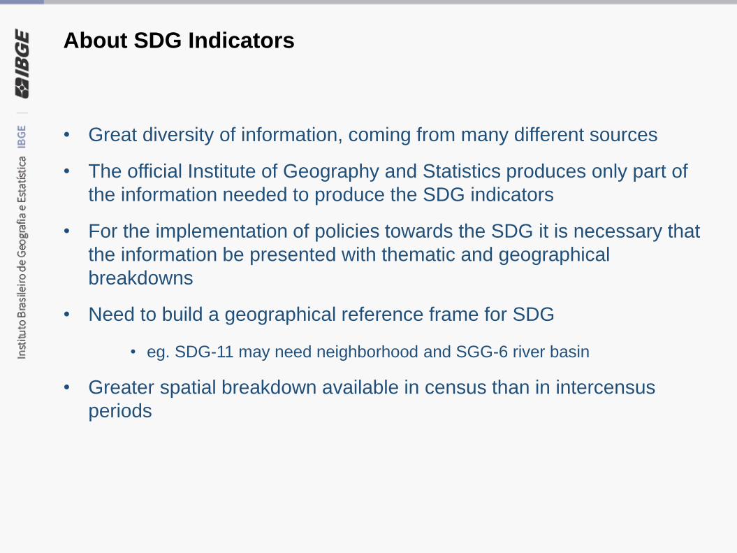
About SDG Indicators
• Great diversity of information, coming from many different sources
• The official Institute of Geography and Statistics produces only part of
the information needed to produce the SDG indicators
• For the implementation of policies towards the SDG it is necessary that
the information be presented with thematic and geographical
breakdowns
• Need to build a geographical reference frame for SDG
• eg. SDG-11 may need neighborhood and SGG-6 river basin
• Greater spatial breakdown available in census than in intercensus
periods

Characteristics of a knowledge platform for SDG indicators
• Clarity in the presentation of information and metadata and ease of
use
• Interoperability and be in accordance with the statistical and geospatial
information standards
• Integration between statistical and geospatial information
• Possibility of thematic and geographical breakdowns
• Possibility of analysis of historical series
• Possibility of insertion of information by partners
• Possibility of customization

Characteristics of a knowledge platform for SDG indicators
• Possibility to display and download data
• Possibility of crosses with related information
• Possibility of collaborative production;
• Possibility of integration with other complementary information
• Integrated with existing systems to avoid duplication of effort and
database

Solutions adopted by IBGE - Brazil
• Digital platform for the shared construction of SDG indicators with data
produced both at IBGE and at partner institutions, including concepts
and metadata
• Web portal for dissemination of SDG indicators
• Take advantage of existing digital tools in IBGE in the production and
dissemination of SDG indicators.

GeospatialDatabase
Geospatial Statistical
N S D I
bridge
SDG Metodological
Sheet
SDG Fact Sheet(tables, charts and
maps)
Statisticaldatabase
Statisticalplatform
Geographicplatform
M e t a d a t a
Externaldata
SDMX StandardsOGC Standards
Geographic andthematic desagregation
Geographic andthematic desagregation
ISO 19115 Standards DDI & SDMX Standards
Existing tools New tools for SDG platform

Main Interface – Select Goal
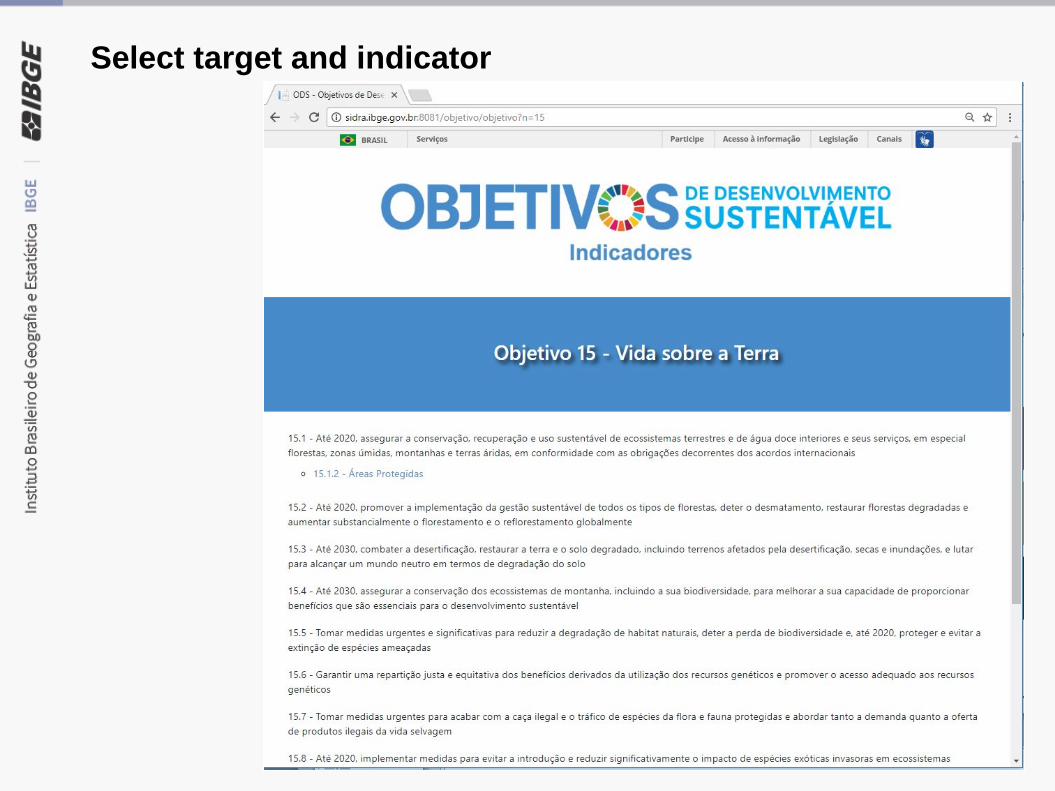
Select target and indicator

Metodological Sheet

Default chart

Default tables

Default maps
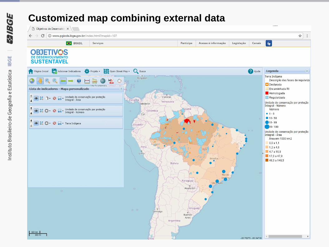
Customized map combining external data
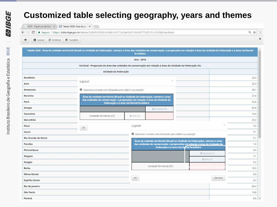
Customized table selecting geography, years and themes
Remarks
• Avoid duplication of efforts in terms of data and system development;
• Fast implementation
• Good usability
• Agreed statistical and geospatial internacional standards
• Direct access to statistical and geospatial SDG data, including
thematic and geographic breakdown.
• Possibility to construct on demand tables and maps;
• The SDG platform is part of a general strategy to build a Brazilian
“data ecosystem”, integrating geospatial and statistical data
Related Documents