Welcome message from author
This document is posted to help you gain knowledge. Please leave a comment to let me know what you think about it! Share it to your friends and learn new things together.
Transcript
magine walking on a rocky shore.You can see the pounding surf, hear stones clink together as waves re-
cede, feel the wind blowing in your hair. But the cliffs don’tmove and the ground doesn’t shake. Even though the Earthappears to be a firm foundation beneath your feet, it is adynamic planet. Continents slowly shift position; mountainsrise and then erode away.These motions escape casual ob-servation because they are generally slow, although everyyear events such as volcanic eruptions and earthquakes re-mind us that geologic change can be rapid.
C H A P T E R
1Geology and the Ear th
I
Администратор
librus
1
A storm-driven wave crashes against the Oregon coast. (H. RichardJohnston/Tony Stone Images)
� 1.1 THE SCIENCE OF GEOLOGY
Geology is the study of the Earth, including the ma-terials that it is made of, the physical and chemicalchanges that occur on its surface and in its interior,and the history of the planet and its life forms.
THE EARTH AND ITS MATERIALS
The Earth’s radius is about 6370 kilometers, nearly oneand a half times the distance from New York to LosAngeles (Fig. 1–1). If you could drive a magical vehiclefrom the center of the Earth to the surface at 100 kilo-meters per hour, the journey would take more than twoand a half days.
Most of the Earth is composed of rocks. Rock out-crops form some of our planet’s most spectacular scenery:white chalk cliffs, pink sandstone arches, and the greygranite of Yosemite Valley. Rocks, in turn, are composedof minerals (Fig. 1–2). Although more than 3500 differ-ent minerals exist, fewer than a dozen are common.Geologists study the origins, properties, and composi-tions of both rocks and minerals.
Geologists also explore the Earth for the resourcesneeded in our technological world: fossil fuels such ascoal, petroleum, and natural gas; mineral resources suchas metals; sand and gravel; and fertilizers. Some searchfor water in reservoirs beneath Earth’s surface.
INTERNAL PROCESSES
Processes that originate deep in the Earth’s interior arecalled internal processes. These are the driving forcesthat raise mountains, cause earthquakes, and producevolcanic eruptions. Builders, engineers, and city plannersmight consult geologists, asking, “What is the probabil-ity that an earthquake or a volcanic eruption will dam-age our city? Is it safe to build skyscrapers, a dam, or anuclear waste repository in the area?”
2 CHAPTER 1 GEOLOGY AND THE EARTH
Figure 1–2 This granite rock is composed of different min-erals, primarily quartz, feldspar, and hornblende.The mineralgrains are a few millimeters in diameter.
Figure 1–1 Most of the Earth is solid rock, surrounded bythe hydrosphere, the biosphere, and the atmosphere.
0
10
20
30
Kilo
met
ers
BIOSPHEREAll life isconcentrated ator within a fewkilometers ofthe surface
ATMOSPHERE99% of atmosphere lieswithin 30 kmof the surface
HYDROSPHEREDeep ocean floor5 km deep.Fresh water andice exist onland
EarthRadius 6370 km

SURFACE PROCESSES
Surface processes are all of those processes that sculptthe Earth’s surface. Most surface processes are driven bywater, although wind, ice, and gravity are also signifi-cant. The hydrosphere includes water in streams, wet-lands, lakes, and oceans; in the atmosphere; and frozenin glaciers. It also includes ground water present in soiland rock to a depth of at least 2 kilometers.
Most of us have seen water running over the groundduring a heavy rain. The flowing water dislodges tinygrains of soil and carries them downslope. If the raincontinues, the water may erode tiny gullies into a hillside(Fig. 1–3). A gully may form in a single afternoon; overmuch longer times, the same process forms canyons andspacious river valleys. People build cities along rivers totake advantage of the flat land, fertile soil, and abundantwater. But the erosion continues. Rivers wear away at their banks and bed and periodically flood adjacentland. Geologists seek to understand these processes andadvise builders and planners to minimize loss of life andproperty.
The oceans cover more than 70 percent of our planet.Although oceanography is a separate scientific disci-pline, it overlaps with geology. Geologic processes formthe ocean basins and alter their size and shape.Weathering and erosion of continents carry mud, sand,and salts to the sea. Earth is the only planet in the SolarSystem that has oceans. It is also the only planet thatsupports life. Oceanographers examine the oceans’ in-fluence on climate, the atmosphere, life, and the solidEarth.
THE ATMOSPHERE
The atmosphere is a mixture of gases, mostly nitrogenand oxygen (Fig. 1–4). It is held to the Earth by gravityand thins rapidly with altitude. Ninety-nine percent isconcentrated within 30 kilometers of the Earth’s surface,but a few traces remain even 10,000 kilometers above thesurface. A brief look at our neighbors in space remindsus that the interactions among air, rock, and life affect at-mospheric composition, temperature, and movement.The solid Earth, Venus, and Mars are approximately iden-tical in composition. Yet the three planets have radicallydifferent atmospheres and climates. Today, the Venusianatmosphere is hot, acidic, and rich in carbon dioxide.The surface temperature is 450ºC, as hot as the interiorof a self-cleaning oven, and the atmospheric pressure is90 times greater than that of the Earth. In contrast, Marsis frigid, with an atmospheric pressure only 0.006 that atthe surface of the Earth. Venusian water has boiled offinto space; almost all Martian water lies frozen in vastunderground reservoirs.
Figure 1–3 Over long periods of time, running water cancarve deep canyons, such as this tributary of Grand Canyon inthe American southwest.
The Science of Geology 3
Figure 1–4 This storm cloud over Mt. Robson, BritishColumbia, is a visible portion of the Earth’s atmosphere.
THE BIOSPHERE
The biosphere is the thin zone near the Earth’s surfacethat is inhabited by life. It includes the uppermost solidEarth, the hydrosphere, and the lower parts of the atmosphere. Land plants grow on the Earth’s surface,with roots penetrating at most a few meters into soil.Animals live on the surface, fly a kilometer or two aboveit, or burrow a few meters underground. Sea life alsoconcentrates near the ocean surface, where sunlight isavailable. Some aquatic communities live on the deepsea floor, bacteria live in rock to depths of a few kilo-meters, and a few windblown microorganisms are foundat heights of 10 kilometers or more. But even at these ex-tremes, the biosphere is a very thin layer at the Earth’ssurface.
Paleontologists are geologists who study the evolu-tion and history of life by examining fossils and otherevidence preserved in rock and sediment. The study ofpast life shows us that the solid Earth, the atmosphere,the hydrosphere, and the biosphere are all interconnected.Internal processes such as volcanic eruptions and mi-grating continents have altered the Earth’s climate andatmospheric composition. Life has altered the atmo-sphere. The atmosphere reacts with rocks.
� 1.2 UNIFORMITARIANISM AND CATASTROPHISM
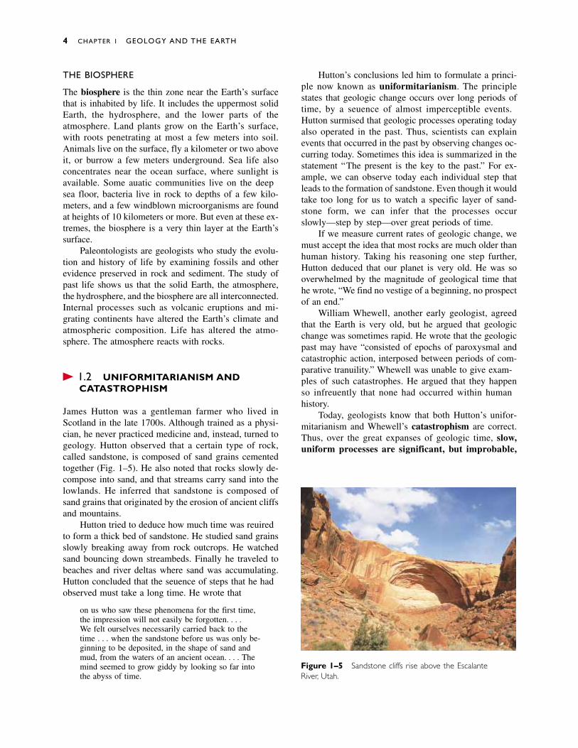
James Hutton was a gentleman farmer who lived inScotland in the late 1700s. Although trained as a physi-cian, he never practiced medicine and, instead, turned togeology. Hutton observed that a certain type of rock,called sandstone, is composed of sand grains cementedtogether (Fig. 1–5). He also noted that rocks slowly de-compose into sand, and that streams carry sand into thelowlands. He inferred that sandstone is composed ofsand grains that originated by the erosion of ancient cliffsand mountains.
Hutton tried to deduce how much time was requiredto form a thick bed of sandstone. He studied sand grainsslowly breaking away from rock outcrops. He watchedsand bouncing down streambeds. Finally he traveled tobeaches and river deltas where sand was accumulating.Hutton concluded that the sequence of steps that he hadobserved must take a long time. He wrote that
on us who saw these phenomena for the first time,the impression will not easily be forgotten. . . . We felt ourselves necessarily carried back to thetime . . . when the sandstone before us was only be-ginning to be deposited, in the shape of sand andmud, from the waters of an ancient ocean. . . . Themind seemed to grow giddy by looking so far intothe abyss of time.
Hutton’s conclusions led him to formulate a princi-ple now known as uniformitarianism. The principlestates that geologic change occurs over long periods oftime, by a sequence of almost imperceptible events.Hutton surmised that geologic processes operating todayalso operated in the past. Thus, scientists can explainevents that occurred in the past by observing changes oc-curring today. Sometimes this idea is summarized in thestatement “The present is the key to the past.” For ex-ample, we can observe today each individual step thatleads to the formation of sandstone. Even though it wouldtake too long for us to watch a specific layer of sand-stone form, we can infer that the processes occurslowly—step by step—over great periods of time.
If we measure current rates of geologic change, wemust accept the idea that most rocks are much older thanhuman history. Taking his reasoning one step further,Hutton deduced that our planet is very old. He was sooverwhelmed by the magnitude of geological time thathe wrote, “We find no vestige of a beginning, no prospectof an end.”
William Whewell, another early geologist, agreedthat the Earth is very old, but he argued that geologicchange was sometimes rapid. He wrote that the geologicpast may have “consisted of epochs of paroxysmal andcatastrophic action, interposed between periods of com-parative tranquility.” Whewell was unable to give exam-ples of such catastrophes. He argued that they happenso infrequently that none had occurred within humanhistory.
Today, geologists know that both Hutton’s unifor-mitarianism and Whewell’s catastrophism are correct.Thus, over the great expanses of geologic time, slow,uniform processes are significant, but improbable,
4 CHAPTER 1 GEOLOGY AND THE EARTH
Figure 1–5 Sandstone cliffs rise above the Escalante River, Utah.

catastrophic events radically modify the path of slowchange.
Gradual Change in Earth History
Within the past few decades, geologists have learned thatcontinents creep across the Earth’s surface at a rate of afew centimeters every year. Since the first steam enginewas built 200 years ago, North America has migrated 8meters westward, a distance a sprinter can run in 1 sec-ond. Thus continental motion is too slow to be observedexcept with sensitive instruments. However, if you couldwatch a time-lapse video of the past few hundred millionyears—only a small chunk of geologic time—you wouldsee continents travel halfway around the Earth.
Catastrophic Change in Earth History
Chances are small that the river flowing through yourcity will flood this spring, but if you lived to be 100years old, you would probably see a catastrophic flood.In fact, many residents of the Midwest saw such a floodin the summer of 1993, and California residents experi-enced one in January 1995 (Fig. 1–6).
When geologists study the 4.6 billion years of Earthhistory, they find abundant evidence of catastrophicevents that are highly improbable in a human lifetime oreven in human history. For example, giant meteoriteshave smashed into our planet, vaporizing enormous vol-umes of rock and spreading dense dust clouds over thesky. Similarly, huge volcanic eruptions have changed
conditions for life across the globe. Geologists have sug-gested that these catastrophic events have driven millionsof species into extinction.
� 1.3 GEOLOGIC TIME
During the Middle Ages, the intellectual climate inEurope was ruled by the clergy, who tried to explain nat-ural history by a literal interpretation of the Bible. In themiddle 1600s, Archbishop James Ussher calculated theEarth’s age from the Book of Genesis in the OldTestament. He concluded that the moment of creationoccurred at noon on October 23, 4004 B.C.
Hutton refuted this biblical logic and deduced thatthe Earth was infinitely old. Today, geologists estimatethat the Earth is about 4.6 billion years old. In his bookBasin and Range, about the geology of western NorthAmerica, John McPhee offers us a metaphor for the mag-nitude of geologic time. If the history of the Earth wererepresented by the old English measure of a yard, thedistance from the king’s nose to the end of his out-stretched hand, all of human history could be erased bya single stroke of a file on his middle fingernail.
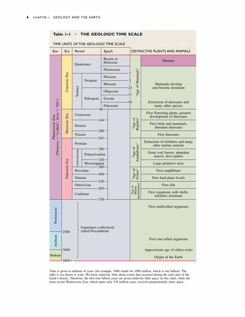
THE GEOLOGIC TIME SCALE
Geologists have divided Earth history into units dis-played in the geologic time scale (Table 1–1). The unitsare called eons, eras, periods, and epochs and are identi-
Geologic Time 5
Figure 1–6 Torrential rainscaused the Russian River inCalifornia to flood in January1995. In this photograph,TomMonaghan is salvaging a few pos-sessions and wading across thesecond-story balcony, awaiting rescue. (Corbis/Bettmann)
6 CHAPTER 1 GEOLOGY AND THE EARTH
Table 1–1 • THE GEOLOGIC TIME SCALE
TIME UNITS OF THE GEOLOGIC TIME SCALE
Eon Era Period Epoch DISTINCTIVE PLANTS AND ANIMALS
Recent or HumansHoloceneQuaternary
Pleistocene2
PlioceneNeogene 5
Miocene Mammals develop24 and become dominant
Oligocene37
Paleogene Eocene58 Extinction of dinosaurs and
Paleocene many other species66
Cretaceous First flowering plants, greatestdevelopment of dinosaurs
144
Jurassic First birds and mammals,abundant dinosaurs
208Triassic First dinosaurs
245
Permian Extinction of trilobites and manyother marine animals
286
Pennsylvanian Great coal forests; abundantinsects, first reptiles
320Mississippian Large primitive trees
360Devonian First amphibians
408Silurian First land plant fossils
438Ordovician First fish
505
Cambrian First organisms with shells,trilobites dominant
538
First multicelled organisms
Sometimes collectivelycalled Precambrian2500
First one-celled organisms
3800 Approximate age of oldest rocks
Hadean Origin of the Earth4600�
Time is given in millions of years (for example, 1000 stands for 1000 million, which is one billion). The table is not drawn to scale. We know relatively little about events that occurred during the early part of theEarth’s history. Therefore, the first four billion years are given relatively little space on this chart, while the more recent Phanerozoic Eon, which spans only 538 million years, receives proportionally more space.
Pale
ozoi
c E
raM
esoz
oic
Era
Car
boni
fero
usTe
rtia
ry
Prot
eroz
oic
Arc
hean
Cen
ozoi
c E
ra
“Age
of
Mar
ine
Inve
rteb
rate
s”
“Age
of
Fish
es”
“Age
of
Am
phib
ians
”“A
ge o
fR
eptil
es”
“Age
of
Mam
mal
s”
Phan
eroz
oic
Eon
(Pha
nero
s�
“evi
dent
”; Z
oon
�“l
ife”
)
fied primarily by the types of life that existed at the var-ious times. The two earliest eons, the Hadean andArchean, cover the first 2.5 billion years of Earth his-tory. Life originated during Archean time. Living organ-isms then evolved and proliferated during the ProterozoicEon (protero is from a Greek root meaning “earlier” or“before” and zoon is from the Greek word meaning“life”). However, most Proterozoic organisms had nohard parts such as shells and bones. Most were singlecelled, although some multicellular organisms existed.The Proterozoic Eon ended about 538 million years ago.
Then, within an astonishingly short time—perhapsas little as 5 million years—many new species evolved.These organisms were biologically more complex thantheir Proterozoic ancestors, and many had shells andskeletons. The most recent 13 percent of geologic time,from 538 million years ago to the present, is called thePhanerozoic Eon (phaneros is Greek for “evident”). ThePhanerozoic Eon is subdivided into the Paleozoic Era(“ancient life”), the Mesozoic Era (“middle life”), andthe Cenozoic Era (“recent life”) (Fig. 1–7).
� 1.4 THE EARTH’S ORIGIN
THE EARLY SOLAR SYSTEM
No one can go back in time to view the formation of theSolar System and the Earth. Therefore, scientists will neverbe able to describe the sequence of events with certainty.
The hypothesis given here is based on calculations aboutthe behavior of dust and gas in space and on observa-tions of stars and dust clouds in our galaxy. Refer to the“Focus On” box on page 12 for a discussion of how sci-entists formulate a hypothesis.
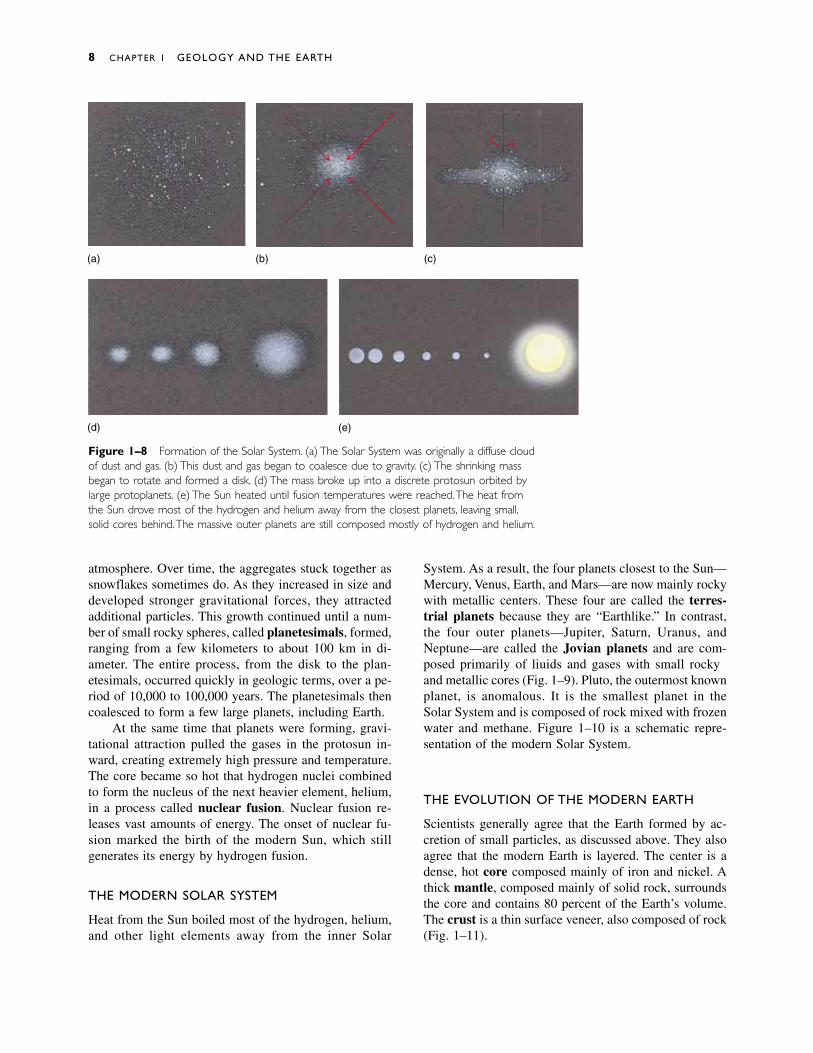
The hypothesis states that about 5 billion years agothe matter that became our Solar System was an im-mense, diffuse, frozen cloud of dust and gas rotatingslowly in space. This cloud formed from matter ejectedfrom an exploding star. More than 99 percent of thecloud consisted of hydrogen and helium, the most abun-dant elements in the Universe. The temperature of thiscloud was about �270ºC. Small gravitational attractionsamong the dust and gas particles caused the cloud tocondense into a sphere (Figs. 1–8a and 1–8b). As con-densation continued, the cloud rotated more rapidly, andthe sphere spread into a disk, as shown in Figure 1–8c.Some scientists have suggested that a nearby star ex-ploded and the shock wave triggered the condensation.
More than 90 percent of the matter in the cloud col-lapsed toward the center of the disk under the influenceof gravity, forming the protosun. Collisions among high-speed particles released heat within this early version ofthe Sun, but it was not a true star because it did not yetgenerate energy by nuclear fusion.
Heat from the protosun warmed the inner region ofthe disk. Then, after the gravitational collapse was nearlycomplete, the disk cooled. Gases in the outer part of thedisk condensed to form small aggregates, much assnowflakes form when moist air cools in the Earth’s
The Earth’s Origin 7
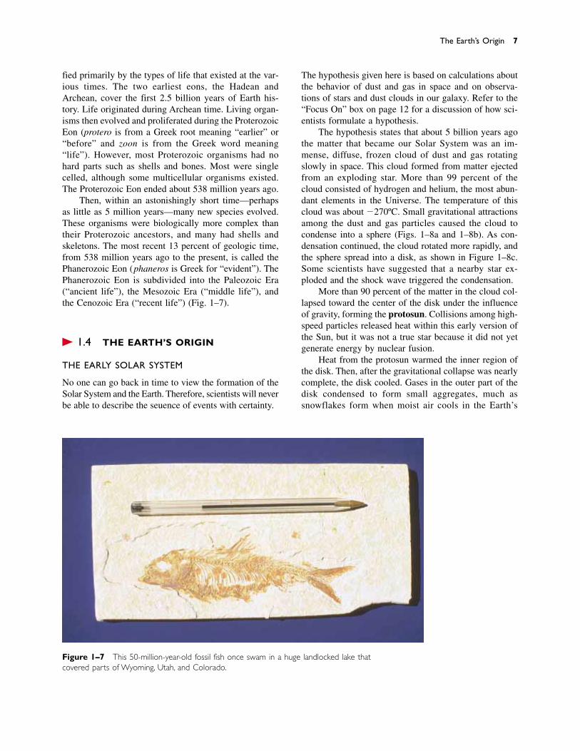
Figure 1–7 This 50-million-year-old fossil fish once swam in a huge landlocked lake thatcovered parts of Wyoming, Utah, and Colorado.
8 CHAPTER 1 GEOLOGY AND THE EARTH
atmosphere. Over time, the aggregates stuck together assnowflakes sometimes do. As they increased in size anddeveloped stronger gravitational forces, they attractedadditional particles. This growth continued until a num-ber of small rocky spheres, called planetesimals, formed,ranging from a few kilometers to about 100 km in di-ameter. The entire process, from the disk to the plan-etesimals, occurred quickly in geologic terms, over a pe-riod of 10,000 to 100,000 years. The planetesimals thencoalesced to form a few large planets, including Earth.
At the same time that planets were forming, gravi-tational attraction pulled the gases in the protosun in-ward, creating extremely high pressure and temperature.The core became so hot that hydrogen nuclei combinedto form the nucleus of the next heavier element, helium,in a process called nuclear fusion. Nuclear fusion re-leases vast amounts of energy. The onset of nuclear fu-sion marked the birth of the modern Sun, which still generates its energy by hydrogen fusion.
THE MODERN SOLAR SYSTEM
Heat from the Sun boiled most of the hydrogen, helium,and other light elements away from the inner Solar
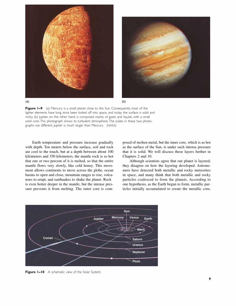
System. As a result, the four planets closest to the Sun—Mercury, Venus, Earth, and Mars—are now mainly rockywith metallic centers. These four are called the terres-trial planets because they are “Earthlike.” In contrast,the four outer planets—Jupiter, Saturn, Uranus, andNeptune—are called the Jovian planets and are com-posed primarily of liquids and gases with small rockyand metallic cores (Fig. 1–9). Pluto, the outermost knownplanet, is anomalous. It is the smallest planet in the Solar System and is composed of rock mixed with frozenwater and methane. Figure 1–10 is a schematic repre-sentation of the modern Solar System.
THE EVOLUTION OF THE MODERN EARTH
Scientists generally agree that the Earth formed by ac-cretion of small particles, as discussed above. They alsoagree that the modern Earth is layered. The center is adense, hot core composed mainly of iron and nickel. Athick mantle, composed mainly of solid rock, surroundsthe core and contains 80 percent of the Earth’s volume.The crust is a thin surface veneer, also composed of rock(Fig. 1–11).
(a)
(d) (e)
(b) (c)
Figure 1–8 Formation of the Solar System. (a) The Solar System was originally a diffuse cloudof dust and gas. (b) This dust and gas began to coalesce due to gravity. (c) The shrinking massbegan to rotate and formed a disk. (d) The mass broke up into a discrete protosun orbited bylarge protoplanets. (e) The Sun heated until fusion temperatures were reached.The heat fromthe Sun drove most of the hydrogen and helium away from the closest planets, leaving small,solid cores behind.The massive outer planets are still composed mostly of hydrogen and helium.
Earth temperature and pressure increase graduallywith depth. Ten meters below the surface, soil and rockare cool to the touch, but at a depth between about 100kilometers and 350 kilometers, the mantle rock is so hotthat one or two percent of it is melted, so that the entiremantle flows very slowly, like cold honey. This move-ment allows continents to move across the globe, oceanbasins to open and close, mountain ranges to rise, volca-noes to erupt, and earthquakes to shake the planet. Rockis even hotter deeper in the mantle, but the intense pres-sure prevents it from melting. The outer core is com-
posed of molten metal, but the inner core, which is as hotas the surface of the Sun, is under such intense pressurethat it is solid. We will discuss these layers further inChapters 2 and 10.
Although scientists agree that our planet is layered,they disagree on how the layering developed. Astrono-mers have detected both metallic and rocky meteorites in space, and many think that both metallic and rockyparticles coalesced to form the planets. According to one hypothesis, as the Earth began to form, metallic par-ticles initially accumulated to create the metallic core,
Figure 1–9 (a) Mercury is a small planet close to the Sun. Consequently, most of thelighter elements have long since been boiled off into space, and today the surface is solid androcky. (b) Jupiter, on the other hand, is composed mainly of gases and liquids, with a smallsolid core.This photograph shows its turbulent atmosphere.The scales in these two photo-graphs are different. Jupiter is much larger than Mercury. (NASA)
(a) (b)
Figure 1–10 A schematic view of the Solar System.
Comet
Pluto
Neptune
Uranus
Saturn
Mars
EarthVenus
Sun
MercuryJupiter
9

and then rocky particles collected around the core toform the rocky mantle. Thus, the Earth has always beenlayered.
An alternative hypothesis states that the rock andmetal accumulated simultaneously during the initial co-alescence, forming a homogeneous (non-layered) planet.The young Earth became hot as gravity pulled the smallparticles together and later as asteroids, comets, andplanetesimals crashed into the surface. At the same time,radioactive decay heated the Earth’s interior. Thus, ourplanet became so hot that all or most of it melted soonafter it formed. Heavy molten iron and nickel gravitatedtoward the center and collected to form the core, whilelighter materials floated toward the surface to form themantle. In both hypotheses, the crust formed later, as dis-cussed in Chapter 12.
How can we determine which of the two hypothesesis correct? By studying modern meteorites and lunarrocks, two geologists recently estimated that the coreformed at least 62 million years after the Earth coa-lesced.1 This interpretation supports the hypothesis thatour planet was initially homogeneous and then separated
into the core and mantle at a later date. However, as dis-cussed in “Focus On: Hypothesis, Theory, and Law,” fu-ture research may change our views about a sequence ofevents that occurred so long ago.
� 1.5 GEOLOGIC CHANGE AND THE ENVIRONMENT
The Earth’s surface environment has changed frequentlyand dramatically during its long history. Atmosphericcomposition and climate have changed. Glaciers havecovered huge portions of the continents and then meltedto leave the land covered by tropical swamps or scorch-ing deserts. Volcanic eruptions and meteorite impactshave occurred, and many scientists think that these eventshave caused global catastrophes that resulted in extinc-tions of large proportions of the Earth’s species.
Primitive human-like species evolved in East Africaabout 4 million years ago. Thus, homo sapiens and theirimmediate ancestors have lived on Earth for a mere 0.05percent of its history. The Industrial Revolution beganonly 250 years ago. Yet within this minuscule slice of ge-ologic history, humans have altered the surface of theplanet. Today, farms cover vast areas that were recentlyforested or covered by natural prairies. People have pavedlarge expanses of land, drained wetlands, dammed rivers,pumped ground water to the surface, and released pollu-tants into waterways and the atmosphere. Some of thesechanges have affected even the most remote regions ofthe Earth, including the Sahara desert, the Amazon rain-forest, the central oceans, and the South Pole. Somescientists are concerned that these changes also threatenhuman well-being.
RISK ASSESSMENT AND COST–BENEFIT ANALYSIS
Many geologic processes put humans at risk. Volcaniceruptions, earthquakes, floods, and mudslides kill peopleand destroy cities. Human activities also create environ-mental hazards that jeopardize our health. Geologistsand other geoscientists attempt to analyze the risks andcosts of exposure to these hazards.
Risk assessment is the analysis of risk and the implementation of policy based on that analysis. Cost–benefit analysis compares the monetary expense of solv-ing a problem with the monetary benefits of the solution.
Consider the following two examples of risk assess-ment and cost–benefit analysis.
10 CHAPTER 1 GEOLOGY AND THE EARTH
1Der-Chuen Lee and Alex N. Halliday, “Hafnium-tungsten Chrono-metry and the Timing of Terrestrial Core Formation.” Science, vol.378, Dec. 21/28, 1995, p. 771.
Crust
Inner core
Outer core Mantle
2,900 km
6,370 km
Figure 1–11 A schematic view of the interior of the Earth.
California Earthquakes
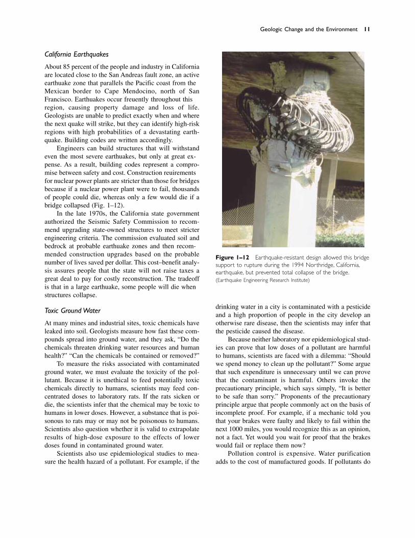
About 85 percent of the people and industry in Californiaare located close to the San Andreas fault zone, an activeearthquake zone that parallels the Pacific coast from theMexican border to Cape Mendocino, north of SanFrancisco. Earthquakes occur frequently throughout thisregion, causing property damage and loss of life.Geologists are unable to predict exactly when and wherethe next quake will strike, but they can identify high-riskregions with high probabilities of a devastating earth-quake. Building codes are written accordingly.
Engineers can build structures that will withstandeven the most severe earthquakes, but only at great ex-pense. As a result, building codes represent a compro-mise between safety and cost. Construction requirementsfor nuclear power plants are stricter than those for bridgesbecause if a nuclear power plant were to fail, thousandsof people could die, whereas only a few would die if abridge collapsed (Fig. 1–12).
In the late 1970s, the California state governmentauthorized the Seismic Safety Commission to recom-mend upgrading state-owned structures to meet stricterengineering criteria. The commission evaluated soil andbedrock at probable earthquake zones and then recom-mended construction upgrades based on the probablenumber of lives saved per dollar. This cost–benefit analy-sis assures people that the state will not raise taxes agreat deal to pay for costly reconstruction. The tradeoffis that in a large earthquake, some people will die whenstructures collapse.
Toxic Ground Water
At many mines and industrial sites, toxic chemicals haveleaked into soil. Geologists measure how fast these com-pounds spread into ground water, and they ask, “Do thechemicals threaten drinking water resources and humanhealth?” “Can the chemicals be contained or removed?”
To measure the risks associated with contaminatedground water, we must evaluate the toxicity of the pol-lutant. Because it is unethical to feed potentially toxicchemicals directly to humans, scientists may feed con-centrated doses to laboratory rats. If the rats sicken ordie, the scientists infer that the chemical may be toxic tohumans in lower doses. However, a substance that is poi-sonous to rats may or may not be poisonous to humans.Scientists also question whether it is valid to extrapolateresults of high-dose exposure to the effects of lowerdoses found in contaminated ground water.
Scientists also use epidemiological studies to mea-sure the health hazard of a pollutant. For example, if the
drinking water in a city is contaminated with a pesticideand a high proportion of people in the city develop anotherwise rare disease, then the scientists may infer thatthe pesticide caused the disease.
Because neither laboratory nor epidemiological stud-ies can prove that low doses of a pollutant are harmfulto humans, scientists are faced with a dilemma: “Shouldwe spend money to clean up the pollutant?” Some arguethat such expenditure is unnecessary until we can provethat the contaminant is harmful. Others invoke the precautionary principle, which says simply, “It is betterto be safe than sorry.” Proponents of the precautionaryprinciple argue that people commonly act on the basis ofincomplete proof. For example, if a mechanic told youthat your brakes were faulty and likely to fail within thenext 1000 miles, you would recognize this as an opinion,not a fact. Yet would you wait for proof that the brakeswould fail or replace them now?
Pollution control is expensive. Water purificationadds to the cost of manufactured goods. If pollutants do
Geologic Change and the Environment 11
Figure 1–12 Earthquake-resistant design allowed this bridgesupport to rupture during the 1994 Northridge, California,earthquake, but prevented total collapse of the bridge.(Earthquake Engineering Research Institute)

escape, removal of the contaminant and restoration ofthe contaminated area may be even more costly. For ex-ample, if a pollutant has already escaped into ground wa-ter, it may be necessary to excavate thousands of cubicmeters of soil, process the soil to remove the contami-nant, and then return the soil to the excavated site.
However, pollution is also expensive. If a groundwater contaminant causes people to sicken, the cost tosociety can be measured in terms of medical bills andloss of income resulting from missed work. Many con-taminants damage structures, crops, and livestock. Peoplein polluted areas also bear expense because tourism di-minishes and land values are reduced when people nolonger want to visit or live in a contaminated area. All ofthese costs are called externalities.
Cost–benefit analysis balances the cost of pollutioncontrol against the cost of externalities. Some peoplesuggest that we should minimize the total cost eventhough this approach accepts significant pollution. Othersargue that cost–benefit analysis is flawed because it ig-nores both the quality of life and the value of human life.How, they ask, can you place a dollar value on a life thatends early, or on the annoyance of a vile odor, a persis-tent cough, polluted streams, dirty air, or industrial noise?Such annoyances damage our sense of well-being.
People do not agree on an optimal level of pollutioncontrol or an acceptable level of pollution. There are noeasy answers. In this textbook we will not offer solu-tions, but we will explain the scientific principles behinddifficult questions.
F O C U S O N
H Y P O T H E S I S , T H E O R Y , A N D L A W
On an afternoon field trip, you may find several different types of rocks or watch a river flow by.
But you can never see the rocks or river as they ex-isted in the past or as they will exist in the future. Yeta geologist might explain to you how the rocks formedmillions or even a few billion years ago and mightpredict how the river valley will change in the future.
Scientists not only study events that they havenever observed and never will observe, but they alsostudy objects that can never be seen, touched, or felt.In this book we describe the center of the Earth 6370kilometers beneath our feet, even though no one hasever visited it and no one ever will.
Much of science is built on inferences aboutevents and objects outside the realm of direct experi-ence. An inference is a conclusion based on thoughtand reason. How certain are we that a conclusion ofthis type is correct?
Scientists develop an understanding of the nat-ural world according to a set of guidelines known asthe scientific method, which involves three basic steps: (1) observation, (2) forming a hypothesis, and(3) testing the hypothesis and developing a theory.
ObservationAll modern science is based on observation. Supposethat you observed an ocean current carrying and de-positing sand. If you watched for some time, youwould see that the sand accumulates slowly, layer bylayer, on the beach. You might then visit Utah orNevada and see cliffs of layered sandstone hundredsof meters high. Observations of this kind are the start-ing point of science.
Forming a HypothesisSimple observations are only a first step along thepath to a theory. A scientist tries to organize observa-tions to recognize patterns. You might note that thesand layers deposited along the coast look just like thelayers of sand in the sandstone cliffs. Perhaps youwould then infer that the thick layers of sandstone hadbeen deposited in an ancient ocean. You might furtherconclude that, since the ocean deposits layers of sandslowly, the thick layers of sandstone must have accu-mulated over a long time.
If you were then to travel, you would observe thatthick layers of sandstone are abundant all over theworld. Because thick layers of sand accumulate soslowly, you might infer that a long time must havebeen required for all that sandstone to form. Fromthese observations and inferences you might form thehypothesis that the Earth is old.
A hypothesis is a tentative explanation built onstrong supporting evidence. Once a scientist or groupof scientists proposes a hypothesis, others test it bycomparison with observations and experiments. Thus,a hypothesis is a rough draft of a theory that is testedagainst observable facts. If it explains some of thefacts but not all of them, it must be altered, or if itcannot be changed satisfactorily, it must be discardedand a new hypothesis developed.
Testing the Hypothesis and Forming a TheoryIf a hypothesis explains new observations as they accumulate and is not substantively contradicted, it
12

Geology is the study of the Earth including the materi-als that it is made of, the physical and chemical changesthat occur on its surface and in its interior, and the his-tory of the planet and its life forms.
Most of the Earth is composed of rocks, and rocksare composed of minerals. Internal processes movecontinents and cause earthquakes and volcanoes; surfaceprocesses sculpt mountains and valleys. The hydro-sphere consists of water in streams, lakes, and oceans;in the atmosphere; and frozen in glaciers. It also includesground water that soaks soil and rock to a depth of 2 or3 kilometers.
The atmosphere is a mixture of gases, mostly nitro-gen and oxygen. Ninety-nine percent is concentrated in
the first 30 kilometers, but a few traces remain even 10,000kilometers above the Earth’s surface. Organisms of thebiosphere, including humans, affect and are affected byEarth’s surface processes and the compositions of the hy-drosphere and atmosphere. Paleontologists study the evo-lution and history of life from its beginning to the present.
The principle of uniformitarianism states that geologic change occurs over a long period of time by asequence of almost imperceptible events. Thus, over the immense magnitude of geologic time, processes thatoccur too slowly or rarely to have an impact on our dailylives are important in Earth history. In contrast, cata-strophism postulates that geologic change occurs mainlyduring infrequent catastrophic events. Today, geologists
S U M M A R Y
becomes elevated to a theory. Theories differ widelyin form and content, but all obey four fundamentalcriteria:
1. A theory must be based on a series of confirmedobservations or experimental results.
2. A theory must explain all relevant observations orexperimental results.
3. A theory must not contradict any relevant obser-vations or other scientific principles.
4. A theory must be internally consistent. Thus, itmust be built in a logical manner so that the con-clusions do not contradict any of the originalpremises.
For example, the theory of plate tectonics statesthat the outer layer of the Earth is broken into a num-ber of plates that move horizontally relative to one an-other. As you will see in later chapters, this theory issupported by many observations and seems to have nomajor inconsistencies.
Many theories can never be absolutely proven.For example, even though scientists are just about cer-tain that their image of atomic structure is correct, noone has watched or ever will watch an individual elec-tron travel in its orbit. Therefore, our interpretation ofatomic structure is called atomic theory.
However, in some instances, a theory is elevatedto a scientific law. A law is a statement of how eventsalways occur under given conditions. It is consideredto be factual and correct. A law is the most certain ofscientific statements. For example, the law of gravity
states that all objects are attracted to one another indirect proportion to their masses. We cannot conceiveof any contradiction to this principle, and none hasbeen observed. Hence, the principle is called a law.
Sharing InformationThe final step in the scientific process is to share yourobservations and conclusions with other scientists andthe general public. Typically, a scientist communi-cates with colleagues to discuss current research byphone, at annual meetings, or more recently, by elec-tronic communications systems such as E-mail andInternet. When the scientist feels confident in his orher conclusions, he or she publishes them in a scien-tific journal. Colleagues review the material before itis published to ensure that the author has followed thescientific method, and, if the results are of general in-terest, the scientist may publish them in popular mag-azines or in newspapers. The authors of this text haveread many scientific journals and now pass the infor-mation on to you, the student.
DISCUSSION QUESTION
Obtain a copy of a news article in a weekly newsmagazine. Underline the facts with one color penciland the author’s opinions with another. Did the au-thor follow the rules for the scientific method inreaching his or her conclusions?
13
know that both uniformitarianism and catastrophism arecorrect.
The 4.6-billion-year history of the Earth is dividedinto eons, eras, periods, and epochs, which are based onthe types of life that existed at various times.
The Solar System formed from dust and gases thatrotated slowly in space. Within its center, the gases werepulled inward with enough velocity to initiate nuclear fu-sion and create the Sun. In the disk, planets formed fromcoalescing dust and gases. In the inner planets, most ofthe lighter elements escaped, but they are important com-ponents in the outer giants.
The modern Earth is made up of a dense core ofiron and nickel, a rocky mantle of lower density, and acrust of yet lower density. One hypothesis states that
both a core and mantle existed in the earliest Earth. Analternative hypothesis states that the Earth was initiallyhomogeneous. The primordial planet was heated by en-ergy from the original gravitational coalescence, by ra-dioactive decay, and by bombardment from outer space.This heat caused all or most of the Earth to melt, anddense materials settled to the center to form the core,while less dense rock floated toward the surface to formthe mantle.
Risk assessment is the analysis of risk of geologicand human-induced hazards and the implementation ofpolicy based on that analysis. Cost–benefit analysiscompares the monetary cost of solving a problem withthe monetary benefits of the solution.
1. Give a concise definition of geology.
2. Compare and contrast internal processes with surfaceprocesses.
3. List six types of reservoirs that collectively contain mostof the Earth’s water.
4. What is ground water? Where in the hydrosphere is it located?
5. What two gases comprise most of the Earth’s atmo-sphere?
6. How thick is the Earth’s atmosphere?
7. Compare and contrast uniformitarianism and catas-trophism. Give an example of each type of geologicchange.
8. How old is the Earth?
9. List the Earth’s major eons in order of age. List the threeeras that comprise the most recent eon.
10. Very briefly outline the formation of the Universe andthe Solar System.
11. How did the Sun form? How is its composition differentfrom that of the Earth? Explain the reasons for this dif-ference.
12. Compare and contrast the properties of the terrestrialplanets with those of the Jovian planets.
13. List the three major layers of the Earth. Which is themost dense, and which is the least dense?
14. Define cost–benefit analysis and risk assessment and givean example of how these policies are implemented.
14 CHAPTER 1 GEOLOGY AND THE EARTH
K E Y W O R D S
rocks 2minerals 2internal processes 2surface processes 3hydrosphere 3
atmosphere 3biosphere 4uniformitarianism 4catastrophism 4geologic time scale 5
protosun 7planetesimals 8nuclear fusion 8terrestrial planets 8
Jovian planets 8core 8mantle 8crust 8
R E V I E W Q U E S T I O N S
D I S C U S S I O N Q U E S T I O N S
1. What would the Earth be like if ita. had no atmosphere? b. had no water?
2. In what ways do organisms, including humans, changethe Earth? What kinds of Earth processes are unaffectedby humans and other organisms?
3. Redraw the geologic time scale with the size of each ofthe major eons proportional to its time span. How doesyour redrawn time scale compare with the one in Table1–1? Speculate on why the time scale is drawn as it is.
Discussion Questions 15
4. Explain how the theory of the evolution of the SolarSystem explains the following observations:a. All the planets in the Solar System are orbiting in thesame direction. b. All the planets in the Solar Systemexcept Pluto are orbiting in the same plane. c. Thechemical composition of Mercury is similar to that of theEarth. d. The Sun is composed mainly of hydrogen andhelium but also contains all the elements found on Earth.e. Venus has a solid surface, whereas Jupiter is mainly amixture of gases and liquids with a small, solid core.
5. Jupiter is composed of solids such as rock, iron, andnickel; a vast amount of liquid hydrogen; and gases suchas hydrogen, helium, ammonia, and methane. From yourknowledge of the formation and structure of the Earth,
which compounds do you predict would make upJupiter’s core, mantle, and outer shell?
6. The radioactive elements that are responsible for theheating of the Earth decompose very slowly, over a pe-riod of billions of years. How would the Earth be differ-ent if these elements decomposed much more rapidly—say, over a period of a few million years?
7. In Los Angeles, the risk of death per year from an auto-mobile accident is 1 in 4000; the risk of death from anearthquake is about 1 in 50,000. Would you use thesedata to argue that additional reinforcement of bridges and buildings is unwarranted?
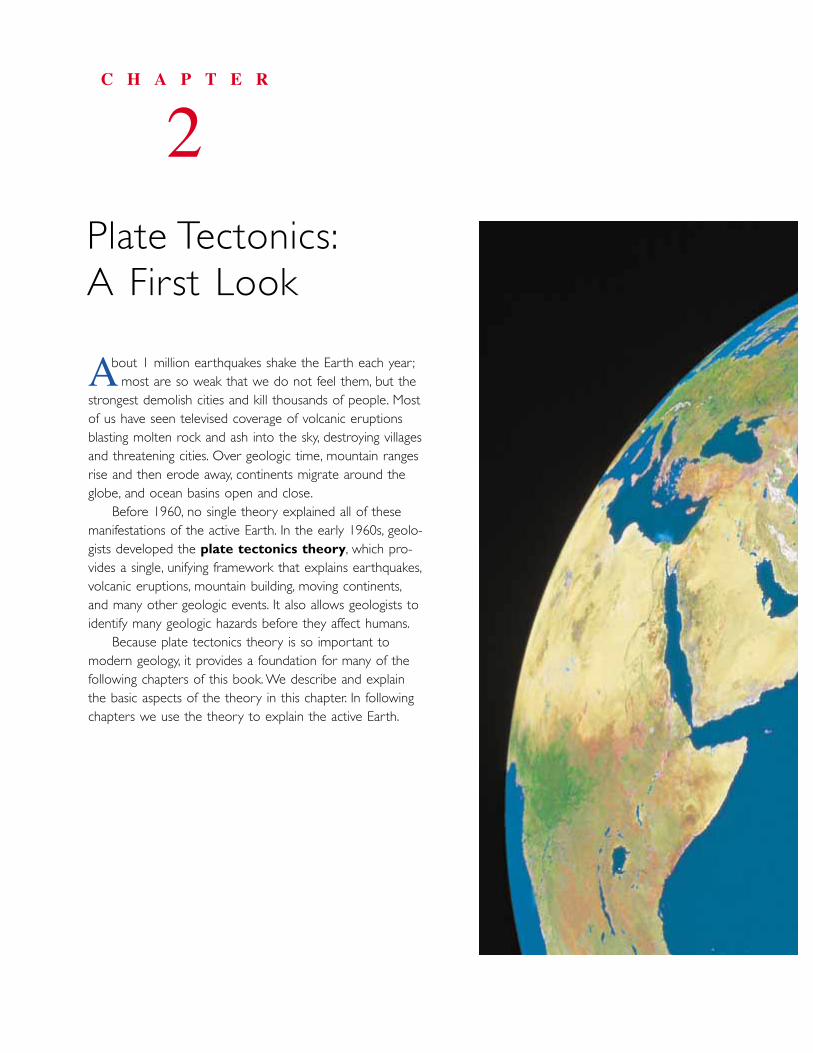
bout 1 million earthquakes shake the Earth each year ;most are so weak that we do not feel them, but the
strongest demolish cities and kill thousands of people. Mostof us have seen televised coverage of volcanic eruptionsblasting molten rock and ash into the sky, destroying villagesand threatening cities. Over geologic time, mountain rangesrise and then erode away, continents migrate around theglobe, and ocean basins open and close.
Before 1960, no single theory explained all of thesemanifestations of the active Earth. In the early 1960s, geolo-gists developed the plate tectonics theory, which pro-vides a single, unifying framework that explains earthquakes,volcanic eruptions, mountain building, moving continents,and many other geologic events. It also allows geologists toidentify many geologic hazards before they affect humans.
Because plate tectonics theory is so important tomodern geology, it provides a foundation for many of thefollowing chapters of this book. We describe and explainthe basic aspects of the theory in this chapter. In followingchapters we use the theory to explain the active Earth.
C H A P T E R
2Plate Tectonics:A First Look
A
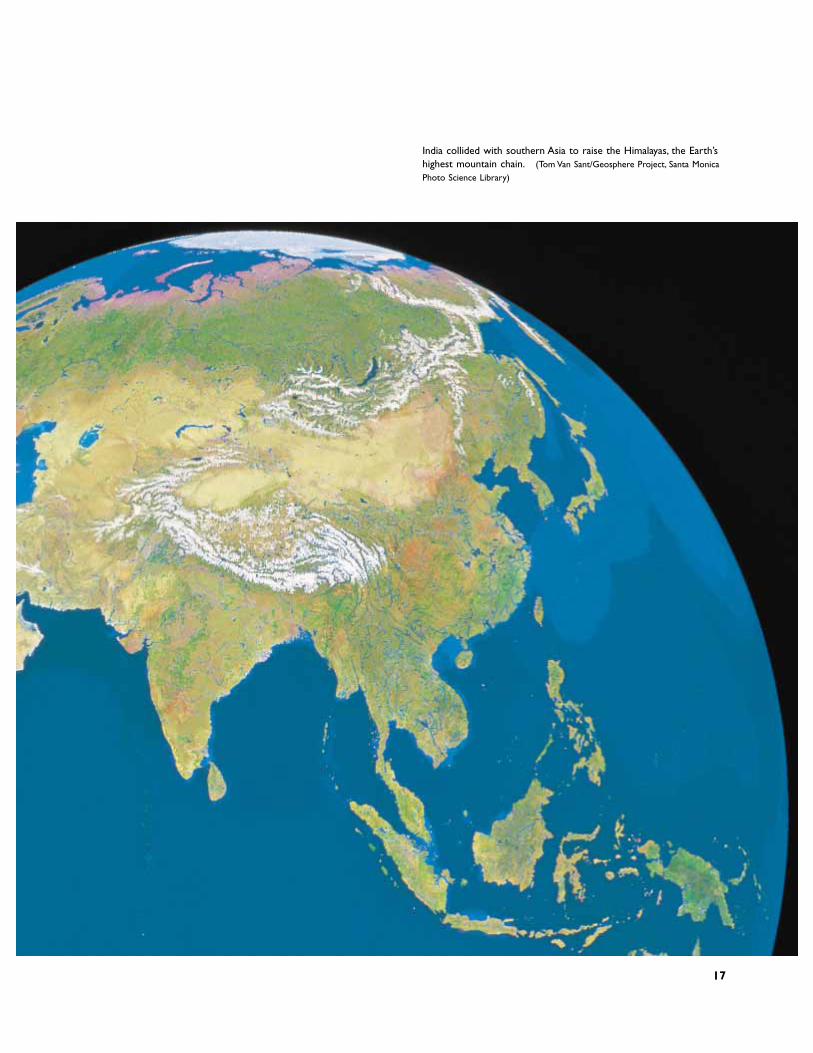
India collided with southern Asia to raise the Himalayas, the Earth’shighest mountain chain. (Tom Van Sant/Geosphere Project, Santa MonicaPhoto Science Library)
17
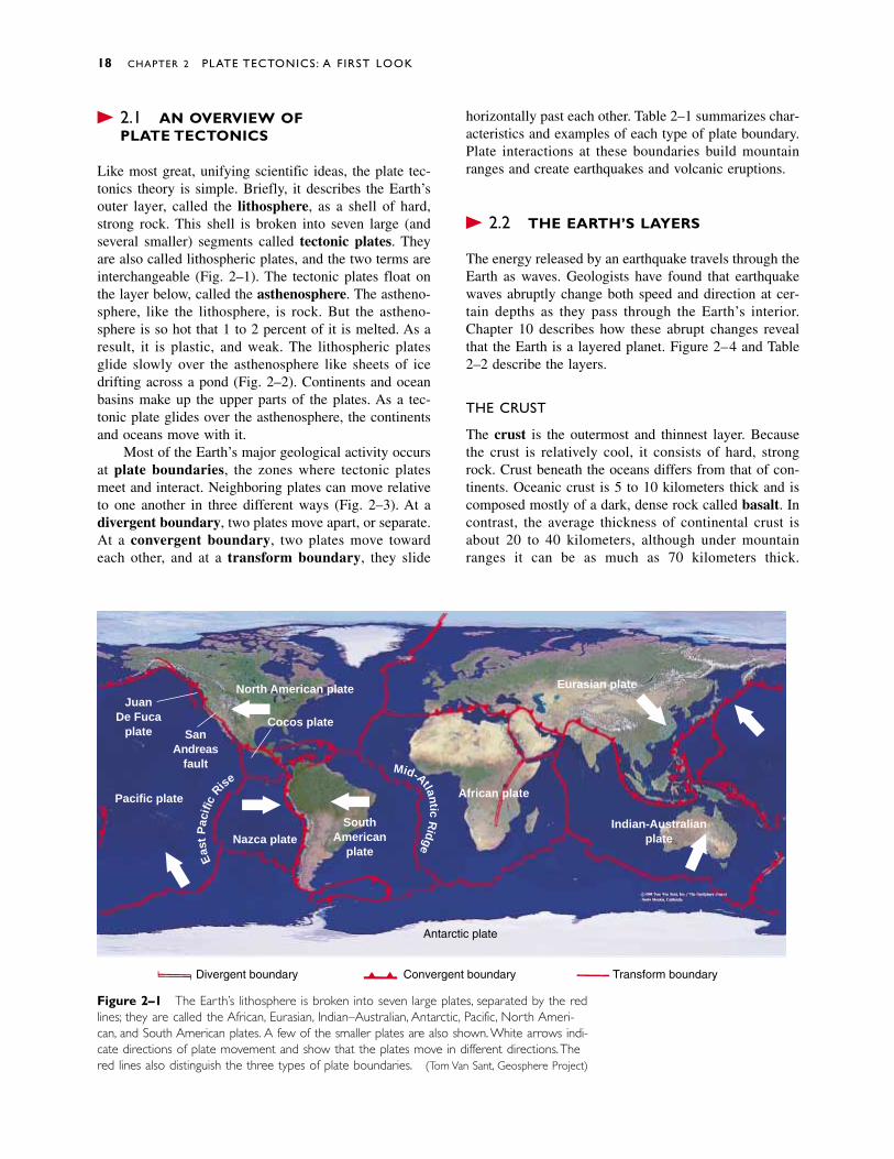
� 2.1 AN OVERVIEW OF PLATE TECTONICS
Like most great, unifying scientific ideas, the plate tec-tonics theory is simple. Briefly, it describes the Earth’souter layer, called the lithosphere, as a shell of hard,strong rock. This shell is broken into seven large (andseveral smaller) segments called tectonic plates. Theyare also called lithospheric plates, and the two terms areinterchangeable (Fig. 2–1). The tectonic plates float onthe layer below, called the asthenosphere. The astheno-sphere, like the lithosphere, is rock. But the astheno-sphere is so hot that 1 to 2 percent of it is melted. As aresult, it is plastic, and weak. The lithospheric platesglide slowly over the asthenosphere like sheets of icedrifting across a pond (Fig. 2–2). Continents and oceanbasins make up the upper parts of the plates. As a tec-tonic plate glides over the asthenosphere, the continentsand oceans move with it.
Most of the Earth’s major geological activity occursat plate boundaries, the zones where tectonic platesmeet and interact. Neighboring plates can move relativeto one another in three different ways (Fig. 2–3). At a divergent boundary, two plates move apart, or separate.At a convergent boundary, two plates move towardeach other, and at a transform boundary, they slide
horizontally past each other. Table 2–1 summarizes char-acteristics and examples of each type of plate boundary.Plate interactions at these boundaries build mountainranges and create earthquakes and volcanic eruptions.
� 2.2 THE EARTH’S LAYERS
The energy released by an earthquake travels through theEarth as waves. Geologists have found that earthquakewaves abruptly change both speed and direction at cer-tain depths as they pass through the Earth’s interior.Chapter 10 describes how these abrupt changes revealthat the Earth is a layered planet. Figure 2–4 and Table2–2 describe the layers.
THE CRUST
The crust is the outermost and thinnest layer. Becausethe crust is relatively cool, it consists of hard, strongrock. Crust beneath the oceans differs from that of con-tinents. Oceanic crust is 5 to 10 kilometers thick and iscomposed mostly of a dark, dense rock called basalt. Incontrast, the average thickness of continental crust isabout 20 to 40 kilometers, although under mountainranges it can be as much as 70 kilometers thick.
18 CHAPTER 2 PLATE TECTONICS: A FIRST LOOK
North American plateJuan
De Fucaplate San
Andreasfault
Pacific plate
Nazca plateSouth
Americanplate
African plate
Eurasian plate
Indian-Australianplate
Cocos plate
Eas
tP
acifi
cRise
Mid-Atla ntic
Ridge
Antarctic plate
Divergent boundary Convergent boundary Transform boundary
Figure 2–1 The Earth’s lithosphere is broken into seven large plates, separated by the redlines; they are called the African, Eurasian, Indian–Australian, Antarctic, Pacific, North Ameri-can, and South American plates. A few of the smaller plates are also shown. White arrows indi-cate directions of plate movement and show that the plates move in different directions.Thered lines also distinguish the three types of plate boundaries. (Tom Van Sant, Geosphere Project)
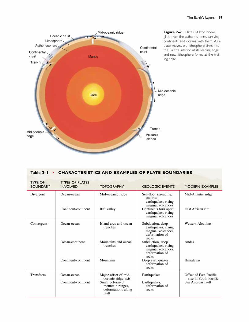
Figure 2–2 Plates of lithosphereglide over the asthenosphere, carryingcontinents and oceans with them. As aplate moves, old lithosphere sinks intothe Earth’s interior at its leading edge,and new lithosphere forms at the trail-ing edge.
The Earth’s Layers 19
Table 2–1 • CHARACTERISTICS AND EXAMPLES OF PLATE BOUNDARIES
TYPE OF TYPES OF PLATESBOUNDARY INVOLVED TOPOGRAPHY GEOLOGIC EVENTS MODERN EXAMPLES
Divergent Ocean-ocean Mid-oceanic ridge Sea-floor spreading, Mid-Atlantic ridgeshallowearthquakes, risingmagma, volcanoes
Continent-continent Rift valley Continents torn apart, East African riftearthquakes, risingmagma, volcanoes
Convergent Ocean-ocean Island arcs and ocean Subduction, deep Western Aleutianstrenches earthquakes, rising
magma, volcanoes,deformation ofrocks
Ocean-continent Mountains and ocean Subduction, deep Andestrenches earthquakes, rising
magma, volcanoes,deformation ofrocks
Continent-continent Mountains Deep earthquakes, Himalayasdeformation ofrocks
Transform Ocean-ocean Major offset of mid- Earthquakes Offset of East Pacificoceanic ridge axis rise in South Pacific
Continent-continent Small deformed Earthquakes, San Andreas faultmountain ranges, deformation ofdeformations along rocksfault
Mid-oceanic ridgeOceanic crust
Lithosphere
Asthenosphere
Continentalcrust
Trench
Mid-oceanicridge Volcanic
islands
Trench
Mid-oceanicridge
Continentalcrust
Mantle
Core
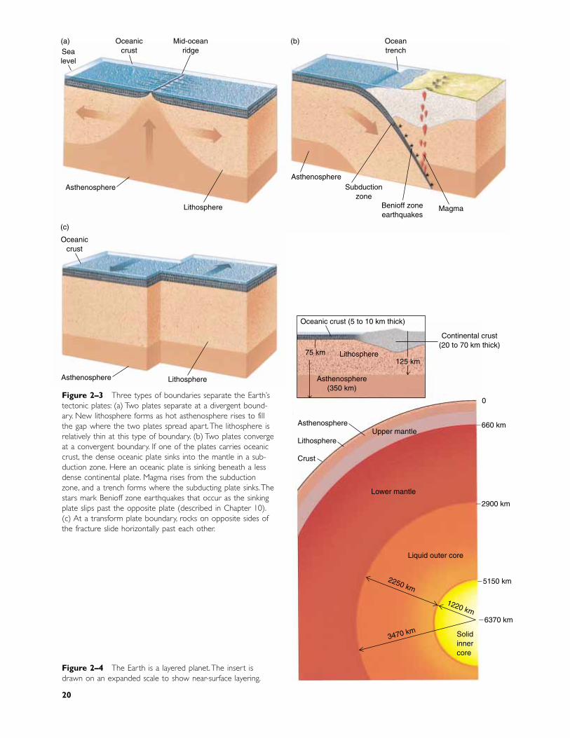
Figure 2–4 The Earth is a layered planet. The insert isdrawn on an expanded scale to show near-surface layering.
Oceanic crust (5 to 10 km thick)
Lithosphere
Asthenosphere(350 km)
125 km
Continental crust(20 to 70 km thick)
Asthenosphere
Lithosphere
Crust
Upper mantle
Lower mantle
Liquid outer core
2250 km
3470 km
1220 km
Solidinnercore
0
�660 km
�2900 km
�5150 km
�6370 km
75 km
Sealevel
Oceaniccrust
Mid-oceanridge
AsthenosphereAsthenosphere
Lithosphere
Oceaniccrust
Asthenosphere Lithosphere
Oceantrench
Benioff zoneearthquakes
Magma
Subductionzone
(a) (b)
(c)
Figure 2–3 Three types of boundaries separate the Earth’stectonic plates: (a) Two plates separate at a divergent bound-ary. New lithosphere forms as hot asthenosphere rises to fillthe gap where the two plates spread apart. The lithosphere isrelatively thin at this type of boundary. (b) Two plates convergeat a convergent boundary. If one of the plates carries oceaniccrust, the dense oceanic plate sinks into the mantle in a sub-duction zone. Here an oceanic plate is sinking beneath a lessdense continental plate. Magma rises from the subductionzone, and a trench forms where the subducting plate sinks. Thestars mark Benioff zone earthquakes that occur as the sinkingplate slips past the opposite plate (described in Chapter 10).(c) At a transform plate boundary, rocks on opposite sides ofthe fracture slide horizontally past each other.
20
The Earth’s Layers 21
Table 2–2 • THE LAYERS OF THE EARTH
LAYER COMPOSITION DEPTH PROPERTIES
Crust Oceanic crust Basalt 5–10 km Cool, hard, and strongContinental crust Granite 20–70 km Cool, hard, and strong
Lithosphere Lithosphere includes Varies; the crust and 75–125 km Cool, hard, and strongthe crust and the the mantle haveuppermost portion differentof the mantle compositions
Mantle Uppermost portion ofthe mantle includedas part of thelithosphere
Asthenosphere Entire mantle is Extends to 350 km Hot, weak, and ultramafic rock. Its plastic, 1% ormineralogy varies 2% melted
Remainder of upper with depth Extends from 350 to Hot, under greatmantle 660 km pressure, and
mechanically strongLower mantle Extends from 660 to High pressure forms
2900 km minerals differentfrom those of theupper mantle
Core Outer core Iron and nickel Extends from 2900 to Liquid5150 km
Inner core Iron and nickel Extends from 5150 km Solidto the center of theEarth
Continents are composed primarily of a light-colored,less dense rock called granite.
THE MANTLE
The mantle lies directly below the crust. It is almost2900 kilometers thick and makes up 80 percent of theEarth’s volume. Although the chemical composition maybe similar throughout the mantle, Earth temperature andpressure increase with depth. These changes cause thestrength of mantle rock to vary with depth, and thus theycreate layering within the mantle. The upper part of themantle consists of two layers.
The Lithosphere
The uppermost mantle is relatively cool and consequentlyis hard, strong rock. In fact, its mechanical behavior issimilar to that of the crust. The outer part of the Earth,including both the uppermost mantle and the crust, makeup the lithosphere (Greek for “rock layer”). The litho-sphere can be as thin as 10 kilometers where tectonicplates separate. However, in most regions, the lithospherevaries from about 75 kilometers thick beneath oceanbasins to about 125 kilometers under the continents. Atectonic (or lithospheric) plate is a segment of the litho-sphere.
The Asthenosphere
At a depth varying from about 75 to 125 kilometers, thestrong, hard rock of the lithosphere gives way to theweak, plastic asthenosphere. This change in rock proper-ties occurs over a vertical distance of only a few kilo-meters, and results from increasing temperature withdepth. Although the temperature increases gradually, itcrosses a threshold at which the rock is close to its melt-ing point. As a result, 1 to 2 percent of the asthenosphereis liquid, and the asthenosphere is mechanically weakand plastic. Because it is plastic, the asthenosphere flowsslowly, perhaps at a rate of a few centimeters per year.Two familiar examples of solid materials that flow areSilly Putty� and hot road tar. However, both of thesesolids flow much more rapidly than the asthenosphererock. The asthenosphere extends from the base of thelithosphere to a depth of about 350 kilometers. At thebase of the asthenosphere, increasing pressure causes themantle to become mechanically stronger, and it remainsso all the way down to the core.
THE CORE
The core is the innermost of the Earth’s layers. It is asphere with a radius of about 3470 kilometers and iscomposed largely of iron and nickel. The outer core is
cools to form new crust, the top layer of the lithosphere.Most of this activity occurs beneath the seas becausemost divergent plate boundaries lie in the ocean basins.
Both the asthenosphere and the lower lithosphere(the part beneath the crust) are parts of the mantle andthus have similar chemical compositions. The main dif-ference between the two layers is one of mechanicalstrength. The hot asthenosphere is weak and plastic, butthe cooler lithosphere is strong and hard. As the asthenosphere rises, it cools, gains mechanical strength,and, therefore, transforms into new lithosphere. In thisway, new lithosphere continuously forms at a divergentboundary.
At a spreading center, the rising asthenosphere ishot, weak, and plastic. Only the upper 10 to 15 kilome-ters cools enough to gain the strength and hardness oflithosphere rock. As a result, the lithosphere, includingthe crust and the upper few kilometers of mantle rock,can be as little as 10 or 15 kilometers thick at a spread-ing center. But as the lithosphere spreads, it cools fromthe top downward. When the lithosphere cools, it be-comes thicker because the boundary between the cool,strong rock of the lithosphere and the hot, weak as-thenosphere migrates downward. Consequently, thethickness of the lithosphere increases as it moves awayfrom the spreading center. Think of ice freezing on apond. On a cold day, water under the ice freezes and the
22 CHAPTER 2 PLATE TECTONICS: A FIRST LOOK
�
�
�
Island arc(andesiticvolcanoes)
Subductionzone
Magma
Cold lithosphereplate sinkinginto mantle
Figure 2–5 Lithospheric plates move away from aspreading center by gliding over the weak, plastic as-thenosphere. In the center of the drawing, new litho-sphere forms at a spreading center. At the sides of thedrawing, old lithosphere sinks into the mantle at sub-duction zones.
molten because of the high temperature in that region.Near its center, the core’s temperature is about 6000ºC,as hot as the Sun’s surface. The pressure is greater than1 million times that of the Earth’s atmosphere at sealevel. The extreme pressure overwhelms the temperatureeffect and compresses the inner core to a solid.
To visualize the relative thickness of the Earth’s lay-ers, let us return to an analogy used in Chapter 1. Imaginethat you could drive a magical vehicle at 100 kilometersper hour through the Earth, from its center to its surface.You would pass through the core in about 35 hours andthe mantle in 29 hours. You would drive through oceaniccrust in only 6 minutes, and most continental crust inabout half an hour. When you arrived at the surface, youwould have spent the last 3�
12
� hours traversing the entireasthenosphere and lithosphere.
� 2.3 PLATES AND PLATE TECTONICS
In most places, the lithosphere is less dense than the as-thenosphere. Consequently, it floats on the asthenospheremuch as ice floats on water. Figure 2–1 shows that thelithosphere is broken into seven large tectonic plates andseveral smaller ones. Think of the plates as irregularlyshaped ice floes, packed tightly together floating on thesea. Ice floes drift over the sea surface and, in a similarway, tectonic plates drift horizontally over the astheno-sphere. The plates move slowly, at rates ranging fromless than 1 to about 16 centimeters per year (about as fastas a fingernail grows). Because the plates move in dif-ferent directions, they bump and grind against their neigh-bors at plate boundaries.
The great forces generated at a plate boundary buildmountain ranges and cause volcanic eruptions and earth-quakes. These processes and events are called tectonicactivity, from the ancient Greek word for “construction.”Tectonic activity “constructs” mountain chains and oceanbasins. In contrast to plate boundaries, the interior por-tion of a plate is usually tectonically quiet because it isfar from the zones where two plates interact.
DIVERGENT PLATE BOUNDARIES
At a divergent plate boundary, also called a spreadingcenter and a rift zone, two lithospheric plates spreadapart (Fig. 2–5). The underlying asthenosphere thenoozes upward to fill the gap between the separating plates.As the asthenosphere rises between separating plates,some of it melts to form molten rock called magma.1
Most of the magma rises to the Earth’s surface, where it
1It seems counterintuitive that the rising, cooling asthenosphereshould melt to form magma, but the melting results from decreasingpressure rather than a temperature change. This process is discussedin Chapter 5.

the mid-oceanic ridge system is the Earth’s longest moun-tain chain. The basaltic magma that oozes onto the seafloor at the ridge creates approximately 6.5 � 1018
(6,500,000,000,000,000,000) tons of new oceanic crusteach year. The mid-oceanic ridge system and other fea-tures of the sea floor are described further in Chapter 11.
Splitting Continents: Rifting in Continental Crust
A divergent plate boundary can rip a continent in half ina process called continental rifting. A rift valley devel-ops in a continental rift zone because continental cruststretches, fractures, and sinks as it is pulled apart.Continental rifting is now taking place along a zonecalled the East African rift (see Fig. 2–1). If the riftingcontinues, eastern Africa will separate from the mainportion of the continent, and a new ocean basin will openbetween the separating portions of Africa. The RioGrande rift is a continental rift extending from southernColorado to El Paso, Texas. It is unclear whether riftingis still taking place here or the process has ended.
CONVERGENT PLATE BOUNDARIES
At a convergent plate boundary, two lithospheric platesmove toward each other. Convergence can occur (1) be-tween a plate carrying oceanic crust and another carryingcontinental crust, (2) between two plates carrying oceaniccrust, and (3) between two plates carrying continental
Plates and Plate Tectonics 23
ice becomes thicker. The lithosphere continues to thickenuntil it attains a steady state thickness of about 75 kilo-meters beneath an ocean basin, and as much as 125 kilo-meters beneath a continent.
The Mid-Oceanic Ridge: Rifting in the Oceans
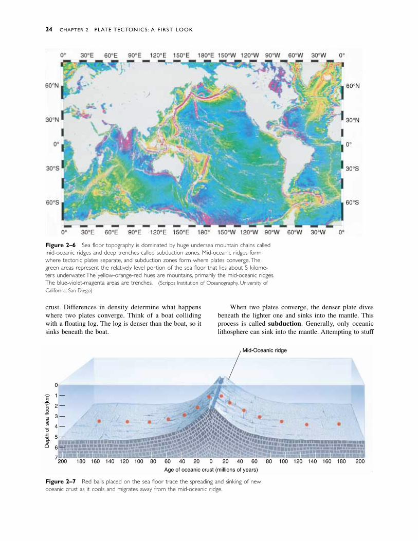
A spreading center lies directly above the hot, rising as-thenosphere. The newly formed lithosphere at an oceanicspreading center is hot and therefore of low density.Consequently, the sea floor at a spreading center floatsto a high elevation, forming an undersea mountain chaincalled the mid-oceanic ridge (Fig. 2–6). But as litho-sphere migrates away from the spreading center, it coolsand becomes denser and thicker; as a result, it sinks. Forthis reason, the sea floor is high at the mid-oceanic ridgeand lower away from the ridge. Thus, the average depthof the sea floor away from the mid-oceanic ridge is about5 kilometers. The mid-oceanic ridge rises 2 to 3 kilome-ters above the surrounding sea floor and, thus, comeswithin 2 kilometers of the sea surface.
If you could place two bright red balls on the seafloor, one on each side of the ridge axis, and then watchthem over millions of years, you would see the balls mi-grate away from the rift as the plates separated. The ballswould also sink to greater depths as the hot rocks cooled(Fig. 2–7).
Oceanic rifts completely encircle the Earth, runningaround the globe like the seam on a baseball. As a result,
�
�
�
�
�
�
�
Transformfault Shallow
earthquake Mid-oceanicridge
Rift valley Benioff zoneof earthquakes Oceanic
trenchContinentalcrust
Asthenosphere
Lithosphere
Cold lithosphereplate sinkinginto mantle
Risingmagma
crust. Differences in density determine what happenswhere two plates converge. Think of a boat collidingwith a floating log. The log is denser than the boat, so itsinks beneath the boat.
When two plates converge, the denser plate divesbeneath the lighter one and sinks into the mantle. Thisprocess is called subduction. Generally, only oceaniclithosphere can sink into the mantle. Attempting to stuff
24 CHAPTER 2 PLATE TECTONICS: A FIRST LOOK
Mid-Oceanic ridge
Dep
th o
f sea
floo
r(km
)
0
1
2
3
4
5
6
7
Age of oceanic crust (millions of years)
0 20 40 60 80 100 120 140 160 180 20020406080100120160180200 140
Figure 2–6 Sea floor topography is dominated by huge undersea mountain chains calledmid-oceanic ridges and deep trenches called subduction zones. Mid-oceanic ridges formwhere tectonic plates separate, and subduction zones form where plates converge.Thegreen areas represent the relatively level portion of the sea floor that lies about 5 kilome-ters underwater.The yellow-orange-red hues are mountains, primarily the mid-oceanic ridges.The blue-violet-magenta areas are trenches. (Scripps Institution of Oceanography, University ofCalifornia, San Diego)
Figure 2–7 Red balls placed on the sea floor trace the spreading and sinking of newoceanic crust as it cools and migrates away from the mid-oceanic ridge.
a low-density continent down into the mantle would belike trying to flush a marshmallow down a toilet: It willnot go because it is too light. In certain cases, however,small amounts of continental crust may sink into themantle at a subduction zone. These cases are discussedin Chapter 12.
A subduction zone is a long, narrow belt where alithospheric plate is sinking into the mantle. On a world-wide scale, the rate at which old lithosphere sinks intothe mantle at subduction zones is equal to the rate atwhich new lithosphere forms at spreading centers. In thisway, global balance is maintained between the creationof new lithosphere and the destruction of old lithosphere.
The oldest sea-floor rocks on Earth are only about200 million years old because oceanic crust continuouslyrecycles into the mantle at subduction zones. Rocks asold as 3.96 billion years are found on continents becausesubduction consumes little continental crust.
Convergence of Oceanic Crust with Continental Crust
When an oceanic plate converges with a continental plate,the denser oceanic plate sinks into the mantle beneaththe edge of the continent. As a result, many subductionzones are located at continental margins. Today, oceanicplates are sinking beneath the western edge of SouthAmerica; along the coasts of Oregon, Washington, andBritish Columbia; and at several other continental mar-gins (see Fig. 2–1). We will return to this subject inChapters 11 and 12.
Convergence of Two Plates Carrying Oceanic Crust
Recall that newly formed oceanic lithosphere is hot, thin,and light, but as it spreads away from the mid-oceanicridge, it becomes older, cooler, thicker, and denser. Thus,
the density of oceanic lithosphere increases with its age.When two oceanic plates converge, the denser one sinksinto the mantle. Oceanic subduction zones are commonin the southwestern Pacific Ocean and are discussed inChapter 11.
Convergence of Two Plates Carrying Continents
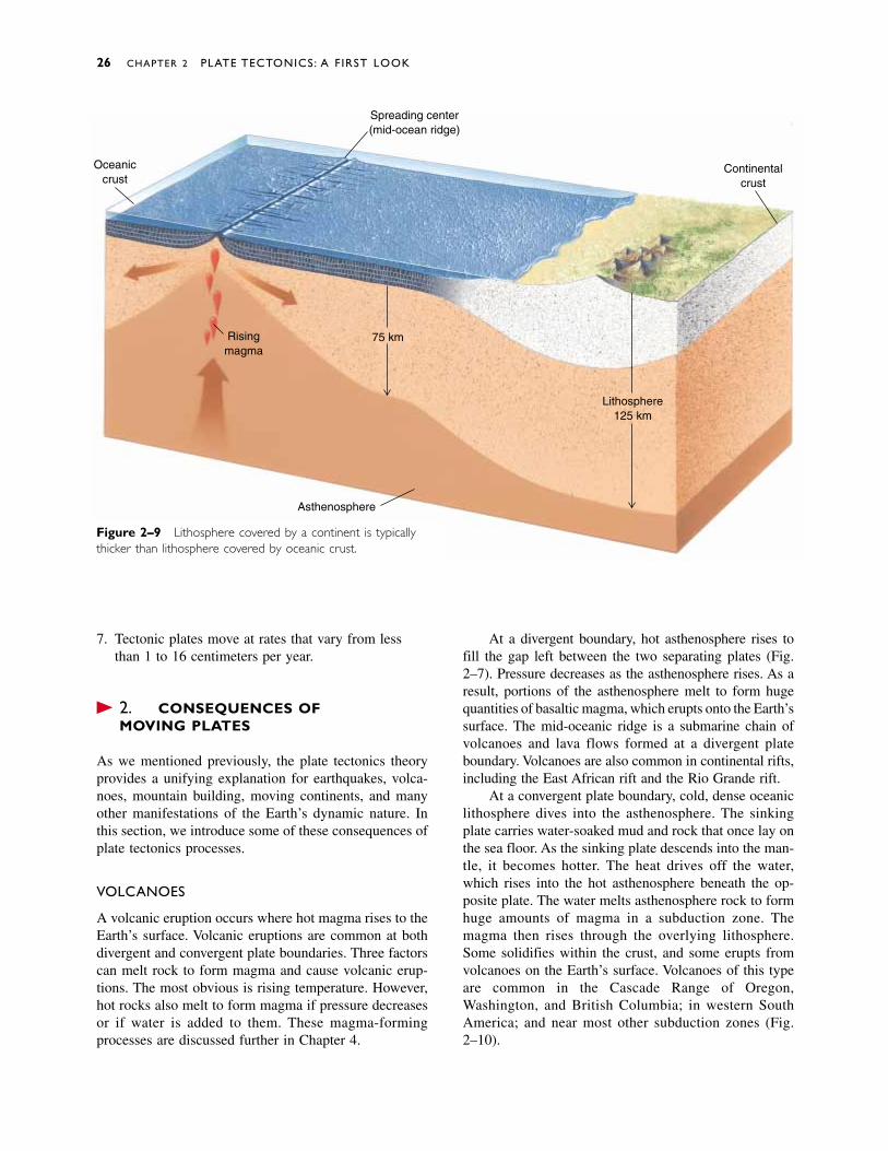
If two converging plates carry continents, neither cansink into the mantle because of their low densities. Inthis case, the two continents collide and crumple againsteach other, forming a huge mountain chain. TheHimalayas, the Alps, and the Appalachians all formed asresults of continental collisions (Fig. 2–8). Theseprocesses are discussed in Chapter 12.
TRANSFORM PLATE BOUNDARIES
A transform plate boundary forms where two plates slidehorizontally past one another as they move in oppositedirections (Fig. 2–3C). California’s San Andreas fault isthe transform boundary between the North Americanplate and the Pacific plate. This type of boundary can oc-cur in both oceans and continents and is discussed inChapters 10, 11, and 12.
� 2.4 THE ANATOMY OF A TECTONIC PLATE
The nature of a tectonic plate can be summarized as follows:
1. A plate is a segment of the lithosphere; thus, it in-cludes the uppermost mantle and all of the overlyingcrust.
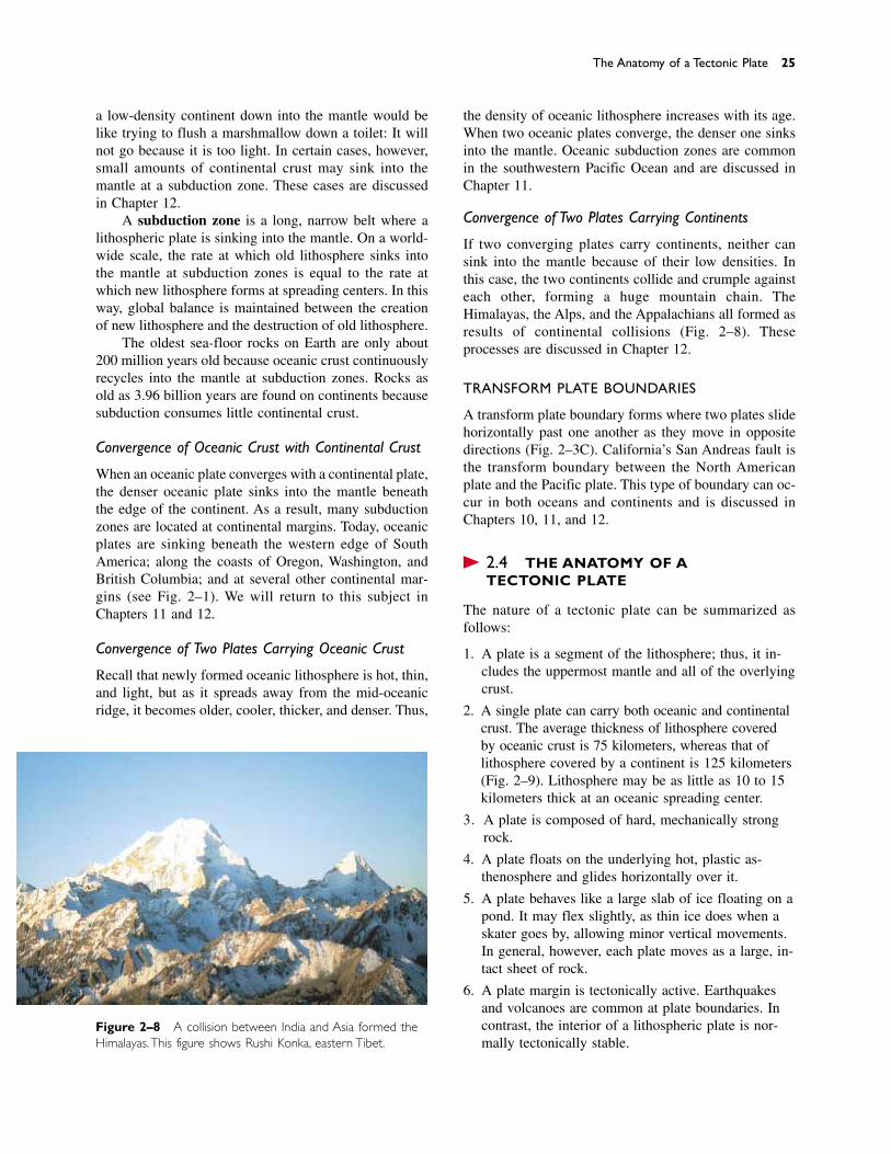
2. A single plate can carry both oceanic and continentalcrust. The average thickness of lithosphere coveredby oceanic crust is 75 kilometers, whereas that oflithosphere covered by a continent is 125 kilometers(Fig. 2–9). Lithosphere may be as little as 10 to 15kilometers thick at an oceanic spreading center.
3. A plate is composed of hard, mechanically strongrock.
4. A plate floats on the underlying hot, plastic as-thenosphere and glides horizontally over it.
5. A plate behaves like a large slab of ice floating on apond. It may flex slightly, as thin ice does when askater goes by, allowing minor vertical movements.In general, however, each plate moves as a large, in-tact sheet of rock.
6. A plate margin is tectonically active. Earthquakesand volcanoes are common at plate boundaries. Incontrast, the interior of a lithospheric plate is nor-mally tectonically stable.
The Anatomy of a Tectonic Plate 25
Figure 2–8 A collision between India and Asia formed theHimalayas.This figure shows Rushi Konka, eastern Tibet.
7. Tectonic plates move at rates that vary from lessthan 1 to 16 centimeters per year.
� 2.5 CONSEQUENCES OF MOVING PLATES
As we mentioned previously, the plate tectonics theoryprovides a unifying explanation for earthquakes, volca-noes, mountain building, moving continents, and manyother manifestations of the Earth’s dynamic nature. Inthis section, we introduce some of these consequences ofplate tectonics processes.
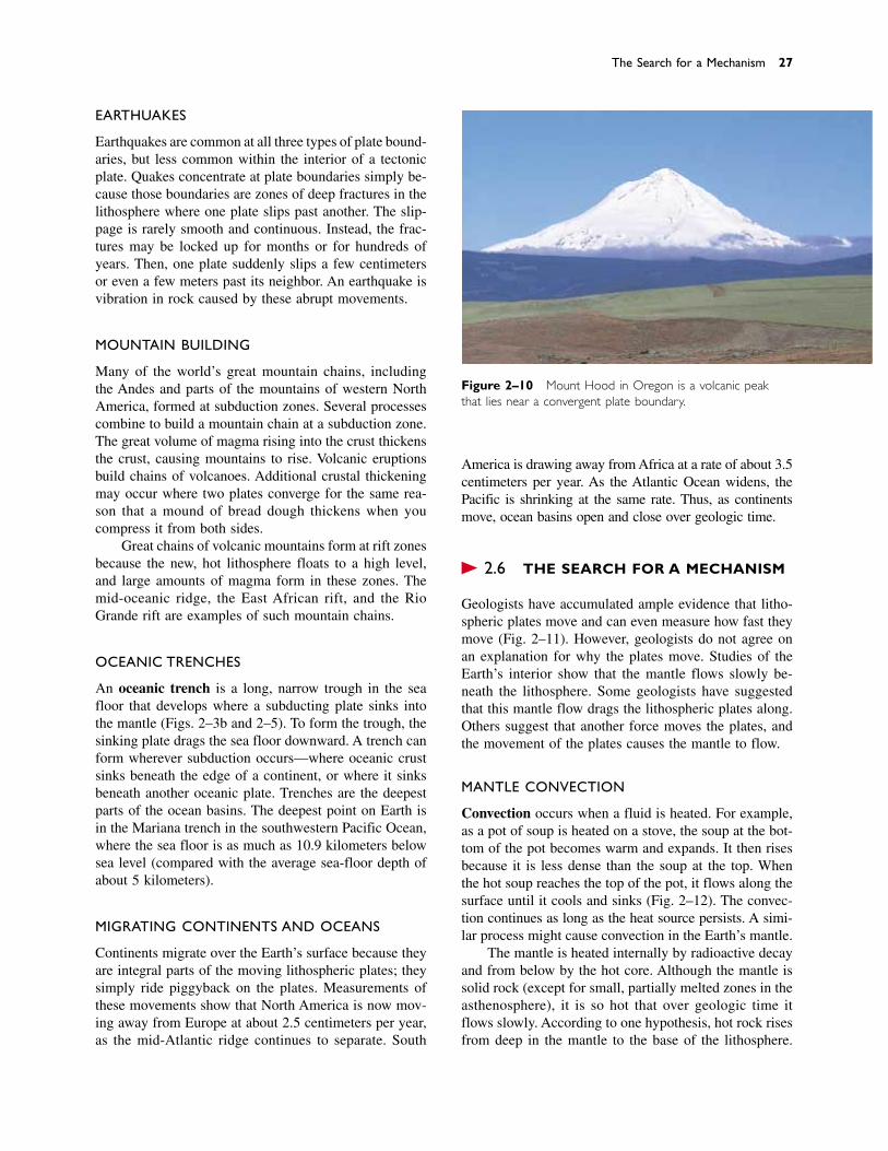
VOLCANOES
A volcanic eruption occurs where hot magma rises to theEarth’s surface. Volcanic eruptions are common at bothdivergent and convergent plate boundaries. Three factorscan melt rock to form magma and cause volcanic erup-tions. The most obvious is rising temperature. However,hot rocks also melt to form magma if pressure decreasesor if water is added to them. These magma-formingprocesses are discussed further in Chapter 4.
At a divergent boundary, hot asthenosphere rises tofill the gap left between the two separating plates (Fig.2–7). Pressure decreases as the asthenosphere rises. As aresult, portions of the asthenosphere melt to form hugequantities of basaltic magma, which erupts onto the Earth’ssurface. The mid-oceanic ridge is a submarine chain ofvolcanoes and lava flows formed at a divergent plateboundary. Volcanoes are also common in continental rifts,including the East African rift and the Rio Grande rift.
At a convergent plate boundary, cold, dense oceaniclithosphere dives into the asthenosphere. The sinkingplate carries water-soaked mud and rock that once lay onthe sea floor. As the sinking plate descends into the man-tle, it becomes hotter. The heat drives off the water,which rises into the hot asthenosphere beneath the op-posite plate. The water melts asthenosphere rock to formhuge amounts of magma in a subduction zone. Themagma then rises through the overlying lithosphere.Some solidifies within the crust, and some erupts fromvolcanoes on the Earth’s surface. Volcanoes of this typeare common in the Cascade Range of Oregon,Washington, and British Columbia; in western SouthAmerica; and near most other subduction zones (Fig.2–10).
26 CHAPTER 2 PLATE TECTONICS: A FIRST LOOK
Oceaniccrust
Spreading center(mid-ocean ridge)
Risingmagma
Asthenosphere
75 km
Lithosphere125 km
Continentalcrust
Figure 2–9 Lithosphere covered by a continent is typicallythicker than lithosphere covered by oceanic crust.
EARTHQUAKES
Earthquakes are common at all three types of plate bound-aries, but less common within the interior of a tectonicplate. Quakes concentrate at plate boundaries simply be-cause those boundaries are zones of deep fractures in thelithosphere where one plate slips past another. The slip-page is rarely smooth and continuous. Instead, the frac-tures may be locked up for months or for hundreds ofyears. Then, one plate suddenly slips a few centimetersor even a few meters past its neighbor. An earthquake isvibration in rock caused by these abrupt movements.
MOUNTAIN BUILDING
Many of the world’s great mountain chains, includingthe Andes and parts of the mountains of western NorthAmerica, formed at subduction zones. Several processescombine to build a mountain chain at a subduction zone.The great volume of magma rising into the crust thickensthe crust, causing mountains to rise. Volcanic eruptionsbuild chains of volcanoes. Additional crustal thickeningmay occur where two plates converge for the same rea-son that a mound of bread dough thickens when youcompress it from both sides.
Great chains of volcanic mountains form at rift zonesbecause the new, hot lithosphere floats to a high level,and large amounts of magma form in these zones. Themid-oceanic ridge, the East African rift, and the RioGrande rift are examples of such mountain chains.
OCEANIC TRENCHES
An oceanic trench is a long, narrow trough in the seafloor that develops where a subducting plate sinks intothe mantle (Figs. 2–3b and 2–5). To form the trough, thesinking plate drags the sea floor downward. A trench canform wherever subduction occurs—where oceanic crustsinks beneath the edge of a continent, or where it sinksbeneath another oceanic plate. Trenches are the deepestparts of the ocean basins. The deepest point on Earth isin the Mariana trench in the southwestern Pacific Ocean,where the sea floor is as much as 10.9 kilometers belowsea level (compared with the average sea-floor depth ofabout 5 kilometers).
MIGRATING CONTINENTS AND OCEANS
Continents migrate over the Earth’s surface because theyare integral parts of the moving lithospheric plates; theysimply ride piggyback on the plates. Measurements ofthese movements show that North America is now mov-ing away from Europe at about 2.5 centimeters per year,as the mid-Atlantic ridge continues to separate. South
America is drawing away from Africa at a rate of about 3.5centimeters per year. As the Atlantic Ocean widens, thePacific is shrinking at the same rate. Thus, as continentsmove, ocean basins open and close over geologic time.
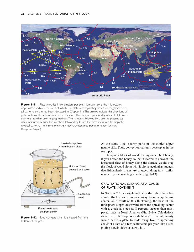
� 2.6 THE SEARCH FOR A MECHANISM
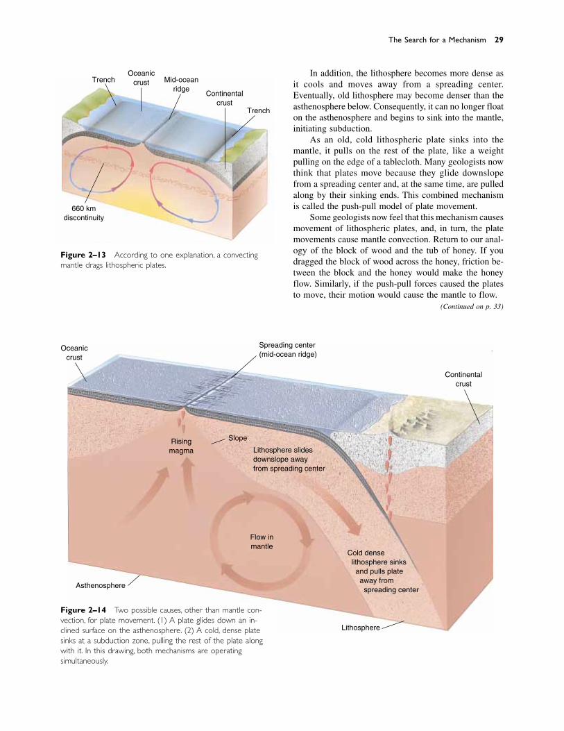
Geologists have accumulated ample evidence that litho-spheric plates move and can even measure how fast theymove (Fig. 2–11). However, geologists do not agree onan explanation for why the plates move. Studies of theEarth’s interior show that the mantle flows slowly be-neath the lithosphere. Some geologists have suggestedthat this mantle flow drags the lithospheric plates along.Others suggest that another force moves the plates, andthe movement of the plates causes the mantle to flow.
MANTLE CONVECTION
Convection occurs when a fluid is heated. For example,as a pot of soup is heated on a stove, the soup at the bot-tom of the pot becomes warm and expands. It then risesbecause it is less dense than the soup at the top. Whenthe hot soup reaches the top of the pot, it flows along thesurface until it cools and sinks (Fig. 2–12). The convec-tion continues as long as the heat source persists. A simi-lar process might cause convection in the Earth’s mantle.
The mantle is heated internally by radioactive decayand from below by the hot core. Although the mantle issolid rock (except for small, partially melted zones in theasthenosphere), it is so hot that over geologic time itflows slowly. According to one hypothesis, hot rock risesfrom deep in the mantle to the base of the lithosphere.
The Search for a Mechanism 27
Figure 2–10 Mount Hood in Oregon is a volcanic peakthat lies near a convergent plate boundary.
At the same time, nearby parts of the cooler upper mantle sink. Thus, convection currents develop as in thesoup pot.
Imagine a block of wood floating on a tub of honey.If you heated the honey so that it started to convect, thehorizontal flow of honey along the surface would dragthe block of wood along with it. Some geologists suggestthat lithospheric plates are dragged along in a similarmanner by a convecting mantle (Fig. 2–13).
GRAVITATIONAL SLIDING AS A CAUSE OF PLATE MOVEMENT
In Section 2.3, we explained why the lithosphere be-comes thicker as it moves away from a spreading center. As a result of this thickening, the base of thelithosphere slopes downward from the spreading centerwith a grade as steep as 8 percent, steeper than mostpaved roads in North America (Fig. 2–14). Calculationsshow that if the slope is as slight as 0.3 percent, gravitywould cause a plate to slide away from a spreading center at a rate of a few centimeters per year, like a sled gliding slowly down a snowy hill.
28 CHAPTER 2 PLATE TECTONICS: A FIRST LOOK
Figure 2–12 Soup convects when it is heated from thebottom of the pot.
Heated soup risesfrom bottom of pot
Hot soup flowsoutward and cools
Cool soupsinks
Flame heats souppot from below
OFF HIGH
Figure 2–11 Plate velocities in centimeters per year. Numbers along the mid-oceanicridge system indicate the rates at which two plates are separating, based on magnetic rever-sal patterns on the sea floor (discussed in Chapter 11).The arrows indicate the directions ofplate motions.The yellow lines connect stations that measure present-day rates of plate mo-tions with satellite laser ranging methods.The numbers followed by L are the present-dayrates measured by laser.The numbers followed by M are the rates measured by magneticreversal patterns. (Modified from NASA report, Geodynamics Branch, 1986.Tom Van Sant,Geosphere Project)
NazcaPlate
6.14.8
5.16.6
Pacific Plate
4.9
5.0
6.2 M
7.0 L
7.3 M8.3 L
East-PacificPlate
5.1
6.8
9.26.6
9.0
SouthAmerican
Plate
North American Plate
Mid-AtlanticPlate
10.45.9 M7.6 L
14.3
16.36.3
5.0 M4.5 L
8.2
6.29.9
2.9
1.62.0
2.5
2.23.4
3.5
1.1
1.4
5.5
6.6
Arabian PlateEurasian Plate
Southeast-Indian Rise
6.6
3.3
9.3
PhilippinePlate
6.7
7.0
Antarctic Plate
AfricanPlate
2.4
3.5
1.41.8
3.3 4.8
AustralianIndian Plate
In addition, the lithosphere becomes more dense asit cools and moves away from a spreading center.Eventually, old lithosphere may become denser than theasthenosphere below. Consequently, it can no longer floaton the asthenosphere and begins to sink into the mantle,initiating subduction.
As an old, cold lithospheric plate sinks into the mantle, it pulls on the rest of the plate, like a weightpulling on the edge of a tablecloth. Many geologists nowthink that plates move because they glide downslopefrom a spreading center and, at the same time, are pulledalong by their sinking ends. This combined mechanismis called the push-pull model of plate movement.
Some geologists now feel that this mechanism causesmovement of lithospheric plates, and, in turn, the platemovements cause mantle convection. Return to our anal-ogy of the block of wood and the tub of honey. If youdragged the block of wood across the honey, friction be-tween the block and the honey would make the honeyflow. Similarly, if the push-pull forces caused the platesto move, their motion would cause the mantle to flow.
The Search for a Mechanism 29
Figure 2–14 Two possible causes, other than mantle con-vection, for plate movement. (1) A plate glides down an in-clined surface on the asthenosphere. (2) A cold, dense platesinks at a subduction zone, pulling the rest of the plate alongwith it. In this drawing, both mechanisms are operating simultaneously.
Figure 2–13 According to one explanation, a convectingmantle drags lithospheric plates.
Oceaniccrust
Spreading center(mid-ocean ridge)
Continentalcrust
SlopeRisingmagma
Asthenosphere
Lithosphere
Cold dense lithosphere sinks and pulls plate away from spreading center
Lithosphere slidesdownslope awayfrom spreading center
Flow inmantle
TrenchOceanic
crust Mid-oceanridge
Continentalcrust
Trench
660 kmdiscontinuity
(Continued on p. 33)
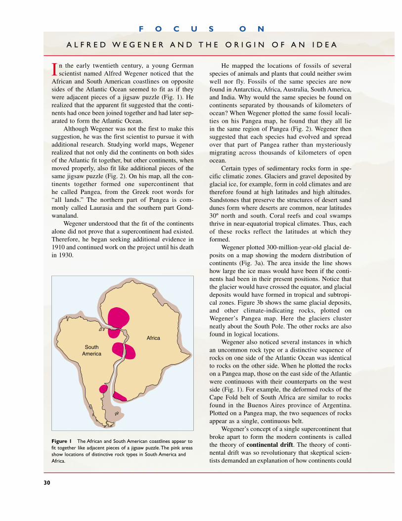
F O C U S O N
A L F R E D W E G E N E R A N D T H E O R I G I N O F A N I D E A
I
Figure 1 The African and South American coastlines appear tofit together like adjacent pieces of a jigsaw puzzle.The pink areasshow locations of distinctive rock types in South America andAfrica.
He mapped the locations of fossils of severalspecies of animals and plants that could neither swimwell nor fly. Fossils of the same species are now found in Antarctica, Africa, Australia, South America,and India. Why would the same species be found oncontinents separated by thousands of kilometers ofocean? When Wegener plotted the same fossil locali-ties on his Pangea map, he found that they all lie in the same region of Pangea (Fig. 2). Wegener thensuggested that each species had evolved and spreadover that part of Pangea rather than mysteriously migrating across thousands of kilometers of openocean.
Certain types of sedimentary rocks form in spe-cific climatic zones. Glaciers and gravel deposited byglacial ice, for example, form in cold climates and aretherefore found at high latitudes and high altitudes.Sandstones that preserve the structures of desert sanddunes form where deserts are common, near latitudes30º north and south. Coral reefs and coal swampsthrive in near-equatorial tropical climates. Thus, eachof these rocks reflect the latitudes at which theyformed.
Wegener plotted 300-million-year-old glacial de-posits on a map showing the modern distribution ofcontinents (Fig. 3a). The area inside the line showshow large the ice mass would have been if the conti-nents had been in their present positions. Notice thatthe glacier would have crossed the equator, and glacialdeposits would have formed in tropical and subtropi-cal zones. Figure 3b shows the same glacial deposits,and other climate-indicating rocks, plotted onWegener’s Pangea map. Here the glaciers clusterneatly about the South Pole. The other rocks are alsofound in logical locations.
Wegener also noticed several instances in whichan uncommon rock type or a distinctive sequence ofrocks on one side of the Atlantic Ocean was identicalto rocks on the other side. When he plotted the rockson a Pangea map, those on the east side of the Atlanticwere continuous with their counterparts on the westside (Fig. 1). For example, the deformed rocks of theCape Fold belt of South Africa are similar to rocksfound in the Buenos Aires province of Argentina.Plotted on a Pangea map, the two sequences of rocksappear as a single, continuous belt.
Wegener’s concept of a single supercontinent thatbroke apart to form the modern continents is calledthe theory of continental drift. The theory of conti-nental drift was so revolutionary that skeptical scien-tists demanded an explanation of how continents could
n the early twentieth century, a young German scientist named Alfred Wegener noticed that the
African and South American coastlines on oppositesides of the Atlantic Ocean seemed to fit as if theywere adjacent pieces of a jigsaw puzzle (Fig. 1). Herealized that the apparent fit suggested that the conti-nents had once been joined together and had later sep-arated to form the Atlantic Ocean.
Although Wegener was not the first to make thissuggestion, he was the first scientist to pursue it withadditional research. Studying world maps, Wegenerrealized that not only did the continents on both sidesof the Atlantic fit together, but other continents, whenmoved properly, also fit like additional pieces of thesame jigsaw puzzle (Fig. 2). On his map, all the con-tinents together formed one supercontinent that he called Pangea, from the Greek root words for “all lands.” The northern part of Pangea is com-monly called Laurasia and the southern part Gond-wanaland.
Wegener understood that the fit of the continentsalone did not prove that a supercontinent had existed.Therefore, he began seeking additional evidence in1910 and continued work on the project until his deathin 1930.
30
Africa
SouthAmerica
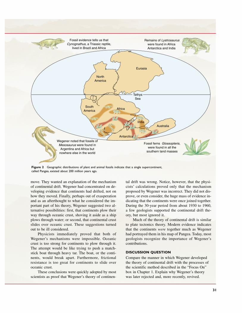
Eurasia
NorthAmerica
SouthAmerica
Africa
AustraliaIndia
TethysSea
Fossil evidence tells us thatCynognathus, a Triassic reptile,
lived in Brazil and Africa
Wegener noted that fossils ofMesosaurus were found inArgentina and Africa but
nowhere else in the world
Remains of Lystrosauruswere found in Africa,Antarctica, and India
Fossil ferns, Glossopteris,were found in all the
southern land masses
Antarctica
Figure 2 Geographic distributions of plant and animal fossils indicate that a single supercontinent,called Pangea, existed about 200 million years ago.
31
move. They wanted an explanation of the mechanismof continental drift. Wegener had concentrated on de-veloping evidence that continents had drifted, not onhow they moved. Finally, perhaps out of exasperationand as an afterthought to what he considered the im-portant part of his theory, Wegener suggested two al-ternative possibilities: first, that continents plow theirway through oceanic crust, shoving it aside as a shipplows through water; or second, that continental crustslides over oceanic crust. These suggestions turnedout to be ill considered.
Physicists immediately proved that both ofWegener’s mechanisms were impossible. Oceaniccrust is too strong for continents to plow through it.The attempt would be like trying to push a match-stick boat through heavy tar. The boat, or the conti-nents, would break apart. Furthermore, frictional resistance is too great for continents to slide overoceanic crust.
These conclusions were quickly adopted by mostscientists as proof that Wegener’s theory of continen-
tal drift was wrong. Notice, however, that the physi-cists’ calculations proved only that the mechanismproposed by Wegener was incorrect. They did not dis-prove, or even consider, the huge mass of evidence in-dicating that the continents were once joined together.During the 30-year period from about 1930 to 1960,a few geologists supported the continental drift the-ory, but most ignored it.
Much of the theory of continental drift is similarto plate tectonics theory. Modern evidence indicatesthat the continents were together much as Wegenerhad portrayed them in his map of Pangea. Today, mostgeologists recognize the importance of Wegener’scontributions.
DISCUSSION QUESTION
Compare the manner in which Wegener developedthe theory of continental drift with the processes ofthe scientific method described in the “Focus On”box in Chapter 1. Explain why Wegener’s theorywas later rejected and, more recently, revived.
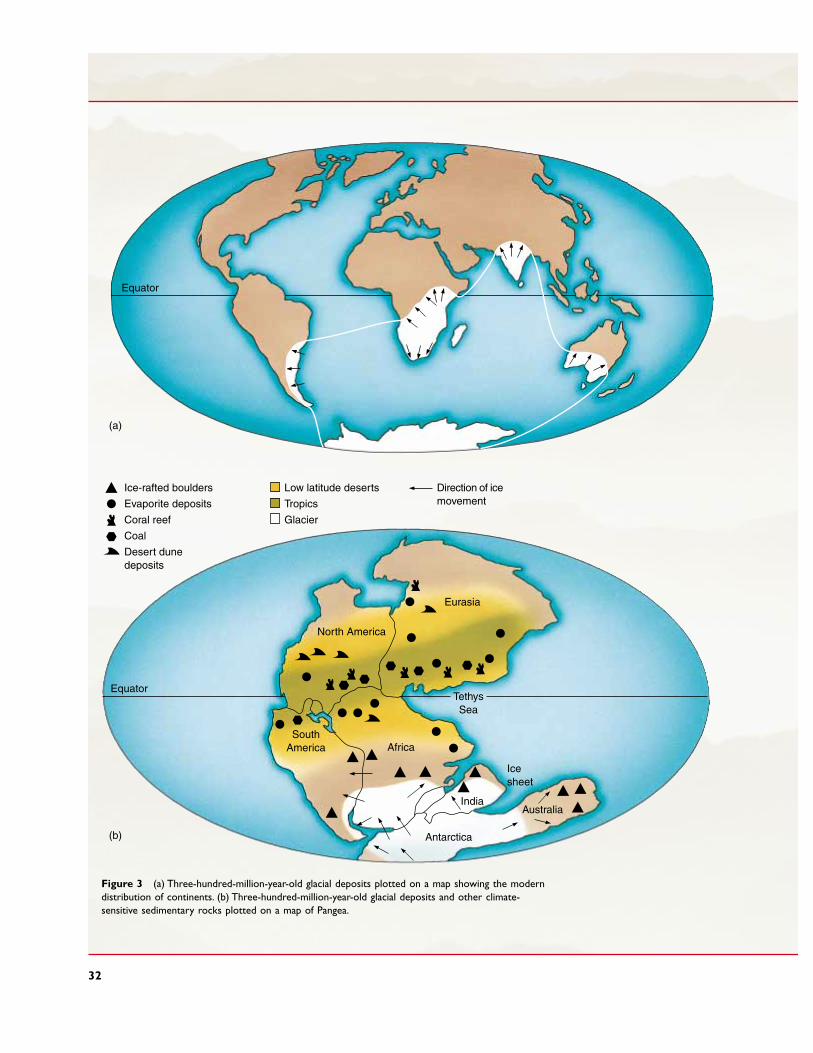
32
Figure 3 (a) Three-hundred-million-year-old glacial deposits plotted on a map showing the moderndistribution of continents. (b) Three-hundred-million-year-old glacial deposits and other climate-sensitive sedimentary rocks plotted on a map of Pangea.
Equator
North America
Eurasia
TethysSea
SouthAmerica Africa
India
Antarctica
Icesheet
Australia
Equator
Ice-rafted boulders
Evaporite deposits
Coral reef
Coal
Desert dunedeposits
Low latitude deserts
Tropics
Glacier
Direction of icemovement
(a)
(b)

Some geologists have suggested that a mantle plumemight cause a new spreading center to develop within thelithosphere. Once spreading started, the push-pull mech-anism would then keep the plates moving, even if theoriginal mantle plume died out. Mantle plumes and theirconsequences are discussed further in Chapter 4.
� 2.7 SUPERCONTINENTS
Many geologists now suggest that movements of tectonicplates have periodically swept the world’s continents to-gether to form a single supercontinent. Each superconti-nent lasted for a few hundred million years and thenbroke into fragments, each riding away from the otherson its own tectonic plate.
Prior to 2 billion years ago, large continents as weknow them today may not have existed. Instead, many—
MANTLE PLUMES
The push-pull model provides a mechanism to maintainplate movement once a lithospheric plate has begun tomove, but does not explain why a plate should start mov-ing. A mantle plume is a rising column of hot, plasticmantle rock that originates deep within the mantle. It risesbecause rock in a certain part of the mantle becomes hot-ter and more buoyant than surrounding regions of themantle. The Earth’s core may provide the heat source tocreate a mantle plume, or the heat may come from ra-dioactive decay within the mantle. Large quantities ofmagma form in mantle plumes, and rise to erupt from vol-canoes at locations called hot spots at the Earth’s surface.The island of Hawaii is an example of a volcanic center atsuch a hot spot. Because mantle plumes form deep withinthe mantle, hot spot volcanoes commonly erupt withintectonic plates, and well away from plate boundaries.
Supercontinents 33
Continental crust
Oceanic crust
Continental crust
Oceanic crust
Ice
Figure 2–15 The weight of an ice sheet causes continentalcrust to sink isostatically.
Oceaniccrust
Continentalcrust
Lithosphere
Asthenosphere
(a)
(b)
Figure 2–16 (a) Icebergs illustrate some of the effects ofisostasy.The large iceberg has a deep root and also a highpeak. (b) Lithosphere covered by continental crust extendsmore deeply into the asthenosphere than lithosphere coveredby oceanic crust.

perhaps hundreds—of small masses of continental crustand island arcs similar to Japan, New Zealand, and themodern island arcs of the southwestern Pacific Oceandotted a global ocean basin. Then, between 2 billion and1.8 billion years ago, tectonic plate movements sweptthese microcontinents together, forming the first super-continent, which we call Pangea I after AlfredWegener’s Pangea, a word meaning “all lands” (see FocusOn: Alfred Wegener and the Origin of an Idea).
After Pangea I split up about 1.3 billion years ago,the fragments of continental crust reassembled, forminga second supercontinent called Pangea II, about 1 bil-lion years ago. In turn, this continent fractured and thecontinental fragments reassembled into Pangea III about300 million years ago, 70 million years before the ap-pearance of dinosaurs. Pangea III is Alfred Wegener’sPangea, described in the “Focus On” box.
� 2.8 ISOSTASY: VERTICAL MOVEMENT OF THE LITHOSPHERE
If you have ever used a small boat, you may have noticedthat the boat settles in the water as you get into it andrises as you step out. The lithosphere behaves in a similarmanner. If a large mass is added to the lithosphere, itsinks and the underlying asthenosphere flows laterallyaway from that region to make space for the settlinglithosphere.
But how is weight added to or subtracted from thelithosphere? One process that adds and removes weightis the growth and melting of large glaciers. When a gla-cier grows, the weight of ice forces the lithosphere down-ward. For example, in the central portion of Greenland,a 3000-meter-thick ice sheet has depressed the continen-tal crust below sea level. Conversely, when a glaciermelts, the continent rises—it rebounds. Geologists havediscovered Ice Age beaches in Scandinavia tens of me-ters above modern sea level. The beaches formed whenglaciers depressed the Scandinavian crust. They now liewell above sea level because the land rose as the icemelted. The concept that the lithosphere is in floatingequilibrium on the asthenosphere is called isostasy, andthe vertical movement in response to a changing burdenis called isostatic adjustment (Fig. 2–15).
The iceberg pictured in Figure 2–16 illustrates an ad-ditional effect of isostasy. A large iceberg has a high peak,but its base extends deep below the surface of the water.
The lithosphere behaves in a similar manner. Con-tinents rise high above sea level, and the lithosphere be-neath a continent has a “root” that extends 125 kilome-ters into the asthenosphere. In contrast, most ocean crustlies approximately 5 kilometers below sea level, andoceanic lithosphere extends only about 75 kilometersinto the asthenosphere. For similar reasons, high moun-tain ranges have deeper roots than low plains, just as thebottom of a large iceberg is deeper than the base of asmall one.
34 CHAPTER 2 PLATE TECTONICS: A FIRST LOOK
S U M M A R Y
The plate tectonics theory provides a unifying frame-work for much of modern geology. It is the concept thatthe lithosphere, the outer, 75 to 125-kilometer-thicklayer of the Earth, floats on the asthenosphere. Thelithosphere is segmented into seven major plates, whichmove relative to one another by gliding over the as-thenosphere. Most of the Earth’s major geological activ-ity occurs at plate boundaries. Three types of plateboundaries exist: (1) New lithosphere forms and spreadsoutward at a divergent boundary, or spreading center;(2) two lithospheric plates move toward each other at aconvergent boundary, which develops into a subduc-tion zone if at least one plate carries oceanic crust; and(3) two plates slide horizontally past each other at atransform plate boundary. Volcanoes, earthquakes,mountain building, and oceanic trenches occur nearplate boundaries. Interior parts of lithospheric plates aretectonically stable. Tectonic plates move horizontally atrates that vary from 1 to 16 centimeters per year. Platemovements carry continents across the globe and causeocean basins to open and close. The Earth is a layered
planet. The crust is its outermost layer and varies from5 to 70 kilometers thick. The mantle extends from thebase of the crust to a depth of 2900 kilometers, wherethe core begins. The lithosphere is the cool outer 75 to125 kilometers of the Earth; it includes all of the crustand the uppermost mantle. The lithosphere floats on thehot, plastic asthenosphere, which extends to 350 kilo-meters in depth. The core is mostly iron and nickel andconsists of a liquid outer layer and a solid inner sphere.
Mantle convection may cause plate movement.Alternatively, a plate may move because it slides down-hill from a spreading center, as its cold leading edgesinks into the mantle and drags the rest of the plate along.Supercontinents may assemble, split apart, and re-assemble every 500 million to 700 million years.
The concept that the lithosphere floats on the as-thenosphere is called isostasy. When weight such as aglacier is added to or removed from the Earth’s surface,the lithosphere sinks or rises. This vertical movement in response to changing burdens is called isostaticadjustment.
K E Y W O R D S
plate tectonics theory 16lithosphere 18tectonic plate 18asthenosphere 18plate boundary 18divergent boundary 18convergent boundary
18
transform plate boundary 18
crust 18basalt 18granite 21mantle 21core 21spreading center 22
rift zone 22magma 22mid-oceanic ridge 23continental rifting 23rift valley 23subduction 24subduction zone 25oceanic trench 27
mantle convection 27mantle plume 33hot spot 33supercontinent 34Pangea 34isostasy 34isostatic adjustment 34
R E V I E W Q U E S T I O N S
1. Draw a cross-sectional view of the Earth. List all the major layers and the thickness of each.
2. Describe the physical properties of each of the Earth’slayers.
3. Describe and explain the important differences betweenthe lithosphere and the asthenosphere.
4. What properties of the asthenosphere allow the litho-spheric plates to glide over it?
5. Describe some important differences between the crustand the lithosphere.
6. Describe some important differences between oceaniccrust and continental crust.
7. How is it possible for the solid rock of the mantle toflow and convect?
8. Summarize the important aspects of the plate tectonicstheory.
9. How many major tectonic plates exist? List them.
10. Describe the three types of tectonic plate boundaries.
11. Explain why tectonic plate boundaries are geologicallyactive and the interior regions of plates are geologicallystable.
12. Describe some differences between the lithosphere be-neath a continent and that beneath oceanic crust.
13. Describe a reasonable model for a mechanism that causesmovement of tectonic plates.
14. Why would a lithospheric plate floating on the astheno-sphere suddenly begin to sink into the mantle to create anew subduction zone?
15. How many supercontinents have formed in Earth’s history?
16. Describe the mid-Atlantic ridge and the mid-oceanic ridge.
17. Why are the oldest sea-floor rocks only about 200 mil-lion years old, whereas some continental rocks are 3.96billion years old?
1. Discuss why a unifying theory, such as the plate tecton-ics theory, is desirable in any field of science.
2. Central Greenland lies below sea level because the crust isdepressed by the ice cap. If the glacier were to melt, wouldGreenland remain beneath the ocean? Why or why not?
3. At a rate of 5 centimeters per year, how long would ittake for a continent to drift the width of your classroom?The distance between your apartment or dormitory andyour classroom? The distance from New York to London?
4. Why do most major continental mountain chains form atconvergent plate boundaries? What topographic and geo-logic features characterize divergent and transform plateboundaries in continental crust? Where do these types ofboundaries exist in continental crust today?
5. If you were studying photographs of another planet, whatfeatures would you look for to determine whether or notthe planet is or has been tectonically active?
6. The largest mountain in the Solar System is OlympusMons, a volcano on Mars. It is 25,000 meters high,nearly three times the elevation of Mount Everest.Speculate on the factors that might permit such a largemountain on Mars.
7. The core’s radius is 3470 kilometers, and that of the man-tle is 2900 kilometers, yet the mantle contains 80 percentof the Earth’s volume. Explain this apparent contradiction.
8. If you built a model of the Earth 1 meter in radius, howthick would the crust, lithosphere, asthenosphere, mantle,and core be?
9. Look at the map in Figure 2–1 and name a tectonic platethat is covered mostly by continental crust. Name onethat is mostly ocean. Name two plates that are about halfocean and half continent.
D I S C U S S I O N Q U E S T I O N S
Discussion Questions 35

ick up any rock and look at it carefully.You will probably see small, differently colored specks like those
in granite (Fig. 3–1). Each speck is a mineral. A rock is anaggregate of minerals. Some rocks are made of only onemineral, but most contain two to five abundant mineralsplus minor amounts of several others.
C H A P T E R
3Minerals
P
Figure 3–1 Each of the differently colored grains in thisgranite is a different mineral. The pink grains are feldspar, theblack ones are biotite, and the glassy-white ones are quartz.

37
A sample of basalt, one of the most abundant rocks in the Earth’scrust, viewed through a microscope.The intense colors are pro-duced by polarized light. (� 1997 Kent Wood)
37
� 3.1 WHAT IS A MINERAL?
A mineral is a naturally occurring inorganic solidwith a characteristic chemical composition and a crys-talline structure. Chemical composition and crystallinestructure are the two most important properties of a min-eral: They distinguish any mineral from all others. Beforediscussing them, however, let us briefly consider theother properties of minerals described by this definition.
NATURAL OCCURRENCE
A synthetic diamond can be identical to a natural one,but it is not a true mineral because a mineral must formby natural processes. Like diamond, most gems that oc-cur naturally can also be manufactured by industrialprocesses. Natural gems are valued more highly thanmanufactured ones. For this reason, jewelers should always tell their customers whether a gem is natural orartificial, and they usually preface the name of a manu-factured gem with the term synthetic.
INORGANIC SOLID
Organic substances are made up mostly of carbon that ischemically bonded to hydrogen or other elements.Although organic compounds can be produced in labo-ratories and by industrial processes, plants and animalscreate most of the Earth’s organic material. In contrast,inorganic compounds do not contain carbon-hydrogenbonds and generally are not produced by living organisms.All minerals are inorganic and most form independentlyof life. An exception is the calcite that forms limestone.Limestone is commonly composed of the shells of deadcorals, clams, and similar marine organisms. Shells, inturn, are made of the mineral calcite or a similar mineralcalled aragonite. Although produced by organisms andcontaining carbon, the calcite and aragonite are trueminerals.
� 3.2 ELEMENTS, ATOMS, AND THE CHEMICAL COMPOSITION OF MINERALS
To consider the chemical composition and crystallinestructure of minerals, we must understand the nature ofchemical elements—the fundamental components ofmatter. An element cannot be broken into simpler parti-cles by ordinary chemical processes. Most common min-erals consist of a small number—usually two to five—ofdifferent chemical elements.
A total of 88 elements occur naturally in the Earth’scrust. However, eight elements—oxygen, silicon, alu-
minum, iron, calcium, magnesium, potassium, andsodium—make up more than 98 percent of the crust(Table 3–1).
A complete list of all elements is given in Table 3–2.Each element is represented by a one- or two-letter sym-bol, such as O for oxygen and Si for silicon. The tableshows a total of 108 elements, not 88, because 20 ele-ments are produced in nuclear reactors but do not occurnaturally.
An atom is the basic unit of an element. An atom istiny; the diameter of the average atom is about 10�10
meters (1/10,000,000,000). A single copper penny con-tains about 1.56 � 1022 (1.56 followed by 22 zeros) cop-per atoms. An atom consists of a small, dense, positivelycharged center called a nucleus surrounded by nega-tively charged electrons (Fig. 3–2).
An electron is a fundamental particle; it is not madeup of smaller components. An electron orbits the nu-cleus, but not in a clearly defined path like that of theEarth around the Sun. Rather, an electron travels in arapidly undulating path and is usually portrayed as acloud of negative charge surrounding the nucleus.Electrons concentrate in spherical layers, or shells,around the nucleus. Each shell can hold a certain num-ber of electrons.
The nucleus is made up of several kinds of particles;the two largest are positively charged protons anduncharged neutrons. A neutral atom contains equalnumbers of protons and electrons. Thus, the positive andnegative charges balance each other so that a neutralatom has no overall electrical charge.
An atom is most stable when its outermost shell iscompletely filled with electrons. But in their neutral
38 CHAPTER 3 MINERALS
Table 3–1 • THE EIGHT MOSTABUNDANT CHEMICAL ELEMENTS INTHE EARTH’S CRUST
WEIGHT ATOM VOLUMEPERCENT PERCENT PERCENT*
O 46.60 62.55 93.8Si 27.72 21.22 0.9Al 8.13 6.47 0.5Fe 5.00 1.92 0.4Ca 3.63 1.94 1.0Na 2.83 2.64 1.3K 2.59 1.42 1.8Mg 2.09 1.84 0.3Total 98.59 100.00 100.00
From Principles of Geochemistry by Brian Mason and Carleton B.Moore. Copyright © 1982 by John Wiley & Sons, Inc.
*These numbers will vary somewhat as a function of the ionic radiichosen for the calculations.
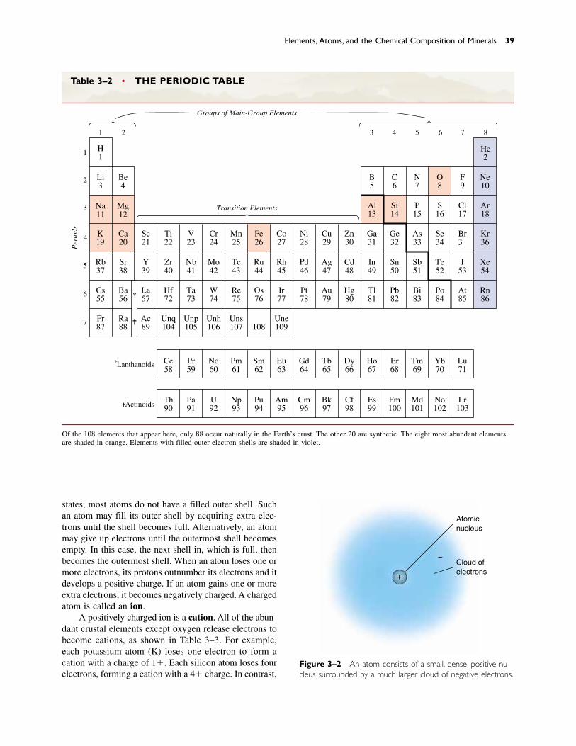
states, most atoms do not have a filled outer shell. Suchan atom may fill its outer shell by acquiring extra elec-trons until the shell becomes full. Alternatively, an atommay give up electrons until the outermost shell becomesempty. In this case, the next shell in, which is full, thenbecomes the outermost shell. When an atom loses one ormore electrons, its protons outnumber its electrons and itdevelops a positive charge. If an atom gains one or moreextra electrons, it becomes negatively charged. A chargedatom is called an ion.
A positively charged ion is a cation. All of the abun-dant crustal elements except oxygen release electrons tobecome cations, as shown in Table 3–3. For example,each potassium atom (K) loses one electron to form acation with a charge of 1�. Each silicon atom loses fourelectrons, forming a cation with a 4� charge. In contrast,
Elements, Atoms, and the Chemical Composition of Minerals 39
Table 3–2 • THE PERIODIC TABLE
H11
2
3
4
5
6
Transition Elements
Per
iods
*Lanthanoids
✝Actinoids
Groups of Main-Group Elements
7
1 2 8 76543
Li3
Be4
Na11
Mg12
Ca20
Sc21
Ti22
V23
Cr24
Mn25
Fe26
Co27
Ni28
Cu29
Zn30
Ga31
Ge32
As33
Se34
Br35
Kr36
Al13
Si14
P15
S16
Cl17
Ar18
B5
C6
N7
O8
F9
Ne10
He2
Sr38
Y39
Zr40
Nb41
Mo42
Tc43
Ru44
Rh45
Pd46
Ag47
Cd48
In49
Sn50
Sb51
Te52
I53
Xe54
Ba56
La57
Hf72
Ta73
W74
Re75
Os76
Ir77
Pt78
Au79
Hg80
Tl81
Pb82
Bi83
Po84
At85
Ce58
Pr59
Nd60
Pm61
Sm62
Eu63
Gd64
Tb65
Dy66
Ho67
Er68
Tm69
Yb70
Lu71
Th90
Pa91
U92
Np93
Pu94
Am95
Cm96
Bk97
Cf98
Es99
Fm100
Md101
No102
Lr103
Rn86
Ra88
Ac89
Unq104
Unp105
Unh106
Uns107 108
Une109
K19
Rb37
Cs55
Fr87
*
✝
Of the 108 elements that appear here, only 88 occur naturally in the Earth’s crust. The other 20 are synthetic. The eight most abundant elementsare shaded in orange. Elements with filled outer electron shells are shaded in violet.
Atomicnucleus
Cloud ofelectrons
–
+
Figure 3–2 An atom consists of a small, dense, positive nu-cleus surrounded by a much larger cloud of negative electrons.
oxygen gains two extra electrons to acquire a 2� charge.Atoms with negative charges are called anions.
Atoms and ions rarely exist independently. Instead,they unite to form compounds. The forces that holdatoms and ions together to form compounds are calledchemical bonds (see the “Focus On” box entitled“Chemical Bonds”).
Most minerals are compounds. When ions bond to-gether to form a mineral, they do so in proportions sothat the total number of negative charges exactly bal-ances the total number of positive charges. Thus, mineralsare always electrically neutral. For example, the mineralquartz proportionally consists of one (4�) silicon cationand two (2�) oxygen anions.
Recall that a mineral has a definite chemical compo-sition. A substance with a definite chemical compositionis made up of chemical elements that are bonded togetherin definite proportions. Therefore, the composition canbe expressed as a chemical formula, which is written bycombining the symbols of the individual elements.
A few minerals, such as gold and silver, consist ofonly a single element. Their chemical formulas, respec-tively, are Au (the symbol for gold) and Ag (the symbolfor silver). Most minerals, however, are made up of twoto five essential elements. For example, the formula ofquartz is SiO2: It consists of one atom of silicon (Si) forevery two of oxygen (O). Quartz from anywhere in theUniverse has that exact composition. If it had a differentcomposition, it would be some other mineral. The com-positions of some minerals, such as quartz, do not varyby even a fraction of a percent. The compositions ofother minerals vary slightly, but the variations are lim-ited, as explained in Section 3.7.
The 88 elements that occur naturally in the Earth’scrust can combine in many ways to form many different
minerals. In fact, about 3500 minerals are known.However, the eight abundant elements commonly com-bine in only a few ways. As a result, only nine rock-forming minerals (or mineral “groups”) make up mostrocks of the Earth’s crust. They are olivine, pyroxene,amphibole, mica, the clay minerals, quartz, feldspar, cal-cite, and dolomite.
� 3.3 CRYSTALS: THE CRYSTALLINE NATURE OF MINERALS
A crystal is any substance whose atoms are arranged ina regular, periodically repeated pattern. All minerals arecrystalline. The mineral halite (common table salt) hasthe composition NaCl: one sodium ion (Na�) for everychlorine ion (Cl�). Figure 3–3a is an “exploded” view of the ions in halite. Figure 3–3b is more realistic, show-ing the ions in contact. In both sketches the sodium andchlorine ions alternate in orderly rows and columns in-tersecting at right angles. This arrangement is the crys-talline structure of halite.
Think of a familiar object with an orderly, repetitivepattern, such as a brick wall. The rectangular bricks re-peat themselves over and over throughout the wall. As aresult, the whole wall also has the shape of a rectangleor some modification of a rectangle. In every crystal, asmall group of atoms, like a single brick in a wall, re-peats itself over and over. This small group of atoms iscalled a unit cell. The unit cell for halite is shown inFigure 3–3a. If you compare Figures 3–3a and 3–3b,you will notice that the simple halite unit cell repeatsthroughout the halite crystal.
Most minerals initially form as tiny crystals thatgrow as layer after layer of atoms is added to their sur-faces. A halite crystal might grow, for example, as saltyseawater evaporates from a tidal pool. At first, a tinygrain might form, similar to the sketch of halite in Figure3–3b. This model shows a halite crystal containing 125atoms; it would be only about one millionth of a mil-limeter long on each side. As evaporation continued,more and more sodium and chlorine ions would precip-itate onto the faces of the growing crystal. Minerals crys-tallize from cooling magma in a similar manner.
The shape of a large, well-formed crystal like that ofhalite in Figure 3–3c is determined by the shape of theunit cell and the manner in which the crystal grows. Forexample, it is obvious from Figure 3–4a that the stack-ing of small cubic unit cells can produce a large cubiccrystal. Figure 3–4b shows that a different kind of stack-ing of the same cubes can also produce an eight-sidedcrystal, called an octahedron. Halite can crystallize as acube or as an octahedron. All minerals consist of unit
40 CHAPTER 3 MINERALS
Table 3–3 • THE MOST COMMON IONSOF THE EIGHT MOST ABUNDANTCHEMICAL ELEMENTS IN THE EARTH’SCRUST
CHEMICAL COMMONELEMENT SYMBOL ION(S)
Oxygen O O2�
Silicon Si Si4�
Aluminum Al Al3�
Iron Fe Fe2� and Fe3�
Calcium Ca Ca2�
Magnesium Mg Mg2�
Potassium K K1�
Sodium Na Na1�
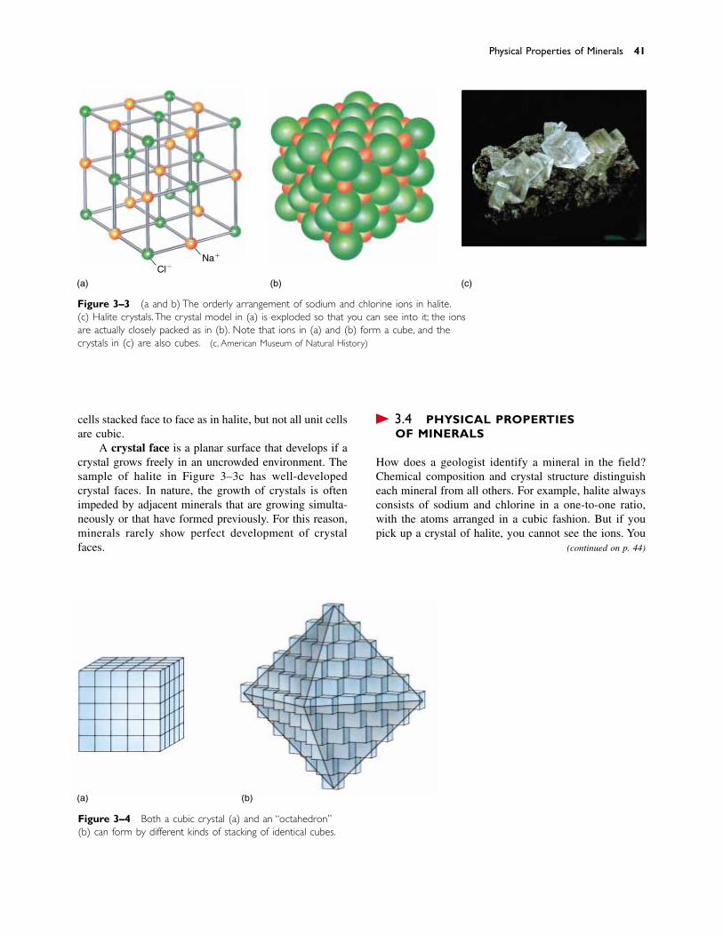
cells stacked face to face as in halite, but not all unit cellsare cubic.
A crystal face is a planar surface that develops if acrystal grows freely in an uncrowded environment. Thesample of halite in Figure 3–3c has well-developed crystal faces. In nature, the growth of crystals is often impeded by adjacent minerals that are growing simulta-neously or that have formed previously. For this reason,minerals rarely show perfect development of crystalfaces.
� 3.4 PHYSICAL PROPERTIES OF MINERALS
How does a geologist identify a mineral in the field?Chemical composition and crystal structure distinguisheach mineral from all others. For example, halite alwaysconsists of sodium and chlorine in a one-to-one ratio,with the atoms arranged in a cubic fashion. But if youpick up a crystal of halite, you cannot see the ions. You
Physical Properties of Minerals 41
(a)
Cl�Na�
(b) (c)
Figure 3–3 (a and b) The orderly arrangement of sodium and chlorine ions in halite.(c) Halite crystals. The crystal model in (a) is exploded so that you can see into it; the ionsare actually closely packed as in (b). Note that ions in (a) and (b) form a cube, and thecrystals in (c) are also cubes. (c, American Museum of Natural History)
Figure 3–4 Both a cubic crystal (a) and an “octahedron”(b) can form by different kinds of stacking of identical cubes.
a)
(b)(a)
(continued on p. 44)
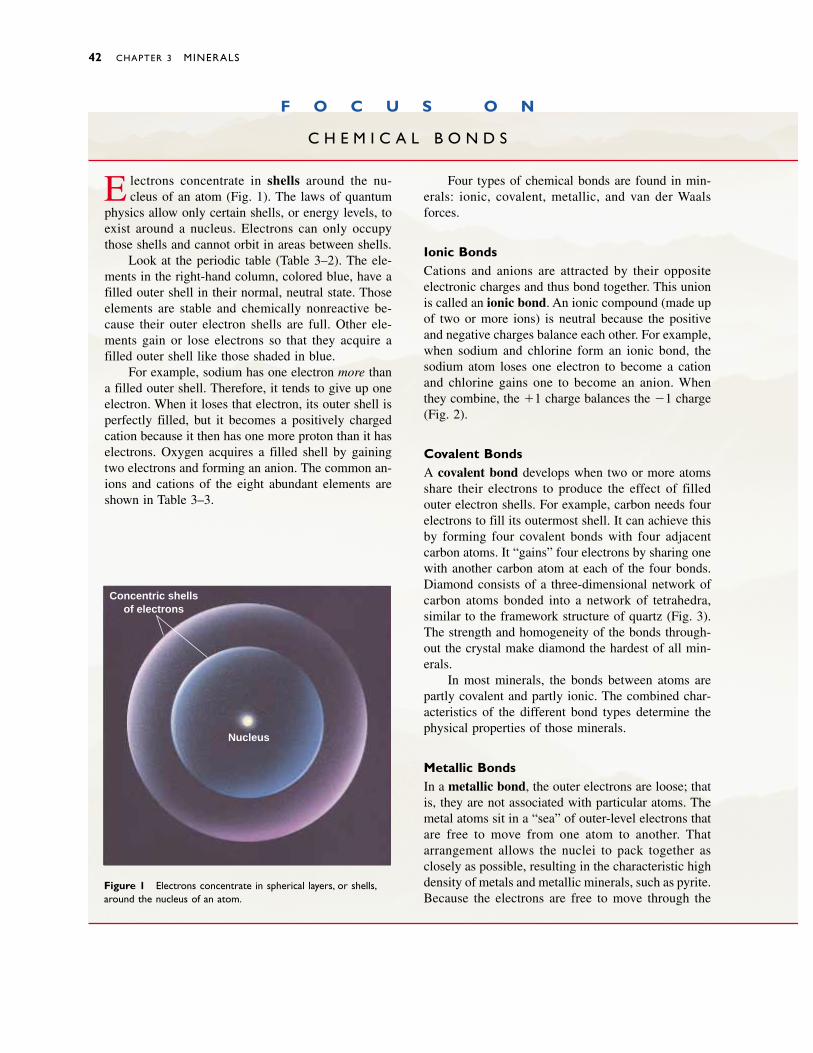
42 CHAPTER 3 MINERALS
F O C U S O N
C H E M I C A L B O N D S
E lectrons concentrate in shells around the nu-cleus of an atom (Fig. 1). The laws of quantum
physics allow only certain shells, or energy levels, toexist around a nucleus. Electrons can only occupythose shells and cannot orbit in areas between shells.
Look at the periodic table (Table 3–2). The ele-ments in the right-hand column, colored blue, have afilled outer shell in their normal, neutral state. Thoseelements are stable and chemically nonreactive be-cause their outer electron shells are full. Other ele-ments gain or lose electrons so that they acquire afilled outer shell like those shaded in blue.
For example, sodium has one electron more thana filled outer shell. Therefore, it tends to give up oneelectron. When it loses that electron, its outer shell isperfectly filled, but it becomes a positively chargedcation because it then has one more proton than it haselectrons. Oxygen acquires a filled shell by gainingtwo electrons and forming an anion. The common an-ions and cations of the eight abundant elements areshown in Table 3–3.
Four types of chemical bonds are found in min-erals: ionic, covalent, metallic, and van der Waalsforces.
Ionic BondsCations and anions are attracted by their oppositeelectronic charges and thus bond together. This unionis called an ionic bond. An ionic compound (made upof two or more ions) is neutral because the positiveand negative charges balance each other. For example,when sodium and chlorine form an ionic bond, thesodium atom loses one electron to become a cationand chlorine gains one to become an anion. Whenthey combine, the �1 charge balances the �1 charge(Fig. 2).
Covalent BondsA covalent bond develops when two or more atomsshare their electrons to produce the effect of filledouter electron shells. For example, carbon needs fourelectrons to fill its outermost shell. It can achieve thisby forming four covalent bonds with four adjacentcarbon atoms. It “gains” four electrons by sharing onewith another carbon atom at each of the four bonds.Diamond consists of a three-dimensional network ofcarbon atoms bonded into a network of tetrahedra,similar to the framework structure of quartz (Fig. 3).The strength and homogeneity of the bonds through-out the crystal make diamond the hardest of all min-erals.
In most minerals, the bonds between atoms arepartly covalent and partly ionic. The combined char-acteristics of the different bond types determine thephysical properties of those minerals.
Metallic BondsIn a metallic bond, the outer electrons are loose; thatis, they are not associated with particular atoms. Themetal atoms sit in a “sea” of outer-level electrons thatare free to move from one atom to another. Thatarrangement allows the nuclei to pack together asclosely as possible, resulting in the characteristic highdensity of metals and metallic minerals, such as pyrite.Because the electrons are free to move through the
Figure 1 Electrons concentrate in spherical layers, or shells,around the nucleus of an atom.
Concentric shellsof electrons
Nucleus

Physical Properties of Minerals 43
entire crystal, metallic minerals are excellent conduc-tors of electricity and heat.
Van der Waals ForcesWeak electrical forces called van der Waals forcesalso bond molecules together. These weak bonds re-sult from an uneven distribution of electrons aroundindividual molecules, so that one portion of a mole-cule may have a greater density of negative chargewhile another portion has a partial positive charge.Because van der Waals forces are weak, minerals inwhich these bonds are important, such as talc andgraphite, tend to be soft and cleave easily along planesof van der Waals bonds.
DISCUSSION QUESTION
Why do some minerals, such as native gold, silver,and graphite, conduct electricity, whereas others,such as quartz and feldspar, do not? Discuss rela-tionships among other physical properties of miner-als and the types of chemical bonds found in thoseminerals.
Figure 3 Carbon atoms in diamond form a tetrahedral net-work similar to that of quartz.
Sodium (Na�) Chlorine (Cl�)
Electron
Figure 2 When sodium and chlorine atoms combine, sodium loses one electron, becominga cation, Na�. Chlorine acquires the electron to become an anion, Cl�.
Carbon
Covalentbond
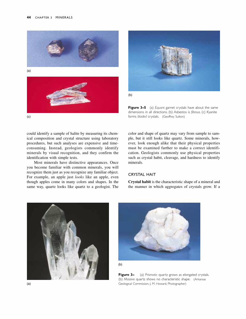
could identify a sample of halite by measuring its chem-ical composition and crystal structure using laboratoryprocedures, but such analyses are expensive and time-consuming. Instead, geologists commonly identifyminerals by visual recognition, and they confirm theidentification with simple tests.
Most minerals have distinctive appearances. Onceyou become familiar with common minerals, you willrecognize them just as you recognize any familiar object.For example, an apple just looks like an apple, eventhough apples come in many colors and shapes. In thesame way, quartz looks like quartz to a geologist. The
color and shape of quartz may vary from sample to sam-ple, but it still looks like quartz. Some minerals, how-ever, look enough alike that their physical propertiesmust be examined further to make a correct identifi-cation. Geologists commonly use physical propertiessuch as crystal habit, cleavage, and hardness to identifyminerals.
CRYSTAL HABIT
Crystal habit is the characteristic shape of a mineral andthe manner in which aggregates of crystals grow. If a
44 CHAPTER 3 MINERALS
(a)
(b)
(c)
Figure 3–5 (a) Equant garnet crystals have about the samedimensions in all directions. (b) Asbestos is fibrous. (c) Kyaniteforms bladed crystals. (Geoffrey Sutton)
(a)
(b)
Figure 3–6 (a) Prismatic quartz grows as elongated crystals.(b) Massive quartz shows no characteristic shape. (ArkansasGeological Commission, J. M. Howard, Photographer)
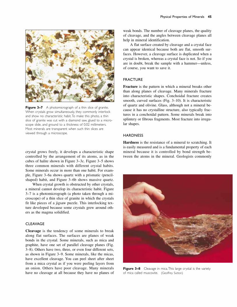
Physical Properties of Minerals 45
crystal grows freely, it develops a characteristic shapecontrolled by the arrangement of its atoms, as in thecubes of halite shown in Figure 3–3c. Figure 3–5 showsthree common minerals with different crystal habits.Some minerals occur in more than one habit. For exam-ple, Figure 3–6a shows quartz with a prismatic (pencil-shaped) habit, and Figure 3–6b shows massive quartz.
When crystal growth is obstructed by other crystals,a mineral cannot develop its characteristic habit. Figure3–7 is a photomicrograph (a photo taken through a mi-croscope) of a thin slice of granite in which the crystalsfit like pieces of a jigsaw puzzle. This interlocking tex-ture developed because some crystals grew around oth-ers as the magma solidified.
CLEAVAGE
Cleavage is the tendency of some minerals to breakalong flat surfaces. The surfaces are planes of weakbonds in the crystal. Some minerals, such as mica andgraphite, have one set of parallel cleavage planes (Fig.3–8). Others have two, three, or even four different sets,as shown in Figure 3–9. Some minerals, like the micas,have excellent cleavage. You can peel sheet after sheetfrom a mica crystal as if you were peeling layers froman onion. Others have poor cleavage. Many mineralshave no cleavage at all because they have no planes of
Figure 3–7 A photomicrograph of a thin slice of granite.When crystals grow simultaneously, they commonly interlockand show no characteristic habit. To make this photo, a thinslice of granite was cut with a diamond saw, glued to a micro-scope slide, and ground to a thickness of 0.02 millimeters.Most minerals are transparent when such thin slices areviewed through a microscope.
Figure 3–8 Cleavage in mica.This large crystal is the varietyof mica called muscovite. (Geoffrey Sutton)
weak bonds. The number of cleavage planes, the qualityof cleavage, and the angles between cleavage planes allhelp in mineral identification.
A flat surface created by cleavage and a crystal facecan appear identical because both are flat, smooth sur-faces. However, a cleavage surface is duplicated when acrystal is broken, whereas a crystal face is not. So if youare in doubt, break the sample with a hammer—unless,of course, you want to save it.
FRACTURE
Fracture is the pattern in which a mineral breaks otherthan along planes of cleavage. Many minerals fractureinto characteristic shapes. Conchoidal fracture createssmooth, curved surfaces (Fig. 3–10). It is characteristicof quartz and olivine. Glass, although not a mineral be-cause it has no crystalline structure, also typically frac-tures in a conchoidal pattern. Some minerals break intosplintery or fibrous fragments. Most fracture into irregu-lar shapes.
HARDNESS
Hardness is the resistance of a mineral to scratching. Itis easily measured and is a fundamental property of eachmineral because it is controlled by bond strength be-tween the atoms in the mineral. Geologists commonly
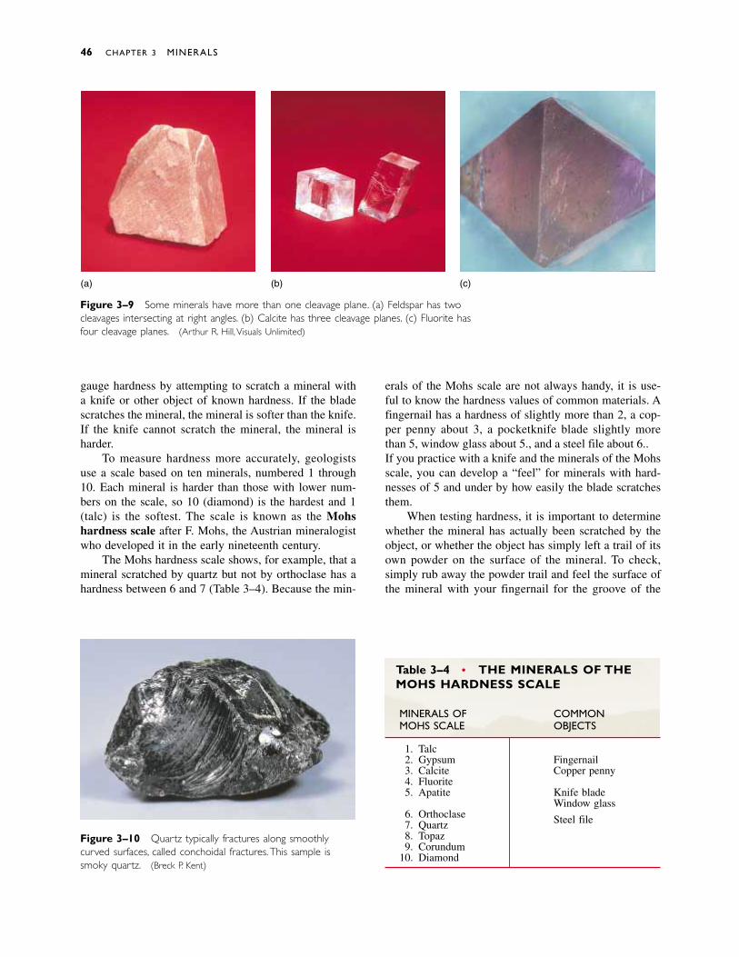
gauge hardness by attempting to scratch a mineral witha knife or other object of known hardness. If the bladescratches the mineral, the mineral is softer than the knife.If the knife cannot scratch the mineral, the mineral isharder.
To measure hardness more accurately, geologistsuse a scale based on ten minerals, numbered 1 through10. Each mineral is harder than those with lower num-bers on the scale, so 10 (diamond) is the hardest and 1(talc) is the softest. The scale is known as the Mohshardness scale after F. Mohs, the Austrian mineralogistwho developed it in the early nineteenth century.
The Mohs hardness scale shows, for example, that amineral scratched by quartz but not by orthoclase has ahardness between 6 and 7 (Table 3–4). Because the min-
erals of the Mohs scale are not always handy, it is use-ful to know the hardness values of common materials. Afingernail has a hardness of slightly more than 2, a cop-per penny about 3, a pocketknife blade slightly morethan 5, window glass about 5.5, and a steel file about 6.5.If you practice with a knife and the minerals of the Mohsscale, you can develop a “feel” for minerals with hard-nesses of 5 and under by how easily the blade scratchesthem.
When testing hardness, it is important to determinewhether the mineral has actually been scratched by theobject, or whether the object has simply left a trail of itsown powder on the surface of the mineral. To check,simply rub away the powder trail and feel the surface ofthe mineral with your fingernail for the groove of the
46 CHAPTER 3 MINERALS
(a) (b) (c)
Figure 3–9 Some minerals have more than one cleavage plane. (a) Feldspar has twocleavages intersecting at right angles. (b) Calcite has three cleavage planes. (c) Fluorite hasfour cleavage planes. (Arthur R. Hill, Visuals Unlimited)
Figure 3–10 Quartz typically fractures along smoothlycurved surfaces, called conchoidal fractures.This sample issmoky quartz. (Breck P. Kent)
Table 3–4 • THE MINERALS OF THEMOHS HARDNESS SCALE
MINERALS OF COMMONMOHS SCALE OBJECTS
1. Talc2. Gypsum Fingernail3. Calcite Copper penny4. Fluorite5. Apatite Knife blade
Window glass6. Orthoclase Steel file7. Quartz8. Topaz9. Corundum
10. Diamond
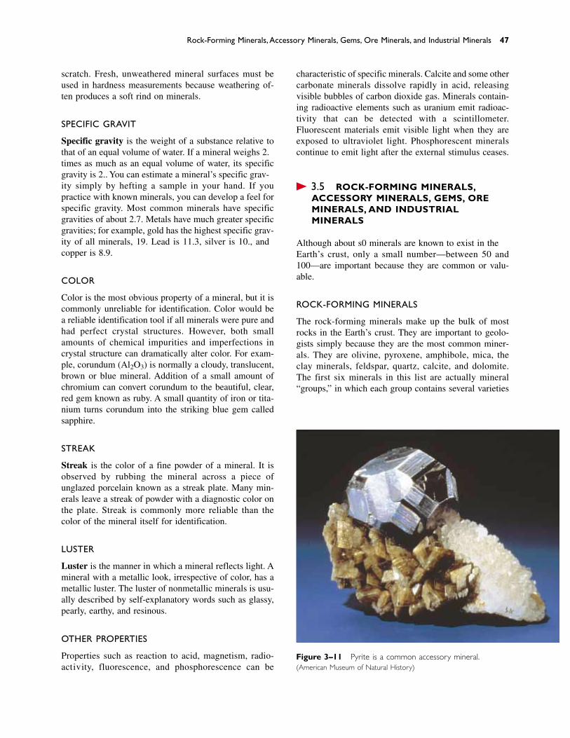
scratch. Fresh, unweathered mineral surfaces must beused in hardness measurements because weathering of-ten produces a soft rind on minerals.
SPECIFIC GRAVITY
Specific gravity is the weight of a substance relative tothat of an equal volume of water. If a mineral weighs 2.5times as much as an equal volume of water, its specificgravity is 2.5. You can estimate a mineral’s specific grav-ity simply by hefting a sample in your hand. If youpractice with known minerals, you can develop a feel forspecific gravity. Most common minerals have specificgravities of about 2.7. Metals have much greater specificgravities; for example, gold has the highest specific grav-ity of all minerals, 19. Lead is 11.3, silver is 10.5, andcopper is 8.9.
COLOR
Color is the most obvious property of a mineral, but it iscommonly unreliable for identification. Color would bea reliable identification tool if all minerals were pure andhad perfect crystal structures. However, both smallamounts of chemical impurities and imperfections incrystal structure can dramatically alter color. For exam-ple, corundum (Al2O3) is normally a cloudy, translucent,brown or blue mineral. Addition of a small amount ofchromium can convert corundum to the beautiful, clear,red gem known as ruby. A small quantity of iron or tita-nium turns corundum into the striking blue gem calledsapphire.
STREAK
Streak is the color of a fine powder of a mineral. It isobserved by rubbing the mineral across a piece ofunglazed porcelain known as a streak plate. Many min-erals leave a streak of powder with a diagnostic color onthe plate. Streak is commonly more reliable than thecolor of the mineral itself for identification.
LUSTER
Luster is the manner in which a mineral reflects light. Amineral with a metallic look, irrespective of color, has ametallic luster. The luster of nonmetallic minerals is usu-ally described by self-explanatory words such as glassy,pearly, earthy, and resinous.
OTHER PROPERTIES
Properties such as reaction to acid, magnetism, radio-activity, fluorescence, and phosphorescence can be
characteristic of specific minerals. Calcite and some othercarbonate minerals dissolve rapidly in acid, releasingvisible bubbles of carbon dioxide gas. Minerals contain-ing radioactive elements such as uranium emit radioac-tivity that can be detected with a scintillometer.Fluorescent materials emit visible light when they areexposed to ultraviolet light. Phosphorescent mineralscontinue to emit light after the external stimulus ceases.
� 3.5 ROCK-FORMING MINERALS,ACCESSORY MINERALS, GEMS, OREMINERALS, AND INDUSTRIALMINERALS
Although about 3500 minerals are known to exist in theEarth’s crust, only a small number—between 50 and100—are important because they are common or valu-able.
ROCK-FORMING MINERALS
The rock-forming minerals make up the bulk of mostrocks in the Earth’s crust. They are important to geolo-gists simply because they are the most common miner-als. They are olivine, pyroxene, amphibole, mica, theclay minerals, feldspar, quartz, calcite, and dolomite.The first six minerals in this list are actually mineral“groups,” in which each group contains several varieties
Rock-Forming Minerals, Accessory Minerals, Gems, Ore Minerals, and Industrial Minerals 47
Figure 3–11 Pyrite is a common accessory mineral.(American Museum of Natural History)
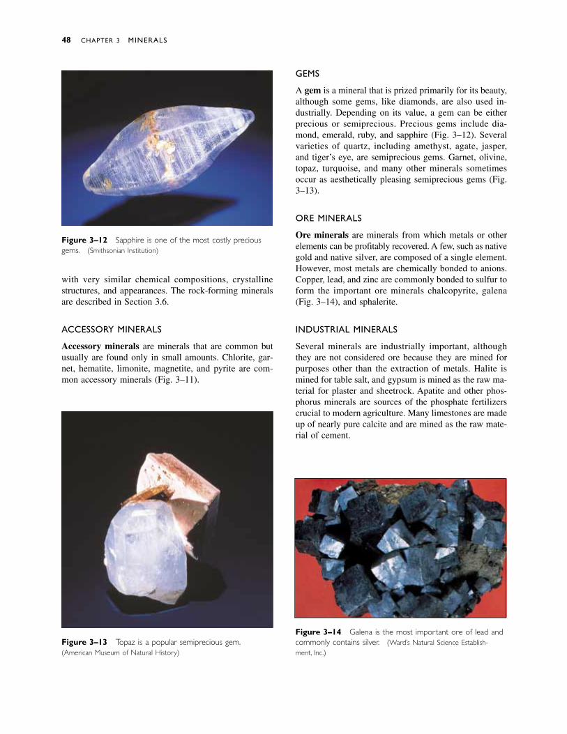
with very similar chemical compositions, crystallinestructures, and appearances. The rock-forming mineralsare described in Section 3.6.
ACCESSORY MINERALS
Accessory minerals are minerals that are common butusually are found only in small amounts. Chlorite, gar-net, hematite, limonite, magnetite, and pyrite are com-mon accessory minerals (Fig. 3–11).
GEMS
A gem is a mineral that is prized primarily for its beauty,although some gems, like diamonds, are also used in-dustrially. Depending on its value, a gem can be eitherprecious or semiprecious. Precious gems include dia-mond, emerald, ruby, and sapphire (Fig. 3–12). Severalvarieties of quartz, including amethyst, agate, jasper,and tiger’s eye, are semiprecious gems. Garnet, olivine,topaz, turquoise, and many other minerals sometimes occur as aesthetically pleasing semiprecious gems (Fig.3–13).
ORE MINERALS
Ore minerals are minerals from which metals or otherelements can be profitably recovered. A few, such as nativegold and native silver, are composed of a single element.However, most metals are chemically bonded to anions.Copper, lead, and zinc are commonly bonded to sulfur toform the important ore minerals chalcopyrite, galena(Fig. 3–14), and sphalerite.
INDUSTRIAL MINERALS
Several minerals are industrially important, althoughthey are not considered ore because they are mined forpurposes other than the extraction of metals. Halite ismined for table salt, and gypsum is mined as the raw ma-terial for plaster and sheetrock. Apatite and other phos-phorus minerals are sources of the phosphate fertilizerscrucial to modern agriculture. Many limestones are madeup of nearly pure calcite and are mined as the raw mate-rial of cement.
48 CHAPTER 3 MINERALS
Figure 3–12 Sapphire is one of the most costly preciousgems. (Smithsonian Institution)
Figure 3–13 Topaz is a popular semiprecious gem.(American Museum of Natural History)
Figure 3–14 Galena is the most important ore of lead andcommonly contains silver. (Ward’s Natural Science Establish-ment, Inc.)
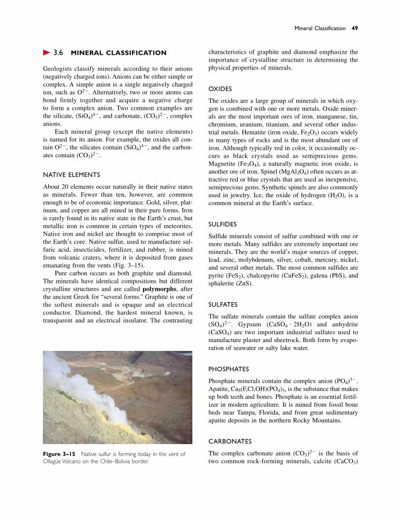
� 3.6 MINERAL CLASSIFICATION
Geologists classify minerals according to their anions(negatively charged ions). Anions can be either simple orcomplex. A simple anion is a single negatively chargedion, such as O2�. Alternatively, two or more atoms canbond firmly together and acquire a negative charge to form a complex anion. Two common examples arethe silicate, (SiO4)4�, and carbonate, (CO3)2�, complexanions.
Each mineral group (except the native elements) is named for its anion. For example, the oxides all con-tain O2�, the silicates contain (SiO4)4�, and the carbon-ates contain (CO3)2�.
NATIVE ELEMENTS
About 20 elements occur naturally in their native statesas minerals. Fewer than ten, however, are commonenough to be of economic importance. Gold, silver, plat-inum, and copper are all mined in their pure forms. Ironis rarely found in its native state in the Earth’s crust, butmetallic iron is common in certain types of meteorites.Native iron and nickel are thought to comprise most ofthe Earth’s core. Native sulfur, used to manufacture sul-furic acid, insecticides, fertilizer, and rubber, is minedfrom volcanic craters, where it is deposited from gasesemanating from the vents (Fig. 3–15).
Pure carbon occurs as both graphite and diamond.The minerals have identical compositions but differentcrystalline structures and are called polymorphs, afterthe ancient Greek for “several forms.” Graphite is one ofthe softest minerals and is opaque and an electrical conductor. Diamond, the hardest mineral known, is transparent and an electrical insulator. The contrasting
characteristics of graphite and diamond emphasize theimportance of crystalline structure in determining thephysical properties of minerals.
OXIDES
The oxides are a large group of minerals in which oxy-gen is combined with one or more metals. Oxide miner-als are the most important ores of iron, manganese, tin,chromium, uranium, titanium, and several other indus-trial metals. Hematite (iron oxide, Fe2O3) occurs widelyin many types of rocks and is the most abundant ore ofiron. Although typically red in color, it occasionally oc-curs as black crystals used as semiprecious gems.Magnetite (Fe3O4), a naturally magnetic iron oxide, isanother ore of iron. Spinel (MgAl2O4) often occurs as at-tractive red or blue crystals that are used as inexpensive,semiprecious gems. Synthetic spinels are also commonlyused in jewelry. Ice, the oxide of hydrogen (H2O), is acommon mineral at the Earth’s surface.
SULFIDES
Sulfide minerals consist of sulfur combined with one ormore metals. Many sulfides are extremely important oreminerals. They are the world’s major sources of copper,lead, zinc, molybdenum, silver, cobalt, mercury, nickel,and several other metals. The most common sulfides arepyrite (FeS2), chalcopyrite (CuFeS2), galena (PbS), andsphalerite (ZnS).
SULFATES
The sulfate minerals contain the sulfate complex anion(SO4)2�. Gypsum (CaSO4 � 2H2O) and anhydrite(CaSO4) are two important industrial sulfates used tomanufacture plaster and sheetrock. Both form by evapo-ration of seawater or salty lake water.
PHOSPHATES
Phosphate minerals contain the complex anion (PO4)3�.Apatite, Ca5(F,Cl,OH)(PO4)3, is the substance that makesup both teeth and bones. Phosphate is an essential fertil-izer in modern agriculture. It is mined from fossil bonebeds near Tampa, Florida, and from great sedimentaryapatite deposits in the northern Rocky Mountains.
CARBONATES
The complex carbonate anion (CO3)2� is the basis oftwo common rock-forming minerals, calcite (CaCO3)
Mineral Classification 49
Figure 3–15 Native sulfur is forming today in the vent ofOllagüe Volcano on the Chile–Bolivia border.
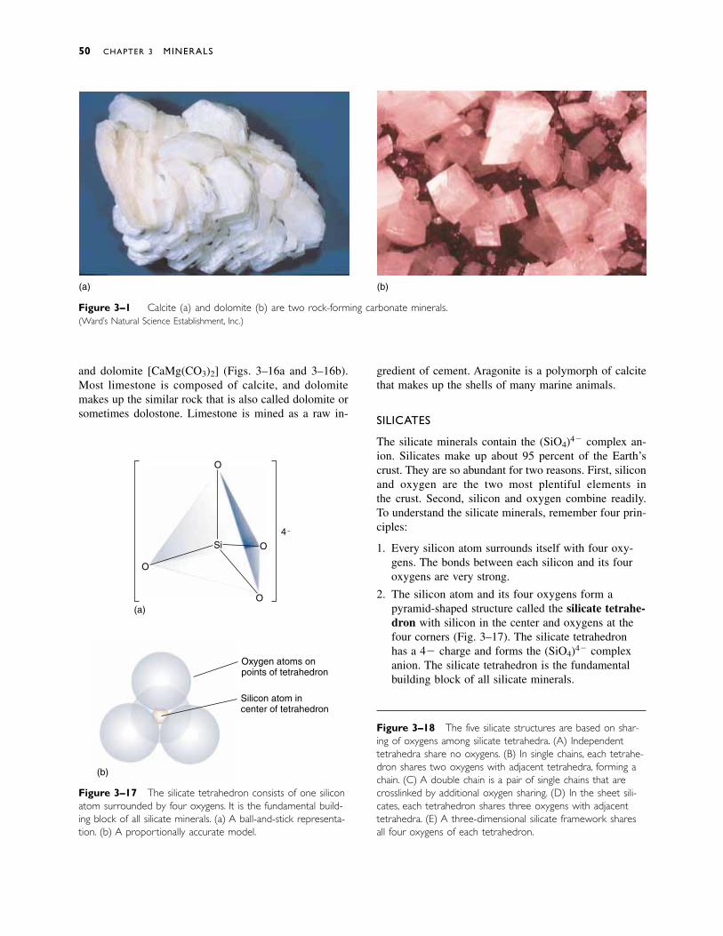
and dolomite [CaMg(CO3)2] (Figs. 3–16a and 3–16b).Most limestone is composed of calcite, and dolomitemakes up the similar rock that is also called dolomite orsometimes dolostone. Limestone is mined as a raw in-
gredient of cement. Aragonite is a polymorph of calcitethat makes up the shells of many marine animals.
SILICATES
The silicate minerals contain the (SiO4)4� complex an-ion. Silicates make up about 95 percent of the Earth’scrust. They are so abundant for two reasons. First, siliconand oxygen are the two most plentiful elements in the crust. Second, silicon and oxygen combine readily.To understand the silicate minerals, remember four prin-ciples:
1. Every silicon atom surrounds itself with four oxy-gens. The bonds between each silicon and its fouroxygens are very strong.
2. The silicon atom and its four oxygens form apyramid-shaped structure called the silicate tetrahe-dron with silicon in the center and oxygens at thefour corners (Fig. 3–17). The silicate tetrahedronhas a 4� charge and forms the (SiO4)4� complexanion. The silicate tetrahedron is the fundamentalbuilding block of all silicate minerals.
50 CHAPTER 3 MINERALS
Si
O
O
O
O
(a)
4 ¯
Figure 3–17 The silicate tetrahedron consists of one siliconatom surrounded by four oxygens. It is the fundamental build-ing block of all silicate minerals. (a) A ball-and-stick representa-tion. (b) A proportionally accurate model.
Oxygen atoms on points of tetrahedron
Silicon atom incenter of tetrahedron
(b)
Figure 3–18 The five silicate structures are based on shar-ing of oxygens among silicate tetrahedra. (A) Independenttetrahedra share no oxygens. (B) In single chains, each tetrahe-dron shares two oxygens with adjacent tetrahedra, forming achain. (C) A double chain is a pair of single chains that arecrosslinked by additional oxygen sharing. (D) In the sheet sili-cates, each tetrahedron shares three oxygens with adjacenttetrahedra. (E) A three-dimensional silicate framework sharesall four oxygens of each tetrahedron.
Figure 3–16 Calcite (a) and dolomite (b) are two rock-forming carbonate minerals.(Ward’s Natural Science Establishment, Inc.)
(a) (b)
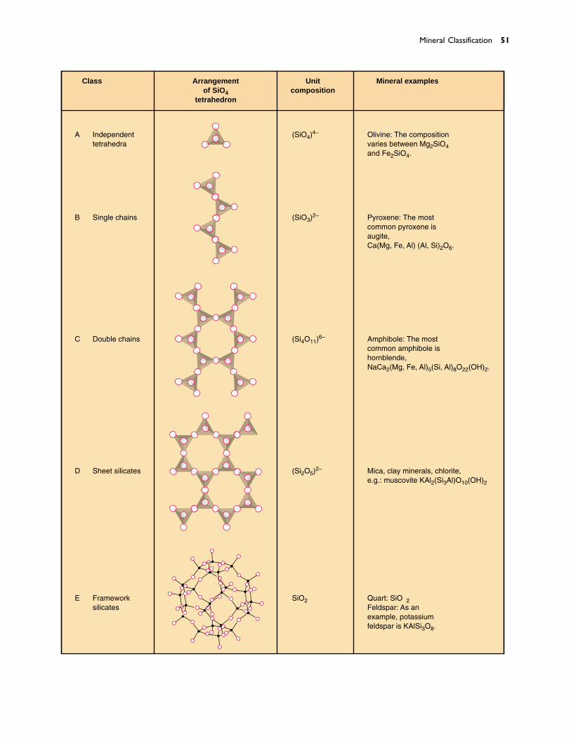
Mineral Classification 51
Frameworksilicates
Unitcomposition
(SiO4)4–
(SiO3)2–
(Si4O11)6–
(Si2O5)2–
SiO2
Arrangementof SiO4
tetrahedron
A
Class
B
C
D
E
Independenttetrahedra
Single chains
Double chains
Sheet silicates
Mineral examples
Olivine: The compositionvaries between Mg2SiO4and Fe2SiO4.
Pyroxene: The mostcommon pyroxene isaugite,Ca(Mg, Fe, Al) (Al, Si)2O6.
Amphibole: The mostcommon amphibole ishornblende,NaCa2(Mg, Fe, Al)5(Si, Al)8O22(OH)2.
Mica, clay minerals, chlorite,e.g.: muscovite KAl2(Si3Al)O10(OH)2
Quartz: SiO2Feldspar: As anexample, potassiumfeldspar is KAlSi3O8.
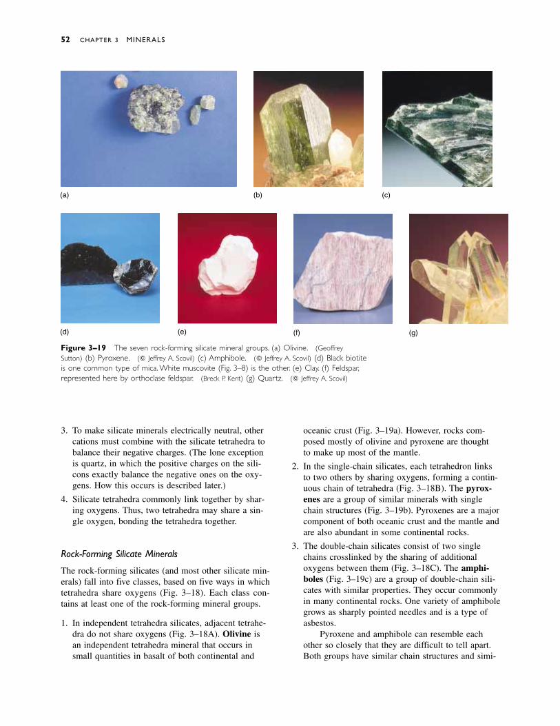
3. To make silicate minerals electrically neutral, othercations must combine with the silicate tetrahedra tobalance their negative charges. (The lone exceptionis quartz, in which the positive charges on the sili-cons exactly balance the negative ones on the oxy-gens. How this occurs is described later.)
4. Silicate tetrahedra commonly link together by shar-ing oxygens. Thus, two tetrahedra may share a sin-gle oxygen, bonding the tetrahedra together.
Rock-Forming Silicate Minerals
The rock-forming silicates (and most other silicate min-erals) fall into five classes, based on five ways in whichtetrahedra share oxygens (Fig. 3–18). Each class con-tains at least one of the rock-forming mineral groups.
1. In independent tetrahedra silicates, adjacent tetrahe-dra do not share oxygens (Fig. 3–18A). Olivine isan independent tetrahedra mineral that occurs insmall quantities in basalt of both continental and
oceanic crust (Fig. 3–19a). However, rocks com-posed mostly of olivine and pyroxene are thought to make up most of the mantle.
2. In the single-chain silicates, each tetrahedron linksto two others by sharing oxygens, forming a contin-uous chain of tetrahedra (Fig. 3–18B). The pyrox-enes are a group of similar minerals with singlechain structures (Fig. 3–19b). Pyroxenes are a majorcomponent of both oceanic crust and the mantle andare also abundant in some continental rocks.
3. The double-chain silicates consist of two singlechains crosslinked by the sharing of additional oxygens between them (Fig. 3–18C). The amphi-boles (Fig. 3–19c) are a group of double-chain sili-cates with similar properties. They occur commonlyin many continental rocks. One variety of amphibolegrows as sharply pointed needles and is a type ofasbestos.
Pyroxene and amphibole can resemble each other so closely that they are difficult to tell apart.Both groups have similar chain structures and simi-
52 CHAPTER 3 MINERALS
(a)
Figure 3–19 The seven rock-forming silicate mineral groups. (a) Olivine. (GeoffreySutton) (b) Pyroxene. (� Jeffrey A. Scovil) (c) Amphibole. (� Jeffrey A. Scovil) (d) Black biotiteis one common type of mica. White muscovite (Fig. 3–8) is the other. (e) Clay. (f) Feldspar,represented here by orthoclase feldspar. (Breck P. Kent) (g) Quartz. (� Jeffrey A. Scovil)
(b) (c)
(d) (e) (f) (g)
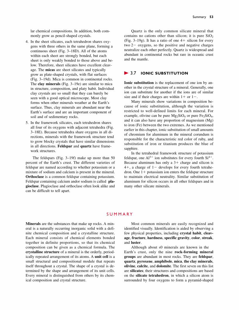
Summary 53
lar chemical compositions. In addition, both com-monly grow as pencil-shaped crystals.
4. In the sheet silicates, each tetrahedron shares oxy-gens with three others in the same plane, forming acontinuous sheet (Fig. 3–18D). All of the atomswithin each sheet are strongly bonded, but eachsheet is only weakly bonded to those above and be-low. Therefore, sheet silicates have excellent cleav-age. The micas are sheet silicates and typicallygrow as plate-shaped crystals, with flat surfaces(Fig. 3–19d). Mica is common in continental rocks.The clay minerals (Fig. 3–19e) are similar to micain structure, composition, and platy habit. Individualclay crystals are so small that they can barely beseen with a good optical microscope. Most clayforms when other minerals weather at the Earth’ssurface. Thus, clay minerals are abundant near theEarth’s surface and are an important component ofsoil and of sedimentary rocks.
5. In the framework silicates, each tetrahedron sharesall four of its oxygens with adjacent tetrahedra (Fig.3–18E). Because tetrahedra share oxygens in all di-rections, minerals with the framework structure tendto grow blocky crystals that have similar dimensionsin all directions. Feldspar and quartz have frame-work structures.
The feldspars (Fig. 3–19f) make up more than 50percent of the Earth’s crust. The different varieties offeldspar are named according to whether potassium or amixture of sodium and calcium is present in the mineral.Orthoclase is a common feldspar containing potassium.Feldspar containing calcium and/or sodium is called pla-gioclase. Plagioclase and orthoclase often look alike andcan be difficult to tell apart.
Quartz is the only common silicate mineral that contains no cations other than silicon; it is pure SiO2
(Fig. 3–19g). It has a ratio of one 4� silicon for everytwo 2� oxygens, so the positive and negative chargesneutralize each other perfectly. Quartz is widespread andabundant in continental rocks but rare in oceanic crustand the mantle.
� 3.7 IONIC SUBSTITUTION
Ionic substitution is the replacement of one ion by an-other in the crystal structure of a mineral. Generally, oneion can substitute for another if the ions are of similarsize and if their charges are within 1� or 1�.
Many minerals show variations in composition be-cause of ionic substitution, although the variation is restricted to well-defined limits for each mineral. Forexample, olivine can be pure Mg2SiO4 or pure Fe2SiO4,and it can also have any proportion of magnesium (Mg)to iron (Fe) between the two extremes. As we mentionedearlier in this chapter, ionic substitution of small amountsof chromium for aluminum in the mineral corundum isresponsible for the characteristic red color of ruby, andsubstitution of iron or titanium produces the blue of sapphire.
In the tetrahedral framework structure of potassiumfeldspar, one Al3� ion substitutes for every fourth Si4�.Because aluminum has only a 3� charge and silicon is4�, a charge of 1� develops for every fourth tetrahe-dron. One 1� potassium ion enters the feldspar structureto maintain electrical neutrality. Similar substitution ofaluminum for silicon occurs in all other feldspars and inmany other silicate minerals.
S U M M A R Y
Minerals are the substances that make up rocks. A min-eral is a naturally occurring inorganic solid with a defi-nite chemical composition and a crystalline structure.Each mineral consists of chemical elements bonded together in definite proportions, so that its chemicalcomposition can be given as a chemical formula. Thecrystalline structure of a mineral is the orderly, period-ically repeated arrangement of its atoms. A unit cell is asmall structural and compositional module that repeatsitself throughout a crystal. The shape of a crystal is de-termined by the shape and arrangement of its unit cells.Every mineral is distinguished from others by its chem-ical composition and crystal structure.
Most common minerals are easily recognized andidentified visually. Identification is aided by observing afew physical properties, including crystal habit, cleav-age, fracture, hardness, specific gravity, color, streak,and luster.
Although about 3500 minerals are known in theEarth’s crust, only the nine rock-forming mineralgroups are abundant in most rocks. They are feldspar,quartz, pyroxene, amphibole, mica, the clay minerals,olivine, calcite, and dolomite. The first seven on this listare silicates; their structures and compositions are basedon the silicate tetrahedron, in which a silicon atom issurrounded by four oxygens to form a pyramid-shaped

54 CHAPTER 3 MINERALS
structure. Silicate tetrahedra link together by sharingoxygens to form the basic structures of the silicateminerals. The silicates are the most abundant mineralsbecause silicon and oxygen are the two most abundantelements in the Earth’s crust and bond together readilyto form the silicate tetrahedron. Two carbonate minerals,calcite and dolomite, are also sufficiently abundant to becalled rock-forming minerals.
K E Y W O R D S
mineral 36element 38atom 38nucleus 38electron 38proton 38neutron 38ion 39
cation 39anion 40compound 40chemical bond 40rock-forming mineral 40crystal 40crystalline structure 40unit cell 40
crystal face 41crystal habit 44cleavage 45fracture 45hardness 45Mohs hardness scale 46specific gravity 47streak 47
luster 47accessory mineral 48gem 48ore mineral 48polymorph 49silicates 50silicate tetrahedron 50ionic substitution 53
Rock-Forming Mineral Groups
Feldspar Amphibole OlivineQuartz Mica CalcitePyroxene Clay minerals Dolomite
R E V I E W Q U E S T I O N S
1. What properties distinguish minerals from other sub-stances?
2. Explain why oil and coal are not minerals.
3. What does the chemical formula for quartz, SiO2, tellyou about its chemical composition? What doesKAlSi3O8 tell you about orthoclase feldspar?
4. What is an atom? An ion? A cation? An anion? Whatroles do they play in minerals?
5. What is a chemical bond? What role do chemical bondsplay in minerals?
6. Every mineral has a crystalline structure. What does thismean?
7. What factors control the shape of a well-formed crystal?
8. What is a crystal face?
9. What conditions allow minerals to grow well-formedcrystals? What conditions prevent their growth?
10. List and explain the physical properties of minerals mostuseful for identification.
11. Why do some minerals have cleavage and others do not?Why do some minerals have more than one set of cleav-age planes?
12. Why is color often an unreliable property for mineralidentification?
13. List the rock-forming mineral groups. Why are theycalled “rock-forming”? Which are silicates? Why are somany of them silicates?
14. Draw a three-dimensional view of a single silicate tetra-hedron. Draw the five different arrangements of tetrahe-dra found in the rock-forming silicate minerals. Howmany oxygen ions are shared between adjacent tetrahedrain each of the five configurations?
15. Make a table with two columns. In the left column listthe basic silicate structures. In the right column list oneor more rock-forming minerals with each structure.
Accessory minerals are commonly found, but insmall amounts. Ore minerals, industrial minerals, andgems are important for economic reasons. Many mineralsshow compositional variation because of ionic substitu-tion. In general, one element can substitute for another ifthe two are similar in charge and size.
Discussion Questions 55
D I S C U S S I O N Q U E S T I O N S
1. Diamond and graphite are two minerals with identicalchemical compositions, pure carbon (C). Diamond is thehardest of all minerals, and graphite is one of the softest.If their compositions are identical, why do they have suchprofound differences in physical properties?
2. List the eight most abundant chemical elements in theEarth’s crust. Are any unfamiliar to you? List familiar elements that are not among the eight. Why are they familiar?
3. Table 3–1 shows that silicon and oxygen together make up
nearly 75 percent by weight of the Earth’s crust. But sili-cate minerals make up more than 95 percent of the crust.Explain the apparent discrepancy.
4. Quartz is SiO2. Why does no mineral exist with the com-position SiO3?
5. If you were given a crystal of diamond and another ofquartz, how would you tell which is diamond?
6. Would you expect minerals found on the Moon, Mars, orVenus to be different from those of the Earth’s crust?Explain your answer.

he Earth is almost entirely rock to a depth of 2900 kilometers, where the solid mantle gives way to the
liquid outer core. Even casual observation reveals that rocksare not all alike.The great peaks of the Sierra Nevada inCalifornia are hard, strong granite.The red cliffs of the Utahdesert are soft sandstone.The top of Mount Everest islimestone, composed of clamshells and the remains ofother small marine animals.
The marine fossils of Mount Everest tell us that thelimestone formed in the sea. What forces lifted the rock tothe highest point of the Himalayas? Where did the vastamounts of sand in the Utah sandstone come from? Howdid the granite of the Sierra Nevada form? All of thesequestions ask about the processes that formed the rocksand about the events that moved and shaped themthroughout geologic history. In the following five chapters,we will study rocks: how they form and what they aremade of. In later chapters we will use our understanding ofrocks to interpret the Earth’s geologic history.
C H A P T E R
4Igneous Rocks
T
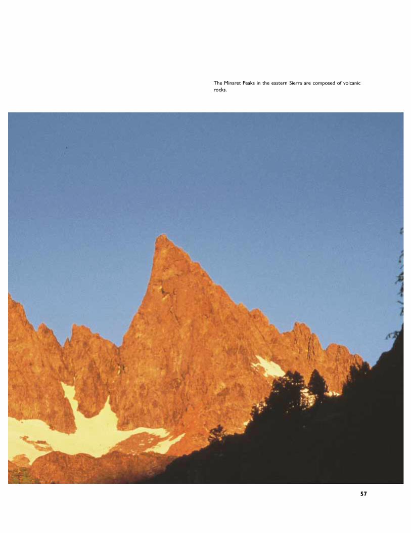
57
The Minaret Peaks in the eastern Sierra are composed of volcanicrocks.
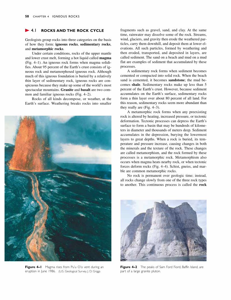
� 4.1 ROCKS AND THE ROCK CYCLE
Geologists group rocks into three categories on the basisof how they form: igneous rocks, sedimentary rocks,and metamorphic rocks.
Under certain conditions, rocks of the upper mantleand lower crust melt, forming a hot liquid called magma(Fig. 4–1). An igneous rock forms when magma solidi-fies. About 95 percent of the Earth’s crust consists of ig-neous rock and metamorphosed igneous rock. Althoughmuch of this igneous foundation is buried by a relativelythin layer of sedimentary rock, igneous rocks are con-spicuous because they make up some of the world’s mostspectacular mountains. Granite and basalt are two com-mon and familiar igneous rocks (Fig. 4–2).
Rocks of all kinds decompose, or weather, at theEarth’s surface. Weathering breaks rocks into smaller
fragments such as gravel, sand, and clay. At the sametime, rainwater may dissolve some of the rock. Streams,wind, glaciers, and gravity then erode the weathered par-ticles, carry them downhill, and deposit them at lower el-evations. All such particles, formed by weathering andthen eroded, transported, and deposited in layers, arecalled sediment. The sand on a beach and mud on a mudflat are examples of sediment that accumulated by theseprocesses.
A sedimentary rock forms when sediment becomescemented or compacted into solid rock. When the beachsand is cemented, it becomes sandstone; the mud be-comes shale. Sedimentary rocks make up less than 5 percent of the Earth’s crust. However, because sedimentaccumulates on the Earth’s surface, sedimentary rocksform a thin layer over about 80 percent of all land. Forthis reason, sedimentary rocks seem more abundant thanthey really are (Fig. 4–3).
A metamorphic rock forms when any preexistingrock is altered by heating, increased pressure, or tectonicdeformation. Tectonic processes can depress the Earth’ssurface to form a basin that may be hundreds of kilome-ters in diameter and thousands of meters deep. Sedimentaccumulates in the depression, burying the lowermostlayers to great depths. When a rock is buried, its tem-perature and pressure increase, causing changes in boththe minerals and the texture of the rock. These changesare called metamorphism, and the rock formed by theseprocesses is a metamorphic rock. Metamorphism alsooccurs when magma heats nearby rock, or when tectonicforces deform rocks (Fig. 4–4). Schist, gneiss, and mar-ble are common metamorphic rocks.
No rock is permanent over geologic time; instead,all rocks change slowly from one of the three rock typesto another. This continuous process is called the rock
58 CHAPTER 4 IGNEOUS ROCKS
Figure 4–2 The peaks of Sam Ford Fiord, Baffin Island, arepart of a large granite pluton.
Figure 4–1 Magma rises from Pu’u O’o vent during aneruption in June 1986. (U.S. Geological Survey, J. D. Griggs)
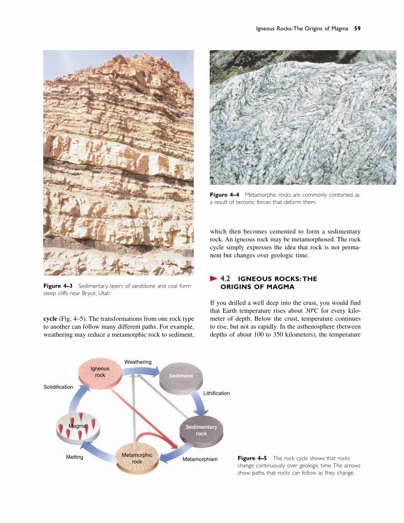
cycle (Fig. 4–5). The transformations from one rock typeto another can follow many different paths. For example,weathering may reduce a metamorphic rock to sediment,
which then becomes cemented to form a sedimentaryrock. An igneous rock may be metamorphosed. The rockcycle simply expresses the idea that rock is not perma-nent but changes over geologic time.
� 4.2 IGNEOUS ROCKS: THE ORIGINS OF MAGMA
If you drilled a well deep into the crust, you would findthat Earth temperature rises about 30ºC for every kilo-meter of depth. Below the crust, temperature continuesto rise, but not as rapidly. In the asthenosphere (betweendepths of about 100 to 350 kilometers), the temperature
Igneous Rocks:The Origins of Magma 59
Figure 4–3 Sedimentary layers of sandstone and coal formsteep cliffs near Bryce, Utah.
Figure 4–4 Metamorphic rocks are commonly contorted asa result of tectonic forces that deform them.
Weathering
Solidification
Melting MetamorphismMetamorphic
rock
Lithification
Magma
Igneousrock Sediment
Sedimentaryrock
Figure 4–5 The rock cycle shows that rockschange continuously over geologic time.The arrowsshow paths that rocks can follow as they change.
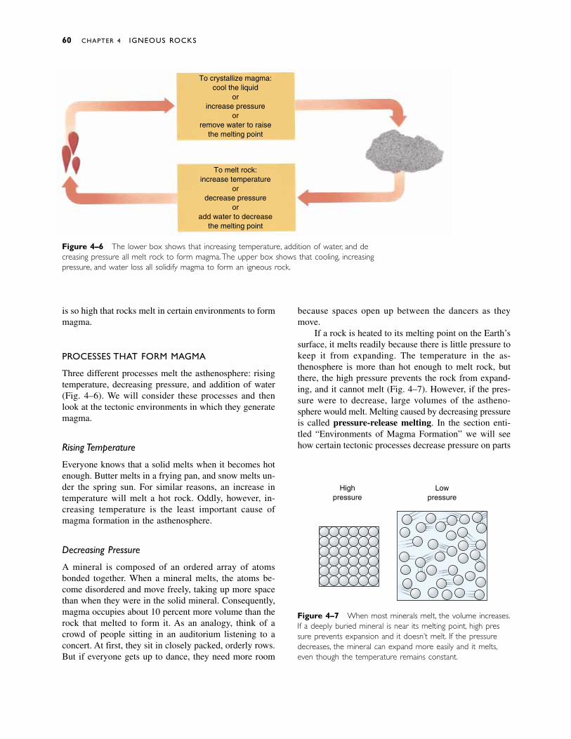
is so high that rocks melt in certain environments to formmagma.
PROCESSES THAT FORM MAGMA
Three different processes melt the asthenosphere: risingtemperature, decreasing pressure, and addition of water(Fig. 4–6). We will consider these processes and thenlook at the tectonic environments in which they generatemagma.
Rising Temperature
Everyone knows that a solid melts when it becomes hotenough. Butter melts in a frying pan, and snow melts un-der the spring sun. For similar reasons, an increase intemperature will melt a hot rock. Oddly, however, in-creasing temperature is the least important cause ofmagma formation in the asthenosphere.
Decreasing Pressure
A mineral is composed of an ordered array of atomsbonded together. When a mineral melts, the atoms be-come disordered and move freely, taking up more spacethan when they were in the solid mineral. Consequently,magma occupies about 10 percent more volume than therock that melted to form it. As an analogy, think of acrowd of people sitting in an auditorium listening to aconcert. At first, they sit in closely packed, orderly rows.But if everyone gets up to dance, they need more room
because spaces open up between the dancers as theymove.
If a rock is heated to its melting point on the Earth’ssurface, it melts readily because there is little pressure tokeep it from expanding. The temperature in the as-thenosphere is more than hot enough to melt rock, butthere, the high pressure prevents the rock from expand-ing, and it cannot melt (Fig. 4–7). However, if the pres-sure were to decrease, large volumes of the astheno-sphere would melt. Melting caused by decreasing pressureis called pressure-release melting. In the section enti-tled “Environments of Magma Formation” we will seehow certain tectonic processes decrease pressure on parts
60 CHAPTER 4 IGNEOUS ROCKS
Figure 4–7 When most minerals melt, the volume increases.If a deeply buried mineral is near its melting point, high pres-sure prevents expansion and it doesn’t melt. If the pressuredecreases, the mineral can expand more easily and it melts,even though the temperature remains constant.
Lowpressure
Highpressure
To crystallize magma:cool the liquid
orincrease pressure
orremove water to raise
the melting point
To melt rock:increase temperature
ordecrease pressure
oradd water to decrease
the melting point
Figure 4–6 The lower box shows that increasing temperature, addition of water, and de-creasing pressure all melt rock to form magma.The upper box shows that cooling, increasingpressure, and water loss all solidify magma to form an igneous rock.
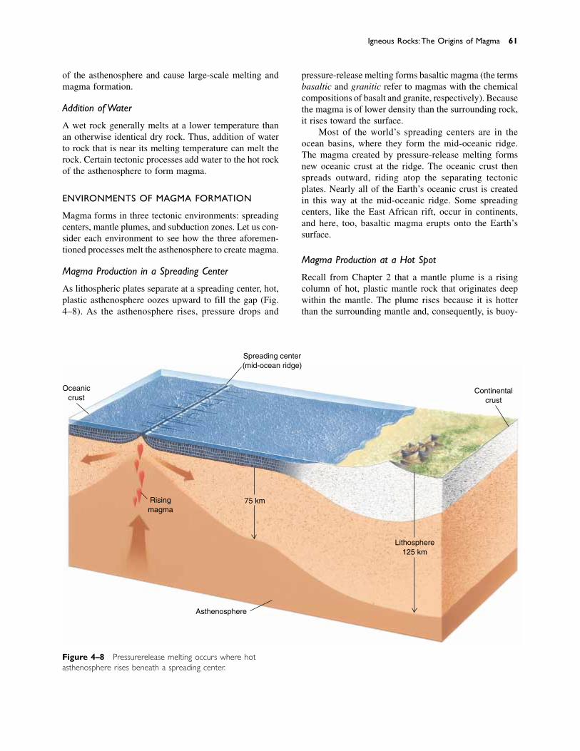
of the asthenosphere and cause large-scale melting andmagma formation.
Addition of Water
A wet rock generally melts at a lower temperature thanan otherwise identical dry rock. Thus, addition of waterto rock that is near its melting temperature can melt therock. Certain tectonic processes add water to the hot rockof the asthenosphere to form magma.
ENVIRONMENTS OF MAGMA FORMATION
Magma forms in three tectonic environments: spreadingcenters, mantle plumes, and subduction zones. Let us con-sider each environment to see how the three aforemen-tioned processes melt the asthenosphere to create magma.
Magma Production in a Spreading Center
As lithospheric plates separate at a spreading center, hot,plastic asthenosphere oozes upward to fill the gap (Fig.4–8). As the asthenosphere rises, pressure drops and
pressure-release melting forms basaltic magma (the termsbasaltic and granitic refer to magmas with the chemicalcompositions of basalt and granite, respectively). Becausethe magma is of lower density than the surrounding rock,it rises toward the surface.
Most of the world’s spreading centers are in theocean basins, where they form the mid-oceanic ridge.The magma created by pressure-release melting formsnew oceanic crust at the ridge. The oceanic crust thenspreads outward, riding atop the separating tectonicplates. Nearly all of the Earth’s oceanic crust is createdin this way at the mid-oceanic ridge. Some spreadingcenters, like the East African rift, occur in continents,and here, too, basaltic magma erupts onto the Earth’ssurface.
Magma Production at a Hot Spot
Recall from Chapter 2 that a mantle plume is a risingcolumn of hot, plastic mantle rock that originates deepwithin the mantle. The plume rises because it is hotterthan the surrounding mantle and, consequently, is buoy-
Igneous Rocks:The Origins of Magma 61
Figure 4–8 Pressure-release melting occurs where hot asthenosphere rises beneath a spreading center.
Oceaniccrust
Spreading center(mid-ocean ridge)
Risingmagma
Asthenosphere
75 km
Lithosphere125 km
Continentalcrust
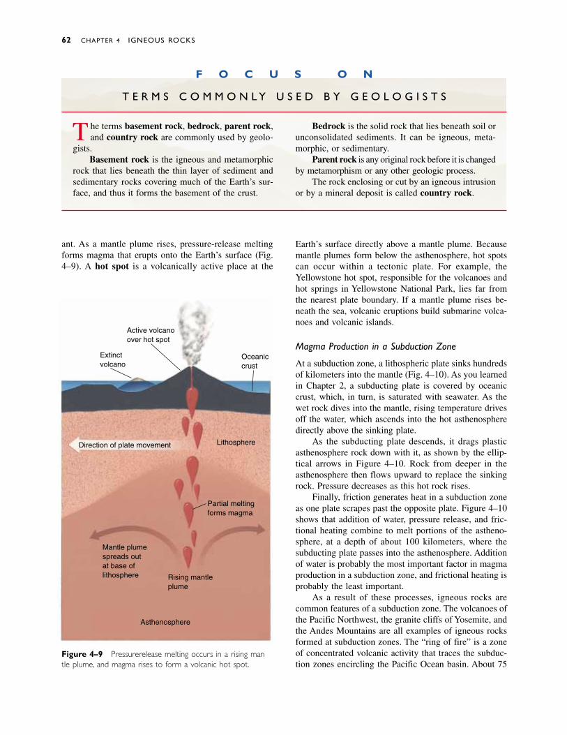
ant. As a mantle plume rises, pressure-release meltingforms magma that erupts onto the Earth’s surface (Fig.4–9). A hot spot is a volcanically active place at the
Earth’s surface directly above a mantle plume. Becausemantle plumes form below the asthenosphere, hot spotscan occur within a tectonic plate. For example, theYellowstone hot spot, responsible for the volcanoes andhot springs in Yellowstone National Park, lies far fromthe nearest plate boundary. If a mantle plume rises be-neath the sea, volcanic eruptions build submarine volca-noes and volcanic islands.
Magma Production in a Subduction Zone
At a subduction zone, a lithospheric plate sinks hundredsof kilometers into the mantle (Fig. 4–10). As you learnedin Chapter 2, a subducting plate is covered by oceaniccrust, which, in turn, is saturated with seawater. As thewet rock dives into the mantle, rising temperature drivesoff the water, which ascends into the hot asthenospheredirectly above the sinking plate.
As the subducting plate descends, it drags plastic asthenosphere rock down with it, as shown by the ellip-tical arrows in Figure 4–10. Rock from deeper in the asthenosphere then flows upward to replace the sinkingrock. Pressure decreases as this hot rock rises.
Finally, friction generates heat in a subduction zoneas one plate scrapes past the opposite plate. Figure 4–10shows that addition of water, pressure release, and fric-tional heating combine to melt portions of the astheno-sphere, at a depth of about 100 kilometers, where thesubducting plate passes into the asthenosphere. Additionof water is probably the most important factor in magmaproduction in a subduction zone, and frictional heating isprobably the least important.
As a result of these processes, igneous rocks arecommon features of a subduction zone. The volcanoes ofthe Pacific Northwest, the granite cliffs of Yosemite, andthe Andes Mountains are all examples of igneous rocksformed at subduction zones. The “ring of fire” is a zoneof concentrated volcanic activity that traces the subduc-tion zones encircling the Pacific Ocean basin. About 75
62 CHAPTER 4 IGNEOUS ROCKS
Figure 4–9 Pressure-release melting occurs in a rising man-tle plume, and magma rises to form a volcanic hot spot.
Active volcanoover hot spot
Extinctvolcano
Direction of plate movement Lithosphere
Partial meltingforms magma
Asthenosphere
Rising mantleplume
Mantle plumespreads outat base oflithosphere
Oceaniccrust
F O C U S O N
T E R M S C O M M O N L Y U S E D B Y G E O L O G I S T S
The terms basement rock, bedrock, parent rock,and country rock are commonly used by geolo-
gists.Basement rock is the igneous and metamorphic
rock that lies beneath the thin layer of sediment andsedimentary rocks covering much of the Earth’s sur-face, and thus it forms the basement of the crust.
Bedrock is the solid rock that lies beneath soil orunconsolidated sediments. It can be igneous, meta-morphic, or sedimentary.
Parent rock is any original rock before it is changedby metamorphism or any other geologic process.
The rock enclosing or cut by an igneous intrusionor by a mineral deposit is called country rock.

percent of the Earth’s active volcanoes (exclusive of thesubmarine volcanoes at the mid-oceanic ridge) lie in thering of fire (Fig. 4–11).
CHARACTERISTICS OF MAGMA
We have just described how, why, and where magmaforms. Now we consider its properties and behavior.
Temperature
The temperature of magma varies from about 600º to1400ºC, depending on its chemical composition and thedepth at which it forms. Generally, basaltic magma formsat great depth and has a temperature near the high end ofthis scale. Granitic magmas, which form at shallowerdepths, tend to lie near the cooler end of the scale. As a
comparison, an iron bar turns red hot at about 600ºC andmelts at slightly over 1500ºC.
Chemical Composition
Because oxygen and silicon are the two most abundantelements in the crust and mantle, nearly all magmas aresilicate magmas. In addition to oxygen and silicon, theyalso contain lesser amounts of the six other common el-ements of the Earth’s crust: aluminum, iron, magnesium,calcium, potassium, and sodium. The main variationsamong different types of magmas are differences in therelative proportions of these eight elements. For exam-ple, basaltic magma contains more iron and magnesiumthan granitic magma, but granitic magma is richer in sil-icon, potassium, and sodium. A few rare magmas are ofcarbonate composition. The rocks that form from these
Igneous Rocks:The Origins of Magma 63
Figure 4–10 Three factors contribute to melting of the asthenosphere and production ofmagma at a subduction zone: (1) Friction heats rocks in the subduction zone; (2) water risesfrom oceanic crust on top of the subducting plate; and (3) circulation in the asthenospheredecreases pressure on hot rock.
Sea level
Oceanic crust
Lithosphere
Asthenosphere
Water rising fromheated oceanic crust
Friction drags the plasticrock of the asthenosphere
downward
Circulation ofasthenosphere
Magma
Mantle(asthenosphere)
Continental crust(lithosphere)
Andesiticvolcano
Graniticplutons
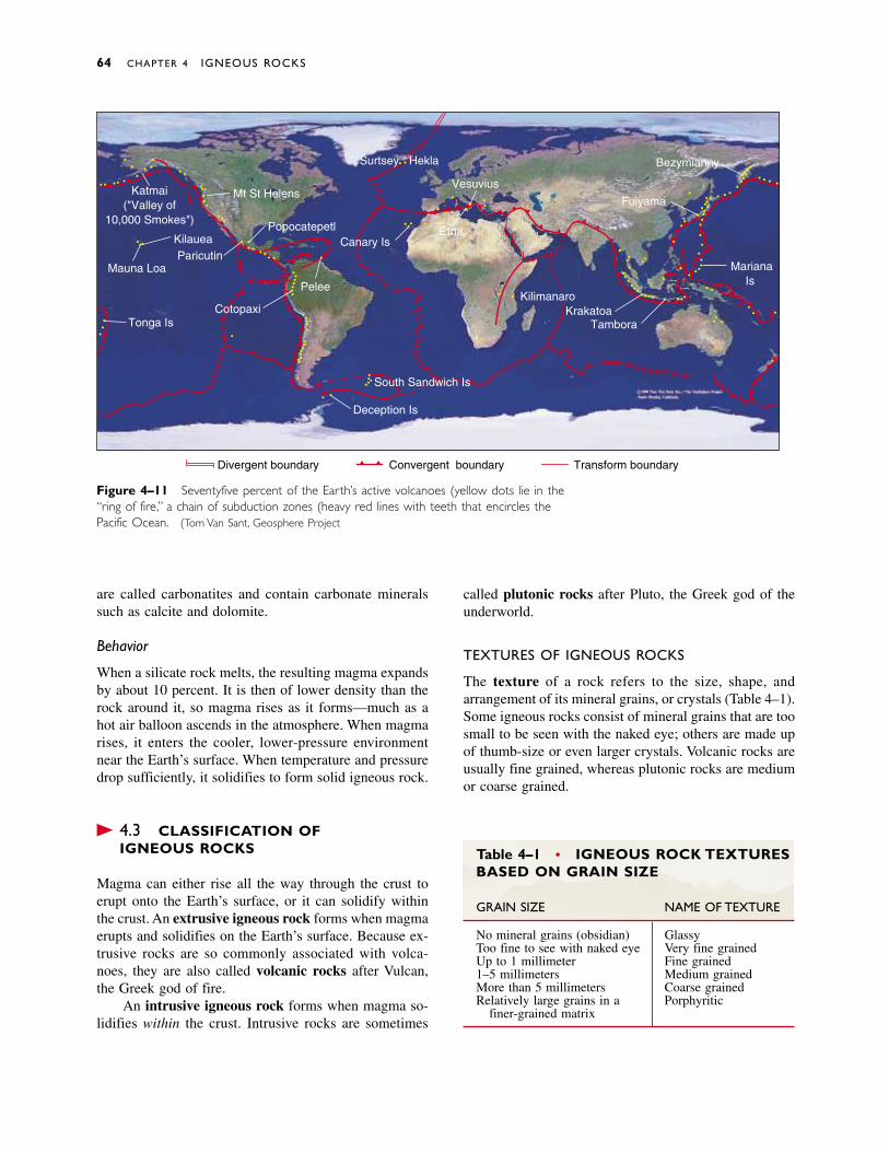
are called carbonatites and contain carbonate mineralssuch as calcite and dolomite.
Behavior
When a silicate rock melts, the resulting magma expandsby about 10 percent. It is then of lower density than therock around it, so magma rises as it forms—much as ahot air balloon ascends in the atmosphere. When magmarises, it enters the cooler, lower-pressure environmentnear the Earth’s surface. When temperature and pressuredrop sufficiently, it solidifies to form solid igneous rock.
� 4.3 CLASSIFICATION OF IGNEOUS ROCKS
Magma can either rise all the way through the crust toerupt onto the Earth’s surface, or it can solidify withinthe crust. An extrusive igneous rock forms when magmaerupts and solidifies on the Earth’s surface. Because ex-trusive rocks are so commonly associated with volca-noes, they are also called volcanic rocks after Vulcan,the Greek god of fire.
An intrusive igneous rock forms when magma so-lidifies within the crust. Intrusive rocks are sometimes
called plutonic rocks after Pluto, the Greek god of theunderworld.
TEXTURES OF IGNEOUS ROCKS
The texture of a rock refers to the size, shape, andarrangement of its mineral grains, or crystals (Table 4–1).Some igneous rocks consist of mineral grains that are toosmall to be seen with the naked eye; others are made upof thumb-size or even larger crystals. Volcanic rocks areusually fine grained, whereas plutonic rocks are mediumor coarse grained.
64 CHAPTER 4 IGNEOUS ROCKS
Figure 4–11 Seventy-five percent of the Earth’s active volcanoes (yellow dots) lie in the“ring of fire,” a chain of subduction zones (heavy red lines with teeth) that encircles thePacific Ocean. (Tom Van Sant, Geosphere Project)
Katmai("Valley of
10,000 Smokes")
KilaueaParicutin
Mauna Loa
Tonga Is.
Mt. St. Helens
Popocatepetl
Cotopaxi
Pelee
Surtsey Hekla
Canary Is.
Deception Is.
Vesuvius
Etna
KilimanjaroKrakatoa
Tambora
Fujiyama
Bezymianny
MarianaIs.
South Sandwich Is.
Divergent boundary Convergent boundary Transform boundary
Table 4–1 • IGNEOUS ROCK TEXTURESBASED ON GRAIN SIZE
GRAIN SIZE NAME OF TEXTURE
No mineral grains (obsidian) GlassyToo fine to see with naked eye Very fine grainedUp to 1 millimeter Fine grained1–5 millimeters Medium grainedMore than 5 millimeters Coarse grainedRelatively large grains in a Porphyritic
finer-grained matrix
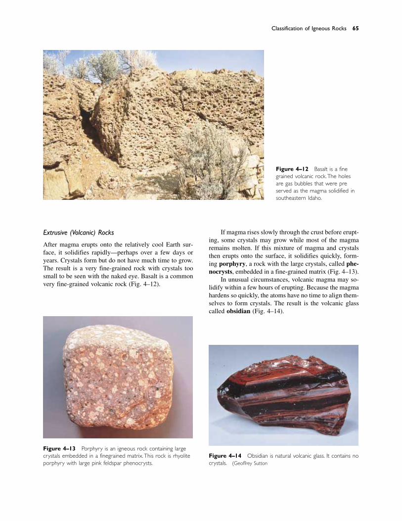
Extrusive (Volcanic) Rocks
After magma erupts onto the relatively cool Earth sur-face, it solidifies rapidly—perhaps over a few days oryears. Crystals form but do not have much time to grow.The result is a very fine-grained rock with crystals toosmall to be seen with the naked eye. Basalt is a commonvery fine-grained volcanic rock (Fig. 4–12).
If magma rises slowly through the crust before erupt-ing, some crystals may grow while most of the magmaremains molten. If this mixture of magma and crystalsthen erupts onto the surface, it solidifies quickly, form-ing porphyry, a rock with the large crystals, called phe-nocrysts, embedded in a fine-grained matrix (Fig. 4–13).
In unusual circumstances, volcanic magma may so-lidify within a few hours of erupting. Because the magmahardens so quickly, the atoms have no time to align them-selves to form crystals. The result is the volcanic glasscalled obsidian (Fig. 4–14).
Classification of Igneous Rocks 65
Figure 4–13 Porphyry is an igneous rock containing largecrystals embedded in a fine-grained matrix. This rock is rhyoliteporphyry with large pink feldspar phenocrysts.
Figure 4–14 Obsidian is natural volcanic glass. It contains nocrystals. (Geoffrey Sutton)
Figure 4–12 Basalt is a fine-grained volcanic rock.The holesare gas bubbles that were pre-served as the magma solidified insoutheastern Idaho.
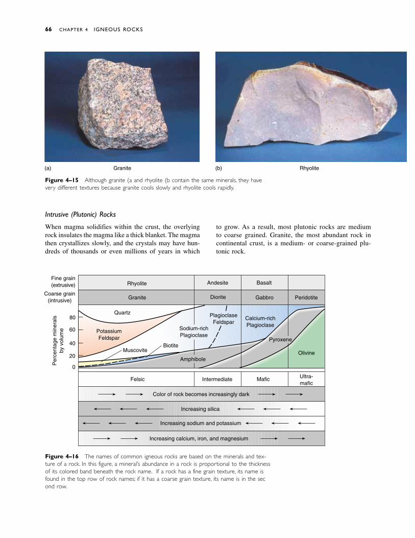
Intrusive (Plutonic) Rocks
When magma solidifies within the crust, the overlyingrock insulates the magma like a thick blanket. The magmathen crystallizes slowly, and the crystals may have hun-dreds of thousands or even millions of years in which
to grow. As a result, most plutonic rocks are medium to coarse grained. Granite, the most abundant rock incontinental crust, is a medium- or coarse-grained plu-tonic rock.
66 CHAPTER 4 IGNEOUS ROCKS
Figure 4–16 The names of common igneous rocks are based on the minerals and tex-ture of a rock. In this figure, a mineral’s abundance in a rock is proportional to the thicknessof its colored band beneath the rock name. If a rock has a fine grain texture, its name isfound in the top row of rock names; if it has a coarse grain texture, its name is in the sec-ond row.
Figure 4–15 Although granite (a) and rhyolite (b) contain the same minerals, they havevery different textures because granite cools slowly and rhyolite cools rapidly.
Rhyolite
Granite
Quartz
PotassiumFeldspar
Muscovite
Andesite
Diorite
Basalt
Gabbro
PlagioclaseFeldspar
Sodium-richPlagioclase
Biotite
Amphibole
Calcium-richPlagioclase
Pyroxene
Peridotite
Olivine
Ultra-mafic
MaficIntermediate
Color of rock becomes increasingly dark
Increasing silica
Increasing sodium and potassium
Increasing calcium, iron, and magnesium
Fine grain(extrusive)
Coarse grain(intrusive)
Per
cent
age
min
eral
sby
vol
ume
80
60
40
20
0
Felsic
(a) Granite Rhyolite(b)
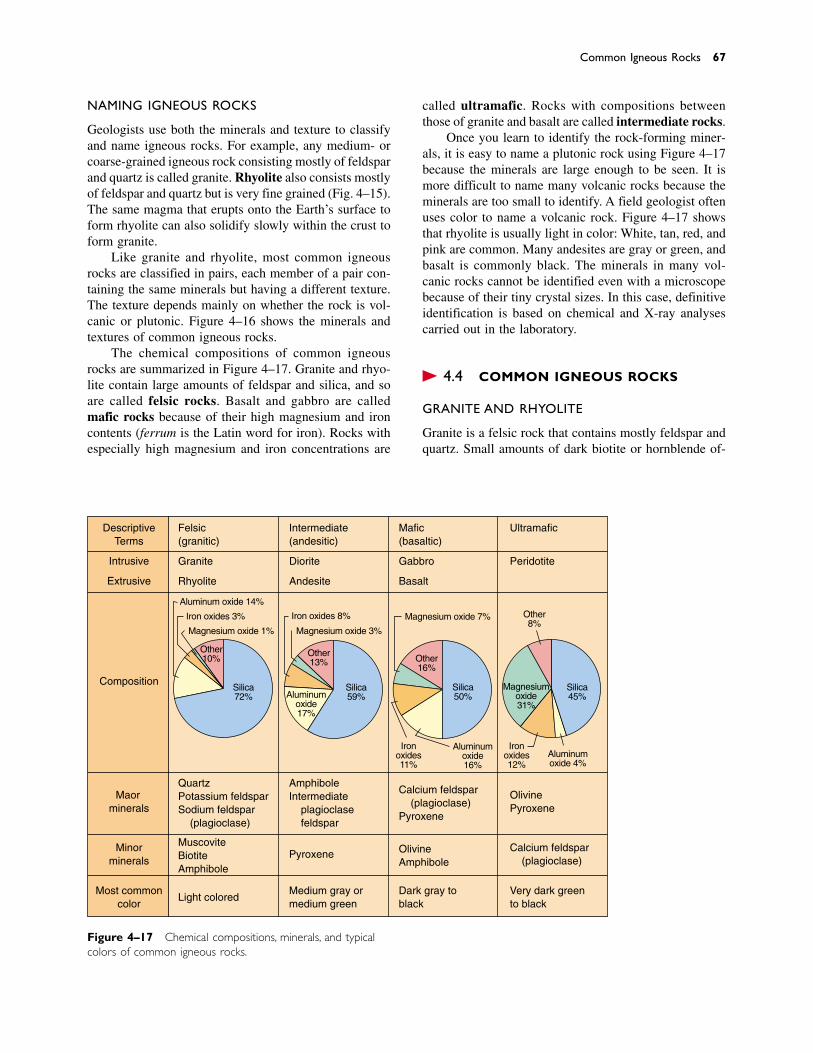
NAMING IGNEOUS ROCKS
Geologists use both the minerals and texture to classifyand name igneous rocks. For example, any medium- orcoarse-grained igneous rock consisting mostly of feldsparand quartz is called granite. Rhyolite also consists mostlyof feldspar and quartz but is very fine grained (Fig. 4–15).The same magma that erupts onto the Earth’s surface toform rhyolite can also solidify slowly within the crust toform granite.
Like granite and rhyolite, most common igneousrocks are classified in pairs, each member of a pair con-taining the same minerals but having a different texture.The texture depends mainly on whether the rock is vol-canic or plutonic. Figure 4–16 shows the minerals andtextures of common igneous rocks.
The chemical compositions of common igneousrocks are summarized in Figure 4–17. Granite and rhyo-lite contain large amounts of feldspar and silica, and soare called felsic rocks. Basalt and gabbro are calledmafic rocks because of their high magnesium and ironcontents (ferrum is the Latin word for iron). Rocks withespecially high magnesium and iron concentrations are
called ultramafic. Rocks with compositions betweenthose of granite and basalt are called intermediate rocks.
Once you learn to identify the rock-forming miner-als, it is easy to name a plutonic rock using Figure 4–17because the minerals are large enough to be seen. It ismore difficult to name many volcanic rocks because theminerals are too small to identify. A field geologist oftenuses color to name a volcanic rock. Figure 4–17 showsthat rhyolite is usually light in color: White, tan, red, andpink are common. Many andesites are gray or green, andbasalt is commonly black. The minerals in many vol-canic rocks cannot be identified even with a microscopebecause of their tiny crystal sizes. In this case, definitiveidentification is based on chemical and X-ray analysescarried out in the laboratory.
� 4.4 COMMON IGNEOUS ROCKS
GRANITE AND RHYOLITE
Granite is a felsic rock that contains mostly feldspar andquartz. Small amounts of dark biotite or hornblende of-
Common Igneous Rocks 67
Figure 4–17 Chemical compositions, minerals, and typicalcolors of common igneous rocks.
DescriptiveTerms
Most commoncolor
Intrusive
Extrusive
Composition
Majorminerals
Minorminerals
Felsic(granitic)
Granite
Rhyolite
QuartzPotassium feldsparSodium feldspar (plagioclase)
MuscoviteBiotiteAmphibole
Light colored
Intermediate(andesitic)
Diorite
Andesite
AmphiboleIntermediate plagioclase feldspar
Pyroxene
Medium gray ormedium green
Mafic(basaltic)
Gabbro
Basalt
Calcium feldspar (plagioclase)Pyroxene
OlivineAmphibole
Dark gray toblack
Ultramafic
Peridotite
OlivinePyroxene
Calcium feldspar (plagioclase)
Very dark greento black
Aluminum oxide 14%
Iron oxides 3%
Magnesium oxide 1%
Other10%
Other13%
Magnesium oxide 3%
Iron oxides 8%
Aluminumoxide17%
Silica59%
Other16%
Magnesium oxide 7%
Ironoxides11%
Aluminumoxide16%
Silica50%
Other8%
Magnesiumoxide31%
Silica45%
Aluminumoxide 4%
Ironoxides12%
Silica72%

Figure 4–18 The authors on Inugsuin Point Buttress, a gran-ite wall on Baffin Island. (Steve Sheriff )
ten give it a black and white speckled appearance. Granite(and metamorphosed granitic rocks) are the most com-mon rocks in continental crust. They are found nearlyeverywhere beneath the relatively thin veneer of sedi-mentary rocks and soil that cover most of the continents.Geologists often call these rocks basement rocks be-cause they make up the foundation of a continent. Graniteis hard and resistant to weathering; it forms steep, sheercliffs in many of the world’s great mountain ranges.Mountaineers prize granite cliffs for the steepness andstrength of the rock (Fig. 4–18).
As granitic magma rises through the Earth’s crust,some of it may erupt from a volcano to form rhyolite,while the remainder solidifies beneath the volcano, form-ing granite. Most obsidian forms from magma with agranitic (rhyolitic) composition.
BASALT AND GABBRO
Basalt is a mafic rock that consists of approximatelyequal amounts of plagioclase feldspar and pyroxene. Itmakes up most of the oceanic crust as well as huge basaltplateaus on continents (Fig. 4–19). Gabbro is the plu-tonic counterpart of basalt; it is mineralogically identicalbut consists of larger crystals. Gabbro is uncommon atthe Earth’s surface, although it is abundant in deeper
68 CHAPTER 4 IGNEOUS ROCKS
parts of oceanic crust, where basaltic magma crystallizesslowly.
ANDESITE AND DIORITE
Andesite is a volcanic rock intermediate in compositionbetween basalt and granite. It is commonly gray or greenand consists of plagioclase and dark minerals (usuallybiotite, amphibole, or pyroxene). It is named for theAndes mountains, the volcanic chain on the western edgeof South America, where it is abundant. Because it isvolcanic, andesite is typically very fine grained.
Diorite is the plutonic equivalent of andesite. Itforms from the same magma as andesite and, conse-quently, often underlies andesitic mountain chains suchas the Andes.
PERIDOTITE
Peridotite is an ultramafic igneous rock that makes upmost of the upper mantle but is rare in the Earth’s crust.It is coarse grained and composed of olivine, and it usu-ally contains pyroxene, amphibole, or mica but no feldspar.
� 4.5 PARTIAL MELTING AND THEORIGINS OF COMMON IGNEOUS ROCKS
BASALT AND BASALTIC MAGMA
Recall that oceanic crust is mostly basalt and that basalticmagma forms by melting of the asthenosphere. However,the asthenosphere is made of peridotite. Figure 4–18shows that basalt and peridotite are quite different incomposition: Peridotite contains about 40 percent silica,but basalt contains about 50 percent. Peridotite containsconsiderably more iron and magnesium than basalt. Howdoes peridotite melt to create basaltic magma? Why doesthe magma have a composition different from that of therock that melted to produce it?
Any pure substance, such as ice, has a definite melt-ing point. Ice melts at exactly 0ºC. In addition, ice meltsto form water, which has exactly the same compositionas the ice, pure H2O. A rock does not behave in this waybecause it is a mixture of several minerals, each of whichmelts at a different temperature. If you heat peridotiteslowly, the minerals with the lowest melting point beginto melt first, while the other minerals remain solid. Thisphenomenon is called partial melting. (Of course, if thetemperature is high enough, the whole rock will melt.)
In general, minerals with the highest silica contentsmelt at the lowest temperatures. Silica-poor mineralsmelt only at higher temperatures. In parts of the as-

thenosphere where magma forms, the temperature is onlyhot enough to melt the minerals with the lowest meltingpoints. As a result, magma is always richer in silica thanthe rock that melted to produce it. In this way, basalticmagma forms from peridotite rock at a temperature ofabout 1100ºC. When the basaltic magma rises toward theEarth’s surface, it leaves silica-depleted peridotite in theasthenosphere.
GRANITE AND GRANITIC MAGMA
Granite contains more silica than basalt and thereforemelts at a lower temperature—typically between 700ºand 900ºC. Thus, basaltic magma is hot enough to meltgranitic continental crust. In certain tectonic environ-ments, the asthenosphere melts beneath a continent,forming basaltic magma that rises into continental crust.These environments include a subduction zone, a conti-nental rift zone, and a mantle plume rising beneath acontinent.
Because the lower continental crust is hot, even asmall amount of basaltic magma melts large quantities ofthe continent to form granitic magma. Typically, thegranitic magma then rises a short distance and then so-lidifies within the crust to form plutonic rocks. Mostgranitic plutons solidify at depths between a few kilo-meters and about 20 kilometers. Some of the magmamay rise to the Earth’s surface to erupt rhyolite and sim-ilar volcanic rocks. Small amounts of the original basalticmagma may erupt with the rhyolite or solidify at depthwith the granite.
ANDESITE AND ANDESITIC MAGMA
Igneous rocks of intermediate composition, such as an-desite and diorite, form by processes similar to those thatgenerate granitic magma. Their magmas contain less sil-ica than granite, either because they form by melting ofcontinental crust that is lower in silica or because thebasaltic magma from the mantle has contaminated thegranitic magma.
Summary 69
Figure 4–19 Lava flows of the Columbia River basaltplateau are well exposed along the Columbia River.
Geologists separate rocks into three classes based onhow they form: igneous rocks, sedimentary rocks, andmetamorphic rocks. Igneous rocks form when a hot,molten liquid called magma solidifies. Sedimentaryrocks form when loose sediment, such as sand and clay,becomes cemented to form a solid rock. Metamorphic
rocks form when older igneous, sedimentary, or othermetamorphic rocks change because of high temperatureand/or pressure or are deformed during mountain build-ing. The rock cycle shows that all rocks change slowlyover geologic time from one of the three rock types toanother.
S U M M A R Y
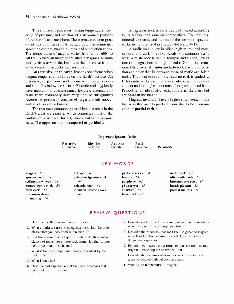
70 CHAPTER 4 IGNEOUS ROCKS
Three different processes—rising temperature, low-ering of pressure, and addition of water—melt portionsof the Earth’s asthenosphere. These processes form greatquantities of magma in three geologic environments:spreading centers, mantle plumes, and subduction zones.The temperature of magma varies from about 600º to1400ºC. Nearly all magmas are silicate magmas. Magmausually rises toward the Earth’s surface because it is oflower density than rocks that surround it.
An extrusive, or volcanic, igneous rock forms whenmagma erupts and solidifies on the Earth’s surface. Anintrusive, or plutonic, rock forms when magma coolsand solidifies below the surface. Plutonic rocks typicallyhave medium- to coarse-grained textures, whereas vol-canic rocks commonly have very fine- to fine-grainedtextures. A porphyry consists of larger crystals imbed-ded in a fine-grained matrix.
The two most common types of igneous rocks in theEarth’s crust are granite, which comprises most of thecontinental crust, and basalt, which makes up oceaniccrust. The upper mantle is composed of peridotite.
An igneous rock is classified and named accordingto its texture and mineral composition. The textures,mineral contents, and names of the common igneousrocks are summarized in Figures 4–16 and 4–17.
A mafic rock is low in silica, high in iron and mag-nesium, and dark in color. Basalt is a common maficrock. A felsic rock is rich in feldspar and silicon, low iniron and magnesium, and light in color. Granite is a com-mon felsic rock. An intermediate rock has a composi-tion and color that lie between those of mafic and felsicrocks. The most common intermediate rock is andesite.Ultramafic rocks have the lowest silicon and aluminumcontent and the highest amounts of magnesium and iron.Peridotite, an ultramafic rock, is rare in the crust butabundant in the mantle.
Magmas invariably have a higher silica content thanthe rocks that melt to produce them, due to the phenom-enon of partial melting.
magma 58igneous rock 58sedimentary rock 58metamorphic rock 58rock cycle 58pressure-release
melting 60
hot spot 62extrusive igneous rock
64volcanic rock 64intrusive igneous rock
64
plutonic rocks 64texture 64porphyry 65phenocryst 65obsidian 65felsic rock 67
mafic rock 67ultramafic rock 67intermediate rock 67basalt plateau 68partial melting 68
K E Y W O R D S
1. Describe the three main classes of rocks.
2. What criteria are used to categorize rocks into the threeclasses that you described in question 1?
3. List two common rock types in each of the three mainclasses of rocks. Were these rock names familiar to youbefore you read this chapter?
4. What is the most important concept described by therock cycle?
5. What is magma?
6. Describe and explain each of the three processes thatmelt rock to form magma.
7. Describe each of the three main geologic environments inwhich magma forms in large quantities.
8. Describe the processes that melt rock to generate magmain each of the three environments that you discussed inthe previous question.
9. Explain how oceanic crust forms only at the mid-oceanicridge but makes up the entire sea floor.
10. Describe the locations of some volcanically active re-gions associated with subduction zones.
11. What is the temperature of magma?
R E V I E W Q U E S T I O N S
Important Igneous Rocks
Extrusive Rhyolite Andesite BasaltIntrusive Granite Diorite Gabbro Peridotite

Discussion Questions 71
12. What is the general chemical composition of most magmas?
13. Why do magmas begin to rise through the Earth’s outerlayers as soon as they form?
14. How would you distinguish a plutonic rock from a vol-canic rock in the field?
15. What factor distinguishes obsidian from all other types ofigneous rocks?
16. What are the most common minerals in igneous rocks?Why?
17. What do the terms mafic, ultramafic, felsic, and interme-diate mean?
18. Describe the mineralogy, texture, and common geologicoccurrence of the following types of igneous rocks: gran-ite, rhyolite, basalt, gabbro, andesite, and peridotite.
19. What type of igneous rock is the most abundant con-stituent of continental crust? What type makes up mostoceanic crust?
20. Why is it sometimes difficult to identify a volcanic rockaccurately in the field?
21. Why does magma normally have a higher silica contentthan the rock from which it formed?
1. The temperature of most magma is thought to be approxi-mately equal to the initial melting temperature of the rockfrom which the magma formed, rarely much hotter. Whydo magmas not get much hotter than their initial meltingpoints?
2. Why is oceanic crust predominantly basalt, whereas conti-nental crust is mainly of granitic composition?
3. Devise a scheme for naming and classifying igneous rocksthat is different from the one based on mineral contentpresented in Figure 4–16.
4. Explain why feldspar is the most abundant mineral in theEarth’s crust and yet is nearly completely absent from theperidotite of the upper mantle.
5. What could you infer about the history of another planet ifyou discovered extrusive igneous rocks but no intrusive ig-neous rocks on its surface?
6. Draw a graph with silica content on the Y-axis and felsic,intermediate, mafic, and ultramafic rocks on the X-axis.Draw similar graphs for aluminum, magnesium, iron, andpotassium contents.
D I S C U S S I O N Q U E S T I O N S
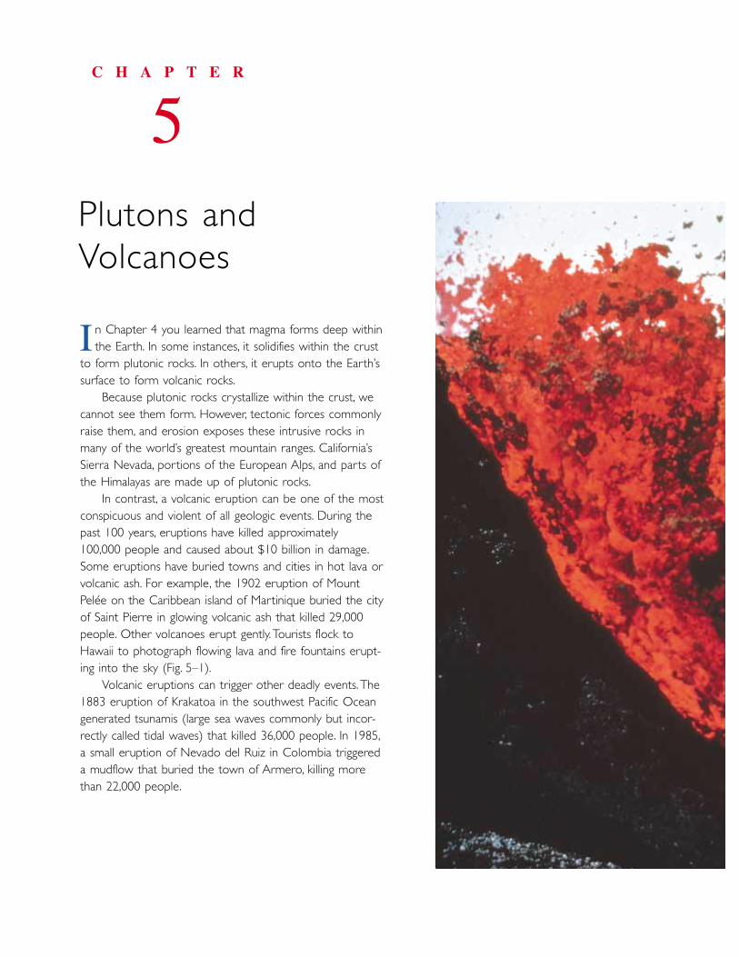
n Chapter 4 you learned that magma forms deep within the Earth. In some instances, it solidifies within the crust
to form plutonic rocks. In others, it erupts onto the Earth’ssurface to form volcanic rocks.
Because plutonic rocks crystallize within the crust, wecannot see them form. However, tectonic forces commonlyraise them, and erosion exposes these intrusive rocks inmany of the world’s greatest mountain ranges. California’sSierra Nevada, portions of the European Alps, and parts ofthe Himalayas are made up of plutonic rocks.
In contrast, a volcanic eruption can be one of the mostconspicuous and violent of all geologic events. During thepast 100 years, eruptions have killed approximately 100,000 people and caused about $10 billion in damage.Some eruptions have buried towns and cities in hot lava orvolcanic ash. For example, the 1902 eruption of MountPelée on the Caribbean island of Martinique buried the cityof Saint Pierre in glowing volcanic ash that killed 29,000people. Other volcanoes erupt gently. Tourists flock toHawaii to photograph flowing lava and fire fountains erupt-ing into the sky (Fig. 5–1).
Volcanic eruptions can trigger other deadly events. The1883 eruption of Krakatoa in the southwest Pacific Oceangenerated tsunamis (large sea waves commonly but incor-rectly called tidal waves) that killed 36,000 people. In 1985,a small eruption of Nevado del Ruiz in Colombia triggereda mudflow that buried the town of Armero, killing morethan 22,000 people.
C H A P T E R
5Plutons andVolcanoes
I
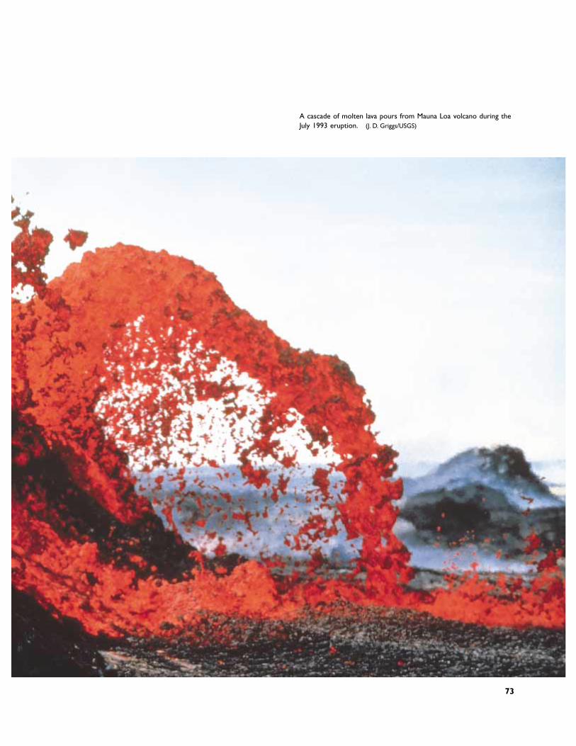
A cascade of molten lava pours from Mauna Loa volcano during theJuly 1993 eruption. (J. D. Griggs/USGS)
73
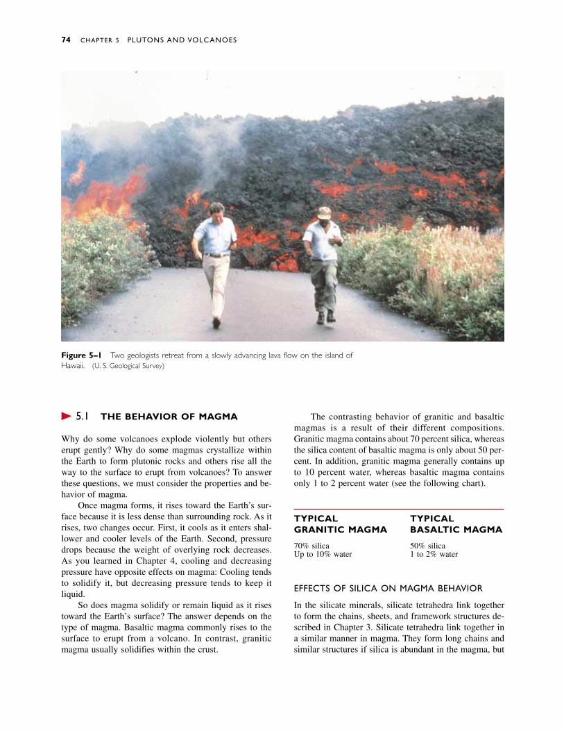
� 5.1 THE BEHAVIOR OF MAGMA
Why do some volcanoes explode violently but otherserupt gently? Why do some magmas crystallize withinthe Earth to form plutonic rocks and others rise all theway to the surface to erupt from volcanoes? To answerthese questions, we must consider the properties and be-havior of magma.
Once magma forms, it rises toward the Earth’s sur-face because it is less dense than surrounding rock. As itrises, two changes occur. First, it cools as it enters shal-lower and cooler levels of the Earth. Second, pressuredrops because the weight of overlying rock decreases. As you learned in Chapter 4, cooling and decreasingpressure have opposite effects on magma: Cooling tendsto solidify it, but decreasing pressure tends to keep it liquid.
So does magma solidify or remain liquid as it risestoward the Earth’s surface? The answer depends on thetype of magma. Basaltic magma commonly rises to thesurface to erupt from a volcano. In contrast, graniticmagma usually solidifies within the crust.
The contrasting behavior of granitic and basalticmagmas is a result of their different compositions.Granitic magma contains about 70 percent silica, whereasthe silica content of basaltic magma is only about 50 per-cent. In addition, granitic magma generally contains upto 10 percent water, whereas basaltic magma containsonly 1 to 2 percent water (see the following chart).
TYPICAL TYPICALGRANITIC MAGMA BASALTIC MAGMA
70% silica 50% silicaUp to 10% water 1 to 2% water
EFFECTS OF SILICA ON MAGMA BEHAVIOR
In the silicate minerals, silicate tetrahedra link togetherto form the chains, sheets, and framework structures de-scribed in Chapter 3. Silicate tetrahedra link together ina similar manner in magma. They form long chains andsimilar structures if silica is abundant in the magma, but
74 CHAPTER 5 PLUTONS AND VOLCANOES
Figure 5–1 Two geologists retreat from a slowly advancing lava flow on the island ofHawaii. (U. S. Geological Survey)
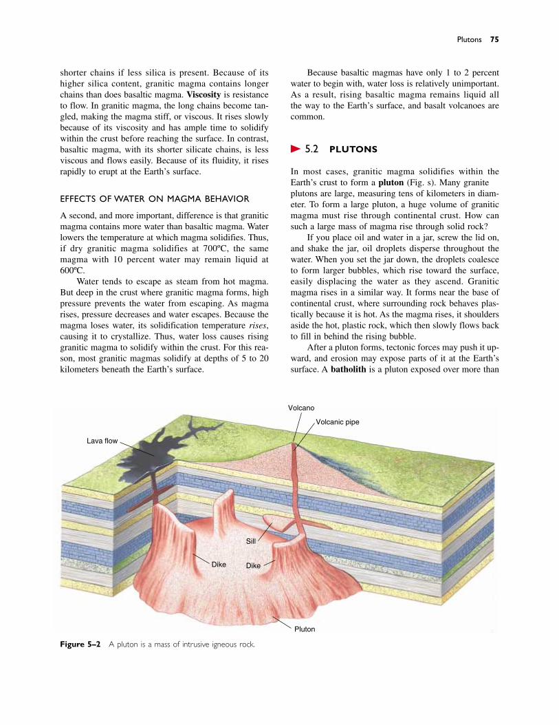
shorter chains if less silica is present. Because of itshigher silica content, granitic magma contains longerchains than does basaltic magma. Viscosity is resistanceto flow. In granitic magma, the long chains become tan-gled, making the magma stiff, or viscous. It rises slowlybecause of its viscosity and has ample time to solidifywithin the crust before reaching the surface. In contrast,basaltic magma, with its shorter silicate chains, is lessviscous and flows easily. Because of its fluidity, it risesrapidly to erupt at the Earth’s surface.
EFFECTS OF WATER ON MAGMA BEHAVIOR
A second, and more important, difference is that graniticmagma contains more water than basaltic magma. Waterlowers the temperature at which magma solidifies. Thus,if dry granitic magma solidifies at 700ºC, the samemagma with 10 percent water may remain liquid at600ºC.
Water tends to escape as steam from hot magma.But deep in the crust where granitic magma forms, highpressure prevents the water from escaping. As magmarises, pressure decreases and water escapes. Because themagma loses water, its solidification temperature rises,causing it to crystallize. Thus, water loss causes risinggranitic magma to solidify within the crust. For this rea-son, most granitic magmas solidify at depths of 5 to 20kilometers beneath the Earth’s surface.
Because basaltic magmas have only 1 to 2 percentwater to begin with, water loss is relatively unimportant.As a result, rising basaltic magma remains liquid all the way to the Earth’s surface, and basalt volcanoes arecommon.
� 5.2 PLUTONS
In most cases, granitic magma solidifies within theEarth’s crust to form a pluton (Fig. 5–2). Many graniteplutons are large, measuring tens of kilometers in diam-eter. To form a large pluton, a huge volume of graniticmagma must rise through continental crust. How cansuch a large mass of magma rise through solid rock?
If you place oil and water in a jar, screw the lid on,and shake the jar, oil droplets disperse throughout thewater. When you set the jar down, the droplets coalesceto form larger bubbles, which rise toward the surface,easily displacing the water as they ascend. Graniticmagma rises in a similar way. It forms near the base ofcontinental crust, where surrounding rock behaves plas-tically because it is hot. As the magma rises, it shouldersaside the hot, plastic rock, which then slowly flows backto fill in behind the rising bubble.
After a pluton forms, tectonic forces may push it up-ward, and erosion may expose parts of it at the Earth’ssurface. A batholith is a pluton exposed over more than
Plutons 75
Lava flow
Volcano
Volcanic pipe
Sill
DikeDike
Pluton
Figure 5–2 A pluton is a mass of intrusive igneous rock.
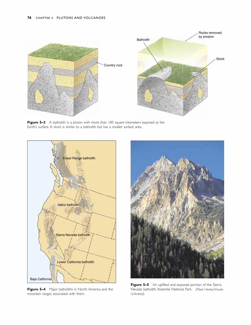
Figure 5–4 Major batholiths in North America and themountain ranges associated with them.
Figure 5–5 An uplifted and exposed portion of the SierraNevada batholith,Yosemite National Park. (Mack Henley/VisualsUnlimited)
Figure 5–3 A batholith is a pluton with more than 100 square kilometers exposed at theEarth’s surface. A stock is similar to a batholith but has a smaller surface area.
76 CHAPTER 5 PLUTONS AND VOLCANOES
Country rock
Rocks removedby erosion
Stock
Batholith
Coast Range batholith
Idaho batholith
Sierra Nevada batholith
Lower California batholith
Baja California
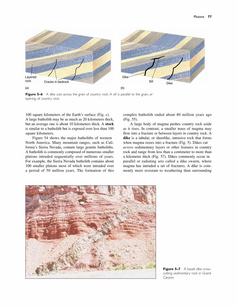
100 square kilometers of the Earth’s surface (Fig. 5–3).A large batholith may be as much as 20 kilometers thick,but an average one is about 10 kilometers thick. A stockis similar to a batholith but is exposed over less than 100square kilometers.
Figure 5–4 shows the major batholiths of westernNorth America. Many mountain ranges, such as Cali-fornia’s Sierra Nevada, contain large granite batholiths.A batholith is commonly composed of numerous smallerplutons intruded sequentially over millions of years. For example, the Sierra Nevada batholith contains about100 smaller plutons most of which were intruded over a period of 50 million years. The formation of this
complex batholith ended about 80 million years ago (Fig. 5–5).
A large body of magma pushes country rock asideas it rises. In contrast, a smaller mass of magma mayflow into a fracture or between layers in country rock. Adike is a tabular, or sheetlike, intrusive rock that formswhen magma oozes into a fracture (Fig. 5–6). Dikes cutacross sedimentary layers or other features in countryrock and range from less than a centimeter to more thana kilometer thick (Fig. 5–7). Dikes commonly occur inparallel or radiating sets called a dike swarm, wheremagma has intruded a set of fractures. A dike is com-monly more resistant to weathering than surrounding
Plutons 77
Figure 5–7 A basalt dike cross-cutting sedimentary rock in GrandCanyon.
Figure 5–6 A dike cuts across the grain of country rock. A sill is parallel to the grain, orlayering, of country rock.
Layeredrock Cracks in bedrock
DikeSill
Dike
(a) (b)
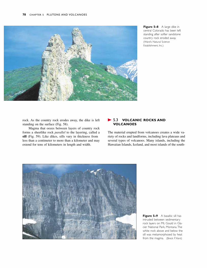
rock. As the country rock erodes away, the dike is leftstanding on the surface (Fig. 5–8).
Magma that oozes between layers of country rockforms a sheetlike rock parallel to the layering, called asill (Fig. 5–9). Like dikes, sills vary in thickness fromless than a centimeter to more than a kilometer and mayextend for tens of kilometers in length and width.
� 5.3 VOLCANIC ROCKS ANDVOLCANOES
The material erupted from volcanoes creates a wide va-riety of rocks and landforms, including lava plateaus andseveral types of volcanoes. Many islands, including theHawaiian Islands, Iceland, and most islands of the south-
78 CHAPTER 5 PLUTONS AND VOLCANOES
Figure 5–8 A large dike incentral Colorado has been leftstanding after softer sandstonecountry rock eroded away.(Ward’s Natural ScienceEstablishment, Inc.)
Figure 5–9 A basaltic sill hasintruded between sedimentaryrock layers on Mt. Gould in Gla-cier National Park, Montana.Thewhite rock above and below thesill was metamorphosed by heatfrom the magma. (Breck P. Kent)
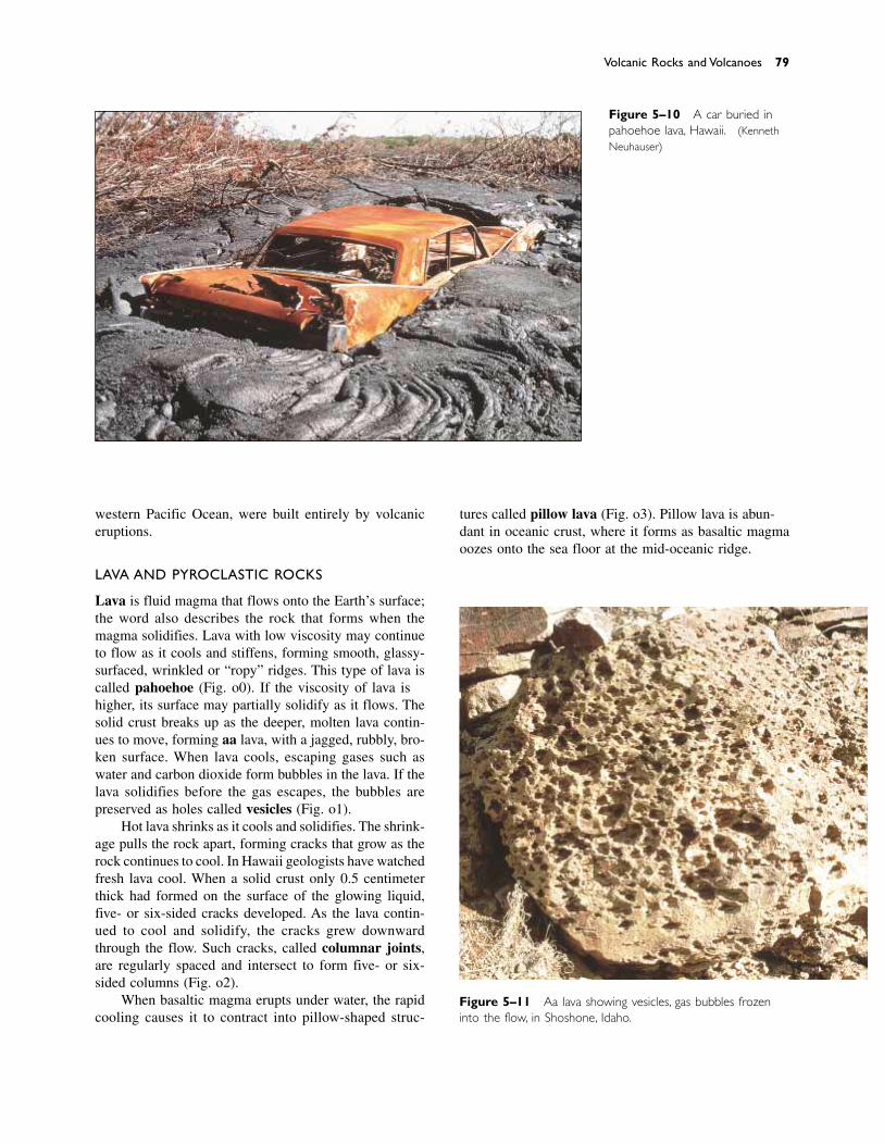
western Pacific Ocean, were built entirely by volcaniceruptions.
LAVA AND PYROCLASTIC ROCKS
Lava is fluid magma that flows onto the Earth’s surface;the word also describes the rock that forms when themagma solidifies. Lava with low viscosity may continueto flow as it cools and stiffens, forming smooth, glassy-surfaced, wrinkled or “ropy” ridges. This type of lava iscalled pahoehoe (Fig. 5–10). If the viscosity of lava ishigher, its surface may partially solidify as it flows. Thesolid crust breaks up as the deeper, molten lava contin-ues to move, forming aa lava, with a jagged, rubbly, bro-ken surface. When lava cools, escaping gases such aswater and carbon dioxide form bubbles in the lava. If thelava solidifies before the gas escapes, the bubbles arepreserved as holes called vesicles (Fig. 5–11).
Hot lava shrinks as it cools and solidifies. The shrink-age pulls the rock apart, forming cracks that grow as therock continues to cool. In Hawaii geologists have watchedfresh lava cool. When a solid crust only 0.5 centimeterthick had formed on the surface of the glowing liquid,five- or six-sided cracks developed. As the lava contin-ued to cool and solidify, the cracks grew downwardthrough the flow. Such cracks, called columnar joints,are regularly spaced and intersect to form five- or six-sided columns (Fig. 5–12).
When basaltic magma erupts under water, the rapidcooling causes it to contract into pillow-shaped struc-
tures called pillow lava (Fig. 5–13). Pillow lava is abun-dant in oceanic crust, where it forms as basaltic magmaoozes onto the sea floor at the mid-oceanic ridge.
Volcanic Rocks and Volcanoes 79
Figure 5–11 Aa lava showing vesicles, gas bubbles frozeninto the flow, in Shoshone, Idaho.
Figure 5–10 A car buried inpahoehoe lava, Hawaii. (KennethNeuhauser)
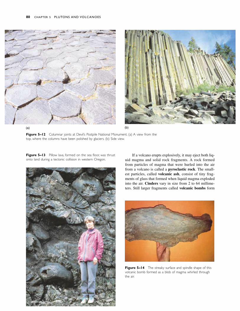
Figure 5–13 Pillow lava, formed on the sea floor, was thrustonto land during a tectonic collision in western Oregon.
Figure 5–12 Columnar joints at Devil’s Postpile National Monument. (a) A view from thetop, where the columns have been polished by glaciers. (b) Side view.
Figure 5–14 The streaky surface and spindle shape of thisvolcanic bomb formed as a blob of magma whirled throughthe air.
If a volcano erupts explosively, it may eject both liq-uid magma and solid rock fragments. A rock formedfrom particles of magma that were hurled into the airfrom a volcano is called a pyroclastic rock. The small-est particles, called volcanic ash, consist of tiny frag-ments of glass that formed when liquid magma explodedinto the air. Cinders vary in size from 2 to 64 millime-ters. Still larger fragments called volcanic bombs form
80 CHAPTER 5 PLUTONS AND VOLCANOES
(a) (b)
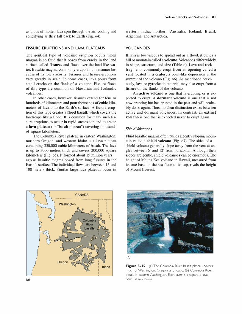
as blobs of molten lava spin through the air, cooling andsolidifying as they fall back to Earth (Fig. 5–14).
FISSURE ERUPTIONS AND LAVA PLATEAUS
The gentlest type of volcanic eruption occurs whenmagma is so fluid that it oozes from cracks in the landsurface called fissures and flows over the land like wa-ter. Basaltic magma commonly erupts in this manner be-cause of its low viscosity. Fissures and fissure eruptionsvary greatly in scale. In some cases, lava pours fromsmall cracks on the flank of a volcano. Fissure flows of this type are common on Hawaiian and Icelandic volcanoes.
In other cases, however, fissures extend for tens orhundreds of kilometers and pour thousands of cubic kilo-meters of lava onto the Earth’s surface. A fissure erup-tion of this type creates a flood basalt, which covers thelandscape like a flood. It is common for many such fis-sure eruptions to occur in rapid succession and to createa lava plateau (or “basalt plateau”) covering thousandsof square kilometers.
The Columbia River plateau in eastern Washington,northern Oregon, and western Idaho is a lava plateaucontaining 350,000 cubic kilometers of basalt. The lavais up to 3000 meters thick and covers 200,000 squarekilometers (Fig. 5–15). It formed about 15 million yearsago as basaltic magma oozed from long fissures in theEarth’s surface. The individual flows are between 15 and100 meters thick. Similar large lava plateaus occur in
Volcanic Rocks and Volcanoes 81
CANADA
Washington
Oregon
Idaho
ColumbiaRiver
basalts
(a)
(b)
Figure 5–15 (a) The Columbia River basalt plateau coversmuch of Washington, Oregon, and Idaho. (b) Columbia Riverbasalt in eastern Washington. Each layer is a separate lavaflow. (Larry Davis)
western India, northern Australia, Iceland, Brazil,Argentina, and Antarctica.
VOLCANOES
If lava is too viscous to spread out as a flood, it builds ahill or mountain called a volcano. Volcanoes differ widelyin shape, structure, and size (Table 5–1). Lava and rockfragments commonly erupt from an opening called avent located in a crater, a bowl-like depression at thesummit of the volcano (Fig. 5–16). As mentioned previ-ously, lava or pyroclastic material may also erupt from afissure on the flanks of the volcano.
An active volcano is one that is erupting or is ex-pected to erupt. A dormant volcano is one that is notnow erupting but has erupted in the past and will proba-bly do so again. Thus, no clear distinction exists betweenactive and dormant volcanoes. In contrast, an extinctvolcano is one that is expected never to erupt again.
Shield Volcanoes
Fluid basaltic magma often builds a gently sloping moun-tain called a shield volcano (Fig. 5–17). The sides of ashield volcano generally slope away from the vent at an-gles between 6º and 12º from horizontal. Although theirslopes are gentle, shield volcanoes can be enormous. Theheight of Mauna Kea volcano in Hawaii, measured fromits true base on the sea floor to its top, rivals the heightof Mount Everest.
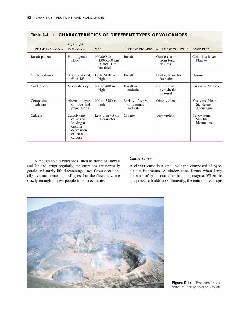
Although shield volcanoes, such as those of Hawaiiand Iceland, erupt regularly, the eruptions are normallygentle and rarely life threatening. Lava flows occasion-ally overrun homes and villages, but the flows advanceslowly enough to give people time to evacuate.
Cinder Cones
A cinder cone is a small volcano composed of pyro-clastic fragments. A cinder cone forms when largeamounts of gas accumulate in rising magma. When thegas pressure builds up sufficiently, the entire mass erupts
82 CHAPTER 5 PLUTONS AND VOLCANOES
Figure 5–16 Two vents in thecrater of Marum volcano,Vanuatu.
Table 5–1 • CHARACTERISTICS OF DIFFERENT TYPES OF VOLCANOES
FORM OFTYPE OF VOLCANO VOLCANO SIZE TYPE OF MAGMA STYLE OF ACTIVITY EXAMPLES
Basalt plateau Flat to gentle 100,000 to Basalt Gentle eruption Columbia Riverslope 1,000,000 km2 from long Plateau
in area; 1 to 3 fissureskm thick
Shield volcano Slightly sloped, Up to 9000 m Basalt Gentle, some fire Hawaii6º to 12º high fountains
Cinder cone Moderate slope 100 to 400 m Basalt or Ejections of Paricutín, Mexicohigh andesite pyroclastic
material
Composite Alternate layers 100 to 3500 m Variety of types Often violent Vesuvius, Mountvolcano of flows and high of magmas St. Helens,
pyroclastics and ash Aconcagua
Caldera Cataclysmic Less than 40 km Granite Very violent Yellowstone,explosion in diameter San Juanleaving a Mountainscirculardepressioncalled acaldera
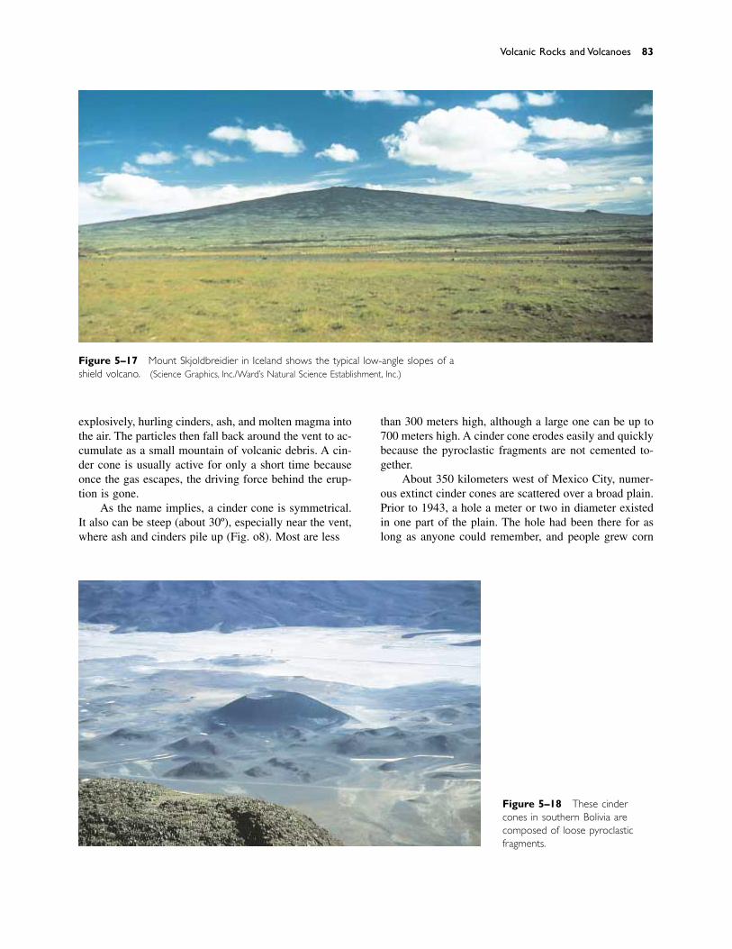
explosively, hurling cinders, ash, and molten magma intothe air. The particles then fall back around the vent to ac-cumulate as a small mountain of volcanic debris. A cin-der cone is usually active for only a short time becauseonce the gas escapes, the driving force behind the erup-tion is gone.
As the name implies, a cinder cone is symmetrical.It also can be steep (about 30º), especially near the vent,where ash and cinders pile up (Fig. 5–18). Most are less
than 300 meters high, although a large one can be up to700 meters high. A cinder cone erodes easily and quicklybecause the pyroclastic fragments are not cemented to-gether.
About 350 kilometers west of Mexico City, numer-ous extinct cinder cones are scattered over a broad plain.Prior to 1943, a hole a meter or two in diameter existedin one part of the plain. The hole had been there for aslong as anyone could remember, and people grew corn
Volcanic Rocks and Volcanoes 83
Figure 5–17 Mount Skjoldbreidier in Iceland shows the typical low-angle slopes of ashield volcano. (Science Graphics, Inc./Ward’s Natural Science Establishment, Inc.)
Figure 5–18 These cindercones in southern Bolivia are composed of loose pyroclasticfragments.
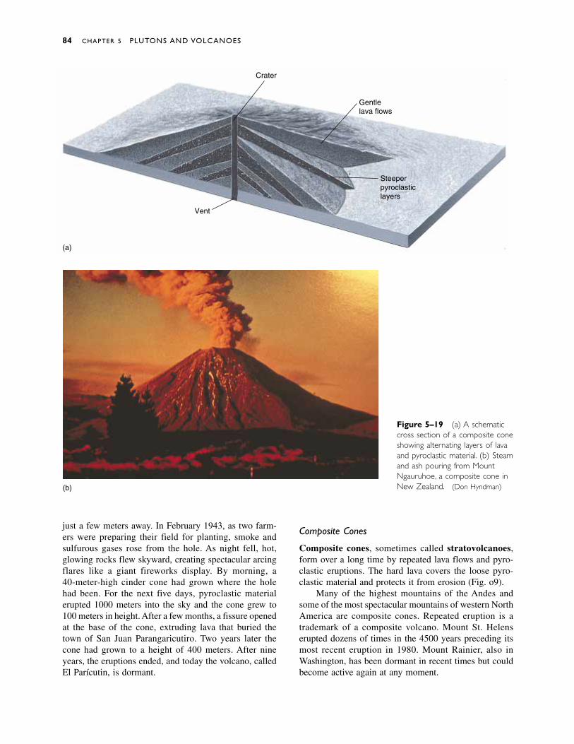
just a few meters away. In February 1943, as two farm-ers were preparing their field for planting, smoke andsulfurous gases rose from the hole. As night fell, hot,glowing rocks flew skyward, creating spectacular arcingflares like a giant fireworks display. By morning, a 40-meter-high cinder cone had grown where the hole had been. For the next five days, pyroclastic materialerupted 1000 meters into the sky and the cone grew to100 meters in height. After a few months, a fissure openedat the base of the cone, extruding lava that buried thetown of San Juan Parangaricutiro. Two years later thecone had grown to a height of 400 meters. After nineyears, the eruptions ended, and today the volcano, calledEl Parícutin, is dormant.
Composite Cones
Composite cones, sometimes called stratovolcanoes,form over a long time by repeated lava flows and pyro-clastic eruptions. The hard lava covers the loose pyro-clastic material and protects it from erosion (Fig. 5–19).
Many of the highest mountains of the Andes andsome of the most spectacular mountains of western NorthAmerica are composite cones. Repeated eruption is atrademark of a composite volcano. Mount St. Helenserupted dozens of times in the 4500 years preceding itsmost recent eruption in 1980. Mount Rainier, also inWashington, has been dormant in recent times but couldbecome active again at any moment.
84 CHAPTER 5 PLUTONS AND VOLCANOES
Crater
Gentlelava flows
Steeperpyroclasticlayers
Vent
(a)
(b)
Figure 5–19 (a) A schematiccross section of a composite coneshowing alternating layers of lavaand pyroclastic material. (b) Steamand ash pouring from MountNgauruhoe, a composite cone inNew Zealand. (Don Hyndman)
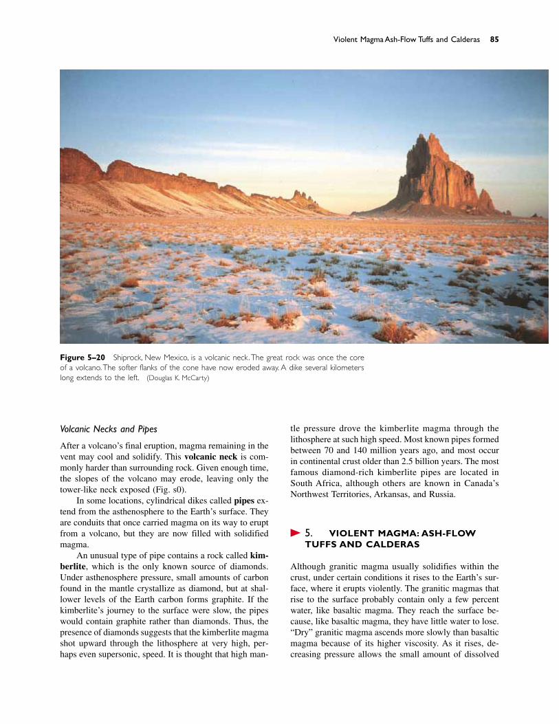
Volcanic Necks and Pipes
After a volcano’s final eruption, magma remaining in thevent may cool and solidify. This volcanic neck is com-monly harder than surrounding rock. Given enough time,the slopes of the volcano may erode, leaving only thetower-like neck exposed (Fig. 5–20).
In some locations, cylindrical dikes called pipes ex-tend from the asthenosphere to the Earth’s surface. Theyare conduits that once carried magma on its way to eruptfrom a volcano, but they are now filled with solidifiedmagma.
An unusual type of pipe contains a rock called kim-berlite, which is the only known source of diamonds.Under asthenosphere pressure, small amounts of carbonfound in the mantle crystallize as diamond, but at shal-lower levels of the Earth carbon forms graphite. If thekimberlite’s journey to the surface were slow, the pipeswould contain graphite rather than diamonds. Thus, thepresence of diamonds suggests that the kimberlite magmashot upward through the lithosphere at very high, per-haps even supersonic, speed. It is thought that high man-
tle pressure drove the kimberlite magma through thelithosphere at such high speed. Most known pipes formedbetween 70 and 140 million years ago, and most occurin continental crust older than 2.5 billion years. The mostfamous diamond-rich kimberlite pipes are located inSouth Africa, although others are known in Canada’sNorthwest Territories, Arkansas, and Russia.
� 5.4 VIOLENT MAGMA: ASH-FLOWTUFFS AND CALDERAS
Although granitic magma usually solidifies within thecrust, under certain conditions it rises to the Earth’s sur-face, where it erupts violently. The granitic magmas thatrise to the surface probably contain only a few percentwater, like basaltic magma. They reach the surface be-cause, like basaltic magma, they have little water to lose.“Dry” granitic magma ascends more slowly than basalticmagma because of its higher viscosity. As it rises, de-creasing pressure allows the small amount of dissolved
Violent Magma: Ash-Flow Tuffs and Calderas 85
Figure 5–20 Shiprock, New Mexico, is a volcanic neck.The great rock was once the coreof a volcano.The softer flanks of the cone have now eroded away. A dike several kilometerslong extends to the left. (Douglas K. McCarty)
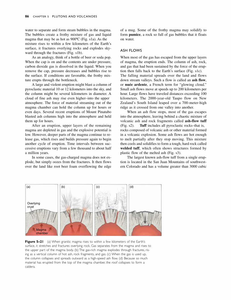
water to separate and form steam bubbles in the magma.The bubbles create a frothy mixture of gas and liquidmagma that may be as hot as 900ºC (Fig. 5–21a). As themixture rises to within a few kilometers of the Earth’ssurface, it fractures overlying rocks and explodes sky-ward through the fractures (Fig. 5–21b).
As an analogy, think of a bottle of beer or soda pop.When the cap is on and the contents are under pressure,carbon dioxide gas is dissolved in the liquid. When youremove the cap, pressure decreases and bubbles rise tothe surface. If conditions are favorable, the frothy mix-ture erupts through the bottleneck.
A large and violent eruption might blast a column ofpyroclastic material 10 or 12 kilometers into the sky, andthe column might be several kilometers in diameter. Acloud of fine ash may rise even higher––into the upperatmosphere. The force of material streaming out of themagma chamber can hold the column up for hours oreven days. Several recent eruptions of Mount Pinatuboblasted ash columns high into the atmosphere and heldthem up for hours.
After an eruption, upper layers of the remainingmagma are depleted in gas and the explosive potential islow. However, deeper parts of the magma continue to re-lease gas, which rises and builds pressure again to beginanother cycle of eruption. Time intervals between suc-cessive eruptions vary from a few thousand to about halfa million years.
In some cases, the gas-charged magma does not ex-plode, but simply oozes from the fractures. It then flowsover the land like root beer foam overflowing the edge
of a mug. Some of the frothy magma may solidify toform pumice, a rock so full of gas bubbles that it floatson water.
ASH FLOWS
When most of the gas has escaped from the upper layersof magma, the eruption ends. The column of ash, rock,and gas that had been sustained by the force of the erup-tion then falls back to the Earth’s surface (Fig. 5–21c).The falling material spreads over the land and flowsdown stream valleys. Such a flow is called an ash flow,or nuée ardente, a French term for “glowing cloud.”Small ash flows move at speeds up to 200 kilometers perhour. Large flows have traveled distances exceeding 100kilometers. The 2000-year-old Taupo flow on NewZealand’s South Island leaped over a 700-meter-highridge as it crossed from one valley into another.
When an ash flow stops, most of the gas escapesinto the atmosphere, leaving behind a chaotic mixture ofvolcanic ash and rock fragments called ash-flow tuff(Fig. 5–22). Tuff includes all pyroclastic rocks––that is,rocks composed of volcanic ash or other material formedin a volcanic explosion. Some ash flows are hot enoughto melt partially after they stop moving. This mixturethen cools and solidifies to form a tough, hard rock calledwelded tuff, which often shows structures formed byplastic flow of the melted ash (Fig. 5–23).
The largest known ash-flow tuff from a single erup-tion is located in the San Juan Mountains of southwest-ern Colorado and has a volume greater than 3000 cubic
86 CHAPTER 5 PLUTONS AND VOLCANOES
Magmachamber
Overlyingcrust
(a) (b) (c) (d)
Figure 5–21 (a) When granitic magma rises to within a few kilometers of the Earth’s surface, it stretches and fractures overlying rock. Gas separates from the magma and rises tothe upper part of the magma body. (b) The gas-rich magma explodes through fractures, ris-ing as a vertical column of hot ash, rock fragments, and gas. (c) When the gas is used up,the column collapses and spreads outward as a high-speed ash flow. (d) Because so muchmaterial has erupted from the top of the magma chamber, the roof collapses to form acaldera.
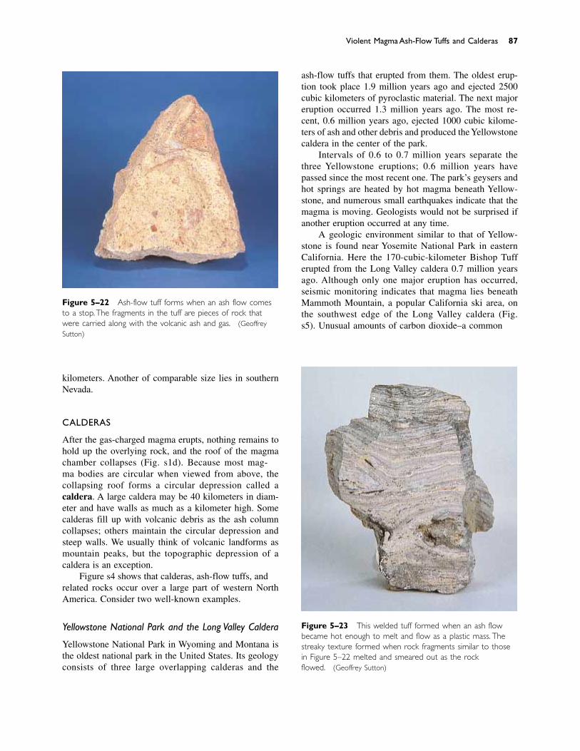
ash-flow tuffs that erupted from them. The oldest erup-tion took place 1.9 million years ago and ejected 2500cubic kilometers of pyroclastic material. The next majoreruption occurred 1.3 million years ago. The most re-cent, 0.6 million years ago, ejected 1000 cubic kilome-ters of ash and other debris and produced the Yellowstonecaldera in the center of the park.
Intervals of 0.6 to 0.7 million years separate thethree Yellowstone eruptions; 0.6 million years havepassed since the most recent one. The park’s geysers andhot springs are heated by hot magma beneath Yellow-stone, and numerous small earthquakes indicate that themagma is moving. Geologists would not be surprised ifanother eruption occurred at any time.
A geologic environment similar to that of Yellow-stone is found near Yosemite National Park in easternCalifornia. Here the 170-cubic-kilometer Bishop Tufferupted from the Long Valley caldera 0.7 million yearsago. Although only one major eruption has occurred,seismic monitoring indicates that magma lies beneathMammoth Mountain, a popular California ski area, onthe southwest edge of the Long Valley caldera (Fig.5–25). Unusual amounts of carbon dioxide––a common
Violent Magma: Ash-Flow Tuffs and Calderas 87
Figure 5–22 Ash-flow tuff forms when an ash flow comesto a stop.The fragments in the tuff are pieces of rock thatwere carried along with the volcanic ash and gas. (GeoffreySutton)
Figure 5–23 This welded tuff formed when an ash flowbecame hot enough to melt and flow as a plastic mass. Thestreaky texture formed when rock fragments similar to thosein Figure 5–22 melted and smeared out as the rockflowed. (Geoffrey Sutton)
kilometers. Another of comparable size lies in southernNevada.
CALDERAS
After the gas-charged magma erupts, nothing remains tohold up the overlying rock, and the roof of the magmachamber collapses (Fig. 5–21d). Because most mag-ma bodies are circular when viewed from above, the collapsing roof forms a circular depression called acaldera. A large caldera may be 40 kilometers in diam-eter and have walls as much as a kilometer high. Somecalderas fill up with volcanic debris as the ash columncollapses; others maintain the circular depression andsteep walls. We usually think of volcanic landforms asmountain peaks, but the topographic depression of acaldera is an exception.
Figure 5–24 shows that calderas, ash-flow tuffs, andrelated rocks occur over a large part of western NorthAmerica. Consider two well-known examples.
Yellowstone National Park and the Long Valley Caldera
Yellowstone National Park in Wyoming and Montana isthe oldest national park in the United States. Its geologyconsists of three large overlapping calderas and the
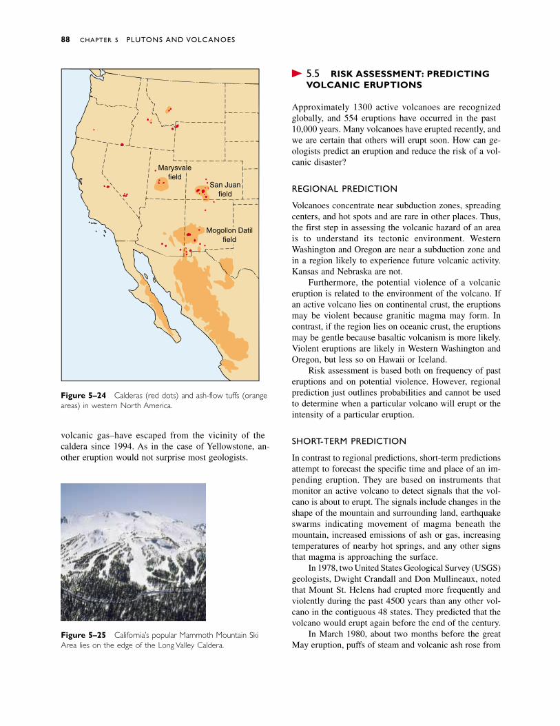
Figure 5–25 California’s popular Mammoth Mountain SkiArea lies on the edge of the Long Valley Caldera.
� 5.5 RISK ASSESSMENT: PREDICTINGVOLCANIC ERUPTIONS
Approximately 1300 active volcanoes are recognizedglobally, and 5564 eruptions have occurred in the past10,000 years. Many volcanoes have erupted recently, andwe are certain that others will erupt soon. How can ge-ologists predict an eruption and reduce the risk of a vol-canic disaster?
REGIONAL PREDICTION
Volcanoes concentrate near subduction zones, spreadingcenters, and hot spots and are rare in other places. Thus,the first step in assessing the volcanic hazard of an areais to understand its tectonic environment. WesternWashington and Oregon are near a subduction zone andin a region likely to experience future volcanic activity.Kansas and Nebraska are not.
Furthermore, the potential violence of a volcaniceruption is related to the environment of the volcano. Ifan active volcano lies on continental crust, the eruptionsmay be violent because granitic magma may form. Incontrast, if the region lies on oceanic crust, the eruptionsmay be gentle because basaltic volcanism is more likely.Violent eruptions are likely in Western Washington andOregon, but less so on Hawaii or Iceland.
Risk assessment is based both on frequency of pasteruptions and on potential violence. However, regionalprediction just outlines probabilities and cannot be usedto determine when a particular volcano will erupt or theintensity of a particular eruption.
SHORT-TERM PREDICTION
In contrast to regional predictions, short-term predictionsattempt to forecast the specific time and place of an im-pending eruption. They are based on instruments thatmonitor an active volcano to detect signals that the vol-cano is about to erupt. The signals include changes in theshape of the mountain and surrounding land, earthquakeswarms indicating movement of magma beneath themountain, increased emissions of ash or gas, increasingtemperatures of nearby hot springs, and any other signsthat magma is approaching the surface.
In 1978, two United States Geological Survey (USGS)geologists, Dwight Crandall and Don Mullineaux, notedthat Mount St. Helens had erupted more frequently andviolently during the past 4500 years than any other vol-cano in the contiguous 48 states. They predicted that thevolcano would erupt again before the end of the century.
In March 1980, about two months before the greatMay eruption, puffs of steam and volcanic ash rose from
88 CHAPTER 5 PLUTONS AND VOLCANOES
San Juanfield
Mogollon Datilfield
Marysvalefield
Figure 5–24 Calderas (red dots) and ash-flow tuffs (orangeareas) in western North America.
volcanic gas––have escaped from the vicinity of thecaldera since 1994. As in the case of Yellowstone, an-other eruption would not surprise most geologists.
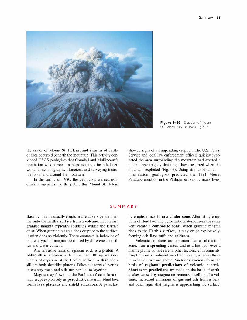
the crater of Mount St. Helens, and swarms of earth-quakes occurred beneath the mountain. This activity con-vinced USGS geologists that Crandall and Mullineaux’sprediction was correct. In response, they installed net-works of seismographs, tiltmeters, and surveying instru-ments on and around the mountain.
In the spring of 1980, the geologists warned gov-ernment agencies and the public that Mount St. Helens
Summary 89
Figure 5–26 Eruption of MountSt. Helens, May 18, 1980. (USGS)
showed signs of an impending eruption. The U.S. ForestService and local law enforcement officers quickly evac-uated the area surrounding the mountain and averted amuch larger tragedy that might have occurred when themountain exploded (Fig. 5–26). Using similar kinds ofinformation, geologists predicted the 1991 MountPinatubo eruption in the Philippines, saving many lives.
Basaltic magma usually erupts in a relatively gentle man-ner onto the Earth’s surface from a volcano. In contrast,granitic magma typically solidifies within the Earth’scrust. When granitic magma does erupt onto the surface,it often does so violently. These contrasts in behavior ofthe two types of magma are caused by differences in sil-ica and water content.
Any intrusive mass of igneous rock is a pluton. Abatholith is a pluton with more than 100 square kilo-meters of exposure at the Earth’s surface. A dike and asill are both sheetlike plutons. Dikes cut across layeringin country rock, and sills run parallel to layering.
Magma may flow onto the Earth’s surface as lava ormay erupt explosively as pyroclastic material. Fluid lavaforms lava plateaus and shield volcanoes. A pyroclas-
tic eruption may form a cinder cone. Alternating erup-tions of fluid lava and pyroclastic material from the samevent create a composite cone. When granitic magmarises to the Earth’s surface, it may erupt explosively,forming ash-flow tuffs and calderas.
Volcanic eruptions are common near a subductionzone, near a spreading center, and at a hot spot over amantle plume but are rare in other tectonic environments.Eruptions on a continent are often violent, whereas thosein oceanic crust are gentle. Such observations form thebasis of regional predictions of volcanic hazards. Short-term predictions are made on the basis of earth-quakes caused by magma movements, swelling of a vol-cano, increased emissions of gas and ash from a vent,and other signs that magma is approaching the surface.
S U M M A R Y
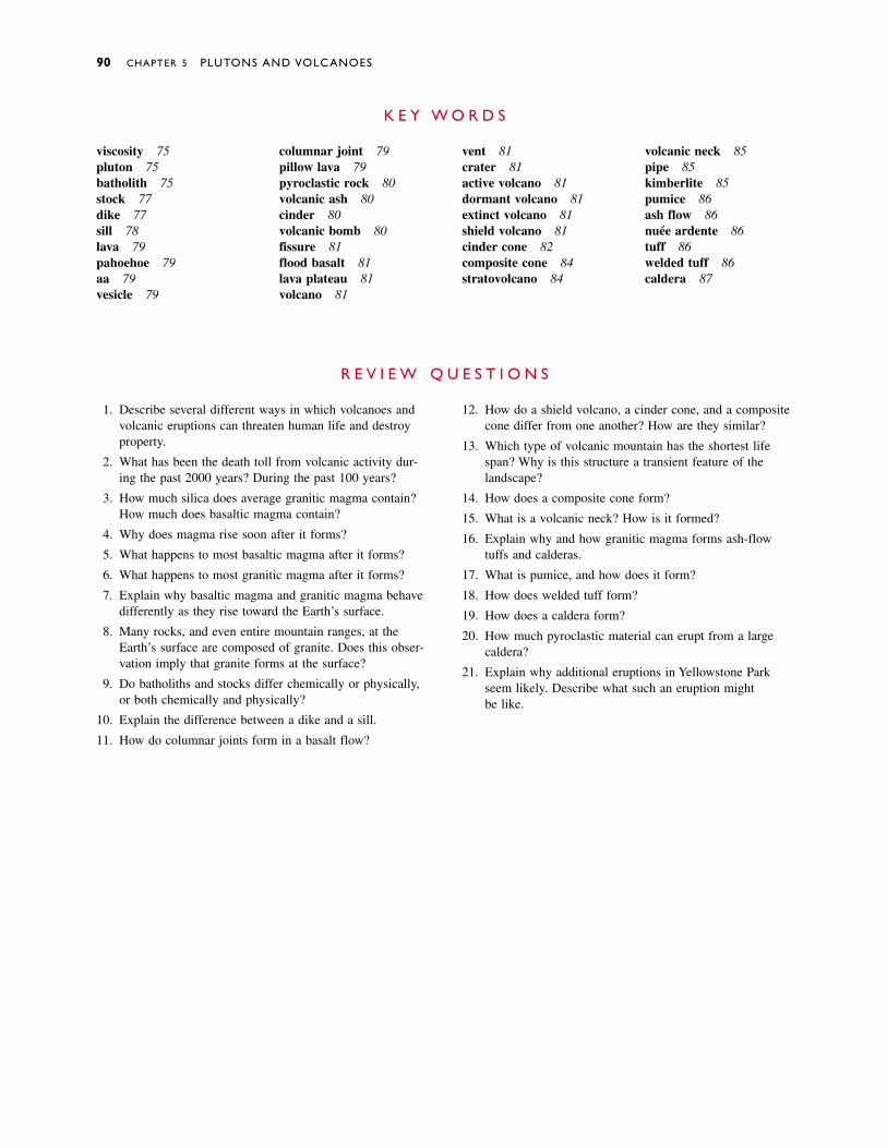
1. Describe several different ways in which volcanoes andvolcanic eruptions can threaten human life and destroyproperty.
2. What has been the death toll from volcanic activity dur-ing the past 2000 years? During the past 100 years?
3. How much silica does average granitic magma contain?How much does basaltic magma contain?
4. Why does magma rise soon after it forms?
5. What happens to most basaltic magma after it forms?
6. What happens to most granitic magma after it forms?
7. Explain why basaltic magma and granitic magma behavedifferently as they rise toward the Earth’s surface.
8. Many rocks, and even entire mountain ranges, at theEarth’s surface are composed of granite. Does this obser-vation imply that granite forms at the surface?
9. Do batholiths and stocks differ chemically or physically,or both chemically and physically?
10. Explain the difference between a dike and a sill.
11. How do columnar joints form in a basalt flow?
12. How do a shield volcano, a cinder cone, and a compositecone differ from one another? How are they similar?
13. Which type of volcanic mountain has the shortest lifespan? Why is this structure a transient feature of thelandscape?
14. How does a composite cone form?
15. What is a volcanic neck? How is it formed?
16. Explain why and how granitic magma forms ash-flowtuffs and calderas.
17. What is pumice, and how does it form?
18. How does welded tuff form?
19. How does a caldera form?
20. How much pyroclastic material can erupt from a largecaldera?
21. Explain why additional eruptions in Yellowstone Parkseem likely. Describe what such an eruption might be like.
R E V I E W Q U E S T I O N S
viscosity 75pluton 75batholith 75stock 77dike 77sill 78lava 79pahoehoe 79aa 79vesicle 79
columnar joint 79pillow lava 79pyroclastic rock 80volcanic ash 80cinder 80volcanic bomb 80fissure 81flood basalt 81lava plateau 81volcano 81
vent 81crater 81active volcano 81dormant volcano 81extinct volcano 81shield volcano 81cinder cone 82composite cone 84stratovolcano 84
volcanic neck 85pipe 85kimberlite 85pumice 86ash flow 86nuée ardente 86tuff 86welded tuff 86caldera 87
K E Y W O R D S
90 CHAPTER 5 PLUTONS AND VOLCANOES

1. How and why does pressure affect the melting point ofrock and, conversely, the solidification temperature ofmagma? How does the explanation differ for basaltic andgranitic magma?
2. Why does water play an important role in magma gener-ation in subduction zones, but not in the other two majorenvironments of magma generation?
3. How could you distinguish between a sill exposed byerosion and a lava flow?
4. Imagine that you detect a volcanic eruption on a distantplanet but have no other data. What conclusions couldyou draw from this single bit of information? What typesof information would you search for to expand yourknowledge of the geology of the planet?
5. Explain why some volcanoes have steep, precipitousfaces, but many do not.
6. Parts of the San Juan Mountains of Colorado are com-posed of granite plutons, and other parts are volcanicrock. Explain why these two types of rock are likely tooccur in proximity.
7. Compare and contrast the danger of living 5 kilometersfrom Yellowstone National Park with the danger of livingan equal distance from Mount St. Helens. Would youranswer differ for people who live 50 kilometers or thosewho live 500 kilometers from the two regions?
8. Use long-term prediction methods to evaluate the vol-canic hazards in the vicinity of your college or university.
9. Discuss some possible consequences of a large calderaeruption in modern times. What is the probability thatsuch an event will occur?
D I S C U S S I O N Q U E S T I O N S
Discussion Questions 91
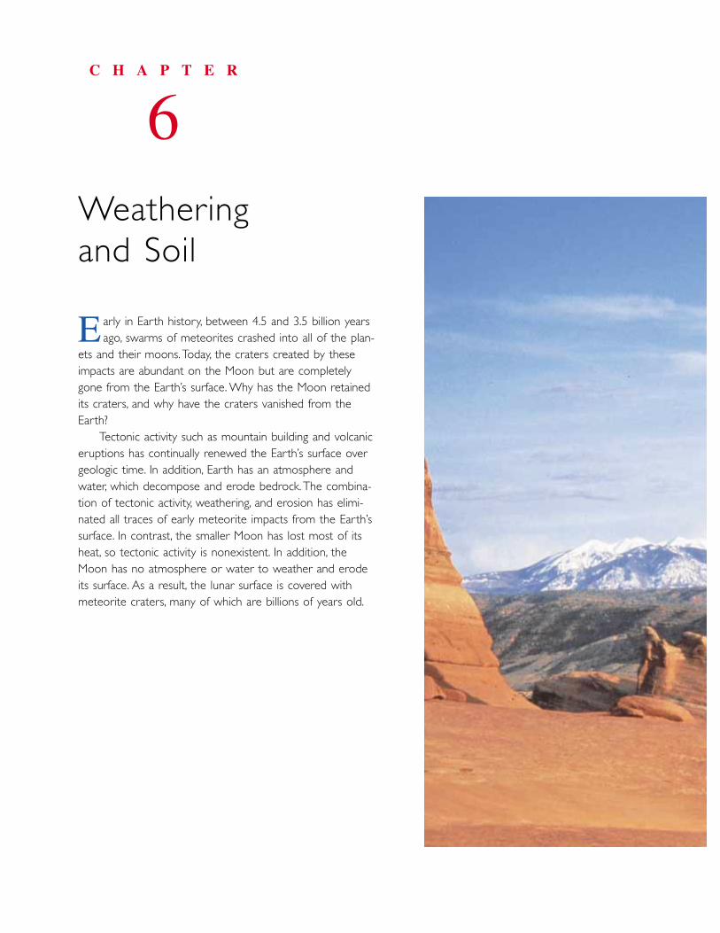
arly in Earth history, between 4.5 and 3.5 billion years ago, swarms of meteorites crashed into all of the plan-
ets and their moons.Today, the craters created by theseimpacts are abundant on the Moon but are completelygone from the Earth’s surface. Why has the Moon retainedits craters, and why have the craters vanished from theEarth?
Tectonic activity such as mountain building and volcaniceruptions has continually renewed the Earth’s surface overgeologic time. In addition, Earth has an atmosphere andwater, which decompose and erode bedrock.The combina-tion of tectonic activity, weathering, and erosion has elimi-nated all traces of early meteorite impacts from the Earth’ssurface. In contrast, the smaller Moon has lost most of itsheat, so tectonic activity is nonexistent. In addition, theMoon has no atmosphere or water to weather and erodeits surface. As a result, the lunar surface is covered withmeteorite craters, many of which are billions of years old.
C H A P T E R
6Weathering and Soil
E
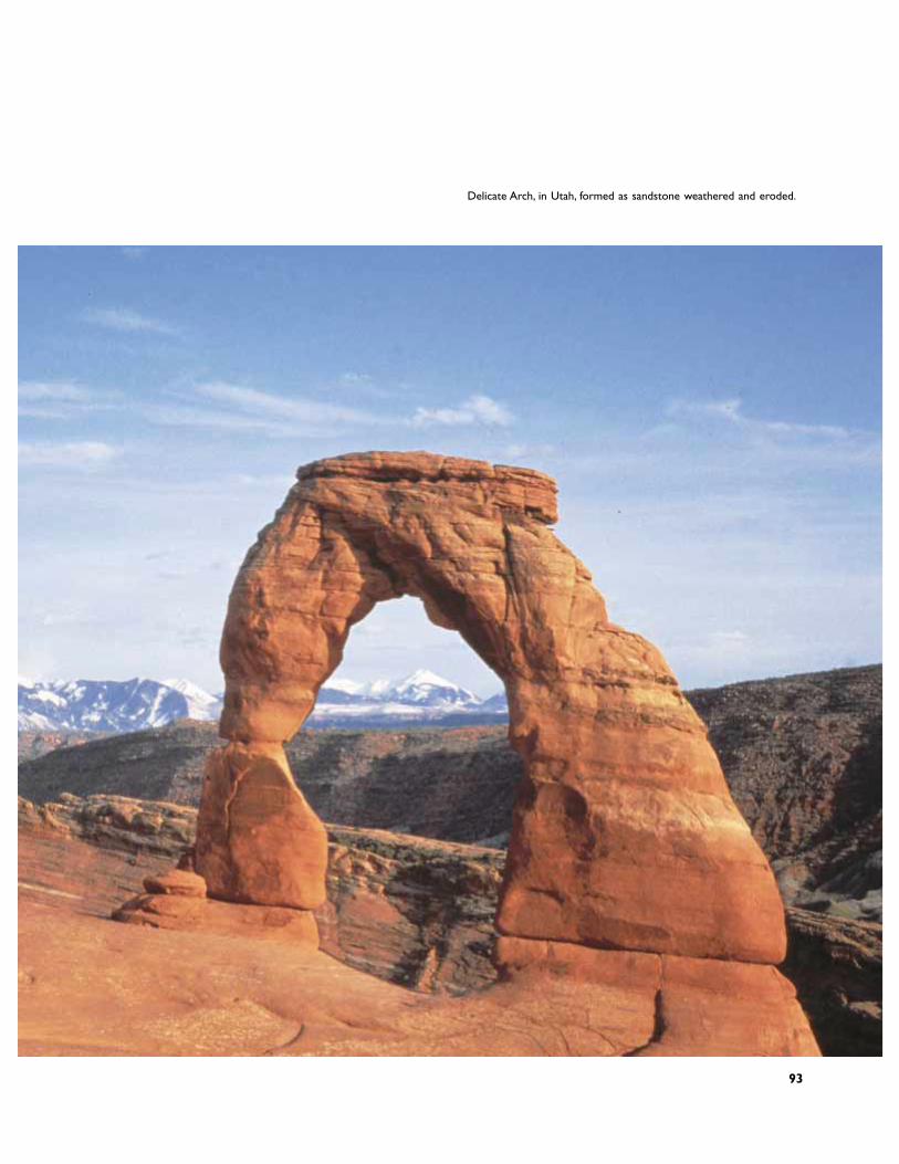
Delicate Arch, in Utah, formed as sandstone weathered and eroded.
93
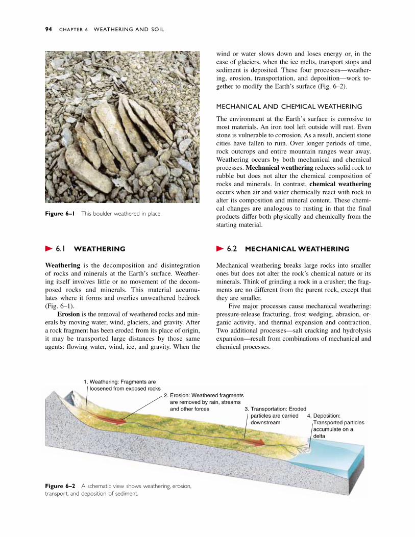
� 6.1 WEATHERING
Weathering is the decomposition and disintegration of rocks and minerals at the Earth’s surface. Weather-ing itself involves little or no movement of the decom-posed rocks and minerals. This material accumu-lates where it forms and overlies unweathered bedrock(Fig. 6–1).
Erosion is the removal of weathered rocks and min-erals by moving water, wind, glaciers, and gravity. Aftera rock fragment has been eroded from its place of origin,it may be transported large distances by those sameagents: flowing water, wind, ice, and gravity. When the
wind or water slows down and loses energy or, in thecase of glaciers, when the ice melts, transport stops andsediment is deposited. These four processes—weather-ing, erosion, transportation, and deposition—work to-gether to modify the Earth’s surface (Fig. 6–2).
MECHANICAL AND CHEMICAL WEATHERING
The environment at the Earth’s surface is corrosive tomost materials. An iron tool left outside will rust. Evenstone is vulnerable to corrosion. As a result, ancient stonecities have fallen to ruin. Over longer periods of time,rock outcrops and entire mountain ranges wear away.Weathering occurs by both mechanical and chemicalprocesses. Mechanical weathering reduces solid rock torubble but does not alter the chemical composition ofrocks and minerals. In contrast, chemical weatheringoccurs when air and water chemically react with rock toalter its composition and mineral content. These chemi-cal changes are analogous to rusting in that the finalproducts differ both physically and chemically from thestarting material.
� 6.2 MECHANICAL WEATHERING
Mechanical weathering breaks large rocks into smallerones but does not alter the rock’s chemical nature or itsminerals. Think of grinding a rock in a crusher; the frag-ments are no different from the parent rock, except thatthey are smaller.
Five major processes cause mechanical weathering:pressure-release fracturing, frost wedging, abrasion, or-ganic activity, and thermal expansion and contraction.Two additional processes—salt cracking and hydrolysisexpansion—result from combinations of mechanical andchemical processes.
94 CHAPTER 6 WEATHERING AND SOIL
Weathering: Fragments areloosened from exposed rocks
1.
Erosion: Weathered fragmentsare removed by rain, streamsand other forces
2.
Transportation: Erodedparticles are carrieddownstream
3.Deposition:Transported particlesaccumulate on adelta
4.
Figure 6–1 This boulder weathered in place.
Figure 6–2 A schematic view shows weathering, erosion,transport, and deposition of sediment.
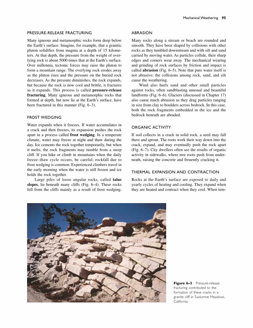
PRESSURE-RELEASE FRACTURING
Many igneous and metamorphic rocks form deep belowthe Earth’s surface. Imagine, for example, that a graniticpluton solidifies from magma at a depth of 15 kilome-ters. At that depth, the pressure from the weight of over-lying rock is about 5000 times that at the Earth’s surface.Over millennia, tectonic forces may raise the pluton toform a mountain range. The overlying rock erodes awayas the pluton rises and the pressure on the buried rockdecreases. As the pressure diminishes, the rock expands,but because the rock is now cool and brittle, it fracturesas it expands. This process is called pressure-releasefracturing. Many igneous and metamorphic rocks thatformed at depth, but now lie at the Earth’s surface, havebeen fractured in this manner (Fig. 6–3).
FROST WEDGING
Water expands when it freezes. If water accumulates ina crack and then freezes, its expansion pushes the rockapart in a process called frost wedging. In a temperateclimate, water may freeze at night and thaw during theday. Ice cements the rock together temporarily, but whenit melts, the rock fragments may tumble from a steepcliff. If you hike or climb in mountains when the dailyfreeze–thaw cycle occurs, be careful; rockfall due tofrost wedging is common. Experienced climbers travel inthe early morning when the water is still frozen and iceholds the rock together.
Large piles of loose angular rocks, called talusslopes, lie beneath many cliffs (Fig. 6–4). These rocksfell from the cliffs mainly as a result of frost wedging.
ABRASION
Many rocks along a stream or beach are rounded andsmooth. They have been shaped by collisions with otherrocks as they tumbled downstream and with silt and sandcarried by moving water. As particles collide, their sharpedges and corners wear away. The mechanical wearingand grinding of rock surfaces by friction and impact iscalled abrasion (Fig. 6–5). Note that pure water itself isnot abrasive; the collisions among rock, sand, and siltcause the weathering.
Wind also hurls sand and other small particlesagainst rocks, often sandblasting unusual and beautifullandforms (Fig. 6–6). Glaciers (discussed in Chapter 17)also cause much abrasion as they drag particles rangingin size from clay to boulders across bedrock. In this case,both the rock fragments embedded in the ice and thebedrock beneath are abraded.
ORGANIC ACTIVITY
If soil collects in a crack in solid rock, a seed may fallthere and sprout. The roots work their way down into thecrack, expand, and may eventually push the rock apart(Fig. 6–7). City dwellers often see the results of organicactivity in sidewalks, where tree roots push from under-neath, raising the concrete and frequently cracking it.
THERMAL EXPANSION AND CONTRACTION
Rocks at the Earth’s surface are exposed to daily andyearly cycles of heating and cooling. They expand whenthey are heated and contract when they cool. When tem-
Mechanical Weathering 95
Figure 6–3 Pressure-releasefracturing contributed to the formation of these cracks in agranite cliff in Tuolumne Meadows,California.
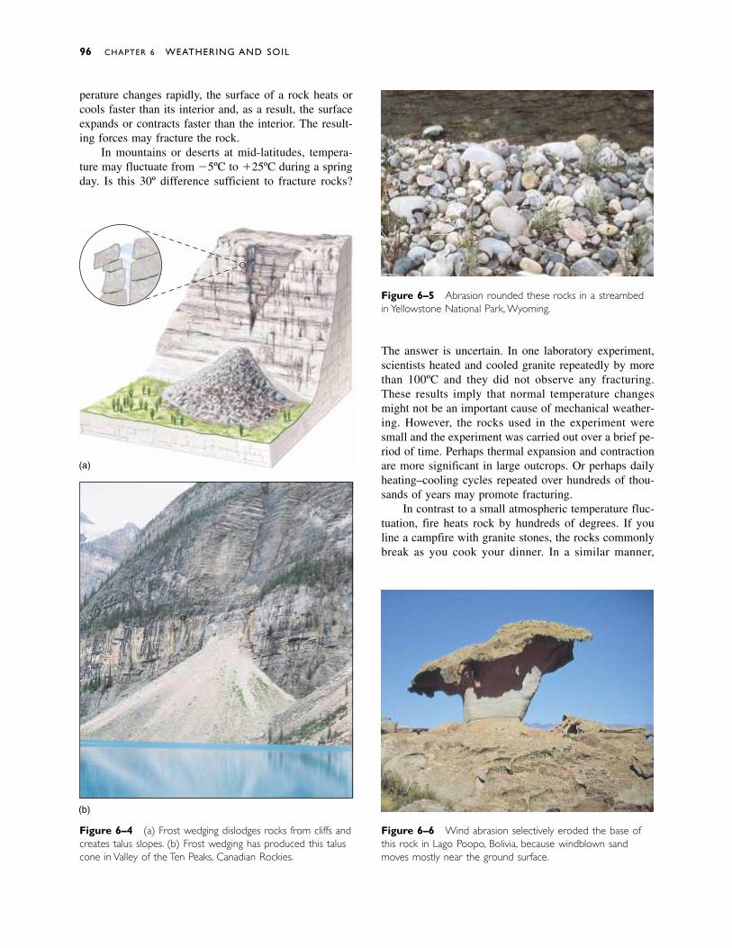
perature changes rapidly, the surface of a rock heats orcools faster than its interior and, as a result, the surfaceexpands or contracts faster than the interior. The result-ing forces may fracture the rock.
In mountains or deserts at mid-latitudes, tempera-ture may fluctuate from �5ºC to �25ºC during a springday. Is this 30º difference sufficient to fracture rocks?
The answer is uncertain. In one laboratory experiment,scientists heated and cooled granite repeatedly by morethan 100ºC and they did not observe any fracturing.These results imply that normal temperature changesmight not be an important cause of mechanical weather-ing. However, the rocks used in the experiment weresmall and the experiment was carried out over a brief pe-riod of time. Perhaps thermal expansion and contractionare more significant in large outcrops. Or perhaps dailyheating–cooling cycles repeated over hundreds of thou-sands of years may promote fracturing.
In contrast to a small atmospheric temperature fluc-tuation, fire heats rock by hundreds of degrees. If youline a campfire with granite stones, the rocks commonlybreak as you cook your dinner. In a similar manner,
96 CHAPTER 6 WEATHERING AND SOIL
(a)
Figure 6–5 Abrasion rounded these rocks in a streambedin Yellowstone National Park, Wyoming.
Figure 6–4 (a) Frost wedging dislodges rocks from cliffs andcreates talus slopes. (b) Frost wedging has produced this taluscone in Valley of the Ten Peaks, Canadian Rockies.
Figure 6–6 Wind abrasion selectively eroded the base ofthis rock in Lago Poopo, Bolivia, because windblown sandmoves mostly near the ground surface.
(b)
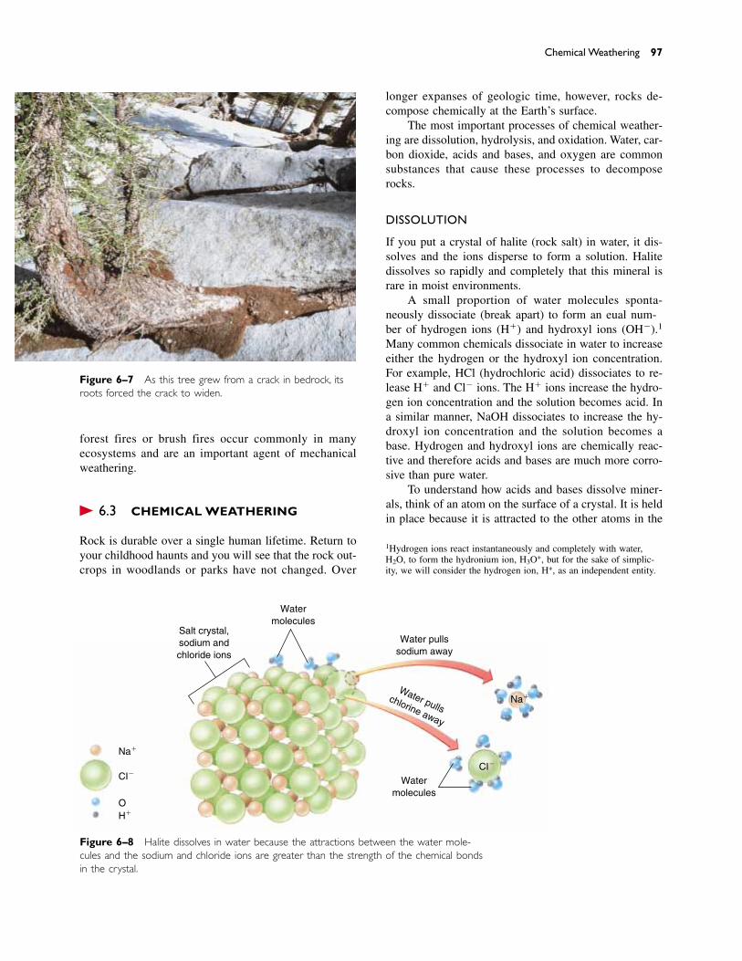
forest fires or brush fires occur commonly in manyecosystems and are an important agent of mechanicalweathering.
� 6.3 CHEMICAL WEATHERING
Rock is durable over a single human lifetime. Return toyour childhood haunts and you will see that the rock out-crops in woodlands or parks have not changed. Over
longer expanses of geologic time, however, rocks de-compose chemically at the Earth’s surface.
The most important processes of chemical weather-ing are dissolution, hydrolysis, and oxidation. Water, car-bon dioxide, acids and bases, and oxygen are commonsubstances that cause these processes to decomposerocks.
DISSOLUTION
If you put a crystal of halite (rock salt) in water, it dis-solves and the ions disperse to form a solution. Halitedissolves so rapidly and completely that this mineral israre in moist environments.
A small proportion of water molecules sponta-neously dissociate (break apart) to form an equal num-ber of hydrogen ions (H�) and hydroxyl ions (OH�).1
Many common chemicals dissociate in water to increaseeither the hydrogen or the hydroxyl ion concentration.For example, HCl (hydrochloric acid) dissociates to re-lease H� and Cl� ions. The H� ions increase the hydro-gen ion concentration and the solution becomes acid. Ina similar manner, NaOH dissociates to increase the hy-droxyl ion concentration and the solution becomes abase. Hydrogen and hydroxyl ions are chemically reac-tive and therefore acids and bases are much more corro-sive than pure water.
To understand how acids and bases dissolve miner-als, think of an atom on the surface of a crystal. It is heldin place because it is attracted to the other atoms in the
Chemical Weathering 97
Figure 6–7 As this tree grew from a crack in bedrock, itsroots forced the crack to widen.
Na�
Na�
CI�CI�
OH�
Salt crystal,sodium andchloride ions
Watermolecules
Watermolecules
Water pullssodium away
Water pullschlorine away
Figure 6–8 Halite dissolves in water because the attractions between the water mole-cules and the sodium and chloride ions are greater than the strength of the chemical bondsin the crystal.
1Hydrogen ions react instantaneously and completely with water,H2O, to form the hydronium ion, H3O+, but for the sake of simplic-ity, we will consider the hydrogen ion, H+, as an independent entity.
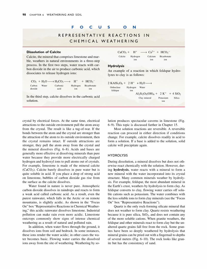
crystal by electrical forces. At the same time, electricalattractions to the outside environment pull the atom awayfrom the crystal. The result is like a tug-of-war. If thebonds between the atom and the crystal are stronger thanthe attraction of the atom to its outside environment, thenthe crystal remains intact. If outside attractions arestronger, they pull the atom away from the crystal andthe mineral dissolves (Fig. 6–8). Acids and bases aregenerally more effective at dissolving minerals than purewater because they provide more electrically charged hydrogen and hydroxyl ions to pull atoms out of crystals.For example, limestone is made of the mineral calcite(CaCO3). Calcite barely dissolves in pure water but isquite soluble in acid. If you place a drop of strong acidon limestone, bubbles of carbon dioxide gas rise fromthe surface as the calcite dissolves.
Water found in nature is never pure. Atmosphericcarbon dioxide dissolves in raindrops and reacts to forma weak acid called carbonic acid. As a result, even thepurest rainwater, which falls in the Arctic or on remotemountains, is slightly acidic. As shown in the “FocusOn” box “Representative Reactions in Chemical Weather-ing,” this acidic rainwater dissolves limestone. Industrialpollution can make rain even more acidic. Limestoneoutcrops commonly show signs of intense chemicalweathering as a result of natural and polluted rain.
In addition, when water flows through the ground, itdissolves ions from soil and bedrock. In some instances,these ions render the water acidic; in other cases the wa-ter becomes basic. Flowing water carries the dissolvedions away from the site of weathering. Weathering by so-
lution produces spectacular caverns in limestone (Fig.6–9). This topic is discussed further in Chapter 15.
Most solution reactions are reversible. A reversiblereaction can proceed in either direction if conditionschange. For example, calcite dissolves readily in acid toform a solution. If a base is added to the solution, solidcalcite will precipitate again.
HYDROLYSIS
During dissolution, a mineral dissolves but does not oth-erwise react chemically with the solution. However, dur-ing hydrolysis, water reacts with a mineral to form anew mineral with the water incorporated into its crystalstructure. Many common minerals weather by hydroly-sis. For example, feldspar, the most abundant mineral inthe Earth’s crust, weathers by hydrolysis to form clay. Asfeldspar converts to clay, flowing water carries off solu-ble cations such as potassium. The water combines withthe less soluble ions to form clay minerals (see the “FocusOn” box “Representative Reactions”).
Quartz is the only rock-forming silicate mineral thatdoes not weather to form clay. Quartz resists weatheringbecause it is pure silica, SiO2, and does not contain anyof the more soluble cations. When granite weathers, thefeldspar and other minerals react to form clay but the un-altered quartz grains fall free from the rock. Some gran-ites have been so deeply weathered by hydrolysis thatmineral grains can be pried out with a fingernail to depthsof several meters (Fig. 6–10). The rock looks like gran-ite but has the consistency of sand.
98 CHAPTER 6 WEATHERING AND SOIL
F O C U S O N
R E P R E S E N T A T I V E R E A C T I O N S I N C H E M I C A L W E A T H E R I N G
Dissolution of CalciteCalcite, the mineral that comprises limestone and mar-ble, weathers in natural environments in a three-stepprocess. In the first two steps, water reacts with car-bon dioxide in the air to produce carbonic acid, whichdissociates to release hydrogen ions:
CO2 � H2O → H2CO3 → H� � HCO3�
Carbon Water Carbonic Hydrogen Bicarbonatedioxide acid ion ion
In the third step, calcite dissolves in the carbonic acidsolution.
CaCO3 � H� → Ca2� � HCO3�
Calcite Hydrogen Calcium Bicarbonateion ion ion
HydrolysisAn example of a reaction in which feldspar hydro-lyzes to clay is as follows:
2 KAlSi3O8 � 2 H� + H2O →Orthoclase Hydrogen Water
feldspar ion
Al2Si2O5(OH)4 � 2 K� � 4 SiO2
Clay mineral Potassium Silicaion
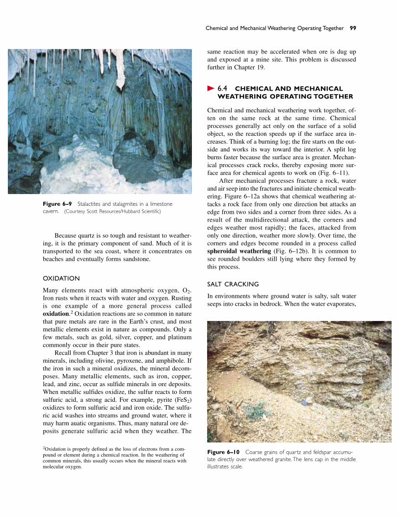
Chemical and Mechanical Weathering Operating Together 99
Figure 6–9 Stalactites and stalagmites in a limestone cavern. (Courtesy Scott Resources/Hubbard Scientific)
Because quartz is so tough and resistant to weather-ing, it is the primary component of sand. Much of it istransported to the sea coast, where it concentrates onbeaches and eventually forms sandstone.
OXIDATION
Many elements react with atmospheric oxygen, O2.Iron rusts when it reacts with water and oxygen. Rustingis one example of a more general process called oxidation.2 Oxidation reactions are so common in naturethat pure metals are rare in the Earth’s crust, and mostmetallic elements exist in nature as compounds. Only afew metals, such as gold, silver, copper, and platinumcommonly occur in their pure states.
Recall from Chapter 3 that iron is abundant in manyminerals, including olivine, pyroxene, and amphibole. Ifthe iron in such a mineral oxidizes, the mineral decom-poses. Many metallic elements, such as iron, copper,lead, and zinc, occur as sulfide minerals in ore deposits.When metallic sulfides oxidize, the sulfur reacts to formsulfuric acid, a strong acid. For example, pyrite (FeS2)oxidizes to form sulfuric acid and iron oxide. The sulfu-ric acid washes into streams and ground water, where itmay harm aquatic organisms. Thus, many natural ore de-posits generate sulfuric acid when they weather. The
same reaction may be accelerated when ore is dug upand exposed at a mine site. This problem is discussedfurther in Chapter 19.
� 6.4 CHEMICAL AND MECHANICALWEATHERING OPERATING TOGETHER
Chemical and mechanical weathering work together, of-ten on the same rock at the same time. Chemicalprocesses generally act only on the surface of a solid object, so the reaction speeds up if the surface area in-creases. Think of a burning log; the fire starts on the out-side and works its way toward the interior. A split logburns faster because the surface area is greater. Mechan-ical processes crack rocks, thereby exposing more sur-face area for chemical agents to work on (Fig. 6–11).
After mechanical processes fracture a rock, waterand air seep into the fractures and initiate chemical weath-ering. Figure 6–12a shows that chemical weathering at-tacks a rock face from only one direction but attacks anedge from two sides and a corner from three sides. As aresult of the multidirectional attack, the corners and edges weather most rapidly; the faces, attacked fromonly one direction, weather more slowly. Over time, thecorners and edges become rounded in a process calledspheroidal weathering (Fig. 6–12b). It is common tosee rounded boulders still lying where they formed bythis process.
SALT CRACKING
In environments where ground water is salty, salt waterseeps into cracks in bedrock. When the water evaporates,
Figure 6–10 Coarse grains of quartz and feldspar accumu-late directly over weathered granite.The lens cap in the middleillustrates scale.
2Oxidation is properly defined as the loss of electrons from a com-pound or element during a chemical reaction. In the weathering ofcommon minerals, this usually occurs when the mineral reacts withmolecular oxygen.
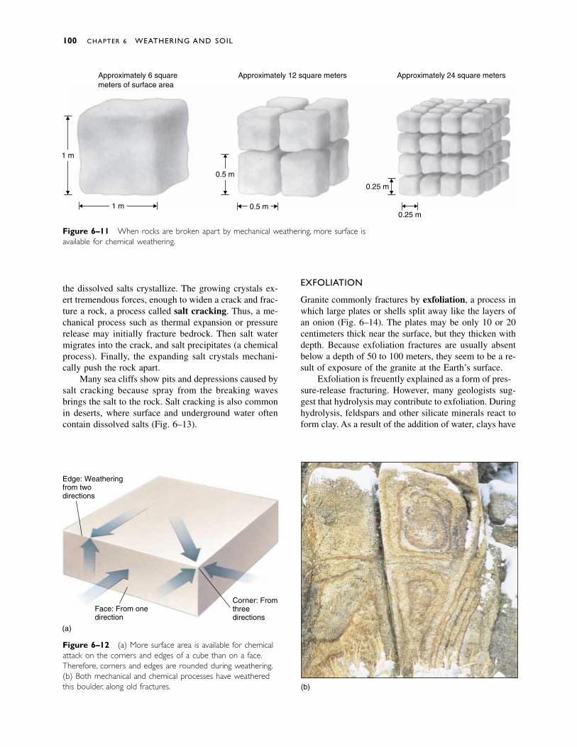
100 CHAPTER 6 WEATHERING AND SOIL
Approximately 6 squaremeters of surface area
Approximately 12 square meters Approximately 24 square meters
1 m
0.5 m
0.25 m
0.25 m0.5 m1 m
Figure 6–11 When rocks are broken apart by mechanical weathering, more surface isavailable for chemical weathering.
Edge: Weatheringfrom twodirections
Face: From onedirection
(a)
Corner: Fromthreedirections
(b)
Figure 6–12 (a) More surface area is available for chemicalattack on the corners and edges of a cube than on a face.Therefore, corners and edges are rounded during weathering.(b) Both mechanical and chemical processes have weatheredthis boulder, along old fractures.
the dissolved salts crystallize. The growing crystals ex-ert tremendous forces, enough to widen a crack and frac-ture a rock, a process called salt cracking. Thus, a me-chanical process such as thermal expansion or pressurerelease may initially fracture bedrock. Then salt watermigrates into the crack, and salt precipitates (a chemicalprocess). Finally, the expanding salt crystals mechani-cally push the rock apart.
Many sea cliffs show pits and depressions caused bysalt cracking because spray from the breaking wavesbrings the salt to the rock. Salt cracking is also commonin deserts, where surface and underground water oftencontain dissolved salts (Fig. 6–13).
EXFOLIATION
Granite commonly fractures by exfoliation, a process inwhich large plates or shells split away like the layers ofan onion (Fig. 6–14). The plates may be only 10 or 20centimeters thick near the surface, but they thicken withdepth. Because exfoliation fractures are usually absentbelow a depth of 50 to 100 meters, they seem to be a re-sult of exposure of the granite at the Earth’s surface.
Exfoliation is frequently explained as a form of pres-sure-release fracturing. However, many geologists sug-gest that hydrolysis may contribute to exfoliation. Duringhydrolysis, feldspars and other silicate minerals react toform clay. As a result of the addition of water, clays have
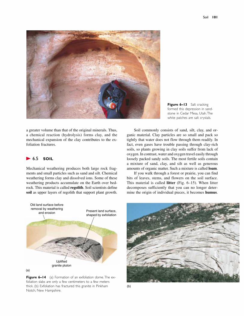
a greater volume than that of the original minerals. Thus,a chemical reaction (hydrolysis) forms clay, and the mechanical expansion of the clay contributes to the ex-foliation fractures.
� 6.5 SOIL
Mechanical weathering produces both large rock frag-ments and small particles such as sand and silt. Chemicalweathering forms clay and dissolved ions. Some of theseweathering products accumulate on the Earth over bed-rock. This material is called regolith. Soil scientists definesoil as upper layers of regolith that support plant growth.
Soil commonly consists of sand, silt, clay, and or-ganic material. Clay particles are so small and pack sotightly that water does not flow through them readily. Infact, even gases have trouble passing through clay-richsoils, so plants growing in clay soils suffer from lack ofoxygen. In contrast, water and oxygen travel easily throughloosely packed sandy soils. The most fertile soils containa mixture of sand, clay, and silt as well as generousamounts of organic matter. Such a mixture is called loam.
If you walk through a forest or prairie, you can findbits of leaves, stems, and flowers on the soil surface.This material is called litter (Fig. 6–15). When litter decomposes sufficiently that you can no longer deter-mine the origin of individual pieces, it becomes humus.
Soil 101
Figure 6–13 Salt crackingformed this depression in sand-stone in Cedar Mesa, Utah.Thewhite patches are salt crystals.
Figure 6–14 (a) Formation of an exfoliation dome.The ex-foliation slabs are only a few centimeters to a few metersthick. (b) Exfoliation has fractured this granite in PinkhamNotch, New Hampshire.
Old land surface beforeremoval by weathering
and erosion Present land surface,shaped by exfoliation
Upliftedgranite pluton
(a)
(b)
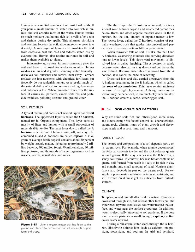
Humus is an essential component of most fertile soils. Ifyou pour a small amount of water into soil rich in hu-mus, the soil absorbs most of the water. Humus retainsso much moisture that humus-rich soil swells after a rainand shrinks during dry spells. This alternate shrinkingand swelling loosens the soil, allowing roots to grow intoit easily. A rich layer of humus also insulates the soilfrom excessive heat and cold and reduces water loss byevaporation. Humus also retains nutrients in soil andmakes them available to plants.
In intensive agriculture, farmers commonly plow thesoil and leave it exposed for weeks or months. Humusoxidizes in air and degrades. Running water frequentlydissolves soil nutrients and carries them away. Farmersreplace the lost nutrients with chemical fertilizers butfrequently do not replenish humus. As a result, much ofthe natural ability of soil to conserve and regulate waterand nutrients is lost. When rainwater flows over the sur-face, it carries soil particles, excess fertilizer, and pesti-cide residues, polluting streams and ground water.
SOIL PROFILES
A typical mature soil consists of several layers called soilhorizons. The uppermost layer is called the O horizon,named for its Organic component. This layer consistsmostly of litter and humus with a small proportion ofminerals (Fig. 6–16). The next layer down, called the Ahorizon, is a mixture of humus, sand, silt, and clay. Thecombined O and A horizons are called topsoil. A kilo-gram of average fertile topsoil contains about 30 percentby weight organic matter, including approximately 2 tril-lion bacteria, 400 million fungi, 50 million algae, 30 mil-lion protozoa, and thousands of larger organisms such asinsects, worms, nematodes, and mites.
The third layer, the B horizon or subsoil, is a tran-sitional zone between topsoil and weathered parent rockbelow. Roots and other organic material occur in the Bhorizon, but the total amount of organic matter is low.The lowest layer, called the C horizon, consists of par-tially weathered rock that grades into unweathered par-ent rock. This zone contains little organic matter.
When rainwater falls on soil, it sinks into the O andA horizons, weathering minerals and carrying dissolvedions to lower levels. This downward movement of dis-solved ions is called leaching. The A horizon is sandybecause water also carries clay downward but leaves thesand behind. Because materials are removed from the Ahorizon, it is called the zone of leaching.
Dissolved ions and clay carried downward from theA horizon accumulate in the B horizon, which is calledthe zone of accumulation. This layer retains moisturebecause of its high clay content. Although moisture re-tention may be beneficial, if too much clay accumulates,the B horizon creates a dense, waterlogged soil.
� 6.6 SOIL-FORMING FACTORS
Why are some soils rich and others poor, some sandyand others loamy? Six factors control soil characteristics:parent rock, climate, rates of plant growth and decay,slope angle and aspect, time, and transport.
PARENT ROCK
The texture and composition of a soil depends partly onits parent rock. For example, when granite decomposes,the feldspar converts to clay and the rock releases quartzas sand grains. If the clay leaches into the B horizon, asandy soil forms. In contrast, because basalt contains noquartz, soil formed from basalt is likely to be rich in clayand contain only small amounts of sand. Nutrient abun-dance also depends in part on the parent rock. For ex-ample, a pure quartz sandstone contains no nutrients, andsoil formed on it must get its nutrients from outsidesources.
CLIMATE
Temperature and rainfall affect soil formation. Rain seepsdownward through soil, but several other factors pull thewater back upward. Roots suck soil water toward the sur-face, and water near the surface evaporates. In addition,water is electrically attracted to soil particles. If the poresize between particles is small enough, capillary actiondraws water upward.
During a rainstorm, water seeps through the A hori-zon, dissolving soluble ions such as calcium, magne-sium, potassium, and sodium. In arid and semiarid
102 CHAPTER 6 WEATHERING AND SOIL
Figure 6–15 Litter is organic matter that has fallen to theground and started to decompose but still retains its originalform and shape.

regions, when the water reaches the B horizon, capillaryaction and plant roots then draw it back up toward thesurface, where it evaporates or is incorporated into planttissue. After the water escapes, many of its dissolvedions precipitate in the B horizon, encrusting the soil withsalts. A soil of this type is a pedocal (Fig. 6–17a). Thisprocess often deposits enough calcium carbonate to forma hard cement called caliche in the soil. In the ImperialValley in California, for example, irrigation water con-tains high concentrations of calcium carbonate. A thickcontinuous layer of caliche forms in the soil as the wa-ter evaporates. To continue growing crops, farmers mustthen rip this layer apart with heavy machinery.
Because nutrients concentrate when water evapo-rates, many pedocals are fertile if irrigation water isavailable. However, salts often concentrate so much thatthey become toxic to plants (Fig. 6–18). As mentionedpreviously, all streams contain small concentrations ofdissolved salts. If arid or semiarid soils are intensively ir-rigated, salts can accumulate until plants cannot grow.This process is called salinization. Some historians ar-gue that salinization destroyed croplands and thereby
contributed to the decline of many ancient civilizations,such as the Babylonian Empire.
In a wet climate, water seeping down through thesoil leaches soluble ions from both the A and B horizons.The less soluble elements, such as aluminum, iron, andsome silicon, remain behind, accumulating in the B hori-zon to form a soil type called a pedalfer (Fig. 6–17b).The subsoil in a pedalfer is commonly rich in clay, whichis mostly aluminum and silicon, and has the reddishcolor of iron oxide.
In regions of very high rainfall, such as a tropicalrainforest, so much water seeps through the soil that itleaches away nearly all the soluble cations. Only very in-soluble aluminum and iron minerals remain (Fig. 6–17c).Soil of this type is called a laterite. Laterites are oftencolored rust-red by iron oxide (Fig. 6–19). A highly alu-minous laterite, called bauxite, is the world’s main typeof aluminum ore.
The second important component of climate, aver-age annual temperature, affects soil formation in twoways. First, chemical reactions proceed more rapidly inwarm temperatures than in cooler conditions, so chemi-
Soil-Forming Factors 103
A
O
B
C
Bedrock
Horizon. Mostlyorganic matter.
Horizon (topsoil).High concentrationof organic matter.
Horizon (subsoil).Clay and cationsleached fromA horizonaccumulated here.
Horizon(weatheredbedrock)
(a)
(b)
Figure 6–16 (a) Schematic soil profile showing typical soilhorizons. (b) Soil horizons are often easily distinguished bycolor and texture.The dark upper layer is the A horizon; thewhiter lower layer is the B horizon. (Soil Conservation Service)
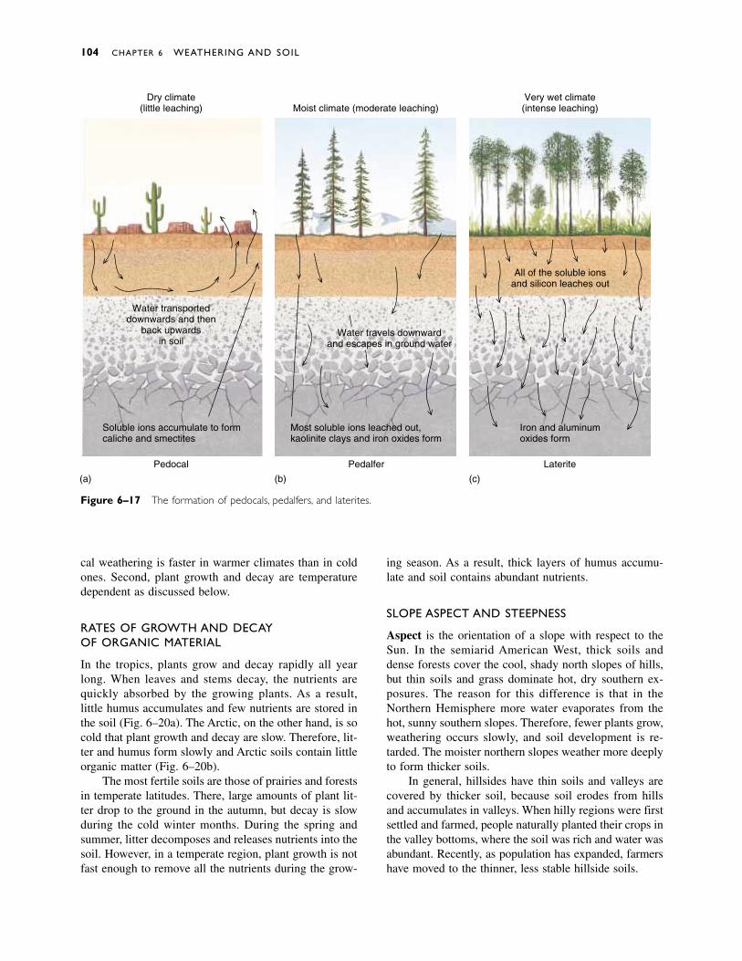
cal weathering is faster in warmer climates than in coldones. Second, plant growth and decay are temperaturedependent as discussed below.
RATES OF GROWTH AND DECAY OF ORGANIC MATERIAL
In the tropics, plants grow and decay rapidly all yearlong. When leaves and stems decay, the nutrients arequickly absorbed by the growing plants. As a result,little humus accumulates and few nutrients are stored inthe soil (Fig. 6–20a). The Arctic, on the other hand, is socold that plant growth and decay are slow. Therefore, lit-ter and humus form slowly and Arctic soils contain littleorganic matter (Fig. 6–20b).
The most fertile soils are those of prairies and forestsin temperate latitudes. There, large amounts of plant lit-ter drop to the ground in the autumn, but decay is slowduring the cold winter months. During the spring andsummer, litter decomposes and releases nutrients into thesoil. However, in a temperate region, plant growth is notfast enough to remove all the nutrients during the grow-
ing season. As a result, thick layers of humus accumu-late and soil contains abundant nutrients.
SLOPE ASPECT AND STEEPNESS
Aspect is the orientation of a slope with respect to theSun. In the semiarid American West, thick soils anddense forests cover the cool, shady north slopes of hills,but thin soils and grass dominate hot, dry southern ex-posures. The reason for this difference is that in theNorthern Hemisphere more water evaporates from thehot, sunny southern slopes. Therefore, fewer plants grow,weathering occurs slowly, and soil development is re-tarded. The moister northern slopes weather more deeplyto form thicker soils.
In general, hillsides have thin soils and valleys arecovered by thicker soil, because soil erodes from hillsand accumulates in valleys. When hilly regions were firstsettled and farmed, people naturally planted their crops inthe valley bottoms, where the soil was rich and water wasabundant. Recently, as population has expanded, farmershave moved to the thinner, less stable hillside soils.
Dry climate(little leaching)
Water transporteddownwards and then
back upwardsin soil
Pedocal Pedalfer Laterite
Soluble ions accumulate to formcaliche and smectites
Most soluble ions leached out,kaolinite clays and iron oxides form
Iron and aluminumoxides form
Water travels downwardand escapes in ground water
All of the soluble ionsand silicon leaches out
Very wet climate(intense leaching)Moist climate (moderate leaching)
(a) (b) (c)
Figure 6–17 The formation of pedocals, pedalfers, and laterites.
104 CHAPTER 6 WEATHERING AND SOIL

TIME
Most chemical weathering occurs at the relatively lowtemperatures of the Earth’s surface. Consequently, chem-ical weathering goes on slowly in most places, and timebecomes an important factor in determining the extent ofweathering.
Recall that feldspars weather to form clay, whereasquartz does not decompose easily. In geologically youngsoils, the decomposition of feldspars may be incompleteand the soils are likely to be sandy. As soils mature, morefeldspars decompose, and the clay content increases.
SOIL TRANSPORT
By studying recent lava flows, scientists have determinedhow quickly plants return to an area after it has beencovered by hard, solid rock. In many cases, plants appearwhen a lava flow is only a few years old, even beforeweathering has formed soil. Closer scrutiny shows thatthe plants have rooted in tiny amounts of soil that weretransported from nearby areas by wind or water.
Soil-Forming Factors 105
Figure 6–18 Saline seep on a ranch in Wyoming. Saline water seeps into this depressionand then evaporates to deposit white salt crystals on the ground and on the fence posts.
Figure 6–19 Iron oxide colors this Georgia laterite. (USGS)
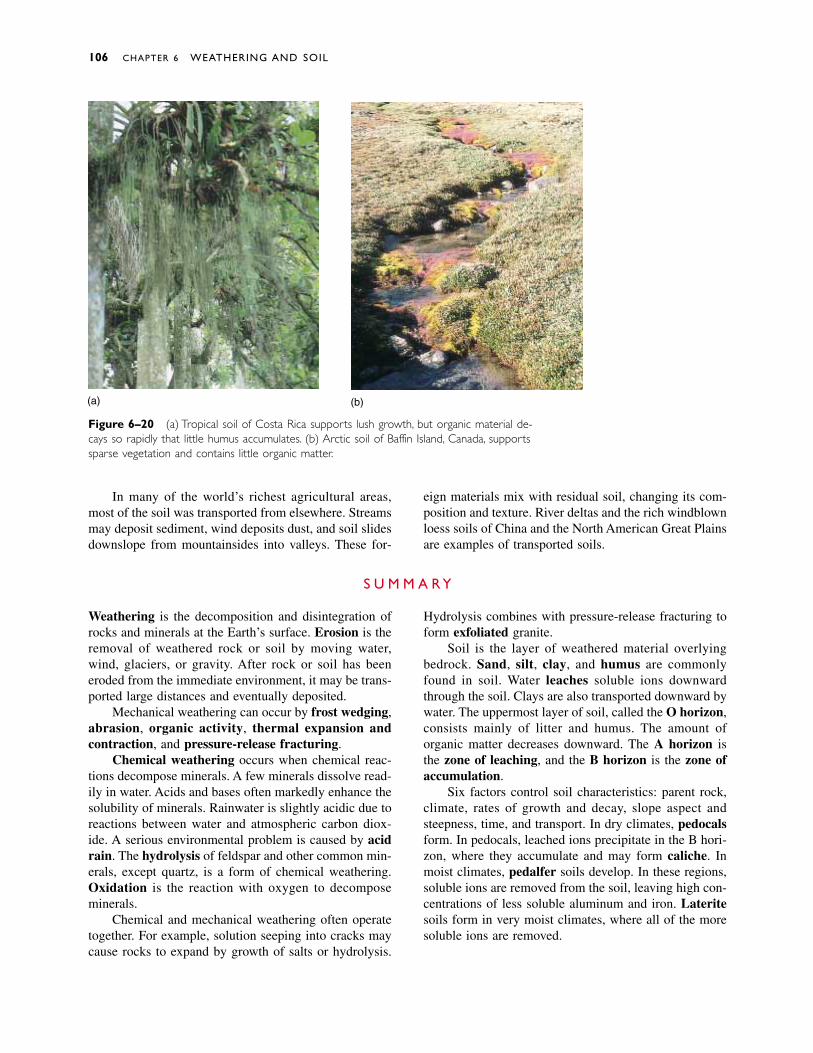
In many of the world’s richest agricultural areas,most of the soil was transported from elsewhere. Streamsmay deposit sediment, wind deposits dust, and soil slidesdownslope from mountainsides into valleys. These for-
eign materials mix with residual soil, changing its com-position and texture. River deltas and the rich windblownloess soils of China and the North American Great Plainsare examples of transported soils.
106 CHAPTER 6 WEATHERING AND SOIL
(a) (b)
Figure 6–20 (a) Tropical soil of Costa Rica supports lush growth, but organic material de-cays so rapidly that little humus accumulates. (b) Arctic soil of Baffin Island, Canada, supportssparse vegetation and contains little organic matter.
Weathering is the decomposition and disintegration ofrocks and minerals at the Earth’s surface. Erosion is theremoval of weathered rock or soil by moving water,wind, glaciers, or gravity. After rock or soil has beeneroded from the immediate environment, it may be trans-ported large distances and eventually deposited.
Mechanical weathering can occur by frost wedging,abrasion, organic activity, thermal expansion andcontraction, and pressure-release fracturing.
Chemical weathering occurs when chemical reac-tions decompose minerals. A few minerals dissolve read-ily in water. Acids and bases often markedly enhance thesolubility of minerals. Rainwater is slightly acidic due toreactions between water and atmospheric carbon diox-ide. A serious environmental problem is caused by acidrain. The hydrolysis of feldspar and other common min-erals, except quartz, is a form of chemical weathering.Oxidation is the reaction with oxygen to decomposeminerals.
Chemical and mechanical weathering often operatetogether. For example, solution seeping into cracks maycause rocks to expand by growth of salts or hydrolysis.
Hydrolysis combines with pressure-release fracturing toform exfoliated granite.
Soil is the layer of weathered material overlyingbedrock. Sand, silt, clay, and humus are commonlyfound in soil. Water leaches soluble ions downwardthrough the soil. Clays are also transported downward bywater. The uppermost layer of soil, called the O horizon,consists mainly of litter and humus. The amount of organic matter decreases downward. The A horizon isthe zone of leaching, and the B horizon is the zone ofaccumulation.
Six factors control soil characteristics: parent rock,climate, rates of growth and decay, slope aspect andsteepness, time, and transport. In dry climates, pedocalsform. In pedocals, leached ions precipitate in the B hori-zon, where they accumulate and may form caliche. Inmoist climates, pedalfer soils develop. In these regions,soluble ions are removed from the soil, leaving high con-centrations of less soluble aluminum and iron. Lateritesoils form in very moist climates, where all of the moresoluble ions are removed.
S U M M A R Y
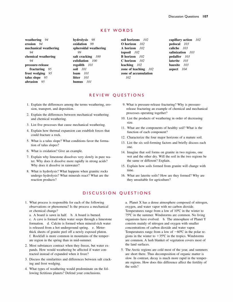
Discussion Questions 107
weathering 94erosion 94mechanical weathering
94chemical weathering
94pressure-release
fracturing 95frost wedging 95talus slope 95abrasion 95
hydrolysis 98oxidation 99spheroidal weathering
99salt cracking 100exfoliation 100regolith 101soil 101loam 101litter 101humus 101
soil horizons 102O horizon 102A horizon 102topsoil 102B horizon 102C horizon 102leaching 102zone of leaching 102zone of accumulation
102
capillary action 102pedocal 103caliche 103salinization 103pedalfer 103laterite 103bauxite 103aspect 104
K E Y W O R D S
1. Explain the differences among the terms weathering, ero-sion, transport, and deposition.
2. Explain the differences between mechanical weatheringand chemical weathering.
3. List five processes that cause mechanical weathering.
4. Explain how thermal expansion can establish forces thatcould fracture a rock.
5. What is a talus slope? What conditions favor the forma-tion of talus slopes?
6. What is oxidation? Give an example.
7. Explain why limestone dissolves very slowly in pure wa-ter. Why does it dissolve more rapidly in strong acids?Why does it dissolve in rainwater?
8. What is hydrolysis? What happens when granitic rocksundergo hydrolysis? What minerals react? What are thereaction products?
9. What is pressure-release fracturing? Why is pressure-release fracturing an example of chemical and mechanicalprocesses operating together?
10. List the products of weathering in order of decreasingsize.
11. What are the components of healthy soil? What is thefunction of each component?
12. Characterize the four major horizons of a mature soil.
13. List the six soil-forming factors and briefly discuss eachone.
14. Imagine that soil forms on granite in two regions, onewet and the other dry. Will the soil in the two regions bethe same or different? Explain.
15. Explain how soils formed from granite will change withtime.
16. What are laterite soils? How are they formed? Why arethey unsuitable for agriculture?
R E V I E W Q U E S T I O N S
1. What process is responsible for each of the following observations or phenomena? Is the process a mechanicalor chemical change?a. A board is sawn in half. b. A board is burned.c. A cave is formed when water seeps through a limestoneformation. d. Calcite is formed when mineral-rich wateris released from a hot underground spring. e. Meter-thick sheets of granite peel off a newly exposed pluton.f. Rockfall is more common in mountains of the temper-ate region in the spring than in mid-summer.
2. Most substances contract when they freeze, but water ex-pands. How would weathering be affected if water con-tracted instead of expanded when it froze?
3. Discuss the similarities and differences between salt crack-ing and frost wedging.
4. What types of weathering would predominate on the fol-lowing fictitious planets? Defend your conclusions.
a. Planet X has a dense atmosphere composed of nitrogen,oxygen, and water vapor with no carbon dioxide.Temperatures range from a low of 10ºC in the winter to75ºC in the summer. Windstorms are common. No livingorganisms have evolved. b. The atmosphere of Planet Yconsists mainly of nitrogen and oxygen with smaller concentrations of carbon dioxide and water vapor.Temperatures range from a low of �60ºC in the polar re-gions in the winter to �35ºC in the tropics. Windstormsare common. A lush blanket of vegetation covers most ofthe land surfaces.
5. The Arctic regions are cold most of the year, and summersare short there. Thus decomposition of organic matter isslow. In contrast, decay is much more rapid in the temper-ate regions. How does this difference affect the fertility ofthe soils?
D I S C U S S I O N Q U E S T I O N S

eathering decomposes bedrock. Flowing water, wind,gravity, and glaciers then erode the decomposed
rock, transport it downslope, and finally deposit it on thesea coast or in lakes and river valleys. Finally, the loose sedi-ment is cemented to form hard sedimentary rock.
Sedimentary rocks make up only about 5 percent ofthe Earth’s crust. However, because they form on theEarth’s surface, they are widely spread in a thin veneer overunderlying igneous and metamorphic rocks. As a result, sed-imentary rocks cover about 75 percent of continents.
Many sedimentary rocks have high economic value. Oiland gas form in certain sedimentary rocks. Coal, a majorenergy resource, is a sedimentary rock. Limestone is an im-portant building material, both as stone and as the primaryingredient in cement. Gypsum is the raw material for plas-ter. Ores of copper, lead, zinc, iron, gold, and silver concen-trate in certain types of sedimentary rocks.
C H A P T E R
7Sedimentary Rocks
W
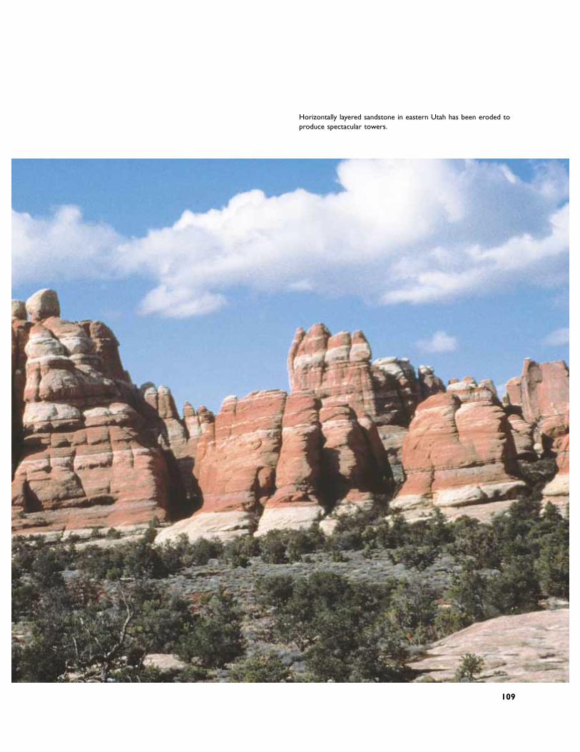
Horizontally layered sandstone in eastern Utah has been eroded toproduce spectacular towers.
109
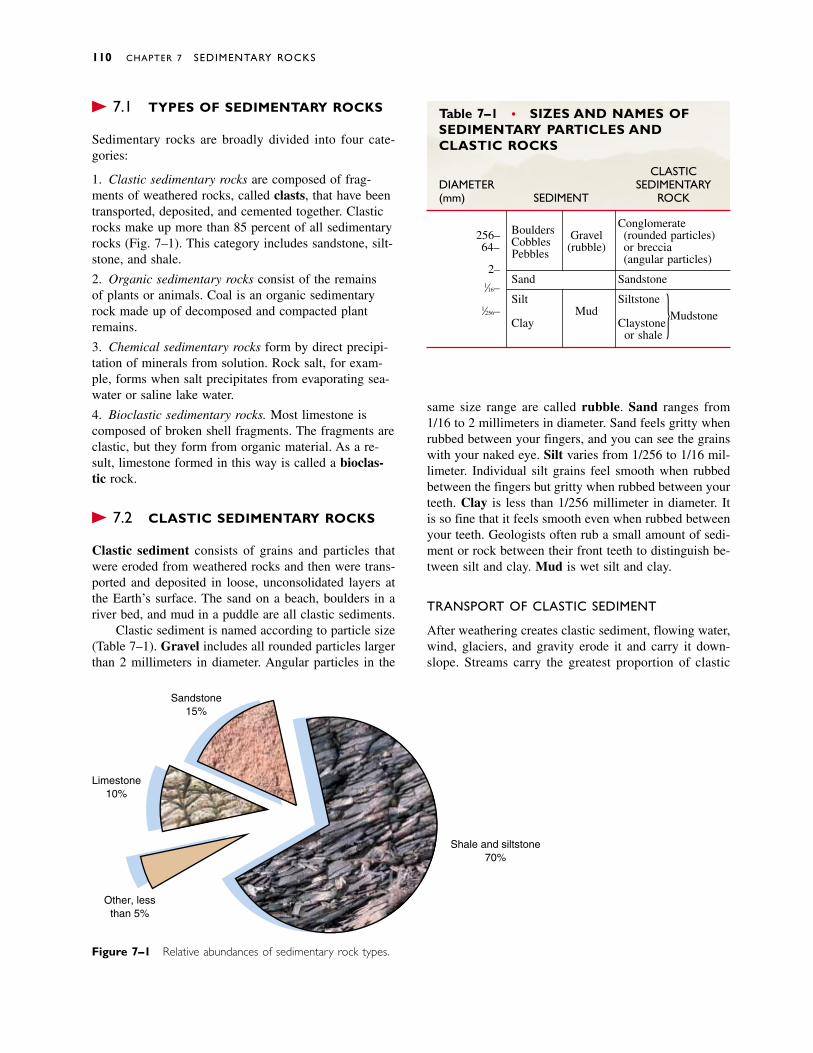
� 7.1 TYPES OF SEDIMENTARY ROCKS
Sedimentary rocks are broadly divided into four cate-gories:
1. Clastic sedimentary rocks are composed of frag-ments of weathered rocks, called clasts, that have beentransported, deposited, and cemented together. Clasticrocks make up more than 85 percent of all sedimentaryrocks (Fig. 7–1). This category includes sandstone, silt-stone, and shale.
2. Organic sedimentary rocks consist of the remains of plants or animals. Coal is an organic sedimentaryrock made up of decomposed and compacted plant remains.
3. Chemical sedimentary rocks form by direct precipi-tation of minerals from solution. Rock salt, for exam-ple, forms when salt precipitates from evaporating sea-water or saline lake water.
4. Bioclastic sedimentary rocks. Most limestone iscomposed of broken shell fragments. The fragments areclastic, but they form from organic material. As a re-sult, limestone formed in this way is called a bioclas-tic rock.
� 7.2 CLASTIC SEDIMENTARY ROCKS
Clastic sediment consists of grains and particles thatwere eroded from weathered rocks and then were trans-ported and deposited in loose, unconsolidated layers atthe Earth’s surface. The sand on a beach, boulders in ariver bed, and mud in a puddle are all clastic sediments.
Clastic sediment is named according to particle size(Table 7–1). Gravel includes all rounded particles largerthan 2 millimeters in diameter. Angular particles in the
same size range are called rubble. Sand ranges from1/16 to 2 millimeters in diameter. Sand feels gritty whenrubbed between your fingers, and you can see the grainswith your naked eye. Silt varies from 1/256 to 1/16 mil-limeter. Individual silt grains feel smooth when rubbedbetween the fingers but gritty when rubbed between yourteeth. Clay is less than 1/256 millimeter in diameter. Itis so fine that it feels smooth even when rubbed betweenyour teeth. Geologists often rub a small amount of sedi-ment or rock between their front teeth to distinguish be-tween silt and clay. Mud is wet silt and clay.
TRANSPORT OF CLASTIC SEDIMENT
After weathering creates clastic sediment, flowing water,wind, glaciers, and gravity erode it and carry it down-slope. Streams carry the greatest proportion of clastic
110 CHAPTER 7 SEDIMENTARY ROCKS
Sandstone15%
Limestone10%
Other, lessthan 5%
Shale and siltstone70%
Figure 7–1 Relative abundances of sedimentary rock types.
Table 7–1 • SIZES AND NAMES OFSEDIMENTARY PARTICLES ANDCLASTIC ROCKS
CLASTICDIAMETER SEDIMENTARY(mm) SEDIMENT ROCK
Boulders Conglomerate256– Gravel (rounded particles)64– Cobbles (rubble) or breccia
2–Pebbles (angular particles)
Sand Sandstone1⁄16–
Silt Siltstone1⁄256– Mud Mudstone
Clay Claystoneor shale
}
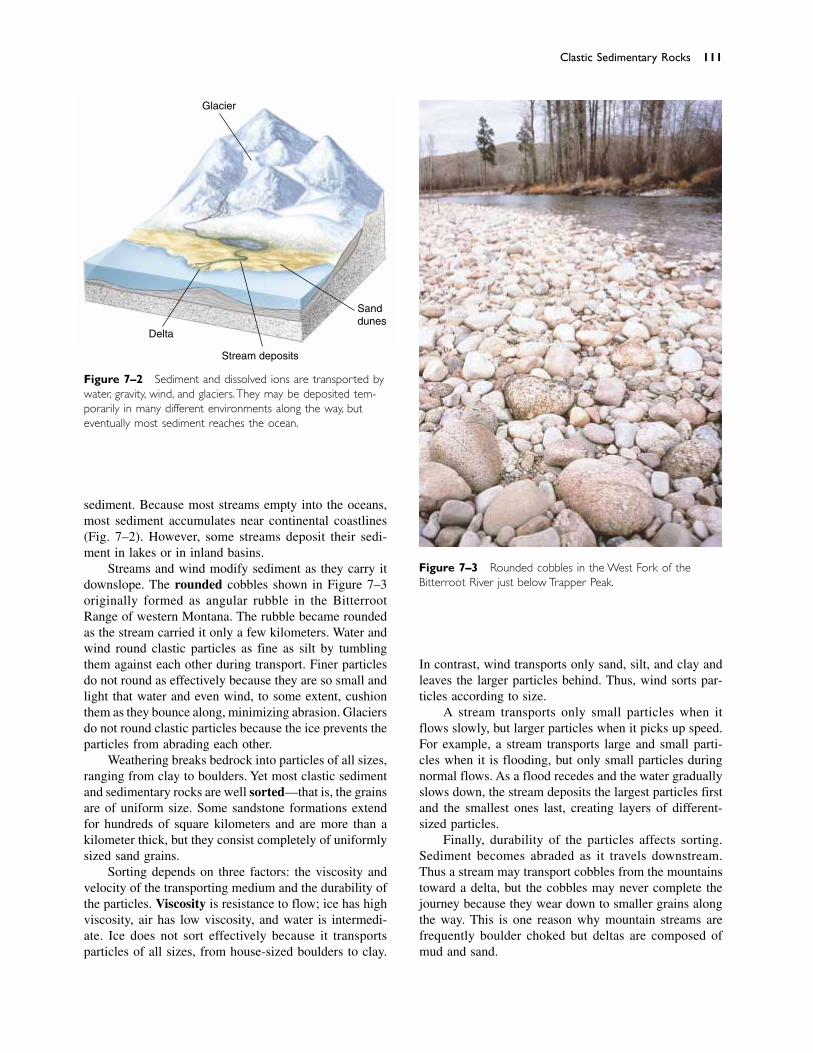
sediment. Because most streams empty into the oceans,most sediment accumulates near continental coastlines(Fig. 7–2). However, some streams deposit their sedi-ment in lakes or in inland basins.
Streams and wind modify sediment as they carry itdownslope. The rounded cobbles shown in Figure 7–3originally formed as angular rubble in the BitterrootRange of western Montana. The rubble became roundedas the stream carried it only a few kilometers. Water andwind round clastic particles as fine as silt by tumblingthem against each other during transport. Finer particlesdo not round as effectively because they are so small andlight that water and even wind, to some extent, cushionthem as they bounce along, minimizing abrasion. Glaciersdo not round clastic particles because the ice prevents theparticles from abrading each other.
Weathering breaks bedrock into particles of all sizes,ranging from clay to boulders. Yet most clastic sedimentand sedimentary rocks are well sorted—that is, the grainsare of uniform size. Some sandstone formations extendfor hundreds of square kilometers and are more than akilometer thick, but they consist completely of uniformlysized sand grains.
Sorting depends on three factors: the viscosity andvelocity of the transporting medium and the durability ofthe particles. Viscosity is resistance to flow; ice has highviscosity, air has low viscosity, and water is intermedi-ate. Ice does not sort effectively because it transportsparticles of all sizes, from house-sized boulders to clay.
In contrast, wind transports only sand, silt, and clay andleaves the larger particles behind. Thus, wind sorts par-ticles according to size.
A stream transports only small particles when itflows slowly, but larger particles when it picks up speed.For example, a stream transports large and small parti-cles when it is flooding, but only small particles duringnormal flows. As a flood recedes and the water graduallyslows down, the stream deposits the largest particles firstand the smallest ones last, creating layers of different-sized particles.
Finally, durability of the particles affects sorting.Sediment becomes abraded as it travels downstream.Thus a stream may transport cobbles from the mountainstoward a delta, but the cobbles may never complete thejourney because they wear down to smaller grains alongthe way. This is one reason why mountain streams arefrequently boulder choked but deltas are composed ofmud and sand.
Clastic Sedimentary Rocks 111
Glacier
Sanddunes
Stream deposits
Delta
Figure 7–2 Sediment and dissolved ions are transported bywater, gravity, wind, and glaciers. They may be deposited tem-porarily in many different environments along the way, buteventually most sediment reaches the ocean.
Figure 7–3 Rounded cobbles in the West Fork of theBitterroot River just below Trapper Peak.
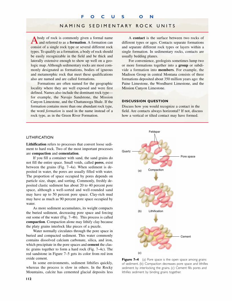
LITHIFICATION
Lithification refers to processes that convert loose sedi-ment to hard rock. Two of the most important processesare compaction and cementation.
If you fill a container with sand, the sand grains donot fill the entire space. Small voids, called pores, existbetween the grains (Fig. 7–4a). When sediment is de-posited in water, the pores are usually filled with water.The proportion of space occupied by pores depends onparticle size, shape, and sorting. Commonly, freshly de-posited clastic sediment has about 20 to 40 percent porespace, although a well-sorted and well-rounded sandmay have up to 50 percent pore space. Clay-rich mudmay have as much as 90 percent pore space occupied bywater.
As more sediment accumulates, its weight compactsthe buried sediment, decreasing pore space and forcingout some of the water (Fig. 7–4b). This process is calledcompaction. Compaction alone may lithify clay becausethe platy grains interlock like pieces of a puzzle.
Water normally circulates through the pore space inburied and compacted sediment. This water commonlycontains dissolved calcium carbonate, silica, and iron,which precipitate in the pore spaces and cement the clas-tic grains together to form a hard rock (Fig. 7–4c). Thered sandstone in Figure 7–5 gets its color from red ironoxide cement.
In some environments, sediment lithifies quickly,whereas the process is slow in others. In the RockyMountains, calcite has cemented glacial deposits less
Figure 7–4 (a) Pore space is the open space among grainsof sediment. (b) Compaction decreases pore space and lithifiessediment by interlocking the grains. (c) Cement fills pores andlithifies sediment by binding grains together.
Cement
(a)
(b)
(c)
Compaction
Lithification
Pore space
Quartz
Feldspar
F O C U S O N
N A M I N G S E D I M E N T A R Y R O C K U N I T S
Abody of rock is commonly given a formal nameand referred to as a formation. A formation can
consist of a single rock type or several different rocktypes. To qualify as a formation, a body of rock shouldbe easily recognizable in the field and be thick andlaterally extensive enough to show up well on a geo-logic map. Although sedimentary rocks are most com-monly designated as formations, bodies of igneousand metamorphic rock that meet these qualificationsalso are named and are called formations.
Formations are often named for the geographiclocality where they are well exposed and were firstdefined. Names also include the dominant rock type—for example, the Navajo Sandstone, the MissionCanyon Limestone, and the Chattanooga Shale. If theformation contains more than one abundant rock type,the word formation is used in the name instead of arock type, as in the Green River Formation.
A contact is the surface between two rocks ofdifferent types or ages. Contacts separate formationsand separate different rock types or layers within asingle formation. In sedimentary rocks, contacts areusually bedding planes.
For convenience, geologists sometimes lump twoor more formations together into a group or subdi-vide a formation into members. For example, theMadison Group in central Montana consists of threeformations deposited about 350 million years ago: thePaine Limestone, the Woodhurst Limestone, and theMission Canyon Limestone.
DISCUSSION QUESTION
Discuss how you would recognize a contact in thefield. Are contacts always horizontal? If not, discusshow a vertical or tilted contact may have formed.
112
than 20,000 years old. In contrast, some sand and graveldeposited between 30 and 40 million years ago in south-western Montana can be dug with a hand shovel. Thespeed of lithification depends mainly on the availabilityof cementing material and water to carry the dissolvedcement through the sediment.
TYPES OF CLASTIC ROCKS
Conglomerate and Breccia
Conglomerate (Fig. 7–6) and breccia are coarse-grainedclastic rocks. They are the lithified equivalents of graveland rubble, respectively. In a conglomerate the particlesare rounded, and in a sedimentary breccia they are an-gular. Because large particles become rounded rapidlyover short distances of transport, sedimentary brecciasare usually found close to the weathering site where theangular rock fragments formed.
Each clast in a conglomerate or breccia is usuallymuch larger than the individual mineral grains in therock. Therefore, the clasts retain most of the characteris-tics of the parent rock. If enough is known about the ge-ology of an area where conglomerate or breccia is found,it may be possible to identify exactly where the clastsoriginated. A granite clast in a sedimentary breccia prob-ably came from nearby granite bedrock.
Gravel typically has large pores between the clastsbecause the individual particles are large. These poresusually fill with finer sediment such as sand or silt. Thenext time you walk along a cobbly stream, look carefullybetween the cobbles. You will probably see sand or silttrapped among the larger clasts. As a result, most con-glomerates have fine sediment among the large clasts.
Sandstone
Sandstone consists of lithified sand grains (Fig. 7–7).When granitic bedrock weathers, feldspar commonlyconverts to clay, but quartz crystals resist weathering. Asstreams carry the clay and quartz grains toward the sea,the quartz grains become rounded. The flowing water deposits the sand in one environment and the clay in an-other. Consequently, most sandstones consist predomi-nantly of rounded quartz grains.
The word sandstone refers to any clastic sedimen-tary rock comprising primarily sand-sized grains. Mostsandstones are quartz sandstone and contain more than90 percent quartz. Arkose is a sandstone comprising 25percent or more feldspar grains, with most of the re-maining grains being quartz. The sand grains in arkose
Clastic Sedimentary Rocks 113
Figure 7–5 Red iron oxide cement colors the red sand-stone of Indian Creek, Utah.
Figure 7–6 Conglomerate is lithified gravel.
are commonly coarse and angular. The high feldsparcontent and the coarse, angular nature of the grains indi-cate that the rock forms only a short distance from itssource area, perhaps adjacent to granite cliffs (Fig. 7–8).Graywacke is a poorly sorted sandstone with consider-able quantities of silt and clay in its pores. Graywacke iscommonly dark in color because of fine clay that coatsthe sand grains. The grains are usually quartz, feldspar,and fragments of volcanic, metamorphic, and sedimen-tary rock.
Claystone, Shale, Mudstone, and Siltstone
Claystone, shale, mudstone, and siltstone are all fine-grained clastic rocks. Claystone is composed predomi-nantly of clay minerals and small amounts of quartz andother minerals of clay size. Shale (Fig. 7–9a) consists of the same material but has a finely layered structurecalled fissility, along which the rock splits easily (Fig.7–9b). Clay minerals have platy shapes, like mica. Whenclays are deposited in water, the sediment commonlycontains 50 to 60 percent water, and the platelike clayminerals are randomly oriented, as shown in Figure7–10a. As more sediment accumulates, compaction drives out most of the water and the clay plates rotate sothat their flat surfaces lie perpendicular to the pull ofgravity (Fig. 7–10b). Thus, they stack like sheets of pa-per on a shelf. The fissility of shale results from the par-allel orientation of the platy clay minerals.
Mudstone is a nonfissile rock composed of clay andsilt. In some mudstone and claystone, layering is absentbecause burrowing animals such as worms, clams, andcrabs disrupted it by churning the sediment.
Siltstone is lithified silt. The main component ofmost siltstones is quartz, although clays are also com-monly present. Siltstones often show layering but lackthe fine fissility of shales because of their lower claycontent.
Shale, mudstone, and siltstone make up 70 percentof all clastic sedimentary rocks (Fig. 7–1). Their abun-dance reflects the vast quantity of clay produced byweathering. Shale is usually gray to black due to the
114 CHAPTER 7 SEDIMENTARY ROCKS
(a) (b)
Granite cliff
Coarse, angular feldspar-rich sand deposited
at base of cliff
Figure 7–8 Arkose commonly accumulates close to thesource of the sediment.
Figure 7–7 Sandstone is lithified sand. (a) A sandstone cliff above the Colorado River,Canyonlands, Utah. (b) A close-up of sandstone. Notice the well-rounded sand grains.
presence of partially decayed remains of plants and ani-mals commonly deposited with clay-rich sediment. Thisorganic material in shales is the source of most oil andnatural gas. (The formation of oil and gas from this or-ganic material is discussed in Chapter 19.)
� 7.3 ORGANIC SEDIMENTARY ROCKS
Organic sedimentary rocks, such as chert and coal, formby lithification of the remains of plants and animals.
CHERT
Chert is a rock composed of pure silica. It occurs as sed-imentary beds interlayered with other sedimentary rocksand as irregularly shaped lumps called nodules in othersedimentary rocks (Fig. 7–11). Microscopic examinationof bedded chert often shows that it is made up of the re-mains of tiny marine organisms that make their skeletonsof silica rather than calcium carbonate. In contrast, somenodular chert appears to form by precipitation from silica-rich ground water, most often in limestone. Chert was
Organic Sedimentary Rocks 115
(a)
(b)
Compaction
(a) (b)
Figure 7–9 Shale is made up mostly of platy clays. There-fore, it shows very thin layering called fissility. (a) An outcrop of shale near Drummond, Montana. (b) A close-up of shale.
Figure 7–10 (a) Randomly oriented clay particles in freshlydeposited mud. (b) Parallel-oriented clay particles after com-paction and dewatering by weight of overlying sediments.
Figure 7–11 Red nodules of chert in light-colored lime-stone.
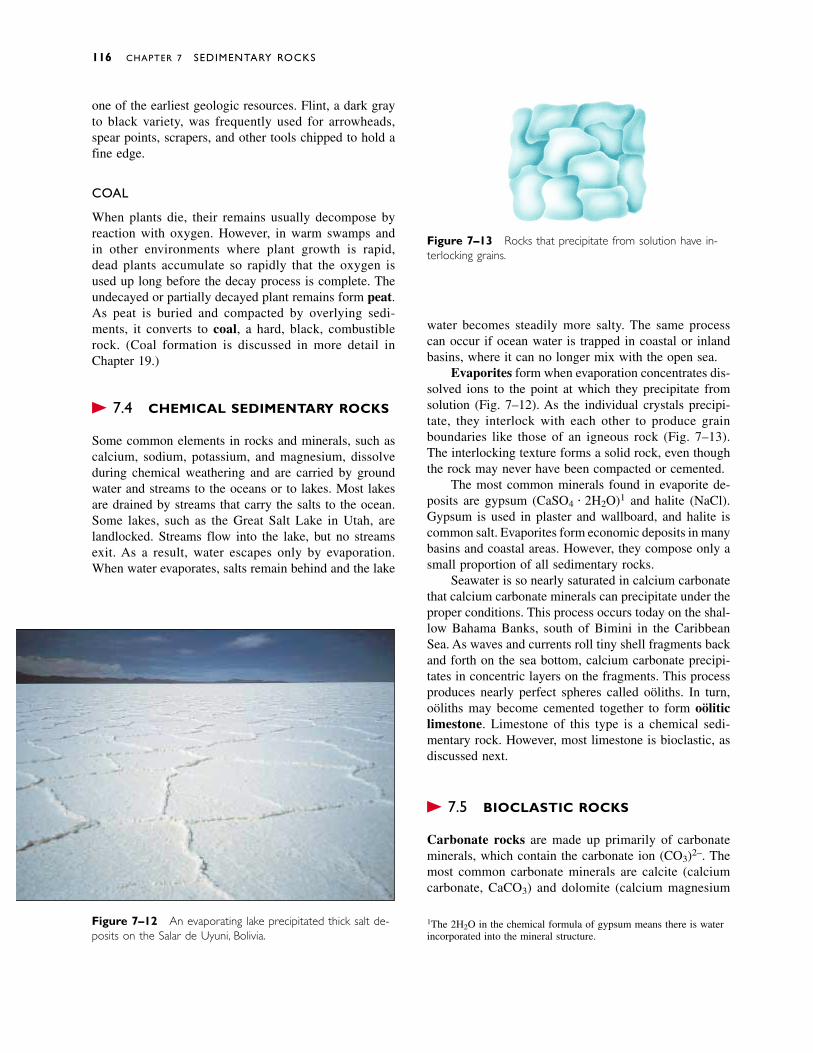
one of the earliest geologic resources. Flint, a dark grayto black variety, was frequently used for arrowheads,spear points, scrapers, and other tools chipped to hold afine edge.
COAL
When plants die, their remains usually decompose by reaction with oxygen. However, in warm swamps and in other environments where plant growth is rapid,dead plants accumulate so rapidly that the oxygen isused up long before the decay process is complete. Theundecayed or partially decayed plant remains form peat.As peat is buried and compacted by overlying sedi-ments, it converts to coal, a hard, black, combustiblerock. (Coal formation is discussed in more detail inChapter 19.)
� 7.4 CHEMICAL SEDIMENTARY ROCKS
Some common elements in rocks and minerals, such ascalcium, sodium, potassium, and magnesium, dissolveduring chemical weathering and are carried by groundwater and streams to the oceans or to lakes. Most lakesare drained by streams that carry the salts to the ocean.Some lakes, such as the Great Salt Lake in Utah, arelandlocked. Streams flow into the lake, but no streamsexit. As a result, water escapes only by evaporation.When water evaporates, salts remain behind and the lake
water becomes steadily more salty. The same processcan occur if ocean water is trapped in coastal or inlandbasins, where it can no longer mix with the open sea.
Evaporites form when evaporation concentrates dis-solved ions to the point at which they precipitate fromsolution (Fig. 7–12). As the individual crystals precipi-tate, they interlock with each other to produce grainboundaries like those of an igneous rock (Fig. 7–13).The interlocking texture forms a solid rock, even thoughthe rock may never have been compacted or cemented.
The most common minerals found in evaporite de-posits are gypsum (CaSO4 � 2H2O)1 and halite (NaCl).Gypsum is used in plaster and wallboard, and halite iscommon salt. Evaporites form economic deposits in manybasins and coastal areas. However, they compose only asmall proportion of all sedimentary rocks.
Seawater is so nearly saturated in calcium carbonatethat calcium carbonate minerals can precipitate under theproper conditions. This process occurs today on the shal-low Bahama Banks, south of Bimini in the CaribbeanSea. As waves and currents roll tiny shell fragments backand forth on the sea bottom, calcium carbonate precipi-tates in concentric layers on the fragments. This processproduces nearly perfect spheres called oöliths. In turn,oöliths may become cemented together to form oöliticlimestone. Limestone of this type is a chemical sedi-mentary rock. However, most limestone is bioclastic, asdiscussed next.
� 7.5 BIOCLASTIC ROCKS
Carbonate rocks are made up primarily of carbonateminerals, which contain the carbonate ion (CO3)2–. Themost common carbonate minerals are calcite (calciumcarbonate, CaCO3) and dolomite (calcium magnesium
116 CHAPTER 7 SEDIMENTARY ROCKS
Figure 7–13 Rocks that precipitate from solution have in-terlocking grains.
Figure 7–12 An evaporating lake precipitated thick salt de-posits on the Salar de Uyuni, Bolivia.
1The 2H2O in the chemical formula of gypsum means there is waterincorporated into the mineral structure.
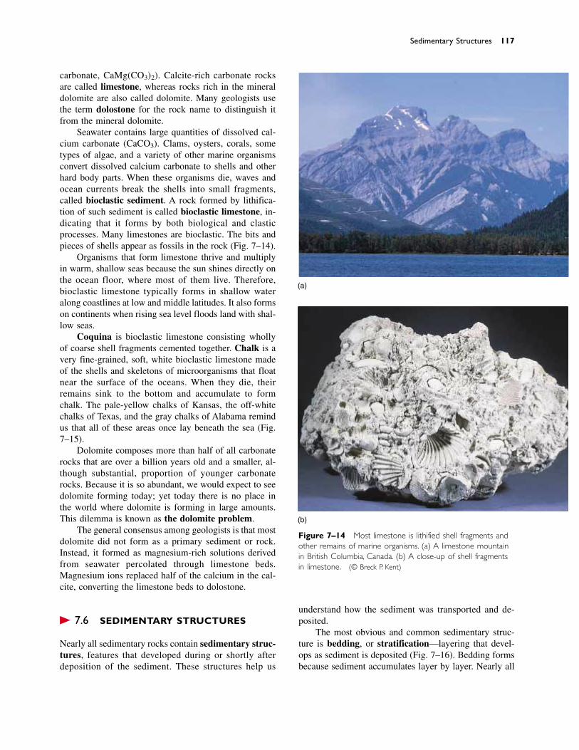
carbonate, CaMg(CO3)2). Calcite-rich carbonate rocksare called limestone, whereas rocks rich in the mineraldolomite are also called dolomite. Many geologists usethe term dolostone for the rock name to distinguish itfrom the mineral dolomite.
Seawater contains large quantities of dissolved cal-cium carbonate (CaCO3). Clams, oysters, corals, sometypes of algae, and a variety of other marine organismsconvert dissolved calcium carbonate to shells and otherhard body parts. When these organisms die, waves andocean currents break the shells into small fragments,called bioclastic sediment. A rock formed by lithifica-tion of such sediment is called bioclastic limestone, in-dicating that it forms by both biological and clasticprocesses. Many limestones are bioclastic. The bits andpieces of shells appear as fossils in the rock (Fig. 7–14).
Organisms that form limestone thrive and multiplyin warm, shallow seas because the sun shines directly onthe ocean floor, where most of them live. Therefore,bioclastic limestone typically forms in shallow wateralong coastlines at low and middle latitudes. It also formson continents when rising sea level floods land with shal-low seas.
Coquina is bioclastic limestone consisting whollyof coarse shell fragments cemented together. Chalk is avery fine-grained, soft, white bioclastic limestone madeof the shells and skeletons of microorganisms that floatnear the surface of the oceans. When they die, their remains sink to the bottom and accumulate to form chalk. The pale-yellow chalks of Kansas, the off-whitechalks of Texas, and the gray chalks of Alabama remindus that all of these areas once lay beneath the sea (Fig.7–15).
Dolomite composes more than half of all carbonaterocks that are over a billion years old and a smaller, al-though substantial, proportion of younger carbonaterocks. Because it is so abundant, we would expect to seedolomite forming today; yet today there is no place inthe world where dolomite is forming in large amounts.This dilemma is known as the dolomite problem.
The general consensus among geologists is that mostdolomite did not form as a primary sediment or rock.Instead, it formed as magnesium-rich solutions derivedfrom seawater percolated through limestone beds.Magnesium ions replaced half of the calcium in the cal-cite, converting the limestone beds to dolostone.
� 7.6 SEDIMENTARY STRUCTURES
Nearly all sedimentary rocks contain sedimentary struc-tures, features that developed during or shortly after deposition of the sediment. These structures help us
understand how the sediment was transported and de-posited.
The most obvious and common sedimentary struc-ture is bedding, or stratification—layering that devel-ops as sediment is deposited (Fig. 7–16). Bedding formsbecause sediment accumulates layer by layer. Nearly all
Sedimentary Structures 117
(a)
(b)
Figure 7–14 Most limestone is lithified shell fragments andother remains of marine organisms. (a) A limestone mountainin British Columbia, Canada. (b) A close-up of shell fragmentsin limestone. (© Breck P. Kent)

Figure 7–15 The Niobrara chalk of western Kansas consistsof the remains of tiny marine organisms. (David Schwimmer)
sedimentary beds were originally horizontal becausemost sediment accumulates on nearly level surfaces.
Cross-bedding consists of small beds lying at anangle to the main sedimentary layering (Fig. 7–17a).Cross-bedding forms in many environments where windor water transports and deposits sediment. For example,wind heaps sand into parallel ridges called dunes, andflowing water forms similar features called sand waves.Figure 7–17b shows that cross-beds are the layers formedby sand grains tumbling down the steep downstream face of a dune or sand wave. Cross-bedding is commonin sands deposited by wind, streams, ocean currents, andwaves on beaches.
Ripple marks are small, nearly parallel sand ridgesand troughs that are also formed by moving water orwind. They are like dunes and sand waves, but smaller.If the water or wind flows in a single direction, the ripple marks become asymmetrical, like miniature dunes.In other cases, waves move back and forth in shallowwater, forming symmetrical ripple marks in bottom sand(Fig. 7–18). Ripple marks are often preserved in sandysedimentary rocks (Fig. 7–19).
In graded bedding, the largest grains collect at thebottom of a layer and the grain size decreases toward thetop (Fig. 7–20). Graded beds commonly form when someviolent activity, such as a major flood or submarine land-
Figure 7–16 Sedimentary bedding shows clearly in the walls of the Grand Canyon.(Donovan Reese/Tony Stone Images)
118
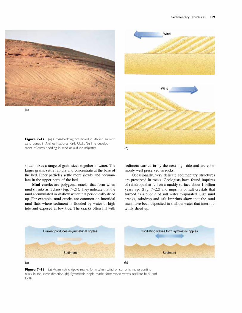
slide, mixes a range of grain sizes together in water. Thelarger grains settle rapidly and concentrate at the base ofthe bed. Finer particles settle more slowly and accumu-late in the upper parts of the bed.
Mud cracks are polygonal cracks that form whenmud shrinks as it dries (Fig. 7–21). They indicate that themud accumulated in shallow water that periodically driedup. For example, mud cracks are common on intertidalmud flats where sediment is flooded by water at hightide and exposed at low tide. The cracks often fill with
sediment carried in by the next high tide and are com-monly well preserved in rocks.
Occasionally, very delicate sedimentary structuresare preserved in rocks. Geologists have found imprintsof raindrops that fell on a muddy surface about 1 billionyears ago (Fig. 7–22) and imprints of salt crystals thatformed as a puddle of salt water evaporated. Like mudcracks, raindrop and salt imprints show that the mudmust have been deposited in shallow water that intermit-tently dried up.
Sedimentary Structures 119
Figure 7–17 (a) Cross-bedding preserved in lithified ancientsand dunes in Arches National Park, Utah. (b) The develop-ment of cross-bedding in sand as a dune migrates.
Figure 7–18 (a) Asymmetric ripple marks form when wind or currents move continu-ously in the same direction. (b) Symmetric ripple marks form when waves oscillate back andforth.
(a)
Wind
Wind
(b)
(a) (b)
Current produces asymmetrical ripples
Sediment
Oscillating waves form symmetric ripples
Sediment
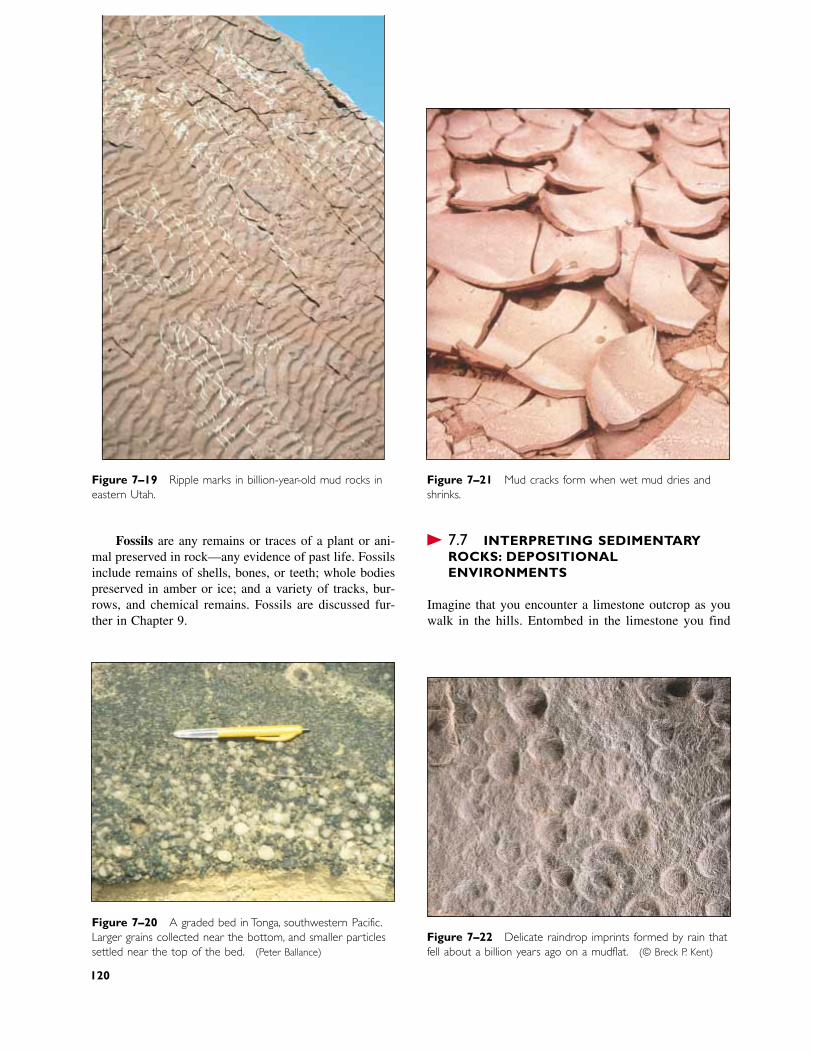
Figure 7–22 Delicate raindrop imprints formed by rain thatfell about a billion years ago on a mudflat. (© Breck P. Kent)
Figure 7–21 Mud cracks form when wet mud dries andshrinks.
Figure 7–20 A graded bed in Tonga, southwestern Pacific.Larger grains collected near the bottom, and smaller particlessettled near the top of the bed. (Peter Ballance)
Figure 7–19 Ripple marks in billion-year-old mud rocks ineastern Utah.
Fossils are any remains or traces of a plant or ani-mal preserved in rock—any evidence of past life. Fossilsinclude remains of shells, bones, or teeth; whole bodiespreserved in amber or ice; and a variety of tracks, bur-rows, and chemical remains. Fossils are discussed fur-ther in Chapter 9.
� 7.7 INTERPRETING SEDIMENTARYROCKS: DEPOSITIONALENVIRONMENTS
Imagine that you encounter a limestone outcrop as youwalk in the hills. Entombed in the limestone you find
120
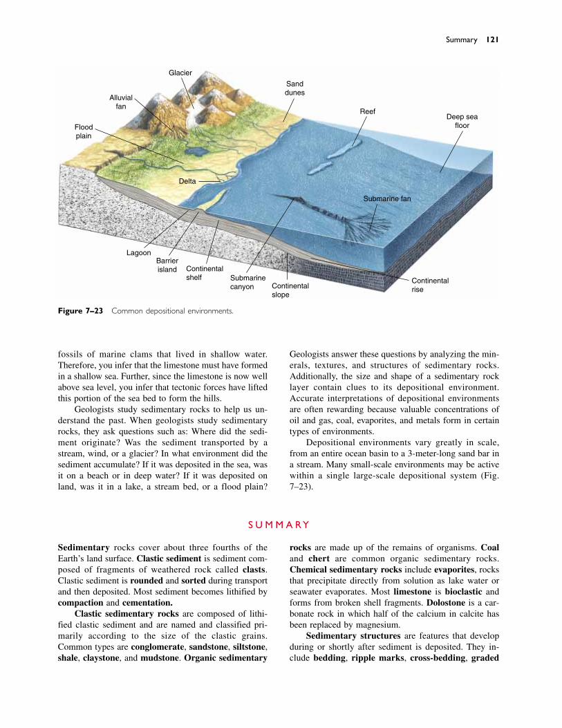
fossils of marine clams that lived in shallow water.Therefore, you infer that the limestone must have formedin a shallow sea. Further, since the limestone is now wellabove sea level, you infer that tectonic forces have liftedthis portion of the sea bed to form the hills.
Geologists study sedimentary rocks to help us un-derstand the past. When geologists study sedimentaryrocks, they ask questions such as: Where did the sedi-ment originate? Was the sediment transported by astream, wind, or a glacier? In what environment did thesediment accumulate? If it was deposited in the sea, wasit on a beach or in deep water? If it was deposited onland, was it in a lake, a stream bed, or a flood plain?
Summary 121
Geologists answer these questions by analyzing the min-erals, textures, and structures of sedimentary rocks.Additionally, the size and shape of a sedimentary rocklayer contain clues to its depositional environment.Accurate interpretations of depositional environmentsare often rewarding because valuable concentrations ofoil and gas, coal, evaporites, and metals form in certaintypes of environments.
Depositional environments vary greatly in scale,from an entire ocean basin to a 3-meter-long sand bar ina stream. Many small-scale environments may be activewithin a single large-scale depositional system (Fig.7–23).
Figure 7–23 Common depositional environments.
Sanddunes
ReefDeep sea
floor
Submarine fan
ContinentalriseContinental
slope
Submarinecanyon
Continentalshelf
Barrierisland
Lagoon
Delta
Floodplain
Alluvialfan
Glacier
Sedimentary rocks cover about three fourths of theEarth’s land surface. Clastic sediment is sediment com-posed of fragments of weathered rock called clasts.Clastic sediment is rounded and sorted during transportand then deposited. Most sediment becomes lithified bycompaction and cementation.
Clastic sedimentary rocks are composed of lithi-fied clastic sediment and are named and classified pri-marily according to the size of the clastic grains.Common types are conglomerate, sandstone, siltstone,shale, claystone, and mudstone. Organic sedimentary
rocks are made up of the remains of organisms. Coaland chert are common organic sedimentary rocks.Chemical sedimentary rocks include evaporites, rocksthat precipitate directly from solution as lake water orseawater evaporates. Most limestone is bioclastic andforms from broken shell fragments. Dolostone is a car-bonate rock in which half of the calcium in calcite hasbeen replaced by magnesium.
Sedimentary structures are features that developduring or shortly after sediment is deposited. They in-clude bedding, ripple marks, cross-bedding, graded
S U M M A R Y
122 CHAPTER 7 SEDIMENTARY ROCKS
clast 110bioclastic 110clastic sediment 110gravel 110rubble 110sand 110silt 110clay 110mud 110rounding 111
sorting 111viscosity 111lithification 112pore 112compaction 112cementing 112quartz sandstone 113fissility 114nodule 115
peat 116chemical sedimentary
rock 116carbonate rock 116bioclastic sediment 117bioclastic limestone 117dolomite problem 117sedimentary structures
117
bedding 117stratification 117cross-bedding 118dune 118sand wave 118ripple mark 118graded bedding 118mud crack 119fossil 120
K E Y W O R D S
1. Why do sedimentary rocks cover more than 75 percent ofthe Earth’s land surface when they compose only 5 per-cent of the volume of the continental crust?
2. List the five stages in the formation of sedimentaryrocks.
3. How do clastic sediments differ from dissolved sedimentand chemical sediment?
4. Define bioclastic sediment.
5. In what ways are clastic sediments modified during transport?
6. Why is the maximum size of particles transported bywind finer than the maximum size transported bystreams?
7. Why is the maximum size of particles transported byglaciers coarser than the maximum size transported bystreams?
8. Describe how loose clastic sediment becomes lithified toform hard rock.
9. What is pore space in a clastic sediment? How is it mod-ified during lithification?
10. What is the difference between conglomerate and breccias?
11. Why are most sandstones made up predominantly ofquartz?
12. In what geologic environment does arkose form?
13. How do shale, sandstone, and limestone differ from oneanother?
14. How do shales acquire fissility? Why do mudstones lackthat property?
15. How do limestones form?
16. What is bioclastic limestone?
17. How do dolomites form? What is the dolomite problem?
18. How does coal form?
19. How do evaporites form?
20. What does cross-bedding in a sandstone tell you aboutdepositional environment?
21. What do the presence of mud cracks in a mudstone tellyou about the depositional environment?
R E V I E W Q U E S T I O N S
bedding, mud cracks, and fossils. Sedimentary structurescontain vital clues regarding the sedimentary environ-ments in which sedimentary rocks formed. The interpre-tation of depositional environments is one of the primary
objectives of the study of sedimentary rocks. Deposi-tional environments include all large- and small-scale environments in which sediments are deposited.
Important Sedimentary Rocks
Conglomerate Breccia Sandstone Arkose GraywackeClaystone Shale Mudstone Siltstone ChertCoal Limestone Dolostone Coquina Chalk
Discussion Questions 123
1. Field geologists sometimes come upon large sections ofsedimentary rocks that have been turned upside down bytectonic activities. How would you use sedimentarystructures to determine whether a sequence of sedimen-tary rocks is upright or overturned?
2. On a field trip you discover a sequence of sedimentaryrocks composed of thin black shales containing marinefossils interbedded with layers of gypsum and halite.What can you deduce about the depositional environmentof these rocks?
3. Large portions of the Canadian Rockies are composed oflimestone and shale. From this information alone, whatcan you tell about the geologic history of the region?
4. All the large-scale depositional environments are marine,while small-scale depositional environments can be eithermarine or terrestrial. Explain.
5. What types of sedimentary structures would you expectto find under the following circumstances? a. A cata-strophic flood washes a huge amount of mixed sedimentinto a lake. b. Sand accumulates in a dry, windy envi-ronment. The prevailing wind direction shifts periodi-cally, over a few million years. c. Mud collects on thebottom of a large, shallow, inland sea.
6. Why is shale the most abundant sedimentary rock?
7. Would you expect to find large quantities of sedimentaryrocks on the Moon? Why or why not? If you do expectto find them, what types would you expect?
D I S C U S S I O N Q U E S T I O N S
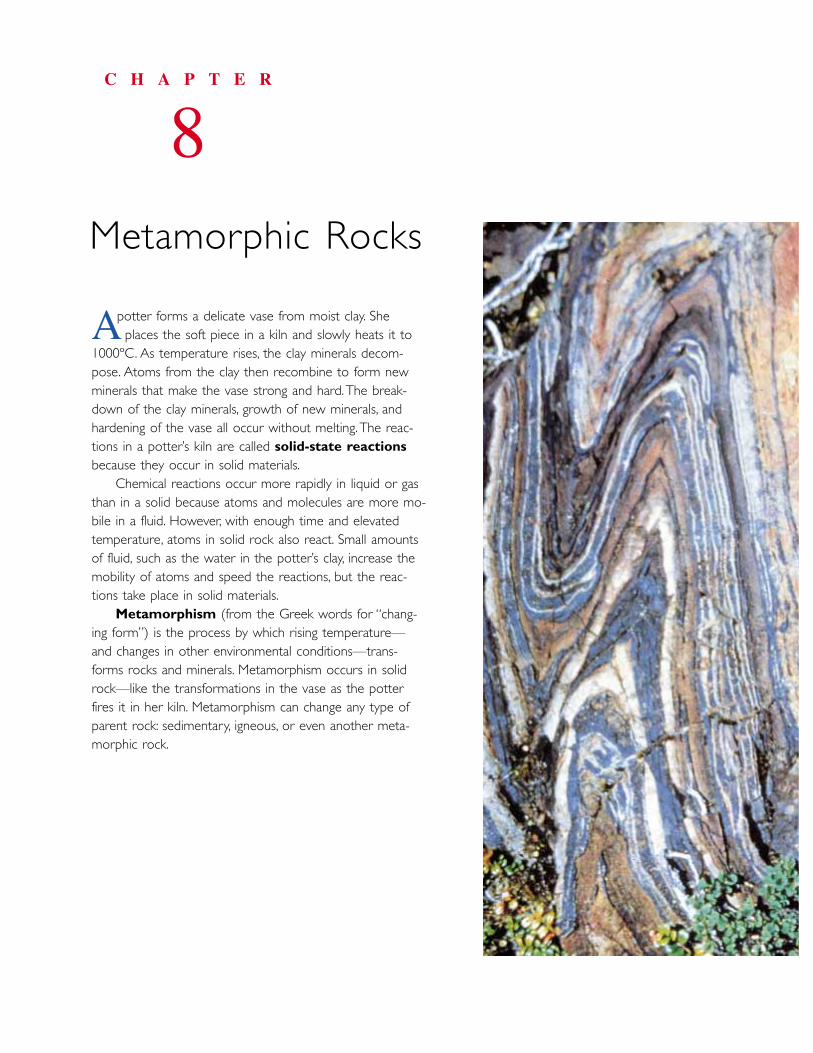
potter forms a delicate vase from moist clay. She places the soft piece in a kiln and slowly heats it to
1000ºC. As temperature rises, the clay minerals decom-pose. Atoms from the clay then recombine to form newminerals that make the vase strong and hard.The break-down of the clay minerals, growth of new minerals, andhardening of the vase all occur without melting.The reac-tions in a potter’s kiln are called solid-state reactionsbecause they occur in solid materials.
Chemical reactions occur more rapidly in liquid or gasthan in a solid because atoms and molecules are more mo-bile in a fluid. However, with enough time and elevatedtemperature, atoms in solid rock also react. Small amountsof fluid, such as the water in the potter’s clay, increase themobility of atoms and speed the reactions, but the reac-tions take place in solid materials.
Metamorphism (from the Greek words for “chang-ing form”) is the process by which rising temperature—and changes in other environmental conditions—trans-forms rocks and minerals. Metamorphism occurs in solidrock—like the transformations in the vase as the potterfires it in her kiln. Metamorphism can change any type ofparent rock: sedimentary, igneous, or even another meta-morphic rock.
C H A P T E R
8Metamorphic Rocks
A
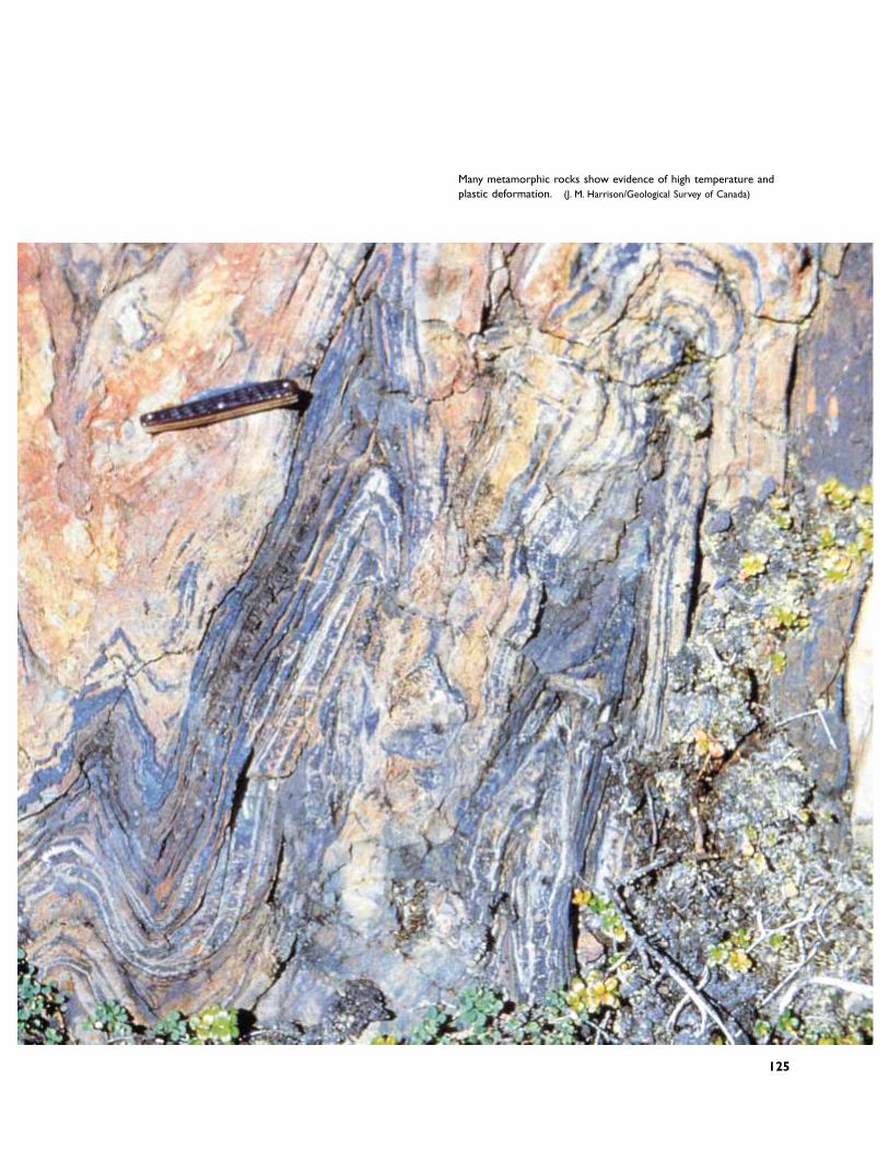
Many metamorphic rocks show evidence of high temperature andplastic deformation. (J. M. Harrison/Geological Survey of Canada)
125
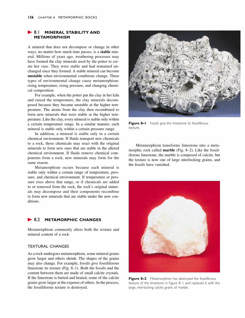
� 8.1 MINERAL STABILITY ANDMETAMORPHISM
A mineral that does not decompose or change in otherways, no matter how much time passes, is a stable min-eral. Millions of years ago, weathering processes mayhave formed the clay minerals used by the potter to cre-ate her vase. They were stable and had remained un-changed since they formed. A stable mineral can becomeunstable when environmental conditions change. Threetypes of environmental change cause metamorphism:rising temperature, rising pressure, and changing chemi-cal composition.
For example, when the potter put the clay in her kilnand raised the temperature, the clay minerals decom-posed because they became unstable at the higher tem-perature. The atoms from the clay then recombined toform new minerals that were stable at the higher tem-perature. Like the clay, every mineral is stable only withina certain temperature range. In a similar manner, eachmineral is stable only within a certain pressure range.
In addition, a mineral is stable only in a certainchemical environment. If fluids transport new chemicalsto a rock, those chemicals may react with the originalminerals to form new ones that are stable in the alteredchemical environment. If fluids remove chemical com-ponents from a rock, new minerals may form for thesame reason.
Metamorphism occurs because each mineral is stable only within a certain range of temperature, pres-sure, and chemical environment. If temperature or pres-sure rises above that range, or if chemicals are added to or removed from the rock, the rock’s original miner-als may decompose and their components recombine to form new minerals that are stable under the new con-ditions.
� 8.2 METAMORPHIC CHANGES
Metamorphism commonly alters both the texture andmineral content of a rock.
TEXTURAL CHANGES
As a rock undergoes metamorphism, some mineral grainsgrow larger and others shrink. The shapes of the grainsmay also change. For example, fossils give fossiliferouslimestone its texture (Fig. 8–1). Both the fossils and thecement between them are made of small calcite crystals.If the limestone is buried and heated, some of the calcitegrains grow larger at the expense of others. In the process,the fossiliferous texture is destroyed.
Metamorphism transforms limestone into a meta-morphic rock called marble (Fig. 8–2). Like the fossil-iferous limestone, the marble is composed of calcite, butthe texture is now one of large interlocking grains, andthe fossils have vanished.
126 CHAPTER 8 METAMORPHIC ROCKS
Figure 8–2 Metamorphism has destroyed the fossiliferoustexture of the limestone in Figure 8–1 and replaced it with thelarge, interlocking calcite grains of marble.
Figure 8–1 Fossils give this limestone its fossiliferous texture.

MINERALOGICAL CHANGES
As a general rule, when a parent rock (the original rock)contains only one mineral, metamorphism transforms therock into one composed of the same mineral but with acoarser texture. The mineral content does not change be-cause no other chemical components are available dur-ing metamorphism. Limestone converting to marble isone example of this generalization. Another is the meta-morphism of quartz sandstone to quartzite, a rock com-posed of recrystallized quartz grains.
In contrast, metamorphism of a parent rock contain-ing several minerals usually forms a rock with new anddifferent minerals and a new texture. For example, a typ-ical shale contains large amounts of clay, as well asquartz and feldspar (Fig. 8–3). When heated, some ofthose minerals decompose, and their atoms recombine toform new minerals such as mica, garnet, and a differentkind of feldspar. Figure 8–4 shows a rock called horn-fels that formed when metamorphism altered both thetexture and minerals of shale.
If migrating fluids change the chemical compositionof a rock, new minerals invariably form. These effectsare discussed further in Section 8.3.
DEFORMATION AND FOLIATION
Changes in temperature, pressure, or the chemical envi-ronment alter a rock’s texture during metamorphism. Butanother factor also causes profound textural changes.Metamorphic rocks commonly form in large regions ofthe Earth’s crust near a subduction zone, where two tec-tonic plates converge. The tectonic forces crush, break,and bend rocks in this environment as the rocks are un-dergoing metamorphism. This combination of metamor-phism and deformation creates layering in the rocks.
Micas are common metamorphic minerals; they formas many different parent rocks undergo metamorphism.Recall from Chapter 3 that micas are shaped like pieplates. When metamorphism occurs without deforma-tion, the micas grow with random orientations, like pieplates flying through the air (Fig. 8–5). However, whenmetamorphism and deformation occur together, the
Metamorphic Changes 127
Unfoliatedmetamorphic rock
Figure 8–3 Shale is a very fine-grained sedimentary rock,containing clay, quartz, and feldspar.
Figure 8–4 Hornfels forms by metamorphism of shale.The white spots are metamorphic minerals. (Geoffrey Sutton)
Figure 8–5 When metamorphism occurs without deforma-tion, platy micas grow with random orientations.

micas develop a parallel orientation. This parallel align-ment of micas (and other minerals) produces the meta-morphic layering called foliation (Fig. 8–6). The layersrange from a fraction of a millimeter to a meter or morein thickness. Metamorphic foliation can resemble sedi-mentary bedding but is different in origin.
Micas and other platy minerals orient at right anglesto the tectonic force squeezing the rocks. Pencil-shapedminerals such as amphiboles align in a similar manner.When horizontal forces deform shale into folds duringmetamorphism, the clays decompose and micas growwith their flat surfaces perpendicular to the direction ofsqueezing. As a result, the rock develops vertical folia-tion—perpendicular to the horizontal force. Many meta-morphic rocks break easily along the foliation planes.This parallel fracture pattern is called slaty cleavage(Fig. 8–7). In most cases, slaty cleavage cuts across theoriginal sedimentary bedding.
METAMORPHIC GRADE
Metamorphic grade expresses the intensity of meta-morphism that affected a rock. Because temperature isthe most important factor in metamorphism, metamor-phic grade closely reflects the highest temperature at-tained during metamorphism. Geologists can interpretthe metamorphic grade of most rocks because manymetamorphic minerals form only within certain temper-ature ranges.
The temperature in shallow parts of the Earth’s crustrises by an average of 30ºC for each kilometer of depth.It continues to rise in deeper parts of the crust and in themantle, but at a lesser rate. The rate at which tempera-ture increases with depth is called the geothermal gra-dient. Consequently, the metamorphic grade of manyrocks is related to the depth to which they were buried(Fig. 8–8). Low-grade metamorphism occurs at shallowdepths, less than 10 to 12 kilometers beneath the surface,where temperature is below 350ºC. High-grade condi-tions are found deep within continental crust and in theupper mantle, 40 or more kilometers below the Earth’ssurface. The temperature in these regions is 600ºC orhotter and is near the melting point of rock. High-grademetamorphism can occur at shallower depths, wheremagma rises to a shallow level of the Earth’s crust.
THE RATE OF METAMORPHISM
A rule of thumb among laboratory chemists is that thespeed of a chemical reaction doubles with every 10ºC
128 CHAPTER 8 METAMORPHIC ROCKS
Figure 8–6 When deformation accompanies metamor-phism, platy micas orient in a parallel manner to producemetamorphic layering called foliation.
Figure 8–7 Horizontal compression formed this tight fold ininterbedded shale and sandstone. Slaty cleavage developed inthe shale but not in the sandstone. (Karl Mueller)
Foliatedmetamorphicrock
Slatycleavage
Oldsedimentarylayers
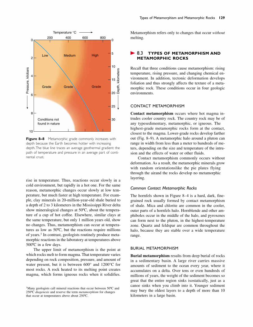
rise in temperature. Thus, reactions occur slowly in acold environment, but rapidly in a hot one. For the samereason, metamorphic changes occur slowly at low tem-perature, but much faster at high temperature. For exam-ple, clay minerals in 20-million-year-old shale buried toa depth of 2 to 3 kilometers in the Mississippi River deltashow mineralogical changes at 50ºC, about the tempera-ture of a cup of hot coffee. Elsewhere, similar clays atthe same temperature, but only 1 million years old, showno changes. Thus, metamorphism can occur at tempera-tures as low as 50ºC, but the reactions require millionsof years.1 In contrast, geologists routinely produce meta-morphic reactions in the laboratory at temperatures above500ºC in a few days.
The upper limit of metamorphism is the point atwhich rocks melt to form magma. That temperature variesdepending on rock composition, pressure, and amount ofwater present, but it is between 600° and 1200°C formost rocks. A rock heated to its melting point createsmagma, which forms igneous rocks when it solidifies.
Metamorphism refers only to changes that occur withoutmelting.
� 8.3 TYPES OF METAMORPHISM ANDMETAMORPHIC ROCKS
Recall that three conditions cause metamorphism: risingtemperature, rising pressure, and changing chemical en-vironment. In addition, tectonic deformation developsfoliation and thus strongly affects the texture of a meta-morphic rock. These conditions occur in four geologicenvironments.
CONTACT METAMORPHISM
Contact metamorphism occurs where hot magma in-trudes cooler country rock. The country rock may be ofany type—sedimentary, metamorphic, or igneous. Thehighest-grade metamorphic rocks form at the contact,closest to the magma. Lower-grade rocks develop fartherout (Fig. 8–9). A metamorphic halo around a pluton canrange in width from less than a meter to hundreds of me-ters, depending on the size and temperature of the intru-sion and the effects of water or other fluids.
Contact metamorphism commonly occurs withoutdeformation. As a result, the metamorphic minerals growwith random orientations—like the pie plates flyingthrough the air—and the rocks develop no metamorphiclayering.
Common Contact Metamorphic Rocks
The hornfels shown in Figure 8–4 is a hard, dark, fine-grained rock usually formed by contact metamorphismof shale. Mica and chlorite are common in the cooler,outer parts of a hornfels halo. Hornblende and other am-phiboles occur in the middle of the halo, and pyroxenescan form next to the pluton, in the highest-temperaturezone. Quartz and feldspar are common throughout thehalo, because they are stable over a wide temperaturerange.
BURIAL METAMORPHISM
Burial metamorphism results from deep burial of rocksin a sedimentary basin. A large river carries massiveamounts of sediment to the ocean every year, where itaccumulates on a delta. Over tens or even hundreds ofmillions of years, the weight of the sediment becomes sogreat that the entire region sinks isostatically, just as acanoe sinks when you climb into it. Younger sedimentmay bury the oldest layers to a depth of more than 10kilometers in a large basin.
Types of Metamorphism and Metamorphic Rocks 129
1Many geologists call mineral reactions that occur between 50ºC and250ºC diagenesis and reserve the term metamorphism for changesthat occur at temperatures above about 250ºC.
Figure 8–8 Metamorphic grade commonly increases withdepth because the Earth becomes hotter with increasingdepth.The blue line traces an average geothermal gradient: thepath of temperature and pressure in an average part of conti-nental crust.
0
2
4
6
8
10
Pre
ssur
e, k
iloba
rs
200 400 600 8000
5
10
15
20
25
30Conditions notfound in nature
Low Medium High
Grade Grade Grade
Temperature °C
Dep
th, k
ilom
eter
s
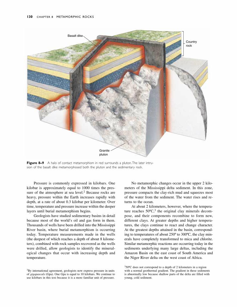
No metamorphic changes occur in the upper 2 kilo-meters of the Mississippi delta sediment. In this zone,pressure compacts the clay-rich mud and squeezes mostof the water from the sediment. The water rises and re-turns to the ocean.
At about 2 kilometers, however, where the tempera-ture reaches 50ºC,3 the original clay minerals decom-pose, and their components recombine to form new,different clays. At greater depths and higher tempera-tures, the clays continue to react and change character.At the greatest depths attained in the basin, correspond-ing to temperatures of about 250º to 300ºC, the clay min-erals have completely transformed to mica and chlorite.Similar metamorphic reactions are occurring today in thesediments underlying many large deltas, including theAmazon Basin on the east coast of South America andthe Niger River delta on the west coast of Africa.
130 CHAPTER 8 METAMORPHIC ROCKS
350ºC does not correspond to a depth of 2 kilometers in a regionwith a normal geothermal gradient. The gradient in these sedimentsis abnormally low because shallow parts of the delta are filled withyoung, cold sediment.
2By international agreement, geologists now express pressure in unitsof gigapascals (Gpa). One Gpa is equal to 10 kilobars. We continue touse kilobars in this text because it is a more familiar unit of pressure.
Figure 8–9 A halo of contact metamorphism in red surrounds a pluton.The later intru-sion of the basalt dike metamorphosed both the pluton and the sedimentary rock.
Basalt dike
Granitepluton
Countryrock
Pressure is commonly expressed in kilobars. Onekilobar is approximately equal to 1000 times the pres-sure of the atmosphere at sea level.2 Because rocks areheavy, pressure within the Earth increases rapidly withdepth, at a rate of about 0.3 kilobar per kilometer. Overtime, temperature and pressure increase within the deeperlayers until burial metamorphism begins.
Geologists have studied sedimentary basins in detailbecause most of the world’s oil and gas form in them.Thousands of wells have been drilled into the MississippiRiver basin, where burial metamorphism is occurring today. Temperature measurements made in the wells (the deepest of which reaches a depth of about 8 kilome-ters), combined with rock samples recovered as the wellswere drilled, allow geologists to identify the mineral-ogical changes that occur with increasing depth and temperature.
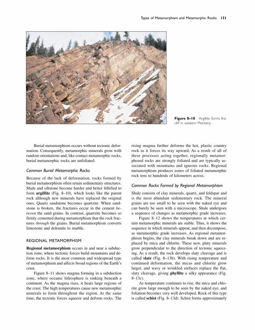
Burial metamorphism occurs without tectonic defor-mation. Consequently, metamorphic minerals grow withrandom orientations and, like contact metamorphic rocks,burial metamorphic rocks are unfoliated.
Common Burial Metamorphic Rocks
Because of the lack of deformation, rocks formed byburial metamorphism often retain sedimentary structures.Shale and siltstone become harder and better lithified toform argillite (Fig. 8–10), which looks like the parentrock although new minerals have replaced the originalones. Quartz sandstone becomes quartzite. When sand-stone is broken, the fractures occur in the cement be-tween the sand grains. In contrast, quartzite becomes sofirmly cemented during metamorphism that the rock frac-tures through the grains. Burial metamorphism convertslimestone and dolomite to marble.
REGIONAL METAMORPHISM
Regional metamorphism occurs in and near a subduc-tion zone, where tectonic forces build mountains and de-form rocks. It is the most common and widespread typeof metamorphism and affects broad regions of the Earth’scrust.
Figure 8–11 shows magma forming in a subductionzone, where oceanic lithosphere is sinking beneath acontinent. As the magma rises, it heats large regions ofthe crust. The high temperatures cause new metamorphicminerals to form throughout the region. At the sametime, the tectonic forces squeeze and deform rocks. The
rising magma further deforms the hot, plastic countryrock as it forces its way upward. As a result of all ofthese processes acting together, regionally metamor-phosed rocks are strongly foliated and are typically as-sociated with mountains and igneous rocks. Regionalmetamorphism produces zones of foliated metamorphicrock tens to hundreds of kilometers across.
Common Rocks Formed by Regional Metamorphism
Shale consists of clay minerals, quartz, and feldspar andis the most abundant sedimentary rock. The mineralgrains are too small to be seen with the naked eye andcan barely be seen with a microscope. Shale undergoesa sequence of changes as metamorphic grade increases.
Figure 8–12 shows the temperatures at which cer-tain metamorphic minerals are stable. Thus, it shows thesequence in which minerals appear, and then decompose,as metamorphic grade increases. As regional metamor-phism begins, the clay minerals break down and are re-placed by mica and chlorite. These new, platy mineralsgrow perpendicular to the direction of tectonic squeez-ing. As a result, the rock develops slaty cleavage and iscalled slate (Fig. 8–13b). With rising temperature andcontinued deformation, the micas and chlorite growlarger, and wavy or wrinkled surfaces replace the flat,slaty cleavage, giving phyllite a silky appearance (Fig.8–13c).
As temperature continues to rise, the mica and chlo-rite grow large enough to be seen by the naked eye, andfoliation becomes very well developed. Rock of this typeis called schist (Fig. 8–13d). Schist forms approximately
Types of Metamorphism and Metamorphic Rocks 131
Figure 8–10 Argillite forms thiscliff in western Montana.

at the transition from low to intermediate metamorphicgrades. In some schists, crystals of nonplaty mineralssuch as garnet, quartz, and feldspar give the rock a knottyappearance.
At high metamorphic grades, light- and dark-coloredminerals often separate into bands that are thicker thanthe layers of schist to form a rock called gneiss (pro-nounced “nice”) (Fig. 8–13e). At the highest metamor-phic grade, the rock begins to melt, forming small veinsof granitic magma. When metamorphism wanes and therock cools, the magma veins solidify to form migmatite,a mixture of igneous and metamorphic rock (Fig. 8–13f).
Under conditions of regional metamorphism, quartzsandstone and limestone transform to foliated quartziteand foliated marble, respectively.
HYDROTHERMAL METAMORPHISM
Water is a chemically active fluid; it attacks and dis-solves many minerals. If the water is hot, it attacks min-erals even more rapidly. Hydrothermal metamorphism(also called hydrothermal alteration and metasomatism)occurs when hot water and ions dissolved in the hot water react with a rock to change its chemical composi-tion and minerals. In some hydrothermal environments,water reacts with sulfur minerals to form sulfuric acid,making the solution even more corrosive.
The water responsible for hydrothermal metamor-phism can originate from three sources. Magmatic wateris given off by a cooling magma. Metamorphic water
is released from rocks during metamorphism. Most hy-drothermal alteration, however, is caused by circulatingground water—the water that saturates soil and bedrock.Cold ground water sinks through bedrock fractures todepths of a few kilometers, where it is heated by the hot-ter rocks at depth or, in some cases, by a hot, shallowpluton. Upon heating, the water expands and rises backtoward the surface through other fractures (Fig. 8–14).As it rises, it alters the country rock through which itflows.
Rocks Formed by Hydrothermal Metamorphism
Hydrothermal metamorphism is like an accelerated formof weathering. As in weathering, feldspars and manyother minerals of the parent rock dissolve. The hot wa-ter carries away soluble components, such as potassium,sodium, calcium, and magnesium. Aluminum and siliconremain because they have low solubilities. They combinewith oxygen and water to form clay minerals. Hydro-thermally metamorphosed rocks often have a white,bleached appearance and a soft consistency because theclays are white and soft.
Most rocks and magma contain low concentrationsof metals such as copper, gold, lead, zinc, and silver. Forexample, gold makes up 0.0000002 percent of averagecrustal rock, while copper makes up 0.0058 percent andlead 0.0001 percent. Although the metals are present invery low concentrations, hydrothermal solutions sweepslowly through vast volumes of country rock, dissolving
132 CHAPTER 8 METAMORPHIC ROCKS
Oceaniccrust
Deformedsedimentary
rocks
Volcanoes andplutons
Continentalcrust
Magma
1100�C1100�C
600�C
600�C300�C
300�C
Asthenosphere
Lithosphere
Figure 8–11 Regional metamorphism is common near a subduction zone.The pinkshaded area is a zone where rising magma and tectonic force cause abnormally high temper-atures and regional metamorphism.The red lines connect points of equal temperature andare called isotherms.

Figure 8–12 Shale changes in both texture and minerals as metamorphic grade increases.The lower part of the figure shows the stability ranges of common metamorphic minerals.
Types of Metamorphism and Metamorphic Rocks 133
Quartz
Smectite Mixed-layerclays
Illite
Plagioclase
Chlorite
Muscovite K-Feldspar
Biotite
Garnet
Kyanite
Sillimanite
Minerals
Sedimentary rock Low grade Intermediate grade High grade
GneissSchistSlateShale
Phyllite Migmatite
Rocktype
Metamorphicenvironment
Below 50 °C 50–300 °C 300–450 °C Above 450 °C
Increasing temperature and pressure
No change Metamorphic rock
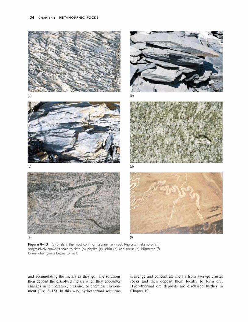
and accumulating the metals as they go. The solutionsthen deposit the dissolved metals when they encounterchanges in temperature, pressure, or chemical environ-ment (Fig. 8–15). In this way, hydrothermal solutions
scavenge and concentrate metals from average crustalrocks and then deposit them locally to form ore.Hydrothermal ore deposits are discussed further inChapter 19.
134 CHAPTER 8 METAMORPHIC ROCKS
(a) (b)
(c) (d)
(e) (f)
Figure 8–13 (a) Shale is the most common sedimentary rock. Regional metamorphismprogressively converts shale to slate (b), phyllite (c), schist (d), and gneiss (e). Migmatite (f)forms when gneiss begins to melt.
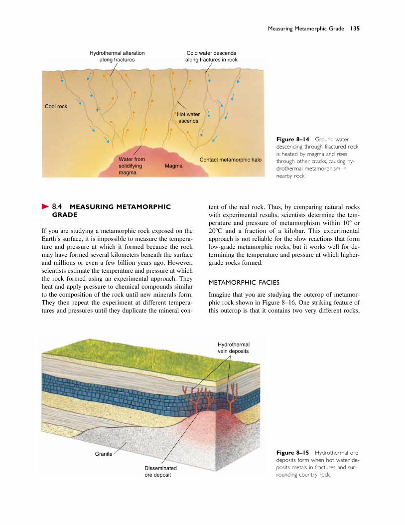
� 8.4 MEASURING METAMORPHICGRADE
If you are studying a metamorphic rock exposed on theEarth’s surface, it is impossible to measure the tempera-ture and pressure at which it formed because the rockmay have formed several kilometers beneath the surfaceand millions or even a few billion years ago. However,scientists estimate the temperature and pressure at whichthe rock formed using an experimental approach. Theyheat and apply pressure to chemical compounds similarto the composition of the rock until new minerals form.They then repeat the experiment at different tempera-tures and pressures until they duplicate the mineral con-
tent of the real rock. Thus, by comparing natural rockswith experimental results, scientists determine the tem-perature and pressure of metamorphism within 10º or20ºC and a fraction of a kilobar. This experimental approach is not reliable for the slow reactions that formlow-grade metamorphic rocks, but it works well for de-termining the temperature and pressure at which higher-grade rocks formed.
METAMORPHIC FACIES
Imagine that you are studying the outcrop of metamor-phic rock shown in Figure 8–16. One striking feature ofthis outcrop is that it contains two very different rocks,
Measuring Metamorphic Grade 135
Hydrothermal alterationalong fractures
Cold water descendsalong fractures in rock
Cool rock
Hot waterascends
MagmaWater fromsolidifyingmagma
Contact metamorphic halo
Granite
Disseminatedore deposit
Hydrothermalvein deposits
Figure 8–14 Ground water descending through fractured rockis heated by magma and risesthrough other cracks, causing hy-drothermal metamorphism innearby rock.
Figure 8–15 Hydrothermal oredeposits form when hot water de-posits metals in fractures and sur-rounding country rock.
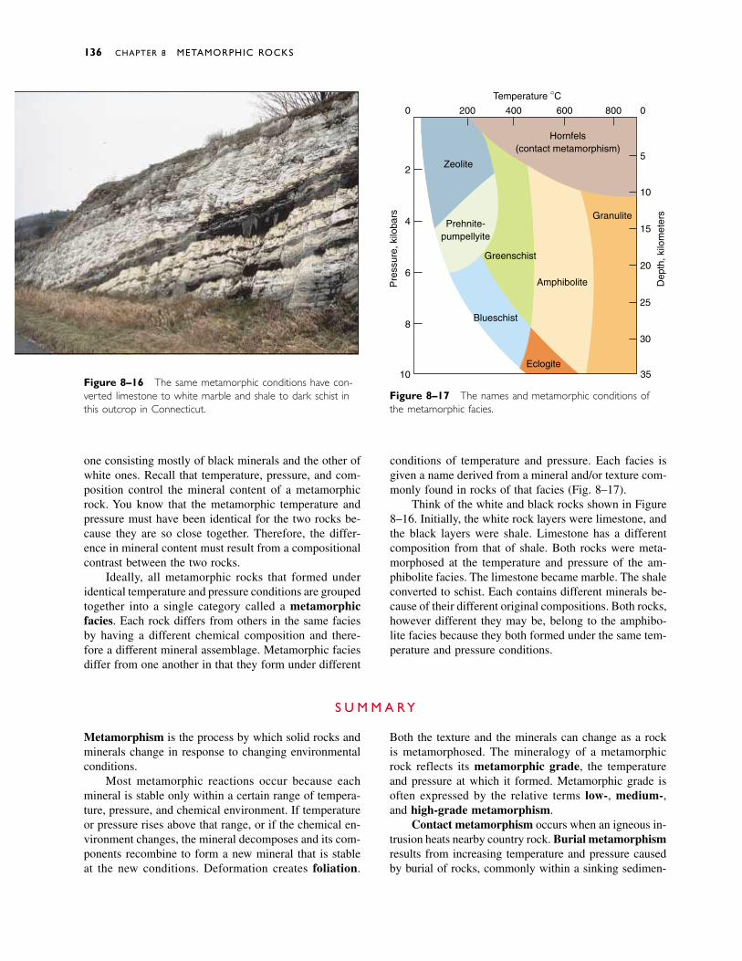
one consisting mostly of black minerals and the other ofwhite ones. Recall that temperature, pressure, and com-position control the mineral content of a metamorphicrock. You know that the metamorphic temperature andpressure must have been identical for the two rocks be-cause they are so close together. Therefore, the differ-ence in mineral content must result from a compositionalcontrast between the two rocks.
Ideally, all metamorphic rocks that formed underidentical temperature and pressure conditions are groupedtogether into a single category called a metamorphic facies. Each rock differs from others in the same faciesby having a different chemical composition and there-fore a different mineral assemblage. Metamorphic faciesdiffer from one another in that they form under different
conditions of temperature and pressure. Each facies isgiven a name derived from a mineral and/or texture com-monly found in rocks of that facies (Fig. 8–17).
Think of the white and black rocks shown in Figure8–16. Initially, the white rock layers were limestone, andthe black layers were shale. Limestone has a differentcomposition from that of shale. Both rocks were meta-morphosed at the temperature and pressure of the am-phibolite facies. The limestone became marble. The shaleconverted to schist. Each contains different minerals be-cause of their different original compositions. Both rocks,however different they may be, belong to the amphibo-lite facies because they both formed under the same tem-perature and pressure conditions.
136 CHAPTER 8 METAMORPHIC ROCKS
Metamorphism is the process by which solid rocks andminerals change in response to changing environmentalconditions.
Most metamorphic reactions occur because eachmineral is stable only within a certain range of tempera-ture, pressure, and chemical environment. If temperatureor pressure rises above that range, or if the chemical en-vironment changes, the mineral decomposes and its com-ponents recombine to form a new mineral that is stableat the new conditions. Deformation creates foliation.
Both the texture and the minerals can change as a rockis metamorphosed. The mineralogy of a metamorphicrock reflects its metamorphic grade, the temperatureand pressure at which it formed. Metamorphic grade isoften expressed by the relative terms low-, medium-,and high-grade metamorphism.
Contact metamorphism occurs when an igneous in-trusion heats nearby country rock. Burial metamorphismresults from increasing temperature and pressure causedby burial of rocks, commonly within a sinking sedimen-
S U M M A R Y
Hornfels(contact metamorphism)
Zeolite
Prehnite-pumpellyite
Greenschist
Amphibolite
Granulite
Eclogite
Blueschist
35
30
25
20
15
10
5
0
10
8
6
4
2
0 200 400 600 800
Temperature °C
Pre
ssur
e, k
iloba
rs
Dep
th, k
ilom
eter
s
Figure 8–16 The same metamorphic conditions have con-verted limestone to white marble and shale to dark schist inthis outcrop in Connecticut.
Figure 8–17 The names and metamorphic conditions ofthe metamorphic facies.

Discussion Questions 137
tary basin. Both types of metamorphism produce nonfo-liated metamorphic rocks. Regional metamorphismforms foliated rocks. It is the most common type ofmetamorphism and is caused by rising temperature andpressure accompanied by tectonic deformation, com-monly near a subduction zone. Hydrothermal meta-
morphism occurs when hot, migrating fluids change thechemical composition of country rock.
All metamorphic rocks that formed under identicaltemperature and pressure are grouped into a metamor-phic facies.
solid-state reaction 124metamorphism 124stable 126unstable 126deformation 127foliation 128slaty cleavage 128
metamorphic grade 128geothermal gradient 128contact metamorphism
129burial metamorphism
129
regional metamorphism131
hydrothermalmetamorphism 132
metasomatism 132magmatic water 132
metamorphic water 132metamorphic facies 136
K E Y W O R D S
1. Describe the two general kinds of changes that a rockundergoes during metamorphism.
2. Describe four main factors that cause and control meta-morphism.
3. How does the nature of parent rock affect the products ofmetamorphism?
4. What is the approximate temperature range over whichmetamorphism occurs? What factors define the upper andlower temperatures of metamorphism?
5. Explain how deformation produces foliated textures inmetamorphic rocks.
6. Name and briefly describe each of the different types ofmetamorphism.
7. Describe and name a rock that might result from contactmetamorphism of a shale.
8. What rock types might form by contact metamorphism oflimestone?
9. Describe and name the succession of metamorphic rocksthat form as shale experiences progressively highergrades of regional dynamothermal metamorphism.
10. Where does the water responsible for hydrothermal alter-ation originate?
11. How does contact metamorphism differ from regionalmetamorphism?
12. What is a metamorphic facies?
R E V I E W Q U E S T I O N S
1. Discuss processes that might cause the composition of arock to change during metamorphism. What would be theeffects of a change in composition?
2. Referring to Figure 8–8, what metamorphic grades wouldbe expected to occur in rocks exposed to the followingconditions? a. 400ºC and 3 kilobars; b. 400ºC and adepth of 12 kilometers; c. 600ºC at the Earth’s surface;d. 200ºC and a depth of 15 kilometers. Referring toFigure 8–17, what metamorphic facies would be ex-pected to form under the same sets of conditions?
3. What types of metamorphic rocks would you expect tofind in the following environments? a. adjacent to a hotspring in Yellowstone Park; b. in the AppalachianMountains, which is an old region of mountain buildingcaused by collision of two tectonic plates; c. at a depthof 6000 meters beneath southern Louisiana.
4. Referring to Figure 8–17, what metamorphic facieswould you expect to find at 600ºC and at a depth of 20kilometers?
D I S C U S S I O N Q U E S T I O N S
Important Metamorphic Rocks
Marble Quartzite Hornfels Argillite SlatePhyllite Schist Gneiss Migmatite

eologists commonly study events that occurred in the past. They observe rocks and landforms and ask
questions such as “What geologic processes shaped thatmountain range?” “When did the mountains rise anderode?” For example, compare the Appalachians, a low,rounded mountain range, with the Tetons, whose rockypeaks rise precipitously from the valley floor. We might ask,“Do the two ranges seem so different because theAppalachians are older and have been eroding for a longertime? Were the Appalachians once as steep as the Tetonsare today? If so, when did their rocky summits rise, andwhen did they become rounded?”
C H A P T E R
9Geologic Time: AStory in the Rocks
G
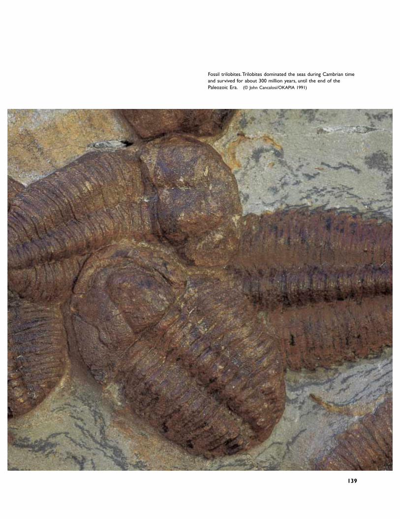
Fossil trilobites.Trilobites dominated the seas during Cambrian timeand survived for about 300 million years, until the end of thePaleozoic Era. (© John Cancalosi/OKAPIA 1991)
139
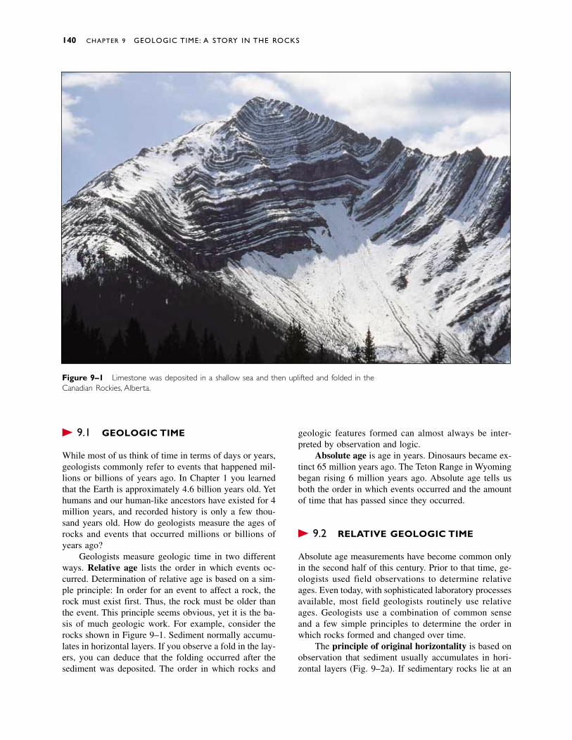
� 9.1 GEOLOGIC TIME
While most of us think of time in terms of days or years,geologists commonly refer to events that happened mil-lions or billions of years ago. In Chapter 1 you learnedthat the Earth is approximately 4.6 billion years old. Yethumans and our human-like ancestors have existed for 4million years, and recorded history is only a few thou-sand years old. How do geologists measure the ages ofrocks and events that occurred millions or billions ofyears ago?
Geologists measure geologic time in two differentways. Relative age lists the order in which events oc-curred. Determination of relative age is based on a sim-ple principle: In order for an event to affect a rock, therock must exist first. Thus, the rock must be older thanthe event. This principle seems obvious, yet it is the ba-sis of much geologic work. For example, consider therocks shown in Figure 9–1. Sediment normally accumu-lates in horizontal layers. If you observe a fold in the lay-ers, you can deduce that the folding occurred after thesediment was deposited. The order in which rocks and
geologic features formed can almost always be inter-preted by observation and logic.
Absolute age is age in years. Dinosaurs became ex-tinct 65 million years ago. The Teton Range in Wyomingbegan rising 6 million years ago. Absolute age tells usboth the order in which events occurred and the amountof time that has passed since they occurred.
� 9.2 RELATIVE GEOLOGIC TIME
Absolute age measurements have become common onlyin the second half of this century. Prior to that time, ge-ologists used field observations to determine relativeages. Even today, with sophisticated laboratory processesavailable, most field geologists routinely use relativeages. Geologists use a combination of common senseand a few simple principles to determine the order inwhich rocks formed and changed over time.
The principle of original horizontality is based onobservation that sediment usually accumulates in hori-zontal layers (Fig. 9–2a). If sedimentary rocks lie at an
140 CHAPTER 9 GEOLOGIC TIME: A STORY IN THE ROCKS
Figure 9–1 Limestone was deposited in a shallow sea and then uplifted and folded in theCanadian Rockies, Alberta.

angle, as in Figure 9–2b, we can infer that tectonic forcestilted them after they formed.
The principle of superposition states that sedimen-tary rocks become younger from bottom to top (as longas tectonic forces have not turned them upside down).This is because younger layers of sediment always ac-cumulate on top of older layers. In Figure 9–3, the sed-imentary layers become progressively younger in the order E, D, C, B, and A.
The principle of crosscutting relationships is basedon the obvious fact that a rock must first exist beforeanything can happen to it. Figure 9–4 shows light gran-ite dikes cutting through older country rock. Clearly, thecountry rock must be older than the dikes. Figure 9–5shows sedimentary rocks intruded by three granite dikes.Dike B cuts dike C, and dike A cuts dike B, so dike C isolder than B, and dike A is the youngest. The sedimen-tary rocks must be older than all of the dikes.
Figure 9–4 Light granitic dikes cutting across older countryrock along the coast in southeast Alaska.
Relative Geologic Time 141
Figure 9–2 (a) The principle of original horizontality tells us that most sedimentary rocksare deposited with horizontal bedding (San Juan River, Utah). (b) When we see tilted rocks, weinfer that they were tilted after they were deposited (Connecticut).
(a) (b)
Older
A
B
C
D
E
Figure 9–3 In a sequence of sedimentarybeds, the oldest bed is the lowest, and theyoungest is on top.These beds become older in the order A, B, C, D, E.
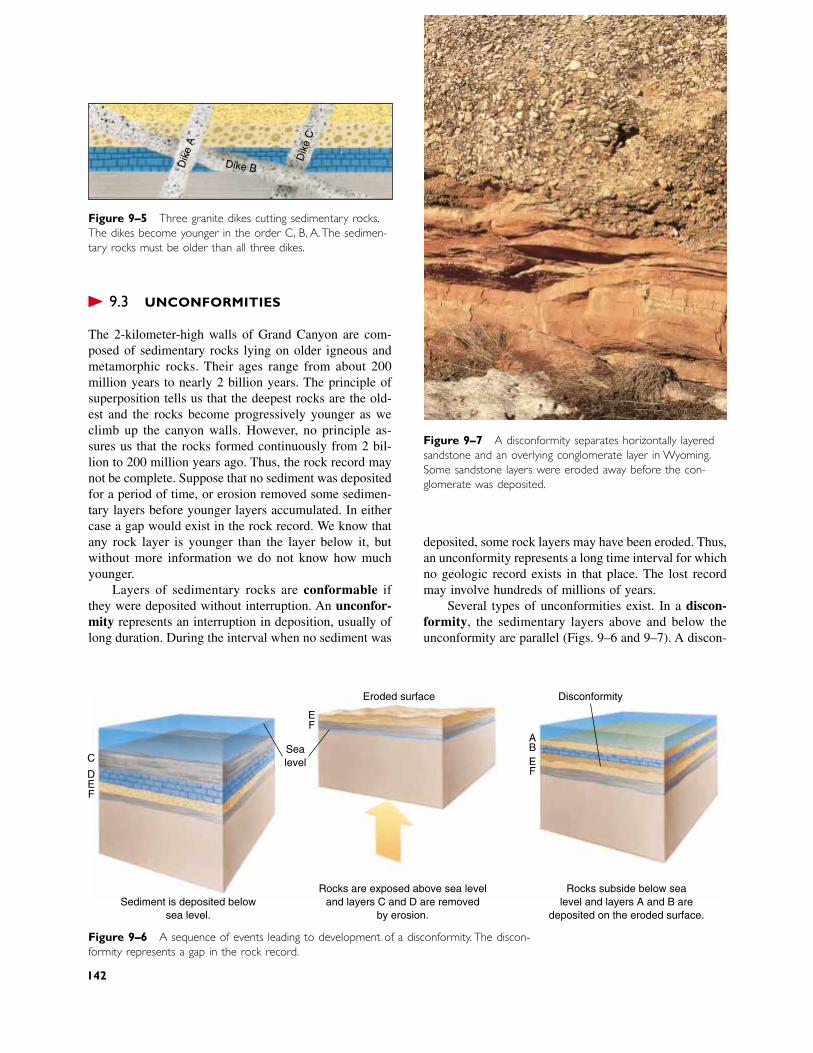
� 9.3 UNCONFORMITIES
The 2-kilometer-high walls of Grand Canyon are com-posed of sedimentary rocks lying on older igneous andmetamorphic rocks. Their ages range from about 200million years to nearly 2 billion years. The principle ofsuperposition tells us that the deepest rocks are the old-est and the rocks become progressively younger as weclimb up the canyon walls. However, no principle as-sures us that the rocks formed continuously from 2 bil-lion to 200 million years ago. Thus, the rock record maynot be complete. Suppose that no sediment was depositedfor a period of time, or erosion removed some sedimen-tary layers before younger layers accumulated. In eithercase a gap would exist in the rock record. We know thatany rock layer is younger than the layer below it, butwithout more information we do not know how muchyounger.
Layers of sedimentary rocks are conformable ifthey were deposited without interruption. An unconfor-mity represents an interruption in deposition, usually oflong duration. During the interval when no sediment was
deposited, some rock layers may have been eroded. Thus,an unconformity represents a long time interval for whichno geologic record exists in that place. The lost recordmay involve hundreds of millions of years.
Several types of unconformities exist. In a discon-formity, the sedimentary layers above and below the unconformity are parallel (Figs. 9–6 and 9–7). A discon-
C
DEF
EF
Eroded surface Disconformity
ABEF
Sealevel
Sediment is deposited belowsea level.
Rocks are exposed above sea leveland layers C and D are removed
by erosion.
Rocks subside below sealevel and layers A and B are
deposited on the eroded surface.
Figure 9–5 Three granite dikes cutting sedimentary rocks.The dikes become younger in the order C, B, A.The sedimen-tary rocks must be older than all three dikes.
Figure 9–7 A disconformity separates horizontally layeredsandstone and an overlying conglomerate layer in Wyoming.Some sandstone layers were eroded away before the con-glomerate was deposited.
Dik
e A
Dike B
Dik
e C
Figure 9–6 A sequence of events leading to development of a disconformity. The discon-formity represents a gap in the rock record.
142
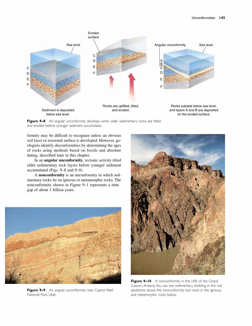
formity may be difficult to recognize unless an obvioussoil layer or erosional surface is developed. However, ge-ologists identify disconformities by determining the agesof rocks using methods based on fossils and absolutedating, described later in this chapter.
In an angular unconformity, tectonic activity tiltedolder sedimentary rock layers before younger sedimentaccumulated (Figs. 9–8 and 9–9).
A nonconformity is an unconformity in which sed-imentary rocks lie on igneous or metamorphic rocks. Thenonconformity shown in Figure 9–10 represents a timegap of about 1 billion years.
Figure 9–10 A nonconformity in the cliffs of the GrandCanyon, Arizona.You can see sedimentary bedding in the redsandstone above the nonconformity but none in the igneousand metamorphic rocks below.
Figure 9–9 An angular unconformity near Capitol ReefNational Park, Utah.
Unconformities 143
Figure 9–8 An angular unconformity develops when older sedimentary rocks are tiltedand eroded before younger sediment accumulates.
C
D
E
F
E
D
C
F
Erodedsurface
Angular unconformity Sea level
ABCD
E
F
Sea level
Sediment is depositedbelow sea level.
Rocks are uplifted, tilted,and eroded.
Rocks subside below sea level,and layers A and B are deposited
on the eroded surface.
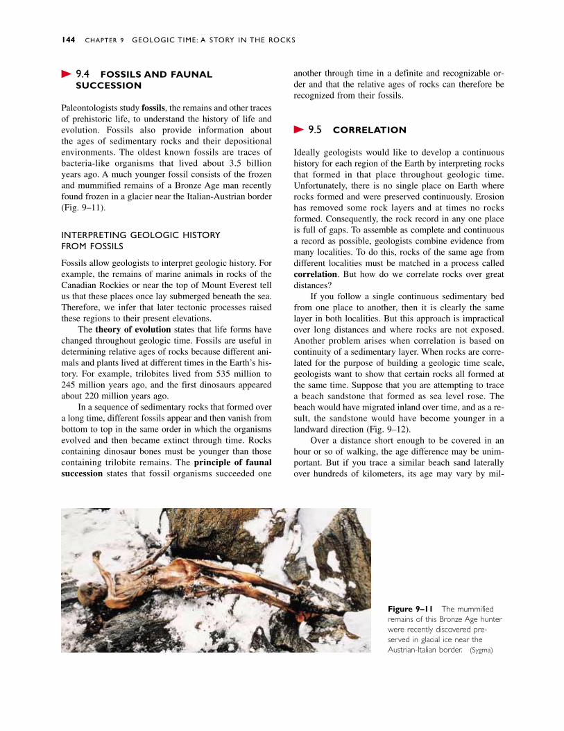
� 9.4 FOSSILS AND FAUNALSUCCESSION
Paleontologists study fossils, the remains and other tracesof prehistoric life, to understand the history of life andevolution. Fossils also provide information about the ages of sedimentary rocks and their depositional environments. The oldest known fossils are traces ofbacteria-like organisms that lived about 3.5 billion years ago. A much younger fossil consists of the frozenand mummified remains of a Bronze Age man recentlyfound frozen in a glacier near the Italian-Austrian border(Fig. 9–11).
INTERPRETING GEOLOGIC HISTORY FROM FOSSILS
Fossils allow geologists to interpret geologic history. Forexample, the remains of marine animals in rocks of theCanadian Rockies or near the top of Mount Everest tellus that these places once lay submerged beneath the sea.Therefore, we infer that later tectonic processes raisedthese regions to their present elevations.
The theory of evolution states that life forms havechanged throughout geologic time. Fossils are useful indetermining relative ages of rocks because different ani-mals and plants lived at different times in the Earth’s his-tory. For example, trilobites lived from 535 million to245 million years ago, and the first dinosaurs appearedabout 220 million years ago.
In a sequence of sedimentary rocks that formed overa long time, different fossils appear and then vanish frombottom to top in the same order in which the organismsevolved and then became extinct through time. Rockscontaining dinosaur bones must be younger than thosecontaining trilobite remains. The principle of faunalsuccession states that fossil organisms succeeded one
144 CHAPTER 9 GEOLOGIC TIME: A STORY IN THE ROCKS
Figure 9–11 The mummifiedremains of this Bronze Age hunterwere recently discovered pre-served in glacial ice near theAustrian-Italian border. (Sygma)
another through time in a definite and recognizable or-der and that the relative ages of rocks can therefore berecognized from their fossils.
� 9.5 CORRELATION
Ideally geologists would like to develop a continuoushistory for each region of the Earth by interpreting rocksthat formed in that place throughout geologic time.Unfortunately, there is no single place on Earth whererocks formed and were preserved continuously. Erosionhas removed some rock layers and at times no rocksformed. Consequently, the rock record in any one placeis full of gaps. To assemble as complete and continuousa record as possible, geologists combine evidence frommany localities. To do this, rocks of the same age fromdifferent localities must be matched in a process calledcorrelation. But how do we correlate rocks over greatdistances?
If you follow a single continuous sedimentary bedfrom one place to another, then it is clearly the samelayer in both localities. But this approach is impracticalover long distances and where rocks are not exposed.Another problem arises when correlation is based oncontinuity of a sedimentary layer. When rocks are corre-lated for the purpose of building a geologic time scale,geologists want to show that certain rocks all formed atthe same time. Suppose that you are attempting to tracea beach sandstone that formed as sea level rose. Thebeach would have migrated inland over time, and as a re-sult, the sandstone would have become younger in alandward direction (Fig. 9–12).
Over a distance short enough to be covered in anhour or so of walking, the age difference may be unim-portant. But if you trace a similar beach sand laterallyover hundreds of kilometers, its age may vary by mil-
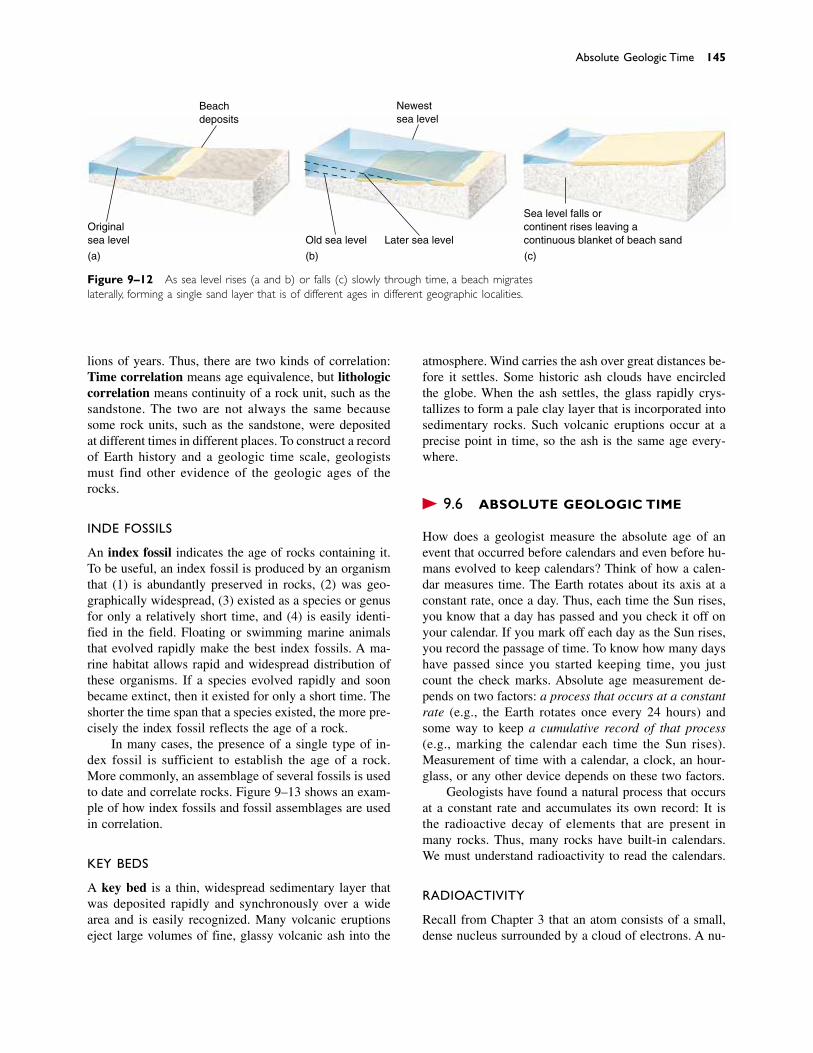
Absolute Geologic Time 145
Beachdeposits
Newestsea level
Originalsea level Old sea level Later sea level
Sea level falls orcontinent rises leaving acontinuous blanket of beach sand
(a) (b) (c)
Figure 9–12 As sea level rises (a and b) or falls (c) slowly through time, a beach migrateslaterally, forming a single sand layer that is of different ages in different geographic localities.
lions of years. Thus, there are two kinds of correlation:Time correlation means age equivalence, but lithologiccorrelation means continuity of a rock unit, such as thesandstone. The two are not always the same becausesome rock units, such as the sandstone, were depositedat different times in different places. To construct a recordof Earth history and a geologic time scale, geologistsmust find other evidence of the geologic ages of therocks.
INDEX FOSSILS
An index fossil indicates the age of rocks containing it.To be useful, an index fossil is produced by an organismthat (1) is abundantly preserved in rocks, (2) was geo-graphically widespread, (3) existed as a species or genusfor only a relatively short time, and (4) is easily identi-fied in the field. Floating or swimming marine animalsthat evolved rapidly make the best index fossils. A ma-rine habitat allows rapid and widespread distribution ofthese organisms. If a species evolved rapidly and soonbecame extinct, then it existed for only a short time. Theshorter the time span that a species existed, the more pre-cisely the index fossil reflects the age of a rock.
In many cases, the presence of a single type of in-dex fossil is sufficient to establish the age of a rock.More commonly, an assemblage of several fossils is usedto date and correlate rocks. Figure 9–13 shows an exam-ple of how index fossils and fossil assemblages are usedin correlation.
KEY BEDS
A key bed is a thin, widespread sedimentary layer thatwas deposited rapidly and synchronously over a widearea and is easily recognized. Many volcanic eruptionseject large volumes of fine, glassy volcanic ash into the
atmosphere. Wind carries the ash over great distances be-fore it settles. Some historic ash clouds have encircledthe globe. When the ash settles, the glass rapidly crys-tallizes to form a pale clay layer that is incorporated intosedimentary rocks. Such volcanic eruptions occur at aprecise point in time, so the ash is the same age every-where.
� 9.6 ABSOLUTE GEOLOGIC TIME
How does a geologist measure the absolute age of anevent that occurred before calendars and even before hu-mans evolved to keep calendars? Think of how a calen-dar measures time. The Earth rotates about its axis at aconstant rate, once a day. Thus, each time the Sun rises,you know that a day has passed and you check it off onyour calendar. If you mark off each day as the Sun rises,you record the passage of time. To know how many dayshave passed since you started keeping time, you justcount the check marks. Absolute age measurement de-pends on two factors: a process that occurs at a constantrate (e.g., the Earth rotates once every 24 hours) andsome way to keep a cumulative record of that process(e.g., marking the calendar each time the Sun rises).Measurement of time with a calendar, a clock, an hour-glass, or any other device depends on these two factors.
Geologists have found a natural process that occursat a constant rate and accumulates its own record: It isthe radioactive decay of elements that are present inmany rocks. Thus, many rocks have built-in calendars.We must understand radioactivity to read the calendars.
RADIOACTIVITY
Recall from Chapter 3 that an atom consists of a small,dense nucleus surrounded by a cloud of electrons. A nu-
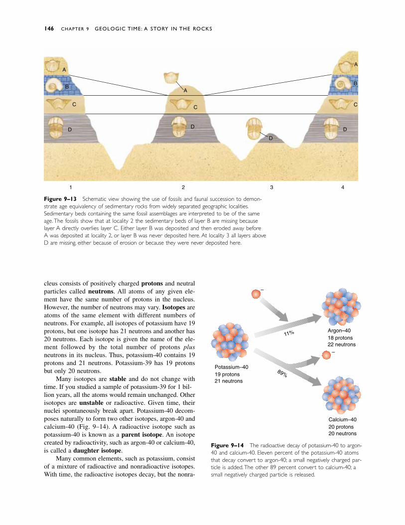
cleus consists of positively charged protons and neutralparticles called neutrons. All atoms of any given ele-ment have the same number of protons in the nucleus.However, the number of neutrons may vary. Isotopes areatoms of the same element with different numbers ofneutrons. For example, all isotopes of potassium have 19protons, but one isotope has 21 neutrons and another has20 neutrons. Each isotope is given the name of the ele-ment followed by the total number of protons plusneutrons in its nucleus. Thus, potassium-40 contains 19protons and 21 neutrons. Potassium-39 has 19 protonsbut only 20 neutrons.
Many isotopes are stable and do not change withtime. If you studied a sample of potassium-39 for 10 bil-lion years, all the atoms would remain unchanged. Otherisotopes are unstable or radioactive. Given time, theirnuclei spontaneously break apart. Potassium-40 decom-poses naturally to form two other isotopes, argon-40 andcalcium-40 (Fig. 9–14). A radioactive isotope such aspotassium-40 is known as a parent isotope. An isotopecreated by radioactivity, such as argon-40 or calcium-40,is called a daughter isotope.
Many common elements, such as potassium, consistof a mixture of radioactive and nonradioactive isotopes.With time, the radioactive isotopes decay, but the nonra-
146 CHAPTER 9 GEOLOGIC TIME: A STORY IN THE ROCKS
Figure 9–14 The radioactive decay of potassium-40 to argon-40 and calcium-40. Eleven percent of the potassium-40 atomsthat decay convert to argon-40; a small negatively charged par-ticle is added.The other 89 percent convert to calcium-40; asmall negatively charged particle is released.
Argon–4018 protons22 neutrons
Calcium–4020 protons20 neutrons
Potassium–4019 protons21 neutrons
11%
89%
–
–
1 2 3 4
A
B
C
D
A
C
D
A
B
C
D
D
Figure 9–13 Schematic view showing the use of fossils and faunal succession to demon-strate age equivalency of sedimentary rocks from widely separated geographic localities.Sedimentary beds containing the same fossil assemblages are interpreted to be of the sameage.The fossils show that at locality 2 the sedimentary beds of layer B are missing becauselayer A directly overlies layer C. Either layer B was deposited and then eroded away beforeA was deposited at locality 2, or layer B was never deposited here. At locality 3 all layers aboveD are missing, either because of erosion or because they were never deposited here.
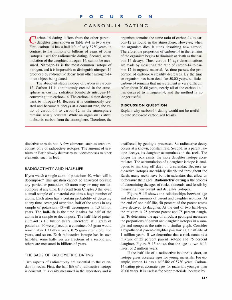
dioactive ones do not. A few elements, such as uranium,consist only of radioactive isotopes. The amount of ura-nium on Earth slowly decreases as it decomposes to otherelements, such as lead.
RADIOACTIVITY AND HALF-LIFE
If you watch a single atom of potassium-40, when will itdecompose? This question cannot be answered becauseany particular potassium-40 atom may or may not de-compose at any time. But recall from Chapter 3 that evena small sample of a material contains a huge number ofatoms. Each atom has a certain probability of decayingat any time. Averaged over time, half of the atoms in anysample of potassium-40 will decompose in 1.3 billionyears. The half-life is the time it takes for half of theatoms in a sample to decompose. The half-life of potas-sium-40 is 1.3 billion years. Therefore, if 1 gram ofpotassium-40 were placed in a container, 0.5 gram wouldremain after 1.3 billion years, 0.25 gram after 2.6 billionyears, and so on. Each radioactive isotope has its ownhalf-life; some half-lives are fractions of a second andothers are measured in billions of years.
THE BASIS OF RADIOMETRIC DATING
Two aspects of radioactivity are essential to the calen-dars in rocks. First, the half-life of a radioactive isotopeis constant. It is easily measured in the laboratory and is
unaffected by geologic processes. So radioactive decayoccurs at a known, constant rate. Second, as a parent iso-tope decays, its daughter accumulates in the rock. Thelonger the rock exists, the more daughter isotope accu-mulates. The accumulation of a daughter isotope is anal-ogous to marking off days on a calendar. Because ra-dioactive isotopes are widely distributed throughout theEarth, many rocks have built-in calendars that allow usto measure their ages. Radiometric dating is the processof determining the ages of rocks, minerals, and fossils bymeasuring their parent and daughter isotopes.
Figure 9–15 shows the relationships between ageand relative amounts of parent and daughter isotopes. Atthe end of one half-life, 50 percent of the parent atomshave decayed to daughter. At the end of two half-lives,the mixture is 25 percent parent and 75 percent daugh-ter. To determine the age of a rock, a geologist measuresthe proportions of parent and daughter isotopes in a sam-ple and compares the ratio to a similar graph. Considera hypothetical parent–daughter pair having a half-life of1 million years. If we determine that a rock contains amixture of 25 percent parent isotope and 75 percentdaughter, Figure 9–15 shows that the age is two half-lives, or 2 million years.
If the half-life of a radioactive isotope is short, anisotope gives accurate ages for young materials. For ex-ample, carbon-14 has a half-life of 5730 years. Carbon-14 dating gives accurate ages for materials younger than70,000 years. It is useless for older materials, because by
F O C U S O N
C A R B O N - 1 4 D A T I N G
Carbon-14 dating differs from the other parent–daughter pairs shown in Table 9–1 in two ways.
First, carbon-14 has a half-life of only 5730 years, incontrast to the millions or billions of years of otherisotopes used for radiometric dating. Second, accu-mulation of the daughter, nitrogen-14, cannot be mea-sured. Nitrogen-14 is the most common isotope of nitrogen, and it is impossible to distinguish nitrogen-14produced by radioactive decay from other nitrogen-14in an object being dated.
The abundant stable isotope of carbon is carbon-12. Carbon-14 is continuously created in the atmo-sphere as cosmic radiation bombards nitrogen-14,converting it to carbon-14. The carbon-14 then decaysback to nitrogen-14. Because it is continuously cre-ated and because it decays at a constant rate, the ra-tio of carbon-14 to carbon-12 in the atmosphere remains nearly constant. While an organism is alive,it absorbs carbon from the atmosphere. Therefore, the
organism contains the same ratio of carbon-14 to car-bon-12 as found in the atmosphere. However, whenthe organism dies, it stops absorbing new carbon.Therefore, the proportion of carbon-14 in the remainsof the organism begins to diminish at death as the car-bon-14 decays. Thus, carbon-14 age determinationsare made by measuring the ratio of carbon-14 to car-bon-12 in organic material. As time passes, the pro-portion of carbon-14 steadily decreases. By the timean organism has been dead for 50,000 years, so littlecarbon-14 remains that measurement is very difficult.After about 70,000 years, nearly all of the carbon-14has decayed to nitrogen-14, and the method is nolonger useful.
DISCUSSION QUESTION
Explain why carbon-14 dating would not be usefulto date Mesozoic carbonized fossils.
147
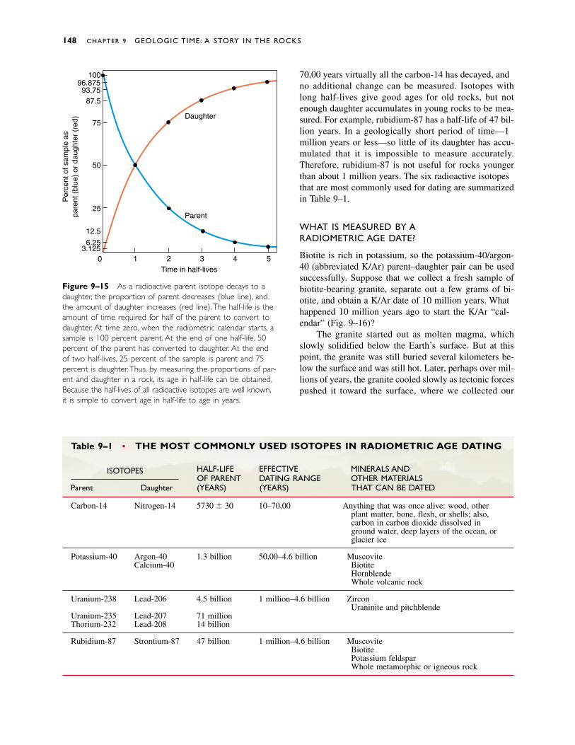
148 CHAPTER 9 GEOLOGIC TIME: A STORY IN THE ROCKS
Table 9–1 • THE MOST COMMONLY USED ISOTOPES IN RADIOMETRIC AGE DATING
HALF-LIFE EFFECTIVE MINERALS ANDISOTOPESOF PARENT DATING RANGE OTHER MATERIALS
Parent Daughter (YEARS) (YEARS) THAT CAN BE DATED
Carbon-14 Nitrogen-14 5730 � 30 100–70,000 Anything that was once alive: wood, otherplant matter, bone, flesh, or shells; also,carbon in carbon dioxide dissolved inground water, deep layers of the ocean, orglacier ice
Potassium-40 Argon-40 1.3 billion 50,000–4.6 billion MuscoviteCalcium-40 Biotite
HornblendeWhole volcanic rock
Uranium-238 Lead-206 4.5 billion 10 million–4.6 billion ZirconUraninite and pitchblende
Uranium-235 Lead-207 710 millionThorium-232 Lead-208 14 billion
Rubidium-87 Strontium-87 47 billion 10 million–4.6 billion MuscoviteBiotitePotassium feldsparWhole metamorphic or igneous rock
Figure 9–15 As a radioactive parent isotope decays to adaughter, the proportion of parent decreases (blue line), andthe amount of daughter increases (red line). The half-life is theamount of time required for half of the parent to convert todaughter. At time zero, when the radiometric calendar starts, asample is 100 percent parent. At the end of one half-life, 50percent of the parent has converted to daughter. At the endof two half-lives, 25 percent of the sample is parent and 75percent is daughter.Thus, by measuring the proportions of par-ent and daughter in a rock, its age in half-life can be obtained.Because the half-lives of all radioactive isotopes are well known,it is simple to convert age in half-life to age in years.
1 2 3 4 5Time in half-lives
Parent
03.125
6.25
12.5
25
50
75
87.593.75
96.875100
Per
cent
of s
ampl
e as
pare
nt (
blue
) or
dau
ghte
r (r
ed) Daughter
70,000 years virtually all the carbon-14 has decayed, andno additional change can be measured. Isotopes withlong half-lives give good ages for old rocks, but notenough daughter accumulates in young rocks to be mea-sured. For example, rubidium-87 has a half-life of 47 bil-lion years. In a geologically short period of time—10million years or less—so little of its daughter has accu-mulated that it is impossible to measure accurately.Therefore, rubidium-87 is not useful for rocks youngerthan about 10 million years. The six radioactive isotopesthat are most commonly used for dating are summarizedin Table 9–1.
WHAT IS MEASURED BY A RADIOMETRIC AGE DATE?
Biotite is rich in potassium, so the potassium-40/argon-40 (abbreviated K/Ar) parent–daughter pair can be usedsuccessfully. Suppose that we collect a fresh sample ofbiotite-bearing granite, separate out a few grams of bi-otite, and obtain a K/Ar date of 100 million years. Whathappened 100 million years ago to start the K/Ar “cal-endar” (Fig. 9–16)?
The granite started out as molten magma, whichslowly solidified below the Earth’s surface. But at thispoint, the granite was still buried several kilometers be-low the surface and was still hot. Later, perhaps over mil-lions of years, the granite cooled slowly as tectonic forcespushed it toward the surface, where we collected our
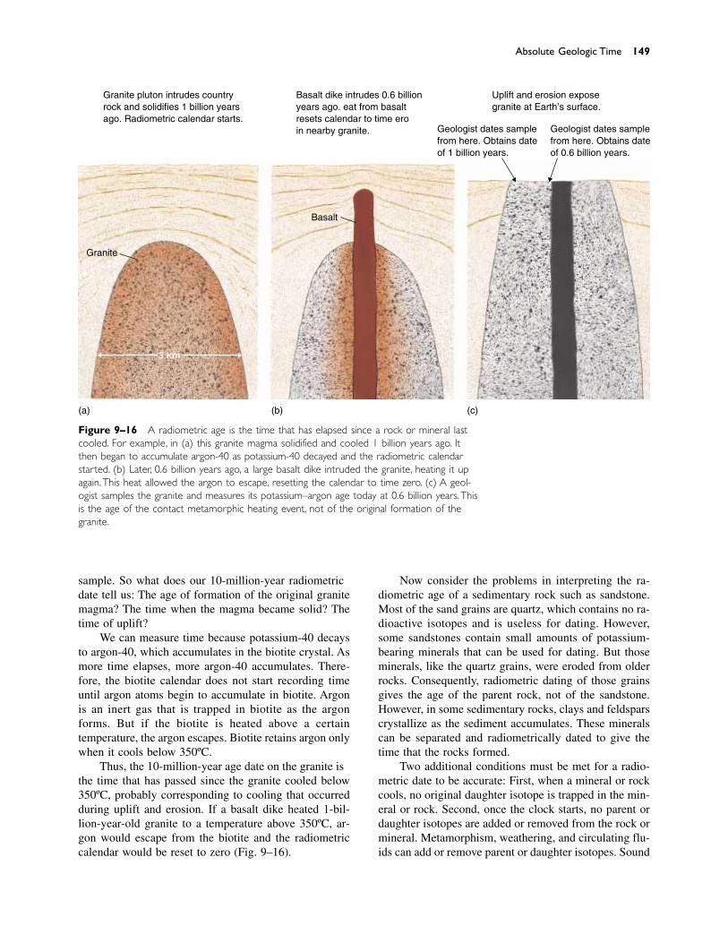
sample. So what does our 100-million-year radiometricdate tell us: The age of formation of the original granitemagma? The time when the magma became solid? Thetime of uplift?
We can measure time because potassium-40 decaysto argon-40, which accumulates in the biotite crystal. Asmore time elapses, more argon-40 accumulates. There-fore, the biotite calendar does not start recording timeuntil argon atoms begin to accumulate in biotite. Argonis an inert gas that is trapped in biotite as the argonforms. But if the biotite is heated above a certain temperature, the argon escapes. Biotite retains argon onlywhen it cools below 350ºC.
Thus, the 100-million-year age date on the granite isthe time that has passed since the granite cooled below350ºC, probably corresponding to cooling that occurredduring uplift and erosion. If a basalt dike heated 1-bil-lion-year-old granite to a temperature above 350ºC, ar-gon would escape from the biotite and the radiometriccalendar would be reset to zero (Fig. 9–16).
Now consider the problems in interpreting the ra-diometric age of a sedimentary rock such as sandstone.Most of the sand grains are quartz, which contains no ra-dioactive isotopes and is useless for dating. However,some sandstones contain small amounts of potassium-bearing minerals that can be used for dating. But thoseminerals, like the quartz grains, were eroded from olderrocks. Consequently, radiometric dating of those grainsgives the age of the parent rock, not of the sandstone.However, in some sedimentary rocks, clays and feldsparscrystallize as the sediment accumulates. These mineralscan be separated and radiometrically dated to give thetime that the rocks formed.
Two additional conditions must be met for a radio-metric date to be accurate: First, when a mineral or rockcools, no original daughter isotope is trapped in the min-eral or rock. Second, once the clock starts, no parent ordaughter isotopes are added or removed from the rock ormineral. Metamorphism, weathering, and circulating flu-ids can add or remove parent or daughter isotopes. Sound
Absolute Geologic Time 149
Granite
Basalt
3 km
(a) (b) (c)
Granite pluton intrudes countryrock and solidifies 1 billion yearsago. Radiometric calendar starts.
Basalt dike intrudes 0.6 billionyears ago. Heat from basaltresets calendar to time zeroin nearby granite.
Uplift and erosion exposegranite at Earth’s surface.
Geologist dates samplefrom here. Obtains dateof 1 billion years.
Geologist dates samplefrom here. Obtains dateof 0.6 billion years.
Figure 9–16 A radiometric age is the time that has elapsed since a rock or mineral lastcooled. For example, in (a) this granite magma solidified and cooled 1 billion years ago. Itthen began to accumulate argon-40 as potassium-40 decayed and the radiometric calendarstarted. (b) Later, 0.6 billion years ago, a large basalt dike intruded the granite, heating it upagain.This heat allowed the argon to escape, resetting the calendar to time zero. (c) A geol-ogist samples the granite and measures its potassium–argon age today at 0.6 billion years. Thisis the age of the contact metamorphic heating event, not of the original formation of thegranite.

geologic reasoning and discretion must be applied whenchoosing materials for radiometric dating and when in-terpreting radiometric age dates.
� 9.7 THE GEOLOGIC COLUMN AND TIME SCALE
As mentioned earlier, no single locality exists on Earthwhere a complete sequence of rocks formed continu-ously throughout geologic time. However, geologistshave correlated rocks that accumulated continuouslythrough portions of geologic time from many differentlocalities around the world. The information has beencombined to create the geologic column, which is anearly complete composite record of geologic time (Table9–2). The worldwide geologic column is frequently re-vised as geologic mapping continues.
Geologists divide all of geologic time into smallerunits for convenience. Just as a year is subdivided intomonths, months into weeks, and weeks into days, largegeologic time units are split into smaller intervals. Theunits are named, just as months and days are. The largesttime units are eons, which are divided into eras. Eras aresubdivided, in turn, into periods, which are further sub-divided into epochs.
The geologic column and the geologic time scalewere constructed on the basis of relative age determina-tions. When geologists developed radiometric dating,they added absolute ages to the column and time scale.
Today, geologists use this time scale to date rocks inthe field. Imagine that you are studying a sedimentarysequence. If you find an index fossil or a key bed thathas already been dated by other scientists, you know theage of the rock and you do not need to send the sampleto a laboratory for radiometric dating.
GEOLOGIC TIME
Look again at the geologic time scale of Table 9–2.Notice that the Phanerozoic Eon, which comprises themost recent 538 million years of geologic time, takes upmost of the table and contains all of the named subdivi-sions. The earlier eons—the Proterozoic, Archean, andHadean—are often not subdivided at all, even though to-gether they constitute a time interval of 4 billion years,almost eight times as long as the Phanerozoic. Why isPhanerozoic time subdivided so finely? Or, conversely,what prevents subdivision of the earlier eons?
Earliest Eons of Geologic Time: Precambrian Time
Geologic time units are based largely on fossils found inrocks. Only a few Earth rocks are known that formed
during the Hadean Eon (Greek for “beneath the Earth”),the earliest time in Earth history. No fossils of Hadeanage are known. It may be that erosion or metamorphismdestroyed traces of Hadean life, or that Hadean time pre-ceded the evolution of life. In any case, Hadean time isnot amenable to subdivision based on fossils.
Most rocks of the Archean Eon (Greek for “an-cient”) are igneous or metamorphic, although a fewArchean sedimentary rocks are preserved. Some containmicroscopic fossils of single-celled organisms. Life onEarth apparently began sometime during the ArcheanEon, although fossils are neither numerous nor well pre-served enough to permit much fine tuning of Archeantime.
Large and diverse groups of fossils have been foundin sedimentary rocks of the Proterozoic Eon (Greek for“earlier life”). The most complex are not only multicel-lular but have different kinds of cells arranged into tis-sues and organs. Some of these organisms look so muchlike modern jellyfish, corals, and worms that some pale-ontologists view them as ancestors of organisms alive today. However, other paleontologists believe that the re-semblance is only superficial. A few types of Proterozoicshell-bearing organisms have been identified, but shelledorganisms did not become abundant until the Paleo-zoic Era.
Commonly, the Hadean, Archean, and ProterozoicEons are collectively referred to by the informal termPrecambrian, because they preceded the CambrianPeriod, when fossil remains first became very abundant.
Phanerozoic Eon
The word Phanerozoic is from the Greek, meaning “vis-ible life.” Sedimentary rocks of the Phanerozoic Eoncontain plentiful and easily discernible fossils. The be-ginning of Phanerozoic time marks a dramatic increasein the abundance and diversity of life.
Subdivision of the Phanerozoic Eon into three eras isbased on the most common types of life during each era.Sedimentary rocks formed during the Paleozoic era (Greekfor “old life”) contain fossils of early life forms, such as in-vertebrates, fishes, amphibians, reptiles, ferns, and cone-bearing trees. Sedimentary rocks of the Mesozoic era(Greek for “middle life”) contain new types of phyto-plankton, microscopic plants that float at or near the seasurface, and beautiful, swimming cephalopods called am-monoids. However, the Mesozoic Era is most famous forthe dinosaurs that dominated the land (Fig. 9–17).Mammals and flowering plants also evolved during thisera. During the Cenozoic era (Greek for “recent life”),mammals and grasses became abundant.
The eras of Phanerozoic time are subdivided intoperiods, the time unit most commonly used by geolo-
150 CHAPTER 9 GEOLOGIC TIME: A STORY IN THE ROCKS
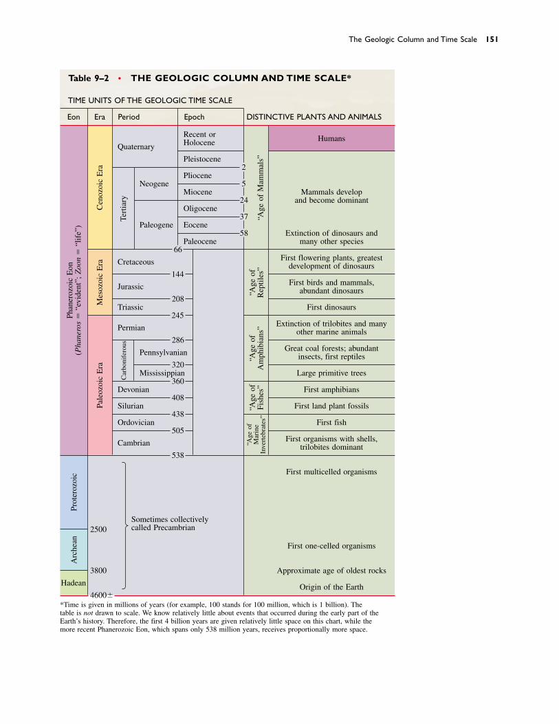
Table 9–2 • THE GEOLOGIC COLUMN AND TIME SCALE*
TIME UNITS OF THE GEOLOGIC TIME SCALE
Eon Era Period Epoch DISTINCTIVE PLANTS AND ANIMALS
Recent or HumansHoloceneQuaternary
Pleistocene2
PlioceneNeogene 5
Miocene Mammals develop24 and become dominant
Oligocene37
Paleogene Eocene58 Extinction of dinosaurs and
Paleocene many other species66
Cretaceous First flowering plants, greatestdevelopment of dinosaurs
144
Jurassic First birds and mammals,abundant dinosaurs
208Triassic First dinosaurs
245
Permian Extinction of trilobites and manyother marine animals
286
Pennsylvanian Great coal forests; abundantinsects, first reptiles
320Mississippian Large primitive trees
360Devonian First amphibians
408Silurian First land plant fossils
438Ordovician First fish
505
Cambrian First organisms with shells,trilobites dominant
538
First multicelled organisms
Sometimes collectivelycalled Precambrian2500
First one-celled organisms
3800 Approximate age of oldest rocks
Hadean Origin of the Earth4600�
*Time is given in millions of years (for example, 1000 stands for 1000 million, which is 1 billion). The table is not drawn to scale. We know relatively little about events that occurred during the early part of theEarth’s history. Therefore, the first 4 billion years are given relatively little space on this chart, while the more recent Phanerozoic Eon, which spans only 538 million years, receives proportionally more space.
Pale
ozoi
c E
raM
esoz
oic
Era
Car
boni
fero
usTe
rtia
ry
Prot
eroz
oic
Arc
hean
Cen
ozoi
c E
ra
“Age
of
Mar
ine
Inve
rteb
rate
s”
“Age
of
Fish
es”
“Age
of
Am
phib
ians
”“A
ge o
fR
eptil
es”
“Age
of
Mam
mal
s”
Phan
eroz
oic
Eon
(Pha
nero
s�
“evi
dent
”; Z
oon
�“l
ife”
)
The Geologic Column and Time Scale 151

gists. Some of the periods are named after special char-acteristics of the rocks formed during that period. For example, the Cretaceous Period is named from the Latinword for “chalk” (creta) after chalk beds of this age inAfrica, North America, and Europe. Other periods arenamed for the geographic localities where rocks of thatage were first described. For example, the Jurassic Periodis named for the Jura Mountains of France andSwitzerland. The Cambrian Period is named for Cambria,the Roman name for Wales, where rocks of this age werefirst studied.
In addition to the abundance of fossils, another rea-son that details of Phanerozoic time are better knownthan those of Precambrian time is that many of the olderrocks have been metamorphosed, deformed, and eroded.It is a simple matter of probability that the older a rockis, the greater the chance that metamorphism or erosionhas obliterated fossils and other evidence of its history. Figure 9–17 In this reconstruction, a mother duckbill
dinosaur nurtures her babies in their nest on a mud flat, 100million years ago in Montana. (Museum of the Rockies)
Determinations of relative time are based on geologicrelationships among rocks and the evolution of life formsthrough time. The criteria for relative dating are summa-rized in a few simple principles: the principle of origi-nal horizontality, the principle of superposition, theprinciple of crosscutting relationships, and the princi-ple of faunal succession.
Layers of sedimentary rock are conformable if theywere deposited without major interruptions. An uncon-formity represents a major interruption of depositionand a significant time gap between formation of succes-sive layers of rock. In a disconformity, layers of sedimen-tary rock on either side of the unconformity are parallel.An angular unconformity forms when lower layers ofrock are tilted prior to deposition of the upper beds. In anonconformity, sedimentary layers overly an erosionsurface developed on igneous or metamorphic rocks.
Fossils are used to date rocks according to the prin-ciple of faunal succession.
Correlation is the demonstration of equivalency ofrocks that are geographically separated. Index fossils
and key beds are important tools in time correlation,the demonstration that sedimentary rocks from differentgeographic localities formed at the same time. Worldwidecorrelation of rocks of all ages has resulted in the geo-logic column, a composite record of rocks formedthroughout the history of the Earth.
Absolute time is measured by radiometric age dat-ing, which relies on the fact that radioactive parent iso-topes decay to form daughter isotopes at a fixed, knownrate as expressed by the half-life of the isotope. The cu-mulative effects of the radioactive decay process can bedetermined because the daughter isotopes accumulate inrocks and minerals.
The major units of the geologic time scale are eons,eras, periods, and epochs. The Phanerozoic Eon isfinely and accurately subdivided because sedimentaryrocks deposited at this time are often well preserved andthey contain abundant well-preserved fossils. In contrast,Precambrian rocks and time are only coarsely subdi-vided because fossils are scarce and poorly preservedand the rocks are often altered.
S U M M A R Y
relative age 140absolute age 140principle of original
horizontality 140principle of superposition
141
principle of crosscutting relationships 141
conformable 142unconformity 142disconformity 142
angular unconformity143
nonconformity 143fossil 144evolution 144
principle of faunal succession 144
correlation 144time correlation 145
K E Y W O R D S
152
Discussion Questions 153
1. Devise two metaphors for the length of geologic time inaddition to the metaphor used in Chapter 1. Locate someof the most important time boundaries in your analogy.
2. Suppose that you landed on the Moon and were able totravel in a vehicle that could carry you over the lunarsurface to see a wide variety of rocks, but that you hadno laboratory equipment to work with. What principlesand tools could you use to determine relative ages ofMoon rocks?
3. Imagine that one species lived between 538 and 505 mil-lion years ago and another lived between 520 and 245million years ago. What can you say about the age of arock that contains fossils of both species?
4. Imagine that someone handed you a sample of sedimen-tary rock containing abundant fossils. What could you tellabout its age if you didn’t use radiometric dating and youdidn’t know where it was collected from? What additionalinformation could you determine if you studied the out-crop that it came from?
5. What geologic events are represented by a potassium–argon age from flakes of biotite in a. granite,b. biotite schist, and c. sandstone?
6. Suppose you were using the potassium–argon method tomeasure the age of biotite in granite. What would be theeffect on the age measurement if the biotite had beenslowly leaking small amounts of argon since it crystal-lized?
7. Some pyroxenes contain enough potassium to be datedby the potassium–argon method. However, pyroxenes arenotorious scavengers of argon. That is, they absorb substan-tial amounts of argon from magma as they crystallize.How would this argon scavenging affect a potassium–argon age measurement done on a pyroxene?
8. Suppose that you measured and described a sequence ofMiddle Paleozoic sedimentary rocks in northern Ohio andlater did the same with a sequence of the same age inWyoming. How would you correlate the two sections?
D I S C U S S I O N Q U E S T I O N S
1. Describe the two ways of measuring geologic time. Howdo they differ?
2. Give an example of how the principle of original horizon-tality might be used to determine the order of events af-fecting a sequence of folded sedimentary rocks.
3. How does the principle of superposition allow us to de-termine the relative ages of a sequence of unfolded sedi-mentary rocks?
4. Explain the principle of crosscutting relationships and howit can be used to determine age relationships among sedi-mentary rocks.
5. Explain a conformable relationship in sedimentary rocks.
6. Explain the differences among unconformities, disconfor-mities, angular unconformities, and nonconformities.
7. List five different types of fossils and how they are formed.
8. How does a trace fossil differ from other types of fossils?
9. Discuss the principle of faunal succession and the use ofindex fossils in time correlation.
10. What are the two different types of correlation of rockunits? How do they differ?
11. What tools or principles are most commonly used in cor-relation?
12. Describe the similarities and differences between how a
calendar records time and how minerals and rocks con-taining radioactive isotopes record time.
13. What is radioactivity?
14. What is a stable isotope? An unstable isotope?
15. What is the relationship between parent and daughter iso-topes?
16. What is meant by the half-life of a radioactive isotope?How is the half-life used in radiometric age dating?
17. Some radioactive isotopes are useful for measuring rela-tively young ages, whereas others are useful for measur-ing older ages. Why is this true?
18. What geologic event is actually measured by a radiomet-ric age determination of an igneous rock or mineral?
19. Why is the Phanerozoic Eon separated into so many sub-divisions in contrast to much longer Precambrian time,which has few subdivisions?
20. Describe and discuss the events in Earth history responsi-ble for rock features that allow us to divide geologic timeinto eras and periods. Describe and discuss the rock fea-tures as well.
21. What geologic events are recorded by an angular uncon-formity? A disconformity? A nonconformity? What canbe inferred about the timing of each set of events?
R E V I E W Q U E S T I O N S
lithologic correlation145
index fossil 145key bed 145radioactivity 145isotope 146
parent isotope 146daughter isotope 146half-life 147radiometric dating 147geologic column 150eon 150
era 150period 150epoch 150Hadean Eon 150Archean Eon 150Proterozoic 150
Precambrian 150Phanerozoic Eon 150Paleozoic era 150Mesozoic era 150Cenozoic era 150
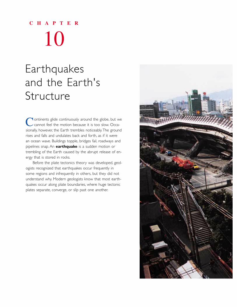
ontinents glide continuously around the globe, but we cannot feel the motion because it is too slow. Occa-
sionally, however, the Earth trembles noticeably.The groundrises and falls and undulates back and forth, as if it were an ocean wave. Buildings topple, bridges fail, roadways andpipelines snap. An earthquake is a sudden motion ortrembling of the Earth caused by the abrupt release of en-ergy that is stored in rocks.
Before the plate tectonics theory was developed, geol-ogists recognized that earthquakes occur frequently insome regions and infrequently in others, but they did notunderstand why. Modern geologists know that most earth-quakes occur along plate boundaries, where huge tectonicplates separate, converge, or slip past one another.
C H A P T E R
10Ear thquakes and the Ear th'sStructure
C
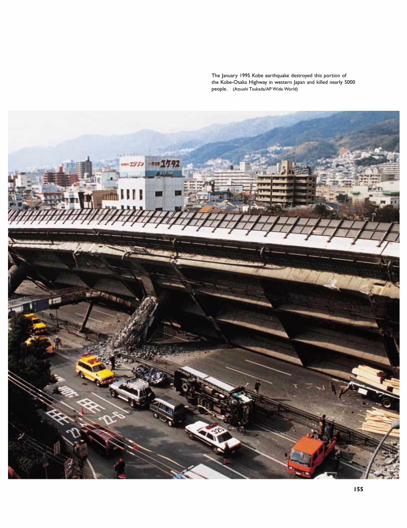
The January 1995 Kobe earthquake destroyed this portion of the Kobe-Osaka Highway in western Japan and killed nearly 5000people. (Atsushi Tsukada/AP Wide World)
155
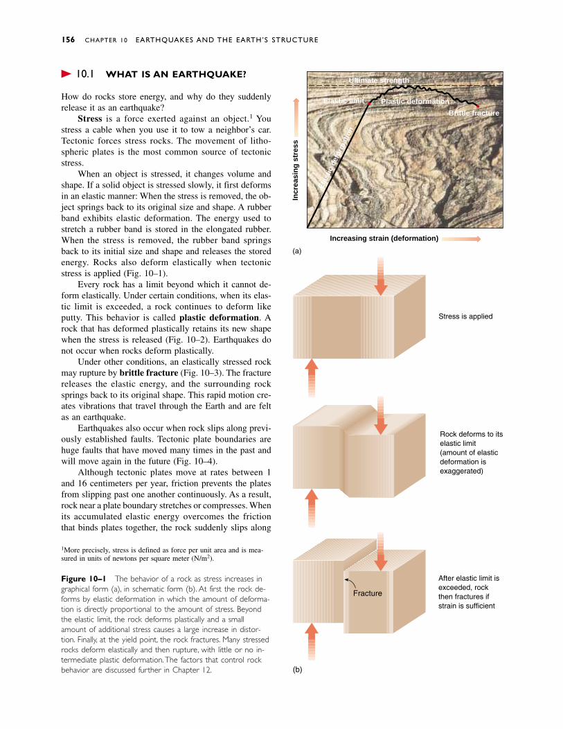
� 10.1 WHAT IS AN EARTHQUAKE?
How do rocks store energy, and why do they suddenlyrelease it as an earthquake?
Stress is a force exerted against an object.1 Youstress a cable when you use it to tow a neighbor’s car.Tectonic forces stress rocks. The movement of litho-spheric plates is the most common source of tectonicstress.
When an object is stressed, it changes volume andshape. If a solid object is stressed slowly, it first deformsin an elastic manner: When the stress is removed, the ob-ject springs back to its original size and shape. A rubberband exhibits elastic deformation. The energy used tostretch a rubber band is stored in the elongated rubber.When the stress is removed, the rubber band springsback to its initial size and shape and releases the storedenergy. Rocks also deform elastically when tectonicstress is applied (Fig. 10–1).
Every rock has a limit beyond which it cannot de-form elastically. Under certain conditions, when its elas-tic limit is exceeded, a rock continues to deform likeputty. This behavior is called plastic deformation. Arock that has deformed plastically retains its new shapewhen the stress is released (Fig. 10–2). Earthquakes donot occur when rocks deform plastically.
Under other conditions, an elastically stressed rockmay rupture by brittle fracture (Fig. 10–3). The fracturereleases the elastic energy, and the surrounding rocksprings back to its original shape. This rapid motion cre-ates vibrations that travel through the Earth and are feltas an earthquake.
Earthquakes also occur when rock slips along previ-ously established faults. Tectonic plate boundaries arehuge faults that have moved many times in the past andwill move again in the future (Fig. 10–4).
Although tectonic plates move at rates between 1and 16 centimeters per year, friction prevents the platesfrom slipping past one another continuously. As a result,rock near a plate boundary stretches or compresses. Whenits accumulated elastic energy overcomes the frictionthat binds plates together, the rock suddenly slips along
156 CHAPTER 10 EARTHQUAKES AND THE EARTH’S STRUCTURE
1More precisely, stress is defined as force per unit area and is mea-sured in units of newtons per square meter (N/m2).
Figure 10–1 The behavior of a rock as stress increases ingraphical form (a), in schematic form (b). At first the rock de-forms by elastic deformation in which the amount of deforma-tion is directly proportional to the amount of stress. Beyondthe elastic limit, the rock deforms plastically and a smallamount of additional stress causes a large increase in distor-tion. Finally, at the yield point, the rock fractures. Many stressedrocks deform elastically and then rupture, with little or no in-termediate plastic deformation.The factors that control rockbehavior are discussed further in Chapter 12.
Ultimate strength
Plastic deformationElastic limit
Brittle fracture
Elas
tic d
efor
mat
ion
Increasing strain (deformation)
Incr
easi
ng
str
ess
(a)
Stress is applied
Rock deforms to itselastic limit(amount of elasticdeformation isexaggerated)
After elastic limit isexceeded, rockthen fractures ifstrain is sufficient
Fracture
(b)
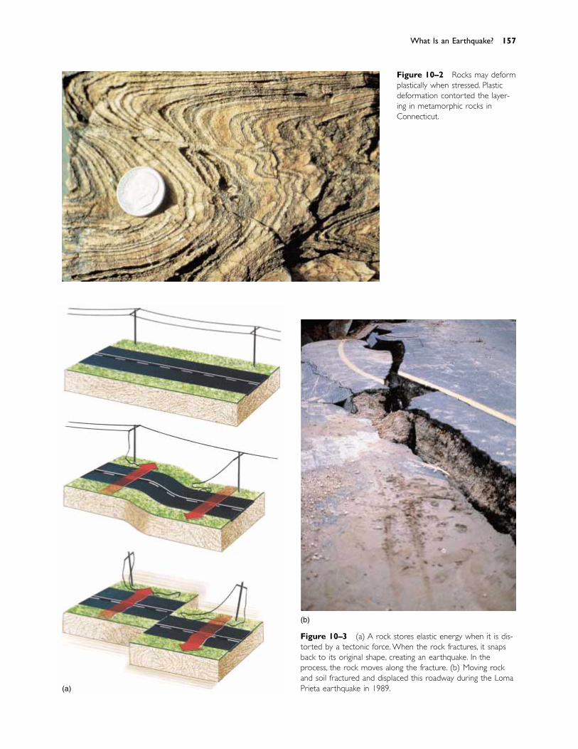
Figure 10–3 (a) A rock stores elastic energy when it is dis-torted by a tectonic force. When the rock fractures, it snapsback to its original shape, creating an earthquake. In theprocess, the rock moves along the fracture. (b) Moving rockand soil fractured and displaced this roadway during the LomaPrieta earthquake in 1989.
Figure 10–2 Rocks may deformplastically when stressed. Plasticdeformation contorted the layer-ing in metamorphic rocks inConnecticut.
What Is an Earthquake? 157
(a)
(b)
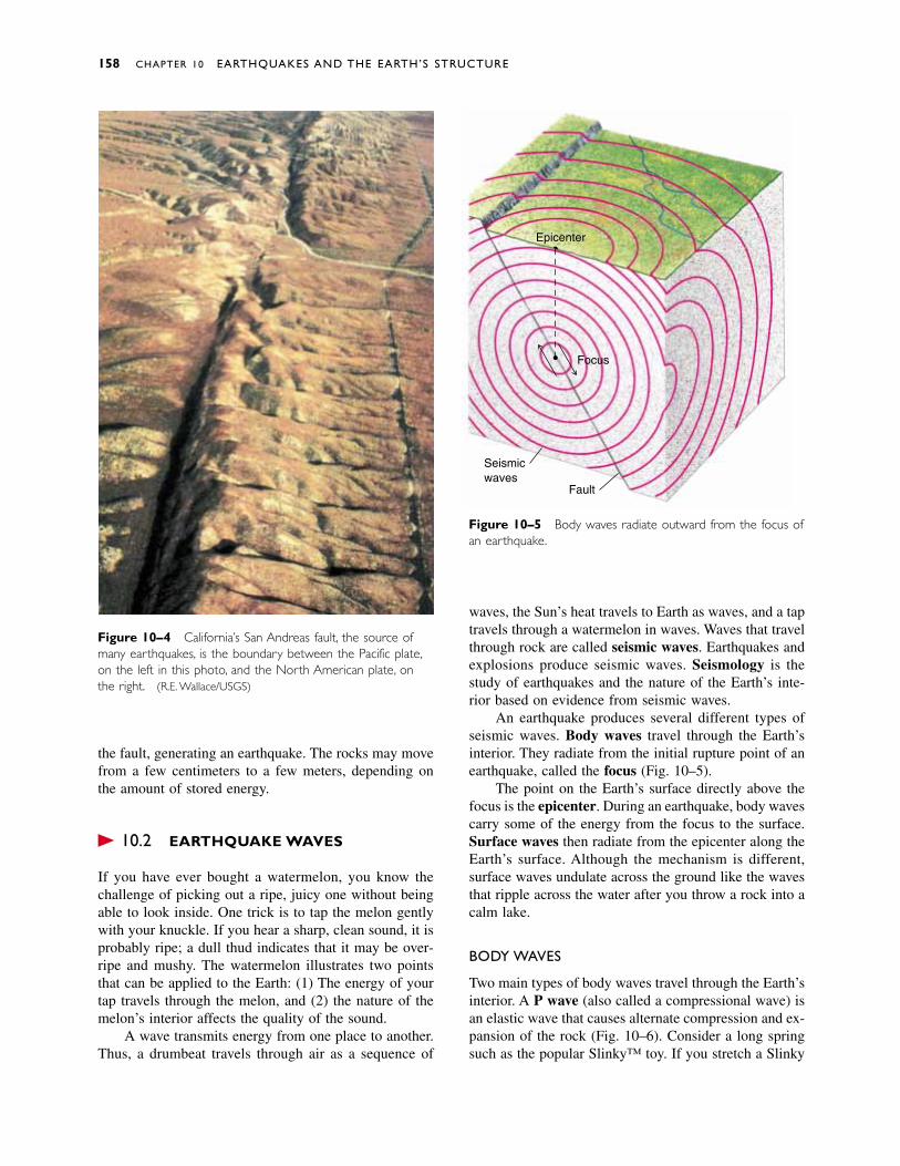
the fault, generating an earthquake. The rocks may movefrom a few centimeters to a few meters, depending onthe amount of stored energy.
� 10.2 EARTHQUAKE WAVES
If you have ever bought a watermelon, you know thechallenge of picking out a ripe, juicy one without beingable to look inside. One trick is to tap the melon gentlywith your knuckle. If you hear a sharp, clean sound, it isprobably ripe; a dull thud indicates that it may be over-ripe and mushy. The watermelon illustrates two pointsthat can be applied to the Earth: (1) The energy of yourtap travels through the melon, and (2) the nature of themelon’s interior affects the quality of the sound.
A wave transmits energy from one place to another.Thus, a drumbeat travels through air as a sequence of
waves, the Sun’s heat travels to Earth as waves, and a taptravels through a watermelon in waves. Waves that travelthrough rock are called seismic waves. Earthquakes andexplosions produce seismic waves. Seismology is thestudy of earthquakes and the nature of the Earth’s inte-rior based on evidence from seismic waves.
An earthquake produces several different types ofseismic waves. Body waves travel through the Earth’sinterior. They radiate from the initial rupture point of anearthquake, called the focus (Fig. 10–5).
The point on the Earth’s surface directly above thefocus is the epicenter. During an earthquake, body wavescarry some of the energy from the focus to the surface.Surface waves then radiate from the epicenter along theEarth’s surface. Although the mechanism is different,surface waves undulate across the ground like the wavesthat ripple across the water after you throw a rock into acalm lake.
BODY WAVES
Two main types of body waves travel through the Earth’sinterior. A P wave (also called a compressional wave) isan elastic wave that causes alternate compression and ex-pansion of the rock (Fig. 10–6). Consider a long springsuch as the popular Slinky™ toy. If you stretch a Slinky
158 CHAPTER 10 EARTHQUAKES AND THE EARTH’S STRUCTURE
Figure 10–4 California’s San Andreas fault, the source ofmany earthquakes, is the boundary between the Pacific plate,on the left in this photo, and the North American plate, onthe right. (R.E. Wallace/USGS)
Figure 10–5 Body waves radiate outward from the focus ofan earthquake.
Epicenter
Fault
Focus
Seismicwaves
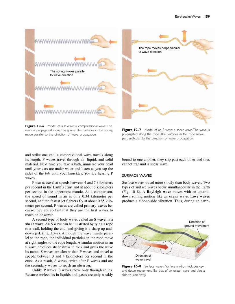
and strike one end, a compressional wave travels alongits length. P waves travel through air, liquid, and solidmaterial. Next time you take a bath, immerse your headuntil your ears are under water and listen as you tap thesides of the tub with your knuckles. You are hearing Pwaves.
P waves travel at speeds between 4 and 7 kilometersper second in the Earth’s crust and at about 8 kilometersper second in the uppermost mantle. As a comparison,the speed of sound in air is only 0.34 kilometer per second, and the fastest jet fighters fly at about 0.85 kilo-meter per second. P waves are called primary waves be-cause they are so fast that they are the first waves toreach an observer.
A second type of body wave, called an S wave, is ashear wave. An S wave can be illustrated by tying a ropeto a wall, holding the end, and giving it a sharp up-and-down jerk (Fig. 10–7). Although the wave travels paral-lel to the rope, the individual particles in the rope moveat right angles to the rope length. A similar motion in anS wave produces shear stress in rock and gives the waveits name. S waves are slower than P waves and travel atspeeds between 3 and 4 kilometers per second in thecrust. As a result, S waves arrive after P waves and arethe secondary waves to reach an observer.
Unlike P waves, S waves move only through solids.Because molecules in liquids and gases are only weakly
bound to one another, they slip past each other and thuscannot transmit a shear wave.
SURFACE WAVES
Surface waves travel more slowly than body waves. Twotypes of surface waves occur simultaneously in the Earth(Fig. 10–8). A Rayleigh wave moves with an up-and- down rolling motion like an ocean wave. Love wavesproduce a side-to-side vibration. Thus, during an earth-
Earthquake Waves 159
The spring moves parallelto wave direction
Figure 10–6 Model of a P wave; a compressional wave.Thewave is propagated along the spring.The particles in the springmove parallel to the direction of wave propagation.
Figure 10–7 Model of an S wave; a shear wave.The wave ispropagated along the rope.The particles in the rope moveperpendicular to the direction of wave propagation.
The rope moves perpendicularto wave direction
Figure 10–8 Surface waves. Surface motion includes up-and-down movement like that of an ocean wave and also aside-to-side sway.
Direction ofground movement
Direction ofwave travel
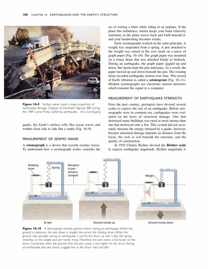
quake, the Earth’s surface rolls like ocean waves andwrithes from side to side like a snake (Fig. 10–9).
MEASUREMENT OF SEISMIC WAVES
A seismograph is a device that records seismic waves.To understand how a seismograph works, consider the
Figure 10–9 Surface waves cause a large proportion ofearthquake damage. Collapse of Interstate Highway 880 duringthe 1989 Loma Prieta, California, earthquake. (Paul Scott/Sygma)
160 CHAPTER 10 EARTHQUAKES AND THE EARTH’S STRUCTURE
Figure 10–10 A seismograph records ground motion during an earthquake. When theground is stationary, the pen draws a straight line across the rotating drum. When theground rises abruptly during an earthquake, it carries the drum up with it. But the springstretches, so the weight and pen hardly move.Therefore, the pen marks a line lower on thedrum. Conversely, when the ground sinks, the pen marks a line higher on the drum. Duringan earthquake, the pen traces a jagged line as the drum rises and falls.
Rotatingdrum Spring
Elevationof penremainsconstant
At rest Ground moves up Ground moves down
Weight
act of writing a letter while riding in an airplane. If theplane hits turbulence, inertia keeps your hand relativelystationary as the plane moves back and forth beneath it,and your handwriting becomes erratic.
Early seismographs worked on the same principle. Aweight was suspended from a spring. A pen attached tothe weight was aimed at the zero mark on a piece ofgraph paper (Fig. 10–10). The graph paper was mountedon a rotary drum that was attached firmly to bedrock.During an earthquake, the graph paper jiggled up anddown, but inertia kept the pen stationary. As a result, thepaper moved up and down beneath the pen. The rotatingdrum recorded earthquake motion over time. This recordof Earth vibration is called a seismogram (Fig. 10–11).Modern seismographs use electronic motion detectorswhich transmit the signal to a computer.
MEASUREMENT OF EARTHQUAKE STRENGTH
Over the past century, geologists have devised severalscales to express the size of an earthquake. Before seis-mographs were in common use, earthquakes were eval-uated on the basis of structural damage. One that destroyed many buildings was rated as more intense thanone that destroyed only a few. This system did not accu-rately measure the energy released by a quake, however,because structural damage depends on distance from thefocus, the rock or soil beneath the structure, and thequality of construction.
In 1935 Charles Richter devised the Richter scaleto express earthquake magnitude. Richter magnitude is
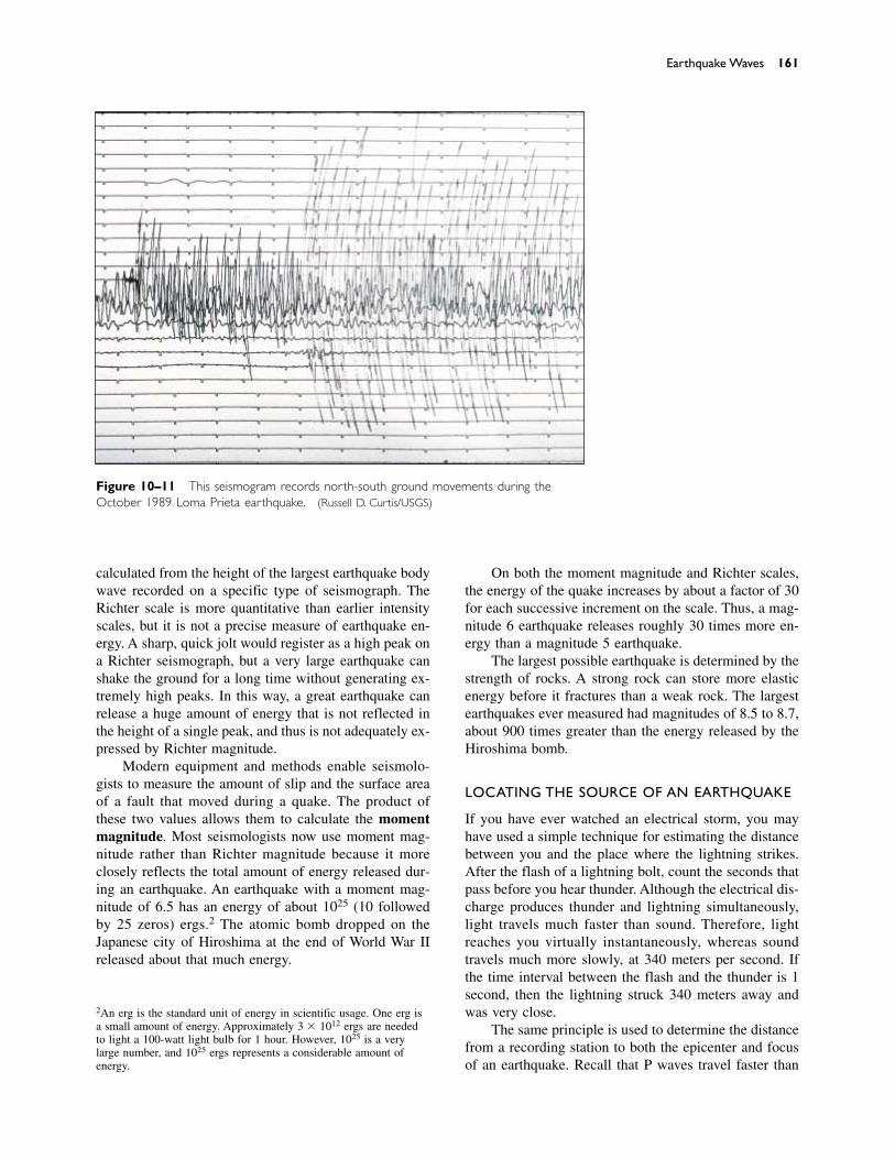
calculated from the height of the largest earthquake bodywave recorded on a specific type of seismograph. TheRichter scale is more quantitative than earlier intensityscales, but it is not a precise measure of earthquake en-ergy. A sharp, quick jolt would register as a high peak ona Richter seismograph, but a very large earthquake canshake the ground for a long time without generating ex-tremely high peaks. In this way, a great earthquake canrelease a huge amount of energy that is not reflected inthe height of a single peak, and thus is not adequately ex-pressed by Richter magnitude.
Modern equipment and methods enable seismolo-gists to measure the amount of slip and the surface areaof a fault that moved during a quake. The product ofthese two values allows them to calculate the momentmagnitude. Most seismologists now use moment mag-nitude rather than Richter magnitude because it moreclosely reflects the total amount of energy released dur-ing an earthquake. An earthquake with a moment mag-nitude of 6.5 has an energy of about 1025 (10 followedby 25 zeros) ergs.2 The atomic bomb dropped on theJapanese city of Hiroshima at the end of World War IIreleased about that much energy.
On both the moment magnitude and Richter scales,the energy of the quake increases by about a factor of 30for each successive increment on the scale. Thus, a mag-nitude 6 earthquake releases roughly 30 times more en-ergy than a magnitude 5 earthquake.
The largest possible earthquake is determined by thestrength of rocks. A strong rock can store more elasticenergy before it fractures than a weak rock. The largestearthquakes ever measured had magnitudes of 8.5 to 8.7,about 900 times greater than the energy released by theHiroshima bomb.
LOCATING THE SOURCE OF AN EARTHQUAKE
If you have ever watched an electrical storm, you mayhave used a simple technique for estimating the distancebetween you and the place where the lightning strikes.After the flash of a lightning bolt, count the seconds thatpass before you hear thunder. Although the electrical dis-charge produces thunder and lightning simultaneously,light travels much faster than sound. Therefore, lightreaches you virtually instantaneously, whereas soundtravels much more slowly, at 340 meters per second. Ifthe time interval between the flash and the thunder is 1second, then the lightning struck 340 meters away andwas very close.
The same principle is used to determine the distancefrom a recording station to both the epicenter and focusof an earthquake. Recall that P waves travel faster than
Earthquake Waves 161
Figure 10–11 This seismogram records north-south ground movements during theOctober 1989 Loma Prieta earthquake. (Russell D. Curtis/USGS)
2An erg is the standard unit of energy in scientific usage. One erg isa small amount of energy. Approximately 3 � 1012 ergs are neededto light a 100-watt light bulb for 1 hour. However, 1025 is a verylarge number, and 1025 ergs represents a considerable amount of energy.
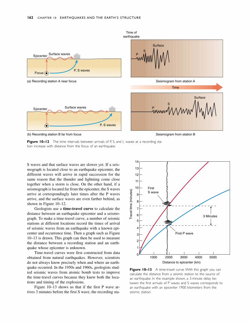
Figure 10–13 A time-travel curve. With this graph you cancalculate the distance from a seismic station to the source ofan earthquake. In the example shown, a 3-minute delay be-tween the first arrivals of P waves and S waves corresponds toan earthquake with an epicenter 1900 kilometers from theseismic station.
S waves and that surface waves are slower yet. If a seis-mograph is located close to an earthquake epicenter, thedifferent waves will arrive in rapid succession for thesame reason that the thunder and lightning come closetogether when a storm is close. On the other hand, if aseismograph is located far from the epicenter, the S wavesarrive at correspondingly later times after the P waves arrive, and the surface waves are even farther behind, asshown in Figure 10–12.
Geologists use a time-travel curve to calculate thedistance between an earthquake epicenter and a seismo-graph. To make a time-travel curve, a number of seismicstations at different locations record the times of arrivalof seismic waves from an earthquake with a known epi-center and occurrence time. Then a graph such as Figure10–13 is drawn. This graph can then be used to measurethe distance between a recording station and an earth-quake whose epicenter is unknown.
Time-travel curves were first constructed from dataobtained from natural earthquakes. However, scientistsdo not always know precisely when and where an earth-quake occurred. In the 1950s and 1960s, geologists stud-ied seismic waves from atomic bomb tests to improvethe time-travel curves because they knew both the loca-tions and timing of the explosions.
Figure 10–13 shows us that if the first P wave ar-rives 3 minutes before the first S wave, the recording sta-
162 CHAPTER 10 EARTHQUAKES AND THE EARTH’S STRUCTURE
Figure 10–12 The time intervals between arrivals of P, S, and L waves at a recording sta-tion increase with distance from the focus of an earthquake.
Epicenter
Epicenter Surface waves
Surface waves
P, S waves
(a) Recording station A near focus
(b) Recording station B far from focus
Time ofearthquake
PS
Surface
PS
Surface
Seismogram from station A
Seismogram from station B
Time
P, S wavesFocus
1
2
3
4
5
6
7
8
9
10
11
12
13
0
14
1000 2000 3000 4000 5000
Distance to epicenter (km)
First P wave
FirstS wave
Trav
el ti
me
(min
utes
)
3 Minutes
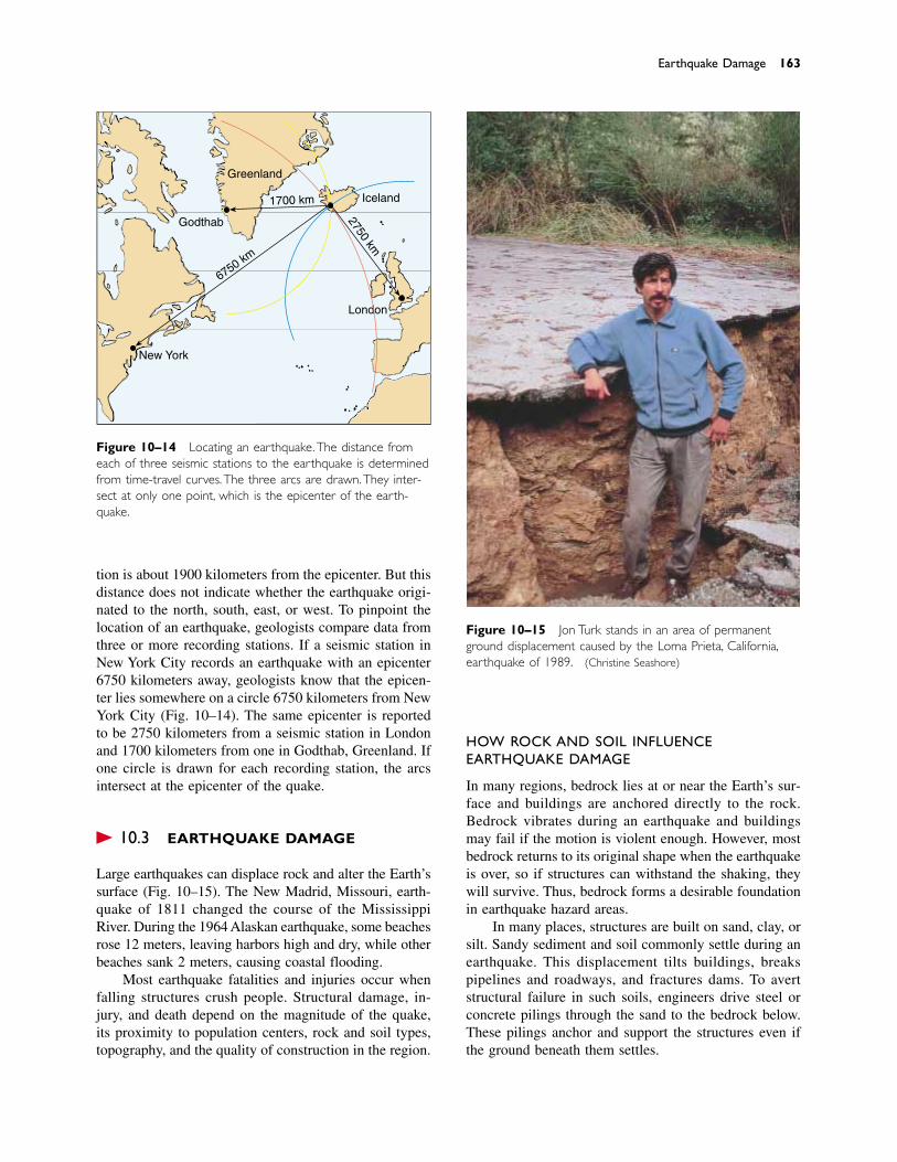
Figure 10–14 Locating an earthquake.The distance fromeach of three seismic stations to the earthquake is determinedfrom time-travel curves.The three arcs are drawn.They inter-sect at only one point, which is the epicenter of the earth-quake.
Earthquake Damage 163
tion is about 1900 kilometers from the epicenter. But thisdistance does not indicate whether the earthquake origi-nated to the north, south, east, or west. To pinpoint thelocation of an earthquake, geologists compare data fromthree or more recording stations. If a seismic station inNew York City records an earthquake with an epicenter6750 kilometers away, geologists know that the epicen-ter lies somewhere on a circle 6750 kilometers from NewYork City (Fig. 10–14). The same epicenter is reportedto be 2750 kilometers from a seismic station in Londonand 1700 kilometers from one in Godthab, Greenland. Ifone circle is drawn for each recording station, the arcsintersect at the epicenter of the quake.
� 10.3 EARTHQUAKE DAMAGE
Large earthquakes can displace rock and alter the Earth’ssurface (Fig. 10–15). The New Madrid, Missouri, earth-quake of 1811 changed the course of the MississippiRiver. During the 1964 Alaskan earthquake, some beachesrose 12 meters, leaving harbors high and dry, while otherbeaches sank 2 meters, causing coastal flooding.
Most earthquake fatalities and injuries occur whenfalling structures crush people. Structural damage, in-jury, and death depend on the magnitude of the quake,its proximity to population centers, rock and soil types,topography, and the quality of construction in the region.
Greenland
Godthab
Iceland
London
New York
1700 km
2750 km
6750 km
Figure 10–15 Jon Turk stands in an area of permanentground displacement caused by the Loma Prieta, California,earthquake of 1989. (Christine Seashore)
HOW ROCK AND SOIL INFLUENCEEARTHQUAKE DAMAGE
In many regions, bedrock lies at or near the Earth’s sur-face and buildings are anchored directly to the rock.Bedrock vibrates during an earthquake and buildingsmay fail if the motion is violent enough. However, mostbedrock returns to its original shape when the earthquakeis over, so if structures can withstand the shaking, theywill survive. Thus, bedrock forms a desirable foundationin earthquake hazard areas.
In many places, structures are built on sand, clay, orsilt. Sandy sediment and soil commonly settle during anearthquake. This displacement tilts buildings, breakspipelines and roadways, and fractures dams. To avertstructural failure in such soils, engineers drive steel orconcrete pilings through the sand to the bedrock below.These pilings anchor and support the structures even ifthe ground beneath them settles.
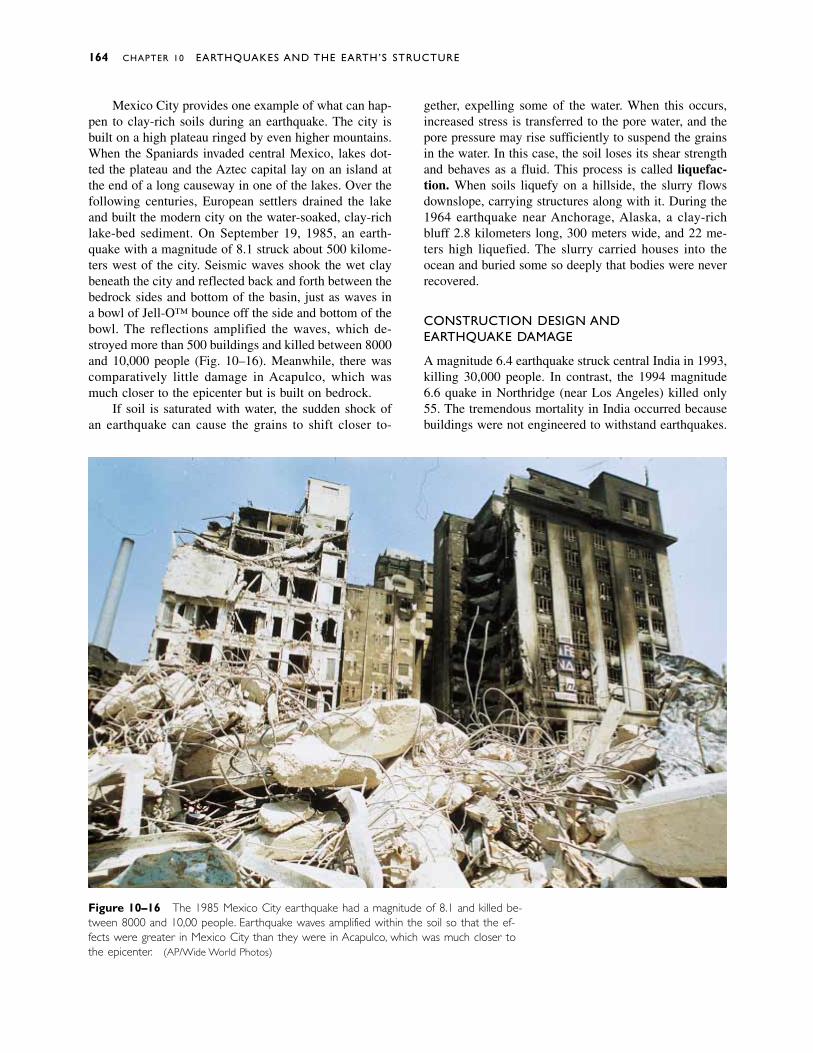
Mexico City provides one example of what can hap-pen to clay-rich soils during an earthquake. The city isbuilt on a high plateau ringed by even higher mountains.When the Spaniards invaded central Mexico, lakes dot-ted the plateau and the Aztec capital lay on an island atthe end of a long causeway in one of the lakes. Over thefollowing centuries, European settlers drained the lakeand built the modern city on the water-soaked, clay-richlake-bed sediment. On September 19, 1985, an earth-quake with a magnitude of 8.1 struck about 500 kilome-ters west of the city. Seismic waves shook the wet claybeneath the city and reflected back and forth between thebedrock sides and bottom of the basin, just as waves ina bowl of Jell-O™ bounce off the side and bottom of thebowl. The reflections amplified the waves, which de-stroyed more than 500 buildings and killed between 8000and 10,000 people (Fig. 10–16). Meanwhile, there wascomparatively little damage in Acapulco, which wasmuch closer to the epicenter but is built on bedrock.
If soil is saturated with water, the sudden shock ofan earthquake can cause the grains to shift closer to-
gether, expelling some of the water. When this occurs,increased stress is transferred to the pore water, and thepore pressure may rise sufficiently to suspend the grainsin the water. In this case, the soil loses its shear strengthand behaves as a fluid. This process is called liquefac-tion. When soils liquefy on a hillside, the slurry flowsdownslope, carrying structures along with it. During the1964 earthquake near Anchorage, Alaska, a clay-richbluff 2.8 kilometers long, 300 meters wide, and 22 me-ters high liquefied. The slurry carried houses into theocean and buried some so deeply that bodies were neverrecovered.
CONSTRUCTION DESIGN AND EARTHQUAKE DAMAGE
A magnitude 6.4 earthquake struck central India in 1993,killing 30,000 people. In contrast, the 1994 magnitude6.6 quake in Northridge (near Los Angeles) killed only55. The tremendous mortality in India occurred becausebuildings were not engineered to withstand earthquakes.
164 CHAPTER 10 EARTHQUAKES AND THE EARTH’S STRUCTURE
Figure 10–16 The 1985 Mexico City earthquake had a magnitude of 8.1 and killed be-tween 8000 and 10,000 people. Earthquake waves amplified within the soil so that the ef-fects were greater in Mexico City than they were in Acapulco, which was much closer tothe epicenter. (AP/Wide World Photos)
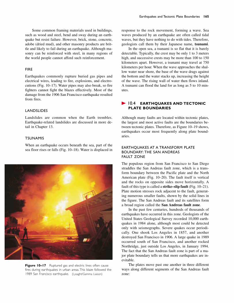
Some common framing materials used in buildings,such as wood and steel, bend and sway during an earth-quake but resist failure. However, brick, stone, concrete,adobe (dried mud), and other masonry products are brit-tle and likely to fail during an earthquake. Although ma-sonry can be reinforced with steel, in many regions ofthe world people cannot afford such reinforcement.
FIRE
Earthquakes commonly rupture buried gas pipes andelectrical wires, leading to fire, explosions, and electro-cutions (Fig. 10–17). Water pipes may also break, so firefighters cannot fight the blazes effectively. Most of thedamage from the 1906 San Francisco earthquake resultedfrom fires.
LANDSLIDES
Landslides are common when the Earth trembles.Earthquake-related landslides are discussed in more de-tail in Chapter 13.
TSUNAMIS
When an earthquake occurs beneath the sea, part of thesea floor rises or falls (Fig. 10–18). Water is displaced in
Earthquakes and Tectonic Plate Boundaries 165
Figure 10–17 Ruptured gas and electric lines often causefires during earthquakes in urban areas.This blaze followed the1989 San Francisco earthquake. (Lysaght/Gamma Liaison)
response to the rock movement, forming a wave. Seawaves produced by an earthquake are often called tidalwaves, but they have nothing to do with tides. Therefore,geologists call them by their Japanese name, tsunami.
In the open sea, a tsunami is so flat that it is barelydetectable. Typically, the crest may be only 1 to 3 metershigh, and successive crests may be more than 100 to 150kilometers apart. However, a tsunami may travel at 750kilometers per hour. When the wave approaches the shal-low water near shore, the base of the wave drags againstthe bottom and the water stacks up, increasing the heightof the wave. The rising wall of water then flows inland.A tsunami can flood the land for as long as 5 to 10 min-utes.
� 10.4 EARTHQUAKES AND TECTONIC PLATE BOUNDARIES
Although many faults are located within tectonic plates,the largest and most active faults are the boundaries be-tween tectonic plates. Therefore, as Figure 10–19 shows,earthquakes occur most frequently along plate bound-aries.
EARTHQUAKES AT A TRANSFORM PLATEBOUNDARY: THE SAN ANDREAS FAULT ZONE
The populous region from San Francisco to San Diegostraddles the San Andreas fault zone, which is a trans-form boundary between the Pacific plate and the NorthAmerican plate (Fig. 10–20). The fault itself is verticaland the rocks on opposite sides move horizontally. Afault of this type is called a strike–slip fault (Fig. 10–21).Plate motion stresses rock adjacent to the fault, generat-ing numerous smaller faults, shown by the solid lines inthe figure. The San Andreas fault and its satellites forma broad region called the San Andreas fault zone.
In the past few centuries, hundreds of thousands ofearthquakes have occurred in this zone. Geologists of theUnited States Geological Survey recorded 10,000 earth-quakes in 1984 alone, although most could be detectedonly with seismographs. Severe quakes occur periodi-cally. One shook Los Angeles in 1857, and another destroyed San Francisco in 1906. A large quake in 1989occurred south of San Francisco, and another rockedNorthridge, just outside Los Angeles, in January 1994.The fact that the San Andreas fault zone is part of a ma-jor plate boundary tells us that more earthquakes are in-evitable.
The plates move past one another in three differentways along different segments of the San Andreas faultzone:
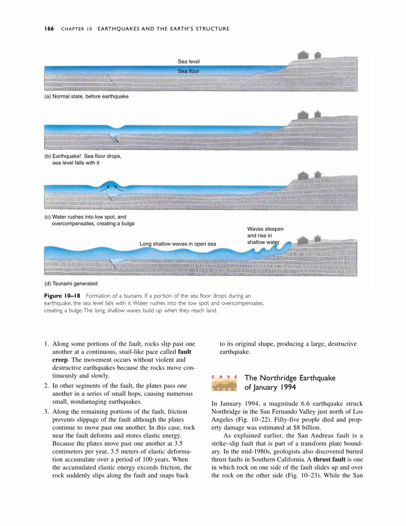
1. Along some portions of the fault, rocks slip past oneanother at a continuous, snail-like pace called faultcreep. The movement occurs without violent anddestructive earthquakes because the rocks move con-tinuously and slowly.
2. In other segments of the fault, the plates pass oneanother in a series of small hops, causing numeroussmall, nondamaging earthquakes.
3. Along the remaining portions of the fault, frictionprevents slippage of the fault although the platescontinue to move past one another. In this case, rocknear the fault deforms and stores elastic energy.Because the plates move past one another at 3.5centimeters per year, 3.5 meters of elastic deforma-tion accumulate over a period of 100 years. Whenthe accumulated elastic energy exceeds friction, therock suddenly slips along the fault and snaps back
to its original shape, producing a large, destructiveearthquake.
The Northridge Earthquakeof January 1994
In January 1994, a magnitude 6.6 earthquake struckNorthridge in the San Fernando Valley just north of LosAngeles (Fig. 10–22). Fifty-five people died and prop-erty damage was estimated at $8 billion.
As explained earlier, the San Andreas fault is astrike–slip fault that is part of a transform plate bound-ary. In the mid-1980s, geologists also discovered buriedthrust faults in Southern California. A thrust fault is onein which rock on one side of the fault slides up and overthe rock on the other side (Fig. 10–23). While the San
166 CHAPTER 10 EARTHQUAKES AND THE EARTH’S STRUCTURE
Figure 10–18 Formation of a tsunami. If a portion of the sea floor drops during anearthquake, the sea level falls with it. Water rushes into the low spot and overcompensates,creating a bulge.The long, shallow waves build up when they reach land.
(b) Earthquake! Sea floor drops, sea level falls with it
(c) Water rushes into low spot, and overcompensates, creating a bulge
(d) Tsunami generated
Long shallow waves in open sea
Waves steepenand rise inshallow water
Sea level
Sea floor
(a) Normal state, before earthquake
C A S E
S T U D Y
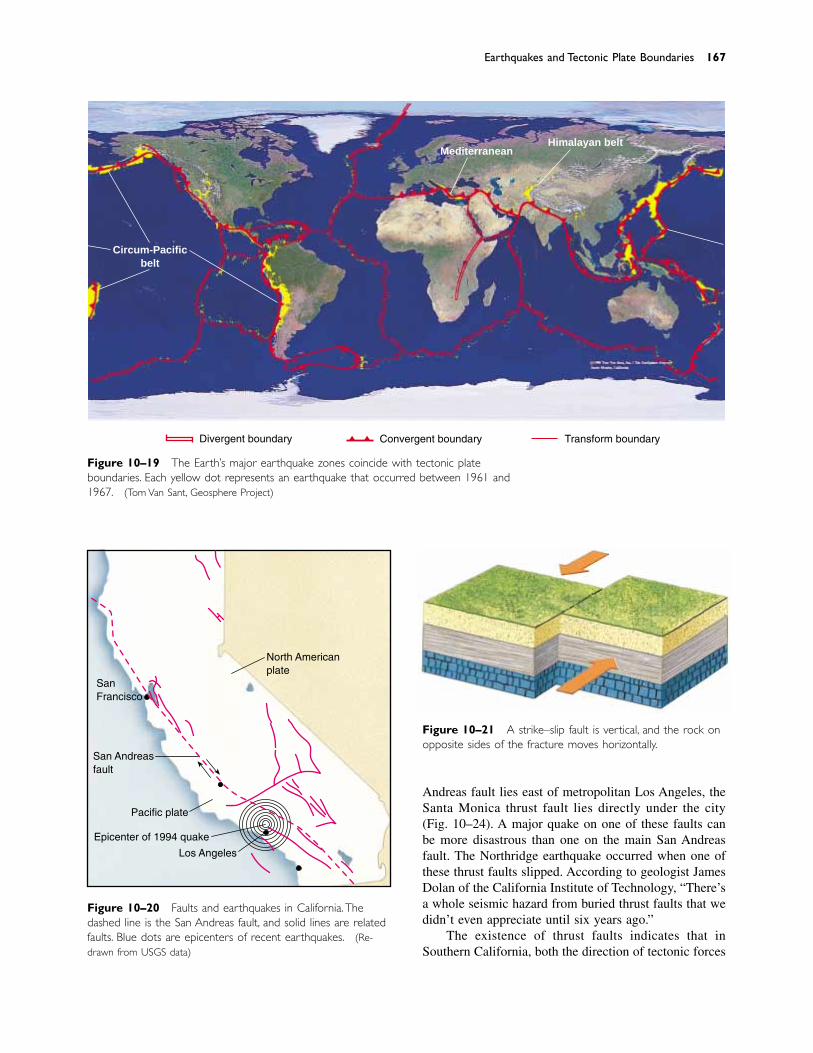
Andreas fault lies east of metropolitan Los Angeles, theSanta Monica thrust fault lies directly under the city(Fig. 10–24). A major quake on one of these faults canbe more disastrous than one on the main San Andreasfault. The Northridge earthquake occurred when one ofthese thrust faults slipped. According to geologist JamesDolan of the California Institute of Technology, “There’sa whole seismic hazard from buried thrust faults that wedidn’t even appreciate until six years ago.”
The existence of thrust faults indicates that inSouthern California, both the direction of tectonic forces
Earthquakes and Tectonic Plate Boundaries 167
Circum-Pacificbelt
MediterraneanHimalayan belt
Divergent boundary Convergent boundary Transform boundary
Figure 10–19 The Earth’s major earthquake zones coincide with tectonic plateboundaries. Each yellow dot represents an earthquake that occurred between 1961 and1967. (Tom Van Sant, Geosphere Project)
Figure 10–20 Faults and earthquakes in California. Thedashed line is the San Andreas fault, and solid lines are relatedfaults. Blue dots are epicenters of recent earthquakes. (Re-drawn from USGS data)
SanFrancisco
San Andreasfault
Pacific plate
Epicenter of 1994 quake
Los Angeles
North Americanplate
Figure 10–21 A strike–slip fault is vertical, and the rock onopposite sides of the fracture moves horizontally.
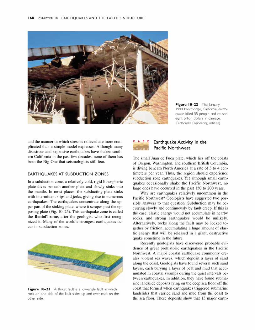
Figure 10–23 A thrust fault is a low-angle fault in whichrock on one side of the fault slides up and over rock on theother side.
and the manner in which stress is relieved are more com-plicated than a simple model expresses. Although manydisastrous and expensive earthquakes have shaken south-ern California in the past few decades, none of them hasbeen the Big One that seismologists still fear.
EARTHQUAKES AT SUBDUCTION ZONES
In a subduction zone, a relatively cold, rigid lithosphericplate dives beneath another plate and slowly sinks intothe mantle. In most places, the subducting plate sinkswith intermittent slips and jerks, giving rise to numerousearthquakes. The earthquakes concentrate along the up-per part of the sinking plate, where it scrapes past the op-posing plate (Fig. 10–25). This earthquake zone is calledthe Benioff zone, after the geologist who first recog-nized it. Many of the world’s strongest earthquakes oc-cur in subduction zones.
168 CHAPTER 10 EARTHQUAKES AND THE EARTH’S STRUCTURE
Figure 10–22 The January1994 Northridge, California, earth-quake killed 55 people and causedeight billion dollars in damage.(Earthquake Engineering Institute)
C A S E
S T U D Y
Earthquake Activity in thePacific Northwest
The small Juan de Fuca plate, which lies off the coastsof Oregon, Washington, and southern British Columbia,is diving beneath North America at a rate of 3 to 4 cen-timeters per year. Thus, the region should experiencesubduction zone earthquakes. Yet although small earth-quakes occasionally shake the Pacific Northwest, nolarge ones have occurred in the past 150 to 200 years.
Why are earthquakes relatively uncommon in thePacific Northwest? Geologists have suggested two pos-sible answers to that question. Subduction may be oc-curring slowly and continuously by fault creep. If this isthe case, elastic energy would not accumulate in nearbyrocks, and strong earthquakes would be unlikely.Alternatively, rocks along the fault may be locked to-gether by friction, accumulating a huge amount of elas-tic energy that will be released in a giant, destructivequake sometime in the future.
Recently geologists have discovered probable evi-dence of great prehistoric earthquakes in the PacificNorthwest. A major coastal earthquake commonly cre-ates violent sea waves, which deposit a layer of sandalong the coast. Geologists have found several such sandlayers, each burying a layer of peat and mud that accu-mulated in coastal swamps during the quiet intervals be-tween earthquakes. In addition, they have found subma-rine landslide deposits lying on the deep sea floor off thecoast that formed when earthquakes triggered submarinelandslides that carried sand and mud from the coast tothe sea floor. These deposits show that 13 major earth-
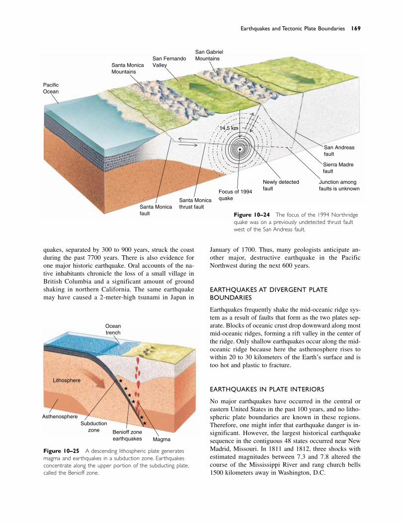
January of 1700. Thus, many geologists anticipate an-other major, destructive earthquake in the PacificNorthwest during the next 600 years.
EARTHQUAKES AT DIVERGENT PLATEBOUNDARIES
Earthquakes frequently shake the mid-oceanic ridge sys-tem as a result of faults that form as the two plates sep-arate. Blocks of oceanic crust drop downward along mostmid-oceanic ridges, forming a rift valley in the center ofthe ridge. Only shallow earthquakes occur along the mid-oceanic ridge because here the asthenosphere rises towithin 20 to 30 kilometers of the Earth’s surface and istoo hot and plastic to fracture.
EARTHQUAKES IN PLATE INTERIORS
No major earthquakes have occurred in the central oreastern United States in the past 100 years, and no litho-spheric plate boundaries are known in these regions.Therefore, one might infer that earthquake danger is in-significant. However, the largest historical earthquakesequence in the contiguous 48 states occurred near NewMadrid, Missouri. In 1811 and 1812, three shocks withestimated magnitudes between 7.3 and 7.8 altered thecourse of the Mississippi River and rang church bells1500 kilometers away in Washington, D.C.
Earthquakes and Tectonic Plate Boundaries 169
Figure 10–24 The focus of the 1994 Northridgequake was on a previously undetected thrust faultwest of the San Andreas fault.
PacificOcean
Santa MonicaMountains
San FernandoValley
San GabrielMountains
Santa Monicafault
Santa Monicathrust fault
Focus of 1994quake
14.5 km
Newly detectedfault
San Andreasfault
Sierra Madrefault
Junction amongfaults is unknown
quakes, separated by 300 to 900 years, struck the coastduring the past 7700 years. There is also evidence forone major historic earthquake. Oral accounts of the na-tive inhabitants chronicle the loss of a small village inBritish Columbia and a significant amount of groundshaking in northern California. The same earthquakemay have caused a 2-meter-high tsunami in Japan in
Figure 10–25 A descending lithospheric plate generatesmagma and earthquakes in a subduction zone. Earthquakesconcentrate along the upper portion of the subducting plate,called the Benioff zone.
�
�
�
�
��
Magma
Asthenosphere
Lithosphere
Subductionzone Benioff zone
earthquakes
Oceantrench
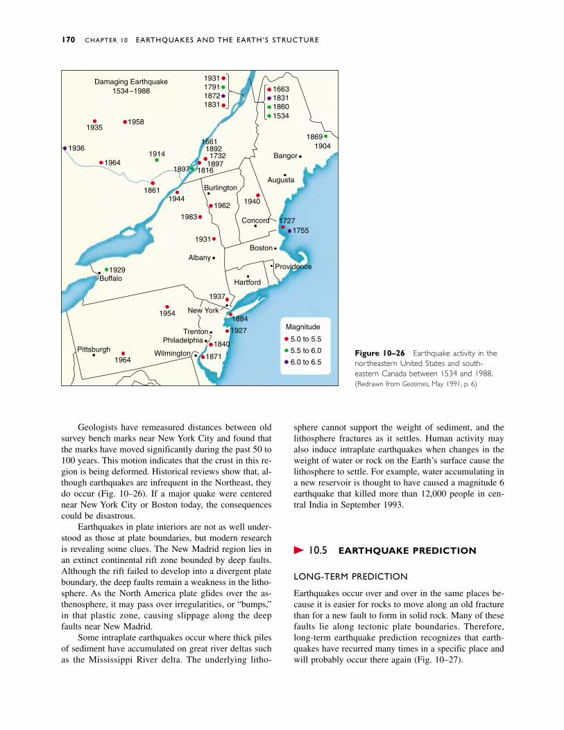
Geologists have remeasured distances between oldsurvey bench marks near New York City and found thatthe marks have moved significantly during the past 50 to100 years. This motion indicates that the crust in this re-gion is being deformed. Historical reviews show that, al-though earthquakes are infrequent in the Northeast, theydo occur (Fig. 10–26). If a major quake were centerednear New York City or Boston today, the consequencescould be disastrous.
Earthquakes in plate interiors are not as well under-stood as those at plate boundaries, but modern researchis revealing some clues. The New Madrid region lies inan extinct continental rift zone bounded by deep faults.Although the rift failed to develop into a divergent plateboundary, the deep faults remain a weakness in the litho-sphere. As the North America plate glides over the as-thenosphere, it may pass over irregularities, or “bumps,”in that plastic zone, causing slippage along the deepfaults near New Madrid.
Some intraplate earthquakes occur where thick pilesof sediment have accumulated on great river deltas suchas the Mississippi River delta. The underlying litho-
170 CHAPTER 10 EARTHQUAKES AND THE EARTH’S STRUCTURE
sphere cannot support the weight of sediment, and thelithosphere fractures as it settles. Human activity mayalso induce intraplate earthquakes when changes in theweight of water or rock on the Earth’s surface cause thelithosphere to settle. For example, water accumulating ina new reservoir is thought to have caused a magnitude 6earthquake that killed more than 12,000 people in cen-tral India in September 1993.
� 10.5 EARTHQUAKE PREDICTION
LONG-TERM PREDICTION
Earthquakes occur over and over in the same places be-cause it is easier for rocks to move along an old fracturethan for a new fault to form in solid rock. Many of thesefaults lie along tectonic plate boundaries. Therefore,long-term earthquake prediction recognizes that earth-quakes have recurred many times in a specific place andwill probably occur there again (Fig. 10–27).
1931179118721831
1663183118601534
18691904
Bangor
Augusta
17271755
Concord
Boston
1962 1940
Burlington
166118921732
189718161897
1914
1861
19581935
1936
1964
1944
1983
1931
Albany
Hartford
1937
New York1884
1927
1840
1871
TrentonPhiladelphia
Wilmington
1954
1964Pittsburgh
Buffalo1929 Providence
Damaging Earthquake1534–1988
5.0 to 5.5
5.5 to 6.0
6.0 to 6.5
Magnitude
Figure 10–26 Earthquake activity in thenortheastern United States and south-eastern Canada between 1534 and 1988.(Redrawn from Geotimes, May 1991, p. 6)
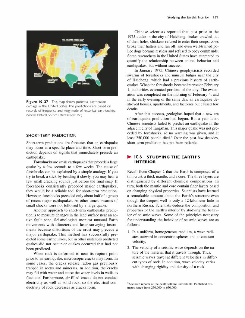
SHORT-TERM PREDICTION
Short-term predictions are forecasts that an earthquakemay occur at a specific place and time. Short-term pre-diction depends on signals that immediately precede anearthquake.
Foreshocks are small earthquakes that precede a largequake by a few seconds to a few weeks. The cause offoreshocks can be explained by a simple analogy. If youtry to break a stick by bending it slowly, you may hear afew small cracking sounds just before the final snap. Ifforeshocks consistently preceded major earthquakes,they would be a reliable tool for short-term prediction.However, foreshocks preceded only about half of a groupof recent major earthquakes. At other times, swarms ofsmall shocks were not followed by a large quake.
Another approach to short-term earthquake predic-tion is to measure changes in the land surface near an ac-tive fault zone. Seismologists monitor unusual Earthmovements with tiltmeters and laser surveying instru-ments because distortions of the crust may precede a major earthquake. This method has successfully pre-dicted some earthquakes, but in other instances predictedquakes did not occur or quakes occurred that had notbeen predicted.
When rock is deformed to near its rupture pointprior to an earthquake, microscopic cracks may form. Insome cases, the cracks release radon gas previouslytrapped in rocks and minerals. In addition, the cracksmay fill with water and cause the water levels in wells tofluctuate. Furthermore, air-filled cracks do not conductelectricity as well as solid rock, so the electrical con-ductivity of rock decreases as cracks form.
Studying the Earth’s Interior 171
Figure 10–27 This map shows potential earthquakedamage in the United States.The predictions are based onrecords of frequency and magnitude of historical earthquakes.(Ward’s Natural Science Establishment, Inc.)
Chinese scientists reported that, just prior to the1975 quake in the city of Haicheng, snakes crawled outof their holes, chickens refused to enter their coops, cowsbroke their halters and ran off, and even well-trained po-lice dogs became restless and refused to obey commands.Some researchers in the United States have attempted toquantify the relationship between animal behavior andearthquakes, but without success.
In January 1975, Chinese geophysicists recordedswarms of foreshocks and unusual bulges near the cityof Haicheng, which had a previous history of earth-quakes. When the foreshocks became intense on February1, authorities evacuated portions of the city. The evacu-ation was completed on the morning of February 4, andin the early evening of the same day, an earthquake de-stroyed houses, apartments, and factories but caused fewdeaths.
After that success, geologists hoped that a new eraof earthquake prediction had begun. But a year later,Chinese scientists failed to predict an earthquake in theadjacent city of Tangshan. This major quake was not pre-ceded by foreshocks, so no warning was given, and atleast 250,000 people died.3 Over the past few decades,short-term prediction has not been reliable.
� 10.6 STUDYING THE EARTH’SINTERIOR
Recall from Chapter 2 that the Earth is composed of athin crust, a thick mantle, and a core. The three layers aredistinguished by different chemical compositions. Inturn, both the mantle and core contain finer layers basedon changing physical properties. Scientists have learneda remarkable amount about the Earth’s structure eventhough the deepest well is only a 12-kilometer hole innorthern Russia. Scientists deduce the composition andproperties of the Earth’s interior by studying the behav-ior of seismic waves. Some of the principles necessaryfor understanding the behavior of seismic waves are asfollows:
1. In a uniform, homogeneous medium, a wave radi-ates outward in concentric spheres and at constantvelocity.
2. The velocity of a seismic wave depends on the na-ture of the material that it travels through. Thus,seismic waves travel at different velocities in differ-ent types of rock. In addition, wave velocity varieswith changing rigidity and density of a rock.
3Accurate reports of the death toll are unavailable. Published esti-mates range from 250,000 to 650,000.
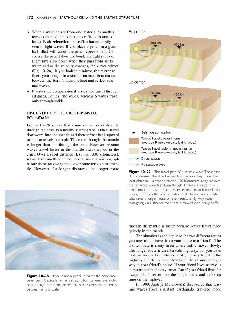
3. When a wave passes from one material to another, itrefracts (bends) and sometimes reflects (bouncesback). Both refraction and reflection are easilyseen in light waves. If you place a pencil in a glasshalf filled with water, the pencil appears bent. Ofcourse the pencil does not bend; the light rays do.Light rays slow down when they pass from air towater, and as the velocity changes, the waves refract(Fig. 10–28). If you look in a mirror, the mirror re-flects your image. In a similar manner, boundariesbetween the Earth’s layers refract and reflect seis-mic waves.
4. P waves are compressional waves and travel throughall gases, liquids, and solids, whereas S waves travelonly through solids.
DISCOVERY OF THE CRUST–MANTLEBOUNDARY
Figure 10–29 shows that some waves travel directlythrough the crust to a nearby seismograph. Others traveldownward into the mantle and then refract back upwardto the same seismograph. The route through the mantleis longer than that through the crust. However, seismicwaves travel faster in the mantle than they do in thecrust. Over a short distance (less than 300 kilometers),waves traveling through the crust arrive at a seismographbefore those following the longer route through the man-tle. However, for longer distances, the longer route
through the mantle is faster because waves travel morequickly in the mantle.
The situation is analogous to the two different routesyou may use to travel from your house to a friend’s. Theshorter route is a city street where traffic moves slowly.The longer route is an interstate highway, but you haveto drive several kilometers out of your way to get to thehighway and then another few kilometers from the high-way to your friend’s house. If your friend lives nearby, itis faster to take the city street. But if your friend lives faraway, it is faster to take the longer route and make uptime on the highway.
In 1909, Andrija Mohorovicic discovered that seis-mic waves from a distant earthquake traveled more
172 CHAPTER 10 EARTHQUAKES AND THE EARTH’S STRUCTURE
Figure 10–28 If you place a pencil in water, the pencil ap-pears bent. It actually remains straight, but our eyes are fooledbecause light rays bend, or refract, as they cross the boundarybetween air and water.
Epicenter
Epicenter
Waves travel slower in crust(average P wave velocity is 6 km/sec.)
Waves travel faster in upper mantle(average P wave velocity is 8 km/sec.)
Direct waves
Refracted waves
Seismograph station
100 km 400 km
400 km100 km
Figure 10–29 The travel path of a seismic wave.The closerstation receives the direct waves first because they travel theleast distance. However, a station 400 kilometers away receivesthe refracted wave first. Even though it travels a longer dis-tance, most of its path is in the denser mantle, so it travels fastenough to reach the seismic station first. Think of a commuterwho takes a longer route on the interstate highway ratherthan going via a shorter road that is choked with heavy traffic.
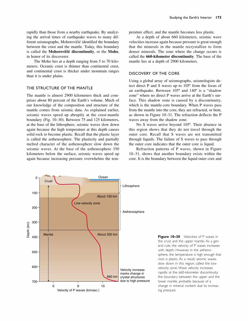
rapidly than those from a nearby earthquake. By analyz-ing the arrival times of earthquake waves to many dif-ferent seismographs, Mohorovicic identified the boundarybetween the crust and the mantle. Today, this boundaryis called the Mohorovicic discontinuity, or the Moho,in honor of its discoverer.
The Moho lies at a depth ranging from 5 to 70 kilo-meters. Oceanic crust is thinner than continental crust,and continental crust is thicker under mountain rangesthan it is under plains.
THE STRUCTURE OF THE MANTLE
The mantle is almost 2900 kilometers thick and com-prises about 80 percent of the Earth’s volume. Much ofour knowledge of the composition and structure of themantle comes from seismic data. As explained earlier,seismic waves speed up abruptly at the crust-mantleboundary (Fig. 10–30). Between 75 and 125 kilometers,at the base of the lithosphere, seismic waves slow downagain because the high temperature at this depth causessolid rock to become plastic. Recall that the plastic layeris called the asthenosphere. The plasticity and partiallymelted character of the asthenosphere slow down theseismic waves. At the base of the asthenosphere 350kilometers below the surface, seismic waves speed upagain because increasing pressure overwhelms the tem-
perature effect, and the mantle becomes less plastic.At a depth of about 660 kilometers, seismic wave
velocities increase again because pressure is great enoughthat the minerals in the mantle recrystallize to formdenser minerals. The zone where the change occurs iscalled the 660-kilometer discontinuity. The base of themantle lies at a depth of 2900 kilometers.
DISCOVERY OF THE CORE
Using a global array of seismographs, seismologists de-tect direct P and S waves up to 105º from the focus ofan earthquake. Between 105º and 140º is a “shadowzone” where no direct P waves arrive at the Earth’s sur-face. This shadow zone is caused by a discontinuity,which is the mantle-core boundary. When P waves passfrom the mantle into the core, they are refracted, or bent,as shown in Figure 10–31. The refraction deflects the Pwaves away from the shadow zone.
No S waves arrive beyond 105º. Their absence inthis region shows that they do not travel through theouter core. Recall that S waves are not transmittedthrough liquids. The failure of S waves to pass throughthe outer core indicates that the outer core is liquid.
Refraction patterns of P waves, shown in Figure10–31, shows that another boundary exists within thecore. It is the boundary between the liquid outer core and
Studying the Earth’s Interior 173
0
100
200
300
400
500
600
700
Crust
Lithosphere
Asthenosphere
Mantle About 350 km
Ocean
About 100 km
Low-velocity zone
660 km
Velocity increasemarks change incrystal structuresdue to high pressure
Dep
th (
km)
6 8 10Velocity of P waves (km/sec.)
Figure 10–30 Velocities of P waves inthe crust and the upper mantle. As a gen-eral rule, the velocity of P waves increaseswith depth. However, in the astheno-sphere, the temperature is high enough thatrock is plastic. As a result, seismic wavesslow down in this region, called the low-velocity zone. Wave velocity increasesrapidly at the 660-kilometer discontinuity,the boundary between the upper and thelower mantle, probably because of achange in mineral content due to increas-ing pressure.
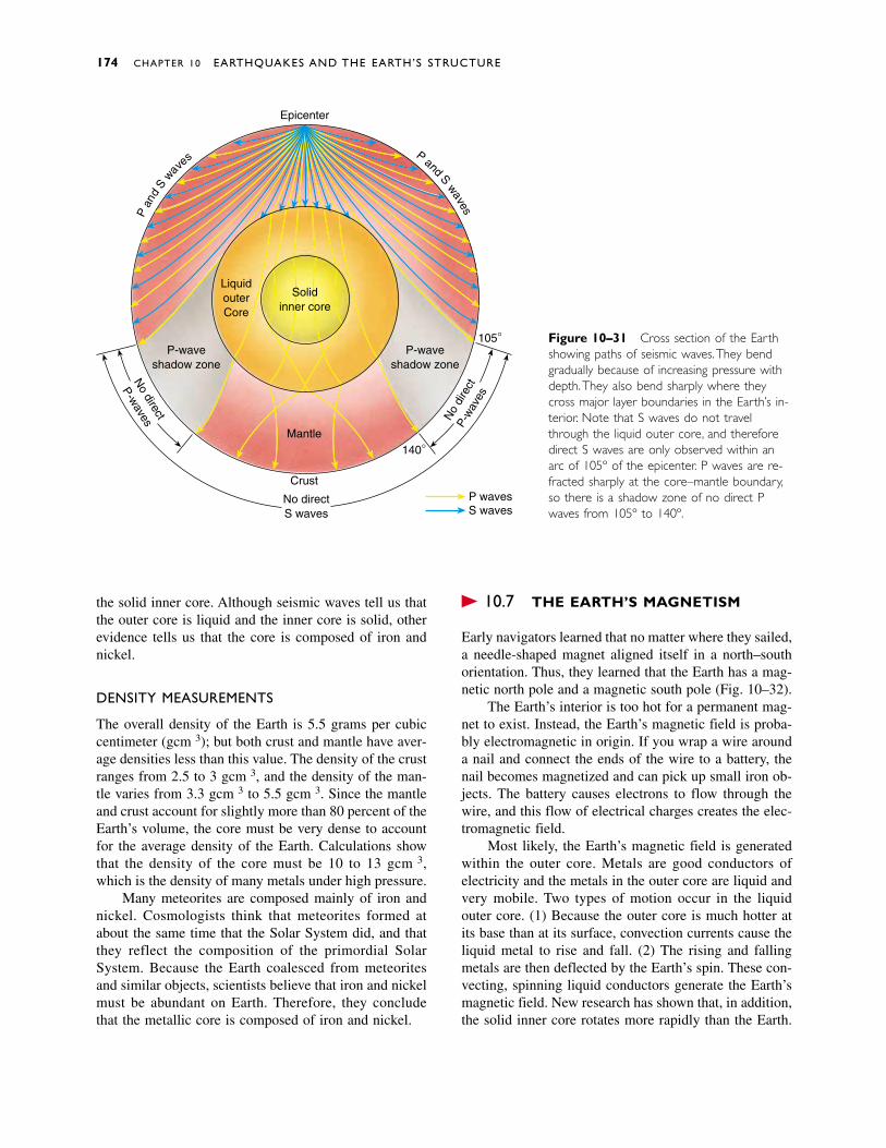
174 CHAPTER 10 EARTHQUAKES AND THE EARTH’S STRUCTURE
Figure 10–31 Cross section of the Earthshowing paths of seismic waves.They bendgradually because of increasing pressure withdepth.They also bend sharply where theycross major layer boundaries in the Earth’s in-terior. Note that S waves do not travelthrough the liquid outer core, and thereforedirect S waves are only observed within anarc of 105º of the epicenter. P waves are re-fracted sharply at the core–mantle boundary,so there is a shadow zone of no direct Pwaves from 105º to 140º.
LiquidouterCore
Solidinner core
Mantle
P-waveshadow zone
P-waveshadow zone
Epicenter
Pan
dS
waves
Pand
Swaves
No direct
P-waves N
o di
rect
P-w
aves
No directS waves
Crust
105°
140°
P wavesS waves
the solid inner core. Although seismic waves tell us thatthe outer core is liquid and the inner core is solid, otherevidence tells us that the core is composed of iron andnickel.
DENSITY MEASUREMENTS
The overall density of the Earth is 5.5 grams per cubiccentimeter (g/cm3); but both crust and mantle have aver-age densities less than this value. The density of the crustranges from 2.5 to 3 g/cm3, and the density of the man-tle varies from 3.3 g/cm3 to 5.5 g/cm3. Since the mantleand crust account for slightly more than 80 percent of theEarth’s volume, the core must be very dense to accountfor the average density of the Earth. Calculations showthat the density of the core must be 10 to 13 g/cm3,which is the density of many metals under high pressure.
Many meteorites are composed mainly of iron andnickel. Cosmologists think that meteorites formed atabout the same time that the Solar System did, and thatthey reflect the composition of the primordial SolarSystem. Because the Earth coalesced from meteoritesand similar objects, scientists believe that iron and nickelmust be abundant on Earth. Therefore, they concludethat the metallic core is composed of iron and nickel.
� 10.7 THE EARTH’S MAGNETISM
Early navigators learned that no matter where they sailed,a needle-shaped magnet aligned itself in a north–southorientation. Thus, they learned that the Earth has a mag-netic north pole and a magnetic south pole (Fig. 10–32).
The Earth’s interior is too hot for a permanent mag-net to exist. Instead, the Earth’s magnetic field is proba-bly electromagnetic in origin. If you wrap a wire arounda nail and connect the ends of the wire to a battery, thenail becomes magnetized and can pick up small iron ob-jects. The battery causes electrons to flow through thewire, and this flow of electrical charges creates the elec-tromagnetic field.
Most likely, the Earth’s magnetic field is generatedwithin the outer core. Metals are good conductors ofelectricity and the metals in the outer core are liquid andvery mobile. Two types of motion occur in the liquidouter core. (1) Because the outer core is much hotter atits base than at its surface, convection currents cause theliquid metal to rise and fall. (2) The rising and fallingmetals are then deflected by the Earth’s spin. These con-vecting, spinning liquid conductors generate the Earth’smagnetic field. New research has shown that, in addition,the solid inner core rotates more rapidly than the Earth.

Magnetic fields are common in planets, stars, andother objects in space. Our Solar System almost certainlyposessed a weak magnetic field when it first formed. Theflowing metals of the liquid outer core amplified some
of this original magnetic force. If we observe this mag-netic field over thousands of years, its axis is approxi-mately lined up with the Earth’s rotational axis, becausethe Earth’s spin affects the flow of metal in the outer core.
Summary 175
Figure 10–32 The magneticfield of the Earth. Note that themagnetic north pole is 11.5º offsetfrom the geographic pole.
North magnetic poleGeographic North Pole
Geographic South Pole
South magnetic pole
111/2°
Outercore
Innercore
Mantle
An earthquake is a sudden motion or trembling of theEarth caused by the abrupt release of slowly accumu-lated energy in rocks. Most earthquakes occur along tec-tonic plate boundaries. Earthquakes occur either whenthe elastic energy accumulated in rock exceeds the fric-tion that holds rock along a fault or when the elastic en-ergy exceeds the strength of the rock and the rock breaksby brittle fracture.
An earthquake starts at the initial point of rupture,called the focus. The location on the Earth’s surface di-rectly above the focus is the epicenter. Seismic wavesinclude body waves, which travel through the interior of
the Earth, and surface waves, which travel on the sur-face. P waves are compressional body waves. S wavesare body waves that travel slower than P waves. Theyconsist of a shearing motion and travel through solids butnot liquids. Surface waves travel more slowly than eithertype of body wave. Seismic waves are recorded on aseismograph. Modern geologists use the moment mag-nitude scale to record the energy released during anearthquake. The distance from a seismic station to anearthquake is calculated by recording the time betweenthe arrival of P and S waves. The epicenter can be lo-cated by measuring the distance from three or more seis-
S U M M A R Y
176 CHAPTER 10 EARTHQUAKES AND THE EARTH’S STRUCTURE
earthquake 154stress 156plastic deformation 156brittle fracture 156seismic wave 158seismology 158body wave 158focus 158
epicenter 158surface wave 158P wave 158S wave 159shear wave 159Rayleigh wave 159Love wave 159seismograph 160
seismogram 160Richter scale 160moment magnitude
scale 161time-travel curve 162liquefaction 164tsunami 165strike–slip fault 165
San Andreas fault zone 165
fault creep 166thrust fault 166Benioff zone 168foreshock 171Mohorovicic discontinuity
(Moho) 173
K E Y W O R D S
1. Explain how energy is stored prior to and then releasedduring an earthquake.
2. Describe the behavior of rock during elastic deformation,plastic deformation, and brittle fracture.
3. Give two mechanisms that can release accumulated elas-tic energy in rocks.
4. Why do most earthquakes occur at the boundaries be-tween tectonic plates? Are there any exceptions?
5. Define focus and epicenter.
6. Discuss the differences between P waves, S waves, andsurface waves.
7. Explain how a seismograph works. Sketch what an imag-inary seismogram would look like before and during anearthquake.
8. Describe the similarities and differences between theRichter and moment magnitude scales. What is actuallymeasured, and what information is obtained?
9. Describe how the epicenter of an earthquake is located.
10. List five different factors that affect earthquake damage.Discuss each briefly.
11. Discuss earthquake mechanisms at the three differenttypes of tectonic plate boundaries.
12. Briefly discuss major faults close to Los Angeles.
13. Discuss earthquake mechanisms at plate interiors.
14. Discuss the scientific reasoning behind long-term andshort-term earthquake prediction.
15. Outline the seismic gap hypothesis. Discuss modern ob-jections to the theory.
16. What is the Moho? How was it discovered?
17. Explain how geologists learned that the core is composedof iron and nickel.
18. Briefly discuss the theories for the existence of theEarth’s magnetic field.
R E V I E W Q U E S T I O N S
mic stations. Earthquake damage is influenced by rockand soil type, construction design, and the likelihood offires, landslides, and tsunamis.
Earthquakes are common at all three types of plateboundaries. The San Andreas fault zone is an example ofa transform plate boundary, where two plates slide pastone another. Subduction zone earthquakes occur whenthe subducting plate slips suddenly. Earthquakes occur atdivergent plate boundaries as blocks of lithosphere alongthe fault drop downward. Earthquakes occur in plate in-teriors along old faults or where sediment depresses thelithosphere.
Long-term earthquake prediction is based on the ob-servation that most earthquakes occur at tectonic plateboundaries. Short-term prediction is based on occur-rences of foreshocks, release of radon gas, changes inthe land surface, the water table, electrical conductivity,and erratic animal behavior.
The Earth’s internal structure and properties areknown by studies of earthquake wave velocities and re-fraction and reflection of seismic waves as they passthrough the Earth. Flowing metal in the outer core gen-erates the Earth’s magnetic field.
Discussion Questions 177
1. Using the graph in Figure 10–13, determine how faraway from an earthquake you would be if the first Pwave arrived 5 minutes before the first S wave.
2. Using a map of the United States, locate an earthquakethat is 1000 kilometers from Seattle, 1300 kilometersfrom San Francisco, and 700 kilometers from Denver.
3. Mortality was high in the India earthquake in 1993 be-cause the quake occurred at night when people weresleeping in their homes. However, mortality in theNorthridge earthquake was low because it occurred earlyin the morning rather than during rush hour. Is there acontradiction in these two statements?
4. Explain why the existence of thrust faults west of theSan Andreas fault complicates attempts at earthquakeprediction near Los Angeles.
5. Argue for or against placing stringent building codes forearthquake-resistant design in the Seattle area.
6. Imagine that geologists predict a major earthquake in adensely populated region. The prediction may be right orit may be wrong. City planners may heed it and evacuatethe city or ignore it. The possibilities lead to four combi-nations of predictions and responses, which can be setout in a grid as follows:
Will the predicted earthquake really occur?
Yes No
Is the city Yes
evacuated? No
For example, the space in the upper left corner of thegrid represents the situation in which the predicted earth-quake occurs and the city is evacuated. For each space inthe square, outline the consequences of the sequence ofevents.
7. Engineers know that if a major quake were to strike alarge California city, many structures would fail and peo-ple would die. Furthermore, it is possible, but expensive,to construct homes, commercial buildings, and bridgesthat would not fail even in a major quake. Discuss thetradeoff between money and human lives in constructionin earthquake-prone zones. Would you be willing to paytwice as much for a house that was earthquake proof, ascompared with a normal house? Would you be willing topay more taxes for safer highway bridges? Do you feelthat different types of structures (i.e., residential homes,commercial buildings, nuclear power plants) should bebuilt to different safety standards?
8. From Figure 10–30, what is the speed of P waves at adepth of 25 kilometers, 200 kilometers, 500 kilometers?
9. Give two reasons why the Earth’s magnetic field cannotbe formed by a giant bar magnet within the Earth’s core.
D I S C U S S I O N Q U E S T I O N S
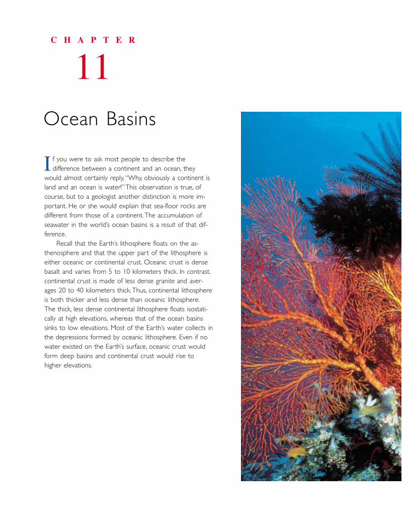
f you were to ask most people to describe the difference between a continent and an ocean, they
would almost certainly reply, “Why, obviously a continent island and an ocean is water!”This observation is true, ofcourse, but to a geologist another distinction is more im-portant. He or she would explain that sea-floor rocks aredifferent from those of a continent. The accumulation ofseawater in the world’s ocean basins is a result of that dif-ference.
Recall that the Earth’s lithosphere floats on the as-thenosphere and that the upper part of the lithosphere iseither oceanic or continental crust. Oceanic crust is densebasalt and varies from 5 to 10 kilometers thick. In contrast,continental crust is made of less dense granite and aver-ages 20 to 40 kilometers thick.Thus, continental lithosphereis both thicker and less dense than oceanic lithosphere.The thick, less dense continental lithosphere floats isostati-cally at high elevations, whereas that of the ocean basinssinks to low elevations. Most of the Earth’s water collects inthe depressions formed by oceanic lithosphere. Even if nowater existed on the Earth’s surface, oceanic crust wouldform deep basins and continental crust would rise tohigher elevations.
C H A P T E R
11Ocean Basins
I
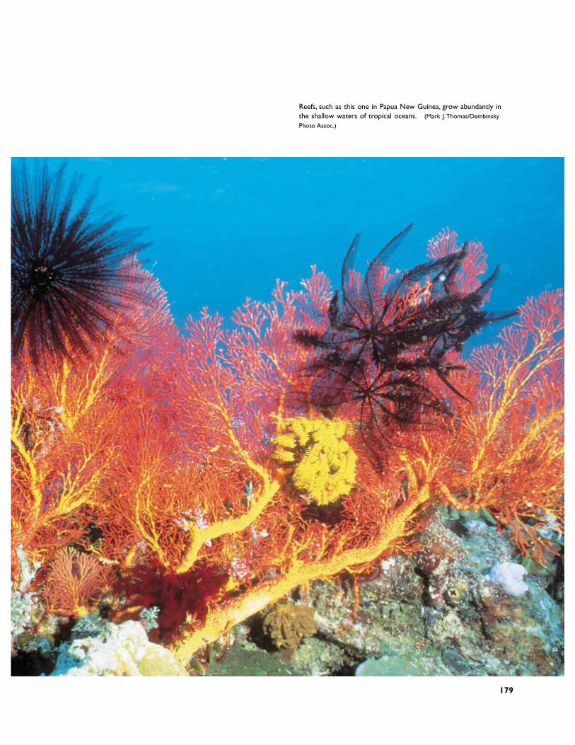
Reefs, such as this one in Papua New Guinea, grow abundantly inthe shallow waters of tropical oceans. (Mark J.Thomas/DembinskyPhoto Assoc.)
179
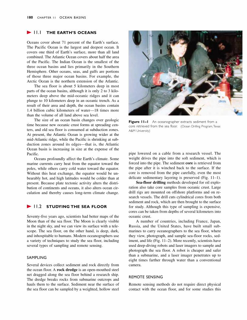
� 11.1 THE EARTH’S OCEANS
Oceans cover about 71 percent of the Earth’s surface.The Pacific Ocean is the largest and deepest ocean. Itcovers one third of Earth’s surface, more than all landcombined. The Atlantic Ocean covers about half the areaof the Pacific. The Indian Ocean is the smallest of thethree ocean basins and lies primarily in the SouthernHemisphere. Other oceans, seas, and gulfs are portionsof those three major ocean basins. For example, theArctic Ocean is the northern extension of the Atlantic.
The sea floor is about 5 kilometers deep in mostparts of the ocean basins, although it is only 2 to 3 kilo-meters deep above the mid-oceanic ridges and it canplunge to 10 kilometers deep in an oceanic trench. As aresult of their area and depth, the ocean basins contain1.4 billion cubic kilometers of water—18 times morethan the volume of all land above sea level.
The size of an ocean basin changes over geologictime because new oceanic crust forms at spreading cen-ters, and old sea floor is consumed at subduction zones.At present, the Atlantic Ocean is growing wider at themid-Atlantic ridge, while the Pacific is shrinking at sub-duction zones around its edges—that is, the AtlanticOcean basin is increasing in size at the expense of thePacific.
Oceans profoundly affect the Earth’s climate. Somemarine currents carry heat from the equator toward thepoles, while others carry cold water toward the equator.Without this heat exchange, the equator would be un-bearably hot, and high latitudes would be colder than atpresent. Because plate tectonic activity alters the distri-bution of continents and oceans, it also alters ocean cir-culation and thereby causes long-term climate change.
� 11.2 STUDYING THE SEA FLOOR
Seventy-five years ago, scientists had better maps of theMoon than of the sea floor. The Moon is clearly visiblein the night sky, and we can view its surface with a tele-scope. The sea floor, on the other hand, is deep, dark,and inhospitable to humans. Modern oceanographers usea variety of techniques to study the sea floor, includingseveral types of sampling and remote sensing.
SAMPLING
Several devices collect sediment and rock directly fromthe ocean floor. A rock dredge is an open-mouthed steelnet dragged along the sea floor behind a research ship.The dredge breaks rocks from submarine outcrops andhauls them to the surface. Sediment near the surface ofthe sea floor can be sampled by a weighted, hollow steel
pipe lowered on a cable from a research vessel. Theweight drives the pipe into the soft sediment, which isforced into the pipe. The sediment core is retrieved fromthe pipe after it is winched back to the surface. If thecore is removed from the pipe carefully, even the mostdelicate sedimentary layering is preserved (Fig. 11–1).
Sea-floor drilling methods developed for oil explo-ration also take core samples from oceanic crust. Largedrill rigs are mounted on offshore platforms and on re-search vessels. The drill cuts cylindrical cores from bothsediment and rock, which are then brought to the surfacefor study. Although this type of sampling is expensive,cores can be taken from depths of several kilometers intooceanic crust.
A number of countries, including France, Japan,Russia, and the United States, have built small sub-marines to carry oceanographers to the sea floor, wherethey view, photograph, and sample sea-floor rocks, sed-iment, and life (Fig. 11–2). More recently, scientists haveused deep-diving robots and laser imagers to sample andphotograph the sea floor. A robot is cheaper and saferthan a submarine, and a laser imager penetrates up toeight times farther through water than a conventionalcamera.
REMOTE SENSING
Remote sensing methods do not require direct physicalcontact with the ocean floor, and for some studies this
180 CHAPTER 11 OCEAN BASINS
Figure 11–1 An oceanographer extracts sediment from acore retrieved from the sea floor. (Ocean Drilling Program,TexasA&M University)

approach is both effective and economical. The echosounder is commonly used to map sea-floor topography.It emits a sound signal from a research ship and then
records the signal after it bounces off the sea floor andtravels back up to the ship (Fig. 11–3a). The water depthis calculated from the time required for the sound tomake the round trip. A topographic map of the sea flooris constructed as the ship steers a carefully navigatedcourse with the echo sounder operating continuously.Modern echo sounders transmit up to 1000 signals at atime to create more complete and accurate maps.
The seismic profiler works in the same way butuses a higher-energy signal that penetrates and reflectsfrom layers in the sediment and rock. This gives a pic-ture of the layering and structure of oceanic crust, aswell as the sea-floor topography (Fig. 11–3b).
A magnetometer is an instrument that measures amagnetic field. Magnetometers towed behind researchships measure the magnetism of sea-floor rocks.
� 11.3 SEA-FLOOR MAGNETISM
Recall from Chapter 2 that Alfred Wegener proposed thatcontinents had migrated across the globe, but because hewas unable to explain how continents moved, his theorywas largely ignored. Then, in the 1960s, 30 years afterWegener’s death, geologists studying the magnetism ofsea-floor rocks detected odd magnetic patterns on the seafloor. Their interpretations of those patterns quickly ledto the development of the plate tectonics theory and
Sea-Floor Magnetism 181
Figure 11–2 Alvin is a research submarine capable of divingto the sea floor. Scientists on board control robot arms tocollect sea-floor rocks and sediment. (Rod Catanach, WoodsHole Oceanographic Institution)
Figure 11–3 (a) Mapping the topography of the sea floorwith an echo sounder. A sound signal generated by the echosounder bounces off the sea floor and back up to the ship,where its travel time is recorded. (b) A seismic profiler recordof sediment layers and basaltic ocean crust in the Sea ofJapan. (Ocean Drilling Program,Texas A&M University)
Sound sentdownwardfrom ship
Soundreflectedfromsea floor
(a)
(b)
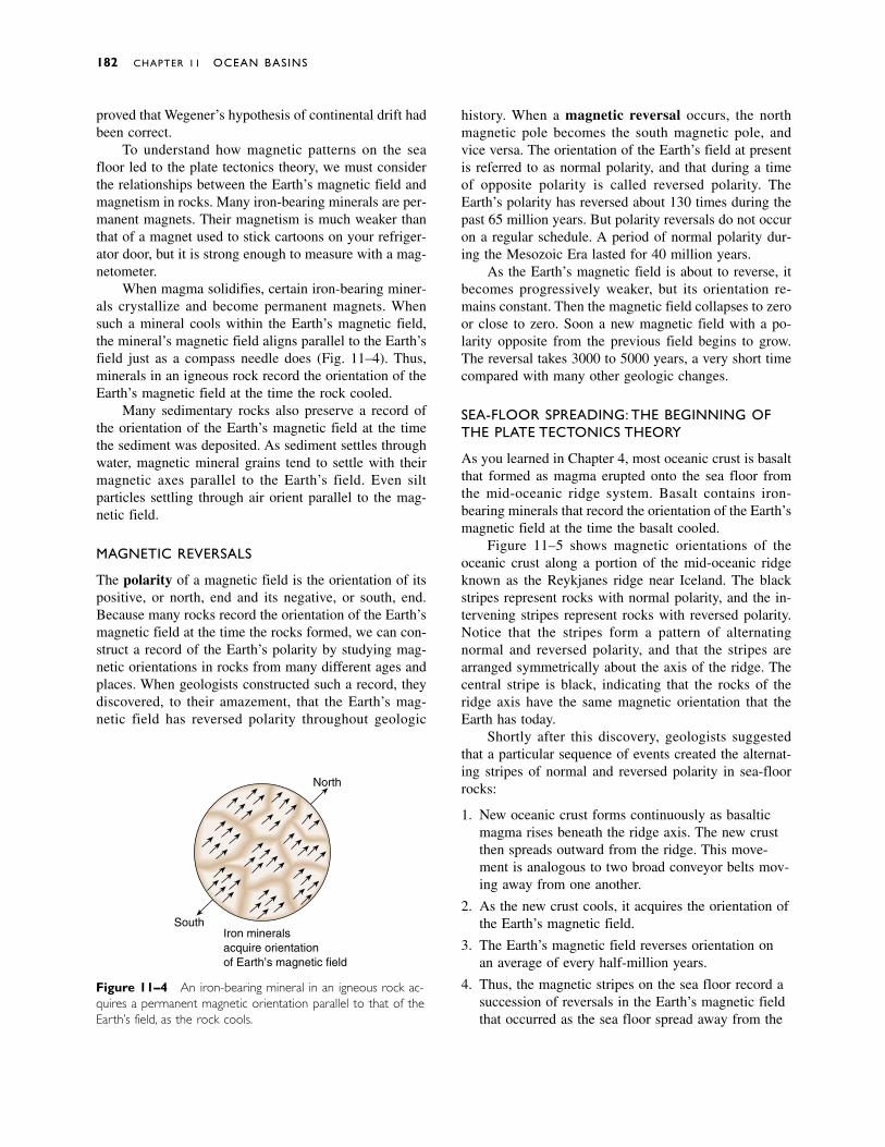
proved that Wegener’s hypothesis of continental drift hadbeen correct.
To understand how magnetic patterns on the seafloor led to the plate tectonics theory, we must considerthe relationships between the Earth’s magnetic field andmagnetism in rocks. Many iron-bearing minerals are per-manent magnets. Their magnetism is much weaker thanthat of a magnet used to stick cartoons on your refriger-ator door, but it is strong enough to measure with a mag-netometer.
When magma solidifies, certain iron-bearing miner-als crystallize and become permanent magnets. Whensuch a mineral cools within the Earth’s magnetic field,the mineral’s magnetic field aligns parallel to the Earth’sfield just as a compass needle does (Fig. 11–4). Thus,minerals in an igneous rock record the orientation of theEarth’s magnetic field at the time the rock cooled.
Many sedimentary rocks also preserve a record ofthe orientation of the Earth’s magnetic field at the timethe sediment was deposited. As sediment settles throughwater, magnetic mineral grains tend to settle with theirmagnetic axes parallel to the Earth’s field. Even silt particles settling through air orient parallel to the mag-netic field.
MAGNETIC REVERSALS
The polarity of a magnetic field is the orientation of itspositive, or north, end and its negative, or south, end.Because many rocks record the orientation of the Earth’smagnetic field at the time the rocks formed, we can con-struct a record of the Earth’s polarity by studying mag-netic orientations in rocks from many different ages andplaces. When geologists constructed such a record, theydiscovered, to their amazement, that the Earth’s mag-netic field has reversed polarity throughout geologic
history. When a magnetic reversal occurs, the northmagnetic pole becomes the south magnetic pole, andvice versa. The orientation of the Earth’s field at presentis referred to as normal polarity, and that during a timeof opposite polarity is called reversed polarity. TheEarth’s polarity has reversed about 130 times during thepast 65 million years. But polarity reversals do not occuron a regular schedule. A period of normal polarity dur-ing the Mesozoic Era lasted for 40 million years.
As the Earth’s magnetic field is about to reverse, itbecomes progressively weaker, but its orientation re-mains constant. Then the magnetic field collapses to zeroor close to zero. Soon a new magnetic field with a po-larity opposite from the previous field begins to grow.The reversal takes 3000 to 5000 years, a very short timecompared with many other geologic changes.
SEA-FLOOR SPREADING: THE BEGINNING OFTHE PLATE TECTONICS THEORY
As you learned in Chapter 4, most oceanic crust is basaltthat formed as magma erupted onto the sea floor fromthe mid-oceanic ridge system. Basalt contains iron-bearing minerals that record the orientation of the Earth’smagnetic field at the time the basalt cooled.
Figure 11–5 shows magnetic orientations of theoceanic crust along a portion of the mid-oceanic ridgeknown as the Reykjanes ridge near Iceland. The blackstripes represent rocks with normal polarity, and the in-tervening stripes represent rocks with reversed polarity.Notice that the stripes form a pattern of alternating normal and reversed polarity, and that the stripes arearranged symmetrically about the axis of the ridge. Thecentral stripe is black, indicating that the rocks of theridge axis have the same magnetic orientation that theEarth has today.
Shortly after this discovery, geologists suggestedthat a particular sequence of events created the alternat-ing stripes of normal and reversed polarity in sea-floorrocks:
1. New oceanic crust forms continuously as basalticmagma rises beneath the ridge axis. The new crustthen spreads outward from the ridge. This move-ment is analogous to two broad conveyor belts mov-ing away from one another.
2. As the new crust cools, it acquires the orientation ofthe Earth’s magnetic field.
3. The Earth’s magnetic field reverses orientation onan average of every half-million years.
4. Thus, the magnetic stripes on the sea floor record asuccession of reversals in the Earth’s magnetic fieldthat occurred as the sea floor spread away from the
182 CHAPTER 11 OCEAN BASINS
North
SouthIron mineralsacquire orientationof Earth’s magnetic field
Figure 11–4 An iron-bearing mineral in an igneous rock ac-quires a permanent magnetic orientation parallel to that of theEarth’s field, as the rock cools.
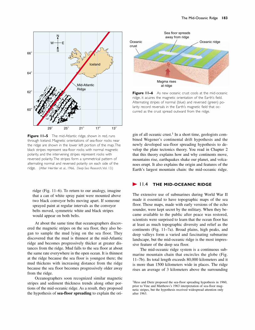
ridge (Fig. 11–6). To return to our analogy, imaginethat a can of white spray paint were mounted abovetwo black conveyor belts moving apart. If someonesprayed paint at regular intervals as the conveyorbelts moved, symmetric white and black stripeswould appear on both belts.
At about the same time that oceanographers discov-ered the magnetic stripes on the sea floor, they also be-gan to sample the mud lying on the sea floor. They discovered that the mud is thinnest at the mid-Atlanticridge and becomes progressively thicker at greater dis-tances from the ridge. Mud falls to the sea floor at aboutthe same rate everywhere in the open ocean. It is thinnestat the ridge because the sea floor is youngest there; themud thickens with increasing distance from the ridge because the sea floor becomes progressively older awayfrom the ridge.
Oceanographers soon recognized similar magneticstripes and sediment thickness trends along other por-tions of the mid-oceanic ridge. As a result, they proposedthe hypothesis of sea-floor spreading to explain the ori-
gin of all oceanic crust.1 In a short time, geologists com-bined Wegener’s continental drift hypothesis and thenewly developed sea-floor spreading hypothesis to de-velop the plate tectonics theory. You read in Chapter 2that this theory explains how and why continents move,mountains rise, earthquakes shake our planet, and volca-noes erupt. It also explains the origin and features of theEarth’s largest mountain chain: the mid-oceanic ridge.
� 11.4 THE MID-OCEANIC RIDGE
The extensive use of submarines during World War IImade it essential to have topographic maps of the seafloor. Those maps, made with early versions of the echosounder, were kept secret by the military. When they be-came available to the public after peace was restored,scientists were surprised to learn that the ocean floor hasat least as much topographic diversity and relief as thecontinents (Fig. 11–7a). Broad plains, high peaks, anddeep valleys form a varied and fascinating submarinelandscape, but the mid-oceanic ridge is the most impres-sive feature of the deep sea floor.
The mid-oceanic ridge system is a continuous sub-marine mountain chain that encircles the globe (Fig.11–7b). Its total length exceeds 80,000 kilometers and itis more than 1500 kilometers wide in places. The ridgerises an average of 3 kilometers above the surrounding
The Mid-Oceanic Ridge 183
66°
64°
62°
60°
29° 25° 21° 17° 13°
N
EW
S
Iceland
Mid-AtlanticRidge
Figure 11–5 The mid-Atlantic ridge, shown in red, runsthrough Iceland. Magnetic orientations of sea-floor rocks nearthe ridge are shown in the lower left portion of the map.Theblack stripes represent sea-floor rocks with normal magneticpolarity, and the intervening stripes represent rocks withreversed polarity. The stripes form a symmetrical pattern ofalternating normal and reversed polarity on each side of theridge. (After Heirtzler et al., 1966, Deep-Sea Research, Vol. 13.)
Figure 11–6 As new oceanic crust cools at the mid-oceanicridge, it acquires the magnetic orientation of the Earth’s field.Alternating stripes of normal (blue) and reversed (green) po-larity record reversals in the Earth’s magnetic field that oc-curred as the crust spread outward from the ridge.
1Hess and Dietz proposed the sea-floor spreading hypothesis in 1960,prior to Vine and Matthews’s 1963 interpretation of sea-floor mag-netic stripes, but the hypothesis received widespread attention onlyafter 1963.
Oceaniccrust
Sea floor spreadsaway from ridge
Oceanic ridge
Magma rises at ridge
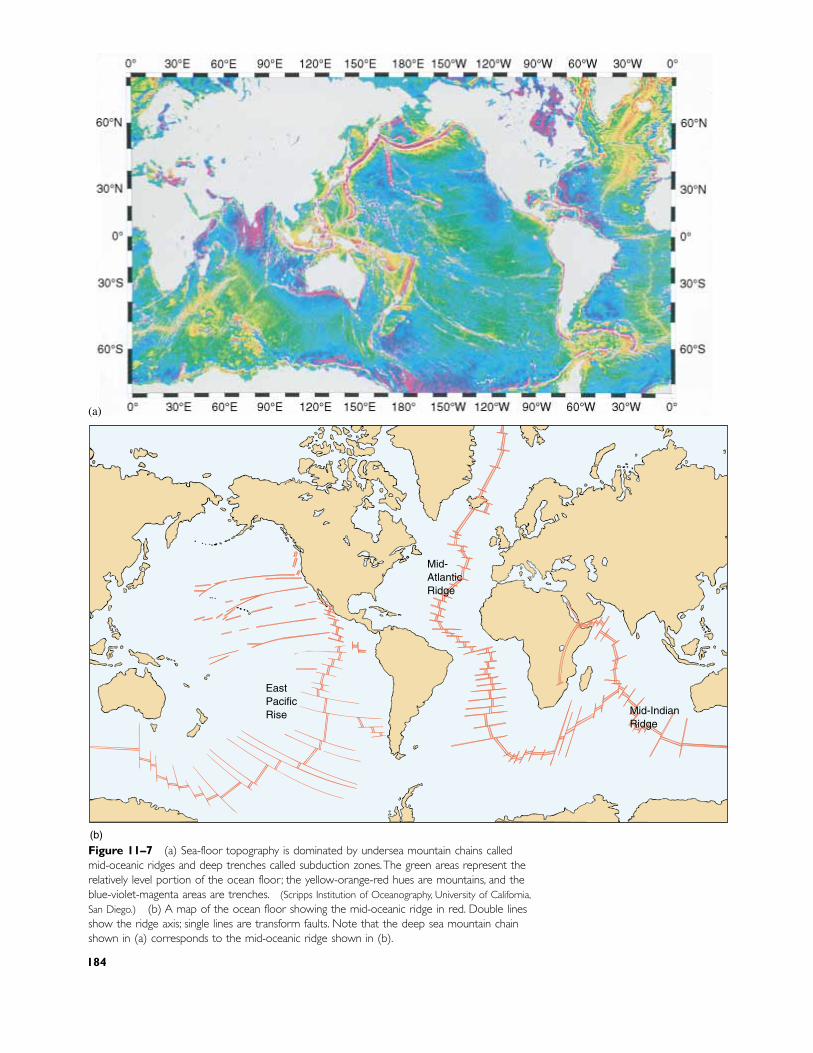
Mid-IndianRidge
Mid-AtlanticRidge
EastPacificRise
(b)
Figure 11–7 (a) Sea-floor topography is dominated by undersea mountain chains calledmid-oceanic ridges and deep trenches called subduction zones.The green areas represent therelatively level portion of the ocean floor; the yellow-orange-red hues are mountains, and theblue-violet-magenta areas are trenches. (Scripps Institution of Oceanography, University of California,San Diego.) (b) A map of the ocean floor showing the mid-oceanic ridge in red. Double linesshow the ridge axis; single lines are transform faults. Note that the deep sea mountain chainshown in (a) corresponds to the mid-oceanic ridge shown in (b).
184
(a)

deep sea floor. It covers more than 20 percent of theEarth’s surface—nearly as much as all continents com-bined—and is made up primarily of undeformed basalt.
On the mid-Atlantic ridge, which is a segment of themid-oceanic ridge, a rift valley 1 to 2 kilometers deepand several kilometers wide splits the ridge crest. In1974, French and American scientists used small re-search submarines to dive into the rift valley. They sawgaping vertical cracks up to 3 meters wide on the floorof the rift. Nearby were basalt flows so young that theywere not covered by any mud. Recall that the mid-oceanicridge is a spreading center. The cracks formed when brit-tle oceanic crust separated at the ridge axis. Basalticmagma then rose through the cracks and flowed onto thefloor of the rift valley. This basalt became new oceaniccrust as two lithospheric plates spread outward from theridge axis. Not all spreading centers have rift valleys asdeep and as wide as those of the mid-Atlantic ridge.
The new crust (and the underlying lithosphere) atthe ridge axis is hot and therefore of relatively low den-sity. Its buoyancy causes it to float high above the sur-rounding sea floor, forming the submarine mountainchain called the mid-oceanic ridge system. The newlithosphere cools as it spreads away from the ridge. As aresult of cooling, it becomes thicker and denser and sinksto lower elevations, forming the deeper sea floor on bothsides of the ridge (Fig. 11–8).
The heat flow (the rate at which heat flows outwardfrom the Earth’s surface) at the ridge is several timesgreater than that in other parts of the ocean basins. Agreat deal of Earth heat escapes from the ridge axis be-cause the spreading lithosphere is stretched thin underthe ridge, and the hot asthenosphere bulges toward thesurface. Rising magma carries additional heat upward.
Shallow earthquakes are common at the mid-oceanicridge because oceanic crust fractures as the two plates
separate (Fig. 11–9). Blocks of crust drop downwardalong the sea-floor cracks, forming the rift valley.
Hundreds of fractures called transform faults cutacross the rift valley and the ridge (Fig. 11–10). Thesefractures extend through the entire thickness of the litho-sphere. They develop because the mid-oceanic ridge actually consists of many short segments. Each seg-ment is slightly offset from adjacent segments by a trans-form fault. Transform faults are original features of themid-oceanic ridge; they develop when lithosphericspreading begins.
Some transform faults displace the ridge by less than a kilometer, but others offset the ridge by hundreds
The Mid-Oceanic Ridge 185
Age of oceanic crust (millions of years)
Dep
th o
f sea
floo
r (k
m)
Mid-oceanicridge
0 20 40 60 80 100 120 140 160 180 200
0
2
3
4
5
6
7
1
Figure 11–8 The sea floor sinksas it grows older. At the mid-oceanic ridge, new lithosphere isbuoyant because it is hot and oflow density. It ages, cools, thickens,and becomes denser as it movesaway from the ridge and conse-quently sinks. The central portion ofthe sea floor lies at a depth ofabout 5 kilometers.
Figure 11–9 A cross-sectional view of the central rift valleyin the mid-oceanic ridge. As the plates separate, blocks of rockdrop down along the fractures to form the rift valley.Themoving blocks cause earthquakes.
Mid-oceanic ridge
Earthquakesalong faults Rift
valleyOceaniccrust
Normalfaults Basaltic
magma
��
�
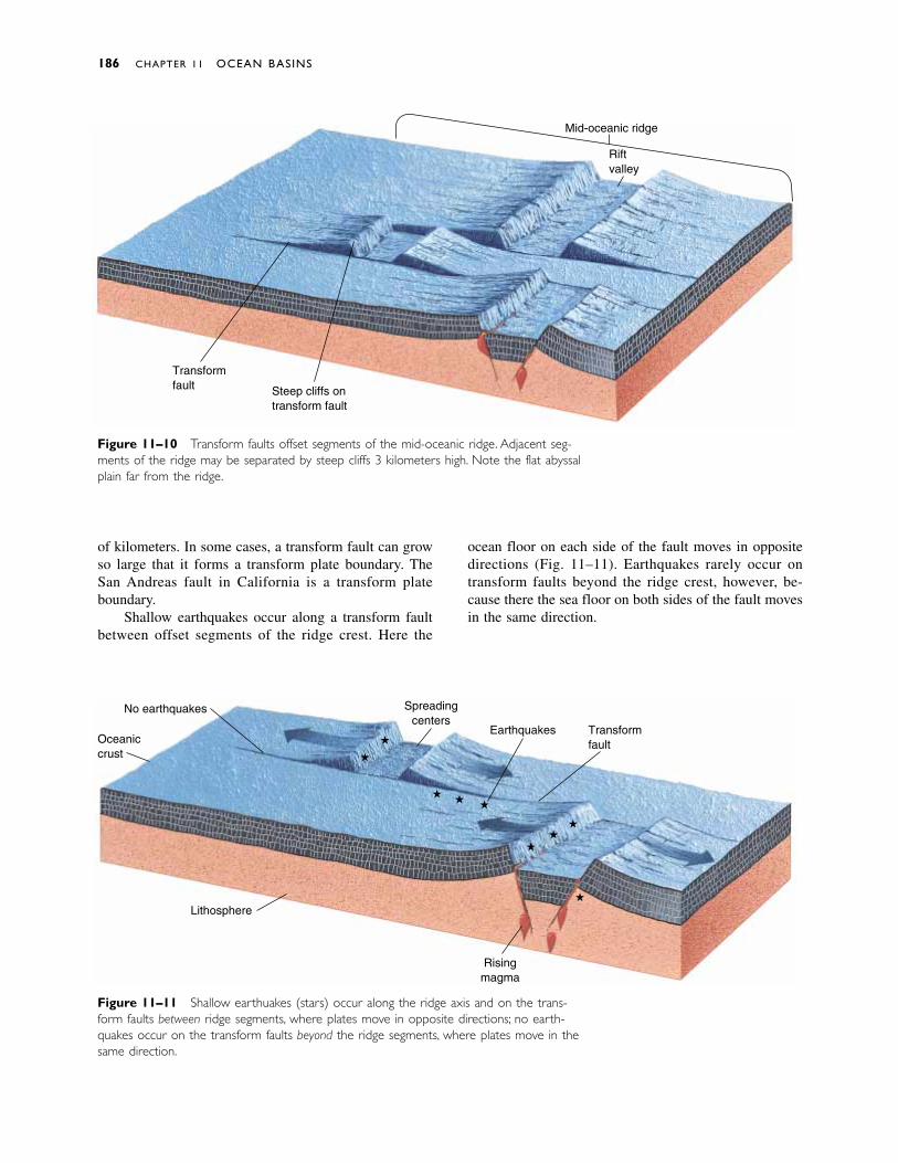
of kilometers. In some cases, a transform fault can growso large that it forms a transform plate boundary. TheSan Andreas fault in California is a transform plateboundary.
Shallow earthquakes occur along a transform faultbetween offset segments of the ridge crest. Here the
ocean floor on each side of the fault moves in oppositedirections (Fig. 11–11). Earthquakes rarely occur ontransform faults beyond the ridge crest, however, be-cause there the sea floor on both sides of the fault movesin the same direction.
186 CHAPTER 11 OCEAN BASINS
Figure 11–10 Transform faults offset segments of the mid-oceanic ridge. Adjacent seg-ments of the ridge may be separated by steep cliffs 3 kilometers high. Note the flat abyssalplain far from the ridge.
Figure 11–11 Shallow earthquakes (stars) occur along the ridge axis and on the trans-form faults between ridge segments, where plates move in opposite directions; no earth-quakes occur on the transform faults beyond the ridge segments, where plates move in thesame direction.
Mid-oceanic ridge
Riftvalley
Steep cliffs ontransform fault
Transformfault
Oceaniccrust
No earthquakes Spreadingcenters
Earthquakes Transformfault
Lithosphere
Risingmagma
�
��
�
���
�
�
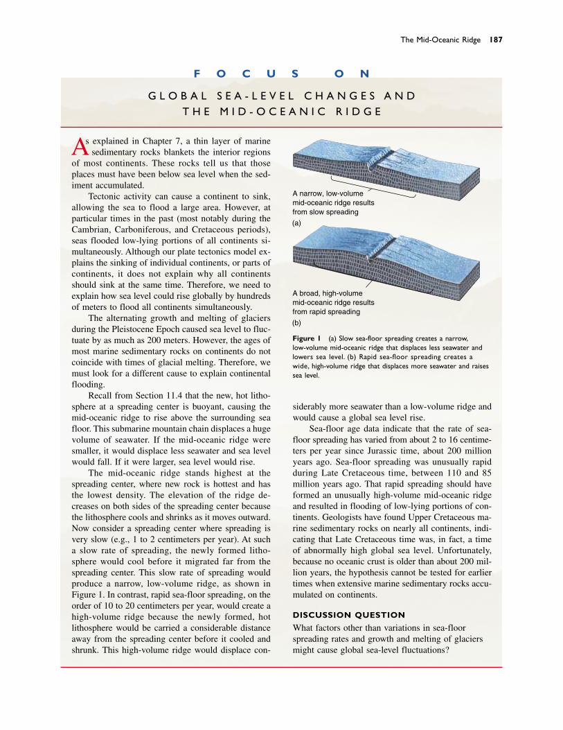
The Mid-Oceanic Ridge 187
F O C U S O N
G L O B A L S E A - L E V E L C H A N G E S A N D T H E M I D - O C E A N I C R I D G E
As explained in Chapter 7, a thin layer of marinesedimentary rocks blankets the interior regions
of most continents. These rocks tell us that thoseplaces must have been below sea level when the sed-iment accumulated.
Tectonic activity can cause a continent to sink,allowing the sea to flood a large area. However, atparticular times in the past (most notably during theCambrian, Carboniferous, and Cretaceous periods),seas flooded low-lying portions of all continents si-multaneously. Although our plate tectonics model ex-plains the sinking of individual continents, or parts ofcontinents, it does not explain why all continentsshould sink at the same time. Therefore, we need toexplain how sea level could rise globally by hundredsof meters to flood all continents simultaneously.
The alternating growth and melting of glaciersduring the Pleistocene Epoch caused sea level to fluc-tuate by as much as 200 meters. However, the ages ofmost marine sedimentary rocks on continents do notcoincide with times of glacial melting. Therefore, wemust look for a different cause to explain continentalflooding.
Recall from Section 11.4 that the new, hot litho-sphere at a spreading center is buoyant, causing themid-oceanic ridge to rise above the surrounding seafloor. This submarine mountain chain displaces a hugevolume of seawater. If the mid-oceanic ridge weresmaller, it would displace less seawater and sea levelwould fall. If it were larger, sea level would rise.
The mid-oceanic ridge stands highest at thespreading center, where new rock is hottest and hasthe lowest density. The elevation of the ridge de-creases on both sides of the spreading center becausethe lithosphere cools and shrinks as it moves outward.Now consider a spreading center where spreading isvery slow (e.g., 1 to 2 centimeters per year). At sucha slow rate of spreading, the newly formed litho-sphere would cool before it migrated far from thespreading center. This slow rate of spreading wouldproduce a narrow, low-volume ridge, as shown inFigure 1. In contrast, rapid sea-floor spreading, on theorder of 10 to 20 centimeters per year, would create ahigh-volume ridge because the newly formed, hotlithosphere would be carried a considerable distanceaway from the spreading center before it cooled andshrunk. This high-volume ridge would displace con-
siderably more seawater than a low-volume ridge andwould cause a global sea level rise.
Sea-floor age data indicate that the rate of sea-floor spreading has varied from about 2 to 16 centime-ters per year since Jurassic time, about 200 millionyears ago. Sea-floor spreading was unusually rapidduring Late Cretaceous time, between 110 and 85million years ago. That rapid spreading should haveformed an unusually high-volume mid-oceanic ridgeand resulted in flooding of low-lying portions of con-tinents. Geologists have found Upper Cretaceous ma-rine sedimentary rocks on nearly all continents, indi-cating that Late Cretaceous time was, in fact, a timeof abnormally high global sea level. Unfortunately,because no oceanic crust is older than about 200 mil-lion years, the hypothesis cannot be tested for earliertimes when extensive marine sedimentary rocks accu-mulated on continents.
DISCUSSION QUESTION
What factors other than variations in sea-floorspreading rates and growth and melting of glaciersmight cause global sea-level fluctuations?
A broad, high-volumemid-oceanic ridge resultsfrom rapid spreading
(b)
A narrow, low-volumemid-oceanic ridge resultsfrom slow spreading
(a)
Figure 1 (a) Slow sea-floor spreading creates a narrow,low-volume mid-oceanic ridge that displaces less seawater andlowers sea level. (b) Rapid sea-floor spreading creates awide, high-volume ridge that displaces more seawater and raisessea level.
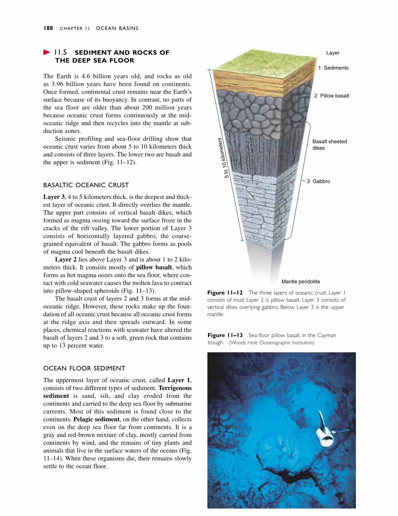
� 11.5 SEDIMENT AND ROCKS OF THE DEEP SEA FLOOR
The Earth is 4.6 billion years old, and rocks as old as 3.96 billion years have been found on continents.Once formed, continental crust remains near the Earth’ssurface because of its buoyancy. In contrast, no parts ofthe sea floor are older than about 200 million years because oceanic crust forms continuously at the mid-oceanic ridge and then recycles into the mantle at sub-duction zones.
Seismic profiling and sea-floor drilling show thatoceanic crust varies from about 5 to 10 kilometers thickand consists of three layers. The lower two are basalt andthe upper is sediment (Fig. 11–12).
BASALTIC OCEANIC CRUST
Layer 3, 4 to 5 kilometers thick, is the deepest and thick-est layer of oceanic crust. It directly overlies the mantle.The upper part consists of vertical basalt dikes, whichformed as magma oozing toward the surface froze in thecracks of the rift valley. The lower portion of Layer 3consists of horizontally layered gabbro, the coarse-grained equivalent of basalt. The gabbro forms as poolsof magma cool beneath the basalt dikes.
Layer 2 lies above Layer 3 and is about 1 to 2 kilo-meters thick. It consists mostly of pillow basalt, whichforms as hot magma oozes onto the sea floor, where con-tact with cold seawater causes the molten lava to contractinto pillow-shaped spheroids (Fig. 11–13).
The basalt crust of layers 2 and 3 forms at the mid-oceanic ridge. However, these rocks make up the foun-dation of all oceanic crust because all oceanic crust formsat the ridge axis and then spreads outward. In someplaces, chemical reactions with seawater have altered thebasalt of layers 2 and 3 to a soft, green rock that containsup to 13 percent water.
OCEAN FLOOR SEDIMENT
The uppermost layer of oceanic crust, called Layer 1,consists of two different types of sediment. Terrigenoussediment is sand, silt, and clay eroded from the continents and carried to the deep sea floor by submarinecurrents. Most of this sediment is found close to the continents. Pelagic sediment, on the other hand, collectseven on the deep sea floor far from continents. It is agray and red-brown mixture of clay, mostly carried fromcontinents by wind, and the remains of tiny plants andanimals that live in the surface waters of the oceans (Fig.11–14). When these organisms die, their remains slowlysettle to the ocean floor.
188 CHAPTER 11 OCEAN BASINS
Figure 11–12 The three layers of oceanic crust. Layer 1consists of mud. Layer 2 is pillow basalt. Layer 3 consists ofvertical dikes overlying gabbro. Below Layer 3 is the uppermantle.
Figure 11–13 Sea-floor pillow basalt in the Caymantrough. (Woods Hole Oceanographic Institution)
5 to
10
kilo
met
ers
Layer
1 Sediments
2 Pillow basalt
Basalt sheeteddikes
3 Gabbro
Mantle peridotite
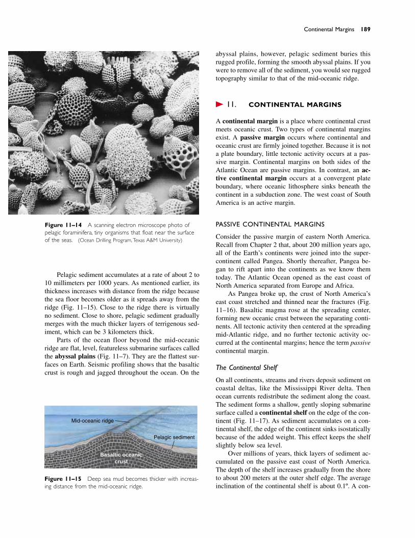
Pelagic sediment accumulates at a rate of about 2 to10 millimeters per 1000 years. As mentioned earlier, itsthickness increases with distance from the ridge becausethe sea floor becomes older as it spreads away from theridge (Fig. 11–15). Close to the ridge there is virtuallyno sediment. Close to shore, pelagic sediment graduallymerges with the much thicker layers of terrigenous sed-iment, which can be 3 kilometers thick.
Parts of the ocean floor beyond the mid-oceanicridge are flat, level, featureless submarine surfaces calledthe abyssal plains (Fig. 11–7). They are the flattest sur-faces on Earth. Seismic profiling shows that the basalticcrust is rough and jagged throughout the ocean. On the
abyssal plains, however, pelagic sediment buries thisrugged profile, forming the smooth abyssal plains. If youwere to remove all of the sediment, you would see ruggedtopography similar to that of the mid-oceanic ridge.
� 11.6 CONTINENTAL MARGINS
A continental margin is a place where continental crustmeets oceanic crust. Two types of continental marginsexist. A passive margin occurs where continental andoceanic crust are firmly joined together. Because it is nota plate boundary, little tectonic activity occurs at a pas-sive margin. Continental margins on both sides of theAtlantic Ocean are passive margins. In contrast, an ac-tive continental margin occurs at a convergent plateboundary, where oceanic lithosphere sinks beneath thecontinent in a subduction zone. The west coast of SouthAmerica is an active margin.
PASSIVE CONTINENTAL MARGINS
Consider the passive margin of eastern North America.Recall from Chapter 2 that, about 200 million years ago,all of the Earth’s continents were joined into the super-continent called Pangea. Shortly thereafter, Pangea be-gan to rift apart into the continents as we know them today. The Atlantic Ocean opened as the east coast ofNorth America separated from Europe and Africa.
As Pangea broke up, the crust of North America’seast coast stretched and thinned near the fractures (Fig.11–16). Basaltic magma rose at the spreading center,forming new oceanic crust between the separating conti-nents. All tectonic activity then centered at the spreadingmid-Atlantic ridge, and no further tectonic activity oc-curred at the continental margins; hence the term passivecontinental margin.
The Continental Shelf
On all continents, streams and rivers deposit sediment oncoastal deltas, like the Mississippi River delta. Thenocean currents redistribute the sediment along the coast.The sediment forms a shallow, gently sloping submarinesurface called a continental shelf on the edge of the con-tinent (Fig. 11–17). As sediment accumulates on a con-tinental shelf, the edge of the continent sinks isostaticallybecause of the added weight. This effect keeps the shelfslightly below sea level.
Over millions of years, thick layers of sediment ac-cumulated on the passive east coast of North America.The depth of the shelf increases gradually from the shoreto about 200 meters at the outer shelf edge. The averageinclination of the continental shelf is about 0.1º. A con-
Continental Margins 189
Figure 11–14 A scanning electron microscope photo ofpelagic foraminifera, tiny organisms that float near the surfaceof the seas. (Ocean Drilling Program,Texas A&M University)
Figure 11–15 Deep sea mud becomes thicker with increas-ing distance from the mid-oceanic ridge.
Mid-oceanic ridge
Pelagic sediment
Basaltic oceaniccrust
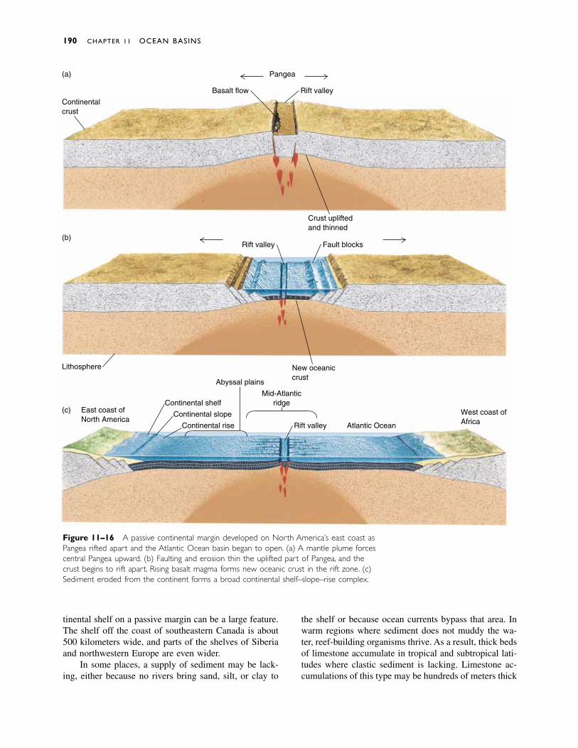
tinental shelf on a passive margin can be a large feature.The shelf off the coast of southeastern Canada is about500 kilometers wide, and parts of the shelves of Siberiaand northwestern Europe are even wider.
In some places, a supply of sediment may be lack-ing, either because no rivers bring sand, silt, or clay to
the shelf or because ocean currents bypass that area. Inwarm regions where sediment does not muddy the wa-ter, reef-building organisms thrive. As a result, thick bedsof limestone accumulate in tropical and subtropical lati-tudes where clastic sediment is lacking. Limestone ac-cumulations of this type may be hundreds of meters thick
190 CHAPTER 11 OCEAN BASINS
Figure 11–16 A passive continental margin developed on North America’s east coast asPangea rifted apart and the Atlantic Ocean basin began to open. (a) A mantle plume forcescentral Pangea upward. (b) Faulting and erosion thin the uplifted part of Pangea, and thecrust begins to rift apart. Rising basalt magma forms new oceanic crust in the rift zone. (c)Sediment eroded from the continent forms a broad continental shelf–slope–rise complex.
Continentalcrust
Basalt flow
Pangea
Rift valley
Crust upliftedand thinned
Rift valley Fault blocks
(a)
(b)
Lithosphere
East coast ofNorth America
Abyssal plains
New oceaniccrust
Continental slope
Continental rise
Continental shelfMid-Atlantic
ridge
Rift valley Atlantic Ocean
West coast ofAfrica
(c)
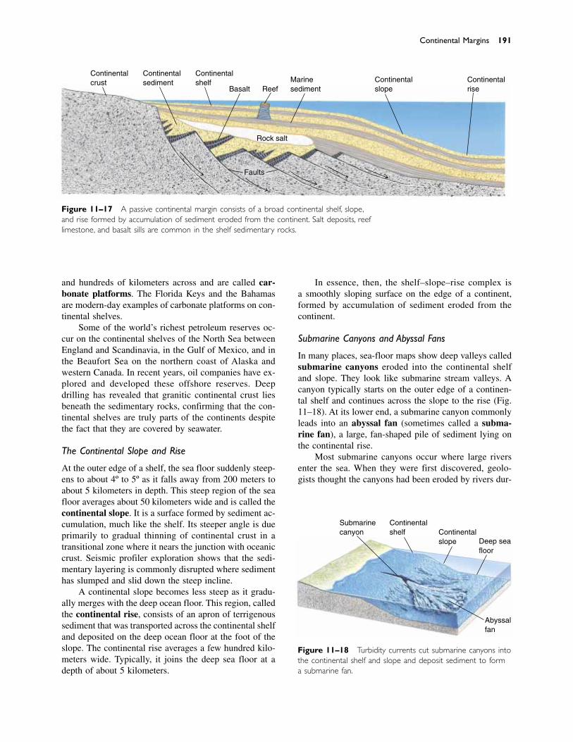
and hundreds of kilometers across and are called car-bonate platforms. The Florida Keys and the Bahamasare modern-day examples of carbonate platforms on con-tinental shelves.
Some of the world’s richest petroleum reserves oc-cur on the continental shelves of the North Sea betweenEngland and Scandinavia, in the Gulf of Mexico, and inthe Beaufort Sea on the northern coast of Alaska andwestern Canada. In recent years, oil companies have ex-plored and developed these offshore reserves. Deepdrilling has revealed that granitic continental crust liesbeneath the sedimentary rocks, confirming that the con-tinental shelves are truly parts of the continents despitethe fact that they are covered by seawater.
The Continental Slope and Rise
At the outer edge of a shelf, the sea floor suddenly steep-ens to about 4º to 5º as it falls away from 200 meters toabout 5 kilometers in depth. This steep region of the seafloor averages about 50 kilometers wide and is called thecontinental slope. It is a surface formed by sediment ac-cumulation, much like the shelf. Its steeper angle is dueprimarily to gradual thinning of continental crust in atransitional zone where it nears the junction with oceaniccrust. Seismic profiler exploration shows that the sedi-mentary layering is commonly disrupted where sedimenthas slumped and slid down the steep incline.
A continental slope becomes less steep as it gradu-ally merges with the deep ocean floor. This region, calledthe continental rise, consists of an apron of terrigenoussediment that was transported across the continental shelfand deposited on the deep ocean floor at the foot of theslope. The continental rise averages a few hundred kilo-meters wide. Typically, it joins the deep sea floor at adepth of about 5 kilometers.
In essence, then, the shelf–slope–rise complex is a smoothly sloping surface on the edge of a continent,formed by accumulation of sediment eroded from thecontinent.
Submarine Canyons and Abyssal Fans
In many places, sea-floor maps show deep valleys calledsubmarine canyons eroded into the continental shelfand slope. They look like submarine stream valleys. Acanyon typically starts on the outer edge of a continen-tal shelf and continues across the slope to the rise (Fig.11–18). At its lower end, a submarine canyon commonlyleads into an abyssal fan (sometimes called a subma-rine fan), a large, fan-shaped pile of sediment lying onthe continental rise.
Most submarine canyons occur where large riversenter the sea. When they were first discovered, geolo-gists thought the canyons had been eroded by rivers dur-
Continental Margins 191
Figure 11–17 A passive continental margin consists of a broad continental shelf, slope,and rise formed by accumulation of sediment eroded from the continent. Salt deposits, reeflimestone, and basalt sills are common in the shelf sedimentary rocks.
Figure 11–18 Turbidity currents cut submarine canyons intothe continental shelf and slope and deposit sediment to forma submarine fan.
Submarinecanyon
Continentalshelf Continental
slope Deep seafloor
Abyssalfan
Continentalcrust
Continentalsediment
Continentalshelf
Basalt ReefMarinesediment
Continentalslope
Continentalrise
Rock salt
Faults

ing the Pleistocene Epoch, when accumulation of glacialice on land lowered sea level by as much as 130 meters.However, this explanation cannot account for the deeperportions of submarine canyons cut into the lower conti-nental slopes at depths of a kilometer or more. Therefore,submarine canyons must have formed under water, and asubmarine mechanism must be found to explain them.
Geologists subsequently discovered that submarinecanyons are cut by turbidity currents. A turbidity cur-rent develops when loose, wet sediment tumbles downthe slope in a submarine landslide. The movement maybe triggered by an earthquake or simply by oversteepen-ing of the slope as sediment accumulates. When the sed-iment starts to move, it mixes with water. Because themixture of sediment and water is denser than water alone,it flows as a turbulent, chaotic avalanche across the shelfand slope. A turbidity current can travel at speeds greaterthan 100 kilometers per hour and for distances up to 700kilometers.
Sediment-laden water traveling at such speed hastremendous erosive power. Once a turbidity current cutsa small channel into the shelf and slope, subsequent cur-rents follow the same channel, just as an intermittent sur-face stream uses the same channel year after year. Overtime, the currents erode a deep submarine canyon intothe shelf and slope. Turbidity currents slow down whenthey reach the deep sea floor. The sediment accumulatesthere to form an abyssal fan. Most submarine canyonsand fans form near the mouths of large rivers because therivers supply the great amount of sediment needed tocreate turbidity currents.
Large abyssal fans form only on passive continentalmargins. They are uncommon at active margins becausein that environment, the sediment is swallowed by thetrench. Furthermore, most of the world’s largest riversdrain toward passive margins. The largest known fan isthe Bengal fan, which covers about 4 million squarekilometers beyond the mouth of the Ganges River in theIndian Ocean east of India. More than half of the sedi-ment eroded from the rapidly rising Himalayas ends upin this fan. Interestingly, the Bengal fan has no associ-ated submarine canyon, perhaps because the sedimentsupply is so great that the rapid accumulation of sedi-ment prevents erosion of a canyon.
ACTIVE CONTINENTAL MARGINS
An active continental margin forms in a subduction zone,where an oceanic plate sinks beneath a continent. A long,narrow, steep-sided depression called a trench forms onthe sea floor where the oceanic plate dives into the man-tle (Fig. 11–19). Because an active margin has no grad-ual transition between continental and oceanic crust, itcommonly has a narrower shelf than a passive margin.
The landward wall (the side toward the continent) of thetrench is the continental slope of an active margin. It typ-ically inclines at 4º or 5º in its upper part and steepensto 15º or more near the bottom of the trench. The conti-nental rise is absent because sediment flows into thetrench instead of accumulating on the ocean floor.
� 11.7 ISLAND ARCS
In many parts of the Pacific Ocean and elsewhere, twooceanic plates converge. One dives beneath the other,forming a subduction zone and a trench. The deepestplace on Earth is in the Mariana trench, north of NewGuinea in the southwestern Pacific, where the oceanfloor sinks to nearly 11 kilometers below sea level.Depths of 8 to 10 kilometers are common in othertrenches.
Huge amounts of magma are generated in the sub-duction zone (Fig. 11–20). The magma rises and eruptson the sea floor to form submarine volcanoes next to thetrench. The volcanoes eventually grow to become a chainof islands, called an island arc. The western AleutianIslands are an example of an island arc. Many others oc-cur at the numerous convergent plate boundaries in thesouthwestern Pacific (Fig. 11–21).
If subduction stops after an island arc forms, vol-canic activity also ends. The island arc may then ridequietly on a tectonic plate until it arrives at another sub-duction zone at an active continental margin. However,the density of island arc rocks is relatively low, makingthem too buoyant to sink into the mantle. Instead, the is-land arc collides with the continent (Fig. 11–22). Whenthis happens, the subducting plate commonly fractureson the seaward side of the island arc to form a new sub-duction zone. In this way, the island arc breaks awayfrom the ocean plate and becomes part of the continent.The accretion of island arcs to continents in this mannerplayed a major role in the geologic history of westernNorth America and is explored more fully in Chapter 20.
Note the following points:
1. An island arc forms as magma rises from the mantleat an oceanic subduction zone.
2. The island arc eventually becomes part of a con-tinent.
3. A continent cannot sink into the mantle at a subduc-tion zone because of its buoyancy.
4. Thus, material is transferred from the mantle to acontinent, but little or no material is transferredfrom continents to the mantle. This aspect of theplate tectonics model suggests that the amount ofcontinental crust has increased throughout geologictime. However, some geologists feel that small
192 CHAPTER 11 OCEAN BASINS
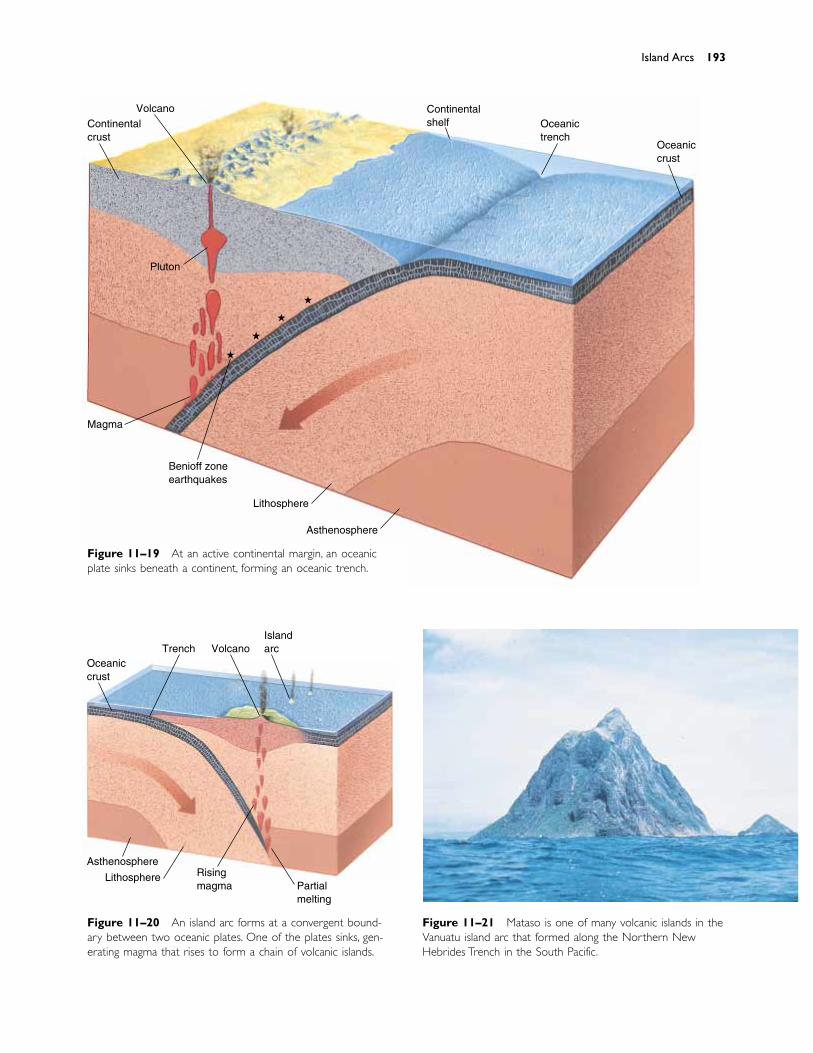
Island Arcs 193
Figure 11–19 At an active continental margin, an oceanicplate sinks beneath a continent, forming an oceanic trench.
Figure 11–20 An island arc forms at a convergent bound-ary between two oceanic plates. One of the plates sinks, gen-erating magma that rises to form a chain of volcanic islands.
Continentalcrust
Volcano Continentalshelf Oceanic
trenchOceaniccrust
Pluton
Magma
Benioff zoneearthquakes
Lithosphere
Asthenosphere
�
�
�
�
Oceaniccrust
Trench VolcanoIslandarc
Asthenosphere
Lithosphere Risingmagma Partial
melting
Figure 11–21 Mataso is one of many volcanic islands in theVanuatu island arc that formed along the Northern NewHebrides Trench in the South Pacific.
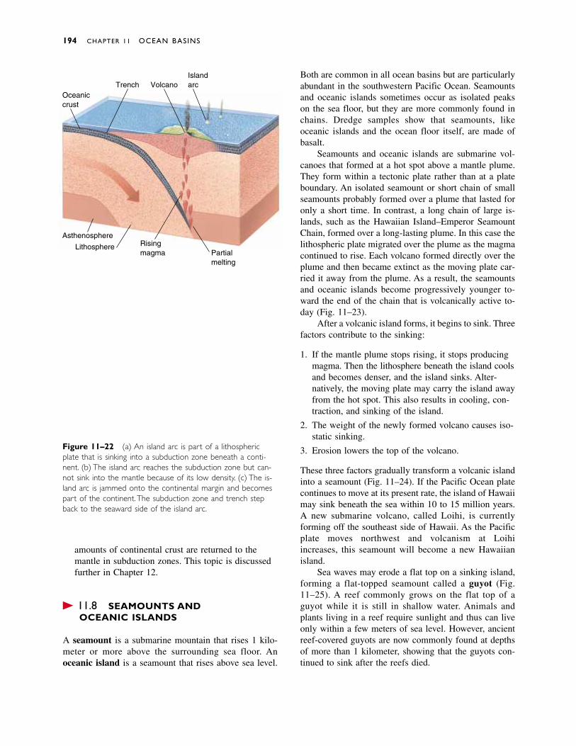
amounts of continental crust are returned to themantle in subduction zones. This topic is discussedfurther in Chapter 12.
� 11.8 SEAMOUNTS AND OCEANIC ISLANDS
A seamount is a submarine mountain that rises 1 kilo-meter or more above the surrounding sea floor. Anoceanic island is a seamount that rises above sea level.
Both are common in all ocean basins but are particularlyabundant in the southwestern Pacific Ocean. Seamountsand oceanic islands sometimes occur as isolated peakson the sea floor, but they are more commonly found inchains. Dredge samples show that seamounts, likeoceanic islands and the ocean floor itself, are made ofbasalt.
Seamounts and oceanic islands are submarine vol-canoes that formed at a hot spot above a mantle plume.They form within a tectonic plate rather than at a plateboundary. An isolated seamount or short chain of smallseamounts probably formed over a plume that lasted foronly a short time. In contrast, a long chain of large is-lands, such as the Hawaiian Island–Emperor SeamountChain, formed over a long-lasting plume. In this case thelithospheric plate migrated over the plume as the magmacontinued to rise. Each volcano formed directly over theplume and then became extinct as the moving plate car-ried it away from the plume. As a result, the seamountsand oceanic islands become progressively younger to-ward the end of the chain that is volcanically active to-day (Fig. 11–23).
After a volcanic island forms, it begins to sink. Threefactors contribute to the sinking:
1. If the mantle plume stops rising, it stops producingmagma. Then the lithosphere beneath the island coolsand becomes denser, and the island sinks. Alter-natively, the moving plate may carry the island awayfrom the hot spot. This also results in cooling, con-traction, and sinking of the island.
2. The weight of the newly formed volcano causes iso-static sinking.
3. Erosion lowers the top of the volcano.
These three factors gradually transform a volcanic islandinto a seamount (Fig. 11–24). If the Pacific Ocean platecontinues to move at its present rate, the island of Hawaiimay sink beneath the sea within 10 to 15 million years.A new submarine volcano, called Loihi, is currentlyforming off the southeast side of Hawaii. As the Pacificplate moves northwest and volcanism at Loihi increases, this seamount will become a new Hawaiian island.
Sea waves may erode a flat top on a sinking island,forming a flat-topped seamount called a guyot (Fig.11–25). A reef commonly grows on the flat top of aguyot while it is still in shallow water. Animals andplants living in a reef require sunlight and thus can liveonly within a few meters of sea level. However, ancientreef-covered guyots are now commonly found at depthsof more than 1 kilometer, showing that the guyots con-tinued to sink after the reefs died.
194 CHAPTER 11 OCEAN BASINS
Figure 11–22 (a) An island arc is part of a lithosphericplate that is sinking into a subduction zone beneath a conti-nent. (b) The island arc reaches the subduction zone but can-not sink into the mantle because of its low density. (c) The is-land arc is jammed onto the continental margin and becomespart of the continent. The subduction zone and trench stepback to the seaward side of the island arc.
Oceaniccrust
Trench VolcanoIslandarc
Asthenosphere
Lithosphere Risingmagma Partial
melting
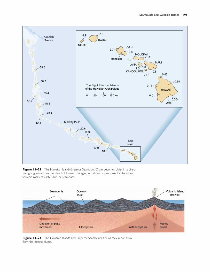
Seamounts and Oceanic Islands 195
Figure 11–23 The Hawaiian Island–Emperor Seamount Chain becomes older in a direc-tion going away from the island of Hawaii. The ages, in millions of years, are for the oldestvolcanic rocks of each island or seamount.
KAUAI
NIIHAUOAHU
MOLOKAI
LANAIMAUI
HAWAII
4.9 5.1
3.72.6
1.9
1.3 1.3
>1.00.8
0.43
0.38
0.15
0.010.004
Honolulu 1.8
The Eight Principle Islandsof the Hawaiian Archipelago
0 50 100 150 km
59.6
55.4
56.2
55.248.1
43.4
42.4 Midway 27.2
20.619.9
12.010.3
AleutianTrench
KAHOOLAWE
Loihi
Seeinset
Principal
Figure 11–24 The Hawaiian Islands and Emperor Seamounts sink as they move awayfrom the mantle plume.
Seamounts Oceaniccrust
Volcanic island(Hawaii)
Direction of platemovement Lithosphere Asthenosphere
Mantleplume
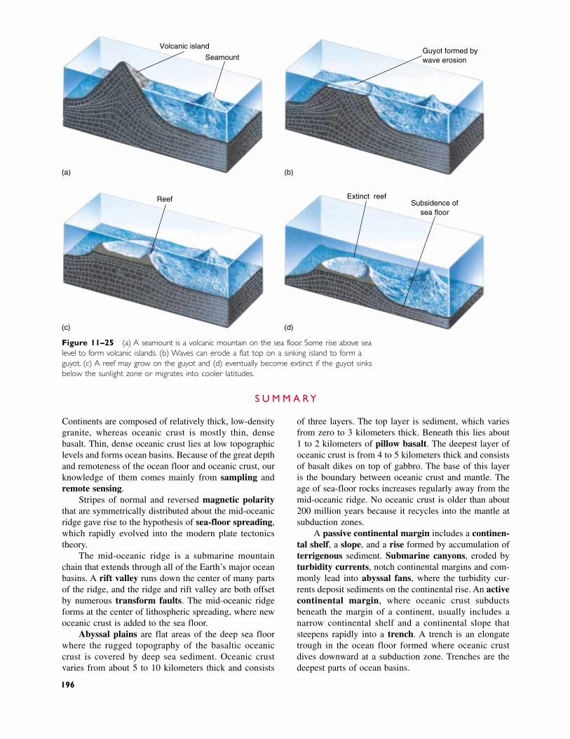
Continents are composed of relatively thick, low-densitygranite, whereas oceanic crust is mostly thin, densebasalt. Thin, dense oceanic crust lies at low topographiclevels and forms ocean basins. Because of the great depthand remoteness of the ocean floor and oceanic crust, ourknowledge of them comes mainly from sampling andremote sensing.
Stripes of normal and reversed magnetic polaritythat are symmetrically distributed about the mid-oceanicridge gave rise to the hypothesis of sea-floor spreading,which rapidly evolved into the modern plate tectonicstheory.
The mid-oceanic ridge is a submarine mountainchain that extends through all of the Earth’s major oceanbasins. A rift valley runs down the center of many partsof the ridge, and the ridge and rift valley are both offsetby numerous transform faults. The mid-oceanic ridgeforms at the center of lithospheric spreading, where newoceanic crust is added to the sea floor.
Abyssal plains are flat areas of the deep sea floorwhere the rugged topography of the basaltic oceaniccrust is covered by deep sea sediment. Oceanic crustvaries from about 5 to 10 kilometers thick and consists
Figure 11–25 (a) A seamount is a volcanic mountain on the sea floor. Some rise above sealevel to form volcanic islands. (b) Waves can erode a flat top on a sinking island to form aguyot. (c) A reef may grow on the guyot and (d) eventually become extinct if the guyot sinksbelow the sunlight zone or migrates into cooler latitudes.
Volcanic island
Seamount
Extinct reefReef
Guyot formed bywave erosion
Subsidence ofsea floor
(a)
(c) (d)
(b)
of three layers. The top layer is sediment, which variesfrom zero to 3 kilometers thick. Beneath this lies about1 to 2 kilometers of pillow basalt. The deepest layer ofoceanic crust is from 4 to 5 kilometers thick and consistsof basalt dikes on top of gabbro. The base of this layeris the boundary between oceanic crust and mantle. Theage of sea-floor rocks increases regularly away from themid-oceanic ridge. No oceanic crust is older than about200 million years because it recycles into the mantle atsubduction zones.
A passive continental margin includes a continen-tal shelf, a slope, and a rise formed by accumulation ofterrigenous sediment. Submarine canyons, eroded byturbidity currents, notch continental margins and com-monly lead into abyssal fans, where the turbidity cur-rents deposit sediments on the continental rise. An activecontinental margin, where oceanic crust subducts beneath the margin of a continent, usually includes a narrow continental shelf and a continental slope thatsteepens rapidly into a trench. A trench is an elongatetrough in the ocean floor formed where oceanic crustdives downward at a subduction zone. Trenches are thedeepest parts of ocean basins.
S U M M A R Y
196
Discussion Questions 197
Island arcs are common features of some oceanbasins, particularly the southwestern Pacific. They arechains of volcanoes formed at subduction zones where
two oceanic plates collide. Seamounts and oceanic is-lands form in oceanic crust as a result of volcanic activ-ity over mantle plumes.
rock dredge 180core 180sea-floor drilling 180echo sounder 181seismic profiler 181magnetometer 181polarity 182magnetic reversal 182sea-floor spreading 183
rift valley 185heat flow 185transform fault 185pillow basalt 188terrigenous sediment 188pelagic sediment 188abyssal plains 189passive continental
margin 189
active continental margin 189
continental shelf 189carbonate platform 191continental slope 191continental rise 191submarine canyon 191abyssal fan (submarine
fan) 191
turbidity current 192island arc 192accretion 192seamount 194oceanic island 194guyot 194
K E Y W O R D S
1. Describe the main differences between oceans and conti-nents.
2. Describe a magnetic reversal.
3. Explain how a rock preserves evidence of the orientationof the Earth’s magnetic field at the time the rock formed.
4. Describe how the discovery of magnetic patterns on thesea floor confirmed the sea-floor spreading theory.
5. Sketch a cross section of the mid-oceanic ridge, includ-ing the rift valley.
6. Describe the dimensions of the mid-oceanic ridge.
7. Explain why the mid-oceanic ridge is topographicallyelevated above the surrounding ocean floor. Why does itselevation gradually decrease away from the ridge axis?
8. Explain the origin of the rift valley in the center of themid-oceanic ridge.
9. Why is heat flow unusually high at the mid-oceanicridge?
10. Why are the abyssal plains characterized by such low relief?
11. Sketch a cross section of oceanic crust from a deep seabasin. Label, describe, and indicate the approximatethickness of each layer.
12. Describe the two main types of sea-floor sediment. Whatis the origin of each type?
13. Compare the ages of oceanic crust with the ages of conti-nental rocks. Why are they so different?
14. Sketch a cross section of both an active continental mar-gin and a passive continental margin. Label the featuresof each. Give approximate depths below sea level of eachof the features.
15. Explain why a continental shelf is made up of a founda-tion of granitic crust, whereas the deep ocean floor iscomposed of basalt.
16. Why does an active continental margin typically have asteeper continental slope than a passive margin? Whydoes an active margin typically have no continental rise?
17. Explain the relationships among submarine canyons,abyssal fans, and turbidity currents.
18. Why are turbidity currents often associated with earth-quakes or with large floods in major rivers?
19. Explain the role played by an island arc in the growth ofa continent.
20. Explain the origins of and differences between seamountsand island arcs.
21. Compare the ocean depths adjacent to an island arc and aseamount.
22. Why do oceanic islands sink after they form?
R E V I E W Q U E S T I O N S
1. How and why does an oceanic trench form?
2. The east coast of South America has a wide continentalshelf, whereas the west coast has a very narrow shelf.Discuss and explain this contrast.
3. Seismic data indicate that continental crust thins where itjoins oceanic crust at a passive continental margin, such ason the east coast of North America. Other than that, weknow relatively little about the nature of the junction be-tween the two types of crust. Speculate on the nature of
that junction. Consider rock types, geologic structures,ages of rocks, and other features of the junction.
4. Discuss the topography of the Earth in an imaginary sce-nario in which all conditions are identical to present onesexcept that there is no water. In contrast, what would bethe effect if there were enough water to cover all of theEarth’s surface?
5. In Section 11.6 we stated that most of the world’s largestrivers drain toward passive continental margins. Explainthis observation.
D I S C U S S I O N Q U E S T I O N S
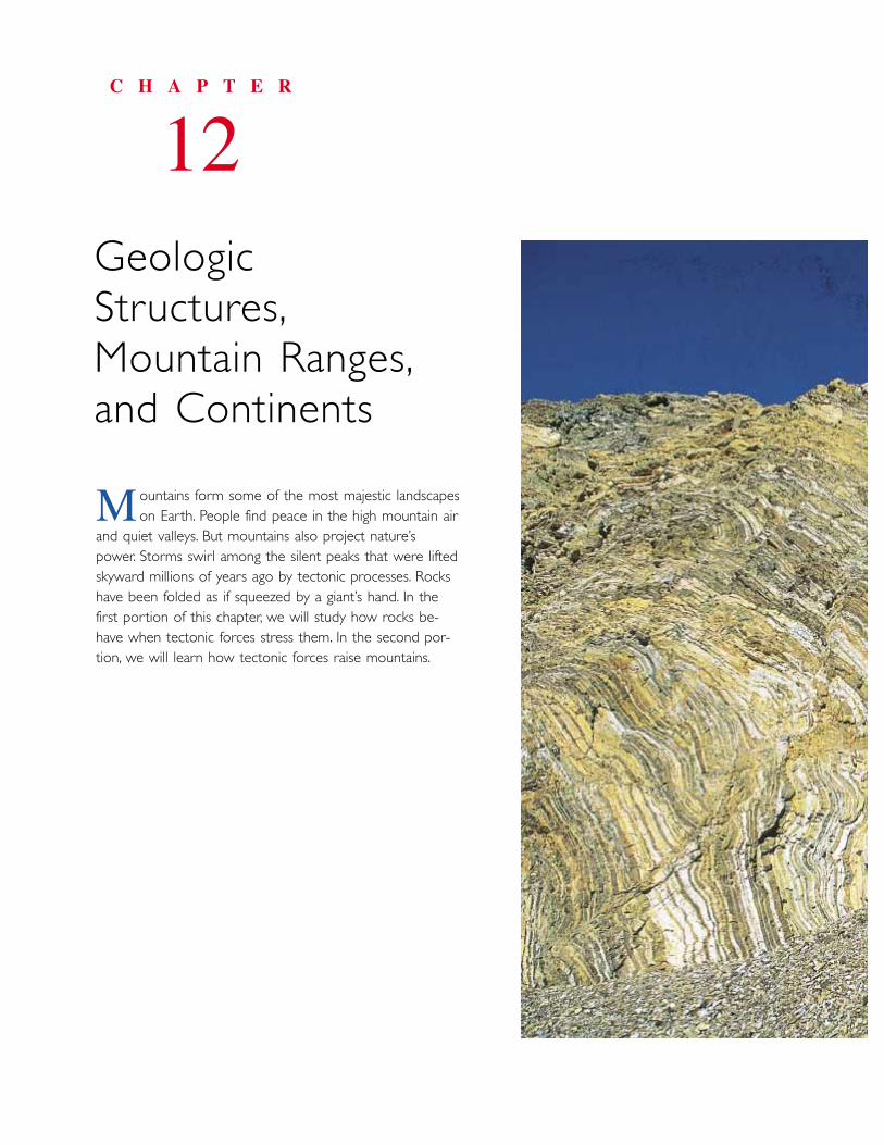
ountains form some of the most majestic landscapes on Earth. People find peace in the high mountain air
and quiet valleys. But mountains also project nature’spower. Storms swirl among the silent peaks that were liftedskyward millions of years ago by tectonic processes. Rockshave been folded as if squeezed by a giant’s hand. In thefirst portion of this chapter, we will study how rocks be-have when tectonic forces stress them. In the second por-tion, we will learn how tectonic forces raise mountains.
C H A P T E R
12GeologicStructures,Mountain Ranges,and Continents
M
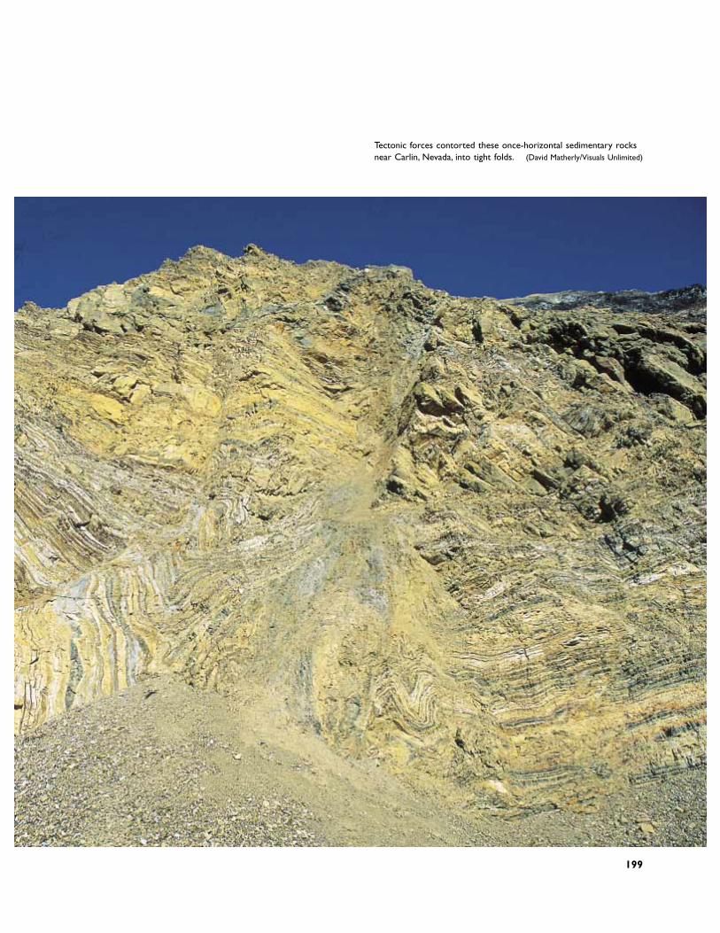
Tectonic forces contorted these once-horizontal sedimentary rocksnear Carlin, Nevada, into tight folds. (David Matherly/Visuals Unlimited)
199
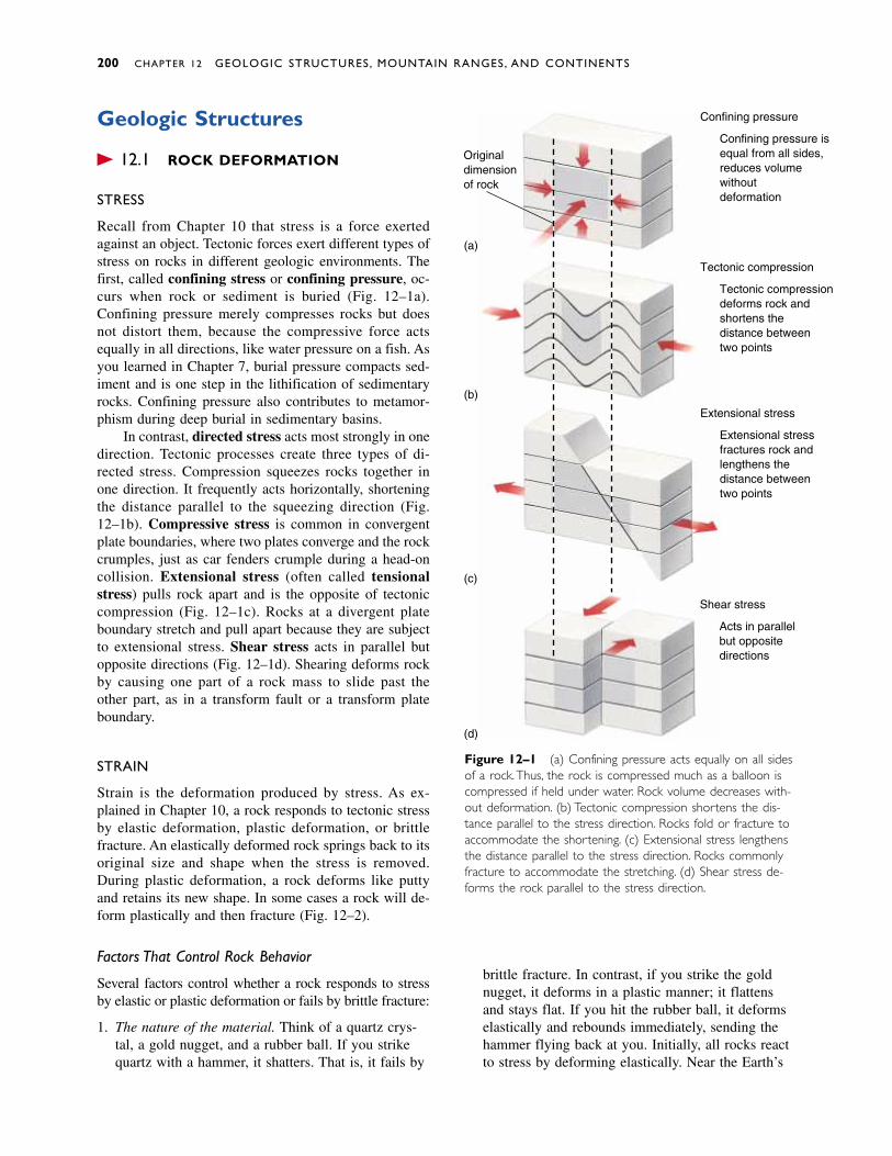
Geologic Structures
� 12.1 ROCK DEFORMATION
STRESS
Recall from Chapter 10 that stress is a force exertedagainst an object. Tectonic forces exert different types ofstress on rocks in different geologic environments. Thefirst, called confining stress or confining pressure, oc-curs when rock or sediment is buried (Fig. 12–1a).Confining pressure merely compresses rocks but doesnot distort them, because the compressive force actsequally in all directions, like water pressure on a fish. Asyou learned in Chapter 7, burial pressure compacts sed-iment and is one step in the lithification of sedimentaryrocks. Confining pressure also contributes to metamor-phism during deep burial in sedimentary basins.
In contrast, directed stress acts most strongly in onedirection. Tectonic processes create three types of di-rected stress. Compression squeezes rocks together inone direction. It frequently acts horizontally, shorteningthe distance parallel to the squeezing direction (Fig.12–1b). Compressive stress is common in convergentplate boundaries, where two plates converge and the rockcrumples, just as car fenders crumple during a head-oncollision. Extensional stress (often called tensionalstress) pulls rock apart and is the opposite of tectoniccompression (Fig. 12–1c). Rocks at a divergent plateboundary stretch and pull apart because they are subjectto extensional stress. Shear stress acts in parallel but opposite directions (Fig. 12–1d). Shearing deforms rockby causing one part of a rock mass to slide past the other part, as in a transform fault or a transform plateboundary.
STRAIN
Strain is the deformation produced by stress. As ex-plained in Chapter 10, a rock responds to tectonic stressby elastic deformation, plastic deformation, or brittlefracture. An elastically deformed rock springs back to itsoriginal size and shape when the stress is removed.During plastic deformation, a rock deforms like puttyand retains its new shape. In some cases a rock will de-form plastically and then fracture (Fig. 12–2).
Factors That Control Rock Behavior
Several factors control whether a rock responds to stressby elastic or plastic deformation or fails by brittle fracture:
1. The nature of the material. Think of a quartz crys-tal, a gold nugget, and a rubber ball. If you strikequartz with a hammer, it shatters. That is, it fails by
brittle fracture. In contrast, if you strike the goldnugget, it deforms in a plastic manner; it flattensand stays flat. If you hit the rubber ball, it deformselastically and rebounds immediately, sending thehammer flying back at you. Initially, all rocks reactto stress by deforming elastically. Near the Earth’s
200 CHAPTER 12 GEOLOGIC STRUCTURES, MOUNTAIN RANGES, AND CONTINENTS
Figure 12–1 (a) Confining pressure acts equally on all sidesof a rock.Thus, the rock is compressed much as a balloon iscompressed if held under water. Rock volume decreases with-out deformation. (b) Tectonic compression shortens the dis-tance parallel to the stress direction. Rocks fold or fracture toaccommodate the shortening. (c) Extensional stress lengthensthe distance parallel to the stress direction. Rocks commonlyfracture to accommodate the stretching. (d) Shear stress de-forms the rock parallel to the stress direction.
Confining pressure
Confining pressure is equal from all sides, reduces volume without deformation
Tectonic compression
Tectonic compression deforms rock and shortens the distance between two points
Extensional stress
Extensional stress fractures rock and lengthens the distance between two points
Shear stress
Acts in parallel but opposite directions
Originaldimensionof rock
(d)
(c)
(b)
(a)
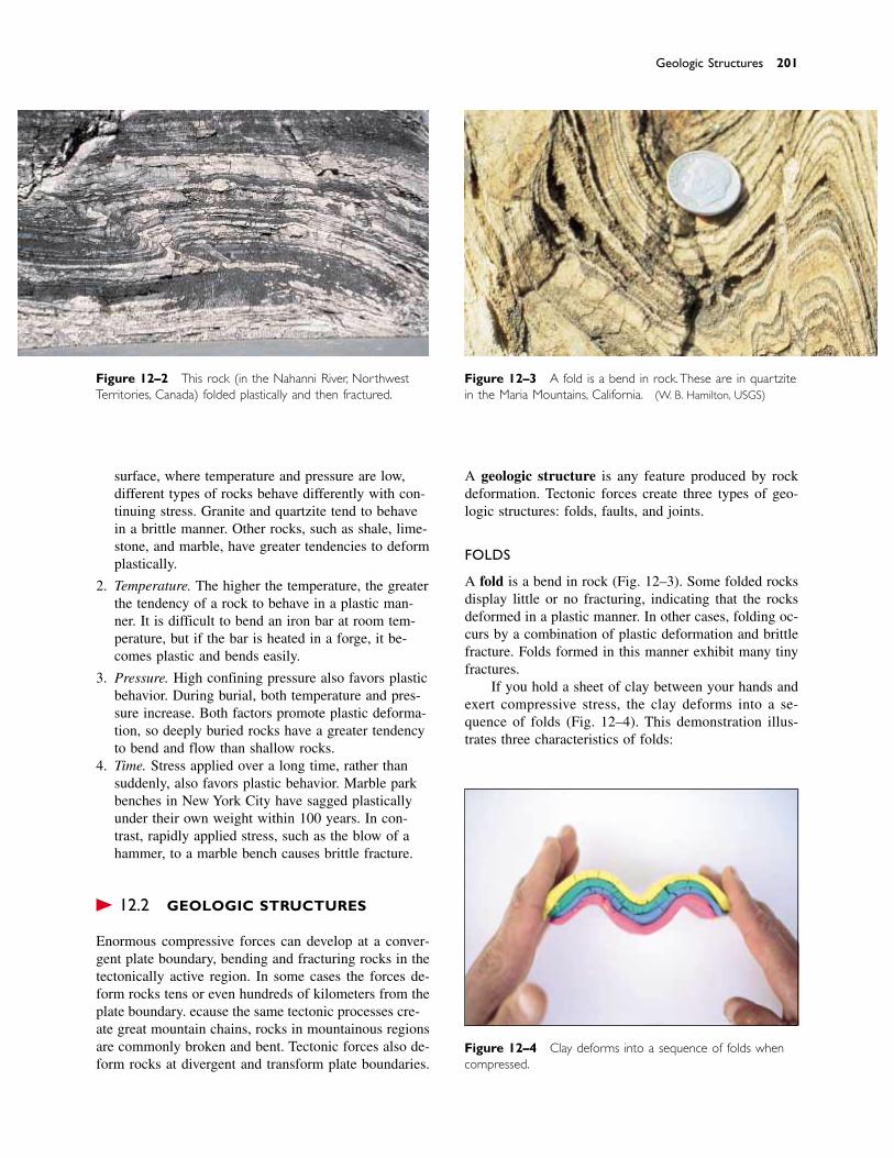
surface, where temperature and pressure are low,different types of rocks behave differently with con-tinuing stress. Granite and quartzite tend to behavein a brittle manner. Other rocks, such as shale, lime-stone, and marble, have greater tendencies to deformplastically.
2. Temperature. The higher the temperature, the greaterthe tendency of a rock to behave in a plastic man-ner. It is difficult to bend an iron bar at room tem-perature, but if the bar is heated in a forge, it be-comes plastic and bends easily.
3. Pressure. High confining pressure also favors plasticbehavior. During burial, both temperature and pres-sure increase. Both factors promote plastic deforma-tion, so deeply buried rocks have a greater tendencyto bend and flow than shallow rocks.
4. Time. Stress applied over a long time, rather thansuddenly, also favors plastic behavior. Marble parkbenches in New York City have sagged plasticallyunder their own weight within 100 years. In con-trast, rapidly applied stress, such as the blow of ahammer, to a marble bench causes brittle fracture.
� 12.2 GEOLOGIC STRUCTURES
Enormous compressive forces can develop at a conver-gent plate boundary, bending and fracturing rocks in thetectonically active region. In some cases the forces de-form rocks tens or even hundreds of kilometers from theplate boundary. Because the same tectonic processes cre-ate great mountain chains, rocks in mountainous regionsare commonly broken and bent. Tectonic forces also de-form rocks at divergent and transform plate boundaries.
A geologic structure is any feature produced by rockdeformation. Tectonic forces create three types of geo-logic structures: folds, faults, and joints.
FOLDS
A fold is a bend in rock (Fig. 12–3). Some folded rocksdisplay little or no fracturing, indicating that the rocksdeformed in a plastic manner. In other cases, folding oc-curs by a combination of plastic deformation and brittlefracture. Folds formed in this manner exhibit many tinyfractures.
If you hold a sheet of clay between your hands andexert compressive stress, the clay deforms into a se-quence of folds (Fig. 12–4). This demonstration illus-trates three characteristics of folds:
Geologic Structures 201
Figure 12–4 Clay deforms into a sequence of folds whencompressed.
Figure 12–2 This rock (in the Nahanni River, NorthwestTerritories, Canada) folded plastically and then fractured.
Figure 12–3 A fold is a bend in rock.These are in quartzitein the Maria Mountains, California. (W. B. Hamilton, USGS)
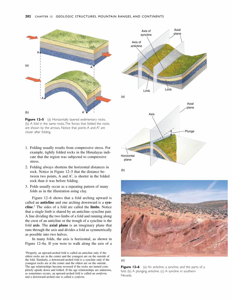
1. Folding usually results from compressive stress. Forexample, tightly folded rocks in the Himalayas indi-cate that the region was subjected to compressivestress.
2. Folding always shortens the horizontal distances inrock. Notice in Figure 12–5 that the distance be-tween two points, A and A′, is shorter in the foldedrock than it was before folding.
3. Folds usually occur as a repeating pattern of manyfolds as in the illustration using clay.
Figure 12–6 shows that a fold arching upward iscalled an anticline and one arching downward is a syn-cline.1 The sides of a fold are called the limbs. Noticethat a single limb is shared by an anticline–syncline pair.A line dividing the two limbs of a fold and running alongthe crest of an anticline or the trough of a syncline is thefold axis. The axial plane is an imaginary plane thatruns through the axis and divides a fold as symmetricallyas possible into two halves.
In many folds, the axis is horizontal, as shown inFigure 12–6a. If you were to walk along the axis of a
Figure 12–6 (a) An anticline, a syncline, and the parts of afold. (b) A plunging anticline. (c) A syncline in southernNevada.
Figure 12–5 (a) Horizontally layered sedimentary rocks.(b) A fold in the same rocks.The forces that folded the rocksare shown by the arrows. Notice that points A and A′ arecloser after folding.
1Properly, an upward-arched fold is called an anticline only if theoldest rocks are in the center and the youngest are on the outside ofthe fold. Similarly, a downward-arched fold is a syncline only if theyoungest rocks are at the center and the oldest are on the outside.The age relationships become reversed if the rocks are turned com-pletely upside down and folded. If the age relationships are unknown,as sometimes occurs, an upward-arched fold is called an antiform,and a downward-arched one is called a synform.
202 CHAPTER 12 GEOLOGIC STRUCTURES, MOUNTAIN RANGES, AND CONTINENTS
(a)
(b)
A
A
A�
A�
Axis ofsyncline
Axis ofanticline
Axialplane
Limb Limb
(a)
(c)
Axis
Axialplane
Plunge
Horizontalplane
(b)
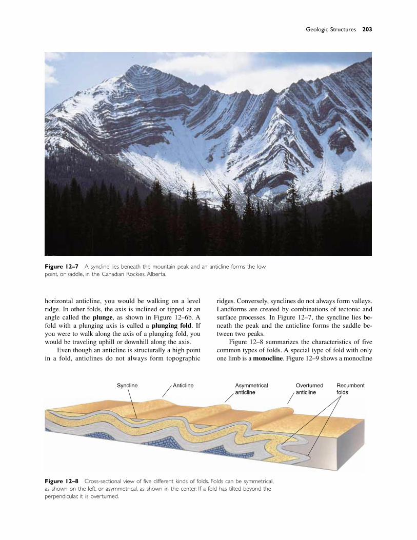
horizontal anticline, you would be walking on a levelridge. In other folds, the axis is inclined or tipped at anangle called the plunge, as shown in Figure 12–6b. Afold with a plunging axis is called a plunging fold. Ifyou were to walk along the axis of a plunging fold, youwould be traveling uphill or downhill along the axis.
Even though an anticline is structurally a high pointin a fold, anticlines do not always form topographic
ridges. Conversely, synclines do not always form valleys.Landforms are created by combinations of tectonic andsurface processes. In Figure 12–7, the syncline lies be-neath the peak and the anticline forms the saddle be-tween two peaks.
Figure 12–8 summarizes the characteristics of fivecommon types of folds. A special type of fold with onlyone limb is a monocline. Figure 12–9 shows a monocline
Geologic Structures 203
Figure 12–7 A syncline lies beneath the mountain peak and an anticline forms the lowpoint, or saddle, in the Canadian Rockies, Alberta.
Figure 12–8 Cross-sectional view of five different kinds of folds. Folds can be symmetrical,as shown on the left, or asymmetrical, as shown in the center. If a fold has tilted beyond theperpendicular, it is overturned.
Syncline Anticline Asymmetricalanticline
Overturnedanticline
Recumbentfolds
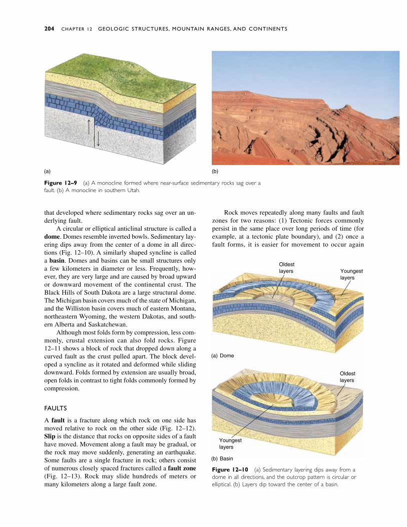
Figure 12–10 (a) Sedimentary layering dips away from adome in all directions, and the outcrop pattern is circular orelliptical. (b) Layers dip toward the center of a basin.
that developed where sedimentary rocks sag over an un-derlying fault.
A circular or elliptical anticlinal structure is called adome. Domes resemble inverted bowls. Sedimentary lay-ering dips away from the center of a dome in all direc-tions (Fig. 12–10). A similarly shaped syncline is calleda basin. Domes and basins can be small structures onlya few kilometers in diameter or less. Frequently, how-ever, they are very large and are caused by broad upwardor downward movement of the continental crust. TheBlack Hills of South Dakota are a large structural dome.The Michigan basin covers much of the state of Michigan,and the Williston basin covers much of eastern Montana,northeastern Wyoming, the western Dakotas, and south-ern Alberta and Saskatchewan.
Although most folds form by compression, less com-monly, crustal extension can also fold rocks. Figure12–11 shows a block of rock that dropped down along acurved fault as the crust pulled apart. The block devel-oped a syncline as it rotated and deformed while slidingdownward. Folds formed by extension are usually broad,open folds in contrast to tight folds commonly formed bycompression.
FAULTS
A fault is a fracture along which rock on one side hasmoved relative to rock on the other side (Fig. 12–12).Slip is the distance that rocks on opposite sides of a faulthave moved. Movement along a fault may be gradual, orthe rock may move suddenly, generating an earthquake.Some faults are a single fracture in rock; others consistof numerous closely spaced fractures called a fault zone(Fig. 12–13). Rock may slide hundreds of meters ormany kilometers along a large fault zone.
Rock moves repeatedly along many faults and faultzones for two reasons: (1) Tectonic forces commonlypersist in the same place over long periods of time (forexample, at a tectonic plate boundary), and (2) once afault forms, it is easier for movement to occur again
204 CHAPTER 12 GEOLOGIC STRUCTURES, MOUNTAIN RANGES, AND CONTINENTS
Dome
Oldestlayers
Youngestlayers
Basin
Oldestlayers
Youngestlayers
(a)
(b)
(a) (b)
Figure 12–9 (a) A monocline formed where near-surface sedimentary rocks sag over afault. (b) A monocline in southern Utah.
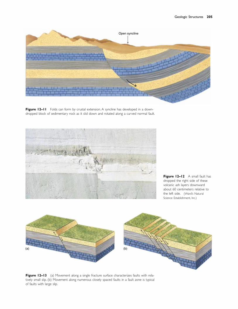
Figure 12–13 (a) Movement along a single fracture surface characterizes faults with rela-tively small slip. (b) Movement along numerous closely spaced faults in a fault zone is typicalof faults with large slip.
Figure 12–11 Folds can form by crustal extension. A syncline has developed in a down-dropped block of sedimentary rock as it slid down and rotated along a curved normal fault.
Figure 12–12 A small fault hasdropped the right side of thesevolcanic ash layers downwardabout 60 centimeters relative tothe left side. (Ward’s NaturalScience Establishment, Inc.)
Geologic Structures 205
(a) (b)
Open syncline
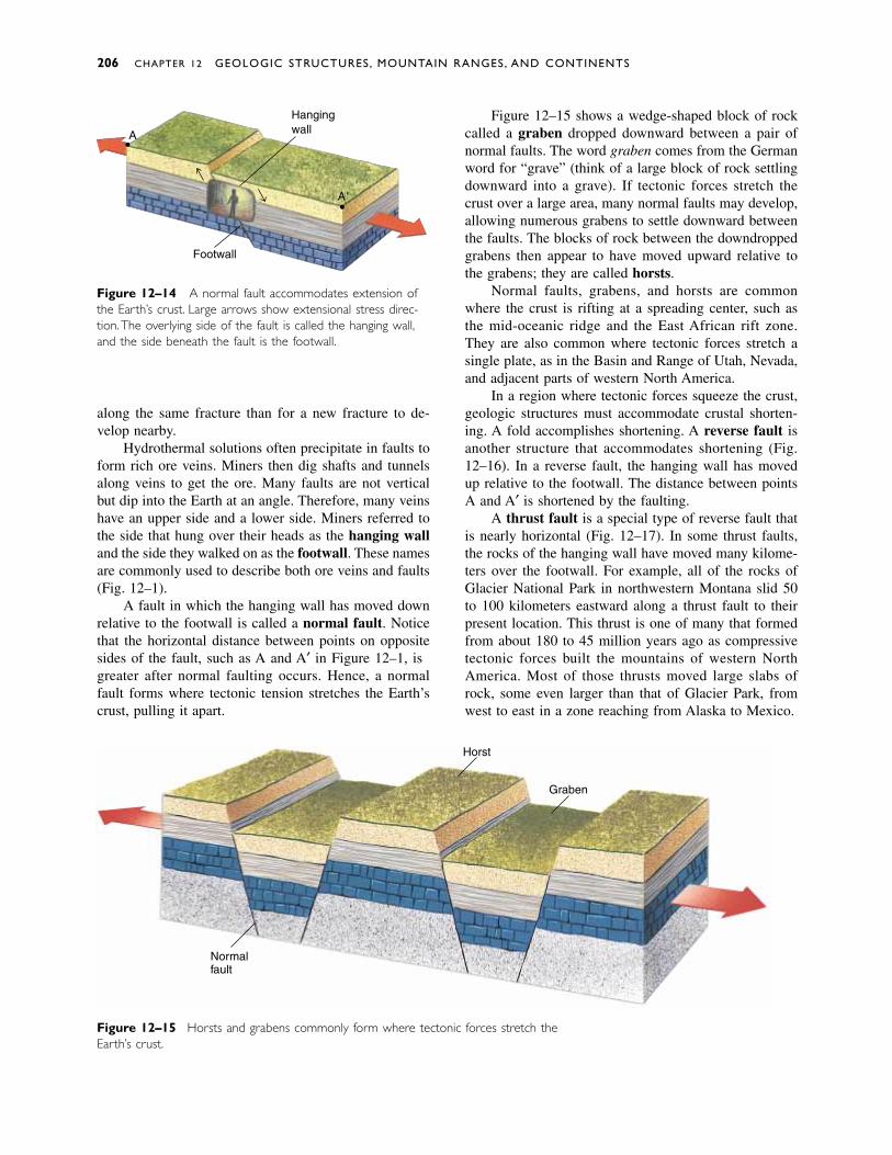
Figure 12–15 Horsts and grabens commonly form where tectonic forces stretch theEarth’s crust.
Figure 12–14 A normal fault accommodates extension ofthe Earth’s crust. Large arrows show extensional stress direc-tion.The overlying side of the fault is called the hanging wall,and the side beneath the fault is the footwall.
along the same fracture than for a new fracture to de-velop nearby.
Hydrothermal solutions often precipitate in faults toform rich ore veins. Miners then dig shafts and tunnelsalong veins to get the ore. Many faults are not verticalbut dip into the Earth at an angle. Therefore, many veinshave an upper side and a lower side. Miners referred tothe side that hung over their heads as the hanging walland the side they walked on as the footwall. These namesare commonly used to describe both ore veins and faults(Fig. 12–14).
A fault in which the hanging wall has moved downrelative to the footwall is called a normal fault. Noticethat the horizontal distance between points on oppositesides of the fault, such as A and A′ in Figure 12–14, isgreater after normal faulting occurs. Hence, a normalfault forms where tectonic tension stretches the Earth’scrust, pulling it apart.
Figure 12–15 shows a wedge-shaped block of rockcalled a graben dropped downward between a pair ofnormal faults. The word graben comes from the Germanword for “grave” (think of a large block of rock settlingdownward into a grave). If tectonic forces stretch thecrust over a large area, many normal faults may develop,allowing numerous grabens to settle downward betweenthe faults. The blocks of rock between the downdroppedgrabens then appear to have moved upward relative tothe grabens; they are called horsts.
Normal faults, grabens, and horsts are commonwhere the crust is rifting at a spreading center, such asthe mid-oceanic ridge and the East African rift zone.They are also common where tectonic forces stretch asingle plate, as in the Basin and Range of Utah, Nevada,and adjacent parts of western North America.
In a region where tectonic forces squeeze the crust,geologic structures must accommodate crustal shorten-ing. A fold accomplishes shortening. A reverse fault isanother structure that accommodates shortening (Fig.12–16). In a reverse fault, the hanging wall has movedup relative to the footwall. The distance between pointsA and A′ is shortened by the faulting.
A thrust fault is a special type of reverse fault thatis nearly horizontal (Fig. 12–17). In some thrust faults,the rocks of the hanging wall have moved many kilome-ters over the footwall. For example, all of the rocks ofGlacier National Park in northwestern Montana slid 50to 100 kilometers eastward along a thrust fault to theirpresent location. This thrust is one of many that formedfrom about 180 to 45 million years ago as compressivetectonic forces built the mountains of western NorthAmerica. Most of those thrusts moved large slabs ofrock, some even larger than that of Glacier Park, fromwest to east in a zone reaching from Alaska to Mexico.
206 CHAPTER 12 GEOLOGIC STRUCTURES, MOUNTAIN RANGES, AND CONTINENTS
Footwall
HangingwallA
A�
Horst
Graben
Normalfault

Figure 12–17 (a) A thrust fault is a low-angle reverse fault.(b) A small thrust fault near Flagstaff, Arizona. (Ward’s NaturalScience Establishment, Inc.)
Figure 12–16 (a) A reverse fault accommodates crustalshortening and reflects squeezing of the crust, shown by largearrows. (b) A small reverse fault in Zion National Park, Utah.
Figure 12–18 A strike–slip fault is nearly vertical, but move-ment along the fault is horizontal. The large arrows show di-rection of movement.
A strike–slip fault is one in which the fracture isvertical, or nearly so, and rocks on opposite sides of thefracture move horizontally past each other (Fig. 12–18).A transform plate boundary is a strike–slip fault. As ex-plained previously, the famous San Andreas fault zone isa zone of strike–slip faults that form the border betweenthe Pacific plate and the North American plate.
JOINTS
A joint is a fracture in rock and is therefore similar to afault, except that in a joint rocks on either side of thefracture have not moved. We have already discussedcolumnar joints in basalt (Chapter 5) and jointing caused
by unloading and exfoliation (Chapter 6). Tectonic forcesalso fracture rock to form joints (Fig. 12–19). Most rocksnear the Earth’s surface are jointed, but joints becomeless abundant with depth because rocks become moreplastic at deeper levels in the crust.
Geologic Structures 207
A
Reversefault
A
(a)
(b)
(a)
(b)
Strike-slipfault
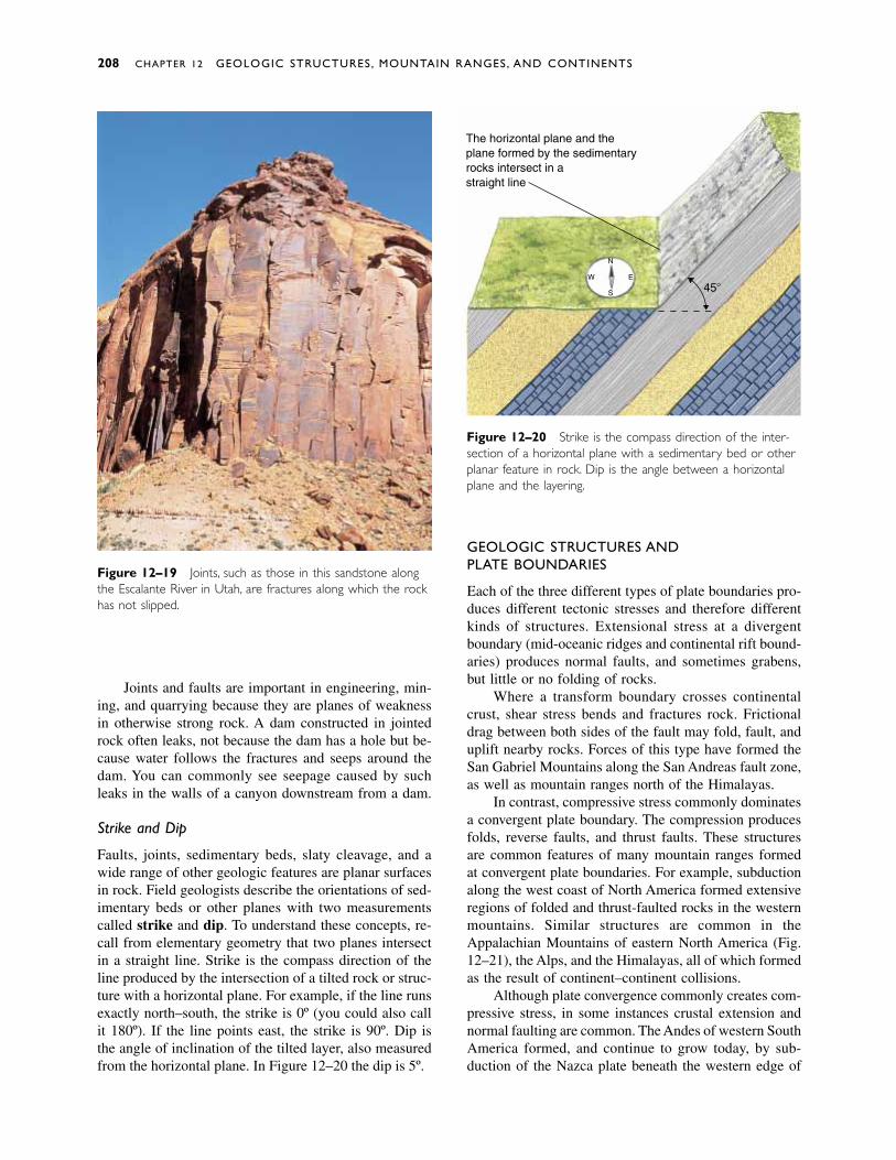
Joints and faults are important in engineering, min-ing, and quarrying because they are planes of weaknessin otherwise strong rock. A dam constructed in jointedrock often leaks, not because the dam has a hole but be-cause water follows the fractures and seeps around thedam. You can commonly see seepage caused by suchleaks in the walls of a canyon downstream from a dam.
Strike and Dip
Faults, joints, sedimentary beds, slaty cleavage, and awide range of other geologic features are planar surfacesin rock. Field geologists describe the orientations of sed-imentary beds or other planes with two measurementscalled strike and dip. To understand these concepts, re-call from elementary geometry that two planes intersectin a straight line. Strike is the compass direction of theline produced by the intersection of a tilted rock or struc-ture with a horizontal plane. For example, if the line runsexactly north–south, the strike is 0º (you could also callit 180º). If the line points east, the strike is 90º. Dip isthe angle of inclination of the tilted layer, also measuredfrom the horizontal plane. In Figure 12–20 the dip is 45º.
GEOLOGIC STRUCTURES AND PLATE BOUNDARIES
Each of the three different types of plate boundaries pro-duces different tectonic stresses and therefore differentkinds of structures. Extensional stress at a divergentboundary (mid-oceanic ridges and continental rift bound-aries) produces normal faults, and sometimes grabens,but little or no folding of rocks.
Where a transform boundary crosses continentalcrust, shear stress bends and fractures rock. Frictionaldrag between both sides of the fault may fold, fault, anduplift nearby rocks. Forces of this type have formed theSan Gabriel Mountains along the San Andreas fault zone,as well as mountain ranges north of the Himalayas.
In contrast, compressive stress commonly dominatesa convergent plate boundary. The compression producesfolds, reverse faults, and thrust faults. These structuresare common features of many mountain ranges formedat convergent plate boundaries. For example, subductionalong the west coast of North America formed extensiveregions of folded and thrust-faulted rocks in the westernmountains. Similar structures are common in theAppalachian Mountains of eastern North America (Fig.12–21), the Alps, and the Himalayas, all of which formedas the result of continent–continent collisions.
Although plate convergence commonly creates com-pressive stress, in some instances crustal extension andnormal faulting are common. The Andes of western SouthAmerica formed, and continue to grow today, by sub-duction of the Nazca plate beneath the western edge of
208 CHAPTER 12 GEOLOGIC STRUCTURES, MOUNTAIN RANGES, AND CONTINENTS
Figure 12–20 Strike is the compass direction of the inter-section of a horizontal plane with a sedimentary bed or otherplanar feature in rock. Dip is the angle between a horizontalplane and the layering.
Figure 12–19 Joints, such as those in this sandstone alongthe Escalante River in Utah, are fractures along which the rockhas not slipped.
The horizontal plane and theplane formed by the sedimentaryrocks intersect in astraight line
N
E
S
W
45�
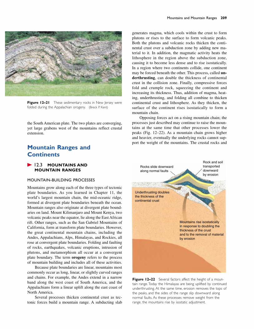
the South American plate. The two plates are converging,yet large grabens west of the mountains reflect crustalextension.
Mountain Ranges andContinents
� 12.3 MOUNTAINS AND MOUNTAIN RANGES
MOUNTAIN-BUILDING PROCESSES
Mountains grow along each of the three types of tectonicplate boundaries. As you learned in Chapter 11, theworld’s largest mountain chain, the mid-oceanic ridge,formed at divergent plate boundaries beneath the ocean.Mountain ranges also originate at divergent plate bound-aries on land. Mount Kilimanjaro and Mount Kenya, twovolcanic peaks near the equator, lie along the East Africanrift. Other ranges, such as the San Gabriel Mountains ofCalifornia, form at transform plate boundaries. However,the great continental mountain chains, including theAndes, Appalachians, Alps, Himalayas, and Rockies, allrose at convergent plate boundaries. Folding and faultingof rocks, earthquakes, volcanic eruptions, intrusion ofplutons, and metamorphism all occur at a convergentplate boundary. The term orogeny refers to the processof mountain building and includes all of these activities.
Because plate boundaries are linear, mountains mostcommonly occur as long, linear, or slightly curved rangesand chains. For example, the Andes extend in a narrowband along the west coast of South America, and theAppalachians form a linear uplift along the east coast ofNorth America.
Several processes thicken continental crust as tec-tonic forces build a mountain range. A subducting slab
generates magma, which cools within the crust to formplutons or rises to the surface to form volcanic peaks.Both the plutons and volcanic rocks thicken the conti-nental crust over a subduction zone by adding new ma-terial to it. In addition, the magmatic activity heats thelithosphere in the region above the subduction zone,causing it to become less dense and to rise isostatically.In a region where two continents collide, one continentmay be forced beneath the other. This process, called un-derthrusting, can double the thickness of continentalcrust in the collision zone. Finally, compressive forcesfold and crumple rock, squeezing the continent and increasing its thickness. Thus, addition of magma, heat-ing, underthrusting, and folding all combine to thickencontinental crust and lithosphere. As they thicken, thesurface of the continent rises isostatically to form a mountain chain.
Opposing forces act on a rising mountain chain; theprocesses just described may continue to raise the moun-tains at the same time that other processes lower thepeaks (Fig. 12–22). As a mountain chain grows higherand heavier, eventually the underlying rocks cannot sup-port the weight of the mountains. The crustal rocks and
Mountains and Mountain Ranges 209
Figure 12–21 These sedimentary rocks in New Jersey werefolded during the Appalachian orogeny. (Breck P. Kent)
Rocks slide downwardalong normal faults
Rock and soiltransporteddownwardby erosion
Underthrusting doublesthe thickness of the continental crust
Mountains rise isostaticallyin response to doubling thethickness of the crustand to the removal of materialby erosion
Figure 12–22 Several factors affect the height of a moun-tain range.Today the Himalayas are being uplifted by continuedunderthrusting. At the same time, erosion removes the tops ofthe peaks, and the sides of the range slip downward alongnormal faults. As these processes remove weight from therange, the mountains rise by isostatic adjustment.
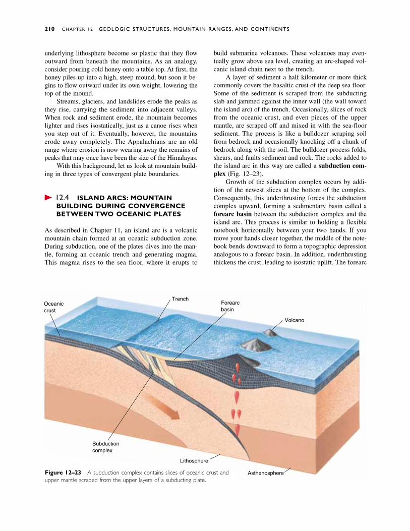
underlying lithosphere become so plastic that they flowoutward from beneath the mountains. As an analogy,consider pouring cold honey onto a table top. At first, thehoney piles up into a high, steep mound, but soon it be-gins to flow outward under its own weight, lowering thetop of the mound.
Streams, glaciers, and landslides erode the peaks asthey rise, carrying the sediment into adjacent valleys.When rock and sediment erode, the mountain becomeslighter and rises isostatically, just as a canoe rises whenyou step out of it. Eventually, however, the mountainserode away completely. The Appalachians are an oldrange where erosion is now wearing away the remains ofpeaks that may once have been the size of the Himalayas.
With this background, let us look at mountain build-ing in three types of convergent plate boundaries.
� 12.4 ISLAND ARCS: MOUNTAIN BUILDING DURING CONVERGENCEBETWEEN TWO OCEANIC PLATES
As described in Chapter 11, an island arc is a volcanicmountain chain formed at an oceanic subduction zone.During subduction, one of the plates dives into the man-tle, forming an oceanic trench and generating magma.This magma rises to the sea floor, where it erupts to
build submarine volcanoes. These volcanoes may even-tually grow above sea level, creating an arc-shaped vol-canic island chain next to the trench.
A layer of sediment a half kilometer or more thickcommonly covers the basaltic crust of the deep sea floor.Some of the sediment is scraped from the subductingslab and jammed against the inner wall (the wall towardthe island arc) of the trench. Occasionally, slices of rockfrom the oceanic crust, and even pieces of the uppermantle, are scraped off and mixed in with the sea-floorsediment. The process is like a bulldozer scraping soilfrom bedrock and occasionally knocking off a chunk ofbedrock along with the soil. The bulldozer process folds,shears, and faults sediment and rock. The rocks added tothe island arc in this way are called a subduction com-plex (Fig. 12–23).
Growth of the subduction complex occurs by addi-tion of the newest slices at the bottom of the complex.Consequently, this underthrusting forces the subductioncomplex upward, forming a sedimentary basin called aforearc basin between the subduction complex and theisland arc. This process is similar to holding a flexiblenotebook horizontally between your two hands. If youmove your hands closer together, the middle of the note-book bends downward to form a topographic depressionanalogous to a forearc basin. In addition, underthrustingthickens the crust, leading to isostatic uplift. The forearc
210 CHAPTER 12 GEOLOGIC STRUCTURES, MOUNTAIN RANGES, AND CONTINENTS
Oceaniccrust
Forearcbasin
Trench
Volcano
Subductioncomplex
Lithosphere
AsthenosphereFigure 12–23 A subduction complex contains slices of oceanic crust andupper mantle scraped from the upper layers of a subducting plate.
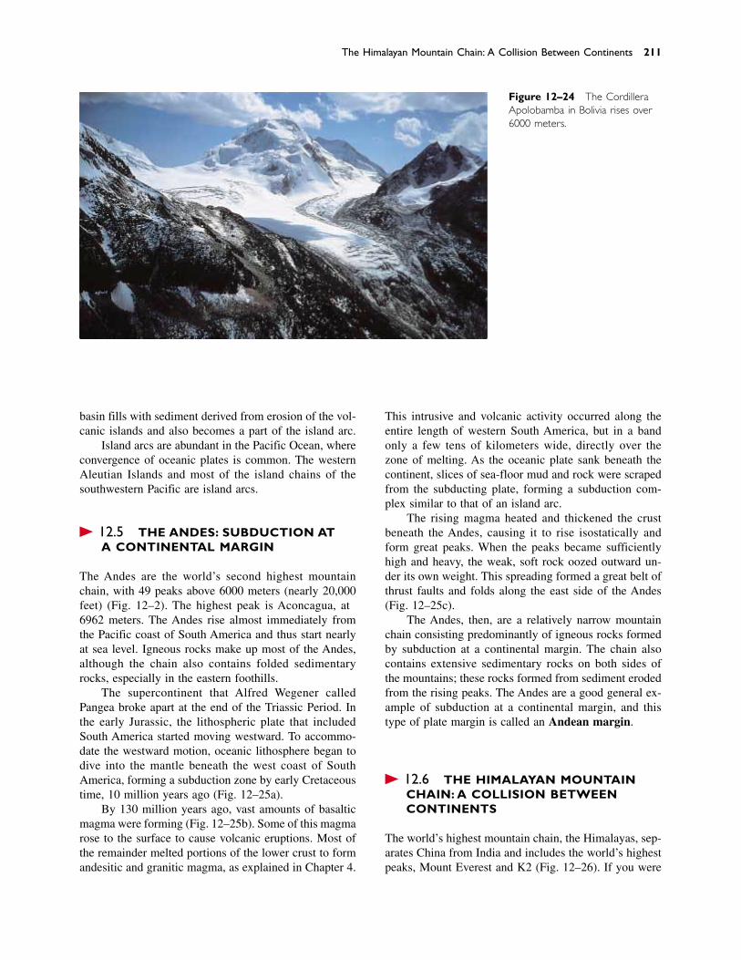
basin fills with sediment derived from erosion of the vol-canic islands and also becomes a part of the island arc.
Island arcs are abundant in the Pacific Ocean, whereconvergence of oceanic plates is common. The westernAleutian Islands and most of the island chains of thesouthwestern Pacific are island arcs.
� 12.5 THE ANDES: SUBDUCTION AT A CONTINENTAL MARGIN
The Andes are the world’s second highest mountainchain, with 49 peaks above 6000 meters (nearly 20,000feet) (Fig. 12–24). The highest peak is Aconcagua, at6962 meters. The Andes rise almost immediately fromthe Pacific coast of South America and thus start nearlyat sea level. Igneous rocks make up most of the Andes,although the chain also contains folded sedimentaryrocks, especially in the eastern foothills.
The supercontinent that Alfred Wegener calledPangea broke apart at the end of the Triassic Period. Inthe early Jurassic, the lithospheric plate that includedSouth America started moving westward. To accommo-date the westward motion, oceanic lithosphere began todive into the mantle beneath the west coast of SouthAmerica, forming a subduction zone by early Cretaceoustime, 140 million years ago (Fig. 12–25a).
By 130 million years ago, vast amounts of basalticmagma were forming (Fig. 12–25b). Some of this magmarose to the surface to cause volcanic eruptions. Most ofthe remainder melted portions of the lower crust to formandesitic and granitic magma, as explained in Chapter 4.
This intrusive and volcanic activity occurred along theentire length of western South America, but in a bandonly a few tens of kilometers wide, directly over thezone of melting. As the oceanic plate sank beneath thecontinent, slices of sea-floor mud and rock were scrapedfrom the subducting plate, forming a subduction com-plex similar to that of an island arc.
The rising magma heated and thickened the crustbeneath the Andes, causing it to rise isostatically andform great peaks. When the peaks became sufficientlyhigh and heavy, the weak, soft rock oozed outward un-der its own weight. This spreading formed a great belt ofthrust faults and folds along the east side of the Andes(Fig. 12–25c).
The Andes, then, are a relatively narrow mountainchain consisting predominantly of igneous rocks formedby subduction at a continental margin. The chain alsocontains extensive sedimentary rocks on both sides ofthe mountains; these rocks formed from sediment erodedfrom the rising peaks. The Andes are a good general ex-ample of subduction at a continental margin, and thistype of plate margin is called an Andean margin.
� 12.6 THE HIMALAYAN MOUNTAIN CHAIN: A COLLISION BETWEEN CONTINENTS
The world’s highest mountain chain, the Himalayas, sep-arates China from India and includes the world’s highestpeaks, Mount Everest and K2 (Fig. 12–26). If you were
The Himalayan Mountain Chain: A Collision Between Continents 211
Figure 12–24 The CordilleraApolobamba in Bolivia rises over6000 meters.
to stand on the southern edge of the Tibetan Plateau andlook southward, you would see the high peaks of theHimalayas. Beyond this great mountain chain lie therainforests and hot, dry plains of the Indian subconti-
nent. If you had been able to stand in the same place 100million years ago and look southward, you would haveseen only ocean. At that time, India was located south ofthe equator, separated from Tibet by thousands of kilo-
212 CHAPTER 12 GEOLOGIC STRUCTURES, MOUNTAIN RANGES, AND CONTINENTS
Figure 12–25 Development of the Andes, seen in cross section looking northward. (a) Asthe South American lithospheric plate moved westward in early Cretaceous time, about 140million years ago, a subduction zone and a trench formed at the west coast of the continent.(b) By 130 million years ago, igneous activity began and a subduction complex and forearcbasin formed. (c) In late Cretaceous time, the trench and region of igneous activity had bothmigrated eastward. Old volcanoes became dormant and new ones formed to the east.
(a) Cretaceous 140 million years ago
(b) Cretaceous 130 million years ago
(c) Late Cretaceous 90 million years ago
Sea levelOceanic crust Trench
South Americancontinental crust
Lithosphere
Asthenosphere
Subductioncomplex
Forearcbasin
Magmaticarc
Zone of melting
New magmatic arc
Old magmatic arc rocks
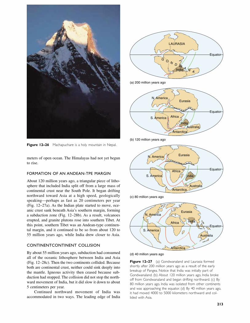
meters of open ocean. The Himalayas had not yet begunto rise.
FORMATION OF AN ANDEAN-TYPE MARGIN
About 120 million years ago, a triangular piece of litho-sphere that included India split off from a large mass ofcontinental crust near the South Pole. It began driftingnorthward toward Asia at a high speed, geologicallyspeaking—perhaps as fast as 20 centimeters per year(Fig. 12–27a). As the Indian plate started to move, oce-anic crust sank beneath Asia’s southern margin, forminga subduction zone (Fig. 12–28b). As a result, volcanoeserupted, and granite plutons rose into southern Tibet. Atthis point, southern Tibet was an Andean-type continen-tal margin, and it continued to be so from about 120 to55 million years ago, while India drew closer to Asia.
CONTINENT–CONTINENT COLLISION
By about 55 million years ago, subduction had consumedall of the oceanic lithosphere between India and Asia(Fig. 12–28c). Then the two continents collided. Becauseboth are continental crust, neither could sink deeply intothe mantle. Igneous activity then ceased because sub-duction had stopped. The collision did not stop the north-ward movement of India, but it did slow it down to about5 centimeters per year.
Continued northward movement of India was accommodated in two ways. The leading edge of India
Figure 12–27 (a) Gondwanaland and Laurasia formedshortly after 200 million years ago as a result of the earlybreakup of Pangea. Notice that India was initially part ofGondwanaland. (b) About 120 million years ago, India brokeoff from Gondwanaland and began drifting northward. (c) By80 million years ago, India was isolated from other continentsand was approaching the equator. (d) By 40 million years ago,it had moved 4000 to 5000 kilometers northward and col-lided with Asia.
Figure 12–26 Machapuchare is a holy mountain in Nepal.
LAURASIA
G O N D WA N AIndia
Equator
(a) 200 million years ago
N. AmericaEurasia
Africa
Antarctica
S. America
AustraliaIndia
Equator
(b) 120 million years ago
AntarcticaAustralia
Eurasia
AfricaS. America
N. America
India
Equator
(c) 80 million years ago
IndiaAfrica
Antarctica
Australia
S. America
N. AmericaEurasia
Equator
(d) 40 million years ago
213
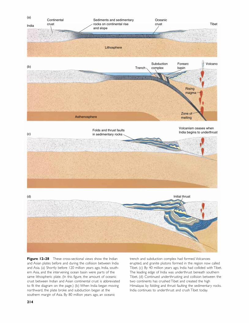
Figure 12–28 These cross-sectional views show the Indianand Asian plates before and during the collision between Indiaand Asia. (a) Shortly before 120 million years ago, India, south-ern Asia, and the intervening ocean basin were parts of thesame lithospheric plate. (In this figure, the amount of oceaniccrust between Indian and Asian continental crust is abbreviatedto fit the diagram on the page.) (b) When India began movingnorthward, the plate broke and subduction began at thesouthern margin of Asia. By 80 million years ago, an oceanic
trench and subduction complex had formed.Volcanoeserupted, and granite plutons formed in the region now calledTibet. (c) By 40 million years ago, India had collided with Tibet.The leading edge of India was underthrust beneath southernTibet. (d) Continued underthrusting and collision between thetwo continents has crushed Tibet and created the highHimalayas by folding and thrust faulting the sedimentary rocks.India continues to underthrust and crush Tibet today.
(a)
India
Continentalcrust
Sediments and sedimentaryrocks on continental riseand slope
Oceaniccrust Tibet
Lithosphere
(b)
Asthenosphere
TrenchSubductioncomplex
Forearcbasin
Volcano
Risingmagma
Zone ofmelting
Folds and thrust faultsin sedimentary rocks
Volcanism ceases whenIndia begins to underthrust(c)
Initial thrust(d)
214
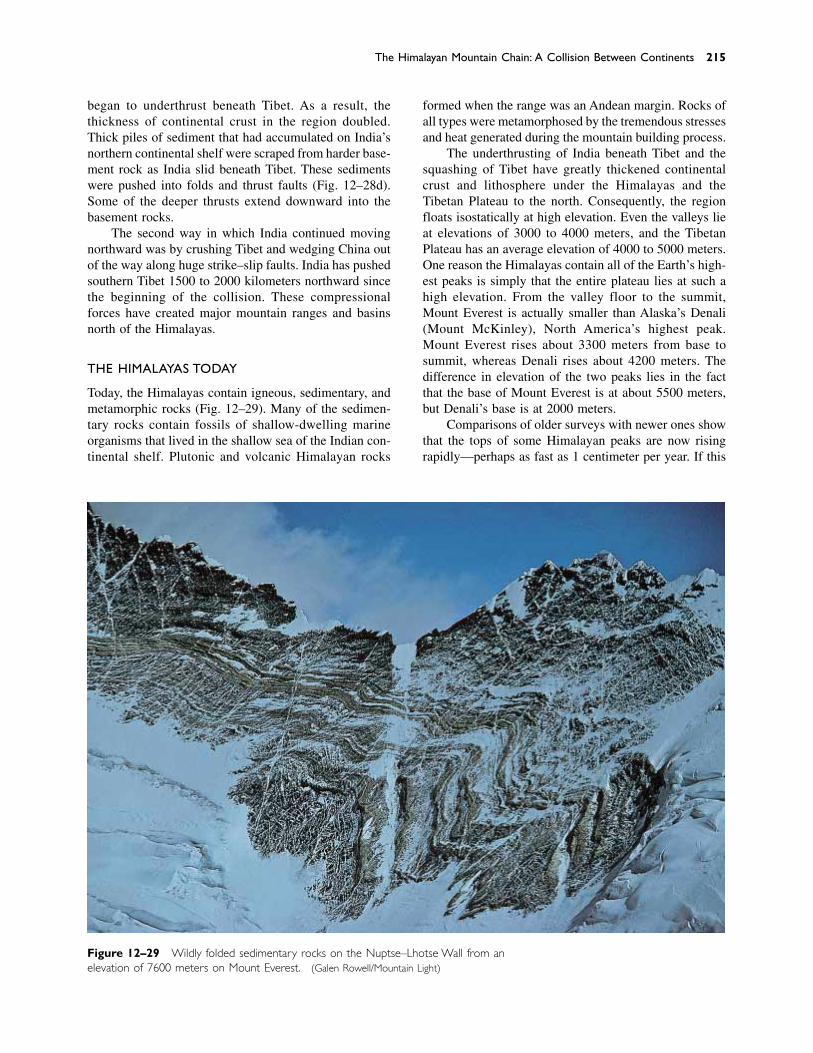
began to underthrust beneath Tibet. As a result, the thickness of continental crust in the region doubled.Thick piles of sediment that had accumulated on India’snorthern continental shelf were scraped from harder base-ment rock as India slid beneath Tibet. These sedimentswere pushed into folds and thrust faults (Fig. 12–28d).Some of the deeper thrusts extend downward into thebasement rocks.
The second way in which India continued movingnorthward was by crushing Tibet and wedging China outof the way along huge strike–slip faults. India has pushedsouthern Tibet 1500 to 2000 kilometers northward sincethe beginning of the collision. These compressionalforces have created major mountain ranges and basinsnorth of the Himalayas.
THE HIMALAYAS TODAY
Today, the Himalayas contain igneous, sedimentary, andmetamorphic rocks (Fig. 12–29). Many of the sedimen-tary rocks contain fossils of shallow-dwelling marine organisms that lived in the shallow sea of the Indian con-tinental shelf. Plutonic and volcanic Himalayan rocks
formed when the range was an Andean margin. Rocks ofall types were metamorphosed by the tremendous stressesand heat generated during the mountain building process.
The underthrusting of India beneath Tibet and thesquashing of Tibet have greatly thickened continentalcrust and lithosphere under the Himalayas and the Tibetan Plateau to the north. Consequently, the regionfloats isostatically at high elevation. Even the valleys lieat elevations of 3000 to 4000 meters, and the TibetanPlateau has an average elevation of 4000 to 5000 meters.One reason the Himalayas contain all of the Earth’s high-est peaks is simply that the entire plateau lies at such ahigh elevation. From the valley floor to the summit,Mount Everest is actually smaller than Alaska’s Denali(Mount McKinley), North America’s highest peak.Mount Everest rises about 3300 meters from base tosummit, whereas Denali rises about 4200 meters. Thedifference in elevation of the two peaks lies in the factthat the base of Mount Everest is at about 5500 meters,but Denali’s base is at 2000 meters.
Comparisons of older surveys with newer ones showthat the tops of some Himalayan peaks are now risingrapidly—perhaps as fast as 1 centimeter per year. If this
The Himalayan Mountain Chain: A Collision Between Continents 215
Figure 12–29 Wildly folded sedimentary rocks on the Nuptse–Lhotse Wall from anelevation of 7600 meters on Mount Everest. (Galen Rowell/Mountain Light)
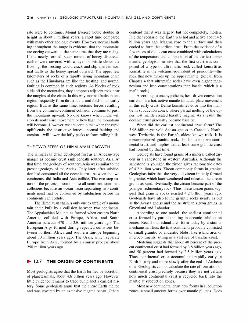
rate were to continue, Mount Everest would double itsheight in about 1 million years, a short time comparedwith many other geologic events. However, normal fault-ing throughout the range is evidence that the mountainsare oozing outward at the same time that they are rising.If the newly formed, steep mound of honey discussedearlier were covered with a layer of brittle chocolatefrosting, the frosting would crack and slip apart in nor-mal faults as the honey spread outward. The upper fewkilometers of rocks of a rapidly rising mountain chainsuch as the Himalayas are like the frosting, and normalfaulting is common in such regions. As blocks of rockslide off the mountains, they compress adjacent rock nearthe margins of the chain. In this way, normal faults in oneregion frequently form thrust faults and folds in a nearbyregion. But, at the same time, tectonic forces resultingfrom the continent–continent collision continue to pushthe mountains upward. No one knows when India willstop its northward movement or how high the mountainswill become. However, we are certain that when the rapiduplift ends, the destructive forces––normal faulting anderosion––will lower the lofty peaks to form rolling hills.
THE TWO STEPS OF HIMALAYAN GROWTH
The Himalayan chain developed first as an Andean-typemargin as oceanic crust sank beneath southern Asia. Atthat time, the geology of southern Asia was similar to thepresent geology of the Andes. Only later, after subduc-tion had consumed all the oceanic crust between the twocontinents, did India and Asia collide. The two-step na-ture of the process is common to all continent–continentcollisions because an ocean basin separating two conti-nents must first be consumed by subduction before thecontinents can collide.
The Himalayan chain is only one example of a moun-tain chain built by a collision between two continents.The Appalachian Mountains formed when eastern NorthAmerica collided with Europe, Africa, and SouthAmerica between 470 and 250 million years ago. TheEuropean Alps formed during repeated collisions be-tween northern Africa and southern Europe beginningabout 30 million years ago. The Urals, which separateEurope from Asia, formed by a similar process about250 million years ago.
� 12.7 THE ORIGIN OF CONTINENTS
Most geologists agree that the Earth formed by accretionof planetesimals, about 4.6 billion years ago. However,little evidence remains to trace our planet’s earliest his-tory. Some geologists argue that the entire Earth meltedand was covered by an extensive magma ocean. Others
contend that it was largely, but not completely, molten.In either scenario, the Earth was hot and active about 4.5billion years ago. Magma rose to the surface and thencooled to form the earliest crust. From the evidence of afew traces of old ocean crust combined with calculationsof the temperature and composition of the earliest uppermantle, geologists surmise that the first crust was com-posed of a type of ultramafic rock called komatiite.Komatiite is the volcanic equivalent of peridotite—therock that now makes up the upper mantle. (Recall fromChapter 4 that ultramafic rocks have even higher mag-nesium and iron concentrations than basalt, which is amafic rock.)
According to one hypothesis, heat-driven convectioncurrents in a hot, active mantle initiated plate movementin this early crust. Dense komatiites dove into the man-tle in subduction zones, where partial melting of the up-permost mantle created basaltic magma. As a result, theoceanic crust gradually became basaltic.
When did the earliest continental crust form? The3.96-billion-year-old Acasta gneiss in Canada’s North-west Territories is the Earth’s oldest known rock. It ismetamorphosed granitic rock, similar to modern conti-nental crust, and implies that at least some granitic crusthad formed by that time.
Geologists have found grains of a mineral called zir-con in a sandstone in western Australia. Although thesandstone is younger, the zircon gives radiometric datesof 4.2 billion years. Zircon commonly forms in granite.Geologists infer that the very old zircon initially formedin granite, which later weathered and released the zircongrains as sand. Eventually, the zircon became part of theyounger sedimentary rock. Thus, these zircon grains sug-gest that granitic rocks existed 4.2 billion years ago.Geologists have also found granitic rocks nearly as oldas the Acasta gneiss and the Australian zircon grains inGreenland and Labrador.
According to one model, the earliest continentalcrust formed by partial melting in oceanic subductionzones. Recall that island arcs form today by a similarmechanism. Thus, the first continents probably consistedof small granitic or andesitic blobs, like island arcs ormicrocontinents, sitting in a vast sea of basaltic crust.
Modeling suggests that about 40 percent of the pres-ent continental crust had formed by 3.8 billion years ago,and 50 percent had formed by 2.5 billion years ago.Thus, continental crust accumulated rapidly early inEarth history and more slowly after the end of Archeantime. Geologists cannot calculate the rate of formation ofcontinental crust precisely because they are not certainhow much continental crust is recycled back into themantle at subduction zones.
Most new continental crust now forms in subductionzones; a small amount forms over mantle plumes. Does
216 CHAPTER 12 GEOLOGIC STRUCTURES, MOUNTAIN RANGES, AND CONTINENTS
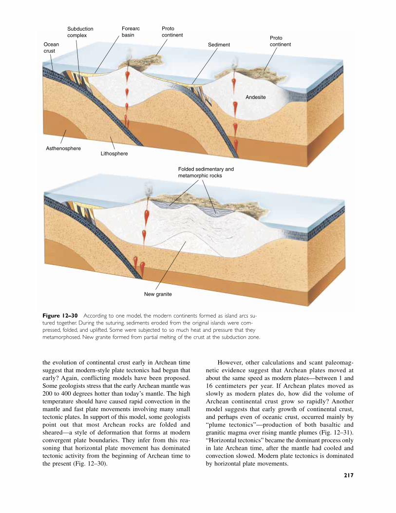
the evolution of continental crust early in Archean timesuggest that modern-style plate tectonics had begun thatearly? Again, conflicting models have been proposed.Some geologists stress that the early Archean mantle was200 to 400 degrees hotter than today’s mantle. The hightemperature should have caused rapid convection in themantle and fast plate movements involving many smalltectonic plates. In support of this model, some geologistspoint out that most Archean rocks are folded andsheared—a style of deformation that forms at modernconvergent plate boundaries. They infer from this rea-soning that horizontal plate movement has dominatedtectonic activity from the beginning of Archean time tothe present (Fig. 12–30).
However, other calculations and scant paleomag-netic evidence suggest that Archean plates moved atabout the same speed as modern plates—between 1 and16 centimeters per year. If Archean plates moved asslowly as modern plates do, how did the volume ofArchean continental crust grow so rapidly? Anothermodel suggests that early growth of continental crust,and perhaps even of oceanic crust, occurred mainly by“plume tectonics”—production of both basaltic andgranitic magma over rising mantle plumes (Fig. 12–31).“Horizontal tectonics” became the dominant process onlyin late Archean time, after the mantle had cooled andconvection slowed. Modern plate tectonics is dominatedby horizontal plate movements.
Subductioncomplex
Oceancrust
Forearcbasin
Protocontinent Proto
continentSediment
Andesite
AsthenosphereLithosphere
Folded sedimentary andmetamorphic rocks
New granite
Figure 12–30 According to one model, the modern continents formed as island arcs su-tured together. During the suturing, sediments eroded from the original islands were com-pressed, folded, and uplifted. Some were subjected to so much heat and pressure that theymetamorphosed. New granite formed from partial melting of the crust at the subduction zone.
217
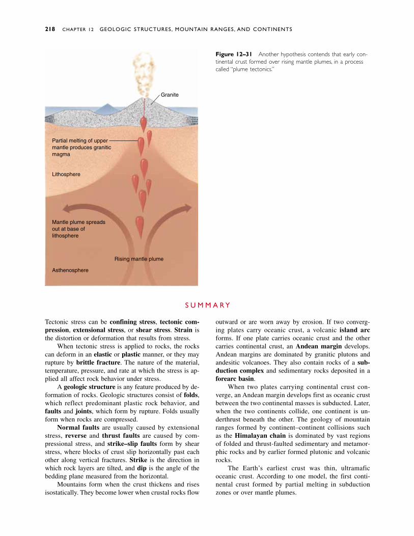
218 CHAPTER 12 GEOLOGIC STRUCTURES, MOUNTAIN RANGES, AND CONTINENTS
Figure 12–31 Another hypothesis contends that early con-tinental crust formed over rising mantle plumes, in a processcalled “plume tectonics.”
Tectonic stress can be confining stress, tectonic com-pression, extensional stress, or shear stress. Strain isthe distortion or deformation that results from stress.
When tectonic stress is applied to rocks, the rockscan deform in an elastic or plastic manner, or they mayrupture by brittle fracture. The nature of the material,temperature, pressure, and rate at which the stress is ap-plied all affect rock behavior under stress.
A geologic structure is any feature produced by de-formation of rocks. Geologic structures consist of folds,which reflect predominant plastic rock behavior, andfaults and joints, which form by rupture. Folds usuallyform when rocks are compressed.
Normal faults are usually caused by extensionalstress, reverse and thrust faults are caused by com-pressional stress, and strike–slip faults form by shearstress, where blocks of crust slip horizontally past eachother along vertical fractures. Strike is the direction inwhich rock layers are tilted, and dip is the angle of thebedding plane measured from the horizontal.
Mountains form when the crust thickens and risesisostatically. They become lower when crustal rocks flow
outward or are worn away by erosion. If two converg-ing plates carry oceanic crust, a volcanic island arcforms. If one plate carries oceanic crust and the othercarries continental crust, an Andean margin develops.Andean margins are dominated by granitic plutons andandesitic volcanoes. They also contain rocks of a sub-duction complex and sedimentary rocks deposited in aforearc basin.
When two plates carrying continental crust con-verge, an Andean margin develops first as oceanic crustbetween the two continental masses is subducted. Later,when the two continents collide, one continent is un-derthrust beneath the other. The geology of mountainranges formed by continent–continent collisions suchas the Himalayan chain is dominated by vast regionsof folded and thrust-faulted sedimentary and metamor-phic rocks and by earlier formed plutonic and volcanicrocks.
The Earth’s earliest crust was thin, ultramaficoceanic crust. According to one model, the first conti-nental crust formed by partial melting in subductionzones or over mantle plumes.
S U M M A R Y
Partial melting of uppermantle produces graniticmagma
Lithosphere
Mantle plume spreadsout at base oflithosphere
Rising mantle plume
Asthenosphere
Granite
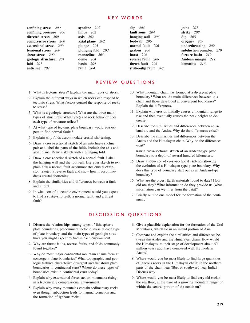
confining stress 200confining pressure 200directed stress 200compressive stress 200extensional stress 200tensional stress 200shear stress 200geologic structure 201fold 201anticline 202
syncline 202limbs 202axis 202axial plane 202plunge 203plunging fold 203monocline 203dome 204basin 204fault 204
slip 204fault zone 204hanging wall 206footwall 206normal fault 206graben 206horst 206reverse fault 206thrust fault 206strike–slip fault 207
joint 207strike 208dip 208orogeny 209underthrusting 209subduction complex 210forearc basin 210Andean margin 211komatiite 216
K E Y W O R D S
1. What is tectonic stress? Explain the main types of stress.
2. Explain the different ways in which rocks can respond totectonic stress. What factors control the response of rocksto stress?
3. What is a geologic structure? What are the three maintypes of structures? What type(s) of rock behavior doeseach type of structure reflect?
4. At what type of tectonic plate boundary would you ex-pect to find normal faults?
5. Explain why folds accommodate crustal shortening.
6. Draw a cross-sectional sketch of an anticline–synclinepair and label the parts of the folds. Include the axis andaxial plane. Draw a sketch with a plunging fold.
7. Draw a cross-sectional sketch of a normal fault. Labelthe hanging wall and the footwall. Use your sketch to ex-plain how a normal fault accommodates crustal exten-sion. Sketch a reverse fault and show how it accommo-dates crustal shortening.
8. Explain the similarities and differences between a faultand a joint.
9. In what sort of a tectonic environment would you expectto find a strike–slip fault, a normal fault, and a thrustfault?
10. What mountain chain has formed at a divergent plateboundary? What are the main differences between thischain and those developed at convergent boundaries?Explain the differences.
11. Explain why erosion initially causes a mountain range torise and then eventually causes the peak heights to de-crease.
12. Describe the similarities and differences between an is-land arc and the Andes. Why do the differences exist?
13. Describe the similarities and differences between theAndes and the Himalayan chain. Why do the differencesexist?
14. Draw a cross-sectional sketch of an Andean-type plateboundary to a depth of several hundred kilometers.
15. Draw a sequence of cross-sectional sketches showing the evolution of a Himalayan-type plate boundary. Whydoes this type of boundary start out as an Andean-typeboundary?
16. What are the oldest Earth materials found to date? Howold are they? What information do they provide us (whatinformation can we infer from the data)?
17. Briefly outline one model for the formation of the conti-nents.
R E V I E W Q U E S T I O N S
1. Discuss the relationships among types of lithosphericplate boundaries, predominant tectonic stress at each typeof plate boundary, and the main types of geologic struc-tures you might expect to find in each environment.
2. Why are thrust faults, reverse faults, and folds commonlyfound together?
3. Why do most major continental mountain chains form atconvergent plate boundaries? What topographic and geo-logic features characterize divergent and transform plateboundaries in continental crust? Where do these types ofboundaries exist in continental crust today?
4. Explain why extensional forces act on mountains risingin a tectonically compressional environment.
5. Explain why many mountains contain sedimentary rockseven though subduction leads to magma formation andthe formation of igneous rocks.
6. Give a plausible explanation for the formation of the UralMountains, which lie in an inland portion of Asia.
7. Compare and explain the similarities and differences be-tween the Andes and the Himalayan chain. How wouldthe Himalayas, at their stage of development about 60million years ago, have compared with the modernAndes?
8. Where would you be most likely to find large quantitiesof igneous rocks in the Himalayan chain: in the northernparts of the chain near Tibet or southward near India?Discuss why.
9. Where would you be most likely to find very old rocks:the sea floor, at the base of a growing mountain range, orwithin the central portion of the continent?
D I S C U S S I O N Q U E S T I O N S
219

very year, small landslides destroy homes and farm-land. Occasionally, an enormous landslide buries a
town or city, killing thousands of people. Landslides causebillions of dollars in damage every year, about equal to thedamage caused by earthquakes in 20 years. In many in-stances, losses occur because people do not recognizedangers that are obvious to a geologist.
Consider three recent landslides that have affectedhumans:
1. A movie star builds a mansion on the edge of a picturesque California cliff. After a few years, thecliff collapses and the house slides into the valley(Fig. 13–1a).
2. A ditch carrying irrigation water across a hillside inMontana leaks water into the ground. After years of seepage, the muddy soil slides downslope andpiles against a house at the bottom of the hill (Fig. 13–1b).
3. Excavations for roads and high-rise buildings under-cut the base of a steep hillside in Hong Kong.Suddenly, the slope slides, destroying everything inits path (Fig. 13–1c).
C H A P T E R
13Mass Wasting
E

221
A landslide on steep, unstable slopes destroyed these expensiveapartments and office buildings in Hong Kong. (Hong Kong Govern-ment Information Services)
221
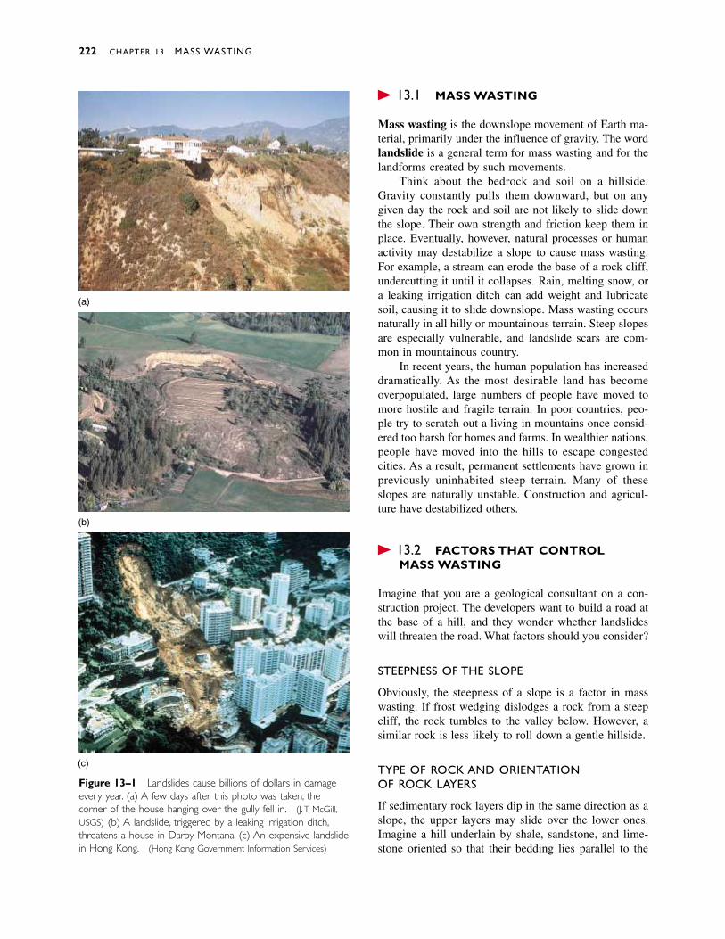
� 13.1 MASS WASTING
Mass wasting is the downslope movement of Earth ma-terial, primarily under the influence of gravity. The wordlandslide is a general term for mass wasting and for thelandforms created by such movements.
Think about the bedrock and soil on a hillside.Gravity constantly pulls them downward, but on anygiven day the rock and soil are not likely to slide downthe slope. Their own strength and friction keep them inplace. Eventually, however, natural processes or humanactivity may destabilize a slope to cause mass wasting.For example, a stream can erode the base of a rock cliff,undercutting it until it collapses. Rain, melting snow, ora leaking irrigation ditch can add weight and lubricatesoil, causing it to slide downslope. Mass wasting occursnaturally in all hilly or mountainous terrain. Steep slopesare especially vulnerable, and landslide scars are com-mon in mountainous country.
In recent years, the human population has increaseddramatically. As the most desirable land has becomeoverpopulated, large numbers of people have moved tomore hostile and fragile terrain. In poor countries, peo-ple try to scratch out a living in mountains once consid-ered too harsh for homes and farms. In wealthier nations,people have moved into the hills to escape congestedcities. As a result, permanent settlements have grown inpreviously uninhabited steep terrain. Many of theseslopes are naturally unstable. Construction and agricul-ture have destabilized others.
� 13.2 FACTORS THAT CONTROL MASS WASTING
Imagine that you are a geological consultant on a con-struction project. The developers want to build a road atthe base of a hill, and they wonder whether landslideswill threaten the road. What factors should you consider?
STEEPNESS OF THE SLOPE
Obviously, the steepness of a slope is a factor in masswasting. If frost wedging dislodges a rock from a steepcliff, the rock tumbles to the valley below. However, asimilar rock is less likely to roll down a gentle hillside.
TYPE OF ROCK AND ORIENTATION OF ROCK LAYERS
If sedimentary rock layers dip in the same direction as aslope, the upper layers may slide over the lower ones.Imagine a hill underlain by shale, sandstone, and lime-stone oriented so that their bedding lies parallel to the
222 CHAPTER 13 MASS WASTING
(a)
(b)
(c)
Figure 13–1 Landslides cause billions of dollars in damageevery year. (a) A few days after this photo was taken, thecorner of the house hanging over the gully fell in. (J.T. McGill,USGS) (b) A landslide, triggered by a leaking irrigation ditch,threatens a house in Darby, Montana. (c) An expensive landslidein Hong Kong. (Hong Kong Government Information Services)
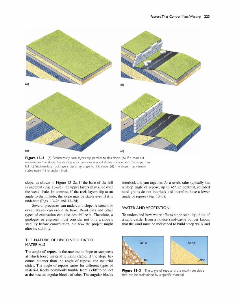
slope, as shown in Figure 13–2a. If the base of the hillis undercut (Fig. 13–2b), the upper layers may slide overthe weak shale. In contrast, if the rock layers dip at anangle to the hillside, the slope may be stable even if it isundercut (Figs. 13–2c and 13–2d).
Several processes can undercut a slope. A stream orocean waves can erode its base. Road cuts and othertypes of excavation can also destabilize it. Therefore, ageologist or engineer must consider not only a slope’sstability before construction, but how the project mightalter its stability.
THE NATURE OF UNCONSOLIDATEDMATERIALS
The angle of repose is the maximum slope or steepnessat which loose material remains stable. If the slope be-comes steeper than the angle of repose, the materialslides. The angle of repose varies for different types ofmaterial. Rocks commonly tumble from a cliff to collectat the base as angular blocks of talus. The angular blocks
interlock and jam together. As a result, talus typically hasa steep angle of repose, up to 45º. In contrast, roundedsand grains do not interlock and therefore have a lowerangle of repose (Fig. 13–3).
WATER AND VEGETATION
To understand how water affects slope stability, think ofa sand castle. Even a novice sand-castle builder knowsthat the sand must be moistened to build steep walls and
Factors That Control Mass Wasting 223
(a)
(c)
(b)
(d)
Figure 13–2 (a) Sedimentary rock layers dip parallel to this slope. (b) If a road cutundermines the slope, the dipping rock provides a good sliding surface, and the slope mayfail. (c) Sedimentary rock layers dip at an angle to this slope. (d) The slope may remainstable even if it is undermined.
Figure 13–3 The angle of repose is the maximum slopethat can be maintained by a specific material.
Talus Sand
35�45�
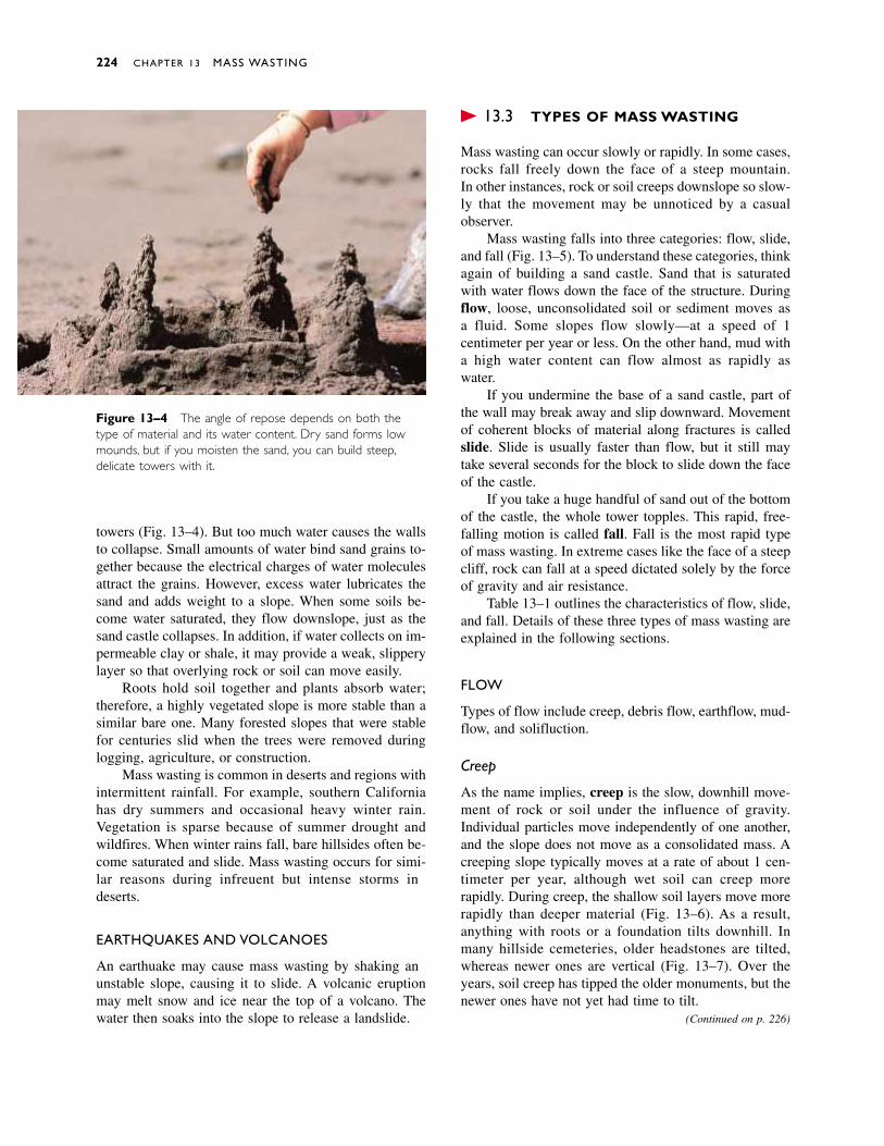
towers (Fig. 13–4). But too much water causes the wallsto collapse. Small amounts of water bind sand grains to-gether because the electrical charges of water moleculesattract the grains. However, excess water lubricates thesand and adds weight to a slope. When some soils be-come water saturated, they flow downslope, just as thesand castle collapses. In addition, if water collects on im-permeable clay or shale, it may provide a weak, slipperylayer so that overlying rock or soil can move easily.
Roots hold soil together and plants absorb water;therefore, a highly vegetated slope is more stable than asimilar bare one. Many forested slopes that were stablefor centuries slid when the trees were removed duringlogging, agriculture, or construction.
Mass wasting is common in deserts and regions withintermittent rainfall. For example, southern Californiahas dry summers and occasional heavy winter rain.Vegetation is sparse because of summer drought andwildfires. When winter rains fall, bare hillsides often be-come saturated and slide. Mass wasting occurs for simi-lar reasons during infrequent but intense storms indeserts.
EARTHQUAKES AND VOLCANOES
An earthquake may cause mass wasting by shaking anunstable slope, causing it to slide. A volcanic eruptionmay melt snow and ice near the top of a volcano. Thewater then soaks into the slope to release a landslide.
� 13.3 TYPES OF MASS WASTING
Mass wasting can occur slowly or rapidly. In some cases,rocks fall freely down the face of a steep mountain. In other instances, rock or soil creeps downslope so slow-ly that the movement may be unnoticed by a casual observer.
Mass wasting falls into three categories: flow, slide,and fall (Fig. 13–5). To understand these categories, thinkagain of building a sand castle. Sand that is saturatedwith water flows down the face of the structure. Duringflow, loose, unconsolidated soil or sediment moves as a fluid. Some slopes flow slowly—at a speed of 1 centimeter per year or less. On the other hand, mud witha high water content can flow almost as rapidly as water.
If you undermine the base of a sand castle, part ofthe wall may break away and slip downward. Movementof coherent blocks of material along fractures is calledslide. Slide is usually faster than flow, but it still maytake several seconds for the block to slide down the faceof the castle.
If you take a huge handful of sand out of the bottomof the castle, the whole tower topples. This rapid, free-falling motion is called fall. Fall is the most rapid typeof mass wasting. In extreme cases like the face of a steepcliff, rock can fall at a speed dictated solely by the forceof gravity and air resistance.
Table 13–1 outlines the characteristics of flow, slide,and fall. Details of these three types of mass wasting areexplained in the following sections.
FLOW
Types of flow include creep, debris flow, earthflow, mud-flow, and solifluction.
Creep
As the name implies, creep is the slow, downhill move-ment of rock or soil under the influence of gravity.Individual particles move independently of one another,and the slope does not move as a consolidated mass. Acreeping slope typically moves at a rate of about 1 cen-timeter per year, although wet soil can creep morerapidly. During creep, the shallow soil layers move morerapidly than deeper material (Fig. 13–6). As a result,anything with roots or a foundation tilts downhill. Inmany hillside cemeteries, older headstones are tilted,whereas newer ones are vertical (Fig. 13–7). Over theyears, soil creep has tipped the older monuments, but thenewer ones have not yet had time to tilt.
224 CHAPTER 13 MASS WASTING
Figure 13–4 The angle of repose depends on both thetype of material and its water content. Dry sand forms lowmounds, but if you moisten the sand, you can build steep,delicate towers with it.
(Continued on p. 226)
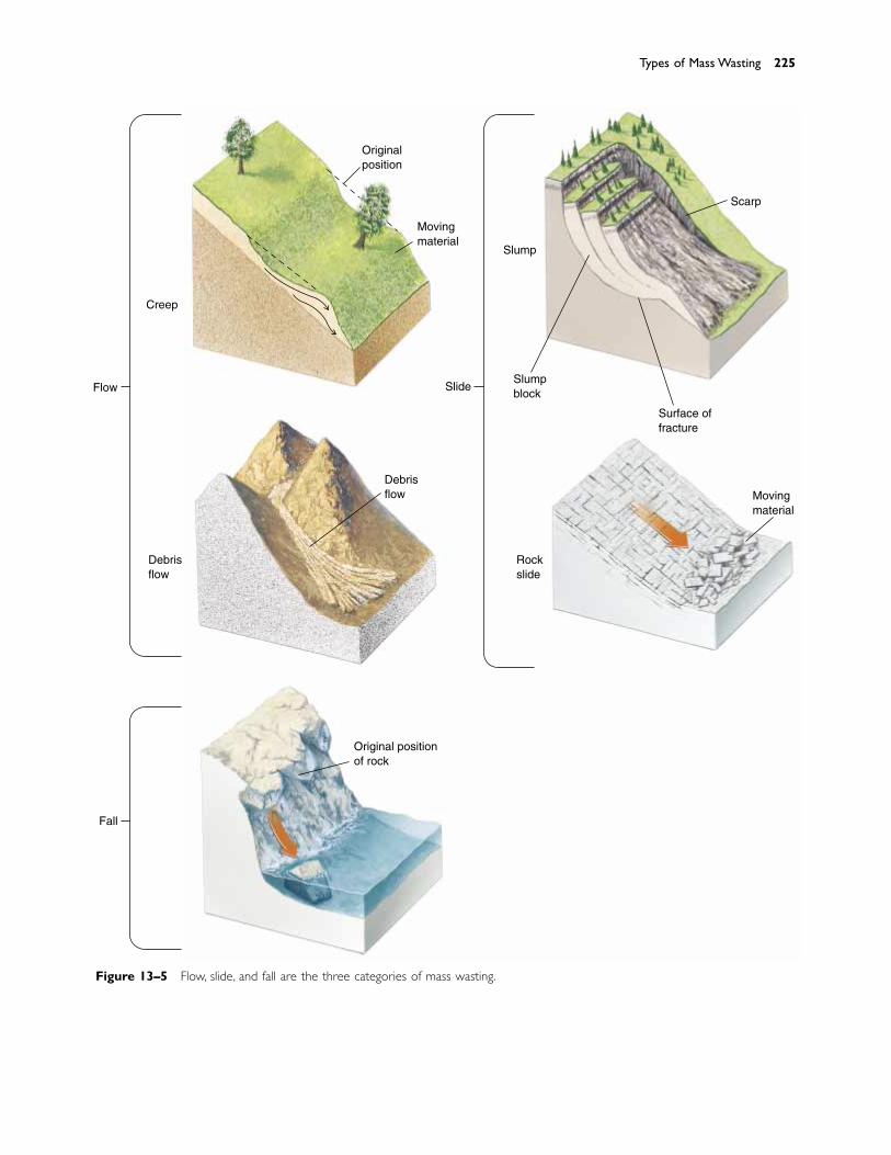
Types of Mass Wasting 225
Creep
Originalposition
Movingmaterial
SlideFlow
Debrisflow
Debrisflow
Fall
Original positionof rock
Rockslide
Movingmaterial
Surface offracture
Slumpblock
Slump
Scarp
Figure 13–5 Flow, slide, and fall are the three categories of mass wasting.
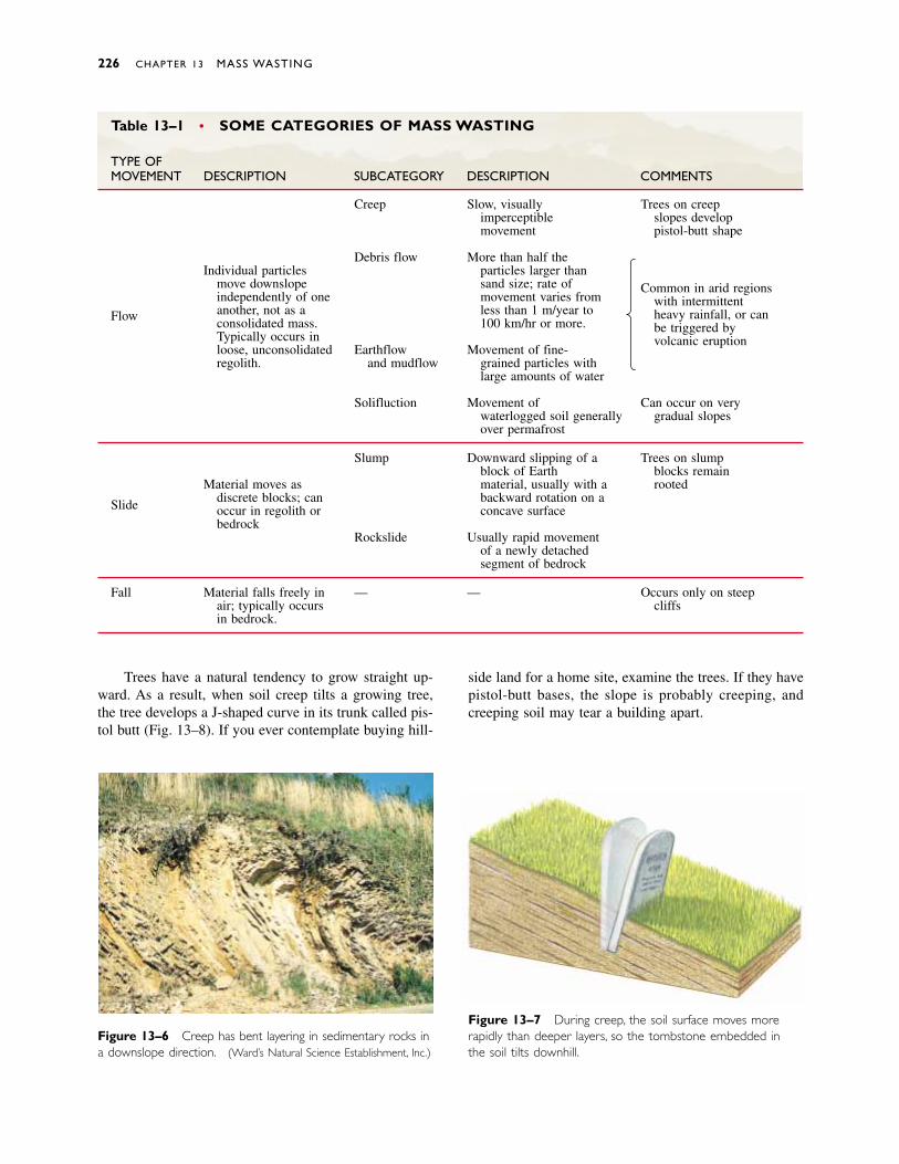
226 CHAPTER 13 MASS WASTING
Figure 13–6 Creep has bent layering in sedimentary rocks ina downslope direction. (Ward’s Natural Science Establishment, Inc.)
Figure 13–7 During creep, the soil surface moves morerapidly than deeper layers, so the tombstone embedded in the soil tilts downhill.
Table 13–1 • SOME CATEGORIES OF MASS WASTING
TYPE OFMOVEMENT DESCRIPTION SUBCATEGORY DESCRIPTION COMMENTS
Creep Slow, visually Trees on creepimperceptible slopes develop movement pistol-butt shape
Debris flow More than half the
Common in arid regionsIndividual particles particles larger than
with intermittentmove downslope sand size; rate of
heavy rainfall, or canindependently of one movement varies from
be triggered byFlow another, not as a less than 1 m/year to
volcanic eruptionconsolidated mass. 100 km/hr or more.Typically occurs inloose, unconsolidated Earthflow Movement of fine-regolith. and mudflow grained particles with
large amounts of water
Solifluction Movement of Can occur on verywaterlogged soil generally gradual slopesover permafrost
Slump Downward slipping of a Trees on slumpblock of Earth blocks remain
Material moves as material, usually with a rooted
Slide discrete blocks; can backward rotation on aoccur in regolith or concave surfacebedrock
Rockslide Usually rapid movementof a newly detachedsegment of bedrock
Fall Material falls freely in — — Occurs only on steepair; typically occurs cliffsin bedrock.
Trees have a natural tendency to grow straight up-ward. As a result, when soil creep tilts a growing tree,the tree develops a J-shaped curve in its trunk called pis-tol butt (Fig. 13–8). If you ever contemplate buying hill-
side land for a home site, examine the trees. If they havepistol-butt bases, the slope is probably creeping, andcreeping soil may tear a building apart.
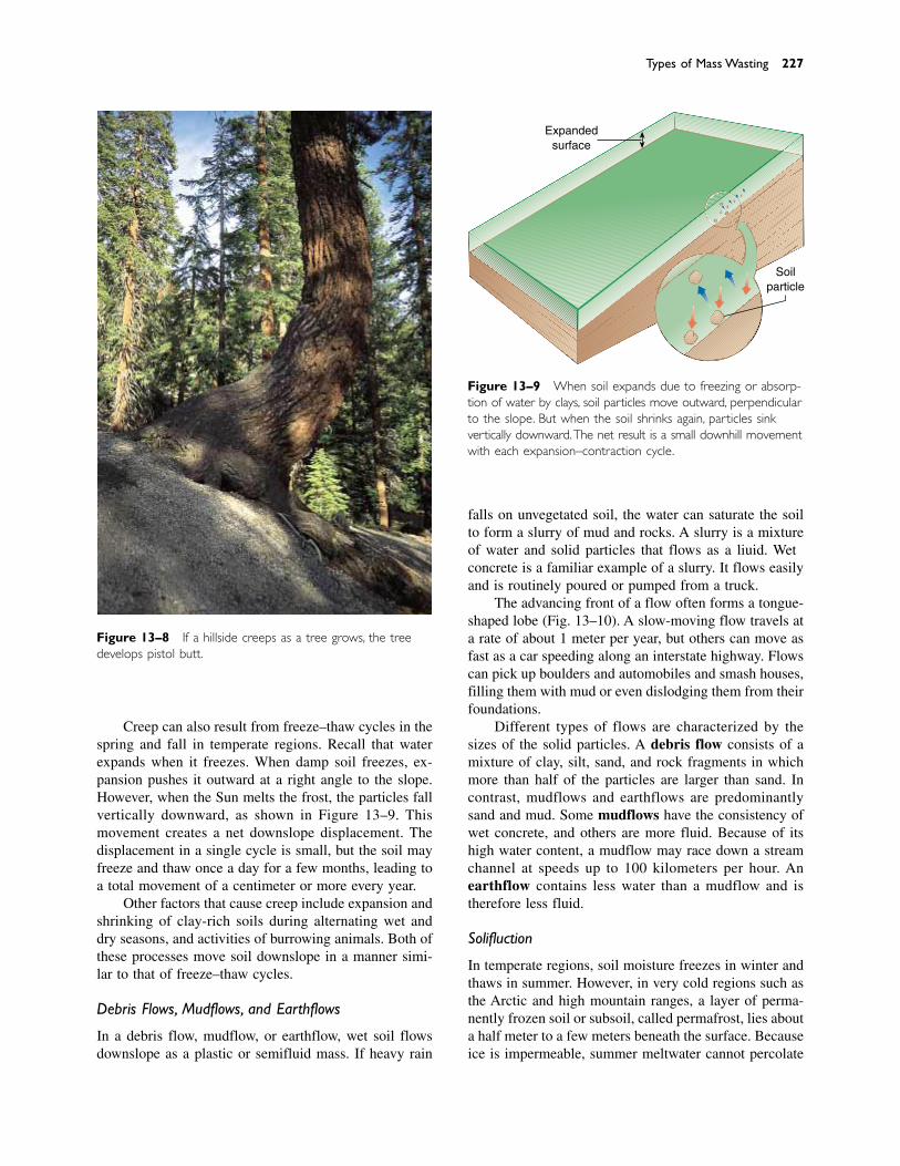
Creep can also result from freeze–thaw cycles in thespring and fall in temperate regions. Recall that waterexpands when it freezes. When damp soil freezes, ex-pansion pushes it outward at a right angle to the slope.However, when the Sun melts the frost, the particles fallvertically downward, as shown in Figure 13–9. Thismovement creates a net downslope displacement. Thedisplacement in a single cycle is small, but the soil mayfreeze and thaw once a day for a few months, leading toa total movement of a centimeter or more every year.
Other factors that cause creep include expansion andshrinking of clay-rich soils during alternating wet anddry seasons, and activities of burrowing animals. Both ofthese processes move soil downslope in a manner simi-lar to that of freeze–thaw cycles.
Debris Flows, Mudflows, and Earthflows
In a debris flow, mudflow, or earthflow, wet soil flowsdownslope as a plastic or semifluid mass. If heavy rain
falls on unvegetated soil, the water can saturate the soilto form a slurry of mud and rocks. A slurry is a mixtureof water and solid particles that flows as a liquid. Wetconcrete is a familiar example of a slurry. It flows easilyand is routinely poured or pumped from a truck.
The advancing front of a flow often forms a tongue-shaped lobe (Fig. 13–10). A slow-moving flow travels ata rate of about 1 meter per year, but others can move asfast as a car speeding along an interstate highway. Flowscan pick up boulders and automobiles and smash houses,filling them with mud or even dislodging them from theirfoundations.
Different types of flows are characterized by thesizes of the solid particles. A debris flow consists of amixture of clay, silt, sand, and rock fragments in whichmore than half of the particles are larger than sand. Incontrast, mudflows and earthflows are predominantlysand and mud. Some mudflows have the consistency ofwet concrete, and others are more fluid. Because of itshigh water content, a mudflow may race down a streamchannel at speeds up to 100 kilometers per hour. Anearthflow contains less water than a mudflow and istherefore less fluid.
Solifluction
In temperate regions, soil moisture freezes in winter andthaws in summer. However, in very cold regions such asthe Arctic and high mountain ranges, a layer of perma-nently frozen soil or subsoil, called permafrost, lies abouta half meter to a few meters beneath the surface. Becauseice is impermeable, summer meltwater cannot percolate
Types of Mass Wasting 227
Figure 13–8 If a hillside creeps as a tree grows, the treedevelops pistol butt.
Expandedsurface
Soilparticle
Figure 13–9 When soil expands due to freezing or absorp-tion of water by clays, soil particles move outward, perpendicularto the slope. But when the soil shrinks again, particles sinkvertically downward.The net result is a small downhill movementwith each expansion–contraction cycle.
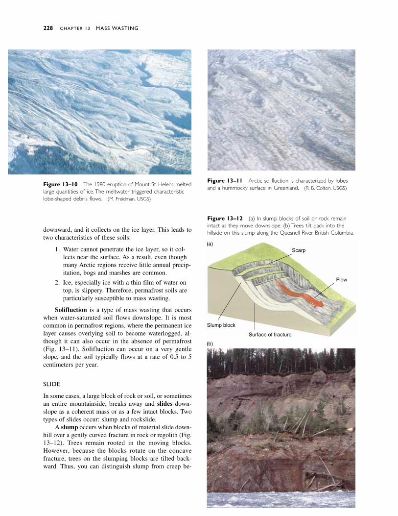
downward, and it collects on the ice layer. This leads totwo characteristics of these soils:
1. Water cannot penetrate the ice layer, so it col-lects near the surface. As a result, even thoughmany Arctic regions receive little annual precip-itation, bogs and marshes are common.
2. Ice, especially ice with a thin film of water ontop, is slippery. Therefore, permafrost soils areparticularly susceptible to mass wasting.
Solifluction is a type of mass wasting that occurswhen water-saturated soil flows downslope. It is mostcommon in permafrost regions, where the permanent icelayer causes overlying soil to become waterlogged, al-though it can also occur in the absence of permafrost(Fig. 13–11). Solifluction can occur on a very gentleslope, and the soil typically flows at a rate of 0.5 to 5centimeters per year.
SLIDE
In some cases, a large block of rock or soil, or sometimesan entire mountainside, breaks away and slides down-slope as a coherent mass or as a few intact blocks. Twotypes of slides occur: slump and rockslide.
A slump occurs when blocks of material slide down-hill over a gently curved fracture in rock or regolith (Fig.13–12). Trees remain rooted in the moving blocks.However, because the blocks rotate on the concavefracture, trees on the slumping blocks are tilted back-ward. Thus, you can distinguish slump from creep be-
228 CHAPTER 13 MASS WASTING
Figure 13–11 Arctic solifluction is characterized by lobesand a hummocky surface in Greenland. (R. B. Colton, USGS)
Figure 13–12 (a) In slump, blocks of soil or rock remainintact as they move downslope. (b) Trees tilt back into thehillside on this slump along the Quesnell River, British Columbia.
Scarp
Flow
Slump block
Surface of fracture
(b)
(a)
Figure 13–10 The 1980 eruption of Mount St. Helens meltedlarge quantities of ice.The meltwater triggered characteristiclobe-shaped debris flows. (M. Freidman, USGS)
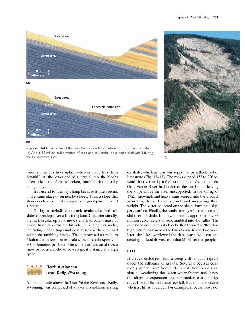
cause slump tilts trees uphill, whereas creep tilts themdownhill. At the lower end of a large slump, the blocksoften pile up to form a broken, jumbled, hummockytopography.
It is useful to identify slump because it often recursin the same place or on nearby slopes. Thus, a slope thatshows evidence of past slump is not a good place to builda house.
During a rockslide, or rock avalanche, bedrockslides downslope over a fracture plane. Characteristically,the rock breaks up as it moves and a turbulent mass ofrubble tumbles down the hillside. In a large avalanche,the falling debris traps and compresses air beneath andwithin the tumbling blocks. The compressed air reducesfriction and allows some avalanches to attain speeds of500 kilometers per hour. The same mechanism allows asnow or ice avalanche to cover a great distance at a highspeed.
Rock Avalanchenear Kelly,Wyoming
A mountainside above the Gros Ventre River near Kelly,Wyoming, was composed of a layer of sandstone resting
Types of Mass Wasting 229
on shale, which in turn was supported by a thick bed oflimestone (Fig. 13–13). The rocks dipped 15º to 20º to-ward the river and parallel to the slope. Over time, theGros Ventre River had undercut the sandstone, leavingthe slope above the river unsupported. In the spring of1925, snowmelt and heavy rains seeped into the ground,saturating the soil and bedrock and increasing theirweight. The water collected on the shale, forming a slip-pery surface. Finally, the sandstone layer broke loose andslid over the shale. In a few moments, approximately 38million cubic meters of rock tumbled into the valley. Thesandstone crumbled into blocks that formed a 70-meter-high natural dam across the Gros Ventre River. Two yearslater, the lake overflowed the dam, washing it out andcreating a flood downstream that killed several people.
FALL
If a rock dislodges from a steep cliff, it falls rapidlyunder the influence of gravity. Several processes com-monly detach rocks from cliffs. Recall from our discus-sion of weathering that when water freezes and thaws,the alternate expansion and contraction can dislodgerocks from cliffs and cause rockfall. Rockfall also occurswhen a cliff is undercut. For example, if ocean waves or
(c)
Sandstone
Sandstone
Landslide dams river
(a)
(b)
Shale
Limestone
kilometer0 0.5 1
Shale
Limestone
kilometer0 0.5 1
Figure 13–13 A profile of the Gros Ventre hillside (a) before and (b) after the slide.(c) About 38 million cubic meters of rock and soil broke loose and slid downhill duringthe Gros Ventre slide.
C A S E
S T U D Y
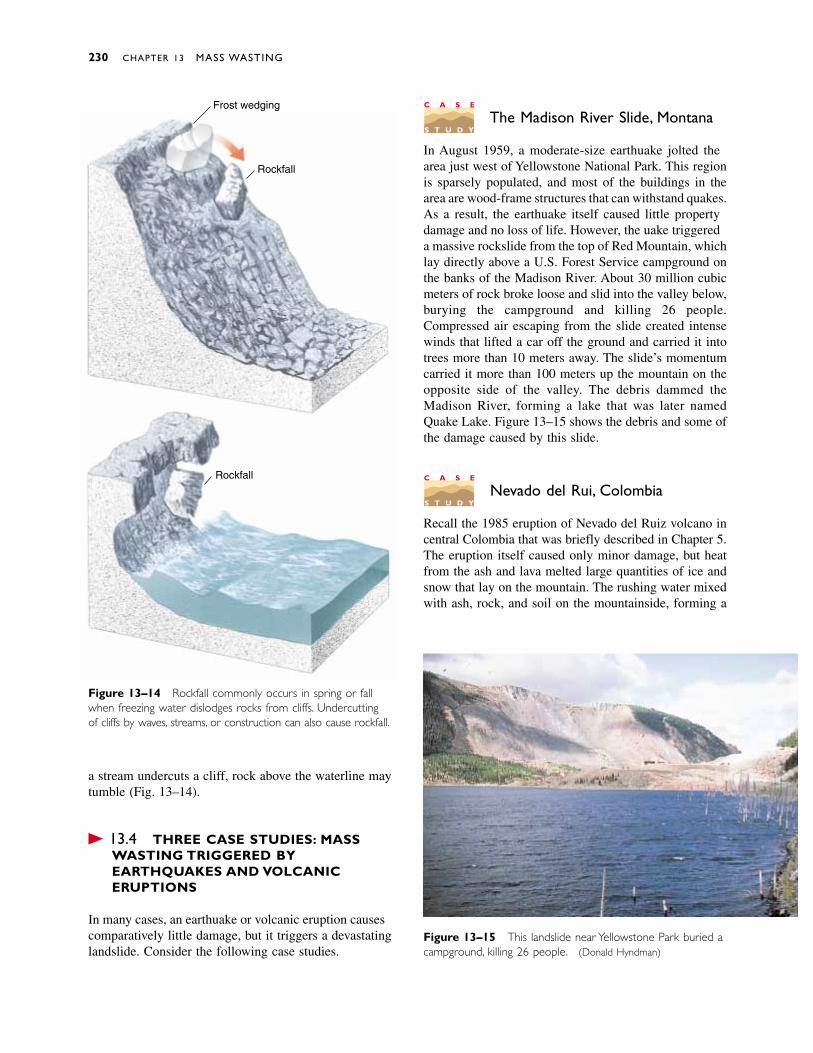
a stream undercuts a cliff, rock above the waterline maytumble (Fig. 13–14).
� 13.4 THREE CASE STUDIES: MASS WASTING TRIGGERED BYEARTHQUAKES AND VOLCANICERUPTIONS
In many cases, an earthquake or volcanic eruption causescomparatively little damage, but it triggers a devastatinglandslide. Consider the following case studies.
The Madison River Slide, Montana
In August 1959, a moderate-size earthquake jolted thearea just west of Yellowstone National Park. This regionis sparsely populated, and most of the buildings in thearea are wood-frame structures that can withstand quakes.As a result, the earthquake itself caused little propertydamage and no loss of life. However, the quake triggereda massive rockslide from the top of Red Mountain, whichlay directly above a U.S. Forest Service campground onthe banks of the Madison River. About 30 million cubicmeters of rock broke loose and slid into the valley below,burying the campground and killing 26 people.Compressed air escaping from the slide created intensewinds that lifted a car off the ground and carried it intotrees more than 10 meters away. The slide’s momentumcarried it more than 100 meters up the mountain on theopposite side of the valley. The debris dammed theMadison River, forming a lake that was later namedQuake Lake. Figure 13–15 shows the debris and some ofthe damage caused by this slide.
Nevado del Ruiz, Colombia
Recall the 1985 eruption of Nevado del Ruiz volcano incentral Colombia that was briefly described in Chapter 5.The eruption itself caused only minor damage, but heatfrom the ash and lava melted large quantities of ice andsnow that lay on the mountain. The rushing water mixedwith ash, rock, and soil on the mountainside, forming a
230 CHAPTER 13 MASS WASTING
C A S E
S T U D Y
C A S E
S T U D Y
Figure 13–14 Rockfall commonly occurs in spring or fallwhen freezing water dislodges rocks from cliffs. Undercuttingof cliffs by waves, streams, or construction can also cause rockfall.
Figure 13–15 This landslide near Yellowstone Park buried acampground, killing 26 people. (Donald Hyndman)
Frost wedging
Rockfall
Rockfall
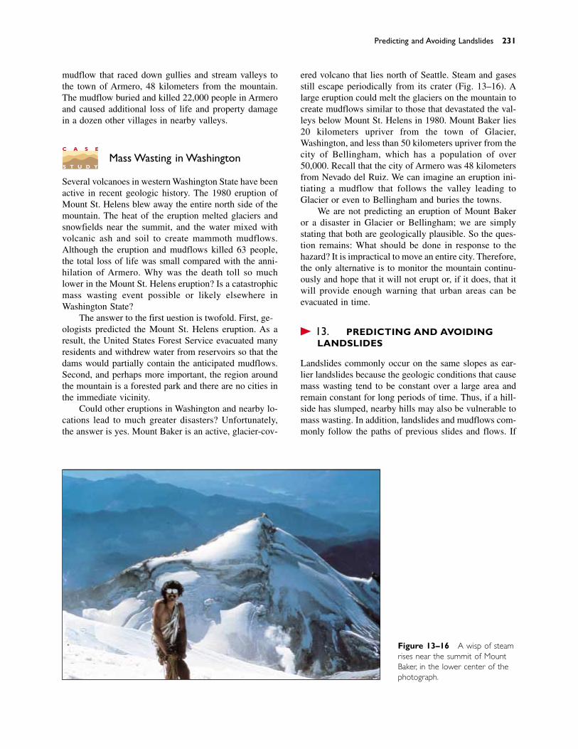
mudflow that raced down gullies and stream valleys tothe town of Armero, 48 kilometers from the mountain.The mudflow buried and killed 22,000 people in Armeroand caused additional loss of life and property damagein a dozen other villages in nearby valleys.
Mass Wasting in Washington
Several volcanoes in western Washington State have beenactive in recent geologic history. The 1980 eruption ofMount St. Helens blew away the entire north side of themountain. The heat of the eruption melted glaciers andsnowfields near the summit, and the water mixed withvolcanic ash and soil to create mammoth mudflows.Although the eruption and mudflows killed 63 people,the total loss of life was small compared with the anni-hilation of Armero. Why was the death toll so muchlower in the Mount St. Helens eruption? Is a catastrophicmass wasting event possible or likely elsewhere inWashington State?
The answer to the first question is twofold. First, ge-ologists predicted the Mount St. Helens eruption. As aresult, the United States Forest Service evacuated manyresidents and withdrew water from reservoirs so that thedams would partially contain the anticipated mudflows.Second, and perhaps more important, the region aroundthe mountain is a forested park and there are no cities inthe immediate vicinity.
Could other eruptions in Washington and nearby lo-cations lead to much greater disasters? Unfortunately,the answer is yes. Mount Baker is an active, glacier-cov-
ered volcano that lies north of Seattle. Steam and gasesstill escape periodically from its crater (Fig. 13–16). Alarge eruption could melt the glaciers on the mountain tocreate mudflows similar to those that devastated the val-leys below Mount St. Helens in 1980. Mount Baker lies20 kilometers upriver from the town of Glacier,Washington, and less than 50 kilometers upriver from thecity of Bellingham, which has a population of over50,000. Recall that the city of Armero was 48 kilometersfrom Nevado del Ruiz. We can imagine an eruption ini-tiating a mudflow that follows the valley leading toGlacier or even to Bellingham and buries the towns.
We are not predicting an eruption of Mount Bakeror a disaster in Glacier or Bellingham; we are simplystating that both are geologically plausible. So the ques-tion remains: What should be done in response to thehazard? It is impractical to move an entire city. Therefore,the only alternative is to monitor the mountain continu-ously and hope that it will not erupt or, if it does, that itwill provide enough warning that urban areas can beevacuated in time.
� 13.5 PREDICTING AND AVOIDING LANDSLIDES
Landslides commonly occur on the same slopes as ear-lier landslides because the geologic conditions that causemass wasting tend to be constant over a large area andremain constant for long periods of time. Thus, if a hill-side has slumped, nearby hills may also be vulnerable tomass wasting. In addition, landslides and mudflows com-monly follow the paths of previous slides and flows. If
Predicting and Avoiding Landslides 231
C A S E
S T U D Y
Figure 13–16 A wisp of steamrises near the summit of MountBaker, in the lower center of thephotograph.
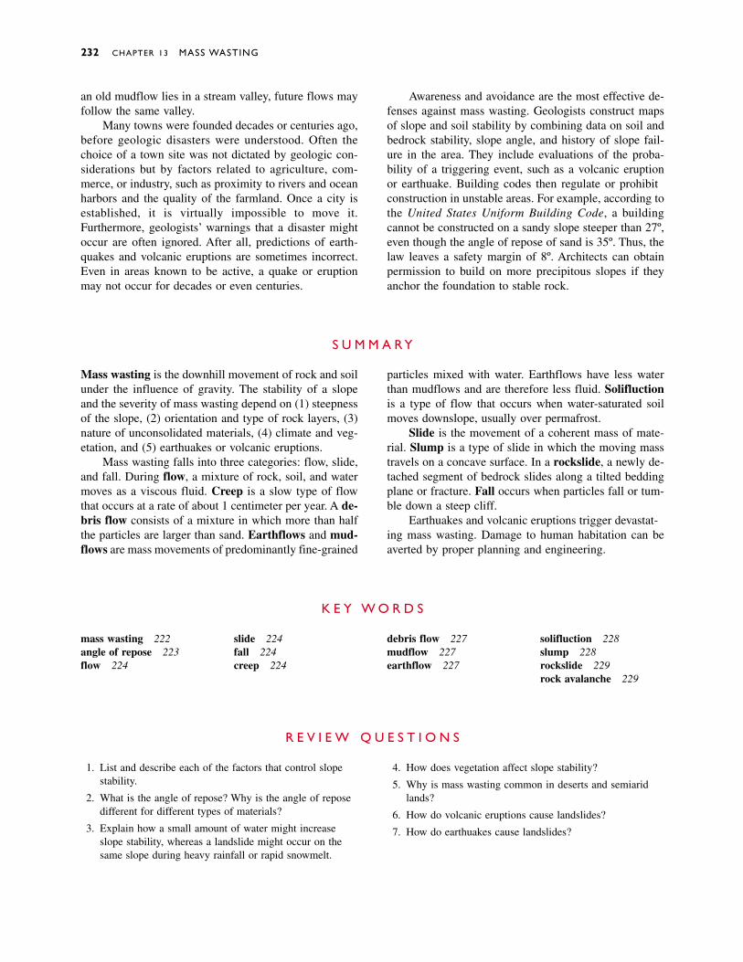
an old mudflow lies in a stream valley, future flows mayfollow the same valley.
Many towns were founded decades or centuries ago,before geologic disasters were understood. Often thechoice of a town site was not dictated by geologic con-siderations but by factors related to agriculture, com-merce, or industry, such as proximity to rivers and oceanharbors and the quality of the farmland. Once a city isestablished, it is virtually impossible to move it.Furthermore, geologists’ warnings that a disaster mightoccur are often ignored. After all, predictions of earth-quakes and volcanic eruptions are sometimes incorrect.Even in areas known to be active, a quake or eruptionmay not occur for decades or even centuries.
232 CHAPTER 13 MASS WASTING
Awareness and avoidance are the most effective de-fenses against mass wasting. Geologists construct mapsof slope and soil stability by combining data on soil andbedrock stability, slope angle, and history of slope fail-ure in the area. They include evaluations of the proba-bility of a triggering event, such as a volcanic eruptionor earthquake. Building codes then regulate or prohibitconstruction in unstable areas. For example, according tothe United States Uniform Building Code, a buildingcannot be constructed on a sandy slope steeper than 27º,even though the angle of repose of sand is 35º. Thus, thelaw leaves a safety margin of 8º. Architects can obtainpermission to build on more precipitous slopes if theyanchor the foundation to stable rock.
S U M M A R Y
Mass wasting is the downhill movement of rock and soilunder the influence of gravity. The stability of a slopeand the severity of mass wasting depend on (1) steepnessof the slope, (2) orientation and type of rock layers, (3)nature of unconsolidated materials, (4) climate and veg-etation, and (5) earthquakes or volcanic eruptions.
Mass wasting falls into three categories: flow, slide,and fall. During flow, a mixture of rock, soil, and watermoves as a viscous fluid. Creep is a slow type of flowthat occurs at a rate of about 1 centimeter per year. A de-bris flow consists of a mixture in which more than halfthe particles are larger than sand. Earthflows and mud-flows are mass movements of predominantly fine-grained
particles mixed with water. Earthflows have less waterthan mudflows and are therefore less fluid. Solifluctionis a type of flow that occurs when water-saturated soilmoves downslope, usually over permafrost.
Slide is the movement of a coherent mass of mate-rial. Slump is a type of slide in which the moving masstravels on a concave surface. In a rockslide, a newly de-tached segment of bedrock slides along a tilted beddingplane or fracture. Fall occurs when particles fall or tum-ble down a steep cliff.
Earthquakes and volcanic eruptions trigger devastat-ing mass wasting. Damage to human habitation can beaverted by proper planning and engineering.
K E Y W O R D S
mass wasting 222angle of repose 223flow 224
slide 224fall 224creep 224
debris flow 227mudflow 227earthflow 227
solifluction 228slump 228rockslide 229rock avalanche 229
R E V I E W Q U E S T I O N S
1. List and describe each of the factors that control slopestability.
2. What is the angle of repose? Why is the angle of reposedifferent for different types of materials?
3. Explain how a small amount of water might increaseslope stability, whereas a landslide might occur on thesame slope during heavy rainfall or rapid snowmelt.
4. How does vegetation affect slope stability?
5. Why is mass wasting common in deserts and semiaridlands?
6. How do volcanic eruptions cause landslides?
7. How do earthquakes cause landslides?
Discussion Questions 233
D I S C U S S I O N Q U E S T I O N S
1. The Moon is considerably less massive than the Earth, andtherefore its gravitational force is less. It has no atmo-sphere and therefore no rainfall. The interior of the Moonis cool, and thus it is geologically inactive. Would you ex-pect mass wasting to be a common or an uncommon eventin mountainous areas of the Moon? Defend your answer.
2. Explain how wildfires affect slope stability and masswasting.
3. What types of mass wasting (if any) would be likely tooccur in each of the following environments? a. A verygradual (2 percent) slope in a heavily vegetated tropicalrainforest. b. A steep hillside composed of alternatinglayers of conglomerate, shale, and sandstone, in a regionthat experiences distinct dry and rainy seasons. The dip ofthe rock layers is parallel to the slope. c. A hillside sim-ilar to that of b, in which the rock layers are oriented per-pendicular to the slope. d. A steep hillside composed ofclay in a rainy environment in an active earthquake zone.
4. Identify a hillside in your city or town that might be un-stable. Using as much data as you can collect, discuss themagnitude of the potential danger. Would the landslide belikely to affect human habitation?
5. Explain how the mass wasting triggered by earthquakesand volcanoes can have more serious effects than theearthquake or volcano itself. Is this always the case?
6. How do mudflows and debris flows transport automobile-sized boulders?
7. Develop a strategy for minimizing loss of life from masswasting if Mount Baker should show signs of an impend-ing eruption similar to those shown by Mount St. Helensin the spring of 1980. How would your strategy apply totowns such as Armero?
8. Discuss the differences among flow, slide, and fall. Giveexamples of each.
9. Compare and contrast creep, debris flow, and mudflow.
10. What does a pistol-butt tree trunk tell you about slopestability?
11. Why is solifluction more likely to occur in the Arcticthan in temperate or tropical regions?
12. Compare and contrast slump and rockslide.
13. Explain how trees are bent but not killed by slump. Howare trees affected by rockslide?
14. How do landslides reach and destroy towns and villagesmany kilometers from the steep slopes where the slidesoriginate?
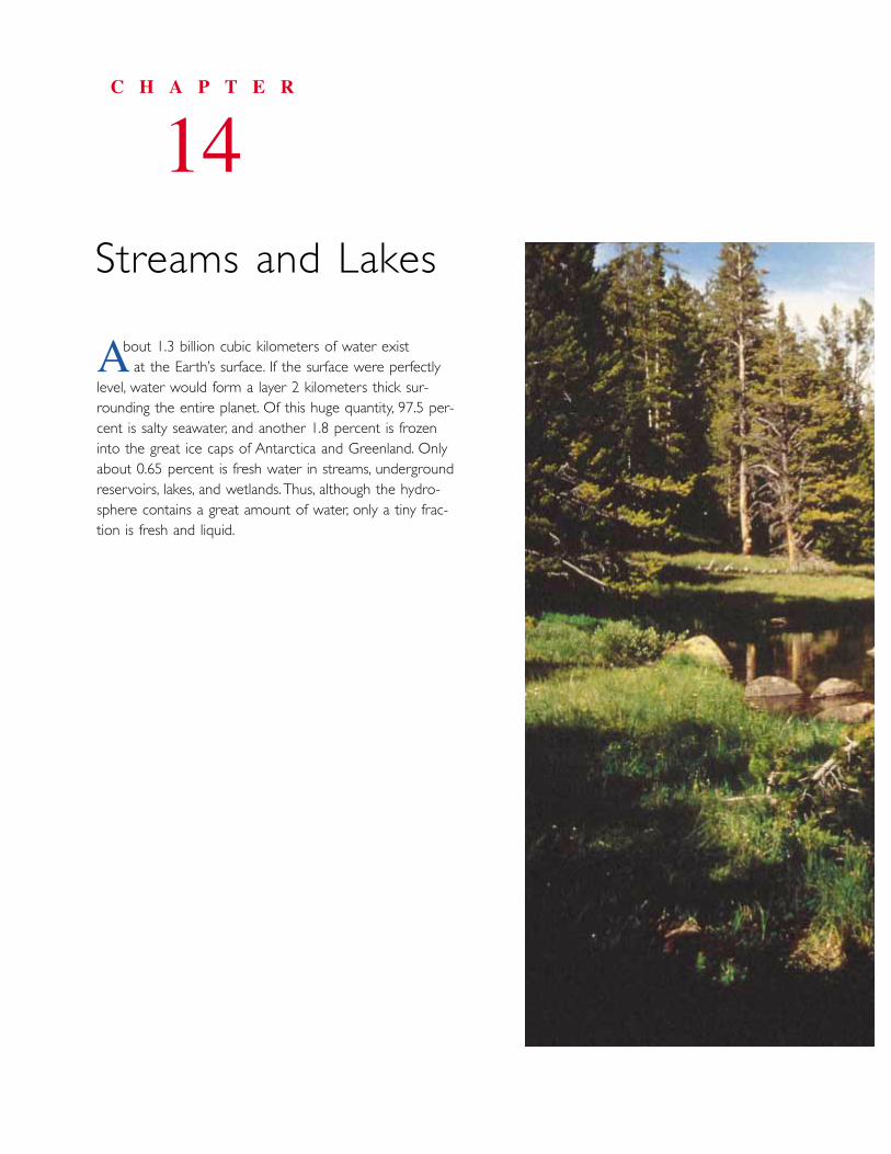
bout 1.3 billion cubic kilometers of water exist at the Earth’s surface. If the surface were perfectly
level, water would form a layer 2 kilometers thick sur-rounding the entire planet. Of this huge quantity, 97.5 per-cent is salty seawater, and another 1.8 percent is frozeninto the great ice caps of Antarctica and Greenland. Onlyabout 0.65 percent is fresh water in streams, undergroundreservoirs, lakes, and wetlands.Thus, although the hydro-sphere contains a great amount of water, only a tiny frac-tion is fresh and liquid.
C H A P T E R
14Streams and Lakes
A
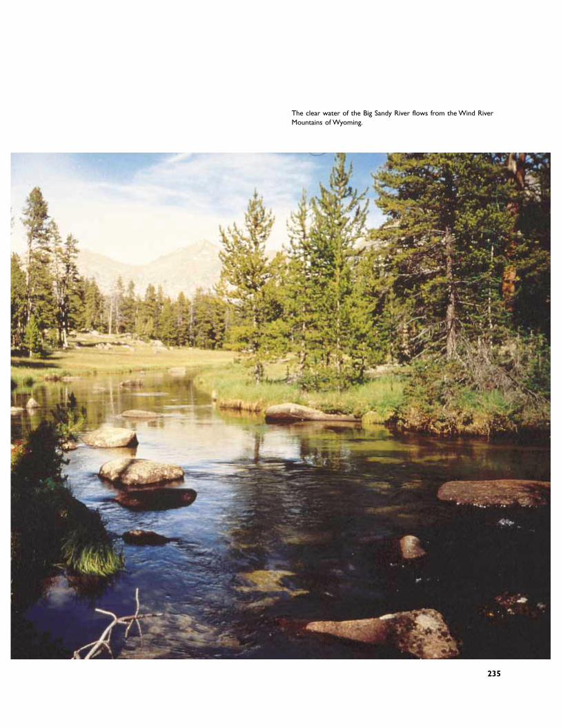
The clear water of the Big Sandy River flows from the Wind RiverMountains of Wyoming.
235
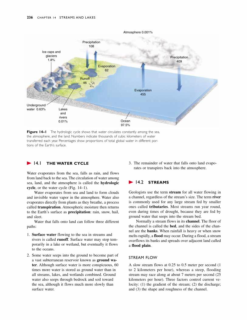
� 14.1 THE WATER CYCLE
Water evaporates from the sea, falls as rain, and flowsfrom land back to the sea. The circulation of water amongsea, land, and the atmosphere is called the hydrologiccycle, or the water cycle (Fig. 14–1).
Water evaporates from sea and land to form cloudsand invisible water vapor in the atmosphere. Water alsoevaporates directly from plants as they breathe, a processcalled transpiration. Atmospheric moisture then returnsto the Earth’s surface as precipitation: rain, snow, hail,and sleet.
Water that falls onto land can follow three differentpaths:
1. Surface water flowing to the sea in streams andrivers is called runoff. Surface water may stop tem-porarily in a lake or wetland, but eventually it flowsto the oceans.
2. Some water seeps into the ground to become part ofa vast subterranean reservoir known as ground wa-ter. Although surface water is more conspicuous, 60times more water is stored as ground water than inall streams, lakes, and wetlands combined. Groundwater also seeps through bedrock and soil towardthe sea, although it flows much more slowly thansurface water.
3. The remainder of water that falls onto land evapo-rates or transpires back into the atmosphere.
� 14.2 STREAMS
Geologists use the term stream for all water flowing ina channel, regardless of the stream’s size. The term riveris commonly used for any large stream fed by smallerones called tributaries. Most streams run year round,even during times of drought, because they are fed byground water that seeps into the stream bed.
Normally a stream flows in its channel. The floor ofthe channel is called the bed, and the sides of the chan-nel are the banks. When rainfall is heavy or when snowmelts rapidly, a flood may occur. During a flood, a streamoverflows its banks and spreads over adjacent land calleda flood plain.
STREAM FLOW
A slow stream flows at 0.25 to 0.5 meter per second (1to 2 kilometers per hour), whereas a steep, floodingstream may race along at about 7 meters per second (25kilometers per hour). Three factors control current ve-locity: (1) the gradient of the stream; (2) the discharge;and (3) the shape and roughness of the channel.
236 CHAPTER 14 STREAMS AND LAKES
Ice caps andglaciers
1.8%
Precipitation108
Atmosphere 0.001%
Undergroundwater 0.63% Lakes
andrivers0.01% Ocean
97.5%
Evaporation455
Precipitation409
Evaporation62
Runoff46
Figure 14–1 The hydrologic cycle shows that water circulates constantly among the sea,the atmosphere, and the land. Numbers indicate thousands of cubic kilometers of watertransferred each year. Percentages show proportions of total global water in different por-tions of the Earth’s surface.
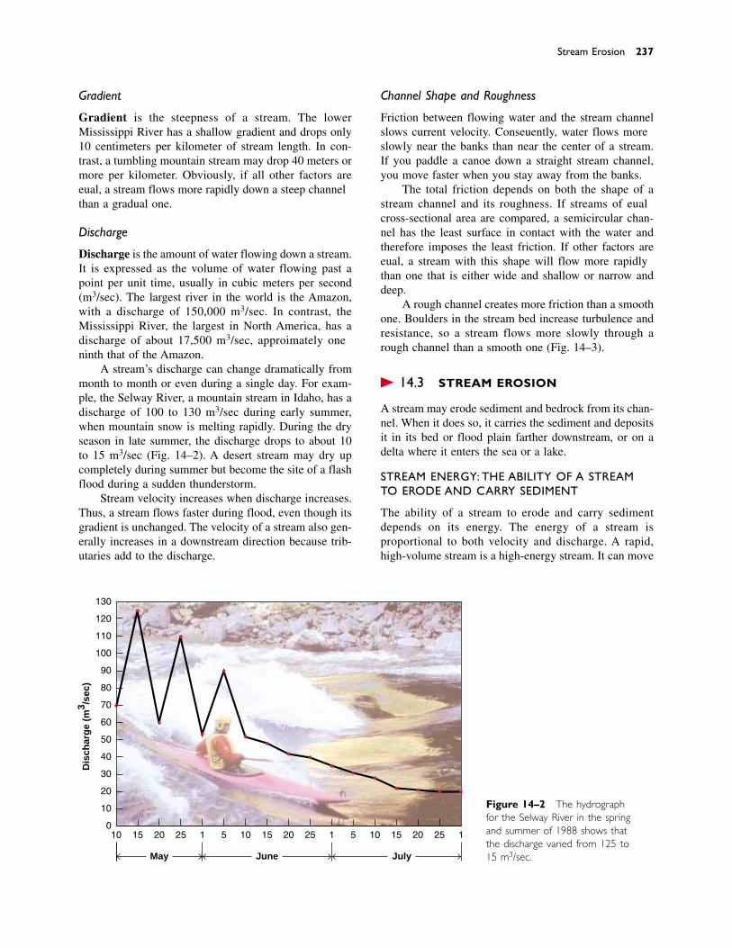
Gradient
Gradient is the steepness of a stream. The lowerMississippi River has a shallow gradient and drops only10 centimeters per kilometer of stream length. In con-trast, a tumbling mountain stream may drop 40 meters ormore per kilometer. Obviously, if all other factors areequal, a stream flows more rapidly down a steep channelthan a gradual one.
Discharge
Discharge is the amount of water flowing down a stream.It is expressed as the volume of water flowing past apoint per unit time, usually in cubic meters per second(m3/sec). The largest river in the world is the Amazon,with a discharge of 150,000 m3/sec. In contrast, theMississippi River, the largest in North America, has adischarge of about 17,500 m3/sec, approximately oneninth that of the Amazon.
A stream’s discharge can change dramatically frommonth to month or even during a single day. For exam-ple, the Selway River, a mountain stream in Idaho, has adischarge of 100 to 130 m3/sec during early summer,when mountain snow is melting rapidly. During the dryseason in late summer, the discharge drops to about 10to 15 m3/sec (Fig. 14–2). A desert stream may dry upcompletely during summer but become the site of a flashflood during a sudden thunderstorm.
Stream velocity increases when discharge increases.Thus, a stream flows faster during flood, even though itsgradient is unchanged. The velocity of a stream also gen-erally increases in a downstream direction because trib-utaries add to the discharge.
Channel Shape and Roughness
Friction between flowing water and the stream channelslows current velocity. Consequently, water flows moreslowly near the banks than near the center of a stream.If you paddle a canoe down a straight stream channel,you move faster when you stay away from the banks.
The total friction depends on both the shape of astream channel and its roughness. If streams of equalcross-sectional area are compared, a semicircular chan-nel has the least surface in contact with the water andtherefore imposes the least friction. If other factors areequal, a stream with this shape will flow more rapidlythan one that is either wide and shallow or narrow anddeep.
A rough channel creates more friction than a smoothone. Boulders in the stream bed increase turbulence andresistance, so a stream flows more slowly through arough channel than a smooth one (Fig. 14–3).
� 14.3 STREAM EROSION
A stream may erode sediment and bedrock from its chan-nel. When it does so, it carries the sediment and depositsit in its bed or flood plain farther downstream, or on adelta where it enters the sea or a lake.
STREAM ENERGY: THE ABILITY OF A STREAMTO ERODE AND CARRY SEDIMENT
The ability of a stream to erode and carry sediment depends on its energy. The energy of a stream is proportional to both velocity and discharge. A rapid,high-volume stream is a high-energy stream. It can move
Stream Erosion 237
10 15 20 25 1 5 10 15 20 25 1 5 10 15 20 25 1
May June July
0
10
20
30
40
50
60
70
80
90
100
110
120
130
Dis
char
ge
(m3 /s
ec)
Figure 14–2 The hydrographfor the Selway River in the springand summer of 1988 shows thatthe discharge varied from 125 to15 m3/sec.
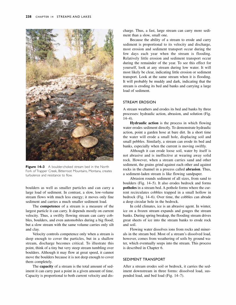
boulders as well as smaller particles and can carry alarge load of sediment. In contrast, a slow, low-volumestream flows with much less energy; it moves only finesediment and carries a much smaller sediment load.
The competence of a stream is a measure of thelargest particle it can carry. It depends mostly on currentvelocity. Thus, a swiftly flowing stream can carry cob-bles, boulders, and even automobiles during a big flood;but a slow stream with the same volume carries only siltand clay.
Velocity controls competence only when a stream isdeep enough to cover the particles, but in a shallowstream, discharge becomes critical. To illustrate thispoint, think of a tiny but very steep stream tumbling overboulders. Although it may flow at great speed, it cannotmove the boulders because it is not deep enough to coverthem completely.
The capacity of a stream is the total amount of sed-iment it can carry past a point in a given amount of time.Capacity is proportional to both current velocity and dis-
charge. Thus, a fast, large stream can carry more sedi-ment than a slow, small one.
Because the ability of a stream to erode and carrysediment is proportional to its velocity and discharge,most erosion and sediment transport occur during thefew days each year when the stream is flooding.Relatively little erosion and sediment transport occurduring the remainder of the year. To see this effect foryourself, look at any stream during low water. It willmost likely be clear, indicating little erosion or sedimenttransport. Look at the same stream when it is flooding.It will probably be muddy and dark, indicating that thestream is eroding its bed and banks and carrying a largeload of sediment.
STREAM EROSION
A stream weathers and erodes its bed and banks by threeprocesses: hydraulic action, abrasion, and solution (Fig.14–4).
Hydraulic action is the process in which flowingwater erodes sediment directly. To demonstrate hydraulicaction, point a garden hose at bare dirt. In a short timethe water will erode a small hole, displacing soil andsmall pebbles. Similarly, a stream can erode its bed andbanks, especially when the current is moving swiftly.
Although it can erode loose soil, water by itself isnot abrasive and is ineffective at wearing away solidrock. However, when a stream carries sand and othersediment, the grains grind against each other and againstrocks in the channel in a process called abrasion. Thus,a sediment-laden stream is like flowing sandpaper.
Abrasion rounds sediment of all sizes, from sand toboulders (Fig. 14–5). It also erodes bedrock and formspotholes in a stream bed. A pothole forms where the cur-rent recirculates cobbles trapped in a small hollow inbedrock (Fig. 14–6). Over time, the cobbles can abradea deep circular hole in the bedrock.
In cold climates, ice is an abrasive agent. In winter,ice on a frozen stream expands and gouges the streambanks. During spring breakup, the flooding stream drivesgreat sheets of ice into the stream banks to erode rockand soil.
Flowing water dissolves ions from rocks and miner-als in the stream bed. Most of a stream’s dissolved load,however, comes from weathering of soils by ground wa-ter, which eventually seeps into the stream. This processis described in Chapter 6.
SEDIMENT TRANSPORT
After a stream erodes soil or bedrock, it carries the sed-iment downstream in three forms: dissolved load, sus-pended load, and bed load (Fig. 14–7).
238 CHAPTER 14 STREAMS AND LAKES
Figure 14–3 A boulder-choked stream bed in the NorthFork of Trapper Creek, Bitterroot Mountains, Montana, createsturbulence and resistance to flow.
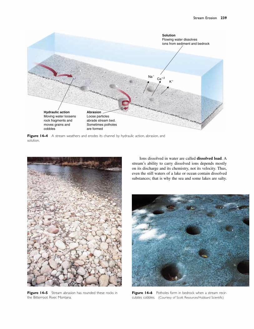
Ions dissolved in water are called dissolved load. Astream’s ability to carry dissolved ions depends mostlyon its discharge and its chemistry, not its velocity. Thus,even the still waters of a lake or ocean contain dissolvedsubstances; that is why the sea and some lakes are salty.
Stream Erosion 239
SolutionFlowing water dissolvesions from sediment and bedrock
Hydraulic actionMoving water loosensrock fragments andmoves grains andcobbles
AbrasionLoose particlesabrade stream bed.Sometimes potholesare formed
Na�
Ca�2
K�
Figure 14–4 A stream weathers and erodes its channel by hydraulic action, abrasion, andsolution.
Figure 14–5 Stream abrasion has rounded these rocks inthe Bitterroot River, Montana.
Figure 14–6 Potholes form in bedrock when a stream recir-culates cobbles. (Courtesy of Scott Resources/Hubbard Scientific)
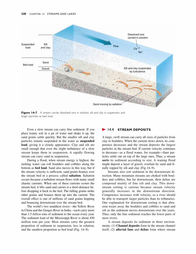
Even a slow stream can carry fine sediment. If youplace loamy soil in a jar of water and shake it up, thesand grains settle quickly. But the smaller silt and clayparticles remain suspended in the water as suspendedload, giving it a cloudy appearance. Clay and silt aresmall enough that even the slight turbulence of a slowstream keeps them in suspension. A rapidly flowingstream can carry sand in suspension.
During a flood, when stream energy is highest, therushing water can roll boulders and cobbles along thebottom as bed load. Sand also moves in this way, but ifthe stream velocity is sufficient, sand grains bounce overthe stream bed in a process called saltation. Saltationoccurs because a turbulent stream flows with many smallchaotic currents. When one of these currents scours thestream bed, it lifts sand and carries it a short distance be-fore dropping it back to the bed. The falling grains strikeother grains and bounce them up into the current. Theoverall effect is one of millions of sand grains hoppingand bouncing downstream over the stream bed.
The world’s two muddiest rivers—the Yellow Riverin China and the Ganges River in India—each carry morethan 1.5 billion tons of sediment to the ocean every year.The sediment load of the Mississippi River is about 450million tons per year. Most streams carry the greatestproportion of sediment in suspension, less in solution,and the smallest proportion as bed load (Fig. 14–8).
� 14.4 STREAM DEPOSITS
A large, swift stream can carry all sizes of particles fromclay to boulders. When the current slows down, its com-petence decreases and the stream deposits the largestparticles in the stream bed. If current velocity continuesto decrease—as a flood wanes, for example—finer par-ticles settle out on top of the large ones. Thus, a streamsorts its sediment according to size. A waning floodmight deposit a layer of gravel, overlain by sand and fi-nally topped by silt and clay (Fig 14–9).
Streams also sort sediment in the downstream di-rection. Many mountain streams are choked with boul-ders and cobbles, but far downstream, their deltas arecomposed mainly of fine silt and clay. This down-stream sorting is curious because stream velocity generally increases in the downstream direction.Competence increases with velocity, so a river shouldbe able to transport larger particles than its tributaries.One explanation for downstream sorting is that abra-sion wears away the boulders and cobbles to sand andsilt as the sediment moves downstream over the years.Thus, only the fine sediment reaches the lower parts ofmost rivers.
A stream deposits its sediment in three environ-ments: (1) Channel deposits form in the stream channelitself; (2) alluvial fans and deltas form where stream
240 CHAPTER 14 STREAMS AND LAKES
Siltand clay
Suspendedload
Sand
Gravel
Bed load
Flow
Sand moving by saltation
Dissolved ionscarried in solution
Ca�2
Na�
Silt and clay suspendedby turbulence
Silt and clay suspendedby turbulence
Figure 14–7 A stream carries dissolved ions in solution, silt and clay in suspension, andlarger particles as bed load.

gradient suddenly decreases as a stream enters a flat plain,a lake, or the sea; and (3) flood plain deposits accumulateon a flood plain adjacent to the stream channel.
CHANNEL DEPOSITS
A bar is an elongate mound of sediment. Bars are tran-sient features that form in the stream channel and on thebanks. They commonly form in one year and erode thenext. Rivers used for commercial navigation must berecharted frequently because bars shift from year to year.
Imagine a winding stream such as that in Figure14–10. The water on the outside of the curve A-A� movesfaster than the water on the inside. The stream erodes itsoutside bank because the current’s inertia drives it intothe outside bank. At the same time, the slower water onthe inside point of the bend deposits sediment, forminga point bar. A mid-channel bar is a sandy and gravellydeposit that forms in the middle of a stream channel.
Most streams flow in a single channel. In contrast, abraided stream flows in many shallow, interconnectingchannels (Fig. 14–11). A braided stream forms where moresediment is supplied to a stream than it can carry. Thestream dumps the excess sediment, forming mid-channelbars. The bars gradually fill a channel, forcing the streamto overflow its banks and erode new channels. As a re-sult, a braided stream flows simultaneously in severalchannels and shifts back and forth across its flood plain.
Braided streams are common in both deserts andglacial environments because both produce abundantsediment. A desert yields large amounts of sediment be-cause it has little or no vegetation to prevent erosion.Glaciers grind bedrock into fine sediment, which is car-ried by streams flowing from the melting ice.
Stream Deposits 241
Bed load30 millionmetric tons
Solution120 millionmetric tons
Suspension300 millionmetric tons
Figure 14–8 The Mississippi River carries the greatest proportion of its sediment as sus-pended load. Numbers indicate sediment load per year.
Figure 14–9 The lower portion of this photograph showscoarse gravel overlain by finer sediment.The coarse gravel wasdeposited during a flood; the finer sediment accumulated asthe flood waned.The upper gravel accumulated during a sec-ond flood. (G. R. Roberts, New Zealand)
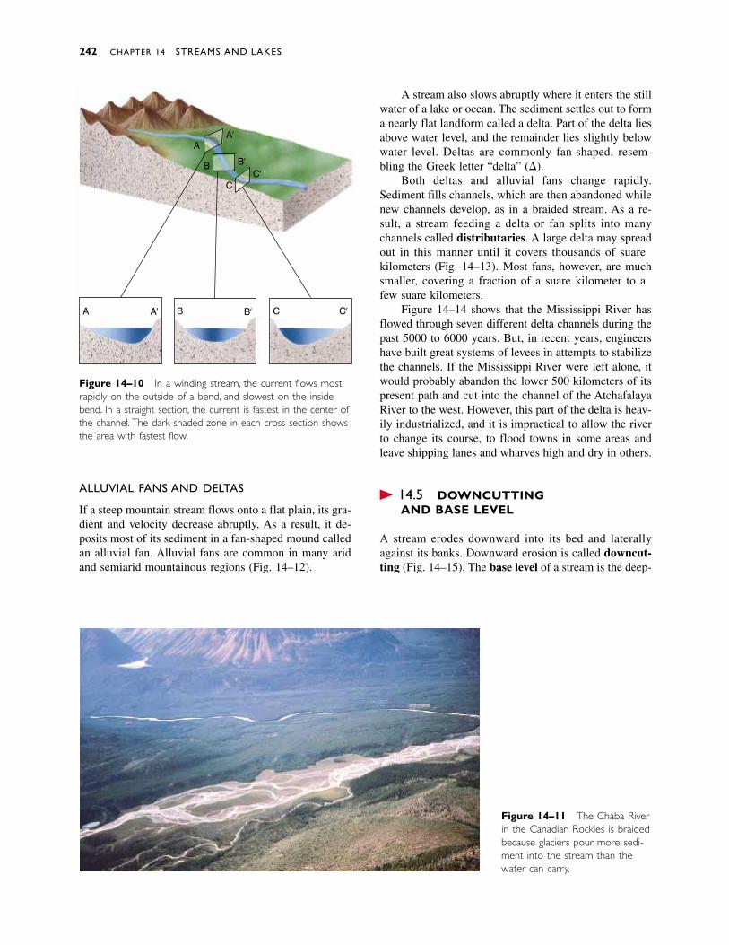
242 CHAPTER 14 STREAMS AND LAKES
A B C�A �B �C
�A
�B�C
A
B
C
Figure 14–10 In a winding stream, the current flows mostrapidly on the outside of a bend, and slowest on the insidebend. In a straight section, the current is fastest in the center ofthe channel. The dark-shaded zone in each cross section showsthe area with fastest flow.
Figure 14–11 The Chaba Riverin the Canadian Rockies is braidedbecause glaciers pour more sedi-ment into the stream than thewater can carry.
ALLUVIAL FANS AND DELTAS
If a steep mountain stream flows onto a flat plain, its gra-dient and velocity decrease abruptly. As a result, it de-posits most of its sediment in a fan-shaped mound calledan alluvial fan. Alluvial fans are common in many aridand semiarid mountainous regions (Fig. 14–12).
A stream also slows abruptly where it enters the stillwater of a lake or ocean. The sediment settles out to forma nearly flat landform called a delta. Part of the delta liesabove water level, and the remainder lies slightly belowwater level. Deltas are commonly fan-shaped, resem-bling the Greek letter “delta” (�).
Both deltas and alluvial fans change rapidly.Sediment fills channels, which are then abandoned whilenew channels develop, as in a braided stream. As a re-sult, a stream feeding a delta or fan splits into manychannels called distributaries. A large delta may spreadout in this manner until it covers thousands of squarekilometers (Fig. 14–13). Most fans, however, are muchsmaller, covering a fraction of a square kilometer to afew square kilometers.
Figure 14–14 shows that the Mississippi River hasflowed through seven different delta channels during thepast 5000 to 6000 years. But, in recent years, engineershave built great systems of levees in attempts to stabilizethe channels. If the Mississippi River were left alone, itwould probably abandon the lower 500 kilometers of itspresent path and cut into the channel of the AtchafalayaRiver to the west. However, this part of the delta is heav-ily industrialized, and it is impractical to allow the riverto change its course, to flood towns in some areas andleave shipping lanes and wharves high and dry in others.
� 14.5 DOWNCUTTING AND BASE LEVEL
A stream erodes downward into its bed and laterallyagainst its banks. Downward erosion is called downcut-ting (Fig. 14–15). The base level of a stream is the deep-

Downcutting and Base Level 243
Figure 14–12 This alluvial fanin the Canadian Rockies formedwhere a steep mountain streamdeposits most of its sediment as itenters a flat valley.
Young deltastraight channel
As the delta grows the channel is divertedto one side and then the other
Distributaries form Mature delta
Figure 14–13 A delta forms and grows with time where a stream deposits its sedimentas it flows into a lake or the sea.
Figure 14–14 The MississippiRiver has flowed into the sea byseven different channels duringthe past 6000 years. As a result,the modern delta is composedof seven smaller deltas formedat different times.The oldestdelta is numbered 1, and thecurrent delta is 7.
Baton Rouge
New Orleans
Gulf of Mexico
2
3
516
4
7
Atchafalaya R
iver
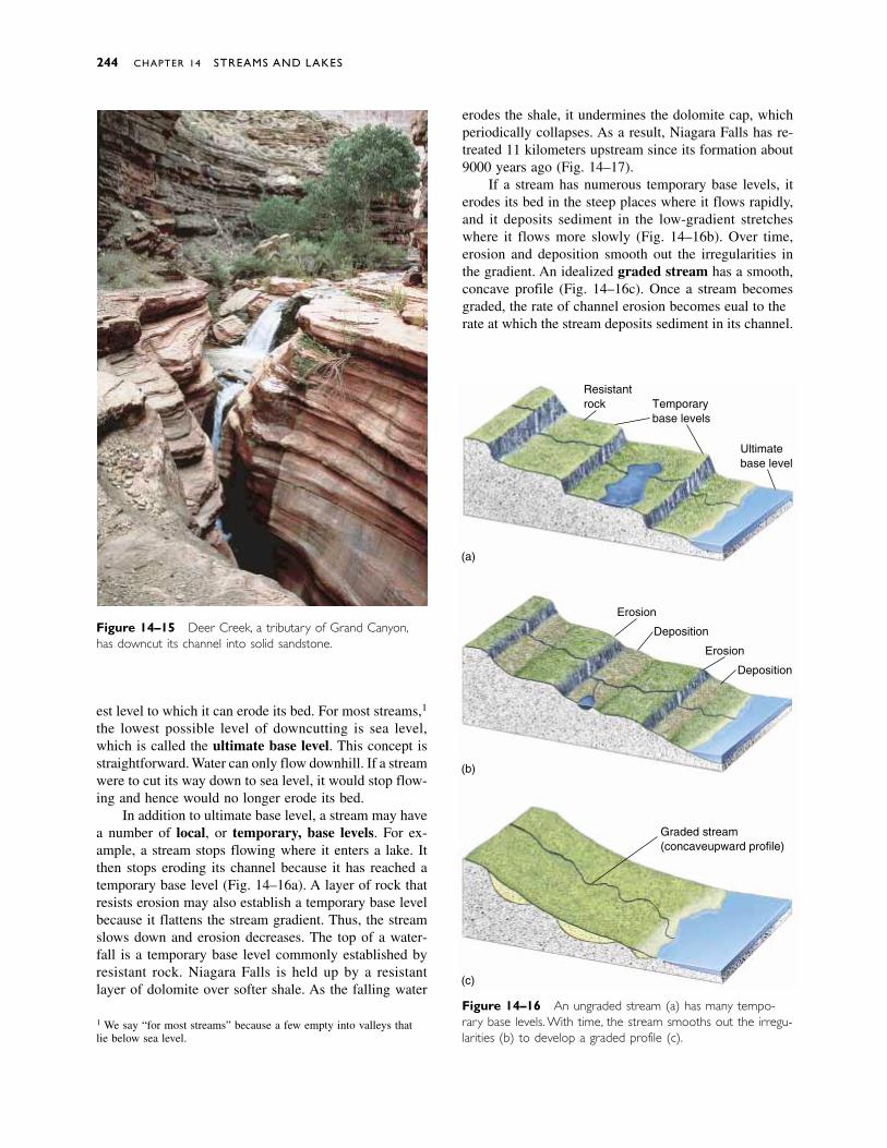
est level to which it can erode its bed. For most streams,1
the lowest possible level of downcutting is sea level,which is called the ultimate base level. This concept isstraightforward. Water can only flow downhill. If a streamwere to cut its way down to sea level, it would stop flow-ing and hence would no longer erode its bed.
In addition to ultimate base level, a stream may havea number of local, or temporary, base levels. For ex-ample, a stream stops flowing where it enters a lake. Itthen stops eroding its channel because it has reached atemporary base level (Fig. 14–16a). A layer of rock thatresists erosion may also establish a temporary base levelbecause it flattens the stream gradient. Thus, the streamslows down and erosion decreases. The top of a water-fall is a temporary base level commonly established byresistant rock. Niagara Falls is held up by a resistantlayer of dolomite over softer shale. As the falling water
erodes the shale, it undermines the dolomite cap, whichperiodically collapses. As a result, Niagara Falls has re-treated 11 kilometers upstream since its formation about9000 years ago (Fig. 14–17).
If a stream has numerous temporary base levels, iterodes its bed in the steep places where it flows rapidly,and it deposits sediment in the low-gradient stretcheswhere it flows more slowly (Fig. 14–16b). Over time,erosion and deposition smooth out the irregularities inthe gradient. An idealized graded stream has a smooth,concave profile (Fig. 14–16c). Once a stream becomesgraded, the rate of channel erosion becomes equal to therate at which the stream deposits sediment in its channel.
244 CHAPTER 14 STREAMS AND LAKES
1 We say “for most streams” because a few empty into valleys thatlie below sea level.
Figure 14–15 Deer Creek, a tributary of Grand Canyon,has downcut its channel into solid sandstone.
Figure 14–16 An ungraded stream (a) has many tempo-rary base levels. With time, the stream smooths out the irregu-larities (b) to develop a graded profile (c).
(a)
(b)
(c)
Resistantrock Temporary
base levels
Ultimatebase level
Erosion
Deposition
Erosion
Deposition
Graded stream(concave-upward profile)
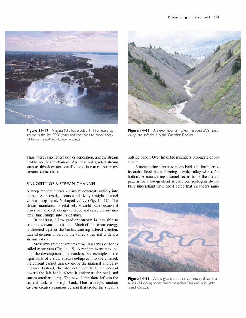
Thus, there is no net erosion or deposition, and the streamprofile no longer changes. An idealized graded streamsuch as this does not actually exist in nature, but manystreams come close.
SINUOSITY OF A STREAM CHANNEL
A steep mountain stream usually downcuts rapidly intoits bed. As a result, it cuts a relatively straight channelwith a steep-sided, V-shaped valley (Fig. 14–18). Thestream maintains its relatively straight path because itflows with enough energy to erode and carry off any ma-terial that slumps into its channel.
In contrast, a low-gradient stream is less able toerode downward into its bed. Much of the stream energyis directed against the banks, causing lateral erosion.Lateral erosion undercuts the valley sides and widens astream valley.
Most low-gradient streams flow in a series of bendscalled meanders (Fig. 14–19). A random event may ini-tiate the development of meanders. For example, if theright bank of a slow stream collapses into the channel,the current cannot quickly erode the material and carryit away. Instead, the obstruction deflects the currenttoward the left bank, where it undercuts the bank andcauses another slump. The new slump then deflects thecurrent back to the right bank. Thus, a single, randomcave-in creates a sinuous current that erodes the stream’s
outside bends. Over time, the meanders propagate down-stream.
A meandering stream wanders back and forth acrossits entire flood plain, forming a wide valley with a flatbottom. A meandering channel seems to be the naturalpattern for a low-gradient stream, but geologists do notfully understand why. Most agree that meanders mini-
Downcutting and Base Level 245
Figure 14–17 Niagara Falls has eroded 11 kilometers up-stream in the last 9000 years and continues to erode today.(Hubertus Kanus/Photo Researchers, Inc.)
Figure 14–18 A steep mountain stream eroded a V-shapedvalley into soft shale in the Canadian Rockies.
Figure 14–19 A low-gradient stream commonly flows in aseries of looping bends called meanders. This one is in BaffinIsland, Canada.
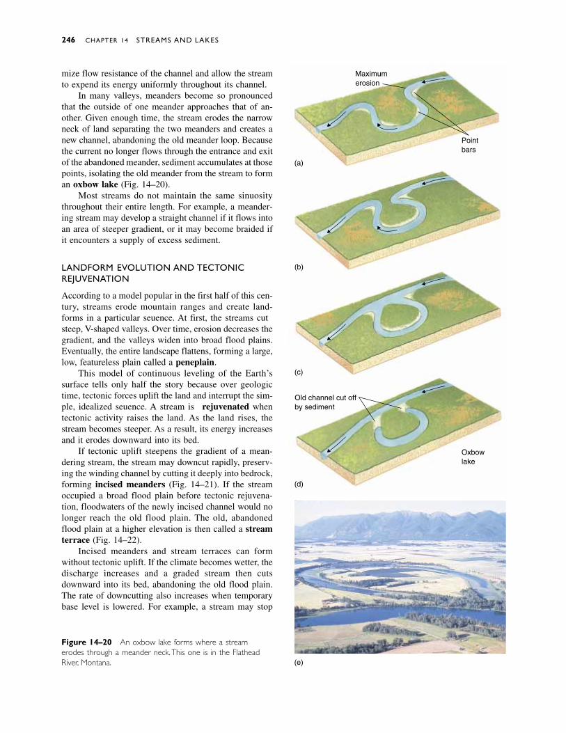
mize flow resistance of the channel and allow the streamto expend its energy uniformly throughout its channel.
In many valleys, meanders become so pronouncedthat the outside of one meander approaches that of an-other. Given enough time, the stream erodes the narrowneck of land separating the two meanders and creates anew channel, abandoning the old meander loop. Becausethe current no longer flows through the entrance and exitof the abandoned meander, sediment accumulates at thosepoints, isolating the old meander from the stream to forman oxbow lake (Fig. 14–20).
Most streams do not maintain the same sinuositythroughout their entire length. For example, a meander-ing stream may develop a straight channel if it flows intoan area of steeper gradient, or it may become braided ifit encounters a supply of excess sediment.
LANDFORM EVOLUTION AND TECTONICREJUVENATION
According to a model popular in the first half of this cen-tury, streams erode mountain ranges and create land-forms in a particular sequence. At first, the streams cutsteep, V-shaped valleys. Over time, erosion decreases thegradient, and the valleys widen into broad flood plains.Eventually, the entire landscape flattens, forming a large,low, featureless plain called a peneplain.
This model of continuous leveling of the Earth’ssurface tells only half the story because over geologictime, tectonic forces uplift the land and interrupt the sim-ple, idealized sequence. A stream is rejuvenated whentectonic activity raises the land. As the land rises, thestream becomes steeper. As a result, its energy increasesand it erodes downward into its bed.
If tectonic uplift steepens the gradient of a mean-dering stream, the stream may downcut rapidly, preserv-ing the winding channel by cutting it deeply into bedrock,forming incised meanders (Fig. 14–21). If the streamoccupied a broad flood plain before tectonic rejuvena-tion, floodwaters of the newly incised channel would nolonger reach the old flood plain. The old, abandonedflood plain at a higher elevation is then called a streamterrace (Fig. 14–22).
Incised meanders and stream terraces can form without tectonic uplift. If the climate becomes wetter, thedischarge increases and a graded stream then cuts downward into its bed, abandoning the old flood plain.The rate of downcutting also increases when temporarybase level is lowered. For example, a stream may stop
246 CHAPTER 14 STREAMS AND LAKES
Figure 14–20 An oxbow lake forms where a streamerodes through a meander neck.This one is in the FlatheadRiver, Montana.
Maximumerosion
Pointbars
Old channel cut offby sediment
Oxbowlake
(a)
(b)
(c)
(d)
(e)
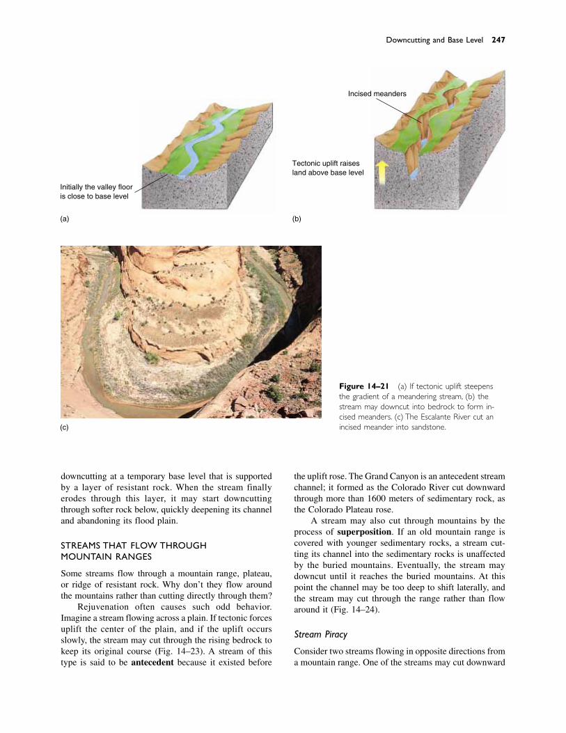
downcutting at a temporary base level that is supportedby a layer of resistant rock. When the stream finallyerodes through this layer, it may start downcuttingthrough softer rock below, quickly deepening its channeland abandoning its flood plain.
STREAMS THAT FLOW THROUGH MOUNTAIN RANGES
Some streams flow through a mountain range, plateau,or ridge of resistant rock. Why don’t they flow aroundthe mountains rather than cutting directly through them?
Rejuvenation often causes such odd behavior.Imagine a stream flowing across a plain. If tectonic forcesuplift the center of the plain, and if the uplift occursslowly, the stream may cut through the rising bedrock tokeep its original course (Fig. 14–23). A stream of thistype is said to be antecedent because it existed before
Downcutting and Base Level 247
Initially the valley flooris close to base level
(a) (b)
Incised meanders
Tectonic uplift raisesland above base level
(c)
Figure 14–21 (a) If tectonic uplift steepensthe gradient of a meandering stream, (b) thestream may downcut into bedrock to form in-cised meanders. (c) The Escalante River cut an incised meander into sandstone.
the uplift rose. The Grand Canyon is an antecedent streamchannel; it formed as the Colorado River cut downwardthrough more than 1600 meters of sedimentary rock, asthe Colorado Plateau rose.
A stream may also cut through mountains by theprocess of superposition. If an old mountain range iscovered with younger sedimentary rocks, a stream cut-ting its channel into the sedimentary rocks is unaffectedby the buried mountains. Eventually, the stream maydowncut until it reaches the buried mountains. At thispoint the channel may be too deep to shift laterally, andthe stream may cut through the range rather than flowaround it (Fig. 14–24).
Stream Piracy
Consider two streams flowing in opposite directions froma mountain range. One of the streams may cut downward
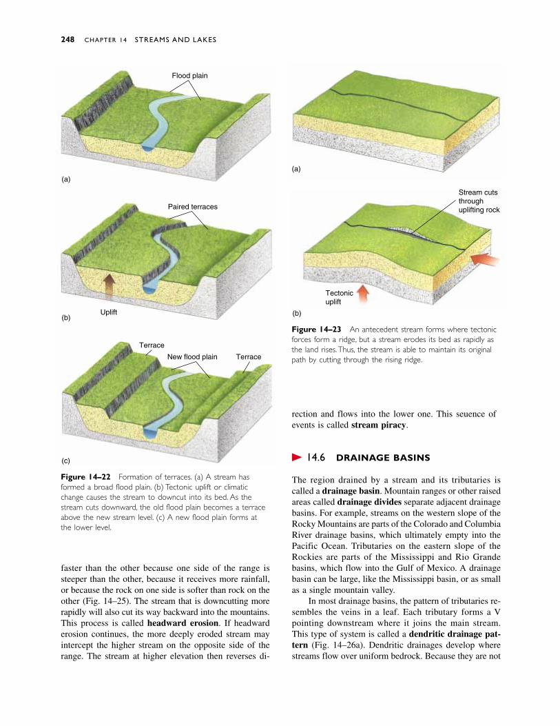
faster than the other because one side of the range issteeper than the other, because it receives more rainfall,or because the rock on one side is softer than rock on theother (Fig. 14–25). The stream that is downcutting morerapidly will also cut its way backward into the mountains.This process is called headward erosion. If headwarderosion continues, the more deeply eroded stream mayintercept the higher stream on the opposite side of therange. The stream at higher elevation then reverses di-
rection and flows into the lower one. This sequence ofevents is called stream piracy.
� 14.6 DRAINAGE BASINS
The region drained by a stream and its tributaries iscalled a drainage basin. Mountain ranges or other raisedareas called drainage divides separate adjacent drainagebasins. For example, streams on the western slope of theRocky Mountains are parts of the Colorado and ColumbiaRiver drainage basins, which ultimately empty into thePacific Ocean. Tributaries on the eastern slope of theRockies are parts of the Mississippi and Rio Grandebasins, which flow into the Gulf of Mexico. A drainagebasin can be large, like the Mississippi basin, or as smallas a single mountain valley.
In most drainage basins, the pattern of tributaries re-sembles the veins in a leaf. Each tributary forms a Vpointing downstream where it joins the main stream.This type of system is called a dendritic drainage pat-tern (Fig. 14–26a). Dendritic drainages develop wherestreams flow over uniform bedrock. Because they are not
248 CHAPTER 14 STREAMS AND LAKES
Figure 14–22 Formation of terraces. (a) A stream hasformed a broad flood plain. (b) Tectonic uplift or climaticchange causes the stream to downcut into its bed. As thestream cuts downward, the old flood plain becomes a terraceabove the new stream level. (c) A new flood plain forms atthe lower level.
Figure 14–23 An antecedent stream forms where tectonicforces form a ridge, but a stream erodes its bed as rapidly asthe land rises. Thus, the stream is able to maintain its originalpath by cutting through the rising ridge.
(a)
(b)
(c)
Flood plain
Paired terraces
Uplift
Terrace
New flood plain Terrace
(a)
(b)
Tectonicuplift
Stream cutsthroughuplifting rock

deflected by resistant layers of bedrock, the streams takethe shortest route downslope.
In some regions, bedrock is not uniform. For exam-ple, Figure 14–26b shows a layer of sandstone lying over granite. The rocks were faulted and tilted after thesandstone formed. As a result, parallel outcrops of easily
eroded sandstone alternate with bands of hard granite.Streams followed the softer sandstone, forming a seriesof long, straight, parallel channels intersected at right an-gles by short tributaries. This type of drainage pattern,called a trellis pattern, is common in the tilted rocks ofthe Appalachian Mountains. A rectangular pattern can
Drainage Basins 249
(b)
(c)
(a)
Figure 14–24 A superposed stream forms where a streamflows over young sedimentary rock that has buried an ancientmountain range. As the stream erodes downward, it cuts intothe old mountains, maintaining its course.
Stream with steeper gradienterodes more rapidly
(a)
(b)
(c)
Figure 14–25 Stream piracy occurs when a stream on thesteeper side of a ridge erodes downward more rapidly thanthe stream on the opposite slope. Eventually, the steeperstream cuts through the ridge to intersect the higher stream.The higher stream then reverses direction to flow into thelower one.
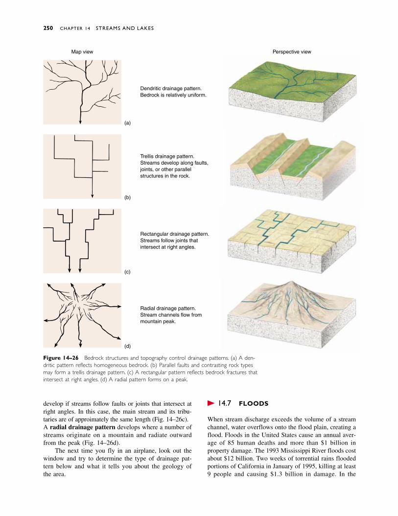
develop if streams follow faults or joints that intersect atright angles. In this case, the main stream and its tribu-taries are of approximately the same length (Fig. 14–26c).A radial drainage pattern develops where a number ofstreams originate on a mountain and radiate outwardfrom the peak (Fig. 14–26d).
The next time you fly in an airplane, look out thewindow and try to determine the type of drainage pat-tern below and what it tells you about the geology of the area.
� 14.7 FLOODS
When stream discharge exceeds the volume of a streamchannel, water overflows onto the flood plain, creating aflood. Floods in the United States cause an annual aver-age of 85 human deaths and more than $1 billion inproperty damage. The 1993 Mississippi River floods costabout $12 billion. Two weeks of torrential rains floodedportions of California in January of 1995, killing at least9 people and causing $1.3 billion in damage. In the
250 CHAPTER 14 STREAMS AND LAKES
Map view Perspective view
(a)
(b)
(c)
(d)
Dendritic drainage pattern.Bedrock is relatively uniform.
Trellis drainage pattern.Streams develop along faults,joints, or other parallelstructures in the rock.
Rectangular drainage pattern.Streams follow joints thatintersect at right angles.
Radial drainage pattern.Stream channels flow frommountain peak.
Figure 14–26 Bedrock structures and topography control drainage patterns. (a) A den-dritic pattern reflects homogeneous bedrock. (b) Parallel faults and contrasting rock typesmay form a trellis drainage pattern. (c) A rectangular pattern reflects bedrock fractures thatintersect at right angles. (d) A radial pattern forms on a peak.
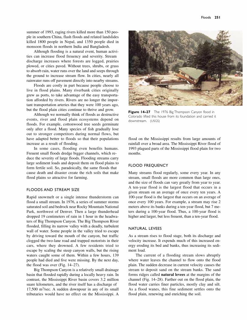
summer of 1993, raging rivers killed more than 150 peo-ple in southern China, flash floods and related landslideskilled 1800 people in Nepal, and 1350 people died inmonsoon floods in northern India and Bangladesh.
Although flooding is a natural event, human activi-ties can increase flood frequency and severity. Streamdischarge increases where forests are logged, prairiesplowed, or cities paved. Without trees, shrubs, or grassto absorb rain, water runs over the land and seeps throughthe ground to increase stream flow. In cities, nearly allrainwater runs off pavement directly into nearby streams.
Floods are costly in part because people choose tolive in flood plains. Many riverbank cities originallygrew as ports, to take advantage of the easy transporta-tion afforded by rivers. Rivers are no longer the impor-tant transportation arteries that they were 100 years ago,but the flood plain cities continue to thrive and grow.
Although we normally think of floods as destructiveevents, river and flood plain ecosystems depend onfloods. For example, cottonwood tree seeds germinateonly after a flood. Many species of fish gradually loseout to stronger competitors during normal flows, buthave adapted better to floods so that their populations increase as a result of flooding.
In some cases, flooding even benefits humans.Frequent small floods dredge bigger channels, which re-duce the severity of large floods. Flooding streams carrylarge sediment loads and deposit them on flood plains toform fertile soil. So, paradoxically, the same floods thatcause death and disaster create the rich soils that makeflood plains so attractive for farming.
FLOODS AND STREAM SIZE
Rapid snowmelt or a single intense thunderstorm canflood a small stream. In 1976, a series of summer stormssaturated soil and bedrock near Rocky Mountain NationalPark, northwest of Denver. Then a large thunderheaddropped 19 centimeters of rain in 1 hour in the headwa-ters of Big Thompson Canyon. The Big Thompson Riverflooded, filling its narrow valley with a deadly, turbulentwall of water. Some people in the valley tried to escapeby driving toward the mouth of the canyon, but trafficclogged the two-lane road and trapped motorists in theircars, where they drowned. A few residents tried to escape by scaling the steep canyon walls, but the risingwaters caught some of them. Within a few hours, 139people had died and five were missing. By the next day,the flood was over (Fig. 14–27).
Big Thompson Canyon is a relatively small drainagebasin that flooded rapidly during a locally heavy rain. Incontrast, the Mississippi River basin covers 3.2 millionsquare kilometers, and the river itself has a discharge of17,500 m3/sec. A sudden downpour in any of its smalltributaries would have no effect on the Mississippi. A
flood on the Mississippi results from large amounts ofrainfall over a broad area. The Mississippi River flood of1993 plagued parts of the Mississippi flood plain for twomonths.
FLOOD FREQUENCY
Many streams flood regularly, some every year. In anystream, small floods are more common than large ones,and the size of floods can vary greatly from year to year.A ten-year flood is the largest flood that occurs in agiven stream on an average of once every ten years. A100-year flood is the largest that occurs on an average ofonce every 100 years. For example, a stream may rise 2meters above its banks during a ten-year flood, but 7 me-ters during a 100-year flood. Thus, a 100-year flood ishigher and larger, but less frequent, than a ten-year flood.
NATURAL LEVEES
As a stream rises to flood stage, both its discharge andvelocity increase. It expends much of this increased en-ergy eroding its bed and banks, thus increasing its sedi-ment load.
The current of a flooding stream slows abruptlywhere water leaves the channel to flow onto the floodplain. The sudden decrease in current velocity causes thestream to deposit sand on the stream banks. The sandforms ridges called natural levees at the margins of thechannel (Fig. 14–28). Farther out on the flood plain, theflood water carries finer particles, mostly clay and silt.As a flood wanes, this fine sediment settles onto theflood plain, renewing and enriching the soil.
Floods 251
Figure 14–27 The 1976 Big Thompson Canyon flood inColorado lifted this house from its foundation and carried itdownstream. (USGS)
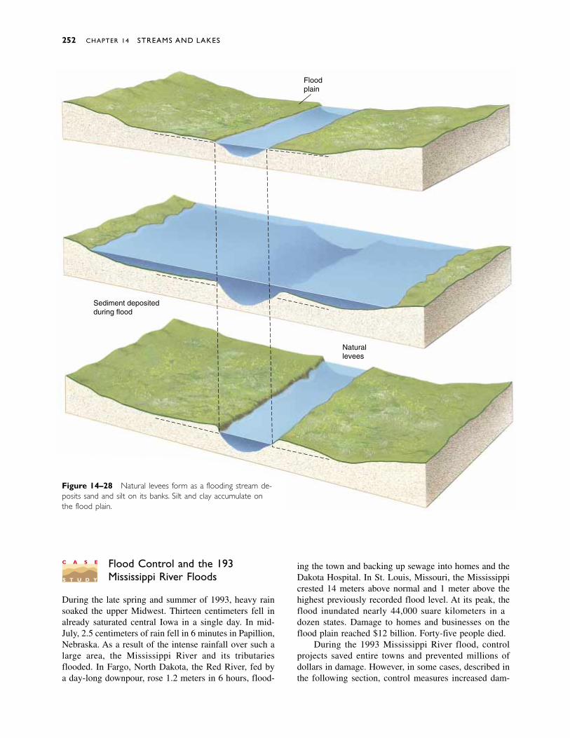
Flood Control and the 1993 Mississippi River Floods
During the late spring and summer of 1993, heavy rainsoaked the upper Midwest. Thirteen centimeters fell inalready saturated central Iowa in a single day. In mid-July, 2.5 centimeters of rain fell in 6 minutes in Papillion,Nebraska. As a result of the intense rainfall over such alarge area, the Mississippi River and its tributariesflooded. In Fargo, North Dakota, the Red River, fed bya day-long downpour, rose 1.2 meters in 6 hours, flood-
ing the town and backing up sewage into homes and theDakota Hospital. In St. Louis, Missouri, the Mississippicrested 14 meters above normal and 1 meter above thehighest previously recorded flood level. At its peak, theflood inundated nearly 44,000 square kilometers in adozen states. Damage to homes and businesses on theflood plain reached $12 billion. Forty-five people died.
During the 1993 Mississippi River flood, controlprojects saved entire towns and prevented millions ofdollars in damage. However, in some cases, described inthe following section, control measures increased dam-
252 CHAPTER 14 STREAMS AND LAKES
Floodplain
Sediment depositedduring flood
Naturallevees
Figure 14–28 Natural levees form as a flooding stream de-posits sand and silt on its banks. Silt and clay accumulate onthe flood plain.
C A S E
S T U D Y

age. Geologists, engineers, and city planners are study-ing these conflicting results to plan for the next flood,which may be years or decades away.
ARTIFICIAL LEVEES AND CHANNELS
An artificial levee is a wall built of earth, rocks, or con-crete along the banks of a stream to prevent rising waterfrom spilling out of the stream channel onto the floodplain. In the past 70 years, the U.S. Army Corps ofEngineers has spent billions of dollars building floodcontrol structures, including 11,000 kilometers of leveesalong the banks of the Mississippi and its tributaries(Fig. 14–29).
As the Mississippi River crested in July 1993, floodwaters surged through low areas of Davenport, Iowa,built on the flood plain. However, the business district ofnearby Rock Island, Illinois, remained mostly dry. In1971, Rock Island had built levees to protect low-lyingareas of the town, whereas Davenport had not built lev-ees. Hannibal, Missouri, had just completed levee con-struction to protect the town when the flood struck. The$8 million project in Hannibal saved the Mark Twainhome and museum and protected the town and sur-rounding land from flooding.
Unfortunately, two major problems plague floodcontrol projects that rely on artificial levees: Levees aretemporary solutions to flooding, and in some cases theycause higher floods along nearby reaches of the river.
In the absence of levees, when a stream floods, it de-posits mud and sand on the flood plain. When artificiallevees are built, the stream cannot overflow during smallfloods, so it deposits the sediment in its channel, raisingthe level of the stream bed. After several small floods,the entire stream may rise above its flood plain, con-tained only by the levees (Fig. 14–30). This configura-tion creates the potential for a truly disastrous flood be-cause if the levee should be breached during a large
flood, the entire stream then flows out of its channel andonto the flood plain. As a result of levee building andchannel sedimentation, portions of the Yellow River inChina now lie 10 meters above its flood plain. Thus, lev-ees may solve flooding problems in the short term, butin a longer time frame they may cause even larger andmore destructive floods.
Engineers have tried to solve the problem of chan-nel sedimentation by dredging artificial channels acrossmeanders. When a stream is straightened, its velocity in-creases and it scours more sediment from its channel.This solution, however, also has its drawbacks. A straight-ened stream is shorter than a meandering one, and con-sequently the total volume of its channel is reduced.Therefore, the channel cannot contain as much excesswater, and flooding is likely to increase downstream.
Floods 253
Figure 14–29 Flood waters pouring from the channel of theMissouri River through a broken levee onto the flood plain inBoone County, Missouri. (Stephen Levin)
(a) Normal flow
(b) Flood level
(c) Normal flow many years later
Figure 14–30 Artificial levees cause sediment to accumulatein a stream channel, eventually raising the channel above thelevel of the flood plain and creating the potential for a disas-trous flood.
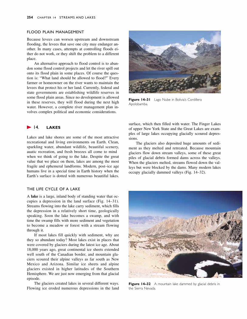
FLOOD PLAIN MANAGEMENT
Because levees can worsen upstream and downstreamflooding, the levees that save one city may endanger an-other. In many cases, attempts at controlling floods ei-ther do not work, or they shift the problem to a differentplace.
An alternative approach to flood control is to aban-don some flood control projects and let the river spill outonto its flood plain in some places. Of course the ques-tion is: “What land should be allowed to flood?” Everyfarmer or homeowner on the river wants to maintain thelevees that protect his or her land. Currently, federal andstate governments are establishing wildlife reserves insome flood plain areas. Since no development is allowedin these reserves, they will flood during the next highwater. However, a complete river management plan in-volves complex political and economic considerations.
� 14.8 LAKES
Lakes and lake shores are some of the most attractiverecreational and living environments on Earth. Clean,sparkling water, abundant wildlife, beautiful scenery,aquatic recreation, and fresh breezes all come to mindwhen we think of going to the lake. Despite the greatvalue that we place on them, lakes are among the mostfragile and ephemeral landforms. Modern, post–ice agehumans live in a special time in Earth history when theEarth’s surface is dotted with numerous beautiful lakes.
THE LIFE CYCLE OF A LAKE
A lake is a large, inland body of standing water that oc-cupies a depression in the land surface (Fig. 14–31).Streams flowing into the lake carry sediment, which fillsthe depression in a relatively short time, geologicallyspeaking. Soon the lake becomes a swamp, and withtime the swamp fills with more sediment and vegetationto become a meadow or forest with a stream flowingthrough it.
If most lakes fill quickly with sediment, why arethey so abundant today? Most lakes exist in places thatwere covered by glaciers during the latest ice age. About18,000 years ago, great continental ice sheets extendedwell south of the Canadian border, and mountain gla-ciers scoured their alpine valleys as far south as NewMexico and Arizona. Similar ice sheets and alpine glaciers existed in higher latitudes of the SouthernHemisphere. We are just now emerging from that glacialepisode.
The glaciers created lakes in several different ways.Flowing ice eroded numerous depressions in the land
surface, which then filled with water. The Finger Lakesof upper New York State and the Great Lakes are exam-ples of large lakes occupying glacially scoured depres-sions.
The glaciers also deposited huge amounts of sedi-ment as they melted and retreated. Because mountainglaciers flow down stream valleys, some of these greatpiles of glacial debris formed dams across the valleys.When the glaciers melted, streams flowed down the val-leys but were blocked by the dams. Many modern lakesoccupy glacially dammed valleys (Fig. 14–32).
254 CHAPTER 14 STREAMS AND LAKES
Figure 14–31 Lago Nube in Bolivia’s CordilleraApolobamba.
Figure 14–32 A mountain lake dammed by glacial debris inthe Sierra Nevada.
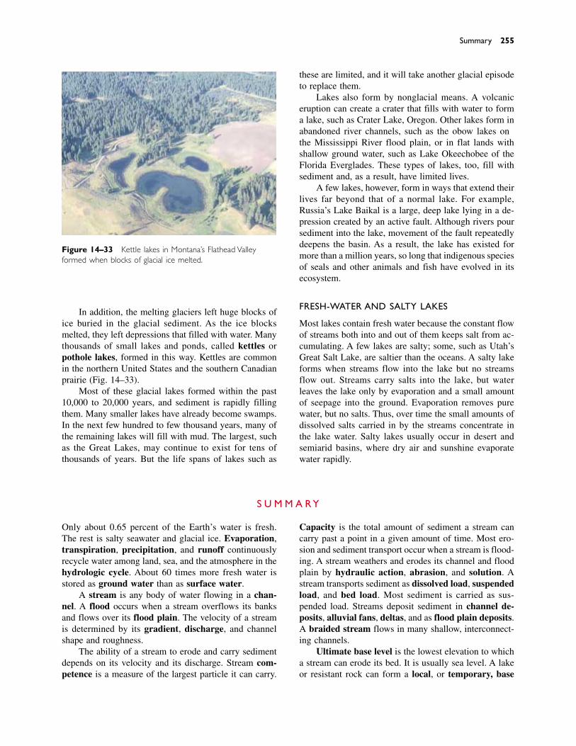
In addition, the melting glaciers left huge blocks ofice buried in the glacial sediment. As the ice blocksmelted, they left depressions that filled with water. Manythousands of small lakes and ponds, called kettles orpothole lakes, formed in this way. Kettles are commonin the northern United States and the southern Canadianprairie (Fig. 14–33).
Most of these glacial lakes formed within the past10,000 to 20,000 years, and sediment is rapidly fillingthem. Many smaller lakes have already become swamps.In the next few hundred to few thousand years, many ofthe remaining lakes will fill with mud. The largest, suchas the Great Lakes, may continue to exist for tens ofthousands of years. But the life spans of lakes such as
these are limited, and it will take another glacial episodeto replace them.
Lakes also form by nonglacial means. A volcaniceruption can create a crater that fills with water to forma lake, such as Crater Lake, Oregon. Other lakes form inabandoned river channels, such as the oxbow lakes onthe Mississippi River flood plain, or in flat lands withshallow ground water, such as Lake Okeechobee of theFlorida Everglades. These types of lakes, too, fill withsediment and, as a result, have limited lives.
A few lakes, however, form in ways that extend theirlives far beyond that of a normal lake. For example,Russia’s Lake Baikal is a large, deep lake lying in a de-pression created by an active fault. Although rivers poursediment into the lake, movement of the fault repeatedlydeepens the basin. As a result, the lake has existed formore than a million years, so long that indigenous speciesof seals and other animals and fish have evolved in itsecosystem.
FRESH-WATER AND SALTY LAKES
Most lakes contain fresh water because the constant flowof streams both into and out of them keeps salt from ac-cumulating. A few lakes are salty; some, such as Utah’sGreat Salt Lake, are saltier than the oceans. A salty lakeforms when streams flow into the lake but no streamsflow out. Streams carry salts into the lake, but waterleaves the lake only by evaporation and a small amountof seepage into the ground. Evaporation removes purewater, but no salts. Thus, over time the small amounts ofdissolved salts carried in by the streams concentrate inthe lake water. Salty lakes usually occur in desert andsemiarid basins, where dry air and sunshine evaporatewater rapidly.
Summary 255
Figure 14–33 Kettle lakes in Montana’s Flathead Valleyformed when blocks of glacial ice melted.
Only about 0.65 percent of the Earth’s water is fresh.The rest is salty seawater and glacial ice. Evaporation,transpiration, precipitation, and runoff continuouslyrecycle water among land, sea, and the atmosphere in thehydrologic cycle. About 60 times more fresh water isstored as ground water than as surface water.
A stream is any body of water flowing in a chan-nel. A flood occurs when a stream overflows its banksand flows over its flood plain. The velocity of a streamis determined by its gradient, discharge, and channelshape and roughness.
The ability of a stream to erode and carry sedimentdepends on its velocity and its discharge. Stream com-petence is a measure of the largest particle it can carry.
Capacity is the total amount of sediment a stream cancarry past a point in a given amount of time. Most ero-sion and sediment transport occur when a stream is flood-ing. A stream weathers and erodes its channel and floodplain by hydraulic action, abrasion, and solution. Astream transports sediment as dissolved load, suspendedload, and bed load. Most sediment is carried as sus-pended load. Streams deposit sediment in channel de-posits, alluvial fans, deltas, and as flood plain deposits.A braided stream flows in many shallow, interconnect-ing channels.
Ultimate base level is the lowest elevation to whicha stream can erode its bed. It is usually sea level. A lakeor resistant rock can form a local, or temporary, base
S U M M A R Y

256 CHAPTER 14 STREAMS AND LAKES
level. A graded stream has a smooth, concave profile.Steep mountain streams form straight channels and V-shaped valleys, whereas lower-gradient streams formmeanders and wide valleys. Tectonic uplift, increasedrainfall, and lowering of base level all can rejuvenate astream, causing it to cut down into its bed to form in-cised meanders and abandon an old flood plain to forma stream terrace. Headward erosion can cause streampiracy. A drainage basin can be characterized by den-
dritic, trellis, rectangular, or radial patterns, dependingon bedrock geology.
Floods occur when a stream flows out of its chan-nel and onto the flood plain. Floods occur periodicallyin all streams. Artificial levees and other flood controlmeasures reduce flood severity in some areas but may in-crease flood severity at other times and places.
Many modern lakes were created by recent glaciers;as a result, we live in an unusual time of abundant lakes.
hydrologic cycle 236transpiration 236precipitation 236surface water 236runoff 236ground water 236stream 236tributary 236channel 236bed 236bank 236flood 236flood plain 236gradient 237
discharge 237competence 238capacity 238hydraulic action 238abrasion 238dissolved load 239suspended load 240bed load 240saltation 240sorting 240channel deposits 240alluvial fan 240delta 240bar 241
braided stream 241distributary 242downcutting 242base level 242ultimate base
level 244local base level 244graded stream 244lateral erosion 245meander 245oxbow lake 246peneplain 246rejuvenation 246incised meander 246
stream terrace 246antecedent stream 247superposition 247headward erosion 248stream piracy 248drainage basin 248drainage divide 248dendritic drainage
pattern 248trellis pattern 249rectangular pattern 249radial pattern 250natural levee 251lake 254
K E Y W O R D S
1. What proportion of the Earth’s free water is useful fordrinking and irrigation? Why is the proportion so small?
2. In which physical state (solid, liquid, or vapor) does mostof the Earth’s free water exist? Which physical state ac-counts for the least?
3. Describe the movement of water through the hydrologiccycle.
4. Describe the factors that determine the velocity of streamflow and describe how those factors interact.
5. For each of the following pairs of streams (or segmentsof streams), which would move faster? a. Two streamshave equal gradients and discharges, but one is narrowand deep while the other has a semicircular cross section.b. Two streams have equal gradients and channel shapes,but one has a greater discharge. c. Two streams haveequal channel shapes and discharges, but one has asteeper gradient. d. Two streams have equal gradients,channel shapes, and discharges, but one is choked withboulders and the other is lined by smooth rock surfaces.
6. Describe the factors that control the competence of astream.
7. Describe the factors that affect stream capacity.
8. Distinguish among the three types of stream erosion: hy-draulic action, solution, and abrasion.
9. List and explain three ways in which sediment can betransported by a stream. Which type of transport is inde-pendent of stream velocity? Explain.
10. In what transport mode is most sediment carried by astream?
11. Why do braided streams often develop in glacial anddesert environments?
12. How is an alluvial fan similar to a delta? How do theydiffer?
13. Give two examples of natural features that create tempo-rary base levels. Why are they temporary?
14. Draw a profile of a graded stream and an ungraded one.
15. Explain how a stream forms and shapes a valley.
16. In what type of terrain would you be likely to find a V-shaped valley? Where would you be likely to find a me-andering stream?
17. What is a meander and how may it become an oxbowlake?
18. How can a stream become rejuvenated? Give an exampleof a landform created by a rejuvenated stream.
19. Explain the difference between an antecedent and a su-perposed stream.
20. Why are most lakes short-lived landforms?
21. What geologic conditions create a long-lived lake?
R E V I E W Q U E S T I O N S
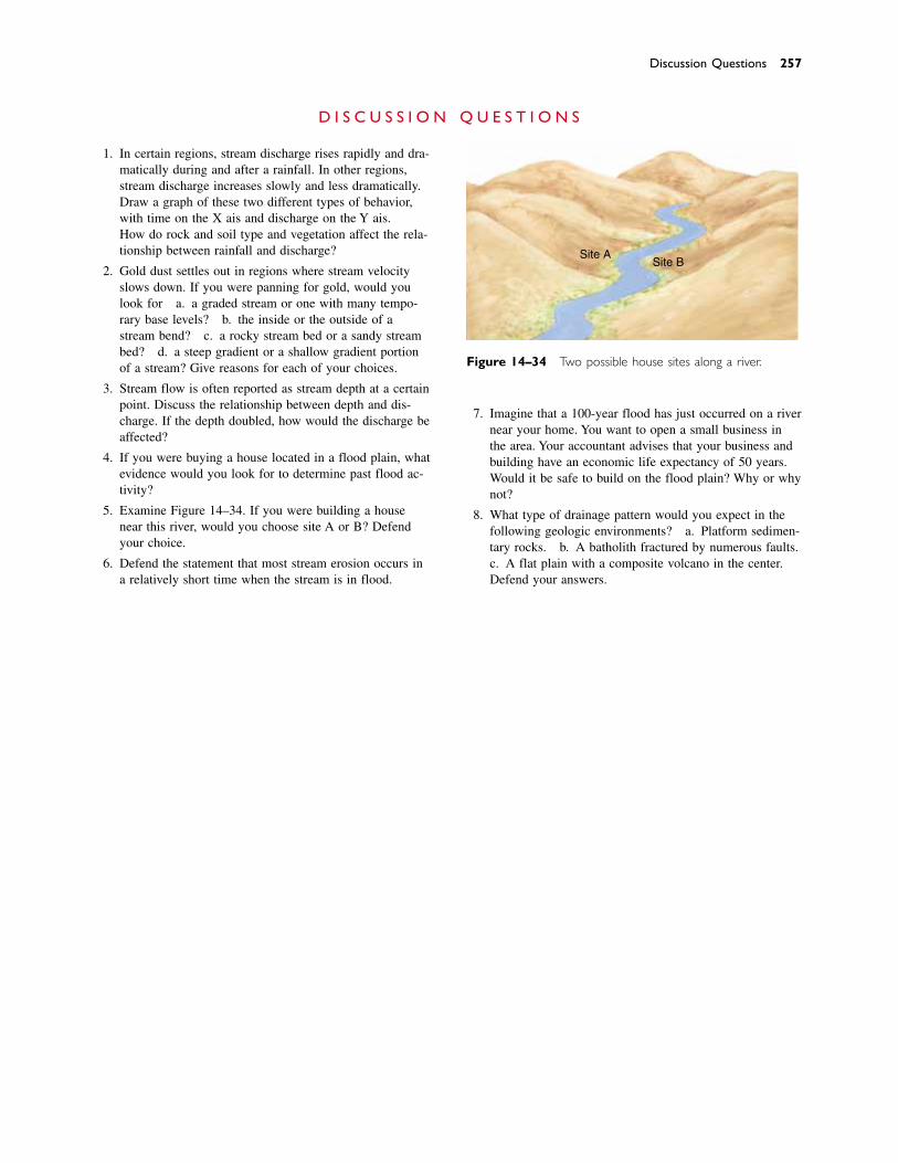
Discussion Questions 257
1. In certain regions, stream discharge rises rapidly and dra-matically during and after a rainfall. In other regions,stream discharge increases slowly and less dramatically.Draw a graph of these two different types of behavior,with time on the X axis and discharge on the Y axis.How do rock and soil type and vegetation affect the rela-tionship between rainfall and discharge?
2. Gold dust settles out in regions where stream velocityslows down. If you were panning for gold, would youlook for a. a graded stream or one with many tempo-rary base levels? b. the inside or the outside of astream bend? c. a rocky stream bed or a sandy streambed? d. a steep gradient or a shallow gradient portionof a stream? Give reasons for each of your choices.
3. Stream flow is often reported as stream depth at a certainpoint. Discuss the relationship between depth and dis-charge. If the depth doubled, how would the discharge beaffected?
4. If you were buying a house located in a flood plain, whatevidence would you look for to determine past flood ac-tivity?
5. Examine Figure 14–34. If you were building a housenear this river, would you choose site A or B? Defendyour choice.
6. Defend the statement that most stream erosion occurs ina relatively short time when the stream is in flood.
7. Imagine that a 100-year flood has just occurred on a rivernear your home. You want to open a small business inthe area. Your accountant advises that your business andbuilding have an economic life expectancy of 50 years.Would it be safe to build on the flood plain? Why or whynot?
8. What type of drainage pattern would you expect in thefollowing geologic environments? a. Platform sedimen-tary rocks. b. A batholith fractured by numerous faults. c. A flat plain with a composite volcano in the center.Defend your answers.
D I S C U S S I O N Q U E S T I O N S
Site ASite B
Figure 14–34 Two possible house sites along a river.
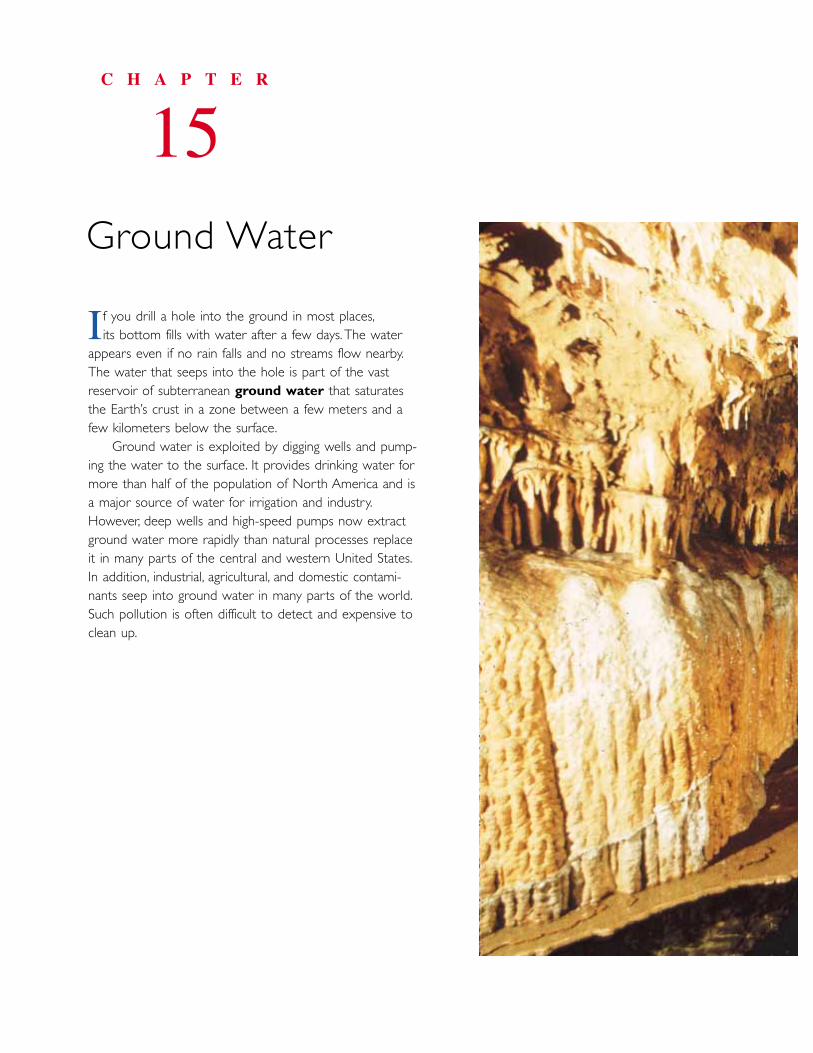
f you drill a hole into the ground in most places,its bottom fills with water after a few days.The water
appears even if no rain falls and no streams flow nearby.The water that seeps into the hole is part of the vastreservoir of subterranean ground water that saturatesthe Earth’s crust in a zone between a few meters and afew kilometers below the surface.
Ground water is exploited by digging wells and pump-ing the water to the surface. It provides drinking water formore than half of the population of North America and isa major source of water for irrigation and industry.However, deep wells and high-speed pumps now extractground water more rapidly than natural processes replaceit in many parts of the central and western United States.In addition, industrial, agricultural, and domestic contami-nants seep into ground water in many parts of the world.Such pollution is often difficult to detect and expensive toclean up.
C H A P T E R
15Ground Water
I
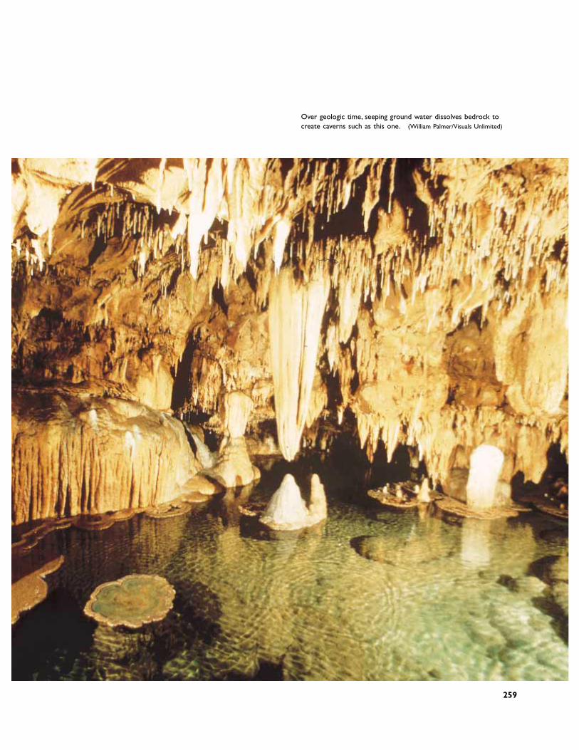
259
Over geologic time, seeping ground water dissolves bedrock to create caverns such as this one. (William Palmer/Visuals Unlimited)
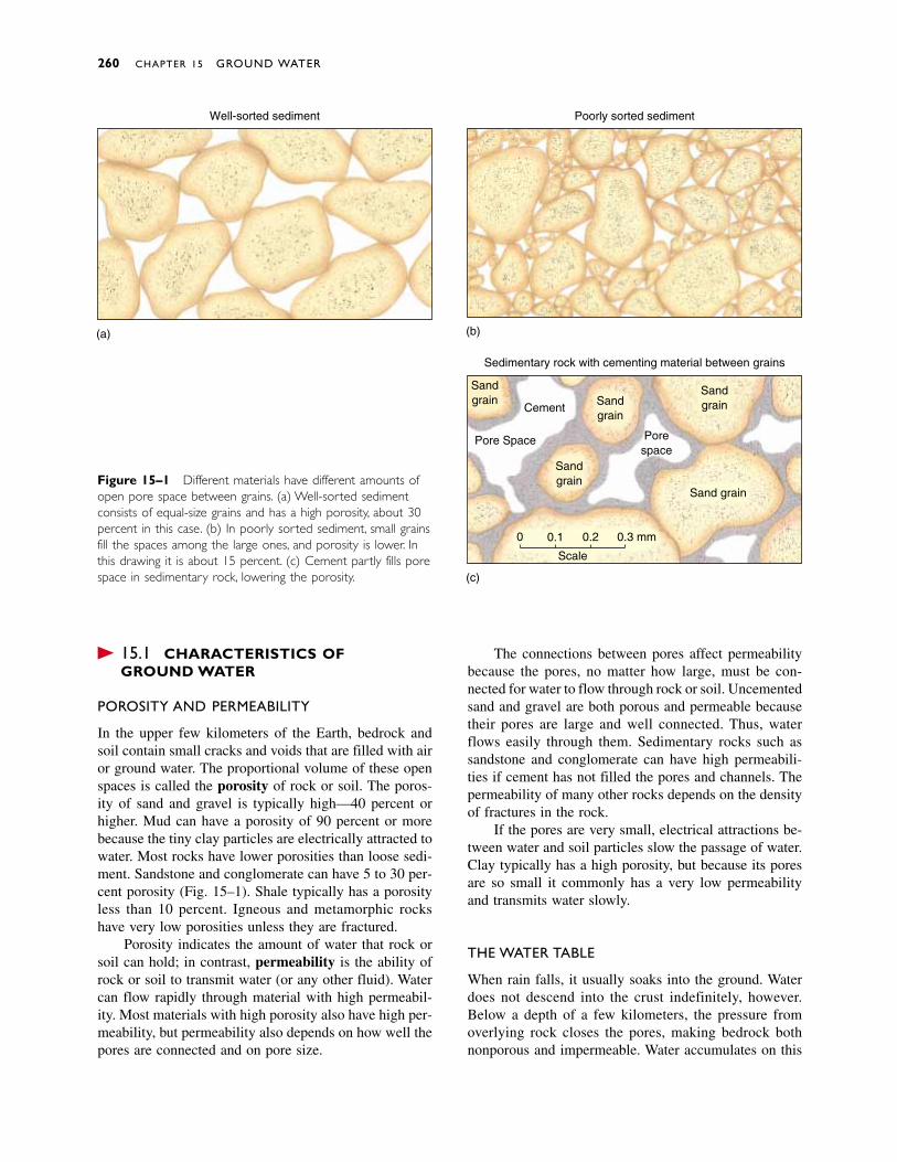
� 15.1 CHARACTERISTICS OF GROUND WATER
POROSITY AND PERMEABILITY
In the upper few kilometers of the Earth, bedrock andsoil contain small cracks and voids that are filled with airor ground water. The proportional volume of these openspaces is called the porosity of rock or soil. The poros-ity of sand and gravel is typically high—40 percent orhigher. Mud can have a porosity of 90 percent or morebecause the tiny clay particles are electrically attracted towater. Most rocks have lower porosities than loose sedi-ment. Sandstone and conglomerate can have 5 to 30 per-cent porosity (Fig. 15–1). Shale typically has a porosityless than 10 percent. Igneous and metamorphic rockshave very low porosities unless they are fractured.
Porosity indicates the amount of water that rock orsoil can hold; in contrast, permeability is the ability ofrock or soil to transmit water (or any other fluid). Watercan flow rapidly through material with high permeabil-ity. Most materials with high porosity also have high per-meability, but permeability also depends on how well thepores are connected and on pore size.
The connections between pores affect permeabilitybecause the pores, no matter how large, must be con-nected for water to flow through rock or soil. Uncementedsand and gravel are both porous and permeable becausetheir pores are large and well connected. Thus, waterflows easily through them. Sedimentary rocks such assandstone and conglomerate can have high permeabili-ties if cement has not filled the pores and channels. Thepermeability of many other rocks depends on the densityof fractures in the rock.
If the pores are very small, electrical attractions be-tween water and soil particles slow the passage of water.Clay typically has a high porosity, but because its poresare so small it commonly has a very low permeabilityand transmits water slowly.
THE WATER TABLE
When rain falls, it usually soaks into the ground. Waterdoes not descend into the crust indefinitely, however.Below a depth of a few kilometers, the pressure fromoverlying rock closes the pores, making bedrock bothnonporous and impermeable. Water accumulates on this
260 CHAPTER 15 GROUND WATER
Well-sorted sediment Poorly sorted sediment
Sedimentary rock with cementing material between grains
Sandgrain
Sandgrain
Sandgrain
Sandgrain
Cement
Pore Space
Sand grain
(a) (b)
(c)
Porespace
0 0.1 0.2 0.3 mm
Scale
Figure 15–1 Different materials have different amounts ofopen pore space between grains. (a) Well-sorted sedimentconsists of equal-size grains and has a high porosity, about 30percent in this case. (b) In poorly sorted sediment, small grainsfill the spaces among the large ones, and porosity is lower. Inthis drawing it is about 15 percent. (c) Cement partly fills porespace in sedimentary rock, lowering the porosity.

impermeable barrier, filling pores in the rock and soilabove it. This completely wet layer of soil and bedrockabove the barrier is called the zone of saturation. Thewater table is the top of the zone of saturation (Fig.15–2). Above the water table lies the unsaturated zone,or zone of aeration. In this layer, the rock or soil maybe moist but not saturated.
Gravity pulls ground water downward. However,electrical forces can pull water upward through smallchannels, just as water rises in a paper towel dipped inwater (Fig. 15–3). This upward movement of water iscalled capillary action. Thus, a capillary fringe 30 to60 centimeters thick rises from the water table.
Topsoil usually contains abundant litter and humus,which retain moisture. Thus, in most humid environ-ments, topsoil is wetter than the unsaturated zone be-neath it. This moist surface layer is called the soil mois-ture belt, and it supplies much of the water needed byplants.
If you dig into the unsaturated zone, the hole doesnot fill with water. However, if you dig below the watertable into the zone of saturation, you have dug a well,and the water level in a well is at the level of the watertable. During a wet season, rain seeps into the ground torecharge the ground water, and the water table rises.During a dry season, the water table falls. Thus, the wa-ter level in most wells fluctuates with the seasons.
An aquifer is any body of rock or soil that can yieldeconomically significant quantities of water. An aquifermust be both porous and permeable so that water flows
into a well to replenish water that is pumped out. Sandand gravel, sandstone, limestone, and highly fracturedbedrock of any kind make excellent aquifers. Shale, clay,and unfractured igneous and metamorphic rocks are pooraquifers.
Characteristics of Ground Water 261
Soil moisturebelt
Well Water table
Rock or regolith is moistbut not saturated(zone of aeration)
Porous or fractured rock orregolith saturated with water(zone of saturation)
Figure 15–2 The water table is the top of the zone of saturation near the Earth’s sur-face. It intersects the land surface at lakes and streams and is the level of standing water in a well.
Figure 15–3 Capillary action pulls water upward from thewater table just as it does in this paper towel dipped intodyed water.

� 15.2 MOVEMENT OF GROUND WATER
Nearly all ground water seeps slowly through bedrockand soil. Ground water flows at about 4 centimeters perday (about 15 meters per year), although flow rates maybe much faster or slower depending on permeability.Most aquifers are like sponges through which waterseeps, rather than underground pools or streams.However, ground water can flow very rapidly throughlarge fractures in bedrock, and in a few regions under-ground rivers flow through caverns.
Ground water flows from zones where the watertable is highest toward areas where it is lowest. In gen-eral, the water table is higher beneath a hill than it is be-neath an adjacent valley (Fig. 15–4). The arrows in Figure15–5a show that some ground water flows from a hill toa valley along the sloping surface of the water table.Much of it, however, flows in curved paths, descendingbelow the valley floor and then rising beneath the lowestpart of the valley.
Why does ground water flow upward against theforce of gravity? The key to this phenomenon lies in wa-ter pressure. Ground water flows from areas of high wa-ter pressure toward areas of low pressure. The waterpressure at any point is proportional to the weight of water above that point. Ground water beneath a hill isunder greater pressure than water beneath the valley because the water table is higher beneath the hill. Thus,the water pressure beneath the hill forces the water up-ward beneath the valley. Because ground water flowsfrom high places to low ones, the water table becomesflatter during a dry season.
Streams flow through most valleys. Because groundwater rises beneath the valley floor, it continually feedsthe stream. That is why streams continue to flow evenwhen rain has not fallen for weeks or months. A streamthat is recharged by ground water is called an effluent(or gaining) stream (Fig. 15–5a). Ground water alsoseeps into most lakes because lakes occupy low parts ofthe land.
In a desert, however, the water table commonly liesbelow a stream bed, and water seeps downward from thestream to the water table (Fig. 15–5b). Such a stream isan influent, or losing, stream. Desert stream channelsare dry most of the time. When they do run, the wateroften flows from nearby mountains where precipitationis greater, although a desert storm can also fill the chan-nel briefly. Thus, a desert stream feeds the ground-waterreservoir, but in temperate climates, ground water feedsthe stream.
262 CHAPTER 15 GROUND WATER
Figure 15–4 The water table follows topography, rising be-neath a hill and sinking beneath a valley. Dashed lines showthat it also sinks during drought and rises during the rainy sea-son.The arrows show ground-water flow.
Soilmoisturebelt Stream
channel
Water tableduring thewet season
Zone ofsaturation
Water table duringprolonged drought
Water tableduring thedry season
(a)
(b)
Water table
Gaining stream
Land surface
Saturated zone
Losing stream
Water table
Figure 15–5 (a) In a moist climate the water table liesabove the stream and ground water seeps into the stream.(b) A desert stream lies above the water table. Water seepsfrom the stream bed to recharge the ground-water reservoirbeneath the desert.
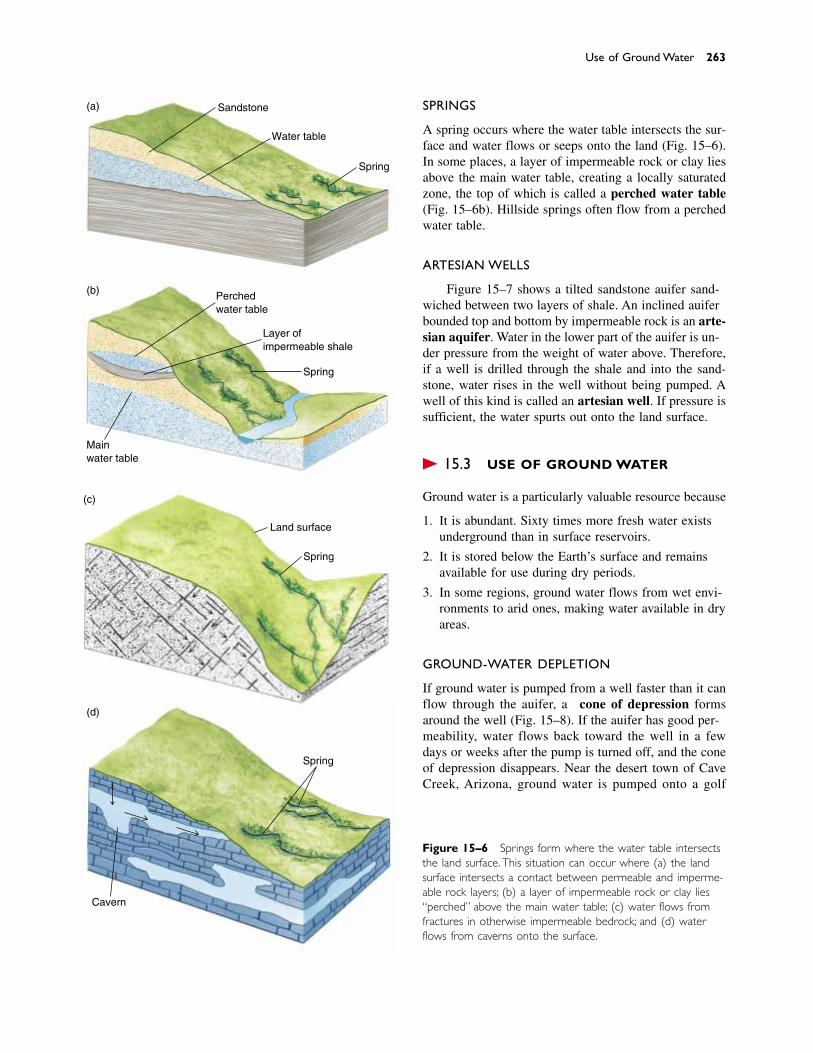
Figure 15–6 Springs form where the water table intersectsthe land surface.This situation can occur where (a) the landsurface intersects a contact between permeable and imperme-able rock layers; (b) a layer of impermeable rock or clay lies“perched” above the main water table; (c) water flows fromfractures in otherwise impermeable bedrock; and (d) waterflows from caverns onto the surface.
SPRINGS
A spring occurs where the water table intersects the sur-face and water flows or seeps onto the land (Fig. 15–6).In some places, a layer of impermeable rock or clay liesabove the main water table, creating a locally saturatedzone, the top of which is called a perched water table(Fig. 15–6b). Hillside springs often flow from a perchedwater table.
ARTESIAN WELLS
Figure 15–7 shows a tilted sandstone aquifer sand-wiched between two layers of shale. An inclined aquiferbounded top and bottom by impermeable rock is an arte-sian aquifer. Water in the lower part of the aquifer is un-der pressure from the weight of water above. Therefore,if a well is drilled through the shale and into the sand-stone, water rises in the well without being pumped. Awell of this kind is called an artesian well. If pressure issufficient, the water spurts out onto the land surface.
� 15.3 USE OF GROUND WATER
Ground water is a particularly valuable resource because
1. It is abundant. Sixty times more fresh water existsunderground than in surface reservoirs.
2. It is stored below the Earth’s surface and remainsavailable for use during dry periods.
3. In some regions, ground water flows from wet envi-ronments to arid ones, making water available in dryareas.
GROUND-WATER DEPLETION
If ground water is pumped from a well faster than it canflow through the aquifer, a cone of depression formsaround the well (Fig. 15–8). If the aquifer has good per-meability, water flows back toward the well in a fewdays or weeks after the pump is turned off, and the coneof depression disappears. Near the desert town of CaveCreek, Arizona, ground water is pumped onto a golf
Use of Ground Water 263
(a)
(b)
(d)
Cavern
Spring
Perchedwater table
Layer ofimpermeable shale
Spring
Mainwater table
Spring
Water table
Sandstone
Land surface
Spring
(c)
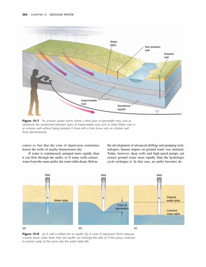
course so fast that the cone of depression sometimesleaves the wells of nearby homeowners dry.
If water is continuously pumped more rapidly thanit can flow through the aquifer, or if many wells extractwater from the same aquifer, the water table drops. Before
the development of advanced drilling and pumping tech-nologies, human impact on ground water was minimal.Today, however, deep wells and high-speed pumps canextract ground water more rapidly than the hydrologiccycle recharges it. In that case, an aquifer becomes de-
264 CHAPTER 15 GROUND WATER
Watertable
Non-artesianwell
Artesianwell
Sandstoneaquifer
Impermeablerock
Figure 15–7 An artesian aquifer forms where a tilted layer of permeable rock, such assandstone, lies sandwiched between layers of impermeable rock, such as shale. Water rises inan artesian well without being pumped. A hose with a hole shows why an artesian wellflows spontaneously.
Figure 15–8 (a) A well is drilled into an aquifer. (b) A cone of depression forms becausea pump draws water faster than the aquifer can recharge the well. (c) If the pump continuesto extract water at the same rate, the water table falls.
Well
Water table
Well
Cone ofdepression
Originalwater table
Loweredwater table
Well
(a) (b) (c)
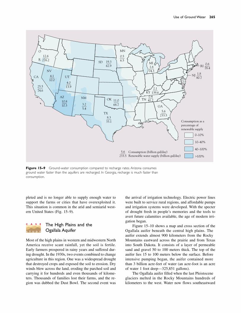
pleted and is no longer able to supply enough water tosupport the farms or cities that have overexploited it.This situation is common in the arid and semiarid west-ern United States (Fig. 15–9).
The High Plains and theOgallala Aquifer
Most of the high plains in western and midwestern NorthAmerica receive scant rainfall, yet the soil is fertile.Early farmers prospered in rainy years and suffered dur-ing drought. In the 1930s, two events combined to changeagriculture in this region. One was a widespread droughtthat destroyed crops and exposed the soil to erosion. Drywinds blew across the land, eroding the parched soil andcarrying it for hundreds and even thousands of kilome-ters. Thousands of families lost their farms, and the re-gion was dubbed the Dust Bowl. The second event was
the arrival of irrigation technology. Electric power lineswere built to service rural regions, and affordable pumpsand irrigation systems were developed. With the specterof drought fresh in people’s memories and the tools toavert future calamities available, the age of modern irri-gation began.
Figure 15–10 shows a map and cross section of theOgallala aquifer beneath the central high plains. Theaquifer extends almost 900 kilometers from the RockyMountains eastward across the prairie and from Texasinto South Dakota. It consists of a layer of permeablesand and gravel 50 to 100 meters thick. The top of theaquifer lies 15 to 100 meters below the surface. Beforeintensive pumping began, the aquifer contained morethan 3 billion acre-feet of water (an acre-foot is an acreof water 1 foot deep—325,851 gallons).
The Ogallala aquifer filled when the last Pleistoceneglaciers melted in the Rocky Mountains hundreds ofkilometers to the west. Water now flows southeastward
Use of Ground Water 265
10%
20%
40%
60%
WA
MT ND
ID
WY
CO
NE
KS
IA
MO
WI
IL INOH
PA
NY
VT
NH
ME
MA
CT
MDDE
WV VA
NC
AR
LA
MS AL
SC
FL
0.6___78.4
0–10%
10–40%
40–100%
>100%
1.8___80.7
1.6___74.3
2.1___139.6
5.6___233.5
5.6___233.5 Renewable water supply (billion gal/day)
Consumption as apercentage ofrenewable supply
0.4___41.2
8.3___33.1
3.2___5.4
25.5___74.6
19.3___62.9
0.5___6.5
12.6___276.2
11.0___68.7
4.0___13.9
4.1___10.0
10.8___10.3
O
R
CA
NV
SD
UT
AZ
MN
NM
TX
OK
MIRI
NJ
KY
TN
GA
Consumption (billion gal/day)
Figure 15–9 Ground-water consumption compared to recharge rates. Arizona consumesground water faster than the aquifers are recharged. In Georgia, recharge is much faster thanconsumption.
C A S E
S T U D Y

through the aquifer at a rate of about a meter per day, andthe recharge rate (the rate at which natural processeswould raise the water level in the aquifer if no waterwere being extracted) varies from 0.4 centimeter to about
2.5 centimeters per year. In many places, however, theaquifer is being drawn down by tens of centimeters eachyear.
Currently, more than 3 million hectares of land areirrigated from the Ogallala aquifer—an area about thesize of Massachusetts, Vermont, and Connecticut com-bined. Approximately 40 percent of the cattle raised inthe United States are fed with corn and sorghum grownin this region, and large quantities of grain and cotton aregrown there as well. About 150,000 pumps extract irri-gation water from the aquifer 24 hours a day during thegrowing season.
Hydrologists estimate that half of the water has already been removed from parts of the aquifer and thatit would take 1000 years to recharge the aquifer if pumping were to cease today. But pumping rates are increasing. Under these conditions, deep ground wateris, for all practical purposes, a nonrenewable resource.Some hydrologists predict that, as the aquifer’s water isused up during the next two decades, the amount of irri-gated land in the central high plains will decline by 80percent.
SUBSIDENCE
Excessive removal of ground water can cause subsi-dence, the sinking or settling of the Earth’s surface.When water is withdrawn from an aquifer, rock or soilparticles may shift to fill space left by the lost water. Asa result, the volume of the aquifer decreases and theoverlying ground subsides (Fig. 15–11). Removal of oilfrom petroleum reservoirs has the same effect.
Subsidence rates can reach 5 to 10 centimeters peryear, depending on the rate of ground-water removal andthe nature of the aquifer. Some areas in the San JoaquinValley of California, one of the most productive agricul-tural regions in the world, have sunk nearly 10 meters.Subsidence creates particularly severe problems when it affects a city. For example, Mexico City is built on an old marsh. Over the years, as the weight of buildingsand roadways has increased and ground water has beenextracted, parts of the city have settled as much as 8.5meters. Many millions of dollars have been spent tomaintain this complex city on its unstable base. Simi-lar problems are found in Phoenix, Arizona, in theHouston–Galveston area of Texas, and in other U.S.cities.
Unfortunately, subsidence is not a reversible process.When rock and soil contract, their porosity is perma-nently reduced so that ground-water reserves cannot becompletely recharged even if water becomes abundantagain.
266 CHAPTER 15 GROUND WATER
WYOMING
SOUTH DAKOTA
NEBRASKA
COLORADO
KANSAS
NEWMEXICO
TEXAS
OKLAHOMA
Water table
High Plains aquifer
Unsaturatedzone
Baseof
aquifer Bedrock
500 1000EastWest Distance (km)
500
1000
1500
Alti
tude
(m
)
(a)
(b)
Figure 15–10 The Ogallala aquifer supplies water to muchof the High Plains. (a) A cross-sectional view of the aquifershows that much of its water originates in the RockyMountains and flows slowly as ground water beneath the HighPlains. (b) A map showing the extent of the aquifer.
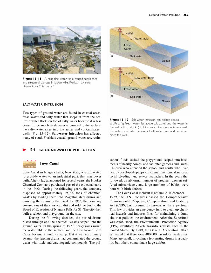
SALT-WATER INTRUSION
Two types of ground water are found in coastal areas:fresh water and salty water that seeps in from the sea.Fresh water floats on top of salty water because it is lessdense. If too much fresh water is pumped to the surface,the salty water rises into the aquifer and contaminateswells (Fig. 15–12). Salt-water intrusion has affectedmany of south Florida’s coastal ground-water reservoirs.
� 15.4 GROUND-WATER POLLUTION
Love Canal
Love Canal in Niagara Falls, New York, was excavatedto provide water to an industrial park that was neverbuilt. After it lay abandoned for several years, the HookerChemical Company purchased part of the old canal earlyin the 1940s. During the following years, the companydisposed of approximately 19,000 tons of chemicalwastes by loading them into 55-gallon steel drums anddumping the drums in the canal. In 1953, the companycovered one of the sites with dirt and sold the land to theBoard of Education of Niagara Falls for $1. The city thenbuilt a school and playground on the site.
During the following decades, the buried drumsrusted through and the chemical wastes seeped into theground water. In the spring of 1977, heavy rains raisedthe water table to the surface, and the area around LoveCanal became a muddy swamp. But it was no ordinaryswamp; the leaking drums had contaminated the groundwater with toxic and carcinogenic compounds. The poi-
sonous fluids soaked the playground, seeped into base-ments of nearby homes, and saturated gardens and lawns.Children who attended the school and adults who livednearby developed epilepsy, liver malfunctions, skin sores,rectal bleeding, and severe headaches. In the years thatfollowed, an abnormal number of pregnant women suf-fered miscarriages, and large numbers of babies wereborn with birth defects.
The Love Canal incident is not unique. In December1979, the U.S. Congress passed the ComprehensiveEnvironmental Response, Compensation, and LiabilityAct (CERCLA), commonly known as the Superfund.This law provides an emergency fund to clean up chem-ical hazards and imposes fines for maintaining a dumpsite that pollutes the environment. After the Superfundwas established, the Environmental Protection Agency(EPA) identified 20,766 hazardous waste sites in theUnited States. By 1989, the General Accounting Officeestimated that there were 400,000 hazardous waste sites.Many are small, involving a few rusting drums in a back-lot, but others contaminate large aquifers.
Ground-Water Pollution 267
Figure 15–11 A dropping water table caused subsidenceand structural damage in Jacksonville, Florida. (WendellMetzen/Bruce Coleman, Inc.)
(a)
(b)
Well
Well
Water table
Freshwater
Salt water
Salt water
Ocean
Ocean
New water table
Fresh water
Figure 15–12 Salt-water intrusion can pollute coastalaquifers. (a) Fresh water lies above salt water, and the water inthe well is fit to drink. (b) If too much fresh water is removed,the water table falls. The level of salt water rises and contami-nates the well.
C A S E
S T U D Y
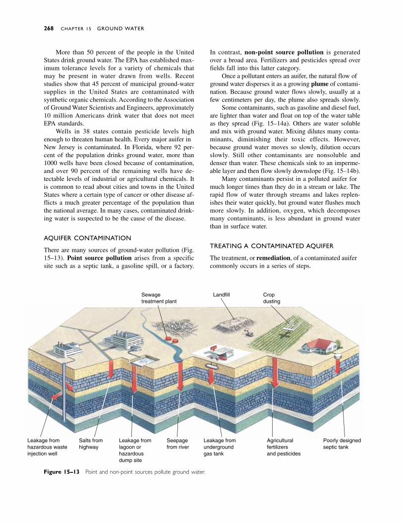
More than 50 percent of the people in the UnitedStates drink ground water. The EPA has established max-imum tolerance levels for a variety of chemicals thatmay be present in water drawn from wells. Recent studies show that 45 percent of municipal ground-watersupplies in the United States are contaminated with synthetic organic chemicals. According to the Associationof Ground Water Scientists and Engineers, approximately10 million Americans drink water that does not meetEPA standards.
Wells in 38 states contain pesticide levels highenough to threaten human health. Every major aquifer inNew Jersey is contaminated. In Florida, where 92 per-cent of the population drinks ground water, more than1000 wells have been closed because of contamination,and over 90 percent of the remaining wells have de-tectable levels of industrial or agricultural chemicals. Itis common to read about cities and towns in the UnitedStates where a certain type of cancer or other disease af-flicts a much greater percentage of the population thanthe national average. In many cases, contaminated drink-ing water is suspected to be the cause of the disease.
AQUIFER CONTAMINATION
There are many sources of ground-water pollution (Fig.15–13). Point source pollution arises from a specificsite such as a septic tank, a gasoline spill, or a factory.
In contrast, non-point source pollution is generatedover a broad area. Fertilizers and pesticides spread overfields fall into this latter category.
Once a pollutant enters an aquifer, the natural flow ofground water disperses it as a growing plume of contami-nation. Because ground water flows slowly, usually at afew centimeters per day, the plume also spreads slowly.
Some contaminants, such as gasoline and diesel fuel,are lighter than water and float on top of the water tableas they spread (Fig. 15–14a). Others are water solubleand mix with ground water. Mixing dilutes many conta-minants, diminishing their toxic effects. However,because ground water moves so slowly, dilution occursslowly. Still other contaminants are nonsoluble anddenser than water. These chemicals sink to an imperme-able layer and then flow slowly downslope (Fig. 15–14b).
Many contaminants persist in a polluted aquifer formuch longer times than they do in a stream or lake. Therapid flow of water through streams and lakes replen-ishes their water quickly, but ground water flushes muchmore slowly. In addition, oxygen, which decomposesmany contaminants, is less abundant in ground waterthan in surface water.
TREATING A CONTAMINATED AQUIFER
The treatment, or remediation, of a contaminated aquifercommonly occurs in a series of steps.
268 CHAPTER 15 GROUND WATER
Sewagetreatment plant
Landfill Cropdusting
Leakage fromhazardous wasteinjection well
Salts fromhighway
Leakage fromlagoon orhazardousdump site
Leakage fromundergroundgas tank
Poorly designedseptic tank
Agriculturalfertilizersand pesticides
Seepagefrom river
Figure 15–13 Point and non-point sources pollute ground water.
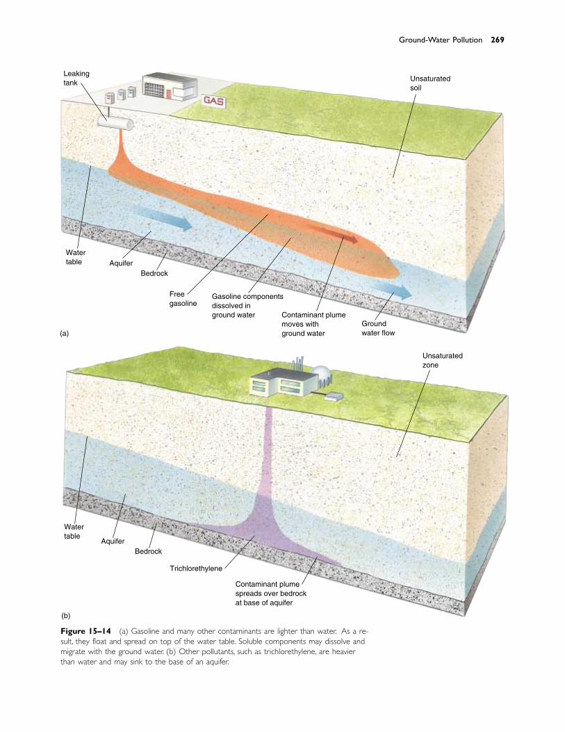
Ground-Water Pollution 269
Figure 15–14 (a) Gasoline and many other contaminants are lighter than water. As a re-sult, they float and spread on top of the water table. Soluble components may dissolve andmigrate with the ground water. (b) Other pollutants, such as trichlorethylene, are heavierthan water and may sink to the base of an aquifer.
Leakingtank
Watertable Aquifer
Bedrock
Freegasoline
Gasoline componentsdissolved inground water Contaminant plume
moves withground water
Groundwater flow
Unsaturatedsoil
(a)
Unsaturatedzone
Contaminant plumespreads over bedrockat base of aquifer
Trichlorethylene
BedrockAquifer
Watertable
(b)
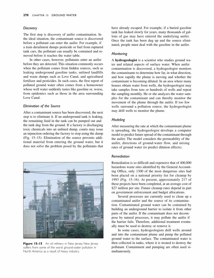
Discovery
The first step is discovery of aquifer contamination. Inthe ideal situation, the contaminant source is discoveredbefore a pollutant can enter the aquifer. For example, ifa train derailment dumps pesticide or fuel from rupturedtank cars, the pollutant can usually be contained and re-moved before it reaches the water table.
In other cases, however, pollutants enter an aquiferbefore they are detected. This situation commonly occurswhen the pollutant comes from hidden sources, such asleaking underground gasoline tanks, unlined landfillsand waste dumps such as Love Canal, and agriculturalfertilizer and pesticides. In such cases, the first report ofpolluted ground water often comes from a homeownerwhose well water suddenly tastes like gasoline or, worse,from epidemics such as those in the area surroundingLove Canal.
Elimination of the Source
After a contaminant source has been discovered, the nextstep is to eliminate it. If an underground tank is leaking,the remaining liquid in the tank can be pumped out andthe tank dug from the ground. If a factory is dischargingtoxic chemicals into an unlined dump, courts may issuean injunction ordering the factory to stop using the dump(Fig. 15–15). Elimination of the source prevents addi-tional material from entering the ground water, but itdoes not solve the problem posed by the pollutants that
have already escaped. For example, if a buried gasolinetank has leaked slowly for years, many thousands of gal-lons of gas may have entered the underlying aquifer.Once the tank has been dug up and the source elimi-nated, people must deal with the gasoline in the aquifer.
Monitoring
A hydrogeologist is a scientist who studies ground wa-ter and related aspects of surface water. When aquifercontamination is discovered, a hydrogeologist monitorsthe contaminants to determine how far, in what direction,and how rapidly the plume is moving and whether thecontaminant is becoming diluted. In an area where manyhouses obtain water from wells, the hydrogeologist maytake samples from tens or hundreds of wells and repeatthe sampling monthly. He or she analyzes the water sam-ples for the contaminant and can thereby monitor themovement of the plume through the aquifer. If too fewwells surround a pollution source, the hydrogeologistmay drill wells to monitor the plume.
Modeling
After measuring the rate at which the contaminant plumeis spreading, the hydrogeologist develops a computermodel to predict future spread of the contaminant throughthe aquifer. The model considers the permeability of theaquifer, directions of ground-water flow, and mixingrates of ground water (to predict dilution effects).
Remediation
Remediation is so difficult and expensive that of 400,000hazardous waste sites identified by the General Account-ing Office, only 1300 of the most dangerous sites hadbeen placed on a national priority list for cleanup by1993 (Fig. 15–16). At present, approximately 217 ofthese projects have been completed, at an average cost of$27 million per site. Future cleanup rates depend in parton government enforcement and budget allocations.
Several processes are currently used to clean up acontaminated aquifer and the source of its contamina-tion. Contaminated ground water can be contained bybuilding an underground barrier to isolate it from otherparts of the aquifer. If the contaminant does not decom-pose by natural processes, it may pollute the aquifer ifthe barrier fails. Therefore, additional treatment eventu-ally must be used to destroy or remove it.
In some cases, hydrogeologists drill wells aroundand into the contaminant plume and pump the pollutedground water to the surface. The contaminated water isthen collected in tanks, where it is treated to destroy thepollutant. Containment and pumping are often used si-multaneously.
270 CHAPTER 15 GROUND WATER
Figure 15–15 An oil refinery in New Jersey. New Jerseysuffers from some of the worst ground-water pollution inNorth America as a result of heavy industry.
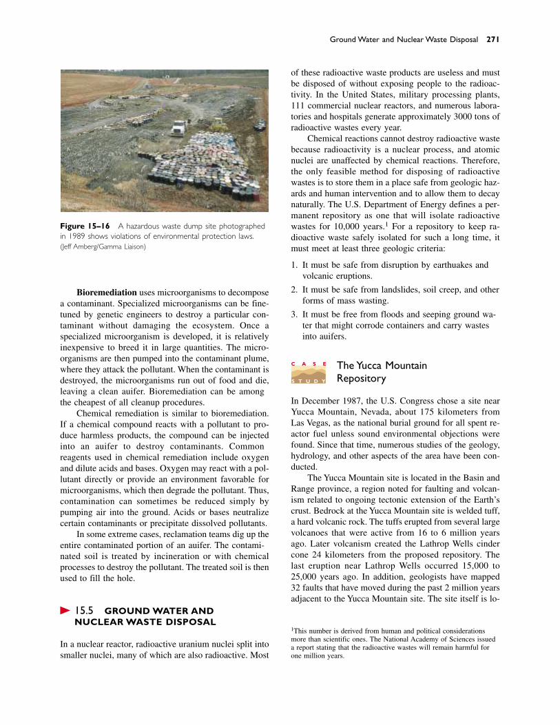
Ground Water and Nuclear Waste Disposal 271
Figure 15–16 A hazardous waste dump site photographedin 1989 shows violations of environmental protection laws.(Jeff Amberg/Gamma Liaison)
Bioremediation uses microorganisms to decomposea contaminant. Specialized microorganisms can be fine-tuned by genetic engineers to destroy a particular con-taminant without damaging the ecosystem. Once a specialized microorganism is developed, it is relativelyinexpensive to breed it in large quantities. The micro-organisms are then pumped into the contaminant plume,where they attack the pollutant. When the contaminant isdestroyed, the microorganisms run out of food and die,leaving a clean aquifer. Bioremediation can be amongthe cheapest of all cleanup procedures.
Chemical remediation is similar to bioremediation.If a chemical compound reacts with a pollutant to pro-duce harmless products, the compound can be injectedinto an aquifer to destroy contaminants. Commonreagents used in chemical remediation include oxygenand dilute acids and bases. Oxygen may react with a pol-lutant directly or provide an environment favorable formicroorganisms, which then degrade the pollutant. Thus,contamination can sometimes be reduced simply bypumping air into the ground. Acids or bases neutralizecertain contaminants or precipitate dissolved pollutants.
In some extreme cases, reclamation teams dig up theentire contaminated portion of an aquifer. The contami-nated soil is treated by incineration or with chemicalprocesses to destroy the pollutant. The treated soil is thenused to fill the hole.
� 15.5 GROUND WATER AND NUCLEAR WASTE DISPOSAL
In a nuclear reactor, radioactive uranium nuclei split intosmaller nuclei, many of which are also radioactive. Most
of these radioactive waste products are useless and mustbe disposed of without exposing people to the radioac-tivity. In the United States, military processing plants,111 commercial nuclear reactors, and numerous labora-tories and hospitals generate approximately 3000 tons ofradioactive wastes every year.
Chemical reactions cannot destroy radioactive wastebecause radioactivity is a nuclear process, and atomicnuclei are unaffected by chemical reactions. Therefore,the only feasible method for disposing of radioactivewastes is to store them in a place safe from geologic haz-ards and human intervention and to allow them to decaynaturally. The U.S. Department of Energy defines a per-manent repository as one that will isolate radioactivewastes for 10,000 years.1 For a repository to keep ra-dioactive waste safely isolated for such a long time, itmust meet at least three geologic criteria:
1. It must be safe from disruption by earthquakes andvolcanic eruptions.
2. It must be safe from landslides, soil creep, and otherforms of mass wasting.
3. It must be free from floods and seeping ground wa-ter that might corrode containers and carry wastesinto aquifers.
The Yucca Mountain Repository
In December 1987, the U.S. Congress chose a site nearYucca Mountain, Nevada, about 175 kilometers fromLas Vegas, as the national burial ground for all spent re-actor fuel unless sound environmental objections werefound. Since that time, numerous studies of the geology,hydrology, and other aspects of the area have been con-ducted.
The Yucca Mountain site is located in the Basin andRange province, a region noted for faulting and volcan-ism related to ongoing tectonic extension of the Earth’scrust. Bedrock at the Yucca Mountain site is welded tuff,a hard volcanic rock. The tuffs erupted from several largevolcanoes that were active from 16 to 6 million yearsago. Later volcanism created the Lathrop Wells cindercone 24 kilometers from the proposed repository. Thelast eruption near Lathrop Wells occurred 15,000 to25,000 years ago. In addition, geologists have mapped32 faults that have moved during the past 2 million yearsadjacent to the Yucca Mountain site. The site itself is lo-
1This number is derived from human and political considerationsmore than scientific ones. The National Academy of Sciences issueda report stating that the radioactive wastes will remain harmful forone million years.
C A S E
S T U D Y
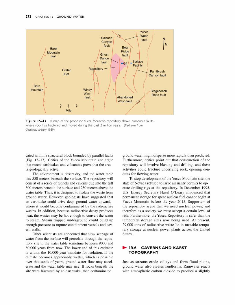
cated within a structural block bounded by parallel faults(Fig. 15–17). Critics of the Yucca Mountain site arguethat recent earthquakes and volcanoes prove that the areais geologically active.
The environment is desert dry, and the water tablelies 550 meters beneath the surface. The repository willconsist of a series of tunnels and caverns dug into the tuff300 meters beneath the surface and 250 meters above thewater table. Thus, it is designed to isolate the waste fromground water. However, geologists have suggested thatan earthquake could drive deep ground water upward,where it would become contaminated by the radioactivewastes. In addition, because radioactive decay producesheat, the wastes may be hot enough to convert the waterto steam. Steam trapped underground could build upenough pressure to rupture containment vessels and cav-ern walls.
Other scientists are concerned that slow seepage ofwater from the surface will percolate through the repos-itory site to the water table sometime between 9000 and80,000 years from now. The lower end of this estimateis within the 10,000-year mandate for isolation. If theclimate becomes appreciably wetter, which is possibleover thousands of years, ground-water flow may accel-erate and the water table may rise. If rocks beneath thesite were fractured by an earthquake, then contaminated
ground water might disperse more rapidly than predicted.Furthermore, critics point out that construction of therepository will involve blasting and drilling, and theseactivities could fracture underlying rock, opening con-duits for flowing water.
To stop development of the Yucca Mountain site, thestate of Nevada refused to issue air quality permits to op-erate drilling rigs at the repository. In December 1995,U.S. Energy Secretary Hazel O’Leary announced thatpermanent storage for spent nuclear fuel cannot begin atYucca Mountain before the year 2015. Supporters of the repository argue that we need nuclear power, andtherefore as a society we must accept a certain level ofrisk. Furthermore, the Yucca Repository is safer than thetemporary storage sites now being used. At present,29,000 tons of radioactive waste lie in unstable tempo-rary storage at nuclear power plants across the UnitedStates.
� 15.6 CAVERNS AND KARSTTOPOGRAPHY
Just as streams erode valleys and form flood plains,ground water also creates landforms. Rainwater reactswith atmospheric carbon dioxide to produce a slightly
272 CHAPTER 15 GROUND WATER
BareMountain
fault
BareMountain
CraterFlat
Mile
0 1 2
WindyWashfault Abandoned
Wash fault
StagecoachRoad fault
PaintbrushCanyon fault
N
YuccaWashfaultSolitario
Canyonfault
BowRidgefault
SurfaceFacility
G4
GhostDancefault
Repository
Figure 15–17 A map of the proposed Yucca Mountain repository shows numerous faultswhere rock has fractured and moved during the past 2 million years. (Redrawn fromGeotimes, January 1989)
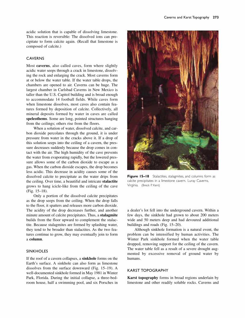
acidic solution that is capable of dissolving limestone.This reaction is reversible: The dissolved ions can pre-cipitate to form calcite again. (Recall that limestone iscomposed of calcite.)
CAVERNS
Most caverns, also called caves, form where slightlyacidic water seeps through a crack in limestone, dissolv-ing the rock and enlarging the crack. Most caverns format or below the water table. If the water table drops, thechambers are opened to air. Caverns can be huge. Thelargest chamber in Carlsbad Caverns in New Mexico istaller than the U.S. Capitol building and is broad enoughto accommodate 14 football fields. While caves formwhen limestone dissolves, most caves also contain fea-tures formed by deposition of calcite. Collectively, allmineral deposits formed by water in caves are calledspeleothems. Some are long, pointed structures hangingfrom the ceilings; others rise from the floors.
When a solution of water, dissolved calcite, and car-bon dioxide percolates through the ground, it is underpressure from water in the cracks above it. If a drop ofthis solution seeps into the ceiling of a cavern, the pres-sure decreases suddenly because the drop comes in con-tact with the air. The high humidity of the cave preventsthe water from evaporating rapidly, but the lowered pres-sure allows some of the carbon dioxide to escape as agas. When the carbon dioxide escapes, the drop becomesless acidic. This decrease in acidity causes some of thedissolved calcite to precipitate as the water drips fromthe ceiling. Over time, a beautiful and intricate stalactitegrows to hang icicle-like from the ceiling of the cave(Fig. 15–18).
Only a portion of the dissolved calcite precipitatesas the drop seeps from the ceiling. When the drop fallsto the floor, it spatters and releases more carbon dioxide.The acidity of the drop decreases further, and anotherminute amount of calcite precipitates. Thus, a stalagmitebuilds from the floor upward to complement the stalac-tite. Because stalagmites are formed by splashing water,they tend to be broader than stalactites. As the two fea-tures continue to grow, they may eventually join to forma column.
SINKHOLES
If the roof of a cavern collapses, a sinkhole forms on theEarth’s surface. A sinkhole can also form as limestonedissolves from the surface downward (Fig. 15–19). Awell-documented sinkhole formed in May 1981 in WinterPark, Florida. During the initial collapse, a three-bed-room house, half a swimming pool, and six Porsches in
Caverns and Karst Topography 273
Figure 15–18 Stalactites, stalagmites, and columns form ascalcite precipitates in a limestone cavern. Luray Caverns,Virginia. (Breck P. Kent)
a dealer’s lot fell into the underground cavern. Within afew days, the sinkhole had grown to about 200 meterswide and 50 meters deep and had devoured additionalbuildings and roads (Fig. 15–20).
Although sinkhole formation is a natural event, theproblem can be intensified by human activities. TheWinter Park sinkhole formed when the water tabledropped, removing support for the ceiling of the cavern.The water table fell as a result of a severe drought aug-mented by excessive removal of ground water by humans.
KARST TOPOGRAPHY
Karst topography forms in broad regions underlain bylimestone and other readily soluble rocks. Caverns and

sinkholes are common features of karst topography.Surface streams often pour into sinkholes and disappearinto caverns. In the area around Mammoth Caves in
Kentucky, streams are given names such as SinkingCreek, an indication of their fate. The word karst is de-rived from a region in Croatia where this type of topog-
274 CHAPTER 15 GROUND WATER
Sinkhole hasenlarged andcollapsed
Sinkholes Disappearing stream
Underground streamin cavern
Figure 15–19 Sinkholes and caverns form in limestone.Streams commonly disappear into sinkholes and flow throughthe caverns to emerge elsewhere.
Figure 15–20 This sinkhole inWinter Park, Florida, collapsedsuddenly in May 1981, swallowingseveral houses and a Porscheagency. (AP/Wide World Photos)
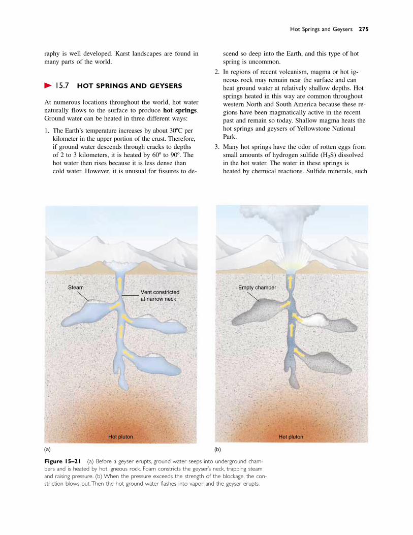
raphy is well developed. Karst landscapes are found inmany parts of the world.
� 15.7 HOT SPRINGS AND GEYSERS
At numerous locations throughout the world, hot waternaturally flows to the surface to produce hot springs.Ground water can be heated in three different ways:
1. The Earth’s temperature increases by about 30ºC perkilometer in the upper portion of the crust. Therefore,if ground water descends through cracks to depthsof 2 to 3 kilometers, it is heated by 60º to 90º. Thehot water then rises because it is less dense thancold water. However, it is unusual for fissures to de-
Hot Springs and Geysers 275
scend so deep into the Earth, and this type of hotspring is uncommon.
2. In regions of recent volcanism, magma or hot ig-neous rock may remain near the surface and canheat ground water at relatively shallow depths. Hotsprings heated in this way are common throughoutwestern North and South America because these re-gions have been magmatically active in the recentpast and remain so today. Shallow magma heats thehot springs and geysers of Yellowstone NationalPark.
3. Many hot springs have the odor of rotten eggs fromsmall amounts of hydrogen sulfide (H2S) dissolvedin the hot water. The water in these springs isheated by chemical reactions. Sulfide minerals, such
Figure 15–21 (a) Before a geyser erupts, ground water seeps into underground cham-bers and is heated by hot igneous rock. Foam constricts the geyser’s neck, trapping steamand raising pressure. (b) When the pressure exceeds the strength of the blockage, the con-striction blows out.Then the hot ground water flashes into vapor and the geyser erupts.
Vent constrictedat narrow neck
Steam
Hot pluton
(a)
Empty chamber
Hot pluton
(b)
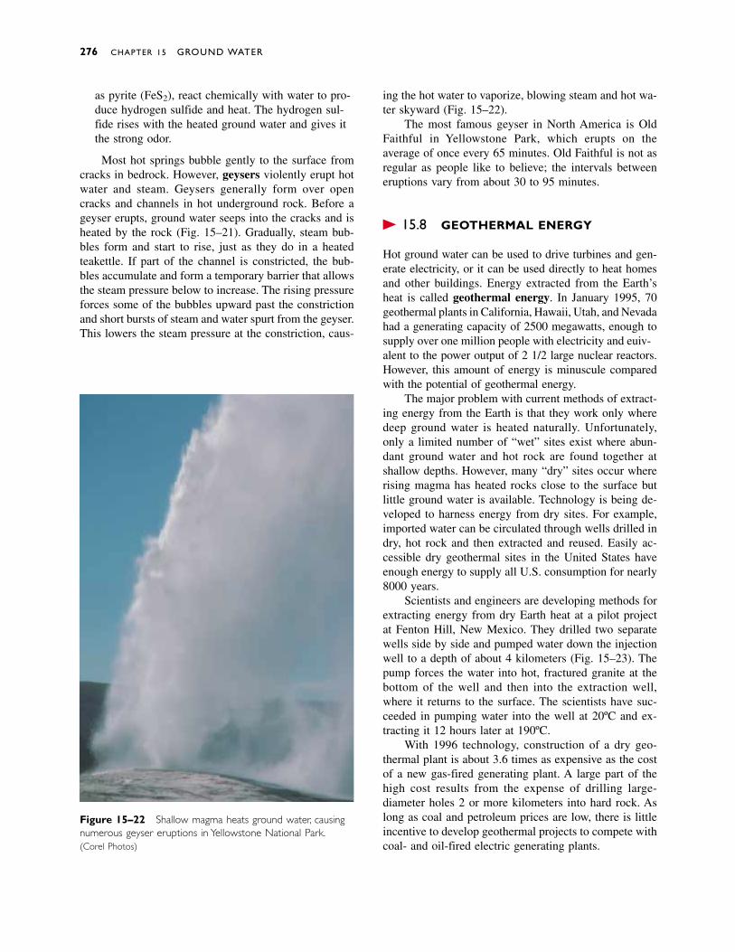
as pyrite (FeS2), react chemically with water to pro-duce hydrogen sulfide and heat. The hydrogen sul-fide rises with the heated ground water and gives itthe strong odor.
Most hot springs bubble gently to the surface fromcracks in bedrock. However, geysers violently erupt hotwater and steam. Geysers generally form over opencracks and channels in hot underground rock. Before ageyser erupts, ground water seeps into the cracks and isheated by the rock (Fig. 15–21). Gradually, steam bub-bles form and start to rise, just as they do in a heatedteakettle. If part of the channel is constricted, the bub-bles accumulate and form a temporary barrier that allowsthe steam pressure below to increase. The rising pressureforces some of the bubbles upward past the constrictionand short bursts of steam and water spurt from the geyser.This lowers the steam pressure at the constriction, caus-
Figure 15–22 Shallow magma heats ground water, causingnumerous geyser eruptions in Yellowstone National Park.(Corel Photos)
ing the hot water to vaporize, blowing steam and hot wa-ter skyward (Fig. 15–22).
The most famous geyser in North America is OldFaithful in Yellowstone Park, which erupts on the average of once every 65 minutes. Old Faithful is not asregular as people like to believe; the intervals betweeneruptions vary from about 30 to 95 minutes.
� 15.8 GEOTHERMAL ENERGY
Hot ground water can be used to drive turbines and gen-erate electricity, or it can be used directly to heat homesand other buildings. Energy extracted from the Earth’sheat is called geothermal energy. In January 1995, 70geothermal plants in California, Hawaii, Utah, and Nevadahad a generating capacity of 2500 megawatts, enough tosupply over one million people with electricity and equiv-alent to the power output of 2 1/2 large nuclear reactors.However, this amount of energy is minuscule comparedwith the potential of geothermal energy.
The major problem with current methods of extract-ing energy from the Earth is that they work only wheredeep ground water is heated naturally. Unfortunately,only a limited number of “wet” sites exist where abun-dant ground water and hot rock are found together atshallow depths. However, many “dry” sites occur whererising magma has heated rocks close to the surface butlittle ground water is available. Technology is being de-veloped to harness energy from dry sites. For example,imported water can be circulated through wells drilled indry, hot rock and then extracted and reused. Easily ac-cessible dry geothermal sites in the United States haveenough energy to supply all U.S. consumption for nearly8000 years.
Scientists and engineers are developing methods forextracting energy from dry Earth heat at a pilot projectat Fenton Hill, New Mexico. They drilled two separatewells side by side and pumped water down the injectionwell to a depth of about 4 kilometers (Fig. 15–23). Thepump forces the water into hot, fractured granite at thebottom of the well and then into the extraction well,where it returns to the surface. The scientists have suc-ceeded in pumping water into the well at 20ºC and ex-tracting it 12 hours later at 190ºC.
With 1996 technology, construction of a dry geo-thermal plant is about 3.6 times as expensive as the costof a new gas-fired generating plant. A large part of thehigh cost results from the expense of drilling large-diameter holes 2 or more kilometers into hard rock. Aslong as coal and petroleum prices are low, there is littleincentive to develop geothermal projects to compete withcoal- and oil-fired electric generating plants.
276 CHAPTER 15 GROUND WATER
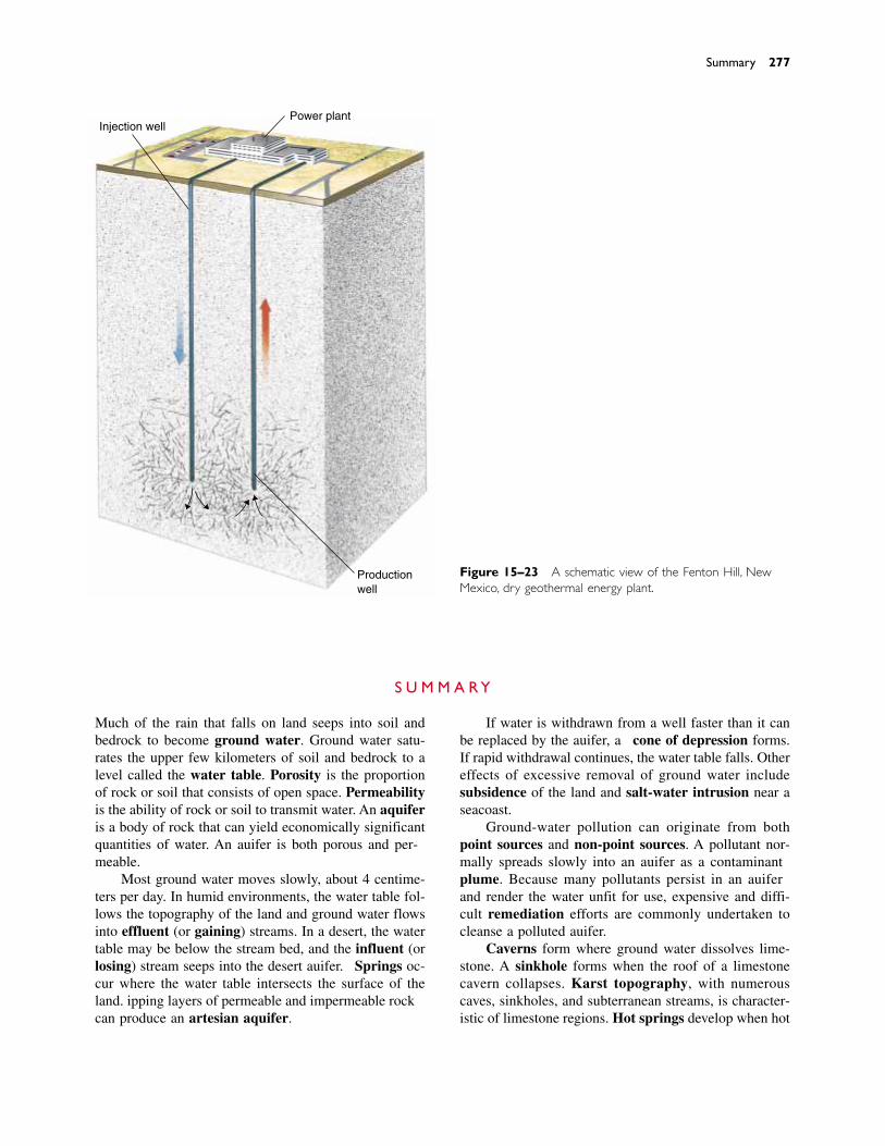
Summary 277
Productionwell
Power plantInjection well
Figure 15–23 A schematic view of the Fenton Hill, NewMexico, dry geothermal energy plant.
S U M M A R Y
Much of the rain that falls on land seeps into soil andbedrock to become ground water. Ground water satu-rates the upper few kilometers of soil and bedrock to alevel called the water table. Porosity is the proportionof rock or soil that consists of open space. Permeabilityis the ability of rock or soil to transmit water. An aquiferis a body of rock that can yield economically significantquantities of water. An aquifer is both porous and per-meable.
Most ground water moves slowly, about 4 centime-ters per day. In humid environments, the water table fol-lows the topography of the land and ground water flowsinto effluent (or gaining) streams. In a desert, the watertable may be below the stream bed, and the influent (orlosing) stream seeps into the desert aquifer. Springs oc-cur where the water table intersects the surface of theland. Dipping layers of permeable and impermeable rockcan produce an artesian aquifer.
If water is withdrawn from a well faster than it canbe replaced by the aquifer, a cone of depression forms.If rapid withdrawal continues, the water table falls. Othereffects of excessive removal of ground water includesubsidence of the land and salt-water intrusion near aseacoast.
Ground-water pollution can originate from bothpoint sources and non-point sources. A pollutant nor-mally spreads slowly into an aquifer as a contaminantplume. Because many pollutants persist in an aquiferand render the water unfit for use, expensive and diffi-cult remediation efforts are commonly undertaken tocleanse a polluted aquifer.
Caverns form where ground water dissolves lime-stone. A sinkhole forms when the roof of a limestonecavern collapses. Karst topography, with numerouscaves, sinkholes, and subterranean streams, is character-istic of limestone regions. Hot springs develop when hot
278 CHAPTER 15 GROUND WATER
R E V I E W Q U E S T I O N S
1. (a) Describe what happens to rain that falls in an arid re-gion and then continues to fall heavily for several days.(b) Describe what happens to this water when no morerain falls for a month.
2. Describe the difference between porosity and permeabil-ity. Can soil or rock be porous and not permeable?Permeable but not porous?
3. (a) Draw a cross section showing the soil moisture belt,zone of saturation, water table, and zone of aeration. (b)Explain each of these terms.
4. What is the capillary fringe, and how does it form?
5. What is an aquifer, and how does water reach it?
6. What does water level in a well tell you about the loca-tion of the water table?
7. Explain why bedrock or regolith must be both porousand permeable to be an aquifer.
8. Compare the movement of ground water in an aquiferwith that of water in a stream.
9. Why does the water table below hills usually remain ele-vated above the level of adjacent streams and lakes?
10. Explain how a temperate-climate stream continues toflow during a prolonged drought.
11. How does an artesian aquifer differ from a normal one?How does water from an artesian well rise without beingpumped?
12. Describe three reasons why ground water is a particularlyvaluable resource.
13. Describe three problems that can arise from excessiveuse of ground water.
14. Why is ground-water depletion likely to have longer-lasting effects than depletion of a surface reservoir?
15. Explain how land subsides when ground water is de-pleted. If the removal of ground water is stopped, willthe land rise again to its original level? Explain your answer.
16. Discuss the differences between point and non-point pol-lution sources. Give examples of each.
17. Describe the steps in cleaning polluted ground water.
18. Give two reasons why ground water purifies itself slowly.
19. Explain how remediation efforts can cleanse a contami-nated aquifer.
20. Explain how caverns, speleothems, and sinkholes form.
21. What is karst topography? How can it be recognized?How does it form?
22. Describe three types of heat source for a hot spring.
K E Y W O R D S
ground water 258porosity 260permeability 260zone of saturation 261water table 261zone of aeration 261capillary action 261soil moisture belt 261well 261recharge 261
salt-water intrusion 267point and non-point
source pollution 268plume (of contamination)
268remediation (of contami-
nation) 268bioremediation 271cavern 273speleothem 273
aquifer 261effluent (gaining) stream
262influent (losing) stream
262perched water table 263artesian aquifer 263artesian well 263cone of depression 263subsidence 266
stalactite 273stalagmite 273column 273sinkhole 273karst topography 273hot spring 275geyser 276geothermal energy 276
ground water rises to the surface. Ground water can beheated by (1) the geothermal gradient, (2) shallow magmaor a cooling pluton, or (3) chemical reactions between
ground water and sulfide minerals. Hot springs have beentapped to produce geothermal energy, and “dry sites”are now being explored.
Discussion Questions 279
D I S C U S S I O N Q U E S T I O N S
1. Imagine that you live on a hill 25 meters above a nearbystream. You drill a well 40 meters deep and do not reachwater. Explain.
2. The ancient civilization of Mesopotamia fell after itsagricultural system collapsed due to problems resultingfrom a failure of irrigation techniques. In his bookCadillac Desert, author Marc Reisner describes the trans-formation of the western United States from its naturalsemidesert condition to its modern agricultural wealth.However, he argues that this system, like others that pre-ceded it, cannot be sustained indefinitely. Argue for oragainst Reisner’s hypothesis.
3. How does a desert aquifer become recharged?
4. Would you expect to find a cavern in granite? Would youexpect to discover a cavern in shale? Defend your an-swers.
5. Why can’t stalactites or stalagmites form when a cavernis filled with water?
6. Discuss differences in problems of ground-water pollu-tion in a region of karst topography in contrast to a re-gion with a sandstone aquifer.
7. Imagine that a high percentage of newly born infants in asmall town had birth defects and that you were called into study the problem. Local health officials suspectedthat polluted ground water might be the cause. Outline astudy project to determine whether or not pollutedground water was responsible. Discuss the role of theprecautionary principle and cost–benefit analysis in anypolicy decisions you might make.
8. A neighbor’s underground fuel tank develops a leak. Youlive downhill from the neighbor, and fuel oil floats to thesurface in your yard. The tank was buried 3 meters deep;your well is 50 meters deep. Your neighbor’s lawyermakes the following three statements: (a) The fuel oil inyour yard may have come from a more distant sourceand may not be his client’s responsibility; (b) even if hisclient’s (your neighbor’s) tank did leak, the tank capacitywas only 1000 liters, so the total quantity of oil spilledwould be relatively small; (c) because oil floats, anyspilled fuel would be unlikely to contaminate your drink-ing water. Evaluate each of these statements.
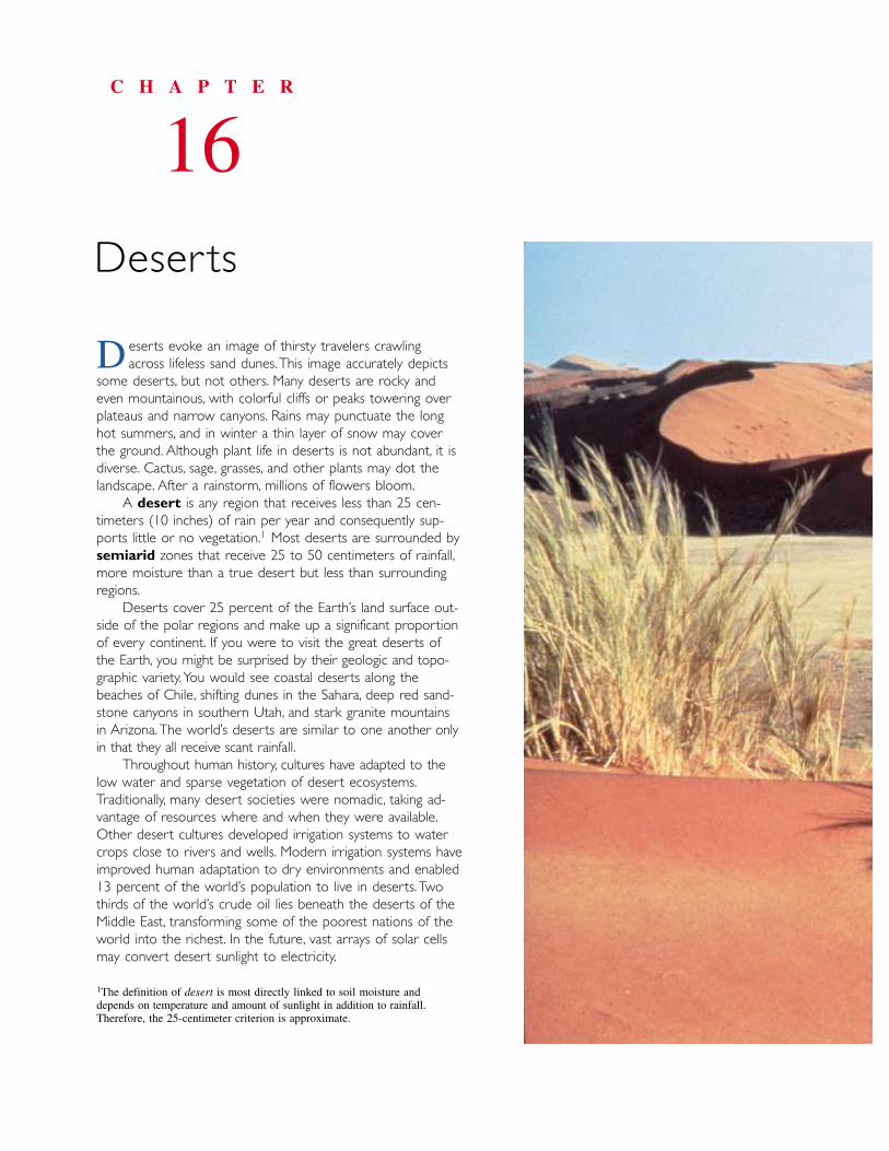
eserts evoke an image of thirsty travelers crawling across lifeless sand dunes.This image accurately depicts
some deserts, but not others. Many deserts are rocky andeven mountainous, with colorful cliffs or peaks towering overplateaus and narrow canyons. Rains may punctuate the longhot summers, and in winter a thin layer of snow may coverthe ground. Although plant life in deserts is not abundant, it isdiverse. Cactus, sage, grasses, and other plants may dot thelandscape. After a rainstorm, millions of flowers bloom.
A desert is any region that receives less than 25 cen-timeters (10 inches) of rain per year and consequently sup-ports little or no vegetation.1 Most deserts are surrounded bysemiarid zones that receive 25 to 50 centimeters of rainfall,more moisture than a true desert but less than surroundingregions.
Deserts cover 25 percent of the Earth’s land surface out-side of the polar regions and make up a significant proportionof every continent. If you were to visit the great deserts ofthe Earth, you might be surprised by their geologic and topo-graphic variety.You would see coastal deserts along thebeaches of Chile, shifting dunes in the Sahara, deep red sand-stone canyons in southern Utah, and stark granite mountainsin Arizona.The world’s deserts are similar to one another onlyin that they all receive scant rainfall.
Throughout human history, cultures have adapted to thelow water and sparse vegetation of desert ecosystems.Traditionally, many desert societies were nomadic, taking ad-vantage of resources where and when they were available.Other desert cultures developed irrigation systems to watercrops close to rivers and wells. Modern irrigation systems haveimproved human adaptation to dry environments and enabled13 percent of the world’s population to live in deserts. Twothirds of the world’s crude oil lies beneath the deserts of theMiddle East, transforming some of the poorest nations of theworld into the richest. In the future, vast arrays of solar cellsmay convert desert sunlight to electricity.
C H A P T E R
16Deserts
D
1The definition of desert is most directly linked to soil moisture anddepends on temperature and amount of sunlight in addition to rainfall.Therefore, the 25-centimeter criterion is approximate.
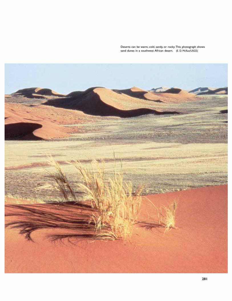
Deserts can be warm, cold, sandy, or rocky. This photograph showssand dunes in a southwest African desert. (E. D. McKee/USGS)
281
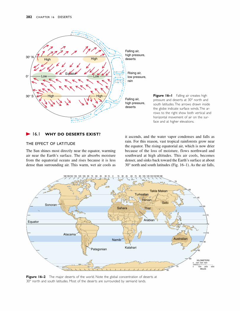
� 16.1 WHY DO DESERTS EXIST?
THE EFFECT OF LATITUDE
The Sun shines most directly near the equator, warmingair near the Earth’s surface. The air absorbs moisturefrom the equatorial oceans and rises because it is lessdense than surrounding air. This warm, wet air cools as
it ascends, and the water vapor condenses and falls asrain. For this reason, vast tropical rainforests grow nearthe equator. The rising equatorial air, which is now drierbecause of the loss of moisture, flows northward andsouthward at high altitudes. This air cools, becomesdenser, and sinks back toward the Earth’s surface at about30° north and south latitudes (Fig. 16–1). As the air falls,
282 CHAPTER 16 DESERTS
Falling air,high pressure,deserts
Rising air,low pressure,rain
Falling air,high pressure,deserts
30° N
0°
30° S
HighHigh
Low Low
HighHigh
Equator
Figure 16–1 Falling air creates highpressure and deserts at 30° north andsouth latitudes.The arrows drawn insidethe globe indicate surface winds.The ar-rows to the right show both vertical andhorizontal movement of air on the sur-face and at higher elevations.
Figure 16–2 The major deserts of the world. Note the global concentration of deserts at30° north and south latitudes. Most of the deserts are surrounded by semiarid lands.
0 1000 2000 3000
0 1000 2000 3000
MILES
KILOMETERS
90
75
60
45
30
15
0
15
30
45
60
75
18016515013512010590756045301503045607590105120135150165180 15
TurkestanTakla Makan
GobiIranian
Thar
Arabian
Sahara
Namib
KalahariPatagonian
Atacama
Sonoran
Australian
Equator
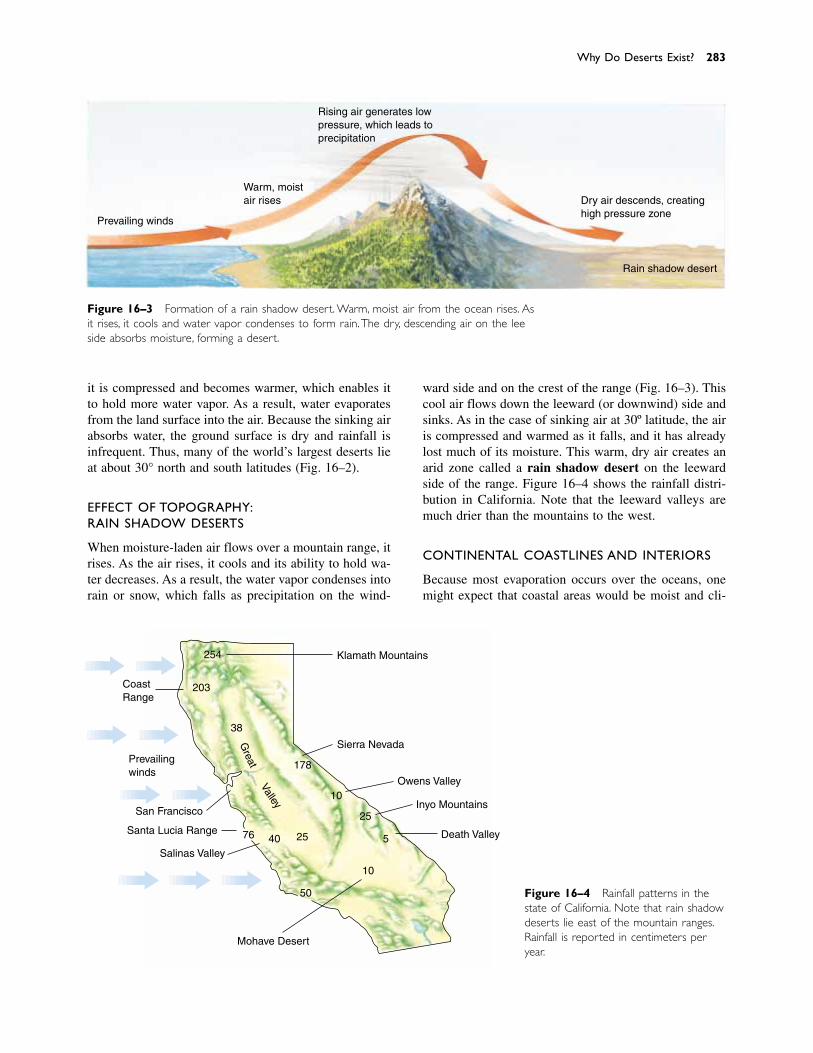
it is compressed and becomes warmer, which enables itto hold more water vapor. As a result, water evaporatesfrom the land surface into the air. Because the sinking airabsorbs water, the ground surface is dry and rainfall isinfrequent. Thus, many of the world’s largest deserts lieat about 30° north and south latitudes (Fig. 16–2).
EFFECT OF TOPOGRAPHY:RAIN SHADOW DESERTS
When moisture-laden air flows over a mountain range, itrises. As the air rises, it cools and its ability to hold wa-ter decreases. As a result, the water vapor condenses intorain or snow, which falls as precipitation on the wind-
ward side and on the crest of the range (Fig. 16–3). Thiscool air flows down the leeward (or downwind) side andsinks. As in the case of sinking air at 30º latitude, the airis compressed and warmed as it falls, and it has alreadylost much of its moisture. This warm, dry air creates anarid zone called a rain shadow desert on the leewardside of the range. Figure 16–4 shows the rainfall distri-bution in California. Note that the leeward valleys aremuch drier than the mountains to the west.
CONTINENTAL COASTLINES AND INTERIORS
Because most evaporation occurs over the oceans, onemight expect that coastal areas would be moist and cli-
Why Do Deserts Exist? 283
Figure 16–3 Formation of a rain shadow desert. Warm, moist air from the ocean rises. Asit rises, it cools and water vapor condenses to form rain.The dry, descending air on the leeside absorbs moisture, forming a desert.
Prevailing winds
Rising air generates lowpressure, which leads toprecipitation
Dry air descends, creatinghigh pressure zone
Rain shadow desert
Warm, moistair rises
CoastRange
Prevailingwinds
San Francisco
Santa Lucia Range
Salinas Valley
Mohave Desert
Klamath Mountains
Sierra Nevada
Owens Valley
Inyo Mountains
Death Valley
203
254
38
178
10
25
5
10
50
254076
Great
Valley
Figure 16–4 Rainfall patterns in thestate of California. Note that rain shadowdeserts lie east of the mountain ranges.Rainfall is reported in centimeters peryear.

mates would become drier with increasing distance fromthe sea. This generalization is often true, but notable ex-ceptions exist.
The Atacama Desert along the west coast of SouthAmerica is so dry that portions of Peru and Chile havereceived no rainfall for a decade or more. Cool oceancurrents flow along the west coast of South America.When the cool marine air encounters warm land, the airis heated. The warm, expanding air holds relatively littlewater vapor and absorbs moisture from the ground, cre-ating a coastal desert.
The Gobi Desert is a broad, arid region in centralAsia. The center of the Gobi lies at about 40°N latitude,and its eastern edge is a little more than 400 kilometersfrom the Yellow Sea. As a comparison, Pittsburgh,Pennsylvania, lies at about the same latitude and is 400kilometers from the Atlantic Ocean. If latitude and dis-tance from the ocean were the only factors, the two re-gions would have similar climates. However, the Gobi isa barren desert and western Pennsylvania receives enoughrainfall to support forests and rich farmland. The Gobi isbounded by the Himalayas to the south and the Urals tothe west, which shadow it from the prevailing winds. Incontrast, winds carry abundant moisture from the Gulf ofMexico, the Great Lakes, and the Atlantic Ocean to west-ern Pennsylvania.
Thus, in some regions deserts extend to the seashoreand in other regions the interior of a continent is humid.The climate at any particular place on the Earth resultsfrom a combination of many factors. Latitude and prox-imity to the ocean are important, but the direction of pre-vailing winds, the direction and temperature of oceancurrents, and the positions of mountain ranges also con-trol climate.
� 16.2 DESERT LANDFORMS
Landforms in humid climates are commonly smooth androunded because abundant rain promotes chemicalweathering. In a desert, however, chemical weathering isslower because less rain falls. Instead, mechanical weath-ering predominates and intermittent desert streams undercut rock outcrops. As a result, steep cliffs and angular landforms dominate many deserts (Fig. 16–5).
DESERT STREAMS
Large rivers flow through some deserts. For example, theColorado River crosses the arid southwestern UnitedStates, and the Nile River flows through North Africandeserts (Fig. 16–6). Desert rivers receive most of theirwater from wetter, mountainous areas bordering the aridlands.
284 CHAPTER 16 DESERTS
Figure 16–5 Mechanical weathering, here at Castleton Towerin the Utah desert, produces angular landforms and steep cliffsin many deserts.
Figure 16–6 The Colorado River flows through the Utahdesert. Most of the water flows from mountains to the east.
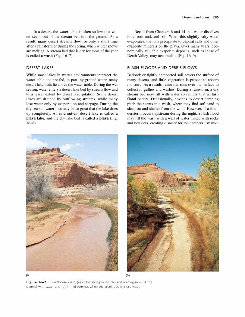
Desert Landforms 285
(a) (b)
Figure 16–7 Courthouse wash, (a) in the spring when rain and melting snow fill thechannel with water and (b) in mid-summer, when the creek bed is a dry wash.
In a desert, the water table is often so low that wa-ter seeps out of the stream bed into the ground. As a result, many desert streams flow for only a short time after a rainstorm or during the spring, when winter snowsare melting. A stream bed that is dry for most of the yearis called a wash (Fig. 16–7).
DESERT LAKES
While most lakes in wetter environments intersect thewater table and are fed, in part, by ground water, manydesert lake beds lie above the water table. During the wetseason, water enters a desert lake bed by stream flow andto a lesser extent by direct precipitation. Some desertlakes are drained by outflowing streams, while manylose water only by evaporation and seepage. During thedry season, water loss may be so great that the lake driesup completely. An intermittent desert lake is called aplaya lake, and the dry lake bed is called a playa (Fig.16–8).
Recall from Chapters 6 and 14 that water dissolvesions from rock and soil. When this slightly salty waterevaporates, the ions precipitate to deposit salts and otherevaporite minerals on the playa. Over many years, eco-nomically valuable evaporite deposits, such as those ofDeath Valley, may accumulate (Fig. 16–9).
FLASH FLOODS AND DEBRIS FLOWS
Bedrock or tightly compacted soil covers the surface ofmany deserts, and little vegetation is present to absorbmoisture. As a result, rainwater runs over the surface tocollect in gullies and washes. During a rainstorm, a drystream bed may fill with water so rapidly that a flashflood occurs. Occasionally, novices to desert campingpitch their tents in a wash, where they find soft sand tosleep on and shelter from the wind. However, if a thun-derstorm occurs upstream during the night, a flash floodmay fill the wash with a wall of water mixed with rocksand boulders, creating disaster for the campers. By mid-
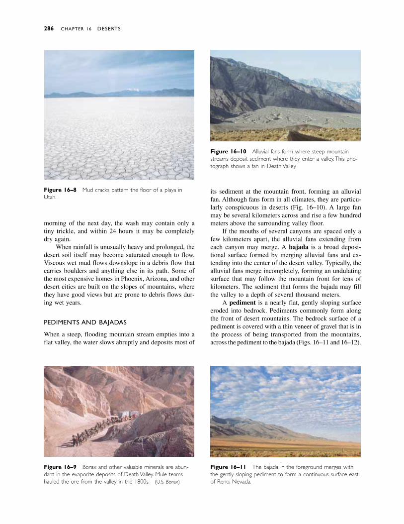
morning of the next day, the wash may contain only atiny trickle, and within 24 hours it may be completelydry again.
When rainfall is unusually heavy and prolonged, thedesert soil itself may become saturated enough to flow.Viscous wet mud flows downslope in a debris flow thatcarries boulders and anything else in its path. Some ofthe most expensive homes in Phoenix, Arizona, and otherdesert cities are built on the slopes of mountains, wherethey have good views but are prone to debris flows dur-ing wet years.
PEDIMENTS AND BAJADAS
When a steep, flooding mountain stream empties into aflat valley, the water slows abruptly and deposits most of
Figure 16–8 Mud cracks pattern the floor of a playa inUtah.
286 CHAPTER 16 DESERTS
Figure 16–9 Borax and other valuable minerals are abun-dant in the evaporite deposits of Death Valley. Mule teamshauled the ore from the valley in the 1800s. (U.S. Borax)
Figure 16–10 Alluvial fans form where steep mountainstreams deposit sediment where they enter a valley.This pho-tograph shows a fan in Death Valley.
Figure 16–11 The bajada in the foreground merges withthe gently sloping pediment to form a continuous surface eastof Reno, Nevada.
its sediment at the mountain front, forming an alluvialfan. Although fans form in all climates, they are particu-larly conspicuous in deserts (Fig. 16–10). A large fanmay be several kilometers across and rise a few hundredmeters above the surrounding valley floor.
If the mouths of several canyons are spaced only afew kilometers apart, the alluvial fans extending fromeach canyon may merge. A bajada is a broad deposi-tional surface formed by merging alluvial fans and ex-tending into the center of the desert valley. Typically, thealluvial fans merge incompletely, forming an undulatingsurface that may follow the mountain front for tens ofkilometers. The sediment that forms the bajada may fillthe valley to a depth of several thousand meters.
A pediment is a nearly flat, gently sloping surfaceeroded into bedrock. Pediments commonly form alongthe front of desert mountains. The bedrock surface of apediment is covered with a thin veneer of gravel that is inthe process of being transported from the mountains,across the pediment to the bajada (Figs. 16–11 and 16–12).
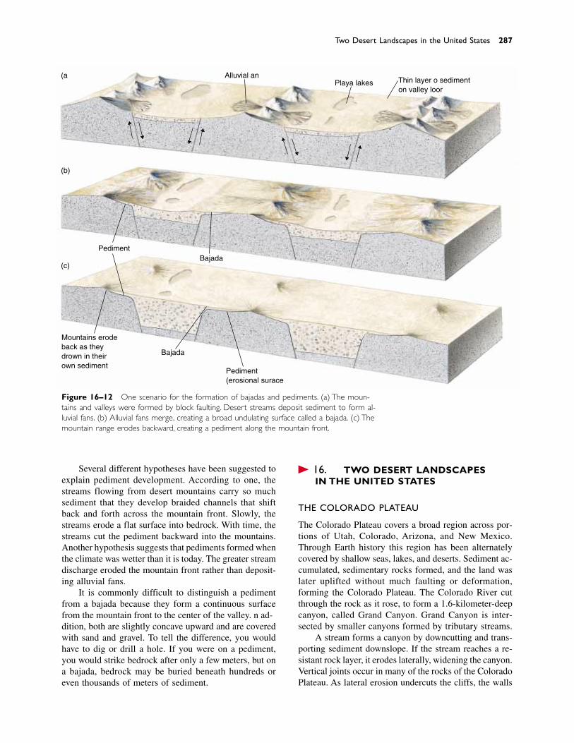
Several different hypotheses have been suggested toexplain pediment development. According to one, thestreams flowing from desert mountains carry so muchsediment that they develop braided channels that shiftback and forth across the mountain front. Slowly, thestreams erode a flat surface into bedrock. With time, thestreams cut the pediment backward into the mountains.Another hypothesis suggests that pediments formed whenthe climate was wetter than it is today. The greater streamdischarge eroded the mountain front rather than deposit-ing alluvial fans.
It is commonly difficult to distinguish a pedimentfrom a bajada because they form a continuous surfacefrom the mountain front to the center of the valley. In ad-dition, both are slightly concave upward and are coveredwith sand and gravel. To tell the difference, you wouldhave to dig or drill a hole. If you were on a pediment,you would strike bedrock after only a few meters, but ona bajada, bedrock may be buried beneath hundreds oreven thousands of meters of sediment.
� 16.3 TWO DESERT LANDSCAPES IN THE UNITED STATES
THE COLORADO PLATEAU
The Colorado Plateau covers a broad region across por-tions of Utah, Colorado, Arizona, and New Mexico.Through Earth history this region has been alternatelycovered by shallow seas, lakes, and deserts. Sediment ac-cumulated, sedimentary rocks formed, and the land waslater uplifted without much faulting or deformation,forming the Colorado Plateau. The Colorado River cutthrough the rock as it rose, to form a 1.6-kilometer-deepcanyon, called Grand Canyon. Grand Canyon is inter-sected by smaller canyons formed by tributary streams.
A stream forms a canyon by downcutting and trans-porting sediment downslope. If the stream reaches a re-sistant rock layer, it erodes laterally, widening the canyon.Vertical joints occur in many of the rocks of the ColoradoPlateau. As lateral erosion undercuts the cliffs, the walls
Two Desert Landscapes in the United States 287
(a)
(b)
(c)
Alluvial fanThin layer of sedimenton valley floor
Playa lakes
Pediment
Pediment(erosional surface)
Bajada
Bajada
Mountains erodeback as theydrown in theirown sediment
Figure 16–12 One scenario for the formation of bajadas and pediments. (a) The moun-tains and valleys were formed by block faulting. Desert streams deposit sediment to form al-luvial fans. (b) Alluvial fans merge, creating a broad undulating surface called a bajada. (c) Themountain range erodes backward, creating a pediment along the mountain front.
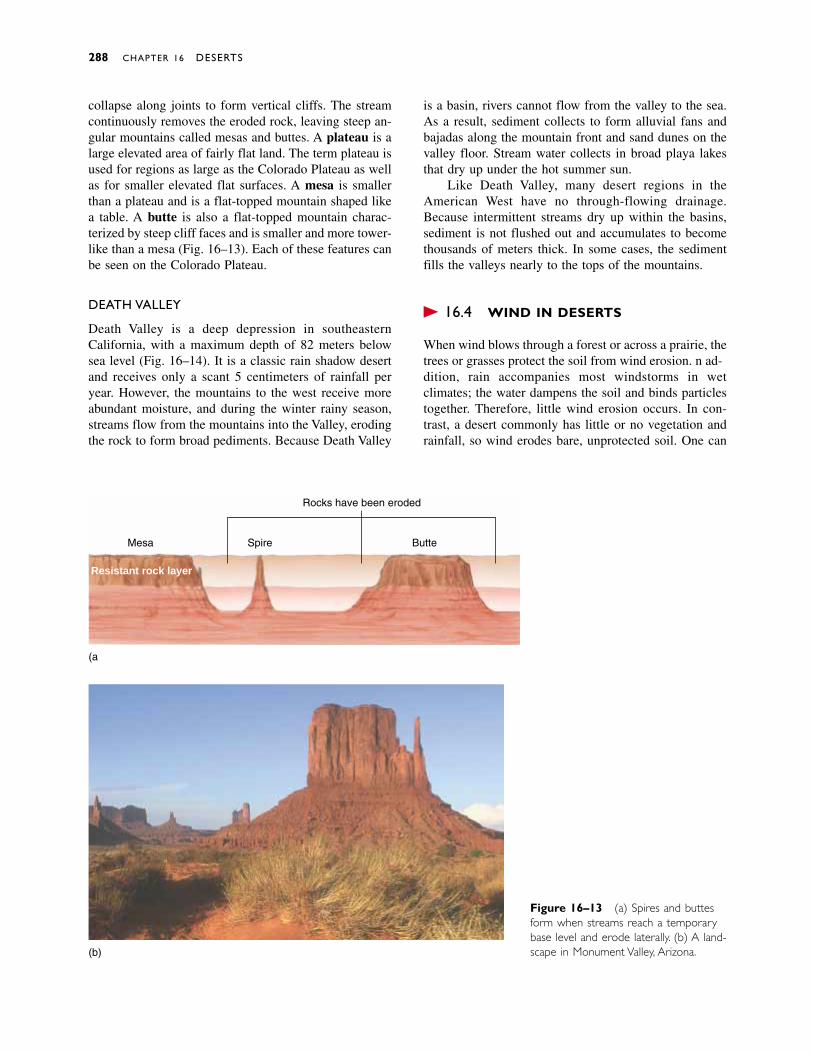
collapse along joints to form vertical cliffs. The streamcontinuously removes the eroded rock, leaving steep an-gular mountains called mesas and buttes. A plateau is alarge elevated area of fairly flat land. The term plateau isused for regions as large as the Colorado Plateau as wellas for smaller elevated flat surfaces. A mesa is smallerthan a plateau and is a flat-topped mountain shaped likea table. A butte is also a flat-topped mountain charac-terized by steep cliff faces and is smaller and more tower-like than a mesa (Fig. 16–13). Each of these features canbe seen on the Colorado Plateau.
DEATH VALLEY
Death Valley is a deep depression in southeasternCalifornia, with a maximum depth of 82 meters belowsea level (Fig. 16–14). It is a classic rain shadow desertand receives only a scant 5 centimeters of rainfall peryear. However, the mountains to the west receive moreabundant moisture, and during the winter rainy season,streams flow from the mountains into the Valley, erodingthe rock to form broad pediments. Because Death Valley
is a basin, rivers cannot flow from the valley to the sea.As a result, sediment collects to form alluvial fans andbajadas along the mountain front and sand dunes on thevalley floor. Stream water collects in broad playa lakesthat dry up under the hot summer sun.
Like Death Valley, many desert regions in theAmerican West have no through-flowing drainage.Because intermittent streams dry up within the basins,sediment is not flushed out and accumulates to becomethousands of meters thick. In some cases, the sedimentfills the valleys nearly to the tops of the mountains.
� 16.4 WIND IN DESERTS
When wind blows through a forest or across a prairie, thetrees or grasses protect the soil from wind erosion. In ad-dition, rain accompanies most windstorms in wet climates; the water dampens the soil and binds particlestogether. Therefore, little wind erosion occurs. In con-trast, a desert commonly has little or no vegetation andrainfall, so wind erodes bare, unprotected soil. One can
288 CHAPTER 16 DESERTS
Mesa Spire Butte
Rocks have been eroded
Resistant rock layer
(a)
(b)
Figure 16–13 (a) Spires and buttesform when streams reach a temporarybase level and erode laterally. (b) A land-scape in Monument Valley, Arizona.
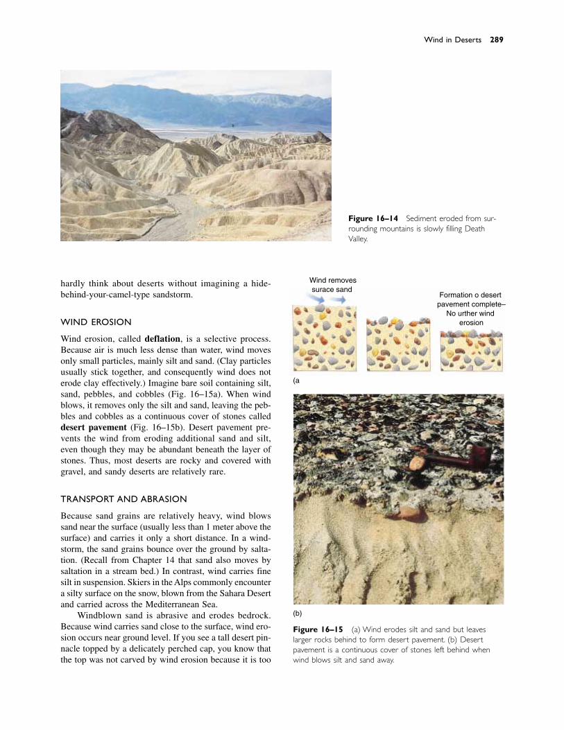
hardly think about deserts without imagining a hide-behind-your-camel-type sandstorm.
WIND EROSION
Wind erosion, called deflation, is a selective process.Because air is much less dense than water, wind movesonly small particles, mainly silt and sand. (Clay particlesusually stick together, and consequently wind does noterode clay effectively.) Imagine bare soil containing silt,sand, pebbles, and cobbles (Fig. 16–15a). When windblows, it removes only the silt and sand, leaving the peb-bles and cobbles as a continuous cover of stones calleddesert pavement (Fig. 16–15b). Desert pavement pre-vents the wind from eroding additional sand and silt,even though they may be abundant beneath the layer ofstones. Thus, most deserts are rocky and covered withgravel, and sandy deserts are relatively rare.
TRANSPORT AND ABRASION
Because sand grains are relatively heavy, wind blowssand near the surface (usually less than 1 meter above thesurface) and carries it only a short distance. In a wind-storm, the sand grains bounce over the ground by salta-tion. (Recall from Chapter 14 that sand also moves bysaltation in a stream bed.) In contrast, wind carries finesilt in suspension. Skiers in the Alps commonly encountera silty surface on the snow, blown from the Sahara Desertand carried across the Mediterranean Sea.
Windblown sand is abrasive and erodes bedrock.Because wind carries sand close to the surface, wind ero-sion occurs near ground level. If you see a tall desert pin-nacle topped by a delicately perched cap, you know thatthe top was not carved by wind erosion because it is too
Wind in Deserts 289
Figure 16–14 Sediment eroded from sur-rounding mountains is slowly filling DeathValley.
(a)
Wind removessurface sand
Formation of desertpavement complete–
No further winderosion
(b)
Figure 16–15 (a) Wind erodes silt and sand but leaveslarger rocks behind to form desert pavement. (b) Desertpavement is a continuous cover of stones left behind whenwind blows silt and sand away.
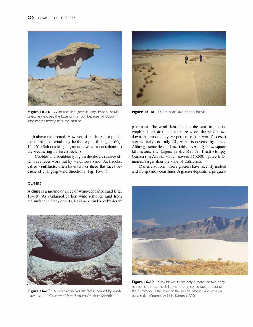
high above the ground. However, if the base of a pinna-cle is sculpted, wind may be the responsible agent (Fig.16–16). (Salt cracking at ground level also contributes tothe weathering of desert rocks.)
Cobbles and boulders lying on the desert surface of-ten have faces worn flat by windblown sand. Such rocks,called ventifacts, often have two or three flat faces be-cause of changing wind directions (Fig. 16–17).
DUNES
A dune is a mound or ridge of wind-deposited sand (Fig.16–18). As explained earlier, wind removes sand fromthe surface in many deserts, leaving behind a rocky desert
pavement. The wind then deposits the sand in a topo-graphic depression or other place where the wind slowsdown. Approximately 80 percent of the world’s desertarea is rocky and only 20 percent is covered by dunes.Although some desert dune fields cover only a few squarekilometers, the largest is the Rub Al Khali (EmptyQuarter) in Arabia, which covers 560,000 square kilo-meters, larger than the state of California.
Dunes also form where glaciers have recently meltedand along sandy coastlines. A glacier deposits large quan-
290 CHAPTER 16 DESERTS
Figure 16–16 Wind abrasion (here in Lago Poopo, Bolivia)selectively eroded the base of this rock because windblownsand moves mostly near the surface.
Figure 16–17 A ventifact shows flat faces scoured by wind-blown sand. (Courtesy of Scott Resources/Hubbard Scientific)
Figure 16–19 Many blowouts are only a meter or two deep,but some can be much larger. The grassy surface on top ofthe hummock is the level of the prairie before wind erosionoccurred. (Courtesy of N. H. Darton, USGS)
Figure 16–18 Dunes near Lago Poopo, Bolivia.
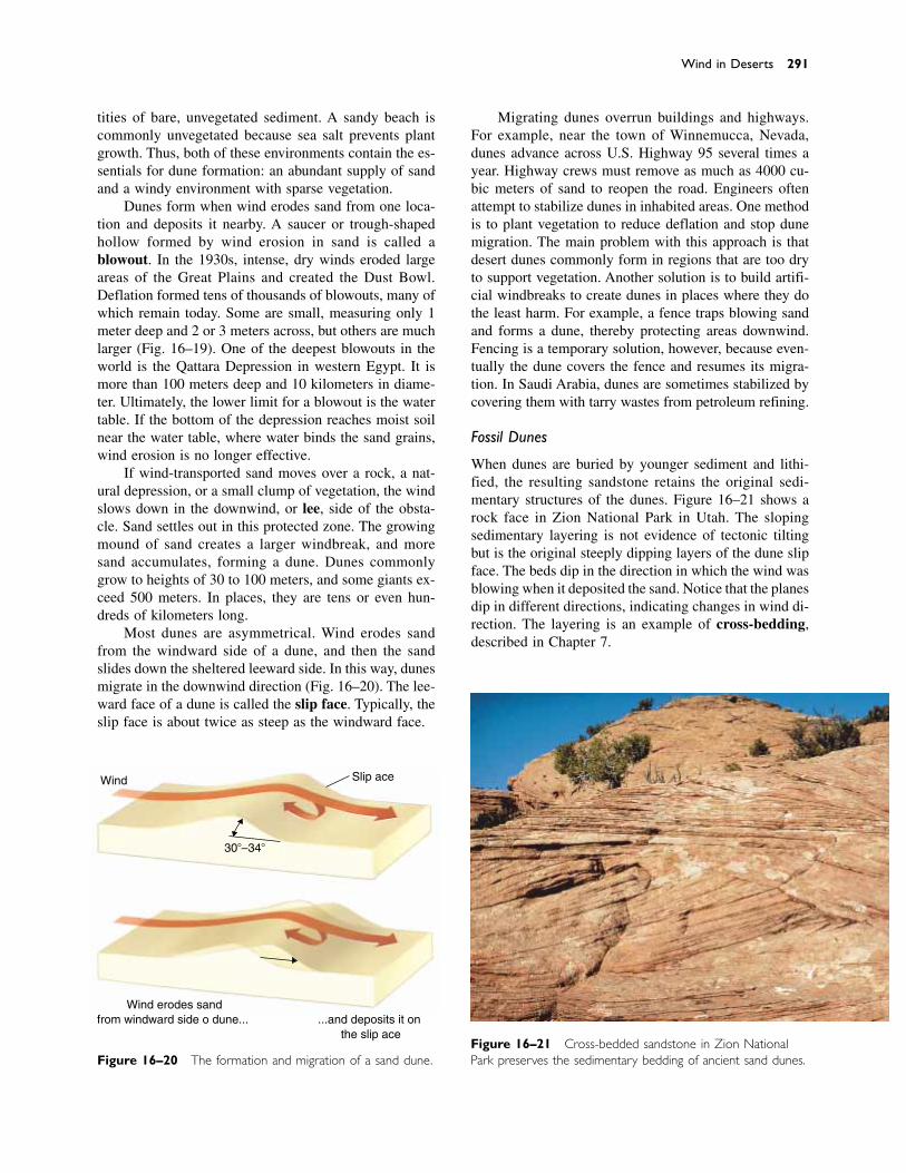
tities of bare, unvegetated sediment. A sandy beach iscommonly unvegetated because sea salt prevents plantgrowth. Thus, both of these environments contain the es-sentials for dune formation: an abundant supply of sandand a windy environment with sparse vegetation.
Dunes form when wind erodes sand from one loca-tion and deposits it nearby. A saucer or trough-shapedhollow formed by wind erosion in sand is called ablowout. In the 1930s, intense, dry winds eroded largeareas of the Great Plains and created the Dust Bowl.Deflation formed tens of thousands of blowouts, many ofwhich remain today. Some are small, measuring only 1meter deep and 2 or 3 meters across, but others are muchlarger (Fig. 16–19). One of the deepest blowouts in theworld is the Qattara Depression in western Egypt. It ismore than 100 meters deep and 10 kilometers in diame-ter. Ultimately, the lower limit for a blowout is the watertable. If the bottom of the depression reaches moist soilnear the water table, where water binds the sand grains,wind erosion is no longer effective.
If wind-transported sand moves over a rock, a nat-ural depression, or a small clump of vegetation, the windslows down in the downwind, or lee, side of the obsta-cle. Sand settles out in this protected zone. The growingmound of sand creates a larger windbreak, and moresand accumulates, forming a dune. Dunes commonlygrow to heights of 30 to 100 meters, and some giants ex-ceed 500 meters. In places, they are tens or even hun-dreds of kilometers long.
Most dunes are asymmetrical. Wind erodes sandfrom the windward side of a dune, and then the sandslides down the sheltered leeward side. In this way, dunesmigrate in the downwind direction (Fig. 16–20). The lee-ward face of a dune is called the slip face. Typically, theslip face is about twice as steep as the windward face.
Migrating dunes overrun buildings and highways.For example, near the town of Winnemucca, Nevada,dunes advance across U.S. Highway 95 several times ayear. Highway crews must remove as much as 4000 cu-bic meters of sand to reopen the road. Engineers oftenattempt to stabilize dunes in inhabited areas. One methodis to plant vegetation to reduce deflation and stop dunemigration. The main problem with this approach is thatdesert dunes commonly form in regions that are too dryto support vegetation. Another solution is to build artifi-cial windbreaks to create dunes in places where they dothe least harm. For example, a fence traps blowing sandand forms a dune, thereby protecting areas downwind.Fencing is a temporary solution, however, because even-tually the dune covers the fence and resumes its migra-tion. In Saudi Arabia, dunes are sometimes stabilized bycovering them with tarry wastes from petroleum refining.
Fossil Dunes
When dunes are buried by younger sediment and lithi-fied, the resulting sandstone retains the original sedi-mentary structures of the dunes. Figure 16–21 shows arock face in Zion National Park in Utah. The slopingsedimentary layering is not evidence of tectonic tiltingbut is the original steeply dipping layers of the dune slipface. The beds dip in the direction in which the wind wasblowing when it deposited the sand. Notice that the planesdip in different directions, indicating changes in wind di-rection. The layering is an example of cross-bedding,described in Chapter 7.
Wind in Deserts 291
Wind Slip face
30�–34�
Wind erodes sandfrom windward side of dune... ...and deposits it on
the slip face
Figure 16–20 The formation and migration of a sand dune.Figure 16–21 Cross-bedded sandstone in Zion NationalPark preserves the sedimentary bedding of ancient sand dunes.
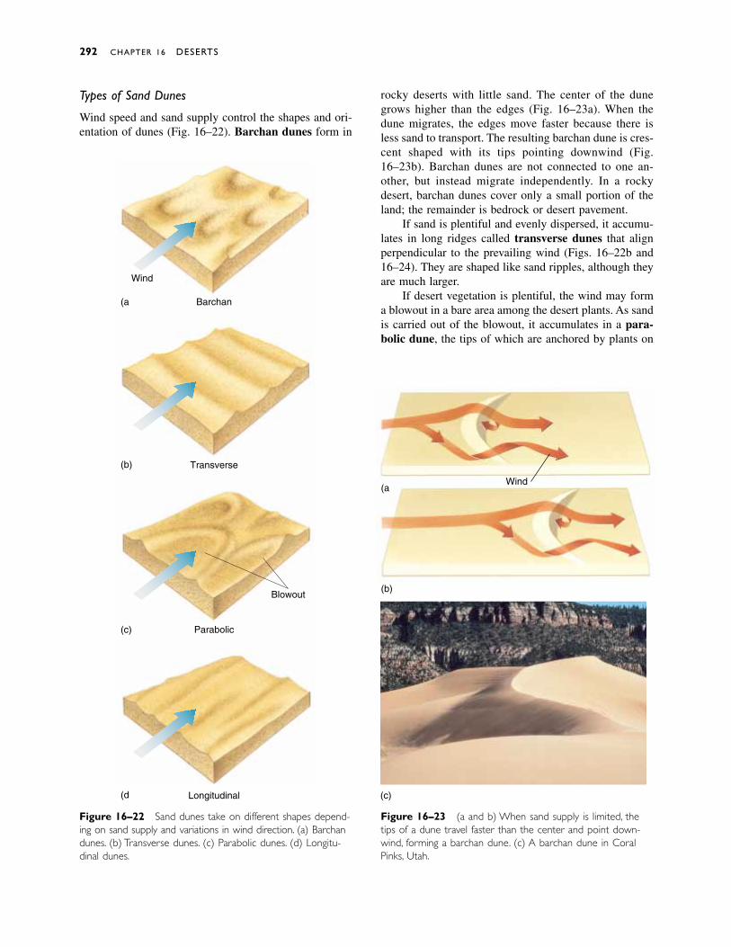
292 CHAPTER 16 DESERTS
Figure 16–22 Sand dunes take on different shapes depend-ing on sand supply and variations in wind direction. (a) Barchandunes. (b) Transverse dunes. (c) Parabolic dunes. (d) Longitu-dinal dunes.
Barchan(a)
(b)
(c)
(d)
Transverse
Wind
Parabolic
Blowout
Longitudinal
Types of Sand Dunes
Wind speed and sand supply control the shapes and ori-entation of dunes (Fig. 16–22). Barchan dunes form in
Figure 16–23 (a and b) When sand supply is limited, thetips of a dune travel faster than the center and point down-wind, forming a barchan dune. (c) A barchan dune in CoralPinks, Utah.
Wind(a)
(b)
(c)
rocky deserts with little sand. The center of the dunegrows higher than the edges (Fig. 16–23a). When thedune migrates, the edges move faster because there isless sand to transport. The resulting barchan dune is cres-cent shaped with its tips pointing downwind (Fig.16–23b). Barchan dunes are not connected to one an-other, but instead migrate independently. In a rockydesert, barchan dunes cover only a small portion of theland; the remainder is bedrock or desert pavement.
If sand is plentiful and evenly dispersed, it accumu-lates in long ridges called transverse dunes that alignperpendicular to the prevailing wind (Figs. 16–22b and16–24). They are shaped like sand ripples, although theyare much larger.
If desert vegetation is plentiful, the wind may forma blowout in a bare area among the desert plants. As sandis carried out of the blowout, it accumulates in a para-bolic dune, the tips of which are anchored by plants on
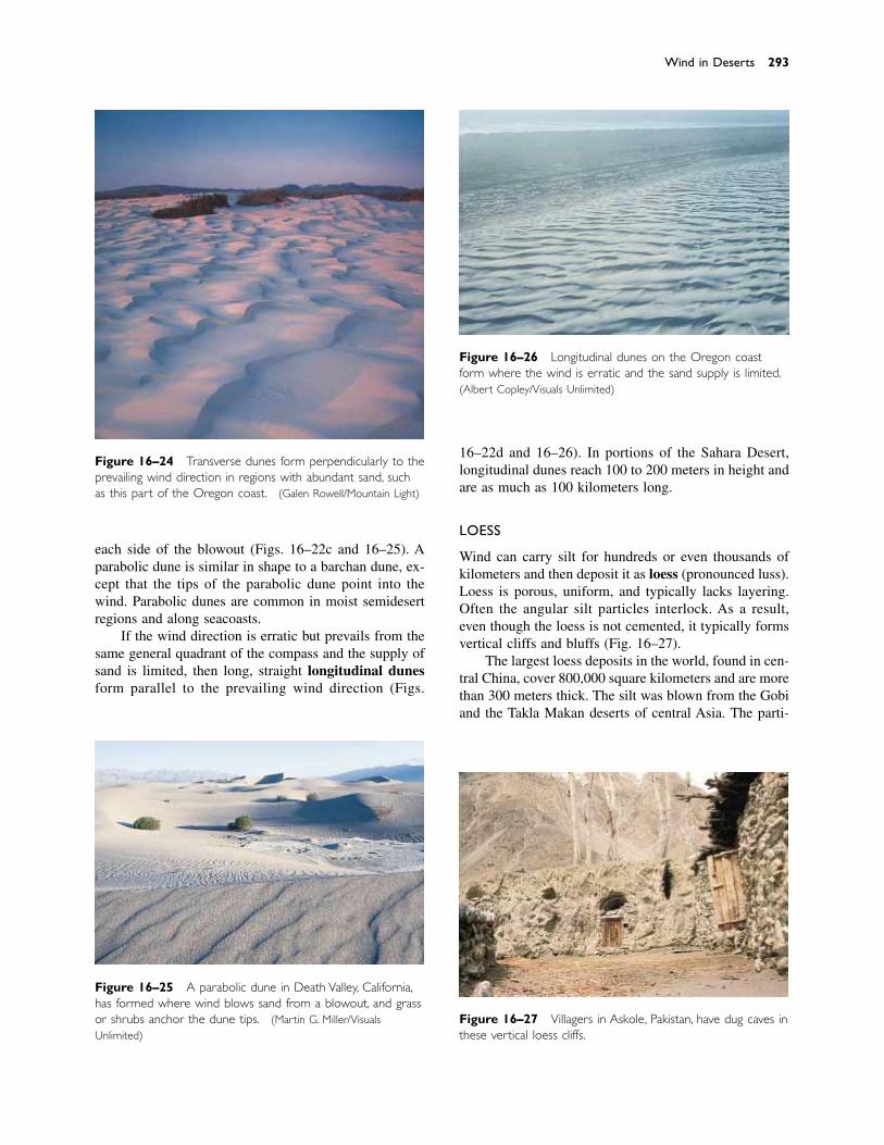
each side of the blowout (Figs. 16–22c and 16–25). Aparabolic dune is similar in shape to a barchan dune, ex-cept that the tips of the parabolic dune point into thewind. Parabolic dunes are common in moist semidesertregions and along seacoasts.
If the wind direction is erratic but prevails from thesame general quadrant of the compass and the supply ofsand is limited, then long, straight longitudinal dunesform parallel to the prevailing wind direction (Figs.
16–22d and 16–26). In portions of the Sahara Desert,longitudinal dunes reach 100 to 200 meters in height andare as much as 100 kilometers long.
LOESS
Wind can carry silt for hundreds or even thousands ofkilometers and then deposit it as loess (pronounced luss).Loess is porous, uniform, and typically lacks layering.Often the angular silt particles interlock. As a result,even though the loess is not cemented, it typically formsvertical cliffs and bluffs (Fig. 16–27).
The largest loess deposits in the world, found in cen-tral China, cover 800,000 square kilometers and are morethan 300 meters thick. The silt was blown from the Gobiand the Takla Makan deserts of central Asia. The parti-
Wind in Deserts 293
Figure 16–24 Transverse dunes form perpendicularly to theprevailing wind direction in regions with abundant sand, suchas this part of the Oregon coast. (Galen Rowell/Mountain Light)
Figure 16–25 A parabolic dune in Death Valley, California,has formed where wind blows sand from a blowout, and grassor shrubs anchor the dune tips. (Martin G. Miller/VisualsUnlimited)
Figure 16–26 Longitudinal dunes on the Oregon coastform where the wind is erratic and the sand supply is limited.(Albert Copley/Visuals Unlimited)
Figure 16–27 Villagers in Askole, Pakistan, have dug caves inthese vertical loess cliffs.
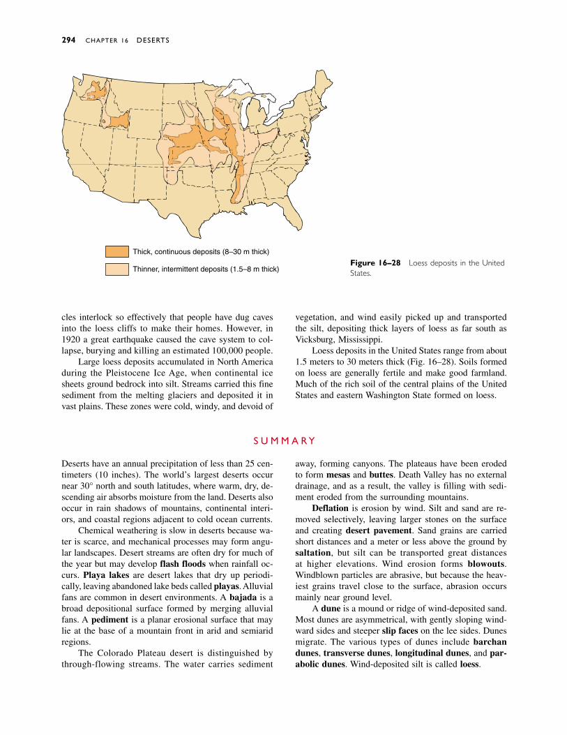
cles interlock so effectively that people have dug cavesinto the loess cliffs to make their homes. However, in1920 a great earthquake caused the cave system to col-lapse, burying and killing an estimated 100,000 people.
Large loess deposits accumulated in North Americaduring the Pleistocene Ice Age, when continental icesheets ground bedrock into silt. Streams carried this finesediment from the melting glaciers and deposited it invast plains. These zones were cold, windy, and devoid of
vegetation, and wind easily picked up and transportedthe silt, depositing thick layers of loess as far south asVicksburg, Mississippi.
Loess deposits in the United States range from about1.5 meters to 30 meters thick (Fig. 16–28). Soils formedon loess are generally fertile and make good farmland.Much of the rich soil of the central plains of the UnitedStates and eastern Washington State formed on loess.
294 CHAPTER 16 DESERTS
Thick, continuous deposits (8–30 m thick)
Thinner, intermittent deposits (1.5–8 m thick)Figure 16–28 Loess deposits in the UnitedStates.
S U M M A R Y
Deserts have an annual precipitation of less than 25 cen-timeters (10 inches). The world’s largest deserts occurnear 30° north and south latitudes, where warm, dry, de-scending air absorbs moisture from the land. Deserts alsooccur in rain shadows of mountains, continental interi-ors, and coastal regions adjacent to cold ocean currents.
Chemical weathering is slow in deserts because wa-ter is scarce, and mechanical processes may form angu-lar landscapes. Desert streams are often dry for much ofthe year but may develop flash floods when rainfall oc-curs. Playa lakes are desert lakes that dry up periodi-cally, leaving abandoned lake beds called playas. Alluvialfans are common in desert environments. A bajada is abroad depositional surface formed by merging alluvialfans. A pediment is a planar erosional surface that maylie at the base of a mountain front in arid and semiaridregions.
The Colorado Plateau desert is distinguished bythrough-flowing streams. The water carries sediment
away, forming canyons. The plateaus have been erodedto form mesas and buttes. Death Valley has no externaldrainage, and as a result, the valley is filling with sedi-ment eroded from the surrounding mountains.
Deflation is erosion by wind. Silt and sand are re-moved selectively, leaving larger stones on the surfaceand creating desert pavement. Sand grains are carriedshort distances and a meter or less above the ground bysaltation, but silt can be transported great distances at higher elevations. Wind erosion forms blowouts.Windblown particles are abrasive, but because the heav-iest grains travel close to the surface, abrasion occursmainly near ground level.
A dune is a mound or ridge of wind-deposited sand.Most dunes are asymmetrical, with gently sloping wind-ward sides and steeper slip faces on the lee sides. Dunesmigrate. The various types of dunes include barchandunes, transverse dunes, longitudinal dunes, and par-abolic dunes. Wind-deposited silt is called loess.
Discussion Questions 295
K E Y W O R D S
desert 280rain shadow desert 283wash 285playa lake 285playa 285flash flood 285
bajada 286pediment 286plateau 288mesa 288butte 288deflation 289
desert pavement 289ventifact 290dune 290blowout 291slip face 291cross-bedding 291
barchan dune 292transverse dune 292parabolic dune 292longitudinal dune 293loess 293
R E V I E W Q U E S T I O N S
8. Why is wind erosion more prominent in desert environ-ments than it is in humid regions?
9. Describe the formation of desert pavement.
10. Describe the evolution and shape of a dune.
11. Describe the differences among barchan dunes, transversedunes, parabolic dunes, and longitudinal dunes. Underwhat conditions does each type of dune form?
12. Compare and contrast desert plateaus, mesas, and buttes.Describe the formation of each.
13. Compare the effects of stream erosion and deposition inthe Colorado Plateau and Death Valley.
1. Why are many deserts concentrated along zones at 30ºlatitude in both the Northern and Southern Hemispheres?
2. List three conditions that produce deserts.
3. Explain why angular topography is common in desertregions.
4. Why do flash floods and debris flows occur in deserts?
5. Why are alluvial fans more prominent in deserts than inhumid environments?
6. Compare and contrast floods in deserts with those inmore humid environments.
7. Compare and contrast pediments and bajadas.
D I S C U S S I O N Q U E S T I O N S
of 100 meters. The batteries on your radio transmitter hada life expectancy of two weeks. The spacecraft landedand you began to receive data. What information wouldconvince you that the spacecraft had landed in a desert?
5. Deserts are defined as areas with low rainfall, yet wateris an active agent of erosion in desert landscapes. Explainthis apparent contradiction.
6. Compare and contrast erosion, transport, and depositionby wind with erosion and deposition by streams.
7. Imagine that someone told you that an alluvial fan hadformed by wind deposition. What evidence would youlook for to test this statement?
8. What type of dunes form under the following conditions?(a) Relatively high vegetation cover, sand supply, andwind strength. (b) Low vegetation and sand supply.
9. What type of environment would produce fossilizedseashells embedded in lithified sand dunes?
1. Coastal regions boast some of the wettest and some ofthe driest environments on Earth. Briefly outline the cli-matological conditions that produce coastal rainforestsversus coastal deserts.
2. Explain why soil moisture content might be more usefulthan total rainfall in defining a desert. How could oneregion have a higher soil moisture content and lowerrainfall than another region?
3. Discuss two types of tectonic change that could producedeserts in previously humid environments.
4. Imagine that you lived on a planet in a distant solar sys-tem. You had no prior information on the topography orclimate of the Earth and were designing an unmannedspacecraft to land on Earth. The spacecraft had arms thatcould reach out a few meters from the landing site tocollect material for chemical analysis. It also had instru-ments to measure the immediate meteorological conditionsand cameras that could focus on anything within a range
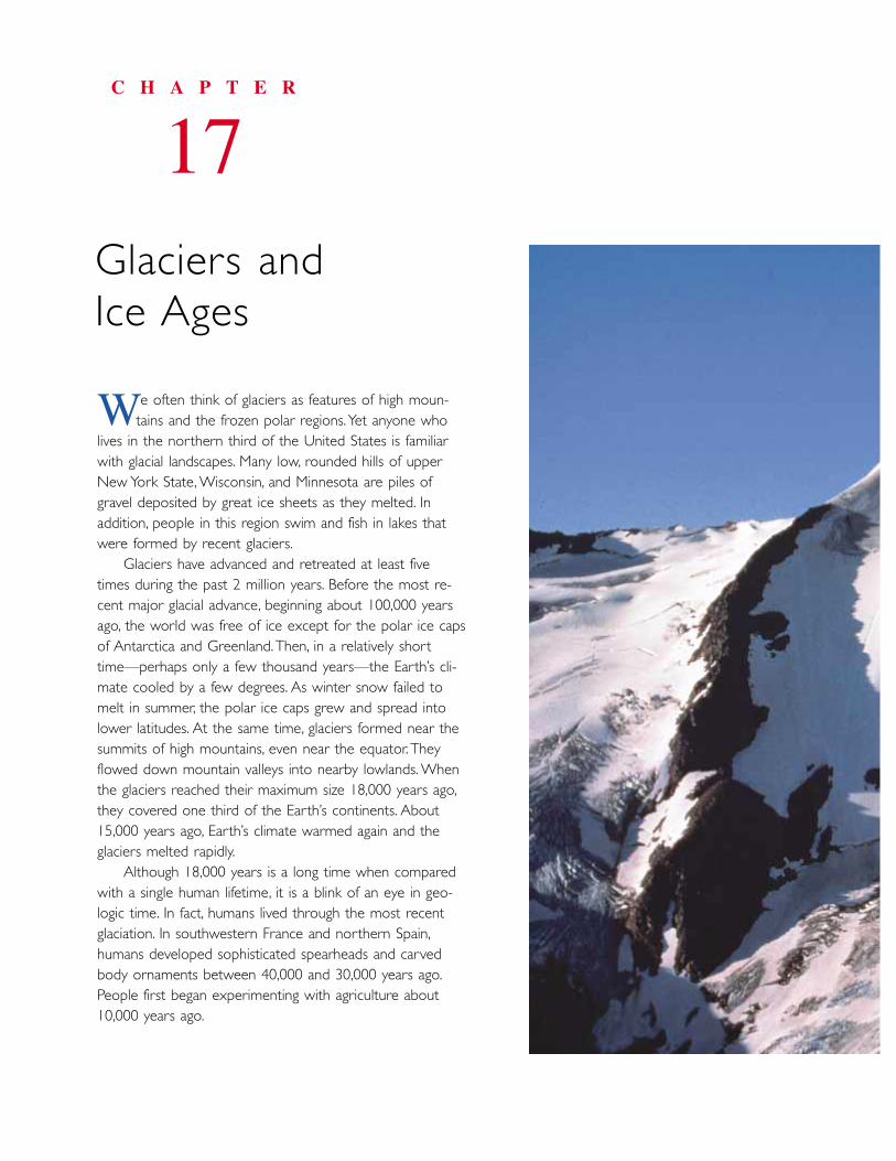
e often think of glaciers as features of high moun-tains and the frozen polar regions.Yet anyone who
lives in the northern third of the United States is familiarwith glacial landscapes. Many low, rounded hills of upperNew York State, Wisconsin, and Minnesota are piles ofgravel deposited by great ice sheets as they melted. In addition, people in this region swim and fish in lakes thatwere formed by recent glaciers.
Glaciers have advanced and retreated at least fivetimes during the past 2 million years. Before the most re-cent major glacial advance, beginning about 100,000 yearsago, the world was free of ice except for the polar ice capsof Antarctica and Greenland.Then, in a relatively shorttime—perhaps only a few thousand years—the Earth’s cli-mate cooled by a few degrees. As winter snow failed tomelt in summer, the polar ice caps grew and spread intolower latitudes. At the same time, glaciers formed near thesummits of high mountains, even near the equator.Theyflowed down mountain valleys into nearby lowlands. Whenthe glaciers reached their maximum size 18,000 years ago,they covered one third of the Earth’s continents. About15,000 years ago, Earth’s climate warmed again and theglaciers melted rapidly.
Although 18,000 years is a long time when comparedwith a single human lifetime, it is a blink of an eye in geo-logic time. In fact, humans lived through the most recentglaciation. In southwestern France and northern Spain,humans developed sophisticated spearheads and carvedbody ornaments between 40,000 and 30,000 years ago.People first began experimenting with agriculture about10,000 years ago.
C H A P T E R
17Glaciers and Ice Ages
W
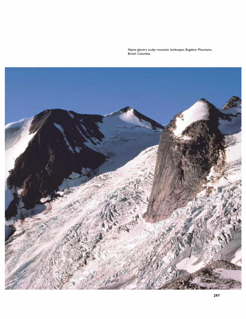
Alpine glaciers sculpt mountain landscapes, Bugaboo Mountains,British Columbia.
297
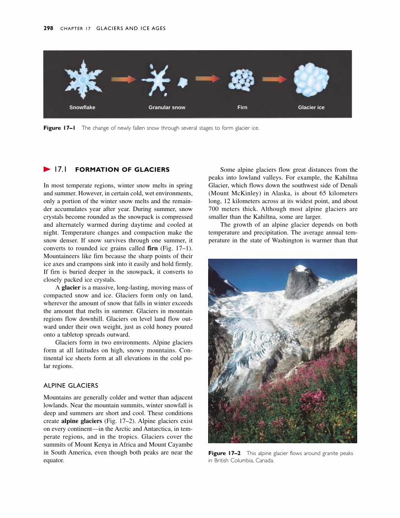
� 17.1 FORMATION OF GLACIERS
In most temperate regions, winter snow melts in springand summer. However, in certain cold, wet environments,only a portion of the winter snow melts and the remain-der accumulates year after year. During summer, snowcrystals become rounded as the snowpack is compressedand alternately warmed during daytime and cooled atnight. Temperature changes and compaction make thesnow denser. If snow survives through one summer, itconverts to rounded ice grains called firn (Fig. 17–1).Mountaineers like firn because the sharp points of theirice axes and crampons sink into it easily and hold firmly.If firn is buried deeper in the snowpack, it converts toclosely packed ice crystals.
A glacier is a massive, long-lasting, moving mass ofcompacted snow and ice. Glaciers form only on land,wherever the amount of snow that falls in winter exceedsthe amount that melts in summer. Glaciers in mountainregions flow downhill. Glaciers on level land flow out-ward under their own weight, just as cold honey pouredonto a tabletop spreads outward.
Glaciers form in two environments. Alpine glaciersform at all latitudes on high, snowy mountains. Con-tinental ice sheets form at all elevations in the cold po-lar regions.
ALPINE GLACIERS
Mountains are generally colder and wetter than adjacentlowlands. Near the mountain summits, winter snowfall isdeep and summers are short and cool. These conditionscreate alpine glaciers (Fig. 17–2). Alpine glaciers existon every continent—in the Arctic and Antarctica, in tem-perate regions, and in the tropics. Glaciers cover thesummits of Mount Kenya in Africa and Mount Cayambein South America, even though both peaks are near theequator.
Some alpine glaciers flow great distances from thepeaks into lowland valleys. For example, the KahiltnaGlacier, which flows down the southwest side of Denali(Mount McKinley) in Alaska, is about 65 kilometerslong, 12 kilometers across at its widest point, and about700 meters thick. Although most alpine glaciers aresmaller than the Kahiltna, some are larger.
The growth of an alpine glacier depends on bothtemperature and precipitation. The average annual tem-perature in the state of Washington is warmer than that
298 CHAPTER 17 GLACIERS AND ICE AGES
Snowflake Granular snow Firn Glacier ice
Figure 17–2 This alpine glacier flows around granite peaksin British Columbia, Canada.
Figure 17–1 The change of newly fallen snow through several stages to form glacier ice.
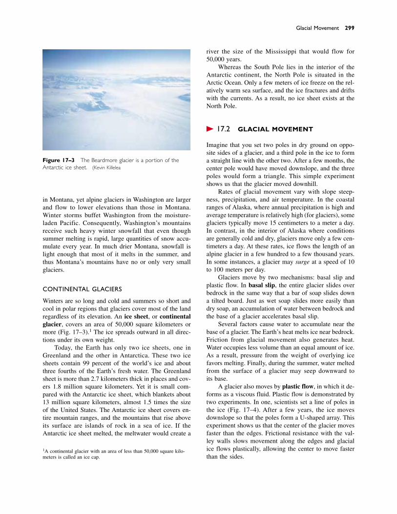
in Montana, yet alpine glaciers in Washington are largerand flow to lower elevations than those in Montana.Winter storms buffet Washington from the moisture-laden Pacific. Consequently, Washington’s mountains receive such heavy winter snowfall that even thoughsummer melting is rapid, large quantities of snow accu-mulate every year. In much drier Montana, snowfall islight enough that most of it melts in the summer, andthus Montana’s mountains have no or only very smallglaciers.
CONTINENTAL GLACIERS
Winters are so long and cold and summers so short andcool in polar regions that glaciers cover most of the landregardless of its elevation. An ice sheet, or continentalglacier, covers an area of 50,000 square kilometers ormore (Fig. 17–3).1 The ice spreads outward in all direc-tions under its own weight.
Today, the Earth has only two ice sheets, one inGreenland and the other in Antarctica. These two icesheets contain 99 percent of the world’s ice and aboutthree fourths of the Earth’s fresh water. The Greenlandsheet is more than 2.7 kilometers thick in places and cov-ers 1.8 million square kilometers. Yet it is small com-pared with the Antarctic ice sheet, which blankets about13 million square kilometers, almost 1.5 times the sizeof the United States. The Antarctic ice sheet covers en-tire mountain ranges, and the mountains that rise aboveits surface are islands of rock in a sea of ice. If theAntarctic ice sheet melted, the meltwater would create a
river the size of the Mississippi that would flow for50,000 years.
Whereas the South Pole lies in the interior of theAntarctic continent, the North Pole is situated in theArctic Ocean. Only a few meters of ice freeze on the rel-atively warm sea surface, and the ice fractures and driftswith the currents. As a result, no ice sheet exists at theNorth Pole.
� 17.2 GLACIAL MOVEMENT
Imagine that you set two poles in dry ground on oppo-site sides of a glacier, and a third pole in the ice to forma straight line with the other two. After a few months, thecenter pole would have moved downslope, and the threepoles would form a triangle. This simple experimentshows us that the glacier moved downhill.
Rates of glacial movement vary with slope steep-ness, precipitation, and air temperature. In the coastalranges of Alaska, where annual precipitation is high andaverage temperature is relatively high (for glaciers), someglaciers typically move 15 centimeters to a meter a day.In contrast, in the interior of Alaska where conditions are generally cold and dry, glaciers move only a few cen-timeters a day. At these rates, ice flows the length of analpine glacier in a few hundred to a few thousand years.In some instances, a glacier may surge at a speed of 10to 100 meters per day.
Glaciers move by two mechanisms: basal slip andplastic flow. In basal slip, the entire glacier slides overbedrock in the same way that a bar of soap slides downa tilted board. Just as wet soap slides more easily thandry soap, an accumulation of water between bedrock andthe base of a glacier accelerates basal slip.
Several factors cause water to accumulate near thebase of a glacier. The Earth’s heat melts ice near bedrock.Friction from glacial movement also generates heat.Water occupies less volume than an equal amount of ice.As a result, pressure from the weight of overlying ice favors melting. Finally, during the summer, water meltedfrom the surface of a glacier may seep downward to its base.
A glacier also moves by plastic flow, in which it de-forms as a viscous fluid. Plastic flow is demonstrated bytwo experiments. In one, scientists set a line of poles inthe ice (Fig. 17–4). After a few years, the ice movesdownslope so that the poles form a U-shaped array. Thisexperiment shows us that the center of the glacier movesfaster than the edges. Frictional resistance with the val-ley walls slows movement along the edges and glacialice flows plastically, allowing the center to move fasterthan the sides.
Glacial Movement 299
1A continental glacier with an area of less than 50,000 square kilo-meters is called an ice cap.
Figure 17–3 The Beardmore glacier is a portion of theAntarctic ice sheet. (Kevin Killelea)
Figure 17–5 In this experiment, a pipe is driven through aglacier until it reaches bedrock.The entire pipe moves down-slope.The pipe becomes curved because the center of theglacier deforms plastically and moves faster than the base.Thetop 40 meters of ice are brittle, and the pipe remains straightin this section.
As another experiment, imagine driving a straightbut flexible pipe downward into the glacier to study theflow of ice at depth (Fig. 17–5). At a later date, you no-tice that not only has the entire pipe moved downslope,but the pipe has become curved. At the surface of a gla-cier, the ice acts as a brittle solid, like an ice cube or theice found on the surface of a lake. In contrast, at depthsgreater than about 40 meters, the pressure is sufficient toallow ice to deform in a plastic manner. The curvature inthe pipe shows that the ice has moved plastically and thatmiddle levels of the glacier moved faster than the lowerpart. The base of the glacier is slowed by friction againstbedrock, so it moves more slowly than the plastic por-tion above it.
The relative rates of basal slip and plastic flow de-pend on the steepness of the bedrock underlying theglacier and on the thickness of the ice. A small alpineglacier on steep terrain moves mostly by basal slip. Incontrast, the bedrock beneath portions of the Antarcticaand Greenland ice sheets is relatively level, so the icecannot slide downslope. Thus, these continental glaciersare huge plastic masses of ice (with a thin rigid cap) thatooze outward mainly under the forces created by theirown weight.
When a glacier flows over uneven bedrock, thedeeper plastic ice bends and flows over bumps, stretch-
300 CHAPTER 17 GLACIERS AND ICE AGES
Figure 17–4 If a line of pipes is set into the ice, the pipesnear the center of the glaciers move downslope faster thanthose near the margins.
Initialpositionof pipe
Crevasses
BedrockMovementfrom basalslip
Deformationfrom plasticflow
Lowerzone ofice isplastic
Brittle zone± 40 meters
ing the brittle upper layer of ice so that it cracks, form-ing crevasses (Fig. 17–6). Crevasses form only in thebrittle upper 40 meters of a glacier, not in the lower plas-tic zone. Crevasses open and close slowly as a glaciermoves. An ice fall is a section of a glacier consisting ofcrevasses and towering ice pinnacles. The pinnacles formwhere ice blocks break away from the crevasse walls androtate as the glacier moves. With crampons, ropes, andice axes, a skilled mountaineer might climb into acrevasse. The walls are a pastel blue, and sunlight filtersthrough the narrow opening above. The ice shifts andcracks, making creaking sounds as the glacier advances.Many mountaineers have been crushed by falling icewhile traveling through ice falls.
THE MASS BALANCE OF A GLACIER
Consider an alpine glacier flowing from the mountainsinto a valley (Fig. 17–7). At the upper end of the glacier,snowfall is heavy, temperatures are below freezing formuch of the year, and avalanches carry large quantitiesof snow from the surrounding peaks onto the ice. Thus,more snow accumulates in winter than melts in sum-
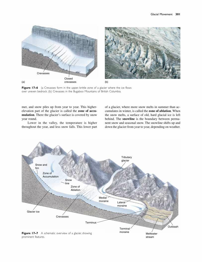
Glacial Movement 301
Figure 17–6 (a) Crevasses form in the upper, brittle zone of a glacier where the ice flowsover uneven bedrock. (b) Crevasses in the Bugaboo Mountains of British Columbia.
(a)
Crevasses
Closedcrevasses (b)
Glacier ice
Crevasses
Terminus
Terminalmoraine
Meltwaterstream
Outwash
Tributaryglacier
Snow andfirn
Zone ofAccumulation
Snowline
Zone ofAblation
Medialmoraine Lateral
moraine
Figure 17–7 A schematic overview of a glacier, showingprominent features.
mer, and snow piles up from year to year. This higher-elevation part of the glacier is called the zone of accu-mulation. There the glacier’s surface is covered by snowyear round.
Lower in the valley, the temperature is higherthroughout the year, and less snow falls. This lower part
of a glacier, where more snow melts in summer than ac-cumulates in winter, is called the zone of ablation. Whenthe snow melts, a surface of old, hard glacial ice is leftbehind. The snowline is the boundary between perma-nent snow and seasonal snow. The snowline shifts up anddown the glacier from year to year, depending on weather.
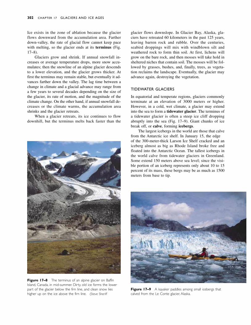
Figure 17–8 The terminus of an alpine glacier on BaffinIsland, Canada, in mid-summer. Dirty, old ice forms the lowerpart of the glacier below the firn line, and clean snow lieshigher up on the ice above the firn line. (Steve Sheriff)
Ice exists in the zone of ablation because the glacierflows downward from the accumulation area. Fartherdown-valley, the rate of glacial flow cannot keep pacewith melting, so the glacier ends at its terminus (Fig.17–8).
Glaciers grow and shrink. If annual snowfall in-creases or average temperature drops, more snow accu-mulates; then the snowline of an alpine glacier descendsto a lower elevation, and the glacier grows thicker. Atfirst the terminus may remain stable, but eventually it ad-vances farther down the valley. The lag time between achange in climate and a glacial advance may range froma few years to several decades depending on the size ofthe glacier, its rate of motion, and the magnitude of theclimate change. On the other hand, if annual snowfall de-creases or the climate warms, the accumulation areashrinks and the glacier retreats.
When a glacier retreats, its ice continues to flowdownhill, but the terminus melts back faster than the
glacier flows downslope. In Glacier Bay, Alaska, gla-ciers have retreated 60 kilometers in the past 125 years,leaving barren rock and rubble. Over the centuries,seabird droppings will mix with windblown silt andweathered rock to form thin soil. At first, lichens willgrow on the bare rock, and then mosses will take hold insheltered niches that contain soil. The mosses will be fol-lowed by grasses, bushes, and, finally, trees, as vegeta-tion reclaims the landscape. Eventually, the glacier mayadvance again, destroying the vegetation.
TIDEWATER GLACIERS
In equatorial and temperate regions, glaciers commonlyterminate at an elevation of 3000 meters or higher.However, in a cold, wet climate, a glacier may extendinto the sea to form a tidewater glacier. The terminus ofa tidewater glacier is often a steep ice cliff droppingabruptly into the sea (Fig. 17–9). Giant chunks of icebreak off, or calve, forming icebergs.
The largest icebergs in the world are those that calvefrom the Antarctic ice shelf. In January 1995, the edgeof the 300-meter-thick Larson Ice Shelf cracked and aniceberg almost as big as Rhode Island broke free andfloated into the Antarctic Ocean. The tallest icebergs inthe world calve from tidewater glaciers in Greenland.Some extend 150 meters above sea level; since the visi-ble portion of an iceberg represents only about 10 to 15percent of its mass, these bergs may be as much as 1500meters from base to tip.
302 CHAPTER 17 GLACIERS AND ICE AGES
Figure 17–9 A kayaker paddles among small icebergs thatcalved from the Le Conte glacier, Alaska.

� 17.3 GLACIAL EROSION
Rock at the base and sides of a glacier may have beenfractured by tectonic forces and may be loosened byweathering processes, such as frost wedging or pressure-release fracturing. The moving ice then dislodges theloosened rock in a process called plucking (Fig. 17–10).Ice is viscous enough to pick up and carry particles of allsizes, from silt-sized grains to house-sized boulders.Thus glaciers erode and transport huge quantities of rockand sediment.
Ice itself is not abrasive to bedrock because it is toosoft. However, rocks embedded in the ice scrape acrossbedrock like a sheet of rough sandpaper pushed by a gi-ant’s hand. This process cuts deep, parallel grooves andscratches in bedrock called glacial striations (Fig.17–11). When glaciers melt and striated bedrock is ex-posed, the markings show the direction of ice movement.Glacial striations are used to map the flow directions ofglaciers. Rocks that were embedded in the base of aglacier also commonly show striations.
Sand and silt embedded in a glacier polish bedrockto a smooth, shiny finish. The abrasion grinds rocks intofine silt-sized grains called rock flour. Characteristically,a glacial stream is so muddy with rock flour that it isgritty and brown or gray in color. Sometimes the sus-pended silt scatters sunlight to make alpine streams andlakes appear turquoise, blue, or green.
Glacial Erosion 303
Figure 17–10 (a) A glacier plucks rocks from bedrock and then drags them along, abrad-ing both the loose rocks and the bedrock. (b) Plucking formed these crescent-shaped de-pressions in granite at Le Conte Bay, Alaska.
Water seeps intocracks, freezes anddislodges rocks whichare then pluckedout by glacier
Rocks aredragged alongbedrock
Bedrock
Ice
(a) (b)
Figure 17–11 Stones embedded in the base of a glaciergouged these striations in bedrock in British Columbia.
EROSIONAL LANDFORMS CREATED BY ALPINE GLACIERS
Let’s take an imaginary journey through a mountainrange that was glaciated in the past but is now mostly ice

free. We start with a helicopter ride to the summit of ahigh, rocky peak. Our first view from the helicopter is ofsharp, jagged mountains rising steeply above smooth,rounded valleys (Fig. 17–12).
A mountain stream commonly erodes downwardinto its bed, cutting a steep-sided, V-shaped valley. Aglacier, however, is not confined to a narrow stream bedbut instead fills its entire valley. As a result, it scours the
sides of the valley as well as the bottom, carving a broad,rounded, U-shaped valley (Fig. 17–13).
We land on one of the peaks and step out of the heli-copter. Beneath us, a steep cliff drops off into a horse-shoe-shaped depression in the mountainside called acirque. A small glacier at the head of the cirque remindsus of the larger mass of ice that existed in a colder, wet-ter time (Fig. 17–14a).
304 CHAPTER 17 GLACIERS AND ICE AGES
Figure 17–12 Glacial landscapes. (a) A landscape as it appears when it is covered by gla-ciers. (b) The same landscape as it appears after the glaciers have melted.
Lateralmoraine
Areteˆ Horn
Cirque
Areteˆ Horn
Cirque
Medialmoraine
Tarn
Hangingvalleys
Paternosterlakes
Truncatedspur
U-shapedvalley
(a)
(b)
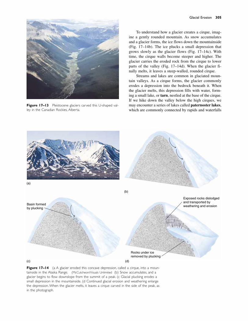
To understand how a glacier creates a cirque, imag-ine a gently rounded mountain. As snow accumulatesand a glacier forms, the ice flows down the mountainside(Fig. 17–14b). The ice plucks a small depression thatgrows slowly as the glacier flows (Fig. 17–14c). Withtime, the cirque walls become steeper and higher. Theglacier carries the eroded rock from the cirque to lowerparts of the valley (Fig. 17–14d). When the glacier fi-nally melts, it leaves a steep-walled, rounded cirque.
Streams and lakes are common in glaciated moun-tain valleys. As a cirque forms, the glacier commonlyerodes a depression into the bedrock beneath it. Whenthe glacier melts, this depression fills with water, form-ing a small lake, or tarn, nestled at the base of the cirque.If we hike down the valley below the high cirques, wemay encounter a series of lakes called paternoster lakes,which are commonly connected by rapids and waterfalls
Glacial Erosion 305
Figure 17–13 Pleistocene glaciers carved this U-shaped val-ley in the Canadian Rockies, Alberta.
Figure 17–14 (a) A glacier eroded this concave depression, called a cirque, into a moun-tainside in the Alaska Range. (McCutcheon/Visuals Unlimited) (b) Snow accumulates, and aglacier begins to flow downslope from the summit of a peak. (c) Glacial plucking erodes asmall depression in the mountainside. (d) Continued glacial erosion and weathering enlargethe depression. When the glacier melts, it leaves a cirque carved in the side of the peak, asin the photograph.
(b)
(d)(c)
Basin formedby plucking
Rocks under iceremoved by plucking
Exposed rocks dislodgedand transported byweathering and erosion
(a)
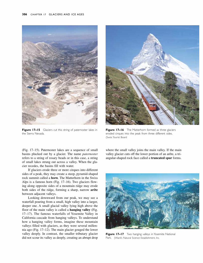
(Fig. 17–15). Paternoster lakes are a sequence of smallbasins plucked out by a glacier. The name paternosterrefers to a string of rosary beads or in this case, a stringof small lakes strung out across a valley. When the gla-cier recedes, the basins fill with water.
If glaciers erode three or more cirques into differentsides of a peak, they may create a steep, pyramid-shapedrock summit called a horn. The Matterhorn in the SwissAlps is a famous horn (Fig. 17–16). Two glaciers flow-ing along opposite sides of a mountain ridge may erodeboth sides of the ridge, forming a sharp, narrow arêtebetween adjacent valleys.
Looking downward from our peak, we may see awaterfall pouring from a small, high valley into a larger,deeper one. A small glacial valley lying high above thefloor of the main valley is called a hanging valley (Fig.17–17). The famous waterfalls of Yosemite Valley inCalifornia cascade from hanging valleys. To understandhow a hanging valley forms, imagine these mountainvalleys filled with glaciers, as they were several millen-nia ago (Fig. 17–12). The main glacier gouged the lowervalley deeply. In contrast, the smaller tributary glacierdid not scour its valley as deeply, creating an abrupt drop
306 CHAPTER 17 GLACIERS AND ICE AGES
Figure 17–17 Two hanging valleys in Yosemite NationalPark. (Ward’s Natural Science Establishment, Inc.)
Figure 17–15 Glaciers cut this string of paternoster lakes inthe Sierra Nevada.
Figure 17–16 The Matterhorn formed as three glacierseroded cirques into the peak from three different sides.(Swiss Tourist Board)
where the small valley joins the main valley. If the mainvalley glacier cuts off the lower portion of an arête, a tri-angular-shaped rock face called a truncated spur forms.

Deep, narrow inlets called fjords extend far inlandon many high-latitude seacoasts. Most fjords are glaciallycarved valleys that were later flooded by rising seas asthe glaciers melted (Fig. 17–18).
EROSIONAL LANDFORMS CREATED BY ACONTINENTAL GLACIER
A continental glacier erodes the landscape just as analpine glacier does. However, a continental glacier isconsiderably larger and thicker and is not confined to avalley. As a result, it covers vast regions, including en-tire mountain ranges.
If a glacier flows over a bedrock knob, it carves anelongate, streamlined hill called a roche moutonnée.(This term is derived from the French words roche, for“rock,” and mouton, for “sheep.” Clusters of roches mou-tonnées resemble herds of grazing sheep.) The upstreamside of the roche moutonnée is typically gently inclined,rounded, and striated by abrasion. As the ice rides overthe bedrock, it plucks rocks from the downstream side,producing a steep, jagged face (Fig. 17–19). Both alpineand continental glaciers form roches moutonnées.
� 17.4 GLACIAL DEPOSITS
In the 1800s, geologists recognized that the large de-posits of sand and gravel found in some places had beentransported from distant sources. A popular hypothesis at
the time explained that this material had drifted in onicebergs during catastrophic floods. The deposits werecalled “drift” after this inferred mode of transport.
Today we know that continental glaciers coveredvast parts of the land only 10,000 to 20,000 years ago,and these glaciers carried and deposited drift. Althoughthe term drift is a misnomer, it remains in common use.Now geologists define drift as all rock or sediment trans-ported and deposited by a glacier. Glacial drift averages6 meters thick over the rocky hills and pastures of NewEngland and 30 meters thick over the plains of Illinois.
Drift is divided into two categories. Till was de-posited directly by glacial ice. Stratified drift was firstcarried by a glacier and then transported and depositedby a stream.
LANDFORMS COMPOSED OF TILL
Ice is so much more viscous than water that it carriesparticles of all sizes together. When a glacier melts, it de-posits its entire sediment load; fine clay and huge boul-ders end up mixed together in an unsorted, unstratifiedmass (Fig. 17–20). Within a glacier, each rock or grainof sediment is protected by the ice that surrounds it.Therefore, the pieces do not rub against one another, andglacial transport does not round sediment as a streamdoes. If you find rounded gravel in till, it became roundedby a stream before the glacier picked it up.
If you travel in country that was once glaciated, youoccasionally find large boulders lying on the surface. In
Glacial Deposits 307
Figure 17–18 A steep-sided fjord bounded by thousand-meter-high cliffs in Baffin Island, Canada.
Figure 17–19 A glacier flowed from right to left over abedrock hill to carve this streamlined roche moutonnée inRocky Mountain National Park, Colorado. (Don Dickson/Visuals Unlimited)
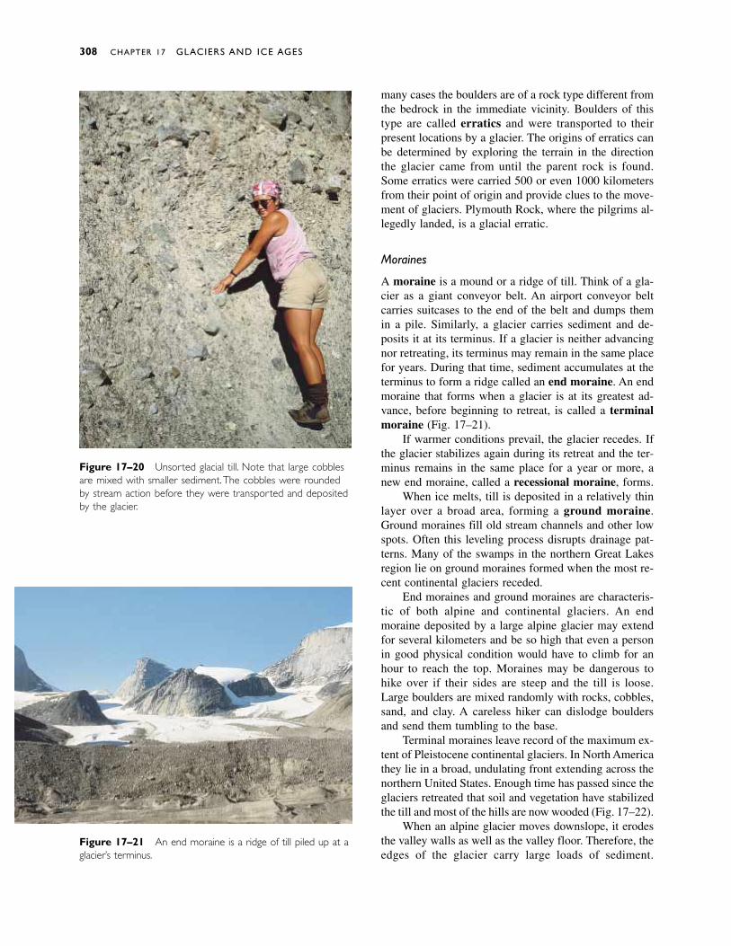
many cases the boulders are of a rock type different fromthe bedrock in the immediate vicinity. Boulders of thistype are called erratics and were transported to theirpresent locations by a glacier. The origins of erratics canbe determined by exploring the terrain in the directionthe glacier came from until the parent rock is found.Some erratics were carried 500 or even 1000 kilometersfrom their point of origin and provide clues to the move-ment of glaciers. Plymouth Rock, where the pilgrims al-legedly landed, is a glacial erratic.
Moraines
A moraine is a mound or a ridge of till. Think of a gla-cier as a giant conveyor belt. An airport conveyor beltcarries suitcases to the end of the belt and dumps themin a pile. Similarly, a glacier carries sediment and de-posits it at its terminus. If a glacier is neither advancingnor retreating, its terminus may remain in the same placefor years. During that time, sediment accumulates at theterminus to form a ridge called an end moraine. An endmoraine that forms when a glacier is at its greatest ad-vance, before beginning to retreat, is called a terminalmoraine (Fig. 17–21).
If warmer conditions prevail, the glacier recedes. Ifthe glacier stabilizes again during its retreat and the ter-minus remains in the same place for a year or more, anew end moraine, called a recessional moraine, forms.
When ice melts, till is deposited in a relatively thinlayer over a broad area, forming a ground moraine.Ground moraines fill old stream channels and other lowspots. Often this leveling process disrupts drainage pat-terns. Many of the swamps in the northern Great Lakesregion lie on ground moraines formed when the most re-cent continental glaciers receded.
End moraines and ground moraines are characteris-tic of both alpine and continental glaciers. An endmoraine deposited by a large alpine glacier may extendfor several kilometers and be so high that even a personin good physical condition would have to climb for anhour to reach the top. Moraines may be dangerous tohike over if their sides are steep and the till is loose.Large boulders are mixed randomly with rocks, cobbles,sand, and clay. A careless hiker can dislodge bouldersand send them tumbling to the base.
Terminal moraines leave record of the maximum ex-tent of Pleistocene continental glaciers. In North Americathey lie in a broad, undulating front extending across thenorthern United States. Enough time has passed since theglaciers retreated that soil and vegetation have stabilizedthe till and most of the hills are now wooded (Fig. 17–22).
When an alpine glacier moves downslope, it erodesthe valley walls as well as the valley floor. Therefore, theedges of the glacier carry large loads of sediment.
308 CHAPTER 17 GLACIERS AND ICE AGES
Figure 17–20 Unsorted glacial till. Note that large cobblesare mixed with smaller sediment.The cobbles were roundedby stream action before they were transported and depositedby the glacier.
Figure 17–21 An end moraine is a ridge of till piled up at aglacier’s terminus.
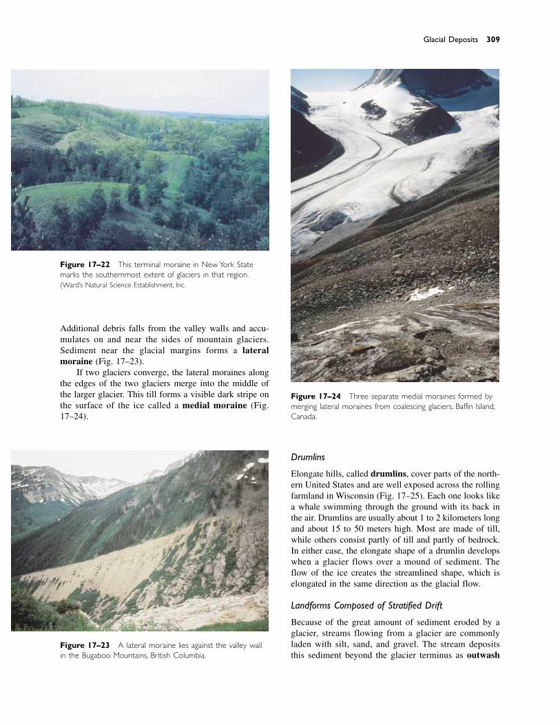
Additional debris falls from the valley walls and accu-mulates on and near the sides of mountain glaciers.Sediment near the glacial margins forms a lateralmoraine (Fig. 17–23).
If two glaciers converge, the lateral moraines alongthe edges of the two glaciers merge into the middle ofthe larger glacier. This till forms a visible dark stripe onthe surface of the ice called a medial moraine (Fig.17–24).
Drumlins
Elongate hills, called drumlins, cover parts of the north-ern United States and are well exposed across the rollingfarmland in Wisconsin (Fig. 17–25). Each one looks likea whale swimming through the ground with its back inthe air. Drumlins are usually about 1 to 2 kilometers longand about 15 to 50 meters high. Most are made of till,while others consist partly of till and partly of bedrock.In either case, the elongate shape of a drumlin developswhen a glacier flows over a mound of sediment. Theflow of the ice creates the streamlined shape, which iselongated in the same direction as the glacial flow.
Landforms Composed of Stratified Drift
Because of the great amount of sediment eroded by aglacier, streams flowing from a glacier are commonlyladen with silt, sand, and gravel. The stream deposits this sediment beyond the glacier terminus as outwash
Glacial Deposits 309
Figure 17–22 This terminal moraine in New York Statemarks the southernmost extent of glaciers in that region.(Ward’s Natural Science Establishment, Inc.)
Figure 17–23 A lateral moraine lies against the valley wallin the Bugaboo Mountains, British Columbia.
Figure 17–24 Three separate medial moraines formed bymerging lateral moraines from coalescing glaciers, Baffin Island,Canada.
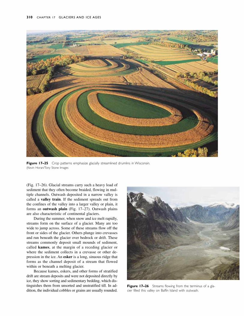
Figure 17–26 Streams flowing from the terminus of a gla-cier filled this valley on Baffin Island with outwash.
Figure 17–25 Crop patterns emphasize glacially streamlined drumlins in Wisconsin.(Kevin Horan/Tony Stone Images)
(Fig. 17–26). Glacial streams carry such a heavy load ofsediment that they often become braided, flowing in mul-tiple channels. Outwash deposited in a narrow valley iscalled a valley train. If the sediment spreads out fromthe confines of the valley into a larger valley or plain, itforms an outwash plain (Fig. 17–27). Outwash plainsare also characteristic of continental glaciers.
During the summer, when snow and ice melt rapidly,streams form on the surface of a glacier. Many are toowide to jump across. Some of these streams flow off thefront or sides of the glacier. Others plunge into crevassesand run beneath the glacier over bedrock or drift. Thesestreams commonly deposit small mounds of sediment,called kames, at the margin of a receding glacier orwhere the sediment collects in a crevasse or other de-pression in the ice. An esker is a long, sinuous ridge thatforms as the channel deposit of a stream that flowedwithin or beneath a melting glacier.
Because kames, eskers, and other forms of stratifieddrift are stream deposits and were not deposited directly byice, they show sorting and sedimentary bedding, which dis-tinguishes them from unsorted and unstratified till. In ad-dition, the individual cobbles or grains are usually rounded.
310 CHAPTER 17 GLACIERS AND ICE AGES
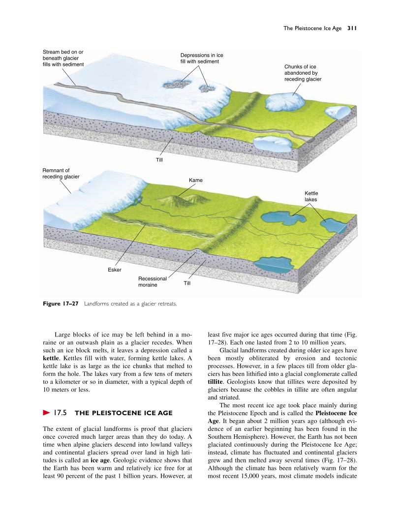
Large blocks of ice may be left behind in a mo-raine or an outwash plain as a glacier recedes. Whensuch an ice block melts, it leaves a depression called a kettle. Kettles fill with water, forming kettle lakes. Akettle lake is as large as the ice chunks that melted toform the hole. The lakes vary from a few tens of metersto a kilometer or so in diameter, with a typical depth of10 meters or less.
� 17.5 THE PLEISTOCENE ICE AGE
The extent of glacial landforms is proof that glaciersonce covered much larger areas than they do today. Atime when alpine glaciers descend into lowland valleysand continental glaciers spread over land in high lati-tudes is called an ice age. Geologic evidence shows thatthe Earth has been warm and relatively ice free for atleast 90 percent of the past 1 billion years. However, at
The Pleistocene Ice Age 311
Stream bed on orbeneath glacierfills with sediment
Depressions in icefill with sediment
Chunks of iceabandoned byreceding glacier
Till
Kame
Kettlelakes
TillRecessionalmoraine
Esker
Remnant ofreceding glacier
Figure 17–27 Landforms created as a glacier retreats.
least five major ice ages occurred during that time (Fig.17–28). Each one lasted from 2 to 10 million years.
Glacial landforms created during older ice ages havebeen mostly obliterated by erosion and tectonicprocesses. However, in a few places till from older gla-ciers has been lithified into a glacial conglomerate calledtillite. Geologists know that tillites were deposited byglaciers because the cobbles in tillite are often angularand striated.
The most recent ice age took place mainly duringthe Pleistocene Epoch and is called the Pleistocene IceAge. It began about 2 million years ago (although evi-dence of an earlier beginning has been found in theSouthern Hemisphere). However, the Earth has not beenglaciated continuously during the Pleistocene Ice Age;instead, climate has fluctuated and continental glaciersgrew and then melted away several times (Fig. 17–28).Although the climate has been relatively warm for themost recent 15,000 years, most climate models indicate
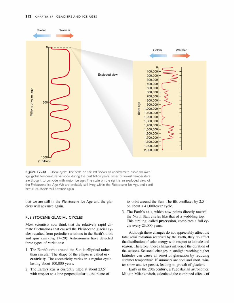
Figure 17–28 Glacial cycles. The scale on the left shows an approximate curve for aver-age global temperature variation during the past billion years. Times of lowest temperatureare thought to coincide with major ice ages.The scale on the right is an exploded view ofthe Pleistocene Ice Age. We are probably still living within the Pleistocene Ice Age, and conti-nental ice sheets will advance again.
that we are still in the Pleistocene Ice Age and the gla-ciers will advance again.
PLEISTOCENE GLACIAL CYCLES
Most scientists now think that the relatively rapid cli-mate fluctuations that caused the Pleistocene glacial cy-cles resulted from periodic variations in the Earth’s orbitand spin axis (Fig 17–29). Astronomers have detectedthree types of variations:
1. The Earth’s orbit around the Sun is elliptical ratherthan circular. The shape of the ellipse is called ec-centricity. The eccentricity varies in a regular cyclelasting about 100,000 years.
2. The Earth’s axis is currently tilted at about 23.5ºwith respect to a line perpendicular to the plane of
its orbit around the Sun. The tilt oscillates by 2.5ºon about a 41,000-year cycle.
3. The Earth’s axis, which now points directly towardthe North Star, circles like that of a wobbling top.This circling, called precession, completes a full cy-cle every 23,000 years.
Although these changes do not appreciably affect thetotal solar radiation received by the Earth, they do affectthe distribution of solar energy with respect to latitude andseason. Therefore, these changes influence the duration ofthe seasons. Seasonal changes in sunlight reaching higherlatitudes can cause an onset of glaciation by reducingsummer temperature. If summers are cool and short, win-ter snow and ice persist, leading to growth of glaciers.
Early in the 20th century, a Yugoslavian astronomer,Milutin Milankovitch, calculated the combined effects of
312 CHAPTER 17 GLACIERS AND ICE AGES
Colder Warmer
Colder Warmer
0100,000200,000300,000400,000500,000600,000700,000800,000900,000
1,000,0001,100,0001,200,0001,300,0001,400,0001,500,0001,600,0001,700,0001,800,0001,900,0002,000,000
0
500
1000(1 billion)
Mill
ions
of y
ears
ago
Exploded view
Year
s ag
o

as the ice sheets retreated and the climate became drier,many of these streams and lakes dried up.
Today, extinct stream channels and lake beds arecommon in North America. The extinct lakes are calledpluvial lakes, a term derived from the Latin word plu-via, meaning “rain.” The basin that is now Death Valleywas once filled with water to a depth of 100 meters ormore. Most of western Utah was also covered by a plu-vial lake called Lake Bonneville. As drier conditions re-turned, Lake Bonneville shrank to become Great SaltLake, west of Salt Lake City.
When glaciers grow, they accumulate water thatwould otherwise be in the oceans, and sea level falls.When glaciers melt, sea level rises again. When thePleistocene glaciers reached their maximum extent18,000 years ago, global sea level fell to about 130 meters below its present elevation. As submerged conti-nental shelves became exposed, the global land area increased by 8 percent (although about one third of theland was ice covered).
When the ice sheets melted, much of the water re-turned to the oceans, raising sea level again. At the sametime, portions of continents rebounded isostatically asthe weight of the ice was removed. The effect along anyspecific coast depends upon the relative amounts of sealevel rise and isostatic rebound. Some coastlines weresubmerged by the rising seas. Others rebounded morethan sea level rose. Today, beaches in the Canadian Arc-tic lie tens to a few hundred meters above the sea. Por-tions of the shoreline of Hudson’s Bay have risen 300meters.
The Pleistocene Ice Age 313
Wintersolstice
Autumn equinox
Earth's orbit
Spring equinox
Summersolstice
Tilt
Perpendicular toEarth/Sun plane
North
Figure 17–29 Earth orbitalvariations may explain the temper-ature oscillations and glacial ad-vances and retreats during thePleistocene Epoch. Orbital varia-tions occur over time spans oftens of thousands of years.
the three orbital variations on climate. His calculationsshowed that they should interact to generate alternatingcool and warm climates in the mid- and high latitudes.Moreover, the timing of the calculated high-latitude cool-ing coincided with that of Pleistocene glacial advances.
EFFECTS OF PLEISTOCENE CONTINENTALGLACIERS
At its maximum extent about 18,000 years ago, the mostrecent North American ice sheet covered 10 millionsquare kilometers—most of Alaska, Canada, and parts ofthe northern United States (Fig. 17–30). At the sametime, alpine glaciers flowed from the mountains into thelowland valleys.
The erosional features and deposits left by theseglaciers dominate much of the landscape of the northernstates. Today terminal moraines form a broad band ofrolling hills from Montana across the Midwest and east-ward to the Atlantic Ocean. Long Island and Cape Codare composed largely of terminal moraines. Kettle lakesor lakes dammed by moraines are abundant in northernMinnesota, Wisconsin, and Michigan. Drumlins dot thelandscape in the northern states. Ground moraines, out-wash, and loess (windblown glacial silt) cover much ofthe northern Great Plains. These deposits have weatheredto form the fertile soil of North America’s “breadbasket.”
Pleistocene glaciers advanced when mid- and high-latitude climates were colder and wetter than today.When the glaciers melted, the rain and meltwater flowedthrough streams and collected in numerous lakes. Later,
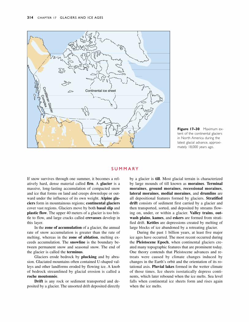
314 CHAPTER 17 GLACIERS AND ICE AGES
Continental ice sheet
Cordilleran G
lacier
Com
plex
Figure 17–30 Maximum ex-tent of the continental glaciersin North America during thelatest glacial advance, approxi-mately 18,000 years ago.
If snow survives through one summer, it becomes a rel-atively hard, dense material called firn. A glacier is amassive, long-lasting accumulation of compacted snowand ice that forms on land and creeps downslope or out-ward under the influence of its own weight. Alpine gla-ciers form in mountainous regions; continental glacierscover vast regions. Glaciers move by both basal slip andplastic flow. The upper 40 meters of a glacier is too brit-tle to flow, and large cracks called crevasses develop inthis layer.
In the zone of accumulation of a glacier, the annualrate of snow accumulation is greater than the rate ofmelting, whereas in the zone of ablation, melting ex-ceeds accumulation. The snowline is the boundary be-tween permanent snow and seasonal snow. The end ofthe glacier is called the terminus.
Glaciers erode bedrock by plucking and by abra-sion. Glaciated mountains often contained U-shaped val-leys and other landforms eroded by flowing ice. A knobof bedrock streamlined by glacial erosion is called aroche moutonnée.
Drift is any rock or sediment transported and de-posited by a glacier. The unsorted drift deposited directly
by a glacier is till. Most glacial terrain is characterizedby large mounds of till known as moraines. Terminalmoraines, ground moraines, recessional moraines,lateral moraines, medial moraines, and drumlins areall depositional features formed by glaciers. Stratifieddrift consists of sediment first carried by a glacier andthen transported, sorted, and deposited by streams flow-ing on, under, or within a glacier. Valley trains, out-wash plains, kames, and eskers are formed from strati-fied drift. Kettles are depressions created by melting oflarge blocks of ice abandoned by a retreating glacier.
During the past 1 billion years, at least five majorice ages have occurred. The most recent occurred duringthe Pleistocene Epoch, when continental glaciers cre-ated many topographic features that are prominent today.One theory contends that Pleistocene advances and re-treats were caused by climate changes induced bychanges in the Earth’s orbit and the orientation of its ro-tational axis. Pluvial lakes formed in the wetter climateof those times. Ice sheets isostatically depress conti-nents, which later rebound when the ice melts. Sea levelfalls when continental ice sheets form and rises againwhen the ice melts.
S U M M A R Y
Discussion Questions 315
firn 298glacier 298alpine glacier 298ice sheet 299continental glacier 299basal slip 299plastic flow 299crevasse 300ice fall 300zone of accumulation
301zone of ablation 301snowline 301
terminus 302tidewater glacier 302iceberg 302plucking 303glacial striation 303rock flour 303U-shaped valley 304cirque 304tarn 305paternoster lake 305horn 306arête 306hanging valley 306
truncated spur 306fjord 307roche moutonnée 307drift 307till 307stratified drift 307erratic 308moraine 308end moraine 308terminal moraine 308recessional moraine 308ground moraine 308lateral moraine 309
medial moraine 309drumlin 309outwash 309valley train 310outwash plain 310kame 310esker 310kettle 311ice age 311tillite 311Pleistocene Ice Age 311pluvial lake 313
K E Y W O R D S
1. Outline the major steps in the metamorphism of newlyfallen snow to glacial ice.
2. Differentiate between alpine glaciers and continentalglaciers. Where are alpine glaciers found today? Whereare continental glaciers found today?
3. Distinguish between basal slip and plastic flow.
4. Why are crevasses only about 40 meters deep, eventhough many glaciers are much thicker?
5. Describe the surface of a glacier in the summer and inthe winter in (a) the zone of accumulation and (b) thezone of ablation.
6. How do icebergs form?
7. Describe how glacial erosion can create (a) a cirque, (b)striated bedrock, and (c) smoothly polished bedrock.
8. Describe the formation of arêtes, horns, hanging valleys,and truncated spurs.
9. Distinguish among ground, recessional, terminal, lateral,and medial moraines.
10. Why are kames and eskers features of receding glaciers?How do they form?
11. What topographic features were left behind by the conti-nental ice sheets? Where can they be found in NorthAmerica today?
12. How do geologists recognize the existence and move-ment of continental glaciers that advanced hundreds ofmillions of years ago?
R E V I E W Q U E S T I O N S
1. Compare and contrast the movement of glaciers withstream flow.
2. Outline the changes that would occur in a glacier if (a)the average annual temperature rose and the precipitationdecreased; (b) the temperature remained constant butthe precipitation increased; and (c) the temperature de-creased and the precipitation remained constant.
3. Explain why plastic flow is a minor mechanism of move-ment for thin glaciers but is likely to be more importantfor a thick glacier.
4. In some regions of northern Canada, both summer andwinter temperatures are cool enough for glaciers to form,but there are no glaciers. Speculate on why continentalglaciers are not forming in these regions.
5. If you found a large boulder lying in a field, how wouldyou determine whether or not it was an erratic?
6. A bulldozer can only build a pile of dirt when it is mov-ing forward. Yet a glacier can build a terminal morainewhen it is neither advancing nor retreating. Explain.
7. Imagine you encountered some gravelly sediment. Howwould you determine whether it was a stream deposit ora ground moraine?
8. Explain how medial moraines prove that glaciers move.
9. If you were hiking along a wooded hill in Michigan, howwould you determine whether or not it was a moraine?
D I S C U S S I O N Q U E S T I O N S
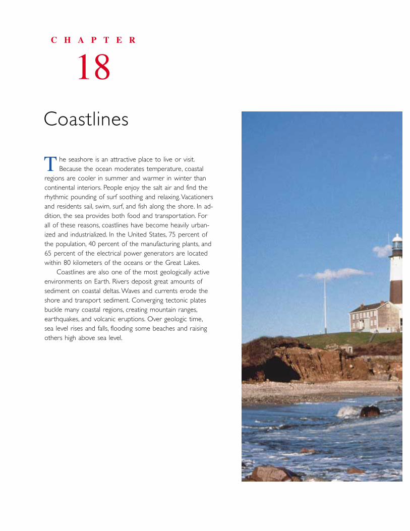
he seashore is an attractive place to live or visit.Because the ocean moderates temperature, coastal
regions are cooler in summer and warmer in winter thancontinental interiors. People enjoy the salt air and find therhythmic pounding of surf soothing and relaxing.Vacationersand residents sail, swim, surf, and fish along the shore. In ad-dition, the sea provides both food and transportation. Forall of these reasons, coastlines have become heavily urban-ized and industrialized. In the United States, 75 percent ofthe population, 40 percent of the manufacturing plants, and65 percent of the electrical power generators are locatedwithin 80 kilometers of the oceans or the Great Lakes.
Coastlines are also one of the most geologically activeenvironments on Earth. Rivers deposit great amounts ofsediment on coastal deltas. Waves and currents erode theshore and transport sediment. Converging tectonic platesbuckle many coastal regions, creating mountain ranges,earthquakes, and volcanic eruptions. Over geologic time,sea level rises and falls, flooding some beaches and raisingothers high above sea level.
C H A P T E R
18Coastlines
T
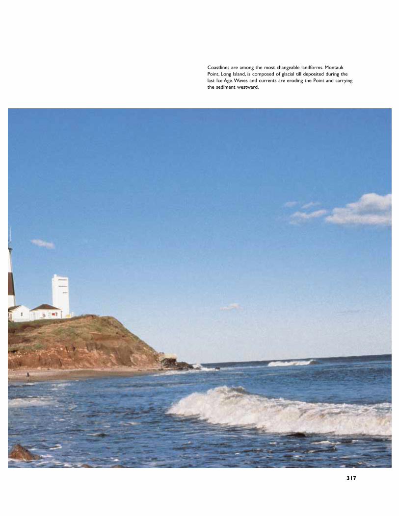
Coastlines are among the most changeable landforms. MontaukPoint, Long Island, is composed of glacial till deposited during thelast Ice Age.Waves and currents are eroding the Point and carryingthe sediment westward.
317
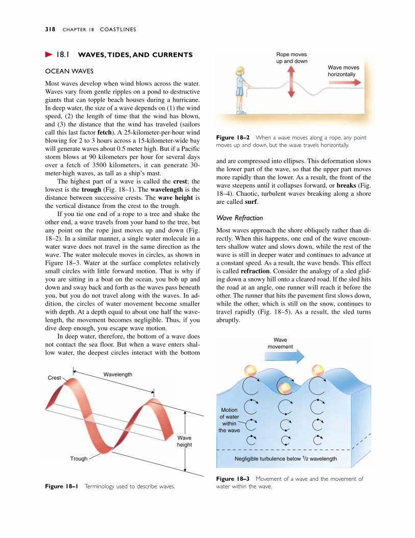
� 18.1 WAVES, TIDES, AND CURRENTS
OCEAN WAVES
Most waves develop when wind blows across the water.Waves vary from gentle ripples on a pond to destructivegiants that can topple beach houses during a hurricane.In deep water, the size of a wave depends on (1) the windspeed, (2) the length of time that the wind has blown,and (3) the distance that the wind has traveled (sailorscall this last factor fetch). A 25-kilometer-per-hour windblowing for 2 to 3 hours across a 15-kilometer-wide baywill generate waves about 0.5 meter high. But if a Pacificstorm blows at 90 kilometers per hour for several daysover a fetch of 3500 kilometers, it can generate 30-meter-high waves, as tall as a ship’s mast.
The highest part of a wave is called the crest; thelowest is the trough (Fig. 18–1). The wavelength is thedistance between successive crests. The wave height isthe vertical distance from the crest to the trough.
If you tie one end of a rope to a tree and shake theother end, a wave travels from your hand to the tree, butany point on the rope just moves up and down (Fig.18–2). In a similar manner, a single water molecule in awater wave does not travel in the same direction as thewave. The water molecule moves in circles, as shown inFigure 18–3. Water at the surface completes relativelysmall circles with little forward motion. That is why ifyou are sitting in a boat on the ocean, you bob up anddown and sway back and forth as the waves pass beneathyou, but you do not travel along with the waves. In ad-dition, the circles of water movement become smallerwith depth. At a depth equal to about one half the wave-length, the movement becomes negligible. Thus, if youdive deep enough, you escape wave motion.
In deep water, therefore, the bottom of a wave doesnot contact the sea floor. But when a wave enters shal-low water, the deepest circles interact with the bottom
and are compressed into ellipses. This deformation slowsthe lower part of the wave, so that the upper part movesmore rapidly than the lower. As a result, the front of thewave steepens until it collapses forward, or breaks (Fig.18–4). Chaotic, turbulent waves breaking along a shoreare called surf.
Wave Refraction
Most waves approach the shore obliquely rather than di-rectly. When this happens, one end of the wave encoun-ters shallow water and slows down, while the rest of thewave is still in deeper water and continues to advance ata constant speed. As a result, the wave bends. This effectis called refraction. Consider the analogy of a sled glid-ing down a snowy hill onto a cleared road. If the sled hitsthe road at an angle, one runner will reach it before theother. The runner that hits the pavement first slows down,while the other, which is still on the snow, continues totravel rapidly (Fig. 18–5). As a result, the sled turnsabruptly.
318 CHAPTER 18 COASTLINES
Figure 18–1 Terminology used to describe waves.
CrestWavelength
Trough
Waveheight
Rope movesup and down
Wave moveshorizontally
Figure 18–2 When a wave moves along a rope, any pointmoves up and down, but the wave travels horizontally.
Figure 18–3 Movement of a wave and the movement ofwater within the wave.
Motionof waterwithin
the wave
Wavemovement
Negligible turbulence below 1/2 wavelength

Figure 18–4 (a) When a wave approaches the shore, thecircular motion flattens out and becomes elliptical. The wave-length shortens, and the wave steepens until it finally breaks,creating surf. The dashed line shows the changes in wavelengthand wave height as the wave approaches shore. (b) Surfbreaks along the beach in Hawaii. (Corel Photos)
Waves,Tides, and Currents 319
(a)
Deepwater Surf in
beach zone
Land
(b)
(a) (b)
This end reachesshallow water firstand slows down
This end remainsin deep water andmaintains speed
Road
Snowy hill
Sled analogy
(c)
Figure 18–5 (a) A sled turns upon striking a paved road-way at an angle because one runner hits the roadway andslows down before the other does. (b) When a water wavestrikes the shore at an angle, one end slows down, causing thewave to refract, or bend. (c) Wave refraction on a lakeshore.

TIDES
Even the most casual observer will notice that on anybeach the level of the ocean rises and falls on a cyclicalbasis. If the water level is low at noon, it will reach itsmaximum height about 6 hours later, at 6 o’clock, andbe low again near midnight. These vertical displacementsare called tides. Most coastlines experience two hightides and two low tides approximately every 24 hours.
Tides are caused by the gravitational pull of theMoon and Sun. Although the Moon is much smaller thanthe Sun, it is so much closer to the Earth that its influ-ence predominates. At any time, one region of the Earth(marked A in Fig. 18–6) lies directly under the Moon.Because gravitational force is greater for objects that arecloser together, the part of the ocean nearest to the Moonis attracted with the strongest force. The water rises, re-sulting in a high tide in that region. (Although land alsoexperiences a gravitational attraction to the Moon, it istoo rigid to rise perceptibly.)
But now our simple explanation runs into trouble.As the Earth spins on its axis, a given point on the Earthpasses directly under the Moon approximately once every24 hours, but the period between successive high tides isonly 12 hours. Why are there ordinarily two high tidesin a day? The tide is high not only when a point on Earthis directly under the Moon, but also when it is 180º away.To understand this, we must consider the Earth–Moonorbital system. Most people visualize the Moon orbitingaround the Earth, but it is more accurate to say that theEarth and the Moon orbit around a common center ofgravity. The two celestial partners are locked togetherlike dancers spinning around in each other’s arms. Justas the back of a dancer’s dress flies outward as she twirls,the oceans on the opposite side of the Earth from theMoon bulge outward. This bulge is the high tide 180ºaway from the Moon (point B in Fig. 18–6). Thus, thetides rise and fall twice daily.
High and low tides do not occur at the same timeeach day, but are delayed by approximately 50 minutes
every 24 hours. The Earth makes one complete rotationon its axis in 24 hours, but at the same time, the Moonis orbiting the Earth in the same direction. After a pointon the Earth makes one complete rotation in 24 hours,that point must spin for an additional 50 minutes to catchup with the orbiting Moon. This is why the Moon risesapproximately 50 minutes later each night and the tidesare approximately 50 minutes later each day.
Although the Sun’s gravitational pull on the Earth’soceans is smaller than the Moon’s, it does affect oceantides. When the Sun and Moon are directly in line, theirgravitational fields are added together, creating a strongtidal bulge. During these times, the variation betweenhigh and low tides is large, producing spring tides (Fig.18–7a). When the Sun and Moon are 90º out of align-ment, each partially offsets the effect of the other and thedifferences between the levels of high and low tide aresmaller. These relatively small tides are called neap tides(Fig. 18–7b).
Tidal variations differ from place to place. For ex-ample, in the Bay of Fundy, the tidal variation is as muchas 15 meters during a spring tide, while in Santa Barbara,California, it is less than 2 meters. Mariners consult tidetables that give the time and height of the tides in anyarea on any day.
OCEAN CURRENTS
A wave is a periodic oscillation of water. In contrast, acurrent is a continuous flow of water in a particular di-rection. Currents are found everywhere in the ocean,from its surface to its greatest depths.
Surface Currents
Prevailing winds push the sea surface to generate broad,slow, surface currents that are deflected into circularpaths by the Earth’s rotation. One familiar ocean currentis the Gulf Stream, which flows from the Caribbean Seanorthward along the east coast of North America and
320 CHAPTER 18 COASTLINES
B A
Earth
Moon
Ocean level
Revolution ofEarth-Moonsystem
Figure 18–6 Schematic view of tide for-mation. (Magnitudes and sizes are exagger-ated for emphasis.)
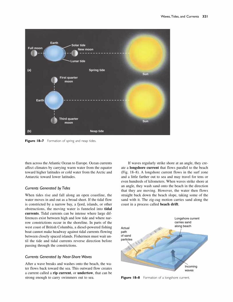
then across the Atlantic Ocean to Europe. Ocean currentsaffect climates by carrying warm water from the equatortoward higher latitudes or cold water from the Arctic andAntarctic toward lower latitudes.
Currents Generated by Tides
When tides rise and fall along an open coastline, the water moves in and out as a broad sheet. If the tidal flowis constricted by a narrow bay, a fjord, islands, or otherobstructions, the moving water is funneled into tidalcurrents. Tidal currents can be intense where large dif-ferences exist between high and low tide and where nar-row constrictions occur in the shoreline. In parts of thewest coast of British Columbia, a diesel-powered fishingboat cannot make headway against tidal currents flowingbetween closely spaced islands. Fishermen must wait un-til the tide and tidal currents reverse direction beforepassing through the constrictions.
Currents Generated by Near-Shore Waves
After a wave breaks and washes onto the beach, the wa-ter flows back toward the sea. This outward flow createsa current called a rip current, or undertow, that can bestrong enough to carry swimmers out to sea.
If waves regularly strike shore at an angle, they cre-ate a longshore current that flows parallel to the beach(Fig. 18–8). A longshore current flows in the surf zoneand a little farther out to sea and may travel for tens oreven hundreds of kilometers. When waves strike shore atan angle, they wash sand onto the beach in the directionthat they are moving. However, the water then flowsstraight back down the beach slope, taking some of thesand with it. The zig-zag motion carries sand along thecoast in a process called beach drift.
Waves,Tides, and Currents 321
Neap tide
Spring tide
(b)
(a)Sun
Sun
Earth
Earth
New moonFull moon
First quartermoon
Third quartermoon
Lunar tide
Solar tide
Figure 18–7 Formation of spring and neap tides.
Figure 18–8 Formation of a longshore current.
Actualpathof sandparticles
Longshore currentcarries sandalong beach
Incomingwaves
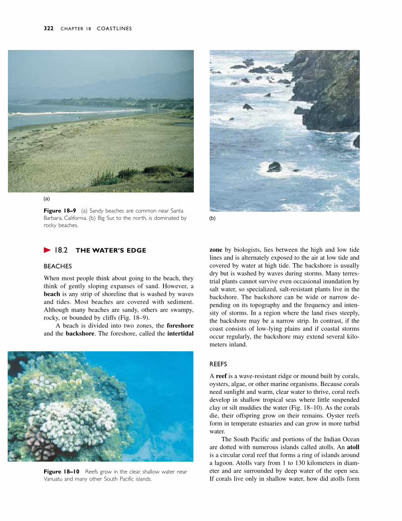
� 18.2 THE WATER’S EDGE
BEACHES
When most people think about going to the beach, theythink of gently sloping expanses of sand. However, abeach is any strip of shoreline that is washed by wavesand tides. Most beaches are covered with sediment.Although many beaches are sandy, others are swampy,rocky, or bounded by cliffs (Fig. 18–9).
A beach is divided into two zones, the foreshoreand the backshore. The foreshore, called the intertidal
zone by biologists, lies between the high and low tidelines and is alternately exposed to the air at low tide andcovered by water at high tide. The backshore is usuallydry but is washed by waves during storms. Many terres-trial plants cannot survive even occasional inundation bysalt water, so specialized, salt-resistant plants live in thebackshore. The backshore can be wide or narrow de-pending on its topography and the frequency and inten-sity of storms. In a region where the land rises steeply,the backshore may be a narrow strip. In contrast, if thecoast consists of low-lying plains and if coastal stormsoccur regularly, the backshore may extend several kilo-meters inland.
REEFS
A reef is a wave-resistant ridge or mound built by corals,oysters, algae, or other marine organisms. Because coralsneed sunlight and warm, clear water to thrive, coral reefsdevelop in shallow tropical seas where little suspendedclay or silt muddies the water (Fig. 18–10). As the coralsdie, their offspring grow on their remains. Oyster reefsform in temperate estuaries and can grow in more turbidwater.
The South Pacific and portions of the Indian Oceanare dotted with numerous islands called atolls. An atollis a circular coral reef that forms a ring of islands arounda lagoon. Atolls vary from 1 to 130 kilometers in diam-eter and are surrounded by deep water of the open sea.If corals live only in shallow water, how did atolls form
322 CHAPTER 18 COASTLINES
(a)
(b)Figure 18–9 (a) Sandy beaches are common near SantaBarbara, California. (b) Big Sur, to the north, is dominated byrocky beaches.
Figure 18–10 Reefs grow in the clear, shallow water nearVanuatu and many other South Pacific islands.
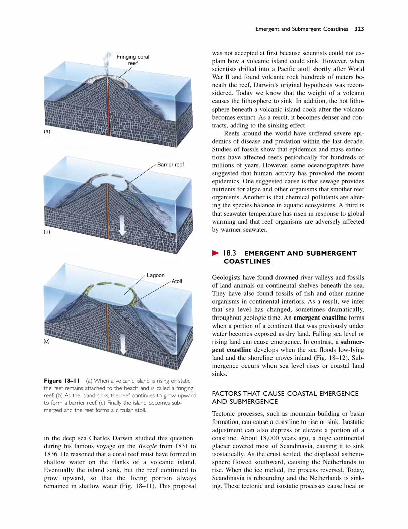
in the deep sea? Charles Darwin studied this questionduring his famous voyage on the Beagle from 1831 to1836. He reasoned that a coral reef must have formed inshallow water on the flanks of a volcanic island.Eventually the island sank, but the reef continued togrow upward, so that the living portion always remained in shallow water (Fig. 18–11). This proposal
was not accepted at first because scientists could not ex-plain how a volcanic island could sink. However, whenscientists drilled into a Pacific atoll shortly after WorldWar II and found volcanic rock hundreds of meters be-neath the reef, Darwin’s original hypothesis was recon-sidered. Today we know that the weight of a volcanocauses the lithosphere to sink. In addition, the hot litho-sphere beneath a volcanic island cools after the volcanobecomes extinct. As a result, it becomes denser and con-tracts, adding to the sinking effect.
Reefs around the world have suffered severe epi-demics of disease and predation within the last decade.Studies of fossils show that epidemics and mass extinc-tions have affected reefs periodically for hundreds ofmillions of years. However, some oceanographers havesuggested that human activity has provoked the recentepidemics. One suggested cause is that sewage providesnutrients for algae and other organisms that smother reeforganisms. Another is that chemical pollutants are alter-ing the species balance in aquatic ecosystems. A third isthat seawater temperature has risen in response to globalwarming and that reef organisms are adversely affectedby warmer seawater.
� 18.3 EMERGENT AND SUBMERGENT COASTLINES
Geologists have found drowned river valleys and fossilsof land animals on continental shelves beneath the sea.They have also found fossils of fish and other marine organisms in continental interiors. As a result, we inferthat sea level has changed, sometimes dramatically,throughout geologic time. An emergent coastline formswhen a portion of a continent that was previously underwater becomes exposed as dry land. Falling sea level orrising land can cause emergence. In contrast, a submer-gent coastline develops when the sea floods low-lyingland and the shoreline moves inland (Fig. 18–12). Sub-mergence occurs when sea level rises or coastal landsinks.
FACTORS THAT CAUSE COASTAL EMERGENCEAND SUBMERGENCE
Tectonic processes, such as mountain building or basinformation, can cause a coastline to rise or sink. Isostaticadjustment can also depress or elevate a portion of acoastline. About 18,000 years ago, a huge continentalglacier covered most of Scandinavia, causing it to sinkisostatically. As the crust settled, the displaced astheno-sphere flowed southward, causing the Netherlands torise. When the ice melted, the process reversed. Today,Scandinavia is rebounding and the Netherlands is sink-ing. These tectonic and isostatic processes cause local or
Emergent and Submergent Coastlines 323
(a)
(b)
(c)
Fringing coralreef
Barrier reef
LagoonAtoll
Figure 18–11 (a) When a volcanic island is rising or static,the reef remains attached to the beach and is called a fringingreef. (b) As the island sinks, the reef continues to grow upwardto form a barrier reef. (c) Finally the island becomes sub-merged and the reef forms a circular atoll.
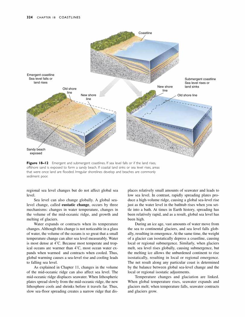
regional sea level changes but do not affect global sealevel.
Sea level can also change globally. A global sea-level change, called eustatic change, occurs by threemechanisms: changes in water temperature, changes inthe volume of the mid-oceanic ridge, and growth andmelting of glaciers.
Water expands or contracts when its temperaturechanges. Although this change is not noticeable in a glassof water, the volume of the oceans is so great that a smalltemperature change can alter sea level measurably. Wateris most dense at 4˚C. Because most temperate and trop-ical oceans are warmer than 4˚C, most ocean water ex-pands when warmed and contracts when cooled. Thus,global warming causes a sea-level rise and cooling leadsto falling sea level.
As explained in Chapter 11, changes in the volumeof the mid-oceanic ridge can also affect sea level. Themid-oceanic ridge displaces seawater. When lithosphericplates spread slowly from the mid-oceanic ridge, the newlithosphere cools and shrinks before it travels far. Thus,slow sea-floor spreading creates a narrow ridge that dis-
places relatively small amounts of seawater and leads tolow sea level. In contrast, rapidly spreading plates pro-duce a high-volume ridge, causing a global sea-level risejust as the water level in the bathtub rises when you set-tle into a bath. At times in Earth history, spreading hasbeen relatively rapid, and as a result, global sea level hasbeen high.
During an ice age, vast amounts of water move fromthe sea to continental glaciers, and sea level falls glob-ally, resulting in emergence. At the same time, the weightof a glacier can isostatically depress a coastline, causinglocal or regional submergence. Similarly, when glaciersmelt, sea level rises globally, causing submergence, butthe melting ice allows the unburdened continent to riseisostatically, resulting in local or regional emergence.The net result along any particular coast is determinedby the balance between global sea-level change and thelocal or regional isostatic adjustments.
Temperature changes and glaciation are linked.When global temperature rises, seawater expands andglaciers melt; when temperature falls, seawater contractsand glaciers grow.
324 CHAPTER 18 COASTLINES
Coastline
New shoreline
New shoreline
Old shoreline
Sandy beachexposed
Submergent coastlineSea level rises orland sinks
Old shore line
Emergent coastlineSea level falls or
land rises
Figure 18–12 Emergent and submergent coastlines. If sea level falls or if the land rises,offshore sand is exposed to form a sandy beach. If coastal land sinks or sea level rises, areasthat were once land are flooded. Irregular shorelines develop and beaches are commonlysediment poor.
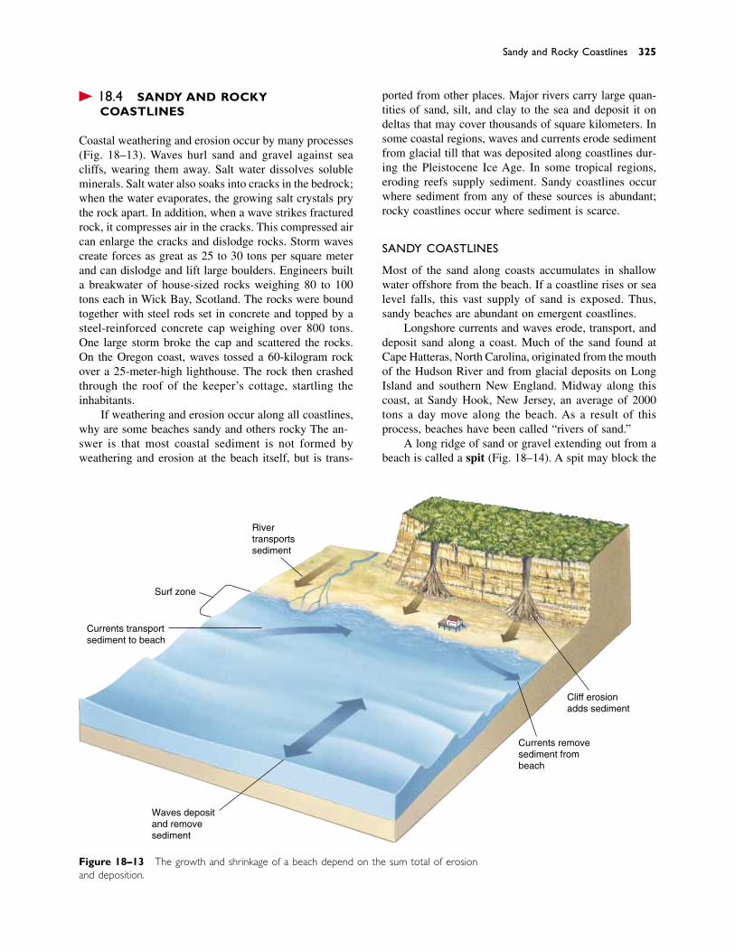
� 18.4 SANDY AND ROCKY COASTLINES
Coastal weathering and erosion occur by many processes(Fig. 18–13). Waves hurl sand and gravel against seacliffs, wearing them away. Salt water dissolves solubleminerals. Salt water also soaks into cracks in the bedrock;when the water evaporates, the growing salt crystals prythe rock apart. In addition, when a wave strikes fracturedrock, it compresses air in the cracks. This compressed aircan enlarge the cracks and dislodge rocks. Storm wavescreate forces as great as 25 to 30 tons per square meterand can dislodge and lift large boulders. Engineers builta breakwater of house-sized rocks weighing 80 to 100tons each in Wick Bay, Scotland. The rocks were boundtogether with steel rods set in concrete and topped by asteel-reinforced concrete cap weighing over 800 tons.One large storm broke the cap and scattered the rocks.On the Oregon coast, waves tossed a 60-kilogram rockover a 25-meter-high lighthouse. The rock then crashedthrough the roof of the keeper’s cottage, startling the inhabitants.
If weathering and erosion occur along all coastlines,why are some beaches sandy and others rocky? The an-swer is that most coastal sediment is not formed byweathering and erosion at the beach itself, but is trans-
ported from other places. Major rivers carry large quan-tities of sand, silt, and clay to the sea and deposit it ondeltas that may cover thousands of square kilometers. Insome coastal regions, waves and currents erode sedimentfrom glacial till that was deposited along coastlines dur-ing the Pleistocene Ice Age. In some tropical regions,eroding reefs supply sediment. Sandy coastlines occurwhere sediment from any of these sources is abundant;rocky coastlines occur where sediment is scarce.
SANDY COASTLINES
Most of the sand along coasts accumulates in shallowwater offshore from the beach. If a coastline rises or sealevel falls, this vast supply of sand is exposed. Thus,sandy beaches are abundant on emergent coastlines.
Longshore currents and waves erode, transport, anddeposit sand along a coast. Much of the sand found atCape Hatteras, North Carolina, originated from the mouthof the Hudson River and from glacial deposits on LongIsland and southern New England. Midway along thiscoast, at Sandy Hook, New Jersey, an average of 2000tons a day move along the beach. As a result of thisprocess, beaches have been called “rivers of sand.”
A long ridge of sand or gravel extending out from abeach is called a spit (Fig. 18–14). A spit may block the
Sandy and Rocky Coastlines 325
Figure 18–13 The growth and shrinkage of a beach depend on the sum total of erosionand deposition.
Rivertransportssediment
Surf zone
Currents transportsediment to beach
Waves depositand removesediment
Currents removesediment frombeach
Cliff erosionadds sediment
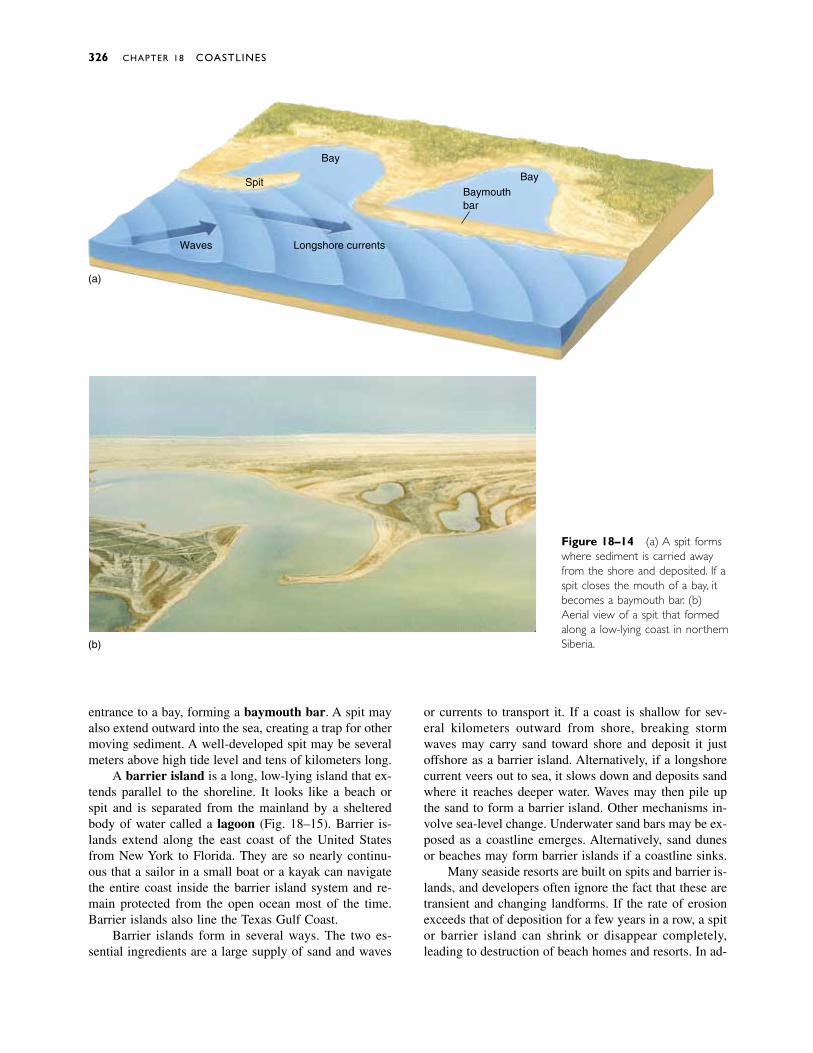
entrance to a bay, forming a baymouth bar. A spit mayalso extend outward into the sea, creating a trap for othermoving sediment. A well-developed spit may be severalmeters above high tide level and tens of kilometers long.
A barrier island is a long, low-lying island that ex-tends parallel to the shoreline. It looks like a beach orspit and is separated from the mainland by a shelteredbody of water called a lagoon (Fig. 18–15). Barrier is-lands extend along the east coast of the United Statesfrom New York to Florida. They are so nearly continu-ous that a sailor in a small boat or a kayak can navigatethe entire coast inside the barrier island system and re-main protected from the open ocean most of the time.Barrier islands also line the Texas Gulf Coast.
Barrier islands form in several ways. The two es-sential ingredients are a large supply of sand and waves
or currents to transport it. If a coast is shallow for sev-eral kilometers outward from shore, breaking stormwaves may carry sand toward shore and deposit it justoffshore as a barrier island. Alternatively, if a longshorecurrent veers out to sea, it slows down and deposits sandwhere it reaches deeper water. Waves may then pile upthe sand to form a barrier island. Other mechanisms in-volve sea-level change. Underwater sand bars may be ex-posed as a coastline emerges. Alternatively, sand dunesor beaches may form barrier islands if a coastline sinks.
Many seaside resorts are built on spits and barrier is-lands, and developers often ignore the fact that these aretransient and changing landforms. If the rate of erosionexceeds that of deposition for a few years in a row, a spitor barrier island can shrink or disappear completely,leading to destruction of beach homes and resorts. In ad-
326 CHAPTER 18 COASTLINES
Spit
Bay
BayBaymouthbar
Longshore currents
(a)
Waves
(b)
Figure 18–14 (a) A spit formswhere sediment is carried awayfrom the shore and deposited. If aspit closes the mouth of a bay, itbecomes a baymouth bar. (b)Aerial view of a spit that formedalong a low-lying coast in northernSiberia.

dition, barrier islands are especially vulnerable to hurri-canes, which can wash over low-lying islands and moveenormous amounts of sediment in a very brief time.
ROCKY COASTLINES
In contrast to the sandy beaches typical of emergentcoastlines, submergent coastlines are commonly sedi-ment poor and are characterized by steep, rocky shores.In many areas on land, bedrock is exposed or covered bya thin layer of soil. If this type of sediment-poor terrainis submerged, and if rivers do not supply large amountsof sand, the coastline is rocky.
A submergent coast is commonly irregular, withmany bays and headlands. The coast of Maine, with itsnumerous inlets and rocky bluffs, is a submergent coast-line (Fig. 18–16). Small sandy beaches form in protectedcoves, but most of the headlands are rocky and steep.
As waves approach an irregular, rocky coast, theyreach the headlands first, breaking against the rocks anderoding the cliffs. The waves then refract around the headland and break against its sides. Thus, most of thewave energy is spent on the headlands. As a result,the waves inside the adjacent bay are less energetic and deposit the sediment eroded from the headland. As the headlands erode and the interiors of bays fill withsediment, an irregular coastline eventually straightens(Fig. 18–17).
A wave-cut cliff forms when waves erode a rockyheadland into a steep profile. As the cliff erodes, it leavesa flat or gently sloping wave-cut platform (Fig. 18–18).If waves cut a cave into a narrow headland, the cave mayeventually erode all the way through the headland, form-ing a scenic sea arch. When an arch collapses or whenthe inshore part of a headland erodes faster than the tip,a pillar of rock called a sea stack forms (Fig. 18–19). Aswaves continue to batter the rock, eventually the seastack crumbles.
Sandy and Rocky Coastlines 327
Figure 18–15 An aerial view of a barrier island along thesouth coast of Long Island.The sheltered lagoon is on the leftside of the island.
Figure 18–16 The Maine coastis a rocky, irregular, submergentcoastline.
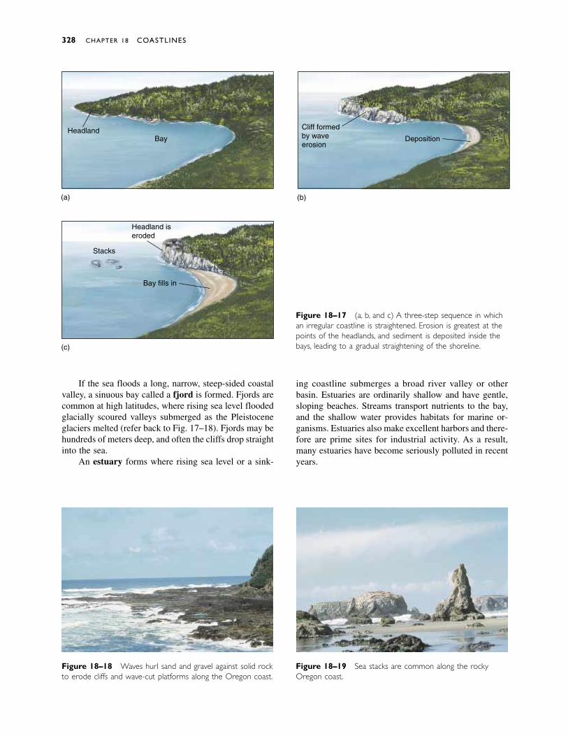
If the sea floods a long, narrow, steep-sided coastalvalley, a sinuous bay called a fjord is formed. Fjords arecommon at high latitudes, where rising sea level floodedglacially scoured valleys submerged as the Pleistoceneglaciers melted (refer back to Fig. 17–18). Fjords may behundreds of meters deep, and often the cliffs drop straightinto the sea.
An estuary forms where rising sea level or a sink-
ing coastline submerges a broad river valley or other basin. Estuaries are ordinarily shallow and have gentle,sloping beaches. Streams transport nutrients to the bay,and the shallow water provides habitats for marine or-ganisms. Estuaries also make excellent harbors and there-fore are prime sites for industrial activity. As a result,many estuaries have become seriously polluted in recentyears.
328 CHAPTER 18 COASTLINES
(a) (b)
(c)
HeadlandBay
Headland iseroded
Stacks
Bay fills in
Cliff formedby waveerosion
Deposition
Figure 18–17 (a, b, and c) A three-step sequence in whichan irregular coastline is straightened. Erosion is greatest at thepoints of the headlands, and sediment is deposited inside thebays, leading to a gradual straightening of the shoreline.
Figure 18–18 Waves hurl sand and gravel against solid rockto erode cliffs and wave-cut platforms along the Oregon coast.
Figure 18–19 Sea stacks are common along the rockyOregon coast.
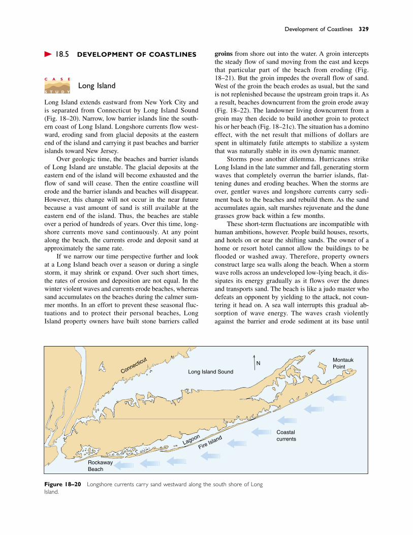
� 18.5 DEVELOPMENT OF COASTLINES
Long Island
Long Island extends eastward from New York City andis separated from Connecticut by Long Island Sound(Fig. 18–20). Narrow, low barrier islands line the south-ern coast of Long Island. Longshore currents flow west-ward, eroding sand from glacial deposits at the easternend of the island and carrying it past beaches and barrierislands toward New Jersey.
Over geologic time, the beaches and barrier islandsof Long Island are unstable. The glacial deposits at theeastern end of the island will become exhausted and theflow of sand will cease. Then the entire coastline willerode and the barrier islands and beaches will disappear.However, this change will not occur in the near futurebecause a vast amount of sand is still available at theeastern end of the island. Thus, the beaches are stableover a period of hundreds of years. Over this time, long-shore currents move sand continuously. At any pointalong the beach, the currents erode and deposit sand atapproximately the same rate.
If we narrow our time perspective further and lookat a Long Island beach over a season or during a singlestorm, it may shrink or expand. Over such short times,the rates of erosion and deposition are not equal. In thewinter violent waves and currents erode beaches, whereassand accumulates on the beaches during the calmer sum-mer months. In an effort to prevent these seasonal fluc-tuations and to protect their personal beaches, LongIsland property owners have built stone barriers called
groins from shore out into the water. A groin interceptsthe steady flow of sand moving from the east and keepsthat particular part of the beach from eroding (Fig.18–21). But the groin impedes the overall flow of sand.West of the groin the beach erodes as usual, but the sandis not replenished because the upstream groin traps it. Asa result, beaches downcurrent from the groin erode away(Fig. 18–22). The landowner living downcurrent from agroin may then decide to build another groin to protecthis or her beach (Fig. 18–21c). The situation has a dominoeffect, with the net result that millions of dollars arespent in ultimately futile attempts to stabilize a systemthat was naturally stable in its own dynamic manner.
Storms pose another dilemma. Hurricanes strikeLong Island in the late summer and fall, generating stormwaves that completely overrun the barrier islands, flat-tening dunes and eroding beaches. When the storms areover, gentler waves and longshore currents carry sedi-ment back to the beaches and rebuild them. As the sandaccumulates again, salt marshes rejuvenate and the dunegrasses grow back within a few months.
These short-term fluctuations are incompatible withhuman ambitions, however. People build houses, resorts,and hotels on or near the shifting sands. The owner of ahome or resort hotel cannot allow the buildings to beflooded or washed away. Therefore, property ownersconstruct large sea walls along the beach. When a stormwave rolls across an undeveloped low-lying beach, it dis-sipates its energy gradually as it flows over the dunesand transports sand. The beach is like a judo master whodefeats an opponent by yielding to the attack, not coun-tering it head on. A sea wall interrupts this gradual ab-sorption of wave energy. The waves crash violentlyagainst the barrier and erode sediment at its base until
Development of Coastlines 329
C A S E
S T U D Y
MontaukPoint
Coastalcurrents
Long Island SoundConnecticut
RockawayBeach
Fire IslandLagoon
N
Figure 18–20 Longshore currents carry sand westward along the south shore of LongIsland.
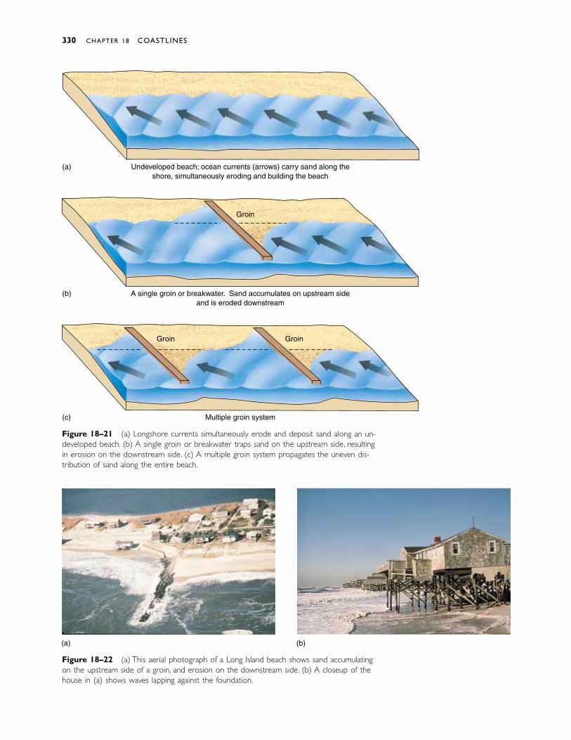
Figure 18–22 (a) This aerial photograph of a Long Island beach shows sand accumulatingon the upstream side of a groin, and erosion on the downstream side. (b) A closeup of thehouse in (a) shows waves lapping against the foundation.
Figure 18–21 (a) Longshore currents simultaneously erode and deposit sand along an un-developed beach. (b) A single groin or breakwater traps sand on the upstream side, resultingin erosion on the downstream side. (c) A multiple groin system propagates the uneven dis-tribution of sand along the entire beach.
330 CHAPTER 18 COASTLINES
Undeveloped beach; ocean currents (arrows) carry sand along theshore, simultaneously eroding and building the beach
A single groin or breakwater. Sand accumulates on upstream sideand is eroded downstream
Multiple groin system
(a)
(b)
(c)
Groin
Groin Groin
(a) (b)
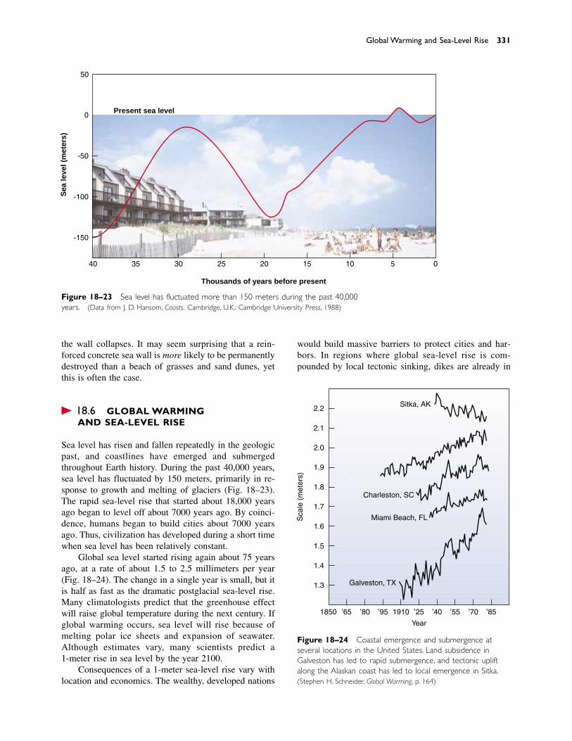
Global Warming and Sea-Level Rise 331
the wall collapses. It may seem surprising that a rein-forced concrete sea wall is more likely to be permanentlydestroyed than a beach of grasses and sand dunes, yetthis is often the case.
� 18.6 GLOBAL WARMING AND SEA-LEVEL RISE
Sea level has risen and fallen repeatedly in the geologicpast, and coastlines have emerged and submergedthroughout Earth history. During the past 40,000 years,sea level has fluctuated by 150 meters, primarily in re-sponse to growth and melting of glaciers (Fig. 18–23).The rapid sea-level rise that started about 18,000 yearsago began to level off about 7000 years ago. By coinci-dence, humans began to build cities about 7000 yearsago. Thus, civilization has developed during a short timewhen sea level has been relatively constant.
Global sea level started rising again about 75 yearsago, at a rate of about 1.5 to 2.5 millimeters per year(Fig. 18–24). The change in a single year is small, but itis half as fast as the dramatic postglacial sea-level rise.Many climatologists predict that the greenhouse effectwill raise global temperature during the next century. Ifglobal warming occurs, sea level will rise because ofmelting polar ice sheets and expansion of seawater.Although estimates vary, many scientists predict a 1-meter rise in sea level by the year 2100.
Consequences of a 1-meter sea-level rise vary withlocation and economics. The wealthy, developed nations
Figure 18–23 Sea level has fluctuated more than 150 meters during the past 40,000years. (Data from J. D. Hansom, Coasts. Cambridge, U.K.: Cambridge University Press, 1988)
Present sea level
05101520253040 35
-150
-100
-50
0
Thousands of years before present
Sea
leve
l (m
eter
s)
50
would build massive barriers to protect cities and har-bors. In regions where global sea-level rise is com-pounded by local tectonic sinking, dikes are already in
New York, NY
Charleston, SC
Miami Beach, FL
Galveston, TX
Sitka, AK
Sca
le (
met
ers)
Year
2.2
2.1
2.0
1.9
1.8
1.7
1.6
1.5
1.4
1.3
1850 ’65 ’80 ’95 ’25 ’40 ’55 ’70 ’851910
Figure 18–24 Coastal emergence and submergence atseveral locations in the United States. Land subsidence inGalveston has led to rapid submergence, and tectonic upliftalong the Alaskan coast has led to local emergence in Sitka.(Stephen H. Schneider, Global Warming, p. 164)
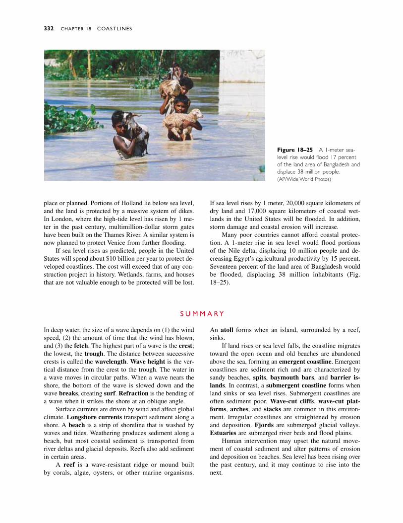
332 CHAPTER 18 COASTLINES
place or planned. Portions of Holland lie below sea level,and the land is protected by a massive system of dikes.In London, where the high-tide level has risen by 1 me-ter in the past century, multimillion-dollar storm gateshave been built on the Thames River. A similar system isnow planned to protect Venice from further flooding.
If sea level rises as predicted, people in the UnitedStates will spend about $10 billion per year to protect de-veloped coastlines. The cost will exceed that of any con-struction project in history. Wetlands, farms, and housesthat are not valuable enough to be protected will be lost.
Figure 18–25 A 1-meter sea-level rise would flood 17 percentof the land area of Bangladesh anddisplace 38 million people.(AP/Wide World Photos)
If sea level rises by 1 meter, 20,000 square kilometers ofdry land and 17,000 square kilometers of coastal wet-lands in the United States will be flooded. In addition,storm damage and coastal erosion will increase.
Many poor countries cannot afford coastal protec-tion. A 1-meter rise in sea level would flood portions of the Nile delta, displacing 10 million people and de-creasing Egypt’s agricultural productivity by 15 percent.Seventeen percent of the land area of Bangladesh wouldbe flooded, displacing 38 million inhabitants (Fig.18–25).
S U M M A R Y
In deep water, the size of a wave depends on (1) the windspeed, (2) the amount of time that the wind has blown,and (3) the fetch. The highest part of a wave is the crest;the lowest, the trough. The distance between successivecrests is called the wavelength. Wave height is the ver-tical distance from the crest to the trough. The water ina wave moves in circular paths. When a wave nears theshore, the bottom of the wave is slowed down and thewave breaks, creating surf. Refraction is the bending ofa wave when it strikes the shore at an oblique angle.
Surface currents are driven by wind and affect globalclimate. Longshore currents transport sediment along ashore. A beach is a strip of shoreline that is washed bywaves and tides. Weathering produces sediment along abeach, but most coastal sediment is transported fromriver deltas and glacial deposits. Reefs also add sedimentin certain areas.
A reef is a wave-resistant ridge or mound built by corals, algae, oysters, or other marine organisms.
An atoll forms when an island, surrounded by a reef,sinks.
If land rises or sea level falls, the coastline migratestoward the open ocean and old beaches are abandonedabove the sea, forming an emergent coastline. Emergentcoastlines are sediment rich and are characterized bysandy beaches, spits, baymouth bars, and barrier is-lands. In contrast, a submergent coastline forms whenland sinks or sea level rises. Submergent coastlines areoften sediment poor. Wave-cut cliffs, wave-cut plat-forms, arches, and stacks are common in this environ-ment. Irregular coastlines are straightened by erosionand deposition. Fjords are submerged glacial valleys.Estuaries are submerged river beds and flood plains.
Human intervention may upset the natural move-ment of coastal sediment and alter patterns of erosionand deposition on beaches. Sea level has been rising overthe past century, and it may continue to rise into thenext.
Discussion Questions 333
K E Y W O R D S
fetch 318crest 318trough 318wavelength 318wave height 318surf 318refraction 318spring tide 320neap tide 320
tidal current 321rip current 321undertow 321longshore current 321beach drift 321beach 322foreshore 322backshore 322intertidal zone 322
reef 322atoll 322emergent coastline 323submergent coastline
323eustatic change 324spit 325baymouth bar 326barrier island 326
lagoon 326wave-cut cliff 327wave-cut platform 327sea arch 327sea stack 327fjord 328estuary 328groin 329
R E V I E W Q U E S T I O N S
1. List the three factors that determine the size of a wave.
2. Draw a picture of a wave and label the crest, the trough,the wavelength, and the wave height.
3. Describe the motion of both the surface and the deeperlayers of water that is disturbed by waves.
4. Explain how surf forms.
5. What is refraction? How does it affect coastal erosion?
6. Explain the differences among a mid-oceanic current, atidal current, a rip current, a longshore current, and beachdrift.
7. List four different sources of coastal sediment.
8. Discuss the most important weathering processes along acoastline.
9. What is an emergent coastline and how does it form? Areemergent coastlines sediment rich or sediment poor?Why?
10. What is a submergent coastline and how does it form?Are submergent coastlines sediment rich or sedimentpoor? Why?
11. Compare and contrast a beach, a barrier island, and aspit.
12. Explain how an irregular coastline is straightened bycoastal processes.
13. Describe some dominant features of a sediment-poorcoastline.
14. What is a groin? How does it affect the beach in its im-mediate vicinity? How does it affect the entire shoreline?
15. Explain how greenhouse warming could lead to a rise insea level.
D I S C U S S I O N Q U E S T I O N S
1. Earthquake waves were discussed in Chapter 10.Compare and contrast earthquake waves with waterwaves.
2. How can a ship survive 30-meter-high storm waves,while a house along the beach will be smashed by wavesof the same size?
3. Explain why very large waves cannot strike a beach di-rectly in shallow coastal waters.
4. During World War II, few maps existed of the underwaterprofile of shore lines. When planning amphibious attackson beaches of the islands in the Pacific, Allied comman-ders needed to know how deep the water was adjacent tothe shore. Explain how this information could be de-duced from aerial photographs of breaking waves andsurf.
5. Imagine that an oil spill occurred from a tanker accident.Discuss the effects of mid-ocean currents, longshore cur-rents, storm waves, and tides on the dispersal of the oil.
6. In Section 18.4 we explained how erosion and depositiontend to smooth out an irregular coastline by erodingheadlands and depositing sediment in bays. If coastlinesare affected in this manner, why haven’t they all beensmoothed out in the 4.6-billion-year history of the Earth?
7. Prepare a three-way debate. Have one side argue that thegovernment should support the construction of groins.Have the second side argue that the government shouldprohibit the construction of groins. The third position de-fends the argument that groins should be permitted, butnot supported.
8. Prepare another debate to argue whether or not govern-ment funding should be used to repair storm damage toproperty on barrier islands.
9. In evaluating flood danger, hydrologists use the conceptof the 100-year flood. Would a similar concept be usefulin planning coastal development?
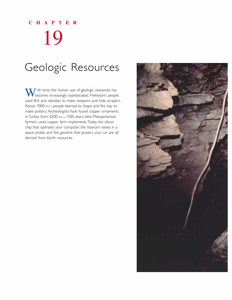
ith time, the human use of geologic resources has become increasingly sophisticated. Prehistoric people
used flint and obsidian to make weapons and hide scrapers.About 7000 B.C., people learned to shape and fire clay tomake pottery. Archeologists have found copper ornamentsin Turkey from 6500 B.C.; 1500 years later, Mesopotamianfarmers used copper farm implements. Today, the siliconchip that operates your computer, the titanium valves in aspace probe, and the gasoline that powers your car are allderived from Earth resources.
C H A P T E R
19Geologic Resources
W
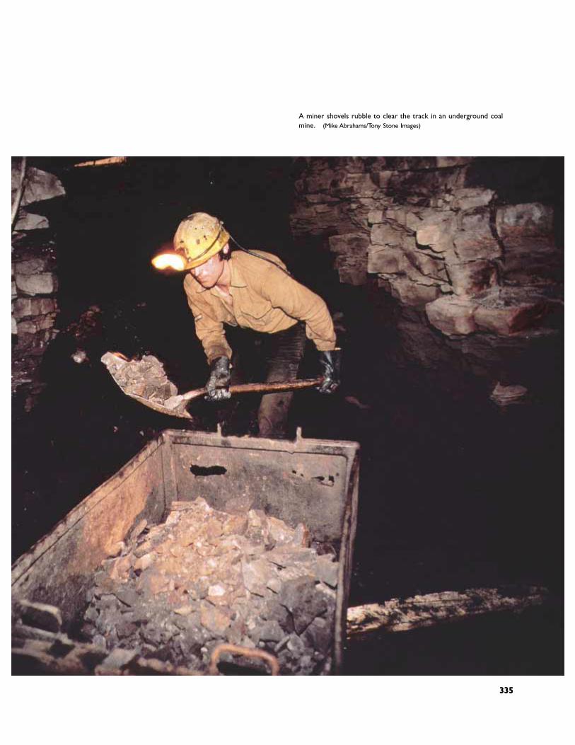
335
A miner shovels rubble to clear the track in an underground coal mine. (Mike Abrahams/Tony Stone Images)
335

� 19.1 GEOLOGIC RESOURCES
Humans use two different types of geologic resources:mineral resources and energy resources. Mineral re-sources include all useful rocks and minerals. Mineralresources fall into two groups: nonmetallic resources andmetals. A nonmetallic resource is any useful rock ormineral that does not have metallic properties, such assalt or sand and gravel. A metal is any chemical elementwith a metallic luster, ductility, and the ability to conductelectricity and heat. About 40 metals are commerciallyimportant. Some, such as iron, lead, copper, aluminum,silver, and gold, are familiar (Fig. 19–1). Others, such asvanadium, titanium, and tellurium, are less well knownbut are vital to industry. All mineral resources are non-renewable: We use them up at a much faster rate thannatural processes create them.
We use energy resources for heat, light, work, anddata transmission. Petroleum, coal, and natural gas arecalled fossil fuels because they formed from the remainsof plants and animals. Nuclear fuels are radioactive iso-topes used to generate electricity in nuclear reactors.Uranium is the most commonly used nuclear fuel. Theseenergy resources, like mineral resources, are nonrenew-able. Alternative energy resources, such as solar, wind,and geothermal energy, are renewable.
� 19.2 NONMETALLIC MINERAL RESOURCES
When we think about striking it rich from mining, weusually think of gold. However, more money has beenmade mining sand and gravel than gold. For example, inthe United States in 1994, sand and gravel produced$4.26 billion in revenue, but gold produced $4.1 billion.Sand and gravel are mined from stream and glacial de-posits, sand dunes, and beaches.
Portland cement is made by heating a mixture ofcrushed limestone and clay. Concrete is a mixture of ce-ment, sand, and gravel. Reinforced with steel, it is usedto build roads, bridges, and buildings.
Many buildings are faced with stone—usually gran-ite or limestone, although marble, slate, sandstone, andother rocks are also used. Stone is mined from quarriescut into bedrock.
� 19.3 METALS AND ORE
If you picked up any rock and sent it to a laboratory foranalysis, the report would probably show that the rockcontains measurable amounts of iron, gold, silver, alu-minum, and other valuable metals. However, the con-centrations of these metals are so low in most rocks thatthe extraction cost would be much greater than the in-come gained by selling the metals. In certain locations,however, geologic processes have enriched metals manytimes above their normal concentrations (Table 19–1).
A mineral deposit is a local enrichment of one ormore minerals. Ore is rock sufficiently enriched in oneor more minerals to be mined profitably. Geologists usu-ally use the term ore to refer to metallic mineral deposits,and the term is commonly accompanied by the name ofthe metal—for example, iron ore or silver ore. Table19–1 shows that the concentration of a metal in ore mayexceed its average abundance in ordinary rock by a fac-tor of more than 100,000. Mineral reserves are theknown supply of ore in the ground. The term can referto the amount of ore remaining in a particular mine, orit can be used on a global or national scale.
� 19.4 HOW ORE FORMS
One of the primary objectives of many geologists is tofind new ore deposits. Successful exploration requires anunderstanding of the processes that concentrate metals toform ore. For example, platinum concentrates in certaintypes of igneous rocks. Therefore, if you were exploringfor platinum, you would focus on those rocks rather thanon sandstone or limestone.
336 CHAPTER 19 GEOLOGIC RESOURCES
Figure 19–1 In the early 1900s, miners extracted gold,copper, and other metals from underground mines such as thisone 600 meters below the surface in Butte, Montana.(Montana Historical Society)
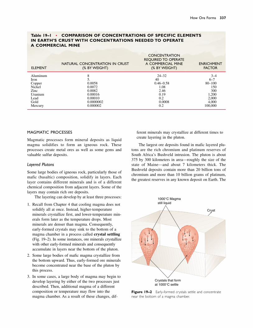
How Ore Forms 337
Table 19–1 • COMPARISON OF CONCENTRATIONS OF SPECIFIC ELEMENTS IN EARTH’S CRUST WITH CONCENTRATIONS NEEDED TO OPERATE A COMMERCIAL MINE
CONCENTRATIONREQUIRED TO OPERATE
NATURAL CONCENTRATION IN CRUST A COMMERCIAL MINE ENRICHMENTELEMENT (% BY WEIGHT) (% BY WEIGHT) FACTOR
Aluminum 8 24–32 3–4Iron 5.8 40 6–7Copper 0.0058 0.46–0.58 80–100Nickel 0.0072 1.08 150Zinc 0.0082 2.46 300Uranium 0.00016 0.19 1,200Lead 0.00010 0.2 2,000Gold 0.0000002 0.0008 4,000Mercury 0.000002 0.2 100,000
MAGMATIC PROCESSES
Magmatic processes form mineral deposits as liquidmagma solidifies to form an igneous rock. Theseprocesses create metal ores as well as some gems andvaluable sulfur deposits.
Layered Plutons
Some large bodies of igneous rock, particularly those ofmafic (basaltic) composition, solidify in layers. Eachlayer contains different minerals and is of a differentchemical composition from adjacent layers. Some of thelayers may contain rich ore deposits.
The layering can develop by at least three processes:
1. Recall from Chapter 4 that cooling magma does notsolidify all at once. Instead, higher-temperature minerals crystallize first, and lower-temperature min-erals form later as the temperature drops. Most minerals are denser than magma. Consequently,early-formed crystals may sink to the bottom of amagma chamber in a process called crystal settling(Fig. 19–2). In some instances, ore minerals crystallizewith other early-formed minerals and consequentlyaccumulate in layers near the bottom of the pluton.
2. Some large bodies of mafic magma crystallize fromthe bottom upward. Thus, early-formed ore mineralsbecome concentrated near the base of the pluton bythis process.
3. In some cases, a large body of magma may begin todevelop layering by either of the two processes justdescribed. Then, additional magma of a differentcomposition or temperature may flow into themagma chamber. As a result of these changes, dif-
ferent minerals may crystallize at different times tocreate layering in the pluton.
The largest ore deposits found in mafic layered plu-tons are the rich chromium and platinum reserves ofSouth Africa’s Bushveld intrusion. The pluton is about375 by 300 kilometers in area—roughly the size of thestate of Maine—and about 7 kilometers thick. TheBushveld deposits contain more than 20 billion tons ofchromium and more than 10 billion grams of platinum,the greatest reserves in any known deposit on Earth. The
1000°C Magmastill liquid
Crust
Crystals that format 1000°C settle
Figure 19–2 Early-formed crystals settle and concentratenear the bottom of a magma chamber.
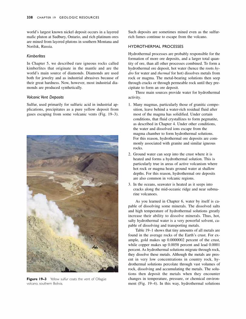
world’s largest known nickel deposit occurs in a layeredmafic pluton at Sudbury, Ontario, and rich platinum oresare mined from layered plutons in southern Montana andNorilsk, Russia.
Kimberlites
In Chapter 5, we described rare igneous rocks calledkimberlites that originate in the mantle and are theworld’s main source of diamonds. Diamonds are usedboth for jewelry and as industrial abrasives because oftheir great hardness. Now, however, most industrial dia-monds are produced synthetically.
Volcanic Vent Deposits
Sulfur, used primarily for sulfuric acid in industrial ap-plications, precipitates as a pure yellow deposit fromgases escaping from some volcanic vents (Fig. 19–3).
Such deposits are sometimes mined even as the sulfur-rich fumes continue to escape from the volcano.
HYDROTHERMAL PROCESSES
Hydrothermal processes are probably responsible for theformation of more ore deposits, and a larger total quan-tity of ore, than all other processes combined. To form ahydrothermal ore deposit, hot water (hence the roots hy-dro for water and thermal for hot) dissolves metals fromrock or magma. The metal-bearing solutions then seepthrough cracks or through permeable rock until they pre-cipitate to form an ore deposit.
Three main sources provide water for hydrothermalactivity.
1. Many magmas, particularly those of granitic compo-sition, leave behind a water-rich residual fluid aftermost of the magma has solidified. Under certainconditions, that fluid crystallizes to form pegmatite,as described in Chapter 4. Under other conditions,the water and dissolved ions escape from themagma chamber to form hydrothermal solutions.For this reason, hydrothermal ore deposits are com-monly associated with granite and similar igneousrocks.
2. Ground water can seep into the crust where it isheated and forms a hydrothermal solution. This isparticularly true in areas of active volcanism wherehot rock or magma heats ground water at shallowdepths. For this reason, hydrothermal ore depositsare also common in volcanic regions.
3. In the oceans, seawater is heated as it seeps intocracks along the mid-oceanic ridge and near subma-rine volcanoes.
As you learned in Chapter 6, water by itself is ca-pable of dissolving some minerals. The dissolved saltsand high temperature of hydrothermal solutions greatlyincrease their ability to dissolve minerals. Thus, hot,salty hydrothermal water is a very powerful solvent, ca-pable of dissolving and transporting metals.
Table 19–1 shows that tiny amounts of all metals arefound in the average rocks of the Earth’s crust. For ex-ample, gold makes up 0.0000002 percent of the crust,while copper makes up 0.0058 percent and lead 0.0001percent. As hydrothermal solutions migrate through rock,they dissolve these metals. Although the metals are pres-ent in very low concentrations in country rock, hy-drothermal solutions percolate through vast volumes ofrock, dissolving and accumulating the metals. The solu-tions then deposit the metals when they encounterchanges in temperature, pressure, or chemical environ-ment (Fig. 19–4). In this way, hydrothermal solutions
338 CHAPTER 19 GEOLOGIC RESOURCES
Figure 19–3 Yellow sulfur coats the vent of Ollagüe volcano, southern Bolivia.
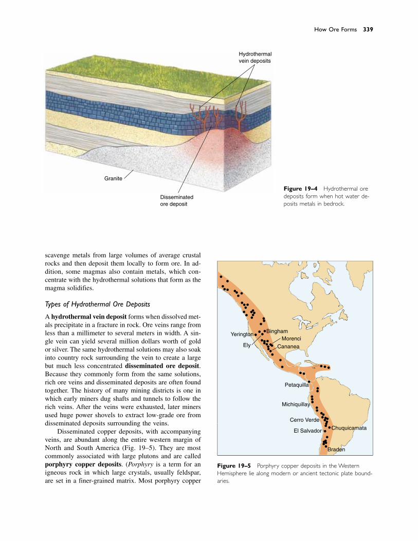
scavenge metals from large volumes of average crustalrocks and then deposit them locally to form ore. In ad-dition, some magmas also contain metals, which con-centrate with the hydrothermal solutions that form as themagma solidifies.
Types of Hydrothermal Ore Deposits
A hydrothermal vein deposit forms when dissolved met-als precipitate in a fracture in rock. Ore veins range fromless than a millimeter to several meters in width. A sin-gle vein can yield several million dollars worth of goldor silver. The same hydrothermal solutions may also soakinto country rock surrounding the vein to create a largebut much less concentrated disseminated ore deposit.Because they commonly form from the same solutions,rich ore veins and disseminated deposits are often foundtogether. The history of many mining districts is one inwhich early miners dug shafts and tunnels to follow therich veins. After the veins were exhausted, later minersused huge power shovels to extract low-grade ore fromdisseminated deposits surrounding the veins.
Disseminated copper deposits, with accompanyingveins, are abundant along the entire western margin ofNorth and South America (Fig. 19–5). They are mostcommonly associated with large plutons and are calledporphyry copper deposits. (Porphyry is a term for anigneous rock in which large crystals, usually feldspar,are set in a finer-grained matrix. Most porphyry copper
How Ore Forms 339
Granite
Disseminatedore deposit
Hydrothermalvein deposits
Figure 19–4 Hydrothermal oredeposits form when hot water de-posits metals in bedrock.
Figure 19–5 Porphyry copper deposits in the WesternHemisphere lie along modern or ancient tectonic plate bound-aries.
Yerington
Ely
BinghamMorenci
Cananea
Petaquilla
Michiquillay
Cerro Verde
El Salvador Chuquicamata
Braden
deposits are found in porphyrys of granitic to dioriticcomposition.) Both the plutons and the copper depositsformed as a result of subduction that occurred as Northand South America migrated westward after the breakupof Pangea. Other metals, including lead, zinc, molybde-num, gold, and silver, are found with porphyry copperdeposits. Examples of such deposits occur at Butte,Montana; Bingham, Utah; Morenci, Arizona; and Ely,Nevada.
Ore deposits also form at hydrothermal vents nearthe mid-oceanic ridge and submarine volcanoes, as de-scribed in Chapter 11. Metal-bearing hydrothermal solu-tions precipitate huge deposits of iron, copper, lead, zinc,and other metals within the sea-floor sediment and basalt(Fig. 19–6). Tectonic activity may eventually carry sub-marine hydrothermal deposits to the Earth’s surface. Thecopper deposits of Jerome, Arizona, the Appenine Alpsof northern Italy and Cyprus, and the copper–lead–zinc deposits of New Brunswick, Canada, formed in this manner.
SEDIMENTARY PROCESSES
Two types of sedimentary processes form ore deposits:sedimentary sorting and precipitation.
Sedimentary Sorting: Placer Deposits
Gold is denser than any other mineral. Therefore, if youswirl a mixture of water, gold dust, and sand in a goldpan, the gold falls to the bottom first (Fig. 19–7).Differential settling also occurs in nature. Many streamscarry silt, sand, and gravel with an occasional small grainof gold. The gold settles first when the current slowsdown. Over years, currents agitate the sediment and theheavy grains of gold work their way into cracks andcrevices in the stream bed. Thus, grains of gold concen-trate near bedrock or in coarse gravel, forming a placerdeposit (Fig. 19–8). It was primarily placer deposits thatbrought prospectors to California in the Gold Rush of 1849.
Precipitation
Ground water dissolves minerals as it seeps through soiland bedrock. In most environments, ground water even-tually flows into streams and then to the sea. Some ofthese dissolved ions, such as sodium and chloride, makeseawater salty. In deserts, however, lakes develop withno outlet to the ocean. Water flows into the lakes but canescape only by evaporation. As the water evaporates, the
340 CHAPTER 19 GEOLOGIC RESOURCES
Figure 19–6 Submarine hydrothermal ore deposits precipi-tate from circulating seawater near the mid-oceanic ridge.
Cold sea waterdrawn intofissures inocean crust
Oredeposit Sediment
Oceaniccrust
Water isheated andrises
Hotmagma
Lithosphere
Asthenosphere
Figure 19–7 Jeffery Embrey panning for gold near his cabinin Park City, Montana, in 1898. (Maud Davis Baker/MontanaHistorical Society)

dissolved ions concentrate until they precipitate to formevaporite deposits.
You can perform a simple demonstration of evapo-ration and precipitation. Fill a bowl with warm water andadd a few teaspoons of table salt. The salt dissolves andyou see only a clear liquid. Set the bowl aside for a fewdays until the water evaporates. The salt precipitates andencrusts the sides and bottom of the bowl.
Evaporite deposits formed in desert lakes includetable salt, borax, sodium sulfate, and sodium carbonate.These salts are used in the production of paper, soap, andmedicines and for the tanning of leather.
Several times during the past 500 million years, shal-low seas covered large regions of North America and allother continents. At times, those seas were so poorlyconnected to the open oceans that water did not circulatefreely between them and the oceans. Consequently, evap-oration concentrated the dissolved ions until salts pre-cipitated as marine evaporites. Periodically, stormsflushed new seawater from the open ocean into the shal-low seas, providing a new supply of salt. Thick marineevaporite beds formed in this way underlie nearly 30 per-cent of North America. Table salt, gypsum (used to man-ufacture plaster and sheetrock), and potassium salts (usedin fertilizer) are mined extensively from these deposits.
About 1 billion tons of iron are mined every year, 90percent from sedimentary rocks called banded iron for-mations, which consist of layers of iron-rich mineralssandwiched between beds of silicates. The alternatinglayers are a few centimeters thick and give the rocks theirbanded appearance (Fig. 19–9). The most abundant andeconomically important banded iron formations devel-oped between 2.6 and 1.9 billion years ago when ironprecipitated from seawater as a result of rising atmo-spheric oxygen concentration.
WEATHERING PROCESSES
In environments with high rainfall, the abundant waterdissolves and removes most of the soluble ions from soiland rock near the Earth’s surface. This process leaves therelatively insoluble ions in the soil to form residual deposits. Both aluminum and iron have very low solubilities in water. Bauxite, the principal source of aluminum, forms as a residual deposit, and in some in-stances iron also concentrates enough to become ore.Most bauxite deposits form in warm, rainy, tropical orsubtropical environments where chemical weathering occurs rapidly, such as those of modern Jamaica, Cuba,Guinea, Australia, and parts of the southeastern United
How Ore Forms 341
Behind rock ledges or indepressions in the stream bed
Beneathwaterfalls
In bars alongstream
Behindbeaver dam
In beachsediment
Figure 19–8 Placer deposits form where water currentsslow down and deposit heavy minerals.
States (Fig. 19–10). Some bauxite deposits are found to-day in regions with dry, cool climates. Most of them,however, formed when the regions had a warm, wet cli-mate, and they reflect climatic change since their origin.
Weathering processes also can enrich metal concen-trations in mineral deposits formed by other processes.For example, a disseminated hydrothermal deposit maycontain copper, lead, zinc, and silver, but in concentra-
tions too low to be mined at a profit. Over millions ofyears, ground water and rain can weather the deposit andcarry off most of the dissolved rocks and minerals in so-lution. In some cases, however, the valuable metals reactto form new minerals in the zone of weathering and arenot removed. In this way, the metals may become con-centrated by factors of tens or hundreds to create rich su-pergene ore lying above a low-grade mineral deposit.These mineral deposits are easily mined because they lieat the Earth’s surface. Supergene ore caps once coveredmany of the great porphyry copper deposits of the UnitedStates, but because they were so rich and easily mined,most are now gone.
Weathering also forms immense amounts of clay, anonmetallic resource described in Chapter 6. One claymineral, called kaolin, is the primary constituent of porce-lain and other ceramics. Another, smectite, is mixed withwater and other minerals to make drilling mud, a clay-rich slurry used to cool and lubricate drill bits in thedrilling of deep wells. Several types of clay are used toline sanitary landfills and irrigation ditches and pondsbecause wet clay is impermeable.
METAMORPHIC PROCESSES
Recall from Chapter 8 that a metamorphic rock formswhen heat and pressure alter the mineralogy and textureof any preexisting rock. Metamorphism can also expelwater from rocks to create hydrothermal fluids, which, inturn, deposit metal ores. Thus, some hydrothermal oredeposits are of metamorphic origin.
Metamorphic processes also form several types ofnonmetallic mineral resources. Graphite, the main com-ponent of the “lead” in pencils, forms when metamor-phism alters the carbon in some organic-rich rocks.Asbestos is a commercial name for two different miner-als formed by metamorphism. Metamorphism also formsmarble, a valuable building stone and sculptor’s mate-rial, from limestone.
� 19.5 MINERAL RESERVES
Mining depletes mineral reserves by decreasing theamount of ore remaining in the ground; but reserves mayincrease in two ways. First, geologists may discover newmineral deposits, thereby adding to the known amount ofore. Second, subeconomic mineral deposits—those inwhich the metal is not sufficiently concentrated to bemined at a profit—can become profitable if the price ofthat metal increases, or if improvements in mining or re-fining technology reduce extraction costs.
Consider an example of the changing nature of re-serves. In 1966 geologists estimated that global reserves
342 CHAPTER 19 GEOLOGIC RESOURCES
Figure 19–10 Bauxite forms by intense weathering ofaluminum-bearing rocks. (H. E. Simpson/USGS)
Figure 19–9 In this banded iron formation from Michigan,the red bands are iron minerals and the dark layers arechert. (Barbara Gerlach/Visuals Unlimited)
of iron were about 5 billion tons.1 At that time, worldconsumption of iron was about 280 million tons per year.Assuming that consumption continued at the 1966 rate,the global iron reserves identified in 1966 would havebeen exhausted in 18 years (5 billion tons/280 milliontons per year � 18 years), and we would have run out ofiron ore in 1984. But iron ore is still plentiful and cheaptoday because new and inexpensive methods of process-ing lower-grade iron ore were developed. Thus, depositsthat were subeconomic in 1966, and therefore not countedas reserves, are now ore.
THE GEOPOLITICS OF METAL RESOURCES
The Earth’s mineral resources are unevenly distributed,and no single nation is self-sufficient in all minerals. Forexample, almost two thirds of the world’s molybdenumreserves and more than one third of the lead reserves arelocated in the United States. More than half of the alu-minum reserves are found in Australia and Guinea. TheUnited States uses 40 percent of all aluminum produced in the world, yet it has no large bauxite de-posits. Zambia and Zaire supply half of the world’scobalt, although neither nation uses the metal for its ownindustry.
Five nations—the United States, Russia, South Africa,Canada, and Australia—supply most of the mineral re-sources used by modern societies. Many other nationshave few mineral resources. For example, Japan has al-most no metal or fuel reserves; despite its thriving econ-omy and high productivity, it relies entirely on importsfor both.
Developed nations consume most of the Earth’s min-eral resources. Four nations—the United States, Japan,Germany, and Russia—consume about 75 percent of the
most intensively used metals, although they account foronly 14 percent of world population.
Currently, the United States depends on 25 othercountries for more than half of its mineral resources.Some must be imported because we have no reserves ofour own. We have reserves of others, but we consumethem more rapidly than we can mine them, or we canbuy them more cheaply than we can mine them.
� 19.6 COAL
The three major fossil fuels are coal, petroleum, and nat-ural gas. All form from the partially decayed remains ofliving organisms. Humans began using coal first becauseit is easily mined and can be burned without refining.
Coal-fired electric generating plants burn about 60percent of the coal consumed in the United States. Theremainder is used to make steel or to produce steam infactories. Although it is easily mined and abundant inmany parts of the world, coal emits air pollutants thatcan be removed only with expensive control devices.
Large quantities of coal formed worldwide duringthe Carboniferous Period, between 360 and 285 millionyears ago, and later in Cretaceous and Paleocene times,when warm, humid swamps covered broad areas of low-lying land. Coal is probably forming today in someplaces, such as in the Ganges River delta in India, but theprocess is much slower than the rate at which we areconsuming coal reserves. As shown in Figure 19–11,widespread availability of this fuel is expected at leastuntil the year 2200.
COAL FORMATION
When plants die in forests and grasslands, organismsconsume some of the litter, and chemical reactions withoxygen and water decompose the remainder. As a result,
Coal 343
1B. Mason, Principles of Geochemistry, 3rd ed. New York: JohnWiley, 1996, Appendix III.
Figure 19–11 Past and predicted global coal supplies based on two different estimates ofreserves. Shaded area shows coal already consumed. (Adapted from M. King Hubbard)
Low estimates of initialreserves of coal
0
10
20
30
Pro
du
ctio
n(b
illio
ns
of
met
ric
ton
s p
er y
ear)
High estimates of initialreserves of coal
1800 1900 2000 2100 2200 2300 2400 2500 2600 2700
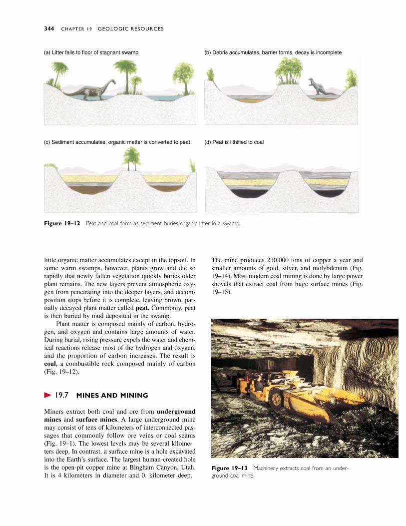
little organic matter accumulates except in the topsoil. Insome warm swamps, however, plants grow and die sorapidly that newly fallen vegetation quickly buries olderplant remains. The new layers prevent atmospheric oxy-gen from penetrating into the deeper layers, and decom-position stops before it is complete, leaving brown, par-tially decayed plant matter called peat. Commonly, peatis then buried by mud deposited in the swamp.
Plant matter is composed mainly of carbon, hydro-gen, and oxygen and contains large amounts of water.During burial, rising pressure expels the water and chem-ical reactions release most of the hydrogen and oxygen,and the proportion of carbon increases. The result iscoal, a combustible rock composed mainly of carbon(Fig. 19–12).
� 19.7 MINES AND MINING
Miners extract both coal and ore from undergroundmines and surface mines. A large underground minemay consist of tens of kilometers of interconnected pas-sages that commonly follow ore veins or coal seams(Fig. 19–13). The lowest levels may be several kilome-ters deep. In contrast, a surface mine is a hole excavatedinto the Earth’s surface. The largest human-created holeis the open-pit copper mine at Bingham Canyon, Utah.It is 4 kilometers in diameter and 0.8 kilometer deep.
The mine produces 230,000 tons of copper a year andsmaller amounts of gold, silver, and molybdenum (Fig.19–14). Most modern coal mining is done by large powershovels that extract coal from huge surface mines (Fig.19–15).
344 CHAPTER 19 GEOLOGIC RESOURCES
Figure 19–12 Peat and coal form as sediment buries organic litter in a swamp.
(a) Litter falls to floor of stagnant swamp
(c) Sediment accumulates, organic matter is converted to peat
(b) Debris accumulates, barrier forms, decay is incomplete
(d) Peat is lithified to coal
Figure 19–13 Machinery extracts coal from an under-ground coal mine.
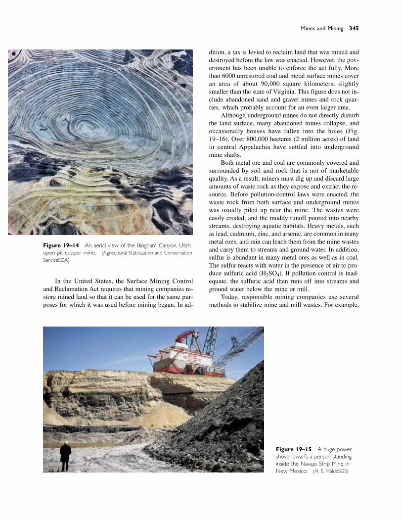
In the United States, the Surface Mining Controland Reclamation Act requires that mining companies re-store mined land so that it can be used for the same pur-poses for which it was used before mining began. In ad-
dition, a tax is levied to reclaim land that was mined anddestroyed before the law was enacted. However, the gov-ernment has been unable to enforce the act fully. Morethan 6000 unrestored coal and metal surface mines coveran area of about 90,000 square kilometers, slightlysmaller than the state of Virginia. This figure does not in-clude abandoned sand and gravel mines and rock quar-ries, which probably account for an even larger area.
Although underground mines do not directly disturbthe land surface, many abandoned mines collapse, andoccasionally houses have fallen into the holes (Fig.19–16). Over 800,000 hectares (2 million acres) of landin central Appalachia have settled into underground mine shafts.
Both metal ore and coal are commonly covered andsurrounded by soil and rock that is not of marketablequality. As a result, miners must dig up and discard largeamounts of waste rock as they expose and extract the re-source. Before pollution-control laws were enacted, thewaste rock from both surface and underground mineswas usually piled up near the mine. The wastes were easily eroded, and the muddy runoff poured into nearbystreams, destroying aquatic habitats. Heavy metals, suchas lead, cadmium, zinc, and arsenic, are common in manymetal ores, and rain can leach them from the mine wastesand carry them to streams and ground water. In addition,sulfur is abundant in many metal ores as well as in coal.The sulfur reacts with water in the presence of air to pro-duce sulfuric acid (H2SO4). If pollution control is inad-equate, the sulfuric acid then runs off into streams andground water below the mine or mill.
Today, responsible mining companies use severalmethods to stabilize mine and mill wastes. For example,
Mines and Mining 345
Figure 19–14 An aerial view of the Bingham Canyon, Utah,open-pit copper mine. (Agricultural Stabilization and ConservationService/USDA)
Figure 19–15 A huge powershovel dwarfs a person standinginside the Navajo Strip Mine inNew Mexico. (H. E. Malde/USGS)
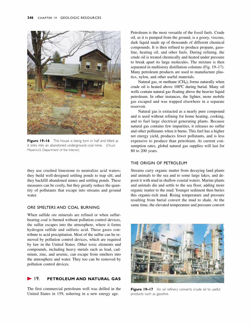
they use crushed limestone to neutralize acid waters;they build well-designed settling ponds to trap silt; andthey backfill abandoned mines and settling ponds. Thesemeasures can be costly, but they greatly reduce the quan-tity of pollutants that escape into streams and ground water.
ORE SMELTERS AND COAL BURNING
When sulfide ore minerals are refined or when sulfur-bearing coal is burned without pollution control devices,the sulfur escapes into the atmosphere, where it formshydrogen sulfide and sulfuric acid. These gases con-tribute to acid precipitation. Most of the sulfur can be re-moved by pollution control devices, which are requiredby law in the United States. Other toxic elements andcompounds, including heavy metals such as lead, cad-mium, zinc, and arsenic, can escape from smelters intothe atmosphere and water. They too can be removed bypollution control devices.
� 19.8 PETROLEUM AND NATURAL GAS
The first commercial petroleum well was drilled in theUnited States in 1859, ushering in a new energy age.
Petroleum is the most versatile of the fossil fuels. Crudeoil, as it is pumped from the ground, is a gooey, viscous,dark liquid made up of thousands of different chemicalcompounds. It is then refined to produce propane, gaso-line, heating oil, and other fuels. During refining, thecrude oil is treated chemically and heated under pressureto break apart its large molecules. The mixture is thenseparated in multistory distillation columns (Fig. 19–17).Many petroleum products are used to manufacture plas-tics, nylon, and other useful materials.
Natural gas, or methane (CH4), forms naturally whencrude oil is heated above 100ºC during burial. Many oilwells contain natural gas floating above the heavier liquidpetroleum. In other instances, the lighter, more mobilegas escaped and was trapped elsewhere in a separatereservoir.
Natural gas is extracted as a nearly pure compoundand is used without refining for home heating, cooking,and to fuel large electrical generating plants. Becausenatural gas contains few impurities, it releases no sulfurand other pollutants when it burns. This fuel has a highernet energy yield, produces fewer pollutants, and is lessexpensive to produce than petroleum. At current con-sumption rates, global natural gas supplies will last for80 to 200 years.
THE ORIGIN OF PETROLEUM
Streams carry organic matter from decaying land plantsand animals to the sea and to some large lakes, and de-posit it with mud in shallow coastal waters. Marine plantsand animals die and settle to the sea floor, adding moreorganic matter to the mud. Younger sediment then buriesthis organic-rich mud. Rising temperature and pressureresulting from burial convert the mud to shale. At thesame time, the elevated temperature and pressure convert
346 CHAPTER 19 GEOLOGIC RESOURCES
Figure 19–16 This house is being torn in half and tilted asit sinks into an abandoned underground coal mine. (ChuckMeyers/U.S. Department of the Interior)
Figure 19–17 An oil refinery converts crude oil to usefulproducts such as gasoline.
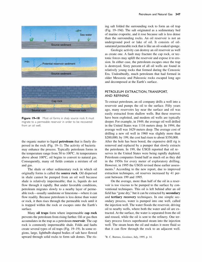
Petroleum and Natural Gas 347
Figure 19–18 Most oil forms in shaly source rock. It mustmigrate to a permeable reservoir in order to be recoveredfrom an oil well.
Sea water
Source sediment
Potential reservoir sediment
Source sediment
Source rock Reservoir rock
Cap rock
the organic matter to liquid petroleum that is finely dis-persed in the rock (Fig. 19–18). The activity of bacteriamay enhance the process. Typically petroleum forms inthe temperature range from 50 to 100ºC. At temperaturesabove about 100ºC, oil begins to convert to natural gas.Consequently, many oil fields contain a mixture of oiland gas.
The shale or other sedimentary rock in which oiloriginally forms is called the source rock. Oil dispersedin shale cannot be pumped from an oil well becauseshale is relatively impermeable; that is, liquids do notflow through it rapidly. But under favorable conditions,petroleum migrates slowly to a nearby layer of perme-able rock—usually sandstone or limestone—where it canflow readily. Because petroleum is less dense than wateror rock, it then rises through the permeable rock until itis trapped within the rock or escapes onto the Earth’ssurface.
Many oil traps form where impermeable cap rockprevents the petroleum from rising further. Oil or gas thenaccumulates in the trap as a petroleum reservoir. The caprock is commonly impermeable shale. Folds and faultscreate several types of oil traps (Fig. 19–19). In some re-gions, large, lightbulb-shaped bodies of salt have flowedupward through solid rocks to form salt domes. The ris-
ing salt folded the surrounding rock to form an oil trap(Fig. 19–19d). The salt originated as a sedimentary bedof marine evaporite, and it rose because salt is less densethan the surrounding rocks. An oil reservoir is not an underground pool or lake of oil. It consists of oil-saturated permeable rock that is like an oil-soaked sponge.
Geologic activity can destroy an oil reservoir as wellas create one. A fault may fracture the cap rock, or tec-tonic forces may uplift the reservoir and expose it to ero-sion. In either case, the petroleum escapes once the trapis destroyed. Sixty percent of all oil wells are found inrelatively young rocks that formed during the CenozoicEra. Undoubtedly, much petroleum that had formed inolder Mesozoic and Paleozoic rocks escaped long agoand decomposed at the Earth’s surface.
PETROLEUM EXTRACTION, TRANSPORT,AND REFINING
To extract petroleum, an oil company drills a well into areservoir and pumps the oil to the surface. Fifty yearsago, many reservoirs lay near the surface and oil waseasily extracted from shallow wells. But these reserveshave been exploited, and modern oil wells are typicallydeeper. For example, in 1949, the average oil well drilledin the United States was 1116 meters deep. In 1994, theaverage well was 1629 meters deep. The average cost ofdrilling a new oil well in 1960 was slightly more than$200,000; by 1993, the cost had risen to about $350,000.After the hole has been bored, the expensive drill rig isremoved and replaced by a pumper that slowly extractsthe petroleum. In 1989, the USGS reported that oil re-serves in the United States were being rapidly depleted.Petroleum companies found half as much oil as they didin the 1950s for every meter of exploratory drilling.However, in 1995 the USGS revised these earlier assess-ments.2 According to the new report, due to improvedextraction techniques, oil reserves increased by 41 per-cent between 1989 and 1995.
On the average, more than half of the oil in a reser-voir is too viscous to be pumped to the surface by con-ventional techniques. This oil is left behind after an oilfield has “gone dry,” but it can be extracted by secondaryand tertiary recovery techniques. In one simple sec-ondary process, water is pumped into one well, calledthe injection well. The water floods the reservoir, drivingoil to nearby wells, where both the water and oil are ex-tracted. At the surface, the water is separated from the oiland reused, while the oil is sent to the refinery. One ter-tiary process forces superheated steam into the injectionwell. The steam heats the oil and makes it more fluid sothat it can flow through the rock to an adjacent well.
2R. C. Burruss, Geotimes, July, 1995, p. 14.
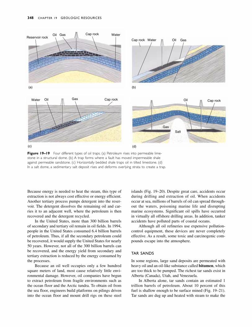
Because energy is needed to heat the steam, this type ofextraction is not always cost effective or energy efficient.Another tertiary process pumps detergent into the reser-voir. The detergent dissolves the remaining oil and car-ries it to an adjacent well, where the petroleum is thenrecovered and the detergent recycled.
In the United States, more than 300 billion barrelsof secondary and tertiary oil remain in oil fields. In 1994,people in the United States consumed 6.4 billion barrelsof petroleum. Thus, if all the secondary petroleum couldbe recovered, it would supply the United States for nearly50 years. However, not all of the 300 billion barrels canbe recovered, and the energy yield from secondary andtertiary extraction is reduced by the energy consumed bythe processes.
Because an oil well occupies only a few hundredsquare meters of land, most cause relatively little envi-ronmental damage. However, oil companies have begunto extract petroleum from fragile environments such asthe ocean floor and the Arctic tundra. To obtain oil fromthe sea floor, engineers build platforms on pilings driveninto the ocean floor and mount drill rigs on these steel
348 CHAPTER 19 GEOLOGIC RESOURCES
islands (Fig. 19–20). Despite great care, accidents occurduring drilling and extraction of oil. When accidents occur at sea, millions of barrels of oil can spread through-out the waters, poisoning marine life and disrupting marine ecosystems. Significant oil spills have occurredin virtually all offshore drilling areas. In addition, tankeraccidents have polluted parts of coastal oceans.
Although all oil refineries use expensive pollution-control equipment, these devices are never completelyeffective. As a result, some toxic and carcinogenic com-pounds escape into the atmosphere.
TAR SANDS
In some regions, large sand deposits are permeated withheavy oil and an oil-like substance called bitumen, whichare too thick to be pumped. The richest tar sands exist inAlberta (Canada), Utah, and Venezuela.
In Alberta alone, tar sands contain an estimated 1trillion barrels of petroleum. About 10 percent of thisfuel is shallow enough to be surface mined (Fig. 19–21).Tar sands are dug up and heated with steam to make the
Reservoir rockOil Gas Cap rock Water
Oil GasCap rock Water
Oil Gas Cap rockWater Oil Cap rock
SaltGas
(a) (b)
(c) (d)
Figure 19–19 Four different types of oil traps. (a) Petroleum rises into permeable lime-stone in a structural dome. (b) A trap forms where a fault has moved impermeable shaleagainst permeable sandstone. (c) Horizontally bedded shale traps oil in tilted limestone. (d)In a salt dome, a sedimentary salt deposit rises and deforms overlying strata to create a trap.
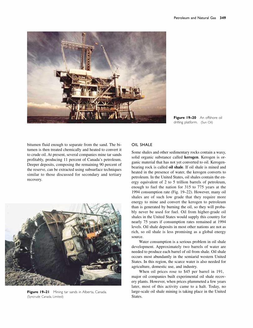
bitumen fluid enough to separate from the sand. The bi-tumen is then treated chemically and heated to convert itto crude oil. At present, several companies mine tar sandsprofitably, producing 11 percent of Canada’s petroleum.Deeper deposits, composing the remaining 90 percent ofthe reserve, can be extracted using subsurface techniquessimilar to those discussed for secondary and tertiary recovery.
OIL SHALE
Some shales and other sedimentary rocks contain a waxy,solid organic substance called kerogen. Kerogen is or-ganic material that has not yet converted to oil. Kerogen-bearing rock is called oil shale. If oil shale is mined andheated in the presence of water, the kerogen converts topetroleum. In the United States, oil shales contain the en-ergy equivalent of 2 to 5 trillion barrels of petroleum,enough to fuel the nation for 315 to 775 years at the1994 consumption rate (Fig. 19–22). However, many oilshales are of such low grade that they require more energy to mine and convert the kerogen to petroleumthan is generated by burning the oil, so they will proba-bly never be used for fuel. Oil from higher-grade oilshales in the United States would supply this country fornearly 75 years if consumption rates remained at 1994levels. Oil shale deposits in most other nations are not asrich, so oil shale is less promising as a global energysource.
Water consumption is a serious problem in oil shaledevelopment. Approximately two barrels of water areneeded to produce each barrel of oil from shale. Oil shaleoccurs most abundantly in the semiarid western UnitedStates. In this region, the scarce water is also needed foragriculture, domestic use, and industry.
When oil prices rose to $45 per barrel in 1981,major oil companies built experimental oil shale recov-ery plants. However, when prices plummeted a few yearslater, most of this activity came to a halt. Today, no large-scale oil shale mining is taking place in the UnitedStates.
Petroleum and Natural Gas 349
Figure 19–20 An offshore oildrilling platform. (Sun Oil)
Figure 19–21 Mining tar sands in Alberta, Canada.(Syncrude Canada, Limited)
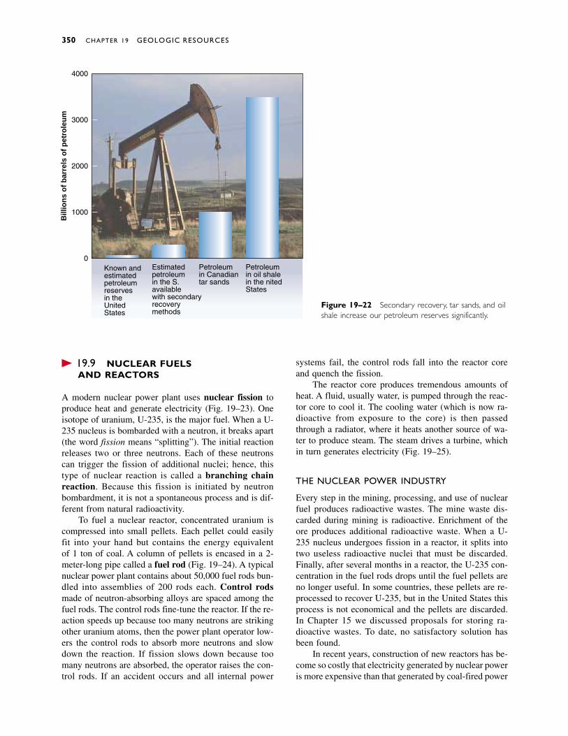
� 19.9 NUCLEAR FUELS AND REACTORS
A modern nuclear power plant uses nuclear fission toproduce heat and generate electricity (Fig. 19–23). Oneisotope of uranium, U-235, is the major fuel. When a U-235 nucleus is bombarded with a neutron, it breaks apart(the word fission means “splitting”). The initial reactionreleases two or three neutrons. Each of these neutronscan trigger the fission of additional nuclei; hence, thistype of nuclear reaction is called a branching chain reaction. Because this fission is initiated by neutronbombardment, it is not a spontaneous process and is dif-ferent from natural radioactivity.
To fuel a nuclear reactor, concentrated uranium iscompressed into small pellets. Each pellet could easilyfit into your hand but contains the energy equivalent of 1 ton of coal. A column of pellets is encased in a 2-meter-long pipe called a fuel rod (Fig. 19–24). A typicalnuclear power plant contains about 50,000 fuel rods bun-dled into assemblies of 200 rods each. Control rodsmade of neutron-absorbing alloys are spaced among thefuel rods. The control rods fine-tune the reactor. If the re-action speeds up because too many neutrons are strikingother uranium atoms, then the power plant operator low-ers the control rods to absorb more neutrons and slowdown the reaction. If fission slows down because toomany neutrons are absorbed, the operator raises the con-trol rods. If an accident occurs and all internal power
systems fail, the control rods fall into the reactor coreand quench the fission.
The reactor core produces tremendous amounts ofheat. A fluid, usually water, is pumped through the reac-tor core to cool it. The cooling water (which is now ra-dioactive from exposure to the core) is then passedthrough a radiator, where it heats another source of wa-ter to produce steam. The steam drives a turbine, whichin turn generates electricity (Fig. 19–25).
THE NUCLEAR POWER INDUSTRY
Every step in the mining, processing, and use of nuclearfuel produces radioactive wastes. The mine waste dis-carded during mining is radioactive. Enrichment of theore produces additional radioactive waste. When a U-235 nucleus undergoes fission in a reactor, it splits intotwo useless radioactive nuclei that must be discarded.Finally, after several months in a reactor, the U-235 con-centration in the fuel rods drops until the fuel pellets areno longer useful. In some countries, these pellets are re-processed to recover U-235, but in the United States thisprocess is not economical and the pellets are discarded.In Chapter 15 we discussed proposals for storing ra-dioactive wastes. To date, no satisfactory solution hasbeen found.
In recent years, construction of new reactors has be-come so costly that electricity generated by nuclear poweris more expensive than that generated by coal-fired power
350 CHAPTER 19 GEOLOGIC RESOURCES
Known and estimatedpetroleumreservesin theUnitedStates
0
1000
2000
3000
4000
Estimatedpetroleumin the U.S.availablewith secondaryrecoverymethods
Petroleumin Canadiantar sands
Petroleumin oil shalein the UnitedStates
Bill
ion
s o
f b
arre
ls o
f p
etro
leu
m
Figure 19–22 Secondary recovery, tar sands, and oilshale increase our petroleum reserves significantly.
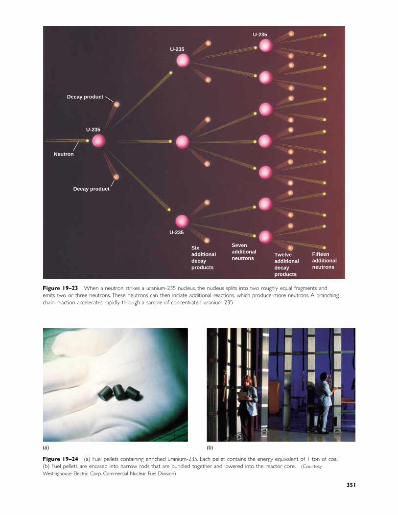
Decay product
U-235
U-235
U-235
Neutron
Decay product
U-235
Sixadditionaldecayproducts
Sevenadditionalneutrons
Twelveadditionaldecayproducts
Fifteenadditionalneutrons
Figure 19–23 When a neutron strikes a uranium-235 nucleus, the nucleus splits into two roughly equal fragments andemits two or three neutrons.These neutrons can then initiate additional reactions, which produce more neutrons. A branchingchain reaction accelerates rapidly through a sample of concentrated uranium-235.
(a) (b)
Figure 19–24 (a) Fuel pellets containing enriched uranium-235. Each pellet contains the energy equivalent of 1 ton of coal.(b) Fuel pellets are encased into narrow rods that are bundled together and lowered into the reactor core. (CourtesyWestinghouse Electric Corp, Commercial Nuclear Fuel Division)
351
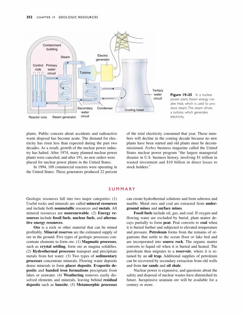
352 CHAPTER 19 GEOLOGIC RESOURCES
Containmentbuilding
Controlrods
Primarywatercircuit
Steam
Turbine
Electricgenerator
Reactor core Steam generator
Secondarywatercircuit
Condenser Cooling tower
Tertiarywatercircuit
Figure 19–25 In a nuclearpower plant, fission energy cre-ates heat, which is used to pro-duce steam.The steam drives a turbine, which generates electricity.
Geologic resources fall into two major categories: (1)Useful rocks and minerals are called mineral resourcesand include both nonmetallic resources and metals. Allmineral resources are nonrenewable. (2) Energy re-sources include fossil fuels, nuclear fuels, and alterna-tive energy resources.
Ore is a rock or other material that can be minedprofitably. Mineral reserves are the estimated supply ofore in the ground. Five types of geologic processes con-centrate elements to form ore. (1) Magmatic processes,such as crystal settling, form ore as magma solidifies.(2) Hydrothermal processes transport and precipitatemetals from hot water. (3) Two types of sedimentaryprocesses concentrate minerals. Flowing water depositsdense minerals to form placer deposits. Evaporite de-posits and banded iron formations precipitate fromlakes or seawater. (4) Weathering removes easily dis-solved elements and minerals, leaving behind residualdeposits such as bauxite. (5) Metamorphic processes
can create hydrothermal solutions and form asbestos andmarble. Metal ores and coal are extracted from under-ground mines and surface mines.
Fossil fuels include oil, gas, and coal. If oxygen andflowing water are excluded by burial, plant matter de-cays partially to form peat. Peat converts to coal whenit is buried further and subjected to elevated temperatureand pressure. Petroleum forms from the remains of or-ganisms that settle to the ocean floor or lake bed and are incorporated into source rock. The organic matterconverts to liquid oil when it is buried and heated. Thepetroleum then migrates to a reservoir, where it is re-tained by an oil trap. Additional supplies of petroleumcan be recovered by secondary extraction from old wellsand from tar sands and oil shale.
Nuclear power is expensive, and questions about thesafety and disposal of nuclear wastes have diminished itsfuture. Inexpensive uranium ore will be available for acentury or more.
S U M M A R Y
plants. Public concern about accidents and radioactivewaste disposal has become acute. The demand for elec-tricity has risen less than expected during the past twodecades. As a result, growth of the nuclear power indus-try has halted. After 1974, many planned nuclear powerplants were canceled, and after 1981, no new orders wereplaced for nuclear power plants in the United States.
In 1994, 109 commercial reactors were operating inthe United States. These generators produced 22 percent
of the total electricity consumed that year. Those num-bers will decline in the coming decade because no newplants have been started and old plants must be decom-missioned. Forbes business magazine called the UnitedStates nuclear power program “the largest managerialdisaster in U.S. business history, involving $1 trillion inwasted investment and $10 billion in direct losses tostock holders.”

Discussion Questions 353
mineral resource 336nonmetallic resources
336metal 336nonrenewable resource
336energy resource 336fossil fuel 336nuclear fuel 336alternative energy
resource 336quarry 336
banded iron formation341
residual deposit 341bauxite 341supergene ore 342peat 344coal 344underground mine 344surface mine 344petroleum 347source rock 347oil trap 347
mineral deposit 336ore 336mineral reserve 336crystal settling 337hydrothermal vein
deposit 339disseminated ore deposit
339porphyry copper deposit
339placer deposit 340evaporite deposit 341
cap rock 347reservoir 347secondary recovery 347bitumen 348kerogen 349oil shale 349branching chain
reaction 350nuclear fission 350fuel rod 350control rod 350
K E Y W O R D S
1. Describe the two categories of geologic resources.
2. Describe the differences between nonrenewable and re-newable resources.
3. What is ore? What are mineral reserves? Describe threefactors that can cause changes in estimates of mineral re-serves.
4. If most elements are widely distributed in ordinary rocks,why should we worry about running short?
5. Explain crystal settling.
6. Discuss the formation of hydrothermal ore deposits.
7. Discuss the formation of marine evaporites and bandediron formations.
8. Explain why the availability of mineral resources de-pends on the availability of energy, on other environmen-tal issues, and on political considerations.
9. Explain how coal forms. Why does it form in some envi-ronments but not in others?
10. Explain the importance of source rock, reservoir rock,cap rock, and oil traps in the formation of petroleum re-serves.
11. Discuss two sources of petroleum that will be availableafter conventional wells go dry.
12. List the relative advantages and disadvantages of usingcoal, petroleum, and natural gas as fuels.
13. Explain how a nuclear reactor works. Discuss the behav-ior of neutrons, the importance of control rods, and howthe heat from the reaction is harnessed to produce usefulenergy.
14. Discuss the status of the nuclear power industry in theUnited States.
R E V I E W Q U E S T I O N S
1. What factors can make our metal reserves last longer?What factors can deplete them rapidly?
2. It is common for a single mine to contain ores of two ormore metals. Discuss how geologic processes might favorconcentration of two metals in a single deposit.
3. List ten objects that you own. What resources are theymade of? How long will each of the objects be used be-fore it is discarded? Will the materials eventually be re-cycled or deposited in the trash? Discuss ways of con-serving resources in your own life.
4. If you were searching for petroleum, would you searchprimarily in sedimentary rock, metamorphic rock, or ig-neous rock? Explain.
5. If you were a space traveler abandoned on an unknownplanet in a distant solar system, what clues would youlook for if you were searching for fossil fuels?
6. Is an impermeable cap rock necessary to preserve coaldeposits? Why or why not?
7. Discuss problems in predicting the future availability offossil fuel reserves. What is the value of the predictions?
8. Compare the depletion of mineral reserves with the de-pletion of fossil fuels. How are the two problems similar,and how are they different?
D I S C U S S I O N Q U E S T I O N S
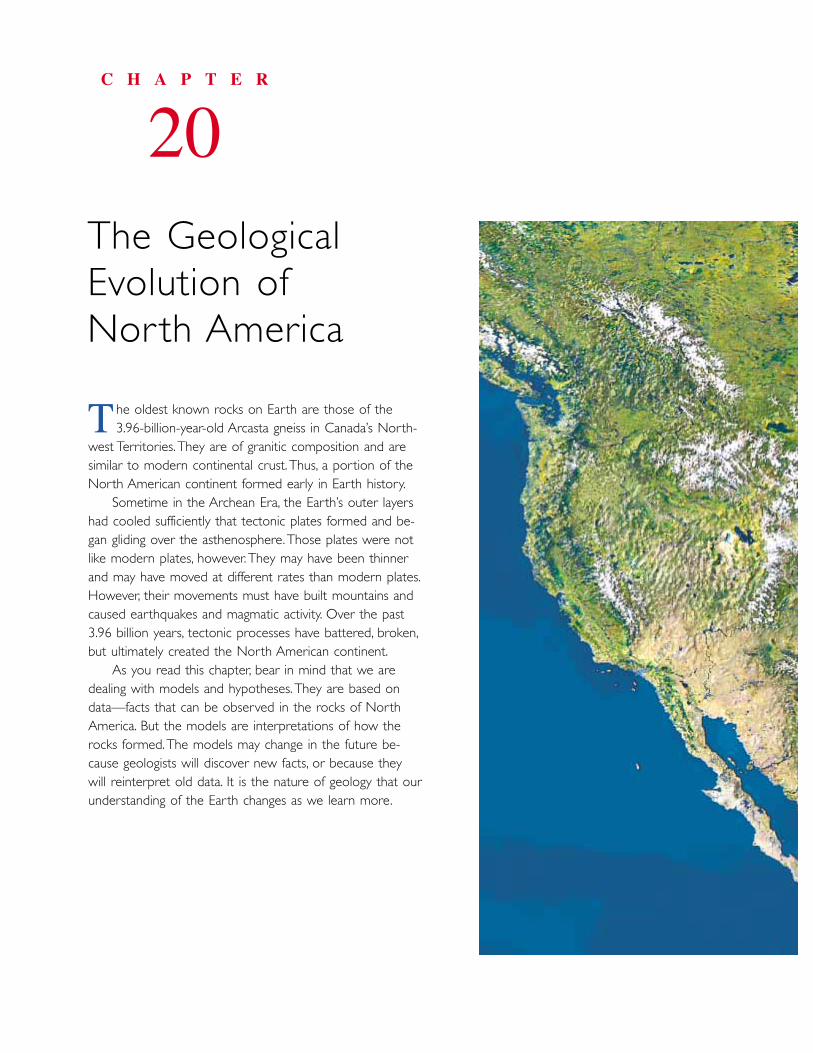
he oldest known rocks on Earth are those of the 3.96-billion-year-old Arcasta gneiss in Canada’s North-
west Territories. They are of granitic composition and aresimilar to modern continental crust. Thus, a portion of theNorth American continent formed early in Earth history.
Sometime in the Archean Era, the Earth’s outer layershad cooled sufficiently that tectonic plates formed and be-gan gliding over the asthenosphere.Those plates were notlike modern plates, however.They may have been thinnerand may have moved at different rates than modern plates.However, their movements must have built mountains andcaused earthquakes and magmatic activity. Over the past3.96 billion years, tectonic processes have battered, broken,but ultimately created the North American continent.
As you read this chapter, bear in mind that we aredealing with models and hypotheses.They are based ondata—facts that can be observed in the rocks of NorthAmerica. But the models are interpretations of how therocks formed.The models may change in the future be-cause geologists will discover new facts, or because theywill reinterpret old data. It is the nature of geology that ourunderstanding of the Earth changes as we learn more.
C H A P T E R
20The GeologicalEvolution of North America
T
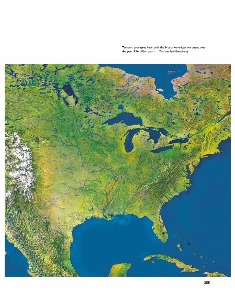
Tectonic processes have built the North American continent overthe past 3.96 billion years. (Tom Van Sant/Geosphere)
355
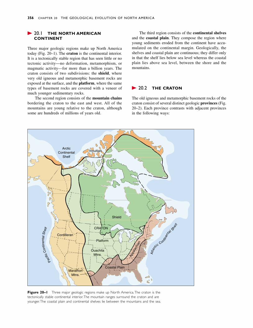
� 20.1 THE NORTH AMERICANCONTINENT
Three major geologic regions make up North Americatoday (Fig. 20–1). The craton is the continental interior.It is a tectonically stable region that has seen little or notectonic activity—no deformation, metamorphism, ormagmatic activity—for more than a billion years. Thecraton consists of two subdivisions: the shield, wherevery old igneous and metamorphic basement rocks areexposed at the surface, and the platform, where the sametypes of basement rocks are covered with a veneer ofmuch younger sedimentary rocks.
The second region consists of the mountain chainsbordering the craton to the east and west. All of themountains are young relative to the craton, althoughsome are hundreds of millions of years old.
The third region consists of the continental shelvesand the coastal plain. They compose the region whereyoung sediments eroded from the continent have accu-mulated on the continental margin. Geologically, theshelves and coastal plain are continuous; they differ onlyin that the shelf lies below sea level whereas the coastalplain lies above sea level, between the shore and themountains.
� 20.2 THE CRATON
The old igneous and metamorphic basement rocks of thecraton consist of several distinct geologic provinces (Fig.20–2). Each province contrasts with adjacent provincesin the following ways:
356 CHAPTER 20 THE GEOLOGICAL EVOLUTION OF NORTH AMERICA
ArcticContinental
Shelf
Innuitian
Sheild
Atla
nt
icContin
en
tal Shelf
Platform
OuachitaMtns.
Coastal PlainMarathon
Mtns.
Cordilleran
Paci
ficC
ontin
enta
l She
lf
Appa
lach
ian
CRATON
Shield
Figure 20–1 Three major geologic regions make up North America.The craton is thetectonically stable continental interior.The mountain ranges surround the craton and areyounger.The coastal plain and continental shelves lie between the mountains and the sea.
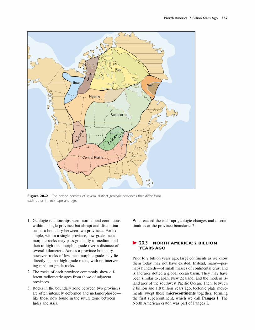
1. Geologic relationships seem normal and continuouswithin a single province but abrupt and discontinu-ous at a boundary between two provinces. For ex-ample, within a single province, low-grade meta-morphic rocks may pass gradually to medium andthen to high metamorphic grade over a distance ofseveral kilometers. Across a province boundary,however, rocks of low metamorphic grade may liedirectly against high-grade rocks, with no interven-ing medium-grade rocks.
2. The rocks of each province commonly show dif-ferent radiometric ages from those of adjacentprovinces.
3. Rocks in the boundary zone between two provincesare often intensely deformed and metamorphosed—like those now found in the suture zone betweenIndia and Asia.
What caused these abrupt geologic changes and discon-tinuities at the province boundaries?
� 20.3 NORTH AMERICA: 2 BILLIONYEARS AGO
Prior to 2 billion years ago, large continents as we knowthem today may not have existed. Instead, many—per-haps hundreds—of small masses of continental crust andisland arcs dotted a global ocean basin. They may havebeen similar to Japan, New Zealand, and the modern is-land arcs of the southwest Pacific Ocean. Then, between2 billion and 1.8 billion years ago, tectonic plate move-ments swept these microcontinents together, formingthe first supercontinent, which we call Pangea I. TheNorth American craton was part of Pangea I.
North America: 2 Billion Years Ago 357
Rae
Bear
Hearne
Nain
Superior
Wyo
min
g
South
ern
Sla
ve
Central Plains
Figure 20–2 The craton consists of several distinct geologic provinces that differ fromeach other in rock type and age.
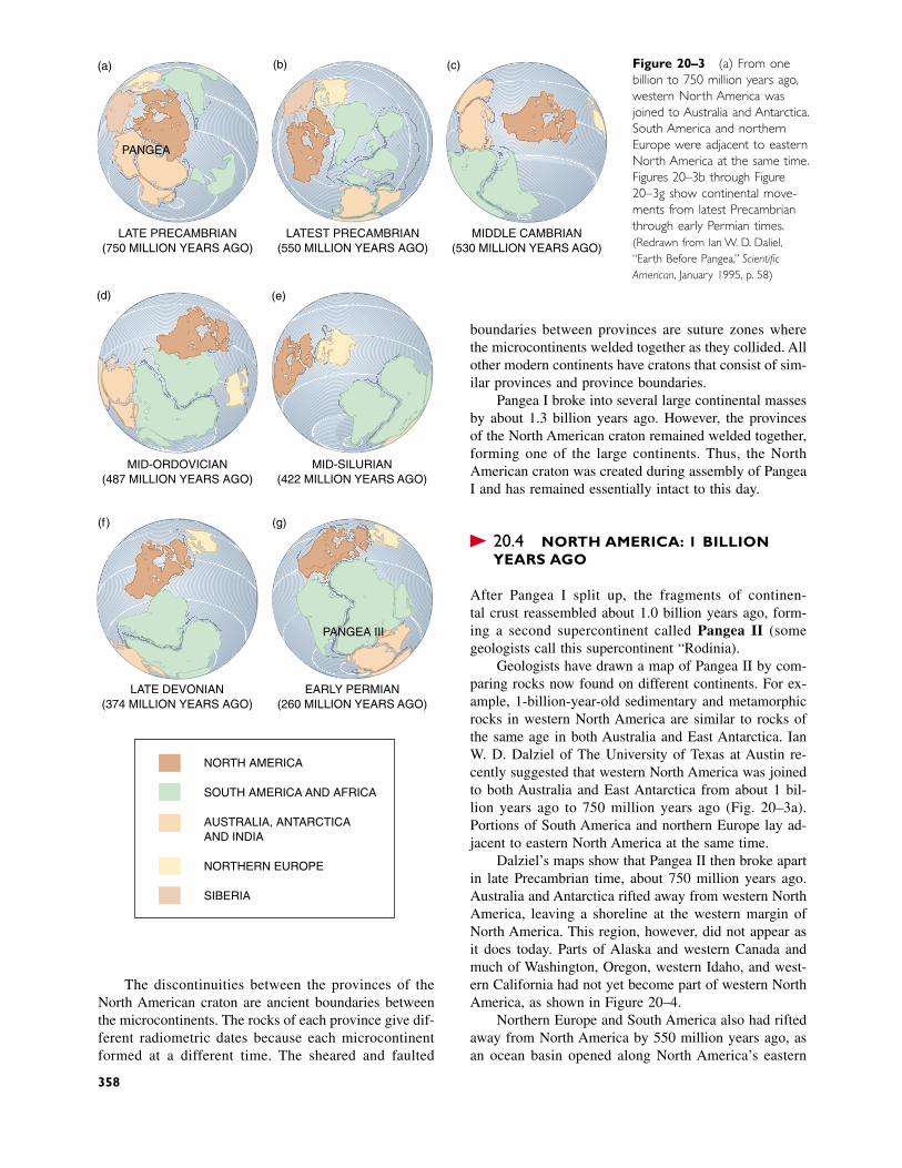
Figure 20–3 (a) From onebillion to 750 million years ago,western North America wasjoined to Australia and Antarctica.South America and northernEurope were adjacent to easternNorth America at the same time.Figures 20–3b through Figure20–3g show continental move-ments from latest Precambrianthrough early Permian times.(Redrawn from Ian W. D. Dalziel,“Earth Before Pangea,” ScientificAmerican, January 1995, p. 58)
boundaries between provinces are suture zones wherethe microcontinents welded together as they collided. Allother modern continents have cratons that consist of sim-ilar provinces and province boundaries.
Pangea I broke into several large continental massesby about 1.3 billion years ago. However, the provincesof the North American craton remained welded together,forming one of the large continents. Thus, the NorthAmerican craton was created during assembly of PangeaI and has remained essentially intact to this day.
� 20.4 NORTH AMERICA: 1 BILLIONYEARS AGO
After Pangea I split up, the fragments of continen-tal crust reassembled about 1.0 billion years ago, form-ing a second supercontinent called Pangea II (somegeologists call this supercontinent “Rodinia”).
Geologists have drawn a map of Pangea II by com-paring rocks now found on different continents. For ex-ample, 1-billion-year-old sedimentary and metamorphicrocks in western North America are similar to rocks ofthe same age in both Australia and East Antarctica. IanW. D. Dalziel of The University of Texas at Austin re-cently suggested that western North America was joinedto both Australia and East Antarctica from about 1 bil-lion years ago to 750 million years ago (Fig. 20–3a).Portions of South America and northern Europe lay ad-jacent to eastern North America at the same time.
Dalziel’s maps show that Pangea II then broke apartin late Precambrian time, about 750 million years ago.Australia and Antarctica rifted away from western NorthAmerica, leaving a shoreline at the western margin ofNorth America. This region, however, did not appear asit does today. Parts of Alaska and western Canada andmuch of Washington, Oregon, western Idaho, and west-ern California had not yet become part of western NorthAmerica, as shown in Figure 20–4.
Northern Europe and South America also had riftedaway from North America by 550 million years ago, asan ocean basin opened along North America’s eastern
LATE PRECAMBRIAN(750 MILLION YEARS AGO)
(a)
LATEST PRECAMBRIAN(550 MILLION YEARS AGO)
(b)
MIDDLE CAMBRIAN(530 MILLION YEARS AGO)
(c)
MID-ORDOVICIAN(487 MILLION YEARS AGO)
(d)
MID-SILURIAN(422 MILLION YEARS AGO)
(e)
LATE DEVONIAN(374 MILLION YEARS AGO)
(f)
EARLY PERMIAN(260 MILLION YEARS AGO)
(g)
PANGEA
PANGEA III
NORTH AMERICA
SOUTH AMERICA AND AFRICA
AUSTRALIA, ANTARCTICAAND INDIA
NORTHERN EUROPE
SIBERIA
The discontinuities between the provinces of theNorth American craton are ancient boundaries betweenthe microcontinents. The rocks of each province give dif-ferent radiometric dates because each microcontinentformed at a different time. The sheared and faulted
358
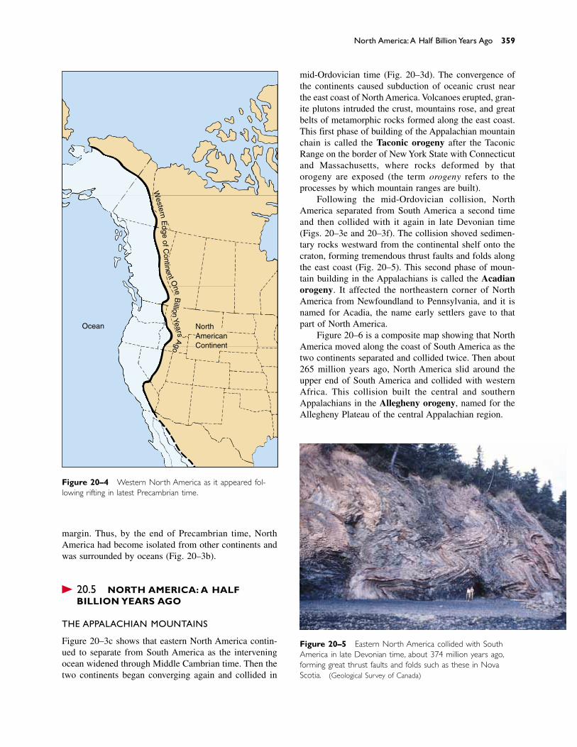
Figure 20–4 Western North America as it appeared fol-lowing rifting in latest Precambrian time.
North America: A Half Billion Years Ago 359
NorthAmericanContinent
Ocean
Western
Edge
of Continent O
neB
illionYears
Ago
margin. Thus, by the end of Precambrian time, NorthAmerica had become isolated from other continents andwas surrounded by oceans (Fig. 20–3b).
� 20.5 NORTH AMERICA: A HALFBILLION YEARS AGO
THE APPALACHIAN MOUNTAINS
Figure 20–3c shows that eastern North America contin-ued to separate from South America as the interveningocean widened through Middle Cambrian time. Then thetwo continents began converging again and collided in
Figure 20–5 Eastern North America collided with SouthAmerica in late Devonian time, about 374 million years ago,forming great thrust faults and folds such as these in NovaScotia. (Geological Survey of Canada)
mid-Ordovician time (Fig. 20–3d). The convergence ofthe continents caused subduction of oceanic crust nearthe east coast of North America. Volcanoes erupted, gran-ite plutons intruded the crust, mountains rose, and greatbelts of metamorphic rocks formed along the east coast.This first phase of building of the Appalachian mountainchain is called the Taconic orogeny after the TaconicRange on the border of New York State with Connecticutand Massachusetts, where rocks deformed by thatorogeny are exposed (the term orogeny refers to theprocesses by which mountain ranges are built).
Following the mid-Ordovician collision, NorthAmerica separated from South America a second timeand then collided with it again in late Devonian time(Figs. 20–3e and 20–3f). The collision shoved sedimen-tary rocks westward from the continental shelf onto thecraton, forming tremendous thrust faults and folds alongthe east coast (Fig. 20–5). This second phase of moun-tain building in the Appalachians is called the Acadianorogeny. It affected the northeastern corner of NorthAmerica from Newfoundland to Pennsylvania, and it isnamed for Acadia, the name early settlers gave to thatpart of North America.
Figure 20–6 is a composite map showing that NorthAmerica moved along the coast of South America as thetwo continents separated and collided twice. Then about265 million years ago, North America slid around theupper end of South America and collided with westernAfrica. This collision built the central and southernAppalachians in the Allegheny orogeny, named for theAllegheny Plateau of the central Appalachian region.
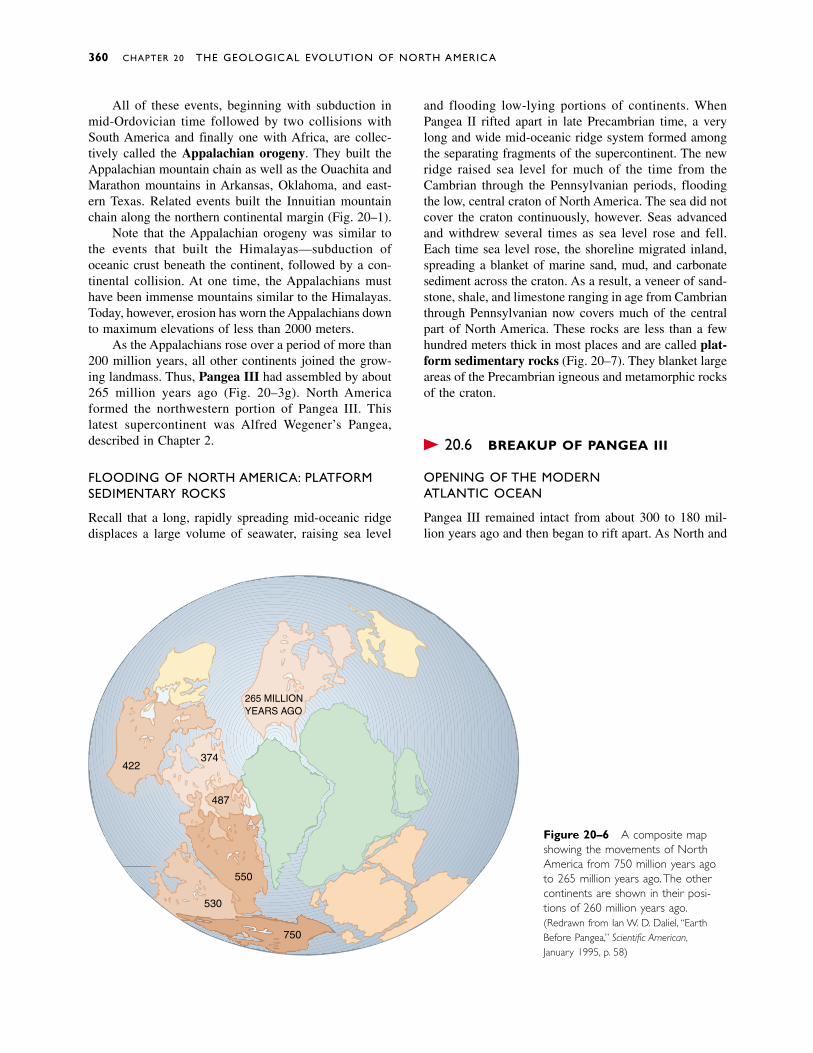
All of these events, beginning with subduction inmid-Ordovician time followed by two collisions withSouth America and finally one with Africa, are collec-tively called the Appalachian orogeny. They built theAppalachian mountain chain as well as the Ouachita andMarathon mountains in Arkansas, Oklahoma, and east-ern Texas. Related events built the Innuitian mountainchain along the northern continental margin (Fig. 20–1).
Note that the Appalachian orogeny was similar tothe events that built the Himalayas—subduction ofoceanic crust beneath the continent, followed by a con-tinental collision. At one time, the Appalachians musthave been immense mountains similar to the Himalayas.Today, however, erosion has worn the Appalachians downto maximum elevations of less than 2000 meters.
As the Appalachians rose over a period of more than200 million years, all other continents joined the grow-ing landmass. Thus, Pangea III had assembled by about265 million years ago (Fig. 20–3g). North Americaformed the northwestern portion of Pangea III. This latest supercontinent was Alfred Wegener’s Pangea,described in Chapter 2.
FLOODING OF NORTH AMERICA: PLATFORMSEDIMENTARY ROCKS
Recall that a long, rapidly spreading mid-oceanic ridgedisplaces a large volume of seawater, raising sea level
and flooding low-lying portions of continents. WhenPangea II rifted apart in late Precambrian time, a verylong and wide mid-oceanic ridge system formed amongthe separating fragments of the supercontinent. The newridge raised sea level for much of the time from theCambrian through the Pennsylvanian periods, floodingthe low, central craton of North America. The sea did notcover the craton continuously, however. Seas advancedand withdrew several times as sea level rose and fell.Each time sea level rose, the shoreline migrated inland,spreading a blanket of marine sand, mud, and carbonatesediment across the craton. As a result, a veneer of sand-stone, shale, and limestone ranging in age from Cambrianthrough Pennsylvanian now covers much of the centralpart of North America. These rocks are less than a fewhundred meters thick in most places and are called plat-form sedimentary rocks (Fig. 20–7). They blanket largeareas of the Precambrian igneous and metamorphic rocksof the craton.
� 20.6 BREAKUP OF PANGEA III
OPENING OF THE MODERN ATLANTIC OCEAN
Pangea III remained intact from about 300 to 180 mil-lion years ago and then began to rift apart. As North and
360 CHAPTER 20 THE GEOLOGICAL EVOLUTION OF NORTH AMERICA
265 MILLIONYEARS AGO
422374
487
550
750
530
Figure 20–6 A composite mapshowing the movements of NorthAmerica from 750 million years agoto 265 million years ago.The othercontinents are shown in their posi-tions of 260 million years ago.(Redrawn from Ian W. D. Dalziel, “EarthBefore Pangea,” Scientific American,January 1995, p. 58)
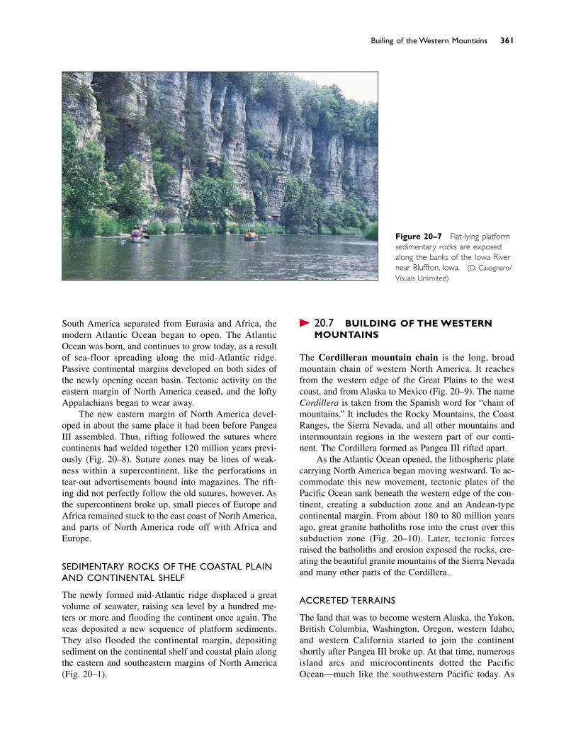
South America separated from Eurasia and Africa, themodern Atlantic Ocean began to open. The AtlanticOcean was born, and continues to grow today, as a resultof sea-floor spreading along the mid-Atlantic ridge.Passive continental margins developed on both sides ofthe newly opening ocean basin. Tectonic activity on theeastern margin of North America ceased, and the loftyAppalachians began to wear away.
The new eastern margin of North America devel-oped in about the same place it had been before PangeaIII assembled. Thus, rifting followed the sutures wherecontinents had welded together 120 million years previ-ously (Fig. 20–8). Suture zones may be lines of weak-ness within a supercontinent, like the perforations intear-out advertisements bound into magazines. The rift-ing did not perfectly follow the old sutures, however. Asthe supercontinent broke up, small pieces of Europe andAfrica remained stuck to the east coast of North America,and parts of North America rode off with Africa andEurope.
SEDIMENTARY ROCKS OF THE COASTAL PLAINAND CONTINENTAL SHELF
The newly formed mid-Atlantic ridge displaced a greatvolume of seawater, raising sea level by a hundred me-ters or more and flooding the continent once again. Theseas deposited a new sequence of platform sediments.They also flooded the continental margin, depositingsediment on the continental shelf and coastal plain alongthe eastern and southeastern margins of North America(Fig. 20–1).
� 20.7 BUILDING OF THE WESTERNMOUNTAINS
The Cordilleran mountain chain is the long, broadmountain chain of western North America. It reachesfrom the western edge of the Great Plains to the westcoast, and from Alaska to Mexico (Fig. 20–9). The nameCordillera is taken from the Spanish word for “chain ofmountains.” It includes the Rocky Mountains, the CoastRanges, the Sierra Nevada, and all other mountains andintermountain regions in the western part of our conti-nent. The Cordillera formed as Pangea III rifted apart.
As the Atlantic Ocean opened, the lithospheric platecarrying North America began moving westward. To ac-commodate this new movement, tectonic plates of thePacific Ocean sank beneath the western edge of the con-tinent, creating a subduction zone and an Andean-typecontinental margin. From about 180 to 80 million yearsago, great granite batholiths rose into the crust over thissubduction zone (Fig. 20–10). Later, tectonic forcesraised the batholiths and erosion exposed the rocks, cre-ating the beautiful granite mountains of the Sierra Nevadaand many other parts of the Cordillera.
ACCRETED TERRAINS
The land that was to become western Alaska, the Yukon,British Columbia, Washington, Oregon, western Idaho,and western California started to join the continentshortly after Pangea III broke up. At that time, numerousisland arcs and microcontinents dotted the PacificOcean—much like the southwestern Pacific today. As
Building of the Western Mountains 361
Figure 20–7 Flat-lying platformsedimentary rocks are exposedalong the banks of the Iowa Rivernear Bluffton, Iowa. (D. Cavagnaro/Visuals Unlimited)
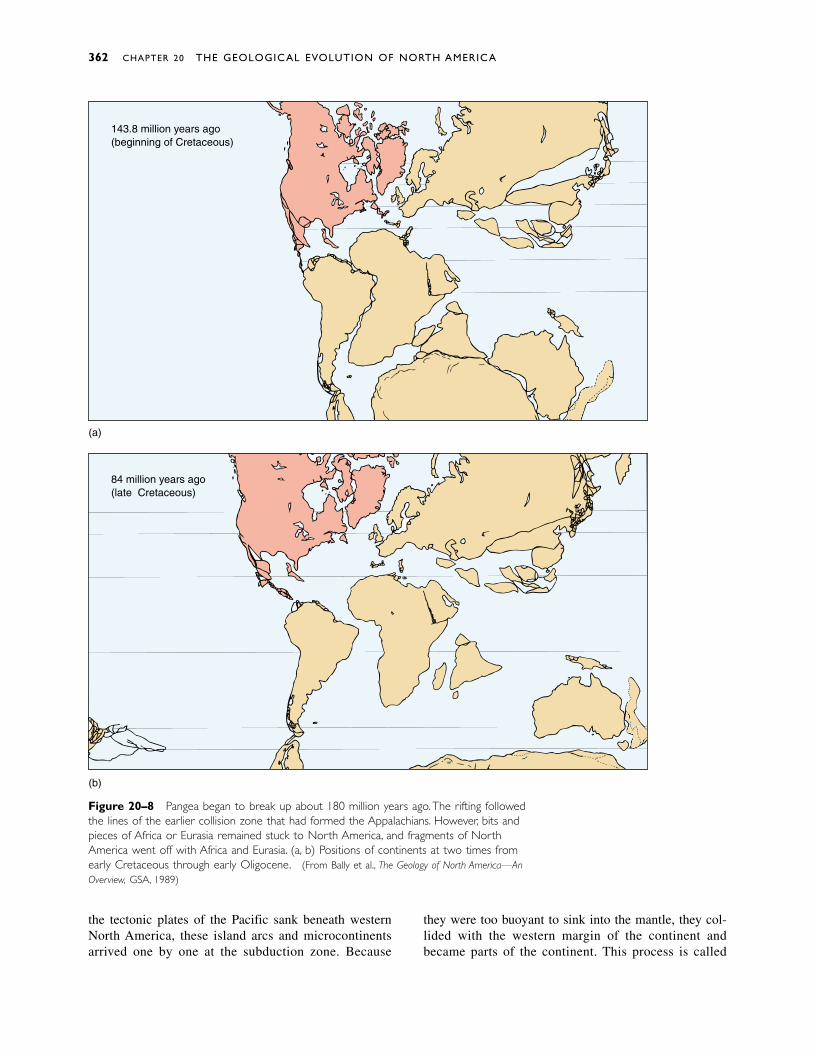
Figure 20–8 Pangea began to break up about 180 million years ago.The rifting followedthe lines of the earlier collision zone that had formed the Appalachians. However, bits andpieces of Africa or Eurasia remained stuck to North America, and fragments of NorthAmerica went off with Africa and Eurasia. (a, b) Positions of continents at two times fromearly Cretaceous through early Oligocene. (From Bally et al., The Geology of North America—AnOverview, GSA, 1989)
362 CHAPTER 20 THE GEOLOGICAL EVOLUTION OF NORTH AMERICA
84 million years ago(late Cretaceous)
(a)
(b)
143.8 million years ago(beginning of Cretaceous)
the tectonic plates of the Pacific sank beneath westernNorth America, these island arcs and microcontinents arrived one by one at the subduction zone. Because
they were too buoyant to sink into the mantle, they col-lided with the western margin of the continent and became parts of the continent. This process is called
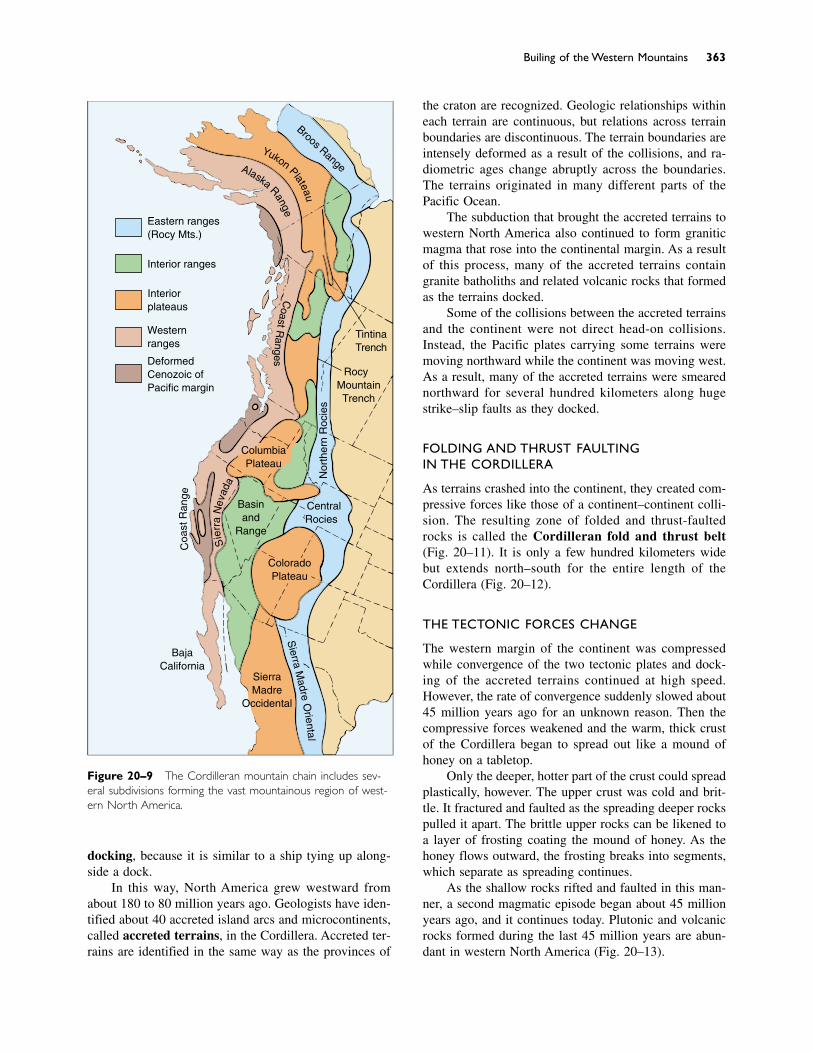
docking, because it is similar to a ship tying up along-side a dock.
In this way, North America grew westward fromabout 180 to 80 million years ago. Geologists have iden-tified about 40 accreted island arcs and microcontinents,called accreted terrains, in the Cordillera. Accreted ter-rains are identified in the same way as the provinces of
the craton are recognized. Geologic relationships withineach terrain are continuous, but relations across terrainboundaries are discontinuous. The terrain boundaries areintensely deformed as a result of the collisions, and ra-diometric ages change abruptly across the boundaries.The terrains originated in many different parts of thePacific Ocean.
The subduction that brought the accreted terrains towestern North America also continued to form graniticmagma that rose into the continental margin. As a resultof this process, many of the accreted terrains containgranite batholiths and related volcanic rocks that formedas the terrains docked.
Some of the collisions between the accreted terrainsand the continent were not direct head-on collisions.Instead, the Pacific plates carrying some terrains weremoving northward while the continent was moving west.As a result, many of the accreted terrains were smearednorthward for several hundred kilometers along hugestrike–slip faults as they docked.
FOLDING AND THRUST FAULTING IN THE CORDILLERA
As terrains crashed into the continent, they created com-pressive forces like those of a continent–continent colli-sion. The resulting zone of folded and thrust-faultedrocks is called the Cordilleran fold and thrust belt(Fig. 20–11). It is only a few hundred kilometers widebut extends north–south for the entire length of theCordillera (Fig. 20–12).
THE TECTONIC FORCES CHANGE
The western margin of the continent was compressedwhile convergence of the two tectonic plates and dock-ing of the accreted terrains continued at high speed.However, the rate of convergence suddenly slowed about45 million years ago for an unknown reason. Then thecompressive forces weakened and the warm, thick crustof the Cordillera began to spread out like a mound ofhoney on a tabletop.
Only the deeper, hotter part of the crust could spreadplastically, however. The upper crust was cold and brit-tle. It fractured and faulted as the spreading deeper rockspulled it apart. The brittle upper rocks can be likened toa layer of frosting coating the mound of honey. As thehoney flows outward, the frosting breaks into segments,which separate as spreading continues.
As the shallow rocks rifted and faulted in this man-ner, a second magmatic episode began about 45 millionyears ago, and it continues today. Plutonic and volcanicrocks formed during the last 45 million years are abun-dant in western North America (Fig. 20–13).
Building of the Western Mountains 363
Eastern ranges(Rocky Mts.)
Interior ranges
Interiorplateaus
Westernranges
DeformedCenozoic ofPacific margin
TintinaTrench
RockyMountainTrench
CentralRockies
ColoradoPlateau
SierraMadre
Occidental
BajaCalifornia
Sie
rra
Nev
ada
Coa
stR
ange
ColumbiaPlateau
CoastR
anges
Nor
ther
n R
ocki
es
Brooks Range
Yukon Plateau
Alaska RangeS
ierraM
adreO
rientalBasinand
Range
Figure 20–9 The Cordilleran mountain chain includes sev-eral subdivisions forming the vast mountainous region of west-ern North America.
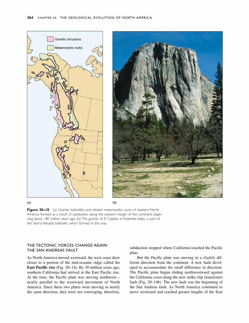
THE TECTONIC FORCES CHANGE AGAIN:THE SAN ANDREAS FAULT
As North America moved westward, the west coast drewcloser to a portion of the mid-oceanic ridge called theEast Pacific rise (Fig. 20–14). By 30 million years ago,southern California had arrived at the East Pacific rise.At the time, the Pacific plate was moving northwest—nearly parallel to the westward movement of NorthAmerica. Since these two plates were moving in nearlythe same direction, they were not converging; therefore,
subduction stopped where California touched the Pacificplate.
But the Pacific plate was moving in a slightly dif-ferent direction from the continent. A new fault devel-oped to accommodate the small difference in direction.The Pacific plate began sliding northwestward againstthe California coast along the new strike-slip (transform)fault (Fig. 20–14b). The new fault was the beginning ofthe San Andreas fault. As North America continued tomove westward and reached greater lengths of the East
364 CHAPTER 20 THE GEOLOGICAL EVOLUTION OF NORTH AMERICA
(a) (b)
Granitic intrusions
Metamorphic rocks
Figure 20–10 (a) Granitic batholiths and related metamorphic rocks of western NorthAmerica formed as a result of subduction along the western margin of the continent, begin-ning about 180 million years ago. (b) The granite of El Capitan in Yosemite Valley is part ofthe Sierra Nevada batholith, which formed in this way.
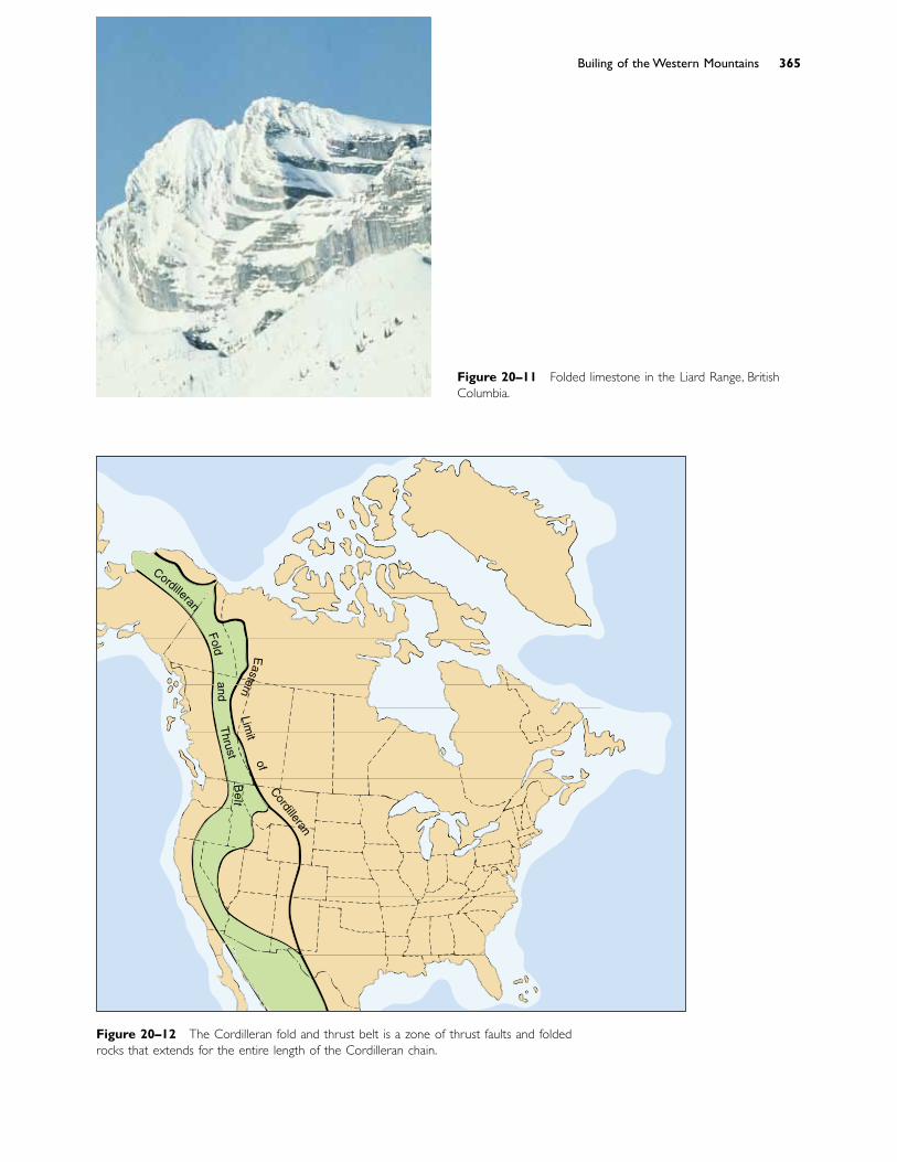
Building of the Western Mountains 365
Figure 20–11 Folded limestone in the Lizard Range, BritishColumbia.
Figure 20–12 The Cordilleran fold and thrust belt is a zone of thrust faults and foldedrocks that extends for the entire length of the Cordilleran chain.
Cordilleran
Foldand
Thrust
Belt
Eastern
Limit
ofCordilleran
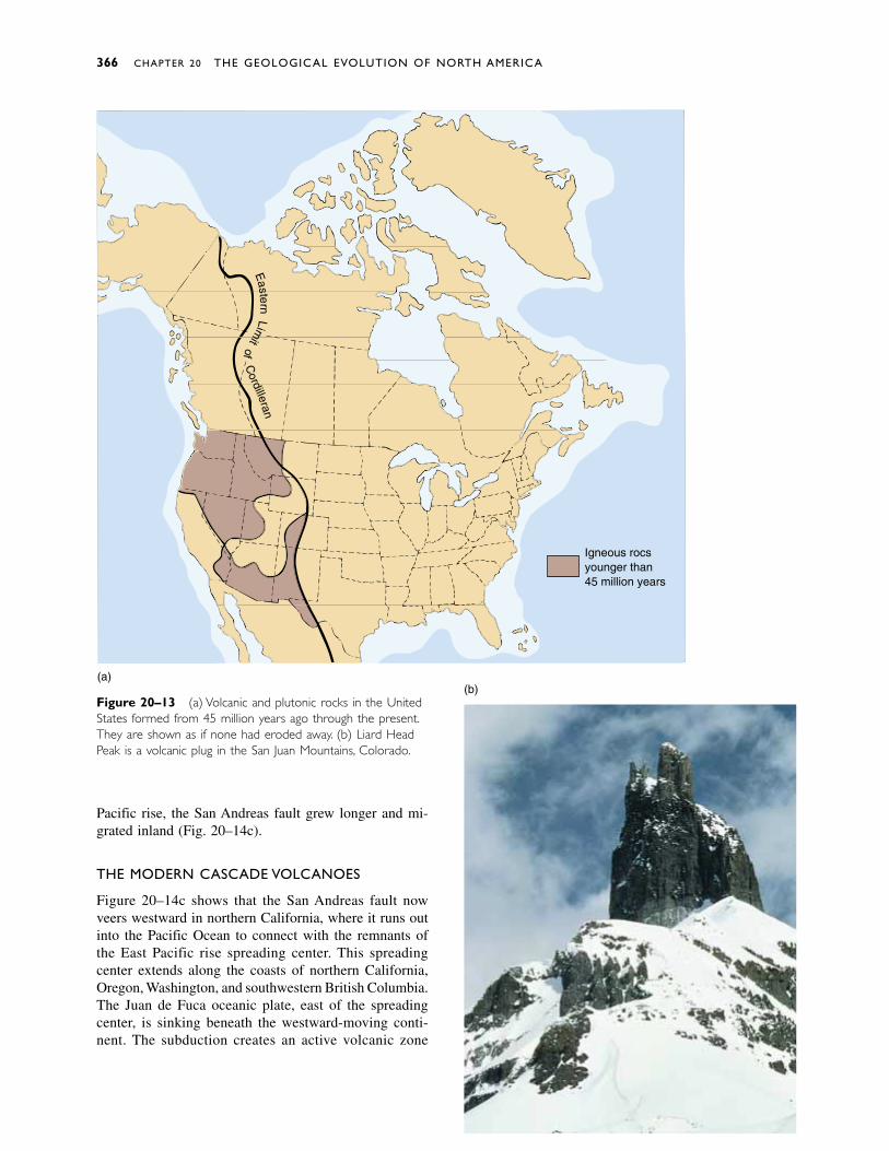
Figure 20–13 (a) Volcanic and plutonic rocks in the UnitedStates formed from 45 million years ago through the present.They are shown as if none had eroded away. (b) Lizard HeadPeak is a volcanic plug in the San Juan Mountains, Colorado.
Pacific rise, the San Andreas fault grew longer and mi-grated inland (Fig. 20–14c).
THE MODERN CASCADE VOLCANOES
Figure 20–14c shows that the San Andreas fault nowveers westward in northern California, where it runs outinto the Pacific Ocean to connect with the remnants ofthe East Pacific rise spreading center. This spreadingcenter extends along the coasts of northern California,Oregon, Washington, and southwestern British Columbia.The Juan de Fuca oceanic plate, east of the spreadingcenter, is sinking beneath the westward-moving conti-nent. The subduction creates an active volcanic zone
(b)
Igneous rocksyounger than45 million years
Eastern
Limit
ofC
ordilleran
(a)
366 CHAPTER 20 THE GEOLOGICAL EVOLUTION OF NORTH AMERICA
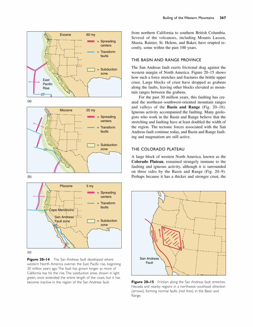
from northern California to southern British Columbia.Several of the volcanoes, including Mounts Lassen,Shasta, Rainier, St. Helens, and Baker, have erupted re-cently, some within the past 100 years.
THE BASIN AND RANGE PROVINCE
The San Andreas fault exerts frictional drag against thewestern margin of North America. Figure 20–15 showshow such a force stretches and fractures the brittle uppercrust. Large blocks of crust have dropped as grabensalong the faults, leaving other blocks elevated as moun-tain ranges between the grabens.
For the past 30 million years, this faulting has cre-ated the northeast–southwest-oriented mountain rangesand valleys of the Basin and Range (Fig. 20–16).Igneous activity accompanied the faulting. Many geolo-gists who work in the Basin and Range believe that thestretching and faulting have at least doubled the width ofthe region. The tectonic forces associated with the SanAndreas fault continue today, and Basin and Range fault-ing and magmatism are still active.
THE COLORADO PLATEAU
A large block of western North America, known as theColorado Plateau, remained strangely immune to thefaulting and igneous activity, although it is surroundedon three sides by the Basin and Range (Fig. 20–9).Perhaps because it has a thicker and stronger crust, the
Building of the Western Mountains 367
Figure 20–14 The San Andreas fault developed wherewestern North America overran the East Pacific rise, beginning30 million years ago.The fault has grown longer as more ofCalifornia has hit the rise.The subduction zone, shown in lightgreen, once extended the entire length of the coast, but it hasbecome inactive in the region of the San Andreas fault.
(a)
(b)
(c)
Eocene 60 my
Spreadingcenters
Transformfaults
Subductionzone
EastPacificRise
=
=
=
Miocene 25 my
Spreadingcenters
Transformfaults
Subductionzone
=
=
=
Pliocene 3 my
Spreadingcenters
Transformfaults
Subductionzone
=
=
=
Cape Mendocino
San AndreasFault zone
San AndreasFault
Figure 20–15 Friction along the San Andreas fault stretchesNevada and nearby regions in a northwest–southeast direction(arrows), forming normal faults (red lines) in the Basin andRange.
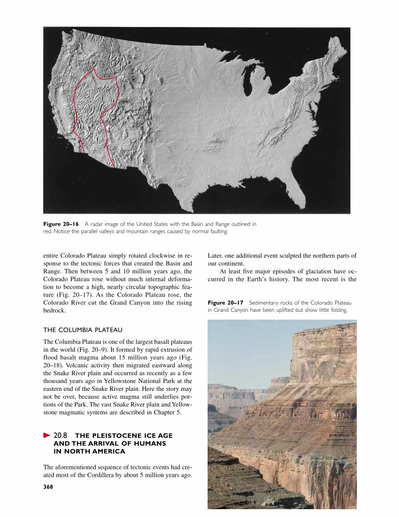
Figure 20–16 A radar image of the United States with the Basin and Range outlined inred. Notice the parallel valleys and mountain ranges caused by normal faulting.
entire Colorado Plateau simply rotated clockwise in re-sponse to the tectonic forces that created the Basin andRange. Then between 5 and 10 million years ago, theColorado Plateau rose without much internal deforma-tion to become a high, nearly circular topographic fea-ture (Fig. 20–17). As the Colorado Plateau rose, theColorado River cut the Grand Canyon into the risingbedrock.
THE COLUMBIA PLATEAU
The Columbia Plateau is one of the largest basalt plateausin the world (Fig. 20–9). It formed by rapid extrusion offlood basalt magma about 15 million years ago (Fig.20–18). Volcanic activity then migrated eastward alongthe Snake River plain and occurred as recently as a fewthousand years ago in Yellowstone National Park at theeastern end of the Snake River plain. Here the story maynot be over, because active magma still underlies por-tions of the Park. The vast Snake River plain and Yellow-stone magmatic systems are described in Chapter 5.
� 20.8 THE PLEISTOCENE ICE AGE AND THE ARRIVAL OF HUMANS IN NORTH AMERICA
The aforementioned sequence of tectonic events had cre-ated most of the Cordillera by about 5 million years ago.
Figure 20–17 Sedimentary rocks of the Colorado Plateauin Grand Canyon have been uplifted but show little folding.
Later, one additional event sculpted the northern parts ofour continent.
At least five major episodes of glaciation have oc-curred in the Earth’s history. The most recent is the
368
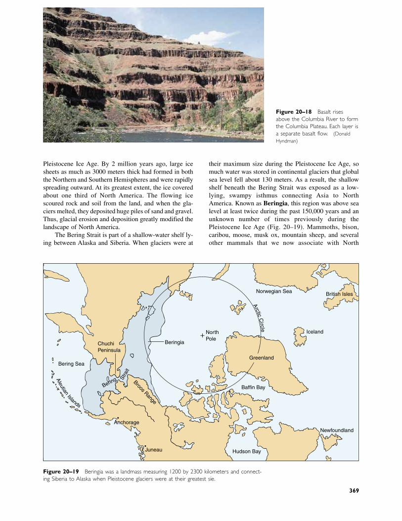
their maximum size during the Pleistocene Ice Age, somuch water was stored in continental glaciers that globalsea level fell about 130 meters. As a result, the shallowshelf beneath the Bering Strait was exposed as a low-lying, swampy isthmus connecting Asia to NorthAmerica. Known as Beringia, this region was above sealevel at least twice during the past 150,000 years and anunknown number of times previously during thePleistocene Ice Age (Fig. 20–19). Mammoths, bison,caribou, moose, musk ox, mountain sheep, and severalother mammals that we now associate with North
Figure 20–18 Basalt risesabove the Columbia River to formthe Columbia Plateau. Each layer isa separate basalt flow. (DonaldHyndman)
Pleistocene Ice Age. By 2 million years ago, large icesheets as much as 3000 meters thick had formed in boththe Northern and Southern Hemispheres and were rapidlyspreading outward. At its greatest extent, the ice coveredabout one third of North America. The flowing icescoured rock and soil from the land, and when the gla-ciers melted, they deposited huge piles of sand and gravel.Thus, glacial erosion and deposition greatly modified thelandscape of North America.
The Bering Strait is part of a shallow-water shelf ly-ing between Alaska and Siberia. When glaciers were at
British Isles
ChukchiPeninsula
Bering Sea
Brooks Range
Anchorage
Juneau
Beringia
NorthPole
Greenland
Baffin Bay
Newfoundland
Iceland
Norwegian Sea
Hudson Bay
Bering Stra
it
Aleutian
Islands
+
Arctic
Circle
Figure 20–19 Beringia was a landmass measuring 1200 by 2300 kilometers and connect-ing Siberia to Alaska when Pleistocene glaciers were at their greatest size.
369
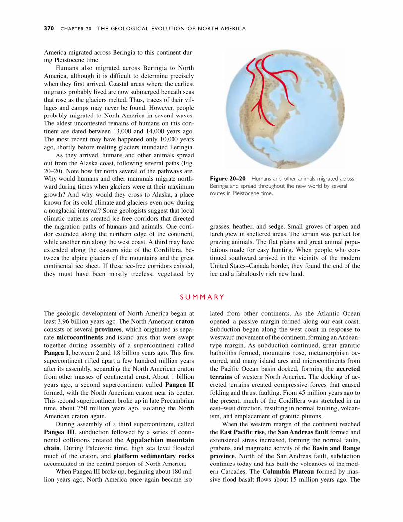
America migrated across Beringia to this continent dur-ing Pleistocene time.
Humans also migrated across Beringia to NorthAmerica, although it is difficult to determine preciselywhen they first arrived. Coastal areas where the earliestmigrants probably lived are now submerged beneath seasthat rose as the glaciers melted. Thus, traces of their vil-lages and camps may never be found. However, peopleprobably migrated to North America in several waves.The oldest uncontested remains of humans on this con-tinent are dated between 13,000 and 14,000 years ago.The most recent may have happened only 10,000 yearsago, shortly before melting glaciers inundated Beringia.
As they arrived, humans and other animals spreadout from the Alaska coast, following several paths (Fig.20–20). Note how far north several of the pathways are.Why would humans and other mammals migrate north-ward during times when glaciers were at their maximumgrowth? And why would they cross to Alaska, a placeknown for its cold climate and glaciers even now duringa nonglacial interval? Some geologists suggest that localclimatic patterns created ice-free corridors that directedthe migration paths of humans and animals. One corri-dor extended along the northern edge of the continent,while another ran along the west coast. A third may haveextended along the eastern side of the Cordillera, be-tween the alpine glaciers of the mountains and the greatcontinental ice sheet. If these ice-free corridors existed,they must have been mostly treeless, vegetated by
370 CHAPTER 20 THE GEOLOGICAL EVOLUTION OF NORTH AMERICA
Figure 20–20 Humans and other animals migrated acrossBeringia and spread throughout the new world by severalroutes in Pleistocene time.
S U M M A R Y
The geologic development of North America began atleast 3.96 billion years ago. The North American cratonconsists of several provinces, which originated as sepa-rate microcontinents and island arcs that were swept together during assembly of a supercontinent calledPangea I, between 2 and 1.8 billion years ago. This firstsupercontinent rifted apart a few hundred million yearsafter its assembly, separating the North American cratonfrom other masses of continental crust. About 1 billionyears ago, a second supercontinent called Pangea IIformed, with the North American craton near its center.This second supercontinent broke up in late Precambriantime, about 750 million years ago, isolating the NorthAmerican craton again.
During assembly of a third supercontinent, calledPangea III, subduction followed by a series of conti-nental collisions created the Appalachian mountainchain. During Paleozoic time, high sea level floodedmuch of the craton, and platform sedimentary rocksaccumulated in the central portion of North America.
When Pangea III broke up, beginning about 180 mil-lion years ago, North America once again became iso-
lated from other continents. As the Atlantic Oceanopened, a passive margin formed along our east coast.Subduction began along the west coast in response towestward movement of the continent, forming an Andean-type margin. As subduction continued, great graniticbatholiths formed, mountains rose, metamorphism oc-curred, and many island arcs and microcontinents fromthe Pacific Ocean basin docked, forming the accretedterrains of western North America. The docking of ac-creted terrains created compressive forces that causedfolding and thrust faulting. From 45 million years ago tothe present, much of the Cordillera was stretched in aneast–west direction, resulting in normal faulting, volcan-ism, and emplacement of granitic plutons.
When the western margin of the continent reachedthe East Pacific rise, the San Andreas fault formed andextensional stress increased, forming the normal faults,grabens, and magmatic activity of the Basin and Rangeprovince. North of the San Andreas fault, subductioncontinues today and has built the volcanoes of the mod-ern Cascades. The Columbia Plateau formed by mas-sive flood basalt flows about 15 million years ago. The
grasses, heather, and sedge. Small groves of aspen andlarch grew in sheltered areas. The terrain was perfect forgrazing animals. The flat plains and great animal popu-lations made for easy hunting. When people who con-tinued southward arrived in the vicinity of the modernUnited States–Canada border, they found the end of theice and a fabulously rich new land.
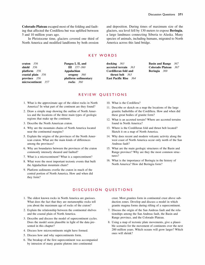
Discussion Questions 371
Colorado Plateau escaped most of the folding and fault-ing that affected the Cordillera but was uplifted between5 and 10 million years ago.
In Pleistocene time, glaciers covered one third ofNorth America and modified landforms by both erosion
and deposition. During times of maximum size of theglaciers, sea level fell by 130 meters to expose Beringia,a large landmass connecting Siberia to Alaska. Manyspecies of animals, including humans, migrated to NorthAmerica across this land bridge.
craton 356shield 356platform 356coastal plain 356province 356microcontinent 357
Pangea I, II, and III 357–360
Appalachian orogeny 360
platform sedimentary rocks 360
docking 363accreted terrain 363Cordilleran fold and
thrust belt 363East Pacific Rise 364
Basin and Range 367Colorado Plateau 367Beringia 369
K E Y W O R D S
1. What is the approximate age of the oldest rocks in NorthAmerica? In what part of the continent are they found?
2. Draw a simple map showing the outline of North Amer-ica and the locations of the three main types of geologicregions that make up the continent.
3. Describe the North American craton.
4. Why are the mountain chains of North America locatednear the continental margins?
5. Explain the origins of the provinces of the North Amer-ican craton. What are the main kinds of differencesamong the provinces?
6. Why are boundaries between the provinces of the cratoncommonly intensely sheared and faulted?
7. What is a microcontinent? What is a supercontinent?
8. What were the most important tectonic events that builtthe Appalachian mountain chain?
9. Platform sediments overlie the craton in much of the central portion of North America. How and when didthey form?
10. What is the Cordillera?
11. Describe or sketch on a map the locations of the largegranitic batholiths of the Cordillera. How and when didthese great bodies of granite form?
12. What is an accreted terrain? Where are accreted terrainsfound in North America?
13. Where is the Cordilleran fold and thrust belt located?Sketch it on a map of North America.
14. Why does recent and modern volcanic activity along thewest coast of North America occur only north of the SanAndreas fault?
15. What are the main geologic structures of the Basin andRange province? Why are they the most common struc-tures?
16. What is the importance of Beringia in the history ofNorth America? How did Beringia form?
R E V I E W Q U E S T I O N S
1. The oldest known rocks in North America are gneisses.What does the fact that they are metamorphic rocks tellyou about the maximum age of rocks of the craton?
2. Explain the relationship between the continental shelvesand the coastal plain of North America.
3. Describe and discuss the model of supercontinent cycles.Does the model seem plausible in light of the data pre-sented in this chapter?
4. Discuss how microcontinents might have formed.
5. Discuss how and why supercontinents form.
6. The breakup of the first supercontinent was accompaniedby intrusion of many granite plutons into continental
crust. Most granites form in continental crust above sub-duction zones. Develop and discuss a model in whichgranite magma forms during rifting of a supercontinent.
7. Discuss the origin of the San Andreas fault and the rela-tionships among the San Andreas fault, the Basin andRange province, and the Colorado Plateau.
8. Using a map of tectonic plate movements, give a plausi-ble scenario for the movement of continents over the next200 million years. Which oceans will grow larger? Whichones will shrink?
D I S C U S S I O N Q U E S T I O N S
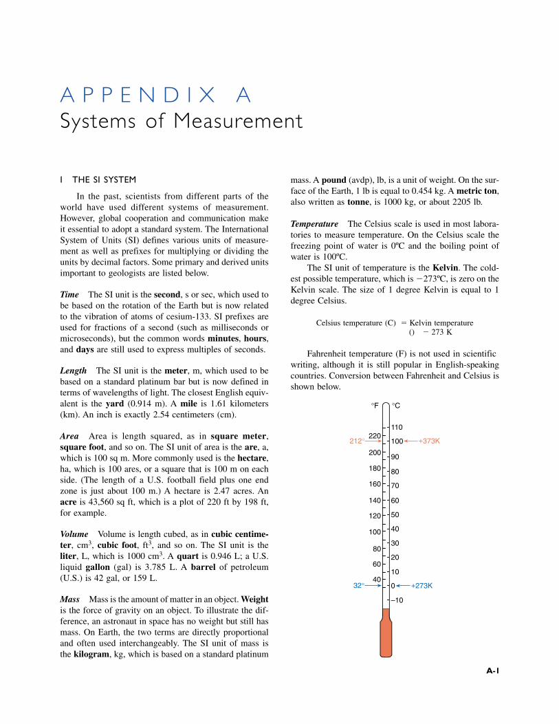
I THE SI SYSTEM
In the past, scientists from different parts of theworld have used different systems of measurement.However, global cooperation and communication makeit essential to adopt a standard system. The InternationalSystem of Units (SI) defines various units of measure-ment as well as prefixes for multiplying or dividing theunits by decimal factors. Some primary and derived unitsimportant to geologists are listed below.
Time The SI unit is the second, s or sec, which used tobe based on the rotation of the Earth but is now relatedto the vibration of atoms of cesium-133. SI prefixes areused for fractions of a second (such as milliseconds ormicroseconds), but the common words minutes, hours,and days are still used to express multiples of seconds.
Length The SI unit is the meter, m, which used to bebased on a standard platinum bar but is now defined interms of wavelengths of light. The closest English equiv-alent is the yard (0.914 m). A mile is 1.61 kilometers(km). An inch is exactly 2.54 centimeters (cm).
Area Area is length squared, as in square meter,square foot, and so on. The SI unit of area is the are, a,which is 100 sq m. More commonly used is the hectare,ha, which is 100 ares, or a square that is 100 m on eachside. (The length of a U.S. football field plus one endzone is just about 100 m.) A hectare is 2.47 acres. Anacre is 43,560 sq ft, which is a plot of 220 ft by 198 ft,for example.
Volume Volume is length cubed, as in cubic centime-ter, cm3, cubic foot, ft3, and so on. The SI unit is theliter, L, which is 1000 cm3. A quart is 0.946 L; a U.S.liquid gallon (gal) is 3.785 L. A barrel of petroleum(U.S.) is 42 gal, or 159 L.
Mass Mass is the amount of matter in an object. Weightis the force of gravity on an object. To illustrate the dif-ference, an astronaut in space has no weight but still hasmass. On Earth, the two terms are directly proportionaland often used interchangeably. The SI unit of mass isthe kilogram, kg, which is based on a standard platinum
mass. A pound (avdp), lb, is a unit of weight. On the sur-face of the Earth, 1 lb is equal to 0.454 kg. A metric ton,also written as tonne, is 1000 kg, or about 2205 lb.
Temperature The Celsius scale is used in most labora-tories to measure temperature. On the Celsius scale thefreezing point of water is 0ºC and the boiling point ofwater is 100ºC.
The SI unit of temperature is the Kelvin. The cold-est possible temperature, which is �273ºC, is zero on theKelvin scale. The size of 1 degree Kelvin is equal to 1degree Celsius.
Celsius temperature (ºC) � Kelvin temperature(K) � 273 K
Fahrenheit temperature (ºF) is not used in scientificwriting, although it is still popular in English-speakingcountries. Conversion between Fahrenheit and Celsius isshown below.
A P P E N D I X ASystems of Measurement
220
200
180
160
140
120
100
80
60
40
110
100
90
80
70
60
50
40
30
20
10
0
–10
°C°F
212° +373K
32° +273K
A-1
A-2 APPENDIX A
Energy Energy is a measure of work or heat, whichwere once thought to be different quantities. Hence, twodifferent sets of units were adopted and still persist, al-though we now know that work and heat are both formsof energy.
The SI unit of energy is the joule, J, the work re-quired to exert a force of 1 newton through a distance of1 m. In turn, a newton is the force that gives a mass of1 kg an acceleration of 1 m/sec2. In human terms, a jouleis not much—it is about the amount of work required tolift a 100-g weight to a height of 1 m. Therefore, jouleunits are too small for discussions of machines, powerplants, or energy policy. Larger units are
megajoule, MJ � 106 J (a day’s work by oneperson)
gigajoule, GJ � 109 J (energy in half a tank ofgasoline)
The energy unit used for heat is the calorie, cal,which is exactly 4.184 J. One calorie is just enough en-ergy to warm 1 g of water 1ºC. The more common unit
used in measuring food energy is the kilocalorie, kcal,which is 1000 cal. When Calorie is spelled with a capi-tal C, it means kcal. If a cookbook says that a jellydoughnut has 185 calories, that is an error—it should say185 Calories (capital C), or 185 kcal. A value of 185calories (small c) would be the energy in about one quar-ter of a thin slice of cucumber.
The unit of energy in the British system is the Britishthermal unit, or Btu, which is the energy needed towarm 1 lb of water 1°F.
1 Btu � 1054 J � 1.054 kJ � 252 cal
The unit often referred to in discussions of national en-ergy policies is the quad, which is 1 quadrillion Btu, or1015 Btu.
Some approximate energy values are
1 barrel (42 gal) of petroleum � 5900 MJ1 ton of coal � 29,000 MJ1 quad � 170 million barrels of oil, or 34
million tons of coal
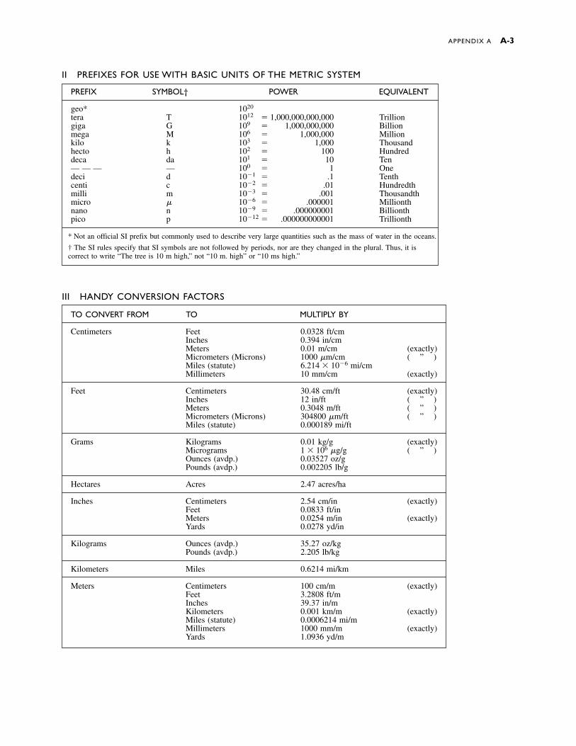
APPENDIX A A-3
PREFIX SYMBOL† POWER EQUIVALENT
geo* 1020
tera T 1012 � 1,000,000,000,000 Trilliongiga G 109 � 1,000,000,000 Billionmega M 106 � 1,000,000 Millionkilo k 103 � 1,000 Thousandhecto h 102 � 100 Hundreddeca da 101 � 10 Ten— — — — 100 � 1 Onedeci d 10�1 � .1 Tenthcenti c 10�2 � .01 Hundredthmilli m 10�3 � .001 Thousandthmicro � 10�6 � .000001 Millionthnano n 10�9 � .000000001 Billionthpico p 10�12 � .000000000001 Trillionth
* Not an official SI prefix but commonly used to describe very large quantities such as the mass of water in the oceans.
† The SI rules specify that SI symbols are not followed by periods, nor are they changed in the plural. Thus, it iscorrect to write “The tree is 10 m high,” not “10 m. high” or “10 ms high.”
TO CONVERT FROM TO MULTIPLY BY
Centimeters Feet 0.0328 ft/cmInches 0.394 in/cmMeters 0.01 m/cm (exactly)Micrometers (Microns) 1000 �m/cm ( ” )Miles (statute) 6.214 � 10�6 mi/cmMillimeters 10 mm/cm (exactly)
Feet Centimeters 30.48 cm/ft (exactly)Inches 12 in/ft ( ” )Meters 0.3048 m/ft ( ” )Micrometers (Microns) 304800 �m/ft ( ” )Miles (statute) 0.000189 mi/ft
Grams Kilograms 0.01 kg/g (exactly)Micrograms 1 � 106 �g/g ( ” )Ounces (avdp.) 0.03527 oz/gPounds (avdp.) 0.002205 lb/g
Hectares Acres 2.47 acres/ha
Inches Centimeters 2.54 cm/in (exactly)Feet 0.0833 ft/inMeters 0.0254 m/in (exactly)Yards 0.0278 yd/in
Kilograms Ounces (avdp.) 35.27 oz/kgPounds (avdp.) 2.205 lb/kg
Kilometers Miles 0.6214 mi/km
Meters Centimeters 100 cm/m (exactly)Feet 3.2808 ft/mInches 39.37 in/mKilometers 0.001 km/m (exactly)Miles (statute) 0.0006214 mi/mMillimeters 1000 mm/m (exactly)Yards 1.0936 yd/m
II PREFIXES FOR USE WITH BASIC UNITS OF THE METRIC SYSTEM
III HANDY CONVERSION FACTORS
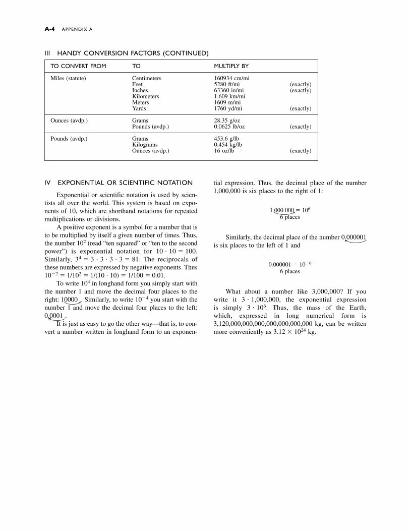
A-4 APPENDIX A
IV EXPONENTIAL OR SCIENTIFIC NOTATION
Exponential or scientific notation is used by scien-tists all over the world. This system is based on expo-nents of 10, which are shorthand notations for repeatedmultiplications or divisions.
A positive exponent is a symbol for a number that isto be multiplied by itself a given number of times. Thus,the number 102 (read “ten squared” or “ten to the secondpower”) is exponential notation for 10 � 10 � 100.Similarly, 34 � 3 � 3 � 3 � 3 � 81. The reciprocals ofthese numbers are expressed by negative exponents. Thus10�2 � 1/102 � 1/(10 � 10) � 1/100 � 0.01.
To write 104 in longhand form you simply start withthe number 1 and move the decimal four places to theright: 10000 . Similarly, to write 10�4 you start with thenumber 1 and move the decimal four places to the left:0.0001 .
It is just as easy to go the other way—that is, to con-vert a number written in longhand form to an exponen-
III HANDY CONVERSION FACTORS (CONTINUED)
tial expression. Thus, the decimal place of the number1,000,000 is six places to the right of 1:
1 000 000 � 106
6 places
Similarly, the decimal place of the number 0.000001is six places to the left of 1 and
0.000001 � 10�6
6 places
What about a number like 3,000,000? If you write it 3 � 1,000,000, the exponential expression is simply 3 � 106. Thus, the mass of the Earth,which, expressed in long numerical form is3,120,000,000,000,000,000,000,000 kg, can be writtenmore conveniently as 3.12 � 1024 kg.
TO CONVERT FROM TO MULTIPLY BY
Miles (statute) Centimeters 160934 cm/miFeet 5280 ft/mi (exactly)Inches 63360 in/mi (exactly)Kilometers 1.609 km/miMeters 1609 m/miYards 1760 yd/mi (exactly)
Ounces (avdp.) Grams 28.35 g/ozPounds (avdp.) 0.0625 lb/oz (exactly)
Pounds (avdp.) Grams 453.6 g/lbKilograms 0.454 kg/lbOunces (avdp.) 16 oz/lb (exactly)
A P P E N D I X BRock Symbols
Breccia
Conglomerate
Gneiss
Granite
Limestone
Sandstone
Schist
Shale
Rising magma
Lithosphere
Asthenosphere
Oceanic crust
Continental crust
The symbols used in this book for types of rocks are shown below:
In this book we have adopted consistent colors and style for depicting magma and layers in the upper mantle and crust.
A-5

A horizon The uppermost layer of soil composed of amixture of humus and leached and weathered min-erals. (syn: topsoil)
aa A lava flow that has a jagged, rubbly, broken sur-face.
ablation area (See zone of ablation.)abrasion The mechanical wearing and grinding of rock
surfaces by friction and impact.absolute age Age, or time measured in years.abyssal fan A large, fan-shaped accumulation of sedi-
ment deposited at the bases of many submarinecanyons adjacent to the deep-sea floor. (syn: subma-rine fan)
abyssal plain A flat, level, largely featureless part ofthe ocean floor between the mid-oceanic ridge andthe continental rise.
accessory mineral A mineral that is common, butusually found only in small amounts.
accreted terrain A landmass that originated as an is-land arc or a microcontinent and was later addedonto a continent.
accumulation area (See zone of accumulation.)acid precipitation A condition in which natural pre-
cipitation becomes acidic after reacting with air pol-lutants. Often called acid rain.
active continental margin A continental margin char-acterized by subduction of an oceanic lithosphericplate beneath a continental plate. (syn: Andean mar-gin)
active volcano A volcano that is erupting or is ex-pected to erupt.
albedo The reflectivity of a surface. A mirror or brightsnowy surface reflects most of the incoming lightand has a high albedo, whereas a rough flat road sur-face has a low albedo.
alluvial fan A fan-like accumulation of sediment cre-ated where a steep stream slows down rapidly as itreaches a relatively flat valley floor.
alpine glacier A glacier that forms in mountainousterrain.
amphibole A group of double chain silicate minerals.Hornblende is a common amphibole.
Andean margin A continental margin characterizedby subduction of an oceanic lithospheric plate be-neath a continental plate. (syn: active continentalmargin)
andesite A fine-grained gray or green volcanic rockintermediate in composition between basalt andgranite, consisting of about equal amounts of pla-gioclase feldspar and mafic minerals.
angle of repose The maximum slope or angle at whichloose material remains stable.
angular unconformity An unconformity in whichyounger sediment or sedimentary rocks rest on theeroded surface of tilted or folded older rocks.
anion An ion that has a negative charge.antecedent stream A stream that was established be-
fore local uplift started and cut its channel at thesame rate the land was rising.
anticline A fold in rock that resembles an arch; thefold is convex upward, and the oldest rocks are inthe middle.
aquifer A porous and permeable body of rock that canyield economically significant quantities of groundwater.
Archean Eon A division of geologic time 3.8 to 2.5billion years ago.
arête A sharp, narrow ridge between adjacent valleysformed by glacial erosion.
arkose A feldspar-rich sandstone formed adjacent togranite cliffs.
artesian aquifer An inclined aquifer that is boundedtop and bottom by layers of impermeable rock so thewater is under pressure. (syn: confined aquifer)
artesian well A well drilled into an artesian aquifer inwhich the water rises without pumping and in somecases spurts to the surface.
asbestos An industrial name for a group of mineralsthat crystallize as thin fibers. The two most commontypes are fibrous varieties of the minerals chrysotileand amphibole.
asbestosis An often lethal lung disease most com-monly found among asbestos miners and others whowork with asbestos.
aseismic ridge A submarine mountain chain with lit-tle or no earthquake activity.
ash (volcanic) Fine pyroclastic material less than 2mm in diameter.
ash flow A mixture of volcanic ash, larger pyroclasticparticles, and gas that flows rapidly along the Earth’ssurface as a result of an explosive volcanic eruption.(syn: nuée ardente)
G L O S S A R Y
G-1
asteroid One of the many small celestial bodies in or-bit around the Sun. Most asteroids orbit betweenMars and Jupiter.
asthenosphere The portion of the upper mantle be-neath the lithosphere. It consists of weak, plasticrock and extends from a depth of about 100 kilo-meters to about 350 kilometers below the surface ofthe Earth.
atmosphere A mixture of gases, mostly nitrogen andoxygen, that envelops the Earth.
atoll A circular coral reef that surrounds a lagoon andis bounded on the outside by the deep water of theopen sea.
atom The fundamental unit of elements, consisting ofa small, dense, positively charged center called a nu-cleus surrounded by a diffuse cloud of negativelycharged electrons.
aulacogen A tectonic trough on a craton bounded bynormal faults and commonly filled with sediment.An aulacogen forms when one limb of a continentalrift becomes inactive shortly after it forms.
axial plane An imaginary plane that runs through theaxis and divides a fold as symmetrically as possibleinto two halves.
B horizon The soil layer just below the A horizon,called the subsoil, where ions leached from the Ahorizon accumulate.
back arc basin A sedimentary basin on the oppositeside of the magmatic arc from the trench, either inan island arc or in an Andean continental margin.
backshore The upper zone of a beach that is usuallydry but is washed by waves during storms.
bajada A broad depositional surface extending out-ward from a mountain front and formed by mergingalluvial fans.
banks The rising slopes bordering the two sides of astream channel.
bar An elongate mound of sediment, usually composedof sand or gravel, in a stream channel or along acoastline.
barchan dune A crescent-shaped dune, highest in thecenter, with the tips facing downwind.
barrier island A long, narrow, low-lying island thatextends parallel to the shoreline and is separatedfrom the mainland by a lagoon.
basal slip Movement of the entire mass of a glacieralong the bedrock.
basalt A dark-colored, very fine-grained, mafic, vol-canic rock composed of about half calcium-rich pla-gioclase feldspar and half pyroxene.
basalt plateau A sequence of horizontal basalt lavaflows that were extruded rapidly to cover a large re-gion of the Earth’s surface. (syn: flood basalt, lavaplateau)
base level The deepest level to which a stream canerode its bed. The ultimate base level is usually sealevel, but this is seldom attained.
basement rocks The older granitic and related meta-morphic rocks of the Earth’s crust that make up thefoundations of continents.
basin A circular or elliptical synclinal structure, com-monly filled with sediment.
batholith A large plutonic mass of intrusive rock withmore than 100 square kilometers of surface exposed.
bauxite A gray, yellow, or reddish brown rock com-posed of a mixture of aluminum oxides and hydrox-ides. It is the principal ore of aluminum.
baymouth bar A spit that extends partially or com-pletely across the entrance to a bay.
beach Any strip of shoreline washed by waves or tides.Most beaches are covered by sediment.
beach drift The concerted movement of sedimentalong a beach caused by waves striking the shore atan angle.
beach terrace A level portion of old beach elevatedabove the modern beach by uplift of the shoreline orfall of sea level.
bed The floor of a stream channel. Also the thinnestlayer in sedimentary rocks, commonly ranging inthickness from a centimeter to a meter or two.
bed load That portion of a stream’s load that is trans-ported on or immediately above the stream bed.
bedding Layering that develops as sediment is de-posited.
bedrock The solid rock that underlies soil or regolith.Benioff zone An inclined zone of earthquake activity
that traces the upper portion of a subducting plate ina subduction zone.
bioclastic sediment Clastic sediment composed offragments of organisms such as clams, oysters, coral,etc.
biogeochemical cycle The movement of nutrientsthrough the atmosphere, biosphere, hydrosphere,and solid Earth in response to physical, biological,and chemical processes.
biomass energy Electricity or other forms of energyproduced by combustion of plant fuels.
bioremediation Use of microorganisms to decomposea ground-water contaminant.
biosphere The thin zone near the Earth’s surface thatis inhabited by life.
biotite Black, rock-forming mineral of the mica group.bitumen A general term for solid and semi-solid hy-
drocarbons that are fusible and soluble in carbonbisulfide. The term includes petroleum, asphalt, nat-ural mineral waxes, and asphaltites.
blowout A saucer- or trough-shaped depression cre-ated by wind erosion.
G-2 GLOSSARY
body waves Seismic waves that travel through the in-terior of the Earth.
boulder A rounded rock fragment larger than a cobble(diameter greater than 256 cm).
Bowen’s reaction series A series of minerals in whichany early-formed mineral crystallizing from a cool-ing magma reacts with the magma to form mineralslower in the series.
braided stream A stream that divides into a networkof branching and reuniting shallow channels sepa-rated by mid-channel bars.
breccia A coarse-grained sedimentary rock composedof angular, broken fragments larger than 2 mm in di-ameter cemented in a fine-grained matrix of sand orsilt.
brittle fracture The rupture that occurs when a rockbreaks sharply.
butte A flat-topped mountain, with several steep clifffaces. A butte is smaller and more tower-like than amesa.
C horizon The lowest soil layer, composed mainly ofpartly weathered bedrock grading downward intounweathered parent rock.
calcite A common rock-forming mineral, CaCO3.caldera A large circular depression caused by an ex-
plosive volcanic eruption.caliche A hard soil layer formed when calcium car-
bonate precipitates and cements the soil.calving A process in which large chunks of ice break
off from tidewater glaciers to form icebergs.cap rock An impermeable rock, usually shale, that
prevents oil or gas from escaping upward from areservoir.
capacity The maximum quantity of sediment that astream can carry.
capillary action The action by which water is pulledupward through small pores by electrical attractionto the pore walls.
capillary fringe A zone above the water table in whichthe pores are filled with water due to capillary action.
carbonate rocks Rocks such as limestone anddolomite, made up primarily of carbonate minerals.
carbonatite A carbonate rock of magmatic origincomposed mostly of calcite or dolomite.
carbonization A process in which a fossil forms whenthe volatile components of the soft tissues are drivenoff, leaving behind a thin film of carbon.
cast A fossil formed when sedimentary rock or min-eral matter fills a natural mold.
catastrophism A principle that states that catastrophicevents have been important in Earth history andmodify the path of slow change.
cation A positively charged ion.
cavern An underground cavity or series of chamberscreated when ground water dissolves large amountsof rock, usually limestone. (syn: cave)
cementation The process by which clastic sedimentis lithified by precipitation of a mineral cementamong the grains of the sediment.
Cenozoic era The most recent era; 65 million yearsago to the present.
chalk A very fine-grained, soft, white to gray bioclas-tic limestone made of the shells and skeletons ofmarine microorganisms.
chemical bond The linkage between atoms in mole-cules and between molecules and ions in crystals.
chemical weathering The chemical decomposition ofrocks and minerals by exposure to air, water, andother chemicals in the environment.
chert A hard, dense, sedimentary rock composed ofmicrocrystalline quartz. (syn: flint)
chondrule A small grain, composed largely of olivineand pyroxene, found in stony meteorites.
cinder cone A small volcano, as high as 300 meters,made up of loose pyroclastic fragments blasted outof a central vent.
cinders (volcanic) Glassy pyroclastic volcanic frag-ments 4 to 32 mm in size.
cirque A steep-walled semicircular depression erodedinto a mountain peak by a glacier.
clastic sediment Sediment composed of fragments ofweathered rock that have been transported and de-posited at the Earth’s surface.
clastic sedimentary rocks Rocks composed of lithi-fied clastic sediment.
clay Any clastic mineral particle less than 1/256 millime-ter in diameter. Also a group of layer silicate minerals.
claystone A fine-grained clastic sedimentary rockcomposed predominantly of clay minerals and smallamounts of quartz and other minerals of clay size.
cleavage The tendency of some minerals to break alongcertain crystallographic planes.
climate The composite pattern of long-term weatherconditions that can be expected in a given region.
coal A flammable organic sedimentary rock formedfrom partially decomposed plant material and com-posed mainly of carbon.
cobbles Rounded rock fragments in the 64- to 256-mmsize range, larger than pebbles and smaller than boulders.
column A dripstone or speleothem formed when a sta-lactite and a stalagmite meet and fuse together.
columnar joints The regularly spaced cracks that com-monly develop in lava flows, forming five- or six-sided columns.
comet An interplanetary body, composed of looselybound rock and ice, that forms a bright head and an
GLOSSARY G-3
extended fuzzy tail when it enters the inner portionof the solar system.
compaction A process whereby the weight of overly-ing sediment compresses deeper sediment, decreas-ing pore space and causing weak lithification.
competence A measure of the largest particles that astream can transport.
composite volcano A volcano that consists of alter-nate layers of unconsolidated pyroclastic materialand lava flows. (syn: stratovolcano)
compressive stress Stress that acts to shorten an ob-ject by squeezing it.
concordant Pertaining to an igneous intrusion that isparallel to the layering of country rock.
cone of depression A cone-like depression in the wa-ter table formed when water is pumped out of a wellmore rapidly than it can flow through the aquifer.
confining stress Stress produced when rock or sedi-ment is buried.
conformable The condition in which sedimentary lay-ers were deposited continuously without interruption.
conglomerate A coarse-grained clastic sedimentaryrock, composed of rounded fragments larger than 2mm in diameter, cemented in a fine-grained matrixof sand or silt.
contact A boundary between two different rock typesor between rocks of different ages.
contact metamorphic ore deposit An ore depositformed by contact metamorphism.
contact metamorphism Metamorphism caused byheating of country rock, and/or addition of fluids,from a nearby igneous intrusion.
continental crust The predominantly granitic portionof the crust, 20 to 80 kilometers thick, that makes upthe continents.
continental drift The theory proposed by AlfredWegener that continents were once joined togetherand later split and drifted apart. The continental drifttheory has been replaced by the more complete platetectonics theory.
continental glacier A glacier that forms a continuouscover of ice over areas of 50,000 square kilometersor more and spreads outward under the influence ofits own weight. (syn: ice sheet)
continental margin The region between the shorelineof a continent and the deep ocean basins, includingthe continental shelf, continental slope, and conti-nental rise. Also the region where thick, graniticcontinental crust joins thinner, basaltic oceanic crust.
continental margin basin A sediment-filled depres-sion or other thick accumulation of sediment andsedimentary rocks near the margin of a continent.
continental rifting The process by which a continentis pulled apart at a divergent plate boundary.
continental rise An apron of sediment between thecontinental slope and the deep sea floor.
continental shelf A shallow, nearly level area of con-tinental crust covered by sediment and sedimentaryrocks that is submerged below sea level at the edgeof a continent between the shoreline and the conti-nental slope.
continental slope The relatively steep (3º to 6º) un-derwater slope between the continental shelf and thecontinental rise.
continental suture The junction created where twocontinents collide and weld into a single mass ofcontinental crust.
control rod A column of neutron-absorbing alloysthat is placed among fuel rods to control nuclear fis-sion in a reactor.
convection current A current in a fluid or plastic ma-terial, formed when heated materials rise and coolermaterials sink.
convergent plate boundary A boundary where twolithospheric plates collide head-on.
coquina A bioclastic limestone consisting of coarseshell fragments cemented together.
core The innermost region of the Earth, probably con-sisting of iron and nickel.
correlation Demonstration of the age equivalence ofrocks or geologic features from different locations.
cost-benefit analysis A system of analysis that at-tempts to weigh the cost of an act or policy, such aspollution control, directly against the economic ben-efits.
country rock The older rock intruded by a youngerigneous intrusion or mineral deposit.
covalent bond A chemical bond in which two or moreatoms share electrons to produce the effect of filledouter electron shells.
crater A bowl-like depression at the summit of thevolcano.
craton A segment of continental crust, usually in theinterior of a continent, that has been tectonically sta-ble for a long time, commonly a billion years orlonger.
creep The slow movement of unconsolidated materialdownslope under the influence of gravity.
crest (of a wave) The highest part of a wave.crevasse A fracture or crack in the upper 40 to 50 me-
ters of a glacier.cross-bedding An arrangement of small beds lying at
an angle to the main sedimentary layering.cross-cutting relationship (See principle of cross-
cutting relationships.)crust The Earth’s outermost layer, about 5 to 80 kilo-
meters thick, composed of relatively low-density sil-icate rocks.
G-4 GLOSSARY

crystal A solid element or compound whose atoms arearranged in a regular, orderly, periodically repeatedarray.
crystal face A planar surface that develops if a crystalgrows freely in an uncrowded environment.
crystal habit The shape in which individual crystalsgrow and the manner in which crystals grow to-gether in aggregates.
crystal settling A process in which the crystals thatsolidify first from a cooling magma settle to the bot-tom of a magma chamber because the solid miner-als are more dense than liquid magma.
Curie point The temperature below which rocks canretain magnetism.
current A continuous flow of water in a concerted di-rection.
daughter isotope An isotope formed by radioactivedecay of another isotope.
debris flow A type of mass wasting in which particlesmove as a fluid and more than half of the particlesare larger than sand.
deflation Erosion by wind.deformation Folding, faulting and other changes in
shape of rocks or minerals in response to mechani-cal forces, such as those that occur in tectonicallyactive regions.
delta The nearly flat, alluvial, fan-shaped tract of landat the mouth of a stream.
dendritic drainage pattern A pattern of stream trib-utaries which branches like the veins in a leaf. It of-ten indicates uniform underlying bedrock.
deposition The laying-down of sediment by any nat-ural agent.
depositional environment Any setting in which sed-iment is deposited.
depositional remanent magnetism Remanent mag-netism resulting from mechanical orientation ofmagnetic mineral grains during sedimentation.
desert A region with less than 25 cm of rainfall a year.Also defined as a region that supports only a sparseplant cover.
desert pavement A continuous cover of stones cre-ated as wind erodes fine sediment, leaving largerrocks behind.
desertification A process by which semiarid land isconverted to desert, often by improper farming or byclimate change.
differential weathering The process by which certainrocks weather more rapidly than adjacent rocks, usu-ally resulting in an uneven surface.
dike A sheet-like igneous rock that cuts across thestructure of country rock.
dike swarm A group of dikes that form in parallel orradial sets.
diorite A rock that is the medium- to coarse-grainedplutonic equivalent of andesite.
dip The angle of inclination of bedding, measured from the horizontal.
directed stress Stress that acts most strongly in onedirection.
discharge The volume of water flowing downstreamper unit time. It is measured in units of m3/sec.
disconformity A type of unconformity in which thesedimentary layers above and below the unconfor-mity are parallel.
discordant Pertaining to a dike or other feature thatcuts across sedimentary layers or other kinds of lay-ering in country rock.
disseminated ore deposit A large low-grade ore de-posit in which generally fine-grained metal-bearingminerals are widely scattered throughout a rock bodyin sufficient concentration to make the deposit eco-nomical to mine.
dissolution The process by which soluble rocks andminerals dissolve in water or water solutions.
dissolved load The portion of a stream’s sediment loadthat is carried in solution.
distributary A channel that flows outward from themain stream channel, such as is commonly found indeltas.
divergent plate boundary The boundary or zonewhere lithospheric plates separate from each other.(syn: spreading center, rift zone)
docking The accretion of island arcs or microconti-nents onto a continental margin.
dolomite A common rock-forming mineral,CaMg(CO3)2.
dome A circular or elliptical anticlinal structure.dormant volcano a volcano that is not now erupting
but has erupted in the past and will probably do soagain.
downcutting Downward erosion by a stream.drainage basin The region that is ultimately drained
by a single river.drainage divide A ridge or other topographically
higher region that separates adjacent drainage basins.
drift (glacial) All rock or sediment transported and de-posited by a glacier or by glacial meltwater.
dripstone A deposit formed in a cavern when calciteprecipitates from dripping water.
drumlin An elongate hill formed when a glacier flowsover and reshapes a mound of till or stratified drift.
dune A mound or ridge of wind-deposited sand.earthflow A flowing mass of fine-grained soil parti-
cles mixed with water. Earthflows are less fluid thanmudflows.
GLOSSARY G-5
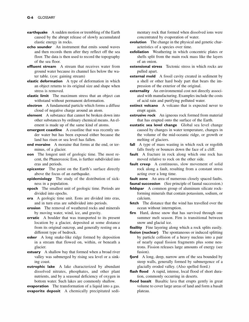
earthquake A sudden motion or trembling of the Earthcaused by the abrupt release of slowly accumulatedelastic energy in rocks.
echo sounder An instrument that emits sound wavesand then records them after they reflect off the seafloor. The data is then used to record the topographyof the sea floor.
effluent stream A stream that receives water fromground water because its channel lies below the wa-ter table. (syn: gaining stream)
elastic deformation A type of deformation in whichan object returns to its original size and shape whenstress is removed.
elastic limit The maximum stress that an object canwithstand without permanent deformation.
electron A fundamental particle which forms a diffusecloud of negative charge around an atom.
element A substance that cannot be broken down intoother substances by ordinary chemical means. An el-ement is made up of the same kind of atoms.
emergent coastline A coastline that was recently un-der water but has been exposed either because theland has risen or sea level has fallen.
end moraine A moraine that forms at the end, or ter-minus, of a glacier.
eon The longest unit of geologic time. The most re-cent, the Phanerozoic Eon, is further subdivided intoeras and periods.
epicenter The point on the Earth’s surface directlyabove the focus of an earthquake.
epidemiology The study of the distribution of sick-ness in a population.
epoch The smallest unit of geologic time. Periods aredivided into epochs.
era A geologic time unit. Eons are divided into eras,and in turn eras are subdivided into periods.
erosion The removal of weathered rocks and mineralsby moving water, wind, ice, and gravity.
erratic A boulder that was transported to its presentlocation by a glacier, deposited at some distancefrom its original outcrop, and generally resting on adifferent type of bedrock.
esker A long snake-like ridge formed by deposition in a stream that flowed on, within, or beneath a glacier.
estuary A shallow bay that formed when a broad rivervalley was submerged by rising sea level or a sink-ing coast.
eutrophic lake A lake characterized by abundant dissolved nitrates, phosphates, and other plant nutrients, and by a seasonal deficiency of oxygen in bottom water. Such lakes are commonly shallow.
evaporation The transformation of a liquid into a gas. evaporite deposit A chemically precipitated sedi-
mentary rock that formed when dissolved ions wereconcentrated by evaporation of water.
evolution The change in the physical and genetic char-acteristics of a species over time.
exfoliation Weathering in which concentric plates orshells split from the main rock mass like the layersof an onion.
extensional stress Tectonic stress in which rocks arepulled apart.
external mold A fossil cavity created in sediment bya shell or other hard body part that bears the im-pression of the exterior of the original.
externality An environmental cost not directly associ-ated with manufacturing. Examples include the costsof acid rain and purifying polluted water.
extinct volcano A volcano that is expected never toerupt again.
extrusive rock An igneous rock formed from materialthat has erupted onto the surface of the Earth.
eustatic sea level change Global sea level changecaused by changes in water temperature, changes inthe volume of the mid-oceanic ridge, or growth ormelting of glaciers.
fall A type of mass wasting in which rock or regolithfalls freely or bounces down the face of a cliff.
fault A fracture in rock along which one rock hasmoved relative to rock on the other side.
fault creep A continuous, slow movement of solidrock along a fault, resulting from a constant stressacting over a long time.
fault zone An area of numerous closely spaced faults.faunal succession (See principle of faunal succession.)feldspar A common group of aluminum silicate rock-
forming minerals that contain potassium, sodium, orcalcium.
fetch The distance that the wind has travelled over theocean without interruption.
firn Hard, dense snow that has survived through onesummer melt season. Firn is transitional betweensnow and glacial ice.
fissility Fine layering along which a rock splits easily.fission (nuclear) The spontaneous or induced splitting
by particle collision of a heavy nucleus into a pairof nearly equal fission fragments plus some neu-trons. Fission releases large amounts of energy (seefusion).
fjord A long, deep, narrow arm of the sea bounded bysteep walls, generally formed by submergence of aglacially eroded valley. (Also spelled fiord.)
flash flood A rapid, intense, local flood of short dura-tion, commonly occurring in deserts.
flood basalt Basaltic lava that erupts gently in greatvolume to cover large areas of land and form a basaltplateau.
G-6 GLOSSARY
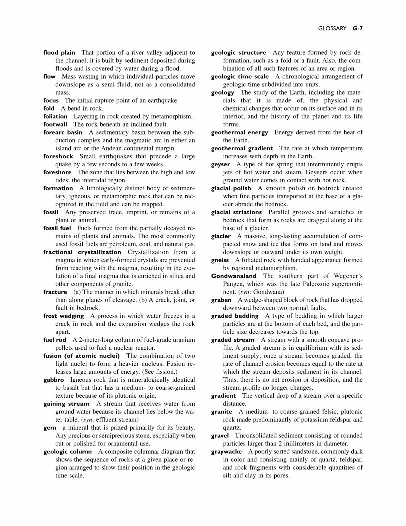
flood plain That portion of a river valley adjacent tothe channel; it is built by sediment deposited duringfloods and is covered by water during a flood.
flow Mass wasting in which individual particles movedownslope as a semi-fluid, not as a consolidatedmass.
focus The initial rupture point of an earthquake.fold A bend in rock.foliation Layering in rock created by metamorphism.footwall The rock beneath an inclined fault.forearc basin A sedimentary basin between the sub-
duction complex and the magmatic arc in either anisland arc or the Andean continental margin.
foreshock Small earthquakes that precede a largequake by a few seconds to a few weeks.
foreshore The zone that lies between the high and lowtides; the intertidal region.
formation A lithologically distinct body of sedimen-tary, igneous, or metamorphic rock that can be rec-ognized in the field and can be mapped.
fossil Any preserved trace, imprint, or remains of aplant or animal.
fossil fuel Fuels formed from the partially decayed re-mains of plants and animals. The most commonlyused fossil fuels are petroleum, coal, and natural gas.
fractional crystallization Crystallization from amagma in which early-formed crystals are preventedfrom reacting with the magma, resulting in the evo-lution of a final magma that is enriched in silica andother components of granite.
fracture (a) The manner in which minerals break otherthan along planes of cleavage. (b) A crack, joint, orfault in bedrock.
frost wedging A process in which water freezes in acrack in rock and the expansion wedges the rockapart.
fuel rod A 2-meter-long column of fuel-grade uraniumpellets used to fuel a nuclear reactor.
fusion (of atomic nuclei) The combination of twolight nuclei to form a heavier nucleus. Fusion re-leases large amounts of energy. (See fission.)
gabbro Igneous rock that is mineralogically identicalto basalt but that has a medium- to coarse-grainedtexture because of its plutonic origin.
gaining stream A stream that receives water fromground water because its channel lies below the wa-ter table. (syn: effluent stream)
gem a mineral that is prized primarily for its beauty.Any precious or semiprecious stone, especially whencut or polished for ornamental use.
geologic column A composite columnar diagram thatshows the sequence of rocks at a given place or re-gion arranged to show their position in the geologictime scale.
geologic structure Any feature formed by rock de-formation, such as a fold or a fault. Also, the com-bination of all such features of an area or region.
geologic time scale A chronological arrangement ofgeologic time subdivided into units.
geology The study of the Earth, including the mate-rials that it is made of, the physical and chemical changes that occur on its surface and in itsinterior, and the history of the planet and its lifeforms.
geothermal energy Energy derived from the heat ofthe Earth.
geothermal gradient The rate at which temperatureincreases with depth in the Earth.
geyser A type of hot spring that intermittently eruptsjets of hot water and steam. Geysers occur whenground water comes in contact with hot rock.
glacial polish A smooth polish on bedrock createdwhen fine particles transported at the base of a gla-cier abrade the bedrock.
glacial striations Parallel grooves and scratches inbedrock that form as rocks are dragged along at thebase of a glacier.
glacier A massive, long-lasting accumulation of com-pacted snow and ice that forms on land and movesdownslope or outward under its own weight.
gneiss A foliated rock with banded appearance formedby regional metamorphism.
Gondwanaland The southern part of Wegener’sPangea, which was the late Paleozoic superconti-nent. (syn: Gondwana)
graben A wedge-shaped block of rock that has droppeddownward between two normal faults.
graded bedding A type of bedding in which largerparticles are at the bottom of each bed, and the par-ticle size decreases towards the top.
graded stream A stream with a smooth concave pro-file. A graded stream is in equilibrium with its sed-iment supply; once a stream becomes graded, therate of channel erosion becomes equal to the rate atwhich the stream deposits sediment in its channel.Thus, there is no net erosion or deposition, and thestream profile no longer changes.
gradient The vertical drop of a stream over a specificdistance.
granite A medium- to coarse-grained felsic, plutonicrock made predominantly of potassium feldspar andquartz.
gravel Unconsolidated sediment consisting of roundedparticles larger than 2 millimeters in diameter.
graywacke A poorly sorted sandstone, commonly darkin color and consisting mainly of quartz, feldspar,and rock fragments with considerable quantities ofsilt and clay in its pores.
GLOSSARY G-7
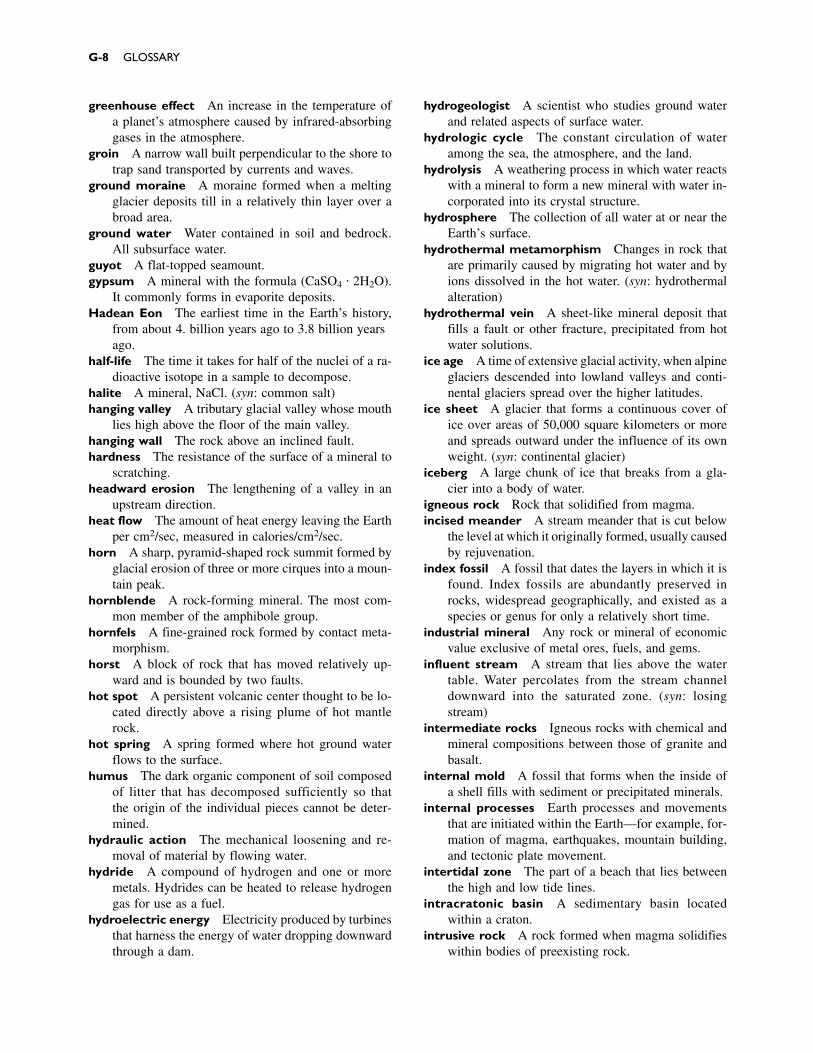
greenhouse effect An increase in the temperature ofa planet’s atmosphere caused by infrared-absorbinggases in the atmosphere.
groin A narrow wall built perpendicular to the shore totrap sand transported by currents and waves.
ground moraine A moraine formed when a meltingglacier deposits till in a relatively thin layer over abroad area.
ground water Water contained in soil and bedrock.All subsurface water.
guyot A flat-topped seamount.gypsum A mineral with the formula (CaSO4 � 2H2O).
It commonly forms in evaporite deposits.Hadean Eon The earliest time in the Earth’s history,
from about 4.6 billion years ago to 3.8 billion yearsago.
half-life The time it takes for half of the nuclei of a ra-dioactive isotope in a sample to decompose.
halite A mineral, NaCl. (syn: common salt)hanging valley A tributary glacial valley whose mouth
lies high above the floor of the main valley.hanging wall The rock above an inclined fault.hardness The resistance of the surface of a mineral to
scratching.headward erosion The lengthening of a valley in an
upstream direction.heat flow The amount of heat energy leaving the Earth
per cm2/sec, measured in calories/cm2/sec.horn A sharp, pyramid-shaped rock summit formed by
glacial erosion of three or more cirques into a moun-tain peak.
hornblende A rock-forming mineral. The most com-mon member of the amphibole group.
hornfels A fine-grained rock formed by contact meta-morphism.
horst A block of rock that has moved relatively up-ward and is bounded by two faults.
hot spot A persistent volcanic center thought to be lo-cated directly above a rising plume of hot mantlerock.
hot spring A spring formed where hot ground waterflows to the surface.
humus The dark organic component of soil composedof litter that has decomposed sufficiently so that the origin of the individual pieces cannot be deter-mined.
hydraulic action The mechanical loosening and re-moval of material by flowing water.
hydride A compound of hydrogen and one or moremetals. Hydrides can be heated to release hydrogengas for use as a fuel.
hydroelectric energy Electricity produced by turbinesthat harness the energy of water dropping downwardthrough a dam.
hydrogeologist A scientist who studies ground waterand related aspects of surface water.
hydrologic cycle The constant circulation of wateramong the sea, the atmosphere, and the land.
hydrolysis A weathering process in which water reactswith a mineral to form a new mineral with water in-corporated into its crystal structure.
hydrosphere The collection of all water at or near theEarth’s surface.
hydrothermal metamorphism Changes in rock thatare primarily caused by migrating hot water and byions dissolved in the hot water. (syn: hydrothermalalteration)
hydrothermal vein A sheet-like mineral deposit thatfills a fault or other fracture, precipitated from hotwater solutions.
ice age A time of extensive glacial activity, when alpineglaciers descended into lowland valleys and conti-nental glaciers spread over the higher latitudes.
ice sheet A glacier that forms a continuous cover ofice over areas of 50,000 square kilometers or moreand spreads outward under the influence of its ownweight. (syn: continental glacier)
iceberg A large chunk of ice that breaks from a gla-cier into a body of water.
igneous rock Rock that solidified from magma.incised meander A stream meander that is cut below
the level at which it originally formed, usually causedby rejuvenation.
index fossil A fossil that dates the layers in which it isfound. Index fossils are abundantly preserved inrocks, widespread geographically, and existed as aspecies or genus for only a relatively short time.
industrial mineral Any rock or mineral of economicvalue exclusive of metal ores, fuels, and gems.
influent stream A stream that lies above the watertable. Water percolates from the stream channeldownward into the saturated zone. (syn: losingstream)
intermediate rocks Igneous rocks with chemical andmineral compositions between those of granite andbasalt.
internal mold A fossil that forms when the inside ofa shell fills with sediment or precipitated minerals.
internal processes Earth processes and movementsthat are initiated within the Earth––for example, for-mation of magma, earthquakes, mountain building,and tectonic plate movement.
intertidal zone The part of a beach that lies betweenthe high and low tide lines.
intracratonic basin A sedimentary basin locatedwithin a craton.
intrusive rock A rock formed when magma solidifieswithin bodies of preexisting rock.
G-8 GLOSSARY
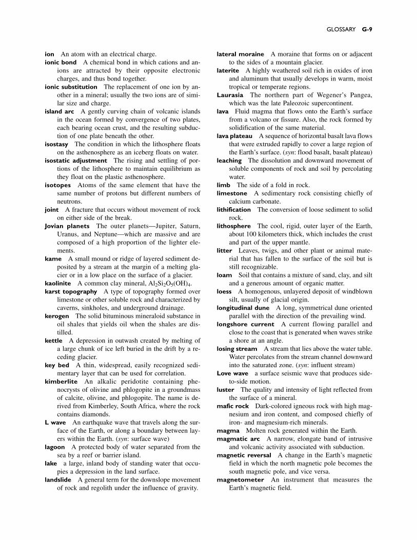
ion An atom with an electrical charge.ionic bond A chemical bond in which cations and an-
ions are attracted by their opposite electroniccharges, and thus bond together.
ionic substitution The replacement of one ion by an-other in a mineral; usually the two ions are of simi-lar size and charge.
island arc A gently curving chain of volcanic islandsin the ocean formed by convergence of two plates,each bearing ocean crust, and the resulting subduc-tion of one plate beneath the other.
isostasy The condition in which the lithosphere floatson the asthenosphere as an iceberg floats on water.
isostatic adjustment The rising and settling of por-tions of the lithosphere to maintain equilibrium asthey float on the plastic asthenosphere.
isotopes Atoms of the same element that have thesame number of protons but different numbers ofneutrons.
joint A fracture that occurs without movement of rockon either side of the break.
Jovian planets The outer planets—Jupiter, Saturn,Uranus, and Neptune—which are massive and arecomposed of a high proportion of the lighter ele-ments.
kame A small mound or ridge of layered sediment de-posited by a stream at the margin of a melting gla-cier or in a low place on the surface of a glacier.
kaolinite A common clay mineral, Al2Si2O5(OH)4.karst topography A type of topography formed over
limestone or other soluble rock and characterized bycaverns, sinkholes, and underground drainage.
kerogen The solid bituminous mineraloid substance inoil shales that yields oil when the shales are dis-tilled.
kettle A depression in outwash created by melting ofa large chunk of ice left buried in the drift by a re-ceding glacier.
key bed A thin, widespread, easily recognized sedi-mentary layer that can be used for correlation.
kimberlite An alkalic peridotite containing phe-nocrysts of olivine and phlogopite in a groundmassof calcite, olivine, and phlogopite. The name is de-rived from Kimberley, South Africa, where the rockcontains diamonds.
L wave An earthquake wave that travels along the sur-face of the Earth, or along a boundary between lay-ers within the Earth. (syn: surface wave)
lagoon A protected body of water separated from thesea by a reef or barrier island.
lake a large, inland body of standing water that occu-pies a depression in the land surface.
landslide A general term for the downslope movementof rock and regolith under the influence of gravity.
lateral moraine A moraine that forms on or adjacentto the sides of a mountain glacier.
laterite A highly weathered soil rich in oxides of ironand aluminum that usually develops in warm, moisttropical or temperate regions.
Laurasia The northern part of Wegener’s Pangea,which was the late Paleozoic supercontinent.
lava Fluid magma that flows onto the Earth’s surfacefrom a volcano or fissure. Also, the rock formed bysolidification of the same material.
lava plateau A sequence of horizontal basalt lava flowsthat were extruded rapidly to cover a large region ofthe Earth’s surface. (syn: flood basalt, basalt plateau)
leaching The dissolution and downward movement ofsoluble components of rock and soil by percolatingwater.
limb The side of a fold in rock.limestone A sedimentary rock consisting chiefly of
calcium carbonate.lithification The conversion of loose sediment to solid
rock.lithosphere The cool, rigid, outer layer of the Earth,
about 100 kilometers thick, which includes the crustand part of the upper mantle.
litter Leaves, twigs, and other plant or animal mate-rial that has fallen to the surface of the soil but isstill recognizable.
loam Soil that contains a mixture of sand, clay, and siltand a generous amount of organic matter.
loess A homogenous, unlayered deposit of windblownsilt, usually of glacial origin.
longitudinal dune A long, symmetrical dune orientedparallel with the direction of the prevailing wind.
longshore current A current flowing parallel andclose to the coast that is generated when waves strikea shore at an angle.
losing stream A stream that lies above the water table.Water percolates from the stream channel downwardinto the saturated zone. (syn: influent stream)
Love wave a surface seismic wave that produces side-to-side motion.
luster The quality and intensity of light reflected fromthe surface of a mineral.
mafic rock Dark-colored igneous rock with high mag-nesium and iron content, and composed chiefly ofiron- and magnesium-rich minerals.
magma Molten rock generated within the Earth.magmatic arc A narrow, elongate band of intrusive
and volcanic activity associated with subduction.magnetic reversal A change in the Earth’s magnetic
field in which the north magnetic pole becomes thesouth magnetic pole, and vice versa.
magnetometer An instrument that measures theEarth’s magnetic field.
GLOSSARY G-9
manganese nodule A manganese-rich, potato-shapedrock found on the ocean floor.
mantle A mostly solid layer of the Earth lying beneaththe crust and above the core. The mantle extendsfrom the base of the crust to a depth of about 2900kilometers.
mantle convection The convective flow of solid rockin the mantle.
mantle plume A rising vertical column of mantlerock.
marble A metamorphic rock consisting of fine- tocoarse-grained recrystallized calcite and/or dolomite.
maria Dry, barren, flat expanses of volcanic rock onthe Moon, first thought to be seas.
mass wasting The movement of earth material down-slope primarily under the influence of gravity.
meander One of a series of sinuous curves or loops inthe course of a stream.
mechanical weathering The disintegration of rockinto smaller pieces by physical processes.
medial moraine A moraine formed in or on the mid-dle of a glacier by the merging of lateral morainesas two glaciers flow together.
mesa A flat-topped mountain or a tableland that issmaller than a plateau and larger than a butte.
Mesozoic era The portion of geologic time roughly245 to 65 million years ago. Dinosaurs rose to promi-nence during this era. The end of the Mesozoic erais marked by the extinction of the dinosaurs.
metallic bond A chemical bond in which the metalatoms are surrounded by a matrix of outer-level elec-trons that are free to move from one atom to another.
metamorphic facies A set of all metamorphic rocktypes that formed under similar temperature andpressure conditions.
metamorphic grade The intensity of metamorphismthat formed a rock; the maximum temperature andpressure attained during metamorphism.
metamorphic rock A rock formed when igneous, sed-imentary, or other metamorphic rocks recrystallizein response to elevated temperature, increased pres-sure, chemical change, and/or deformation.
metamorphism The process by which rocks and min-erals change in response to changes in temperature,pressure, chemical conditions, and/or deformation.
metasomatism Metamorphism accompanied by theintroduction of ions from an external source.
meteorite A fallen meteoroid.meteoroid A small interplanetary body in an irregular
orbit. Many meteoroids are asteroids or comet frag-ments.
mica A layer silicate mineral with a distinctive platycrystal habit and perfect cleavage. Muscovite and bi-otite are common micas.
mid-channel bar An elongate lobe of sand and gravelformed in a stream channel.
mid-oceanic ridge A continuous submarine mountainchain that forms at the boundary between divergenttectonic plates within oceanic crust.
migmatite A rock composed of both igneous andmetamorphic-looking materials. It forms at very highmetamorphic grades when rock begins to partiallymelt to form magma.
mineral A naturally occurring inorganic solid with acharacteristic chemical composition and a crystallinestructure.
mineral deposit A local enrichment of one or moreminerals.
mineral reserve The known supply of ore in theground.
mineralization A process of fossilization in which theorganic components of an organism are replaced byminerals.
Mohorovicic discontinuity (Moho) The boundary be-tween the crust and the mantle, identified by a changein the velocity of seismic waves.
Mohs hardness scale A standard numbered from 1 to10, to measure and express the hardness of mineralsbased on a series of ten fairly common minerals,each of which is harder than those lower on thescale.
moment magnitude scale A scale used to measureand express the energy released during an earth-quake.
monocline A fold with only one limb.moraine A mound or ridge of till deposited directly by
glacial ice.mountain chain A number of mountain ranges
grouped together in an elongate zone.mountain range A series of mountains or mountain
ridges that are closely related in position, direction,age, and mode of formation.
mud Wet silt and clay.mud cracks Irregular, usually polygonal fractures that
develop when mud dries. The patterns may be pre-served when the mud is lithified.
mudflow Mass wasting of fine-grained soil particlesmixed with a large amount of water.
mudstone A non-fissile rock composed of clay andsilt.
mummification A process in which the remains of ananimal are preserved by dehydration.
natural gas A mixture of naturally occurring light hydrocarbons composed mainly of methane (CH4).
natural levee A ridge or embankment of flood-deposited sediment along both banks of a stream channel.
G-10 GLOSSARY
neutron A subatomic particle with the mass of a pro-ton but no electrical charge.
nonconformity A type of unconformity in which lay-ered sedimentary rocks lie on igneous or metamor-phic rocks.
nonfoliated The lack of layering in metamorphic rock.non-point source pollution Pollution that is gener-
ated over a broad area, such as that originating fromfertilizers and pesticides spread over fields.
nonrenewable resource A resource in which forma-tion of new deposits occurs much more slowly thanconsumption.
normal fault A fault in which the hanging wall hasmoved downward relative to the footwall.
normal polarity A magnetic orientation the same asthat of the Earth’s modern magnetic field.
nucleus The small, dense, central portion of an atomcomposed of protons and neutrons. Nearly all of themass of an atom is concentrated in the nucleus.
nuée ardente A swiftly flowing, often red-hot cloudof gas, volcanic ash, and other pyroclastics formedby an explosive volcanic eruption. (syn: ash flow)
O horizon The uppermost soil layer, consisting mostlyof litter and humus with a small proportion of min-erals.
obsidian A black or dark-colored glassy volcanic rock,usually of rhyolitic composition.
oceanic crust The 7- to 10-kilometer-thick layer ofsediment and basalt that underlies the ocean basins.
oceanic island A seamount, usually of volcanic origin,that rises above sea level.
Ogallala aquifer The aquifer that extends for almost1000 kilometers from the Rocky Mountains east-ward beneath portions of the Great Plains.
oil A naturally occurring liquid or gas composed of acomplex mixture of hydrocarbons. (syn: petroleum)
oil shale A kerogen-bearing sedimentary rock thatyields liquid or gaseous hydrocarbons when heated.
oil trap Any rock barrier that accumulates oil or gasby preventing its upward movement.
oligotrophic lake A lake characterized by nearly purewater with low concentrations of nitrates, phos-phates, and other plant nutrients. Oligotrophic lakeshave low productivities and sustain relatively feworganisms, although lakes of this type typically con-tain a few huge trout or similar game fish and arecommonly deep.
olivine A common rock-forming mineral in mafic andultramafic rocks with a composition that varies be-tween Mg2SiO4 and Fe2SiO4.
ooid A small rounded accretionary body in sedimen-tary rock, generally formed of concentric layers ofcalcium carbonate around a nucleus such as a sandgrain.
ore A natural material that is sufficiently enriched inone or more minerals to be mined profitably.
original horizontality (principle of) (See principle oforiginal horizontality.)
orogeny The process of mountain building; all tec-tonic processes associated with mountain building.
orographic lifting Lifting of air that occurs when airflows over a mountain.
orthoclase A common rock-forming mineral; a vari-ety of potassium feldspar, (KAlSi3O8).
outwash Sediment deposited by streams beyond theglacial terminus.
outwash plain A broad, level surface composed ofoutwash.
oxbow lake A crescent-shaped lake formed where ameander is cut off from a stream and the ends of thecut-off meander become plugged with sediment.
oxidation The loss of electrons from a compound orelement during a chemical reaction. In the weather-ing of common minerals, oxidation usually occurswhen a mineral reacts with molecular oxygen.
ozone hole The unusually low concentration of ozonein the upper atmosphere, first discovered in 1985.
P wave (Also called a compressional wave.) A seismicwave that causes alternate compression and expan-sion of rock.
pahoehoe A basaltic lava flow with a smooth, billowy,or “ropy” surface.
paleoclimatology The study of ancient climates.paleomagnetism The study of natural remnant mag-
netism in rocks and of the history of the Earth’smagnetic field.
paleontology The study of life that existed in the past.Paleozoic era The part of geologic time 538 to 245
million years ago. During this era invertebrates,fishes, amphibians, reptiles, ferns, and cone-bearingtrees were dominant.
Pangea A supercontinent, identified and named byAlfred Wegener, that existed from about 300 to 200million years ago and included most of the conti-nental crust of the Earth. In this book we refer tothree supercontinents: Pangea I (about 2.0 billion to1.3 billion years ago), Pangea II (1 billion to 700million years ago), and Pangea III (300 million to200 million years ago).
parabolic dune A crescent-shaped dune with tipspointing into the wind.
parent rock Any original rock before it is changed bymetamorphism or other geological processes.
partial melting The process in which a silicate rockonly partly melts as it is heated, to form magma thatis more silica-rich than the original rock.
passive continental margin A margin character-ized by a firm connection between continental
GLOSSARY G-11
and oceanic crust, where little tectonic activity occurs.
paternoster lake One of a series of lakes, strung outlike beads and connected by short streams and wa-terfalls, created by glacial erosion.
peat A loose, unconsolidated, brownish mass of par-tially decayed plant matter; a precursor to coal.
pebble A sedimentary particle between 2 and 64 mil-limeters in diameter, larger than sand and smallerthan a cobble.
pedalfer A soil type that forms in humid environments,characterized by abundant iron and aluminum ox-ides and a concentration of clay in the B horizon.
pediment A gently sloping erosional surface thatforms along a mountain front uphill from a bajada,usually covered by a patchy veneer of gravel only afew meters thick.
pedocal A soil formed in arid and semiarid climatescharacterized by an accumulation of calcium car-bonate and other minerals in the B horizon.
pegmatite An exceptionally coarse-grained igneousrock, usually with the same mineral content as granite.
pelagic sediment Muddy ocean sediment that con-sists of a mixture of clay and the skeletons of mi-croscopic marine organisms.
peneplain According to a model popular in the firsthalf of this century, streams erode mountain rangesultimately to form a large, low, nearly featurelesssurface called a peneplain. However, the theory failsto consider tectonic rejuvenation, and peneplains donot actually exist.
perched water table The top of a localized lens ofground water that lies above the main water table,formed by a layer of impermeable rock or clay.
peridotite A coarse-grained plutonic rock composedmainly of olivine; it may also contain pyroxene, am-phibole, or mica but little or no feldspar. The upperpart of the mantle is thought to be composed mostlyof peridotite.
period A geologic time unit longer than an epoch andshorter than an era.
permafrost A layer of permanently frozen soil or sub-soil which lies from about a half meter to a few me-ters beneath the surface in arctic environments.
permeability A measure of the ease with which fluidcan travel through a porous material.
permineralization Fossilization that occurs whenmineral matter is deposited in cavities or pores.
petroleum A naturally occurring liquid composed ofa complex mixture of hydrocarbons.
Phanerozoic Eon The most recent 538 million yearsof geologic time, represented by rocks that containevident and abundant fossils.
phenocryst A large, early-formed crystal in a finermatrix in igneous rock.
phyllite A metamorphic rock with a silky appearanceand commonly wrinkled surface, intermediate ingrade between slate and schist.
phytoplankton All floating plants, such as diatoms.pillow lava Lava that solidified under water, forming
spheroidal lumps like a stack of pillows.pipe A vertical conduit below a volcano, through which
magmatic materials passed. It is usually filled withsolidified magma and/or brecciated rock.
placer deposit A surface mineral deposit formed bythe mechanical concentration of mineral particles(usually by water) from weathered debris.
planetesimal One of many small rocky spheres thatformed early in the history of the solar system andlater coalesced to form the planets.
plankton Floating and drifting aquatic organisms.plastic deformation A type of deformation in which
the material changes shape permanently withoutfracture.
plate A relatively rigid independent segment of thelithosphere that can move independently of otherplates.
plate boundary A boundary between two lithosphericplates.
plate tectonics theory A theory of global tectonics inwhich the lithosphere is segmented into severalplates that move about relative to one another byfloating on and gliding over the plastic astheno-sphere. Seismic and tectonic activity occur mainly atthe plate boundaries.
plateau A large elevated area of comparatively flatland.
platform The part of a continent covered by a thinlayer of nearly horizontal sedimentary rocks overly-ing older igneous and metamorphic rocks of thecraton.
playa A dry desert lake bed.playa lake An intermittent desert lake.Pleistocene epoch A span of time from roughly 2
million to 8000 years ago, characterized by severaladvances and retreats of glaciers.
plucking A process in which glacial ice erodes rock byloosening particles and then lifting and carryingthem downslope.
plunging fold A fold with a dipping or plunging axis.pluton An igneous intrusion.plutonic rock An igneous rock that forms deep (a kilo-
meter or more) beneath the Earth’s surface.pluvial lake A lake formed during a time of abundant
precipitation. Many pluvial lakes formed as conti-nental ice sheets melted.
point bar A stream deposit located on the inside of agrowing meander.
point source pollution Pollution which arises from aspecific site such as a septic tank or a factory.
G-12 GLOSSARY

polarity The magnetically positive (north) or negative(south) character of a magnetic pole.
polymorph A mineral that crystallizes with more thanone crystal structure.
pore space The open space between grains in rock,sediment, or soil.
porosity The proportion of the volume of a materialthat consists of open spaces.
porphyry Any igneous rock containing larger crystals(phenocrysts) in a relatively fine-grained matrix.
porphyry copper deposit A large body of porphyriticigneous rock that contains disseminated copper sul-fide minerals, usually mined by surface miningmethods.
pothole A smooth, rounded depression in bedrock ina stream bed, caused by abrasion when currents cir-culate stones or coarse sediment.
Precambrian All of geologic time before the Paleozoicera, encompassing approximately the first 4 billionyears of Earth’s history. Also, all rocks formed dur-ing that time.
precautionary principle A guideline that recom-mends that environmental precautions be takenwithout absolute proof that the perturbation isharmful.
precipitation (a) A chemical reaction that produces asolid salt, or precipitate, from a solution. (b) Anyform in which atmospheric moisture returns to theEarth’s surface—rain, snow, hail, and sleet.
preservation A process in which an entire organismor a part of an organism is preserved with very lit-tle chemical or physical change.
pressure-release fracturing The process by whichrock fractures as overlying rock erodes away and thepressure diminishes.
pressure release melting The melting of rock andthe resulting formation of magma caused by a dropin pressure at constant temperature.
primary (P) wave A seismic wave formed by alter-nate compression and expansion of rock. P wavestravel faster than any other seismic waves.
principle of crosscutting relationships The principlethat a dike or other feature cutting through rock mustbe younger than the rock.
principle of faunal succession The principle that fos-sil organisms succeed one another in a definite andrecognizable sequence, so that sedimentary rocks ofdifferent ages contain different fossils, and rocks ofthe same age contain identical fossils. Therefore, therelative ages of rocks can be identified from theirfossils.
principle of original horizontality The principle thatmost sediment is deposited as nearly horizontal beds,and therefore most sedimentary rocks started outwith nearly horizontal layering.
principle of superposition The principle that statesthat in any undisturbed sequence of sediment or sed-imentary rocks, the age becomes progressivelyyounger from bottom to top.
Proterozoic Eon The portion of geological time from2.5 billion to 538 million years ago.
proton A dense, massive, positively charged particlefound in the nucleus of an atom.
pumice Frothy, usually rhyolitic magma solidified intoa rock so full of gas bubbles that it can float on water.
pyroclastic rock Any rock made up of material ejectedexplosively from a volcanic vent.
pyroxene A rock-forming silicate mineral group thatconsists of many similar minerals. Members of thepyroxene group are major constituents of basalt andgabbro.
quartz A rock-forming silicate mineral, SiO2. Quartzis a widespread and abundant component of conti-nental rocks but is rare in the oceanic crust andmantle.
quartz sandstone Sandstone containing more than 90percent quartz.
quartzite A metamorphic rock composed mostly ofquartz, formed by recrystallization of sandstone.
radial drainage pattern A drainage pattern formedwhen a number of streams originate on a mountainand flow outward like the spokes on a wheel.
radioactivity The natural spontaneous decay of unsta-ble nuclei.
radiometric age dating The process of measuring theabsolute age of geologic material by measuring theconcentrations of radioactive isotopes and their de-cay products.
radon A radioactive gas formed by radioactive decayof uranium that commonly accumulates in some ig-neous and sedimentary rocks.
rain shadow desert A desert formed on the lee sideof a mountain range.
Rayleigh wave A surface seismic wave with an up-and-down rolling motion.
recessional moraine A moraine that forms at the ter-minus of a glacier as the glacier stabilizes tem-porarily during retreat.
recharge The replenishment of an aquifer by the ad-dition of water.
rectangular drainage pattern A drainage pattern inwhich the main stream and its tributaries are of ap-proximately the same length and intersect at rightangles.
reef A wave-resistant ridge or mound built by corals orother marine organisms.
reflection The return of a wave that strikes a surface.refraction The bending of a wave that occurs when
the wave changes velocity as it passes from onemedium to another.
GLOSSARY G-13
regional burial metamorphism Metamorphism of abroad area of the Earth’s crust caused by elevatedtemperatures and pressures resulting from simpleburial.
regional dynamothermal metamorphism Meta-morphism accompanied by deformation affecting anextensive region of the Earth’s crust.
regional metamorphism Metamorphism that isbroadly regional in extent, involving very large ar-eas and volumes of rock. Includes both regional dy-namothermal and regional burial metamorphism.
regolith The loose, unconsolidated, weathered mater-ial that overlies bedrock.
rejuvenated stream A stream that has had its gradi-ent steepened and its erosive ability renewed by tec-tonic uplift or a drop of sea level.
relative age Age expressed as the order in which rocksformed and geological events occurred, but not mea-sured in years.
relief The vertical distance between a high and a lowpoint on the Earth’s surface.
remediation (of a contaminated aquifer) The treat-ment of a contaminated aquifer to remove or de-compose a pollutant.
remote sensing The collection of information aboutan object by instruments that are not in direct con-tact with it.
replacement Fossilization in which the original or-ganic material is replaced by new minerals.
reserves Known geological deposits that can be ex-tracted profitably under current conditions.
reservoir rock Porous and permeable rock in whichliquid petroleum or gas accumulates.
reverse fault A fault in which the hanging wall hasmoved up relative to the footwall.
reversed polarity Magnetic orientations in rock whichare opposite to the present orientation of the Earth’sfield. Also, the condition in which the Earth’s mag-netic field is opposite to its present orientation.
rhyolite A fine-grained extrusive igneous rock compo-sitionally equivalent to granite.
Richter scale A numerical scale of earthquake magni-tude measured by the amplitude of the largest waveon a standardized seismograph.
rift A zone of separation of tectonic plates at a diver-gent plate boundary.
rift valley An elongate depression that develops at adivergent plate boundary. Examples include conti-nental rift valleys and the rift valley along the cen-ter of the mid-oceanic ridge system.
rift zone The boundary or zone where lithosphericplates rift or separate from each other. (syn: diver-gent plate boundary, spreading center)
ring of fire The belt of subduction zones and major
tectonic activity including extensive volcanism thatborders the Pacific Ocean along the continental mar-gins of Asia and the Americas.
rip current A current created when water flows backtoward the sea after a wave breaks against the shore.(syn: undertow)
ripple marks Small, nearly parallel ridges and troughsformed in loose sediment by wind or water currentsand waves. They may then be preserved when thesediment is lithified.
risk assessment The analysis of risk and the imple-mentation of policy based on that analysis.
roche moutonnée An elongate, streamlined bedrockhill sculpted by a glacier.
rock A naturally formed solid that is an aggregate ofone or more different minerals.
rock avalanche A type of mass wasting in which asegment of bedrock slides over a tilted bedding planeor fracture. The moving mass usually breaks intofragments. (syn: rockslide)
rock cycle The sequence of events in which rocks areformed, destroyed, altered, and reformed by geolog-ical processes.
rock flour Finely ground, silt-sized rock fragmentsformed by glacial abrasion.
rockslide A type of slide in which a segment ofbedrock slides along a tilted bedding plane or frac-ture. The moving mass usually breaks into frag-ments. (syn: rock avalanche)
rounding The sedimentary process in which sharp, an-gular edges and corners of grains are smoothed.
rubble Angular particles with diameters greater than2 millimeters.
runoff Water that flows back to the oceans in surfacestreams.
S wave A seismic wave consisting of a shearing mo-tion in which the oscillation is perpendicular to thedirection of wave travel. S waves travel more slowlythan P waves.
salinization A process whereby salts accumulate insoil when water, especially irrigation water, evapo-rates from the soil.
salt cracking A weathering process in which salty wa-ter migrates into the pores in rock. When the waterevaporates, the salts crystallize, pushing grains apart.
saltation Sediment transport in which particles bounceand hop along the surface.
sand Sedimentary grains that range from 1/16 to 2 millimeters in diameter.
sandstone Clastic sedimentary rock composed pri-marily of lithified sand.
saturated zone The region below the water tablewhere all the pores in rock or regolith are filled withwater.
G-14 GLOSSARY

scarp A line of cliffs created by faulting or by erosion.schist A strongly foliated metamorphic rock that has a
well developed parallelism of minerals such as micas.
sea arch An opening created when a cave is eroded allthe way through a narrow headland.
sea stack A pillar of rock left when a sea arch col-lapses or when the inshore portion of a headlanderodes faster than the tip.
sea-floor spreading The hypothesis that segments ofoceanic crust are separating at the mid-oceanic ridge.
seamount A submarine mountain, usually of volcanicorigin, that rises 1 kilometer or more above the sur-rounding sea floor.
secondary recovery Production of oil or gas as a re-sult of artificially augmenting the reservoir energyby injection of water or other fluids. Secondary re-covery methods are usually applied after substantialdepletion of the reservoir.
sediment Solid rock or mineral fragments transportedand deposited by wind, water, gravity, or ice, pre-cipitated by chemical reactions, or secreted by or-ganisms, and that accumulate as layers in loose, un-consolidated form.
sedimentary rock A rock formed when sediment islithified.
sedimentary structure Any structure formed in sed-imentary rock during deposition or by later sedi-mentary processes; for example, bedding.
seismic gap An immobile region of a fault bounded bymoving segments.
seismic profiler A device used to construct a topo-graphic profile of the ocean floor and to reveal lay-ering in sediment and rock beneath the sea floor.
seismic tomography A technique whereby seismicdata from many earthquakes and recording stationsare analyzed to provide a three-dimensional view ofthe Earth’s interior.
seismic wave All elastic waves that travel throughrock, produced by an earthquake or explosion.
seismogram The record made by a seismograph.seismograph An instrument that records seismic
waves.seismology The study of earthquake waves and the in-
terpretation of these data to elucidate the structure ofthe interior of the Earth.
semiarid Any zone that receives between 25 and 50centimeters of rainfall annually. Semiarid zones sur-round most deserts.
serpentinite A rock composed largely of serpentine-group minerals, usually chrysotile and antigorite,commonly derived from alteration of peridotite orsea floor basalt.
shale A fine-grained clastic sedimentary rock with
finely layered structure composed predominantly ofclay minerals.
shear stress Stress that acts in parallel but opposite di-rections.
shear wave (See S wave.)sheet flood A broad, thin sheet of flowing water that
is not concentrated into channels, typically in aridregions.
shield A large region of exposed basement rocks thatare commonly of Precambrian age.
shield volcano A large, gently sloping volcanic moun-tain formed by successive flows of basaltic magma.
sialic rock A rock such as granite and rhyolite thatcontains large proportions of silicon and aluminum.
silica Silicon dioxide, SiO2. Includes quartz, opal,chert, and many other varieties.
silicate A mineral whose crystal structure contains sil-icate tetrahedra. All rocks composed principally ofsilicate minerals.
silicate tetrahedron A pyramid-shaped structure of asilicon ion bonded to four oxygen ions, (SiO4)4-.
sill A tabular or sheetlike igneous intrusion that liesparallel to the grain or layering of country rock.
silt All sedimentary particles from 1/256 to 1/16 mil-limeter in size.
siltstone A rock composed of lithified silt.sinkhole A circular depression in karst topography
caused by the collapse of a cavern roof or by disso-lution of surface rocks.
slate A compact, fine-grained, low-grade metamorphicrock with slaty cleavage that can be split into slabsand thin plates, intermediate in grade between shaleand phyllite.
slaty cleavage Metamorphic foliation aligned in aplane perpendicular to the direction of maximumtectonic compressive stress.
slide Any type of mass wasting in which the rock orregolith initially moves as coherent blocks over afracture surface.
slip The distance that rocks on opposite sides of a faulthave moved.
slip face The steep lee side of a dune that is at the an-gle of repose for loose sand so that the sand slidesor slips.
slump A type of mass wasting in which the rock andregolith move as a consolidated unit with a back-ward rotation along a concave fracture.
smectite A type of clay mineral that contains the abun-dant elements weathered from feldspar and silicaterocks.
snowline The boundary on a glacier between perma-nent glacial ice and seasonal snow. Above the snow-line, winter snow does not melt completely duringsummer, while below the snowline it does.
GLOSSARY G-15
soil The upper layers of regolith that support plantgrowth.
soil horizon A layer of soil that is distinguishable fromother horizons because of differences in appearanceand in physical and chemical properties.
soil-moisture belt The relatively thin, moist surfacelayer of soil above the unsaturated zone beneath it.
solar cell A device that produces electricity directlyfrom sunlight.
solar energy Energy derived from the Sun. Currenttechnologies allow us to use solar energy in threeways: passive solar heating, active solar heating, andelectricity production by solar cells.
solar wind A stream of ions and electrons shot intospace by violent storms occurring in the outer re-gions of the Sun’s atmosphere.
solifluction The slow mass wasting of water-saturatedsoil that commonly occurs over permafrost.
sorting A process in which flowing water or wind separates sediment according to particle size, shape,or density.
source rock The geologic formation in which oil orgas originates.
specific gravity The weight of a substance relative tothe weight of an equal volume of water.
speleothems Any mineral deposit formed in caves bythe action of water.
spheroidal weathering Weathering in which the edgesand corners of a rock weather more rapidly than theflat faces, giving rise to a rounded shape.
spit A long ridge of sand or gravel extending fromshore into a body of water.
spreading center The boundary or zone where litho-spheric plates rift or separate from each other. (syn:divergent plate boundary, rift zone)
spring A place where ground water flows out of theEarth to form a small stream or pool.
stalactite An icicle-like dripstone deposited fromdrops of water that hang from the ceiling of a cavern.
stalagmite A deposit of mineral matter that forms onthe floor of a cavern by the action of dripping water.
stock An igneous intrusion with an exposed surfacearea of less than 100 square kilometers.
strain The deformation (change in size or shape) thatresults from stress.
stratification The arrangement of sedimentary rocksin strata or beds.
stratified drift Sediment that was transported by aglacier and then transported, sorted, and depositedby glacial meltwater.
stratovolcano A steep-sided volcano formed by an al-ternating series of lava flows and pyroclastic erup-tions. (syn: composite volcano)
streak The color of a fine powder of a mineral usuallyobtained by rubbing the mineral on an unglazedporcelain streak plate.
stream A moving body of water confined in a channeland flowing downslope.
stream piracy The natural diversion of the headwatersof one stream into the channel of another.
stream terrace An abandoned flood plain above thelevel of the present stream.
stress The force per unit area exerted against an object.
striations Parallel scratches in bedrock caused byrocks embedded in the base of a flowing glacier.
strike The compass direction of the line produced bythe intersection of a tilted rock or structure with ahorizontal plane.
strike-slip fault A fault on which the motion is paral-lel with its strike and is primarily horizontal.
subduction The process in which a lithospheric platedescends beneath another plate and dives into the as-thenosphere.
subduction complex Rock and sediment scraped ontoan island arc or continental margin during conver-gence and subduction.
subduction zone (or subduction boundary) The re-gion or boundary where a lithospheric plate descendsinto the asthenosphere.
sublimation The process by which a solid transformsdirectly into a vapor or a vapor transforms directlyinto a solid without passing through the liquid phase.
submarine canyon A deep, V-shaped, steep-walledtrough eroded into a continental shelf and slope.
submarine fan A large, fan-shaped accumulation ofsediment deposited at the bases of many submarinecanyons adjacent to the deep sea floor. (syn: abyssalfan)
submergent coastline A coastline that was recentlyabove sea level but has been drowned either becausethe land has sunk or sea level has risen.
subsidence Settling of the Earth’s surface which canoccur as either petroleum or ground water is re-moved by natural processes.
supergene (ore) An ore deposit that has been en-riched by weathering processes that leach metalsfrom a metal deposit, carry them downward, and re-precipitate them to form more highly concentratedore.
superposed stream A stream that has downcutthrough several rock units and maintained its courseas it encountered older geologic structures and rocks.
superposition (principle of) (See principle of super-position.)
surf The chaotic turbulence created when a wave breaksnear the beach.
G-16 GLOSSARY
surface mine A hole excavated into the Earth’s sur-face for the purpose of recovering mineral or fuel re-sources.
surface processes All processes that sculpt the Earth’ssurface, such as erosion, transport, and deposition.
surface wave An earthquake wave that travels alongthe surface of the Earth or along a boundary be-tween layers within the Earth. (syn: L wave)
suspended load That portion of a stream’s load that iscarried for a considerable time in suspension, freefrom contact with the stream bed.
suture The junction created when two continents orother masses of crust collide and weld into a singlemass of continental crust.
syncline A fold that arches downward and whose cen-ter contains the youngest rocks.
tactite A rock formed by contact metamorphism ofcarbonate rocks. It is typically coarse-grained andrich in garnet.
talus slope An accumulation of loose angular rocks atthe base of a cliff that has fallen mainly as a resultof frost wedging.
tarn A small lake at the base of a cirque.tectonics A branch of geology dealing with the broad
architecture of the outer part of the Earth; specifi-cally the relationships, origins, and histories of ma-jor structural and deformational features.
terminal moraine An end moraine that forms when aglacier is at its greatest advance.
terminus The end or foot of a glacier.terrestrial planets The four Earth-like planets closest
to the sun—Mercury, Venus, Earth, and Mars—whichare composed primarily of rocky and metallic mate-rials.
terrigenous sediment Sea-floor sediment derived di-rectly from land.
tertiary recovery Production of oil or gas by artifi-cially augmenting the reservoir energy, as by injection of steam or detergents. Tertiary recoverymethods are usually applied after secondary recovery methods have been used.
thermoremanent magnetism The permanent mag-netism of rocks and minerals that results from cool-ing through the Curie point.
thrust fault A type of reverse fault with a dip of 45ºor less over most of its extent.
tidal current A current caused by the tides.tide The cyclic rise and fall of ocean water caused by
the gravitational force of the Moon and, to a lesserextent, of the Sun.
tidewater glacier A glacier that flows directly intothe sea.
till Sediment deposited directly by glacial ice and thathas not been resorted by a stream.
tillite A sedimentary rock formed of lithified till.trace fossil A sedimentary structure consisting of
tracks, burrows, or other marks made by an organism.traction Sediment transport in which particles are
dragged or rolled along a stream bed, beach, or desertsurface.
transform fault A strike-slip fault between two offsetsegments of a mid-oceanic ridge.
transform plate boundary A boundary between twolithospheric plates where the plates are sliding hori-zontally past one another.
transpiration Direct evaporation from the leaf sur-faces of plants.
transport The movement of sediment by flowing wa-ter, ice, wind, or gravity.
transverse dune A relatively long, straight dune thatis oriented perpendicular to the prevailing wind.
trellis drainage pattern A drainage pattern character-ized by a series of fairly straight parallel streamsjoined at right angles by tributaries.
trench A long, narrow depression of the sea floorformed where a subducting plate sinks into the mantle.
tributary Any stream that contributes water to anotherstream.
trough The lowest part of a wave.truncated spur A triangular-shaped rock face that
forms when a valley glacier cuts off the lower por-tion of an arête.
tsunami A large sea wave produced by a submarineearthquake or a volcano, characterized by long wave-length and great speed.
tuff A general term for all consolidated pyroclasticrocks.
turbidity current A rapidly flowing submarine cur-rent laden with suspended sediment, that results frommass wasting on the continental shelf or slope.
turbulent flow A pattern in which water flows in anirregular and chaotic manner. It is typical of streamflow.
U-shaped valley A glacially eroded valley with a char-acteristic U-shaped cross section.
ultimate base level The lowest possible level of down-cutting of a stream, usually sea level.
ultramafic rock Rock composed mostly of mineralscontaining iron and magnesium–– for example, peri-dotite.
unconformity A gap in the geological record, such asan interruption of deposition of sediments, or a breakbetween eroded igneous and overlying sedimentarystrata, usually of long duration.
underground mine A mine consisting of subterraneanpassages that commonly follow ore veins or coalseams.
GLOSSARY G-17
undertow A current created by water flowing back to-ward the sea after a wave breaks. (syn: rip current)
uniformitarianism The principle that states that geo-logical change occurs over long periods of time, bya sequence of almost imperceptible events. In addi-tion, processes and scientific laws operating todayalso operated in the past and thus past geologicevents can be explained by forces observable today.
unit cell The smallest group of atoms that perfectlydescribes the arrangement of all atoms in a crystal,and repeats itself to form the crystal structure.
unsaturated zone A subsurface zone above the watertable that may be moist but is not saturated; it liesabove the zone of saturation. (syn: zone of aeration)
upper mantle The part of the mantle that extendsfrom the base of the crust downward to about 670kilometers beneath the surface.
upwelling A rising ocean current that transports waterfrom the depths to the surface.
valley train A long and relatively narrow strip of out-wash deposited in a mountain valley by the streamsflowing from an alpine glacier.
Van der Waals forces Weak electrical forces that bondmolecules together. They result from an uneven dis-tribution of electrons around individual molecules,so that one portion of a molecule may have a greaterdensity of negative charge while another portion hasa partial positive charge.
varve A pair of light and dark layers that was depositedin a year’s time as sediment settled out of a body ofstill water. Most commonly formed in sediment de-posited in a glacial lake.
vent A volcanic opening through which lava and rockfragments erupt.
ventifact Cobbles and boulders found in desert envi-ronments which have one or more faces flattenedand polished by windblown sand.
vesicle A bubble formed by expanding gases in vol-canic rocks.
viscosity The property of a substance that offers inter-nal resistance to flow.
volcanic bomb A small blob of molten lava hurled outof a volcanic vent that acquired a rounded shapewhile in flight.
volcanic neck A vertical pipe-like intrusion formed bythe solidification of magma in the vent of a volcano.
volcanic rock A rock that formed when magmaerupted, cooled, and solidified within a kilometer orless of the Earth’s surface.
volcano A hill or mountain formed from lava and rockfragments ejected through a volcanic vent.
wash An intermittent stream channel found in a desert.water table The upper surface of a body of ground
water at the top of the zone of saturation and belowthe zone of aeration.
wave height The vertical distance from the crest to thetrough of a wave.
wave period The time interval between two crests (ortwo troughs) as a wave passes a stationary observer.
wave-cut cliff A cliff created when a rocky coast iseroded by waves.
wave-cut platform A flat or gently sloping platformcreated by erosion of a rocky shoreline.
wavelength The distance between successive wavecrests (or troughs).
weather The condition of the atmosphere, includingtemperature, precipitation, cloudiness, humidity, andwind, at any given time and place.
weathering The decomposition and disintegration ofrocks and minerals at the Earth’s surface by me-chanical and chemical processes.
welded tuff A hard, tough glass-rich pyroclastic rockformed by cooling of an ash flow that was hot enoughto deform plastically and partly melt after it stoppedmoving; it often appears layered or streaky.
wetlands Known as swamps, bogs, marshes, sloughs,mud flats, and flood plains, wetlands develop wherethe water table intersects the land surface. Some arewater soaked or flooded throughout the entire year;others are dry for much of the year and wet onlyduring times of high water. Still others are wet onlyduring exceptionally wet years and may be dry forseveral years at a time.
X-ray diffraction A powerful technique for the studyof crystal structure in which the regular, periodicarrangement of atoms in a crystal splits an x-raybeam into many separate beams, the pattern of whichreflects the crystal structure.
zone of ablation The lower portion of a glacier wheremore snow melts in summer than accumulates inwinter so that there is a net loss of glacial ice.
zone of accumulation The upper portion of a glacierwhere more snow accumulates in winter than meltsin summer, and snow accumulates from year to year.
zone of aeration A subsurface zone above the watertable that may be moist but is not saturated; it liesabove the zone of saturation. (syn: unsaturated zone)
zone of saturation A subsurface zone below the wa-ter table in which the soil and bedrock are com-pletely saturated with water.
zooplankton Animal forms of plankton, e.g., jellyfish.They consume phytoplankton.
G-18 GLOSSARY
Related Documents