BOARDMAN RIVER WALL STABILIZATION PROJECT DOWNTOWN DEVELOPMENT AUTHORITY MEETING APRIL 16, 2021

Welcome message from author
This document is posted to help you gain knowledge. Please leave a comment to let me know what you think about it! Share it to your friends and learn new things together.
Transcript

BOARDMAN RIVER WALL STABILIZATION
PROJECT
DOWNTOWN DEVELOPMENT AUTHORITY MEETING
APRIL 16, 2021

PROJECT CONTEXT
2 smithgroup.com
Study Area-100 and 200 blocks of East Front Street
Front Street
Un
ion
Str
ee
t
Ca
ss
Str
ee
t

WALL CONDITIONS
3 smithgroup.com
Existing Wall
River Scouring Under Wall
Existing Surface
Soil Subsidence
Timber Piles Supporting Wall
Existing 24”Sanitary Sewer
Wall Cross Section Looking West

WALL CONDITIONS
4 smithgroup.com
Wall Elevation View From River
Summary of Issues• Continued soil subsidence = pavement failure and disappearing parking
signs.• Issues with multiple sanitary sewer service line failures and river pollution.• Ground water infiltration into sanitary sewer increases treatment plant costs
and potential for sewage releases into river.• Long term destabilization of wall and sewer main.

WALL ASSESSMENT PROCESS
5 smithgroup.com
Elements of the Study• Topographic Survey
• Geotechnical Soil Borings
• Inspection of wall and review of existing documents
• Engineering Alternatives
• Hydraulic Modeling
• Evaluation and Recommendations

ALTERNATIVES CONSIDERED
6 smithgroup.com
Alternatives Considered Include-
• Sheet Pile on Land Side of the Wall
• Concrete Filled Geotextile Tube
• Cores in the Footer • Wall Removal and
Sewer Relocation• Sheet Pile Wall
Protection
Criteria for Evaluation of Alternatives1. Provide long term protection for
adjacent properties and sanitary sewer.
2. Maintain the alley and service access on the north side of the commercial buildings.
3. Limit impact on the flooding elevation of the river; especially upstream of the project area.
4. Preserve opportunities in the future to achieve the developing goals of the UNIFIED PLAN
5. Be cost effective.
1. Protect from scouring and soil loss
2. Backfill voids in soil

ALTERNATIVES EVALUATION
7 smithgroup.com
Alternatives
Long Term Protection –
Adjacent Properties and Sanitary Sewer
Maintain Alley and Service
Functions
Limit Flood Impacts to
Project Area
Achieves goals of the Unified Plan
Cost Effective*
Overall Rating
Sheet Pile –Land Side
2 3 3 1 2 2
Concrete Filled
Geotextile1 3 1 1 1 1
Cores in Footer
1 3 3 1 1 2
Wall Removal &
Sewer Relocation
3 2 3 3 3 3
Sheet Pile –River Side
3 3 2 1 3 2.5
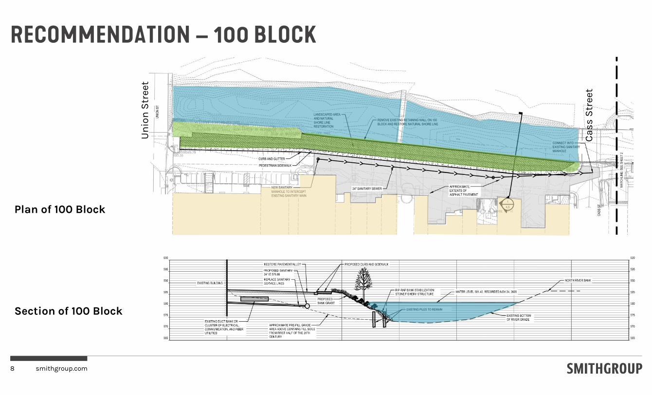
RECOMMENDATION – 100 BLOCK
8 smithgroup.com
Plan of 100 Block
Section of 100 Block
Un
ion
Str
ee
t
Ca
ss
Str
ee
t

RECOMMENDATION – 100 BLOCK
9 smithgroup.com
100 Block of Front St, looking east
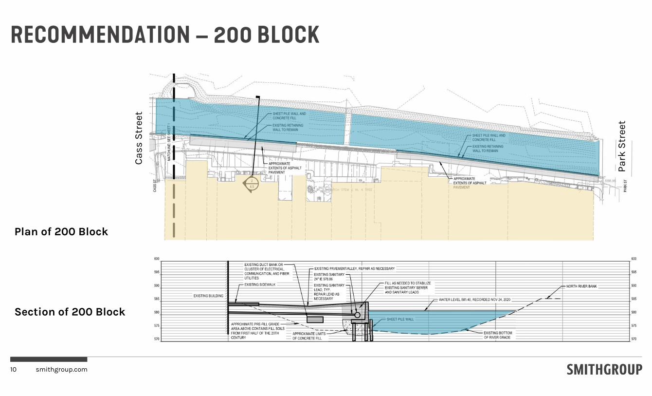
RECOMMENDATION – 200 BLOCK
10 smithgroup.com
Plan of 200 Block
Section of 200 Block
Ca
ss
Str
ee
t
Pa
rk S
tre
et

HYDRAULIC MODELLING RESULTS
11 smithgroup.com
River Bottom
River SurfaceP
ark
Str
ee
t B
rid
ge
Ca
ss
Str
ee
t B
rid
ge
Un
ion
Str
ee
t B
rid
ge
Profile of River Looking South
The recommended approach will lead to a rise in flood elevation within the project area of approximately 0.10 feet but does not result in a change upstream or downstream from the project area.

UNIFIED PLAN
12 smithgroup.com
DISCUSSIONS TO DATE
Key priorities from the Community Engagement Process
• Providing public access
• Soften shore treatment/restore natural edge
• Remove/Limit parking from riverbanks
• Utilize best practices to manage stormwater and other means of improving water quality.
• Shift the balance towards habitat and nature over human recreation and economic development
• Keep river corridor natural and passive
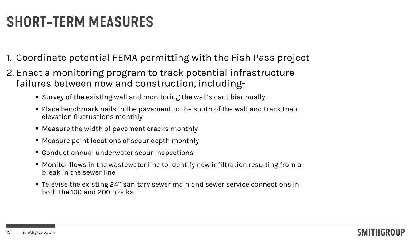
SHORT-TERM MEASURES
13 smithgroup.com
1. Coordinate potential FEMA permitting with the Fish Pass project
2. Enact a monitoring program to track potential infrastructure failures between now and construction, including-
Survey of the existing wall and monitoring the wall’s cant biannually
Place benchmark nails in the pavement to the south of the wall and track their elevation fluctuations monthly
Measure the width of pavement cracks monthly
Measure point locations of scour depth monthly
Conduct annual underwater scour inspections
Monitor flows in the wastewater line to identify new infiltration resulting from a break in the sewer line
Televise the existing 24” sanitary sewer main and sewer service connections in both the 100 and 200 blocks

STEPS FORWARD
Seek support for project by elected and appointed officials.
Find source(s) of funding to limit financial impact to residents
Submit for Permits
Prepare Final Engineering Plans and Specifications
Bidding and Construction
14 smithgroup.com
Related Documents