Board of County Commissioners Meeting Tuesday, August 13, 2019 Hearing Room 1, First Floor AGENDA The Tuesday meeting of the Board of County Commissioners (The Board) is an open meeting in which The Board approves contracts, expends funds, hears testimony, makes decisions on land use cases and takes care of other county matters. The public is welcome to attend. The Board meeting has three parts: Public Comment, the Business Meeting and the Public Hearing. General Procedures Agenda items will normally be considered in the order they appear on this agenda. However, The Board may alter the agenda, take breaks during the meeting, work through the noon hour; and even continue an item to a future meeting date. Public Comment (8:00 a.m.) The Board welcomes your comments; During the Public Comment time, members of the public have three minutes to present views on county matters that are not included on the Hearing Agenda. The Public Comment time is not for questions and answers: it is your time to express your views. The Board will take up to 15 minutes at the beginning of the meeting and if needed, additional public comment will be taken at the end of the meeting on items not listed on the Hearing Agenda. Please note that you are always welcome to communicate with the Board on the county’s Web site (www.jeffco.us), by e-mail ([email protected]), by phone (303-271-8525), fax (303-271-8941) or US mail (100 Jefferson County Parkway, Golden, CO 80419). You can also meet your Commissioners at numerous community events such as town hall meetings, homeowner associations and chamber meetings.

Welcome message from author
This document is posted to help you gain knowledge. Please leave a comment to let me know what you think about it! Share it to your friends and learn new things together.
Transcript
Board of County Commissioners Meeting
Tuesday, August 13, 2019
Hearing Room 1, First Floor
AGENDA
The Tuesday meeting of the Board of County Commissioners (The Board) is an open meeting in which The Board approves contracts, expends funds, hears testimony, makes decisions on land use cases and takes care of other county matters. The public is welcome to attend.
The Board meeting has three parts: Public Comment, the Business Meeting and the Public Hearing.
General Procedures
Agenda items will normally be considered in the order they appear on this agenda. However, The Board may alter the agenda, take breaks during the meeting, work through the noon hour; and even continue an item to a future meeting date.
Public Comment (8:00 a.m.)
The Board welcomes your comments; During the Public Comment time, members of the public have three minutes to present views on county matters that are not included on the Hearing Agenda. The Public Comment time is not for questions and answers: it is your time to express your views.
The Board will take up to 15 minutes at the beginning of the meeting and if needed, additional public comment will be taken at the end of the meeting on items not listed on the Hearing Agenda.
Please note that you are always welcome to communicate with the Board on the county’s Web site (www.jeffco.us), by e-mail ([email protected]), by phone (303-271-8525), fax (303-271-8941) or US mail (100 Jefferson County Parkway, Golden, CO 80419). You can also meet your Commissioners at numerous community events such as town hall meetings, homeowner associations and chamber meetings.
Tuesday, August 13, 2019 (continued)
Business Meeting (Following Public Comment)
Call to Order
Pledge of Allegiance
Approval of Minutes Dated August 6, 2019
Consent Agenda
CONSENT AGENDA PROCEDURES - Items on the Business Meeting Consent Agenda generally are decided by The Board without further discussion at the meeting. However, any Board member may remove an item from the Business Meeting Consent Agenda. The Board is not required to take public comment on removed items but may request additional information and input.
1. Resolution CC19-288 Expenditure Approval Listings - Finance
2. Resolution CC19-289 Bi-Weekly Payroll Register - Finance
3. Resolution CC19-290 Delegation of Authority to Administerand Settle Claims and Litigation - Board of CountyCommissioners
4. Resolution CC19-278 Approval of the 2019 SCFD GrantRecommendations - Board of County Commissioners
Other Contracts and Resolutions for which Notice was not possible may be considered.
Regular Agenda - No Agenda Items
Public Hearing
There are two parts to the Public Hearing Agenda: The Hearing Consent Agenda and the Regular Hearing Agenda.
Items are listed on the Hearing Consent Agenda because no testimony is expected. In the event a Commissioner or any member of the public wishes to testify regarding an item on the Consent Agenda, the item will be removed and considered with the Regular Hearing Agenda.
Tuesday, August 13, 2019 (continued)
Unless otherwise stated by the Chair, a motion to approve the Hearing Consent Agenda shall include and be subject to staff’s findings, recommendations, and conditions as listed in the applicable Staff Report.
Hearing Consent Agenda
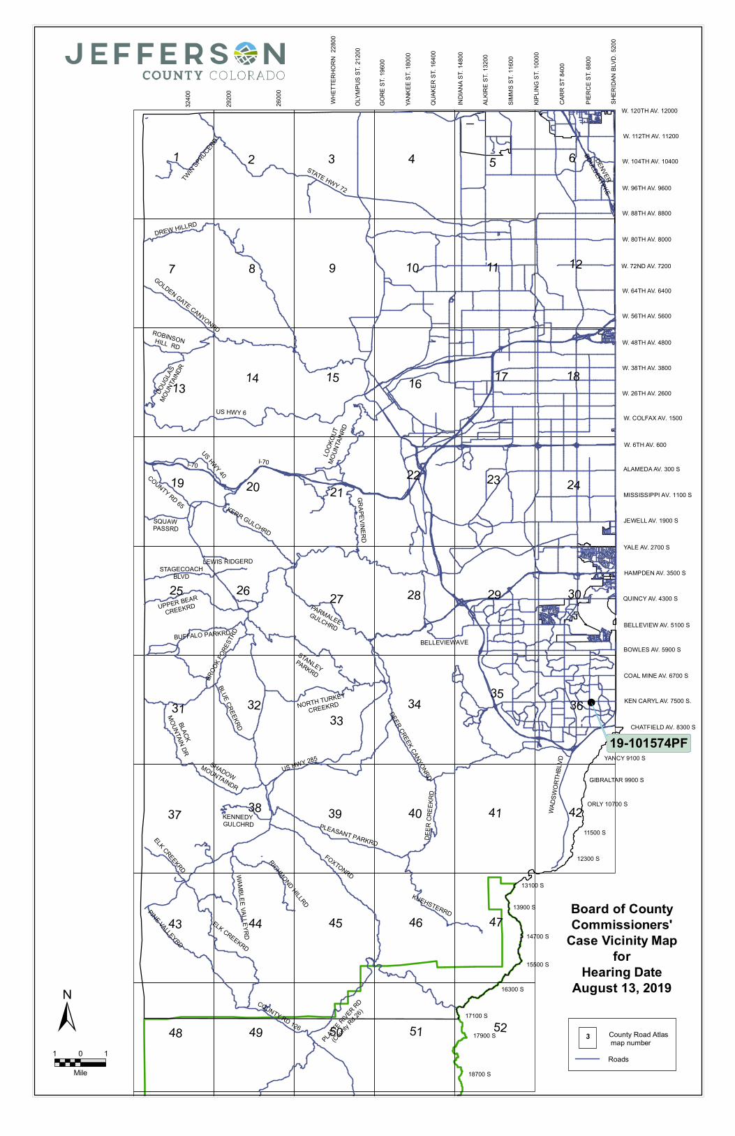
5. Resolution CC19-287Case Number: 19-101574PF: Preliminary and Final
PlatCase Name: Ken Caryl Center Filing 1Owner: Mid-States Building LLCApplicant: Cadence Development, LLCLocation: 7500 South Pierce Street
Section 36, Township 5 South, Range 69West
Approximate Area: 3.194 AcresPurpose: To subdivide the property into two
commercial lots.Case Manager: Nathan Seymour
The public is entitled to testify on items under the Public Hearing Regular Agenda. Information on participation in hearings is provided in the County’s brochure, “Your Guide to Board of County Commissioners Hearings.” It may be obtained on the rack outside the hearing room or from the County Public Affairs Office at 303-271-8512.
Hearing Regular Agenda - No Agenda Items
Reports
Adjournment
Public Comment (following Hearing Regular Agenda)
Jefferson County does not discriminate on the basis of race, color, national origin, sex, religion, age, disability or sexual orientation in the provision of services. Disabled persons requiring reasonable accommodation to attend or participate in a County service, program or activity should call 303-271-5000 or TDD 303-271-8560. We appreciate a minimum of 24 hours advance notice so arrangements can be made to provide the requested auxiliary aid.
The Board meetings can be viewed on a television monitor in the cafeteria on the lower level of the Jefferson County Administration and Courts Facility. Also, you may use the cafeteria tables there to work or gather until The Board is ready to hear your case. The Board meetings and hearings are recorded and available on the county’s Web site at www.jeffco.us.
1
COMMISSIONERS' MINUTES OF TUESDAY AUGUST 6, 2019
The Board of County Commissioners of the County of Jefferson, State of Colorado, met in regular session on August 6, 2019 in the Jefferson County Government Center, Golden, Colorado. Commissioner Libby Szabo, Chairman presided. Commissioner Casey Tighe, Commissioner Lesley Dahlkemper and Gunnar Vincens, Deputy Clerk to the Board, were present.
Commissioner Libby Szabo, Chairman called the meeting to order.
STAFF PRESENT: Don Davis, County Manager Kimberly Sorrells, County Attorney Dan Conway, Budget Manager Katherine Takai, Budget Analyst
APPROVAL OF MINUTES
Following a general discussion, the Board upon motion of Commissioner Tighe, duly seconded by Commissioner Dahlkemper and by unanimous vote, approved the Minutes of July 30, 2019.
CONSENT AGENDA
The Board approved the following Resolutions:
1. Resolution CC19-277 Expenditure Approval Listings - Finance
2. Resolution CC19-279 Purchase Order Modification - StraightStripe Painting Inc. for Additional Water-Based Striping andMarking (Additional NTE $200,000.00 for Revised Amount NTE$450,000.00) - Road and Bridge
3. Resolution CC19-280 Traffic Regulatory Devices InstalledJanuary 1, 2019 through June 30, 2019 - Transportation andEngineering
4. Resolution CC19-281 Contract - Braconier Plumbing andHeating Co., Inc. for District Attorney Building Chilled WaterSystem Replacement Services ($375,285.00) - Facilities
5. Resolution CC19-282 Policy Manual Part 3, Chapter 2, Section2, Regarding Control of Fugitive Particulate Emissions fromGravel Roads - Development and Transportation
2
6. Resolution CC19-283 Policy Manual Part 5, Chapter 4, Section1 Regarding Use of Information Technology Resources -Business, Innovation and Technology
7. Resolution CC19-284 Policy Manual Part 7, Chapter 5, Section6 Regarding Annexation Petitions - Planning and Zoning
8. Resolution CC19-285 Policy Manual Part 4, Chapter 3, Section1 Regarding Payroll - Finance
9. Resolution CC19-286 Policy Manual Part 1, Chapter 2, Section5 Regarding Airport Lease Agreements - Development andTransportation
REGULAR AGENDA - No Agenda Items
PUBLIC HEARING CONSENT AGENDA – No Agenda Items
PUBLIC HEARING REGULAR AGENDA
10. 2020 Proposed Budget
REPORTS
Commissioner Tighe thanked the first responders in Texas and Ohio for their quick actions during the recent mass shootings. He further expressed his sympathy for the victims and their families. Following these remarks, he reminded the meeting that the Jefferson County Fair and Festival will be held this weekend at the Jefferson County Fairgrounds with musical entertainment and a rodeo.
Commissioner Szabo added her sympathies to the victims and their families and her gratitude for first responders. She also added that the issue of mental health needs to be addressed to help reduce the problem.
Commissioner Dahlkemper added her sympathies to the victims and families and thanks to the first responders while also commenting about how heartwarming to see the community come together in the face of tragedy. She also expressed her commitment to tackling the multi-faceted problem of gun violence in any way she could with the board.
3
County Manager Don Davis introduced Zoe Jenkins who will be working for the county over the next year as part of the International City and County Managers Association (ICMA) fellowship program.
ADJOURNMENT
There being no further business to come before the Board, the meeting was adjourned.
Attest: Board of County Commissioners of the County of Jefferson, Colorado
____________________________ ____________________________ Gunnar X. Vincens, Deputy Clerk Libby Szabo, Chairman
!
13100 S
13900 S
12300 S
11500 S
15500 S
14700 S
17100 S
16300 S
17900 S
18700 S
19500 S
YANCY 9100 S
ORLY 10700 S
W. 6TH AV. 600
YALE AV. 2700 S
W. 88TH AV. 8800
W. 96TH AV. 9600
W. 80TH AV. 8000
W. 72ND AV. 7200
W. 64TH AV. 6400
W. 48TH AV. 4800
W. 56TH AV. 5600
W. 38TH AV. 3800
W. 26TH AV. 2600
GIBRALTAR 9900 S
ALAMEDA AV. 300 S
JEWELL AV. 1900 S
QUINCY AV. 4300 S
BOWLES AV. 5900 S
W. 120TH AV. 12000
W. 112TH AV. 11200
W. 104TH AV. 10400
W. COLFAX AV. 1500
HAMPDEN AV. 3500 S
BELLEVIEW AV. 5100 S
COAL MINE AV. 6700 S
CHATFIELD AV. 8300 S
KEN CARYL AV. 7500 S.
MISSISSIPPI AV. 1100 S
3240
0
2920
0
2600
0
CARR
ST 84
00
GORE
ST. 1
9600
PIERC
E ST.
6800
SIMMS
ST. 1
1600
ALKIR
E ST
. 132
00
YANK
EE S
T. 18
000
QUAK
ER S
T. 16
400
KIPLIN
G ST
. 100
00
INDI
ANA S
T. 14
800
OLYM
PUS
ST. 2
1200
SHER
IDAN
BLV
D. 52
00
WHET
TERH
ORN
2280
0
KERR GULCHRD
LEWIS RIDGERDSTAGECOACH
BLVD
UPPER BEAR
CREEKRD
BUFFALO PARKRD
NORTH TURKEY
CREEKRD
BLUE CREEKRD
PARMALEE GULCHRD
US HWY 6
I-70
SQUAW PASSRD
STATE HWY 72 TW
IN SPRUCERD
DREW HILLRD
GOLDEN GATE CANYONRDROBINSON HILL RD
DOUG
LAS
MOU
NTAIN
DR
US HWY 40
I-70 COUNTY RD 65
GRAPEVINERD
LOOK
OUT
MOU
NTAIN
RD
DENVER
BOULDERTPKE
DEER CREEK CANYONRD
PLEASANT PARKRDFOXTONRD
RICHMOND HILLRD
WAMBLEE VALLEYRD
ELK CREEKRD
PINE VALLEYRD
COUNTY RD 126
PLATTE RIVER RD
(County R
d 26)
KUEHSTERRD
DEER
CRE
EKRD
WADS
WORT
HBLV
D
US HWY 285
KENNEDY GULCHRD
ELK CREEKRD
SHADOW MOUNTAINDR
BROO
K FOR
ESTR
D
BLACK
MOUNTAIN DR
BELLEVIEWAVESTANLEY
PARKRD
1 2 3 4 5 6
7 8 9 11
525148
4746
49 50
43
424140393837
3635
4544
31
302927 282625
242322212019
181716151413
12
34
10
3233
19-101574PF
Board of CountyCommissioners'
Case Vicinity Mapfor
Hearing DateAugust 13, 2019
County Road Atlas map number3
Roads
±1 10
Mile
TO:
Agenda Item __ _
MEMORANDUM
Honorable Chairman and Members of the Board of County Commissioners
FROM: Donald J. Davis, County Manage@
EXPENDITURE APPROVAL LISTINGS
August13,2019
RE:
DATE:
Staff Recommendation:
Allow settlement of accounts listed on the Expenditure Approval Listings dated August 8, 2019
Resolution No. CC19-288
Background: Jefferson County has established a system of controls to reasonably assure thatthe claims to be examined and settled by the BCC on the Expenditure Approval Listings are allowable.
Further, the staff has reviewed all claims and has reasonable assurance that allclaims are allowable and are in order to be paid
Original returned to:
Deborah Freischlag, Director of Accounting, x8542, Jefferson County Accounting Division
Distribution:
Jerry DiTullio, County Treasurer
1
TO:
FROM:
RE:
DATE:
Agenda Item __ _
MEMORANDUM
Honorable Chairman and Members of the Board of County Commissioners
Donald J. Davis, County Manager @2_
Bl-WEEKLY PAYROLL REGISTER
August 13, 2019
Staff Recommendation:
Approve the issuance of county warrants as listed on this Biweekly Payroll Register for period ending August 3, 2019.
Resolution No.
Background:
CC19-289
Payroll warrants and ACH Direct Deposit Notifications have been prepared in accordance with current Personnel Action forms and time sheets received in the Financial Control Division by the required deadlines and all applicable taxes and deductions have been withheld therefrom. A summary register of these claims has been circulated and thereby presented for audit and allowance by the Board of County Commissioners. The Board of County Commissioners hereby directs the County Treasurer to pay same.
Prepared By: Jefferson County Accounting Division
Distribution: Donald J. Davis, Jerry DiTullio, Accounting
2
TO:
FROM:
RE:
DATE:
Agenda _Item __ _
MEMORANDUM
Honorable Chairman and Members of the Board of County Commissioners
Kym Sorrells, County Attorney '¢ Board of County Commissioners - Delegation of Authority to Administer and Settle Claims and Litigation
August 13, 2019
Staff Recommendation:
WHEREAS, by resolution CC17-190, Ellen Wakeman, as County Attorney, was authorized to approve any settlement of any claim or lawsuit involving the County, its Elected Officials, employees, agents, or entities.
WHEREAS, the Board. of County Commissioners wishes to update the delegations in CC17-190 and replace it with this resolution.
NOW, THEREFORE, BE IT RESOLVED, by the Board of County Commissioners of Jefferson County that the County Attorney is authorized to approve any settlement of any claim or lawsuit involving the County, its Elected Officials, employees, agents, or related entities, in an amount not to exceed $250,000.
BE IT FURTHER RESOLVED, that the County Attorney is authorized to execute, or delegate to attorneys in the County Attorney's Office the authority to execute, any settlement documents, pleadings, contracts, or agreements necessary to effectuate any settlement pursuant to the settlement authority delegated herein.
Resolution No. C C 1 g - 2 g 0
Background: The existing delegation of authority matrix specifically identified that the Board delegated settlement authority to Ellen Wakeman, rather than the office of County Attorney. With Ellen's retirement and the appointment of a new County Attorney, the delegation matrix needs to be updated. Staff recommended revising the delegation so that the County Attorney, whomever holds that position, may settle claims up to the County's self-insured limit, or $250,000.
3
Fiscal Impact: There is no direct fiscal impact as this is simply a delegation of authority.
BCC Briefing Presented on: July 23, 2019
Originator: Kym Sorrells, x8965
Distribution: Clerk to the Board, Kourtney Hartmann, County Attorney's Office
Contacts:
BCC HEARING ROUTING FORM (non-purchasing items)
Originating Division and Contact: _K__.y.__m_S..:....o:.....r....:.re--'lls;..__ ______ Phone: _X _8_9_6_5 ____ _
County Attorney Contact: ----'-Ko.:....:u...;_;rt :.....ne.;;..,,.y....:.H....:.a--'rt :.....m;.:.:.a
....:.nn
..;...__ ____ Phone: _X_8.:....:9_;_6_4 ____ _
Board of County Commissioners - Delegation of Authority to Administer and Settle Claims and Litigation
Business Consent Agenda August 13, 2019
ROUTING
0 Au thor ized
R
Signa tures Date Date D Division Com ments
Rec'd Frw'd
R Name/Ini t ials
() Originator -Kourtney Hartmann
() Division Director
() Roun� Attwney -ym orre s �
() Department Director -
�IV"-Kate Newman
() Budget
() Elected Official BCC Agenda
�'«-'
() Coordinator
Agenda Item __ _
MEMORANDUM
TO: Honorable Chairman and Members of the Board of County Commissioners
FROM:
RE:
DATE:
Donald J. Davis, County Manage@
Approval of the 2019 SCFD Grant Recommendations
August 13, 2019
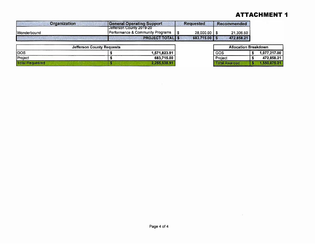
Staff Recommendation: Resolved, that the Board of County Commissioners hereby approves the Jefferson County Cultural Council 2019 Grant recommendations totaling $1,550,075.21 for 2019-2020 SCFD programs, as set forth in the attached table.
Resolution No. C C 1 g - 2 7 8
Background: The Jefferson County Cultural Council (Council) received 89 eligible grant requests for Scientific and Cultural Facilities District (SCFD) funding for 2019-2020 programs and general operating support. The Council met with all applicants for a brief interview and evaluated each grant application. The Council's recommended grant funding is described in the attached table. Provided the Board of County Commissioners approves the Council's recommendations, the SCFD Board will vote to approve the funding and the grant funds will be distributed to the organizations on October 14, 2019.
Fiscal Impact: SCFD grants are funded by the SCFD sales tax.
BCC Briefing Presented on: July 23, 2019
Originator: Dylan Trujillo, Clerk to the Board, x8166
Distribution: Dylan Trujillo, Accounting, Steve Snyder
4
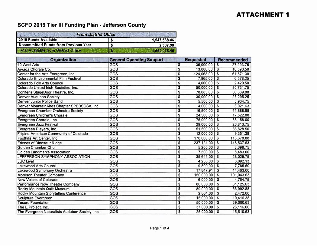
SCFD 2019 Tier Ill Funding Plan - Jefferson County
h :? .. "''f£ ' ;,,,' \;;-(. O·riganizati'0'n"� ,:· . - :,.'i' -- " -" ·,' .,''-' 40 West Arts Arvada Chorale Co. Center for the Arts Evergreen, Inc.
. ':r��}{}!zf:t •,'\, ' : y �-- -� '}},,
Colorado Environmental Film Festival Colorado Folk Arts Council Colorado United Irish Societies, Inc. Conifer's StageDoor Theatre, Inc. Denver Audubon Society Denver Junior Police Band Denver MountainAires Chapter SPEBSQSA, Inc Evergreen Chamber Orchestra Society Evergreen Children's Chorale Evergreen Chorale, Inc. Evergreen Jazz Festival Evergreen Players, Inc. Filipino-American Community of Colorado Foothills Art Center, Inc Friends of Dinosaur Ridge Golden Chamber Choir Golden Landmarks Association JEFFERSON SYMPHONY ASSOCIATION JUC Live! Lakewood Arts Council Lakewood Symphony Orchestra Morrison Theater Company New Voices of Colorado Performance Now Theatre Company Rocky Mountain Quilt Museum Rocky Mountain Storytellers Conference Sculpture Evergreen Tesoro Foundation The E Project, Inc. The Evergreen Naturalists Audubon Society, Inc.
, i1(j_ehera1�; Ope.r:ati ng\S:ij.ppo�._?:,%r.r- -- \,· GOS GOS GOS GOS GOS GOS GOS GOS GOS GOS GOS GOS GOS GOS GOS GOS GOS GOS GOS GOS GOS GOS GOS GOS GOS GOS GOS GOS GOS GOS GOS GOS GOS
Page 1 of 4
$
$
$
$
$
$
$
$
$
$
$
$
$
$
$
$
$
$
$
$
$
$
$
$
$
$
$
$
$
$
$
$
$
ATTACHMENT 1
.. Reqwe$-te•· · : ,: �- Re�ommen-deEI' 35,000.00 $ 27,293.75 13,000.00 $ 10,590.50
124,068.00 $ 61,571.38 7,965.00 $ 6,578.25 4,000.00 $ 2,420.50
50,000.00 $ 30,731.75 78,083.00 $ 56,339.88 30,000.00 $ 23,295.25
5,500.00 $ 3,934.75 4,000.00 $ 3,021.63
16,500.00 $ 11,888.88 24,500.00 $ 17,522.88 75,000.00 $ 55,158.00 29,000.00 $ 20,813.75 51,500.00 $ 36,828.50 12,000.00 $ 9,351.38
170,000.00 $ 118,678.88 237,124.00 $ 148,537.63
5,200.00 $ 3,698.75 7,500.00 $ 5,483.00
35,641.00 $ 28,029.75 4,250.00 $ 3,092.13 9,800.00 $ 7,785.50
17,847.91 $ 14,463.00 150,000.00 $ 101,043.63
6,000.00 $ 4,764.75 80,000.00 $ 61,125.63 89,000.00 $ 66,992.88
2,864.00 $ 2,472.00 15,000.00 $ 10,416.38 50,000.00 $ 39,000.63 37,000.00 $ 26,116.00 25,000.00 $ 15,510.63
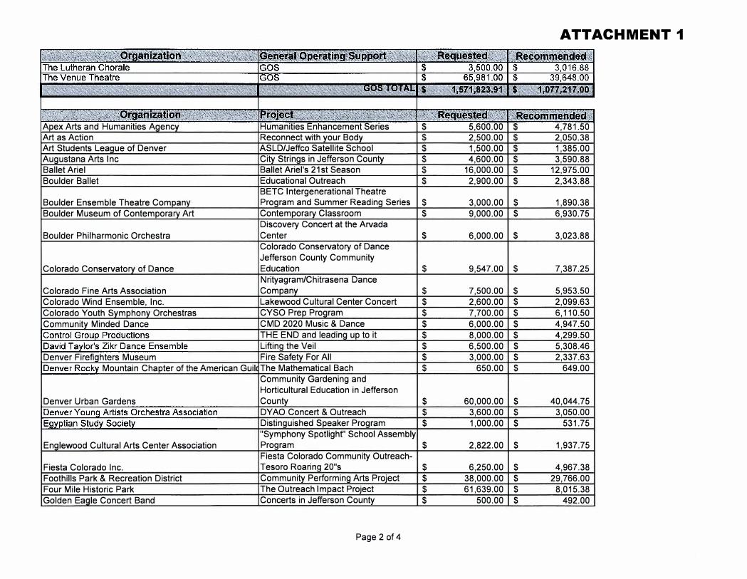
ATTACHMENT 1
A ex Arts and Humanities A enc Humanities Enhancement Series 5,600.00 4,781.50 Art as Action Reconnect with your Body 2,500.00 2,050.38 Art Students Lea ue of Denver ASLD/Jeffco Satellite School 1,500.00 1,385.00 Augustana Arts Inc City Strings in Jefferson County 4,600.00 3,590.88 Ballet Ariel Ballet Ariel's 21st Season 16,000.00 12,975.00 Boulder Ballet Educational Outreach 2,900.00 2,343.88
BETC Intergenerational Theatre Boulder Ensemble Theatre Compan Program and Summer Reading Series $ 3,000.00 $ 1,890.38 Boulder Museum of Contempora Art Contemporary Classroom $ 9,000.00 $ 6,930.75
Discovery Concert at the Arvada Boulder Philharmonic Orchestra Center $ 6,000.00 $ 3,023.88
Colorado Conservatory of Dance Jefferson County Community
Colorado Conservato of Dance Education $ 9,547.00 $ 7,387.25 Nrityagram/Chitrasena Dance
Colorado Fine Arts Association Company $ 7,500.00 $ 5,953.50 Colorado Wind Ensemble, Inc. Lakewood Cultural Center Concert $ 2,600.00 $ 2,099.63 Colorado Youth S mphon Orchestras CYSO Prep Program $ 7,700.00 $ 6,110.50 Communit Minded Dance CMD 2020 Music & Dance $ 6,000.00 $ 4,947.50
THE END and leading up to it $ 8,000.00 $ 4,299.50 Lifting the Veil $ 6,500.00 $ 5,308.46
Denver Firefi hters Museum Fire Safety For All $ 3,000.00 $ 2,337.63 Mountain Chapter of the American Guil The Mathematical Bach $ 650.00 $ 649.00
Community Gardening and Horticultural Education in Jefferson
Denver Urban Gardens County $ 60,000.00 $ 40,044.75 DY AO Concert & Outreach $ 3,600.00 $ 3,050.00 Distinguished Speaker Program $ 1,000.00 $ 531.75 "Symphony Spotlight" School Assembly
En lewood Cultural Arts Center Association Program $ 2,822.00 $ 1,937.75 Fiesta Colorado Community Outreach-
Fiesta Colorado Inc. Tesoro Roaring 20"s $ 6,250.00 $ 4,967.38 Foothills Park & Recreation District Community Performing Arts Project $ 38,000.00 $ 29,766.00 Four Mile Historic Park The Outreach Impact Project $ 61,639.00 $ 8,015.38 Golden Ea le Concert Band Concerts in Jefferson County $ 500.00 $ 492.00
Page 2 of 4
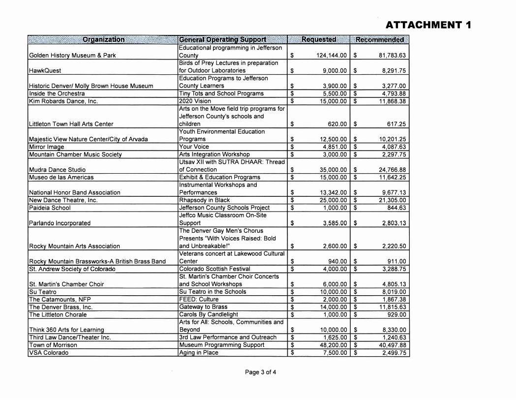
Golden Histo Museum & Park
HawkQuest
Historic Denver/ Moll Brown House Museum Inside the Orchestra Kim Robards Dance, Inc.
Littleton Town Hall Arts Center
Ma·estic View Nature Center/Cit of Arvada Mirror Ima e Mountain Chamber Music Societ
Mudra Dance Studio Museo de las Americas
National Honor Band Association New Dance Theatre, Inc. Paideia School
Parlando lncor orated
Rock Mountain Arts Association
Rock Mountain Brassworks-A British Brass Band
St. Martin's Chamber Choir Su Teatro The Catamounts, NFP The Denver Brass, Inc. The Littleton Chorale
Think 360 Arts for Learnin Third Law Dance/Theater Inc. Town of Morrison VSA Colorado
Educational programming in Jefferson County $
Birds of Prey Lectures in preparation for Outdoor Laboratories $
Education Programs to Jefferson County Learners $
Tiny Tots and School Programs $ 2020 Vision $
Arts on the Move field trip programs for Jefferson County's schools and children $
Youth Environmental Education Programs $ Your Voice $
Arts Integration Workshop $ Utsav XII with SUTRA DHAAR: Thread of Connection $
Exhibit & Education Programs $
Instrumental Workshops and Performances $
Rhapsody in Black $
Jefferson County Schools Project $
Jeffco Music Classroom On-Site Support $
The Denver Gay Men's Chorus Presents "With Voices Raised: Bold and Unbreakable!" $
Veterans concert at Lakewood Cultural Center $ Colorado Scottish Festival $ St. Martin's Chamber Choir Concerts and School Workshops $
Su Teatro in the Schools $
FEED: Culture $
Gateway to Brass $
Carols By Candlelight $
Arts for All: Schools, Communities and Beyond $
3rd Law Performance and Outreach $
Museum Programming Support $
Aging in Place $
Page 3 of 4
ATTACHMENT 1
124,144.00 $ 81,783.63
9,000.00 $ 8,291.75
3,900.00 $ 3,277.00 5,500.00 $ 4,793.88
15,000.00 $ 11,868.38
620.00 $ 617.25
12,500.00 $ 10,201.25 4,851.00 $ 4,087.63 3,000.00 $ 2,297.75
35,000.00 $ 24,766.88 15,000.00 $ 11,642.25
13,342.00 $ 9,677.13 25,000.00 $ 21,305.00
1,000.00 $ 844.63
3,585.00 $ 2,803.13
2,600.00 $ 2,220.50
940.00 $ 911.00 4,000.00 $ 3,288.75
6,000.00 $ 4,805.13 10,000.00 $ 8,019.00
2,000.00 $ 1,867.38 14,000.00 $ 11,815.63
1,000.00 $ 929.00
10,000.00 $ 8,330.00 1,625.00 $ 1,240.63
48,200.00 $ 40,497.88 7,500.00 $ 2,499.75
ATTACHMENT 1
Page 4 of 4
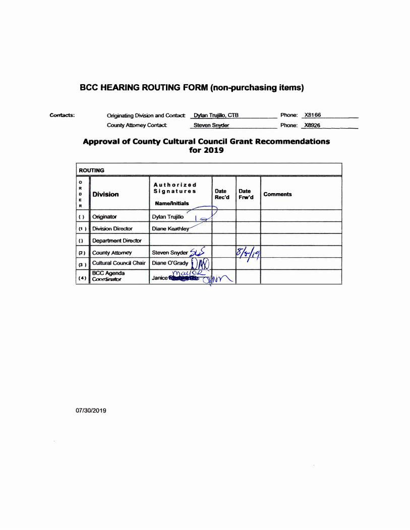
Contacts:
ace HEARING ROUTING FORM {non-purchasing items)
Originating Division and Contact _Oyl ____ an_T_ru...._iiUo..;..;...:_, C_TB _____ Phone: _X8_166 ____ _ County Attorney Contact Steven Snyder Phone: _X8926 _____ _
Approval of County Cultural Council Grant Recommendations for 2019
ROUTING
0 Authorized
R Signa tures Date Date
D Division Rec'd Frw'd Comments
Name/Initials R
.,---
V ( ) Originator Dylan Trujillo ,�
(1 ) Division Director Diane Keathley�
() Department Director
(2) County Attorney Steven Snyder�_> w�/41 Cultural Council Chair Diane O'Grady l) 'ff{) I I
(3 )
BCCAgenda �ac�-
� (4) Coordinator Janice �eb.. a�,
07/30/2019
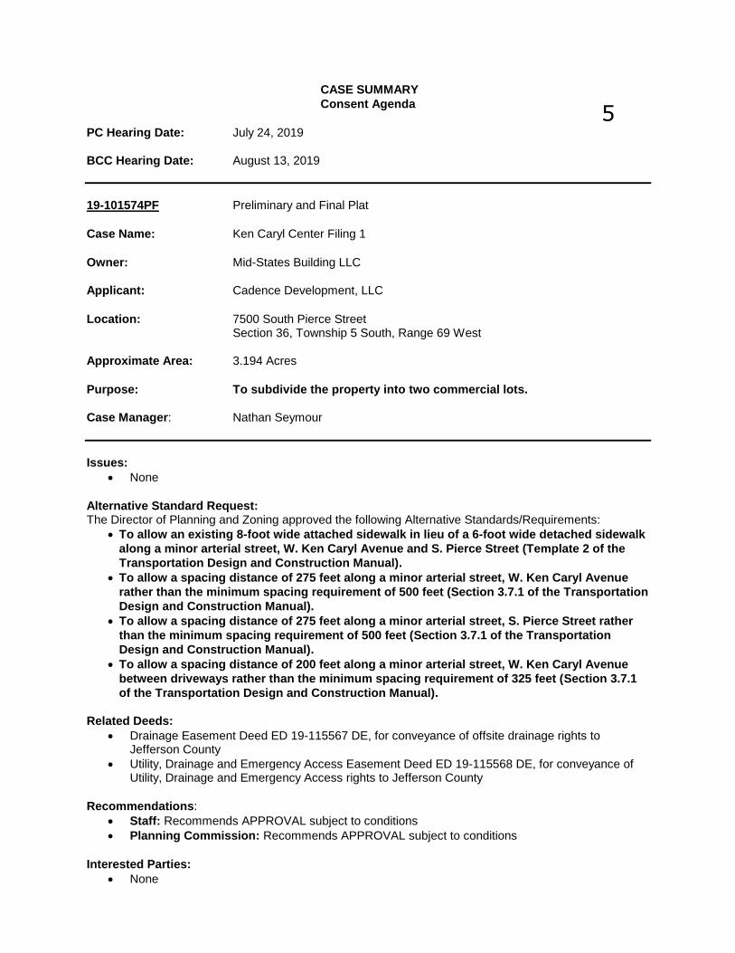
CASE SUMMARY
Consent Agenda
PC Hearing Date: July 24, 2019
BCC Hearing Date: August 13, 2019
19-101574PF Preliminary and Final Plat
Case Name: Ken Caryl Center Filing 1
Owner: Mid-States Building LLC
Applicant: Cadence Development, LLC
Location: 7500 South Pierce StreetSection 36, Township 5 South, Range 69 West
Approximate Area: 3.194 Acres
Purpose: To subdivide the property into two commercial lots.
Case Manager: Nathan Seymour
Issues:
• None
Alternative Standard Request: The Director of Planning and Zoning approved the following Alternative Standards/Requirements:
• To allow an existing 8-foot wide attached sidewalk in lieu of a 6-foot wide detached sidewalk
along a minor arterial street, W. Ken Caryl Avenue and S. Pierce Street (Template 2 of the
Transportation Design and Construction Manual).
• To allow a spacing distance of 275 feet along a minor arterial street, W. Ken Caryl Avenue
rather than the minimum spacing requirement of 500 feet (Section 3.7.1 of the Transportation
Design and Construction Manual).
• To allow a spacing distance of 275 feet along a minor arterial street, S. Pierce Street rather
than the minimum spacing requirement of 500 feet (Section 3.7.1 of the Transportation
Design and Construction Manual).
• To allow a spacing distance of 200 feet along a minor arterial street, W. Ken Caryl Avenue
between driveways rather than the minimum spacing requirement of 325 feet (Section 3.7.1
of the Transportation Design and Construction Manual).
Related Deeds:
• Drainage Easement Deed ED 19-115567 DE, for conveyance of offsite drainage rights toJefferson County
• Utility, Drainage and Emergency Access Easement Deed ED 19-115568 DE, for conveyance ofUtility, Drainage and Emergency Access rights to Jefferson County
Recommendations:• Staff: Recommends APPROVAL subject to conditions• Planning Commission: Recommends APPROVAL subject to conditions
Interested Parties:
• None
5
bbenedik
Agenda Item

Level of Community Interest: Low Representative for Applicant: Lucy Dinneen, Cadence Development, LLC General Location: Southeast of the intersection of W. Ken Caryl Avenue and S. Pierce Street Case Manager Information: Phone: 303-271-8751 e-mail: [email protected]
It was moved by Commissioner G. SPENCER that the following Resolution be adopted:
BEFORE THE PLANNING COMMISSION
COUNTY OF JEFFERSON STATE OF COLORADO
July 24, 2019
RESOLUTION
19-101574PF Preliminary and Final Plat Case Name: Ken Caryl Center Filing 1 Owner: Mid-States Building LLC Applicant: Cadence Development, LLC Location: 7500 South Pierce Street Section 36, Township 5 South, Range 69 West Approximate Area: 3.194 Acres Purpose: To subdivide the property into two commercial
lots. Case Manager: Nathan Seymour The Jefferson County Planning Commission hereby recommends APPROVAL WITH CONDITIONS of the above application on the basis of the following facts: 1. That the factors upon which this decision is based include evidence
and testimony and staff findings presented in this case. 2. The Planning Commission finds that the proposal conforms to the Land
Development Regulation because all applicable regulations have been satisfied, or will be satisfied, prior to recordation of the Preliminary and Final Plat, as indicated within this report.
3. The following are conditions of approval:
A. Submittal of a title insurance commitment update with an effective date less than 45 days prior to the recording of the Plat which depicts no new owners or encumbrances. Said title insurance commitment shall be approved by the County Attorney’s Office.
B. The improvements agreement and Exhibit “A” being approved as
to form by the County Attorney’s Office.
Jefferson County Planning Commission Resolution Case #19-101574PF July 24, 2019 2 of 2
C. The recordation of the Plat mylars after being prepared in accordance with the red-marked print dated July 24, 2019.
D. Recordation of an offsite private drainage easement agreement. E. Acceptance of Easement Deed ED 19-115567DE by the Board of
County Commissioners. F. Acceptance of Easement Deed ED 19-115568DE by the Board of
County Commissioners. G. Recordation of an access and utility easement to the benefit of
the created lots and the future lot owners. H. Resolution of Planning Engineering comments dated July 9,
2019. I. Resolution of Staff Geologist comments dated July 3, 2019. J. Resolution of Platte Canyon Water and Sanitation District
comments dated June 26, 2019. K. Submittal of a current tax certificate from the County Treasurer’s
Office indicating that all ad valorem taxes applicable to Ken Caryl Center Filing 1 for prior years have been paid.
Commissioner BANK seconded the adoption of the foregoing Resolution, and upon a vote of the Planning Commission as follows:
Commissioner Rogers Aye Commissioner Hatton Aye Commissioner Schiche Aye Commissioner G. Spencer Aye Commissioner Bank Aye
Commissioner Phillips Aye Commissioner Gibson Aye
The Resolution was adopted by unanimous vote of the Planning Commission of the County of Jefferson, State of Colorado. I, Bonnie Benedik, Secretary for the Jefferson County Planning Commission, do hereby certify that the foregoing is a true copy of a Resolution duly
Jefferson County Planning Commission Resolution Case #19-101574PF July 24, 2019 3 of 3 adopted by the Jefferson County Planning Commission at a regular hearing held in Jefferson County, Colorado, July 24, 2019.
_______________________ Bonnie Benedik Executive Secretary
1
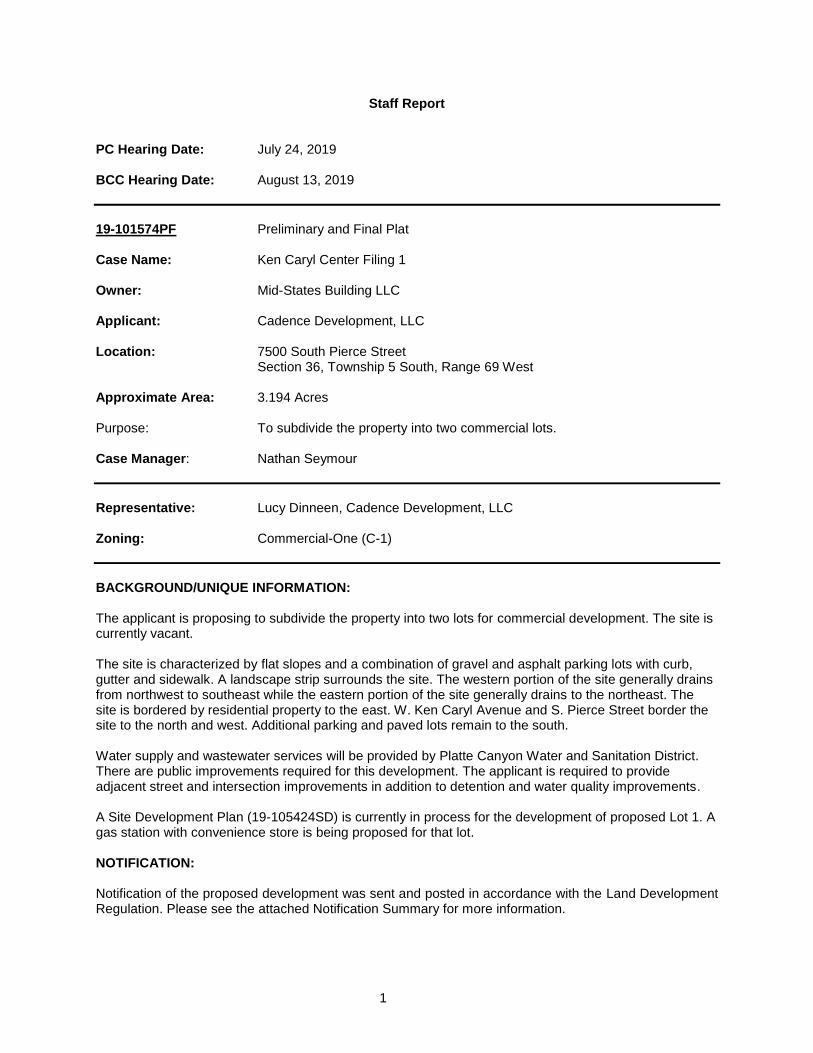
Staff Report PC Hearing Date: July 24, 2019 BCC Hearing Date: August 13, 2019 19-101574PF Preliminary and Final Plat Case Name: Ken Caryl Center Filing 1 Owner: Mid-States Building LLC Applicant: Cadence Development, LLC Location: 7500 South Pierce Street Section 36, Township 5 South, Range 69 West Approximate Area: 3.194 Acres Purpose: To subdivide the property into two commercial lots. Case Manager: Nathan Seymour
Representative: Lucy Dinneen, Cadence Development, LLC Zoning: Commercial-One (C-1)
BACKGROUND/UNIQUE INFORMATION: The applicant is proposing to subdivide the property into two lots for commercial development. The site is currently vacant. The site is characterized by flat slopes and a combination of gravel and asphalt parking lots with curb, gutter and sidewalk. A landscape strip surrounds the site. The western portion of the site generally drains from northwest to southeast while the eastern portion of the site generally drains to the northeast. The site is bordered by residential property to the east. W. Ken Caryl Avenue and S. Pierce Street border the site to the north and west. Additional parking and paved lots remain to the south. Water supply and wastewater services will be provided by Platte Canyon Water and Sanitation District. There are public improvements required for this development. The applicant is required to provide adjacent street and intersection improvements in addition to detention and water quality improvements. A Site Development Plan (19-105424SD) is currently in process for the development of proposed Lot 1. A gas station with convenience store is being proposed for that lot. NOTIFICATION: Notification of the proposed development was sent and posted in accordance with the Land Development Regulation. Please see the attached Notification Summary for more information.

2
During the processing of the application, Staff received comments from one concerned citizen. The concerns included building height, proposed uses, speeding along the eastern portion of the parking lot and the condition of an existing fence along the east property line. Staff followed up with the citizen’s concerns explaining that while the current C-1 zoning does allow for an increased building height, the structures proposed at this time should have minimal impacts to the view corridor. Additionally, it was noted that with the development of this lot, speeding should be less of an issue as internal parking lot improvements will be required. The replacement of the fence is a private matter and something that will have to be agreed upon by the private parties. Staff received a response from the citizen stating that he/she had all the information he/she need at this time. ISSUES ANALYSIS:
(1)
Layo
ut/
Desig
n
(2)
Acce
ss/R
oad
s
(3)
Wate
r/S
an
. &
Uti
liti
es
(4)
Fir
e P
rote
cti
on
(5)
Dra
inag
e
(6)
Hazard
s
(7)
Sen
so
ry Im
pacts
(8)
Wild
life
/
Lan
dscap
ing
Acceptable X X X X X X X X
Unacceptable
Services: South Metro Fire Rescue
Platte Canyon Water and Sanitation District Century Link Communications Corporation Public Service Company Comcast Cable
SUMMARY OF ACCEPTABLE ISSUES: 1. Layout/Design:
The proposal would create two commercial lots, known as Lot 1 (on the west) and Lot 2 (on the east).
As part of this Preliminary and Final Plat, right-of-way dedication is required adjacent to S. Pierce Street, shown as Tract A on the Plat. Tract A will include the concrete sidewalk along S. Pierce Street.
The proposed configuration of the lots is in compliance with Section 14.A (Lot and Tract Standards) of
the Jefferson County Land Development Regulation and the prevailing Commercial One (C-1) zoning. 2. Access: The proposed lots will take direct access from the County maintained public street, West Ken Caryl
Avenue. There will be a full movement access to Lot 2 and a right in, right out access serving both Lots 1 and 2. The access serving lots 1 and 2 will also serve the users to the south. A private access and utility easement will be required over the internal private street system by separate deed for the benefit of the future lot owners and is listed as a condition of Plat approval.
Additional access will be provided from South Pierce Street using an offsite access easement on the property to the south. The recordation of a separate Utility, Drainage and Emergency Access Easement is listed as a condition of plat approval for the offsite access driveway coming from South Pierce Street.
3
The Director of Planning and Zoning granted the following Alternative Standard Requests related to access: • To allow an existing 8-foot wide attached sidewalk in lieu of a 6-foot wide detached sidewalk along
minor arterial streets, W. Ken Caryl Avenue and S. Pierce Street (Template 2 of the Transportation Design and Construction Manual).
• To allow a spacing distance of 275 feet along a minor arterial street, W. Ken Caryl Avenue rather than the minimum spacing requirement of 500 feet (Section 3.7.1 of the Transportation Design and Construction Manual).
• To allow a spacing distance of 275 feet along a minor arterial street, S. Pierce Street rather than the minimum spacing requirement of 500 feet (Section 3.7.1 of the Transportation Design and Construction Manual).
• To allow a spacing distance of 200 feet along a minor arterial street, W. Ken Caryl Avenue between driveways rather than the minimum spacing requirement of 325 feet (Section 3.7.1 of the Transportation Design and Construction Manual).
The above-mentioned requests were approved for the following reasons:
1. Related to the sidewalk request, due to the ineffectiveness of a 6-foot wide sidewalk for both
bikes and pedestrians, it was determined that the existing 8-foot wide attached sidewalk is preferred. New shared use path safety standards highly encourage that sidewalks be at least 8’ wide to accommodate bike traffic.
2. For the spacing request, the applicant has agreed to make several improvements per the recommendations of Staff to include fees for the construction of a median in W. Ken Caryl Avenue, fees for the intersection improvements along Pierce Street, and the shifting of the eastern access along Ken Caryl Avenue to the west. All of which will provide a safer and more user-friendly development.
Access and circulation for this development are in conformance with the requirements of Section 15 of the Land Development Regulation (Circulation) and the Transportation Design and Construction Manual.
3. Water and Sanitation/Utilities:
Platte Canyon Water and Sanitation District (the District) will provide water and sewer services for the subdivision. The applicant is working diligently with the District to address their comments dated June 26, 2019. These comments concern the abandonment of a Fireline off of the existing 8” water main, a private sewer service line easement between Lot 1 and Lot 2 and a license to cross the easement. The resolution of Platte Canyon Water and Sanitation District comments dated June 26, 2019 is listed as a condition of approval. The Office of the State Engineer indicated in its letter dated March 5, 2019, that the proposed water supply is adequate and can be provided without causing injury to decreed water rights.
Utilities are available for this subdivision. Xcel Energy will provide electricity. CenturyLink will provide
telephone service. Comcast will provide cable services.
Water supply is in conformance with Section 21 of the Land Development Regulation (Water Supply) subject to the resolution of Platte Canyon Water and Sanitation District comments.
Wastewater is in conformance with Section 22 of the Land Development Regulation (Wastewater) subject to the resolution of Platte Canyon Water and Sanitation District comments. Utilities is in conformance with Section 23 of the Land Development Regulation (Utilities).
4
4. Fire Protection:
South Metro Fire Rescue has deemed the proposal to be acceptable and will provide fire protection for the subject property.
Fire protection for the development is in conformance with Section 24 of the Land Development Regulation (Fire Protection).
5. Drainage: The submitted Drainage Report has only one minor outstanding comment and will be acceptable once
revised in accordance with the engineering comments dated July 9, 2019. Detention and Water Quality improvements are required to be completed by the applicant/owner as part of this Preliminary and Final Plat.
Offsite drainage improvements (construction of a storm sewer pipe) are required with this Plat for the
proposed detention and water quality pond to connect into the existing storm sewer system. As a result of these offsite improvements the applicant is required to provide offsite Drainage Easements to the County for all drainage facilities associated with the Plat. The applicant is also required to provide offsite private drainage easements to allow for access, construction and maintenance of the offsite drainage facilities. These requirements have been listed as conditions of Plat approval.
Drainage for the development is in conformance with Section 18 of the Land Development Regulation (Drainage) and the Storm Drainage Design and Technical Criteria.
6. Hazards: This site is not in an identified geohazard area; however, there is the potential for swelling soils and
movement to occur. An Expansive Soils Plat Restriction has been added to the Plat to ensure that geotechnical issues are properly addressed at the time of building permit.
The applicant is proposing retaining walls as part of the improvements. The County Geologist has
one minor remaining comment which staff believes can easily be addressed. The comment states that retaining walls must be faced with a textured earth color material identified in the plans. The resolution of Staff Geologist comments dated July 3, 2019 is listed as a condition of approval.
Geology and hazards associated with the proposed development are in conformance with Section 25 (Geologic and Geotechnical) of the Land Development Regulation.
7. Sensory Impacts: Jefferson County Public Health and Planning and Zoning have reviewed the Sensory Impact Report
and determined the proposed development complies with Section 26 (Sensory Impact) of the Land Development Regulation.
8. Wildlife/Vegetation/Landscaping: The proposal is not expected to have a significant impact on wildlife. A referral was sent to the Division
of Wildlife; however, Planning Staff has not received any response to date.
All landscaping design and construction requirements, which include landscape buffers along W. Ken Caryl Avenue and S. Pierce Street, will be completed at the time of the future Site Development Plan, which is required prior to the development of each lot.
As such, the applicant is in accordance with Section 15 (Landscaping) of the Zoning Resolution and
Section 28 (Wildlife and Vegetation) of the Land Development Regulation.
5
ADDITIONAL REQUIREMENTS:
1. Performance Guarantee and Improvements Agreement: The public improvements will be guaranteed by Plat restriction. At this time, the Improvements
Agreement has not been approved as to form by the County Attorney's Office, and the Exhibit "A" to be attached to the Improvements Agreement has not been finally approved. Approval of the Improvements Agreement and Exhibit "A" are listed as conditions of approval for this development. If this Plat is approved, then the Chairman of the Board of County Commissioners shall be authorized to sign the Improvements Agreement on behalf of the County and staff will record the Improvements Agreement with the Plat.
2. Mineral Rights: The applicant in this case certified that the required inspection occurred per Colorado State Statute
and that the inspection indicated that mineral rights have not been severed from the surface estate of the subject property.
3. Easement Deed ED 19-115567DE:
The offsite Drainage Easement Deed, ED 19-115567DE, has been submitted as required for conveyance to Jefferson County. The form of the Drainage Easement Deed has been reviewed by the County Attorney’s Office and the executed deed will need to be submitted and accepted by the County Attorney’s Office prior to recording. The acceptance of the deed has been listed as a condition of approval.
4. Easement Deed ED 19-115568DE:
The offsite Utility, Drainage and Emergency Access Easement Deed, ED 19-115567DE, has been submitted as required for conveyance to Jefferson County. The form of the Utility, Drainage and Emergency Access Easement Deed form has been reviewed by the County Attorney’s Office and the executed deed will need to be submitted and accepted by the County Attorney’s Office prior to recording. The acceptance of the deed has been listed as a condition of approval.
PLANNING COMMISSION: Planning Commission Recommendation (Resolution Dated July 24, 2019 Attached):
Approval Approval with Conditions X (7-0) vote Denial
The case was scheduled on the consent agenda for the Planning Commission hearing. The case remained on the consent agenda and was not removed for discussion.
FINDINGS/RECOMMENDATIONS: Staff recommends that the Board of County Commissioners find that the proposal conforms to the Land Development Regulation because all applicable regulations have been satisfied, or will be satisfied, prior to recordation of the Preliminary and Final Plat, as indicated within this report.
6
And; Staff recommends that the Board of County Commissioners APPROVE Case No. 19-101574PF subject to the following conditions:
1. Submittal of a title insurance commitment update with an effective date less than 45 days prior to the recording of the Plat which depicts no new owners or encumbrances. Said title insurance commitment shall be approved by the County Attorney’s Office.
2. The Improvements Agreement and Exhibit "A" being approved as to form by the County Attorney's Office.
3. The recordation of the Plat mylars after being prepared in accordance with the red-marked print dated August 13, 2019.
4. Recordation of an offsite private drainage easement agreement.
5. Acceptance of Easement Deed ED 19-115567DE by the Board of County Commissioners.
6. Acceptance of Easement Deed ED 19-115568DE by the Board of County Commissioners.
7. Recordation of an access and utility easement to the benefit of the created lots and the future lot
owners. 8. Resolution of Planning Engineering comments dated July 9, 2019. 9. Resolution of County Geologist comments dated July 3, 2019. 10. Resolution of Platte Canyon Water and Sanitation District comments dated June 26, 2019.
11. Submittal of a current tax certificate from the County Treasurer's Office indicating that all ad
valorem taxes applicable to Ken Caryl Center Filing 1 for prior years have been paid.
Staff further recommends that the Board of County Commissioners authorize the Chairman to sign the Improvements Agreement once approved as to form by the County Attorney’s Office.
COMMENTS PREPARED BY: Nathan Seymour _____________________________________ Nathan Seymour, Civil Planning Engineer August 1, 2019
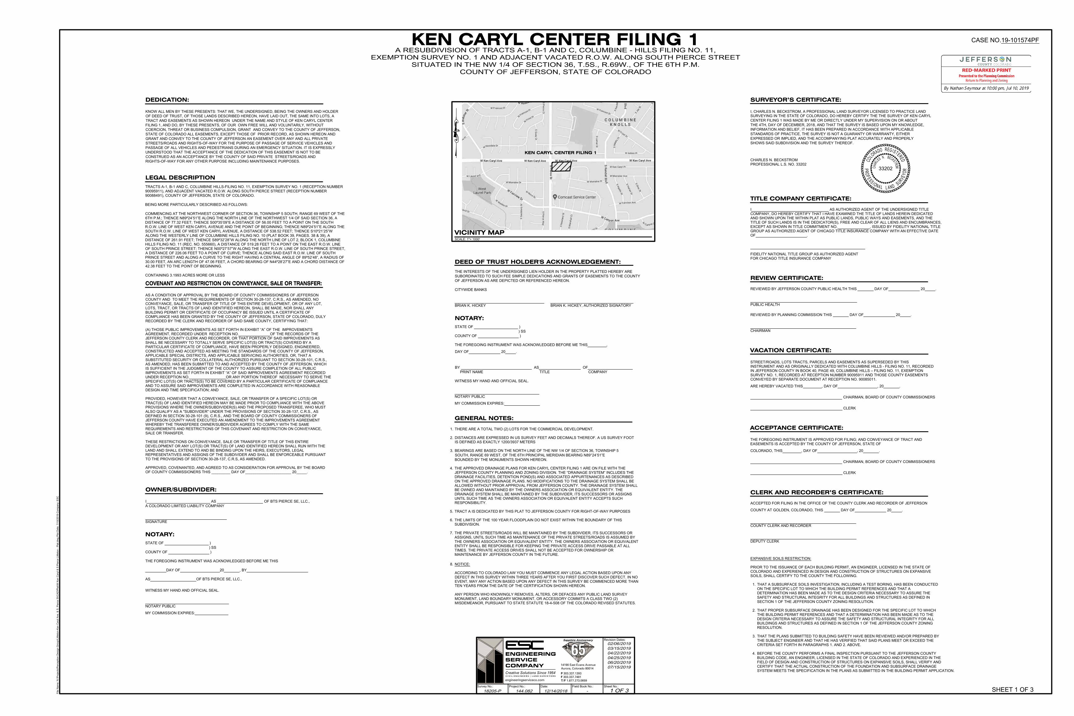
KEN CARYL CENTER FILING 1EXEMPTION SURVEY NO. 1 AND ADJACENT VACATED R.O.W. ALONG SOUTH PIERCE STREET
SITUATED IN THE NW 1/4 OF SECTION 36, T.5S., R.69W., OF THE 6TH P.M.
COUNTY OF JEFFERSON, STATE OF COLORADO
SCALE: 1"= 1000'
VICINITY MAP
SHEET 1 OF 3
C
O
L
O
R
A
D
O
REG
I
S
T
E
R
E
D
33202
PR
O
F
E
S
S
I
O
N
A
L
L AN
D
S
U
R
V
E
Y
O
R
CH
A
R
L
E
S
N
. B
E
C
K
S
T
R
O
M
SURVEYOR’S CERTIFICATE:
SURVEYING IN THE STATE OF COLORADO, DO HEREBY CERTIFY THE THE SURVEY OF KEN CARYL
CENTER FILING 1 WAS MADE BY ME OR DIRECTLY UNDER MY SUPERVISION ON OR ABOUT
THE 4TH, DAY OF DECEMBER, 2018, AND THAT THE SURVEY IS BASED UPON MY KNOWLEDGE,
I, CHARLES N. BECKSTROM, A PROFESSIONAL LAND SURVEYOR LICENSED TO PRACTICE LAND
INFORMATION AND BELIEF, IT HAS BEEN PREPARED IN ACCORDANCE WITH APPLICABLE
STANDARDS OF PRACTICE, THE SURVEY IS NOT A GUARANTY OR WARRANTY, EITHER
EXPRESSED OR IMPLIED, AND THE ACCOMPANYING PLAT ACCURATELY AND PROPERLY
SHOWS SAID SUBDIVISION AND THE SURVEY THEREOF.
TITLE COMPANY CERTIFICATE:
I AS AUTHORIZED AGENT OF THE UNDERSIGNED TITLE
COMPANY, DO HEREBY CERTIFY THAT I HAVE EXAMINED THE TITLE OF LANDS HEREIN DEDICATED
AND SHOWN UPON THE WITHIN PLAT AS PUBLIC LANDS, PUBLIC WAYS AND EASEMENTS, AND THE
TITLE OF SUCH LANDS IS IN THE DEDICATOR(S), FREE AND CLEAR OF ALL LIENS AND ENCUMBRANCES,
EXCEPT AS SHOWN IN TITLE COMMITMENT NO. , ISSUED BY FIDELITY NATIONAL TITLE
OF .
FOR CHICAGO TITLE INSURANCE COMPANY
CLERK AND RECORDER’S CERTIFICATE:
ACCEPTED FOR FILING IN THE OFFICE OF THE COUNTY CLERK AND RECORDER OF JEFFERSON
COUNTY AT GOLDEN, COLORADO, THIS DAY OF 20 .
COUNTY CLERK AND RECORDER
DEPUTY CLERK
REVIEW CERTIFICATE:
REVIEWED BY JEFFERSON COUNTY PUBLIC HEALTH THIS DAY OF 20 .
PUBLIC HEALTH
REVIEWED BY PLANNING COMMISSION THIS DAY OF 20 .
CHAIRMAN
VACATION CERTIFICATE:
ARE HEREBY VACATED THIS , DAY OF , 20 .
CHAIRMAN, BOARD OF COUNTY COMMISSIONERS
CLERK
ACCEPTANCE CERTIFICATE:
EASEMENTS IS ACCEPTED BY THE COUNTY OF JEFFERSON, STATE OF
THE FOREGOING INSTRUMENT IS APPROVED FOR FILING; AND CONVEYANCE OF TRACT AND
CHAIRMAN, BOARD OF COUNTY COMMISSIONERS
CLERK
COLORADO, THIS , DAY OF , 20 .
OWNER/SUBDIVIDER:
STATE OF )
) SS
COUNTY OF )
THE FOREGOING INSTRUMENT WAS ACKNOWLEDGED BEFORE ME THIS
I AS OF BTS PIERCE SE, LLC.,
NOTARY:
AS OF BTS PIERCE SE, LLC.,
DAY OF 20 , BY
WITNESS MY HAND AND OFFICIAL SEAL.
NOTARY PUBLIC
MY COMMISSION EXPIRES:
1. THERE ARE A TOTAL TWO (2) LOTS FOR THE COMMERCIAL DEVELOPMENT.
2. DISTANCES ARE EXPRESSED IN US SURVEY FEET AND DECIMALS THEREOF. A US SURVEY FOOT
IS DEFINED AS EXACTLY 1200/3937 METERS
AS A CONDITION OF APPROVAL BY THE BOARD OF COUNTY COMMISSIONERS OF JEFFERSON
COUNTY AND TO MEET THE REQUIREMENTS OF SECTION 30-28-137, C.R.S., AS AMENDED, NO
CONVEYANCE, SALE, OR TRANSFER OF TITLE OF THIS ENTIRE DEVELOPMENT, OR OF ANY LOT,
LOTS, TRACT, OR TRACTS OF LAND IDENTIFIED HEREON, SHALL BE MADE, NOR SHALL ANY
BUILDING PERMIT OR CERTIFICATE OF OCCUPANCY BE ISSUED UNTIL A CERTIFICATE OF
COMPLIANCE HAS BEEN GRANTED BY THE COUNTY OF JEFFERSON, STATE OF COLORADO, DULY
RECORDED BY THE CLERK AND RECORDER OF SAID SAME COUNTY, CERTIFYING THAT:
(A) THOSE PUBLIC IMPROVEMENTS AS SET FORTH IN EXHIBIT “A” OF THE IMPROVEMENTS
AGREEMENT, RECORDED UNDER RECEPTION NO. OF THE RECORDS OF THE
JEFFERSON COUNTY CLERK AND RECORDER, OR THAT PORTION OF SAID IMPROVEMENTS AS
SHALL BE NECESSARY TO TOTALLY SERVE SPECIFIC LOT(S) OR TRACT(S) COVERED BY A
PARTICULAR CERTIFICATE OF COMPLIANCE, HAVE BEEN PROPERLY DESIGNED, ENGINEERED,
CONSTRUCTED AND ACCEPTED AS MEETING THE STANDARDS OF THE COUNTY OF JEFFERSON,
APPLICABLE SPECIAL DISTRICTS, AND APPLICABLE SERVICING AUTHORITIES, OR, THAT A
SUBSTITUTED SECURITY OR COLLATERAL AUTHORIZED PURSUANT TO SECTION 30-28-101, C.R.S.,
AS AMENDED, HAS BEEN SUBMITTED TO AND ACCEPTED BY THE COUNTY OF JEFFERSON, WHICH
IS SUFFICIENT IN THE JUDGMENT OF THE COUNTY TO ASSURE COMPLETION OF ALL PUBLIC
IMPROVEMENTS AS SET FORTH IN EXHIBIT “A” OF SAID IMPROVEMENTS AGREEMENT RECORDED
UNDER RECEPTION NO. OR ANY PORTION THEREOF NECESSARY TO SERVE THE
SPECIFIC LOT(S) OR TRACTS(S) TO BE COVERED BY A PARTICULAR CERTIFICATE OF COMPLIANCE
AND TO ASSURE SAID IMPROVEMENTS ARE COMPLETED IN ACCORDANCE WITH REASONABLE
DESIGN AND TIME SPECIFICATION; AND
PROVIDED, HOWEVER THAT A CONVEYANCE, SALE, OR TRANSFER OF A SPECIFIC LOT(S) OR
TRACT(S) OF LAND IDENTIFIED HEREON MAY BE MADE PRIOR TO COMPLIANCE WITH THE ABOVE
PROVISIONS WHERE THE OWNER/SUBDIVIDER(S) AND THE PROPOSED TRANSFEREE, WHO MUST
ALSO QUALIFY AS A "SUBDIVIDER" UNDER THE PROVISIONS OF SECTION 30-28-137, C.R.S., AS
DEFINED IN SECTION 30-28-101 (9), C.R.S., AND THE BOARD OF COUNTY COMMISSIONERS OF
JEFFERSON COUNTY HAVE EXECUTED AN AMENDMENT TO THE IMPROVEMENTS AGREEMENT
WHEREBY THE TRANSFEREE OWNER/SUBDIVIDER AGREES TO COMPLY WITH THE SAME
REQUIREMENTS AND RESTRICTIONS OF THIS COVENANT AND RESTRICTION ON CONVEYANCE,
SALE OR TRANSFER.
THESE RESTRICTIONS ON CONVEYANCE, SALE OR TRANSFER OF TITLE OF THIS ENTIRE
DEVELOPMENT OR ANY LOT(S) OR TRACT(S) OF LAND IDENTIFIED HEREON SHALL RUN WITH THE
LAND AND SHALL EXTEND TO AND BE BINDING UPON THE HEIRS, EXECUTORS, LEGAL
REPRESENTATIVES AND ASSIGNS OF THE SUBDIVIDER AND SHALL BE ENFORCEABLE PURSUANT
TO THE PROVISIONS OF SECTION 30-28-137, C.R.S, AS AMENDED.
APPROVED, COVENANTED, AND AGREED TO AS CONSIDERATION FOR APPROVAL BY THE BOARD
OF COUNTY COMMISSIONERS THIS _________ DAY OF______________________ 20_____.
NOTICE:
ACCORDING TO COLORADO LAW YOU MUST COMMENCE ANY LEGAL ACTION BASED UPON ANY
DEFECT IN THIS SURVEY WITHIN THREE YEARS AFTER YOU FIRST DISCOVER SUCH DEFECT. IN NO
EVENT, MAY ANY ACTION BASED UPON ANY DEFECT IN THIS SURVEY BE COMMENCED MORE THAN
TEN YEARS FROM THE DATE OF THE CERTIFICATION SHOWN HEREON.
ANY PERSON WHO KNOWINGLY REMOVES, ALTERS, OR DEFACES ANY PUBLIC LAND SURVEY
MONUMENT, LAND BOUNDARY MONUMENT, OR ACCESSORY COMMITS A CLASS TWO (2)
MISDEMEANOR, PURSUANT TO STATE STATUTE 18-4-508 OF THE COLORADO REVISED STATUTES.
GENERAL NOTES:
A COLORADO LIMITED LIABILITY COMPANY
GROUP AS AUTHORIZED AGENT OF CHICAGO TITLE INSURANCE COMPANY WITH AN EFFECTIVE DATE
CHARLES N. BECKSTROM
PROFESSIONAL L.S. NO. 33202
SIGNATURE
BEARINGS ARE BASED ON THE NORTH LINE OF THE NW 1/4 OF SECTION 36, TOWNSHIP 5
SOUTH, RANGE 69 WEST, OF THE 6TH PRINCIPAL MERIDIAN BEARING N89°24’51”E
BOUNDED BY THE MONUMENTS SHOWN HEREON.
3.
File
N
am
e: N
:\P
ro
je
cts\P
erce
ptio
n D
esig
n G
ro
up
\L
ittle
to
n-K
en
C
aryl A
ve
. &
S
. P
ie
rce
S
t\C
AD
\P
la
t\W
K
en
C
aryl &
S
P
ie
rce
L
ittle
to
n - P
la
t.d
wg
P
lo
t D
ate
: 7
/1
5/2
01
9 C
om
pa
ny: E
SC
COVENANT AND RESTRICTION ON CONVEYANCE, SALE OR TRANSFER:
FIDELITY NATIONAL TITLE GROUP AS AUTHORIZED AGENT
THE APPROVED DRAINAGE PLANS FOR KEN CARYL CENTER FILING 1 ARE ON FILE WITH THE4.
JEFFERSON COUNTY PLANNING AND ZONING DIVISION. THE “DRAINAGE SYSTEM” INCLUDES THE
DRAINAGE FACILITIES, DETENTION POND(S) AND ASSOCIATED APPURTENANCES AS DESCRIBED
ON THE APPROVED DRAINAGE PLANS. NO MODIFICATIONS TO THE DRAINAGE SYSTEM SHALL BE
ALLOWED WITHOUT PRIOR APPROVAL FROM JEFFERSON COUNTY. THE DRAINAGE SYSTEM SHALL
BE OWNED AND MAINTAINED BY THE OWNERS ASSOCIATION OR EQUIVALENT ENTITY. THE
DRAINAGE SYSTEM SHALL BE MAINTAINED BY THE SUBDIVIDER, ITS SUCCESSORS OR ASSIGNS
UNTIL SUCH TIME AS THE OWNERS ASSOCIATION OR EQUIVALENT ENTITY ACCEPTS SUCH
RESPONSIBILITY.
LEGAL DESCRIPTION
TRACT A IS DEDICATED BY THIS PLAT TO JEFFERSON COUNTY FOR RIGHT-OF-WAY PURPOSES
THE LIMITS OF THE 100 YEAR FLOODPLAIN DO NOT EXIST WITHIN THE BOUNDARY OF THIS
SUBDIVISION.
THE PRIVATE STREETS/ROADS WILL BE MAINTAINED BY THE SUBDIVIDER, ITS SUCCESSORS OR
ASSIGNS, UNTIL SUCH TIME AS MAINTENANCE OF THE PRIVATE STREETS/ROADS IS ASSUMED BY
THE OWNERS ASSOCIATION OR EQUIVALENT ENTITY. THE OWNERS ASSOCIATION OR EQUIVALENT
ENTITY SHALL BE RESPONSIBLE FOR KEEPING THE PRIVATE ACCESS DRIVE PASSABLE AT ALL
TIMES. THE PRIVATE ACCESS DRIVES SHALL NOT BE ACCEPTED FOR OWNERSHIP OR
MAINTENANCE BY JEFFERSON COUNTY IN THE FUTURE.
5.
6.
7.
EXPANSIVE SOILS RESTRICTION:
PRIOR TO THE ISSUANCE OF EACH BUILDING PERMIT, AN ENGINEER, LICENSED IN THE STATE OF
COLORADO AND EXPERIENCED IN DESIGN AND CONSTRUCTION OF STRUCTURES ON EXPANSIVE
SOILS, SHALL CERTIFY TO THE COUNTY THE FOLLOWING.
THAT A SUBSURFACE SOILS INVESTIGATION, INCLUDING A TEST BORING, HAS BEEN CONDUCTED
ON THE SPECIFIC LOT TO WHICH THE BUILDING PERMIT REFERENCES AND THAT A
DETERMINATION HAS BEEN MADE AS TO THE DESIGN CRITERIA NECESSARY TO ASSURE THE
SAFETY AND STRUCTURAL INTEGRITY FOR ALL BUILDINGS AND STRUCTURES AS DEFINED IN
SECTION 1 OF THE JEFFERSON COUNTY ZONING RESOLUTION.
THAT PROPER SUBSURFACE DRAINAGE HAS BEEN DESIGNED FOR THE SPECIFIC LOT TO WHICH
THE BUILDING PERMIT REFERENCES AND THAT A DETERMINATION HAS BEEN MADE AS TO THE
DESIGN CRITERIA NECESSARY TO ASSURE THE SAFETY AND STRUCTURAL INTEGRITY FOR ALL
BUILDINGS AND STRUCTURES AS DEFINED IN SECTION 1 OF THE JEFFERSON COUNTY ZONING
RESOLUTION.
THAT THE PLANS SUBMITTED TO BUILDING SAFETY HAVE BEEN REVIEWED AND/OR PREPARED BY
THE SUBJECT ENGINEER AND THAT HE HAS VERIFIED THAT SAID PLANS MEET OR EXCEED THE
CRITERIA SET FORTH IN PARAGRAPHS 1. AND 2. ABOVE.
BEFORE THE COUNTY PERFORMS A FINAL INSPECTION PURSUANT TO THE JEFFERSON COUNTY
BUILDING CODE, AN ENGINEER, LICENSED IN THE STATE OF COLORADO AND EXPERIENCED IN THE
FIELD OF DESIGN AND CONSTRUCTION OF STRUCTURES ON EXPANSIVE SOILS, SHALL VERIFY AND
CERTIFY THAT THE ACTUAL CONSTRUCTION OF THE FOUNDATION AND SUBSURFACE DRAINAGE
SYSTEM MEETS THE SPECIFICATION IN THE PLANS AS SUBMITTED IN THE BUILDING PERMIT APPLICATION.
1.
2.
3.
Project No.:Survey No.: Date: Field Book No.:
Revision Dates:
Sheet No.:
C I V I L E N G I N E E R S | L A N D S U R V E Y O R S
14190 East Evans AvenueAurora, Colorado 80014P 303.337.1393F 303.337.7481T/F 1.877.273.0659
Creative Solutions Since 1954
ENGINEERINGSERVICECOMPANY
Sapphire Anniversary
engineeringserviceco.com
18205-P 144.082 12/14/2018 - 1 OF 3
02/06/2019
03/15/2019
04/22/2019
04/25/2019
06/20/2019
07/15/2019
A RESUBDIVISION OF TRACTS A-1, B-1 AND C, COLUMBINE - HILLS FILING NO. 11,
CASE NO.19-101574PF
8.
STREET/ROADS, LOTS TRACTS, PARCELS AND EASEMENTS AS SUPERSEDED BY THIS
INSTRUMENT AND AS ORIGINALLY DEDICATED WITH COLUMBINE HILLS - FILING NO. 11, RECORDED
IN JEFFERSON COUNTY IN BOOK 40, PAGE 49, COLUMBINE HILLS – FILING NO. 11, EXEMPTION
SURVEY NO. 1, RECORDED AT RECEPTION NUMBER 90095911 AND THOSE COUNTY EASEMENTS
CONVEYED BY SEPARATE DOCUMENT AT RECEPTION NO. 90085011.
TRACTS A-1, B-1 AND C, COLUMBINE HILLS-FILING NO. 11, EXEMPTION SURVEY NO. 1 (RECEPTION NUMBER
90095911), AND ADJACENT VACATED R.O.W. ALONG SOUTH PIERCE STREET (RECEPTION NUMBER
90088491), COUNTY OF JEFFERSON, STATE OF COLORADO.
BEING MORE PARTICULARLY DESCRIBED AS FOLLOWS:
COMMENCING AT THE NORTHWEST CORNER OF SECTION 36, TOWNSHIP 5 SOUTH, RANGE 69 WEST OF THE
6TH P.M.; THENCE N89º24’51”E ALONG THE NORTH LINE OF THE NORTHWEST 1/4 OF SAID SECTION 36, A
DISTANCE OF 77.32 FEET; THENCE S00º35’09”E A DISTANCE OF 56.00 FEET TO A POINT ON THE SOUTH
R.O.W. LINE OF WEST KEN CARYL AVENUE AND THE POINT OF BEGINNING; THENCE N89º24’51”E ALONG THE
SOUTH R.O.W. LINE OF WEST KEN CARYL AVENUE, A DISTANCE OF 538.52 FEET; THENCE S10º21’25”W
ALONG THE WESTERLY LINE OF COLUMBINE HILLS FILING NO. 10 (PLAT BOOK 39, PAGES. 38 & 39), A
DISTANCE OF 261.91 FEET; THENCE S89º32’28”W ALONG THE NORTH LINE OF LOT 2, BLOCK 1, COLUMBINE
HILLS FILING NO. 11 (REC. NO. 555660), A DISTANCE OF 519.28 FEET TO A POINT ON THE EAST R.O.W. LINE
OF SOUTH PRINCE STREET; THENCE N00º27’57”W ALONG THE EAST R.O.W. LINE OF SOUTH PRINCE STREET,
A DISTANCE OF 226.06 FEET TO A POINT OF CURVE; THENCE ALONG SAID EAST R.O.W. LINE OF SOUTH
PRINCE STREET AND ALONG A CURVE TO THE RIGHT HAVING A CENTRAL ANGLE OF 89º52’48”, A RADIUS OF
30.00 FEET, AN ARC LENGTH OF 47.06 FEET, A CHORD BEARING OF N44º28’27”E AND A CHORD DISTANCE OF
42.38 FEET TO THE POINT OF BEGINNING.
CONTAINING 3.1993 ACRES MORE OR LESS
4.
DEED OF TRUST HOLDER'S ACKNOWLEDGEMENT:THE INTERESTS OF THE UNDERSIGNED LIEN HOLDER IN THE PROPERTY PLATTED HEREBY ARE
SUBORDINATED TO SUCH FEE SIMPLE DEDICATIONS AND GRANTS OF EASEMENTS TO THE COUNTY
OF JEFFERSON AS ARE DEPICTED OR REFERENCED HEREON.
STATE OF )
) SS
COUNTY OF )
THE FOREGOING INSTRUMENT WAS ACKNOWLEDGED BEFORE ME THIS ,
WITNESS MY HAND AND OFFICIAL SEAL.
NOTARY PUBLIC
MY COMMISSION EXPIRES:
DAY OF 20 .
CITYWIDE BANKS
NOTARY:
BRIAN K. HICKEY BRIAN K. HICKEY, AUTHORIZED SIGNATORY
BY AS OF
PRINT NAME TITLE COMPANY
KEN CARYL CENTER FILING 1
KNOW ALL MEN BY THESE PRESENTS: THAT WE, THE UNDERSIGNED, BEING THE OWNERS AND HOLDER
OF DEED OF TRUST, OF THOSE LANDS DESCRIBED HEREON, HAVE LAID OUT, THE SAME INTO LOTS, A
TRACT AND EASEMENTS AS SHOWN HEREON UNDER THE NAME AND STYLE OF KEN CARYL CENTER
FILING 1, AND DO, BY THESE PRESENTS, OF OUR OWN FREE WILL AND VOLUNTARILY, WITHOUT
COERCION, THREAT OR BUSINESS COMPULSION, GRANT AND CONVEY TO THE COUNTY OF JEFFERSON,
STATE OF COLORADO ALL EASEMENTS, EXCEPT THOSE OF PRIOR RECORD, AS SHOWN HEREON AND
GRANT AND CONVEY TO THE COUNTY OF JEFFERSON AN EASEMENT OVER ANY AND ALL PRIVATE
STREETS/ROADS AND RIGHTS-OF-WAY FOR THE PURPOSE OF PASSAGE OF SERVICE VEHICLES AND
PASSAGE OF ALL VEHICLES AND PEDESTRIANS DURING AN EMERGENCY SITUATION. IT IS EXPRESSLY
UNDERSTOOD THAT THE ACCEPTANCE OF THE DEDICATION OF THIS EASEMENT IS NOT TO BE
CONSTRUED AS AN ACCEPTANCE BY THE COUNTY OF SAID PRIVATE STREETS/ROADS AND
RIGHTS-OF-WAY FOR ANY OTHER PURPOSE INCLUDING MAINTENANCE PURPOSES.
DEDICATION:
nseymour
Callout
Final Title Commitment will need to reflect BTS ownership.
lwire
Callout
A signed operating agreement and recorded statement of authority are required prior to recordation
nseymour
red marked print PC
rklopf
Text Box
BCC Remark Print August 13, 2019
L.S. NO. 35594
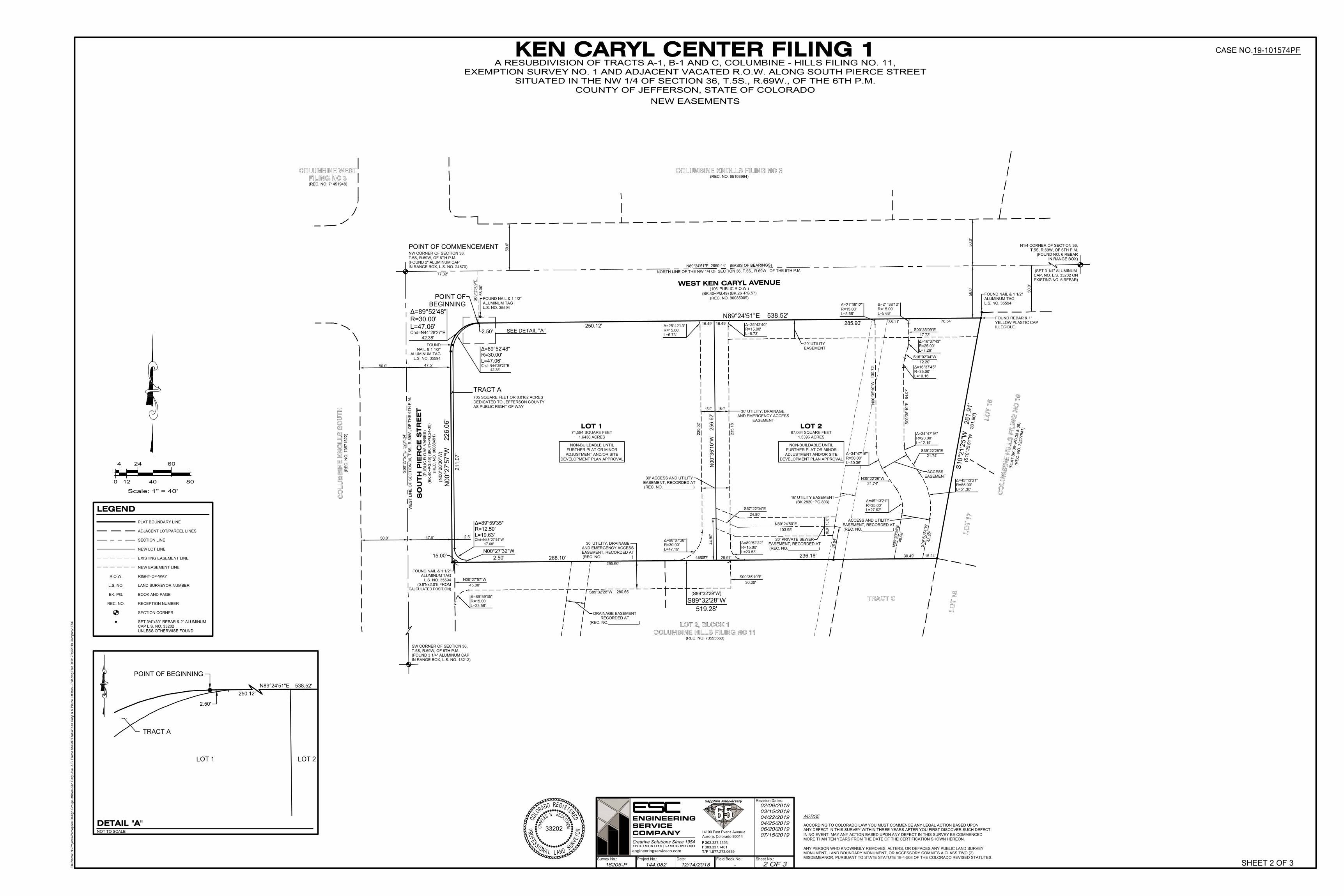
N89°24'51"E 538.52'
N00°27'57"W
226.06'
NAIL & 1 1/2"
L=47.06'
Chd=N44°28'27"E
42.38'
R=30.00'
Δ=89°52'48"
ALUMINUM TAG
FOUND NAIL & 1 1/2"
L.S. NO. 35594
L.S. NO. 35594
ALUMINUM TAG
FOUND NAIL & 1 1/2"
ALUMINUM TAG
FOUND
YELLOW PLASTIC CAP
ILLEGIBLE
FOUND REBAR & 1"
ALUMINUM TAG
L.S. NO. 35594
FOUND NAIL & 1 1/2"
COLUMBINE HILLS FILING NO 11LOT 2, BLOCK 1
WEST KEN CARYL AVENUE(106' PUBLIC R.O.W.)
CO
LU
MB
INE
HIL
LS
FIL
ING
NO
10
N89°24'51"E 2660.44' (BASIS OF BEARINGS)
NORTH LINE OF THE NW 1/4 OF SECTION 36, T.5S., R.69W., OF THE 6TH P.M.
IN RANGE BOX)
(FOUND NO. 6 REBAR
T.5S, R.69W, OF 6TH P.M.
N1/4 CORNER OF SECTION 36,
IN RANGE BOX, L.S. NO. 13212)
(FOUND 3 1/4" ALUMINUM CAP
T.5S, R.69W, OF 6TH P.M.
SW CORNER OF SECTION 36,
S0
0°2
7'5
7"E
5
28
1.3
4'
WE
ST
L
IN
E O
F S
EC
TIO
N 3
6, T
.5
S., R
.6
9W
., O
F T
HE
6
TH
P
.M
.
LOT 171,594 SQUARE FEET
1.6436 ACRES
LOT 267,064 SQUARE FEET
1.5396 ACRES
N00°35'10"W
256.62'
268.10'
236.18'
30' UTILITY, DRAINAGE,
15.0'15.0'
235.18'
Δ=89°52'22"
R=15.00'
L=23.53'
Δ=90°07'38"
R=30.00'
L=47.19'
220.02'
47.5'
47.5'
16.49' 16.49'
(0.8'Nx2.0'E FROM
CALCULATED POSITION)
(S89°32'29"W)
(N
00°28'30"W
)
(REC. NO. 73555660)
TRACT C
56.00'
S00°35'09"E
77.32'
S89°32'28"W
519.28'
COLUMBINE KNOLLS FILING NO 3(REC. NO. 65103994)FILING NO 3
COLUMBINE WEST
(REC. NO. 71451948)
CO
LU
MB
INE
KN
OL
LS
SO
UT
H(R
EC
. N
O. 7
35
71
52
2)
LO
T 1
6
LO
T 1
7
LO
T 1
8
L=47.06'
Chd=N44°28'27"E
42.38'
R=30.00'
Δ=89°52'48"
211.07'
(S
1
0
°2
0
'5
1
"W
2
6
1
.9
0
')
S
1
0
°2
1
'2
5
"W
2
6
1
.9
1
'
AS PUBLIC RIGHT OF WAY
DEDICATED TO JEFFERSON COUNTY
705 SQUARE FEET OR 0.0162 ACRES
TRACT A
Δ=25°42'40"
R=15.00'
L=6.73'
Δ=25°42'43"
R=15.00'
L=6.73'
AND EMERGENCY ACCESS
EASEMENT
(P
L
A
T
B
K
.3
9
~
P
G
.3
8
&
3
9
)
(R
E
C
. N
O
. 7
2
5
2
7
9
4
1
)
2.5'
285.90'
250.12'
15.00'
(BK.40~PG.49) (BK.26~PG.57)
(REC. NO. 90085009)
EXISTING NO. 6 REBAR)
CAP, NO. L.S. 33202 ON
(SET 3 1/4" ALUMINUM
15.24'
76.54'
30.49'
Δ=45°13'21"
R=35.00'
L=27.62'
N35°22'26"W
21.74'
Δ=34°47'16"
R=50.00'
L=30.36'
Δ=21°38'12"
R=15.00'
Δ=21°38'12"
R=15.00'
L=5.66'
S16°02'34"W
12.20'
Δ=16°37'43"
R=25.00'
L=7.26'
S00°35'09"E
17.73'
Δ=16°37'45"
R=35.00'
L=10.16'
S00°35'10"E
84.07'
Δ=34°47'16"
R=20.00'
L=12.14'
S35°22'26"E
21.74'
Δ=45°13'21"
R=65.00'
L=51.30'
S
0
9
°5
0
'5
4
"W
4
3
.5
2
'
ACCESS
45.07'
20' UTILITY
EASEMENT
DEVELOPMENT PLAN APPROVAL
ADJUSTMENT AND/OR SITE
FURTHER PLAT OR MINOR
NON-BUILDABLE UNTIL
DEVELOPMENT PLAN APPROVAL
ADJUSTMENT AND/OR SITE
FURTHER PLAT OR MINOR
NON-BUILDABLE UNTIL
EASEMENT
295.60'
S00°35'10"E
30.00'
S89°32'28"W 280.66'
DRAINAGE EASEMENT
RECORDED AT
(REC. NO.______________)
Δ=89°59'35"
R=15.00'
L=23.56'
30' ACCESS AND UTILITY
EASEMENT, RECORDED AT
(REC. NO.______________)
30' UTILITY, DRAINAGE
AND EMERGENCY ACCESS
EASEMENT, RECORDED AT
(REC. NO.______________)
SO
UTH
PIE
RC
E S
TR
EE
T(P
UB
LIC
R
.O
.W
. V
AR
IE
S)
(B
K.4
0~
PG
.4
9) (B
K.4
1~
PG
.2
4-3
0)
(R
EC
. N
O. 9
00
88
49
1)
L=19.63'
Chd=N45°27'44"W
17.68'
R=12.50'
Δ=89°59'35"
N00°27'32"W
2.50'
38.11'
29.97'
2.50'
SEE DETAIL "A"
N00°27'57"W
45.00'
(FOUND 2" ALUMINUM CAP
T.5S, R.69W, OF 6TH P.M.
NW CORNER OF SECTION 36,
POINT OF COMMENCEMENT
IN RANGE BOX, L.S. NO. 24670)
POINT OF
BEGINNING
N00°35'10"W
130.72'
N
0
9
°5
0
'5
4
"E
4
8
.9
8
'
56
.0
'5
0.0
'
50
.0
'
50
.0
'
50.0'
50.0'
ACCESS AND UTILITY
EASEMENT, RECORDED AT
(REC. NO.______________)
(BK.2820~PG.803)
16' UTILITY EASEMENT
3
6
.0
4
'
44
.9
0'
45.07'
S67°22'04"E
24.80'
N89°24'50"E
103.95'
20' PRIVATE SEWER
EASEMENT, RECORDED AT
(REC. NO.______________)
10.0'
10.0'
L=5.66'
2.50'
N89°24'51"E 538.52'
250.12'
TRACT A
LOT 1 LOT 2
POINT OF BEGINNING
Scale: 1" = 40'
0 12
4 24
40 80
60
LEGEND
SET 3/4"x30" REBAR & 2" ALUMINUM
CAP L.S. NO. 33202
UNLESS OTHERWISE FOUND
PLAT BOUNDARY LINE
ADJACENT LOT/PARCEL LINES
NEW LOT LINE
EXISTING EASEMENT LINE
NEW EASEMENT LINE
RIGHT-OF-WAYR.O.W.
LAND SURVEYOR NUMBERL.S. NO.
BOOK AND PAGEBK. PG.
RECEPTION NUMBERREC. NO.
SECTION CORNER
SECTION LINE
SHEET 2 OF 3
File
N
am
e: N
:\P
ro
je
cts\P
erce
ptio
n D
esig
n G
ro
up
\L
ittle
to
n-K
en
C
aryl A
ve
. &
S
. P
ie
rce
S
t\C
AD
\P
la
t\W
K
en
C
aryl &
S
P
ie
rce
L
ittle
to
n - P
la
t.d
wg
P
lo
t D
ate
: 7
/1
5/2
01
9 C
om
pa
ny: E
SC
C
O
L
O
R
A
D
O
REG
I
S
T
E
R
E
D
33202
PR
O
F
E
S
S
I
O
N
A
L
L AN
D
S
U
R
V
E
Y
OR
CH
A
R
L
E
S
N
. B
E
C
K
S
T
R
O
M
CASE NO.19-101574PF
Project No.:Survey No.: Date: Field Book No.:
Revision Dates:
Sheet No.:
C I V I L E N G I N E E R S | L A N D S U R V E Y O R S
14190 East Evans AvenueAurora, Colorado 80014P 303.337.1393F 303.337.7481T/F 1.877.273.0659
Creative Solutions Since 1954
ENGINEERINGSERVICECOMPANY
Sapphire Anniversary
engineeringserviceco.com
18205-P 144.082 12/14/2018 - 2 OF 3
02/06/2019
03/15/2019
04/22/2019
04/25/2019
06/20/2019
07/15/2019
KEN CARYL CENTER FILING 1EXEMPTION SURVEY NO. 1 AND ADJACENT VACATED R.O.W. ALONG SOUTH PIERCE STREET
SITUATED IN THE NW 1/4 OF SECTION 36, T.5S., R.69W., OF THE 6TH P.M.
COUNTY OF JEFFERSON, STATE OF COLORADO
A RESUBDIVISION OF TRACTS A-1, B-1 AND C, COLUMBINE - HILLS FILING NO. 11,
ACCORDING TO COLORADO LAW YOU MUST COMMENCE ANY LEGAL ACTION BASED UPON
ANY DEFECT IN THIS SURVEY WITHIN THREE YEARS AFTER YOU FIRST DISCOVER SUCH DEFECT.
IN NO EVENT, MAY ANY ACTION BASED UPON ANY DEFECT IN THIS SURVEY BE COMMENCED
ANY PERSON WHO KNOWINGLY REMOVES, ALTERS, OR DEFACES ANY PUBLIC LAND SURVEY
MORE THAN TEN YEARS FROM THE DATE OF THE CERTIFICATION SHOWN HEREON.
MONUMENT, LAND BOUNDARY MONUMENT, OR ACCESSORY COMMITS A CLASS TWO (2)
MISDEMEANOR, PURSUANT TO STATE STATUTE 18-4-508 OF THE COLORADO REVISED STATUTES.
NOTICE:
NEW EASEMENTS
NOT TO SCALE
DETAIL "A"
nseymour
Text Box
Utility, Drainage, and Emergency Access Easement
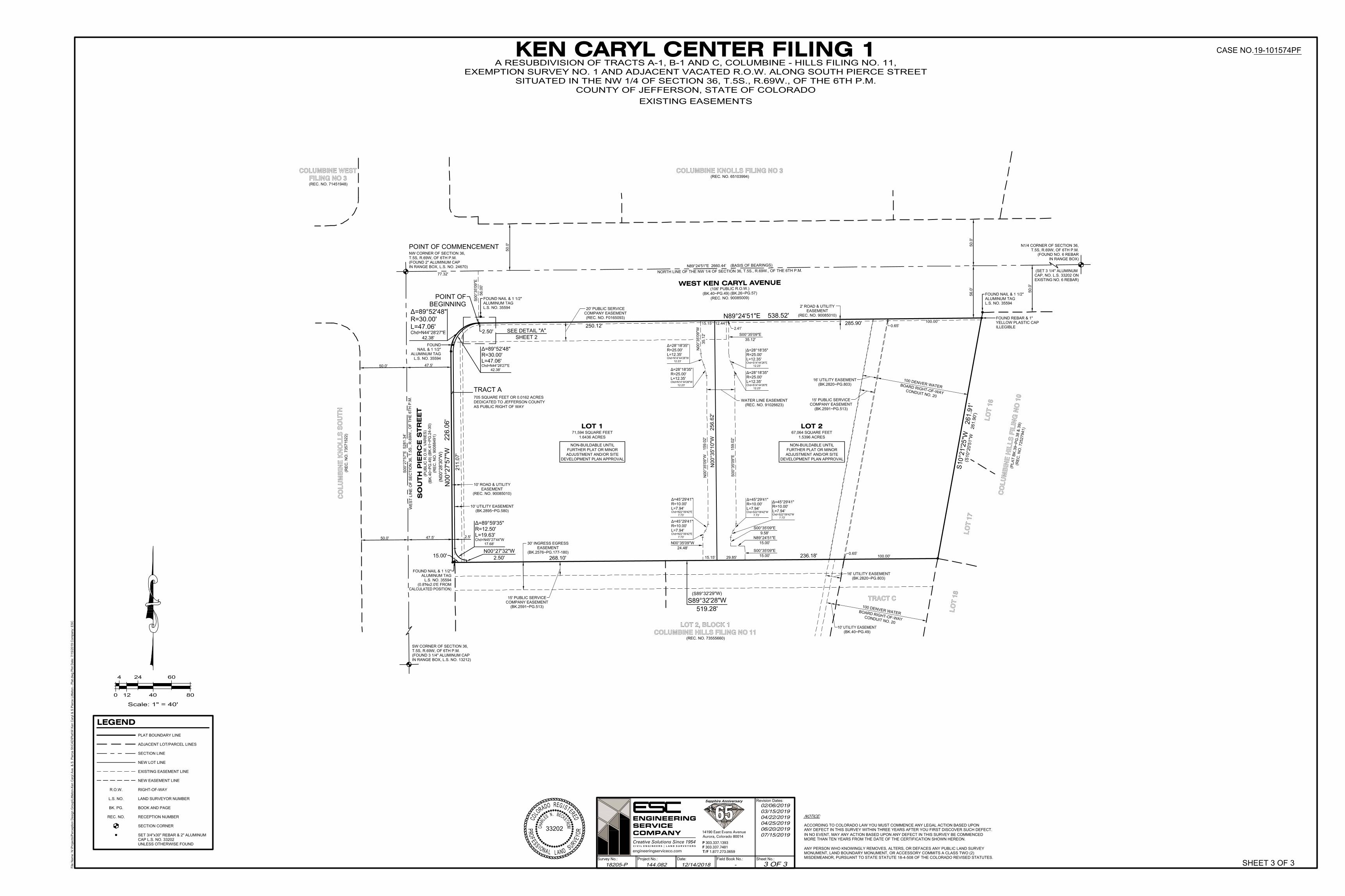
(BK.2591~PG.513)
15' PUBLIC SERVICE
COMPANY EASEMENT
1
0
0
D
E
N
V
E
R
W
A
T
E
R
B
O
A
R
D
R
IG
H
T
-O
F
-W
A
Y
C
O
N
D
U
IT
N
O
. 2
0
L.S. NO. 35594
N89°24'51"E 538.52'
N00°27'57"W
226.06'
NAIL & 1 1/2"
L=47.06'
Chd=N44°28'27"E
42.38'
R=30.00'
Δ=89°52'48"
ALUMINUM TAG
FOUND NAIL & 1 1/2"
L.S. NO. 35594
L.S. NO. 35594
ALUMINUM TAG
FOUND NAIL & 1 1/2"
ALUMINUM TAG
FOUND
YELLOW PLASTIC CAP
ILLEGIBLE
FOUND REBAR & 1"
ALUMINUM TAG
L.S. NO. 35594
FOUND NAIL & 1 1/2"
COLUMBINE HILLS FILING NO 11LOT 2, BLOCK 1
WEST KEN CARYL AVENUE(106' PUBLIC R.O.W.)
CO
LU
MB
INE
HIL
LS
FIL
ING
NO
10
N89°24'51"E 2660.44' (BASIS OF BEARINGS)
NORTH LINE OF THE NW 1/4 OF SECTION 36, T.5S., R.69W., OF THE 6TH P.M.
IN RANGE BOX)
(FOUND NO. 6 REBAR
T.5S, R.69W, OF 6TH P.M.
N1/4 CORNER OF SECTION 36,
IN RANGE BOX, L.S. NO. 13212)
(FOUND 3 1/4" ALUMINUM CAP
T.5S, R.69W, OF 6TH P.M.
SW CORNER OF SECTION 36,
S0
0°2
7'5
7"E
5
28
1.3
4'
WE
ST
L
IN
E O
F S
EC
TIO
N 3
6, T
.5
S., R
.6
9W
., O
F T
HE
6
TH
P
.M
.
LOT 171,594 SQUARE FEET
1.6436 ACRES
LOT 267,064 SQUARE FEET
1.5396 ACRES
N00°35'10"W
256.62'
268.10'
236.18'
10' UTILITY EASEMENT
(BK.40~PG.49)
20' PUBLIC SERVICE
COMPANY EASEMENT
(REC. NO. F0165093)
30' INGRESS EGRESS
EASEMENT
15' PUBLIC SERVICE
COMPANY EASEMENT
(BK.2591~PG.513)
10' UTILITY EASEMENT
(BK.2895~PG.580)
16' UTILITY EASEMENT
(BK.2820~PG.803)
WATER LINE EASEMENT
(REC. NO. 91026623)
47.5'
47.5'
(0.8'Nx2.0'E FROM
CALCULATED POSITION)
(S89°32'29"W)
(N
00°28'30"W
)
(REC. NO. 73555660)
TRACT C
56.00'
S00°35'09"E
77.32'
S89°32'28"W
519.28'
(BK.2576~PG.177-180)
COLUMBINE KNOLLS FILING NO 3(REC. NO. 65103994)FILING NO 3
COLUMBINE WEST
(REC. NO. 71451948)
CO
LU
MB
INE
KN
OL
LS
SO
UT
H(R
EC
. N
O. 7
35
71
52
2)
LO
T 1
6
LO
T 1
7
LO
T 1
8
L=47.06'
Chd=N44°28'27"E
42.38'
R=30.00'
Δ=89°52'48"
211.07'
16' UTILITY EASEMENT
(BK.2820~PG.803)
(S
1
0
°2
0
'5
1
"W
2
6
1
.9
0
')
S
1
0
°2
1
'2
5
"W
2
6
1
.9
1
'
AS PUBLIC RIGHT OF WAY
DEDICATED TO JEFFERSON COUNTY
705 SQUARE FEET OR 0.0162 ACRES
TRACT A
L=12.35'
Chd=S14°44'26"E
12.23'
R=25.00'
Δ=28°18'35"
L=12.35'
Chd=S14°44'26"E
12.23'
R=25.00'
Δ=28°18'35"
S00°35'09"E
159.02'
L=7.94'
Chd=S22°09'42"W
7.73'
R=10.00'
Δ=45°29'41"
L=7.94'
Chd=S22°09'42"W
7.73'
R=10.00'
Δ=45°29'41"
N00°35'09"W
24.48'
L=7.94'
Chd=N22°09'42"E
7.73'
R=10.00'
Δ=45°29'41"
L=7.94'
Chd=N22°09'42"E
7.73'
R=10.00'
Δ=45°29'41"
N00°35'09"W
159.02'
L=12.35'
Chd=N14°44'26"W
12.23'
R=25.00'
Δ=28°18'35"
L=12.35'
Chd=N14°44'26"W
12.23'
R=25.00'
Δ=28°18'35"
29.85'
100.00'
0.65'
0.65'
(P
L
A
T
B
K
.3
9
~
P
G
.3
8
&
3
9
)
(R
E
C
. N
O
. 7
2
5
2
7
9
4
1
)
N00°35'09"W
35.12'
2.5'
285.90'
250.12'
15.00'
(BK.40~PG.49) (BK.26~PG.57)
(REC. NO. 90085009)
EXISTING NO. 6 REBAR)
CAP, NO. L.S. 33202 ON
(SET 3 1/4" ALUMINUM
2.41'
DEVELOPMENT PLAN APPROVAL
ADJUSTMENT AND/OR SITE
FURTHER PLAT OR MINOR
NON-BUILDABLE UNTIL
DEVELOPMENT PLAN APPROVAL
ADJUSTMENT AND/OR SITE
FURTHER PLAT OR MINOR
NON-BUILDABLE UNTIL
SO
UTH
PIE
RC
E S
TR
EE
T(P
UB
LIC
R
.O
.W
. V
AR
IE
S)
(B
K.4
0~
PG
.4
9) (B
K.4
1~
PG
.2
4-3
0)
(R
EC
. N
O. 9
00
88
49
1)
L=19.63'
Chd=N45°27'44"W
17.68'
R=12.50'
Δ=89°59'35"
N00°27'32"W
2.50'
2.50'
SEE DETAIL "A"
SHEET 2
(FOUND 2" ALUMINUM CAP
T.5S, R.69W, OF 6TH P.M.
NW CORNER OF SECTION 36,
POINT OF COMMENCEMENT
IN RANGE BOX, L.S. NO. 24670)
POINT OF
BEGINNING
1
0
0
D
E
N
V
E
R
W
A
T
E
R
B
O
A
R
D
R
IG
H
T
-O
F
-W
A
Y
C
O
N
D
U
IT
N
O
. 2
0
15.15'
S00°35'09"E
15.00'
N89°24'51"E
15.00'
S00°35'09"E
9.58'
S00°35'09"E
35.12'
56
.0
'5
0.0
'
50
.0
'
50
.0
'
50.0'
50.0'
10' ROAD & UTILITY
EASEMENT
(REC. NO. 90085010)
2' ROAD & UTILITY
EASEMENT
(REC. NO. 90085010)
100.00'
12.44'15.15'
Scale: 1" = 40'
0 12
4 24
40 80
60
LEGEND
SET 3/4"x30" REBAR & 2" ALUMINUM
CAP L.S. NO. 33202
UNLESS OTHERWISE FOUND
PLAT BOUNDARY LINE
ADJACENT LOT/PARCEL LINES
NEW LOT LINE
EXISTING EASEMENT LINE
NEW EASEMENT LINE
RIGHT-OF-WAYR.O.W.
LAND SURVEYOR NUMBERL.S. NO.
BOOK AND PAGEBK. PG.
RECEPTION NUMBERREC. NO.
SECTION CORNER
SECTION LINE
SHEET 3 OF 3
File
N
am
e: N
:\P
ro
je
cts\P
erce
ptio
n D
esig
n G
ro
up
\L
ittle
to
n-K
en
C
aryl A
ve
. &
S
. P
ie
rce
S
t\C
AD
\P
la
t\W
K
en
C
aryl &
S
P
ie
rce
L
ittle
to
n - P
la
t.d
wg
P
lo
t D
ate
: 7
/1
5/2
01
9 C
om
pa
ny: E
SC
C
O
L
O
R
A
D
O
REG
I
S
T
E
R
E
D
33202
PR
O
F
E
S
S
I
O
N
A
L
L AN
D
S
U
R
V
E
Y
OR
CH
A
R
L
E
S
N
. B
E
C
K
S
T
R
O
M
CASE NO.19-101574PF
Project No.:Survey No.: Date: Field Book No.:
Revision Dates:
Sheet No.:
C I V I L E N G I N E E R S | L A N D S U R V E Y O R S
14190 East Evans AvenueAurora, Colorado 80014P 303.337.1393F 303.337.7481T/F 1.877.273.0659
Creative Solutions Since 1954
ENGINEERINGSERVICECOMPANY
Sapphire Anniversary
engineeringserviceco.com
18205-P 144.082 12/14/2018 - 3 OF 3
02/06/2019
03/15/2019
04/22/2019
04/25/2019
06/20/2019
07/15/2019
KEN CARYL CENTER FILING 1EXEMPTION SURVEY NO. 1 AND ADJACENT VACATED R.O.W. ALONG SOUTH PIERCE STREET
SITUATED IN THE NW 1/4 OF SECTION 36, T.5S., R.69W., OF THE 6TH P.M.
COUNTY OF JEFFERSON, STATE OF COLORADO
A RESUBDIVISION OF TRACTS A-1, B-1 AND C, COLUMBINE - HILLS FILING NO. 11,
ACCORDING TO COLORADO LAW YOU MUST COMMENCE ANY LEGAL ACTION BASED UPON
ANY DEFECT IN THIS SURVEY WITHIN THREE YEARS AFTER YOU FIRST DISCOVER SUCH DEFECT.
IN NO EVENT, MAY ANY ACTION BASED UPON ANY DEFECT IN THIS SURVEY BE COMMENCED
ANY PERSON WHO KNOWINGLY REMOVES, ALTERS, OR DEFACES ANY PUBLIC LAND SURVEY
MORE THAN TEN YEARS FROM THE DATE OF THE CERTIFICATION SHOWN HEREON.
MONUMENT, LAND BOUNDARY MONUMENT, OR ACCESSORY COMMITS A CLASS TWO (2)
MISDEMEANOR, PURSUANT TO STATE STATUTE 18-4-508 OF THE COLORADO REVISED STATUTES.
NOTICE:
EXISTING EASEMENTS
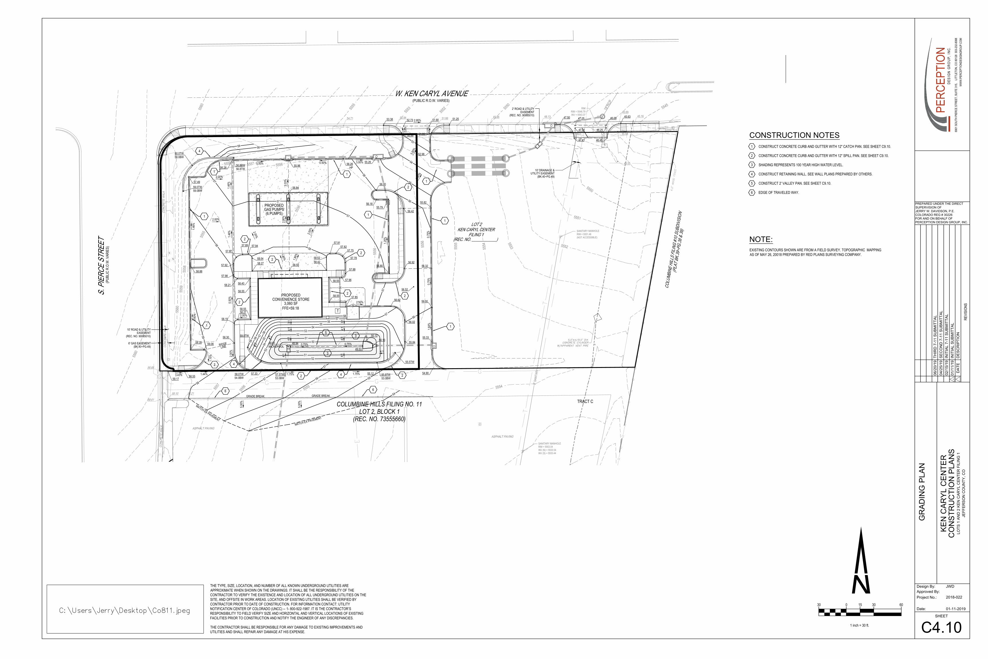
SANITARY MANHOLERIM = 5551.46(NOT ACCESSIBLE)
56.42
55.82
ASPHALT PAVING
CONC
RETE
WAL
K
ASPHALT PAVING
CONC
RETE
WAL
KCO
NCRE
TE W
ALK
S. P
IERC
E ST
REET
(PUB
LIC R
.O.W
. VAR
IES)
COLUMBINE HILLS FILING NO. 11LOT 2, BLOCK 1
(REC. NO. 73555660)
COLU
MBIN
E HI
LLS
FILIN
G #1
0 SUB
DIVI
SION
5545
5550
5555
5560
5560
5550
SANITARY MANHOLERIM = 5553.04INV (N) = 5533.54INV (S) = 5533.44
8" S
ANIT
ARY
CONVENIENCE STORE3,060 SF
58.89
58.6159.10 58.21
59.1755.12
46.54
48.53
FFE=59.18
58.27 58.4258.55
58.5558.40
58.55
58.55
58.551.8
0%
1.80%
2.00%
2.00%
2.00%
1.75% 1.75%
5555
5555
5556
5556
5554 5553 5552
5551
55545555
55565557
5560
5559
5558
56.8BW56.8TW
60.0TW58.0BW
59.0TW59.0BW
2.50%
56.32
0.75%
0.75%
56.92
56.1855.79
56.00
1.25%
5556
555655575558
57.3358.55
1.44%3.43%
2.00%
58.30
57.96
57.88
57.75
57.78
57.8257.91
58.02
57.9457.89
57.92
57.87
58.04
58.21
58.27
58.19
1.15%
59.06 RIDGELINE
56.02
55.8448.94 0.75% 0.75%49.53
55.33
LOT 2KEN CARYL CENTER
FILING 1
55.5TW53.0BW
50.13
48.61MICROPOOL
3.00%0.50%
5.00%
52.98
5.00%
54.90
56.00
1.64%
50.13
57.5TW53.0BW
TRACT C
(PLA
T BK
.39~P
G.38
& 39
)
10' ROAD & UTILITY
2' ROAD & UTILITY
EASEMENT(REC. NO. 90085010)
EASEMENT(REC. NO. 90085010)
10' DRAINAGE &UTILITY EASEMENT
(BK.40~PG.49)
6' GAS EASEMENT(BK.40~PG.49)
57.8556.62
56.80
57.49
59.35
W. KEN CARYL AVENUE(PUBLIC R.O.W. VARIES)
56.52
55.2656.26HP
0.50%55.96
2.33%
2.00%
56.26
1.46%
2.00%
56.84
57.98
0.50%
2.00%
58.88
1.46%
0.50%
56
56
58
58
57
58
57
5758
575859
56
5756
5554
5352
5150
57
5051
52
56 55
54
58 57
57
5758
59
PROPOSEDGAS PUMPS(6 PUMPS)
1.46%
PROPOSED
58.0TW54.0BW
59.0TW
5354
5556
5758
59
55.5TW
RIMRIM = 5546.79INV = 5543.37
15"P
VC18
"RCP
48.13 46.24 45.1645.69
45.6347.50 47.05 46.09
46.2547.21
47.41 46.45
5.00%
(REC. NO. ____________)
T
4:14:1
3:1
4:14:1
3:14:14:1
4:1
4:1
3:1
54.71 51.6652.9453.3849.9651.252.95%52.73 51.90
51.96
5552
5553
52.88
2.0%
2.0%
54
55
53
5.00%11
1
1
6
2
2 2
2
2
2
2
2
21
1
1
4
1
2
5
4
4
6
MATCH EX PAVEMENT
MATCH EX PAVEMENT
GRADE BREAK GRADE BREAK
3
3
GR
AD
IN
G P
LA
N
C4.10
0
1 inch = 30 ft.
30 15 30 60
4
3
2
CONSTRUCT CONCRETE CURB AND GUTTER WITH 12" CATCH PAN. SEE SHEET C9.10.
CONSTRUCT CONCRETE CURB AND GUTTER WITH 12" SPILL PAN. SEE SHEET C9.10.
SHADING REPRESENTS 100 YEAR HIGH WATER LEVEL.
CONSTRUCT RETAINING WALL. SEE WALL PLANS PREPARED BY OTHERS.
CONSTRUCT 2' VALLEY PAN. SEE SHEET C9.10.
EDGE OF TRAVELED WAY.
1
CONSTRUCTION NOTES
REVI
SION
S
DA
TE
DE
SC
RIP
TIO
N
Date:
Project No.:
Approved By:
Design By: JWD
IN
IT
IA
L S
UB
MIT
TA
L
LO
TS
1
A
ND
2
K
EN
C
AR
YL
C
EN
TE
R F
IL
IN
G 1
JE
FF
ER
SO
N C
OU
NT
Y, C
O
KE
N C
AR
YL C
EN
TE
R
PREPARED UNDER THE DIRECT
SUPERVISION OF
JERRY W. DAVIDSON, P.E.
COLORADO REG # 30226
FOR AND ON BEHALF OF
PERCEPTION DESIGN GROUP, INC.
01
/1
1/1
9
-
THE TYPE, SIZE, LOCATION, AND NUMBER OF ALL KNOWN UNDERGROUND UTILITIES AREAPPROXIMATE WHEN SHOWN ON THE DRAWINGS. IT SHALL BE THE RESPONSIBILITY OF THECONTRACTOR TO VERIFY THE EXISTENCE AND LOCATION OF ALL UNDERGROUND UTILITIES ON THESITE, AND OFFSITE IN WORK AREAS. LOCATION OF EXISTING UTILITIES SHALL BE VERIFIED BYCONTRACTOR PRIOR TO DATE OF CONSTRUCTION. FOR INFORMATION CONTACT: UTILITYNOTIFICATION CENTER OF COLORADO (UNCC) – 1- 800-922-1987. IT IS THE CONTRACTOR’SRESPONSIBILITY TO FIELD VERIFY SIZE AND HORIZONTAL AND VERTICAL LOCATIONS OF EXISTINGFACILITIES PRIOR TO CONSTRUCTION AND NOTIFY THE ENGINEER OF ANY DISCREPANCIES.
THE CONTRACTOR SHALL BE RESPONSIBLE FOR ANY DAMAGE TO EXISTING IMPROVEMENTS ANDUTILITIES AND SHALL REPAIR ANY DAMAGE AT HIS EXPENSE.
CO
NS
TR
UC
TIO
N P
LA
NS
6901
SOU
TH P
IERC
E ST
REET
, SUI
TE 31
5, L
ITTL
ETON
, CO
8012
8 30
3-23
2-80
88W
WW
.PER
CEPT
IOND
ESIG
NGRO
UP.C
OM
PERC
EPTI
ONDE
SIG
NG
ROU
P,IN
C.
2018-022
01-11-2019
SHEET
IN
IT
IA
L 7
-1
1 S
UB
MIT
TA
L0
2/1
5/1
9
SE
CO
ND
7
-1
1 S
UB
MIT
TA
L0
4/2
5/1
9
TH
IR
D 7
-1
1 S
UB
MIT
TA
L0
6/2
0/1
9
5
EXISTING CONTOURS SHOWN ARE FROM A FIELD SURVEY. TOPOGRAPHIC MAPPINGAS OF MAY 26, 20018 PREPARED BY RED PLAINS SURVEYING COMPANY.
NOTE:
6
AutoCAD SHX Text
E
AutoCAD SHX Text
S
AutoCAD SHX Text
S
AutoCAD SHX Text
S
AutoCAD SHX Text
S
AutoCAD SHX Text
T
AutoCAD SHX Text
TP
AutoCAD SHX Text
TP
AutoCAD SHX Text
TP
AutoCAD SHX Text
TP
AutoCAD SHX Text
TP
AutoCAD SHX Text
6.0' WOOD FENCE
AutoCAD SHX Text
5.0'±H/9.0' DIA. CONCRETE CYLINDER W/APPARENT VENT PIPE
AutoCAD SHX Text
S
AutoCAD SHX Text
S
AutoCAD SHX Text
S
rklopf
Callout
Show drainage easement locations
nseymour
Text Box
Supplemental Information Only
nseymour
Text Box
Supplemental Information - Adjacent Street and Detention/Water Quality Improvements required with the Preliminary and Final Plat.
rklopf
Red Marked Print -1
rklopf
Text Box
BCC Redmark Print August 13, 2019
6901 South Pierce Street, Suite 315 Littleton, Colorado 80128 Voice 303-232-8088
April 25, 2019 Jefferson County Colorado Development and Transportation 100 Jefferson County Pkwy Suite 3550 Golden, CO 80419 Re: Preliminary Supplemental Information – Ken Caryl Center Filing 1 a. Name, address and phone number of the owner(s) and developer. Developer: Cadence Development, LLC 6400 S Fiddlers Green Cir, Suite 1820. Greenwood Village, CO 80111 (720) 439‐5100 Owner: Midstates Building LLC 1830 W 38th Ave. Denver, CO 80211 [email protected] b. Name, address and phone number of the person, firm or organization preparing plat. Engineering Service Company 14190 East Evans Avenue Aurora, Colorado 80014 Attn: Charles Beckstrom c. A statement of the water source, including the well permit number and water court
decree for any well or surface right to be used, including an estimate of the total number of gallons per day of water system requirements when a distribution system is proposed.
Water Source: Platte Canyon Water and Sanitation District Water Estimate: 7,400 gpd
Meredith Reckert, AICP WZ‐18‐08 Response to ODP Comments Page 2 of 2
d. A statement of provisions for sewage disposal that includes the estimated total number of gallons per day of sewage to be treated when a central sewage facility is proposed.
Sewer Service Provider: Platte Canyon Water and Sanitation District Sewer Estimate: 2,000 gpd e. Estimated fire flow of fire hydrants or gallon capacity of fire cisterns. 1,500 gpm @ 20psi residual
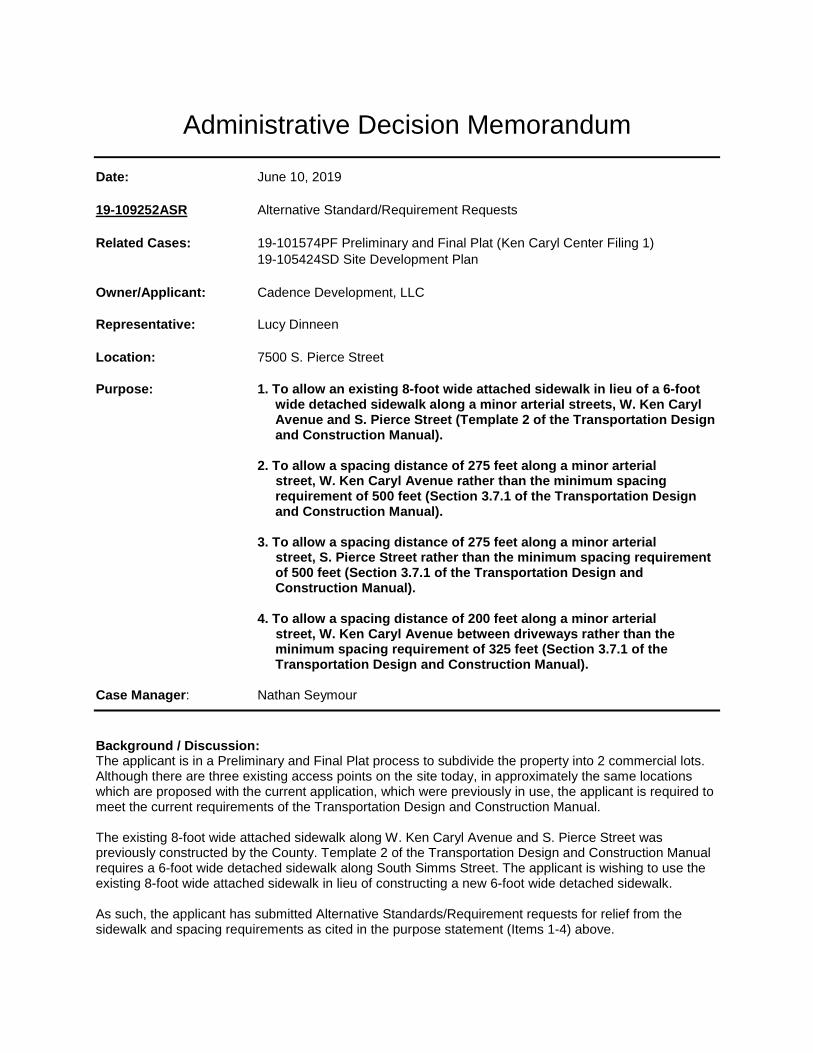
Administrative Decision Memorandum
Date: June 10, 2019
19-109252ASR Alternative Standard/Requirement Requests Related Cases: 19-101574PF Preliminary and Final Plat (Ken Caryl Center Filing 1) 19-105424SD Site Development Plan
Owner/Applicant: Cadence Development, LLC Representative: Lucy Dinneen
Location: 7500 S. Pierce Street Purpose: 1. To allow an existing 8-foot wide attached sidewalk in lieu of a 6-foot wide detached sidewalk along a minor arterial streets, W. Ken Caryl
Avenue and S. Pierce Street (Template 2 of the Transportation Design and Construction Manual).
2. To allow a spacing distance of 275 feet along a minor arterial
street, W. Ken Caryl Avenue rather than the minimum spacing requirement of 500 feet (Section 3.7.1 of the Transportation Design and Construction Manual).
3. To allow a spacing distance of 275 feet along a minor arterial
street, S. Pierce Street rather than the minimum spacing requirement of 500 feet (Section 3.7.1 of the Transportation Design and Construction Manual).
4. To allow a spacing distance of 200 feet along a minor arterial
street, W. Ken Caryl Avenue between driveways rather than the minimum spacing requirement of 325 feet (Section 3.7.1 of the Transportation Design and Construction Manual).
Case Manager: Nathan Seymour
Background / Discussion: The applicant is in a Preliminary and Final Plat process to subdivide the property into 2 commercial lots. Although there are three existing access points on the site today, in approximately the same locations which are proposed with the current application, which were previously in use, the applicant is required to meet the current requirements of the Transportation Design and Construction Manual. The existing 8-foot wide attached sidewalk along W. Ken Caryl Avenue and S. Pierce Street was previously constructed by the County. Template 2 of the Transportation Design and Construction Manual requires a 6-foot wide detached sidewalk along South Simms Street. The applicant is wishing to use the existing 8-foot wide attached sidewalk in lieu of constructing a new 6-foot wide detached sidewalk. As such, the applicant has submitted Alternative Standards/Requirement requests for relief from the sidewalk and spacing requirements as cited in the purpose statement (Items 1-4) above.
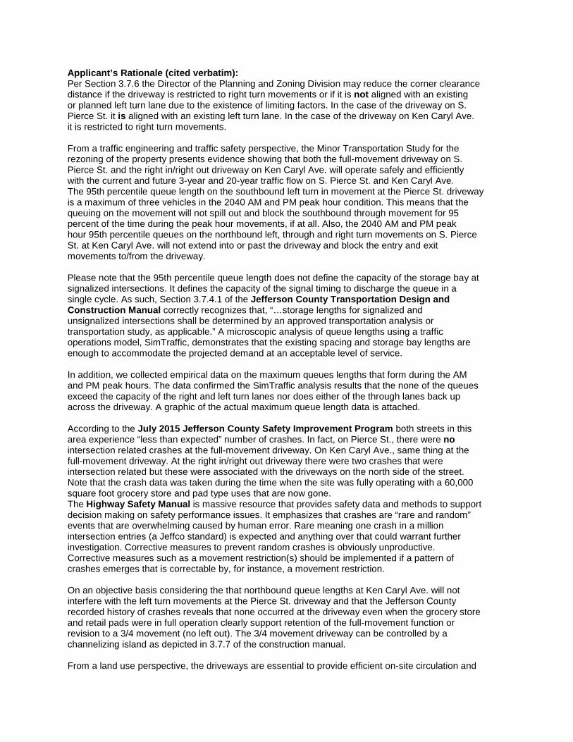
Applicant’s Rationale (cited verbatim): Per Section 3.7.6 the Director of the Planning and Zoning Division may reduce the corner clearance distance if the driveway is restricted to right turn movements or if it is not aligned with an existing or planned left turn lane due to the existence of limiting factors. In the case of the driveway on S. Pierce St. it is aligned with an existing left turn lane. In the case of the driveway on Ken Caryl Ave. it is restricted to right turn movements. From a traffic engineering and traffic safety perspective, the Minor Transportation Study for the rezoning of the property presents evidence showing that both the full-movement driveway on S. Pierce St. and the right in/right out driveway on Ken Caryl Ave. will operate safely and efficiently with the current and future 3-year and 20-year traffic flow on S. Pierce St. and Ken Caryl Ave. The 95th percentile queue length on the southbound left turn in movement at the Pierce St. driveway is a maximum of three vehicles in the 2040 AM and PM peak hour condition. This means that the queuing on the movement will not spill out and block the southbound through movement for 95 percent of the time during the peak hour movements, if at all. Also, the 2040 AM and PM peak hour 95th percentile queues on the northbound left, through and right turn movements on S. Pierce St. at Ken Caryl Ave. will not extend into or past the driveway and block the entry and exit movements to/from the driveway. Please note that the 95th percentile queue length does not define the capacity of the storage bay at signalized intersections. It defines the capacity of the signal timing to discharge the queue in a single cycle. As such, Section 3.7.4.1 of the Jefferson County Transportation Design and Construction Manual correctly recognizes that, “…storage lengths for signalized and unsignalized intersections shall be determined by an approved transportation analysis or transportation study, as applicable.” A microscopic analysis of queue lengths using a traffic operations model, SimTraffic, demonstrates that the existing spacing and storage bay lengths are enough to accommodate the projected demand at an acceptable level of service. In addition, we collected empirical data on the maximum queues lengths that form during the AM and PM peak hours. The data confirmed the SimTraffic analysis results that the none of the queues exceed the capacity of the right and left turn lanes nor does either of the through lanes back up across the driveway. A graphic of the actual maximum queue length data is attached. According to the July 2015 Jefferson County Safety Improvement Program both streets in this area experience “less than expected” number of crashes. In fact, on Pierce St., there were no intersection related crashes at the full-movement driveway. On Ken Caryl Ave., same thing at the full-movement driveway. At the right in/right out driveway there were two crashes that were intersection related but these were associated with the driveways on the north side of the street. Note that the crash data was taken during the time when the site was fully operating with a 60,000 square foot grocery store and pad type uses that are now gone. The Highway Safety Manual is massive resource that provides safety data and methods to support decision making on safety performance issues. It emphasizes that crashes are “rare and random” events that are overwhelming caused by human error. Rare meaning one crash in a million intersection entries (a Jeffco standard) is expected and anything over that could warrant further investigation. Corrective measures to prevent random crashes is obviously unproductive. Corrective measures such as a movement restriction(s) should be implemented if a pattern of crashes emerges that is correctable by, for instance, a movement restriction. On an objective basis considering the that northbound queue lengths at Ken Caryl Ave. will not interfere with the left turn movements at the Pierce St. driveway and that the Jefferson County recorded history of crashes reveals that none occurred at the driveway even when the grocery store and retail pads were in full operation clearly support retention of the full-movement function or revision to a 3/4 movement (no left out). The 3/4 movement driveway can be controlled by a channelizing island as depicted in 3.7.7 of the construction manual. From a land use perspective, the driveways are essential to provide efficient on-site circulation and
access to/from the adjacent streets and intersections. Denying their use would render the property useless as the only access would be from the full-movement service type driveway on the east side which is a joint access easement with the property to the east and south and perhaps from driveways further south on Pierce St. However, this would require a cross-access agreement with the property owner to the south. Presently there is no agreement and certainly no guarantee that one would be executed in the future. Regarding the spacing of the right in/right out movement driveway and the full-movement driveway on Ken Caryl Ave., meeting the standard would require frontage of 650 feet. That isn’t available at approximately 525 feet. The about equidistance spacing is the best engineering fit. Clearly the existing driveways and spacing have long served the commercial land uses on this corner for many years with detriment to the traffic flow and safety on the adjacent streets and intersections. Compliance with the corner clearance and spacing standards would move the driveways off the property which is impossible. Based on the analysis herein and documentation provided on the County on safety, review of the current street and intersection geometry. and operations analyses for the near-term and long-term growth scenarios, it is my professional opinion that retention of the existing driveway locations and type including the revision of the Pierce St. driveway to a 3/4 movement will be equivalent to that prescribed in the Land Development Regulation in quality, effectiveness, durability, and safety. Applicable Regulations: Section 2.B.2 of the Jefferson County Land Development Regulation allows the Director of Planning and Zoning the authority to make decisions on any request for Alternative Standards/Requirements, unless the specific provision indicates that a decision is to be made by the Board of County Commissioners. The following shall be considered for Alternative Standards/Requirements of the Land Development Regulation:
a. The applicant can demonstrate that alternate solutions or designs will not be detrimental to or contrary to the Purpose of this Regulation and will be in harmony with the general purpose and intent of the provision for which a waiver is sought.
b. The applicant can demonstrate that strict compliance with such provision would be impossible,
impractical or undesirable. Referral: This request was sent on a 2-week referral to internal agencies including the Transportation and Engineering, Road and Bridge and Current Planning. The referrals resulted in no objections or concerns. Notification: The Alternative Standard request was sent to adjacent property owners and registered associations per Level 1 Notification procedures. Staff did not receive any objections, simply requests for information. Analysis: Staff is supportive of the Alternative Standard requests. Staff findings are based upon the following: Spacing Requirements:
• Staff has no objections to the request to the intersection spacing requests. There are also no objections from any nearby property owners. Staff believes that keeping the intersections in the same location as the previous development on the property will not result in any adverse safety issued.
• The applicant has agreed to make several improvements per the recommendations of Staff to include fees for the construction of a median in W. Ken Caryl Avenue, fees for the intersection
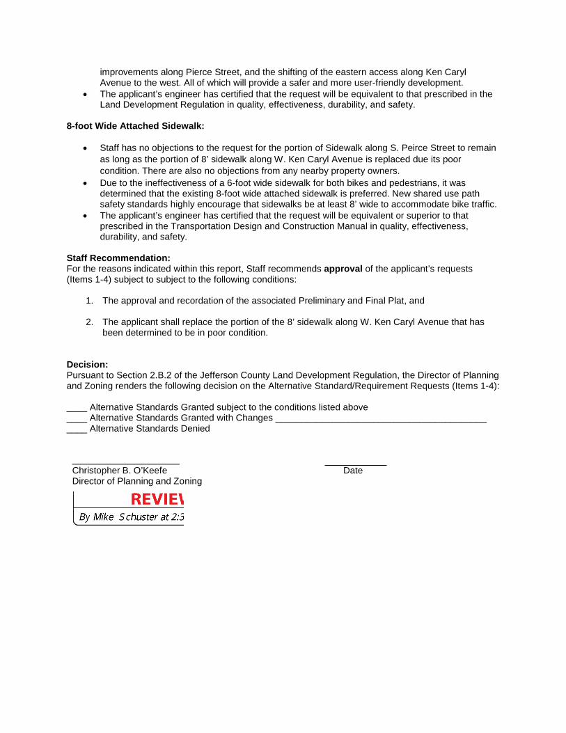
improvements along Pierce Street, and the shifting of the eastern access along Ken Caryl Avenue to the west. All of which will provide a safer and more user-friendly development.
• The applicant’s engineer has certified that the request will be equivalent to that prescribed in the Land Development Regulation in quality, effectiveness, durability, and safety.
8-foot Wide Attached Sidewalk:
• Staff has no objections to the request for the portion of Sidewalk along S. Peirce Street to remain as long as the portion of 8’ sidewalk along W. Ken Caryl Avenue is replaced due its poor condition. There are also no objections from any nearby property owners.
• Due to the ineffectiveness of a 6-foot wide sidewalk for both bikes and pedestrians, it was determined that the existing 8-foot wide attached sidewalk is preferred. New shared use path safety standards highly encourage that sidewalks be at least 8’ wide to accommodate bike traffic.
• The applicant’s engineer has certified that the request will be equivalent or superior to that prescribed in the Transportation Design and Construction Manual in quality, effectiveness, durability, and safety.
Staff Recommendation: For the reasons indicated within this report, Staff recommends approval of the applicant’s requests (Items 1-4) subject to subject to the following conditions:
1. The approval and recordation of the associated Preliminary and Final Plat, and
2. The applicant shall replace the portion of the 8’ sidewalk along W. Ken Caryl Avenue that has been determined to be in poor condition.
Decision: Pursuant to Section 2.B.2 of the Jefferson County Land Development Regulation, the Director of Planning and Zoning renders the following decision on the Alternative Standard/Requirement Requests (Items 1-4): ____ Alternative Standards Granted subject to the conditions listed above ____ Alternative Standards Granted with Changes _________________________________________ ____ Alternative Standards Denied
Christopher B. O’Keefe Date Director of Planning and Zoning
mschuste
Reviewed
cokeefe
Typewritten Text
x
cokeefe
Typewritten Text
June 12, 2019
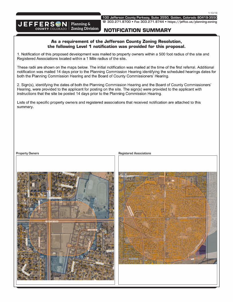
100 Jefferson County Parkway, Suite 3550, Golden, Colorado 80419-3550
303.271.8700 • Fax 303.271.8744 • https://jeffco.us/planning-zoningPlanning & Zoning Division NOTIFICATION SUMMARY
1-10-19
As a requirement of the Jefferson County Zoning Resolution, the following Level 1 notification was provided for this proposal.
Property Owners Registered Associations
19 HOA within 1 miles of subject properties
HOA Name
COHOPE
COLUMBINE HILLS CIVIC ASSN
COLUMBINE KNOLLS HOA
COLUMBINE KNOLLS SOUTH ESTATES
COLUMBINE KNOLLS SOUTH II HOA
COLUMBINE TOWNHOUSES I
COLUMBINE TOWNHOUSES II
COLUMBINE WEST CIVIC ASSN
DUTCH RIDGE HOA
JEFFERSON CORPORATE CENTER OWNERS ASSN
JEFFERSON COUNTY HORSE COUNCIL
MARINA POINT COVE
NORMANDY ESTATES IMPROVEMENT ASSN INC
PLAN JEFFCO
PRECEDENT AT STONY CREEK
STONY CREEK 6 HOA
TERRACE AT COLUMBINE CONDO ASSOCIATION
THE ENCLAVE AT NORMANDY HOA, INC
WESTLAKE
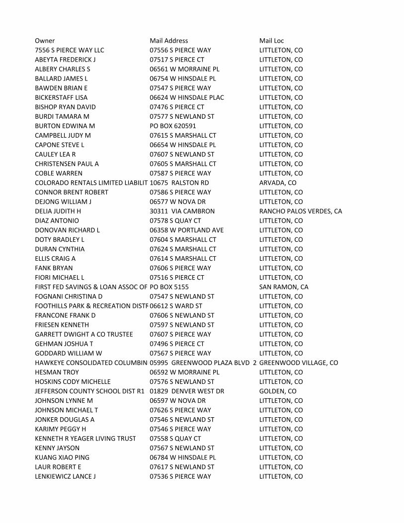
Owner Mail Address Mail Loc
7556 S PIERCE WAY LLC 07556 S PIERCE WAY LITTLETON, CO
ABEYTA FREDERICK J 07517 S PIERCE CT LITTLETON, CO
ALBERY CHARLES S 06561 W MORRAINE PL LITTLETON, CO
BALLARD JAMES L 06754 W HINSDALE PL LITTLETON, CO
BAWDEN BRIAN E 07547 S PIERCE WAY LITTLETON, CO
BICKERSTAFF LISA 06624 W HINSDALE PLAC LITTLETON, CO
BISHOP RYAN DAVID 07476 S PIERCE CT LITTLETON, CO
BURDI TAMARA M 07577 S NEWLAND ST LITTLETON, CO
BURTON EDWINA M PO BOX 620591 LITTLETON, CO
CAMPBELL JUDY M 07615 S MARSHALL CT LITTLETON, CO
CAPONE STEVE L 06654 W HINSDALE PL LITTLETON, CO
CAULEY LEA R 07607 S NEWLAND ST LITTLETON, CO
CHRISTENSEN PAUL A 07605 S MARSHALL CT LITTLETON, CO
COBLE WARREN 07587 S PIERCE WAY LITTLETON, CO
COLORADO RENTALS LIMITED LIABILITY10675 RALSTON RD ARVADA, CO
CONNOR BRENT ROBERT 07586 S PIERCE WAY LITTLETON, CO
DEJONG WILLIAM J 06577 W NOVA DR LITTLETON, CO
DELIA JUDITH H 30311 VIA CAMBRON RANCHO PALOS VERDES, CA
DIAZ ANTONIO 07578 S QUAY CT LITTLETON, CO
DONOVAN RICHARD L 06358 W PORTLAND AVE LITTLETON, CO
DOTY BRADLEY L 07604 S MARSHALL CT LITTLETON, CO
DURAN CYNTHIA 07624 S MARSHALL CT LITTLETON, CO
ELLIS CRAIG A 07614 S MARSHALL CT LITTLETON, CO
FANK BRYAN 07606 S PIERCE WAY LITTLETON, CO
FIORI MICHAEL L 07516 S PIERCE CT LITTLETON, CO
FIRST FED SAVINGS & LOAN ASSOC OF PO BOX 5155 SAN RAMON, CA
FOGNANI CHRISTINA D 07547 S NEWLAND ST LITTLETON, CO
FOOTHILLS PARK & RECREATION DISTR06612 S WARD ST LITTLETON, CO
FRANCONE FRANK D 07606 S NEWLAND ST LITTLETON, CO
FRIESEN KENNETH 07597 S NEWLAND ST LITTLETON, CO
GARRETT DWIGHT A CO TRUSTEE 07607 S PIERCE WAY LITTLETON, CO
GEHMAN JOSHUA T 07496 S PIERCE CT LITTLETON, CO
GODDARD WILLIAM W 07567 S PIERCE WAY LITTLETON, CO
HAWKEYE CONSOLIDATED COLUMBINE05995 GREENWOOD PLAZA BLVD 21GREENWOOD VILLAGE, CO
HESMAN TROY 06592 W MORRAINE PL LITTLETON, CO
HOSKINS CODY MICHELLE 07576 S NEWLAND ST LITTLETON, CO
JEFFERSON COUNTY SCHOOL DIST R1 01829 DENVER WEST DR GOLDEN, CO
JOHNSON LYNNE M 06597 W NOVA DR LITTLETON, CO
JOHNSON MICHAEL T 07626 S PIERCE WAY LITTLETON, CO
JONKER DOUGLAS A 07546 S NEWLAND ST LITTLETON, CO
KARIMY PEGGY H 07546 S PIERCE WAY LITTLETON, CO
KENNETH R YEAGER LIVING TRUST 07558 S QUAY CT LITTLETON, CO
KENNY JAYSON 07567 S NEWLAND ST LITTLETON, CO
KUANG XIAO PING 06784 W HINSDALE PL LITTLETON, CO
LAUR ROBERT E 07617 S NEWLAND ST LITTLETON, CO
LENKIEWICZ LANCE J 07536 S PIERCE WAY LITTLETON, CO
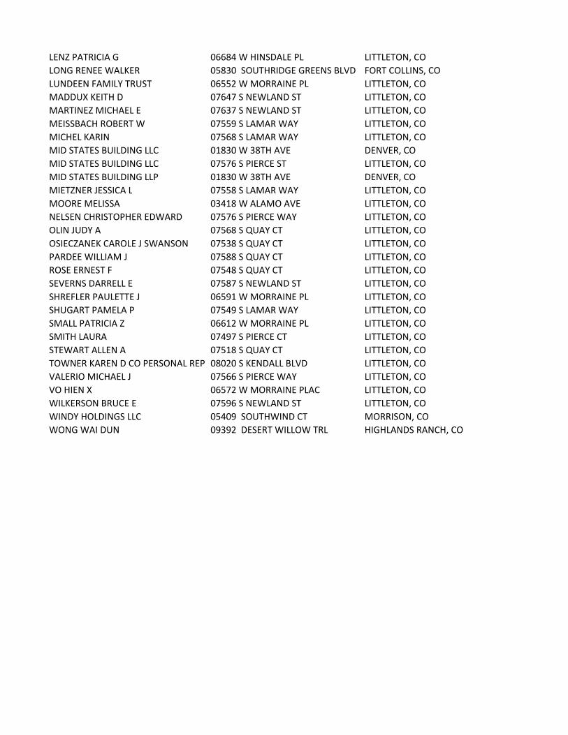
LENZ PATRICIA G 06684 W HINSDALE PL LITTLETON, CO
LONG RENEE WALKER 05830 SOUTHRIDGE GREENS BLVD FORT COLLINS, CO
LUNDEEN FAMILY TRUST 06552 W MORRAINE PL LITTLETON, CO
MADDUX KEITH D 07647 S NEWLAND ST LITTLETON, CO
MARTINEZ MICHAEL E 07637 S NEWLAND ST LITTLETON, CO
MEISSBACH ROBERT W 07559 S LAMAR WAY LITTLETON, CO
MICHEL KARIN 07568 S LAMAR WAY LITTLETON, CO
MID STATES BUILDING LLC 01830 W 38TH AVE DENVER, CO
MID STATES BUILDING LLC 07576 S PIERCE ST LITTLETON, CO
MID STATES BUILDING LLP 01830 W 38TH AVE DENVER, CO
MIETZNER JESSICA L 07558 S LAMAR WAY LITTLETON, CO
MOORE MELISSA 03418 W ALAMO AVE LITTLETON, CO
NELSEN CHRISTOPHER EDWARD 07576 S PIERCE WAY LITTLETON, CO
OLIN JUDY A 07568 S QUAY CT LITTLETON, CO
OSIECZANEK CAROLE J SWANSON 07538 S QUAY CT LITTLETON, CO
PARDEE WILLIAM J 07588 S QUAY CT LITTLETON, CO
ROSE ERNEST F 07548 S QUAY CT LITTLETON, CO
SEVERNS DARRELL E 07587 S NEWLAND ST LITTLETON, CO
SHREFLER PAULETTE J 06591 W MORRAINE PL LITTLETON, CO
SHUGART PAMELA P 07549 S LAMAR WAY LITTLETON, CO
SMALL PATRICIA Z 06612 W MORRAINE PL LITTLETON, CO
SMITH LAURA 07497 S PIERCE CT LITTLETON, CO
STEWART ALLEN A 07518 S QUAY CT LITTLETON, CO
TOWNER KAREN D CO PERSONAL REP 08020 S KENDALL BLVD LITTLETON, CO
VALERIO MICHAEL J 07566 S PIERCE WAY LITTLETON, CO
VO HIEN X 06572 W MORRAINE PLAC LITTLETON, CO
WILKERSON BRUCE E 07596 S NEWLAND ST LITTLETON, CO
WINDY HOLDINGS LLC 05409 SOUTHWIND CT MORRISON, CO
WONG WAI DUN 09392 DESERT WILLOW TRL HIGHLANDS RANCH, CO

ELECTRONIC REFERRAL
JEFFERSON COUNTY, COLORADO Documents related to a Preliminary and Final Plat have been submitted to Jefferson County Planning and Zoning. This case is now beginning the 1st Referral part of the process. Please review the specific electronic documents related to the 1st Referral found here. Comments on the Preliminary and Final Plat should be submitted electronically to the case manager by the due date below. Case Numbers: 19-101574PF and 19-102785ASR Case Name: Ken Caryl Center Filing 1 Address: 7500 S. Pierce Street General Location: Southeast of intersection of S. Pierce St and Ken Caryl Ave Case Type: Preliminary and Final Plat Case Type: Alternative Standard Request Application (PF): To subdivide a property into 2 Commercial Lots Application (ASR): To allow existing intersection spacing to remain although nonconforming to the
Transportation Manual Comments Due: Thursday, 500March 7, 2019 Case Manager: Nathan Seymour Case Manager Contact Information: [email protected] 303.271.8751 The entire case file for this application can be viewed here. Referrals: Internal Agencies: Addressing Assessor Cartography County Geologist Public Health Planning/Zoning Administration Planning Engineering Open Space JeffCo Historical Commission (Dennis D) Transportation and Engineering Road & Bridge District II – Mike Haroldson Weed and Pest External Agencies: South Metro Fire Protection District Littleton Fire Platte Canyon Water and Sanitation District Division of Water Resources, State Engineer’s Office Colorado Geological Survey Soils Conservation District Department of Health Colorado Historical Society Century Link Comcast Xcel Energy Post Office Division of Wildlife Denver Water
Adjacent HOA’S:
COHOPE COLUMBINE HILLS CIVIC ASSN COLUMBINE KNOLLS HOA COLUMBINE KNOLLS SOUTH ESTATES COLUMBINE KNOLLS SOUTH II HOA COLUMBINE TOWNHOUSES I COLUMBINE TOWNHOUSES II COLUMBINE WEST CIVIC ASSN DUTCH RIDGE HOA JEFFERSON CORPORATE CENTER OWNERS ASSN JEFFERSON COUNTY HORSE COUNCIL MARINA POINT COVE NORMANDY ESTATES IMPROVEMENT ASSN INC PLAN JEFFCO PRECEDENT AT STONY CREEK STONY CREEK 6 HOA TERRACE AT COLUMBINE CONDO ASSOCIATION THE ENCLAVE AT NORMANDY

HOA, INC WESTLAKE
Please see attached list of HOA’s within 1 Mile of the Property Adjacent Property Owners: See List in Community Notification for owners within 500’
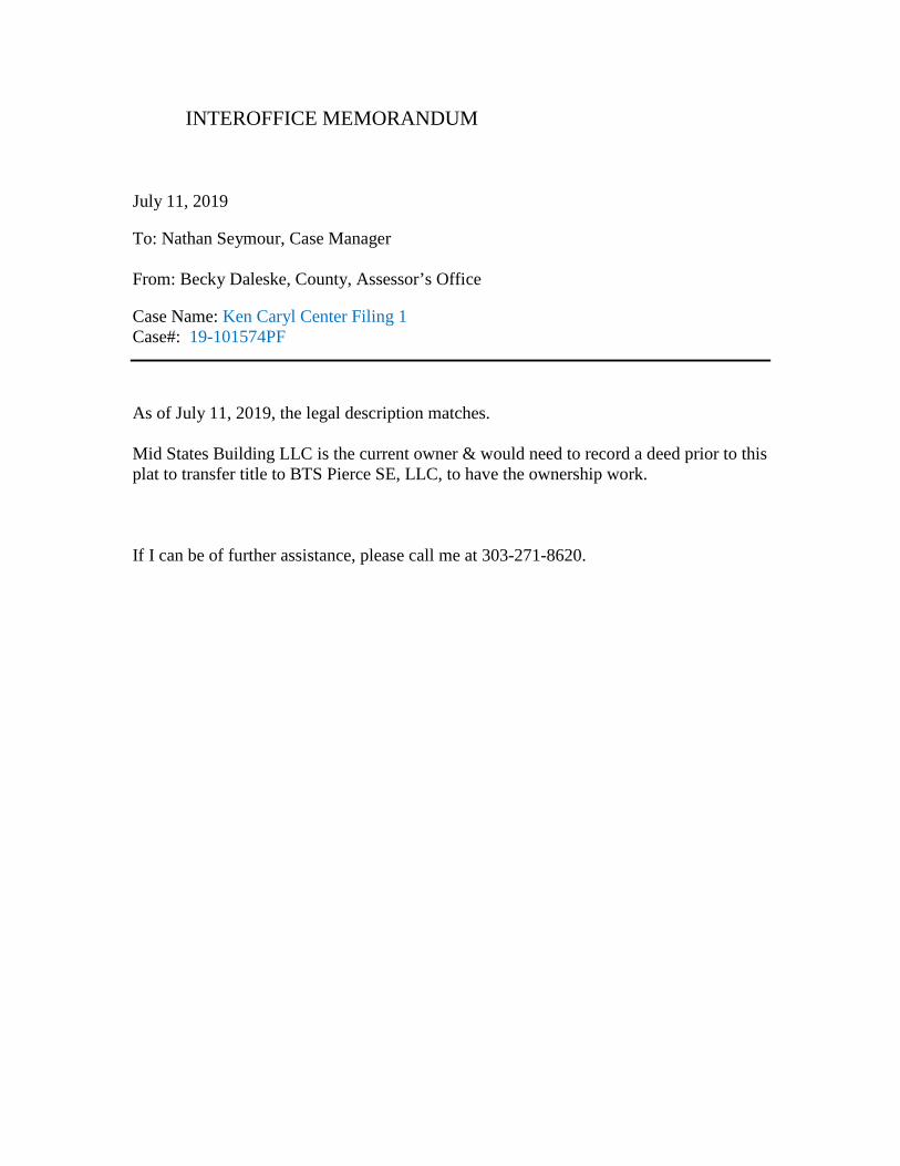
INTEROFFICE MEMORANDUM July 11, 2019 To: Nathan Seymour, Case Manager From: Becky Daleske, County, Assessor’s Office Case Name: Ken Caryl Center Filing 1 Case#: 19-101574PF
As of July 11, 2019, the legal description matches. Mid States Building LLC is the current owner & would need to record a deed prior to this plat to transfer title to BTS Pierce SE, LLC, to have the ownership work. If I can be of further assistance, please call me at 303-271-8620.
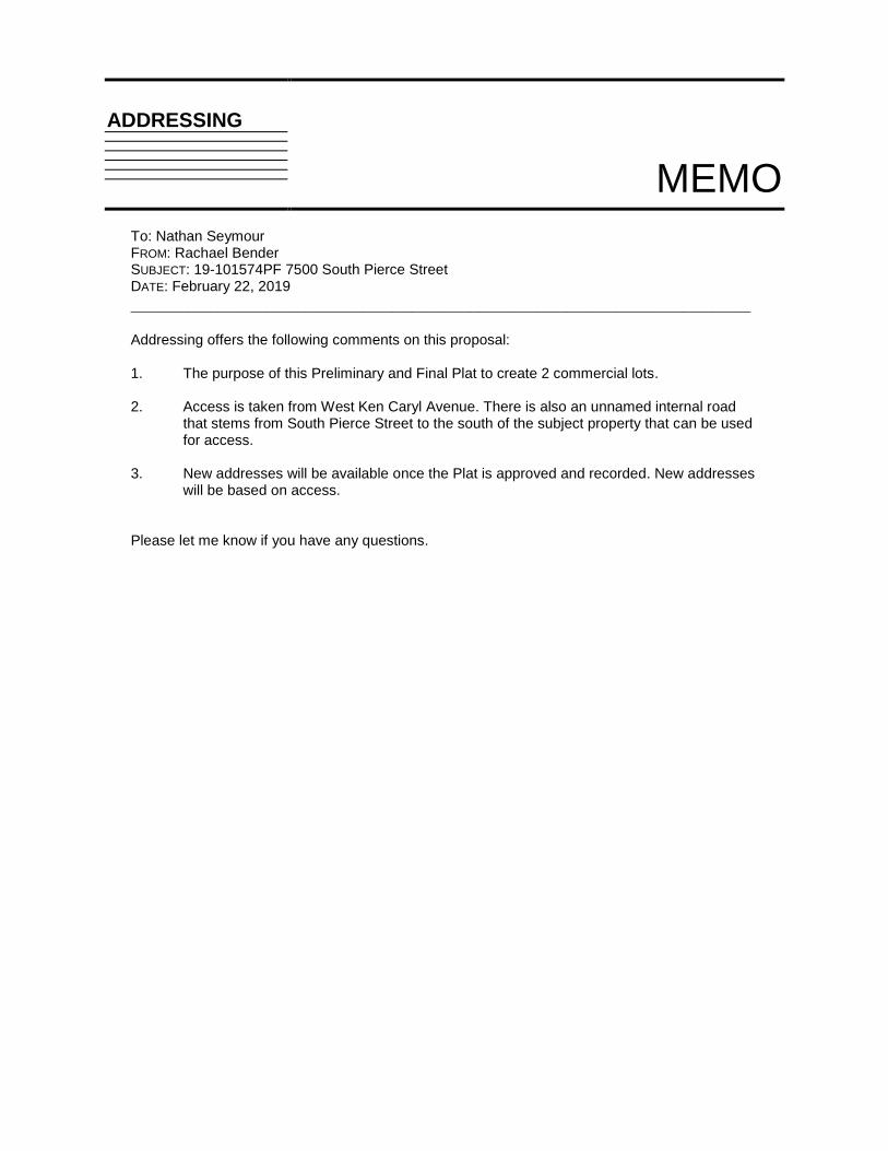
ADDRESSING
MEMO
To: Nathan Seymour FROM: Rachael Bender SUBJECT: 19-101574PF 7500 South Pierce Street DATE: February 22, 2019 ________________________________________________________________ Addressing offers the following comments on this proposal: 1. The purpose of this Preliminary and Final Plat to create 2 commercial lots.
2. Access is taken from West Ken Caryl Avenue. There is also an unnamed internal road
that stems from South Pierce Street to the south of the subject property that can be used for access.
3. New addresses will be available once the Plat is approved and recorded. New addresses
will be based on access.
Please let me know if you have any questions.
Network Real Estate
5025 N. Black Canyon Hwy
Phoenix, AZ 85015
February 19, 2018
APPROVED
Nathan Seymour
303.271.8751
SUBJECT: 19-101574PF AND 19-102785ASR, KEN CARYL CENTER FILING 1, LOCATED
IN THE NORTHWEST 1/4 OF SECTION 36, TOWNSHIP 5 SOUTH , RANGE 69 WEST, OF
THE 6TH P.M., COUNTY OF JEFFERSON, STATE OF COLORADO
To Whom It May Concern:
CenturyLink has reviewed the proposed Plat as requested. Our approval is hereby given to
continue the site approval process with the County Of Jefferson.
If CenturyLink facilities are found to restrict development within the area as described, the
Applicant will relocate the facilities at Applicant's expense and within guidelines set by
CenturyLink and all regulating entities. All relocations will be done under the supervision of a
CenturyLink Inspector.
Sincerely,
Karen Caime
Right of Way Agent
Qwest Corporation d/b/a CENTURYLINK QC
602.630.1428 Phone
602.246.1326 Fax
[email protected] P812784
Karen Caime
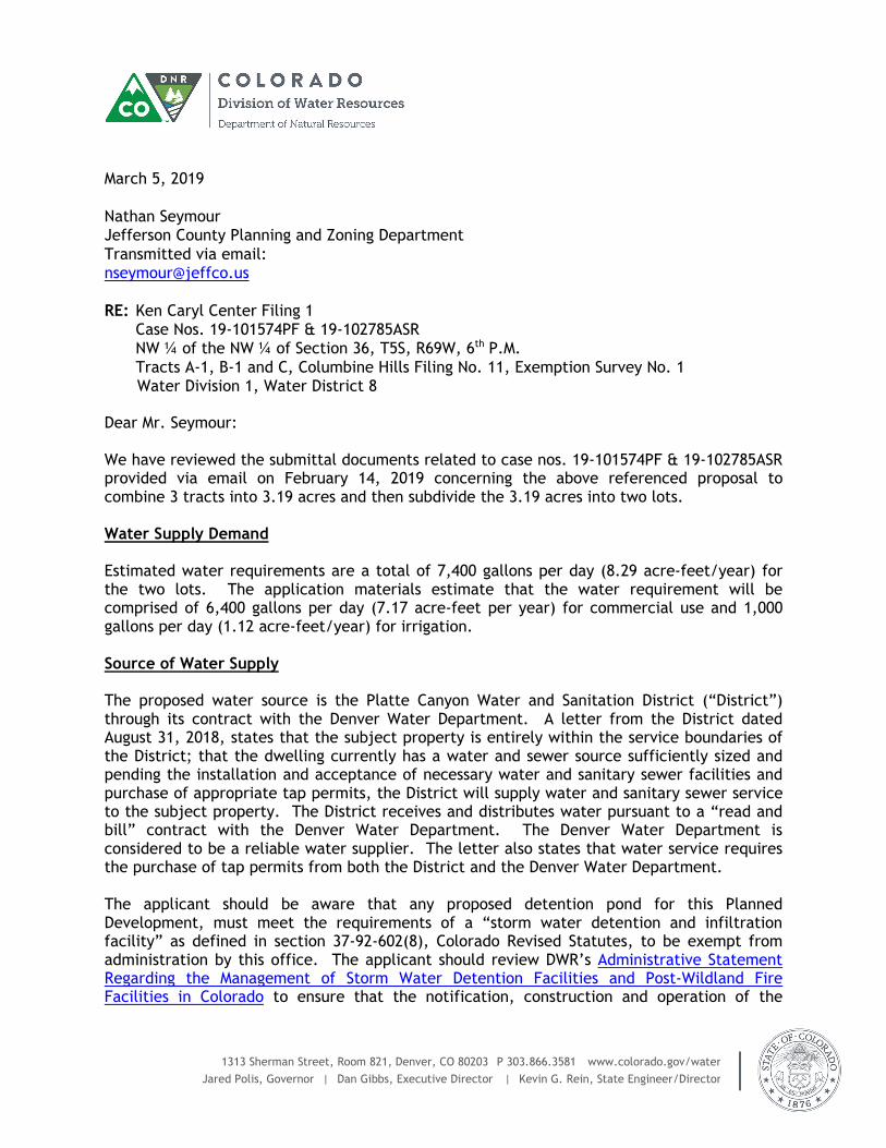
1313 Sherman Street, Room 821, Denver, CO 80203 P 303.866.3581 www.colorado.gov/water
Jared Polis, Governor | Dan Gibbs, Executive Director | Kevin G. Rein, State Engineer/Director
March 5, 2019
Nathan Seymour Jefferson County Planning and Zoning Department
Transmitted via email: [email protected]
RE: Ken Caryl Center Filing 1 Case Nos. 19-101574PF & 19-102785ASR NW ¼ of the NW ¼ of Section 36, T5S, R69W, 6th P.M.
Tracts A-1, B-1 and C, Columbine Hills Filing No. 11, Exemption Survey No. 1 Water Division 1, Water District 8
Dear Mr. Seymour: We have reviewed the submittal documents related to case nos. 19-101574PF & 19-102785ASR provided via email on February 14, 2019 concerning the above referenced proposal to combine 3 tracts into 3.19 acres and then subdivide the 3.19 acres into two lots. Water Supply Demand Estimated water requirements are a total of 7,400 gallons per day (8.29 acre-feet/year) for the two lots. The application materials estimate that the water requirement will be comprised of 6,400 gallons per day (7.17 acre-feet per year) for commercial use and 1,000 gallons per day (1.12 acre-feet/year) for irrigation. Source of Water Supply The proposed water source is the Platte Canyon Water and Sanitation District (“District”) through its contract with the Denver Water Department. A letter from the District dated August 31, 2018, states that the subject property is entirely within the service boundaries of the District; that the dwelling currently has a water and sewer source sufficiently sized and pending the installation and acceptance of necessary water and sanitary sewer facilities and purchase of appropriate tap permits, the District will supply water and sanitary sewer service to the subject property. The District receives and distributes water pursuant to a “read and bill” contract with the Denver Water Department. The Denver Water Department is considered to be a reliable water supplier. The letter also states that water service requires the purchase of tap permits from both the District and the Denver Water Department. The applicant should be aware that any proposed detention pond for this Planned Development, must meet the requirements of a “storm water detention and infiltration facility” as defined in section 37-92-602(8), Colorado Revised Statutes, to be exempt from administration by this office. The applicant should review DWR’s Administrative Statement Regarding the Management of Storm Water Detention Facilities and Post-Wildland Fire Facilities in Colorado to ensure that the notification, construction and operation of the
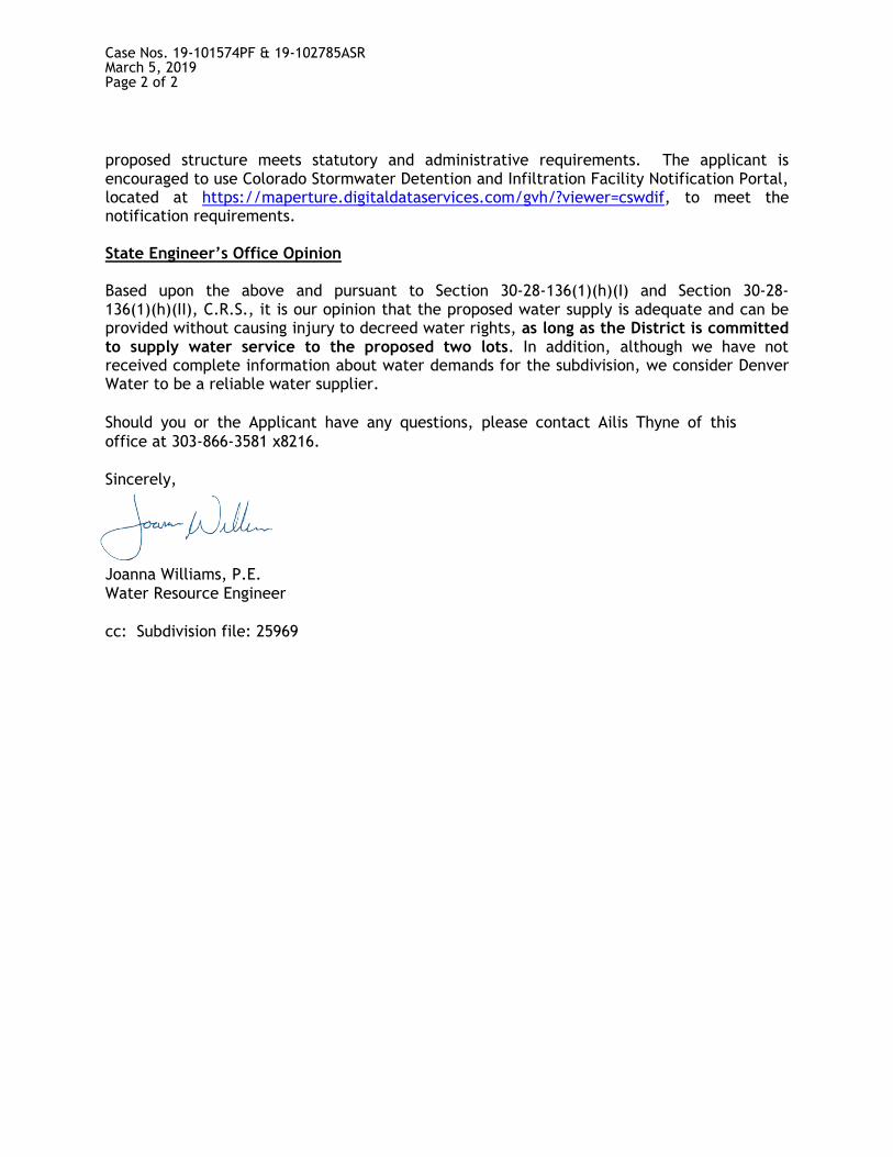
Case Nos. 19-101574PF & 19-102785ASR March 5, 2019 Page 2 of 2
proposed structure meets statutory and administrative requirements. The applicant is encouraged to use Colorado Stormwater Detention and Infiltration Facility Notification Portal, located at https://maperture.digitaldataservices.com/gvh/?viewer=cswdif, to meet the notification requirements. State Engineer’s Office Opinion Based upon the above and pursuant to Section 30-28-136(1)(h)(I) and Section 30-28-136(1)(h)(II), C.R.S., it is our opinion that the proposed water supply is adequate and can be provided without causing injury to decreed water rights, as long as the District is committed to supply water service to the proposed two lots. In addition, although we have not received complete information about water demands for the subdivision, we consider Denver Water to be a reliable water supplier.
Should you or the Applicant have any questions, please contact Ailis Thyne of this
office at 303-866-3581 x8216. Sincerely,
Joanna Williams, P.E. Water Resource Engineer
cc: Subdivision file: 25969
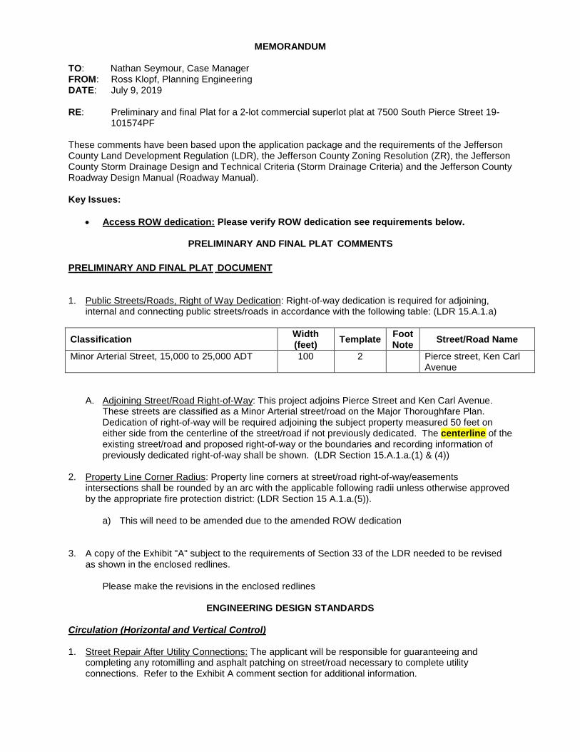
MEMORANDUM TO: Nathan Seymour, Case Manager FROM: Ross Klopf, Planning Engineering DATE: July 9, 2019 RE: Preliminary and final Plat for a 2-lot commercial superlot plat at 7500 South Pierce Street 19-
101574PF These comments have been based upon the application package and the requirements of the Jefferson County Land Development Regulation (LDR), the Jefferson County Zoning Resolution (ZR), the Jefferson County Storm Drainage Design and Technical Criteria (Storm Drainage Criteria) and the Jefferson County Roadway Design Manual (Roadway Manual). Key Issues:
• Access ROW dedication: Please verify ROW dedication see requirements below.
PRELIMINARY AND FINAL PLAT COMMENTS
PRELIMINARY AND FINAL PLAT DOCUMENT 1. Public Streets/Roads, Right of Way Dedication: Right-of-way dedication is required for adjoining,
internal and connecting public streets/roads in accordance with the following table: (LDR 15.A.1.a)
Classification Width (feet)
Template Foot Note
Street/Road Name
Minor Arterial Street, 15,000 to 25,000 ADT 100 2 Pierce street, Ken Carl Avenue
A. Adjoining Street/Road Right-of-Way: This project adjoins Pierce Street and Ken Carl Avenue. These streets are classified as a Minor Arterial street/road on the Major Thoroughfare Plan. Dedication of right-of-way will be required adjoining the subject property measured 50 feet on either side from the centerline of the street/road if not previously dedicated. The centerline of the existing street/road and proposed right-of-way or the boundaries and recording information of previously dedicated right-of-way shall be shown. (LDR Section 15.A.1.a.(1) & (4))
2. Property Line Corner Radius: Property line corners at street/road right-of-way/easements
intersections shall be rounded by an arc with the applicable following radii unless otherwise approved by the appropriate fire protection district: (LDR Section 15 A.1.a.(5)).
a) This will need to be amended due to the amended ROW dedication
3. A copy of the Exhibit "A" subject to the requirements of Section 33 of the LDR needed to be revised
as shown in the enclosed redlines. Please make the revisions in the enclosed redlines
ENGINEERING DESIGN STANDARDS
Circulation (Horizontal and Vertical Control) 1. Street Repair After Utility Connections: The applicant will be responsible for guaranteeing and
completing any rotomilling and asphalt patching on street/road necessary to complete utility connections. Refer to the Exhibit A comment section for additional information.
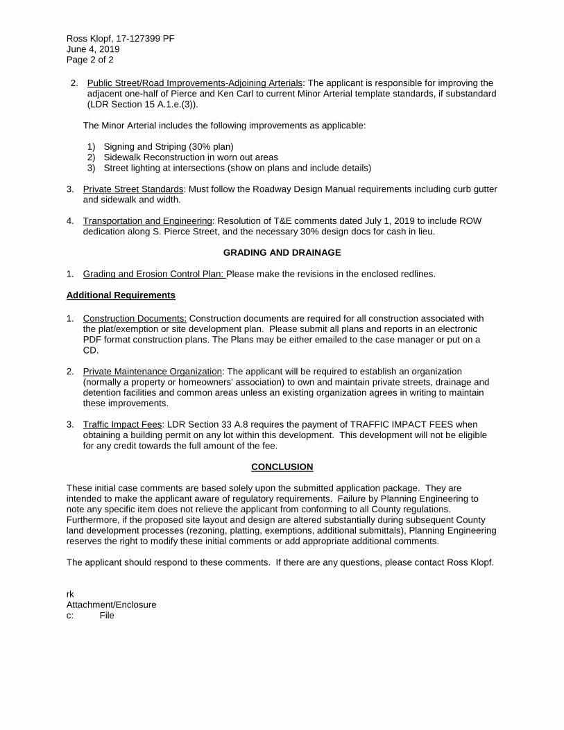
Ross Klopf, 17-127399 PF June 4, 2019 Page 2 of 2 2. Public Street/Road Improvements-Adjoining Arterials: The applicant is responsible for improving the
adjacent one-half of Pierce and Ken Carl to current Minor Arterial template standards, if substandard (LDR Section 15 A.1.e.(3)).
The Minor Arterial includes the following improvements as applicable: 1) Signing and Striping (30% plan) 2) Sidewalk Reconstruction in worn out areas 3) Street lighting at intersections (show on plans and include details)
3. Private Street Standards: Must follow the Roadway Design Manual requirements including curb gutter
and sidewalk and width.
4. Transportation and Engineering: Resolution of T&E comments dated July 1, 2019 to include ROW dedication along S. Pierce Street, and the necessary 30% design docs for cash in lieu.
GRADING AND DRAINAGE 1. Grading and Erosion Control Plan: Please make the revisions in the enclosed redlines. Additional Requirements
1. Construction Documents: Construction documents are required for all construction associated with
the plat/exemption or site development plan. Please submit all plans and reports in an electronic PDF format construction plans. The Plans may be either emailed to the case manager or put on a CD.
2. Private Maintenance Organization: The applicant will be required to establish an organization
(normally a property or homeowners' association) to own and maintain private streets, drainage and detention facilities and common areas unless an existing organization agrees in writing to maintain these improvements.
3. Traffic Impact Fees: LDR Section 33 A.8 requires the payment of TRAFFIC IMPACT FEES when
obtaining a building permit on any lot within this development. This development will not be eligible for any credit towards the full amount of the fee.
CONCLUSION
These initial case comments are based solely upon the submitted application package. They are intended to make the applicant aware of regulatory requirements. Failure by Planning Engineering to note any specific item does not relieve the applicant from conforming to all County regulations. Furthermore, if the proposed site layout and design are altered substantially during subsequent County land development processes (rezoning, platting, exemptions, additional submittals), Planning Engineering reserves the right to modify these initial comments or add appropriate additional comments. The applicant should respond to these comments. If there are any questions, please contact Ross Klopf. rk Attachment/Enclosure c: File
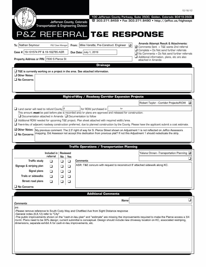
100 Jefferson County Parkway, Suite 3500, Golden, Colorado 80419-3500
303.271.8459 • Fax 303.271.8490 • http://jeffco.us/highwaysJefferson County, Colorado Transportation & Engineering Division
10/18/10
Drainage
Right-of-Way / Roadway Corridor Expansion Projects
Traffic Operations / Transportation Planning
Additional Comments
P&Z RefeRRal T&E REsPOnsETo:
Case #:
Property Address or PIN:
Due Date:
From:P&Z Case Manager Amanda Attempt Result & Attachments: Comments Sent = T&e wants 2nd referral Complete = Do Not send further referrals No Comments = Do Not send further referrals additional information, plans, etc are also
attached in amanda
Other Notes:
No Concerns
Other Notes:
No Concerns
T&E is currently working on a project in the area. See attached information.
land owner will need to refund County for ROW purchased in This amount must be paid before plat is recorded and/or plans are approved and released for construction. Documentation attached in amanda Documentation to follow additional ROW needed for upcoming T&e project. Plan sheet attached with required width/area. fee-in-lieu of adjacent roadway construction preferred, due to planned construction by the County. Please have the applicant submit a cost estimate.
$ for
Included in referral
ReviewedNo Yes
Traffic study Signage & striping plan
Signal plans Trails or sidewalks Street road plans
No Concerns
Comments
CommentsName
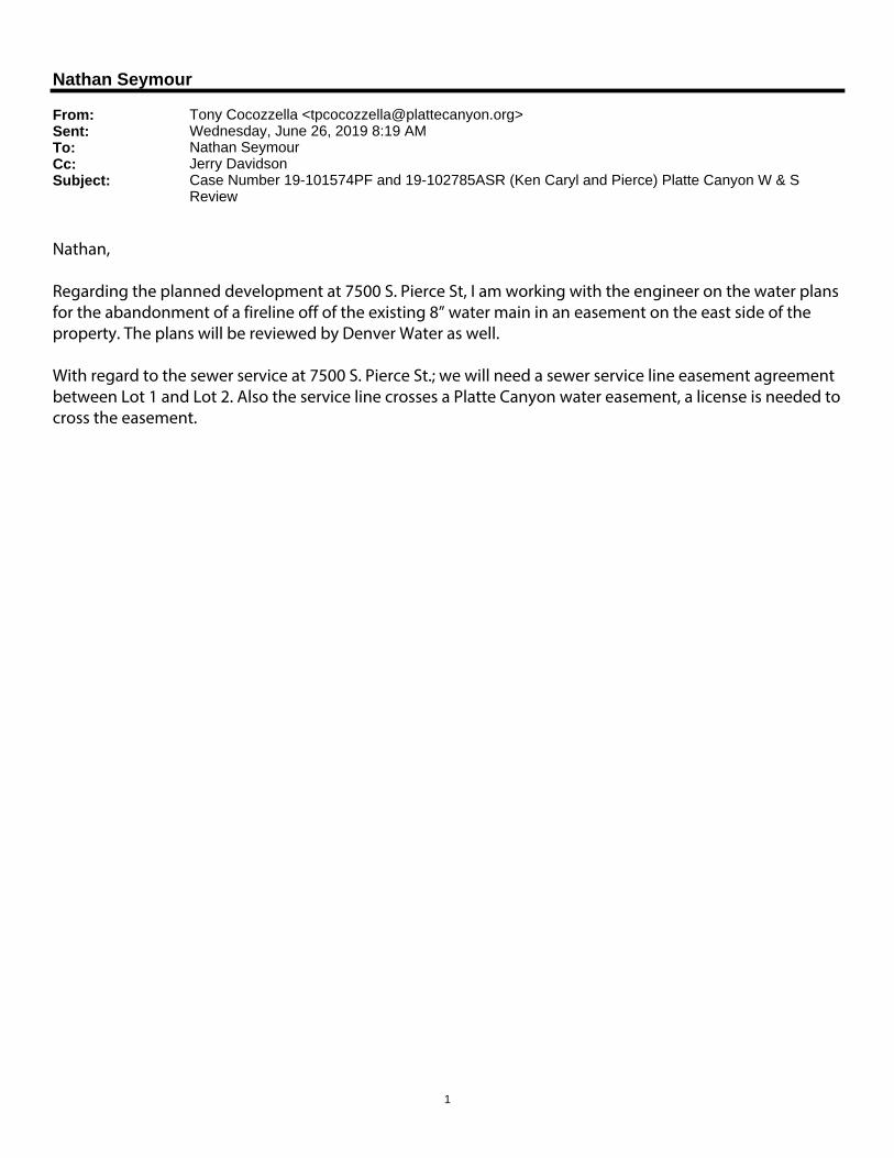
1
Nathan Seymour
From: Tony Cocozzella <[email protected]>Sent: Wednesday, June 26, 2019 8:19 AMTo: Nathan SeymourCc: Jerry DavidsonSubject: Case Number 19-101574PF and 19-102785ASR (Ken Caryl and Pierce) Platte Canyon W & S
Review
Nathan, Regarding the planned development at 7500 S. Pierce St, I am working with the engineer on the water plans for the abandonment of a fireline off of the existing 8” water main in an easement on the east side of the property. The plans will be reviewed by Denver Water as well. With regard to the sewer service at 7500 S. Pierce St.; we will need a sewer service line easement agreement between Lot 1 and Lot 2. Also the service line crosses a Platte Canyon water easement, a license is needed to cross the easement.
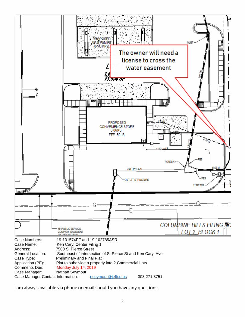
2
Case Numbers: 19-101574PF and 19-102785ASR Case Name: Ken Caryl Center Filing 1 Address: 7500 S. Pierce Street General Location: Southeast of intersection of S. Pierce St and Ken Caryl Ave Case Type: Preliminary and Final Plat Application (PF): Plat to subdivide a property into 2 Commercial Lots Comments Due: Monday July 1st, 2019 Case Manager: Nathan Seymour Case Manager Contact Information: [email protected] 303.271.8751 I am always available via phone or email should you have any questions.
3
Regards, Tony Cocozzella Tony Cocozzella |Platte Canyon Water and Sanitation District/ Construction Program Manager
Office 720.726.5030 | Mobile 303.829.9407 | Email [email protected]
‐‐‐‐‐‐‐‐‐‐‐‐‐‐‐‐‐‐‐‐‐‐‐‐‐‐‐‐‐‐‐‐‐‐‐‐‐‐‐‐‐‐‐‐‐‐‐‐‐‐‐‐‐‐‐‐‐‐‐‐‐‐‐‐‐‐‐‐‐‐‐‐‐‐‐‐‐‐‐‐‐‐‐‐‐‐‐‐‐‐‐‐‐‐‐‐‐‐‐‐‐‐‐‐‐‐‐‐‐‐‐‐‐‐‐‐‐‐‐‐‐‐‐‐‐‐‐‐‐‐‐‐‐‐‐‐‐‐‐‐‐‐‐‐‐‐‐‐‐‐‐‐‐‐‐‐‐‐‐‐‐‐‐‐‐‐‐‐‐‐‐‐‐‐‐‐‐‐ CAUTION: This email originated from outside Jefferson County Government. Do not click links or open attachments unless you recognize the sender and know the content is safe. ‐‐‐‐‐‐‐‐‐‐‐‐‐‐‐‐‐‐‐‐‐‐‐‐‐‐‐‐‐‐‐‐‐‐‐‐‐‐‐‐‐‐‐‐‐‐‐‐‐‐‐‐‐‐‐‐‐‐‐‐‐‐‐‐‐‐‐‐‐‐‐‐‐‐‐‐‐‐‐‐‐‐‐‐‐‐‐‐‐‐‐‐‐‐‐‐‐‐‐‐‐‐‐‐‐‐‐‐‐‐‐‐‐‐‐‐‐‐‐‐‐‐‐‐‐‐‐‐‐‐‐‐‐‐‐‐‐‐‐‐‐‐‐‐‐‐‐‐‐‐‐‐‐‐‐‐‐‐‐‐‐‐‐‐‐‐‐‐‐‐‐‐‐‐‐‐‐‐
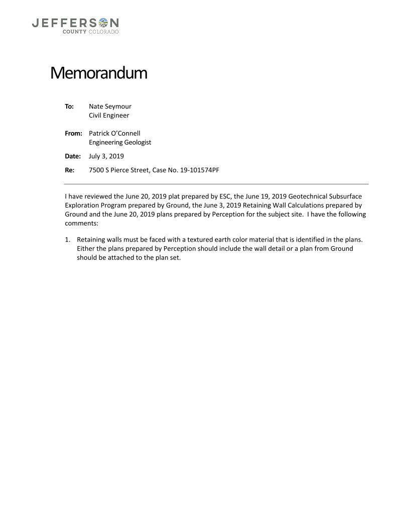
Memorandum
To: Nate Seymour Civil Engineer From: Patrick O’Connell Engineering Geologist
Date: July 3, 2019
Re: 7500 S Pierce Street, Case No. 19-101574PF
I have reviewed the June 20, 2019 plat prepared by ESC, the June 19, 2019 Geotechnical Subsurface Exploration Program prepared by Ground, the June 3, 2019 Retaining Wall Calculations prepared by Ground and the June 20, 2019 plans prepared by Perception for the subject site. I have the following comments:
1. Retaining walls must be faced with a textured earth color material that is identified in the plans. Either the plans prepared by Perception should include the wall detail or a plan from Ground should be attached to the plan set.
Nathan Seymour Jefferson County Planning and Zoning 100 Jefferson County Parkway Golden, CO 80419 303-271.8751
File #/Name: 19-101574PF & 19-102785ASR Project Type: Plat Final & Alternate Standards Request Referral Received: February 18, 2019 Comments Due: March 7, 2019
S Metro Review # REFFP19-00041 Plan reviewer: Jeff Sceili [email protected] Review date: February 18, 2019
Narrative:
Code Reference: 2012 International Fire Code, 2012 International Building Code
South Metro Fire Rescue’s Life Safety Division has reviewed the above project and has approved the plans and has no comments.
Page 1/1
SOUTH METRO FIRE RESCUE Life Safety Bureau
9195 E Mineral Ave, Centennial, CO 80112 PHONE: 720.989.2230 www.southmetro.org FAX: 720.989.2130
1
Nathan Seymour
From: [email protected]: Friday, March 22, 2019 8:01 AMTo: Nathan SeymourCc: Nick NelsonSubject: 19 101574 PF - Agency Response
Case Number: 19 101574 PF Case Type: Preliminary ‐ Final Plat Case Name: Ken Caryl Center Filing 1 Review: Planner (Development Review) Results: Comments Sent (request re‐review) Review Comments: Scheduled End Date: 03/07/2019 Reviewer: Nick Nelson Description: Preliminary and Final Plat to create 2 commercial lots
Public Health303.232.6301 | jeffco.us
645 Parfet Street, Lakewood, Colorado 80215
MEMO
TO: Nathan Seymour Jefferson County Planning and Zoning Division
FROM: Tracy Volkman Jefferson County Environmental Health Services Division
DATE: February 15, 2019
SUBJECT: Case #19-101574 PFKen Caryl Center Filing 1Mike Falbo7500 S Pierce St
The applicant has met the public health requirements for the proposed platting of this property.
PROPOSAL SUMMARYSubdivide a property into 2 Commercial Lots.
COMMENTSJefferson County Public Health (JCPH) provided comments on 05/11/18 for the pre-application proposal and on 11/01/18 for the rezoning of this property. We have reviewed the documents submitted by the applicant for the platting process and have the following updated comments:
The applicant must submit the following documents or take the following actions prior to a ruling on the proposed platting of this property. NOTE: Items marked with a “” indicate that the document has been submitted or action has been taken. Please read entire document for requirements and information. Please note additional documentation may be required.
PLATTING
Date Reviewed Required Documentation/Actions Refer to Sections
11/01/18
Submit a will serve letter from the Water and Sanitation District to provide proof of public water and sewer services in accordance with the Jefferson County Zoning Resolution and Land Development Regulation (LDR) Section 21 and 22.
Water/Wastewater
2/15/19
Submit a Sensory Impact Assessment in accordance with the LDR Section 26 and must be prepared by a qualified professional planner, certified industrial hygienist, or landscape architect or engineer, registered in
Sensory Impact
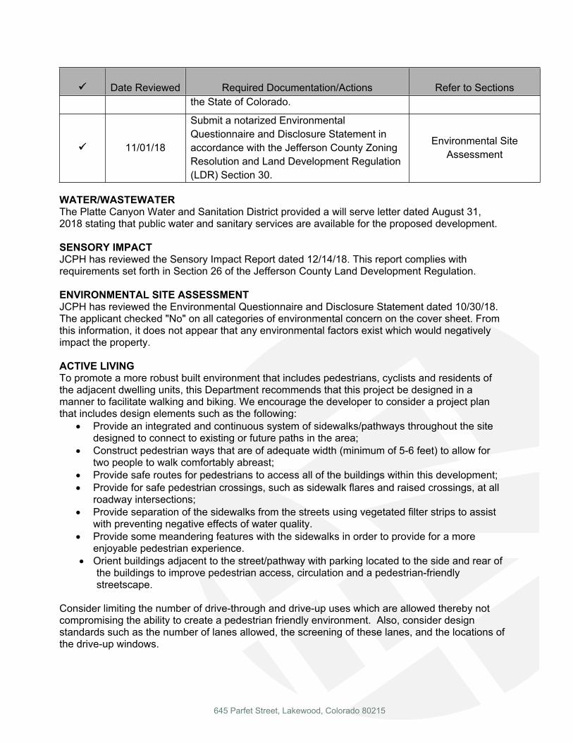
645 Parfet Street, Lakewood, Colorado 80215
Date Reviewed Required Documentation/Actions Refer to Sectionsthe State of Colorado.
11/01/18
Submit a notarized Environmental Questionnaire and Disclosure Statement in accordance with the Jefferson County Zoning Resolution and Land Development Regulation (LDR) Section 30.
Environmental Site Assessment
WATER/WASTEWATERThe Platte Canyon Water and Sanitation District provided a will serve letter dated August 31, 2018 stating that public water and sanitary services are available for the proposed development.
SENSORY IMPACTJCPH has reviewed the Sensory Impact Report dated 12/14/18. This report complies with requirements set forth in Section 26 of the Jefferson County Land Development Regulation.
ENVIRONMENTAL SITE ASSESSMENTJCPH has reviewed the Environmental Questionnaire and Disclosure Statement dated 10/30/18. The applicant checked "No" on all categories of environmental concern on the cover sheet. From this information, it does not appear that any environmental factors exist which would negatively impact the property.
ACTIVE LIVINGTo promote a more robust built environment that includes pedestrians, cyclists and residents of the adjacent dwelling units, this Department recommends that this project be designed in a manner to facilitate walking and biking. We encourage the developer to consider a project plan that includes design elements such as the following:
Provide an integrated and continuous system of sidewalks/pathways throughout the site designed to connect to existing or future paths in the area;
Construct pedestrian ways that are of adequate width (minimum of 5-6 feet) to allow for two people to walk comfortably abreast;
Provide safe routes for pedestrians to access all of the buildings within this development; Provide for safe pedestrian crossings, such as sidewalk flares and raised crossings, at all
roadway intersections; Provide separation of the sidewalks from the streets using vegetated filter strips to assist
with preventing negative effects of water quality. Provide some meandering features with the sidewalks in order to provide for a more
enjoyable pedestrian experience. Orient buildings adjacent to the street/pathway with parking located to the side and rear of
the buildings to improve pedestrian access, circulation and a pedestrian-friendly streetscape.
Consider limiting the number of drive-through and drive-up uses which are allowed thereby not compromising the ability to create a pedestrian friendly environment. Also, consider design standards such as the number of lanes allowed, the screening of these lanes, and the locations of the drive-up windows.
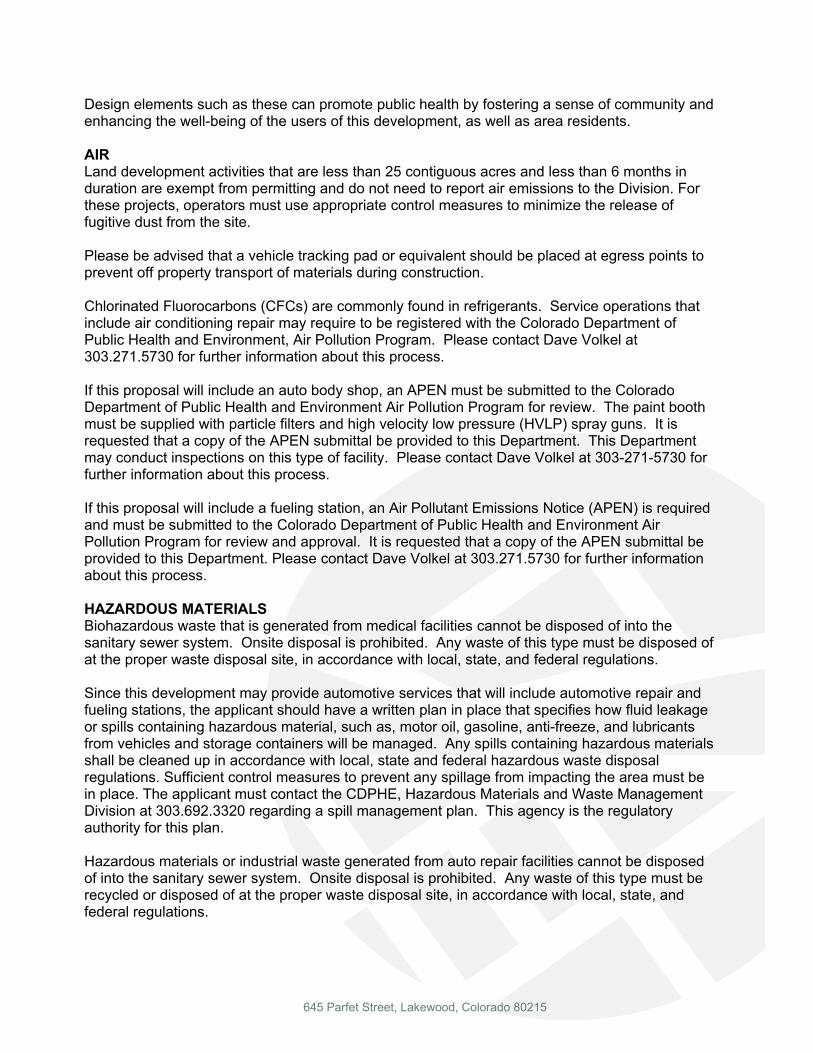
645 Parfet Street, Lakewood, Colorado 80215
Design elements such as these can promote public health by fostering a sense of community and enhancing the well-being of the users of this development, as well as area residents.
AIRLand development activities that are less than 25 contiguous acres and less than 6 months in duration are exempt from permitting and do not need to report air emissions to the Division. For these projects, operators must use appropriate control measures to minimize the release of fugitive dust from the site.
Please be advised that a vehicle tracking pad or equivalent should be placed at egress points to prevent off property transport of materials during construction.
Chlorinated Fluorocarbons (CFCs) are commonly found in refrigerants. Service operations that include air conditioning repair may require to be registered with the Colorado Department of Public Health and Environment, Air Pollution Program. Please contact Dave Volkel at 303.271.5730 for further information about this process.
If this proposal will include an auto body shop, an APEN must be submitted to the Colorado Department of Public Health and Environment Air Pollution Program for review. The paint booth must be supplied with particle filters and high velocity low pressure (HVLP) spray guns. It is requested that a copy of the APEN submittal be provided to this Department. This Department may conduct inspections on this type of facility. Please contact Dave Volkel at 303-271-5730 for further information about this process.
If this proposal will include a fueling station, an Air Pollutant Emissions Notice (APEN) is required and must be submitted to the Colorado Department of Public Health and Environment Air Pollution Program for review and approval. It is requested that a copy of the APEN submittal be provided to this Department. Please contact Dave Volkel at 303.271.5730 for further information about this process.
HAZARDOUS MATERIALSBiohazardous waste that is generated from medical facilities cannot be disposed of into the sanitary sewer system. Onsite disposal is prohibited. Any waste of this type must be disposed of at the proper waste disposal site, in accordance with local, state, and federal regulations.
Since this development may provide automotive services that will include automotive repair and fueling stations, the applicant should have a written plan in place that specifies how fluid leakage or spills containing hazardous material, such as, motor oil, gasoline, anti-freeze, and lubricants from vehicles and storage containers will be managed. Any spills containing hazardous materials shall be cleaned up in accordance with local, state and federal hazardous waste disposal regulations. Sufficient control measures to prevent any spillage from impacting the area must be in place. The applicant must contact the CDPHE, Hazardous Materials and Waste Management Division at 303.692.3320 regarding a spill management plan. This agency is the regulatory authority for this plan.
Hazardous materials or industrial waste generated from auto repair facilities cannot be disposed of into the sanitary sewer system. Onsite disposal is prohibited. Any waste of this type must be recycled or disposed of at the proper waste disposal site, in accordance with local, state, and federal regulations.
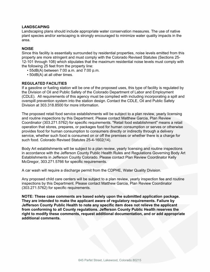
645 Parfet Street, Lakewood, Colorado 80215
LANDSCAPINGLandscaping plans should include appropriate water conservation measures. The use of native plant species and/or xeriscaping is strongly encouraged to minimize water quality impacts in the area.
NOISESince this facility is essentially surrounded by residential properties, noise levels emitted from this property are more stringent and must comply with the Colorado Revised Statutes (Sections 25-12-101 through 108) which stipulates that the maximum residential noise levels must comply with the following 25 feet from the property line: • 55dB(A) between 7:00 a.m. and 7:00 p.m. • 50dB(A) at all other times.
REGULATED FACILITIESIf a gasoline or fueling station will be one of the proposed uses, this type of facility is regulated by the Division of Oil and Public Safety of the Colorado Department of Labor and Employment (CDLE). All requirements of this agency must be complied with including incorporating a spill and overspill prevention system into the station design. Contact the CDLE, Oil and Public Safety Division at 303.318.8500 for more information.
The proposed retail food service establishments will be subject to a plan review, yearly licensing and routine inspections by this Department. Please contact Matthew Garcia, Plan Review Coordinator (303.271.5762) for specific requirements. "Retail food establishment" means a retail operation that stores, prepares, or packages food for human consumption or serves or otherwise provides food for human consumption to consumers directly or indirectly through a delivery service, whether such food is consumed on or off the premises or whether there is a charge for such food. Colorado Revised Statutes 25-4-1602(14).
Body Art establishments will be subject to a plan review, yearly licensing and routine inspections in accordance with the Jefferson County Public Health Rules and Regulations Governing Body Art Establishments in Jefferson County Colorado. Please contact Plan Review Coordinator Kelly McGregor, 303.271.5766 for specific requirements.
A car wash will require a discharge permit from the CDPHE, Water Quality Division.
Any proposed child care centers will be subject to a plan review, yearly inspection fee and routine inspections by this Department. Please contact Matthew Garcia, Plan Review Coordinator (303.271.5762) for specific requirements.
NOTE: These case comments are based solely upon the submitted application package. They are intended to make the applicant aware of regulatory requirements. Failure by Jefferson County Public Health to note any specific item does not relieve the applicant from conforming to all County regulations. Jefferson County Public Health reserves the right to modify these comments, request additional documentation, and or add appropriate additional comments.
1
Nathan Seymour
From: Mike HaraldsonSent: Wednesday, March 20, 2019 7:03 AMTo: Nathan Seymour; Nick Nelson; Ross Klopf; Dennis DempseyCc: Ryan BeckmannSubject: RE: Ken Caryl Center Filing 1 - 1st Referral Comments - 19-101574PF
Good morning Nathan, Road and Bridge has no issues with this filing. Thank you.
Michael Haraldson Senior Supervisor, District II – South o 303.271.5252 f 303.933.9528 w jeffco.us
From: Nathan Seymour <[email protected]> Sent: Tuesday, March 19, 2019 1:23 PM To: Nick Nelson <[email protected]>; Ross Klopf <[email protected]>; Dennis Dempsey <[email protected]>; Mike Haraldson <[email protected]> Cc: Ryan Beckmann <[email protected]> Subject: Ken Caryl Center Filing 1 ‐ 1st Referral Comments ‐ 19‐101574PF Nick, Ross, Dennis and Mike, I have not received comments (Due Mar. 7th) from you on Plat at Ken Caryl and Pierce. Please provide comments as soon as possible so that I can complete the 1st referral and provide the applicant with comments. Thanks, Nathan Seymour Civil Planning Engineer Jefferson County 100 Jefferson County Parkway Golden, CO 80419 o 303.271.8751 [email protected]
Find us on the web: www.jeffco.us Facebook | Twitter | Instagram
nseymour
Rectangle
1
Nathan Seymour
From: Ruth <[email protected]>Sent: Thursday, July 11, 2019 7:29 PMTo: 'Lucy Dinneen'; Nathan SeymourCc: Nick Nelson; [email protected]: RE: Ken Caryl Center Filing 1
Thank you all for responses. Lucy ‐ as you can see the email today dated July 11, 2019 from Nathan Seymour is in response to the original email I sent back on March 9, 2019. I had not heard anything from him prior to today’s email. Nathan – I have sent a couple of emails directly to Lucy and she has been most helpful and has answered the questions we have posed to her. Again, thank you for your responses. We have all of the information we need at this time. Regards, Ruth Severns
From: Lucy Dinneen <[email protected]> Sent: Thursday, July 11, 2019 7:15 PM To: Nathan Seymour <[email protected]> Cc: Ruth <[email protected]>; Nick Nelson <[email protected]>; [email protected] Subject: Re: Ken Caryl Center Filing 1 I have tried to be communicative. I believe the fence issue will be on the kiddie academy lot and it will be up to them. I would presume but can’t guarantee they would want it in reasonable repair and might be willing to repair if it is on their property. We continue as well to forward the emails to the current land owner. Hope that helps.
Lucy Dinneen Managing Director‐ Rocky Mountain and Northwest Regions
email: [email protected]
(O) 720.496.2586
(c) 303.868.7349 On Jul 11, 2019, at 6:55 PM, Nathan Seymour <[email protected]> wrote:
Ruth and Darrell, I am unaware of any additional correspondence you have had with Lucy (Cadence) but wanted to reach out and follow up with your previous email regarding the Ken Caryl Center Filing 1 Preliminary and Final Plat to create 2 commercial lots.
2
As you are probably aware the rezoning was approved. While the C‐1 zoning does allow for building heights above what was previously allowed I can tell you that all of the proposed uses that we know about are for those which you are also aware of, such as a gas station and kiddie academy. We are currently processing a Site Development Plan for the western lot (gas station) and have had some preliminary meetings for the eastern lot (kiddie academy). Not to say that this couldn’t change in the future but that is what I am aware of. The driveway access on the eastern side of the property will be shifted to the west to more align with the access across Ken Caryl Avenue. In addition. While we can’t do much to control speeding as part of this process, I am hopeful that with the future ability to develop the eastern lot it will be more difficult to speed especially once a user constructs the necessary infrastructure improvements (such as curb, gutter, sidewalk and parking) within the lot. Regarding the fence along the eastern property, that is something that you will have to discuss with the landowner or future landowner as it is not a requirement of this process in which we can enforce. Have you received any correspondence from Cadence on this? I hope that this was helpful. Please feel free to reach out to me with any further questions or concerns. Nathan Seymour Civil Planning Engineer o 303.271.8751 <image002.png>
From: Ruth <[email protected]> Sent: Saturday, March 09, 2019 12:00 PM To: [email protected] Cc: Nick Nelson <[email protected]>; Nathan Seymour <[email protected]>; [email protected]; [email protected] Subject: Ken Caryl Center Filing 1 Lucy, Nathan and Nick, We have been following with great interest the redevelopment of the property at Ken Caryl and Pierce (formerly the Safeway store). Our home directly abuts the property. One of our concerns regarding the rezoning of the property from Planned Development to C‐1 is the building height going from 35 feet as currently zoned to 60 feet as proposed zoning. The view from the back of our home would be severely impacted by a 60‐foot building. If, however, the development as proposed on the property of a gas station and a kiddie academy were to be completed (per documents on the Jefferson County website), we would not oppose that except for the assurance that the ground would not be contaminated by the existence of a gas station. It is my understanding that the property at Pierce and Canyon is already contaminated due to a former gas station that has since been removed. Another concern is the driveway access on the extreme east side of the property. People use this entrance as an access point to the businesses located in the strip mall towards the south end of the
3
property. The speed at which some drivers drive down the east side of the property is dangerous and extremely noisy and we would like to request that consideration be given to block access beyond the development so people cannot use that driveway as a “drag strip.” We are interested in being a good neighbor to the proposed development and are hopeful that the new neighbors would be good neighbors in return. As such, the previous/current landlord has made NO effort to maintain and/or improve the fencing along the east side of the property. The homeowners have been told they are not allowed to touch the fence, including making any necessary repairs. The fence appears to be the original fence and is in very poor condition (much of the fence appears ready to fall over). It would be our request that as part of the improvement to the property including landscaping that the fence be replaced. Would you be able to assure us that the fence would be replaced? Lucy, will you please let us know if the planned development includes the gas station and the kiddie academy as outlined on the website or has that changed? It was my understanding from the original meeting that Cadence was to purchase the entire property (Ken Caryl to Canyon, and from Pierce east), but from all indications it appears that only the Safeway portion is being purchased. Is that correct? Thank you for your prompt attention to this matter. Sincerely, Darrell and Ruth Severns CC: Nick Nelson, Jefferson County (Case # 129017RZ) Nathan Seymour, Jefferson County (Case # 19‐101574PF & 19‐102785ASR) ‐‐‐‐‐‐‐‐‐‐‐‐‐‐‐‐‐‐‐‐‐‐‐‐‐‐‐‐‐‐‐‐‐‐‐‐‐‐‐‐‐‐‐‐‐‐‐‐‐‐‐‐‐‐‐‐‐‐‐‐‐‐‐‐‐‐‐‐‐‐‐‐‐‐‐‐‐‐‐‐‐‐‐‐‐‐‐‐‐‐‐‐‐‐‐‐‐‐‐‐‐‐‐‐‐‐‐‐‐‐‐‐‐‐‐‐‐‐‐‐‐‐‐‐‐‐‐‐‐‐‐‐‐‐‐‐‐‐‐‐‐‐‐‐‐‐‐‐‐‐‐‐‐‐‐‐‐‐‐‐‐‐‐‐‐‐‐‐‐‐‐‐‐‐‐‐‐‐ CAUTION: This email originated from outside Jefferson County Government. Do not click links or open attachments unless you recognize the sender and know the content is safe. ‐‐‐‐‐‐‐‐‐‐‐‐‐‐‐‐‐‐‐‐‐‐‐‐‐‐‐‐‐‐‐‐‐‐‐‐‐‐‐‐‐‐‐‐‐‐‐‐‐‐‐‐‐‐‐‐‐‐‐‐‐‐‐‐‐‐‐‐‐‐‐‐‐‐‐‐‐‐‐‐‐‐‐‐‐‐‐‐‐‐‐‐‐‐‐‐‐‐‐‐‐‐‐‐‐‐‐‐‐‐‐‐‐‐‐‐‐‐‐‐‐‐‐‐‐‐‐‐‐‐‐‐‐‐‐‐‐‐‐‐‐‐‐‐‐‐‐‐‐‐‐‐‐‐‐‐‐‐‐‐‐‐‐‐‐‐‐‐‐‐‐‐‐‐‐‐‐‐
‐‐‐‐‐‐‐‐‐‐‐‐‐‐‐‐‐‐‐‐‐‐‐‐‐‐‐‐‐‐‐‐‐‐‐‐‐‐‐‐‐‐‐‐‐‐‐‐‐‐‐‐‐‐‐‐‐‐‐‐‐‐‐‐‐‐‐‐‐‐‐‐‐‐‐‐‐‐‐‐‐‐‐‐‐‐‐‐‐‐‐‐‐‐‐‐‐‐‐‐‐‐‐‐‐‐‐‐‐‐‐‐‐‐‐‐‐‐‐‐‐‐‐‐‐‐‐‐‐‐‐‐‐‐‐‐‐‐‐‐‐‐‐‐‐‐‐‐‐‐‐‐‐‐‐‐‐‐‐‐‐‐‐‐‐‐‐‐‐‐‐‐‐‐‐‐‐‐ CAUTION: This email originated from outside Jefferson County Government. Do not click links or open attachments unless you recognize the sender and know the content is safe. ‐‐‐‐‐‐‐‐‐‐‐‐‐‐‐‐‐‐‐‐‐‐‐‐‐‐‐‐‐‐‐‐‐‐‐‐‐‐‐‐‐‐‐‐‐‐‐‐‐‐‐‐‐‐‐‐‐‐‐‐‐‐‐‐‐‐‐‐‐‐‐‐‐‐‐‐‐‐‐‐‐‐‐‐‐‐‐‐‐‐‐‐‐‐‐‐‐‐‐‐‐‐‐‐‐‐‐‐‐‐‐‐‐‐‐‐‐‐‐‐‐‐‐‐‐‐‐‐‐‐‐‐‐‐‐‐‐‐‐‐‐‐‐‐‐‐‐‐‐‐‐‐‐‐‐‐‐‐‐‐‐‐‐‐‐‐‐‐‐‐‐‐‐‐‐‐‐‐
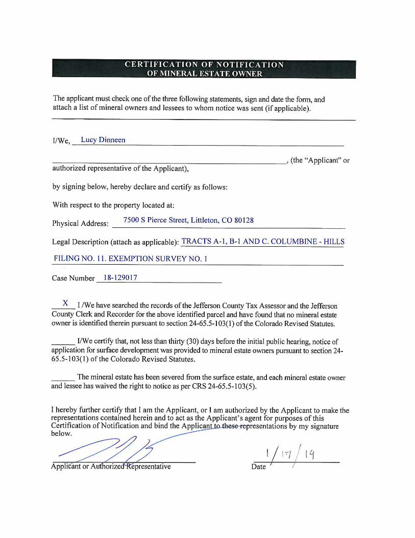
1
Nathan Seymour
From: [email protected]: Wednesday, February 20, 2019 11:00 AMTo: Nathan SeymourCc: Nancy YorkSubject: 19 101574 PF - Agency Response
Case Number: 19 101574 PF Case Type: Preliminary ‐ Final Plat Case Name: Ken Caryl Center Filing 1 Review: Open Space Results: No Comment (no further review) Review Comments: Scheduled End Date: 03/07/2019 Reviewer: Nancy York Description: Preliminary and Final Plat to create 2 commercial lots
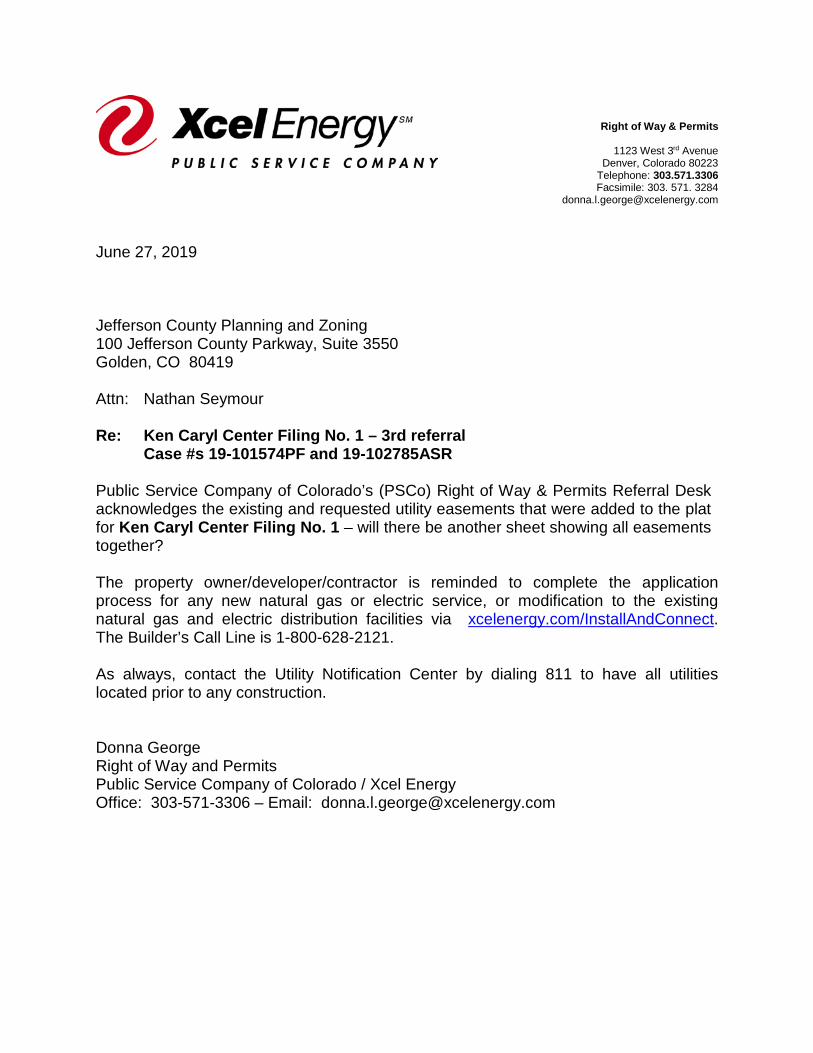
Siting and Land Rights
Right of Way & Permits
1123 West 3rd Avenue Denver, Colorado 80223
Telephone: 303.571.3306 Facsimile: 303. 571. 3284
June 27, 2019 Jefferson County Planning and Zoning 100 Jefferson County Parkway, Suite 3550 Golden, CO 80419 Attn: Nathan Seymour Re: Ken Caryl Center Filing No. 1 – 3rd referral Case #s 19-101574PF and 19-102785ASR Public Service Company of Colorado’s (PSCo) Right of Way & Permits Referral Desk acknowledges the existing and requested utility easements that were added to the plat for Ken Caryl Center Filing No. 1 – will there be another sheet showing all easements together? The property owner/developer/contractor is reminded to complete the application process for any new natural gas or electric service, or modification to the existing natural gas and electric distribution facilities via xcelenergy.com/InstallAndConnect. The Builder’s Call Line is 1-800-628-2121. As always, contact the Utility Notification Center by dialing 811 to have all utilities located prior to any construction. Donna George Right of Way and Permits Public Service Company of Colorado / Xcel Energy Office: 303-571-3306 – Email: [email protected]
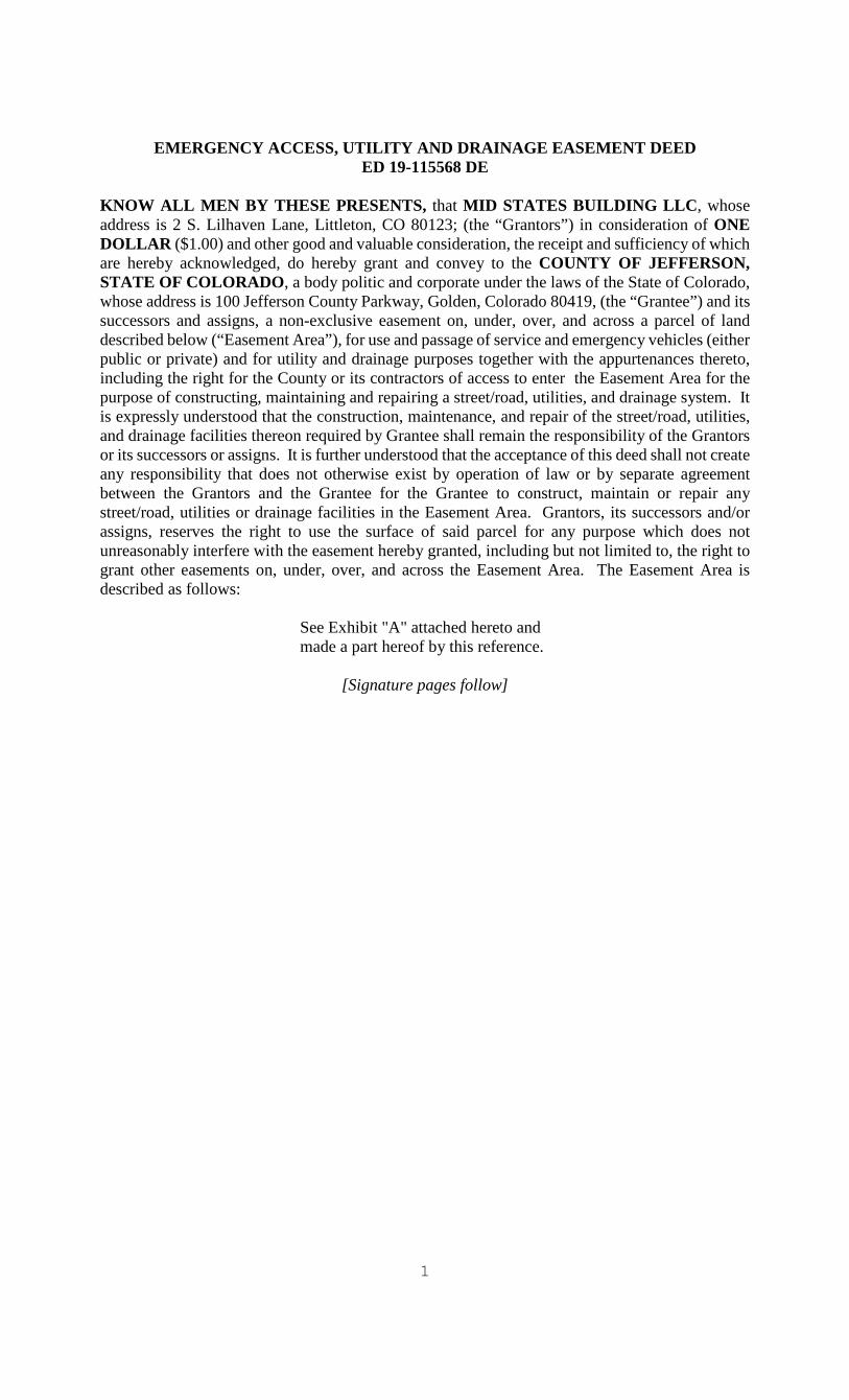
1
EMERGENCY ACCESS, UTILITY AND DRAINAGE EASEMENT DEED ED 19-115568 DE KNOW ALL MEN BY THESE PRESENTS, that MID STATES BUILDING LLC, whose address is 2 S. Lilhaven Lane, Littleton, CO 80123; (the “Grantors”) in consideration of ONE DOLLAR ($1.00) and other good and valuable consideration, the receipt and sufficiency of which are hereby acknowledged, do hereby grant and convey to the COUNTY OF JEFFERSON, STATE OF COLORADO, a body politic and corporate under the laws of the State of Colorado, whose address is 100 Jefferson County Parkway, Golden, Colorado 80419, (the “Grantee”) and its successors and assigns, a non-exclusive easement on, under, over, and across a parcel of land described below (“Easement Area”), for use and passage of service and emergency vehicles (either public or private) and for utility and drainage purposes together with the appurtenances thereto, including the right for the County or its contractors of access to enter the Easement Area for the purpose of constructing, maintaining and repairing a street/road, utilities, and drainage system. It is expressly understood that the construction, maintenance, and repair of the street/road, utilities, and drainage facilities thereon required by Grantee shall remain the responsibility of the Grantors or its successors or assigns. It is further understood that the acceptance of this deed shall not create any responsibility that does not otherwise exist by operation of law or by separate agreement between the Grantors and the Grantee for the Grantee to construct, maintain or repair any street/road, utilities or drainage facilities in the Easement Area. Grantors, its successors and/or assigns, reserves the right to use the surface of said parcel for any purpose which does not unreasonably interfere with the easement hereby granted, including but not limited to, the right to grant other easements on, under, over, and across the Easement Area. The Easement Area is described as follows:
See Exhibit "A" attached hereto and made a part hereof by this reference.
[Signature pages follow]
nseymour
Text Box
DRAFT
DRAINAGE EASEMENT DEED ED 19-115567 DE KNOW ALL MEN BY THESE PRESENTS, that MID STATES BUILDING LLC, whose address is 2 S. Lilhaven Lane, Littleton, CO 80123; (“Grantors”) in consideration of ONE DOLLAR ($1.00) and other good and valuable consideration, the receipt and sufficiency of which are hereby acknowledged, do hereby grant and convey to the COUNTY OF JEFFERSON, STATE OF COLORADO, a body politic and corporate under the laws of the State of Colorado, whose address is 100 Jefferson County Parkway, Golden, Colorado 80419, (the “Grantee”) and its successors and assigns, a non-exclusive easement on, under, over and across a parcel of land, described below (“Easement Area”), together with the appurtenances thereto for the purpose of constructing, maintaining, and repairing a drainage system. The Grantee shall have the right of reasonable ingress and egress across the Grantors’ property to access the Easement Area. It is expressly understood that the construction, maintenance, and repair of the drainage system installed within the Easement Area and any facilities thereon required by Grantee shall be the responsibility of the Grantors, its successors and/or assigns. It is further understood that the acceptance of this deed shall not create any responsibility that does not otherwise exist by operation of law or by separate agreement between the Grantors and the Grantee for the Grantee to construct, maintain or repair any drainage facilities in the Easement Area. Grantors, its successors and/or assigns, reserves the right to use the Easement Area for any purpose which does not unreasonably interfere with the easement hereby granted, including but not limited to, the right to grant other easements on, under, over, and across the Easement Area. The Easement Area is described as follows:
See Exhibit "A" attached hereto and made a part hereof by this reference.
[Signature pages follow]
nseymour
Text Box
DRAFT
2
GRANTORS:
MID STATES BUILDING LLC
By: ______________________________ Nancy A. Leprino, Representative STATE OF COLORADO ) ) ss COUNTY OF ___________ ) The foregoing Drainage Easement Deed ED 19-115567 DE was acknowledged before me this ____ day of ______________, 2019, by Nancy A. Leprino as Representative for Mid States Building LLC. Witness my hand and official seal.
___________________________________ Notary Public
[Signatures continue on next page]

3
This deed is accepted this ______ day of _________________, 2019.
COUNTY OF JEFFERSON, STATE OF COLORADO
BY: ______________________________________ Libby Szabo, Chairman Board of County Commissioners
Approved as to Form: BY: __________________________ Assistant County Attorney
2
GRANTORS:
MID STATES BUILDING LLC
By: ______________________________ Nancy A. Leprino, Representative STATE OF COLORADO ) COUNTY OF ___________ ) The foregoing Emergency Access, Utility and Drainage Easement Deed was acknowledged before me this ____ day of _____________________, 2019, by Nancy A. Leprino as Representative for Mid States Building LLC. Witness my hand and official seal.
___________________________________ Notary Public
[Signatures continue on next page]

3
This deed is accepted this ______ day of _________________, 2019.
COUNTY OF JEFFERSON, STATE OF COLORADO
By: ______________________________________ Libby Szabo, Chairman Board of County Commissioners
Approved as to Form: By: ________________________ Assistant County Attorney
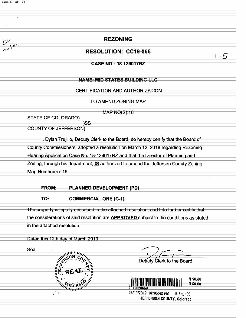

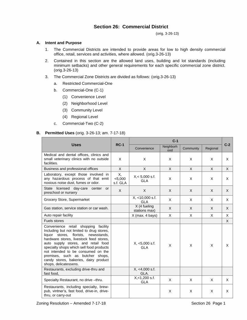
Zoning Resolution – Amended 7-17-18 Section 26 Page 1
Section 26: Commercial District
(orig. 3-26-13)
A. Intent and Purpose
1. The Commercial Districts are intended to provide areas for low to high density commercial office, retail, services and activities, where allowed. (orig.3-26-13)
2. Contained in this section are the allowed land uses, building and lot standards (including minimum setbacks) and other general requirements for each specific commercial zone district. (orig.3-26-13)
3. The Commercial Zone Districts are divided as follows: (orig.3-26-13) a. Restricted Commercial-One b. Commercial-One (C-1)
(1) Convenience Level (2) Neighborhood Level (3) Community Level (4) Regional Level
c. Commercial-Two (C-2)
B. Permitted Uses (orig. 3-26-13; am. 7-17-18)
Uses RC-1 C-1
C-2 Convenience Neighborh
ood Community Regional
Medical and dental offices, clinics and small veterinary clinics with no outside facilities.
X X X X X X
Business and professional offices X X X X X X
Laboratory, except those involved in any hazardous process of that emit noxious noise dust, fumes or odor.
X, <5,000 s.f. GLA
X,< 5,000 s.f. GLA
X X X X
State licensed day-care center or preschool or nursery X X X X X X
Grocery Store, Supermarket X, <10,000 s.f. GLA
X X X X
Gas station, service station or car wash. X (4 fueling stations max) X X X X
Auto repair facility X (max. 4 bays) X X X X
Fuels stores X Convenience retail shopping facility Including but not limited to drug stores, liquor stores, florists, newsstands, hardware stores, livestock feed stores, auto supply stores, and retail food specialty shops which sell food products not intended to be consumed on the premises, such as butcher shops, candy stores, bakeries, dairy product shops, delicatessens.
X, <5,000 s.f. GLA
X X X X
Restaurants, excluding drive-thru and fast food, X, <4,000 s.f.
GLA.
Specialty Restaurant, no drive –thru. X,<1,200 s.f. GLA
X X X X
Restaurants, including specialty, brew-pub, vintner’s, fast food, drive-in, drive-thru, or carry-out
X X X X
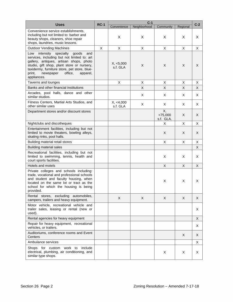
Section 26 Page 2 Zoning Resolution – Amended 7-17-18
Uses RC-1 C-1
C-2 Convenience Neighborhood Community Regional Convenience service establishments, including but not limited to: barber and beauty shops, cleaners, shoe repair shops, laundries, music lessons.
X X X X X
Outdoor Vending Machines X X X X X X
Low intensity specialty goods and services, including but not limited to: art gallery, antiques, artisan shops, photo studio, gift shop, plant store or nursery, taxidermy, furniture store, pet store, blue-print, newspaper office, apparel, appliances.
X, <5,000 s.f. GLA
X X X X
Taverns and lounges X X X X X
Banks and other financial institutions X X X X
Arcades, pool halls, dance and other similar studios. X X X X
Fitness Centers, Martial Arts Studios, and other similar uses X, <4,000
s.f. GLA X X X X
Department stores and/or discount stores
X, <75,000 s.f. GLA.
X X
Nightclubs and discotheques X X X
Entertainment facilities, including but not limited to movie theaters, bowling alleys, skating rinks, pool halls.
X X X
Building material retail stores X X X
Building material sales X Recreational facilities, including but not limited to swimming, tennis, health and court sports facilities.
X X X
Hotels and motels X X X
Private colleges and schools including: trade, vocational and professional schools and student and faculty housing, when located on the same lot or tract as the school for which the housing is being provided.
X X X
Rental stores, excluding automobiles, campers, trailers and heavy equipment. X X X X X
Motor vehicle, recreational vehicle and trailer sales, leasing or rental (new or used).
X
Rental agencies for heavy equipment X
Repair for heavy equipment, recreational vehicles, or trailers. X
Auditoriums, conference rooms and Event Centers X X
Ambulance services X
Shops for custom work to include electrical, plumbing, air conditioning, and similar type shops.
X X X
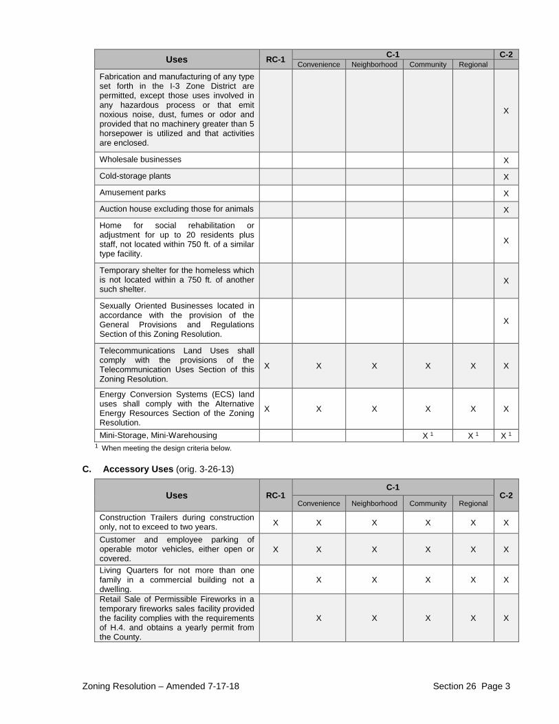
Zoning Resolution – Amended 7-17-18 Section 26 Page 3
Uses RC-1 C-1 C-2
Convenience Neighborhood Community Regional Fabrication and manufacturing of any type set forth in the I-3 Zone District are permitted, except those uses involved in any hazardous process or that emit noxious noise, dust, fumes or odor and provided that no machinery greater than 5 horsepower is utilized and that activities are enclosed.
X
Wholesale businesses X
Cold-storage plants X
Amusement parks X
Auction house excluding those for animals X
Home for social rehabilitation or adjustment for up to 20 residents plus staff, not located within 750 ft. of a similar type facility.
X
Temporary shelter for the homeless which is not located within a 750 ft. of another such shelter.
X
Sexually Oriented Businesses located in accordance with the provision of the General Provisions and Regulations Section of this Zoning Resolution.
X
Telecommunications Land Uses shall comply with the provisions of the Telecommunication Uses Section of this Zoning Resolution.
X X X X X X
Energy Conversion Systems (ECS) land uses shall comply with the Alternative Energy Resources Section of the Zoning Resolution.
X X X X X X
Mini-Storage, Mini-Warehousing X 1 X 1 X 1 1 When meeting the design criteria below.
C. Accessory Uses (orig. 3-26-13)
Uses RC-1 C-1
C-2 Convenience Neighborhood Community Regional
Construction Trailers during construction only, not to exceed to two years. X X X X X X
Customer and employee parking of operable motor vehicles, either open or covered.
X X X X X X
Living Quarters for not more than one family in a commercial building not a dwelling.
X X X X X
Retail Sale of Permissible Fireworks in a temporary fireworks sales facility provided the facility complies with the requirements of H.4. and obtains a yearly permit from the County.
X X X X X
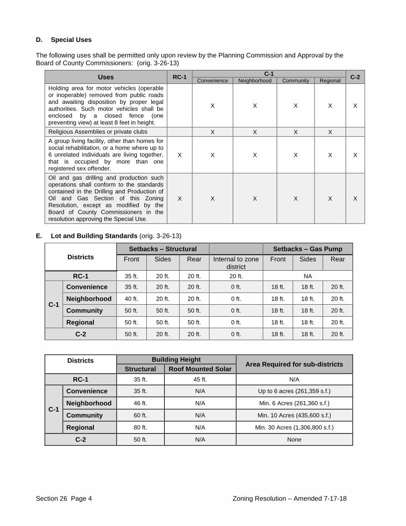
Section 26 Page 4 Zoning Resolution – Amended 7-17-18
D. Special Uses
The following uses shall be permitted only upon review by the Planning Commission and Approval by the Board of County Commissioners: (orig. 3-26-13)
Uses RC-1 C-1
C-2 Convenience Neighborhood Community Regional Holding area for motor vehicles (operable or inoperable) removed from public roads and awaiting disposition by proper legal authorities. Such motor vehicles shall be enclosed by a closed fence (one preventing view) at least 8 feet in height.
X X X X X
Religious Assemblies or private clubs X X X X A group living facility, other than homes for social rehabilitation, or a home where up to 6 unrelated individuals are living together, that is occupied by more than one registered sex offender.
X X X X X X
Oil and gas drilling and production such operations shall conform to the standards contained in the Drilling and Production of Oil and Gas Section of this Zoning Resolution, except as modified by the Board of County Commissioners in the resolution approving the Special Use.
X X X X X X
E. Lot and Building Standards (orig. 3-26-13)
Districts
Setbacks – Structural Setbacks – Gas Pump
Front Sides Rear Internal to zone district
Front Sides Rear
RC-1 35 ft. 20 ft. 20 ft. 20 ft. NA
C-1
Convenience 35 ft. 20 ft. 20 ft. 0 ft. 18 ft. 18 ft. 20 ft.
Neighborhood 40 ft. 20 ft. 20 ft. 0 ft. 18 ft. 18 ft. 20 ft.
Community 50 ft. 50 ft. 50 ft. 0 ft. 18 ft. 18 ft. 20 ft.
Regional 50 ft. 50 ft. 50 ft. 0 ft. 18 ft. 18 ft. 20 ft.
C-2 50 ft. 20 ft. 20 ft. 0 ft. 18 ft. 18 ft. 20 ft.
Districts
Building Height
Area Required for sub-districts Structural Roof Mounted Solar
RC-1 35 ft. 45 ft. N/A
C-1
Convenience 35 ft. N/A Up to 6 acres (261,359 s.f.)
Neighborhood 46 ft. N/A Min. 6 Acres (261,360 s.f.)
Community 60 ft. N/A Min. 10 Acres (435,600 s.f.)
Regional 80 ft. N/A Min. 30 Acres (1,306,800 s.f.)
C-2 50 ft. N/A None
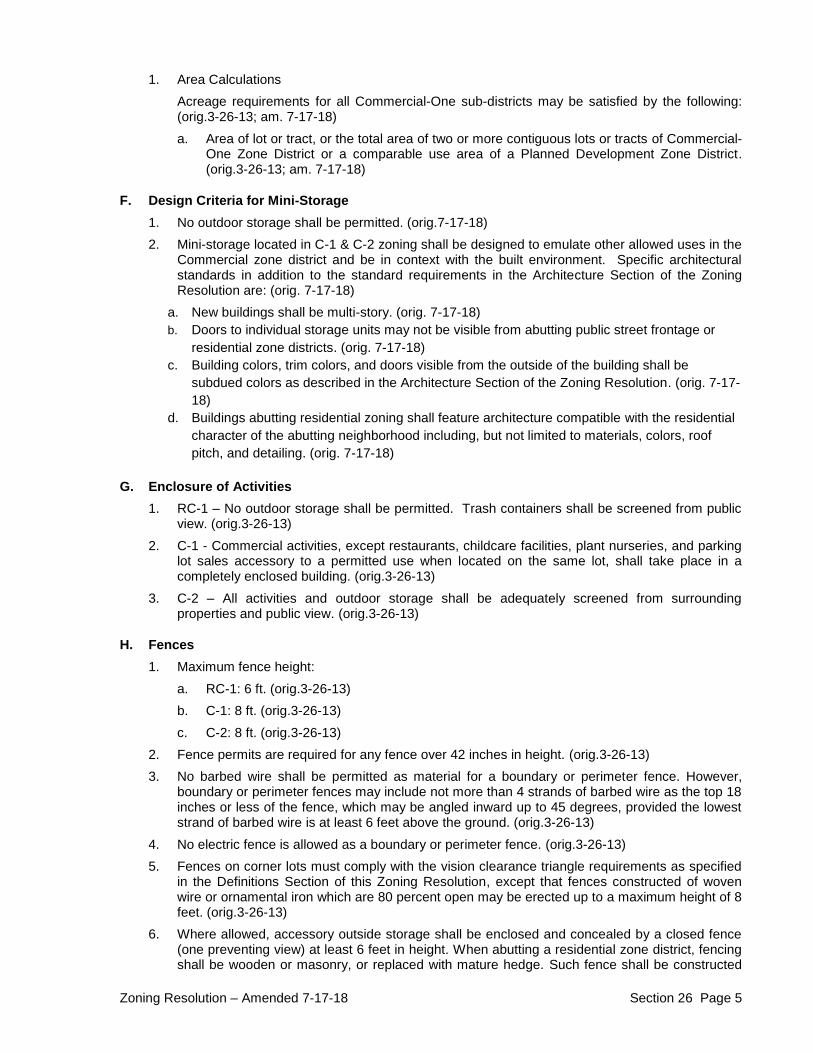
Zoning Resolution – Amended 7-17-18 Section 26 Page 5
1. Area Calculations Acreage requirements for all Commercial-One sub-districts may be satisfied by the following: (orig.3-26-13; am. 7-17-18) a. Area of lot or tract, or the total area of two or more contiguous lots or tracts of Commercial-
One Zone District or a comparable use area of a Planned Development Zone District. (orig.3-26-13; am. 7-17-18)
F. Design Criteria for Mini-Storage
1. No outdoor storage shall be permitted. (orig.7-17-18) 2. Mini-storage located in C-1 & C-2 zoning shall be designed to emulate other allowed uses in the
Commercial zone district and be in context with the built environment. Specific architectural standards in addition to the standard requirements in the Architecture Section of the Zoning Resolution are: (orig. 7-17-18)
a. New buildings shall be multi-story. (orig. 7-17-18) b. Doors to individual storage units may not be visible from abutting public street frontage or
residential zone districts. (orig. 7-17-18) c. Building colors, trim colors, and doors visible from the outside of the building shall be
subdued colors as described in the Architecture Section of the Zoning Resolution. (orig. 7-17-18)
d. Buildings abutting residential zoning shall feature architecture compatible with the residential character of the abutting neighborhood including, but not limited to materials, colors, roof pitch, and detailing. (orig. 7-17-18)
G. Enclosure of Activities
1. RC-1 – No outdoor storage shall be permitted. Trash containers shall be screened from public view. (orig.3-26-13)
2. C-1 - Commercial activities, except restaurants, childcare facilities, plant nurseries, and parking lot sales accessory to a permitted use when located on the same lot, shall take place in a completely enclosed building. (orig.3-26-13)
3. C-2 – All activities and outdoor storage shall be adequately screened from surrounding properties and public view. (orig.3-26-13)
H. Fences
1. Maximum fence height: a. RC-1: 6 ft. (orig.3-26-13) b. C-1: 8 ft. (orig.3-26-13) c. C-2: 8 ft. (orig.3-26-13)
2. Fence permits are required for any fence over 42 inches in height. (orig.3-26-13) 3. No barbed wire shall be permitted as material for a boundary or perimeter fence. However,
boundary or perimeter fences may include not more than 4 strands of barbed wire as the top 18 inches or less of the fence, which may be angled inward up to 45 degrees, provided the lowest strand of barbed wire is at least 6 feet above the ground. (orig.3-26-13)
4. No electric fence is allowed as a boundary or perimeter fence. (orig.3-26-13) 5. Fences on corner lots must comply with the vision clearance triangle requirements as specified
in the Definitions Section of this Zoning Resolution, except that fences constructed of woven wire or ornamental iron which are 80 percent open may be erected up to a maximum height of 8 feet. (orig.3-26-13)
6. Where allowed, accessory outside storage shall be enclosed and concealed by a closed fence (one preventing view) at least 6 feet in height. When abutting a residential zone district, fencing shall be wooden or masonry, or replaced with mature hedge. Such fence shall be constructed
Section 26 Page 6 Zoning Resolution – Amended 7-17-18
and maintained in good condition. As used in this section, accessory outdoor storage shall not include employee or customer parking lots or merchandise displayed for sale. Accessory outside storage shall not exceed the height of the fence, except for operable vehicles, trailers, and other equipment designed to be towed or lifted as a single component. Where the topography of the land is such that a fence would not prevent view from adjoining property or right-of-way, the Director of Planning and Zoning may waive this requirement. No accessory outdoor storage shall be allowed within a required front setback or within any required landscaping area. (orig.3-26-13; am. 3-3-15)
I. General Requirements
1. All setbacks shall be measured from the foundation or wall; however, eaves, roof overhangs and fireplaces may protrude 24 inches into the setback. (orig.3-26-13)
2. Corner lots must comply with the vision clearance triangle requirements as specified in the Definitions Section of this Zoning Resolution (orig.3-26-13)
3. No structure may be erected, placed upon or extend over any easement unless approved in writing by the agency or agencies having jurisdiction over such easement. (orig.3-26-13)
4. A temporary fireworks sales facility (i.e., tent rather than the stakes) must be a minimum of 100 feet from the property line of adjacent property located in a residential or agricultural zone district. Accessory storage of fireworks is permitted if fully enclosed in a metal storage container, and must be a minimum of 50 feet from the property line of adjacent property located in a residential or agricultural zone district. (orig.3-26-13)
5. Recreational facilities shall conform to the setback requirements for a main building in this zone district. Enclosure fences immediately surrounding these facilities shall not exceed 12 feet in height. (orig.3-26-13)
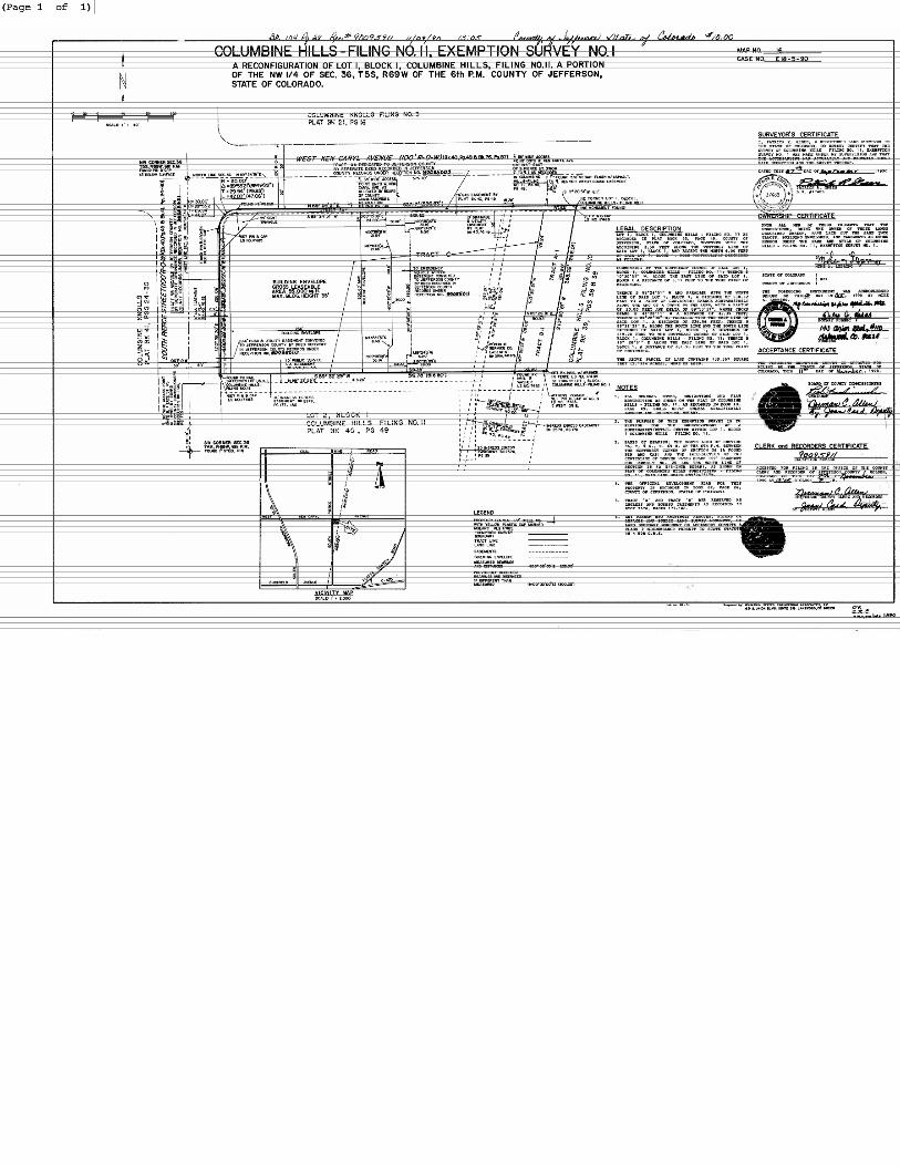
Related Documents