© 2010 Bentley Systems, Incorporated Bentley Map SELECTseries 3 - Introducing ‘Data Acquisition’ Tools Ian Rosam Product Manager, Bentley Civil 15 th November 2011

Welcome message from author
This document is posted to help you gain knowledge. Please leave a comment to let me know what you think about it! Share it to your friends and learn new things together.
Transcript
© 2
010 B
entley S
yste
ms,
Incorp
ora
ted
Bentley Map SELECTseries 3 - Introducing ‘Data Acquisition’ Tools
Ian Rosam
Product Manager, Bentley Civil
15th November 2011
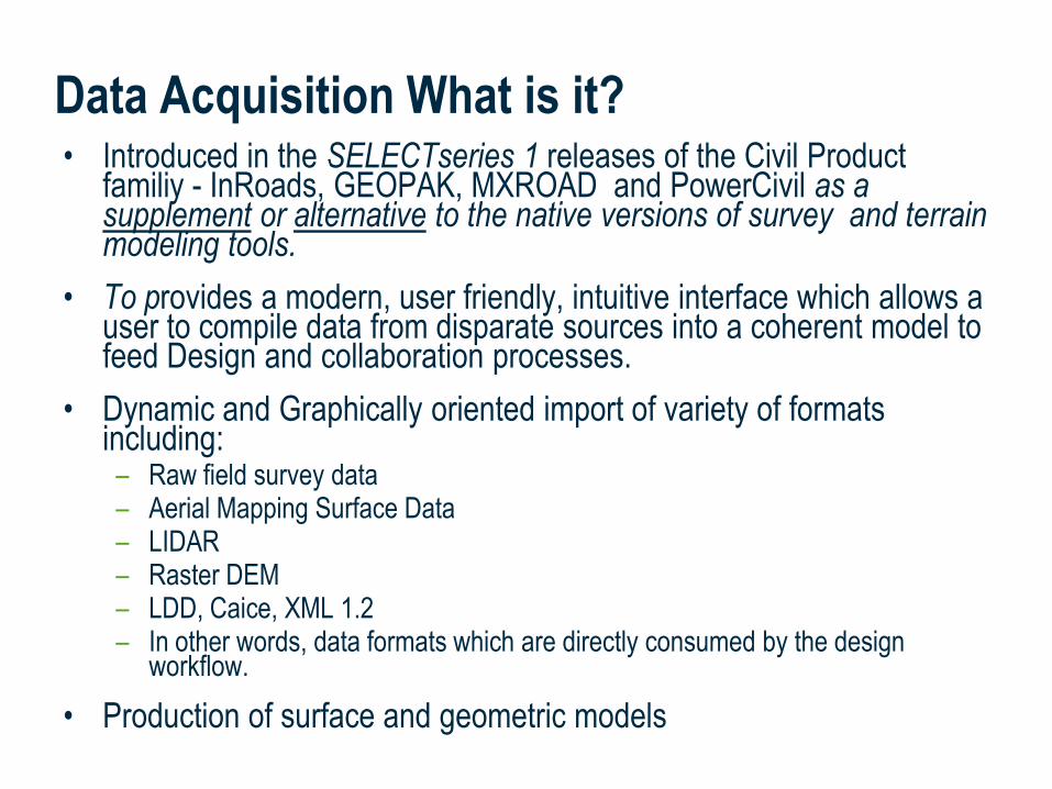
• Introduced in the SELECTseries 1 releases of the Civil Product familiy - InRoads, GEOPAK, MXROAD and PowerCivil as a supplement or alternative to the native versions of survey and terrain modeling tools.
• To provides a modern, user friendly, intuitive interface which allows a user to compile data from disparate sources into a coherent model to feed Design and collaboration processes.
• Dynamic and Graphically oriented import of variety of formats including:– Raw field survey data – Aerial Mapping Surface Data – LIDAR– Raster DEM– LDD, Caice, XML 1.2– In other words, data formats which are directly consumed by the design
workflow.
• Production of surface and geometric models
Data Acquisition What is it?
Data Acquisition What is it?
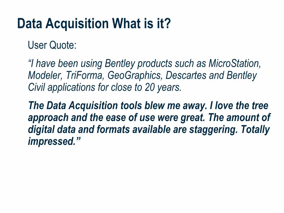
User Quote:
“I have been using Bentley products such as MicroStation, Modeler, TriForma, GeoGraphics, Descartes and Bentley Civil applications for close to 20 years.
The Data Acquisition tools blew me away. I love the tree approach and the ease of use were great. The amount of digital data and formats available are staggering. Totally impressed.”
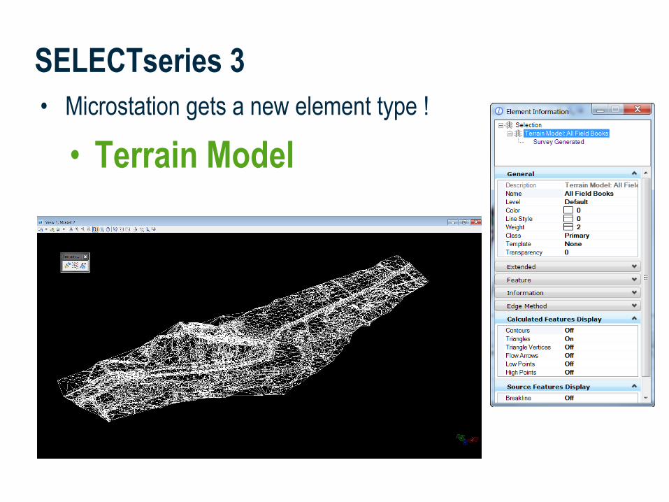
• Microstation gets a new element type !
• Terrain Model
SELECTseries 3
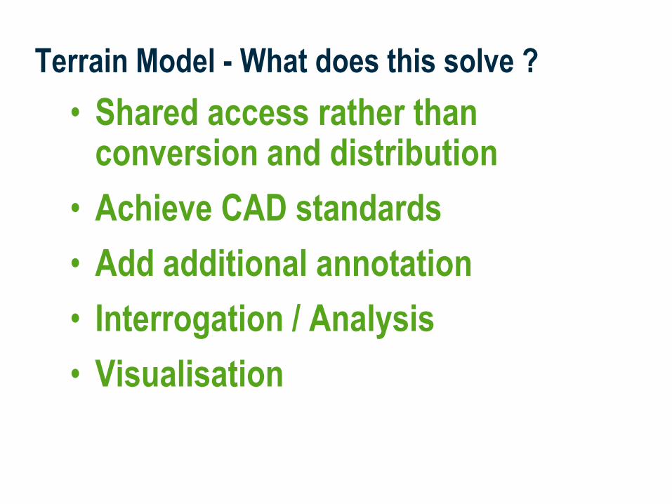
Terrain Model - What does this solve ?
• Shared access rather than conversion and distribution
• Achieve CAD standards
• Add additional annotation
• Interrogation / Analysis
• Visualisation
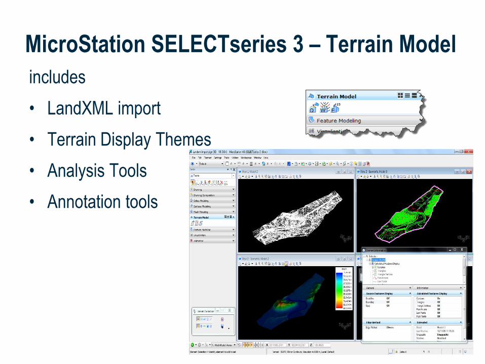
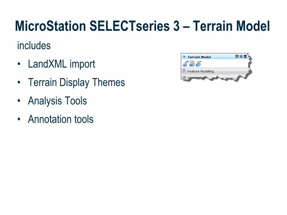
includes
• LandXML import
• Terrain Display Themes
• Analysis Tools
• Annotation tools
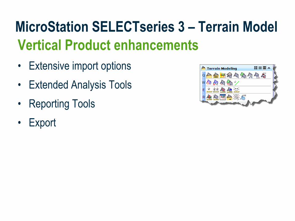
MicroStation SELECTseries 3 – Terrain Model

Vertical Product enhancements
• Extensive import options
• Binary File
• Graphics
MicroStation SELECTseries 3 – Terrain Model
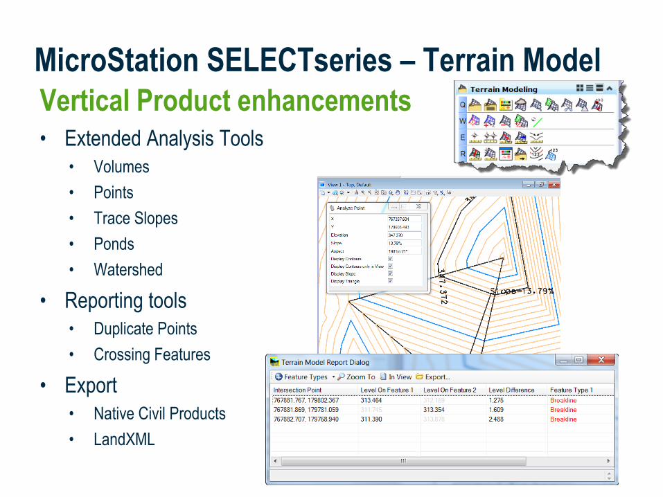
Vertical Product enhancements• Extended Analysis Tools
• Volumes
• Points
• Trace Slopes
• Ponds
• Watershed
• Reporting tools
• Duplicate Points
• Crossing Features
• Export
• Native Civil Products
• LandXML
MicroStation SELECTseries – Terrain Model
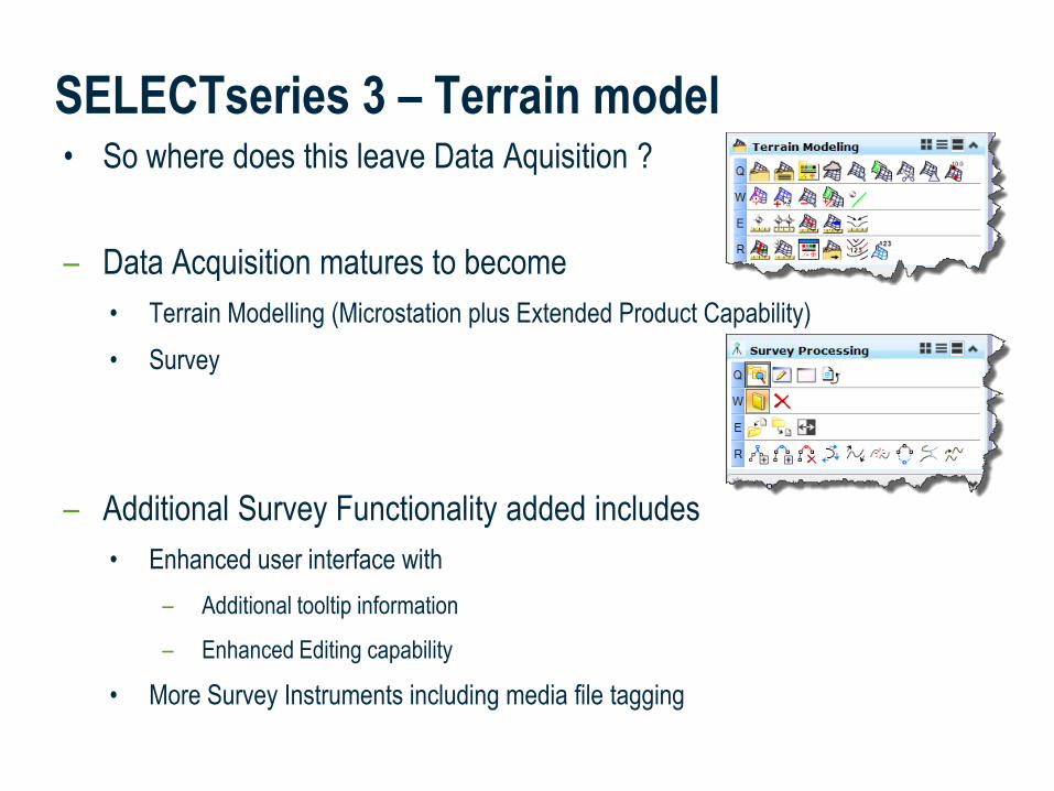
• So where does this leave Data Aquisition ?
– Data Acquisition matures to become
• Terrain Modelling (Microstation plus Extended Product Capability)
• Survey
– Additional Survey Functionality added includes
• Enhanced user interface with
– Additional tooltip information
– Enhanced Editing capability
• More Survey Instruments including media file tagging
SELECTseries 3 – Terrain model
• Terrain Modelling
• Survey
Demo
Bentley Map SELECTseries 3
Concepts Recap
• Terrain Modelling
• Survey
includes
• LandXML import
• Terrain Display Themes
• Analysis Tools
• Annotation tools
MicroStation SELECTseries 3 – Terrain Model
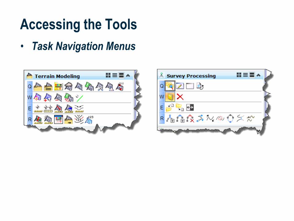
Accessing the Tools
• Task Navigation Menus
Vertical Product enhancements
• Extensive import options
• Extended Analysis Tools
• Reporting Tools
• Export
MicroStation SELECTseries 3 – Terrain Model
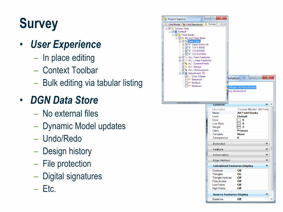
Survey
• User Experience– In place editing
– Context Toolbar
– Bulk editing via tabular listing
• DGN Data Store– No external files
– Dynamic Model updates
– Undo/Redo
– Design history
– File protection
– Digital signatures
– Etc.

Survey Preferences
• MicroStation Settings > Design File
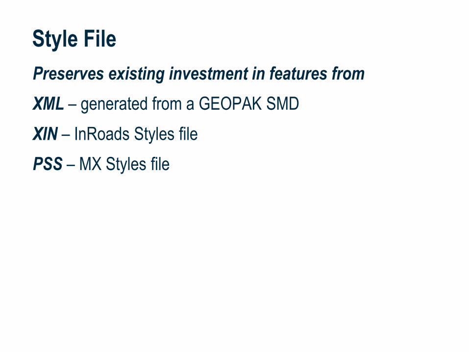
Style File
Preserves existing investment in features from
XML – generated from a GEOPAK SMD
XIN – InRoads Styles file
PSS – MX Styles file
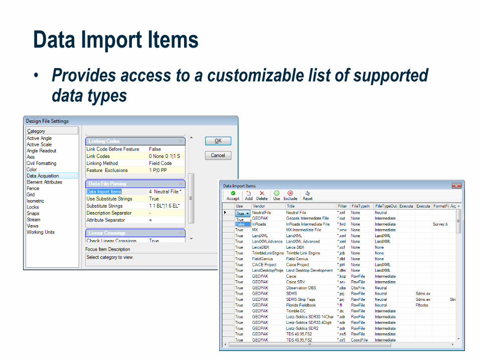
Data Import Items
• Provides access to a customizable list of supported data types

• Multiple Options
• Automatic Surface Updating Even of merged surfaces
• Crossing Breaklines management
Point and Chain Editing
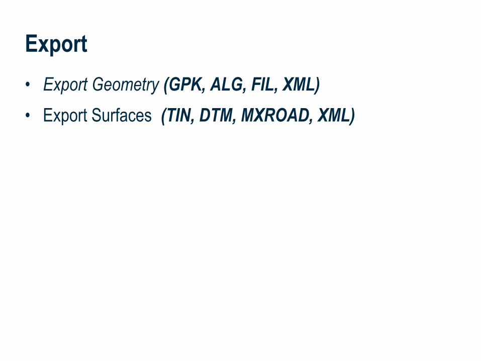
• Export Geometry (GPK, ALG, FIL, XML)
• Export Surfaces (TIN, DTM, MXROAD, XML)
Export
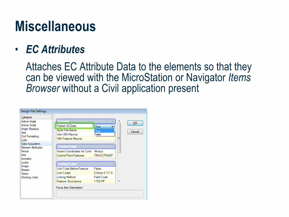
• EC Attributes
Attaches EC Attribute Data to the elements so that they can be viewed with the MicroStation or Navigator Items Browser without a Civil application present
Miscellaneous
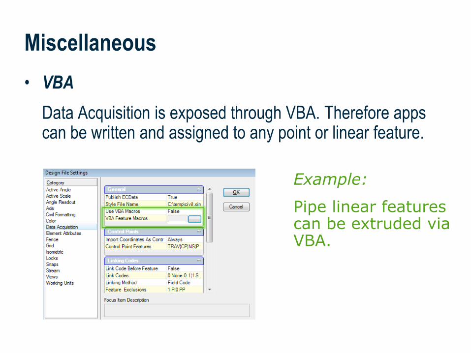
• VBA
Data Acquisition is exposed through VBA. Therefore apps can be written and assigned to any point or linear feature.
Miscellaneous
Example:
Pipe linear features can be extruded via VBA.
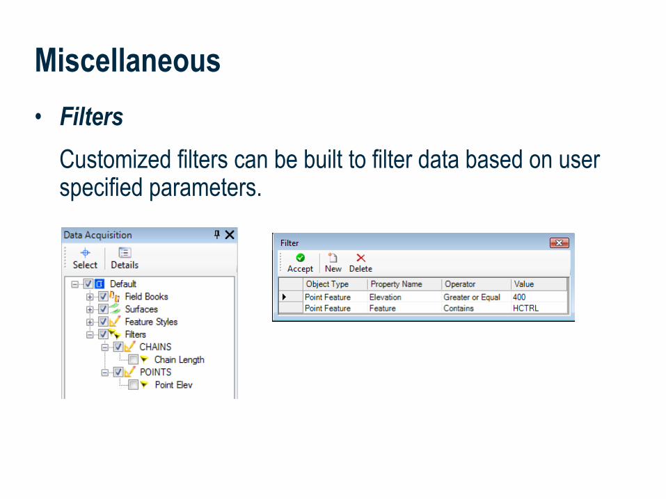
• Filters
Customized filters can be built to filter data based on user specified parameters.
Miscellaneous

| 2424 | WWW.BENTLEY.COM
2011 BE Together
Roads and Bridges
Thank You!
Are there any questions?
Related Documents
![FOR...Bentley WaterCAD V8i (SELECTseries 1) [08.11.01.32] Bentley Systems, Inc. Haestad Methods Solution Water Model.wtg Center. HIGH HGL NO DEMAND. FlexTable: Pipe Table (Water Model.wtg)](https://static.cupdf.com/doc/110x72/611cbb157fee8c396150a92e/-bentley-watercad-v8i-selectseries-1-08110132-bentley-systems-inc-haestad.jpg)