A handbook for regional water authorities Practice measures example book Benefit of governance in DROught adaPtation

Welcome message from author
This document is posted to help you gain knowledge. Please leave a comment to let me know what you think about it! Share it to your friends and learn new things together.
Transcript

a handbook for regional water authorities
Practice measures example book
Benefit of governance in DROught adaPtation

Preface 4
Introduction 6
The DROP-project and this handbook 7
How this book is organized 8
Drought, water scarcity and climate change in North-West Europe 9
Pilot Nature 12
General introduction 13
Pilot Nature - Waterboard Vechtstromen, Region Twente 14
Facts 14
Pilot description 16
Pilot Nature - Somerset County Council, Region Somerset 20
Facts 20
Pilot description 22
Table of contents
Pilot Agriculture 26
General introduction 27
Pilot Agriculture - Vlaamse Milieumaatschappij, Region Flanders 28
Facts 28
Pilot description 30
Pilot Agriculture - Waterboard Groot Salland, Region Salland 34
Facts 34
Pilot description 36
Pilot Freshwater 40
General introduction 41
Pilot Freshwater - Institution d’Aménagement de la Vilaine, Region Brittany 42
Facts 42
Pilot description 44
Pilot Freshwater - Waterboard Eifel-Rur, Region Eifel-Rur 48
Facts 48
Pilot description 50
Five needs for drought adaptation 54
Colophon 59
4
26 40 5412
6 9
DROP Handbook | 3

Preface

Water shortage and drought are becoming
increasingly common, and the situation is
expected to become further aggravated
as a consequence of climate change.
Urgent actions are required to adapt to
these changes. The ‘Benefi t of governance
in DROught adaPtation (DROP)’ project aims
to enhance the preparedness and resilience
of the regions of North-Western Europe to
such periods of drought and water shortage.
The core pillars of the DROP project include
transnational knowledge exchange and
integration between science, policy and
practice, and the exchange of knowledge
between regional authorities in the form of
drought expert teams, and between practice
and science through governance assessment.
First and foremost, there is an urgent need
to raise awareness on the topic of drought
and water shortage. To date, in North-West
Europe, drought and water shortage as water
management issues have been considered
less signifi cant than fl ooding. The real key
to fi nding a solution is to view drought and
fl ooding as two sides of the same coin.
There are major discrepancies between the
working methods and organisation approaches
employed by the partners, to say nothing of
the differences between the geography and
spatial planning policies of the participating
countries. We can overcome these differences
through joint development.
The DROP project has demonstrated that the
issue of drought and water shortage calls for a
broad set of technical solutions in combination
with a system of water governance capable of
putting the right measures in place at local,
regional and national level.
This handbook provides the reader with a
raft of possible measures and actions that
could be undertaken to combat drought,
and on that basis aims to inspire other
regional water authorities.
I would like to express a special word of
thanks to all partners in the DROP project.
Without the pilots in the regions and the
results they have generated, this book could
never have been written.
Stefan Kuks,
chairman of the international steering group
DROP
‘Water shortage and drought are becoming increasingly
common, and the situation is expected to become
further aggravated as a consequence of climate change’
In 2013, the European Commission adopted an EU strategy on adaptation to climate
change that has been welcomed by the EU Member States. The aim of the strategy
is to make Europe more climate resilient.
DROP Handbook | 5

Water scarcity and drought can harm
agricultural production, nature and
fresh water supplies. Although the
problems caused by drought in
North-West Europe are currently not
overwhelmingly visible, early action
should be taken to reduce costs and
prevent damage. How can European
regions increase the resilience of their
catchments to drought periods?
This book presents the key practice findings
of the three pilots (Nature, Agriculture and
Freshwater) of the DROP project (benefit of
governance in DROught adaPtation). In the
period 2012-2014, eleven organisations,
both practice and science, have learned
from each other through cooperation in
pilot actions and governance assessments,
to enhance the preparedness and resilience
of North-West European regions to periods
of drought and water scarcity. The DROP-
project recieves funding from the Interreg
IVb Programme North-West Europe of the
European Union.
The DROP-project and this handbook
The Commission’s recent “Blue Print on
European Waters” states that existing climate
adaptation policies are good, but that the
implementation of (technical) solutions is
especially difficult. A future challenge for
Europe is therefore to improve the implemen-
tation of adaptation measures, regarding both
technical measures and governance contexts.
DROP dealt with both issues for North-West
Europe regions: technical drought adaptation
measures and assessment of the governance
setting of regions. Each of the six regional
water organisations (the practice partners)
carried out studies and realised drought
adaptation measures.
It turned out that these measures are most
effective if relevant stakeholders are on
board and engaged in drought adaptation.
Strong governance is needed to help to
unify the different interests of stakeholders
at different levels of policy and practice.
Therefore, the project con sortium was
complemented by five knowledge institutes
(knowledge partners) who developed a
governance toolkit which was used in
the six regions of the practice partners.
The toolkit and some of the results of this
scientific endeavour are presented in another
DROP report: The governance assessment
guide. In this handbook we introduce the
measures and studies carried out by the
practice partners, aiming at providing an
inspiration and guidance for other regional
authorities in the process of finding inno-
vative solutions to adapt to drought and
water scarcity situations. More extensive
descriptions of the pilots can be found
online at www.dropproject.eu.
Introduction
‘How can European
regions increase
the resilience of
their catchments
to drought periods?’
DROP Handbook | 7

DROP partners
DROP is a transnational project and integrates knowledge from science, policy and
practice. The project is implemented through collaboration between six practice
partners and five knowledge partners. From the Netherlands, Waterschap Vechtstromen
(lead partner), Waterschap Groot Salland and the University of Twente are participating.
Germany is represented by Wasserverband Eifel-Rur. The French partners are the
Institution d’ Aménagement de la Vilaine, IRSTEA and Université François Rabelais.
Belgium is represented by the Vlaamse Milieumaatschappij and the Brussels
office of Ecologic. From the United Kingdom, Somerset County Council and
The University of Manchester are involved.
How this book is organized
This book is organized as follows. The descrip-
tion of the general framework on drought,
water scarcity and climate change in Europe
(chapter 2) is followed by three pilot chapters,
dealing with the pilot Nature (chapter 3:
regions Twente and Somerset), pilot Agri-
culture (chapter 4: regions Salland and
Flanders) and pilot Freshwater (chapter 5:
regions Eifel-Rur and Brittany).
Each chapter contains a description of the
studies and measures carried out in each
region. These chapters are complemented
by a text box on the specific governance
context in the regions. These boxes summarize
some of the achievements of the governance
team.
The lessons and recommendations the DROP
partners draw from the three pilots are
formulated in chapter 6.
The seperate chapters for Nature, Agriculture
and Freshwater may suggest that these themes
can be regarded in isolation from each other.
Nothing could be less true. In fact, Nature,
Agriculture and Freshwater are closely
interrelated when it comes to dealing with
drought and water scarcity. To illustrate the
interrelation, the book ends with a figure
of three overlapping circles illustrating the
interrelations between the three pilots
(page 60). The DROP researches and measures
in the circles show that most research and
measures influence more than just Nature,
Agriculture or Freshwater.

Water scarcity and drought is an increasingly
frequent and widespread phenomenon in the
European Union. The challenge from water
scarcity and drought has been recognised
in the Communications from the European
Commission ‘Adressing the challenge of
water scarcity and drought’ (adopted in 2007)
and ‘The Blue Print to Safeguarding European
Waters’ (adopted in 2012). Underlying studies
show that in 2007 11% of the European
population and 17% of its territory have
been affected.
Drought, water scarcity and climate change in Europe
‘Changes in drought
occurrences are closely
related to changes
in temperature and
land use’
DROP Handbook | 9

The communications from the European
Commission stated that long term imbalance
resulting from water demand exceeding water
resources availability is increasingly a problem
within Europe. Over the past thirty years,
droughts have dramatically increased in both
frequency and severity. Changes in drought
occurrences are closely related to changes in
temperature and land use. In the last decade
(2002-2011), the average temperature was
no less than 1.3 centigrade above the pre-
industrial level, and predictions of future
climate conditions indicate that this tendency
might persist in the future decades. In several
regions, extreme events such as heat waves,
forest fires, floods and droughts are occurring
(or expected to occur) more often. Changes in
land use amplify this effect, resulting in more
and more intense droughts and periods of
water shortages. The heat wave and drought
experienced by Europe in summer 2003
caused the loss of thousands of human lives
and severe economic damages, including
10 billion euros of agricultural damage.
In Europe, the number of people and
areas that are affected by drought (or a
temporary decrease in water availability)
has increased by 20% between 1976 and
2006. It is expected that water shortages
will increase in the near future, if temperatu-
res keep rising as a result of climate change.
Equally, changing and competing ‘demand’
needs for agriculture, drinking and urban
water, and environmental/nature flows will
place even greater pressures on increasingly
scarce resources. Adaptation – of demand and
supply systems – is necessary to prevent high
costs in the future. Many European countries
are working on drought adaptation strategies
and policies. However, the implementation of
such strategies is just starting. Many studies
are still needed to test the effectiveness of
adaptation measures in periods of drought
and scarcity, and to enable the engagement
of key stakeholders and users in planning
and decision-making.
Drought and water scarcity are no
longer concerns of only the hot and dry
Mediterranean regions; they are becoming
a concern of North-West Europe as well.
Although the problem is not yet overwhelming
visible early action should be taken to reduce
costs and prevent damage.
‘The heat wave and drought experienced by Europe
in summer 2003 caused the loss of thousands
of human lives and severe economic damages,
including 10 billion euros of agricultural damage’
DROP Handbook | 11
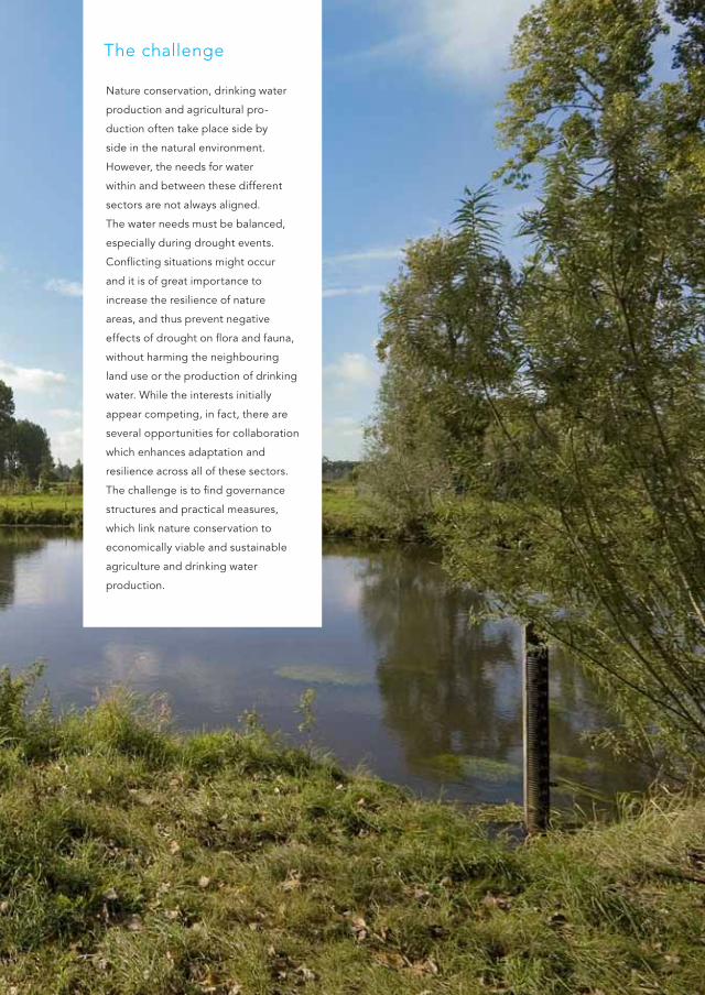
The challenge
Nature conservation, drinking water
production and agricultural pro-
duction often take place side by
side in the natural environment.
However, the needs for water
within and between these different
sectors are not always aligned.
The water needs must be balanced,
especially during drought events.
Conflicting situations might occur
and it is of great importance to
increase the resilience of nature
areas, and thus prevent negative
effects of drought on flora and fauna,
without harming the neighbouring
land use or the production of drinking
water. While the interests initially
appear competing, in fact, there are
several opportunities for collaboration
which enhances adaptation and
resilience across all of these sectors.
The challenge is to find governance
structures and practical measures,
which link nature conservation to
economically viable and sustainable
agriculture and drinking water
production.

Pilot
NatureGeneral introduction
The effects of higher temperatures and drought on nature are diverse and complex.
However, it is clear that the effects are extensive. During a drought period, groundwater
levels drop, the vegetation competes for the water and dehydrates, and faster mineralization
(eutrophication) can occur. Studies have shown that increased droughts contribute to the
emission of carbon in the atmosphere, through increased degradation of dead and decaying
plant material such as peat land. In Twente (NL) and Somerset Levels (GB), several innovative
measures related to drought and nature conservation have been tested and implemented.
These projects show how farming and nature conservation can go well together. This is further
enhanced by engagement and awareness efforts to create a sense of ownership among farmers
and nature organisations.
‘We want the right amount of water of the right
quality in the right place at the right time’
DROP Handbook | 13

Region
Twente, The Netherlands
Project scale
From farm-level (less than 1 km2)
to catchment level (100 km2)
Project owner
Waterboard Vechtstromen
In collaboration with
Province of Overijssel, Municipalities, Staatsbosbeheer
(State Forest Service), Landschap Overijssel (Foundation
for nature and landscape conservation in Overijssel)
and Natuurmomenten (National foundation for nature
conservation).
For more information
Waterboard Vechtstromen
www.vechtstromen.nl
Koen Bleumink: [email protected]
Facts
T W E N T E | T H E N E T H E R l a N D s
‘The groundwater
sensitive flora responds
very quickly to level
improvement measures.
You will soon see special
plants occupy the area’
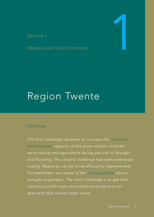
Challenge
The first challenge has been to increase the resilience
and retention capacity of the water system to better
serve nature and agriculture during periods of drought
and flooding. The second challenge has been awareness
raising. Measures can be more efficiently implemented
if stakeholders are aware of the consequences severe
drought engenders. The third challenge is to get from
numerous small-scale and scattered projects to an
approach that covers larger areas.
Nature ›
Waterboard Vechtstromen
Region Twente
1T W E N T E | T H E N E T H E R l a N D s
DROP Handbook | 15

Pilot description
Context
Waterboard Vechtstromen is situated in the
east of the Netherlands and responsible for
the management of water and treatment of
wastewater in the Twente region.
In recent years, water shortages have
occurred in the sandy soils in North-East
Twente during dry summers. Due to climate
change the average annual precipitation
surplus (precipitation minus evaporation)
is decreasing. As a result, less water will be
available in the near future causing problems
both for agriculture and nature: damage to
crops and damage to both terrestial and
aquatic nature.
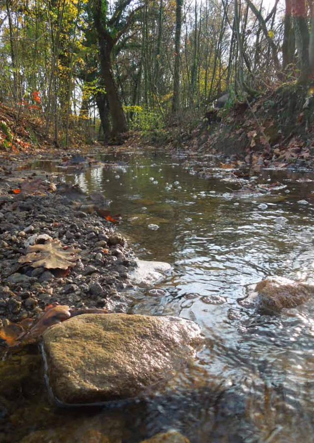
In the North-East region of Twente,
already about 90% of the water streams
carry too little water or even run dry.
Desiccation has a great impact on the
aquatic nature. Lower groundwater levels
reduce the river discharge with the impact
particularly seen in spring and summer
periods, when precipitation is low and river
levels are maintained by groundwater.
Not only in streams and their valleys,
but also on high ground in the catchment
area nature will deteriorate with desiccation.
In the whole catchment area, substantial
impacts are expected, which may be only
partly countered by measures.
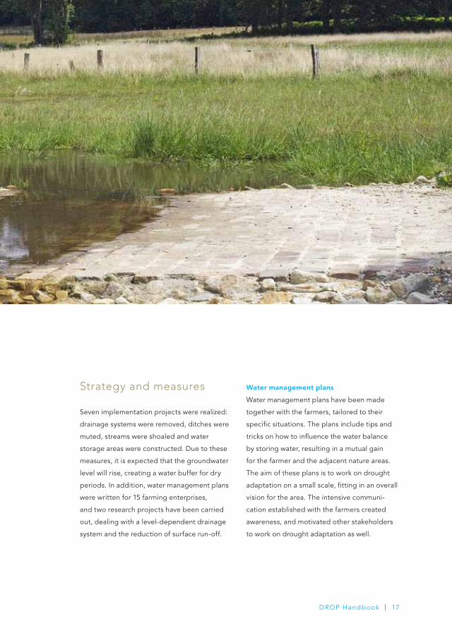
strategy and measures
Seven implementation projects were realized:
drainage systems were removed, ditches were
muted, streams were shoaled and water
storage areas were constructed. Due to these
measures, it is expected that the groundwater
level will rise, creating a water buffer for dry
periods. In addition, water management plans
were written for 15 farming enterprises,
and two research projects have been carried
out, dealing with a level-dependent drainage
system and the reduction of surface run-off.
Water management plans
Water management plans have been made
together with the farmers, tailored to their
specific situations. The plans include tips and
tricks on how to influence the water balance
by storing water, resulting in a mutual gain
for the farmer and the adjacent nature areas.
The aim of these plans is to work on drought
adaptation on a small scale, fitting in an overall
vision for the area. The intensive communi-
cation established with the farmers created
awareness, and motivated other stakeholders
to work on drought adaptation as well.
DROP Handbook | 17

Governance
‘Recognition of the drought
and water scarcity problem
is still at an early phase’
In the Netherlands, the recognition
of the drought and water scarcity
problem is still at an early phase.
There is only legitimacy for soft
voluntary approaches to prevention
policies and measures. In this context,
partnerships with as many stake-
holders as possible, are the best
way to create success. In Twente,
a close collaboration with stakeholders
has been found. Trust relations have
been built and each other’s goals
and visions are taken into account
when planning drought measures.
This provides coherence and enables
the successful implementation of
drought measures. However, it can
also be seen as a successful adaptation
to deal with an incoherent and
fragmented governance context for
the implementation of preventive
drought measures. While normally
incoherence and fragmentation would
lead to stalemates and ultimately
disinterest in the topic, it now has
led to the recognition that the various
parties need each other, and to the
absence of fear that one of them will
become too dominant.
Testing of a level-dependent drainage
system near a nature conservation area
Many water managers see level-dependent
drainage as the primary means of preventing
water depletion and of optimizing agricultural
use of areas of land. However, this idea lacks
theoretical underpinning. There is only
limited knowledge about the effects that
level-dependent drainage has on nature.
A study in Duivelshof (a nature area that
is surrounded by a water-depleted area of
intensive agriculture) aimed to better serve
both nature and agriculture during long
periods of drought. Waterboard Vechtstromen
has constructed a system of level-dependent
drainage in combination with raising the
drainage basis of a small water-depleted
nature conservation area.
Research and measures
for reducing surface run-off
Surface runoff in North-East Twente
is commonly observed in hilly areas,
where soil layers with low permeability
reach the surface. Extreme precipitation
events, together with impermeable layers
at shallow depths, can result in pool
formation. If precipitation events follow
shortly after land fertilization, pools with
high phosphate concentrations are formed.
As a result, the surface water is enriched
with phosphates, leading to eutrophication.
Research has been carried out to estimate
the potential of conceivable measures to
reduce run-off (e.g., contour ploughing
or constructing earth banks along the
low parts of fields for water infiltration).
DROP Handbook | 19
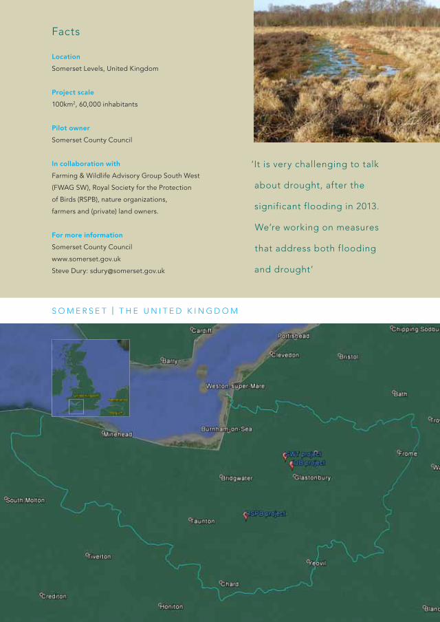
Location
Somerset Levels, United Kingdom
Project scale
100km2, 60,000 inhabitants
Pilot owner
Somerset County Council
In collaboration with
Farming & Wildlife Advisory Group South West
(FWAG SW), Royal Society for the Protection
of Birds (RSPB), nature organizations,
farmers and (private) land owners.
For more information
Somerset County Council
www.somerset.gov.uk
Steve Dury: [email protected]
Facts
s O M E R s E T | T H E u N I T E D k I N g D O M
‘It is very challenging to talk
about drought, after the
significant flooding in 2013.
We’re working on measures
that address both flooding
and drought’

Nature ›
somerset County Council
Region somerset
2s O M E R s E T | T H E u N I T E D k I N g D O M
Challenge
The challenge has been to bring together two areas
of drought adaptation – nature conservation needs
and agricultural demands and needs. This requires an
overhaul of the water management infrastructure and
governance arrangements. Climate change is expected to
have a profound effect on farming and land management.
Therefore, water conservation measures needed to
be implemented and innovative approaches to water
management needed to be explored.
DROP Handbook | 21

Pilot description
Context
The Somerset Levels are a sparsely populated
wetland area of central Somerset. They consist
of marine clay levels along the coast and often
peat based moors inland. The peat soils of the
Somerset Levels provide multiple ecosystem
services including food production, nature,
carbon storage and protection of historic
environment. These peat soils are vulnerable
to sudden and irreversible changes as a direct
result of drought. These changes include a
lowering of the land as water is lost, which then
leads to difficulties in managing water levels
cost-effectively at a landscape scale.
Therefore, decent water management in the
area is extremely important in sustaining
valuable environmental features, like exposed
peat soils and wetland wildlife (meadows,
ditches).
Somerset will be faced with changing rainfall
patterns under climate change. These changes
will likely mean wetter winters and drier
summers, which is likely to have a profound
effect on land management and farming.
In order to increase resilience to climate
change, the water management infrastructure
and governance arrangements with respect
to water need an overhaul.

There is a need for winter storage of water
to alleviate flooding and also to cope with
reduced summer rainfall. This winter storage
could be anything from floodplain retention
areas and creation of wetland habitats,
to interception ponds, water recycling,
collection pits and water collection tanks.
At a farm level, climate change is expected
to have a profound effect on land management
and farming. Farmers will need to implement
water conservation measures and explore
innovative approaches to water management
on farms. Additionally, nature conservationists
have acknowledged the need to work at a
landscape scale to address problems of habitat
fragmentation and isolation. Climate change
gives added impetus to work at a landscape
scale to mitigate and adapt to increased flood
and droughts. There is a need to create a
landscape in which flora and fauna can migrate
in response to change.
DROP Handbook | 23

strategy and measures
Somerset has implemented a number of
innovative approaches to increasing drought
resilience. FWAG SW has developed modelling
and technology transfer in the Upper Parrett
catchment on irrigation scheduling and water
application management. Water demands for
agriculture (e.g. potato production) are high
in the Upper Parrett, and there is an urgent
need to reduce water demand from irrigation.
Use of soil moisture probes and data analysis
has led to a more effective and efficient
use of water for application via irrigation.
FWAG SW has also worked with farmers,
trialling different types of cover crop to help
build organic matter. Healthy soil structure
and high organic matter levels are important
to help increase soils resilience against the
effects of waterlogging and drying.
This is especially important on arable farms
where the normal sources of organic matter
are in shorter supply due to the removal of
biomass. Results indicate that these methods
have been successful by increasing soil organic
matter content, soil water holding capacity,
soil microbial activity, and earth worm counts,
and by decreasing soil density.
In a managed lowland landscape, the conser-
vation of peat soils and their associated
habitats is dependent upon the functioning
of a managed water system. During droughts,
pinch points in the water system can result in
interruptions to the water supply to large areas,
and the consequent desiccation of peat soils.
Conservation NGOs RSPB and Somerset Wild-
life Trust have identified pinch points in the
water system on nature reserves, to plan and
implement works to improve the flow of water.
Governance
‘The challenge for
somerset is to avoid
maladaptation between
these two policy areas
and to integrate the
adaptive measures for
flood and drought’
The drought period in the South of
England in 2010-2012 had created
substantial momentum to improve
the processes of drought and water
scarcity adaptation, preparation and
communication. There are a number
of ways that drought and water scarcity
are included in water resources or
crisis planning of various stake holders,
including the regional Water
Companies, the Environment Agency,
the Irrigation Board, and a range of
other community and council stake-
holders. During and after this period
of drought, there was an increased
emphasis on coordinating responses
to drought and water scarcity across
stakeholders. This was seen to some-
what overcome the fragmented way
that drought and water scarcity had
been experienced, planned for,
and communicated in the past.
However, as the area is also prone
to flooding (e.g. winters 2012 and
2013/14), the challenge for Somerset
is to avoid maladaptation between
these two policy areas and to integrate
the adaptive measures for flood and
drought.
As elsewhere across North-West Europe,
there has been a dramatic decline in the
area of lowland raised bog habitat since
around the start of the nineteenth century.
The area of lowland raised bog in the UK,
retaining a largely undisturbed surface,
is estimated to have diminished by around
94%. The majority of the raised peat bog
has been lost to peat extraction and
agricultural intensification. The remaining
fragments, which are now all within nature
reserves, are raised above the surrounding
peat voids, and are, consequently, very difficult
to keep wet. The largest remaining fragments
of raised bog (about 20Ha at Westhay Moor
NNR and about 10Ha at Street Heath) are
managed by Somerset Wildlife Trust,
who together with RSPB have planned
and implemented a programme of work
including scrub clearance, re-grading of
peat soils and improvement of structures
that retain rainwater, to improve the drought
resilience of this fragile but valuable habitat.
DROP Handbook | 25
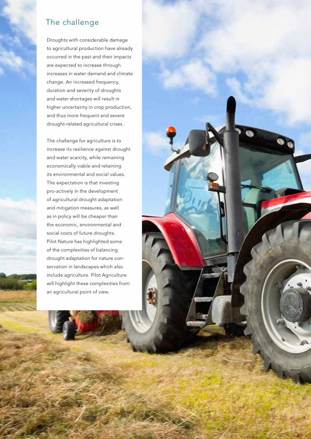
The challenge
Droughts with considerable damage
to agricultural production have already
occurred in the past and their impacts
are expected to increase through
increases in water demand and climate
change. An increased frequency,
duration and severity of droughts
and water shortages will result in
higher uncertainty in crop production,
and thus more frequent and severe
drought-related agricultural crises.
The challenge for agriculture is to
increase its resilience against drought
and water scarcity, while remaining
economically viable and retaining
its environmental and social values.
The expectation is that investing
pro-actively in the development
of agricultural drought adaptation
and mitigation measures, as well
as in policy will be cheaper than
the economic, environmental and
social costs of future droughts.
Pilot Nature has highlighted some
of the complexities of balancing
drought adaptation for nature con-
servation in landscapes which also
include agriculture. Pilot Agriculture
will highlight these complexities from
an agricultural point of view.
Pilot
agri-cultureGeneral introduction
There are different perspectives on drought. The meteorological perspective on drought
focuses on the degree of dryness, in comparison to a normal or average amount, and the
duration of the dry period. The hydrological perspective on drought refers to the low
discharge of water in streams and reservoirs, lasting months or years. Hydrological drought
can be a natural phenomenon or the result of human activities depending on the cultivation
of the land. Changes in land use and land degradation can affect the magnitude and frequency
of hydrological droughts. The agricultural perspective on drought is the impact of meteorological
and hydrological drought on agriculture production, focusing on precipitation shortages,
differences between actual and potential evapotranspiration, soil-water deficits, reduced
groundwater or reservoir levels, and so on. In Flanders (BE), instruments for agricultural
drought monitoring and impact modelling have been developed. In Salland (NL), two pumping
stations with an innovative control system that makes use of weather-predictions have been built.
‘addressing drought impacts on agriculture requires the
adaptation of existing tools for new challenges, and urges
different stakeholders to work towards common solutions’
DROP Handbook | 27

Region
Flanders, Belgium
Project scale
Drought monitoring indicators were developed for the
whole of Flanders. Hydrological models were developed
for the catchments of the Velpe and Dommel rivers.
Pilot owner
Vlaamse Milieumaatschappij (Flemish Environment Agency)
In collaboration with
Different departments and agencies of the Flemish
Government, water managers, farmers’ associations,
local authorities.
For more information
Vlaamse Milieumaatschappij (VMM)
www.vmm.be, www.waterinfo.be
Willem Defloor: [email protected]
Facts
F l a N D E R s | b E l g I u M
‘a better understanding
of drought occurrence
and impacts supports more
effective and efficient future
drought adaptation and
mitigation strategies’

Challenge
The challenge was to develop an approach which
allows monitoring and reporting the drought
status to enable pro-active water management,
estimating the impact of droughts on agriculture,
and evaluating measures for drought adaptation
and mitigation in the Flemish framework.
agriculture ›
Vlaamse Milieumaatschappij
Region Flanders
1F l a N D E R s | b E l g I u M
DROP Handbook | 29

Context
Existing monitoring and modelling tools for
water management are largely geared towards
flooding instead of drought. Nevertheless,
agricultural droughts may have severe
socio-economic impacts if not well forcasted
and monitored. The development and use
of a set of indicators for the monitoring and
reporting of a drought situation is still needed
in Flanders. Furthermore, existing hydrological
models require adjustments, so they can be
used for the modelling of low flow conditions
and in support of defining strategies of
drought adaptation in relation to agriculture.
The goal of this project is twofold: to set up
adequate instruments for drought monitoring
and impact modelling, and to provide impor-
tant information in support of future strategies
for drought management. In this pilot project,
drought monitoring indicators are developed
for the whole of Flanders, while more specific
drought impact models are developed for the
catchments of the Velpe river (141 km2), in the
Belgian loam belt, and for the Dommel river
(176 km2), in the sandy area of Eastern Flanders.
Pilot description

strategy and measures
An operational set of indicators for drought
monitoring and reporting was developed
(e.g. standardized precipitation index,
rainfall deficit, standardized streamflow
index). This allows monitoring different
levels of drought (meteorological, agricultural
and hydrological) on the local scale (measuring
station) and at a larger scale (here, Flanders).
The integration of these indicators in the
existing framework of data management
and reporting at VMM contributes to a more
effective drought status reporting. It also
represents a technical step towards the
development of an integrated water
management strategy that addresses both
high flows (floods) and low flows (droughts).
In 2014, the web portal www.waterinfo.be
was launched in cooperation between
five Flemish water management services.
Drought is included as one of the four main
themes of the portal. Through the website,
the drought indicators developed in the DROP
pilot case are published and disseminated.
Modelling tools focusing on the impact of
droughts on different aspects of the water
system (e.g. soil moisture, streamflow) and
on agricultural production (yield loss) have
been developed.
Dutch and Flemish stakeholders from the agricultural sector meet and discuss solutions
for drought-related agricultural problems.
DROP Handbook | 31

‘Model results for the
pilot catchments show
different drought
impacts’
SWAT (Soil and Water Assessment Tool)
and SWAP (Soil - Water - Atmosphere - Plant)
models were set up for the two pilot river
catchments. These models allow an estimation
of the impact of droughts on water availability
and crop production. Past droughts (for
understanding existing drought impacts),
present droughts (for operational drought
management) as well as expected future
droughts (in support of drought adaptation
measures) can be modelled.
Model results for the pilot catchments show
different drought impacts depending on
the severity of the drought, time of drought
occurrence during the year, and soil and
crop type.
While model conclusions have been restricted
to the project areas, the future application of
these modelling tools over the entire Flanders
area will provide essential information to
support the development of a drought
adaptation and mitigation policy in Flanders.
The modelling exercise for the project areas
also outlined knowledge and information
gaps that are to be addressed by further
model improvement and an increased
cooperation among different experts
and stakeholders. For instance, there is a lack
of accurate soil moisture data, a key variable
in assessing drought impact on agricultural
production. For the project areas, this was
addressed through a measuring campaign.

Governance
‘a strong governance
context for drought
adaptation involves
mechanisms to support
the engagement
of various relevant
stakeholders’
In Flanders, the Flemish Environment
Agency (VMM) is the main actor
organizing awareness-raising initiatives
on the issue of drought in the region.
In general, awareness for drought
issues is lacking in many stakeholder
groups. The approach used by VMM
to change this situation has been
based on making a scientific case
for drought action on the part of
stakeholders. Scientific results have
been used to create awareness and
as a basis for a discussion of potential
adaptation actions for drought in the
region. The development of indicators
for agriculture is one example.
This kind of approach was already
used successfully for floods by
VMM. Therefore, an established
‘organizational logic’ is being followed
when introducing regional awareness
for droughts. However, a strong
governance context for drought
adaptation does not just involve the
development of technical expertise.
It also involves mechanisms to support
the engagement of various relevant
stakeholders.
Drought problems are already
included in some strategies and
visions, and various policy instruments
are in place. These policy instruments
stem from different strategies and,
consequently, coherence and synergy
between these instruments is missing.
The drought monitoring and modelling
framework that was implemented can be
used by decision makers, such as water
managers, the agricultural department
and farmers’ organisations, to evaluate
the impact of droughts and to take action
accordingly. While initially focused on agri-
culture, the framework might be extended
towards drought-sensitive nature reserves,
ground water extraction, water quality and
navigation on waterways. At the same time,
a coordination platform was created by
bringing together governmental agencies
and organizations involved in water
management and agriculture. This will
further stimulate the cooperation between
different stakeholders, such as the Flemish
agricultural department, the Flemish Land
Agency, regional and national water managers,
the provinces and municipalities. The aim is
to develop this approach in such a way that
it can be used in other countries as well.
DROP Handbook | 33

Region
Salland, the Netherlands
Project scale
The project is part of a larger project
which covers an area of 180 km2
Pilot owner
Waterboard Groot Salland
In collaboration with
Province of Overijssel, farmers,
Vitens (water supply company)
For more information
Waterboard Groot Salland
www.wgs.nl/streukelerzijl
Hilde Buitelaar - van Mensvoort: [email protected]
Facts
s a l l a N D | T H E N E T H E R l a N D s
‘People from different
functions and disciplines
came together to talk about
the future workings of the
system. It is good to have all
their dif fering perspectives
on board’
s a l l a N D | T H E N E T H E R l a N D s
Challenge
The challenge in this project has been to build a water
system that is more resilient to extreme and changing
weather conditions by dividing up a catchment area
into two catchment areas. The new water system then
will have a double function: water supply from the river
Vecht to the catchment area and water discharge from
the catchment area to the river Vecht.
agriculture ›
Waterboard groot salland
Region salland
2
DROP Handbook | 35

Context
The jurisdictional area of Waterboard Groot
Salland (NL) is located in the North-East of
the Netherlands. The catchment area of the
pumping stations Streukelerzijl-Galgenrak,
located in the North-Eastern part, is prone
to flooding due to an insufficient drainage
system and to water shortage in periods of
drought. The aim of this project has been
to protect this catchment area of about
18.000 ha against flooding and drought
events.
This required a water system that is
able to drain and supply enough water
in, respectively, wet and dry weather
conditions, and also a water system that
responds quickly and effectively to changing
weather circumstances. A good steering
mechanism for the water system is essential
and key for good water mangement.
Another challenge of the project is to
generate knowledge about how to enhance
cooperation with all stakeholders involved,
in order to come to new implementations
to prevent drought related agricultural losses.
Pilot description
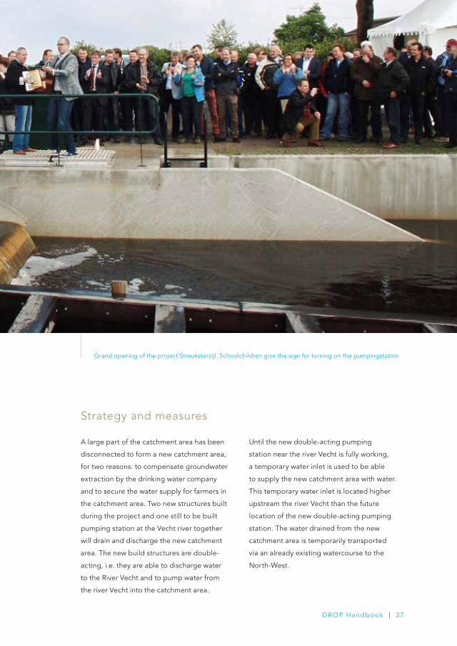
strategy and measures
A large part of the catchment area has been
disconnected to form a new catchment area,
for two reasons: to compensate groundwater
extraction by the drinking water company
and to secure the water supply for farmers in
the catchment area. Two new structures built
during the project and one still to be built
pumping station at the Vecht river together
will drain and discharge the new catchment
area. The new build structures are double-
acting, i.e. they are able to discharge water
to the River Vecht and to pump water from
the river Vecht into the catchment area.
Until the new double-acting pumping
station near the river Vecht is fully working,
a temporary water inlet is used to be able
to supply the new catchment area with water.
This temporary water inlet is located higher
upstream the river Vecht than the future
location of the new double-acting pumping
station. The water drained from the new
catchment area is temporarily transported
via an already existing watercourse to the
North-West.
Grand opening of the project Streukelerzijl. Schoolchildren give the sign for turning on the pumpingstation
DROP Handbook | 37


Governance
‘The emphasis of national
and Eu policies on river
basin management
encourages the regional
water authorities to
coordinate their actions’
A vivid governance context has
been observed here. The emphasis
of national and EU policies on river
basin management encourages
the regional water authorities to
coordinate their actions. One of
the regional initiatives has been the
development and implementation
of a common irrigation policy,
which aims to balance the use of
water by farmers close to natural
areas. The investigation on the
governance context revealed that
all stakeholders involved discuss
the issue of irrigation in terms of
(a lack of) water supply, an approach
culturally and historically firmly rooted
in this region.
As such, the focus of the policy
shifted towards zoning, a solution
that aims to reserve scarce water for
nature, during periods of drought.
However, the governance assessment
also revealed some evidence that
stakeholders on a regional level
learn to treat the issue of drought
as a phenomenon in itself through
participating in a regional initiative,
which aims to preserve and increase
the freshwater reserves in the region,
whereby stakeholders are willing to
address drought as an issue in itself
that influences the vulnerability and
adaptability of their activities.
An optimization study on the water manage-
ment of the double-acting water system has
been carried out. The new build pumping
stations are equipped with the new innovative
steering mechanism based on the results of
the optimization study. It involves a remote-
controlled control system that is linked to
output of weather forecasting models.
DROP Handbook | 39
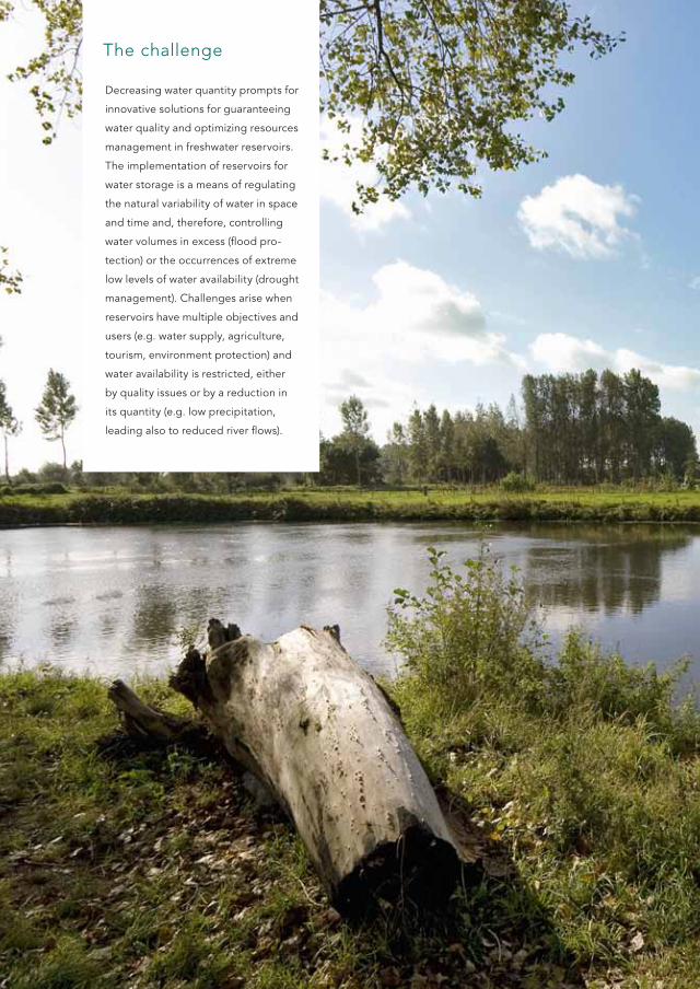
The challenge
Decreasing water quantity prompts for
innovative solutions for guaranteeing
water quality and optimizing resources
management in freshwater reservoirs.
The implementation of reservoirs for
water storage is a means of regulating
the natural variability of water in space
and time and, therefore, controlling
water volumes in excess (flood pro-
tection) or the occurrences of extreme
low levels of water availability (drought
management). Challenges arise when
reservoirs have multiple objectives and
users (e.g. water supply, agriculture,
tourism, environment protection) and
water availability is restricted, either
by quality issues or by a reduction in
its quantity (e.g. low precipitation,
leading also to reduced river flows).
General introduction
Worldwide, many examples of unsustainable management have shown that water shortages
can have significant social and economic impacts. Reduced river flows and lowered lake and
groundwater levels lead to a decrease in the quality of surface water, as less water is available
to dilute pollutants. It also leads to insufficient water to meet environmental and industrial
needs, as well as household demands for fit-for-purpose water. Water supply infrastructures
(e.g. transfers, reservoirs and desalination plants), and efficient drought monitoring and
forecasting systems are means to prevent and handle situations of severe drought.
The supply-demand balance and the needs to address and create reductions and efficiencies
in the demand side of sustainable water management are part of the solutions to cope with
more prolonged periods of water shortage. Solutions for a sustainable management of water
resources, including an optimized management of multi-purpose reservoirs, are still necessary
to increase resilience to drought and water scarcity. The urge to induce new demand and supply
strategies is high, due to the economic interests of the reservoirs and the increasing demands
of their different users. The pilot Freshwater illustrate the experiences in realizing innovative
technological measures for reservoir management in Brittany (France) and Eifel (Germany),
to better manage droughts and combat water scarcity for freshwater supply.
‘Without adaptation a change in the precipitation pattern can
lead even in water rich regions to water shortage in reservoirs’
Pilot
Fresh-water
DROP Handbook | 41
Location
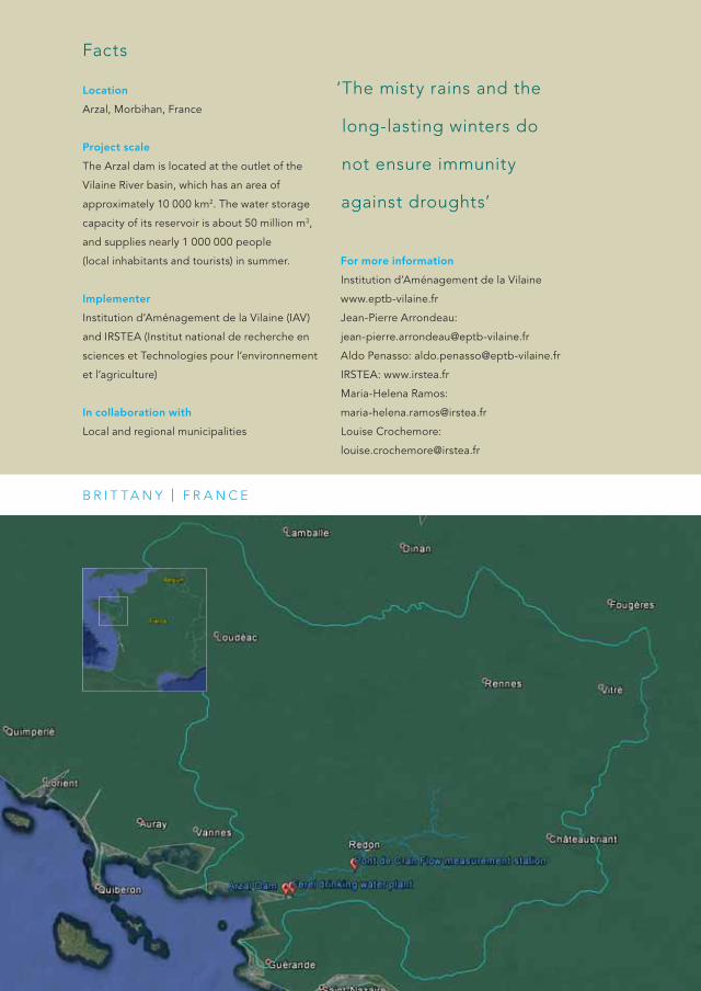
Arzal, Morbihan, France
Project scale
The Arzal dam is located at the outlet of the
Vilaine River basin, which has an area of
approximately 10 000 km2. The water storage
capacity of its reservoir is about 50 million m3,
and supplies nearly 1 000 000 people
(local inhabitants and tourists) in summer.
Implementer
Institution d’Aménagement de la Vilaine (IAV)
and IRSTEA (Institut national de recherche en
sciences et Technologies pour l’environnement
et l’agriculture)
In collaboration with
Local and regional municipalities
For more information
Institution d’Aménagement de la Vilaine
www.eptb-vilaine.fr
Jean-Pierre Arrondeau:
Aldo Penasso: [email protected]
IRSTEA: www.irstea.fr
Maria-Helena Ramos:
Louise Crochemore:
Facts
b R I T T a N Y | F R a N C E
‘The misty rains and the
long-lasting winters do
not ensure immunity
against droughts’
Freshwater ›
Institution d’aménagement de la Vilaine
Region brittany
1b R I T T a N Y | F R a N C E
Challenge
The challenge of this project is to ensure an
adequate level in the reservoir for all uses to be
possible, and at the same time to keep saltwater
out of the reservoir as much as possible so as to
preserve freshwater quality and guarantee drinking
water supply.
DROP Handbook | 43

Context
The Vilaine River basin has an area of
approximately 10 000 km2, which drains to
the estuarine Arzal dam located just before
the Atlantic Ocean in Brittany (France).
Built in 1970, its original goal was to protect
inlands (and especially the city of Redon)
against flooding, by disconnecting the
tide wave of the river flood wave.
Nowadays, even if flood prevention remains
one of the major issues, another very important
purpose of the dam is the regulation of the
fresh water reservoir (50 million m3) controlled
by the dam, mainly during low flow periods.
Regulation actions comprise the management
of water levels and the protection against salt
water intrusions. The drinking water plant,
which collects water in the freshwater reservoir
controlled by the Arzal dam, supplies nearly
1 000 000 people (local inhabitants and
tourists) in summer. The challenge of the
freshwater regulation in the Arzal dam lies
mainly in the multi-purpose nature of the
resource. It has a central role in providing
water supply, but, also to agricultural activities
and for recreational purposes, such as sailing
and fishing. This can lead to severe conflicts
among users, especially in drought periods
and under risk of water scarcity.
Pilot description

IAV, the institution which manages the Arzal
dam, faces several challenges related to salt
water intrusion and reservoir management
during the low flow season (June to October),
when both water quantity and water quality
constraints apply on the management of the
dam. Salt intrusions in the reservoir mainly
occur when boats cross the lock of the dam.
When water inflows tend to be the lowest
(during the low flow season), touristic activities,
including sailing, are generally at the highest
(since it involves the summer period), and lead
to a peak of salt water intrusions in the
reservoir, which can affect fresh water quality.
To prevent salt intrusions, siphons have been
installed upstream of the dam to pump the
contaminated water from the reservoir back
to the sea. However, this system leads to huge
losses of fresh water, which, during prolonged
periods of droughts, may aggravate the
problem of freshwater supply. Currently, the
only solution to limit salt water intrusions and,
consequently, pumping losses, is to make
restrictions in the use of the lock in summer,
the period when the traffic of boats is at its
highest. This generates conflicts and has
prompted IAV to the implementation of
new solutions through this project. In the
context of climate change, which may result
in longer and more intense periods of low
flows and droughts in the region, and aggra-
vated conflicts, these new solutions will
also contribute to the implementation
of adaptation measures.
The possibilities for development of a new lock, preventing salt water from penetrating into the fresh water
reservoir, was studied. A scientific model has allowed to verify the technical data in this innovative project.
DROP Handbook | 45

strategy and measures
The two principal strategic management
objectives in the Arzal reservoir during low
flow periods are:
1. to ensure an adequate level in the reservoir
for all uses to be possible, and
2. to keep saltwater out of the reservoir
as much as possible so as to preserve
freshwater quality and guarantee drinking
water supply.
Current and future challenges related to
declining water quality and quantity push
towards automated and integrated tools for
improved drought management and efficient
adaptation initiatives for the Arzal reservoir.
IAV and the national research institute IRSTEA
are working in close collaboration to take up
these challenges, through two main actions:
the implementation of a new lock, and the
development of drought forecasting and risk
management tools.
IAV has worked on developing an innovative
lock on the dam that prevents salt water to
intrude when boats pass the dam to and from
the Atlantic Ocean. Significant efforts have
been put into developing a physical model
of the new lock. Currently, all preliminary
studies are finished, model calibration is
achieved and all simulations have been
completed. The global cost of the project
is estimated to be 20 million euros
(based on preliminary studies). In parallel,
IRSTEA has developed a tool that forecasts
inflows to the reservoir during the low flow
season and helps in anticipating critical
situations for a better drought risk manage-
ment. The tool incorporates infor mation
from a hydrological forecasting model into
a graphical representation of the drought
risk. The model transforms future possible
weather scenarios over the Vilaine catchment
into river inflows right upstream to the dam.

Governance
‘as soon as drought
perceptions are raised,
drought adap tation
measures can rapidly
be designed and
implemented’
In addition to managing the Arzal dam,
IAV hosts the Local Water Committee,
where water issues are discussed with
all the stakeholders. This Committee
defines the Vilaine river basin manage-
ment plan, where measures are taken
to prevent low flows in several tributa-
ries. However, except for emergency
measures, there is no global plan set
up to manage drought vulnerabilities
induced by climate change.
The overall current situation is
of low drought risk perception,
compared to a more significant flood
risk perception. This is explained by a
lack of drought risk awareness, due to
the absence of critical drought events
in the past years in the region, and the
lack of a culture of drought forecasting
and risk communication. However, it is
expected that as soon as drought
perceptions are raised, drought
adap tation measures can rapidly be
designed and implemented by the
efficient, existing water governance
for freshwater in the basin, which is
supported by a dense stakeholder
network driven by IAV.
The graphical representation of the drought
risk provides a visual assessment of the risk of
being below given critical low-flow thresholds
in the next weeks or months, both in terms of
flow intensity and duration (i.e., mean flow and
number of days below each critical threshold,
respectively). This risk assessment visualisation
tool aims to help the managers of the dam in
deciding on whether or not to release water
from the reservoir and on how to operate the
corresponding dam components. It can be
integrated into the various reservoir operations
and management rules necessary to fulfil its
multiple operational uses, connecting the
utilities in a pre-operational framework.
DROP Handbook | 47
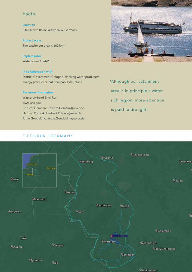
Location
Eifel, North Rhine Westphalia, Germany
Project scale
The catchment area is 662 km2
Implementer
Waterboard Eifel-Rur
In collaboration with
District Government Cologne, drinking water producers,
energy producers, national park Eifel, clubs
For more information
Wasserverband Eifel-Rur
www.wver.de
Christof Homann: [email protected]
Herbert Polczyk: [email protected]
Antje Goedeking: [email protected]
Facts
E I F E l - R u R | g E R M a N Y
‘although our catchment
area is in principle a water
rich region, more attention
is paid to drought’

E I F E l - R u R | g E R M a N Y
Freshwater ›
Waterboard Eifel-Rur
Region Eifel-Rur
2
Challenge
Recently, Eifel-Rur region has experienced somewhat
dryer periods during the spring season. as a result,
the water flow through the reservoirs decreases.
stillwater and falling water levels in reservoirs bear
the risk of a decrease in water quality, which results
in a higher amount of production work and possibly
drinking water production problems. Climate change,
which is expected to cause longer periods of drought,
will make these problems more severe.
DROP Handbook | 49

Context
The Waterboard Eifel-Rur has executed
a project to improve water reservoir
management. The project concerns a study
about a large reservoir-system situated in the
upper catchment of the Rur in the Eifel-hills,
where six dams were built and are managed
by the waterboard. The dams form an inter-
connected system around the main reservoir
‘Rurtalsperre’, which is the largest in Germany.
The system has a total capacity of 300 million
cubic meters. The main reason the system of
reservoirs was built was to regulate the effects
of flooding and to maintain the flow during
dry seasons. This is still the main task for the
management today. The system of dams also
plays an important role as drinking water
supply. Additionally, it is an attractive site
for tourism thanks to its good water quality
and its natural surroundings.
Pilot description

strategy and measures
The main aim of the pilot project is to prevent
deterioration of the water quality in the water
reservoir system. This is done by investigating
possible changes of the inflow in the last
decades. Based on the results obtained,
the rules of the management plan for discharge
downstream of the reservoir system are
checked. The checking aims to bring new ideas
for the adaptation of the management plan.
Reservoir system Rurtalsperre
The reservoir system in the northern Eifel has
important different tasks, which do not always
go in line with each other, but all of them
have to be served. For example, sometimes a
controlled high discharge out of the reservoir
is needed in order to prevent flooding, but this
can only be carried out to such an extent that
there is still enough water in the reservoirs to
produce drinking water and maintain the flow
in dry periods.
DROP Handbook | 51

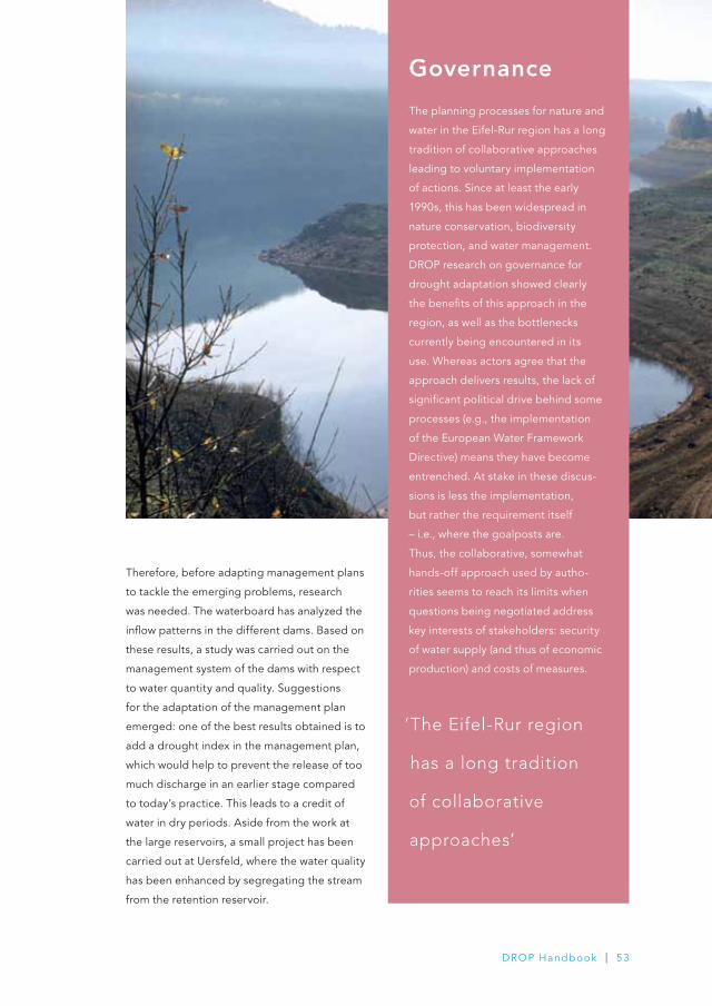
Governance
The planning processes for nature and
water in the Eifel-Rur region has a long
tradition of collaborative approaches
leading to voluntary implementation
of actions. Since at least the early
1990s, this has been widespread in
nature conservation, biodiversity
protection, and water management.
DROP research on governance for
drought adaptation showed clearly
the benefits of this approach in the
region, as well as the bottlenecks
currently being encountered in its
use. Whereas actors agree that the
approach delivers results, the lack of
significant political drive behind some
processes (e.g., the implementation
of the European Water Framework
Directive) means they have become
entrenched. At stake in these discus-
sions is less the implementation,
but rather the requirement itself
– i.e., where the goalposts are.
Thus, the collaborative, somewhat
hands-off approach used by autho-
rities seems to reach its limits when
questions being negotiated address
key interests of stakeholders: security
of water supply (and thus of economic
production) and costs of measures.
Therefore, before adapting management plans
to tackle the emerging problems, research
was needed. The waterboard has analyzed the
inflow patterns in the different dams. Based on
these results, a study was carried out on the
management system of the dams with respect
to water quantity and quality. Suggestions
for the adaptation of the management plan
emerged: one of the best results obtained is to
add a drought index in the management plan,
which would help to prevent the release of too
much discharge in an earlier stage compared
to today’s practice. This leads to a credit of
water in dry periods. Aside from the work at
the large reservoirs, a small project has been
carried out at Uersfeld, where the water quality
has been enhanced by segregating the stream
from the retention reservoir.
‘The Eifel-Rur region
has a long tradition
of collaborative
approaches’
DROP Handbook | 53
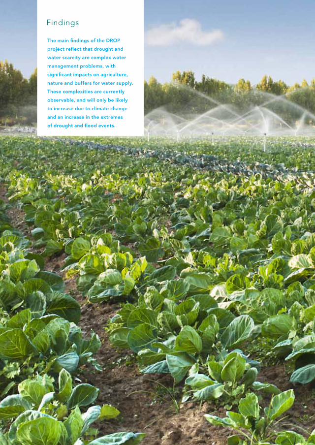
The main findings of the DROP
project reflect that drought and
water scarcity are complex water
management problems, with
significant impacts on agriculture,
nature and buffers for water supply.
These complexities are currently
observable, and will only be likely
to increase due to climate change
and an increase in the extremes
of drought and flood events.
Findings
Five basic needs
A number of things contribute to the
complexities of drought and water scarcity.
First, there is the vague and tacit nature of
the drought and water scarcity problem itself.
Desiccation, for instance, is about the absence
of water mostly in the capillaries of the system,
the opposite of the overwhelming presence
of flooding for many North-West Europe
regions. Secondly and partly as a result of
the first aspect, the absence of awareness
of a range of climate change risks needs to
be considered. For many water authorities
in North-West Europe, the main focus of risk
management lies in managing excesses
of water, and not the shortages of water.
To some extent, the same is true for many
water users and local stakeholders, for whom
flood awareness is more present than drought
awareness. Thirdly, there are the (supposedly)
opposing interests of flood prevention and
drought and water shortage prevention,
which, although acting on different levels
and timeframes, may be reinforced given a
general lack of integrated flood and drought
risk management across the European water
sector.
In the pilots of the DROP project,
partners have experimented with several
kinds of drought adaptation strategies
and measures. They had to face specific
challenges and, together, had the opportunity
to exchange on the pros and cons of such
adaptation ‘solutions’. We have captured the
experiences from these pilots in five basic
needs for dealing with the complexity of
adaptation to drought and water shortages,
in the context of climate change and increased
extreme events.
The need for insight and data processing
The first need is for more joined up under-
standings of the problem of drought and water
shortage. This includes better knowledge on
the natural processes governing droughts,
on the relation between groundwater and
surface water systems, on the interactions
between weather and climate variables and
land-surface processes, and the impact of
climate change on the supply-demand
balance. This is specifically needed during
dry summer periods to improve the modelling
of interdependencies and to reliably predict
the effect of current risk management rules
and future drought adapta tion measures.
Due to extensive measurement programmes,
data is often available on climatologic
variables, river discharges,
Five needs for drought adaptation
‘a number of things
contribute to the
complexities of drought
and water scarcity’
DROP Handbook | 55

soil moisture or groundwater levels.
However, this data needs to be translated
into information (understanding relationships),
into knowledge (understanding patterns)
and finally into insight (understanding
principles) to inform supply-side indicators
with changes to demand side needs in periods
of extremes. The web portal of VMM is a
fine example of translating data processing
into information (i.e., drought indicators)
and making it available to water managers,
farmers, and other stakeholders. Other actions
on hydrological modelling, risk visualisation
tools and probability analyses were also
part of the DROP project, contributing to
increased knowledge and insight on droughts
for practical operations in NEW Europe.
Increased investment needs to be made in
understandings the potential changes that will
occur to user demand under different climate
conditions – that is householders, industry,
business, farmers – and how adaptations can
occur at these different levels of ‘user’ while
still balancing the needs of nature for example,
through minimum environmental flows.
The need for engagement and awareness
The second need is for creating engagement
and awareness on drought and water shortage
across North-West Europe. Actions can be
more efficiently implemented if stakeholders,
decision-makers and the public are aware
of the consequences severe drought may
engender, if they acquire knowledge on the
recent research achievements in physical
and social sciences, and if they are engaged
in the implementation of new solutions for
water shortage management and drought
adaptation. All actors benefit from a more
transparent, engaged and trans-disciplinary
approach (i.e., including multiple disciplines
to define new approaches to problems that
transcend disciplinary silos.) The pilots in
Brittany and Eifel-Rur have shown that,
even in areas with abundant rainfall,
drought adaptation strategies are getting
more and more important for water supply
managers due to climate change affecting
precipitation patterns.
First meeting and the symbolic start of DROP.

The DROP project, in itself, and the
regional projects, more specifically,
were able to successfully raise attention
to the issues of drought and water scarcity,
by approaching actors at different levels:
from raising awareness amongst personnel
in the pilot organisations; to transboundary
collaboration between water authorities
and regional stakeholders across the
six regions; governance team visits and
discussions with a range of stakeholders
from local to regional in each of the six
catchments; and regional, national and
international dissemination.
The need for tailored action
Awareness-raising is especially of significant
importance in regions where drought and,
more generally, impact of climate change on
water management is not considered an issue
in societal, political and economic networks.
This is however only a first step to action.
Even in regions where drought awareness
is raised concrete and tailored adaptation
actions need to follow. This should involve
setting up specific actions that respond to
the concerns and needs of climate change
and drought/water scarcity impacts within
the specific region. Regional tailoring is
important, as the adaptation actions that
work well in one region will not necessarily
work well somewhere else. One of the ratio-
nalisations for the need for regional tailoring
is obviously the regional variability in climate
impacts – which influences the experience
of previous droughts. However, equally
importantly regional tailoring is needed
due to the variability in processes of
governance across regions and nations.
The governance processes that underpin
water management vary significantly across
regional and national boundaries in Europe
in terms of whether water management is
privatised or not, the level at which water
management is organised (local government
versus catchment boundaries), the degree to
which public and stakeholders are involved in
processes of water management, and whether
there is a history of adapting to drought and
water scarcity (and therefore existing measures
to build upon) or whether the measures are
being implemented from scratch.
For instance, in Brittany, talking about climate
change itself revealed to be not the best way
to draw more attention to drought and water
shortage challenges. Climate change is not
seen as a real problem, whereas water supply
quality and water sharing among different,
and sometimes concurrent, uses do receive
attention, although mostly through the issue
of low flows. Another example is Somerset,
where even though a period of drought had
preceded it, the significant flooding in the
2013-2014 winter season showed that talking
about drought measures can be very difficult
in the context of experiences of the devasta-
tion of the other side of water management
extremes. Drought awareness raising and the
implementation of tailored action for drought
adaptation can thus be more challenging in
some contexts and will include more than
‘simple’ arguing and convincing; it will require
a very subtle and connected way of dealing
with water issues in general.
‘Drought awareness
will require a very subtle
and connected way of
dealing with water issues
in general’
DROP Handbook | 57
The need for an integrated approach
That leads to the fourth need we discerned
clearly in the DROP project. Addressing the
challenges of drought and water shortage
requires an integrated approach to water
and risk management. With an integrated
approach we mean seeking smart combi-
nations for discussing and problem-solving
water shortage and water flooding within
the same frameworks of water management.
The flooding in Somerset showed that even
though water scarcity and flooding are
‘two sides of the same coin’, and there is
need for integrated water management,
there is a risk that developments on one
side of the coin – such as flood policy in
reactions to climate extremes – could be
maladaptive for the other side of the climate
adaptation coin – drought policy. This inte-
gration proceeds beyond the connection
between scarcity and excess of water.
The entire spatial context has to be
integrated with water management that
deals with both flooding and drought in
order to favour the implementation of truly
effective and climate-resilient strategies
for the future.
The need for multi-level strategy and action
At the macro level, people such as scientists,
policy makers, the media or environment/
water managers produce, reproduce and
communicate particular discourses (big themes
and big picture stories), through generic
models, abstract theories and general
policy on drought and water scarcity.
At the micro level, people such as farmers,
water authority workers, and NGOs volunteers
have experiences, tell stories of experience,
take concrete actions and share opinions
across farm fences or kitchen tables.

To move forward on the adaptation and
resilience to drought and water scarcity across
NWE we need to ensure that the macro level
discourses and regional/national/international
policies, reflect and are supported by the
micro level stories and actions of people
‘doing’ water management on the ground.
In the 6 DROP pilot regions, partners have
worked on a variety of measures and at a
variety of scales (from field level to regional
level to scientific discourse levels) to cope
better with drought and water scarcity.
Some measures involved the (re)construction
of the physical water management system
on-farm to influence landscape scale water
management (Twente, Somerset, Salland);
others addressed management plans
(Eifel-Rur); and others still developed
scientific knowledge, tool selection,
model building, and communication
of scientific risks (Flanders, Brittany).
Working across micro-meso-macro scales,
the DROP partners have put in evidence
that there is no such thing as ‘the right level
for drought adaptation’. Rather, drought has
to be tackled at a large variety of levels
and scales simultaneously. While a regional
scientific overview say of climate risks will
dictate which level or scale is the most
important to make physical changes to the
water management system, the local and
regional governance conditions (including
‘buy in’ from stakeholders that drought and
water scarcity is an issue worth addressing,
or that it is a ‘no cost’ solution when
implementing other adaptation measures
for flood) will dictate at what level
engagement can and should occur to
enhance the socio-economic-political
preparedness for drought and water
scarcity under current and future climate
for a region.
DROP Handbook | 59

• Realization of two new
structures: a weir and a
double-acting pumping
station (NL)
• Testing of a level-dependent
drainage system near a nature
conservation area (NL)
• Research and
measures for
reducing surface
run-off (NL)
• Design of an steering
mechanism for management
of the double-acting water
system, in order to respond
quick and effective to
changing weather
circumstances (NL)
• Trialling different
types of cover
crop to help
build organic
matter (UK)
• Dissemination of data by
www.waterinfo.be (B)
• Development of a tool that
provides to forecast infl ows to
the reservoir during the low fl ow
season and helps in anticipating
critical situations for a better
drought risk management in
the river basin (F)
• Creation of a platform to stimulate
cooperation between governmental
agencies and local organizations
involved in water management
and agriculture (B)
• Development of modeling
tools on the impact of
drought on water
system and agricultural
production (B)
• Set up of models to estimate
the impact of drought on
water availability and crop
production (Soil and Water
Assessment Tool and Soil -
Water - Atmosphere -
Plant model) (B)
Pilot agriculture
This handbook contains separate chapters for Nature, Agriculture
and Freshwater. That may suggest that these themes can be
regarded in isolation from each other. Nothing could be less
true. In fact, the three themes are closely interrelated when it
comes to dealing with drought and water scarcity. This fi gure,
with three overlapping circles, illustrates the interrelations
between the three pilots. The DROP researches and measures
in the circles show that most research and measures infl uence
more than just Nature, Agriculture or Freshwater.

• Research and measures
for reducing surface
run-off (NL)
• Restructuring and
restoring streams
and brooks at various
locations (NL)
• Testing of a level-
dependent drainage
system near a nature
conservation area (NL)
• Analysis of the infl ow patterns in
the different dams and a study
on the management system of
the dams with respect to water
quantity and quality (D)
• Development of an innovative
lock on the dam that prevents
salt water to intrude when
boats pass the dam (F)
• Development of a physical
model of the new lock
(calibration, simulations) (F)
• Identifi cation of pinch
points in the water
system on nature
reserves, to plan
and implement work
to improve the fl ow
of water (UK)
• Improvements of the
drought resilience of
raised peat bog (UK)
• Modelling and
technology transfer
in the Upper Parrett
catchment on irrigation
scheduling and
water application
management (UK)
Pilot Nature
Pilot Freshwater
DROP Handbook | 61
Colophon© January 2015
Lead Partner
Waterschap Vechtstromen
Partners
Waterschap Vechtstromen (lead partner)
Waterschap Groot Salland
University of Twente
Wasserverband Eifel-Rur
Institution d’ Aménagement de la Vilaine
IRSTEA
Université François Rabelais
Vlaamse Milieumaatschappij
Brussels office of Ecologic
Somerset County Council
The University of Manchester
Author
Nanny Bressers in cooperation with all partners
Full Title
Benefit of Governance in DROught AdaPtation
– Practice measures example book Benefit of
Governance in DROught AdaPtation
Funding
INTERREG-programme IVB/North West
Europe (NWE)
Co-director
Tauw bv
Photographs
All partners, Bas Worm, Wilco de Bruijne
Lay out and printing
Catapult creëert
Download www.dropproject.eu
All rights reserved. No part of this publication may be reproduced in any manner without
permission. All images are © the artists, reproduced with the kind permission of the artists
and/or their representatives.

Partners
www.dropproject.eu
Related Documents