Welcome message from author
This document is posted to help you gain knowledge. Please leave a comment to let me know what you think about it! Share it to your friends and learn new things together.
Transcript
2012 REPORT
ON THE
YELLOWJACKET Property
Atlin Mining District
Mapsheet NTS10412E
Center of Work
Latitude 59° 35’ N, Longitude 133°32' W
UTM NAD 83 N 6607172 / E 581908
Prepared for:
Athabasca Nuclear Corp.
Suite 200, 44 – 12th Ave. S., Cranbrook, BC V1C 2R7Toll Free: 1 866 HUNT ORE (486 8673)
Local: (250) 426-0749 Fax: (250) 426-6899 Email: [email protected]
By
Charles C. Downie, P.Geo.Athabasca Nuclear Corp.
August 2013
ldegroot
Text Box
BC Geological Survey Assessment Report 34034
YELLOWJACKET 2012 Assessment Report Page 2
SUMMARY
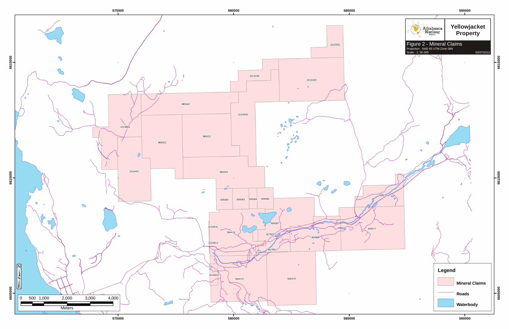
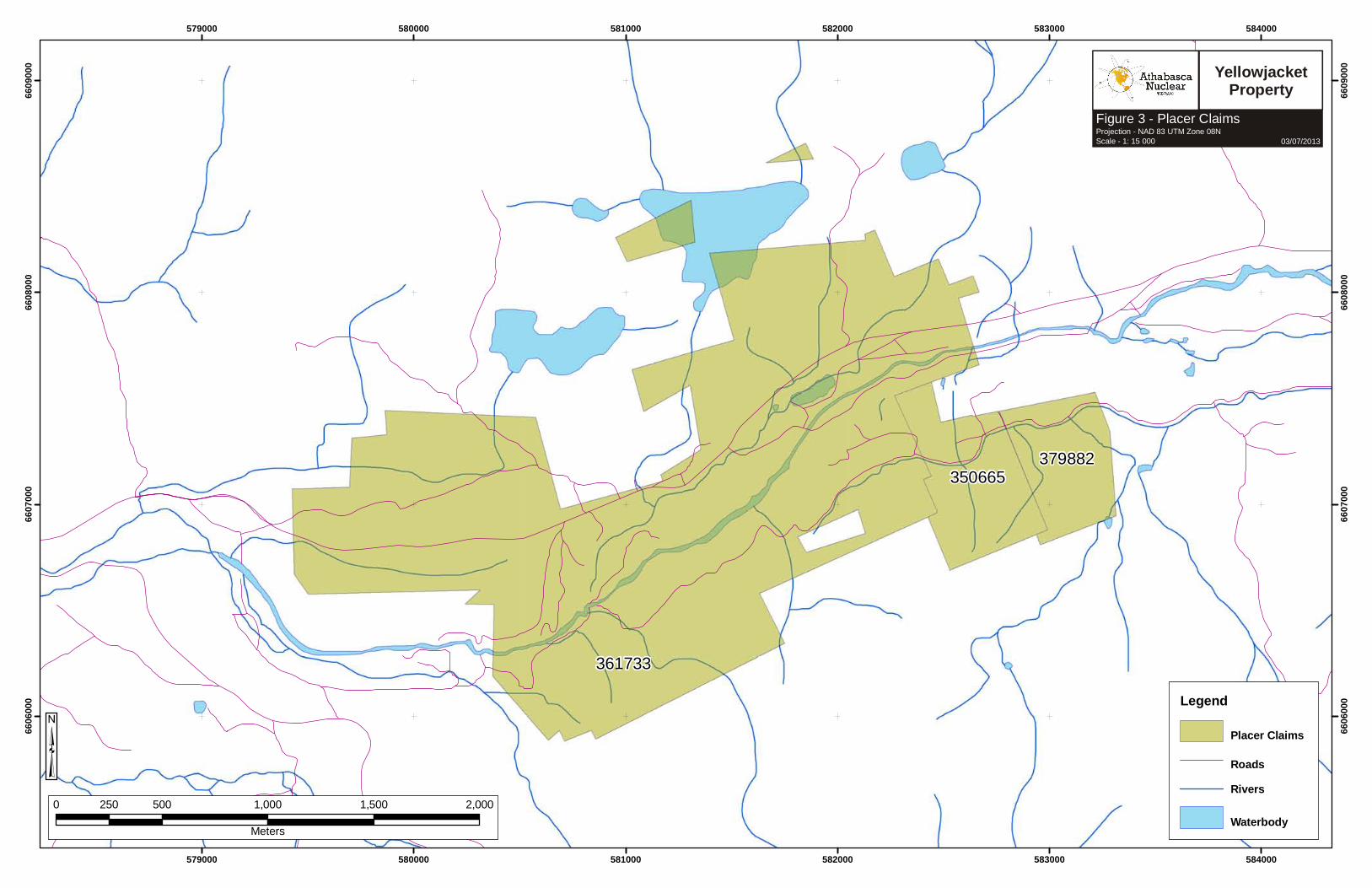
The Yellowjacket Property consists of 5 legacy claims and 20 mineral tenure cell claims totaling 7,025 contiguous hectares, two placer mining claims and a placer mining lease covering 366 hectares. The cells are centered at Latitude 59°35'N and Longitude 133°32'E within map sheets 104N.053 and 104N.063.
The project achieved exploration bulk testing in 2007-08 and test mining and production in 2009, under a Small Mines Act Permit. The joint venture has the cooperation of the Taku River Tlingit First Nation under a formal Impact and Benefits Agreement.
The Yellowjacket gold deposit is located west of Surprise Lake along Pine Creek, which runs westerly into Atlin, BC. The zone is located directly under a well-developed historical placer area with a long history of production dating back to the late 1800's. A 26 meter shaft was sunk on the Yellowjacket Property in 1903 and reportedly hit free gold, but the shaft was filled with placer tailings and has not been located since. The reported gold was hosted in quartz-filled fissures at mineable widths.
A shallow thrust fault along the southern slopes of Mount Munro and capping Spruce Mountain hosts many gold showings. A later steep fault along Pine Creek valley is also seen in placer workings and showings.
The occurrence consists of a zone of quartz veins, breccia and silicified patches located within intensely altered and sheared ultramafic rocks of the Pennsylvanian to Permian Atlin Ultramafic Allochthon. The ultramafics are bounded above by light green, hornblende-feldspar porphyritic andesite and below by a darker green, and more massive andesite to basalt of the Triassic Cache Creek Group. The contacts are highly sheared and altered, often having slickensides. Around the contacts, the basalt is heavily chlorite-altered and the ultramafic is altered to serpentine, mariposite, talc, quartz and carbonate (listwanite assemblage). The talc/serpentine zones often grade into intense silicification. Within the ultramafic zone, there are abundant interbedded sequences of andesite/basalt. Shearing and alteration has occurred preferentially along the contacts of the interbedded mafic and ultramafic rocks.
The auriferous zone occurs near the top of the ultramafic zone, which likely relates to a shallow thrust fault zone. This zone is 3 to 4 meters wide with narrow quartz veins containing free gold within brecciated and silicified zones.
Pyrite, chromite, and mariposite occur as minor accessories. Samples from this zone have assayed as high as 15.1 grams per tonne gold over 4.0 meters and 17.8 grams per tonne gold over 3.1 meters (Vancouver Stockwatch, March 11, 1987).
In 1983, local area prospectors staked the area of the Yellowjacket Property and then optioned the property to Canova Resources and Tri-Pacific Resources. During 1984 and 1985 these companies conducted programs of ground geophysics, rotary, and diamond drilling. In 1986 Homestake Mineral Development Company optioned the property from Canova in joint venture and initiated programs of mapping, reverse circulation drilling and diamond drilling.
Athabasca Nuclear Corp. August 2012
YELLOWJACKET 2012 Assessment Report Page 3
In 1988, Homestake completed a ground geophysical program, which consisted of 5.5 kilometres of magnetic, and VLF-EM surveys. By 1988, Homestake Mining Company outlined a mineralized zone containing significant gold intercepts over 2 kilometres by drilling 58 diamond drill holes to depths up to 183 meters (George Cross Newsletter, No. 213, 1988).
Following this work, Homestake estimated an historical resource estimate of 453,500 tonnes grading 10.26 grams per tonne gold (www.eagleplains.com, BC Dept. Mines Open File 2000-2 page 41). This historical estimate was prior to the implementation of NI 43-101, neither the authors nor the companies have completed sufficient work to validate the estimate, and it should not be relied upon.
Muskox Minerals Corp. (now renamed Prize Mining Corporation) optioned the property in late 2003 and began exploration in December of that same year to further outline the extent, nature, grade and geometry of gold mineralization. The zone does not outcrop, therefore geological information about the zone is obtainable only through the examination of diamond drill core. Two holes were drilled in December, the beginning of a 41-hole program that would continue in 2004. In 2003-2004, thirteen of the holes drilled by Muskox encountered coarse gold that yielded assay intercepts similar to those obtained by Homestake. Muskox reported significant gold intersections (among others) of up to (Press Releases, November 15, 2004 and February 03, 2005):
• 513.5 grams per tonne over 5.56 meters in drill hole YJ03-01 • 128.15 grams per tonne over 0.5 meters in drill hole YJ04-01 • 40.10 grams per tonne over 6.10 meters in drill hole YJ04-07• 142.40 grams per tonne over 1.0 meters in drill hole YJ04-20• 156.95 grams per tonne over 0.5 meters in drill hole YJ04-22• 119.62 grams per tonne over 0.5 meters in drill hole YJ04-29
In 2004, Canamera Geoscience Corp. under contract to Muskox conducted an airborne geophysical survey over the Atlin Gold Property. A total of 820 line kilometres of airborne survey were flown by helicopter, using 50 meter spaced flight lines.
In 2005, Muskox performed a 50 kilometer magnetic survey and, late in the year, resumed drilling. Six holes were drilled in the Yellowjacket zone and 1.5 kilometres to the southwest, three holes were drilled in the Rock of Ages zone, for a total of 895 meters. On February 15, 2005, Prize Mining Corp. reported the completion of a technical report on the property by consultant Linda Dandy, P.Geo., dated Feb. 15, 2005.
In 2006, Prize commenced an exploration bulk sampling program, which included diversion of Pine Creek, overburden/placer tailings excavation, bedrock mapping and channel sampling, bedrock excavation and processing. In 2007, Prize reported production of 6.43 kilograms (206.9 ounces) of gold produced from sluicing the placer-bedrock interface material excavated during bulk sample excavation. In 2008, Prize processed 4200 tonnes of material in their on-site bulk sample mill. Of this material, 2880 tonnes were considered to be taken from the main mineralized zone and returned gold bars totaling 18.63 kilograms (599 ounces). About 800 kilograms of low grade gold concentrates from 2008 remain and are estimated to contain approximately 1.5 kilograms (50 ounces) of gold. These gold
Athabasca Nuclear Corp. August 2012
YELLOWJACKET 2012 Assessment Report Page 4
volumes back-calculate, using a formula that allows for smelting and processing plant recoveries, to a head grade of approximately 9 g/t gold.
The success of the bulk sampling program led Eagle Plains (as project operator) to apply for a Small Mines Act Permit for continued excavation and milling at the Yellowjacket Gold Zone. Permit approval was received on July 10, 2009, after which tailings pond construction and plant modifications were completed. The bulk sample pit was then dewatered and approximately 89,000 tonnes of overburden, waste rock and ore were excavated. Due to the lateness of the season and some continued operational difficulties, only three weeks of production were achieved for 2009. Production consisted of table concentrates and dore' bars. Currently, gold concentrates are being refined at Kemetco Research and Technic Inc. Gold production information for 2009 is pending but it is estimated that approximately 1,000 ounces of bedrock hosted gold have been produced on the Yellowjacket Property.
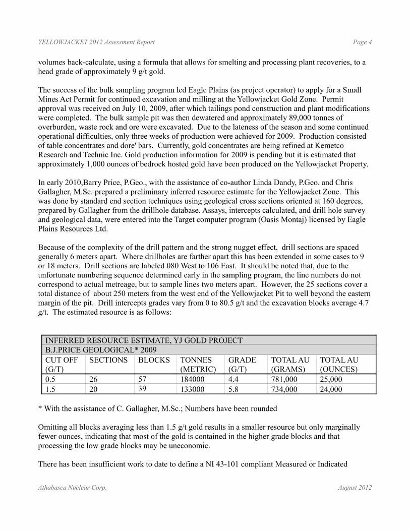
In early 2010,Barry Price, P.Geo., with the assistance of co-author Linda Dandy, P.Geo. and Chris Gallagher, M.Sc. prepared a preliminary inferred resource estimate for the Yellowjacket Zone. This was done by standard end section techniques using geological cross sections oriented at 160 degrees, prepared by Gallagher from the drillhole database. Assays, intercepts calculated, and drill hole survey and geological data, were entered into the Target computer program (Oasis Montaj) licensed by Eagle Plains Resources Ltd.
Because of the complexity of the drill pattern and the strong nugget effect, drill sections are spaced generally 6 meters apart. Where drillholes are farther apart this has been extended in some cases to 9 or 18 meters. Drill sections are labeled 080 West to 106 East. It should be noted that, due to the unfortunate numbering sequence determined early in the sampling program, the line numbers do not correspond to actual metreage, but to sample lines two meters apart. However, the 25 sections cover a total distance of about 250 meters from the west end of the Yellowjacket Pit to well beyond the eastern margin of the pit. Drill intercepts grades vary from 0 to 80.5 g/t and the excavation blocks average 4.7 g/t. The estimated resource is as follows:
INFERRED RESOURCE ESTIMATE, YJ GOLD PROJECTB.J.PRICE GEOLOGICAL* 2009CUT OFF(G/T)
SECTIONS BLOCKS TONNES(METRIC)
GRADE(G/T)
TOTAL AU(GRAMS)
TOTAL AU(OUNCES)
0.5 26 57 184000 4.4 781,000 25,0001.5 20 39 133000 5.8 734,000 24,000
* With the assistance of C. Gallagher, M.Sc.; Numbers have been rounded
Omitting all blocks averaging less than 1.5 g/t gold results in a smaller resource but only marginally fewer ounces, indicating that most of the gold is contained in the higher grade blocks and that processing the low grade blocks may be uneconomic.
There has been insufficient work to date to define a NI 43-101 compliant Measured or Indicated
Athabasca Nuclear Corp. August 2012
YELLOWJACKET 2012 Assessment Report Page 5
Mineral resource for the YJ project. Due to the uncertainty that may be attached to Inferred Mineral resources, it cannot be assumed that all or any part of an Inferred Mineral resource will be upgraded to an Indicated or Measured Mineral Resource with continued exploration or that this material may be mined in the future. Much of the resource is at depth and would require underground mining methods. The Study was preliminary in nature and included only inferred mineral resources that are considered too speculative geologically to have the economic considerations applied to them that would enable them to be categorized as measured or indicated.
Based on the results of the exploration and development conducted to date on the Property, the report concluded that the Yellowjacket Gold Zone represents a legitimate development target with the potential to host an economically feasible mineral deposit.
The authors identified additional zones on the Property, with geophysical responses similar to those at the Yellowjacket Zone, as legitimate early stage exploration targets. The report included recommendations for further work on the property. A tentative budget of $520,000 for the next stage of exploration was recommended, to be followed, if results warrant, by an additional program costing $770,000.
On August 19th, 2010, Eagle Plains announced that it had completed the purchase of Prize Mining's remaining interest in the Yellow Jacket Joint Venture and now holds 100%, subject to any underlying agreements. Under the terms of the original JVA, Eagle Plains earned an initial 40% interest in the Project from Prize by making a $2,000,000 cash payment. Since commencing activities, Eagle Plains has advanced the JV an additional amount of approximately $2,600,000. Prize Mining subsequently agreed to accept dilution of its interest in the project in accordance with a formula established in the YJV agreement. Prior to the purchase of the remaining Prize interest and dissolution of the YJV, Eagle Plains held a 59.62% interest. The total consideration for the purchase of Prize’s remaining 40.38% interest was $400,000 plus 2,000,000 Eagle Plains common shares. These shares are subject to escrow restrictions over a two year period.
Based on the recommendations of the 2010 Technical Report, Eagle Plains carried out a Reverse Circulation drill program at the Yellowjacket in the fall of 2010. A total of 2181 meters in 64-holes was completed in the area of the proposed East pit extension. The results from the program were encouraging and further work was recommended to both better define mineralization for potential open pit mining operations and to test for mineralization both at depth and outside the area of the main Yellowjacket Zone. The total cost for the program was $481,056.37
On September 28, 2011, Eagle Plains announced the transfer of the Yellowjacket project into a new company, incorporated under the name Yellowjacket Resources Ltd. (“Yellowjacket”). Under the terms of the Arrangement, Eagle Plains shareholders of record on the effective date of the Arrangement received one share of Yellowjacket for every three Eagle Plains shares held.
In 2012 Yellowjacket Resources conducted an exploration program on the Yellowjacket property which included a 51 hole, 2,357 meter Reverse Circulation drill program, ground based geophysics east of Pine Pit, and geological mapping at the Rock of Ages pit area. Drilling was conducted on the Pine Pit East extension and the Rock of Ages Pit area, in addition to some wide spaced step out holes east of the
Athabasca Nuclear Corp. August 2012
YELLOWJACKET 2012 Assessment Report Page 6
main Pine Pit. The drill results confirmed the presence of gold mineralization in each of the three target areas. The total cost of the 2012 program was $475,496.
Detailed recommendations and a budget for this future proposed work are included in this report.
On May 30, 2013, Yellowjacket Resources announced shareholder approval of a name change to Athabasca Nuclear Corp.
Athabasca Nuclear Corp. August 2012
YELLOWJACKET 2012 Assessment Report Page 7
Table of ContentsIntroduction................................................................................................................................................9
Location and Access and Physiography................................................................................................9Tenure..................................................................................................................................................10
History and Previous Work......................................................................................................................16Geology....................................................................................................................................................18
Regional Geology ...............................................................................................................................18Property Geology................................................................................................................................23
2012 Exploration Program.......................................................................................................................34Rock of Ages.......................................................................................................................................34Geophysics..........................................................................................................................................36Reverse Circulation Drilling...............................................................................................................37
Conclusions ............................................................................................................................................51Recommendations....................................................................................................................................52References................................................................................................................................................55
List of FiguresFigure 1 - Property Location map............................................................................................................12Figure 2 - Tenure Map - Mineral Tenures................................................................................................13Figure 3 - Tenure Map - Placer Tenures...................................................................................................14Figure 4 - Orthophoto..............................................................................................................................15Figure 5 - Regional Geology Map...........................................................................................................21Figure 6 - Regional Geology Legend.......................................................................................................22Figure 7 - Pine Pit Bedrock Geology.......................................................................................................24Figure 8 - Rock of Ages 2012 RC Drilling Plan Map..............................................................................43Figure 9 - Rock of Ages Structure and Lithology....................................................................................44Figure 10 - Rock of Ages Alteration, Veining and Mineralization..........................................................45Figure 11 - Pine Pit 2012 RC Drilling Plan Map.....................................................................................46Figure 12- Pine Pit RC Section L130E....................................................................................................47Figure 13 - Pine Pit RC Section L354E...................................................................................................48Figure 14 - Rock of Ages RC Section L474W.........................................................................................49Figure 15 - 2012 HLEM Survey..............................................................................................................50
List of TablesTable 1 - Tenure Summary.......................................................................................................................10Table 2 – Summary of Historic Work......................................................................................................17Table 3 - 2009 Inferred Resource Estimate .............................................................................................33Table 4 - RC Drilling Collar Summary....................................................................................................39Table 5 - RC Drilling Intercepts Summary..............................................................................................41Table 6 – 2014 Phase I Recommended Budget........................................................................................54
Athabasca Nuclear Corp. August 2012
YELLOWJACKET 2012 Assessment Report Page 8
LIST OF APPENDICES
Appendix I – Statement of QualificationsAppendix II – Statement of ExpendituresAppendix III – Geochemical ProtocolAppendix IV – Analytical CertificatesAppendix V – RC Drilling Logs and SamplingAppendix VI – Aurora Geosciences Geophysics Report
Athabasca Nuclear Corp. August 2012
YELLOWJACKET 2012 Assessment Report Page 9
INTRODUCTION
Location and Access and Physiography
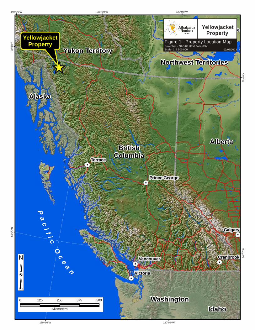
LocationThe claims are located along the Pine Creek Valley, 7 to 12 kilometres east of the community of Atlin in northwestern British Columbia. The claims are centred at latitude 59°35'N and longitude 133°32'E within map sheets 104N.053 and 104N.063.
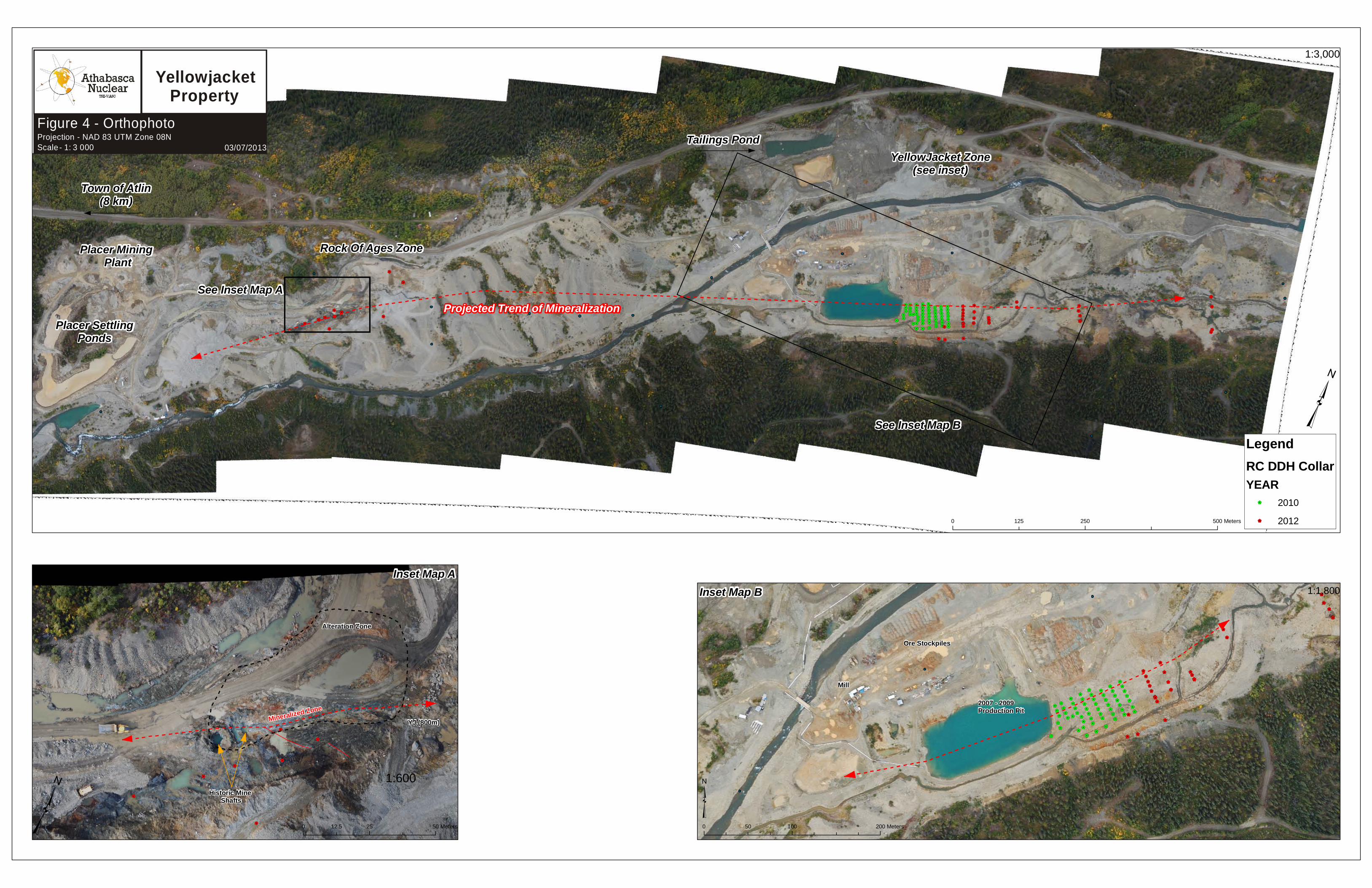
The main mineralized zone of interest on the Atlin Gold Property is the Yellowjacket Gold Zone (“YGZ”). The YGZ is located near the centre of the claim holdings, along the Pine Creek Valley, which bisects the claim block in an east-west direction. Two additional historic workings (BC Ministry of Energy and Mines Minfile), the Rock of Ages and Red Jacket Zones are also located along Pine Creek. The exact location of the Red Jacket Zone is not currently known, due to masking of bedrock by placer mining tailings. The Rock of Ages Zone is located approximately 1.5 kilometres west of the YGZ.
Access Access to the Atlin Gold Property is via the Surprise Lake Road, east from Atlin for 7 kilometres. The Property lies along the Pine Creek Valley, parallel to Surprise Lake Road, for approximately 6.5 kilometres. Mine roads afford access to the camp, plant and claims.
PhysiographyThe Atlin Gold Property lies in an area of moderate relief, in a broad valley between mountains, with elevations ranging between 810 and 1060 metres along the Pine Creek valley. In the far southeastern corner of the Atlin Gold Property the elevation increases up slope to 1340 metres. Outcrop is very limited, generally confined to creek gullies, but occasionally observed in road cuts and along some of the steeper slopes. The main area of mineralization identified to date on the Atlin Gold Property is the Yellowjacket Gold Zone. The YGZ lies along the Pine Creek Valley and is completely covered by five or more metres of tailings consisting of boulders from historic placer mining. The tree line is at approximately 1370 metres on north facing slopes and 1525 metres on south facing slopes. Below 1370 metres the valleys are forested with lodgepole pine, black spruce, aspen and scrub birch. Mountain alder and willow grow near streams with stunted buck brush covering the hills above tree line.
Climate is typical of northern British Columbia with winter temperatures averaging -5oC in January with moderate snowfall. A pleasant summer climate has average daytime temperatures of 20oC and little precipitation. Total annual precipitation is measured at 279.4 millimetres of moisture. “Winter” conditions can be expected from October to April.
Local Resources and InfrastructurePower lines follow Surprise Lake Road to within 5 kilometres of the Atlin Gold Property. Abundant water for mining operations is available from Pine Creek and its tributaries. Crew lodgings are available in Atlin. A skilled labour force for mining and exploration is available in Atlin or Whitehorse,
Athabasca Nuclear Corp. August 2012
YELLOWJACKET 2012 Assessment Report Page 10
YT, a 2 hour drive. Whitehorse is also the major supply and service centre for resource industries working in northwestern British Columbia and the Yukon.
In May 2009, a new run-of-river micro-hydroelectric plant was brought on line to service the community of Atlin. The plant was built by a corporation fully owned by the Taku River Tlingit First Nation and is the only fully first nation owned hydroelectric plant in Canada. This hydroelectric plant produces power, which is sold onto the local BC Hydro grid already and the town of Atlin is now only using its existing diesel generators as backup. The new power plant has sufficient excess power to run the Yellowjacket Gold Mine and discussions are underway with BC Hydro and TRTFN to study the feasibility of hooking the mine into the hydroelectric grid.
TenureThe Atlin Gold Property is located within the Atlin Mining Division in northwestern British Columbia, Canada. The claim block consists of 26 mineral tenure cell claims totaling 7,025 contiguous hectares, two placer mining claims and a placer mining lease covering 366 hectares. The cells are centered at Latitude 59°35'N and Longitude 133°32'E within map sheets 104N.053 and 104N.063. All claims are located on crown land. The claims are listed in Table 1, below.
Table 1 - Tenure SummaryChecked with Mineral Titles Online November 23, 2011
TenureNo
ClaimName
OwnerNumber
Tenure Type
MapNumber
IssuedDate
ExpiryDate
Area(Ha)
508170 Pine 271708 (100%) Mineral claim 104N 2005/mar/02 2023/nov/30 196.56
327903 YJ 138703 (100%) Mineral claim 104N053 1994/jul/01 2023/nov/30 75.00
364968 EVA 7 138703 (100%) Mineral claim 104N063 1998/aug/25 2023/nov/30 375.00
367492 CELESTE 138703 (100%) Mineral claim 104N053 1998/dec/23 2023/nov/30 75.00
394473 YJ 1 138703 (100%) Mineral claim 104N053 2002/jun/18 2023/nov/30 500.00
394474 YJ 2 138703 (100%) Mineral claim 104N053 2002/jun/18 2023/nov/30 500.00
509377 138703 (100%) Mineral claim 104N 2005/mar/22 2023/nov/30 524.35
509379 138703 (100%) Mineral claim 104N 2005/mar/22 2023/nov/30 491.78
509382 138703 (100%) Mineral claim 104N 2005/mar/22 2023/nov/30 65.51
509383 138703 (100%) Mineral claim 104N 2005/mar/22 2023/nov/30 65.51
509384 138703 (100%) Mineral claim 104N 2005/mar/22 2023/nov/30 32.76
509385 138703 (100%) Mineral claim 104N 2005/mar/22 2023/nov/30 65.51
509387 138703 (100%) Mineral claim 104N 2005/mar/22 2023/nov/30 442.33
985002 138703 (100%) Mineral claim 104N 2012/may/09 2023/may/09 392.95
985003 138703 (100%) Mineral claim 104N 2012/may/09 2023/may/09 409.17
985022 138703 (100%) Mineral claim 104N 2012/may/09 2023/may/09 409.16
985042 138703 (100%) Mineral claim 104N 2012/may/09 2023/may/09 376.28
1013329 138703 (100%) Mineral claim 104N 2012/sep/29 2013/sep/29 523.39
1013336 138703 (100%) Mineral claim 104N 2012/sep/29 2013/sep/29 130.84
1013865 138703 (100%) Mineral claim 104N 2012/oct/20 2013/oct/20 392.7
1014040 138703 (100%) Mineral claim 104N 2012/oct/28 2013/oct/28 409.05
1015391 138703 (100%) Mineral claim 104N 2012/dec/19 2013/dec/19 130.77
1015813 138703 (100%) Mineral claim 104N 2013/jan/08 2014/jan/08 32.77
Athabasca Nuclear Corp. August 2012
YELLOWJACKET 2012 Assessment Report Page 11
1015814 138703 (100%) Mineral claim 104N 2013/jan/08 2014/jan/08 32.78
1015816 138703 (100%) Mineral claim 104N 2013/jan/08 2014/jan/08 16.38
1016497 138703 (100%) Mineral claim 104N 2013/jan/08 2014/jan/08 360.17
350665 MARTHA II 138703 (100%) Placer Claim 104N 1996/sep/19 2018/mar/01 50
379882 MARTHA 4 138703 (100%) Placer Claim 104N 2000/aug/23 2018/mar/01 50
361733 138703 (100%) Placer Lease 104N 1998/may/05 2014/may/05 366.15
13 Mineral 7025.741 Placer Lease 366.152 Placer Claim 100
The mineral claims are un-surveyed, but cell corners are referenced to exact Latitude and Longitude points (or UTM Coordinates), which may be precisely located in the field using differential GPS or Theodolite. The placer lease is subject to an annual lease fee of $1830.75, which has been paid, advancing the expiry to 2012. The mineral claims are in good standing to 2016.
The claims cover the hard rock Yellowjacket Gold Mine. All permits have been obtained for exploration and small scale mining (75,000 tonnes per year or less). Other exploration targets within the claims are the Gold Run Zone and the historical Rock of Ages prospect.
Part of the hard rock claims cover Placer Lease 361733, and the two placer claims noted above, also owned by Eagle Plains. Other placer claims or leases may underlie parts of the Yellowjacket mineral tenures. In addition there are at least three Crown Granted claims, including DL 184 (Discovery MC), DL 520 (Cub Fraction) and DL 521 (Wedge Fraction) with ownership and status unknown. To the authors’ knowledge, none of the placer claims or leases have been surveyed.
The project received a British Columbia Ministry of Energy, Mines and Petroleum Resources Small Mines Act Permit on July 10, 2009 for the development and production of gold from the Yellowjacket Gold Zone (see EPL/PRZ news release July 13th, 2009). The Permit allows for the development and operation of an open pit gold mine and onsite concentrator processing up to 75,000 tons per year of ore. The local Taku River Tlingit First Nation (“TRTFN”) were active participants in the review and approval of the Permit.
Athabasca Nuclear Corp. August 2012
BritishColumbia
Alberta
Yukon TerritoryNorthwest Territories
P a c i f i c Oc e a n
Alaska
WashingtonIdaho
YellowjacketProperty
Terrace
Calgary
Victoria
Vancouver Cranbrook
Yellowknife
Prince George
120°0'0"W
120°0'0"W
130°0'0"W
130°0'0"W140°0'0"W60
°0'0"N
60°0'
0"N
50°0'
0"N
50°0'
0"N
0 125 250 375 500
Kilometers
³
EPL:TSX-V
Figure 1 - Property Location Map Projection - NAD 83 UTM Zone 08NScale - 1: 7 500 000 03/07/2013
YellowjacketProperty
509377
394473 509379
1013329
509387
394474
985003
985022
985002
985042
1014040
1013865
1016497
364968
508170
1013336
1015391
327903
509382 509383 509385
367492
509384
1015814
1015813
1015816
575000
575000
580000
580000
585000
585000
590000
590000
6605
000
6605
000
6610
000
6610
000
6615
000
6615
000
0 1,000 2,000 3,000 4,000500Meters
³
EPL:TSX-V
Figure 2 - Mineral Claims Projection - NAD 83 UTM Zone 08NScale - 1: 50 000 03/07/2013
YellowjacketProperty
Legend
Mineral Claims
Roads
Waterbody
361733
350665379882
579000
579000
580000
580000
581000
581000
582000
582000
583000
583000
584000
584000
6606
000
6606
000
6607
000
6607
000
6608
000
6608
000
6609
000
6609
000
0 500 1,000 1,500 2,000250Meters
³
EPL:TSX-V
Figure 3 - Placer Claims Projection - NAD 83 UTM Zone 08NScale - 1: 15 000 03/07/2013
YellowjacketProperty
Legend
Placer Claims
RoadsRivers
Waterbody
$1 $1 $1 $1 $1 $1$1
$1
$1 $1 $1 $1 $1 $1$1$1$1 $1 $1
$1$1
$1
$1$1
$1
$1
$1 $1
$1
$1
$1$1$1$1$1$1$1$1
$1
$1 $1 $1$1
$1
$1
$1$1$1$1 $1
$1
$1
$1$1
$1$1
$1
$1
$1
$1
$1
$1$1
$1
$1$1$1
$1
$1
$1$1
$1$1$1$1$1
$1$1$1$1
$1$1$1$1$1
$1$1$1$1$1
$1$1$1$1$1
$1$1 $1 $1 $1$1 $1 $1$1$1$1$1
$1$1$1$1
$1$1$1$1
$1$1
$1$1$1$1
$1$1
$1
$1
$1
$1$1
$1$1
$1$1
$1
$1
$1$1
$1
$1$1
$1
$1$1
$1$1
$1
$1$1
$1
$1$1
$1
$1
$1$1
$1
$1
$1
$1
$1
$1
$1
$1
$1
$1
$1
$1
$1$1
$1
$1
$1
$1
$1
$1
$1
$1$1
$1$1$1
$1$1$1$1
$1$1$1$1$1
$1$1$1$1$1
$1$1$1$1$1
$1
$1$1
$1$1
$1
$1
$1
$1$1$1$1
$1$1$1$1
$1$1$1$1
Town of Atlin(8 km)
Placer Mining Plant
Placer SettlingPonds
Rock Of Ages Zone
Tailings PondYellowJacket Zone
(see inset)
Projected Trend of Mineralization
See Inset Map B
2007 - 2009Production Pit
Ore Stockpiles
Mill
Mineralized Zone
Historic Mine Shafts
YJ (800m)
Alteration Zone
LegendRC DDH CollarYEAR
$1 2010$1 2012
See Inset Map A
Inset Map AInset Map B
³
³ ³
1:3,000
1:600
1:1,800
0 250 500125 Meters
0 25 5012.5 Meters 0 100 20050 Meters
EPL:TSX-V
Figure 4 - Orthophoto Projection - NAD 83 UTM Zone 08NScale - 1: 3 000 03/07/2013
YellowjacketProperty
YELLOWJACKET 2012 Assessment Report Page 16
HISTORY AND PREVIOUS WORK
Gold was first discovered in the Atlin area in 1897 by Fritz Miller while en route to the Klondike Goldfields. The first workings were on Pine Creek and by the end of 1898, more than 3000 people were camped in the Atlin area. Placer mining has been, for most of its history, the economic mainstay for the town of Atlin. Reported placer gold production between 1898 and 1946 (the last year for which records were kept) from creeks in the Atlin area totaled 634,147 ounces (19,722 kilograms). A number of the larger placer deposits, including those on Otter, Spruce and Pine Creeks, continued to produce significant quantities of gold into the late 1980s. Although the total placer gold production from the area to date is not available, it probably exceeds one million ounces (Ash, 2001).
Gold bearing quartz veins were first discovered in the Atlin area in 1899 and by 1905 most of the known showings had been discovered. In 1899, an auriferous vein zone (the Yellowjacket showing) was discovered along Pine Creek by placer miners (BC Ministry of Energy and Mines Minfile Number 104N043). Additional gold zones in bedrock were found during subsequent placer mining operations at the Red Jacket and Rock of Ages showings. Numerous gold-bearing quartz veins in the vicinity of the gold placers are believed to be the source for many of the placer deposits.
Details of the geological mapping and research history of the Atlin region is outlined by Evans (2003).
In 1983, Canova Resources (“Canova”) and Tri-Pacific Resources optioned the Yellowjacket Property (which now encompasses the Atlin Gold Property) from the title holder and conducted a small diamond drill program that intersected high grade gold mineralization at depth. Total reported Canova expenditures are $0.54 million.
In 1986, Homestake Mineral Development Corp. (“Homestake”) optioned the Yellowjacket Property and conducted geological, geophysical and drilling programs until 1989. From 1986 to 1988, Homestake diamond drilled 58 holes on the Yellowjacket Zone, and in 1989, carried out a reverse circulation rotary drilling program their larger Yellowjacket Property. Total reported Homestake expenditures on the Yellowjacket Property are $1.66 million. These expenditure figures are taken directly from the BC Ministry of Energy and Mines Minfile website.
Conclusions from these exploration programs include:
• Drilling in 1986 to 1989 identified gold mineralization within broad zones of intensely altered (carbonate, silica, mariposite) ultramafic rocks, and in adjacent silicified and stockworked volcanic rocks. These rock and alteration types are notable for their close association to gold mineralization throughout the Atlin camp.
• Airborne and ground magnetic surveys located the ultramafic contacts in areas of very limited outcrop exposure identifying a significant target area for gold mineralization. It is widely known that gold mineralization within mesothermal/ophiolite hosted gold deposits is often located adjacent to contact zones.
No exploration work was conducted on the Atlin Gold Property from 1989 until Muskox (now Prize) optioned the Atlin Gold Property in 2003.
From 2003 to 2006, 14 NQ and 50 HQ size diamond drill holes totaling 7797.26 metres were drilled by Prize on the Yellowjacket Gold Zone of the Atlin Gold Property. In 2005 and 2006, 10 HQ size
Athabasca Nuclear Corp. August 2012
YELLOWJACKET 2012 Assessment Report Page 17
diamond drill holes totaling 1481.28 metres were drilled on the Rock of Ages Zone. Of the holes drilled on the Yellowjacket Zone, 51 were drilled within the mineralized target area, 4 were step out holes following cross structures identified by geophysics, 6 were twinned holes of Homestake or early NQ drilling and 3 short holes were put in to use for metallurgical testing.
The drill programs were designed to test for high grade gold mineralization within a large fault zone (the Pine Creek Fault) along the contact between ultramafics and Cache Creek Group volcanics and metasediments. This fault zone is thought to be the source area for much or all of the placer gold mined in the lower part of Pine Creek. The majority of the holes drilled during on the Yellowjacket Gold Zone during these programs encountered one or more intervals of gold mineralization.
Upon initially receiving gold assays from the laboratory, it was immediately apparent that there are two or more populations of gold mineralization; with high grade gold intercepts being interspersed within broader zones of lower grade gold values.
The high grade gold mineralization has always been assumed to be found along steeply southerly dipping structures associated with the Pine Creek Fault, which underlies the rich placer channel. However, gold mineralization is also concentrated along independent structural orientations, which intersect the Pine Creek Fault at the Yellowjacket Gold Zone.
The results of the drilling show concluded broad zones of gold values ranging from 0.5 to 5.0 g/t relate to shallowly dipping fault thrust features. These shallow structures are intersected by two steeply dipping fault zones (the Pine Creek Fault and its associated cross faults). Narrower but higher grade gold mineralization has been identified within these steeply dipping structures. Additional drilling to trace the steeply dipping features to depth in the central portion of the Yellowjacket Gold Zone, and along strike in the main Pine Creek Fault is required to in order to fully define the gold potential of this system.
Based on the recommendations of the 2010 Technical Report, Eagle Plains carried out a Reverse Circulation drill program at the Yellowjacket in the fall of 2010. A total of 2181 meters in 64-holes was completed in the area of the proposed East pit extension. The results from the program were encouraging and further work was recommended to both better define mineralization for potential open pit mining operations and to test for mineralization both at depth and outside the area of the main Yellowjacket Zone.
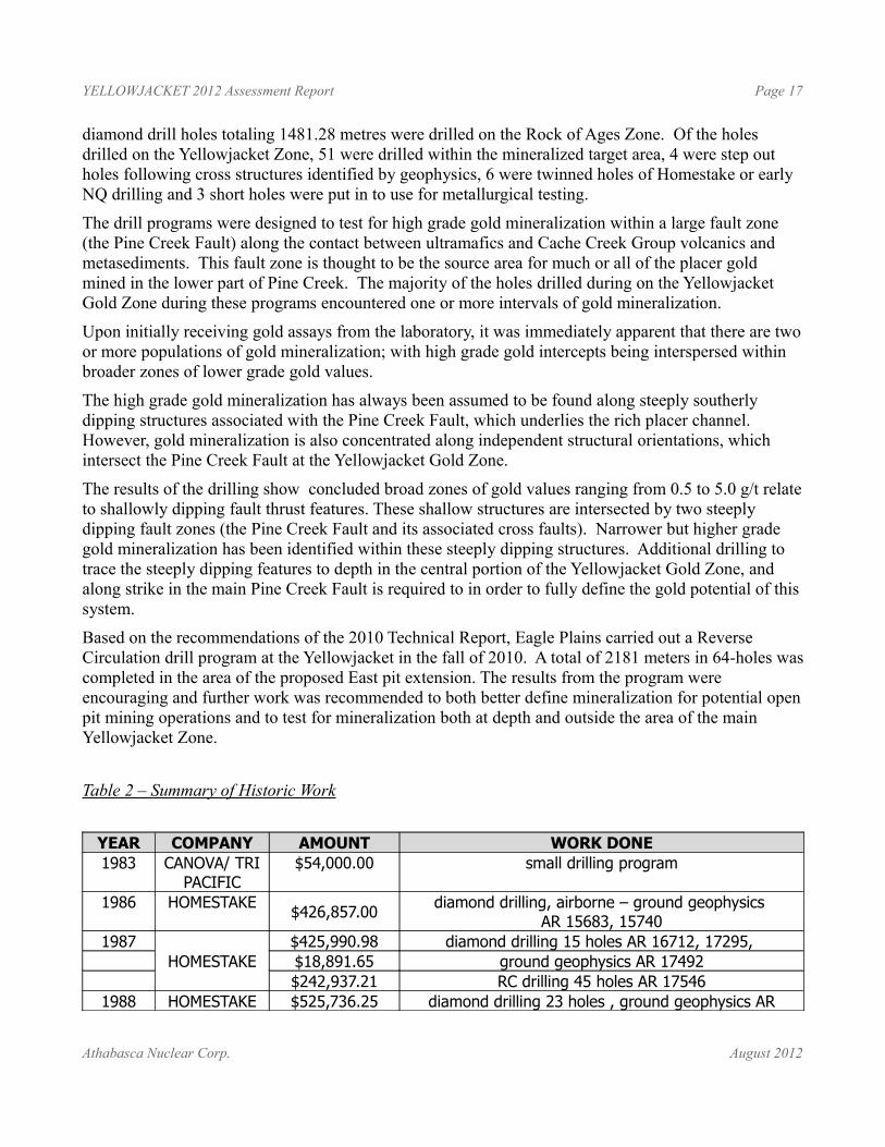
Table 2 – Summary of Historic Work
YEAR COMPANY AMOUNT WORK DONE1983 CANOVA/ TRI
PACIFIC$54,000.00 small drilling program
1986 HOMESTAKE $426,857.00 diamond drilling, airborne – ground geophysics AR 15683, 15740
1987HOMESTAKE
$425,990.98 diamond drilling 15 holes AR 16712, 17295, $18,891.65 ground geophysics AR 17492$242,937.21 RC drilling 45 holes AR 17546
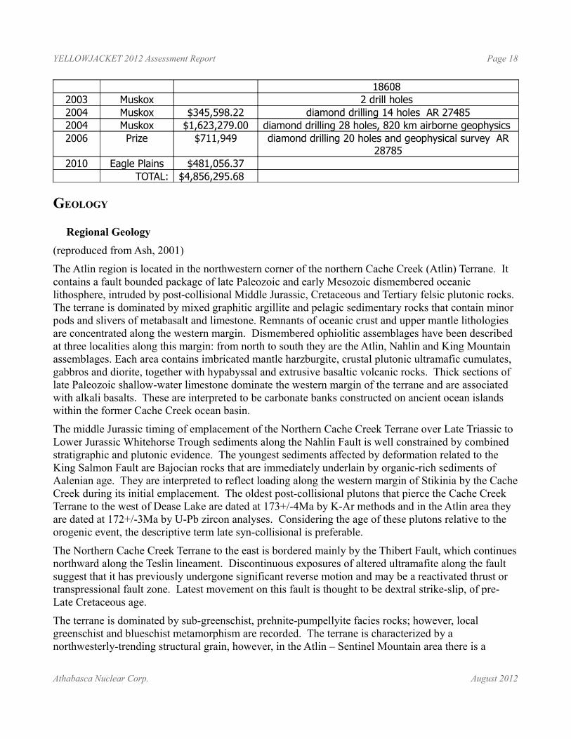
1988 HOMESTAKE $525,736.25 diamond drilling 23 holes , ground geophysics AR
Athabasca Nuclear Corp. August 2012
YELLOWJACKET 2012 Assessment Report Page 18
18608 2003 Muskox 2 drill holes 2004 Muskox $345,598.22 diamond drilling 14 holes AR 274852004 Muskox $1,623,279.00 diamond drilling 28 holes, 820 km airborne geophysics 2006 Prize $711,949 diamond drilling 20 holes and geophysical survey AR
287852010 Eagle Plains $481,056.37
TOTAL: $4,856,295.68
GEOLOGY
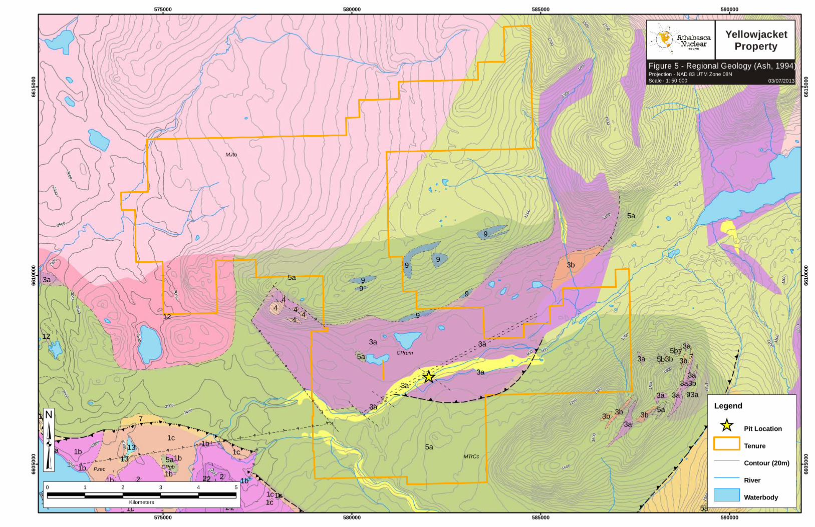
Regional Geology (reproduced from Ash, 2001)
The Atlin region is located in the northwestern corner of the northern Cache Creek (Atlin) Terrane. It contains a fault bounded package of late Paleozoic and early Mesozoic dismembered oceanic lithosphere, intruded by post-collisional Middle Jurassic, Cretaceous and Tertiary felsic plutonic rocks. The terrane is dominated by mixed graphitic argillite and pelagic sedimentary rocks that contain minor pods and slivers of metabasalt and limestone. Remnants of oceanic crust and upper mantle lithologies are concentrated along the western margin. Dismembered ophiolitic assemblages have been described at three localities along this margin: from north to south they are the Atlin, Nahlin and King Mountain assemblages. Each area contains imbricated mantle harzburgite, crustal plutonic ultramafic cumulates, gabbros and diorite, together with hypabyssal and extrusive basaltic volcanic rocks. Thick sections of late Paleozoic shallow-water limestone dominate the western margin of the terrane and are associated with alkali basalts. These are interpreted to be carbonate banks constructed on ancient ocean islands within the former Cache Creek ocean basin.
The middle Jurassic timing of emplacement of the Northern Cache Creek Terrane over Late Triassic to Lower Jurassic Whitehorse Trough sediments along the Nahlin Fault is well constrained by combined stratigraphic and plutonic evidence. The youngest sediments affected by deformation related to the King Salmon Fault are Bajocian rocks that are immediately underlain by organic-rich sediments of Aalenian age. They are interpreted to reflect loading along the western margin of Stikinia by the Cache Creek during its initial emplacement. The oldest post-collisional plutons that pierce the Cache Creek Terrane to the west of Dease Lake are dated at 173+/-4Ma by K-Ar methods and in the Atlin area they are dated at 172+/-3Ma by U-Pb zircon analyses. Considering the age of these plutons relative to the orogenic event, the descriptive term late syn-collisional is preferable.
The Northern Cache Creek Terrane to the east is bordered mainly by the Thibert Fault, which continues northward along the Teslin lineament. Discontinuous exposures of altered ultramafite along the fault suggest that it has previously undergone significant reverse motion and may be a reactivated thrust or transpressional fault zone. Latest movement on this fault is thought to be dextral strike-slip, of pre-Late Cretaceous age.
The terrane is dominated by sub-greenschist, prehnite-pumpellyite facies rocks; however, local greenschist and blueschist metamorphism are recorded. The terrane is characterized by a northwesterly-trending structural grain, however, in the Atlin – Sentinel Mountain area there is a
Athabasca Nuclear Corp. August 2012
YELLOWJACKET 2012 Assessment Report Page 19
marked deviation from this regional orientation with a dominant northeasterly trend. Reasons for this divergence in structural grain are poorly understood.
Atlin Area Geology(reproduced from Ash, 2001)
The geology of the Atlin region is divisible into two distinct lithotectonic elements. A structurally higher, imbricated sequence of oceanic crustal and upper mantle lithologies termed the “Atlin ophiolitic assemblage”, is tectonically superimposed over a lower and lithologically diverse sequence of steeply to moderately dipping, tectonically intercalated slices of pelagic metasedimentary rocks with tectonized pods and slivers of metabasalt, limestone and greywacke termed the “Atlin accretionary complex”. Locally these elements are intruded by the Middle Jurassic calcalkaline Fourth of July batholith and related quartz-feldspar porphyritic and melanocratic dike rocks.
Atlin Ophiolite Assemblage The Atlin ophiolitic assemblage comprises an imbricated sequence of relatively flat-lying, coherent thrust slices of obducted oceanic crustal and upper mantle rocks. Mantle lithologies are dominated by harzburgite tectonite containing subordinate dunite and lesser pyroxenite dikes. The unit forms an isolated klippe that underlies the town of Atlin and Monarch Mountain, which is located four kilometres southeast of the town.
The harzburgite is also exposed on the northern and southern slopes of Union Mountain, 10 kilometres south of Atlin. Ductile deformational fabrics indicative of hypersolidus to subsolidus deformation, and the phase chemistry of primary silicates and chrome spinels in the harzburgite indicate a uniform, highly refractory composition and support a depleted mantle metamorphic origin for the unit. The least serpentinized rocks with well-preserved primary structures and texture crop out at the highest elevations on Monarch Mountain. Primary features are less well preserved toward the base of the body and internally where high angle fault zones cut it, the unit becomes increasingly serpentinized. Serpentinite mylonite fabrics are locally preserved near the base of the body. Commonly the basal contact of the harzburgite unit is pervasively carbonatized and tectonized over distances of several tens of metres or more.
Oceanic crustal lithologies in the Atlin map area, in decreasing order of abundance, include metamorphosed basalt, ultramafic cumulates, diabase and gabbro with metabasalts dominating. They are generally massive, fine grained to aphanitic and weather a characteristic dull green-grey color. Locally, the unit grades to medium-grained varieties or diabase. Primary textures locally identified in the metabasalt include flow banding, auto-brecciation and rare pillow structures. Although rarely exposed, basalt contacts are commonly sheared or brecciated zones, sometimes intensely carbonatized. Petrochemical investigations of these basaltic rocks indicate they are similar in composition to basalts of normal mid ocean-ridge settings and the chemistry also suggests a genetic relationship to the associated depleted metamorphic mantle ultramafic rocks.
Serpentinized peridotite displaying ghost cumulate textures and sporadically preserved relict poikilitic texture is suspected to originally be wehrlite. The peridotite forms an isolated thrust sheet that outcrops discontinuously along an east-trending belt 1 to 3 kilometres wide on the south-facing slope of Mount Munroe, located four kilometres northeast of the town of Atlin. Extensive exploration drilling along the base of Mount Monroe at the Yellowjacket Zone indicates that the serpentinized body is in
Athabasca Nuclear Corp. August 2012
YELLOWJACKET 2012 Assessment Report Page 20
structural contact with metabasaltic rocks along a gently northwest-dipping thrust. Along the contact zone hanging wall ultramafites and footwall metabasalts are tectonically intercalated and carbonatized. Projection of this fault across the Pine Creek valley suggests that carbonatized and serpentinized ultramafic rocks on the summit of Spruce Mountain, immediately south of the Pine Creek valley in the vicinity of the Yellowjacket Zone, represent a remnant above an extension of the same tectonized and altered basal contact.
Metagabbro is the least commonly seen ophiolitic component in the Atlin area. It crops out on the northern slope of Union Mountain and along the south-facing slope of Mount Munroe. On Union Mountain, gabbro occurs along the Monarch Mountain thrust as isolated dismembered blocks with faulted contacts.
Atlin Accretionary ComplexThe Atlin accretionary complex comprises a series of steeply to moderately dipping lenses and slices of structurally intercalated metasedimentary and metavolcanic rocks that underlie the southern half and northwest corner of the Atlin region (see Figure 4).
Pelagic metasedimentary rocks dominate the unit and consist of argillites, cherty argillites, argillaceous cherts and cherts with lesser limestones and greywackes. They range from highly mixed zones with well-developed flattening fabric indicative of tectonic melange to relatively coherent tectonic slices. Individual slices range from metres to several hundreds of metres in width. Indications of internal deformation are moderate or lacking; in a few slices original stratigraphy is well preserved. Contact relationships between many of the individual units of the complex have not been established due to a lack of exposure, however most are inferred to be tectonic. Internal bedding within the individual lenses in some places is parallel to the external contacts, but is more commonly strongly discordant. This argues against simple interfingering of different facies.
A common feature throughout the accretionary complex, particularly in areas of moderate overburden, is closely spaced outcroppings of different lithologies with no clearly defined contacts. Such relationships are interpreted to represent areas of melange in which the exposed lithologies that commonly include chert, limestone and basalt are more competent than the intervening, recessive fissile and argillaceous matrix. Such relationships are confirmed where sections are exposed along road cuts and in areas of trenching.
Athabasca Nuclear Corp. August 2012
((
((((
((
((
((
((
~~~ ~~~~~~~~~~~ ~~ ~~~ ~~~~~ ~~~~ ~ ~~ ~~~ ~~
@@
@@
@@
@@
@@
@@
@@
@@
@@
~ ~ ~ ~ ~ ~ ~
~ ~ ~ ~ ~ ~ ~ ~~ ~ ~ ~ ~ ~
~ ~ ~ ~ ~ ~~ ~ ~ ~ ~ ~
~ ~ ~ ~ ~ ~ ~ ~ ~ ~
~ ~ ~ ~ ~ ~ ~ ~ ~ ~~ ~ ~ ~ ~ ~ ~ ~
~ ~ ~ ~ ~ ~ ~ ~ ~ ~ ~ ~ ~ ~ ~ ~ ~ ~ ~ ~ ~ ~ ~ ~
~ ~ ~ ~ ~ ~ ~ ~ ~ ~ ~ ~ ~ ~ ~ ~ ~ ~ ~ ~ ~ ~ ~ ~
~ ~ ~ ~ ~ ~ ~~ ~ ~ ~ ~ ~ ~ ~ ~
~ ~ ~ ~ ~ ~ ~ ~~~ ~~~~@@~~
~~
~~ ~~ ~~ ~ ~~ ~ ~ ~~ ~ ~~ ~ ~~ ~ ~ ~~ ~ ~~ ~~ ~ ~~ ~ ~~ ~ ~~ ~~ ~ ~ ~~ ~~ ~ ~~ ~ ~~ ~ ~~ ~ ~~ ~ ~ ~~ ~ ~~ ~ ~~
@@@@
@@@@
@@@@
@@@@
@@@@
@@@@
@@@@
@@@@
@@@@
((
((
((
((
((
((
((
((
((
((
((
((
((
((
((
((
((
((
((
((((((((
((
((
((
((
((
((
((((((
((((((((((((((
((((((((((((((
((((
((
((
((
((
~ ~~~ ~ ~
~ ~~ ~
~~ ~
@*@*
@*@*
~ ~~
~ ~~ ~ ~
~
~ ~~ ~
~ ~~
~~ ~
@ *@ *
@ *
~~~
~~~~~~~~~~~~~~
@@
@@
**
**
*
* **
**
*
_̂
MTrCc
MJto
CPrum
Pzec
LKgr
Qv
CPgb
5a
5a
3a
12
7
3a
1c
1c
1b1b 1a
5a
1b
3b
7
9
9
1b
1c
9
4
3a
3a
3a3b
9
3a
9
1c
5a
1b
6
3a
1b
8+6
3b
13
3b
4
9
4
5a
5a
3a
7
3a
12
9
2
3a
9
1c
9
1b1b
3a
3b
2
3b
44
5a
7
5a
2
3a
12a
3a
1b
22
2
13
5b5b
3a2
9
2
3b
12a
1c 2 1c1c
3a
1c
2600
2500
2400
2300
2200
2500
2500
2600
2400
2500
2600
2600
26002600
2300
2200
1000
1100
12001300
14001500
1600
1700
900
1800
1600
1700
1100
1100
1400
1600
1200
900
1500
1100
1200
1200
1500
1600
1300
1400
1700
1000
575000
575000
580000
580000
585000
585000
590000
590000
6605
000
6605
000
6610
000
6610
000
6615
000
6615
000
0 1 2 3 4 5
Kilometers
³
EPL:TSX-V
Figure 5 - Regional Geology (Ash, 1994)Projection - NAD 83 UTM Zone 08NScale - 1: 50 000 03/07/2013
YellowjacketProperty
Legend
_̂ Pit Location
Tenure
Contour (20m)
River
Waterbody
Legend
_̂ Pit Location
Tenure
Contour
River
Waterbody
- - Geologic Cross SectionContacts
Defined
* Airphoto
Approximate
InferredFaults
(( Thrust, Approximate
(( (( ((Thrust, Inferred
~ ~ ~ ~ ~@* Unknown, Airphoto
~ ~ ~ ~ ~ Unknown, Approximate
~ ~ ~ ~ ~ ~@@ Unknown, Inferred
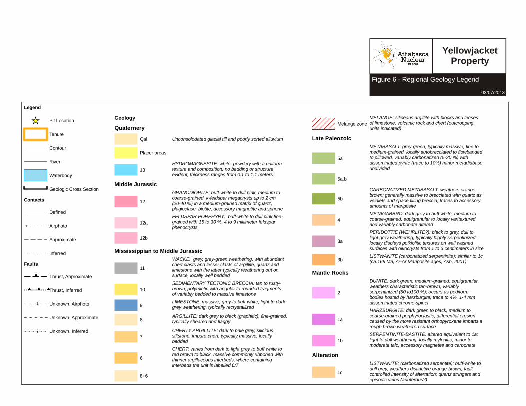
GeologyQuaternery
Qal Unconsolodated glacial till and poorly sorted alluvium
Placer areas
13HYDROMAGNESITE: white, powdery with a uniformtexture and composition, no bedding or structure evident, thickness ranges from 0.1 to 1.1 meters
Middle Jurassic
12GRANODIORITE: buff-white to dull pink, medium to coarse-grained, k-feldspar megacrysts up to 2 cm (20-40 %) in a medium-grained matrix of quartz, plagioclase, biotite, accessory magnetite and sphene
12aFELDSPAR PORPHYRY: buff-white to dull pink fine-grained with 15 to 30 %, 4 to 9 millimeter feldspar phenocrysts.
12b
Mississippian to Middle Jurassic
11WACKE: grey, grey-green weathering, with abundant chert clasts and lesser clasts of argillite, quartz and limestone with the latter typically weathering out on surface, locally well bedded
10SEDIMENTARY TECTONIC BRECCIA: tan to rusty-brown, polymictic with angular to rounded fragments of variably bedded to massive limestone
9 LIMESTONE: massive, grey to buff-white, light to dark grey weathering, typically recrystallized
8 ARGILLITE: dark grey to black (graphitic), fine-grained, typically sheared and flaggy
7CHERTY ARGILLITE: dark to pale grey, silicious siltstone, impure chert, typically massive, locally bedded
6CHERT: varies from dark to light grey to buff white to red brown to black, massive commonly ribboned with thinner argillaceous interbeds, where containing interbeds the unit is labelled 6/7
8+6
Melange zoneMELANGE: siliceous argillite with blocks and lenses of limestone, volcanic rock and chert (outcropping units indicated)
Late Paleozoic
5a
METABASALT: grey-green, typically massive, fine to medium-grained, locally autobrecciated to flowbanded to pillowed, variably carbonatized (5-20 %) with disseminated pyrite (trace to 10%) minor metadiabase, undivided
5a,b
5bCARBONATIZED METABASALT: weathers orange-brown; generally massive to brecciated with quartz as veinlets and space filling breccia; traces to accessory amounts of mariposite
4METAGABBRO: dark grey to buff white, medium to coarse-grained, equigranular to locally varitextured and variably carbonate altered
3aPERIDOTTIE (WEHRLITE?): black to grey, dull to light grey weathering, typically highly serpentinized, locally displays poikiolitic textures on well washed surfaces with oikocrysts from 1 to 3 centimeters in size
3b LISTWANITE (carbonatized serpentinite): similar to 1c (ca.169 Ma, Ar-Ar Mariposite ages; Ash, 2001)
Mantle Rocks
2
DUNITE: dark green, medium-grained, equigranular, weathers characteristic tan-brown; variably serpentinized (50 to100 %); occurs as podiform bodies hosted by harzburgite; trace to 4%, 1-4 mm disseminated chrome-spinel
1aHARZBURGITE: dark green to black, medium tocoarse-grained porphyroclastic; differential erosion caused by the more resistant orthopyroxene imparts a rough brown weathered surface
1bSERPENTINITE-BASTITE: altered equivalent to 1a: light to dull weathering; locally mylonitic; minor to moderate talc; accessory magnetite and carbonate
Alteration
1cLISTWANITE: (carbonatized serpentite): buff-white to dull grey, weathers distinctive orange-brown; fault controlled intensity of altertation; quartz stringers and episodic veins (auriferous?)
EPL:TSX-V
Figure 6 - Regional Geology Legend 03/07/2013
Yellowjacket Property
YELLOWJACKET 2012 Assessment Report Page 23
Property GeologyThe Yellowjacket Gold Zone is associated with the basal faulted contact of an ultramafic body along the Pine Creek valley. The contact between the hangingwall ultramafics and footwall metavolcanics is not exposed but is well defined by exploration drill holes (Dandy, 2005). The zone of thrusting is characterized by up to 15 metres of carbonate alteration that contains intermittent zones of quartz-carbonate veining in both hangingwall and footwall rocks. On the Atlin Gold Property the thrust fault is disrupted by a later, east-trending, steeply south dipping structure referred to as the Pine Creek Fault. This high angle fault zone averages approximately 70 metres in width and can be described as a fault melange. The fault is characterized by strongly broken and fractured rocks, with gouge and rubble zones ranging from centimetres to more than 10 metres wide. The zone contains irregular blocks and lenses of all the lithologies that are typical of the Atlin ophiolitic assemblage, metamorphosed basalt and andesite, ultramafics, diabase and gabbro. Ultramafic rocks vary from completely serpentinized to completely carbonatized, with or without silicification (quartz veining and stockworks).
The high angle Pine Creek Fault may be contemporaneous with mineralization along the fault structure, however Ash (2001) feels it is more likely that the Pine Creek Fault post-dates mineralization. Work to date appears to support the contemporaneous hypothesis, with high grade gold intercepts in drilling being traced along the Pine Creek Fault. However, it is possible that the fault postdates the original gold emplacement but contains a later concentration of mineralization along its trend.
Diamond drilling intersected gold mineralization along a 350 metre strike length of Pine Creek Fault in the Yellowjacket Gold Zone. Here ophiolite-hosted gold veins per se are relatively rare, but silicified and stockwork zones are contained within fault-bounded lenses of oceanic igneous crust. Listwanite altered ultramafic rocks are consistently associated with the ophiolite-hosted silicified gold stockworks, but rarely host them. This deposit type contains very high grade, coarse native gold occurring in quartz veins or flooding hosted by ophiolitic mafic igneous crustal rocks (gabbro, diabase, basalt, andesite) adjacent to the listwanite altered ultramafic rocks.
Exploration drilling which encounters this type of coarse native gold is subject to the ‘nugget effect’ where adjacent samples within the same mineralized zone can have widely varying gold values. This “nugget effect” must be taken into account when exploring for gold mineralization in this type of system and the use of structures, veins and associated and indicator element geochemistry optimized. Gold values within this mineralized system are often greatly variable, however this variability can be mitigated by increasing sample size with the implementation of a bulk sampling program.
There are eleven distinct lithologies that were logged in drill core. These lithologies were originally defined by Homestake (Marud, 1987). In order to maintain consistency in core logging, Muskox followed these rock descriptions and labels as much as possible. In some instances, changes to the lithological nomenclature were necessary for clarity. The following description of each lithological unit, where they are generally found and their common characteristics is reproduced from the original Homestake reports. In italics are comments or changes made to the original lithologies during subsequent core logging by Linda Dandy, P.Geo.
Unit 1: BasaltRocks logged as basalts are generally found in holes that intersect bedrock north of 1+00S. The rocks strike roughly 040° to 070° and dip shallowly northwest. They form a thrust fault slice of rock
Athabasca Nuclear Corp. August 2012
0
862
857852
842847
862
0
0
862
857
857
582000
582000
582050
582050
582100
582100
582150
582150
6607
300
6607
300
6607
350
6607
350
LegendContour (5m)Quartz Vien
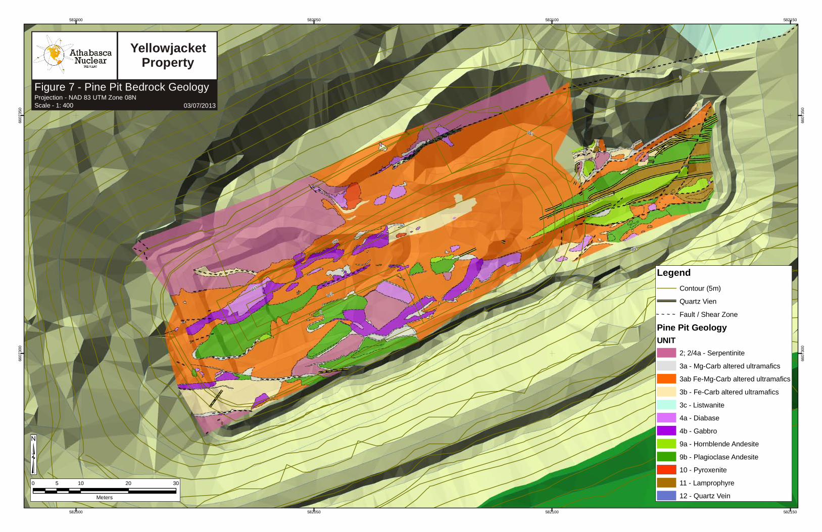
~ ~ ~ ~ Fault / Shear ZonePine Pit GeologyUNIT
2; 2/4a - Serpentinite3a - Mg-Carb altered ultramafics3ab Fe-Mg-Carb altered ultramafics3b - Fe-Carb altered ultramafics3c - Listwanite4a - Diabase4b - Gabbro9a - Hornblende Andesite9b - Plagioclase Andesite10 - Pyroxenite11 - Lamprophyre12 - Quartz Vein
0 10 20 305
Meters
³
EPL:TSX-V
Figure 7 - Pine Pit Bedrock Geology Projection - NAD 83 UTM Zone 08NScale - 1: 400 03/07/2013
Yellowjacket Property

YELLOWJACKET 2012 Assessment Report Page 25
sandwiched between two sheets of serpentinite. To the south they are truncated by a vertical fault zone and to the east by a west dipping fault zone. The basalts are generally dark green, weakly to strongly chloritized rocks. They are very fine to fine grained and massive. Original mineralogy consists of approximately 20% plagioclase and 80% pyroxene. Fracturing is ubiquitous with most fractures being coated with dark green serpentine.
In some instances where the rock is faulted and altered, identification between basalt and andesite is not distinguishable, therefore in several instances these two lithologies (Units 1 and 9) are combined during core logging into a single mafic/intermediate volcanic unit.
Unit 2: SerpentiniteAlmost all holes within the Yellowjacket Zone intersect some thickness of serpentinite. Serpentinite is the result of alteration of ultramafic rocks such as pyroxenite and dunite.
The rocks are typically dark blue-grey to blue-green and massive. Usually they are moderately to strongly magnetic due to the presence of up to 10% magnetite, but non-magnetic varieties are observed. Stringers, veinlets and spots of talc, calcite and carbonate are common.
Occasionally, unaltered pyroxenite is intersected, often at depth.
Unit 3: Completely Altered UltramaficMost rocks within the Yellowjacket Zone display some alteration. However, some rocks are altered to the point where identification of original minerals and textures is impossible. Such rocks are said to completely altered and are classified under unit 3. Although serpentinite is a completely altered ultramafic rock, within the Yellowjacket Zone it is considered to be a separate rock type because of its abundance, unique character and early stage of alteration.
Alteration varies widely throughout the zone but carbonatization is by far the most widespread. This alteration results in the replacement of serpentine by magnesian dolomite and/or magnesite with lesser amounts of talc, tremolite and quartz. These rocks are typically light grey, light green or cream in color and are generally non-magnetic. 2-3% black “flecks” of chromite are regularly observed.
Pervasive silicification is not as common as carbonatization but is extensive enough to be noted. It is usually associated with abundant quartz veining, locally in volcanic rocks but more commonly in serpentinite. Silicification is usually accompanied by 2-3% fine-grained pyrite in volcanic rocks and trace disseminated pyrite in serpentinite.
Other alteration minerals noted in the Yellowjacket Zone include calcite, sericite, chlorite, biotite and mariposite.Whenever possible, distinctions between the various intense alterations within the ultramafic rocks have been made during core logging. In general, the light and dark grey, mottled to spotted completely altered ultramafic unit is called magnesite indicating strong magnesium-carbonate alteration. In many instances this alteration is combined with weak to strong talc or overprinted by silica flooding.
Dark orange, mottled and spotted completely altered ultramafic is moderately to strongly iron carbonate altered. Again this alteration can be combined with weak to strong talc or overprinted by silica flooding. Visible gold has been identified in intervals of strong iron carbonate and silica alteration.
Athabasca Nuclear Corp. August 2012
YELLOWJACKET 2012 Assessment Report Page 26
The third important alteration to identify in the completely altered ultramafic category is listwanite. Listwanite is ultramafic that is carbonatized, strongly silicified (exhibiting both silica flooding and veinlets), mariposite (Cr-mica) rich, and often contains minor amounts of fine-grained disseminated pyrite. Occasionally fine specks of visible gold can be identified in the listwanite, and more commonly within the associated quartz veining.
Unit 4: Mafic Intrusive Rocks4a. Diabase – Diabase dykes have been noted in most of the drill holes in the Yellowjacket Zone. They are typically a fine-grained mixture of pyroxene and plagioclase, sometimes exhibiting ophitic texture. Alteration is variable but chlorite, carbonate, serpentine and leucoxene have all been noted. Hematite is a common fracture coating. As with the basalts above, in the intensely faulted zones, distinction between the volcanic units (basalt and andesite) and diabase is not readily visible, therefore these units are sometimes combined.
4b. Gabbro – Gabbro is encountered predominantly east of line 15+00E. It seems to occur as thin, long flat lying sills, often cut by numerous dykes. Thickness of the units is estimated at 30 metres. The gabbro is medium to coarse grained and relatively unaltered except for abundant thin unmineralized white quartz veins.
At the west end of the Yellowjacket Zone, another gabbro sill was encountered in drill hole YJ04-30. As described above, this sill was medium to coarse grained and relatively unaltered, however it did display some good examples of cumulate layering textures.
Unit 5: Feldspar PorphyryFeldspar porphyry has previously been noted in holes YJ86-9, 12 and 17. It was not intersected in subsequent drilling. This feldspar porphyry unit is likely the same as Unit 9b plagioclase porphyritic andesite.
Unit 6: SyeniteSyenite was identified in hole YJ86-13 and 16 but was not intersected in subsequent drilling.
Unit 7: DioriteRocks logged as diorites are generally dark green with up to 40% white feldspar phenocrysts and 60% chloritized(?) amphibole. They typically have a dioritic texture and often grade in and out of fine grained andesitic rocks. In drill holes they have also been noted to contain hornblende phenocrysts and have been call hornblende andesites (9a).
Unit 8: GreenstoneThis unit is used as a field term for any chloritized and/or carbonatized volcanic rock presumably ranging from andesite to basalt. It was only used where a more diagnostic description was not possible. As mentioned earlier in this section, in the faulted and altered zones, distinction between the intermediate/mafic volcanic units is often difficult. Although, in core logging Homestake used the term Greenstone, the author prefers to identify these units simply as volcanic.
Unit 9: AndesiteRocks logged as andesites are intersected south of 1+50S. They seem to form irregular shaped pods,
Athabasca Nuclear Corp. August 2012
YELLOWJACKET 2012 Assessment Report Page 27
lenses and slivers between 1+50S and 1+90S but are more continuous south of 1+90S. They are generally dark grey to green, fine-grained volcanic rocks made up primarily of plagioclase feldspar with 10-15% quartz. Mafic minerals include hornblende, chlorite and biotite.
Two sub-units have been recognized and classified on the basis of their predominant phenocrysts. These are 9a, Hornblende Andesite and 9b, Plagioclase Andesite.
Adjacent to strong fault features, where the ultramafic units are strongly deformed and altered, the more competent andesite tends to shatter. This fractured rock is then stockworked and flooded with quartz-carbonate. The highest grade gold intervals returned from drill core are associated with this portion of the lithology package.
Unit 10: Lamprophyre (Phlogopite/Biotite Porphyry)These rocks are dark grey to dark olive green, fine to coarse grained, with brown biotite/phlogopite flakes of less than 1 millimetre in size disseminated in a fine-grained matrix of plagioclase.
Unit 11: Intermediate ExtrusiveAlthough this unit is not that common in the Yellowjacket Zone it does bear mention, as it is quite unusual. It has been noted only in holes YJ88-52 and 55 at depths greater than 100 metres. The unit is typically dark grey to brown and very fine grained. It contains between 1 to 15% white recrystallized knots of quartz. The knots are generally 0.5 to 1.5 centimetres in diameter and often look to be boudined quartz veins. The matrix of the rock however shows no sign of tectonism. The unit is very competent and is highly siliceous. Fracturing is only poorly developed and alteration is weak with only minor amounts of carbonate and calcite being present.
Structure The area of the Pine Creek fault zone that was drilled in 2010 revealed a wedge-shaped package of volcanics (andesites and lamprophyres) sandwiched within carbonate-altered ultramafics as described above, and bounded below by a major fault zone. This is an extension of the same lithological packages that were mapped, assayed, and described in the eastern end of the pit in 2009.
The major fault zone which creates the bounding surface beneath the mineralized wedge of ultramafics and volcanics is ~15m thick, dips about 45° to the South and projects to the surface just to the North of the drill grid. It is on trend with the unstable fault zone that was encountered in the ramp of the Northern pit wall, and believed to be the same feature. The geology of the fault zone and how it relates to the listwanitization is not well understood, but it is bluish-greenish in color, which is in contrast to the bright orange color displayed in the altered and mineralized ultramafics within the hanging wall of this zone.
The fault contains abundant talc, quartz, and white magnesite, along with pyrite, arsenopyrite, and occasional mariposite. Samples from drilling also contained green to black mafics, which often appear partially serpentinized or chloritized, as well as unaltered serpentinites. The zone was also weakly magnetic, most likely due to the presence of these serpentinites. These relationships seen in this zone are not yet well understood, however the alteration appears to be different from the brightly orange colored and mineralized listwanitization found in the hanging wall of this fault. The most striking difference in appearance of the “listwanite” in this zone is highlighted by its color, and by the abundance of talc when compared to the alteration in the hanging wall. The mafics and serpentinites
Athabasca Nuclear Corp. August 2012
YELLOWJACKET 2012 Assessment Report Page 28
may represent structural boudins within the shear zone, or possibly a different “structural slice” within the greater Pine Creek fault zone and emplaced during a period of movement postdating listwanitization. It is possible that a geochemically different phase of fluid flow has also occurred through this zone. Whatever the reason, sample results from the 2009 season revealed that the gold grades in this zone were not significant despite the abundance of sulphides, and drilling was shut down when this zone was reached.
As a result of this bounding fault, the 2010 drill program focused on the wedge of ultramafics and volcanics found in the hanging wall. As can be seen on the drill logs and cross-sections, the wedge trends towards the east-northeast, pinches out on the northern edge, and thickens towards the south. The altered ultramafic and volcanic units are lensoidal in geometry, bounded by faults, and dip southward. In the western end of the drill grid, the section consists of the altered ultramafic package, with andesites and lamprophyres. This andesitic-lamprophyre package either pinches out or is faulted as you head towards the east, and the easternmost sections in the drill grid are composed mainly of altered ultramafic lithologies, an increase in diabase, and occasional andesites.
Several potential gold-bearing zones were discovered within the area drilled. Quartz stockworking and intense Fe-carbonate alteration was found within the ultramafics, and quartz-stockworking, silicification, and pyrite was found within the andesites. Alteration of the diabase was also present, and may or may not yield mineralization in the assay results. Though shear zones cannot be directly mapped in chip sample, they can be inferred though lithological changes and relationships established previously in pit mapping. Intense Fe-carbonate alteration and stockworking occurred near contacts between units, and supports the idea that the shear zones act as permeability conduits for fluids moving through the system. VG was seen in a few samples in these lithologies, supporting the relationships between mineralization and alteration that have previously been observed, and discussed above.
MineralizationOn the Atlin Gold Property, the Yellowjacket Zone (YJZ) is the main mineralized zone identified by drilling to date. Diamond drilling intersected gold mineralization throughout the 350 metre length of the Yellowjacket Zone.
In the Yellowjacket Zone, ophiolite-hosted gold quartz veins stockworks or breccias are contained within fault-bounded lenses of oceanic igneous crust. Listwanite altered ultramafic rocks are consistently associated with the ophiolite-hosted gold veins, but rarely host them. This deposit type contains very high grade, coarse native gold occurring in quartz veins or flooding hosted by ophiolitic mafic igneous crustal rocks (gabbro, diabase, basalt, andesite) adjacent to listwanite altered ultramafic rocks.
Exploration drilling which encounters coarse native gold is subject to the ‘nugget effect’ where adjacent samples within the same mineralized zone can have widely varying gold values. This “nugget effect” must be taken in to account when exploring for gold mineralization in this type of system and the importance of structures, veins and associated and indicator element geochemistry must be stressed. The gold values within this mineralized system will often be greatly variable. This variability can be partly mitigated by increasing sample size with the implementation of a bulk sampling program.
Rock Of Ages ProspectThe Rock of Ages Zone is located approximately 1.5 kilometres west of the Yellowjacket Gold Mine.
Athabasca Nuclear Corp. August 2012
YELLOWJACKET 2012 Assessment Report Page 29
The 1903 Report of the Minister of Mines describes the Rock of Ages workings as: "...a shaft has been sunk 60 feet. From the bottom of this a cross-cut was run 7 feet and struck the hanging wall of the ledge. A drift was run down-stream 60 feet at this level, and one upstream on the 30 foot level. The ledge wherever tapped is about 14 feet in width, mostly low grade ore, although many extremely rich patches are encountered." Subsequent drilling by Prize did not return any significant gold assay values from drill core samples. It is unknown whether the Prize diamond drill holes were located in the area of the referenced historic workings.
Placer mining has been carried out on Lease 361733, located east of the Yellowjacket Zone, since 2009. The Rock of Ages pit is located approximately 750 metres west of the Yellowjacket Gold Zone along Pine Creek and the underlying Pine Creek fault. It was excavated during placer operations on the property during the 2010 season. The Pit was progressively uncovered from west to east as overburden was stripped and the pay near bedrock was mined and processed for placer gold extraction. In the process of stripping and mining the gravels, the placer operators dug through a maze of tunnels through the gravels that were remnants of the turn‐of‐the‐century underground placer workings on Pine Creek.
During the 2010 excavation two shafts were uncovered in the central part of the pit. The main, deep shaft fits historic descriptions and the approximate location of the ‘Rock of Ages’ shaft.
The Rock of Ages area is a possible lateral extension or offset continuation of the Yellowjacket Gold Zone. The area has been identified as a geophysical (magnetic) anomaly (Dandy and Price, 2010) similar in character to the Yellowjacket zone, and to the eastern Gold Run zone. Gold has been recovered from parts of the pit (visual gold grain analysis, Devine, 2010) and elevated gold values in channel samples returned up to 51.36 g/t over 5.2m.
Rock types and structures in the base of the pit are similar to those at the Yellowjacket (Pine) pit.
In 2010, Fionnualla Devine, M.Sc. spent approximately 10 days mapping the bedrock exposed by placer mining activity in the Rock of Ages pit. The following geological summary is based on her report.
Lithological units defined during mapping are similar to the units described by Katay (2009) and Dandy and Price (2010).
Black to dark grey chert and argillite bound the ‘Rock of Ages’ fault zone to the south. The southern margin of the fault zone is spatially associated with a gabbro unit which has been faulted against the chert argillite unit along east west trending faults. The dominant rock types exposed in the Rock of‐ Ages pit are andesite and ultramafics which occur as sheared pods and larger blocks. There are also local, rare diabase dykes and lamprophyre noted.
Chert-Argillite UnitBlack to dark grey chert and argillite bound the ‘Rock of Ages’ fault zone to the south. The unit is predominantly dark grey to black argillite in the eastern part of the pit, with wispy, dark and light domains varying on a mm to cm scale. Areas of argillite are locally graphitic and disseminated‐ ‐ euhedral pyrite is common throughout the unit. Towards the eastern side of the pit the unit includes domains of dark grey chert argillite and local boudined clasts of grey chert up to 5 centimetres long. This is consistent with regionally mapped units of interbeded chert and argillite with ribboned beds of chert from 1 to 10 centimetres thick.
Athabasca Nuclear Corp. August 2012
YELLOWJACKET 2012 Assessment Report Page 30
GabbroThe gabbro unit is spatially associated with the chert argillite unit along the southern margin of the‐ Rock of Ages fault zone. It is faulted against the chert argillite unit along east west trending faults. The‐ unit is dark olive green and has consistent medium grained texture with up to 80% pyroxene grains‐ with interstitial plagioclase.
AndesiteAndesite units are grouped into one mappable unit at the Rock of Ages. The domains are dark grey‐grey with fine to medium grained equigranular texture that weathers to a granular surface texture. There is significant variability within this unit, with some areas containing up to 5% vol. 1 2 mm‐ acicular hornblende, locally rimmed by plagioclase, within a fine grained, dark green grey groundmass‐ (“hornblende andesite”). A plagioclase phyric unit with <2mm plagioclase laths also occurs locally.‐ Other areas contain rare quartz grains. The unit is friable on surface and fresh surfaces are difficult to obtain.
Mapping in the Yellowjacket zone distinguishes two subunits: hornblende andesite, and plagioclase andesite, based on their predominant phenocrysts.
One area in the central part of the pit (with the most intense silicification) shows indications of having a coherent andesitic igneous protolith. Few outcrops are visible, but the rock is pale grey and fine‐grained equigranular.
Ultramafic RocksTwo general divisions for the Rock of Ages mapping were used to refer to ultramafic rocks. A distinct “serpentinite” unit occurs as domains that are dark green and massive, without significant internal mineralogical variation and texture. These domains are locally weakly listwanite altered with rusty (Mg carbonate) veinlets.‐Other ultramafic rocks domains were grouped in the field as general “ultramafic rocks”. These are everywhere listwanitized to varying degrees, but contain a mixture of magnesite, talc, and quartz, with minor tremolite, chromite, mariposite, and other accessory minerals, including magnetite. These rocks commonly contain significant mineralogical variation, partly as a result of the varying intensities of listwanite alteration, but one can also see relict pyroxene domains that are altered differently than the original olivine groundmass. This results in the “tiger tail” texture, a field term used to describe the‐ dark spotted rock with white talc+quartz groundmass. These ultramafic rocks are mapped as a single lithological unit. Their alteration is mapped separately as varying degrees of listwanite sequence‐ alteration.
Diabase DykesFew diabase dykes are mapped on in the pit, but where present, they trend approximately 290°, parallel to an early fault set in the area. The diabase is dark grey, fine grained aphanitic, and has distinctive red‐ hematite coated fracture surfaces.
LamprophyreThe lamprophyre unit only appears in one location in the Rock of Ages pit, along the southeastern margin of the fault zone. The lamprophyre occurs as <1 metre diameter elongate lozenge shaped pods‐
Athabasca Nuclear Corp. August 2012
YELLOWJACKET 2012 Assessment Report Page 31
fault bound in a zone of mixed, fault bound domains. The rocks are dark olive green and are medium‐ grained with distinct biotite (phlogopite) booklets to 1 cm diameter in a dark grey biotite plagioclase‐ groundmass.
Structure Structures in the Rock of Ages pit form what is herein called the Rock of Ages fault zone, part of the more broadly defined Pine Creek fault zone. The Rock of Ages fault zone is inferred to trend approximately 050° based on its bounding southern structure, the Shaft fault, a multi episodic fault that‐ records some of the youngest displacement in the zone. The northern margin of the Rock of Ages fault zone is not mapped, and its width is uncertain, but it continues undercover to the north of the pit.
Faults within the zone are brittle, serpentinite magnetite talc lubricated zones that bound elongate,‐ ‐ lozenge to ribbon shaped ductilely deformed domains of predominantly andesite and ultramafic rocks‐ ‐ (harzburgite) and massive serpentinite. The zone dips steeply to the south and was active with right‐lateral sense of displacement.
A young set of high angle, low displacement faults trend northeast into the southern margin of the‐ zone. Only minor left lateral offset of Rock of Ages structures occurs along these faults.‐
Alteration and VeiningThree separate alteration and veining classes occur in the Rock of Ages pit. These are:
• Calcite+pyrite veins and pervasive chlorite alteration
• Listwanite assemblage (“quartz carbonate” / serpentine magnesite talc quartz)‐ ‐ ‐ ‐ ‐• Quartz pyrite sericite (mariposite) alteration‐ ‐There are indications as to their relative timing on a local scale; however, the relationships of the alteration types in the context of the hydrothermal evolution of the fault system are as yet uncertain.‐ These classes do not include regional pre Pine Creek fault and premineralization regional greenschist‐ facies metamorphism of the Cache Creek group rocks.
MineralizationBedrock gold is present in the Rock of Ages pit as indicated by the visual gold grain study as well as elevated gold in bedrock channel samples from the pit.
The mineralogical and spatial relationships of gold mineralization to the separate alteration events requires more work; however, workers at the Yellowjacket (Pine) pit report elevated gold values in samples from the ultramafic and andesite units, and quartz veins with coarse visible gold. Preliminary results of statistical analysis of assay values from the Rock of Ages pit also show a positive relationship between gold and the andesite units. Also, the area where bedrock gold was recovered for the visual gold grain analysis is an area of high quartz vein density. Channel samples over these quartz veins returned erratic results, but with some high grades. These veins need to be studied in more detail to determine their complete mineral assemblage and relationship to gold mineralization.
Individual quartz veins in the pit either follow pre existing structures, or form vein arrays across‐ coherent fault bound blocks. These quartz vein arrays consistently oriented at approximately 300° and are interpreted to be tensional vein sets in a dextral brittle fault system. An important consideration for
Athabasca Nuclear Corp. August 2012

YELLOWJACKET 2012 Assessment Report Page 32
future studies on the distribution of gold in this
system should consider the possibility of higher gold grades along these tensional arrays and at zones along the fault system where a dextral sense of displacement would have created dilatant zones that would be a focus for hydrothermal fluids and areas of gold deposition.
Other minor mineralization mapped in the pit includes chalcopyrite bornite pyrite mineralization along‐ ‐ local quartz veins adjacent to fault bound ultramafic blocks. Also, a 3cm diameter mass of pyrrhotite‐ was found in the bedrock surface 2 metres north of the main shaft. It’s relationship to alteration and vein assemblages is uncertain.
Mineral Resource EstimatesBarry Price, P.Geo. has, with the assistance of Linda Dandy, P.Geo. and Chris Gallagher M.Sc. prepared a preliminary inferred resource estimate for the Yellowjacket Zone. This was done by standard end section techniques using geological cross sections oriented at 160 degrees, prepared by Gallagher from the drillhole database. Assays, intercepts calculated, and drill hole survey and geological data were entered into the Target computer program (Oasis Montaj) licensed by Eagle Plains Resources Ltd.
Because of the complexity of the drill pattern and the strong nugget effect, drill sections are spaced generally 6 meters apart. Where drillholes are farther apart this has been extended in some cases to 9 or 18 meters. Drill sections are labeled 080 West to 106 East. It should be noted that, due to the unfortunate numbering sequence determined early in the sampling program, the line numbers do not correspond to actual metreage, but to sample lines two meters apart. However, the 25 sections cover a total distance of about 250 meters from the west end of the Yellowjacket Pit to well beyond the eastern margin of the pit.
In the drill intercepts grades vary from 0 to 80.5 g/t gold and the bulk sample blocks average 4.7 grams/tonne.
Athabasca Nuclear Corp. August 2012
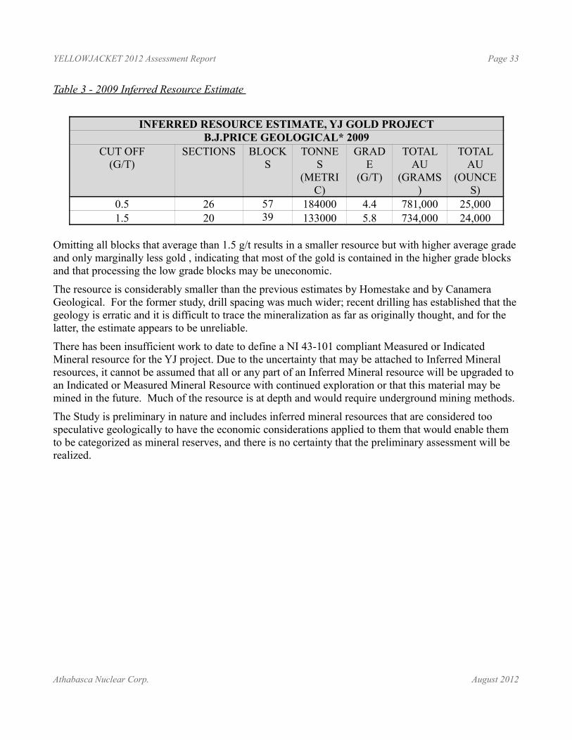
YELLOWJACKET 2012 Assessment Report Page 33
Table 3 - 2009 Inferred Resource Estimate
INFERRED RESOURCE ESTIMATE, YJ GOLD PROJECTB.J.PRICE GEOLOGICAL* 2009
CUT OFF(G/T)
SECTIONS BLOCKS
TONNES
(METRIC)
GRADE
(G/T)
TOTAL AU
(GRAMS)
TOTAL AU
(OUNCES)
0.5 26 57 184000 4.4 781,000 25,0001.5 20 39 133000 5.8 734,000 24,000
Omitting all blocks that average than 1.5 g/t results in a smaller resource but with higher average grade and only marginally less gold , indicating that most of the gold is contained in the higher grade blocks and that processing the low grade blocks may be uneconomic.
The resource is considerably smaller than the previous estimates by Homestake and by Canamera Geological. For the former study, drill spacing was much wider; recent drilling has established that the geology is erratic and it is difficult to trace the mineralization as far as originally thought, and for the latter, the estimate appears to be unreliable.
There has been insufficient work to date to define a NI 43-101 compliant Measured or Indicated Mineral resource for the YJ project. Due to the uncertainty that may be attached to Inferred Mineral resources, it cannot be assumed that all or any part of an Inferred Mineral resource will be upgraded to an Indicated or Measured Mineral Resource with continued exploration or that this material may be mined in the future. Much of the resource is at depth and would require underground mining methods.
The Study is preliminary in nature and includes inferred mineral resources that are considered too speculative geologically to have the economic considerations applied to them that would enable them to be categorized as mineral reserves, and there is no certainty that the preliminary assessment will be realized.
Athabasca Nuclear Corp. August 2012
YELLOWJACKET 2012 Assessment Report Page 34
2012 EXPLORATION PROGRAM
Rock of AgesFionnualla Devine, M.Sc. spent approximately 10 days mapping the bedrock exposed by placer mining activity in the Rock of Ages pit. The following summary is based on her report.
The Rock of Ages pit was progressively excavated and mined for placer gold during the 2010 and 2011 seasons. Bedrock in the pit was mapped as it was uncovered during 2010; the results of that mapping are summarized in Devine (2010). Additional pit excavation during 2011 along the eastern extension of the pit uncovered additional bedrock. This area was mapped in 2012 and the results are reported here. Some areas that were originally uncovered in 2010 were examined in more detail and are also described herein.
The Rock of Ages area covers some of the richest placer gold ground in the Atlin Gold Camp, and also has a historically reported bedrock gold occurrence for which the area is named; the“Rock of Ages” showing (Prior, 1903). The Pine Creek fault runs up Pine Creek and is host to the bedrock gold occurrences. Exploration for bedrock gold in the area through the 1980’s to present day has identified the Rock of Ages zone as a potential extension to the Yellowjacket resource. 2010 mapping focused on developing the geological setting of key alteration and veining features in the Rock of Ages area to add to the developing geological story of bedrock gold mineralization along the Pine Creek fault and its implications for expanding the Au resource on the Yellowjacket property.
The Rock of Ages pit is located approximately 750 metres west of the Yellowjacket Gold Zone along Pine Creek and the underlying Pine Creek fault. This is notably south of the Willow Drain, a historic location mentioned in historic placer reports on Pine Creek (e.g. Black, 1953), and is the area of the original ‘discovery’ showing that initiated the turn of the century Atlin Gold Rush.
Lithology and structure, alteration, and veining and mineralization were mapped as separate layers, and particular attention was paid to the relationship between structures, listwanite alteration, and quartz veining. The included maps highlight the timing and spatial relationships between structural and vein features.
Summary of Results From 2012 Mapping (Figure9, Figure 10)Several patterns and features became apparent in the Rock of Ages geology that have important implications for understanding the relative timing and nature of gold mineralization along the Yellowjacket trend:
• The Rock of Ages area occurs at the junction of the main northeast-trending Rock of Ages fault and a set of west-northwest trending subsidiary structures, which developed (or were re-activated) during right lateral displacement along the Pine Creek fault zone. The area of most complex alteration and most predominant quartz veining occurs in the general area of the junction of these two trends.
Athabasca Nuclear Corp. August 2012
YELLOWJACKET 2012 Assessment Report Page 35
• Latest movement along the fault zone is mapped as a set of right-lateral brittle faults. These faults are commonly marked by 1 cm to 1 metre white clay-filled fault gouge zones. Movement along these structures both pre- and post-date quartz veining along their surfaces. While a robust spatial connection to gold mineralization has not been established in the Rock of Ages pit, the historic gold workings in the Rock of Ages shaft area lie along a wide and continuous fault (the Rock of Ages fault) that also saw late brittle deformation. The highest gold values in channel sampling in the Rock of Ages area also lie adjacent to this main structure. A similar spatial relationship is recorded in the Pine Pit where notable gold values were returned in drilling from clay gouge zones that contain broken quartz vein fragments. This suggests that these structures may have controlled hydrothermal fluid flow and gold deposition, and that the structural history of the late brittle deformation along the Pine Creek fault may be more significant in controlling gold mineralization than the (possible) earlier ductile deformation along the potentially long-lived structure. Channel sampling in the Rock of Ages pit did not produce consistent gold values, therefore a spatial relationships between certain vein phases and/or structures was not established. However, a similar detailed mapping exercise in the Pine Pit might produce better results. Separating the latest brittle deformation features in the Pine Pit area from possible earlier structures to see if there is a correlation with the highest gold values.
• A set of interconnected lamprophyre dykes in the central part of the Rock of Ages pit were emplaced late in the development of the fault zone. Their emplacement was controlled by the late brittle faults that opened with a right-lateral sense of displacement. Locally, the lamprophyres are also cut by the same controlling faults. Several samples of the lamprophyre dykes were collected for assay. No elevated gold values were returned. However, the connection between lamprophyre dykes and gold mineralization in other gold-rich districts has been noted by several authors (eg. Rock and Groves, 1988) and should be explored further in relation to mineralization along the Yellowjacket trend.
Brittle Deformation Along the Fault ZoneFaults mapped in the Rock of Ages are divided into three stages in an attempt to separate different structural events along the zone.
Stage 3 is the youngest set; it includes several low-displacement, high-angle, north-trending faults along southern margin of the Rock of Ages zone with a left-lateral sense of offset. Stage 3 is considered to post-date all major veining and mineralization.
Stages 1 and 2 are more difficult to distinguish as both are high-angle sets that result from right-lateral displacement along the main Rock of Ages zone. Stage 2 is considered the later phase of right lateral movement with a distinct brittle characteristics such as straight boundaries and sharp offsets. They are commonly marked by zones of white clay gouge. Stage 2 both controlled and progressed after lamprophyre emplacement. Stage 2 faults were also commonly exploited by quartz veins that are locally also deformed along the same surfaces that controlled their emplacement.
Athabasca Nuclear Corp. August 2012
YELLOWJACKET 2012 Assessment Report Page 36
Stage 1 faults are less well defined, but include structures that may have originally formed during earlier phases of fault zone development. Many Stage 1 structures juxtapose andesite and ultramafic rocks. These units are the oldest in the area and have a protracted tectonic history that includes obduction and overthrusting during Cache Creek emplacement in the Early Jurassic. The structural relationship between these units likely pre-dates development of the Pine Creek fault zone, although these relationships have been modified by younger adjustments.
Lamprophyres (Syn-Brittle Deformation Emplacement)The presence of a set of lamprophyre dykes in the central part of the Rock of Ages area was mapped in detail in 2012. The lamprophyres are fine to medium-grained biotite-rich rocks (up to 95% vol. biotite) that with distinctive friable weathering. They contain up to 2% vol. disseminated pyrite. Lamprophyre dyke occur as 10 centimetre to 2 metre wide dykes along are fault structures. Mapped relationships demonstrate emplacement along structures that were opened during right-lateral displacement along the fault zone. Some primary intrusive contacts are maintained, however other contacts are faulted, indicating that movement along the fault zone continued following igneous emplacement.
Samples were collected from several lamprophyre dykes for multi-element geochemistry. No elevated gold values were returned. However, a general and implied genetic connection between mesothermal gold deposits and lamprophyres has been suggested by several authors (eg. Rock and Groves, 1988). They suggest that while lamprophyres may not be the immediate host of gold mineralization, they are a possible source of introduced gold-rich fluids to the mineralizing system. Their presence, and also possible their age through isotopic age dating of biotite, may provide constraints on the origin and timing of gold mineralization along the Yellowjacket trend.
The project was significantly enhanced by the availability of a high resolution orthophoto that was‐ updated as the pit was excavated. Discovery Helicopters Ltd. in Atlin B.C. fabricated and installed an interior chin bubble camera mount for a Nixon D50 D SLR camera and conducted an aerial‐ ‐ photography program over the Yellowjacket Property, with detailed photo sequences over the Rock of Ages pit. The photos were orthorectified image and used as the base map for the 2012 mapping program.
Geophysics
Figure 15Aurora Geoscience Ltd. conducted a HLEM (Horizontal Loop Electromagnetic) survey on the Yellowjacket property prior to the start of the RC drill program. The survey was designed as a follow-up survey to a test survey that was done in June 2012 to cover an area with good drill control of the grey clay zone (“Slumpy”) in the footwall of the ore zone. The HLEM survey used 25m coil separation. There were a total of 12 lines and 2.35 line kms of survey completed.
The HLEM survey imaged a south-dipping, high-frequency, quadrature-onlyfeature, consistent with a weak conductor coincident with the target. The extension of the survey confirmed the test survey results. The Slumpy target, which is shown as a weak conductor on the higher frequencies, has a possible linear trend to the east.
Athabasca Nuclear Corp. August 2012
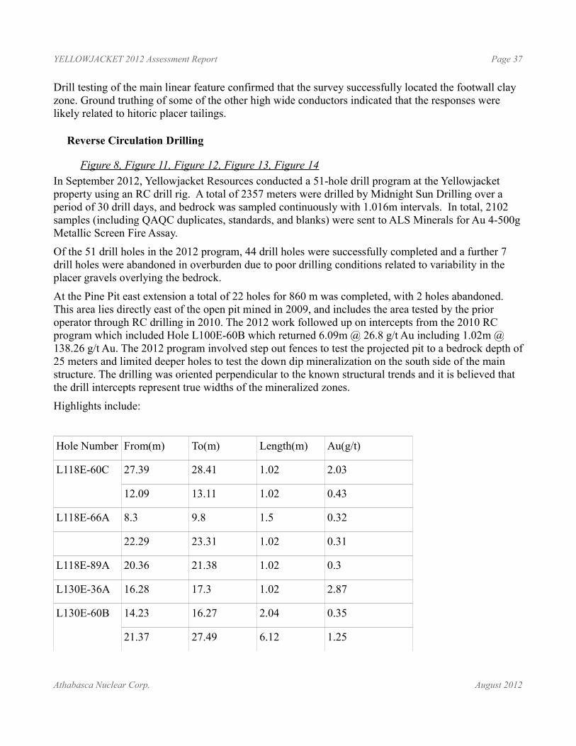
YELLOWJACKET 2012 Assessment Report Page 37
Drill testing of the main linear feature confirmed that the survey successfully located the footwall clay zone. Ground truthing of some of the other high wide conductors indicated that the responses were likely related to hitoric placer tailings.
Reverse Circulation Drilling
Figure 8, Figure 11, Figure 12, Figure 13, Figure 14In September 2012, Yellowjacket Resources conducted a 51-hole drill program at the Yellowjacket property using an RC drill rig. A total of 2357 meters were drilled by Midnight Sun Drilling over a period of 30 drill days, and bedrock was sampled continuously with 1.016m intervals. In total, 2102 samples (including QAQC duplicates, standards, and blanks) were sent to ALS Minerals for Au 4-500g Metallic Screen Fire Assay.
Of the 51 drill holes in the 2012 program, 44 drill holes were successfully completed and a further 7 drill holes were abandoned in overburden due to poor drilling conditions related to variability in the placer gravels overlying the bedrock.
At the Pine Pit east extension a total of 22 holes for 860 m was completed, with 2 holes abandoned. This area lies directly east of the open pit mined in 2009, and includes the area tested by the prior operator through RC drilling in 2010. The 2012 work followed up on intercepts from the 2010 RC program which included Hole L100E-60B which returned 6.09m @ 26.8 g/t Au including 1.02m @ 138.26 g/t Au. The 2012 program involved step out fences to test the projected pit to a bedrock depth of 25 meters and limited deeper holes to test the down dip mineralization on the south side of the main structure. The drilling was oriented perpendicular to the known structural trends and it is believed that the drill intercepts represent true widths of the mineralized zones.
Highlights include:
Hole Number From(m) To(m) Length(m) Au(g/t)
L118E-60C 27.39 28.41 1.02 2.03
12.09 13.11 1.02 0.43
L118E-66A 8.3 9.8 1.5 0.32
22.29 23.31 1.02 0.31
L118E-89A 20.36 21.38 1.02 0.3
L130E-36A 16.28 17.3 1.02 2.87
L130E-60B 14.23 16.27 2.04 0.35
21.37 27.49 6.12 1.25
Athabasca Nuclear Corp. August 2012
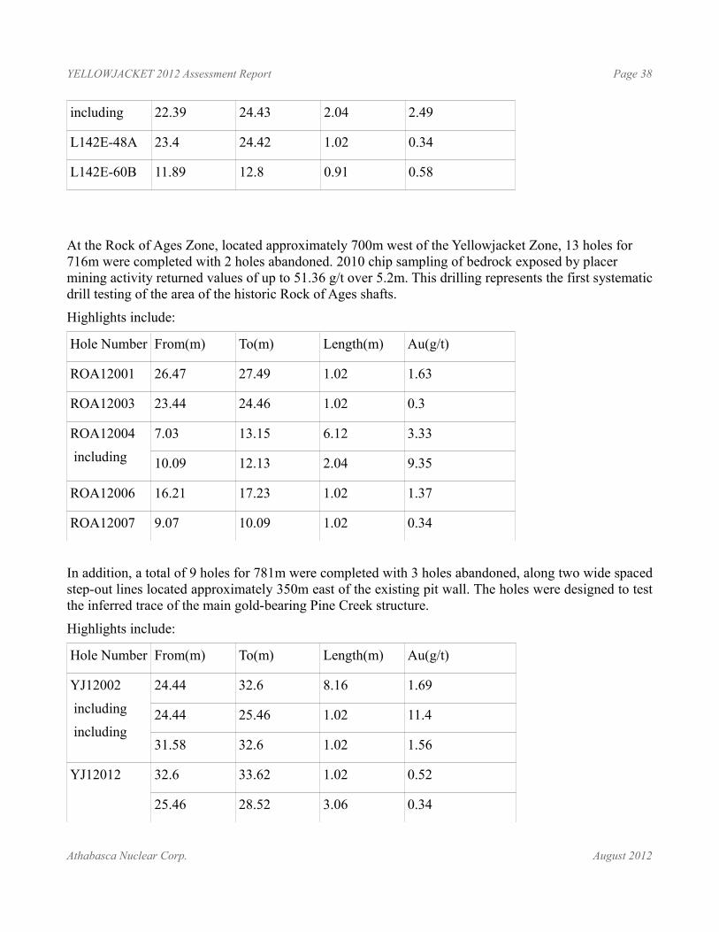
YELLOWJACKET 2012 Assessment Report Page 38
including 22.39 24.43 2.04 2.49
L142E-48A 23.4 24.42 1.02 0.34
L142E-60B 11.89 12.8 0.91 0.58
At the Rock of Ages Zone, located approximately 700m west of the Yellowjacket Zone, 13 holes for 716m were completed with 2 holes abandoned. 2010 chip sampling of bedrock exposed by placer mining activity returned values of up to 51.36 g/t over 5.2m. This drilling represents the first systematic drill testing of the area of the historic Rock of Ages shafts.
Highlights include:
Hole Number From(m) To(m) Length(m) Au(g/t)
ROA12001 26.47 27.49 1.02 1.63
ROA12003 23.44 24.46 1.02 0.3
ROA12004
including
7.03 13.15 6.12 3.33
10.09 12.13 2.04 9.35
ROA12006 16.21 17.23 1.02 1.37
ROA12007 9.07 10.09 1.02 0.34
In addition, a total of 9 holes for 781m were completed with 3 holes abandoned, along two wide spaced step-out lines located approximately 350m east of the existing pit wall. The holes were designed to test the inferred trace of the main gold-bearing Pine Creek structure.
Highlights include:
Hole Number From(m) To(m) Length(m) Au(g/t)
YJ12002
including
including
24.44 32.6 8.16 1.69
24.44 25.46 1.02 11.4
31.58 32.6 1.02 1.56
YJ12012 32.6 33.62 1.02 0.52
25.46 28.52 3.06 0.34
Athabasca Nuclear Corp. August 2012
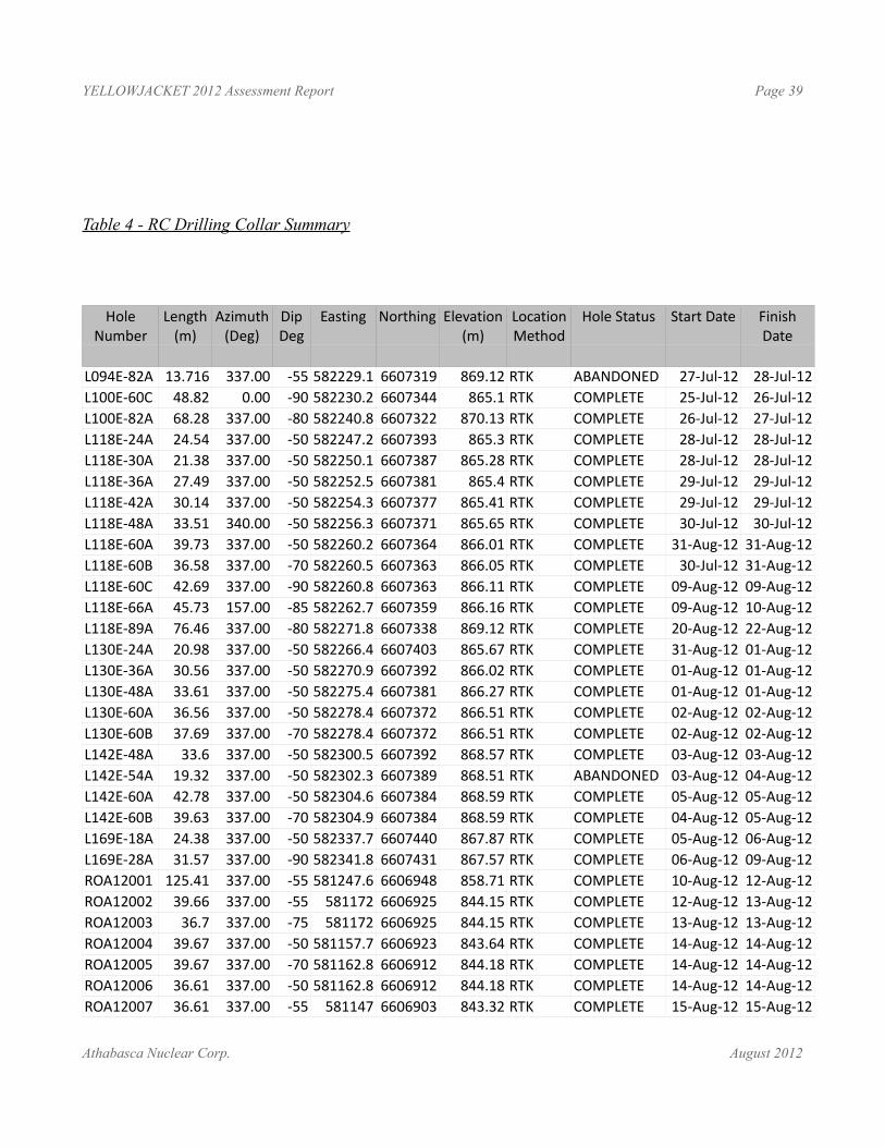
YELLOWJACKET 2012 Assessment Report Page 39
Table 4 - RC Drilling Collar Summary
Hole Number
Length(m)
Azimuth(Deg)
Dip Deg
Easting Northing Elevation(m)
Location Method
Hole Status Start Date Finish Date
L094E-82A 13.716 337.00 -55 582229.1 6607319 869.12 RTK ABANDONED 27-Jul-12 28-Jul-12L100E-60C 48.82 0.00 -90 582230.2 6607344 865.1 RTK COMPLETE 25-Jul-12 26-Jul-12L100E-82A 68.28 337.00 -80 582240.8 6607322 870.13 RTK COMPLETE 26-Jul-12 27-Jul-12L118E-24A 24.54 337.00 -50 582247.2 6607393 865.3 RTK COMPLETE 28-Jul-12 28-Jul-12L118E-30A 21.38 337.00 -50 582250.1 6607387 865.28 RTK COMPLETE 28-Jul-12 28-Jul-12L118E-36A 27.49 337.00 -50 582252.5 6607381 865.4 RTK COMPLETE 29-Jul-12 29-Jul-12L118E-42A 30.14 337.00 -50 582254.3 6607377 865.41 RTK COMPLETE 29-Jul-12 29-Jul-12L118E-48A 33.51 340.00 -50 582256.3 6607371 865.65 RTK COMPLETE 30-Jul-12 30-Jul-12L118E-60A 39.73 337.00 -50 582260.2 6607364 866.01 RTK COMPLETE 31-Aug-12 31-Aug-12L118E-60B 36.58 337.00 -70 582260.5 6607363 866.05 RTK COMPLETE 30-Jul-12 31-Aug-12L118E-60C 42.69 337.00 -90 582260.8 6607363 866.11 RTK COMPLETE 09-Aug-12 09-Aug-12L118E-66A 45.73 157.00 -85 582262.7 6607359 866.16 RTK COMPLETE 09-Aug-12 10-Aug-12L118E-89A 76.46 337.00 -80 582271.8 6607338 869.12 RTK COMPLETE 20-Aug-12 22-Aug-12L130E-24A 20.98 337.00 -50 582266.4 6607403 865.67 RTK COMPLETE 31-Aug-12 01-Aug-12L130E-36A 30.56 337.00 -50 582270.9 6607392 866.02 RTK COMPLETE 01-Aug-12 01-Aug-12L130E-48A 33.61 337.00 -50 582275.4 6607381 866.27 RTK COMPLETE 01-Aug-12 01-Aug-12L130E-60A 36.56 337.00 -50 582278.4 6607372 866.51 RTK COMPLETE 02-Aug-12 02-Aug-12L130E-60B 37.69 337.00 -70 582278.4 6607372 866.51 RTK COMPLETE 02-Aug-12 02-Aug-12L142E-48A 33.6 337.00 -50 582300.5 6607392 868.57 RTK COMPLETE 03-Aug-12 03-Aug-12L142E-54A 19.32 337.00 -50 582302.3 6607389 868.51 RTK ABANDONED 03-Aug-12 04-Aug-12L142E-60A 42.78 337.00 -50 582304.6 6607384 868.59 RTK COMPLETE 05-Aug-12 05-Aug-12L142E-60B 39.63 337.00 -70 582304.9 6607384 868.59 RTK COMPLETE 04-Aug-12 05-Aug-12L169E-18A 24.38 337.00 -50 582337.7 6607440 867.87 RTK COMPLETE 05-Aug-12 06-Aug-12L169E-28A 31.57 337.00 -90 582341.8 6607431 867.57 RTK COMPLETE 06-Aug-12 09-Aug-12ROA12001 125.41 337.00 -55 581247.6 6606948 858.71 RTK COMPLETE 10-Aug-12 12-Aug-12ROA12002 39.66 337.00 -55 581172 6606925 844.15 RTK COMPLETE 12-Aug-12 13-Aug-12ROA12003 36.7 337.00 -75 581172 6606925 844.15 RTK COMPLETE 13-Aug-12 13-Aug-12ROA12004 39.67 337.00 -50 581157.7 6606923 843.64 RTK COMPLETE 14-Aug-12 14-Aug-12ROA12005 39.67 337.00 -70 581162.8 6606912 844.18 RTK COMPLETE 14-Aug-12 14-Aug-12ROA12006 36.61 337.00 -50 581162.8 6606912 844.18 RTK COMPLETE 14-Aug-12 14-Aug-12ROA12007 36.61 337.00 -55 581147 6606903 843.32 RTK COMPLETE 15-Aug-12 15-Aug-12
Athabasca Nuclear Corp. August 2012
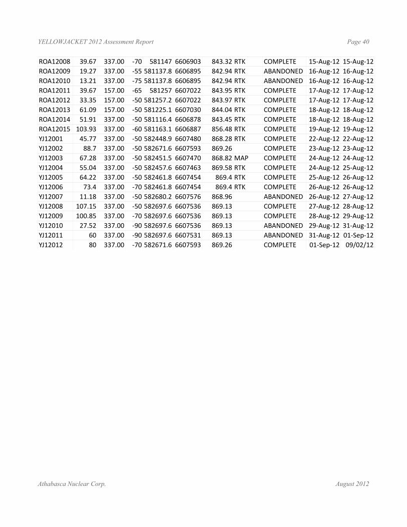
YELLOWJACKET 2012 Assessment Report Page 40
ROA12008 39.67 337.00 -70 581147 6606903 843.32 RTK COMPLETE 15-Aug-12 15-Aug-12ROA12009 19.27 337.00 -55 581137.8 6606895 842.94 RTK ABANDONED 16-Aug-12 16-Aug-12ROA12010 13.21 337.00 -75 581137.8 6606895 842.94 RTK ABANDONED 16-Aug-12 16-Aug-12ROA12011 39.67 157.00 -65 581257 6607022 843.95 RTK COMPLETE 17-Aug-12 17-Aug-12ROA12012 33.35 157.00 -50 581257.2 6607022 843.97 RTK COMPLETE 17-Aug-12 17-Aug-12ROA12013 61.09 157.00 -50 581225.1 6607030 844.04 RTK COMPLETE 18-Aug-12 18-Aug-12ROA12014 51.91 337.00 -50 581116.4 6606878 843.45 RTK COMPLETE 18-Aug-12 18-Aug-12ROA12015 103.93 337.00 -60 581163.1 6606887 856.48 RTK COMPLETE 19-Aug-12 19-Aug-12YJ12001 45.77 337.00 -50 582448.9 6607480 868.28 RTK COMPLETE 22-Aug-12 22-Aug-12YJ12002 88.7 337.00 -50 582671.6 6607593 869.26 COMPLETE 23-Aug-12 23-Aug-12YJ12003 67.28 337.00 -50 582451.5 6607470 868.82 MAP COMPLETE 24-Aug-12 24-Aug-12YJ12004 55.04 337.00 -50 582457.6 6607463 869.58 RTK COMPLETE 24-Aug-12 25-Aug-12YJ12005 64.22 337.00 -50 582461.8 6607454 869.4 RTK COMPLETE 25-Aug-12 26-Aug-12YJ12006 73.4 337.00 -70 582461.8 6607454 869.4 RTK COMPLETE 26-Aug-12 26-Aug-12YJ12007 11.18 337.00 -50 582680.2 6607576 868.96 ABANDONED 26-Aug-12 27-Aug-12YJ12008 107.15 337.00 -50 582697.6 6607536 869.13 COMPLETE 27-Aug-12 28-Aug-12YJ12009 100.85 337.00 -70 582697.6 6607536 869.13 COMPLETE 28-Aug-12 29-Aug-12YJ12010 27.52 337.00 -90 582697.6 6607536 869.13 ABANDONED 29-Aug-12 31-Aug-12YJ12011 60 337.00 -90 582697.6 6607531 869.13 ABANDONED 31-Aug-12 01-Sep-12YJ12012 80 337.00 -70 582671.6 6607593 869.26 COMPLETE 01-Sep-12 09/02/12
Athabasca Nuclear Corp. August 2012
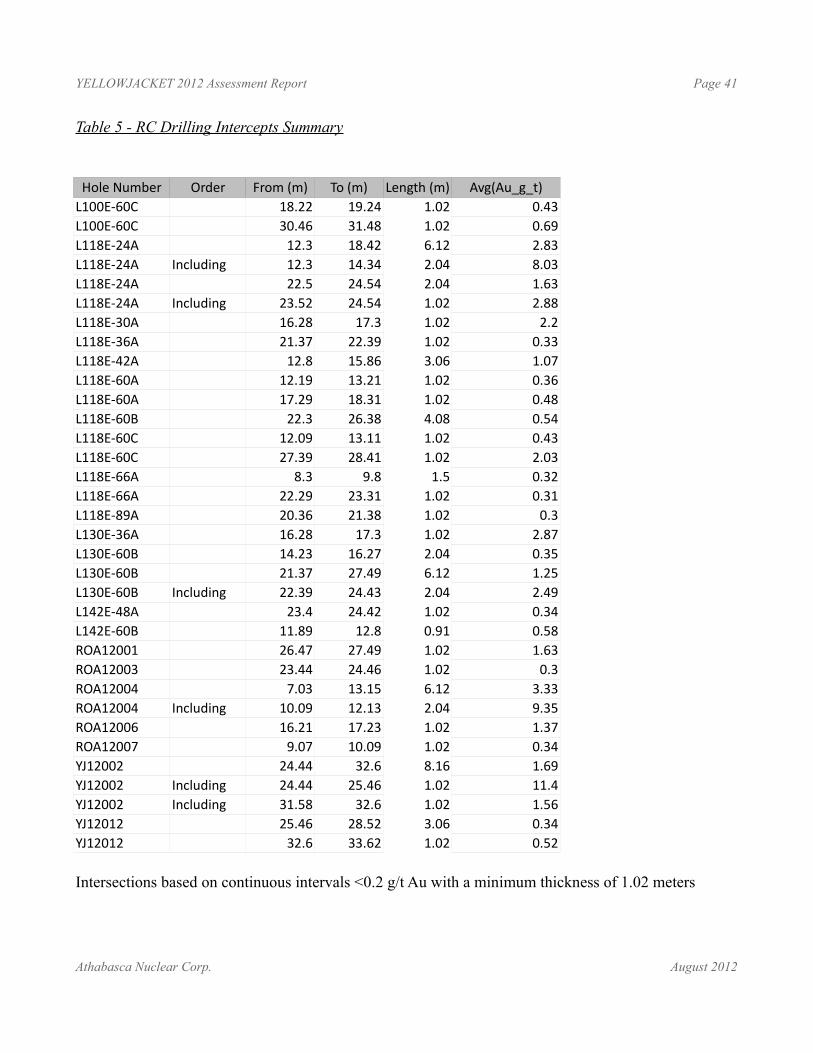
YELLOWJACKET 2012 Assessment Report Page 41
Table 5 - RC Drilling Intercepts Summary
Hole Number Order From (m) To (m) Length (m) Avg(Au_g_t)L100E-60C 18.22 19.24 1.02 0.43L100E-60C 30.46 31.48 1.02 0.69L118E-24A 12.3 18.42 6.12 2.83L118E-24A Including 12.3 14.34 2.04 8.03L118E-24A 22.5 24.54 2.04 1.63L118E-24A Including 23.52 24.54 1.02 2.88L118E-30A 16.28 17.3 1.02 2.2L118E-36A 21.37 22.39 1.02 0.33L118E-42A 12.8 15.86 3.06 1.07L118E-60A 12.19 13.21 1.02 0.36L118E-60A 17.29 18.31 1.02 0.48L118E-60B 22.3 26.38 4.08 0.54L118E-60C 12.09 13.11 1.02 0.43L118E-60C 27.39 28.41 1.02 2.03L118E-66A 8.3 9.8 1.5 0.32L118E-66A 22.29 23.31 1.02 0.31L118E-89A 20.36 21.38 1.02 0.3L130E-36A 16.28 17.3 1.02 2.87L130E-60B 14.23 16.27 2.04 0.35L130E-60B 21.37 27.49 6.12 1.25L130E-60B Including 22.39 24.43 2.04 2.49L142E-48A 23.4 24.42 1.02 0.34L142E-60B 11.89 12.8 0.91 0.58ROA12001 26.47 27.49 1.02 1.63ROA12003 23.44 24.46 1.02 0.3ROA12004 7.03 13.15 6.12 3.33ROA12004 Including 10.09 12.13 2.04 9.35ROA12006 16.21 17.23 1.02 1.37ROA12007 9.07 10.09 1.02 0.34YJ12002 24.44 32.6 8.16 1.69YJ12002 Including 24.44 25.46 1.02 11.4YJ12002 Including 31.58 32.6 1.02 1.56YJ12012 25.46 28.52 3.06 0.34YJ12012 32.6 33.62 1.02 0.52
Intersections based on continuous intervals <0.2 g/t Au with a minimum thickness of 1.02 meters
Athabasca Nuclear Corp. August 2012
YELLOWJACKET 2012 Assessment Report Page 42
Recovery, Sampling Merthod and ApproachDrill casing was set down to bedrock surface, and then bedrock was continuously sampled in 1.016m intervals (3 samples for every 10 foot drill string) for the entire length of the hole. Water was used during drilling due to the high clay and talc content of the rock, and slurry was run through a cyclone splitter at the drill with half of the sample collected for assay and the other half saved onsite in cloth sample bags. Chip samples for logging were collected directly from the cyclone splitter at he drill. The sample fraction in cloth bags were sent to ALS Minerals for Au 4-500g FA analysis.
SurveyingDrill collar pickups were done by Terralogic Exploration Inc. using a Trimble Differential Global Positioning System.
Athabasca Nuclear Corp. August 2012
ROA12009
ROA12014 ROA12010ROA12007
ROA12008ROA12015
ROA12004 ROA12006ROA12005
ROA12002ROA12003
ROA12001
ROA12013
ROA12011 and 012
L474W
ROA12001
ROA12015
ROA12013
ROA12014
RDH87-05
ROA12004
RDH87-06
RDH87-40
ROA12002
ROA12012
ROA12007
ROA12005
ROA12009
L474W
581000
581000
581100
581100
581200
581200
581300
581300
6606
900
6606
900
6607
000
6607
000
10 0 10 20 305Meters
EPL:TSX-V
Figure 8 - ROA RC Plan Map Projection - NAD 83 UTM Zone 08NScale - 1: 1,000 20/08/2013
YellowJacketProperty
LegendRC CollarsYEAR
20122010; 1987; 1985Grid SectionROA PitDDH Collar Location
Figure 9
Figure 10
YJ12002YJ12012
YJ12001
YJ12005YJ12006
YJ12004YJ12003
YJ12008YJ12009YJ12010YJ12011
YJ12007
L142E-48AL142E-54A
L118E-89A
L169E-18AL169E-28A
L094E-82AL100E-82A
L100E-60C
L142E-60AL142E-60B
L130E-60AL130E-60B
L130E-48A
L130E-24A
L130E-36A
L118E-30AL118E-24A
L118E-42A
L118E-60A - L118E-60CL118E-66A
L118E-48A
L118E-36A
L118E
L130E
L145E
L172E
L230E
L354E
"Slumpy" Footwall Fault Zone
582200
582200
582400
582400
582600
582600
6607
300
6607
300
6607
400
6607
400
6607
500
6607
500
6607
600
6607
600
0 20 40 60 80 10010
Meters
LegendRC CollarStatus
2012 ABANDONED2012 COMPLETE1985; 2010; 2012DDH HistoricHLEM Linear Conductor
EPL:TSX-V
Figure 11 - Pine Pit RC Plan Map Projection - NAD 83 UTM Zone 09NScale - 1: 1000 19/08/2013
YellowJacketProperty
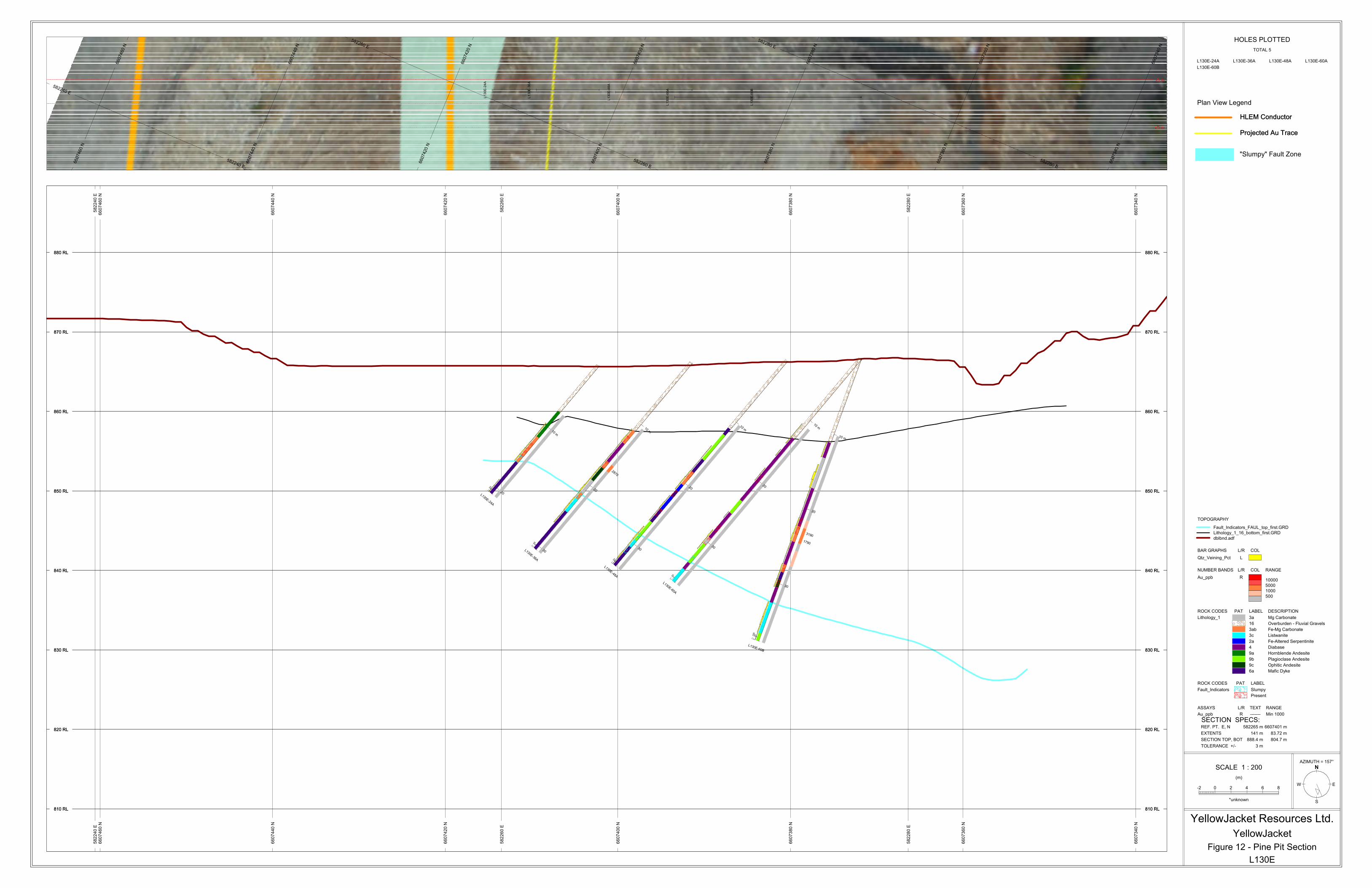
L130E
Figure 12 - Pine Pit Section
YellowJacket
YellowJacket Resources Ltd.
SCALE 1 : 200
-2 0 2 4 6 8
(m)
*unknown
W
S
E
N
AZIMUTH = 157°
TOLERANCE +/- 3 m
SECTION TOP, BOT 888.4 m 804.7 m
EXTENTS 141 m 83.72 m
REF. PT. E, N 582265 m 6607401 m
SECTION SPECS:
HOLES PLOTTED
TOTAL 5
L130E-24A L130E-36A L130E-48A L130E-60A
L130E-60B
Au_ppb R ------- Min 1000
ASSAYS L/R TEXT RANGE
Present
SlumpyFault_Indicators
ROCK CODES PAT LABEL
Mafic Dyke6a
Ophitic Andesite9c
Plagioclase Andesite9b
Hornblende Andesite9a
Diabase4
Fe-Altered Serpentinite2a
Listwanite3c
Fe-Mg Carbonate3ab
Overburden - Fluvial Gravels16
Mg Carbonate3aLithology_1
ROCK CODES PAT LABEL DESCRIPTION
500
1000
5000
10000Au_ppb R
NUMBER BANDS L/R COL RANGE
Qtz_Veining_Pct L
BAR GRAPHS L/R COL
dblbnd.adf
Lithology_1_16_bottom_first.GRD
Fault_Indicators_FAUL_top_first.GRD
TOPOGRAPHY
Plan View Legend
HLEM Conductor
Projected Au Trace
HLEM Conductor
"Slumpy" Fault Zone
Projected Au Trace
582240 E
582240 E
582260 E
582260 E
582280 E
582280 E
6607340 N
6607340 N
6607360 N
6607360 N
6607380 N
6607380 N
6607400 N
6607400 N
6607420 N
6607420 N
6607440 N
6607440 N
6607460 N
6607460 N
+3 m
-3 m
L130E-24A
L130E-36A
L130E-48A
L130E-60A
L130E-60B
582240 E
582240 E
582260 E
582260 E
582280 E
582280 E
810 RL 810 RL
820 RL 820 RL
830 RL 830 RL
840 RL 840 RL
850 RL 850 RL
860 RL 860 RL
870 RL 870 RL
880 RL 880 RL
6607340 N
6607340 N
6607360 N
6607360 N
6607380 N
6607380 N
6607400 N
6607400 N
6607420 N
6607420 N
6607440 N
6607440 N
6607460 N
6607460 N
810 RL810 RL
820 RL820 RL
830 RL830 RL
840 RL840 RL
850 RL850 RL
860 RL860 RL
870 RL870 RL
880 RL880 RL
050
050
050
050
050100
2870
3190
1790
10 m
20L130E-24A
10 m
20
30L130E-36A
10 m
20
30
L130E-48A
10 m
20
30
L130E-60A
10 m
20
30
L130E-60B
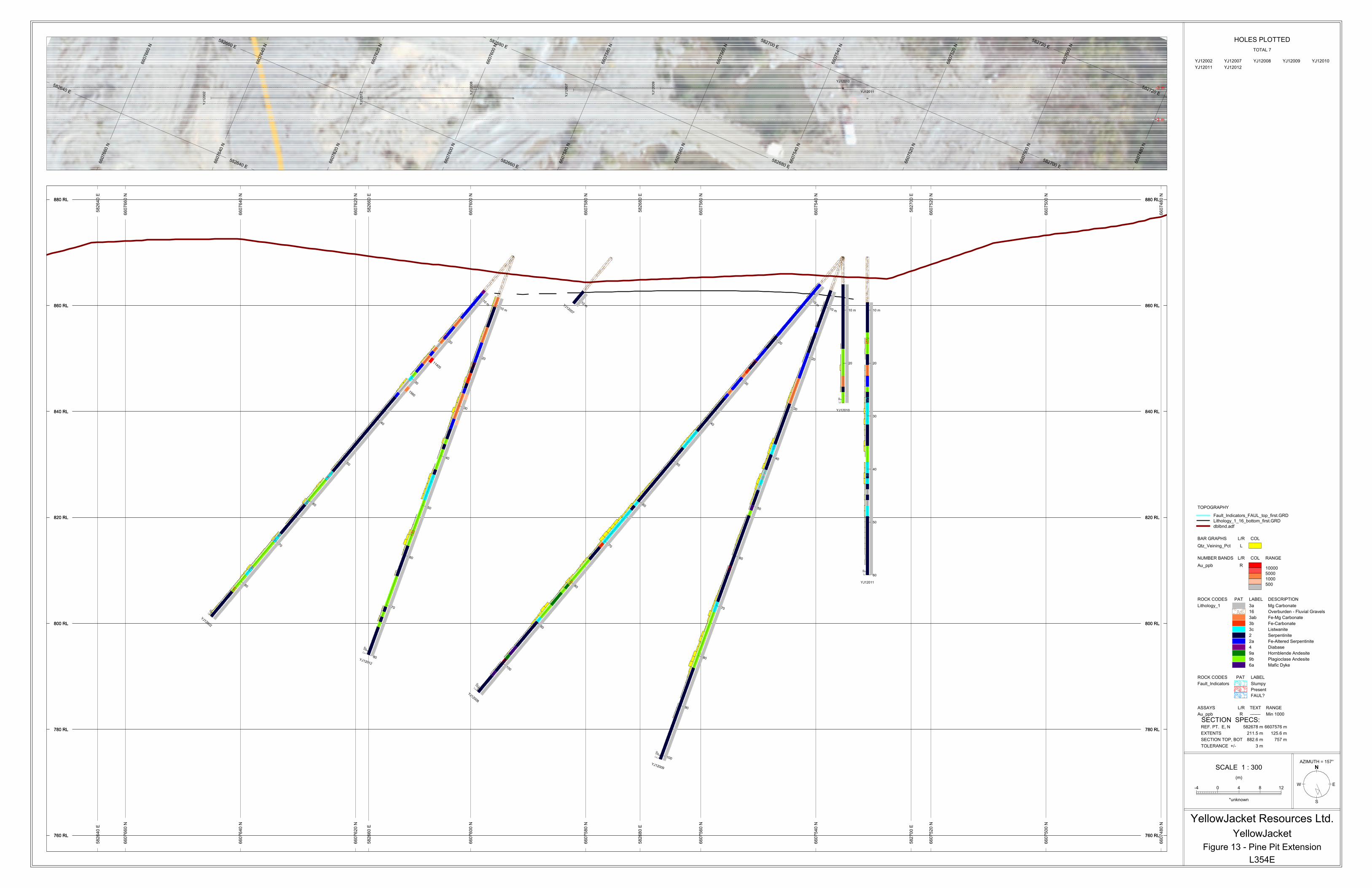
L354E
Figure 13 - Pine Pit Extension
YellowJacket
YellowJacket Resources Ltd.
SCALE 1 : 300
-4 0 4 8 12
(m)
*unknown
W
S
E
N
AZIMUTH = 157°
TOLERANCE +/- 3 m
SECTION TOP, BOT 882.6 m 757 m
EXTENTS 211.5 m 125.6 m
REF. PT. E, N 582678 m 6607576 m
SECTION SPECS:
HOLES PLOTTED
TOTAL 7
YJ12002 YJ12007 YJ12008 YJ12009 YJ12010
YJ12011 YJ12012
Au_ppb R ------- Min 1000
ASSAYS L/R TEXT RANGE
FAUL?
Present
SlumpyFault_Indicators
ROCK CODES PAT LABEL
Mafic Dyke6a
Plagioclase Andesite9b
Hornblende Andesite9a
Diabase4
Fe-Altered Serpentinite2a
Serpentinite2
Listwanite3c
Fe-Carbonate3b
Fe-Mg Carbonate3ab
Overburden - Fluvial Gravels16
Mg Carbonate3aLithology_1
ROCK CODES PAT LABEL DESCRIPTION
500
1000
5000
10000Au_ppb R
NUMBER BANDS L/R COL RANGE
Qtz_Veining_Pct L
BAR GRAPHS L/R COL
dblbnd.adf
Lithology_1_16_bottom_first.GRD
Fault_Indicators_FAUL_top_first.GRD
TOPOGRAPHY
582640 E
582640 E
582660 E
582660 E
582680 E
582680 E
582700 E
582700 E
582720 E
582720 E
6607480 N
6607500 N
6607500 N
6607520 N
6607520 N
6607540 N
6607540 N
6607560 N
6607560 N
6607580 N
6607580 N
6607600 N
6607600 N
6607620 N
6607620 N
6607640 N
6607640 N
6607660 N
6607660 N
+3 m
-3 m
YJ12002
YJ12007
YJ12008
YJ12009 YJ12010
YJ12011
YJ12012
582640 E
582640 E
582660 E
582660 E
582680 E
582680 E
582700 E
582700 E
760 RL 760 RL
780 RL 780 RL
800 RL 800 RL
820 RL 820 RL
840 RL 840 RL
860 RL 860 RL
880 RL 880 RL
6607480 N
6607480 N
6607500 N
6607500 N
6607520 N
6607520 N
6607540 N
6607540 N
6607560 N
6607560 N
6607580 N
6607580 N
6607600 N
6607600 N
6607620 N
6607620 N
6607640 N
6607640 N
6607660 N
6607660 N
760 RL760 RL
780 RL780 RL
800 RL800 RL
820 RL820 RL
840 RL840 RL
860 RL860 RL
880 RL880 RL
050
050100
050100
050
050
050100
11400
1560
10 m
20
30
40
50
60
70
80
YJ12002
10 mYJ12007
10 m
20
30
40
50
60
70
80
90
100
YJ12008
10 m
20
30
40
50
60
70
80
90
100
YJ12009
10 m
20
YJ12010
10 m
20
30
40
50
60
YJ12011
10 m
20
30
40
50
60
70
80YJ12012
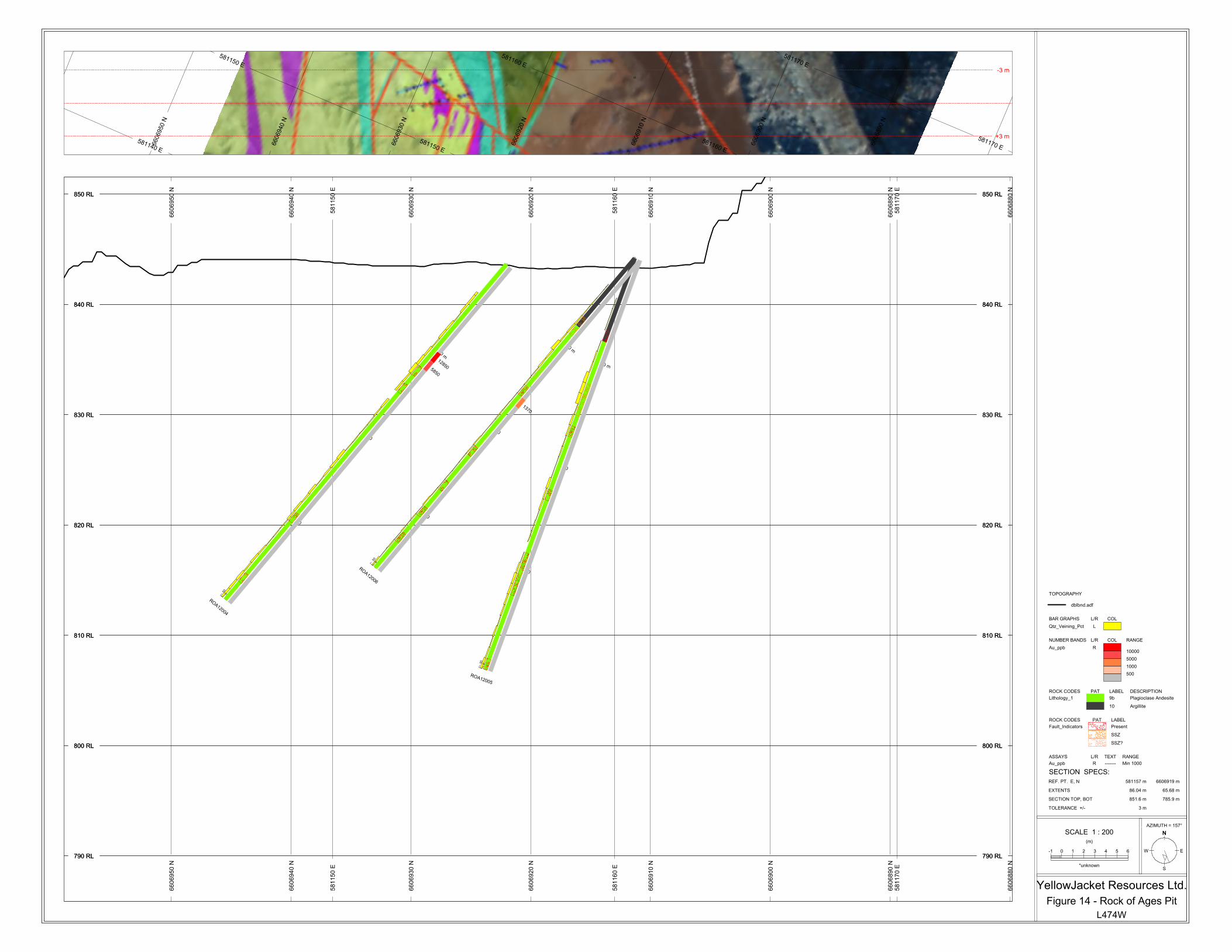
L474W
Figure 14 - Rock of Ages Pit
YellowJacket Resources Ltd.
SCALE 1 : 200
-1 0 1 2 3 4 5 6
(m)
*unknown
W
S
E
N
AZIMUTH = 157°
TOLERANCE +/- 3 m
SECTION TOP, BOT 851.6 m 785.9 m
EXTENTS 86.04 m 65.68 m
REF. PT. E, N 581157 m 6606919 m
SECTION SPECS:
Au_ppb R ------- Min 1000
ASSAYS L/R TEXT RANGE
SSZ?
SSZ
PresentFault_Indicators
ROCK CODES PAT LABEL
Argillite10
Plagioclase Andesite9bLithology_1
ROCK CODES PAT LABEL DESCRIPTION
500
1000
5000
10000Au_ppb R
NUMBER BANDS L/R COL RANGE
Qtz_Veining_Pct L
BAR GRAPHS L/R COL
dblbnd.adf
TOPOGRAPHY
581140 E
581150 E
581150 E
581160 E
581160 E
581170 E
581170 E
6606890 N
6606900 N
6606910 N
6606920 N
6606930 N
6606940 N
6606950 N
+3 m
-3 m
581150 E
581150 E
581160 E
581160 E
581170 E
581170 E
790 RL 790 RL
800 RL 800 RL
810 RL 810 RL
820 RL 820 RL
830 RL 830 RL
840 RL 840 RL
850 RL 850 RL
6606880 N
6606880 N
6606890 N
6606890 N
6606900 N
6606900 N
6606910 N
6606910 N
6606920 N
6606920 N
6606930 N
6606930 N
6606940 N
6606940 N
6606950 N
6606950 N
790 RL790 RL
800 RL800 RL
810 RL810 RL
820 RL820 RL
830 RL830 RL
840 RL840 RL
850 RL850 RL
10 m
20
30
ROA12004
10 m
20
30
ROA12005
10 m
20
30
ROA12006
050
050
050
128505850
1370
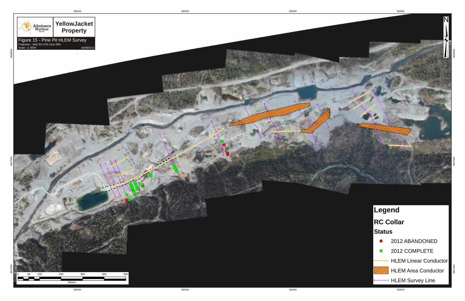
582000
582000
582500
582500
583000
583000
583500
583500
6607
000
6607
000
6607
500
6607
500
6608
000
6608
000
0 100 200 300 400 50050
Meters
LegendRC CollarStatus
2012 ABANDONED2012 COMPLETEHLEM Linear ConductorHLEM Area ConductorHLEM Survey Line
EPL:TSX-V
Figure 15 - Pine Pit HLEM Survey Projection - NAD 83 UTM Zone 09NScale - 1: 5000 19/08/2013
YellowJacketProperty
YELLOWJACKET 2012 Assessment Report Page 51
CONCLUSIONS From previous work at the Yellowjacket Gold Property, it has been found that gold is preferentially hosted within the carbonate altered (listwanitic) ultramafic rocks, and often associated with quartz veining and structuring. The timing of the alteration and gold-mineralization is still not well understood, however there are several schools of thought on this issue:
• The gold may be sourced from within the ultramafic rocks themselves, and liberated during the alteration
• The gold may be sourced externally and emplaced within the system by hydrothermal fluids
• A combination of the above and related to multi-episodic alteration
A paper by Gerard Buisson and Marc Leblanc (1987) suggests that gold may be partially sourced from within the ultramafic rocks themselves. During the formation of serpentine and magnetite from olivine, gold is concentrated within magnetite and secondary sulphides. During later carbonate-alteration of the serpentinites, the magnetite is destroyed and Au is released and concentrated within these altered rocks. This may explain an early and possible stage of Au mineralization at Yellowjacket.
As noted above, the destruction of magnetite occurs as the carbonate alteration reaction of serpentinite proceeds. There is a sequential decrease in magnetism from serpentinite (2) to fe-serpentinite (2a) to fe-mg carbonate (3ab) to fe-carbonate (3b), which is non-magnetic and where the magnetite is completely destroyed. If gold was present in the original mantle rocks, it may partially explain one source of the gold.
Subsequently, hydrothermal and acidic gold-bearing solutions within the Pine Creek shear zone may precipitate silica, pyrite, arsenides and gold when entering the reducing alkaline environment of the carbonatized rocks. From sample and field mapping in 2009 and also from the VG seen in samples from the 2010 and 2012 RC drilling, gold was found in relation to quartz veining within the altered ultramafic succession, but also within partially altered and quartz-stockworked andesites. Within the andesites, quartz-stockworking was found to be associated with silicification, fe-oxidation, and abundant cubic and oxidized pyrite. Arsenopyrite (FeAsS) was also found within the system.
The property is located in a valley controlled by the Pine Creek Fault zone, which has been described by Linda Dandy (2005) as east trending and approximately 70m in width. From mapping, the zone is intensely sheared and structured. Permeability within the system may be controlled along structural faulting, and as noted above, also created geochemically within the ultramafics themselves during the carbonate-alteration reaction. The complexity of the geology along this structure, and the differences in mineralogy and alteration noted during mapping and in and sample could support the idea of multiple sources for the gold.
The Rock of Ages area is a possible lateral extension or offset continuation of the Yellowjacket Gold Zone. The area has been identified as a geophysical (magnetic) anomaly (Dandy and Price, 2010) similar in character to the Yellowjacket zone, and to the eastern Gold Run zone. Gold has been recovered from parts of the pit (visual gold grain analysis, Devine, 2010) and elevated gold values in channel samples return up to 51.36 g/t over 5.2m. 2010 mapping identified at least two distinct
Athabasca Nuclear Corp. August 2012
YELLOWJACKET 2012 Assessment Report Page 52
alteration sequences (or classes) that both create silica enriched domains within the zone. The first, and‐ earlier of the two, is the “Listwanite assemblage” alteration, which is considered herein as progressive carbonation of ultramafic rock with the later stages of alteration resulting in quartz formation within ultramafic rocks. This is considered separate from the second alteration event that caused local pervasive silica flooding, local brecciation, and quartz veining, as is shown by the mapping presented in this report. It is difficult to distinguish quartz enriched rock related to early listwanite series‐ ‐ alteration from a quartz flooded rock related to the later alteration event, but it is of critical importance‐ to models for gold mineralization along the Pine Creek fault.
The results from the 2012 RC program clearly demonstrate the potential along strike from the main Pine Pit area. Significant intercepts in the Rock of Ages Pit - 6.12 meters at 3.33 g/t Au - and east of Pine Pit - 8.16m at 1.69 g/t Au including 1.02m at 11.4 g/t Au – are associated with typical listwanite alteration and likely are hosted in the same structure as Pine Pit.
RECOMMENDATIONS
The immediate goal of future work would be to continue to drill along strike east and west of the main Pine Pit area to determine the nature of mineralization associated with the Pine Creek fault. The results from the 2012 RC program demonstrate that gold mineralization assiciated with the Pine Creek structure occurs at least 350 meters to the east of the main Pine Pit. Additional drilling should be completed in the area of YJ12002 and YJ12012 and a seto test the mineralization east to the gold run Zone.
Phase 1
• 800 meter Reverse Circulation drilling program extending the 2010 drill grid eastward.
• targets should include extensions of known mineralization and also step out holes to the east of the 2012 drilling
• analysis of RC chip samples should include metallic screen assays and throughout QA / QC procedures
• integrate results from RC drilling into current resource model
Phase 2
• strip the next planned pit to the east
• stockpile bedrock / placer interface material for processing
• expose the Yellowjacket fault zone and associated mineralized zones
• lay out chip sample panels similar to 2007 plan
• see about logistics of using a ditch witch (small excavator for sampling)
• detail mapping of geology in the pit area
• step out diamond drilling east of the main pit, at the Rock of ages and at the Gold Run Zone
• possible short holes Reverse Circulation drilling into north wall of pit (would require draining
Athabasca Nuclear Corp. August 2012

YELLOWJACKET 2012 Assessment Report Page 53
pit temporarily)
• use onsite assay lab to analyze samples with check assays to a certified laboratory
• use QA /QC procedures to validate assay approach
• plan additional mining if warranted
• examine economics of treatment of existing mineralized material in stockpiles and placer materials, as well as new mineralization
• engineering and metallurgical review of past production and recommendations for future production if warranted
Athabasca Nuclear Corp. August 2012
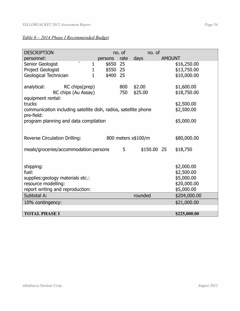
YELLOWJACKET 2012 Assessment Report Page 54
Table 6 – 2014 Phase I Recommended Budget
DESCRIPTION no. of no. ofpersonnel: persons rate days AMOUNTSenior Geologist ` 1 $650 25 $16,250.00Project Geologist 1 $550 25 $13,750.00Geological Technician 1 $400 25 $10,000.00
analytical: RC chips(prep) 800 $2.00 $1,600.00 RC chips (Au Assay) 750 $25.00 $18,750.00
equipment rental:trucks $2,500.00communication including satellite dish, radios, satellite phone $2,500.00pre-field:program planning and data compilation $5,000.00
Reverse Circulation Drilling: 800 meters x$100/m $80,000.00
meals/groceries/accommodation:persons 5 $150.00 25 $18,750
shipping: $2,000.00fuel: $2,500.00supplies:geology materials etc.: $5,000.00resource modelling: $20,000.00report writing and reproduction: $5,000.00Subtotal A: rounded $204,000.0010% contingency: $21,000.00
TOTAL PHASE I $225,000.00
Athabasca Nuclear Corp. August 2012
YELLOWJACKET 2012 Assessment Report Page 55
REFERENCES
ASH, C.H., 1994; Origin and Tectonic Setting of Ophiolitic Ultramafic and Related Rocks in the Atlin Area, British Columbia (NTS 104N); BC Ministry of Energy and Mines, Bulletin 94
ASH, C.H., 2001; Ophiolite Related Gold Quartz Veins in the North American Cordillera: BC Ministry of Energy and Mines Bulletin 108.
ASH, C.H., 2004; Geology of the Atlin Map Area, Northwestern British Columbia: BC. Ministry of Energy and Mines – Geoscience Map 2004-4.
British Columbia Small Mines Act Application for an Open Pit Mine and Gravity Concentrating Plant; Submitted by the Yellowjacket Joint Venture; April 2009
British Columbia Discharge Permit Application Technical Assessment Report; Submitted by the Yellowjacket Joint Venture; April 2009
DANDY, L., 2004; Technical Report on the Motherlode Property for American Creek Resources Ltd.; 43-101 Report.
DANDY, L., 2004; Technical Report on the Atlin Gold Property, Atlin, BC, for Muskox Minerals Corporation;
DANDY, L., 2005; Geological, Geochemical, Geophysical and Diamond Drilling Report on the Atlin Gold Property; BC Ministry of Energy and Mines Assessment Report.
DANDY, L., 2005; Technical Report on the Atlin Gold Property; 43-101 Report; prepared for Muskox Minerals Corp.
DANDY, L., 2006; Geological, Geophysical and Drilling Report on the Atlin Gold Property; prepared for Prize Mining Corp.
DANDY, L. and PRICE, B.J.; 2010; Technical Report on the Yellowjacket Gold Project; 43-101 Report; prepared for Eagle Plains Resources and Prize Mining Corp.
DEVINE, F.; 2010; Report on Bedrock Geological Mapping at the Rock of Ages Pit, Yellowjacket Property, Atlin Area, B.C.; Internal Report for Eagle Plains Resources Ltd prepared by Merlin Geosciences Inc.
DEVINE, F.; 2013; Update on Bedrock Mapping at the Rock of Ages Pit, Yellowjacket Property, Atlin Area, B.C.; Internal Report for Eagle Plains Resources Ltd prepared by Merlin Geosciences Inc.
EVANS, B.T., 2003; Geological Report on the Muskox Minerals Corp. Yellowjacket Property; 43-101 Technical Report.
GALLAGHER, C.S. And KATAY, F.; 2011; Report on 2010 Reverse Circulation Drilling Program at the Yellowjacket Project; Internal Report for Eagle Plains Resources Ltd.
HABIB, S., 2004; Project Report Yellowjacket Claims, Atlin, BC: Unpublished Report for Muskox Minerals Corp.
KATAY, F., 2009; Field Report on 2009 Grade Control, Pine Pit, Yellowjacket Property; EPL Internal Report.
Athabasca Nuclear Corp. August 2012
YELLOWJACKET 2012 Assessment Report Page 56
KICKBUSH, I.,2012; Memorandum on HLEM Survey at Yellowjacket Property; Internal report prepared for Yellowjacket Resources Ltd. By Aurora Geosciences Ltd.
MONGER, J.W.H., 1975; Upper Paleozoic Rocks of the Atlin Terrane, Northwestern British Columbia and South-Central Yukon: Geological Survey of Canada Paper 74-47.
MARUD, D.E., 1987; Surface Drilling North and South Claim Groups, Yellowjacket Property; Summary Report dated October 1987.
MARUD, D.E. and SOUTHAM, P., 1988; Diamond Drilling North and South Claim Groups, Yellowjacket Property; Summary Report dated December 1988.
MCIVOR, D.F., 1988; Geological Mapping, Lithogeochemical Sampling and Geophysical Survey Programs on the Yellowjacket Property; Summary Report dated January 1988.
MCIVOR, D.F., 1988; The Results of a Rotary Reverse-Circulation Drilling Program, Atlin Area Properties; Engineer’s Report dated January 1988.
MINFILE, BC Ministry of Energy and Mines
PRICE, B.J. and DANDY, L., 2010; Technical Report on the Yellowjacket Gold Project; 43-101 Report; prepared for Eagle Plains Resources and Prize Mining Corp.
RODIONOV, A., 2004; Report on a HummingbirdTM Magnetic and Electromagnetic Airborne Geophysical Survey: Unpublished Report for Muskox Minerals Corp. from Canamera Geoscience Corp.
RONNING, P.A., 1986; Diamond Drilling and Geophysical Work Yellowjacket Property: Summary Report dated December 1986.
SCHROETER, T.G. and PINSENT, R.H., 2000; Gold Production, Resources and Total Inventories in British Columbia (1858-1998): BC Ministry of Energy and Mines, Open File 2000-2.
WATKINS, J.J. and ATKINSON, M. 1985: Report of Work on the Cal 11 Mineral Claim, Atlin Mining Division. B.C. Report done for Pan Island Resources Corp.
WATKINS, J.J. and ATKINSON, M. 1985: Report of Work, Geology, Magnetometer and Rotary Drill Program. Yellowjacket Property, Arent Claim Group, Atlin Mining Division British Columbia. Report done for Canova Resources Ltd. and Tri-Pacific Resources Ltd.
Athabasca Nuclear Corp. August 2012
YELLOWJACKET 2012 Assessment Report Page 57
APPENDIX ISTATEMENT OF QUALIFICATIONS
Athabasca Nuclear Corp. August 2012

YELLOWJACKET 2012 Assessment Report Page 58
I, Charles Claude Downie, hereby certify that:
I am a Geologist and Vice President Exploration for Eagle Plains Resources Ltd. having an office at Suite 200, 44-12th Ave.S. Cranbrook, BC V1C 2R7
I am a graduate of the University of Alberta with the degree of Bachelor of Science (1988).
I am a member of the Association of Professional Engineers and Geoscientists of British Columbia(Registration No. 20137).
I have practiced my profession in since graduation in 1988 having worked as an employee and consultant for Major Mining Corporations and Junior Resource Companies.
I have read the definition of “Qualified Person” set out in National Instrument 43- 101 and, as a result of my experience and qualifications, I am a Qualified Person as defined in National Instrument 43–101.
This report is based upon a personal examination of all available company and government reports pertinent to the subject property. I have also directly supervised the exploration and development programs undertaken on the property between March 2009 and the present.
I supervised the 2012 Reverse Circulation drilling program at the Yellowjacket Project that forms part of this report.
In the disclosure of information relating to title of the claims I have relied on the information provided by Eagle Plains Resources Ltd. and the BC Mineral titles website
My most recent visit to the site was on July 20 2013.
At the effective date of the technical report, to the best of the my knowledge, information, and belief, the technical report, or part that the qualified person is responsible for, contains all scientific and technical information that is required to be disclosed to make the technical report not misleading.
Dated at Cranbrook, British Columbia this 12h day of August, 2013 (signature and effective date),
“Signed and Sealed”
“C.C (Chuck) Downie”Charles Downie, P.Geo. Qualified Person
Athabasca Nuclear Corp. August 2012

YELLOWJACKET 2012 Assessment Report Page 59
APPENDIX IISTATEMENT OF EXPENDITURES
Athabasca Nuclear Corp. August 2012
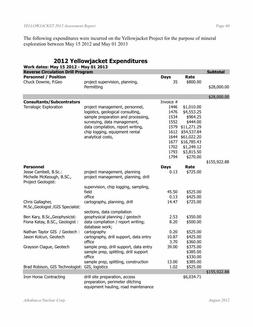
YELLOWJACKET 2012 Assessment Report Page 60
The following expenditures were incurred on the Yellowjacket Project for the purpose of mineral exploration between May 15 2012 and May 01 2013
2012 Yellowjacket ExpendituresWork dates: May 15 2012 - May 01 2013Reverse Circulation Drill Program SubtotalPersonnel / Position Days RateChuck Downie, P.Geo project supervision, planning, 35 $800.00
Permitting $28,000.00
$28,000.00Consultants/Subcontrators Invoice # Terralogic Exploration project management, personnel, 1446 $1,010.00
logistics, geological consulting, 1476 $4,553.25sample preparation and processing, 1534 $964.25surveying, data management, 1552 $444.00data compilation, report writing, 1579 $11,271.29chip logging, equipment rental 1612 $54,537.84analytical costs, 1644 $61,022.20
1677 $16,785.431702 $1,249.121793 $3,815.501794 $270.00
$155,922.88Personnel Days RateJesse Cambell, B.Sc.: project management, planning 0.13 $725.00Michelle McKeough, B.SC., Project Geologist:
project management, planning, drill
supervision, chip logging, sampling, field 45.50 $525.00office 0.13 $425.00
Chris Gallagher, M.Sc.,Geologist /GIS Specialist:
cartography, planning, drill 14.47 $725.00
sections, data compilationBen Kary, B.Sc.,Geophysicist: geophysical planning / geotech 2.53 $350.00Fiona Katay, B.SC., Geologist : data compilation / report writing; 8.20 $500.00
database work;Nathan Taylor GIS / Geotech : cartography 0.20 $525.00Jason Kolcun, Geotech cartography, drill support, data entry 10.87 $425.00
office 3.70 $360.00Grayson Clague, Geotech sample prep, drill support, data entry 39.00 $375.00
sample prep, splitting, drill support $385.00office $330.00sample prep, splitting, construction 13.00 $385.00
Brad Robison, GIS Technologist: GIS, logistics 1.02 $525.00$155,922.88
Iron Horse Contracting drill site preparation, access $6,034.71preparation, perimeter ditchingequipment hauling, road maintenance
Athabasca Nuclear Corp. August 2012
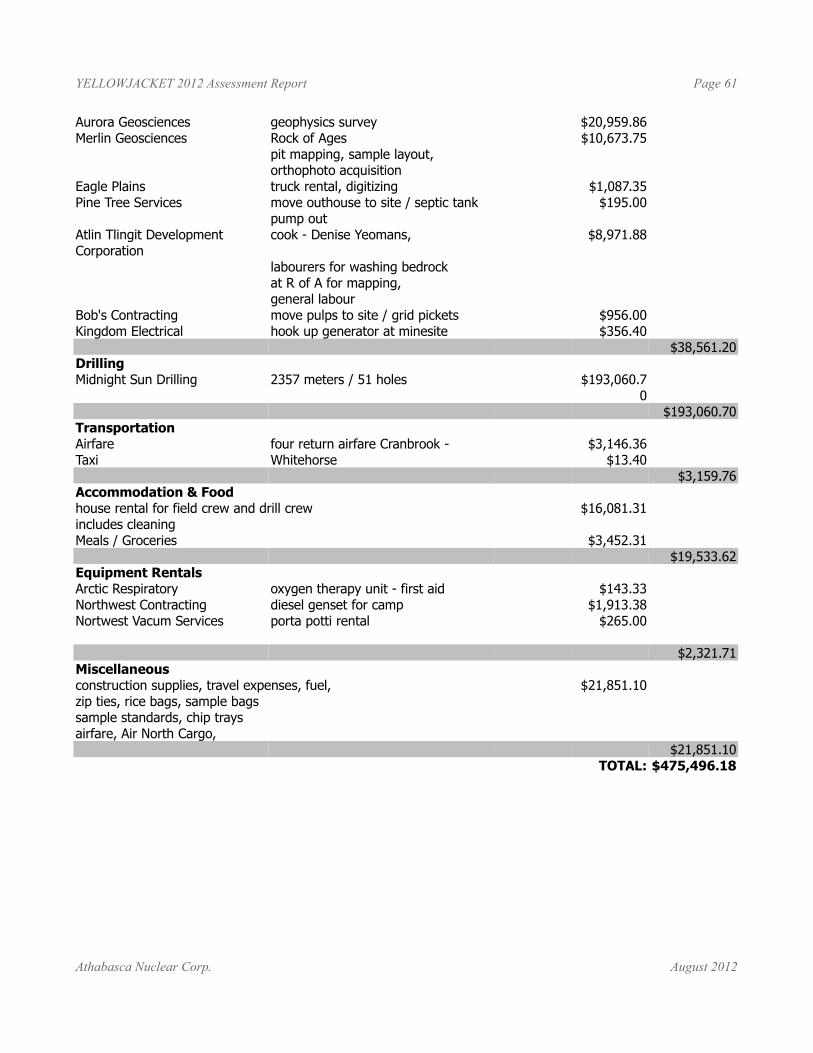
YELLOWJACKET 2012 Assessment Report Page 61
Aurora Geosciences geophysics survey $20,959.86Merlin Geosciences Rock of Ages $10,673.75
pit mapping, sample layout,orthophoto acquisition
Eagle Plains truck rental, digitizing $1,087.35Pine Tree Services move outhouse to site / septic tank $195.00
pump outAtlin Tlingit Development Corporation
cook - Denise Yeomans, $8,971.88
labourers for washing bedrock at R of A for mapping, general labour
Bob's Contracting move pulps to site / grid pickets $956.00Kingdom Electrical hook up generator at minesite $356.40
$38,561.20Drilling Midnight Sun Drilling 2357 meters / 51 holes $193,060.7
0$193,060.70
TransportationAirfare four return airfare Cranbrook - $3,146.36Taxi Whitehorse $13.40
$3,159.76Accommodation & Foodhouse rental for field crew and drill crew $16,081.31includes cleaningMeals / Groceries $3,452.31
$19,533.62Equipment RentalsArctic Respiratory oxygen therapy unit - first aid $143.33Northwest Contracting diesel genset for camp $1,913.38Nortwest Vacum Services porta potti rental $265.00
$2,321.71Miscellaneousconstruction supplies, travel expenses, fuel, $21,851.10zip ties, rice bags, sample bags sample standards, chip traysairfare, Air North Cargo,
$21,851.10TOTAL: $475,496.18
Athabasca Nuclear Corp. August 2012
YELLOWJACKET 2012 Assessment Report Page 62
APPENDIX IIIGEOCHEMICAL PROTOCOL
Athabasca Nuclear Corp. August 2012
YELLOWJACKET 2012 Assessment Report Page 63
SAMPLE PREPARATION, ANALYSIS AND SECURITYThe following relates to the 2012RC program at the Yellowjacket. Quality Assurance and Quality control for the 2010 program and for some historical work is included under a separate heading “Sampling Method and Approach”
All 2010 samples were collected by Terralogic Exploration Inc. employees. The sampling process is standardized and continually monitored for quality assurance and quality control. Both reverse circulation chips and channel samples were collected during this program.
Drill casing was set down to bedrock surface, and then bedrock was continuously sampled in 1.016m intervals (3 samples for every 10” drill string) for the entire length of the hole. Water was used during drilling due to the high clay and talc content of the rock, and samples were collected from a cyclone splitter at the drill. The coarse reject poly bags are saved on site, and the sample fraction in cloth bags were sent to Ecotech Labs for Au 4-500g FA analysis.
One area of concern in regards to the sampling is that some of the clays and fine material from the sample was lost during the drilling and splitting process as a result of the volume of water that was used. This may result in positively skewed Au values as some of the lightest and finest bulk material of the sample was lost.
Each sample was logged in order to later tie the sampling and assay results of the program to hosting lithologies, and to better map and understand the deposit. The geological samples were taken from the coarse rejects for lithological description. Each sample was washed, screened into a coarse fraction (>2mm) and a fine fraction (200μm – 2mm), and analyzed using a microscope to determine the lithology, degree of alteration, and mineralization.
The different lithologies were evident within each sample and could be plotted on strip logs and correlated through the section. There appeared to be little to no lithological contamination from upper zones within each sample. As the gold is hosted within the rock itself and found most often in quartz veining and silicified zones that seem to remain as intact chips, it is possible to assume that gold contamination between samples is also minimal. Potential contamination may occur where the rock was completely pulverized and the gold was liberated, however it is believed that this may be minimal. Other heavy minerals, such as the magnetite from the black sand in the placer gravels correlated well with overburden type, and therefore the air pressure used during sample circulation by the RC rig is thought to be adequate to also circulate all gold to surface as well.
All samples were sent to ALS Laboratories labs in Vancouver, BC, an ISO17025 accredited facility for Mineral Analysis Testing. Acme is completely independent of Athabasca Nuclear Corp.
Methods and Specifications for Analytical PackageSample PreparationSamples (minimum sample size 250g) are catalogued and logged into the sample-tracking database. During the logging in process, samples are checked for spillage and general sample integrity. It is verified that samples match the sample shipment requisition provided by the clients. The samples are transferred into a drying oven and dried.
Athabasca Nuclear Corp. August 2012
YELLOWJACKET 2012 Assessment Report Page 64
Drill core samples are crushed on a Terminator jaw crusher to -10 mesh ensuring that 70% passes through a Tyler 10 mesh screen. Every 35 samples a re-split is taken using a riffle splitter to be tested to ensure the homogeneity of the crushed material. A 250 gram sub sample of the crushed material is pulverized on a ring mill pulverizer ensuring that 95% passes through a -150 mesh screen. The sub sample is rolled, homogenized and bagged in a pre-numbered bag. A barren gravel blank is prepared before each job in the sample prep to be analyzed for trace contamination along with the processed samples.
Assay Gold Analysis (AU-4500) A 30 g sample size is fire assayed along with certified reference materials using appropriate fluxes. The flux used is pre-mixed, purchased from Anachemia which contains Cookson Granular Litharge. (Silver and Gold Free). The ratios are 66% Litharge, 24% Sodium Carbonate, 2.7% Borax, 7.3% Silica. (These charges may be adjusted with borax or silica based on the sample). Flux weight per fusion is 120g. Purified Silver Nitrate is used for inquartation. The resultant dore bead is parted and then digested with nitric and hydrochloric acid solutions and then analyzed on an atomic absorption instrument (Perkin Elmer/Thermo S-Series AA instrument). Gold detection limit on AA is 0.03-100 g/t. Any gold samples over 100g/t will be run using a gravimetric analysis protocol.
Appropriate certified reference material and repeat/re-split samples (Quality Control Components) accompany the samples on the data sheet for quality control assessment.
Ore Grade Overlimit Analysis
(BMEH-11, single element, BMEH-13, all elements) Note that “ore grade” in this case is a laboratory term and does not imply economic viability. Samples and standards undergo an oxidizing digestion in 200 ml phosphoric flasks with final solution in aqua regia solution. Appropriate standards and repeat/re-split samples (Quality Control Components) accompany the samples on the data sheet.
The digested solutions are made to volume with RO water and allowed to settle. An aliquot of the sample is analyzed on a Perkin Elmer/Thermo S-Series AA instrument.
Instrument calibration is done by verified synthetic standards, which have undergone the same digestion procedure as the samples. Standards used narrowly bracket the absorbance value of the sample for maximum precision.
Results are collated and are printed along with accompanying quality control data (repeats, re-splits, and standards).
SecurityAll samples were collected by Terralogic Exploration Services Inc. employees. Samples were placed in rice bags and sealed with cable ties and shipped directly to the ALS analytical laboratory prep lab in Whitehorse, Yukon. Sample cataloging and shipping was overseen by either Chuck Downie, Michelle McKeough or Grayson Clague. There were no irregularities noted by the laboratories with respect to the sample shipment, therefore, the author has no reason to believe that the security of the samples was compromised in any way.
ALS is registered for ISO 9001:2008 by QMI Quality registrars for the “provision of assay, geochemical and environmental analytical services”. ALS also Participates in The Canadian Certified Reference Materials Project (CCRMP) testing program annually.
Athabasca Nuclear Corp. August 2012
YELLOWJACKET 2012 Assessment Report Page 65
APPENDIX IVANALYTICAL CERTIFICATES
Athabasca Nuclear Corp. August 2012
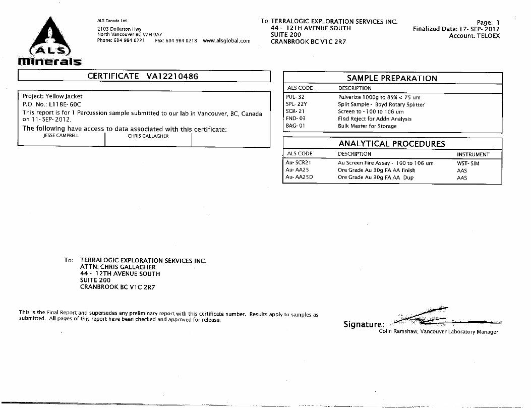
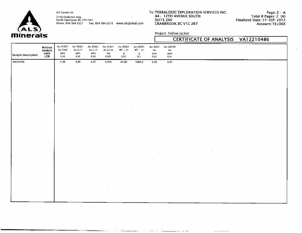

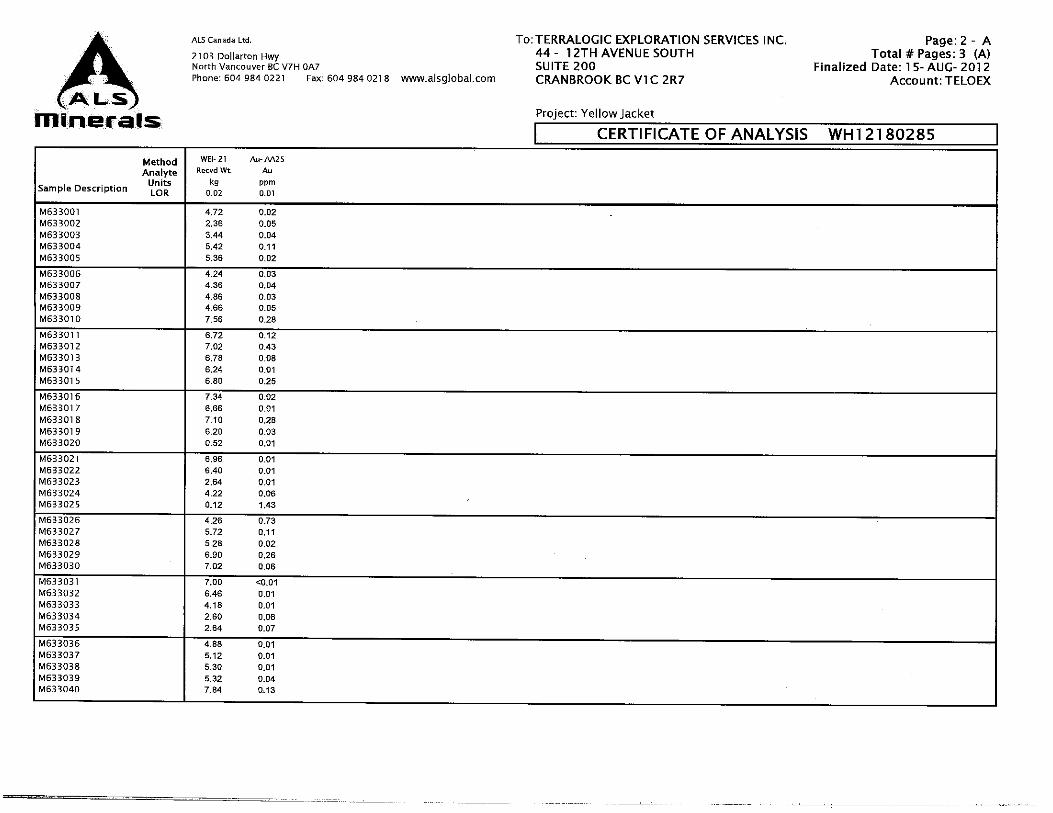
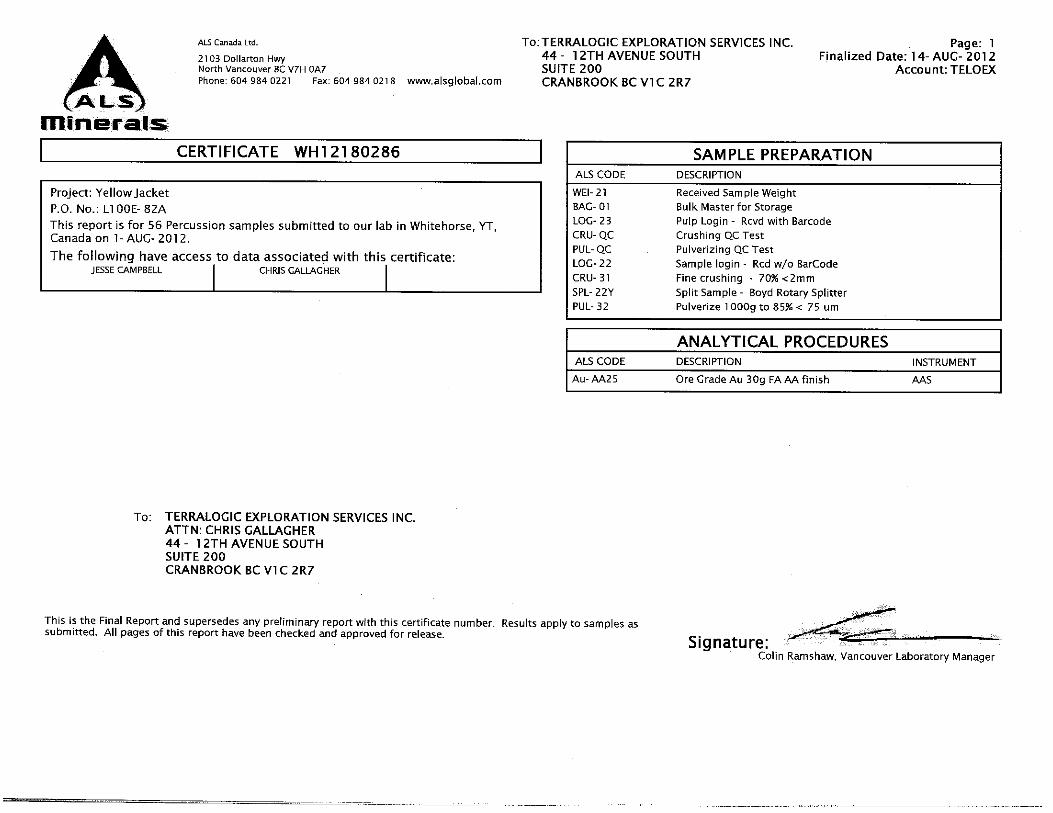
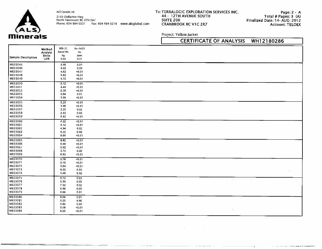
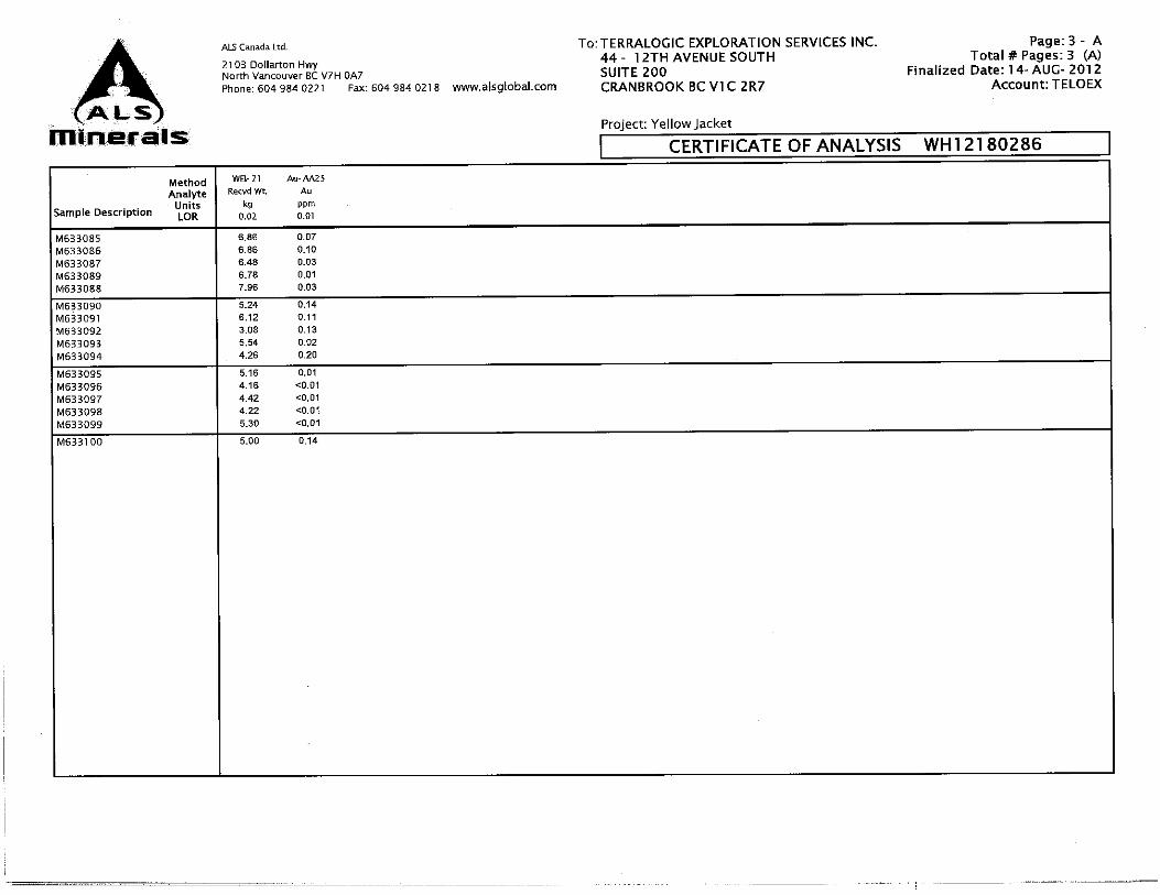
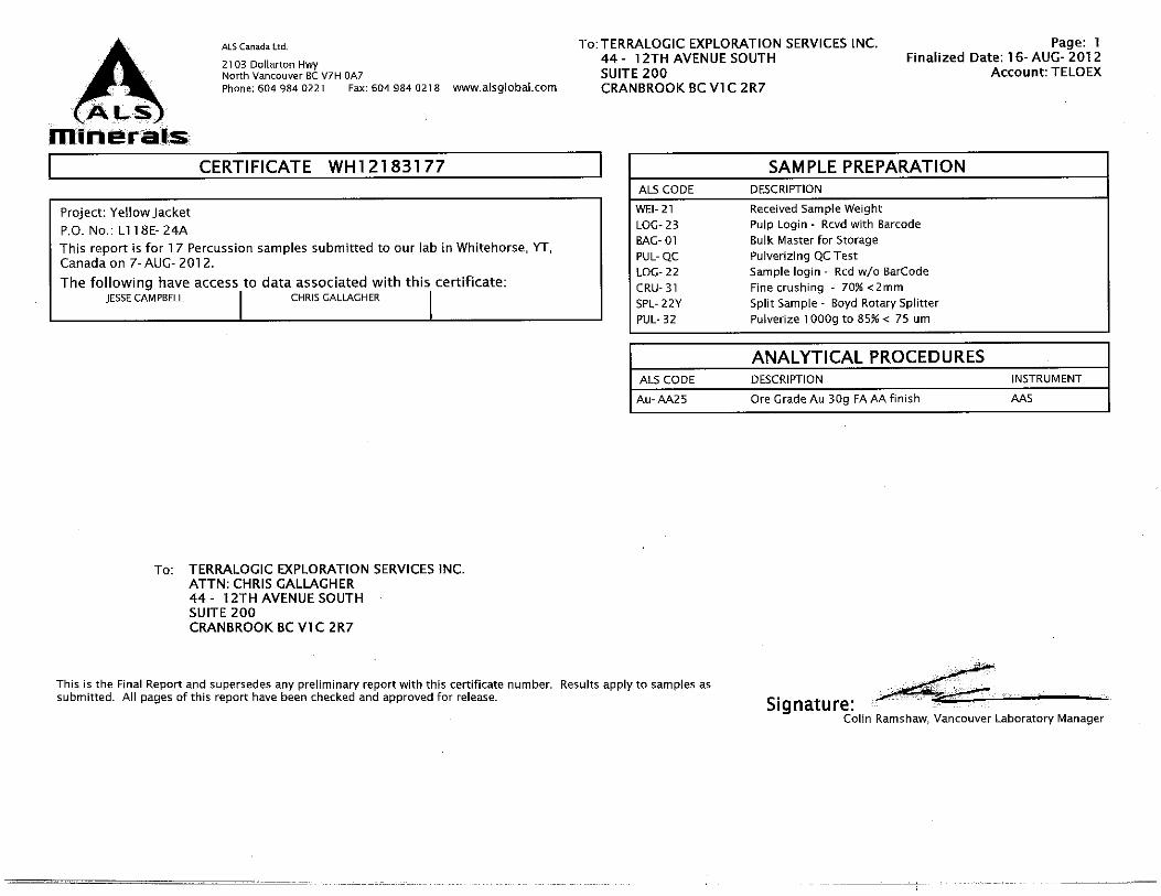
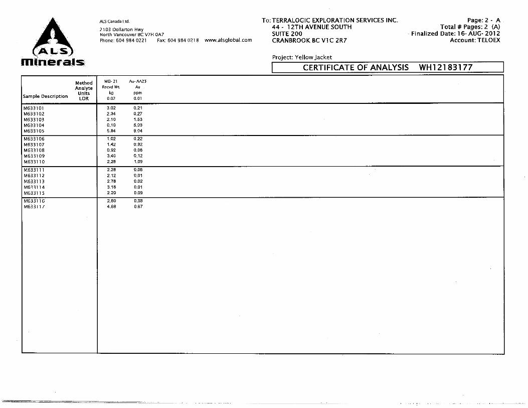
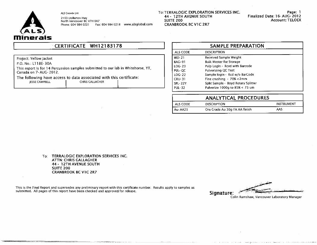
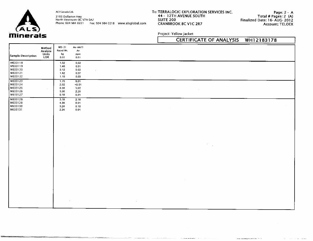
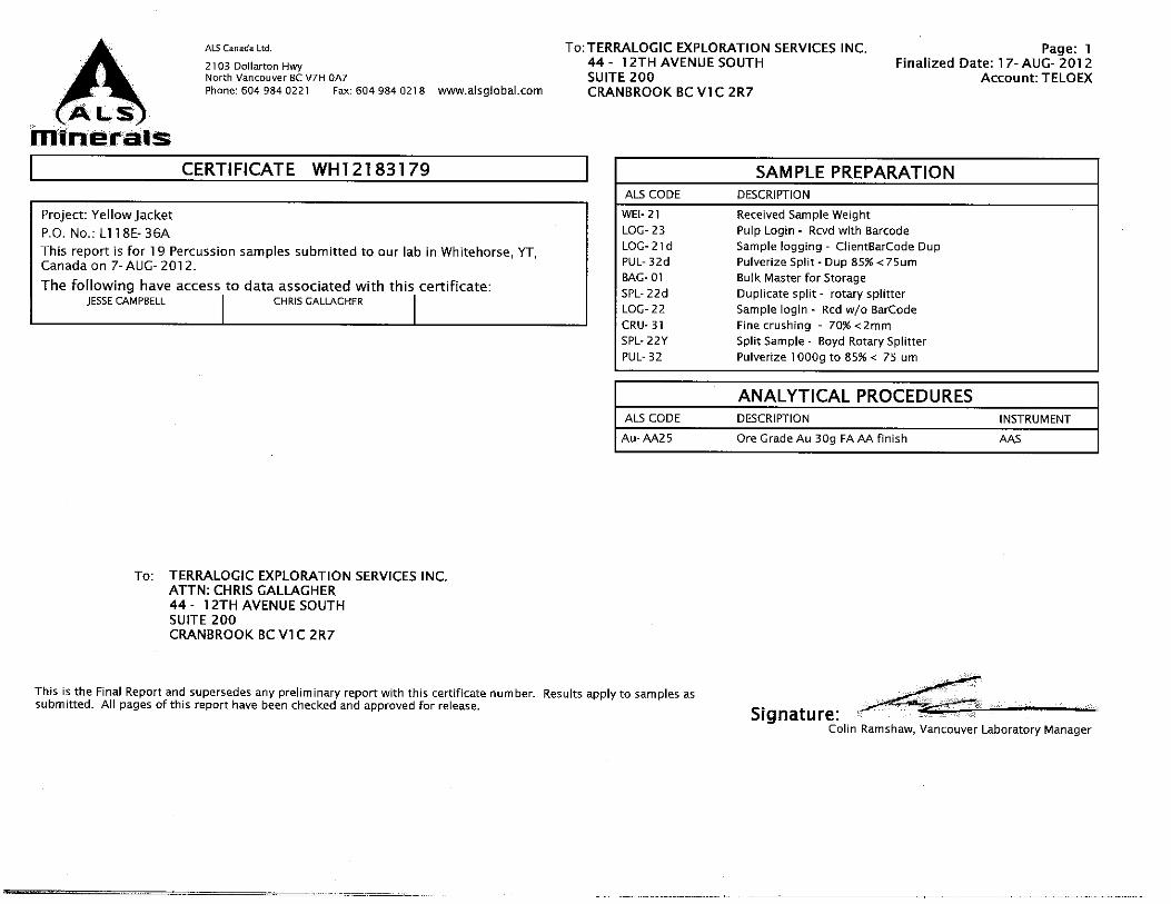
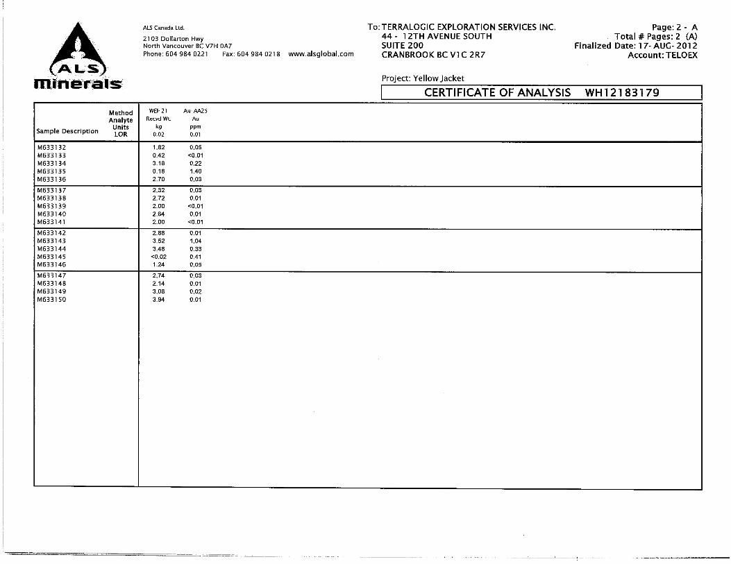
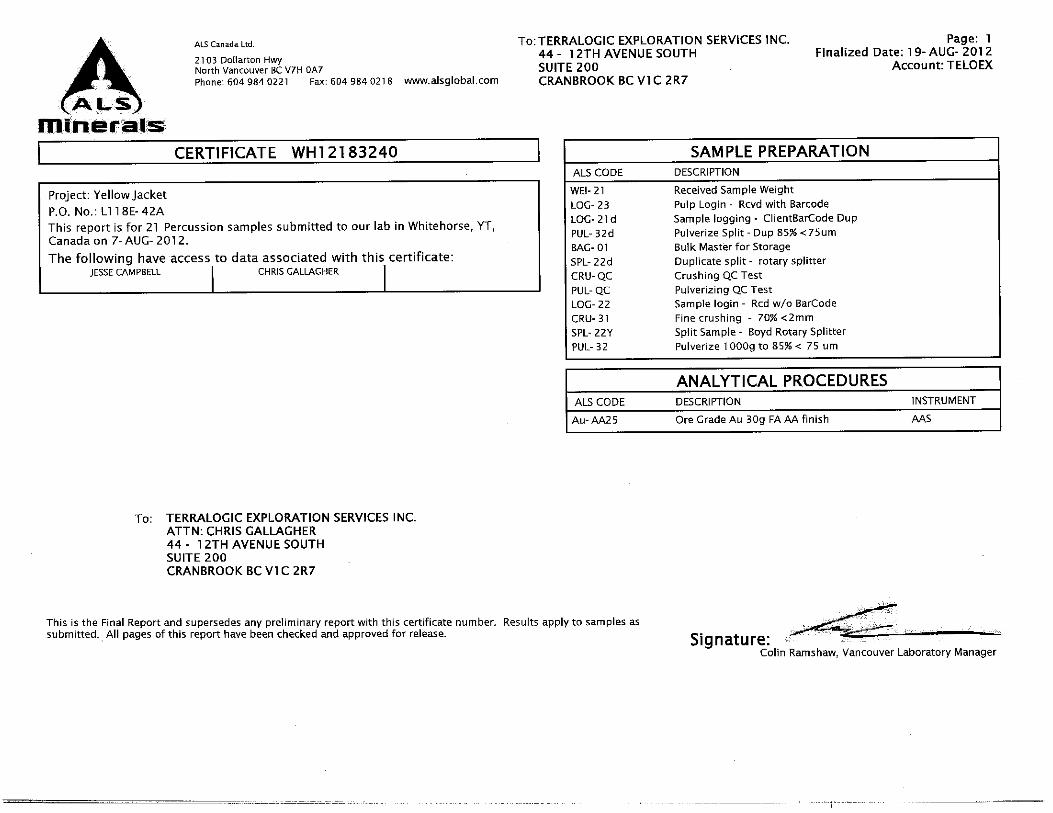
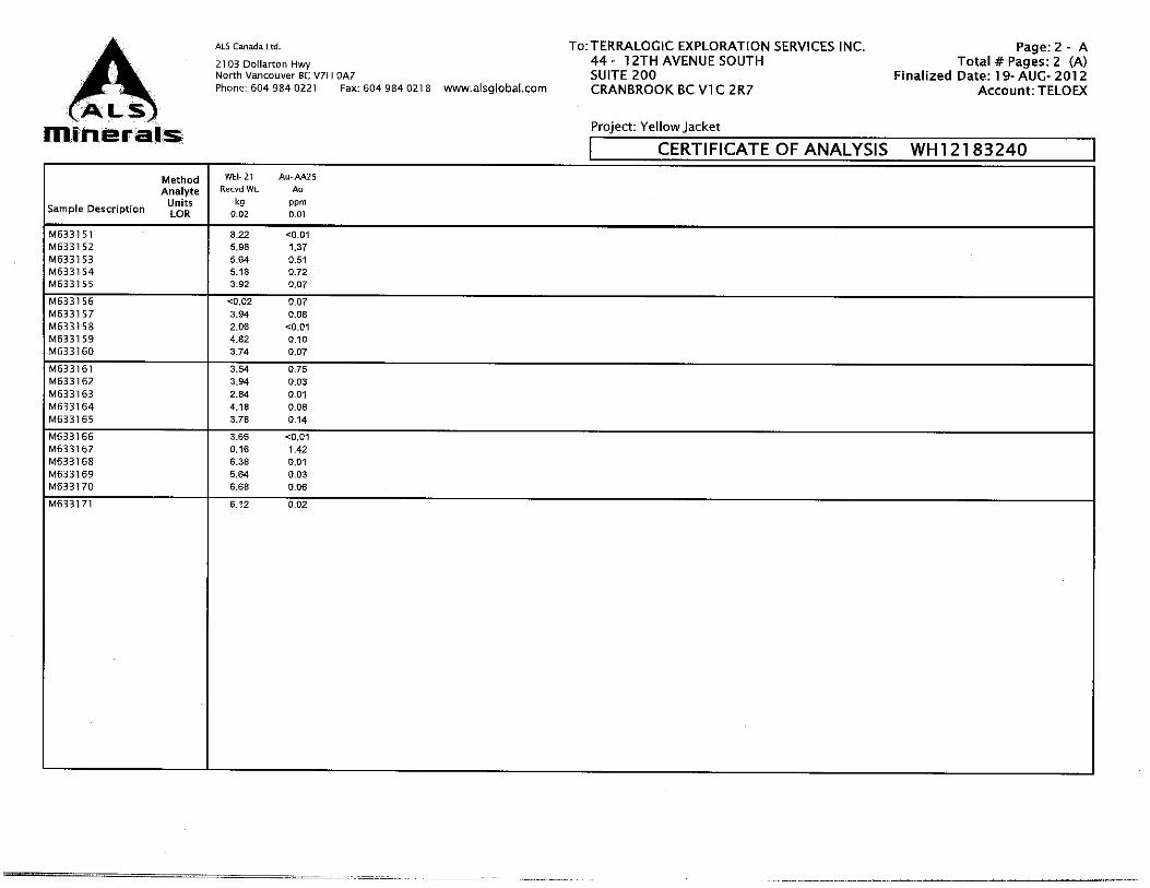
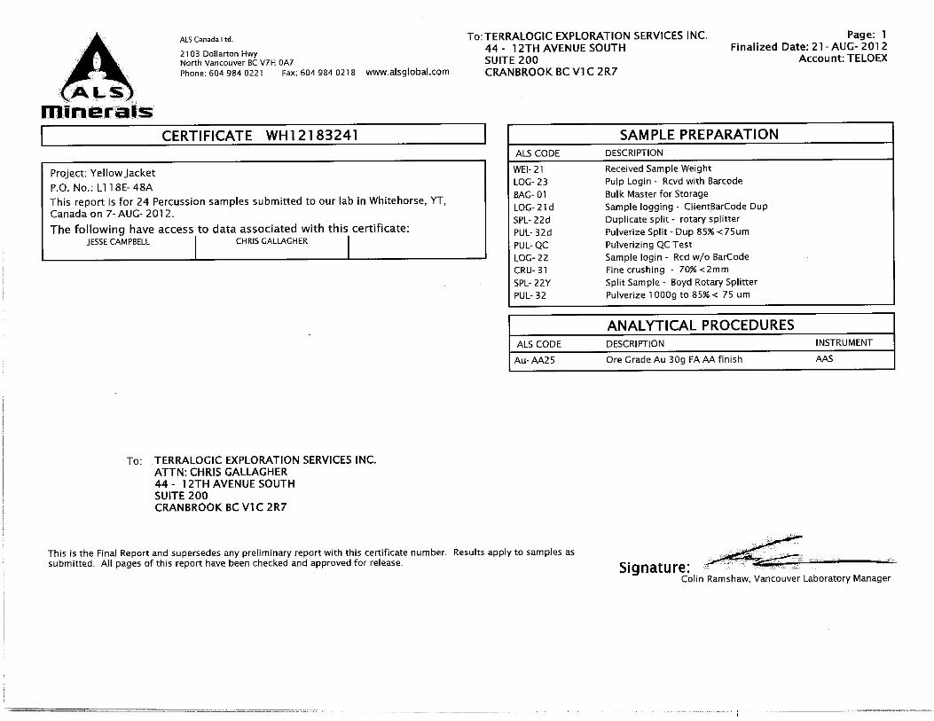
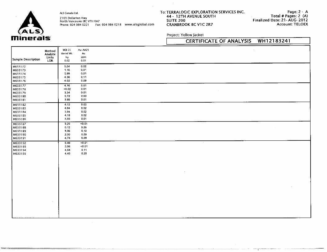
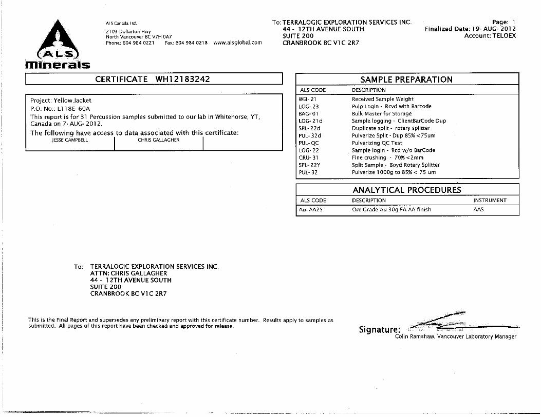
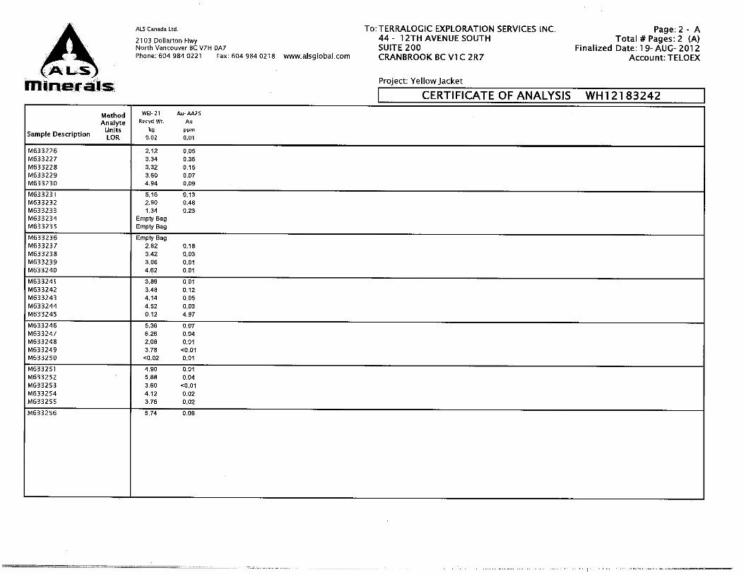
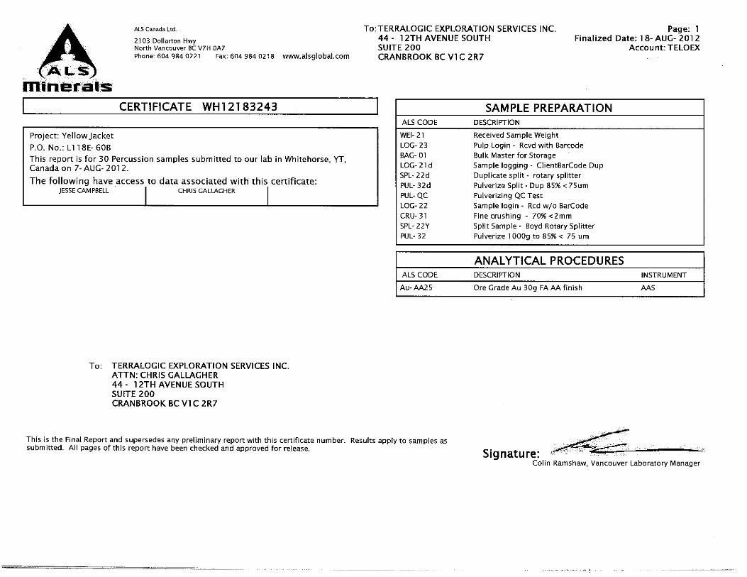
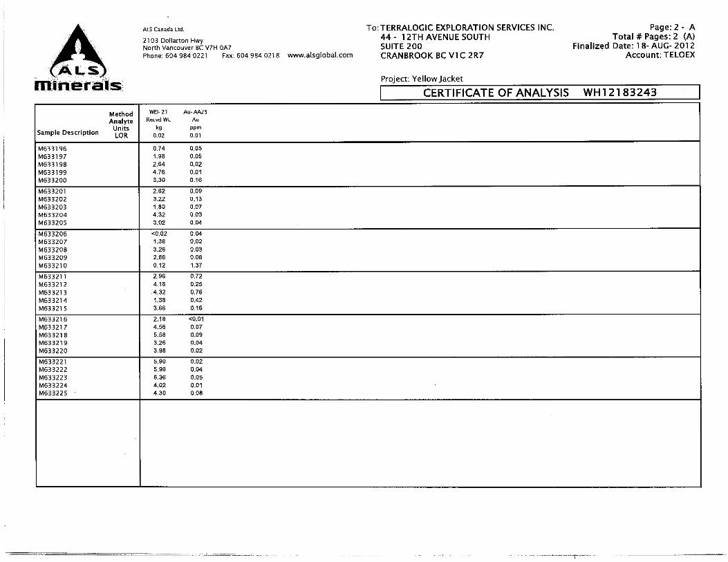
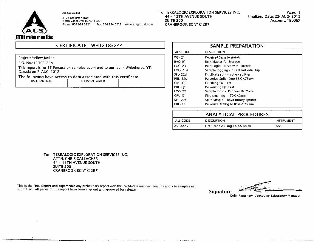
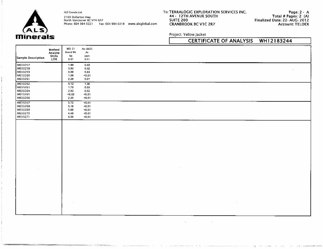
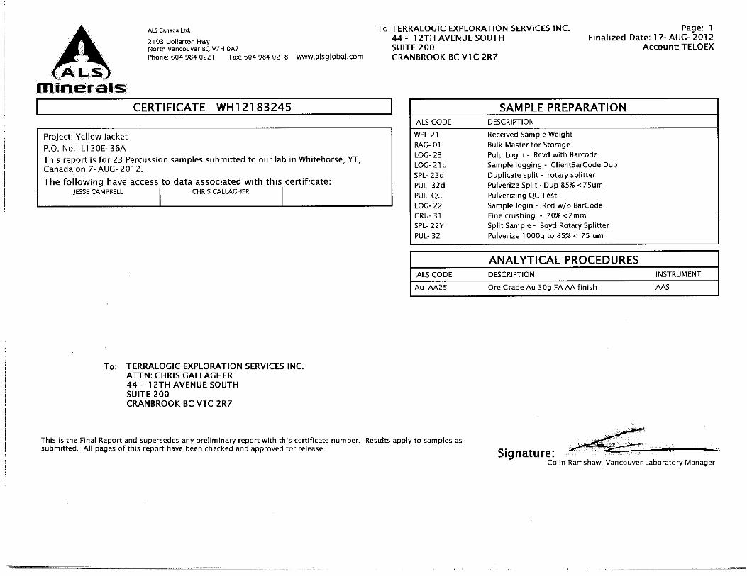


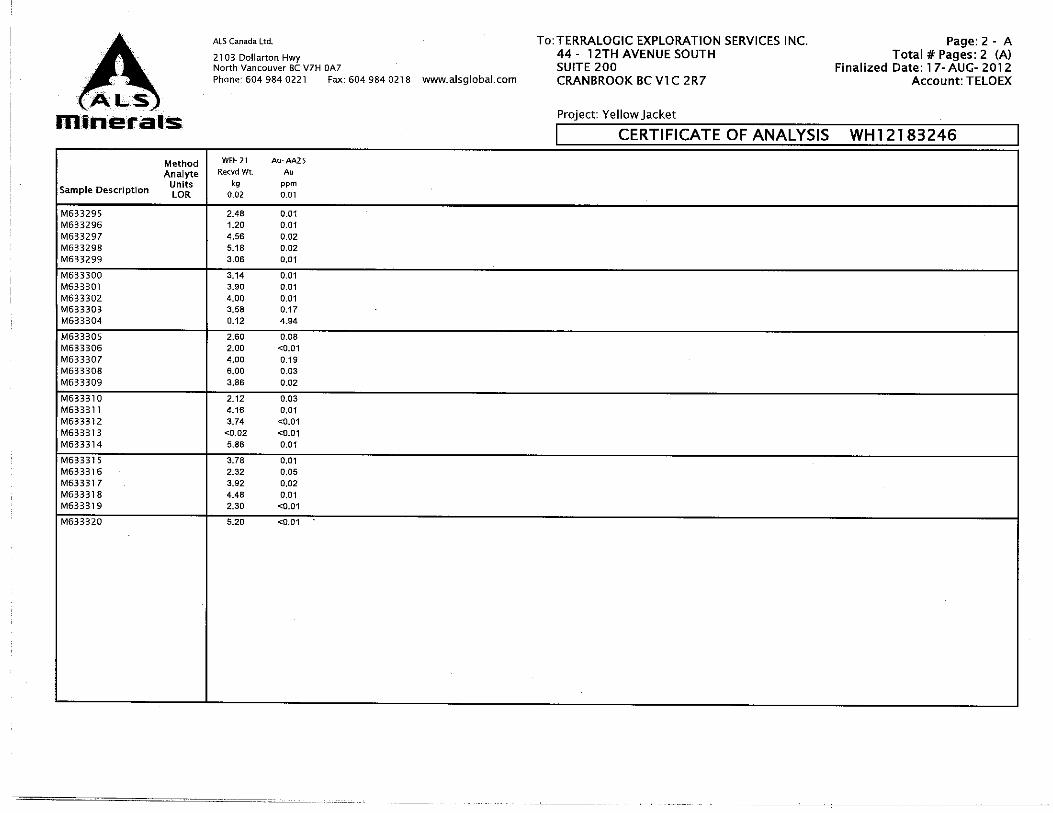

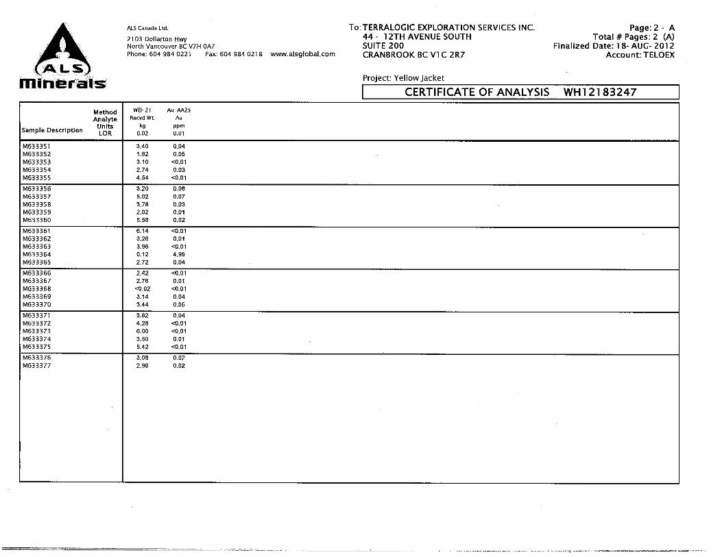
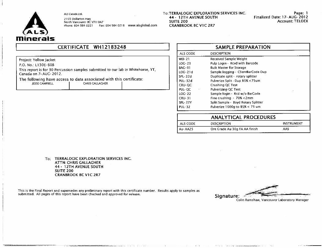
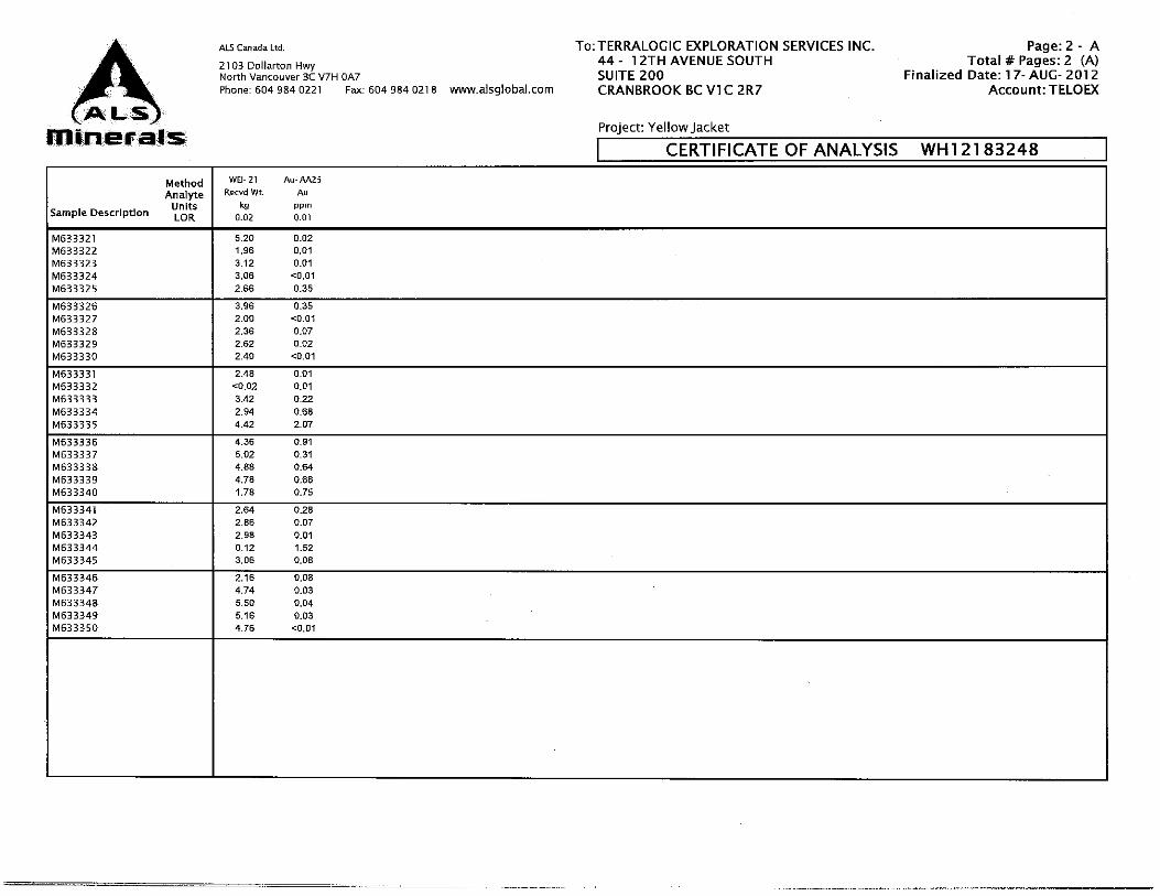

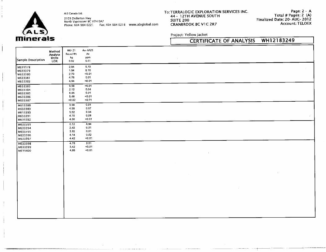
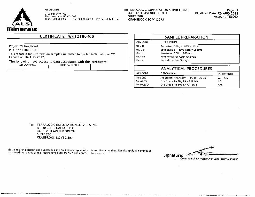
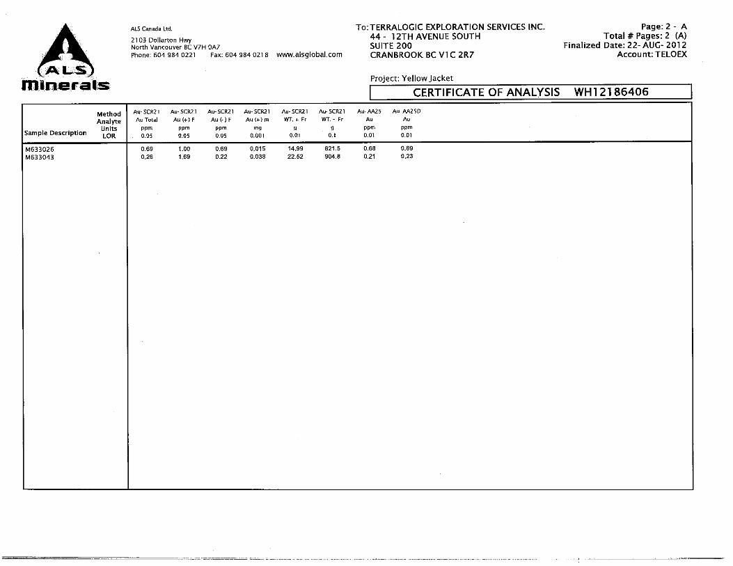
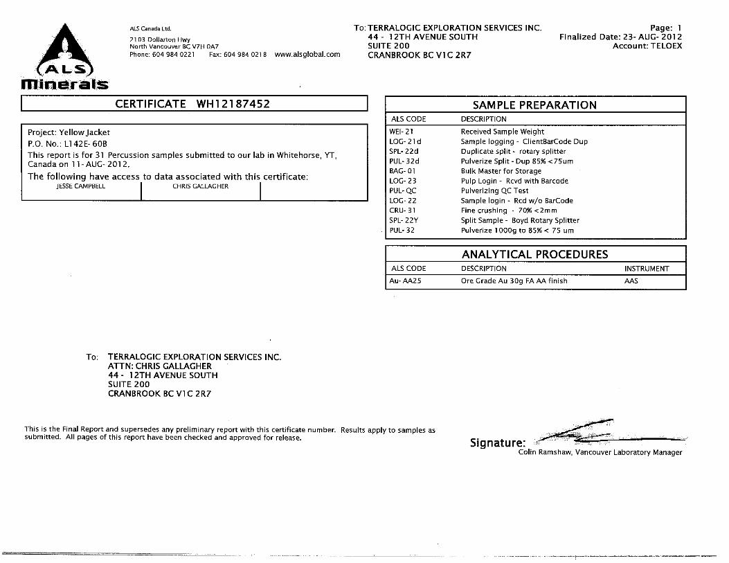
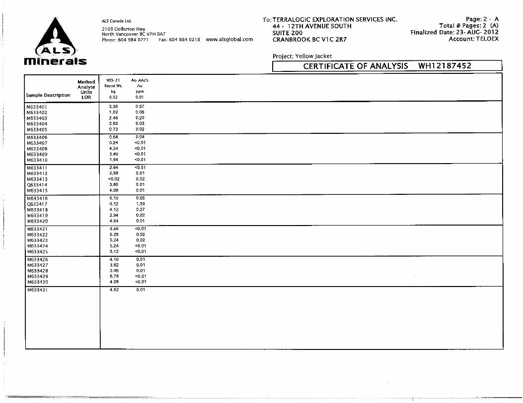
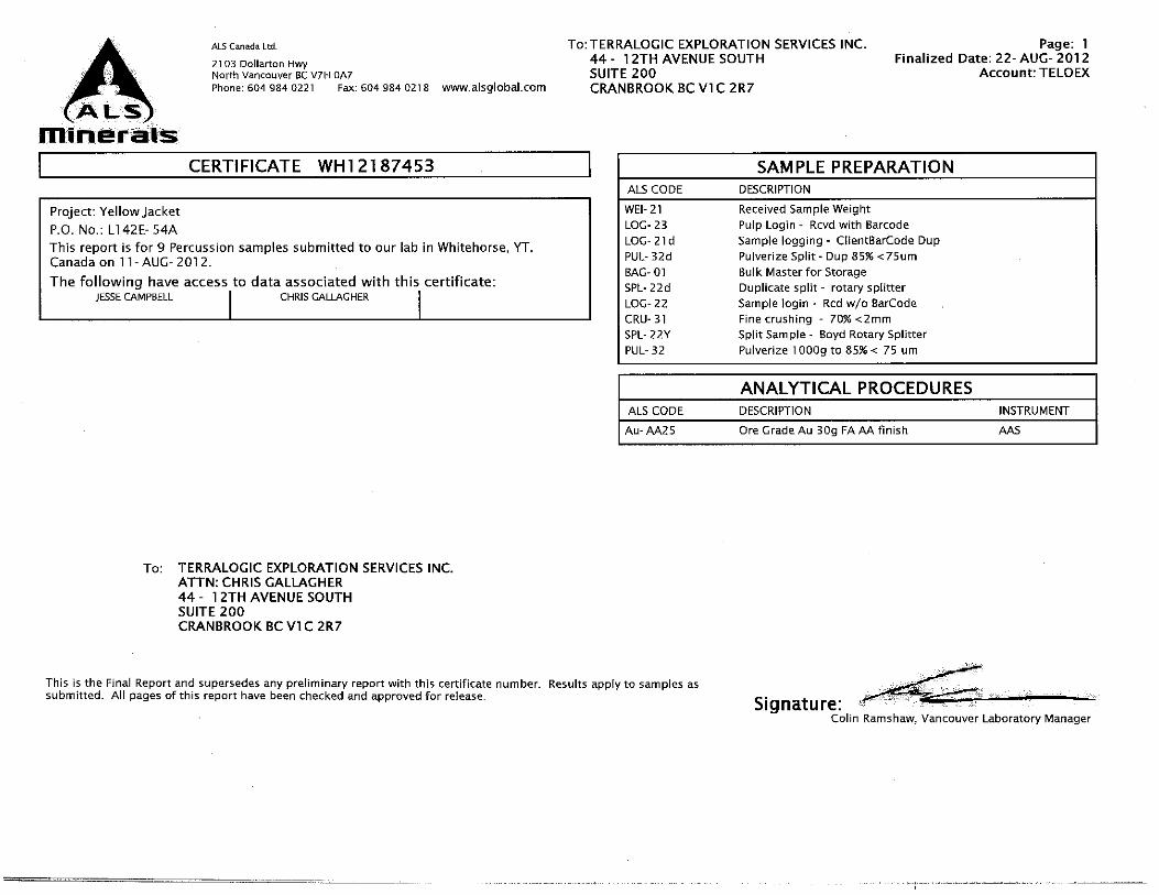
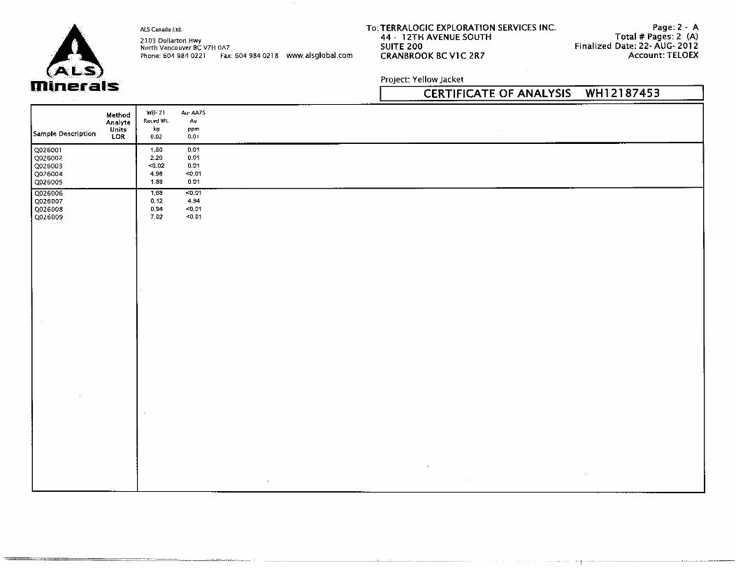
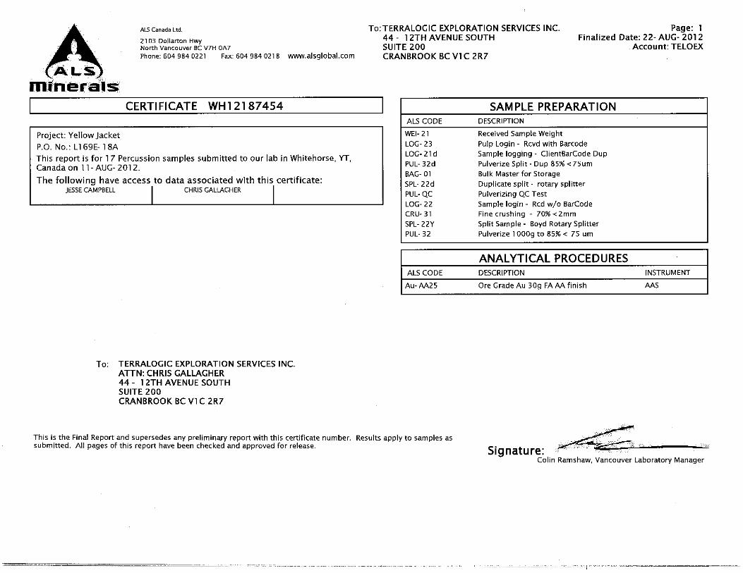
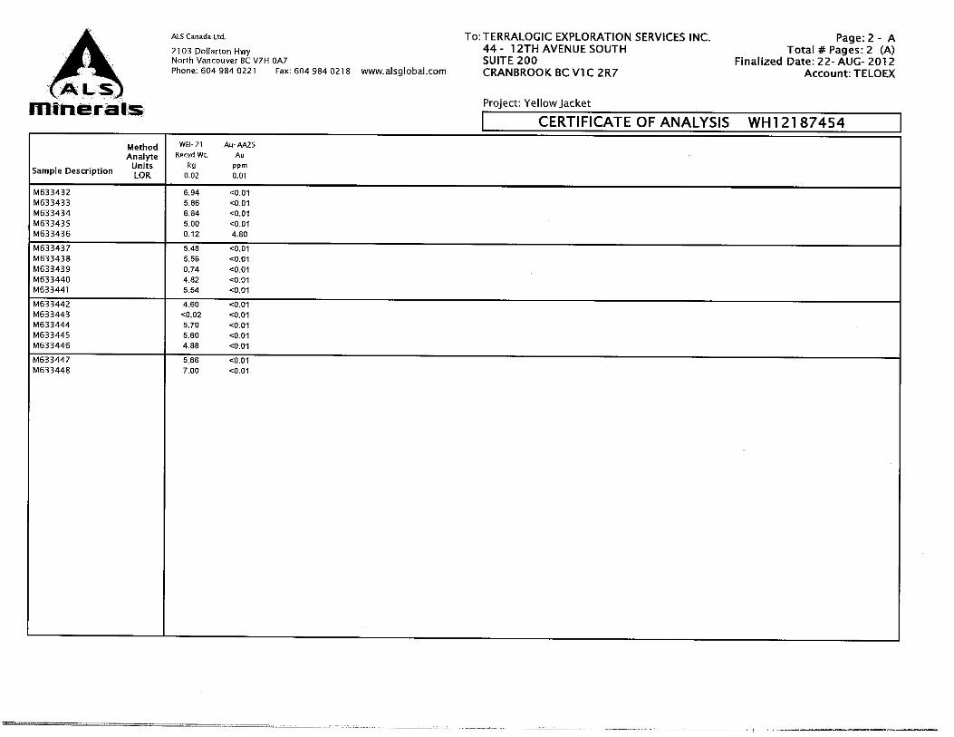
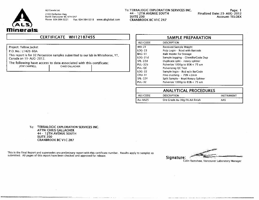
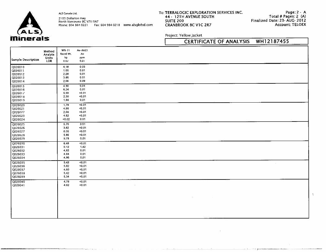

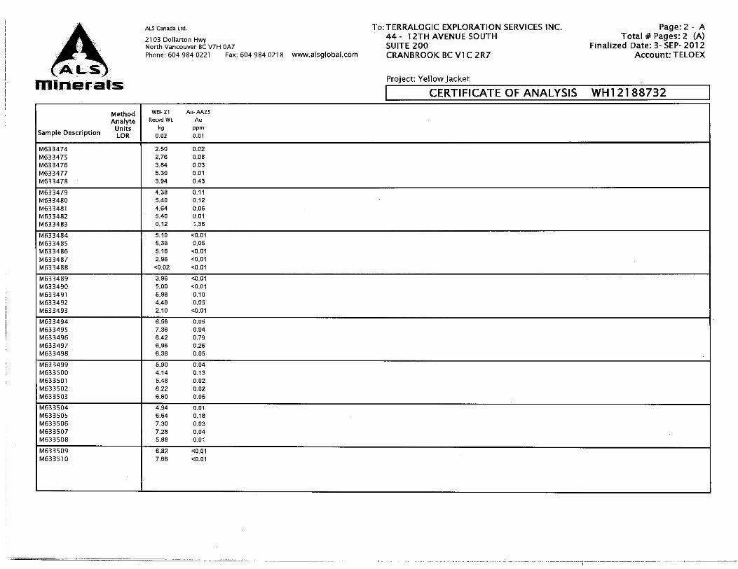

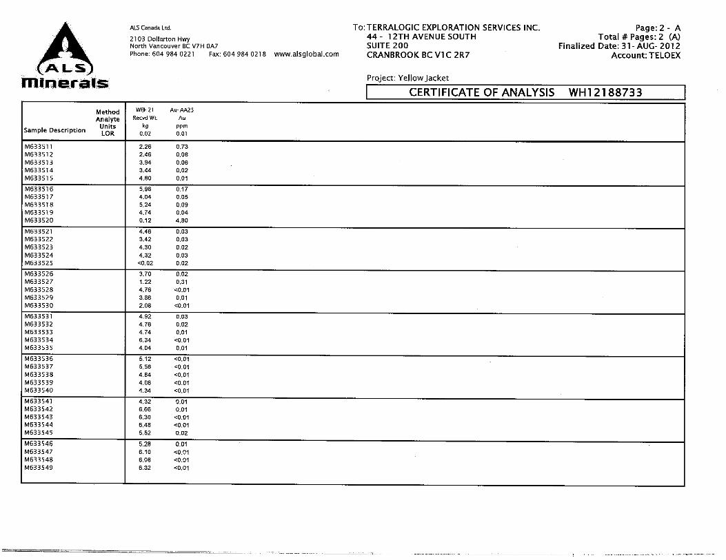
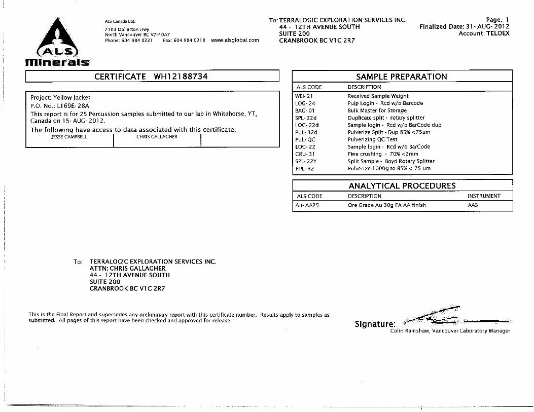
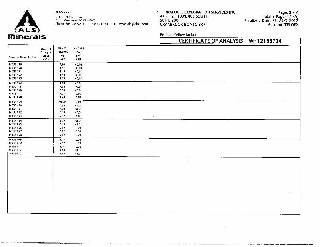
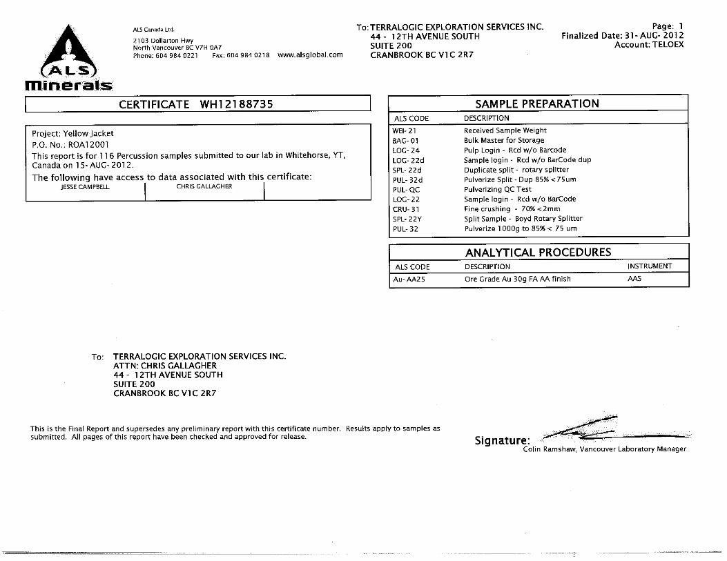
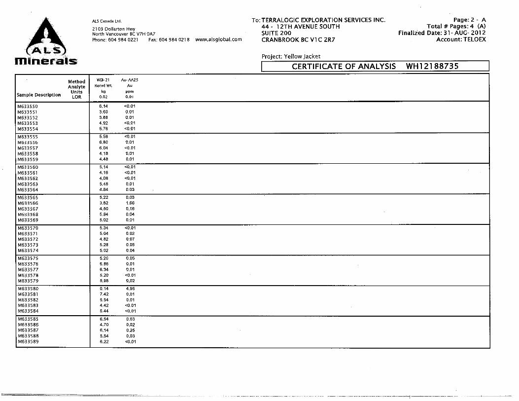
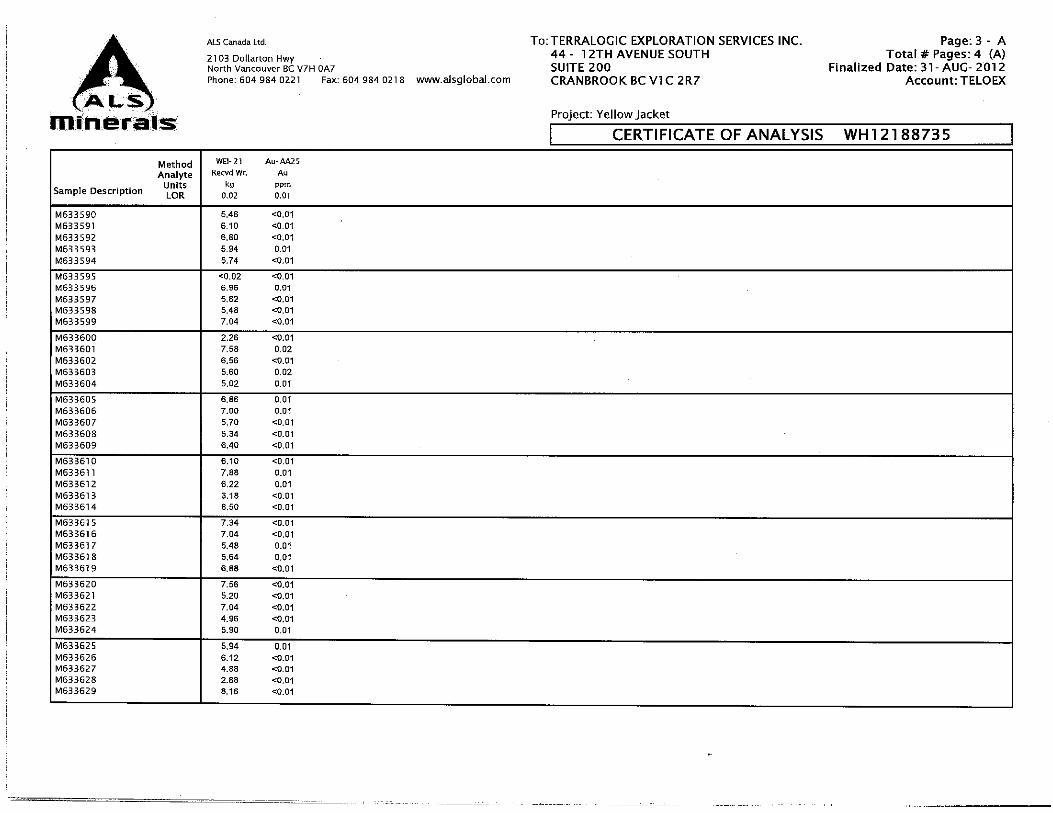
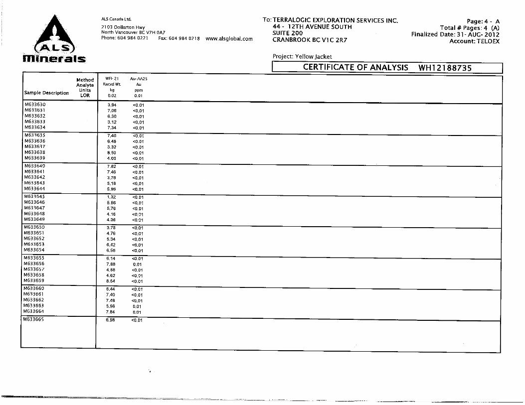


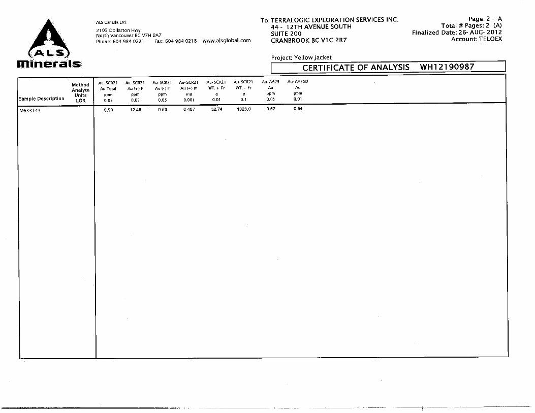
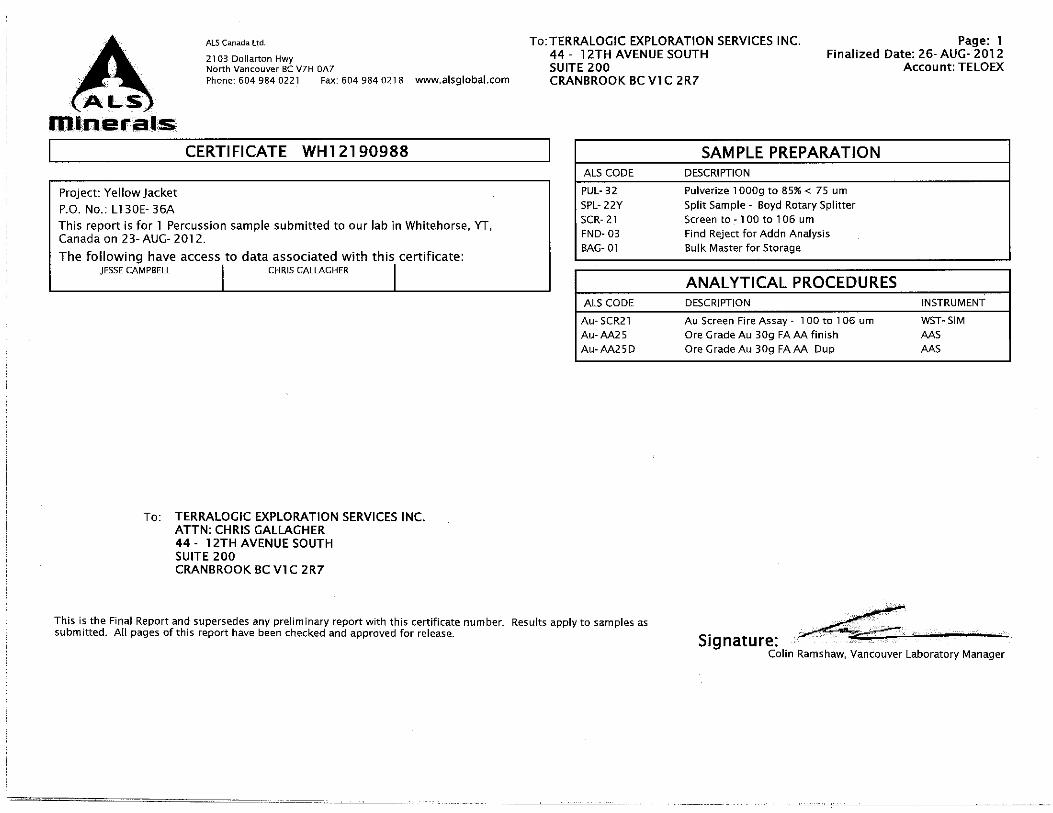
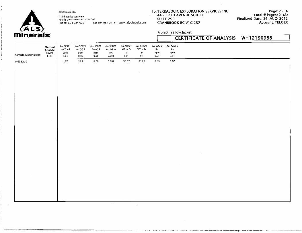
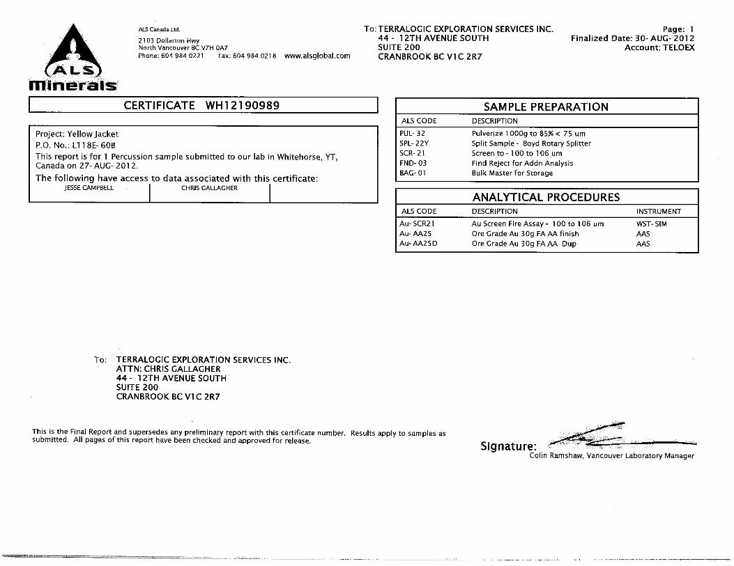
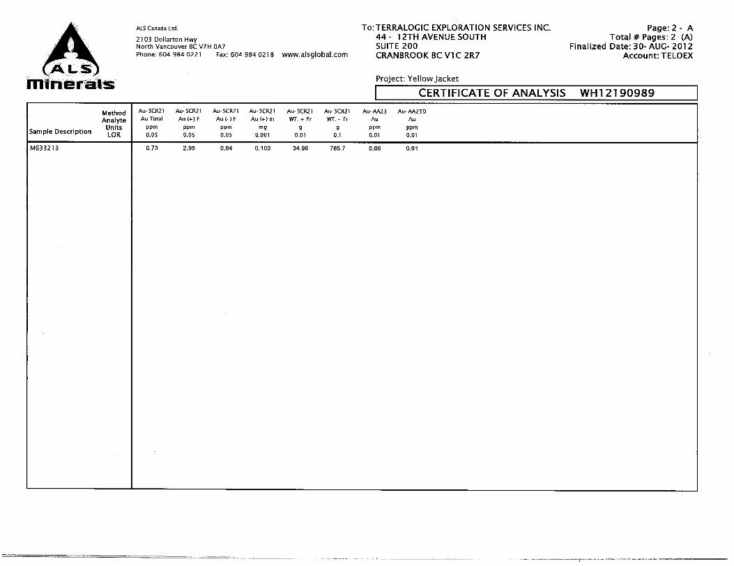
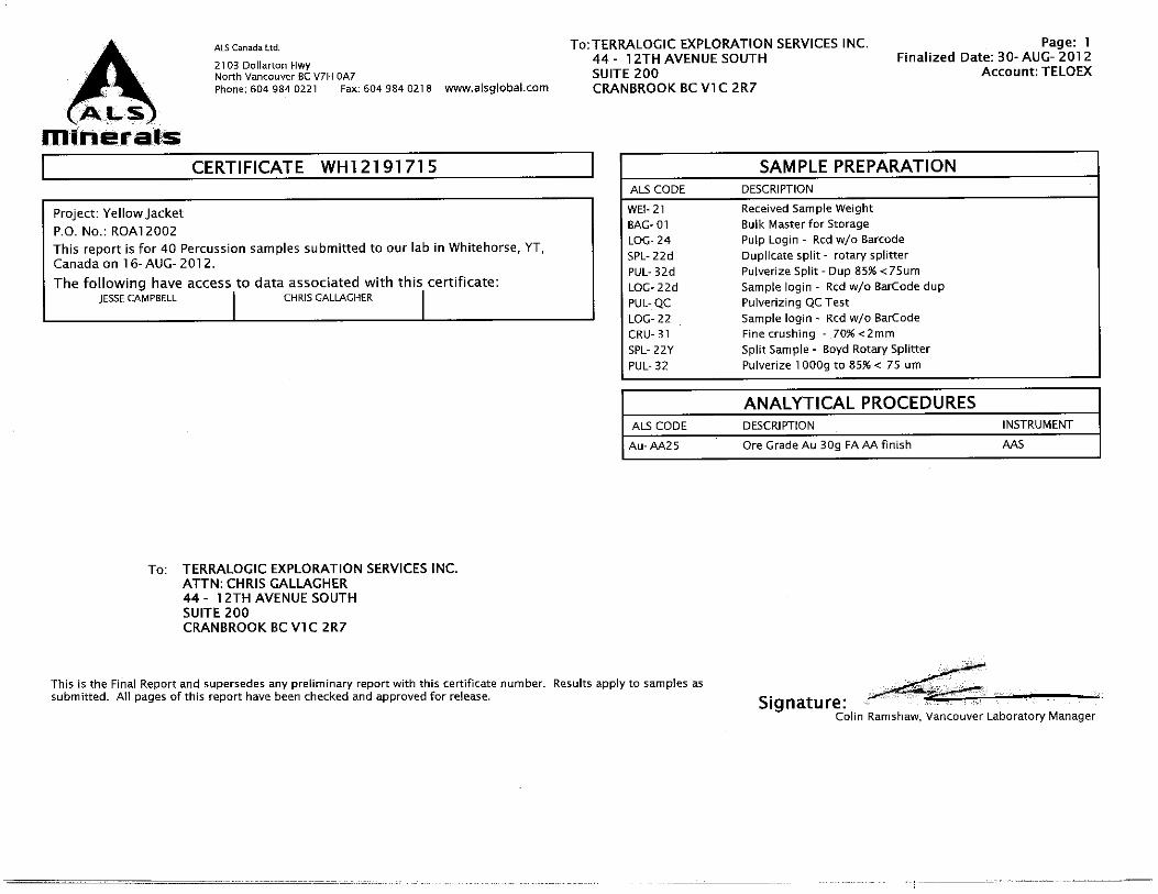
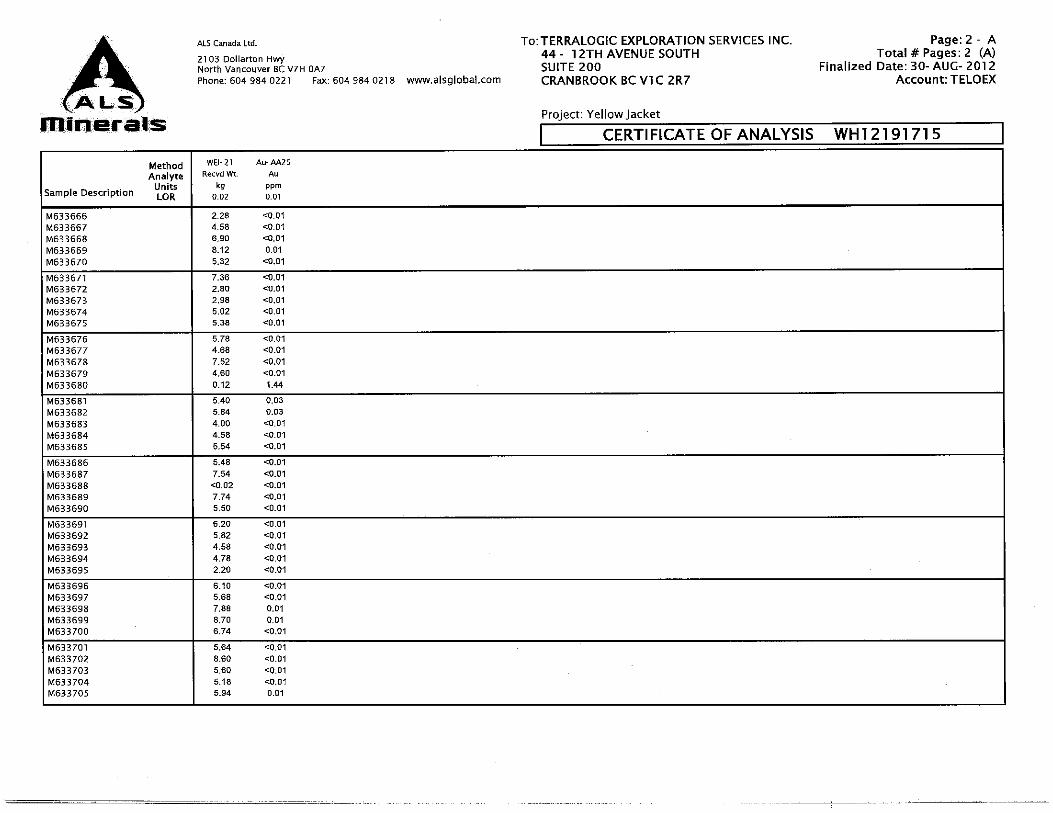

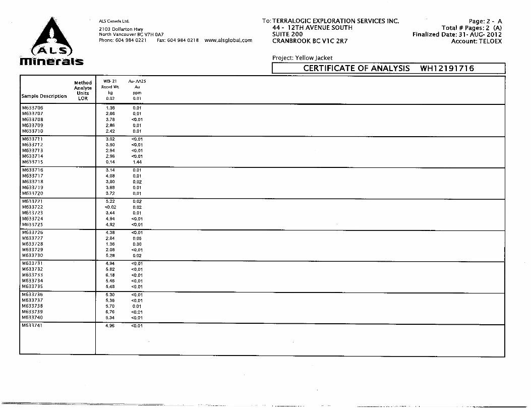
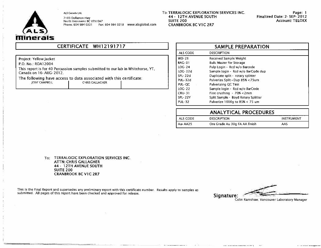
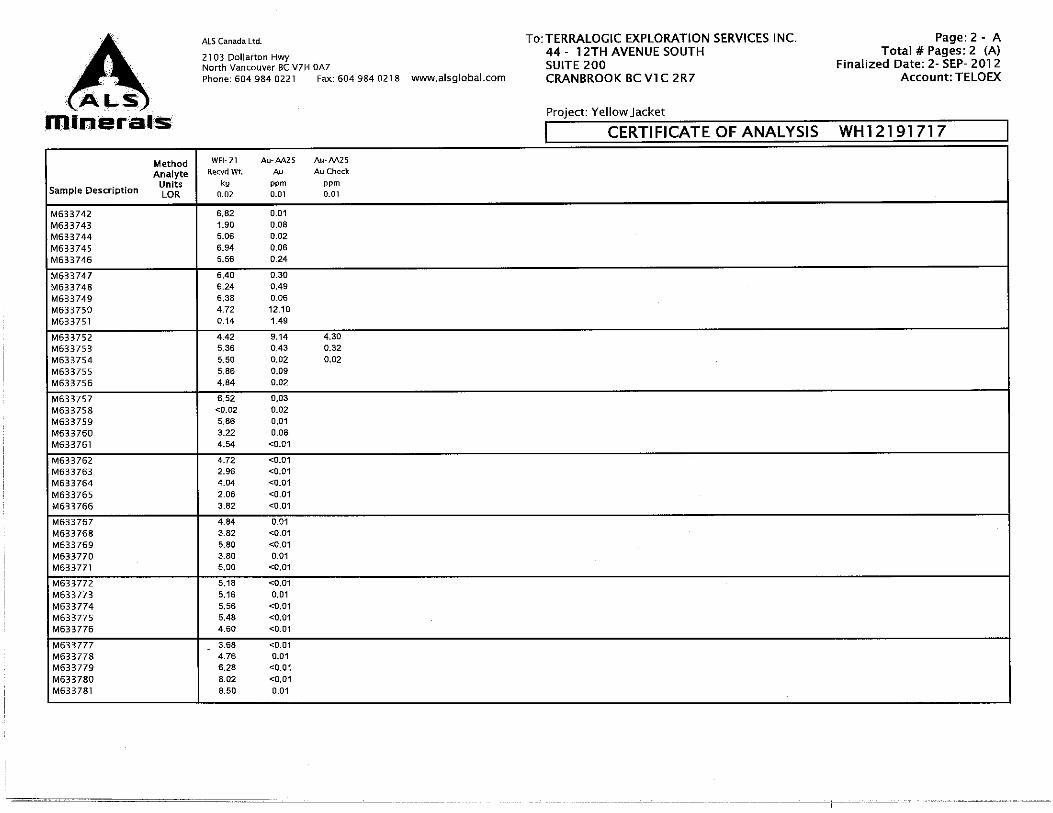
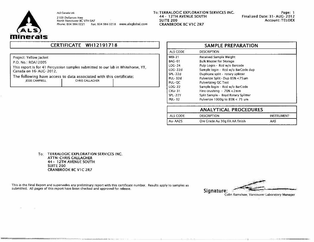
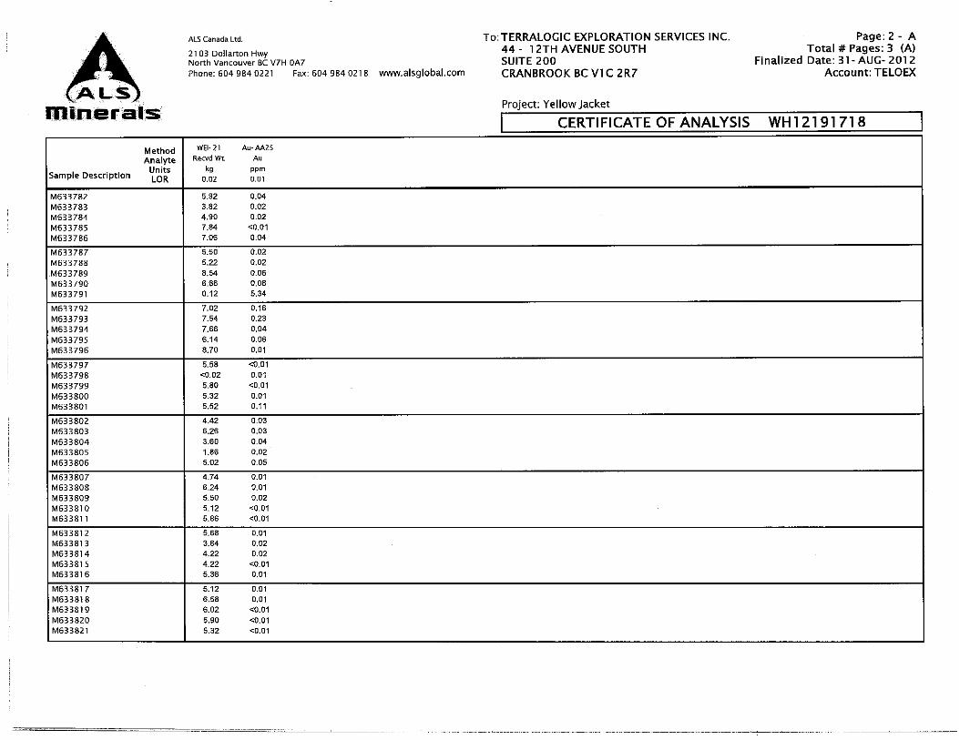
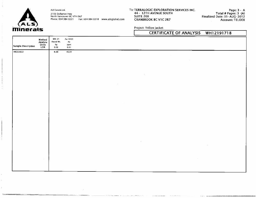
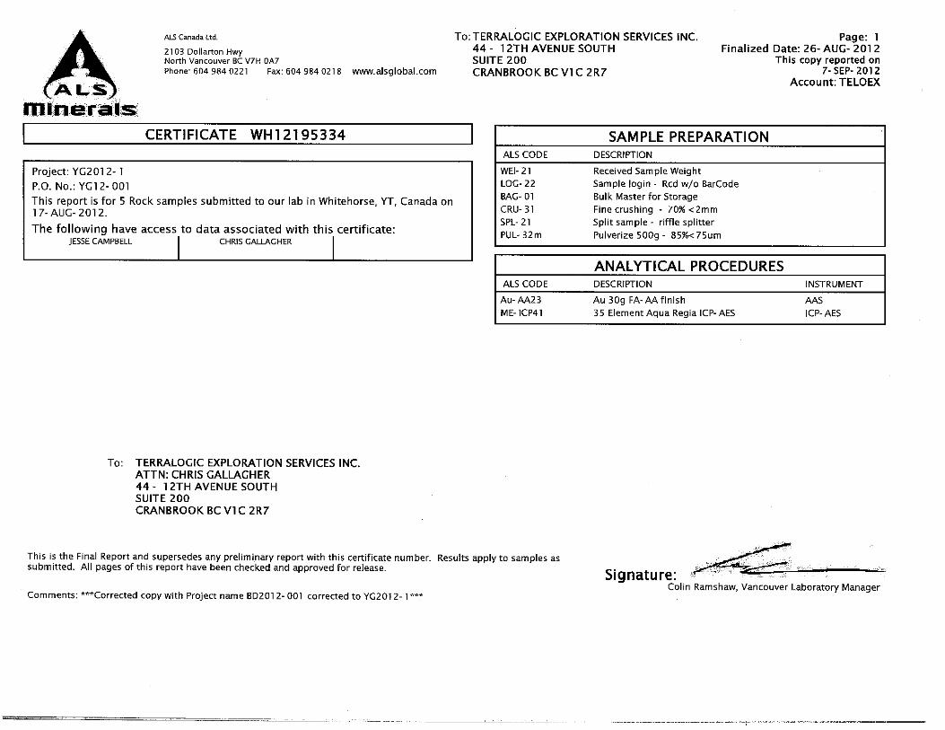
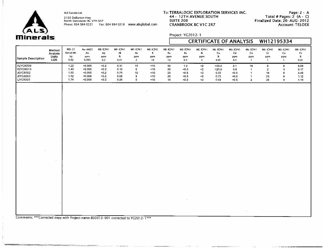
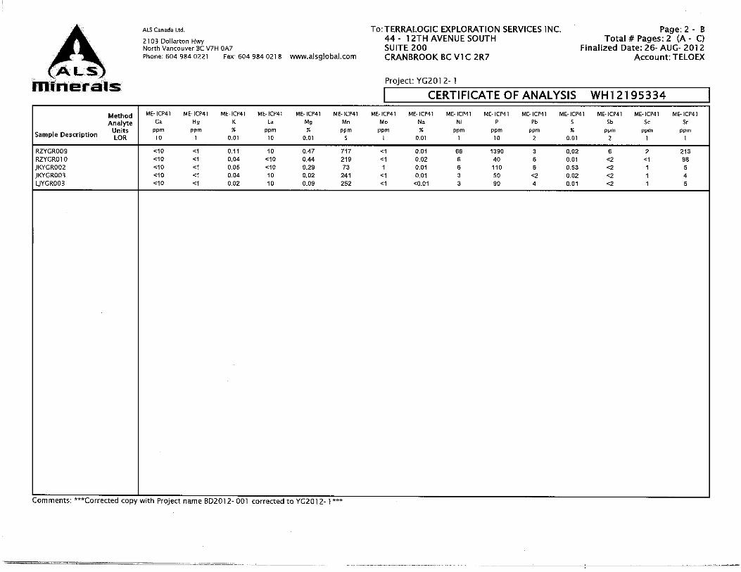
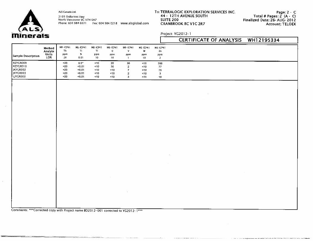
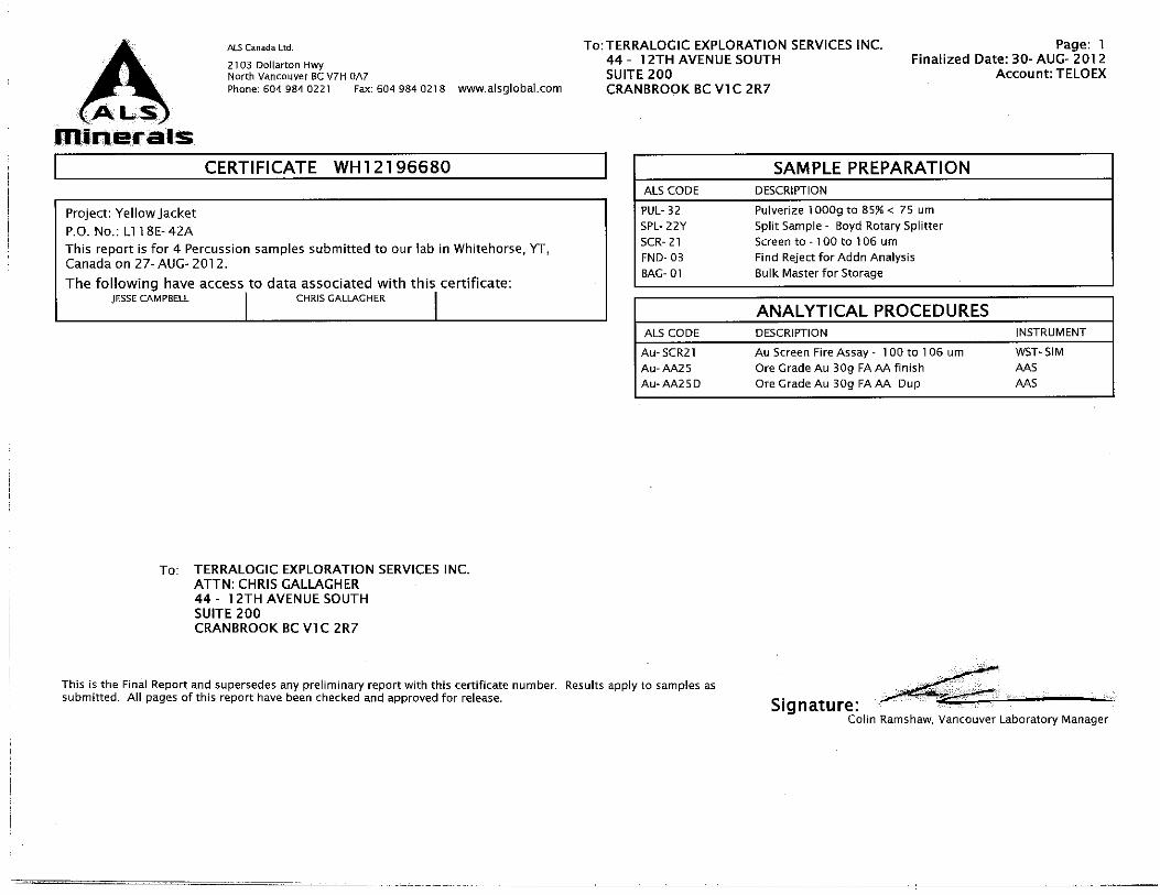
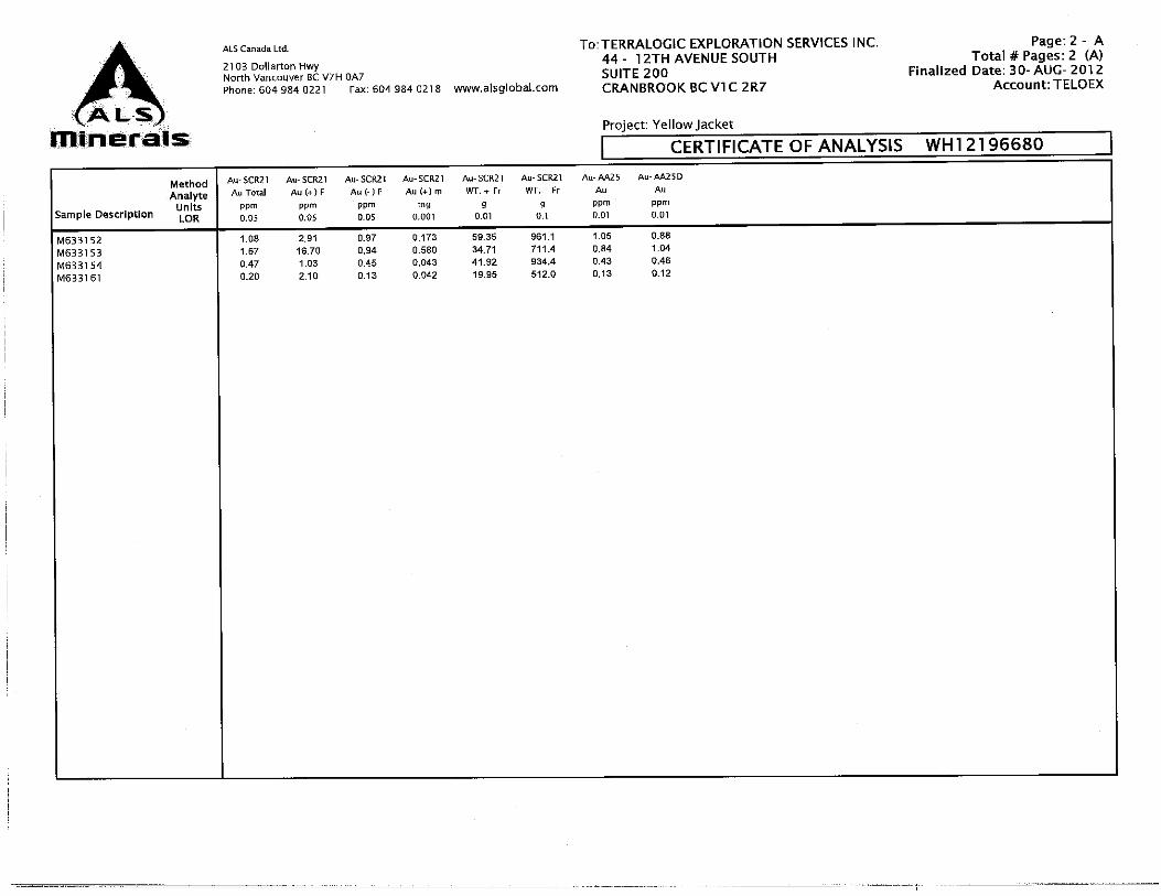
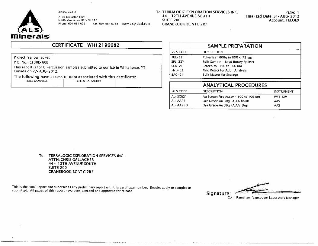
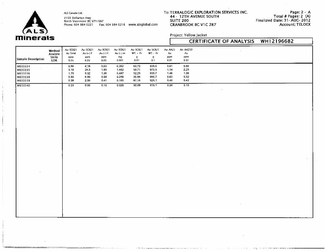
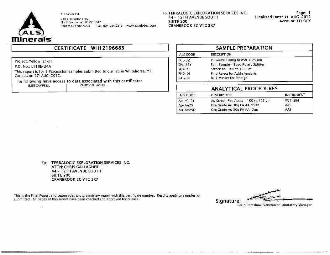
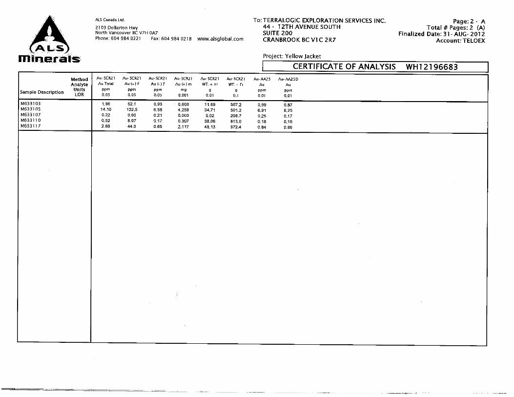
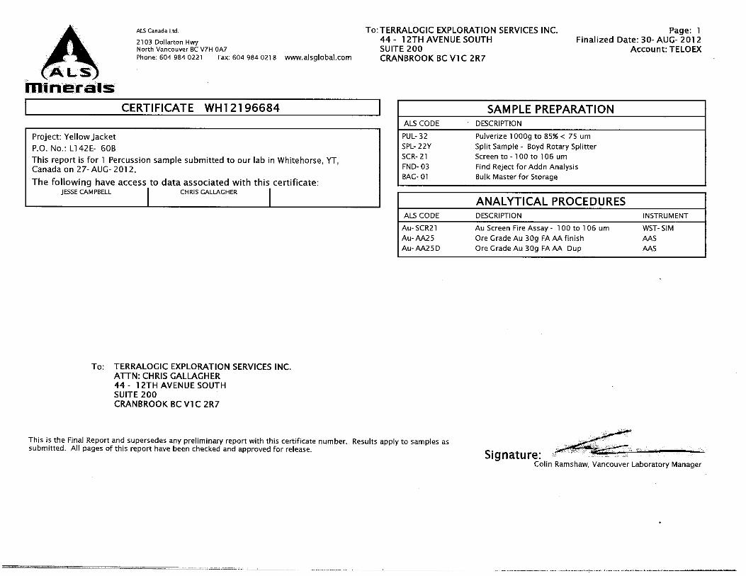
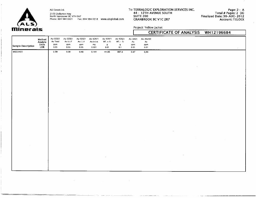
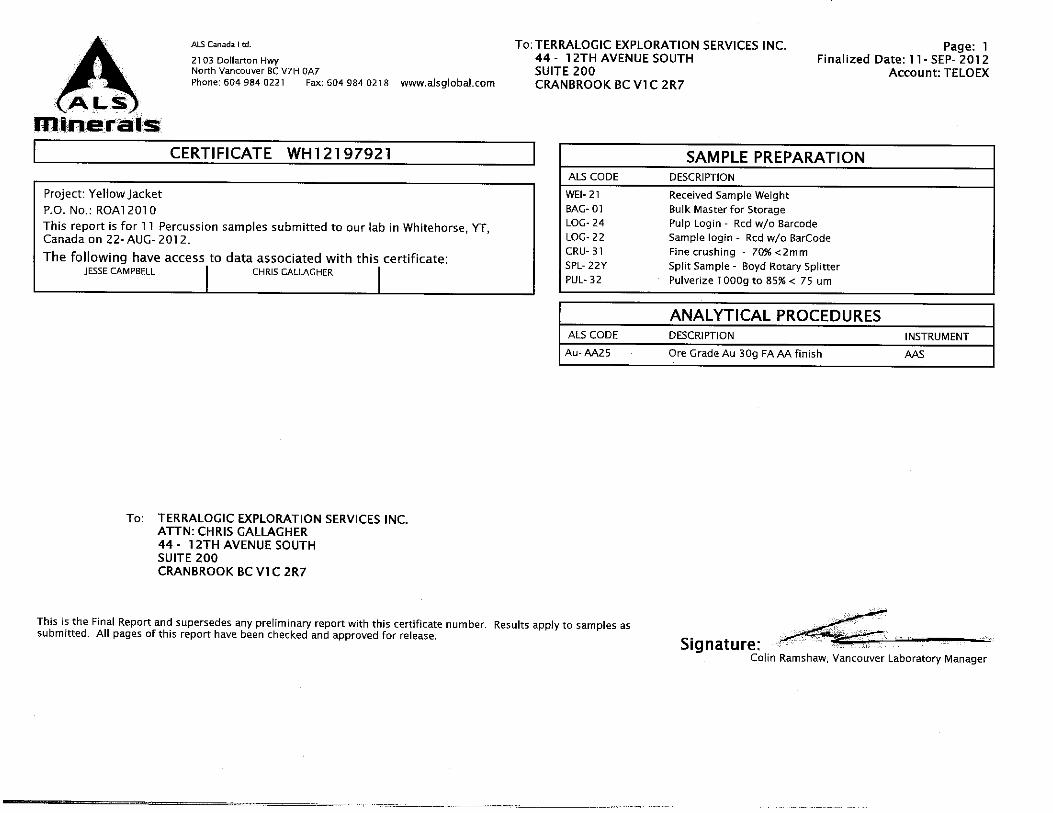
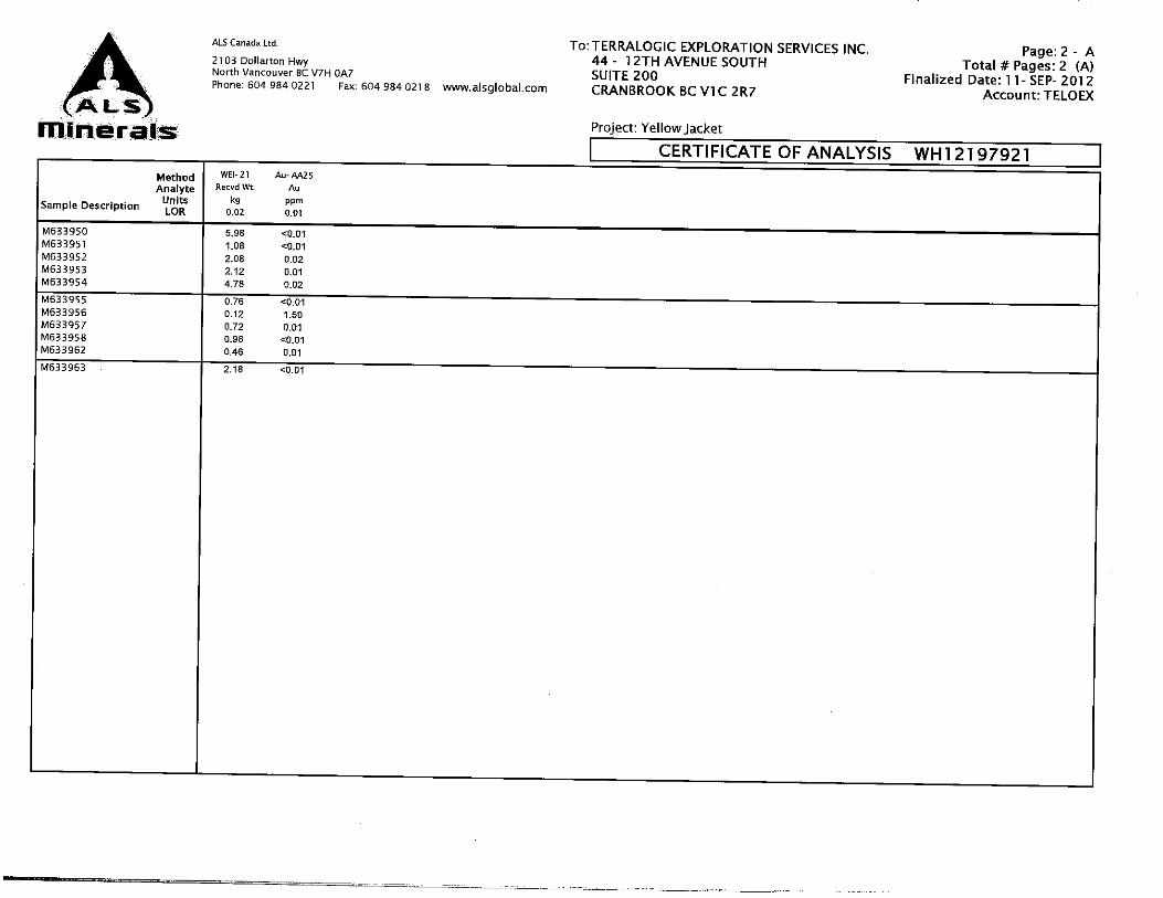
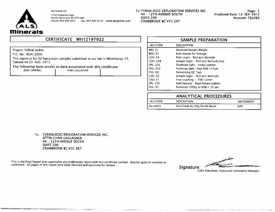
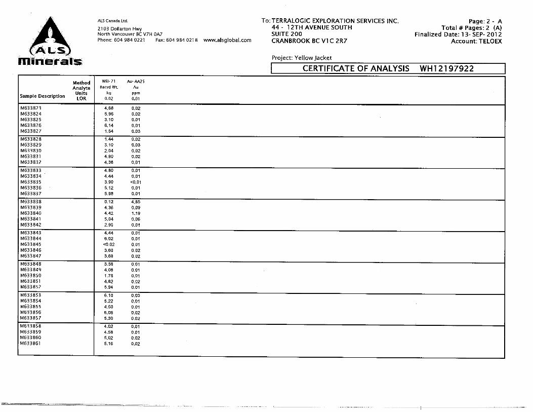

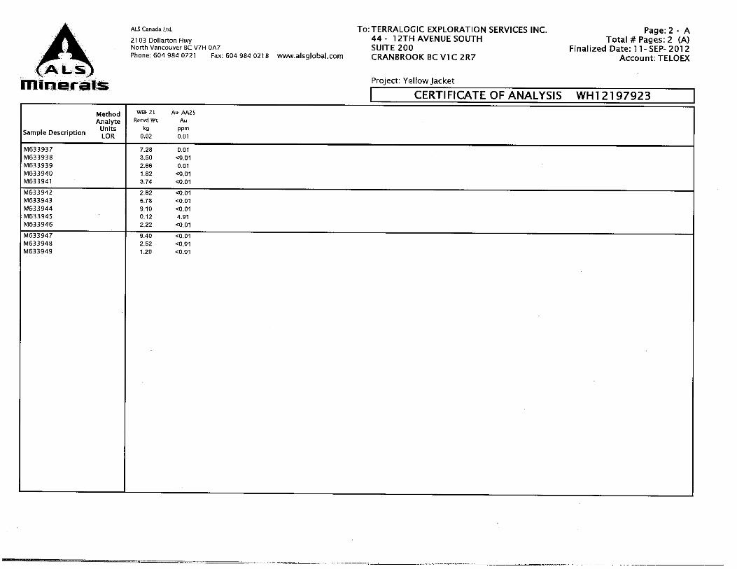
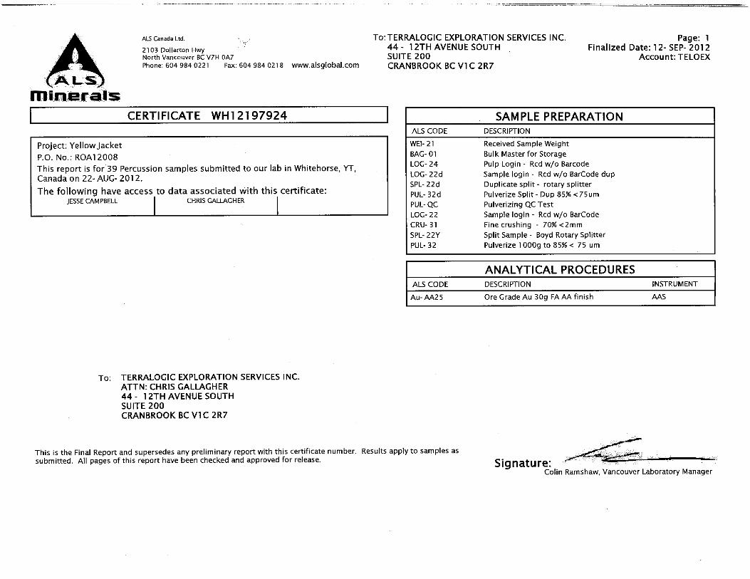
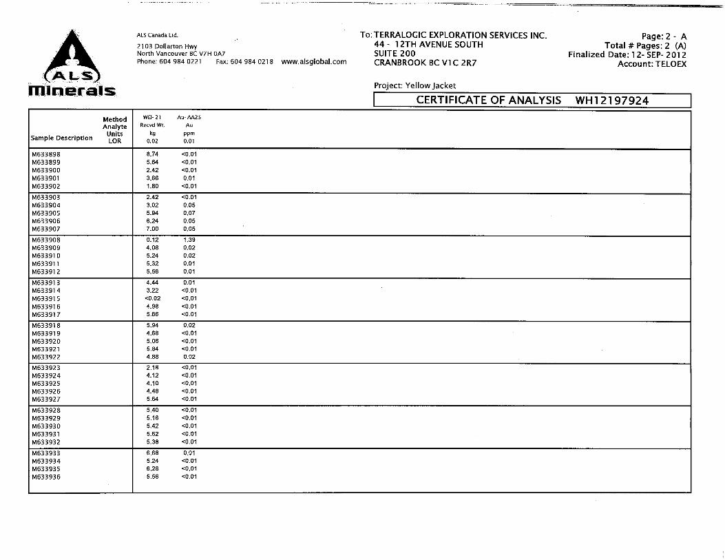


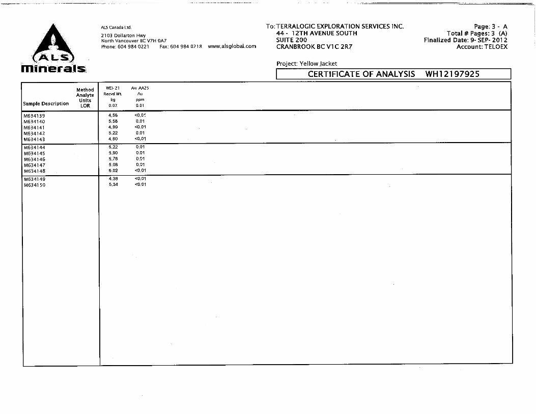
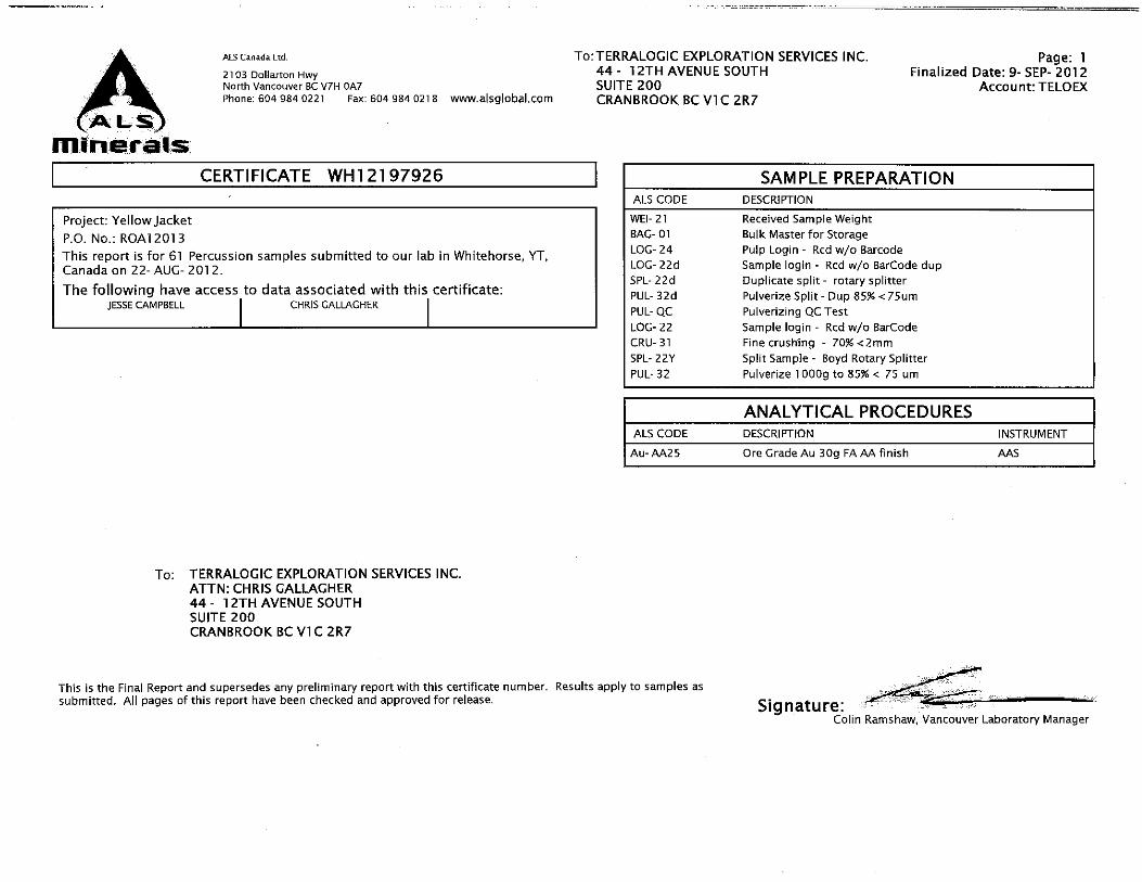
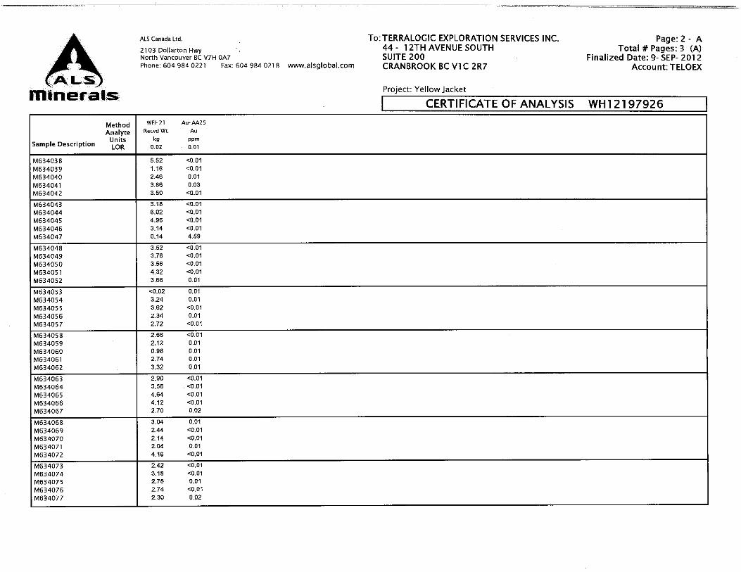
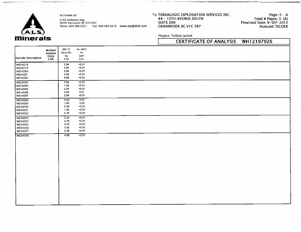
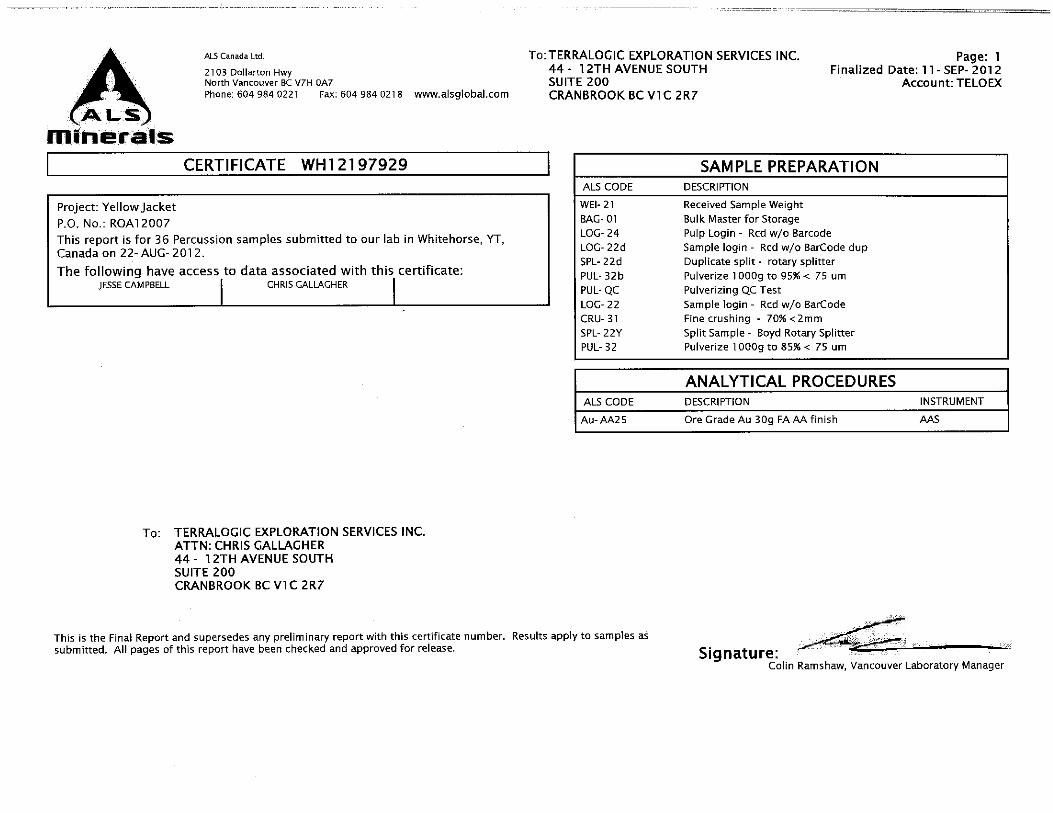
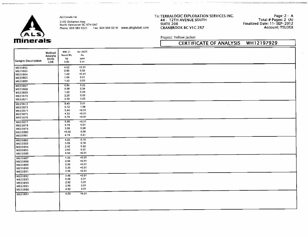
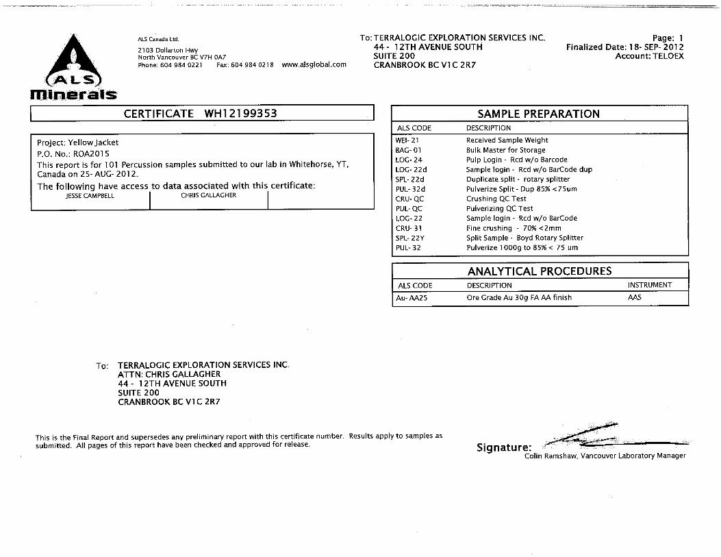

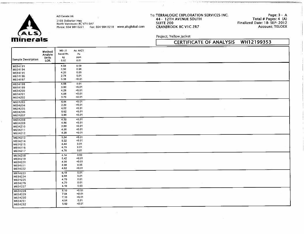
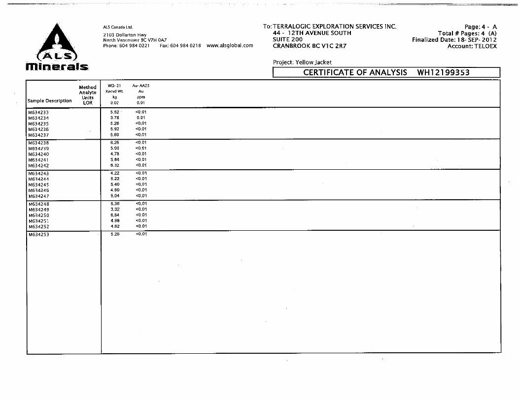

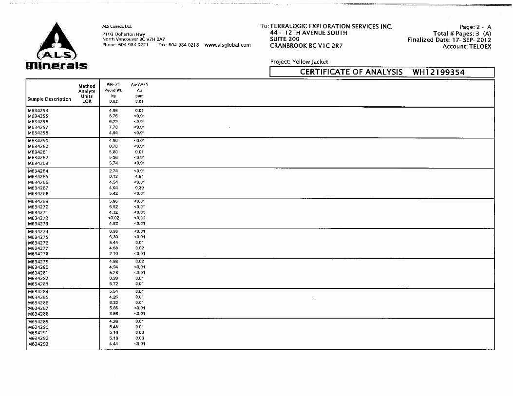
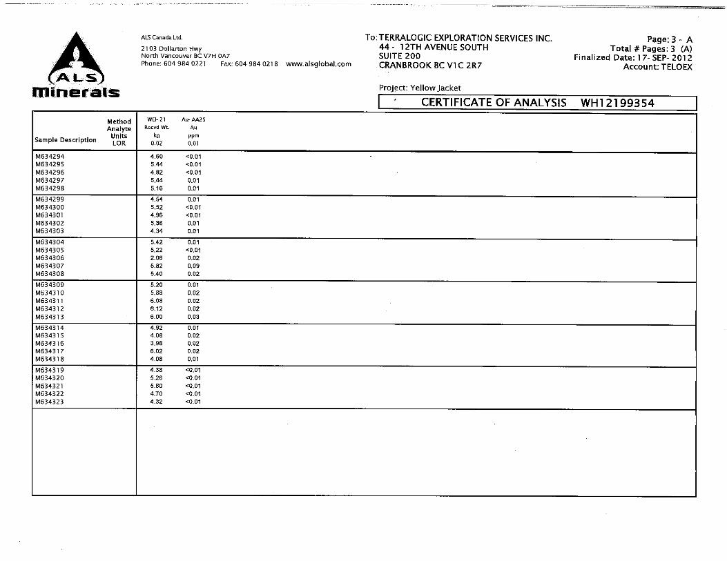
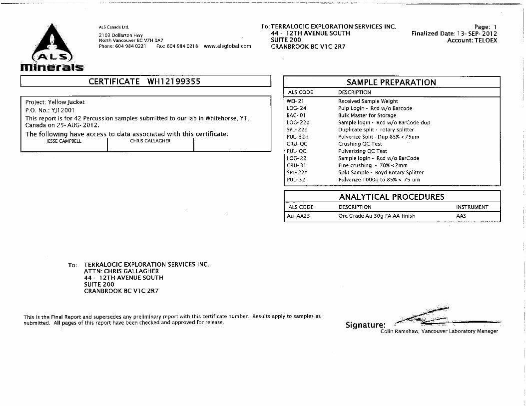
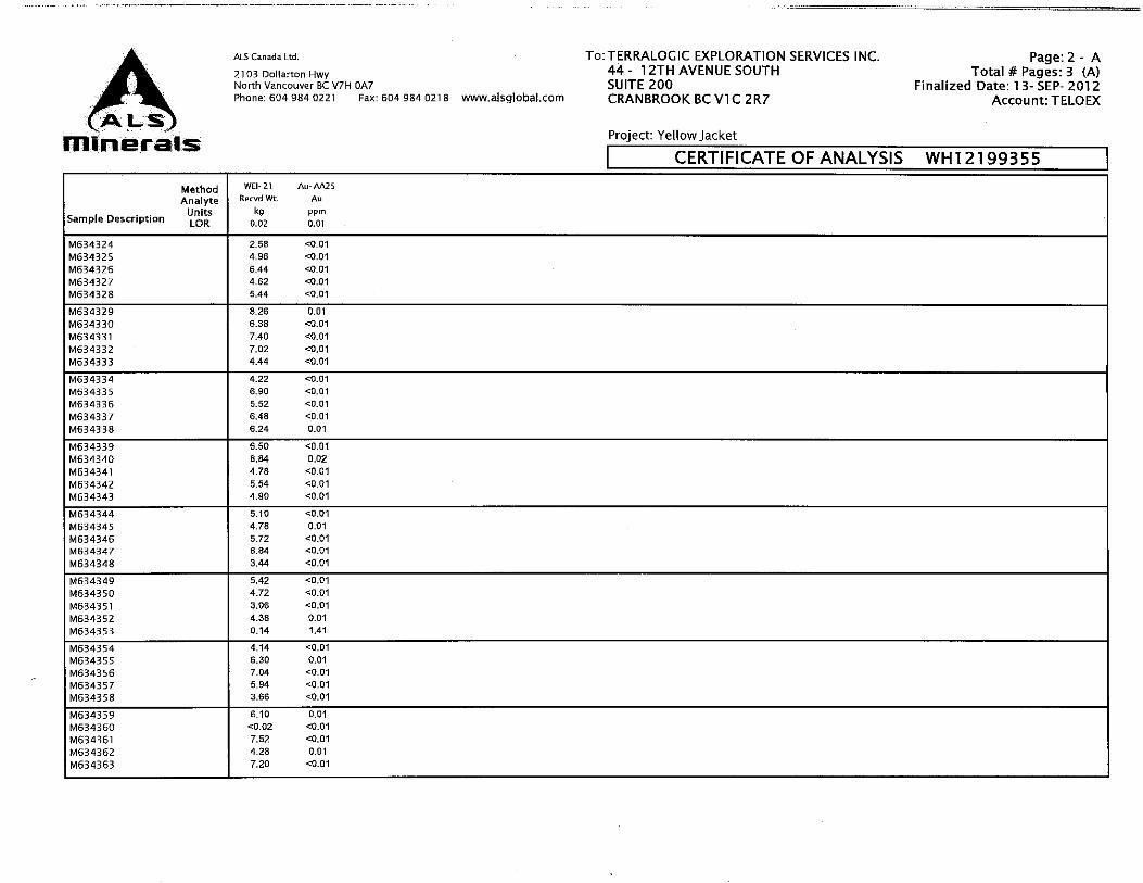
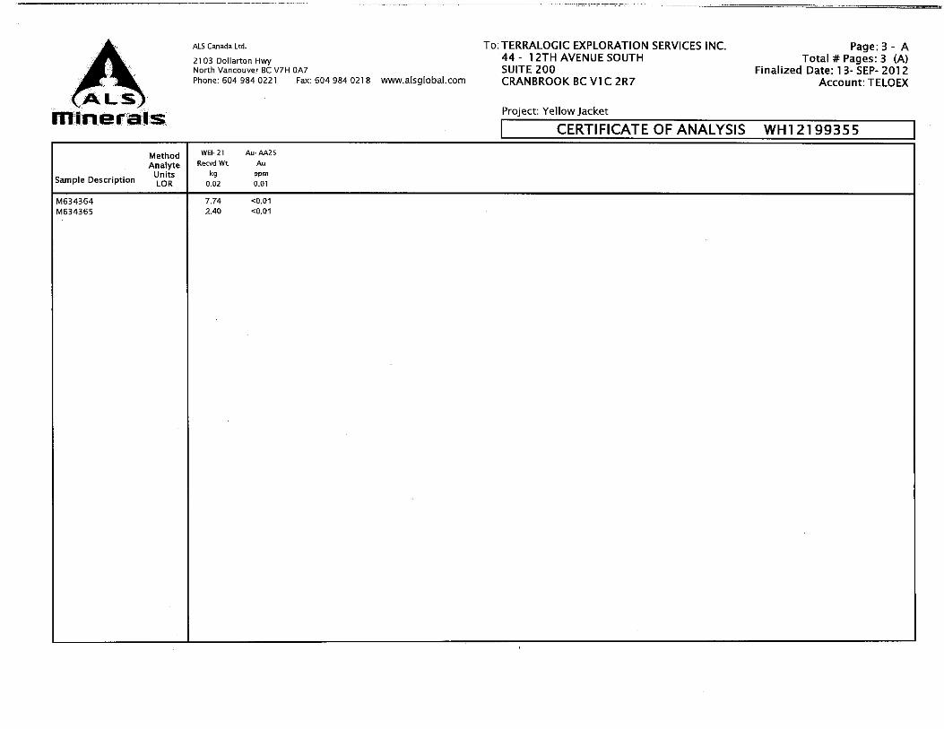
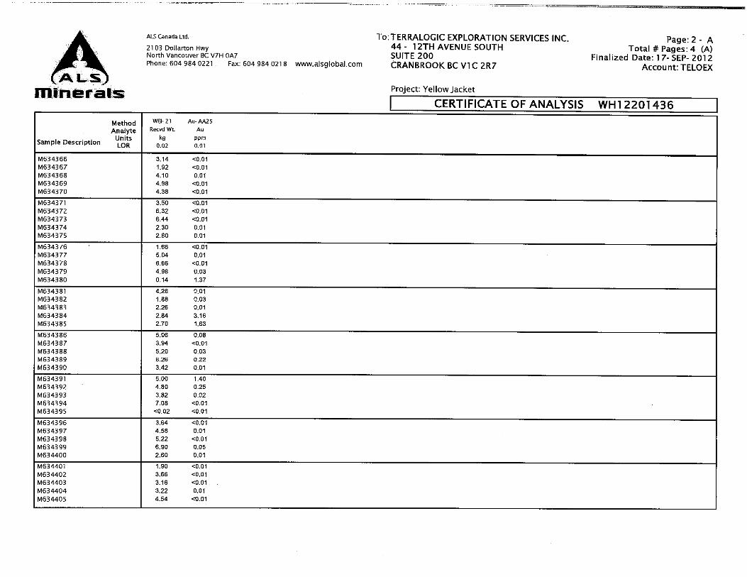

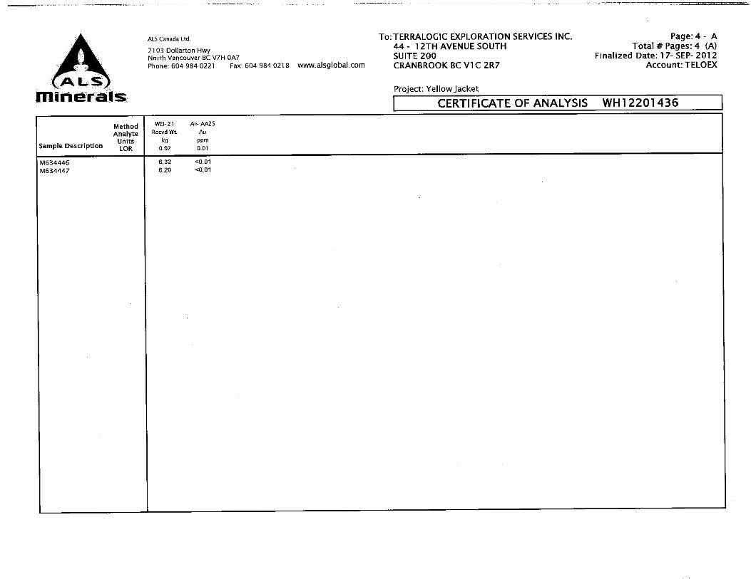
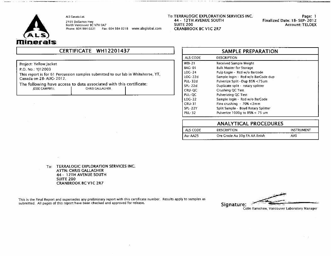
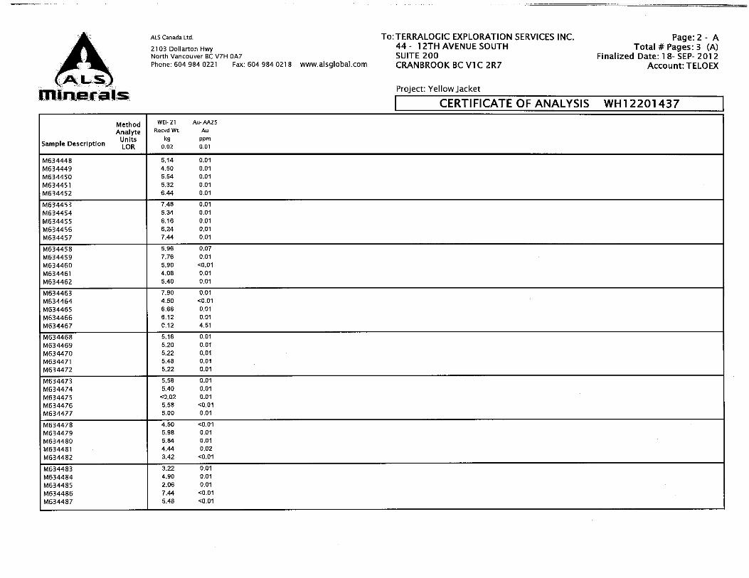
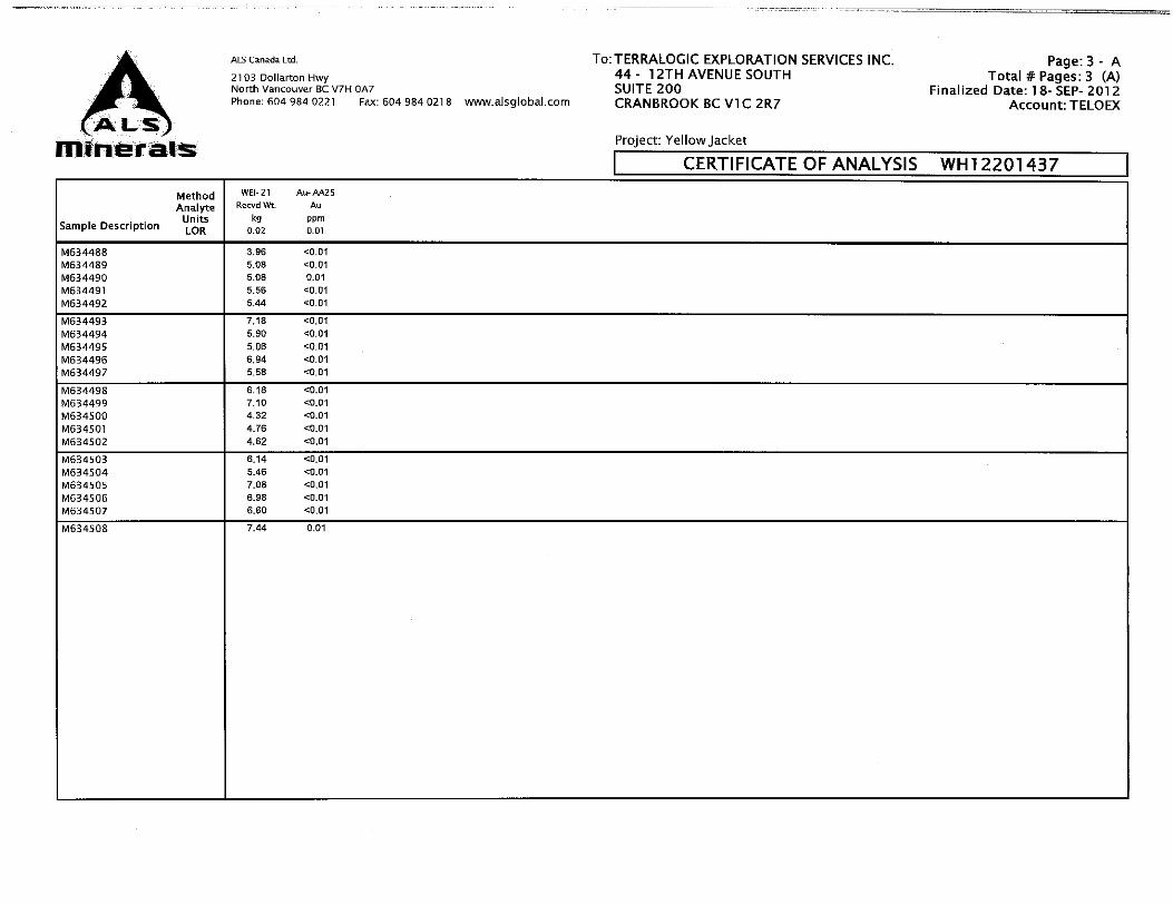

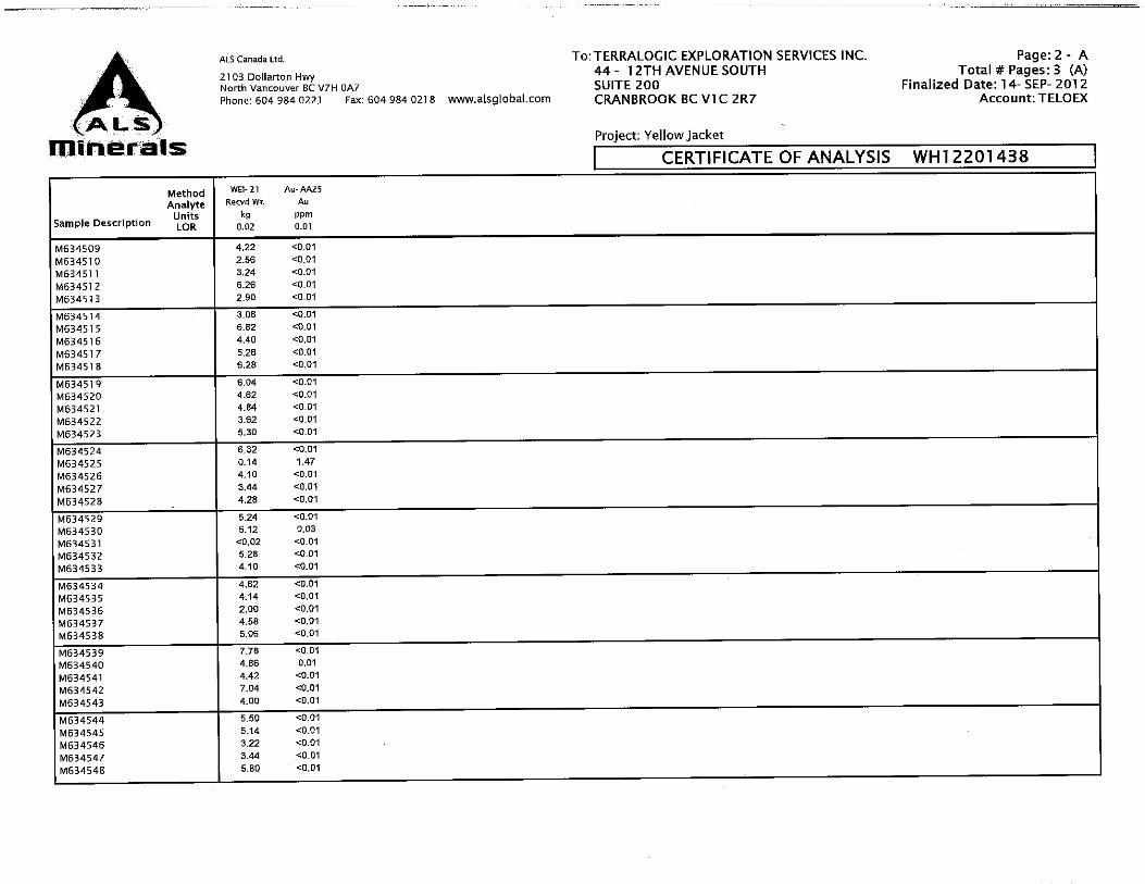
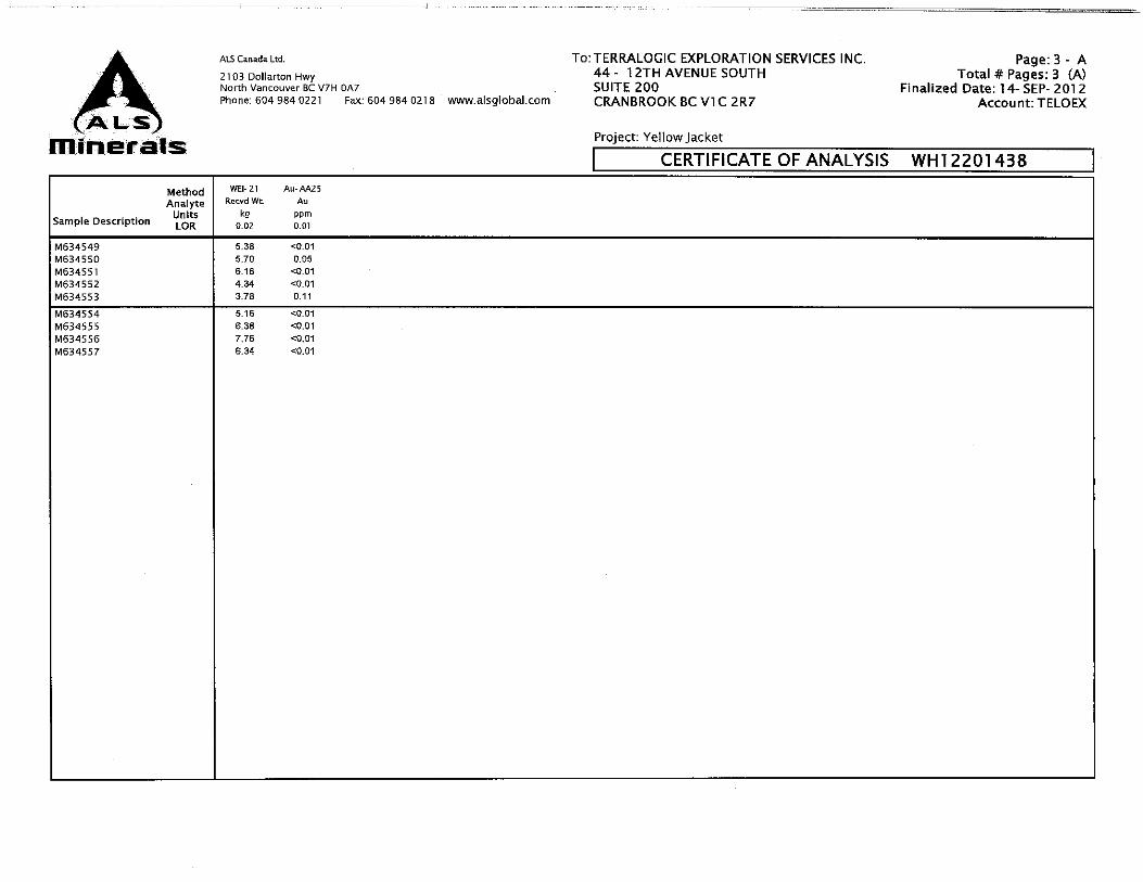
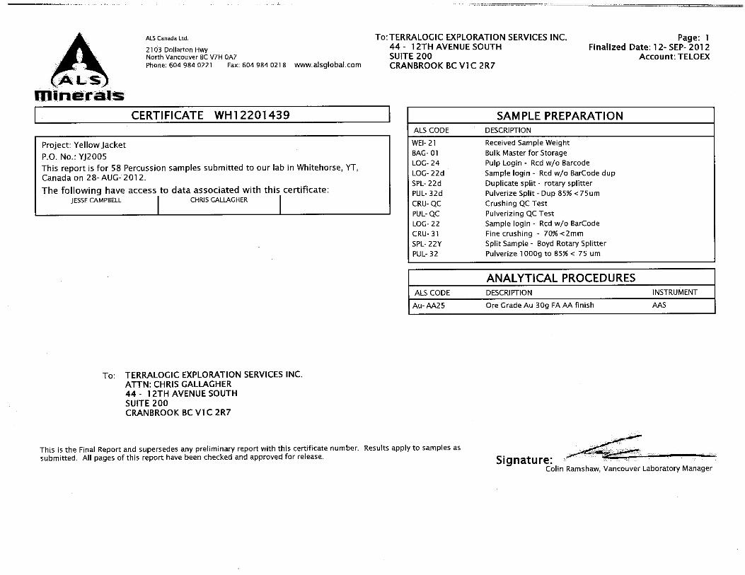
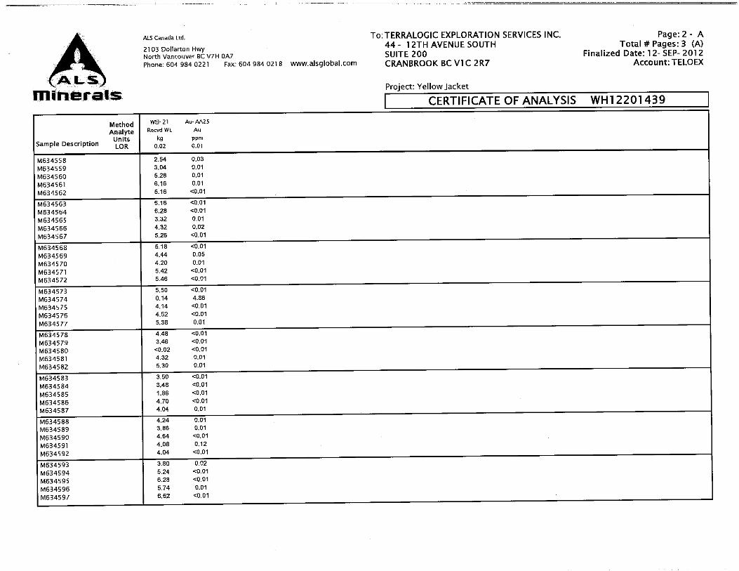
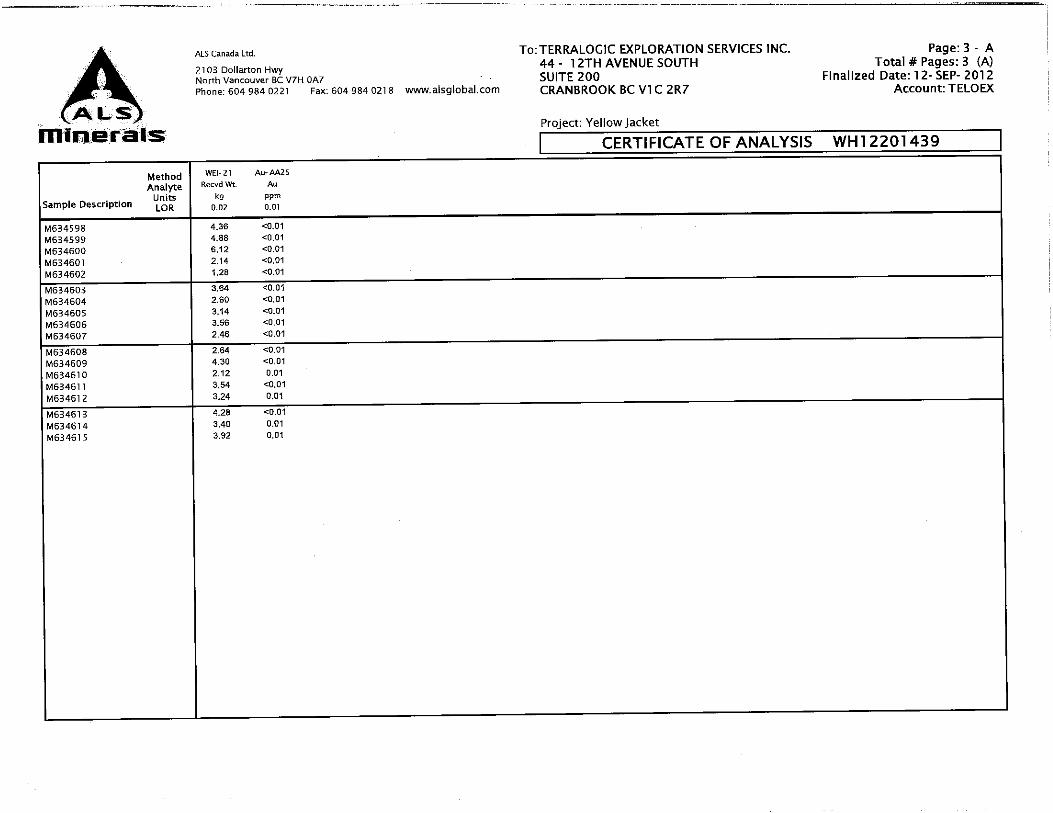
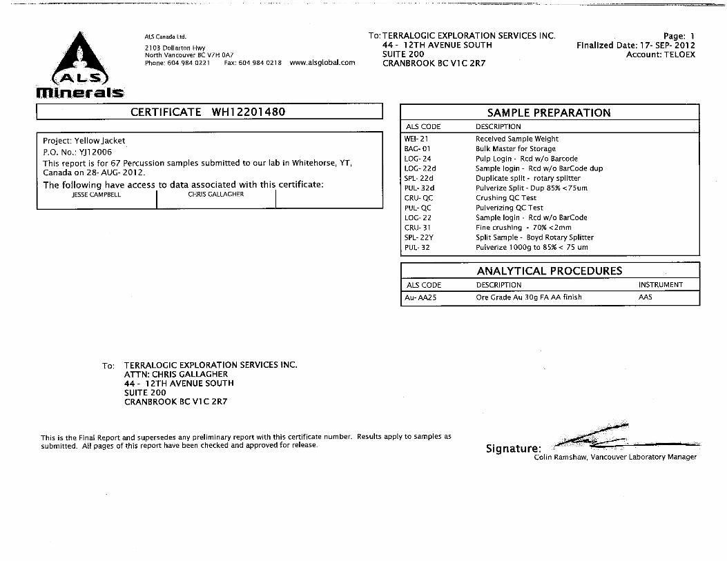
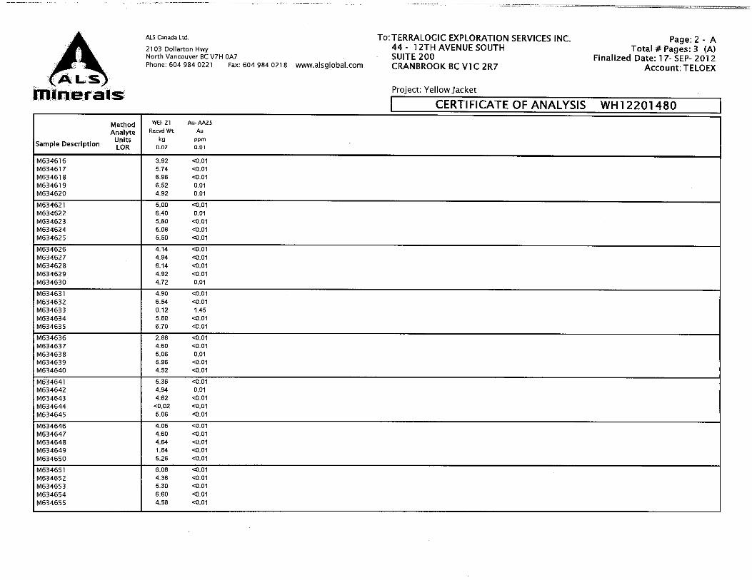
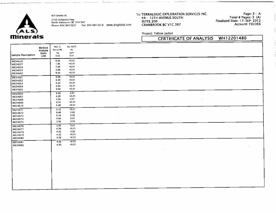
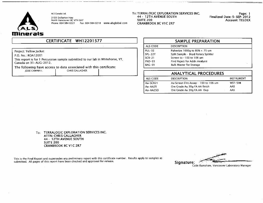

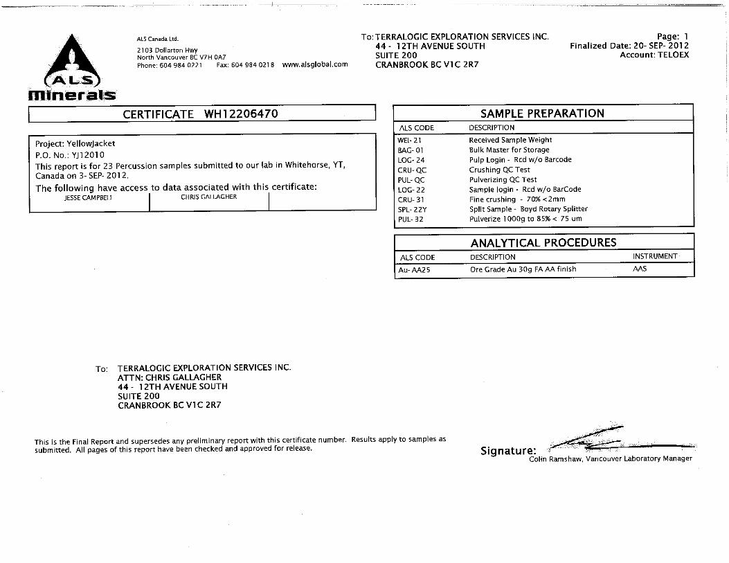
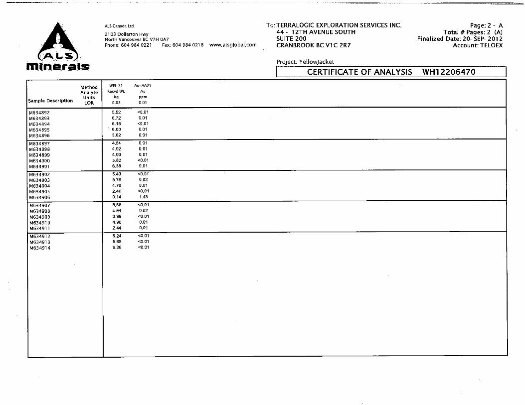
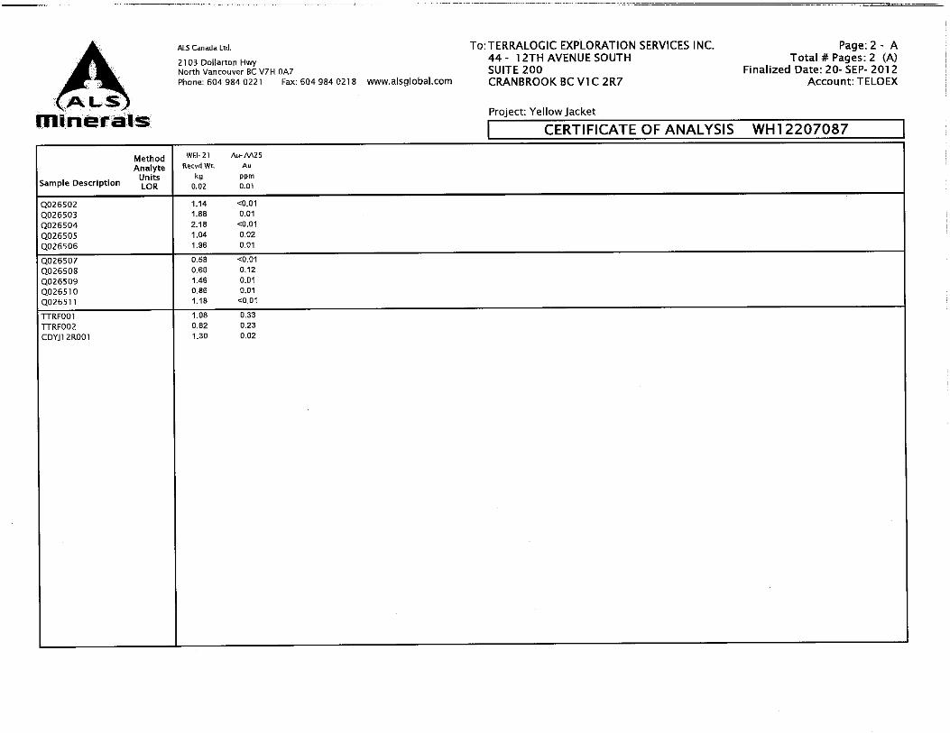
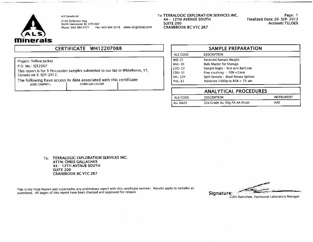
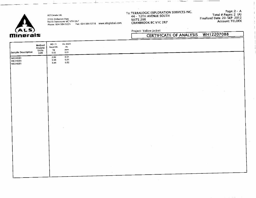

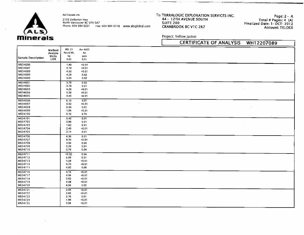

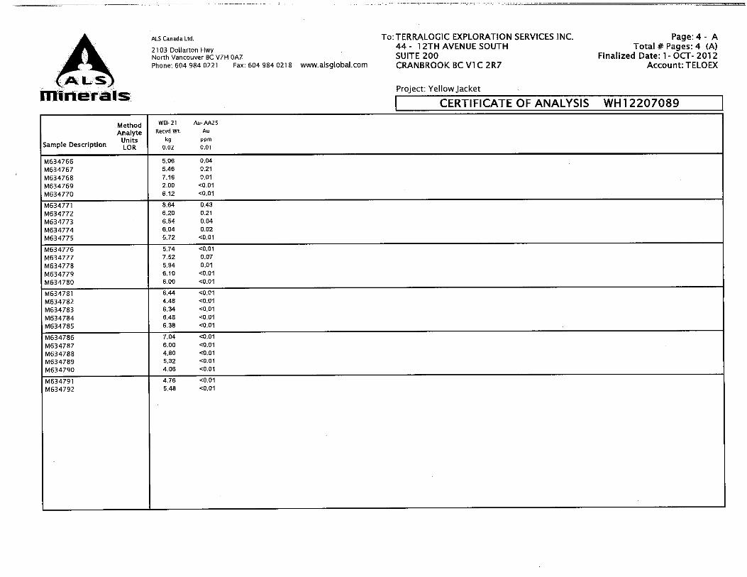
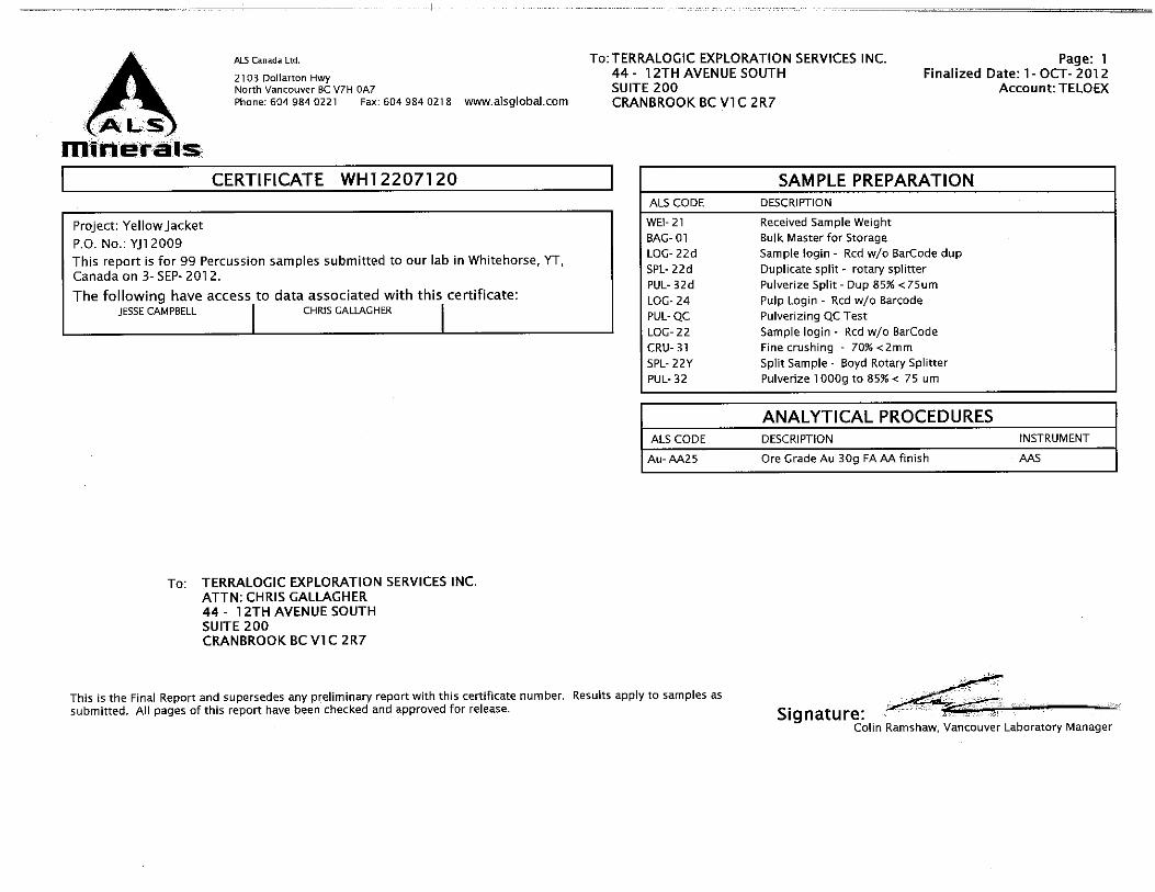
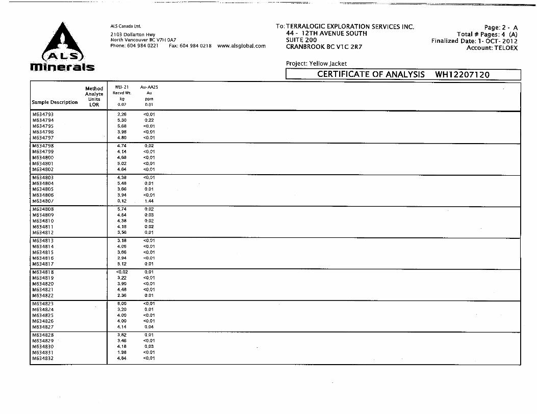
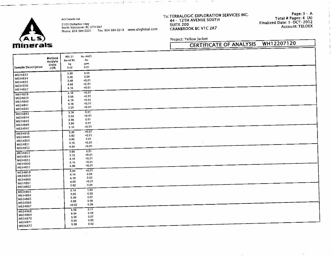
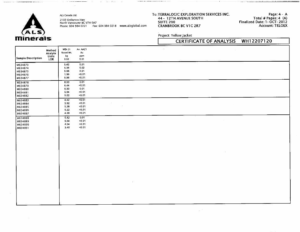

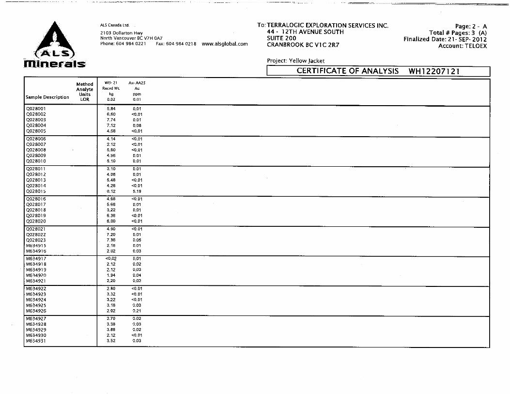
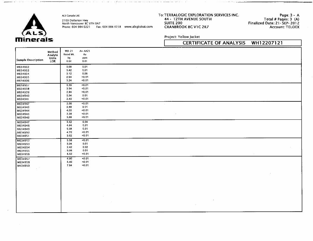
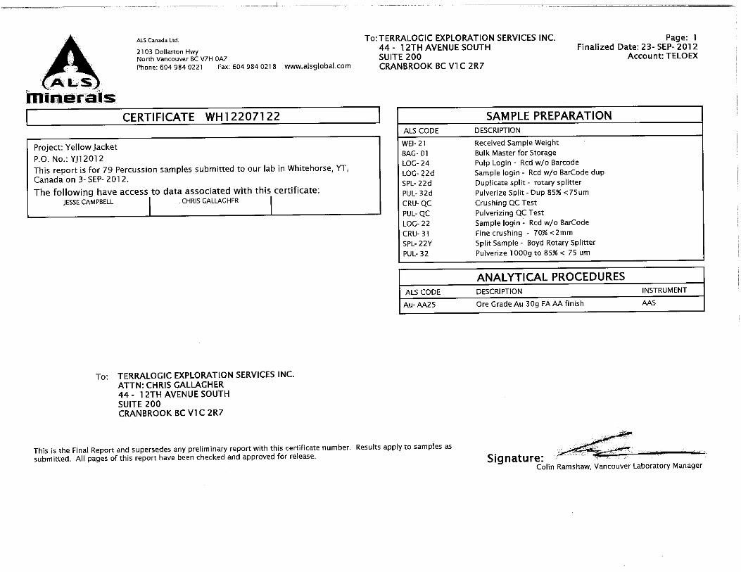
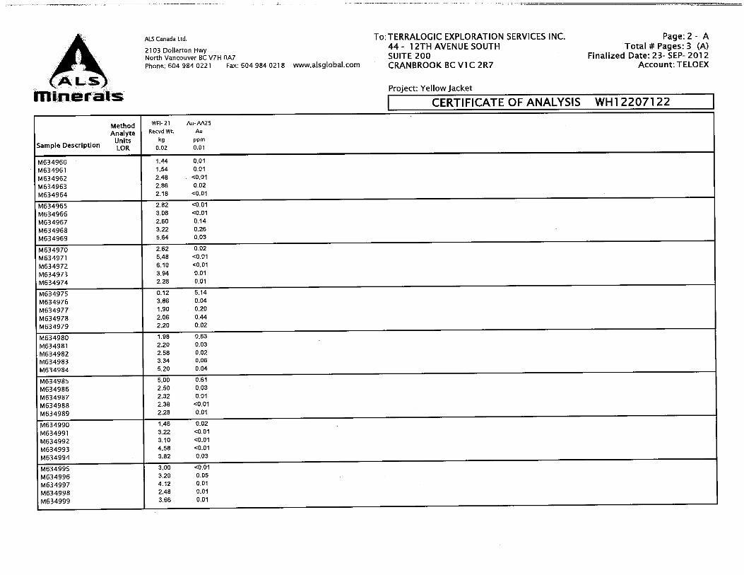
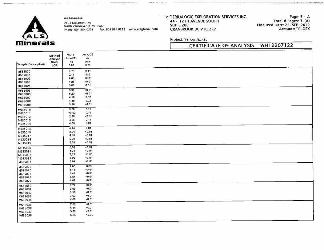
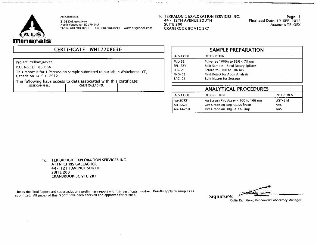
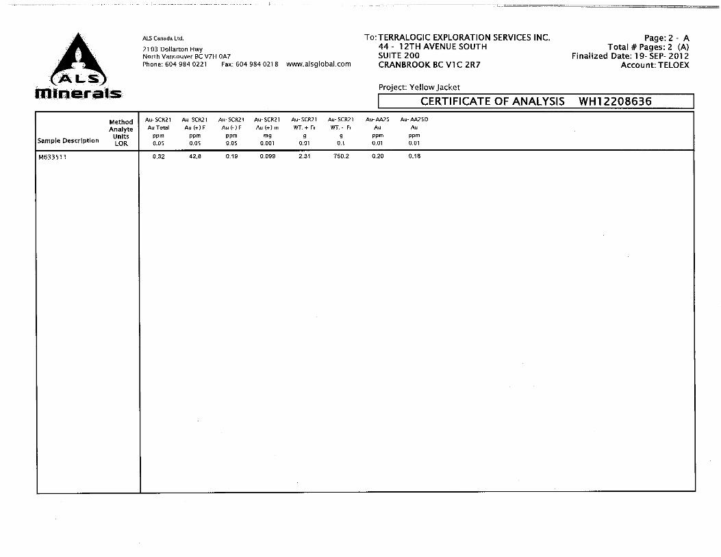
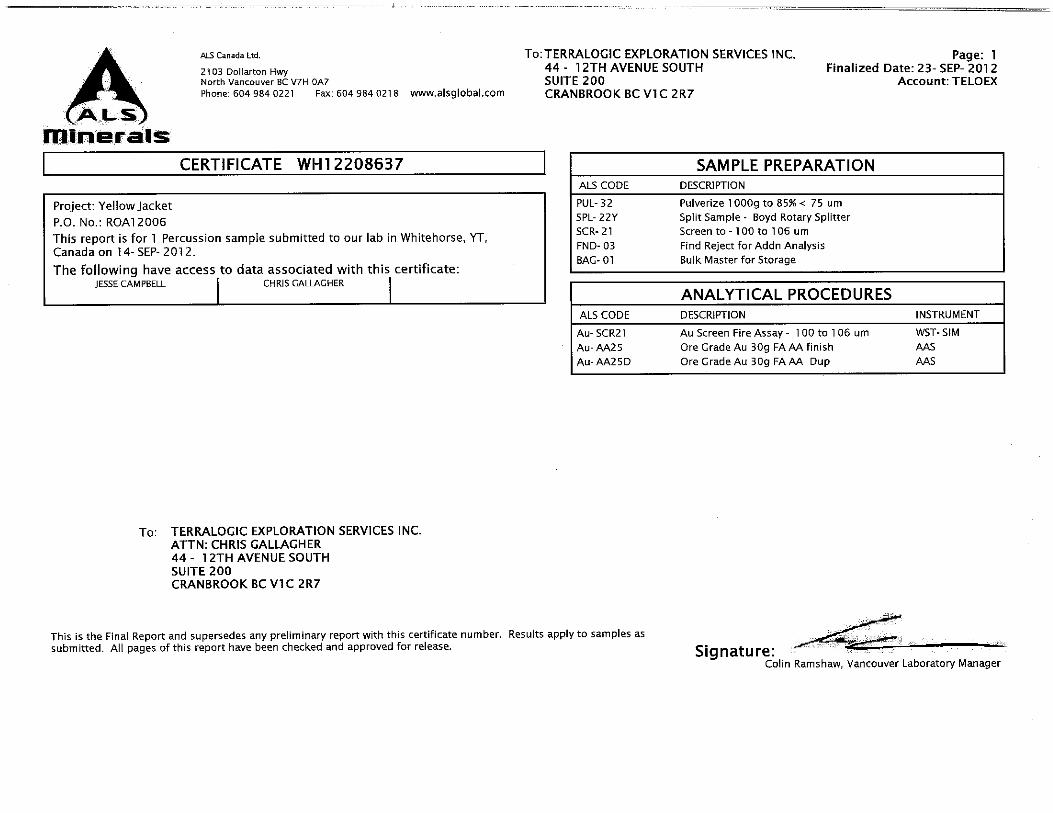
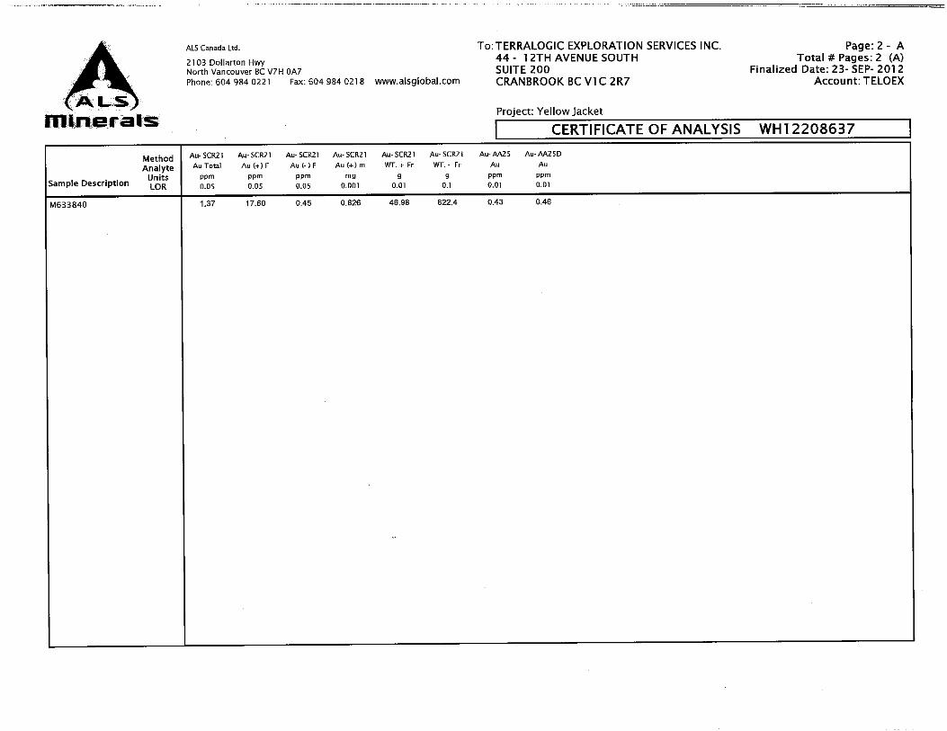

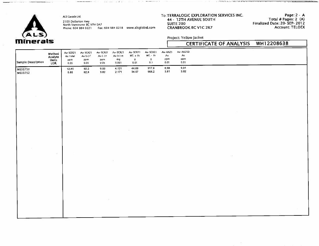
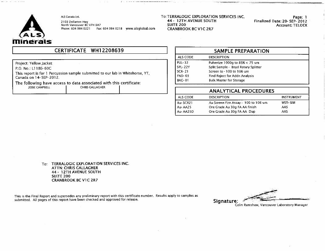
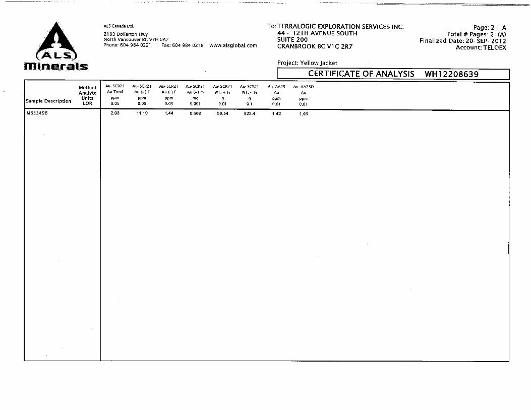
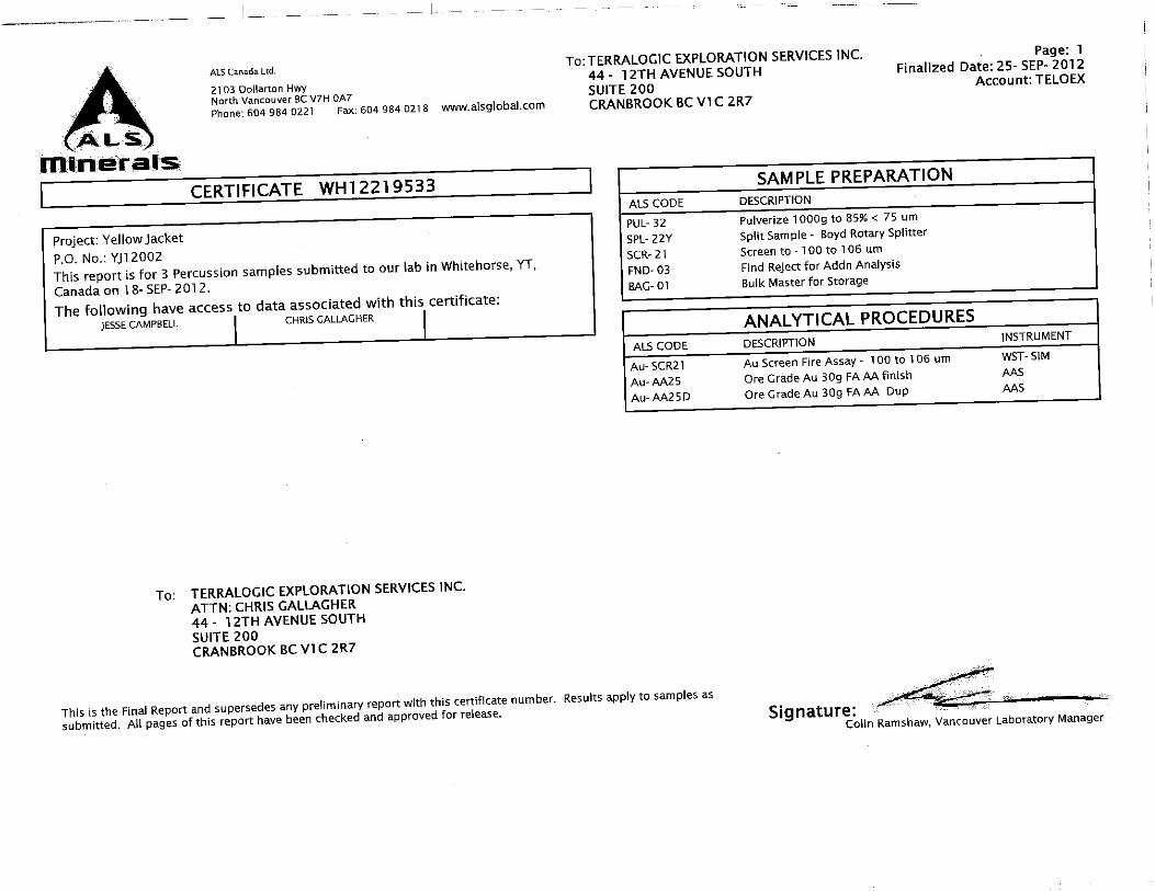
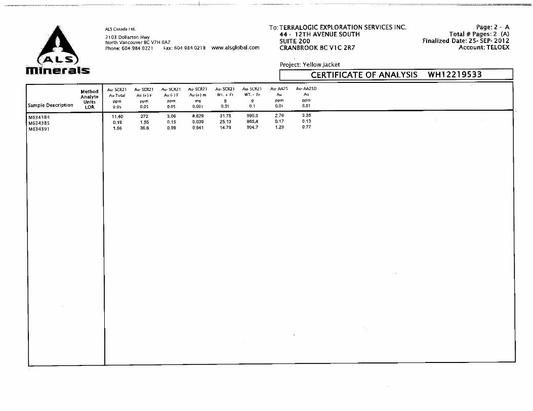
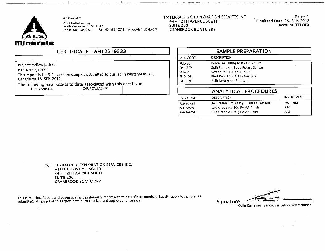
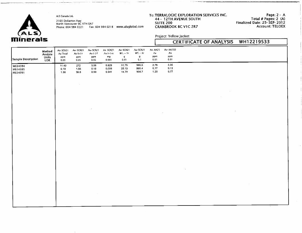
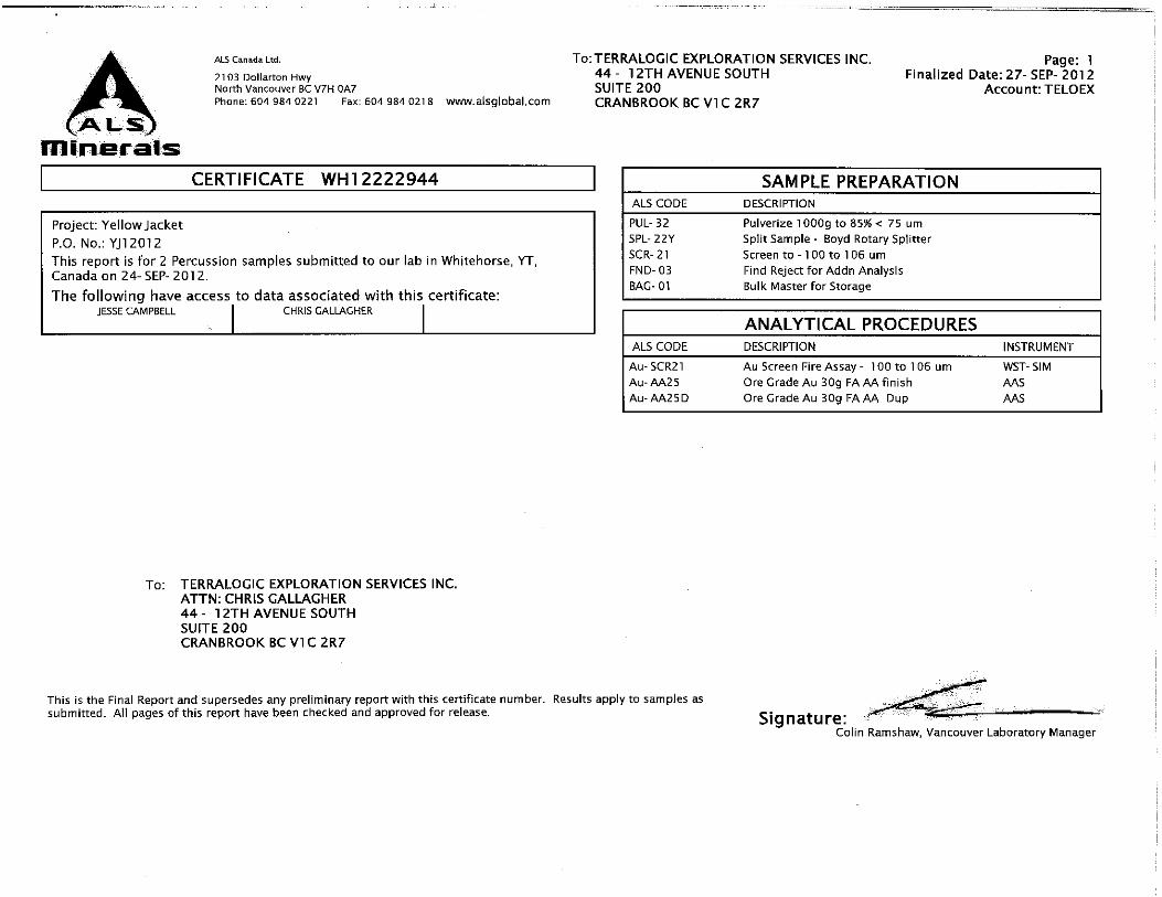
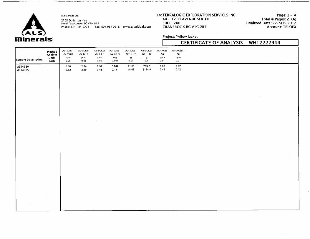
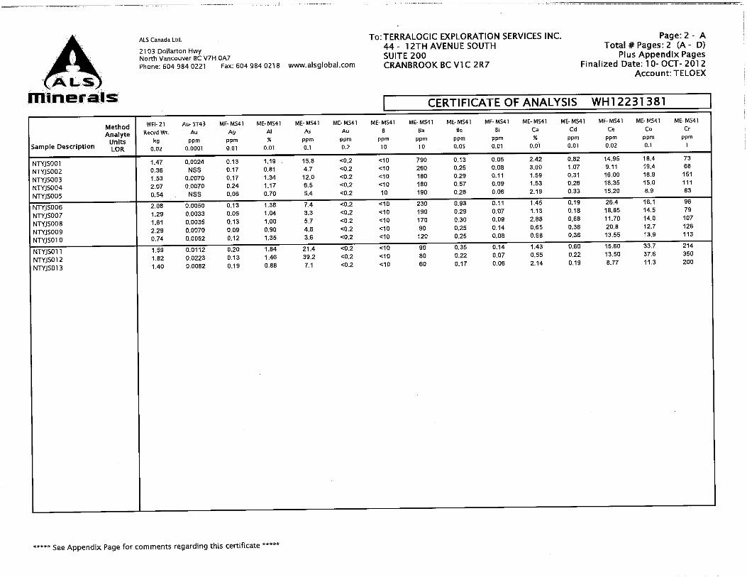
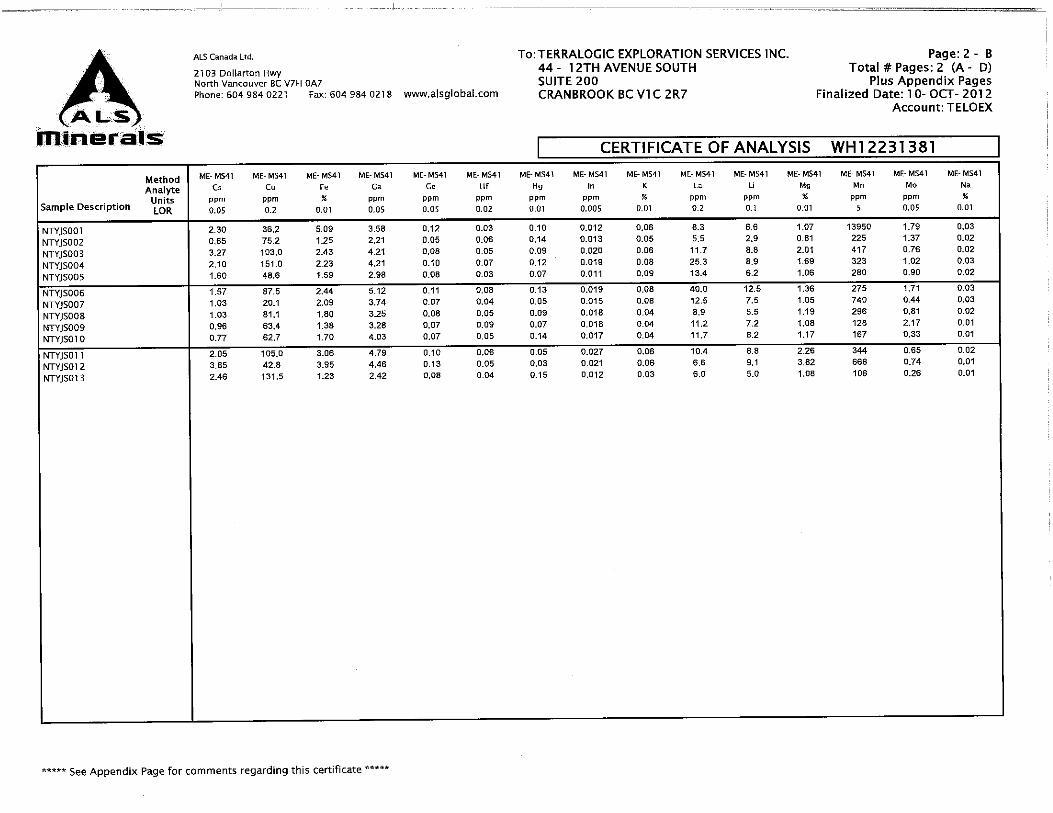
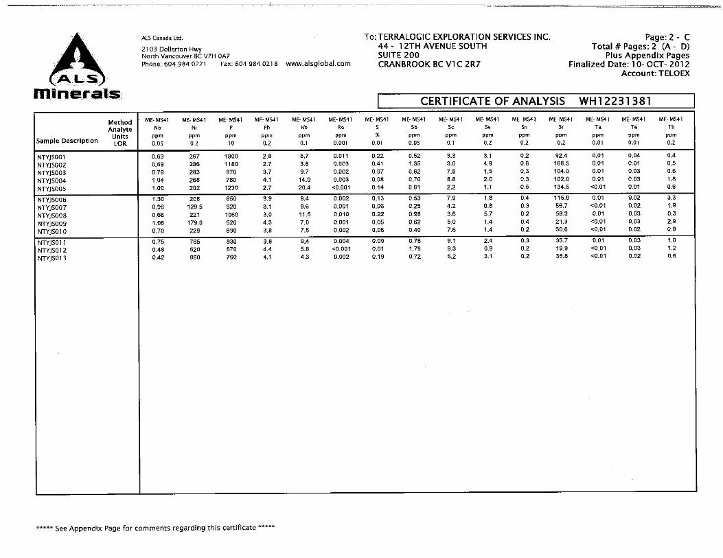
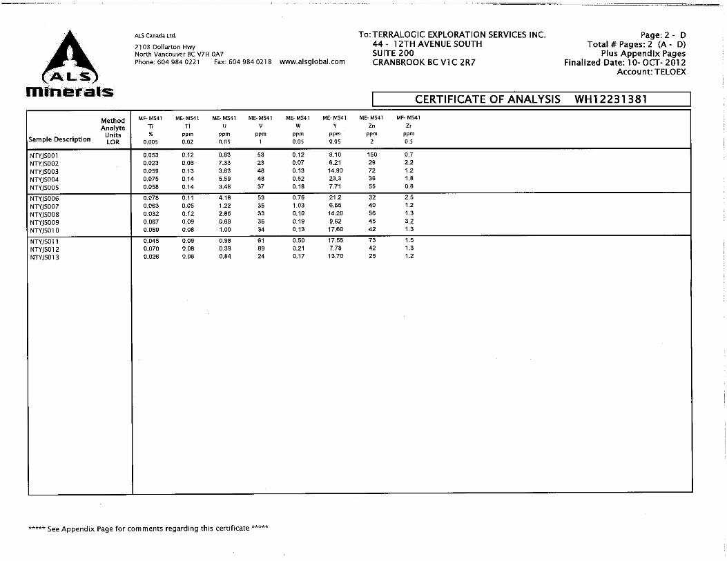
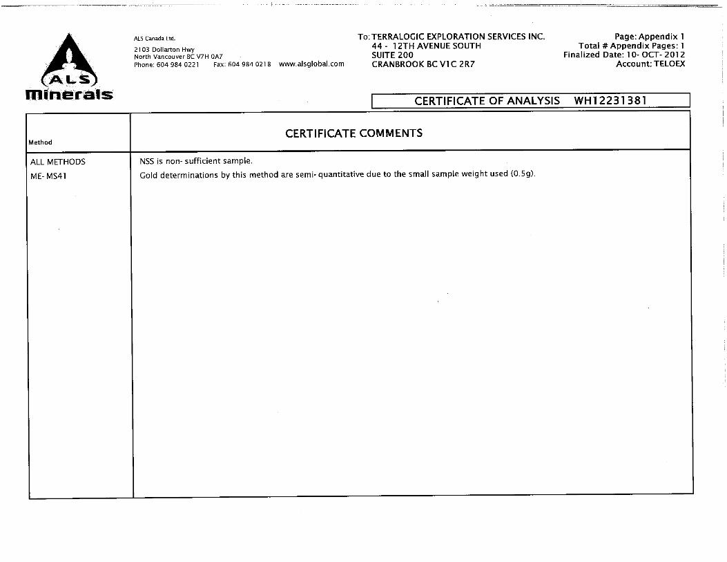
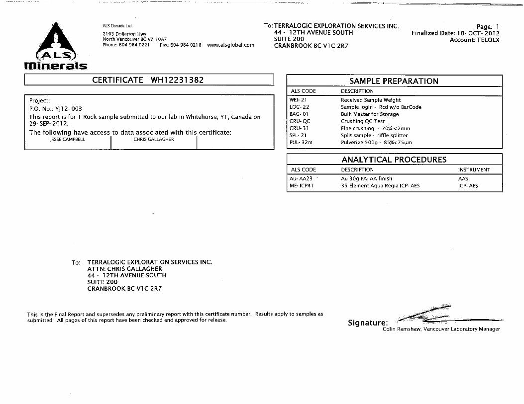
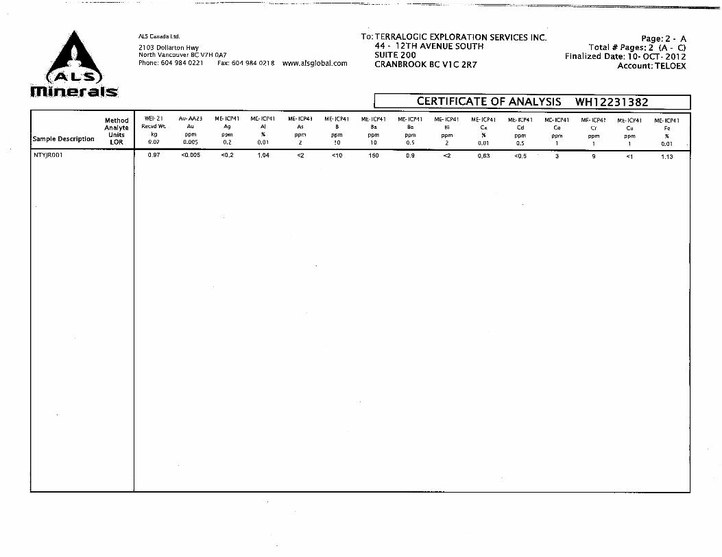
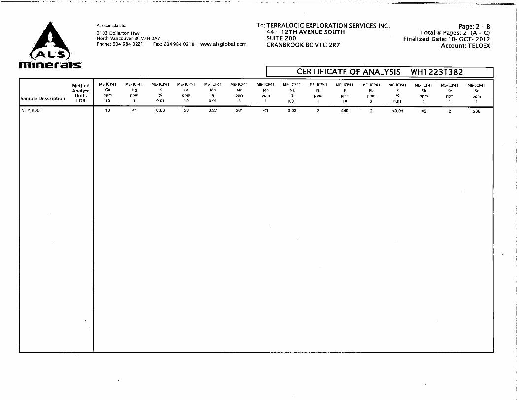
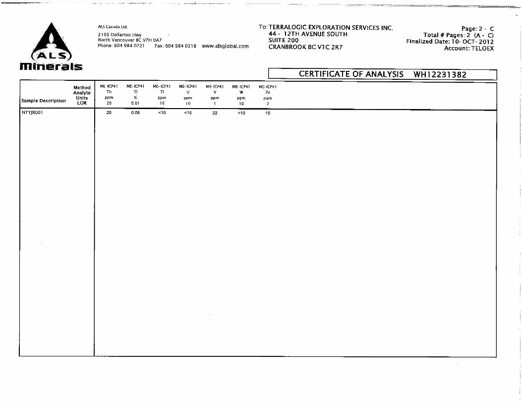

YELLOWJACKET 2012 Assessment Report Page 66
APPENDIX VRC STRIP LOGS
Athabasca Nuclear Corp. August 2012
Hole Name :L058E-48A
Length(m) :38.78 Azimuth(Deg) :337 Dip(Deg) :-50
Collar X :582142.61 Collar Y :6607319.78 Collar Z :862.19 Location Method :GPS Accuracy(m) :0.5
Hole Status :COMPLETE Drill Type :RC Drill Company :Northspan
Start Date :1284879600 Finish Date :1284879600 Geologist :Fiona Katay
QDH - LogQDH - Geochem Master
Depth At
DDH_SAMP Fault_IndicatorsLith_1_Pct Lith_1 Description Lith_2_PctLith_2 Description
Qtz_Veining_Pct Mariposite_PctPyrite_Pct Aspy_PctMineralization Description
Au_g_t Elevation
Scale 1:176 11/18/10 14:48:11
5
10
15
20
25
30
35
L058E-48A-001
L058E-48A-002
L058E-48A-003
L058E-48A-004
L058E-48A-005
L058E-48A-006
L058E-48A-007
L058E-48A-008
L058E-48A-009
L058E-48A-010
L058E-48A-011
L058E-48A-012
L058E-48A-013
L058E-48A-014
L058E-48A-015
L058E-48A-016
L058E-48A-017
L058E-48A-018
L058E-48A-019
L058E-48A-020
L058E-48A-021
L058E-48A-022
L058E-48A-023
L058E-48A-024
L058E-48A-025
L058E-48A-026
L058E-48A-027
L058E-48A-028
L058E-48A-029
L058E-48A-030
L058E-48A-031
L058E-48A-032
L058E-48A-033
25
50
75
Rounded pebbles from fluvial gravels, various lithologies
mottled
mottled
mottled
rusty speckles
rusty speckles
?
?
silicified, waxy
silicified, waxy, rounded white plg crystals, relict acicular hbl
as above
micaceous, partially silicified, fe-altered in parts
as above
fe-oxidized andesite, silicified, sugary texture
fe-oxidized andesite, silicified, sugary texture, fe-oxides along fracs
half of chips fe-stained, half greyish hbl andesite, poss 2 different dykes
hbl, fine small slickenlines
biotite mica, minor silicified contact
silicified, qtz overgrowths
silicified, micaceous
silicified, fe-oxides
silicified, fe-altered, fine qtz veinlets
fine chalcedony veinlets, qtz stockwork
small sample, suspect fault zone with mg-carb washed away
like hand specimen
as above
fe-serpentinite to weakly fe-mg altered
strongly fe-altered
strongly fe-altered
less altered fe-serp, becoming greener
greenish, waxy serp
greenish, waxy serp
greenish, waxy serp
25
50
75
?
micaceous
moderately fe-altered serpentinite
?
mottled texture
?
silicified, talc
silicified
silicified, partially altered, contact, zoned plag crystals, remnant brownishmafics
?
micacous, silicified and partially fe-altered
?
silicified, fe-oxidized, indistinct xls
?
?
?
?
?
biotite micas
?
?
qtz stockwork
silicified
?
?
?
dark grey with orange speckles
weak fe-mg-carb
weak fe-mg-carb
?
?
?
?
25
50
75
few very fine >0.5mm flat flecks of gold found in fine fraction
no vis min
no vis min
no vis min
no vis min
no vis min
no vis min
no vis min
no vis min
no vis min
no vis min
no vis min
no vis min
no vis min
trace brownish, cubic, oxidized pyr
fine, cubic, oxidized pyr in buff band
trace chromite in qtz
minor grren chronite in qtz
fine, cubic, oxidized pyr in buff band
no vis min
no vis min
green mica in qtz, trace VF pyr
trace mariposite in qtz
no vis min
no vis min
no vis min
no vis min
no vis min
no vis min
no vis min
no vis min
no vis min
no vis min
1 2 3 4
858.36
854.53
850.70
846.87
843.04
839.21
835.38
Hole Name :YJ88-56
YJ DDH.dhx
Start Depth :0.00 End Depth :147.22
QDH - Lithology QDH - Alteration QDH - Sampling QDH - Geochem Master
Depth At Unit Rock Type Alt Assemblage SampleNumber Au_ppb Elevat
10
20
30
40
50
60
70
80
10
7
4954
overburden
serpentinite
mafic volcanic
serpentinite
breccia
4543
4544
4545
4546
4547
4548
4549
4550
4551
4552
4553
4554
4555
4556
4557
4558455945604561456245634564
100020003000400050006000700080009000
Hole Name :YJ04-22
YJ DDH.dhx
Start Depth :0.00 End Depth :181.97
QDH - Lithology QDH - Alteration QDH - Geochem Master QDH - Magnetic Sus
Depth At Unit Alt Assemblage Au_ppb Mag Sus Elevation
Scale 1:575 03/12/09 10:33:57
25
50
75
100
125
150
175
10
7111124124
11191
1142
11
79
6
135
13
513
611
7
9
12
9
2
?
1
?8
?
8
21
2
1
1
8
??
8
100020003000400050006000700080009000
50 100
150
200
842.93
821.49
800.20
779.06
758.06
737.21
716.47
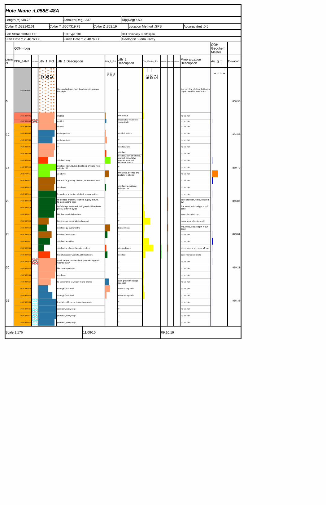
Hole Name :L058E-48A
Length(m) :38.78 Azimuth(Deg) :337 Dip(Deg) :-50Collar X :582142.61 Collar Y :6607319.78 Collar Z :862.19 Location Method :GPS Accuracy(m) :0.5Hole Status :COMPLETE Drill Type :RC Drill Company :NorthspanStart Date :1284876000 Finish Date :1284876000 Geologist :Fiona Katay
QDH - LogQDH - Geochem Master
Depth At DDH_SAMP Fault_IndicaLith_1_Pct Lith_1 Description Lith_2_Pct Lith_2
Description Qtz_Veining_Pct Mariposite_ Pyrite_Pct Aspy_Pct Mineralization Description Au_g_t Elevation
Scale 1:176 11/08/10 09:10:19
5
10
15
20
25
30
35
L058E-48A-001
L058E-48A-002
L058E-48A-003
L058E-48A-004
L058E-48A-005
L058E-48A-006
L058E-48A-007
L058E-48A-008
L058E-48A-009
L058E-48A-010
L058E-48A-011
L058E-48A-012
L058E-48A-013
L058E-48A-014
L058E-48A-015
L058E-48A-016
L058E-48A-017
L058E-48A-018
L058E-48A-019
L058E-48A-020
L058E-48A-021
L058E-48A-022
L058E-48A-023
L058E-48A-024
L058E-48A-025
L058E-48A-026
L058E-48A-027
L058E-48A-028
L058E-48A-029
L058E-48A-030
L058E-48A-031
L058E-48A-032
L058E-48A-033
25 50 75
Rounded pebbles from fluvial gravels, various lithologies
mottled
mottled
mottled
rusty speckles
rusty speckles
?
?
silicified, waxy
silicified, waxy, rounded white plg crystals, relict acicular hbl
as above
micaceous, partially silicified, fe-altered in parts
as above
fe-oxidized andesite, silicified, sugary texture
fe-oxidized andesite, silicified, sugary texture, fe-oxides along fracshalf of chips fe-stained, half greyish hbl andesite, poss 2 different dykes
hbl, fine small slickenlines
biotite mica, minor silicified contact
silicified, qtz overgrowths
silicified, micaceous
silicified, fe-oxides
silicified, fe-altered, fine qtz veinlets
fine chalcedony veinlets, qtz stockwork
small sample, suspect fault zone with mg-carb washed away
like hand specimen
as above
fe-serpentinite to weakly fe-mg altered
strongly fe-altered
strongly fe-altered
less altered fe-serp, becoming greener
greenish, waxy serp
greenish, waxy serp
greenish, waxy serp
25 50 75
?
micaceousmoderately fe-altered serpentinite?
mottled texture
?
silicified, talc
silicifiedsilicified, partially altered, contact, zoned plag crystals, remnant brownish mafics?
micacous, silicified and partially fe-altered
?
silicified, fe-oxidized, indistinct xls
?
?
?
?
?
biotite micas
?
?
qtz stockwork
silicified
?
?
?
dark grey with orange speckles
weak fe-mg-carb
weak fe-mg-carb
?
?
?
?
25 50 75
few very fine >0.5mm flat flecks of gold found in fine fraction
no vis min
no vis min
no vis min
no vis min
no vis min
no vis min
no vis min
no vis min
no vis min
no vis min
no vis min
no vis min
no vis min
trace brownish, cubic, oxidized pyrfine, cubic, oxidized pyr in buff band
trace chromite in qtz
minor grren chronite in qtz
fine, cubic, oxidized pyr in buff band
no vis min
no vis min
green mica in qtz, trace VF pyr
trace mariposite in qtz
no vis min
no vis min
no vis min
no vis min
no vis min
no vis min
no vis min
no vis min
no vis min
no vis min
1 2 3 4858.36
854.53
850.70
846.87
843.04
839.21
835.38
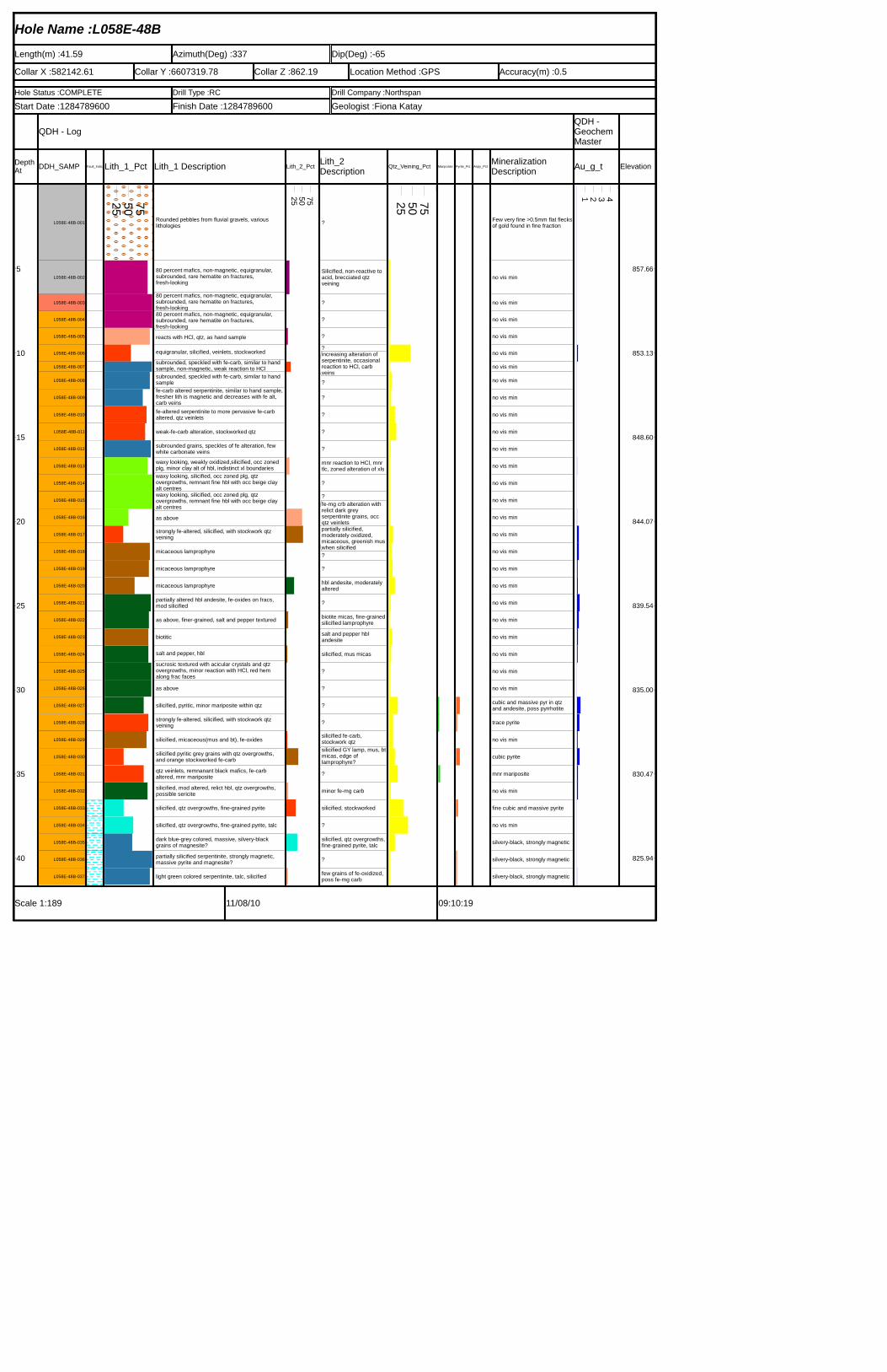
Hole Name :L058E-48B
Length(m) :41.59 Azimuth(Deg) :337 Dip(Deg) :-65Collar X :582142.61 Collar Y :6607319.78 Collar Z :862.19 Location Method :GPS Accuracy(m) :0.5Hole Status :COMPLETE Drill Type :RC Drill Company :NorthspanStart Date :1284789600 Finish Date :1284789600 Geologist :Fiona Katay
QDH - LogQDH - Geochem Master
Depth At DDH_SAMP Fault_IndicaLith_1_Pct Lith_1 Description Lith_2_Pct Lith_2
Description Qtz_Veining_Pct Mariposite_ Pyrite_Pct Aspy_Pct Mineralization Description Au_g_t Elevation
Scale 1:189 11/08/10 09:10:19
5
10
15
20
25
30
35
40
L058E-48B-001
L058E-48B-002
L058E-48B-003
L058E-48B-004
L058E-48B-005
L058E-48B-006
L058E-48B-007
L058E-48B-008
L058E-48B-009
L058E-48B-010
L058E-48B-011
L058E-48B-012
L058E-48B-013
L058E-48B-014
L058E-48B-015
L058E-48B-016
L058E-48B-017
L058E-48B-018
L058E-48B-019
L058E-48B-020
L058E-48B-021
L058E-48B-022
L058E-48B-023
L058E-48B-024
L058E-48B-025
L058E-48B-026
L058E-48B-027
L058E-48B-028
L058E-48B-029
L058E-48B-030
L058E-48B-031
L058E-48B-032
L058E-48B-033
L058E-48B-034
L058E-48B-035
L058E-48B-036
L058E-48B-037
25 50 75
Rounded pebbles from fluvial gravels, various lithologies
80 percent mafics, non-magnetic, equigranular, subrounded, rare hematite on fractures, fresh-looking80 percent mafics, non-magnetic, equigranular, subrounded, rare hematite on fractures, fresh-looking80 percent mafics, non-magnetic, equigranular, subrounded, rare hematite on fractures, fresh-lookingreacts with HCl, qtz, as hand sample
equigranular, silicified, veinlets, stockworkedsubrounded, speckled with fe-carb, similar to hand sample, non-magnetic, weak reaction to HClsubrounded, speckled with fe-carb, similar to hand samplefe-carb altered serpentinite, similar to hand sample,fresher lith is magnetic and decreases with fe alt, carb veinsfe-altered serpentinite to more pervasive fe-carb altered, qtz veinlets
weak-fe-carb alteration, stockworked qtz
subrounded grains, speckles of fe alteration, few white carbonate veinswaxy looking, weakly oxidized,silicified, occ zoned plg, minor clay alt of hbl, indistinct xl boundarieswaxy looking, silicified, occ zoned plg, qtz overgrowths, remnant fine hbl with occ beige clay alt centreswaxy looking, silicified, occ zoned plg, qtz overgrowths, remnant fine hbl with occ beige clay alt centresas abovestrongly fe-altered, silicified, with stockwork qtz veining
micaceous lamprophyre
micaceous lamprophyre
micaceous lamprophyre
partially altered hbl andesite, fe-oxides on fracs, mod silicified
as above, finer-grained, salt and pepper textured
biotitic
salt and pepper, hblsucrosic textured with acicular crystals and qtz overgrowths, minor reaction with HCl, red hem along frac facesas above
silicified, pyritic, minor mariposite within qtz
strongly fe-altered, silicified, with stockwork qtz veining
silicified, micaceous(mus and bt), fe-oxides
silicified pyritic grey grains with qtz overgrowths, and orange stockworked fe-carbqtz veinlets, remnanant black mafics, fe-carb altered, mnr maripositesilicified, mod altered, relict hbl, qtz overgrowths, possible sericite
silicified, qtz overgrowths, fine-grained pyrite
silicified, qtz overgrowths, fine-grained pyrite, talc
dark blue-grey colored, massive, silvery-black grains of magnesite?partially silicified serpentinite, strongly magnetic, massive pyrite and magnesite?
light green colored serpentinite, talc, silicified
25 50 75
?
Silicified, non-reactive to acid, brecciated qtz veining
?
?
??increasing alteration of serpentinite, occasional reaction to HCl, carb veins?
?
?
?
?
mnr reaction to HCl, mnr tlc, zoned alteration of xls
??fe-mg crb alteration with relict dark grey serpentinite grains, occ qtz veinletspartially silicified, moderately oxidized, micaceous, greenish muswhen silicified??
hbl andesite, moderately altered
?
biotite micas, fine-grainedsilicified lamprophyresalt and pepper hbl andesite
silicified, mus micas
?
?
?
?silicified fe-carb, stockwork qtzsilicified GY lamp, mus, btmicas, edge of lamprophyre??
minor fe-mg carb
silicified, stockworked
?
silicified, qtz overgrowths, fine-grained pyrite, talc
?
few grains of fe-oxidized, poss fe-mg carb
25 50 75
Few very fine >0.5mm flat flecksof gold found in fine fraction
no vis min
no vis min
no vis min
no vis min
no vis min
no vis min
no vis min
no vis min
no vis min
no vis min
no vis min
no vis min
no vis min
no vis min
no vis min
no vis min
no vis min
no vis min
no vis min
no vis min
no vis min
no vis min
no vis min
no vis min
no vis min
cubic and massive pyr in qtz and andesite, poss pyrrhotite
trace pyrite
no vis min
cubic pyrite
mnr mariposite
no vis min
fine cubic and massive pyrite
no vis min
silvery-black, strongly magnetic
silvery-black, strongly magnetic
silvery-black, strongly magnetic
1 2 3 4857.66
853.13
848.60
844.07
839.54
835.00
830.47
825.94
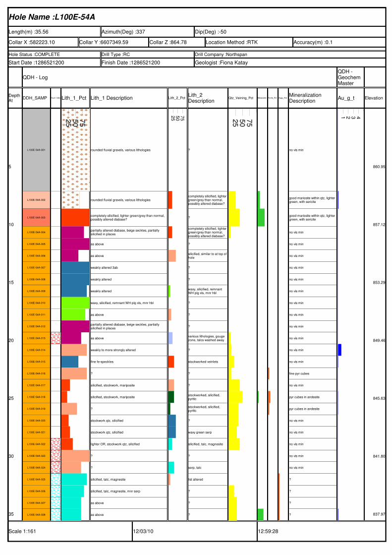
Hole Name :L100E-54A
Length(m) :35.56 Azimuth(Deg) :337 Dip(Deg) :-50
Collar X :582223.10 Collar Y :6607349.59 Collar Z :864.78 Location Method :RTK Accuracy(m) :0.1
Hole Status :COMPLETE Drill Type :RC Drill Company :Northspan
Start Date :1286521200 Finish Date :1286521200 Geologist :Fiona Katay
QDH - LogQDH - Geochem Master
Depth At
DDH_SAMP Fault_IndicatorsLith_1_Pct Lith_1 Description Lith_2_PctLith_2 Description
Qtz_Veining_Pct Mariposite_PctPyrite_Pct Aspy_PctMineralization Description
Au_g_t Elevation
Scale 1:161 12/03/10 12:59:28
5
10
15
20
25
30
35
L100E-54A-001
L100E-54A-002
L100E-54A-003
L100E-54A-004
L100E-54A-005
L100E-54A-006
L100E-54A-007
L100E-54A-008
L100E-54A-009
L100E-54A-010
L100E-54A-011
L100E-54A-012
L100E-54A-013
L100E-54A-014
L100E-54A-015
L100E-54A-016
L100E-54A-017
L100E-54A-018
L100E-54A-019
L100E-54A-020
L100E-54A-021
L100E-54A-022
L100E-54A-023
L100E-54A-024
L100E-54A-025
L100E-54A-026
L100E-54A-027
L100E-54A-028
25
50
75
rounded fluvial gravels, various lithologies
rounded fluvial gravels, various lithologies
completely silicified, lighter green/grey than normal, possibly altered diabase?
partially altered diabase, beige seckles, partially silicified in places
as above
as above
weakly altered 3ab
weakly altered
weakly altered
waxy, silicified, remnant WH plg xls, mnr hbl
as above
partially altered diabase, beige seckles, partially silicified in places
as above
weakly to more strongly altered
fine fe-speckles
?
silicified, stockwork, mariposite
silicified, stockwork, mariposite
?
stockwork qtz, silicified
stockwork qtz, silicified
lighter OR, stockwork qtz, silicified
?
?
silicified, talc, magnesite
silicified, talc, magnesite, mnr serp
as above
as above
25
50
75
?
completely silicified, lightergreen/grey than normal, possibly altered diabase?
?
completely silicified, lightergreen/grey than normal, possibly altered diabase?
?
silicified, similar to at top ofhole
?
?
waxy, silicified, remnant WH plg xls, mnr hbl
?
?
?
various lithologies, gouge zone, talcs washed away
?
stockworked veinlets
?
?
stockworked, silicified, pyritic
stockworked, silicified, pyritic
?
waxy green serp
silicified, talc, magnesite
?
serp, talc
list altered
?
?
?
25
50
75
no vis min
good mariosite within qtz, lighter green, with sericite
good mariosite within qtz, lighter green, with sericite
no vis min
no vis min
no vis min
no vis min
no vis min
no vis min
no vis min
no vis min
no vis min
no vis min
no vis min
no vis min
fine pyr cubes
no vis min
pyr cubes in andesite
pyr cubes in andesite
no vis min
no vis min
no vis min
no vis min
no vis min
?
?
?
?
1 2 3 4
860.95
857.12
853.29
849.46
845.63
841.80
837.97
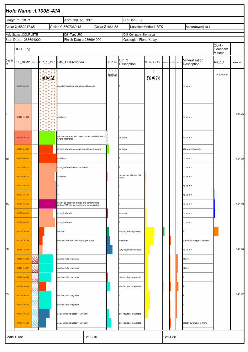
Hole Name :L100E-42A
Length(m) :28.71 Azimuth(Deg) :337 Dip(Deg) :-50
Collar X :582217.65 Collar Y :6607360.13 Collar Z :864.58 Location Method :RTK Accuracy(m) :0.1
Hole Status :COMPLETE Drill Type :RC Drill Company :Northspan
Start Date :1286694000 Finish Date :1286694000 Geologist :Fiona Katay
QDH - LogQDH - Geochem Master
Depth At
DDH_SAMP Fault_IndicatorsLith_1_Pct Lith_1 Description Lith_2_PctLith_2 Description
Qtz_Veining_Pct Mariposite_PctPyrite_Pct Aspy_PctMineralization Description
Au_g_t Elevation
Scale 1:132 12/03/10 12:54:38
5
10
15
20
25
L100E-42A-001
L100E-42A-002
L100E-42A-003
L100E-42A-004
L100E-42A-005
L100E-42A-006
L100E-42A-007
L100E-42A-008
L100E-42A-009
L100E-42A-010
L100E-42A-011
L100E-42A-012
L100E-42A-013
L100E-42A-014
L100E-42A-015
L100E-42A-016
L100E-42A-017
L100E-42A-018
L100E-42A-019
L100E-42A-020
L100E-42A-021
L100E-42A-022
L100E-42A-023
25
50
75
rounded fluvial gravels, various lithologies
as above
silicified, remnant WH plg xls, hbl xls, mod buff color where weathered
strongly altered, recessive limonitic, no stock qtz
as above
strongly altered, recessive limonitic
as above
?
?
fine beige speckles, altered and serpentinized diabase? Mnr fe-stain and hem, some silicified
strongly altered
strongly altered
silicified
silicified, some 9c from above, pyr cubes
?
silicified, talc, magnesite
silicified, talc, magnesite
silicified, talc, magnesite
?
silicified, talc, magnesite
silicified, talc, magnesite
serpentinized diabase? Mnr hem
serpentinized diabase? Mnr hem
25
50
75
?
?
as above
as above
?
?
qtz veinlets, silicified OR halos
?
?
?
as above
?
silicified, fine plg netting
waxy serp
very weakly altered serp
?
?
silicified, talc, magnesite
silicified, talc, magnesite
?
?
silicified, talc, magnesite
silicified, talc, magnesite
25
50
75
no vis min
no vis min
no vis min
VG seen in bucket 4
no vis min
no vis min
no vis min
no vis min
no vis min
no vis min
no vis min
no vis min
?
cubic oxidized pyr in andesite
no vis min
silvery
silvery
?
?
?
?
?
golden pyr cluster to 4mm
1 2 3 4
860.75
856.92
853.09
849.26
845.42
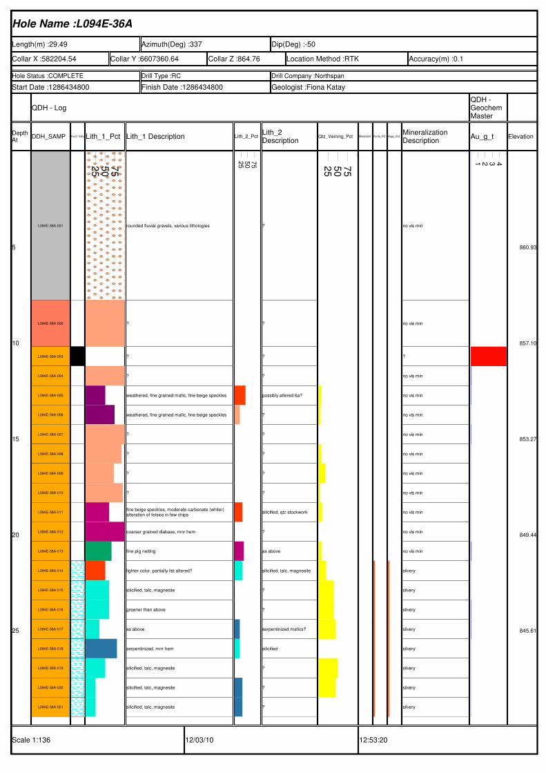
Hole Name :L094E-36A
Length(m) :29.49 Azimuth(Deg) :337 Dip(Deg) :-50
Collar X :582204.54 Collar Y :6607360.64 Collar Z :864.76 Location Method :RTK Accuracy(m) :0.1
Hole Status :COMPLETE Drill Type :RC Drill Company :Northspan
Start Date :1286434800 Finish Date :1286434800 Geologist :Fiona Katay
QDH - LogQDH - Geochem Master
Depth At
DDH_SAMP Fault_IndicatorsLith_1_Pct Lith_1 Description Lith_2_PctLith_2 Description
Qtz_Veining_Pct Mariposite_PctPyrite_Pct Aspy_PctMineralization Description
Au_g_t Elevation
Scale 1:136 12/03/10 12:53:20
5
10
15
20
25
L094E-36A-001
L094E-36A-002
L094E-36A-003
L094E-36A-004
L094E-36A-005
L094E-36A-006
L094E-36A-007
L094E-36A-008
L094E-36A-009
L094E-36A-010
L094E-36A-011
L094E-36A-012
L094E-36A-013
L094E-36A-014
L094E-36A-015
L094E-36A-016
L094E-36A-017
L094E-36A-018
L094E-36A-019
L094E-36A-020
L094E-36A-021
25
50
75
rounded fluvial gravels, various lithologies
?
?
?
weathered, fine grained mafic, fine beige speckles
weathered, fine grained mafic, fine beige speckles
?
?
?
?
fine beige speckles, moderate carbonate (whiter) alteration of felsics in few chips
coarser grained diabase, mnr hem
fine plg netting
lighter color, partially list altered?
silicified, talc, magnesite
greener than above
as above
serpentinized, mnr hem
silicified, talc, magnesite
silicified, talc, magnesite
silicified, talc, magnesite
25
50
75
?
?
?
?
possibly altered 6a?
?
?
?
?
?
silicified, qtz stockwork
?
as above
silicified, talc, magnesite
?
?
serpentinized mafics?
silicified
?
?
?
25
50
75
no vis min
no vis min
?
no vis min
no vis min
no vis min
no vis min
no vis min
no vis min
no vis min
no vis min
no vis min
no vis min
silvery
silvery
silvery
silvery
silvery
silvery
silvery
silvery
1 2 3 4
860.93
857.10
853.27
849.44
845.61
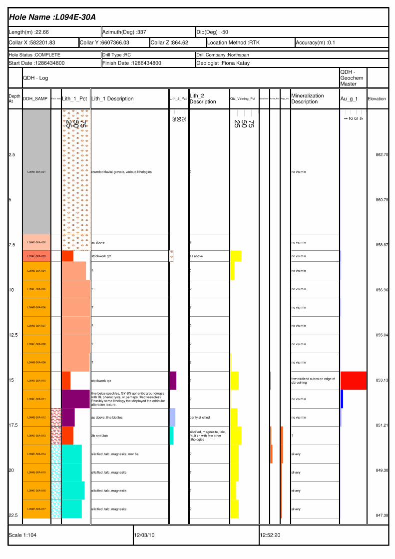
Hole Name :L094E-30A
Length(m) :22.66 Azimuth(Deg) :337 Dip(Deg) :-50
Collar X :582201.83 Collar Y :6607366.03 Collar Z :864.62 Location Method :RTK Accuracy(m) :0.1
Hole Status :COMPLETE Drill Type :RC Drill Company :Northspan
Start Date :1286434800 Finish Date :1286434800 Geologist :Fiona Katay
QDH - LogQDH - Geochem Master
Depth At
DDH_SAMP Fault_IndicatorsLith_1_Pct Lith_1 Description Lith_2_PctLith_2 Description
Qtz_Veining_Pct Mariposite_PctPyrite_Pct Aspy_PctMineralization Description
Au_g_t Elevation
Scale 1:104 12/03/10 12:52:20
2.5
5
7.5
10
12.5
15
17.5
20
22.5
L094E-30A-001
L094E-30A-002
L094E-30A-003
L094E-30A-004
L094E-30A-005
L094E-30A-006
L094E-30A-007
L094E-30A-008
L094E-30A-009
L094E-30A-010
L094E-30A-011
L094E-30A-012
L094E-30A-013
L094E-30A-014
L094E-30A-015
L094E-30A-016
L094E-30A-017
25
50
75
rounded fluvial gravels, various lithologies
as above
stockwork qtz
?
?
?
?
?
?
stockwork qtz
fine beige speckles, GY-BN aphanitic groundmass with BL phenocrysts, or perhaps filled vessicles? Possibly same lithology that displayed the orbicular alteration texture.
as above, fine biotites
3b and 3ab
silicified, talc, magnesite, mnr 6a
silicified, talc, magnesite
silicified, talc, magnesite
silicified, talc, magnesite
25
50
75
?
?
as above
?
?
?
?
?
?
?
?
partly silicified
silicified, magnesite, talc, fault zn with few other lithologies
?
?
?
?
25
50
75
no vis min
no vis min
no vis min
no vis min
no vis min
no vis min
no vis min
no vis min
no vis min
few oxidized cubes on edge of qtz veining
no vis min
no vis min
?
silvery
silvery
silvery
silvery
1 2 3 4
862.70
860.79
858.87
856.96
855.04
853.13
851.21
849.30
847.38
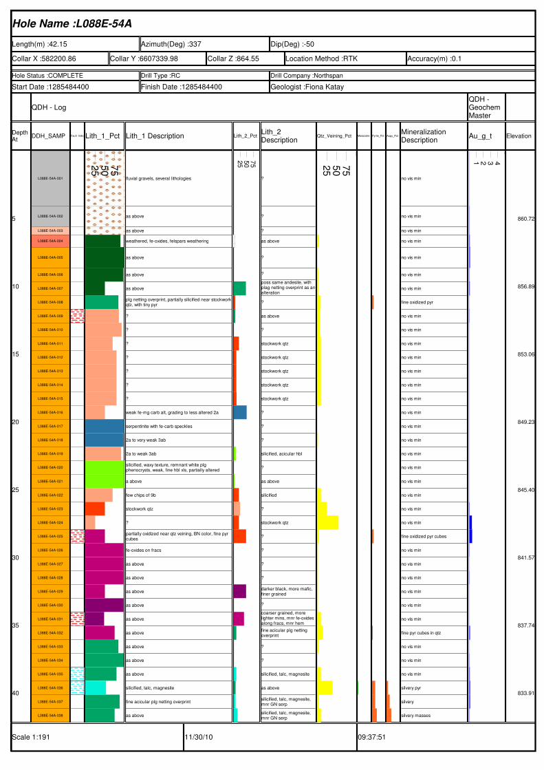
Hole Name :L088E-54A
Length(m) :42.15 Azimuth(Deg) :337 Dip(Deg) :-50
Collar X :582200.86 Collar Y :6607339.98 Collar Z :864.55 Location Method :RTK Accuracy(m) :0.1
Hole Status :COMPLETE Drill Type :RC Drill Company :Northspan
Start Date :1285484400 Finish Date :1285484400 Geologist :Fiona Katay
QDH - LogQDH - Geochem Master
Depth At
DDH_SAMP Fault_IndicatorsLith_1_Pct Lith_1 Description Lith_2_PctLith_2 Description
Qtz_Veining_Pct Mariposite_PctPyrite_Pct Aspy_PctMineralization Description
Au_g_t Elevation
Scale 1:191 11/30/10 09:37:51
5
10
15
20
25
30
35
40
L088E-54A-001
L088E-54A-002
L088E-54A-003
L088E-54A-004
L088E-54A-005
L088E-54A-006
L088E-54A-007
L088E-54A-008
L088E-54A-009
L088E-54A-010
L088E-54A-011
L088E-54A-012
L088E-54A-013
L088E-54A-014
L088E-54A-015
L088E-54A-016
L088E-54A-017
L088E-54A-018
L088E-54A-019
L088E-54A-020
L088E-54A-021
L088E-54A-022
L088E-54A-023
L088E-54A-024
L088E-54A-025
L088E-54A-026
L088E-54A-027
L088E-54A-028
L088E-54A-029
L088E-54A-030
L088E-54A-031
L088E-54A-032
L088E-54A-033
L088E-54A-034
L088E-54A-035
L088E-54A-036
L088E-54A-037
L088E-54A-038
25
50
75
fluvial gravels, several lithologies
as above
as above
weathered, fe-oxides, felspars weathering
as above
as above
as above
plg netting overprint, partially silicified near stockworkqtz, with tiny pyr
?
?
?
?
?
?
?
weak fe-mg carb alt, grading to less altered 2a
serpentinite with fe-carb speckles
2a to very weak 3ab
2a to weak 3ab
silicified, waxy texture, remnant white plg phenocrysts, weak, fine hbl xls, partially altered
a above
few chips of 9b
stockwork qtz
?
partially oxidized near qtz veining, BN color, fine pyr cubes
fe-oxides on fracs
as above
as above
as above
as above
as above
as above
as above
as above
as above
silicified, talc, magnesite
fine acicular plg netting overprint
as above
25
50
75
?
?
?
as above
?
?
poss same andesite, with plag netting overprint as analteration
?
as above
?
stockwork qtz
stockwork qtz
stockwork qtz
stockwork qtz
stockwork qtz
?
?
?
silicified, acicular hbl
?
as above
silicified
?
stockwork qtz
?
?
?
?
darker black, more mafic, finer grained
?
coarser grained, more lighter mins, mnr fe-oxides along fracs, mnr hem
fine acicular plg netting overprint
?
?
silicified, talc, magnesite
as above
silicified, talc, magnesite, mnr GN serp
silicified, talc, magnesite, mnr GN serp
25
50
75
no vis min
no vis min
no vis min
no vis min
no vis min
no vis min
no vis min
fine oxidized pyr
no vis min
no vis min
no vis min
no vis min
no vis min
no vis min
no vis min
no vis min
no vis min
no vis min
no vis min
no vis min
no vis min
no vis min
no vis min
no vis min
fine oxidized pyr cubes
no vis min
no vis min
no vis min
no vis min
no vis min
no vis min
fine pyr cubes in qtz
no vis min
no vis min
no vis min
silvery pyr
silvery
silvery masses
1 2 3 4
860.72
856.89
853.06
849.23
845.40
841.57
837.74
833.91
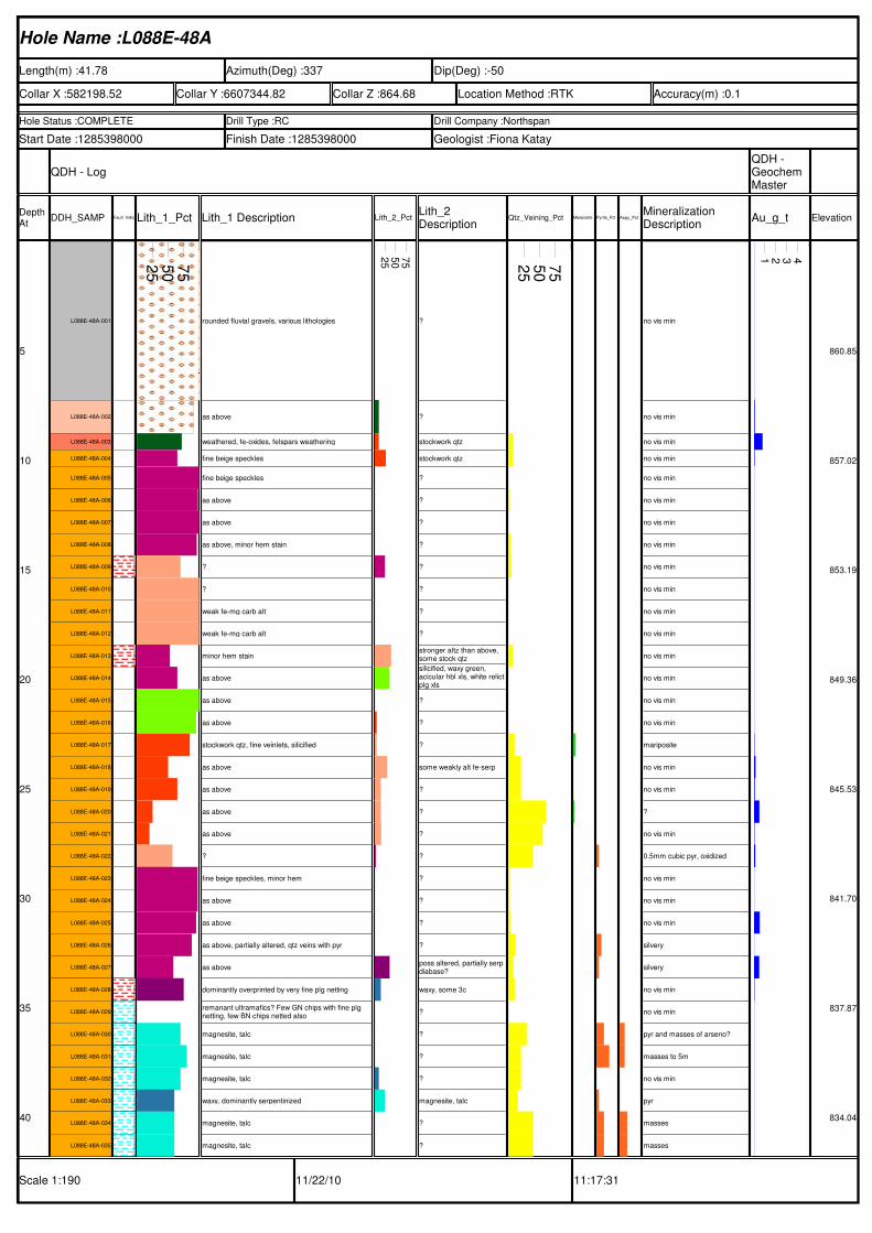
Hole Name :L088E-48A
Length(m) :41.78 Azimuth(Deg) :337 Dip(Deg) :-50
Collar X :582198.52 Collar Y :6607344.82 Collar Z :864.68 Location Method :RTK Accuracy(m) :0.1
Hole Status :COMPLETE Drill Type :RC Drill Company :Northspan
Start Date :1285398000 Finish Date :1285398000 Geologist :Fiona Katay
QDH - LogQDH - Geochem Master
Depth At
DDH_SAMP Fault_IndicatorsLith_1_Pct Lith_1 Description Lith_2_PctLith_2 Description
Qtz_Veining_Pct Mariposite_PctPyrite_Pct Aspy_PctMineralization Description
Au_g_t Elevation
Scale 1:190 11/22/10 11:17:31
5
10
15
20
25
30
35
40
L088E-48A-001
L088E-48A-002
L088E-48A-003
L088E-48A-004
L088E-48A-005
L088E-48A-006
L088E-48A-007
L088E-48A-008
L088E-48A-009
L088E-48A-010
L088E-48A-011
L088E-48A-012
L088E-48A-013
L088E-48A-014
L088E-48A-015
L088E-48A-016
L088E-48A-017
L088E-48A-018
L088E-48A-019
L088E-48A-020
L088E-48A-021
L088E-48A-022
L088E-48A-023
L088E-48A-024
L088E-48A-025
L088E-48A-026
L088E-48A-027
L088E-48A-028
L088E-48A-029
L088E-48A-030
L088E-48A-031
L088E-48A-032
L088E-48A-033
L088E-48A-034
L088E-48A-035
25
50
75
rounded fluvial gravels, various lithologies
as above
weathered, fe-oxides, felspars weathering
fine beige speckles
fine beige speckles
as above
as above
as above, minor hem stain
?
?
weak fe-mg carb alt
weak fe-mg carb alt
minor hem stain
as above
as above
as above
stockwork qtz, fine veinlets, silicified
as above
as above
as above
as above
?
fine beige speckles, minor hem
as above
as above
as above, partially altered, qtz veins with pyr
as above
dominantly overprinted by very fine plg netting
remanant ultramafics? Few GN chips with fine plg netting, few BN chips netted also
magnesite, talc
magnesite, talc
magnesite, talc
waxy, dominantly serpentinized
magnesite, talc
magnesite, talc
25
50
75
?
?
stockwork qtz
stockwork qtz
?
?
?
?
?
?
?
?
stronger altz than above, some stock qtz
silicified, waxy green, acicular hbl xls, white relictplg xls
?
?
?
some weakly alt fe-serp
?
?
?
?
?
?
?
?
poss altered, partially serp diabase?
waxy, some 3c
?
?
?
?
magnesite, talc
?
?
25
50
75
no vis min
no vis min
no vis min
no vis min
no vis min
no vis min
no vis min
no vis min
no vis min
no vis min
no vis min
no vis min
no vis min
no vis min
no vis min
no vis min
mariposite
no vis min
no vis min
?
no vis min
0.5mm cubic pyr, oxidized
no vis min
no vis min
no vis min
silvery
silvery
no vis min
no vis min
pyr and masses of arseno?
masses to 5m
no vis min
pyr
masses
masses
1 2 3 4
860.85
857.02
853.19
849.36
845.53
841.70
837.87
834.04
Hole Name :L088E-42A
Length(m) :35.5 Azimuth(Deg) :337 Dip(Deg) :-50
Collar X :582196.02 Collar Y :6607350.37 Collar Z :864.69 Location Method :RTK Accuracy(m) :0.1
Hole Status :COMPLETE Drill Type :RC Drill Company :Northspan
Start Date :1285311600 Finish Date :1285398000 Geologist :Fiona Katay
QDH - LogQDH - Geochem Master
Depth At
DDH_SAMP Fault_IndicatorsLith_1_Pct Lith_1 Description Lith_2_PctLith_2 Description
Qtz_Veining_Pct Mariposite_PctPyrite_Pct Aspy_PctMineralization Description
Au_g_t Elevation
Scale 1:161 11/18/10 14:52:21
5
10
15
20
25
30
35
L088E-42A-001
L088E-42A-002
L088E-42A-003
L088E-42A-004
L088E-42A-005
L088E-42A-006
L088E-42A-007
L088E-42A-008
L088E-42A-009
L088E-42A-010
L088E-42A-011
L088E-42A-012
L088E-42A-013
L088E-42A-014
L088E-42A-015
L088E-42A-016
L088E-42A-017
L088E-42A-018
L088E-42A-019
L088E-42A-020
L088E-42A-021
L088E-42A-022
L088E-42A-023
L088E-42A-024
L088E-42A-025
L088E-42A-026
L088E-42A-027
L088E-42A-028
25
50
75
rounded fluvial gravels, various lithologies
as above
extrememly weathered, rusty color, difficult to distinguish lith, prob hbl andesite, appears to be abundant qtz, poss diabase, but diabase doesn't weather like this, rusty fe-ox, no hem
as above
as above
VF, black, dominantly mafics
as above, few chips with slickenlines
partially aletered serp
black mafic, overprinted by fine beige speckles, few slickenlines
black mafic, overprinted by fine beige speckles
silicified, relict acicular black hbl xls, partially altered, few chips buff colored
as above
as above
as above, stockwork qtz in andesites
strongly altered, fe-carb with qtz stockwork, mariposite, very fine chalcedony veinlets
as above
as above
?
fine beige speckle overprint, few thin calcite veinlets, greenish color
as above
silicified, magnesite, talc, mnr serp
as above
as above
as above
as above
altered 9c? VF acicular plag netting, buff color
silicified, talc, magnesite
as above
25
50
75
?
?
as above
?
VF, black, dominantly mafics
?
poss mg-carb fault zone, chalky, few chips silicified
poss mg-carb fault zone, chalky, few chips silicified
poss mg-carb fault zone, chalky, few chips silicified
?
MG
?
stockwork qtz, silicified
as above, altered by fe-carb, qtz stock
altered andesite, fine plg netting overprint
?
?
?
?
silicified, talc, magnesite
variable lith, some fe-mg carb, some altered diabaseplg netted, fine acicular laths, poss altered pyroxenite? Few chips listwanitized, light GN, maintain lath text
?
?
acicular fine lath netting text, altered 9c
?
?
?
25
50
75
no vis min
no vis min
no vis min
no vis min
no vis min
no vis min
no vis min
no vis min
no vis min
no vis min
no vis min
no vis min
no vis min
no vis min
no vis min
bright GN mariposite veinlets
bright GN
cubic in qtz veins
no vis min
thin acicular, golden crytals
fine silvery pyr
fine silvery
no vis min
no vis min
silvery
fine cubic pyr
silvery
silvery
1 2 3 4
860.86
857.03
853.20
849.37
845.54
841.71
837.88
Hole Name :L088E-36A
Length(m) :33.25 Azimuth(Deg) :337 Dip(Deg) :-50
Collar X :582193.21 Collar Y :6607355.97 Collar Z :864.77 Location Method :RTK Accuracy(m) :0.1
Hole Status :COMPLETE Drill Type :RC Drill Company :Northspan
Start Date :1285311600 Finish Date :1285311600 Geologist :Fiona Katay
QDH - LogQDH - Geochem Master
Depth At
DDH_SAMP Fault_IndicatorsLith_1_Pct Lith_1 Description Lith_2_PctLith_2 Description
Qtz_Veining_Pct Mariposite_PctPyrite_Pct Aspy_PctMineralization Description
Au_g_t Elevation
Scale 1:151 11/23/10 11:47:07
5
10
15
20
25
30
L088E-36A-001
L088E-36A-002
L088E-36A-003
L088E-36A-004
L088E-36A-005
L088E-36A-006
L088E-36A-007
L088E-36A-008
L088E-36A-009
L088E-36A-010
L088E-36A-011
L088E-36A-012
L088E-36A-013
L088E-36A-014
L088E-36A-015
L088E-36A-016
L088E-36A-017
L088E-36A-018
L088E-36A-019
L088E-36A-020
L088E-36A-021
L088E-36A-022
L088E-36A-023
L088E-36A-024
L088E-36A-025
25
50
75
rounded fluvial gravels, various lithologies
as above
dark colored diabase, dominantly black mafic minerals, overprinted by very fine beige clay alt? mnrhem on fracs. Weakly magnetic
as above
as above
as above, occasionally finer grained
pervasively silicified and homogeneous, with relict acicular hbl xls with partially altered centres, faint euhedral whiter plag xls
as above
as above, few chips altered beige, poss contact with underlying zone
?
stockwork qtz, v.fine chalcedony veinlets, possible infilling of fracture porosity created by density differences related to alteration
stockwork qtz, v.fine chalcedony veinlets, possible infilling of fracture porosity created by density differences related to alteration
as above
as above
as above
as above
dark GN.GY mafic, VF pyr, few chips mod silicified, light GY, with abundant pyr
as above
as above
partially alt, competely netted with fine acicular plg xls, light greenish color with darker greenish roundedmafics
as above
as above
list alt in mafics?
GN altered mafic, partially serpentinitized? Partially list altered to lighter grey, buff, with abundant pyr surrounding veining
as above
25
50
75
?
?
as above
?
?
?
?
?
?
fine being plag lath netting overprint
?
?
?
?
?
?
?
?
?
as above
?
silicified, talc, magnesite
GN altered mafic, partially serpentinitized? Partially list altered to lighter grey, buff, with abundant pyr surrounding veining
?
?
25
50
75
no vis min
no vis min
no vis min
no vis min
no vis min
up to 5m flat VG flecks seen in splitter
no vis min
no vis min
no vis min
no vis min
no vis min
no vis min
no vis min
mariposite withing qtz veining
2 large clusters up to 5mm, striations
dark red hem stain
fine silvery pyr
fine silvery pyr
fine silvery pyr
no vis min
no vis min
silvery, granular
silvery, granular
no vis min
silvery pyr
1 2 3 4
860.94
857.11
853.28
849.45
845.61
841.78
Hole Name :L088E-24A
Length(m) :23.37 Azimuth(Deg) :337 Dip(Deg) :-50
Collar X :582188.14 Collar Y :6607366.57 Collar Z :864.78 Location Method :RTK Accuracy(m) :0.1
Hole Status :COMPLETE Drill Type :RC Drill Company :Northspan
Start Date :1285225200 Finish Date :1285225200 Geologist :Fiona Katay
QDH - LogQDH - Geochem Master
Depth At
DDH_SAMP Fault_IndicatorsLith_1_Pct Lith_1 Description Lith_2_PctLith_2 Description
Qtz_Veining_Pct Mariposite_PctPyrite_Pct Aspy_PctMineralization Description
Au_g_t Elevation
Scale 1:106 11/18/10 14:51:57
2.5
5
7.5
10
12.5
15
17.5
20
22.5
L088E-24A-001
L088E-24A-002
L088E-24A-003
L088E-24A-004
L088E-24A-005
L088E-24A-006
L088E-24A-007
L088E-24A-008
L088E-24A-009
L088E-24A-010
L088E-24A-011
L088E-24A-012
L088E-24A-013
L088E-24A-014
L088E-24A-015
L088E-24A-016
25
50
75
rounded fluvial gravels, various lithologies
as above
poss weathered/altered diabase, fe-stain, fine beige clay speckles, few chips less altered, resemble handsample
as above
mottled
?
?
?
as above
weak fe-carb with qtz stock
qtz stockwork
?
silicified
?
silicified
silicified
25
50
75
?
?
as above
?
?
VF, dominantly black mafics, fine fe-specks/alt
?
?
fe-alt halo within diabase? Some chips more altered, possible alt gradation
serpentinite
?
?
?
?
?
waxy
25
50
75
no vis min
no vis min
no vis min
no vis min
no vis min
no vis min
no vis min
no vis min
no vis min
no vis min
no vis min
VF Au?
?
no vis min
no vis min
no vis min
1 2 3 4
862.86
860.95
859.03
857.12
855.20
853.29
851.37
849.46
847.54
Hole Name :L088E-18A
Length(m) :37.63 Azimuth(Deg) :337 Dip(Deg) :-50
Collar X :582185.70 Collar Y :6607371.90 Collar Z :864.97 Location Method :RTK Accuracy(m) :0.1
Hole Status :COMPLETE Drill Type :RC Drill Company :Northspan
Start Date :1285225200 Finish Date :1285311600 Geologist :Fiona Katay
QDH - LogQDH - Geochem Master
Depth At
DDH_SAMP Fault_IndicatorsLith_1_Pct Lith_1 Description Lith_2_PctLith_2 Description
Qtz_Veining_Pct Mariposite_PctPyrite_Pct Aspy_PctMineralization Description
Au_g_t Elevation
Scale 1:171 11/18/10 14:51:37
5
10
15
20
25
30
35
L088E-18A-001
L088E-18A-002
L088E-18A-003
L088E-18A-004
L088E-18A-005
L088E-18A-006
L088E-18A-007
L088E-18A-008
L088E-18A-009
L088E-18A-010
L088E-18A-011
L088E-18A-012
L088E-18A-013
L088E-18A-014
L088E-18A-015
L088E-18A-016
L088E-18A-017
L088E-18A-018
L088E-18A-019
L088E-18A-020
L088E-18A-021
L088E-18A-022
L088E-18A-023
L088E-18A-024
L088E-18A-025
L088E-18A-026
L088E-18A-027
L088E-18A-028
L088E-18A-029
L088E-18A-030
25
50
75
rounded fluvial gravels, various lithologies
rusty weathering
dark colored fe-mg? Poss weakly altered greyish serp? No fizz in HCl, weakly magnetic
mottled, highly altered
?
partially alt, fine beige speckles, mnr hem, fe-oxides
as above
as above
silicified, talc, magnesite
as above
as above
as above
as above
as above
as above
as above
as above
waxy GN serp
waxy GN serp
as above
as above
waxy GN serp
silicified, talc, magnesite
as above
waxy GN serp, partially altered, WH speckles
as above
waxy GN serp, less altered than above
as above
partially alt, fine beige speckles, mnr hem, fe-oxides
as above
25
50
75
?
as above
speckled, no fizz.
?
?
?
?
GN serp, talc, magnesite
?
?
?
?
?
?
?
?
?
silicified, talc, magnesite
?
?
?
silicified, talc, magnesite
mainly altered serp
partially altered serp, speckled with white specks
silicified, talc, magnesite
?
?
?
?
poss partly alt mafic dyke?
25
50
75
no vis min
no vis min
no vis min
no vis min
no vis min
no vis min
no vis min
no vis min
no vis min
fine silvery pyr
fine silvery pyr
fine silvery pyr
fine silvery pyr
fine pyr, mnr mariposite
fine pyr, mariposite
fine pyr
fine pyr
fine acicular/fibrous pyr
pyr, cubic
no vis min
fine pyr within serp
fine pyr within serp
no vis min
fine pyr
no vis min
tr pyr
tr pyr
tr pyr
tr pyr, partially hem alt
no vis min
1 2 3 4
861.14
857.31
853.48
849.65
845.82
841.99
838.16
Hole Name :L082E-54A
Length(m) :41.01 Azimuth(Deg) :337 Dip(Deg) :-50
Collar X :582189.88 Collar Y :6607334.09 Collar Z :864.81 Location Method :RTK Accuracy(m) :0.1
Hole Status :COMPLETE Drill Type :RC Drill Company :Northspan
Start Date :1286089200 Finish Date :1286089200 Geologist :Fiona Katay
QDH - LogQDH - Geochem Master
Depth At
DDH_SAMP Fault_IndicatorsLith_1_Pct Lith_1 Description Lith_2_PctLith_2 Description
Qtz_Veining_Pct Mariposite_PctPyrite_Pct Aspy_PctMineralization Description
Au_g_t Elevation
Scale 1:186 12/03/10 13:16:03
5
10
15
20
25
30
35
40
L082E-54A-001
L082E-54A-002
L082E-54A-003
L082E-54A-004
L082E-54A-005
L082E-54A-006
L082E-54A-007
L082E-54A-008
L082E-54A-009
L082E-54A-010
L082E-54A-011
L082E-54A-012
L082E-54A-013
L082E-54A-014
L082E-54A-015
L082E-54A-016
L082E-54A-017
L082E-54A-018
L082E-54A-019
L082E-54A-020
L082E-54A-021
L082E-54A-022
L082E-54A-023
L082E-54A-024
L082E-54A-025
L082E-54A-026
L082E-54A-027
L082E-54A-028
L082E-54A-029
L082E-54A-030
L082E-54A-031
L082E-54A-032
25
50
75
rounded fluvial gravels, various lithologies
weathered andesite, fine beige speckles, some fluvial gravels
mnr greener 2a
?
?
stockwork qtz
acicular frosted plg xl overprint or sericite, silicified, poss lamprophyre
as above
less to more altered with buff color, silicified, and finepyr cubes
stockwork qtz, silicified, abundant mariposite in fine veinlets, banded
as above
as above
as above
?
?
?
more altered than above
more altered than above
silicified, stockwork, mariposite
as above, few qtz veinlets with 1mm orange selvages
as above
?
?
?
fine beige speckles, few fine qtz veinlets, mnr hem
as above
as above
as above
as above
as above
as above
silicified, list alteration in diabase
25
50
75
?
?
?
?
?
?
?
?
poss faulted, several lithologies from 2 to 3ab to more stockworked 3b
?
?
?
?
?
?
?
?
silicified, stockwork, mariposite
partially silicified and stockworked, fine acicular plg netting
?
?
?
silicified, stockwork, fine chalcedony veinlets
silicified, talc, magnesite
?
?
?
?
?
?
?
?
25
50
75
no vis min
no vis min
no vis min
no vis min
no vis min
no vis min
no vis min
no vis min
fine pyr cubes
abundant mariposite within fe-carb
abundant mariposite within fe-carb
?
no vis min
no vis min
no vis min
no vis min
no vis min
?
?
no vis min
no vis min
no vis min
no vis min
no vis min
no vis min
no vis min
no vis min
no vis min
no vis min
no vis min
no vis min
no vis min
1 2 3 4
860.98
857.15
853.32
849.49
845.66
841.83
838.00
834.17
Hole Name :L082E-48A
Length(m) :38.48 Azimuth(Deg) :337 Dip(Deg) :-50
Collar X :582187.82 Collar Y :6607339.57 Collar Z :864.56 Location Method :RTK Accuracy(m) :0.1
Hole Status :COMPLETE Drill Type :RC Drill Company :Northspan
Start Date :1286175600 Finish Date :1286175600 Geologist :Fiona Katay
QDH - LogQDH - Geochem Master
Depth At
DDH_SAMP Fault_IndicatorsLith_1_Pct Lith_1 Description Lith_2_PctLith_2 Description
Qtz_Veining_Pct Mariposite_PctPyrite_Pct Aspy_PctMineralization Description
Au_g_t Elevation
Scale 1:177 12/02/10 14:09:13
5
10
15
20
25
30
35
L082E-48A-001
L082E-48A-002
L082E-48A-003
L082E-48A-004
L082E-48A-005
L082E-48A-006
L082E-48A-007
L082E-48A-008
L082E-48A-009
L082E-48A-010
L082E-48A-011
L082E-48A-012
L082E-48A-013
L082E-48A-014
L082E-48A-015
L082E-48A-016
L082E-48A-017
L082E-48A-018
L082E-48A-019
L082E-48A-020
L082E-48A-021
L082E-48A-022
L082E-48A-023
L082E-48A-024
L082E-48A-025
L082E-48A-026
L082E-48A-027
L082E-48A-028
L082E-48A-029
L082E-48A-030
25
50
75
rounded fluvial gravels, various lithologies
weathered, altered, orange colored with secondary fine pyr cubes, granular texture
as above
weathered, altered, orange colored with secondary fine pyr cubes, granular texture, partially silicified, stockwork qtz veining
?
?
several masses of reddish-brown metallic, to 5mm
?
?
?
waxy
waxy
fault gouge? Various lithologies, 2a, 3ab, 2, 9a, abundant greenish talc chips? Soft, waxy
waxy
abundant qtz
?
silicified, black hbl xls, few chips buff color with fine pyr xls as alt near qtz veining?
as above, altered near qtz veining, mnr pyrite
as above, stockwork with alt selvages
?
?
less altered
?
mnr hem, few thin qtz veinlets
mnr hem, few thin qtz veinlets
as above
as above
partially altered, lighter grey color
silicified, talc, magnesite
list altered mafic, L.GY color
25
50
75
?
as above
?
?
silicified, qtz stockwork, buff colored with relict hbl as fe-oxidized xls, fine cubic pyrsilicified, qtz stockwork, mariposite, fine chalcedony veinlets
?
?
?
waxy
?
?
?
?
?
?
?
?
?
silicified, stockwork qtz, thin zones
silicified, stockwork qtz, thin zones
?
?
silicified, altered mafic
?
?
?
?
?
silicified, altered mafic
25
50
75
no vis min
no vis min
no vis min
fine secondary cubic pyr, oxidized
fine pyr cubes in altered andesite, near qtz veining/contact/faultfine pyr cubes
RE-BN, oxidized, occ cubic crystals but dominantly conchoidal fracturing, striations, RE-BN streak, homogeneous masses to 5mm, hematitie or possibly pyrite?
no vis min
no vis min
no vis min
no vis min
no vis min
no vis min
no vis min
no vis min
no vis min
fine pyr cubes
fine pyr cubes
fine pyr cubes
no vis min
?
no vis min
no vis min
fault zn, talc and fines washed away
no vis min
no vis min
no vis min
no vis min
3mm golden pyr clusters
?
1 2 3 4
860.73
856.90
853.07
849.24
845.40
841.57
837.74
Hole Name :L082E-42A
Length(m) :38.71 Azimuth(Deg) :337 Dip(Deg) :-50
Collar X :582185.30 Collar Y :6607345.01 Collar Z :864.52 Location Method :RTK Accuracy(m) :0.1
Hole Status :COMPLETE Drill Type :RC Drill Company :Northspan
Start Date :1286175600 Finish Date :1286175600 Geologist :Fiona Katay
QDH - LogQDH - Geochem Master
Depth At
DDH_SAMP Fault_IndicatorsLith_1_Pct Lith_1 Description Lith_2_PctLith_2 Description
Qtz_Veining_Pct Mariposite_PctPyrite_Pct Aspy_PctMineralization Description
Au_g_t Elevation
Scale 1:182 12/02/10 14:08:25
5
10
15
20
25
30
35
L082E-42A-001
L082E-42A-002
L082E-42A-003
L082E-42A-004
L082E-42A-005
L082E-42A-006
L082E-42A-007
L082E-42A-008
L082E-42A-009
L082E-42A-010
L082E-42A-011
L082E-42A-012
L082E-42A-013
L082E-42A-014
L082E-42A-015
L082E-42A-016
L082E-42A-017
L082E-42A-018
L082E-42A-019
L082E-42A-020
L082E-42A-021
L082E-42A-022
L082E-42A-023
L082E-42A-024
L082E-42A-025
L082E-42A-026
L082E-42A-027
L082E-42A-028
L082E-42A-029
L082E-42A-030
25
50
75
rounded fluvial gravels, various lithologies
VF mafic, weathered, partially altered, VF beige specks, similar to lithology with orange obicular texture
as above
as above
fine beige specks
fine beige specks
fine beige specks
VF, more mafic than
as above
partially altered, lighter grey color
fine beige specks, mnr hem
?
silicified, abundant qtz
?
?
stockwork, silicified
silicified, fine plg netting, stockworked
as above
stockwork, silicified
stockwork, silicified
stockwork, silicified
stockwork, silicified
?
silicified, stockwork, mariposite
silicified, talc, magnesite
as above
serp coated fractures, slickenlines
list altered mafic, L.GY color, fine plg netting
as above
mod altered to serp/talc
25
50
75
?
as above
?
fine beige specks
?
?
?
?
?
talc, fines washed away
poss faulted zn
?
various lithologies, poss fault zn, mnr andesite and diabase
?
?
silicified, talc, magnesite
possibly altered and stockworked andesite
silicified, qtz stockwork
?
?
?
?
stockwork qtz veining through fe-mg carb
silicified, talc, magnesite
list altered mafic, L.GY color, fine plg netting
list altered mafic, L.GY color, fine plg netting
?
silicified, talc, magnesite
silicified, talc, magnesite
?
25
50
75
no vis min
light greenish in qtz
light greenish in qtz
no vis min
no vis min
no vis min
no vis min
no vis min
no vis min
no vis min
no vis min
no vis min
lighter GN
no vis min
no vis min
no vis min
no vis min
no vis min
good GN mariposite in qtz
good GN mariposite in qtz
no vis min
?
?
?
no vis min
silvery
no vis min
no vis min
no vis min
silvery
1 2 3 4
860.69
856.86
853.03
849.20
845.37
841.54
837.71
Hole Name :L082E-36A
Length(m) :35.45 Azimuth(Deg) :337 Dip(Deg) :-50
Collar X :582182.88 Collar Y :6607350.53 Collar Z :864.49 Location Method :RTK Accuracy(m) :0.1
Hole Status :COMPLETE Drill Type :RC Drill Company :Northspan
Start Date :1286262000 Finish Date :1286262000 Geologist :Fiona Katay
QDH - LogQDH - Geochem Master
Depth At
DDH_SAMP Fault_IndicatorsLith_1_Pct Lith_1 Description Lith_2_PctLith_2 Description
Qtz_Veining_Pct Mariposite_PctPyrite_Pct Aspy_PctMineralization Description
Au_g_t Elevation
Scale 1:162 12/03/10 12:49:33
5
10
15
20
25
30
35
L082E-36A-001
L082E-36A-002
L082E-36A-003
L082E-36A-004
L082E-36A-005
L082E-36A-006
L082E-36A-007
L082E-36A-008
L082E-36A-009
L082E-36A-010
L082E-36A-011
L082E-36A-012
L082E-36A-013
L082E-36A-014
L082E-36A-015
L082E-36A-016
L082E-36A-017
L082E-36A-018
L082E-36A-019
L082E-36A-020
L082E-36A-021
L082E-36A-022
L082E-36A-023
L082E-36A-024
L082E-36A-025
L082E-36A-026
L082E-36A-027
L082E-36A-028
25
50
75
rounded fluvial gravels, various lithologies
mod weathering, fine beige speckles
as above
partially weathered, few fine beige speckles
as above
few fine beige speckles
partially weathered, few fine beige speckles
as above
partially altered diabase, mnr hem, few slickenlines
as above
silicified, partially list, stockworked
silicified, stockwork
?
partially serpentinized, mnr hem, few fine qtz veinlets
?
?
?
?
?
silicified, talc, magesite
silicified, talc, magesite, mnr serp
as above
as above
silicified, talc, magnesite, WH altered diabase
silicified, talc, magnesite, WH altered diabase or maic
as above
list altered diabase or mafic
list altered diabase or mafic
25
50
75
?
as above
?
as above
?
?
?
light green sticky clays in unwashed sample
?
?
various lithologies, poss fault zn, mnr diabase, list, fe-mg
siliciied, stockwork
silicified, sericitized, transluscent texture with VF white specks, remnant acicular hbl, poss cubic pyr, poss altered plg andesite
silicified, stockwork
silicified, stockwork
silicified, fine plg netting, qtz stockwork
as above
?
?
similar to silicified, sericitized, VF andesite? Seen in sample 13, but less altered
?
list altered 2a, remnant serp with fe
list altered 2a, remnant serp with fe
waxy
?
?
?
?
25
50
75
no vis min
no vis min
no vis min
no vis min
no vis min
no vis min
no vis min
no vis min
no vis min
no vis min
no vis min
cubic pyr
no vis min
?
no vis min
no vis min
?
?
no vis min
no vis min
no vis min
no vis min
?
?
?
?
no vis min
no vis min
1 2 3 4
860.66
856.83
853.00
849.17
845.34
841.51
837.68
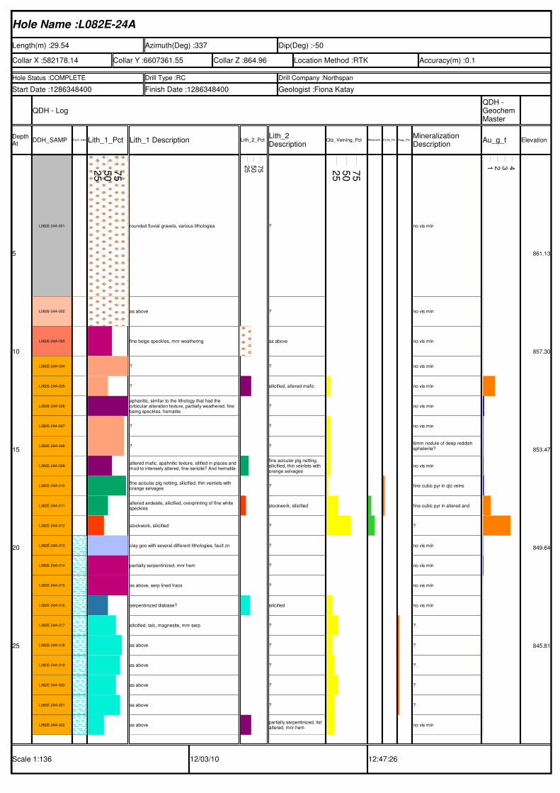
Hole Name :L082E-24A
Length(m) :29.54 Azimuth(Deg) :337 Dip(Deg) :-50
Collar X :582178.14 Collar Y :6607361.55 Collar Z :864.96 Location Method :RTK Accuracy(m) :0.1
Hole Status :COMPLETE Drill Type :RC Drill Company :Northspan
Start Date :1286348400 Finish Date :1286348400 Geologist :Fiona Katay
QDH - LogQDH - Geochem Master
Depth At
DDH_SAMP Fault_IndicatorsLith_1_Pct Lith_1 Description Lith_2_PctLith_2 Description
Qtz_Veining_Pct Mariposite_PctPyrite_Pct Aspy_PctMineralization Description
Au_g_t Elevation
Scale 1:136 12/03/10 12:47:26
5
10
15
20
25
L082E-24A-001
L082E-24A-002
L082E-24A-003
L082E-24A-004
L082E-24A-005
L082E-24A-006
L082E-24A-007
L082E-24A-008
L082E-24A-009
L082E-24A-010
L082E-24A-011
L082E-24A-012
L082E-24A-013
L082E-24A-014
L082E-24A-015
L082E-24A-016
L082E-24A-017
L082E-24A-018
L082E-24A-019
L082E-24A-020
L082E-24A-021
L082E-24A-022
25
50
75
rounded fluvial gravels, various lithologies
as above
fine beige speckles, mnr weathering
?
?
aphanitic, similar to the lithology that had the orbicular alteration texture, partially weathered, fine being speckles, hematite
?
?
altered mafic, apahnitic texture, silified in places and mod to intensely altered, fine sericite? And hematite
fine acicular plg netting, silicified, thin veinlets with orange selvages
altered andesite, silicified, overprinting of fine white speckles
stockwork, silicified
clay goo with several different lithologies, fault zn
partially serpentinized, mnr hem
as above, serp lined fracs
serpentinized diabase?
silicified, talc, magnesite, mnr serp
as above
as above
as above
as above
as above
25
50
75
?
?
as above
?
silicified, altered mafic
?
?
?
fine acicular plg netting, silicified, thin veinlets with orange selvages
?
stockwork, silicified
?
?
?
?
silicified
?
?
?
?
?
partially serpentinized, list altered, mnr hem
25
50
75
no vis min
no vis min
no vis min
no vis min
no vis min
no vis min
no vis min
6mm nodule of deep reddish sphalerite?
no vis min
fine cubic pyr in qtz veins
fine cubic pyr in altered and
?
no vis min
no vis min
no vis min
no vis min
?
?
?
?
?
no vis min
1 2 3 4
861.13
857.30
853.47
849.64
845.81
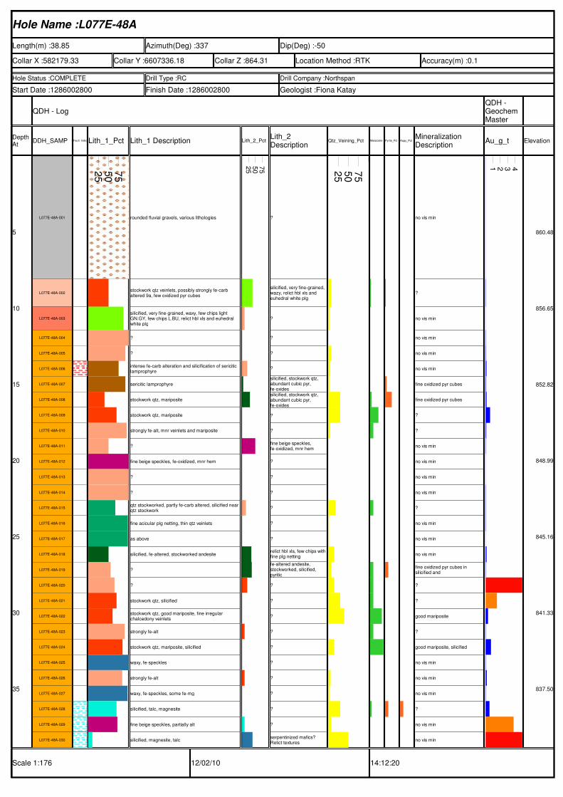
Hole Name :L077E-48A
Length(m) :38.85 Azimuth(Deg) :337 Dip(Deg) :-50
Collar X :582179.33 Collar Y :6607336.18 Collar Z :864.31 Location Method :RTK Accuracy(m) :0.1
Hole Status :COMPLETE Drill Type :RC Drill Company :Northspan
Start Date :1286002800 Finish Date :1286002800 Geologist :Fiona Katay
QDH - LogQDH - Geochem Master
Depth At
DDH_SAMP Fault_IndicatorsLith_1_Pct Lith_1 Description Lith_2_PctLith_2 Description
Qtz_Veining_Pct Mariposite_PctPyrite_Pct Aspy_PctMineralization Description
Au_g_t Elevation
Scale 1:176 12/02/10 14:12:20
5
10
15
20
25
30
35
L077E-48A-001
L077E-48A-002
L077E-48A-003
L077E-48A-004
L077E-48A-005
L077E-48A-006
L077E-48A-007
L077E-48A-008
L077E-48A-009
L077E-48A-010
L077E-48A-011
L077E-48A-012
L077E-48A-013
L077E-48A-014
L077E-48A-015
L077E-48A-016
L077E-48A-017
L077E-48A-018
L077E-48A-019
L077E-48A-020
L077E-48A-021
L077E-48A-022
L077E-48A-023
L077E-48A-024
L077E-48A-025
L077E-48A-026
L077E-48A-027
L077E-48A-028
L077E-48A-029
L077E-48A-030
25
50
75
rounded fluvial gravels, various lithologies
stockwork qtz veinlets, possibly strongly fe-carb altered 9a, few oxidized pyr cubes
silicified, very fine-grained, waxy, few chips light GN.GY, few chips L.BU, relict hbl xls and euhedral white plg
?
?
intense fe-carb alteration and silicification of sericitic lamprophyre
sericitic lamprophyre
stockwork qtz, mariposite
stockwork qtz, mariposite
strongly fe-alt, mnr veinlets and mariposite
?
fine beige speckles, fe-oxidized, mnr hem
?
?
qtz stockworked, partly fe-carb altered, silicified near qtz stockwork
fine acicular plg netting, thin qtz veinlets
as above
silicified, fe-altered, stockworked andesite
?
?
stockwork qtz, silicified
stockwork qtz, good mariposite, fine irregular chalcedony veinlets
strongly fe-alt
stockwork qtz, mariposite, silicified
waxy, fe-speckles
strongly fe-alt
waxy, fe-speckles, some fe-mg
silicified, talc, magnesite
fine beige speckles, partially alt
silicified, magnesite, talc
25
50
75
?
silicified, very fine-grained, wazy, relict hbl xls and euhedral white plg
?
?
?
?
silicified, stockwork qtz, abundant cubic pyr, fe-oxidessilicified, stockwork qtz, abundant cubic pyr, fe-oxides
?
?
fine beige speckles, fe-oxidized, mnr hem
?
?
?
?
?
?
relict hbl xls, few chips withfine plg netting
fe-altered andesite, stockworked, silicified, pyritic
?
?
?
?
?
?
?
?
?
?
serpentinized mafics? Relict textures
25
50
75
no vis min
?
no vis min
no vis min
no vis min
no vis min
fine oxidized pyr cubes
fine oxidized pyr cubes
?
?
no vis min
no vis min
no vis min
no vis min
?
no vis min
no vis min
no vis min
fine oxidized pyr cubes in silicified and
?
?
good mariposite
?
good mariposite, silicified
no vis min
no vis min
no vis min
?
no vis min
no vis min
1 2 3 4
860.48
856.65
852.82
848.99
845.16
841.33
837.50
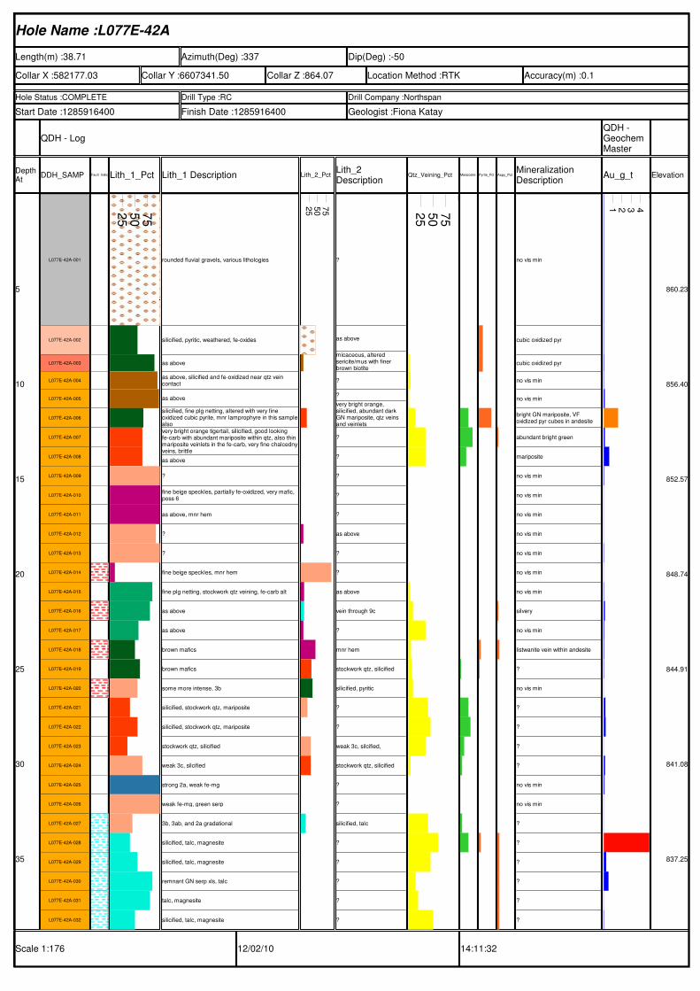
Hole Name :L077E-42A
Length(m) :38.71 Azimuth(Deg) :337 Dip(Deg) :-50
Collar X :582177.03 Collar Y :6607341.50 Collar Z :864.07 Location Method :RTK Accuracy(m) :0.1
Hole Status :COMPLETE Drill Type :RC Drill Company :Northspan
Start Date :1285916400 Finish Date :1285916400 Geologist :Fiona Katay
QDH - LogQDH - Geochem Master
Depth At
DDH_SAMP Fault_IndicatorsLith_1_Pct Lith_1 Description Lith_2_PctLith_2 Description
Qtz_Veining_Pct Mariposite_PctPyrite_Pct Aspy_PctMineralization Description
Au_g_t Elevation
Scale 1:176 12/02/10 14:11:32
5
10
15
20
25
30
35
L077E-42A-001
L077E-42A-002
L077E-42A-003
L077E-42A-004
L077E-42A-005
L077E-42A-006
L077E-42A-007
L077E-42A-008
L077E-42A-009
L077E-42A-010
L077E-42A-011
L077E-42A-012
L077E-42A-013
L077E-42A-014
L077E-42A-015
L077E-42A-016
L077E-42A-017
L077E-42A-018
L077E-42A-019
L077E-42A-020
L077E-42A-021
L077E-42A-022
L077E-42A-023
L077E-42A-024
L077E-42A-025
L077E-42A-026
L077E-42A-027
L077E-42A-028
L077E-42A-029
L077E-42A-030
L077E-42A-031
L077E-42A-032
25
50
75
rounded fluvial gravels, various lithologies
silicified, pyritic, weathered, fe-oxides
as above
as above, silicified and fe-oxidized near qtz vein contact
as above
silicified, fine plg netting, altered with very fine oxidized cubic pyrite, mnr lamprophyre in this samplealsovery bright orange tigertail, silicified, good looking fe-carb with abundant mariposite within qtz, also thin mariposite veinlets in the fe-carb, very fine chalcednyveins, brittle
as above
?
fine beige speckles, partially fe-oxidized, very mafic, poss 6
as above, mnr hem
?
?
fine beige speckles, mnr hem
fine plg netting, stockwork qtz veining, fe-carb alt
as above
as above
brown mafics
brown mafics
some more intense, 3b
silicified, stockwork qtz, mariposite
silicified, stockwork qtz, mariposite
stockwork qtz, silicified
weak 3c, silcified
strong 2a, weak fe-mg
weak fe-mg, green serp
3b, 3ab, and 2a gradational
silicified, talc, magnesite
silicified, talc, magnesite
remnant GN serp xls, talc
talc, magnesite
silicified, talc, magnesite
25
50
75
?
as above
micaceous, altered sericite/mus with finer brown biotite
?
?
very bright orange, silicified, abundant dark GN mariposite, qtz veins and veinlets
?
?
?
?
?
as above
?
?
as above
vein through 9c
?
mnr hem
stockwork qtz, silicified
silicified, pyritic
?
?
weak 3c, silcified,
stockwork qtz, silicified
?
?
silicified, talc
?
?
?
?
?
25
50
75
no vis min
cubic oxidized pyr
cubic oxidized pyr
no vis min
no vis min
bright GN mariposite, VF oxidized pyr cubes in andesite
abundant bright green
mariposite
no vis min
no vis min
no vis min
no vis min
no vis min
no vis min
no vis min
silvery
no vis min
listwanite vein within andesite
?
no vis min
?
?
?
?
no vis min
no vis min
?
?
?
?
?
?
1 2 3 4
860.23
856.40
852.57
848.74
844.91
841.08
837.25
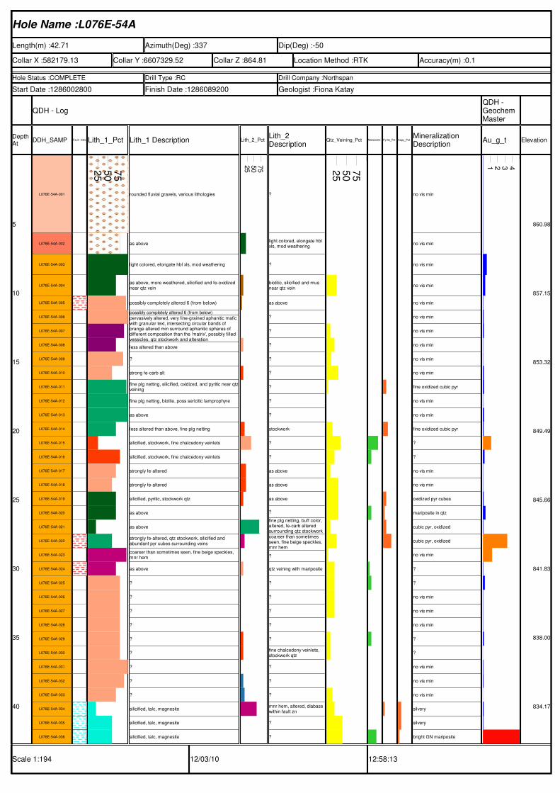
Hole Name :L076E-54A
Length(m) :42.71 Azimuth(Deg) :337 Dip(Deg) :-50
Collar X :582179.13 Collar Y :6607329.52 Collar Z :864.81 Location Method :RTK Accuracy(m) :0.1
Hole Status :COMPLETE Drill Type :RC Drill Company :Northspan
Start Date :1286002800 Finish Date :1286089200 Geologist :Fiona Katay
QDH - LogQDH - Geochem Master
Depth At
DDH_SAMP Fault_IndicatorsLith_1_Pct Lith_1 Description Lith_2_PctLith_2 Description
Qtz_Veining_Pct Mariposite_PctPyrite_Pct Aspy_PctMineralization Description
Au_g_t Elevation
Scale 1:194 12/03/10 12:58:13
5
10
15
20
25
30
35
40
L076E-54A-001
L076E-54A-002
L076E-54A-003
L076E-54A-004
L076E-54A-005
L076E-54A-006
L076E-54A-007
L076E-54A-008
L076E-54A-009
L076E-54A-010
L076E-54A-011
L076E-54A-012
L076E-54A-013
L076E-54A-014
L076E-54A-015
L076E-54A-016
L076E-54A-017
L076E-54A-018
L076E-54A-019
L076E-54A-020
L076E-54A-021
L076E-54A-022
L076E-54A-023
L076E-54A-024
L076E-54A-025
L076E-54A-026
L076E-54A-027
L076E-54A-028
L076E-54A-029
L076E-54A-030
L076E-54A-031
L076E-54A-032
L076E-54A-033
L076E-54A-034
L076E-54A-035
L076E-54A-036
25
50
75
rounded fluvial gravels, various lithologies
as above
light colored, elongate hbl xls, mod weathering
as above, more weathered, silicified and fe-oxidized near qtz vein
possibly completely altered 6 (from below)
possibly completely altered 6 (from below)
pervasively altered, very fine-grained aphanitic mafic with granular text, intersecting circular bands of orange altered min surround aphanitic spheres of different composition than the 'matrix', possibly filled vessicles, qtz stockwork and alteration
less altered than above
?
strong fe-carb alt
fine plg netting, silicified, oxidized, and pyritic near qtzveining
fine plg netting, biotite, poss sericitic lamprophyre
as above
less altered than above, fine plg netting
silicified, stockwork, fine chalcedony veinlets
silicified, stockwork, fine chalcedony veinlets
strongly fe-altered
strongly fe-altered
silicified, pyritic, stockwork qtz
as above
as above
strongly fe-altered, qtz stockwork, silicified and abundant pyr cubes surrounding veins
coarser than sometimes seen, fine beige speckles, mnr hem
as above
?
?
?
?
?
?
?
?
?
silicified, talc, magnesite
silicified, talc, magnesite
silicified, talc, magnesite
25
50
75
?
light colored, elongate hbl xls, mod weathering
?
biotitic, silicified and mus near qtz vein
as above
?
?
?
?
?
?
?
?
stockwork
?
?
as above
as above
as above
?
fine plg netting, buff color, altered, fe-carb altered surrounding qtz stockworkcoarser than sometimes seen, fine beige speckles, mnr hem
?
qtz veining with mariposite
?
?
?
?
?
fine chalcedony veinlets, stockwork qtz
?
?
?
mnr hem, altered, diabase within fault zn
?
?
25
50
75
no vis min
no vis min
no vis min
no vis min
no vis min
no vis min
no vis min
no vis min
no vis min
no vis min
fine oxidized cubic pyr
no vis min
no vis min
fine oxidized cubic pyr
?
?
no vis min
no vis min
oxidized pyr cubes
mariposite in qtz
cubic pyr, oxidized
cubic pyr, oxidized
no vis min
?
?
no vis min
no vis min
no vis min
?
?
no vis min
no vis min
no vis min
silvery
silvery
bright GN mariposite
1 2 3 4
860.98
857.15
853.32
849.49
845.66
841.83
838.00
834.17
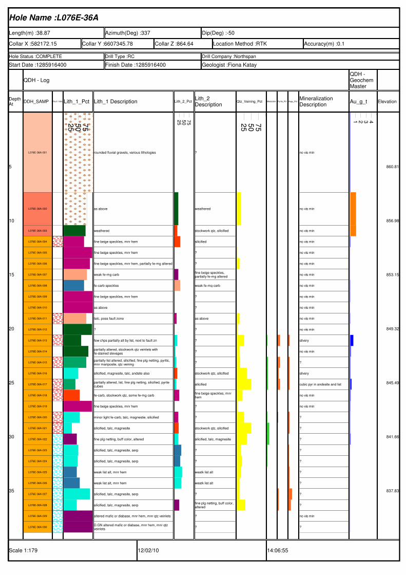
Hole Name :L076E-36A
Length(m) :38.87 Azimuth(Deg) :337 Dip(Deg) :-50
Collar X :582172.15 Collar Y :6607345.78 Collar Z :864.64 Location Method :RTK Accuracy(m) :0.1
Hole Status :COMPLETE Drill Type :RC Drill Company :Northspan
Start Date :1285916400 Finish Date :1285916400 Geologist :Fiona Katay
QDH - LogQDH - Geochem Master
Depth At
DDH_SAMP Fault_IndicatorsLith_1_Pct Lith_1 Description Lith_2_PctLith_2 Description
Qtz_Veining_Pct Mariposite_PctPyrite_Pct Aspy_PctMineralization Description
Au_g_t Elevation
Scale 1:179 12/02/10 14:06:55
5
10
15
20
25
30
35
L076E-36A-001
L076E-36A-002
L076E-36A-003
L076E-36A-004
L076E-36A-005
L076E-36A-006
L076E-36A-007
L076E-36A-008
L076E-36A-009
L076E-36A-010
L076E-36A-011
L076E-36A-012
L076E-36A-013
L076E-36A-014
L076E-36A-015
L076E-36A-016
L076E-36A-017
L076E-36A-018
L076E-36A-019
L076E-36A-020
L076E-36A-021
L076E-36A-022
L076E-36A-023
L076E-36A-024
L076E-36A-025
L076E-36A-026
L076E-36A-027
L076E-36A-028
L076E-36A-029
L076E-36A-030
25
50
75
rounded fluvial gravels, various lithologies
as above
weathered
fine beige speckles, mnr hem
fine beige speckles, mnr hem
fine beige speckles, mnr hem, partially fe-mg altered
weak fe-mg carb
fe-carb speckles
fine beige speckles, mnr hem
as above
talc, poss fault zone
?
few chps partially alt by list, next to fault zn
partially altered, stockwork qtz veinlets with fe-stained slevages
partially list altered, silicified, fine plg netting, pyritic, mnr mariposite, qtz veining
silicified, magnesite, talc, andsite also
partially altered, list, fine plg netting, silicified, pyrite cubes
fe-carb, stockwork qtz, some fe-mg carb
fine beige speckles, mnr hem
minor light fe-carb, talc, magnestie, silicified
silicified, talc, magnesite
fine plg netting, buff color, altered
silicified, talc, magnesite, serp
silicified, talc, magnesite, serp
weak list alt, mnr hem
weak list alt, mnr hem
silicified, talc, magnesite, serp
silicified, talc, magnesite, serp
altered mafic or diabase, mnr hem, mnr qtz veinlets
D.GN altered mafic or diabase, mnr hem, mnr qtz veinlets
25
50
75
?
weathered
stockwork qtz, silicified
silicified
?
?
fine beige speckles, partially fe-mg altered
weak fe-mg carb
?
?
as above
?
?
?
?
stockwork qtz, silicified
silicified
fine beige speckles, mnr hem
?
?
stockwork qtz, silicified
silicified, talc, magnesite
?
?
weatk list alt
weatk list alt
?
fine plg netting, buff color, altered
?
?
25
50
75
no vis min
no vis min
no vis min
no vis min
no vis min
no vis min
no vis min
no vis min
no vis min
no vis min
no vis min
no vis min
silvery
no vis min
?
silvery
cubic pyr in andesite and list
no vis min
no vis min
?
?
?
?
?
?
?
?
?
no vis min
?
1 2 3 4
860.81
856.98
853.15
849.32
845.49
841.66
837.83
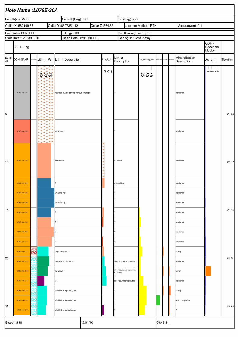
Hole Name :L076E-30A
Length(m) :25.88 Azimuth(Deg) :337 Dip(Deg) :-50
Collar X :582169.85 Collar Y :6607351.12 Collar Z :864.83 Location Method :RTK Accuracy(m) :0.1
Hole Status :COMPLETE Drill Type :RC Drill Company :Northspan
Start Date :1285830000 Finish Date :1285830000 Geologist :Fiona Katay
QDH - LogQDH - Geochem Master
Depth At
DDH_SAMP Fault_IndicatorsLith_1_Pct Lith_1 Description Lith_2_PctLith_2 Description
Qtz_Veining_Pct Mariposite_PctPyrite_Pct Aspy_PctMineralization Description
Au_g_t Elevation
Scale 1:118 12/01/10 09:48:34
5
10
15
20
25
L076E-30A-001
L076E-30A-002
L076E-30A-003
L076E-30A-004
L076E-30A-005
L076E-30A-006
L076E-30A-007
L076E-30A-008
L076E-30A-009
L076E-30A-010
L076E-30A-011
L076E-30A-012
L076E-30A-013
L076E-30A-014
L076E-30A-015
L076E-30A-016
L076E-30A-017
25
50
75
rounded fluvial gravels, various lithologies
as above
more silica
?
weak fe-mg
weak fe-mg
?
?
?
?
mg-carb zone?
acicular plg xls, list alt
as above
?
silicified, magnesite, talc
silicified, magnesite, talc
silicified, magnesite, talc
25
50
75
?
?
as above
more silica
?
?
?
?
?
?
?
silicified, talc, magnesite
silicified, talc, magnesite, mnr serp
silicified, magnesite, talc
?
?
?
25
50
75
no vis min
no vis min
no vis min
no vis min
no vis min
no vis min
no vis min
no vis min
no vis min
no vis min
silvery
no vis min
wilvery
no vis min
silvery
good mariposite
?
1 2 3 4
861.00
857.17
853.34
849.51
845.68
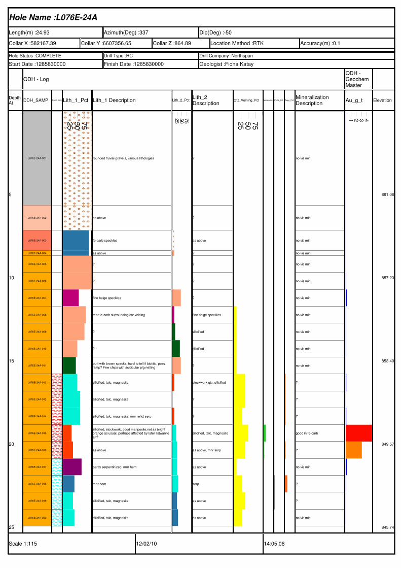
Hole Name :L076E-24A
Length(m) :24.93 Azimuth(Deg) :337 Dip(Deg) :-50
Collar X :582167.39 Collar Y :6607356.65 Collar Z :864.89 Location Method :RTK Accuracy(m) :0.1
Hole Status :COMPLETE Drill Type :RC Drill Company :Northspan
Start Date :1285830000 Finish Date :1285830000 Geologist :Fiona Katay
QDH - LogQDH - Geochem Master
Depth At
DDH_SAMP Fault_IndicatorsLith_1_Pct Lith_1 Description Lith_2_PctLith_2 Description
Qtz_Veining_Pct Mariposite_PctPyrite_Pct Aspy_PctMineralization Description
Au_g_t Elevation
Scale 1:115 12/02/10 14:05:06
5
10
15
20
25
L076E-24A-001
L076E-24A-002
L076E-24A-003
L076E-24A-004
L076E-24A-005
L076E-24A-006
L076E-24A-007
L076E-24A-008
L076E-24A-009
L076E-24A-010
L076E-24A-011
L076E-24A-012
L076E-24A-013
L076E-24A-014
L076E-24A-015
L076E-24A-016
L076E-24A-017
L076E-24A-018
L076E-24A-019
L076E-24A-020
25
50
75
rounded fluvial gravels, various lithologies
as above
fe-carb speckles
as above
?
?
fine beige speckles
mnr fe-carb surrounding qtz veining
?
?
buff with brown specks, hard to tell if biotitic, poss lamp? Few chips with acicicular plg netting
silicified, talc, magnesite
silicified, talc, magnesite
silicified, talc, magnesite, mnr relict serp
silicified, stockwork, good mariposite,not as bright orange as usual, perhaps affected by later listwanite alt?
as above
partly serpentinized, mnr hem
mnr hem
silicified, talc, magnesite
silicified, talc, magnesite
25
50
75
?
?
as above
?
?
?
?
fine beige speckles
silicified
silicified
?
stockwork qtz, silicified
?
?
silicified, talc, magnesite
as above, mnr serp
as above
serp
as above
as above
25
50
75
no vis min
no vis min
no vis min
no vis min
no vis min
no vis min
no vis min
no vis min
no vis min
no vis min
no vis min
?
?
?
good in fe-carb
?
no vis min
?
?
no vis min
1 2 3 4
861.06
857.23
853.40
849.57
845.74
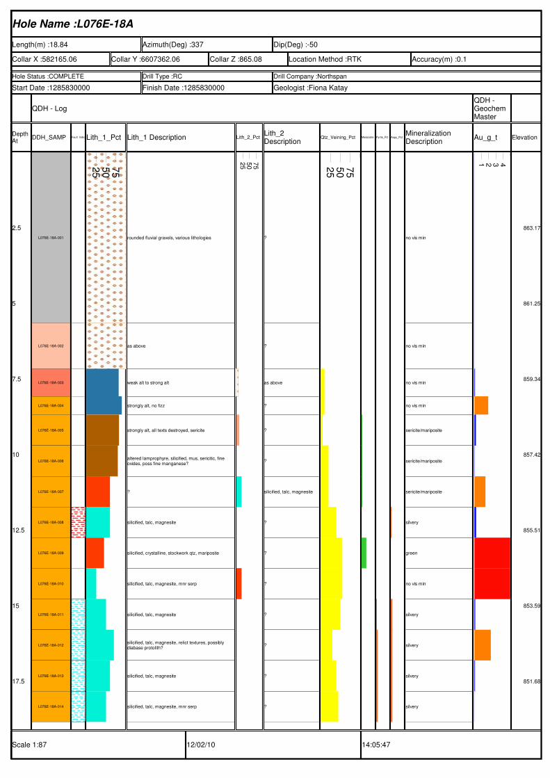
Hole Name :L076E-18A
Length(m) :18.84 Azimuth(Deg) :337 Dip(Deg) :-50
Collar X :582165.06 Collar Y :6607362.06 Collar Z :865.08 Location Method :RTK Accuracy(m) :0.1
Hole Status :COMPLETE Drill Type :RC Drill Company :Northspan
Start Date :1285830000 Finish Date :1285830000 Geologist :Fiona Katay
QDH - LogQDH - Geochem Master
Depth At
DDH_SAMP Fault_IndicatorsLith_1_Pct Lith_1 Description Lith_2_PctLith_2 Description
Qtz_Veining_Pct Mariposite_PctPyrite_Pct Aspy_PctMineralization Description
Au_g_t Elevation
Scale 1:87 12/02/10 14:05:47
2.5
5
7.5
10
12.5
15
17.5
L076E-18A-001
L076E-18A-002
L076E-18A-003
L076E-18A-004
L076E-18A-005
L076E-18A-006
L076E-18A-007
L076E-18A-008
L076E-18A-009
L076E-18A-010
L076E-18A-011
L076E-18A-012
L076E-18A-013
L076E-18A-014
25
50
75
rounded fluvial gravels, various lithologies
as above
weak alt to strong alt
strongly alt, no fizz
strongly alt, all texts destroyed, sericite
altered lamprophyre, silicified, mus, sericitic, fine oxides, poss fine manganese?
?
silicified, talc, magnesite
silicified, crystalline, stockwork qtz, mariposite
silicified, talc, magnesite, mnr serp
silicified, talc, magnesite
silicified, talc, magnesite, relict textures, possibly diabase protolith?
silicified, talc, magnesite
silicified, talc, magnesite, mnr serp
25
50
75
?
?
as above
?
?
?
silicified, talc, magnesite
?
?
?
?
?
?
?
25
50
75
no vis min
no vis min
no vis min
no vis min
sericite/mariposite
sericite/mariposite
sericite/mariposite
silvery
green
no vis min
silvery
silvery
silvery
silvery
1 2 3 4
863.17
861.25
859.34
857.42
855.51
853.59
851.68
Hole Name :L073E-54A
Length(m) :41.55 Azimuth(Deg) :337 Dip(Deg) :-50
Collar X :582173.65 Collar Y :6607326.21 Collar Z :864.53 Location Method :RTK Accuracy(m) :0.1
Hole Status :COMPLETE Drill Type :RC Drill Company :Northspan
Start Date :1285484400 Finish Date :1285570800 Geologist :Fiona Katay
QDH - LogQDH - Geochem Master
Depth At
DDH_SAMP Fault_IndicatorsLith_1_Pct Lith_1 Description Lith_2_PctLith_2 Description
Qtz_Veining_Pct Mariposite_PctPyrite_Pct Aspy_PctMineralization Description
Au_g_t Elevation
Scale 1:189 11/30/10 09:36:52
5
10
15
20
25
30
35
40
L073E-54A-001
L073E-54A-002
L073E-54A-003
L073E-54A-004
L073E-54A-005
L073E-54A-006
L073E-54A-007
L073E-54A-008
L073E-54A-009
L073E-54A-010
L073E-54A-011
L073E-54A-012
L073E-54A-013
L073E-54A-014
L073E-54A-015
L073E-54A-016
L073E-54A-017
L073E-54A-018
L073E-54A-019
L073E-54A-020
L073E-54A-021
L073E-54A-022
L073E-54A-023
L073E-54A-024
L073E-54A-025
L073E-54A-026
L073E-54A-027
L073E-54A-028
L073E-54A-029
L073E-54A-030
L073E-54A-031
L073E-54A-032
L073E-54A-033
L073E-54A-034
L073E-54A-035
L073E-54A-036
25
50
75
rounded fluvial gravels, various lithologies
as above
crystalline, silicified, stockwork qtz
as above
silicified, buff colored, partially altered hbl andesite, fe-oxides
as above
as above, more altered
as above
strongly fe-alt, almost fe-carb, abundant qtz
biotitic, silicified contact with qtz vn, mnr mus
as avobe
weathered, silicified, pyritic, highly altered, stockworked with fe-carb and qtz
biotitic, silicified in few chips, mnr mus, fe-oxidized
fine OR speckles
fine plg netting, partially altered, fe-oxidides
stockwork qtz, partially fe-carb, silicified
fine plg netting
as above
as above
silicified, qtz stockwork
as above
?
fine plg netting
stockwork qtz
fine plg netting, fe-staining on fracs
as above
stockwork qtz
stockwork qtz
stockwork qtz
minor hem stain
as above
as above
as above
as above, becoming coarser grained and greener
as above
weak 3b, grading to 3ab, grading to 2a
25
50
75
?
?
as above
?
silicified, qtz stock, poss altered crystalline UM?
?
?
?
silicified, fe-oxidized
?
weathered, silicified, pyritic,altered
altered andesite?
?
?
partially altered, orange speckles
as above
?
?
silicified, talc, magnesite
?
?
as above
stockwork qtz in andesite
as above
?
?
?
?
?
stockwork qtz
?
?
?
?
?
partially altered serp, orange speckles
25
50
75
no vis min
no vis min
no vis min
poss Au? Very fine
no vis min
oxidized cubic
no vis min
oxidized cubic
no vis min
no vis min
oxidized cubic
oxidized cubic
no vis min
no vis min
no vis min
oxidized cubic pyr, mariposite in qtz vn
no vis min
no vis min
fine oxidized cubes in andesite, silvery in list
good mariposite in qtz
?
no vis min
fine oxidized cubes
?
no vis min
cubic pyr in qtz veins
?
?
?
no vis min
no vis min
no vis min
no vis min
no vis min
no vis min
no vis min
1 2 3 4
860.70
856.87
853.04
849.21
845.38
841.55
837.72
833.89
Hole Name :L073E-36A
Length(m) :31.27 Azimuth(Deg) :337 Dip(Deg) :-67
Collar X :582167.13 Collar Y :6607342.20 Collar Z :864.66 Location Method :RTK Accuracy(m) :0.1
Hole Status :COMPLETE Drill Type :RC Drill Company :Northspan
Start Date :1286089200 Finish Date :1286089200 Geologist :Fiona Katay
QDH - LogQDH - Geochem Master
Depth At
DDH_SAMP Fault_IndicatorsLith_1_Pct Lith_1 Description Lith_2_PctLith_2 Description
Qtz_Veining_Pct Mariposite_PctPyrite_Pct Aspy_PctMineralization Description
Au_g_t Elevation
Scale 1:142 12/02/10 14:10:44
5
10
15
20
25
30
L073E-36A-001
L073E-36A-002
L073E-36A-003
L073E-36A-004
L073E-36A-005
L073E-36A-006
L073E-36A-007
L073E-36A-008
L073E-36A-009
L073E-36A-010
L073E-36A-011
L073E-36A-012
L073E-36A-013
L073E-36A-014
L073E-36A-015
L073E-36A-016
L073E-36A-017
L073E-36A-018
L073E-36A-019
L073E-36A-020
L073E-36A-021
L073E-36A-022
L073E-36A-023
L073E-36A-024
L073E-36A-025
25
50
75
rounded fluvial gravels, various lithologies
as above
?
fine plg netting, silicified, biotitic, possible lamp or 9c, heavily altered, fine sericitic?
fine plg netting, silicified, abundant fine pyr cubes
silicified with qtz stockwork, pyr
silicified with qtz stockwork, pyr, buff color with relict hbl xls
silicified with qtz stockwork, pyr
?
?
qtz veinlets, mnr fe oxidation
?
?
stockworked, silicified, partially altered, minor OR coloration
fine plg netting
fine plg netting
silicified pyritic, pyr cubes with rusty oxidized halos
stockwork qtz, fine chalcedony veinlets, mariposite
?
some weakly altered
?
some stongly altered, almost 3b
?
weakly altered
silicified, talc, magnesite
25
50
75
?
?
as above
?
?
?
?
?
fe-carb speckles
?
?
?
?
?
?
?
?
?
?
?
some weakly altered
?
?
talc, weak mg-alteration of serp
partially altered
25
50
75
no vis min
no vis min
no vis min
abundant VF pyr cubes within silicified andesite
fine oxidized cubic pyr xls
abundant oxidized cubic pyr in qtz veining
oxidized cubic pyr
oxidized cubic pyr
no vis min
no vis min
no vis min
no vis min
no vis min
fine pyr cubes in qtz veining
no vis min
no vis min
no vis min
mariposite in qtz and fe-carb
no vis min
no vis min
no vis min
no vis min
no vis min
no vis min
silvery
1 2 3 4
860.06
855.46
850.86
846.25
841.65
837.05
Hole Name :L070E-36A
Length(m) :40.23 Azimuth(Deg) :337 Dip(Deg) :-50
Collar X :582161.56 Collar Y :6607340.27 Collar Z :864.68 Location Method :RTK Accuracy(m) :0.1
Hole Status :COMPLETE Drill Type :RC Drill Company :Northspan
Start Date :1285570800 Finish Date :1285657200 Geologist :Fiona Katay
QDH - LogQDH - Geochem Master
Depth At
DDH_SAMP Fault_IndicatorsLith_1_Pct Lith_1 Description Lith_2_PctLith_2 Description
Qtz_Veining_Pct Mariposite_PctPyrite_Pct Aspy_PctMineralization Description
Au_g_t Elevation
Scale 1:183 11/30/10 09:14:34
5
10
15
20
25
30
35
40
L070E-36A-001
L070E-36A-002
L070E-36A-003
L070E-36A-004
L070E-36A-005
L070E-36A-006
L070E-36A-007
L070E-36A-008
L070E-36A-009
L070E-36A-010
L070E-36A-011
L070E-36A-012
L070E-36A-013
L070E-36A-014
L070E-36A-015
L070E-36A-016
L070E-36A-017
L070E-36A-018
L070E-36A-019
L070E-36A-020
L070E-36A-021
L070E-36A-022
L070E-36A-023
L070E-36A-024
L070E-36A-025
L070E-36A-026
L070E-36A-027
L070E-36A-028
L070E-36A-029
L070E-36A-030
L070E-36A-031
L070E-36A-032
L070E-36A-033
L070E-36A-034
L070E-36A-035
25
50
75
rounded fluvial gravels, various lithologies
as above
as above
weathered, buff colored, few qtz veins and silicified halos with fine pyr cubes, mnr mariposite and VG!
silicified, stockwork qtz, highly altered
as above
as above
as above
as above
?
fine beige specks
altered diabase, fe-speckles, some pervasively altered
altered diabase, abundant qtz, poss stockwork
silicified, stockwork qtz
silicified, stockwork, fe-oxide selvages
biotitic, partially silicified near contact with qtz vein?
silicified
silicified, veined
fine plg netting
fine plg netting
weak fe-mg altered serp
weakly altering serp
partially altered fe-mg
silicified, talc, mnr serp
altered 9c, silicified, partial talc replacement?
silicified, talc
partially altered serp, darker GN
silicified, talc, magnesite
silicified, talc, magnesite
silicified, talc, magnesite
silicified, talc, magnesite
silicified, talc, magnesite, serp
silicified, talc, magnesite, serp
silicified, talc, magnesite, serp
partially altered serp
25
50
75
?
?
weathered
?
?
?
completely silicified, pyritic
?
completely altered diabase, stockwork qtz
altered diabase? Silicified
?
?
?
altered, stockwork qtz
mus, silicified, fe-oxides
fe-oxides
stockwork qtz
?
?
?
as above, some fe-carb silicification and fine qtz stockwork
partially altered fe-mg
weakly altering serp
altered, silicified, in fault zn
?
dark GN serp
partially altered
partially altered
partially serpentinitized?
?
?
?
partially altered mafic
partially altered mafic
silicified, talc, magnesite, serp
25
50
75
no vis min
no vis min
no vis min
grain of hackly Au found within mariposite in silicified 'vein' in andesite, fine oxidized cubes of pyr in buff silicified andesite
oxidized cubic pyr
no vis min
silvery in list/silicified
no vis min
no vis min
no vis min
no vis min
no vis min
no vis min
no vis min
?
no vis min
?
no vis min
no vis min
no vis min
no vis min
no vis min
no vis min
silvery in list
no vis min
silvery
no vis min
?
silvery
silvery
masses of cubic golden pyr
silvery
?
?
?
1 2 3 4
860.85
857.02
853.19
849.36
845.53
841.70
837.87
834.04
Hole Name :L070E-30A
Length(m) :34.08 Azimuth(Deg) :337 Dip(Deg) :-50
Collar X :582159.00 Collar Y :6607345.75 Collar Z :864.79 Location Method :RTK Accuracy(m) :0.1
Hole Status :COMPLETE Drill Type :RC Drill Company :Northspan
Start Date :1285657200 Finish Date :1285743600 Geologist :Fiona Katay
QDH - LogQDH - Geochem Master
Depth At
DDH_SAMP Fault_IndicatorsLith_1_Pct Lith_1 Description Lith_2_PctLith_2 Description
Qtz_Veining_Pct Mariposite_PctPyrite_Pct Aspy_PctMineralization Description
Au_g_t Elevation
Scale 1:155 12/02/10 14:02:51
5
10
15
20
25
30
L070E-30A-001
L070E-30A-002
L070E-30A-003
L070E-30A-004
L070E-30A-005
L070E-30A-006
L070E-30A-007
L070E-30A-008
L070E-30A-009
L070E-30A-010
L070E-30A-011
L070E-30A-012
L070E-30A-013
L070E-30A-014
L070E-30A-015
L070E-30A-016
L070E-30A-017
L070E-30A-018
L070E-30A-019
L070E-30A-020
L070E-30A-021
L070E-30A-022
L070E-30A-023
L070E-30A-024
L070E-30A-025
L070E-30A-026
L070E-30A-027
L070E-30A-028
25
50
75
rounded fluvial gravels, various lithologies
as above
as above
weathered
weathered, silicified, stockwork qtz, some 3b
partially fe-carb altered? Poss fault zone, some chips of andesite
fine beige speckles, darker and finer than usually seen
weathered and partially altered
stockwork qtz veining within andesite
altered diabase
altered diabse, stockwork qtz
silicified, stockwork qtz, minor fe-oxides, mus, silicified
stockwork qtz, altered andesite
fine acicuar plg netting, stockworked
as above
weak to more strongly altered fe-mg to list, GN talc
waxy serp, weak fe to fe-mg altered
silicified, talc, magnesite
silicified, talc, magnesite
silicified, talc, magnesite
silicified, talc, magnesite
greener color than above
as above
silicified, talc, magnesite, mnr serp
silicified, talc, magnesite
silicified, talc, magnesite
green altered mafic, partially serpentinized? Possibly diabase, mnr hem
as above
25
50
75
?
?
?
?
altered diabase? Silicified
altered diabase
?
?
stockwork qtz
?
stockwork qtz
?
highly altered, silicified, mus
?
?
?
?
as above
?
?
?
?
?
?
?
green altered mafic, partially serpentinized? Possibly diabase, mnr hem
?
?
25
50
75
no vis min
no vis min
no vis min
no vis min
no vis min
no vis min
no vis min
no vis min
no vis min
no vis min
?
no vis min
fine cubic pyr, oxidized
no vis min
no vis min
no vis min
no vis min
?
?
?
?
?
no vis min
no vis min
?
?
no vis min
no vis min
1 2 3 4
860.96
857.13
853.30
849.47
845.64
841.81
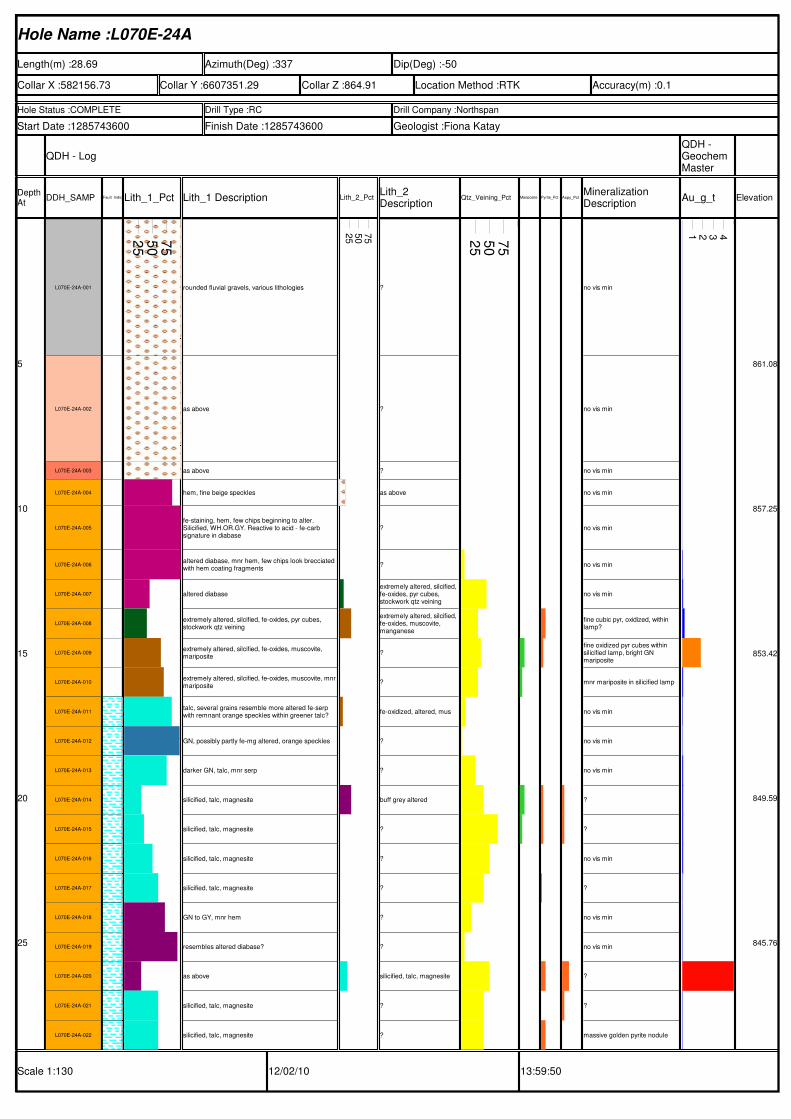
Hole Name :L070E-24A
Length(m) :28.69 Azimuth(Deg) :337 Dip(Deg) :-50
Collar X :582156.73 Collar Y :6607351.29 Collar Z :864.91 Location Method :RTK Accuracy(m) :0.1
Hole Status :COMPLETE Drill Type :RC Drill Company :Northspan
Start Date :1285743600 Finish Date :1285743600 Geologist :Fiona Katay
QDH - LogQDH - Geochem Master
Depth At
DDH_SAMP Fault_IndicatorsLith_1_Pct Lith_1 Description Lith_2_PctLith_2 Description
Qtz_Veining_Pct Mariposite_PctPyrite_Pct Aspy_PctMineralization Description
Au_g_t Elevation
Scale 1:130 12/02/10 13:59:50
5
10
15
20
25
L070E-24A-001
L070E-24A-002
L070E-24A-003
L070E-24A-004
L070E-24A-005
L070E-24A-006
L070E-24A-007
L070E-24A-008
L070E-24A-009
L070E-24A-010
L070E-24A-011
L070E-24A-012
L070E-24A-013
L070E-24A-014
L070E-24A-015
L070E-24A-016
L070E-24A-017
L070E-24A-018
L070E-24A-019
L070E-24A-020
L070E-24A-021
L070E-24A-022
25
50
75
rounded fluvial gravels, various lithologies
as above
as above
hem, fine beige speckles
fe-staining, hem, few chips beginning to alter. Silicified, WH.OR.GY. Reactive to acid - fe-carb signature in diabase
altered diabase, mnr hem, few chips look brecciated with hem coating fragments
altered diabase
extremely altered, silcified, fe-oxides, pyr cubes, stockwork qtz veining
extremely altered, silcified, fe-oxides, muscovite, mariposite
extremely altered, silcified, fe-oxides, muscovite, mnrmariposite
talc, several grains resemble more altered fe-serp with remnant orange speckles within greener talc?
GN, possibly partly fe-mg altered, orange speckles
darker GN, talc, mnr serp
silicified, talc, magnesite
silicified, talc, magnesite
silicified, talc, magnesite
silicified, talc, magnesite
GN to GY, mnr hem
resembles altered diabase?
as above
silicified, talc, magnesite
silicified, talc, magnesite
25
50
75
?
?
?
as above
?
?
extremely altered, silcified, fe-oxides, pyr cubes, stockwork qtz veining
extremely altered, silcified, fe-oxides, muscovite, manganese
?
?
fe-oxidized, altered, mus
?
?
buff grey altered
?
?
?
?
?
silicified, talc, magnesite
?
?
25
50
75
no vis min
no vis min
no vis min
no vis min
no vis min
no vis min
no vis min
fine cubic pyr, oxidized, within lamp?
fine oxidized pyr cubes within silicified lamp, bright GN mariposite
mnr mariposite in silicified lamp
no vis min
no vis min
no vis min
?
?
no vis min
?
no vis min
no vis min
?
?
massive golden pyrite nodule
1 2 3 4
861.08
857.25
853.42
849.59
845.76
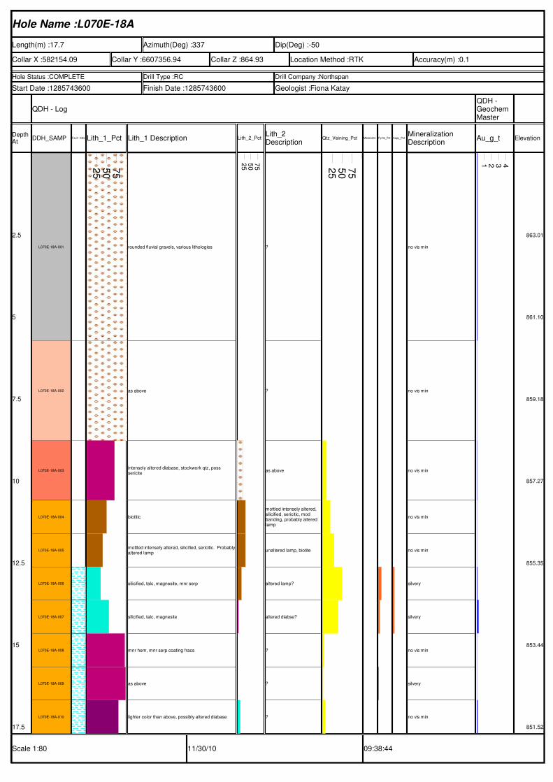
Hole Name :L070E-18A
Length(m) :17.7 Azimuth(Deg) :337 Dip(Deg) :-50
Collar X :582154.09 Collar Y :6607356.94 Collar Z :864.93 Location Method :RTK Accuracy(m) :0.1
Hole Status :COMPLETE Drill Type :RC Drill Company :Northspan
Start Date :1285743600 Finish Date :1285743600 Geologist :Fiona Katay
QDH - LogQDH - Geochem Master
Depth At
DDH_SAMP Fault_IndicatorsLith_1_Pct Lith_1 Description Lith_2_PctLith_2 Description
Qtz_Veining_Pct Mariposite_PctPyrite_Pct Aspy_PctMineralization Description
Au_g_t Elevation
Scale 1:80 11/30/10 09:38:44
2.5
5
7.5
10
12.5
15
17.5
L070E-18A-001
L070E-18A-002
L070E-18A-003
L070E-18A-004
L070E-18A-005
L070E-18A-006
L070E-18A-007
L070E-18A-008
L070E-18A-009
L070E-18A-010
25
50
75
rounded fluvial gravels, various lithologies
as above
intensely altered diabase, stockwork qtz, poss sericite
biotitic
mottled intensely altered, silicified, sericitic. Probablyaltered lamp
silicified, talc, magnesite, mnr serp
silicified, talc, magnesite
mnr hem, mnr serp coating fracs
as above
lighter color than above, possibly altered diabase
25
50
75
?
?
as above
mottled intensely altered, silicified, sericitic, mod banding, probably altered lamp
unaltered lamp, biotite
altered lamp?
altered diabse?
?
?
?
25
50
75
no vis min
no vis min
no vis min
no vis min
no vis min
silvery
silvery
no vis min
silvery
no vis min
1 2 3 4
863.01
861.10
859.18
857.27
855.35
853.44
851.52
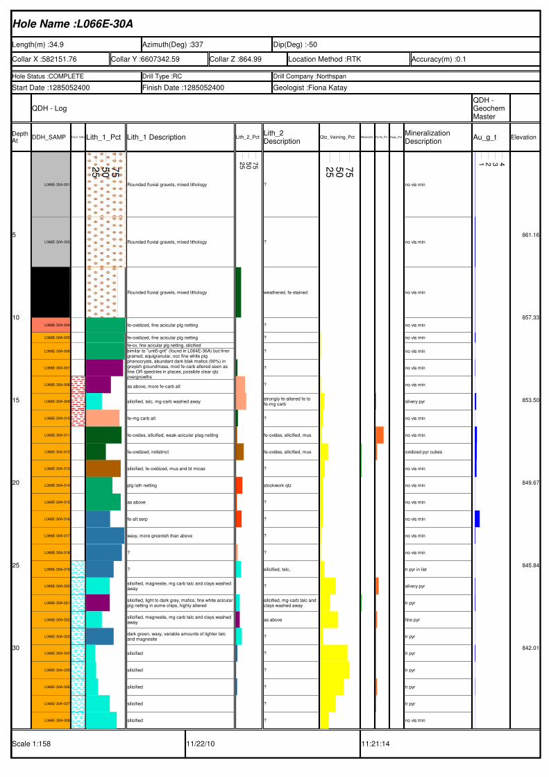
Hole Name :L066E-30A
Length(m) :34.9 Azimuth(Deg) :337 Dip(Deg) :-50
Collar X :582151.76 Collar Y :6607342.59 Collar Z :864.99 Location Method :RTK Accuracy(m) :0.1
Hole Status :COMPLETE Drill Type :RC Drill Company :Northspan
Start Date :1285052400 Finish Date :1285052400 Geologist :Fiona Katay
QDH - LogQDH - Geochem Master
Depth At
DDH_SAMP Fault_IndicatorsLith_1_Pct Lith_1 Description Lith_2_PctLith_2 Description
Qtz_Veining_Pct Mariposite_PctPyrite_Pct Aspy_PctMineralization Description
Au_g_t Elevation
Scale 1:158 11/22/10 11:21:14
5
10
15
20
25
30
L066E-30A-001
L066E-30A-002
L066E-30A-003
L066E-30A-004
L066E-30A-005
L066E-30A-006
L066E-30A-007
L066E-30A-008
L066E-30A-009
L066E-30A-010
L066E-30A-011
L066E-30A-012
L066E-30A-013
L066E-30A-014
L066E-30A-015
L066E-30A-016
L066E-30A-017
L066E-30A-018
L066E-30A-019
L066E-30A-020
L066E-30A-021
L066E-30A-022
L066E-30A-023
L066E-30A-024
L066E-30A-025
L066E-30A-026
L066E-30A-027
L066E-30A-028
25
50
75
Rounded fluvial gravels, mixed lithology
Rounded fluvial gravels, mixed lithology
Rounded fluvial gravels, mixed lithology
fe-oxidized, fine acicular plg netting
fe-oxidized, fine acicular plg netting
fe-ox, fine acicular plg netting, silicified
similar to "unit5-grit" (found in L064E-36A) but finer grained, equigranular, occ fine white plg phenocrysts, abundant dark blak mafics (90%) in greyish groundmass, mod fe-carb altered seen as fine OR speckles in places, possible clear qtz overgrowths
as above, more fe-carb alt
silicified, talc, mg-carb washed away
fe-mg carb alt
fe-oxides, silicified, weak acicular plag netting
fe-oxidized, indistinct
silicified, fe-oxidized, mus and bt micas
plg lath netting
as above
fe-alt serp
waxy, more greenish than above
?
?
silicified, magnesite, mg carb talc and clays washed away
silicified, light to dark grey, mafics, fine white acicular plg netting in some chips, highly altered
silicified, magnesite, mg carb talc and clays washed away
dark green, waxy, variable amounts of lighter talc and magnesite
silicified
silicified
silicified
silicified
silicified
25
50
75
?
?
weathered, fe-stained
?
?
?
?
?
strongly fe-altered fe to fe-mg carb
?
fe-oxides, silicified, mus
fe-oxides, silicified, mus
?
stockwork qtz
?
?
?
?
silicified, talc,
?
silicified, mg-carb talc and clays washed away
as above
?
?
?
?
?
?
25
50
75
no vis min
no vis min
no vis min
no vis min
no vis min
no vis min
no vis min
no vis min
silvery pyr
no vis min
no vis min
oxidized pyr cubes
no vis min
no vis min
no vis min
no vis min
no vis min
no vis min
tr pyr in list
silvery pyr
tr pyr
fine pyr
tr pyr
tr pyr
tr pyr
tr pyr
tr pyr
no vis min
1 2 3 4
861.16
857.33
853.50
849.67
845.84
842.01
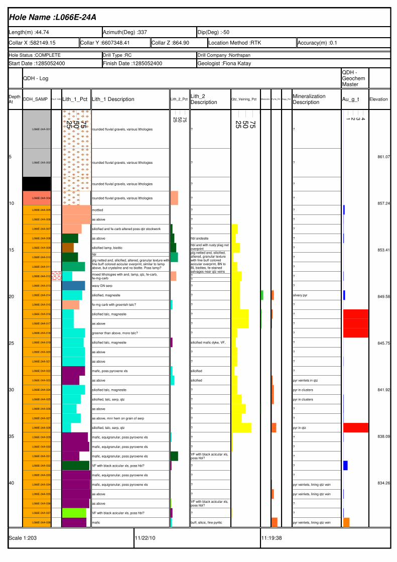
Hole Name :L066E-24A
Length(m) :44.74 Azimuth(Deg) :337 Dip(Deg) :-50
Collar X :582149.15 Collar Y :6607348.41 Collar Z :864.90 Location Method :RTK Accuracy(m) :0.1
Hole Status :COMPLETE Drill Type :RC Drill Company :Northspan
Start Date :1285052400 Finish Date :1285052400 Geologist :Fiona Katay
QDH - LogQDH - Geochem Master
Depth At
DDH_SAMP Fault_IndicatorsLith_1_Pct Lith_1 Description Lith_2_PctLith_2 Description
Qtz_Veining_Pct Mariposite_PctPyrite_Pct Aspy_PctMineralization Description
Au_g_t Elevation
Scale 1:203 11/22/10 11:19:38
5
10
15
20
25
30
35
40
L066E-24A-001
L066E-24A-002
L066E-24A-003
L066E-24A-004
L066E-24A-005
L066E-24A-006
L066E-24A-007
L066E-24A-008
L066E-24A-009
L066E-24A-010
L066E-24A-011
L066E-24A-012
L066E-24A-013
L066E-24A-014
L066E-24A-015
L066E-24A-016
L066E-24A-017
L066E-24A-018
L066E-24A-019
L066E-24A-020
L066E-24A-021
L066E-24A-022
L066E-24A-023
L066E-24A-024
L066E-24A-025
L066E-24A-026
L066E-24A-027
L066E-24A-028
L066E-24A-029
L066E-24A-030
L066E-24A-031
L066E-24A-032
L066E-24A-033
L066E-24A-034
L066E-24A-035
L066E-24A-036
L066E-24A-037
L066E-24A-038
25
50
75
rounded fluvial gravels, various lithologies
rounded fluvial gravels, various lithologies
rounded fluvial gravels, various lithologies
rounded fluvial gravels, various lithologies
mottled
as above
silicified and fe-carb altered poss qtz stockwork
as above
silicified lamp, biotitic
hbl
plg netted and, silicified, altered, granular texture withfine buff colored acicular overprint, similar to lamp above, but crystaline and no biotite. Poss lamp?
mixed lithologies with and, lamp, qtz, fe-carb, fe-mg-carb
waxy GN serp
silicified, magnesite
fe-mg carb with greenish talc?
silicified talc, magnesite
as above
greener than above, more talc?
silicified talc, magnesite
as above
as above
mafic, poss pyroxene xls
as above
silicified talc, magnesite
silicified, talc, serp, qtz
as above
as above, mnr hem on grain of serp
silicified, talc, serp, qtz
mafic, equigranular, poss pyroxene xls
mafic, equigranular, poss pyroxene xls
mafic, equigranular, poss pyroxene xls
VF with black acicular xls, poss hbl?
mafic, equigranular, poss pyroxene xls
mafic, equigranular, poss pyroxene xls
as above
as above
VF with black acicular xls, poss hbl?
mafic
25
50
75
?
?
?
?
?
?
?
hbl andesite
hbl and with rusty plag net overprintplg netted and, silicified, altered, granular texture with fine buff colored acicular overprint, BN to BL biotites, fe-stained selvages near qtz veins?
?
?
?
?
?
?
?
silicified mafic dyke, VF,
?
?
silicified
silicified
?
?
?
?
?
?
?
VF with black acicular xls, poss hbl?
?
?
?
?
VF with black acicular xls, poss hbl?
?
buff, silicic, fine pyritic
25
50
75
?
?
?
?
?
?
?
?
?
?
?
?
?
silvery pyr
?
?
?
?
?
?
?
?
pyr veinlets in qtz
pyr in clusters
pyr in clusters
?
?
pyr in qtz
?
?
?
?
?
pyr veinlets, lining qtz vein
pyr veinlets, lining qtz vein
?
?
pyr veinlets, lining qtz vein
1 2 3 4
861.07
857.24
853.41
849.58
845.75
841.92
838.09
834.26
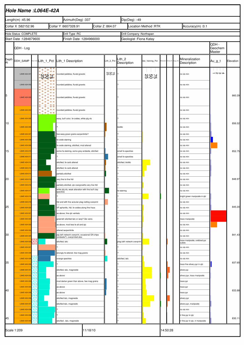
Hole Name :L064E-42A
Length(m) :45.96 Azimuth(Deg) :337 Dip(Deg) :-49
Collar X :582152.96 Collar Y :6607328.91 Collar Z :864.07 Location Method :RTK Accuracy(m) :0.1
Hole Status :COMPLETE Drill Type :RC Drill Company :Northspan
Start Date :1284879600 Finish Date :1284966000 Geologist :Fiona Katay
QDH - LogQDH - Geochem Master
Depth At
DDH_SAMP Fault_IndicatorsLith_1_Pct Lith_1 Description Lith_2_PctLith_2 Description
Qtz_Veining_Pct Mariposite_PctPyrite_Pct Aspy_PctMineralization Description
Au_g_t Elevation
Scale 1:209 11/18/10 14:50:28
5
10
15
20
25
30
35
40
45
L064E-42A-001
L064E-42A-002
L064E-42A-003
L064E-42A-004
L064E-42A-005
L064E-42A-006
L064E-42A-007
L064E-42A-008
L064E-42A-009
L064E-42A-010
L064E-42A-011
L064E-42A-012
L064E-42A-013
L064E-42A-014
L064E-42A-015
L064E-42A-016
L064E-42A-017
L064E-42A-018
L064E-42A-019
L064E-42A-020
L064E-42A-021
L064E-42A-022
L064E-42A-023
L064E-42A-024
L064E-42A-025
L064E-42A-026
L064E-42A-027
L064E-42A-028
L064E-42A-029
L064E-42A-030
L064E-42A-031
L064E-42A-032
L064E-42A-033
L064E-42A-034
L064E-42A-035
L064E-42A-036
L064E-42A-037
L064E-42A-038
L064E-42A-039
L064E-42A-040
25
50
75 rounded pebbles, fluvial gravels
rounded pebbles, fluvial gravels
rounded pebbles, fluvial gravels
rounded pebbles, fluvial gravels
waxy, buff color, fe-oxides, white plg xls
?
few waxy green grains serpentinite?
fe-oxide staining
fe-oxide staining, silicified, mod altered
some fe-staining, some grey andesite, silicified
?
silicified, fe-carb altered
silicified, fe-carb altered
partially silicified
very fine to fine hbl
partially silicified, qtz overgrowths very fine hbl
white plg xls, weak alteration with fine buff clay speckles
?
hbl and with fine acicular plag netting overprint
VF aphanitic, hbl, fe-oxides along fine fracs
as above, fine qtz veinlets
greenish silicified talc or serp? Qtz veins
as above, mod less fe alt and qtz
altered serpentinite
plg lath network overprint, occasional GN chips (andesite?), overprinted also
silicified, talc
?
strongly fe-altered, few mag grains
orange speckles
?
silicified, talc, magnesite
as above
mod darker green than above, few mag grains
as above
as above
silicified talc, magnesite
silicified talc, magnesite
?
?
silicified , talc, magnesite
25
50
75
?
?
?
?
?
biotitic
?
?
?
small fe-speckles
small fe-speckles
silicified, biotitic
?
?
?
?
fe-staining
?
?
?
?
?
?
?
?
plag lath network overprint
?
?
silicified, talc
?
?
?
?
?
?
?
?
?
?
?
25
50
75 no vis min
no vis min
no vis min
no vis min
no vis min
no vis min
no vis min
no vis min
no vis min
no vis min
no vis min
no vis min
no vis min
no vis min
no vis min
no vis min
no vis min
bright green mariposite in qtz
no vis min
no vis min
no vis min
trace mariposite
no vis min
no vis min
no vis min
trace mariposite, oxidized pyr cubes
no vis min
no vis min
no vis min
trace fine silvery pyr in qtz
silvery py
silvery pyr, trace mariposite
trace pyr
trace pyr
trace pyr
silvery pyr
silvery pyr, mariposite
no vis min
tr fine pyr in qtz
tr fine pyr in qtz, tr mariposite
1 2 3 4
860.29
856.52
852.75
848.97
845.20
841.43
837.65
833.88
830.11
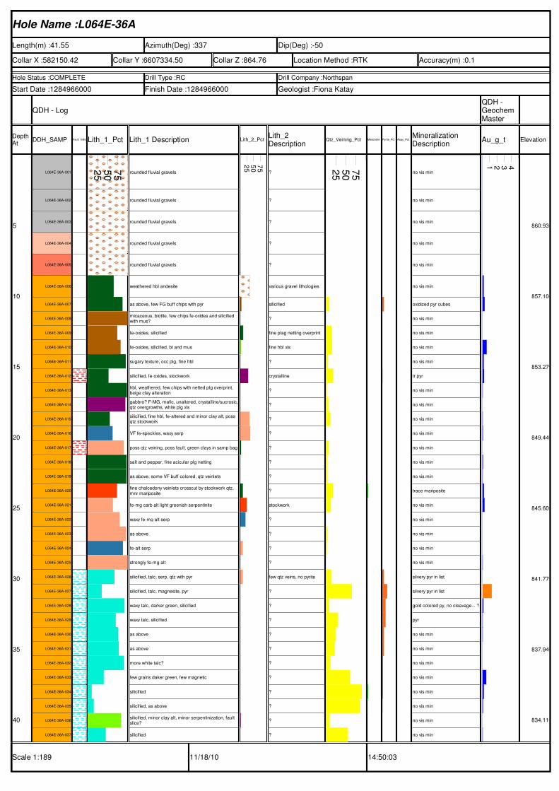
Hole Name :L064E-36A
Length(m) :41.55 Azimuth(Deg) :337 Dip(Deg) :-50
Collar X :582150.42 Collar Y :6607334.50 Collar Z :864.76 Location Method :RTK Accuracy(m) :0.1
Hole Status :COMPLETE Drill Type :RC Drill Company :Northspan
Start Date :1284966000 Finish Date :1284966000 Geologist :Fiona Katay
QDH - LogQDH - Geochem Master
Depth At
DDH_SAMP Fault_IndicatorsLith_1_Pct Lith_1 Description Lith_2_PctLith_2 Description
Qtz_Veining_Pct Mariposite_PctPyrite_Pct Aspy_PctMineralization Description
Au_g_t Elevation
Scale 1:189 11/18/10 14:50:03
5
10
15
20
25
30
35
40
L064E-36A-001
L064E-36A-002
L064E-36A-003
L064E-36A-004
L064E-36A-005
L064E-36A-006
L064E-36A-007
L064E-36A-008
L064E-36A-009
L064E-36A-010
L064E-36A-011
L064E-36A-012
L064E-36A-013
L064E-36A-014
L064E-36A-015
L064E-36A-016
L064E-36A-017
L064E-36A-018
L064E-36A-019
L064E-36A-020
L064E-36A-021
L064E-36A-022
L064E-36A-023
L064E-36A-024
L064E-36A-025
L064E-36A-026
L064E-36A-027
L064E-36A-028
L064E-36A-029
L064E-36A-030
L064E-36A-031
L064E-36A-032
L064E-36A-033
L064E-36A-034
L064E-36A-035
L064E-36A-036
L064E-36A-037
25
50
75 rounded fluvial gravels
rounded fluvial gravels
rounded fluvial gravels
rounded fluvial gravels
rounded fluvial gravels
weathered hbl andesite
as above, few FG buff chips with pyr
micaceous, biotite, few chips fe-oxides and silicified with mus?
fe-oxides, silicified
fe-oxides, silicified, bt and mus
sugary texture, occ plg, fine hbl
silicified, fe-oxides, stockwork
hbl, weathered, few chips with netted plg overprint, beige clay alteration
gabbro? F-MG, mafic, unaltered, crystalline/sucrosic,qtz overgrowths, white plg xls
silicified, fine hbl, fe-altered and minor clay alt, poss qtz stockwork
VF fe-speckles, waxy serp
poss qtz veining, poss fault, green clays in samp bag
salt and pepper, fine acicular plg netting
as above, some VF buff colored, qtz veinlets
fine chalcedony veinlets crosscut by stockwork qtz, mnr mariposite
fe-mg carb alt light greenish serpentinite
waxy fe-mg alt serp
as above
fe-alt serp
strongly fe-mg alt
silicified, talc, serp, qtz with pyr
silicified, talc, magnesite, pyr
waxy talc, darker green, silicified
waxy talc, silicified
as above
as above
more white talc?
few grains daker green, few magnetic
silicified
silicified, as above
silicified, minor clay alt, minor serpentinization, fault slice?
silicified
25
50
75
?
?
?
?
?
various gravel lithologies
silicified
?
fine plag netting overprint
fine hbl xls
?
crystalline
?
?
?
?
?
?
?
?
stockwork
?
?
?
?
few qtz veins, no pyrite
?
?
?
?
?
?
?
?
?
?
?
25
50
75 no vis min
no vis min
no vis min
no vis min
no vis min
no vis min
oxidized pyr cubes
no vis min
no vis min
no vis min
no vis min
tr pyr
no vis min
no vis min
no vis min
no vis min
no vis min
no vis min
no vis min
trace mariposite
no vis min
no vis min
no vis min
no vis min
no vis min
silvery pyr in list
silvery pyr in list
gold colored py, no cleavage... ?
pyr
no vis min
no vis min
no vis min
no vis min
no vis min
no vis min
no vis min
no vis min
1 2 3 4
860.93
857.10
853.27
849.44
845.60
841.77
837.94
834.11
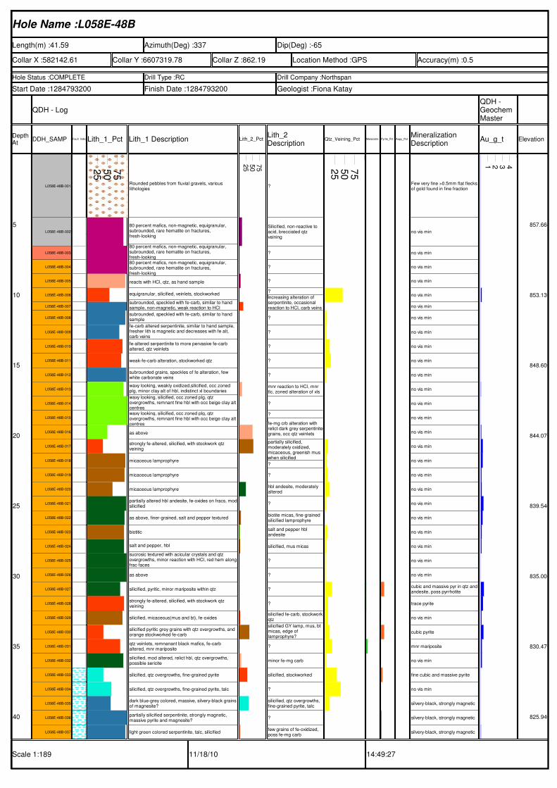
Hole Name :L058E-48B
Length(m) :41.59 Azimuth(Deg) :337 Dip(Deg) :-65
Collar X :582142.61 Collar Y :6607319.78 Collar Z :862.19 Location Method :GPS Accuracy(m) :0.5
Hole Status :COMPLETE Drill Type :RC Drill Company :Northspan
Start Date :1284793200 Finish Date :1284793200 Geologist :Fiona Katay
QDH - LogQDH - Geochem Master
Depth At
DDH_SAMP Fault_IndicatorsLith_1_Pct Lith_1 Description Lith_2_PctLith_2 Description
Qtz_Veining_Pct Mariposite_PctPyrite_Pct Aspy_PctMineralization Description
Au_g_t Elevation
Scale 1:189 11/18/10 14:49:27
5
10
15
20
25
30
35
40
L058E-48B-001
L058E-48B-002
L058E-48B-003
L058E-48B-004
L058E-48B-005
L058E-48B-006
L058E-48B-007
L058E-48B-008
L058E-48B-009
L058E-48B-010
L058E-48B-011
L058E-48B-012
L058E-48B-013
L058E-48B-014
L058E-48B-015
L058E-48B-016
L058E-48B-017
L058E-48B-018
L058E-48B-019
L058E-48B-020
L058E-48B-021
L058E-48B-022
L058E-48B-023
L058E-48B-024
L058E-48B-025
L058E-48B-026
L058E-48B-027
L058E-48B-028
L058E-48B-029
L058E-48B-030
L058E-48B-031
L058E-48B-032
L058E-48B-033
L058E-48B-034
L058E-48B-035
L058E-48B-036
L058E-48B-037
25
50
75
Rounded pebbles from fluvial gravels, various lithologies
80 percent mafics, non-magnetic, equigranular, subrounded, rare hematite on fractures, fresh-looking
80 percent mafics, non-magnetic, equigranular, subrounded, rare hematite on fractures, fresh-looking80 percent mafics, non-magnetic, equigranular, subrounded, rare hematite on fractures, fresh-looking
reacts with HCl, qtz, as hand sample
equigranular, silicified, veinlets, stockworked
subrounded, speckled with fe-carb, similar to hand sample, non-magnetic, weak reaction to HCl
subrounded, speckled with fe-carb, similar to hand sample
fe-carb altered serpentinite, similar to hand sample, fresher lith is magnetic and decreases with fe alt, carb veins
fe-altered serpentinite to more pervasive fe-carb altered, qtz veinlets
weak-fe-carb alteration, stockworked qtz
subrounded grains, speckles of fe alteration, few white carbonate veins
waxy looking, weakly oxidized,silicified, occ zoned plg, minor clay alt of hbl, indistinct xl boundaries
waxy looking, silicified, occ zoned plg, qtz overgrowths, remnant fine hbl with occ beige clay alt centreswaxy looking, silicified, occ zoned plg, qtz overgrowths, remnant fine hbl with occ beige clay alt centres
as above
strongly fe-altered, silicified, with stockwork qtz veining
micaceous lamprophyre
micaceous lamprophyre
micaceous lamprophyre
partially altered hbl andesite, fe-oxides on fracs, modsilicified
as above, finer-grained, salt and pepper textured
biotitic
salt and pepper, hbl
sucrosic textured with acicular crystals and qtz overgrowths, minor reaction with HCl, red hem alongfrac faces
as above
silicified, pyritic, minor mariposite within qtz
strongly fe-altered, silicified, with stockwork qtz veining
silicified, micaceous(mus and bt), fe-oxides
silicified pyritic grey grains with qtz overgrowths, and orange stockworked fe-carb
qtz veinlets, remnanant black mafics, fe-carb altered, mnr mariposite
silicified, mod altered, relict hbl, qtz overgrowths, possible sericite
silicified, qtz overgrowths, fine-grained pyrite
silicified, qtz overgrowths, fine-grained pyrite, talc
dark blue-grey colored, massive, silvery-black grains of magnesite?
partially silicified serpentinite, strongly magnetic, massive pyrite and magnesite?
light green colored serpentinite, talc, silicified
25
50
75
?
Silicified, non-reactive to acid, brecciated qtz veining
?
?
?
?
increasing alteration of serpentinite, occasional reaction to HCl, carb veins
?
?
?
?
?
mnr reaction to HCl, mnr tlc, zoned alteration of xls
?
?
fe-mg crb alteration with relict dark grey serpentinitegrains, occ qtz veinlets
partially silicified, moderately oxidized, micaceous, greenish mus when silicified
?
?
hbl andesite, moderately altered
?
biotite micas, fine-grained silicified lamprophyre
salt and pepper hbl andesite
silicified, mus micas
?
?
?
?
silicified fe-carb, stockworkqtz
silicified GY lamp, mus, bt micas, edge of lamprophyre?
?
minor fe-mg carb
silicified, stockworked
?
silicified, qtz overgrowths, fine-grained pyrite, talc
?
few grains of fe-oxidized, poss fe-mg carb
25
50
75
Few very fine >0.5mm flat flecksof gold found in fine fraction
no vis min
no vis min
no vis min
no vis min
no vis min
no vis min
no vis min
no vis min
no vis min
no vis min
no vis min
no vis min
no vis min
no vis min
no vis min
no vis min
no vis min
no vis min
no vis min
no vis min
no vis min
no vis min
no vis min
no vis min
no vis min
cubic and massive pyr in qtz andandesite, poss pyrrhotite
trace pyrite
no vis min
cubic pyrite
mnr mariposite
no vis min
fine cubic and massive pyrite
no vis min
silvery-black, strongly magnetic
silvery-black, strongly magnetic
silvery-black, strongly magnetic
1 2 3 4
857.66
853.13
848.60
844.07
839.54
835.00
830.47
825.94
YELLOWJACKET 2012 Assessment Report Page 67
APPENDIX VIAURORA GEOSCIENCES REPORT
Athabasca Nuclear Corp. August 2012
YellowjacketHLEM - page 1
NORTHERN GEOLOGICAL & GEOPHYSICAL CONSULTANTS
YELLOWKNIFE - WHITEHORSE - JUNEAU34A Laberge Road, Whitehorse, Yukon, Canada Tel (867) 668-7673 Fax (867) 393-3577
MEMORANDUM
To: Chuck Downie Date: July17, 2012Yellowjacket Resources [email protected]
From: Ian [email protected]
Re: HLEM Survey
This is a field report describing a HLEM (Horizontal Loop Electromagnetic) survey on the YellowjacketResources property, Atlin BC. The survey was designed as a follow-up survey to the test survey that wasdone in June 2012 to cover an area with good drill control of the grey clay zone in the footwall of the orezone (Slumpy). The HLEM survey used 25m coil separation. There were a total of 12 lines and 2.35 line-kms.
Survey Location
The Yellowjacket Resources camp is located582080E 6607340N, NAD83 Zone 8N, about 8kms downSurprise Lake road, north of Atlin BC. The project area covers NTS map sheet 104N12. The surveyextended from July13–July15, 2012.
Crew and Equipment
The surveys were conducted by the following personnel:
Ian Kickbush,B.Sc Crew chief
DimitriSpassov Helper
YellowjacketHLEM - page 2
The crew was equipped with the following instruments and equipment:
HLEM: 1 - Apex Parametrics MaxMin I-10equipped with 25m cables and MMC.S/N 10384
Other: 1 - Laptop with Geosoft1 - Iridium satellite phone2 - Handheld radios1 - Garmin Handheld GPS
1 - Truck
Survey Specifications
The lines were uncut. Every 12.5m stations were painted orange. Stations at line-ends were painted andpin-flagged.
HLEMThe HLEM survey was completed according to the following specifications:
Coil separation: 25 m
Line Spacing: Various
Station Spacing: 6.25m
Frequencies: 220, 14080, 28160, 56320 KHz
Registration: Data was registered to NAD 83 Z8N coordinatesusing a Garmin 76 handheld GPS.
Geometric corrections: Slope chain method: The leading receiver operatorrecorded the station-to-station slope, theoperators held their coils according to thecalculated tilt. Short-coil effects were removedwith software during processing (MaxMinFix.com)
Data Processing
The HLEM data were downloaded nightly from the MMC, corrected for short-coil errors arising fromterrain using the Apex software MMCFIX1 and imported into Oasis Montaj.The IP data was normalized to 220 Hz. The HLEM data was registered using line-end coordinates taken inthe field using a garmin 76 handheld GPS.
Data formats
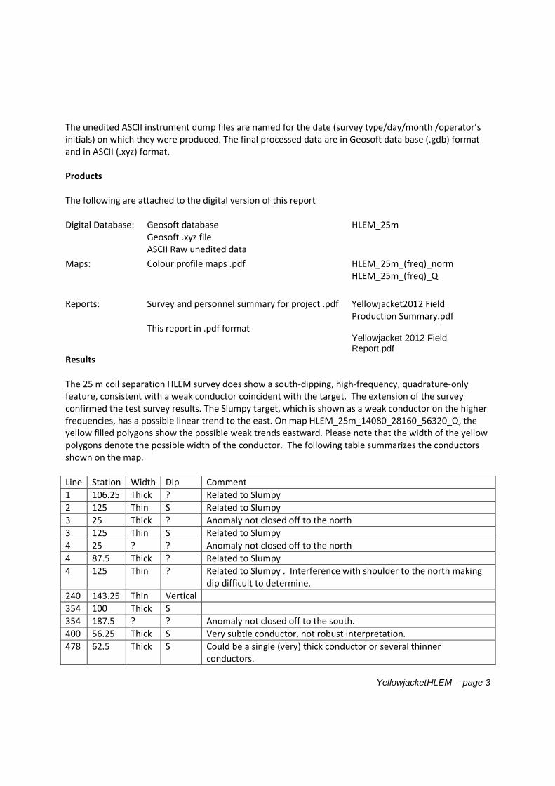
YellowjacketHLEM - page 3
The unedited ASCII instrument dump files are named for the date (survey type/day/month /operator’sinitials) on which they were produced. The final processed data are in Geosoft data base (.gdb) formatand in ASCII (.xyz) format.
Products
The following are attached to the digital version of this report
Digital Database: Geosoft databaseGeosoft .xyz fileASCII Raw unedited data
HLEM_25m
Maps: Colour profile maps .pdf HLEM_25m_(freq)_normHLEM_25m_(freq)_Q
Reports: Survey and personnel summary for project .pdf
This report in .pdf format
Yellowjacket2012 FieldProduction Summary.pdf
Yellowjacket 2012 FieldReport.pdf
Results
The 25 m coil separation HLEM survey does show a south-dipping, high-frequency, quadrature-onlyfeature, consistent with a weak conductor coincident with the target. The extension of the surveyconfirmed the test survey results. The Slumpy target, which is shown as a weak conductor on the higherfrequencies, has a possible linear trend to the east. On map HLEM_25m_14080_28160_56320_Q, theyellow filled polygons show the possible weak trends eastward. Please note that the width of the yellowpolygons denote the possible width of the conductor. The following table summarizes the conductorsshown on the map.
Line Station Width Dip Comment
1 106.25 Thick ? Related to Slumpy
2 125 Thin S Related to Slumpy
3 25 Thick ? Anomaly not closed off to the north
3 125 Thin S Related to Slumpy
4 25 ? ? Anomaly not closed off to the north
4 87.5 Thick ? Related to Slumpy
4 125 Thin ? Related to Slumpy . Interference with shoulder to the north makingdip difficult to determine.
240 143.25 Thin Vertical
354 100 Thick S
354 187.5 ? ? Anomaly not closed off to the south.
400 56.25 Thick S Very subtle conductor, not robust interpretation.
478 62.5 Thick S Could be a single (very) thick conductor or several thinnerconductors.
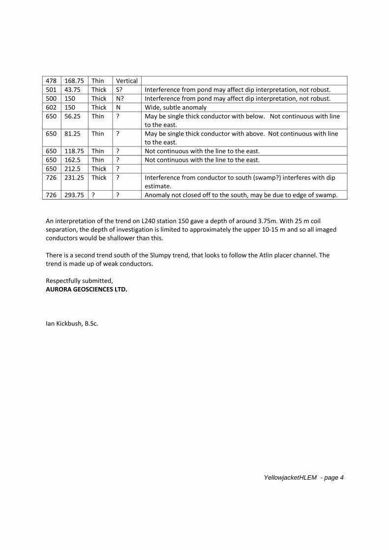
YellowjacketHLEM - page 4
478 168.75 Thin Vertical
501 43.75 Thick S? Interference from pond may affect dip interpretation, not robust.
500 150 Thick N? Interference from pond may affect dip interpretation, not robust.
602 150 Thick N Wide, subtle anomaly
650 56.25 Thin ? May be single thick conductor with below. Not continuous with lineto the east.
650 81.25 Thin ? May be single thick conductor with above. Not continuous with lineto the east.
650 118.75 Thin ? Not continuous with the line to the east.
650 162.5 Thin ? Not continuous with the line to the east.
650 212.5 Thick ?
726 231.25 Thick ? Interference from conductor to south (swamp?) interferes with dipestimate.
726 293.75 ? ? Anomaly not closed off to the south, may be due to edge of swamp.
An interpretation of the trend on L240 station 150 gave a depth of around 3.75m. With 25 m coilseparation, the depth of investigation is limited to approximately the upper 10-15 m and so all imagedconductors would be shallower than this.
There is a second trend south of the Slumpy trend, that looks to follow the Atlin placer channel. Thetrend is made up of weak conductors.
Respectfully submitted,AURORA GEOSCIENCES LTD.
Ian Kickbush, B.Sc.
Elevation (m)
25 0 25 50 75 100 125 150
(meters)
NAD83 / UTM zone 8N
Scale 1:2000
Yellowjacket Resources
ATLIN GRID HLEM SURVEY25m Coil Seperation
14080, 28160, 56320 Hz - Normalized
BRITISH COLUMBIA, CANADANTS : 104n12
DATE SURVEYED : July 13-15 2012
MAP NAME : HLEM_25M_14080_28160_56320_norm.map (17-Jul-2012/IK)
AURORA GEOSCIENCES LTD.
Slumpy
HORIZONTAL LOOP EMFREQUENCIES : 220 14080 28160 56320 Hz
INSTRUMENT : APEX PARAMETRICS MAX-MIN I-10
PROFILE SCALE : 1 cm = 10%
IN PHASE :
QUADRATURE :
COIL SEPARATION
25 mNORTH
SOUTH
+10
DATUM
-10
IN-PHASE DATUM : 0%
QUADRATURE DATUM : 0%
DATA FILE : HLEM_25m.GDB
OPERATORS : IK
STATION SEPARATION : 6.25m
LINE-KM SURVEYED THIS SHEET : 2.35
6607300
6607400
6607500
6607600
6607700
6607800
6607900
6607
300
6607
400
6607
500
6607
600
6607700
6607800
6607900
582100 582200 582300 582400 582500 582600 582700 582800 582900 583000 583100 583200 583300 583400 583500
582100 582200 582300 582400 582500 582600 582700 582800 582900 583000 583100 583200 583300 583400 583500
59
°3
5'4
5"
59
°3
5'5
0"
59
°3
5'5
5"
59
°3
6'0
0"
59
°3
5'4
5"
59
°3
5'5
0"
59
°3
5'5
5"
59
°3
6'0
0"
-133°32'45" -133°32'30" -133°32'15" -133°32'00" -133°31'45" -133°31'30" -133°31'15"
-133°32'45" -133°32'30" -133°32'15" -133°32'00" -133°31'45" -133°31'30" -133°31'15"
0
25
50
75
100
125
150
175
0
25
50
75
100
125
150
175
175
150
125
100
75
50
25
0
25
50
75
100
125
150
175
25
50
75
100
125
150
175
200
225
200
175
150
125
100
75
50
25
25
50
75
100
125
150
175
25
50
75
100
150
175
200
225
200
175
150
125
100
25
50
75
200
175
150
125
100
25
50
75
100
125
150
175
200
225
250
275
300
275
250
225
200
175
150
125
100
75
50
25
L1
L1
L2
L2
L3
L3
L4
L4
L240
L240
L354
L354
L400
L400
L478
L478
L500
L500
L501
L501
L602
L602
L650
L650
L726
L726
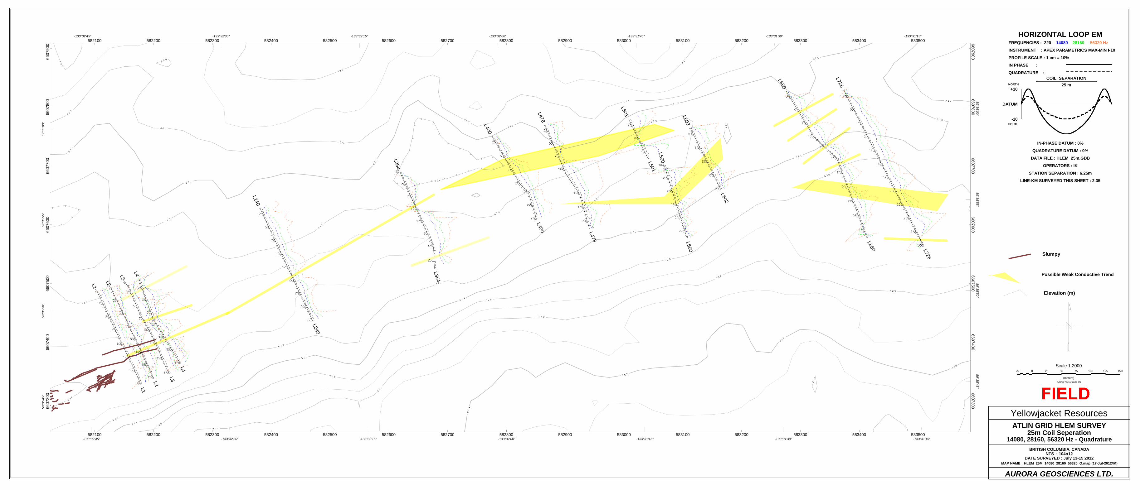
Elevation (m)
Slumpy
25 0 25 50 75 100 125 150
(meters)NAD83 / UTM zone 8N
Scale 1:2000
Yellowjacket ResourcesATLIN GRID HLEM SURVEY
25m Coil Seperation14080, 28160, 56320 Hz - Quadrature
BRITISH COLUMBIA, CANADANTS : 104n12
DATE SURVEYED : July 13-15 2012MAP NAME : HLEM_25M_14080_28160_56320_Q.map (17-Jul-2012/IK)
AURORA GEOSCIENCES LTD.
HORIZONTAL LOOP EMFREQUENCIES : 220 14080 28160 56320 Hz
INSTRUMENT : APEX PARAMETRICS MAX-MIN I-10
PROFILE SCALE : 1 cm = 10%
IN PHASE :
QUADRATURE :COIL SEPARATION
25 mNORTH
SOUTH
+10
DATUM
-10
IN-PHASE DATUM : 0%
QUADRATURE DATUM : 0%
DATA FILE : HLEM_25m.GDB
OPERATORS : IK
STATION SEPARATION : 6.25m
LINE-KM SURVEYED THIS SHEET : 2.35
Possible Weak Conductive Trend
6607
300
6607
400
6607
500
6607
600
6607
700
6607
800
6607
900
66073006607400
66075006607600
66077006607800
6607900
582100 582200 582300 582400 582500 582600 582700 582800 582900 583000 583100 583200 583300 583400 583500
582100 582200 582300 582400 582500 582600 582700 582800 582900 583000 583100 583200 583300 583400 5835005
9°3
5'4
5"
59
°35
'50
"5
9°3
5'5
5"
59
°36
'00
"
59
°35
'45
"5
9°3
5'5
0"
59
°35
'55
"5
9°3
6'0
0"
-133°32'45" -133°32'30" -133°32'15" -133°32'00" -133°31'45" -133°31'30" -133°31'15"
-133°32'45" -133°32'30" -133°32'15" -133°32'00" -133°31'45" -133°31'30" -133°31'15"
L1
L1
L2
L2
L3
L3
L4
L4
L240
L240
L354
L354
L400
L400L478
L478
L500
L500
L501
L501
L602
L602
L650
L650
L726
L726
Related Documents