1:100 000 Reference maps for Bahamas showing islands, settlements, transport infrastructure, districts and topographic features " ó ! S ! S ! S ! S ! S ! S ! S ? ? " " " ! W a r r e n J L a varit y High w a y E a s t S u n r i s e H i g h w a y W est S un ris e H ig hway G r and B aham a H i ghwa y Que en' s Hi gh w a y Q u e en' s h i g hwa y E as t M a l l D r i ve West End Airport Grand Bahama International Airport Williams Town Bain Town Freeport 78°42'W 78°44'W 78°46'W 78°48'W 78°50'W 78°52'W 78°54'W 78°56'W 78°58'W 79°W 26°42'N 26°40'N 26°38'N 26°36'N 26°34'N 26°32'N 26°30'N 105000 110000 115000 120000 125000 130000 2935000 2940000 2945000 2950000 2955000 2960000 ! ! ! ! Ba Ba 1 3 4 2 5 9 10 11 12 6 8 7 ´ MA006_1 Data sources Bahamas: Hurricane Matthew- Reference - Island Assessments Boundaries: GADM, OSM Settlements: OSM Physical features: GADM Airports: OurAirports Healthcare facilities: OSM Hurricane track: NHC Territorial boundaries: OSM Shelters: GBPA 0 1 2 3 4 5 kilometres 1: 100,000 (At A3) Produced by MapAction www.mapaction.org [email protected] The depiction and use of boundaries, names and associated data shown here do not imply endorsement or acceptance by MapAction. Supported by DFID and the Ministry of Foreign Affairs of the Netherlands Created 8 Oct 2016 / 12:00 UTC-04:00 Map Document MA006_Island_Assessments Projection & Datum UTM Zone 18N / WGS 1984 Glide Number NA Sheet 1 West Grand Bahamas Legend Intensity (knots) ! 111 - 140 Track type Forecast track Settlement " City " Town " Hamlet Airport type ? Medium airport ? Small airport Shelters ! S Place of worship ! S NGO ! S School Healthcare facility " ó pharmacy Territorial boundary

Welcome message from author
This document is posted to help you gain knowledge. Please leave a comment to let me know what you think about it! Share it to your friends and learn new things together.
Transcript

1:100 000 Reference maps for Bahamas showingislands, settlements, transport infrastructure,districts and topographic features
"ó!S !S
!S !S
!S!S
!S
!S
?
?
" "
"
"
!
Warre
n J Lavarity Highway
Ea stSun riseHigh wayWest SunriseHighway
Grand Bahama
Highway
Queen's Highway
Queen's highway
East
M all
Drive
West EndAirport
Grand BahamaInternationalAirport
Will iamsTown
BainTown Freeport
78°42'W78°44'W78°46'W78°48'W78°50'W78°52'W78°54'W78°56'W78°58'W79°W
26°4
2'N26
°40'N
26°3
8'N26
°36'N
26°3
4'N26
°32'N
26°3
0'N
105000 110000 115000 120000 125000 130000
2935
000
2940
000
2945
000
2950
000
2955
000
2960
000
!
!
!
!
B a h a m a sB a h a m a s
1 3 42
5
9101112
6
87
´MA006_1
Data sources
Bahamas:Hurricane Matthew-
Reference -Island Assessments
Boundaries: GADM, OSMSettlements: OSMPhysical features: GADMAirports: OurAirportsHealthcare facilities: OSMHurricane track: NHCTerritorial boundaries: OSMShelters: GBPA
0 1 2 3 4 5kilometres
1: 100,000 (At A3)
Produced by MapAction [email protected]
The depiction and use of boundaries, names andassociated data shown here do not implyendorsement or acceptance by MapAction.
Supported by DFID and the Ministry of ForeignAffairs of the Netherlands
Created 8 Oct 2016 / 12:00 UTC-04:00Map Document MA006_Island_AssessmentsProjection &Datum UTM Zone 18N / WGS 1984Glide Number NA
Sheet 1 West Grand Bahamas
LegendIntensity (knots)
! 111 - 140Track type
Forecast trackSettlement" City
" Town" Hamlet
Airport type
? Medium airport
? Small airportShelters
!S Place of worship
!S NGO
!S SchoolHealthcare facility
"ó pharmacyTerritorialboundary
1:100 000 Reference maps for Bahamas showingislands, settlements, transport infrastructure,districts and topographic features
"ó
"ó!S !S
!S !S
!S
!S!S
!S
?
"
"
"
"
"
Midshipman Road
East Sunrise Highway
Grand Bahama Highway
SeahorseRoad
CasuarinaDrive
East
Mal l
Dri ve
Grand BahamaInternationalAirport
Will iamsTown
Lucaya
Freeport
78°24'W78°26'W78°28'W78°30'W78°32'W78°34'W78°36'W78°38'W78°40'W78°42'W
26°4
2'N26
°40'N
26°3
8'N26
°36'N
26°3
4'N26
°32'N
26°3
0'N
135000 140000 145000 150000 155000 160000
2935
000
2940
000
2945
000
2950
000
2955
000
2960
000
!
!
!
!
B a h a m a sB a h a m a s
1 3 42
5
9101112
6
87
´MA006_2
Data sources
Bahamas:Hurricane Matthew-
Reference -Island Assessments
Boundaries: GADM, OSMSettlements: OSMPhysical features: GADMAirports: OurAirportsHealthcare facilities: OSMHurricane track: NHCTerritorial boundaries: OSMShelters: GBPA
0 1 2 3 4 5kilometres
1: 100,000 (At A3)
Produced by MapAction [email protected]
The depiction and use of boundaries, names andassociated data shown here do not implyendorsement or acceptance by MapAction.
Supported by DFID and the Ministry of ForeignAffairs of the Netherlands
Created 8 Oct 2016 / 12:00 UTC-04:00Map Document MA006_Island_AssessmentsProjection &Datum UTM Zone 18N / WGS 1984Glide Number NA
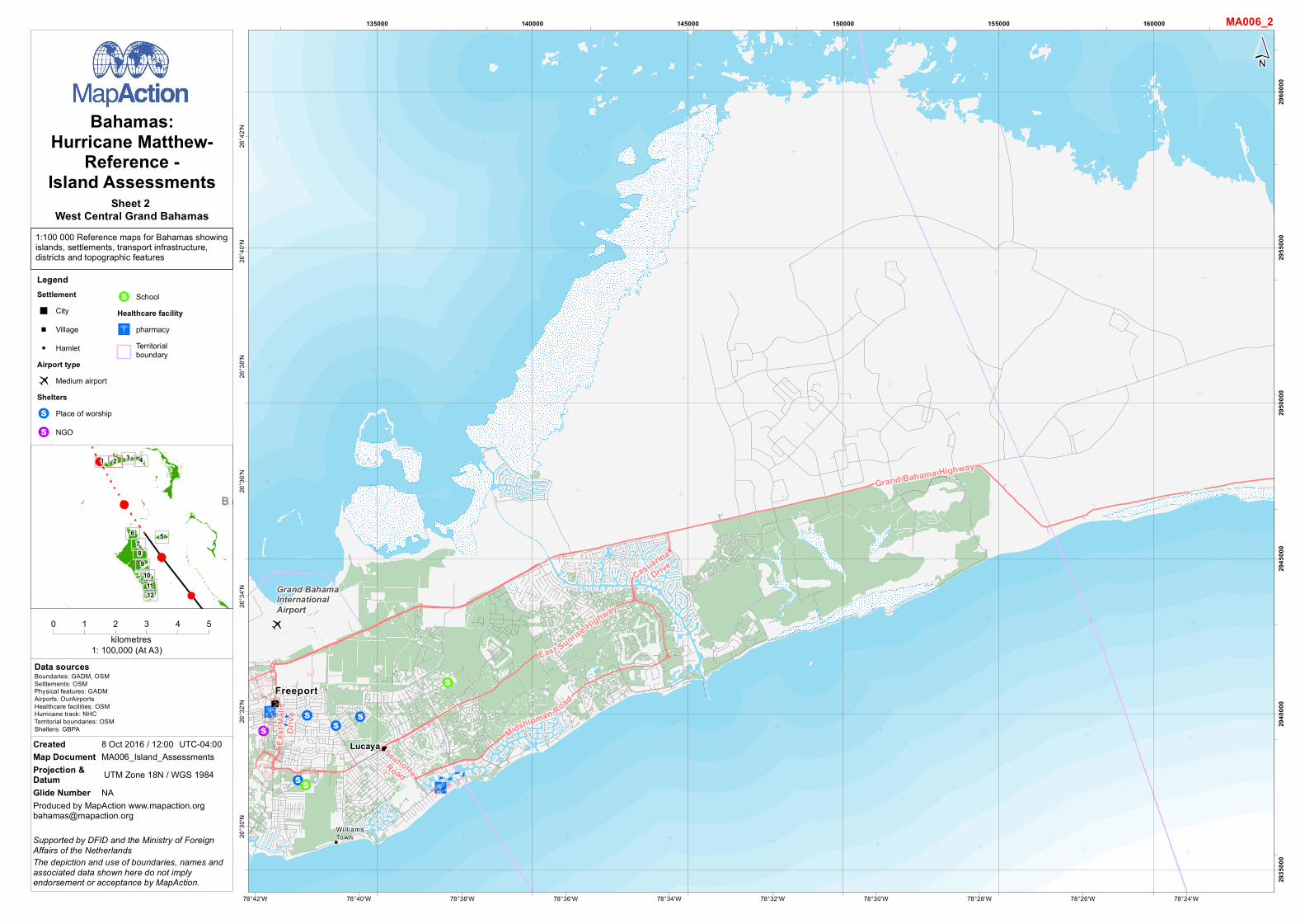
Sheet 2 West Central Grand Bahamas
LegendSettlement" City" Village" Hamlet
Airport type? Medium airportShelters
!S Place of worship
!S NGO
!S SchoolHealthcare facility
"ó pharmacyTerritorialboundary

1:100 000 Reference maps for Bahamas showingislands, settlements, transport infrastructure,districts and topographic features
?
"
"
"
Grand Bahama Highway
AuxiliaryAirfield
GambierPoint
Freetown
HighRock
GrandBahama
78°6'W78°8'W78°10'W78°12'W78°14'W78°16'W78°18'W78°20'W78°22'W 78°4'W
26°4
8'N26
°46'N
26°4
4'N26
°42'N
26°4
0'N26
°38'N
26°3
6'N26
°34'N
165000 170000 175000 180000 185000 190000
2945
000
2950
000
2955
000
2960
000
2965
000
!
!
!
!
B a h a m a sB a h a m a s
1 3 42
5
9101112
6
87
´MA006_3
Data sources
Bahamas:Hurricane Matthew-
Reference -Island Assessments
Boundaries: GADM, OSMSettlements: OSMPhysical features: GADMAirports: OurAirportsHealthcare facilities: OSMHurricane track: NHCTerritorial boundaries: OSMShelters: GBPA
0 1 2 3 4 5kilometres
1: 100,000 (At A3)
Produced by MapAction [email protected]
The depiction and use of boundaries, names andassociated data shown here do not implyendorsement or acceptance by MapAction.
Supported by DFID and the Ministry of ForeignAffairs of the Netherlands
Created 8 Oct 2016 / 12:00 UTC-04:00Map Document MA006_Island_AssessmentsProjection &Datum UTM Zone 18N / WGS 1984Glide Number NA
Sheet 3 East Central Grand Bahamas
LegendSettlement" Town" Hamlet
Airport type? Small airport
Territorialboundary

1:100 000 Reference maps for Bahamas showingislands, settlements, transport infrastructure,districts and topographic features
?
Grand BahamaHighway
Deep WaterCay Airport
77°46'W77°48'W77°50'W77°52'W77°54'W77°56'W77°58'W78°W78°2'W78°4'W
26°4
4'N26
°42'N
26°4
0'N26
°38'N
26°3
6'N26
°34'N
26°3
2'N
195000 200000 205000 210000 215000 220000 225000
2940
000
2945
000
2950
000
2955
000
2960
000
!
!
!
!
B a h a m a sB a h a m a s
1 3 42
5
9101112
6
87
´MA006_4
Data sources
Bahamas:Hurricane Matthew-
Reference -Island Assessments
Boundaries: GADM, OSMSettlements: OSMPhysical features: GADMAirports: OurAirportsHealthcare facilities: OSMHurricane track: NHCTerritorial boundaries: OSMShelters: GBPA
0 1 2 3 4 5kilometres
1: 100,000 (At A3)
Produced by MapAction [email protected]
The depiction and use of boundaries, names andassociated data shown here do not implyendorsement or acceptance by MapAction.
Supported by DFID and the Ministry of ForeignAffairs of the Netherlands
Created 8 Oct 2016 / 12:00 UTC-04:00Map Document MA006_Island_AssessmentsProjection &Datum UTM Zone 18N / WGS 1984Glide Number NA
Sheet 4 East Grand Bahamas
LegendAirport type? Small airport
Territorialboundary

1:100 000 Reference maps for Bahamas showingislands, settlements, transport infrastructure,districts and topographic features
"ó "ó
"ó
"ó"V
"ó
"ó
"D"ó
"ó"ó"ó
"ó
"ó
?
?
v
"
Windsor Field Road
North
Bethe
lHi
ghwa
y
Central DriveEast
East Wes tHighwa y
Western Road
Wulff Road
Shirley StreetJohn F. Kennedy Drive
MiloB
utler
Hig
hway
Eastern Road
Nassau ParadiseIsland Airport
Lynden PindlingInternationalAirport
OakesField-Nassau
Nassau
77°16'W77°18'W77°20'W77°22'W77°24'W77°26'W77°28'W77°30'W77°32'W
25°8
'N25
°6'N
25°4
'N25
°2'N
25°N
24°5
8'N24
°56'N
245000 250000 255000 260000 265000 270000
2760
000
2765
000
2770
000
2775
000
2780
000
!
!
!
!
B a h a m a sB a h a m a s
1 3 42
5
9101112
6
87
´MA006_5
Data sources
Bahamas:Hurricane Matthew-
Reference -Island Assessments
Boundaries: GADM, OSMSettlements: OSMPhysical features: GADMAirports: OurAirportsHealthcare facilities: OSMHurricane track: NHCTerritorial boundaries: OSMShelters: GBPA
0 1 2 3 4 5kilometres
1: 100,000 (At A3)
Produced by MapAction [email protected]
The depiction and use of boundaries, names andassociated data shown here do not implyendorsement or acceptance by MapAction.
Supported by DFID and the Ministry of ForeignAffairs of the Netherlands
Created 8 Oct 2016 / 12:00 UTC-04:00Map Document MA006_Island_AssessmentsProjection &Datum UTM Zone 18N / WGS 1984Glide Number NA
Sheet 5 New Providence
LegendSettlement" City
Airport typev Heliport
? Large airport
? Small airportHealthcare facility
"ó pharmacy
"D doctors
"V veterinaryTerritorialboundary

1:100 000 Reference maps for Bahamas showingislands, settlements, transport infrastructure,districts and topographic features
?
"
"
"
"
"
San AndrosAirport
Conch SoundSet tlement
MasticPointSet tlement
New Town
Morgan'sBluff
Nicholl'sTown
77°56'W77°58'W78°W78°2'W78°4'W78°6'W78°8'W78°10'W78°12'W78°14'W
25°1
2'N25
°10'N
25°8
'N25
°6'N
25°4
'N25
°2'N
25°N
24°5
8'N
175000 180000 185000 190000 195000 200000 205000
2770
000
2775
000
2780
000
2785
000
2790
000
!
!
!
!
B a h a m a sB a h a m a s
1 3 42
5
9101112
6
87
´MA006_6
Data sources
Bahamas:Hurricane Matthew-
Reference -Island Assessments
Boundaries: GADM, OSMSettlements: OSMPhysical features: GADMAirports: OurAirportsHealthcare facilities: OSMHurricane track: NHCTerritorial boundaries: OSMShelters: GBPA
0 1 2 3 4 5kilometres
1: 100,000 (At A3)
Produced by MapAction [email protected]
The depiction and use of boundaries, names andassociated data shown here do not implyendorsement or acceptance by MapAction.
Supported by DFID and the Ministry of ForeignAffairs of the Netherlands
Created 8 Oct 2016 / 12:00 UTC-04:00Map Document MA006_Island_AssessmentsProjection &Datum UTM Zone 18N / WGS 1984Glide Number NA
Sheet 6 Andros
LegendSettlement" Town" Hamlet
Airport type? Medium airport
Territorialboundary

1:100 000 Reference maps for Bahamas showingislands, settlements, transport infrastructure,districts and topographic features
"
"
StaniardCreek
77°48'W77°50'W77°52'W77°54'W77°56'W77°58'W78°W78°2'W78°4'W78°6'W
24°5
8'N24
°56'N
24°5
4'N24
°52'N
24°5
0'N24
°48'N
24°4
6'N
190000 195000 200000 205000 210000 215000
2740
000
2745
000
2750
000
2755
000
2760
000
2765
000
!
!
!
!
B a h a m a sB a h a m a s
1 3 42
5
9101112
6
87
´MA006_7
Data sources
Bahamas:Hurricane Matthew-
Reference -Island Assessments
Boundaries: GADM, OSMSettlements: OSMPhysical features: GADMAirports: OurAirportsHealthcare facilities: OSMHurricane track: NHCTerritorial boundaries: OSMShelters: GBPA
0 1 2 3 4 5kilometres
1: 100,000 (At A3)
Produced by MapAction [email protected]
The depiction and use of boundaries, names andassociated data shown here do not implyendorsement or acceptance by MapAction.
Supported by DFID and the Ministry of ForeignAffairs of the Netherlands
Created 8 Oct 2016 / 12:00 UTC-04:00Map Document MA006_Island_AssessmentsProjection &Datum UTM Zone 18N / WGS 1984Glide Number NA
Sheet 7 Andros
LegendSettlement
" HamletTerritorialboundary

1:100 000 Reference maps for Bahamas showingislands, settlements, transport infrastructure,districts and topographic features
?
v
"
"
"
"
AndrosTownAirport
AUTECHeliport
BowensSoundSet tlement
Man ofWar SoundSett lement
AndrosTown
77°46'W77°48'W77°50'W77°52'W77°54'W77°56'W77°58'W78°W78°2'W78°4'W
24°4
6'N24
°44'N
24°4
2'N24
°40'N
24°3
8'N24
°36'N
24°3
4'N
190000 195000 200000 205000 210000 215000 220000
2720
000
2725
000
2730
000
2735
000
2740
000
!
!
!
!
B a h a m a sB a h a m a s
1 3 42
5
9101112
6
87
´MA006_8
Data sources
Bahamas:Hurricane Matthew-
Reference -Island Assessments
Boundaries: GADM, OSMSettlements: OSMPhysical features: GADMAirports: OurAirportsHealthcare facilities: OSMHurricane track: NHCTerritorial boundaries: OSMShelters: GBPA
0 1 2 3 4 5kilometres
1: 100,000 (At A3)
Produced by MapAction [email protected]
The depiction and use of boundaries, names andassociated data shown here do not implyendorsement or acceptance by MapAction.
Supported by DFID and the Ministry of ForeignAffairs of the Netherlands
Created 8 Oct 2016 / 12:00 UTC-04:00Map Document MA006_Island_AssessmentsProjection &Datum UTM Zone 18N / WGS 1984Glide Number NA
Sheet 8 Andros
LegendSettlement" Village" Hamlet
Airport typev Heliport
? Medium airportTerritorialboundary

1:100 000 Reference maps for Bahamas showingislands, settlements, transport infrastructure,districts and topographic features
"
"
"
"
Man ofWar SoundSettlement
Cargi l lGreekSet tlement
BehringPointSet tlement
77°42'W77°44'W77°46'W77°48'W77°50'W77°52'W77°54'W77°56'W77°58'W
24°3
2'N24
°30'N
24°2
8'N24
°26'N
24°2
4'N24
°22'N
24°2
0'N
200000 205000 210000 215000 220000 225000
2695
000
2700
000
2705
000
2710
000
2715
000
2720
000
!
!
!
!
B a h a m a sB a h a m a s
1 3 42
5
9101112
6
87
´MA006_9
Data sources
Bahamas:Hurricane Matthew-
Reference -Island Assessments
Boundaries: GADM, OSMSettlements: OSMPhysical features: GADMAirports: OurAirportsHealthcare facilities: OSMHurricane track: NHCTerritorial boundaries: OSMShelters: GBPA
0 1 2 3 4 5kilometres
1: 100,000 (At A3)
Produced by MapAction [email protected]
The depiction and use of boundaries, names andassociated data shown here do not implyendorsement or acceptance by MapAction.
Supported by DFID and the Ministry of ForeignAffairs of the Netherlands
Created 8 Oct 2016 / 12:00 UTC-04:00Map Document MA006_Island_AssessmentsProjection &Datum UTM Zone 18N / WGS 1984Glide Number NA
Sheet 9 Andros
LegendSettlement
" HamletTerritorialboundary

1:100 000 Reference maps for Bahamas showingislands, settlements, transport infrastructure,districts and topographic features
?
?
"Congo TownAirport
ClarenceA. BainAirport
CongoTown
77°36'W77°38'W77°40'W77°42'W77°44'W77°46'W77°48'W77°50'W77°52'W 77°34'W
24°2
0'N24
°18'N
24°1
6'N24
°14'N
24°1
2'N24
°10'N
24°8
'N24
°6'N
210000 215000 220000 225000 230000 235000
2670
000
2675
000
2680
000
2685
000
2690
000
!
!
!
!
B a h a m a sB a h a m a s
1 3 42
5
9101112
6
87
´MA006_10
Data sources
Bahamas:Hurricane Matthew-
Reference -Island Assessments
Boundaries: GADM, OSMSettlements: OSMPhysical features: GADMAirports: OurAirportsHealthcare facilities: OSMHurricane track: NHCTerritorial boundaries: OSMShelters: GBPA
0 1 2 3 4 5kilometres
1: 100,000 (At A3)
Produced by MapAction [email protected]
The depiction and use of boundaries, names andassociated data shown here do not implyendorsement or acceptance by MapAction.
Supported by DFID and the Ministry of ForeignAffairs of the Netherlands
Created 8 Oct 2016 / 12:00 UTC-04:00Map Document MA006_Island_AssessmentsProjection &Datum UTM Zone 18N / WGS 1984Glide Number NA
Sheet 10 Andros
LegendSettlement" Village
Airport type? Medium airport
Territorialboundary

1:100 000 Reference maps for Bahamas showingislands, settlements, transport infrastructure,districts and topographic features
"
77°30'W77°32'W77°34'W77°36'W77°38'W77°40'W77°42'W77°44'W77°46'W77°48'W
24°6
'N24
°4'N
24°2
'N24
°N23
°58'N
23°5
6'N23
°54'N
215000 220000 225000 230000 235000 240000 245000
2645
000
2650
000
2655
000
2660
000
2665
000
2670
000
!
!
!
!
B a h a m a sB a h a m a s
1 3 42
5
9101112
6
87
´MA006_11
Data sources
Bahamas:Hurricane Matthew-
Reference -Island Assessments
Boundaries: GADM, OSMSettlements: OSMPhysical features: GADMAirports: OurAirportsHealthcare facilities: OSMHurricane track: NHCTerritorial boundaries: OSMShelters: GBPA
0 1 2 3 4 5kilometres
1: 100,000 (At A3)
Produced by MapAction [email protected]
The depiction and use of boundaries, names andassociated data shown here do not implyendorsement or acceptance by MapAction.
Supported by DFID and the Ministry of ForeignAffairs of the Netherlands
Created 8 Oct 2016 / 12:00 UTC-04:00Map Document MA006_Island_AssessmentsProjection &Datum UTM Zone 18N / WGS 1984Glide Number NA
Sheet 11 Andros
LegendTerritorialboundary
1:100 000 Reference maps for Bahamas showingislands, settlements, transport infrastructure,districts and topographic features
77°30'W77°32'W77°34'W77°36'W77°38'W77°40'W77°42'W77°44'W77°46'W
23°5
4'N23
°52'N
23°5
0'N23
°48'N
23°4
6'N23
°44'N
23°4
2'N23
°40'N
215000 220000 225000 230000 235000 240000 245000
2625
000
2630
000
2635
000
2640
000
2645
000
!
!
!
!
B a h a m a sB a h a m a s
1 3 42
5
9101112
6
87
´MA006_12
Data sources
Bahamas:Hurricane Matthew-
Reference -Island Assessments
Boundaries: GADM, OSMSettlements: OSMPhysical features: GADMAirports: OurAirportsHealthcare facilities: OSMHurricane track: NHCTerritorial boundaries: OSMShelters: GBPA
0 1 2 3 4 5kilometres
1: 100,000 (At A3)
Produced by MapAction [email protected]
The depiction and use of boundaries, names andassociated data shown here do not implyendorsement or acceptance by MapAction.
Supported by DFID and the Ministry of ForeignAffairs of the Netherlands
Created 8 Oct 2016 / 12:00 UTC-04:00Map Document MA006_Island_AssessmentsProjection &Datum UTM Zone 18N / WGS 1984Glide Number NA
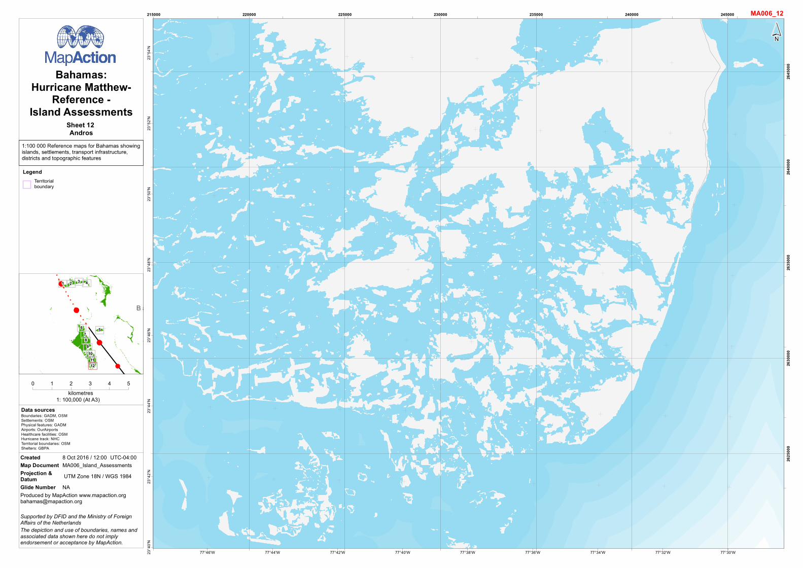
Sheet 12 Andros
LegendTerritorialboundary
Related Documents