Arup Dasgupta Managing Editor, Geospatial World

Welcome message from author
This document is posted to help you gain knowledge. Please leave a comment to let me know what you think about it! Share it to your friends and learn new things together.
Transcript

Arup DasguptaManaging Editor, Geospatial World

India’s Geospatial LegacySurvey of India set up in
1767Geological Survey of
India set up in 1851Cadastral Mapping
started by Survey of India. Responsibility handed over to States in 1904
Indian Forest Act 1878. Forest survey of India set up in 1981
© Royal Geographical Society
2

3
Organisation
•Capabilities•Competencies•Processes•Culture
TrajectoriesAlignment•Past Decisions•Future Choices

4
How Innovation HappensLook at organisations as living systems Innovation is evolutionaryThe phases in remote sensing show a life cycle
approach involving the co-evolution of the organisation, technology & industry
Choosing the right technology during a transition period enables the organisation to catch up and even become a world leader
If such catching up pressures are driven by unique country specific needs the chances of radical innovations are higher
Having caught up the trajectory follow predictable paths
Time
Perf
orm
an
ce
measu
re
Technology A: Scanner
Technology B: CCD
Limit of technology A
Limit of technology B
5

First Operational UseISRO interprets Landsat
imagery to show reduction in forest cover
FSI disputes findings and begins State of Indian Forests Report
1987 report acknowledges “satellite imagery shows good forest cover … is one third of extent of forest cover envisaged in National Forest Policy”
6

NNRMSRajiv Gandhi
National Drinking Water Mission – 1985
Wasteland Mapping Mission 2000,2003, 2006
FASALIntegrated Mission
for Sustainable Development
7

• MAP UNIT• ROCK TYPE & GEOLOGICAL
SEQUENCE• GEOMORPHIC UNIT/LANDFORM• RECHARGE CONDITIONS• NATURE OF THE UNIT• TYPE OF WELLS SUITABLE• PROBABLE DEPTH RANGE OF
WELLS• EXPECTED YIELD RANGE OF
WELLS
RUNOFF ZONES
NC VILLAGE
• PROBABLE SUCCESS RATE OF WELLS
• REFERENCE NO. OF OBSERVATION WELLS
• GROUND WATER IRRIGATED AREA
• RECHARGE STRUCTURE SUITABLE
• PROBLEMS/LIMITATIONS /REMARKS
INFORMATION CONTENT IN THE MAP
PROBLEM AREA
YIELD RANGE
EXCELLENT>200 lpm
GOOD100-200 lpm
MODERATE50-100 lpm
LIMITED20-50 lpm
POOR<20 lpm
NIL
DEPTH RANGESHALLOW<20 m
MODERATE20-80 m
DEEP>80 m
FRACTURE ZONES
GROUND WATER IRRIGATED AREA
FRACTURE/LINEAMENT
GEOLOGICAL/GEOMORPHOLOGICAL BOUNDARIES
RAJIV GANDHI NATIONAL DRINKING WATER MISSIONGROUND WATER PROSPECTS MAP - PARTS OF CHITRADURGA DISTRICT, KARNATAKA

ACREAGE
Forcasting Agricultural output using Space, Agrometeorology & Land based observations (FASAL)
F O R E C A S T S
D E C I S I O N R U L E S
ECONOM
ETRICWEATHER
FIELD SURVEY
MULTIDATE
COARSE
RESOLUTION
HIGH
RESOLUTION
CROPPEDAREA CROPASSES- SMENT
YIELDFO
RE-CASTS
EARLY MID LATE
National Wheat Forecast
‘FASAL’ - RESULTS
72.9 Mt
73 Mt
FORECAST
ACTUAL

Enterprise Resource Planning
Customer Relations Management
Supplier Relations Management
Tracking
GIS
Document Management
Project Management
Land Title
Asset Management
Acc
ess
Port
al
IT Infrastructure

Enterprise Resources Planning

IssuesGeospatial systems are mainly government
funded and ownedGeospatial applications by industry for
industry are few and far betweenDeterring factors
PoliciesLoss of IP
Policies are not affecting foreign entities like Google
12

Growth DriversBig spenders – Defence and NTROMajor public sector projects
R-APDRPNLRMPJNNRUM
All seek to make geospatial systems a part of the overall IT solution
Investment in the order of Rs 65000 million in 2007-12
But progress is slow13
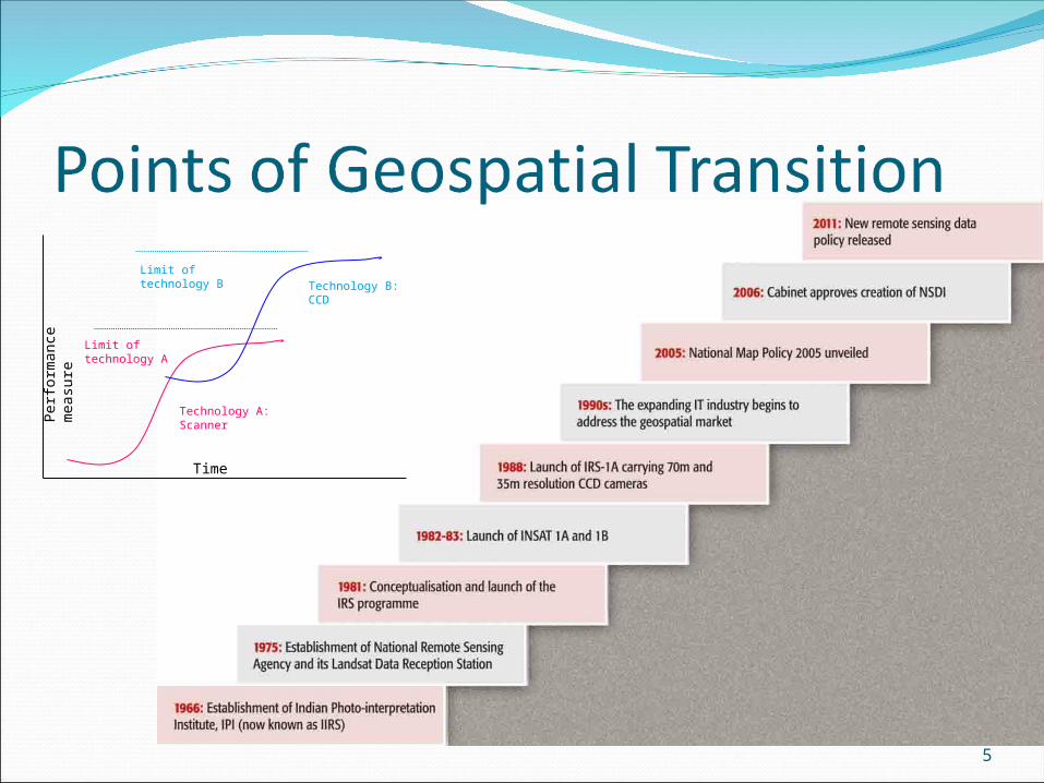
Promises NSDI
Started in 2000Government approval 2006Geoportal established in 2008 but not being
populatedGML schema readyMetadata standards ready
Independent portals coming upBhuvanState Government portals
National GIS of Planning CommissionSeeks to ‘integrate’ all efforts and also provide DSS
to all departments
14

ChallengesThe Indian psyche of data secrecy
Nobody wants to share dataPolicy of ‘Give me your data and we will make a
fantastic database’Inadequate human resources
Geospatial courses are turning out Jacks of all trades who are Masters of none
Introduce geospatial electives in schools, arts and science colleges and engineering institutions
Aligning data policies to technological advances
15

Recommendations – Map PolicyMake the Open Series Maps completely unrestricted Continue to register the map users under the Map
Policy Do not use OSM maps for legal purposesProvide slope and aspect maps derived from height
informationCharge royalty on map reuse through value addition
but do not demand IP rightsBase map series having lower positional accuracy for
thematic mapping All digital data must be supplied in GML 3.0 or higher
16
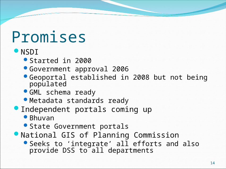
Recommendations – Remote Sensing Data PolicyDeregulate all old high resolution satellite imagery
2 years for satellite imagery5 years for aerial imagery
Deregulate data from sensors like SAR and LIDARForeign satellite data up to one metre resolution
should be directly available from suppliersFor data better than one metre the requirement of
a government certificate should be removed Such data should be made available through Antrix
Corporation who will maintain a database of the supplies and the intended usage
17
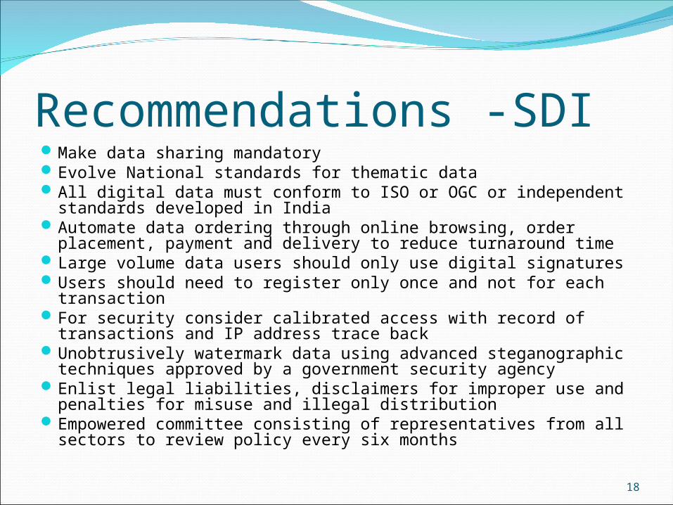
Recommendations -SDIMake data sharing mandatoryEvolve National standards for thematic dataAll digital data must conform to ISO or OGC or independent
standards developed in India Automate data ordering through online browsing, order
placement, payment and delivery to reduce turnaround timeLarge volume data users should only use digital signatures Users should need to register only once and not for each
transactionFor security consider calibrated access with record of
transactions and IP address trace backUnobtrusively watermark data using advanced steganographic
techniques approved by a government security agencyEnlist legal liabilities, disclaimers for improper use and
penalties for misuse and illegal distributionEmpowered committee consisting of representatives from all
sectors to review policy every six months18

Recommendations - HRIntroduce electives in existing courses in computer
science, statistics, mathematics, geography, physics, life sciences, social sciences, engineering and management
Courses for administrators in the government and industry during their induction training
State academies for administrative training need to hold refresher courses from time to time to update their staff capacities
Introduce geospatial applications and technology in schools so that it becomes a career option for the students entering college
A beginning has been made to introduce geospatial subjects in school curricula by the Central Board of Secondary Education This needs to be spread to all other Boards
19

Public Private PartnershipPromote Volunteered Geographical Information
as a source of dataEnable citizens to understand and participate
in decisions that impact their lives and living spaces
Firm up participation of private industryMove beyond services and contractsInvolve industry in DSS design and
implementationIndustry can use service contracts as entry to
push in higher levels of modelling20
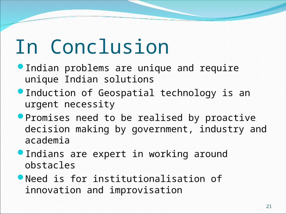
In ConclusionIndian problems are unique and require
unique Indian solutionsInduction of Geospatial technology is an
urgent necessityPromises need to be realised by proactive
decision making by government, industry and academia
Indians are expert in working around obstaclesNeed is for institutionalisation of innovation
and improvisation
21

22
THANK YOU
Related Documents