An Archaeology of the East Midlands Class 2b: Themes in Research: Aerial Archaeology Tutor: Keith Challis east-midlands-archaeology.blogspot.co. Beeston, Winter 2015

Archaeology of the East Midlands Class 2b Beeston Winter 2015
Aug 20, 2015
Welcome message from author
This document is posted to help you gain knowledge. Please leave a comment to let me know what you think about it! Share it to your friends and learn new things together.
Transcript

An Archaeology of the East Midlands
Class 2b: Themes in Research: Aerial Archaeology
Tutor: Keith Challis
east-midlands-archaeology.blogspot.co.uk Beeston, Winter 2015
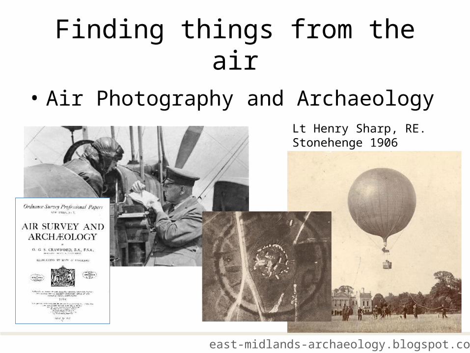
Finding things from the air
• Air Photography and Archaeology
east-midlands-archaeology.blogspot.co.uk
Lt Henry Sharp, RE. Stonehenge 1906

Finding things from the air
• Derrick Riley• Derrick Riley (1915-1993) was a one of the outstanding
pioneers of aerial archaeology.
• He began his flying career during the second world war as a bomber pilot and applied his skills in aerial reconnaissance to archaeology in Britain and overseas.
• His campaigns of flying in the 1970s and 80s resulted in the discovery of a vast number of new sites and transformed the understanding of some previously undervalued landscapes, notably the lowlands of the East Midlands and South Yorkshire.
• His books included Early Landscapes from the Air (University of Sheffield, 1980), Aerial Archaeology in Britain (Shire, 1982), and Air Photography and Archaeology (Duckworth, 1987).
east-midlands-archaeology.blogspot.co.uk
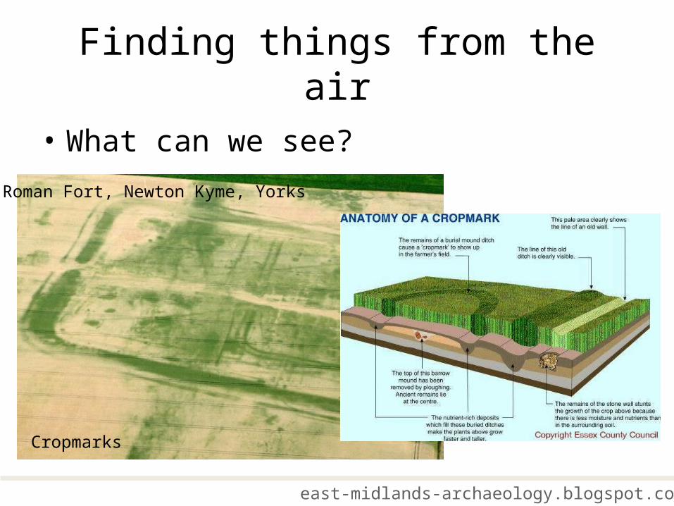
Finding things from the air
• What can we see?
east-midlands-archaeology.blogspot.co.uk
Roman Fort, Newton Kyme, Yorks
Cropmarks

Finding things from the air
• What can we see?
east-midlands-archaeology.blogspot.co.uk
Soilmarks Shadow Sites

Finding things from the air
• Making Sense of Landscape
east-midlands-archaeology.blogspot.co.uk
Later Prehistoric Settlement Trent Valley
An English Heritage, National Mapping Programme cropmark plot, the result of analysis of numerous photographs taken over many years.
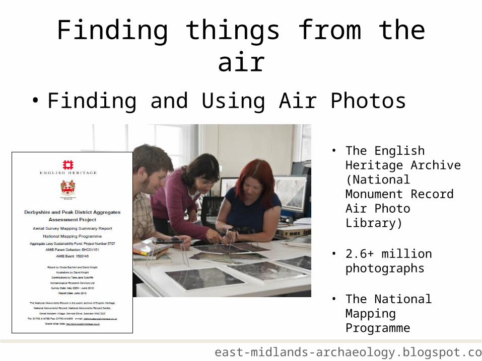
Finding things from the air
• Finding and Using Air Photos
east-midlands-archaeology.blogspot.co.uk
• The English Heritage Archive (National Monument Record Air Photo Library)
• 2.6+ million photographs
• The National Mapping Programme

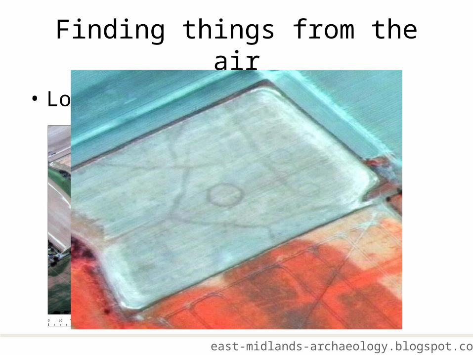
Finding things from the air
• Looking from Space?
east-midlands-archaeology.blogspot.co.uk
Secret Images from Space
“many of the earthworks and cropmarks which we deal with are difficult to see from 2000 ft and I am not therefore clear how ….they would be visible at a distance of 100 miles” J. K. St. Jospeh (1967)
CORONA 860,000 imagescollected between 1960 and the last CORONA mission, in May 1972

Finding things from the air
• Looking from Space?
east-midlands-archaeology.blogspot.co.uk
Worldview 2
• Worldview 2
• Typical of modern civilian systems
• 4 spectral bands
• Panchromatic 0.6m resolution
• Multispectral 1.4m resolution
Finding things from the air
• Looking from Space?
east-midlands-archaeology.blogspot.co.uk

Finding things from the air
• Lidar – What is it?
east-midlands-archaeology.blogspot.co.uk
• Lidar (Light Detection and Ranging
• Uses a very high frequency pulsing laser to scan ground below a moving aircraft
• Calculations using GPS and INS allow generation of 3D map of ground surface
Finding things from the air
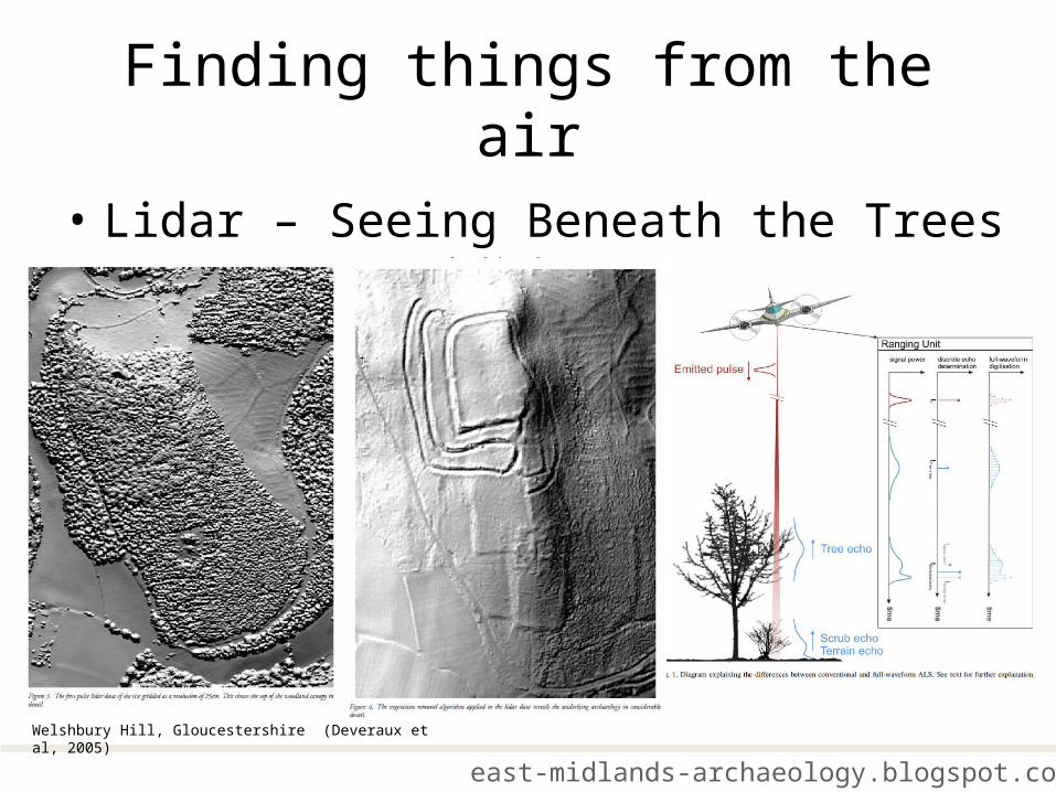
• Lidar – Seeing Beneath the Trees
east-midlands-archaeology.blogspot.co.uk
Welshbury Hill, Gloucestershire (Deveraux et al, 2005)

Finding things from the air
• Lidar – Understanding What You See
east-midlands-archaeology.blogspot.co.uk
Elevation (Height)
Hill Shade (Shadows)

Finding things from the air
• Lidar in the Midlands
east-midlands-archaeology.blogspot.co.uk
Lidar used as a tool to update HER Challis et al 2008

Finding things from the air
• Lidar in the Midlands
east-midlands-archaeology.blogspot.co.uk
M1 motorway widening scheme
east-midlands-archaeology.blogspot.co.uk
Finding things from the air
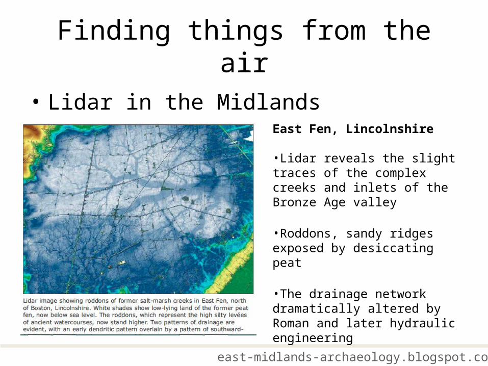
• Lidar in the MidlandsEast Fen, Lincolnshire
•Lidar reveals the slight traces of the complex creeks and inlets of the Bronze Age valley
•Roddons, sandy ridges exposed by desiccating peat
•The drainage network dramatically altered by Roman and later hydraulic engineering
Related Documents