NWGIS Conference, October 11, 2017 With John Sharrard, Esri GIS Solutions Engineer [email protected] ArcGIS Pro Q&A Session

Welcome message from author
This document is posted to help you gain knowledge. Please leave a comment to let me know what you think about it! Share it to your friends and learn new things together.
Transcript

NWGIS Conference, October 11, 2017
With John Sharrard, Esri GIS Solutions Engineer
ArcGIS Pro Q&A Session
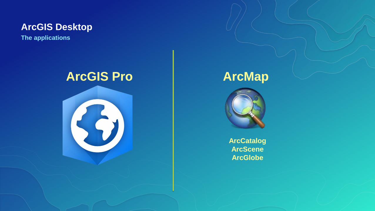
ArcGIS DesktopThe applications
ArcMap ArcGIS Pro
ArcCatalog
ArcScene
ArcGlobe
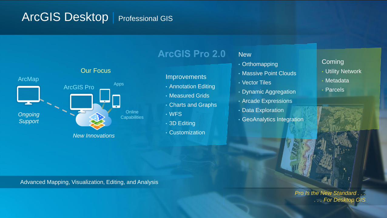
Improvements
• Annotation Editing
• Measured Grids
• Charts and Graphs
• WFS
• 3D Editing
• Customization
ArcMap
ArcGIS ProApps
Online
Capabilities
Coming
• Utility Network
• Metadata
• Parcels
New
• Orthomapping
• Massive Point Clouds
• Vector Tiles
• Dynamic Aggregation
• Arcade Expressions
• Data Exploration
• GeoAnalytics Integration
ArcGIS Desktop | Professional GIS
Advanced Mapping, Visualization, Editing, and Analysis
Pro Is the New Standard . . .
. . . For Desktop GIS
Our Focus
Ongoing
Support
New Innovations
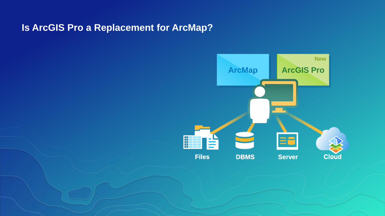
Is ArcGIS Pro a Replacement for ArcMap?
CloudFiles DBMS ServerFiles DBMS Server Cloud
ArcMap ArcGIS Pro
New
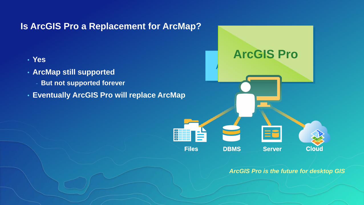
Is ArcGIS Pro a Replacement for ArcMap?
• Yes
• ArcMap still supported
- But not supported forever
• Eventually ArcGIS Pro will replace ArcMap
ArcGIS Pro is the future for desktop GIS
CloudFiles DBMS ServerFiles DBMS Server Cloud
ArcGIS Pro
New
ArcMapArcMap
ArcGIS Pro
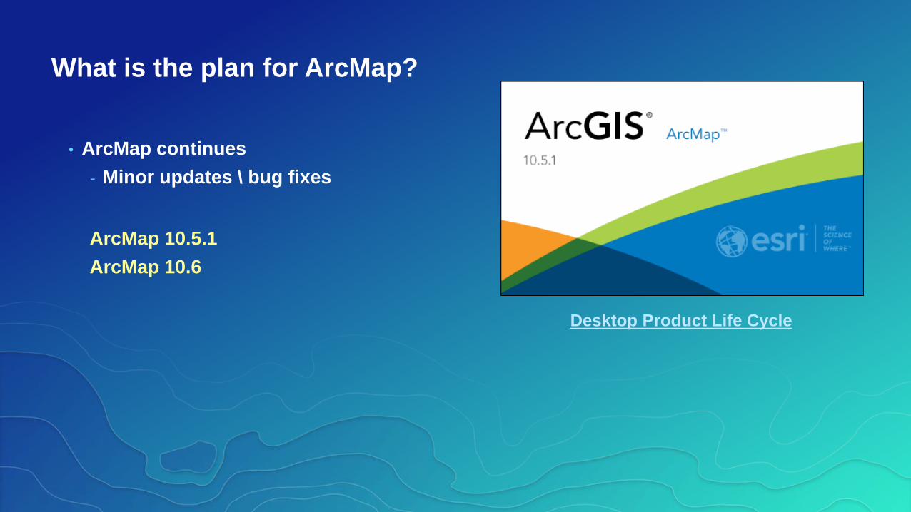
• ArcMap continues
- Minor updates \ bug fixes
ArcMap 10.5.1
ArcMap 10.6
What is the plan for ArcMap?
Desktop Product Life Cycle
Migrating to ArcGIS Pro

Getting Started With ArcGIS Pro
Setup
• Download and Install
• Sign-in and Authorize
• Get Updates
• Set Display Language
Migration
• Take inventory
• Create, connect, import
• Analyze results
• Consult resources
Resources
• Tutorials
• Terminology Guide
• Supported data types and items
• Virtual Campus
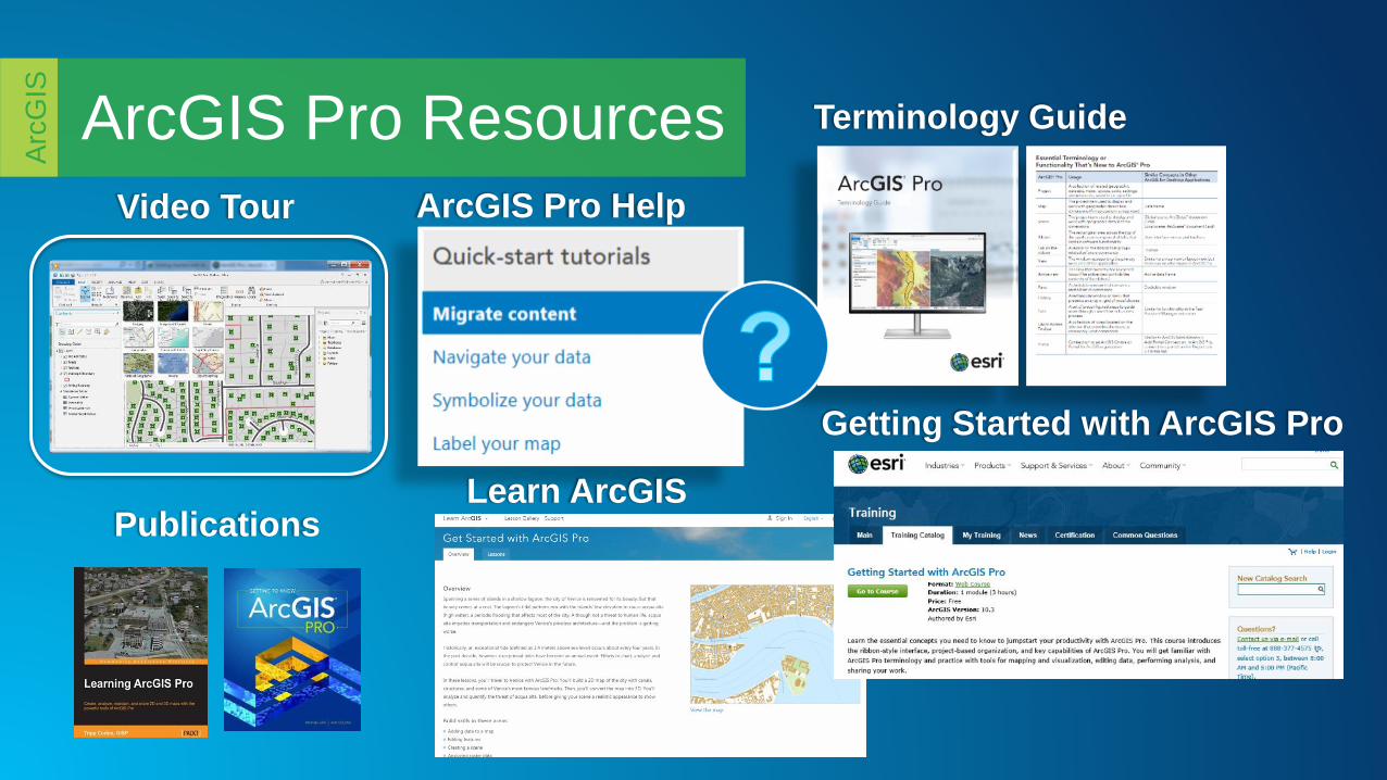
ArcGIS Pro Resources
Arc
GIS
Getting Started with ArcGIS Pro
ArcGIS Pro Help
Terminology Guide
Video Tour
PublicationsLearn ArcGIS
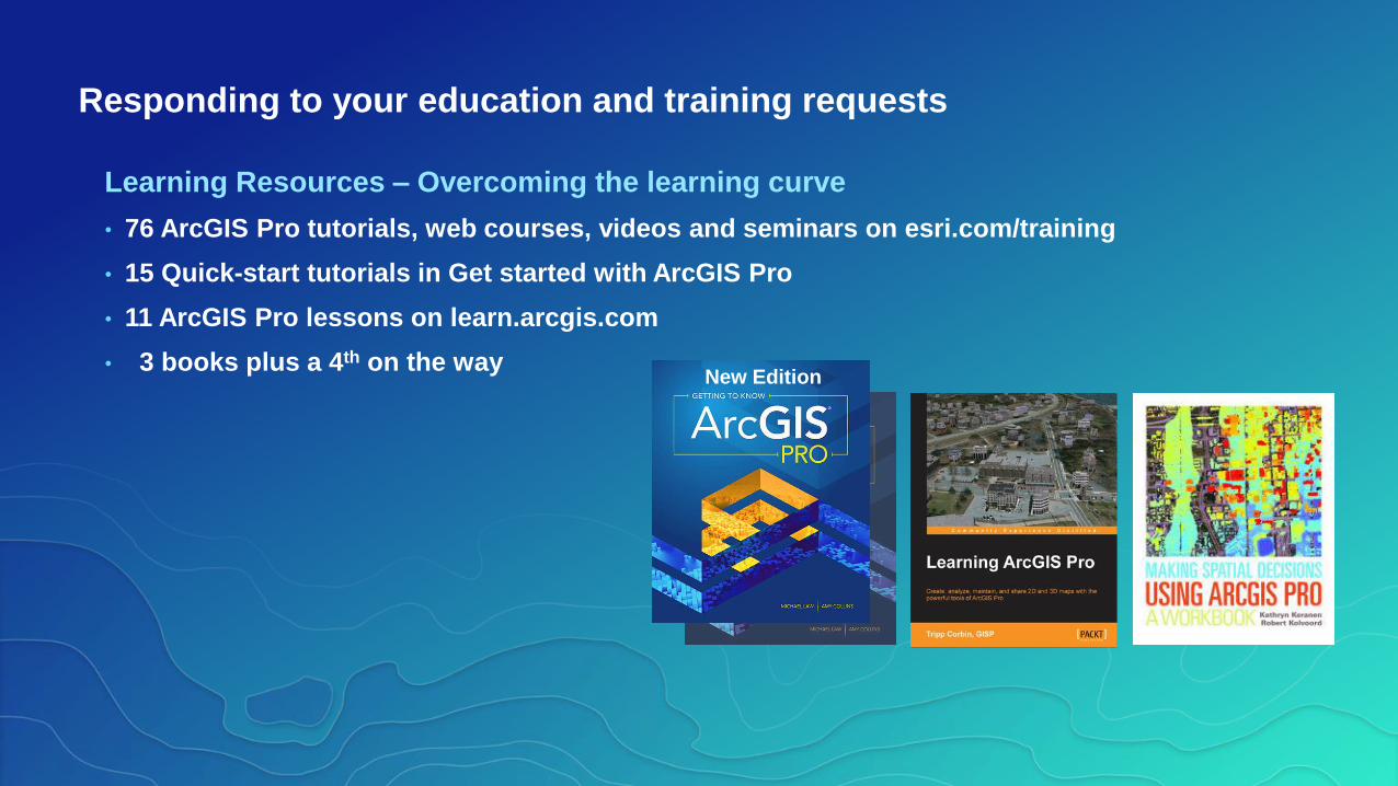
Responding to your education and training requests
Learning Resources – Overcoming the learning curve
• 76 ArcGIS Pro tutorials, web courses, videos and seminars on esri.com/training
• 15 Quick-start tutorials in Get started with ArcGIS Pro
• 11 ArcGIS Pro lessons on learn.arcgis.com
• 3 books plus a 4th on the wayNew Edition
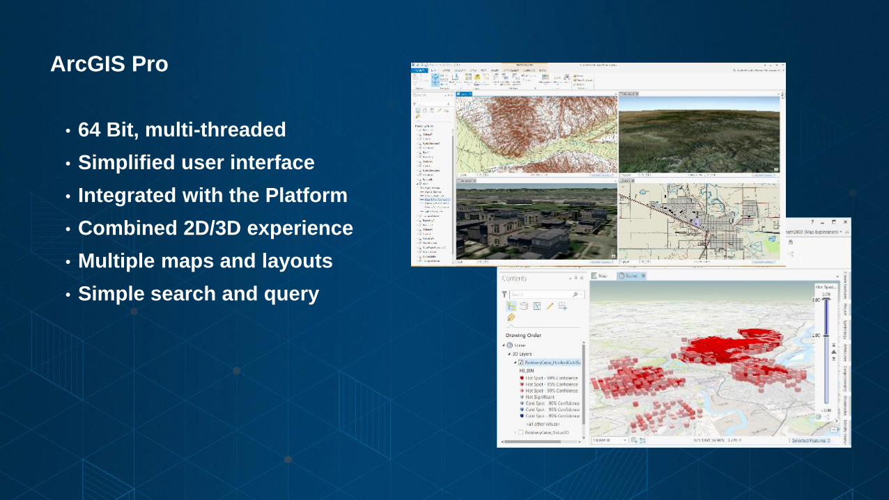
• 64 Bit, multi-threaded
• Simplified user interface
• Integrated with the Platform
• Combined 2D/3D experience
• Multiple maps and layouts
• Simple search and query
ArcGIS Pro

Why migrate to Pro?
• Modern application
• Great sharing experience for maps, scenes, layers & analysis
• Author the best web maps and layers
• 3D GIS
• Most comprehensive set of geospatial analysis tools
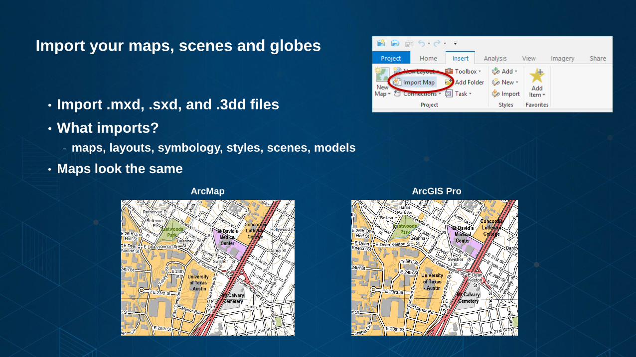
Import your maps, scenes and globes
• Import .mxd, .sxd, and .3dd files
• What imports?
- maps, layouts, symbology, styles, scenes, models
• Maps look the same
ArcMap ArcGIS Pro
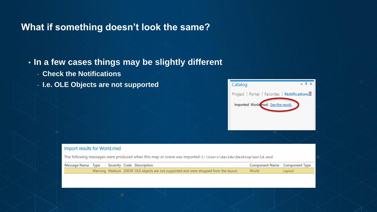
What if something doesn’t look the same?
• In a few cases things may be slightly different
- Check the Notifications
- I.e. OLE Objects are not supported
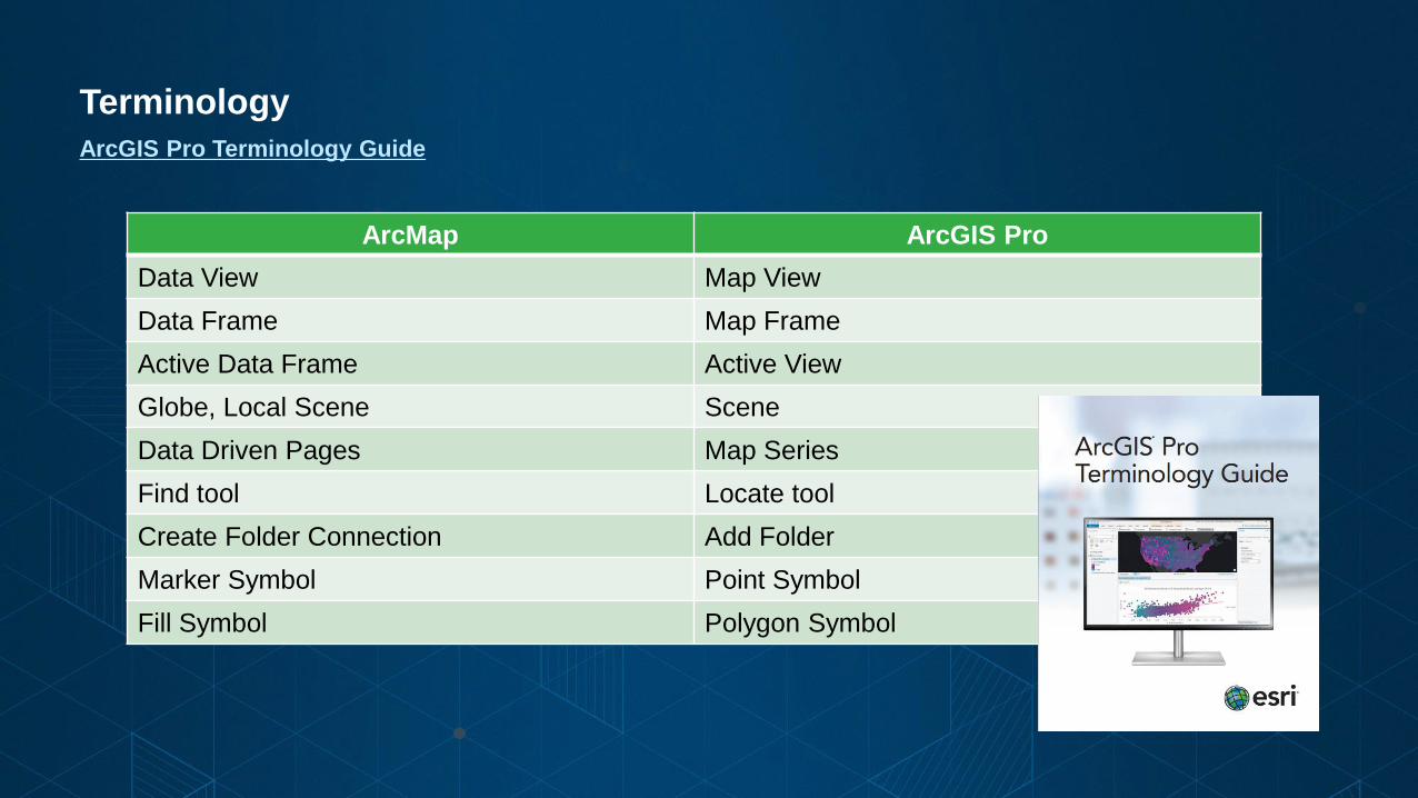
Terminology
ArcGIS Pro Terminology Guide
ArcMap ArcGIS Pro
Data View Map View
Data Frame Map Frame
Active Data Frame Active View
Globe, Local Scene Scene
Data Driven Pages Map Series
Find tool Locate tool
Create Folder Connection Add Folder
Marker Symbol Point Symbol
Fill Symbol Polygon Symbol
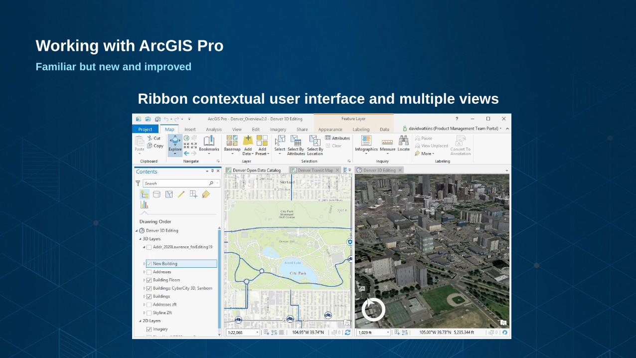
Working with ArcGIS Pro
Familiar but new and improved
Ribbon contextual user interface and multiple views
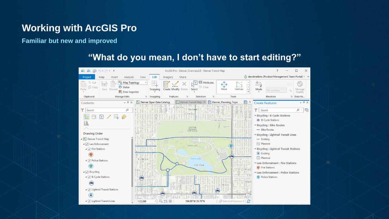
Working with ArcGIS Pro
Familiar but new and improved
“What do you mean, I don’t have to start editing?”
Working with ArcGIS Pro
Familiar but new and improved
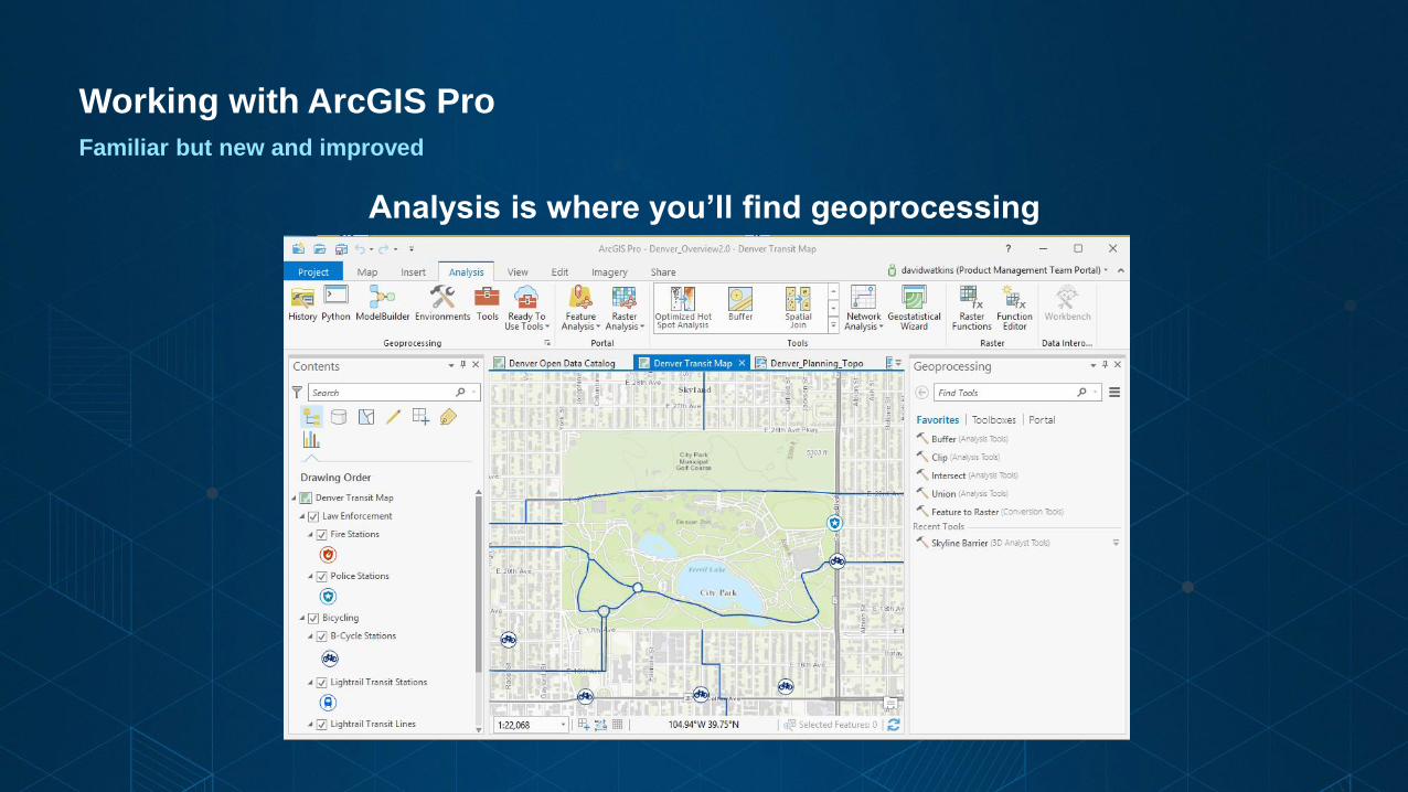
Analysis is where you’ll find geoprocessing
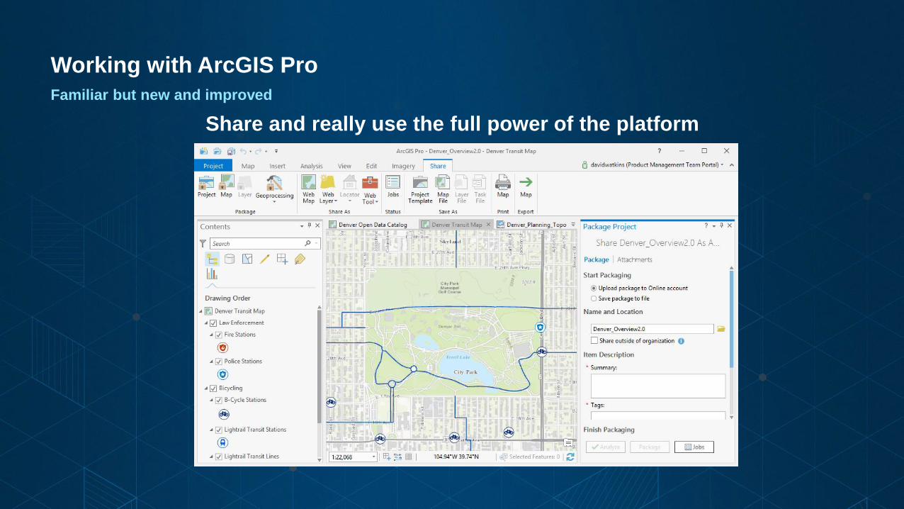
Working with ArcGIS Pro
Familiar but new and improved
Share and really use the full power of the platform
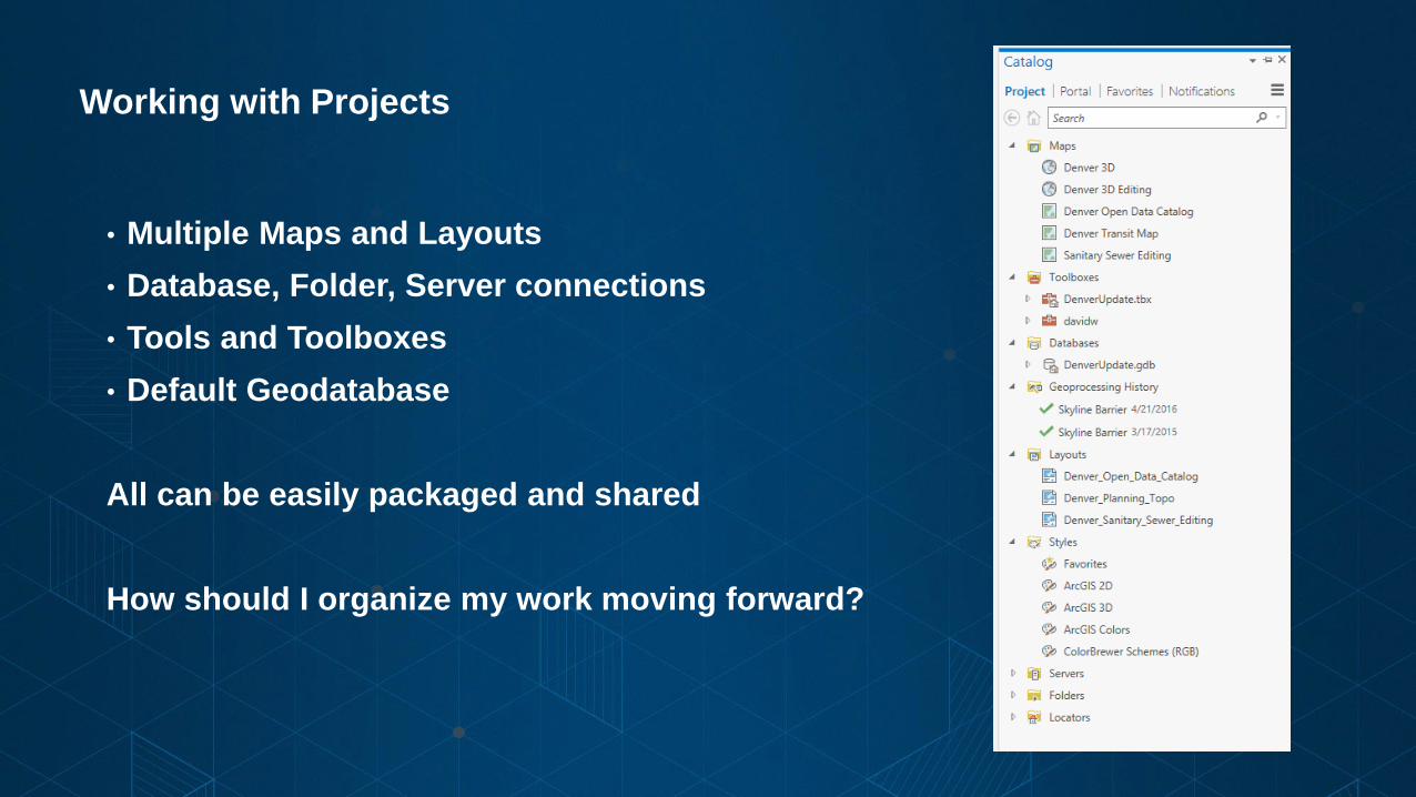
Working with Projects
• Multiple Maps and Layouts
• Database, Folder, Server connections
• Tools and Toolboxes
• Default Geodatabase
All can be easily packaged and shared
How should I organize my work moving forward?
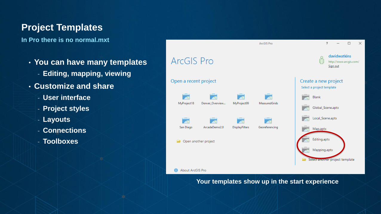
Project Templates
In Pro there is no normal.mxt
• You can have many templates
- Editing, mapping, viewing
• Customize and share
- User interface
- Project styles
- Layouts
- Connections
- Toolboxes
Your templates show up in the start experience

Where are my styles?
• New style format (.stylx)
• Not all styles are installed with ArcGIS Pro
• Referenced styles are imported with maps
• Styles from ArcMap and Custom styles can be imported
• Add styles to your project
• Styles can be shared via ArcGIS Online or your portal
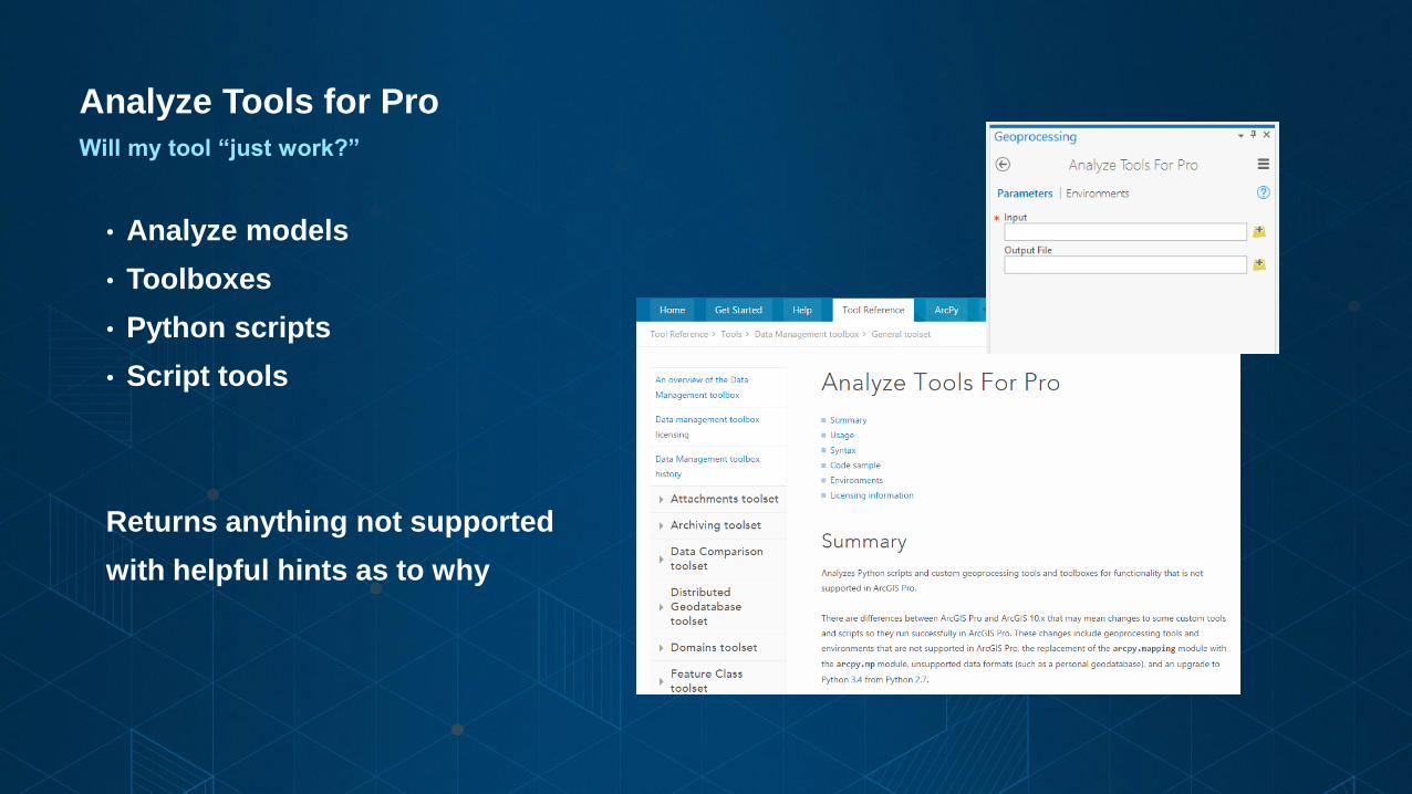
Analyze Tools for Pro
Will my tool “just work?”
• Analyze models
• Toolboxes
• Python scripts
• Script tools
Returns anything not supported
with helpful hints as to why
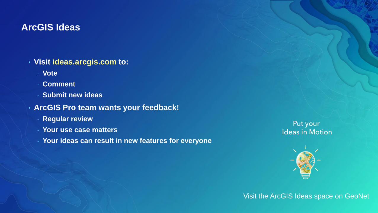
ArcGIS Ideas
• Visit ideas.arcgis.com to:
- Vote
- Comment
- Submit new ideas
• ArcGIS Pro team wants your feedback!
- Regular review
- Your use case matters
- Your ideas can result in new features for everyone
Put yourIdeas in Motion
Visit the ArcGIS Ideas space on GeoNet
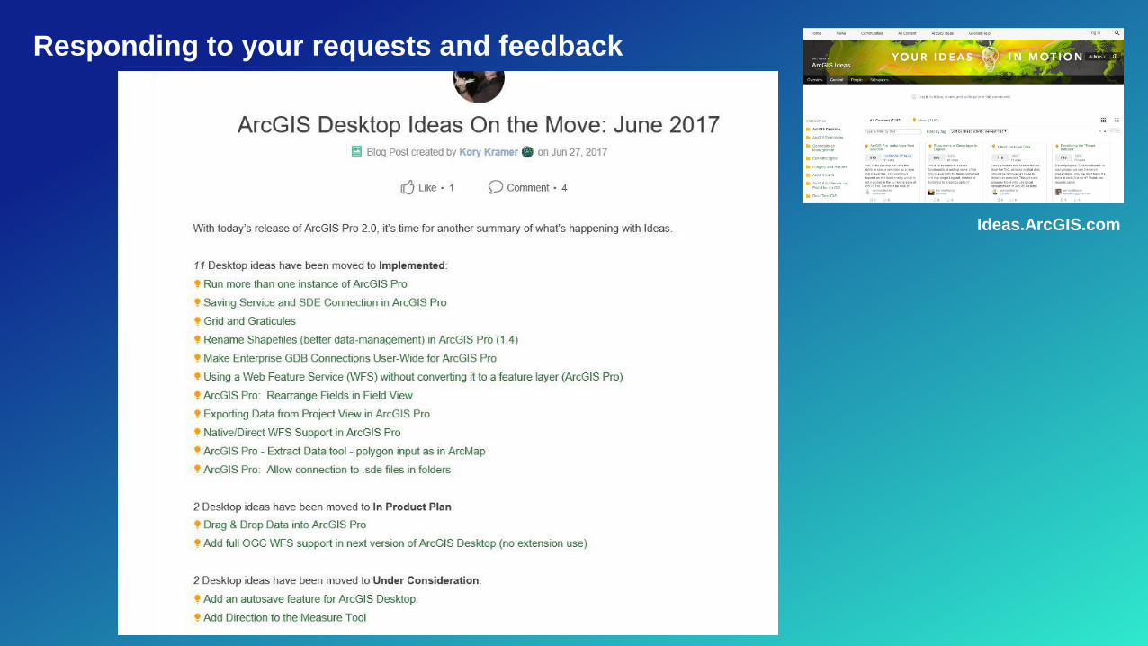
Responding to your requests and feedback
Ideas.ArcGIS.com

ArcGIS Pro Licensing
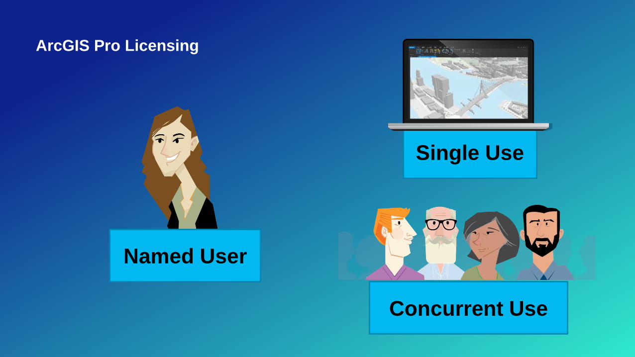
ArcGIS Pro Licensing
Concurrent Use
Named User
Single Use
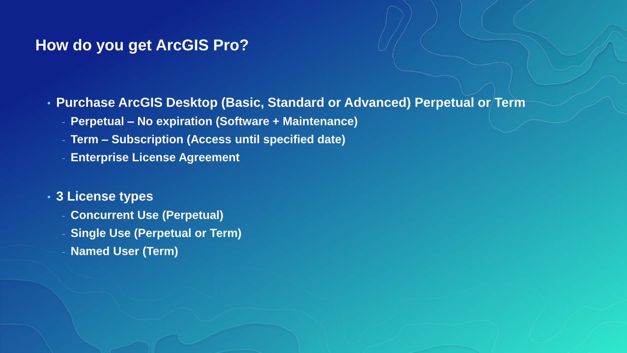
How do you get ArcGIS Pro?
• Purchase ArcGIS Desktop (Basic, Standard or Advanced) Perpetual or Term
- Perpetual – No expiration (Software + Maintenance)
- Term – Subscription (Access until specified date)
- Enterprise License Agreement
• 3 License types
- Concurrent Use (Perpetual)
- Single Use (Perpetual or Term)
- Named User (Term)
ArcGIS Pro Licensing
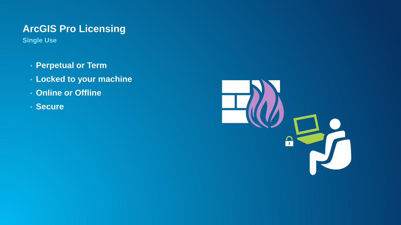
• Perpetual or Term
• Locked to your machine
• Online or Offline
• Secure
Single Use
ArcGIS Pro Licensing
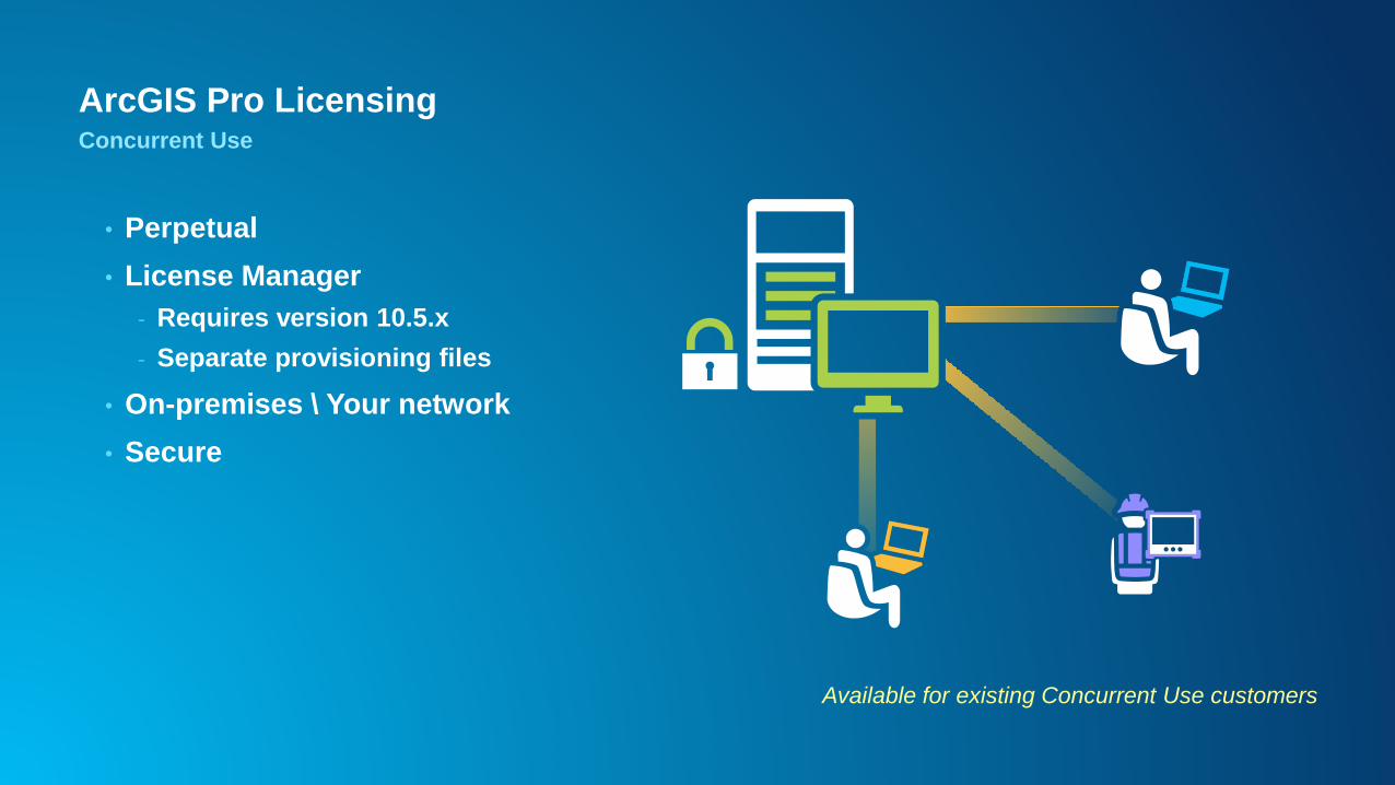
• Perpetual
• License Manager
- Requires version 10.5.x
- Separate provisioning files
• On-premises \ Your network
• Secure
Concurrent Use
Available for existing Concurrent Use customers
Access Pro the best way for your organization
ArcGIS Pro Licensing
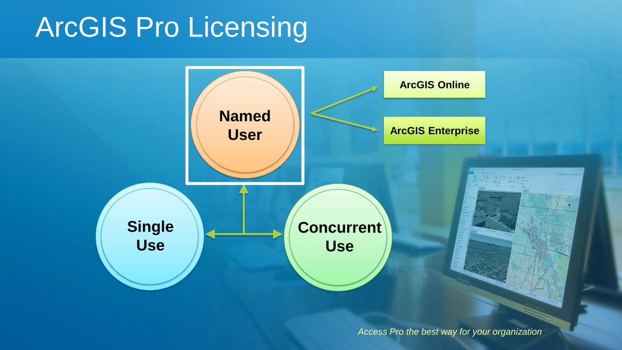
Single
Use
Named
User
Concurrent
Use
ArcGIS Online
ArcGIS Enterprise
ArcGIS Pro Licensing
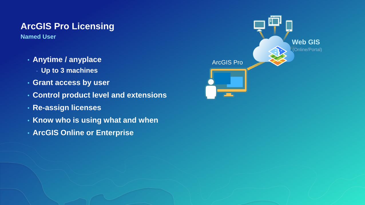
• Anytime / anyplace
- Up to 3 machines
• Grant access by user
• Control product level and extensions
• Re-assign licenses
• Know who is using what and when
• ArcGIS Online or Enterprise
Named User
ArcGIS Pro
Web GIS(Online/Portal)
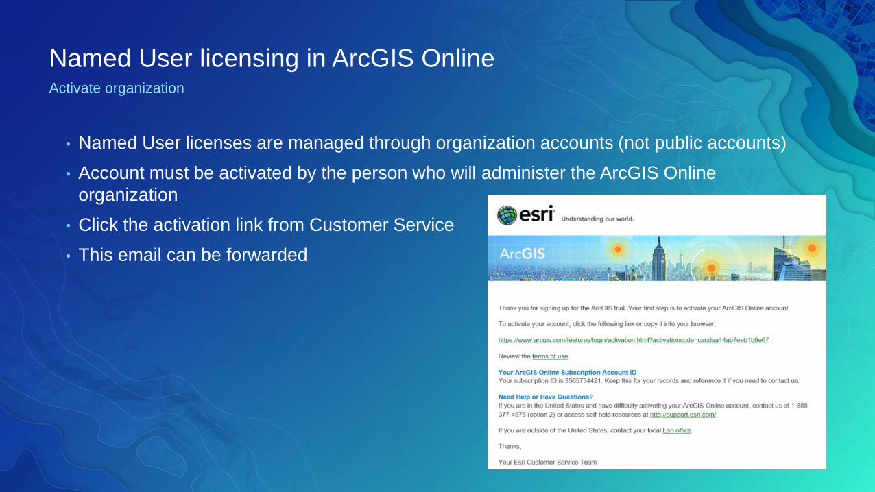
Named User licensing in ArcGIS OnlineActivate organization
• Named User licenses are managed through organization accounts (not public accounts)
• Account must be activated by the person who will administer the ArcGIS Online
organization
• Click the activation link from Customer Service
• This email can be forwarded
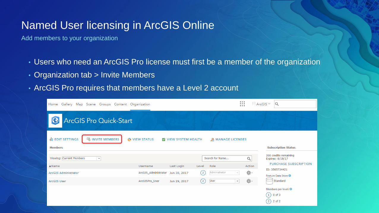
Named User licensing in ArcGIS OnlineAdd members to your organization
• Users who need an ArcGIS Pro license must first be a member of the organization
• Organization tab > Invite Members
• ArcGIS Pro requires that members have a Level 2 account
Manage Licenses
• Must be Administrator or have the Manage Licenses privilege
• Manage Licenses experience in ArcGIS Online
- Search by Group or Role
- Assign and revoke licenses
• ArcGIS Pro user experience
- Licensing portal and active portal
- Take license offline
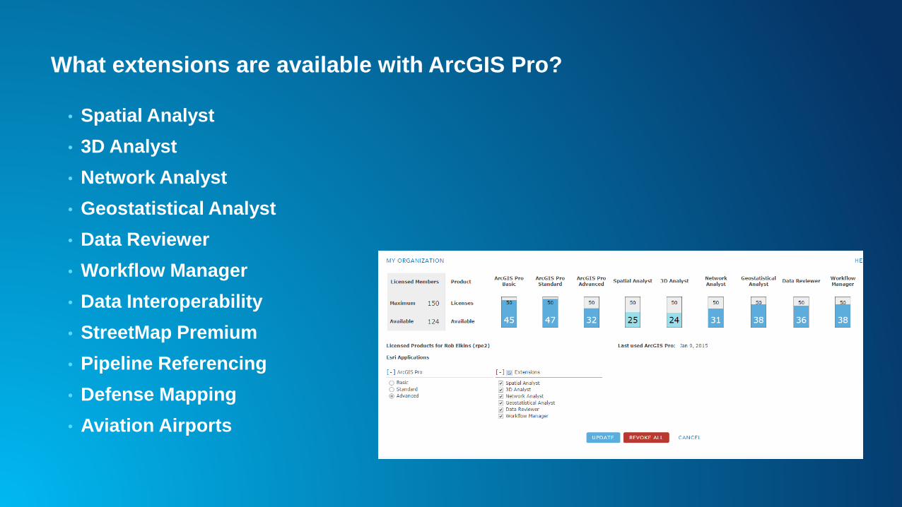
What extensions are available with ArcGIS Pro?
• Spatial Analyst
• 3D Analyst
• Network Analyst
• Geostatistical Analyst
• Data Reviewer
• Workflow Manager
• Data Interoperability
• StreetMap Premium
• Pipeline Referencing
• Defense Mapping
• Aviation Airports

ArcGIS Pro – The Road
Ahead
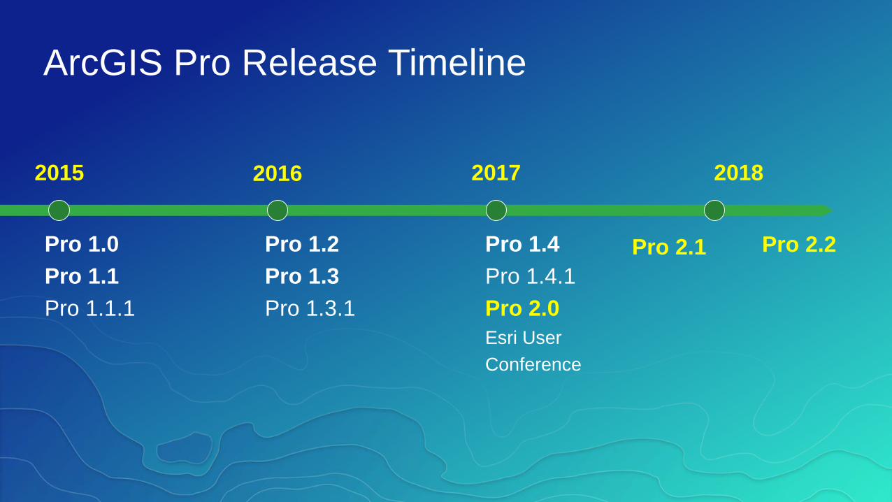
ArcGIS Pro Release Timeline
2015
Pro 1.0
Pro 1.1
Pro 1.1.1
2016 2017 2018
Pro 1.2
Pro 1.3
Pro 1.3.1
Pro 1.4
Pro 1.4.1
Pro 2.0
Esri User
Conference
Pro 2.1 Pro 2.2
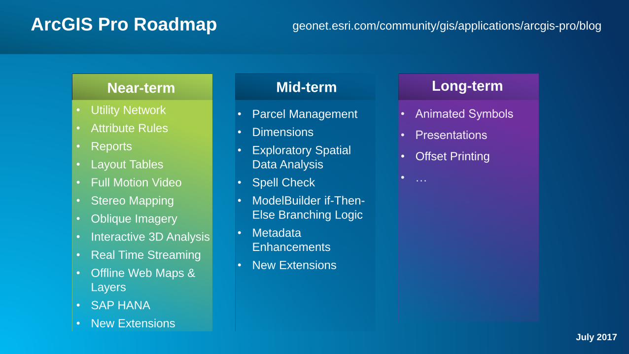
ArcGIS Pro Roadmap
• Offset Printing
• Parcel Management
• Dimensions
• Exploratory Spatial
Data Analysis
• Spell Check
• ModelBuilder if-Then-
Else Branching Logic
• Metadata
Enhancements
• New Extensions
Near-term Mid-term Long-term
• Utility Network
• Attribute Rules
• Reports
• Layout Tables
• Full Motion Video
• Stereo Mapping
• Oblique Imagery
• Interactive 3D Analysis
• Real Time Streaming
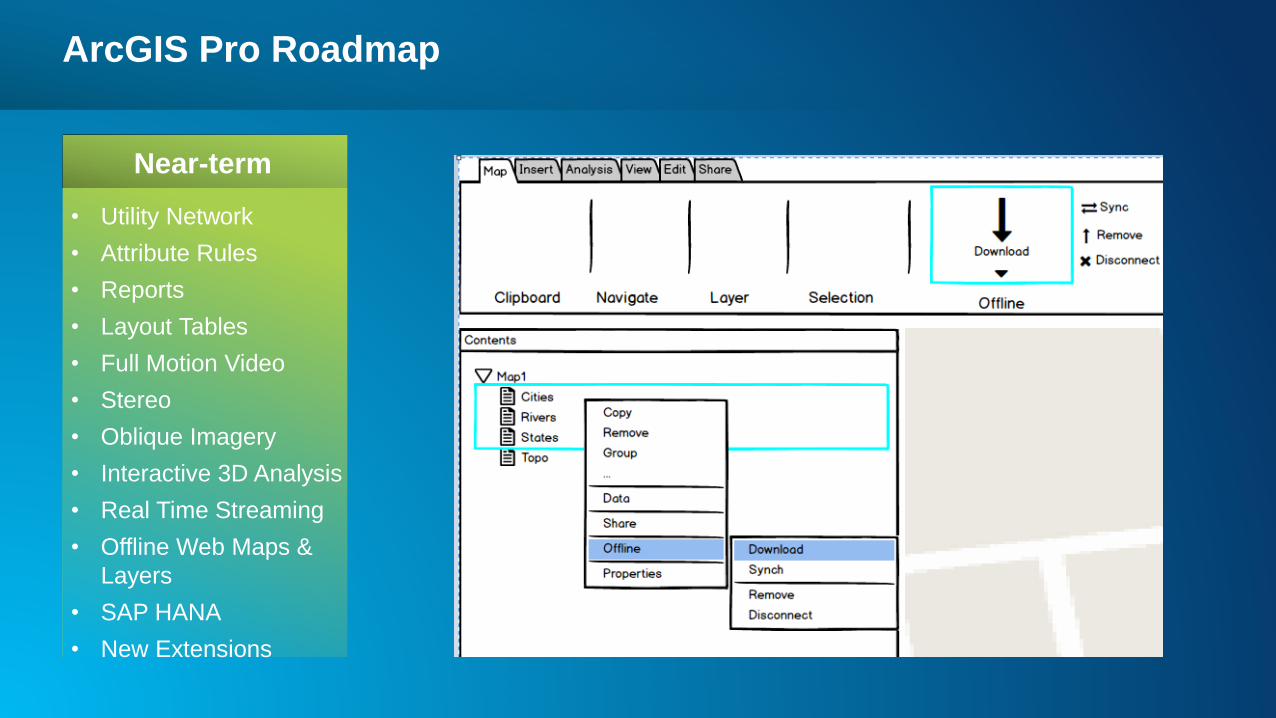
• Offline Web Maps &
Layers
• SAP HANA
• New ExtensionsJuly 2017
geonet.esri.com/community/gis/applications/arcgis-pro/blog
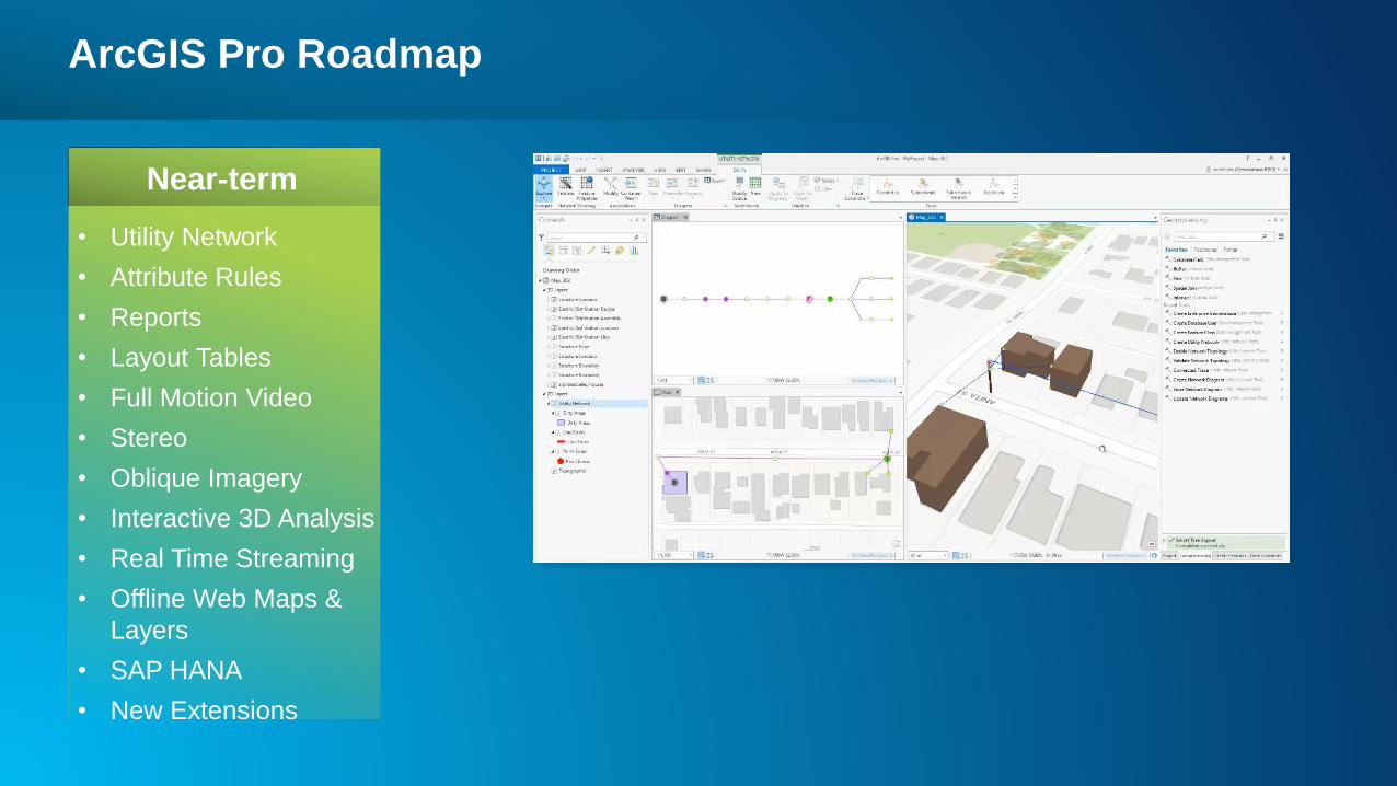
ArcGIS Pro Roadmap
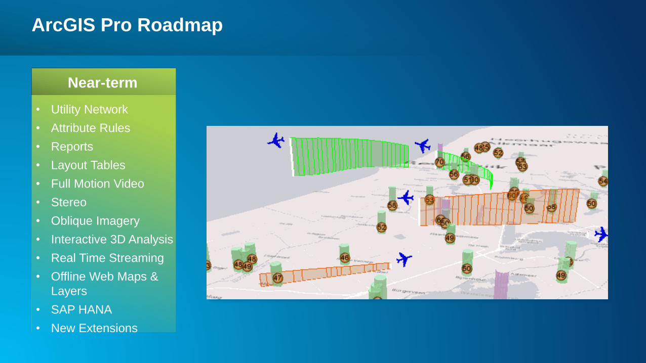
Near-term
• Utility Network
• Attribute Rules
• Reports
• Layout Tables
• Full Motion Video
• Stereo
• Oblique Imagery
• Interactive 3D Analysis
• Real Time Streaming
• Offline Web Maps &
Layers
• SAP HANA
• New Extensions
ArcGIS Pro Roadmap
Near-term
• Utility Network
• Attribute Rules
• Reports
• Layout Tables
• Full Motion Video
• Stereo
• Oblique Imagery
• Interactive 3D Analysis
• Real Time Streaming
• Offline Web Maps &
Layers
• SAP HANA
• New Extensions
ArcGIS Pro Roadmap
Near-term
• Utility Network
• Attribute Rules
• Reports
• Layout Tables
• Full Motion Video
• Stereo
• Oblique Imagery
• Interactive 3D Analysis
• Real Time Streaming
• Offline Web Maps &
Layers
• SAP HANA
• New Extensions
ArcGIS Pro Roadmap
Near-term
• Utility Network
• Attribute Rules
• Reports
• Layout Tables
• Full Motion Video
• Stereo
• Oblique Imagery
• Interactive 3D Analysis
• Real Time Streaming
• Offline Web Maps &
Layers
• SAP HANA
• New Extensions
ArcGIS Pro Roadmap
Near-term
• Utility Network
• Attribute Rules
• Reports
• Layout Tables
• Full Motion Video
• Stereo
• Oblique Imagery
• Interactive 3D Analysis
• Real Time Streaming
• Offline Web Maps &
Layers
• SAP HANA
• New Extensions
ArcGIS Pro Roadmap
Near-term
• Utility Network
• Attribute Rules
• Reports
• Layout Tables
• Full Motion Video
• Stereo
• Oblique Imagery
• Interactive 3D Analysis
• Real Time Streaming
• Offline Web Maps &
Layers
• SAP HANA
• New Extensions
ArcGIS Pro Roadmap
Near-term
• Utility Network
• Attribute Rules
• Reports
• Layout Tables
• Full Motion Video
• Stereo
• Oblique Imagery
• Interactive 3D Analysis
• Real Time Streaming
• Offline Web Maps &
Layers
• SAP HANA
• New Extensions
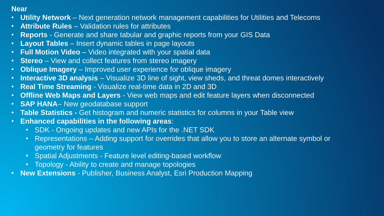
Near
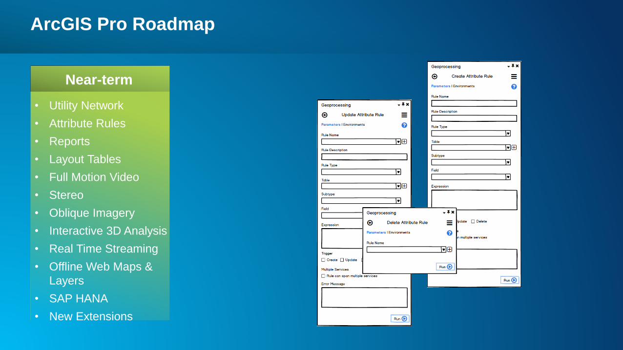
• Utility Network – Next generation network management capabilities for Utilities and Telecoms
• Attribute Rules – Validation rules for attributes
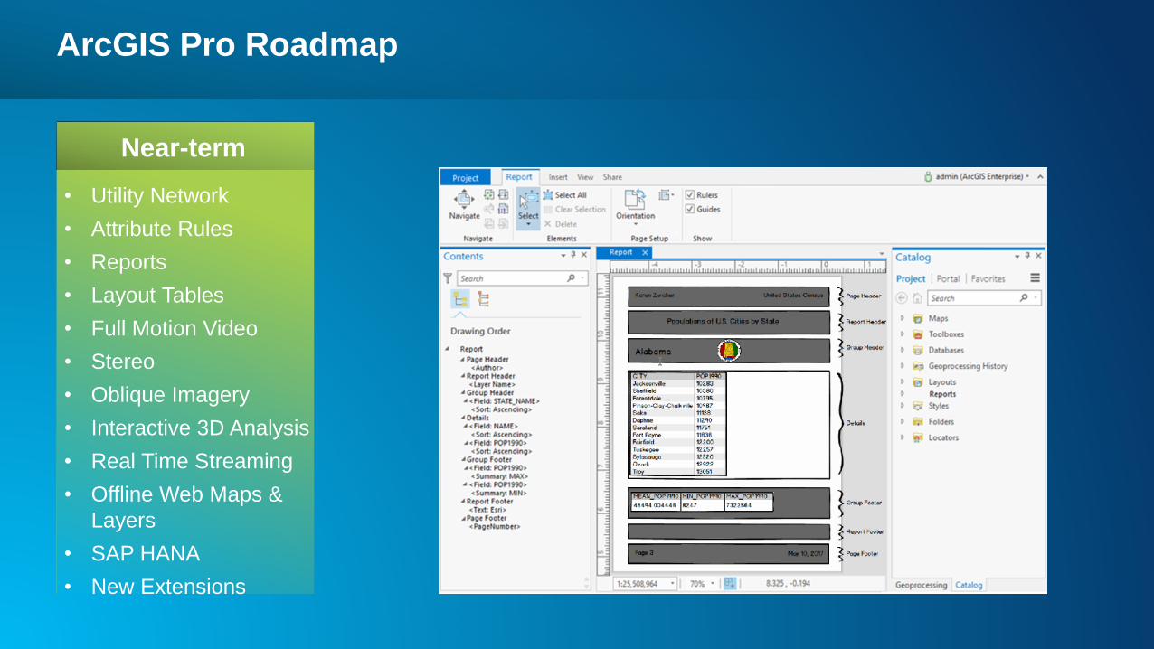
• Reports - Generate and share tabular and graphic reports from your GIS Data
• Layout Tables – Insert dynamic tables in page layouts
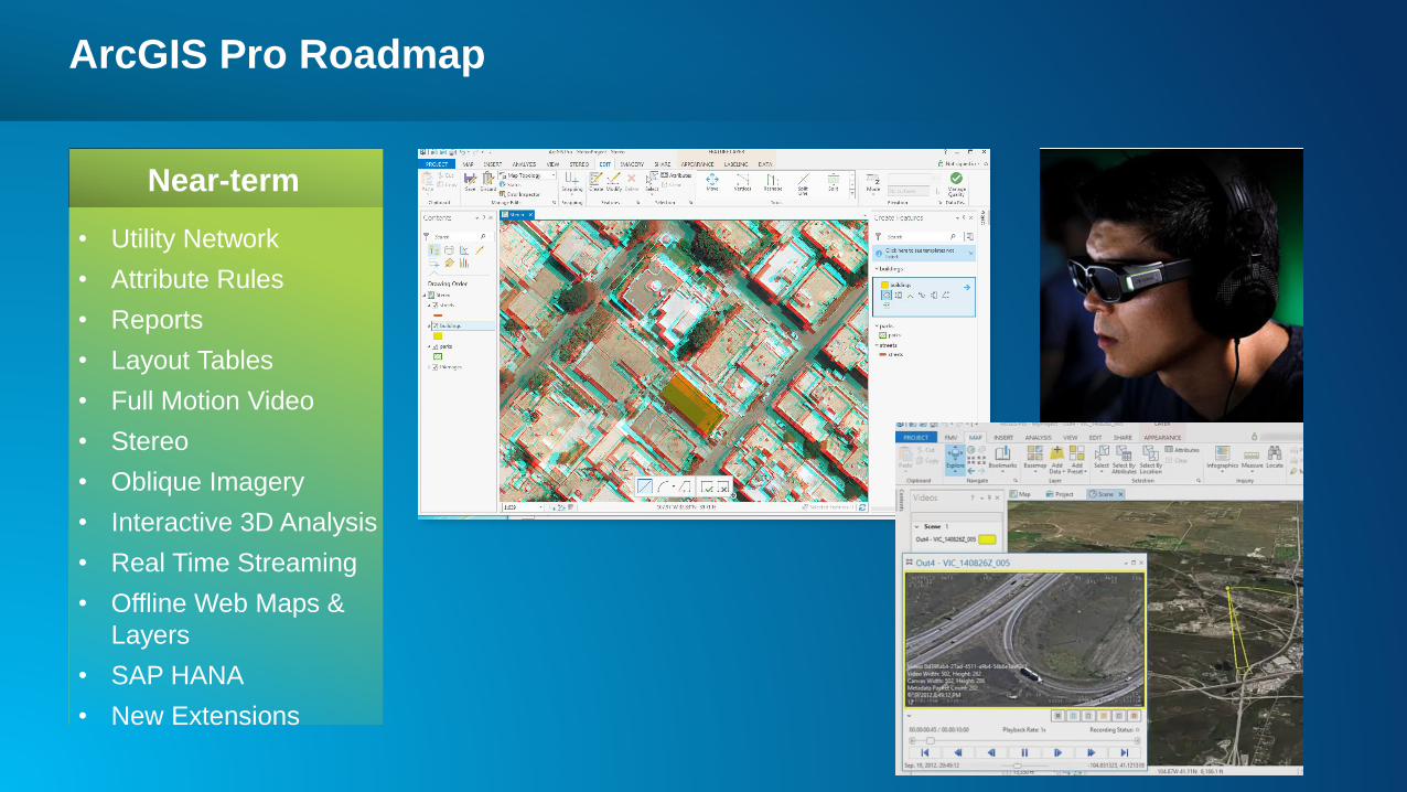
• Full Motion Video – Video integrated with your spatial data
• Stereo – View and collect features from stereo imagery
• Oblique Imagery – Improved user experience for oblique imagery
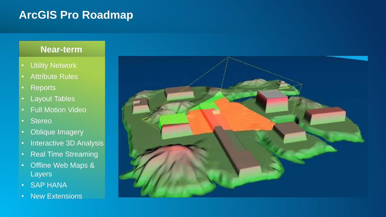
• Interactive 3D analysis – Visualize 3D line of sight, view sheds, and threat domes interactively
• Real Time Streaming - Visualize real-time data in 2D and 3D
• Offline Web Maps and Layers - View web maps and edit feature layers when disconnected
• SAP HANA– New geodatabase support
• Table Statistics - Get histogram and numeric statistics for columns in your Table view
• Enhanced capabilities in the following areas:
• SDK - Ongoing updates and new APIs for the .NET SDK
• Representations – Adding support for overrides that allow you to store an alternate symbol or
geometry for features
• Spatial Adjustments - Feature level editing-based workflow
• Topology - Ability to create and manage topologies
• New Extensions - Publisher, Business Analyst, Esri Production Mapping
ArcGIS Pro Roadmap
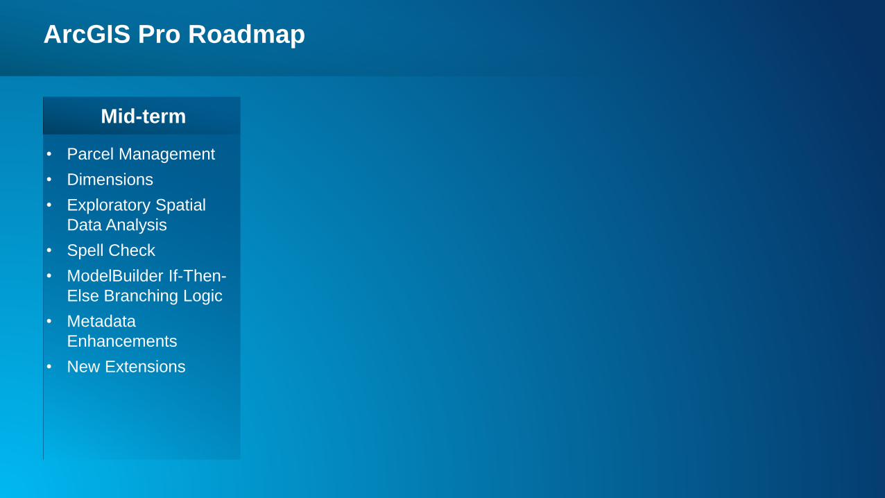
• Parcel Management
• Dimensions
• Exploratory Spatial
Data Analysis
• Spell Check
• ModelBuilder If-Then-
Else Branching Logic
• Metadata
Enhancements
• New Extensions
Mid-term

ArcGIS Pro Roadmap
• Parcel Management
• Dimensions
• Exploratory Spatial
Data Analysis
• Spell Check
• ModelBuilder If-Then-
Else Branching Logic
• Metadata
Enhancements
• New Extensions
Mid-term
ArcGIS Pro Roadmap
• Parcel Management
• Dimensions
• Exploratory Spatial
Data Analysis
• Spell Check
• ModelBuilder If-Then-
Else Branching Logic
• Metadata
Enhancements
• New Extensions
Mid-term
ArcGIS Pro Roadmap
• Parcel Management
• Dimensions
• Exploratory Spatial
Data Analysis
• Spell Check
• ModelBuilder If-Then-
Else Branching Logic
• Metadata
Enhancements
• New Extensions
Mid-term
Mid-term
• Parcel Management - The next generation of the parcel fabric will introduce 2D/3D editing capabilities and a
simpler, more efficient approach for parcel maintenance across the platform.
• Dimensions - Create, manage, and edit dimensions in an updated format for the ArcGIS Platform
• Exploratory Spatial Data Analysis - Ability to create charts to explore spatial data for comparing distributions
between datasets and/or “normal distributions” and examine data for the presence and direction of trends.
• Spell Check – Spell check for text throughout the application
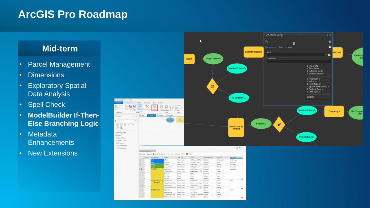
• ModelBuilder if-Then-Else Branching Logic – Build logic into your models that test conditional statements to
determine how a model should proceed.
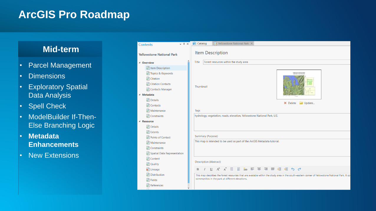
• Metadata Enhancements – Support majority of metadata functionality
• New Extensions - Aviation: Charting
Long-term
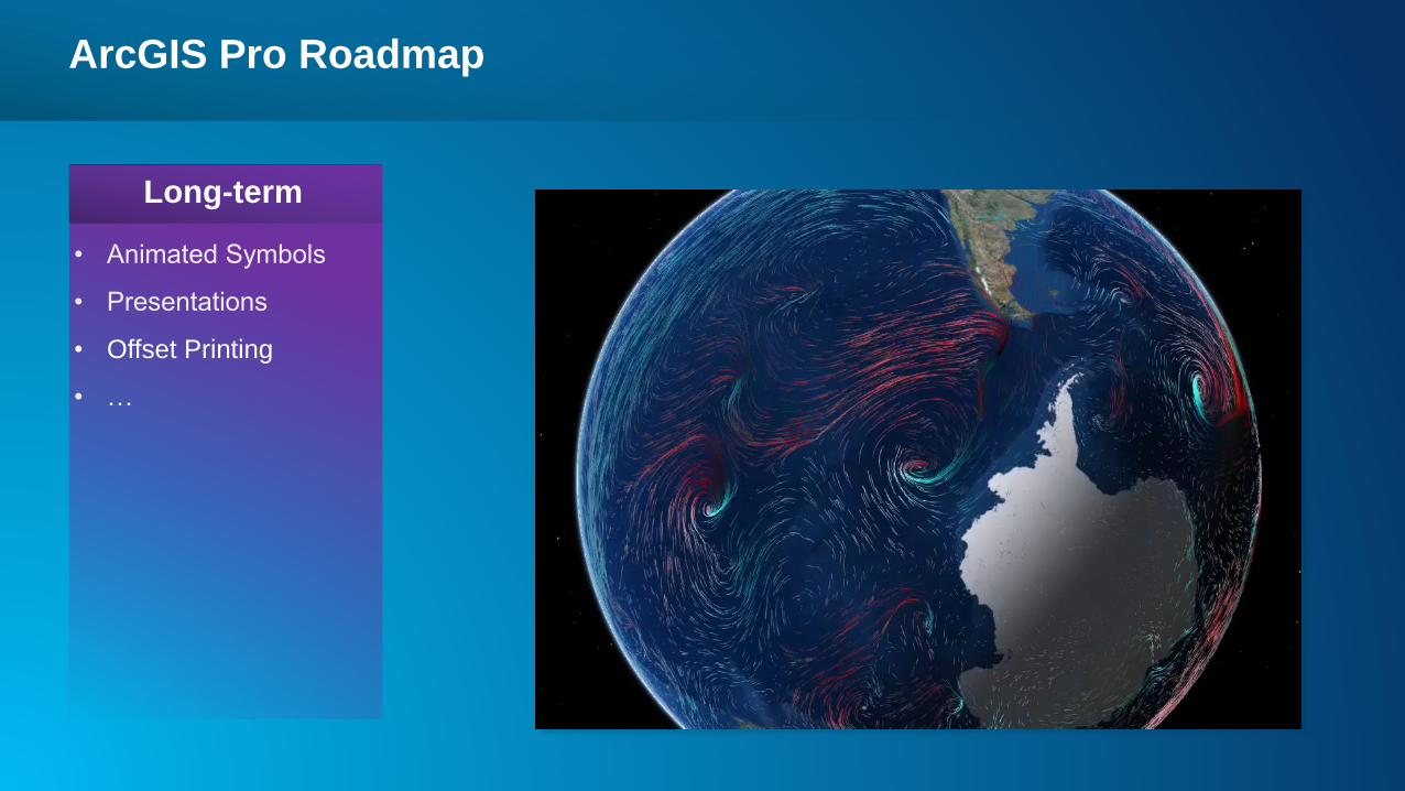
• Animated Symbols - Scientific temporal visualizations
• Offset Printing - For high quality printed map products
• Presentations - Create and share presentations
• New Extensions:
Maritime: Charting and Bathymetry
Roads and Highways
ArcGIS Pro Roadmap
• Offset Printing
Long-term
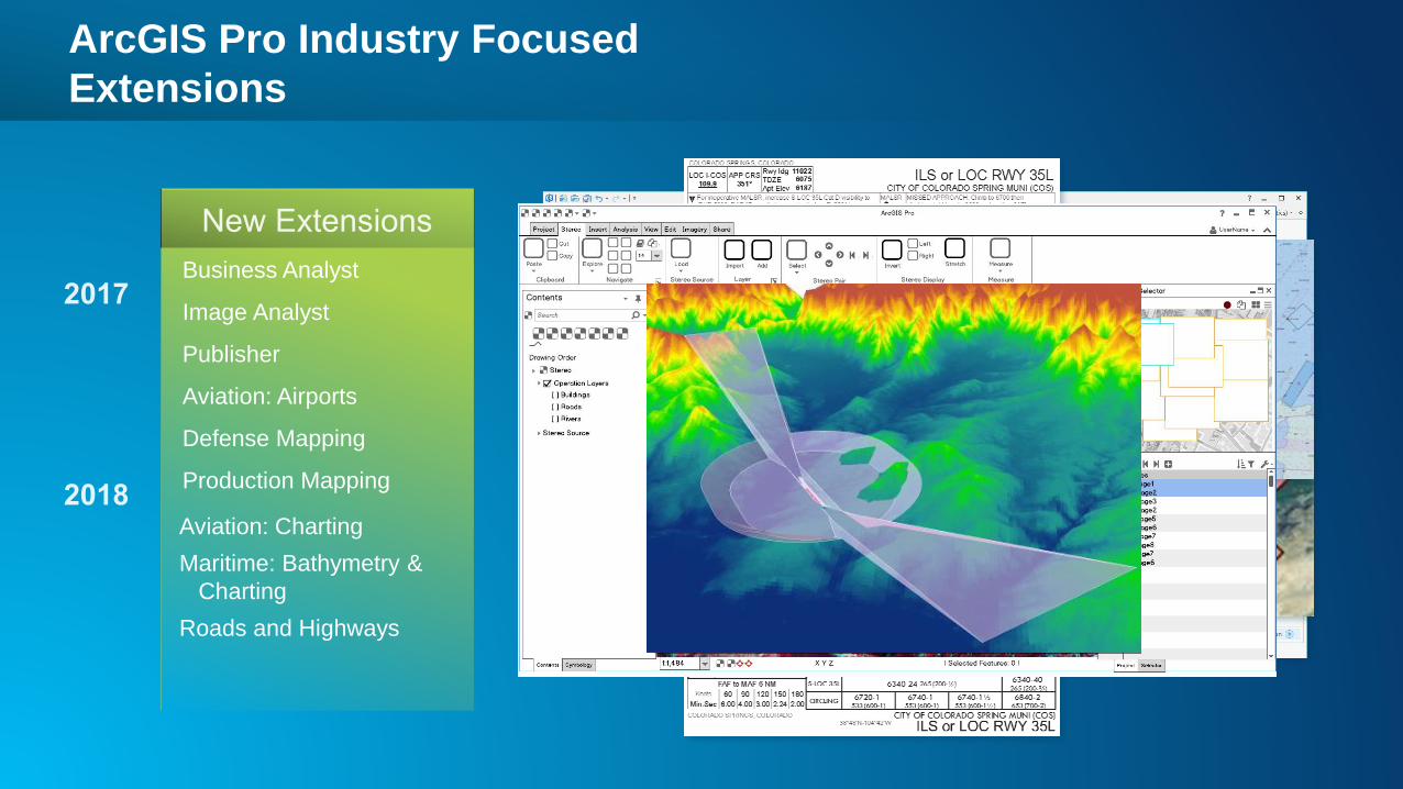
ArcGIS Pro Industry Focused
Extensions
Aviation: Charting
Maritime: Bathymetry &
Charting
Roads and Highways
Business Analyst
Image Analyst
Publisher
Aviation: Airports
Defense Mapping
Production Mapping
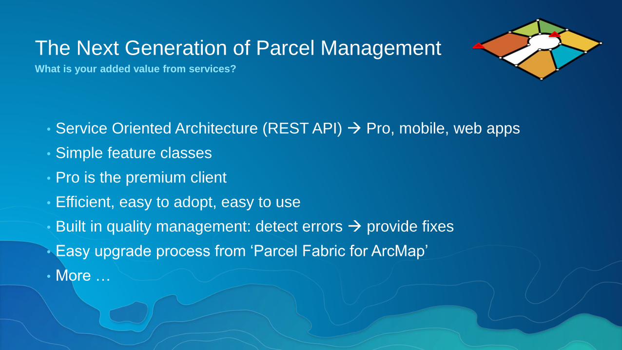
The Next Generation of Parcel ManagementWhat is your added value from services?
• Service Oriented Architecture (REST API) Pro, mobile, web apps
• Simple feature classes
• Pro is the premium client
• Efficient, easy to adopt, easy to use
• Built in quality management: detect errors provide fixes
• Easy upgrade process from ‘Parcel Fabric for ArcMap’
• More …

Related Documents


