AOSC 200 Lesson 17

AOSC 200 Lesson 17. Birth of a an Extratropical Cyclone.
Dec 23, 2015
Welcome message from author
This document is posted to help you gain knowledge. Please leave a comment to let me know what you think about it! Share it to your friends and learn new things together.
Transcript
AOSC 200Lesson 17

Birth of a an Extratropical Cyclone
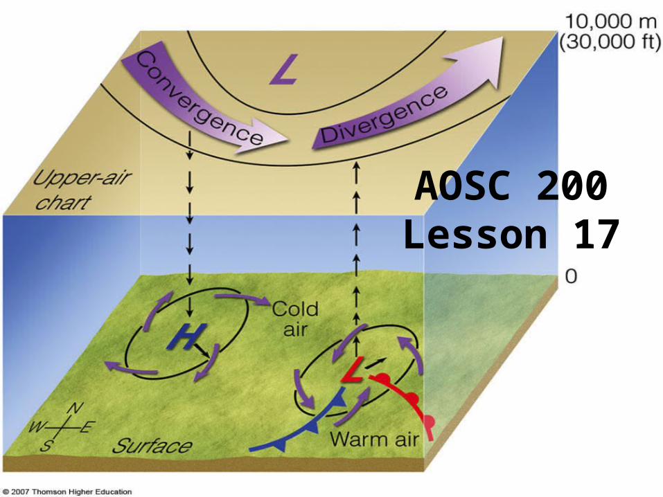
LIFE CYCLE OF AN EXTRATROPICAL CYCLONE
• THE LEFT HAND SIDE SHOWS HOW BJERKNES DEPICTED THE LIFE CYCLE.
• FORM ALONG THE LINE BETWEEN THE POLAR AIR MASS AND THE MARITIME TROPICAL AIR MASS.
• SHEARING ACTION OF OPPOSING WINDS PRODUCES CYCLONIC MOTION.
• UNDER SUITABLE CONDITIONS FRONTAL SURFACE WILL ASSUME A WAVE SHAPE.
• OPEN WAVE DEVELOPS COLD AND WARM FRONTS• COLD FRONT CATCHES UP WITH WARM FRONT• CYCLONE DISSIPATES
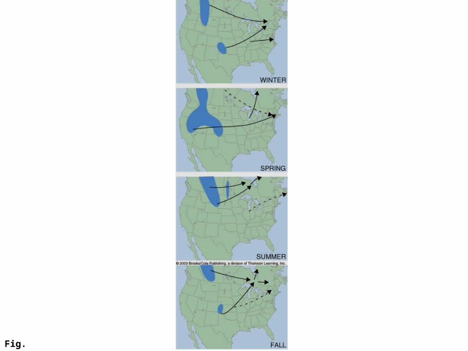
Fig. 10.6
Box 10.1
Box 10.1
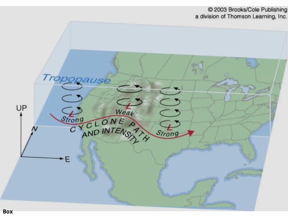
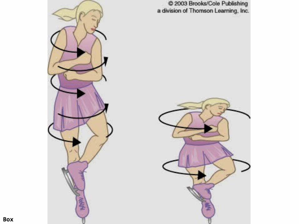
Cyclones over the Rockies
• In order for Cyclones formed over the Pacific to each the mid-west they have to go over the Rockies.
• This squeezes the cyclone down, which increases the radius of rotation
• This decreases the rate of rotation (conservation of angular momentum)
• The cyclone appears to weaken.• East of the Rockies the cyclone expands and regains its full rate of rotation

Fig. 10.11
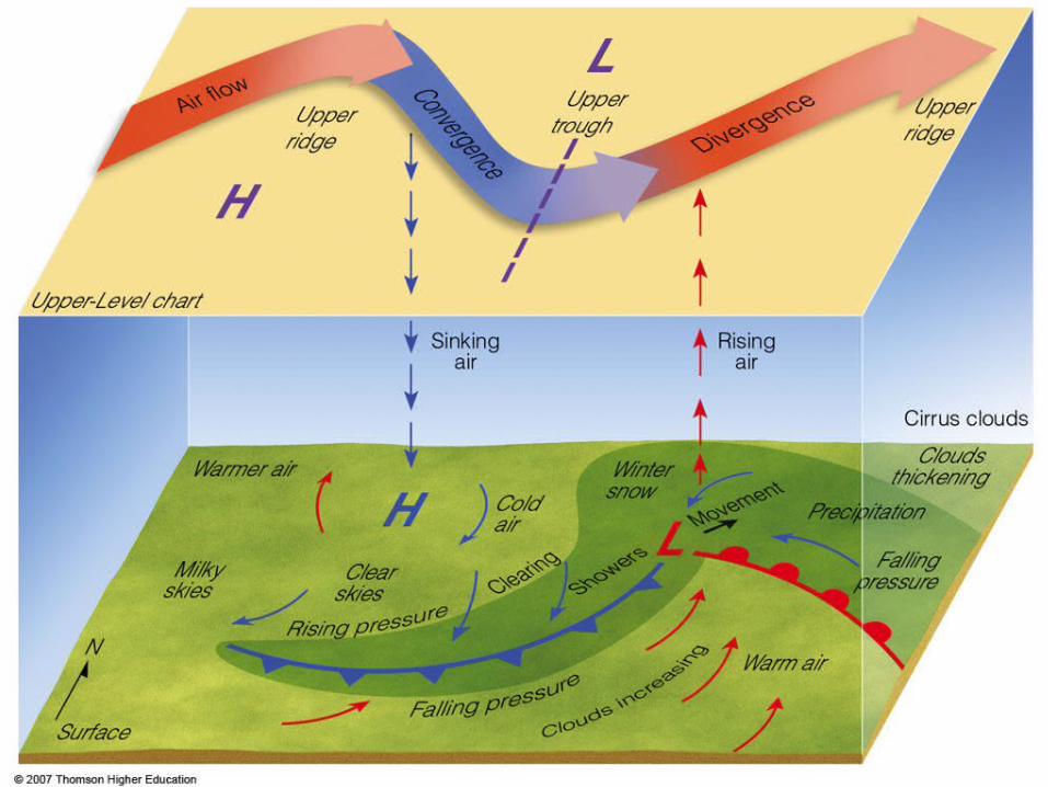
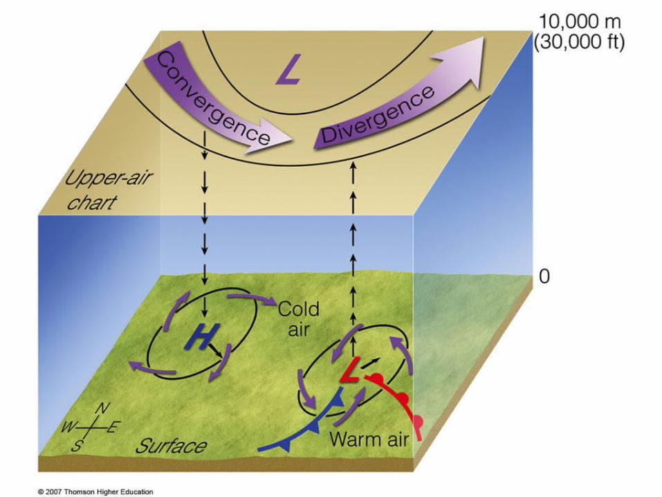
Formation of Cyclones
• .CLOSE RELATIONSHIP BETWEEN SURFACE DISTURBANCES AND THE FLOW IN THE JET STREAM.
• .FOR A MID-LATITUDE CYCLONE TO FORM:CYCLONIC FLOW MUST BE ESTABLISHED
• .INWARD FLOW OF AIR NEAR SURFACE MUST BE SUPPORTED BY OUTFLOW ALOFT.
• DIVERGENCE AND CONVERGENCE ALOFT• TOTAL SPIN / CYCLONIC HEIGHT = CONSTANT• .VORTICITY - TENDENCY OF AIR TO ROTATE IN A WHIRLPOOL LIKE VORTEX – SPIN AROUND A VERTICAL AXIS
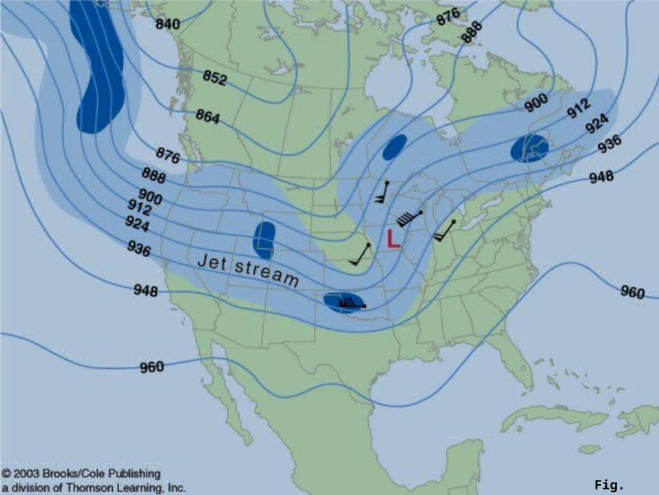
Fig. 10.13

TRAVELING CYCLONES AND ANTI-CYCLONES
• .FLOW ALOFT DETERMINES HOW RAPIDLY THE PRESSURE SYSTEMS ADVANCE AND THE DIRECTION THEY WILL TAKE.
• .CYCLONES TRAVEL AT ABOUT ONE HALF OF THE FLOW VELOCITY AT 500 MB, ABOUT 20 TO 50 KM PER HOUR.
• .TEND TO TRAVEL IN AN EASTERLY DIRECTION AT FIRST, BUT THEN FOLLOW A NORTH-EASTERLY PATH.
• .MOST PACIFIC LOWS DO NOT CROSS THE ROCKIES, BUT MAY RE-DEVELOP ON THE LEE SIDE OF THE MOUNTAINS.
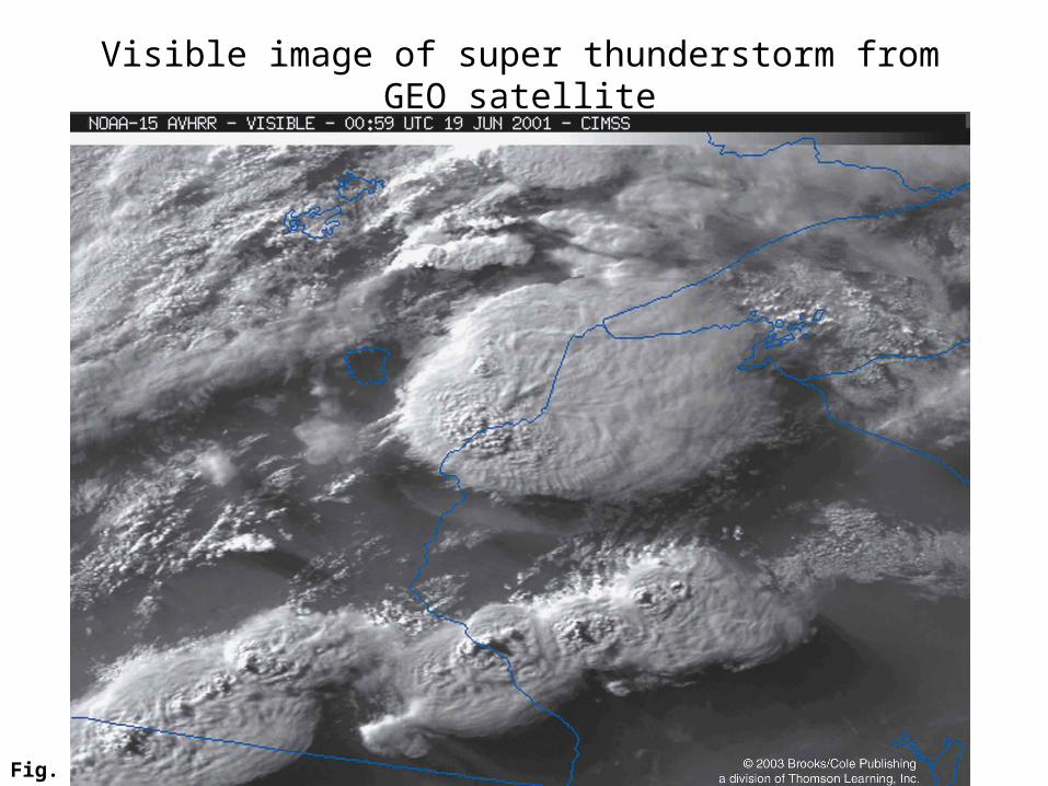
Fig. 11.2a
Visible image of super thunderstorm from GEO satellite
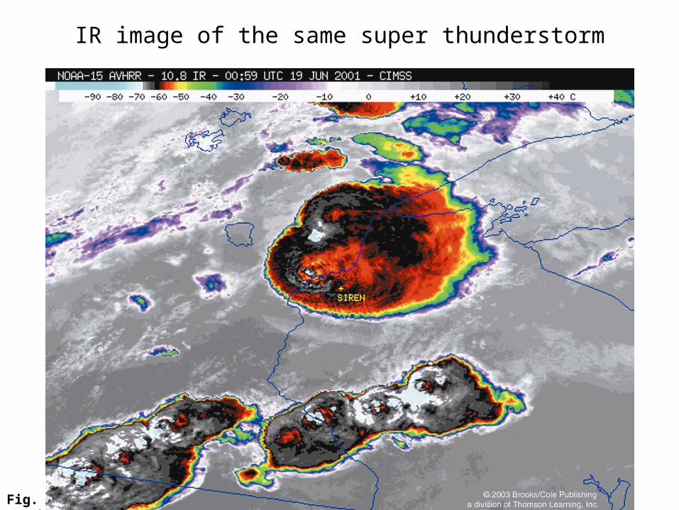
Fig. 11.2b
IR image of the same super thunderstorm
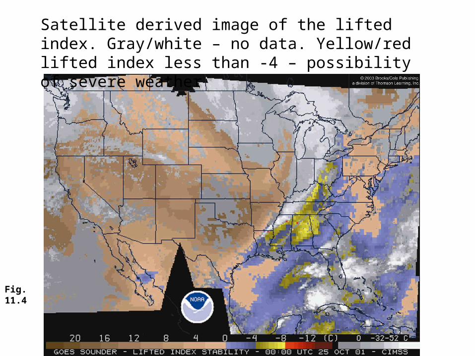
Fig. 11.4
Satellite derived image of the lifted index. Gray/white – no data. Yellow/red lifted index less than -4 – possibility of severe weather
THUNDERSTORM• IS A CLOUD OR CLUSTER OF CLOUDS THAT PRODUCES THUNDER, LIGHTNING, HEAVY RAIN, AND SOMETIMES HAIL AND TORNADOS
• CAN DIVIDE THUNDERSTORMS INTO TWO MAIN TYPES
ISOLATED THUNDERSTORMS PRODUCES WITHIN A WARM HUMID AIR MASS
SEVERE THUNDERSTORMS PRODUCED BY FORCEFUL LIFTING
• IN THE USA, AIRMASS THUNDERSTORMS GENERALLY OCCUR IN WARM MOIST AIR - mT
• LIFTING CAN BE BY FRONTS OR OROGRAPHICALLY

Fig. 11.7
Life cycle of an ordinary thunderstorm cell
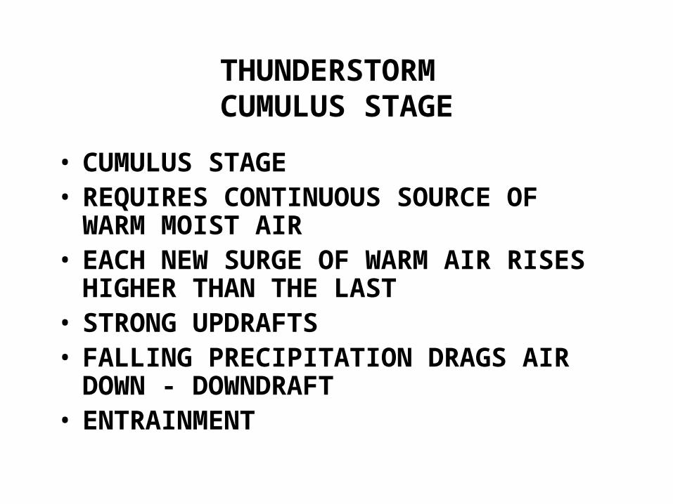
THUNDERSTORM CUMULUS STAGE
• CUMULUS STAGE• REQUIRES CONTINUOUS SOURCE OF WARM MOIST AIR
• EACH NEW SURGE OF WARM AIR RISES HIGHER THAN THE LAST
• STRONG UPDRAFTS• FALLING PRECIPITATION DRAGS AIR DOWN - DOWNDRAFT
• ENTRAINMENT
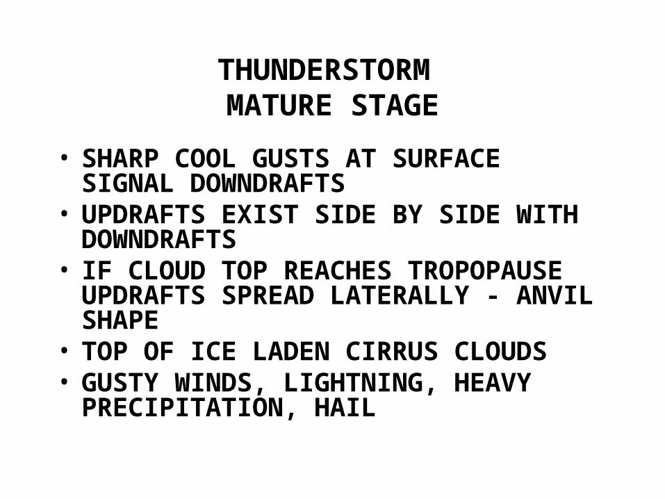
THUNDERSTORM MATURE STAGE
• SHARP COOL GUSTS AT SURFACE SIGNAL DOWNDRAFTS
• UPDRAFTS EXIST SIDE BY SIDE WITH DOWNDRAFTS
• IF CLOUD TOP REACHES TROPOPAUSE UPDRAFTS SPREAD LATERALLY - ANVIL SHAPE
• TOP OF ICE LADEN CIRRUS CLOUDS• GUSTY WINDS, LIGHTNING, HEAVY PRECIPITATION, HAIL
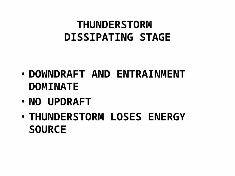
THUNDERSTORM DISSIPATING STAGE
• DOWNDRAFT AND ENTRAINMENT DOMINATE
• NO UPDRAFT• THUNDERSTORM LOSES ENERGY SOURCE
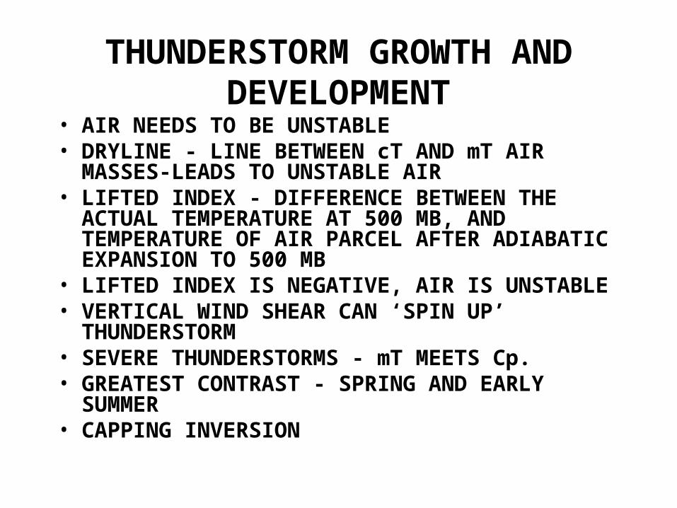
THUNDERSTORM GROWTH AND DEVELOPMENT
• AIR NEEDS TO BE UNSTABLE• DRYLINE - LINE BETWEEN cT AND mT AIR MASSES-LEADS TO UNSTABLE AIR
• LIFTED INDEX - DIFFERENCE BETWEEN THE ACTUAL TEMPERATURE AT 500 MB, AND TEMPERATURE OF AIR PARCEL AFTER ADIABATIC EXPANSION TO 500 MB
• LIFTED INDEX IS NEGATIVE, AIR IS UNSTABLE• VERTICAL WIND SHEAR CAN ‘SPIN UP’ THUNDERSTORM
• SEVERE THUNDERSTORMS - mT MEETS Cp.• GREATEST CONTRAST - SPRING AND EARLY SUMMER
• CAPPING INVERSION
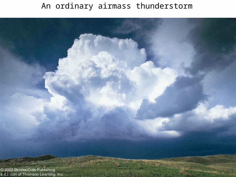
Fig. 11.8
An ordinary airmass thunderstorm
Related Documents