Author: Jeffrey J. Danielson Acting CoNED Applications Project Chief Annual Update – Coastal Zone Elevation Mapping (3DEP in the Coastal Zone and More….) USGS Coastal Annual Update

Welcome message from author
This document is posted to help you gain knowledge. Please leave a comment to let me know what you think about it! Share it to your friends and learn new things together.
Transcript
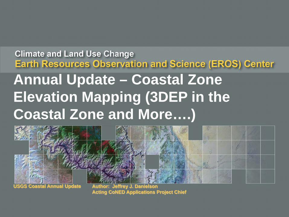
Author: Jeffrey J. DanielsonActing CoNED Applications Project Chief
Annual Update – Coastal Zone Elevation Mapping (3DEP in the Coastal Zone and More….)
USGS Coastal Annual Update
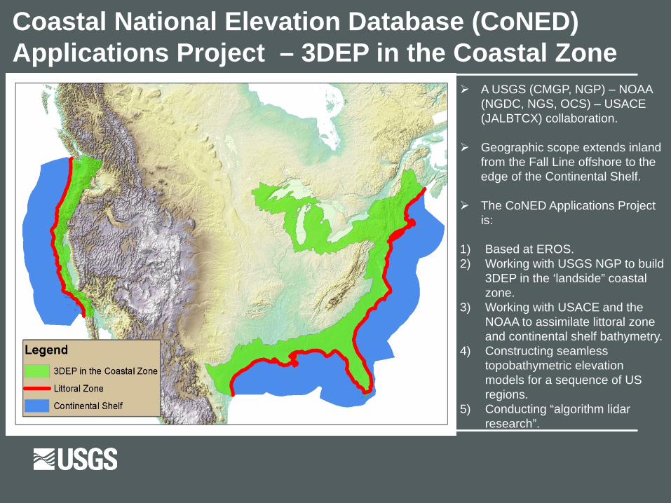
Coastal National Elevation Database (CoNED) Applications Project – 3DEP in the Coastal Zone
A USGS (CMGP, NGP) – NOAA (NGDC, NGS, OCS) – USACE (JALBTCX) collaboration.
Geographic scope extends inland from the Fall Line offshore to the edge of the Continental Shelf.
The CoNED Applications Project is:
1) Based at EROS.2) Working with USGS NGP to build
3DEP in the ‘landside” coastal zone.
3) Working with USACE and the NOAA to assimilate littoral zone and continental shelf bathymetry.
4) Constructing seamless topobathymetric elevation models for a sequence of US regions.
5) Conducting “algorithm lidar research”.
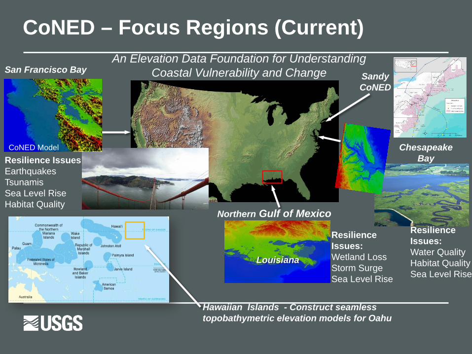
CoNED – Focus Regions (Current)
Chesapeake BayResilience Issues:
Earthquakes TsunamisSea Level RiseHabitat Quality
Resilience Issues:Water QualityHabitat QualitySea Level Rise
Resilience Issues:Wetland LossStorm SurgeSea Level Rise
San Francisco Bay
CoNED Model
Northern Gulf of Mexico
Louisiana
An Elevation Data Foundation for Understanding Coastal Vulnerability and Change Sandy
CoNED
Hawaiian Islands - Construct seamless topobathymetric elevation models for Oahu

Hurricane Sandy Region

Delaware River
Hurricane Sandy Region Delaware River Bathymetry

Hydro-Enforced Topobathymetric Elevation Model – Delaware (Hurricane Sandy)

Hurricane Sandy RegionNew Jersey / Delaware Subregion Topobathymetric Model (1-Meter)
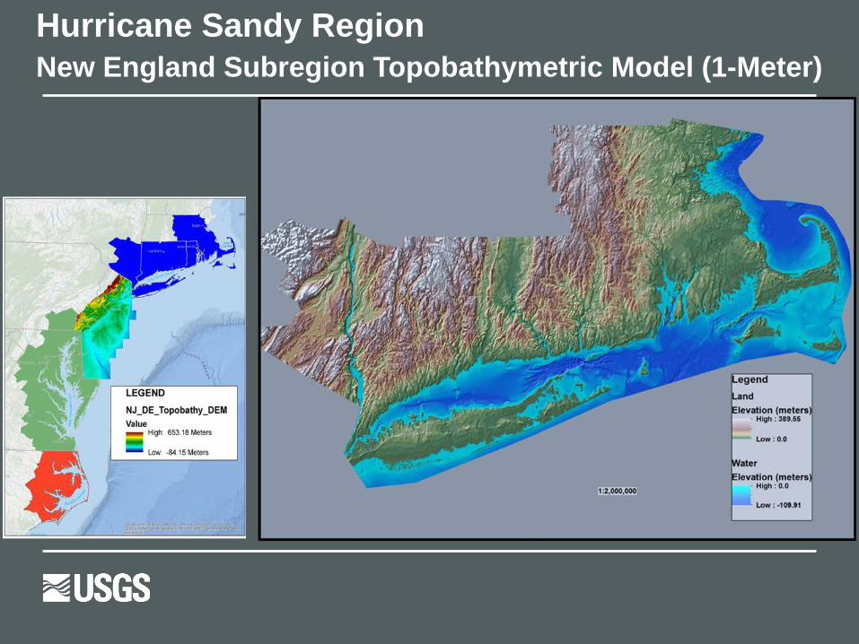
Hurricane Sandy RegionNew England Subregion Topobathymetric Model (1-Meter)

Hurricane Sandy RegionChesapeake Subregion Topobathymetric Model (1-Meter)
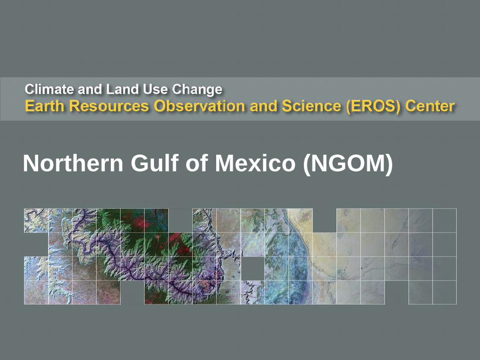
Northern Gulf of Mexico (NGOM)
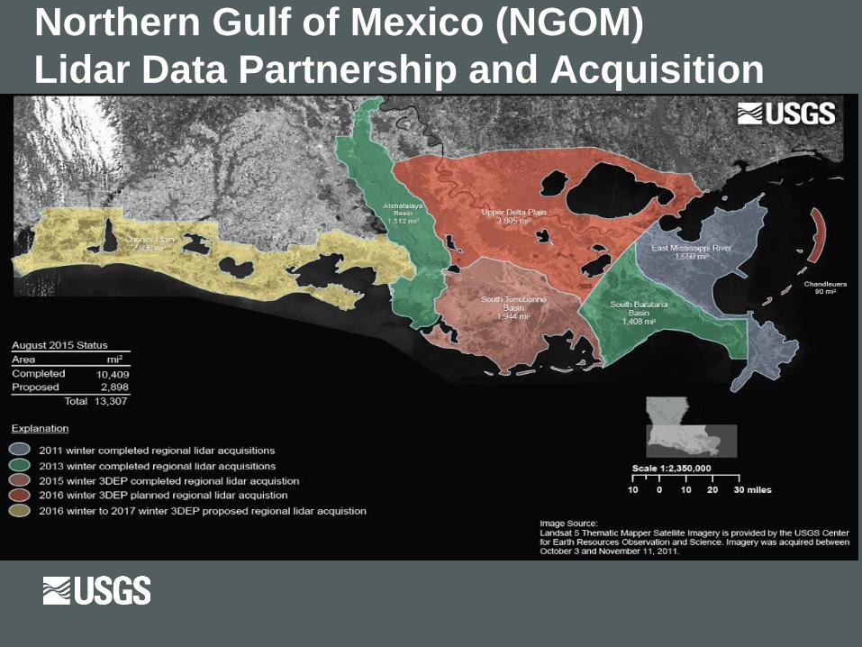
Northern Gulf of Mexico (NGOM) Lidar Data Partnership and Acquisition

NGOM – Louisiana South Terrebonne Basin Acquisition

West Coast / Pacific Region
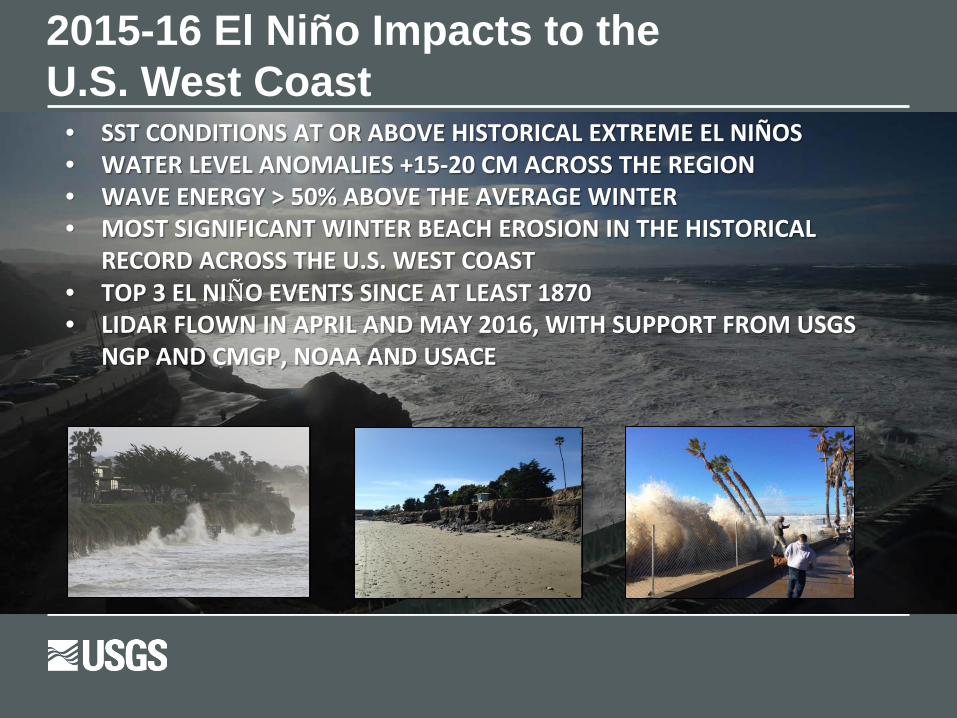
2015-16 El Niño Impacts to the U.S. West Coast
• SST CONDITIONS AT OR ABOVE HISTORICAL EXTREME EL NIÑOS • WATER LEVEL ANOMALIES +15-20 CM ACROSS THE REGION• WAVE ENERGY > 50% ABOVE THE AVERAGE WINTER• MOST SIGNIFICANT WINTER BEACH EROSION IN THE HISTORICAL
RECORD ACROSS THE U.S. WEST COAST• TOP 3 EL NIÑO EVENTS SINCE AT LEAST 1870• LIDAR FLOWN IN APRIL AND MAY 2016, WITH SUPPORT FROM USGS
NGP AND CMGP, NOAA AND USACE

“Fragmented” Accurate Topobathymetric Mapping is Needed to Enable Planning to Increase the Resilience of U.S. Pacific Islands to Sea Level Rise:• Many U.S. Pacific islands are atolls
fringed with coral reefs and have maximum elevations of 3-5 m, with mean elevations of 1-2 m.
● Sea level in the western Pacific Ocean has been increasing at a rate 2-3 times the global average, resulting in almost +0.3 m of net rise since 1990.
● The 2012 US National Climate Assessment provided global sea level rise scenarios that ranged from 0.2 to 2.0 m by 2100.

Pacific Atolls are Endangered and Poorly Mapped1) Very low and poorly known
topography.2) Very steep and poorly mapped
bathymetry.3) Available freshwater is limited
to a shallow lens.4) A mix of unconsolidated and
consolidated carbonate sediments.
5) Changing coral reef status and biogeomorphology.
There are over 2000 islands in the Pacific that are extremely vulnerable to sea-level rise, tsunamis, storm surge, coastal flooding, and climate change that could impact the sustainability of their infrastructure, groundwater, and ecosystems.
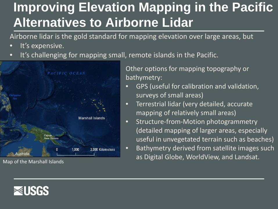
Airborne lidar is the gold standard for mapping elevation over large areas, but• It’s expensive.• It’s challenging for mapping small, remote islands in the Pacific.
Other options for mapping topography or bathymetry:• GPS (useful for calibration and validation,
surveys of small areas)• Terrestrial lidar (very detailed, accurate
mapping of relatively small areas)• Structure-from-Motion photogrammetry
(detailed mapping of larger areas, especially useful in unvegetated terrain such as beaches)
• Bathymetry derived from satellite images such as Digital Globe, WorldView, and Landsat.
Map of the Marshall Islands
Improving Elevation Mapping in the Pacific Alternatives to Airborne Lidar

• Representative of Pacific Island coastlines: dense mangroves, wetlands, fringing coral reefs, shrub/scrub vegetation near shoreline, dense vegetation.
• Purpose of Oct. 2015 field survey: Filling elevation data gaps; collecting validation data; testing low-cost elevation mapping techniques in Oahu for future use on more remote Pacific Islands.
He’eia field site
Pacific Islands – He’eia Field Test Improving Elevation Mapping in the Pacific
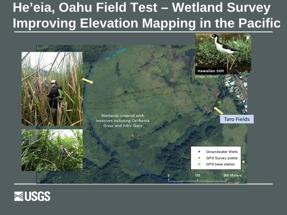
He’eia, Oahu Field Test – Wetland SurveyImproving Elevation Mapping in the Pacific

He’eia, Oahu – Field Test Wetland – Airborne Lidar AccuracyBare earth elevation accuracy: Overall Root Mean Square Error (RMSE) reported in metadata: 0.101 m. RMSE in vegetated areas= 0.169 m.
Error was recalculated using GPS data from field survey, focusing on very heavily vegetated areas.
Indicates that airborne lidar has a positive elevation bias in wetlands- laser did not penetrate dense grasses.
Dense wetland grasses up to 2m in height

He’eia, Oahu Field Test – Upland AreaIntegrated DEM from Multiple Sources
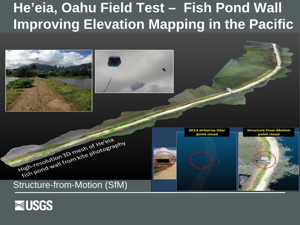
He’eia, Oahu Field Test – Fish Pond Wall Improving Elevation Mapping in the Pacific
Structure-from-Motion (SfM)
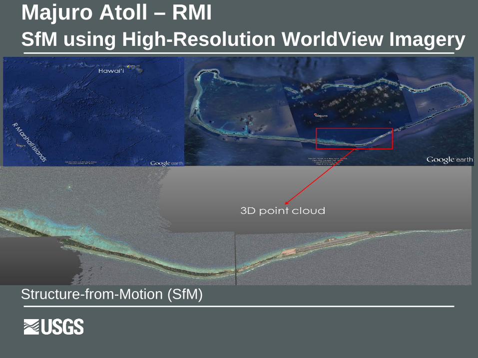
Majuro Atoll – RMI SfM using High-Resolution WorldView Imagery
Structure-from-Motion (SfM)
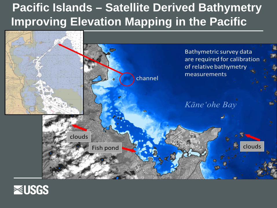
Pacific Islands – Satellite Derived Bathymetry Improving Elevation Mapping in the Pacific
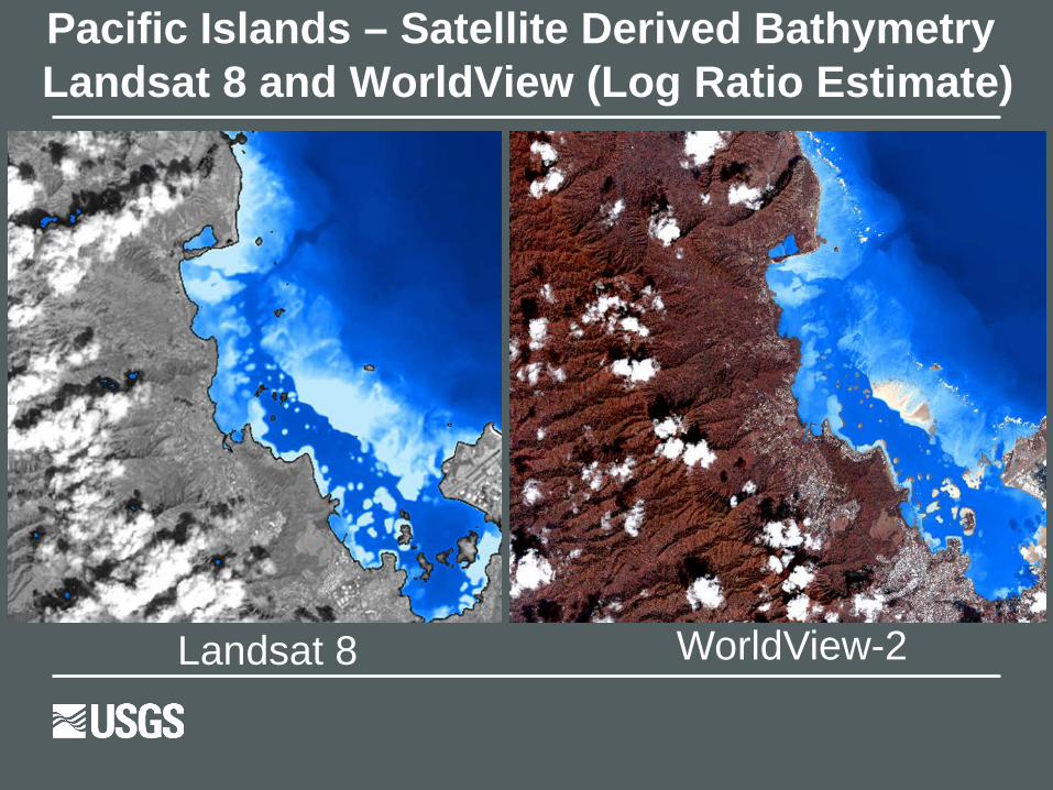
Pacific Islands – Satellite Derived Bathymetry Landsat 8 and WorldView (Log Ratio Estimate)
Landsat 8 WorldView-2

Author: Jeffrey J. Danielson
Algorithm Research, Workshops, and Future Plans (FY17+ Focus Regions
USGS Coastal Annual Update

Wetland Extent MappingBarnegat Bay – New Jersey Lidar – First Return Lidar – Point Density Wetland Extent Polygons
Impacts of Hurricanes on Coastal Forests: Habitat Change
Mapping water depthsIn estuaries: identify new sediment in channels after Hurricane Sandy. Important for navigation safety, water quality, vulnerability to future storms.
Wetland fragmentation: implications for valuable fisheries, threatened/endangered shorebirds, and water quality. Wetlands act as a natural barrier to storm surge.
Hurricane Sandy RegionCoNED – Wetland Status Mapping Research
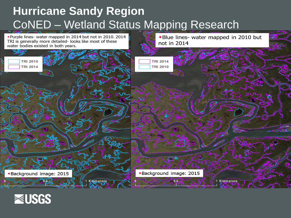
Hurricane Sandy RegionCoNED – Wetland Status Mapping Research
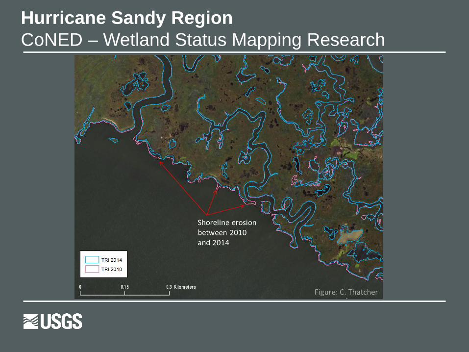
Hurricane Sandy RegionCoNED – Wetland Status Mapping Research
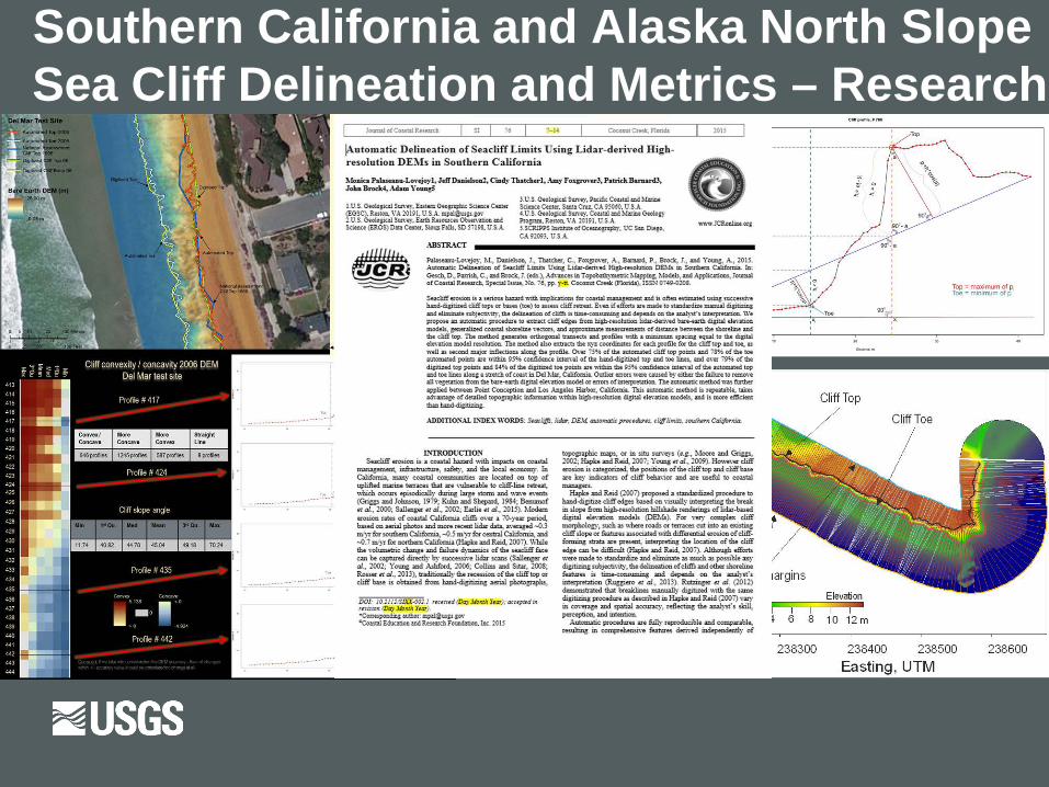
Southern California and Alaska North Slope Sea Cliff Delineation and Metrics – Research
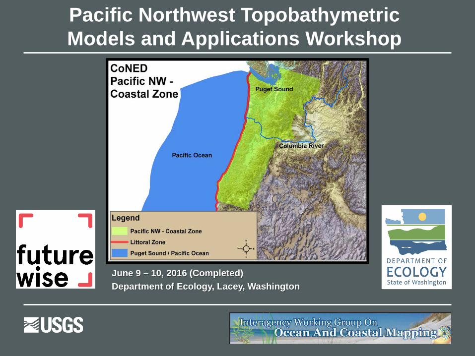
Pacific Northwest TopobathymetricModels and Applications Workshop
June 9 – 10, 2016 (Completed)Department of Ecology, Lacey, Washington

CoNED Applications Project – Future Plans
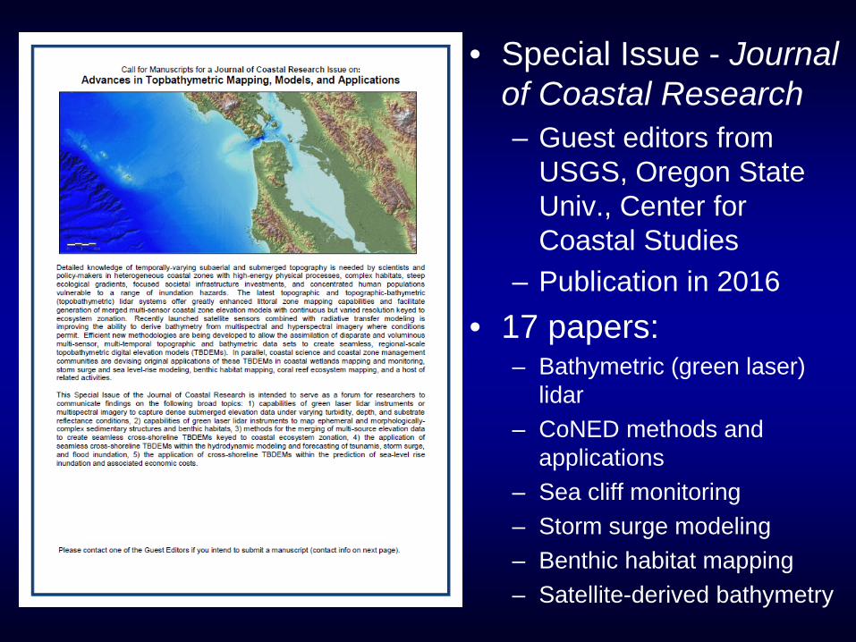
• Special Issue - Journal of Coastal Research– Guest editors from
USGS, Oregon State Univ., Center for Coastal Studies
– Publication in 2016• 17 papers:
– Bathymetric (green laser) lidar
– CoNED methods and applications
– Sea cliff monitoring– Storm surge modeling– Benthic habitat mapping– Satellite-derived bathymetry

Questions
Related Documents