Annexure 13: Disaster management plan This page has been intentionally left blank. Please turn over to next page.

Welcome message from author
This document is posted to help you gain knowledge. Please leave a comment to let me know what you think about it! Share it to your friends and learn new things together.
Transcript

Annexure 13: Disaster management plan
This page has been intentionally left blank. Please turn over to next page.
INLAND WATERWAYS AUTHORITY OF INDIA
Consulting Services for Risk Assessment and Disaster
Management Plan for National Waterway-1 (River Ganga)
Femith’s, PB No.4407
Puthiya Road, NH Bypass
Vennala, Kochi
Final Report
Volume I – Main Report
Risk Assessment & Disaster Management Plan Final Report
for the National Waterway - 1
KITCO Limited Page 1 of 216
TABLE OF CONTENTS
1. INTRODUCTION.............................................................................................................. 18
2. SALIENT FEATURES OF NW 1 AND ITS OPERATIONAL PROFILE.................. 21
2.1. Scope of the Study 23
2.2. Approach and Methodology 25
2.3. Salient Features of Waterway 28
2.3.1. Prayagraj - Varanasi Section .................................................................................. 29
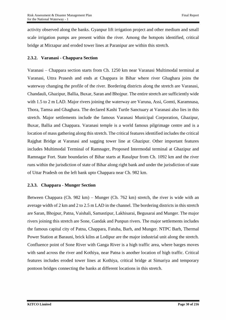
2.3.2. Varanasi - Chappara Section .................................................................................. 30
2.3.3. Chappara - Munger Section ................................................................................... 30
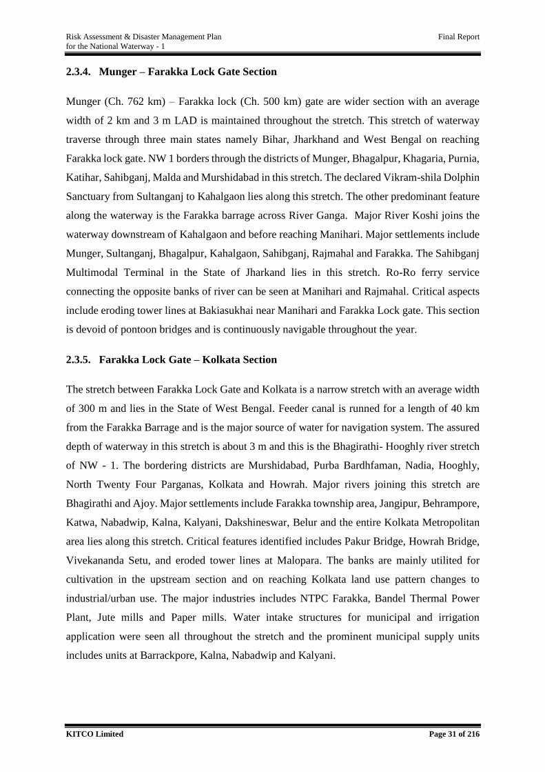
2.3.4. Munger – Farakka Lock Gate Section ................................................................... 31
2.3.5. Farakka Lock Gate – Kolkata Section ................................................................... 31
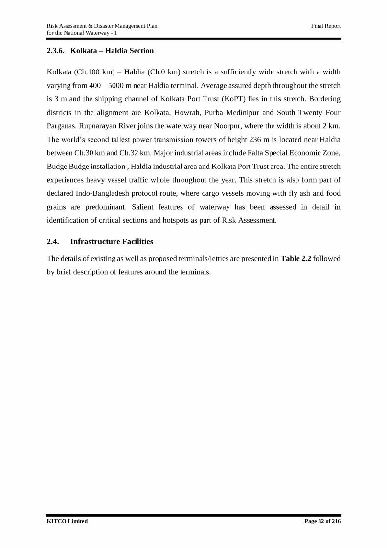
2.3.6. Kolkata – Haldia Section ....................................................................................... 32
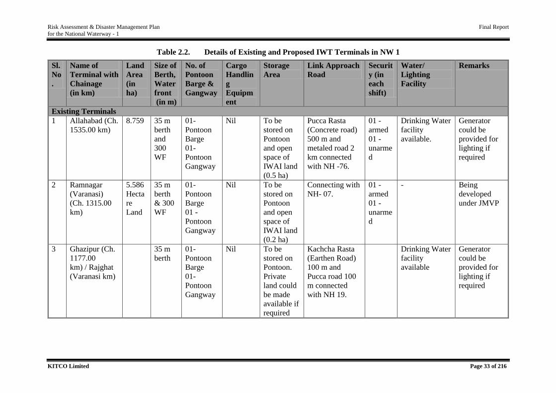
2.4. Infrastructure Facilities 32
2.5. Salient Features of Multimodal and Intermodal Terminal Areas 40
2.5.1. Varanasi Multimodal Terminal .............................................................................. 40
2.5.2. Sahibganj Multimodal Terminal ............................................................................ 40
2.5.3. Haldia Multimodal Terminal ................................................................................. 41
2.5.4. Ghazipur Intermodal Terminal .............................................................................. 42
2.5.5. Kalughat Intermodal Terminal ............................................................................... 43
2.5.6. Tribeni Intermodal Terminal (Under consideration) ............................................. 44
2.6. Cargo Operational Pattern of NW 1 44
2.6.1. Existing and Projected Cargo Traffic .................................................................... 44
2.6.2. Type of Cargo ........................................................................................................ 45
2.7. Vessels to be used in NW 1 45
3. RISK ASSESMENT........................................................................................................... 47
3.1. Risk Assessment (RA) Methodology 47
3.2. Review of IWT Operational Activities 49
3.3. Identify Hazards & Analysis of Existing Control Measures 51
3.4. Risk Assessment 58
3.4.1. Channel Related Risk Elements ............................................................................. 58
3.4.2. Cargo Related Risk Elements ................................................................................ 69
3.4.2.1. Oil Spill Related Risks 76
3.4.3. Vessel Related Risk ............................................................................................... 78
3.4.4. Dredging Related Risk ........................................................................................... 82
Risk Assessment & Disaster Management Plan Final Report
for the National Waterway - 1
KITCO Limited Page 2 of 216
3.5. Delineation of Credible Scenarios 88
3.6. Risk Abatement Measures 93
3.6.1. Channel Related Risk ............................................................................................. 93
3.6.2. Cargo Related Risk ................................................................................................ 96
3.6.3. Terminals & Jetties Related Risk ........................................................................... 98
3.6.4. Vessel Related Risk ............................................................................................... 98
3.6.5. Crew Related Risk ................................................................................................. 98
4. DISASTER MANAGEMENT PLAN FOR NW 1 .......................................................... 99
4.1. Approach towards Preparation of DMP for NW 1 99
4.2. Review of Institutional Mechanism for Disaster Management 102
4.3. Emergency Management Planning for NW 1 110
4.4. Onsite Emergency Management Plan for IWAI Terminals 111
4.4.1. Emergency Control Centre/ Incident Control Room and Facilities ..................... 113
4.4.2. Equipment ............................................................................................................ 113
4.4.3. Documents, Contact Details, Lists / Maps ........................................................... 114
4.4.4. Lists/Maps ............................................................................................................ 115
4.4.5. Field Command Post (FCP) and Communications .............................................. 115
4.4.5.1 Field Communication Equipment’s 115
4.4.6. Emergency Response Operation at Terminal ...................................................... 118
4.4.7. Responsibility Allocation for Incident Management Team ................................. 119
4.4.7.1. Chief Incident Controller (CIC) – Head (Terminal) 119
4.4.7.2. Site Incident Controller (SIC) – In Charge (HSFE) 120
4.4.7.3. In Charge – Operation 122
4.4.7.4. In Charge – Security 123
4.4.7.5. In Charge - HR 124
4.4.7.6. In Charge – Admin 125
4.4.7.7. In Charge – Finance 125
4.4.7.8. Technical Resource Person 126
4.4.7.9. Responsibilities of Supporting Teams of IMT 126
4.4.7.9.1. Supportive Team – under In Charge (Operations) – 2 Members ............... 126
4.4.7.9.2. Supportive Team – under In Charge (Admin) – 2 Members ...................... 126
4.4.7.9.3. Document Assistant– under In Charge - Admin ........................................ 127
4.4.7.9.4. Officer - Finance ......................................................................................... 127
4.4.7.9.5. Support Officer 1 – under In Charge- HR .................................................. 127
4.4.7.9.6. Support Officer 2 – under In Charge- HR .................................................. 127
4.4.7.9.7. Supporting Officer 3 – under In Charge -HR ............................................. 127
4.4.7.9.8. Document Assistant for ECC – under In charge HR .................................. 127
4.4.7.9.10. Supporting Officer – Under In Charge HSFE at FCP ............................... 127
4.4.8. Manpower Allocation for IMT - Training and Capacity Building Requirements
128
Risk Assessment & Disaster Management Plan Final Report
for the National Waterway - 1
KITCO Limited Page 3 of 216
4.4.9. Conducting Mock drill ......................................................................................... 129
4.4.10. Emergency Response Equipments to be availed at IWAI Terminal.................... 129
4.5. Offsite Emergency Plan for IWT Operation in NW 1 131
4.5.1. Responsibility of Emergency Response Personals at IWAI - RO ....................... 135
4.5.1.1. Head – RO 135
4.5.1.2. In Charge (Civil) – SIC 136
4.5.1.3. In-Charge Traffic 137
4.5.1.4. In-Charge – Admin 138
4.5.1.5. In Charge – Finance 139
4.5.1.6. RIS Operational Team 139
4.5.2. Manpower Allocation for IMT - Training and Capacity Building Requirements .....
............................................................................................................................. 139
4.5.3. Conducting Mock drill ......................................................................................... 140
4.5.4. Facilities to be availed at ECC of IWAI – RO..................................................... 140
4.5.5. Responsibility of Emergency Response Personals at IWAI - HO ....................... 142
4.4.5.1. Chairman – IWAI – CIC 142
4.4.5.2. Vice Chairman, IWAI – SIC 142
4.4.5.3. Member Technical /Finance/Traffic 143
4.4.5.4. Chief Engineer, Secretary & Hydrographic Chief 143
4.4.5.5. In Charge – Admin 144
4.4.5.6. Chief Accounts Officer 145
4.4.5.7. Dy Dir. /Asst. Dir (Marine – Mech) / Civil/Traffic/ Senior Hydrographers 145
4.5.6. Manpower Allocation for IMT - Training and Capacity Building Requirements .....
............................................................................................................................. 146
4.5.7. Conducting Mock drill ......................................................................................... 147
4.5.8. Emergency Response Facilities to be availed at ECC of IWAI - HO ................. 147
4.6. Block Cost Estimate for Developing Facilities within IWAI 148
4.6.1. Cargo Handling Terminals of IWAI .................................................................... 148
4.6.2. Regional Offices and Head Office of IWAI ........................................................ 151
4.7. Deriving of Proposal for Integration of IWT Related Disasters in to DDMPs 152
4.7.1. Integration of IWT Related Disasters in DDMAs of Uttar Pradesh .................... 153
4.7.2. Integration of IWT Related Disasters in DDMAs of Bihar ................................. 164
4.7.3. Integration of IWT Related Disasters in DDMAs of Jharkhand .......................... 176
4.7.4. Integration of IWT Related Disasters in DDMAs of West Bengal ..................... 186
4.8. Offsite Emergency Operation by DDMAs of Bordering Districts of NW 1 195
4.9. Emergency Response Equipments for DDMAs 196
4.10. Specialized Protection for Environmental Sensitive Areas 196
4.11. Oil Spill Contingency Handling in Offshore Incidents in NW 1 197
Risk Assessment & Disaster Management Plan Final Report
for the National Waterway - 1
KITCO Limited Page 4 of 216
4.12. Project Implementation Plan 197
5. BEST MANAGEMENT PRACTICES .......................................................................... 199
5.1. Waterway 200
5.2. Vessels 201
5.3. Operator 202
5.4. Cargo 203
5.4.1. Dry Bulk Storage and Handling ........................................................................... 203
5.4.2. Non-Bulk Chemical Storage and Handling ......................................................... 204
5.4.3. Liquid (Flammable/ Toxic Cargo) Bulk Storage and Transfer ............................ 205
5.4.4. Gaseous Flammable/ Toxic Cargo ....................................................................... 207
5.4.5. Loading & Unloading of Cargo ........................................................................... 207
5.4.6. Cargo Handling Equipment and Rail/Truck Operations ...................................... 208
5.4.7. Hazardous Wastes ................................................................................................ 209
5.4.8. Non-hazardous Waste .......................................................................................... 209
5.5 Navigation &Traffic Management 210
5.6. Management of dredged material 211
5.7. Environmental Protection &Sustainability 212
5.8. Quality & Safety 212
5.9. Administration 212
5.10. Competing Uses 214
5.11. Emergency Response 214
5.12. Technology &Innovations 214
5.13. Training 215
5.14. Casualties and Incidents 215
Risk Assessment & Disaster Management Plan Final Report
for the National Waterway - 1
KITCO Limited Page 5 of 216
LIST OF TABLES
Table 2.1. State Wise Administrative Demarcation of NW 1 ............................................. 29
Table 2.2. Details of Existing and Proposed IWT Terminals in NW 1 .............................. 33
Table 2.3. Designated Capacity of Multimodal Terminal .................................................. 42
Table 2.4. Cargo Statistics through both NW 1 and IBP Routes during 2013-18 .............. 45
Table 2.5. Total Projected Cargo for NW 1 for 2020 ......................................................... 45
Table 2.6. Details of Vessels to be used in NW - 1 ............................................................ 46
Table 3.1. Offshore and Onshore Risks w r to Operations or Activities under JMVP ....... 51
Table 3.2. Analysis of Causes of Hazards, Existing Control Measures and Resultant
Influence of Risk factors on IWT Operation in NW 1 ....................................... 56
Table 3.3. Categorization of Critical Sections towards Determining the Hot Spots .......... 60
Table 3.4. Hotspot in NW 1 ................................................................................................ 61
Table 3.5. Cargo Classified in IMDG Code and or IMSCB ............................................... 70
Table 3.6. Compatibility Matrix for Cargo to be Transported through NW1 ..................... 73
Table 3.7. Properties of Cargo on Release .......................................................................... 74
Table 3.8. Oil Classification for Cargo through NW 1 ....................................................... 77
Table 3.9. Risk Categorization of Ports as per NOS-DCP.................................................. 78
Table 3.10. Vessel Related Risks and Consequences ........................................................... 80
Table 3.11. Matrix on Cumulative Interaction of Risk Elements ......................................... 84
Table 3.12. Vulnerability to Natural Disasters for NW 1 ..................................................... 85
Table 3.13. Basis of Probability and Consequences ............................................................. 88
Table 3.14. Representative Risk Matrix................................................................................ 89
Table 3.15. Risk Levels for Credible Scenarios for NW 1 ................................................... 90
Table 4.1. Institutional Arrangement for Management/Mitigation and Coordination of
Disaster at National Level ................................................................................ 105
Table 4.2. Central Agencies Designated for Natural Hazard-Specific Early Warnings ... 106
Table 4.3. Disaster Planning at Various Levels and Responsibilities ............................... 107
Table 4.4. Offshore and Onshore Activities and Related Hazards ................................... 110
Table 4.5. Training and Capacity Building Requirements for IMT Personals ................. 128
Table 4.6. Emergency Response Equipments Proposed for Oil Handling Terminal ........ 130
Table 4.7. Emergency Response Equipments Proposed for No- Oil Handling Terminal 131
Table 4.8. Training and Capacity Building Activities for IMT Personals ........................ 139
Table 4.9. Training and Capacity Building Activities for IMT Personals ........................ 146
Table 4.10. Block Cost Estimate for Emergency Facilities at Oil Handling Terminals ..... 149
Table 4.11. Block Cost Estimate for Emergency Facilities at Non-Oil Handling Terminals
150
Table 4.12. Block Cost Estimate for ECC Facilities at IWAI RO and IWAI HO .............. 151
Table 4.13. SDMA and DDMA for Bordering Districts in Uttar Pradesh.......................... 156
Table 4.14. Vulnerability of State of Uttar Pradesh to Various Disasters .......................... 160
Table 4.15. Nodal Departments under State Disaster Management Authority ................... 160
Table 4.16. Vulnerable Users along NW 1 in Uttar Pradesh .............................................. 163
Table 4.17. SDMA and DDMA for Bordering Districts in Bihar ....................................... 170
Table 4.18. Vulnerable Users along NW 1 in the State of Bihar ........................................ 173
Risk Assessment & Disaster Management Plan Final Report
for the National Waterway - 1
KITCO Limited Page 6 of 216
Table 4.19. Key Role to be Played by Additional Stakeholders during IWT Related Disaster
.......................................................................................................................... 176
Table 4.20. Structure of SDMA, Jharkhand and DDMA, Sahibganj .................................. 178
Table 4.21. ESFs to be Activated during a Disaster in Jharkhand ...................................... 180
Table 4.22. Disasters Identified in the State of Jharkhand.................................................. 182
Table 4.23. Vulnerable Users along NW 1 in the State of Jharkhand ................................ 183
Table 4.24. SDMA and DDMA of Bordering Districts in West Bengal ............................ 188
Table 4.25. Vulnerability of State of West Bengal to Various Disasters............................ 191
Table 4.26. Vulnerable Users along NW 1. ........................................................................ 192
Table 4.27. Key Role to be played by Additional Stakeholders during IWT Related Disaster
.......................................................................................................................... 195
Table 4.28. Minimum Facilities Required at each DDMA and Block Cost Estimate ........ 196
Table 4.29. Provision for Gangetic Dolphin Sanctuary and Kashi Turtle Sanctuary ......... 197
Risk Assessment & Disaster Management Plan Final Report
for the National Waterway - 1
KITCO Limited Page 7 of 216
LIST OF FIGURES
Figure 2.1. Location Map of NW 1 ...................................................................................... 22
Figure 2.2. Sequence of Activities Leading to RA for NW 1 .............................................. 26
Figure 2.3. Schematic Representation of Salient Features of Waterway Influencing Risk . 26
Figure 2.4. Five Tier Approach in Delineating Salient Features of Project Region ............ 28
Figure 2.5. Varanasi Terminal and Immediate Surroundings of 1 km ................................. 40
Figure 2.6. Sahibganj Terminal and Immediate Surrounding of 1 km ................................. 41
Figure 2.7. Haldia Terminal and Immediate Surrounding of 1 km ...................................... 42
Figure 2.8. Ghazipur Terminal and Immediate Surrounding of 1 km .................................. 43
Figure 2.9. Location Map of Kalughat Terminal and Immediate Surroundings .................. 43
Figure 2.10. Tribeni Terminal and Immediate Surrounding of 1 km ................................. 44
Figure 3.1. Risk Assessment Procedure ............................................................................... 48
Figure 3.2. Mode Sharing in the Operational Profile of IWT through NW 1 ...................... 50
Figure 3.3. Offshore and Onshore Activities in IWT Operational Profile ........................... 50
Figure 3.4. Vessel Accidents within Kolkata Port Limit ..................................................... 52
Figure 3.5. IWT Hazards and Causes of Hazards in U.S ..................................................... 53
Figure 3.6. IWT Hazards and Causes for Germany ............................................................. 54
Figure 3.7. Causes of IWT Hazards in Myanmar................................................................. 54
Figure 3.8. IWT Hazards and Causes of Hazards in Bangladesh ......................................... 54
Figure 3.9. IWT Accidents and Causes in Rhine (Europe) .................................................. 55
Figure 3.10. Responsibility for Combating to Oil Spill within Indian Waters ................... 76
Figure 4.1. Various Phase of Disasters and Activities Involved – On a Broader Profile... 100
Figure 4.2. Steps Involved in Formulation of Proposal for Handling IWT Related Disasters
in NW 1 ............................................................................................................ 101
Figure 4.3. Basic Institutional Framework for Disaster Management in India .................. 104
Figure 4.4. DM Institutional Framework in NW 1 Project Region .................................... 108
Figure 4.5. Incident Reporting for IWT Disasters in NW 1 ............................................... 110
Figure 4.6. Emergency Operation Sequence and Infrastructure Provisions Required ....... 116
Figure 4.7. Incident Management Team for IWAI Terminal ............................................. 117
Figure 4.8. Incident Organization Chart for IWAI for Handling Operational Emergencies in
NW 1 ................................................................................................................ 134
Figure 4.9. Process Involved in Integration of IWT Related Disasters to DDMPs ........... 152
Figure 4.10. Uttar Pradesh State Disaster Management Authority .................................. 154
Figure 4.11. Uttar Pradesh Disaster Management Structure ............................................ 159
Figure 4.12. Existing and Proposed Departments and Agencies in SDMA ..................... 164
Figure 4.13. Organization Structure of Bihar State Disaster Management Authority...... 167
Figure 4.14. Existing and Proposed Departments and Agencies in SDMA ..................... 175
Figure 4.15. Organizational Set-up of the ESF at State Level.......................................... 181
Figure 4.16. Organisational Set-Up of the ESF at District Level ..................................... 182
Figure 4.17. Existing and Proposed Departments in SDMA of Jharkhand ...................... 185
Figure 4.18. Stakeholder Integration in West Bengal Disaster Management System ...... 190
Figure 4.19 Existing and Proposed Departments and Agencies in SDMA ..................... 193
Figure 4.20. Existing DM structure of the State of West Bengal ..................................... 194

Risk Assessment & Disaster Management Plan Final Report
for the National Waterway - 1
KITCO Limited Page 8 of 216
Figure 5.1. Signages for HAZCHEM Vessel ..................................................................... 203
Figure 5.2. Traffic Control System .................................................................................... 211
LIST OF MAPS
Maps Showing Hotspots – 12 Sheets
Risk Assessment & Disaster Management Plan Final Report
for the National Waterway - 1
KITCO Limited Page 9 of 216
ABBREVIATIONS
ALARP As Low As Practically Reasonable
AIS Automatic Identification System
BHD Back Hoe Dredgers
BMP Best Management Practices
BPCL Bharat Petroleum Corporation Limited
BSDMA Bihar State Disaster Management Authority
BOOT Build Own Operate and Transfer
CCS Cabinet Committee on Security
CAPF Central Armed Police Forces
CCA Central Coordinating Authority
CWC Central Water Commission
CBRN Chemical Biological Radiological and Nuclear
CIC Chief Incident Controller
CIF Chief Inspector of Factories and Boilers
CS Chief Secretary
CRZ Coastal Regulation Zone
CNG Compressed Natural Gas
CMG Crisis Management Group
CSA Critical Section Analysis
CSD Cutter Suction Dredger
DWT Dead Weight Tonnage
DAE Department of Atomic Energy
DGPS Differential Global Positioning Systems
DGICG Director General of Indian Coast Guard
DM Act Disaster Management Act
DMA Disaster Management Authority
DMD Disaster Management Department
DMP Disaster Management Plan
DRR Disaster Risk Reduction
DC District Collector
DDMA District Disaster Management Authority
EDFC Eastern Dedicated Freight Corridor
ENC Electronic Navigational Chart
ECC Emergency Control Centre
EOC Emergency Operation Centre
ERV Emergency Recovery Van
ESFs Emergency Support Functionaries
EIA Environmental Impact Assessment
FCP Field Command Post
FAST First Applied Sorbent Treatment against Chemical Threats
FGDs Focus Group Discussions
FOCAL Forum of Cargo Owners and Logistics Operators
FO Furnace oil
GSI Geological Survey of India
GST Goods and Services Tax
Risk Assessment & Disaster Management Plan Final Report
for the National Waterway - 1
KITCO Limited Page 10 of 216
GoI Government of India
HDC Haldia Dock Complex
HNS Hazardous and Noxious Substances
HO Head Office
HSD High Speed Diesel
HTL High Tension Line
ICR Incident Control Room
IMT Incident Management Team
IBP India Bangladesh Protocol
IMD India Meteorological Department
INCOIS India National Centre for Oceanic Information Services
ICG Indian Coast Guard
IRS Indian Registry of Shipping
IV Act Inland Vessel act
IWT Inland Water Transport
IWAI Inland Waterways Authority of India
IADC International Association of Dredging Companies
IMDG International Maritime Dangerous Goods
IMO International Maritime Organization
IMSBC International Maritime Solid Bulk Cargoes
ISGINTT International Safety Guide for Inland Navigation Tank-barges and
Terminals
IBRD International Bank for Reconstruction and Development
JMVP Jal Marg Vikas Project
JSDMA Jharkhand State Disaster Management Authority
KAT Key Assessment Team
KoPT Kolkata Port Trust
LAD Least Available Depth
LNG Liquefied Natural Gas
LC-DMAF London Convention- Dredged Material Assessment Framework
MSIHC Manufacture, Storage and Import of Hazardous Chemical
MSDS Material Safety Data Sheets
MTPA Metric Tons Per Annum
MMT Million Metric Tone
MoAFW Ministry of Agriculture and Farmers Welfare
MoCA Ministry of Civil Aviation
MoD Ministry of Defence
MoES Ministry of Earth Science
MoEF&CC Ministry of Environment, Forest sand Climate Change
MoHFW Ministry of Health and Family Welfare
MHA Ministry of Home Affairs
MoM Ministry of Mines
MoR Ministry of Railways
MoRTH Ministry of Road Transport and Highways
MoS Ministry of Shipping
MoUD Ministry of Urban Development
Risk Assessment & Disaster Management Plan Final Report
for the National Waterway - 1
KITCO Limited Page 11 of 216
MoWR Ministry of Water Resources
NCMC National Crisis Management Committee
NDMA National Disaster Management Authority
NDMP National Disaster Management Plan
NDRF National Disaster Response Force
NEC National Executive Committee
NINI National Inland Navigation Institute
NIDM National Institute of Disaster Management
NOS-DCP National Oil Spill Disaster Contingency Plan
NTPC National Thermal Power Corporation
NW 1 National Waterway - 1
NWs National Waterways
NGOs Non-Government Organization
OMD Operation, Maintenance and Development
OSCP Oil Spill Contingency Plan
OSR Oil Spill Response
O-D Origin-Destination
ODC Over Dimensional Cargo
PFD Personal Flotation Devices
PPE Personal protective equipment
PAC Provincial Armed Constabulary
QHSE Quality, Health, Safety & Environment
RO Regional Office
RA Risk Assessment
RIS River Information System
RNA River Navigation Atlas
Ro-Ro Roll-on – Roll-off
SCBA Self-Contained Breathing Apparatus
SIC Site Incident Controller
SOC Site Operation Centre
SASE Snow and Avalanche Study Establishment
SOP Standard Operating Procedure
SAP State Armed Police
SDMA State Disaster Management Authority
SDMP State Disaster Management Plan
SDRF State Disaster Response Force
SEOC State Emergency Operation Centre
SEC State Executive Committee
SIDM State Institute of Disaster Management
ToR Terms of Reference
TML Transportable Moisture Limit
ULSD Ultra-Low Sulphur Diesel
UPDMA Uttar Pradesh Disaster Management Authority
UP Uttar Pradesh
UPPCL Uttar Pradesh Power Corporation Ltd.
VTMS Vessel Traffic Management System

Risk Assessment & Disaster Management Plan Final Report
for the National Waterway - 1
KITCO Limited Page 12 of 216
WS Water Supply
WTMS Water Traffic Management System
WB West Bengal
WBDMA West Bengal Disaster Management Authority
WODA World Dredging Association
Risk Assessment & Disaster Management Plan Final Report
for the National Waterway - 1
KITCO Limited Page 13 of 216
Executive Summary
National Waterway - 1 (NW 1) with an extend of 1620 km is the longest waterway which is
essential part of Ganga - Bhageerathi - Hooghly river system falling within 4 major States of
the Country i.e. Uttar Pradesh, Bihar, Jharkhand and West Bengal exiting to Bay of Bengal.
Industrial developments along the project region, proximity with Eastern Dedicated Freight
Corridor and connection with Port of Call, Kolkata and its Dock complex at Haldia offers
great potential for intermodal and multimodal operability for NW-1. Towards developing NW
1 as an alternative mode of transport, Government of India is assisted by International Bank
for Reconstruction and Development under the flagship project “Jal Marg Vikas Project”
through developing fairway between Varanasi and Haldia.
As part of JMVP, A fairway of 45 m bottom width with 3.0/2.5/2.2/1.5 m Least Available Depth
(LAD) is proposed for the Varanasi to haldia strech of waterway with provision of Multimodal
Terminals at Varanasi, Sahibganj and Haldia with Intermodal terminals at Ghazipur and
Kalughat and Tribeni. Ro-Ro terminals at 5 locations, construction of new navigational lock
at Farakka, installation of RIS and VTMS facilities etc. are already integrated in the project.
As per the standard design vessels for NW 1, the maximum vessel size allowed is 110*12*4.3
with a Dead Weight Tonnage around 2000 tonne requiring draft of 2.8m with an air draught
of 9 m. 22 types of cargos are identified including hazardous and non-hazardous cargoes and
total traffic expected in 5, 07,44,762 Tonnes by 2020 (Source: EIA Report, IWAI)
The present study is targeted on identifying the risk associated with IWT operation in NW 1
and preparation of proposal for integration of IWT related risk with respective District
Disaster Management Plans(DDMPs) of the 30 bordering districts with provision for
escalation to involve national plan stakeholders based on the criticality of the incident. The
study also includes preparation of onsite and offsite emergency plan for IWT related incidents
and proposing emergency response equipments including cost estimation towards
implementing the same.
Towards comprehensive risk assessment study, Consultants(KITCO) carried out detailed
reconnaissance visit along the entire waterway and comprehensive database on salient
features has been developed for NW 1.with support of extensive literature review with an
interval of 2 km to delineate critical risk elements associated with waterway. As per the terms
of reference, the study was focused on hazards associated with four risk elements i.e. related
to channel, cargo, vessel and dredging for both offshore and onshore operations. Historical
analysis shows that, hazards, which can develop into risky scenarios with respect to the four
risk elements are grounding, collision, contact, fire and explosion. The consequence may
include toxic contamination, toxic cloud, spillage of flammable liquid /gas. Vulnerability of
project region to natural hazards i.e., cyclone, thunderstorm, flood, earthquake, tsunami, tidal
bore were also assessed. Towards deriving the credible scenarios for detailed risk assessment,
channel related risk were studied through critical section analysis, cargo related risk was
assessed through intrinsic and inter compatibility issues, vessel related risk were assessed with
causative factors and dredging related risk based on operation pattern. The major outcomes
of the study are:
Risk Assessment & Disaster Management Plan Final Report
for the National Waterway - 1
KITCO Limited Page 14 of 216
Out of the total 1620 km stretch of waterway, there are 325 sections along in NW 1 -
105 no between Prayagraj and Munger and 220 no between Munger and Haldia) due
to presence of risk elements. There are 169 hotspots identified all along the stretch
studies.
Total of 105 critical stretches identified for Prayagraj -Munger section, out of that, 38
are hotspots. The critical risk factors include critical bridge locations, pontoon bridges,
mass gathering areas, environmentally sensitive stretches, high traffic areas, cargo
handling terminal locations, multiple ferry crossings, sagging and eroding tower lines
etc.
There are 220 critical sections identified for Munger - Haldia section out of which 131
are hotspots. The critical risk factors within hotspots were sharp curves less than 200 ,
environmentally sensitive areas, high traffic areas such cargo jetties, multiple ferry
crossings, presence of cross structures having low clearance, tower lines in eroding
banks, lock gates and aqueducts etc.
It is proposed that cautionary approach is to be adopted for the yellow sections, which
are moderately critical and standard operating procedure, compliance with
regulations, regular Thalweg surveys and dredging shall be adopted for the white
sections including remaining sections. Also, in case of narrow stretches with thickly
populated banks disaster management mechanism to be correctly aligned.
The areas falling under Vikramshila Gangetic Dolphin Sanctuary and Kashi Turtle
Sanctuary requires specific attention.
The analysis of the intrinsic properties of cargo shows that, hazardous cargoes include
liquefied ammonia, CNG, LNG, Petrol, High Speed Diesel, Furnace Oil, Coal,
Ammonium Nitrate based Fertiliser (based on ammonium nitrate content) and Iron as
Ferrous Metal Borings, shavings, turnings or cuttings or Iron Oxide, Spent or Iron
Sponge, Spent (obtained from coal gas purification) which are to be transported as per
the IMDG guidelines.
Coal, Coke, Manganese Ore, and Iron in its various forms are attracting IMBC code
require to follow the specific guidelines w r to the same and non-listed cargoes such as
edible oil, food grains, plastic, paper, ODC etc. has to follow the best industry practice
for safe transport through NW 1.
Provision of RIS, VTMS facility, routine thalweg surveys, standardisation of cargo
vessels for NW 1, implementation of FOCAL etc. would contribute for avoiding risks
associated with vessels and manoeuvring. However, the risk associated with vessel
malfunction, mis-communications, negligence of crew etc. cannot be ruled out and
hence need close monitoring on operation and maintenance of vessels including the
training and capacity building for the crew.
A detailed disaster management plan has been prepared for inegration of the IWT related
disaster operation for handling disasters onshore (terminal) and offshore (along waterway).
The major aspects of DM Plan for NW-1 are
Being a continuous medium the emergency may easily transport from one location to
another. As per the administrative system of India, the emergency within a State shall
be routed through State and National Disaster Management Authority whereas
Risk Assessment & Disaster Management Plan Final Report
for the National Waterway - 1
KITCO Limited Page 15 of 216
incidents affecting multiple states the entire coordination shall be done through
National Crisis Management Committee.
The onsite emergency plan has been prepared to deal the emergency Level 1 in a
terminal with detailed proposal as Emergency Control Centre, Incident Management
Team, Roles, Responsibilities, Training and Capacity Building including mock drills
with provision of essential emergency equipment and facilities including the block cost
estimate.
For Level 2 /3 operation, proposal is made with suitable scaling up of intervention of
IWAI-RO /HO in line with the DM Act, 2005 with provision of Incident Management
Team at RO and HO with specific roles and responsibilities. A dedicated Crisis
Management Group has been proposed at HO to handle the management decisions is
and to coordinate with the apex authorities of country i.e. National Disaster
Management Authority and National Crisis Management Committee. The proposal
formulated has given the communication and operation flow and guideline suiting with
both situations.
Existing DM mechanism of each State was analysed in detail to understand the present
nodal departments and specific roles assigned. The vulnerable resources along the
project region of each State was listed out towards delineating the line departments /
agencies who need to be integrated in the respective State Disaster Management
Authority. Nodal departments who shall take care of the responsibility of coordination
in each state as per the present operation plan was also delineated towards integrating
the DM operations in case of an emergency. It is identified/proposed that
For State of UP, Boat capsizing is the only IWT related disaster considered in the
SDMP with Department of Revenue as Nodal Department. It is proposed to include
IWT related disasters in SDMP with incremental cargo operation with suggesting
Department of Revenue as nodal department. Vulnerable resources who may directly
or indirectly affected include - Turtle Sanctuary, water supply Intake, Ferry services,
Tourism vessels, Country boats, passenger vessels, fishing vessels, Jetties, HT
line/Overhead Tower lines, Road bridge/ Rail bridge and human settlements,
agriculture activities, common use of public. Since majority of respective line
departments are already part of SDMA, it is proposed that Fisheries Department and
Tourism Department to be integrated in the SDMA and integrate the same department
in DDMAs of bordering districts of NW 1. IWAI and Ministry of Railways will act as
resource agencies.
For the State of Bihar, inland water transport related disasters are not identified as
disaster within the state and is to be added in the disasters list in SDMP. The Secretary,
Department of Transport, who is already part of SDMA could be represent SDMA,
same department shall act as nodal department in case of IWT related disasters within
the State. Vulnerable resources who may directly or indirectly affected include – water
supply intake, Gangetic Dolphin Sanctuary, ghats, rural/urban settlements, pilgrim
centres, road cum railway bridge, Ro-Ro, Passenger Boats, Agriculture, HT Lines and
fishing activities. Additionally, Department of Revenue and Land Forms and Dept. of
Risk Assessment & Disaster Management Plan Final Report
for the National Waterway - 1
KITCO Limited Page 16 of 216
Industries shall be added as additional stakeholder in SDMA and essentially in DDMAs
of bordering districts.
In the State of Jharkhand, inland water transport related disasters are not listed in
SDMP and is to be integrated. The Secretary, Department of Transport is already
designated as one of the ESF in the SDMA, who could be represented for handling the
IWT related disasters. The same department shall act as nodal department in case of
IWT related disasters within the State. Vulnerable resources of project region who may
directly or indirectly affected include fishing and agriculture activities, Ro-Ro facilities,
country boat operations, municipal water supply, common property resources such as
temple, burning ghats etc. It is required that Department of Environment and
Department of Industries has to be added within SDMA to meet the requirement of
emergency handling in IWT sector.
For the State of West Bengal, inland water transport related disasters are to be added
to SDMP with proposed incremental cargo operation. The Secretary, Irrigation &
Waterways Department is already part of SDMA could represent for handling the IWT
related disasters. The same department shall act as nodal department in case of IWT
related disasters within the State. Vulnerable resources of project region who may
directly or indirectly affected include floating jetty, bank protection, irrigation water
supply, fishing activities, vessels –tourism, ferry, passenger vessels, fishing harbour,
H/T lines, agriculture activities, Port related traffic, Defence vessels/establishments
road bridge, human settlements and public uses and drinking water supplies. It is
proposed that Department of Land and Land Reform and Refugee Relief and
Rehabilitation, Industry, Commerce and Enterprises, Department of Forest,
Department of Environment with representation from State Pollution Control Board
shall be added to SDMA. Kolkata Port Trust, IWAI, NTPC and Ministry of Railways
would act as resource agencies within the project region.
It is required that necessary inclusion of provision for Inland oil spill incidents to be
integrated in the National Oil Spill Disaster Contingency Plan, which presently deals
with only marine oil spill contingencies. However, following the essential criteria and
guidelines of NOS-DCP, proposal has been made for handling oil spill incidents within
NW 1. It is concluded that
Only Furnace Oil is the persistent oil to be transported through NW 1 requiring specific
Oil Spill Response (OSR) equipments. OSR equipments have been proposed for all
terminals in line with NOS-DCP guidelines and it is proposed to have arrangement
with Kolkata Port Trust and Indian Coast Guard for emergency operations in case of
an offshore incidents.
Emergency response equipment’s including OSR equipments has been proposed at
each IWAI terminal along with facilities for setting up of an Emergency Control Centre
in IWAI terminals, Ro and HO.
The block cost estimate for implementing the facilities at each terminal works out to
Rs. 6.66 Cr for an oil handling terminal and Rs. 1.49 Cr for a non-oil handling
terminal. The total cost for proposed 3 terminals works out to Rs 19.98 Cr and Rs 4.5
Cr respectively. The cost is inclusive of all tax except GST.
Risk Assessment & Disaster Management Plan Final Report
for the National Waterway - 1
KITCO Limited Page 17 of 216
RO and HO of IWAI shall be having a dedicated ECC facility to coordinate the response
operations. The total cost estimate for setting up the facilities works out to Rs. 20 Lakhs
each totalling to Rs. 60 Lakhs excluding GST.
For handling the offshore emergencies associated with the vessels by respective
DDMAs of the project region, it is proposed that additional facilities shall be ensured
such as portable firefighting facilities and adequate PPEs etc. The total cost works out
to Rs.19.64 lakhs for each DDMA and total of Rs.5.892 crore for 30 districts in case
the facilities proposed are not available with them.
Environmental Sensitive Areas of project region – Vikramshila Gangetic Dolphin
Sanctuary and Kashi Turlte Sancutary is proposed with specialised onshore oil spill
containment facilities with provision of River Booms with accessories. The total cost
works out to Rs.78.85 Lakhs excluding GST.
IWAI shall have a dedicated provisioning for meeting with disaster management
requirements with specific budgetary provisions to meet the expenses related with
training, maintenance and upkeepting of the facilities and manpower to deal with any
disaster situation.
The best management practices that could be implemented at NW 1 for ensuring safe and
sustainable IWT operation is proposed based on international practices and study has
integrated the essential Standard Operating Proceedure (SOPs) as per Inland Vessel act and
specific protocosl on speed control, monitoring, vessel tracking, waste management, incident
reporting with aquatic mammals, hazardous chemicals handling etc. as part of the study. The
final report incorperates all the findings of the study is submitted for approval.
Risk Assessment & Disaster Management Plan Final Report
for the National Waterway - 1
KITCO Limited Page 18 of 216
INTRODUCTION
India is blessed with more than 18, 240 km of navigable or potentially navigable waterways
through the extensive network of rivers, canals, creeks and back waters. It is with clear
understanding on the potential and advantages of the inland waterways development for the
country that Inland Waterways Authority of India (IWAI) was set up in October, 1986 vide
IWAI Act, 1985 under the Ministry of Shipping (MoS) towards coordinating the task of
developing, monitoring and administering Indian waterways. IWAI plays a key role in the
expansion and maintenance of the waterways with development of infrastructure and
regulations in National Waterways (NWs), taking up feasibility studies and advising Central
Government and supporting State Governments in their initiatives to develop waterways. So
far, 111 waterways of the country have been declared as NWs.
Ganga - Bhageerathi - Hooghly river system of 1620 km is the longest waterway in India,
declared as national waterway with effect from 27th October, 1986. It spans from Central
portion of North India till North –West Boundary of India, exiting to Bay of Bengal. The
historical waterway is geographically, economically and strategically important and is serving
as a lifeline of the country in all respects in terms of its multifaceted dependence stretching
through four states, i.e. Uttar Pradesh, Bihar, Jharkhand and West Bengal, which have been
marked with industry as a thrust area. The waterway is located in close proximity with Eastern
Dedicated Freight Corridor (EDFC) and connectivity to Port of Call, Kolkata and Haldia make
it apt for the establishment of vast network with ample opportunity for both intermodal and
multimodal systems.
Understanding the potential of NW 1 to serve as an alternative mode of transport, the
Government of India (GoI) has been assisted by the International Bank for Reconstruction and
Development (IBRD) to develop the same as an alternative mode of transport under the
flagship project “Jal Marg Vikas Project (JMVP)”. The project envisages developing fairway
between Varanasi to Haldia covering a distance of 1620 km with many infrastructure
interventions in between such as development of cargo terminals, Roll-on – Roll-off (Ro-Ro)
1
Risk Assessment & Disaster Management Plan Final Report
for the National Waterway - 1
KITCO Limited Page 19 of 216
terminals, re-development of navigational lock etc. This would enable commercial navigation
of vessels of around 2000 Dead Weight Tonnage (DWT).
River Ganga being a perennial river with industrial areas developed along its banks offers
potential for commercial activities. However, it is to be noted that like any activity there are
inherent risks as well as that posed by the hazardous commodities. Thus, it is necessary to
undertake a detailed risk assessment study on safety and sustainability aspects. IWAI
recognizes the need to preserve and protect human health and natural environment from the
ever-present risk of oil and chemical spills, accidents and other natural hazards. In this context,
the risk assessment study for the transport of existing and prospective cargo movement is
highly relevant. The risk management measures would be integrated as mutually agreeable
Disaster Management Plan (DMP) for NW 1, after due consultation with all the stakeholders
including Disaster Management Authority (DMA) and integration of the same to the District
Disaster Management Plan (DDMP). This proactive step will ensure integration of
sustainability aspects to the planning as well as operational aspects of the IWT operations and
maintenance of the same.
With present national policies focusing on the improvement of NWs, with several initiatives
have been taken up by the government for enhancing the essential infrastructure facilities,
establishing communication and navigation aids, ensuring regular maintenance of channels
etc., the present study would be a leap in the sustainable management of IWT operations of
cargo transport, especially hazardous cargo transport through prestigious inland waterways of
India and a bench mark project for NW 1.
Through the national competitive bidding, M/s. KITCO Limited, Kochi, India’s first state level
public sector technical consultancy organisation was qualified as the Consultant towards
undertaking the Risk Assessment study towards integration of IWT related risk in to DDMP
and awarded the above work through Contract No.IWAI/WB/NW-1/10/3(4)/2016 dated
04thApril 2018. The present report makes the Final Report of the study incorporating all scope
of work as per the Terms of Reference (ToR) requirement. The report has been structured in to
2 Volumes including this introduction as below.
Volume I –Final Report
Section 1 - Introduction
Section 2 - Salient Features of Waterway and its Operational Profile
Risk Assessment & Disaster Management Plan Final Report
for the National Waterway - 1
KITCO Limited Page 20 of 216
Section 3 - Risk Assessment
Section 4 – Proposal on DM Plan for IWT Related Disasters for NW 1.
Section 5 – Best Management Practices
Volume II –Final Report – Protocols, SOPs and Annexures
Risk Assessment & Disaster Management Plan Final Report
for the National Waterway - 1
KITCO Limited Page 21 of 216
SALIENT FEATURES OF NW 1 AND ITS OPERATIONAL PROFILE
NW 1 forms the part of the Ganga-Bhagirathi-Hooghly river system, extends between
Allahabad in Uttar Pradesh to Sagar Island in West Bengal. The waterway connects four major
states of the Country; Uttar Pradesh (UP), Bihar, Jharkhand and West Bengal (WB) and serves
multi-stakeholder utilization pattern. It is fed by various tributaries along the entire stretch such
as Tons, Gomti, Ghaghara, Sone, Gandak, Punpun and Kosi. A fairway of 45 m bottom width
with 3.0/2.5/2.2/1.5 m Least Available Depth (LAD) is being provided for the entire waterway.
Most sacred river of India, the Ganges is mainstay of this system and has the status “living
human entities” and first to receive the same in the country. It is the lifeline to millions of
Indians who live along its course and depend on it for their daily needs. NW 1 passes through
diverse cultural and socio-economic provinces having much of difference in language,
geography, means and way of living for those who depend on this water body. With industrial
developments picked up in the respective States, there are numerous industrial units set up
along the riverbank and its hinterlands. The portion of the water body declared as NW 1 forms
part of major important pilgrim centers and thus attracts tourist activities throughout the year.
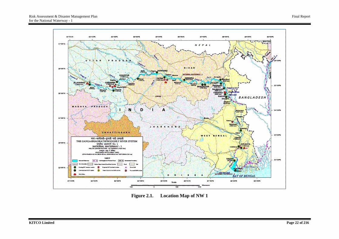
NW 1 on its long course serves major cities and their industrial hinterlands like Haldia,
Howrah, Kolkata, Sahibganj, Bhagalpur, Munger, Patna, Ghazipur, Varanasi and Allahabad,
which are themselves the key promoters for the IWT operations in NW 1. Thus, JMVP aims at
making it a full-fledged parallel transportation system to facilitate the commercial operations,
with adequate connectivity with conventional transportation network including intermodal and
multimodal aspects. Figure 2.1. presents the location map of the project region.
2
Risk Assessment & Disaster Management Plan Final Report
for the National Waterway - 1
KITCO Limited Page 22 of 216
Figure 2.1. Location Map of NW 1
Risk Assessment & Disaster Management Plan Final Report
for the National Waterway - 1
KITCO Limited Page 23 of 216
While considering the utilization of NW 1 as a cargo transport medium, it could be seen that
the cargo includes wide variety of both solids and liquid commodities including hazardous
ones. Also, at presen,t there have been extensive movement of Over Dimensional Cargo (ODC)
especially related to Thermal Power projects by various power companies. Other common
operators are tourism vessels, Inland Waterways Authority of India (IWAI) vessels and other
traditionally operated vessels. Liquefied Natural Gas (LNG) is a prospective commodity under
consideration in the near future. Operations of LNG operated vessels are also anticipated.
The present study targets on assessing the risk associated with cargo operation in NW 1 towards
deriving a proposal for integration of risk into DDMPs of the project region.
2.1. Scope of the Study
The main objective of the present assignment is to prepare a detailed Disaster Management
Plan for NW-1 in compliance with the existing DM structure of the country as the DM ACT
2005. The study will be conducted as two parts offshore and onshore. Offshore operations
involve water activities with respect to the waterway, while onshore interventions for waterway
activities which essentially requires activities/interventions with land –water interface such as
Jetties, Terminals, Risk Information System(RIS)/ Differential Global Positioning Systems
(DGPS) stations, ship repair facilities, lock gate, other assets etc.
Each aspect of NW-1 has been evaluated; independently based on its respective vulnerabilities
to find and detail the declared “hotspots” along NW-1 and will make a recommendation to the
IWAI to identify the more promising development of the DMP, which will include allocation
and stockpile of resources at the designated hot spots.
For this project, the following activities will be done in brief:
Review and adopt the international standards used in the DMP for inland waterways
Analyse the IWT operational profile of NW - 1 with respect to all potential cargo
movement.
Risk Assessment
Identify all “Hotspot” related risks under construction, operation and maintenance
activities for NW-1
Examine the vulnerability of the stakeholders affected by these risks
Risk Assessment & Disaster Management Plan Final Report
for the National Waterway - 1
KITCO Limited Page 24 of 216
Determine retained and transferable risk and quantify each risk using deterministic and
probabilistic approaches for analysis as applicable.
Identify practically possible safeguard options for integration to IWT operational
procedure, ie., potential offshore & onshore emergencies during all phases of the project
ie., construction, maintenance & operation phase of the waterway, river/marine
accidents like grounding, collisions, capsizing etc., oil spill disaster contingency plan
along NW-1, including plan for hazardous goods and vessels operating and/or carrying
LNG/CNG as define by law in India.
Develop an emergency preparedness and response strategy which shall outline the
potential foreseeable emergency scenarios, classification, resources, incident command
structure and a management plan encompassing prevention, control, recovery and
remediation measures to deal with any emergency event that may occur within the
project during construction, maintenance & operation phases.
Preparation of Standard Operating Procedures (SOPs) in line with the Inland Vessels
Acts, 1917 as amended from time to time.
Development and update of following protocols:
For speed control, monitoring, and vessel tracking
Waste management for barge operations and terminals
Biodiversity protection & accident reporting with aquatic mammals
Oil & Hazardous chemicals spills reporting and control and remediation as
define by law in India.
Risk assessment procedures to assess and manage risks to personnel,
vessels and the environment.
Internal and external audit procedures and frequency.
Delineate a methodology for integration of operational risk abetment measures to
existing District Disaster Management Plan (DDMP) and coordinate with all nodal
agencies on behalf of IWAI.
Formulate capacity building and training strategy for effective implementation of
comprehensive Disaster Management Plan.
The Disaster Management Plan for NW-1 shall lay down clear guidelines for execution
of mock drills of the plans.
Validate the cost estimate for each segment of the DMP (i.e. infrastructure cost,
equipment cost and training cost) based on the information collected for the NW-1. If
Risk Assessment & Disaster Management Plan Final Report
for the National Waterway - 1
KITCO Limited Page 25 of 216
any relevant costs are missing in the studies, the Consultant is responsible to make the
proper estimates. IWAI will facilitate the access of the Consultant to the relevant
documentation;
The DMP for NW-1 therefore will cover all phases of a disaster and therefore will have
three plans - Mitigation Plan, Preparedness Plan and Response Plan and confirm that
each part of the DMP substantially complies with local, state and national international
safety, environmental and social requirements, and if not, what additional steps need to
be taken in this regard.
The DMP for NW -1 there for will cover all phases of a disaster and therefore will have
three plans – mitigation plan, preparedness plan and response plan.
Assistance of any statutory clearance/approvals for proposed Disaster Management
Plan for NW-1.
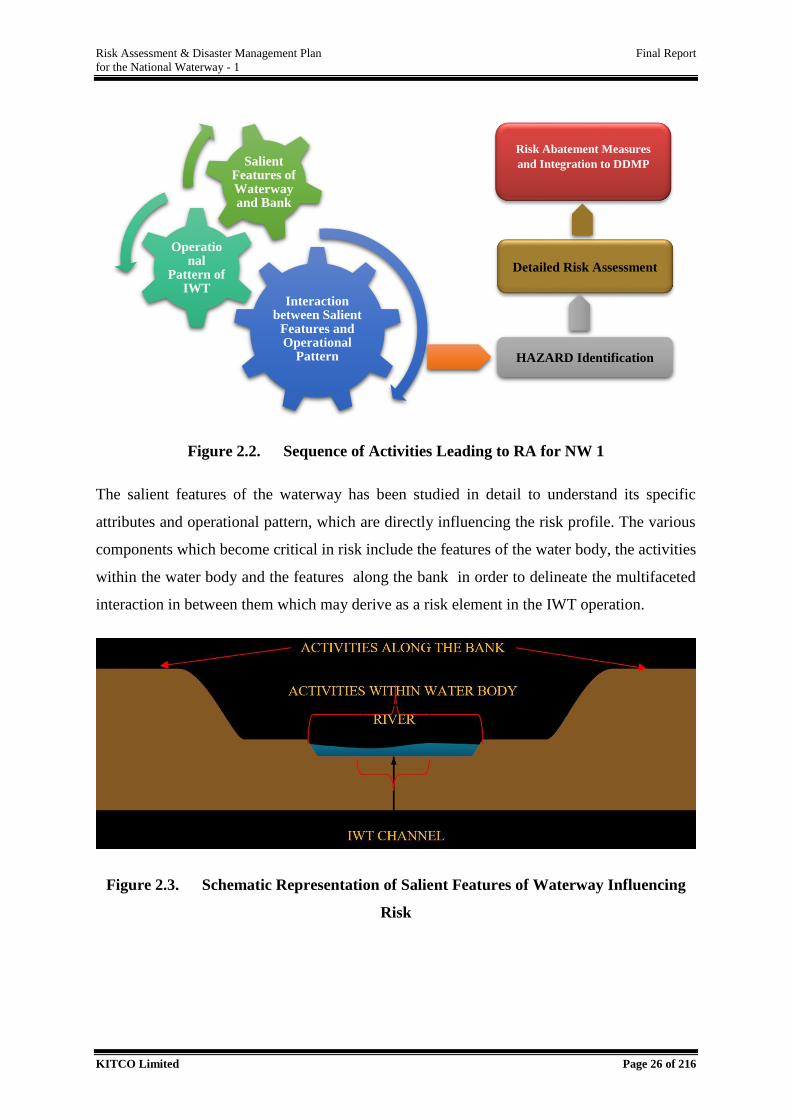
2.2. Approach and Methodology
The present study targets on assessing the risk associated with the enhanced IWT operation
with implementation of JMVP. In order to facilitate realistic view on the risk assessment study,
the salient features of the waterway focusing to its key features w.r.to risk has been primarily
delineated. IWT sector has 4 major components – channel, terminal, vessel and cargo. The
salient features of channel, operation pattern of cargo transport and the properties of cargo are
critical influential factors and multifaceted interaction between the activities/features or with
operation, which will be emerged as a hazard, are analyzed in detail in the risk assessment
study. Sequence of activities are presented in Figure 2.2.
Risk Assessment & Disaster Management Plan Final Report
for the National Waterway - 1
KITCO Limited Page 26 of 216
Figure 2.2. Sequence of Activities Leading to RA for NW 1
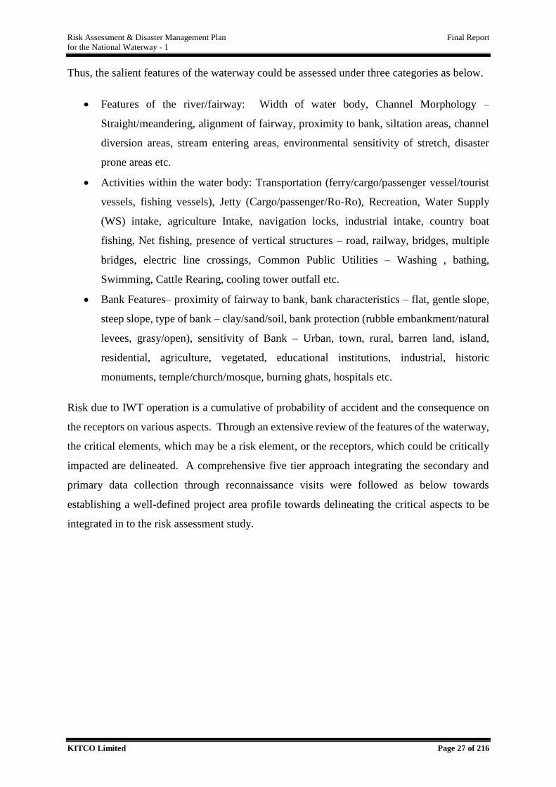
The salient features of the waterway has been studied in detail to understand its specific
attributes and operational pattern, which are directly influencing the risk profile. The various
components which become critical in risk include the features of the water body, the activities
within the water body and the features along the bank in order to delineate the multifaceted
interaction in between them which may derive as a risk element in the IWT operation.
Figure 2.3. Schematic Representation of Salient Features of Waterway Influencing
Risk
Interaction between Salient
Features and Operational
Pattern
Operational
Pattern of IWT
Salient Features of Waterway and Bank
HAZARD Identification
Detailed Risk Assessment
Risk Abatement Measures
and Integration to DDMP
Risk Assessment & Disaster Management Plan Final Report
for the National Waterway - 1
KITCO Limited Page 27 of 216
Thus, the salient features of the waterway could be assessed under three categories as below.
Features of the river/fairway: Width of water body, Channel Morphology –
Straight/meandering, alignment of fairway, proximity to bank, siltation areas, channel
diversion areas, stream entering areas, environmental sensitivity of stretch, disaster
prone areas etc.
Activities within the water body: Transportation (ferry/cargo/passenger vessel/tourist
vessels, fishing vessels), Jetty (Cargo/passenger/Ro-Ro), Recreation, Water Supply
(WS) intake, agriculture Intake, navigation locks, industrial intake, country boat
fishing, Net fishing, presence of vertical structures – road, railway, bridges, multiple
bridges, electric line crossings, Common Public Utilities – Washing , bathing,
Swimming, Cattle Rearing, cooling tower outfall etc.
Bank Features– proximity of fairway to bank, bank characteristics – flat, gentle slope,
steep slope, type of bank – clay/sand/soil, bank protection (rubble embankment/natural
levees, grasy/open), sensitivity of Bank – Urban, town, rural, barren land, island,
residential, agriculture, vegetated, educational institutions, industrial, historic
monuments, temple/church/mosque, burning ghats, hospitals etc.
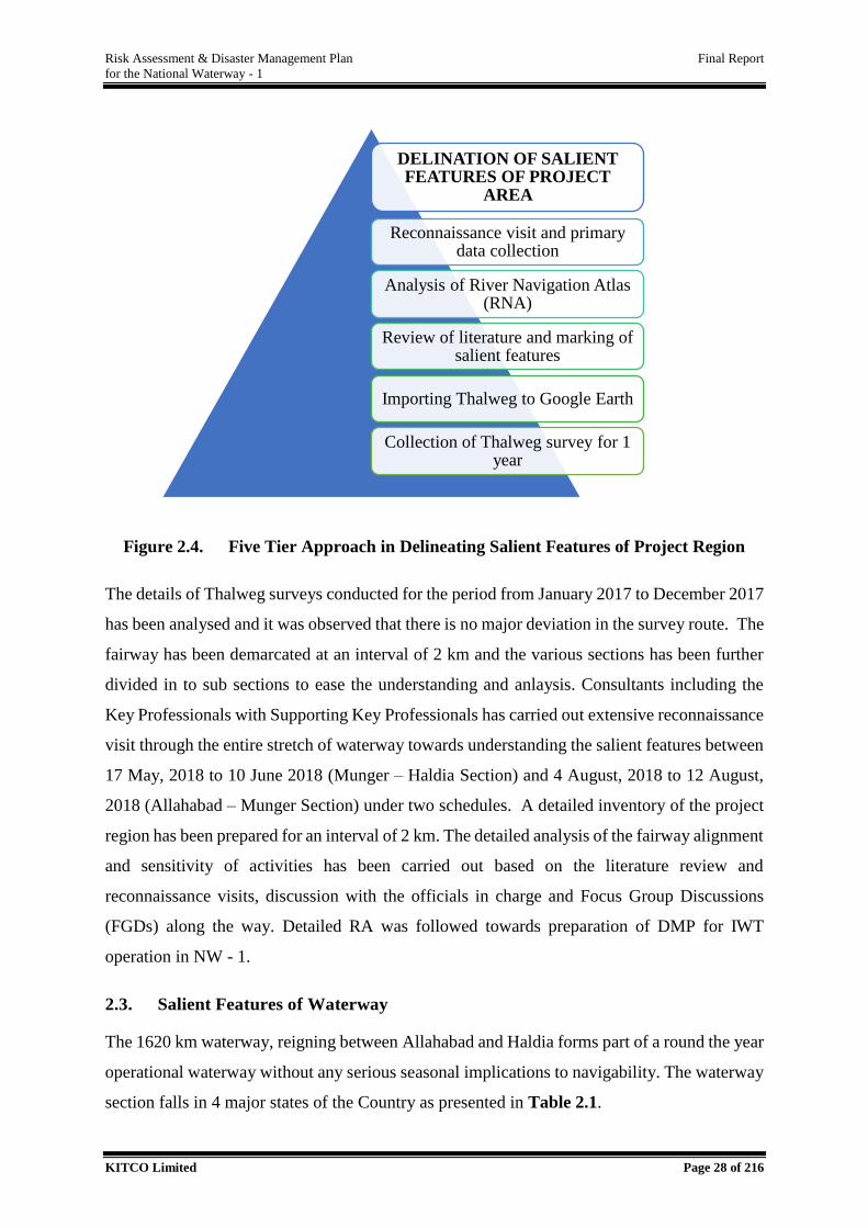
Risk due to IWT operation is a cumulative of probability of accident and the consequence on
the receptors on various aspects. Through an extensive review of the features of the waterway,
the critical elements, which may be a risk element, or the receptors, which could be critically
impacted are delineated. A comprehensive five tier approach integrating the secondary and
primary data collection through reconnaissance visits were followed as below towards
establishing a well-defined project area profile towards delineating the critical aspects to be
integrated in to the risk assessment study.
Risk Assessment & Disaster Management Plan Final Report
for the National Waterway - 1
KITCO Limited Page 28 of 216
Figure 2.4. Five Tier Approach in Delineating Salient Features of Project Region
The details of Thalweg surveys conducted for the period from January 2017 to December 2017
has been analysed and it was observed that there is no major deviation in the survey route. The
fairway has been demarcated at an interval of 2 km and the various sections has been further
divided in to sub sections to ease the understanding and anlaysis. Consultants including the
Key Professionals with Supporting Key Professionals has carried out extensive reconnaissance
visit through the entire stretch of waterway towards understanding the salient features between
17 May, 2018 to 10 June 2018 (Munger – Haldia Section) and 4 August, 2018 to 12 August,
2018 (Allahabad – Munger Section) under two schedules. A detailed inventory of the project
region has been prepared for an interval of 2 km. The detailed analysis of the fairway alignment
and sensitivity of activities has been carried out based on the literature review and
reconnaissance visits, discussion with the officials in charge and Focus Group Discussions
(FGDs) along the way. Detailed RA was followed towards preparation of DMP for IWT
operation in NW - 1.
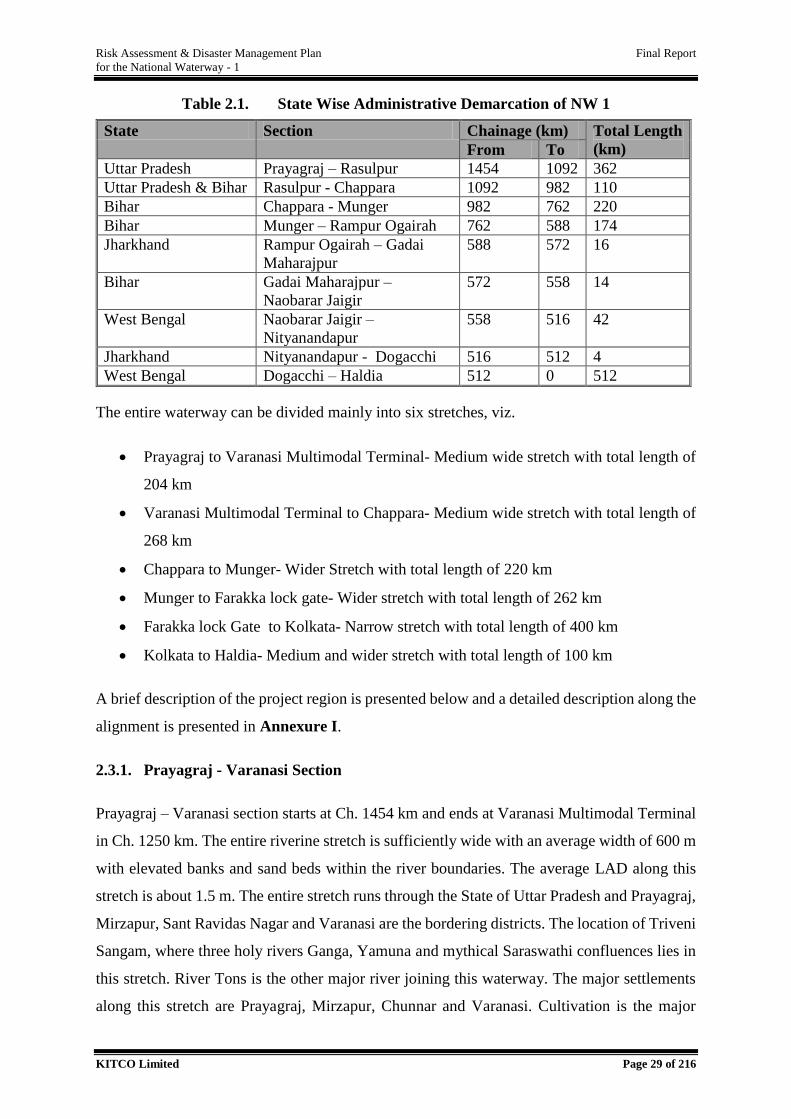
2.3. Salient Features of Waterway
The 1620 km waterway, reigning between Allahabad and Haldia forms part of a round the year
operational waterway without any serious seasonal implications to navigability. The waterway
section falls in 4 major states of the Country as presented in Table 2.1.
DELINATION OF SALIENT FEATURES OF PROJECT
AREA
Reconnaissance visit and primary data collection
Analysis of River Navigation Atlas (RNA)
Review of literature and marking of salient features
Importing Thalweg to Google Earth
Collection of Thalweg survey for 1 year
Risk Assessment & Disaster Management Plan Final Report
for the National Waterway - 1
KITCO Limited Page 29 of 216
Table 2.1. State Wise Administrative Demarcation of NW 1
State Section Chainage (km) Total Length
(km) From To
Uttar Pradesh Prayagraj – Rasulpur 1454 1092 362
Uttar Pradesh & Bihar Rasulpur - Chappara 1092 982 110
Bihar Chappara - Munger 982 762 220
Bihar Munger – Rampur Ogairah 762 588 174
Jharkhand Rampur Ogairah – Gadai
Maharajpur
588 572 16
Bihar Gadai Maharajpur –
Naobarar Jaigir
572 558 14
West Bengal Naobarar Jaigir –
Nityanandapur
558 516 42
Jharkhand Nityanandapur - Dogacchi 516 512 4
West Bengal Dogacchi – Haldia 512 0 512
The entire waterway can be divided mainly into six stretches, viz.
Prayagraj to Varanasi Multimodal Terminal- Medium wide stretch with total length of
204 km
Varanasi Multimodal Terminal to Chappara- Medium wide stretch with total length of
268 km
Chappara to Munger- Wider Stretch with total length of 220 km
Munger to Farakka lock gate- Wider stretch with total length of 262 km
Farakka lock Gate to Kolkata- Narrow stretch with total length of 400 km
Kolkata to Haldia- Medium and wider stretch with total length of 100 km
A brief description of the project region is presented below and a detailed description along the
alignment is presented in Annexure I.
2.3.1. Prayagraj - Varanasi Section
Prayagraj – Varanasi section starts at Ch. 1454 km and ends at Varanasi Multimodal Terminal
in Ch. 1250 km. The entire riverine stretch is sufficiently wide with an average width of 600 m
with elevated banks and sand beds within the river boundaries. The average LAD along this
stretch is about 1.5 m. The entire stretch runs through the State of Uttar Pradesh and Prayagraj,
Mirzapur, Sant Ravidas Nagar and Varanasi are the bordering districts. The location of Triveni
Sangam, where three holy rivers Ganga, Yamuna and mythical Saraswathi confluences lies in
this stretch. River Tons is the other major river joining this waterway. The major settlements
along this stretch are Prayagraj, Mirzapur, Chunnar and Varanasi. Cultivation is the major
Risk Assessment & Disaster Management Plan Final Report
for the National Waterway - 1
KITCO Limited Page 30 of 216
activity observed along the banks. Gyanpur lift irrigation project and other medium and small
scale irrigation pumps are present within the river. Among the hotspots identified, critical
bridge at Mirzapur and eroded tower lines at Paranipur are within this stretch.
2.3.2. Varanasi - Chappara Section
Varanasi – Chappara section starts from Ch. 1250 km near Varanasi Multimodal terminal at
Varanasi, Uttra Prasesh and ends at Chappara in Bihar where river Ghaghara joins the
waterway changing the profile of the river. Bordering districts along the stretch are Varanasi,
Chandauli, Ghazipur, Ballia, Buxar, Saran and Bhojpur. The entire stretch are sufficiently wide
with 1.5 to 2 m LAD. Major rivers joining the waterway are Varuna, Assi, Gomti, Karamnasa,
Thora, Tamsa and Ghaghara. The declared Kashi Turtle Sanctuary at Varanasi also lies in this
stretch. Major settlements include the famous Varanasi Municipal Corporation, Ghazipur,
Buxar, Ballia and Chappara. Varanasi temple is a world famous pilgrimage centre and is a
location of mass gathering along this stretch. The critical features identified includes the critical
Rajghat Bridge at Varanasi and sagging tower line at Ghazipur. Other important features
includes Multimodal Terminal of Ramnager, Proposed Intermodal terminal at Ghazipur and
Ramnagar Fort. State boundaries of Bihar starts at Rasulpur from Ch. 1092 km and the river
runs within the jurisdiction of state of Bihar along right bank and under the jurisdiction of state
of Uttar Pradesh on the left bank upto Chappara near Ch. 982 km.
2.3.3. Chappara - Munger Section
Between Chappara (Ch. 982 km) – Munger (Ch. 762 km) stretch, the river is wide with an
average width of 2 km and 2 to 2.5 m LAD in the channel. The bordering districts in this stretch
are Saran, Bhojpur, Patna, Vaishali, Samastipur, Lakhisarai, Begusarai and Munger. The major
rivers joining this stretch are Sone, Gandak and Punpun rivers. The major settlements includes
the famous capital city of Patna, Chappara, Fatuha, Barh, and Munger. NTPC Barh, Thermal
Power Station at Barauni, brick kilns at Lodipur are the major industrial unit along the stretch.
Confluence point of Sone River with Ganga River is a high traffic area, where barges moves
with sand across the river and Kothiya, near Patna is another location of high traffic. Critical
features includes eroded tower lines at Kothiya, critical bridge at Simariya and temporary
pontoon bridges connecting the banks at different locations in this stretch.
Risk Assessment & Disaster Management Plan Final Report
for the National Waterway - 1
KITCO Limited Page 31 of 216
2.3.4. Munger – Farakka Lock Gate Section
Munger (Ch. 762 km) – Farakka lock (Ch. 500 km) gate are wider section with an average
width of 2 km and 3 m LAD is maintained throughout the stretch. This stretch of waterway
traverse through three main states namely Bihar, Jharkhand and West Bengal on reaching
Farakka lock gate. NW 1 borders through the districts of Munger, Bhagalpur, Khagaria, Purnia,
Katihar, Sahibganj, Malda and Murshidabad in this stretch. The declared Vikram-shila Dolphin
Sanctuary from Sultanganj to Kahalgaon lies along this stretch. The other predominant feature
along the waterway is the Farakka barrage across River Ganga. Major River Koshi joins the
waterway downstream of Kahalgaon and before reaching Manihari. Major settlements include
Munger, Sultanganj, Bhagalpur, Kahalgaon, Sahibganj, Rajmahal and Farakka. The Sahibganj
Multimodal Terminal in the State of Jharkand lies in this stretch. Ro-Ro ferry service
connecting the opposite banks of river can be seen at Manihari and Rajmahal. Critical aspects
include eroding tower lines at Bakiasukhai near Manihari and Farakka Lock gate. This section
is devoid of pontoon bridges and is continuously navigable throughout the year.
2.3.5. Farakka Lock Gate – Kolkata Section
The stretch between Farakka Lock Gate and Kolkata is a narrow stretch with an average width
of 300 m and lies in the State of West Bengal. Feeder canal is runned for a length of 40 km
from the Farakka Barrage and is the major source of water for navigation system. The assured
depth of waterway in this stretch is about 3 m and this is the Bhagirathi- Hooghly river stretch
of NW - 1. The bordering districts are Murshidabad, Purba Bardhfaman, Nadia, Hooghly,
North Twenty Four Parganas, Kolkata and Howrah. Major rivers joining this stretch are
Bhagirathi and Ajoy. Major settlements include Farakka township area, Jangipur, Behrampore,
Katwa, Nabadwip, Kalna, Kalyani, Dakshineswar, Belur and the entire Kolkata Metropolitan
area lies along this stretch. Critical features identified includes Pakur Bridge, Howrah Bridge,
Vivekananda Setu, and eroded tower lines at Malopara. The banks are mainly utilited for
cultivation in the upstream section and on reaching Kolkata land use pattern changes to
industrial/urban use. The major industries includes NTPC Farakka, Bandel Thermal Power
Plant, Jute mills and Paper mills. Water intake structures for municipal and irrigation
application were seen all throughout the stretch and the prominent municipal supply units
includes units at Barrackpore, Kalna, Nabadwip and Kalyani.
Risk Assessment & Disaster Management Plan Final Report
for the National Waterway - 1
KITCO Limited Page 32 of 216
2.3.6. Kolkata – Haldia Section
Kolkata (Ch.100 km) – Haldia (Ch.0 km) stretch is a sufficiently wide stretch with a width
varying from 400 – 5000 m near Haldia terminal. Average assured depth throughout the stretch
is 3 m and the shipping channel of Kolkata Port Trust (KoPT) lies in this stretch. Bordering
districts in the alignment are Kolkata, Howrah, Purba Medinipur and South Twenty Four
Parganas. Rupnarayan River joins the waterway near Noorpur, where the width is about 2 km.
The world’s second tallest power transmission towers of height 236 m is located near Haldia
between Ch.30 km and Ch.32 km. Major industrial areas include Falta Special Economic Zone,
Budge Budge installation , Haldia industrial area and Kolkata Port Trust area. The entire stretch
experiences heavy vessel traffic whole throughout the year. This stretch is also form part of
declared Indo-Bangladesh protocol route, where cargo vessels moving with fly ash and food
grains are predominant. Salient features of waterway has been assessed in detail in
identification of critical sections and hotspots as part of Risk Assessment.
2.4. Infrastructure Facilities
The details of existing as well as proposed terminals/jetties are presented in Table 2.2 followed
by brief description of features around the terminals.
Risk Assessment & Disaster Management Plan Final Report
for the National Waterway - 1
KITCO Limited Page 33 of 216
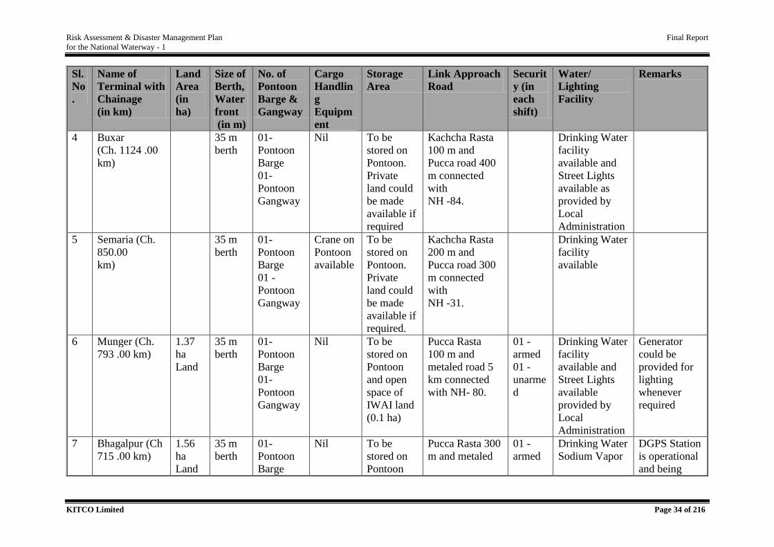
Table 2.2. Details of Existing and Proposed IWT Terminals in NW 1
Sl.
No
.
Name of
Terminal with
Chainage
(in km)
Land
Area
(in
ha)
Size of
Berth,
Water
front
(in m)
No. of
Pontoon
Barge &
Gangway
Cargo
Handlin
g
Equipm
ent
Storage
Area
Link Approach
Road
Securit
y (in
each
shift)
Water/
Lighting
Facility
Remarks
Existing Terminals
1 Allahabad (Ch.
1535.00 km)
8.759
35 m
berth
and
300
WF
01-
Pontoon
Barge
01-
Pontoon
Gangway
Nil To be
stored on
Pontoon
and open
space of
IWAI land
(0.5 ha)
Pucca Rasta
(Concrete road)
500 m and
metaled road 2
km connected
with NH -76.
01 -
armed
01 -
unarme
d
Drinking Water
facility
available.
Generator
could be
provided for
lighting if
required
2 Ramnagar
(Varanasi)
(Ch. 1315.00
km)
5.586
Hecta
re
Land
35 m
berth
& 300
WF
01-
Pontoon
Barge
01 -
Pontoon
Gangway
Nil To be
stored on
Pontoon
and open
space of
IWAI land
(0.2 ha)
Connecting with
NH- 07.
01 -
armed
01 -
unarme
d
- Being
developed
under JMVP
3 Ghazipur (Ch.
1177.00
km) / Rajghat
(Varanasi km)
35 m
berth
01-
Pontoon
Barge
01-
Pontoon
Gangway
Nil To be
stored on
Pontoon.
Private
land could
be made
available if
required
Kachcha Rasta
(Earthen Road)
100 m and
Pucca road 100
m connected
with NH 19.
Drinking Water
facility
available
Generator
could be
provided for
lighting if
required
Risk Assessment & Disaster Management Plan Final Report
for the National Waterway - 1
KITCO Limited Page 34 of 216
Sl.
No
.
Name of
Terminal with
Chainage
(in km)
Land
Area
(in
ha)
Size of
Berth,
Water
front
(in m)
No. of
Pontoon
Barge &
Gangway
Cargo
Handlin
g
Equipm
ent
Storage
Area
Link Approach
Road
Securit
y (in
each
shift)
Water/
Lighting
Facility
Remarks
4 Buxar
(Ch. 1124 .00
km)
35 m
berth
01-
Pontoon
Barge
01-
Pontoon
Gangway
Nil To be
stored on
Pontoon.
Private
land could
be made
available if
required
Kachcha Rasta
100 m and
Pucca road 400
m connected
with
NH -84.
Drinking Water
facility
available and
Street Lights
available as
provided by
Local
Administration
5 Semaria (Ch.
850.00
km)
35 m
berth
01-
Pontoon
Barge
01 -
Pontoon
Gangway
Crane on
Pontoon
available
To be
stored on
Pontoon.
Private
land could
be made
available if
required.
Kachcha Rasta
200 m and
Pucca road 300
m connected
with
NH -31.
Drinking Water
facility
available
6 Munger (Ch.
793 .00 km)
1.37
ha
Land
35 m
berth
01-
Pontoon
Barge
01-
Pontoon
Gangway
Nil To be
stored on
Pontoon
and open
space of
IWAI land
(0.1 ha)
Pucca Rasta
100 m and
metaled road 5
km connected
with NH- 80.
01 -
armed
01 -
unarme
d
Drinking Water
facility
available and
Street Lights
available
provided by
Local
Administration
Generator
could be
provided for
lighting
whenever
required
7 Bhagalpur (Ch
715 .00 km)
1.56
ha
Land
35 m
berth
01-
Pontoon
Barge
Nil To be
stored on
Pontoon
Pucca Rasta 300
m and metaled
01 -
armed
Drinking Water
Sodium Vapor
DGPS Station
is operational
and being
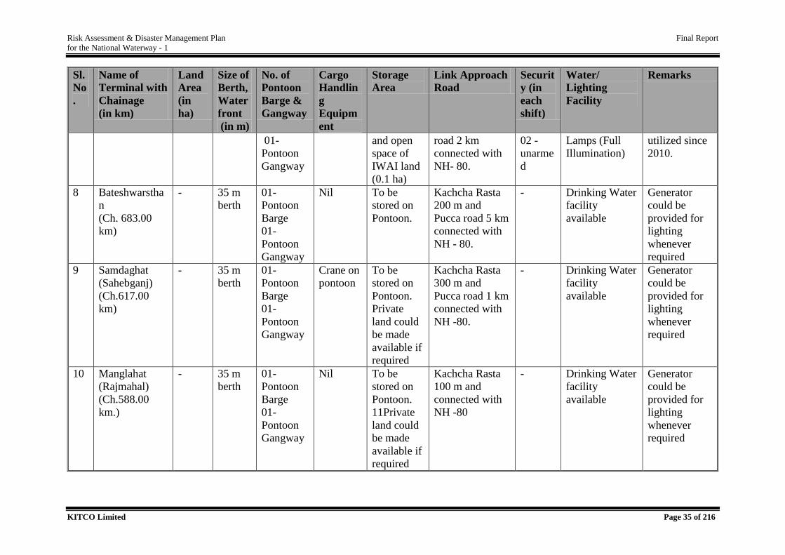
Risk Assessment & Disaster Management Plan Final Report
for the National Waterway - 1
KITCO Limited Page 35 of 216
Sl.
No
.
Name of
Terminal with
Chainage
(in km)
Land
Area
(in
ha)
Size of
Berth,
Water
front
(in m)
No. of
Pontoon
Barge &
Gangway
Cargo
Handlin
g
Equipm
ent
Storage
Area
Link Approach
Road
Securit
y (in
each
shift)
Water/
Lighting
Facility
Remarks
01-
Pontoon
Gangway
and open
space of
IWAI land
(0.1 ha)
road 2 km
connected with
NH- 80.
02 -
unarme
d
Lamps (Full
Illumination)
utilized since
2010.
8 Bateshwarstha
n
(Ch. 683.00
km)
- 35 m
berth
01-
Pontoon
Barge
01-
Pontoon
Gangway
Nil To be
stored on
Pontoon.
Kachcha Rasta
200 m and
Pucca road 5 km
connected with
NH - 80.
- Drinking Water
facility
available
Generator
could be
provided for
lighting
whenever
required
9 Samdaghat
(Sahebganj)
(Ch.617.00
km)
- 35 m
berth
01-
Pontoon
Barge
01-
Pontoon
Gangway
Crane on
pontoon
To be
stored on
Pontoon.
Private
land could
be made
available if
required
Kachcha Rasta
300 m and
Pucca road 1 km
connected with
NH -80.
- Drinking Water
facility
available
Generator
could be
provided for
lighting
whenever
required
10 Manglahat
(Rajmahal)
(Ch.588.00
km.)
- 35 m
berth
01-
Pontoon
Barge
01-
Pontoon
Gangway
Nil To be
stored on
Pontoon.
11Private
land could
be made
available if
required
Kachcha Rasta
100 m and
connected with
NH -80
- Drinking Water
facility
available
Generator
could be
provided for
lighting
whenever
required
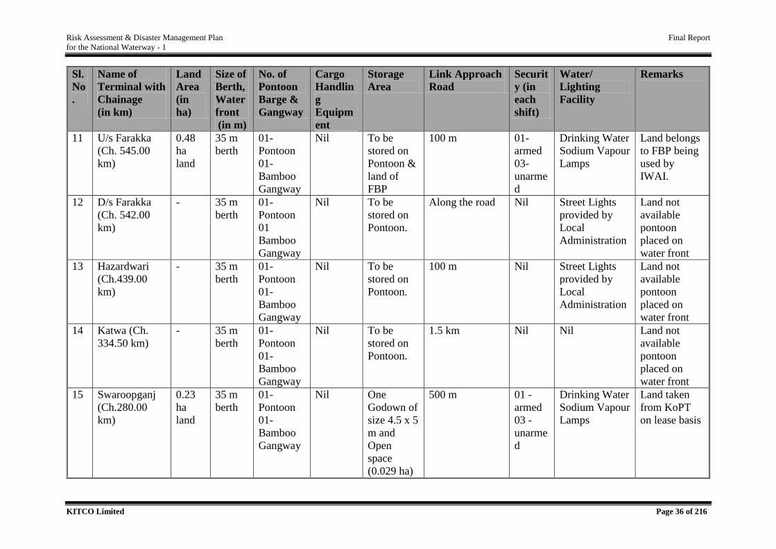
Risk Assessment & Disaster Management Plan Final Report
for the National Waterway - 1
KITCO Limited Page 36 of 216
Sl.
No
.
Name of
Terminal with
Chainage
(in km)
Land
Area
(in
ha)
Size of
Berth,
Water
front
(in m)
No. of
Pontoon
Barge &
Gangway
Cargo
Handlin
g
Equipm
ent
Storage
Area
Link Approach
Road
Securit
y (in
each
shift)
Water/
Lighting
Facility
Remarks
11 U/s Farakka
(Ch. 545.00
km)
0.48
ha
land
35 m
berth
01-
Pontoon
01-
Bamboo
Gangway
Nil To be
stored on
Pontoon &
land of
FBP
100 m 01-
armed
03-
unarme
d
Drinking Water
Sodium Vapour
Lamps
Land belongs
to FBP being
used by
IWAI.
12 D/s Farakka
(Ch. 542.00
km)
- 35 m
berth
01-
Pontoon
01
Bamboo
Gangway
Nil To be
stored on
Pontoon.
Along the road Nil Street Lights
provided by
Local
Administration
Land not
available
pontoon
placed on
water front
13 Hazardwari
(Ch.439.00
km)
- 35 m
berth
01-
Pontoon
01-
Bamboo
Gangway
Nil To be
stored on
Pontoon.
100 m Nil Street Lights
provided by
Local
Administration
Land not
available
pontoon
placed on
water front
14 Katwa (Ch.
334.50 km)
- 35 m
berth
01-
Pontoon
01-
Bamboo
Gangway
Nil To be
stored on
Pontoon.
1.5 km Nil Nil Land not
available
pontoon
placed on
water front
15 Swaroopganj
(Ch.280.00
km)
0.23
ha
land
35 m
berth
01-
Pontoon
01-
Bamboo
Gangway
Nil One
Godown of
size 4.5 x 5
m and
Open
space
(0.029 ha)
500 m 01 -
armed
03 -
unarme
d
Drinking Water
Sodium Vapour
Lamps
Land taken
from KoPT
on lease basis
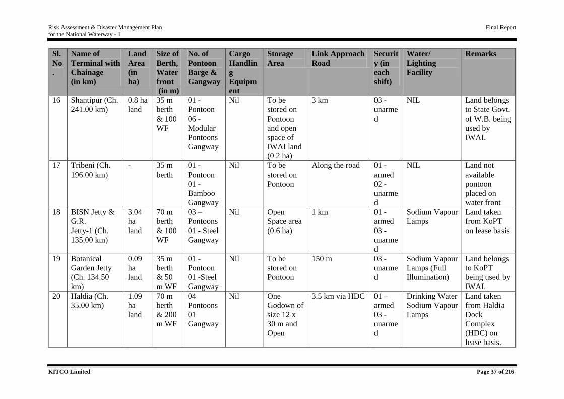
Risk Assessment & Disaster Management Plan Final Report
for the National Waterway - 1
KITCO Limited Page 37 of 216
Sl.
No
.
Name of
Terminal with
Chainage
(in km)
Land
Area
(in
ha)
Size of
Berth,
Water
front
(in m)
No. of
Pontoon
Barge &
Gangway
Cargo
Handlin
g
Equipm
ent
Storage
Area
Link Approach
Road
Securit
y (in
each
shift)
Water/
Lighting
Facility
Remarks
16 Shantipur (Ch.
241.00 km)
0.8 ha
land
35 m
berth
& 100
WF
01 -
Pontoon
06 -
Modular
Pontoons
Gangway
Nil To be
stored on
Pontoon
and open
space of
IWAI land
(0.2 ha)
3 km 03 -
unarme
d
NIL Land belongs
to State Govt.
of W.B. being
used by
IWAI.
17 Tribeni (Ch.
196.00 km)
- 35 m
berth
01 -
Pontoon
01 -
Bamboo
Gangway
Nil To be
stored on
Pontoon
Along the road 01 -
armed
02 -
unarme
d
NIL Land not
available
pontoon
placed on
water front
18 BISN Jetty &
G.R.
Jetty-1 (Ch.
135.00 km)
3.04
ha
land
70 m
berth
& 100
WF
03 –
Pontoons
01 - Steel
Gangway
Nil Open
Space area
(0.6 ha)
1 km 01 -
armed
03 -
unarme
d
Sodium Vapour
Lamps
Land taken
from KoPT
on lease basis
19 Botanical
Garden Jetty
(Ch. 134.50
km)
0.09
ha
land
35 m
berth
& 50
m WF
01 -
Pontoon
01 -Steel
Gangway
Nil To be
stored on
Pontoon
150 m 03 -
unarme
d
Sodium Vapour
Lamps (Full
Illumination)
Land belongs
to KoPT
being used by
IWAI.
20 Haldia (Ch.
35.00 km)
1.09
ha
land
70 m
berth
& 200
m WF
04
Pontoons
01
Gangway
Nil One
Godown of
size 12 x
30 m and
Open
3.5 km via HDC 01 –
armed
03 -
unarme
d
Drinking Water
Sodium Vapour
Lamps
Land taken
from Haldia
Dock
Complex
(HDC) on
lease basis.
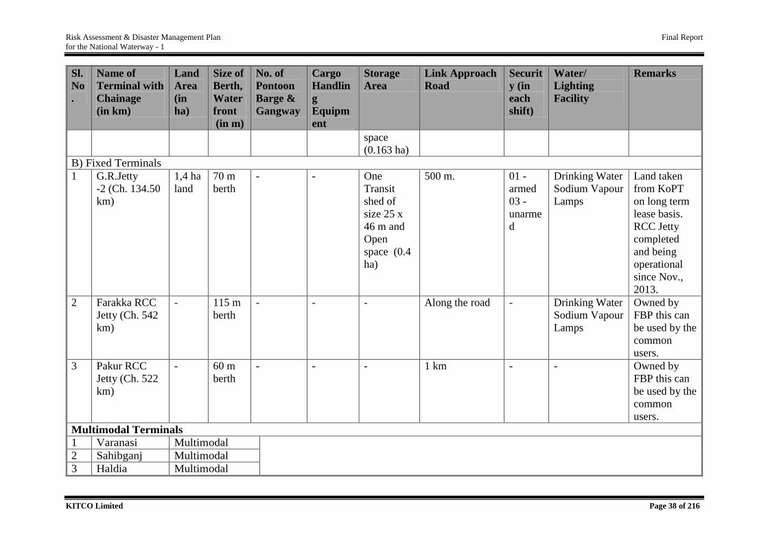
Risk Assessment & Disaster Management Plan Final Report
for the National Waterway - 1
KITCO Limited Page 38 of 216
Sl.
No
.
Name of
Terminal with
Chainage
(in km)
Land
Area
(in
ha)
Size of
Berth,
Water
front
(in m)
No. of
Pontoon
Barge &
Gangway
Cargo
Handlin
g
Equipm
ent
Storage
Area
Link Approach
Road
Securit
y (in
each
shift)
Water/
Lighting
Facility
Remarks
space
(0.163 ha)
B) Fixed Terminals
1 G.R.Jetty
-2 (Ch. 134.50
km)
1,4 ha
land
70 m
berth
- - One
Transit
shed of
size 25 x
46 m and
Open
space (0.4
ha)
500 m. 01 -
armed
03 -
unarme
d
Drinking Water
Sodium Vapour
Lamps
Land taken
from KoPT
on long term
lease basis.
RCC Jetty
completed
and being
operational
since Nov.,
2013.
2 Farakka RCC
Jetty (Ch. 542
km)
- 115 m
berth
- - - Along the road - Drinking Water
Sodium Vapour
Lamps
Owned by
FBP this can
be used by the
common
users.
3 Pakur RCC
Jetty (Ch. 522
km)
- 60 m
berth
- - - 1 km - - Owned by
FBP this can
be used by the
common
users.
Multimodal Terminals
1 Varanasi Multimodal
2 Sahibganj Multimodal
3 Haldia Multimodal
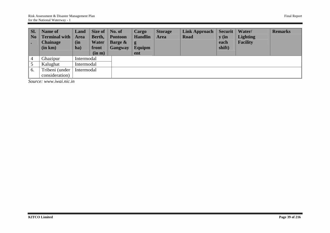
Risk Assessment & Disaster Management Plan Final Report
for the National Waterway - 1
KITCO Limited Page 39 of 216
Sl.
No
.
Name of
Terminal with
Chainage
(in km)
Land
Area
(in
ha)
Size of
Berth,
Water
front
(in m)
No. of
Pontoon
Barge &
Gangway
Cargo
Handlin
g
Equipm
ent
Storage
Area
Link Approach
Road
Securit
y (in
each
shift)
Water/
Lighting
Facility
Remarks
4 Ghazipur Intermodal
5 Kalughat Intermodal
6. Tribeni (under
consideration)
Intermodal
Source: www.iwai.nic.in
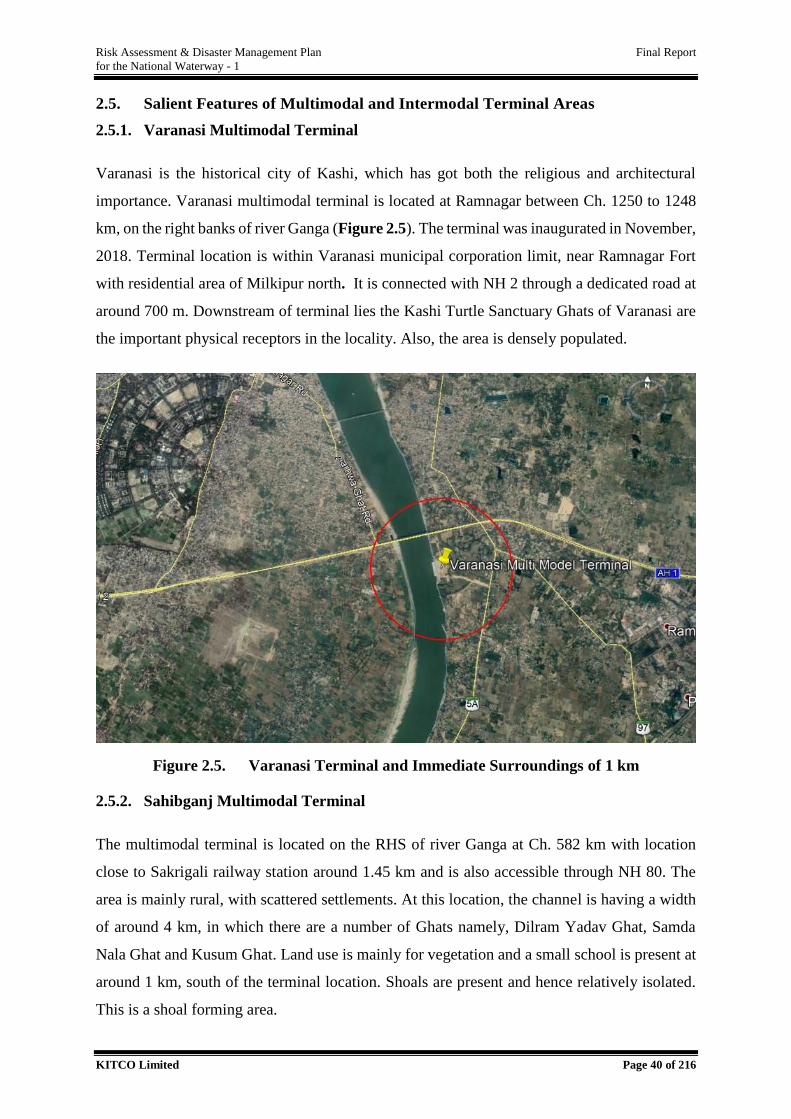
Risk Assessment & Disaster Management Plan Final Report
for the National Waterway - 1
KITCO Limited Page 40 of 216
2.5. Salient Features of Multimodal and Intermodal Terminal Areas
2.5.1. Varanasi Multimodal Terminal
Varanasi is the historical city of Kashi, which has got both the religious and architectural
importance. Varanasi multimodal terminal is located at Ramnagar between Ch. 1250 to 1248
km, on the right banks of river Ganga (Figure 2.5). The terminal was inaugurated in November,
2018. Terminal location is within Varanasi municipal corporation limit, near Ramnagar Fort
with residential area of Milkipur north. It is connected with NH 2 through a dedicated road at
around 700 m. Downstream of terminal lies the Kashi Turtle Sanctuary Ghats of Varanasi are
the important physical receptors in the locality. Also, the area is densely populated.
Figure 2.5. Varanasi Terminal and Immediate Surroundings of 1 km
2.5.2. Sahibganj Multimodal Terminal
The multimodal terminal is located on the RHS of river Ganga at Ch. 582 km with location
close to Sakrigali railway station around 1.45 km and is also accessible through NH 80. The
area is mainly rural, with scattered settlements. At this location, the channel is having a width
of around 4 km, in which there are a number of Ghats namely, Dilram Yadav Ghat, Samda
Nala Ghat and Kusum Ghat. Land use is mainly for vegetation and a small school is present at
around 1 km, south of the terminal location. Shoals are present and hence relatively isolated.
This is a shoal forming area.
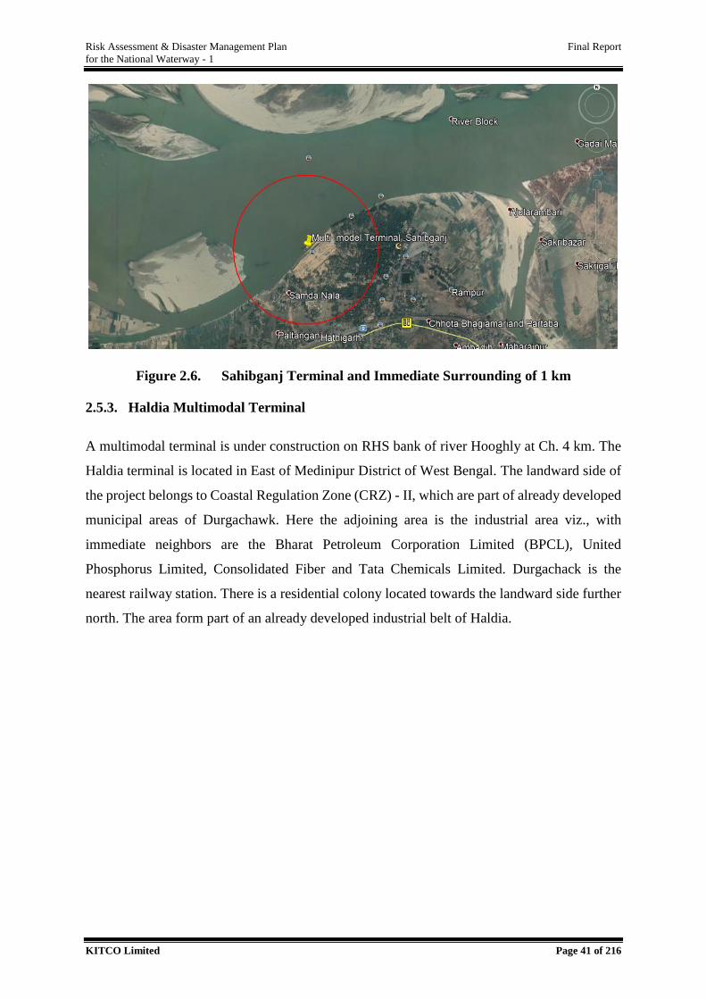
Risk Assessment & Disaster Management Plan Final Report
for the National Waterway - 1
KITCO Limited Page 41 of 216
Figure 2.6. Sahibganj Terminal and Immediate Surrounding of 1 km
2.5.3. Haldia Multimodal Terminal
A multimodal terminal is under construction on RHS bank of river Hooghly at Ch. 4 km. The
Haldia terminal is located in East of Medinipur District of West Bengal. The landward side of
the project belongs to Coastal Regulation Zone (CRZ) - II, which are part of already developed
municipal areas of Durgachawk. Here the adjoining area is the industrial area viz., with
immediate neighbors are the Bharat Petroleum Corporation Limited (BPCL), United
Phosphorus Limited, Consolidated Fiber and Tata Chemicals Limited. Durgachack is the
nearest railway station. There is a residential colony located towards the landward side further
north. The area form part of an already developed industrial belt of Haldia.
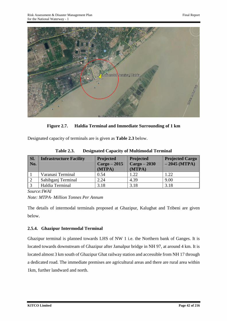
Risk Assessment & Disaster Management Plan Final Report
for the National Waterway - 1
KITCO Limited Page 42 of 216
Figure 2.7. Haldia Terminal and Immediate Surrounding of 1 km
Designated capacity of terminals are is given as Table 2.3 below.
Table 2.3. Designated Capacity of Multimodal Terminal
Sl.
No.
Infrastructure Facility Projected
Cargo – 2015
(MTPA)
Projected
Cargo – 2030
(MTPA)
Projected Cargo
– 2045 (MTPA)
1 Varanasi Terminal 0.54 1.22 1.22
2 Sahibganj Terminal 2.24 4.39 9.00
3 Haldia Terminal 3.18 3.18 3.18
Source:IWAI
Note: MTPA- Million Tonnes Per Annum
The details of intermodal terminals proposed at Ghazipur, Kalughat and Tribeni are given
below.
2.5.4. Ghazipur Intermodal Terminal
Ghazipur terminal is planned towards LHS of NW 1 i.e. the Northern bank of Ganges. It is
located towards downstream of Ghazipur after Jamalpur bridge in NH 97, at around 4 km. It is
located almost 3 km south of Ghazipur Ghat railway station and accessible from NH 17 through
a dedicated road. The immediate premises are agricultural areas and there are rural area within
1km, further landward and north.
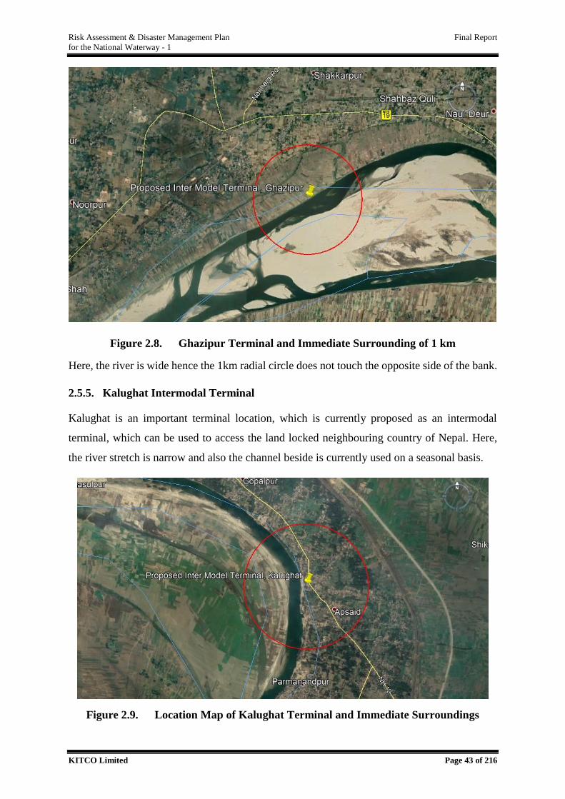
Risk Assessment & Disaster Management Plan Final Report
for the National Waterway - 1
KITCO Limited Page 43 of 216
Figure 2.8. Ghazipur Terminal and Immediate Surrounding of 1 km
Here, the river is wide hence the 1km radial circle does not touch the opposite side of the bank.
2.5.5. Kalughat Intermodal Terminal
Kalughat is an important terminal location, which is currently proposed as an intermodal
terminal, which can be used to access the land locked neighbouring country of Nepal. Here,
the river stretch is narrow and also the channel beside is currently used on a seasonal basis.
Figure 2.9. Location Map of Kalughat Terminal and Immediate Surroundings
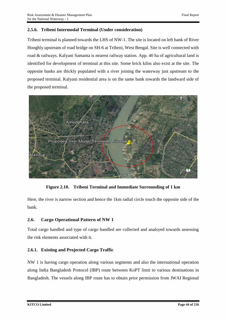
Risk Assessment & Disaster Management Plan Final Report
for the National Waterway - 1
KITCO Limited Page 44 of 216
2.5.6. Tribeni Intermodal Terminal (Under consideration)
Tribeni terminal is planned towards the LHS of NW-1. The site is located on left bank of River
Hooghly upstream of road bridge on SH-6 at Tribeni, West Bengal. Site is well connected with
road & railways. Kalyani Samanta is nearest railway station. App. 40 ha of agricultural land is
identified for development of terminal at this site. Some brick kilns also exist at the site. The
opposite banks are thickly populated with a river joining the waterway just upstream to the
proposed terminal. Kalyani residential area is on the same bank towards the landward side of
the proposed terminal.
Figure 2.10. Tribeni Terminal and Immediate Surrounding of 1 km
Here, the river is narrow section and hence the 1km radial circle touch the opposite side of the
bank.
2.6. Cargo Operational Pattern of NW 1
Total cargo handled and type of cargo handled are collected and analsyed towards assessing
the risk elements associated with it.
2.6.1. Existing and Projected Cargo Traffic
NW 1 is having cargo operation along various segments and also the international operation
along India Bangladesh Protocol (IBP) route between KoPT limit to various destinations in
Bangladesh. The vessels along IBP route has to obtain prior permission from IWAI Regional
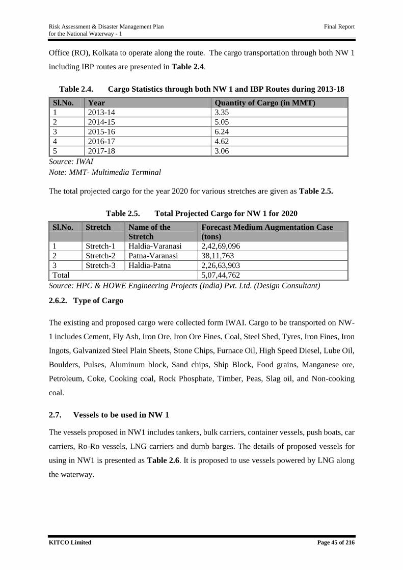
Risk Assessment & Disaster Management Plan Final Report
for the National Waterway - 1
KITCO Limited Page 45 of 216
Office (RO), Kolkata to operate along the route. The cargo transportation through both NW 1
including IBP routes are presented in Table 2.4.
Table 2.4. Cargo Statistics through both NW 1 and IBP Routes during 2013-18
Sl.No. Year Quantity of Cargo (in MMT)
1 2013-14 3.35
2 2014-15 5.05
3 2015-16 6.24
4 2016-17 4.62
5 2017-18 3.06
Source: IWAI
Note: MMT- Multimedia Terminal
The total projected cargo for the year 2020 for various stretches are given as Table 2.5.
Table 2.5. Total Projected Cargo for NW 1 for 2020
Sl.No. Stretch Name of the
Stretch
Forecast Medium Augmentation Case
(tons)
1 Stretch-1 Haldia-Varanasi 2,42,69,096
2 Stretch-2 Patna-Varanasi 38,11,763
3 Stretch-3 Haldia-Patna 2,26,63,903
Total 5,07,44,762
Source: HPC & HOWE Engineering Projects (India) Pvt. Ltd. (Design Consultant)
2.6.2. Type of Cargo
The existing and proposed cargo were collected form IWAI. Cargo to be transported on NW-
1 includes Cement, Fly Ash, Iron Ore, Iron Ore Fines, Coal, Steel Shed, Tyres, Iron Fines, Iron
Ingots, Galvanized Steel Plain Sheets, Stone Chips, Furnace Oil, High Speed Diesel, Lube Oil,
Boulders, Pulses, Aluminum block, Sand chips, Ship Block, Food grains, Manganese ore,
Petroleum, Coke, Cooking coal, Rock Phosphate, Timber, Peas, Slag oil, and Non-cooking
coal.
2.7. Vessels to be used in NW 1
The vessels proposed in NW1 includes tankers, bulk carriers, container vessels, push boats, car
carriers, Ro-Ro vessels, LNG carriers and dumb barges. The details of proposed vessels for
using in NW1 is presented as Table 2.6. It is proposed to use vessels powered by LNG along
the waterway.
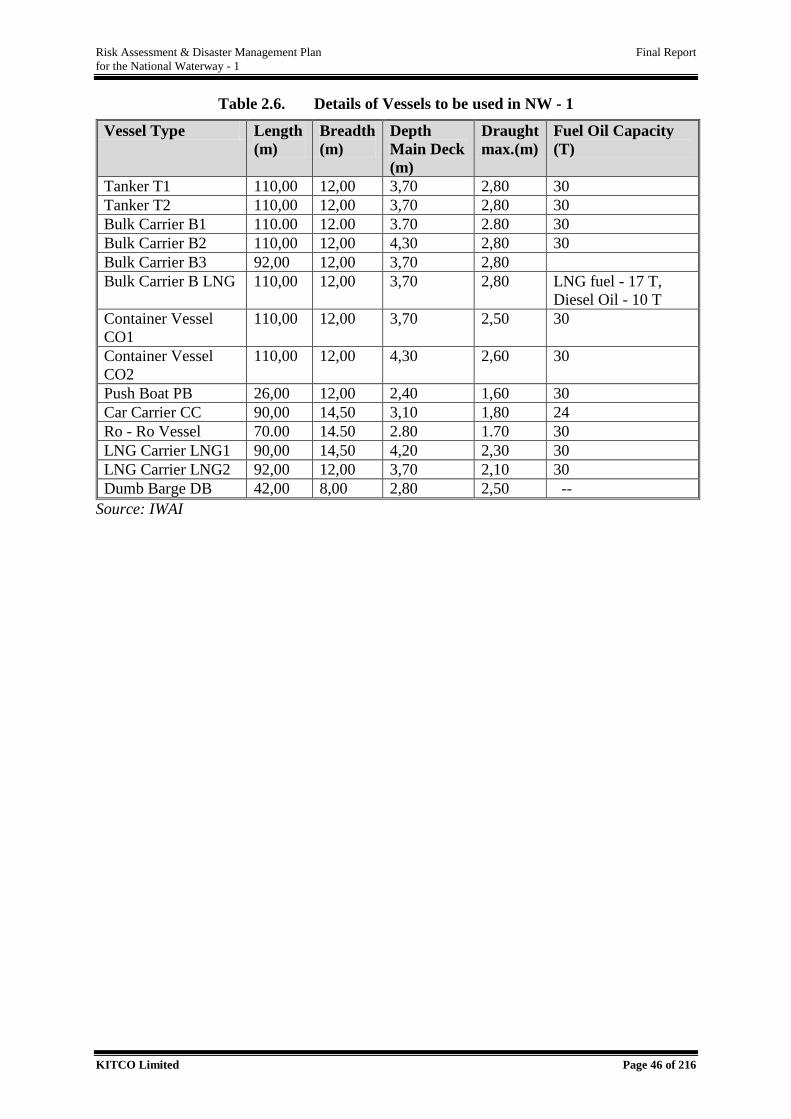
Risk Assessment & Disaster Management Plan Final Report
for the National Waterway - 1
KITCO Limited Page 46 of 216
Table 2.6. Details of Vessels to be used in NW - 1
Vessel Type Length
(m)
Breadth
(m)
Depth
Main Deck
(m)
Draught
max.(m)
Fuel Oil Capacity
(T)
Tanker T1 110,00 12,00 3,70 2,80 30
Tanker T2 110,00 12,00 3,70 2,80 30
Bulk Carrier B1 110.00 12.00 3.70 2.80 30
Bulk Carrier B2 110,00 12,00 4,30 2,80 30
Bulk Carrier B3 92,00 12,00 3,70 2,80
Bulk Carrier B LNG 110,00 12,00 3,70 2,80 LNG fuel - 17 T,
Diesel Oil - 10 T
Container Vessel
CO1
110,00 12,00 3,70 2,50 30
Container Vessel
CO2
110,00 12,00 4,30 2,60 30
Push Boat PB 26,00 12,00 2,40 1,60 30
Car Carrier CC 90,00 14,50 3,10 1,80 24
Ro - Ro Vessel 70.00 14.50 2.80 1.70 30
LNG Carrier LNG1 90,00 14,50 4,20 2,30 30
LNG Carrier LNG2 92,00 12,00 3,70 2,10 30
Dumb Barge DB 42,00 8,00 2,80 2,50 --
Source: IWAI
Risk Assessment & Disaster Management Plan Final Report
for the National Waterway - 1
KITCO Limited Page 47 of 216
RISK ASSESMENT
Risk Assessment is a systematic process of evaluating the potential risks that may be involved
in an activity and assessing the negative consequences. Risk, by definition is a situation
involving exposure to danger and the risk is determined as the probability of one entity to be
exposed to a hazard and quantum of its negative consequence. During risk assessment, the level
of risk involved in an operation is determined as low/medium/high through risk analysis with
respect to a given situation and appropriate risk abatement measures are proposed to reduce the
risk level to As Low As Practically Reasonable (ALARP).
Like any other activity, IWT is not an exception for hazards. They may turn out into disaster,
if it occur in extreme intensity in a very vulnerable locality; due to natural or human induced
factors. It is extremely important to have a detailed risk analysis covering the planning, design,
implementation and operational phases. This helps in the preparation of an executable plan,
with a road map for ensuring better preparedness as well as response in the case of a hazard
scenario. This section presents the details of the RA conducted for NW 1 for the stretch from
Allahabad to Haldia.
3.1. Risk Assessment (RA) Methodology
RA methodology adopted is a hybrid method that involves both qualitative and quantitative
components. Different parameters involved in the risk assessment was initially identified and
shortlisted in qualitative terms and wherever possible, their extent and impacts were expressed
quantitatively. In addition, towards arriving at final risk posed by credible scenarios, a
combination of probabilistic method as well as deterministic method was adopted. The
probabilistic method was utilized to list out all possible credible scenario and to narrow down
into the most probable and worst case scenarios while, deterministic method was used to
establish their extent. The basic framework of RA process is summarized in the Figure 3.1.
3
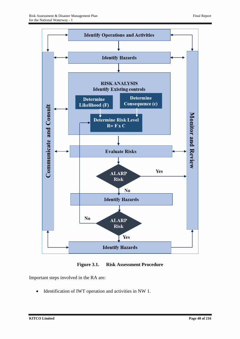
Risk Assessment & Disaster Management Plan Final Report
for the National Waterway - 1
KITCO Limited Page 48 of 216
Figure 3.1. Risk Assessment Procedure
Important steps involved in the RA are:
Identification of IWT operation and activities in NW 1.
Risk Assessment & Disaster Management Plan Final Report
for the National Waterway - 1
KITCO Limited Page 49 of 216
Hazard identification through detailed reconnaissance visit, literature review and
stakeholder interaction. The exiting waterway was analysed and the risk elements were
identified. Critical Section Analysis (CSA) was carried out to delineate the stretches
through multi criteria decision making.
Analysis of existing/proposed control /precautions in development and maintenance of
NW 1 which will reduce the risk of operation of waterway.
Probabilistic risk analysis using historical frequency analysis, probability assessment,
expert judgement to arrive at credible scenarios.
Deterministic risk analysis for damage estimation for representative worst-case
scenarios.
Prioritization of areas and resources based on the risk level and proposing risk control
or mitigation measures.
Mitigation or re-prioritization of exposure category based on risk levels to ALARP
principle.
Reassess high-risk events by preparing and for monitoring and control plans.
Monitoring and Improvement at the stage of operation, maintenance and shutdown
phases.
As per the methodology outlined in the Terms of Reference (ToR), the cumulative risk is
having the following components, four individual risks, i.e., with respect to channel, cargo,
vessel and dredging. The cumulative risk levels were determined for credible scenarios
including most probable and worst case ones. Risk abatement measures were also proposed.
The studies executed in this regard is followed.
3.2. Review of IWT Operational Activities
IWT Operation activities proposed under JMVP were reviewed critically as a preliminary step
towards initiating the RA study. The IWT operation in NW 1 include loading of cargo at
terminals, transport of cargo through waterway, unloading and storage at terminal as presented
in Figure 3.2 below.
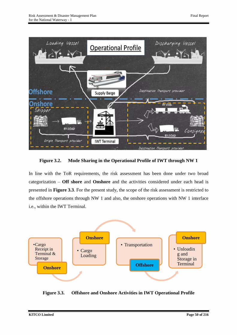
Risk Assessment & Disaster Management Plan Final Report
for the National Waterway - 1
KITCO Limited Page 50 of 216
Figure 3.2. Mode Sharing in the Operational Profile of IWT through NW 1
In line with the ToR requirements, the risk assessment has been done under two broad
categorization – Off shore and Onshore and the activities considered under each head is
presented in Figure 3.3. For the present study, the scope of the risk assessment is restricted to
the offshore operations through NW 1 and also, the onshore operations with NW 1 interface
i.e., within the IWT Terminal.
Figure 3.3. Offshore and Onshore Activities in IWT Operational Profile
•Cargo Receipt in Terminal & Storage
Onshore
• Cargo Loading
Onshore
• Transportation
Offshore
• Unloading and Storage in Terminal
Onshore
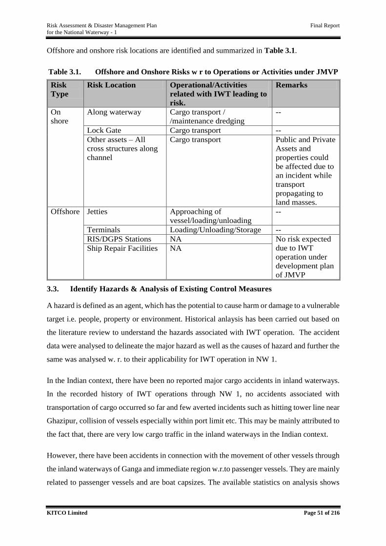
Risk Assessment & Disaster Management Plan Final Report
for the National Waterway - 1
KITCO Limited Page 51 of 216
Offshore and onshore risk locations are identified and summarized in Table 3.1.
Table 3.1. Offshore and Onshore Risks w r to Operations or Activities under JMVP
Risk
Type
Risk Location Operational/Activities
related with IWT leading to
risk.
Remarks
On
shore
Along waterway Cargo transport /
/maintenance dredging
--
Lock Gate Cargo transport --
Other assets – All
cross structures along
channel
Cargo transport Public and Private
Assets and
properties could
be affected due to
an incident while
transport
propagating to
land masses.
Offshore Jetties Approaching of
vessel/loading/unloading
--
Terminals Loading/Unloading/Storage --
RIS/DGPS Stations NA No risk expected
due to IWT
operation under
development plan
of JMVP
Ship Repair Facilities NA
3.3. Identify Hazards & Analysis of Existing Control Measures
A hazard is defined as an agent, which has the potential to cause harm or damage to a vulnerable
target i.e. people, property or environment. Historical anlaysis has been carried out based on
the literature review to understand the hazards associated with IWT operation. The accident
data were analysed to delineate the major hazard as well as the causes of hazard and further the
same was analysed w. r. to their applicability for IWT operation in NW 1.
In the Indian context, there have been no reported major cargo accidents in inland waterways.
In the recorded history of IWT operations through NW 1, no accidents associated with
transportation of cargo occurred so far and few averted incidents such as hitting tower line near
Ghazipur, collision of vessels especially within port limit etc. This may be mainly attributed to
the fact that, there are very low cargo traffic in the inland waterways in the Indian context.
However, there have been accidents in connection with the movement of other vessels through
the inland waterways of Ganga and immediate region w.r.to passenger vessels. They are mainly
related to passenger vessels and are boat capsizes. The available statistics on analysis shows
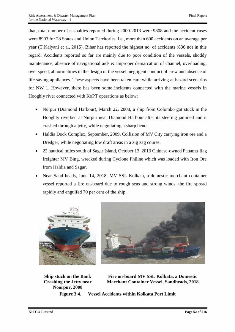
Risk Assessment & Disaster Management Plan Final Report
for the National Waterway - 1
KITCO Limited Page 52 of 216
that, total number of casualties reported during 2000-2013 were 9808 and the accident cases
were 8903 for 28 States and Union Territories. i.e., more than 600 accidents on an average per
year (T Kalyani et al, 2015). Bihar has reported the highest no. of accidents (836 no) in this
regard. Accidents reported so far are mainly due to poor condition of the vessels, shoddy
maintenance, absence of navigational aids & improper demarcation of channel, overloading,
over speed, abnormalities in the design of the vessel, negligent conduct of crew and absence of
life saving appliances. These aspects have been taken care while arriving at hazard scenarios
for NW 1. However, there has been some incidents connected with the marine vessels in
Hooghly river connected with KoPT operations as below:
Nurpur (Diamond Harbour), March 22, 2008, a ship from Colombo got stuck in the
Hooghly riverbed at Nurpur near Diamond Harbour after its steering jammed and it
crashed through a jetty, while negotiating a sharp bend.
Haldia Dock Complex, September, 2009, Collision of MV City carrying iron ore and a
Dredger, while negotiating low draft areas in a zig zag course.
22 nautical miles south of Sagar Island, October 13, 2013 Chinese-owned Panama-flag
freighter MV Bing, wrecked during Cyclone Philine which was loaded with Iron Ore
from Haldia and Sagar.
Near Sand heads, June 14, 2018, MV SSL Kolkata, a domestic merchant container
vessel reported a fire on-board due to rough seas and strong winds, the fire spread
rapidly and engulfed 70 per cent of the ship.
Ship stuck on the Bank
Crashing the Jetty near
Noorpur, 2008
Fire on-board MV SSL Kolkata, a Domestic
Merchant Container Vessel, Sandheads, 2018
Figure 3.4. Vessel Accidents within Kolkata Port Limit
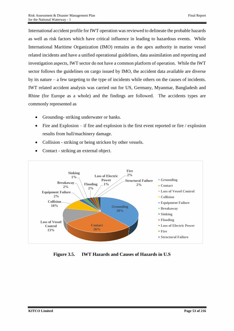
Risk Assessment & Disaster Management Plan Final Report
for the National Waterway - 1
KITCO Limited Page 53 of 216
International accident profile for IWT operation was reviewed to delineate the probable hazards
as well as risk factors which have critical influence in leading to hazardous events. While
International Maritime Organization (IMO) remains as the apex authority in marine vessel
related incidents and have a unified operational guidelines, data assimilation and reporting and
investigation aspects, IWT sector do not have a common platform of operation. While the IWT
sector follows the guidelines on cargo issued by IMO, the accident data available are diverse
by its nature – a few targeting to the type of incidents while others on the causes of incidents.
IWT related accident analysis was carried out for US, Germany, Myanmar, Bangladesh and
Rhine (for Europe as a whole) and the findings are followed. The accidents types are
commonly represented as
Grounding- striking underwater or banks.
Fire and Explosion – if fire and explosion is the first event reported or fire / explosion
results from hull/machinery damage.
Collision - striking or being stricken by other vessels.
Contact - striking an external object.
Figure 3.5. IWT Hazards and Causes of Hazards in U.S
Grounding
39%
Contact
26%
Loss of Vessel
Control
13%
Collision
10%
Equipment Failure
2%
Breakaway
2%
Sinking
1%
Flooding
2%
Loss of Electric
Power
1%
Fire
2%
Structural Failure
2%
Grounding
Contact
Loss of Vessel Control
Collision
Equipment Failure
Breakaway
Sinking
Flooding
Loss of Electric Power
Fire
Structural Failure
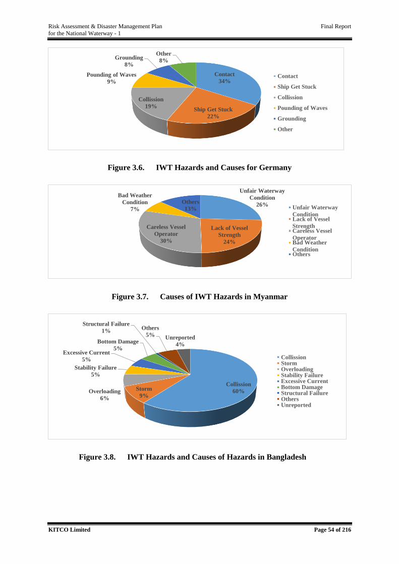
Risk Assessment & Disaster Management Plan Final Report
for the National Waterway - 1
KITCO Limited Page 54 of 216
Figure 3.6. IWT Hazards and Causes for Germany
Figure 3.7. Causes of IWT Hazards in Myanmar
Figure 3.8. IWT Hazards and Causes of Hazards in Bangladesh
Contact
34%
Ship Get Stuck
22%
Collission
19%
Pounding of Waves
9%
Grounding
8%
Other
8%
Contact
Ship Get Stuck
Collission
Pounding of Waves
Grounding
Other
Unfair Waterway
Condition
26%
Lack of Vessel
Strength
24%
Careless Vessel
Operator
30%
Bad Weather
Condition
7%
Others
13% Unfair Waterway
ConditionLack of Vessel
StrengthCareless Vessel
OperatorBad Weather
ConditionOthers
Collission
60%Storm
9%Overloading
6%
Stability Failure
5%
Excessive Current
5%
Bottom Damage
5%
Structural Failure
1%Others
5% Unreported
4%
CollissionStormOverloadingStability FailureExcessive CurrentBottom DamageStructural FailureOthersUnreported
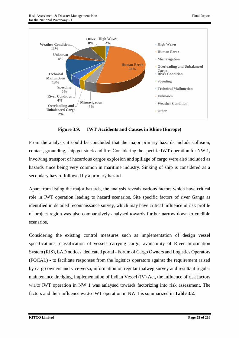
Risk Assessment & Disaster Management Plan Final Report
for the National Waterway - 1
KITCO Limited Page 55 of 216
Figure 3.9. IWT Accidents and Causes in Rhine (Europe)
From the analysis it could be concluded that the major primary hazards include collision,
contact, grounding, ship get stuck and fire. Considering the specific IWT operation for NW 1,
involving transport of hazardous cargos explosion and spillage of cargo were also included as
hazards since being very common in maritime industry. Sinking of ship is considered as a
secondary hazard followed by a primary hazard.
Apart from listing the major hazards, the analysis reveals various factors which have critical
role in IWT operation leading to hazard scenarios. Site specific factors of river Ganga as
identified in detailed reconnaissance survey, which may have critical influence in risk profile
of project region was also comparatively analysed towards further narrow down to credible
scenarios.
Considering the existing control measures such as implementation of design vessel
specifications, classification of vessels carrying cargo, availability of River Information
System (RIS), LAD notices, dedicated portal - Forum of Cargo Owners and Logistics Operators
(FOCAL) - to facilitate responses from the logistics operators against the requirement raised
by cargo owners and vice-versa, information on regular thalweg survey and resultant regular
maintenance dredging, implementation of Indian Vessel (IV) Act, the influence of risk factors
w.r.to IWT operation in NW 1 was anlaysed towards factorizing into risk assessment. The
factors and their influence w.r.to IWT operation in NW 1 is summarized in Table 3.2.
High Waves
2%
Human Error
52%
Misnavigation
4%Overloading and
Unbalanced Cargo
2%
River Condition
4%
Speeding
0%
Technical
Malfunction
13%
Unknown
4%
Weather Condition
11%
Other
8% High Waves
Human Error
Misnavigation
Overloading and Unbalanced
CargoRiver Condition
Speeding
Technical Malfunction
Unknown
Weather Condition
Other
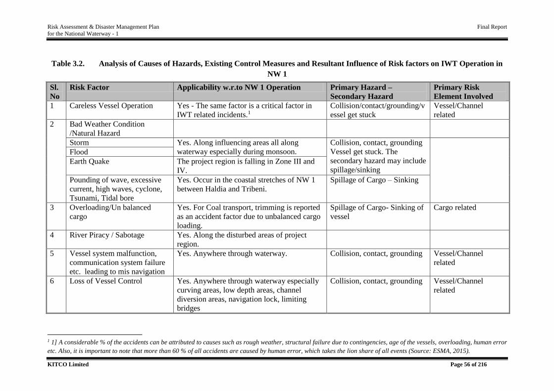
Risk Assessment & Disaster Management Plan Final Report
for the National Waterway - 1
KITCO Limited Page 56 of 216
Table 3.2. Analysis of Causes of Hazards, Existing Control Measures and Resultant Influence of Risk factors on IWT Operation in
NW 1
Sl.
No
Risk Factor Applicability w.r.to NW 1 Operation Primary Hazard –
Secondary Hazard
Primary Risk
Element Involved
1 Careless Vessel Operation Yes - The same factor is a critical factor in
IWT related incidents.1
Collision/contact/grounding/v
essel get stuck
Vessel/Channel
related
2 Bad Weather Condition
/Natural Hazard
Storm Yes. Along influencing areas all along
waterway especially during monsoon.
Collision, contact, grounding
Vessel get stuck. The
secondary hazard may include
spillage/sinking
Flood
Earth Quake The project region is falling in Zone III and
IV.
Pounding of wave, excessive
current, high waves, cyclone,
Tsunami, Tidal bore
Yes. Occur in the coastal stretches of NW 1
between Haldia and Tribeni.
Spillage of Cargo – Sinking
3 Overloading/Un balanced
cargo
Yes. For Coal transport, trimming is reported
as an accident factor due to unbalanced cargo
loading.
Spillage of Cargo- Sinking of
vessel
Cargo related
4 River Piracy / Sabotage Yes. Along the disturbed areas of project
region.
5 Vessel system malfunction,
communication system failure
etc. leading to mis navigation
Yes. Anywhere through waterway. Collision, contact, grounding Vessel/Channel
related
6 Loss of Vessel Control Yes. Anywhere through waterway especially
curving areas, low depth areas, channel
diversion areas, navigation lock, limiting
bridges
Collision, contact, grounding Vessel/Channel
related
1 1] A considerable % of the accidents can be attributed to causes such as rough weather, structural failure due to contingencies, age of the vessels, overloading, human error
etc. Also, it is important to note that more than 60 % of all accidents are caused by human error, which takes the lion share of all events (Source: ESMA, 2015).
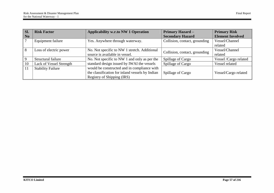
Risk Assessment & Disaster Management Plan Final Report
for the National Waterway - 1
KITCO Limited Page 57 of 216
Sl.
No
Risk Factor Applicability w.r.to NW 1 Operation Primary Hazard –
Secondary Hazard
Primary Risk
Element Involved
7 Equipment failure Yes. Anywhere through waterway. Collision, contact, grounding Vessel/Channel
related
8 Loss of electric power No. Not specific to NW 1 stretch. Additional
source is available in vessel. Collision, contact, grounding
Vessel/Channel
related
9 Structural failure No. Not specific to NW 1 and only as per the
standard design issued by IWAI the vessels
would be constructed and in compliance with
the classification for inland vessels by Indian
Registry of Shipping (IRS)
Spillage of Cargo Vessel /Cargo related
10 Lack of Vessel Strength Spillage of Cargo Vessel related
11 Stability Failure Spillage of Cargo Vessel/Cargo related
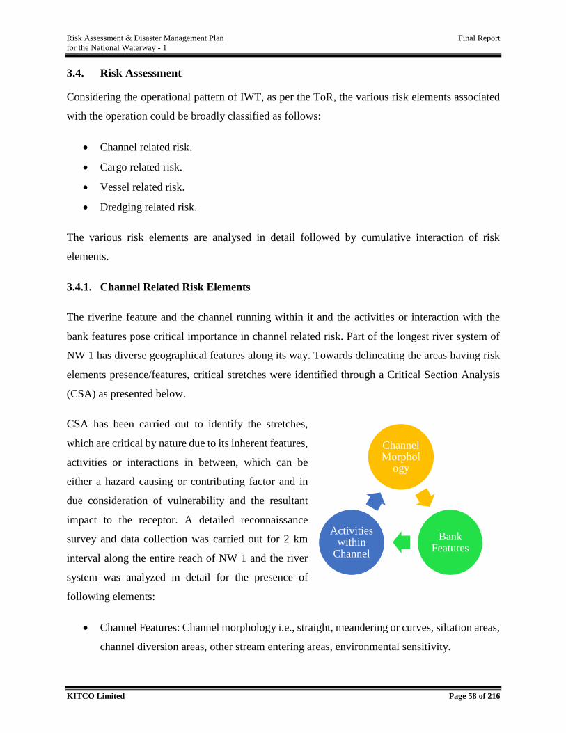
Risk Assessment & Disaster Management Plan Final Report
for the National Waterway - 1
KITCO Limited Page 58 of 216
3.4. Risk Assessment
Considering the operational pattern of IWT, as per the ToR, the various risk elements associated
with the operation could be broadly classified as follows:
Channel related risk.
Cargo related risk.
Vessel related risk.
Dredging related risk.
The various risk elements are analysed in detail followed by cumulative interaction of risk
elements.
3.4.1. Channel Related Risk Elements
The riverine feature and the channel running within it and the activities or interaction with the
bank features pose critical importance in channel related risk. Part of the longest river system of
NW 1 has diverse geographical features along its way. Towards delineating the areas having risk
elements presence/features, critical stretches were identified through a Critical Section Analysis
(CSA) as presented below.
CSA has been carried out to identify the stretches,
which are critical by nature due to its inherent features,
activities or interactions in between, which can be
either a hazard causing or contributing factor and in
due consideration of vulnerability and the resultant
impact to the receptor. A detailed reconnaissance
survey and data collection was carried out for 2 km
interval along the entire reach of NW 1 and the river
system was analyzed in detail for the presence of
following elements:
Channel Features: Channel morphology i.e., straight, meandering or curves, siltation areas,
channel diversion areas, other stream entering areas, environmental sensitivity.
Channel Morphol
ogy
Bank Features
Activities within
Channel
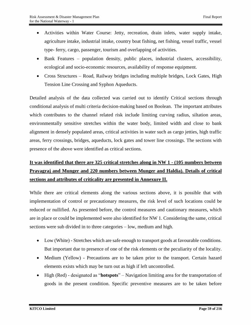
Risk Assessment & Disaster Management Plan Final Report
for the National Waterway - 1
KITCO Limited Page 59 of 216
Activities within Water Course: Jetty, recreation, drain inlets, water supply intake,
agriculture intake, industrial intake, country boat fishing, net fishing, vessel traffic, vessel
type- ferry, cargo, passenger, tourism and overlapping of activities.
Bank Features – population density, public places, industrial clusters, accessibility,
ecological and socio-economic resources, availability of response equipment.
Cross Structures – Road, Railway bridges including multiple bridges, Lock Gates, High
Tension Line Crossing and Syphon Aqueducts.
Detailed analysis of the data collected was carried out to identify Critical sections through
conditional analysis of multi criteria decision-making based on Boolean. The important attributes
which contributes to the channel related risk include limiting curving radius, siltation areas,
environmentally sensitive stretches within the water body, limited width and close to bank
alignment in densely populated areas, critical activities in water such as cargo jetties, high traffic
areas, ferry crossings, bridges, aqueducts, lock gates and tower line crossings. The sections with
presence of the above were identified as critical sections.
It was identified that there are 325 critical stretches along in NW 1 - (105 numbers between
Prayagraj and Munger and 220 numbers between Munger and Haldia). Details of critical
sections and attributes of criticality are presented in Annexure II.
While there are critical elements along the various sections above, it is possible that with
implementation of control or precautionary measures, the risk level of such locations could be
reduced or nullified. As presented before, the control measures and cautionary measures, which
are in place or could be implemented were also identified for NW 1. Considering the same, critical
sections were sub divided in to three categories – low, medium and high.
Low (White) - Stretches which are safe enough to transport goods at favourable conditions.
But important due to presence of one of the risk elements or the peculiarity of the locality.
Medium (Yellow) - Precautions are to be taken prior to the transport. Certain hazard
elements exists which may be turn out as high if left uncontrolled.
High (Red) - designated as “hotspots” – Navigation limiting area for the transportation of
goods in the present condition. Specific preventive measures are to be taken before
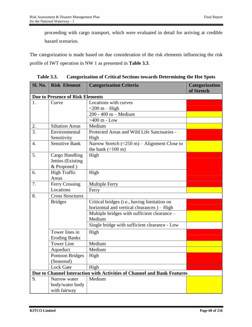
Risk Assessment & Disaster Management Plan Final Report
for the National Waterway - 1
KITCO Limited Page 60 of 216
proceeding with cargo transport, which were evaluated in detail for arriving at credible
hazard scenarios.
The categorization is made based on due consideration of the risk elements influencing the risk
profile of IWT operation in NW 1 as presented in Table 3.3.
Table 3.3. Categorization of Critical Sections towards Determining the Hot Spots
Sl. No. Risk Element Categorization Criteria Categorization
of Stretch
Due to Presence of Risk Elements
1. Curve Locations with curves
<200 m – High
200 - 400 m – Medium
>400 m - Low
2. Siltation Areas Medium
3. Environmental
Sensitivity
Protected Areas and Wild Life Sanctuaries -
High
4. Sensitive Bank Narrow Stretch (<250 m) – Alignment Close to
the bank (<100 m)
5. Cargo Handling
Jetties (Existing
& Proposed )
High
6. High Traffic
Areas
High
7. Ferry Crossing
Locations
Multiple Ferry
Ferry
8. Cross Structures
Bridges Critical bridges (i.e., having limitation on
horizontal and vertical clearances ) – High
Multiple bridges with sufficient clearance –
Medium
Single bridge with sufficient clearance - Low
Tower lines in
Eroding Banks
High
Tower Line Medium
Aqueduct Medium
Pontoon Bridges
(Seasonal)
High
Lock Gate High
Due to Channel Interaction with Activities of Channel and Bank Features
9. Narrow water
body/water body
with fairway
Medium
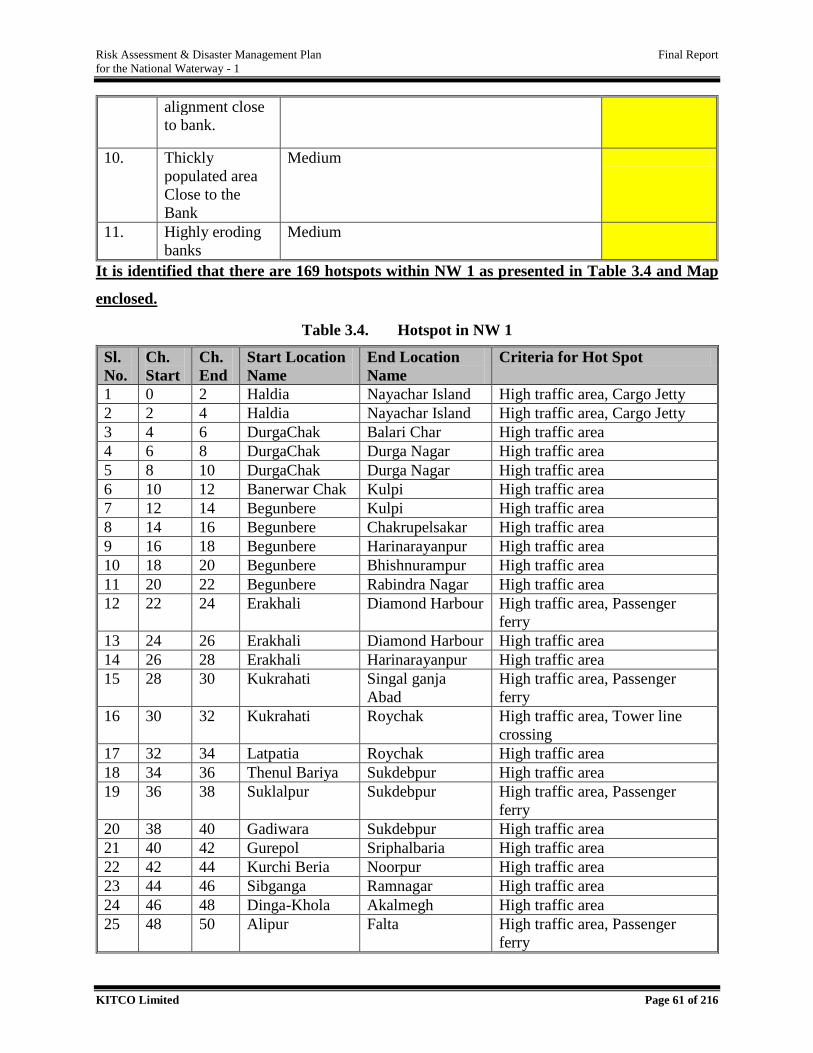
Risk Assessment & Disaster Management Plan Final Report
for the National Waterway - 1
KITCO Limited Page 61 of 216
It is identified that there are 169 hotspots within NW 1 as presented in Table 3.4 and Map
enclosed.
Table 3.4. Hotspot in NW 1
Sl.
No.
Ch.
Start
Ch.
End
Start Location
Name
End Location
Name
Criteria for Hot Spot
1 0 2 Haldia Nayachar Island High traffic area, Cargo Jetty
2 2 4 Haldia Nayachar Island High traffic area, Cargo Jetty
3 4 6 DurgaChak Balari Char High traffic area
4 6 8 DurgaChak Durga Nagar High traffic area
5 8 10 DurgaChak Durga Nagar High traffic area
6 10 12 Banerwar Chak Kulpi High traffic area
7 12 14 Begunbere Kulpi High traffic area
8 14 16 Begunbere Chakrupelsakar High traffic area
9 16 18 Begunbere Harinarayanpur High traffic area
10 18 20 Begunbere Bhishnurampur High traffic area
11 20 22 Begunbere Rabindra Nagar High traffic area
12 22 24 Erakhali Diamond Harbour High traffic area, Passenger
ferry
13 24 26 Erakhali Diamond Harbour High traffic area
14 26 28 Erakhali Harinarayanpur High traffic area
15 28 30 Kukrahati Singal ganja
Abad
High traffic area, Passenger
ferry
16 30 32 Kukrahati Roychak High traffic area, Tower line
crossing
17 32 34 Latpatia Roychak High traffic area
18 34 36 Thenul Bariya Sukdebpur High traffic area
19 36 38 Suklalpur Sukdebpur High traffic area, Passenger
ferry
20 38 40 Gadiwara Sukdebpur High traffic area
21 40 42 Gurepol Sriphalbaria High traffic area
22 42 44 Kurchi Beria Noorpur High traffic area
23 44 46 Sibganga Ramnagar High traffic area
24 46 48 Dinga-Khola Akalmegh High traffic area
25 48 50 Alipur Falta High traffic area, Passenger
ferry
alignment close
to bank.
10. Thickly
populated area
Close to the
Bank
Medium
11. Highly eroding
banks
Medium
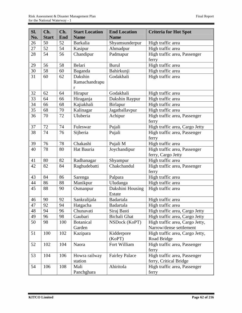
Risk Assessment & Disaster Management Plan Final Report
for the National Waterway - 1
KITCO Limited Page 62 of 216
Sl.
No.
Ch.
Start
Ch.
End
Start Location
Name
End Location
Name
Criteria for Hot Spot
26 50 52 Barkalia Shyamsunderpur High traffic area
27 52 54 Kasipur Ahmadpur High traffic area
28 54 56 Chandipur Padmapur High traffic area, Passenger
ferry
29 56 58 Belari Burul High traffic area
30 58 60 Baganda Bahirkunji High traffic area
31 60 62 Dakshin
Ramachandrapu
r
Godakhali High traffic area
32 62 64 Hirapur Godakhali High traffic area
33 64 66 Hiraganja Dakshin Raypur High traffic area
34 66 68 Kajiakhali Birlapur High traffic area
35 68 70 Kalinagar Jagatballavpur High traffic area
36 70 72 Uluberia Achipur High traffic area, Passenger
ferry
37 72 74 Fuleswar Pujali High traffic area, Cargo Jetty
38 74 76 Sijberia Pujali High traffic area, Passenger
ferry
39 76 78 Chakashi Pujali M High traffic area
40 78 80 Hat Bauria Joychandipur High traffic area, Passenger
ferry, Cargo Jetty
41 80 82 Radhanagar Shyampur High traffic area
42 82 84 Raghudebatti Chakchandul High traffic area, Passenger
ferry
43 84 86 Sarenga Palpara High traffic area
44 86 88 Manikpur Uludanga High traffic area
45 88 90 Osmanpur Dakshini Housing
Estate
High traffic area
46 90 92 Sankralijala Badartala High traffic area
47 92 94 Hatgacha Badartala High traffic area
48 94 96 Chunavati Siraj Basti High traffic area, Cargo Jetty
49 96 98 Gaubari Bichali Ghat High traffic area, Cargo Jetty
50 98 100 Botanical
Garden
NSDock (KoPT) High traffic area, Cargo Jetty,
Narrow/dense settlement
51 100 102 Kazipara Kidderpore
(KoPT)
High traffic area, Cargo Jetty,
Road Bridge
52 102 104 Naora Fort William High traffic area, Passenger
ferry
53 104 106 Howra railway
station
Fairley Palace High traffic area, Passenger
ferry, Critical Bridge
54 106 108 Mali
Panchghara
Ahiritola High traffic area, Passenger
ferry
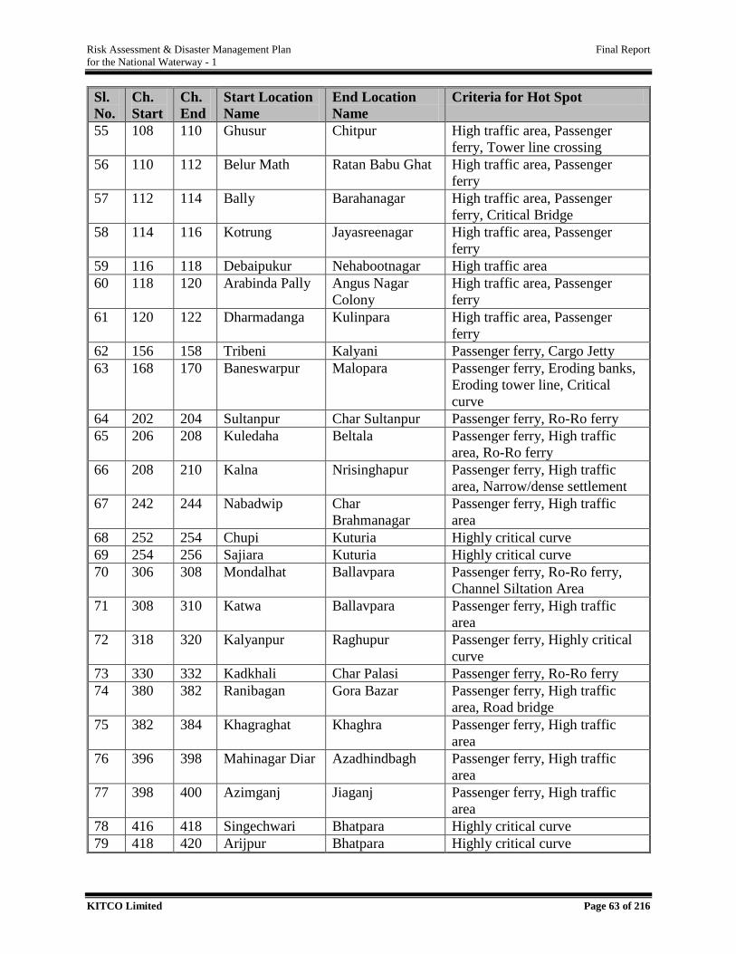
Risk Assessment & Disaster Management Plan Final Report
for the National Waterway - 1
KITCO Limited Page 63 of 216
Sl.
No.
Ch.
Start
Ch.
End
Start Location
Name
End Location
Name
Criteria for Hot Spot
55 108 110 Ghusur Chitpur High traffic area, Passenger
ferry, Tower line crossing
56 110 112 Belur Math Ratan Babu Ghat High traffic area, Passenger
ferry
57 112 114 Bally Barahanagar High traffic area, Passenger
ferry, Critical Bridge
58 114 116 Kotrung Jayasreenagar High traffic area, Passenger
ferry
59 116 118 Debaipukur Nehabootnagar High traffic area
60 118 120 Arabinda Pally Angus Nagar
Colony
High traffic area, Passenger
ferry
61 120 122 Dharmadanga Kulinpara High traffic area, Passenger
ferry
62 156 158 Tribeni Kalyani Passenger ferry, Cargo Jetty
63 168 170 Baneswarpur Malopara Passenger ferry, Eroding banks,
Eroding tower line, Critical
curve
64 202 204 Sultanpur Char Sultanpur Passenger ferry, Ro-Ro ferry
65 206 208 Kuledaha Beltala Passenger ferry, High traffic
area, Ro-Ro ferry
66 208 210 Kalna Nrisinghapur Passenger ferry, High traffic
area, Narrow/dense settlement
67 242 244 Nabadwip Char
Brahmanagar
Passenger ferry, High traffic
area
68 252 254 Chupi Kuturia Highly critical curve
69 254 256 Sajiara Kuturia Highly critical curve
70 306 308 Mondalhat Ballavpara Passenger ferry, Ro-Ro ferry,
Channel Siltation Area
71 308 310 Katwa Ballavpara Passenger ferry, High traffic
area
72 318 320 Kalyanpur Raghupur Passenger ferry, Highly critical
curve
73 330 332 Kadkhali Char Palasi Passenger ferry, Ro-Ro ferry
74 380 382 Ranibagan Gora Bazar Passenger ferry, High traffic
area, Road bridge
75 382 384 Khagraghat Khaghra Passenger ferry, High traffic
area
76 396 398 Mahinagar Diar Azadhindbagh Passenger ferry, High traffic
area
77 398 400 Azimganj Jiaganj Passenger ferry, High traffic
area
78 416 418 Singechwari Bhatpara Highly critical curve
79 418 420 Arijpur Bhatpara Highly critical curve
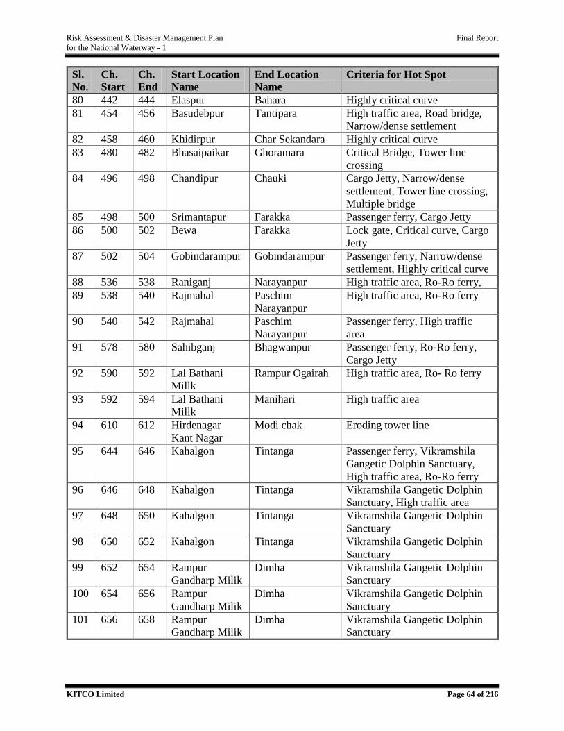
Risk Assessment & Disaster Management Plan Final Report
for the National Waterway - 1
KITCO Limited Page 64 of 216
Sl.
No.
Ch.
Start
Ch.
End
Start Location
Name
End Location
Name
Criteria for Hot Spot
80 442 444 Elaspur Bahara Highly critical curve
81 454 456 Basudebpur Tantipara High traffic area, Road bridge,
Narrow/dense settlement
82 458 460 Khidirpur Char Sekandara Highly critical curve
83 480 482 Bhasaipaikar Ghoramara Critical Bridge, Tower line
crossing
84 496 498 Chandipur Chauki Cargo Jetty, Narrow/dense
settlement, Tower line crossing,
Multiple bridge
85 498 500 Srimantapur Farakka Passenger ferry, Cargo Jetty
86 500 502 Bewa Farakka Lock gate, Critical curve, Cargo
Jetty
87 502 504 Gobindarampur Gobindarampur Passenger ferry, Narrow/dense
settlement, Highly critical curve
88 536 538 Raniganj Narayanpur High traffic area, Ro-Ro ferry,
89 538 540 Rajmahal Paschim
Narayanpur
High traffic area, Ro-Ro ferry
90 540 542 Rajmahal Paschim
Narayanpur
Passenger ferry, High traffic
area
91 578 580 Sahibganj Bhagwanpur Passenger ferry, Ro-Ro ferry,
Cargo Jetty
92 590 592 Lal Bathani
Millk
Rampur Ogairah High traffic area, Ro- Ro ferry
93 592 594 Lal Bathani
Millk
Manihari High traffic area
94 610 612 Hirdenagar
Kant Nagar
Modi chak Eroding tower line
95 644 646 Kahalgon Tintanga Passenger ferry, Vikramshila
Gangetic Dolphin Sanctuary,
High traffic area, Ro-Ro ferry
96 646 648 Kahalgon Tintanga Vikramshila Gangetic Dolphin
Sanctuary, High traffic area
97 648 650 Kahalgon Tintanga Vikramshila Gangetic Dolphin
Sanctuary
98 650 652 Kahalgon Tintanga Vikramshila Gangetic Dolphin
Sanctuary
99 652 654 Rampur
Gandharp Milik
Dimha Vikramshila Gangetic Dolphin
Sanctuary
100 654 656 Rampur
Gandharp Milik
Dimha Vikramshila Gangetic Dolphin
Sanctuary
101 656 658 Rampur
Gandharp Milik
Dimha Vikramshila Gangetic Dolphin
Sanctuary
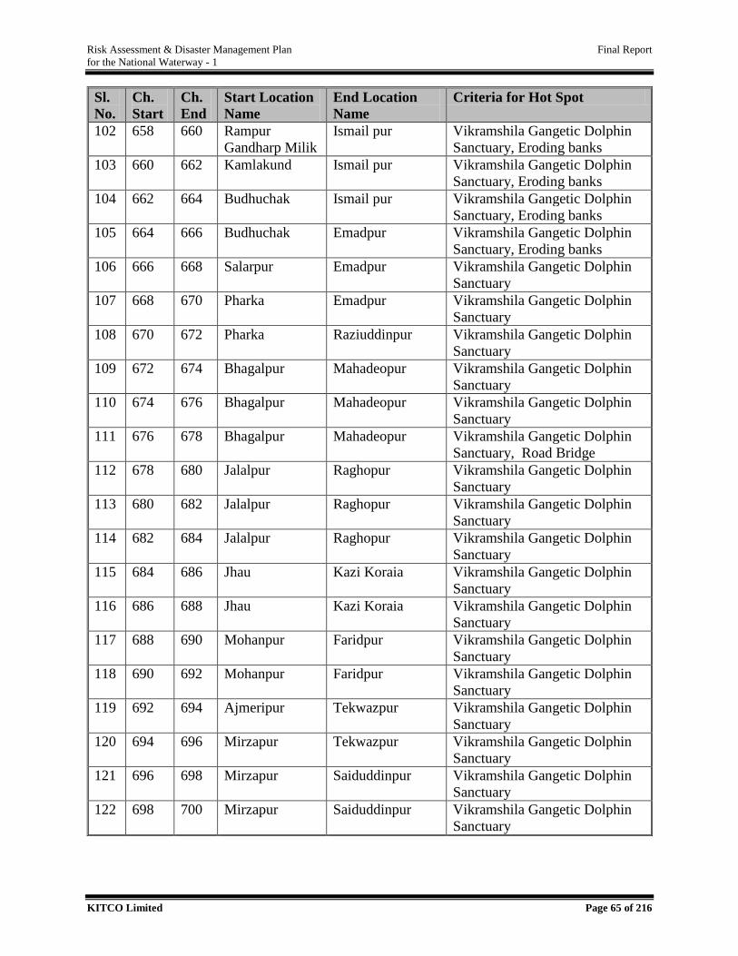
Risk Assessment & Disaster Management Plan Final Report
for the National Waterway - 1
KITCO Limited Page 65 of 216
Sl.
No.
Ch.
Start
Ch.
End
Start Location
Name
End Location
Name
Criteria for Hot Spot
102 658 660 Rampur
Gandharp Milik
Ismail pur Vikramshila Gangetic Dolphin
Sanctuary, Eroding banks
103 660 662 Kamlakund Ismail pur Vikramshila Gangetic Dolphin
Sanctuary, Eroding banks
104 662 664 Budhuchak Ismail pur Vikramshila Gangetic Dolphin
Sanctuary, Eroding banks
105 664 666 Budhuchak Emadpur Vikramshila Gangetic Dolphin
Sanctuary, Eroding banks
106 666 668 Salarpur Emadpur Vikramshila Gangetic Dolphin
Sanctuary
107 668 670 Pharka Emadpur Vikramshila Gangetic Dolphin
Sanctuary
108 670 672 Pharka Raziuddinpur Vikramshila Gangetic Dolphin
Sanctuary
109 672 674 Bhagalpur Mahadeopur Vikramshila Gangetic Dolphin
Sanctuary
110 674 676 Bhagalpur Mahadeopur Vikramshila Gangetic Dolphin
Sanctuary
111 676 678 Bhagalpur Mahadeopur Vikramshila Gangetic Dolphin
Sanctuary, Road Bridge
112 678 680 Jalalpur Raghopur Vikramshila Gangetic Dolphin
Sanctuary
113 680 682 Jalalpur Raghopur Vikramshila Gangetic Dolphin
Sanctuary
114 682 684 Jalalpur Raghopur Vikramshila Gangetic Dolphin
Sanctuary
115 684 686 Jhau Kazi Koraia Vikramshila Gangetic Dolphin
Sanctuary
116 686 688 Jhau Kazi Koraia Vikramshila Gangetic Dolphin
Sanctuary
117 688 690 Mohanpur Faridpur Vikramshila Gangetic Dolphin
Sanctuary
118 690 692 Mohanpur Faridpur Vikramshila Gangetic Dolphin
Sanctuary
119 692 694 Ajmeripur Tekwazpur Vikramshila Gangetic Dolphin
Sanctuary
120 694 696 Mirzapur Tekwazpur Vikramshila Gangetic Dolphin
Sanctuary
121 696 698 Mirzapur Saiduddinpur Vikramshila Gangetic Dolphin
Sanctuary
122 698 700 Mirzapur Saiduddinpur Vikramshila Gangetic Dolphin
Sanctuary
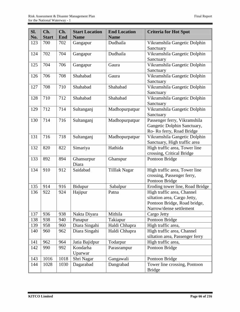
Risk Assessment & Disaster Management Plan Final Report
for the National Waterway - 1
KITCO Limited Page 66 of 216
Sl.
No.
Ch.
Start
Ch.
End
Start Location
Name
End Location
Name
Criteria for Hot Spot
123 700 702 Gangapur Dudhaila Vikramshila Gangetic Dolphin
Sanctuary
124 702 704 Gangapur Dudhaila Vikramshila Gangetic Dolphin
Sanctuary
125 704 706 Gangapur Gaura Vikramshila Gangetic Dolphin
Sanctuary
126 706 708 Shahabad Gaura Vikramshila Gangetic Dolphin
Sanctuary
127 708 710 Shahabad Shahabad Vikramshila Gangetic Dolphin
Sanctuary
128 710 712 Shahabad Shahabad Vikramshila Gangetic Dolphin
Sanctuary
129 712 714 Sultanganj Madhopurpatpar Vikramshila Gangetic Dolphin
Sanctuary
130 714 716 Sultanganj Madhopurpatpar Passenger ferry, Vikramshila
Gangetic Dolphin Sanctuary,
Ro- Ro ferry, Road Bridge
131 716 718 Sultanganj Madhopurpatpar Vikramshila Gangetic Dolphin
Sanctuary, High traffic area
132 820 822 Simariya Hathida High traffic area, Tower line
crossing, Critical Bridge
133 892 894 Ghansurpur
Diara
Ghanspur Pontoon Bridge
134 910 912 Saidabad Tilllak Nagar High traffic area, Tower line
crossing, Passenger ferry,
Pontoon Bridge
135 914 916 Bidupur Sabalpur Eroding tower line, Road Bridge
136 922 924 Hajipur Patna High traffic area, Channel
siltation area, Cargo Jetty,
Pontoon Bridge, Road bridge,
Narrow/dense settlement
137 936 938 Nakta Diyara Mithila Cargo Jetty
138 938 940 Panapur Takiapur Pontoon Bridge
139 958 960 Diara Singahi Haldi Chhapra High traffic area,
140 960 962 Diara Singahi Haldi Chhapra High traffic area, Channel
siltation area, Passenger ferry
141 962 964 Jatia Bajidpur Todarpur High traffic area,
142 990 992 Kondarha
Uparwar
Parasrampur Pontoon Bridge
143 1016 1018 Shri Nagar Gangawali Pontoon Bridge
144 1028 1030 Dagarabad Dangrabad Tower line crossing, Pontoon
Bridge
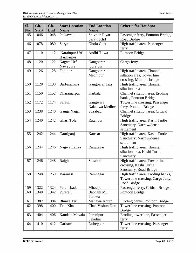
Risk Assessment & Disaster Management Plan Final Report
for the National Waterway - 1
KITCO Limited Page 67 of 216
Sl.
No.
Ch.
Start
Ch.
End
Start Location
Name
End Location
Name
Criteria for Hot Spot
145 1046 1048 Paikawali Shivpur Diyar
Saraju Khd
Passenger ferry, Pontoon Bridge,
Road Bridge
146 1078 1080 Sarya Ghola Ghat High traffic area, Passenger
ferry
147 1110 1112 Narainpur Urf
Hariharpur
Andhi Tilwa Pontoon Bridge
148 1120 1122 Nagwa Urf
Nawapura
Gangbarar
juvrajpur
Cargo Jetty
149 1126 1128 Foolpur Gangbarar
Mednipur
High traffic area, Channel
siltation area, Tower line
crossing, Multiple bridge
150 1128 1130 Barbarahana Gangbarar Tari High traffic area, Channel
siltation area
151 1150 1152 Dharamarpur Karbala Channel siltation area, Eroding
banks, Pontoon Bridge
152 1172 1174 Sarauli Gangwara
Nakanwa Medhw
Tower line crossing, Passenger
ferry, Pontoon Bridge
153 1238 1240 Ganga Nagar Suzabad Channel siltation area, Critical
Bridge
154 1240 1242 Ghasi Tola Ratanpur High traffic area, Kashi Turtle
Sanctuary, Narrow/dense
settlement
155 1242 1244 Gauriganj Katesar High traffic area, Kashi Turtle
Sanctuary, Narrow/dense
settlement
156 1244 1246 Nagwa Lanka Ramnagar High traffic area, Channel
siltation area, Kashi Turtle
Sanctuary
157 1246 1248 Rajghat Susabad High traffic area, Tower line
crossing, Kashi Turtle
Sanctuary, Road Bridge
158 1248 1250 Varanasi Ramnagar High traffic area, Eroding banks,
Tower line crossing, Cargo Jetty,
Road Bridge
159 1322 1324 Puranebada Mirzapur Passenger ferry, Critical Bridge
160 1340 1342 Pureraji Babhani Mu.
Parawa
Pontoon Bridge
161 1382 1384 Bhurra Tari Mahewa Khurd Eroding banks, Pontoon Bridge
162 1398 1400 Tela Khas Chak Vishun Dutt Tower line crossing, Pontoon
Bridge
163 1404 1406 Kandala Mavaia Paranipur
Uparhar
Eroding tower line, Passenger
ferry
164 1410 1412 Garhawa Dubeypur Tower line crossing, Passenger
ferry
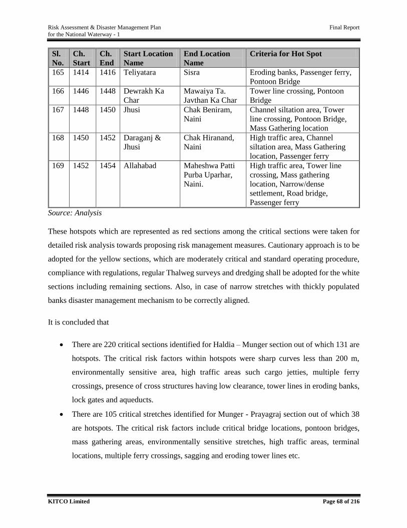
Risk Assessment & Disaster Management Plan Final Report
for the National Waterway - 1
KITCO Limited Page 68 of 216
Sl.
No.
Ch.
Start
Ch.
End
Start Location
Name
End Location
Name
Criteria for Hot Spot
165 1414 1416 Teliyatara Sisra Eroding banks, Passenger ferry,
Pontoon Bridge
166 1446 1448 Dewrakh Ka
Char
Mawaiya Ta.
Javthan Ka Char
Tower line crossing, Pontoon
Bridge
167 1448 1450 Jhusi Chak Beniram,
Naini
Channel siltation area, Tower
line crossing, Pontoon Bridge,
Mass Gathering location
168 1450 1452 Daraganj &
Jhusi
Chak Hiranand,
Naini
High traffic area, Channel
siltation area, Mass Gathering
location, Passenger ferry
169 1452 1454 Allahabad Maheshwa Patti
Purba Uparhar,
Naini.
High traffic area, Tower line
crossing, Mass gathering
location, Narrow/dense
settlement, Road bridge,
Passenger ferry
Source: Analysis
These hotspots which are represented as red sections among the critical sections were taken for
detailed risk analysis towards proposing risk management measures. Cautionary approach is to be
adopted for the yellow sections, which are moderately critical and standard operating procedure,
compliance with regulations, regular Thalweg surveys and dredging shall be adopted for the white
sections including remaining sections. Also, in case of narrow stretches with thickly populated
banks disaster management mechanism to be correctly aligned.
It is concluded that
There are 220 critical sections identified for Haldia – Munger section out of which 131 are
hotspots. The critical risk factors within hotspots were sharp curves less than 200 m,
environmentally sensitive area, high traffic areas such cargo jetties, multiple ferry
crossings, presence of cross structures having low clearance, tower lines in eroding banks,
lock gates and aqueducts.
There are 105 critical stretches identified for Munger - Prayagraj section out of which 38
are hotspots. The critical risk factors include critical bridge locations, pontoon bridges,
mass gathering areas, environmentally sensitive stretches, high traffic areas, terminal
locations, multiple ferry crossings, sagging and eroding tower lines etc.
Risk Assessment & Disaster Management Plan Final Report
for the National Waterway - 1
KITCO Limited Page 69 of 216
Out of the total 169 hotspots identified, 87 are falling within the state of West Bengal alone
and rest 82 hotspot segments are falling under Jharkhand, Bihar and Uttar Pradesh.
3.4.2. Cargo Related Risk Elements
Cargo related risk in IWT operation are due to
Intrinsic properties
Inter-compatibility of various chemicals/ interaction with the medium – air/water
Interaction with other activates – terminal operation/ vessel operation such as loading or
unloading.
Towards delineating the cargo related risk, the listed cargos were anlyased in detail to understand
the properties above which may turn in to a disaster. International Maritime Dangerous Goods
Code (IMDG) and International Maritime Solid Bulk Cargo (IMSBC) are the accepted
international guideline for safe transportation or shipment which is followed for the IWT sector
too. IMDG Code list out the Hazardous cargoes - those substance when mishandled will pose
damage to people, property and environment because of their intrinsic properties such as
flammability, corrosivity, reactivity and toxicity which are defined as below.
Flammability - It is the ease with which a material ignites either naturally or through the
presence of an ignition source. Flammable liquids are characterized by low boiling and
flash point. Other flammable materials may catch fire spontaneously in contact with air or
due to friction. In the fire event, a hazardous substance causes release of heat, solid particles
and toxic gases.
Corrosivity - It is the property of the chemical by which it destroy or irreversibly damage
another surface or substance with which they come into contact including both living
tissues skin, eyes, lungs and such as response equipment other cargos or packaging.
Toxicity - Toxic chemicals are those chemicals that cause death or injury to the living
organisms if inhaled, ingested or absorbed through the skin at low levels. It is often
represented by the risk of a particular concentration to human health or the environment.
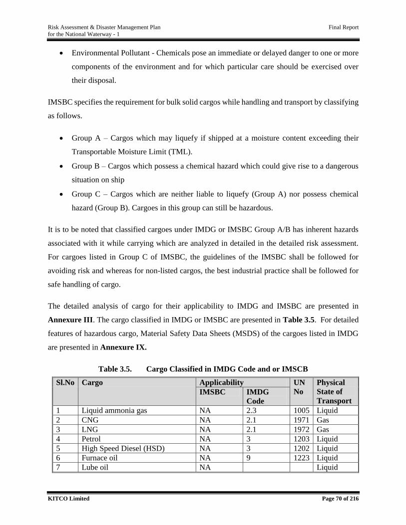
Risk Assessment & Disaster Management Plan Final Report
for the National Waterway - 1
KITCO Limited Page 70 of 216
Environmental Pollutant - Chemicals pose an immediate or delayed danger to one or more
components of the environment and for which particular care should be exercised over
their disposal.
IMSBC specifies the requirement for bulk solid cargos while handling and transport by classifying
as follows.
Group A – Cargos which may liquefy if shipped at a moisture content exceeding their
Transportable Moisture Limit (TML).
Group B – Cargos which possess a chemical hazard which could give rise to a dangerous
situation on ship
Group C – Cargos which are neither liable to liquefy (Group A) nor possess chemical
hazard (Group B). Cargoes in this group can still be hazardous.
It is to be noted that classified cargoes under IMDG or IMSBC Group A/B has inherent hazards
associated with it while carrying which are analyzed in detailed in the detailed risk assessment.
For cargoes listed in Group C of IMSBC, the guidelines of the IMSBC shall be followed for
avoiding risk and whereas for non-listed cargos, the best industrial practice shall be followed for
safe handling of cargo.
The detailed analysis of cargo for their applicability to IMDG and IMSBC are presented in
Annexure III. The cargo classified in IMDG or IMSBC are presented in Table 3.5. For detailed
features of hazardous cargo, Material Safety Data Sheets (MSDS) of the cargoes listed in IMDG
are presented in Annexure IX.
Table 3.5. Cargo Classified in IMDG Code and or IMSCB
Sl.No Cargo Applicability UN
No
Physical
State of
Transport IMSBC IMDG
Code
1 Liquid ammonia gas NA 2.3 1005 Liquid
2 CNG NA 2.1 1971 Gas
3 LNG NA 2.1 1972 Gas
4 Petrol NA 3 1203 Liquid
5 High Speed Diesel (HSD) NA 3 1202 Liquid
6 Furnace oil NA 9 1223 Liquid
7 Lube oil NA Liquid
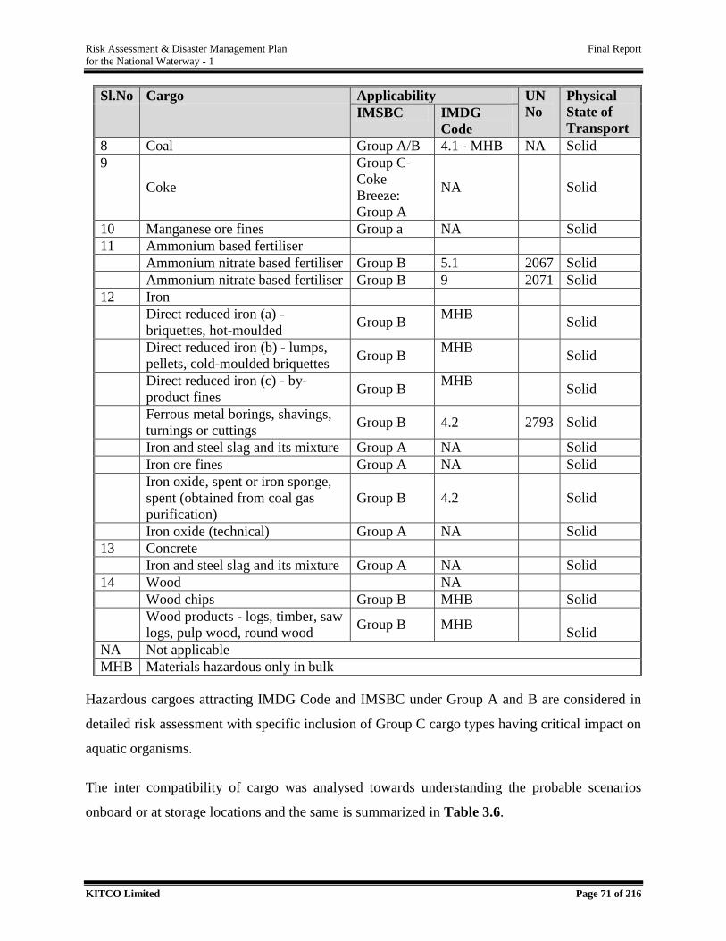
Risk Assessment & Disaster Management Plan Final Report
for the National Waterway - 1
KITCO Limited Page 71 of 216
Sl.No Cargo Applicability UN
No
Physical
State of
Transport IMSBC IMDG
Code
8 Coal Group A/B 4.1 - MHB NA Solid
9
Coke
Group C-
Coke
Breeze:
Group A
NA Solid
10 Manganese ore fines Group a NA Solid
11 Ammonium based fertiliser
Ammonium nitrate based fertiliser Group B 5.1 2067 Solid
Ammonium nitrate based fertiliser Group B 9 2071 Solid
12 Iron
Direct reduced iron (a) -
briquettes, hot-moulded Group B
MHB Solid
Direct reduced iron (b) - lumps,
pellets, cold-moulded briquettes Group B
MHB Solid
Direct reduced iron (c) - by-
product fines Group B
MHB Solid
Ferrous metal borings, shavings,
turnings or cuttings Group B 4.2 2793 Solid
Iron and steel slag and its mixture Group A NA Solid
Iron ore fines Group A NA Solid
Iron oxide, spent or iron sponge,
spent (obtained from coal gas
purification)
Group B 4.2 Solid
Iron oxide (technical) Group A NA Solid
13 Concrete
Iron and steel slag and its mixture Group A NA Solid
14 Wood NA
Wood chips Group B MHB Solid
Wood products - logs, timber, saw
logs, pulp wood, round wood Group B MHB
Solid
NA Not applicable
MHB Materials hazardous only in bulk
Hazardous cargoes attracting IMDG Code and IMSBC under Group A and B are considered in
detailed risk assessment with specific inclusion of Group C cargo types having critical impact on
aquatic organisms.
The inter compatibility of cargo was analysed towards understanding the probable scenarios
onboard or at storage locations and the same is summarized in Table 3.6.

Risk Assessment & Disaster Management Plan Final Report
for the National Waterway - 1
KITCO Limited Page 72 of 216
A cargo related incident can trigger various hazard scenarios such as spillage of cargo, fire or
explosion. The primary release of cargo may trigger toxic cloud in air and on interaction with water
lead to toxic contamination. Hence, cargo properties and immediate consequence were analysed
and summarized in Table 3.7 and the same were duly considered in identifying credible scenarios.
The response of individual chemicals on release is presented in Annexure VI.
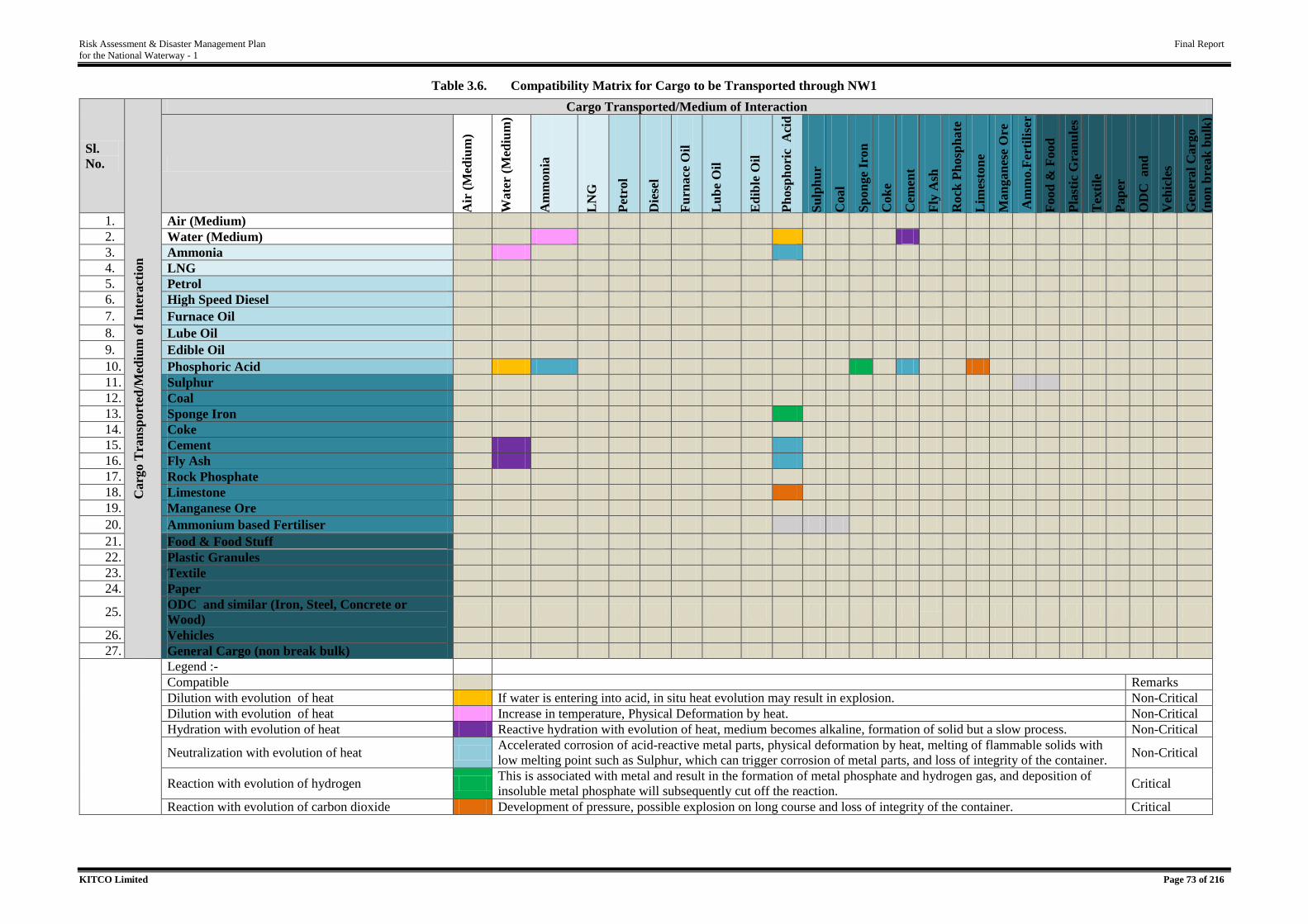
Risk Assessment & Disaster Management Plan Final Report
for the National Waterway - 1
KITCO Limited Page 73 of 216
Table 3.6. Compatibility Matrix for Cargo to be Transported through NW1
Sl.
No.
Carg
o T
ran
sport
ed/M
ed
ium
of
Inte
ract
ion
Cargo Transported/Medium of Interaction
Air
(M
ediu
m)
Wate
r (M
ediu
m)
Am
mon
ia
LN
G
Pet
rol
Die
sel
Fu
rnace
Oil
Lu
be
Oil
Ed
ible
Oil
Ph
osp
hori
c A
cid
Su
lph
ur
Coal
Sp
on
ge
Iron
Cok
e
Cem
ent
Fly
Ash
Rock
Ph
osp
hate
Lim
esto
ne
Man
gan
ese
Ore
Am
mo.F
ert
ilis
er
Food
& F
ood
Stu
ff
Pla
stic
Gra
nu
les
Tex
tile
Pap
er
OD
C an
d
sim
ilar
V
ehic
les
Gen
eral
Carg
o
(non
bre
ak
bu
lk)
1. Air (Medium)
2. Water (Medium)
3. Ammonia
4. LNG
5. Petrol
6. High Speed Diesel
7. Furnace Oil
8. Lube Oil
9. Edible Oil
10. Phosphoric Acid
11. Sulphur
12. Coal
13. Sponge Iron
14. Coke
15. Cement
16. Fly Ash
17. Rock Phosphate
18. Limestone
19. Manganese Ore
20. Ammonium based Fertiliser
21. Food & Food Stuff
22. Plastic Granules
23. Textile
24. Paper
25. ODC and similar (Iron, Steel, Concrete or
Wood)
26. Vehicles
27. General Cargo (non break bulk)
Legend :-
Compatible Remarks
Dilution with evolution of heat If water is entering into acid, in situ heat evolution may result in explosion. Non-Critical
Dilution with evolution of heat Increase in temperature, Physical Deformation by heat. Non-Critical
Hydration with evolution of heat Reactive hydration with evolution of heat, medium becomes alkaline, formation of solid but a slow process. Non-Critical
Neutralization with evolution of heat Accelerated corrosion of acid-reactive metal parts, physical deformation by heat, melting of flammable solids with
low melting point such as Sulphur, which can trigger corrosion of metal parts, and loss of integrity of the container. Non-Critical
Reaction with evolution of hydrogen This is associated with metal and result in the formation of metal phosphate and hydrogen gas, and deposition of
insoluble metal phosphate will subsequently cut off the reaction. Critical
Reaction with evolution of carbon dioxide Development of pressure, possible explosion on long course and loss of integrity of the container. Critical
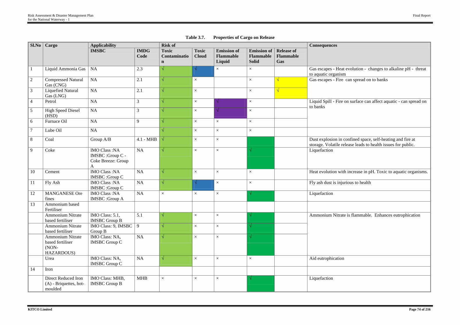
Risk Assessment & Disaster Management Plan Final Report
for the National Waterway - 1
KITCO Limited Page 74 of 216
Table 3.7. Properties of Cargo on Release
Sl.No Cargo Applicability Risk of Consequences
IMSBC IMDG
Code
Toxic
Contaminatio
n
Toxic
Cloud
Emission of
Flammable
Liquid
Emission of
Flammable
Solid
Release of
Flammable
Gas
1 Liquid Ammonia Gas NA 2.3 √ √ × × Gas escapes - Heat evolution - changes to alkaline pH - threat
to aquatic organism
2 Compressed Natural
Gas (CNG)
NA 2.1 √ × × √ Gas escapes - Fire can spread on to banks
3 Liquefied Natural
Gas (LNG)
NA 2.1 √ × × √
4 Petrol NA 3 √ × √ × Liquid Spill - Fire on surface can affect aquatic - can spread on
to banks 5 High Speed Diesel
(HSD)
NA 3 √ × √ ×
6 Furnace Oil NA 9 √ × × ×
7 Lube Oil NA √ × × ×
8 Coal Group A/B 4.1 - MHB √ × × Dust explosion in confined space, self-heating and fire at
storage. Volatile release leads to health issues for public.
9 Coke IMO Class :NA
IMSBC :Group C -
Coke Breeze: Group
A
NA √ × × √ Liquefaction
10 Cement IMO Class :NA
IMSBC :Group C
NA √ × × × Heat evolution with increase in pH. Toxic to aquatic organisms.
11 Fly Ash IMO Class :NA
IMSBC :Group C
NA √ √ × × Fly ash dust is injurious to health
12 MANGANESE Ore
fines
IMO Class :NA
IMSBC :Group A
NA × × × √ Liquefaction
13 Ammonium based
Fertiliser
Ammonium Nitrate
based fertiliser
IMO Class: 5.1,
IMSBC Group B
5.1 √ × × √ Ammonium Nitrate is flammable. Enhances eutrophication
Ammonium Nitrate
based fertiliser
IMO Class: 9, IMSBC
Group B
9 √ × × √
Ammonium Nitrate
based fertiliser
(NON-
HAZARDOUS)
IMO Class: NA,
IMSBC Group C
NA √ × × √
Urea IMO Class: NA,
IMSBC Group C
NA √ × × × Aid eutrophication
14 Iron
Direct Reduced Iron
(A) - Briquettes, hot-
moulded
IMO Class: MHB,
IMSBC Group B
MHB × × × √ Liquefaction
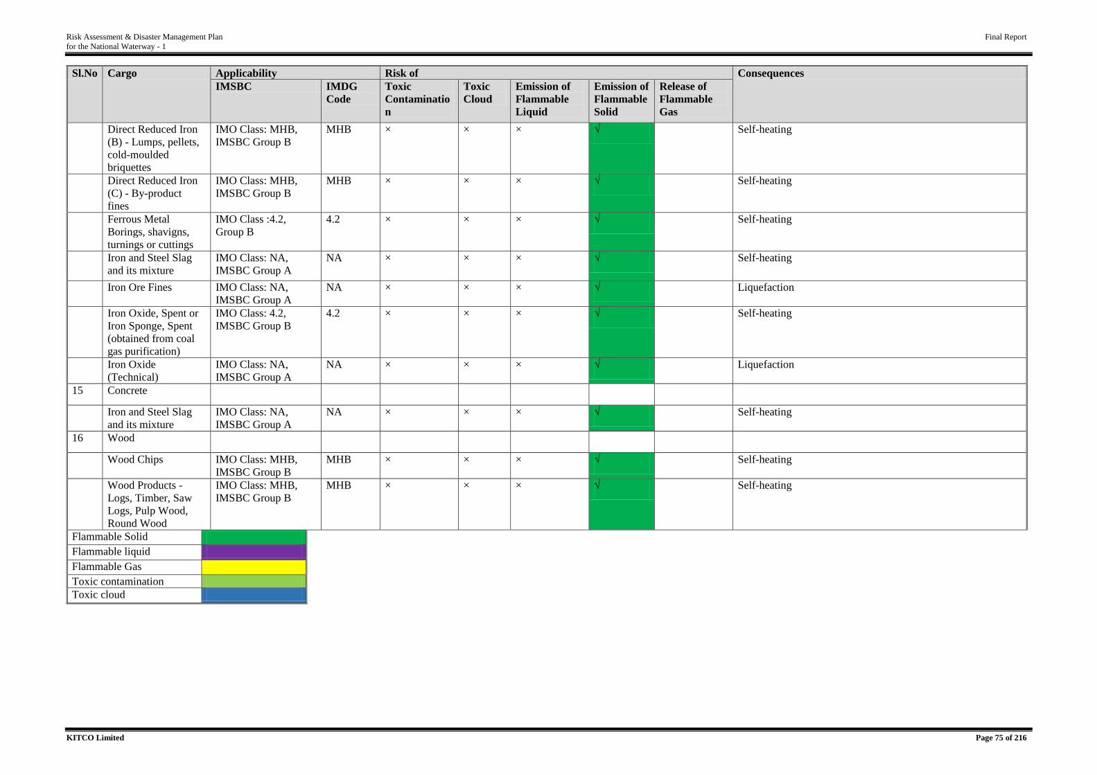
Risk Assessment & Disaster Management Plan Final Report
for the National Waterway - 1
KITCO Limited Page 75 of 216
Sl.No Cargo Applicability Risk of Consequences
IMSBC IMDG
Code
Toxic
Contaminatio
n
Toxic
Cloud
Emission of
Flammable
Liquid
Emission of
Flammable
Solid
Release of
Flammable
Gas
Direct Reduced Iron
(B) - Lumps, pellets,
cold-moulded
briquettes
IMO Class: MHB,
IMSBC Group B
MHB × × × √ Self-heating
Direct Reduced Iron
(C) - By-product
fines
IMO Class: MHB,
IMSBC Group B
MHB × × × √ Self-heating
Ferrous Metal
Borings, shavigns,
turnings or cuttings
IMO Class :4.2,
Group B
4.2 × × × √ Self-heating
Iron and Steel Slag
and its mixture
IMO Class: NA,
IMSBC Group A
NA × × × √ Self-heating
Iron Ore Fines IMO Class: NA,
IMSBC Group A
NA × × × √ Liquefaction
Iron Oxide, Spent or
Iron Sponge, Spent
(obtained from coal
gas purification)
IMO Class: 4.2,
IMSBC Group B
4.2 × × × √ Self-heating
Iron Oxide
(Technical)
IMO Class: NA,
IMSBC Group A
NA × × × √ Liquefaction
15 Concrete
Iron and Steel Slag
and its mixture
IMO Class: NA,
IMSBC Group A
NA × × × √ Self-heating
16 Wood
Wood Chips IMO Class: MHB,
IMSBC Group B
MHB × × × √ Self-heating
Wood Products -
Logs, Timber, Saw
Logs, Pulp Wood,
Round Wood
IMO Class: MHB,
IMSBC Group B
MHB × × × √ Self-heating
Flammable Solid
Flammable liquid
Flammable Gas
Toxic contamination
Toxic cloud
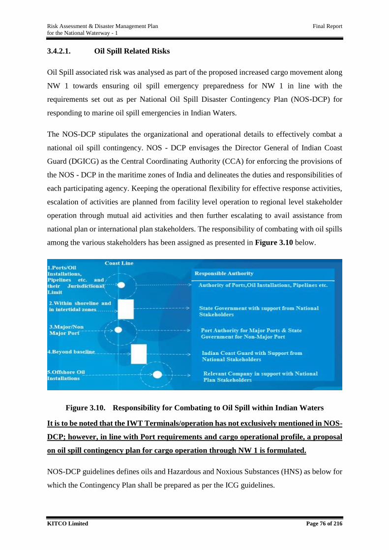
Risk Assessment & Disaster Management Plan Final Report
for the National Waterway - 1
KITCO Limited Page 76 of 216
3.4.2.1. Oil Spill Related Risks
Oil Spill associated risk was analysed as part of the proposed increased cargo movement along
NW 1 towards ensuring oil spill emergency preparedness for NW 1 in line with the
requirements set out as per National Oil Spill Disaster Contingency Plan (NOS-DCP) for
responding to marine oil spill emergencies in Indian Waters.
The NOS-DCP stipulates the organizational and operational details to effectively combat a
national oil spill contingency. NOS - DCP envisages the Director General of Indian Coast
Guard (DGICG) as the Central Coordinating Authority (CCA) for enforcing the provisions of
the NOS - DCP in the maritime zones of India and delineates the duties and responsibilities of
each participating agency. Keeping the operational flexibility for effective response activities,
escalation of activities are planned from facility level operation to regional level stakeholder
operation through mutual aid activities and then further escalating to avail assistance from
national plan or international plan stakeholders. The responsibility of combating with oil spills
among the various stakeholders has been assigned as presented in Figure 3.10 below.
Figure 3.10. Responsibility for Combating to Oil Spill within Indian Waters
It is to be noted that the IWT Terminals/operation has not exclusively mentioned in NOS-
DCP; however, in line with Port requirements and cargo operational profile, a proposal
on oil spill contingency plan for cargo operation through NW 1 is formulated.
NOS-DCP guidelines defines oils and Hazardous and Noxious Substances (HNS) as below for
which the Contingency Plan shall be prepared as per the ICG guidelines.
Risk Assessment & Disaster Management Plan Final Report
for the National Waterway - 1
KITCO Limited Page 77 of 216
“Oil” means petroleum in any form including crude oil, fuel oil, sludge, oil refuse and
refined products, other than petrochemicals subject to the provisions of Annex II of
MARPOL 73/78 and includes the substances listed in Appendix I to Annex I of
MARPOL 73/78 as amended.
“Hazardous and Noxious Substance” as defined in the IMO OPRC-HNS Protocol
means any substance other than oil which, if introduced into the marine environment is
likely to create hazards to human health, harm living resources and marine life, damage
amenities or interfere with other legitimate uses of the sea.
When oil is spilled, it undergoes a number of physical and chemical changes, some of which
lead to its removal from the sea surface, while others cause it to persist. Higher molecular
fraction of oil products are persistent since considerable portion of heavy fractions of high
boiling material which remain after spillage. While non-persistent oils are generally of a
volatile nature and are composed of lighter hydrocarbon factions which tend to dissipate rapidly
through evaporation.
Considering the fate of spilled oil, distinction is frequently made between non persistent oils
which tend to disappear rapidly from water surface and persistent oils which in contrast
dissipate more slowly and usually require a clean-up response.
The detailed list of cargo proposed to be handled through NW 1 was reviewed for their
applicability w.r.to the provision of MARPOL 73/78 and IMO OPRC-HNS towards its
applicability with NOS-DCP guidelines. For the oil classified, persistency of the oil was
analysed as it is critical in planning the response operation requirement and also for ensuring
that appropriate equipments and facilities are procured for handling the oil or chemical
emergencies expected. Table 3.8 presents the analysis of oil types w r to persistency towards
selecting the oil spill response system to be in place.
Table 3.8. Oil Classification for Cargo through NW 1
Sl.No Commodity Classification as per
MARPOL
Persistency
1 Motor spirit Oil Non-persistent
2 High speed diesel / gas oil
(HSD)
Oil Non-persistent
3 Furnace oil (FO) Oil Persistent
4 Lube Oil Oil Non-persistent
Source: Analysis
Risk Assessment & Disaster Management Plan Final Report
for the National Waterway - 1
KITCO Limited Page 78 of 216
The vessel to be moved include Tankers, Bulk Carriers, Container Vessel, Push boats, Car
Carrier, Ro-Ro Vessel, LNG Carrier and Dumb barge along with the present operational vessels
such as barges, dredgers, survey vessels, passenger ferries, fishing vessels, sand-carrying
vessels etc. All the above vessels would be fueled either by High Speed Diesel (HSD) or by
LNG /CNG as the case may be. So, it is to be concluded that the only persistent oil having
probability for spill in NW 1 is Furnace Oil. As per the standard design specification for vessel
proposed in IWAI, the maximum fuel stored in vessel would be HSD of 30 T and Furnace oil
would be carried in tanker would be 1500 T. The same is duly considered in developing
credible scenarios.
NOS-DCP has classified ports as Category A, B, C and D depending on the oil spill risk in due
consideration of the oil spill probability based on vessel and cargo handled as presented in
Table 3.9. The minimum Oil Spill Response (OSR) equipments to be in place for the facilities
are also detailed out in NOS-DCP.
Table 3.9. Risk Categorization of Ports as per NOS-DCP
Risk Category Description
A Ports handling crude oil cargo Tankers (alongside/SBM/STS)
B Ports handling Ships with other Cargos than crude oil cargo
Ports handling Tankers with products only
C Other than Cat ‘A’ and Cat ‘B’
D Ports handling ships using HSD only as bunker fuel and nil HFO
onboard.
Source: EP/0720/Circular No 03/2018 dated 19.12.2018, Indian Coast Guard.
Considering the above, the minimum preparedness equivalent to Category C has been
proposed for all terminals along NW 1 with specific requirements for protecting the
environmental sensitive areas of Vikramshila Gangetic Dolphin Sanctuary and Kashi
Turtle Sanctuary.
3.4.3. Vessel Related Risk
Vessel related risks are equally important as cargo related and channel related risk at the same
time highly dependent on them. In the case of NW 1, the vessel to be moved include Tankers,
Bulk Carriers, Container Vessel, Push boats, Car Carrier, Ro-Ro Vessel, LNG Carrier and
Dumb barge along with the present operational vessels such as barges, dredgers, survey vessels,
passenger ferries, fishing vessels, sand-carrying vessels etc. In the port areas of Haldia and
Kolkata, there are marine going vessel operations ongoing and the areas are represented with
highest traffic. Pure vessel related risks and consequences, other than those covered under

Risk Assessment & Disaster Management Plan Final Report
for the National Waterway - 1
KITCO Limited Page 79 of 216
channel related and cargo related risk elements are given in Table 3.10 below. These aspects
were duly considered in development of credible scenarios.
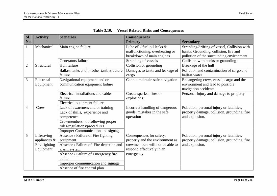
Risk Assessment & Disaster Management Plan Final Report
for the National Waterway - 1
KITCO Limited Page 80 of 216
Table 3.10. Vessel Related Risks and Consequences
Sl.
No.
Activity Scenarios Consequences
Primary Secondary
1 Mechanical Main engine failure Lube oil / fuel oil leaks &
malfunctioning, overheating or
breakdown of main engines.
Stranding/drifting of vessel, Collision with
banks, Grounding, collision, fire and
pollution of the surrounding environment
Generators failure Stranding of vessels Collision with banks or grounding
2 Structural Hull failure Collision or grounding Breakage of the hull
Ballast tanks and or other tank structure
failure
Damages to tanks and leakage of
cargo
Pollution and contamination of cargo and
ballast water
3 Electrical
Equipment
Navigational equipment and or
communication equipment failure
Cannot maintain safe navigation Endangering crew, vessel, cargo and the
environment and lead to possible
navigation accidents
Electrical installations and cables
failure
Create sparks , fires or
explosions
Personal Injury and damage to property
Electrical equipment failure
4 Crew Lack of awareness and or training Incorrect handling of dangerous
goods, mistakes in the safe
operation
Pollution, personal injury or fatalities,
property damage, collision, grounding, fire
and explosion. Lack of skills, experience and
competence
Crewmembers not following proper
rules/regulations/procedures.
Improper Communication and signage
5 Lifesaving
appliances &
Fire fighting
Equipment
Absence / Failure of Fire fighting
equipment.
Consequences for safety,
property and the environment as
crewmembers will not be able to
respond effectively in an
emergency.
Pollution, personal injury or fatalities,
property damage, collision, grounding, fire
and explosion. Absence / Failure of Fire detection and
alarm system
Absence / Failure of Emergency fire
pump
Improper communication and signage
Absence of fire control plan
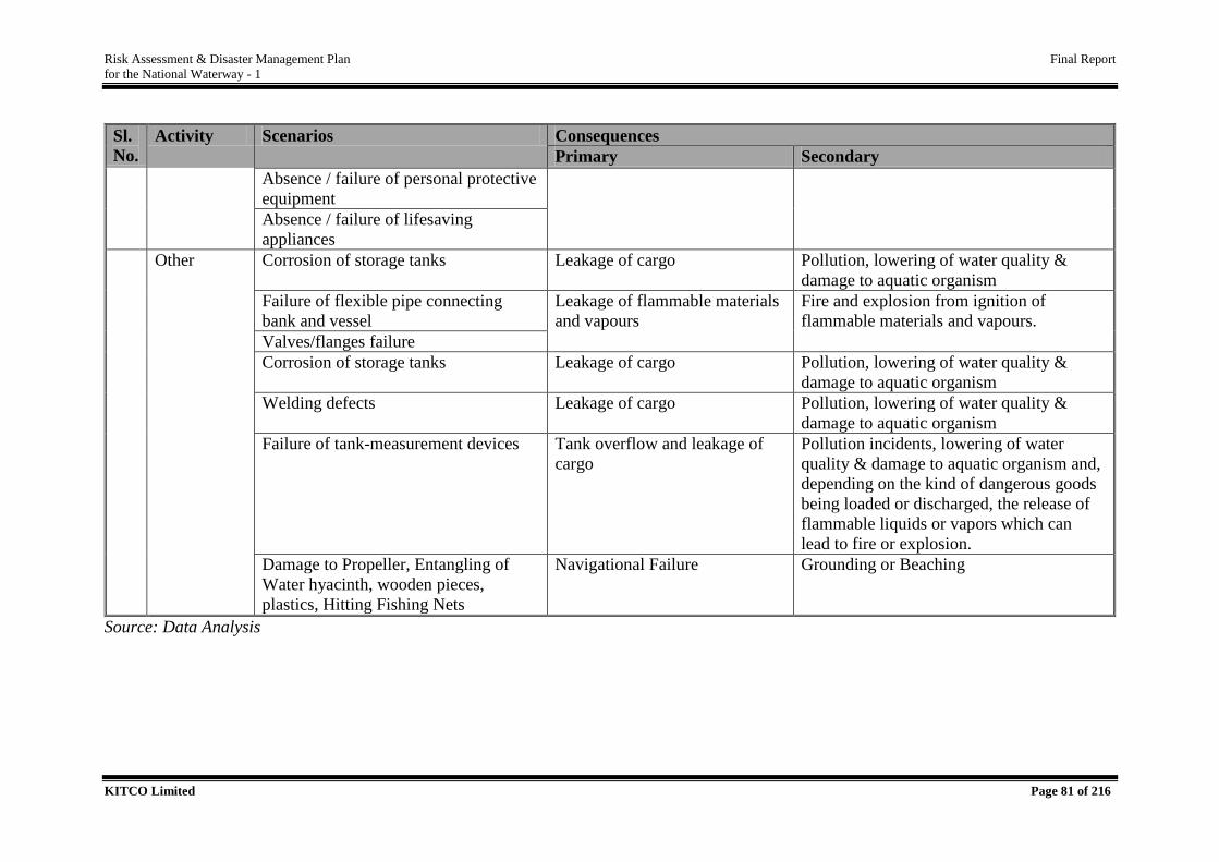
Risk Assessment & Disaster Management Plan Final Report
for the National Waterway - 1
KITCO Limited Page 81 of 216
Sl.
No.
Activity Scenarios Consequences
Primary Secondary
Absence / failure of personal protective
equipment
Absence / failure of lifesaving
appliances
Other Corrosion of storage tanks Leakage of cargo Pollution, lowering of water quality &
damage to aquatic organism
Failure of flexible pipe connecting
bank and vessel
Leakage of flammable materials
and vapours
Fire and explosion from ignition of
flammable materials and vapours.
Valves/flanges failure
Corrosion of storage tanks Leakage of cargo Pollution, lowering of water quality &
damage to aquatic organism
Welding defects Leakage of cargo Pollution, lowering of water quality &
damage to aquatic organism
Failure of tank-measurement devices Tank overflow and leakage of
cargo
Pollution incidents, lowering of water
quality & damage to aquatic organism and,
depending on the kind of dangerous goods
being loaded or discharged, the release of
flammable liquids or vapors which can
lead to fire or explosion.
Damage to Propeller, Entangling of
Water hyacinth, wooden pieces,
plastics, Hitting Fishing Nets
Navigational Failure Grounding or Beaching
Source: Data Analysis
Risk Assessment & Disaster Management Plan Final Report
for the National Waterway - 1
KITCO Limited Page 82 of 216
3.4.4. Dredging Related Risk
Dredging related risks are present in the form of channel related risks and is applicable during
both construction and operation phases associated with capital and maintenance dredging
respectively. It involves risk associated with dredging and allied activities. It is essential that
minimum depth of the water is maintained in the river all the time of navigation, as per the
notified LAD for each stretches. It cannot be stated that, this particular stretch has more
dredging related risk since, LAD varies from each stretch.
Capital dredging location of proposed terminals i.e., Haldia (Operation of terminal would
require dredging of 1,57,60,596 cum and also maintenance 8.5 lakh cum/year.), Sahibganj (1.5
lakh cum and also 30,000 cum for maintenance in lean season). Maintenance dredging within
Navigation Channel - 14,850,000 cum/year is the tentative quantity, from Haldia to Varanasi
(at present dredging is done only up to this point). Dredging activities are most prominent
during the lean season between the November to May. All the terminals are important dredging
locations in this regard.
Dredging as a fairway development or fairway conservation method in National Waterway
No.1 is estimated to be a modest physical intervention. Modest because firstly it's required only
in few and far places where the natural depth falls below minimum requirement for navigation.
Secondly, required only during the lean season which ordinarily extends for maximum seven
months from November to May. The dredging activity is confined only to the navigational
channel which is 50-70 m. wide in comparison to the width of the river which is hundreds of
meters or even kilometres.
Cutter suction dredging being the principal method of dredging NW.1, the dredged material
can be disposed either by side casting away from the channel or to a farther distance through
pipe lines. Transporting the dredged material out of the river to higher banks would involve
huge technical challenges and unjustified costs. Further, it would amount to mining and
permanently altering the bed profile of river. Hence, this option is ruled out.
It's recommended to dispose the dredged material within the river only away from the fairway
in such a way that the disposed material do not cause substantial changes to the natural river
characteristics. This is appropriate because dredging in a dynamic river environment is a
temporary measure to conserve the fairway. The disposal areas which are appurtenant to the
main navigational channel also shall be surveyed and mapped prior to commencement of
Risk Assessment & Disaster Management Plan Final Report
for the National Waterway - 1
KITCO Limited Page 83 of 216
dredging and disposal. Deposition of dredged material at the disposal areas shall be
continuously monitored with equal importance as assigned to the dredging area itself. Disposal
shall be planned in such a way not to cause development of mounds on the river bed. It shall
be uniform spread of dredged material over an area duly marked on the disposal area that has
been initially mapped. The disposal areas shall be monitored continuously and ensured that at
no place the disposal exceed a certain thickness which shall be decided specific to each shoal
location.
Proper record of the disposal carried out according to above guidelines, ensuring least visible
changes to the river bed profile outside of the fairway shall also form part of the dredging
records at each shoal. Such records for individual shoals in successive lean seasons would also
lead to a data base that will offer new insights into possible improvements in coming years to
the methods of dredging and disposal in order to make the activity neutral in its environmental
impacts.
The risk related with dredging activities includes disturbances in water column and bottom
sediments which may affect aquatic organisms due to increased turbidity. The impact of the
activity may be extended up to around 300m downstream depending on localized river
hydraulics. Most common area where siltation is always a serious issue includes stretches
downstream Ghazipur to Patna and at the feeder canal mouth. Highest no. of shoals being
reported in the Farakka – Barh (60 no), followed by Barh – Ghazipur (43 no), Ghazipur -
Allahabad (30 no) and Haldia (Sagar) – Farakka (15 no).
Type of dredgers used are Cutter Suction Dredger (CSD), Agitation dredgers/plough dredgers
and Back Hoe Dredgers (BHD). Disposal of dredged material through CSDs will be done
through pipeline into the free stream of the river in a way to avoid material working its way
back to dredged channel. This can be achieved by disposing in faster flowing water,
downstream and to the side of the working dredgers and disposal of material into secondary
channels or redundant channels. Material dredged by BHD will need to be placed in a barge
and disposed of away from the channel, as the reach of the BHD is unlikely to be sufficient to
reach the faster flow for dispersion of the material.
Dredge disposal is done preferably offshore, onshore only if sediments are found to be
contaminated. In general, dredging causes only temporary damage for the water quality i.e., 3
- 4 minutes as the plume passes. As per baseline study, riverbed sediments are non-toxic except
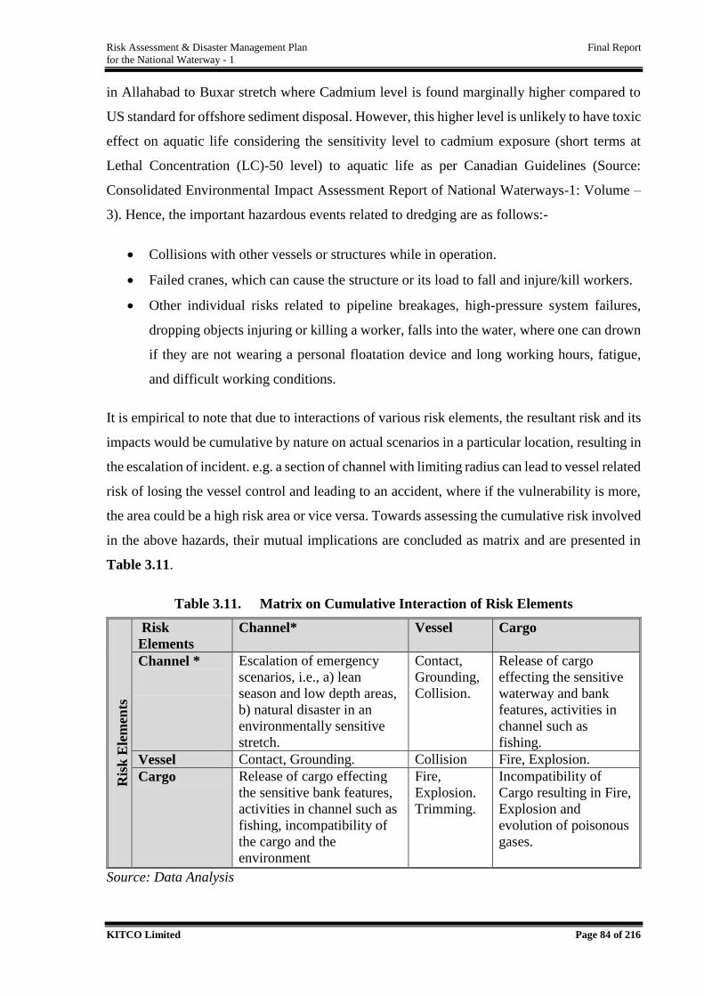
Risk Assessment & Disaster Management Plan Final Report
for the National Waterway - 1
KITCO Limited Page 84 of 216
in Allahabad to Buxar stretch where Cadmium level is found marginally higher compared to
US standard for offshore sediment disposal. However, this higher level is unlikely to have toxic
effect on aquatic life considering the sensitivity level to cadmium exposure (short terms at
Lethal Concentration (LC)-50 level) to aquatic life as per Canadian Guidelines (Source:
Consolidated Environmental Impact Assessment Report of National Waterways-1: Volume –
3). Hence, the important hazardous events related to dredging are as follows:-
Collisions with other vessels or structures while in operation.
Failed cranes, which can cause the structure or its load to fall and injure/kill workers.
Other individual risks related to pipeline breakages, high-pressure system failures,
dropping objects injuring or killing a worker, falls into the water, where one can drown
if they are not wearing a personal floatation device and long working hours, fatigue,
and difficult working conditions.
It is empirical to note that due to interactions of various risk elements, the resultant risk and its
impacts would be cumulative by nature on actual scenarios in a particular location, resulting in
the escalation of incident. e.g. a section of channel with limiting radius can lead to vessel related
risk of losing the vessel control and leading to an accident, where if the vulnerability is more,
the area could be a high risk area or vice versa. Towards assessing the cumulative risk involved
in the above hazards, their mutual implications are concluded as matrix and are presented in
Table 3.11.
Table 3.11. Matrix on Cumulative Interaction of Risk Elements
Ris
k E
lem
ents
Risk
Elements
Channel* Vessel Cargo
Channel *
Escalation of emergency
scenarios, i.e., a) lean
season and low depth areas,
b) natural disaster in an
environmentally sensitive
stretch.
Contact,
Grounding,
Collision.
Release of cargo
effecting the sensitive
waterway and bank
features, activities in
channel such as
fishing.
Vessel Contact, Grounding. Collision Fire, Explosion.
Cargo Release of cargo effecting
the sensitive bank features,
activities in channel such as
fishing, incompatibility of
the cargo and the
environment
Fire,
Explosion.
Trimming.
Incompatibility of
Cargo resulting in Fire,
Explosion and
evolution of poisonous
gases.
Source: Data Analysis
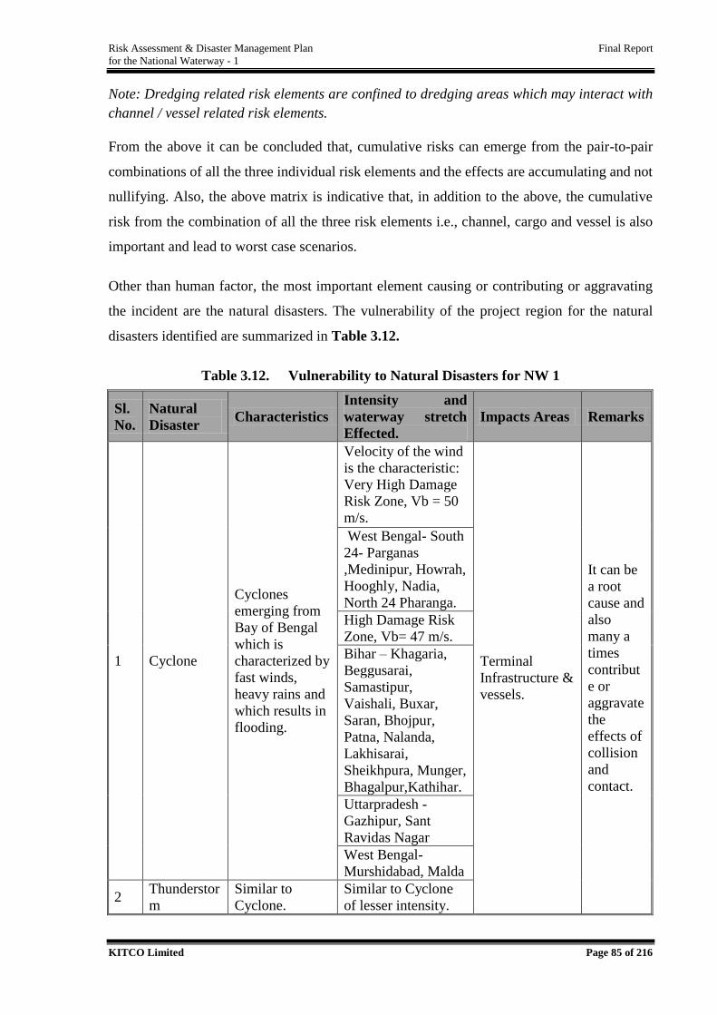
Risk Assessment & Disaster Management Plan Final Report
for the National Waterway - 1
KITCO Limited Page 85 of 216
Note: Dredging related risk elements are confined to dredging areas which may interact with
channel / vessel related risk elements.
From the above it can be concluded that, cumulative risks can emerge from the pair-to-pair
combinations of all the three individual risk elements and the effects are accumulating and not
nullifying. Also, the above matrix is indicative that, in addition to the above, the cumulative
risk from the combination of all the three risk elements i.e., channel, cargo and vessel is also
important and lead to worst case scenarios.
Other than human factor, the most important element causing or contributing or aggravating
the incident are the natural disasters. The vulnerability of the project region for the natural
disasters identified are summarized in Table 3.12.
Table 3.12. Vulnerability to Natural Disasters for NW 1
Sl.
No.
Natural
Disaster Characteristics
Intensity and
waterway stretch
Effected.
Impacts Areas Remarks
1 Cyclone
Cyclones
emerging from
Bay of Bengal
which is
characterized by
fast winds,
heavy rains and
which results in
flooding.
Velocity of the wind
is the characteristic:
Very High Damage
Risk Zone, Vb = 50
m/s.
Terminal
Infrastructure &
vessels.
It can be
a root
cause and
also
many a
times
contribut
e or
aggravate
the
effects of
collision
and
contact.
West Bengal- South
24- Parganas
,Medinipur, Howrah,
Hooghly, Nadia,
North 24 Pharanga.
High Damage Risk
Zone, Vb= 47 m/s.
Bihar – Khagaria,
Beggusarai,
Samastipur,
Vaishali, Buxar,
Saran, Bhojpur,
Patna, Nalanda,
Lakhisarai,
Sheikhpura, Munger,
Bhagalpur,Kathihar.
Uttarpradesh -
Gazhipur, Sant
Ravidas Nagar
West Bengal-
Murshidabad, Malda
2 Thunderstor
m
Similar to
Cyclone.
Similar to Cyclone
of lesser intensity.
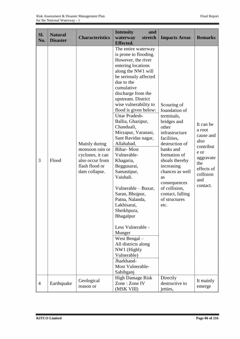
Risk Assessment & Disaster Management Plan Final Report
for the National Waterway - 1
KITCO Limited Page 86 of 216
Sl.
No.
Natural
Disaster Characteristics
Intensity and
waterway stretch
Effected.
Impacts Areas Remarks
3 Flood
Mainly during
monsoon rain or
cyclones, it can
also occur from
flash flood or
dam collapse.
The entire waterway
is prone to flooding.
However, the river
entering locations
along the NW1 will
be seriously affected
due to the
cumulative
discharge from the
upstream. District
wise vulnerability to
flood is given below: Scouring of
foundation of
terminals,
bridges and
other
infrastructure
facilities,
destruction of
banks and
formation of
shoals thereby
increasing
chances as well
as
consequences
of collision,
contact, falling
of structures
etc.
It can be
a root
cause and
also
contribut
e or
aggravate
the
effects of
collision
and
contact.
Uttar Pradesh-
Ballia, Ghazipur,
Chanduali,
Mirzapur, Varanasi,
Sant Ravidas nagar,
Allahabad.
Bihar- Most
Vulnerable-
Khagaria,
Beggusarai,
Samastipur,
Vaishali.
Vulnerable – Buxar,
Saran, Bhojpur,
Patna, Nalanda,
Lakhisarai,
Sheikhpura,
Bhagalpur
Less Vulnerable -
Munger
West Bengal –
All districts along
NW1 (Highly
Vulnerable)
Jharkhand-
Most Vulnerable-
Sahibganj
4 Earthquake Geological
reason or
High Damage Risk
Zone : Zone IV
(MSK VIII)
Directly
destructive to
jetties,
It mainly
emerge
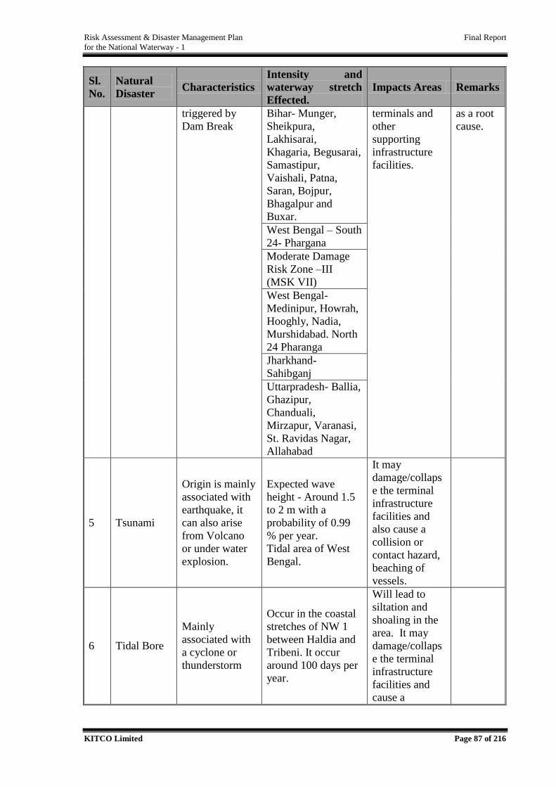
Risk Assessment & Disaster Management Plan Final Report
for the National Waterway - 1
KITCO Limited Page 87 of 216
Sl.
No.
Natural
Disaster Characteristics
Intensity and
waterway stretch
Effected.
Impacts Areas Remarks
triggered by
Dam Break
Bihar- Munger,
Sheikpura,
Lakhisarai,
Khagaria, Begusarai,
Samastipur,
Vaishali, Patna,
Saran, Bojpur,
Bhagalpur and
Buxar.
terminals and
other
supporting
infrastructure
facilities.
as a root
cause.
West Bengal – South
24- Phargana
Moderate Damage
Risk Zone –III
(MSK VII)
West Bengal-
Medinipur, Howrah,
Hooghly, Nadia,
Murshidabad. North
24 Pharanga
Jharkhand-
Sahibganj
Uttarpradesh- Ballia,
Ghazipur,
Chanduali,
Mirzapur, Varanasi,
St. Ravidas Nagar,
Allahabad
5 Tsunami
Origin is mainly
associated with
earthquake, it
can also arise
from Volcano
or under water
explosion.
Expected wave
height - Around 1.5
to 2 m with a
probability of 0.99
% per year.
Tidal area of West
Bengal.
It may
damage/collaps
e the terminal
infrastructure
facilities and
also cause a
collision or
contact hazard,
beaching of
vessels.
6 Tidal Bore
Mainly
associated with
a cyclone or
thunderstorm
Occur in the coastal
stretches of NW 1
between Haldia and
Tribeni. It occur
around 100 days per
year.
Will lead to
siltation and
shoaling in the
area. It may
damage/collaps
e the terminal
infrastructure
facilities and
cause a
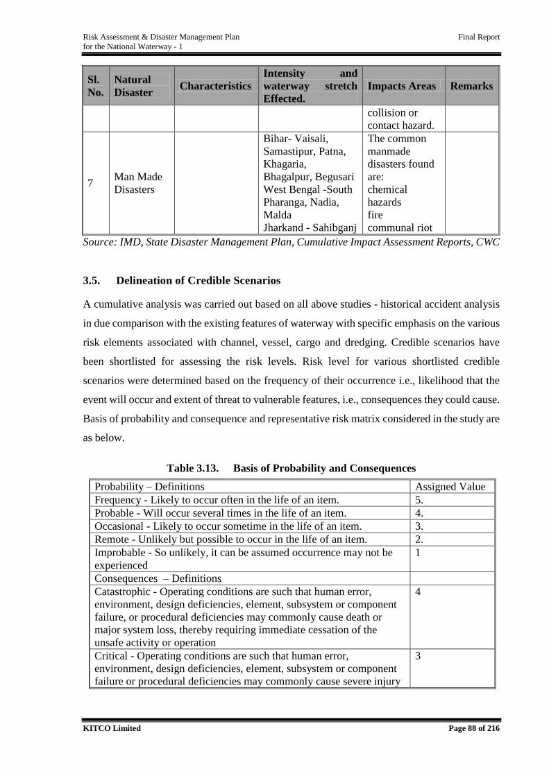
Risk Assessment & Disaster Management Plan Final Report
for the National Waterway - 1
KITCO Limited Page 88 of 216
Sl.
No.
Natural
Disaster Characteristics
Intensity and
waterway stretch
Effected.
Impacts Areas Remarks
collision or
contact hazard.
7 Man Made
Disasters
Bihar- Vaisali,
Samastipur, Patna,
Khagaria,
Bhagalpur, Begusari
West Bengal -South
Pharanga, Nadia,
Malda
Jharkand - Sahibganj
The common
manmade
disasters found
are:
chemical
hazards
fire
communal riot
Source: IMD, State Disaster Management Plan, Cumulative Impact Assessment Reports, CWC
3.5. Delineation of Credible Scenarios
A cumulative analysis was carried out based on all above studies - historical accident analysis
in due comparison with the existing features of waterway with specific emphasis on the various
risk elements associated with channel, vessel, cargo and dredging. Credible scenarios have
been shortlisted for assessing the risk levels. Risk level for various shortlisted credible
scenarios were determined based on the frequency of their occurrence i.e., likelihood that the
event will occur and extent of threat to vulnerable features, i.e., consequences they could cause.
Basis of probability and consequence and representative risk matrix considered in the study are
as below.
Table 3.13. Basis of Probability and Consequences
Probability – Definitions Assigned Value
Frequency - Likely to occur often in the life of an item. 5.
Probable - Will occur several times in the life of an item. 4.
Occasional - Likely to occur sometime in the life of an item. 3.
Remote - Unlikely but possible to occur in the life of an item. 2.
Improbable - So unlikely, it can be assumed occurrence may not be
experienced
1
Consequences – Definitions
Catastrophic - Operating conditions are such that human error,
environment, design deficiencies, element, subsystem or component
failure, or procedural deficiencies may commonly cause death or
major system loss, thereby requiring immediate cessation of the
unsafe activity or operation
4
Critical - Operating conditions are such that human error,
environment, design deficiencies, element, subsystem or component
failure or procedural deficiencies may commonly cause severe injury
3
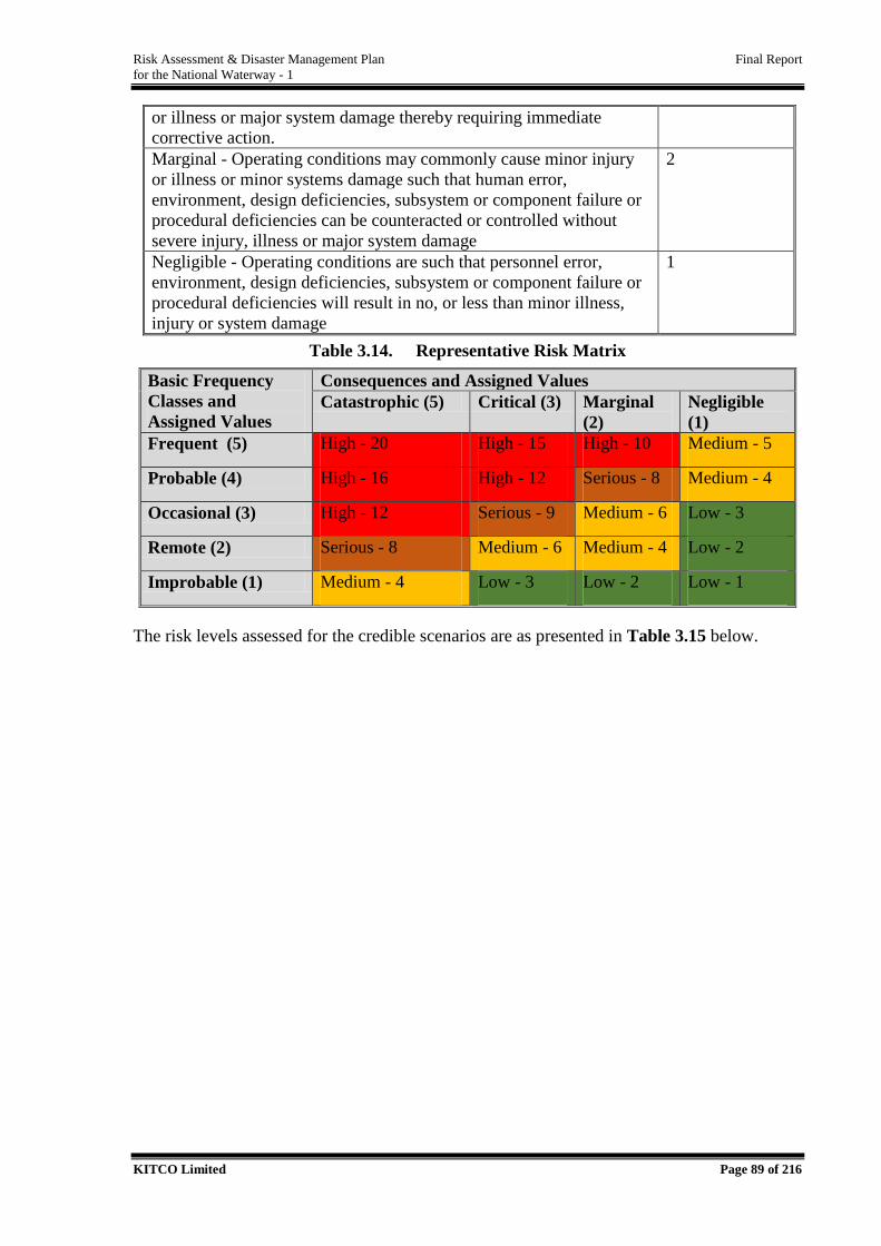
Risk Assessment & Disaster Management Plan Final Report
for the National Waterway - 1
KITCO Limited Page 89 of 216
or illness or major system damage thereby requiring immediate
corrective action.
Marginal - Operating conditions may commonly cause minor injury
or illness or minor systems damage such that human error,
environment, design deficiencies, subsystem or component failure or
procedural deficiencies can be counteracted or controlled without
severe injury, illness or major system damage
2
Negligible - Operating conditions are such that personnel error,
environment, design deficiencies, subsystem or component failure or
procedural deficiencies will result in no, or less than minor illness,
injury or system damage
1
Table 3.14. Representative Risk Matrix
Basic Frequency
Classes and
Assigned Values
Consequences and Assigned Values
Catastrophic (5) Critical (3) Marginal
(2)
Negligible
(1)
Frequent (5) High - 20 High - 15 High - 10 Medium - 5
Probable (4) High - 16 High - 12 Serious - 8 Medium - 4
Occasional (3) High - 12 Serious - 9 Medium - 6 Low - 3
Remote (2) Serious - 8 Medium - 6 Medium - 4 Low - 2
Improbable (1) Medium - 4 Low - 3 Low - 2 Low - 1
The risk levels assessed for the credible scenarios are as presented in Table 3.15 below.
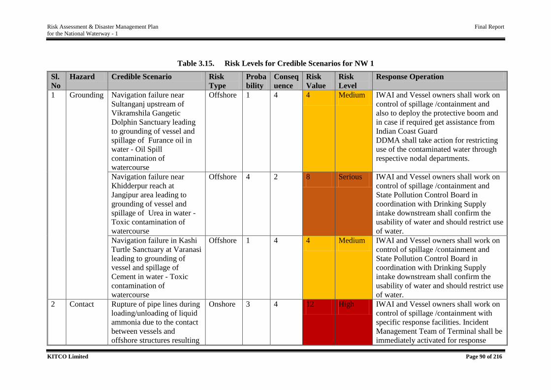
Risk Assessment & Disaster Management Plan Final Report
for the National Waterway - 1
KITCO Limited Page 90 of 216
Table 3.15. Risk Levels for Credible Scenarios for NW 1
Sl.
No
Hazard Credible Scenario Risk
Type
Proba
bility
Conseq
uence
Risk
Value
Risk
Level
Response Operation
1 Grounding Navigation failure near
Sultanganj upstream of
Vikramshila Gangetic
Dolphin Sanctuary leading
to grounding of vessel and
spillage of Furance oil in
water - Oil Spill
contamination of
watercourse
Offshore 1 4 4 Medium IWAI and Vessel owners shall work on
control of spillage /containment and
also to deploy the protective boom and
in case if required get assistance from
Indian Coast Guard
DDMA shall take action for restricting
use of the contaminated water through
respective nodal departments.
Navigation failure near
Khidderpur reach at
Jangipur area leading to
grounding of vessel and
spillage of Urea in water -
Toxic contamination of
watercourse
Offshore 4 2 8 Serious IWAI and Vessel owners shall work on
control of spillage /containment and
State Pollution Control Board in
coordination with Drinking Supply
intake downstream shall confirm the
usability of water and should restrict use
of water.
Navigation failure in Kashi
Turtle Sanctuary at Varanasi
leading to grounding of
vessel and spillage of
Cement in water - Toxic
contamination of
watercourse
Offshore 1 4 4 Medium IWAI and Vessel owners shall work on
control of spillage /containment and
State Pollution Control Board in
coordination with Drinking Supply
intake downstream shall confirm the
usability of water and should restrict use
of water.
2 Contact Rupture of pipe lines during
loading/unloading of liquid
ammonia due to the contact
between vessels and
offshore structures resulting
Onshore 3 4 12 High IWAI and Vessel owners shall work on
control of spillage /containment with
specific response facilities. Incident
Management Team of Terminal shall be
immediately activated for response
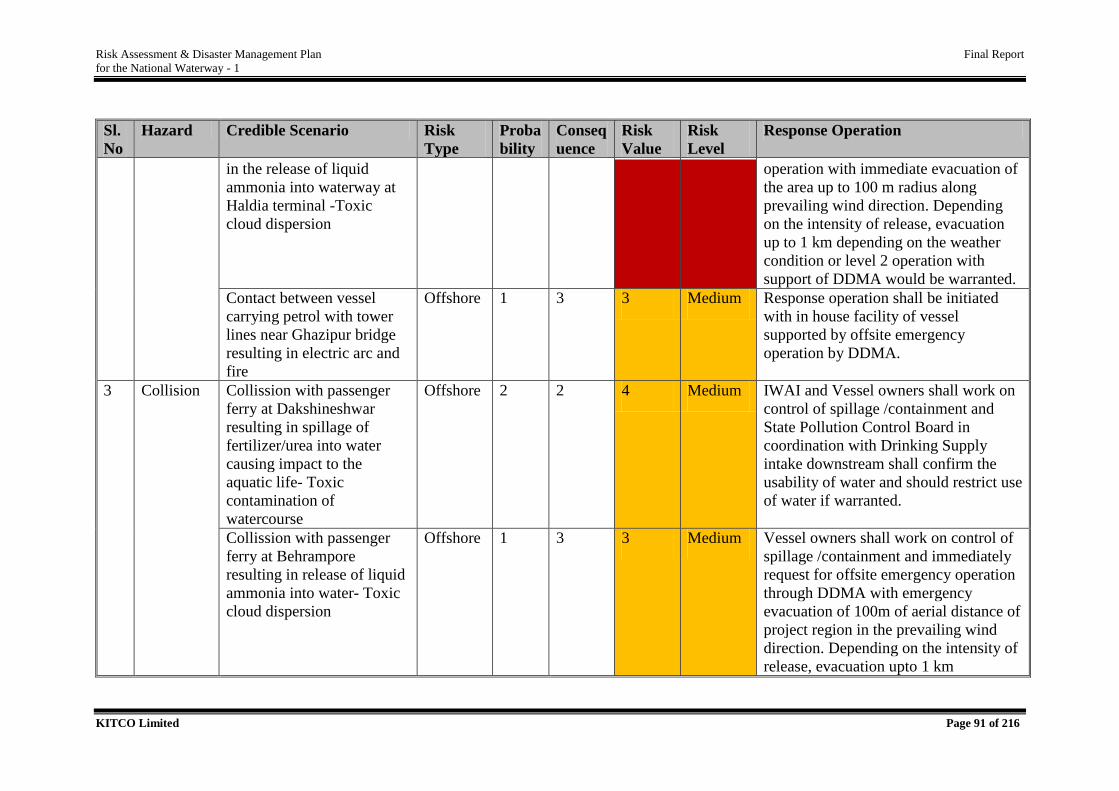
Risk Assessment & Disaster Management Plan Final Report
for the National Waterway - 1
KITCO Limited Page 91 of 216
Sl.
No
Hazard Credible Scenario Risk
Type
Proba
bility
Conseq
uence
Risk
Value
Risk
Level
Response Operation
in the release of liquid
ammonia into waterway at
Haldia terminal -Toxic
cloud dispersion
operation with immediate evacuation of
the area up to 100 m radius along
prevailing wind direction. Depending
on the intensity of release, evacuation
up to 1 km depending on the weather
condition or level 2 operation with
support of DDMA would be warranted.
Contact between vessel
carrying petrol with tower
lines near Ghazipur bridge
resulting in electric arc and
fire
Offshore 1 3 3 Medium Response operation shall be initiated
with in house facility of vessel
supported by offsite emergency
operation by DDMA.
3 Collision Collission with passenger
ferry at Dakshineshwar
resulting in spillage of
fertilizer/urea into water
causing impact to the
aquatic life- Toxic
contamination of
watercourse
Offshore 2 2 4 Medium IWAI and Vessel owners shall work on
control of spillage /containment and
State Pollution Control Board in
coordination with Drinking Supply
intake downstream shall confirm the
usability of water and should restrict use
of water if warranted.
Collission with passenger
ferry at Behrampore
resulting in release of liquid
ammonia into water- Toxic
cloud dispersion
Offshore 1 3 3 Medium Vessel owners shall work on control of
spillage /containment and immediately
request for offsite emergency operation
through DDMA with emergency
evacuation of 100m of aerial distance of
project region in the prevailing wind
direction. Depending on the intensity of
release, evacuation upto 1 km
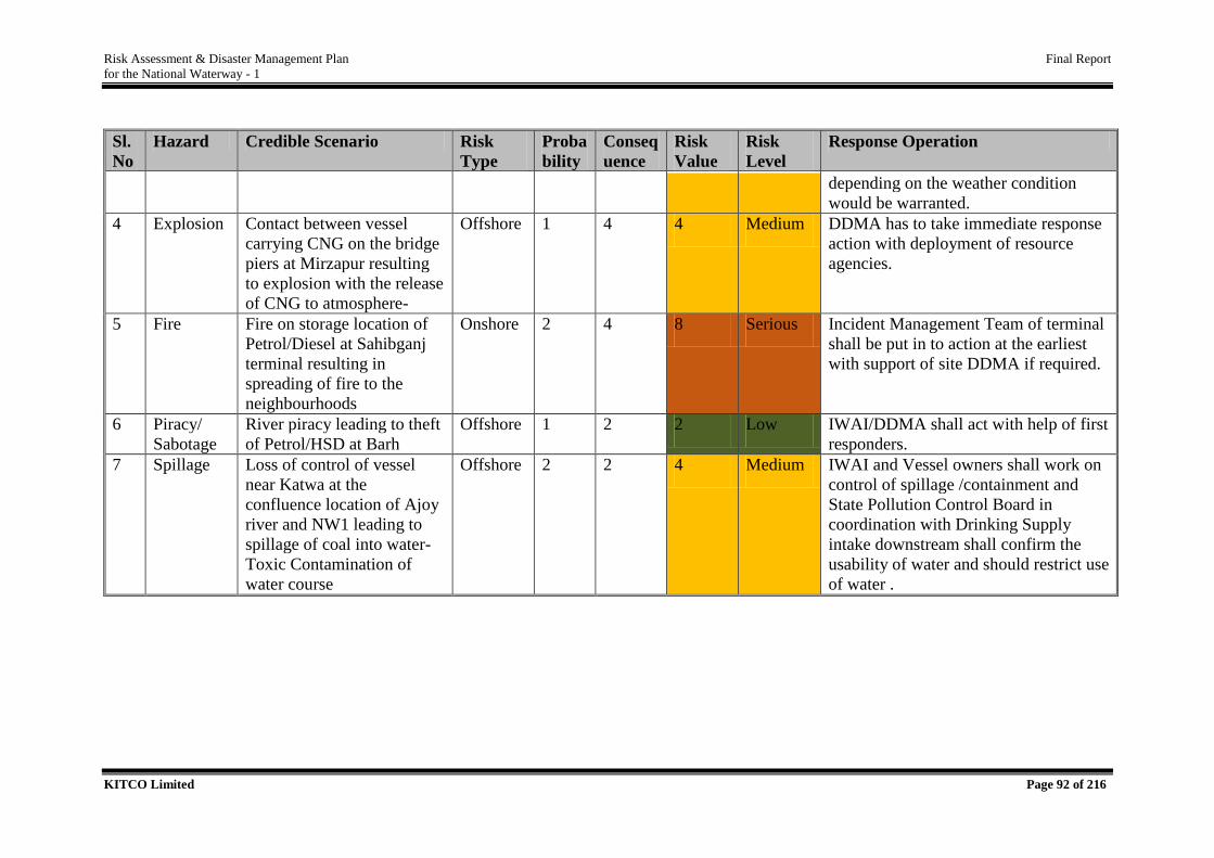
Risk Assessment & Disaster Management Plan Final Report
for the National Waterway - 1
KITCO Limited Page 92 of 216
Sl.
No
Hazard Credible Scenario Risk
Type
Proba
bility
Conseq
uence
Risk
Value
Risk
Level
Response Operation
depending on the weather condition
would be warranted.
4 Explosion Contact between vessel
carrying CNG on the bridge
piers at Mirzapur resulting
to explosion with the release
of CNG to atmosphere-
Offshore 1 4 4 Medium DDMA has to take immediate response
action with deployment of resource
agencies.
5 Fire Fire on storage location of
Petrol/Diesel at Sahibganj
terminal resulting in
spreading of fire to the
neighbourhoods
Onshore 2 4 8 Serious Incident Management Team of terminal
shall be put in to action at the earliest
with support of site DDMA if required.
6 Piracy/
Sabotage
River piracy leading to theft
of Petrol/HSD at Barh
Offshore 1 2 2 Low IWAI/DDMA shall act with help of first
responders.
7 Spillage Loss of control of vessel
near Katwa at the
confluence location of Ajoy
river and NW1 leading to
spillage of coal into water-
Toxic Contamination of
water course
Offshore 2 2 4 Medium IWAI and Vessel owners shall work on
control of spillage /containment and
State Pollution Control Board in
coordination with Drinking Supply
intake downstream shall confirm the
usability of water and should restrict use
of water .
Risk Assessment & Disaster Management Plan Final Report
for the National Waterway - 1
KITCO Limited Page 93 of 216
3.6. Risk Abatement Measures
Historical analysis of accidents in IWT shows that the major primary hazards include collision,
contact, grounding, ship get stuck and fire, spillage followed by explosion as an extremely
negligible case. The probable areas for hazards above are identified under channel related risk
and fire and explosion could be resulted as a consequence of primary hazards or due to cargo
related or vessel related risk. Specific risk abatement measures has been proposed for handling
channel related risk, vessel related risk, cargo related risk and dredging related risk.
Considering that, 60% of the IWT related risks are caused by human error, risk abatement
measures have been proposed for individual risk and crew. The following section presents the
important risk abatement measures first followed by specific measures to handle channel, cargo
and vessel related risk including risk abatement measures for avoiding human errors in IWT
operations.
Emergency Numbers to be displayed in vessel and at terminals where rescue facilities
are available.
‘Do’s and ‘Don’ts details of hazardous cargo handling, transport emergency card,
MSDS etc. should be available at vessel or jetty.
If possible, develop a software and mobile app for hazardous cargo transportation.
Modern first aid fix fighting facility should be made available in cargo vessels.
Training on certified first aid, fire fighting, chemical spill handling etc. to be given to
crew
Minimum 4 fire drill shall be done an year for all members (in vessel and jetty)
Equipments like Automated External Defibrillator (AED), first aid kit, Self - Contained
Breathing Equipment (SCBA) etc. should be available in vessels.
Hotline facility shall be developed for getting expert advice in case of emergency.
Emergency Recovery Van (ERV) facility should be made available at major terminals
handling hazardous cargos.
3.6.1. Channel Related Risk
Channel shall be marked with navigational aids all along the way, which will be
operational meeting the requirement of 24-hour navigation.
Strictly monitor for the compliance of minimum LAD assured under JMVP to ensure
smooth flow of traffic to avoid the grounding and related risks in areas identified as
Annexure IV High siltation areas. The areas shall be marked with appropriate warning
Risk Assessment & Disaster Management Plan Final Report
for the National Waterway - 1
KITCO Limited Page 94 of 216
signage and the routine Thalweg survey and dredging aspects to be kept on close
monitoring while IWT traffic is allowed.
Where the critical radius is <200 m as presented in Table 3.3 navigation shall be with
extreme caution with regulated speed, prohibiting parallel navigation during the initial
period with a long term plan to realign the curve as per the design standard. Vessel
movement through this areas shall be closely tracked in VTMS and shall be provided
with appropriate warning from the nearest terminal/RO. For areas where the curving
radius between 200-400 m, navigation shall be with extreme caution prohibiting parallal
navigation of large sized vessels. For areas where the curving radius >400 m, proper
cautionary approach shall be followed.
There are many channel diversion areas in NW 1 and Electronic Navigation Chart
(ENC) shall have essential provision to guide the channel to be followed during the
various seasons. Even during flood, since water level fluctuations of 8-10 m is
experienced, rerouting the vessels in bridge locations would be warranted. Under
JMVP, it shall be mandated to have seasonal navigation chart in place prior to
accelerating IWT operation in NW 1.
There are 44 bridges crossing the fairway including multiple bridges up to 3 no in single
locations near Farakka, at Chauki (Ch. 496 to 498 km). All bridges shall be installed
with fenders to avoid any collision impacts. As per RNA, 1 bridge location, at Bally,
with a vertical clearance 8.8 m only (Ch. 112 to 114 km) is a limiting bridge. Also,
Howrah bridge at Ch.104 to 106 is having a vertical clearance 9 m just meeting the
requisite air draft for the design vessel. Specific cautionary approach has to be installed
especially on these crossings while operating in monsoon seasons.
Along all bridge locations, conscious approach shall be made to avoid contact. Along
critical bridges (i.e., having limitation on horizontal and vertical clearances) speed
regulation shall be followed with confirmation on vertical clearance according to the
tidal/seasonal fluctuation in water level. Extreme caution shall be applied in case of
multiple bridge crossings.
Navigation of cargo vessel should be with caution along lock gate, tower line crossings,
aqueduct crossing, narrow channels, water body with fairway alignment close to bank
especially thickly populated banks.
Sharp depth transition is observed in Kahalgaon area. The ENC shall include the
location for precautionary approach for loaded vessels.
Risk Assessment & Disaster Management Plan Final Report
for the National Waterway - 1
KITCO Limited Page 95 of 216
Mass gathering occurs at Prayagraj (Allahabad) during Kumbh mela (February to May
once in 9 years), at Ghats in Varanasi during Ganga Arati, Ganga Puja during the month
of Shrawan (July- August), Ghats of Bihar during Chat Puja and Ghats of West Bengal
during Durga Puja. Ajgaivinath Dham in Sultangaj and Batheshwer Dham in
Kahalgaon area are important mass gathering location during the pilgrim season and is
also characterised by large number of ferry crossings in this regard. This areas shall
have specific traffic management with pass by permissions for IWT traffic avoid hitting
the ferry crossings. Along the mass gathering areas, IWAI shall intimate the local self-
governments on the NW1 about the Cargo movement, timings etc. to derive adequate
traffic management mechanisms during the festive season.
Dense settlements along the waterway have multiple ferry crossings as listed in
Annexure V. Standard vessel operation guidelines for inland water transport shall be
strictly mandated in those areas to avoid any mishap.
Electric tower lines are crossing the fairway at 51 locations. The reported incidents
where tower line has fallen to water body are at Srikrishnapur (Ch. 168 to 170 km),
Bakiya Bishanpur (Ch. 610 to 612 km), Himatpur Diara (Ch. 914 to 916 km) and
Kandala Mavaia (Ch.1404 to1406 km). Sagging tower lines were observed at Ghazipur
(Ch. 1126 to1128 km). As per the mandate, the respective electricity boards are in
charge of the safety of the tower lines. While all the tower lines crossing the waterway
has been observed to have sufficient clearances w. r. to the vessels. As a precautionary
approach, the routine fortnight Thalweg survey shall be mandated with a close
observation of tower lines, especially following the floods and reporting the sagging if
any and also IWAI shall have a formal arrangement with respective electricity board
for confirmation based on the residual life studies executed by them.
Speed regulation shall be mandated along the Farakka feeder canal stretch due to
limited waterway width as well as concentration of human activities especially fishing
using country boats at regular and multiple ferry crossing locations.
Entry location of environmental sensitive areas such as Vikramshila Gangetic Dolphin
Sanctuary and Kashi Turtle Sanctuary shall be provided with appropriate caution boards
to enhance the consciousness of the vessel operator to avoid any mishap which will lead
to huge ecological damages. Cautionary boards shall be installed stating important
regulatory frameworks mandated for such areas including implications of violations if
any.
Risk Assessment & Disaster Management Plan Final Report
for the National Waterway - 1
KITCO Limited Page 96 of 216
As per the various accident statistics, 60 % of the IWT related disasters have been
happened due to human errors. IWAI as a proactive measure may foster the safety
culture to the crew operating in NW 1 utilising the facilities at National Inland
Navigation Institute (NINI), Patna and further scaling up the skill enhancement
programme as per the requirements.
IWAI shall implement the disaster management plan proposed for the terminal and at
IWAI RO and HQ and ensure regular mock drills and updation of plan as per the
operation pattern. This will include Incident management team, trained response
personals and all facilities in an Emergency Control Room for responding in case of
emergency with provision for escalating to the essential disaster management facilities
of the respective districts.
For the enhanced IWT operations, the vessel berthing points shall be allocated in
designated areas along the waterway.
Along aqueduct area at Ch.484-486 km, cautionary signs shall be installed to guide the
Master of the vessel.
IWAI need to have close coordination with Kolkata Port Trust and major industrial
establishments to have direct support on Disaster Management. Major include NTPC
Farakka, various other Thermal Power plants, Industrial Units of Haldia and Kolkata
including BPCL, Hindustan Unilever, Indian Oil Corporation etc. A mutual aid
association shall be in place towards emergency preparedness and response.
Risk Assessment study for IWT sector whole over the world faces challenges due to
reliable records on incidents w r to incident type, frequency of occurrence etc. Under
JMVP, IWAI shall mandate to have a systematic accident record with investigation
details compiled for futuristic planning.
IWT related disasters shall be included in the respective DDMPs and regular mock
drills shall be conducted in coordination with the DDMA. The frequency of the mock
drill shall be 2 nos. per year. The same shall be schedule in during day and the other
during night.
Being a continuous medium, horizontal integration of DDMPs would be critical
towards better response.
3.6.2. Cargo Related Risk
It is to be noted that classified cargoes under IMDG or IMSBC Group A/B has inherent
hazards associated with it while carrying which are analyzed in detailed in the detailed
Risk Assessment & Disaster Management Plan Final Report
for the National Waterway - 1
KITCO Limited Page 97 of 216
risk assessment. The above goods shall be transported as per the IMDG or IMSBC and
shall bear the tag and MSDS shall be made available on board.
For cargoes listed in Group C of IMSBC, the transport and storage guidelines of the
code shall be followed for avoiding risk and whereas for non-listed cargoes, the best
industrial practice shall be followed for safe handling of cargo.
All transfer or storage facilities of hazardous cargo shall have essential prior approval
or permissions under the Manufacture, Storage and Import of Hazardous Chemical
(MSIHC) (Amendment) Rules, 2016.
The inter compatibility of cargoes (Table 3.6) shall be taken with due care while general
cargo transport planning and also while assigning storage locations at terminals.
Crew as well as the workers shall be trained with specific training requirements as per
the cargo type handled.
No source of ignition should be allowed into or near to a place where dangerous goods
containers are stowed. Flame proof equipment shall be installed at all requisite
locations.
The deck and even the cargo holds should be free of oil or greasy material. If the deck
is found in such a condition, it must be cleaned up immediately.
Safety of the cargo involves the correct lashings & securing of the cargo.
While handling the ongoing cargo operation, be careful not to come in the way or stand
under any heavy load.
On-board refrigerated cargo such as Liquefied Natural Gas (LNG) to be monitored and
should be maintained at their required temperatures. Cargo holds containing dangerous
cargo or fumigated containers should be well ventilated. Entry into such a hold with
inadequate ventilation must not be allowed. Any kind of oil spill or leak must be
prevented so as to avoid pollution of the water.
Emergency response operations shall be done specific to the cargo and depending upon
their inter compatibility.
Emergency response measures related to individual cargo has been detailed in the
section on DMP and the same has to be maintained at each terminal and the training
shall be conducted as per the proposal.
Risk Assessment & Disaster Management Plan Final Report
for the National Waterway - 1
KITCO Limited Page 98 of 216
3.6.3. Terminals & Jetties Related Risk
Introduce specific infrastructure facilities for loading /unloading, shifting/storing of
cargo at terminals as the situation demands.
Regular maintenance of terminals and associated facilities.
Appropriate safety measures to be installed at terminals and jetties.
Implement the disaster management plan for Terminals and conduct regular mock drills
once in 3 months.
3.6.4. Vessel Related Risk
Vessels are to be constructed as per the design approved for IWAI complying with IRS
Classification for inland vessels.
Push Barges, which requires low draft can be adopted for certain areas. This will
increase the cargo carrying capacity and at the same time reduce the risk of inland
operations through narrow channel section to a great extent.
In the case of vessels with external mounting for cargo special provisions for proper
securement shall be provided.
Safe manoeuvring for the vessels shall be ensured throughout the waterway.
Fenders are to be provided to the vessels to ensure sufficient protection due to damages
from hitting.
Qualification of crew members and timely training are to be assured.
All crew should be aware of the vessel contingency plan, which is kept in the deck
office.
First aid kit must always be present in the deck office.
Unification and modernisation of Vessels Act and ensuring best practices.
3.6.5. Crew Related Risk
Personal protective equipment must be worn during cargo operation, which includes
the safety shoes, safety helmet, overall, gloves, etc.
Correct lashing procedure have to be followed to avoid back injuries and sprains. One
must never stand or walk under a working spreader.
Safety signs should be posted at appropriate places e.g. ‘No Smoking’ signs.
With the implementation of various recommendation as above, risk for transportation of
goods through NW 1 shall be greatlyallineated.
Risk Assessment & Disaster Management Plan Final Report
for the National Waterway - 1
KITCO Limited Page 99 of 216
DISASTER MANAGEMENT PLAN FOR NW 1
In the Indian context, National Disaster Management Act, 2005 (DM Act, 2005) is the basic
legislation in the purview of Disaster Management (DM). DM Act defines disaster as “a
catastrophe, mishap, calamity or grave occurrence in an area, arising from natural or manmade
causes, by incidence or negligence which results in substantial loss of life or human suffering
or damage to and destruction of property or damage to, or degradation of environment of such
a nature or magnitude as to be beyond the coping capacity of the affected area”. They can be
natural, manmade or hybrid based on the cause of their occurrence.
Disasters are result of a hazard’s impact on society. Disasters result in loss of life, livelihoods,
infrastructure and property, thus pose serious disruptions to the normal functioning of the
community resulting in widespread loss, pose immense hardships to them and results in the
disruption of economic activity. Detailed risk assessment studies have showed the disaster
vulnerability of the project region and the risk elements associated with the cargo transport
through NW 1.
Towards developing a low risk cum risk resilient system for its developmental in NW 1, it was
decided to take proactive measure under JMVP with deriving a detailed proposal for integration
of IWT related disasters in to the District Disaster Management Plans (DDMPs). The present
section details out the review of the existing disaster management system of the Country as per
DM Act, 2005 and further leading to the development of proposal for integration of IWT related
disasters in to existing DDMPs.
4.1. Approach towards Preparation of DMP for NW 1
The detailed risk assessment study w.r.to the IWT operations has revealed the critical hazards
associated with the IWT operation include grounding, collision, contact, fire, explosion and
spillage (flammable liquid, solid, chemicals leading to toxic contamination and or toxic cloud).
The causes and contributing/aggravating factors include natural hazards, human error (while
maneuvering, cargo handling – loading, unloading, storage) and technical issues associated
with the vessels and intrinsic and inter compatibility issues of cargoes.
4
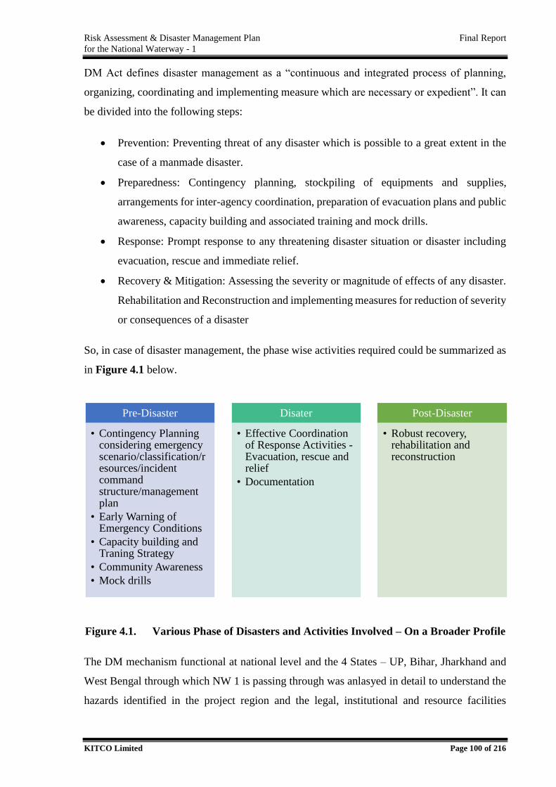
Risk Assessment & Disaster Management Plan Final Report
for the National Waterway - 1
KITCO Limited Page 100 of 216
DM Act defines disaster management as a “continuous and integrated process of planning,
organizing, coordinating and implementing measure which are necessary or expedient”. It can
be divided into the following steps:
Prevention: Preventing threat of any disaster which is possible to a great extent in the
case of a manmade disaster.
Preparedness: Contingency planning, stockpiling of equipments and supplies,
arrangements for inter-agency coordination, preparation of evacuation plans and public
awareness, capacity building and associated training and mock drills.
Response: Prompt response to any threatening disaster situation or disaster including
evacuation, rescue and immediate relief.
Recovery & Mitigation: Assessing the severity or magnitude of effects of any disaster.
Rehabilitation and Reconstruction and implementing measures for reduction of severity
or consequences of a disaster
So, in case of disaster management, the phase wise activities required could be summarized as
in Figure 4.1 below.
Figure 4.1. Various Phase of Disasters and Activities Involved – On a Broader Profile
The DM mechanism functional at national level and the 4 States – UP, Bihar, Jharkhand and
West Bengal through which NW 1 is passing through was anlasyed in detail to understand the
hazards identified in the project region and the legal, institutional and resource facilities
Pre-Disaster
• Contingency Planning considering emergency scenario/classification/resources/incident command structure/management plan
• Early Warning of Emergency Conditions
• Capacity building and Traning Strategy
• Community Awareness
• Mock drills
Disater
• Effective Coordination of Response Activities -Evacuation, rescue and relief
• Documentation
Post-Disaster
• Robust recovery, rehabilitation and reconstruction
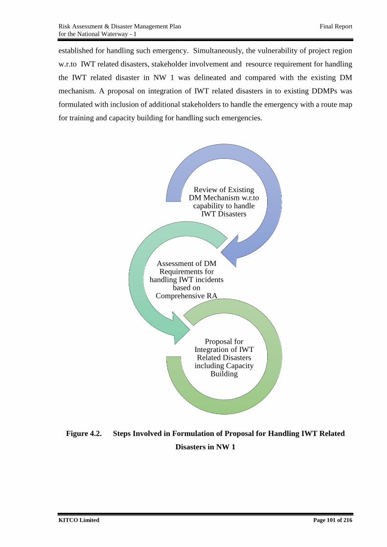
Risk Assessment & Disaster Management Plan Final Report
for the National Waterway - 1
KITCO Limited Page 101 of 216
established for handling such emergency. Simultaneously, the vulnerability of project region
w.r.to IWT related disasters, stakeholder involvement and resource requirement for handling
the IWT related disaster in NW 1 was delineated and compared with the existing DM
mechanism. A proposal on integration of IWT related disasters in to existing DDMPs was
formulated with inclusion of additional stakeholders to handle the emergency with a route map
for training and capacity building for handling such emergencies.
Figure 4.2. Steps Involved in Formulation of Proposal for Handling IWT Related
Disasters in NW 1
Review of Existing DM Mechanism w.r.to
capability to handle IWT Disasters
Assessment of DM Requirements for
handling IWT incidents based on
Comprehensive RA
Proposal for Integration of IWT Related Disasters
including Capacity Building
Risk Assessment & Disaster Management Plan Final Report
for the National Waterway - 1
KITCO Limited Page 102 of 216
4.2. Review of Institutional Mechanism for Disaster Management
DM Act, 2005 provides the legal and institutional framework for disaster management in India
at the national, state and district and local levels. Before the enactment of DM Act, 2005,
National level Cabinet Committee on Security (CCS) was dealing with the matters relating to
nuclear, biological and chemical emergencies and National Crisis Management Committee
(NCMC) under the Cabinet Secretary overseed the command, control and coordination of the
disaster response. The DM Act promulgate establishment of National Disaster Management
Authority (NDMA), State Disaster Management Authority (SDMA) and District Disaster
Management Authority (DDMA) to combat with any disaster within the country.
DM Act mandates developing disaster management policies at the Central and State level along
with preparation of Disaster Management Plan (DMP) delegating various nodal
ministries/departments to effectively combat any disaster towards integrating the various
manpower and infrastructure provisions available within the Country to combat with any
disaster. The Central Government lays down policies and guidelines at the apex level and
provides technical, financial and logistic support while the State and district administration
through developing disaster management policies and plans make institutional and capacity
building as per the vulnerability of the area to various disasters. Disaster management plans are
integrated with various stakeholders specifying nodal agencies for early warning, coordination
and mitigation or response of any operation. As an integrated approach the disaster response
system of country will integrate involvement of various stakeholders i.e., academic institutions,
scientific organizations, professional bodies, corporate sectors, Non-Government Organization
(NGOs). National Institute of Disaster Management (NIDM) is involved in research and
advisory support for the authorities in relevant policy interventions and for effective response
operations and dedicated response forces have been established at Central and State levels
including National Disaster Response Force (NDRF), Armed Forces and Central Armed Police
Forces (CAPF). DM Act also mandates that the disaster management plans prepared at various
levels shall be approved by the respective central and state authorities so as to ensure that the
mechanism would function seamlessly in case of an event and also mandates for updation and
revisions as per the schedules proposed.
Risk Assessment & Disaster Management Plan Final Report
for the National Waterway - 1
KITCO Limited Page 103 of 216
National Disaster Management Plan (NDMP), 2016 classifies the disasters primarily as Natural
Hazards or human induced hazard or result from a combination of both. Natural hazards are
categorized as below.
Geophysical – Earthquake, mass movement of earth material, volcano, Tsunami
Hydrological – Flood, landslide, Wave action
Meteorological – Cyclone, storm sure, Tornado, Convective storm, extra tropical storm,
wind, cold wave, derecho2, extreme temperature , fog, frost , freeze, hail, heat wave,
lightning, heavy rain, sand storm, dust storm, snow , ice, winter storm, blizzard
Climatological – drought, extreme hot/cold conditions, forest/wildlife fires, glacial lake
outburst, subsidence
Biological – epidemic: viral, bacterial, parasitic, fungal, or prion infections, insect
infections, animal stampedes
Human induced hazards include accidents (industrial, road air, rail on river or sea, building
collapse, fires mine flooding, oil spills), Chemical Biological radiological and Nuclear (CBRN)
terrorists activities etc.
NDMP has identified the area of NW 1 under the section, ‘the Riverine Areas’ that spread over
one or more states and also are the part of regions or areas involving multiple states requiring
special attention i.e., ‘Ganga region’ drained by River Ganga of “Rivers of the Himalayan
Region” (National Disaster Management Policy, 2016).
It is to be noted that RA study has identified that the causes and contributing factors of IWT
related disasters, which include a few of the natural and human induced hazards listed above.
The basic institutional framework at national level to deal with the disaster is presented in.
Figure 4.3
2 A derecho is a widespread, long-lived,straight-line wind storm that is associated with a fast-moving group of
severe thunderstorms known as a mesoscale convective system, which can cause hurricane-force winds,
tornadoes, heavy rains, and flash floods.
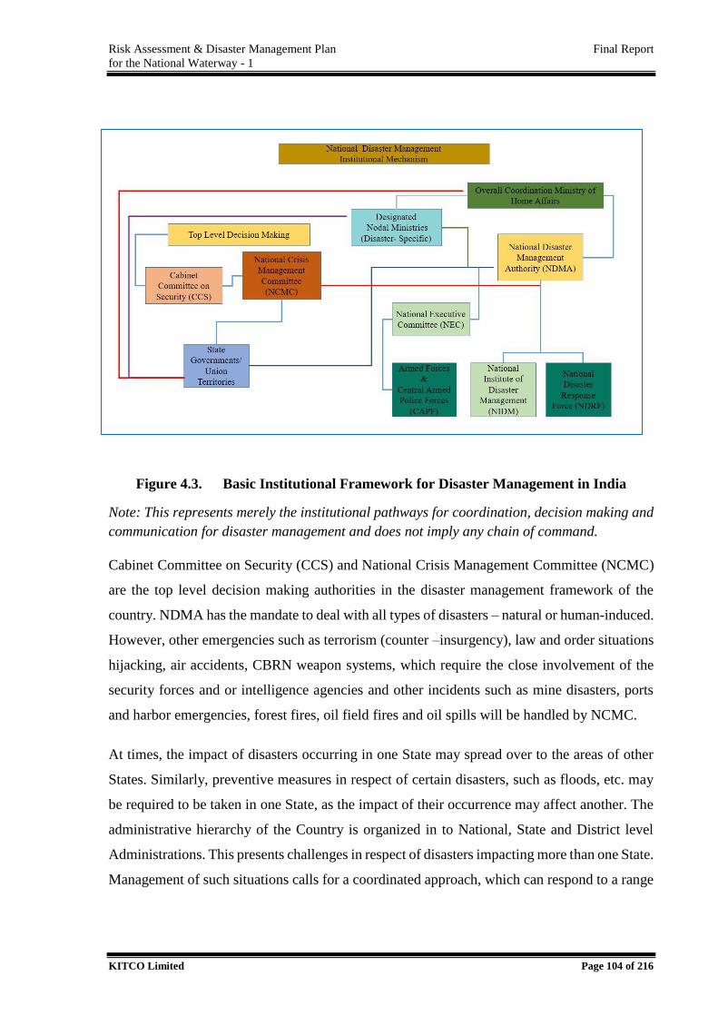
Risk Assessment & Disaster Management Plan Final Report
for the National Waterway - 1
KITCO Limited Page 104 of 216
Figure 4.3. Basic Institutional Framework for Disaster Management in India
Note: This represents merely the institutional pathways for coordination, decision making and
communication for disaster management and does not imply any chain of command.
Cabinet Committee on Security (CCS) and National Crisis Management Committee (NCMC)
are the top level decision making authorities in the disaster management framework of the
country. NDMA has the mandate to deal with all types of disasters – natural or human-induced.
However, other emergencies such as terrorism (counter –insurgency), law and order situations
hijacking, air accidents, CBRN weapon systems, which require the close involvement of the
security forces and or intelligence agencies and other incidents such as mine disasters, ports
and harbor emergencies, forest fires, oil field fires and oil spills will be handled by NCMC.
At times, the impact of disasters occurring in one State may spread over to the areas of other
States. Similarly, preventive measures in respect of certain disasters, such as floods, etc. may
be required to be taken in one State, as the impact of their occurrence may affect another. The
administrative hierarchy of the Country is organized in to National, State and District level
Administrations. This presents challenges in respect of disasters impacting more than one State.
Management of such situations calls for a coordinated approach, which can respond to a range
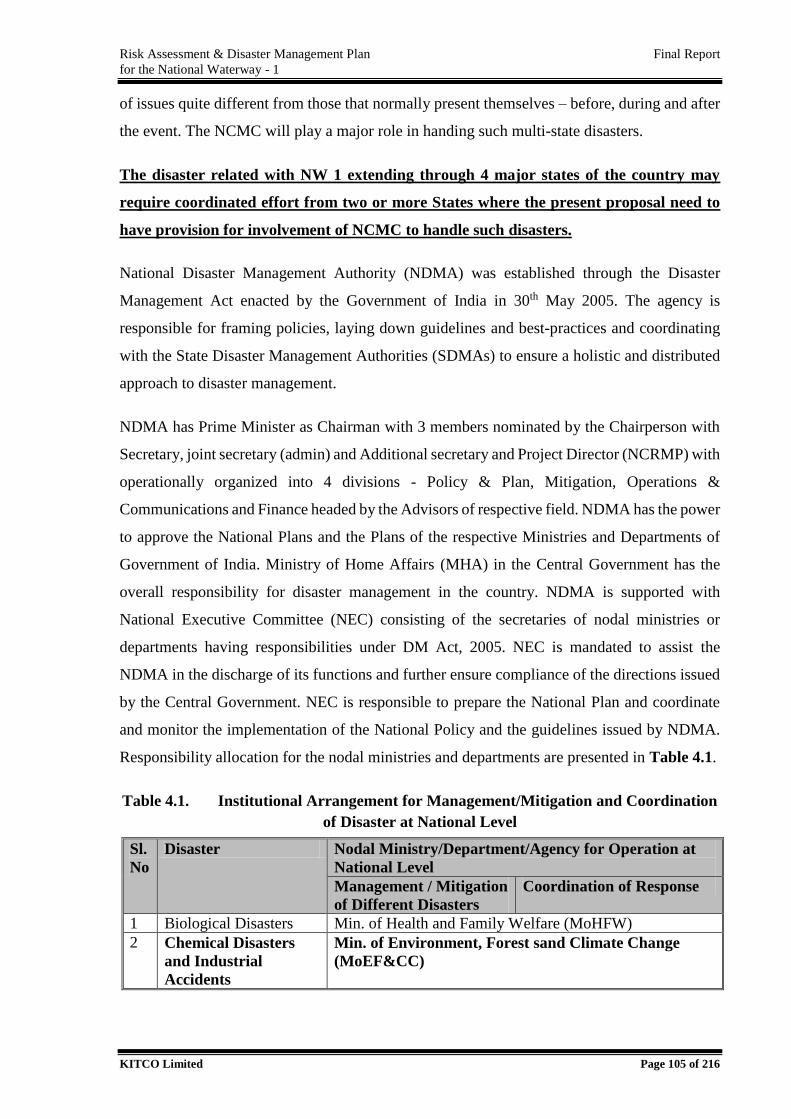
Risk Assessment & Disaster Management Plan Final Report
for the National Waterway - 1
KITCO Limited Page 105 of 216
of issues quite different from those that normally present themselves – before, during and after
the event. The NCMC will play a major role in handing such multi-state disasters.
The disaster related with NW 1 extending through 4 major states of the country may
require coordinated effort from two or more States where the present proposal need to
have provision for involvement of NCMC to handle such disasters.
National Disaster Management Authority (NDMA) was established through the Disaster
Management Act enacted by the Government of India in 30th May 2005. The agency is
responsible for framing policies, laying down guidelines and best-practices and coordinating
with the State Disaster Management Authorities (SDMAs) to ensure a holistic and distributed
approach to disaster management.
NDMA has Prime Minister as Chairman with 3 members nominated by the Chairperson with
Secretary, joint secretary (admin) and Additional secretary and Project Director (NCRMP) with
operationally organized into 4 divisions - Policy & Plan, Mitigation, Operations &
Communications and Finance headed by the Advisors of respective field. NDMA has the power
to approve the National Plans and the Plans of the respective Ministries and Departments of
Government of India. Ministry of Home Affairs (MHA) in the Central Government has the
overall responsibility for disaster management in the country. NDMA is supported with
National Executive Committee (NEC) consisting of the secretaries of nodal ministries or
departments having responsibilities under DM Act, 2005. NEC is mandated to assist the
NDMA in the discharge of its functions and further ensure compliance of the directions issued
by the Central Government. NEC is responsible to prepare the National Plan and coordinate
and monitor the implementation of the National Policy and the guidelines issued by NDMA.
Responsibility allocation for the nodal ministries and departments are presented in Table 4.1.
Table 4.1. Institutional Arrangement for Management/Mitigation and Coordination
of Disaster at National Level
Sl.
No
Disaster Nodal Ministry/Department/Agency for Operation at
National Level
Management / Mitigation
of Different Disasters
Coordination of Response
1 Biological Disasters Min. of Health and Family Welfare (MoHFW)
2 Chemical Disasters
and Industrial
Accidents
Min. of Environment, Forest sand Climate Change
(MoEF&CC)
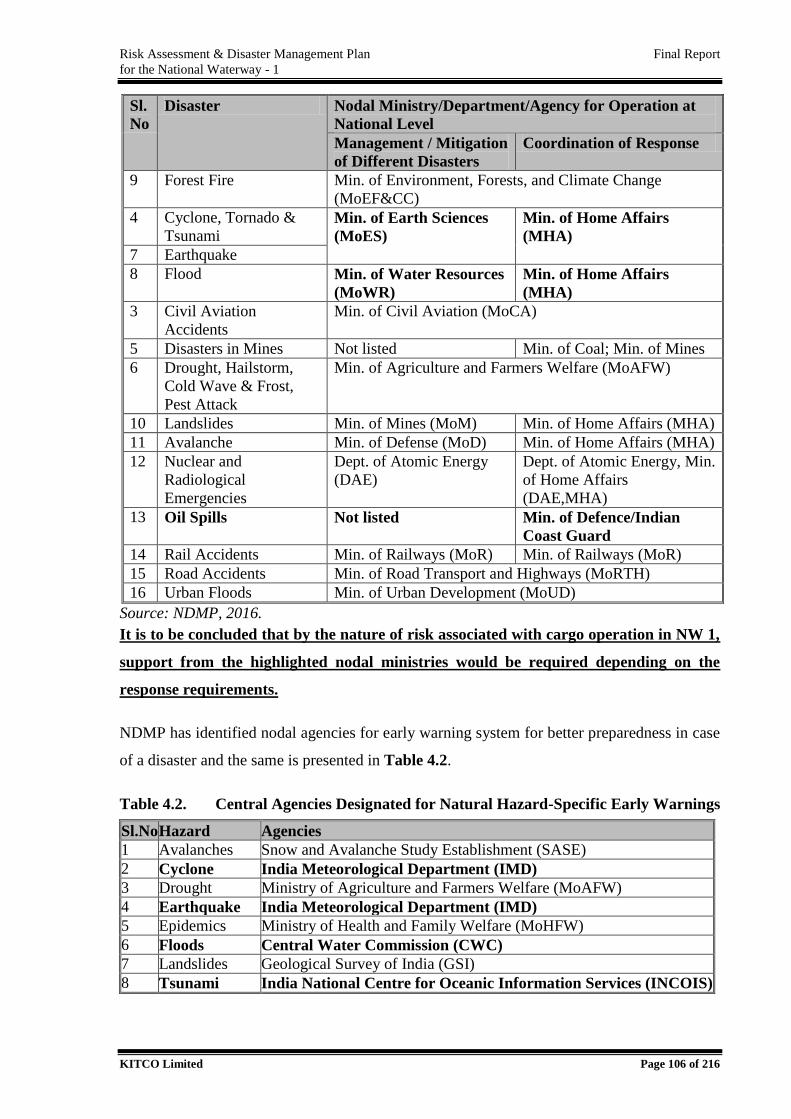
Risk Assessment & Disaster Management Plan Final Report
for the National Waterway - 1
KITCO Limited Page 106 of 216
Sl.
No
Disaster Nodal Ministry/Department/Agency for Operation at
National Level
Management / Mitigation
of Different Disasters
Coordination of Response
9 Forest Fire Min. of Environment, Forests, and Climate Change
(MoEF&CC)
4 Cyclone, Tornado &
Tsunami Min. of Earth Sciences
(MoES)
Min. of Home Affairs
(MHA)
7 Earthquake
8 Flood Min. of Water Resources
(MoWR)
Min. of Home Affairs
(MHA)
3 Civil Aviation
Accidents
Min. of Civil Aviation (MoCA)
5 Disasters in Mines Not listed Min. of Coal; Min. of Mines
6 Drought, Hailstorm,
Cold Wave & Frost,
Pest Attack
Min. of Agriculture and Farmers Welfare (MoAFW)
10 Landslides Min. of Mines (MoM) Min. of Home Affairs (MHA)
11 Avalanche Min. of Defense (MoD) Min. of Home Affairs (MHA)
12 Nuclear and
Radiological
Emergencies
Dept. of Atomic Energy
(DAE)
Dept. of Atomic Energy, Min.
of Home Affairs
(DAE,MHA)
13 Oil Spills Not listed Min. of Defence/Indian
Coast Guard
14 Rail Accidents Min. of Railways (MoR) Min. of Railways (MoR)
15 Road Accidents Min. of Road Transport and Highways (MoRTH)
16 Urban Floods Min. of Urban Development (MoUD)
Source: NDMP, 2016.
It is to be concluded that by the nature of risk associated with cargo operation in NW 1,
support from the highlighted nodal ministries would be required depending on the
response requirements.
NDMP has identified nodal agencies for early warning system for better preparedness in case
of a disaster and the same is presented in Table 4.2.
Table 4.2. Central Agencies Designated for Natural Hazard-Specific Early Warnings
Sl.No Hazard Agencies
1 Avalanches Snow and Avalanche Study Establishment (SASE)
2 Cyclone India Meteorological Department (IMD)
3 Drought Ministry of Agriculture and Farmers Welfare (MoAFW)
4 Earthquake India Meteorological Department (IMD)
5 Epidemics Ministry of Health and Family Welfare (MoHFW)
6 Floods Central Water Commission (CWC)
7 Landslides Geological Survey of India (GSI)
8 Tsunami India National Centre for Oceanic Information Services (INCOIS)
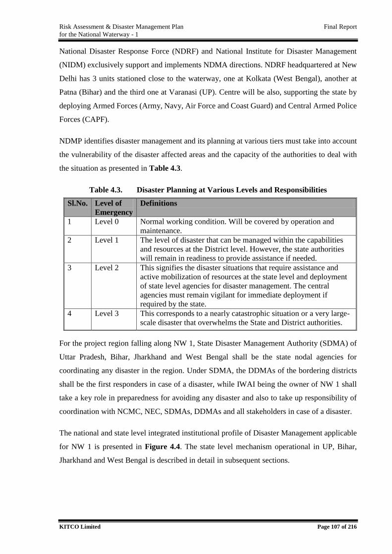
Risk Assessment & Disaster Management Plan Final Report
for the National Waterway - 1
KITCO Limited Page 107 of 216
National Disaster Response Force (NDRF) and National Institute for Disaster Management
(NIDM) exclusively support and implements NDMA directions. NDRF headquartered at New
Delhi has 3 units stationed close to the waterway, one at Kolkata (West Bengal), another at
Patna (Bihar) and the third one at Varanasi (UP). Centre will be also, supporting the state by
deploying Armed Forces (Army, Navy, Air Force and Coast Guard) and Central Armed Police
Forces (CAPF).
NDMP identifies disaster management and its planning at various tiers must take into account
the vulnerability of the disaster affected areas and the capacity of the authorities to deal with
the situation as presented in Table 4.3.
Table 4.3. Disaster Planning at Various Levels and Responsibilities
Sl.No. Level of
Emergency
Definitions
1 Level 0 Normal working condition. Will be covered by operation and
maintenance.
2 Level 1 The level of disaster that can be managed within the capabilities
and resources at the District level. However, the state authorities
will remain in readiness to provide assistance if needed.
3 Level 2 This signifies the disaster situations that require assistance and
active mobilization of resources at the state level and deployment
of state level agencies for disaster management. The central
agencies must remain vigilant for immediate deployment if
required by the state.
4 Level 3 This corresponds to a nearly catastrophic situation or a very large-
scale disaster that overwhelms the State and District authorities.
For the project region falling along NW 1, State Disaster Management Authority (SDMA) of
Uttar Pradesh, Bihar, Jharkhand and West Bengal shall be the state nodal agencies for
coordinating any disaster in the region. Under SDMA, the DDMAs of the bordering districts
shall be the first responders in case of a disaster, while IWAI being the owner of NW 1 shall
take a key role in preparedness for avoiding any disaster and also to take up responsibility of
coordination with NCMC, NEC, SDMAs, DDMAs and all stakeholders in case of a disaster.
The national and state level integrated institutional profile of Disaster Management applicable
for NW 1 is presented in Figure 4.4. The state level mechanism operational in UP, Bihar,
Jharkhand and West Bengal is described in detail in subsequent sections.
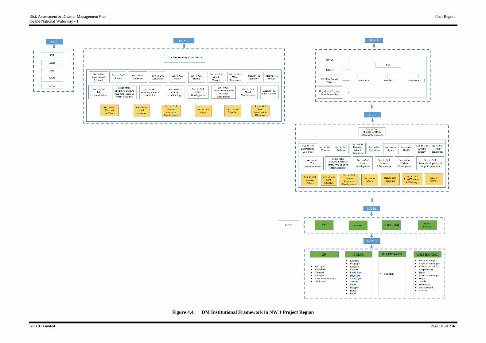
Risk Assessment & Disaster Management Plan Final Report
for the National Waterway - 1
KITCO Limited Page 108 of 216
Figure 4.4. DM Institutional Framework in NW 1 Project Region
Risk Assessment & Disaster Management Plan Final Report
for the National Waterway - 1
KITCO Limited Page 109 of 216
From the review of existing DM profile, it is to be concluded that
IWT related disaster w.r.to the cargo movement has not been listed as a major hazard
under NDMP. However, the port and harbor related disasters has been listed having
responsibility for NCMC. With accelerated IWT related developments, the same need
to be added in the NDMP.
Secretary to Ministry of Shipping (MoS) is a special invitee to the NEC and also
member of NCMC and shall be the nodal contact point with NCMC/NDMA in case of
IWT related disasters.
Disaster management Plan for NW 1 shall be prepared in line with DM Act, 2005
integrating to existing DDMPs of respective districts, while key coordination activities
shall be handled by the owner – IWAI. Capacity building requirements for existing
DDMAs and IWAI shall be delineated.
The DM proposal has to have the provision to handle Level 1 emergency with a
provision for escalation to Level 2 and Level 3. In case of Level 2 incidents, DDMAs
would play a key role on response and for Level 3 incidents, the various national plan
stakeholders such as resources from other states, national level shall be mobilized.
It is required that the DMP proposal will involve essential provision to avail early
warning from IMD (Cyclone and Earthquake), INCOISE (Tsunami) and CWC (Flood)
for avoiding disasters which may be causative or contributive by nature in IWT.
Since NW 1 is extending through 4 major states of India where the off shore hazard has
high probability for getting transported to the neighboring state, the incident reporting
requirements will be of two types considering the administrative system of the Country.
DDMAs of the State shall take lead on response operation with support from the
respective SDMA for inter district operations if hazard is not transferable to
neighboring districts.
In case the hazards are transferable to the districts outside the State Limit, it is required
that the matter need to be taken up at a higher level under NCMC to take a key role in
coordination.
Incident reporting requirement for IWT related disasters in NW 1 is presented in Figure 4.5.
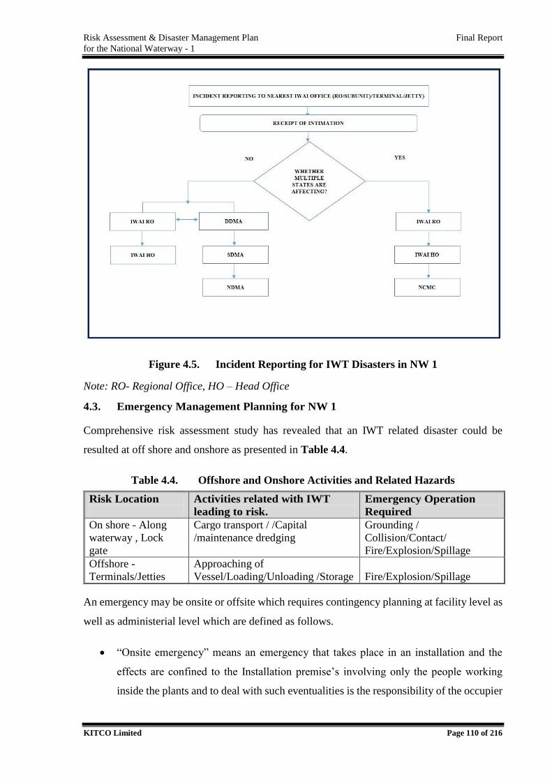
Risk Assessment & Disaster Management Plan Final Report
for the National Waterway - 1
KITCO Limited Page 110 of 216
Figure 4.5. Incident Reporting for IWT Disasters in NW 1
Note: RO- Regional Office, HO – Head Office
4.3. Emergency Management Planning for NW 1
Comprehensive risk assessment study has revealed that an IWT related disaster could be
resulted at off shore and onshore as presented in Table 4.4.
Table 4.4. Offshore and Onshore Activities and Related Hazards
Risk Location
Activities related with IWT
leading to risk.
Emergency Operation
Required
On shore - Along
waterway , Lock
gate
Cargo transport / /Capital
/maintenance dredging
Grounding /
Collision/Contact/
Fire/Explosion/Spillage
Offshore -
Terminals/Jetties
Approaching of
Vessel/Loading/Unloading /Storage
Fire/Explosion/Spillage
An emergency may be onsite or offsite which requires contingency planning at facility level as
well as administerial level which are defined as follows.
“Onsite emergency” means an emergency that takes place in an installation and the
effects are confined to the Installation premise’s involving only the people working
inside the plants and to deal with such eventualities is the responsibility of the occupier
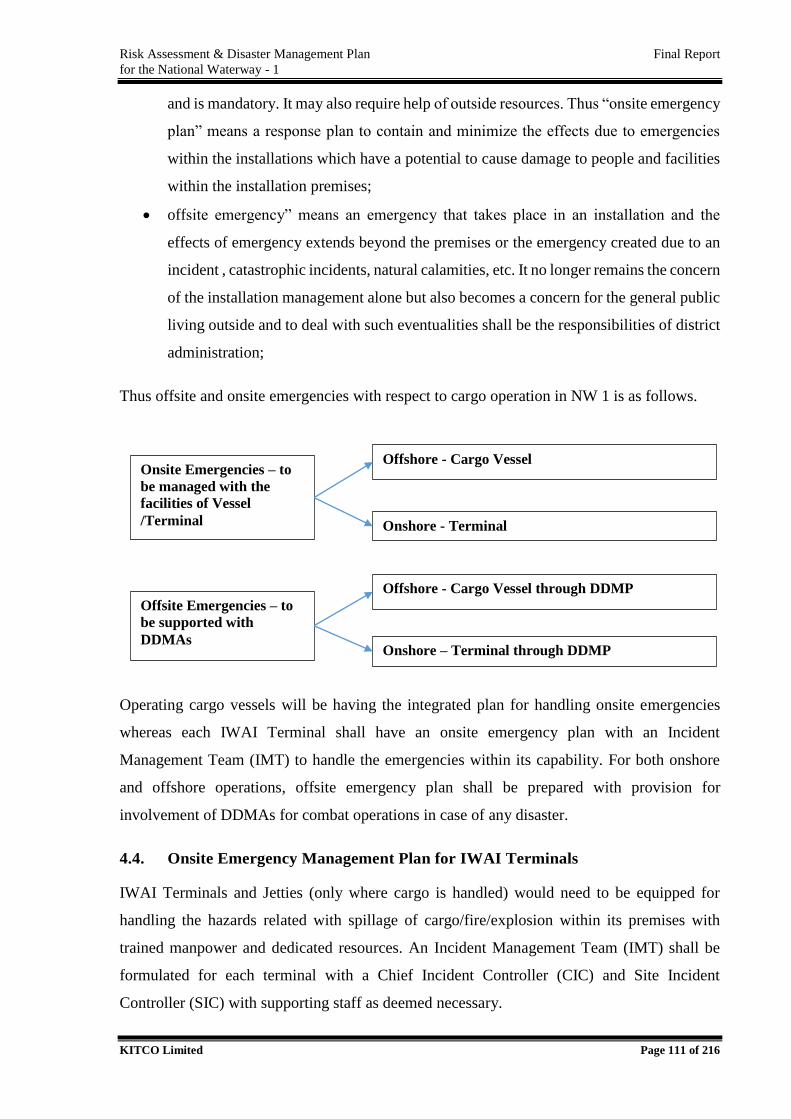
Risk Assessment & Disaster Management Plan Final Report
for the National Waterway - 1
KITCO Limited Page 111 of 216
and is mandatory. It may also require help of outside resources. Thus “onsite emergency
plan” means a response plan to contain and minimize the effects due to emergencies
within the installations which have a potential to cause damage to people and facilities
within the installation premises;
offsite emergency” means an emergency that takes place in an installation and the
effects of emergency extends beyond the premises or the emergency created due to an
incident , catastrophic incidents, natural calamities, etc. It no longer remains the concern
of the installation management alone but also becomes a concern for the general public
living outside and to deal with such eventualities shall be the responsibilities of district
administration;
Thus offsite and onsite emergencies with respect to cargo operation in NW 1 is as follows.
Operating cargo vessels will be having the integrated plan for handling onsite emergencies
whereas each IWAI Terminal shall have an onsite emergency plan with an Incident
Management Team (IMT) to handle the emergencies within its capability. For both onshore
and offshore operations, offsite emergency plan shall be prepared with provision for
involvement of DDMAs for combat operations in case of any disaster.
4.4. Onsite Emergency Management Plan for IWAI Terminals
IWAI Terminals and Jetties (only where cargo is handled) would need to be equipped for
handling the hazards related with spillage of cargo/fire/explosion within its premises with
trained manpower and dedicated resources. An Incident Management Team (IMT) shall be
formulated for each terminal with a Chief Incident Controller (CIC) and Site Incident
Controller (SIC) with supporting staff as deemed necessary.
Onsite Emergencies – to
be managed with the
facilities of Vessel
/Terminal
Offshore - Cargo Vessel
Onshore - Terminal
Offsite Emergencies – to
be supported with
DDMAs
Offshore - Cargo Vessel through DDMP
Onshore – Terminal through DDMP
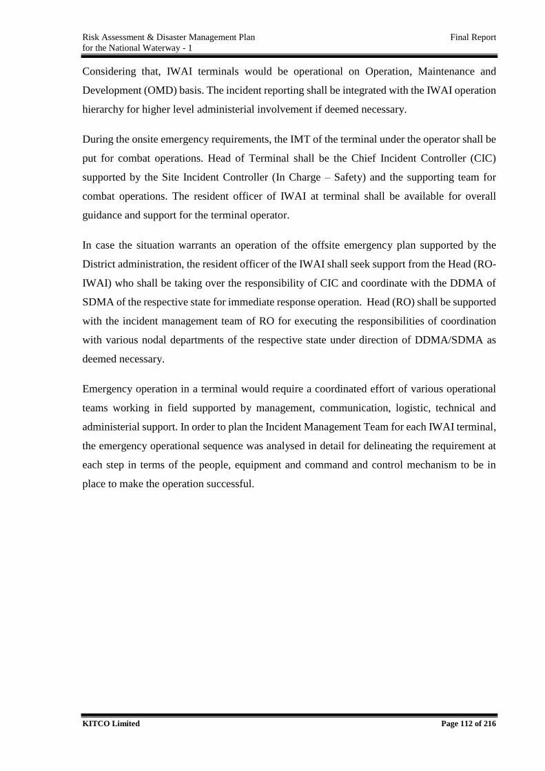
Risk Assessment & Disaster Management Plan Final Report
for the National Waterway - 1
KITCO Limited Page 112 of 216
Considering that, IWAI terminals would be operational on Operation, Maintenance and
Development (OMD) basis. The incident reporting shall be integrated with the IWAI operation
hierarchy for higher level administerial involvement if deemed necessary.
During the onsite emergency requirements, the IMT of the terminal under the operator shall be
put for combat operations. Head of Terminal shall be the Chief Incident Controller (CIC)
supported by the Site Incident Controller (In Charge – Safety) and the supporting team for
combat operations. The resident officer of IWAI at terminal shall be available for overall
guidance and support for the terminal operator.
In case the situation warrants an operation of the offsite emergency plan supported by the
District administration, the resident officer of the IWAI shall seek support from the Head (RO-
IWAI) who shall be taking over the responsibility of CIC and coordinate with the DDMA of
SDMA of the respective state for immediate response operation. Head (RO) shall be supported
with the incident management team of RO for executing the responsibilities of coordination
with various nodal departments of the respective state under direction of DDMA/SDMA as
deemed necessary.
Emergency operation in a terminal would require a coordinated effort of various operational
teams working in field supported by management, communication, logistic, technical and
administerial support. In order to plan the Incident Management Team for each IWAI terminal,
the emergency operational sequence was analysed in detail for delineating the requirement at
each step in terms of the people, equipment and command and control mechanism to be in
place to make the operation successful.
Risk Assessment & Disaster Management Plan Final Report
for the National Waterway - 1
KITCO Limited Page 113 of 216
This detailed analysis has been followed with delineation of Emergency Control Centre (ECC)
requirements delineating infrastructure facilities,
manpower, resources and infrastructure facility
requirement leading to the proposal on Incident
Management Team (IMT) for IWAI Terminals
specifying the roles and responsibilities of the IMT team
members and command and control to be in place. The
above analysis has been sequentially presented below.
4.4.1. Emergency Control Centre/ Incident Control
Room and Facilities
In case of an emergency operation requirement, the
planning and response operation need to be coordinated
from a single point called Incident Control Room (ICR)
alternatively called as Emergency Control Centre (ECC)
whereas response action may require to be directly over
seed at a site close to the incident known as Field
Command Post (FCP); response operation would require to be initiated simultaneously in Jetty
and associated water course as well as the shoreline areas under risk. For each IWAI Terminal,
ECC shall be established at Terminal Administrative Building. ECC shall be operated on 24*7
basis and would be activated on incident reporting.
ICR shall mandatorily have the various equipments for coordination with the activities of
various operational units of Port as well as field operational team at the same remaining
connected with the RO, HO, District Disaster Management Authority (DDMA) and
stakeholders associated with terminal operation or stakeholders at risk, due to operational
activities close to Terminal. ECC should mandatorily have the copy of the approved
contingency plan, maps, charts, data formats to be used for operation. The facilities planned at
ECC are followed.
4.4.2. Equipment
ECC shall be equipped with all equipments, communication and coordination facilities to act
on emergency.
Incident
Intimation to Authorities
Notifying the Key Team Memebrs
Assessment by CIC
Activation of ECC , Declare Emergency
Deciding Response Operation by CIC
Assembling of Team
Transport of Response Team to Site
Response Operation
Progress Monitoring & Reporting
Closure of Operation
Risk Assessment & Disaster Management Plan Final Report
for the National Waterway - 1
KITCO Limited Page 114 of 216
Maps and display charts and diagrams showing buildings, roads, underground fire
mains, important hazardous material and process lines, drainage trenches, and utilities
such as steam, water, natural gas and electricity.
A copy of the relevant disaster management plan.
Situation boards (continuously updated to present a summary of the current situation
and response actions being taken).
Aerial photographs, if possible, and maps showing the site, adjacent industries, the
surrounding community, highways, etc., to help determine how the disaster may affect
the community so that the proper people can be notified, adequate roadblocks
established, and the civil authorities advised.
Sufficient telephone lines to enable full liaison with outside bodies.
Names, addresses, and telephone numbers of employees, off-site groups and
organizations that might have to be contacted; all telephone lists being reviewed for
accuracy on a scheduled basis and updated, as necessary.
Dedicated and reliable communication equipment; enough telephones and at least one
fax line to serve the organization for calls both on and off-the-site.
Fixed and portable two-way radio equipment to keep in contact with activities on-scene
and to maintain continuity of communications when other means fail.
Plan board, logbook, voice recorder, television, DVD and Video facilities for playing
back records from aircraft and helicopters, as well as monitoring media coverage of the
incident with a person assigned to record pertinent information and to assist in
investigating cases, evaluating performance, and preparing reports.
Emergency lights so that operations can continue in the event of power failure.
Photocopy, fax and e-mail facilities.
Dedicated computers with LAN/ internet facility to access the installation data and the
latest and updated soft copies of all standard operating procedure (SOP) etc.
Wireless Internet Facility.
Video Conferencing Facility to have face to face communication/meetings between the
stake holders.
4.4.3. Documents, Contact Details, Lists / Maps
ECC has to maintain documents on Terminal Level Disaster Management Plan, emergency
contact details, maps, charts incident logs etc. The following details shall be available at ECC.
Risk Assessment & Disaster Management Plan Final Report
for the National Waterway - 1
KITCO Limited Page 115 of 216
Contact Details
ECC Key Personals, Trained Response Personals
Emergency Contacts – Hospitals, Ambulance, Fire, Police, DDMA, Indian Coast Guard
Stakeholders in and around terminal
Contact List of Resource Agencies – IMD, CWC, INCOIS etc.
Mutual Aid Partners
Emergency Contact Details of Sub offices, RO and HQ, IWAI.
Response Equipment Suppliers
Specialists available on Call
4.4.4. Lists/Maps
Emergency Response Equipment List
Master Plan of Terminal showing ICR, equipment storage areas, FCPs, waste storage
locations based on available terminal layout
4.4.5. Field Command Post (FCP) and Communications
Field Command Post is the point from where the response persons will be operating. FCP
would be identified based on the location of incident in due consideration of the safety of the
people to be deployed for emergency by SIC during an incident. FCP may be on land or in a
vessel depending on the incident location and type of incident to be handled.
4.4.5.1 Field Communication Equipment’s
SIC shall be directly overseeing the response operation and team would be deployed within
terminal or shoreline adjacent to the terminal. The team should have seamless connectivity with
dedicated field communication equipment for communicating in between during the operation.
ECC shall have dedicated communication facilities in place to receipt, record and respond to
the team under operation and also with the statutory authorities continuously.
The emergency response operation sequence and the facility requirements to handle emergency
is compiled in Figure 4.6 based on which, the Incident Management Team proposed for IWAI
Terminal is presented in Figure 4.7.
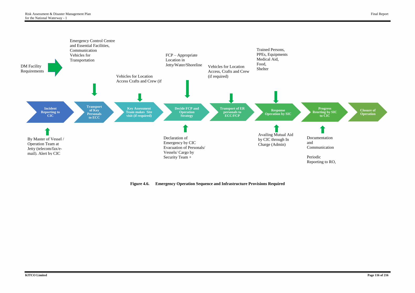
Risk Assessment & Disaster Management Plan Final Report
for the National Waterway - 1
KITCO Limited Page 116 of 216
Figure 4.6. Emergency Operation Sequence and Infrastructure Provisions Required
Incident Reporting to
CIC
Transport of Key
Personals to ECC
Key Assessment Team makes Site visit (if required)
Decide FCP and Operation Strategy
Transport of ER personals to ECC/FCP
Response Operation by SIC
Progress Reorting by SIC
to CIC
Closure of Operation
Emergency Control Centre
and Essential Facilities,
Communication
Vehicles for
Transportation
Vehicles for Location
Access Crafts and Crew (if
required)
FCP – Appropriate
Location in
Jetty/Water/Shoreline
Declaration of
Emergency by CIC
Evacuation of Personals/
Vessels/ Cargo by
Security Team +
Operation team
Vehicles for Location
Access, Crafts and Crew
(if required)
Trained Persons,
PPEs, Equipments
Medical Aid,
Food,
Shelter
Documentation
and
Communication
Periodic
Reporting to RO,
DDMA, Media
etc. by ECC
Availing Mutual Aid
by CIC through In
Charge (Admin)
By Master of Vessel /
Operation Team at
Jetty (telecom/fax/e-
mail). Alert by CIC
DM Facility
Requirements
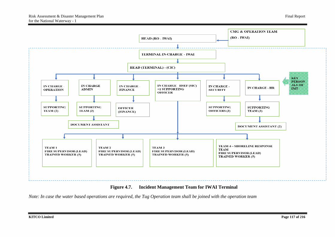
Risk Assessment & Disaster Management Plan Final Report
for the National Waterway - 1
KITCO Limited Page 117 of 216
Figure 4.7. Incident Management Team for IWAI Terminal
Note: In case the water based operations are required, the Tug Operation team shall be joined with the operation team
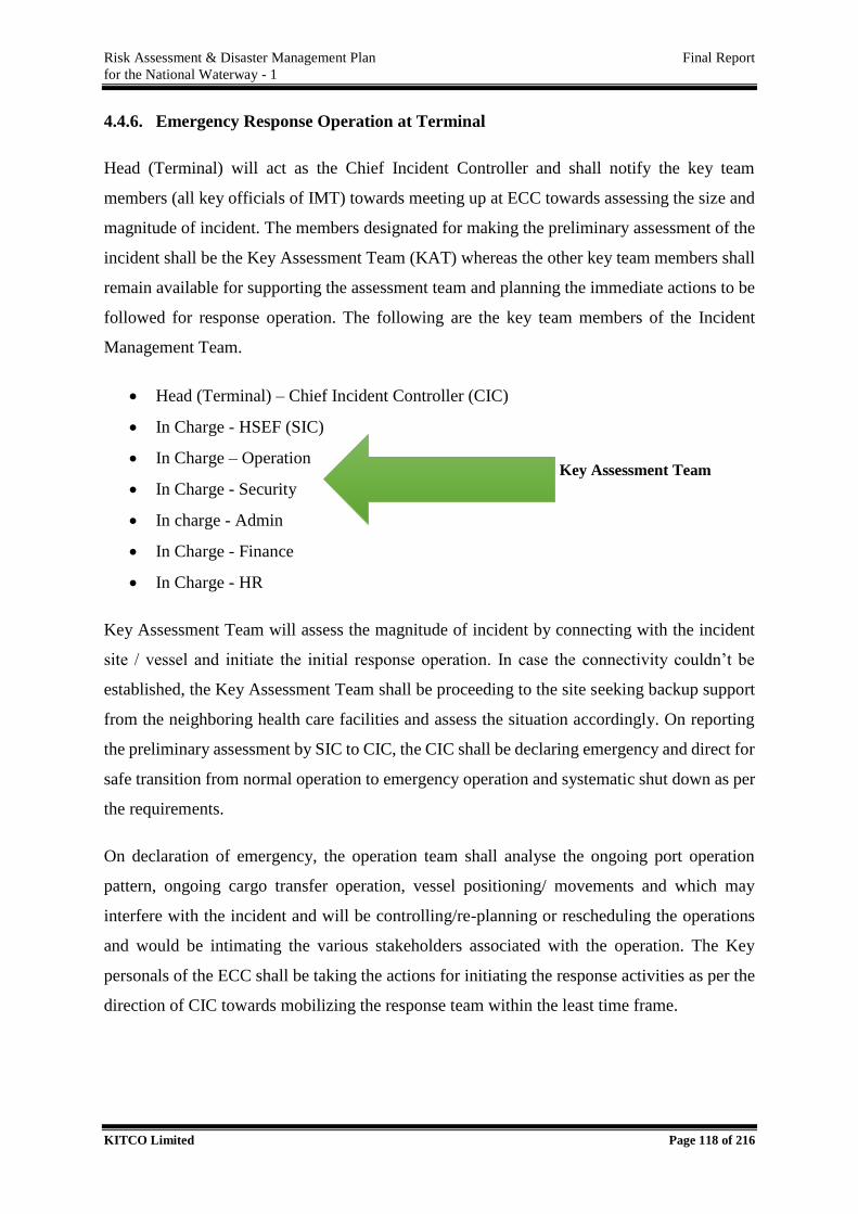
Risk Assessment & Disaster Management Plan Final Report
for the National Waterway - 1
KITCO Limited Page 118 of 216
4.4.6. Emergency Response Operation at Terminal
Head (Terminal) will act as the Chief Incident Controller and shall notify the key team
members (all key officials of IMT) towards meeting up at ECC towards assessing the size and
magnitude of incident. The members designated for making the preliminary assessment of the
incident shall be the Key Assessment Team (KAT) whereas the other key team members shall
remain available for supporting the assessment team and planning the immediate actions to be
followed for response operation. The following are the key team members of the Incident
Management Team.
Head (Terminal) – Chief Incident Controller (CIC)
In Charge - HSEF (SIC)
In Charge – Operation
In Charge - Security
In charge - Admin
In Charge - Finance
In Charge - HR
Key Assessment Team will assess the magnitude of incident by connecting with the incident
site / vessel and initiate the initial response operation. In case the connectivity couldn’t be
established, the Key Assessment Team shall be proceeding to the site seeking backup support
from the neighboring health care facilities and assess the situation accordingly. On reporting
the preliminary assessment by SIC to CIC, the CIC shall be declaring emergency and direct for
safe transition from normal operation to emergency operation and systematic shut down as per
the requirements.
On declaration of emergency, the operation team shall analyse the ongoing port operation
pattern, ongoing cargo transfer operation, vessel positioning/ movements and which may
interfere with the incident and will be controlling/re-planning or rescheduling the operations
and would be intimating the various stakeholders associated with the operation. The Key
personals of the ECC shall be taking the actions for initiating the response activities as per the
direction of CIC towards mobilizing the response team within the least time frame.
Key Assessment Team
Risk Assessment & Disaster Management Plan Final Report
for the National Waterway - 1
KITCO Limited Page 119 of 216
4.4.7. Responsibility Allocation for Incident Management Team
The following section presents the roles and responsibilities of the emergency response
personals and reporting requirements.
4.4.7.1. Chief Incident Controller (CIC) – Head (Terminal)
Head (Terminal) has been designated as the Chief Incident Controller for emergencies
associated with the terminal Operations. CIC is responsible for the management and
coordination of response operations at the scene of incident to achieve the most cost effective
and least environmentally damaging resolution to the problem. During a major incident
requiring operation of DDMA through offsite emergency plan, Head – RO (IWAI) shall take
over the responsibility of the CIC where the Head (Terminal) shall be acting as SIC to execute
the operational aspects of the response.
The Chief Incident Controller shall have overall responsibility to protect personnel, site
facilities and the public before, during, and after an emergency or disaster. The CIC shall be
present at the ECC for counsel and overall guidance. Responsibilities of the Chief Incident
Controller shall include the following:-
Preparation, review and updation of the Facility Level Disaster Contingency Plan for
Terminal;
Receive incident report; declaration of initial alert, preliminary reporting to RO.
Mobilization of Key Personals to ECC, assessment of situation, declaration of
emergency.
Activation of ECC; intimation of various stakeholders on the emergency.
Taking decision on seeking assistance from mutual aid members and external agencies;
Arrange for medical aid for saving life; mobilize emergency response team for
operation.
Take decision and provide alternative arrangements coordinate with stakeholders on
aspects related with changes in vessel operation plans, cargo handling plans, cargo
/vessel shifting requirements etc.
Support SIC through external assistance – technical, resources/equipment/medical
support as deemed necessary.
Risk Assessment & Disaster Management Plan Final Report
for the National Waterway - 1
KITCO Limited Page 120 of 216
Coordinate with Head – RO, ensure that appropriate local and national government
authorities are notified and various stakeholders are informed with regular and updated
reports/information/guidance.
Ensure round the clock operation; with shift personal being prepared to take charge of
the emergency control function, emergency shutdown of system if needed.
Taking stock of casualties and ensuring timely medical attention;
Ensuring correct accounting and position of personnel after the emergency;
Ordering evacuation of personnel as and when necessary;
Support RO for taking decision of escalation of response operation with involvement
of NDMA and NCMC.
Remain for counselling at ECC for various stakeholders, releasing media and public
statements.
Planning and conducting mock drills and ensure the contingency plan is ready to
execute.
4.4.7.2. Site Incident Controller (SIC) – In Charge (HSFE)
In Charge (HSFE) shall be the Site Incident Controller (SIC) who has overall responsibility for
managing the response and will report directly to CIC. During lesser incidents, the SIC shall
act as CIC and will have In Charge (Operation)/ In Charge (Security) as the resources who will
assume the responsibility of SIC in absence of In Charge (HSFE). Three member team of -
SIC, In Charge (Operation) and In Charge (Security) shall be the Key Assessment Team (KAT)
on receipt of any incident reporting. The key personals shall be directly involved in response
strategy formulation and revisions all throughout the emergency period.
Responsibilities of the Site Incident Controller shall include the following:-
To maintain a workable emergency control plan, establish emergency control center,
organize and equip the organization with trained personnel;
On receipt of the intimation from CIC immediately proceed to ECC and play key role
in assessing the situation by contacting vessel /In charge of incident area or proceeding
to site.
Assess the situation by contacting vessel or by leading the team to the incident
assessment; report to CIC for emergency declaration, lifesaving requirements,
Risk Assessment & Disaster Management Plan Final Report
for the National Waterway - 1
KITCO Limited Page 121 of 216
operation and response strategy. Support CIC in decision on availing support from
mutual aid members and or DDMA.
Ensure that essential HSE/Communication equipments are availed for the Key
Assessment Team.
Take quick decisions on priority of operation – life saving requirements/ response
requirements, ideal location for field command post, response strategy to be adopted
and take full charge of operational activities; coordinate all activities within Incident
Management Team members.
Plan both off shore and onshore operational strategy, revisit the strategy
Ensure that medical aid has been made available as early as possible.
Assess mutual aid requirements, intimate to CIC. Lead the response operation in case
of smaller incidents assuming the power of CIC.
Coordinate mutual aid activities if situation warrants. Support DDMA as Coordinator
on behalf of Terminal with availing equipment, manpower and supporting facilities for
response operation.
Plan and deploy the available resources – equipment, firefighting facilities assess
additional requirements with support from Key Assessment Team and avail with
support of ECC.
Lead response team to Field Command Post, brief the situation, lead operational
activities; ensure that the response operations are least environmental damaging and
best suited to the situation.
Guide operational activities with appropriate response strategy, provide technical inputs
(meteorological conditions, physical and chemical properties, environmental
significance etc.) continuously monitor and report, revise the strategy as and when
required.
Ensure the maintenance requirements of the equipments and manpower (medical,
transportation, food, shelter, change of shift etc.) is met with during the course of
operation.
Assess the additional requirements for response operation –equipments/ trained
resources/ crafts/ crew/ communication devices / supply of food/ transportation,
specialist support, weather forecasting requirements etc., ensure timely availing the
support as desired.
Risk Assessment & Disaster Management Plan Final Report
for the National Waterway - 1
KITCO Limited Page 122 of 216
Ensure that the response operations are appropriately monitored, evidences are taken as
per the guidelines and passed on to In Charge HR – Documentation in charge of ECC.
Assess the immediate financial requirements, avail the same through CIC.
Regularly report to CIC; support with in situ information on progress, terminal /vessel
operational control requirements which need to be imposed.
Provide technical support to CIC on coordinating with stakeholders, protecting the
interest of the affected parties and ensuring factual information dissemination with the
statutory/media/public.
4.4.7.3. In Charge – Operation
On receipt of the intimation from CIC immediately proceed to ECC and play key role
in assessing the situation by contacting vessel or proceeding to site.
Support the response operation throughout the period with continued availability of
Crafts (tug/pilot boats/survey launches etc.) and Crew & in case vessel operation is
required, guide assessment team to the boarding point ensure the assessment team
reaching the site of incident.
Provide the Key assessment team with input on the vessel met with accident and the
details available on the consignment, quantity etc.
Support for the securing the wrecked vessel and or cargo arranged by the Ship
Owner/Agent/Charterer.
In absence of SIC, take over the complete responsibility of SIC as per the advice of
CIC.
Take decision on stopping the cargo handling activities/ evacuation of other vessels
/operations if the incident site is close to the berth / anchorage. Coordinate and ensure
immediate evacuation from the scene of incident.
Take adequate action in consultation with the cargo handling team for securing the
unloading cargo as well as the cargo received for dispatch.
Take adequate action for informing the various stakeholders – with the change in vessel
entry/exit to terminal areas, resultant cargo handling changes; ensure that the interest
of the Terminal Owner as well as the Stakeholders are protected to the maximum.
Ensure constant communications from ECC and remain available for the
clarifications/decisions thereto.
Risk Assessment & Disaster Management Plan Final Report
for the National Waterway - 1
KITCO Limited Page 123 of 216
Supporting team under In Charge – Operation shall execute the changes required in
vessel operation and cargo handling aspects as above.
Immediately release the emergency operational people both for the response operation
and ECC management requirements. Assess the additional manpower requirement for
the ongoing operation pattern in Consultation with SIC and pass on emergency call
people list to In Charge (Admin).
Support with availing suitable cranes, vehicles and supporting crews for the transfer of
spilled cargo collected to land and safe transfer to temporary disposal site.
On behalf of Terminal, as per the advice of CIC, communicate with Vessel
Owner/Agent/Charterer for the salvage operation requirements. Support for the salvage
operation arranged by the Vessel Owner/Agent/Charterer with allotting operational
accessibilities.
Act as Specific In Charge for Jetty/Terminal based response operations.
4.4.7.4. In Charge – Security
On receipt of the intimation from CIC immediately proceed to ECC; alert terminal users
as per the direction of CIC.
Assess the security requirements for immediately proceeding to the site of incidence;
avail utility vehicles;
Responsible for disbursing security directions for controlling entry/exit to Terminal
premises.
Assist the operation team for evacuation of personals/cargo if warranted. Operate public
warning systems in emergency situations.
Ensure the utility vehicles in place for accessing the site of incidence. Immediately plan
and make available pathways for operation for medical team/fire team/response team
etc. without compromising the security.
In case of Level 2/3 operation, control on the entry /exit of vehicles, equipments and
personals for the emergency operation; ensure ease of operation within the security
regime.
Quickly assess the security areas, requirement of additional resources if any from State
Police/DDMA, report to CIC and coordinate with the additional resources.
Risk Assessment & Disaster Management Plan Final Report
for the National Waterway - 1
KITCO Limited Page 124 of 216
Support SIC in limiting the access of unauthorized persons/vehicle to the scene of
incidence or response operation areas including the shore line response areas. Ensure
tight security of the operational areas until normalcy is restored.
Oversee the shoreline response operations, regularly report the progress to SIC, ensure
that the response operations are appropriately monitored, evidences are taken as per the
guidelines.
In absence of SIC, take over the complete responsibility of SIC as per the advice of
CIC.
Act as specific in charge for shoreline response operations.
4.4.7.5. In Charge - HR
Core responsibility dealing with identifying manpower support for operations, handling
communication with various agencies and central point of communication in ECC.
On receipt of the intimation from CIC immediately proceed to ECC; alert terminal users
per the direction of CIC.
After primary assessment / as per the direction of SIC, immediately identify the primary
responders and release intimation to In charge – Admin for necessary intimation and
transport of personal to ECC.
Support SIC in identifying additional manpower and requirement for the ongoing
operation and pass on emergency call persons list to In Charge -Admin.
Remain as the communication head of ECC, ensure that the communication from Site
Incident Control is maintained uninterrupted. Support SIC in all communication
aspects. Ensure that the information at ECC is continuously updated from the site.
Responsible for all communication with all other agencies – DDMA,ICG, Government,
mutual aid partners, various stakeholder – prepare the communication, get approval
from CIC and release on behalf of CIC.
Prepare response to all media/public queries, prepare press statements release
responses/statements after approval from CIC.
In case of additional support requirement, as per direction of CIC, contact mutual aid
partners, collect information on the resources committed to be availed pass the
information to SIC.
Take full charge of the documentation of response operation. Direct /request the team
in operation for documentary evidences, take full control on progress reports are
Risk Assessment & Disaster Management Plan Final Report
for the National Waterway - 1
KITCO Limited Page 125 of 216
maintained, evidences are taken as per the DM guidelines. Get guidance from In charge
(Finance) on the documentation aspects and support In charge (Finance) for financial
closure of operation with providing various claims/reimbursements/disbursements etc.
towards realization.
4.4.7.6. In Charge – Admin
Responsible for core administration and logistic support for ECC and its operation.
Responsible for the operation and maintenance for ECC. Over all coordination with the
various operational unit for maintaining the ECC functional.
After primary assessment / as per the direction of SIC, immediately coordinate with the
primary responders and avail utility vehicle support for reaching ECC and further
proceeding to FCP.
Make necessary arrangements for the mutual aid partners for travel to project site, lead
them to ECC and connect with the response team under SIC. Avail compliance with
the security procedures of Terminal for the resources on call (internal as well as
external) with a dedicated security personal for ease of operation.
Maintain document on the resources deployment – details of the people/equipment on
operation, period of deployment, comply with the financial requirements for arranging
facilities for response personals through CIC.
Avail transport and logistic arrangements for the personal on duty for emergency
operation – ensure supply of food, shelter and travel requirement. Coordinate with the
external facilities of terminal areas for making temporary arrangements.
4.4.7.7. In Charge – Finance
Support CIC for preliminary estimate of the finance requirement for operations.
Approve and avail the fund throughout operational period.
Allot Officer (finance) round the clock in ECC for supporting the various team with
guidance on collecting and recording the relevant supporting documents toward
effecting payment directly/reimbursements.
Support SIC on aspects of financial control of operations, after closure of operation,
assume the charge of financial closure of operation with proceeding for the various
claims/reimbursements/disbursements etc. until it is realized.

Risk Assessment & Disaster Management Plan Final Report
for the National Waterway - 1
KITCO Limited Page 126 of 216
4.4.7.8. Technical Resource Person
Lead coordinator for site specific support to ECC on cargo properties, weather
forecasting and environmental and bathymetric aspects
Provide technical guidance for the operation team on the chemical characteristics and
fate of the cargo by analysing the incident report.
Maintain updated contacts with the various resources agencies identified in Disaster
Management Plan and avail ready to contact list in case of emergency. Identify resource
persons to be utilised in case of emergency and maintain appropriate arrangements for
availing services.
Support In Charge - HR in communication with statutory agencies.
Support response operation by connecting to the agencies such as INCOIS, CWC, IMD
etc., early warning
4.4.7.9. Responsibilities of Supporting Teams of IMT
The most relevant roles of the key supporting members are listed below and being part of ECC
additional responsibilities would be allotted to all members as per the requirement by CIC.
4.4.7.9.1. Supportive Team – under In Charge (Operations) – 2 Members
Support In Charge - Operation for planning and execution of functional activities
assigned to him.
Analyse and re-plan ongoing and planned cargo operation, secure cargo unloaded or
accepted for loading to vessels, securing of the vessels /facilities in incident proximity.
Execution of the re plans as per the direction In Charge (Operation) which may include
upto systematic shutting down.
4.4.7.9.2. Supportive Team – under In Charge (Admin) – 2 Members
Support In charge – Admin to execute the role in managing ECC
Support In charge – Admin for transportation of ECC Key members as per direction of
CIC.
Support In charge – Admin for providing logistic arrangements, catering facilities etc.,
for the incident response team.
Support In charge – Admin for arranging any transfer facilities - arrangement of
emergency vehicles, people etc.,
Risk Assessment & Disaster Management Plan Final Report
for the National Waterway - 1
KITCO Limited Page 127 of 216
Liaison with external facilities - hotels/resorts etc. for arranging accommodation for
response personals.
4.4.7.9.3. Document Assistant– under In Charge - Admin
Support In charge Admin to act as Centre point of communication at ECC.
Take charge of preparation and custody of all documents w r to manpower and
equipment requirements, logistic supports etc., for response operations.
4.4.7.9.4. Officer - Finance
Complete the procedure for financial disbursement as per the direction of In Charge -
Finance and ensure the disbursements.
Keep on updating the reserve funds and additional requirements if any to In Charge -
Finance.
4.4.7.9.5. Support Officer 1 – under In Charge- HR
Support In Charge - HR for emergency call of response personals to ECC.
Support In Charge - HR to ensure seamless communication to SIC and update to CIC.
Support In Charge - HR for acting as the communication point at ECC, receiving and
replying for the communication for all stakeholders.
4.4.7.9.6. Support Officer 2 – under In Charge- HR
Analyse Media and PR queries, prepare replies and support In Charge - HR to get
approved by CIC.
4.4.7.9.7. Supporting Officer 3 – under In Charge -HR
Act as documentation in charge - take charge of preparation and custody of all
documents - requests/orders/bills/claims etc.
Support In Charge - HR for all documentation related aspects.
Safe custody of progress reports of operation, ensure that essential supporting evidences
are captured and documented towards claim on later stage.
4.4.7.9.8. Document Assistant for ECC – under In charge HR
Meet the requirement of ECC on drafting, communications, printing, publishing,
recording etc. throughout the operational period.
4.4.7.9.10. Supporting Officer – Under In Charge HSFE at FCP
Support SIC executing his duties – managing FCP and coordinating the supporting
units.
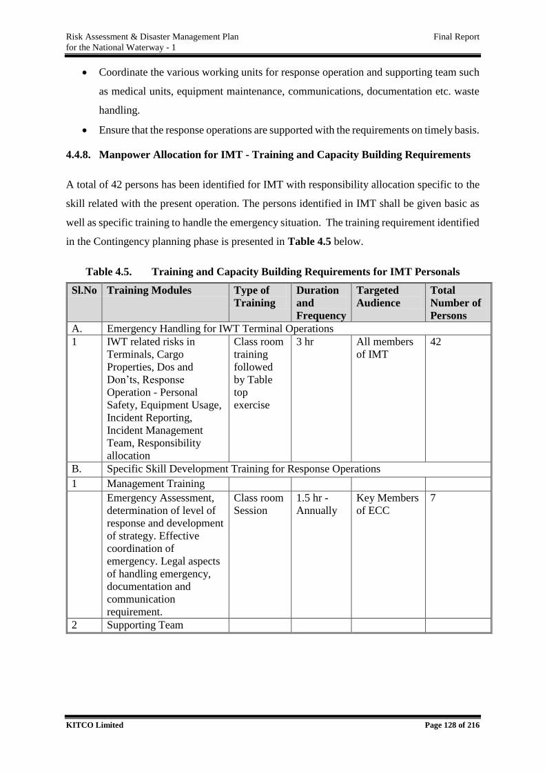
Risk Assessment & Disaster Management Plan Final Report
for the National Waterway - 1
KITCO Limited Page 128 of 216
Coordinate the various working units for response operation and supporting team such
as medical units, equipment maintenance, communications, documentation etc. waste
handling.
Ensure that the response operations are supported with the requirements on timely basis.
4.4.8. Manpower Allocation for IMT - Training and Capacity Building Requirements
A total of 42 persons has been identified for IMT with responsibility allocation specific to the
skill related with the present operation. The persons identified in IMT shall be given basic as
well as specific training to handle the emergency situation. The training requirement identified
in the Contingency planning phase is presented in Table 4.5 below.
Table 4.5. Training and Capacity Building Requirements for IMT Personals
Sl.No Training Modules Type of
Training
Duration
and
Frequency
Targeted
Audience
Total
Number of
Persons
A. Emergency Handling for IWT Terminal Operations
1 IWT related risks in
Terminals, Cargo
Properties, Dos and
Don’ts, Response
Operation - Personal
Safety, Equipment Usage,
Incident Reporting,
Incident Management
Team, Responsibility
allocation
Class room
training
followed
by Table
top
exercise
3 hr All members
of IMT
42
B. Specific Skill Development Training for Response Operations
1 Management Training
Emergency Assessment,
determination of level of
response and development
of strategy. Effective
coordination of
emergency. Legal aspects
of handling emergency,
documentation and
communication
requirement.
Class room
Session
1.5 hr -
Annually
Key Members
of ECC
7
2 Supporting Team
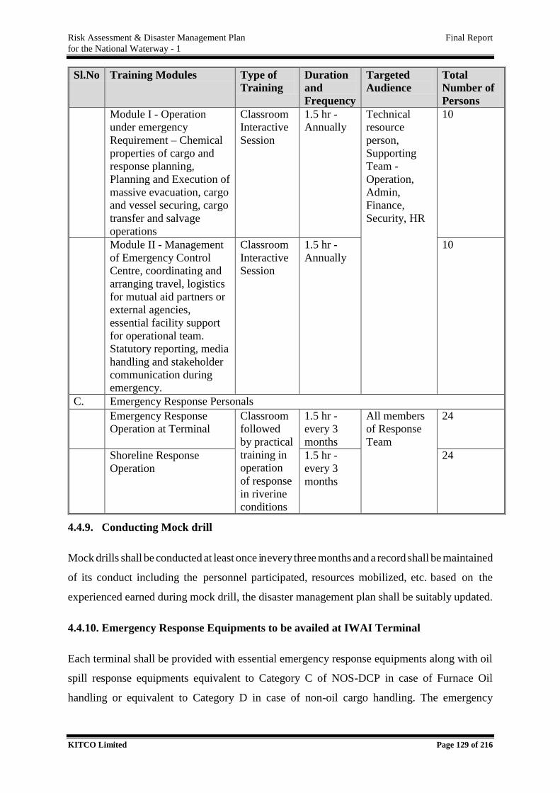
Risk Assessment & Disaster Management Plan Final Report
for the National Waterway - 1
KITCO Limited Page 129 of 216
Sl.No Training Modules Type of
Training
Duration
and
Frequency
Targeted
Audience
Total
Number of
Persons
Module I - Operation
under emergency
Requirement – Chemical
properties of cargo and
response planning,
Planning and Execution of
massive evacuation, cargo
and vessel securing, cargo
transfer and salvage
operations
Classroom
Interactive
Session
1.5 hr -
Annually
Technical
resource
person,
Supporting
Team -
Operation,
Admin,
Finance,
Security, HR
10
Module II - Management
of Emergency Control
Centre, coordinating and
arranging travel, logistics
for mutual aid partners or
external agencies,
essential facility support
for operational team.
Statutory reporting, media
handling and stakeholder
communication during
emergency.
Classroom
Interactive
Session
1.5 hr -
Annually
10
C. Emergency Response Personals
Emergency Response
Operation at Terminal
Classroom
followed
by practical
training in
operation
of response
in riverine
conditions
1.5 hr -
every 3
months
All members
of Response
Team
24
Shoreline Response
Operation
1.5 hr -
every 3
months
24
4.4.9. Conducting Mock drill
Mock drills shall be conducted at least once in every three months and a record shall be maintained
of its conduct including the personnel participated, resources mobilized, etc. based on the
experienced earned during mock drill, the disaster management plan shall be suitably updated.
4.4.10. Emergency Response Equipments to be availed at IWAI Terminal
Each terminal shall be provided with essential emergency response equipments along with oil
spill response equipments equivalent to Category C of NOS-DCP in case of Furnace Oil
handling or equivalent to Category D in case of non-oil cargo handling. The emergency
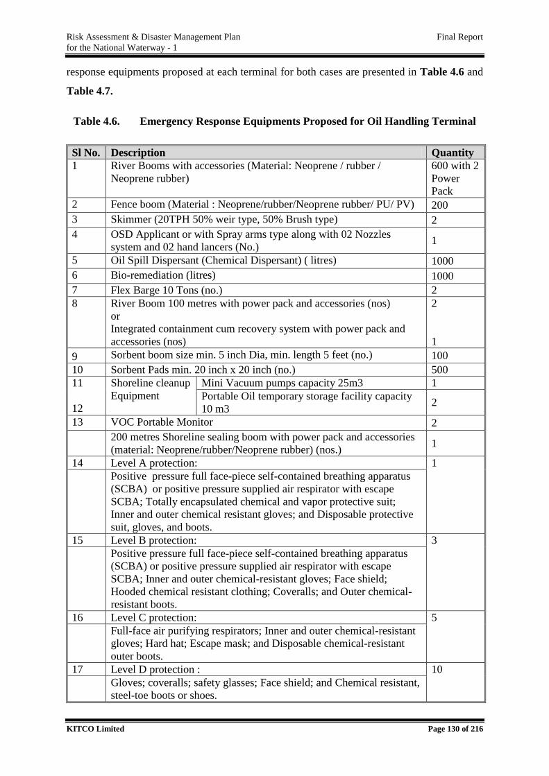
Risk Assessment & Disaster Management Plan Final Report
for the National Waterway - 1
KITCO Limited Page 130 of 216
response equipments proposed at each terminal for both cases are presented in Table 4.6 and
Table 4.7.
Table 4.6. Emergency Response Equipments Proposed for Oil Handling Terminal
Sl No. Description Quantity
1 River Booms with accessories (Material: Neoprene / rubber /
Neoprene rubber)
600 with 2
Power
Pack
2 Fence boom (Material : Neoprene/rubber/Neoprene rubber/ PU/ PV) 200
3 Skimmer (20TPH 50% weir type, 50% Brush type) 2
4 OSD Applicant or with Spray arms type along with 02 Nozzles
system and 02 hand lancers (No.) 1
5 Oil Spill Dispersant (Chemical Dispersant) ( litres) 1000
6 Bio-remediation (litres) 1000
7 Flex Barge 10 Tons (no.) 2
8 River Boom 100 metres with power pack and accessories (nos)
or
Integrated containment cum recovery system with power pack and
accessories (nos)
2
1
9 Sorbent boom size min. 5 inch Dia, min. length 5 feet (no.) 100
10 Sorbent Pads min. 20 inch x 20 inch (no.) 500
11
12
Shoreline cleanup
Equipment
Mini Vacuum pumps capacity 25m3 1
Portable Oil temporary storage facility capacity
10 m3 2
13 VOC Portable Monitor 2
200 metres Shoreline sealing boom with power pack and accessories
(material: Neoprene/rubber/Neoprene rubber) (nos.) 1
14 Level A protection: 1
Positive pressure full face-piece self-contained breathing apparatus
(SCBA) or positive pressure supplied air respirator with escape
SCBA; Totally encapsulated chemical and vapor protective suit;
Inner and outer chemical resistant gloves; and Disposable protective
suit, gloves, and boots.
15 Level B protection: 3
Positive pressure full face-piece self-contained breathing apparatus
(SCBA) or positive pressure supplied air respirator with escape
SCBA; Inner and outer chemical-resistant gloves; Face shield;
Hooded chemical resistant clothing; Coveralls; and Outer chemical-
resistant boots.
16 Level C protection: 5
Full-face air purifying respirators; Inner and outer chemical-resistant
gloves; Hard hat; Escape mask; and Disposable chemical-resistant
outer boots.
17 Level D protection : 10
Gloves; coveralls; safety glasses; Face shield; and Chemical resistant,
steel-toe boots or shoes.
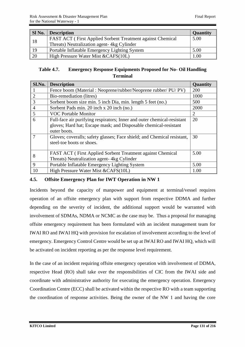
Risk Assessment & Disaster Management Plan Final Report
for the National Waterway - 1
KITCO Limited Page 131 of 216
Sl No. Description Quantity
18 FAST ACT ( First Applied Sorbent Treatment against Chemical
Threats) Neutralization agent- 4kg Cylinder
5.00
19 Portable Inflatable Emergency Lighting System 5.00
20 High Pressure Water Mist &CAFS(10L) 1.00
Table 4.7. Emergency Response Equipments Proposed for No- Oil Handling
Terminal
Sl.No. Description Quantity
1 Fence boom (Material : Neoprene/rubber/Neoprene rubber/ PU/ PV) 200
2 Bio-remediation (litres) 1000
3 Sorbent boom size min. 5 inch Dia, min. length 5 feet (no.) 500
4 Sorbent Pads min. 20 inch x 20 inch (no.) 2000
5 VOC Portable Monitor 2
6 Full-face air purifying respirators; Inner and outer chemical-resistant
gloves; Hard hat; Escape mask; and Disposable chemical-resistant
outer boots.
20
7 Gloves; coveralls; safety glasses; Face shield; and Chemical resistant,
steel-toe boots or shoes.
30
8 FAST ACT ( First Applied Sorbent Treatment against Chemical
Threats) Neutralization agent- 4kg Cylinder
5.00
9 Portable Inflatable Emergency Lighting System 5.00
10 High Pressure Water Mist &CAFS(10L) 1.00
4.5. Offsite Emergency Plan for IWT Operation in NW 1
Incidents beyond the capacity of manpower and equipment at terminal/vessel requires
operation of an offsite emergency plan with support from respective DDMA and further
depending on the severity of incident, the additional support would be warranted with
involvement of SDMAs, NDMA or NCMC as the case may be. Thus a proposal for managing
offsite emergency requirement has been formulated with an incident management team for
IWAI RO and IWAI HQ with provision for escalation of involvement according to the level of
emergency. Emergency Control Centre would be set up at IWAI RO and IWAI HQ, which will
be activated on incident reporting as per the response level requirement.
In the case of an incident requiring offsite emergency operation with involvement of DDMA,
respective Head (RO) shall take over the responsibilities of CIC from the IWAI side and
coordinate with administrative authority for executing the emergency operation. Emergency
Coordination Centre (ECC) shall be activated within the respective RO with a team supporting
the coordination of response activities. Being the owner of the NW 1 and having the core
Risk Assessment & Disaster Management Plan Final Report
for the National Waterway - 1
KITCO Limited Page 132 of 216
technical expertise in administering waterways, IWAI shall extend all technical assistance /
advice to DDMAs for responding to the incident.
The key responsibilities of IWAI in handling offsite emergencies of an IWT related disaster
would be
Assist DDMAs by providing technical assistance on river hydrography, inland vessel
operation, cargo type and its chemical characteristics, response requirements and
supervising cargo transfer operations (if any).
Execute a Mutual aid with the stakeholders along the region (under each RO) including
major industrial units who may be able to assist to manage the incident with qualified
persons and resources.
Based on the Risk assessment study, provide inputs on stakeholders affected due to the
incident actively involved in prioritising protection measures of the vulnerable
resources.
Be part of the DDMA to assess the situation, identifying additional resources for
combat operations and help DDMA to take decision on escalation of emergency.
RO – IWAI shall be the nodal officer from IWAI for coordinating with the disaster
management system till Level 2 operation (confined within a state) with involvement
of the respective SDMAs.
On escalation of an emergency to Level 3/ in case of any emergency which may be
affecting more than one state requiring involvement of NCMC, Chairman IWAI shall
be the CIC from the IWAI side for effective coordination with the respective disaster
management mechanism. ECC shall be activated at IWAI – HQ and the ECC would
be directly coordinating with the NDMA or NCMC for availing all possible support for
the response operation and will act as a facility hub for extensive maximum support
from the central institutions including armed forces, NDRF etc.
IWAI shall play an active role in emergency response with specific intervention to avail
support from central authorities in the least time frame through Secretary of Shipping,
(MoS)
IWAI shall take responsibility of coordinating with the respective Inland Vessel
owner/Charterer/Agent and suitably support in securing cargo or vessel and supporting
salvage operations, if any, initiated by the owner of vessel.
Risk Assessment & Disaster Management Plan Final Report
for the National Waterway - 1
KITCO Limited Page 133 of 216
It is to be noted that, for major incidents or incidents involving multiple States, response
operation would warrant critical management decisions at the top level to coordinate with
NDMA/NCMC. Hence a Crisis Management Group (CMG) has been proposed at IWAI HO.
Direction of the CMG shall be implemented by the IMT of HO where senior officials shall be
involved in supporting CMG for coordinating with NDMA/NCMC through relevant
information from field through the IMT of RO. CMG proposed for IWAI shall be normally
involved in major incidents as above and shall be available for any specific incidents which
require the involvement of top level management of IWAI. Thus the Incident Organogram
proposed for IWAI for handling offshore emergencies are presented in Figure 4.8.
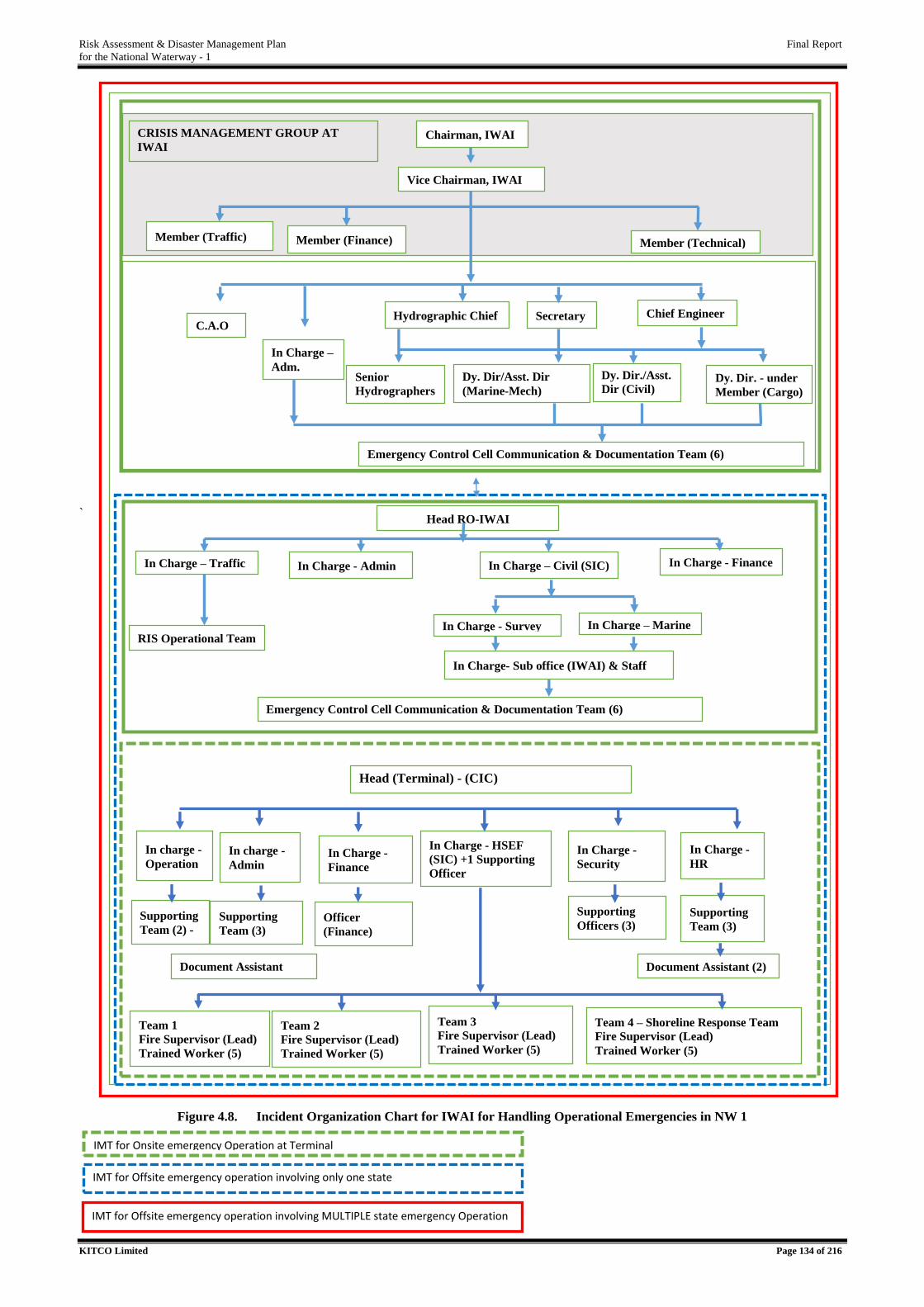
Risk Assessment & Disaster Management Plan Final Report
for the National Waterway - 1
KITCO Limited Page 134 of 216
zzzzzzzzzzzzzzzzzzzz
`
Figure 4.8. Incident Organization Chart for IWAI for Handling Operational Emergencies in NW 1
IMT for Onsite emergency Operation at Terminal
IMT for Offsite emergency operation involving only one state
IMT for Offsite emergency operation involving MULTIPLE state emergency Operation
Head (Terminal) - (CIC)
In Charge - HSEF
(SIC) +1 Supporting
Officer
In Charge -
Security In Charge -
Finance
In charge -
Admin
In Charge -
HR
Team 1
Fire Supervisor (Lead)
Trained Worker (5)
Supporting
Team (2) - Supporting
Team (3) Officer
(Finance)
Supporting
Team (3)
Supporting
Officers (3)
Document Assistant
In Charge- Sub office (IWAI) & Staff
Team 2
Fire Supervisor (Lead)
Trained Worker (5)
Team 3
Fire Supervisor (Lead)
Trained Worker (5)
Document Assistant (2)
Team 4 – Shoreline Response Team
Fire Supervisor (Lead)
Trained Worker (5)
Head RO-IWAI
In Charge – Traffic
c In Charge - Admin In Charge – Civil (SIC) In Charge - Finance
In Charge - Survey In Charge – Marine
Chairman, IWAI
Member (Traffic) Member (Finance) Member (Technical)
Dy. Dir. - under
Member (Cargo)
C.A.O
Dy. Dir/Asst. Dir
(Marine-Mech)
Vice Chairman, IWAI
In Charge –
Adm. Dy. Dir./Asst.
Dir (Civil)
Emergency Control Cell Communication & Documentation Team (6)
Chief Engineer Hydrographic Chief
CRISIS MANAGEMENT GROUP AT
IWAI
Emergency Control Cell Communication & Documentation Team (6)
In charge -
Operation
Secretary
Senior
Hydrographers
s
RIS Operational Team
Risk Assessment & Disaster Management Plan Final Report
for the National Waterway - 1
KITCO Limited Page 135 of 216
4.5.1. Responsibility of Emergency Response Personals at IWAI - RO
Responsibility allocation of IWAI officials at RO for handling emergencies confined within a
State.
4.5.1.1. Head – RO
Receive incident report from terminals, alert RO, activate ECC at RO and send an
intimation to IWAI –HQ.
Continuously receive update from terminal on response operation and additional
support requirements if any and keep IWAI – HQ updated on the incident.
Allot a member or entire team under In Charge (Civil) to scene of incident if situation
demands.
If escalation of emergency to Level 2 is required, take over the overall coordination
responsibility with respective DDMA and avail technical support to DDMAs on river
hydrography, inland vessel operation, cargo type and its chemical characteristics,
response requirements and supervising cargo transfer operations (if any).
Extend support to DDMA with available vessels, tugs and crew for combat operation.
In case of an emergency of Level 3 or multiple State involvement, act as the site
representative of IWAI for coordinating the involvement of various agencies /
authorities/departments.
Act as nodal contact point with IWAI –HQ for availing timely additional guidance or
assistance from HQ/ NDMA/NCMC.
Ensure that the ECC is functional throughout the response operation period and guide
various team under to execute the specific responsibilities assigned and allot additional
manpower or responsibilities for better management of the situation.
Call for mutual aid as per the demand.
Ensure that ECC members are provided with adequate training and all essential
facilities are available at ECC at working conditions to handle any incident reported.
Actively coordinate with DDMAs/SDMA in response operations.
Avail counselling at RO for various stakeholders and decide on escalation of emergency
and avail additional support through ECC at HQ.
Risk Assessment & Disaster Management Plan Final Report
for the National Waterway - 1
KITCO Limited Page 136 of 216
4.5.1.2. In Charge (Civil) – SIC
Core responsibility to act as a representative of IWAI at the scene / allot appropriate
officer under him to coordinate with the response operation initiated by DDMA.
Give input to DDMA on hydrographic aspects and vessel operational feasibilities
through In-Charge (Survey)
Give input to DDMA on vessel related risk, cargo related risk and support response
operation through In-Charge (Marine)
Avail report from field, analyse and update to CIC on additional support requirements
for the ongoing field operations and make available the same to field team. e.g, support
of Mutual aid members, additional vessels, experts, travel or accommodation
arrangements for IWAI team in the field etc.
As per the requirement, assess the emergency escalation requirement, support DDMA
for escalation of emergency and also intimate RO on additional support requirement
and intimation of IWAI HQ involvement.
Be available at the site of incident in case of a critical situation and act as nodal person
for coordination with authorities on behalf of IWAI when SDMA/NDMA/NCMC
operation is initiated.
Closely monitor the operation of the vessel owner in securing the vessel /cargo and
ensure appropriate coordination between the vessels related operation and response
operation of DDMAs.
Ensure that minimum essential HSE/Communication equipment’s are available at ECC
and also at field offices to immediately act on emergency.
Coordinate mutual aid activities if situation warrants. Support DDMA as Coordinator
on behalf of IWAI with making available equipment, manpower and supporting
facilities for response operation.
Guide operational activities with appropriate response strategy, provide technical inputs
continuously monitor and report revise the strategy as and when required.
Ensure the maintenance requirements of the equipment and manpower (medical,
transportation, food, shelter, change of shift etc.) is met with during the course of
operation.
Assess the additional requirements for response operation – equipment/ trained
resources/ crafts/ crew/ communication devices / supply of food/ transportation,
Risk Assessment & Disaster Management Plan Final Report
for the National Waterway - 1
KITCO Limited Page 137 of 216
specialist support, weather forecasting requirements etc.,. Assist DDMA for ensuring
timely availability the support as desired.
Ensure that the response operations are appropriately monitored, evidences are taken as
per the guidelines and passed on to In-Charge Admin – Documentation in- charge of
ECC.
Assess the immediate financial requirements, avail the same through CIC.
Regularly report to CIC; support with on site information on progress, terminal /vessel
operational control requirements which need to be imposed.
Provide technical support to CIC while coordinating with DDMA to handle the issues
and interests of various stakeholders, affected parties and ensure factual information
dissemination with statutory agencies media/public in all level of emergency operation.
4.5.1.3. In-Charge Traffic
Core responsibility to support DDMA for technical matters related with cargo and
traffic.
On receipt of the intimation from Head RO, immediately proceed to ECC and play key
role in assessing the situation and actively follow up /advice/direct w r to the vessel and
cargo related aspects and get updated of the situation in case of a Level 1 Incident.
In case of Level 2 Incident, support CIC with essential traffic re scheduling and advising
on securing other vessels or cargos nearby the scene of incident.
Appraise the ECC team members on meteorological conditions, type of consignment,
physical and chemical properties, environmental significance etc. and the response
operation methods towards appraisal of DDMA.
Act as the nodal officer to deal with the vessel and cargo related matters and provide
technical input to DDMA if deemed necessary.
Execute the vessel rescheduling due to the incident along the scene of incident.
If situation warrants, be available or allot additional resources for assistance at site for
vessel or cargo related matters.
Support for the securing the wrecked vessel and/or cargo arranged by the Ship
Owner/Agent/Charterer.
Support CIC in executing his/her responsibilities throughout the operational period of
ECC.
Risk Assessment & Disaster Management Plan Final Report
for the National Waterway - 1
KITCO Limited Page 138 of 216
In the absence of SIC, take over the complete responsibility of SIC as per the advice of
CIC.
4.5.1.4. In-Charge – Admin
Core responsibility for administration and logistic support for ECC and its operation.
Identifying additional manpower support for operations, handling communication with
various agencies, complete documentation of operation of ECC and act as central point
of communication in ECC.
On receipt of the intimation from CIC immediately proceed to ECC; alert RO per the
direction of CIC.
After primary assessment / as per the direction of SIC, arrange for transport of IMT
officials of RO to scene of incident
Support SIC in identifying additional manpower and requirement for the ongoing
operation and pass on emergency call to persons identified.
Remain as the communication head of ECC, ensure that the communication from Site
Incident Control is maintained uninterrupted. Support SIC in all communication
aspects. Ensure that the information at ECC is continuously updated from the site.
Responsible for all internal communication (within RO and with HQ) and with all other
agencies – DDMA, ICG, Vessel owners, mutual aid partners and various stakeholders
– prepare the communication, get approval from CIC and release on behalf of CIC.
Prepare response to all media/public queries, prepare press statements and release
responses/statements after approval from CIC.
In case of additional support requirement, as per direction of CIC, contact mutual aid
partners, support transport and logistic arrangements for mutual aid partners.
Take full charge of the documentation of response operation. Direct /request the team
in operation for documentary evidences, ensure that progress reports are maintained
and evidences are taken as per the DM guidelines. Get guidance from In Charge
(Finance) on the documentation aspects and support In Charge (Finance) for financial
closure of operation by providing various claims/reimbursements/disbursements etc.
towards realization in case of Level 2 incidents.
In case of Level 3/ any multi state incidents, support CIC to communicate with ECC
with site specific updates.

Risk Assessment & Disaster Management Plan Final Report
for the National Waterway - 1
KITCO Limited Page 139 of 216
4.5.1.5. In Charge – Finance
Support CIC to prepare preliminary estimate of the finance requirement for operations.
Approve and avail the fund throughout operational period.
Allot Officer (finance) round the clock in ECC for supporting the various team with
guidance on collecting and recording the relevant supporting documents toward
effecting payment directly/reimbursements.
Support SIC on aspects of financial control of operations, after Closure of operation,
assume the charge of financial closure of operation with proceeding for the various
claims/reimbursements/disbursements etc. until it is realized in case of Level 2
operation. In case of Level 3 on multiple state exigencies support finance team of IWAI
HQ with appropriate supporting documents as above towards financial closure of
activities.
4.5.1.6. RIS Operational Team
Receive the incident report within the area.
Pass on the message to IWAI – RO&DDMAs in the region.
Connect with other vessels on voyage and restrict sailing to scene of incidence.
Sharing and retrieving details on vessels involved and movement in analysing the
accident scenarios.
4.5.2. Manpower Allocation for IMT - Training and Capacity Building Requirements
A total of 38 persons has been identified for IMT with responsibility allocation specific to the
skill related with the present operation. The persons identified in IMT shall be given basic as
well as specific training to handle the emergency situation. The training requirement identified
in the Contingency planning phase is presented in Table 4.8 below.
Table 4.8. Training and Capacity Building Activities for IMT Personals
Sl.
No
Training Module Type of
Training
Duration &
Frequency
Targeted
Audience
No. of
Persons
A. Basic Training
1 IWT related risks in
Terminals, Cargo
Properties, Dos and
Don’ts, Response
Operation - Personal
Safety, Equipment Usage,
Incident Reporting,
Class
room
training
followed
by Table
top
exercise
3 hr -
Annually
All members
of IMT
38
Risk Assessment & Disaster Management Plan Final Report
for the National Waterway - 1
KITCO Limited Page 140 of 216
Sl.
No
Training Module Type of
Training
Duration &
Frequency
Targeted
Audience
No. of
Persons
Incident Management
Team, Responsibility
allocation
B. Specific Skill Development Training for OSR Operations
1. Module I - Emergency
Coordination, Managing
ECC, Documentation and
Statutory reporting -
Equivalent to IMO Level 2
Course.
Class
room
Session
3 hr -
Annually
Head - RO
(CIC), In
Charge -
Civil (SIC),
In Charge
(Traffic)
3
2. Module II - Management
of ECC, Coordination and
Communication in
Emergency Situations,
Travel, Logistic
Arrangements, DM
Documentation - Progress
reports, evidences, claims,
reimbursements/disbursem
ents/financial closure.
Class
room
Session
3 hr -
Annually
In Charge -
Fin and In
Charge
Admin
2
3. Module III - Emergency
Operation Coordination
and Communication. DM
Documentation - Progress
reports, evidences, claims,
reimbursements/disbursem
ents/financial closure.
Class
room
Session
3 hr -
Annually
In Charge -
Survey and
In Charge
Marine & In
Charge of
IWAI Sub
offices and
supporting
Staff
33
4.5.3. Conducting Mock drill
Mock drills shall be conducted at least once in every six months internally and a record shall be
maintained of its conduct including the personnel participated, resources mobilized, etc. based
on the experiences earned during mock drill, the disaster management plan shall be suitably
updated. RO - IWAI and all sub offices shall take part actively in the mock drills arranged by
DDMA and Indian Coast Guard (ICG) on oil spill preparedness.
4.5.4. Facilities to be availed at ECC of IWAI – RO
Risk Assessment & Disaster Management Plan Final Report
for the National Waterway - 1
KITCO Limited Page 141 of 216
Facilities to be made available at ECC of IWAI - RO is presented below.
Maps and display charts and diagrams showing buildings, roads, underground fire
mains, important hazardous material and process lines, drainage trenches, and utilities
such as steam, water, natural gas and electricity.
Electronic Navigational Chart (ENC) along with map of hotspots preferably
superimposed on ENC and a copy of risk assessment and DMP report.
A copy of the relevant Disaster Management Plan.
Situation boards (continuously updated to present a summary of the current situation
and response actions being taken).
Aerial photographs, if possible, and maps showing the site, adjacent industries, the
surrounding community, high-ways, etc., to help determine how the disaster may affect
the community so that the proper people can be notified, adequate roadblocks
established, and the civil authorities advised.
Sufficient telephone lines to enable full liaison with outside bodies.
Names, addresses, and telephone numbers of employees, off-site groups and
organizations that might have to be contacted; all telephone lists being reviewed for
accuracy on a scheduled basis and updated, as necessary.
Dedicated and reliable communication equipment; enough telephones and at least one
fax line to serve the organization for calls both on and off-the-site.
Fixed and portable two-way radio equipment to keep in contact with activities on-scene
and to maintain continuity of communications when other means fail.
Plan board, logbook, voice recorder, television, DVD and Video facilities for playing
back records from aircraft and helicopters, as well as monitoring media coverage of the
incident with a person assigned to record pertinent information and to assist in
investigating cases, evaluating performance, and preparing reports.
Emergency lights so that operations can continue in the event of power failure.
Photocopy, fax and e-mail facilities.
Dedicated computers with LAN/ internet facility to access the installation data and the
latest and updated soft copies of all standard operating procedure (SOP) etc.
Wireless Internet Facility.
Video Conferencing Facility to have face to face communication/meetings between the
stake holders.
Risk Assessment & Disaster Management Plan Final Report
for the National Waterway - 1
KITCO Limited Page 142 of 216
4.5.5. Responsibility of Emergency Response Personals at IWAI - HO
Responsibility allocation of IWAI officials at HO for handling Level 3 (through NDMA)
/incidents involving more than one State (through NCMC).
4.4.5.1. Chairman – IWAI – CIC
Receive report on any incident within terminal or waterway upto Level 2 stage
(coordinated by IWAI RO) and regularly get updated from the CIC at RO and update
to Secretary (MoS) as deemed necessary.
With support of members of CMG and IMT, analyse additional support requirement
for RO. Coordinate with NDMA or NCMC through MoS and extend support as far as
possible.
On Level 3 / multiple state emergency, act as CIC on behalf of IWAI and take over the
overall coordination responsibility with NDMA/NCMC
In Level 3 / multiple state emergency, on receipt of incident report from RO, activate
ECC at HO and send an intimation to MoS for passing to NDMA/NCMC (if warranted).
Deploy senior IMT members at site for coordinating the higher level response operation
extend technical support on river hydrography, inland vessel operation, cargo type and
its chemical characteristics, response requirements, supervising cargo transfer
operations (if any).
Update MoS on the progress, avail advice and execute at site.
Allot additional staff for operational support for the field team as requested by CIC –
RO.
Coordinate with any specific institution at Central level for specific involvement on
request of CIC-RO.
Act as nodal contact point with IWAI –HQ for availing timely additional guidance or
assistance from HQ/ NDMA/NCMC.
Execute a mutual aid agreement with the various resource agencies who may be able to
support response operations.
Ensure that ECC members are provided with adequate training and all essential
facilities are available at ECC at working conditions to handle any incident reported.
4.4.5.2. Vice Chairman, IWAI – SIC
Support CIC to execute his / her responsibility.
Risk Assessment & Disaster Management Plan Final Report
for the National Waterway - 1
KITCO Limited Page 143 of 216
Specific responsibility to coordinate with the IMT of headquarters and actively
following up or supporting the response operations and issuing essential management
decision on approval of CIC.
Support CIC for submission of regular updates to statutory authorities; MoS, NDMA
or NCMC as deemed necessary.
Over all control over operation of ECC. Ensure that minimum essential
HSE/Communication equipment’s are available at ECC and also at field offices to
immediately act on emergency.
Ensure that the response coordination team under Hydrographic Chief and Chief
Engineer is extending technical support to the operations on hydrographic aspects and
inland vessel operational feasibilities.
Avail report from field, analyse and update CIC on additional support requirements for
the ongoing field operations and avail the same to field team including intensifying the
response operation with wider participation.
4.4.5.3. Member Technical /Finance/Traffic
Key role in top level management decisions.
Assist CIC in discharging his duties.
Continuously analyse the progress reports from site and design strategy for efficient
coordination of response operation from IWAI.
Assist CIC for connecting with the Nodal Department of agencies and negotiate for
availing specialised support if any.
Member (Technical) and Member (Traffic) shall make key analysis on operational
support requirement and coordination with resource agencies.
Member (Finance) shall understand and analyse budgetary requirements and
immediately make the same available for the field teams.
4.4.5.4. Chief Engineer, Secretary & Hydrographic Chief
Overall responsibility for ensuring top level coordination of response operations with
all resource agencies on behalf of IWAI supported with the resources at HQ an RO.
As per the requirement assess the emergency escalation requirement support RO/HQ
for escalation of emergency and extend additional support through SIC.
Risk Assessment & Disaster Management Plan Final Report
for the National Waterway - 1
KITCO Limited Page 144 of 216
Be available at site of incident in case of criticality of situation and act as nodal person
for coordination with authorities on behalf of IWAI when SDMA/NDMA/NCMC
operation is initiated.
Closely monitor the operation of the vessel owner in securing the vessel /cargo and
ensure appropriate coordination between the vessels related operation and response
operation of DM system.
Coordinate mutual aid activities if situation warrants. Support DDMA as Coordinator
on behalf of IWAI with making available the equipment, manpower and supporting
facilities for response operation.
Guide operational activities with appropriate response strategy, provide technical inputs
continuously monitor and report, revise the strategy as and when required.
Ensure the maintenance requirements of the equipment and manpower (medical,
transportation, food, shelter, change of shift etc.) is met with during the course of
operation.
Assess the additional requirements for response operation–equipments/ trained
resources/ crafts/ crew/ communication devices / supply of food/ transportation,
specialist support, weather forecasting requirements etc.,. Ensure appropriate support
from NDMA/NCMC through SIC.
Direct for appropriate monitoring of response operations, evidences are taken as per the
guidelines and passed on to In Charge Establishment and Admin.
Assess the immediate financial requirements, avail the same through SIC.
Regularly report to SIC; support with in situ information on progress, terminal /vessel
operational control requirements which need to be imposed.
Provide technical support to SIC while coordinating with top level decision making
authorities and also guide/ advice Head – RO to handle the issues and interest of various
stakeholders, affected parties and ensuring factual information dissemination with the
statutory/media/public in all level of emergency operation.
4.4.5.5. In Charge – Admin
Core responsibility for administration and logistic support for ECC and its operation,
handling communication with various agencies, complete documentation of operation
of ECC and central point of communication in ECC.
Risk Assessment & Disaster Management Plan Final Report
for the National Waterway - 1
KITCO Limited Page 145 of 216
On receipt of the intimation from CIC immediately proceed to ECC; alert HO as per
the direction of CIC.
After primary assessment / as per the direction of SIC, arrange for transport of IMT
officials of HO to scene of incident
Support SIC in identifying additional manpower and requirement for the ongoing
operation and pass on emergency call to persons identified.
Remain as the communication head of ECC, ensure that the communication from site
of incident/RO is maintained uninterrupted. Support SIC in all communication aspects.
Ensure that the information at ECC is continuously updated from the site.
Responsible for all internal communication (within RO and with HQ) and with all other
statutory or resource agencies.
Prepare response to all media/public queries, prepare press statements release
responses/statements after approval from CIC.
Take full charge of the documentation of response operation. Direct /request the team
in operation for documentary evidences, take full control on progress reports are
maintained, evidences are taken as per the DM guidelines. Get guidance from In Charge
(Finance) on the documentation aspects and support In Charge (Finance) for financial
closure of operation with providing various claims/reimbursements/disbursements etc.
towards realization in case of Level 3 incidents or incidents involving multiple States.
4.4.5.6. Chief Accounts Officer
Support CIC for preliminary estimate of the finance requirement for operations.
Approve and avail the fund throughout operational period.
Remain available at ECC for the emergency financial approvals and disbursements
throughout the operational period collecting and recording the relevant supporting
documents toward effecting payment directly/reimbursements.
Support SIC on aspects of financial control of operations, after Closure of operation,
Assume the charge of financial closure of operation with proceeding for the various
claims/reimbursements/disbursements etc. until it is realized in Level 3 or multiple state
exigencies.
4.4.5.7. Dy Dir. /Asst. Dir (Marine – Mech) / Civil/Traffic/ Senior Hydrographers
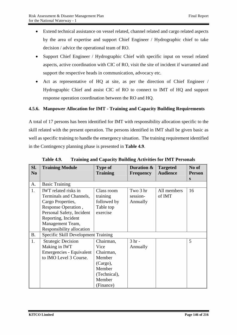
Risk Assessment & Disaster Management Plan Final Report
for the National Waterway - 1
KITCO Limited Page 146 of 216
Extend technical assistance on vessel related, channel related and cargo related aspects
by the area of expertise and support Chief Engineer / Hydrographic chief to take
decision / advice the operational team of RO.
Support Chief Engineer / Hydrographic Chief with specific input on vessel related
aspects, active coordination with CIC of RO, visit the site of incident if warranted and
support the respective heads in communication, advocacy etc.
Act as representative of HQ at site, as per the direction of Chief Engineer /
Hydrographic Chief and assist CIC of RO to connect to IMT of HQ and support
response operation coordination between the RO and HQ.
4.5.6. Manpower Allocation for IMT - Training and Capacity Building Requirements
A total of 17 persons has been identified for IMT with responsibility allocation specific to the
skill related with the present operation. The persons identified in IMT shall be given basic as
well as specific training to handle the emergency situation. The training requirement identified
in the Contingency planning phase is presented in Table 4.9.
Table 4.9. Training and Capacity Building Activities for IMT Personals
Sl.
No
Training Module Type of
Training
Duration &
Frequency
Targeted
Audience
No of
Person
s
A. Basic Training
1. IWT related risks in
Terminals and Channels,
Cargo Properties,
Response Operation ,
Personal Safety, Incident
Reporting, Incident
Management Team,
Responsibility allocation
Class room
training
followed by
Table top
exercise
Two 3 hr
session-
Annually
All members
of IMT
16
B. Specific Skill Development Training
1. Strategic Decision
Making in IWT
Emergencies - Equivalent
to IMO Level 3 Course.
Chairman,
Vice
Chairman,
Member
(Cargo),
Member
(Technical),
Member
(Finance)
3 hr -
Annually
5
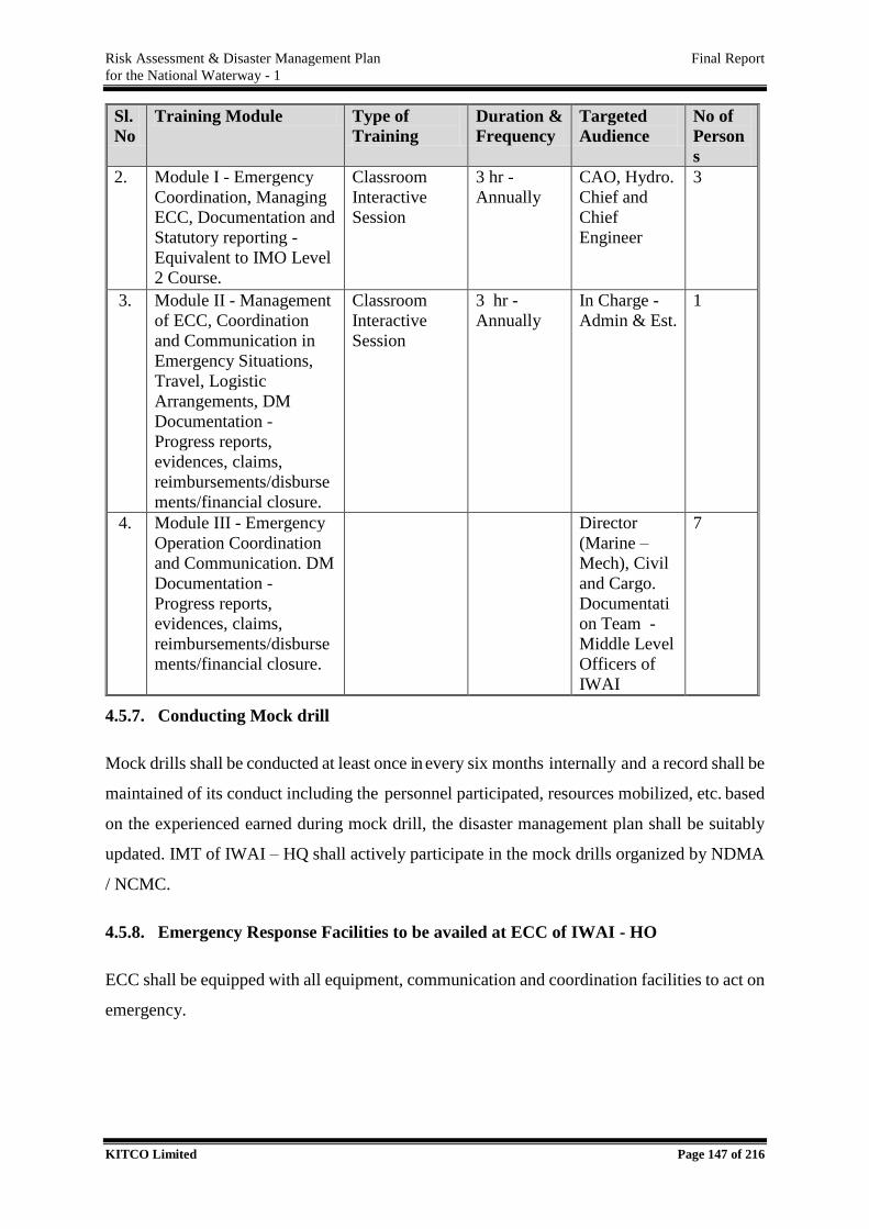
Risk Assessment & Disaster Management Plan Final Report
for the National Waterway - 1
KITCO Limited Page 147 of 216
Sl.
No
Training Module Type of
Training
Duration &
Frequency
Targeted
Audience
No of
Person
s
2. Module I - Emergency
Coordination, Managing
ECC, Documentation and
Statutory reporting -
Equivalent to IMO Level
2 Course.
Classroom
Interactive
Session
3 hr -
Annually
CAO, Hydro.
Chief and
Chief
Engineer
3
3. Module II - Management
of ECC, Coordination
and Communication in
Emergency Situations,
Travel, Logistic
Arrangements, DM
Documentation -
Progress reports,
evidences, claims,
reimbursements/disburse
ments/financial closure.
Classroom
Interactive
Session
3 hr -
Annually
In Charge -
Admin & Est.
1
4. Module III - Emergency
Operation Coordination
and Communication. DM
Documentation -
Progress reports,
evidences, claims,
reimbursements/disburse
ments/financial closure.
Director
(Marine –
Mech), Civil
and Cargo.
Documentati
on Team -
Middle Level
Officers of
IWAI
7
4.5.7. Conducting Mock drill
Mock drills shall be conducted at least once in every six months internally and a record shall be
maintained of its conduct including the personnel participated, resources mobilized, etc. based
on the experienced earned during mock drill, the disaster management plan shall be suitably
updated. IMT of IWAI – HQ shall actively participate in the mock drills organized by NDMA
/ NCMC.
4.5.8. Emergency Response Facilities to be availed at ECC of IWAI - HO
ECC shall be equipped with all equipment, communication and coordination facilities to act on
emergency.
Risk Assessment & Disaster Management Plan Final Report
for the National Waterway - 1
KITCO Limited Page 148 of 216
Maps and display charts and diagrams showing buildings, roads, underground fire
mains, important hazardous material and process lines, drainage trenches, and utilities
such as steam, water, natural gas and electricity.
Electronic Navigational Chart (ENC) along with map of hotspots preferably
superimposed on ENC and a copy of risk assessment and DMP report.
A copy of the relevant Disaster Management Plan.
Situation boards (continuously updated to present a summary of the current situation
and response actions being taken).
Sufficient telephone lines to enable full liaison with outside bodies.
Names, addresses, and telephone numbers of employees, off-site groups and
organizations that might have to be contacted; all telephone lists being reviewed for
accuracy on a scheduled basis and updated, as necessary.
Dedicated and reliable communication equipment; enough telephones and at least one
fax line to serve the organization for calls both on and off-the-site.
Fixed and portable two-way radio equipment to keep in contact with activities on-scene
and to maintain continuity of communications when other means fail.
Plan board, logbook, voice recorder, television, DVD and Video facilities for playing
back records from aircraft and helicopters, as well as monitoring media coverage of the
incident with a person assigned to record pertinent information and to assist in
investigating cases, evaluating performance and preparing reports.
Emergency lights so that operations can continue in the event of power failure.
Photocopy, fax and e-mail facilities.
Dedicated computers with LAN/ internet facility to access the installation data and the
latest and updated soft copies of all standard operating procedure (SOP) etc.
Wireless Internet Facility.
Video Conferencing Facility to have face to face communication/meetings between the
stake holders.
4.6. Block Cost Estimate for Developing Facilities within IWAI
4.6.1. Cargo Handling Terminals of IWAI
Block cost estimate for setting up of facilities for IWAI terminal in case of oil handling
(Furnace Oil handling) i.e. equivalent to category B of NOS-DCP and no oil handling i.e.
equivalent to Category D has been worked out. The cost towards setting up of ECC with
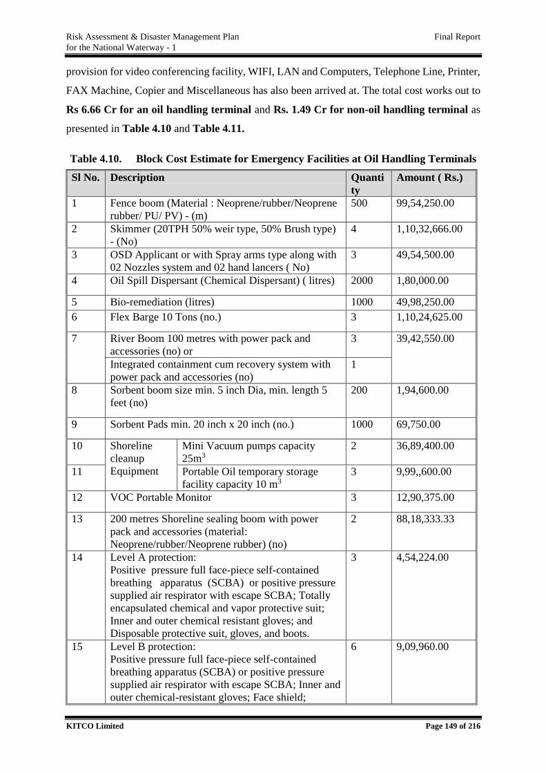
Risk Assessment & Disaster Management Plan Final Report
for the National Waterway - 1
KITCO Limited Page 149 of 216
provision for video conferencing facility, WIFI, LAN and Computers, Telephone Line, Printer,
FAX Machine, Copier and Miscellaneous has also been arrived at. The total cost works out to
Rs 6.66 Cr for an oil handling terminal and Rs. 1.49 Cr for non-oil handling terminal as
presented in Table 4.10 and Table 4.11.
Table 4.10. Block Cost Estimate for Emergency Facilities at Oil Handling Terminals
Sl No. Description Quanti
ty
Amount ( Rs.)
1 Fence boom (Material : Neoprene/rubber/Neoprene
rubber/ PU/ PV) - (m)
500 99,54,250.00
2 Skimmer (20TPH 50% weir type, 50% Brush type)
- (No)
4 1,10,32,666.00
3 OSD Applicant or with Spray arms type along with
02 Nozzles system and 02 hand lancers ( No)
3 49,54,500.00
4 Oil Spill Dispersant (Chemical Dispersant) ( litres) 2000 1,80,000.00
5 Bio-remediation (litres) 1000 49,98,250.00
6 Flex Barge 10 Tons (no.) 3 1,10,24,625.00
7 River Boom 100 metres with power pack and
accessories (no) or
3 39,42,550.00
Integrated containment cum recovery system with
power pack and accessories (no)
1
8 Sorbent boom size min. 5 inch Dia, min. length 5
feet (no)
200 1,94,600.00
9 Sorbent Pads min. 20 inch x 20 inch (no.) 1000 69,750.00
10 Shoreline
cleanup
Equipment
Mini Vacuum pumps capacity
25m3
2 36,89,400.00
11 Portable Oil temporary storage
facility capacity 10 m3
3 9,99,,600.00
12 VOC Portable Monitor 3 12,90,375.00
13 200 metres Shoreline sealing boom with power
pack and accessories (material:
Neoprene/rubber/Neoprene rubber) (no)
2 88,18,333.33
14
Level A protection:
Positive pressure full face-piece self-contained
breathing apparatus (SCBA) or positive pressure
supplied air respirator with escape SCBA; Totally
encapsulated chemical and vapor protective suit;
Inner and outer chemical resistant gloves; and
Disposable protective suit, gloves, and boots.
3 4,54,224.00
15
Level B protection:
Positive pressure full face-piece self-contained
breathing apparatus (SCBA) or positive pressure
supplied air respirator with escape SCBA; Inner and
outer chemical-resistant gloves; Face shield;
6 9,09,960.00
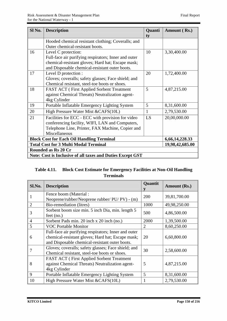
Risk Assessment & Disaster Management Plan Final Report
for the National Waterway - 1
KITCO Limited Page 150 of 216
Sl No. Description Quanti
ty
Amount ( Rs.)
Hooded chemical resistant clothing; Coveralls; and
Outer chemical-resistant boots.
16
Level C protection:
Full-face air purifying respirators; Inner and outer
chemical-resistant gloves; Hard hat; Escape mask;
and Disposable chemical-resistant outer boots.
10 3,30,400.00
17
Level D protection :
Gloves; coveralls; safety glasses; Face shield; and
Chemical resistant, steel-toe boots or shoes.
20 1,72,400.00
18 FAST ACT ( First Applied Sorbent Treatment
against Chemical Threats) Neutralization agent-
4kg Cylinder
5 4,87,215.00
19 Portable Inflatable Emergency Lighting System 5 8,31,600.00
20 High Pressure Water Mist &CAFS(10L) 1 2,79,530.00
21 Facilities for ECC - ECC with provision for video
conferencing facility, WIFI, LAN and Computers,
Telephone Line, Printer, FAX Machine, Copier and
Miscellaneous
LS 20,00,000.00
Block Cost for Each Oil Handling Terminal 6,66,14,228.33
Total Cost for 3 Multi Modal Terminal 19,98,42,685.00
Rounded as Rs 20 Cr
Note: Cost is Inclusive of all taxes and Duties Except GST
Table 4.11. Block Cost Estimate for Emergency Facilities at Non-Oil Handling
Terminals
Sl.No. Description Quantit
y Amount (Rs.)
1 Fence boom (Material :
Neoprene/rubber/Neoprene rubber/ PU/ PV) - (m) 200 39,81,700.00
2 Bio-remediation (litres) 1000 49,98,250.00
3 Sorbent boom size min. 5 inch Dia, min. length 5
feet (no.) 500 4,86,500.00
4 Sorbent Pads min. 20 inch x 20 inch (no.) 2000 1,39,500.00
5 VOC Portable Monitor 2 8,60,250.00
6
Full-face air purifying respirators; Inner and outer
chemical-resistant gloves; Hard hat; Escape mask;
and Disposable chemical-resistant outer boots.
20 6,60,800.00
7 Gloves; coveralls; safety glasses; Face shield; and
Chemical resistant, steel-toe boots or shoes. 30 2,58,600.00
8
FAST ACT ( First Applied Sorbent Treatment
against Chemical Threats) Neutralization agent-
4kg Cylinder
5 4,87,215.00
9 Portable Inflatable Emergency Lighting System 5 8,31,600.00
10 High Pressure Water Mist &CAFS(10L) 1 2,79,530.00
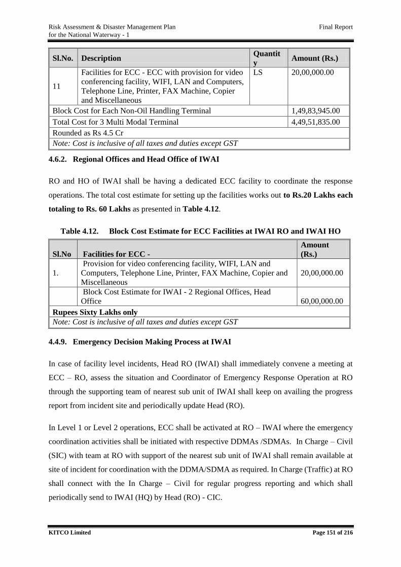
Risk Assessment & Disaster Management Plan Final Report
for the National Waterway - 1
KITCO Limited Page 151 of 216
Sl.No. Description Quantit
y Amount (Rs.)
11
Facilities for ECC - ECC with provision for video
conferencing facility, WIFI, LAN and Computers,
Telephone Line, Printer, FAX Machine, Copier
and Miscellaneous
LS 20,00,000.00
Block Cost for Each Non-Oil Handling Terminal 1,49,83,945.00
Total Cost for 3 Multi Modal Terminal 4,49,51,835.00
Rounded as Rs 4.5 Cr
Note: Cost is inclusive of all taxes and duties except GST
4.6.2. Regional Offices and Head Office of IWAI
RO and HO of IWAI shall be having a dedicated ECC facility to coordinate the response
operations. The total cost estimate for setting up the facilities works out to Rs.20 Lakhs each
totaling to Rs. 60 Lakhs as presented in Table 4.12.
Table 4.12. Block Cost Estimate for ECC Facilities at IWAI RO and IWAI HO
Sl.No Facilities for ECC -
Amount
(Rs.)
1.
Provision for video conferencing facility, WIFI, LAN and
Computers, Telephone Line, Printer, FAX Machine, Copier and
Miscellaneous
20,00,000.00
Block Cost Estimate for IWAI - 2 Regional Offices, Head
Office 60,00,000.00
Rupees Sixty Lakhs only
Note: Cost is inclusive of all taxes and duties except GST
4.4.9. Emergency Decision Making Process at IWAI
In case of facility level incidents, Head RO (IWAI) shall immediately convene a meeting at
ECC – RO, assess the situation and Coordinator of Emergency Response Operation at RO
through the supporting team of nearest sub unit of IWAI shall keep on availing the progress
report from incident site and periodically update Head (RO).
In Level 1 or Level 2 operations, ECC shall be activated at RO – IWAI where the emergency
coordination activities shall be initiated with respective DDMAs /SDMAs. In Charge – Civil
(SIC) with team at RO with support of the nearest sub unit of IWAI shall remain available at
site of incident for coordination with the DDMA/SDMA as required. In Charge (Traffic) at RO
shall connect with the In Charge – Civil for regular progress reporting and which shall
periodically send to IWAI (HQ) by Head (RO) - CIC.
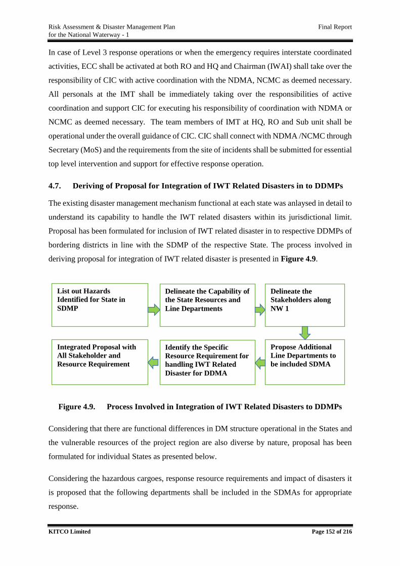
Risk Assessment & Disaster Management Plan Final Report
for the National Waterway - 1
KITCO Limited Page 152 of 216
In case of Level 3 response operations or when the emergency requires interstate coordinated
activities, ECC shall be activated at both RO and HQ and Chairman (IWAI) shall take over the
responsibility of CIC with active coordination with the NDMA, NCMC as deemed necessary.
All personals at the IMT shall be immediately taking over the responsibilities of active
coordination and support CIC for executing his responsibility of coordination with NDMA or
NCMC as deemed necessary. The team members of IMT at HQ, RO and Sub unit shall be
operational under the overall guidance of CIC. CIC shall connect with NDMA /NCMC through
Secretary (MoS) and the requirements from the site of incidents shall be submitted for essential
top level intervention and support for effective response operation.
4.7. Deriving of Proposal for Integration of IWT Related Disasters in to DDMPs
The existing disaster management mechanism functional at each state was anlaysed in detail to
understand its capability to handle the IWT related disasters within its jurisdictional limit.
Proposal has been formulated for inclusion of IWT related disaster in to respective DDMPs of
bordering districts in line with the SDMP of the respective State. The process involved in
deriving proposal for integration of IWT related disaster is presented in Figure 4.9.
Figure 4.9. Process Involved in Integration of IWT Related Disasters to DDMPs
Considering that there are functional differences in DM structure operational in the States and
the vulnerable resources of the project region are also diverse by nature, proposal has been
formulated for individual States as presented below.
Considering the hazardous cargoes, response resource requirements and impact of disasters it
is proposed that the following departments shall be included in the SDMAs for appropriate
response.
List out Hazards
Identified for State in
SDMP
Delineate the Capability of
the State Resources and
Line Departments
Delineate the
Stakeholders along
NW 1
Identify the Specific
Resource Requirement for
handling IWT Related
Disaster for DDMA
Propose Additional
Line Departments to
be included SDMA
Integrated Proposal with
All Stakeholder and
Resource Requirement
Risk Assessment & Disaster Management Plan Final Report
for the National Waterway - 1
KITCO Limited Page 153 of 216
Department of Industries and Commerce – To support with technical resources on
chemical characteristics and emergency handling persons, equipment and facilities.
Chief Inspector of Factories and Boilers (CIF) – Regulatory authority in hazardous
cargo handling.
Department of Environment including specific representation from State/Central
Pollution Control Board - CRZ authorities – Regulatory authority under Air and Water
act, waste handling etc.
Forest and Wildlife Department – Regulatory Authority in Protected Areas
Fire and Emergency Services – Fire and Emergency support for IWT incidents
Health and Family Welfare Department – Emergency medical support.
Registered Vessel Owners – for handling water based emergency operations
The above departments shall be integrated in DM structure of all States to handle the
requirements on IWT related incidents.
4.7.1. Integration of IWT Related Disasters in DDMAs of Uttar Pradesh
State of Uttar Pradesh is a disaster prone State. The geo-climatic conditions and critical
structures along the waterway of make it vulnerable to many hazards. As seen in Section 2.3.1
and 2.3.2 of the salient features of NW1, the Prayagraj to Ballai strech of NW 1 is falling in
Uttar Pradesh for a total length of 472 km. NW 1 is boardering through 7 districts of the State
– Prayagraj, Sant Ravidas Nagar, Mirzapur, Varanasi, Chandauli, Ghazipur and Ballai where
DDMAs are present.
State Disaster Management Authority (SDMA) has been constituted in Uttar Pradesh vide
Notification in exercise of the powers conferred by sub section (1) of section 14 of DM Act,
2005. SDMA, headed by the Chief Minister as the Chairperson with 5 members from nodal
departments, one member secretary and the Chief Secretary as the Chief Executive Officer.
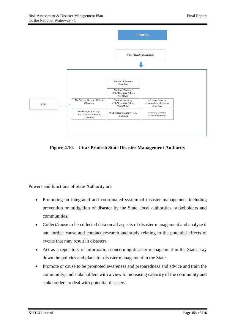
Risk Assessment & Disaster Management Plan Final Report
for the National Waterway - 1
KITCO Limited Page 154 of 216
Figure 4.10. Uttar Pradesh State Disaster Management Authority
Powers and functions of State Authority are
Promoting an integrated and coordinated system of disaster management including
prevention or mitigation of disaster by the State, local authorities, stakeholders and
communities.
Collect/cause to be collected data on all aspects of disaster management and analyze it
and further cause and conduct research and study relating to the potential effects of
events that may result in disasters.
Act as a repository of information concerning disaster management in the State. Lay
down the policies and plans for disaster management in the State.
Promote or cause to be promoted awareness and preparedness and advice and train the
community, and stakeholders with a view to increasing capacity of the community and
stakeholders to deal with potential disasters.
Risk Assessment & Disaster Management Plan Final Report
for the National Waterway - 1
KITCO Limited Page 155 of 216
On the expiry of a disaster declaration, the Authority shall, where necessary, act as an
agency for facilitating and coordinating rehabilitation and reconstruction activities by
departments of the Government
The SDMA and DDMA functional at State is presented in Table 4.13.
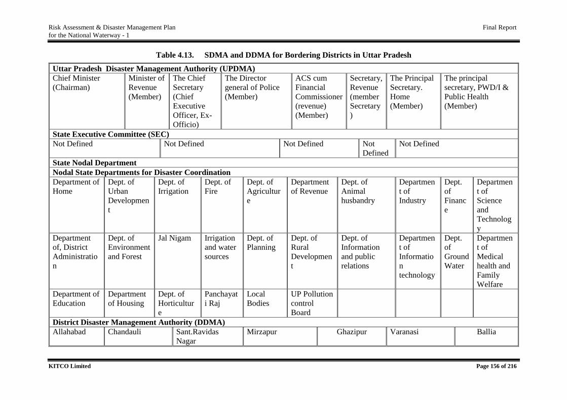
Risk Assessment & Disaster Management Plan Final Report
for the National Waterway - 1
KITCO Limited Page 156 of 216
Table 4.13. SDMA and DDMA for Bordering Districts in Uttar Pradesh
Uttar Pradesh Disaster Management Authority (UPDMA)
Chief Minister
(Chairman)
Minister of
Revenue
(Member)
The Chief
Secretary
(Chief
Executive
Officer, Ex-
Officio)
The Director
general of Police
(Member)
ACS cum
Financial
Commissioner
(revenue)
(Member)
Secretary,
Revenue
(member
Secretary
)
The Principal
Secretary.
Home
(Member)
The principal
secretary, PWD/I &
Public Health
(Member)
State Executive Committee (SEC)
Not Defined Not Defined Not Defined Not
Defined
Not Defined
State Nodal Department
Nodal State Departments for Disaster Coordination
Department of
Home
Dept. of
Urban
Developmen
t
Dept. of
Irrigation
Dept. of
Fire
Dept. of
Agricultur
e
Department
of Revenue
Dept. of
Animal
husbandry
Departmen
t of
Industry
Dept.
of
Financ
e
Departmen
t of
Science
and
Technolog
y
Department
of, District
Administratio
n
Dept. of
Environment
and Forest
Jal Nigam Irrigation
and water
sources
Dept. of
Planning
Dept. of
Rural
Developmen
t
Dept. of
Information
and public
relations
Departmen
t of
Informatio
n
technology
Dept.
of
Ground
Water
Departmen
t of
Medical
health and
Family
Welfare
Department of
Education
Department
of Housing
Dept. of
Horticultur
e
Panchayat
i Raj
Local
Bodies
UP Pollution
control
Board
District Disaster Management Authority (DDMA)
Allahabad Chandauli Sant.Ravidas
Nagar
Mirzapur Ghazipur Varanasi Ballia
Risk Assessment & Disaster Management Plan Final Report
for the National Waterway - 1
KITCO Limited Page 157 of 216
The Relief Commissioner Organisation/ UPSDMA of the state is the nodal department for
controlling, monitoring and directing measures for organizing rescue, relief and rehabilitation.
All other concerned line departments should extend full cooperation in all matters pertaining
to the response management of the disaster whenever it occurs. The State EOC and other
control rooms at the state level as well as district control rooms should be activated with full
strength. The existing arrangements therefore will be strengthened by the Relief Commissioner
through Emergency Operations Centers (EOC), both at State Level and at the district levels.
The DM Act 2005 empowers Relief Commissioner to be the Incident Commander in the State
and District Collector in the respective districts.
State Emergency Operations Centre will be the hub of activity in a disaster situation. The EOC,
the key organizational structure, is flexible to expand when demands increase, and contract
when the situation slows down. The primary function of an EOC is to implement the Disaster
Management Action Plan which includes the following:
Coordination
Policy-making
Operations management
Information gathering and record keeping.
Public information
Resource management.
DDMA has been formed in all the districts of the state. Chairperson of this authority is the
district magistrate and it is co- chaired by the Zila Panchayant Chairman. DDMA acts as the
planning, coordinating and implementing body for DM at District level and take all necessary
measures for the purposes of DM in accordance with the Guidelines laid down by the NDMA
and SDMA Plan. The DDMA will also ensure that the Guidelines for prevention, mitigation,
preparedness and response measures laid down by NDMA and SDMA are followed by all
Departments of the State Government, at the District level and the Local Authorities in the
District.
District Emergency Operation Centre located in the office of deputy commissioner shall
discharge the following functions:
Risk Assessment & Disaster Management Plan Final Report
for the National Waterway - 1
KITCO Limited Page 158 of 216
On receipt of information from SEOC/SEC or from any field office or Panchayat or
from any other reliable source, DEOC will bring this in the notice of DDMA.
DEOC shall issue necessary alerts to all authorities in the district or at state level
depending on the situation.
DEOC will send regular status and appraisal reports to SEOC.
DEOC shall maintain all records.
DEOC shall collate and synthesise information for consideration of DDMA.
The disaster management structure of the state is presented in the flow chart below.
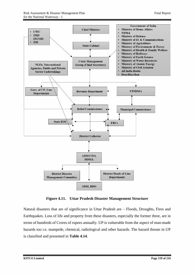
Risk Assessment & Disaster Management Plan Final Report
for the National Waterway - 1
KITCO Limited Page 159 of 216
Figure 4.11. Uttar Pradesh Disaster Management Structure
Natural disasters that are of significance in Uttar Pradesh are – Floods, Droughts, Fires and
Earthquakes. Loss of life and property from these disasters, especially the former three, are in
terms of hundreds of Crores of rupees annually. UP is vulnerable from the aspect of man-made
hazards too i.e. stampede, chemical, radiological and other hazards. The hazard threats in UP
is classified and presented in Table 4.14.
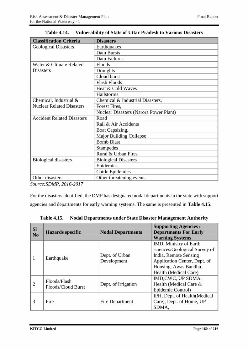
Risk Assessment & Disaster Management Plan Final Report
for the National Waterway - 1
KITCO Limited Page 160 of 216
Table 4.14. Vulnerability of State of Uttar Pradesh to Various Disasters
Classification Criteria Disasters
Geological Disasters Earthquakes
Dam Bursts
Dam Failures
Water & Climate Related
Disasters
Floods
Droughts
Cloud burst
Flash Floods
Heat & Cold Waves
Hailstorms
Chemical, Industrial &
Nuclear Related Disasters
Chemical & Industrial Disasters,
Forest Fires,
Nuclear Disasters (Narora Power Plant)
Accident Related Disasters Road
Rail & Air Accidents
Boat Capsizing,
Major Building Collapse
Bomb Blast
Stampedes
Rural & Urban Fires
Biological disasters Biological Disasters
Epidemics
Cattle Epidemics
Other disasters Other threatening events
Source:SDMP, 2016-2017
For the disasters identified, the DMP has designated nodal departments in the state with support
agencies and departments for early warning systems. The same is presented in Table 4.15.
Table 4.15. Nodal Departments under State Disaster Management Authority
Sl
No Hazards specific Nodal Departments
Supporting Agencies /
Departments For Early
Warning Systems
1 Earthquake Dept. of Urban
Development
IMD, Ministry of Earth
sciences/Geological Survey of
India, Remote Sensing
Application Center, Dept. of
Housing, Awas Bandhu,
Health (Medical Care)
2 Floods/Flash
Floods/Cloud Burst Dept. of Irrigation
IMD,CWC, UP SDMA,
Health (Medical Care &
Epidemic Control)
3 Fire Fire Department
IPH, Dept. of Health(Medical
Care), Dept. of Home, UP
SDMA,
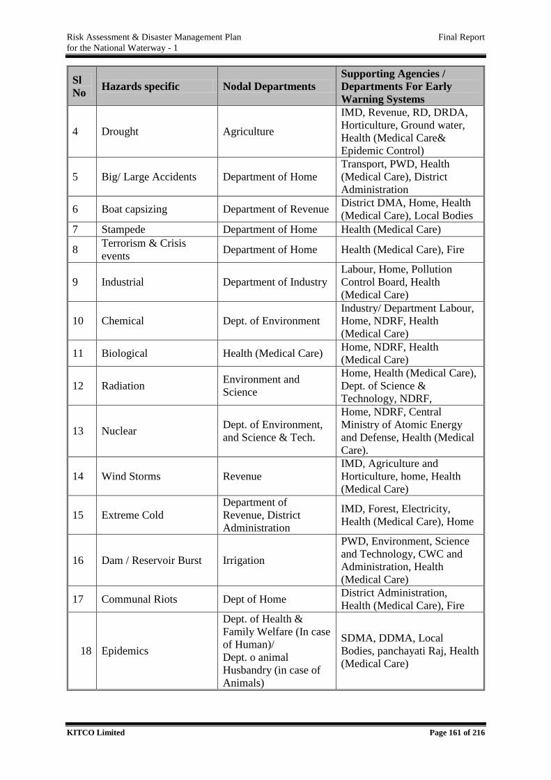
Risk Assessment & Disaster Management Plan Final Report
for the National Waterway - 1
KITCO Limited Page 161 of 216
Sl
No Hazards specific Nodal Departments
Supporting Agencies /
Departments For Early
Warning Systems
4 Drought Agriculture
IMD, Revenue, RD, DRDA,
Horticulture, Ground water,
Health (Medical Care&
Epidemic Control)
5 Big/ Large Accidents Department of Home
Transport, PWD, Health
(Medical Care), District
Administration
6 Boat capsizing Department of Revenue District DMA, Home, Health
(Medical Care), Local Bodies
7 Stampede Department of Home Health (Medical Care)
8 Terrorism & Crisis
events Department of Home Health (Medical Care), Fire
9 Industrial Department of Industry
Labour, Home, Pollution
Control Board, Health
(Medical Care)
10 Chemical Dept. of Environment
Industry/ Department Labour,
Home, NDRF, Health
(Medical Care)
11 Biological Health (Medical Care) Home, NDRF, Health
(Medical Care)
12 Radiation Environment and
Science
Home, Health (Medical Care),
Dept. of Science &
Technology, NDRF,
13 Nuclear Dept. of Environment,
and Science & Tech.
Home, NDRF, Central
Ministry of Atomic Energy
and Defense, Health (Medical
Care).
14 Wind Storms Revenue
IMD, Agriculture and
Horticulture, home, Health
(Medical Care)
15 Extreme Cold
Department of
Revenue, District
Administration
IMD, Forest, Electricity,
Health (Medical Care), Home
16 Dam / Reservoir Burst Irrigation
PWD, Environment, Science
and Technology, CWC and
Administration, Health
(Medical Care)
17 Communal Riots Dept of Home District Administration,
Health (Medical Care), Fire
18 Epidemics
Dept. of Health &
Family Welfare (In case
of Human)/
Dept. o animal
Husbandry (in case of
Animals)
SDMA, DDMA, Local
Bodies, panchayati Raj, Health
(Medical Care)
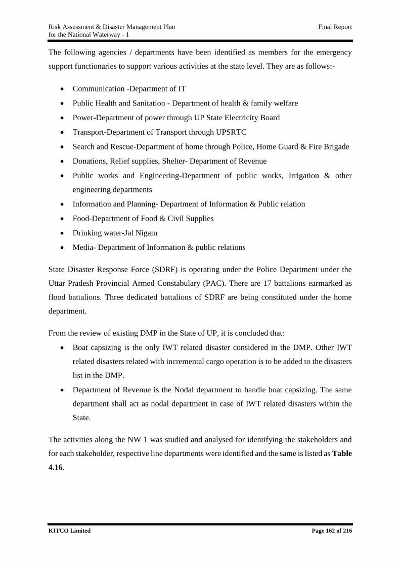
Risk Assessment & Disaster Management Plan Final Report
for the National Waterway - 1
KITCO Limited Page 162 of 216
The following agencies / departments have been identified as members for the emergency
support functionaries to support various activities at the state level. They are as follows:-
Communication -Department of IT
Public Health and Sanitation - Department of health & family welfare
Power-Department of power through UP State Electricity Board
Transport-Department of Transport through UPSRTC
Search and Rescue-Department of home through Police, Home Guard & Fire Brigade
Donations, Relief supplies, Shelter- Department of Revenue
Public works and Engineering-Department of public works, Irrigation & other
engineering departments
Information and Planning- Department of Information & Public relation
Food-Department of Food & Civil Supplies
Drinking water-Jal Nigam
Media- Department of Information & public relations
State Disaster Response Force (SDRF) is operating under the Police Department under the
Uttar Pradesh Provincial Armed Constabulary (PAC). There are 17 battalions earmarked as
flood battalions. Three dedicated battalions of SDRF are being constituted under the home
department.
From the review of existing DMP in the State of UP, it is concluded that:
Boat capsizing is the only IWT related disaster considered in the DMP. Other IWT
related disasters related with incremental cargo operation is to be added to the disasters
list in the DMP.
Department of Revenue is the Nodal department to handle boat capsizing. The same
department shall act as nodal department in case of IWT related disasters within the
State.
The activities along the NW 1 was studied and analysed for identifying the stakeholders and
for each stakeholder, respective line departments were identified and the same is listed as Table
4.16.
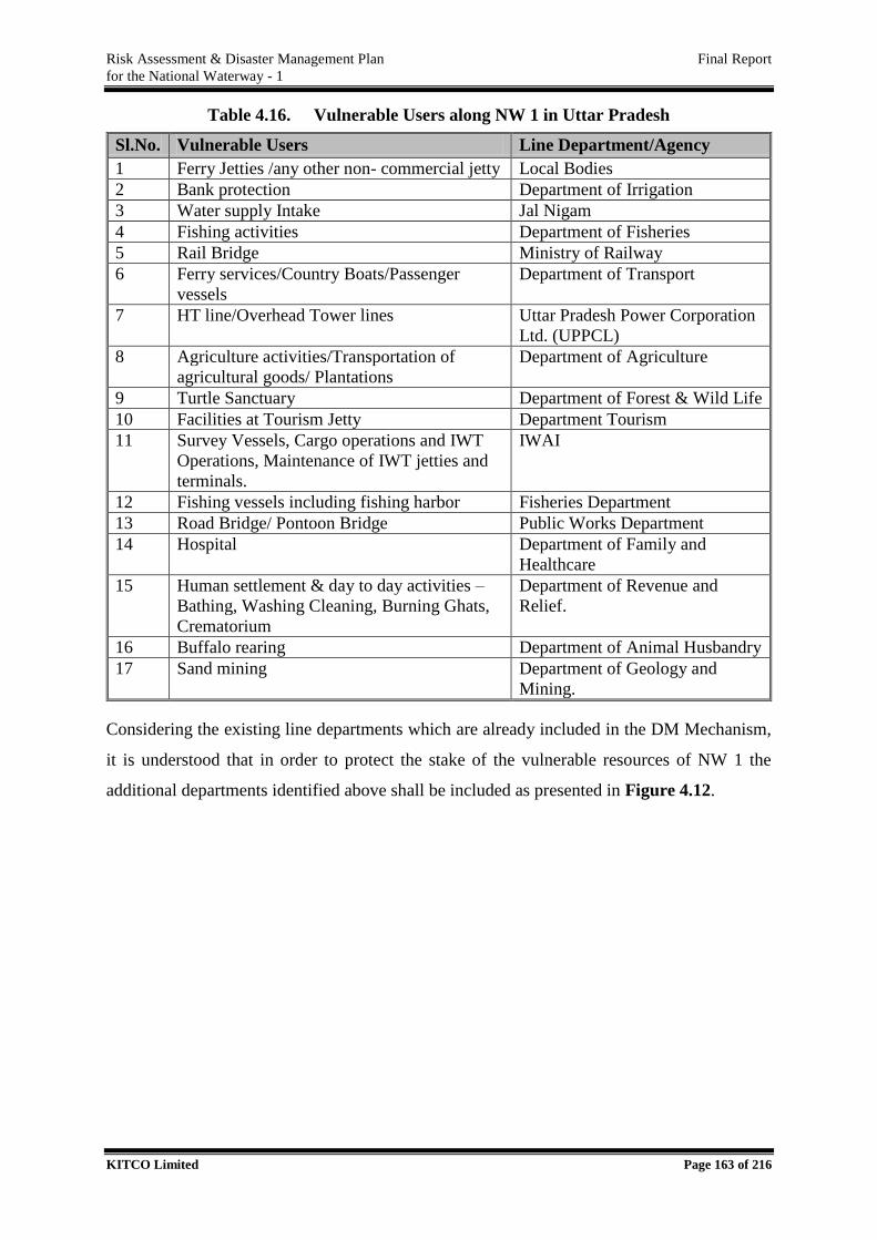
Risk Assessment & Disaster Management Plan Final Report
for the National Waterway - 1
KITCO Limited Page 163 of 216
Table 4.16. Vulnerable Users along NW 1 in Uttar Pradesh
Sl.No. Vulnerable Users Line Department/Agency
1 Ferry Jetties /any other non- commercial jetty Local Bodies
2 Bank protection Department of Irrigation
3 Water supply Intake Jal Nigam
4 Fishing activities Department of Fisheries
5 Rail Bridge Ministry of Railway
6 Ferry services/Country Boats/Passenger
vessels
Department of Transport
7 HT line/Overhead Tower lines Uttar Pradesh Power Corporation
Ltd. (UPPCL)
8 Agriculture activities/Transportation of
agricultural goods/ Plantations
Department of Agriculture
9 Turtle Sanctuary Department of Forest & Wild Life
10 Facilities at Tourism Jetty Department Tourism
11 Survey Vessels, Cargo operations and IWT
Operations, Maintenance of IWT jetties and
terminals.
IWAI
12 Fishing vessels including fishing harbor Fisheries Department
13 Road Bridge/ Pontoon Bridge Public Works Department
14 Hospital Department of Family and
Healthcare
15 Human settlement & day to day activities –
Bathing, Washing Cleaning, Burning Ghats,
Crematorium
Department of Revenue and
Relief.
16 Buffalo rearing Department of Animal Husbandry
17 Sand mining Department of Geology and
Mining.
Considering the existing line departments which are already included in the DM Mechanism,
it is understood that in order to protect the stake of the vulnerable resources of NW 1 the
additional departments identified above shall be included as presented in Figure 4.12.
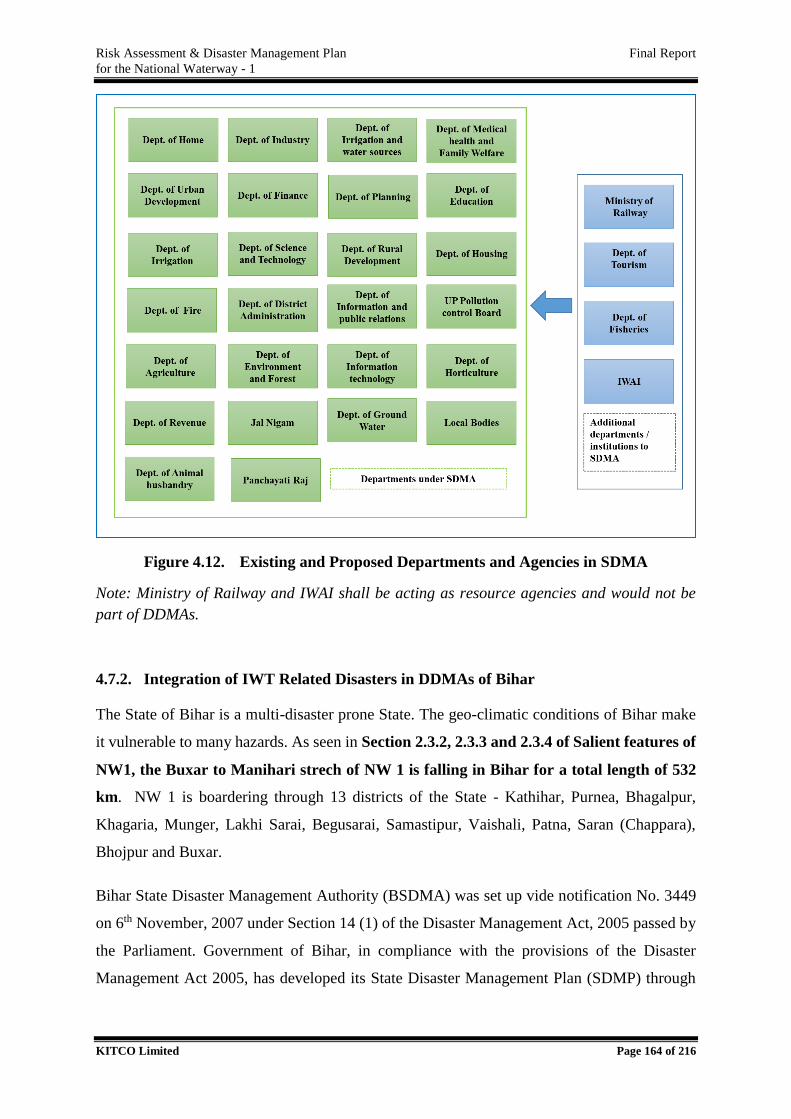
Risk Assessment & Disaster Management Plan Final Report
for the National Waterway - 1
KITCO Limited Page 164 of 216
Figure 4.12. Existing and Proposed Departments and Agencies in SDMA
Note: Ministry of Railway and IWAI shall be acting as resource agencies and would not be
part of DDMAs.
4.7.2. Integration of IWT Related Disasters in DDMAs of Bihar
The State of Bihar is a multi-disaster prone State. The geo-climatic conditions of Bihar make
it vulnerable to many hazards. As seen in Section 2.3.2, 2.3.3 and 2.3.4 of Salient features of
NW1, the Buxar to Manihari strech of NW 1 is falling in Bihar for a total length of 532
km. NW 1 is boardering through 13 districts of the State - Kathihar, Purnea, Bhagalpur,
Khagaria, Munger, Lakhi Sarai, Begusarai, Samastipur, Vaishali, Patna, Saran (Chappara),
Bhojpur and Buxar.
Bihar State Disaster Management Authority (BSDMA) was set up vide notification No. 3449
on 6th November, 2007 under Section 14 (1) of the Disaster Management Act, 2005 passed by
the Parliament. Government of Bihar, in compliance with the provisions of the Disaster
Management Act 2005, has developed its State Disaster Management Plan (SDMP) through
Risk Assessment & Disaster Management Plan Final Report
for the National Waterway - 1
KITCO Limited Page 165 of 216
Disaster Management Department, which has been approved by the State Cabinet in the year
2014.
BSDMA, the apex body in the disaster management system, is headed by Hon’ble Chief
Minister of Bihar, a full time Vice Chairman (with Cabinet Minister Rank) and few experts as
its Members (with Minister of State rank). BSDMA is undertaking a number of measures
focused on Disaster Risk Reduction (DRR) and mitigation. Major divisions of BSDMA are;
Natural Disaster
Human Induced Disaster
Human Resource Division , Capacity Building & Training
Environment & Climate Change Adaptation
Administration and Finance
Role and responsibilities of BSDMA are:-
Lay down policies on disaster management.
Approve the State Disaster Management Plan.
Approve plans prepared by the Departments of the State Government in accordance
with the State Disaster Management Plan.
Lay down guidelines to be followed by the District Authorities in drawing up the
District Disaster Management Plan.
Lay down guidelines to be followed by the different State Departments for the Purpose
of integrating the measures for prevention of disaster or the mitigation of it's effects in
their development plans and projects.
Coordinate the enforcement and implementation of the policy and plan for disaster
management
Recommend provision of funds for the purpose of mitigation.
Take such other measures for the prevention of disaster, or the mitigation, or
preparedness and capacity building for dealing with the threatening disaster situation
or disaster as it may consider necessary.
Lay down broad policies and guidelines for the functioning of the State Institute of
Disaster Management.

Risk Assessment & Disaster Management Plan Final Report
for the National Waterway - 1
KITCO Limited Page 166 of 216
The prime executive body for disaster management at the state level is State Executive
Committee (SEC) headed by the Chief Secretary. The State Executive Committee shall
function through Disaster Management Department (DMD) and other line departments. The
organizational structure of BSDMA is presented in Figure 4.13.
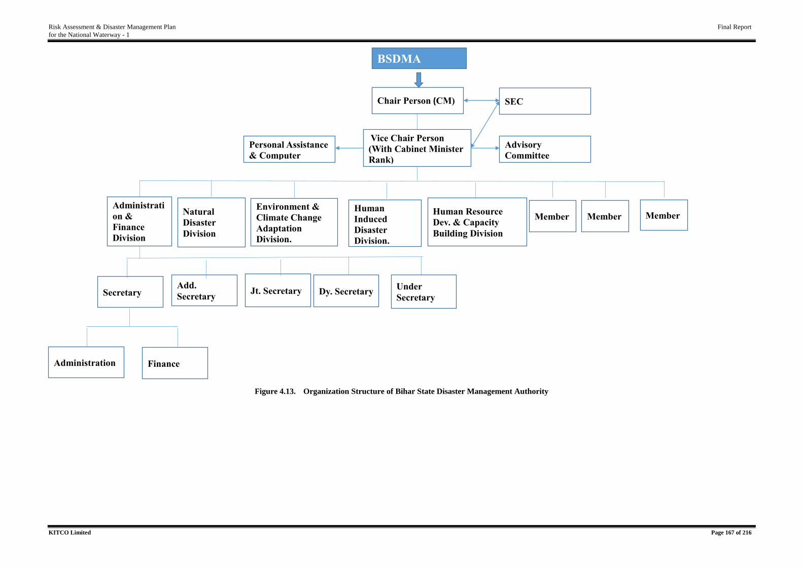
Risk Assessment & Disaster Management Plan Final Report
for the National Waterway - 1
KITCO Limited Page 167 of 216
Figure 4.13. Organization Structure of Bihar State Disaster Management Authority
BSDMA
Chair Person (CM)
Human Resource
Dev. & Capacity
Building Division
Administrati
on &
Finance
Division
Natural
Disaster
Division
Human
Induced
Disaster
Division.
Environment &
Climate Change
Adaptation
Division.
Member Member
Vice Chair Person
(With Cabinet Minister
Rank)
Member
Advisory
Committee
Personal Assistance
& Computer
SECTIONS
SEC
Secretary Add.
Secretary Jt. Secretary Dy. Secretary
Under
Secretary
Finance Administration
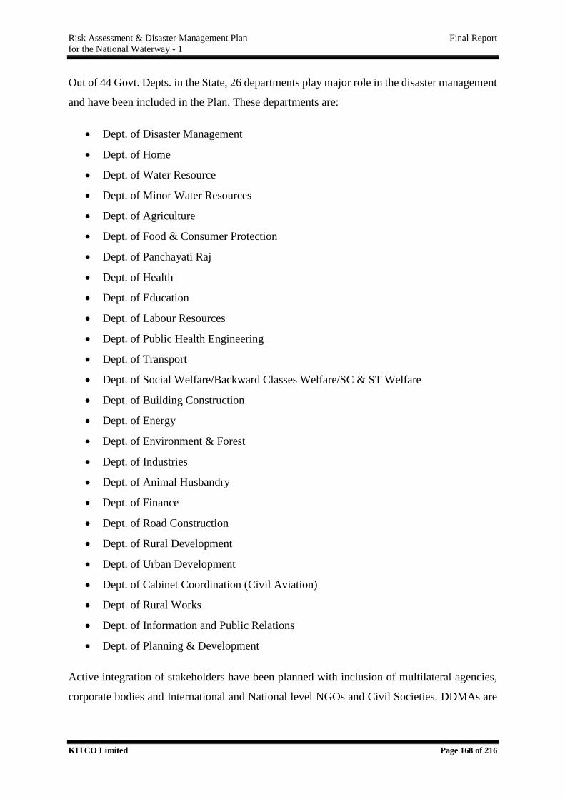
Risk Assessment & Disaster Management Plan Final Report
for the National Waterway - 1
KITCO Limited Page 168 of 216
Out of 44 Govt. Depts. in the State, 26 departments play major role in the disaster management
and have been included in the Plan. These departments are:
Dept. of Disaster Management
Dept. of Home
Dept. of Water Resource
Dept. of Minor Water Resources
Dept. of Agriculture
Dept. of Food & Consumer Protection
Dept. of Panchayati Raj
Dept. of Health
Dept. of Education
Dept. of Labour Resources
Dept. of Public Health Engineering
Dept. of Transport
Dept. of Social Welfare/Backward Classes Welfare/SC & ST Welfare
Dept. of Building Construction
Dept. of Energy
Dept. of Environment & Forest
Dept. of Industries
Dept. of Animal Husbandry
Dept. of Finance
Dept. of Road Construction
Dept. of Rural Development
Dept. of Urban Development
Dept. of Cabinet Coordination (Civil Aviation)
Dept. of Rural Works
Dept. of Information and Public Relations
Dept. of Planning & Development
Active integration of stakeholders have been planned with inclusion of multilateral agencies,
corporate bodies and International and National level NGOs and Civil Societies. DDMAs are

Risk Assessment & Disaster Management Plan Final Report
for the National Waterway - 1
KITCO Limited Page 169 of 216
present in various bordering districts and the combined institutional arrangement is presented
in Table 4.17.
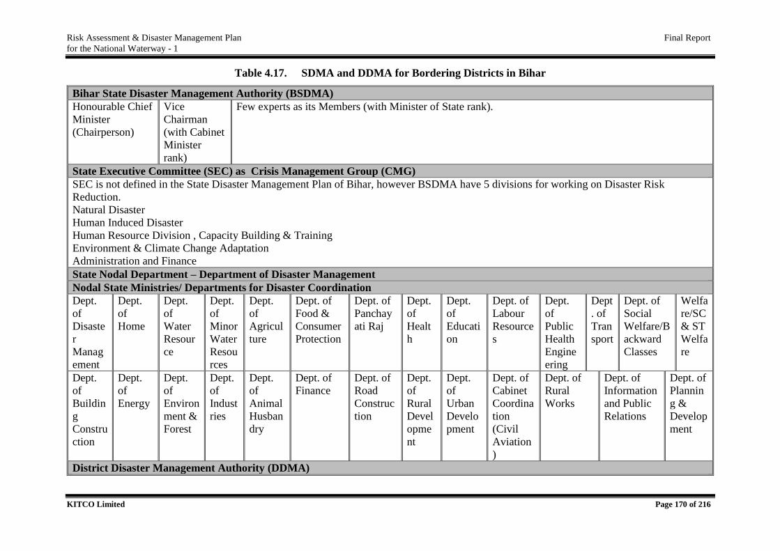
Risk Assessment & Disaster Management Plan Final Report
for the National Waterway - 1
KITCO Limited Page 170 of 216
Table 4.17. SDMA and DDMA for Bordering Districts in Bihar
Bihar State Disaster Management Authority (BSDMA)
Honourable Chief
Minister
(Chairperson)
Vice
Chairman
(with Cabinet
Minister
rank)
Few experts as its Members (with Minister of State rank).
State Executive Committee (SEC) as Crisis Management Group (CMG)
SEC is not defined in the State Disaster Management Plan of Bihar, however BSDMA have 5 divisions for working on Disaster Risk
Reduction.
Natural Disaster
Human Induced Disaster
Human Resource Division , Capacity Building & Training
Environment & Climate Change Adaptation
Administration and Finance
State Nodal Department – Department of Disaster Management
Nodal State Ministries/ Departments for Disaster Coordination
Dept.
of
Disaste
r
Manag
ement
Dept.
of
Home
Dept.
of
Water
Resour
ce
Dept.
of
Minor
Water
Resou
rces
Dept.
of
Agricul
ture
Dept. of
Food &
Consumer
Protection
Dept. of
Panchay
ati Raj
Dept.
of
Healt
h
Dept.
of
Educati
on
Dept. of
Labour
Resource
s
Dept.
of
Public
Health
Engine
ering
Dept
. of
Tran
sport
Dept. of
Social
Welfare/B
ackward
Classes
Welfa
re/SC
& ST
Welfa
re
Dept.
of
Buildin
g
Constru
ction
Dept.
of
Energy
Dept.
of
Environ
ment &
Forest
Dept.
of
Indust
ries
Dept.
of
Animal
Husban
dry
Dept. of
Finance
Dept. of
Road
Construc
tion
Dept.
of
Rural
Devel
opme
nt
Dept.
of
Urban
Develo
pment
Dept. of
Cabinet
Coordina
tion
(Civil
Aviation
)
Dept. of
Rural
Works
Dept. of
Information
and Public
Relations
Dept. of
Plannin
g &
Develop
ment
District Disaster Management Authority (DDMA)
Risk Assessment & Disaster Management Plan Final Report
for the National Waterway - 1
KITCO Limited Page 171 of 216
District Disaster Management Plan for districts of Bihar is under preparation.
Risk Assessment & Disaster Management Plan Final Report
for the National Waterway - 1
KITCO Limited Page 172 of 216
Emergency Operation Center (EOC) is an essential part of disaster management system. EOCs
are present in State level (SEOC), District level (DEOC) and Field level. The State Emergency
Operation Centre (SEOC) shall operate on round the clock basis and be the Command Centre
during disaster response period. It shall function as the data collection, programme monitoring
and response providing centre for Disaster Management Department and cautioning and
warning centre for the people at large. As a control room, SEOC shall be the seat of Incident
Command for which it shall be suitably equipped and manned. As a monitoring cell, SEOC
shall be an exchange of data collection, processing and dissemination. The Emergency Support
Groups would be located in the SEOC and perform their functions under overall command and
control of SEOC.
A shadow SEOC shall be located in the State Police Headquarter building which is being
constructed in Patna. If the SEOC becomes dysfunctional, the shadow centre shall also function
as SEOC for providing material support for relief and rehabilitation.
For the effective disaster management, BSDMA shall have the support of Bihar State Institute
of Disaster Management (SIDM) for providing inputs to formulate guidelines on prevention,
mitigation, preparedness, and research and development on vulnerability management related
issues. The main objectives of BSIDM shall be:
Hazard mapping and vulnerability studies.
Strengthening of information technology for Natural Disaster Management.
Monitoring and impact assessment of natural hazards.
Human Resource Development mainly by imparting training.
Early Warning System.
The Bihar State Govt. also constituted State Disaster Response Force (SDRF) as part of the
disaster management. SDRF is hazard specific, i.e. separate force for Earthquake, Flood, Fire,
Drought and Cyclonic Storm. SDRF, in association with NDRF, shall also prepare Civil
Defence, Home Guard, Fire Brigade, Police, BMP and local youth in disaster response. They
shall be trained to equip Gram Panchayat and communities with necessary skill of self-help
which is the first help one is forced to bank upon at the time of disaster.
The District Disaster Management Authority (DDMA) consisting of District Magistrate as
Chairman & 'Adhyaksa,' Zila Parisad as Co-Chairman shall be over all in-charge of response
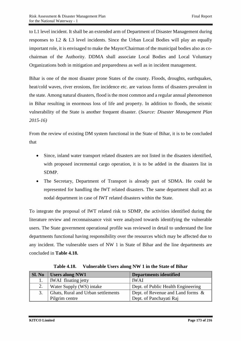
Risk Assessment & Disaster Management Plan Final Report
for the National Waterway - 1
KITCO Limited Page 173 of 216
to L1 level incident. It shall be an extended arm of Department of Disaster Management during
responses to L2 & L3 level incidents. Since the Urban Local Bodies will play an equally
important role, it is envisaged to make the Mayor/Chairman of the municipal bodies also as co-
chairman of the Authority. DDMA shall associate Local Bodies and Local Voluntary
Organizations both in mitigation and preparedness as well as in incident management.
Bihar is one of the most disaster prone States of the county. Floods, droughts, earthquakes,
heat/cold waves, river erosions, fire incidence etc. are various forms of disasters prevalent in
the state. Among natural disasters, flood is the most common and a regular annual phenomenon
in Bihar resulting in enormous loss of life and property. In addition to floods, the seismic
vulnerability of the State is another frequent disaster. (Source: Disaster Management Plan
2015-16)
From the review of existing DM system functional in the State of Bihar, it is to be concluded
that
Since, inland water transport related disasters are not listed in the disasters identified,
with proposed incremental cargo operation, it is to be added in the disasters list in
SDMP.
The Secretary, Department of Transport is already part of SDMA. He could be
represented for handling the IWT related disasters. The same department shall act as
nodal department in case of IWT related disasters within the State.
To integrate the proposal of IWT related risk to SDMP, the activities identified during the
literature review and reconnaissance visit were analyzed towards identifying the vulnerable
users. The State government operational profile was reviewed in detail to understand the line
departments functional having responsibility over the resources which may be affected due to
any incident. The vulnerable users of NW 1 in State of Bihar and the line departments are
concluded in Table 4.18.
Table 4.18. Vulnerable Users along NW 1 in the State of Bihar
Sl. No Users along NW1 Departments identified
1. IWAI floating jetty IWAI
2. Water Supply (WS) intake Dept. of Public Health Engineering
3. Ghats, Rural and Urban settlements
Pilgrim centre
Dept. of Revenue and Land forms &
Dept. of Panchayati Raj
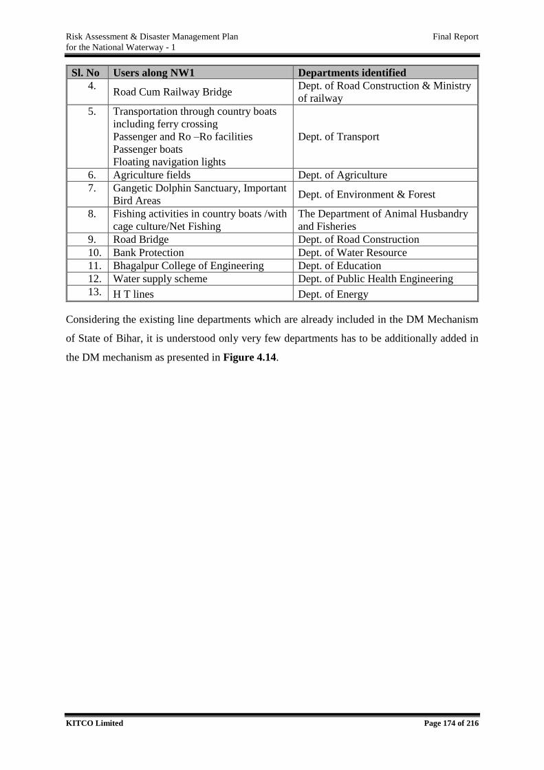
Risk Assessment & Disaster Management Plan Final Report
for the National Waterway - 1
KITCO Limited Page 174 of 216
Sl. No Users along NW1 Departments identified
4. Road Cum Railway Bridge
Dept. of Road Construction & Ministry
of railway
5. Transportation through country boats
including ferry crossing
Passenger and Ro –Ro facilities
Passenger boats
Floating navigation lights
Dept. of Transport
6. Agriculture fields Dept. of Agriculture
7. Gangetic Dolphin Sanctuary, Important
Bird Areas Dept. of Environment & Forest
8. Fishing activities in country boats /with
cage culture/Net Fishing
The Department of Animal Husbandry
and Fisheries
9. Road Bridge Dept. of Road Construction
10. Bank Protection Dept. of Water Resource
11. Bhagalpur College of Engineering Dept. of Education
12. Water supply scheme Dept. of Public Health Engineering
13. H T lines Dept. of Energy
Considering the existing line departments which are already included in the DM Mechanism
of State of Bihar, it is understood only very few departments has to be additionally added in
the DM mechanism as presented in Figure 4.14.
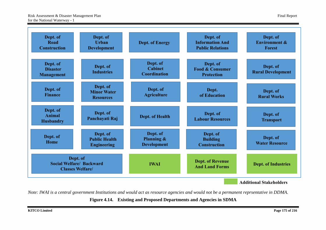
Risk Assessment & Disaster Management Plan Final Report
for the National Waterway - 1
KITCO Limited Page 175 of 216
Note: IWAI is a central government Institutions and would act as resource agencies and would not be a permanent reprsentative in DDMA.
Figure 4.14. Existing and Proposed Departments and Agencies in SDMA
Dept. of
Road
Construction
Dept. of
Disaster
Management
Dept. of
Finance
Dept. of
Animal
Husbandry
Dept. of
Home Dept. of
Water Resource
Dept. of
Urban
Development
Dept. of
Industries
Dept. of
Minor Water
Resources
Dept. of
Panchayati Raj
Dept. of
Public Health
Engineering
Dept. of
Social Welfare/ Backward
Classes Welfare/
Sc & St Welfare
Dept. of Energy
Dept. of
Cabinet
Coordination
(Civil Aviation)
Dept. of
Agriculture
Dept. of Health
Dept. of
Planning &
Development
Dept. of
Information And
Public Relations
Dept. of
Food & Consumer
Protection
Dept.
of Education
Dept. of
Labour Resources Dept. of
Transport
Dept. of
Building
Construction
Dept. of
Environment &
Forest
Dept. of
Rural Development
Dept. of
Rural Works
IWAI Dept. of Revenue
And Land Forms Dept. of Industries
Additional Stakeholders
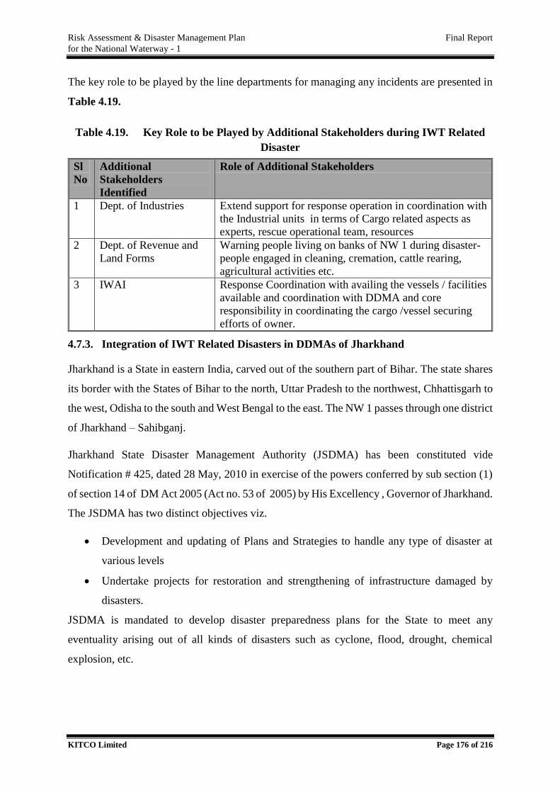
Risk Assessment & Disaster Management Plan Final Report
for the National Waterway - 1
KITCO Limited Page 176 of 216
The key role to be played by the line departments for managing any incidents are presented in
Table 4.19.
Table 4.19. Key Role to be Played by Additional Stakeholders during IWT Related
Disaster
Sl
No
Additional
Stakeholders
Identified
Role of Additional Stakeholders
1 Dept. of Industries Extend support for response operation in coordination with
the Industrial units in terms of Cargo related aspects as
experts, rescue operational team, resources
2 Dept. of Revenue and
Land Forms
Warning people living on banks of NW 1 during disaster-
people engaged in cleaning, cremation, cattle rearing,
agricultural activities etc.
3 IWAI Response Coordination with availing the vessels / facilities
available and coordination with DDMA and core
responsibility in coordinating the cargo /vessel securing
efforts of owner.
4.7.3. Integration of IWT Related Disasters in DDMAs of Jharkhand
Jharkhand is a State in eastern India, carved out of the southern part of Bihar. The state shares
its border with the States of Bihar to the north, Uttar Pradesh to the northwest, Chhattisgarh to
the west, Odisha to the south and West Bengal to the east. The NW 1 passes through one district
of Jharkhand – Sahibganj.
Jharkhand State Disaster Management Authority (JSDMA) has been constituted vide
Notification # 425, dated 28 May, 2010 in exercise of the powers conferred by sub section (1)
of section 14 of DM Act 2005 (Act no. 53 of 2005) by His Excellency , Governor of Jharkhand.
The JSDMA has two distinct objectives viz.
Development and updating of Plans and Strategies to handle any type of disaster at
various levels
Undertake projects for restoration and strengthening of infrastructure damaged by
disasters.
JSDMA is mandated to develop disaster preparedness plans for the State to meet any
eventuality arising out of all kinds of disasters such as cyclone, flood, drought, chemical
explosion, etc.
Risk Assessment & Disaster Management Plan Final Report
for the National Waterway - 1
KITCO Limited Page 177 of 216
SDMA headed by Chief Minister as the Chairperson and Minister-in-Charge, Department of
Disaster Management as Vice Chairperson with 7 members from Nodal Departments and Chief
Secretary as Chief Operating Officer. The State Authority is responsible for:
Development of Multi-hazard response plan
Establish and maintain a failsafe communication network interconnecting the State,
district, block and GP Headquarters for dissemination and collection of information
relating to disaster management.
Institutional capacity building
Capacity building of the communities and Community Based Organisations to handle
emergencies
Preparation of Geographic Information System (GIS) for disaster mitigation and
development planning.
Design and development of training programme for decision makers, elected
representatives and the Civil Society groups.
Coordination of NGO efforts
State Executive Committee (SEC) is proactively strategizing and functioning for the disaster
management of the State. State Steering Committee has also been formed at the department
level to govern the Govt. of India and UNDP sponsored disaster risk reduction program in the
state.
SEC is headed by Chief Secretary as Chair person and Secretary to Disaster Management
Department as member secretary and three members - Principal Secretary to Health
department, Principal Secretary to Home department and Secretary to Finance department.
Emergency Operation Centre (EOC) will act as nerve centre for coordination and management
of disasters of all kind and magnitude. EOC will be a central command and control facility
provider, responsible for carrying out the principles of disaster preparedness, response and
management functions at a strategic level in emergency situation in their notified area. The
present structure of SDMA and DDMA of Sahibganj in Jharkhand is presented in Table 4.20.
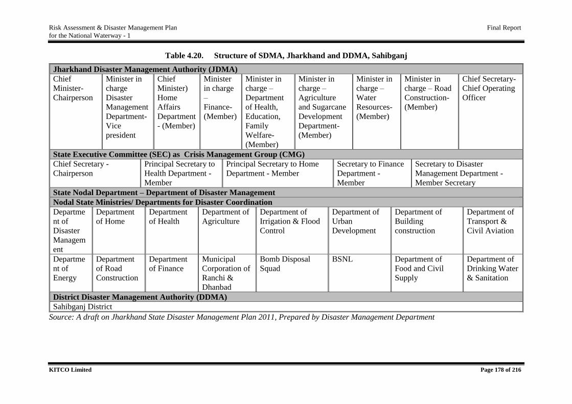
Risk Assessment & Disaster Management Plan Final Report
for the National Waterway - 1
KITCO Limited Page 178 of 216
Table 4.20. Structure of SDMA, Jharkhand and DDMA, Sahibganj
Jharkhand Disaster Management Authority (JDMA)
Chief
Minister-
Chairperson
Minister in
charge
Disaster
Management
Department-
Vice
president
Chief
Minister)
Home
Affairs
Department
- (Member)
Minister
in charge
–
Finance-
(Member)
Minister in
charge –
Department
of Health,
Education,
Family
Welfare-
(Member)
Minister in
charge –
Agriculture
and Sugarcane
Development
Department-
(Member)
Minister in
charge –
Water
Resources-
(Member)
Minister in
charge – Road
Construction-
(Member)
Chief Secretary-
Chief Operating
Officer
State Executive Committee (SEC) as Crisis Management Group (CMG)
Chief Secretary -
Chairperson
Principal Secretary to
Health Department -
Member
Principal Secretary to Home
Department - Member
Secretary to Finance
Department -
Member
Secretary to Disaster
Management Department -
Member Secretary
State Nodal Department – Department of Disaster Management
Nodal State Ministries/ Departments for Disaster Coordination
Departme
nt of
Disaster
Managem
ent
Department
of Home
Department
of Health
Department of
Agriculture
Department of
Irrigation & Flood
Control
Department of
Urban
Development
Department of
Building
construction
Department of
Transport &
Civil Aviation
Departme
nt of
Energy
Department
of Road
Construction
Department
of Finance
Municipal
Corporation of
Ranchi &
Dhanbad
Bomb Disposal
Squad
BSNL Department of
Food and Civil
Supply
Department of
Drinking Water
& Sanitation
District Disaster Management Authority (DDMA)
Sahibganj District
Source: A draft on Jharkhand State Disaster Management Plan 2011, Prepared by Disaster Management Department
Risk Assessment & Disaster Management Plan Final Report
for the National Waterway - 1
KITCO Limited Page 179 of 216
Disaster Management Department proposes comprehensive training program to build the
capacity of functionaries of all the line departments at State, District and Block level to
integrate and mainstream disaster management into development planning and programmes.
Department proposes Knowledge cum Demonstration centers to be created for making aware
the community and the common people about various types of probable disasters and their
vulnerability to that, through technologies and tools and various ways to mitigate and cope up
with the incumbent disaster.
An Incident Site Operation Centre (SOC) is also proposed as a complimentary unit to EOC,
especially during disasters, which will operate close to the disaster site and will be linked
directly with the State and District Emergency Operations Centre. The concerned Additional
Collectors at District as Nodal Officer and CEO of DDMA will be the nodal officer from the
district administration at this Centre. In the event of a serious disaster, the Chief Secretary will
have sole right to appoint senior officers of any State Government Department, posted in the
district as ‘Field Relief Managers’ for monitoring and co-ordinating the relief operations in the
affected area.
The Chief Secretary is the official Incident Response Team Leader to activate the response
system and to control and coordinate the resources required at the site of disaster. The Deputy
Commissioner is the official Incident Response Team Leader to activate the command system
and to control and coordinate the resources required at the site of disaster.
At the District level, DDMAs will act as the planning, coordinating and implementing body for
DM and will take all measures for the purposes of DM in the respective Districts in accordance
with the Guidelines laid down by NDMA and the concerned SDMA. Each DDMA is headed
by the respective District Magistrate, District Collector (DC), Dy. Commissioner as the case
may be with the elected representative of the Local Authority as the Co-Chairperson. DDMA
will act as the planning, coordinating and implementing body for DM at District level and take
all necessary measures for the purposes of DM in accordance with the guidelines laid down by
the NDMA and SDMA.
Emergency Support Functionaries (ESFs) are identified for the state to be activated during a
disaster. The list of function, nodal agency/officers and supporting agencies are listed in the
Table 4.21.
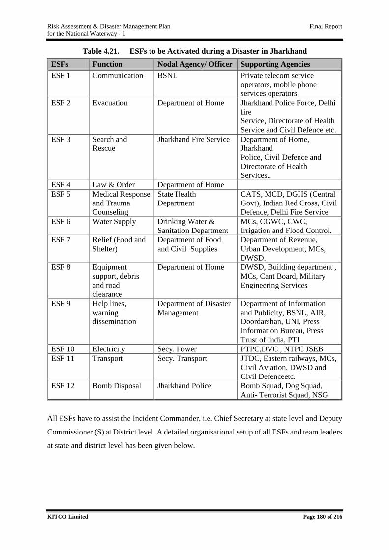
Risk Assessment & Disaster Management Plan Final Report
for the National Waterway - 1
KITCO Limited Page 180 of 216
Table 4.21. ESFs to be Activated during a Disaster in Jharkhand
ESFs Function Nodal Agency/ Officer Supporting Agencies
ESF 1 Communication BSNL Private telecom service
operators, mobile phone
services operators
ESF 2 Evacuation Department of Home Jharkhand Police Force, Delhi
fire
Service, Directorate of Health
Service and Civil Defence etc.
ESF 3 Search and
Rescue
Jharkhand Fire Service Department of Home,
Jharkhand
Police, Civil Defence and
Directorate of Health
Services..
ESF 4 Law & Order Department of Home
ESF 5 Medical Response
and Trauma
Counseling
State Health
Department
CATS, MCD, DGHS (Central
Govt), Indian Red Cross, Civil
Defence, Delhi Fire Service
ESF 6 Water Supply Drinking Water &
Sanitation Department
MCs, CGWC, CWC,
Irrigation and Flood Control.
ESF 7 Relief (Food and
Shelter)
Department of Food
and Civil Supplies
Department of Revenue,
Urban Development, MCs,
DWSD,
ESF 8 Equipment
support, debris
and road
clearance
Department of Home DWSD, Building department ,
MCs, Cant Board, Military
Engineering Services
ESF 9 Help lines,
warning
dissemination
Department of Disaster
Management
Department of Information
and Publicity, BSNL, AIR,
Doordarshan, UNI, Press
Information Bureau, Press
Trust of India, PTI
ESF 10 Electricity Secy. Power PTPC,DVC , NTPC JSEB
ESF 11 Transport Secy. Transport JTDC, Eastern railways, MCs,
Civil Aviation, DWSD and
Civil Defenceetc.
ESF 12 Bomb Disposal Jharkhand Police Bomb Squad, Dog Squad,
Anti- Terrorist Squad, NSG
All ESFs have to assist the Incident Commander, i.e. Chief Secretary at state level and Deputy
Commissioner (S) at District level. A detailed organisational setup of all ESFs and team leaders
at state and district level has been given below.
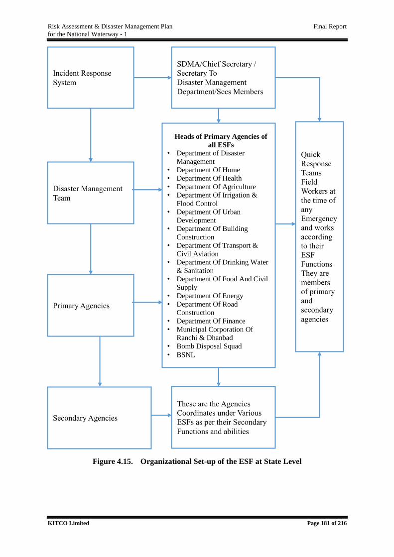
Risk Assessment & Disaster Management Plan Final Report
for the National Waterway - 1
KITCO Limited Page 181 of 216
Figure 4.15. Organizational Set-up of the ESF at State Level
SDMA/Chief Secretary /
Secretary To
Disaster Management
Department/Secs Members
Incident Response
System
Disaster Management
Team
Primary Agencies
Heads of Primary Agencies of
all ESFs
• Department of Disaster
Management
• Department Of Home
• Department Of Health
• Department Of Agriculture
• Department Of Irrigation &
Flood Control
• Department Of Urban
Development
• Department Of Building
Construction
• Department Of Transport &
Civil Aviation
• Department Of Drinking Water
& Sanitation
• Department Of Food And Civil
Supply
• Department Of Energy
• Department Of Road
Construction
• Department Of Finance
• Municipal Corporation Of
Ranchi & Dhanbad
• Bomb Disposal Squad
• BSNL
Secondary Agencies
These are the Agencies
Coordinates under Various
ESFs as per their Secondary
Functions and abilities
Quick
Response
Teams
Field
Workers at
the time of
any
Emergency
and works
according
to their
ESF
Functions
They are
members
of primary
and
secondary
agencies
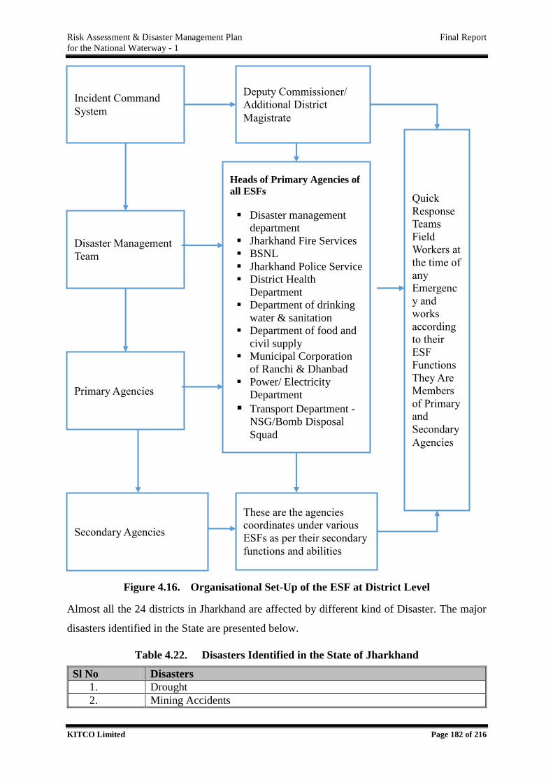
Risk Assessment & Disaster Management Plan Final Report
for the National Waterway - 1
KITCO Limited Page 182 of 216
Figure 4.16. Organisational Set-Up of the ESF at District Level
Almost all the 24 districts in Jharkhand are affected by different kind of Disaster. The major
disasters identified in the State are presented below.
Table 4.22. Disasters Identified in the State of Jharkhand
Sl No Disasters
1. Drought
2. Mining Accidents
Deputy Commissioner/
Additional District
Magistrate
Incident Command
System
Disaster Management
Team
Primary Agencies
Heads of Primary Agencies of
all ESFs
Disaster management
department
Jharkhand Fire Services
BSNL
Jharkhand Police Service
District Health
Department
Department of drinking
water & sanitation
Department of food and
civil supply
Municipal Corporation
of Ranchi & Dhanbad
Power/ Electricity
Department
Transport Department -
NSG/Bomb Disposal
Squad
Secondary Agencies
These are the agencies
coordinates under various
ESFs as per their secondary
functions and abilities
Quick
Response
Teams
Field
Workers at
the time of
any
Emergenc
y and
works
according
to their
ESF
Functions
They Are
Members
of Primary
and
Secondary
Agencies
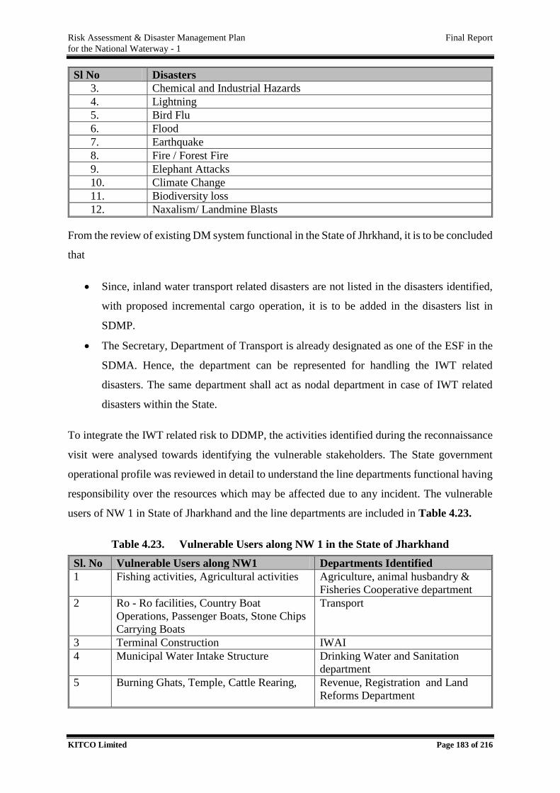
Risk Assessment & Disaster Management Plan Final Report
for the National Waterway - 1
KITCO Limited Page 183 of 216
Sl No Disasters
3. Chemical and Industrial Hazards
4. Lightning
5. Bird Flu
6. Flood
7. Earthquake
8. Fire / Forest Fire
9. Elephant Attacks
10. Climate Change
11. Biodiversity loss
12. Naxalism/ Landmine Blasts
From the review of existing DM system functional in the State of Jhrkhand, it is to be concluded
that
Since, inland water transport related disasters are not listed in the disasters identified,
with proposed incremental cargo operation, it is to be added in the disasters list in
SDMP.
The Secretary, Department of Transport is already designated as one of the ESF in the
SDMA. Hence, the department can be represented for handling the IWT related
disasters. The same department shall act as nodal department in case of IWT related
disasters within the State.
To integrate the IWT related risk to DDMP, the activities identified during the reconnaissance
visit were analysed towards identifying the vulnerable stakeholders. The State government
operational profile was reviewed in detail to understand the line departments functional having
responsibility over the resources which may be affected due to any incident. The vulnerable
users of NW 1 in State of Jharkhand and the line departments are included in Table 4.23.
Table 4.23. Vulnerable Users along NW 1 in the State of Jharkhand
Sl. No Vulnerable Users along NW1 Departments Identified
1 Fishing activities, Agricultural activities Agriculture, animal husbandry &
Fisheries Cooperative department
2 Ro - Ro facilities, Country Boat
Operations, Passenger Boats, Stone Chips
Carrying Boats
Transport
3 Terminal Construction IWAI
4 Municipal Water Intake Structure Drinking Water and Sanitation
department
5 Burning Ghats, Temple, Cattle Rearing, Revenue, Registration and Land
Reforms Department
Risk Assessment & Disaster Management Plan Final Report
for the National Waterway - 1
KITCO Limited Page 184 of 216
The respective line departments of vulnerable resources are already included in the state
disaster management authority except Industries Department and Forest, Environment and
Climate Change Department.
The institutional mechanism proposed for integration of IWT related disasters in existing DM
structure of the State of Jharkhand is presented in Figure 4.17. The key role to be played by
the line departments for managing any incidents are presented in Table 4.18.
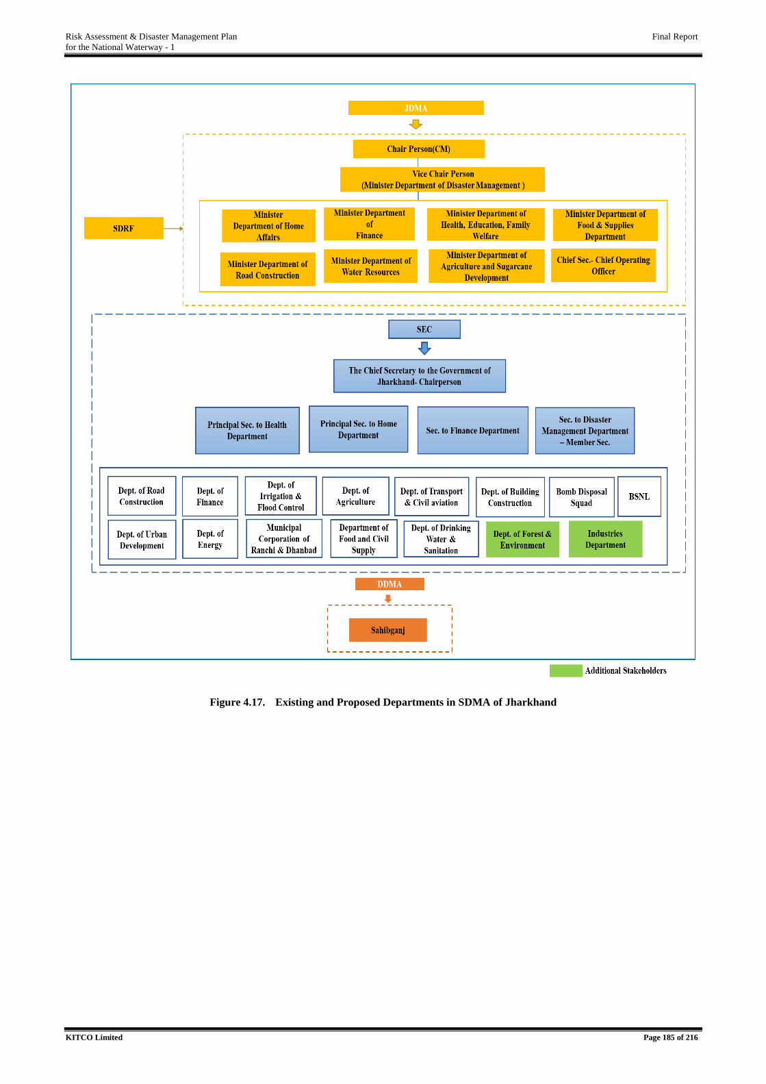
Risk Assessment & Disaster Management Plan Final Report
for the National Waterway - 1
KITCO Limited Page 185 of 216
Figure 4.17. Existing and Proposed Departments in SDMA of Jharkhand
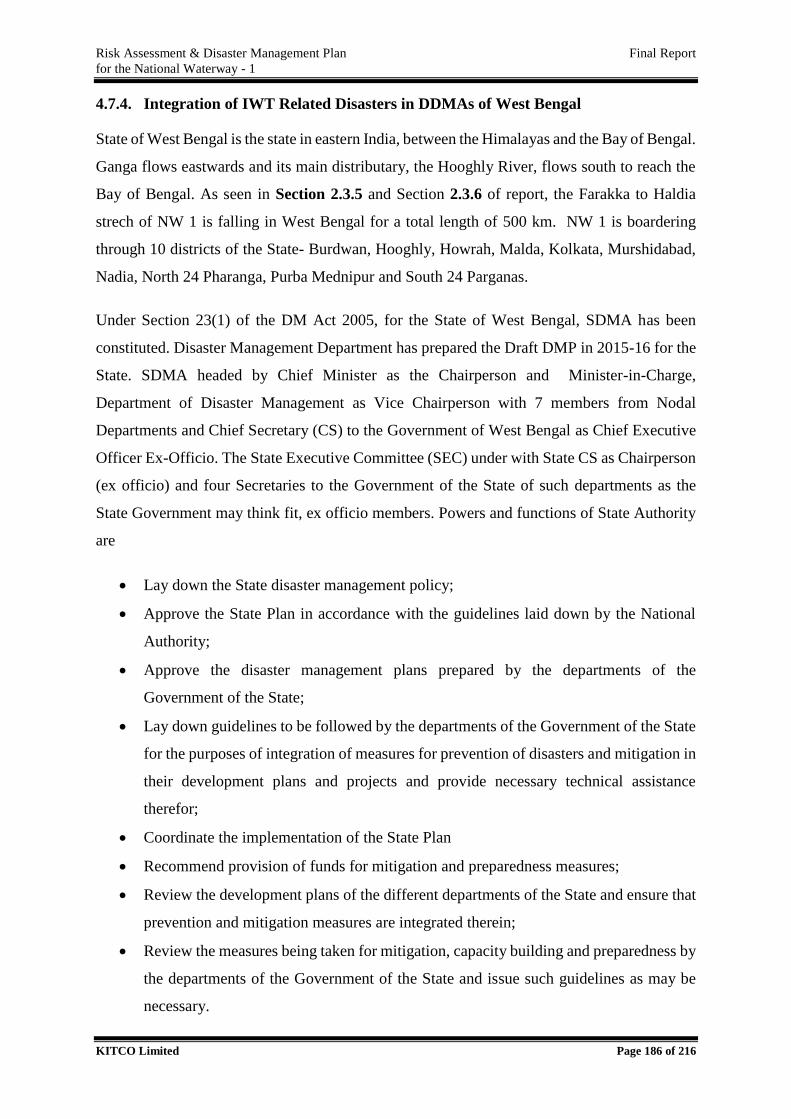
Risk Assessment & Disaster Management Plan Final Report
for the National Waterway - 1
KITCO Limited Page 186 of 216
4.7.4. Integration of IWT Related Disasters in DDMAs of West Bengal
State of West Bengal is the state in eastern India, between the Himalayas and the Bay of Bengal.
Ganga flows eastwards and its main distributary, the Hooghly River, flows south to reach the
Bay of Bengal. As seen in Section 2.3.5 and Section 2.3.6 of report, the Farakka to Haldia
strech of NW 1 is falling in West Bengal for a total length of 500 km. NW 1 is boardering
through 10 districts of the State- Burdwan, Hooghly, Howrah, Malda, Kolkata, Murshidabad,
Nadia, North 24 Pharanga, Purba Mednipur and South 24 Parganas.
Under Section 23(1) of the DM Act 2005, for the State of West Bengal, SDMA has been
constituted. Disaster Management Department has prepared the Draft DMP in 2015-16 for the
State. SDMA headed by Chief Minister as the Chairperson and Minister-in-Charge,
Department of Disaster Management as Vice Chairperson with 7 members from Nodal
Departments and Chief Secretary (CS) to the Government of West Bengal as Chief Executive
Officer Ex-Officio. The State Executive Committee (SEC) under with State CS as Chairperson
(ex officio) and four Secretaries to the Government of the State of such departments as the
State Government may think fit, ex officio members. Powers and functions of State Authority
are
Lay down the State disaster management policy;
Approve the State Plan in accordance with the guidelines laid down by the National
Authority;
Approve the disaster management plans prepared by the departments of the
Government of the State;
Lay down guidelines to be followed by the departments of the Government of the State
for the purposes of integration of measures for prevention of disasters and mitigation in
their development plans and projects and provide necessary technical assistance
therefor;
Coordinate the implementation of the State Plan
Recommend provision of funds for mitigation and preparedness measures;
Review the development plans of the different departments of the State and ensure that
prevention and mitigation measures are integrated therein;
Review the measures being taken for mitigation, capacity building and preparedness by
the departments of the Government of the State and issue such guidelines as may be
necessary.

Risk Assessment & Disaster Management Plan Final Report
for the National Waterway - 1
KITCO Limited Page 187 of 216
The SDMA and DDMA functional at State is presented in Table 4.24.
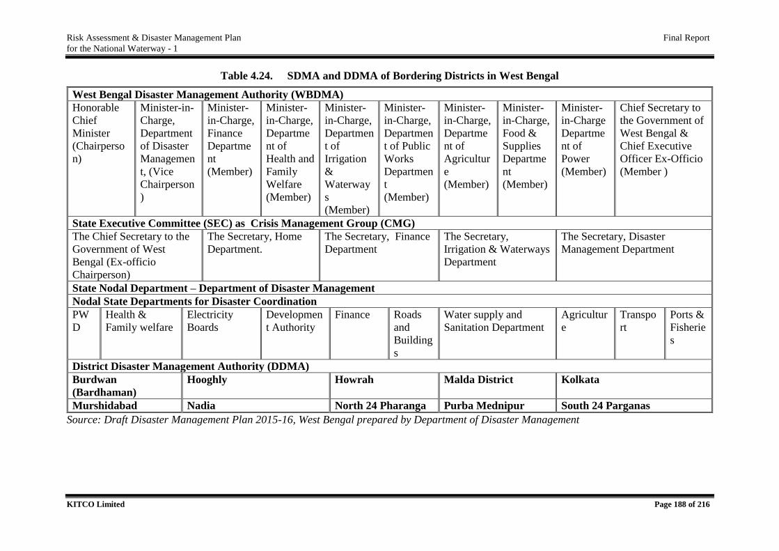
Risk Assessment & Disaster Management Plan Final Report
for the National Waterway - 1
KITCO Limited Page 188 of 216
Table 4.24. SDMA and DDMA of Bordering Districts in West Bengal
West Bengal Disaster Management Authority (WBDMA)
Honorable
Chief
Minister
(Chairperso
n)
Minister-in-
Charge,
Department
of Disaster
Managemen
t, (Vice
Chairperson
)
Minister-
in-Charge,
Finance
Departme
nt
(Member)
Minister-
in-Charge,
Departme
nt of
Health and
Family
Welfare
(Member)
Minister-
in-Charge,
Departmen
t of
Irrigation
&
Waterway
s
(Member)
Minister-
in-Charge,
Departmen
t of Public
Works
Departmen
t
(Member)
Minister-
in-Charge,
Departme
nt of
Agricultur
e
(Member)
Minister-
in-Charge,
Food &
Supplies
Departme
nt
(Member)
Minister-
in-Charge
Departme
nt of
Power
(Member)
Chief Secretary to
the Government of
West Bengal &
Chief Executive
Officer Ex-Officio
(Member )
State Executive Committee (SEC) as Crisis Management Group (CMG)
The Chief Secretary to the
Government of West
Bengal (Ex-officio
Chairperson)
The Secretary, Home
Department.
The Secretary, Finance
Department
The Secretary,
Irrigation & Waterways
Department
The Secretary, Disaster
Management Department
State Nodal Department – Department of Disaster Management
Nodal State Departments for Disaster Coordination
PW
D
Health &
Family welfare
Electricity
Boards
Developmen
t Authority
Finance Roads
and
Building
s
Water supply and
Sanitation Department
Agricultur
e
Transpo
rt
Ports &
Fisherie
s
District Disaster Management Authority (DDMA)
Burdwan
(Bardhaman)
Hooghly Howrah Malda District Kolkata
Murshidabad Nadia North 24 Pharanga Purba Mednipur South 24 Parganas
Source: Draft Disaster Management Plan 2015-16, West Bengal prepared by Department of Disaster Management
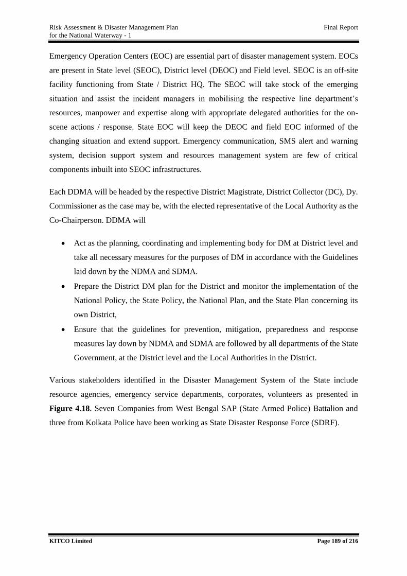
Risk Assessment & Disaster Management Plan Final Report
for the National Waterway - 1
KITCO Limited Page 189 of 216
Emergency Operation Centers (EOC) are essential part of disaster management system. EOCs
are present in State level (SEOC), District level (DEOC) and Field level. SEOC is an off-site
facility functioning from State / District HQ. The SEOC will take stock of the emerging
situation and assist the incident managers in mobilising the respective line department’s
resources, manpower and expertise along with appropriate delegated authorities for the on-
scene actions / response. State EOC will keep the DEOC and field EOC informed of the
changing situation and extend support. Emergency communication, SMS alert and warning
system, decision support system and resources management system are few of critical
components inbuilt into SEOC infrastructures.
Each DDMA will be headed by the respective District Magistrate, District Collector (DC), Dy.
Commissioner as the case may be, with the elected representative of the Local Authority as the
Co-Chairperson. DDMA will
Act as the planning, coordinating and implementing body for DM at District level and
take all necessary measures for the purposes of DM in accordance with the Guidelines
laid down by the NDMA and SDMA.
Prepare the District DM plan for the District and monitor the implementation of the
National Policy, the State Policy, the National Plan, and the State Plan concerning its
own District,
Ensure that the guidelines for prevention, mitigation, preparedness and response
measures lay down by NDMA and SDMA are followed by all departments of the State
Government, at the District level and the Local Authorities in the District.
Various stakeholders identified in the Disaster Management System of the State include
resource agencies, emergency service departments, corporates, volunteers as presented in
Figure 4.18. Seven Companies from West Bengal SAP (State Armed Police) Battalion and
three from Kolkata Police have been working as State Disaster Response Force (SDRF).
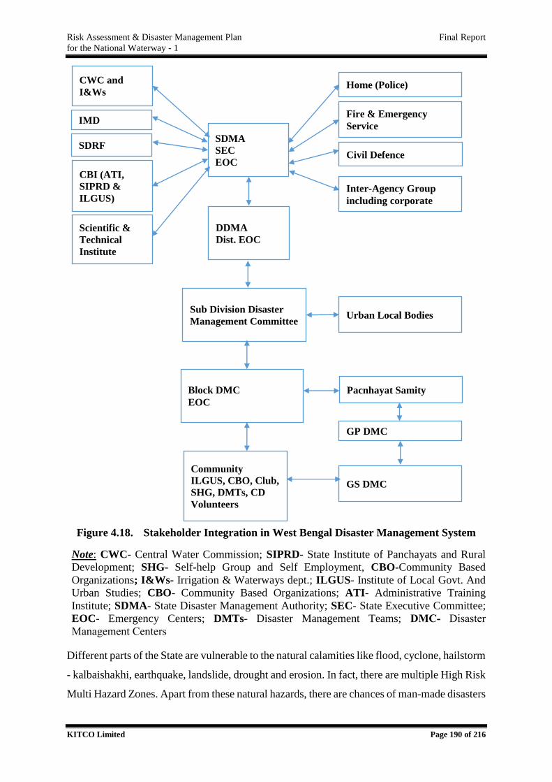
Risk Assessment & Disaster Management Plan Final Report
for the National Waterway - 1
KITCO Limited Page 190 of 216
Figure 4.18. Stakeholder Integration in West Bengal Disaster Management System
Note: CWC- Central Water Commission; SIPRD- State Institute of Panchayats and Rural
Development; SHG- Self-help Group and Self Employment, CBO-Community Based
Organizations; I&Ws- Irrigation & Waterways dept.; ILGUS- Institute of Local Govt. And
Urban Studies; CBO- Community Based Organizations; ATI- Administrative Training
Institute; SDMA- State Disaster Management Authority; SEC- State Executive Committee;
EOC- Emergency Centers; DMTs- Disaster Management Teams; DMC- Disaster
Management Centers
Different parts of the State are vulnerable to the natural calamities like flood, cyclone, hailstorm
- kalbaishakhi, earthquake, landslide, drought and erosion. In fact, there are multiple High Risk
Multi Hazard Zones. Apart from these natural hazards, there are chances of man-made disasters
SDMA
SEC
EOC
DDMA
Dist. EOC
Sub Division Disaster
Management Committee
Block DMC
EOC
Community
ILGUS, CBO, Club,
SHG, DMTs, CD
Volunteers
CWC and
I&Ws
IMD
SDRF
CBI (ATI,
SIPRD &
ILGUS)
Scientific &
Technical
Institute
Home (Police)
Fire & Emergency
Service
Civil Defence
Inter-Agency Group
including corporate
Urban Local Bodies
Pacnhayat Samity
GP DMC
GS DMC
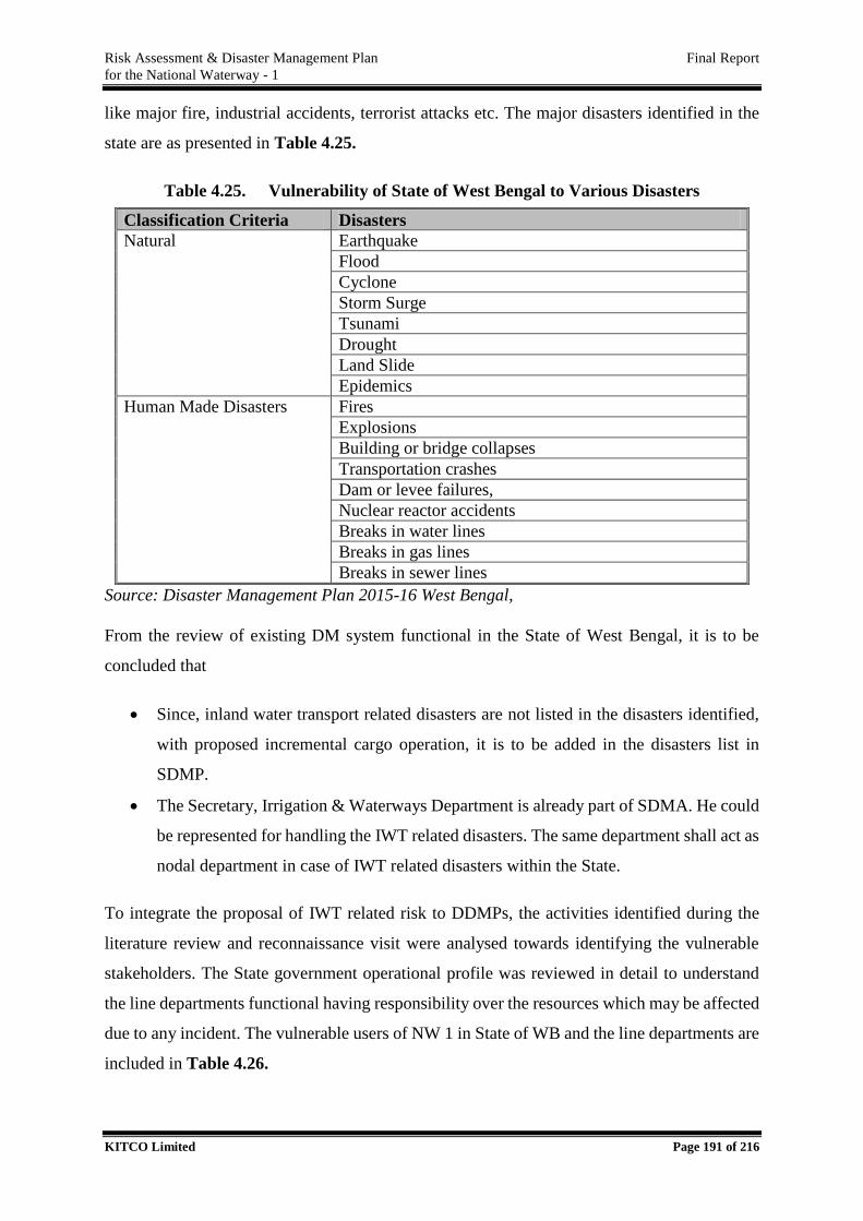
Risk Assessment & Disaster Management Plan Final Report
for the National Waterway - 1
KITCO Limited Page 191 of 216
like major fire, industrial accidents, terrorist attacks etc. The major disasters identified in the
state are as presented in Table 4.25.
Table 4.25. Vulnerability of State of West Bengal to Various Disasters
Classification Criteria Disasters
Natural Earthquake
Flood
Cyclone
Storm Surge
Tsunami
Drought
Land Slide
Epidemics
Human Made Disasters Fires
Explosions
Building or bridge collapses
Transportation crashes
Dam or levee failures,
Nuclear reactor accidents
Breaks in water lines
Breaks in gas lines
Breaks in sewer lines
Source: Disaster Management Plan 2015-16 West Bengal,
From the review of existing DM system functional in the State of West Bengal, it is to be
concluded that
Since, inland water transport related disasters are not listed in the disasters identified,
with proposed incremental cargo operation, it is to be added in the disasters list in
SDMP.
The Secretary, Irrigation & Waterways Department is already part of SDMA. He could
be represented for handling the IWT related disasters. The same department shall act as
nodal department in case of IWT related disasters within the State.
To integrate the proposal of IWT related risk to DDMPs, the activities identified during the
literature review and reconnaissance visit were analysed towards identifying the vulnerable
stakeholders. The State government operational profile was reviewed in detail to understand
the line departments functional having responsibility over the resources which may be affected
due to any incident. The vulnerable users of NW 1 in State of WB and the line departments are
included in Table 4.26.
Risk Assessment & Disaster Management Plan Final Report
for the National Waterway - 1
KITCO Limited Page 192 of 216
Table 4.26. Vulnerable Users along NW 1.
Sl. No Vulnerable Users along NW 1 Line Department/Agency
1. Floating tetty, bank protection,
irrigation water supply intake
Irrigation and Waterways
2. NTPC water outlet from Industry NTPC – Central Government
Institution
Department of Industries and
Commerce – from State Government
side.
3. Fishing activities, Sea going fishing
vessels, fishing harbour
Fisheries
4. Railway line, railway station, rail bridge Ministry of Railway – Central
Government Institution
5. Ferry services, country boats, passenger
vessels
Transport
6. H T lines Power and Non-Conventional Energy
Sources
7. Agriculture activities Agriculture
8. Tourism jetty Tourism
9. Port related traffic KoPT
10. Defence vessels/establishments Ministry of Defence
11. Road Bridge Public Works Department
12. Hospital Health and Family Welfare
13. Human settlements and public uses Land and Land Reforms & Refugee
Relief and Rehabilitation
14. Drinking Water Supplies Water Supply and Sanitation
Considering the existing line departments which are already included in the DM Mechanism,
it is understood that in order to protect the stake of the vulnerable resources of NW 1 the
additional departments identified above shall be included as presented in Figure 4.19.
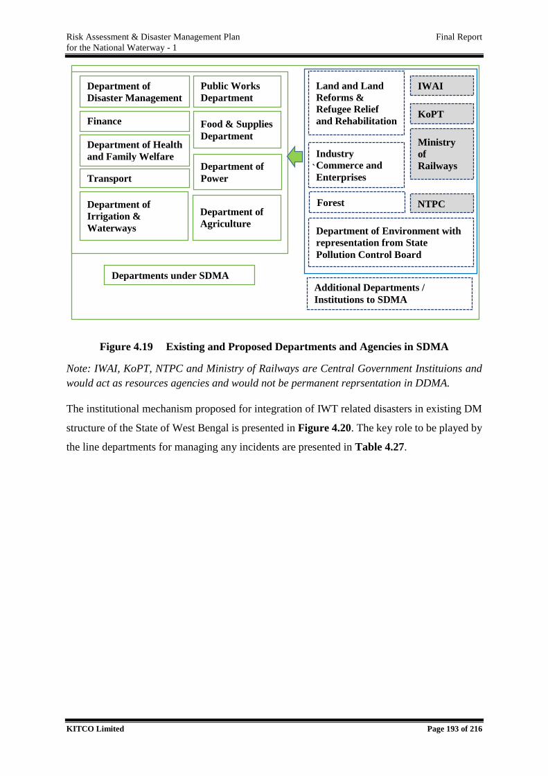
Risk Assessment & Disaster Management Plan Final Report
for the National Waterway - 1
KITCO Limited Page 193 of 216
Figure 4.19 Existing and Proposed Departments and Agencies in SDMA
Note: IWAI, KoPT, NTPC and Ministry of Railways are Central Government Instituions and
would act as resources agencies and would not be permanent reprsentation in DDMA.
The institutional mechanism proposed for integration of IWT related disasters in existing DM
structure of the State of West Bengal is presented in Figure 4.20. The key role to be played by
the line departments for managing any incidents are presented in Table 4.27.
` `
Department of
Disaster Management
Finance
DEPARTMENT Department of Health and Family Welfare
Department of
Agriculture
Food & Supplies
Department
Department of
Irrigation &
Waterways
Public Works
Department
Department of
Power
Departments under SDMA
KoPT
IWAI Land and Land
Reforms &
Refugee Relief
and Rehabilitation
Transport
Forest
Department of Environment with
representation from State
Pollution Control Board
Industry
Commerce and
Enterprises
Ministry
of
Railways
Additional Departments /
Institutions to SDMA
NTPC
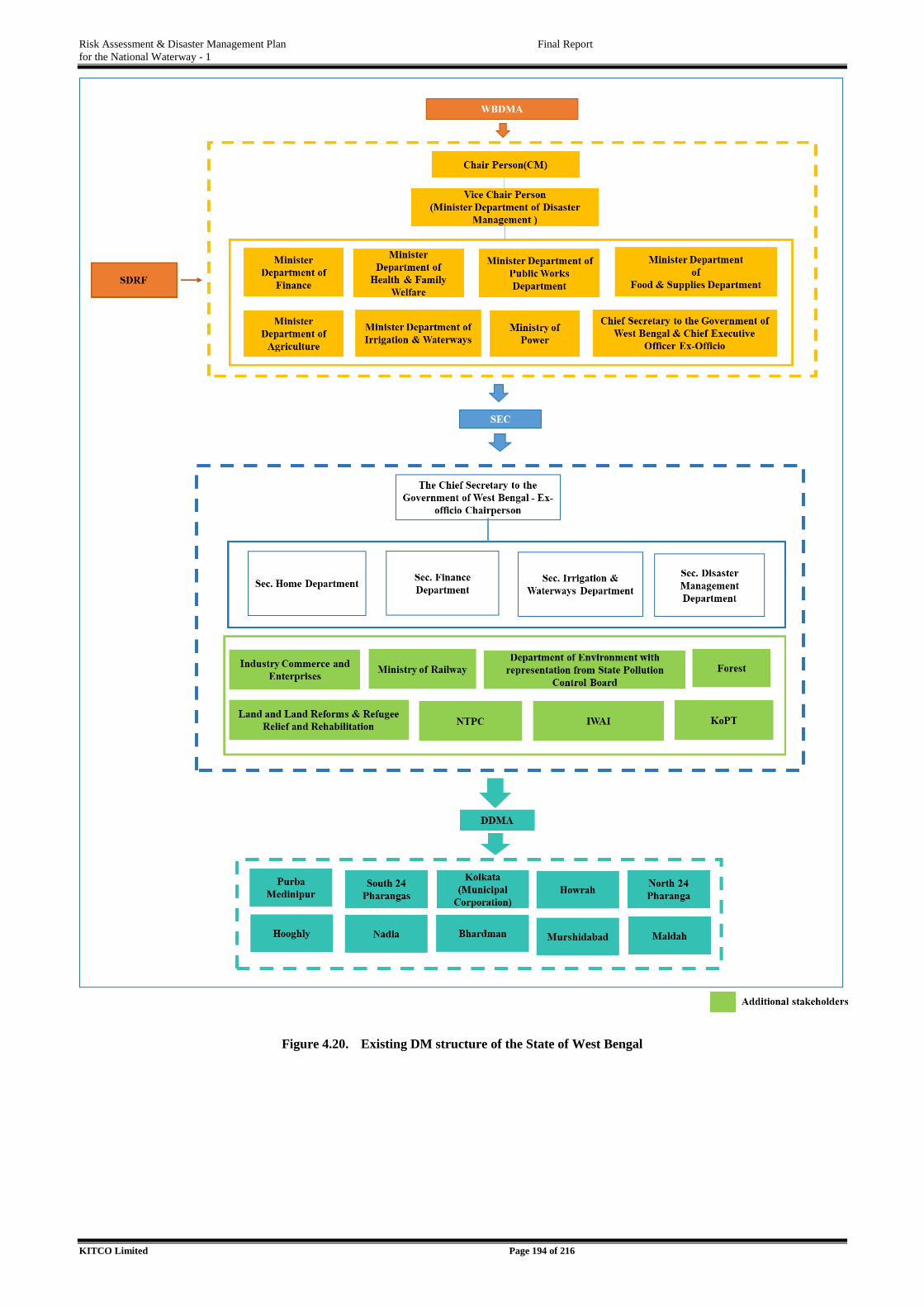
Risk Assessment & Disaster Management Plan Final Report
for the National Waterway - 1
KITCO Limited Page 194 of 216
Figure 4.20. Existing DM structure of the State of West Bengal
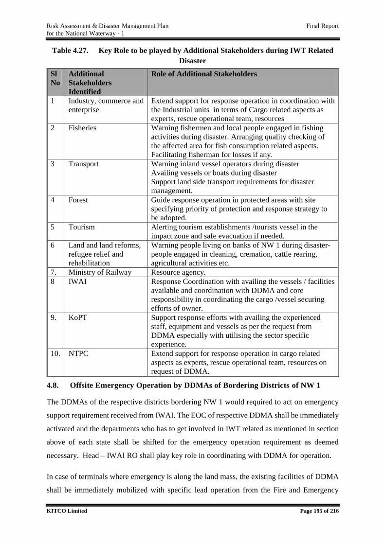
Risk Assessment & Disaster Management Plan Final Report
for the National Waterway - 1
KITCO Limited Page 195 of 216
Table 4.27. Key Role to be played by Additional Stakeholders during IWT Related
Disaster
Sl
No
Additional
Stakeholders
Identified
Role of Additional Stakeholders
1 Industry, commerce and
enterprise
Extend support for response operation in coordination with
the Industrial units in terms of Cargo related aspects as
experts, rescue operational team, resources
2 Fisheries Warning fishermen and local people engaged in fishing
activities during disaster. Arranging quality checking of
the affected area for fish consumption related aspects.
Facilitating fisherman for losses if any.
3 Transport Warning inland vessel operators during disaster
Availing vessels or boats during disaster
Support land side transport requirements for disaster
management.
4 Forest Guide response operation in protected areas with site
specifying priority of protection and response strategy to
be adopted.
5 Tourism Alerting tourism establishments /tourists vessel in the
impact zone and safe evacuation if needed.
6 Land and land reforms,
refugee relief and
rehabilitation
Warning people living on banks of NW 1 during disaster-
people engaged in cleaning, cremation, cattle rearing,
agricultural activities etc.
7. Ministry of Railway Resource agency.
8 IWAI Response Coordination with availing the vessels / facilities
available and coordination with DDMA and core
responsibility in coordinating the cargo /vessel securing
efforts of owner.
9. KoPT Support response efforts with availing the experienced
staff, equipment and vessels as per the request from
DDMA especially with utilising the sector specific
experience.
10. NTPC Extend support for response operation in cargo related
aspects as experts, rescue operational team, resources on
request of DDMA.
4.8. Offsite Emergency Operation by DDMAs of Bordering Districts of NW 1
The DDMAs of the respective districts bordering NW 1 would required to act on emergency
support requirement received from IWAI. The EOC of respective DDMA shall be immediately
activated and the departments who has to get involved in IWT related as mentioned in section
above of each state shall be shifted for the emergency operation requirement as deemed
necessary. Head – IWAI RO shall play key role in coordinating with DDMA for operation.
In case of terminals where emergency is along the land mass, the existing facilities of DDMA
shall be immediately mobilized with specific lead operation from the Fire and Emergency
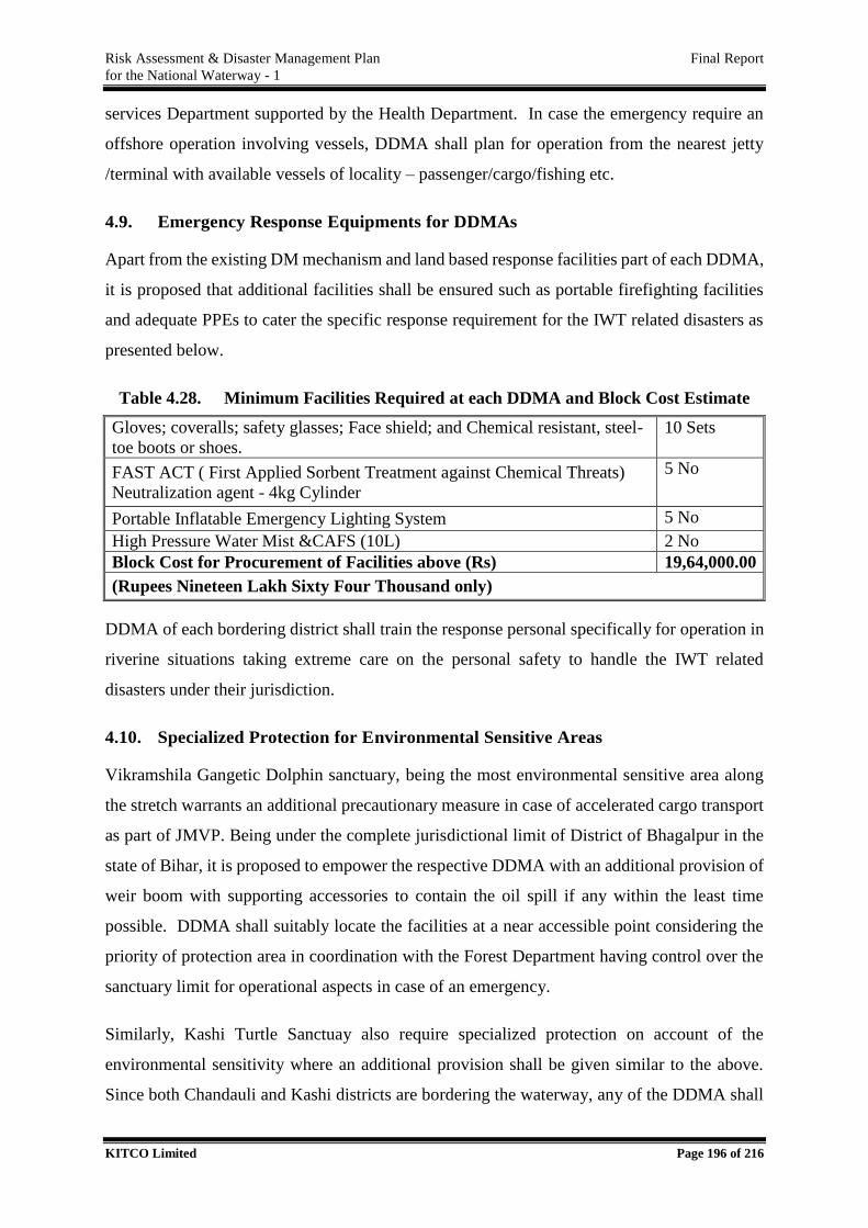
Risk Assessment & Disaster Management Plan Final Report
for the National Waterway - 1
KITCO Limited Page 196 of 216
services Department supported by the Health Department. In case the emergency require an
offshore operation involving vessels, DDMA shall plan for operation from the nearest jetty
/terminal with available vessels of locality – passenger/cargo/fishing etc.
4.9. Emergency Response Equipments for DDMAs
Apart from the existing DM mechanism and land based response facilities part of each DDMA,
it is proposed that additional facilities shall be ensured such as portable firefighting facilities
and adequate PPEs to cater the specific response requirement for the IWT related disasters as
presented below.
Table 4.28. Minimum Facilities Required at each DDMA and Block Cost Estimate
Gloves; coveralls; safety glasses; Face shield; and Chemical resistant, steel-
toe boots or shoes.
10 Sets
FAST ACT ( First Applied Sorbent Treatment against Chemical Threats)
Neutralization agent - 4kg Cylinder
5 No
Portable Inflatable Emergency Lighting System 5 No
High Pressure Water Mist &CAFS (10L) 2 No
Block Cost for Procurement of Facilities above (Rs) 19,64,000.00
(Rupees Nineteen Lakh Sixty Four Thousand only)
DDMA of each bordering district shall train the response personal specifically for operation in
riverine situations taking extreme care on the personal safety to handle the IWT related
disasters under their jurisdiction.
4.10. Specialized Protection for Environmental Sensitive Areas
Vikramshila Gangetic Dolphin sanctuary, being the most environmental sensitive area along
the stretch warrants an additional precautionary measure in case of accelerated cargo transport
as part of JMVP. Being under the complete jurisdictional limit of District of Bhagalpur in the
state of Bihar, it is proposed to empower the respective DDMA with an additional provision of
weir boom with supporting accessories to contain the oil spill if any within the least time
possible. DDMA shall suitably locate the facilities at a near accessible point considering the
priority of protection area in coordination with the Forest Department having control over the
sanctuary limit for operational aspects in case of an emergency.
Similarly, Kashi Turtle Sanctuay also require specialized protection on account of the
environmental sensitivity where an additional provision shall be given similar to the above.
Since both Chandauli and Kashi districts are bordering the waterway, any of the DDMA shall
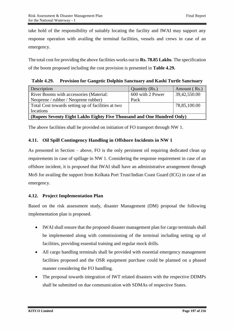
Risk Assessment & Disaster Management Plan Final Report
for the National Waterway - 1
KITCO Limited Page 197 of 216
take hold of the responsibility of suitably locating the facility and IWAI may support any
response operation with availing the terminal facilities, vessels and crews in case of an
emergency.
The total cost for providing the above facilities works out to Rs. 78.85 Lakhs. The specification
of the boom proposed including the cost provision is presented in Table 4.29.
Table 4.29. Provision for Gangetic Dolphin Sanctuary and Kashi Turtle Sanctuary
Description Quantity (Rs.) Amount ( Rs.)
River Booms with accessories (Material:
Neoprene / rubber / Neoprene rubber)
600 with 2 Power
Pack
39,42,550.00
Total Cost towards setting up of facilities at two
locations
78,85,100.00
(Rupees Seventy Eight Lakhs Eighty Five Thousand and One Hundred Only)
The above facilities shall be provided on initiation of FO transport through NW 1.
4.11. Oil Spill Contingency Handling in Offshore Incidents in NW 1
As presented in Section – above, FO is the only persistent oil requiring dedicated clean up
requirements in case of spillage in NW 1. Considering the response requirement in case of an
offshore incident, it is proposed that IWAI shall have an administrative arrangement through
MoS for availing the support from Kolkata Port Trust/Indian Coast Guard (ICG) in case of an
emergency.
4.12. Project Implementation Plan
Based on the risk assessment study, disaster Management (DM) proposal the following
implementation plan is proposed.
IWAI shall ensure that the proposed disaster management plan for cargo terminals shall
be implemented along with commissioning of the terminal including setting up of
facilities, providing essential training and regular mock drills.
All cargo handling terminals shall be provided with essential emergency management
facilities proposed and the OSR equipment purchase could be planned on a phased
manner considering the FO handling.
The proposal towards integration of IWT related disasters with the respective DDMPs
shall be submitted on due communication with SDMAs of respective States.
Risk Assessment & Disaster Management Plan Final Report
for the National Waterway - 1
KITCO Limited Page 198 of 216
IWAI shall actively coordinate with DDMAs for mainstreaming mock drill to handle
IWT related disasters and remain prepared for handling emergencies. The additional
provisions for the DDMAs shall be allocated from the state /central reserves on mutual
interactions.
IWAI shall ensure that the proposed ECC facilities are established at RO and HO and
essential trainings are given for the personals identified as part of Incident Management
Team.
Specialised protection for Vikramshila Gangetic Dolphin Sanctuary and Kashi Turtle
Sanctuary to be implemented on initiation of FO transport through the respective
regions.
For oil spill emergencies, each IWAI terminals shall be equipped with in built facilities
and for offshore exigencies an administrative arrangement with KoPT and ICG shall be
operationalized.
Risk Assessment & Disaster Management Plan Final Report
for the National Waterway - 1
KITCO Limited Page 199 of 216
BEST MANAGEMENT PRACTICES
Best Management Practices (BMP) are essential prerequisites for an efficient and sustainable
IWT system. BMP for transportation through waterways include different aspects related with
waterways, vessels, terminals, cargo handling and storage, other users embedded in Quality
Safety base. BMP of waterways have been adopted in the countries with extensive waterway
system depending on the priority of the region. Countries of European Union, Myanmar are a
few example. They are able to utilise the waterways efficiently by focusing on its benefits and
introducing state of the art technical and managerial practices for better utilisation with
improved performance. Major aims are to ease road congestion and the pollution by switching
to greener transport modes away from residential areas.
NW 1 is a multi-user inland waterway where several development activities are underway at
different planning and execution levels for enhancing the cargo transport and other uses of the
waterway. Therefore, it is essential to initiate implementation of BMP for IWT in NW 1. This
is more so in the backdrop of highly diverse uses and environmental sensitivity of the
waterway, land use and socio-economic environment of the banks. Adoption of best practices
will lead to achieve responsible IWT operations.
At present, the other countries extensively utilised for inland waterway navigation other than
India are the North America, Europe, China, Thailand and Bangladesh.
North America – Missouri- Mississippi and Inter Coastal Traffic in the Great Lake,
which together accounts for over 630 million tonnes of cargo movement per annum.
Europe – The Rivers Rhine and Danube are the major modes of transportation through
European Union (EU). It is estimated that at around 7 % of the total freight traffic is
supposed to be carried by the IWT operations. The modal share in EU by ton-kilometre
percentages are 48 %.
China - IWT accounts for almost 10 % of the total freight tonnage carried in the country
and of the two- third is carried on the Yangtze river including the bulk commodities
like coal, steel, cement, containers and LPG.
5
Risk Assessment & Disaster Management Plan Final Report
for the National Waterway - 1
KITCO Limited Page 200 of 216
Thailand - IWT operations are having around 20 million tons of cargo handling
annually, representing 4.5 % of the total inland cargo volume.
Bangladesh – IWT accounts for 14 percentage of countries annual passenger volume
and 35 % of its annual freight volume.
After considering the peculiarities of NW 1 stress areas for implementing BMPs are identified
as below:
Waterway
Vessels
Operator/Tenant
Terminals & Supporting Infrastructure Facilities
Navigation & Traffic Management Systems
Management of Dredged Material
Environmental Protection & Sustainability
Quality & Safety
Administration
Competing Uses
Emergency Response
Technology and Innovations
Training
Casualties and incidents
5.1. Waterway
Giving more attention to hot spots area and critical sections like curves, sensitive banks,
critical structures, high siltation area, high eroding banks etc. Check out the possibility
of reducing the risk elements so that hotspots will be brought to critical sections and
critical sections to non-critical sections.
Identify parking, repair and halting areas along the waterway. Identify zones based on
type of user and make arrangements for multiple user.
Ensure proper visibility of signage at place throughout the waterway and provide
additional signage were ever required for E.g. demarcation of channel diversions,
accident prone areas etc.

Risk Assessment & Disaster Management Plan Final Report
for the National Waterway - 1
KITCO Limited Page 201 of 216
Provide appropriate fender to all bridges and all other cross structures.
Provide lighting in areas with curvature, low width etc. to support night navigation
through the waterway.
Impose speed restrictions, no turning etc. to prevent accidents at hotspot and critical
sections.
Erosion control measures in the banks should be provided by planting erosion resisting
plants.
Monitoring of Waterways to avoid dumping of municipal and industrial solid waste
with the help of local people.
Removal of wrecks and other obstructions from time to time impeding navigation.
5.2. Vessels
Each Inland water vessel will have a unique identification number indicating its
important features and its area of operation,
Ensure Global Positioning System (GPS) and Automatic Identification System (AIS)
facilities in each vessel.
Barges having separate ballast and product tanks, as well as vapour return and efficient
stripping facilities according to the latest technical standards are preferred so that not
only will it minimise product residues by eliminating the need for cleaning and
degassing, it will reduce the number of personnel along the supply chain who handle
products thus allowing for greater levels of training.
All the vessels should have on board all Life Saving Appliances, Light and Sound
Signals and Fire Fighting Appliances required as per the Rules and regulations.
Official log book shall be maintained at each vessel and any occurrence should be
entered without fail.
Double-hulled barges with diamond shaped tanks will help to minimise product
residues.
Barges equipped with deep well pumps or equivalents are preferred for self-priming
purpose and for minimising pollution due to leakages.
Efficient line draining should be available on the barge as recommended in the
International Safety Guide for Inland Navigation Tank-barges and Terminals
(ISGINTT guide.).
Use of barges with a slop tanks for carrying loading residues should be ensured for
better waste management.
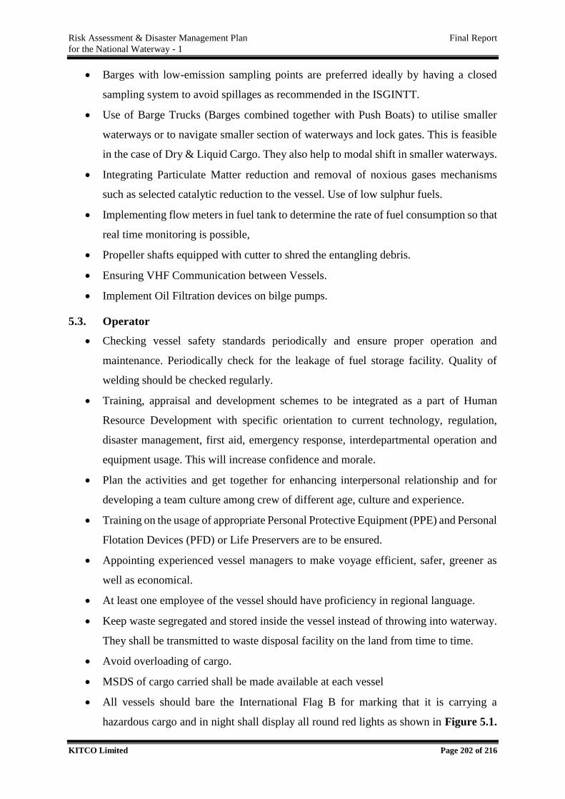
Risk Assessment & Disaster Management Plan Final Report
for the National Waterway - 1
KITCO Limited Page 202 of 216
Barges with low-emission sampling points are preferred ideally by having a closed
sampling system to avoid spillages as recommended in the ISGINTT.
Use of Barge Trucks (Barges combined together with Push Boats) to utilise smaller
waterways or to navigate smaller section of waterways and lock gates. This is feasible
in the case of Dry & Liquid Cargo. They also help to modal shift in smaller waterways.
Integrating Particulate Matter reduction and removal of noxious gases mechanisms
such as selected catalytic reduction to the vessel. Use of low sulphur fuels.
Implementing flow meters in fuel tank to determine the rate of fuel consumption so that
real time monitoring is possible,
Propeller shafts equipped with cutter to shred the entangling debris.
Ensuring VHF Communication between Vessels.
Implement Oil Filtration devices on bilge pumps.
5.3. Operator
Checking vessel safety standards periodically and ensure proper operation and
maintenance. Periodically check for the leakage of fuel storage facility. Quality of
welding should be checked regularly.
Training, appraisal and development schemes to be integrated as a part of Human
Resource Development with specific orientation to current technology, regulation,
disaster management, first aid, emergency response, interdepartmental operation and
equipment usage. This will increase confidence and morale.
Plan the activities and get together for enhancing interpersonal relationship and for
developing a team culture among crew of different age, culture and experience.
Training on the usage of appropriate Personal Protective Equipment (PPE) and Personal
Flotation Devices (PFD) or Life Preservers are to be ensured.
Appointing experienced vessel managers to make voyage efficient, safer, greener as
well as economical.
At least one employee of the vessel should have proficiency in regional language.
Keep waste segregated and stored inside the vessel instead of throwing into waterway.
They shall be transmitted to waste disposal facility on the land from time to time.
Avoid overloading of cargo.
MSDS of cargo carried shall be made available at each vessel
All vessels should bare the International Flag B for marking that it is carrying a
hazardous cargo and in night shall display all round red lights as shown in Figure 5.1.
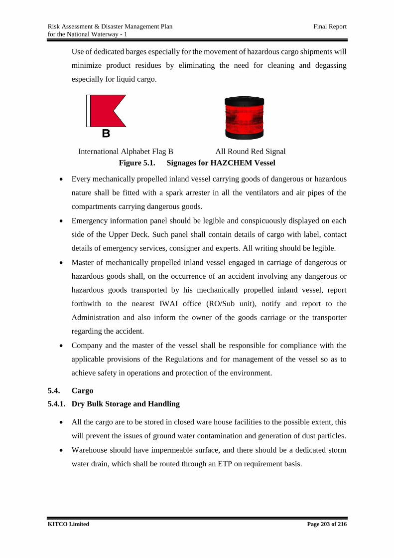
Risk Assessment & Disaster Management Plan Final Report
for the National Waterway - 1
KITCO Limited Page 203 of 216
Use of dedicated barges especially for the movement of hazardous cargo shipments will
minimize product residues by eliminating the need for cleaning and degassing
especially for liquid cargo.
International Alphabet Flag B All Round Red Signal
Figure 5.1. Signages for HAZCHEM Vessel
Every mechanically propelled inland vessel carrying goods of dangerous or hazardous
nature shall be fitted with a spark arrester in all the ventilators and air pipes of the
compartments carrying dangerous goods.
Emergency information panel should be legible and conspicuously displayed on each
side of the Upper Deck. Such panel shall contain details of cargo with label, contact
details of emergency services, consigner and experts. All writing should be legible.
Master of mechanically propelled inland vessel engaged in carriage of dangerous or
hazardous goods shall, on the occurrence of an accident involving any dangerous or
hazardous goods transported by his mechanically propelled inland vessel, report
forthwith to the nearest IWAI office (RO/Sub unit), notify and report to the
Administration and also inform the owner of the goods carriage or the transporter
regarding the accident.
Company and the master of the vessel shall be responsible for compliance with the
applicable provisions of the Regulations and for management of the vessel so as to
achieve safety in operations and protection of the environment.
5.4. Cargo
5.4.1. Dry Bulk Storage and Handling
All the cargo are to be stored in closed ware house facilities to the possible extent, this
will prevent the issues of ground water contamination and generation of dust particles.
Warehouse should have impermeable surface, and there should be a dedicated storm
water drain, which shall be routed through an ETP on requirement basis.
Risk Assessment & Disaster Management Plan Final Report
for the National Waterway - 1
KITCO Limited Page 204 of 216
In case of open storage, heaps shall be made steep to minimize the percolation pollution
load and also, if possible a temporary barrier shall be kept in the most prominent
direction to prevent the spillages.
5.4.2. Non-Bulk Chemical Storage and Handling
Locate outdoor storage areas on impervious surfaces with no storm drains and within
berms low enough to permit equipment access but capable of containing spills/releases;
Outdoor storage areas can be constructed with a slightly sloping surface to a dead-end
sump to collect precipitation. Sump pumps should be manually operated. Collected
precipitation should be closely examined and tested, if necessary, to ensure there is no
contamination from the contents of stored drums. if no contamination is observed or
analyzed, collected precipitation can be pumped to the storm water collection system;
If contamination is suspected or analyzed, the collected precipitation should be pumped
to a drum or other container and managed as a hazardous waste
For outdoor storage areas for containers of petroleum product, pumping the
precipitation through an oil-water separator will then allow the water portion to be
discharged to the storm water collection system [Note: oil-water separators will not
remove chemical pollutants from water].
Locate long-term storage areas under cover and within a secondary containment
structure capable of holding the contents of the largest container plus at least 10 percent
of its volume;
Erect barriers at the perimeter of storage areas to prevent vehicle collisions, but that
will permit access by loading/unloading equipment;
Frequently inspect equipment used to unload/load containers off/on vessels, trains and
trucks;
Employees handling chemical containers should ensure labels, placards and other
identification affixed to containers is not removed or defaced;
Segregate chemicals and chemical products by compatibility; store flammables in a
separate area and usually, per local codes, at a greater distance from the property line;
Do not dispense product from containers in the storage area - - this should not be
necessary or permitted for cargo in transit.
Store drums upright (bungs-up), not horizontally, to prevent leaks from improperly
closed or poorly fitted bungs and possible movement (rolling) on the storage area
surface or from a horizontal storage rack;
Risk Assessment & Disaster Management Plan Final Report
for the National Waterway - 1
KITCO Limited Page 205 of 216
Forklifts equipped with drum grapplers should be used to move individual drums;
Pallets of drums should be moved only when the drums are securely banded together;
Move single drums only with a drum dolly, never roll drums on their side or bottom
edge;
Locate over pack drums (usually 80 gallons) with spill response equipment into which
leaking drums can be placed and their contents contained.
Other cargo handling structures such as restrict double-stacking plastic totes.
Forklift drivers need to employ caution in lifting and moving totes and be particularly
observant of the location and configuration of the top fill portal and (on some totes) a
discharge valve near the bottom;
Frequently inspect tote storage areas for leaking valves (if totes are equipped with these.
5.4.3. Liquid (Flammable/ Toxic Cargo) Bulk Storage and Transfer
No leaky tank or container shall be used for transportation of HAZCHEM.
Filled barrels and drums should be loaded with their bung upwards.
No vessel shall carry the petroleum if passengers or any combustible cargo is present
on board.
Smoking, matchsticks, lighters or other fire inducing appliances should be strictly
prohibited during loading/unloading and while transportation.
Loading/unloading of petroleum after sunset shall be prohibited unless adequate
lighting and firefighting facilities with trained personnel are available.
Petroleum in bulk shall be necessarily carried in a vessel which is licensed for the stated
purpose and stored in the standardised mandated manner approved by the licensing
authority in water transportation.
It should not be transported in a barge or flat-bottomed boat unless it is self-propelled
or is in tow of, or attended by a steamer or tug and carries fire extinguishers.
After complete discharge of petroleum from the vessel, its holds, tanks and bilges shall
be rendered free from inflammable vapour.
Gas free certificates for dock entry, man entry and hot work by the appointed officers
are obligatory.
Handling facilities in all cases shall be approved by the Terminal/Vessel Manager along
with Terminal Safety Office rafter evaluating the various safety reports.
Use of naked lights, fire or smoking on board in vessel are prohibited.
Risk Assessment & Disaster Management Plan Final Report
for the National Waterway - 1
KITCO Limited Page 206 of 216
Fire-extinguishing appliances should always be kept ready
Prepare a spill prevention and emergency response plan for the facility and all
storage/transfer operations and submit it to the federal and/or state/provincial
environmental regulatory authority for approval;
Provide initial and follow-up training to employees responsible for facility operations
and for emergency spill response;
Locate spill clean-up materials and equipment in known and convenient locations
Ensure that the loading/unloading area drains to a catchment basin or other similar
containment structure; the capacity of the containment structure must be equivalent to
the largest compartment of a tank car or truck loaded/unloaded;
Ensure that secondary containment holds the volume of the largest storage container
plus sufficient freeboard for precipitation;
Regularly inspect fixed and mobile tanks, transfer equipment and piping for drip marks,
tank discoloration, puddles of leaked liquid, puddles of water with a sheen (indicating
petroleum product), corrosion, localized dead vegetation and stains on the ground,
leaks/seepage from valves and seals, deformities (e.g., bulges, cracks, bends) in pipes
and tanks.
Regularly inspect secondary containment structures for cracks, discoloration,
corrosion, erosion (of inside walls and outside perimeter), valve leaks, loose mortar,
sealer, sizing or grouting used to construct walls, presence of leaked or spilled material
within the containment area, debris within the containment area and the operational
status of drainage valves [closed] regularly inspect and test liquid level sensing devices
and audible alarms on each storage tank to ensure proper operation.
Periodically conduct integrity testing of above ground storage tanks and leak testing of
valves and piping;
Inspect and record inspection results of storm water released from any drainage system
in the bulk tank storage area directly to waterways;
Regularly inspect and test liquid level sensing devices and audible alarms on each
storage tank to ensure proper operation;
Inspect valves that permit the outward flow of tank or secondary containment contents
to ensure that they will remain closed when not operating;
Inspect starter controls for pumps within secondary containment to ensure that they will
remain locked in off position when not operating;
Risk Assessment & Disaster Management Plan Final Report
for the National Waterway - 1
KITCO Limited Page 207 of 216
Inspect loading/unloading connections of pipelines to ensure that they are securely
capped or blank flanged when not in service;
Inspect valves and valve operation, piping, flange joints, expansion joints, valve glands,
catch pans, pipeline supports and metal surfaces;
Use physical barriers, warning signs, wheel chocks or vehicle brake interlock systems
to prevent tank cars/trucks from departing before complete disconnection of transfer
lines;
Inspect drains and outlets on tank cars/trucks prior to filling and departure and tighten,
adjust or replace as necessary;
Use pans or containers to catch drips/spills when making or breaking connections with
hoses, nozzles or other transfer equipment;
Ensure that buried piping has protective wrapping or coating and is catholically
protected or otherwise meets corrosion protection requirements;
Install and maintain vapor recovery systems for product transfer to bulk tanks;
Ensure that transfers are supervised by facility employees who are thoroughly familiar
with normal and emergency operations procedures.
5.4.4. Gaseous Flammable/ Toxic Cargo
No portion of the cylinder carrying gaseous HAZCHEM should project from the vessel
and there should be no other flammable or corrosive articles in it.
These cylinders need to be prevented from falling, rough handling, excessive shocks or
local stresses.
No lifting magnet shall be used in loading or unloading of filled cylinders.
No person shall transport any leaky cylinder. In case of a leak during transport the same
shall be removed to an isolated open place away from any source of ignition.
Cylinders containing flammable gases should not be transported along with cylinders
containing other type of compressed gas.
Toxic or corrosive gas cylinders shall not be transported along with food-stuffs.
5.4.5. Loading & Unloading of Cargo
Safety data sheet for each material should be available at the terminal as well as in each
vessel and should be available before loading the cargo.
Loading& Unloading operations should be carried out according to the Standard
Operating Procedures (SOP).
Risk Assessment & Disaster Management Plan Final Report
for the National Waterway - 1
KITCO Limited Page 208 of 216
For liquid cargo, the loading lines are to be emptied into product tanks to avoid
emissions or spillages. The loading location should be able to handle barge vapour
residues. Closed loading systems are preferred, i.e. vapour return facilities, incineration
or vapour absorbing systems should be considered.
Sampling after loading of vessel’s tank should be executed with lowest emission
possible, ideally via a closed sampling system.
When the previous cargo was incompatible, then the barge should be presented clean,
dry and odourless and at atmospheric pressure. Any necessary cleaning should not
result in a release of the substances in to the water. Contaminated water must be treated
according to the regulations.
Barges should either to be connected to a vapour return line of the land tank in to which
the product is to be discharged or land tank to be connected to an off-gas handling
system i.e. vapour return facilities, incineration or vapour absorbing system.
Unloading facilities should always be provided with installations to use the efficient
stripping system of barges to ensure that product tanks can be ensured liquid free.
Arrangements for facilitating the draining of the barge’s tanks can comprise of suction
by a terminal’s pump, Discharge by a barge’s pump (stripping pump) and Purged by
inert gas or air through a stripping line.
When draining is complete, and before hoses or arms are disconnected, the barge’s
manifold valves and shore valves should be closed and the drain cocks at the barge’s
manifold should be opened to drain into fixed drain tanks or portable drip trays.
Cargo manifolds and marine arms or hoses should be securely blanked off after being
disconnected. The contents of portable or fixed drip trays should be transferred to a slop
tank or other safe receptacle ashore.
5.4.6. Cargo Handling Equipment and Rail/Truck Operations
Clean Fuel: change to advanced clean diesel fuel, such as low or ultra-low sulfur diesel
(LSD) (ULSD), emulsified diesel, bio-diesel, compressed natural gas, liquefied natural
gas, liquefied petroleum gas (propane, which requires a dedicated engine);
Retrofit with essential equipments such as diesel particulate filters, oxidation catalysts,
closed crankcase ventilation, selective catalytic reduction, lean NOx catalyst, exhaust
gas recirculation, idle reduction devices;
Rebuild and properly maintain engines;
Risk Assessment & Disaster Management Plan Final Report
for the National Waterway - 1
KITCO Limited Page 209 of 216
Replace an older engine with a newer, cleaner engine, especially one that can use
alternative fuels and/or has been manufactured to stricter on-road emission standards;
Replace older vehicles or machines with one built to stricter emissions standards;
Investigate the feasibility of using hydraulic hybrid vehicles as replacements for diesel
engine equipment.
Conduct an emissions inventory to quantify air quality impacts of the current operations
and assess potential impacts of port expansion and/or growth in port activities;
Implement an anti-idling policy and distribute information to tenants and transportation
providers about idle reduction technologies;
Implement an educational program for tenants to inform them of strategies and options
for reducing diesel emissions;
Include incentives for emissions reduction in leases and contracts with tenants,
contractors and transportation service providers;
Expand operating hours to reduce truck queuing, idling and traffic congestion;
5.4.7. Hazardous Wastes
Designate a permanent storage facility constructed and operated per regulatory
requirements, including - covered area with impervious base and secondary
containment;
Signage designating Hazardous Waste Storage and restricting entry by unauthorized
persons;
Sufficient space to allow the segregation of non-compatible wastes and to permit
movement of persons within the facility;
Use of containers that are compatible with their waste contents; ensuring that containers
are closed, except when adding waste;
Required fire, emergency, communication and security measures implemented;
Locate drums for the collection of hazardous waste in the operations areas
where the waste is generated (satellite accumulation areas, per U.S. EPA regulations;
drums must be moved to the permanent storage facility within three days of being
filled);
5.4.8. Non-hazardous Waste
Locate waste collection areas on impervious surfaces with a bermed perimeter;
use covered dumpsters or roll-offs as the primary waste collection receptacles;
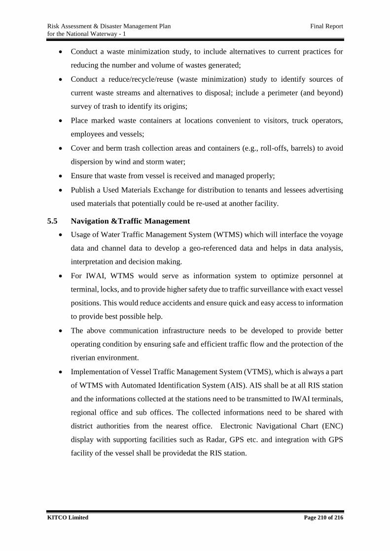
Risk Assessment & Disaster Management Plan Final Report
for the National Waterway - 1
KITCO Limited Page 210 of 216
Conduct a waste minimization study, to include alternatives to current practices for
reducing the number and volume of wastes generated;
Conduct a reduce/recycle/reuse (waste minimization) study to identify sources of
current waste streams and alternatives to disposal; include a perimeter (and beyond)
survey of trash to identify its origins;
Place marked waste containers at locations convenient to visitors, truck operators,
employees and vessels;
Cover and berm trash collection areas and containers (e.g., roll-offs, barrels) to avoid
dispersion by wind and storm water;
Ensure that waste from vessel is received and managed properly;
Publish a Used Materials Exchange for distribution to tenants and lessees advertising
used materials that potentially could be re-used at another facility.
5.5 Navigation &Traffic Management
Usage of Water Traffic Management System (WTMS) which will interface the voyage
data and channel data to develop a geo-referenced data and helps in data analysis,
interpretation and decision making.
For IWAI, WTMS would serve as information system to optimize personnel at
terminal, locks, and to provide higher safety due to traffic surveillance with exact vessel
positions. This would reduce accidents and ensure quick and easy access to information
to provide best possible help.
The above communication infrastructure needs to be developed to provide better
operating condition by ensuring safe and efficient traffic flow and the protection of the
riverian environment.
Implementation of Vessel Traffic Management System (VTMS), which is always a part
of WTMS with Automated Identification System (AIS). AIS shall be at all RIS station
and the informations collected at the stations need to be transmitted to IWAI terminals,
regional office and sub offices. The collected informations need to be shared with
district authorities from the nearest office. Electronic Navigational Chart (ENC)
display with supporting facilities such as Radar, GPS etc. and integration with GPS
facility of the vessel shall be providedat the RIS station.
Risk Assessment & Disaster Management Plan Final Report
for the National Waterway - 1
KITCO Limited Page 211 of 216
Figure 5.2. Traffic Control System
5.6. Management of dredged material
To prevent or limit the impacts from dredged materials, many national and international
conventions have been developed. One component of the LC-DMAF (London
Convention- Dredged Material Assessment Framework) is the conduct of a thorough
Environmental Impact Assessment (EIA) to identify potential effects of a given
dredging project prior to its execution and to reduce uncertainty about the scales of
those impacts.
PIANC has published, in close co-operation with the World Dredging Association
(WODA) and International Association of Dredging Companies (IADC), a number of
valuable reports about the environmentally sound handling and management of dredged
material (see http://www.pianc-aipcn.org/ and Bray 2008).
Based on this knowledge, the most recent PIANC reports Dredging Management
Practices for the Environment – A Structured Selection Approach’ (PIANC, 2008b)
and ‘Dredged Material as a Resource – Options and Constraints’ (PIANC, 2008c)
provide up-to-date guidance and a number of recommendations including the benefits
of relocating dredged material into aquatic systems, and of monitoring to minimize
uncertainty about the interaction between dredged material and its receiving
environment.
A clear trend is to develop a better understanding of the sediment quantity and quality
dynamics on a river basin scale and to set up sediment management plans for each
single river.
Risk Assessment & Disaster Management Plan Final Report
for the National Waterway - 1
KITCO Limited Page 212 of 216
5.7. Environmental Protection &Sustainability
An Environmental Management System should be in place for the IWT as a whole and for
various departments as a part of BMP. This system shall be in accordance with prevailing
environmental laws and rules along with statutory regulations such as Water Act, Air Act, etc.,
‘Polluter Pay’ principle should be adopted and channelize fund to protect important
ecological areas such as notified sanctuary along the waterway.
Prevent waterway activities that will create environmental problems such as scour
damage, changes to the riverine regime.
Promote habitat creation/enhancement at degraded areas.
Declaration of valuable waterway sections as zero pollution areas, associate with NGOs
& local people for achieving it.
Prevention harmful emissions such as CO2, NOx and PM during activities related to
IWT.
5.8. Quality & Safety
Dedicated Quality, Health, Safety & Environment (QHSE) officers shall be appointed
to consider the matters related to quality and safety at all terminals
Quality manual should be made and followed for vessel operation by owner/operator
of the vessel.
Formal training schemes for improving the quality awareness of the employees
especially in the operation side of IWT.
Nurture a “no accusation / blame” culture while discussing matters in the areas of
Quality &Safety among the employees.
Use integrated Quality & Safety solution typically comprising of complete on board-
onshore reporting for all findings and incidents, structured descriptions, conditions, root
cause analysis functionality, fleet-wide action tracking etc. which shall be reviewed in
a joint meeting of administrator & operators and proper corrective actions are to be
taken.
5.9. Administration
Focus on investment plans. Authority may invest for lands near Terminals and facilitate
industries to invest on handling and storage facilities
Develop Terminals-Establish CCTV Camera for Terminals. Ensure regular
maintenance of Terminals, Vessels and allied facilities
Risk Assessment & Disaster Management Plan Final Report
for the National Waterway - 1
KITCO Limited Page 213 of 216
Provision of pilotage facilities for River-Sea vessels entering the waterway may be
extended.
Interact with prospective clients for inviting traffic to NW 1 and identify new Origin-
Destination (O-D) Pairs. Organise O-D pairs to improve the channel performance.
Schedule the vessel movements to avoid haphazard operation and reduce the probability
of accident.
Intimate with lock gate operators on timing of passing.
Discuss with National Highway authorities for arriving at mutually amicable solutions
in the expansion/development plans. Negotiate with responsible authorities for
dismantling old bridges posing threat.
Implementation of risk abatement and management measures with coordination of
district authorities and ensuring that the disaster management mechanisms are familiar
and would effectively function in case of an emergency.
Provide Green Certification to less polluting vessels and provide fee exemptions for
limited periods for them.
Contracts for various outsourced operations are to be provided and extended on
performance base.
Registered users of inland waterways must be informed by the authorities on the day to
day matters of waterway relevant to them which may include details related to fairway,
traffic, restriction etc.
To provide Information Centre that will be providing information, advice and directions
regarding vessel movements, timing etc. to users other interested personals. This will
be very useful for new users. The users shall be also possible to deliver their grievance
at this number.
Interactive Data bases which are accessible to the public through internet can be
developed.
Conduct a public survey to understand their needs related to NW1. Concerns of Transit
& Residential communities in and around NW1 shall be passed on to the respective
departments/agencies/organization on identification.
Improving public awareness regarding various aspects of IWT through
seminars/workshops and other media. This will attract more support and involvement
of the public.
Risk Assessment & Disaster Management Plan Final Report
for the National Waterway - 1
KITCO Limited Page 214 of 216
Conduct awareness classes and exhibitions on the waterway its importance and
potential. Invite entries on Innovative ideas from academic/ research institutions.
Improvement of existing jetties along NW 1.
Provide loading and unloading facilities that does not require any land acquisition. Ro-
Ro services can be effectively utilized for shorter distances of IWT operation.
Testing of the dredged material to identify the presence of undesirable elements.
Safe disposal of dredged material according to safe disposal plans.
Discussing with industries on prohibition of discharge of untreated effluent into the
waterway.
Planning with local self-governments on diversion of municipal sewage from the
waterway.
Introduction of private sector management for the IWT systems or a part there of in the
initial stage. Implement project management agency to review the efficiency of
implementation of project.
5.10. Competing Uses
Scheduling of cargo movements by fixing time for channel crossing for other vessels
like Ro-Ro ferries, Passenger ferries, Cargo ferries etc.
Fixing of low speed areas, no parking areas in high traffic areas after having discussion
with respective authorities.
Determine the peak hours for high and medium traffic areas based on activities like
tourism, port activities, passenger crossings etc.
Patrolling/Sudden inspection in high risk areas
Estimation of carriage capacity & augmentation planning
Marking Buffer Zones between waterway & multiuser areas.
Low speed zones near moored vessels, fixed objects, swimmers, anglers etc.
Recommend control on issue of permit in areas already having high traffic density
5.11. Emergency Response
Implement SOPs for responding to emergency
Promote joint mock drill of different agencies
Provide temporary diversions from spill scene
5.12. Technology &Innovations
Risk Assessment & Disaster Management Plan Final Report
for the National Waterway - 1
KITCO Limited Page 215 of 216
Efficiency improving measures such as Eco-speed coating on the hull to reduce the
viscous resistance. Z-drive counter-rotating propeller systems
Energy-efficient and environmentally friendly systems such as Diesel electric
propulsion.
5.13. Training
Purchase of Navigation Simulators for trainees and students which will be highly useful
in navigating inland waterways which is much more restricted compared to open sea it
will be helpful in safe manoeuvring, crossing etc.
5.14. Casualties and Incidents
In the event of a casualty or incident involving the vessel resulting in loss of life or the
vessel being materially damaged, stranded, abandoned or lost, the master or the
Company shall inform the Administration immediately. If it is not possible to inform
the Administration directly, information on the casualty or incident shall be provided
to the nearest surveyor, registrar of vessels, police officer or harbour master, who shall
immediately notify the Administration.
In the case of the death or disappearance of any person on or from the vessel the
information notified to the Administration shall include at least:
the date, time and location of the accident or occurrence;
the name of each person that died or disappeared;
the identification number and name of the vessel; and
the name and address of the Company.
The Company shall submit a report to the Administration when as a result of a casualty
or incident that involves the vessel or its equipment:
a person dies;
a person is injured and requires medical treatment beyond first aid;
a person disappears from a vessel in circumstances that indicate probable death or
injury; or damage occurs to the vessel or other property.
The report required shall be made:
within 48 hours of the casualty or incident if a person dies within 24 hours of the
occurrence, requires medical treatment beyond first aid or disappears from a vessel; or
within 10 days of the occurrence

Risk Assessment & Disaster Management Plan Final Report
for the National Waterway - 1
KITCO Limited Page 216 of 216
The report required shall be in writing, dated and signed on completion by the person
or persons that prepared it. The administration should conduct an investigation into any
occurrence meeting the criteria specified.
KITCO Ltd.
Femith’s, P. B. No:4407,
Puthiya Road, NH Bypass Vennala,
Kochi – 682 028, Kerala, India
Phone:0484-4129000
e-mail: [email protected]
New Delhi :-
Flat No: B2/92, 9th Floor,
Himalaya House, 23, KG Marg,
New Delhi 110 001
Tel: +91-1141030081
e-mail: [email protected]
Chennai:-
KITCO Ltd.,
1st Main Road, MEPZ-SEZ,
GST Road, Tambaram Sanatorium,
Chennai – 600 045, India.
Phone: +91-044-45118383/84
e-mail: [email protected]
Thiruvananthapuram :-
KITCO Ltd.,
TC No.16/839-1,
Kochar Road, Jagathy,
Thiruvananthapuram -695 014, Kerala, India.
Phone /Fax: +91-471-2728543
e-mail: [email protected]
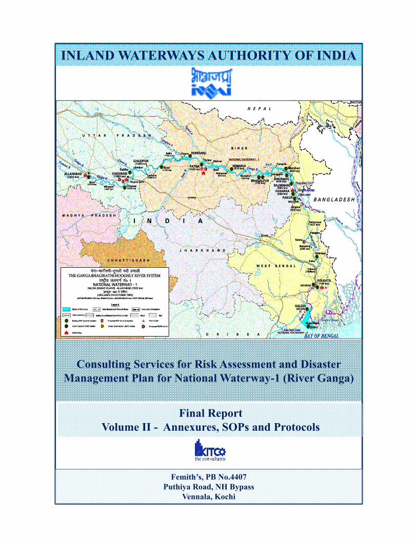
INLAND WATERWAYS AUTHORITY OF INDIA
Consulting Services for Risk Assessment and Disaster Management Plan for National Waterway-1 (River Ganga)
Femith’s, PB No.4407Puthiya Road, NH Bypass
Vennala, Kochi
Final ReportVolume II - Annexures, SOPs and Protocols
Risk Assessment & Disaster Management Plan Final Report for the National Waterway - 1
KITCO Limited Page 1 of 179
LIST OF ANNEXURES
ANNEXURE I - DETAILED DESCRIPTION OF WATERWAY 4
1.1. Allahabad (km 1454) - Varanasi (km 1350) 5
1.2. Varanasi (km 1250) - Ghazipur (1132) 24
1.3. Ghazipur (km 1132) - Patna (km 969) 34
1.4. Patna (km 936) – Munger (km 762) 44
1.5. Munger - Rajmahal 52
1.6. Rajmahal- Farakka 62
1.7. Farakka – Behrampur 65
1.8. Behrampur – Katwa 75
1.9. Katwa to Nabadweep 80
1.10. Nabadwip to Kolkata 85
1.11. Kolkata to Hooghly Point 110
1.12. Hooghly Point to Haldia 114
ANNEXURE II - DETAILS OF CRITICAL SECTIONS 117
ANNEXURE III - CARGO ANALYSIS BASED ON THEIR APPLICABILITY TO IMDG AND IMSBC 130
ANNEXURE IV - SILTATION AREAS 135
ANNEXURE V - MULTIPLE FERRY CROSSING LOCATIONS 138
ANNEXURE VI - CONSEQUENCES & RESPONSE ACTION FOR SHORTLISTED CARGO 140
ANNEXURE VII - STANDARD OPERATING PROCEDURES 144
1. SOP FOR THE REMOVAL OF OBSTRUCTIONS AND SIMILAR HAZARDS IN NAVIGATION 146
1.1. Objective 146
Risk Assessment & Disaster Management Plan Final Report for the National Waterway - 1
KITCO Limited Page 2 of 179
1.2. General 146 1.3. Responsibility 146 1.4. Methodology 147
2. SOP for Investigation in to Causalities 149 2.1. Objective 149 2.2. Responsibility 149 2.3. Methodology 149
3. SOP FOR PREVENTION AND CONTROL OF POLLUTION AND PROTECTION OF IN LAND WATER 153
3.1 Objective 153 3.2 General 153 3.3 Responsibility 153 3.4 Methodology 154
4 PENALTIES AND LEGAL PROCEEDINGS 154
ANNEXURE VIII – PROTOCOLS 156
1. Protocol for Speed Control, Monitoring and Vessel Tracking 157 1.1. Objective 157 1.2. Components of RIS and Voice VHF systems 157 1.3. Benefits of RIS 160
2. Protocol for Waste Management System 160 2.1. Objective 161 2.2. Legal Compliance Requirement 161
3. Protocol for the Protection of Biodiversity including Accident Reporting with Aquatic Mammals 167
3.1. Introduction 167 3.2. Objective 167 3.3. Measures to be Implemented 167
4. Protocol for Defining Hazardous Chemical as per the law of India 169 4.1. Introduction 169 4.2. Objective 169 4.3. IMO Classes for Dangerous Goods 169 4.4. Procedure to be adopted while Handling Hazardous Cargo 170
5. Protocol for Lessons Learned and Corrective Actions Programme 172 5.1. Introduction 172 5.2. Objective 172 5.3. Process 173
Risk Assessment & Disaster Management Plan Final Report for the National Waterway - 1
KITCO Limited Page 3 of 179
6. Protocol for Internal and External Auditing Procedure and Frequency 174 6.1. Introduction 174 6.2. Objective 174 6.3. Performance Audit Objectives 174 6.4. Audit Criteria 174 6.5. Frequency and Procedure for Auditing 176
7. Protocol for Oil Spil Reporting and Control and Remediation 177 7.1 Introduction 177 7.2 Onshore & Offshore Oil Spill Incidents Reporting and Management 177
ANNEXURE IV - MATERIAL SAFTEY DATA SHEETS FOR LISTED CARGOS 179
Risk Assessment & Disaster Management Plan Final Report for the National Waterway - 1
KITCO Limited Page 4 of 179
ANNEXURE I - DETAILED DESCRIPTION OF WATERWAY
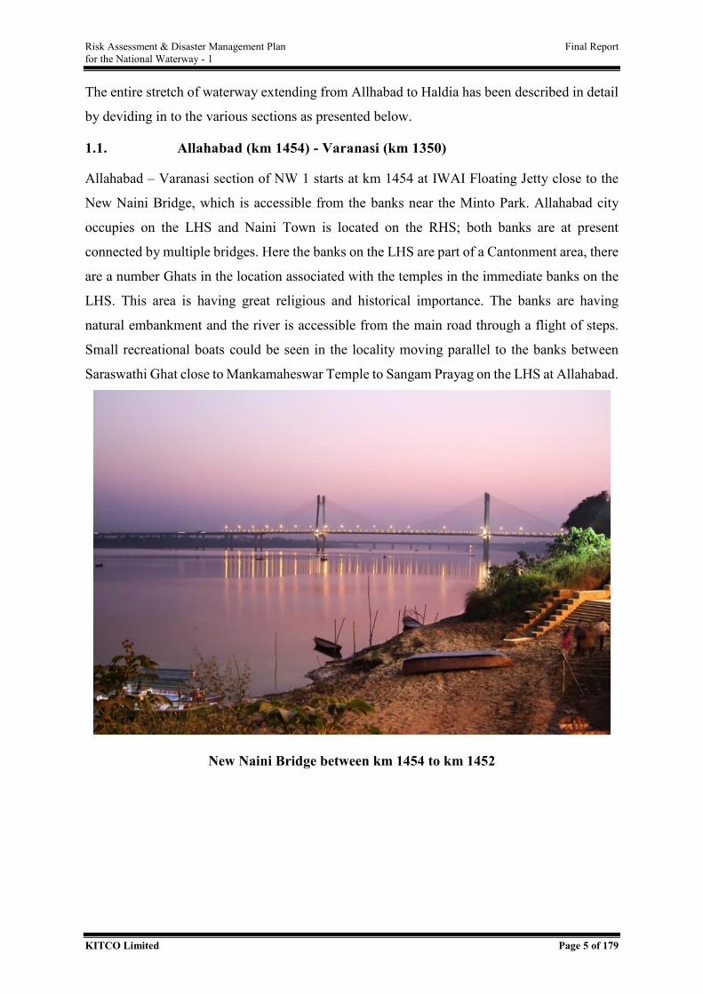
Risk Assessment & Disaster Management Plan Final Report for the National Waterway - 1
KITCO Limited Page 5 of 179
The entire stretch of waterway extending from Allhabad to Haldia has been described in detail
by deviding in to the various sections as presented below.
1.1. Allahabad (km 1454) - Varanasi (km 1350)
Allahabad – Varanasi section of NW 1 starts at km 1454 at IWAI Floating Jetty close to the
New Naini Bridge, which is accessible from the banks near the Minto Park. Allahabad city
occupies on the LHS and Naini Town is located on the RHS; both banks are at present
connected by multiple bridges. Here the banks on the LHS are part of a Cantonment area, there
are a number Ghats in the location associated with the temples in the immediate banks on the
LHS. This area is having great religious and historical importance. The banks are having
natural embankment and the river is accessible from the main road through a flight of steps.
Small recreational boats could be seen in the locality moving parallel to the banks between
Saraswathi Ghat close to Mankamaheswar Temple to Sangam Prayag on the LHS at Allahabad.
New Naini Bridge between km 1454 to km 1452
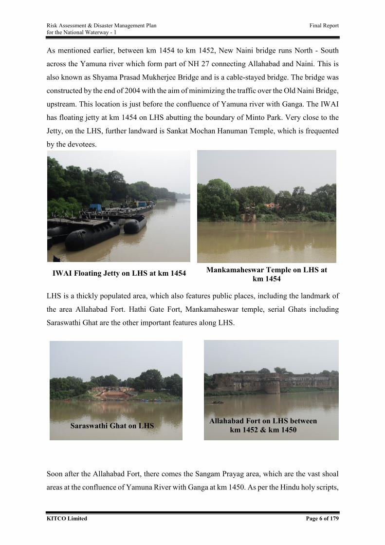
Risk Assessment & Disaster Management Plan Final Report for the National Waterway - 1
KITCO Limited Page 6 of 179
As mentioned earlier, between km 1454 to km 1452, New Naini bridge runs North - South
across the Yamuna river which form part of NH 27 connecting Allahabad and Naini. This is
also known as Shyama Prasad Mukherjee Bridge and is a cable-stayed bridge. The bridge was
constructed by the end of 2004 with the aim of minimizing the traffic over the Old Naini Bridge,
upstream. This location is just before the confluence of Yamuna river with Ganga. The IWAI
has floating jetty at km 1454 on LHS abutting the boundary of Minto Park. Very close to the
Jetty, on the LHS, further landward is Sankat Mochan Hanuman Temple, which is frequented
by the devotees.
LHS is a thickly populated area, which also features public places, including the landmark of
the area Allahabad Fort. Hathi Gate Fort, Mankamaheswar temple, serial Ghats including
Saraswathi Ghat are the other important features along LHS.
Soon after the Allahabad Fort, there comes the Sangam Prayag area, which are the vast shoal
areas at the confluence of Yamuna River with Ganga at km 1450. As per the Hindu holy scripts,
IWAI Floating Jetty on LHS at km 1454 Mankamaheswar Temple on LHS at km 1454
Saraswathi Ghat on LHS Allahabad Fort on LHS between km 1452 & km 1450
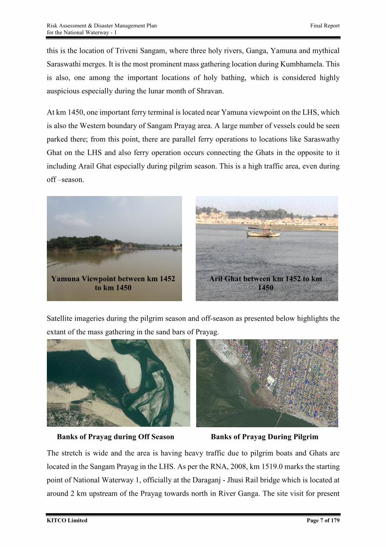
Risk Assessment & Disaster Management Plan Final Report for the National Waterway - 1
KITCO Limited Page 7 of 179
this is the location of Triveni Sangam, where three holy rivers, Ganga, Yamuna and mythical
Saraswathi merges. It is the most prominent mass gathering location during Kumbhamela. This
is also, one among the important locations of holy bathing, which is considered highly
auspicious especially during the lunar month of Shravan.
At km 1450, one important ferry terminal is located near Yamuna viewpoint on the LHS, which
is also the Western boundary of Sangam Prayag area. A large number of vessels could be seen
parked there; from this point, there are parallel ferry operations to locations like Saraswathy
Ghat on the LHS and also ferry operation occurs connecting the Ghats in the opposite to it
including Arail Ghat especially during pilgrim season. This is a high traffic area, even during
off –season.
Satellite imageries during the pilgrim season and off-season as presented below highlights the
extant of the mass gathering in the sand bars of Prayag.
The stretch is wide and the area is having heavy traffic due to pilgrim boats and Ghats are
located in the Sangam Prayag in the LHS. As per the RNA, 2008, km 1519.0 marks the starting
point of National Waterway 1, officially at the Daraganj - Jhusi Rail bridge which is located at
around 2 km upstream of the Prayag towards north in River Ganga. The site visit for present
Yamuna Viewpoint between km 1452 to km 1450
Aril Ghat between km 1452 to km 1450
Banks of Prayag during Off Season Banks of Prayag During Pilgrim S
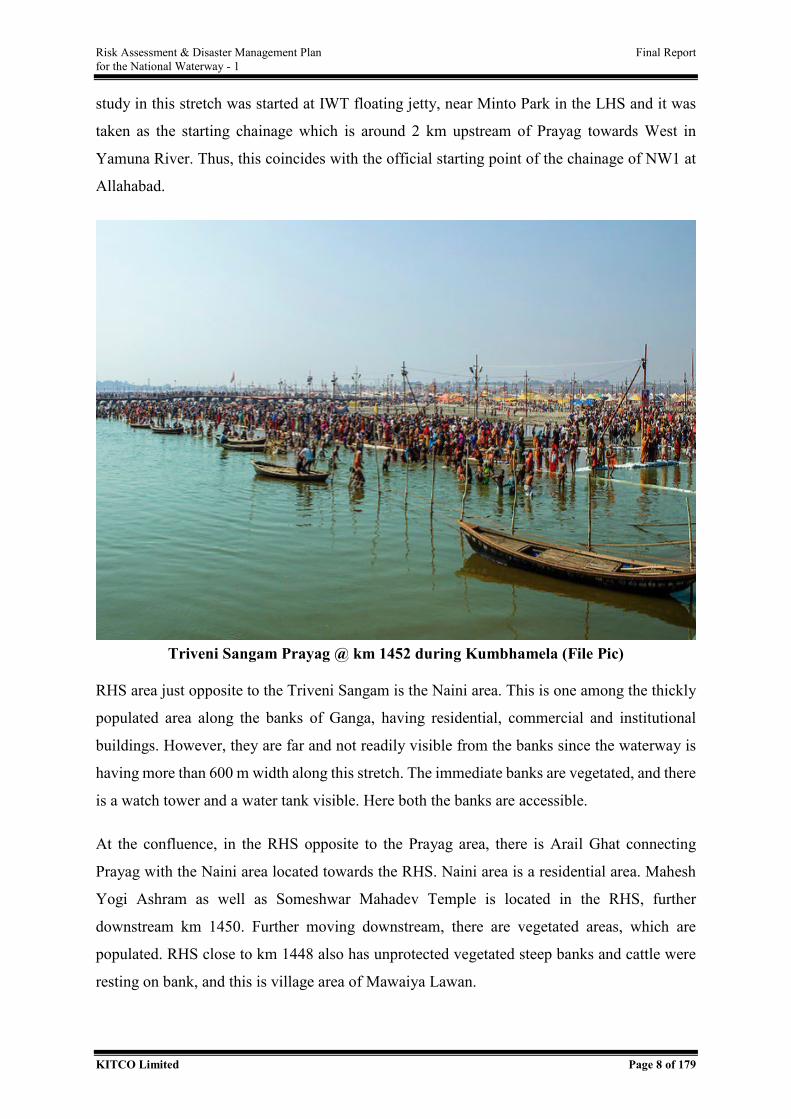
Risk Assessment & Disaster Management Plan Final Report for the National Waterway - 1
KITCO Limited Page 8 of 179
study in this stretch was started at IWT floating jetty, near Minto Park in the LHS and it was
taken as the starting chainage which is around 2 km upstream of Prayag towards West in
Yamuna River. Thus, this coincides with the official starting point of the chainage of NW1 at
Allahabad.
Triveni Sangam Prayag @ km 1452 during Kumbhamela (File Pic)
RHS area just opposite to the Triveni Sangam is the Naini area. This is one among the thickly
populated area along the banks of Ganga, having residential, commercial and institutional
buildings. However, they are far and not readily visible from the banks since the waterway is
having more than 600 m width along this stretch. The immediate banks are vegetated, and there
is a watch tower and a water tank visible. Here both the banks are accessible.
At the confluence, in the RHS opposite to the Prayag area, there is Arail Ghat connecting
Prayag with the Naini area located towards the RHS. Naini area is a residential area. Mahesh
Yogi Ashram as well as Someshwar Mahadev Temple is located in the RHS, further
downstream km 1450. Further moving downstream, there are vegetated areas, which are
populated. RHS close to km 1448 also has unprotected vegetated steep banks and cattle were
resting on bank, and this is village area of Mawaiya Lawan.
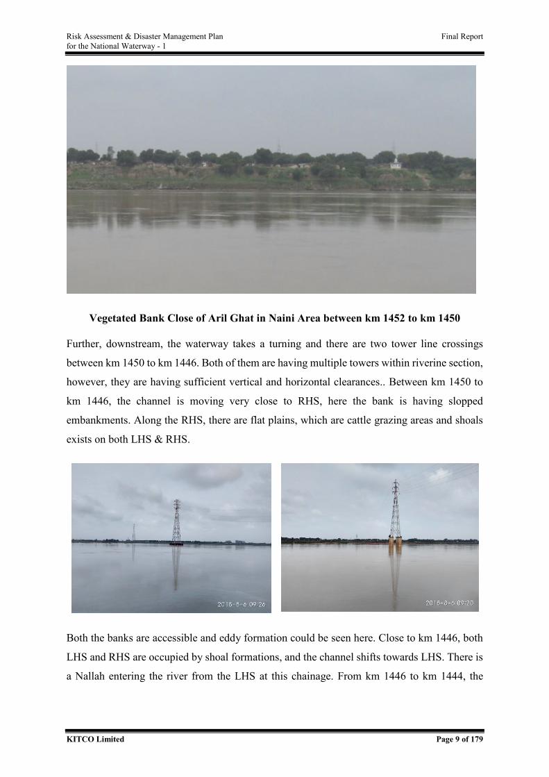
Risk Assessment & Disaster Management Plan Final Report for the National Waterway - 1
KITCO Limited Page 9 of 179
Vegetated Bank Close of Aril Ghat in Naini Area between km 1452 to km 1450
Further, downstream, the waterway takes a turning and there are two tower line crossings
between km 1450 to km 1446. Both of them are having multiple towers within riverine section,
however, they are having sufficient vertical and horizontal clearances.. Between km 1450 to
km 1446, the channel is moving very close to RHS, here the bank is having slopped
embankments. Along the RHS, there are flat plains, which are cattle grazing areas and shoals
exists on both LHS & RHS.
Both the banks are accessible and eddy formation could be seen here. Close to km 1446, both
LHS and RHS are occupied by shoal formations, and the channel shifts towards LHS. There is
a Nallah entering the river from the LHS at this chainage. From km 1446 to km 1444, the
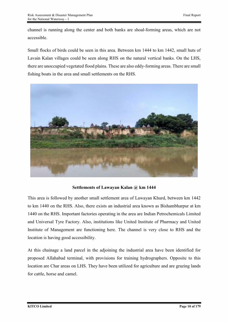
Risk Assessment & Disaster Management Plan Final Report for the National Waterway - 1
KITCO Limited Page 10 of 179
channel is running along the center and both banks are shoal-forming areas, which are not
accessible.
Small flocks of birds could be seen in this area. Between km 1444 to km 1442, small huts of
Lavain Kalan villages could be seen along RHS on the natural vertical banks. On the LHS,
there are unoccupied vegetated flood plains. These are also eddy-forming areas. There are small
fishing boats in the area and small settlements on the RHS.
Settlements of Lawayan Kalan @ km 1444
This area is followed by another small settlement area of Lawayan Khurd, between km 1442
to km 1440 on the RHS. Also, there exists an industrial area known as Bishambharpur at km
1440 on the RHS. Important factories operating in the area are Indian Petrochemicals Limited
and Universal Tyre Factory. Also, institutions like United Institute of Pharmacy and United
Institute of Management are functioning here. The channel is very close to RHS and the
location is having good accessibility.
At this chainage a land parcel in the adjoining the industrial area have been identified for
proposed Allahabad terminal, with provisions for training hydrographers. Opposite to this
location are Char areas on LHS. They have been utilized for agriculture and are grazing lands
for cattle, horse and camel.
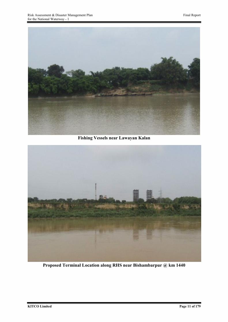
Risk Assessment & Disaster Management Plan Final Report for the National Waterway - 1
KITCO Limited Page 11 of 179
Fishing Vessels near Lawayan Kalan
Proposed Terminal Location along RHS near Bishambarpur @ km 1440
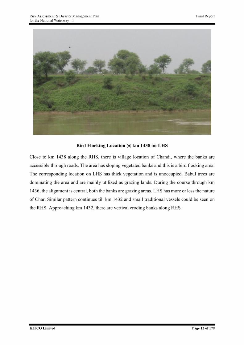
Risk Assessment & Disaster Management Plan Final Report for the National Waterway - 1
KITCO Limited Page 12 of 179
Bird Flocking Location @ km 1438 on LHS
Close to km 1438 along the RHS, there is village location of Chandi, where the banks are
accessible through roads. The area has sloping vegetated banks and this is a bird flocking area.
The corresponding location on LHS has thick vegetation and is unoccupied. Babul trees are
dominating the area and are mainly utilized as grazing lands. During the course through km
1436, the alignment is central, both the banks are grazing areas. LHS has more or less the nature
of Char. Similar pattern continues till km 1432 and small traditional vessels could be seen on
the RHS. Approaching km 1432, there are vertical eroding banks along RHS.
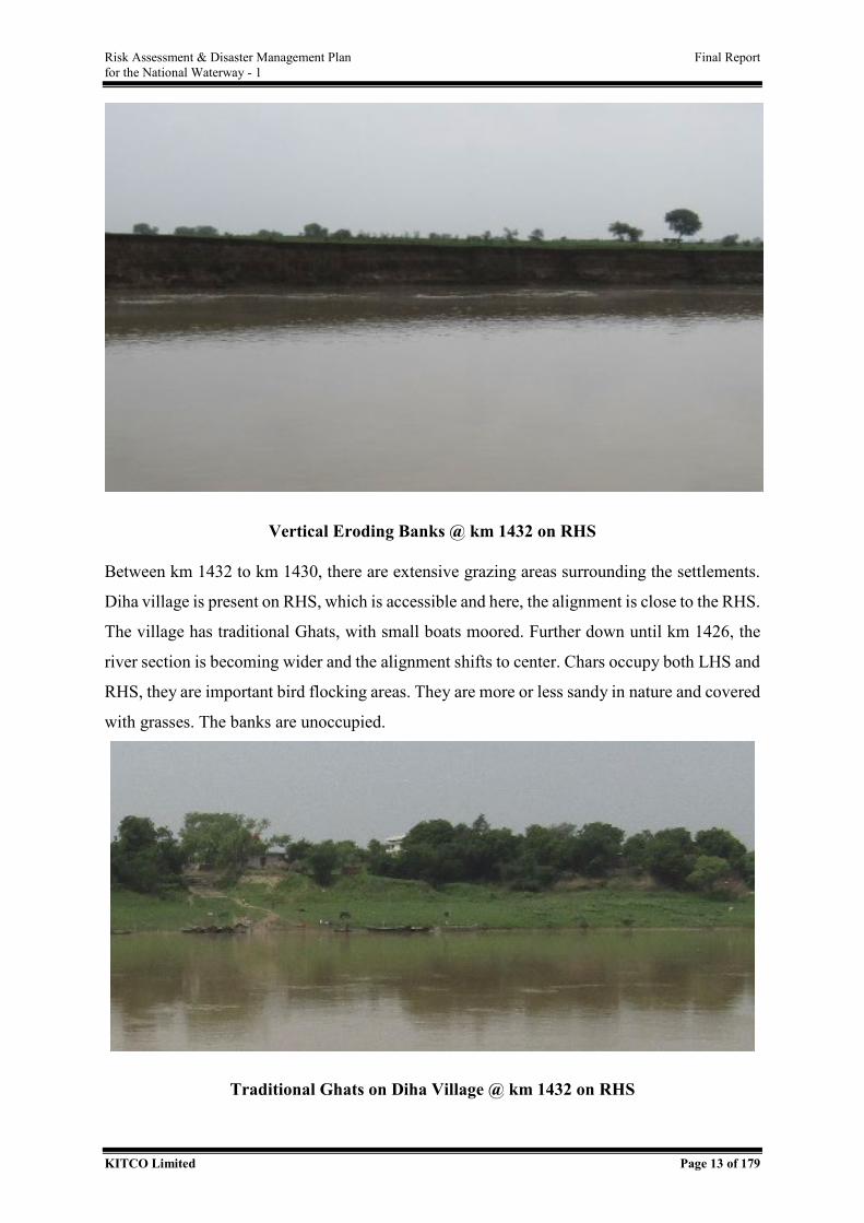
Risk Assessment & Disaster Management Plan Final Report for the National Waterway - 1
KITCO Limited Page 13 of 179
Vertical Eroding Banks @ km 1432 on RHS
Between km 1432 to km 1430, there are extensive grazing areas surrounding the settlements.
Diha village is present on RHS, which is accessible and here, the alignment is close to the RHS.
The village has traditional Ghats, with small boats moored. Further down until km 1426, the
river section is becoming wider and the alignment shifts to center. Chars occupy both LHS and
RHS, they are important bird flocking areas. They are more or less sandy in nature and covered
with grasses. The banks are unoccupied.
Traditional Ghats on Diha Village @ km 1432 on RHS
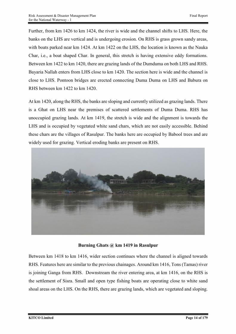
Risk Assessment & Disaster Management Plan Final Report for the National Waterway - 1
KITCO Limited Page 14 of 179
Further, from km 1426 to km 1424, the river is wide and the channel shifts to LHS. Here, the
banks on the LHS are vertical and is undergoing erosion. On RHS is grass grown sandy areas,
with boats parked near km 1424. At km 1422 on the LHS, the location is known as the Nauka
Char, i.e., a boat shaped Char. In general, this stretch is having extensive eddy formations.
Between km 1422 to km 1420, there are grazing lands of the Dumduma on both LHS and RHS.
Bayaria Nallah enters from LHS close to km 1420. The section here is wide and the channel is
close to LHS. Pontoon bridges are erected connecting Duma Duma on LHS and Babura on
RHS between km 1422 to km 1420.
At km 1420, along the RHS, the banks are sloping and currently utilized as grazing lands. There
is a Ghat on LHS near the premises of scattered settlements of Duma Duma. RHS has
unoccupied grazing lands. At km 1419, the stretch is wide and the alignment is towards the
LHS and is occupied by vegetated white sand chars, which are not easily accessible. Behind
these chars are the villages of Rasulpur. The banks here are occupied by Babool trees and are
widely used for grazing. Vertical eroding banks are present on RHS.
Burning Ghats @ km 1419 in Rasulpur
Between km 1418 to km 1416, wider section continues where the channel is aligned towards
RHS. Features here are similar to the previous chainages. Around km 1416, Tons (Tamas) river
is joining Ganga from RHS. Downstream the river entering area, at km 1416, on the RHS is
the settlement of Sisra. Small and open type fishing boats are operating close to white sand
shoal areas on the LHS. On the RHS, there are grazing lands, which are vegetated and sloping.
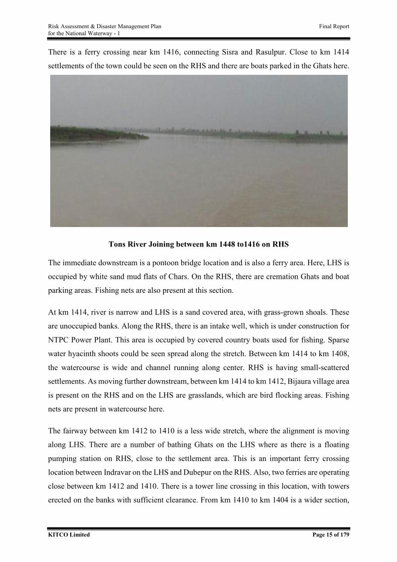
Risk Assessment & Disaster Management Plan Final Report for the National Waterway - 1
KITCO Limited Page 15 of 179
There is a ferry crossing near km 1416, connecting Sisra and Rasulpur. Close to km 1414
settlements of the town could be seen on the RHS and there are boats parked in the Ghats here.
Tons River Joining between km 1448 to1416 on RHS
The immediate downstream is a pontoon bridge location and is also a ferry area. Here, LHS is
occupied by white sand mud flats of Chars. On the RHS, there are cremation Ghats and boat
parking areas. Fishing nets are also present at this section.
At km 1414, river is narrow and LHS is a sand covered area, with grass-grown shoals. These
are unoccupied banks. Along the RHS, there is an intake well, which is under construction for
NTPC Power Plant. This area is occupied by covered country boats used for fishing. Sparse
water hyacinth shoots could be seen spread along the stretch. Between km 1414 to km 1408,
the watercourse is wide and channel running along center. RHS is having small-scattered
settlements. As moving further downstream, between km 1414 to km 1412, Bijaura village area
is present on the RHS and on the LHS are grasslands, which are bird flocking areas. Fishing
nets are present in watercourse here.
The fairway between km 1412 to 1410 is a less wide stretch, where the alignment is moving
along LHS. There are a number of bathing Ghats on the LHS where as there is a floating
pumping station on RHS, close to the settlement area. This is an important ferry crossing
location between Indravar on the LHS and Dubepur on the RHS. Also, two ferries are operating
close between km 1412 and 1410. There is a tower line crossing in this location, with towers
erected on the banks with sufficient clearance. From km 1410 to km 1404 is a wider section,
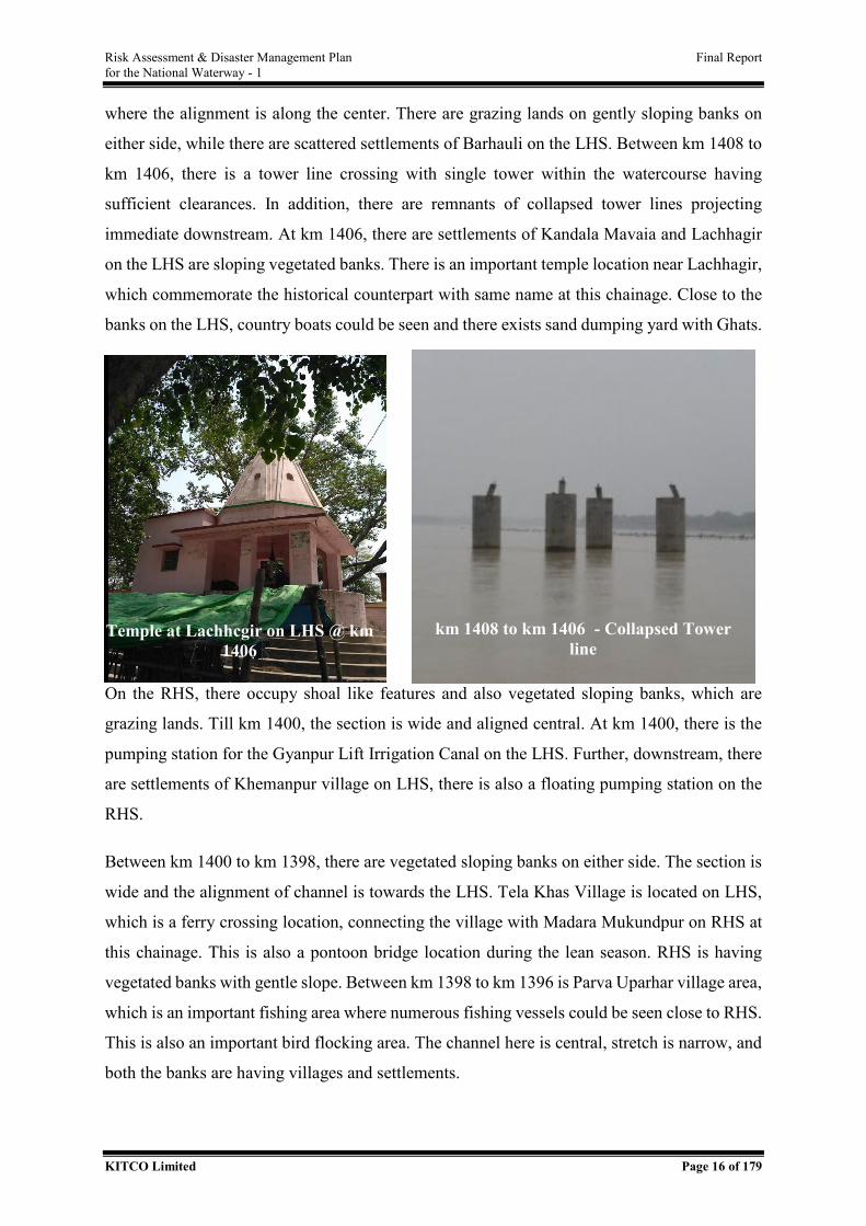
Risk Assessment & Disaster Management Plan Final Report for the National Waterway - 1
KITCO Limited Page 16 of 179
where the alignment is along the center. There are grazing lands on gently sloping banks on
either side, while there are scattered settlements of Barhauli on the LHS. Between km 1408 to
km 1406, there is a tower line crossing with single tower within the watercourse having
sufficient clearances. In addition, there are remnants of collapsed tower lines projecting
immediate downstream. At km 1406, there are settlements of Kandala Mavaia and Lachhagir
on the LHS are sloping vegetated banks. There is an important temple location near Lachhagir,
which commemorate the historical counterpart with same name at this chainage. Close to the
banks on the LHS, country boats could be seen and there exists sand dumping yard with Ghats.
On the RHS, there occupy shoal like features and also vegetated sloping banks, which are
grazing lands. Till km 1400, the section is wide and aligned central. At km 1400, there is the
pumping station for the Gyanpur Lift Irrigation Canal on the LHS. Further, downstream, there
are settlements of Khemanpur village on LHS, there is also a floating pumping station on the
RHS.
Between km 1400 to km 1398, there are vegetated sloping banks on either side. The section is
wide and the alignment of channel is towards the LHS. Tela Khas Village is located on LHS,
which is a ferry crossing location, connecting the village with Madara Mukundpur on RHS at
this chainage. This is also a pontoon bridge location during the lean season. RHS is having
vegetated banks with gentle slope. Between km 1398 to km 1396 is Parva Uparhar village area,
which is an important fishing area where numerous fishing vessels could be seen close to RHS.
This is also an important bird flocking area. The channel here is central, stretch is narrow, and
both the banks are having villages and settlements.
km 1408 to km 1406 - Collapsed Tower line
Temple at Lachhcgir on LHS @ km 1406
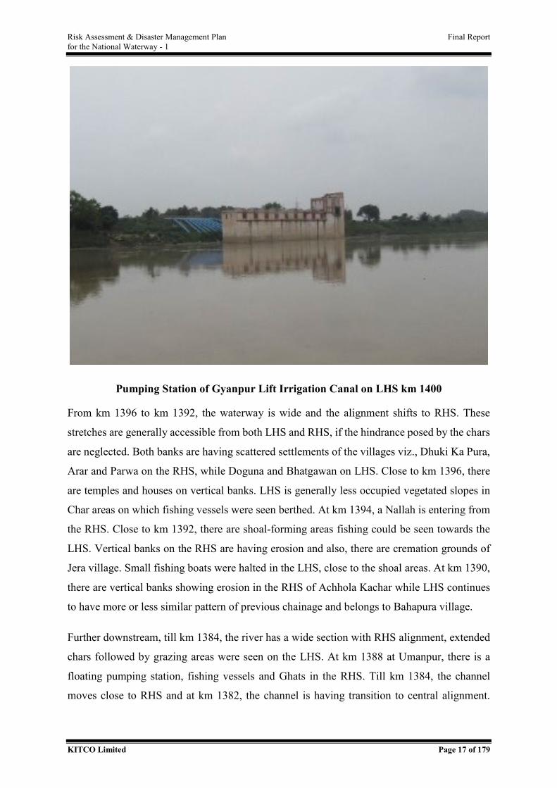
Risk Assessment & Disaster Management Plan Final Report for the National Waterway - 1
KITCO Limited Page 17 of 179
Pumping Station of Gyanpur Lift Irrigation Canal on LHS km 1400
From km 1396 to km 1392, the waterway is wide and the alignment shifts to RHS. These
stretches are generally accessible from both LHS and RHS, if the hindrance posed by the chars
are neglected. Both banks are having scattered settlements of the villages viz., Dhuki Ka Pura,
Arar and Parwa on the RHS, while Doguna and Bhatgawan on LHS. Close to km 1396, there
are temples and houses on vertical banks. LHS is generally less occupied vegetated slopes in
Char areas on which fishing vessels were seen berthed. At km 1394, a Nallah is entering from
the RHS. Close to km 1392, there are shoal-forming areas fishing could be seen towards the
LHS. Vertical banks on the RHS are having erosion and also, there are cremation grounds of
Jera village. Small fishing boats were halted in the LHS, close to the shoal areas. At km 1390,
there are vertical banks showing erosion in the RHS of Achhola Kachar while LHS continues
to have more or less similar pattern of previous chainage and belongs to Bahapura village.
Further downstream, till km 1384, the river has a wide section with RHS alignment, extended
chars followed by grazing areas were seen on the LHS. At km 1388 at Umanpur, there is a
floating pumping station, fishing vessels and Ghats in the RHS. Till km 1384, the channel
moves close to RHS and at km 1382, the channel is having transition to central alignment.
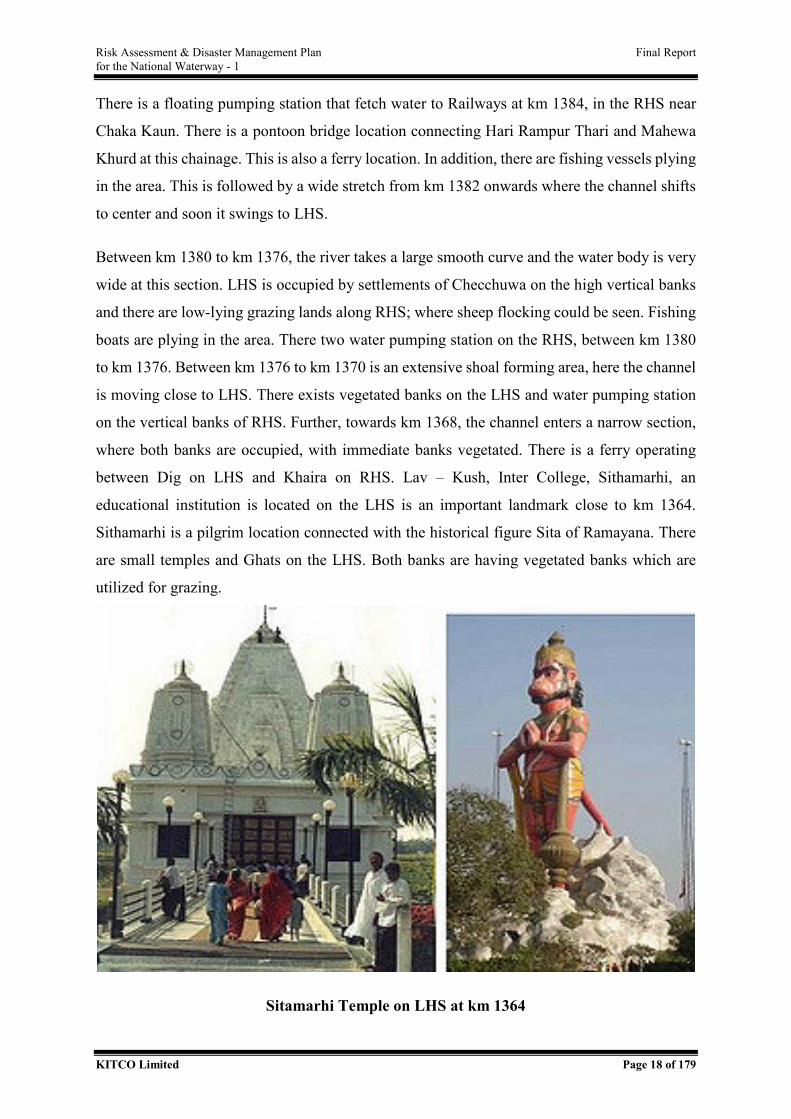
Risk Assessment & Disaster Management Plan Final Report for the National Waterway - 1
KITCO Limited Page 18 of 179
There is a floating pumping station that fetch water to Railways at km 1384, in the RHS near
Chaka Kaun. There is a pontoon bridge location connecting Hari Rampur Thari and Mahewa
Khurd at this chainage. This is also a ferry location. In addition, there are fishing vessels plying
in the area. This is followed by a wide stretch from km 1382 onwards where the channel shifts
to center and soon it swings to LHS.
Between km 1380 to km 1376, the river takes a large smooth curve and the water body is very
wide at this section. LHS is occupied by settlements of Checchuwa on the high vertical banks
and there are low-lying grazing lands along RHS; where sheep flocking could be seen. Fishing
boats are plying in the area. There two water pumping station on the RHS, between km 1380
to km 1376. Between km 1376 to km 1370 is an extensive shoal forming area, here the channel
is moving close to LHS. There exists vegetated banks on the LHS and water pumping station
on the vertical banks of RHS. Further, towards km 1368, the channel enters a narrow section,
where both banks are occupied, with immediate banks vegetated. There is a ferry operating
between Dig on LHS and Khaira on RHS. Lav – Kush, Inter College, Sithamarhi, an
educational institution is located on the LHS is an important landmark close to km 1364.
Sithamarhi is a pilgrim location connected with the historical figure Sita of Ramayana. There
are small temples and Ghats on the LHS. Both banks are having vegetated banks which are
utilized for grazing.
Sitamarhi Temple on LHS at km 1364
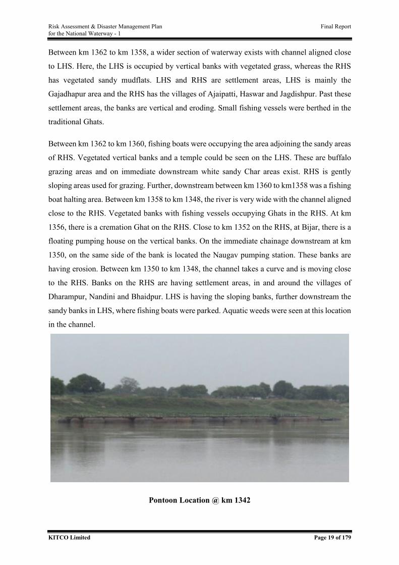
Risk Assessment & Disaster Management Plan Final Report for the National Waterway - 1
KITCO Limited Page 19 of 179
Between km 1362 to km 1358, a wider section of waterway exists with channel aligned close
to LHS. Here, the LHS is occupied by vertical banks with vegetated grass, whereas the RHS
has vegetated sandy mudflats. LHS and RHS are settlement areas, LHS is mainly the
Gajadhapur area and the RHS has the villages of Ajaipatti, Haswar and Jagdishpur. Past these
settlement areas, the banks are vertical and eroding. Small fishing vessels were berthed in the
traditional Ghats.
Between km 1362 to km 1360, fishing boats were occupying the area adjoining the sandy areas
of RHS. Vegetated vertical banks and a temple could be seen on the LHS. These are buffalo
grazing areas and on immediate downstream white sandy Char areas exist. RHS is gently
sloping areas used for grazing. Further, downstream between km 1360 to km1358 was a fishing
boat halting area. Between km 1358 to km 1348, the river is very wide with the channel aligned
close to the RHS. Vegetated banks with fishing vessels occupying Ghats in the RHS. At km
1356, there is a cremation Ghat on the RHS. Close to km 1352 on the RHS, at Bijar, there is a
floating pumping house on the vertical banks. On the immediate chainage downstream at km
1350, on the same side of the bank is located the Naugav pumping station. These banks are
having erosion. Between km 1350 to km 1348, the channel takes a curve and is moving close
to the RHS. Banks on the RHS are having settlement areas, in and around the villages of
Dharampur, Nandini and Bhaidpur. LHS is having the sloping banks, further downstream the
sandy banks in LHS, where fishing boats were parked. Aquatic weeds were seen at this location
in the channel.
Pontoon Location @ km 1342
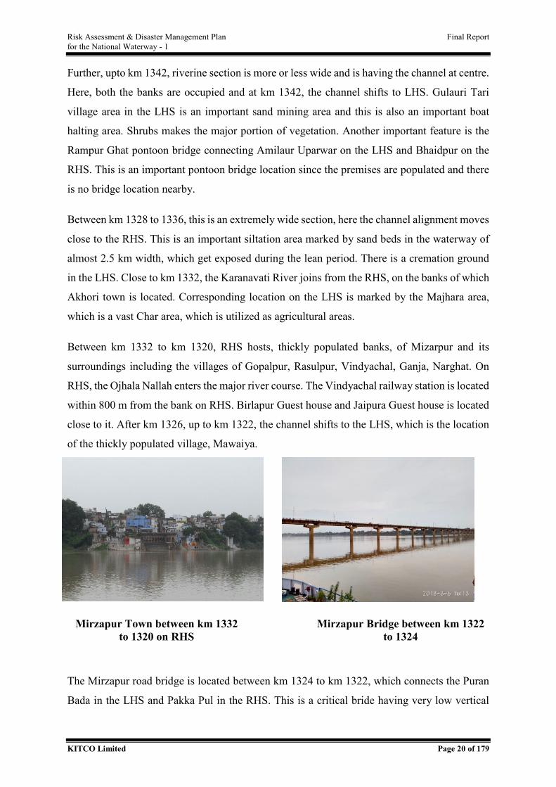
Risk Assessment & Disaster Management Plan Final Report for the National Waterway - 1
KITCO Limited Page 20 of 179
Further, upto km 1342, riverine section is more or less wide and is having the channel at centre.
Here, both the banks are occupied and at km 1342, the channel shifts to LHS. Gulauri Tari
village area in the LHS is an important sand mining area and this is also an important boat
halting area. Shrubs makes the major portion of vegetation. Another important feature is the
Rampur Ghat pontoon bridge connecting Amilaur Uparwar on the LHS and Bhaidpur on the
RHS. This is an important pontoon bridge location since the premises are populated and there
is no bridge location nearby.
Between km 1328 to 1336, this is an extremely wide section, here the channel alignment moves
close to the RHS. This is an important siltation area marked by sand beds in the waterway of
almost 2.5 km width, which get exposed during the lean period. There is a cremation ground
in the LHS. Close to km 1332, the Karanavati River joins from the RHS, on the banks of which
Akhori town is located. Corresponding location on the LHS is marked by the Majhara area,
which is a vast Char area, which is utilized as agricultural areas.
Between km 1332 to km 1320, RHS hosts, thickly populated banks, of Mizarpur and its
surroundings including the villages of Gopalpur, Rasulpur, Vindyachal, Ganja, Narghat. On
RHS, the Ojhala Nallah enters the major river course. The Vindyachal railway station is located
within 800 m from the bank on RHS. Birlapur Guest house and Jaipura Guest house is located
close to it. After km 1326, up to km 1322, the channel shifts to the LHS, which is the location
of the thickly populated village, Mawaiya.
The Mirzapur road bridge is located between km 1324 to km 1322, which connects the Puran
Bada in the LHS and Pakka Pul in the RHS. This is a critical bride having very low vertical
Mirzapur Town between km 1332 to 1320 on RHS
Mirzapur Bridge between km 1322 to 1324
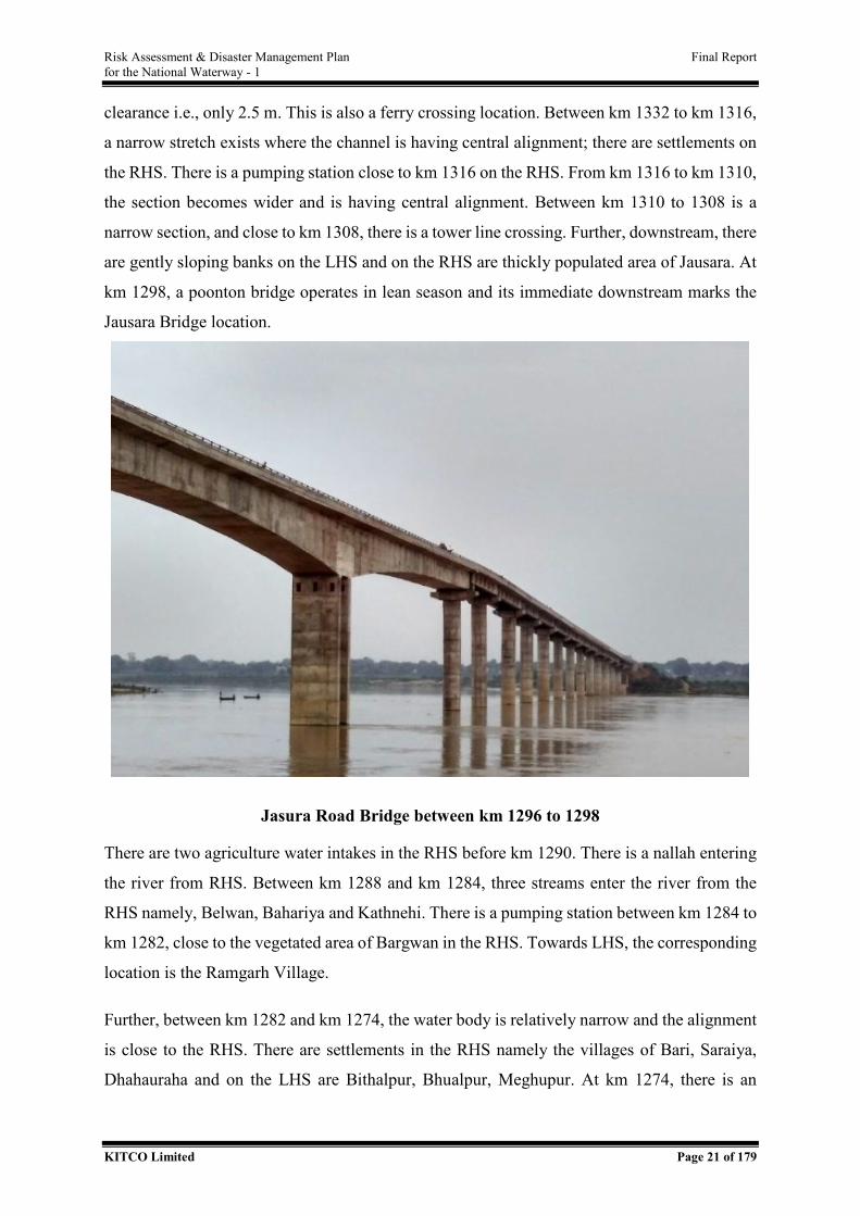
Risk Assessment & Disaster Management Plan Final Report for the National Waterway - 1
KITCO Limited Page 21 of 179
clearance i.e., only 2.5 m. This is also a ferry crossing location. Between km 1332 to km 1316,
a narrow stretch exists where the channel is having central alignment; there are settlements on
the RHS. There is a pumping station close to km 1316 on the RHS. From km 1316 to km 1310,
the section becomes wider and is having central alignment. Between km 1310 to 1308 is a
narrow section, and close to km 1308, there is a tower line crossing. Further, downstream, there
are gently sloping banks on the LHS and on the RHS are thickly populated area of Jausara. At
km 1298, a poonton bridge operates in lean season and its immediate downstream marks the
Jausara Bridge location.
Jasura Road Bridge between km 1296 to 1298
There are two agriculture water intakes in the RHS before km 1290. There is a nallah entering
the river from RHS. Between km 1288 and km 1284, three streams enter the river from the
RHS namely, Belwan, Bahariya and Kathnehi. There is a pumping station between km 1284 to
km 1282, close to the vegetated area of Bargwan in the RHS. Towards LHS, the corresponding
location is the Ramgarh Village.
Further, between km 1282 and km 1274, the water body is relatively narrow and the alignment
is close to the RHS. There are settlements in the RHS namely the villages of Bari, Saraiya,
Dhahauraha and on the LHS are Bithalpur, Bhualpur, Meghupur. At km 1274, there is an
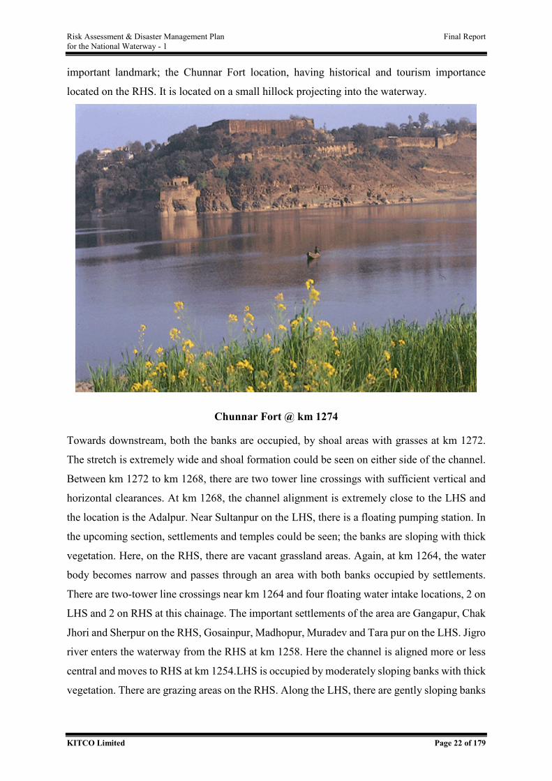
Risk Assessment & Disaster Management Plan Final Report for the National Waterway - 1
KITCO Limited Page 22 of 179
important landmark; the Chunnar Fort location, having historical and tourism importance
located on the RHS. It is located on a small hillock projecting into the waterway.
Chunnar Fort @ km 1274
Towards downstream, both the banks are occupied, by shoal areas with grasses at km 1272.
The stretch is extremely wide and shoal formation could be seen on either side of the channel.
Between km 1272 to km 1268, there are two tower line crossings with sufficient vertical and
horizontal clearances. At km 1268, the channel alignment is extremely close to the LHS and
the location is the Adalpur. Near Sultanpur on the LHS, there is a floating pumping station. In
the upcoming section, settlements and temples could be seen; the banks are sloping with thick
vegetation. Here, on the RHS, there are vacant grassland areas. Again, at km 1264, the water
body becomes narrow and passes through an area with both banks occupied by settlements.
There are two-tower line crossings near km 1264 and four floating water intake locations, 2 on
LHS and 2 on RHS at this chainage. The important settlements of the area are Gangapur, Chak
Jhori and Sherpur on the RHS, Gosainpur, Madhopur, Muradev and Tara pur on the LHS. Jigro
river enters the waterway from the RHS at km 1258. Here the channel is aligned more or less
central and moves to RHS at km 1254.LHS is occupied by moderately sloping banks with thick
vegetation. There are grazing areas on the RHS. Along the LHS, there are gently sloping banks
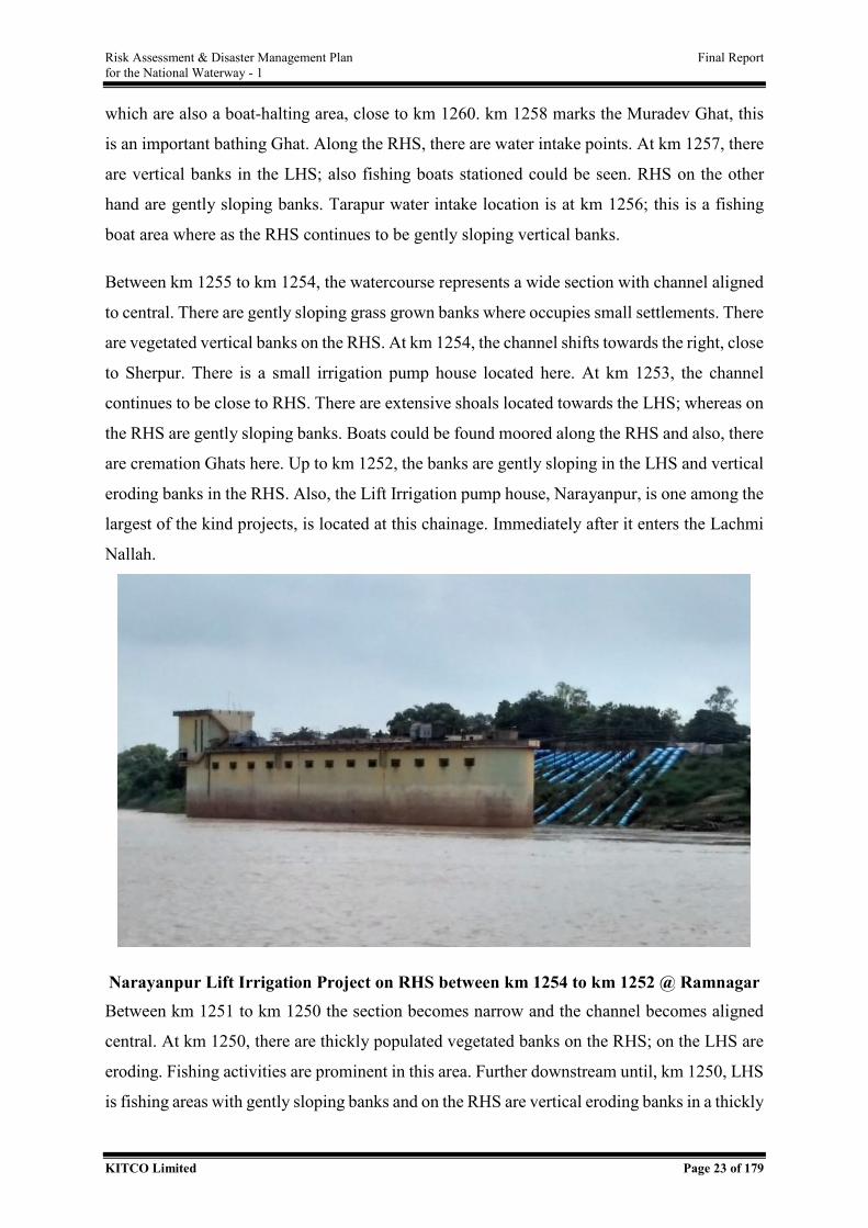
Risk Assessment & Disaster Management Plan Final Report for the National Waterway - 1
KITCO Limited Page 23 of 179
which are also a boat-halting area, close to km 1260. km 1258 marks the Muradev Ghat, this
is an important bathing Ghat. Along the RHS, there are water intake points. At km 1257, there
are vertical banks in the LHS; also fishing boats stationed could be seen. RHS on the other
hand are gently sloping banks. Tarapur water intake location is at km 1256; this is a fishing
boat area where as the RHS continues to be gently sloping vertical banks.
Between km 1255 to km 1254, the watercourse represents a wide section with channel aligned
to central. There are gently sloping grass grown banks where occupies small settlements. There
are vegetated vertical banks on the RHS. At km 1254, the channel shifts towards the right, close
to Sherpur. There is a small irrigation pump house located here. At km 1253, the channel
continues to be close to RHS. There are extensive shoals located towards the LHS; whereas on
the RHS are gently sloping banks. Boats could be found moored along the RHS and also, there
are cremation Ghats here. Up to km 1252, the banks are gently sloping in the LHS and vertical
eroding banks in the RHS. Also, the Lift Irrigation pump house, Narayanpur, is one among the
largest of the kind projects, is located at this chainage. Immediately after it enters the Lachmi
Nallah.
Narayanpur Lift Irrigation Project on RHS between km 1254 to km 1252 @ Ramnagar Between km 1251 to km 1250 the section becomes narrow and the channel becomes aligned
central. At km 1250, there are thickly populated vegetated banks on the RHS; on the LHS are
eroding. Fishing activities are prominent in this area. Further downstream until, km 1250, LHS
is fishing areas with gently sloping banks and on the RHS are vertical eroding banks in a thickly
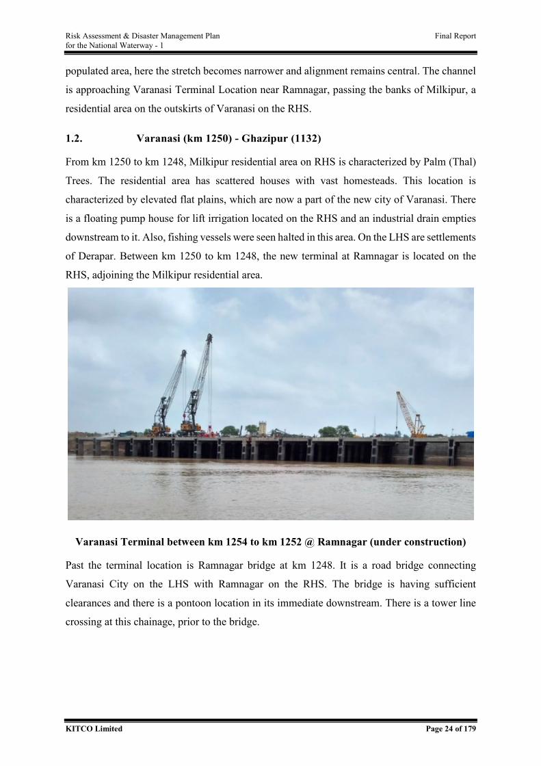
Risk Assessment & Disaster Management Plan Final Report for the National Waterway - 1
KITCO Limited Page 24 of 179
populated area, here the stretch becomes narrower and alignment remains central. The channel
is approaching Varanasi Terminal Location near Ramnagar, passing the banks of Milkipur, a
residential area on the outskirts of Varanasi on the RHS.
1.2. Varanasi (km 1250) - Ghazipur (1132)
From km 1250 to km 1248, Milkipur residential area on RHS is characterized by Palm (Thal)
Trees. The residential area has scattered houses with vast homesteads. This location is
characterized by elevated flat plains, which are now a part of the new city of Varanasi. There
is a floating pump house for lift irrigation located on the RHS and an industrial drain empties
downstream to it. Also, fishing vessels were seen halted in this area. On the LHS are settlements
of Derapar. Between km 1250 to km 1248, the new terminal at Ramnagar is located on the
RHS, adjoining the Milkipur residential area.
Varanasi Terminal between km 1254 to km 1252 @ Ramnagar (under construction)
Past the terminal location is Ramnagar bridge at km 1248. It is a road bridge connecting
Varanasi City on the LHS with Ramnagar on the RHS. The bridge is having sufficient
clearances and there is a pontoon location in its immediate downstream. There is a tower line
crossing at this chainage, prior to the bridge.
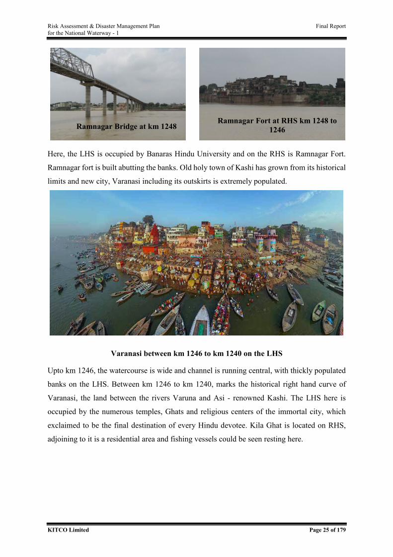
Risk Assessment & Disaster Management Plan Final Report for the National Waterway - 1
KITCO Limited Page 25 of 179
Here, the LHS is occupied by Banaras Hindu University and on the RHS is Ramnagar Fort.
Ramnagar fort is built abutting the banks. Old holy town of Kashi has grown from its historical
limits and new city, Varanasi including its outskirts is extremely populated.
Varanasi between km 1246 to km 1240 on the LHS
Upto km 1246, the watercourse is wide and channel is running central, with thickly populated
banks on the LHS. Between km 1246 to km 1240, marks the historical right hand curve of
Varanasi, the land between the rivers Varuna and Asi - renowned Kashi. The LHS here is
occupied by the numerous temples, Ghats and religious centers of the immortal city, which
exclaimed to be the final destination of every Hindu devotee. Kila Ghat is located on RHS,
adjoining to it is a residential area and fishing vessels could be seen resting here.
Ramnagar Bridge at km 1248 Ramnagar Fort at RHS km 1248 to
1246
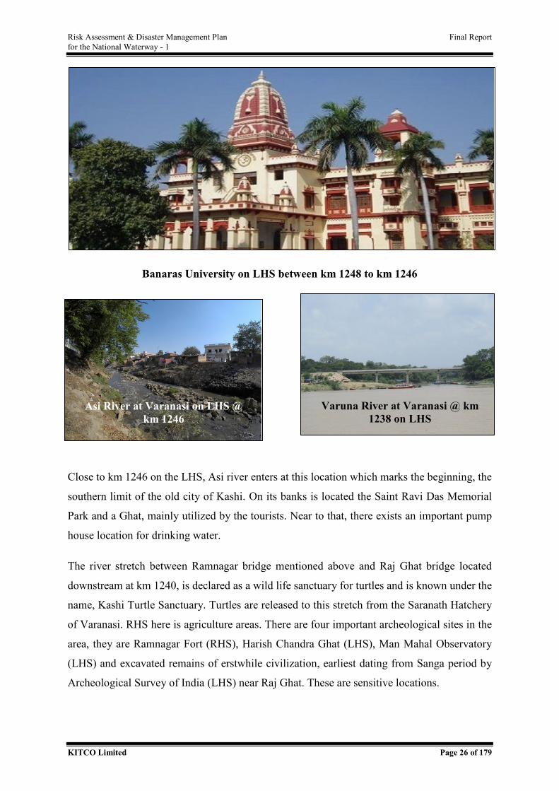
Risk Assessment & Disaster Management Plan Final Report for the National Waterway - 1
KITCO Limited Page 26 of 179
Banaras University on LHS between km 1248 to km 1246
Close to km 1246 on the LHS, Asi river enters at this location which marks the beginning, the
southern limit of the old city of Kashi. On its banks is located the Saint Ravi Das Memorial
Park and a Ghat, mainly utilized by the tourists. Near to that, there exists an important pump
house location for drinking water.
The river stretch between Ramnagar bridge mentioned above and Raj Ghat bridge located
downstream at km 1240, is declared as a wild life sanctuary for turtles and is known under the
name, Kashi Turtle Sanctuary. Turtles are released to this stretch from the Saranath Hatchery
of Varanasi. RHS here is agriculture areas. There are four important archeological sites in the
area, they are Ramnagar Fort (RHS), Harish Chandra Ghat (LHS), Man Mahal Observatory
(LHS) and excavated remains of erstwhile civilization, earliest dating from Sanga period by
Archeological Survey of India (LHS) near Raj Ghat. These are sensitive locations.
Asi River at Varanasi on LHS @ km 1246
Varuna River at Varanasi @ km 1238 on LHS
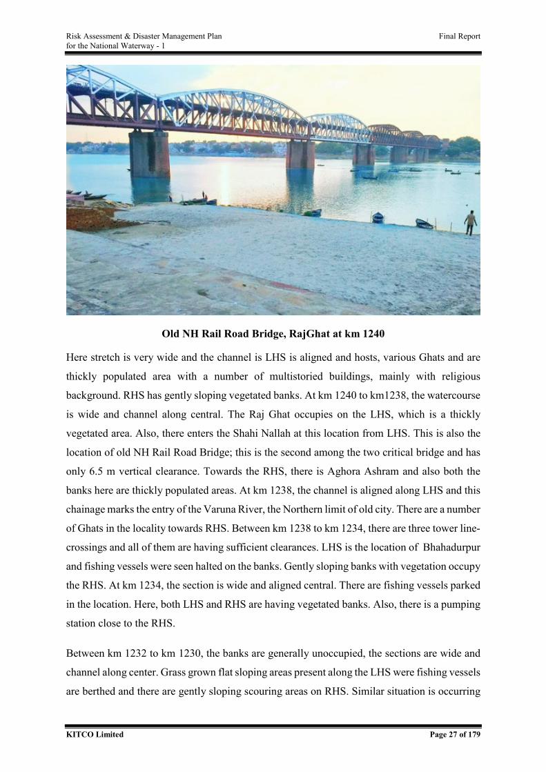
Risk Assessment & Disaster Management Plan Final Report for the National Waterway - 1
KITCO Limited Page 27 of 179
Old NH Rail Road Bridge, RajGhat at km 1240
Here stretch is very wide and the channel is LHS is aligned and hosts, various Ghats and are
thickly populated area with a number of multistoried buildings, mainly with religious
background. RHS has gently sloping vegetated banks. At km 1240 to km1238, the watercourse
is wide and channel along central. The Raj Ghat occupies on the LHS, which is a thickly
vegetated area. Also, there enters the Shahi Nallah at this location from LHS. This is also the
location of old NH Rail Road Bridge; this is the second among the two critical bridge and has
only 6.5 m vertical clearance. Towards the RHS, there is Aghora Ashram and also both the
banks here are thickly populated areas. At km 1238, the channel is aligned along LHS and this
chainage marks the entry of the Varuna River, the Northern limit of old city. There are a number
of Ghats in the locality towards RHS. Between km 1238 to km 1234, there are three tower line-
crossings and all of them are having sufficient clearances. LHS is the location of Bhahadurpur
and fishing vessels were seen halted on the banks. Gently sloping banks with vegetation occupy
the RHS. At km 1234, the section is wide and aligned central. There are fishing vessels parked
in the location. Here, both LHS and RHS are having vegetated banks. Also, there is a pumping
station close to the RHS.
Between km 1232 to km 1230, the banks are generally unoccupied, the sections are wide and
channel along center. Grass grown flat sloping areas present along the LHS were fishing vessels
are berthed and there are gently sloping scouring areas on RHS. Similar situation is occurring
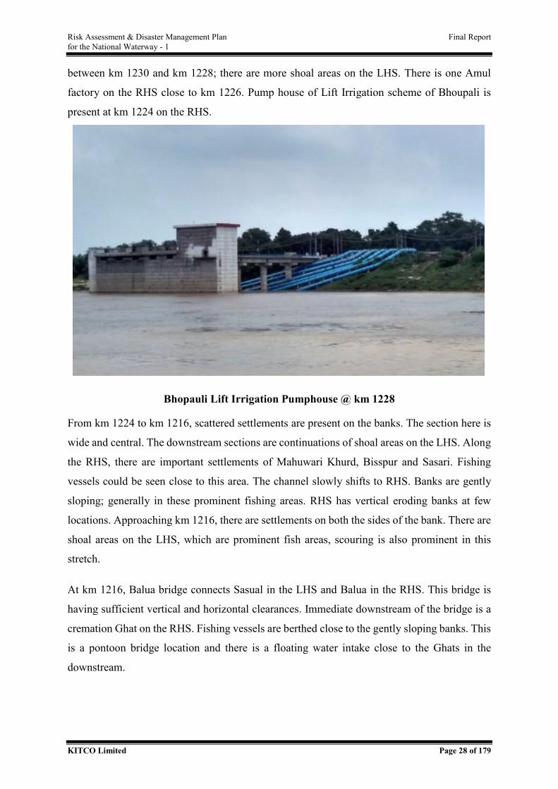
Risk Assessment & Disaster Management Plan Final Report for the National Waterway - 1
KITCO Limited Page 28 of 179
between km 1230 and km 1228; there are more shoal areas on the LHS. There is one Amul
factory on the RHS close to km 1226. Pump house of Lift Irrigation scheme of Bhoupali is
present at km 1224 on the RHS.
Bhopauli Lift Irrigation Pumphouse @ km 1228
From km 1224 to km 1216, scattered settlements are present on the banks. The section here is
wide and central. The downstream sections are continuations of shoal areas on the LHS. Along
the RHS, there are important settlements of Mahuwari Khurd, Bisspur and Sasari. Fishing
vessels could be seen close to this area. The channel slowly shifts to RHS. Banks are gently
sloping; generally in these prominent fishing areas. RHS has vertical eroding banks at few
locations. Approaching km 1216, there are settlements on both the sides of the bank. There are
shoal areas on the LHS, which are prominent fish areas, scouring is also prominent in this
stretch.
At km 1216, Balua bridge connects Sasual in the LHS and Balua in the RHS. This bridge is
having sufficient vertical and horizontal clearances. Immediate downstream of the bridge is a
cremation Ghat on the RHS. Fishing vessels are berthed close to the gently sloping banks. This
is a pontoon bridge location and there is a floating water intake close to the Ghats in the
downstream.
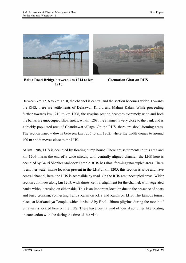
Risk Assessment & Disaster Management Plan Final Report for the National Waterway - 1
KITCO Limited Page 29 of 179
Between km 1216 to km 1210, the channel is central and the section becomes wider. Towards
the RHS, there are settlements of Dehrawan Khurd and Mahuri Kalan. While proceeding
further towards km 1210 to km 1206, the riverine section becomes extremely wide and both
the banks are unoccupied shoal areas. At km 1208, the channel is very close to the bank and is
a thickly populated area of Chandrawat village. On the RHS, there are shoal-forming areas.
The section narrow downs between km 1206 to km 1202, where the width comes to around
400 m and it moves close to the LHS.
At km 1208, LHS is occupied by floating pump house. There are settlements in this area and
km 1206 marks the end of a wide stretch, with centrally aligned channel; the LHS here is
occupied by Gauri Shanker Mahadev Temple. RHS has shoal forming unoccupied areas. There
is another water intake location present in the LHS at km 1205; this section is wide and have
central channel, here, the LHS is accessible by road. On the RHS are unoccupied areas. Wider
section continues along km 1203, with almost central alignment for the channel, with vegetated
banks without erosion on either side. This is an important location due to the presence of boats
and ferry crossing, connecting Tanda Kalan on RHS and Kaithi on LHS. The famous tourist
place, at Markandeya Temple, which is visited by Bhol - Bhum pilgrims during the month of
Shrawan is located here on the LHS. There have been a kind of tourist activities like boating
in connection with the during the time of site visit.
Balua Road Bridge between km 1214 to km 1216
Cremation Ghat on RHS
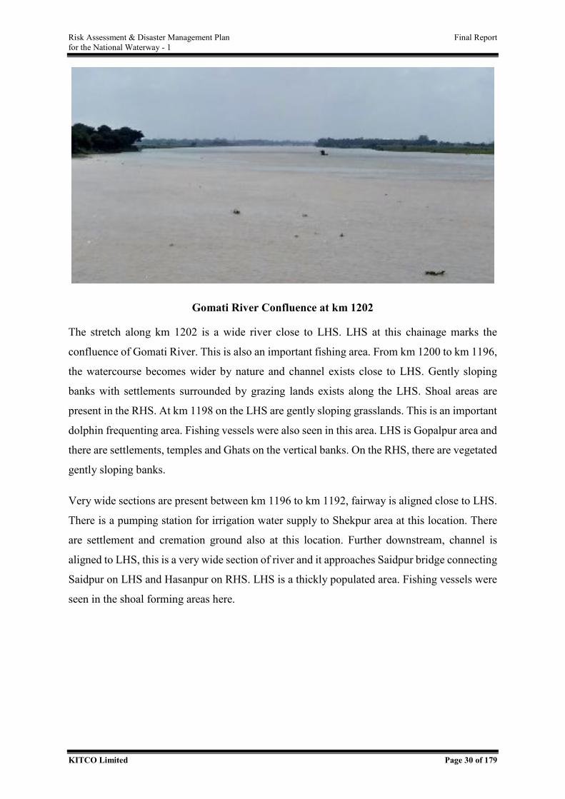
Risk Assessment & Disaster Management Plan Final Report for the National Waterway - 1
KITCO Limited Page 30 of 179
Gomati River Confluence at km 1202
The stretch along km 1202 is a wide river close to LHS. LHS at this chainage marks the
confluence of Gomati River. This is also an important fishing area. From km 1200 to km 1196,
the watercourse becomes wider by nature and channel exists close to LHS. Gently sloping
banks with settlements surrounded by grazing lands exists along the LHS. Shoal areas are
present in the RHS. At km 1198 on the LHS are gently sloping grasslands. This is an important
dolphin frequenting area. Fishing vessels were also seen in this area. LHS is Gopalpur area and
there are settlements, temples and Ghats on the vertical banks. On the RHS, there are vegetated
gently sloping banks.
Very wide sections are present between km 1196 to km 1192, fairway is aligned close to LHS.
There is a pumping station for irrigation water supply to Shekpur area at this location. There
are settlement and cremation ground also at this location. Further downstream, channel is
aligned to LHS, this is a very wide section of river and it approaches Saidpur bridge connecting
Saidpur on LHS and Hasanpur on RHS. LHS is a thickly populated area. Fishing vessels were
seen in the shoal forming areas here.
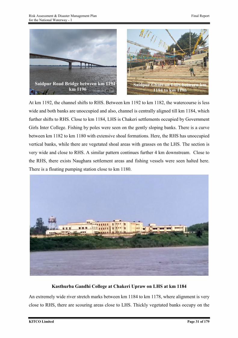
Risk Assessment & Disaster Management Plan Final Report for the National Waterway - 1
KITCO Limited Page 31 of 179
At km 1192, the channel shifts to RHS. Between km 1192 to km 1182, the watercourse is less
wide and both banks are unoccupied and also, channel is centrally aligned till km 1184, which
further shifts to RHS. Close to km 1184, LHS is Chakeri settlements occupied by Government
Girls Inter College. Fishing by poles were seen on the gently sloping banks. There is a curve
between km 1182 to km 1180 with extensive shoal formations. Here, the RHS has unoccupied
vertical banks, while there are vegetated shoal areas with grasses on the LHS. The section is
very wide and close to RHS. A similar pattern continues further 4 km downstream. Close to
the RHS, there exists Naughara settlement areas and fishing vessels were seen halted here.
There is a floating pumping station close to km 1180.
Kasthurba Gandhi College at Chakeri Upraw on LHS at km 1184
An extremely wide river stretch marks between km 1184 to km 1178, where alignment is very
close to RHS, there are scouring areas close to LHS. Thickly vegetated banks occupy on the
Saidpur Road Bridge between km 1194 to km 1196
Saidpur Ghats on LHS between km 1194 to km 1196
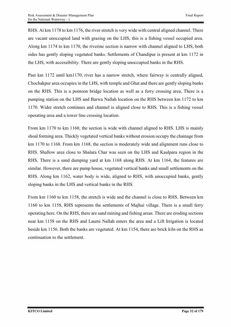
Risk Assessment & Disaster Management Plan Final Report for the National Waterway - 1
KITCO Limited Page 32 of 179
RHS. At km 1178 to km 1176, the river stretch is very wide with central aligned channel. There
are vacant unoccupied land with grazing on the LHS, this is a fishing vessel occupied area.
Along km 1174 to km 1170, the riverine section is narrow with channel aligned to LHS, both
sides has gently sloping vegetated banks. Settlements of Chandipur is present at km 1172 in
the LHS, with accessibility. There are gently sloping unoccupied banks in the RHS.
Past km 1172 until km1170, river has a narrow stretch, where fairway is centrally aligned,
Chochakpur area occupies in the LHS, with temple and Ghat and there are gently sloping banks
on the RHS. This is a pontoon bridge location as well as a ferry crossing area, There is a
pumping station on the LHS and Barwa Nallah location on the RHS between km 1172 to km
1170. Wider stretch continues and channel is aligned close to RHS. This is a fishing vessel
operating area and a tower line crossing location.
From km 1170 to km 1160, the section is wide with channel aligned to RHS. LHS is mainly
shoal forming area. Thickly vegetated vertical banks without erosion occupy the chainage from
km 1170 to 1168. From km 1168, the section is moderately wide and alignment runs close to
RHS. Shallow area close to Shalara Char was seen on the LHS and Kaulpara region in the
RHS. There is a sand dumping yard at km 1168 along RHS. At km 1164, the features are
similar. However, there are pump house, vegetated vertical banks and small settlements on the
RHS. Along km 1162, water body is wide, aligned to RHS, with unoccupied banks, gently
sloping banks in the LHS and vertical banks in the RHS.
From km 1160 to km 1158, the stretch is wide and the channel is close to RHS. Between km
1160 to km 1158, RHS represents the settlements of Majhui village. There is a small ferry
operating here. On the RHS, there are sand mining and fishing areas. There are eroding sections
near km 1158 on the RHS and Laumi Nallah enters the area and a Lift Irrigation is located
beside km 1156. Both the banks are vegetated. At km 1154, there are brick kiln on the RHS as
continuation to the settlement.
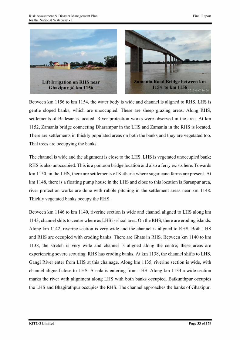
Risk Assessment & Disaster Management Plan Final Report for the National Waterway - 1
KITCO Limited Page 33 of 179
Between km 1156 to km 1154, the water body is wide and channel is aligned to RHS. LHS is
gentle sloped banks, which are unoccupied. These are sheep grazing areas. Along RHS,
settlements of Badesar is located. River protection works were observed in the area. At km
1152, Zamania bridge connecting Dharampur in the LHS and Zamania in the RHS is located.
There are settlements in thickly populated areas on both the banks and they are vegetated too.
Thal trees are occupying the banks.
The channel is wide and the alignment is close to the LHS. LHS is vegetated unoccupied bank;
RHS is also unoccupied. This is a pontoon bridge location and also a ferry exists here. Towards
km 1150, in the LHS, there are settlements of Katharia where sugar cane farms are present. At
km 1148, there is a floating pump house in the LHS and close to this location is Saranpur area,
river protection works are done with rubble pitching in the settlement areas near km 1148.
Thickly vegetated banks occupy the RHS.
Between km 1146 to km 1140, riverine section is wide and channel aligned to LHS along km
1143, channel shits to centre where as LHS is shoal area. On the RHS, there are eroding islands.
Along km 1142, riverine section is very wide and the channel is aligned to RHS. Both LHS
and RHS are occupied with eroding banks. There are Ghats in RHS. Between km 1140 to km
1138, the stretch is very wide and channel is aligned along the centre; these areas are
experiencing severe scouring. RHS has eroding banks. At km 1138, the channel shifts to LHS,
Gangi River enter from LHS at this chainage. Along km 1135, riverine section is wide, with
channel aligned close to LHS. A nala is entering from LHS. Along km 1134 a wide section
marks the river with alignment along LHS with both banks occupied. Baikunthpur occupies
the LHS and Bhagirathpur occupies the RHS. The channel approaches the banks of Ghazipur.
Lift Irrigation on RHS near Ghazipur @ km 1156
Zamania Road Bridge between km 1154 to km 1156
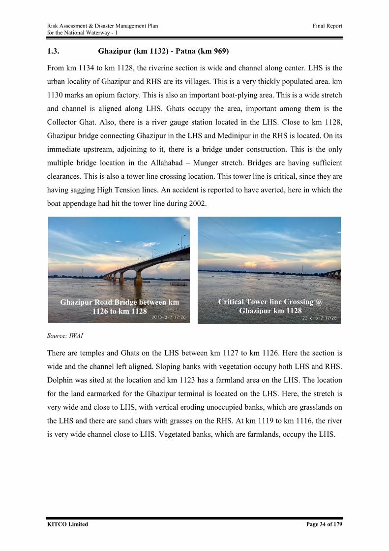
Risk Assessment & Disaster Management Plan Final Report for the National Waterway - 1
KITCO Limited Page 34 of 179
1.3. Ghazipur (km 1132) - Patna (km 969)
From km 1134 to km 1128, the riverine section is wide and channel along center. LHS is the
urban locality of Ghazipur and RHS are its villages. This is a very thickly populated area. km
1130 marks an opium factory. This is also an important boat-plying area. This is a wide stretch
and channel is aligned along LHS. Ghats occupy the area, important among them is the
Collector Ghat. Also, there is a river gauge station located in the LHS. Close to km 1128,
Ghazipur bridge connecting Ghazipur in the LHS and Medinipur in the RHS is located. On its
immediate upstream, adjoining to it, there is a bridge under construction. This is the only
multiple bridge location in the Allahabad – Munger stretch. Bridges are having sufficient
clearances. This is also a tower line crossing location. This tower line is critical, since they are
having sagging High Tension lines. An accident is reported to have averted, here in which the
boat appendage had hit the tower line during 2002.
Source: IWAI
There are temples and Ghats on the LHS between km 1127 to km 1126. Here the section is
wide and the channel left aligned. Sloping banks with vegetation occupy both LHS and RHS.
Dolphin was sited at the location and km 1123 has a farmland area on the LHS. The location
for the land earmarked for the Ghazipur terminal is located on the LHS. Here, the stretch is
very wide and close to LHS, with vertical eroding unoccupied banks, which are grasslands on
the LHS and there are sand chars with grasses on the RHS. At km 1119 to km 1116, the river
is very wide channel close to LHS. Vegetated banks, which are farmlands, occupy the LHS.
Ghazipur Road Bridge between km 1126 to km 1128
Critical Tower line Crossing @ Ghazipur km 1128
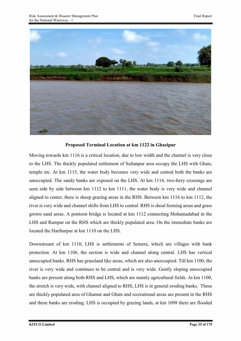
Risk Assessment & Disaster Management Plan Final Report for the National Waterway - 1
KITCO Limited Page 35 of 179
Proposed Terminal Location at km 1122 in Ghazipur
Moving towards km 1116 is a critical location, due to low width and the channel is very close
to the LHS. The thickly populated settlement of Sultanpur area occupy the LHS with Ghats,
temple etc. At km 1115, the water body becomes very wide and central both the banks are
unoccupied. The sandy banks are exposed on the LHS. At km 1114, two-ferry crossings are
seen side by side between km 1112 to km 1111, the water body is very wide and channel
aligned to center, there is sheep grazing areas in the RHS. Between km 1116 to km 1112, the
river is very wide and channel shifts from LHS to central. RHS is shoal forming areas and grass
grown sand areas. A pontoon bridge is located at km 1112 connecting Mohamadabad in the
LHS and Rampur on the RHS which are thickly populated area. On the immediate banks are
located the Hariharpur at km 1110 on the LHS.
Downstream of km 1110, LHS is settlements of Semera, which are villages with bank
protection. At km 1106, the section is wide and channel along central. LHS has vertical
unoccupied banks. RHS has grassland like areas, which are also unoccupied. Till km 1100, the
river is very wide and continues to be central and is very wide. Gently sloping unoccupied
banks are present along both RHS and LHS, which are mainly agricultural fields. At km 1100,
the stretch is very wide, with channel aligned to RHS, LHS is in general eroding banks. These
are thickly populated area of Ghamar and Ghats and recreational areas are present in the RHS
and these banks are eroding. LHS is occupied by grazing lands, at km 1098 there are flooded
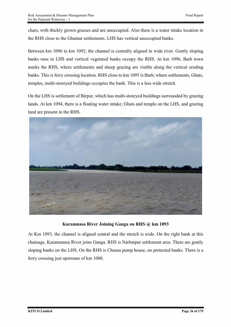
Risk Assessment & Disaster Management Plan Final Report for the National Waterway - 1
KITCO Limited Page 36 of 179
chars, with thickly grown grasses and are unoccupied. Also there is a water intake location in
the RHS close to the Ghamar settlements. LHS has vertical unoccupied banks.
Between km 1096 to km 1092, the channel is centrally aligned in wide river. Gently sloping
banks runs in LHS and vertical vegetated banks occupy the RHS. At km 1096, Barh town
marks the RHS, where settlements and sheep grazing are visible along the vertical eroding
banks. This is ferry crossing location. RHS close to km 1095 is Barh; where settlements, Ghats,
temples, multi-storeyed buildings occupies the bank. This is a less wide stretch.
On the LHS is settlement of Birpur, which has multi-storeyed buildings surrounded by grazing
lands. At km 1094, there is a floating water intake; Ghats and temple on the LHS, and grazing
land are present in the RHS.
Karamnasa River Joining Ganga on RHS @ km 1093
At Km 1093, the channel is aligned central and the stretch is wide. On the right bank at this
chainage, Karamanasa River joins Ganga. RHS is Narbatpur settlement area. There are gently
sloping banks on the LHS. On the RHS is Chausa pump house, on protected banks. There is a
ferry crossing just upstream of km 1088.
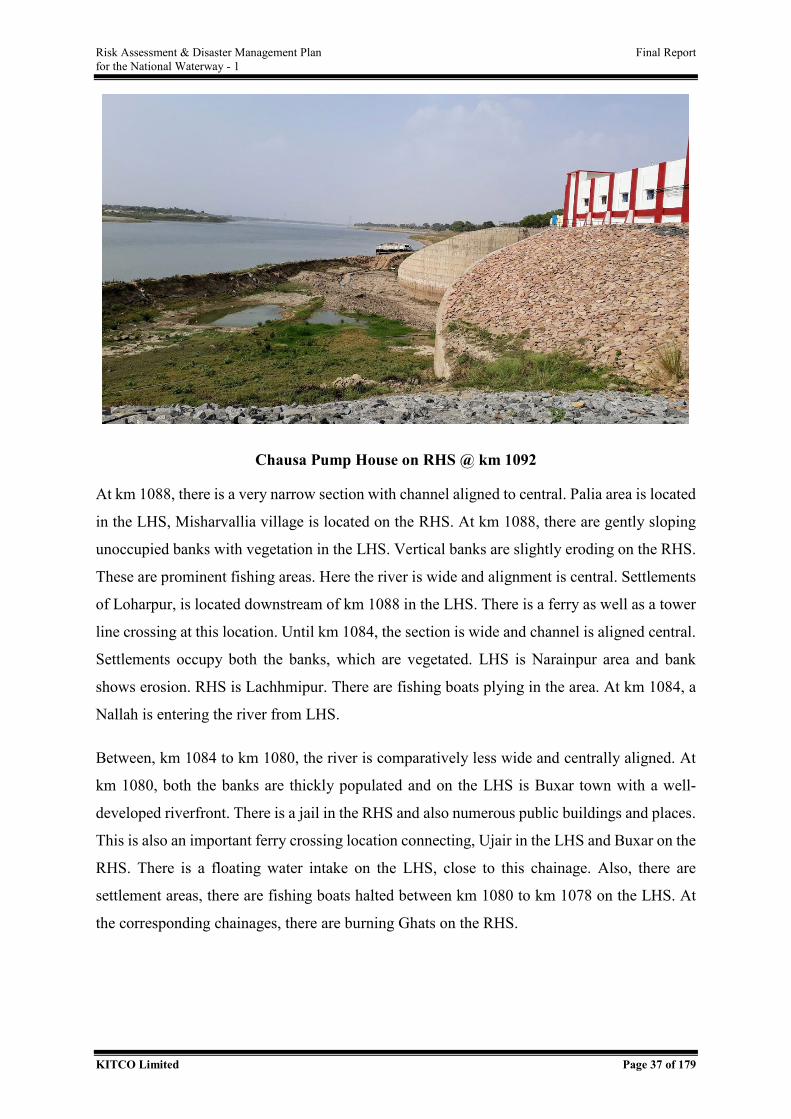
Risk Assessment & Disaster Management Plan Final Report for the National Waterway - 1
KITCO Limited Page 37 of 179
Chausa Pump House on RHS @ km 1092
At km 1088, there is a very narrow section with channel aligned to central. Palia area is located
in the LHS, Misharvallia village is located on the RHS. At km 1088, there are gently sloping
unoccupied banks with vegetation in the LHS. Vertical banks are slightly eroding on the RHS.
These are prominent fishing areas. Here the river is wide and alignment is central. Settlements
of Loharpur, is located downstream of km 1088 in the LHS. There is a ferry as well as a tower
line crossing at this location. Until km 1084, the section is wide and channel is aligned central.
Settlements occupy both the banks, which are vegetated. LHS is Narainpur area and bank
shows erosion. RHS is Lachhmipur. There are fishing boats plying in the area. At km 1084, a
Nallah is entering the river from LHS.
Between, km 1084 to km 1080, the river is comparatively less wide and centrally aligned. At
km 1080, both the banks are thickly populated and on the LHS is Buxar town with a well-
developed riverfront. There is a jail in the RHS and also numerous public buildings and places.
This is also an important ferry crossing location connecting, Ujair in the LHS and Buxar on the
RHS. There is a floating water intake on the LHS, close to this chainage. Also, there are
settlement areas, there are fishing boats halted between km 1080 to km 1078 on the LHS. At
the corresponding chainages, there are burning Ghats on the RHS.
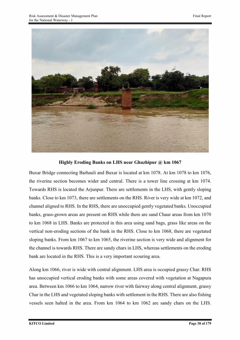
Risk Assessment & Disaster Management Plan Final Report for the National Waterway - 1
KITCO Limited Page 38 of 179
Highly Eroding Banks on LHS near Ghazhipur @ km 1067
Buxar Bridge connecting Barhauli and Buxar is located at km 1078. At km 1078 to km 1076,
the riverine section becomes wider and central. There is a tower line crossing at km 1074.
Towards RHS is located the Arjunpur. There are settlements in the LHS, with gently sloping
banks. Close to km 1073, there are settlements on the RHS. River is very wide at km 1072, and
channel aligned to RHS. In the RHS, there are unoccupied gently vegetated banks. Unoccupied
banks, grass-grown areas are present on RHS while there are sand Chaur areas from km 1070
to km 1068 in LHS. Banks are protected in this area using sand bags, grass like areas on the
vertical non-eroding sections of the bank in the RHS. Close to km 1068, there are vegetated
sloping banks. From km 1067 to km 1065, the riverine section is very wide and alignment for
the channel is towards RHS. There are sandy chars in LHS, whereas settlements on the eroding
bank are located in the RHS. This is a very important scouring area.
Along km 1066, river is wide with central alignment. LHS area is occupied grassy Char. RHS
has unoccupied vertical eroding banks with some areas covered with vegetation at Nagapura
area. Between km 1066 to km 1064, narrow river with fairway along central alignment, grassy
Char in the LHS and vegetated sloping banks with settlement in the RHS. There are also fishing
vessels seen halted in the area. From km 1064 to km 1062 are sandy chars on the LHS.
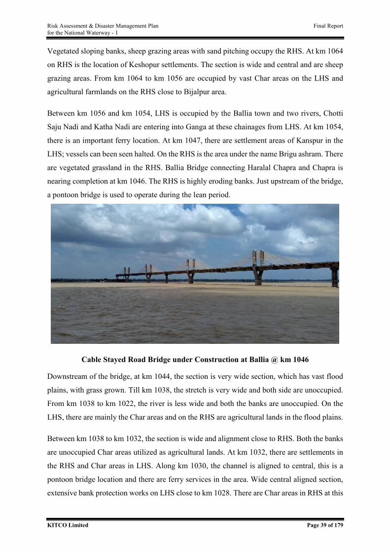
Risk Assessment & Disaster Management Plan Final Report for the National Waterway - 1
KITCO Limited Page 39 of 179
Vegetated sloping banks, sheep grazing areas with sand pitching occupy the RHS. At km 1064
on RHS is the location of Keshopur settlements. The section is wide and central and are sheep
grazing areas. From km 1064 to km 1056 are occupied by vast Char areas on the LHS and
agricultural farmlands on the RHS close to Bijalpur area.
Between km 1056 and km 1054, LHS is occupied by the Ballia town and two rivers, Chotti
Saju Nadi and Katha Nadi are entering into Ganga at these chainages from LHS. At km 1054,
there is an important ferry location. At km 1047, there are settlement areas of Kanspur in the
LHS; vessels can been seen halted. On the RHS is the area under the name Brigu ashram. There
are vegetated grassland in the RHS. Ballia Bridge connecting Haralal Chapra and Chapra is
nearing completion at km 1046. The RHS is highly eroding banks. Just upstream of the bridge,
a pontoon bridge is used to operate during the lean period.
Cable Stayed Road Bridge under Construction at Ballia @ km 1046
Downstream of the bridge, at km 1044, the section is very wide section, which has vast flood
plains, with grass grown. Till km 1038, the stretch is very wide and both side are unoccupied.
From km 1038 to km 1022, the river is less wide and both the banks are unoccupied. On the
LHS, there are mainly the Char areas and on the RHS are agricultural lands in the flood plains.
Between km 1038 to km 1032, the section is wide and alignment close to RHS. Both the banks
are unoccupied Char areas utilized as agricultural lands. At km 1032, there are settlements in
the RHS and Char areas in LHS. Along km 1030, the channel is aligned to central, this is a
pontoon bridge location and there are ferry services in the area. Wide central aligned section,
extensive bank protection works on LHS close to km 1028. There are Char areas in RHS at this
Risk Assessment & Disaster Management Plan Final Report for the National Waterway - 1
KITCO Limited Page 40 of 179
chainage. The wider section continues between km 1028 to km 1026, where the channel is
along central. LHS marks Durjanpur area, where banks are protected with settlements.
Nauranga is located in the RHS. At km 1021, the stretch is wide and central aligned, there are
settlements in the protected banks in LHS. At km 1020, the section is extremely wide and the
channel is central. LHS is grass grown chars. Similar pattern continues till km 1018.
At km 1018, LHS is Srirampur area, the river is extremely wide and channel close to RHS and
it is a pontoon bridge location. Dredging pipeline could be seen and fishing boats are halted in
these area. Unoccupied vegetated banks exists near Muril Chapra. Farmlands are used for
grazing. There are sandy Char in the LHS and gently sloping banks, which is followed by
eroding banks. Very wide stretch with central alignment of the channel, occupied the km 1014.
Sopalpur Chaur is located in the LHS. Banks are eroding in the RHS. At LHS is located
Bhusola Ghat, settlement vertical banks with grass. Sloping banks occupy the RHS. Along km
1012 to km 1009 is a very wide section close to LHS. Along km 1009, there are sand unloading
areas; large no. of boats, tractors on the bank to take sand in LHS. There are gently sloping
banks on the RHS.
Between km 1005 to km 1003, the river is very wide and fairway is aligned towards RHS. LHS
is Char areas within grasses in the initial sections. Water hyacinth was observed near km 1003.
Also, there is fishing activity in the locality. Here, the RHS is very thickly populated with the
buildings very close to the banks. There are sugarcane fields in gently sloping banks. The area
marks high erosion with bank protection done with sand bags.
Along km 994, there exists a narrow channel with fairway close to RHS. This is Mauzampur
settlement area and boat could be seen halted. At km 993, a pontoon bridge is located. Mauli
Ghat area with double storied buildings occupy the RHS. River is very wide along km 991 and
fairway close to RHS. Banks are flat flood plains with vertical eroding banks. Only sparse
vegetation exists on the RHS. Very wide riverine section occupies km 989, vegetated banks
with settlements are there on the LHS. Unoccupied flood plains present on RHS. From km 986
to km 984, is the water body is extremely wide and is having fairway aligned along RHS, as it
moves from central at km 986. These banks are highly eroding at LHS. There are geo-tubes
placed at km 986, to prevent bank erosion. There is Ghaghara river confluence at km 986. RHS
is having unoccupied banks.
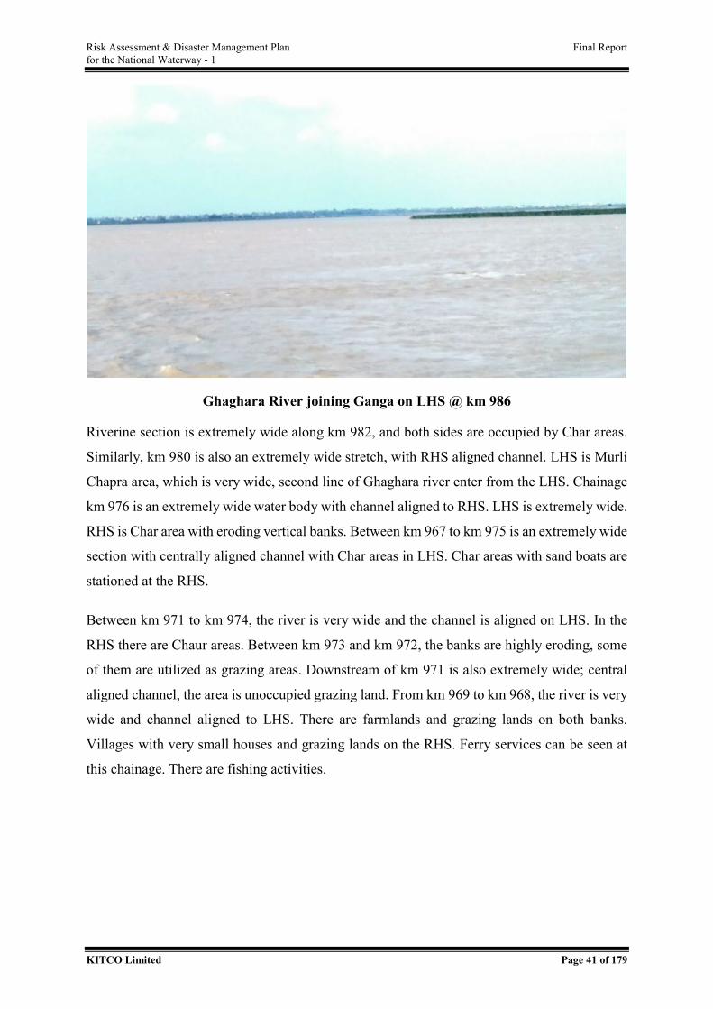
Risk Assessment & Disaster Management Plan Final Report for the National Waterway - 1
KITCO Limited Page 41 of 179
Ghaghara River joining Ganga on LHS @ km 986
Riverine section is extremely wide along km 982, and both sides are occupied by Char areas.
Similarly, km 980 is also an extremely wide stretch, with RHS aligned channel. LHS is Murli
Chapra area, which is very wide, second line of Ghaghara river enter from the LHS. Chainage
km 976 is an extremely wide water body with channel aligned to RHS. LHS is extremely wide.
RHS is Char area with eroding vertical banks. Between km 967 to km 975 is an extremely wide
section with centrally aligned channel with Char areas in LHS. Char areas with sand boats are
stationed at the RHS.
Between km 971 to km 974, the river is very wide and the channel is aligned on LHS. In the
RHS there are Chaur areas. Between km 973 and km 972, the banks are highly eroding, some
of them are utilized as grazing areas. Downstream of km 971 is also extremely wide; central
aligned channel, the area is unoccupied grazing land. From km 969 to km 968, the river is very
wide and channel aligned to LHS. There are farmlands and grazing lands on both banks.
Villages with very small houses and grazing lands on the RHS. Ferry services can be seen at
this chainage. There are fishing activities.
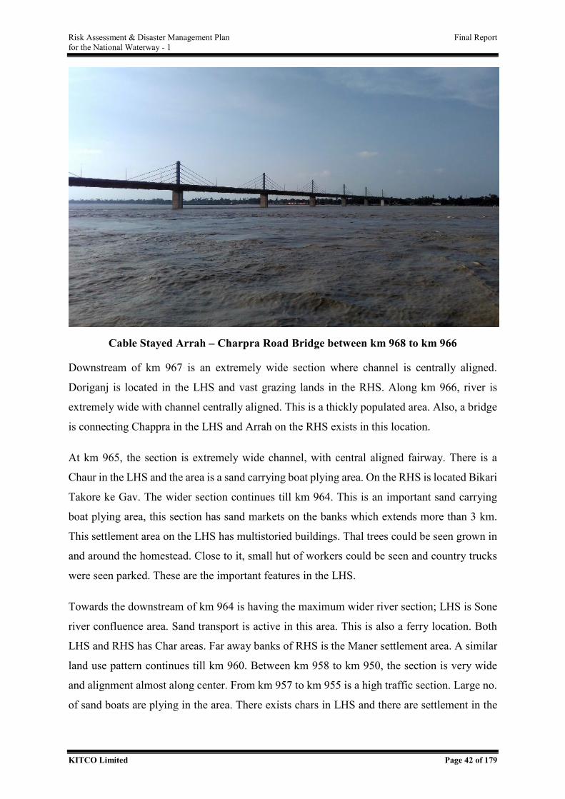
Risk Assessment & Disaster Management Plan Final Report for the National Waterway - 1
KITCO Limited Page 42 of 179
Cable Stayed Arrah – Charpra Road Bridge between km 968 to km 966
Downstream of km 967 is an extremely wide section where channel is centrally aligned.
Doriganj is located in the LHS and vast grazing lands in the RHS. Along km 966, river is
extremely wide with channel centrally aligned. This is a thickly populated area. Also, a bridge
is connecting Chappra in the LHS and Arrah on the RHS exists in this location.
At km 965, the section is extremely wide channel, with central aligned fairway. There is a
Chaur in the LHS and the area is a sand carrying boat plying area. On the RHS is located Bikari
Takore ke Gav. The wider section continues till km 964. This is an important sand carrying
boat plying area, this section has sand markets on the banks which extends more than 3 km.
This settlement area on the LHS has multistoried buildings. Thal trees could be seen grown in
and around the homestead. Close to it, small hut of workers could be seen and country trucks
were seen parked. These are the important features in the LHS.
Towards the downstream of km 964 is having the maximum wider river section; LHS is Sone
river confluence area. Sand transport is active in this area. This is also a ferry location. Both
LHS and RHS has Char areas. Far away banks of RHS is the Maner settlement area. A similar
land use pattern continues till km 960. Between km 958 to km 950, the section is very wide
and alignment almost along center. From km 957 to km 955 is a high traffic section. Large no.
of sand boats are plying in the area. There exists chars in LHS and there are settlement in the
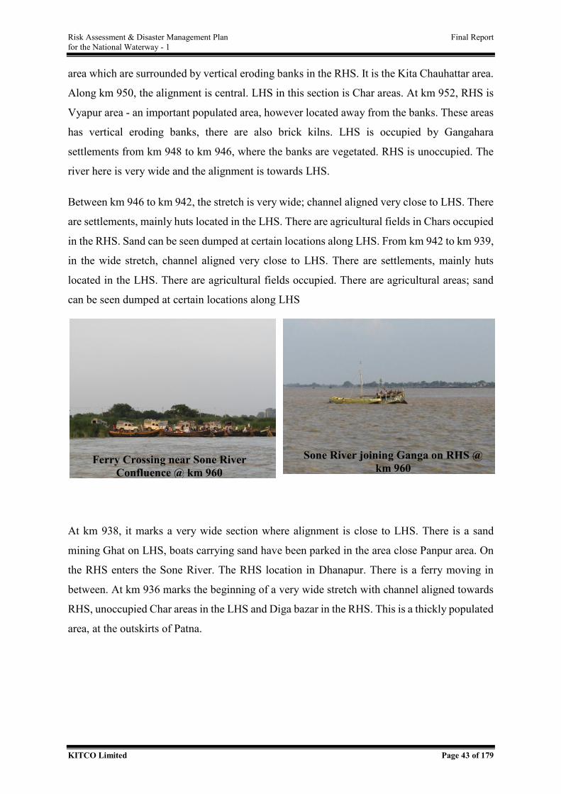
Risk Assessment & Disaster Management Plan Final Report for the National Waterway - 1
KITCO Limited Page 43 of 179
area which are surrounded by vertical eroding banks in the RHS. It is the Kita Chauhattar area.
Along km 950, the alignment is central. LHS in this section is Char areas. At km 952, RHS is
Vyapur area - an important populated area, however located away from the banks. These areas
has vertical eroding banks, there are also brick kilns. LHS is occupied by Gangahara
settlements from km 948 to km 946, where the banks are vegetated. RHS is unoccupied. The
river here is very wide and the alignment is towards LHS.
Between km 946 to km 942, the stretch is very wide; channel aligned very close to LHS. There
are settlements, mainly huts located in the LHS. There are agricultural fields in Chars occupied
in the RHS. Sand can be seen dumped at certain locations along LHS. From km 942 to km 939,
in the wide stretch, channel aligned very close to LHS. There are settlements, mainly huts
located in the LHS. There are agricultural fields occupied. There are agricultural areas; sand
can be seen dumped at certain locations along LHS
At km 938, it marks a very wide section where alignment is close to LHS. There is a sand
mining Ghat on LHS, boats carrying sand have been parked in the area close Panpur area. On
the RHS enters the Sone River. The RHS location in Dhanapur. There is a ferry moving in
between. At km 936 marks the beginning of a very wide stretch with channel aligned towards
RHS, unoccupied Char areas in the LHS and Diga bazar in the RHS. This is a thickly populated
area, at the outskirts of Patna.
Ferry Crossing near Sone River Confluence @ km 960
Sone River joining Ganga on RHS @ km 960
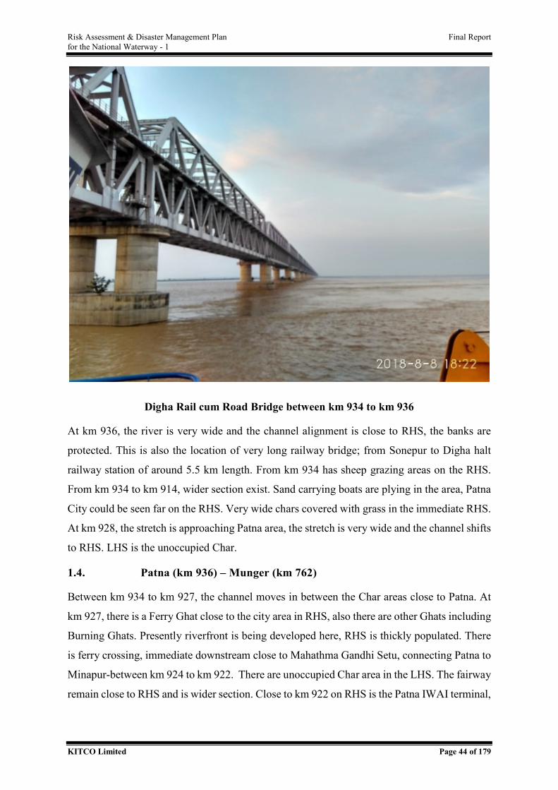
Risk Assessment & Disaster Management Plan Final Report for the National Waterway - 1
KITCO Limited Page 44 of 179
Digha Rail cum Road Bridge between km 934 to km 936
At km 936, the river is very wide and the channel alignment is close to RHS, the banks are
protected. This is also the location of very long railway bridge; from Sonepur to Digha halt
railway station of around 5.5 km length. From km 934 has sheep grazing areas on the RHS.
From km 934 to km 914, wider section exist. Sand carrying boats are plying in the area, Patna
City could be seen far on the RHS. Very wide chars covered with grass in the immediate RHS.
At km 928, the stretch is approaching Patna area, the stretch is very wide and the channel shifts
to RHS. LHS is the unoccupied Char.
1.4. Patna (km 936) – Munger (km 762)
Between km 934 to km 927, the channel moves in between the Char areas close to Patna. At
km 927, there is a Ferry Ghat close to the city area in RHS, also there are other Ghats including
Burning Ghats. Presently riverfront is being developed here, RHS is thickly populated. There
is ferry crossing, immediate downstream close to Mahathma Gandhi Setu, connecting Patna to
Minapur-between km 924 to km 922. There are unoccupied Char area in the LHS. The fairway
remain close to RHS and is wider section. Close to km 922 on RHS is the Patna IWAI terminal,
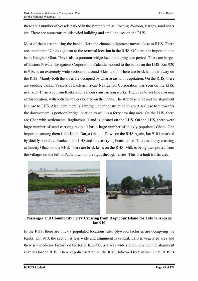
Risk Assessment & Disaster Management Plan Final Report for the National Waterway - 1
KITCO Limited Page 45 of 179
there are a number of vessels parked in the stretch such as Floating Pontoon, Barges, sand boats
etc. There are numerous multistoried building and small houses on the RHS.
Most of them are abutting the banks. Here the channel alignment moves close to RHS. There
are a number of Ghats adjacent to the terminal location in the RHS. Of them, the important one
is the Kanghan Ghat. This is also a pontoon bridge location during lean period. There are barges
of Eastern Private Navigation Corporation, Calcutta moored to the banks on the LHS. Km 920
to 916, is an extremely wide section of around 4 km width. There are brick kilns far away on
the RHS. Mainly both the sides are occupied by Char areas with vegetation. On the RHS, there
are eroding banks. Vessels of Eastern Private Navigation Corporation was seen on the LHS,
near km 915 arrived from Kolkata for various construction works. There is a tower line crossing
at this location, with both the towers located on the banks. The stretch is wide and the alignment
is close to LHS. Also, here there is a bridge under construction at km 914.Close to it towards
the downstream is pontoon bridge location as well as a ferry crossing area. On the LHS, there
are Char with settlements. Raghavpur Island is located on the LHS. On the LHS, there were
large number of sand carrying boats. It has a large number of thickly populated Ghats. One
important among them is the Kachi Darga Ghat, of Fatwa on the RHS.Again, km 910 is marked
by thickly populated banks on the LHS and sand carrying boats halted. There is a ferry crossing
at Jaidety Ghats on the RHS. There are brick kilns on the RHS. Milk is being transported from
the villages on the left to Patna town on the right through ferries. This is a high traffic area.
Passenger and Commodity Ferry Crossing from Raghopur Island for Fatuha Area @ km 910
In the RHS, there are thickly populated locations; also plywood factories are occupying the
banks. Km 910, the section is less wide and alignment is central. LHS is vegetated area and
there is a medicine factory on the RHS. Km 908, is a very wide stretch in which the alignment
is very close to RHS. There is police station on the RHS, followed by Sanshan Ghat. RHS is
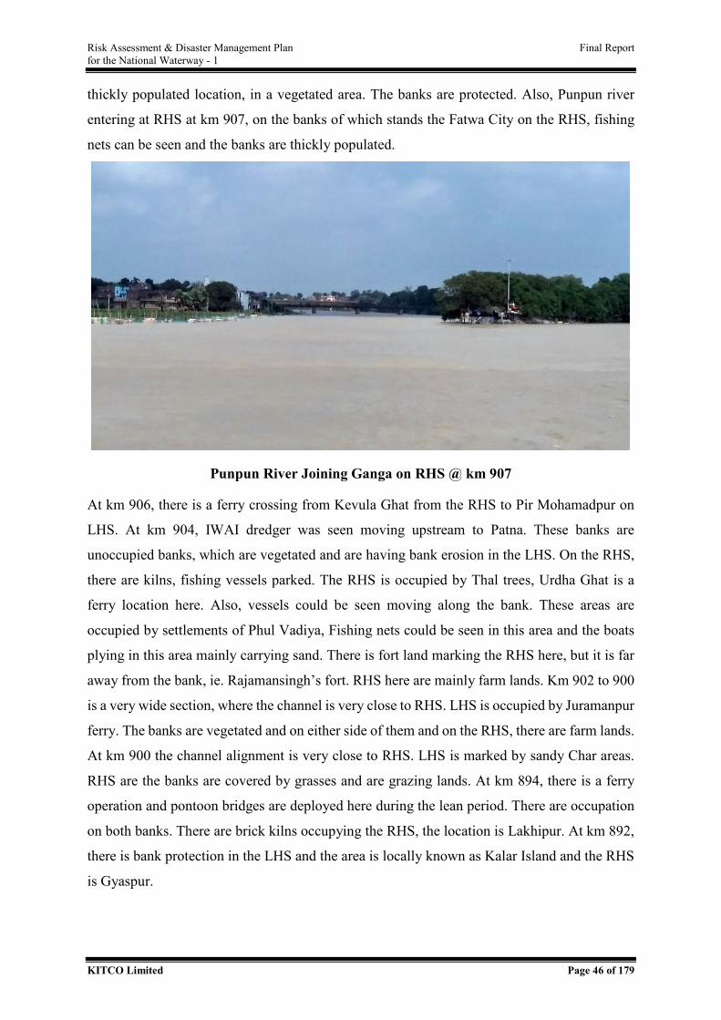
Risk Assessment & Disaster Management Plan Final Report for the National Waterway - 1
KITCO Limited Page 46 of 179
thickly populated location, in a vegetated area. The banks are protected. Also, Punpun river
entering at RHS at km 907, on the banks of which stands the Fatwa City on the RHS, fishing
nets can be seen and the banks are thickly populated.
Punpun River Joining Ganga on RHS @ km 907
At km 906, there is a ferry crossing from Kevula Ghat from the RHS to Pir Mohamadpur on
LHS. At km 904, IWAI dredger was seen moving upstream to Patna. These banks are
unoccupied banks, which are vegetated and are having bank erosion in the LHS. On the RHS,
there are kilns, fishing vessels parked. The RHS is occupied by Thal trees, Urdha Ghat is a
ferry location here. Also, vessels could be seen moving along the bank. These areas are
occupied by settlements of Phul Vadiya, Fishing nets could be seen in this area and the boats
plying in this area mainly carrying sand. There is fort land marking the RHS here, but it is far
away from the bank, ie. Rajamansingh’s fort. RHS here are mainly farm lands. Km 902 to 900
is a very wide section, where the channel is very close to RHS. LHS is occupied by Juramanpur
ferry. The banks are vegetated and on either side of them and on the RHS, there are farm lands.
At km 900 the channel alignment is very close to RHS. LHS is marked by sandy Char areas.
RHS are the banks are covered by grasses and are grazing lands. At km 894, there is a ferry
operation and pontoon bridges are deployed here during the lean period. There are occupation
on both banks. There are brick kilns occupying the RHS, the location is Lakhipur. At km 892,
there is bank protection in the LHS and the area is locally known as Kalar Island and the RHS
is Gyaspur.
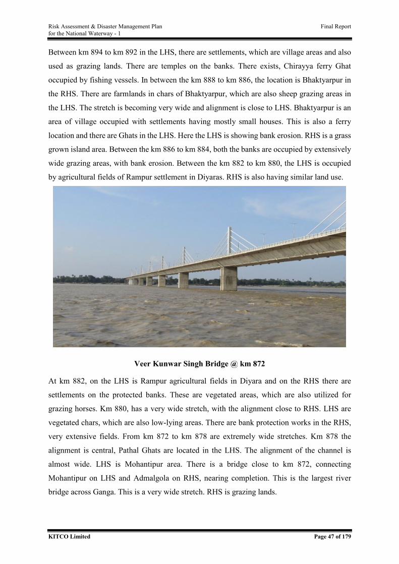
Risk Assessment & Disaster Management Plan Final Report for the National Waterway - 1
KITCO Limited Page 47 of 179
Between km 894 to km 892 in the LHS, there are settlements, which are village areas and also
used as grazing lands. There are temples on the banks. There exists, Chirayya ferry Ghat
occupied by fishing vessels. In between the km 888 to km 886, the location is Bhaktyarpur in
the RHS. There are farmlands in chars of Bhaktyarpur, which are also sheep grazing areas in
the LHS. The stretch is becoming very wide and alignment is close to LHS. Bhaktyarpur is an
area of village occupied with settlements having mostly small houses. This is also a ferry
location and there are Ghats in the LHS. Here the LHS is showing bank erosion. RHS is a grass
grown island area. Between the km 886 to km 884, both the banks are occupied by extensively
wide grazing areas, with bank erosion. Between the km 882 to km 880, the LHS is occupied
by agricultural fields of Rampur settlement in Diyaras. RHS is also having similar land use.
Veer Kunwar Singh Bridge @ km 872
At km 882, on the LHS is Rampur agricultural fields in Diyara and on the RHS there are
settlements on the protected banks. These are vegetated areas, which are also utilized for
grazing horses. Km 880, has a very wide stretch, with the alignment close to RHS. LHS are
vegetated chars, which are also low-lying areas. There are bank protection works in the RHS,
very extensive fields. From km 872 to km 878 are extremely wide stretches. Km 878 the
alignment is central, Pathal Ghats are located in the LHS. The alignment of the channel is
almost wide. LHS is Mohantipur area. There is a bridge close to km 872, connecting
Mohantipur on LHS and Admalgola on RHS, nearing completion. This is the largest river
bridge across Ganga. This is a very wide stretch. RHS is grazing lands.
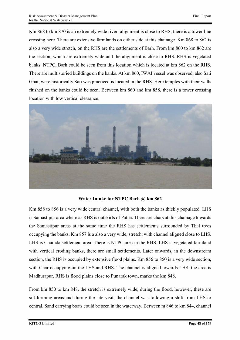
Risk Assessment & Disaster Management Plan Final Report for the National Waterway - 1
KITCO Limited Page 48 of 179
Km 868 to km 870 is an extremely wide river; alignment is close to RHS, there is a tower line
crossing here. There are extensive farmlands on either side at this chainage. Km 868 to 862 is
also a very wide stretch, on the RHS are the settlements of Barh. From km 860 to km 862 are
the section, which are extremely wide and the alignment is close to RHS. RHS is vegetated
banks. NTPC, Barh could be seen from this location which is located at km 862 on the RHS.
There are multistoried buildings on the banks. At km 860, IWAI vessel was observed, also Sati
Ghat, were historically Sati was practiced is located in the RHS. Here temples with their walls
flushed on the banks could be seen. Between km 860 and km 858, there is a tower crossing
location with low vertical clearance.
Water Intake for NTPC Barh @ km 862
Km 858 to 856 is a very wide central channel, with both the banks as thickly populated. LHS
is Samastipur area where as RHS is outskirts of Patna. There are chars at this chainage towards
the Samastipur areas at the same time the RHS has settlements surrounded by Thal trees
occupying the banks. Km 857 is a also a very wide, stretch, with channel aligned close to LHS.
LHS is Chamda settlement area. There is NTPC area in the RHS. LHS is vegetated farmland
with vertical eroding banks, there are small settlements. Later onwards, in the downstream
section, the RHS is occupied by extensive flood plains. Km 856 to 850 is a very wide section,
with Char occupying on the LHS and RHS. The channel is aligned towards LHS, the area is
Madhurapur. RHS is flood plains close to Punarak town, marks the km 848.
From km 850 to km 848, the stretch is extremely wide, during the flood, however, these are
silt-forming areas and during the site visit, the channel was following a shift from LHS to
central. Sand carrying boats could be seen in the waterway. Between m 846 to km 844, channel
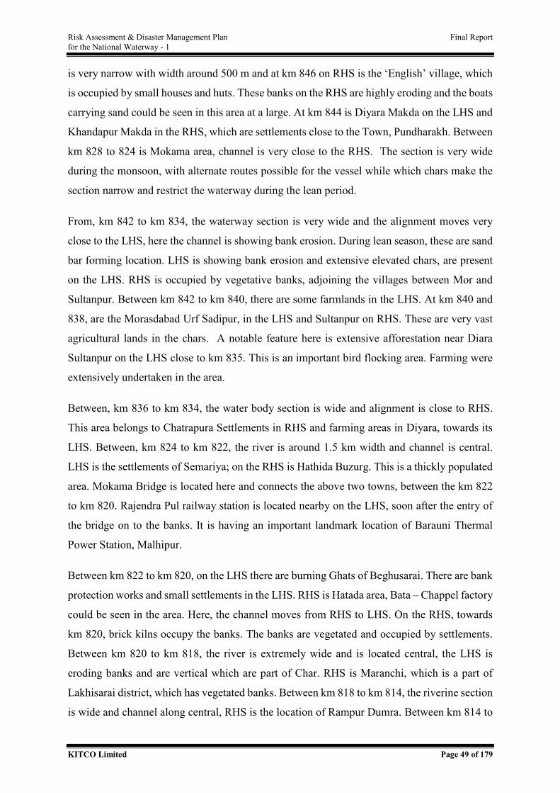
Risk Assessment & Disaster Management Plan Final Report for the National Waterway - 1
KITCO Limited Page 49 of 179
is very narrow with width around 500 m and at km 846 on RHS is the ‘English’ village, which
is occupied by small houses and huts. These banks on the RHS are highly eroding and the boats
carrying sand could be seen in this area at a large. At km 844 is Diyara Makda on the LHS and
Khandapur Makda in the RHS, which are settlements close to the Town, Pundharakh. Between
km 828 to 824 is Mokama area, channel is very close to the RHS. The section is very wide
during the monsoon, with alternate routes possible for the vessel while which chars make the
section narrow and restrict the waterway during the lean period.
From, km 842 to km 834, the waterway section is very wide and the alignment moves very
close to the LHS, here the channel is showing bank erosion. During lean season, these are sand
bar forming location. LHS is showing bank erosion and extensive elevated chars, are present
on the LHS. RHS is occupied by vegetative banks, adjoining the villages between Mor and
Sultanpur. Between km 842 to km 840, there are some farmlands in the LHS. At km 840 and
838, are the Morasdabad Urf Sadipur, in the LHS and Sultanpur on RHS. These are very vast
agricultural lands in the chars. A notable feature here is extensive afforestation near Diara
Sultanpur on the LHS close to km 835. This is an important bird flocking area. Farming were
extensively undertaken in the area.
Between, km 836 to km 834, the water body section is wide and alignment is close to RHS.
This area belongs to Chatrapura Settlements in RHS and farming areas in Diyara, towards its
LHS. Between, km 824 to km 822, the river is around 1.5 km width and channel is central.
LHS is the settlements of Semariya; on the RHS is Hathida Buzurg. This is a thickly populated
area. Mokama Bridge is located here and connects the above two towns, between the km 822
to km 820. Rajendra Pul railway station is located nearby on the LHS, soon after the entry of
the bridge on to the banks. It is having an important landmark location of Barauni Thermal
Power Station, Malhipur.
Between km 822 to km 820, on the LHS there are burning Ghats of Beghusarai. There are bank
protection works and small settlements in the LHS. RHS is Hatada area, Bata – Chappel factory
could be seen in the area. Here, the channel moves from RHS to LHS. On the RHS, towards
km 820, brick kilns occupy the banks. The banks are vegetated and occupied by settlements.
Between km 820 to km 818, the river is extremely wide and is located central, the LHS is
eroding banks and are vertical which are part of Char. RHS is Maranchi, which is a part of
Lakhisarai district, which has vegetated banks. Between km 818 to km 814, the riverine section
is wide and channel along central, RHS is the location of Rampur Dumra. Between km 814 to
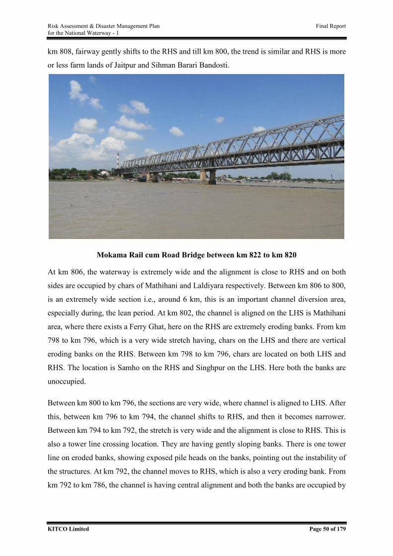
Risk Assessment & Disaster Management Plan Final Report for the National Waterway - 1
KITCO Limited Page 50 of 179
km 808, fairway gently shifts to the RHS and till km 800, the trend is similar and RHS is more
or less farm lands of Jaitpur and Sihman Barari Bandosti.
Mokama Rail cum Road Bridge between km 822 to km 820
At km 806, the waterway is extremely wide and the alignment is close to RHS and on both
sides are occupied by chars of Mathihani and Laldiyara respectively. Between km 806 to 800,
is an extremely wide section i.e., around 6 km, this is an important channel diversion area,
especially during, the lean period. At km 802, the channel is aligned on the LHS is Mathihani
area, where there exists a Ferry Ghat, here on the RHS are extremely eroding banks. From km
798 to km 796, which is a very wide stretch having, chars on the LHS and there are vertical
eroding banks on the RHS. Between km 798 to km 796, chars are located on both LHS and
RHS. The location is Samho on the RHS and Singhpur on the LHS. Here both the banks are
unoccupied.
Between km 800 to km 796, the sections are very wide, where channel is aligned to LHS. After
this, between km 796 to km 794, the channel shifts to RHS, and then it becomes narrower.
Between km 794 to km 792, the stretch is very wide and the alignment is close to RHS. This is
also a tower line crossing location. They are having gently sloping banks. There is one tower
line on eroded banks, showing exposed pile heads on the banks, pointing out the instability of
the structures. At km 792, the channel moves to RHS, which is also a very eroding bank. From
km 792 to km 786, the channel is having central alignment and both the banks are occupied by
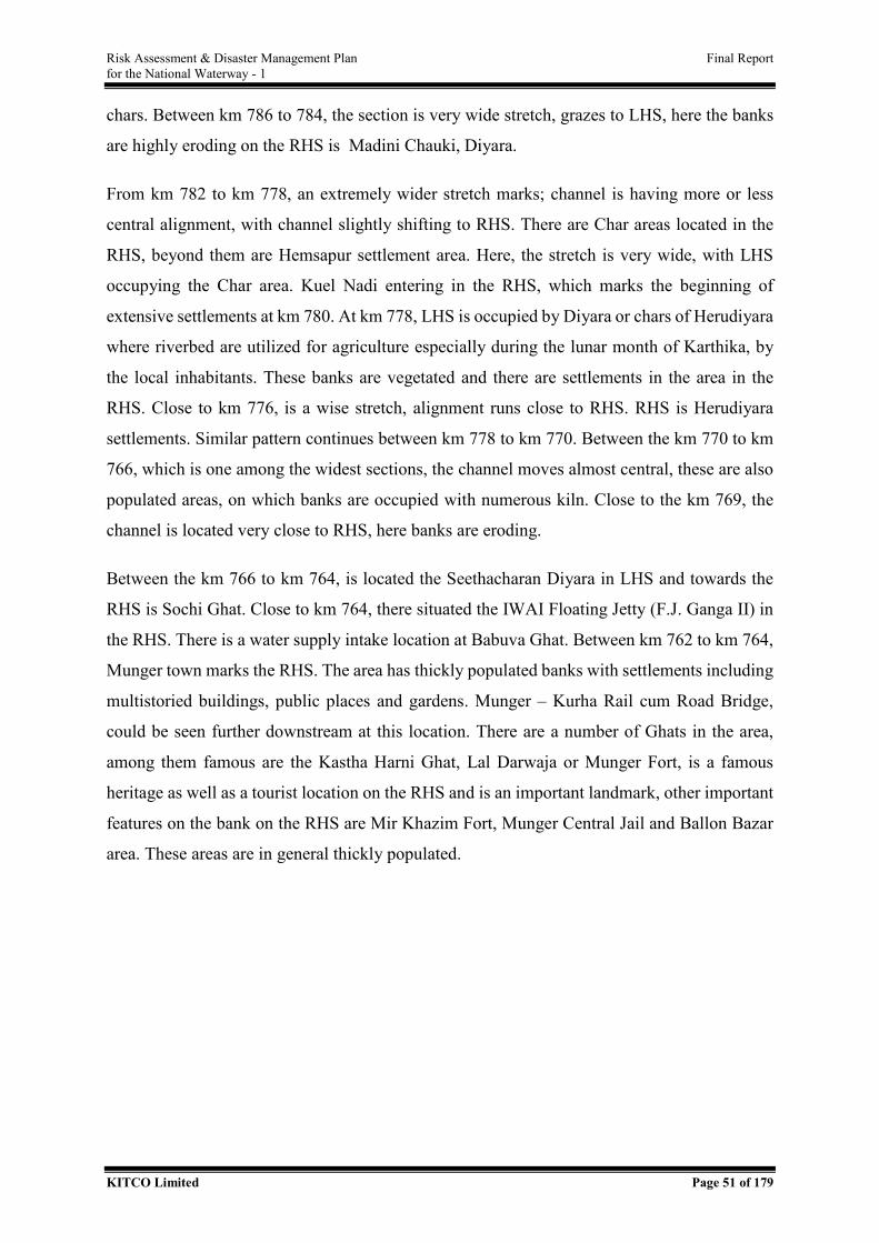
Risk Assessment & Disaster Management Plan Final Report for the National Waterway - 1
KITCO Limited Page 51 of 179
chars. Between km 786 to 784, the section is very wide stretch, grazes to LHS, here the banks
are highly eroding on the RHS is Madini Chauki, Diyara.
From km 782 to km 778, an extremely wider stretch marks; channel is having more or less
central alignment, with channel slightly shifting to RHS. There are Char areas located in the
RHS, beyond them are Hemsapur settlement area. Here, the stretch is very wide, with LHS
occupying the Char area. Kuel Nadi entering in the RHS, which marks the beginning of
extensive settlements at km 780. At km 778, LHS is occupied by Diyara or chars of Herudiyara
where riverbed are utilized for agriculture especially during the lunar month of Karthika, by
the local inhabitants. These banks are vegetated and there are settlements in the area in the
RHS. Close to km 776, is a wise stretch, alignment runs close to RHS. RHS is Herudiyara
settlements. Similar pattern continues between km 778 to km 770. Between the km 770 to km
766, which is one among the widest sections, the channel moves almost central, these are also
populated areas, on which banks are occupied with numerous kiln. Close to the km 769, the
channel is located very close to RHS, here banks are eroding.
Between the km 766 to km 764, is located the Seethacharan Diyara in LHS and towards the
RHS is Sochi Ghat. Close to km 764, there situated the IWAI Floating Jetty (F.J. Ganga II) in
the RHS. There is a water supply intake location at Babuva Ghat. Between km 762 to km 764,
Munger town marks the RHS. The area has thickly populated banks with settlements including
multistoried buildings, public places and gardens. Munger – Kurha Rail cum Road Bridge,
could be seen further downstream at this location. There are a number of Ghats in the area,
among them famous are the Kastha Harni Ghat, Lal Darwaja or Munger Fort, is a famous
heritage as well as a tourist location on the RHS and is an important landmark, other important
features on the bank on the RHS are Mir Khazim Fort, Munger Central Jail and Ballon Bazar
area. These areas are in general thickly populated.
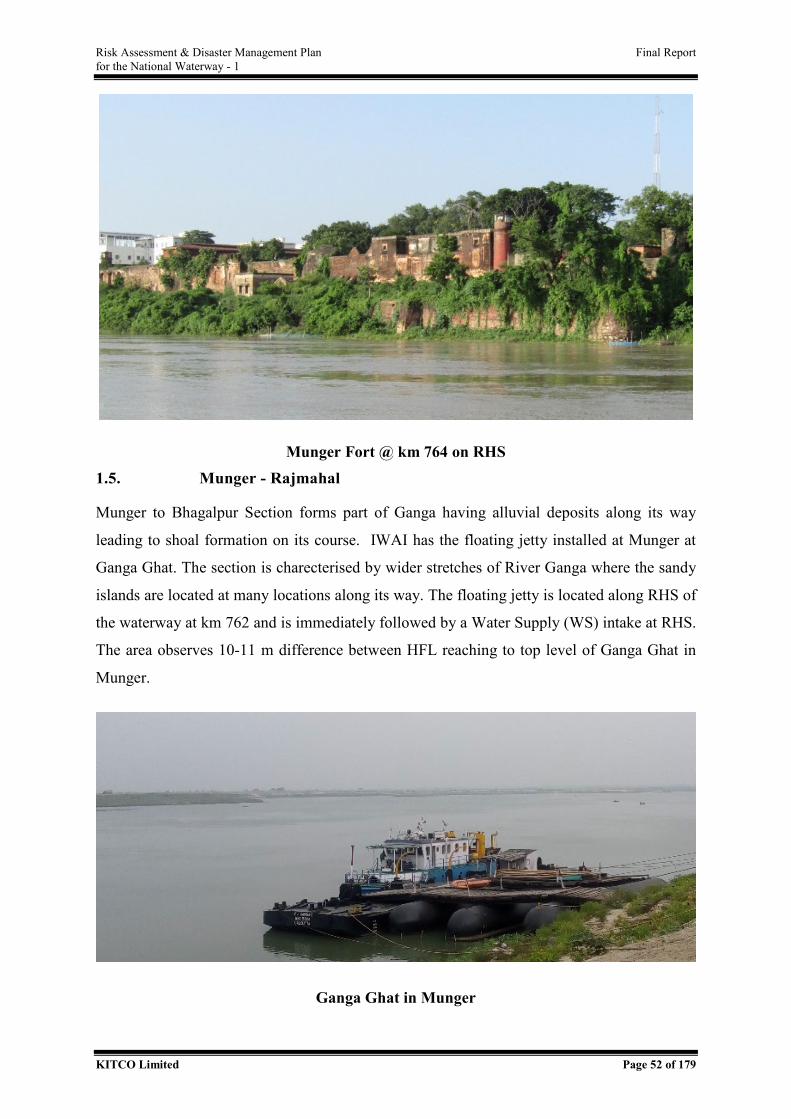
Risk Assessment & Disaster Management Plan Final Report for the National Waterway - 1
KITCO Limited Page 52 of 179
Munger Fort @ km 764 on RHS 1.5. Munger - Rajmahal
Munger to Bhagalpur Section forms part of Ganga having alluvial deposits along its way
leading to shoal formation on its course. IWAI has the floating jetty installed at Munger at
Ganga Ghat. The section is charecterised by wider stretches of River Ganga where the sandy
islands are located at many locations along its way. The floating jetty is located along RHS of
the waterway at km 762 and is immediately followed by a Water Supply (WS) intake at RHS.
The area observes 10-11 m difference between HFL reaching to top level of Ganga Ghat in
Munger.
Ganga Ghat in Munger
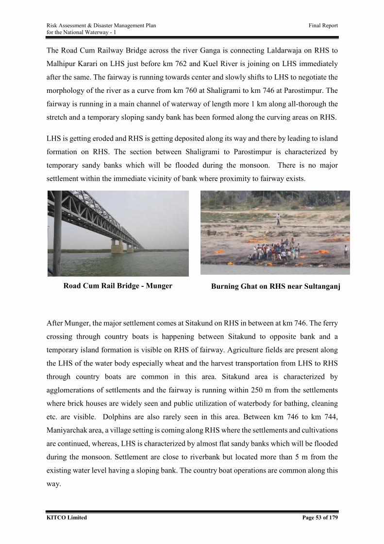
Risk Assessment & Disaster Management Plan Final Report for the National Waterway - 1
KITCO Limited Page 53 of 179
The Road Cum Railway Bridge across the river Ganga is connecting Laldarwaja on RHS to
Malhipur Karari on LHS just before km 762 and Kuel River is joining on LHS immediately
after the same. The fairway is running towards center and slowly shifts to LHS to negotiate the
morphology of the river as a curve from km 760 at Shaligrami to km 746 at Parostimpur. The
fairway is running in a main channel of waterway of length more 1 km along all-thorough the
stretch and a temporary sloping sandy bank has been formed along the curving areas on RHS.
LHS is getting eroded and RHS is getting deposited along its way and there by leading to island
formation on RHS. The section between Shaligrami to Parostimpur is characterized by
temporary sandy banks which will be flooded during the monsoon. There is no major
settlement within the immediate vicinity of bank where proximity to fairway exists.
After Munger, the major settlement comes at Sitakund on RHS in between at km 746. The ferry
crossing through country boats is happening between Sitakund to opposite bank and a
temporary island formation is visible on RHS of fairway. Agriculture fields are present along
the LHS of the water body especially wheat and the harvest transportation from LHS to RHS
through country boats are common in this area. Sitakund area is characterized by
agglomerations of settlements and the fairway is running within 250 m from the settlements
where brick houses are widely seen and public utilization of waterbody for bathing, cleaning
etc. are visible. Dolphins are also rarely seen in this area. Between km 746 to km 744,
Maniyarchak area, a village setting is coming along RHS where the settlements and cultivations
are continued, whereas, LHS is characterized by almost flat sandy banks which will be flooded
during the monsoon. Settlement are close to riverbank but located more than 5 m from the
existing water level having a sloping bank. The country boat operations are common along this
way.
Road Cum Rail Bridge - Munger Burning Ghat on RHS near Sultanganj
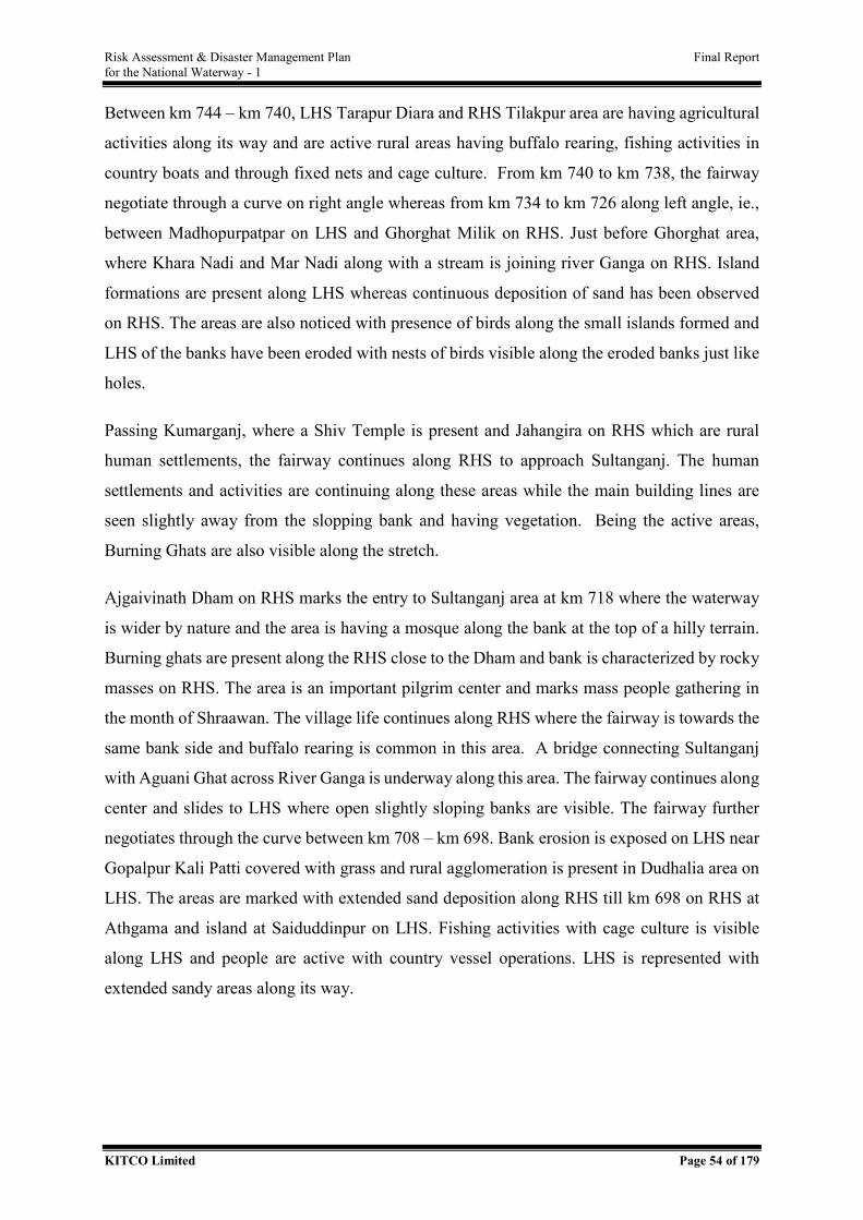
Risk Assessment & Disaster Management Plan Final Report for the National Waterway - 1
KITCO Limited Page 54 of 179
Between km 744 – km 740, LHS Tarapur Diara and RHS Tilakpur area are having agricultural
activities along its way and are active rural areas having buffalo rearing, fishing activities in
country boats and through fixed nets and cage culture. From km 740 to km 738, the fairway
negotiate through a curve on right angle whereas from km 734 to km 726 along left angle, ie.,
between Madhopurpatpar on LHS and Ghorghat Milik on RHS. Just before Ghorghat area,
where Khara Nadi and Mar Nadi along with a stream is joining river Ganga on RHS. Island
formations are present along LHS whereas continuous deposition of sand has been observed
on RHS. The areas are also noticed with presence of birds along the small islands formed and
LHS of the banks have been eroded with nests of birds visible along the eroded banks just like
holes.
Passing Kumarganj, where a Shiv Temple is present and Jahangira on RHS which are rural
human settlements, the fairway continues along RHS to approach Sultanganj. The human
settlements and activities are continuing along these areas while the main building lines are
seen slightly away from the slopping bank and having vegetation. Being the active areas,
Burning Ghats are also visible along the stretch.
Ajgaivinath Dham on RHS marks the entry to Sultanganj area at km 718 where the waterway
is wider by nature and the area is having a mosque along the bank at the top of a hilly terrain.
Burning ghats are present along the RHS close to the Dham and bank is characterized by rocky
masses on RHS. The area is an important pilgrim center and marks mass people gathering in
the month of Shraawan. The village life continues along RHS where the fairway is towards the
same bank side and buffalo rearing is common in this area. A bridge connecting Sultanganj
with Aguani Ghat across River Ganga is underway along this area. The fairway continues along
center and slides to LHS where open slightly sloping banks are visible. The fairway further
negotiates through the curve between km 708 – km 698. Bank erosion is exposed on LHS near
Gopalpur Kali Patti covered with grass and rural agglomeration is present in Dudhalia area on
LHS. The areas are marked with extended sand deposition along RHS till km 698 on RHS at
Athgama and island at Saiduddinpur on LHS. Fishing activities with cage culture is visible
along LHS and people are active with country vessel operations. LHS is represented with
extended sandy areas along its way.
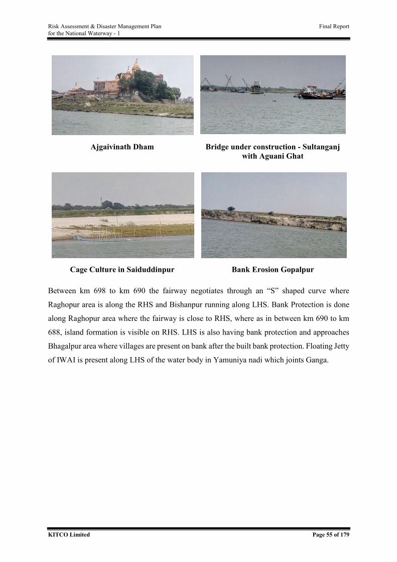
Risk Assessment & Disaster Management Plan Final Report for the National Waterway - 1
KITCO Limited Page 55 of 179
Ajgaivinath Dham Bridge under construction - Sultanganj with Aguani Ghat
Cage Culture in Saiduddinpur Bank Erosion Gopalpur
Between km 698 to km 690 the fairway negotiates through an “S” shaped curve where
Raghopur area is along the RHS and Bishanpur running along LHS. Bank Protection is done
along Raghopur area where the fairway is close to RHS, where as in between km 690 to km
688, island formation is visible on RHS. LHS is also having bank protection and approaches
Bhagalpur area where villages are present on bank after the built bank protection. Floating Jetty
of IWAI is present along LHS of the water body in Yamuniya nadi which joints Ganga.
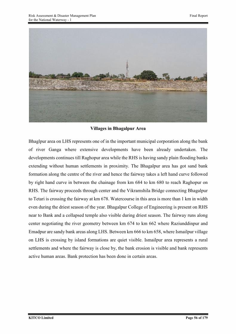
Risk Assessment & Disaster Management Plan Final Report for the National Waterway - 1
KITCO Limited Page 56 of 179
Villages in Bhagalpur Area
Bhaglpur area on LHS represents one of in the important municipal corporation along the bank
of river Ganga where extensive developments have been already undertaken. The
developments continues till Raghopur area while the RHS is having sandy plain flooding banks
extending without human settlements in proximity. The Bhagalpur area has got sand bank
formation along the centre of the river and hence the fairway takes a left hand curve followed
by right hand curve in between the chainage from km 684 to km 680 to reach Raghopur on
RHS. The fairway proceeds through center and the Vikramshila Bridge connecting Bhagalpur
to Tetari is crossing the fairway at km 678. Watercourse in this area is more than 1 km in width
even during the driest season of the year. Bhagalpur College of Engineering is present on RHS
near to Bank and a collapsed temple also visible during driest season. The fairway runs along
center negotiating the river geometry between km 674 to km 662 where Raziunddinpur and
Emadpur are sandy bank areas along LHS. Between km 666 to km 658, where Ismailpur village
on LHS is crossing by island formations are quiet visible. Ismailpur area represents a rural
settlements and where the fairway is close by, the bank erosion is visible and bank represents
active human areas. Bank protection has been done in certain areas.
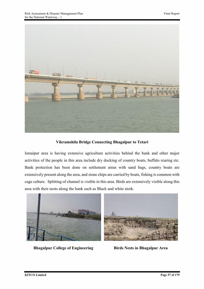
Risk Assessment & Disaster Management Plan Final Report for the National Waterway - 1
KITCO Limited Page 57 of 179
Vikramshila Bridge Connecting Bhagalpur to Tetari
Ismaipur area is having extensive agriculture activities behind the bank and other major
activities of the people in this area include dry docking of country boats, buffalo rearing etc.
Bank protection has been done on settlement areas with sand bags, country boats are
extensively present along the area, and stone chips are carried by boats, fishing is common with
cage culture. Splitting of channel is visible in this area. Birds are extensively visible along this
area with their nests along the bank such as Black and white stork.
Bhagalpur College of Engineering Birds Nests in Bhagalpur Area
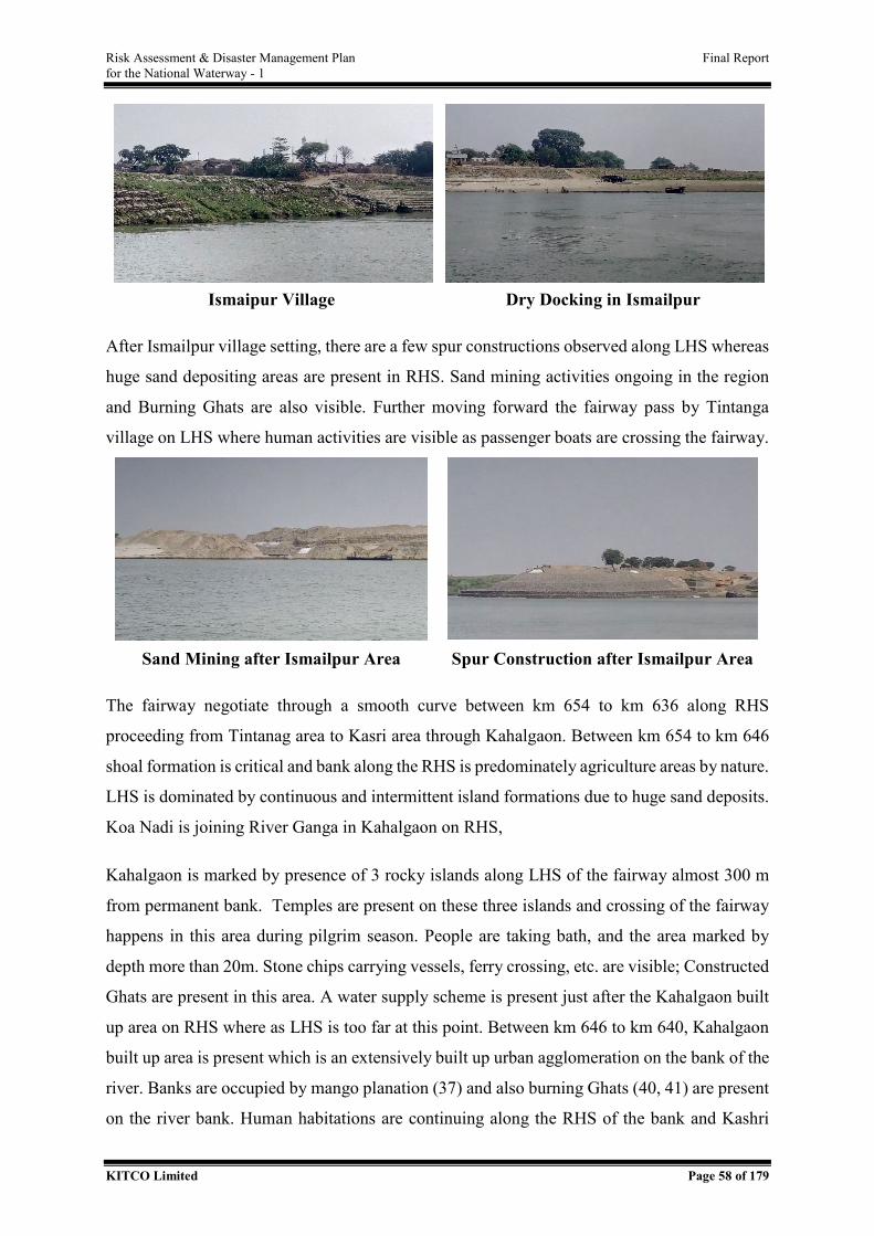
Risk Assessment & Disaster Management Plan Final Report for the National Waterway - 1
KITCO Limited Page 58 of 179
Ismaipur Village Dry Docking in Ismailpur
After Ismailpur village setting, there are a few spur constructions observed along LHS whereas
huge sand depositing areas are present in RHS. Sand mining activities ongoing in the region
and Burning Ghats are also visible. Further moving forward the fairway pass by Tintanga
village on LHS where human activities are visible as passenger boats are crossing the fairway.
Sand Mining after Ismailpur Area Spur Construction after Ismailpur Area
The fairway negotiate through a smooth curve between km 654 to km 636 along RHS
proceeding from Tintanag area to Kasri area through Kahalgaon. Between km 654 to km 646
shoal formation is critical and bank along the RHS is predominately agriculture areas by nature.
LHS is dominated by continuous and intermittent island formations due to huge sand deposits.
Koa Nadi is joining River Ganga in Kahalgaon on RHS,
Kahalgaon is marked by presence of 3 rocky islands along LHS of the fairway almost 300 m
from permanent bank. Temples are present on these three islands and crossing of the fairway
happens in this area during pilgrim season. People are taking bath, and the area marked by
depth more than 20m. Stone chips carrying vessels, ferry crossing, etc. are visible; Constructed
Ghats are present in this area. A water supply scheme is present just after the Kahalgaon built
up area on RHS where as LHS is too far at this point. Between km 646 to km 640, Kahalgaon
built up area is present which is an extensively built up urban agglomeration on the bank of the
river. Banks are occupied by mango planation (37) and also burning Ghats (40, 41) are present
on the river bank. Human habitations are continuing along the RHS of the bank and Kashri
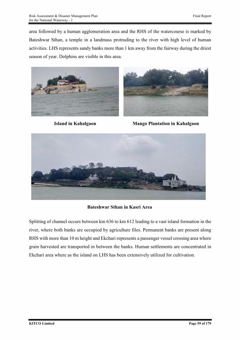
Risk Assessment & Disaster Management Plan Final Report for the National Waterway - 1
KITCO Limited Page 59 of 179
area followed by a human agglomeration area and the RHS of the watercourse is marked by
Bateshwar Sthan, a temple in a landmass protruding to the river with high level of human
activities. LHS represents sandy banks more than 1 km away from the fairway during the driest
season of year. Dolphins are visible in this area.
Island in Kahalgaon Mango Plantation in Kahalgaon
Bateshwar Sthan in Kasri Area
Splitting of channel occurs between km 636 to km 612 leading to a vast island formation in the
river, where both banks are occupied by agriculture files. Permanent banks are present along
RHS with more than 10 m height and Ekchari represents a passenger vessel crossing area where
grain harvested are transported in between the banks. Human settlements are concentrated in
Ekchari area where as the island on LHS has been extensively utilized for cultivation.
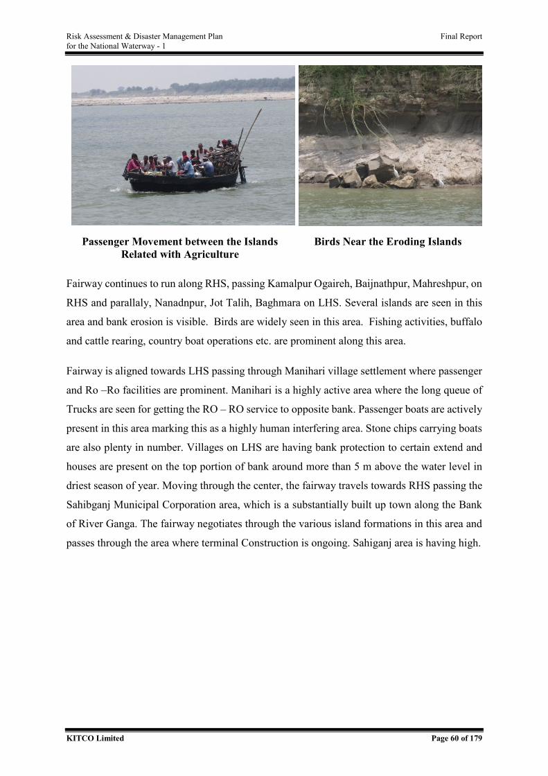
Risk Assessment & Disaster Management Plan Final Report for the National Waterway - 1
KITCO Limited Page 60 of 179
Passenger Movement between the Islands Related with Agriculture
Birds Near the Eroding Islands
Fairway continues to run along RHS, passing Kamalpur Ogaireh, Baijnathpur, Mahreshpur, on
RHS and parallaly, Nanadnpur, Jot Talih, Baghmara on LHS. Several islands are seen in this
area and bank erosion is visible. Birds are widely seen in this area. Fishing activities, buffalo
and cattle rearing, country boat operations etc. are prominent along this area.
Fairway is aligned towards LHS passing through Manihari village settlement where passenger
and Ro –Ro facilities are prominent. Manihari is a highly active area where the long queue of
Trucks are seen for getting the RO – RO service to opposite bank. Passenger boats are actively
present in this area marking this as a highly human interfering area. Stone chips carrying boats
are also plenty in number. Villages on LHS are having bank protection to certain extend and
houses are present on the top portion of bank around more than 5 m above the water level in
driest season of year. Moving through the center, the fairway travels towards RHS passing the
Sahibganj Municipal Corporation area, which is a substantially built up town along the Bank
of River Ganga. The fairway negotiates through the various island formations in this area and
passes through the area where terminal Construction is ongoing. Sahiganj area is having high.
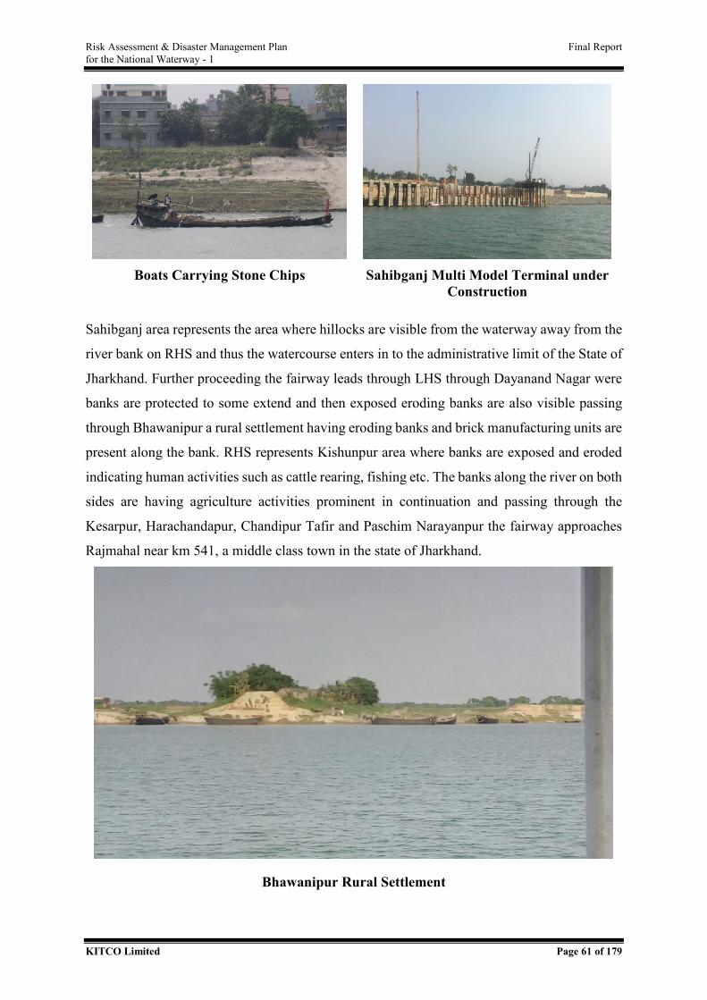
Risk Assessment & Disaster Management Plan Final Report for the National Waterway - 1
KITCO Limited Page 61 of 179
Boats Carrying Stone Chips Sahibganj Multi Model Terminal under
Construction
Sahibganj area represents the area where hillocks are visible from the waterway away from the
river bank on RHS and thus the watercourse enters in to the administrative limit of the State of
Jharkhand. Further proceeding the fairway leads through LHS through Dayanand Nagar were
banks are protected to some extend and then exposed eroding banks are also visible passing
through Bhawanipur a rural settlement having eroding banks and brick manufacturing units are
present along the bank. RHS represents Kishunpur area where banks are exposed and eroded
indicating human activities such as cattle rearing, fishing etc. The banks along the river on both
sides are having agriculture activities prominent in continuation and passing through the
Kesarpur, Harachandapur, Chandipur Tafir and Paschim Narayanpur the fairway approaches
Rajmahal near km 541, a middle class town in the state of Jharkhand.
Bhawanipur Rural Settlement
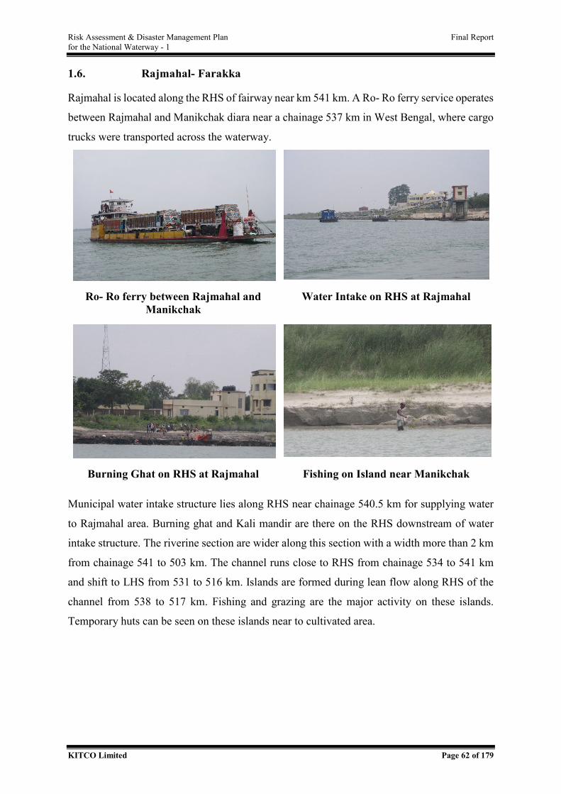
Risk Assessment & Disaster Management Plan Final Report for the National Waterway - 1
KITCO Limited Page 62 of 179
1.6. Rajmahal- Farakka
Rajmahal is located along the RHS of fairway near km 541 km. A Ro- Ro ferry service operates
between Rajmahal and Manikchak diara near a chainage 537 km in West Bengal, where cargo
trucks were transported across the waterway.
Ro- Ro ferry between Rajmahal and Manikchak
Water Intake on RHS at Rajmahal
Burning Ghat on RHS at Rajmahal Fishing on Island near Manikchak
Municipal water intake structure lies along RHS near chainage 540.5 km for supplying water
to Rajmahal area. Burning ghat and Kali mandir are there on the RHS downstream of water
intake structure. The riverine section are wider along this section with a width more than 2 km
from chainage 541 to 503 km. The channel runs close to RHS from chainage 534 to 541 km
and shift to LHS from 531 to 516 km. Islands are formed during lean flow along RHS of the
channel from 538 to 517 km. Fishing and grazing are the major activity on these islands.
Temporary huts can be seen on these islands near to cultivated area.
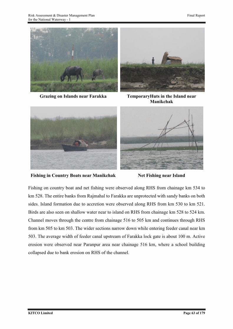
Risk Assessment & Disaster Management Plan Final Report for the National Waterway - 1
KITCO Limited Page 63 of 179
Grazing on Islands near Farakka TemporaryHuts in the Island near
Manikchak
Fishing in Country Boats near Manikchak Net Fishing near Island
Fishing on country boat and net fishing were observed along RHS from chainage km 534 to
km 528. The entire banks from Rajmahal to Farakka are unprotected with sandy banks on both
sides. Island formation due to accretion were observed along RHS from km 530 to km 521.
Birds are also seen on shallow water near to island on RHS from chainage km 528 to 524 km.
Channel moves through the centre from chainage 516 to 505 km and continues through RHS
from km 505 to km 503. The wider sections narrow down while entering feeder canal near km
503. The average width of feeder canal upstream of Farakka lock gate is about 100 m. Active
erosion were observed near Paranpur area near chainage 516 km, where a school building
collapsed due to bank erosion on RHS of the channel.
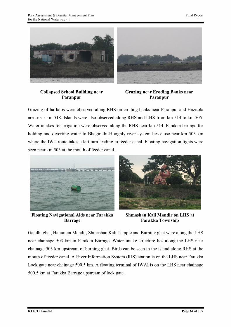
Risk Assessment & Disaster Management Plan Final Report for the National Waterway - 1
KITCO Limited Page 64 of 179
Collapsed School Building near Paranpur
Grazing near Eroding Banks near Paranpur
Grazing of baffalos were observed along RHS on eroding banks near Paranpur and Hazitola
area near km 518. Islands were also observed along RHS and LHS from km 514 to km 505.
Water intakes for irrigation were observed along the RHS near km 514. Farakka barrage for
holding and diverting water to Bhagirathi-Hooghly river system lies close near km 503 km
where the IWT route takes a left turn leading to feeder canal. Floating navigation lights were
seen near km 503 at the mouth of feeder canal.
Floating Navigational Aids near Farakka
Barrage Shmashan Kali Mandir on LHS at
Farakka Township
Gandhi ghat, Hanuman Mandir, Shmashan Kali Temple and Burning ghat were along the LHS
near chainage 503 km in Farakka Barrage. Water intake structure lies along the LHS near
chainage 503 km upstream of burning ghat. Birds can be seen in the island along RHS at the
mouth of feeder canal. A River Information System (RIS) station is on the LHS near Farakka
Lock gate near chainage 500.5 km. A floating terminal of IWAI is on the LHS near chainage
500.5 km at Farakka Barrage upstream of lock gate.
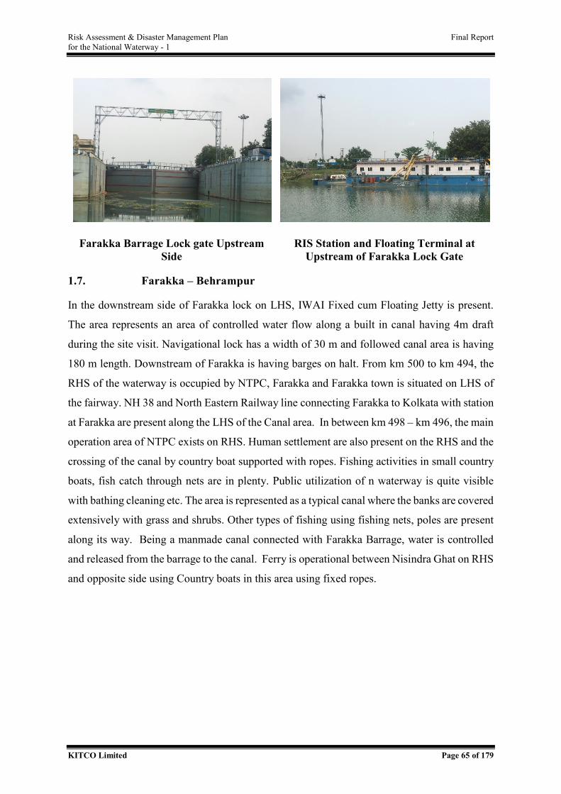
Risk Assessment & Disaster Management Plan Final Report for the National Waterway - 1
KITCO Limited Page 65 of 179
Farakka Barrage Lock gate Upstream Side
RIS Station and Floating Terminal at Upstream of Farakka Lock Gate
1.7. Farakka – Behrampur
In the downstream side of Farakka lock on LHS, IWAI Fixed cum Floating Jetty is present.
The area represents an area of controlled water flow along a built in canal having 4m draft
during the site visit. Navigational lock has a width of 30 m and followed canal area is having
180 m length. Downstream of Farakka is having barges on halt. From km 500 to km 494, the
RHS of the waterway is occupied by NTPC, Farakka and Farakka town is situated on LHS of
the fairway. NH 38 and North Eastern Railway line connecting Farakka to Kolkata with station
at Farakka are present along the LHS of the Canal area. In between km 498 – km 496, the main
operation area of NTPC exists on RHS. Human settlement are also present on the RHS and the
crossing of the canal by country boat supported with ropes. Fishing activities in small country
boats, fish catch through nets are in plenty. Public utilization of n waterway is quite visible
with bathing cleaning etc. The area is represented as a typical canal where the banks are covered
extensively with grass and shrubs. Other types of fishing using fishing nets, poles are present
along its way. Being a manmade canal connected with Farakka Barrage, water is controlled
and released from the barrage to the canal. Ferry is operational between Nisindra Ghat on RHS
and opposite side using Country boats in this area using fixed ropes.
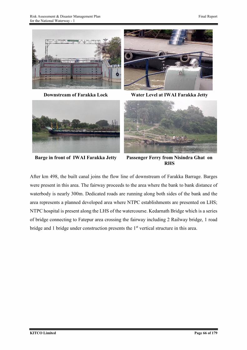
Risk Assessment & Disaster Management Plan Final Report for the National Waterway - 1
KITCO Limited Page 66 of 179
Downstream of Farakka Lock Water Level at IWAI Farakka Jetty
Barge in front of IWAI Farakka Jetty Passenger Ferry from Nisindra Ghat on
RHS
After km 498, the built canal joins the flow line of downstream of Farakka Barrage. Barges
were present in this area. The fairway proceeds to the area where the bank to bank distance of
waterbody is nearly 300m. Dedicated roads are running along both sides of the bank and the
area represents a planned developed area where NTPC establishments are presented on LHS;
NTPC hospital is present along the LHS of the watercourse. Kedarnath Bridge which is a series
of bridge connecting to Fatepur area crossing the fairway including 2 Railway bridge, 1 road
bridge and 1 bridge under construction presents the 1st vertical structure in this area.
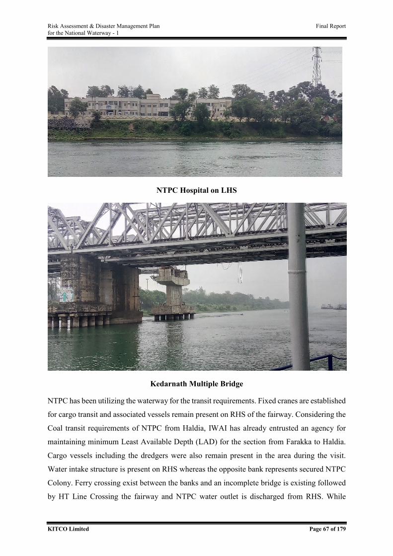
Risk Assessment & Disaster Management Plan Final Report for the National Waterway - 1
KITCO Limited Page 67 of 179
NTPC Hospital on LHS
Kedarnath Multiple Bridge
NTPC has been utilizing the waterway for the transit requirements. Fixed cranes are established
for cargo transit and associated vessels remain present on RHS of the fairway. Considering the
Coal transit requirements of NTPC from Haldia, IWAI has already entrusted an agency for
maintaining minimum Least Available Depth (LAD) for the section from Farakka to Haldia.
Cargo vessels including the dredgers were also remain present in the area during the visit.
Water intake structure is present on RHS whereas the opposite bank represents secured NTPC
Colony. Ferry crossing exist between the banks and an incomplete bridge is existing followed
by HT Line Crossing the fairway and NTPC water outlet is discharged from RHS. While
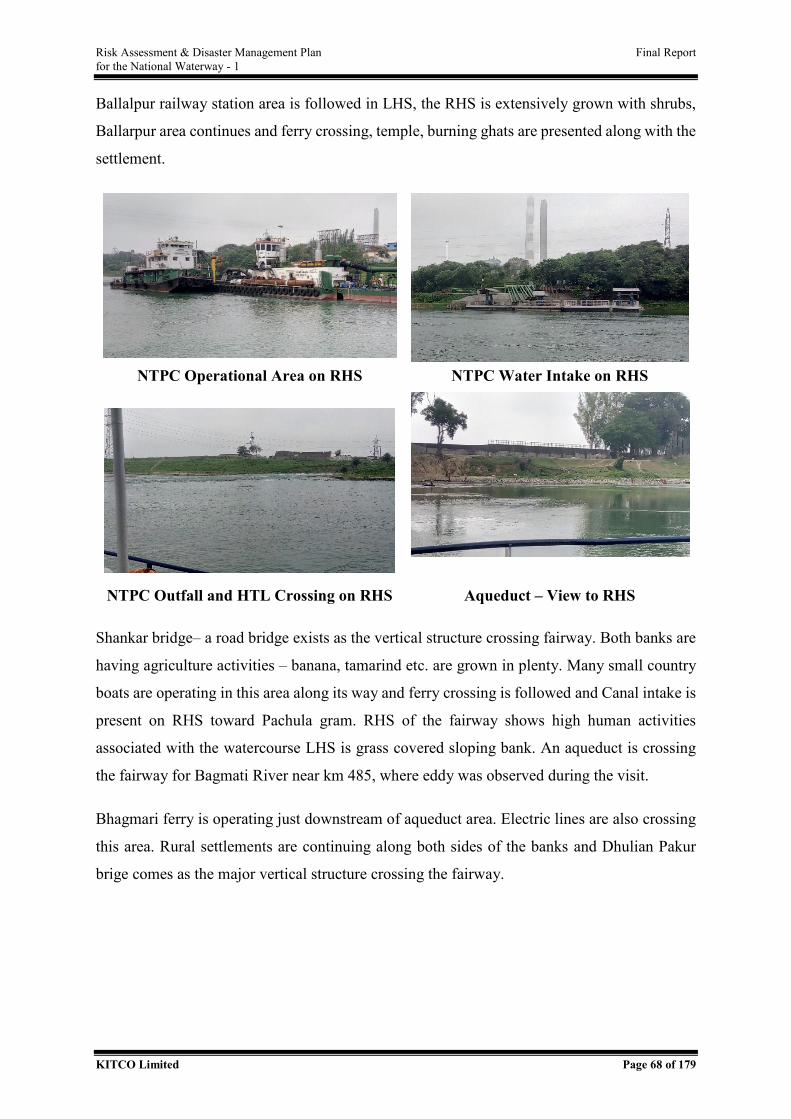
Risk Assessment & Disaster Management Plan Final Report for the National Waterway - 1
KITCO Limited Page 68 of 179
Ballalpur railway station area is followed in LHS, the RHS is extensively grown with shrubs,
Ballarpur area continues and ferry crossing, temple, burning ghats are presented along with the
settlement.
NTPC Operational Area on RHS NTPC Water Intake on RHS
NTPC Outfall and HTL Crossing on RHS Aqueduct – View to RHS
Shankar bridge– a road bridge exists as the vertical structure crossing fairway. Both banks are
having agriculture activities – banana, tamarind etc. are grown in plenty. Many small country
boats are operating in this area along its way and ferry crossing is followed and Canal intake is
present on RHS toward Pachula gram. RHS of the fairway shows high human activities
associated with the watercourse LHS is grass covered sloping bank. An aqueduct is crossing
the fairway for Bagmati River near km 485, where eddy was observed during the visit.
Bhagmari ferry is operating just downstream of aqueduct area. Electric lines are also crossing
this area. Rural settlements are continuing along both sides of the banks and Dhulian Pakur
brige comes as the major vertical structure crossing the fairway.
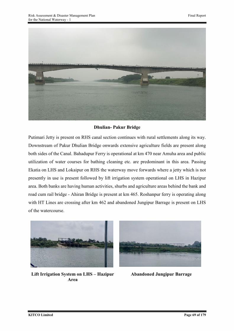
Risk Assessment & Disaster Management Plan Final Report for the National Waterway - 1
KITCO Limited Page 69 of 179
Dhulian- Pakur Bridge
Putimari Jetty is present on RHS canal section continues with rural settlements along its way.
Downstream of Pakur Dhulian Bridge onwards extensive agriculture fields are present along
both sides of the Canal. Bahadupur Ferry is operational at km 470 near Amuha area and public
utilization of water courses for bathing cleaning etc. are predominant in this area. Passing
Ekatia on LHS and Lokaipur on RHS the waterway move forwards where a jetty which is not
presently in use is present followed by lift irrigation system operational on LHS in Hazipur
area. Both banks are having human activities, shurbs and agriculture areas behind the bank and
road cum rail bridge - Ahiran Bridge is present at km 465. Roshanpur ferry is operating along
with HT Lines are crossing after km 462 and abandoned Jungipur Barrage is present on LHS
of the watercourse.
Lift Irrigation System on LHS – Hazipur Area
Abandoned Jungipur Barrage
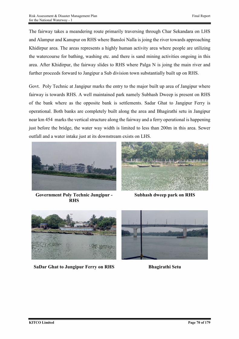
Risk Assessment & Disaster Management Plan Final Report for the National Waterway - 1
KITCO Limited Page 70 of 179
The fairway takes a meandering route primarily traversing through Char Sekandara on LHS
and Alampur and Kanupur on RHS where Bansloi Nalla is joing the river towards approaching
Khidirpur area. The areas represents a highly human activity area where people are utilizing
the watercourse for bathing, washing etc. and there is sand mining activities ongoing in this
area. After Khidirpur, the fairway slides to RHS where Palga N is joing the main river and
further proceeds forward to Jangipur a Sub division town substantially built up on RHS.
Govt. Poly Technic at Jangipur marks the entry to the major built up area of Jangipur where
fairway is towards RHS. A well maintained park namely Subhash Dweep is present on RHS
of the bank where as the opposite bank is settlements. Sadar Ghat to Jangipur Ferry is
operational. Both banks are completely built along the area and Bhagirathi setu in Jangipur
near km 454 marks the vertical structure along the fairway and a ferry operational is happening
just before the bridge, the water way width is limited to less than 200m in this area. Sewer
outfall and a water intake just at its downstream exists on LHS.
Government Poly Technic Jungipur -
RHS Subhash dweep park on RHS
SaDar Ghat to Jungipur Ferry on RHS Bhagirathi Setu
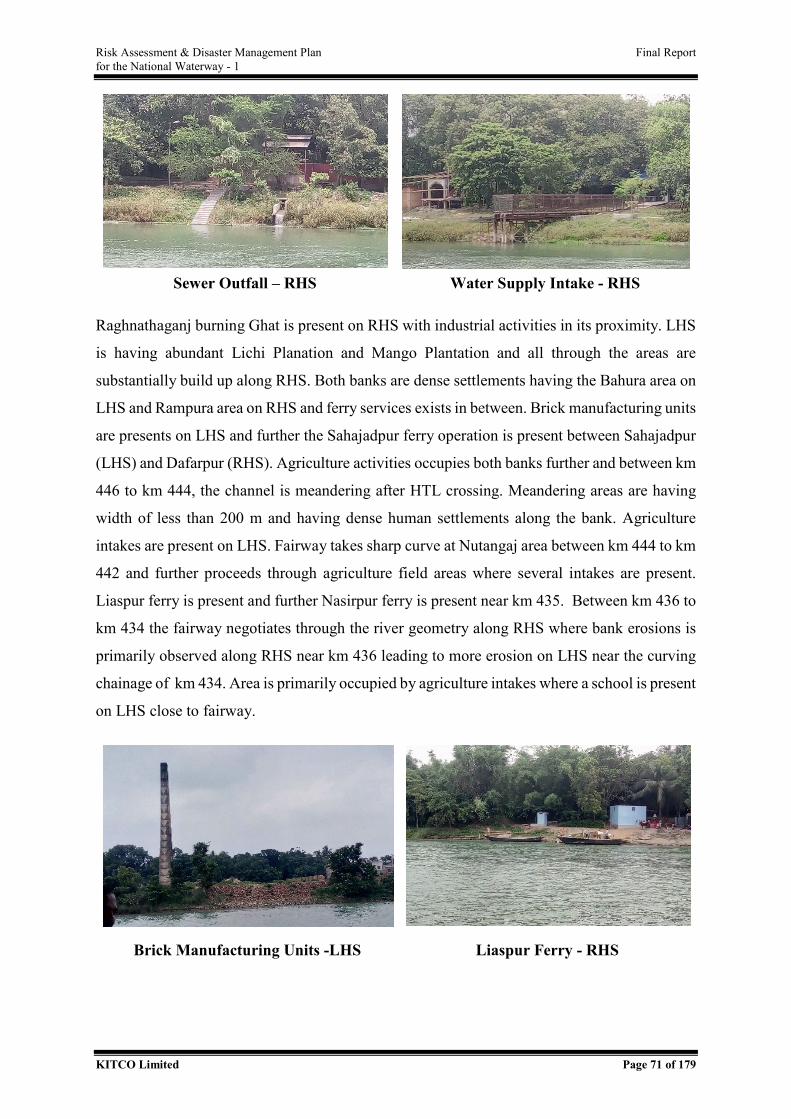
Risk Assessment & Disaster Management Plan Final Report for the National Waterway - 1
KITCO Limited Page 71 of 179
Sewer Outfall – RHS Water Supply Intake - RHS
Raghnathaganj burning Ghat is present on RHS with industrial activities in its proximity. LHS
is having abundant Lichi Planation and Mango Plantation and all through the areas are
substantially build up along RHS. Both banks are dense settlements having the Bahura area on
LHS and Rampura area on RHS and ferry services exists in between. Brick manufacturing units
are presents on LHS and further the Sahajadpur ferry operation is present between Sahajadpur
(LHS) and Dafarpur (RHS). Agriculture activities occupies both banks further and between km
446 to km 444, the channel is meandering after HTL crossing. Meandering areas are having
width of less than 200 m and having dense human settlements along the bank. Agriculture
intakes are present on LHS. Fairway takes sharp curve at Nutangaj area between km 444 to km
442 and further proceeds through agriculture field areas where several intakes are present.
Liaspur ferry is present and further Nasirpur ferry is present near km 435. Between km 436 to
km 434 the fairway negotiates through the river geometry along RHS where bank erosions is
primarily observed along RHS near km 436 leading to more erosion on LHS near the curving
chainage of km 434. Area is primarily occupied by agriculture intakes where a school is present
on LHS close to fairway.
Brick Manufacturing Units -LHS Liaspur Ferry - RHS
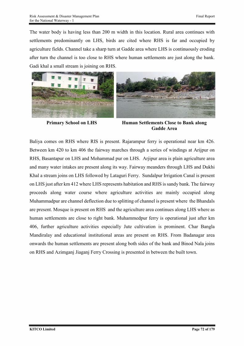
Risk Assessment & Disaster Management Plan Final Report for the National Waterway - 1
KITCO Limited Page 72 of 179
The water body is having less than 200 m width in this location. Rural area continues with
settlements predominantly on LHS, birds are cited where RHS is far and occupied by
agriculture fields. Channel take a sharp turn at Gadde area where LHS is continuously eroding
after turn the channel is too close to RHS where human settlements are just along the bank.
Gadi khal a small stream is joining on RHS.
Primary School on LHS Human Settlements Close to Bank along
Gadde Area
Baliya comes on RHS where RIS is present. Rajarampur ferry is operational near km 426.
Between km 420 to km 406 the fairway marches through a series of windings at Arijpur on
RHS, Basantapur on LHS and Mohammad pur on LHS. Arjipur area is plain agriculture area
and many water intakes are present along its way. Fairway meanders through LHS and Dukhi
Khal a stream joins on LHS followed by Lataguri Ferry. Sundalpur Irrigation Canal is present
on LHS just after km 412 where LHS represents habitation and RHS is sandy bank. The fairway
proceeds along water course where agriculture activities are mainly occupied along
Muhammadpur are channel deflection due to splitting of channel is present where the Bhandals
are present. Mosque is present on RHS and the agriculture area continues along LHS where as
human settlements are close to right bank. Muhammedpur ferry is operational just after km
406, further agriculture activities especially Jute cultivation is prominent. Char Bangla
Mandiralay and educational institutional areas are present on RHS. From Badanagar area
onwards the human settlements are present along both sides of the bank and Binod Nala joins
on RHS and Azimganj Jiaganj Ferry Crossing is presented in between the built town.
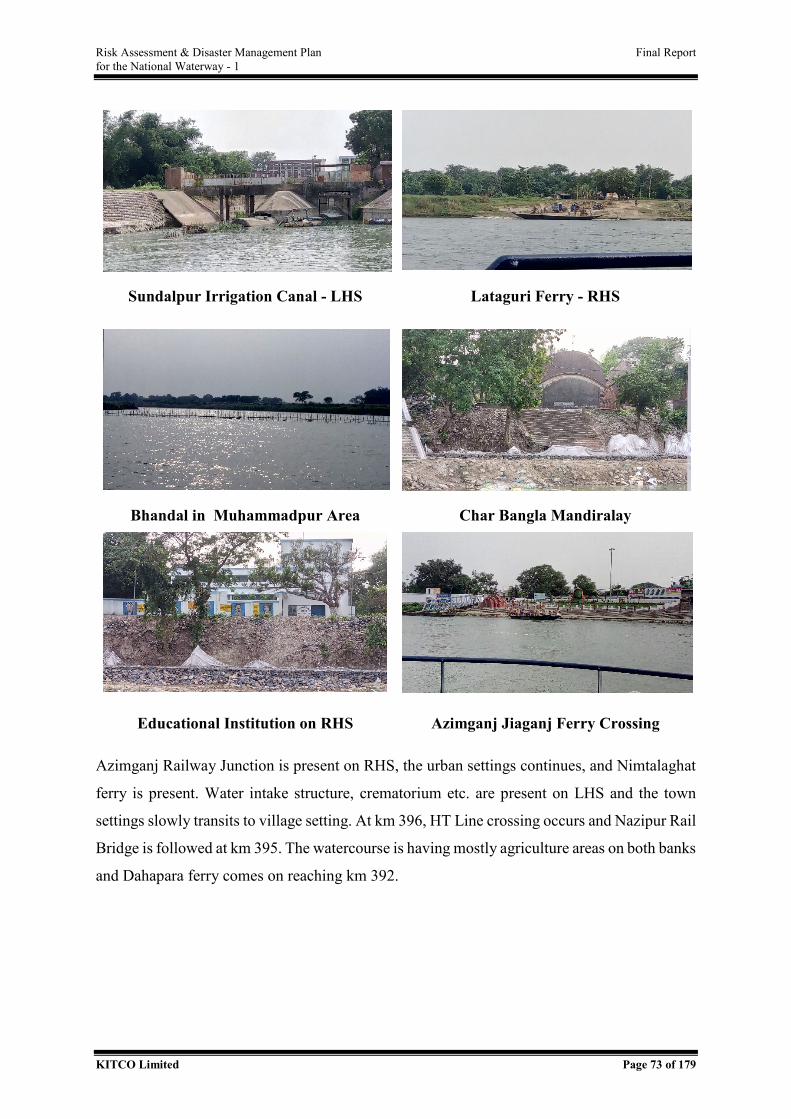
Risk Assessment & Disaster Management Plan Final Report for the National Waterway - 1
KITCO Limited Page 73 of 179
Sundalpur Irrigation Canal - LHS Lataguri Ferry - RHS
Bhandal in Muhammadpur Area Char Bangla Mandiralay
Educational Institution on RHS Azimganj Jiaganj Ferry Crossing
Azimganj Railway Junction is present on RHS, the urban settings continues, and Nimtalaghat
ferry is present. Water intake structure, crematorium etc. are present on LHS and the town
settings slowly transits to village setting. At km 396, HT Line crossing occurs and Nazipur Rail
Bridge is followed at km 395. The watercourse is having mostly agriculture areas on both banks
and Dahapara ferry comes on reaching km 392.
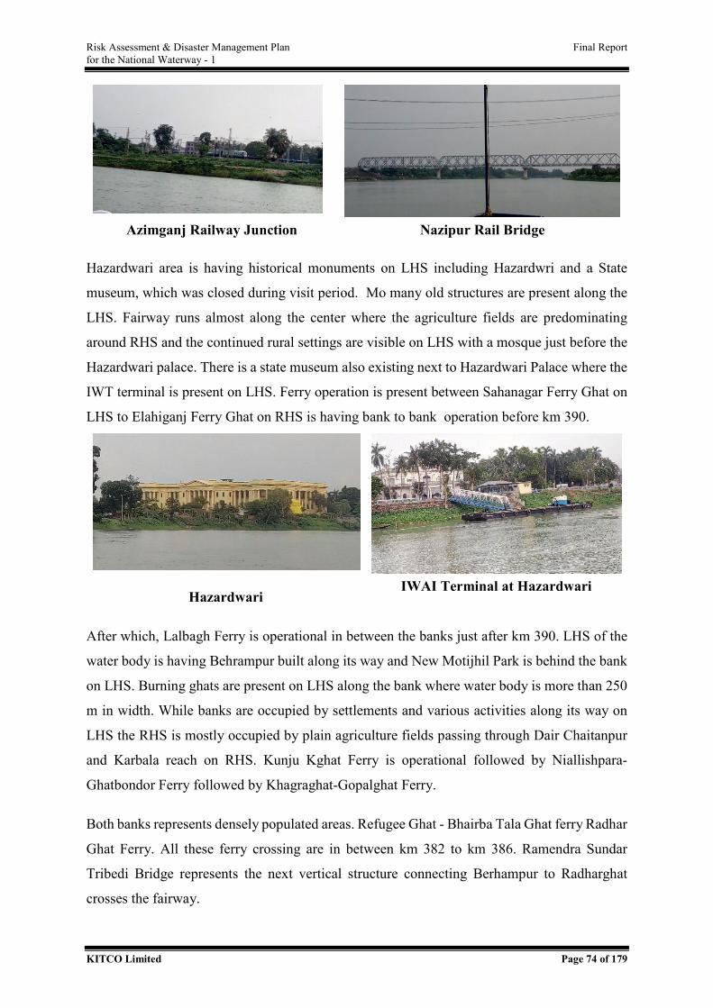
Risk Assessment & Disaster Management Plan Final Report for the National Waterway - 1
KITCO Limited Page 74 of 179
Azimganj Railway Junction Nazipur Rail Bridge
Hazardwari area is having historical monuments on LHS including Hazardwri and a State
museum, which was closed during visit period. Mo many old structures are present along the
LHS. Fairway runs almost along the center where the agriculture fields are predominating
around RHS and the continued rural settings are visible on LHS with a mosque just before the
Hazardwari palace. There is a state museum also existing next to Hazardwari Palace where the
IWT terminal is present on LHS. Ferry operation is present between Sahanagar Ferry Ghat on
LHS to Elahiganj Ferry Ghat on RHS is having bank to bank operation before km 390.
Hazardwari IWAI Terminal at Hazardwari
After which, Lalbagh Ferry is operational in between the banks just after km 390. LHS of the
water body is having Behrampur built along its way and New Motijhil Park is behind the bank
on LHS. Burning ghats are present on LHS along the bank where water body is more than 250
m in width. While banks are occupied by settlements and various activities along its way on
LHS the RHS is mostly occupied by plain agriculture fields passing through Dair Chaitanpur
and Karbala reach on RHS. Kunju Kghat Ferry is operational followed by Niallishpara-
Ghatbondor Ferry followed by Khagraghat-Gopalghat Ferry.
Both banks represents densely populated areas. Refugee Ghat - Bhairba Tala Ghat ferry Radhar
Ghat Ferry. All these ferry crossing are in between km 382 to km 386. Ramendra Sundar
Tribedi Bridge represents the next vertical structure connecting Berhampur to Radharghat
crosses the fairway.
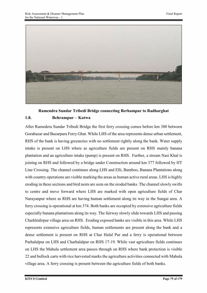
Risk Assessment & Disaster Management Plan Final Report for the National Waterway - 1
KITCO Limited Page 75 of 179
Ramendra Sundar Tribedi Bridge connecting Berhampur to Radharghat 1.8. Behrampur – Katwa
After Ramedera Sundar Tribedi Bridge the first ferry crossing comes before km 380 between
Gorabazar and Bazarpara Ferry Ghat. While LHS of the area represents dense urban settlement,
RHS of the bank is having greeneries with no settlement rightly along the bank. Water supply
intake is present on LHS where as agriculture fields are present on RHS mainly banana
plantation and an agriculture intake (pump) is present on RHS. Further, a stream Nasi Khal is
joining on RHS and followed by a bridge under Construction around km 377 followed by HT
Line Crossing. The channel continues along LHS and Elli, Bamboo, Banana Plantations along
with country operations are visible marking the areas as human active rural areas. LHS is highly
eroding in these sections and bird nests are seen on the eroded banks. The channel slowly swifts
to centre and move forward where LHS are marked with open agriculture fields of Char
Narayanpur where as RHS are having human settlement along its way in the Sungai area. A
ferry crossing is operational at km 374. Both banks are occupied by extensive agriculture fields
especially banana plantations along its way. The fairway slowly slide towards LHS and passing
Charkhidirpur village area on RHS. Eroding exposed banks are visible in this area. While LHS
represents extensive agriculture fields, human settlements are present along the bank and a
dense settlement is present on RHS at Char Halal Pur and a ferry is operational between
Parhalalpur on LHS and Charhalalpur on RHS 17-19. While vast agriculture fields continues
on LHS the Mahula settlement area passes through on RHS where bank protection is visible
22 and bullock carts with rice harvested marks the agriculture activities connected with Mahula
village area. A ferry crossing is present between the agriculture fields of both banks.
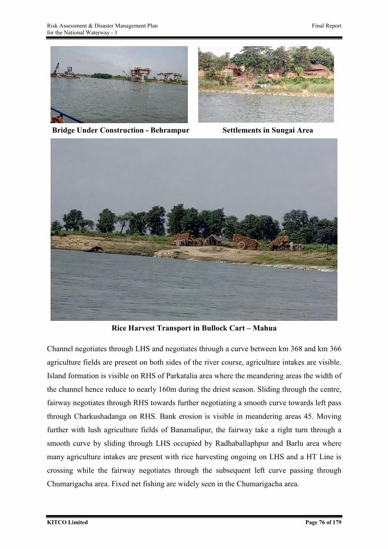
Risk Assessment & Disaster Management Plan Final Report for the National Waterway - 1
KITCO Limited Page 76 of 179
Bridge Under Construction - Behrampur Settlements in Sungai Area
Rice Harvest Transport in Bullock Cart – Mahua
Channel negotiates through LHS and negotiates through a curve between km 368 and km 366
agriculture fields are present on both sides of the river course, agriculture intakes are visible.
Island formation is visible on RHS of Parkatalia area where the meandering areas the width of
the channel hence reduce to nearly 160m during the driest season. Sliding through the centre,
fairway negotiates through RHS towards further negotiating a smooth curve towards left pass
through Charkushadanga on RHS. Bank erosion is visible in meandering areas 45. Moving
further with lush agriculture fields of Banamalipur, the fairway take a right turn through a
smooth curve by sliding through LHS occupied by Radhaballaphpur and Barlu area where
many agriculture intakes are present with rice harvesting ongoing on LHS and a HT Line is
crossing while the fairway negotiates through the subsequent left curve passing through
Chumarigacha area. Fixed net fishing are widely seen in the Chumarigacha area.

Risk Assessment & Disaster Management Plan Final Report for the National Waterway - 1
KITCO Limited Page 77 of 179
Rice Harvest at Radhaballaphpur Fixed Net Fishing at Chumarigacha
The fairway slides over to LHS passing through settlement area of Jalalpur where birds are
visible along RHS where island formation is evident reaching Kumarpur area on LHS where
RIS is established. There are two ferry services operational in this area; one between
Chaoricacha and Jalalpur and Kumarpur Ferry Service at km 356. Both Kumarpur area and
Satui area are dense human settlement areas and fairway moves through LHS towards
Kumarpur area along this way. Fixed net fishing is common in this areas. Both banks have
extensive agriculture fields along its way and fairway proceed further along centre and then
sliding to LHS to pass through Mirzapur area which is a settlement along its way. Brick Kilns
are visible in Mirzapur area and people are active in agriculture activities with tractors etc. are
present.
Channel takes a right turn in Mirzapur area followed by initiating a left turn where fairway run
through RHS and a Ferry Crossing is present between both banks. The agriculture fields
extensively covers along Mirzapur area on LHS whereas agriculture fields mixed with human
settlements in between are present on RHS. After negotiating the curve, the fairway run through
centre of the river course, the areas are having the water body width less than 200m along many
stretches along its way.
Ultrasan River joins the main water course from RHS after the same, Saharbati area is present
where agriculture fields occupy the LHS. The Alikpur area after the river joining is
charecterised with shoal formation and hence Bhandals are erected on RHS for diverting the
water to fairway running along LHS, island formation is visible in this area along RHS. The
fairway further negotiates through LHS and then sliding over to RHS to cover the right turn
curve between km 346 to km 344 passing through Mashimpur and Chandpur area. Bank erosion
is visible in LHS along curving areas 89. A ferry crossing is operational between both banks
Saktipur on RHS and Suniyapara on LHS before km 342.
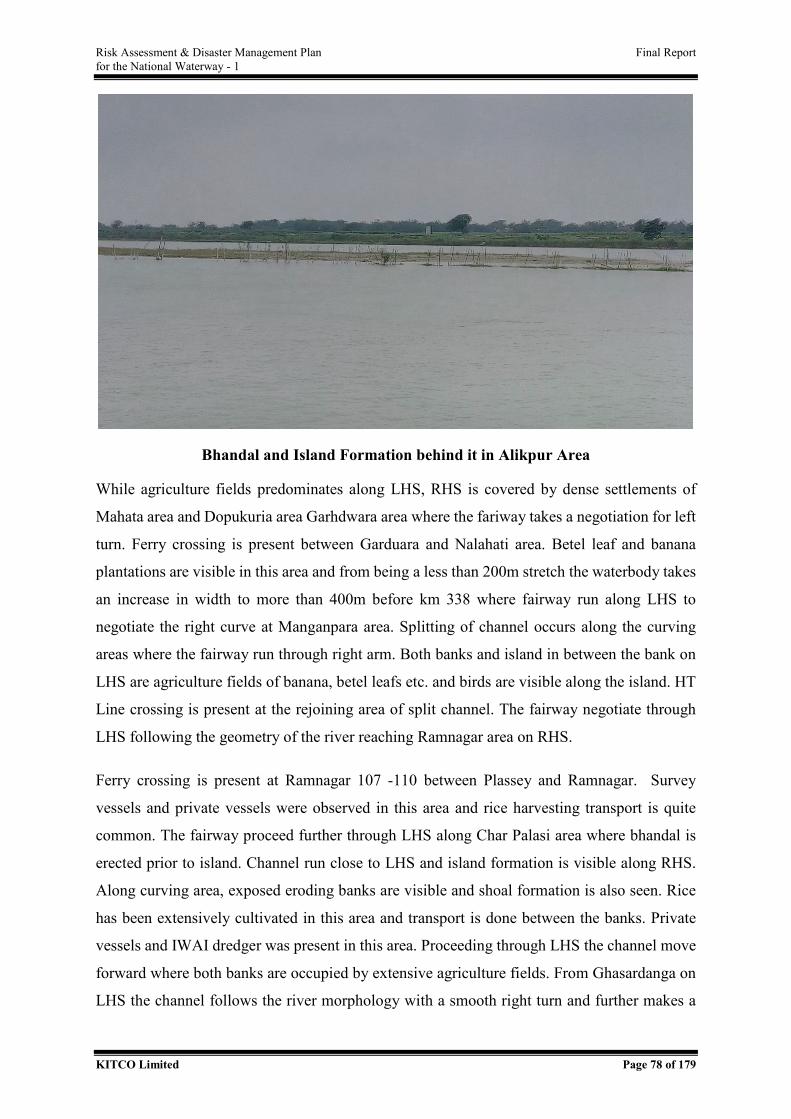
Risk Assessment & Disaster Management Plan Final Report for the National Waterway - 1
KITCO Limited Page 78 of 179
Bhandal and Island Formation behind it in Alikpur Area
While agriculture fields predominates along LHS, RHS is covered by dense settlements of
Mahata area and Dopukuria area Garhdwara area where the fariway takes a negotiation for left
turn. Ferry crossing is present between Garduara and Nalahati area. Betel leaf and banana
plantations are visible in this area and from being a less than 200m stretch the waterbody takes
an increase in width to more than 400m before km 338 where fairway run along LHS to
negotiate the right curve at Manganpara area. Splitting of channel occurs along the curving
areas where the fairway run through right arm. Both banks and island in between the bank on
LHS are agriculture fields of banana, betel leafs etc. and birds are visible along the island. HT
Line crossing is present at the rejoining area of split channel. The fairway negotiate through
LHS following the geometry of the river reaching Ramnagar area on RHS.
Ferry crossing is present at Ramnagar 107 -110 between Plassey and Ramnagar. Survey
vessels and private vessels were observed in this area and rice harvesting transport is quite
common. The fairway proceed further through LHS along Char Palasi area where bhandal is
erected prior to island. Channel run close to LHS and island formation is visible along RHS.
Along curving area, exposed eroding banks are visible and shoal formation is also seen. Rice
has been extensively cultivated in this area and transport is done between the banks. Private
vessels and IWAI dredger was present in this area. Proceeding through LHS the channel move
forward where both banks are occupied by extensive agriculture fields. From Ghasardanga on
LHS the channel follows the river morphology with a smooth right turn and further makes a
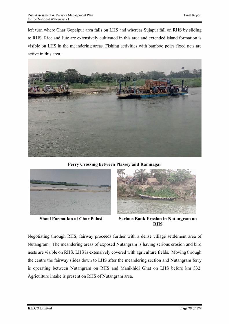
Risk Assessment & Disaster Management Plan Final Report for the National Waterway - 1
KITCO Limited Page 79 of 179
left turn where Char Gopalpur area falls on LHS and whereas Sujapur fall on RHS by sliding
to RHS. Rice and Jute are extensively cultivated in this area and extended island formation is
visible on LHS in the meandering areas. Fishing activities with bamboo poles fixed nets are
active in this area.
Ferry Crossing between Plassey and Ramnagar
Shoal Formation at Char Palasi Serious Bank Erosion in Nutangram on
RHS
Negotiating through RHS, fairway proceeds further with a dense village settlement area of
Nutangram. The meandering areas of exposed Nutangram is having serious erosion and bird
nests are visible on RHS. LHS is extensively covered with agriculture fields. Moving through
the centre the fairway slides down to LHS after the meandering section and Nutangram ferry
is operating between Nutangram on RHS and Manikhidi Ghat on LHS before km 332.
Agriculture intake is present on RHS of Nutangram area.
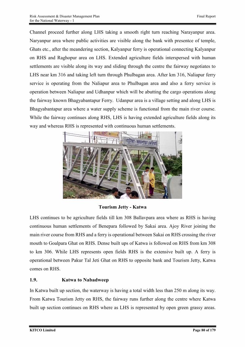
Risk Assessment & Disaster Management Plan Final Report for the National Waterway - 1
KITCO Limited Page 80 of 179
Channel proceed further along LHS taking a smooth right turn reaching Narayanpur area.
Naryanpur area where public activities are visible along the bank with presentce of temple,
Ghats etc., after the meandering section, Kalyanpur ferry is operational connecting Kalyanpur
on RHS and Raghopur area on LHS. Extended agriculture fields interspersed with human
settlements are visible along its way and sliding through the centre the fairway negotiates to
LHS near km 316 and taking left turn through Phulbagan area. After km 316, Naliapur ferry
service is operating from the Naliapur area to Phulbagan area and also a ferry service is
operation between Naliapur and Udhanpur which will be abutting the cargo operations along
the fairway known Bhagyabantapur Ferry. Udanpur area is a village setting and along LHS is
Bhagyabantapur area where a water supply scheme is functional from the main river course.
While the fairway continues along RHS, LHS is having extended agriculture fields along its
way and whereas RHS is represented with continuous human settlements.
Tourism Jetty - Katwa
LHS continues to be agriculture fields till km 308 Ballavpara area where as RHS is having
continuous human settlements of Benepara followed by Sakai area. Ajoy River joining the
main river course from RHS and a ferry is operational between Sakai on RHS crossing the river
mouth to Goalpara Ghat on RHS. Dense built ups of Katwa is followed on RHS from km 308
to km 306. While LHS represents open fields RHS is the extensive built up. A ferry is
operational between Pakur Tal Jeti Ghat on RHS to opposite bank and Tourism Jetty, Katwa
comes on RHS.
1.9. Katwa to Nabadweep
In Katwa built up section, the waterway is having a total width less than 250 m along its way.
From Katwa Tourism Jetty on RHS, the fairway runs further along the centre where Katwa
built up section continues on RHS where as LHS is represented by open green grassy areas.
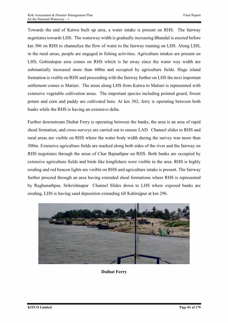
Risk Assessment & Disaster Management Plan Final Report for the National Waterway - 1
KITCO Limited Page 81 of 179
Towards the end of Katwa built up area, a water intake is present on RHS. The fairway
negotiates towards LHS. The waterway width is gradually increasing Bhandal is erected before
km 306 on RHS to channelize the flow of water to the fairway running on LHS. Along LHS,
in the rural areas, people are engaged in fishing activities. Agriculture intakes are present on
LHS, Gobindopur area comes on RHS which is far away since the water way width are
substantially increased more than 600m and occupied by agriculture fields. Huge island
formation is visible on RHS and proceeding with the fairway further on LHS the next important
settlement comes is Matiari. The areas along LHS from Katwa to Matiari is represented with
extensive vegetable cultivation areas. The important species including pointed gourd, Sweet
potato and corn and paddy are cultivated here. At km 302, ferry is operating between both
banks while the RHS is having an extensive delta.
Further downstream Daihat Ferry is operating between the banks, the area is an area of rapid
shoal formation, and cross-surveys are carried out to ensure LAD. Channel slides to RHS and
rural areas are visible on RHS where the water body width during the survey was more than
300m. Extensive agriculture fields are marked along both sides of the river and the fairway on
RHS negotiates through the areas of Char Bajnathpur on RHS. Both banks are occupied by
extensive agriculture fields and birds like kingfishers were visible in the area. RHS is highly
eroding and red beacon lights are visible on RHS and agriculture intake is present. The fairway
further proceed through an area having extended shoal formations where RHS is represented
by Raghunathpur, Srikrishnapur Channel Slides down to LHS where exposed banks are
eroding, LHS is having sand deposition extending till Kabirajpur at km 296.
Daihat Ferry
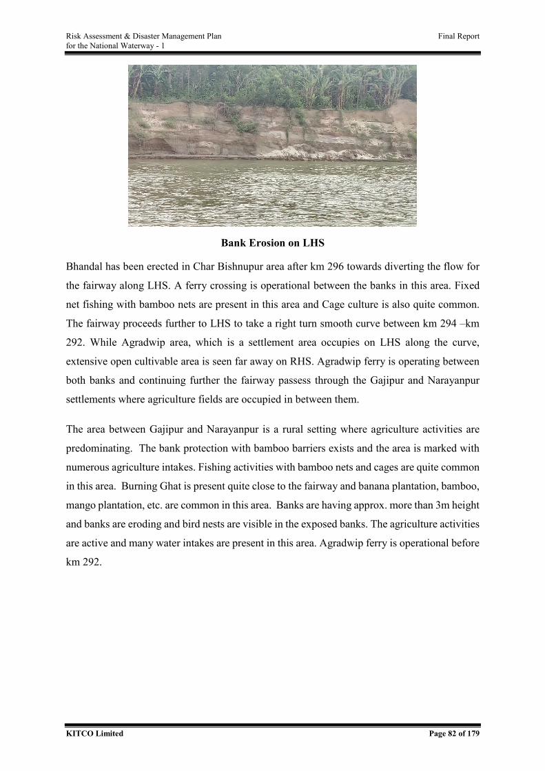
Risk Assessment & Disaster Management Plan Final Report for the National Waterway - 1
KITCO Limited Page 82 of 179
Bank Erosion on LHS
Bhandal has been erected in Char Bishnupur area after km 296 towards diverting the flow for
the fairway along LHS. A ferry crossing is operational between the banks in this area. Fixed
net fishing with bamboo nets are present in this area and Cage culture is also quite common.
The fairway proceeds further to LHS to take a right turn smooth curve between km 294 –km
292. While Agradwip area, which is a settlement area occupies on LHS along the curve,
extensive open cultivable area is seen far away on RHS. Agradwip ferry is operating between
both banks and continuing further the fairway passess through the Gajipur and Narayanpur
settlements where agriculture fields are occupied in between them.
The area between Gajipur and Narayanpur is a rural setting where agriculture activities are
predominating. The bank protection with bamboo barriers exists and the area is marked with
numerous agriculture intakes. Fishing activities with bamboo nets and cages are quite common
in this area. Burning Ghat is present quite close to the fairway and banana plantation, bamboo,
mango plantation, etc. are common in this area. Banks are having approx. more than 3m height
and banks are eroding and bird nests are visible in the exposed banks. The agriculture activities
are active and many water intakes are present in this area. Agradwip ferry is operational before
km 292.
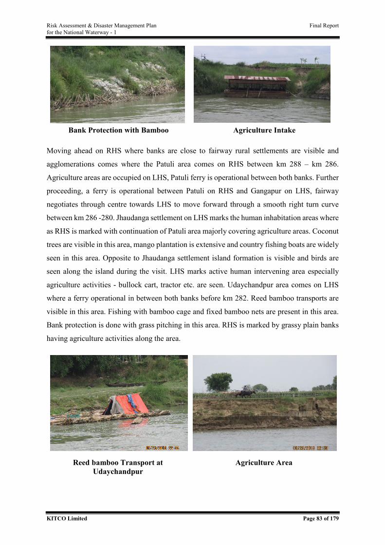
Risk Assessment & Disaster Management Plan Final Report for the National Waterway - 1
KITCO Limited Page 83 of 179
Bank Protection with Bamboo Agriculture Intake
Moving ahead on RHS where banks are close to fairway rural settlements are visible and
agglomerations comes where the Patuli area comes on RHS between km 288 – km 286.
Agriculture areas are occupied on LHS, Patuli ferry is operational between both banks. Further
proceeding, a ferry is operational between Patuli on RHS and Gangapur on LHS, fairway
negotiates through centre towards LHS to move forward through a smooth right turn curve
between km 286 -280. Jhaudanga settlement on LHS marks the human inhabitation areas where
as RHS is marked with continuation of Patuli area majorly covering agriculture areas. Coconut
trees are visible in this area, mango plantation is extensive and country fishing boats are widely
seen in this area. Opposite to Jhaudanga settlement island formation is visible and birds are
seen along the island during the visit. LHS marks active human intervening area especially
agriculture activities - bullock cart, tractor etc. are seen. Udaychandpur area comes on LHS
where a ferry operational in between both banks before km 282. Reed bamboo transports are
visible in this area. Fishing with bamboo cage and fixed bamboo nets are present in this area.
Bank protection is done with grass pitching in this area. RHS is marked by grassy plain banks
having agriculture activities along the area.
Reed bamboo Transport at Udaychandpur
Agriculture Area
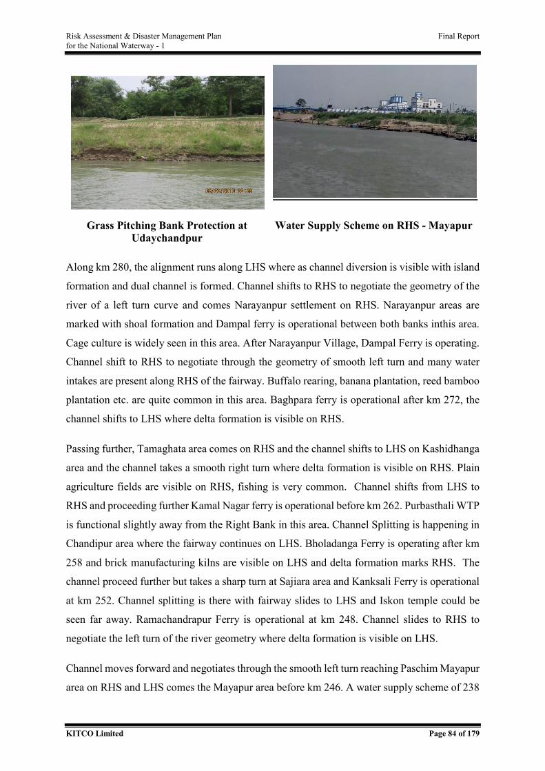
Risk Assessment & Disaster Management Plan Final Report for the National Waterway - 1
KITCO Limited Page 84 of 179
Grass Pitching Bank Protection at Udaychandpur
Water Supply Scheme on RHS - Mayapur
Along km 280, the alignment runs along LHS where as channel diversion is visible with island
formation and dual channel is formed. Channel shifts to RHS to negotiate the geometry of the
river of a left turn curve and comes Narayanpur settlement on RHS. Narayanpur areas are
marked with shoal formation and Dampal ferry is operational between both banks inthis area.
Cage culture is widely seen in this area. After Narayanpur Village, Dampal Ferry is operating.
Channel shift to RHS to negotiate through the geometry of smooth left turn and many water
intakes are present along RHS of the fairway. Buffalo rearing, banana plantation, reed bamboo
plantation etc. are quite common in this area. Baghpara ferry is operational after km 272, the
channel shifts to LHS where delta formation is visible on RHS.
Passing further, Tamaghata area comes on RHS and the channel shifts to LHS on Kashidhanga
area and the channel takes a smooth right turn where delta formation is visible on RHS. Plain
agriculture fields are visible on RHS, fishing is very common. Channel shifts from LHS to
RHS and proceeding further Kamal Nagar ferry is operational before km 262. Purbasthali WTP
is functional slightly away from the Right Bank in this area. Channel Splitting is happening in
Chandipur area where the fairway continues on LHS. Bholadanga Ferry is operating after km
258 and brick manufacturing kilns are visible on LHS and delta formation marks RHS. The
channel proceed further but takes a sharp turn at Sajiara area and Kanksali Ferry is operational
at km 252. Channel splitting is there with fairway slides to LHS and Iskon temple could be
seen far away. Ramachandrapur Ferry is operational at km 248. Channel slides to RHS to
negotiate the left turn of the river geometry where delta formation is visible on LHS.
Channel moves forward and negotiates through the smooth left turn reaching Paschim Mayapur
area on RHS and LHS comes the Mayapur area before km 246. A water supply scheme of 238
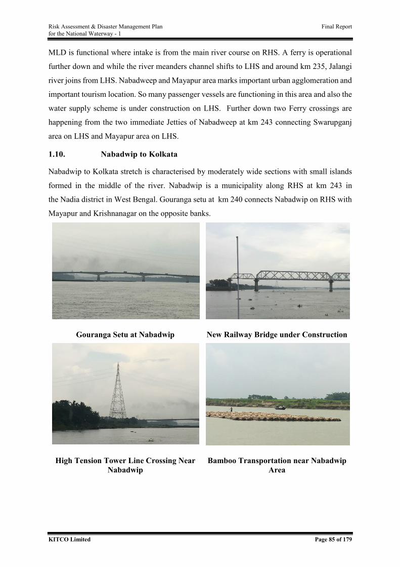
Risk Assessment & Disaster Management Plan Final Report for the National Waterway - 1
KITCO Limited Page 85 of 179
MLD is functional where intake is from the main river course on RHS. A ferry is operational
further down and while the river meanders channel shifts to LHS and around km 235, Jalangi
river joins from LHS. Nabadweep and Mayapur area marks important urban agglomeration and
important tourism location. So many passenger vessels are functioning in this area and also the
water supply scheme is under construction on LHS. Further down two Ferry crossings are
happening from the two immediate Jetties of Nabadweep at km 243 connecting Swarupganj
area on LHS and Mayapur area on LHS.
1.10. Nabadwip to Kolkata
Nabadwip to Kolkata stretch is characterised by moderately wide sections with small islands
formed in the middle of the river. Nabadwip is a municipality along RHS at km 243 in
the Nadia district in West Bengal. Gouranga setu at km 240 connects Nabadwip on RHS with
Mayapur and Krishnanagar on the opposite banks.
Gouranga Setu at Nabadwip New Railway Bridge under Construction
High Tension Tower Line Crossing Near Nabadwip
Bamboo Transportation near Nabadwip Area
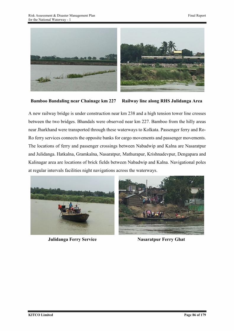
Risk Assessment & Disaster Management Plan Final Report for the National Waterway - 1
KITCO Limited Page 86 of 179
Bamboo Bandaling near Chainage km 227 Railway line along RHS Julidanga Area
A new railway bridge is under construction near km 238 and a high tension tower line crosses
between the two bridges. Bhandals were observed near km 227. Bamboo from the hilly areas
near Jharkhand were transported through these waterways to Kolkata. Passenger ferry and Ro-
Ro ferry services connects the opposite banks for cargo movements and passenger movements.
The locations of ferry and passenger crossings between Nabadwip and Kalna are Nasaratpur
and Julidanga. Hatkalna, Gramkalna, Nasaratpur, Mathurapur, Krishnadevpur, Dengapara and
Kalinagar area are locations of brick fields between Nabadwip and Kalna. Navigational poles
at regular intervals facilities night navigations across the waterways.
Julidanga Ferry Service Nasaratpur Ferry Ghat
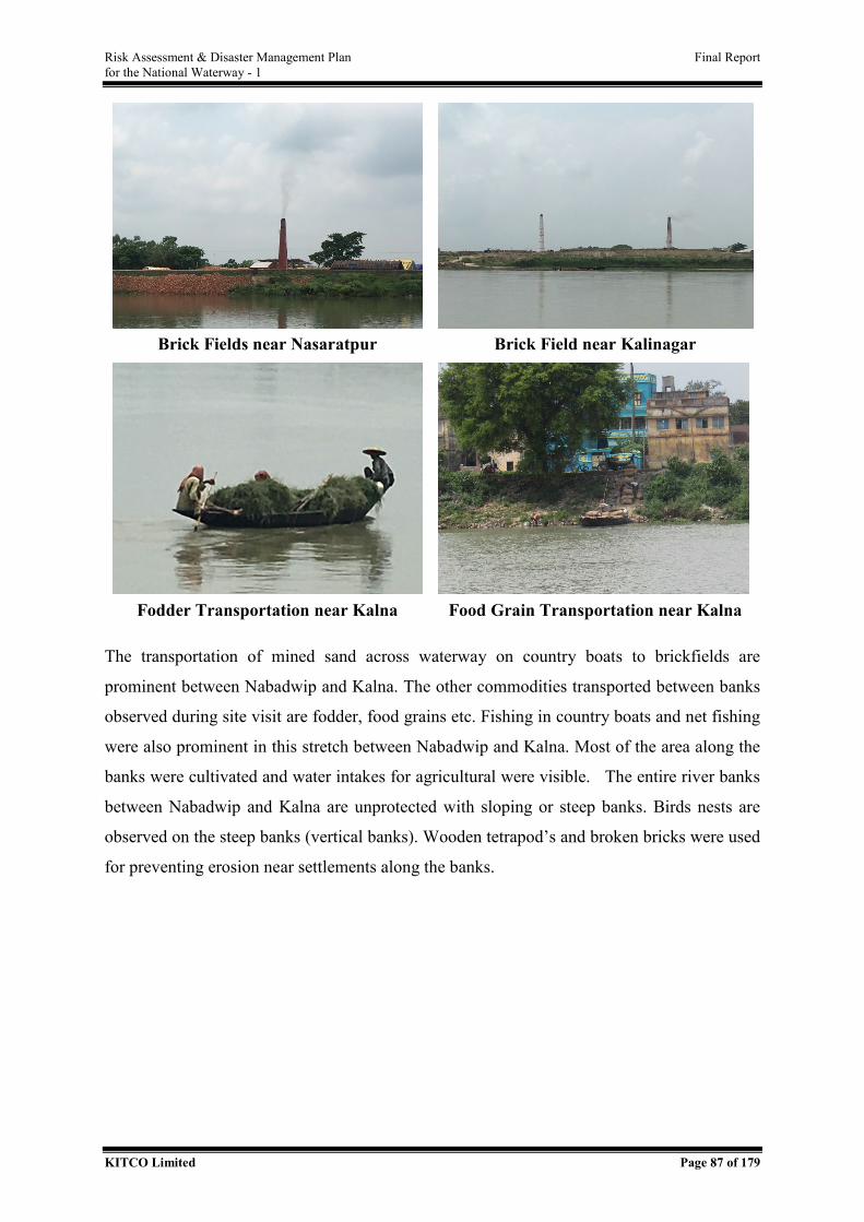
Risk Assessment & Disaster Management Plan Final Report for the National Waterway - 1
KITCO Limited Page 87 of 179
Brick Fields near Nasaratpur Brick Field near Kalinagar
Fodder Transportation near Kalna Food Grain Transportation near Kalna
The transportation of mined sand across waterway on country boats to brickfields are
prominent between Nabadwip and Kalna. The other commodities transported between banks
observed during site visit are fodder, food grains etc. Fishing in country boats and net fishing
were also prominent in this stretch between Nabadwip and Kalna. Most of the area along the
banks were cultivated and water intakes for agricultural were visible. The entire river banks
between Nabadwip and Kalna are unprotected with sloping or steep banks. Birds nests are
observed on the steep banks (vertical banks). Wooden tetrapod’s and broken bricks were used
for preventing erosion near settlements along the banks.
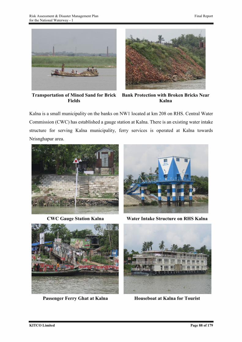
Risk Assessment & Disaster Management Plan Final Report for the National Waterway - 1
KITCO Limited Page 88 of 179
Transportation of Mined Sand for Brick
Fields Bank Protection with Broken Bricks Near
Kalna
Kalna is a small municipality on the banks on NW1 located at km 208 on RHS. Central Water
Commission (CWC) has established a gauge station at Kalna. There is an existing water intake
structure for serving Kalna municipality, ferry services is operated at Kalna towards
Nrisnghapur area.
CWC Gauge Station Kalna Water Intake Structure on RHS Kalna
Passenger Ferry Ghat at Kalna Houseboat at Kalna for Tourist
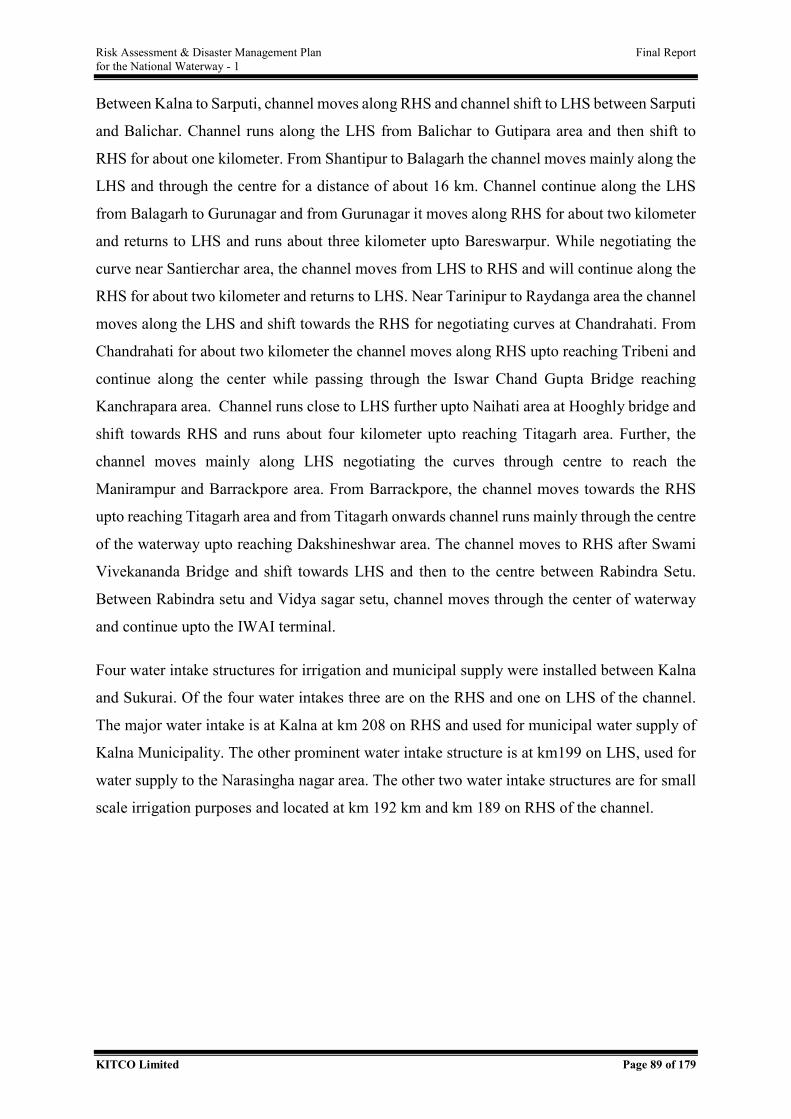
Risk Assessment & Disaster Management Plan Final Report for the National Waterway - 1
KITCO Limited Page 89 of 179
Between Kalna to Sarputi, channel moves along RHS and channel shift to LHS between Sarputi
and Balichar. Channel runs along the LHS from Balichar to Gutipara area and then shift to
RHS for about one kilometer. From Shantipur to Balagarh the channel moves mainly along the
LHS and through the centre for a distance of about 16 km. Channel continue along the LHS
from Balagarh to Gurunagar and from Gurunagar it moves along RHS for about two kilometer
and returns to LHS and runs about three kilometer upto Bareswarpur. While negotiating the
curve near Santierchar area, the channel moves from LHS to RHS and will continue along the
RHS for about two kilometer and returns to LHS. Near Tarinipur to Raydanga area the channel
moves along the LHS and shift towards the RHS for negotiating curves at Chandrahati. From
Chandrahati for about two kilometer the channel moves along RHS upto reaching Tribeni and
continue along the center while passing through the Iswar Chand Gupta Bridge reaching
Kanchrapara area. Channel runs close to LHS further upto Naihati area at Hooghly bridge and
shift towards RHS and runs about four kilometer upto reaching Titagarh area. Further, the
channel moves mainly along LHS negotiating the curves through centre to reach the
Manirampur and Barrackpore area. From Barrackpore, the channel moves towards the RHS
upto reaching Titagarh area and from Titagarh onwards channel runs mainly through the centre
of the waterway upto reaching Dakshineshwar area. The channel moves to RHS after Swami
Vivekananda Bridge and shift towards LHS and then to the centre between Rabindra Setu.
Between Rabindra setu and Vidya sagar setu, channel moves through the center of waterway
and continue upto the IWAI terminal.
Four water intake structures for irrigation and municipal supply were installed between Kalna
and Sukurai. Of the four water intakes three are on the RHS and one on LHS of the channel.
The major water intake is at Kalna at km 208 on RHS and used for municipal water supply of
Kalna Municipality. The other prominent water intake structure is at km199 on LHS, used for
water supply to the Narasingha nagar area. The other two water intake structures are for small
scale irrigation purposes and located at km 192 km and km 189 on RHS of the channel.
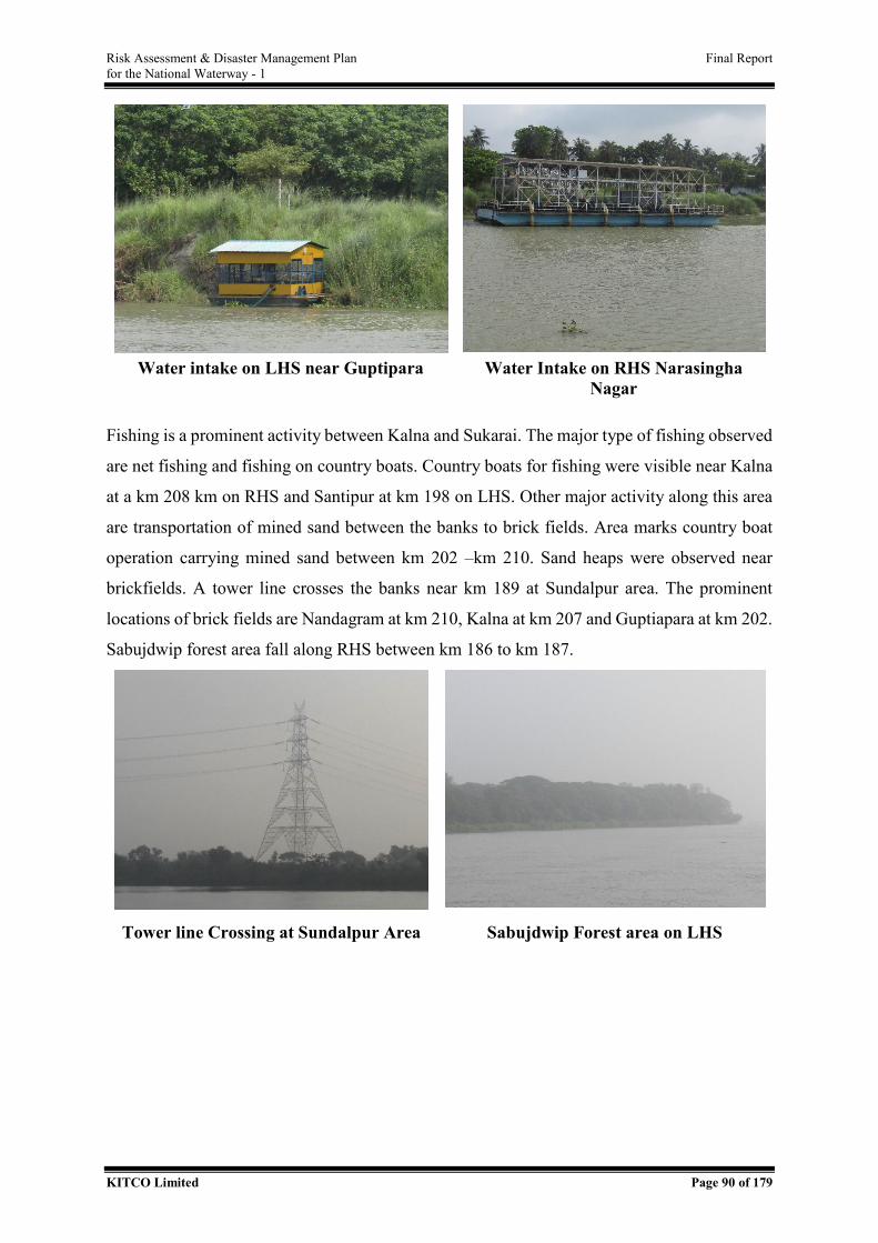
Risk Assessment & Disaster Management Plan Final Report for the National Waterway - 1
KITCO Limited Page 90 of 179
Water intake on LHS near Guptipara Water Intake on RHS Narasingha
Nagar
Fishing is a prominent activity between Kalna and Sukarai. The major type of fishing observed
are net fishing and fishing on country boats. Country boats for fishing were visible near Kalna
at a km 208 km on RHS and Santipur at km 198 on LHS. Other major activity along this area
are transportation of mined sand between the banks to brick fields. Area marks country boat
operation carrying mined sand between km 202 –km 210. Sand heaps were observed near
brickfields. A tower line crosses the banks near km 189 at Sundalpur area. The prominent
locations of brick fields are Nandagram at km 210, Kalna at km 207 and Guptiapara at km 202.
Sabujdwip forest area fall along RHS between km 186 to km 187.
Tower line Crossing at Sundalpur Area Sabujdwip Forest area on LHS
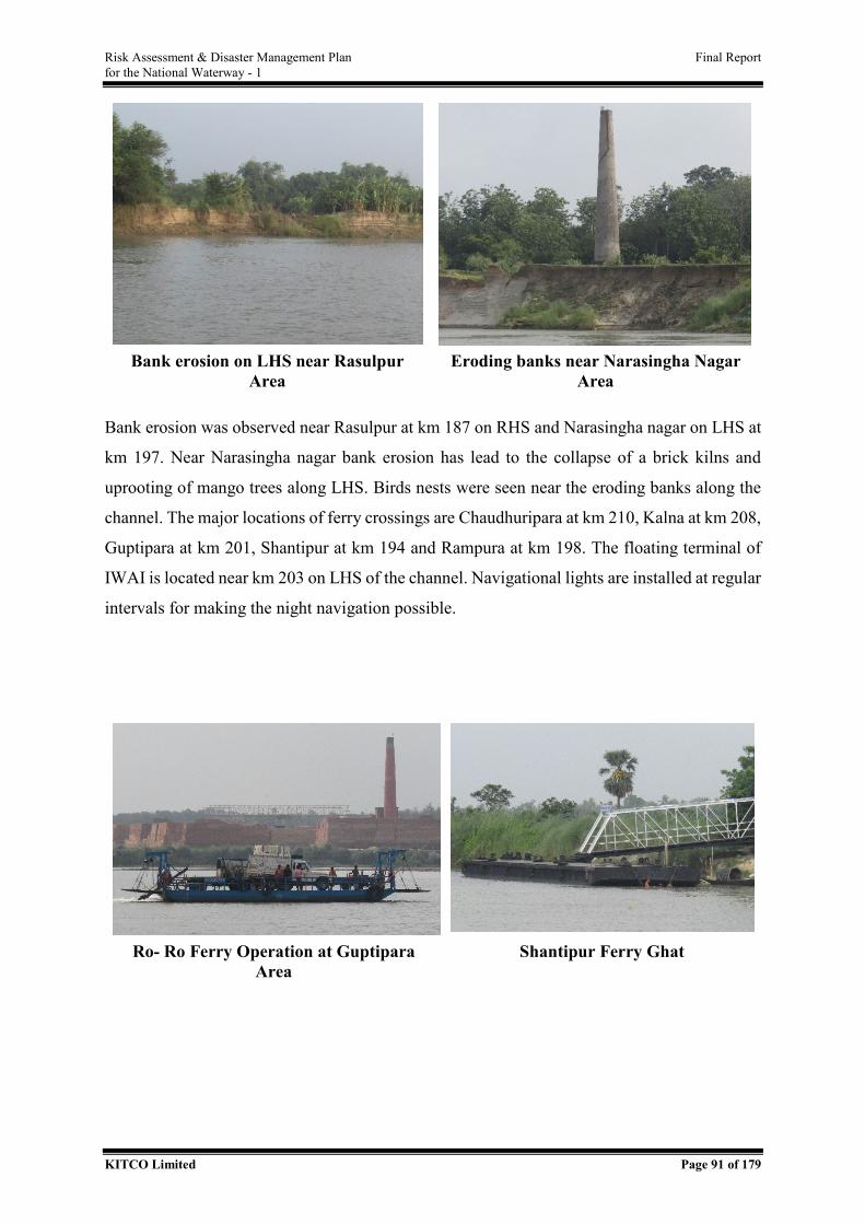
Risk Assessment & Disaster Management Plan Final Report for the National Waterway - 1
KITCO Limited Page 91 of 179
Bank erosion on LHS near Rasulpur
Area Eroding banks near Narasingha Nagar
Area
Bank erosion was observed near Rasulpur at km 187 on RHS and Narasingha nagar on LHS at
km 197. Near Narasingha nagar bank erosion has lead to the collapse of a brick kilns and
uprooting of mango trees along LHS. Birds nests were seen near the eroding banks along the
channel. The major locations of ferry crossings are Chaudhuripara at km 210, Kalna at km 208,
Guptipara at km 201, Shantipur at km 194 and Rampura at km 198. The floating terminal of
IWAI is located near km 203 on LHS of the channel. Navigational lights are installed at regular
intervals for making the night navigation possible.
Ro- Ro Ferry Operation at Guptipara
Area Shantipur Ferry Ghat
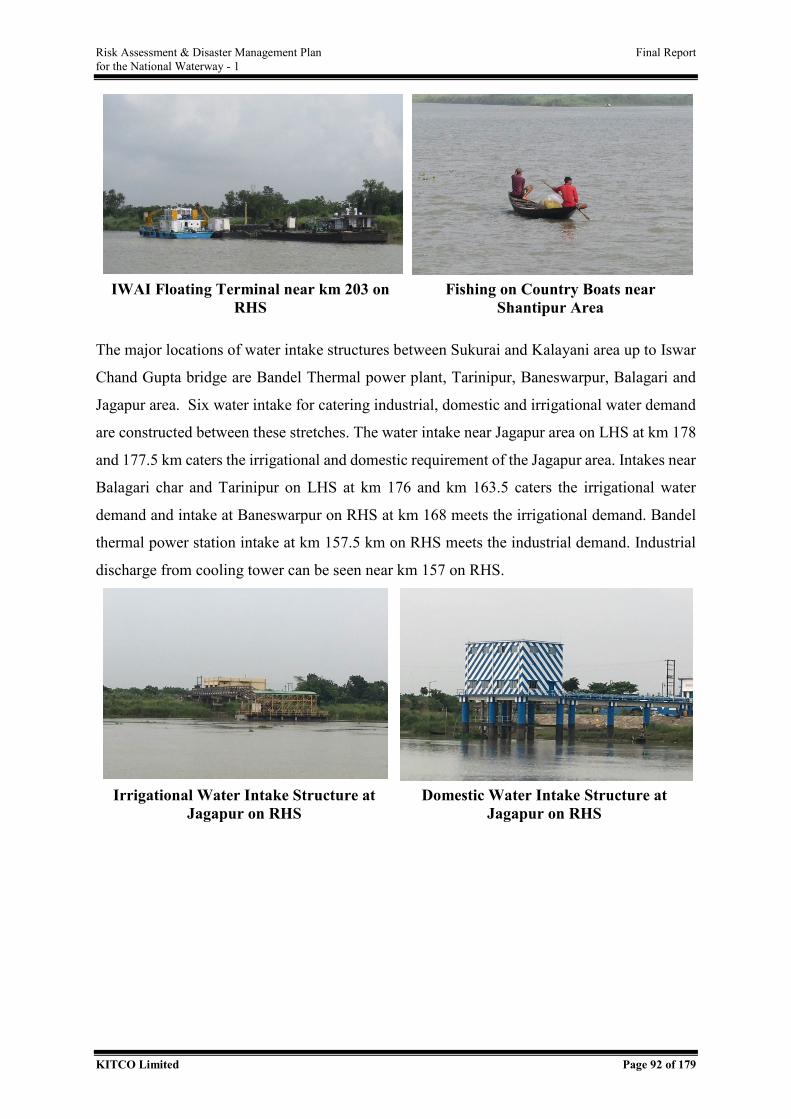
Risk Assessment & Disaster Management Plan Final Report for the National Waterway - 1
KITCO Limited Page 92 of 179
IWAI Floating Terminal near km 203 on
RHS Fishing on Country Boats near
Shantipur Area
The major locations of water intake structures between Sukurai and Kalayani area up to Iswar
Chand Gupta bridge are Bandel Thermal power plant, Tarinipur, Baneswarpur, Balagari and
Jagapur area. Six water intake for catering industrial, domestic and irrigational water demand
are constructed between these stretches. The water intake near Jagapur area on LHS at km 178
and 177.5 km caters the irrigational and domestic requirement of the Jagapur area. Intakes near
Balagari char and Tarinipur on LHS at km 176 and km 163.5 caters the irrigational water
demand and intake at Baneswarpur on RHS at km 168 meets the irrigational demand. Bandel
thermal power station intake at km 157.5 km on RHS meets the industrial demand. Industrial
discharge from cooling tower can be seen near km 157 on RHS.
Irrigational Water Intake Structure at
Jagapur on RHS Domestic Water Intake Structure at
Jagapur on RHS
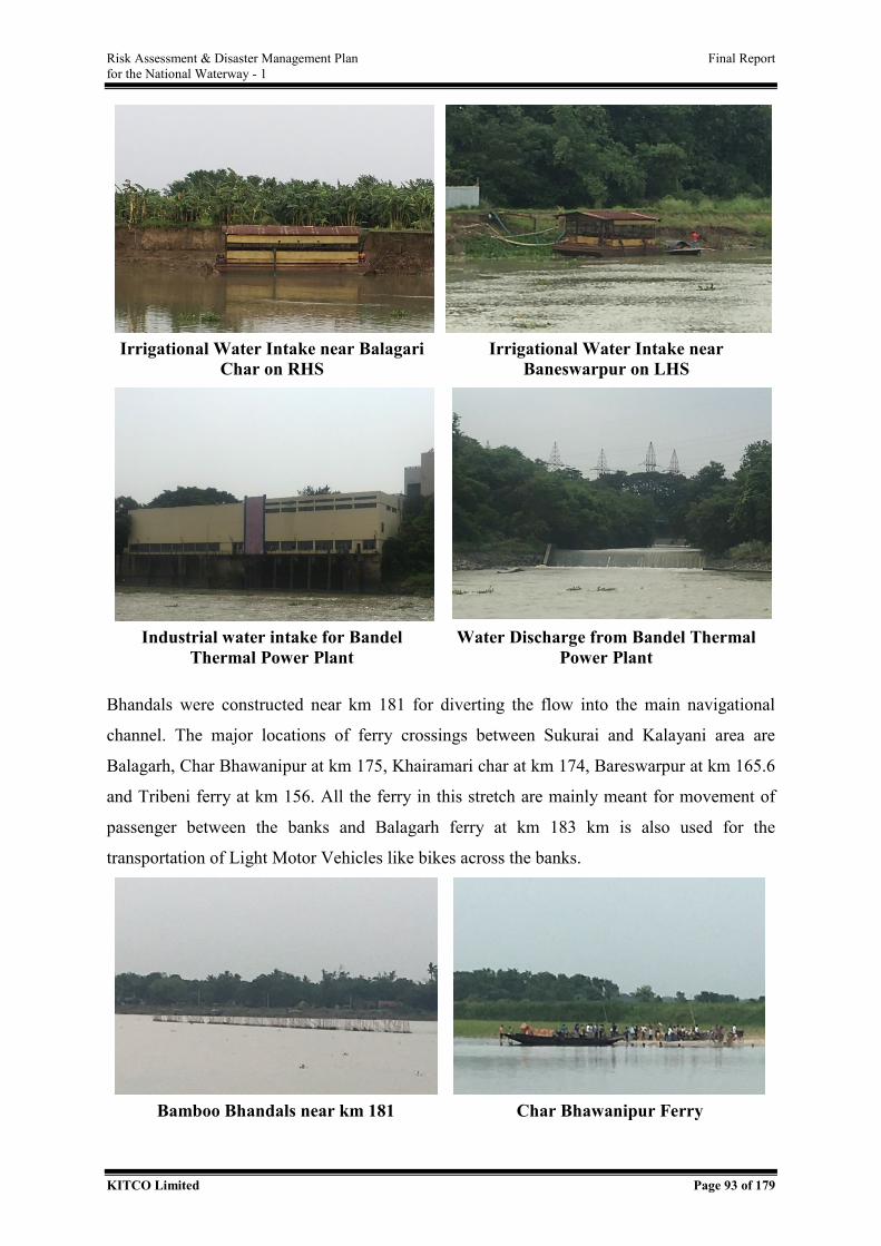
Risk Assessment & Disaster Management Plan Final Report for the National Waterway - 1
KITCO Limited Page 93 of 179
Irrigational Water Intake near Balagari
Char on RHS Irrigational Water Intake near
Baneswarpur on LHS
Industrial water intake for Bandel
Thermal Power Plant Water Discharge from Bandel Thermal
Power Plant
Bhandals were constructed near km 181 for diverting the flow into the main navigational
channel. The major locations of ferry crossings between Sukurai and Kalayani area are
Balagarh, Char Bhawanipur at km 175, Khairamari char at km 174, Bareswarpur at km 165.6
and Tribeni ferry at km 156. All the ferry in this stretch are mainly meant for movement of
passenger between the banks and Balagarh ferry at km 183 km is also used for the
transportation of Light Motor Vehicles like bikes across the banks.
Bamboo Bhandals near km 181 Char Bhawanipur Ferry
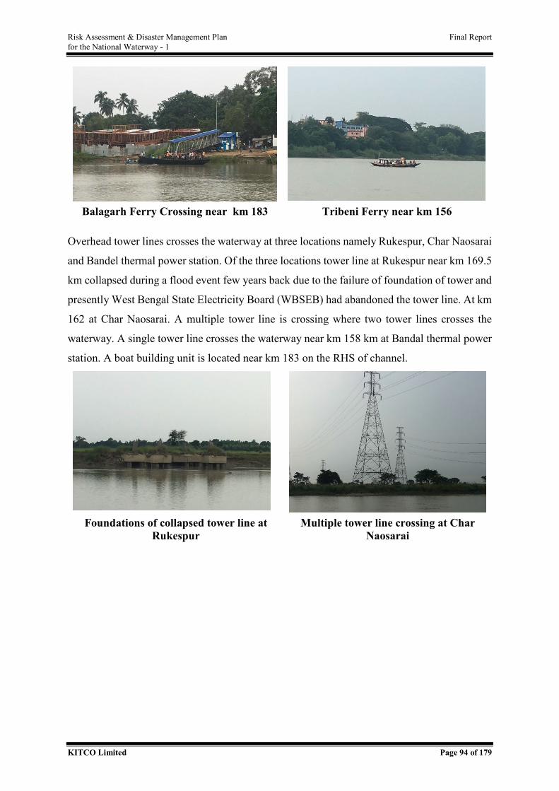
Risk Assessment & Disaster Management Plan Final Report for the National Waterway - 1
KITCO Limited Page 94 of 179
Balagarh Ferry Crossing near km 183 Tribeni Ferry near km 156
Overhead tower lines crosses the waterway at three locations namely Rukespur, Char Naosarai
and Bandel thermal power station. Of the three locations tower line at Rukespur near km 169.5
km collapsed during a flood event few years back due to the failure of foundation of tower and
presently West Bengal State Electricity Board (WBSEB) had abandoned the tower line. At km
162 at Char Naosarai. A multiple tower line is crossing where two tower lines crosses the
waterway. A single tower line crosses the waterway near km 158 km at Bandal thermal power
station. A boat building unit is located near km 183 on the RHS of channel.
Foundations of collapsed tower line at
Rukespur Multiple tower line crossing at Char
Naosarai
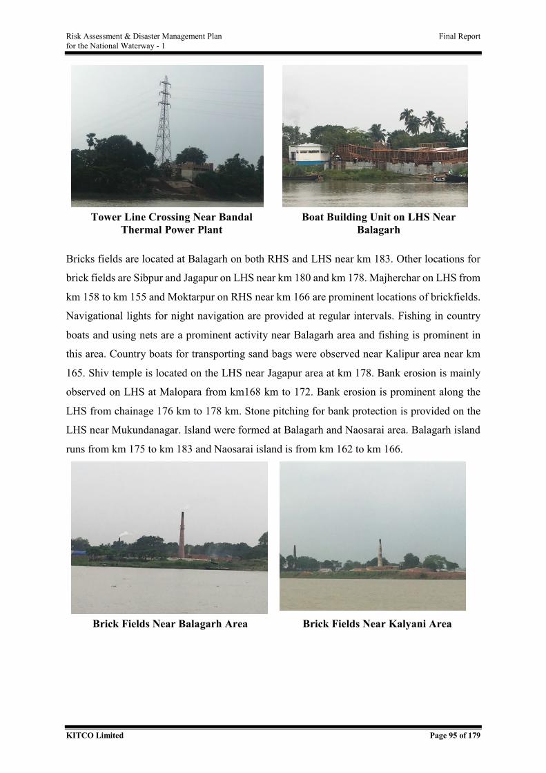
Risk Assessment & Disaster Management Plan Final Report for the National Waterway - 1
KITCO Limited Page 95 of 179
Tower Line Crossing Near Bandal
Thermal Power Plant Boat Building Unit on LHS Near
Balagarh
Bricks fields are located at Balagarh on both RHS and LHS near km 183. Other locations for
brick fields are Sibpur and Jagapur on LHS near km 180 and km 178. Majherchar on LHS from
km 158 to km 155 and Moktarpur on RHS near km 166 are prominent locations of brickfields.
Navigational lights for night navigation are provided at regular intervals. Fishing in country
boats and using nets are a prominent activity near Balagarh area and fishing is prominent in
this area. Country boats for transporting sand bags were observed near Kalipur area near km
165. Shiv temple is located on the LHS near Jagapur area at km 178. Bank erosion is mainly
observed on LHS at Malopara from km168 km to 172. Bank erosion is prominent along the
LHS from chainage 176 km to 178 km. Stone pitching for bank protection is provided on the
LHS near Mukundanagar. Island were formed at Balagarh and Naosarai area. Balagarh island
runs from km 175 to km 183 and Naosarai island is from km 162 to km 166.
Brick Fields Near Balagarh Area Brick Fields Near Kalyani Area
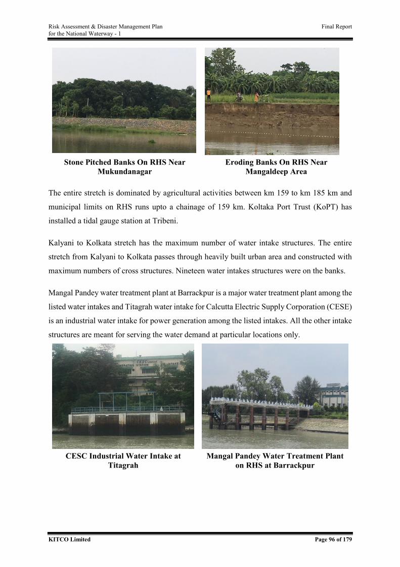
Risk Assessment & Disaster Management Plan Final Report for the National Waterway - 1
KITCO Limited Page 96 of 179
Stone Pitched Banks On RHS Near
Mukundanagar Eroding Banks On RHS Near
Mangaldeep Area
The entire stretch is dominated by agricultural activities between km 159 to km 185 km and
municipal limits on RHS runs upto a chainage of 159 km. Koltaka Port Trust (KoPT) has
installed a tidal gauge station at Tribeni.
Kalyani to Kolkata stretch has the maximum number of water intake structures. The entire
stretch from Kalyani to Kolkata passes through heavily built urban area and constructed with
maximum numbers of cross structures. Nineteen water intakes structures were on the banks.
Mangal Pandey water treatment plant at Barrackpur is a major water treatment plant among the
listed water intakes and Titagrah water intake for Calcutta Electric Supply Corporation (CESE)
is an industrial water intake for power generation among the listed intakes. All the other intake
structures are meant for serving the water demand at particular locations only.
CESC Industrial Water Intake at
Titagrah Mangal Pandey Water Treatment Plant
on RHS at Barrackpur
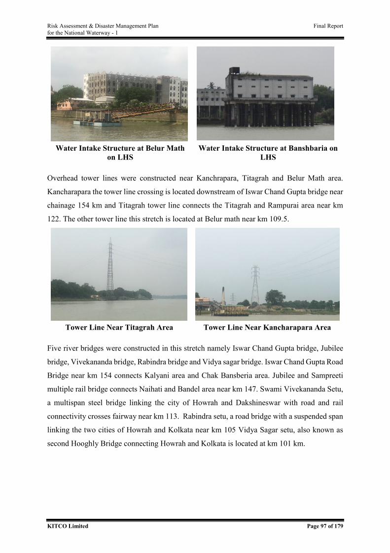
Risk Assessment & Disaster Management Plan Final Report for the National Waterway - 1
KITCO Limited Page 97 of 179
Water Intake Structure at Belur Math
on LHS Water Intake Structure at Banshbaria on
LHS
Overhead tower lines were constructed near Kanchrapara, Titagrah and Belur Math area.
Kancharapara the tower line crossing is located downstream of Iswar Chand Gupta bridge near
chainage 154 km and Titagrah tower line connects the Titagrah and Rampurai area near km
122. The other tower line this stretch is located at Belur math near km 109.5.
Tower Line Near Titagrah Area Tower Line Near Kancharapara Area
Five river bridges were constructed in this stretch namely Iswar Chand Gupta bridge, Jubilee
bridge, Vivekananda bridge, Rabindra bridge and Vidya sagar bridge. Iswar Chand Gupta Road
Bridge near km 154 connects Kalyani area and Chak Bansberia area. Jubilee and Sampreeti
multiple rail bridge connects Naihati and Bandel area near km 147. Swami Vivekananda Setu,
a multispan steel bridge linking the city of Howrah and Dakshineswar with road and rail
connectivity crosses fairway near km 113. Rabindra setu, a road bridge with a suspended span
linking the two cities of Howrah and Kolkata near km 105 Vidya Sagar setu, also known as
second Hooghly Bridge connecting Howrah and Kolkata is located at km 101 km.
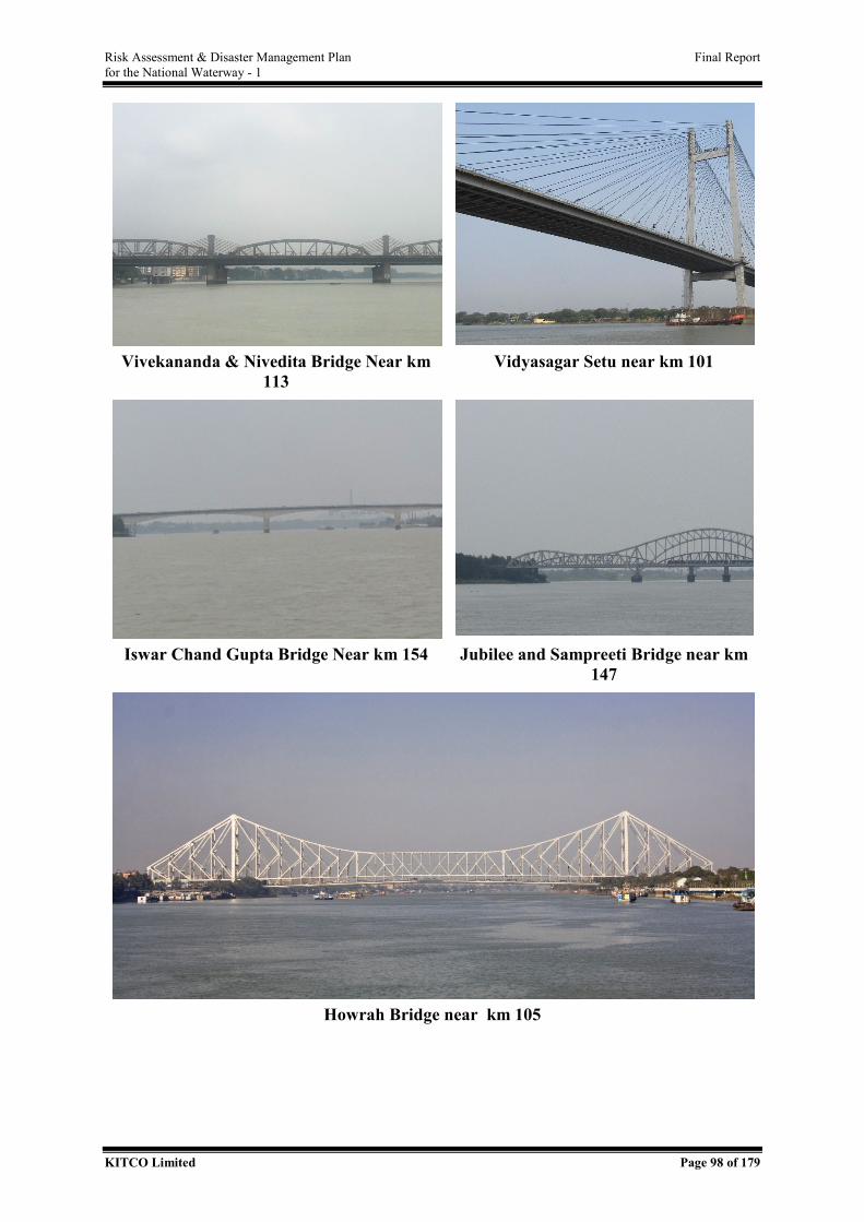
Risk Assessment & Disaster Management Plan Final Report for the National Waterway - 1
KITCO Limited Page 98 of 179
Vivekananda & Nivedita Bridge Near km
113 Vidyasagar Setu near km 101
Iswar Chand Gupta Bridge Near km 154 Jubilee and Sampreeti Bridge near km
147
Howrah Bridge near km 105
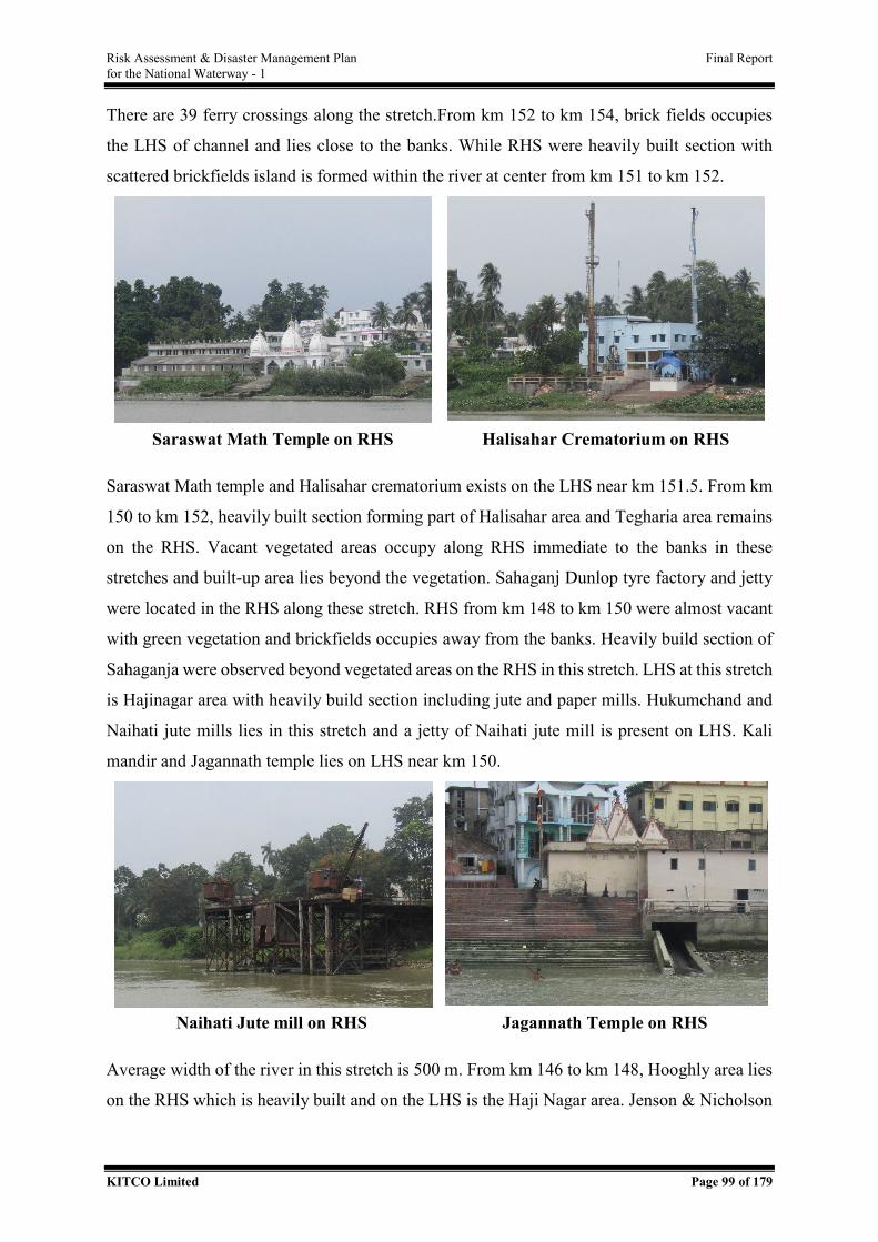
Risk Assessment & Disaster Management Plan Final Report for the National Waterway - 1
KITCO Limited Page 99 of 179
There are 39 ferry crossings along the stretch.From km 152 to km 154, brick fields occupies
the LHS of channel and lies close to the banks. While RHS were heavily built section with
scattered brickfields island is formed within the river at center from km 151 to km 152.
Saraswat Math Temple on RHS Halisahar Crematorium on RHS
Saraswat Math temple and Halisahar crematorium exists on the LHS near km 151.5. From km
150 to km 152, heavily built section forming part of Halisahar area and Tegharia area remains
on the RHS. Vacant vegetated areas occupy along RHS immediate to the banks in these
stretches and built-up area lies beyond the vegetation. Sahaganj Dunlop tyre factory and jetty
were located in the RHS along these stretch. RHS from km 148 to km 150 were almost vacant
with green vegetation and brickfields occupies away from the banks. Heavily build section of
Sahaganja were observed beyond vegetated areas on the RHS in this stretch. LHS at this stretch
is Hajinagar area with heavily build section including jute and paper mills. Hukumchand and
Naihati jute mills lies in this stretch and a jetty of Naihati jute mill is present on LHS. Kali
mandir and Jagannath temple lies on LHS near km 150.
Naihati Jute mill on RHS Jagannath Temple on RHS
Average width of the river in this stretch is 500 m. From km 146 to km 148, Hooghly area lies
on the RHS which is heavily built and on the LHS is the Haji Nagar area. Jenson & Nicholson
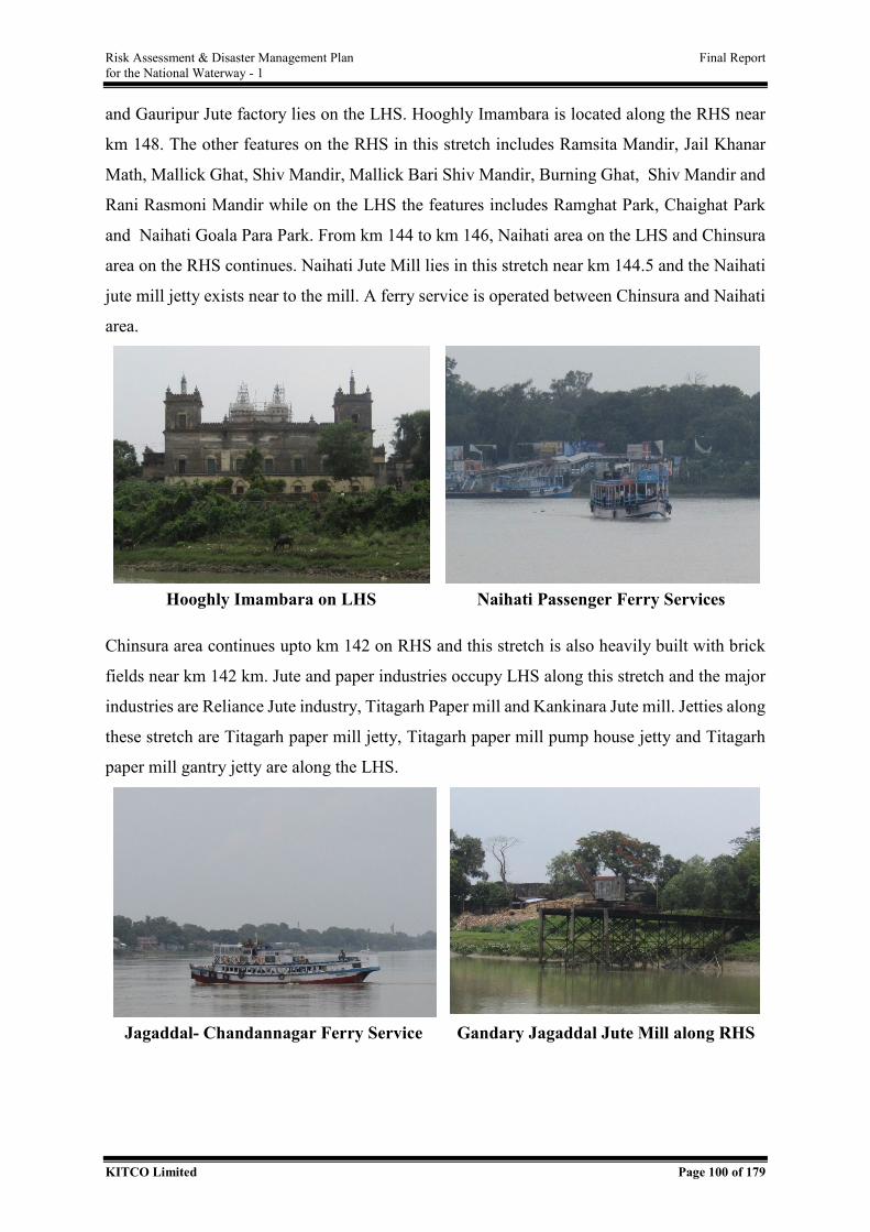
Risk Assessment & Disaster Management Plan Final Report for the National Waterway - 1
KITCO Limited Page 100 of 179
and Gauripur Jute factory lies on the LHS. Hooghly Imambara is located along the RHS near
km 148. The other features on the RHS in this stretch includes Ramsita Mandir, Jail Khanar
Math, Mallick Ghat, Shiv Mandir, Mallick Bari Shiv Mandir, Burning Ghat, Shiv Mandir and
Rani Rasmoni Mandir while on the LHS the features includes Ramghat Park, Chaighat Park
and Naihati Goala Para Park. From km 144 to km 146, Naihati area on the LHS and Chinsura
area on the RHS continues. Naihati Jute Mill lies in this stretch near km 144.5 and the Naihati
jute mill jetty exists near to the mill. A ferry service is operated between Chinsura and Naihati
area.
Hooghly Imambara on LHS Naihati Passenger Ferry Services
Chinsura area continues upto km 142 on RHS and this stretch is also heavily built with brick
fields near km 142 km. Jute and paper industries occupy LHS along this stretch and the major
industries are Reliance Jute industry, Titagarh Paper mill and Kankinara Jute mill. Jetties along
these stretch are Titagarh paper mill jetty, Titagarh paper mill pump house jetty and Titagarh
paper mill gantry jetty are along the LHS.
Jagaddal- Chandannagar Ferry Service Gandary Jagaddal Jute Mill along RHS
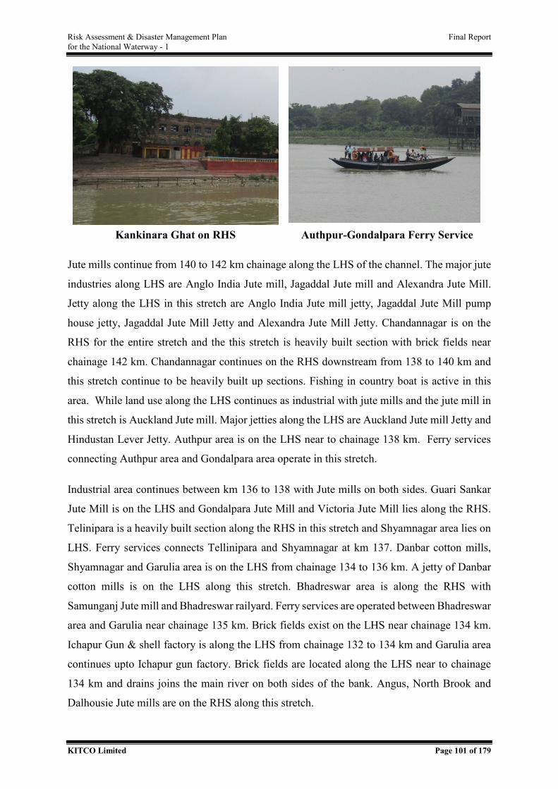
Risk Assessment & Disaster Management Plan Final Report for the National Waterway - 1
KITCO Limited Page 101 of 179
Kankinara Ghat on RHS Authpur-Gondalpara Ferry Service
Jute mills continue from 140 to 142 km chainage along the LHS of the channel. The major jute
industries along LHS are Anglo India Jute mill, Jagaddal Jute mill and Alexandra Jute Mill.
Jetty along the LHS in this stretch are Anglo India Jute mill jetty, Jagaddal Jute Mill pump
house jetty, Jagaddal Jute Mill Jetty and Alexandra Jute Mill Jetty. Chandannagar is on the
RHS for the entire stretch and the this stretch is heavily built section with brick fields near
chainage 142 km. Chandannagar continues on the RHS downstream from 138 to 140 km and
this stretch continue to be heavily built up sections. Fishing in country boat is active in this
area. While land use along the LHS continues as industrial with jute mills and the jute mill in
this stretch is Auckland Jute mill. Major jetties along the LHS are Auckland Jute mill Jetty and
Hindustan Lever Jetty. Authpur area is on the LHS near to chainage 138 km. Ferry services
connecting Authpur area and Gondalpara area operate in this stretch.
Industrial area continues between km 136 to 138 with Jute mills on both sides. Guari Sankar
Jute Mill is on the LHS and Gondalpara Jute Mill and Victoria Jute Mill lies along the RHS.
Telinipara is a heavily built section along the RHS in this stretch and Shyamnagar area lies on
LHS. Ferry services connects Tellinipara and Shyamnagar at km 137. Danbar cotton mills,
Shyamnagar and Garulia area is on the LHS from chainage 134 to 136 km. A jetty of Danbar
cotton mills is on the LHS along this stretch. Bhadreswar area is along the RHS with
Samunganj Jute mill and Bhadreswar railyard. Ferry services are operated between Bhadreswar
area and Garulia near chainage 135 km. Brick fields exist on the LHS near chainage 134 km.
Ichapur Gun & shell factory is along the LHS from chainage 132 to 134 km and Garulia area
continues upto Ichapur gun factory. Brick fields are located along the LHS near to chainage
134 km and drains joins the main river on both sides of the bank. Angus, North Brook and
Dalhousie Jute mills are on the RHS along this stretch.
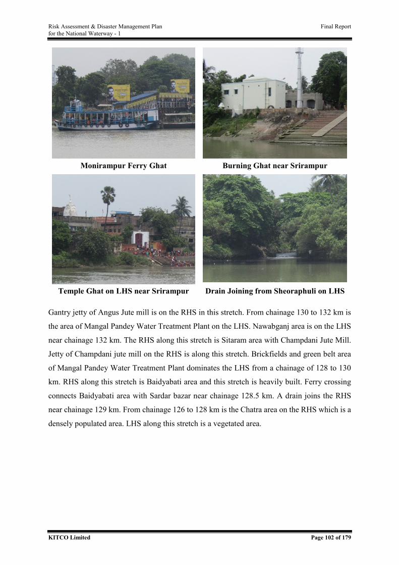
Risk Assessment & Disaster Management Plan Final Report for the National Waterway - 1
KITCO Limited Page 102 of 179
Monirampur Ferry Ghat Burning Ghat near Srirampur
Temple Ghat on LHS near Srirampur Drain Joining from Sheoraphuli on LHS
Gantry jetty of Angus Jute mill is on the RHS in this stretch. From chainage 130 to 132 km is
the area of Mangal Pandey Water Treatment Plant on the LHS. Nawabganj area is on the LHS
near chainage 132 km. The RHS along this stretch is Sitaram area with Champdani Jute Mill.
Jetty of Champdani jute mill on the RHS is along this stretch. Brickfields and green belt area
of Mangal Pandey Water Treatment Plant dominates the LHS from a chainage of 128 to 130
km. RHS along this stretch is Baidyabati area and this stretch is heavily built. Ferry crossing
connects Baidyabati area with Sardar bazar near chainage 128.5 km. A drain joins the RHS
near chainage 129 km. From chainage 126 to 128 km is the Chatra area on the RHS which is a
densely populated area. LHS along this stretch is a vegetated area.
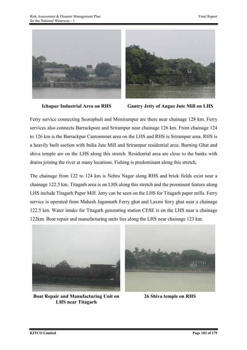
Risk Assessment & Disaster Management Plan Final Report for the National Waterway - 1
KITCO Limited Page 103 of 179
Ichapur Industrial Area on RHS Gantry Jetty of Angus Jute Mill on LHS
Ferry service connecting Seoraphuli and Monirampur are there near chainage 128 km. Ferry
services also connects Barrackpore and Srirampur near chainage 126 km. From chainage 124
to 126 km is the Barrackpur Cantonmnet area on the LHS and RHS is Srirampur area. RHS is
a heavily built section with India Jute Mill and Srirampur residential area. Burning Ghat and
shiva temple are on the LHS along this stretch. Residential area are close to the banks with
drains joining the river at many locations. Fishing is predominant along this stretch.
The chainage from 122 to 124 km is Nehru Nagar along RHS and brick fields exist near a
chainage 122.5 km. Titagarh area is on LHS along this stretch and the prominent feature along
LHS include Titagarh Paper Mill. Jetty can be seen on the LHS for Titagarh paper mills. Ferry
service is operated from Mahesh Jagannath Ferry ghat and Laxmi ferry ghat near a chainage
122.5 km. Water intake for Titagarh generating station CESE is on the LHS near a chainage
122km. Boat repair and manufacturing units lies along the LHS near chainage 123 km.
Boat Repair and Manufacturing Unit on
LHS near Titagarh 26 Shiva temple on RHS
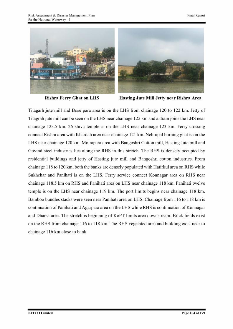
Risk Assessment & Disaster Management Plan Final Report for the National Waterway - 1
KITCO Limited Page 104 of 179
Rishra Ferry Ghat on LHS Hasting Jute Mill Jetty near Rishra Area
Titagarh jute mill and Bose para area is on the LHS from chainage 120 to 122 km. Jetty of
Titagrah jute mill can be seen on the LHS near chainage 122 km and a drain joins the LHS near
chainage 123.5 km. 26 shiva temple is on the LHS near chainage 123 km. Ferry crossing
connect Rishra area with Khardah area near chainage 121 km. Nehrupal burning ghat is on the
LHS near chainage 120 km. Moirapara area with Bangoshri Cotton mill, Hasting Jute mill and
Govind steel industries lies along the RHS in this stretch. The RHS is densely occupied by
residential buildings and jetty of Hasting jute mill and Bangoshri cotton industries. From
chainage 118 to 120 km, both the banks are densely populated with Hatirkul area on RHS while
Sukhchar and Panihati is on the LHS. Ferry service connect Konnagar area on RHS near
chainage 118.5 km on RHS and Panihati area on LHS near chainage 118 km. Panihati twelve
temple is on the LHS near chainage 119 km. The port limits begins near chainage 118 km.
Bamboo bundles stacks were seen near Panihati area on LHS. Chainage from 116 to 118 km is
continuation of Panihati and Agarpara area on the LHS while RHS is continuation of Konnagar
and Dharsa area. The stretch is beginning of KoPT limits area downstream. Brick fields exist
on the RHS from chainage 116 to 118 km. The RHS vegetated area and building exist near to
chainage 116 km close to bank.
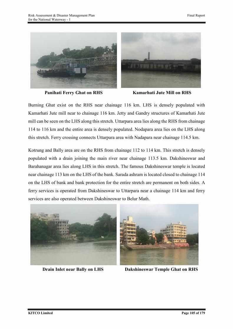
Risk Assessment & Disaster Management Plan Final Report for the National Waterway - 1
KITCO Limited Page 105 of 179
Panihati Ferry Ghat on RHS Kamarhati Jute Mill on RHS
Burning Ghat exist on the RHS near chainage 116 km. LHS is densely populated with
Kamarhati Jute mill near to chainage 116 km. Jetty and Gandry structures of Kamarhati Jute
mill can be seen on the LHS along this stretch. Uttarpara area lies along the RHS from chainage
114 to 116 km and the entire area is densely populated. Nodapara area lies on the LHS along
this stretch. Ferry crossing connects Uttarpara area with Nadapara near chainage 114.5 km.
Kotrung and Bally area are on the RHS from chainage 112 to 114 km. This stretch is densely
populated with a drain joining the main river near chainage 113.5 km. Dakshineswar and
Barahanagar area lies along LHS in this stretch. The famous Dakshineswar temple is located
near chainage 113 km on the LHS of the bank. Sarada ashram is located closed to chainage 114
on the LHS of bank and bank protection for the entire stretch are permanent on both sides. A
ferry services is operated from Dakshineswar to Uttarpara near a chainage 114 km and ferry
services are also operated between Dakshineswar to Belur Math.
Drain Inlet near Bally on LHS Dakshineswar Temple Ghat on RHS
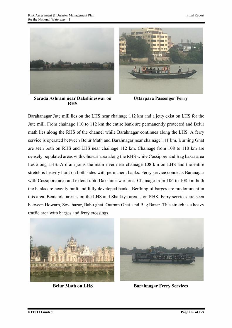
Risk Assessment & Disaster Management Plan Final Report for the National Waterway - 1
KITCO Limited Page 106 of 179
Sarada Ashram near Dakshineswar on
RHS Uttarpara Passenger Ferry
Barahanagar Jute mill lies on the LHS near chainage 112 km and a jetty exist on LHS for the
Jute mill. From chainage 110 to 112 km the entire bank are permanently protected and Belur
math lies along the RHS of the channel while Barahnagar continues along the LHS. A ferry
service is operated between Belur Math and Barahnagar near chainage 111 km. Burning Ghat
are seen both on RHS and LHS near chainage 112 km. Chainage from 108 to 110 km are
densely populated areas with Ghusuri area along the RHS while Cossipore and Bag bazar area
lies along LHS. A drain joins the main river near chainage 108 km on LHS and the entire
stretch is heavily built on both sides with permanent banks. Ferry service connects Baranagar
with Cossipore area and extend upto Dakshineswar area. Chainage from 106 to 108 km both
the banks are heavily built and fully developed banks. Berthing of barges are predominant in
this area. Beniatola area is on the LHS and Shalkiya area is on RHS. Ferry services are seen
between Howarh, Sovabazar, Babu ghat, Outram Ghat, and Bag Bazar. This stretch is a heavy
traffic area with barges and ferry crossings.
Belur Math on LHS Barahnagar Ferry Services
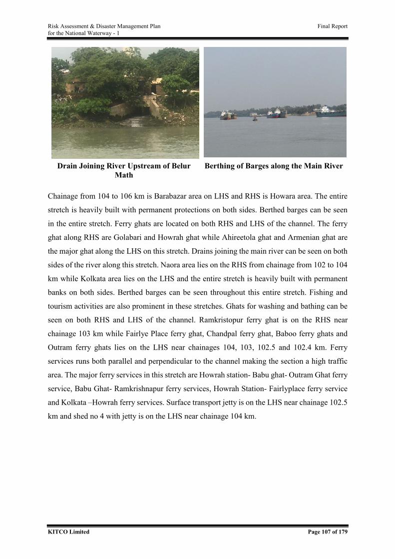
Risk Assessment & Disaster Management Plan Final Report for the National Waterway - 1
KITCO Limited Page 107 of 179
Drain Joining River Upstream of Belur
Math Berthing of Barges along the Main River
Chainage from 104 to 106 km is Barabazar area on LHS and RHS is Howara area. The entire
stretch is heavily built with permanent protections on both sides. Berthed barges can be seen
in the entire stretch. Ferry ghats are located on both RHS and LHS of the channel. The ferry
ghat along RHS are Golabari and Howrah ghat while Ahireetola ghat and Armenian ghat are
the major ghat along the LHS on this stretch. Drains joining the main river can be seen on both
sides of the river along this stretch. Naora area lies on the RHS from chainage from 102 to 104
km while Kolkata area lies on the LHS and the entire stretch is heavily built with permanent
banks on both sides. Berthed barges can be seen throughout this entire stretch. Fishing and
tourism activities are also prominent in these stretches. Ghats for washing and bathing can be
seen on both RHS and LHS of the channel. Ramkristopur ferry ghat is on the RHS near
chainage 103 km while Fairlye Place ferry ghat, Chandpal ferry ghat, Baboo ferry ghats and
Outram ferry ghats lies on the LHS near chainages 104, 103, 102.5 and 102.4 km. Ferry
services runs both parallel and perpendicular to the channel making the section a high traffic
area. The major ferry services in this stretch are Howrah station- Babu ghat- Outram Ghat ferry
service, Babu Ghat- Ramkrishnapur ferry services, Howrah Station- Fairlyplace ferry service
and Kolkata –Howrah ferry services. Surface transport jetty is on the LHS near chainage 102.5
km and shed no 4 with jetty is on the LHS near chainage 104 km.
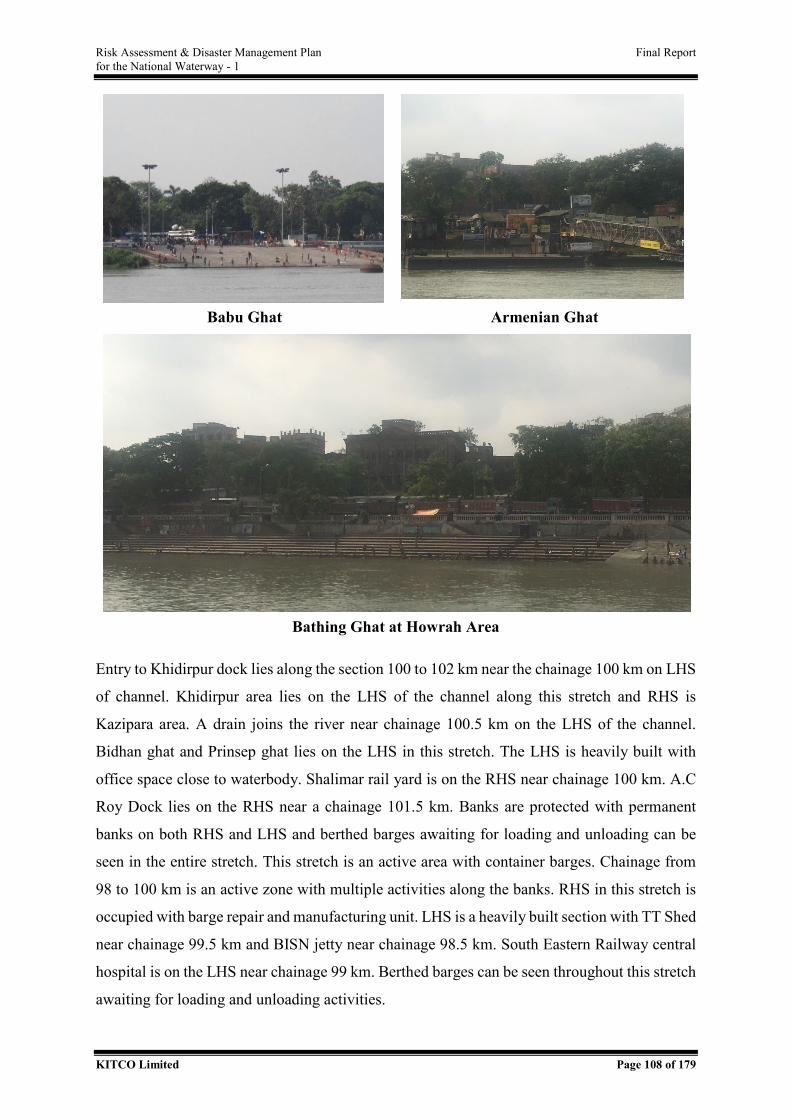
Risk Assessment & Disaster Management Plan Final Report for the National Waterway - 1
KITCO Limited Page 108 of 179
Babu Ghat Armenian Ghat
Bathing Ghat at Howrah Area
Entry to Khidirpur dock lies along the section 100 to 102 km near the chainage 100 km on LHS
of channel. Khidirpur area lies on the LHS of the channel along this stretch and RHS is
Kazipara area. A drain joins the river near chainage 100.5 km on the LHS of the channel.
Bidhan ghat and Prinsep ghat lies on the LHS in this stretch. The LHS is heavily built with
office space close to waterbody. Shalimar rail yard is on the RHS near chainage 100 km. A.C
Roy Dock lies on the RHS near a chainage 101.5 km. Banks are protected with permanent
banks on both RHS and LHS and berthed barges awaiting for loading and unloading can be
seen in the entire stretch. This stretch is an active area with container barges. Chainage from
98 to 100 km is an active zone with multiple activities along the banks. RHS in this stretch is
occupied with barge repair and manufacturing unit. LHS is a heavily built section with TT Shed
near chainage 99.5 km and BISN jetty near chainage 98.5 km. South Eastern Railway central
hospital is on the LHS near chainage 99 km. Berthed barges can be seen throughout this stretch
awaiting for loading and unloading activities.
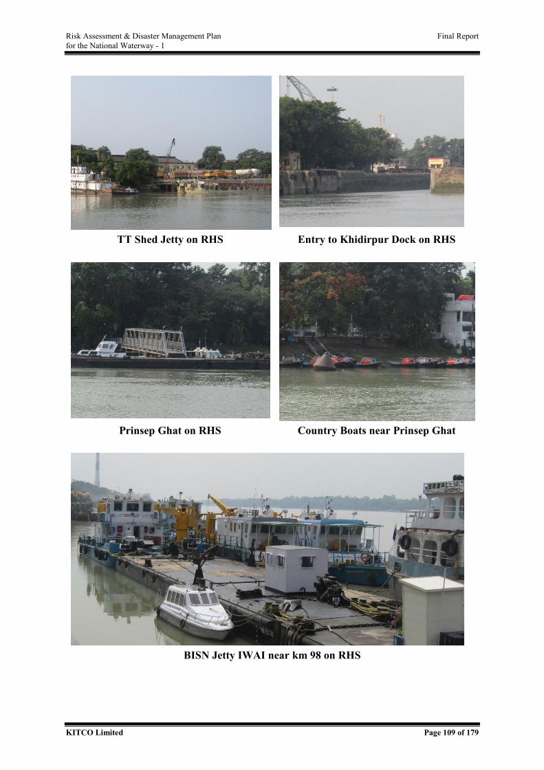
Risk Assessment & Disaster Management Plan Final Report for the National Waterway - 1
KITCO Limited Page 109 of 179
TT Shed Jetty on RHS Entry to Khidirpur Dock on RHS
Prinsep Ghat on RHS Country Boats near Prinsep Ghat
BISN Jetty IWAI near km 98 on RHS
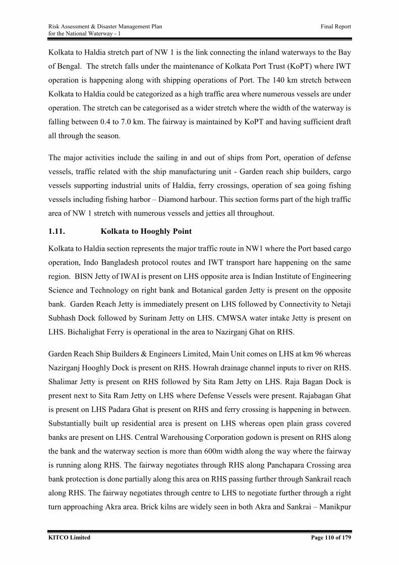
Risk Assessment & Disaster Management Plan Final Report for the National Waterway - 1
KITCO Limited Page 110 of 179
Kolkata to Haldia stretch part of NW 1 is the link connecting the inland waterways to the Bay
of Bengal. The stretch falls under the maintenance of Kolkata Port Trust (KoPT) where IWT
operation is happening along with shipping operations of Port. The 140 km stretch between
Kolkata to Haldia could be categorized as a high traffic area where numerous vessels are under
operation. The stretch can be categorised as a wider stretch where the width of the waterway is
falling between 0.4 to 7.0 km. The fairway is maintained by KoPT and having sufficient draft
all through the season.
The major activities include the sailing in and out of ships from Port, operation of defense
vessels, traffic related with the ship manufacturing unit - Garden reach ship builders, cargo
vessels supporting industrial units of Haldia, ferry crossings, operation of sea going fishing
vessels including fishing harbor – Diamond harbour. This section forms part of the high traffic
area of NW 1 stretch with numerous vessels and jetties all throughout.
1.11. Kolkata to Hooghly Point
Kolkata to Haldia section represents the major traffic route in NW1 where the Port based cargo
operation, Indo Bangladesh protocol routes and IWT transport hare happening on the same
region. BISN Jetty of IWAI is present on LHS opposite area is Indian Institute of Engineering
Science and Technology on right bank and Botanical garden Jetty is present on the opposite
bank. Garden Reach Jetty is immediately present on LHS followed by Connectivity to Netaji
Subhash Dock followed by Surinam Jetty on LHS. CMWSA water intake Jetty is present on
LHS. Bichalighat Ferry is operational in the area to Nazirganj Ghat on RHS.
Garden Reach Ship Builders & Engineers Limited, Main Unit comes on LHS at km 96 whereas
Nazirganj Hooghly Dock is present on RHS. Howrah drainage channel inputs to river on RHS.
Shalimar Jetty is present on RHS followed by Sita Ram Jetty on LHS. Raja Bagan Dock is
present next to Sita Ram Jetty on LHS where Defense Vessels were present. Rajabagan Ghat
is present on LHS Padara Ghat is present on RHS and ferry crossing is happening in between.
Substantially built up residential area is present on LHS whereas open plain grass covered
banks are present on LHS. Central Warehousing Corporation godown is present on RHS along
the bank and the waterway section is more than 600m width along the way where the fairway
is running along RHS. The fairway negotiates through RHS along Panchapara Crossing area
bank protection is done partially along this area on RHS passing further through Sankrail reach
along RHS. The fairway negotiates through centre to LHS to negotiate further through a right
turn approaching Akra area. Brick kilns are widely seen in both Akra and Sankrai – Manikpur
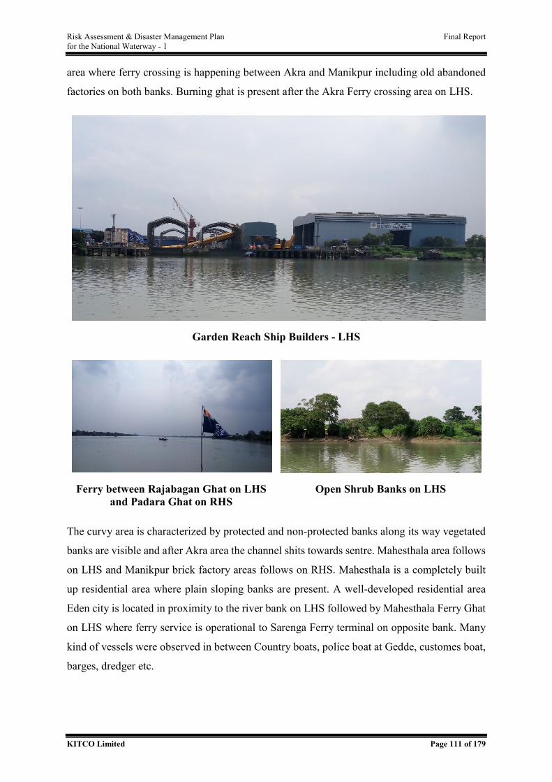
Risk Assessment & Disaster Management Plan Final Report for the National Waterway - 1
KITCO Limited Page 111 of 179
area where ferry crossing is happening between Akra and Manikpur including old abandoned
factories on both banks. Burning ghat is present after the Akra Ferry crossing area on LHS.
Garden Reach Ship Builders - LHS
Ferry between Rajabagan Ghat on LHS and Padara Ghat on RHS
Open Shrub Banks on LHS
The curvy area is characterized by protected and non-protected banks along its way vegetated
banks are visible and after Akra area the channel shits towards sentre. Mahesthala area follows
on LHS and Manikpur brick factory areas follows on RHS. Mahesthala is a completely built
up residential area where plain sloping banks are present. A well-developed residential area
Eden city is located in proximity to the river bank on LHS followed by Mahesthala Ferry Ghat
on LHS where ferry service is operational to Sarenga Ferry terminal on opposite bank. Many
kind of vessels were observed in between Country boats, police boat at Gedde, customes boat,
barges, dredger etc.

Risk Assessment & Disaster Management Plan Final Report for the National Waterway - 1
KITCO Limited Page 112 of 179
Customs boat at Baj Baj
Eden Garden at Mahesthala on
LHS Barge
Cargo Vessel
Passing through the well-developed bank areas, Baj Baj Ferry is operational at km 80. Jetty is
present on LHS where fairway has proximity, followed by extensive oil storage on LHS in
Joychandipur having 6 series of jetties operational feeding to the storage tank along the bank.
Bauria side has intake associated with industrial operations opposite to the oil jetty area. Bauria
Ferry ghat is present on RHS. Jyoti Basu Park is present on LHS and the area is having more
than 600 m width for water course in this way. Charial canal joins the major river course on
LHS and from where the width of the river increases to more than 800m from this stretch
onwards. Barges and cargo vessels are present along this area. RHS is too far but many country
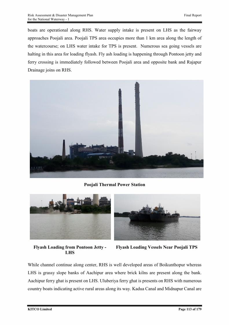
Risk Assessment & Disaster Management Plan Final Report for the National Waterway - 1
KITCO Limited Page 113 of 179
boats are operational along RHS. Water supply intake is present on LHS as the fairway
approaches Poojali area. Poojali TPS area occupies more than 1 km area along the length of
the watercourse; on LHS water intake for TPS is present. Numerous sea going vessels are
halting in this area for loading flyash. Fly ash loading is happening through Pontoon jetty and
ferry crossing is immediately followed between Poojali area and opposite bank and Rajapur
Drainage joins on RHS.
Poojali Thermal Power Station
Flyash Loading from Pontoon Jetty - LHS
Flyash Loading Vessels Near Poojali TPS
While channel continue along center, RHS is well developed areas of Boikunthopur whereas
LHS is grassy slope banks of Aachipur area where brick kilns are present along the bank.
Aachipur ferry ghat is present on LHS. Uluberiya ferry ghat is presents on RHS with numerous
country boats indicating active rural areas along its way. Kadua Canal and Midnapur Canal are
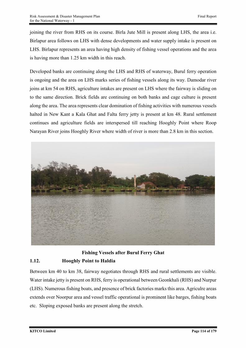
Risk Assessment & Disaster Management Plan Final Report for the National Waterway - 1
KITCO Limited Page 114 of 179
joining the river from RHS on its course. Birla Jute Mill is present along LHS, the area i.e.
Birlapur area follows on LHS with dense developments and water supply intake is present on
LHS. Birlapur represents an area having high density of fishing vessel operations and the area
is having more than 1.25 km width in this reach.
Developed banks are continuing along the LHS and RHS of waterway, Burul ferry operation
is ongoing and the area on LHS marks series of fishing vessels along its way. Damodar river
joins at km 54 on RHS, agriculture intakes are present on LHS where the fairway is sliding on
to the same direction. Brick fields are continuing on both banks and cage culture is present
along the area. The area represents clear domination of fishing activities with numerous vessels
halted in New Kant a Kala Ghat and Falta ferry jetty is present at km 48. Rural settlement
continues and agriculture fields are interspersed till reaching Hooghly Point where Roop
Narayan River joins Hooghly River where width of river is more than 2.8 km in this section.
Fishing Vessels after Burul Ferry Ghat 1.12. Hooghly Point to Haldia
Between km 40 to km 38, fairway negotiates through RHS and rural settlements are visible.
Water intake jetty is present on RHS, ferry is operational between Geonkhali (RHS) and Nurpur
(LHS). Numerous fishing boats, and presence of brick factories marks this area. Agriculre areas
extends over Noorpur area and vessel traffic operational is prominent like barges, fishing boats
etc. Sloping exposed banks are present along the stretch.
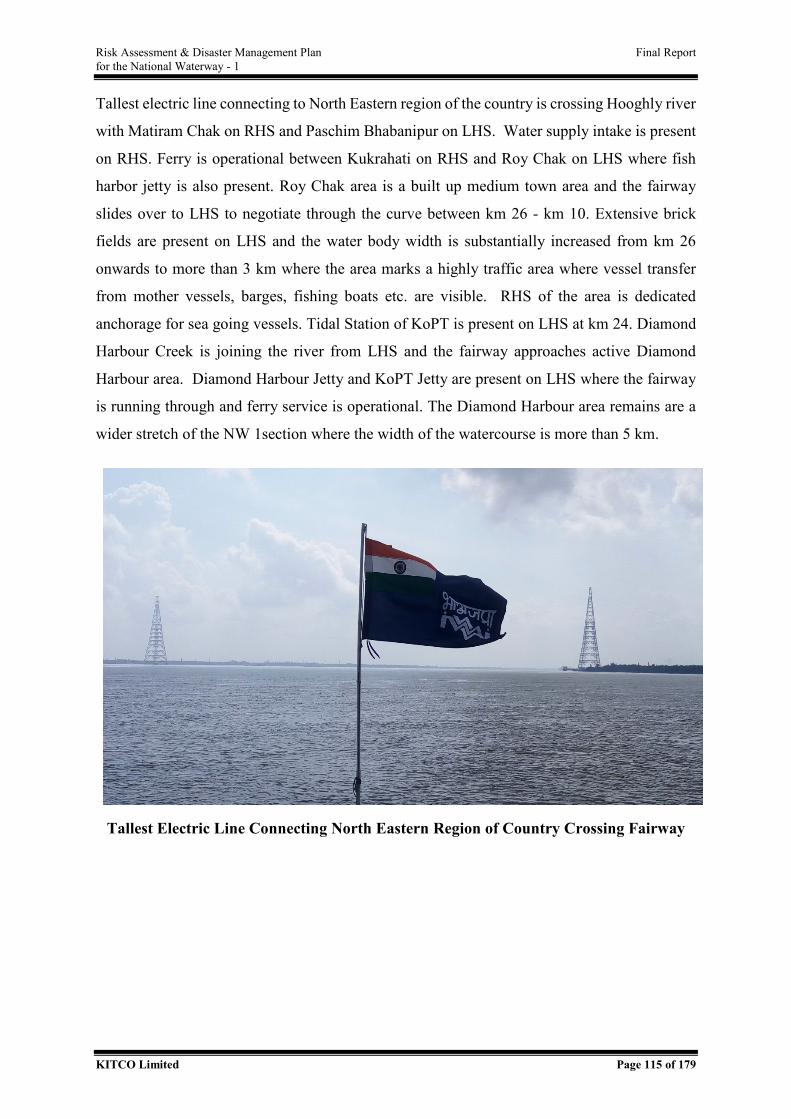
Risk Assessment & Disaster Management Plan Final Report for the National Waterway - 1
KITCO Limited Page 115 of 179
Tallest electric line connecting to North Eastern region of the country is crossing Hooghly river
with Matiram Chak on RHS and Paschim Bhabanipur on LHS. Water supply intake is present
on RHS. Ferry is operational between Kukrahati on RHS and Roy Chak on LHS where fish
harbor jetty is also present. Roy Chak area is a built up medium town area and the fairway
slides over to LHS to negotiate through the curve between km 26 - km 10. Extensive brick
fields are present on LHS and the water body width is substantially increased from km 26
onwards to more than 3 km where the area marks a highly traffic area where vessel transfer
from mother vessels, barges, fishing boats etc. are visible. RHS of the area is dedicated
anchorage for sea going vessels. Tidal Station of KoPT is present on LHS at km 24. Diamond
Harbour Creek is joining the river from LHS and the fairway approaches active Diamond
Harbour area. Diamond Harbour Jetty and KoPT Jetty are present on LHS where the fairway
is running through and ferry service is operational. The Diamond Harbour area remains are a
wider stretch of the NW 1section where the width of the watercourse is more than 5 km.
Tallest Electric Line Connecting North Eastern Region of Country Crossing Fairway
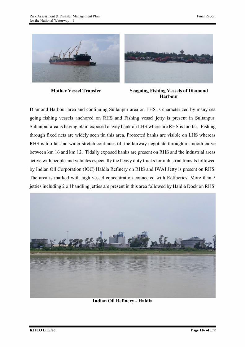
Risk Assessment & Disaster Management Plan Final Report for the National Waterway - 1
KITCO Limited Page 116 of 179
Mother Vessel Transfer Seagoing Fishing Vessels of Diamond Harbour
Diamond Harbour area and continuing Sultanpur area on LHS is characterized by many sea
going fishing vessels anchored on RHS and Fishing vessel jetty is present in Sultanpur.
Sultanpur area is having plain exposed clayey bank on LHS where are RHS is too far. Fishing
through fixed nets are widely seen tin this area. Protected banks are visible on LHS whereas
RHS is too far and wider stretch continues till the fairway negotiate through a smooth curve
between km 16 and km 12. Tidally exposed banks are present on RHS and the industrial areas
active with people and vehicles especially the heavy duty trucks for industrial transits followed
by Indian Oil Corporation (IOC) Haldia Refinery on RHS and IWAI Jetty is present on RHS.
The area is marked with high vessel concentration connected with Refineries. More than 5
jetties including 2 oil handling jetties are present in this area followed by Haldia Dock on RHS.
Indian Oil Refinery - Haldia
Risk Assessment & Disaster Management Plan Final Report for the National Waterway - 1
KITCO Limited Page 117 of 179
ANNEXURE II - DETAILS OF CRITICAL SECTIONS
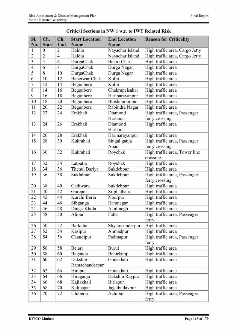
Risk Assessment & Disaster Management Plan Final Report for the National Waterway - 1
KITCO Limited Page 118 of 179
Critical Sections in NW 1 w.r. to IWT Related Risk
Sl. No.
Ch. Start
Ch. End
Start Location Name
End Location Name
Reason for Criticality
1 0 2 Haldia Nayachar Island High traffic area, Cargo Jetty 2 2 4 Haldia Nayachar Island High traffic area, Cargo Jetty 3 4 6 DurgaChak Balari Char High traffic area 4 6 8 DurgaChak Durga Nagar High traffic area 5 8 10 DurgaChak Durga Nagar High traffic area 6 10 12 Banerwar Chak Kulpi High traffic area 7 12 14 Begunbere Kulpi High traffic area 8 14 16 Begunbere Chakrupelsakar High traffic area 9 16 18 Begunbere Harinarayanpur High traffic area 10 18 20 Begunbere Bhishnurampur High traffic area 11 20 22 Begunbere Rabindra Nagar High traffic area 12 22 24 Erakhali Diamond
Harbour High traffic area, Passenger ferry crossing
13 24 26 Erakhali Diamond Harbour
High traffic area
14 26 28 Erakhali Harinarayanpur High traffic area 15 28 30 Kukrahati Singal ganja
Abad High traffic area, Passenger ferry crossing
16 30 32 Kukrahati Roychak High traffic area, Tower line crossing
17 32 34 Latpatia Roychak High traffic area 18 34 36 Thenul Bariya Sukdebpur High traffic area 19 36 38 Suklalpur Sukdebpur High traffic area, Passenger
ferry crossing 20 38 40 Gadiwara Sukdebpur High traffic area 21 40 42 Gurepol Sriphalbaria High traffic area 22 42 44 Kurchi Beria Noorpur High traffic area 23 44 46 Sibganga Ramnagar High traffic area 24 46 48 Dinga-Khola Akalmegh High traffic area 25 48 50 Alipur Falta High traffic area, Passenger
ferry 26 50 52 Barkalia Shyamsunderpur High traffic area 27 52 54 Kasipur Ahmadpur High traffic area 28 54 56 Chandipur Padmapur High traffic area, Passenger
ferry 29 56 58 Belari Burul High traffic area 30 58 60 Baganda Bahirkunji High traffic area 31 60 62 Dakshin
Ramachandrapur Godakhali High traffic area
32 62 64 Hirapur Godakhali High traffic area 33 64 66 Hiraganja Dakshin Raypur High traffic area 34 66 68 Kajiakhali Birlapur High traffic area 35 68 70 Kalinagar Jagatballavpur High traffic area 36 70 72 Uluberia Achipur High traffic area, Passenger
ferry
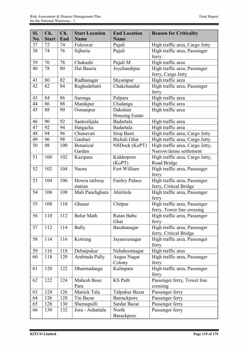
Risk Assessment & Disaster Management Plan Final Report for the National Waterway - 1
KITCO Limited Page 119 of 179
Sl. No.
Ch. Start
Ch. End
Start Location Name
End Location Name
Reason for Criticality
37 72 74 Fuleswar Pujali High traffic area, Cargo Jetty 38 74 76 Sijberia Pujali High traffic area, Passenger
ferry 39 76 78 Chakashi Pujali M High traffic area 40 78 80 Hat Bauria Joychandipur High traffic area, Passenger
ferry, Cargo Jetty 41 80 82 Radhanagar Shyampur High traffic area 42 82 84 Raghudebatti Chakchandul High traffic area, Passenger
ferry 43 84 86 Sarenga Palpara High traffic area 44 86 88 Manikpur Uludanga High traffic area 45 88 90 Osmanpur Dakshini
Housing Estate High traffic area
46 90 92 Sankralijala Badartala High traffic area 47 92 94 Hatgacha Badartala High traffic area 48 94 96 Chunavati Siraj Basti High traffic area, Cargo Jetty 49 96 98 Gaubari Bichali Ghat High traffic area, Cargo Jetty 50 98 100 Botanical
Garden NSDock (KoPT) High traffic area, Cargo Jetty,
Narrow/dense settlement 51 100 102 Kazipara Kidderpore
(KoPT) High traffic area, Cargo Jetty, Road Bridge
52 102 104 Naora Fort William High traffic area, Passenger ferry
53 104 106 Howra railway station
Fairley Palace High traffic area, Passenger ferry, Critical Bridge
54 106 108 Mali Panchghara Ahiritola High traffic area, Passenger ferry
55 108 110 Ghusur Chitpur High traffic area, Passenger ferry, Tower line crossing
56 110 112 Belur Math Ratan Babu Ghat
High traffic area, Passenger ferry
57 112 114 Bally Barahanagar High traffic area, Passenger ferry, Critical Bridge
58 114 116 Kotrung Jayasreenagar High traffic area, Passenger ferry
59 116 118 Debaipukur Nehabootnagar High traffic area 60 118 120 Arabinda Pally Angus Nagar
Colony High traffic area, Passenger ferry
61 120 122 Dharmadanga Kulinpara High traffic area, Passenger ferry
62 122 124 Mahesh Bose Para
KS Path Passenger ferry, Tower line crossing
63 124 126 Manick Tala Talpukur Bazar Passenger ferry 64 126 128 Tin Bazar Barrackpore Passenger ferry 65 128 130 Sheraupulli Sardar Bazar Passenger ferry 66 130 132 Jora - Ashattala North
Barackpore Passenger ferry
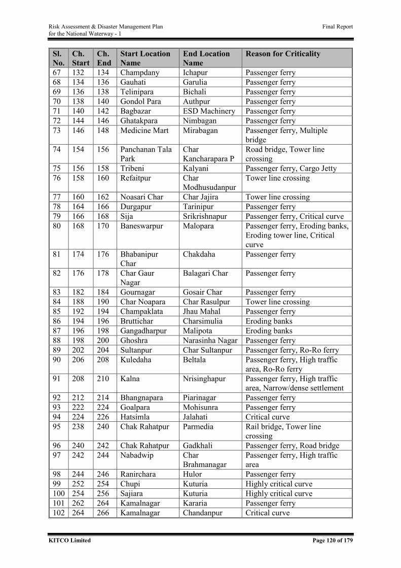
Risk Assessment & Disaster Management Plan Final Report for the National Waterway - 1
KITCO Limited Page 120 of 179
Sl. No.
Ch. Start
Ch. End
Start Location Name
End Location Name
Reason for Criticality
67 132 134 Champdany Ichapur Passenger ferry 68 134 136 Gauhati Garulia Passenger ferry 69 136 138 Telinipara Bichali Passenger ferry 70 138 140 Gondol Para Authpur Passenger ferry 71 140 142 Bagbazar ESD Machinery Passenger ferry 72 144 146 Ghatakpara Nimbagan Passenger ferry 73 146 148 Medicine Mart Mirabagan Passenger ferry, Multiple
bridge 74 154 156 Panchanan Tala
Park Char Kancharapara P
Road bridge, Tower line crossing
75 156 158 Tribeni Kalyani Passenger ferry, Cargo Jetty 76 158 160 Refaitpur Char
Modhusudanpur Tower line crossing
77 160 162 Noasari Char Char Jajira Tower line crossing 78 164 166 Durgapur Tarinipur Passenger ferry 79 166 168 Sija Srikrishnapur Passenger ferry, Critical curve 80 168 170 Baneswarpur Malopara Passenger ferry, Eroding banks,
Eroding tower line, Critical curve
81 174 176 Bhabanipur Char
Chakdaha Passenger ferry
82 176 178 Char Gaur Nagar
Balagari Char Passenger ferry
83 182 184 Gournagar Gosair Char Passenger ferry 84 188 190 Char Noapara Char Rasulpur Tower line crossing 85 192 194 Champaklata Jhau Mahal Passenger ferry 86 194 196 Bruttichar Charsimulia Eroding banks 87 196 198 Gangadharpur Malipota Eroding banks 88 198 200 Ghoshra Narasinha Nagar Passenger ferry 89 202 204 Sultanpur Char Sultanpur Passenger ferry, Ro-Ro ferry 90 206 208 Kuledaha Beltala Passenger ferry, High traffic
area, Ro-Ro ferry 91 208 210 Kalna Nrisinghapur Passenger ferry, High traffic
area, Narrow/dense settlement 92 212 214 Bhangnapara Piarinagar Passenger ferry 93 222 224 Goalpara Mohisunra Passenger ferry 94 224 226 Hatsimla Jalahati Critical curve 95 238 240 Chak Rahatpur Parmedia Rail bridge, Tower line
crossing 96 240 242 Chak Rahatpur Gadkhali Passenger ferry, Road bridge 97 242 244 Nabadwip Char
Brahmanagar Passenger ferry, High traffic area
98 244 246 Ranirchara Hulor Passenger ferry 99 252 254 Chupi Kuturia Highly critical curve 100 254 256 Sajiara Kuturia Highly critical curve 101 262 264 Kamalnagar Kararia Passenger ferry 102 264 266 Kamalnagar Chandanpur Critical curve
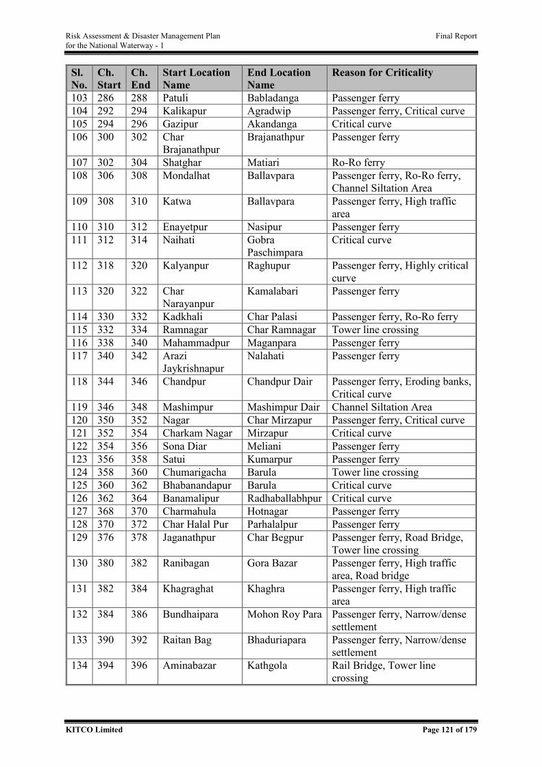
Risk Assessment & Disaster Management Plan Final Report for the National Waterway - 1
KITCO Limited Page 121 of 179
Sl. No.
Ch. Start
Ch. End
Start Location Name
End Location Name
Reason for Criticality
103 286 288 Patuli Babladanga Passenger ferry 104 292 294 Kalikapur Agradwip Passenger ferry, Critical curve 105 294 296 Gazipur Akandanga Critical curve 106 300 302 Char
Brajanathpur Brajanathpur Passenger ferry
107 302 304 Shatghar Matiari Ro-Ro ferry 108 306 308 Mondalhat Ballavpara Passenger ferry, Ro-Ro ferry,
Channel Siltation Area 109 308 310 Katwa Ballavpara Passenger ferry, High traffic
area 110 310 312 Enayetpur Nasipur Passenger ferry 111 312 314 Naihati Gobra
Paschimpara Critical curve
112 318 320 Kalyanpur Raghupur Passenger ferry, Highly critical curve
113 320 322 Char Narayanpur
Kamalabari Passenger ferry
114 330 332 Kadkhali Char Palasi Passenger ferry, Ro-Ro ferry 115 332 334 Ramnagar Char Ramnagar Tower line crossing 116 338 340 Mahammadpur Maganpara Passenger ferry 117 340 342 Arazi
Jaykrishnapur Nalahati Passenger ferry
118 344 346 Chandpur Chandpur Dair Passenger ferry, Eroding banks, Critical curve
119 346 348 Mashimpur Mashimpur Dair Channel Siltation Area 120 350 352 Nagar Char Mirzapur Passenger ferry, Critical curve 121 352 354 Charkam Nagar Mirzapur Critical curve 122 354 356 Sona Diar Meliani Passenger ferry 123 356 358 Satui Kumarpur Passenger ferry 124 358 360 Chumarigacha Barula Tower line crossing 125 360 362 Bhabanandapur Barula Critical curve 126 362 364 Banamalipur Radhaballabhpur Critical curve 127 368 370 Charmahula Hotnagar Passenger ferry 128 370 372 Char Halal Pur Parhalalpur Passenger ferry 129 376 378 Jaganathpur Char Begpur Passenger ferry, Road Bridge,
Tower line crossing 130 380 382 Ranibagan Gora Bazar Passenger ferry, High traffic
area, Road bridge 131 382 384 Khagraghat Khaghra Passenger ferry, High traffic
area 132 384 386 Bundhaipara Mohon Roy Para Passenger ferry, Narrow/dense
settlement 133 390 392 Raitan Bag Bhaduriapara Passenger ferry, Narrow/dense
settlement 134 394 396 Aminabazar Kathgola Rail Bridge, Tower line
crossing
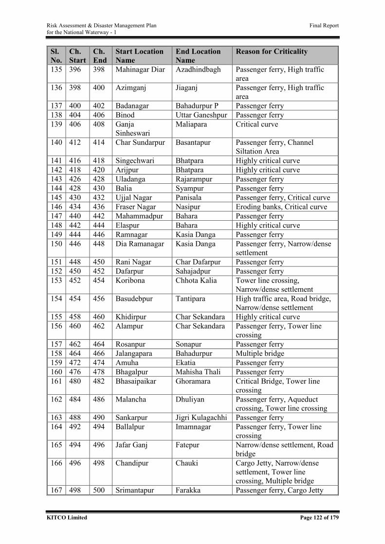
Risk Assessment & Disaster Management Plan Final Report for the National Waterway - 1
KITCO Limited Page 122 of 179
Sl. No.
Ch. Start
Ch. End
Start Location Name
End Location Name
Reason for Criticality
135 396 398 Mahinagar Diar Azadhindbagh Passenger ferry, High traffic area
136 398 400 Azimganj Jiaganj Passenger ferry, High traffic area
137 400 402 Badanagar Bahadurpur P Passenger ferry 138 404 406 Binod Uttar Ganeshpur Passenger ferry 139 406 408 Ganja
Sinheswari Maliapara Critical curve
140 412 414 Char Sundarpur Basantapur Passenger ferry, Channel Siltation Area
141 416 418 Singechwari Bhatpara Highly critical curve 142 418 420 Arijpur Bhatpara Highly critical curve 143 426 428 Uladanga Rajarampur Passenger ferry 144 428 430 Balia Syampur Passenger ferry 145 430 432 Ujjal Nagar Panisala Passenger ferry, Critical curve 146 434 436 Fraser Nagar Nasipur Eroding banks, Critical curve 147 440 442 Mahammadpur Bahara Passenger ferry 148 442 444 Elaspur Bahara Highly critical curve 149 444 446 Ramnagar Kasia Danga Passenger ferry 150 446 448 Dia Ramanagar Kasia Danga Passenger ferry, Narrow/dense
settlement 151 448 450 Rani Nagar Char Dafarpur Passenger ferry 152 450 452 Dafarpur Sahajadpur Passenger ferry 153 452 454 Koribona Chhota Kalia Tower line crossing,
Narrow/dense settlement 154 454 456 Basudebpur Tantipara High traffic area, Road bridge,
Narrow/dense settlement 155 458 460 Khidirpur Char Sekandara Highly critical curve 156 460 462 Alampur Char Sekandara Passenger ferry, Tower line
crossing 157 462 464 Rosanpur Sonapur Passenger ferry 158 464 466 Jalangapara Bahadurpur Multiple bridge 159 472 474 Amuha Ekatia Passenger ferry 160 476 478 Bhagalpur Mahisha Thali Passenger ferry 161 480 482 Bhasaipaikar Ghoramara Critical Bridge, Tower line
crossing 162 484 486 Malancha Dhuliyan Passenger ferry, Aqueduct
crossing, Tower line crossing 163 488 490 Sankarpur Jigri Kulagachhi Passenger ferry 164 492 494 Ballalpur Imamnagar Passenger ferry, Tower line
crossing 165 494 496 Jafar Ganj Fatepur Narrow/dense settlement, Road
bridge 166 496 498 Chandipur Chauki Cargo Jetty, Narrow/dense
settlement, Tower line crossing, Multiple bridge
167 498 500 Srimantapur Farakka Passenger ferry, Cargo Jetty
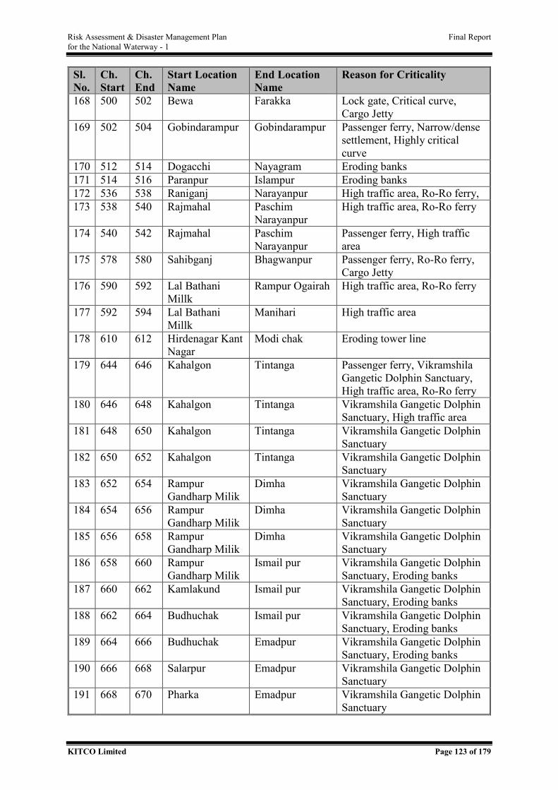
Risk Assessment & Disaster Management Plan Final Report for the National Waterway - 1
KITCO Limited Page 123 of 179
Sl. No.
Ch. Start
Ch. End
Start Location Name
End Location Name
Reason for Criticality
168 500 502 Bewa Farakka Lock gate, Critical curve, Cargo Jetty
169 502 504 Gobindarampur Gobindarampur Passenger ferry, Narrow/dense settlement, Highly critical curve
170 512 514 Dogacchi Nayagram Eroding banks 171 514 516 Paranpur Islampur Eroding banks 172 536 538 Raniganj Narayanpur High traffic area, Ro-Ro ferry, 173 538 540 Rajmahal Paschim
Narayanpur High traffic area, Ro-Ro ferry
174 540 542 Rajmahal Paschim Narayanpur
Passenger ferry, High traffic area
175 578 580 Sahibganj Bhagwanpur Passenger ferry, Ro-Ro ferry, Cargo Jetty
176 590 592 Lal Bathani Millk
Rampur Ogairah High traffic area, Ro-Ro ferry
177 592 594 Lal Bathani Millk
Manihari High traffic area
178 610 612 Hirdenagar Kant Nagar
Modi chak Eroding tower line
179 644 646 Kahalgon Tintanga Passenger ferry, Vikramshila Gangetic Dolphin Sanctuary, High traffic area, Ro-Ro ferry
180 646 648 Kahalgon Tintanga Vikramshila Gangetic Dolphin Sanctuary, High traffic area
181 648 650 Kahalgon Tintanga Vikramshila Gangetic Dolphin Sanctuary
182 650 652 Kahalgon Tintanga Vikramshila Gangetic Dolphin Sanctuary
183 652 654 Rampur Gandharp Milik
Dimha Vikramshila Gangetic Dolphin Sanctuary
184 654 656 Rampur Gandharp Milik
Dimha Vikramshila Gangetic Dolphin Sanctuary
185 656 658 Rampur Gandharp Milik
Dimha Vikramshila Gangetic Dolphin Sanctuary
186 658 660 Rampur Gandharp Milik
Ismail pur Vikramshila Gangetic Dolphin Sanctuary, Eroding banks
187 660 662 Kamlakund Ismail pur Vikramshila Gangetic Dolphin Sanctuary, Eroding banks
188 662 664 Budhuchak Ismail pur Vikramshila Gangetic Dolphin Sanctuary, Eroding banks
189 664 666 Budhuchak Emadpur Vikramshila Gangetic Dolphin Sanctuary, Eroding banks
190 666 668 Salarpur Emadpur Vikramshila Gangetic Dolphin Sanctuary
191 668 670 Pharka Emadpur Vikramshila Gangetic Dolphin Sanctuary
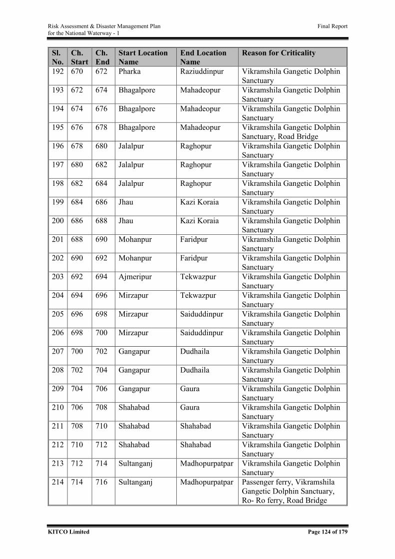
Risk Assessment & Disaster Management Plan Final Report for the National Waterway - 1
KITCO Limited Page 124 of 179
Sl. No.
Ch. Start
Ch. End
Start Location Name
End Location Name
Reason for Criticality
192 670 672 Pharka Raziuddinpur Vikramshila Gangetic Dolphin Sanctuary
193 672 674 Bhagalpore Mahadeopur Vikramshila Gangetic Dolphin Sanctuary
194 674 676 Bhagalpore Mahadeopur Vikramshila Gangetic Dolphin Sanctuary
195 676 678 Bhagalpore Mahadeopur Vikramshila Gangetic Dolphin Sanctuary, Road Bridge
196 678 680 Jalalpur Raghopur Vikramshila Gangetic Dolphin Sanctuary
197 680 682 Jalalpur Raghopur Vikramshila Gangetic Dolphin Sanctuary
198 682 684 Jalalpur Raghopur Vikramshila Gangetic Dolphin Sanctuary
199 684 686 Jhau Kazi Koraia Vikramshila Gangetic Dolphin Sanctuary
200 686 688 Jhau Kazi Koraia Vikramshila Gangetic Dolphin Sanctuary
201 688 690 Mohanpur Faridpur Vikramshila Gangetic Dolphin Sanctuary
202 690 692 Mohanpur Faridpur Vikramshila Gangetic Dolphin Sanctuary
203 692 694 Ajmeripur Tekwazpur Vikramshila Gangetic Dolphin Sanctuary
204 694 696 Mirzapur Tekwazpur Vikramshila Gangetic Dolphin Sanctuary
205 696 698 Mirzapur Saiduddinpur Vikramshila Gangetic Dolphin Sanctuary
206 698 700 Mirzapur Saiduddinpur Vikramshila Gangetic Dolphin Sanctuary
207 700 702 Gangapur Dudhaila Vikramshila Gangetic Dolphin Sanctuary
208 702 704 Gangapur Dudhaila Vikramshila Gangetic Dolphin Sanctuary
209 704 706 Gangapur Gaura Vikramshila Gangetic Dolphin Sanctuary
210 706 708 Shahabad Gaura Vikramshila Gangetic Dolphin Sanctuary
211 708 710 Shahabad Shahabad Vikramshila Gangetic Dolphin Sanctuary
212 710 712 Shahabad Shahabad Vikramshila Gangetic Dolphin Sanctuary
213 712 714 Sultanganj Madhopurpatpar Vikramshila Gangetic Dolphin Sanctuary
214 714 716 Sultanganj Madhopurpatpar Passenger ferry, Vikramshila Gangetic Dolphin Sanctuary, Ro- Ro ferry, Road Bridge
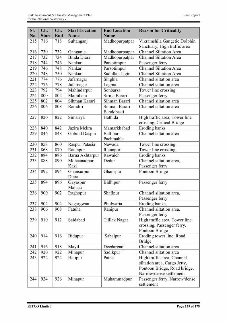
Risk Assessment & Disaster Management Plan Final Report for the National Waterway - 1
KITCO Limited Page 125 of 179
Sl. No.
Ch. Start
Ch. End
Start Location Name
End Location Name
Reason for Criticality
215 716 718 Sultanganj Madhopurpatpar Vikramshila Gangetic Dolphin Sanctuary, High traffic area
216 730 732 Gangania Madhopurpatpar Channel Siltation Area 217 732 734 Binda Diara Madhopurpatpar Channel Siltation Area 218 744 746 Nankar Parsotimpur Passenger ferry 219 746 748 Nankar Parsotimpur Channel Siltation Area 220 748 750 Nankar Sadullah Jagir Channel Siltation Area 221 774 776 Jafarnagar Singhia Channel siltation area 222 776 778 Jafarnagar Lagma Channel siltation area 223 792 794 Mahindarpur Sonbarsa Tower line crossing 224 800 802 Mathihani Sirnia Barari Passenger ferry 225 802 804 Sihman Karari Sihman Barari Channel siltation area 226 806 808 Ramdiri Sihman Barari
Bandobasti Channel siltation area
227 820 822 Simariya Hathida High traffic area, Tower line crossing, Critical Bridge
228 840 842 Jazira Mekra Mamarkhabad Eroding banks 229 846 848 Gobind Daspur Ballipur
Pachmahla Channel siltation area
230 858 860 Raspur Patasia Nawada Tower line crossing 231 868 870 Ratanpur Ratanpur Tower line crossing 232 884 886 Barua Akhtarpur Rawaich Eroding banks 233 888 890 Mohaanadpur
Kazi Dedur Channel siltation area,
Passenger ferry 234 892 894 Ghansurpur
Diara Ghanspur Pontoon Bridge
235 894 896 Gayaspur Mahazi
Bidhipur Passenger ferry
236 900 902 Raghopur Shafipur Channel siltation area, Passenger ferry
237 902 904 Nagargwan Phulwaria Eroding banks, 238 906 908 Fatuha Ranipur Channel siltation area,
Passenger ferry 239 910 912 Saidabad Tilllak Nagar High traffic area, Tower line
crossing, Passenger ferry, Pontoon Bridge
240 914 916 Bidupur Sabalpur Eroding tower line, Road Bridge
241 916 918 Mayil Deedarganj Channel siltation area 242 920 922 Minapur Sadikpur Channel siltation area 243 922 924 Hajipur Patna High traffic area, Channel
siltation area, Cargo Jetty, Pontoon Bridge, Road bridge, Narrow/dense settlement
244 924 926 Minapur Muhammadpur Passenger ferry, Narrow/dense settlement
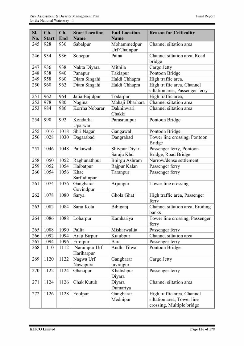
Risk Assessment & Disaster Management Plan Final Report for the National Waterway - 1
KITCO Limited Page 126 of 179
Sl. No.
Ch. Start
Ch. End
Start Location Name
End Location Name
Reason for Criticality
245 928 930 Sabalpur Mohammedpur Urf Chainpur
Channel siltation area
246 934 936 Sonepur Patna Channel siltation area, Road bridge
247 936 938 Nakta Diyara Mithila Cargo Jetty 248 938 940 Panapur Takiapur Pontoon Bridge 249 958 960 Diara Singahi Haldi Chhapra High traffic area, 250 960 962 Diara Singahi Haldi Chhapra High traffic area, Channel
siltation area, Passenger ferry 251 962 964 Jatia Bajidpur Todarpur High traffic area, 252 978 980 Nagina Mahaji Dharhara Channel siltation area 253 984 986 Korrha Nobarar Dakhinwari
Chakki Channel siltation area
254 990 992 Kondarha Uparwar
Parasrampur Pontoon Bridge
255 1016 1018 Shri Nagar Gangawali Pontoon Bridge 256 1028 1030 Dagarabad Dangrabad Tower line crossing, Pontoon
Bridge 257 1046 1048 Paikawali Shivpur Diyar
Saraju Khd Passenger ferry, Pontoon Bridge, Road Bridge
258 1050 1052 Raghunathpur Bhirgu Ashram Narrow/dense settlement 259 1052 1054 Haibatpur Rajpur Kalan Passenger ferry 260 1054 1056 Khae
Sarfudinpur Taranpur Passenger ferry
261 1074 1076 Gangbarar Govindpur
Arjunpur Tower line crossing
262 1078 1080 Sarya Ghola Ghat High traffic area, Passenger ferry
263 1082 1084 Sarai Kota Bibiganj Channel siltation area, Eroding banks
264 1086 1088 Loharpur Kamhariya Tower line crossing, Passenger ferry
265 1088 1090 Pallia Misharwallia Passenger ferry 266 1092 1094 Araji Birpur Kutubpur Channel siltation area 267 1094 1096 Firojpur Bara Passenger ferry 268 1110 1112 Narainpur Urf
Hariharpur Andhi Tilwa Pontoon Bridge
269 1120 1122 Nagwa Urf Nawapura
Gangbarar juvrajpur
Cargo Jetty
270 1122 1124 Ghazipur Khalishpur Diyara
Passenger ferry
271 1124 1126 Chak Kutub Diyara Dumariya
Channel siltation area
272 1126 1128 Foolpur Gangbarar Mednipur
High traffic area, Channel siltation area, Tower line crossing, Multiple bridge
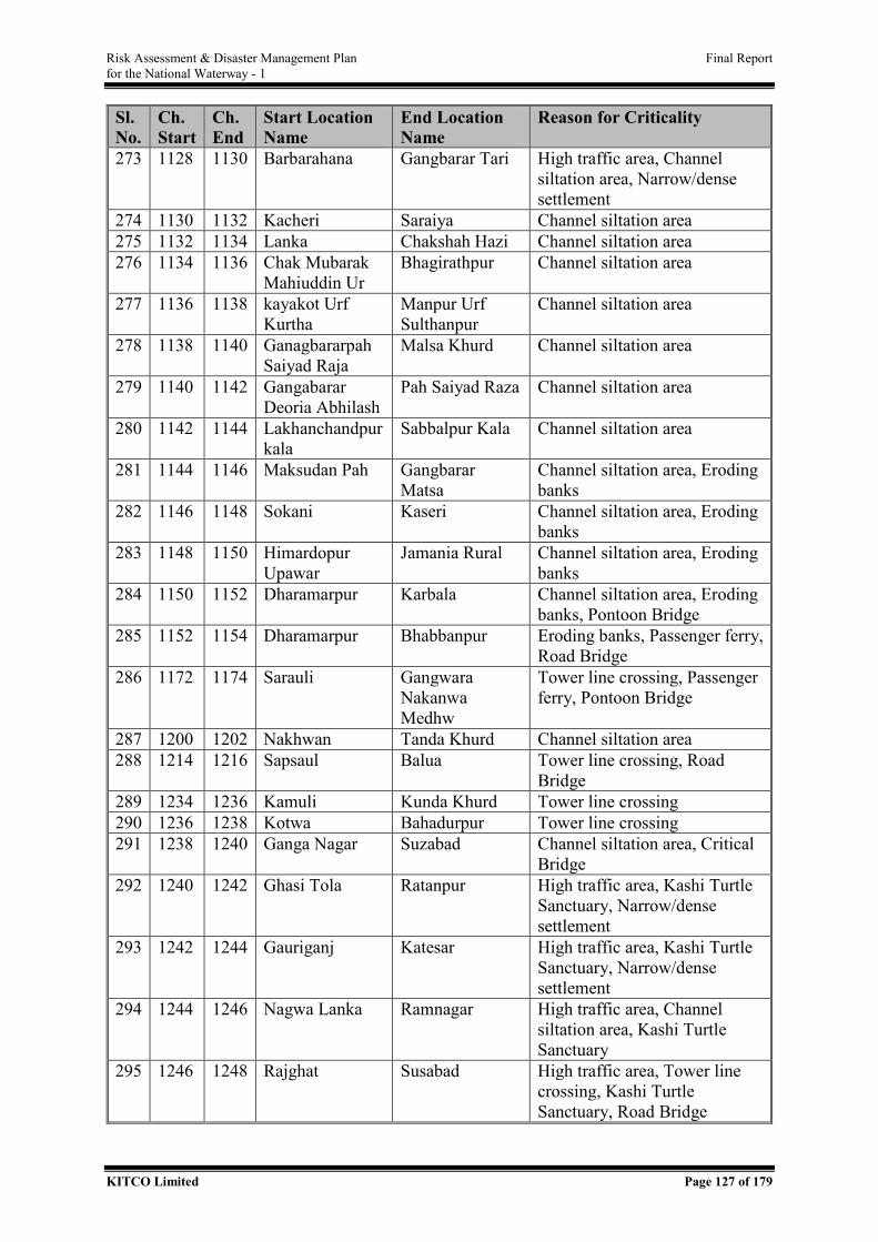
Risk Assessment & Disaster Management Plan Final Report for the National Waterway - 1
KITCO Limited Page 127 of 179
Sl. No.
Ch. Start
Ch. End
Start Location Name
End Location Name
Reason for Criticality
273 1128 1130 Barbarahana Gangbarar Tari High traffic area, Channel siltation area, Narrow/dense settlement
274 1130 1132 Kacheri Saraiya Channel siltation area 275 1132 1134 Lanka Chakshah Hazi Channel siltation area 276 1134 1136 Chak Mubarak
Mahiuddin Ur Bhagirathpur Channel siltation area
277 1136 1138 kayakot Urf Kurtha
Manpur Urf Sulthanpur
Channel siltation area
278 1138 1140 Ganagbararpah Saiyad Raja
Malsa Khurd Channel siltation area
279 1140 1142 Gangabarar Deoria Abhilash
Pah Saiyad Raza Channel siltation area
280 1142 1144 Lakhanchandpur kala
Sabbalpur Kala Channel siltation area
281 1144 1146 Maksudan Pah Gangbarar Matsa
Channel siltation area, Eroding banks
282 1146 1148 Sokani Kaseri Channel siltation area, Eroding banks
283 1148 1150 Himardopur Upawar
Jamania Rural Channel siltation area, Eroding banks
284 1150 1152 Dharamarpur Karbala Channel siltation area, Eroding banks, Pontoon Bridge
285 1152 1154 Dharamarpur Bhabbanpur Eroding banks, Passenger ferry, Road Bridge
286 1172 1174 Sarauli Gangwara Nakanwa Medhw
Tower line crossing, Passenger ferry, Pontoon Bridge
287 1200 1202 Nakhwan Tanda Khurd Channel siltation area 288 1214 1216 Sapsaul Balua Tower line crossing, Road
Bridge 289 1234 1236 Kamuli Kunda Khurd Tower line crossing 290 1236 1238 Kotwa Bahadurpur Tower line crossing 291 1238 1240 Ganga Nagar Suzabad Channel siltation area, Critical
Bridge 292 1240 1242 Ghasi Tola Ratanpur High traffic area, Kashi Turtle
Sanctuary, Narrow/dense settlement
293 1242 1244 Gauriganj Katesar High traffic area, Kashi Turtle Sanctuary, Narrow/dense settlement
294 1244 1246 Nagwa Lanka Ramnagar High traffic area, Channel siltation area, Kashi Turtle Sanctuary
295 1246 1248 Rajghat Susabad High traffic area, Tower line crossing, Kashi Turtle Sanctuary, Road Bridge
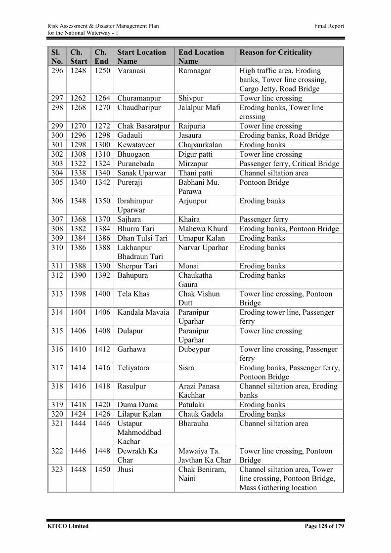
Risk Assessment & Disaster Management Plan Final Report for the National Waterway - 1
KITCO Limited Page 128 of 179
Sl. No.
Ch. Start
Ch. End
Start Location Name
End Location Name
Reason for Criticality
296 1248 1250 Varanasi Ramnagar High traffic area, Eroding banks, Tower line crossing, Cargo Jetty, Road Bridge
297 1262 1264 Churamanpur Shivpur Tower line crossing 298 1268 1270 Chaudharipur Jalalpur Mafi Eroding banks, Tower line
crossing 299 1270 1272 Chak Basaratpur Raipuria Tower line crossing 300 1296 1298 Gadauli Jasaura Eroding banks, Road Bridge 301 1298 1300 Kewataveer Chapaurkalan Eroding banks 302 1308 1310 Bhuogaon Digur patti Tower line crossing 303 1322 1324 Puranebada Mirzapur Passenger ferry, Critical Bridge 304 1338 1340 Sanak Uparwar Thani patti Channel siltation area 305 1340 1342 Pureraji Babhani Mu.
Parawa Pontoon Bridge
306 1348 1350 Ibrahimpur Uparwar
Arjunpur Eroding banks
307 1368 1370 Sajhara Khaira Passenger ferry 308 1382 1384 Bhurra Tari Mahewa Khurd Eroding banks, Pontoon Bridge 309 1384 1386 Dhan Tulsi Tari Umapur Kalan Eroding banks 310 1386 1388 Lakhanpur
Bhadraun Tari Narvar Uparhar Eroding banks
311 1388 1390 Sherpur Tari Monai Eroding banks 312 1390 1392 Bahupura Chaukatha
Gaura Eroding banks
313 1398 1400 Tela Khas Chak Vishun Dutt
Tower line crossing, Pontoon Bridge
314 1404 1406 Kandala Mavaia Paranipur Uparhar
Eroding tower line, Passenger ferry
315 1406 1408 Dulapur Paranipur Uparhar
Tower line crossing
316 1410 1412 Garhawa Dubeypur Tower line crossing, Passenger ferry
317 1414 1416 Teliyatara Sisra Eroding banks, Passenger ferry, Pontoon Bridge
318 1416 1418 Rasulpur Arazi Panasa Kachhar
Channel siltation area, Eroding banks
319 1418 1420 Duma Duma Patulaki Eroding banks 320 1424 1426 Lilapur Kalan Chauk Gadela Eroding banks 321 1444 1446 Ustapur
Mahmoddbad Kachar
Bharauha Channel siltation area
322 1446 1448 Dewrakh Ka Char
Mawaiya Ta. Javthan Ka Char
Tower line crossing, Pontoon Bridge
323 1448 1450 Jhusi Chak Beniram, Naini
Channel siltation area, Tower line crossing, Pontoon Bridge, Mass Gathering location
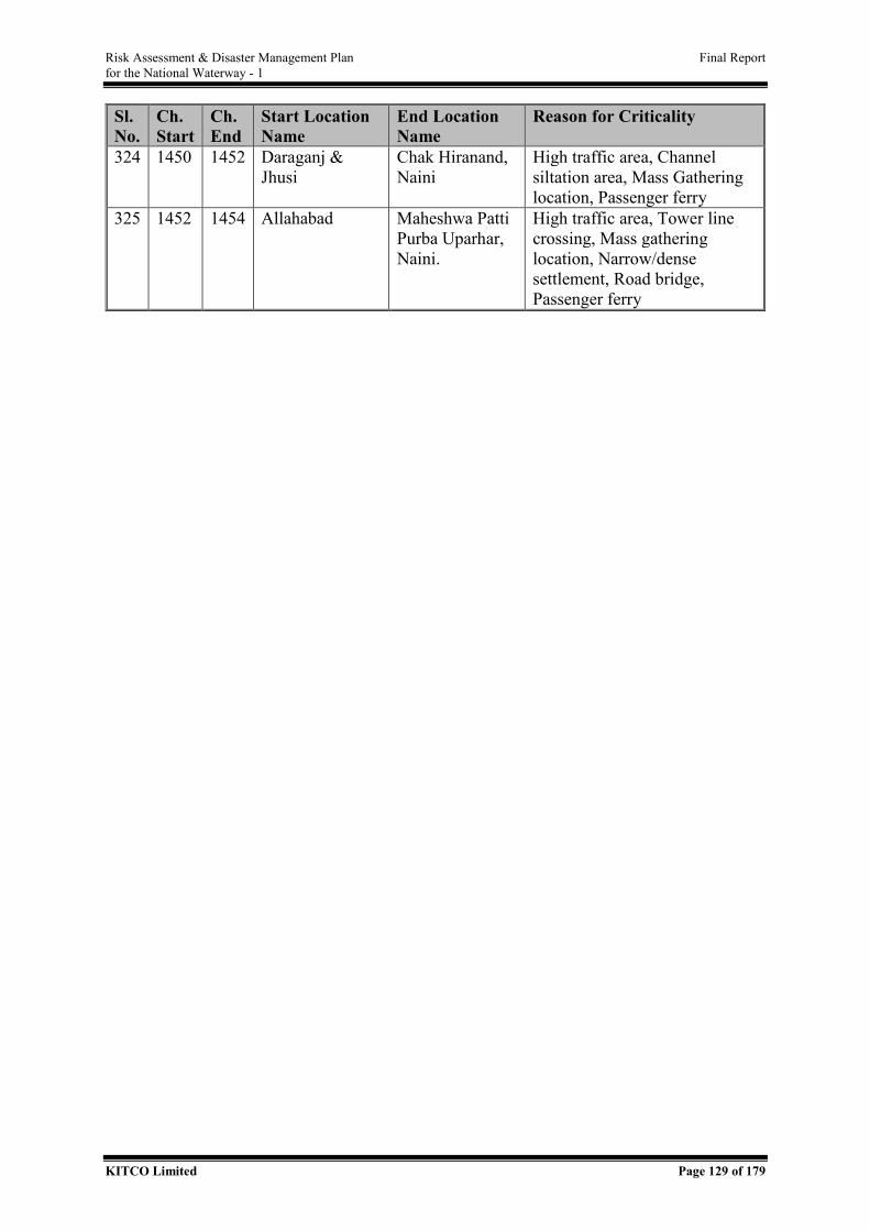
Risk Assessment & Disaster Management Plan Final Report for the National Waterway - 1
KITCO Limited Page 129 of 179
Sl. No.
Ch. Start
Ch. End
Start Location Name
End Location Name
Reason for Criticality
324 1450 1452 Daraganj & Jhusi
Chak Hiranand, Naini
High traffic area, Channel siltation area, Mass Gathering location, Passenger ferry
325 1452 1454 Allahabad Maheshwa Patti Purba Uparhar, Naini.
High traffic area, Tower line crossing, Mass gathering location, Narrow/dense settlement, Road bridge, Passenger ferry
Risk Assessment & Disaster Management Plan Final Report for the National Waterway - 1
KITCO Limited Page 130 of 179
ANNEXURE III - CARGO ANALYSIS BASED ON THEIR APPLICABILITY TO
IMDG AND IMSBC
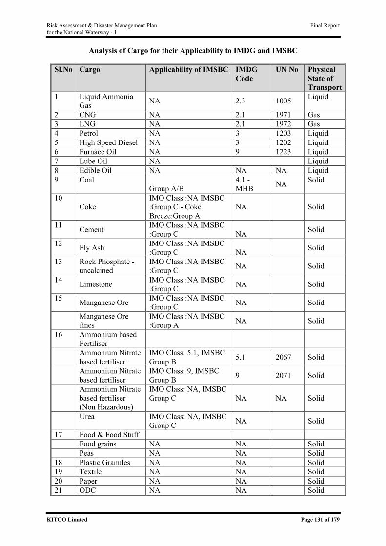
Risk Assessment & Disaster Management Plan Final Report for the National Waterway - 1
KITCO Limited Page 131 of 179
Analysis of Cargo for their Applicability to IMDG and IMSBC
Sl.No Cargo Applicability of IMSBC IMDG Code
UN No Physical State of Transport
1 Liquid Ammonia Gas NA 2.3 1005 Liquid
2 CNG NA 2.1 1971 Gas 3 LNG NA 2.1 1972 Gas 4 Petrol NA 3 1203 Liquid 5 High Speed Diesel NA 3 1202 Liquid 6 Furnace Oil NA 9 1223 Liquid 7 Lube Oil NA Liquid 8 Edible Oil NA NA NA Liquid 9 Coal
Group A/B 4.1 - MHB NA Solid
10 Coke
IMO Class :NA IMSBC :Group C - Coke Breeze:Group A
NA Solid
11 Cement IMO Class :NA IMSBC :Group C NA Solid
12 Fly Ash IMO Class :NA IMSBC :Group C NA Solid
13 Rock Phosphate - uncalcined
IMO Class :NA IMSBC :Group C NA Solid
14 Limestone IMO Class :NA IMSBC :Group C NA Solid
15 Manganese Ore IMO Class :NA IMSBC :Group C NA Solid
Manganese Ore fines
IMO Class :NA IMSBC :Group A NA Solid
16 Ammonium based Fertiliser
Ammonium Nitrate based fertiliser
IMO Class: 5.1, IMSBC Group B 5.1 2067 Solid
Ammonium Nitrate based fertiliser
IMO Class: 9, IMSBC Group B 9 2071 Solid
Ammonium Nitrate based fertiliser (Non Hazardous)
IMO Class: NA, IMSBC Group C NA NA Solid
Urea IMO Class: NA, IMSBC Group C NA Solid
17 Food & Food Stuff Food grains NA NA Solid Peas NA NA Solid 18 Plastic Granules NA NA Solid 19 Textile NA NA Solid 20 Paper NA NA Solid 21 ODC NA NA Solid
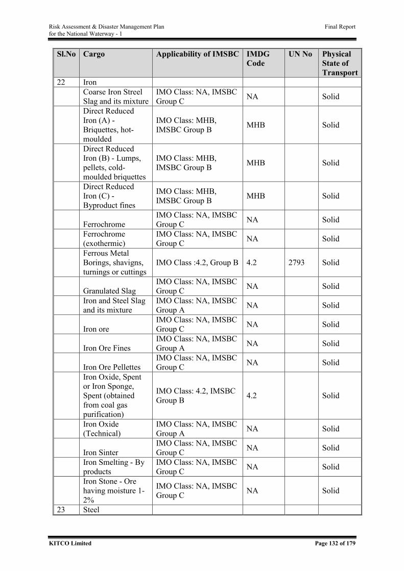
Risk Assessment & Disaster Management Plan Final Report for the National Waterway - 1
KITCO Limited Page 132 of 179
Sl.No Cargo Applicability of IMSBC IMDG Code
UN No Physical State of Transport
22 Iron Coarse Iron Streel
Slag and its mixture IMO Class: NA, IMSBC Group C NA Solid
Direct Reduced Iron (A) - Briquettes, hot-moulded
IMO Class: MHB, IMSBC Group B MHB Solid
Direct Reduced Iron (B) - Lumps, pellets, cold-moulded briquettes
IMO Class: MHB, IMSBC Group B MHB Solid
Direct Reduced Iron (C) - Byproduct fines
IMO Class: MHB, IMSBC Group B MHB Solid
Ferrochrome
IMO Class: NA, IMSBC Group C NA Solid
Ferrochrome (exothermic)
IMO Class: NA, IMSBC Group C NA Solid
Ferrous Metal Borings, shavigns, turnings or cuttings
IMO Class :4.2, Group B 4.2 2793 Solid
Granulated Slag
IMO Class: NA, IMSBC Group C NA Solid
Iron and Steel Slag and its mixture
IMO Class: NA, IMSBC Group A NA Solid
Iron ore
IMO Class: NA, IMSBC Group C NA Solid
Iron Ore Fines
IMO Class: NA, IMSBC Group A NA Solid
Iron Ore Pellettes
IMO Class: NA, IMSBC Group C NA Solid
Iron Oxide, Spent or Iron Sponge, Spent (obtained from coal gas purification)
IMO Class: 4.2, IMSBC Group B 4.2 Solid
Iron Oxide (Technical)
IMO Class: NA, IMSBC Group A NA Solid
Iron Sinter
IMO Class: NA, IMSBC Group C NA Solid
Iron Smelting - By products
IMO Class: NA, IMSBC Group C NA Solid
Iron Stone - Ore having moisture 1-2%
IMO Class: NA, IMSBC Group C NA Solid
23 Steel
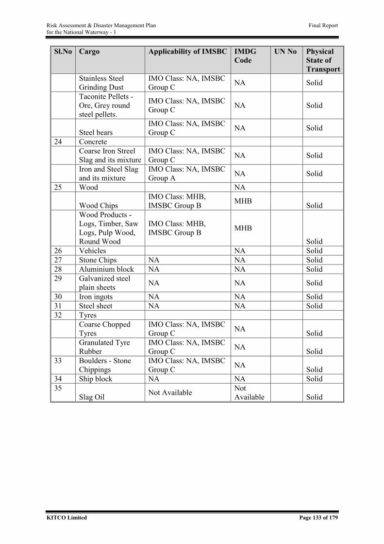
Risk Assessment & Disaster Management Plan Final Report for the National Waterway - 1
KITCO Limited Page 133 of 179
Sl.No Cargo Applicability of IMSBC IMDG Code
UN No Physical State of Transport
Stainless Steel Grinding Dust
IMO Class: NA, IMSBC Group C NA Solid
Taconite Pellets - Ore, Grey round steel pellets.
IMO Class: NA, IMSBC Group C NA Solid
Steel bears
IMO Class: NA, IMSBC Group C NA Solid
24 Concrete Coarse Iron Streel
Slag and its mixture IMO Class: NA, IMSBC Group C NA Solid
Iron and Steel Slag and its mixture
IMO Class: NA, IMSBC Group A NA Solid
25 Wood NA
Wood Chips IMO Class: MHB, IMSBC Group B MHB Solid
Wood Products - Logs, Timber, Saw Logs, Pulp Wood, Round Wood
IMO Class: MHB, IMSBC Group B MHB
Solid 26 Vehicles NA Solid 27 Stone Chips NA NA Solid 28 Aluminium block NA NA Solid 29 Galvanized steel
plain sheets NA NA Solid
30 Iron ingots NA NA Solid 31 Steel sheet NA NA Solid 32 Tyres Coarse Chopped
Tyres IMO Class: NA, IMSBC Group C NA Solid
Granulated Tyre Rubber
IMO Class: NA, IMSBC Group C NA Solid
33 Boulders - Stone Chippings
IMO Class: NA, IMSBC Group C NA Solid
34 Ship block NA NA Solid 35
Slag Oil Not Available Not Available Solid

Risk Assessment & Disaster Management Plan Final Report for the National Waterway - 1
KITCO Limited Page 134 of 179

Risk Assessment & Disaster Management Plan Final Report for the National Waterway - 1
KITCO Limited Page 135 of 179
ANNEXURE IV - SILTATION AREAS
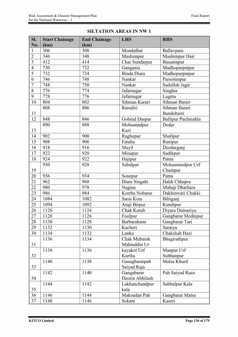
Risk Assessment & Disaster Management Plan Final Report for the National Waterway - 1
KITCO Limited Page 136 of 179
SILTATION AREAS IN NW 1
Sl. No.
Start Chainage (km)
End Chainage (km)
LHS RHS
1 306 308 Mondalhat Ballavpara 2 346 348 Mashimpur Mashimpur Dair 3 412 414 Char Sundarpur Basantapur 4 730 732 Gangania Madhopurpatpar 5 732 734 Binda Diara Madhopurpatpar 6 746 748 Nankar Parsotimpur 7 748 750 Nankar Sadullah Jagir 8 776 774 Jafarnagar Singhia 9 778 776 Jafarnagar Lagma 10 804 802 Sihman Karari Sihman Barari
11 808 806 Ramdiri Sihman Barari
Bandobasti 12 848 846 Gobind Daspur Ballipur Pachmahla
13 890 888 Mohaanadpur
Kazi Dedur
14 902 900 Raghopur Shafipur 15 908 906 Fatuha Ranipur 16 918 916 Mayil Deedarganj 17 922 920 Minapur Sadikpur 18 924 922 Hajipur Patna
19 930 928 Sabalpur Mohammedpur Urf
Chainpur 20 936 934 Sonepur Patna 21 962 960 Diara Singahi Haldi Chhapra 22 980 978 Nagina Mahaji Dharhara 23 986 984 Korrha Nobarar Dakhinwari Chakki 24 1084 1082 Sarai Kota Bibiganj 25 1094 1092 Araji Birpur Kutubpur 26 1126 1124 Chak Kutub Diyara Dumariya 27 1128 1126 Foolpur Gangbarar Mednipur 28 1130 1128 Barbarahana Gangbarar Tari 29 1132 1130 Kacheri Saraiya 30 1134 1132 Lanka Chakshah Hazi
31 1136 1134 Chak Mubarak
Mahiuddin Ur Bhagirathpur
32 1138 1136 kayakot Urf
Kurtha Manpur Urf Sulthanpur
33 1140 1138 Ganagbararpah
Saiyad Raja Malsa Khurd
34 1142 1140 Gangabarar
Deoria Abhilash Pah Saiyad Raza
35 1144 1142 Lakhanchandpur
kala Sabbalpur Kala
36 1146 1144 Maksudan Pah Gangbarar Matsa 37 1148 1146 Sokani Kaseri
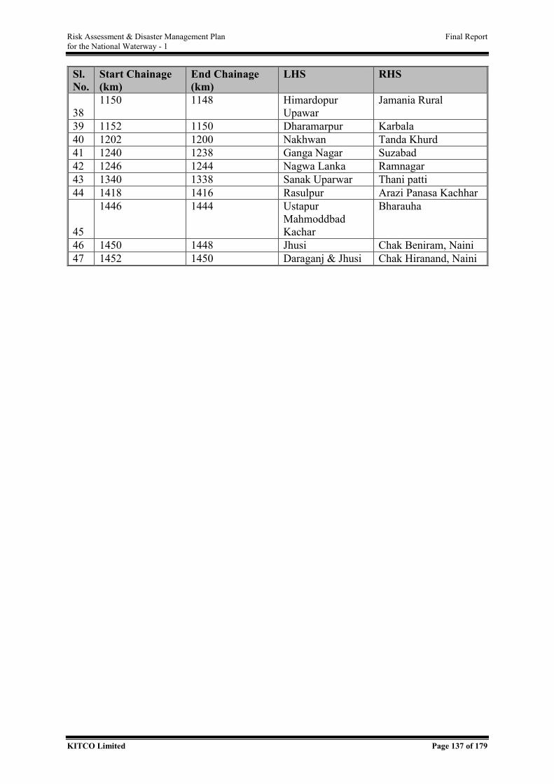
Risk Assessment & Disaster Management Plan Final Report for the National Waterway - 1
KITCO Limited Page 137 of 179
Sl. No.
Start Chainage (km)
End Chainage (km)
LHS RHS
38 1150 1148 Himardopur
Upawar Jamania Rural
39 1152 1150 Dharamarpur Karbala 40 1202 1200 Nakhwan Tanda Khurd 41 1240 1238 Ganga Nagar Suzabad 42 1246 1244 Nagwa Lanka Ramnagar 43 1340 1338 Sanak Uparwar Thani patti 44 1418 1416 Rasulpur Arazi Panasa Kachhar
45
1446 1444 Ustapur Mahmoddbad Kachar
Bharauha
46 1450 1448 Jhusi Chak Beniram, Naini 47 1452 1450 Daraganj & Jhusi Chak Hiranand, Naini
Risk Assessment & Disaster Management Plan Final Report for the National Waterway - 1
KITCO Limited Page 138 of 179
ANNEXURE V - MULTIPLE FERRY CROSSING LOCATIONS
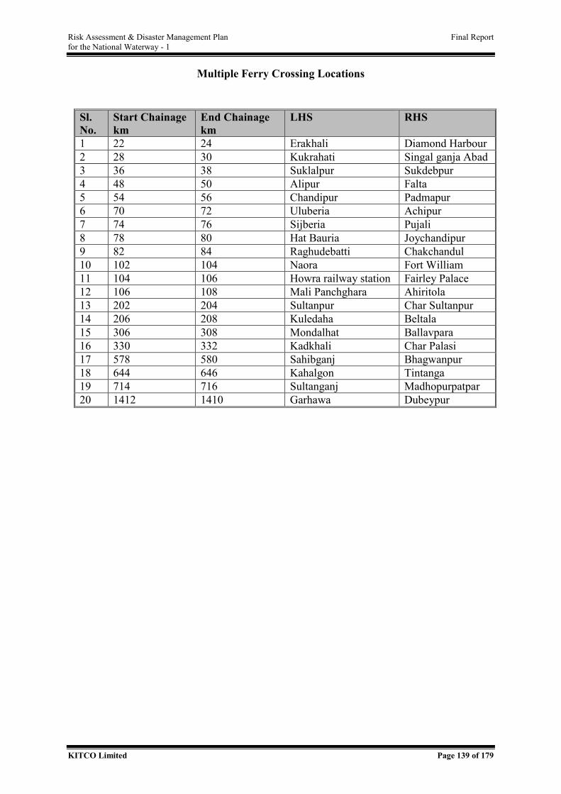
Risk Assessment & Disaster Management Plan Final Report for the National Waterway - 1
KITCO Limited Page 139 of 179
Multiple Ferry Crossing Locations
Sl. No.
Start Chainage km
End Chainage km
LHS RHS
1 22 24 Erakhali Diamond Harbour 2 28 30 Kukrahati Singal ganja Abad 3 36 38 Suklalpur Sukdebpur 4 48 50 Alipur Falta 5 54 56 Chandipur Padmapur 6 70 72 Uluberia Achipur 7 74 76 Sijberia Pujali 8 78 80 Hat Bauria Joychandipur 9 82 84 Raghudebatti Chakchandul 10 102 104 Naora Fort William 11 104 106 Howra railway station Fairley Palace 12 106 108 Mali Panchghara Ahiritola 13 202 204 Sultanpur Char Sultanpur 14 206 208 Kuledaha Beltala 15 306 308 Mondalhat Ballavpara 16 330 332 Kadkhali Char Palasi 17 578 580 Sahibganj Bhagwanpur 18 644 646 Kahalgon Tintanga 19 714 716 Sultanganj Madhopurpatpar 20 1412 1410 Garhawa Dubeypur
Risk Assessment & Disaster Management Plan Final Report for the National Waterway - 1
KITCO Limited Page 140 of 179
ANNEXURE VI - CONSEQUENCES & RESPONSE ACTION FOR SHORTLISTED
CARGO
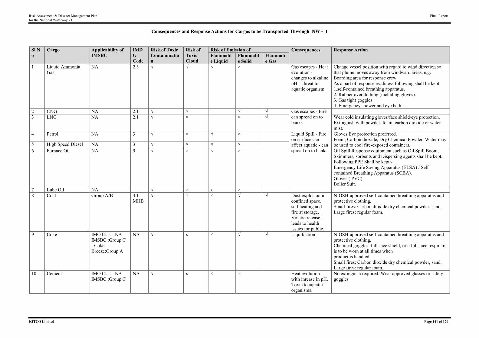
Risk Assessment & Disaster Management Plan Final Report for the National Waterway - 1
KITCO Limited Page 141 of 179
Consequences and Response Actions for Cargos to be Transported Thwough NW - 1
Sl.No
Cargo Applicability of IMSBC
IMDG Code
Risk of Toxic Contamination
Risk of Toxic Cloud
Risk of Emission of Consequences Response Action Flammable Liquid
Flammable Solid
Flammabe Gas
1 Liquid Ammonia Gas
NA 2.3 √ √ × × Gas escapes - Heat evolution - changes to alkaline pH - threat to aquatic organism
Change vessel position with regard to wind direction so that plume moves away from windward areas, e.g. Boarding area for response crew. As a part of response readiness following shall be kept 1.self-contained breathing apparatus. 2. Rubber overclothing (including gloves). 3. Gas tight goggles 4. Emergency shower and eye bath
2 CNG NA 2.1 √ ×
× √ Gas escapes - Fire can spread on to banks
3 LNG NA 2.1 √ ×
× √ Wear cold insulating gloves/face shield/eye protection.
Extinguish with powder, foam, carbon dioxide or water mist.
4 Petrol NA 3 √ × √ × Liquid Spill - Fire on surface can affect aquatic - can spread on to banks
Gloves,Eye protection preferred. Foam, Carbon dioxide, Dry Chemical Powder. Water may be used to cool fire-exposed containers. 5 High Speed Diesel NA 3 √ × √ ×
6 Furnace Oil NA 9 √ × × × Oil Spill Response equipment such as Oil Spill Boom, Skimmers, sorbents and Dispersing agents shall be kept. Following PPE Shall be kept:- Emergency Life Saving Apparatus (ELSA) / Self contained Breathing Apparatus (SCBA). Gloves ( PVC) Bolier Suit.
7 Lube Oil NA √ × x × 8 Coal Group A/B 4.1 -
MHB √ × × √ √ Dust explosion in
confined space, self heating and fire at storage. Volatie release leads to health issues for public.
NIOSH-approved self-contained breathing apparatus and protective clothing. Small fires: Carbon dioxide dry chemical powder, sand. Large fires: regular foam.
9 Coke IMO Class :NA IMSBC :Group C - Coke Breeze:Group A
NA √ x × √ √ Liquifaction NIOSH-approved self-contained breathing apparatus and protective clothing. Chemical goggles, full-face shield, or a full-face respirator is to be worn at all times when product is handled. Small fires: Carbon dioxide dry chemical powder, sand. Large fires: regular foam.
10 Cement IMO Class :NA IMSBC :Group C
NA √ x × × Heat evolution with inrease in pH. Toxic to aquatic organisms.
No extinguish required. Wear approved glasses or safety goggles
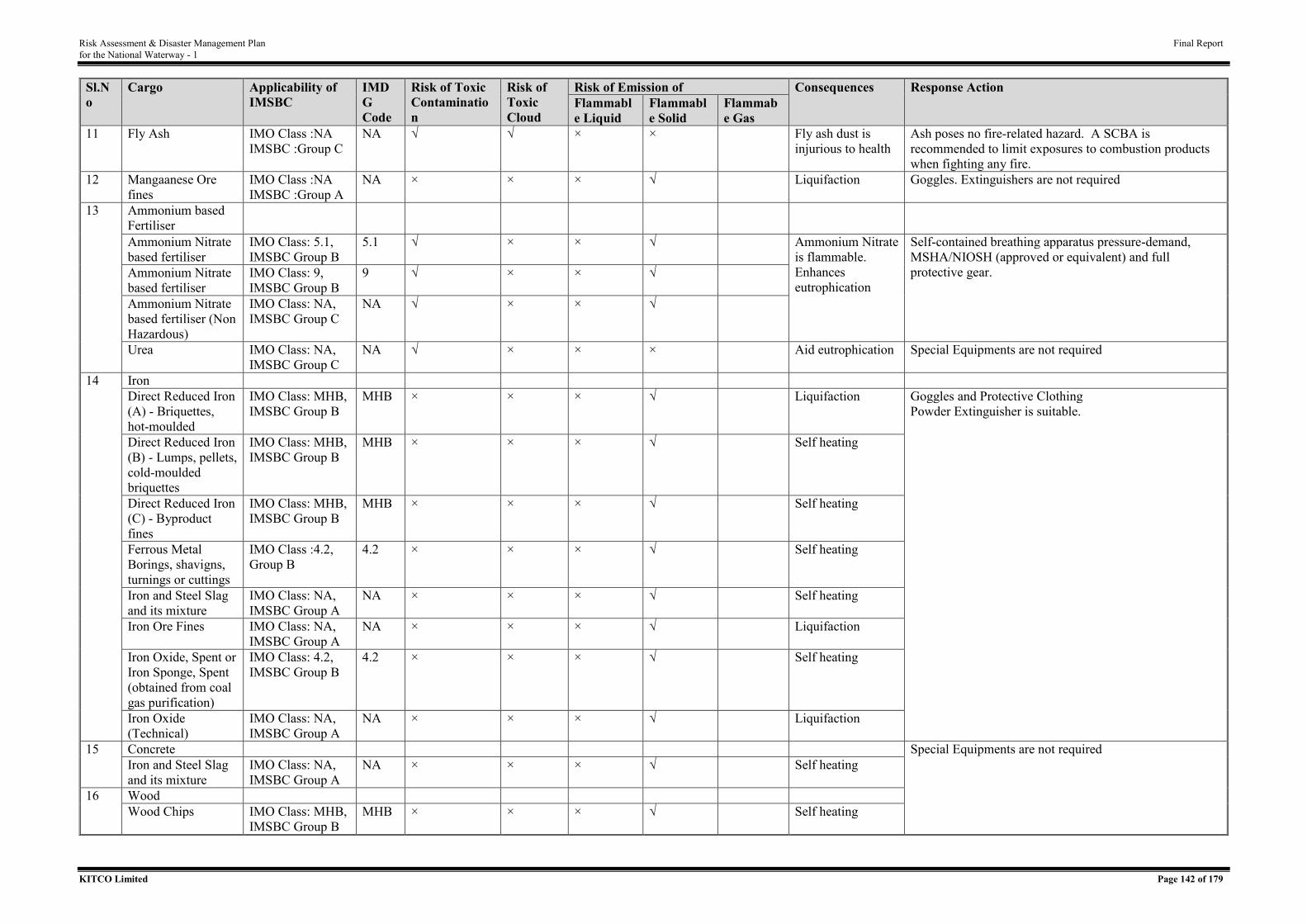
Risk Assessment & Disaster Management Plan Final Report for the National Waterway - 1
KITCO Limited Page 142 of 179
Sl.No
Cargo Applicability of IMSBC
IMDG Code
Risk of Toxic Contamination
Risk of Toxic Cloud
Risk of Emission of Consequences Response Action Flammable Liquid
Flammable Solid
Flammabe Gas
11 Fly Ash IMO Class :NA IMSBC :Group C
NA √ √ × × Fly ash dust is injurious to health
Ash poses no fire-related hazard. A SCBA is recommended to limit exposures to combustion products when fighting any fire.
12 Mangaanese Ore fines
IMO Class :NA IMSBC :Group A
NA × × × √ Liquifaction Goggles. Extinguishers are not required
13
Ammonium based Fertiliser
Ammonium Nitrate based fertiliser
IMO Class: 5.1, IMSBC Group B
5.1 √ × × √ Ammonium Nitrate is flammable. Enhances eutrophication
Self-contained breathing apparatus pressure-demand, MSHA/NIOSH (approved or equivalent) and full protective gear. Ammonium Nitrate
based fertiliser IMO Class: 9, IMSBC Group B
9 √ × × √
Ammonium Nitrate based fertiliser (Non Hazardous)
IMO Class: NA, IMSBC Group C
NA √ × × √
Urea IMO Class: NA, IMSBC Group C
NA √ × × × Aid eutrophication Special Equipments are not required
14
Iron Direct Reduced Iron (A) - Briquettes, hot-moulded
IMO Class: MHB, IMSBC Group B
MHB × × × √ Liquifaction Goggles and Protective Clothing Powder Extinguisher is suitable.
Direct Reduced Iron (B) - Lumps, pellets, cold-moulded briquettes
IMO Class: MHB, IMSBC Group B
MHB × × × √ Self heating
Direct Reduced Iron (C) - Byproduct fines
IMO Class: MHB, IMSBC Group B
MHB × × × √ Self heating
Ferrous Metal Borings, shavigns, turnings or cuttings
IMO Class :4.2, Group B
4.2 × × × √ Self heating
Iron and Steel Slag and its mixture
IMO Class: NA, IMSBC Group A
NA × × × √ Self heating
Iron Ore Fines IMO Class: NA, IMSBC Group A
NA × × × √ Liquifaction
Iron Oxide, Spent or Iron Sponge, Spent (obtained from coal gas purification)
IMO Class: 4.2, IMSBC Group B
4.2 × × × √ Self heating
Iron Oxide (Technical)
IMO Class: NA, IMSBC Group A
NA × × × √ Liquifaction
15
Concrete Special Equipments are not required Iron and Steel Slag and its mixture
IMO Class: NA, IMSBC Group A
NA × × × √ Self heating
16
Wood Wood Chips IMO Class: MHB,
IMSBC Group B MHB × × × √ Self heating
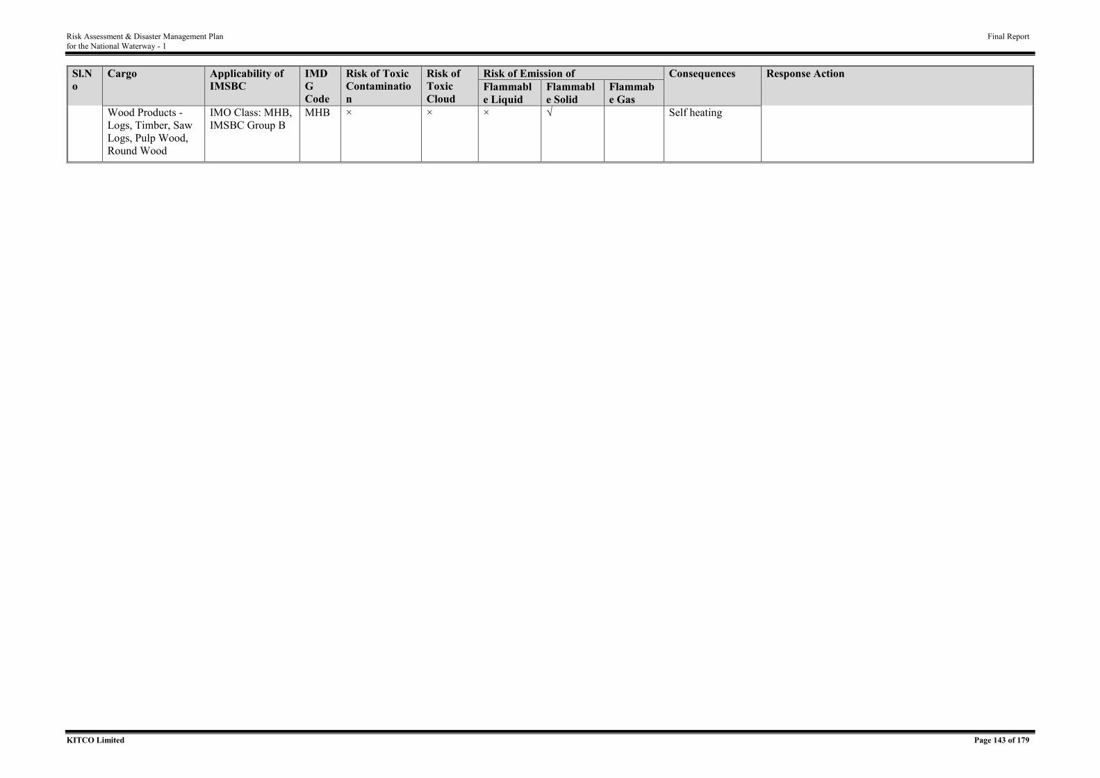
Risk Assessment & Disaster Management Plan Final Report for the National Waterway - 1
KITCO Limited Page 143 of 179
Sl.No
Cargo Applicability of IMSBC
IMDG Code
Risk of Toxic Contamination
Risk of Toxic Cloud
Risk of Emission of Consequences Response Action Flammable Liquid
Flammable Solid
Flammabe Gas
Wood Products - Logs, Timber, Saw Logs, Pulp Wood, Round Wood
IMO Class: MHB, IMSBC Group B
MHB × × × √ Self heating
Risk Assessment & Disaster Management Plan Final Report for the National Waterway - 1
KITCO Limited Page 144 of 179
ANNEXURE VII - STANDARD OPERATING PROCEDURES
Risk Assessment & Disaster Management Plan Final Report for the National Waterway - 1
KITCO Limited Page 145 of 179
Inland vessel act, 1917 amended time to time serve as the apex act on Inland Vessel operation
in India. The acts focusses on the following key aspects of inland navigation
• Survey of Inland mechanically Propelled Vessels
• Registration of Inland Mechanically Propelled Vessels
• Master including Seragns and Engineers including Engine Drivers inland
mechanically propelled vessels
• Investigation in to causalities
• Removal of obstructions and similar hazards in navigation
• Suspension and cancellation of certificates granted under the act
• Protection of an carriage of passenger in inland mechanically propelled vessels
• Insurance of mechanically propelled vessels against third party risk
• Prevention and control of pollution an protection of inland water
• Penalties and legal proceedings
Relating the most relevant sections of act to risk assessment and disaster management plans,
SOPs has been framed for
• Removal of obstructions and similar hazards in navigation
• Investigation in to causalities
• Prevention and control of pollution and protection of inland water
Risk Assessment & Disaster Management Plan Final Report for the National Waterway - 1
KITCO Limited Page 146 of 179
1. SOP FOR THE REMOVAL OF OBSTRUCTIONS AND SIMILAR HAZARDS IN NAVIGATION
1.1. Objective
The objective is to delineate a procedure with allocation of responsibility for the removal
of obstruction and similar hazards in navigation caused by mechanically propelled vessel
or other vessel when wrecked, stranded or sunk in any inland water. The section also
discuss on procedure with allocation of responsibility for the removal of obstruction
caused by timber, raft or other thing, floating and including fouling/hooking of
mechanically propelled vessels in buoys or moorings laid down by the authority in the
inland water.
1.2. General
The obstruction, impediment or danger of the inland water for the safe and convenient
navigation or use of inland water or the landing place or embarkment or part thereof, any
officer empowered by the State Government by notification in the Official Gazette will be
responsible for clearing the obstruction. The major obstruction envisaged are wreck of
mechanically propelled vessels, other vessels, timber, raft, or other things floating or being
in any part of the inland water. Other hindrance for navigation are obstruction or
impediment to the navigation of the inland water lawfully made or due to fouling of
government moorings by hooking of mechanically propelled vessels.
1.3. Responsibility
• Officer empowered by the State Government shall cause the vessel to be
raised, removed, blown up or otherwise destroy as the circumstances may
warrant or remove any timber, raft or other thing, floating or being in any part
of the inland water obstructing or impeding the free navigation thereof or the
lawful use of any landing place or embankment or part thereof.
• Competent officer acting for the property recovery may sell the property by
public auction, if the property recovered is unclaimed or the person claiming
it fails to pay reasonable expenses incurred for recovery.
• The officer shall pay the balance after recovery of expense to the person
entitled to the property recovered or if no such person appears to claim the
balance, the amount will be deposited for payment without interest, to the
person establishing his right thereto.
Risk Assessment & Disaster Management Plan Final Report for the National Waterway - 1
KITCO Limited Page 147 of 179
• Competent officer shall recover deficiency from the owner of recovered
property if the property are not sufficient to meet the expenses and further
sum aforesaid for the recovery.
• The officer shall report of obstruction/impediment to the State Government
to navigation of inland water and removal of the same or alteration after
making reasonable compensation to the person suffering damage by such
removal or alteration.
• The officer shall clear fouling when a mechanically propelled vessel hooked
on a buoys or mooring laid down by authority on receipt of information of
such accident.
1.4. Methodology
1.4.1. Raising of or Removal of Wreck Impeding Navigation etc.
• Obstruction, impediment or danger to the safe and convenient navigation or
use of inland water or the landing place or embarkment or part thereof with
the wreck of vessels, shall be cleared by raising, removal, blowing up or
otherwise destroying as the circumstances may warrant for vessels.
• Selling of the property by public auction if any property recovered by a
competent officer is unclaimed or the person claiming it fails to pay
reasonable expenses incurred by the competent officer under that sub-section
and a further sum of twenty-five per cent. of the amount of such expenses.
• The expenses and further sum shall be payable to the competent officer out
of the sale proceeds of the property, and the balance shall be paid to the person
entitled to the property recovered, or, if no such person appears and claims
the balance, shall be held in deposit for payment, without interest, to the
person thereafter establishing his right thereto.
• Where the sale proceeds of the property are not sufficient to meet the expenses
and further sum aforesaid, the owner of the vessel at the time the vessel was
wrecked, stranded or sunk shall be liable to pay the deficiency to the
competent officer on demand, and if the deficiency be not paid within the
month of such demand, the competent officer may recover the deficiency
from such owner as if it were an arrear of land revenue.
Risk Assessment & Disaster Management Plan Final Report for the National Waterway - 1
KITCO Limited Page 148 of 179
1.4.2. Removal of Obstruction in Inland Water
• Removal of timber, raft or other thing, floating or being in any part of the
inland water, which, in his opinion, obstructs or impedes the free navigation
thereof or the lawful use of any landing place or embarkment or part thereof.
• Owner of timber, raft or other thing shall be liable to pay the reasonable
expenses of the removal thereof, and if such owner or any other person has
without lawful excuse caused any such obstruction or impediment, or causes
any public nuisance affecting or likely to affect such free navigation or lawful
use.
• If the owner neglects to pay the expenses incurred in the removal thereof,
within one week after demand or within fourteen days after such removal has
been notified in the Official Gazette, the materials of any public nuisance so
removed can be sold by public auction and may retain all the expenses of such
removal and sale out of the proceeds.
1.4.3. Removal of Lawful Obstruction
• For obstruction or impediment to the navigation of any inland water has been
lawfully made or has become lawful by reason of the long continuance of
such obstruction or impediment or otherwise.
• Removal or alteration, making reasonable compensation to the person
suffering damage by such removal or alteration.
• Settling of dispute arising out of or concerning such compensation shall be
determined according to the law relating to like disputes in the case of land
required for public purposes
1.4.4. Fouling of Government Moorings
• For hooking of mechanically propelled vessel or gets fouled in any of the
buoys or moorings laid down by or by the authority of the State Government
in any part of inland water, the master of such vessel shall not, nor shall any
other person, except in the case of emergency lift the buoy or mooring for the
purpose of unhooking or getting clear from the same.
• The competent officer immediately on receiving information of such
accident, shall assist and superintend the clearing of such vessel and the
Risk Assessment & Disaster Management Plan Final Report for the National Waterway - 1
KITCO Limited Page 149 of 179
master of the vessel shall, on demand, pay such reasonable expenses as may
be incurred in clearing the same.
2. SOP for Investigation in to Causalities
2.1. Objective
Objective of the SOP is for understanding the proceedure as per IV Act on investigations of
casualities assocated with Inland vessels. In line with IV Act, the report of causalities has be to
made to the nearest Police Station whenever
• Any inland mechanically propelled vessels has been wrecked abandoned or
materially damaged or
• By reason of any casualty happening to or on board or any inland mechanically
propelled vessel, loss of life has ensured
• Or any inland mechanically prospered vessel has caused loss or material damage
to any other vessel
2.2. Responsibility
The master of the vessel shall forthwith give notice of the wreck, abandonment, damage,
casualty, or loss to the officer in charge of the nearest police station. State government is
authorised to investigate the casualities associated with Inland Vessels.
2.3. Methodology
State government shall exercise the various powers on investigation in to casualities as
presented below.
2.3.1. Power of State Government to Appoint Court of Investigation
Any case reported under section defined above or otherwise brought to its notice, the state
government may
• Appoint a special court and direct the Court to make the investigation at such
place as the State Government may fix in this behalf , or
• Direct any principal court of ordinary criminal jurisdiction or the court of any
District Magistrate to make the investigation.
• A special court shall be appointed consisting of not less than two nor more than
four persons. One shall be a magistrate, one shall be person conversant with
maritime affairs or with the navigation of inland mechanically propelled vessel.
Risk Assessment & Disaster Management Plan Final Report for the National Waterway - 1
KITCO Limited Page 150 of 179
• Others shall be conversant with either maritime or mercantile affairs, or with the
navigation of inland mechanically propelled vessel
2.3.1.1. Power of Court of investigation to inquire into charges of incompetency or misconduct.
Court making an investigation under section 33 may inquire into any charge of incompetency
or misconduct arising in the course of the investigation against any master, engineer, or engine
driver, or any person holding a certificate granted under chapter III, as well as into any charge
of a wrongful act or default on his part causing any wreck, abandonment, damage casualty, or
loss referred in section 32 of IV Act.
• In every case, in which any charge arises against the master, engineer, or engine
driver, or any person holding a certificate granted under Chapter III in the course
of an investigation, the court shall, before the commencement of the inquiry shall
furnish him a copy of the report or any statement upon the case upon which the
investigation has been directed.
2.3.2. Power of State Government to Direct Investigation Otherwise than under Court
of Investigation
• The state government may send a statement of the case to the principal Court of
ordinary criminal jurisdiction, or the Court of the District magistrate , or at nearest
to the place at which it may be convenient for the parties and witness to attend
and may direct the Court to make an investigation into the charge.
• Before commencing an investigation, the court shall cause the person charged to
be furnished with a copy of the statement of the case sent by the State
Government.
2.3.2.1. Person Charged to be Heard
• For the purpose of the investigation, any charge against the a master, engineer, or
an engine driver, or any person holding a certificate granted under Chapter III,
the court may summon him to appear, and shall give him full opportunity of
making a defence , either in person or otherwise.
• The court may summon the person to appear for the purpose of investigation.
• The investigation involves or appears the cancelling or suspension of the
certificate of a master, engineer, or engine driver, or any person holding a
certificate granted under Chapter III of IV Act.
Risk Assessment & Disaster Management Plan Final Report for the National Waterway - 1
KITCO Limited Page 151 of 179
• The court shall appoint assessors for the purpose of the investigation, two persons
having experience in the merchant service or in the navigation of inland
mechanically propelled vessels.
• In every other investigation, the court may appoint as its assessor, any person
conversant with maritime affairs or the navigation of inland mechanically
propelled vessel and willing to act as assessor.
• Every person appointed as an assessor under this section shall attend during the
investigation and deliver his opinion in writing to be recorded on the proceedings.
2.3.2.2. Powers of Court as to Evidence and Regulation of Proceedings
• For the purpose of any investigation, the court making the investigation shall so
far as relates to compelling the attendance and examination of witness, and the
production of documents and the regulation of the proceedings , have
• If the court is a special court- the same powers as are exercisable by the principal
Court of ordinary criminal jurisdiction for the place at which the investigation is
made , or
• If the Court is a principal Court of ordinary criminal jurisdiction or the Court of
the District magistrate- the same powers as ae exercisable respectively by either
Court in the exercise of its criminal jurisdiction.
2.3.2.3. Power of Court to Effect Arrest of Witnesses by Entry and Detention of Vessels
• Any court making an investigation issues a warrant of arrest to compel the
attendance of any person whose evidence is in its opinion necessary.
• For the purpose of effecting the arrest, but subject to any general or special
instructions issued by the State Government in this behalf, authorise any officer
to entry any vessel.
• Any officer so authorised to enter any vessel may for the purpose of enforcing
the entry can call any officers of Police or Customs or any other persons to his
aid and may seize and detain the vessel for such time as is reasonably necessary
to effect the arrest
• Every such officer or other person shall be deemed to be a public servant within
the meaning of the Indian Penal Code (45 of 1860)
• No person shall be detained under this section for more than forty- eight hours.
Risk Assessment & Disaster Management Plan Final Report for the National Waterway - 1
KITCO Limited Page 152 of 179
2.3.2.4. Power of Court to Commit for Trial and to Bind Over Witnesses
In the course of investigation, it appears to the court making the investigation that any person
has committed an offense punishable under any law in force, the court making the investigation
may
• Cause such person to be arrested
• Commit him to hold him to bail to take his trial before the proper court
• Bind over any other person to give evidence at such trial and
• Exercise al the powers of a Magistrate of the first class or of a Presidency
Magistrate.
2.3.2.5. Depositions of Absent Witness
Whenever in the course of trial, the evidence of any witness is required in relation to the subject
matter, any deposition previously made by him in relation to the subject matter before any court
making an investigation shall if authenticated by the Signature of the magistrate or presiding
Judge of such Court, be admissible in evidence on proof-
• The witness cannot be found within the jurisdiction of the Court before which the
trial is held, and
• The deposition was made in the presence of the person accused, and that he had
held an opportunity of cross- examining the witness.
• A certificate signed by such a Magistrate or presiding Judge that the deposition
was made in the presence of the accused, and that he had an opportunity of cross-
examining the witness shall, unless the contrary be proved, be sufficient evidence
that it was so made and that the accused had such opportunity.
• The Court shall in the case of every investigation , transmit to the State
Government a full report of the conclusions at which it has arrived, together with
the evidence recorded and the written opinion of any assessor.
• Notwithstanding the appointment of an assessor or assessors by a Court making
an investigation, the exercise of all powers conferred on such Court shall rest with
the Court alone.
• Whenever any explosion occurs on board any inland mechanically propelled
vessel, the State Government may direct that an investigation into the cause of
the explosion be made by such person or persons as it may appoint in this behalf.
Risk Assessment & Disaster Management Plan Final Report for the National Waterway - 1
KITCO Limited Page 153 of 179
• The person or persons so appointed may for the purpose of the investigation, enter
into and upon the mechanically propelled vessel with all necessary workmen and
labourers and remove any portion of the vessel or of the machinery thereof, and
shall report to the State Government, in his or their opinion was the cause of the
explosion
• Every person making an investigation under this section shall be deemed to a
public servant, within the meaning of the Indian Penal Code (45 of 1860).
3. SOP FOR PREVENTION AND CONTROL OF POLLUTION AND PROTECTION OF IN LAND WATER
3.1 Objective
The main objective of this procedure is for prohibition as to discharge of oil, oily mixture, etc.
from a mechanically propelled vessel in the inland water. This section also describes the
facilities to be maintained at inland port for the treatment and disposal of waste from vessels.
The disposal of waste should be in line with the central and state rules for prevention and
control of pollution. The section also narrate on the inspections of authorized persons.
3.2 General
For minimizing the pollution already caused or for preventing the pollution threatened to be
caused in the inland water from vessels by order in writing, the owner or operator of an inland
port, at cargo or passenger terminal is to provide or arrange for the provision of such pollution
containment equipment and pollutant removing materials at such inland port, cargo and
passenger terminal.
3.3 Responsibility
• The owner/operator of an inland port shall provide reception facilities to
discharge oil, oil mixture, and hazardous chemicals or obnoxious substance at
such inland port terminals
• The owner/operator shall facilitate surveyor/any person authorized under this act
to inspect any inland port facilities for the purposes of prevention and control of
pollution and protection of inland water at any reasonable time.
Risk Assessment & Disaster Management Plan Final Report for the National Waterway - 1
KITCO Limited Page 154 of 179
• The authorized surveyor/person by the state government shall verify the pollution
containment equipment and pollutant removing materials in conformity with the
order of the state government or rules.
• The authorized surveyor/person shall give notice to the owner or operator of
inland port, cargo or passenger terminal in writing, pointing out the deficiency
and also what in his opinion is requisite to remedy the said deficiency.
• The State Government may direct, by order in writing, the owner or operator of
an inland port, at cargo or passenger terminal to provide or arrange for the
provision of such pollution containment equipment and pollutant removing
materials at such inland port
3.4 Methodology
No oil or oily mixture, hazardous chemical or obnoxious substance from a mechanically
propelled vessel shall be discharged in inland water:
• Reception facilities shall be provide to discharge oil, oily mixture, hazardous
chemical or obnoxious substance at such inland port, cargo or passenger terminal.
• Reception facilities at any inland port, a cargo or passenger terminal will be
charges for the use of the facilities at such rates and may impose such conditions
in respect of use thereof as may be approved by notification in the Official
Gazette, by the State Government in respect of the inland port, cargo or passenger
terminal.
• For minimizing the pollution already caused, or for preventing the pollution
threatened to be caused, the State Government may direct, by order in writing,
the owner or operator of an inland port, at cargo or passenger terminal to provide
or arrange for the provision of such pollution containment equipment and
pollutant removing materials at such inland port.
4 PENALTIES AND LEGAL PROCEEDINGS
The listed penalties in IV act are as follows a) Penalty for making voyage without certificate
of survey b) Penalty for neglect to affix certificate of survey in inland mechanically propelled
vessel c) Penalty for neglect or refusal to deliver up or surrender certificates of survey or
registration d) Penalty for carrying excessive number of passengers on board e) Penalty for
carrying excessive quantity of cargo on board f) Penalty for serving, or engaging a person to
serve, as master or engineer without certificate g) Penalty for master failing to give notice of
Risk Assessment & Disaster Management Plan Final Report for the National Waterway - 1
KITCO Limited Page 155 of 179
wreck or casualty h)Penalty for failing to deliver up suspended or cancelled certificate i)Penalty
for taking or delivering or tendering for carriage dangerous goods on board inland mechanically
propelled vessels without notice j) Punishment for offences relating to accident k) Penalty for
using uninsured mechanically propelled vessel l) Penalty for neglect or refusal to give
information as to insurance or to produce certificate of insurance m)Punishment for offences
relating to pollution and n) Penalty for misconduct or neglect endangering inland mechanically
propelled vessel or life or limb. The legal proceeding for each violations should be followed as
specified in IV Act.

Risk Assessment & Disaster Management Plan Final Report for the National Waterway - 1
KITCO Limited Page 156 of 179
ANNEXURE VIII – PROTOCOLS
Risk Assessment & Disaster Management Plan Final Report for the National Waterway - 1
KITCO Limited Page 157 of 179
1. Protocol for Speed Control, Monitoring and Vessel Tracking
IWAI has planned to utilise the River Information System (RIS) as the facility for monitoring
and vessel tracking of inland vessels plying through NW 1. RIS is a combination of tracking
and meteorological equipment with specialized software designed to optimize traffic and
transport processes in inland navigation. The system enables swift electronic data transfer
between mobile vessels and shore (base stations) through advance and real-time exchange of
information so as to ensure navigation safety in inland waterways.
The implementation of the latest information and communication technologies will help IWAI
in several ways. First and foremost is safety. River Information Services (RIS) drastically
improve safety of inland waterway navigation by utilization of the AIS (Automatic
Identification System) and VHF networks in order to enable vessel tracking and tracing, vessel-
vessel and vessel-shore communication, both data and voice communication, the ability to “see
another vessel behind the bend” etc.
1.1. Objective
The objective of this protocol is to guide IWAI on the operational aspects of RIS under
implementation for achieving the following main objectives.
• To enhance the traffic safety by monitoring and managing the traffic on the Ganga river
waterway.
• to optimize the utilization of the Ganga river.
• to establish manageability of the traffic on the Ganga river by providing the possibility.
of giving navigational/directional aids to traffic.
• to enable the authorities to manage and plan the traffic operation and strategy
• to enable quick and timely response in the event of an accident or incident which
involves hazardous cargo
• to enable the authorities to share information to other operators and organizations
• to integrate the information in logistic chains and enable seamless transport operations
• to reduce environmental hazard and polluting emissions and spills due to accidents.
1.2. Components of RIS and Voice VHF systems
An architecture of RIS setup is depicted in Figure 1 with following major components.
• Automatic Identification System (AIS)
• Radar
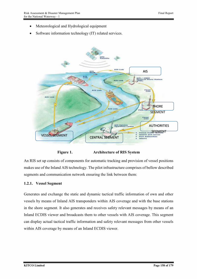
Risk Assessment & Disaster Management Plan Final Report for the National Waterway - 1
KITCO Limited Page 158 of 179
• Meteorological and Hydrological equipment
• Software information technology (IT) related services.
Figure 1. Architecture of RIS System
An RIS set up consists of components for automatic tracking and provision of vessel positions
makes use of the Inland AIS technology. The pilot infrastructure comprises of bellow described
segments and communication network ensuring the link between them:
1.2.1. Vessel Segment
Generates and exchange the static and dynamic tactical traffic information of own and other
vessels by means of Inland AIS transponders within AIS coverage and with the base stations
in the shore segment. It also generates and receives safety relevant messages by means of an
Inland ECDIS viewer and broadcasts them to other vessels with AIS coverage. This segment
can display actual tactical traffic information and safety relevant messages from other vessels
within AIS coverage by means of an Inland ECDIS viewer.
VESSEL SEGMENT
AUTHORITIES SEGMENT
SHORE SEGMENT
CENTRAL SEGMENT
AIS
Risk Assessment & Disaster Management Plan Final Report for the National Waterway - 1
KITCO Limited Page 159 of 179
1.2.2. Shore Segment
Receives and stores static and tactical traffic information of vessels within AIS coverage of the
Inland AIS base station and sends it to the operator segment. It furthermore broadcasts safety
relevant messages, or generates Differential GPS (dGPS) correction data and broadcast them
to vessels within AIS coverage of the base station. AIS base station consisting of base station
transponder and controller connected via internet to AIS network.
1.2.3. Central Segment
Receives static and tactical traffic information of vessels within AIS coverage of the base
stations of the shore segment and store it in the database server and provides this information
for national and international exchange of traffic data to governmental, commercial users, for
triggering purposes of automatic forwarding of other relevant data or to ‘Calamity Abatement
Service’ for enhanced information provision in case of calamities.
1.2.4. Authority Segment
Displays actual and historic static and tactical traffic information of vessels within AIS
coverage as the tactical traffic image for the authorities by means e.g. Inland ECDIS Viewer.
For the purposes of tests, different authorities have been equipped with work stations,
consisting of personal computers with the electronic navigational chart connected to the RIS
System, incl. national and international data exchange
1.2.5. Automatic Identification System (AIS)
The automatic identification system (AIS) is an automatic tracking system that uses
transponders on ships and is used by vessel traffic services (VTS). AIS information
supplements marine radar, which continues to be the primary method of collision avoidance
for water transport.
Information provided by AIS equipment, such as unique identification, position, course, and
speed, can be displayed on a screen or an electronic chart display and information system
(ECDIS). AIS is intended to assist a vessel's watch keeping officers and allow concerned
authorities to track and monitor vessel movements.
AIS integrates a standardized VHF transceiver with a positioning system such as a GPS
receiver, with other electronic navigation sensors, such as a gyrocompass or rate of turn
Risk Assessment & Disaster Management Plan Final Report for the National Waterway - 1
KITCO Limited Page 160 of 179
indicator. Vessels fitted with AIS transceivers can be tracked by AIS base stations located along
coast lines or, when out of range of terrestrial networks, through a growing number of satellites
that are fitted with special AIS receivers which are capable of de-conflicting a large number of
signatures.
1.3. Benefits of RIS
RIS aims to streamline the exchange of information between various stakeholders of Inland
water transport. The system will facilitate exchange of real time information like, wind speed,
fog conditions, danger areas, depth information, route details between operators and vessel
masters. This would facilitate enhancement of inland navigation safety in ports and rivers and
optimize the resource management of the waterborne transport chain which will enhance the
efficiency of inland navigation. This will also help in providing traffic and transport
information to the operators for an efficient calamity & optimal navigation in Ganga.
This will immensely help in optimization of navigation and minimize collision risks in the
waterway thus benefitting the users greatly.
2. Protocol for Waste Management System
The increases in cargo operation pattern through NW 1 will require to have a scientific solid
waste management system in place to handle diverse nature of waste generated. As per the
proposed operational pattern the vessels to be plied in NW 1 include Bulk Carriers, Tankers,
Container Vessels, Ro-Ro Vessels, passenger vessels, barges, push boats etc. The waste
generated could be classified as:
• Waste containing oil and grease
• Waste from cargo
• Other wastes.
Waste Containing Oil and Grease: This category covers waste from the engine room such as
bilge water, used oil, filters, used cleaning rags and used grease. This waste must be deposited
(and a delivery receipt obtained) with a collecting facility at the terminals/jetties or handed
over to firms approved by the pollution control board. Proper records shall be maintained on
board both for the quantity of waste generated and for the quantity of waste handed over from
the vessel. The competent authority should make arrangements for the inspection of these
record books and take necessary actions against the master of the faulty vessels.
Risk Assessment & Disaster Management Plan Final Report for the National Waterway - 1
KITCO Limited Page 161 of 179
Waste from Cargo: Cargo waste is generated during the transshipment and transport of dry and
liquid cargo. The recipient or consignor of the cargo is responsible for the costs of cleaning the
vessel’s holds and gangways after loading/unloading. The handling facility at the terminals
indicates where waste or washing water can be deposited. Proper records should be maintained
on board the vessels for the quantity of the deposited waste.
Other Wastes: Other wastes from ships cover the following kinds of wastes: domestic waste,
domestic waste water, slops from the holds and tanks and all waste not containing oil, including
small hazardous waste such as batteries. There are waste containers for domestic waste at the
public berths in the port area. For disposing of all other wastes from the vessel, the master
should make necessary arrangements with terminals, well before the arrival of the vessel in
terminal.
2.1. Objective
Objective of this protocol is to guide IWAI on meeting the regulatory compliance requirements
with respect to the waste management aspects in line with IV Act, and related rules thereto.
2.2. Legal Compliance Requirement
IV act, 1917 amended from time to time and Inland Vessels (Prevention and Control of
Pollution and Protection of Inland Water) Rules, 2016 are the relevant guidelines on handling
the waste generated in Inland vessels.
In line with IV act, “No oil or oily mixture, hazardous chemical or obnoxious substance from
a mechanically propelled vessel shall be discharged in inland water: Provided that nothing in
this section shall apply to the discharge of such oil or oily mixture, hazardous chemical or
obnoxious substance from a mechanically propelled vessel for the purpose of securing the
safety of a mechanically propelled vessel, preventing damage to a mechanically propelled
vessel, cargo or saving of life at inland water.” The following definitions are made under the
act,
• “Hazardous chemical” or “obnoxious substance” means any chemical or substance as
the case may be which has been designated as such by rules made under this Chapter.
• “Oil” means any persistent oil such as crude oil, heavy diesel oil, lubricating oil and
white oil whether carried on board a tanker as cargo or fuel;
• Oily mixture means a mixture with any oil content.
Risk Assessment & Disaster Management Plan Final Report for the National Waterway - 1
KITCO Limited Page 162 of 179
As per the act, it is mandated to have waste handling and reception facilities at the Inland Ports
as per the approval of competent authorities and also the same could be inspected by approved
surveyors or any person authorized under the act and certify or issue notice to the owner of the
facility on non-compliances. Inland Vessels (Prevention and Control of Pollution and
Protection of Inland Water) Rules, 2016 further defines the statutory requirements as per the
provision of rules. IWAI has the responsibility of maintaining NW 1 as well as owning few
vessels and terminals; in due consideration of the same, the following section defines the
protocol to be followed by IWAI towards compliance with the provision of said act and rules.
Under Schedule I of said rule, the details of chemicals attracting the provision of rule as
hazardous chemical or obnoxious substance has been listed out. Under the proposed cargoes
through NW 1, furnace oil, petrol, diesel and lube oil will be falling under the category of oil.
To comply with the requirements, IWAI shall ensure that:
• All IWAI Terminals shall have a waste reception facility and facility for oily mixture
treatment and sludge or waste and designated pollutants (as specified in of Schedule II
& IV) and maintain a record book on operation of facility as specified in Schedule V,
within one year from the .date of coming into force of these rules. '
• Every IWAI Vessel above 1000 Gross Tonnes shall be equipped with oily mixture
treatment equipment on board as specified in Part I of Schedule III, within one year
from the .date of coming into force of these rules.
In line with the rule, the specific waste management facility requirements are as follows.
General Provision
• The treatment facility shall be established at Inland Port, but the collection equipment
can either be mobile or shore based at a central point.
• Collection of oily wastes can be either by floating reception facilities like barges of
adequate capacity either towed if non-propelled or self propelled or by fixed reception
facilities such as one central shore based waste collection point in inland port. The State
Government may prescribe the type of facility based on the size and nature of operation
of the Inland port.
Port Reception Facilities for Hazardous Chemicals or Obnoxious Substances: - Details
of Components:
Risk Assessment & Disaster Management Plan Final Report for the National Waterway - 1
KITCO Limited Page 163 of 179
Buffering and equalizing
In buffering/equalizing tanks, the process flow is continuous by using the tanks as buffers and
the composition of the waste stream is equalised by mixing several batches of oily waste.
Plate Separation
Plate separators work on the principle of increasing the surface area of separation, resulting in
a better separation. The water phase effluent reached with a plate separator is approximately
20-100ppm.
Flocculation
The water phase effluent quantity of 20-40 ppm shall be achieved with this technique. A large
variety of chemicals are available for emulsion breaking. Most frequently iron or aluminum
salts and charged polymers are used for emulsion breaking.
Flotation
This is a unit operation used to separate solid or liquid particles from a liquid phase. Air bubbles
are injected into a waste water tank and the rising air bubbles will attach to the flocculated oil
particles and increase their buoyancy. The combined particles and gas bubbles will rise to the
surface and the floating particles can be collected.
Biological Treatment
Here the use of micro-organisms for degrading dissolved organic components in wastewater
streams is done. For treatment of oily waste, standard aerobic activated sludge treatment can
be used. The discharge level of oil in the effluent shall be reduced to less than 1 ppm by this
treatment.
Oily Mixture Treatment Equipments
Preliminary Treatment
Settling tanks: The effluent oil concentration for an API separator shall be 50-200 ppm.
Secondary Treatment
• Chemical emulsion breaking or flocculation and floatation:, The water phase
effluent quantity of 20-.40 ppm shall be achieved .with this technique. A large variety
of chemicals are available for emulsion breaking. Most frequently iron or aluminum
salts and charged polymers are used for emulsion breaking;. ,
Risk Assessment & Disaster Management Plan Final Report for the National Waterway - 1
KITCO Limited Page 164 of 179
• Filtration: The water phase effluent oil concentration shall be approximately 20 ppm,
which can be lowered to 5 ppm, when flocculation chemicals are added.
• Hydrocyclones: Hydrocyclones use the density difference between oil and water for
separation and separation is achieved. by centrifugal force. The waste water effluent
concentration shall be reached with hydro cyclones is approximately 5-15 ppm.
• Centrifuges:. They work on the same principle as hydro cyclones. However, they are
not static, as the equipment is rotated. They can be used for 3 phase separation (Oil,
water and solids).
• Molecular. Coalescence oil or water separator: The main principle is the molecular
coagulation of like molecules. The coagulation is achieved by changing the energy
pattern from a tranquil phase to a rapid phase. The water content of the oil is less than
10% and frequently less than 1%.
Tertiary Treatment
Biological treatment: Here the use of micro-organisms for degrading dissolved organic
components in wastewater streams is done. For treatment of oily waste, standard aerobic
activated' sludge treatment can be used. The discharge level of oil in the effluent shall be
reduced to less than l' ppm by this treatment.
Specification for Oily Mixture Treatment Equipment on Shore
• The oil content of the effluent from the treatment unit shall be as minimum as possible
but in no case it exceed 15ppm.
• The treatment equipment shall be strong and robust in construction and suitable for use.
• Any' electrical equipment that is part of the treatment unit shall be located in a non-
hazardous area or certified by the competent authority as safe for use in hazardous areas.
• The treatment unit shall be so designed that it functions automatically. A fail-safe
arrangement to avoid any discharge in case of malfunction shall be provided.
• The system shall require minimum maintenance and attention to bring it into operation.
It shall be capable of operating at least twenty four-hours of normal duty without
attention.
• A ppm display and alarm shall be provided
• The accuracy of the ppm alarm shall be checked as per manufacturer's instruction s
periodically as directed by the competent person. A copy of calibration certificate,
certifying the date of calibration shall be retained by the port for inspection purpose.
Risk Assessment & Disaster Management Plan Final Report for the National Waterway - 1
KITCO Limited Page 165 of 179
The facility established shall be inspected at any time by the statutory surveyors /competent
authorities and a certificate of compliance or conformity shall be issued in the form prescribed
in the rule. Surveyors may issue a notification on non-compliance in the format prescribed in
the notification and the owner of the inland port need to take remedial action and report
compliance within a period of thirty days from the date of receipt of notice and after compliance
is reported and the surveyor is satisfied a certificate of compliance or conformity shall be issued
in the specified in the rule.
The form and record book to be maintained at IWAI terminal is as follows.
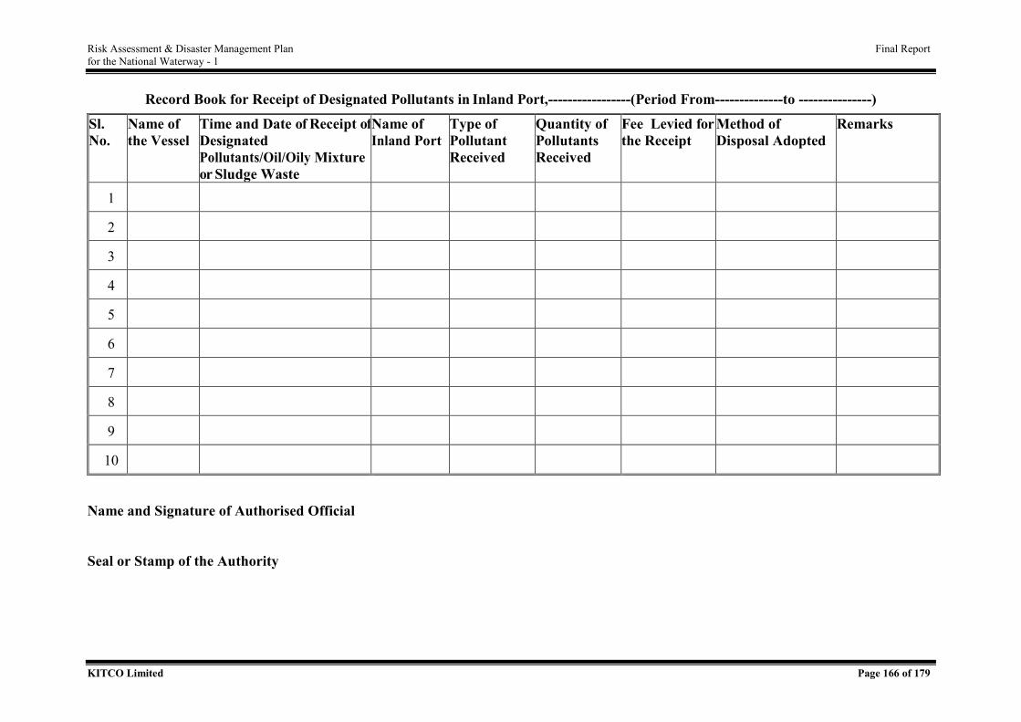
Risk Assessment & Disaster Management Plan Final Report for the National Waterway - 1
KITCO Limited Page 166 of 179
Record Book for Receipt of Designated Pollutants in Inland Port,-----------------(Period From--------------to ---------------)
Sl. No.
Name of the Vessel
Time and Date of Receipt of Designated Pollutants/Oil/Oily Mixture or Sludge Waste
Name of Inland Port
Type of Pollutant Received
Quantity of Pollutants Received
Fee Levied for the Receipt
Method of Disposal Adopted
Remarks
1
2
3
4
5
6
7
8
9
10
Name and Signature of Authorised Official Seal or Stamp of the Authority
Risk Assessment & Disaster Management Plan Final Report for the National Waterway - 1
KITCO Limited Page 167 of 179
3. Protocol for the Protection of Biodiversity including Accident Reporting with Aquatic Mammals
3.1. Introduction
India’s rivers support high levels of biodiversity. This includes the globally endangered species
such as the country’s National Aquatic Animal, the Ganges river dolphin, the fish-eating
crocodile—the Gharial, and numerous freshwater turtles, fishes, and birds. The waterways
form part of the declared Kashi Turtle Sanctuary in Uttar Pradesh and Vikramshila Dolphin
Sanctuary in the state of Bihar. Biodiversity protection measures to be implemented has been
extensively studied through reputed research institutes like Wildlife Institute of India (WII)
and Central Inland Fisheries Research Institute (CIFRI) and the compliance requirement w.r.to
protection and conservation aspects are already delineated which IWAI will implement during
the course of implementation of JMVP. Further specific measures as per the clearance
accorded from National Wild Life Board (NWLB) is also integrated by IWAI in the
implementation plan.
3.2. Objective
Objective of this protocol is to guide IWAI on the measures to be implemented apart from the
studies undertaken in the biodiversity rich areas of NW 1.
3.3. Measures to be Implemented
Recommendation of the studies conducted shall be strictly implemented with additional
measures as below.
• IWAI shall make markings along the entry and exit areas of the sensitive areas as above
indicating the extra precaution to be adopted and the rules and regulations in force for
protection of such areas including the consequences on violation.
• The barge speed restriction may be imposed in dolphin dominated areas, in hilsa
sanctuaries during breeding season and narrow stretches for reducing the wave action
and thereby minimizing possibilities of bank erosion.
• Pumping out over board any pollutants or oils contained within water courses are
strictly prohibited. IWAI shall implement provision for waste reception facilities at its
terminals and also vessel shall have in built facilities as per the statutory requirements.
State government shall closely monitor compliance with the regulations. All provisions
Risk Assessment & Disaster Management Plan Final Report for the National Waterway - 1
KITCO Limited Page 168 of 179
under Inland Vessels (Prevention and Control of Pollution and Protection of Inland
Water) Rules, 2016 shall be mandatorily followed.
• In case of an accident reporting with aquatic animal, the same shall be immediately
intimated to the nearest IWAI sub unit or RO. IWAI shall intimate the same to
respective state government, further to be taken up with the respective line department
of State government.
• A sample format which may be implemented is appended.
Risk Assessment & Disaster Management Plan Final Report for the National Waterway - 1
KITCO Limited Page 169 of 179
4. Protocol for Defining Hazardous Chemical as per the law of India
4.1. Introduction
International Maritime Organisation has developed a systematic classification of cargo to be
transported in maritime industry which has been worldwide approved as the basis for
categorisation of cargo and also to follow the specific guidelines for safe transport. This
classification is applicable for all modes of transport (sea, air, rail, road and inland waterways)
the classification (grouping) of dangerous goods, by type of risk involved, has been drawn up
by the United Nation’s Committee of Experts on the Transport of Dangerous Goods (UN).
Other related regulations include IWAI Rules, MSIHC Rules and IV act and other relevant
rules related to IWT operations.
4.2. Objective
The protocol is to guide IWAI to assess whether a cargo is a hazardous chemical as per the law
of India and the cautionary measures to be adopted while handling the same cargo.
4.3. IMO Classes for Dangerous Goods
A comprehensive statement of IMDG Class description and corresponding guidelines followed
by IWAI is given in the Table 1 below.
Table 1. IMDG Classification and Guidelines
Sl.No. IMDG CLASS (DESCRIPTION)
R E M A R K S
1 Class 1 Explosives Under the approval of explosives (commercial Explosives) by Chief Controller of Explosives.
2 Class 2 Flammable/ Non Flammable /Toxic or Poisonous Gas
Follow the Gas Cylinder Rules, 2016 / Port Bye Laws etc. and the Static Mobile Pressure Vessel (Unfired) Rules, 2016.
3 Class 3 Flammable Liquids Follow the Petroleum Rules. 4 Class 4 Flammable Solid /
Water Reactive Solid etc.
Chemical safety data sheet.
5 Class 5 Oxidizing / Organic Peroxide
Follow IMO Guidelines / Chemical Safety data sheet. Ammonium Nitrate Rules, 2012.
6 Class 6 Toxic/Poisonous Substances
Follow IMO Guidelines / Chemical safety data sheet
7 Class 7 Radio Active Substances
As per the safe handling certificate from Directorate of Atomic Energy Regulatory Board (AERB), Govt. of India, Mumbai.
Risk Assessment & Disaster Management Plan Final Report for the National Waterway - 1
KITCO Limited Page 170 of 179
Sl.No. IMDG CLASS (DESCRIPTION)
R E M A R K S
8 Class 8 Corrosive Substances Follow IMO Guidelines / Chemical safety data sheet.
9 Class 9 Misc. Dangerous Substances
Follow IMO Guidelines / Chemical safety data sheet.
The list of cargo attracting IMDG guidelines is presented in Annexure III. For any other cargo,
the latest IMDG Code / IMSBC shall be referred to.
4.4. Procedure to be adopted while Handling Hazardous Cargo
Whenever a vessel intends to import hazardous cargo or to load & export hazardous cargo
to/from the Terminals of IWAI, the agent shall furnish a list of all hazardous cargo with full
particulars to the Officer- In- charge before arrival or prior to shipment of such hazardous
cargo. This list should indicate the IMDG Code/Class, UN No., Flash Point, Packing Group
(PG)/IMDG Packing Certificate (i.e. multi modal dangerous goods Form) from Cargo
Operators etc. against each of the hazardous items.
The provisions governing the carriage of solid bulk cargoes are amplified in the International
Maritime Solid Bulk Cargoes Code (IMSBC Code) and as such the same is excluded from this
protocol. The prime hazards associated with the shipment of solid bulk cargoes are those
relating to structural damage due to improper cargo distribution, loss or reduction of stability
during a voyage and chemical reactions of cargoes. Therefore the primary aim of this Code is
to facilitate the safe stowage and shipment of solid bulk cargoes by providing information on
the dangers associated with the shipment of certain types of solid bulk cargoes and instructions
on the procedures to be adopted when the shipment of solid bulk cargoes is contemplated. The
handling, loading, unloading, transport by road and also stowage, packing, segregation etc. for
all classes of hazardous goods, following rules and regulations are to be adhered to:
• IMDG Code 2016 (Amendment 38-16) & IMDG Code Supplement,
• Gas Cylinder Rules, 2016
• Petroleum Rules 2016,
• The Static Mobile Pressure Vessel (Unfired) Rules, 2016
• Manufacture, Storage & Import Of Hazardous Chemicals Rules, 1989
• Calcium Carbide Rules, 1987
• Hazardous Waste (Management, Handling & Trans Boundary Movement) Rules, 2016
• Dock Workers (Safety, Health & Welfare) Regulation 1990
Risk Assessment & Disaster Management Plan Final Report for the National Waterway - 1
KITCO Limited Page 171 of 179
• IWAI Rules,
• Ammonium Nitrate Rules, 2012
• Central Motor Vehicles Rules 1989
• AERB safety guidelines for importation & safe handling of “Radio Active material”.
As regards to safe transport & handling of this hazardous cargo in bulk & in packaged/
containerized form, following safety measures (not limited to )are to be adhered to:
• Appropriate IMDG danger label, sign & symbol are to be pasted on all four sides of the
containerized hazardous cargo and its stowage, packing, segregation etc. are to be made
as per the relevant provisions of IMDG Code for inland vessel transportation.
• Fire fighting personnel with appropriate fire fighting equipment are to remain standby
throughout the period of handling & loading/unloading operation of the Containers
containing Hazardous Cargo.
• Appropriate type of Personal Protective Equipment (PPE), Tools, Gears & Lifting
appliances etc. are to be used at the time of handling / unloading and delivery of such
consignments.
• The unloading / loading area is to be isolated by restraining all unauthorized persons
from entering into the area. Adequate security arrangements are to be made during the
handling of such cargo.
• The Containers containing hazardous cargo are to be handled with precaution to avoid
any shock, jolt or knock. They must not be dropped, bumped, rolled or otherwise
mishandled.
• All electrical lights & equipment including Walkie-talkie Sets, Mobile Phone for
communication between the Ship & the shore should be certified ‘intrinsically safe’.
• Trained Personnel as per IMO guidelines are to remain standby during the operation
with appropriate equipment to avoid spillage/leakage as well as to combat in case of
any spillage, leakage, fire etc. “No Smoking” and “No Naked Light” are to be strictly
observed and maintained throughout the time of handling & loading / unloading
operation.
• Such Containers containing hazardous cargo are to be kept away from direct source of
ignition, heat & spark etc. even when in transit and should be kept in well ventilated
and cool place.
Risk Assessment & Disaster Management Plan Final Report for the National Waterway - 1
KITCO Limited Page 172 of 179
Specific guidelines for individual cargoes as per IMDG Code or IMSBC shall be ensured by
IWAI while transporting cargo through NW 1 and handling at IWAI terminals.
5. Protocol for Lessons Learned and Corrective Actions Programme
5.1. Introduction
It is necessary, during every stage of any project starting from the preparations of the project,
to make a proper checklist for monitoring and for assessing the various parts of work done by
the different members of the project team. The checklist may be made stage wise and the jobs
to be done are detailed out as shown in the attached specimen checklist. During the course of
work if any problems or difficulties are experienced, they should be noted down as either
“positive” or “negative” or listed out according to the number (depending on the gravity of the
problem) as shown in the checklist.
Once the problem/difficulty/non-conformity is experienced, root cause analysis is done and the
necessary applicable corrective actions are applied. Where found necessary, preventive
measures are also taken to avoid the recurrence of the same elsewhere in the project.
Developing and tracking corrective actions to closure may help institutionalize a lessons
learned. Corrective actions can take many forms and may be used to verifiably document a
change in the affected process. Developing and managing corrective actions associated with a
lessons learned proactively reduces known risks, improves effectiveness and efficiency, and
helps prevent recurrence of undesirable events. The term "corrective action" refers to a discrete
action having a target completion date and a responsible person.
Lessons learned should be taken as an important component of the feedback and continuous
improvement function within the Management System. This could be applied to Quality
Management System / Safety Management System / Environmental Management System/
Risks Management System implemented and maintained in the organisation or for any project
done within the organisation.
5.2. Objective
Objective of the protocol is to guide IWAI on the process to be implemented for implementing
lessons learned from the work executed.
Risk Assessment & Disaster Management Plan Final Report for the National Waterway - 1
KITCO Limited Page 173 of 179
5.3. Process
5.3.1. Preparation
Before corrective actions are defined for a lessons learned, the following should be considered:
(a) Necessity of the Corrective Actions - A corrective action may not be necessary if the
analysis indicates that the event which led to the lesson learned was not the result of a systemic
problem.
(b) The risk, significance, cause, and applicability of the incident - Corrective actions may not
be necessary if the incidents which precipitate lessons learned have corrective actions tracked
in other programs (e.g., occurrence reports, non-conformance reports, etc.). Managers should
coordinate their efforts to avoid tracking the same corrective actions in multiple systems.
Based on a thorough evaluation of the lessons learned, the corrective action could:
• mitigate risk to environmental, safety, and health as it relates to the incident in the
lessons learned;
• prevent the recurrence of undesirable events;
• improve process efficiency and effectiveness.
Actions which address the root cause should prevent recurrence of the event. Actions taken
should be concise, discrete, and closable. Developing corrective actions to improve processes
is an example of using lessons learned as feedback for continuous improvement.
Consider cost, priority, action dependencies, interfaces, and schedules when developing a
corrective action plan. The finished product should include realistic target dates with each
action assigned to a responsible person.
5.3.2. Managing the Lessons Learned and the Corrective Actions
Corrective actions associated with lessons learned should be evaluated for impact and
budgetary concerns, prioritized, and tracked to completion. Implementation of detailed
corrective action may require multiple milestones. After final completion of any actions, the
appropriate organization should verify that the original problems were appropriately addressed.
In the case of a project, when a project is finished, it is necessary that the organisation or the
project team has prepared a lessons learned document. By collecting and recording the lessons
Risk Assessment & Disaster Management Plan Final Report for the National Waterway - 1
KITCO Limited Page 174 of 179
learned while completing the previous project, the organization as a whole can benefit. Solicit
feedback from all stakeholders also. Summarise the results and pass the recommendations to
future teams.
Share the lessons learned of one project team with other project teams. The basic objective
behind documenting lessons learned is to provide other project teams with information that can
increase their efficiency and effectiveness and build on the experience that has been earned by
each completed project. Sharing the lessons learned with other teams helps improve the overall
performance of the organization.
Store your lessons learned document in a central repository of the organization. This makes it
easier for other project teams to access them whenever it is required.
Archive all the lessons learned documents. They should be archived as historical project data
and incorporated into organizational lessons learned.
6. Protocol for Internal and External Auditing Procedure and Frequency
6.1. Introduction
Inland Water Transport (IWT) is the most energy and cost efficient mode of transport and is
best suited for moving bulk and hazardous goods. The components of IWT infrastructure are:
(a) fair waterway and navigation facilities; (b) terminals, jetties and repair yards, with
connectivity to mainland; and (c) vessels (cargo vessels, barges, boats, passenger vessels, Ro -
Ro vessels etc.). IWAI has the responsibility to maintain the fairway and infrastructure facilities
associated with IWT along NW 1.
6.2. Objective
Objective of this project is to state the requirement on performance audit on effective utilization
of NW 1and suggesting audit frequency for such audit.
6.3. Performance Audit Objectives
The objectives of the performance audit are whether
• There is effective utilisation of the NW-1 and the infrastructure created; and
• Passenger and cargo operations on inland waterways were economical, efficient and
safe.
6.4. Audit Criteria
Risk Assessment & Disaster Management Plan Final Report for the National Waterway - 1
KITCO Limited Page 175 of 179
The activities of IWT Sector shall be examined with reference to the following:
• IWT Policy of Government of India, 2001;
• The Inland Vessels Act, 1917 as amended; and
• The Public Works Department Manual.
Areas/ functions to be audited
Waterways:
• Fairway, infrastructure, vessels, other allied facilities (Self owned as well as operated
or leased or monitored).
• Poor progress in execution of development/ maintenance works.
• Under utilisation of developed waterways (NW-1).
• Lack of policy directions by State Government for increased utilisation of NW-1.
• Obstructions affecting navigability in NW-1 such as Fishing nets, temporary
constructions, other encroachment of waterways
• Navigation channels were not dredged
Cargo Transport Operations:
• Deficiencies in executing transportation contracts of bulk cargo and liquid leading to
consequential loss of business
• Excessive time taken for completion of trips
• Non-utilisation of full capacity of barges
• Non-operation of trips targeted
• Delay in repair of barges/vessels
• Uneconomic operation of services
Important interventions required as a part of the audit services are the following:
• Quality Management System (QMS) shall be implemented and ISO-9000:2015
certification shall be insisted.
• If the Quality Management System (QMS) implemented and maintained by the
organisation is already certified to the international standard ISO-9000:2015 by an
externally accredited agency, most of the critical functional areas, whose quality
performance need to be measured, would have already included in that.
• If any of the important functions are left out, the same can also be brought under the
QMS system. In this case, the internal audits are done by a team of qualified and trained
Risk Assessment & Disaster Management Plan Final Report for the National Waterway - 1
KITCO Limited Page 176 of 179
internal auditors selected from different departments of the organisation i.e., Traffic,
Environment, Engineering, Hydrographic, Finance etc., led by the Asst. director at each
terminals..
6.5. Frequency and Procedure for Auditing
The internal audits should preferably be done at least twice in a year i.e., at six monthly
intervals, in the beginning. Once the system is established, the frequency may be made once in
a year.
The QMS certificate issued to the organisation is valid for a period of three years. Before the
expiry of the validity of the certificate, renewal audit will be done by the certification body and
the validity is increased for a further period of three years.
Besides, statutory/ mandatory surveillance audits are done every year by the external
certification body.
In addition to auditing of the QMS system, a separate performance audits (external audits) as
stated above, are also done in Central govt. organisations by CAG (Controller of Audit
General) at regular intervals.
The Internal audits are generally done, prior to external audits, by AGM/GM of the
organisation at least once in a year.
In the case of performance audit, the internal audit parties are responsible to audit all financial
accounts of departments and divisions whether they are done properly according to the
financial regulations approved by the authorised organizations and to submit the audit reports
directly to General Manager and Managing Director.
The internal audits as described above both for the performance audits and for QMS audits are
done before the statutory yearly surveillance audit/ renewal audit by the external certification
body and the statutory performance audit done by CAG.
After the completion of internal audits, the non- conformities found, if any, during the audits
are recorded in the NCR (non-conformity report) by the auditor and the same got signed by the
auditee.
Risk Assessment & Disaster Management Plan Final Report for the National Waterway - 1
KITCO Limited Page 177 of 179
Root cause analysis of those non-conformities is to be carried out by the auditee’s department
and they have to be closed within a stipulated given time as agreed in the NCR. The NCRs
found during both the internal as well as the external audits have to be reported to the top
management review and discussed in detail for taking improvement actions or for changing
organisation’s objectives/targets/policy.
All necessary records like Audit schedule, Audit Notice, NCRs and CAPA registers are
maintained.
7. Protocol for Oil Spil Reporting and Control and Remediation
7.1 Introduction
Oil Spill is one of the major threats to marine environment. The consequences of an oil spill
are profound. In addition, to the direct and immediate human health impacts it pose, an oil spill
can trigger a chain of events that can seriously affect the river banks and its resources including
wildlife, fisheries, tourism activities, industries etc., which can cause adverse consequences to
the local economy of the affected coastal area, if left unmanaged. The following section details
the protocol to be followed for reporting oil spill incidents within NW 1.
7.2 Onshore & Offshore Oil Spill Incidents Reporting and Management
In case of onshore incidents, the IWAI Terminals shall activate the emergencyr response unit
of terminal and shall utilise the minimum equipments required to combat with the Tier 1
incidents. The Incident Management Team of terminal shall be utilised for the response
operations with Head, RO (IWAI) shall keep informed of the situations. In case of Teir 1
incidents, Head RO (IWAI) shall immediately convene a meeting at ECC – RO, assess the
situation and Coordinator of Emergency Response Operation at RO through the supporting
team of nearest sub unit of IWAI shall keep on availing the progress report from incident site
and periodically update Head (RO). IWAI RO will intimate inciedent progress to DDMA and
DDMA will inturn intimate SDMA.
In Teir 2 incidents, RO – IWAI shall be initiated to respective DDMAs /SDMAs and DDMA
will initate reponse action. RO with support of the nearest sub unit of IWAI shall organize
entire response action in coordination with DDMA. The various facility operations available
in the region such as oil handling facilities, ports, refineries etc would be extened support
through mutual aid and RO will seek the assistance of HQ and through NCMC support shall
be extended from nearest ICG unit for combat operations.
Risk Assessment & Disaster Management Plan Final Report for the National Waterway - 1
KITCO Limited Page 178 of 179
Tier 3 incident, being a major incident NCMC will play the key role and support from all
national plan stakeholders shall be availed by IWAI HO through NCMC.
In case of offshore incidents, the facilities available in the vessel shall be utilised for control of
spill and immediately the incident report shal be made to the nearest IWAI unit. As per the
gravity of the incident, IWAI , HO shall seek support through NCMC for involvment of Indian
Coast Guard with airside access with trained manpower and facilities to combat the response
operation at the offshore area.
Risk Assessment & Disaster Management Plan Final Report for the National Waterway - 1
KITCO Limited Page 179 of 179
ANNEXURE IV - MATERIAL SAFTEY DATA SHEETS FOR LISTED CARGOS
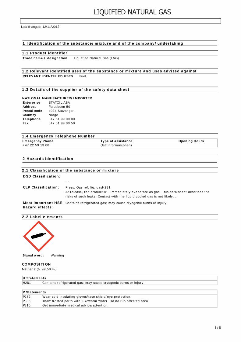
1 Identification of the substance/mixture and of the company/undertaking
1.1 Product identifier
Trade name / designation Liquefied Natural Gas (LNG)
1.2 Relevant identified uses of the substance or mixture and uses advised against
RELEVANT IDENTIFIED USES Fuel.
1.3 Details of the supplier of the safety data sheet
NATIONAL MANUFACTURER/IMPORTER
Enterprise STATOIL ASA
Address Forusbeen 50
Postal code 4034 Stavanger
Country Norge
Telephone 047 51 99 00 00
Fax 047 51 99 00 50
1.4 Emergency Telephone Number
Emergency Phone Type of assistance Opening Hours
+47 22 59 13 00 (Giftinformasjonen)
2 Hazards identification
2.1 Classification of the substance or mixture
DSD Classification:
- .
CLP Classification: Press. Gas ref. liq. gasH281
At release, the product will immediately evaporate as gas. This data sheet describes the
risks of such leaks. Contact with the liquid cooled gas is not likely. .
Most important HSEhazard effects:
Contains refrigerated gas; may cause cryogenic burns or injury.
2.2 Label elements
Signal word: Warning
COMPOSITION
Methane (> 99,50 %)
H Statements
H281 Contains refrigerated gas; may cause cryogenic burns or injury.
P Statements
P282 Wear cold insulating gloves/face shield/eye protection.
P336 Thaw frosted parts with lukewarm water. Do no rub affected area.
P315 Get immediate medical advice/attention.
Last changed: 12/11/2012
1 / 8
LIQUIFIED NATURAL GAS
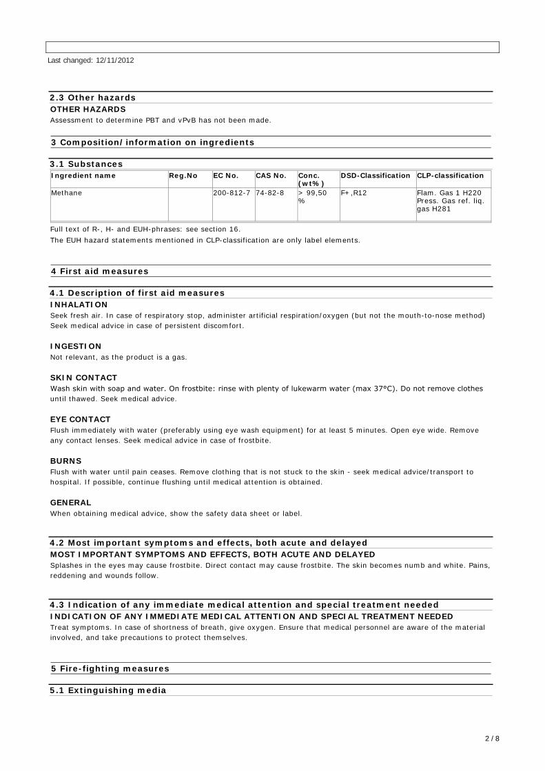
2.3 Other hazards
OTHER HAZARDS
Assessment to determine PBT and vPvB has not been made.
3 Composition/information on ingredients
3.1 Substances
Ingredient name Reg.No EC No. CAS No. Conc.(wt%)
DSD-Classification CLP-classification
Methane 200-812-7 74-82-8 > 99,50%
F+,R12 Flam. Gas 1 H220 Press. Gas ref. liq.gas H281
Full text of R-, H- and EUH-phrases: see section 16.
The EUH hazard statements mentioned in CLP-classification are only label elements.
4 First aid measures
4.1 Description of first aid measures
INHALATION
Seek fresh air. In case of respiratory stop, administer artificial respiration/oxygen (but not the mouth-to-nose method)
Seek medical advice in case of persistent discomfort.
INGESTION
Not relevant, as the product is a gas.
SKIN CONTACT
Wash skin with soap and water. On frostbite: rinse with plenty of lukewarm water (max 37°C). Do not remove clothesuntil thawed. Seek medical advice.
EYE CONTACT
Flush immediately with water (preferably using eye wash equipment) for at least 5 minutes. Open eye wide. Remove
any contact lenses. Seek medical advice in case of frostbite.
BURNS
Flush with water until pain ceases. Remove clothing that is not stuck to the skin - seek medical advice/transport to
hospital. If possible, continue flushing until medical attention is obtained.
GENERAL
When obtaining medical advice, show the safety data sheet or label.
4.2 Most important symptoms and effects, both acute and delayed
MOST IMPORTANT SYMPTOMS AND EFFECTS, BOTH ACUTE AND DELAYED
Splashes in the eyes may cause frostbite. Direct contact may cause frostbite. The skin becomes numb and white. Pains,
reddening and wounds follow.
4.3 Indication of any immediate medical attention and special treatment needed
INDICATION OF ANY IMMEDIATE MEDICAL ATTENTION AND SPECIAL TREATMENT NEEDED
Treat symptoms. In case of shortness of breath, give oxygen. Ensure that medical personnel are aware of the material
involved, and take precautions to protect themselves.
5 Fire-fighting measures
5.1 Extinguishing media
Last changed: 12/11/2012
2 / 8
SUITABLE EXTINGUISHING MEDIA:
Extinguish with powder, foam, carbon dioxide or water mist.
5.2 Special hazards arising from the substance or mixture
SPECIAL HAZARDS
Can generate harmful flue gases containing carbon monoxide in the event of fire.
5.3 Advice for fire-fighters
ADVICE FOR FIREFIGHTERS
Move containers from danger area if it can be done without risk. Avoid inhalation of vapour and flue gases - seek fresh
air. Wear Self-Contained Breathing Apparatus (SCBA) with chemical resistant gloves.
6 Accidental release measures
6.1 Personal precautions, protective equipment and emergency procedures
FOR NON-EMERGENCY PESONNEL
Stop leak if this can be done without risk. Smoking and naked flames prohibited. Wear gloves. Shut off gas supply.
Provide adequate ventilation. In case of insufficient ventilation, wear respiratory protective equipment.
FOR EMERGENCY RESPONDERS
In addition to the above: Normal protective clothing equivalent to EN 469 is recommended.
6.2 Environmental precautions
ENVIRONMENTAL PRECAUTIONS
Avoid unnecessary release to the environment.
6.3 Methods and material for containment and cleaning up
METHODS AND MATERIAL
Provide good ventilation.
6.4 Reference to other sections
REFERENCES
See section 13 for instructions on disposal. See section 8 for type of protective equipment.
7 Handling and Storage
7.1 Precautions for safe handling
PRECAUTION FOR SAFE HANDLING
Smoking and naked flames prohibited. Running water and eye wash equipment must be available. Take precautionary
measures against static discharges. Use spark-free tools and explosion proof equipment. All fixtures, pipes, wires and
fittings must be free of oil, grease and other oxidizing materials (e.g. solvents).
7.2 Conditions for safe storage, including any incompatibilities
CONDITION FOR SAFE STORAGE, INCLUDING ANY UNCOMPATIBILITIES
Store safely, out of reach of children and away from food, animal feeding stuffs, medicines, etc. Take precautionary
measures against static discharges. Use spark-free tools and explosion proof equipment.
7.3 Specific end uses
SPECIFIC END USE(S)
None.
Last changed: 12/11/2012
3 / 8
8 Exposure controls / Personal protection
8.1 Control parameters
LEGAL BASIS
EH40/2005 Workplace exposure limits. Last amended December 2011.
MONITORING PROCEDURES
Compliance with the stated occupational exposure limits may be checked by occupational hygiene measurements.
OTHER INFORMATION REGARDING LIMIT VALUES AND MONITORING
Contains no substances subject to reporting requirements.
8.2 Exposure controls
APPROPRIATE ENGINEERING CONTROLS
Wear the personal protective equipment specified below.
EYE PROTECTION
Wear safety goggles if there is a risk of eye splash.
HAND PROTECTION
Wear gloves that protect against cold and pressure effects, e.g. strong leather gloves. The gloves must be loose
enough to be shaken off easily.
RESPIRATORY PROTECTION
Wear fresh air respiratory protective equipment.
LIMITATION OF ENVIRONMENTAL EXPOSURE
Ensure compliance with local regulations for emissions.
9 Physical and chemical Properties
9.1 Information on basic physical and chemical properties
PHYSICAL STATE Liquid Gas
COLOUR Colourless
ODOUR Odourless
WATER SOLUBILITY Not miscible
Parameter Value/unit Method/reference Observation
pH consentrate No data
pH in solution No data
Melting point No data
Freezing point No data
Initial boiling point and boiling range 161,50 °C Flash point 188 °C Evaporation rate No data
Flammability (solid, gas) No data
Flammability limits No data
Explotion limits 5 - 15 %
Vapour pressure No data
Vapour density No data
Relative density No data
Partition coefficient No data
Auto-ignition temprature No data
Decomposition temprature 700 °C Viscosity No data
Last changed: 12/11/2012
4 / 8
9.2 Other safety information
Parameter Value/unit Method/reference Observation
Molvekt 16,04
Kritisk temp. 82 °C Kritisk tryk 46 bar
Note no. Comments
10 Stability and Reactivity
10.1 Reactivity
REACTIVITY
Reacts with the following: Oxidisers.
10.2 Chemical stability
CHEMICAL STABILITY
The product is stable when used in accordance with the supplier's directions.
10.3 Possibility of hazardous reactions
POSSIBILITY OF HAZARDOUS REACTIONS
None known.
10.4 Conditions to avoid
CONDITIONS TO AVOID
Avoid heating and contact with ignition sources.
10.5 Incompatible materials
INCOMPATIBLE MATERIALS
Oxidisers.
10.6 Hazardous decomposition products:
HAZARDOUS DECOMPOSITION PRODUCTS
None known.
11 Toxicological information
11.1 Toxicological effects
ACUTE TOXICITY - ORAL
The product does not have to be classified. Test data are not available.
ACUTE TOXICITY - DERMAL
The product does not have to be classified. Test data are not available.
ACUTE TOXICITY - INHALATION
The product does not have to be classified. Test data are not available.
SKIN CORROSION/IRRITATION
Direct contact may cause frostbite. The skin becomes numb and white. Pains, reddening and wounds follow. The
product does not have to be classified. Test data are not available.
Last changed: 12/11/2012
5 / 8
SERIOUS EYE DAMAGE/IRRITATION
Splashes of gas in the eyes may cause frostbite.
RESPIRATORY OR SKIN SENSITISATION
The product does not have to be classified. Test data are not available.
GERM CELL MUTAGENICITY
The product does not have to be classified. Test data are not available.
CARCINOGENICITY
The product does not have to be classified. Test data are not available.
REPRODUCTIVE TOXICITY
The product does not have to be classified. Test data are not available.
SINGLE STOT EXPOSURE
The product does not have to be classified. Test data are not available. The gas may displace atmospheric air, thereby
causing risk of suffocation.
STOT-REPEATED EXPOSURE
The product does not have to be classified. Test data are not available.
ASPIRATION
The product does not have to be classified. Test data are not available.
OTHER TOXICOLOGICAL INFORMATION
None known.
12 Ecological information
12.1 Toxicity
ECOTOXICITY
The product does not have to be classified. Test data are not available.
12.2 Persistence and degradability
DEGRADABILITY
Not expected to be biodegradable.
12.3 Bioaccumulative potential
ACCUMULATION
No bioaccumulation expected.
12.4 Mobility in soil
12.5 Results of PBT and vPvB assessment
RESULT OF PBT AND VPVB ASSESSMENT
The product does not contain any PBT or vPvB substances.
12.6 Other adverse effects
OTHER EFFECTS
Can affect global warming.
13 Disposal considerations
Last changed: 12/11/2012
6 / 8
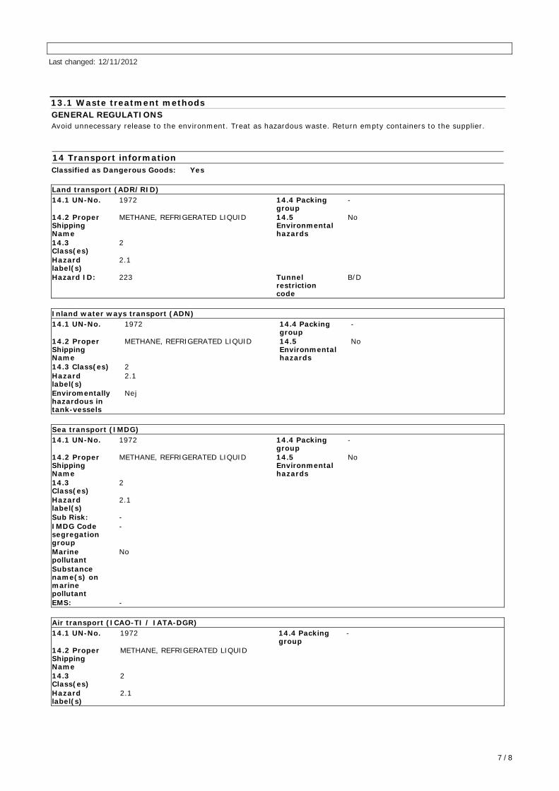
13.1 Waste treatment methods
GENERAL REGULATIONS
Avoid unnecessary release to the environment. Treat as hazardous waste. Return empty containers to the supplier.
14 Transport information
Classified as Dangerous Goods: Yes
Land transport (ADR/RID)
14.1 UN-No. 1972 14.4 Packinggroup
-
14.2 ProperShippingName
METHANE, REFRIGERATED LIQUID 14.5Environmentalhazards
No
14.3Class(es)
2
Hazardlabel(s)
2.1
Hazard ID: 223 Tunnelrestrictioncode
B/D
Inland water ways transport (ADN)
14.1 UN-No. 1972 14.4 Packinggroup
-
14.2 ProperShippingName
METHANE, REFRIGERATED LIQUID 14.5Environmentalhazards
No
14.3 Class(es) 2Hazardlabel(s)
2.1
Enviromentallyhazardous intank-vessels
Nej
Sea transport (IMDG)
14.1 UN-No. 1972 14.4 Packinggroup
-
14.2 ProperShippingName
METHANE, REFRIGERATED LIQUID 14.5Environmentalhazards
No
14.3Class(es)
2
Hazardlabel(s)
2.1
Sub Risk: -IMDG Codesegregationgroup
-
Marinepollutant
No
Substancename(s) onmarinepollutantEMS: -
Air transport (ICAO-TI / IATA-DGR)
14.1 UN-No. 1972 14.4 Packinggroup
-
14.2 ProperShippingName
METHANE, REFRIGERATED LIQUID
14.3Class(es)
2
Hazardlabel(s)
2.1
Last changed: 12/11/2012
7 / 8
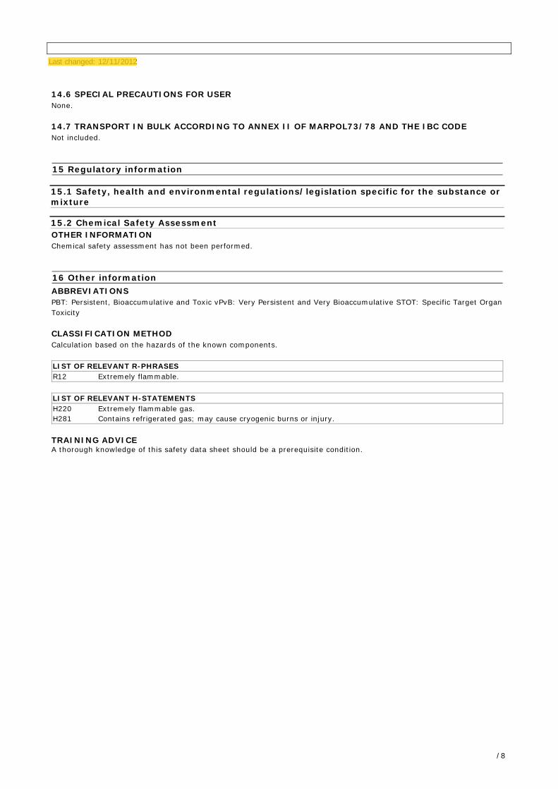
14.6 SPECIAL PRECAUTIONS FOR USER
None.
14.7 TRANSPORT IN BULK ACCORDING TO ANNEX II OF MARPOL73/78 AND THE IBC CODE
Not included.
15 Regulatory information
15.1 Safety, health and environmental regulations/legislation specific for the substance ormixture
15.2 Chemical Safety Assessment
OTHER INFORMATION
Chemical safety assessment has not been performed.
16 Other information
ABBREVIATIONS
PBT: Persistent, Bioaccumulative and Toxic vPvB: Very Persistent and Very Bioaccumulative STOT: Specific Target Organ
Toxicity
CLASSIFICATION METHOD
Calculation based on the hazards of the known components.
LIST OF RELEVANT R-PHRASES
R12 Extremely flammable.
LIST OF RELEVANT H-STATEMENTS
H220 Extremely flammable gas.
H281 Contains refrigerated gas; may cause cryogenic burns or injury.
TRAINING ADVICEA thorough knowledge of this safety data sheet should be a prerequisite condition.
Last changed: 12/11/2012
/ 8
Keerthi
Highlight
Swathy
Highlight
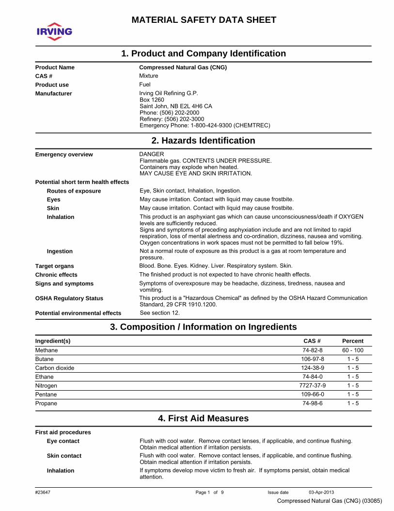
#23647 Page 1 of 9 Issue date 03-Apr-2013
Compressed Natural Gas (CNG) (03085)
MATERIAL SAFETY DATA SHEET
.
1. Product and Company Identification
space
Product Name Compressed Natural Gas (CNG) space
CAS # Mixture space
Product use Fuel space
Manufacturer Irving Oil Refining G.P. Box 1260 Saint John, NB E2L 4H6 CA Phone: (506) 202-2000 Refinery: (506) 202-3000 Emergency Phone: 1-800-424-9300 (CHEMTREC)
.
2. Hazards Identification
space
Emergency overview DANGER Flammable gas. CONTENTS UNDER PRESSURE. Containers may explode when heated. MAY CAUSE EYE AND SKIN IRRITATION.
space
Potential short term health effects Routes of exposure
Eye, Skin contact, Inhalation, Ingestion.
space
space
space
space
space
Eyes May cause irritation. Contact with liquid may cause frostbite. Skin May cause irritation. Contact with liquid may cause frostbite. Inhalation This product is an asphyxiant gas which can cause unconsciousness/death if OXYGEN
levels are sufficiently reduced. Signs and symptoms of preceding asphyxiation include and are not limited to rapid respiration, loss of mental alertness and co-ordination, dizziness, nausea and vomiting. Oxygen concentrations in work spaces must not be permitted to fall below 19%.
Ingestion Not a normal route of exposure as this product is a gas at room temperature and pressure.
Target organs Blood. Bone. Eyes. Kidney. Liver. Respiratory system. Skin. space
Chronic effects The finished product is not expected to have chronic health effects. space
Signs and symptoms Symptoms of overexposure may be headache, dizziness, tiredness, nausea and vomiting.
space
OSHA Regulatory Status This product is a "Hazardous Chemical" as defined by the OSHA Hazard Communication Standard, 29 CFR 1910.1200.
space
Potential environmental effects See section 12. .
3. Composition / Information on Ingredients
space
Ingredient(s) CAS # Percent Methane Butane Carbon dioxide Ethane Nitrogen Pentane Propane
74-82-8 106-97-8 124-38-9 74-84-0
7727-37-9 109-66-0 74-98-6
60 - 100 1 - 5 1 - 5 1 - 5 1 - 5 1 - 5 1 - 5
.
4. First Aid Measures
space
First aid procedures Eye contact
space
Flush with cool water. Remove contact lenses, if applicable, and continue flushing. Obtain medical attention if irritation persists.
space
Skin contact Flush with cool water. Remove contact lenses, if applicable, and continue flushing. Obtain medical attention if irritation persists.
Inhalation If symptoms develop move victim to fresh air. If symptoms persist, obtain medical attention.
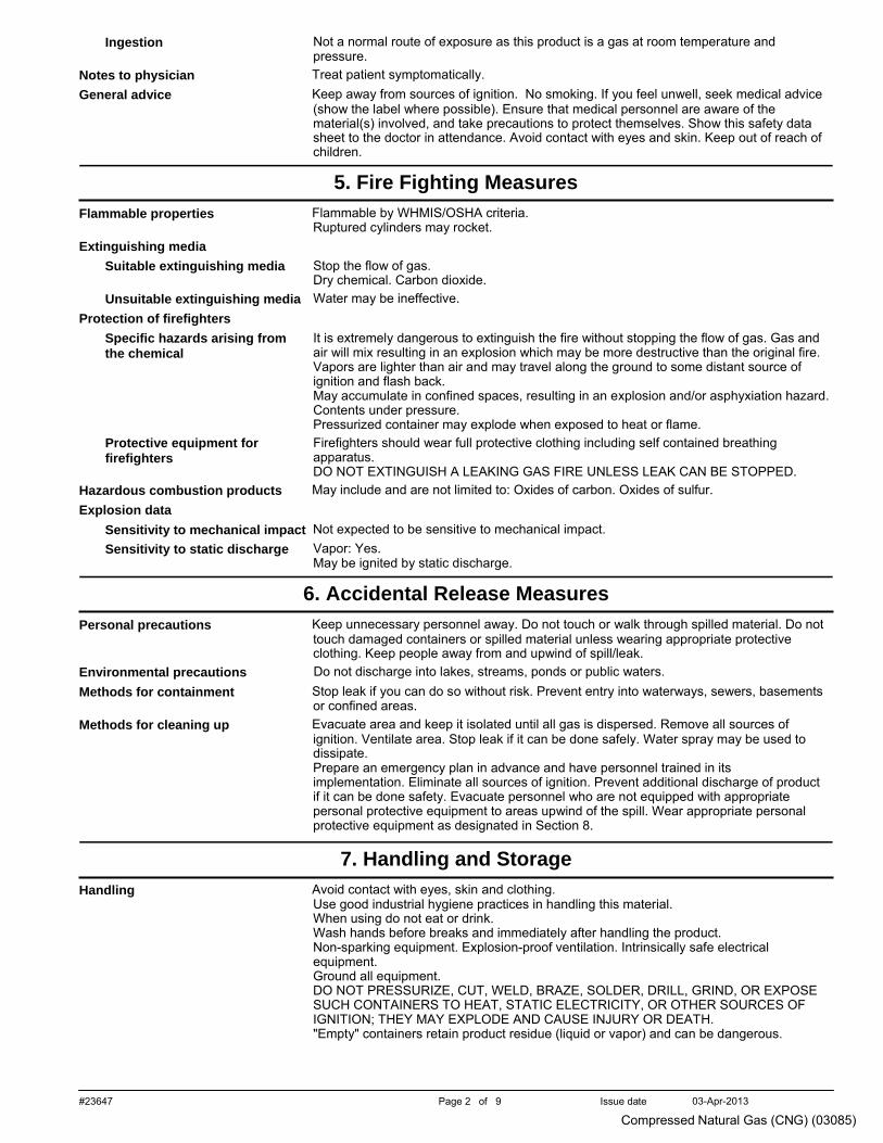
#23647 Page 2 of 9 Issue date 03-Apr-2013
Compressed Natural Gas (CNG) (03085)
space
space
Ingestion Not a normal route of exposure as this product is a gas at room temperature and pressure.
Notes to physician Treat patient symptomatically. space
General advice Keep away from sources of ignition. No smoking. If you feel unwell, seek medical advice (show the label where possible). Ensure that medical personnel are aware of the material(s) involved, and take precautions to protect themselves. Show this safety data sheet to the doctor in attendance. Avoid contact with eyes and skin. Keep out of reach of children.
.
5. Fire Fighting Measures
space
Flammable properties Flammable by WHMIS/OSHA criteria. Ruptured cylinders may rocket.
space
Extinguishing media Suitable extinguishing media
space
Stop the flow of gas. Dry chemical. Carbon dioxide.
space
Unsuitable extinguishing media Water may be ineffective. Protection of firefighters
Specific hazards arising from the chemical
space
It is extremely dangerous to extinguish the fire without stopping the flow of gas. Gas and air will mix resulting in an explosion which may be more destructive than the original fire. Vapors are lighter than air and may travel along the ground to some distant source of ignition and flash back. May accumulate in confined spaces, resulting in an explosion and/or asphyxiation hazard. Contents under pressure. Pressurized container may explode when exposed to heat or flame.
space
Protective equipment for firefighters
Firefighters should wear full protective clothing including self contained breathing apparatus. DO NOT EXTINGUISH A LEAKING GAS FIRE UNLESS LEAK CAN BE STOPPED.
Hazardous combustion products May include and are not limited to: Oxides of carbon. Oxides of sulfur. space
Explosion data Sensitivity to mechanical impact Not expected to be sensitive to mechanical impact.
space
Sensitivity to static discharge Vapor: Yes. May be ignited by static discharge.
.
6. Accidental Release Measures
space
Personal precautions Keep unnecessary personnel away. Do not touch or walk through spilled material. Do not touch damaged containers or spilled material unless wearing appropriate protective clothing. Keep people away from and upwind of spill/leak.
space
Environmental precautions Do not discharge into lakes, streams, ponds or public waters. space
Methods for containment Stop leak if you can do so without risk. Prevent entry into waterways, sewers, basements or confined areas.
space
Methods for cleaning up Evacuate area and keep it isolated until all gas is dispersed. Remove all sources of ignition. Ventilate area. Stop leak if it can be done safely. Water spray may be used to dissipate. Prepare an emergency plan in advance and have personnel trained in its implementation. Eliminate all sources of ignition. Prevent additional discharge of product if it can be done safety. Evacuate personnel who are not equipped with appropriate personal protective equipment to areas upwind of the spill. Wear appropriate personal protective equipment as designated in Section 8.
.
7. Handling and Storage
space
Handling Avoid contact with eyes, skin and clothing. Use good industrial hygiene practices in handling this material. When using do not eat or drink. Wash hands before breaks and immediately after handling the product. Non-sparking equipment. Explosion-proof ventilation. Intrinsically safe electrical equipment. Ground all equipment. DO NOT PRESSURIZE, CUT, WELD, BRAZE, SOLDER, DRILL, GRIND, OR EXPOSE SUCH CONTAINERS TO HEAT, STATIC ELECTRICITY, OR OTHER SOURCES OF IGNITION; THEY MAY EXPLODE AND CAUSE INJURY OR DEATH. "Empty" containers retain product residue (liquid or vapor) and can be dangerous.
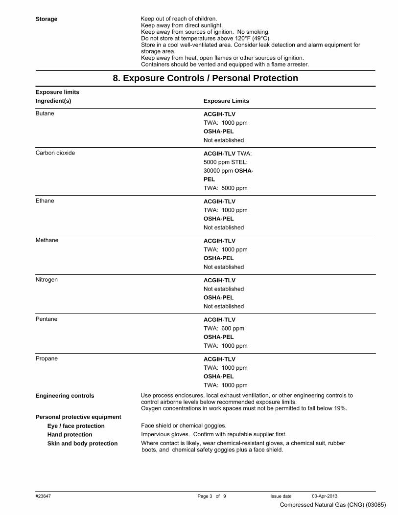
#23647 Page 3 of 9 Issue date 03-Apr-2013
Compressed Natural Gas (CNG) (03085)
space
Storage Keep out of reach of children. Keep away from direct sunlight. Keep away from sources of ignition. No smoking. Do not store at temperatures above 120°F (49°C). Store in a cool well-ventilated area. Consider leak detection and alarm equipment for storage area. Keep away from heat, open flames or other sources of ignition. Containers should be vented and equipped with a flame arrester.
.
8. Exposure Controls / Personal Protection
space
Exposure limits Ingredient(s)
Butane
Exposure Limits ACGIH-TLV TWA: 1000 ppm OSHA-PEL Not established
Carbon dioxide ACGIH-TLV TWA:
5000 ppm STEL: 30000 ppm OSHA-PEL TWA: 5000 ppm
Ethane ACGIH-TLV
TWA: 1000 ppm OSHA-PEL Not established
Methane ACGIH-TLV
TWA: 1000 ppm OSHA-PEL Not established
Nitrogen ACGIH-TLV
Not established OSHA-PEL Not established
Pentane ACGIH-TLV
TWA: 600 ppm OSHA-PEL TWA: 1000 ppm
Propane ACGIH-TLV
TWA: 1000 ppm OSHA-PEL TWA: 1000 ppm
space
Engineering controls Use process enclosures, local exhaust ventilation, or other engineering controls to control airborne levels below recommended exposure limits. Oxygen concentrations in work spaces must not be permitted to fall below 19%.
space
Personal protective equipment Eye / face protection
Face shield or chemical goggles.
space
space
Hand protection Impervious gloves. Confirm with reputable supplier first. Skin and body protection Where contact is likely, wear chemical-resistant gloves, a chemical suit, rubber
boots, and chemical safety goggles plus a face shield.
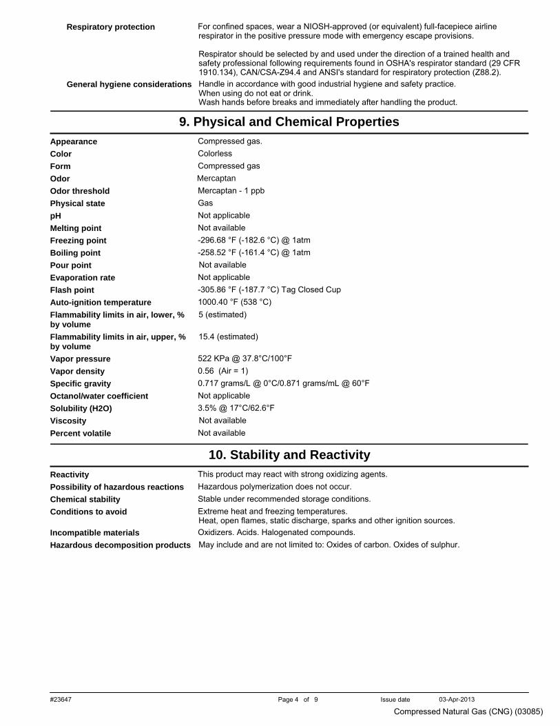
#23647 Page 4 of 9 Issue date 03-Apr-2013
Compressed Natural Gas (CNG) (03085)
space
Respiratory protection For confined spaces, wear a NIOSH-approved (or equivalent) full-facepiece airline respirator in the positive pressure mode with emergency escape provisions.
space
Respirator should be selected by and used under the direction of a trained health and safety professional following requirements found in OSHA's respirator standard (29 CFR 1910.134), CAN/CSA-Z94.4 and ANSI's standard for respiratory protection (Z88.2).
General hygiene considerations Handle in accordance with good industrial hygiene and safety practice. When using do not eat or drink. Wash hands before breaks and immediately after handling the product.
.
9. Physical and Chemical Properties
space
Appearance Compressed gas. space
Color Colorless space
Form Compressed gas space
Odor Mercaptan space
Odor threshold Mercaptan - 1 ppb space
Physical state Gas space
pH Not applicable space
Melting point Not available space
Freezing point -296.68 °F (-182.6 °C) @ 1atm space
Boiling point -258.52 °F (-161.4 °C) @ 1atm space
Pour point Not available space
Evaporation rate Not applicable space
Flash point -305.86 °F (-187.7 °C) Tag Closed Cup space
Auto-ignition temperature 1000.40 °F (538 °C) space
Flammability limits in air, lower, % by volume
space
Flammability limits in air, upper, % by volume
space
5 (estimated) 15.4 (estimated)
Vapor pressure 522 KPa @ 37.8°C/100°F space
Vapor density 0.56 (Air = 1) space
Specific gravity 0.717 grams/L @ 0°C/0.871 grams/mL @ 60°F space
Octanol/water coefficient Not applicable space
Solubility (H2O) 3.5% @ 17°C/62.6°F space
Viscosity Not available space
Percent volatile Not available
.
10. Stability and Reactivity
space
Reactivity This product may react with strong oxidizing agents. space
Possibility of hazardous reactions Hazardous polymerization does not occur. space
Chemical stability Stable under recommended storage conditions. space
Conditions to avoid Extreme heat and freezing temperatures. Heat, open flames, static discharge, sparks and other ignition sources.
space
Incompatible materials Oxidizers. Acids. Halogenated compounds. space
Hazardous decomposition products May include and are not limited to: Oxides of carbon. Oxides of sulphur.
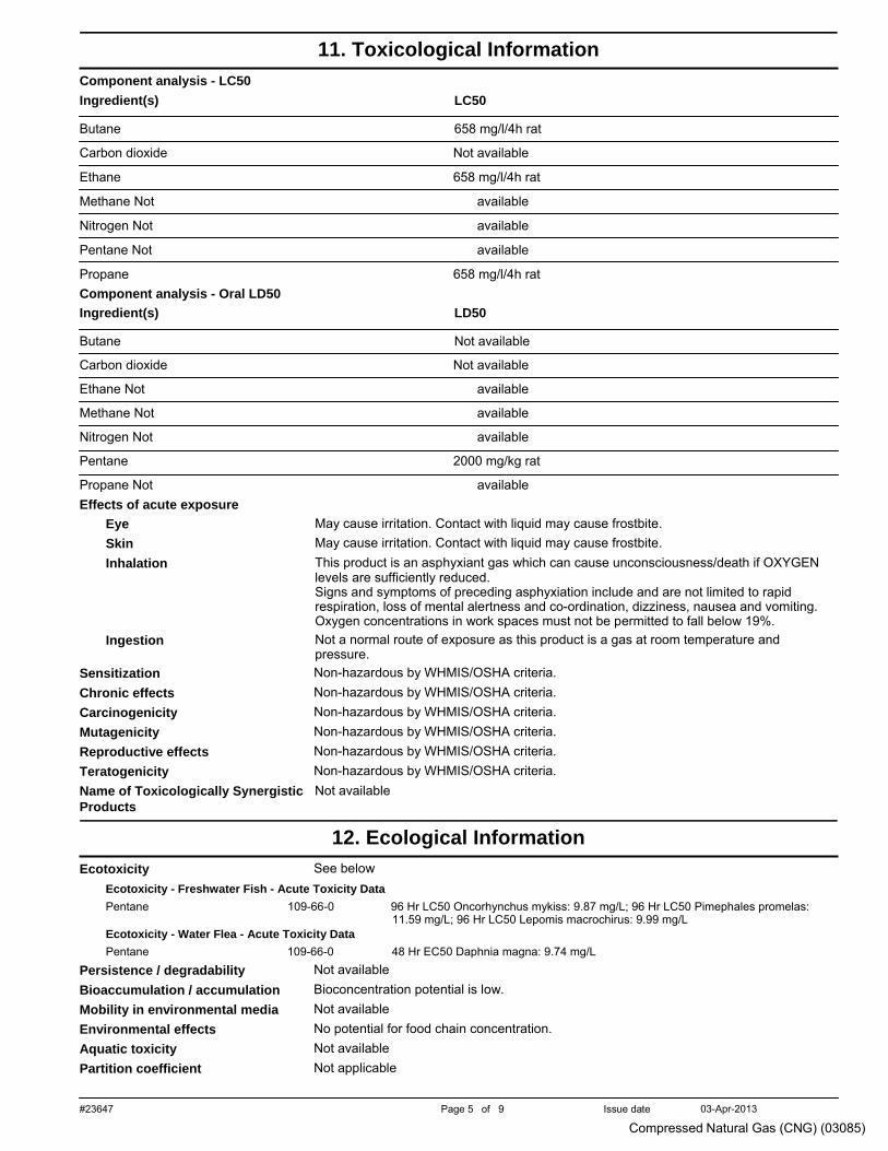
#23647 Page 5 of 9 Issue date 03-Apr-2013
Compressed Natural Gas (CNG) (03085)
.
11. Toxicological Information
space
Component analysis - LC50 Ingredient(s)
Butane
LC50 658 mg/l/4h rat
Carbon dioxide Not available
Ethane 658 mg/l/4h rat
Methane Not available
Nitrogen Not available
Pentane Not available
Propane 658 mg/l/4h rat space
Component analysis - Oral LD50 Ingredient(s)
Butane
LD50 Not available
Carbon dioxide Not available
Ethane Not available
Methane Not available
Nitrogen Not available
Pentane 2000 mg/kg rat
Propane Not available space
Effects of acute exposure
space
Eye May cause irritation. Contact with liquid may cause frostbite.
space
space
space
Skin May cause irritation. Contact with liquid may cause frostbite. Inhalation This product is an asphyxiant gas which can cause unconsciousness/death if OXYGEN
levels are sufficiently reduced. Signs and symptoms of preceding asphyxiation include and are not limited to rapid respiration, loss of mental alertness and co-ordination, dizziness, nausea and vomiting. Oxygen concentrations in work spaces must not be permitted to fall below 19%.
Ingestion Not a normal route of exposure as this product is a gas at room temperature and pressure.
Sensitization Non-hazardous by WHMIS/OSHA criteria. space
Chronic effects Non-hazardous by WHMIS/OSHA criteria. space
Carcinogenicity Non-hazardous by WHMIS/OSHA criteria. space
Mutagenicity Non-hazardous by WHMIS/OSHA criteria. space
Reproductive effects Non-hazardous by WHMIS/OSHA criteria. space
Teratogenicity Non-hazardous by WHMIS/OSHA criteria. space
Name of Toxicologically Synergistic Products
Not available
.
12. Ecological Information
space
Ecotoxicity See below Ecotoxicity - Freshwater Fish - Acute Toxicity Data Pentane 109-66-0 96 Hr LC50 Oncorhynchus mykiss: 9.87 mg/L; 96 Hr LC50 Pimephales promelas:
11.59 mg/L; 96 Hr LC50 Lepomis macrochirus: 9.99 mg/L
space
Ecotoxicity - Water Flea - Acute Toxicity Data Pentane 109-66-0 48 Hr EC50 Daphnia magna: 9.74 mg/L
Persistence / degradability Not available space
Bioaccumulation / accumulation Bioconcentration potential is low. space
Mobility in environmental media Not available space
Environmental effects No potential for food chain concentration. space
Aquatic toxicity Not available space
Partition coefficient Not applicable
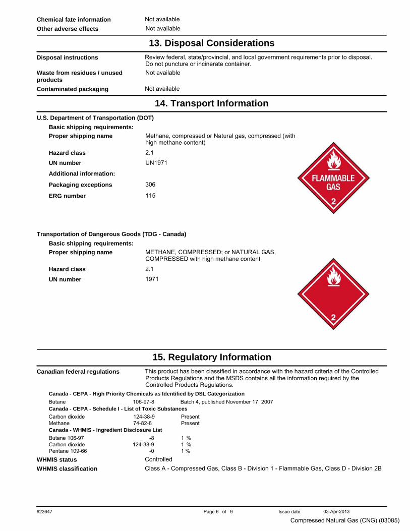
#23647 Page 6 of 9 Issue date 03-Apr-2013
Compressed Natural Gas (CNG) (03085)
space
Chemical fate information Not available space
Other adverse effects Not available .
13. Disposal Considerations
space
Disposal instructions Review federal, state/provincial, and local government requirements prior to disposal. Do not puncture or incinerate container.
space
Waste from residues / unused products
space
Not available
Contaminated packaging Not available .
14. Transport Information
space
U.S. Department of Transportation (DOT) Basic shipping requirements: Proper shipping name
Hazard class
UN number
Additional information:
Packaging exceptions
ERG number
Methane, compressed or Natural gas, compressed (with high methane content)
2.1
UN1971 306 115
space
Transportation of Dangerous Goods (TDG - Canada) Basic shipping requirements: Proper shipping name
Hazard class
UN number
METHANE, COMPRESSED; or NATURAL GAS, COMPRESSED with high methane content
2.1
1971
.
15. Regulatory Information
space
Canadian federal regulations This product has been classified in accordance with the hazard criteria of the Controlled Products Regulations and the MSDS contains all the information required by the Controlled Products Regulations.
Canada - CEPA - High Priority Chemicals as Identified by DSL Categorization Butane 106-97-8 Batch 4, published November 17, 2007 Canada - CEPA - Schedule I - List of Toxic Substances Carbon dioxide 124-38-9 PresentMethane 74-82-8 Present
space
Canada - WHMIS - Ingredient Disclosure List Butane 106-97 -8 1 % Carbon dioxide 124-38-9 1 % Pentane 109-66 -0 1 %
WHMIS status Controlled space
WHMIS classification Class A - Compressed Gas, Class B - Division 1 - Flammable Gas, Class D - Division 2B
#23647 Page 7 of 9 Issue date 03-Apr-2013
Compressed Natural Gas (CNG) (03085)
space
WHMIS labeling
space
Occupational Safety and Health Administration (OSHA)
space
29 CFR 1910.1200 hazardous chemical
Yes
US Federal regulations This product is a "Hazardous Chemical" as defined by the OSHA Hazard Communication Standard, 29 CFR 1910.1200.
U.S. - CAA (Clean Air Act) - Accidental Release Prevention - Flammable Substances Butane Ethane Methane Pentane Propane
106-97-8 74-84-0 74-82-8 109-66-0 74-98-6
10000 lb threshold quantity 10000 lb threshold quantity 10000 lb threshold quantity 10000 lb threshold quantity 10000 lb threshold quantity
U.S. - CAA (Clean Air Act) - Greenhouse Gases (GHG) - Findings under Section 202(a) - Final Rule Carbon dioxide Methane
124-38-9 74-82-8
Subject to Endangerment Finding; Subject to Cause or Contribute FindingSubject to Endangerment Finding; Subject to Cause or Contribute Finding
U.S. - CAA (Clean Air Act) - Greenhouse Gases (GHG) - Global Warming PotentialsCarbon dioxide Methane
124-38-9 74-82-8
1 GWP 21 GWP
U.S. - CAA (Clean Air Act) - Greenhouse Gases (GHG) - Mandatory Reporting of Emissions - Final Rule Carbon dioxide Methane
124-38-9 74-82-8
Present Present
U.S. - CAA (Clean Air Act) - Reactivity Factors for VOCs in Aerosol CoatingsButane Pentane Propane
106-97-8 109-66-0 74-98-6
1.33 G Ozone/g VOC Reactivity Factor 1.54 G Ozone/g VOC Reactivity Factor 0.56 G Ozone/g VOC Reactivity Factor
U.S. - CAA (Clean Air Act) - SNAP Program Listing of Substitutes for ODSsButane Carbon dioxide Nitrogen Propane
106-97-8 124-38-9 7727-37-9 74-98-6
Acceptable substitute for: 6 Acceptable substitute for: 1, 2, 4, 6, 7 Acceptable substitute for: 6 Acceptable substitute for: 6, 7
U.S. - CAA (Clean Air Act) - VOCs with Negligible Photochemical ReactivityEthane Methane
74-84-0 74-82-8
Present Present
U.S. - CAA (Clean Air Act) - Volatile Organic Compounds (VOCs) in SOCMI
space
Pentane 109-66 -0 Present CERCLA (Superfund) reportable quantity
None space
Superfund Amendments and Reauthorization Act of 1986 (SARA)
space
space
Hazard categories Section 302 extremely hazardous substance
Immediate Hazard - Yes Delayed Hazard - No Fire Hazard - Yes Pressure Hazard - Yes Reactivity Hazard - No No
space
Section 311 hazardous chemical Yes Clean Water Act (CWA) Not available
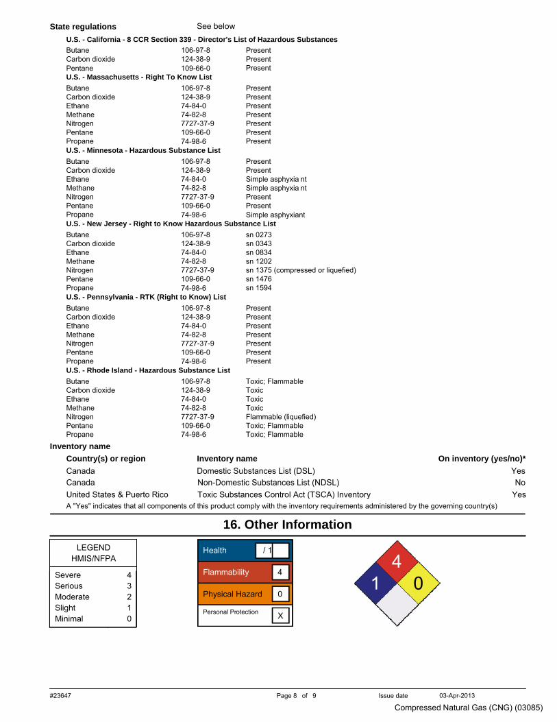
#23647 Page 8 of 9 Issue date 03-Apr-2013
Compressed Natural Gas (CNG) (03085)
space
Severe 4 Serious 3 Moderate 2 Slight 1 Minimal 0
State regulations See below U.S. - California - 8 CCR Section 339 - Director's List of Hazardous Substances Butane Carbon dioxide Pentane
106-97-8 124-38-9 109-66-0
Present Present Present
U.S. - Massachusetts - Right To Know List Butane Carbon dioxide Ethane Methane Nitrogen Pentane Propane
106-97-8 124-38-9 74-84-0 74-82-8 7727-37-9 109-66-0 74-98-6
Present Present Present Present Present Present Present
U.S. - Minnesota - Hazardous Substance List Butane Carbon dioxide Ethane Methane Nitrogen Pentane Propane
106-97-8 124-38-9 74-84-0 74-82-8 7727-37-9 109-66-0 74-98-6
Present Present Simple asphyxia nt Simple asphyxia nt Present Present Simple asphyxiant
U.S. - New Jersey - Right to Know Hazardous Substance ListButane Carbon dioxide Ethane Methane Nitrogen Pentane Propane
106-97-8 124-38-9 74-84-0 74-82-8 7727-37-9 109-66-0 74-98-6
sn 0273 sn 0343 sn 0834 sn 1202 sn 1375 (compressed or liquefied)sn 1476 sn 1594
U.S. - Pennsylvania - RTK (Right to Know) ListButane Carbon dioxide Ethane Methane Nitrogen Pentane Propane
106-97-8 124-38-9 74-84-0 74-82-8 7727-37-9 109-66-0 74-98-6
Present Present Present Present Present Present Present
U.S. - Rhode Island - Hazardous Substance ListButane Carbon dioxide Ethane Methane Nitrogen Pentane Propane
106-97-8 124-38-9 74-84-0 74-82-8 7727-37-9 109-66-0 74-98-6
Toxic; Flammable Toxic Toxic Toxic Flammable (liquefied) Toxic; Flammable Toxic; Flammable
space
Inventory name Country(s) or region Inventory name On inventory (yes/no)* Canada Domestic Substances List (DSL) Yes Canada United States & Puerto Rico
Non-Domestic Substances List (NDSL) Toxic Substances Control Act (TSCA) Inventory
No Yes
A "Yes" indicates that all components of this product comply with the inventory requirements administered by the governing country(s) .
16. Other Information
space LEGEND
HMIS/NFPA
Health / 1
4 Flammability 4
1 0 Physical Hazard 0 Personal Protection X
#23647 Page 9 of 9 Issue date 03-Apr-2013
Compressed Natural Gas (CNG) (03085)
space
Disclaimer The information contained in this form is based on data from sources considered to be reliable but Irving Oil Refining G.P. does not guarantee the accuracy or completeness thereof. The information is provided as a service to the persons purchasing or using the material to which it refers and Irving Oil Refining G.P. expressly disclaims all liability for loss or damage including consequential loss or for injury to persons including death. The information shall not be reproduced, published or distributed in any manner without prior consent in writing of Irving Oil Refining G.P.
space
Issue date 03-Apr-2013 space
Effective date 01-Apr-2013 space
Expiry date 01-Apr-2016 space
Prepared by Dell Tech Laboratories Ltd. (519) 858-5021 space
Other information For an updated MSDS, please contact the supplier/manufacturer listed on the first page of the document.
This MSDS conforms to the ANSI Z400.1/Z129.1-2010 Standard.
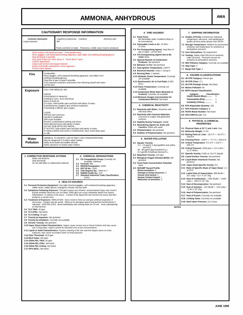
AMMONIA, ANHYDROUS AMA
CAUTIONARY RESPONSE INFORMATION
Common Synonyms Liquefied compressedgas
Colorless Ammonia odor
Floats and boils on water. Poisonous, visible vapor cloud is produced.
Liquid ammonia
Avoid contact with liquid and vapor. Keep people away.Wear goggles, self-contained breathing apparatus, and rubber overclothing (including gloves).Stop discharge if possible.Stay upwind and use water spray to ``knock down'' vapor.Call fire department.Isolate and remove discharged material.Notify local health and pollution control agencies.Protect water intakes.
Fire Combustible.Wear goggles, self-contained breathing apparatus, and rubber over-clothing (including gloves).Stop flow of gas or liquid if possible.Cool exposed containers and protect men effecting shutoff with water.Let fire burn.
Exposure CALL FOR MEDICAL AID.
VAPORPOISONOUS IF INHALED.Irritating to eyes, nose and throat.Move to fresh air.If in eyes, hold eyelids open and flush with plenty of water.If breathing has stopped, give artificial respiration.If breathing is difficult, give oxygen.
LIQUIDWill burn skin and eyes.Harmful if swallowed.Will cause frostbite.Remove contaminated clothing and shoes.Flush affected areas with plenty of water.DO NOT RUB AFFECTED AREAS.IF IN EYES, hold eyelids open and flush with plenty of water.IF SWALLOWED and victim is CONSCIOUS, have victim drink wateror milk.
WaterPollution
HARMFUL TO AQUATIC LIFE IN VERY LOW CONCENTRATIONS.May be dangerous if it enters water intakes.Notify local health and wildlife officials.Notify operators of nearby water intakes.
1. CORRECTIVE RESPONSE ACTIONSDilute and disperseStop dischargeDo not add water to undissolved material
2. CHEMICAL DESIGNATIONS2.1 CG Compatibility Group: Currently not
available; Ammonia2.2 Formula: NH3
2.3 IMO/UN Designation: /10052.4 DOT ID No.: 10052.5 CAS Registry No.: 7664-41-72.6 NAERG Guide No.: 1252.7 Standard Industrial Trade Classification:
52261
3. HEALTH HAZARDS3.1 Personal Protective Equipment: Gas-tight chemical goggles, self-contained breathing apparatus,
rubber boots, rubber gloves, emergency shower and eye bath.3.2 Symptoms Following Exposure: 700 ppm causes eye irritation, and permanent injury may result if
prompt remedial measures are not taken; 5000 ppm can cause immediate death from spasm,inflammation, or edema of the larynx. Contact of the liquid with skin freezes the tissue and thenproduces a caustic burn.
3.3 Treatment of Exposure: INHALATION: move victim to fresh air and give artificial respiration ifnecessary. Oxygen may be useful. Observe for laryngeal spasm and perform tracheostomy ifindicated. SKIN OR EYES: flood immediately with running water for 15 min. Treat subsequentlyas thermal burn.
3.4 TLV-TWA: 25 ppm.3.5 TLV-STEL: Not listed.3.6 TLV-Ceiling: 35 ppm.3.7 Toxicity by Ingestion: Not pertinent3.8 Toxicity by Inhalation: Currently not available.3.9 Chronic Toxicity: Not pertinent3.10 Vapor (Gas) Irritant Characteristics: Vapors cause severe eye or throat irritation and may cause
eye or lung injury; vapors cannot be tolerated even at low concentrations.3.11 Liquid or Solid Characteristics: Causes smarting of the skin and first-degree burns on short
exposure; may cause secondary burns on long exposure.3.12 Odor Threshold: 46.8 ppm3.13 IDLH Value: 300 ppm.3.14 OSHA PEL-TWA: 50 ppm.3.15 OSHA PEL-STEL: Not listed.3.16 OSHA PEL-Ceiling: Not listed.3.17 EPA AEGL: Not listed
4. FIRE HAZARDS
4.1 Flash Point: Not flammable under conditions likely to
be encountered4.2 Flammable Limits in Air: 15.50%-
27.00%4.3 Fire Extinguishing Agents: Stop flow of
gas or liquid. Let fire burn.4.4 Fire Extinguishing Agents Not to Be
Used: None4.5 Special Hazards of Combustion
Products: Not pertinent4.6 Behavior in Fire: Not pertinent4.7 Auto Ignition Temperature: 1204°F4.8 Electrical Hazards: Class I, Group D4.9 Burning Rate: 1 mm/min.4.10 Adiabatic Flame Temperature: Currently
not available4.11 Stoichometric Air to Fuel Ratio: 6.050
(Est.)4.12 Flame Temperature: Currently not
available4.13 Combustion Molar Ratio (Reactant to
Product): Currently not available4.14 Minimum Oxygen Concentration for
Combustion (MOCC): Not listed
5. CHEMICAL REACTIVITY
5.1 Reactivity with Water: Dissolves withmild heat effect
5.2 Reactivity with Common Materials:Corrosive to copper and galvanizedsurfaces.
5.3 Stability During Transport: Stable5.4 Neutralizing Agents for Acids and
Caustics: Dilute with water5.5 Polymerization: Not pertinent5.6 Inhibitor of Polymerization: Not pertinent
6. WATER POLLUTION
6.1 Aquatic Toxicity:2.0 - 2.5 ppm/1-4 days/goldfish and yellow
perch/LC60 - 80 ppm/3 days/crayfish/LC100
8.2 ppm/96 hr/fathead minnow/TLm
6.2 Waterfowl Toxicity: 120 ppm6.3 Biological Oxygen Demand (BOD): Not
pertinent6.4 Food Chain Concentration Potential:
None6.5 GESAMP Hazard Profile:
Bioaccumulation: 0Damage to living resources: 2Human Oral hazard: 1Human Contact hazard: IReduction of amenities: X
7. SHIPPING INFORMATION
7.1 Grades of Purity: Commercial, industrial,refrigeration, electronic, and metaflurgicalgrades all have purity greater than 99.5%
7.2 Storage Temperature: Ambient for pressurizedammonia; low temperature for ammonia atatmospheric pressure
7.3 Inert Atmosphere: No requirement7.4 Venting: Safety relief 250 psi for ammonia
under pressure. Pressure-vacuum forammonia at atmospheric pressure.
7.5 IMO Pollution Category: Currently not available7.6 Ship Type: 27.7 Barge Hull Type: 2
8. HAZARD CLASSIFICATIONS8.1 49 CFR Category: Poison gas8.2 49 CFR Class: 2.38.3 49 CFR Package Group: Not listed.8.4 Marine Pollutant: No8.5 NFPA Hazard Classification:
Category ClassificationHealth Hazard (Blue).......... 3Flammability (Red)............. 1Instability (Yellow)............. 0
8.6 EPA Reportable Quantity: 1008.7 EPA Pollution Category: B8.8 RCRA Waste Number: Not listed8.9 EPA FWPCA List: Yes
9. PHYSICAL & CHEMICALPROPERTIES
9.1 Physical State at 15° C and 1 atm: Gas9.2 Molecular Weight: 17.039.3 Boiling Point at 1 atm: –28.1°F = –33.4°C =
239.8°K9.4 Freezing Point: –108°F = –77.7°C = 265.5°K9.5 Critical Temperature: 271.4°F = 133°C =
406.2°K9.6 Critical Pressure: 1636 psia = 111.3 atm =
11.27 MN/m2
9.7 Specific Gravity: 0.682 at -33.4°C (liquid)9.8 Liquid Surface Tension: Not pertinent9.9 Liquid Water Interfacial Tension: Not
pertinent9.10 Vapor (Gas) Specific Gravity: 0.69.11 Ratio of Specific Heats of Vapor (Gas): 1.3
at 20°C9.12 Latent Heat of Vaporization: 589 Btu/lb =
327 cal/g = 13.7 X 10⁵ J/kg9.13 Heat of Combustion: –7992 Btu/lb = –4440
cal/g = –185.9 X 10⁵ J/kg9.14 Heat of Decomposition: Not pertinent9.15 Heat of Solution: –232 Btu/lb = –129 cal/g =
–5.40 X 10⁵ J/kg9.16 Heat of Polymerization: Not pertinent9.17 Heat of Fusion: Currently not available9.18 Limiting Value: Currently not available9.19 Reid Vapor Pressure: 211.9 psia
NOTES
JUNE 1999
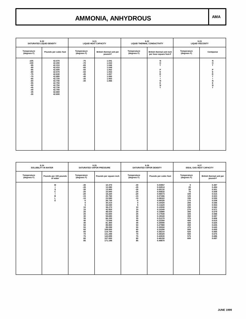
AMMONIA, ANHYDROUS AMA
9.20SATURATED LIQUID DENSITY
Temperature(degrees F)
Pounds per cubic foot
-105-100
-95-90-85-80-75-70-65-60-55-50-45-40-35-30
42.07042.20042.31042.41042.50042.57042.63042.68042.72042.74042.75042.75042.73042.70042.66042.600
9.21LIQUID HEAT CAPACITY
Temperature(degrees F)
British thermal unit perpound-F
-75-70-65-60-55-50-45-40-35-30
1.0411.0431.0461.0491.0521.0541.0571.0601.0631.066
9.22LIQUID THERMAL CONDUCTIVITY
Temperature(degrees F)
British thermal unit inchper hour-square foot-F
NOT
PERTINENT
9.23LIQUID VISCOSITY
Temperature(degrees F)
Centipoise
NOT
PERTINENT
9.24SOLUBILITY IN WATER
Temperature(degrees F)
Pounds per 100 poundsof water
MISCIBLE
9.25SATURATED VAPOR PRESSURE
Temperature(degrees F)
Pounds per square inch
-40-35-30-25-20-15-10
-505
10152025303540455055606570758085
10.47012.08013.90015.94018.22020.76023.59026.73030.21034.04038.27042.92048.02053.60059.69066.33073.54981.40089.90099.099
109.000119.700131.299143.699157.000171.199
9.26SATURATED VAPOR DENSITY
Temperature(degrees F)
Pounds per cubic foot
-40-35-30-25-20-15-10
-505
10152025303540455055606570758085
0.039570.045140.051320.058160.065730.074060.083220.093260.104200.116200.129300.143400.158800.175400.193400.212700.233500.255900.279800.305500.332900.362100.393200.426300.461500.49870
9.27IDEAL GAS HEAT CAPACITY
Temperature(degrees F)
British thermal unit perpound-F
0255075
100125150175200225250275300325350375400425450475500525550575600
0.4870.4940.5010.5080.5150.5230.5300.5380.5460.5540.5620.5710.5790.5880.5970.6060.6150.6250.6350.6450.6550.6650.6750.6860.697
JUNE 1999
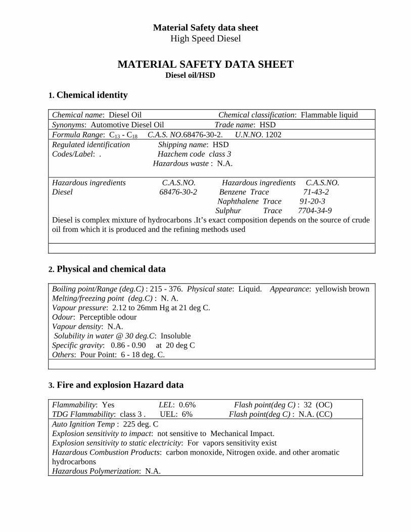
Material Safety data sheet High Speed Diesel
MATERIAL SAFETY DATA SHEET
Diesel oil/HSD 1. Chemical identity Chemical name: Diesel Oil Chemical classification: Flammable liquid Synonyms: Automotive Diesel Oil Trade name: HSD Formula Range: C13 - C18 C.A.S. NO.68476-30-2. U.N.NO. 1202 Regulated identification Shipping name: HSD Codes/Label: . Hazchem code class 3 Hazardous waste : N.A. Hazardous ingredients C.A.S.NO. Hazardous ingredients C.A.S.NO. Diesel 68476-30-2 Benzene Trace 71-43-2 Naphthalene Trace 91-20-3 Sulphur Trace 7704-34-9 Diesel is complex mixture of hydrocarbons .It’s exact composition depends on the source of crude oil from which it is produced and the refining methods used
2. Physical and chemical data Boiling point/Range (deg.C) : 215 - 376. Physical state: Liquid. Appearance: yellowish brown Melting/freezing point (deg.C) : N. A. Vapour pressure: 2.12 to 26mm Hg at 21 deg C. Odour: Perceptible odour Vapour density: N.A. Solubility in water @ 30 deg.C: Insoluble Specific gravity: 0.86 - 0.90 at 20 deg C Others: Pour Point: 6 - 18 deg. C.
3. Fire and explosion Hazard data Flammability: Yes LEL: 0.6% Flash point(deg C) : 32 (OC) TDG Flammability: class 3 . UEL: 6% Flash point(deg C) : N.A. (CC) Auto Ignition Temp : 225 deg. C Explosion sensitivity to impact: not sensitive to Mechanical Impact. Explosion sensitivity to static electricity: For vapors sensitivity exist Hazardous Combustion Products: carbon monoxide, Nitrogen oxide. and other aromatic hydrocarbons Hazardous Polymerization: N.A.
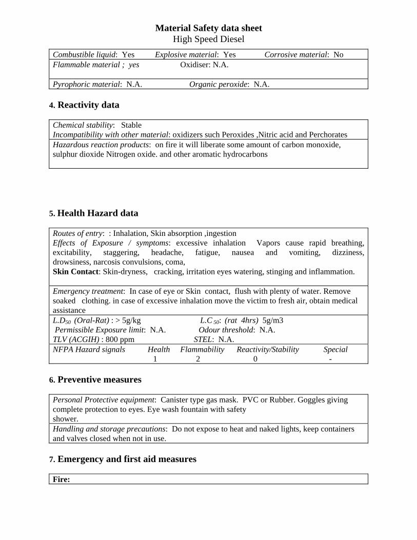
Material Safety data sheet High Speed Diesel
Combustible liquid: Yes Explosive material: Yes Corrosive material: No Flammable material ; yes Oxidiser: N.A. Pyrophoric material: N.A. Organic peroxide: N.A.
4. Reactivity data Chemical stability: Stable Incompatibility with other material: oxidizers such Peroxides ,Nitric acid and Perchorates Hazardous reaction products: on fire it will liberate some amount of carbon monoxide, sulphur dioxide Nitrogen oxide. and other aromatic hydrocarbons
5. Health Hazard data Routes of entry: : Inhalation, Skin absorption ,ingestion Effects of Exposure / symptoms: excessive inhalation Vapors cause rapid breathing, excitability, staggering, headache, fatigue, nausea and vomiting, dizziness, drowsiness, narcosis convulsions, coma, Skin Contact: Skin-dryness, cracking, irritation eyes watering, stinging and inflammation. Emergency treatment: In case of eye or Skin contact, flush with plenty of water. Remove soaked clothing. in case of excessive inhalation move the victim to fresh air, obtain medical assistance L.D50 (Oral-Rat) : > 5g/kg L.C 50: (rat 4hrs) 5g/m3 Permissible Exposure limit: N.A. Odour threshold: N.A. TLV (ACGIH) : 800 ppm STEL: N.A. NFPA Hazard signals Health Flammability Reactivity/Stability Special 1 2 0 -
6. Preventive measures Personal Protective equipment: Canister type gas mask. PVC or Rubber. Goggles giving complete protection to eyes. Eye wash fountain with safety shower. Handling and storage precautions: Do not expose to heat and naked lights, keep containers and valves closed when not in use.
7. Emergency and first aid measures Fire:
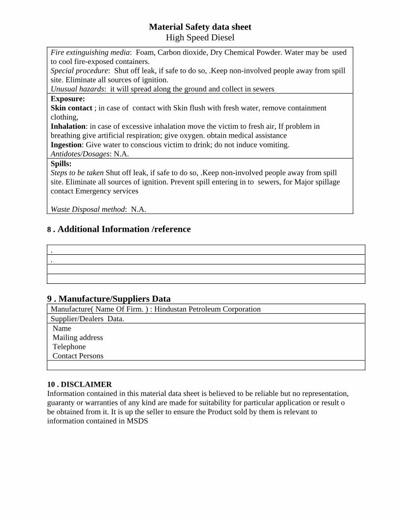
Material Safety data sheet High Speed Diesel
Fire extinguishing media: Foam, Carbon dioxide, Dry Chemical Powder. Water may be used to cool fire-exposed containers. Special procedure: Shut off leak, if safe to do so, .Keep non-involved people away from spill site. Eliminate all sources of ignition. Unusual hazards: it will spread along the ground and collect in sewers Exposure: Skin contact ; in case of contact with Skin flush with fresh water, remove containment clothing, Inhalation: in case of excessive inhalation move the victim to fresh air, If problem in breathing give artificial respiration; give oxygen. obtain medical assistance Ingestion: Give water to conscious victim to drink; do not induce vomiting. Antidotes/Dosages: N.A. Spills: Steps to be taken Shut off leak, if safe to do so, .Keep non-involved people away from spill site. Eliminate all sources of ignition. Prevent spill entering in to sewers, for Major spillage contact Emergency services Waste Disposal method: N.A.
8 . Additional Information /reference . .
9 . Manufacture/Suppliers Data Manufacture( Name Of Firm. ) : Hindustan Petroleum Corporation Supplier/Dealers Data. Name Mailing address Telephone Contact Persons
10 . DISCLAIMER Information contained in this material data sheet is believed to be reliable but no representation, guaranty or warranties of any kind are made for suitability for particular application or result o be obtained from it. It is up the seller to ensure the Product sold by them is relevant to information contained in MSDS
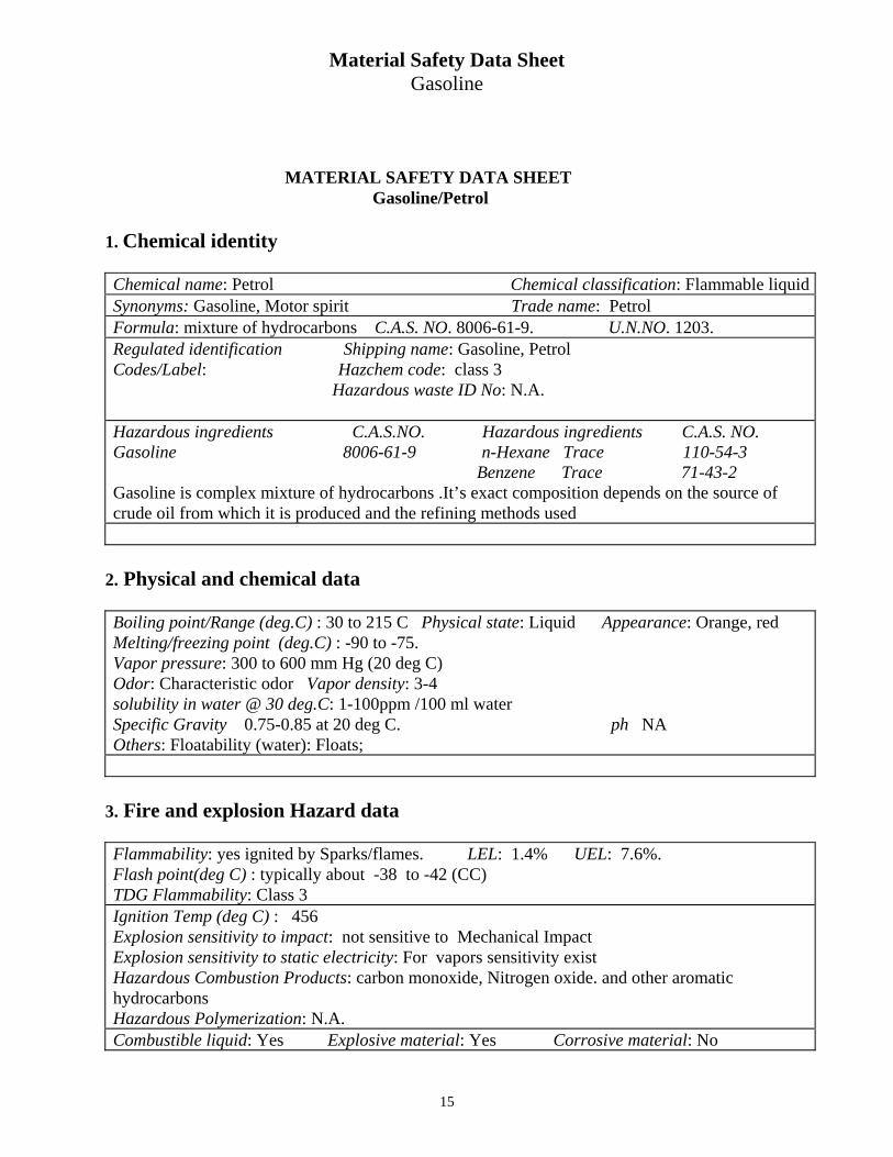
Material Safety Data Sheet Gasoline
15
MATERIAL SAFETY DATA SHEET Gasoline/Petrol 1. Chemical identity Chemical name: Petrol Chemical classification: Flammable liquidSynonyms: Gasoline, Motor spirit Trade name: Petrol Formula: mixture of hydrocarbons C.A.S. NO. 8006-61-9. U.N.NO. 1203. Regulated identification Shipping name: Gasoline, Petrol Codes/Label: Hazchem code: class 3 Hazardous waste ID No: N.A. Hazardous ingredients C.A.S.NO. Hazardous ingredients C.A.S. NO. Gasoline 8006-61-9 n-Hexane Trace 110-54-3 Benzene Trace 71-43-2 Gasoline is complex mixture of hydrocarbons .It’s exact composition depends on the source of crude oil from which it is produced and the refining methods used
2. Physical and chemical data Boiling point/Range (deg.C) : 30 to 215 C Physical state: Liquid Appearance: Orange, red Melting/freezing point (deg.C) : -90 to -75. Vapor pressure: 300 to 600 mm Hg (20 deg C) Odor: Characteristic odor Vapor density: 3-4 solubility in water @ 30 deg.C: 1-100ppm /100 ml water Specific Gravity 0.75-0.85 at 20 deg C. ph NA Others: Floatability (water): Floats;
3. Fire and explosion Hazard data Flammability: yes ignited by Sparks/flames. LEL: 1.4% UEL: 7.6%. Flash point(deg C) : typically about -38 to -42 (CC) TDG Flammability: Class 3 Ignition Temp (deg C) : 456 Explosion sensitivity to impact: not sensitive to Mechanical Impact Explosion sensitivity to static electricity: For vapors sensitivity exist Hazardous Combustion Products: carbon monoxide, Nitrogen oxide. and other aromatic hydrocarbons Hazardous Polymerization: N.A. Combustible liquid: Yes Explosive material: Yes Corrosive material: No
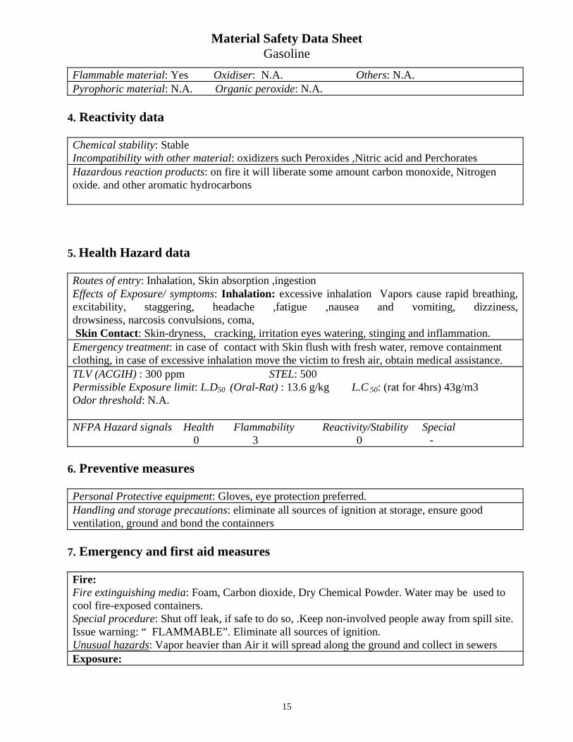
Material Safety Data Sheet Gasoline
15
Flammable material: Yes Oxidiser: N.A. Others: N.A. Pyrophoric material: N.A. Organic peroxide: N.A.
4. Reactivity data Chemical stability: Stable Incompatibility with other material: oxidizers such Peroxides ,Nitric acid and Perchorates Hazardous reaction products: on fire it will liberate some amount carbon monoxide, Nitrogen oxide. and other aromatic hydrocarbons
5. Health Hazard data Routes of entry: Inhalation, Skin absorption ,ingestion Effects of Exposure/ symptoms: Inhalation: excessive inhalation Vapors cause rapid breathing, excitability, staggering, headache ,fatigue ,nausea and vomiting, dizziness, drowsiness, narcosis convulsions, coma, Skin Contact: Skin-dryness, cracking, irritation eyes watering, stinging and inflammation. Emergency treatment: in case of contact with Skin flush with fresh water, remove containment clothing, in case of excessive inhalation move the victim to fresh air, obtain medical assistance. TLV (ACGIH) : 300 ppm STEL: 500 Permissible Exposure limit: L.D50 (Oral-Rat) : 13.6 g/kg L.C 50: (rat for 4hrs) 43g/m3 Odor threshold: N.A. NFPA Hazard signals Health Flammability Reactivity/Stability Special 0 3 0 -
6. Preventive measures Personal Protective equipment: Gloves, eye protection preferred. Handling and storage precautions: eliminate all sources of ignition at storage, ensure good ventilation, ground and bond the containners
7. Emergency and first aid measures Fire: Fire extinguishing media: Foam, Carbon dioxide, Dry Chemical Powder. Water may be used to cool fire-exposed containers. Special procedure: Shut off leak, if safe to do so, .Keep non-involved people away from spill site. Issue warning: “ FLAMMABLE”. Eliminate all sources of ignition. Unusual hazards: Vapor heavier than Air it will spread along the ground and collect in sewers Exposure:
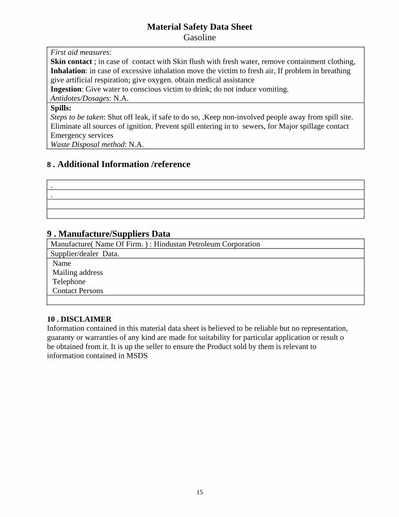
Material Safety Data Sheet Gasoline
15
First aid measures: Skin contact ; in case of contact with Skin flush with fresh water, remove containment clothing, Inhalation: in case of excessive inhalation move the victim to fresh air, If problem in breathing give artificial respiration; give oxygen. obtain medical assistance Ingestion: Give water to conscious victim to drink; do not induce vomiting. Antidotes/Dosages: N.A. Spills: Steps to be taken: Shut off leak, if safe to do so, .Keep non-involved people away from spill site. Eliminate all sources of ignition. Prevent spill entering in to sewers, for Major spillage contact Emergency services Waste Disposal method: N.A.
8 . Additional Information /reference . .
9 . Manufacture/Suppliers Data Manufacture( Name Of Firm. ) : Hindustan Petroleum Corporation Supplier/dealer Data. Name Mailing address Telephone Contact Persons
10 . DISCLAIMER Information contained in this material data sheet is believed to be reliable but no representation, guaranty or warranties of any kind are made for suitability for particular application or result o be obtained from it. It is up the seller to ensure the Product sold by them is relevant to information contained in MSDS
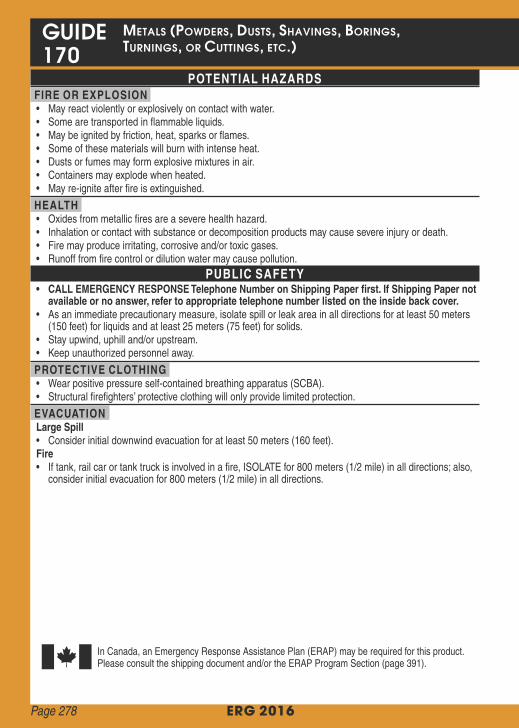
FIRE•• Dousing
• Use• Confining• Move
• If
SPILL OR LEAK• ELIMINATE• Do• Stop• Prevent
FIRST AID• Ensure
• Move• Call• Give• Administer• Remove• In
• Keep
ERG 2016
GUIDE MetaLs (poWders, dUsts, sHavings, borings, tUrnings, or CUttings, etC.) 170
POTENTIAL HAZARDS FIRE OR EXPLOSION • May react violently or explosively on contact with water. • Some are transported in flammable liquids. • May be ignited by friction, heat, sparks or flames. • Some of these materials will burn with intense heat. • Dusts or fumes may form explosive mixtures in air. • Containers may explode when heated. • May re-ignite after fire is extinguished.
HEALTH • Oxides from metallic fires are a severe health hazard. • Inhalation or contact with substance or decomposition products may cause severe injury or death. • Fire may produce irritating, corrosive and/or toxic gases. • Runoff from fire control or dilution water may cause pollution.
PUBLIC SAFETY • CALL EMERGENCY RESPONSE Telephone Number on Shipping Paper first. If Shipping Paper not
available or no answer, refer to appropriate telephone number listed on the inside back cover. • As an immediate precautionary measure, isolate spill or leak area in all directions for at least 50 meters (150 feet) for liquids and at least 25 meters (75 feet) for solids.
• Stay upwind, uphill and/or upstream. • Keep unauthorized personnel away.
PROTECTIVE CLOTHING • Wear positive pressure self-contained breathing apparatus (SCBA). • Structural firefighters’ protective clothing will only provide limited protection.
EVACUATION Large Spill • Consider initial downwind evacuation for at least 50 meters (160 feet). Fire • If tank, rail car or tank truck is involved in a fire, ISOLATE for 800 meters (1/2 mile) in all directions; also, consider initial evacuation for 800 meters (1/2 mile) in all directions.
In Canada, an Emergency Response Assistance Plan (ERAP) may be required for this product. Please consult the shipping document and/or the ERAP Program Section (page 391).
Page 278
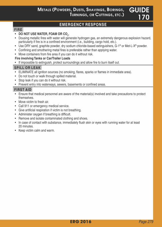
CALL EMERGENCY RESPONSE Telephone Number on Shipping Paper first. If Shipping Paper not
ERG 2016
MetaLs (poWders, dUsts, sHavings, borings, GUIDE tUrnings, or CUttings, etC.) 170
EMERGENCY RESPONSE FIRE • DO NOT USE WATER, FOAM OR CO2. • Dousing metallic fires with water will generate hydrogen gas, an extremely dangerous explosion hazard, particularly if fire is in a confined environment (i.e., building, cargo hold, etc.).
• Use DRY sand, graphite powder, dry sodium chloride-based extinguishers, G-1® or Met-L-X® powder. • Confining and smothering metal fires is preferable rather than applying water. • Move containers from fire area if you can do it without risk. Fire involving Tanks or Car/Trailer Loads • If impossible to extinguish, protect surroundings and allow fire to burn itself out.
SPILL OR LEAK • ELIMINATE all ignition sources (no smoking, flares, sparks or flames in immediate area). • Do not touch or walk through spilled material. • Stop leak if you can do it without risk. • Prevent entry into waterways, sewers, basements or confined areas.
FIRST AID • Ensure that medical personnel are aware of the material(s) involved and take precautions to protect themselves.
• Move victim to fresh air. • Call 911 or emergency medical service. • Give artificial respiration if victim is not breathing. • Administer oxygen if breathing is difficult. • Remove and isolate contaminated clothing and shoes. • In case of contact with substance, immediately flush skin or eyes with running water for at least 20 minutes.
• Keep victim calm and warm.
Page 279
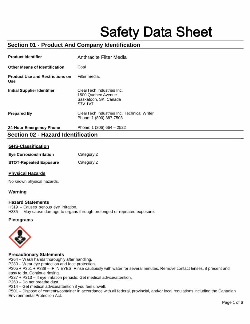
Page 1 of 6
Section 01 - Product And Company Identification
Product Identifier Anthracite Filter Media
Other Means of Identification Coal
Product Use and Restrictions on Use
Filter media.
Initial Supplier Identifier ClearTech Industries Inc. 1500 Quebec Avenue Saskatoon, SK. Canada S7V 1V7
Prepared By ClearTech Industries Inc. Technical Writer Phone: 1 (800) 387-7503
24-Hour Emergency Phone Phone: 1 (306) 664 – 2522
Section 02 - Hazard Identification
GHS-Classification
Eye Corrosion/Irritation Category 2
STOT-Repeated Exposure Category 2
Physical Hazards
No known physical hazards.
Warning
Hazard Statements H319 – Causes serious eye irritation. H335 – May cause damage to organs through prolonged or repeated exposure.
Pictograms
Precautionary Statements P264 – Wash hands thoroughly after handling. P280 – Wear eye protection and face protection. P305 + P351 + P338 – IF IN EYES: Rinse cautiously with water for several minutes. Remove contact lenses, if present and easy to do. Continue rinsing. P337 + P313 – If eye irritation persists: Get medical advice/attention. P260 – Do not breathe dust. P314 – Get medical advice/attention if you feel unwell. P501 – Dispose of contents/container in accordance with all federal, provincial, and/or local regulations including the Canadian Environmental Protection Act.
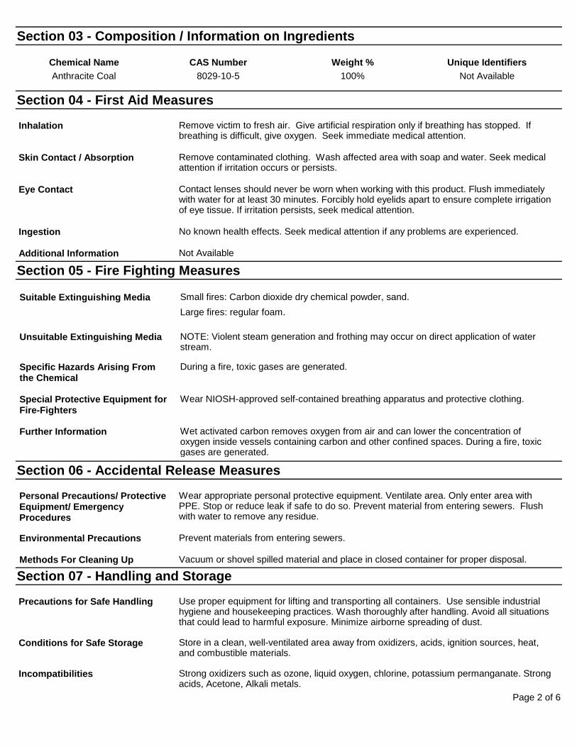
Page 2 of 6
Section 03 - Composition / Information on Ingredients
Chemical Name CAS Number Weight % Unique Identifiers Anthracite Coal 8029-10-5 100% Not Available
Section 04 - First Aid Measures
Inhalation Remove victim to fresh air. Give artificial respiration only if breathing has stopped. If breathing is difficult, give oxygen. Seek immediate medical attention.
Skin Contact / Absorption Remove contaminated clothing. Wash affected area with soap and water. Seek medical attention if irritation occurs or persists.
Eye Contact Contact lenses should never be worn when working with this product. Flush immediately with water for at least 30 minutes. Forcibly hold eyelids apart to ensure complete irrigation of eye tissue. If irritation persists, seek medical attention.
Ingestion No known health effects. Seek medical attention if any problems are experienced.
Additional Information Not Available
Section 05 - Fire Fighting Measures
Suitable Extinguishing Media Small fires: Carbon dioxide dry chemical powder, sand. Large fires: regular foam.
Unsuitable Extinguishing Media NOTE: Violent steam generation and frothing may occur on direct application of water stream.
Specific Hazards Arising From the Chemical
During a fire, toxic gases are generated.
Special Protective Equipment for Fire-Fighters
Wear NIOSH-approved self-contained breathing apparatus and protective clothing.
Further Information Wet activated carbon removes oxygen from air and can lower the concentration of oxygen inside vessels containing carbon and other confined spaces. During a fire, toxic gases are generated.
Section 06 - Accidental Release Measures
Personal Precautions/ Protective Equipment/ Emergency Procedures
Wear appropriate personal protective equipment. Ventilate area. Only enter area with PPE. Stop or reduce leak if safe to do so. Prevent material from entering sewers. Flush with water to remove any residue.
Environmental Precautions Prevent materials from entering sewers.
Methods For Cleaning Up Vacuum or shovel spilled material and place in closed container for proper disposal.
Section 07 - Handling and Storage
Precautions for Safe Handling Use proper equipment for lifting and transporting all containers. Use sensible industrial hygiene and housekeeping practices. Wash thoroughly after handling. Avoid all situations that could lead to harmful exposure. Minimize airborne spreading of dust.
Conditions for Safe Storage Store in a clean, well-ventilated area away from oxidizers, acids, ignition sources, heat, and combustible materials.
Incompatibilities Strong oxidizers such as ozone, liquid oxygen, chlorine, potassium permanganate. Strong acids, Acetone, Alkali metals.
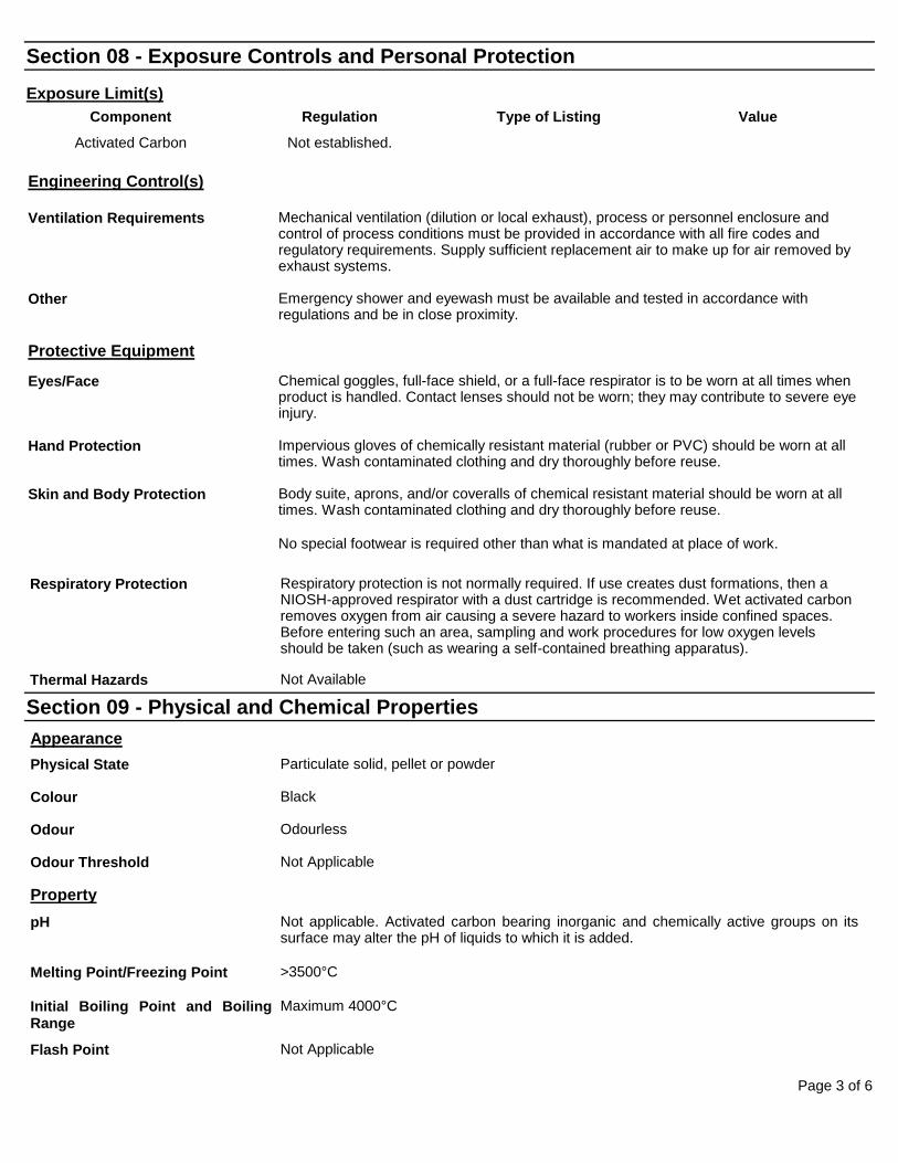
Page 3 of 6
Section 08 - Exposure Controls and Personal Protection Exposure Limit(s)
Component Regulation Type of Listing Value
Activated Carbon Not established.
Engineering Control(s)
Ventilation Requirements Mechanical ventilation (dilution or local exhaust), process or personnel enclosure and control of process conditions must be provided in accordance with all fire codes and regulatory requirements. Supply sufficient replacement air to make up for air removed by exhaust systems.
Other Emergency shower and eyewash must be available and tested in accordance with regulations and be in close proximity.
Protective Equipment
Eyes/Face Chemical goggles, full-face shield, or a full-face respirator is to be worn at all times when product is handled. Contact lenses should not be worn; they may contribute to severe eye injury.
Hand Protection Impervious gloves of chemically resistant material (rubber or PVC) should be worn at all times. Wash contaminated clothing and dry thoroughly before reuse.
Skin and Body Protection Body suite, aprons, and/or coveralls of chemical resistant material should be worn at all times. Wash contaminated clothing and dry thoroughly before reuse.
No special footwear is required other than what is mandated at place of work.
Respiratory Protection Respiratory protection is not normally required. If use creates dust formations, then a NIOSH-approved respirator with a dust cartridge is recommended. Wet activated carbon removes oxygen from air causing a severe hazard to workers inside confined spaces. Before entering such an area, sampling and work procedures for low oxygen levels should be taken (such as wearing a self-contained breathing apparatus).
Thermal Hazards Not Available
Section 09 - Physical and Chemical Properties
Appearance
Physical State Particulate solid, pellet or powder
Colour Black
Odour Odourless
Odour Threshold Not Applicable
Property
pH Not applicable. Activated carbon bearing inorganic and chemically active groups on its surface may alter the pH of liquids to which it is added.
Melting Point/Freezing Point >3500°C
Initial Boiling Point and Boiling Range
Maximum 4000°C
Flash Point Not Applicable
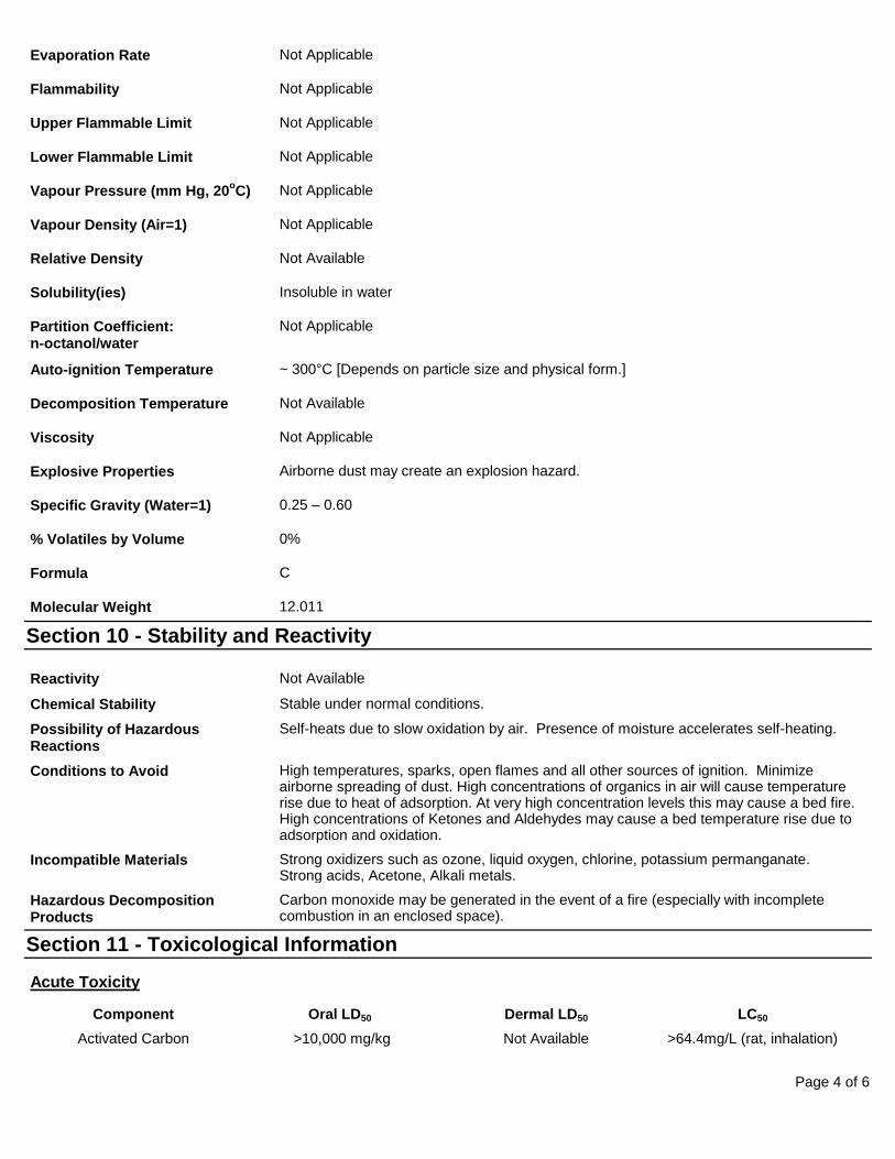
Page 4 of 6
Evaporation Rate Not Applicable
Flammability Not Applicable
Upper Flammable Limit Not Applicable
Lower Flammable Limit Not Applicable
Vapour Pressure (mm Hg, 20oC) Not Applicable
Vapour Density (Air=1) Not Applicable
Relative Density Not Available
Solubility(ies) Insoluble in water
Partition Coefficient: n-octanol/water
Not Applicable
Auto-ignition Temperature ~ 300°C [Depends on particle size and physical form.]
Decomposition Temperature Not Available
Viscosity Not Applicable
Explosive Properties Airborne dust may create an explosion hazard.
Specific Gravity (Water=1) 0.25 – 0.60
% Volatiles by Volume 0%
Formula C
Molecular Weight 12.011
Section 10 - Stability and Reactivity Reactivity Not Available
Chemical Stability Stable under normal conditions.
Possibility of Hazardous Reactions
Self-heats due to slow oxidation by air. Presence of moisture accelerates self-heating.
Conditions to Avoid High temperatures, sparks, open flames and all other sources of ignition. Minimize airborne spreading of dust. High concentrations of organics in air will cause temperature rise due to heat of adsorption. At very high concentration levels this may cause a bed fire. High concentrations of Ketones and Aldehydes may cause a bed temperature rise due to adsorption and oxidation.
Incompatible Materials Strong oxidizers such as ozone, liquid oxygen, chlorine, potassium permanganate. Strong acids, Acetone, Alkali metals.
Hazardous Decomposition Products
Carbon monoxide may be generated in the event of a fire (especially with incomplete combustion in an enclosed space).
Section 11 - Toxicological Information
Acute Toxicity
Component Oral LD50 Dermal LD50 LC50
Activated Carbon >10,000 mg/kg Not Available >64.4mg/L (rat, inhalation)
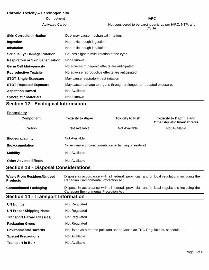
Page 5 of 6
Chronic Toxicity – Carcinogenicity Component IARC
Activated Carbon Not considered to be carcinogenic as per IARC, NTP, and OSHA.
Skin Corrosion/Irritation Dust may cause mechanical irritation.
Ingestion Non-toxic though ingestion
Inhalation Non-toxic though inhalation
Serious Eye Damage/Irritation Causes slight to mild irritation of the eyes.
Respiratory or Skin Sensitization None known.
Germ Cell Mutagenicity No adverse mutagenic effects are anticipated.
Reproductive Toxicity No adverse reproductive effects are anticipated.
STOT-Single Exposure May cause respiratory tract irritation
STOT-Repeated Exposure May cause damage to organs through prolonged or repeated exposure.
Aspiration Hazard Not Available
Synergistic Materials None known
Section 12 - Ecological Information Ecotoxicity
Component Toxicity to Algae Toxicity to Fish Toxicity to Daphnia and Other Aquatic Invertebrates
Carbon Not Available Not Available Not Available
Biodegradability Not Available
Bioaccumulation No evidence of bioaccumulation or tainting of seafood.
Mobility Not Available
Other Adverse Effects Not Available
Section 13 - Disposal Considerations Waste From Residues/Unused Products
Dispose in accordance with all federal, provincial, and/or local regulations including the Canadian Environmental Protection Act.
Contaminated Packaging Dispose in accordance with all federal, provincial, and/or local regulations including the Canadian Environmental Protection Act.
Section 14 - Transport Information
UN Number Not Regulated
UN Proper Shipping Name Not Regulated
Transport Hazard Class(es) Not Regulated
Packaging Group Not Regulated
Environmental Hazards Not listed as a marine pollutant under Canadian TDG Regulations, schedule III.
Special Precautions Not Available
Transport in Bulk Not Available
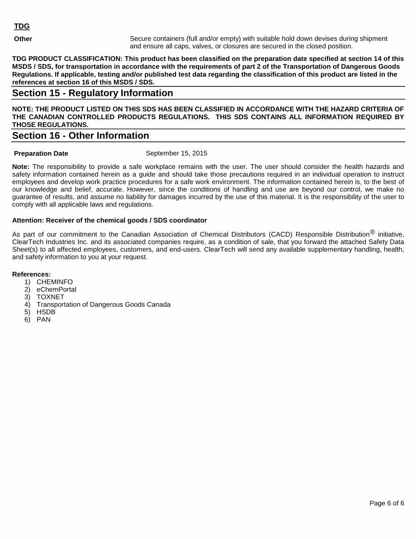
Page 6 of 6
TDG Other Secure containers (full and/or empty) with suitable hold down devises during shipment
and ensure all caps, valves, or closures are secured in the closed position.
TDG PRODUCT CLASSIFICATION: This product has been classified on the preparation date specified at section 14 of this MSDS / SDS, for transportation in accordance with the requirements of part 2 of the Transportation of Dangerous Goods Regulations. If applicable, testing and/or published test data regarding the classification of this product are listed in the references at section 16 of this MSDS / SDS. Section 15 - Regulatory Information NOTE: THE PRODUCT LISTED ON THIS SDS HAS BEEN CLASSIFIED IN ACCORDANCE WITH THE HAZARD CRITERIA OF THE CANADIAN CONTROLLED PRODUCTS REGULATIONS. THIS SDS CONTAINS ALL INFORMATION REQUIRED BY THOSE REGULATIONS. Section 16 - Other Information
Preparation Date September 15, 2015
Note: The responsibility to provide a safe workplace remains with the user. The user should consider the health hazards and safety information contained herein as a guide and should take those precautions required in an individual operation to instruct employees and develop work practice procedures for a safe work environment. The information contained herein is, to the best of our knowledge and belief, accurate. However, since the conditions of handling and use are beyond our control, we make no guarantee of results, and assume no liability for damages incurred by the use of this material. It is the responsibility of the user to comply with all applicable laws and regulations.
Attention: Receiver of the chemical goods / SDS coordinator
As part of our commitment to the Canadian Association of Chemical Distributors (CACD) Responsible Distribution® initiative,ClearTech Industries Inc. and its associated companies require, as a condition of sale, that you forward the attached Safety Data Sheet(s) to all affected employees, customers, and end-users. ClearTech will send any available supplementary handling, health, and safety information to you at your request.
References: 1) CHEMINFO2) eChemPortal3) TOXNET4) Transportation of Dangerous Goods Canada5) HSDB6) PAN
Swathy
Highlight
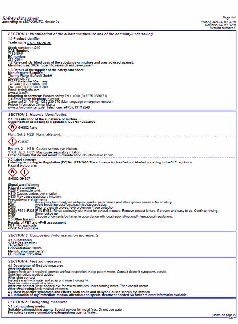
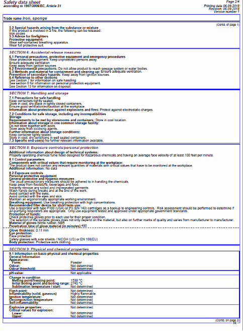
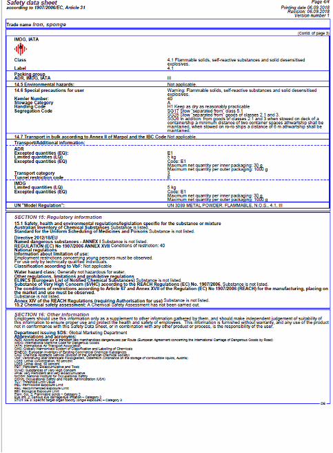
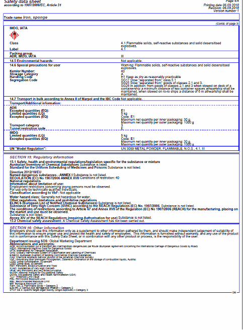
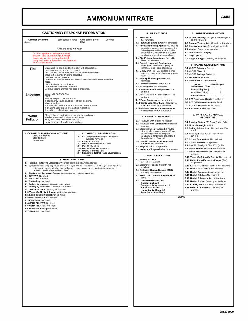
AMMONIUM NITRATE AMN
CAUTIONARY RESPONSE INFORMATION
Common Synonyms Solid pellets or flakes White to light gray orbrown
Odorless
Sinks and mixes with water.
Nitram
Call Fire department. Keep people away.Evacuate area in case of large discharge.Isolate and remove discharged material.Notify local health and pollution control agencies.Protect water intakes.
Fire May cause fire and explode on contact with combustibles.CONTAINERS MAY EXPLODE IN FIRE.POISONOUS GASES MAY BE PRODUCED WHEN HEATED.Wear self-contained breathing apparatus.Evacuate surrounding area.Combat fires from protected location with unmanned hose holder or monitornozzle.Flood discharge area with water.Cool exposed containers with water.Continue cooling after fire has been extinguished.
Exposure CALL FOR MEDICAL AID.DUSTIrritating to eyes, nose, and throat.If inhaled, may cause coughing or difficult breathing.Move to fresh air.If in eyes, hold eyelids open and flush with plenty of water.If breathing has stopped, give artificial respiration.If breathing is difficult, give oxygen.
WaterPollution
Effect of low concentrations on aquatic life is unknown.May be dangerous if it enters water intakes.Notify local health and wildlife officials.Notify operators of nearby water intakes.
1. CORRECTIVE RESPONSE ACTIONSDilute and disperseStop dischargeDo not burn
2. CHEMICAL DESIGNATIONS2.1 CG Compatibility Group: Currently not
available; Ammonia2.2 Formula: NH4NO3
2.3 IMO/UN Designation: 5.1/20672.4 DOT ID No.: 19422.5 CAS Registry No.: 6484-52-22.6 NAERG Guide No.: 1402.7 Standard Industrial Trade Classification:
51481
3. HEALTH HAZARDS3.1 Personal Protective Equipment: Wear self-contained breathing apparatus3.2 Symptoms Following Exposure: Irritation of eyes and mucous membranes. Absorption via ingestion
or inhalation causes urination and acid urine. Large amount causes systemic acidosis andmetheglobinemia (abnormal hemoglobin).
3.3 Treatment of Exposure: Remove from exposure-symptoms reversible.3.4 TLV-TWA: Not listed.3.5 TLV-STEL: Not listed.3.6 TLV-Ceiling: Not listed.3.7 Toxicity by Ingestion: Currently not available3.8 Toxicity by Inhalation: Currently not available.3.9 Chronic Toxicity: Currently not available3.10 Vapor (Gas) Irritant Characteristics: Not pertinent3.11 Liquid or Solid Characteristics: None3.12 Odor Threshold: Not pertinent3.13 IDLH Value: Not listed.3.14 OSHA PEL-TWA: Not listed.3.15 OSHA PEL-STEL: Not listed.3.16 OSHA PEL-Ceiling: Not listed.3.17 EPA AEGL: Not listed
4. FIRE HAZARDS
4.1 Flash Point: Not flammable4.2 Flammable Limits in Air: Not flammable4.3 Fire Extinguishing Agents: Use flooding
amounts of water in early stages of fire.When large quantities are involved inmassive fires, control efforts should beconfined to protecting from explosion.
4.4 Fire Extinguishing Agents Not to BeUsed: Not pertinent
4.5 Special Hazards of CombustionProducts: Decomposes, giving offextremely toxic oxides of nitrogen.
4.6 Behavior in Fire: May explode in fires.Supports combustion of common organicfuels.
4.7 Auto Ignition Temperature: Notflammable
4.8 Electrical Hazards: Not pertinent4.9 Burning Rate: Not flammable4.10 Adiabatic Flame Temperature: Not
pertinent4.11 Stoichometric Air to Fuel Ratio: Not
pertinent4.12 Flame Temperature: Not pertinent4.13 Combustion Molar Ratio (Reactant to
Product): Currently not available4.14 Minimum Oxygen Concentration for
Combustion (MOCC): Not listed
5. CHEMICAL REACTIVITY
5.1 Reactivity with Water: No reaction5.2 Reactivity with Common Materials: No
reaction5.3 Stability During Transport: If heated
strongly, decomposes, giving off toxicgases and gases which supportcombustion. Undergoes detonation ifheated under confinement.
5.4 Neutralizing Agents for Acids andCaustics: Not pertinent
5.5 Polymerization: Not pertinent5.6 Inhibitor of Polymerization: Not pertinent
6. WATER POLLUTION
6.1 Aquatic Toxicity:Currently not available
6.2 Waterfowl Toxicity: Currently notavailable
6.3 Biological Oxygen Demand (BOD):Currently not available
6.4 Food Chain Concentration Potential:None
6.5 GESAMP Hazard Profile:Bioaccumulation: 0Damage to living resources: 1Human Oral hazard: 1Human Contact hazard: 0Reduction of amenities: 0
7. SHIPPING INFORMATION
7.1 Grades of Purity: Pure grade; fertilizer grade(33.5% nitrogen)
7.2 Storage Temperature: Currently not available7.3 Inert Atmosphere: Currently not available7.4 Venting: Currently not available7.5 IMO Pollution Category: D7.6 Ship Type: 27.7 Barge Hull Type: Currently not available
8. HAZARD CLASSIFICATIONS8.1 49 CFR Category: Oxidizer8.2 49 CFR Class: 5.18.3 49 CFR Package Group: III8.4 Marine Pollutant: No8.5 NFPA Hazard Classification:
Category ClassificationHealth Hazard (Blue).......... 0Flammability (Red)............. 0Instability (Yellow)............. 3Special (White)................... OX
8.6 EPA Reportable Quantity: Not listed8.7 EPA Pollution Category: Not listed8.8 RCRA Waste Number: Not listed8.9 EPA FWPCA List: Not listed
9. PHYSICAL & CHEMICALPROPERTIES
9.1 Physical State at 15° C and 1 atm: Solid9.2 Molecular Weight: 80.059.3 Boiling Point at 1 atm: Not pertinent; 230-
278°F9.4 Freezing Point: 337.8°F = 169.9°C =
443.1°K9.5 Critical Temperature: Not pertinent9.6 Critical Pressure: Not pertinent9.7 Specific Gravity: 1.72 at 20°C (solid)9.8 Liquid Surface Tension: Not pertinent9.9 Liquid Water Interfacial Tension: Not
pertinent9.10 Vapor (Gas) Specific Gravity: Not pertinent9.11 Ratio of Specific Heats of Vapor (Gas):
Not pertinent9.12 Latent Heat of Vaporization: Not pertinent9.13 Heat of Combustion: Not pertinent9.14 Heat of Decomposition: Not pertinent9.15 Heat of Solution: Not pertinent9.16 Heat of Polymerization: Not pertinent9.17 Heat of Fusion: Currently not available9.18 Limiting Value: Currently not available9.19 Reid Vapor Pressure: Currently not
available
NOTES
JUNE 1999
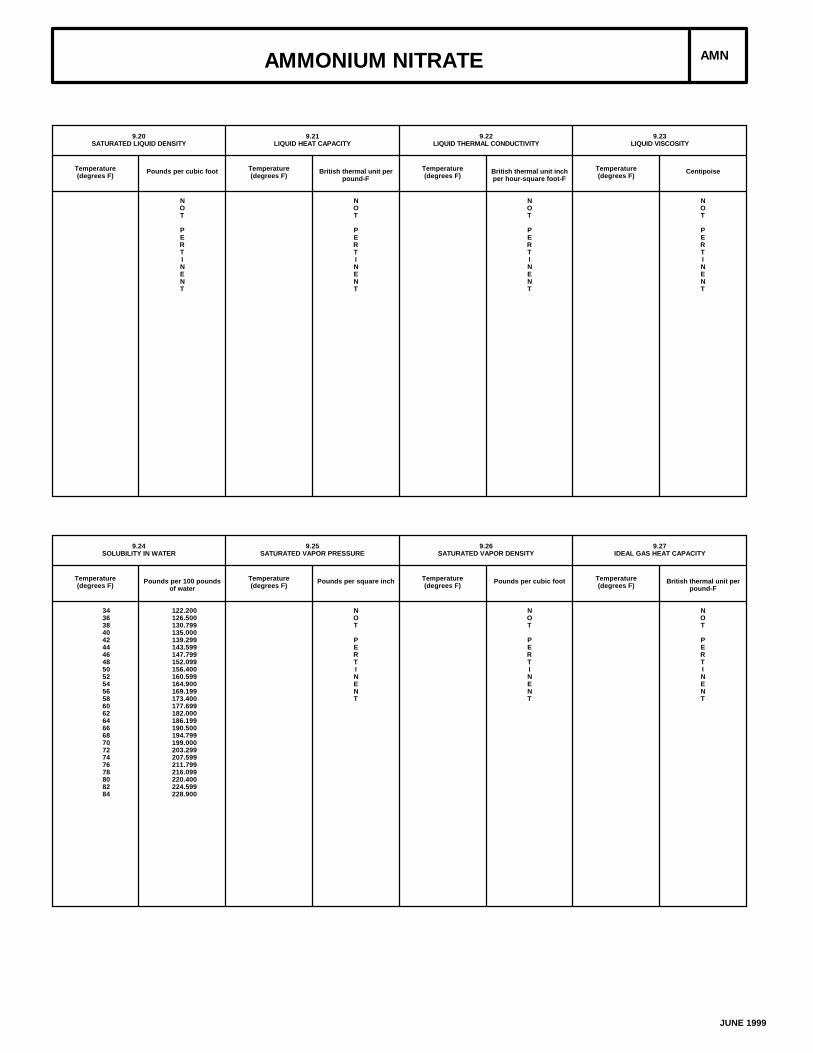
AMMONIUM NITRATE AMN
9.20SATURATED LIQUID DENSITY
Temperature(degrees F)
Pounds per cubic foot
NOT
PERTINENT
9.21LIQUID HEAT CAPACITY
Temperature(degrees F)
British thermal unit perpound-F
NOT
PERTINENT
9.22LIQUID THERMAL CONDUCTIVITY
Temperature(degrees F)
British thermal unit inchper hour-square foot-F
NOT
PERTINENT
9.23LIQUID VISCOSITY
Temperature(degrees F)
Centipoise
NOT
PERTINENT
9.24SOLUBILITY IN WATER
Temperature(degrees F)
Pounds per 100 poundsof water
3436384042444648505254565860626466687072747678808284
122.200126.500130.799135.000139.299143.599147.799152.099156.400160.599164.900169.199173.400177.699182.000186.199190.500194.799199.000203.299207.599211.799216.099220.400224.599228.900
9.25SATURATED VAPOR PRESSURE
Temperature(degrees F)
Pounds per square inch
NOT
PERTINENT
9.26SATURATED VAPOR DENSITY
Temperature(degrees F)
Pounds per cubic foot
NOT
PERTINENT
9.27IDEAL GAS HEAT CAPACITY
Temperature(degrees F)
British thermal unit perpound-F
NOT
PERTINENT
JUNE 1999
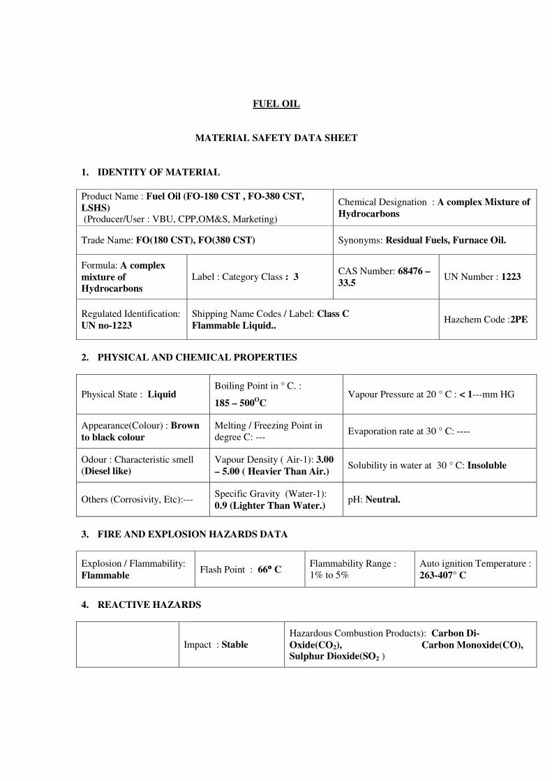
FUEL OIL
MATERIAL SAFETY DATA SHEET
1. IDENTITY OF MATERIAL
Product Name : Fuel Oil (FO-180 CST , FO-380 CST,
LSHS) (Producer/User : VBU, CPP,OM&S, Marketing)
Chemical Designation : A complex Mixture of
Hydrocarbons
Trade Name: FO(180 CST), FO(380 CST) Synonyms: Residual Fuels, Furnace Oil.
Formula: A complex
mixture of
Hydrocarbons
Label : Category Class : 3 CAS Number: 68476 –
33.5 UN Number : 1223
Regulated Identification:
UN no-1223
Shipping Name Codes / Label: Class C
Flammable Liquid.. Hazchem Code :2PE
2. PHYSICAL AND CHEMICAL PROPERTIES
Physical State : Liquid Boiling Point in ° C. :
185 – 500OC
Vapour Pressure at 20 ° C : < 1---mm HG
Appearance(Colour) : Brown
to black colour
Melting / Freezing Point in
degree C: --- Evaporation rate at 30 ° C: ----
Odour : Characteristic smell
(Diesel like)
Vapour Density ( Air-1): 3.00
– 5.00 ( Heavier Than Air.) Solubility in water at 30 ° C: Insoluble
Others (Corrosivity, Etc):--- Specific Gravity (Water-1):
0.9 (Lighter Than Water.) pH: Neutral.
3. FIRE AND EXPLOSION HAZARDS DATA
Explosion / Flammability:
Flammable Flash Point : 66°°°° C
Flammability Range :
1% to 5%
Auto ignition Temperature :
263-407° C
4. REACTIVE HAZARDS
Impact : Stable
Hazardous Combustion Products): Carbon Di-
Oxide(CO2), Carbon Monoxide(CO), Sulphur Dioxide(SO2 )
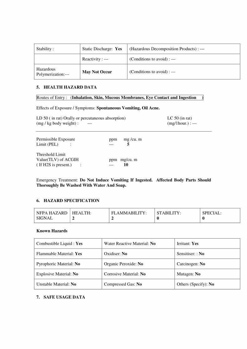
Stability : Static Discharge: Yes (Hazardous Decomposition Products) : ---
Reactivity : --- (Conditions to avoid) : ---
Hazardous
Polymerization:--- May Not Occur (Conditions to avoid) : ---
5. HEALTH HAZARD DATA
Routes of Entry : (Inhalation, Skin, Mucous Membranes, Eye Contact and Ingestion )
Effects of Exposure / Symptoms: Spontaneous Vomiting, Oil Acne.
LD 50 ( in rat) Orally or percutaneous absorption) LC 50 (in rat)
(mg / kg body weight) : --- (mg/1hour.) : ---
Permissible Exposure ppm mg /cu. m
Limit (PEL) : --- 5
Threshold Limit
Value(TLV) of ACGIH ppm mg/cu. m
( If H2S is present.) : --- 10
Emergency Treatment: Do Not Induce Vomiting If Ingested. Affected Body Parts Should
Thoroughly Be Washed With Water And Soap.
6. HAZARD SPECIFICATION
NFPA HAZARD
SIGNAL
HEALTH:
2
FLAMMABILITY:
2
STABILITY:
0
SPECIAL:
0
Known Hazards
Combustible Liquid : Yes Water Reactive Material: No Irritant: Yes
Flammable Material: Yes Oxidiser: No Sensitiser: : No
Pyrophoric Material: No Organic Peroxide: No Carcinogen: No
Explosive Material: No Corrosive Material: No Mutagen: No
Unstable Material: No Compressed Gas: No Others (Specify): No
7. SAFE USAGE DATA
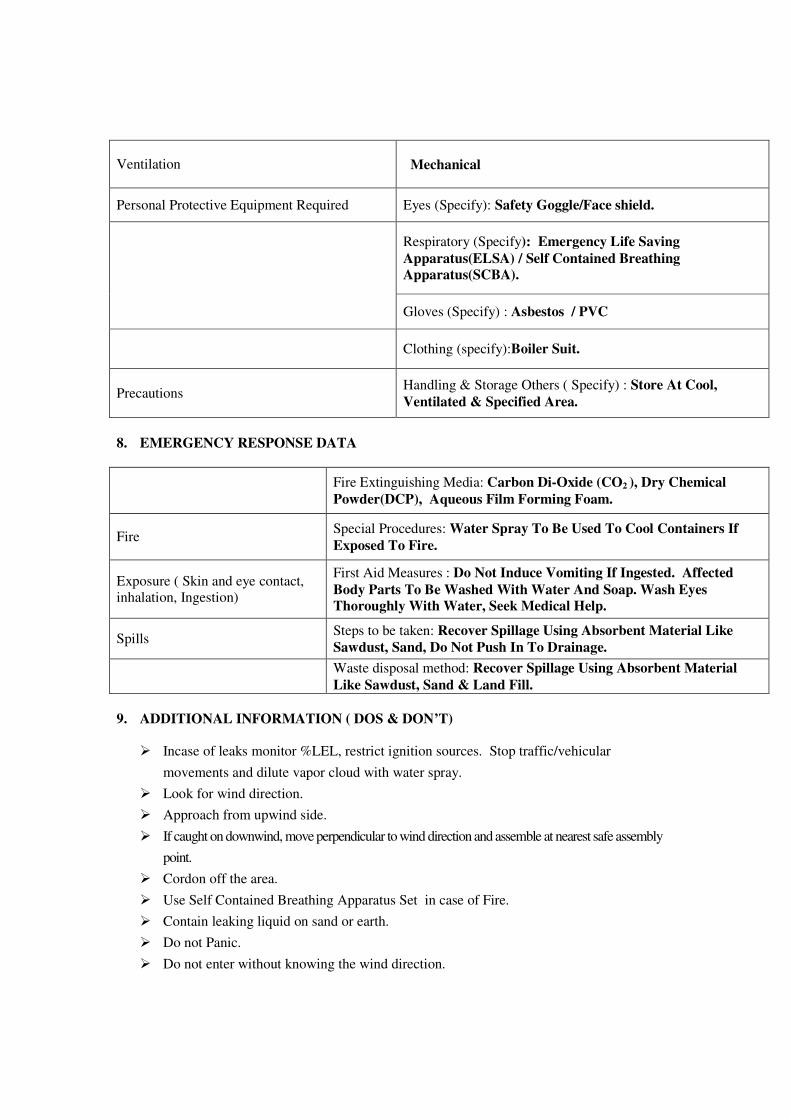
Ventilation Mechanical
Personal Protective Equipment Required Eyes (Specify): Safety Goggle/Face shield.
Respiratory (Specify): Emergency Life Saving
Apparatus(ELSA) / Self Contained Breathing
Apparatus(SCBA).
Gloves (Specify) : Asbestos / PVC
Clothing (specify):Boiler Suit.
Precautions Handling & Storage Others ( Specify) : Store At Cool,
Ventilated & Specified Area.
8. EMERGENCY RESPONSE DATA
Fire Extinguishing Media: Carbon Di-Oxide (CO2 ), Dry Chemical
Powder(DCP), Aqueous Film Forming Foam.
Fire Special Procedures: Water Spray To Be Used To Cool Containers If
Exposed To Fire.
Exposure ( Skin and eye contact,
inhalation, Ingestion)
First Aid Measures : Do Not Induce Vomiting If Ingested. Affected
Body Parts To Be Washed With Water And Soap. Wash Eyes
Thoroughly With Water, Seek Medical Help.
Spills Steps to be taken: Recover Spillage Using Absorbent Material Like
Sawdust, Sand, Do Not Push In To Drainage.
Waste disposal method: Recover Spillage Using Absorbent Material
Like Sawdust, Sand & Land Fill.
9. ADDITIONAL INFORMATION ( DOS & DON’T)
� Incase of leaks monitor %LEL, restrict ignition sources. Stop traffic/vehicular
movements and dilute vapor cloud with water spray.
� Look for wind direction.
� Approach from upwind side.
� If caught on downwind, move perpendicular to wind direction and assemble at nearest safe assembly
point.
� Cordon off the area.
� Use Self Contained Breathing Apparatus Set in case of Fire.
� Contain leaking liquid on sand or earth.
� Do not Panic.
� Do not enter without knowing the wind direction.
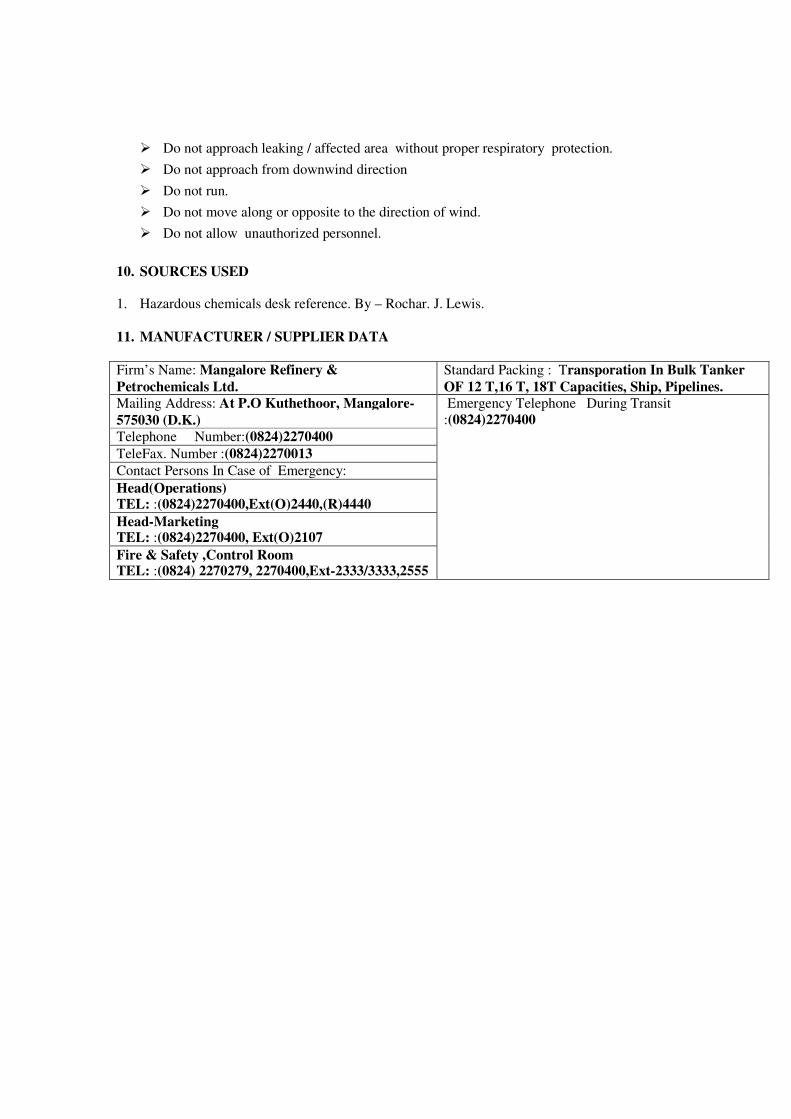
� Do not approach leaking / affected area without proper respiratory protection.
� Do not approach from downwind direction
� Do not run.
� Do not move along or opposite to the direction of wind.
� Do not allow unauthorized personnel.
10. SOURCES USED
1. Hazardous chemicals desk reference. By – Rochar. J. Lewis.
11. MANUFACTURER / SUPPLIER DATA
Firm’s Name: Mangalore Refinery &
Petrochemicals Ltd.
Standard Packing : Transporation In Bulk Tanker
OF 12 T,16 T, 18T Capacities, Ship, Pipelines.
Mailing Address: At P.O Kuthethoor, Mangalore-
575030 (D.K.)
Emergency Telephone During Transit
:(0824)2270400
Telephone Number:(0824)2270400
TeleFax. Number :(0824)2270013
Contact Persons In Case of Emergency:
Head(Operations) TEL: :(0824)2270400,Ext(O)2440,(R)4440
Head-Marketing TEL: :(0824)2270400, Ext(O)2107
Fire & Safety ,Control Room TEL: :(0824) 2270279, 2270400,Ext-2333/3333,2555
KITCO Ltd.Femith’s, P. B. No:4407,
Puthiya Road, NH Bypass Vennala,Kochi – 682 028, Kerala, India
Phone:0484-4129000e-mail: [email protected]
New Delhi :-Flat No: B2/92, 9th Floor,Himalaya House, 23, KG Marg,New Delhi 110 001Tel: +91-1141030081e-mail: [email protected]
Chennai:-KITCO Ltd.,1st Main Road, MEPZ-SEZ,GST Road, Tambaram Sanatorium,Chennai – 600 045, India.Phone: +91-044-45118383/84e-mail: [email protected]
Thiruvananthapuram :-KITCO Ltd.,TC No.16/839-1,Kochar Road, Jagathy,Thiruvananthapuram -695 014, Kerala, India.Phone /Fax: +91-471-2728543e-mail: [email protected]
Related Documents