An Introduction to An Introduction to TRMM and its TRMM and its Precipitation Radar Precipitation Radar (PR) (PR) Arash Mashayekhi Arash Mashayekhi CASA REU Program CASA REU Program Sandra Cruz-Pol, Assoc. Prof. ECE Sandra Cruz-Pol, Assoc. Prof. ECE UPRM UPRM

An Introduction to TRMM and its Precipitation Radar (PR) Arash Mashayekhi CASA REU Program Sandra Cruz-Pol, Assoc. Prof. ECE UPRM.
Dec 24, 2015
Welcome message from author
This document is posted to help you gain knowledge. Please leave a comment to let me know what you think about it! Share it to your friends and learn new things together.
Transcript
An Introduction to TRMM and An Introduction to TRMM and its Precipitation Radar (PR)its Precipitation Radar (PR)
Arash MashayekhiArash Mashayekhi
CASA REU ProgramCASA REU Program
Sandra Cruz-Pol, Assoc. Prof. ECE UPRMSandra Cruz-Pol, Assoc. Prof. ECE UPRM

The Big PictureThe Big Picture
Why TRMM?Why TRMM?
Tropical Rain Measurement MissionTropical Rain Measurement Mission tropical rainfall tropical rainfall Drives the Climate MachineDrives the Climate Machine Need to understand the Water Cycle Need to understand the Water Cycle TRMM: the first space-borne rain radar (PR) TRMM: the first space-borne rain radar (PR)
and microwave radiometric data and microwave radiometric data

About TRMM:About TRMM: • Launched:
• November 28, 1997•Circular Orbit altitude:
• 350 km•Inclination:
• approx. 35 deg.•Orbit Duration:
• 91 minutes (16 Orbits a day)•Time Spent over Puerto Rico during each orbit:
• 1.14 minutes•Total Time spent over Puerto Rico Each Day:
• 18.2 minutes

TRMM Primary Instruments for TRMM Primary Instruments for Measuring Precipitation:Measuring Precipitation:
1.1. Precipitation Radar (PR)Precipitation Radar (PR)
2.2. TRMM Microwave Imager (TMI) TRMM Microwave Imager (TMI) radiometerradiometer
3.3. Visible and Infrared Scanner (VIRS)Visible and Infrared Scanner (VIRS)
• Two Additional Instruments:
1. Cloud and Earth Radiant Energy Sensor (CERES)
2. Lightning Imaging Sensor (LIS)

Microwave ImagerMicrowave Imager
Introduction:Introduction:passive microwave sensor designed to passive microwave sensor designed to
provide quantitative rainfall informationprovide quantitative rainfall information
Provides Valuable Information on: • Quantity of the water vapor, • Quantity of the cloud water• Intensity of the rainfall in the atmosphere.
Specifications:
• Frequency: 10.65 to 85.5 GHz
• Horizontal Resolution: 6 to 50 km
• Swath Width: 760 km
TMI
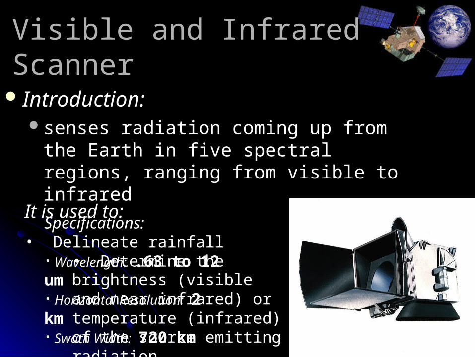
Visible and Infrared ScannerVisible and Infrared Scanner
Introduction:Introduction:senses radiation coming up from the Earth in senses radiation coming up from the Earth in
five spectral regions, ranging from visible to five spectral regions, ranging from visible to infraredinfrared
It is used to:
• Delineate rainfall• Determine the brightness (visible and near infrared) or temperature (infrared) of the source emitting radiation
Specifications:
• Wavelength: .63 to 12 um• Horizontal Resolution: 2 km• Swath Width: 720 km
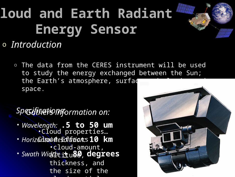
Cloud and Earth Radiant Cloud and Earth Radiant Energy SensorEnergy Sensor
o IntroductionIntroduction
o The data from the CERES instrument will be used to study the The data from the CERES instrument will be used to study the energy exchanged between the Sun; the Earth’s atmosphere, energy exchanged between the Sun; the Earth’s atmosphere, surface and clouds; and space.surface and clouds; and space.
Gathers information on:Gathers information on:
•Cloud properties…Cloud Cloud properties…Cloud EffectsEffects
•cloud-amount, cloud-amount, altitude, thickness, and altitude, thickness, and the size of the cloud the size of the cloud particlesparticles
Specifications:
• Wavelength: .5 to 50 um
• Horizontal Resolution: 10 km
• Swath Width: + 80 degrees
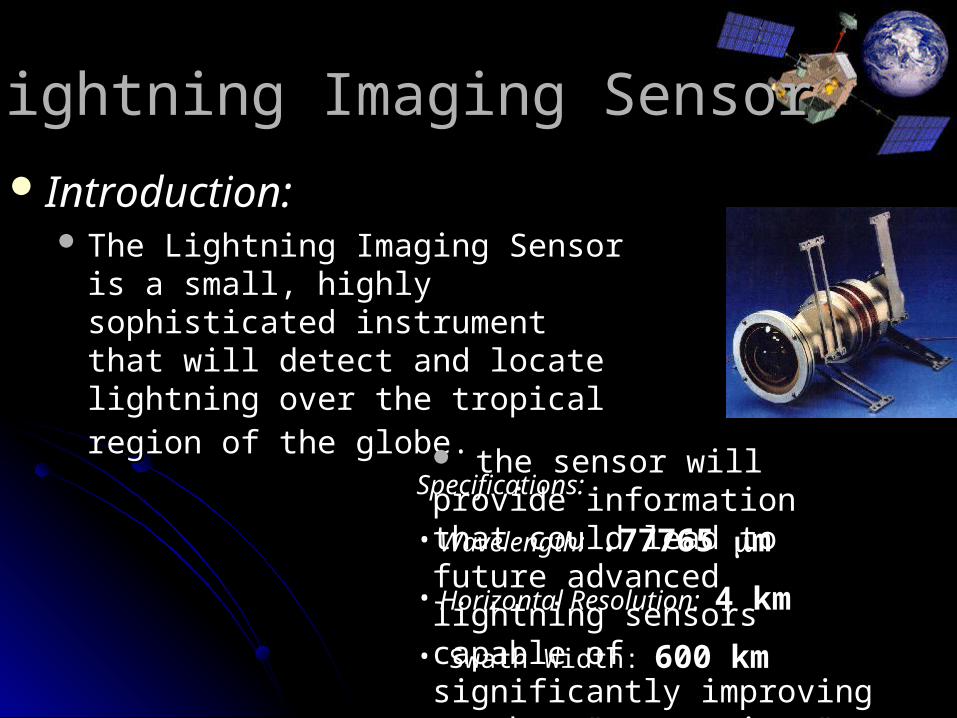
Lightning Imaging SensorLightning Imaging Sensor
Introduction:Introduction: The Lightning Imaging Sensor is a The Lightning Imaging Sensor is a
small, highly sophisticated instrument small, highly sophisticated instrument that will detect and locate lightning that will detect and locate lightning
over the tropical region of the globe.over the tropical region of the globe.
the sensor will provide the sensor will provide information that could lead to information that could lead to future advanced lightning future advanced lightning sensors capable of significantly sensors capable of significantly improving weather improving weather "nowcasting.""nowcasting."
Specifications:
• Wavelength: .77765 m
• Horizontal Resolution: 4 km
• Swath Width: 600 km
Precipitation RadarPrecipitation Radar
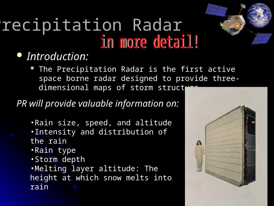
Introduction:Introduction: The Precipitation Radar is the first active space borne radar The Precipitation Radar is the first active space borne radar
designed to provide three-dimensional maps of storm structure designed to provide three-dimensional maps of storm structure
PR will provide valuable information on:
•Rain size, speed, and altitude•Intensity and distribution of the rain•Rain type•Storm depth•Melting layer altitude: The height at which snow melts into rain

Precipitation RadarPrecipitation Radar
Specifications:Specifications:
o Frequency :Frequency : 13.8 GHz (Ku-band)13.8 GHz (Ku-band)o More than four times higher than that of a typical ground based More than four times higher than that of a typical ground based
radar (NEXTRAD ~ 3 GHz, S-band)radar (NEXTRAD ~ 3 GHz, S-band)
o Horizontal Resolution:Horizontal Resolution: 4.3 km4.3 km
o Swath Width:Swath Width: 215 km215 km
o Vertical Profile of Rain and Snow:Vertical Profile of Rain and Snow: 19.3 km19.3 kmo Able to detect rainfall rate down to .7 millimeters/hrAble to detect rainfall rate down to .7 millimeters/hro Able to separate vertical rain echo samples of 250 metersAble to separate vertical rain echo samples of 250 meters

Precipitation RadarPrecipitation Radar
Specifications (Cont’d):Specifications (Cont’d):
Power Consumption:Power Consumption: 224 W224 W
Solid state power amplifiers (128) are used to conserve power Solid state power amplifiers (128) are used to conserve power
Target Area:Target Area:
phased array antenna that steers the beam electronicallyphased array antenna that steers the beam electronically

PrecipitationPrecipitation RadarRadar
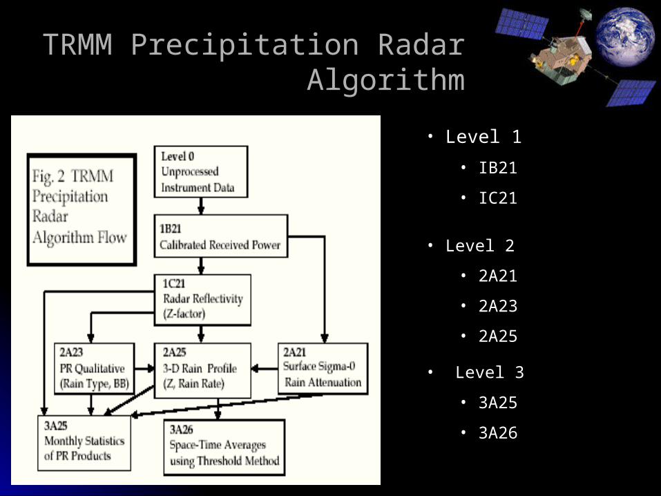
TRMM Precipitation Radar AlgorithmTRMM Precipitation Radar Algorithm
• Level 1
• IB21
• IC21
• Level 2
• 2A21
• 2A23
• 2A25
• Level 3
• 3A25
• 3A26
TRMM Precipitation Radar AlgorithmTRMM Precipitation Radar Algorithm
Level 1 Level 1 ((IB21IB21, IC21), IC21)
IB21 IB21 Calculates received power by performing extensive Calculates received power by performing extensive
internal calibrations internal calibrations
Data in IB21 include:Data in IB21 include:Location of Earth surface and surface clutterLocation of Earth surface and surface clutterSystem noise levelSystem noise levelLand/Ocean FlagLand/Ocean FlagAnd many more…And many more…

TRMM Precipitation Radar AlgorithmTRMM Precipitation Radar Algorithm
Some Examples of IB21 Data:Some Examples of IB21 Data: NavigationNavigation
X, Y, Z Components of Space Craft Velocity and PositionX, Y, Z Components of Space Craft Velocity and Position LatitudeLatitude LongitudeLongitude AltitudeAltitude Sensor OrientationSensor Orientation
Min. Echo FlagMin. Echo Flag 0 : No Rain0 : No Rain 10: Rain possible but maybe noise10: Rain possible but maybe noise 20: Rain Certain20: Rain Certain
Land / Ocean FlagLand / Ocean Flag 0: Water0: Water 1: Land1: Land

TRMM Precipitation Radar AlgorithmTRMM Precipitation Radar Algorithm
Level 1 Level 1 (IB21, (IB21, IC21IC21))Output: Radar Reflectivity FactorOutput: Radar Reflectivity FactorAlmost same file format as that of IB21:Almost same file format as that of IB21:
Power replaced by Radar Reflectivity FactorPower replaced by Radar Reflectivity Factor Noise replaced by Dummy VariableNoise replaced by Dummy Variable
Level 2 Level 2 ((2A212A21, 2A23, 2A25), 2A23, 2A25)Primary Objective: Primary Objective:
Compute Path Integrated Attenuation (PIA) using the Compute Path Integrated Attenuation (PIA) using the Surface Reference Techniques (SRT).Surface Reference Techniques (SRT).
Input Data: IB21Input Data: IB21Output used by: 2A25, 3A25, and 3A26Output used by: 2A25, 3A25, and 3A26

TRMM Precipitation Radar AlgorithmTRMM Precipitation Radar Algorithm
Level 2 Level 2 (2A21, (2A21, 2A232A23, 2A25), 2A25) Main Objectives:Main Objectives:
Classification of Rain TypesClassification of Rain Types Output of Rain / No Rain FlagOutput of Rain / No Rain Flag Computation of estimated height of freezing levelComputation of estimated height of freezing level Output of the height of storm topOutput of the height of storm top
Input Data: IC21Input Data: IC21 Output used by: 2A25, 2B31, 3A25, 3A26Output used by: 2A25, 2B31, 3A25, 3A26
Level 2 Level 2 (Cont’d)(Cont’d) (2A21, 2A23, (2A21, 2A23, 2A252A25)) Main Objectives:Main Objectives: Input Data: IC21, 2A21, 2A23Input Data: IC21, 2A21, 2A23 Output used by: 3A25, 3A26Output used by: 3A25, 3A26
Correct for the Rain Attenuation in measured Radar ReflectivityCorrect for the Rain Attenuation in measured Radar Reflectivity Estimate instantaneous 3-D distribution of rain Estimate instantaneous 3-D distribution of rain

TRMM Precipitation Radar AlgorithmTRMM Precipitation Radar Algorithm
Level 3 (Level 3 (3A253A25, 3A26) , 3A26) Objective:Objective:
calculate various statistics over a month from the level 2 Four types of statistics are calculated:
1. probabilities of occurrence2. means and standard deviations3. histograms4. correlation coefficients
Level 3 (3A25, Level 3 (3A25, 3A263A26)) Objective:Objective:
Compute rain rate statistics Compared to 3A25Compared to 3A25
statistics produced from 3A25 are conditioned either on the presence of rain or on the presence of a particular type of rain but statistics from 3A26 are unconditioned.
Data for Rain eventData for Rain event
We requested data for a strong rain event We requested data for a strong rain event that occurred in Puerto Rico last May that occurred in Puerto Rico last May 2004. 2004.
Dates May 14, 15, 21 …Dates May 14, 15, 21 …We have corresponding data for NWS We have corresponding data for NWS
NEXRAD in Cayey, PR and rain gauges NEXRAD in Cayey, PR and rain gauges around the island.around the island.
Our goal is to compare these data setsOur goal is to compare these data sets

How does the data look like?How does the data look like?
Data files are huge: 30MB for each 1.1 Data files are huge: 30MB for each 1.1 minute. Total of over 1GB for the event.minute. Total of over 1GB for the event.
There are several (~20) productsThere are several (~20) productsAve rainAve rainNear surface rainNear surface rainSigma zeroSigma zeroRain flagRain flagZetaZetaPIAPIA
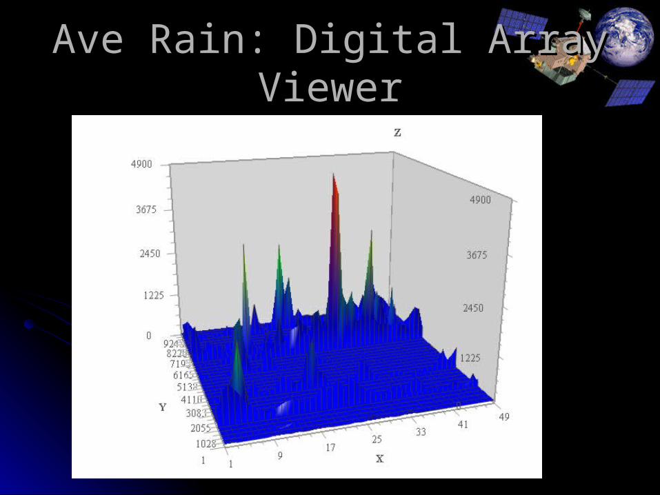
Ave Rain: Digital Array ViewerAve Rain: Digital Array Viewer

Sigma 0: Digital Array viewerSigma 0: Digital Array viewer

Need to FilterNeed to Filter
We only needWe only needNear surf rainNear surf rainQuality flagQuality flag??
And of course Latitude/Longitude, Date, And of course Latitude/Longitude, Date, Time to map over Puerto RicoTime to map over Puerto Rico
This filtering should considerably reduce This filtering should considerably reduce the data file sizes.the data file sizes.

Rain algorithmRain algorithm
Once we filter the dataOnce we filter the data Need to develop code in IDL to convert to Need to develop code in IDL to convert to
arrays in textarrays in text Compare actual rain algorithm being used by Compare actual rain algorithm being used by
NWS. The Rosenfelt tropical convectiveNWS. The Rosenfelt tropical convective
2.1250RZ

PR Rain CharacterizationPR Rain Characterization Look at different algorithms per regionLook at different algorithms per region Elsner & Carter, 2000Elsner & Carter, 2000 ; ; Vasquez & RocheVasquez & Roche, ,
19971997 suggest that the island be divided into suggest that the island be divided into ~6 rain regions each with a different ~6 rain regions each with a different algorithm for 3 seasons.algorithm for 3 seasons.

Tropical EnvironmentTropical Environment
Tropical weather is especially Tropical weather is especially difficult to forecast due to difficult to forecast due to several factors including:several factors including:
Easterly trade winds caused Easterly trade winds caused forced convectionforced convection
Complex topography of the Complex topography of the islandisland
In the fall, we plan to use CSU In the fall, we plan to use CSU disdrometer to help further disdrometer to help further characterize rainfall in PR.characterize rainfall in PR.

CreditsCredits TRMM Official Website
TRMM Education and Outreach Scientist : Dr Jeffrey B. Halverson
Responsible NASA Official: Dr.Robert Adler
http://trmm.gsfc.nasa.gov/
NASA Official WebsiteEditor: Jim Wilson
NASA Official: Brian DunbarLast Updated: July 6, 2004
http://www.nasa.gov/home/index.html
Japan Aerospace Exploration Agency (JAXA) Official Websitehttp://www.jaxa.jp/index_e.html
National Space Development Agency of Japan (NASDA) Official Websitehttp://www.nasda.go.jp/index_e.html
Tropical Rainfall Measuring Mission( TRMM ) Precipitation Radar Algorithm Instruction Manual For Version 6
Related Documents