An Incremental Approach For Teaching Field Mapping Using Rugged Tablet Computers & GIS Paul Umhoefer (Instructor) Professor of Geology Mark Manone (Technical leader) Geospatial Research & Information Lab Geology Program, School of Earth Sciences & Environmental Sustainability Northern Arizona University

Welcome message from author
This document is posted to help you gain knowledge. Please leave a comment to let me know what you think about it! Share it to your friends and learn new things together.
Transcript

An Incremental Approach ForTeaching Field Mapping
Using Rugged Tablet Computers & GIS
Paul Umhoefer (Instructor) Professor of GeologyMark Manone (Technical leader) Geospatial Research & Information Lab
Geology Program, School of Earth Sciences & Environmental SustainabilityNorthern Arizona University

GLG 440 - Advanced Field Geology – 6 credits{Introductory Field Methods – 2 credits}
• Capstone Geology course: Class of 12-20 students (all NAU); 1 prof in each of 4 projects; 1 TA in each project
• Spring semester class:*** 2 projects in semester (long weekends)*** 2 projects in classic summer style in May
• review basic field methods (despite Intro Field Methods class)
• mix of traditional advanced mapping and field methods
• always include one hydro – geomorphology project
• included tablet computer component for the last 8 years

Incremental approach to GIS - digital mapping…{obvious now, but took us 4-5 years to figure out}
typically 3 exercises
Exercise 1 – ONLY in lab• Previewing the field area with air photos & images;• getting to know your map area & data• preliminary map…
Exercise 2 – ONLY in lab; Preview map again in lab;• Georeference a traditional field map;• edit and digitize geologic features in GIS• produce a final digital map
Exercise 3 – in lab and field; Preview map again in lab;• Complete digital map in a GIS with Rugged tablet computers & GPS
Exercise 4 – return to traditional mapping…. OR• Optional mapping with tablets

Project 1 - preview in lab only

Project 1

Project 2 - traditional mapping in field

GIS map onair photo base
Project 2

Project 2

Project 3 - dive intoTablets in field…

BUT are students ready to dive in to full blownTablet computer mapping??
some are not…• We added a short (one afternoon) on-campus mapping projectwith tablet computers,
so basic use of tabletsIs familiar in field
Project 3

Collecting hydrogeologic data…Project 3

Tertiary
Paleozoic
Quaternary
Use fairly simple area &non-mapping data collecting with tablets
Project 3
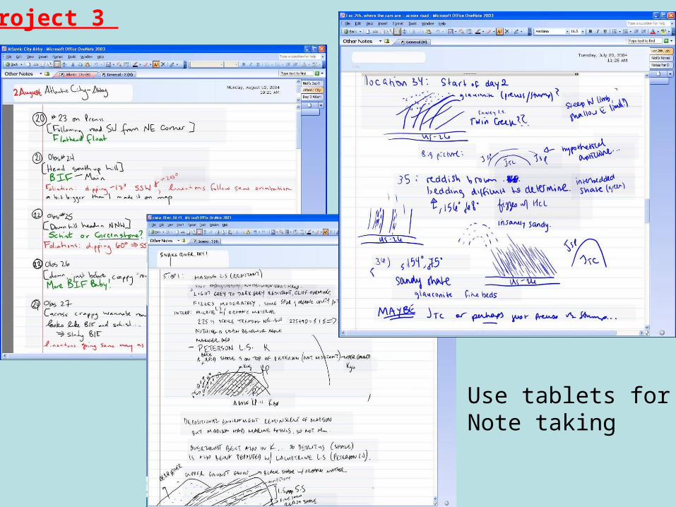
Use tablets forNote taking
Project 3

Stay at RuralBed & Breakfast
Within field area
• electricity for charging• good evening workconditions
PicklogisticallySimplelocation
Project 3

B & B
Project 3

Assessment – Professional Assessors at NAU
• Students split on if using field based GIS is positive
5 yes, 3 neutral, 5 no• Students positive on using GIS to make final map versus hand drawn map
8 yes, 3 neutral, 2 no• Students very positive about using GIS to preview and recon field areas
13 yes• Some students complained about Logistics & computer problems with field-based GIS

Conclusions: Tablet computers work well…
But (for us) only after incremental approach was used;
Keep it simple; provide easy logistics; extra instructors
••• Former students have used GIS & tablets in many jobs.
Related Documents