ALTA/ACSM Land Title Surveys Leveraging the Feasibility Assessment Tool for Land Development Deals Today’s faculty features: 1pm Eastern | 12pm Central | 11am Mountain | 10am Pacific The audio portion of the conference may be accessed via the telephone or by using your computer's speakers. Please refer to the instructions emailed to registrants for additional information. If you have any questions, please contact Customer Service at 1-800-926-7926 ext. 10. TUESDAY, MARCH 5, 2013 Presenting a live 90-minute webinar with interactive Q&A Mitchell G. Williams, Partner, Hunton Williams, New York Earl Morriss, Of Counsel, Genesis Law Firm, Everett, Wash.

Welcome message from author
This document is posted to help you gain knowledge. Please leave a comment to let me know what you think about it! Share it to your friends and learn new things together.
Transcript
ALTA/ACSM Land Title Surveys Leveraging the Feasibility Assessment Tool for Land Development Deals
Today’s faculty features:
1pm Eastern | 12pm Central | 11am Mountain | 10am Pacific
The audio portion of the conference may be accessed via the telephone or by using your computer's
speakers. Please refer to the instructions emailed to registrants for additional information. If you
have any questions, please contact Customer Service at 1-800-926-7926 ext. 10.
TUESDAY, MARCH 5, 2013
Presenting a live 90-minute webinar with interactive Q&A
Mitchell G. Williams, Partner, Hunton Williams, New York
Earl Morriss, Of Counsel, Genesis Law Firm, Everett, Wash.

Sound Quality
If you are listening via your computer speakers, please note that the quality of
your sound will vary depending on the speed and quality of your internet
connection.
If the sound quality is not satisfactory and you are listening via your computer
speakers, you may listen via the phone: dial 1-866-871-8924 and enter your PIN
when prompted. Otherwise, please send us a chat or e-mail
[email protected] immediately so we can address the problem.
If you dialed in and have any difficulties during the call, press *0 for assistance.
Viewing Quality
To maximize your screen, press the F11 key on your keyboard. To exit full screen,
press the F11 key again.

For CLE purposes, please let us know how many people are listening at your
location by completing each of the following steps:
• In the chat box, type (1) your company name and (2) the number of
attendees at your location
• Click the SEND button beside the box
FOR LIVE EVENT ONLY

If you have not printed the conference materials for this program, please
complete the following steps:
• Click on the + sign next to “Conference Materials” in the middle of the left-
hand column on your screen.
• Click on the tab labeled “Handouts” that appears, and there you will see a
PDF of the slides for today's program.
• Double click on the PDF and a separate page will open.
• Print the slides by clicking on the printer icon.

Strafford Publications Webinar Tuesday, March 5, 2013
Presented by:
Mitchell Williams Partner [email protected] Hunton & Williams LLP 200 Park Avenue 52nd Floor New York, NY 10166
5

ALTA/ACSM LAND SURVEYS
• What is ALTA?
• What is ACSM?
• What is NSPS?
• What is an ALTA/ACSM land survey?
6

CODES OF PRACTICE
• Provide a uniform set of guidelines and requirements for land surveys, and establish a standard of care
• State Codes of Practice
• State and local Surveyor’s association standards
• Minimum Standard Detail Requirements for ALTA/ACSM Land Title Surveys • 1946: ACSM issued technical standards for title surveys
• 1962: ACSM joined with ALTA to issue the first ALTA/ACSM title survey code
• 2011: The most recent version of the ALTA/ACSM Code
7
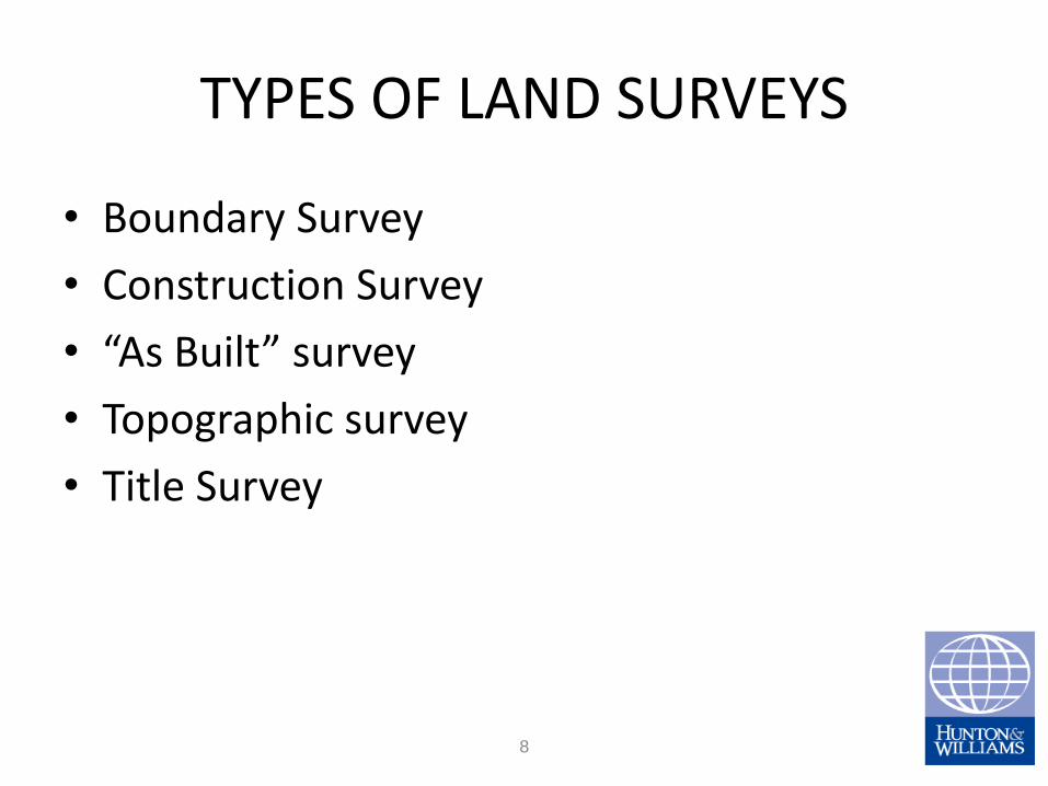
TYPES OF LAND SURVEYS
• Boundary Survey
• Construction Survey
• “As Built” survey
• Topographic survey
• Title Survey
8

WHAT DOES A TITLE SURVEY TYPICALLY SHOW?
• The location of the Property described in the deed and its record boundary lines
• The location and nature of the improvements on the Property and their relationship to the record boundary lines, as well as improvements on adjoining property that are close to or over the record boundary lines
• The location of easements of record affecting the Property, and visible evidence of possible easements that are not of record
• Adjoining streets
• Discrepancies between the record boundaries of the Property and the record boundary lines of all adjoining property, as well as with physical lines of occupation
• This is not an exhaustive list
9

WHAT DOES A TITLE SURVEY TYPICALLY NOT
SHOW, UNLESS SPECIFICALLY REQUESTED?
• Zoning information
• Flood Zones
• Minimum setback lines, unless contained in a recorded document
• Ownership
• Underground improvements; e.g., pipes, electrical lines, other utilities, unless there is visible surface evidence that they may exist.
• This is not an exhaustive list
10

WHAT IS A LAND SURVEY? • It is a report to a client by a licensed land surveyor of the results of his or her review of recorded
documents affecting the surveyed property, his or her observations and measurements in the field, and his or her professional opinion regarding the location of the property boundary lines and their relationship to the improvements on the property and the record boundary lines of the adjoining properties.
• This report is typically presented in the form of a “map of survey” or a “survey map”, and in particularly complex case, may be supplemented by a written report.
• It is an opinion, not a guaranty. Two surveyors may reasonably disagree as to the location of a corner or a boundary line, particularly if there are ambiguous descriptions, conflicting lines of occupation, etc. Unless the adjoining landowners agree in a recorded writing, only a Court can legally resolve a boundary dispute.
• If the dispute does goes to court, it is the surveyor’s field notes, calculations and recorded documents that are required to be produced as evidence.
11

WHEN AND WHY DO YOU NEED A NEW SURVEY?
• Because things change. Fences may be moved, buildings expanded, or additional ones built. The flood zone designation may have changed because of revisions to the flood zone maps. There may have been a condemnation for a street widening. Neighbors may have built some encroachments onto the property.
• Is it certified to YOU? If not, you may have no recourse to the Surveyor if the survey is incorrect. Is it signed and sealed by a licensed land surveyor? Was it done in accordance with an acceptable Code of Practice? Are there items that you want to know about that were not required to be shown by the Code used?
• Is there an adequate legal description of record? If not, e.g., the description relies on physical monuments that may or may not still exist, on a water boundary, or on the location of the boundaries of adjoining owners, then another opinion on the boundaries may be advisable, and with recent developments in technology, a more precise measurement of the Property may be warranted.
12

ALTA/ACMS Land
Title Surveys
Earl Morriss, Esq.
Genesis Law Firm, PLLC
2918 Colby Avenue #211
Everett, WA 98201
13
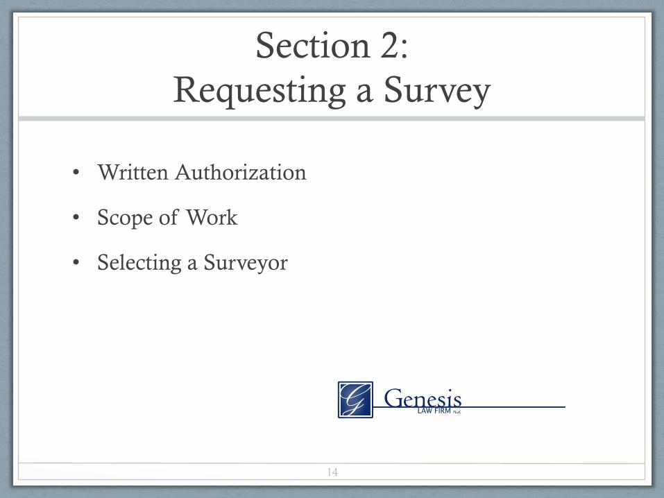
Section 2:
Requesting a Survey
• Written Authorization
• Scope of Work
• Selecting a Surveyor
14

Section 3: Standard of Care
• Effective Date
• Other Requirements and Standards of Practice
• The Normal Standard of Care
• Boundary Resolution
• Measurement Standards
15

Section 4: Records Search
“Record Documents” to Surveyor
Who Provides? (not necessarily title company)
What is the“most recent” title commitment?
Need to Bifurcate Title and Survey in Contract—
need Title and documents of record in order to get
Survey
Adjoining Land: Need Title Company to provide
Deeds to Adjacent Land
16

Section 5: Field Work
• Performed on the ground and include
• Monuments
• Rights of Way and Access
• Lines of Possession, Improvements
• Buildings
• Easements
• Cemeteries
• Water Features
17

Section 6: Plat or Map
Legal Description Discrepancy (Section 6(B)(i))
In dueling legal descriptions, who wins?
Surveyor’s certification assumes a closed metes and bounds
description
Disclosure of Gaps and Overlaps (Section 6(B)(vii))
Does surveyor need to resolve gaps and overlaps?
Plotting easements and servitudes (Section 6(C)(i) and (ii))
No definition of “plottable”
18

Section 7: Surveyor Certification
Section 7 only requires the unaltered standard survey
certification
What are the lender’s requirements—no more ‘long form’?
Will surveyors or surveyor’s insurers allow successors and
assigns as part of the survey’s certified parties?
Can include local certification requirements under Section
7
19

Section 8: Surveyor Deliverables
• Copies of Plat or Map
• Hard Copies
• Digital Copies: Does lender or title company require
embossed seal?
• Recordable Form
• Recorded or Filed
20

RECORDS RESEARCH
• Records required: current legal descriptions of subject property and all adjoining properties • Copies of all recorded easements and covenants burdening or benefitting
the property • Copies of all documents mentioned in any of the documents listed above • All other information and documents the surveyor needs to comply with
requests for additional items the client requests to be shown, including items on table A.
• Responsible for providing the required records: the person ordering the survey,
typically the title company
21

22
Table A

23
Table A
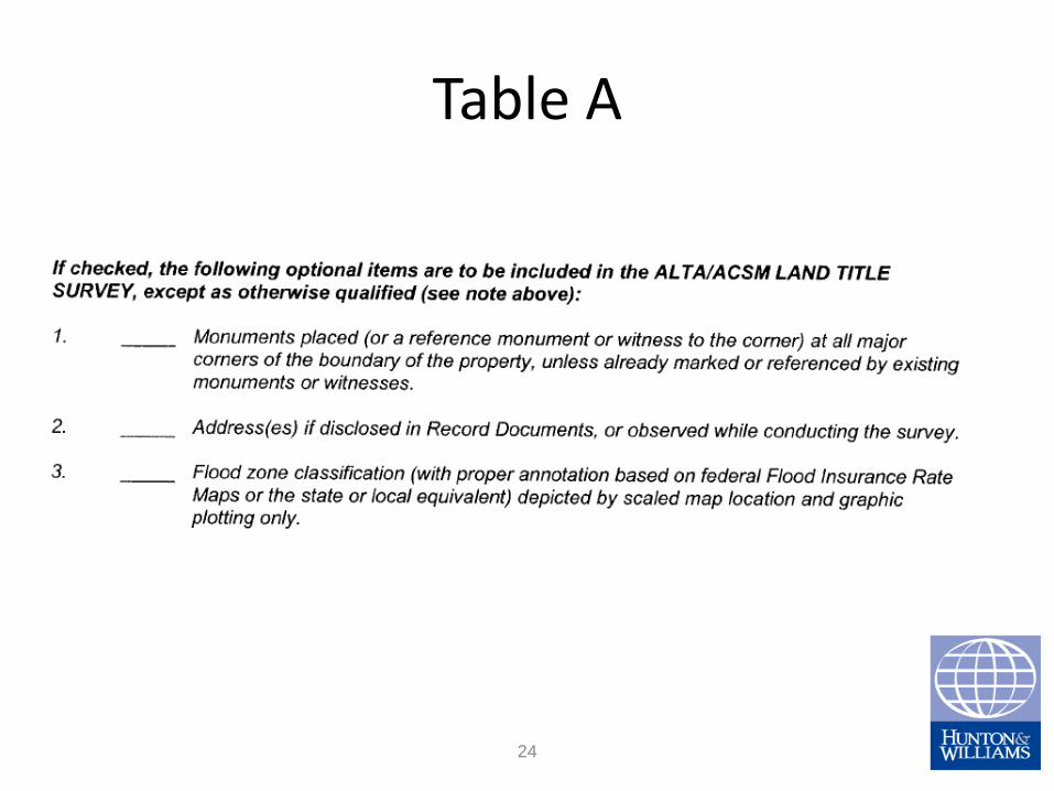
24
Table A

25
Table A

26
Table A

27
Table A

28
Table A
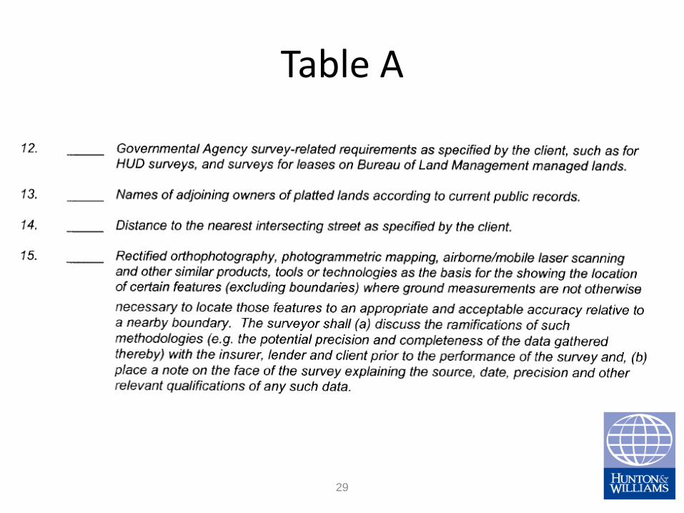
29
Table A

30
Table A

31
Table A
Effective Use of Surveys
• Questions?
32
Related Documents