SUPERFUND THIRD FIVE-YEAR REVIEW REPORT for A.L. Taylor (Valley of Drums) Operable Unit 01 Brooks, Bullitt County, Kentucky PREPARED BY: US Army Corps of Engineers, Louisville District for US Environmental Protection Agency, Region 4 Atlanta, Georgia February 2003 C:\TaylorDFTReport.doc

Welcome message from author
This document is posted to help you gain knowledge. Please leave a comment to let me know what you think about it! Share it to your friends and learn new things together.
Transcript
SUPERFUND THIRD FIVE-YEAR REVIEW REPORT
for
A.L. Taylor (Valley of Drums) Operable Unit 01
Brooks, Bullitt County, Kentucky
PREPARED BY:
US Army Corps of Engineers, Louisville District
for
US Environmental Protection Agency, Region 4 Atlanta, Georgia
February 2003 C:\TaylorDFTReport.doc
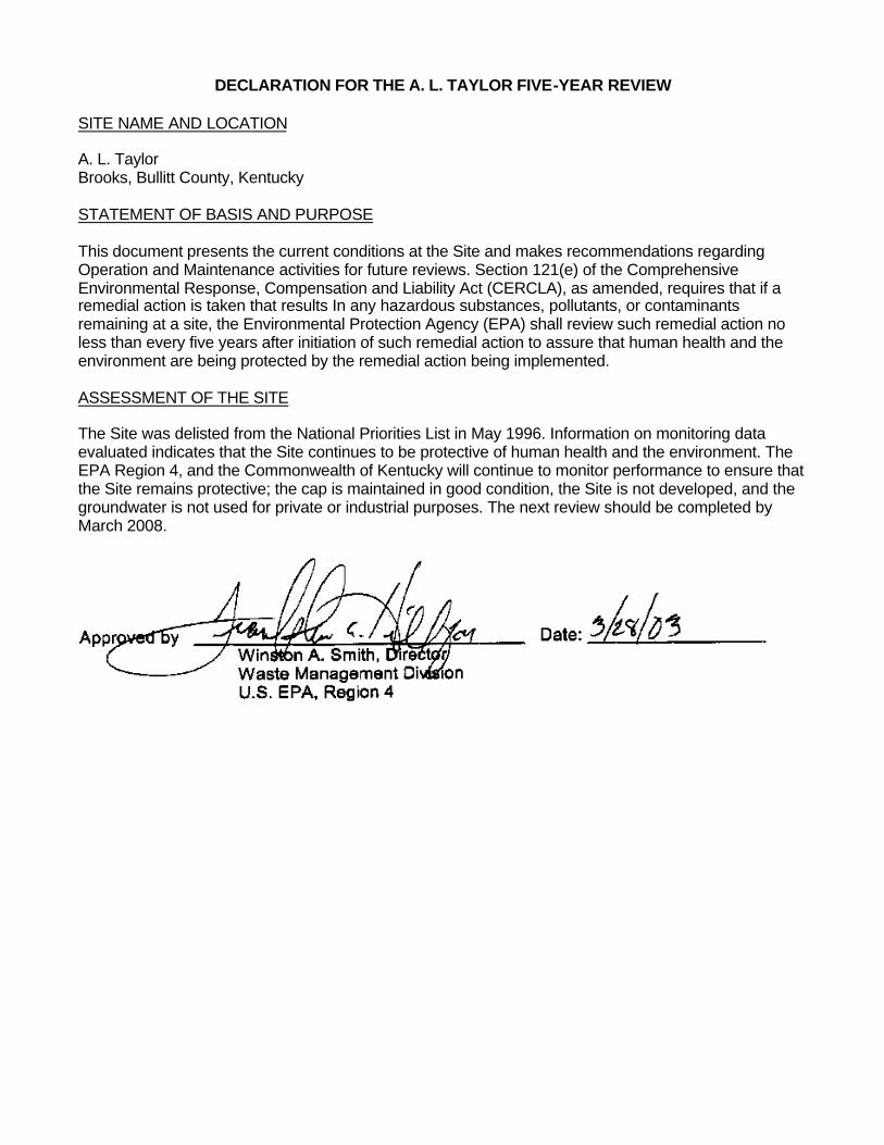
DECLARATION FOR THE A. L. TAYLOR FIVE-YEAR REVIEW SITE NAME AND LOCATION A. L. Taylor Brooks, Bullitt County, Kentucky STATEMENT OF BASIS AND PURPOSE This document presents the current conditions at the Site and makes recommendations regarding Operation and Maintenance activities for future reviews. Section 121(e) of the Comprehensive Environmental Response, Compensation and Liability Act (CERCLA), as amended, requires that if a remedial action is taken that results In any hazardous substances, pollutants, or contaminants remaining at a site, the Environmental Protection Agency (EPA) shall review such remedial action no less than every five years after initiation of such remedial action to assure that human health and the environment are being protected by the remedial action being implemented. ASSESSMENT OF THE SITE The Site was delisted from the National Priorities List in May 1996. Information on monitoring data evaluated indicates that the Site continues to be protective of human health and the environment. The EPA Region 4, and the Commonwealth of Kentucky will continue to monitor performance to ensure that the Site remains protective; the cap is maintained in good condition, the Site is not developed, and the groundwater is not used for private or industrial purposes. The next review should be completed by March 2008.
SUPERFUND THIRD FIVE-YEAR REVIEW REPORT
for
A.L. Taylor (Valley of Drums)
Brooks, Bullitt County, Kentucky
PREPARED BY:
US Army Corps of Engineers, Louisville District
for
US Environmental Protection Agency, Region 4 Atlanta, Georgia
March 2003
Third Five-Year Review Report A. L. Taylor, Brooks, KY
March 2003
i
TABLE OF CONTENTS List of Acronyms Executive Summary Five-Year Review Summary Form SECTION 1 INTRODUCTION AND PURPOSE......................................................................................1 1.1 GENERAL..............................................................................................................................1 1.2 AUTHORITY ..........................................................................................................................1 1.3 PURPOSE .............................................................................................................................1 1.4 LOCAL REPOSITORY ............................................................................................................1 SECTION 2 SITE CHRONOLOGY..........................................................................................................2 SECTION 3 BACKGROUND ...................................................................................................................2 3.1 GENERAL..............................................................................................................................2 3.2 LOCATION AND DESCRIPTION.............................................................................................2 3.3 SITE HISTORY ......................................................................................................................4 3.4 BASIS FOR TAKING ACTION.................................................................................................6 3.5 REMEDIAL OBJECTIVES .......................................................................................................6 3.6 DESCRIPTION OF THE REMEDIAL ACTIONS ........................................................................6 3.7 PREVIOUS FIVE-YEAR REVIEW ACTIVITIES.........................................................................7 3.7.1 First Five-Year Review (June 1992) .............................................................................7 3.7.2 Second Five-Year Review (June 1997) ........................................................................9 3.8 PROGRESS and O&M ACTIVITIES SINCE LAST REVIEW ......................................................9 SECTION 4 FIVE-YEAR REVIEW PROCESS......................................................................................12 SECTION 5 FIVE-YEAR REVIEW FINDINGS ......................................................................................12 5.1 INTERVIEWS.......................................................................................................................12 5.2 SITE VISITS/INSPECTIONS .................................................................................................15 SECTION 6 ASSESSMENT...................................................................................................................15 6.1 SITE CONDITIONS ..............................................................................................................15 6.1.1 Initial Approach and Institutional Controls ...................................................................15 6.1.2 Cap and Ground Cover .............................................................................................16 6.1.3 Riprap Lining............................................................................................................17 6.1.4 Groundwater Monitoring Well Conditions ....................................................................17 6.2 SUMMARY OF ON-SITE INTERVIEWS.................................................................................17 6.3 APPLICABLE OR RELEVANT AND APPROPRIATE REQUIREMENTS (ARARS) REVIEW......18 6.3.1 Changes in Standards and To -Be-Considered (TBC) Criteria ......................................18
6.3.2 Comparison of Surface Water Data to Kentucky Ambient Water Quality Criteria 19
6.3.3 Kentucky Water Quality Standards .............................................................................20 6.4 DATA REVIEW.....................................................................................................................22 6.4.1 Groundwater ............................................................................................................22 6.4.2 Surface Water ..........................................................................................................24 6.4.3 Sediment..................................................................................................................24 6.4.4 Summary of Sampling Results...................................................................................25 SECTION 7 ISSUES ..............................................................................................................................27
Third Five-Year Review Report A. L. Taylor, Brooks, KY
March 2003
ii
7.1 SURFACE/COVER ..............................................................................................................27 7.2 GROUNDWATER MONITORING WELLS .............................................................................27 7.3 INSTITUTIONAL CONTROLS ..............................................................................................27 SECTION 8 RECOMMENDATIONS ....................................................................................................28 8.1 SURFACE/COVER ..............................................................................................................28 8.2 GROUNDWATER AND SURFACE WATER MONITORING ...................................................28 8.3 GROUNDWATER MONITORING WELLS .............................................................................28 8.4 INSTITUTIONAL CONTROLS ..............................................................................................29 SECTION 9 STATEMENT OF PROTECTIVENESS ............................................................................29 SECTION 10 NEXT REVIEW .................................................................................................................29
LIST OF TABLES Table 1: Comparison of Surface Water Data to Kentucky Ambient Water Quality Criteria......................20 Table 2: 401 KAR 5:026, Section 4 - Warm Water Aquatic Habitat Allowable In-stream Concentrations ....................................................................................................................................23 Table 3: Table of Exceedances of Federal Guidelines 1998-2000 ..........................................................26
LIST OF FIGURES Figure 1 Location Map Figure 2 Vicinity Map Figure 3 Site Map Figure 4 Issues Areas Figure 5 ALT-03 Well Section Figure 6 Sediment Sample Locations
LIST OF APPENDICES APPENDIX A Documents Reviewed APPENDIX B Site Visit Attendees APPENDIX C Site Inspection Checklists APPENDIX D Photographs APPENDIX E Typical O&M Inspection Form
Third Five-Year Review Report A. L. Taylor, Brooks, KY
March 2003
List of Acronyms ARARs Applicable or Relevant and Appropriate Requirements CERCLA Comprehensive Environmental Response, Compensations, and Liability Act COC Chemical of Concern EPA Environmental Protection Agency FWAL Freshwater Aquatic Life HHC Human Health Criteria IC Institutional Control KDNREPC Kentucky Department of Natural Resources and Environmental Protection Cabinet KDWM Kentucky Division of Waste Management MCL Maximum Contaminant Level mg/L milligrams per liter NCP National Oil and Hazardous Substances Pollution Contingency Plan NOAA National Oceanographic and Atmospheric Administration NPL National Priorities List O&M Operation and Maintenance PAH Polyaromatic hydrocarbon PCBs Polychlorinated biphenyls PRP Potentially Responsib le Party ppb parts per billion ppm parts per million RI/FS Remedial Investigation/Feasibility Study ROD Record of Decision RPM Remediation Project Manager SARA Superfund Amendments and Reauthorization Act of 1986 SSC Superfund State Contract TBC To-Be-Considered TSCA Toxic Substance Control Act USACE U.S. Army Corps of Engineers VOC Volatile Organic Compound WAH Warm Water Aquatic Habitat Criteria
Third Five-Year Review Report A. L. Taylor, Brooks, KY
March 2003
Executive Summary
The third Five-Year Review of the A.L. Taylor Superfund Site in Built County, Kentucky was completed in March 2003. The results of the Five-Year Review indicate that the remedy implemented at the Site should continue to be protective of human health and the environment. Overall, the landfill cap remedial actions were functioning as designed, and for the most part were operated and maintained in an appropriate manner. A few issues that do not immediately impact the protectiveness of the remedy were noted. The protection of human health and the environment by the remedial actions at the Site is discussed below. Both the Health and Safety Plan and the Operation and Maintenance Plan are in place, sufficiently control risks, and are properly implemented. The remedy at A. L. Taylor is protective of human health and the environment. The remedy at the Site currently protects human health and the environment because it eliminates the exposure pathways relative to surface soils, surface water and groundwater in the short term. The landfill cap is effective at containing contaminants through preventing infiltration of storm water and preventing direct contact or exposure of landfill waste by humans and fauna. The landfill cap prevents further migration of hazardous substances offsite to Wilson Creek, the Ohio River, and the groundwater aquifer beneath the landfill.
Third Five-Year Review Report A. L. Taylor, Brooks, KY
March 2003
Five-Year Review Summary Form
Site name: A. L. Taylor EPA ID: KYD980500961 Region: 04 State: Kentucky City/County: Bullitt LTRA (highlight): Y N Construction completion date: 03/1989 Fund/PRP Lead: PRP NFL status: Delisted in 05/1996 Lead agency: EPA, Region 4 Who conducted the review (EPA Region, state, Federal agencies or contractor): U.S. Army Corps of Engineers, Louisville District Dates review conducted: From: 12/01/2002 To: 03/14/2003 Date(s) of site visit: 01/23/2003 and 02/25/2003 Whether first or successive review: Third Review Circle: Statutory Policy Due date: 03/2003 Trigger for this review (name and date): Five years from the last review. Recycling reuse redevelopment site (highlight): Y N
Issues: Issues identified are listed in Section 7 of this Report. Recommendations: Recommendations are listed in Section 8 of this Report. Protectiveness Statement: All elements of the remedy selected in the Record of Decision for the A. L. Taylor have been put in place, are functioning properly, and remain protective of human health and the environment. Other Comments: The issues noted during this review are not of immediate threats to the protectiveness of the remedy. Once these items are investigated and addressed, protectiveness, operation, and site safety will continue be assured.
Third Five-Year Review Report A. L. Taylor, Brooks, KY
March 2003
1
SECTION 1 INTRODUCTION AND PURPOSE 1.1 GENERAL During December 2002 to March 2003, the U.S, Army Corps of Engineers, Louisville District (USACE), on behalf of the U.S. Environmental Protection Agency, Region 4 (EPA), conducted a Five-Year Review of the remedy implemented at the A. L. Taylor Superfund Site (herein referred to as the Site) located in Brooks, Bullitt County, Kentucky. This report documents the results of that review. The purpose of Five-Year Reviews is to determine whether the remedial action at a site remains protective of human health and the environment. The methods, findings, and conclusions of reviews are documented in Five-Year Review reports. In addition, any issues identified during the review are presented, along with recommendations to address them. 1.2 AUTHORITY This review is required by statute. Section 121 of the Comprehensive Environmental Response, Compensation, and Liability Act of 1980 (CERCLA), as amended by the Superfund Amendments and Reauthorization Act of 1986 (SARA), and Section 300.430 (f) (4) (ii) of the National Oil and Hazardous Substance Contingency Plan (NCP), require that periodic reviews be conducted, at least every five years, for sites where hazardous substances, pollutants or contaminants remain at a site above levels that allow for unlimited use and unrestricted exposure following the completion of all remedial actions. 1.3 PURPOSE This is the third Five-Year Review for the She. The trigger for this statutory review is the passage of five years since the last review. All elements of the remedy for the Site have been completed; the only on-going actions at the Site are operations and maintenance activities intended to maintain the integrity of the remedy, and long-term monitoring to evaluate the effectiveness of the remedy. This report presents the information collected during the review by USAGE for the EPA. The review was intended to confirm that the remedial actions and associated performance standards in the ROD have been achieved and that the current conditions remain protective of human health and environment. This is accomplished by 1) technical review of existing documents and data and standards; 2) site reconnaissance to evaluate the remediation as specified in the ROD; 3) evaluation of site-specific factors (i.e., scope of O&M, frequency of sampling and inspections, and monitoring parameters) to assess if the remedy implemented remains operational, functional, and protective; and 4) Five-Year Review report preparation, Resource Applications, Inc., (RAI) submitted the first review in June 1992 and Roy F. Weston, Inc. submitted the second review in November 1997. 1.4 LOCAL REPOSITORY This review will be placed in the Site flies at the local repository for the Site: Ridgeway Memorial Library, 127 N. Walnut Street, Shepherdsville, Kentucky 41165.
Third Five-Year Review Report A. L. Taylor, Brooks, KY
March 2003
2
SECTION 2 SITE CHRONOLOGY The chronology of the major actions at the Site is summarized as follows:
ACTION ACTION COMPLETION
DISCOVERY 1975 VOLUNTARY CLEANUP BY PRP 1980 SITE INSPECTION BY EPA 1981 EPA CLEANUP ACTION 1981 RI/FS 1982 FINAL LISTING ON NPL 9/1983 RECORD OF DECISION 6/1986 REMEDIAL ACTION COMMENCED 4/1987 REMEDIAL ACTION COMPLETED 3/1989 FIRST FIVE-YEAR REVIEW REPORT 6/1992 DELETION FROM NPL 6/1996 SECOND FIVE-YEAR REVIEW REPORT 11/1997
SECTION 3 BACKGROUND 3.1 GENERAL The Site was added to the National Priorities List (NFL) in September 1983. Following a Remedial Investigation/Feasibility Study by the EPA, the EPA Regional Administrator signed a Record of Decision (ROD) in June 1986. The remedial actions implemented by the EPA commenced in April 1987, and concluded in March 1989. A description of the remedial actions is presented in Section 3.4 of this document. Subsequent to completion of the remedial action, operation and maintenance activities as required in the ROD were initiated at the Site and included groundwater sampling. 3.2 LOCATION AND DESCRIPTION The Site, sometimes referred to as “The Valley of the Drums’’, is a 23-acre site located in Bullit County, Kentucky, near the community of Brooks at an approximate latitude of 38°04’55”, longitude of 85°42’56” (Figure 1.1 LOCATION MAP). The Site is approximately 1.3 miles west of interstate 65 and 1.7 miles northwest of Brooks, Kentucky, off of State Highway 1020. The Site is bordered to the north and west by woods and to the south and east by several private rural residences and a golf course (The Crossings). The portions of the Site, which have not been impacted by the construction of the remedial facilities, approximately 17 acres, remain in woodlands and pasture. A security fence, for protection of the remedial facilities, encloses approximately 6 acres of the site.
Third Five-Year Review Report A. L. Taylor, Brooks, KY
March 2003
3
The A. L Taylor Site is located in the Salt River drainage basin. Wilson Creek, which runs along the eastern edge of the Site, is a small tributary originating from a spring (or relic farm pond) south of the Site. The creek initially flows northward, joining the Southern Ditch approximately 4 miles downstream of the Site, and then flows approximately 2.5 miles into Pond Creek, which flows for approximately 14 miles before it drains into the Salt River just above the Salt River’s confluence with the Ohio River. The normal stream flow of Wilson Creek is low and subject to fluctuation from seasonal storm and snowmelt water contribution. The low flow of the creek combined with the high flow in the Ohio River gives a dilution factor of greater than 1,000,000 to 1 for any drinking water intake on the Ohio River downstream of the Salt River (Feasibility Study, 1982). The A. L Taylor site is in the Knobs physiographic region, which is a series of erosional remnants formed of Mississippian and Pennsylvanian rocks overlying Silurian and Devonian rocks. The Mississippian rocks are limestones and siltstones with some shale beds, while the Pennsylvanian rocks are sandy limestones and sandstones, which form the cap rocks in the Knobs. The Knobs province is on the western edge of the Jessamine Dome, a structural dome, which lies along the aids of the Cincinnati Arch. Regional dip of the formations in the vicinity of the Site, is gentle at 2 to 4 degrees to the southwest. The New Providence Shale, the New Albany Shale, the Louisville Limestone, and the Waldron Shale underlie the Site, in descending stratigraphic order The New Providence Shale begins as shallow as 3 feet and is weathered to a depth of 12 to 13 feet. Joints and fractures in the New Providence Shale are numerous and are 2 to 5 feet long. It is not known at this time how open the fractures are, how continuous they are, or if there is significant intersecting of openings. Groundwater at the Site occurs in two aquifers: a shallow unconfined residual soil aquifer and a deeper confined consolidated rock aquifer. The shallow aquifer varies in thickness from approximately 3 to 25 feet. Water levels from hand-augured wells in this aquifer range from 2.4 to 6.4 feet below land surface. Based or topography, shallow bedrock, and water levels in wells, the direction of groundwater flow in the shallow aquifer is from the hills southeasterly toward the valley of Wilson Creek. Shales, which comprise the uppermost geologic formations in the Site area, are relatively impermeable and thus retard the downward movement of water. In the Knobs area, the small number of sinkholes and low-yielding springs Indicate that the subsurface drainage system is poorly developed. The deep aquifer occurs in the limestones under the confining shale formations. The Louisville Limestone of Silurian age, along with the Jeffersonville and Sellersburg Limestones, form a single confined aquifer of secondary importance that yields most of the water pumped from consolidated rocks in this area of the state. Water is contained in and moves along interconnected fractures and solution channels. Locally, little use is made of the shallow or deep aquifers, and no nearby wells that penetrate the deep aquifer are known to be in use. The five homes located closest to the Site get their drinking water from cisterns, and other nearby residences and businesses are on cisterns or are connected to a municipal drinking water supply. An adjacent landowner had drilled a well, but it was never used because of its low yield. This well was sampled during the Remedial
Third Five-Year Review Report A. L. Taylor, Brooks, KY
March 2003
4
Investigation and found to contain concentrations of iron and manganese that were approximately 30 and 3 times the National Drinking Water Standards, respectively. Vertical groundwater flow direction has not been defined; flow is related to the interconnection of fractures or joints within the rocks and the hydraulic gradient. Although movement of groundwater from the shallow aquifer to the deep aquifer cannot be precluded, it is unlikely. The groundwater aquifers beneath the A.L. Taylor Site offer limited potability due to several factors. First, naturally occurring high levels of Iron and manganese have an adverse effect on the aesthetic quality of the water. Second, low yield makes it difficult to obtain a good supply. 3.3 SITE HISTORY The Kentucky Department of Natural Resources and Environmental Protection Cabinet (KDNREPC) first identified the A.L Taylor Site as a waste disposal site in 1967. The paint and coating industries in the Louisville area were the primary waste generators using the Site. The surface features of the Site were significantly disturbed, as Mr. Taylor had excavated pits and emptied the contents of waste-containing drums into them prior to recycling the drums. Mr. Taylor also disposed of solvent wastes in the drums by burning the wastes in the open pits. After KDNREPC stopped Mr. Taylor from burning solvents, soil from the nearby hillsides was used to cover the pits. Thousands of drums were stored on the ground surface, especially during the later years of operation. During the Remedial Investigation, four or five cells of buried wastes containing chemical liquids, sludges and crushed drums were identified. KDNREPC first became involved with the Site in 1967 after receiving reports of a fire that had been burning for approximately one week. The State noted that Mr. A.L. Taylor at this location with proper permitting could operate an approved sanitary landfill. Mr. Taylor did not apply for a sanitary landfill permit, but continued receiving and disposing of waste on the Site, under the business name of the A.L Taylor Drum Cleaning Service, until November 1977. KDNREPC first documented releases of hazardous substances from the Site in 1975 and pursued legal actions against Mr. Taylor until his death in late 1977. In January 1979, at the request of KDNREPC, EPA responded to releases of oil and hazardous substances at the A.L. Taylor Site. Under the authority of Section 311 of the Clean Water Act, the EPA Emergency Response Branch prevented further releases of pollutants into Wilson Creek by constructing interceptor trenches, constructing a temporary water treatment system, securing leaking drums, and segregating and organizing drums on site. The EPA operated and maintained the carbon treatment system on site until December 1979, when the KDNREPC assumed responsibility for the system. The EPA’s final count of drums located on the Site after the 1979 emergency response action was 17,051 drums, of which 11,629 were empty. In 1980, KDNREPC contacted five principal Responsible Parties who identified and removed approximately 20 percent of the drummed waste remaining on the surface. The five generators contacted included: Ford Motor Co.; Reliance Universal. Inc.; Louisville Varnish Co.; George W. Whitesides Co.; and Kurfee’s Coating, Inc. following this removal, an estimated 4,200 drums remained. In 1981, an EPA inspection revealed deteriorated and leaking drums, which were again discharging pollutants into Wilson Creek. EPA, responding under the emergency provisions of CERCLA, upgraded the existing treatment system and moved the remaining 4,200 drums from the Site for recycling or disposal. The Site was then regraded to promote positive drainage
Third Five-Year Review Report A. L. Taylor, Brooks, KY
March 2003
5
towards Wilson Creek, thus reducing the amount of ponded water and minimizing surface erosion. These measures eliminated the drummed waste from the surface, but left contaminated soils and buried drums on site. Analytical data was collected during several site actions, including the two immediate removals and the remedial investigation. Hazardous substances detected on-site included the following classes of compounds: heavy metals, ketones, phthalates, polychlorinated biphenyls (PCBs), chlorinated alkanes and alkenes, aromatics, chlorinated aromatics, and polynuclear aromatics. In all, approximately 140 compounds were identified. The chemicals found most often and in the highest concentrations were: xylene methyl ethyl ketone methylene chloride acetone acetone vinyl chloride enthracene toluene fluoranthene alkyl benzene phthalates dichloroethylene aliphatic acids PCBs were detected in low concentrations and several metals, including barium, zinc, copper, strontium, magnesium, and chromium, were detected in concentrations exceeding background levels. The highest concentrations of organic contaminants detected on-site, other than from drum samples, were from liquid samples collected in the test pits. Some of the same compounds were detected in water samples from borings located down gradient of the test pits. It is significant to note that some water samples from the borings were collected immediately down gradient of the disposal cells, yet the analyses showed relatively low concentrations of contaminants when compared to the pit samples. Ecology and Environment, Inc. completed a Feasibility Study in 1982. The Record of Decision (ROD), which was finalized by EPA in June 1986, identified groundwater and surface water (Wilson Creek) as potential routes of exposure to hazardous substances. In April 1987, remedial measures commenced by Haztech, Inc. included the installation of a clay cap, a perimeter drainage system, monitoring wells, and a security fence. Water from a surface impoundment was discharged into Wilson Creek at this time. Also, a groundwater-monitoring schedule was implemented by Ebasco Services, inc. to include quarterly sampling at the Site. In the fall of 1988, reseeding and regrading of the cap was found to be necessary due to erosion problems. In March 1989, all remedial construction was completed. Operations and Maintenance (O&M) activities were performed by Ebasco Services, Inc., and included groundwater sampling over five quarters from September 1988, through February 1990. Resource Applications, Inc. (RAI) performed a Five-Year Review site visit in December 1991, with follow-up visits in January 1992, and March 1992. The Commonwealth of Kentucky has received funds from the cost recovery settlement with the PRPs for 29 years of routine operations and maintenance (O&M). The Site was ranked 96 on the National Priorities List (NPL) in Group 2, sites with a Hazardous Ranking Score between 58.41 and 57.80. The Site was deleted from the National Priorities List in June 1996 (see Appendix A, reference 3). EPA and the Commonwealth of Kentucky determined that all appropriate Fund-financed responses under the Comprehensive Environmental Response, Compensation and Liability Act (CERCLA), as amended, had been
Third Five-Year Review Report A. L. Taylor, Brooks, KY
March 2003
6
implemented and that no further cleanup was appropriate. Moreover, EPA and the Commonwealth of Kentucky determined that response actions conducted at the Site to date had been protective of public health, welfare, and the environment. This deletion does not, however, preclude future action under Superfund. 3.4 BASIS FOR TAKING ACTION The Kentucky Department of Natural Resources and Environmental Protection (KDNREP) first documented releases of hazardous substances in 1975. The EPA inspected the Site in 1981 and discovered approximately 4,000 deteriorating and leaking drums that were discharging pollutants into a nearby tributary of the Ohio River. Approximately 100 people lived in a residential area located within 1-mile of the Site. The ground water, surface water, and soil were polluted with heavy metals, volatile organic compounds (VOCs) such as ketones, plastics such as phthalates, and polychlorinated biphenyls (PCBs) from spills and deteriorating waste drums. Accidental ingestion of and direct contact with the contaminated ground water, soil and surface water presented possible health threats. 3.5 REMEDIAL OBJECTIVES The remedial alternatives evaluated at the A.L. Taylor Site were source control measures. The migration of hazardous substances from their original disposal area is minimal and the remedial alternatives considered were to control off-site migration of contaminants. The objectives of the remedial action were broad enough to address all mutes of release, but focused on those areas with the greatest potential for having adverse effects on public health and the environment. The remedy also took into account cost-effectiveness considerations. Based on these criteria, the following remedial action objectives were developed:
1. Provide on-site containment for the buried waste and contaminated soil.
2. Protect the public health and welfare and the environment.
3. Protect recreational users and biota of downstream surface waters (Wilson Creek) from leachate and contaminated runoff, i.e. prevent migration of contaminants off-site.
4. Restore the Site by regrading and revegetation.
5. Protect local populations from direct contact with contaminated soils and surface water.
6. Preclude access to the Site by the general public. 3.6 DESCRIPTION OF THE REMEDIAL ACTIONS As stated in the ROO, since the active contaminant migration pathway at the Site was by surface water runoff, the selected remedy included:
1) Removal of ponded water from the Site. 2) Securing pond sediments, sludge and materials from low-lying areas beneath the
cap. 3) Installing final cap cover for containment of the waste materials.
Third Five-Year Review Report A. L. Taylor, Brooks, KY
March 2003
7
4) Constructing a surface water drainage diversion to route surface water around the cap area and accommodate a 25-year/24 hour storm.
5) Implementing a performance-monitoring program on Wilson Creek (the only potential receptor of chemical migration) to evaluate the effectiveness of the clay cap in mitigating surface chemical migration.
6) Monitoring groundwater quality accomplished by eight (8) newly installed nested wells placed along the creek valley at four locations, to monitor both the shallow and the deeper groundwaters. In addition, these wells would provide an early warning of any contaminant movement toward Wilson Creek via groundwater.
7) Following the completion of the remedial construction, the Site was secured with the installation of a six-foot high chain Zink fence with appropriate gates.
8) The Site will be subject to a regular inspection and maintenance program following completion of remedial construction for a period of 30 years.
9) The cover consisted of a 30-inch layer of clay to attain a permeability of 1 x 10⁻⁷ cm/sec. followed by an 18-inch layer of material with permeability between 10-3 and 10-5 cm/sec, A 6-inch layer of topsoil was pieced as final cover and vegetated with cover plants having root systems that would stabilize the topsoil and loam against erosion without penetrating the clay material of the cap.
In April 1987, EPA commenced the remedial action which included installing a clay cap, a perimeter drainage system, monitoring wells, and a security fence. In the fall of 1988, reseeding and regrading of the cap were necessary due to erosion problems. In March 1989, all remedial construction was completed. EPA performed operation and maintenance (O&M) activities from September 1988 through February 1990. Since then, the Commonwealth of Kentucky has been conducting the O&M including ground water monitoring, and cap maintenance. The O&M currently costs approximately one thousand five hundred dollars ($1,500) per month. This is pallid from funds received as a cost recovery settlement with the Responsible Parties for the Site. The balance of the funds is approximately $1.2 million at this time. 3.7 PREVIOUS FIVE-YEAR REVIEW ACTIVITIES 3.7.1 First Five-Year Review (June 1992) As part of the first Five-Year Review conducted by Resource Applications, Inc. (RAI) for the EPA, site sampling was performed on surface water, groundwater, and sediment, to determine whether or not the remedial action continued to be protective of human health and the environment. The analytical data were compared with Federal and State Applicable or Relevant and Appropriate Requirements (ARARs) and the results of previous sampling events that occurred from September 1988 to February 1990. These sample results and evaluations were discussed in the Five-Year Review report. Based on the findings of the review, RAI determined that the remedial actions performed at the Site remained protective of human health and the environment. However, the presence of inorganics in the groundwater, and PCBs In the sediments in Wilson Creek warranted further sampling. RAI’s conclusions and recommendations were as follows:
Third Five-Year Review Report A. L. Taylor, Brooks, KY
March 2003
8
Site Maintenance and Corrective Manual • Several tests should be performed far the sediments in Wilson Creek, including a rapid bioassessment, a
Total Organic Carbon test, and possible toxological testing required by the results of the rapid bioassessment. • Necessary sampling should be performed on the groundwater beneath the Site to confirm that the aquifers
are classified as Class III (undrinkable). • Groundwater, surface water, and sediment should be sampled at previously sampled locations, and at
proposed locations, on a quarterly basis to ensure that levels of contamination in the aquifers are not changing over time. Soil samples should be taken quarterly at the locations shown in Figure 3.1 until a determination of the source of the PCB contamination is made.
• Continued maintenance of the Site should be performed, such as mowing the grass on the cap to within four
inches to help storm water to run off the cap, thus preventing Infiltration into the buried waste. • Repair of several minor erosion areas on the cap should be performed to prevent the growth of these areas
into major erosion areas. The presence of major erosion on the cap could threaten the integrity of the cap. • Vegetation growing in the riprap in the perimeter drainage channel was minor, however, excessive growth can
inhibit the capacity of the channel. It was suggested that the vegetation be removed using an EPA-approved herbicide.
• It was recommended that the excessive vegetation around the security fence in the area east of ALT-04 be
controlled, using an EPA-approved herbicide, to prevent any possible damage to the fence. • Repairs to the Site security fence should include blocking off the gaps underneath the fence to discourage
entry into the Site by email animals and possibly small children. The rear gate had some minor damage, and should be repaired.
• The area outside of the rear gate was eroded and stayed muddy even in periods of dry weather. This area
should be regraded and stabilized with gravel to allow easy access to ALT-01. • Potholes on the access road between the upper gate and the front gate should be filled in and stabilized with
gravel to prevent fill from washing out. • An accurate recent topographic map of the Site was unavailable for this review. It was suggested that a new
topographic map be prepared to accurately show the locations or the wells, and other important site features, to show any settlement of the clay cap, and to satisfy the conditions in the Operations and Maintenance Plan.
Groundwater/Surface Water/Sediment Sampling
• Levels of contamination in the groundwater were significantly reduced since initiation of remediation. • Contamination by organic compounds in the surface waters of Wilson Creek was minimal. • The levels of PCBs in the creek sediment exceeded EPA’s Sediment Screening Value [Effects
Third Five-Year Review Report A. L. Taylor, Brooks, KY
March 2003
9
Range-Median (ER-M)] Additional testing, including a rapid bioassessment, should be performed on the creek sediments. It was noted that the PCBs might have been attributable to other sources.
• Additional sampling and analyses of the surface water and sediment were recommended to determine the extent of PCB contamination and any effects on aquatic life. RAI determined that the selected remedy at the Site remained protective of human health and the environment, and was effective. The remedy also complied with all Applicable or Relevant and Appropriate Regulations (ARARs) and that the initiation of the above recommendations would ensure the continued protectiveness and effectiveness The report recommended that the next review be conducted after the collection of at least two more quarters of sampling, and after obtaining the results of the tests mentioned above. It was also suggested that a public meeting be held to inform the public of the present and future status of the Site.
3.7.2 Second Five-Year Review (June 1997) As part of the second Five-Year Review conducted by Roy F. Weston, Inc (Weston) for the EPA, a review of sampling and analytical data gathered by KDNRFPC on surface water, groundwater, and sediment was conducted to determine whether or not the remedial action continued to be protective of human health and the environment. Weston compared the analytical data with Federal and State Applicable or Relevant and Appropriate Requirements (ARARs) and the results of sampling events conducted between the fourth quarter of 1993 and the fourth quarter of 1996. These analytical results and evaluations were discussed In the Five-Year Review report. Based on the findings in the review, Weston determined that the remedial action performed at the Site remained protective of human health and the environment. The day cap appeared to be preventing infiltration of water into the waste and leaching of hazardous materials. The report’s conclusions and recommendations were summarized in Weston’s Statement of Remedy Protectiveness as follows.
“Analytical data of groundwater and surface water samples Indicate that contamination is present in groundwater beneath the landfill and immediately adjacent to the Site in surface water. However, levels of contamination are greater by only one order of magnitude or less than regulatory levels established by MCLs, HHC, or FWAL criteria. Based on this information, the remedial actions performed at the Site are, overall, effective at protection of human health and the environment. More sampling and testing data for Wilson Creek must be obtained to determine the extent of PCB contamination. In addition, groundwater sampling should be continued on an annual basis. The clay cap at the Site appears to be preventing water from entering into the buried waste and causing significant contamination to groundwater and surface water. During the 1962 Feasibility Study, levels of organic contaminants in groundwater were within the 1,000 µg/L range. During the 1992 Five-Year Review, groundwater sampling detected very low levels of organic contaminants. Prior to this Five-Year Review organic contaminants have also been detected at very low levels. Based on this information, the clay cap appears to be preventing Infiltration of water into the waste below and leaching of hazardous constituents.”
3.8 PROGRESS and O&M ACTIVITIES SINCE LAST REVIEW The following is a summary of actual and planned operation and maintenance activities (O&M) conducted by the Commonwealth of Kentucky at the A.L. Taylor Superfund Site since the last Five-Year Review to insure the integrity of the remedy.
Third Five-Year Review Report A. L. Taylor, Brooks, KY
March 2003
10
1998 Actual Activities:
• Field observations were made in January, March, May, June, July, August, September and November.
• Mowing and weeding tasks were performed twice. • Sediment/soil sampling was conducted in May to determine possible sources of PCBs. • Two problem areas were corrected in September: filling and reseeding depressions on the
upper terrace, around two power poles, and near well ALT-04; and rip-rapping an eroded area under the fence near the upper gate and cleaning and rip-rapping the ditch along the entrance road.
• Annual sampling of groundwater monitoring wells and surface water was completed in October. Results showed low levels of chlorinated compounds in wells ALT-04 and 09, and detection of Aroclor 1254 in well ALT-04 and surface water sampling point SW-01.
Year 1998 Statement of Condition: Overall, the Site remained in excellent physical condition at the end of 1998. Environmentally, the only concern was the continued presence of low levels of PCBs in sediments and surface water adjacent to the Site.
1999 Planned Activities:
• Continue periodic field observations • Continue periodic mowing activities • Continue site maintenance as necessary • Expand PCB investigation to precisely define downstream extent of stream contamination • Complete a topographic survey (last surveyed 12/94)
1999 Actual Activities:
• Field observations were made in January, March, April, June, July, August, September and November.
• A private contractor performed mowing and weeding tasks. • Sediment sampling was conducted In May along Wilson Creek to determine the
downstream extent of PCB contamination. The results showed that PCBs on the order of 1.0 mg/kg (ppm) were measured in sediments to a distance of approximately 1200 to 1500 feet downstream from the Site.
• Annual sampling of monitoring wells and surface water was completed in October. Results showed low levels of volatile organic compounds (VOCs) in wells ALT-03, ALT-04, and ALT-09. No detection of PCBs occurred in any of the monitoring wells. A single downstream surface water sample was taken. The analysis showed no evidence of contamination.
• A professional surveyor was contracted to conduct the 5-year topographic survey. Year 1999 Statement of Condition: Overall, the Site remained in excellent physical condition at the end of 1999. Environmentally, the only concern was the continued presence of low levels of PCBs in Wilson Creek sediments.
2000 Planned Activities:
• Continue periodic field observations.
Third Five-Year Review Report A. L. Taylor, Brooks, KY
March 2003
11
• Continue periodic mowing activities. • Perform site maintenance as necessary • Complete the topographic survey. • Conduct annual surface and groundwater sampling.
2000 Actual Activities:
• Field observations were made in January, March, April, May, June, July, August, September and November. • A private contractor performed mowing and weeding tasks. • The 5-year topographic survey was completed. • Annual sampling of monitoring wells and surface water was conducted in October.
Results showed little evidence of contamination.
Year 2000 Statement of Condition: Overall, the Site remained in excellent physical condition at the end of 2000. Environmentally, the only concern was the presence of low levels of PCBs in Wilson Creek sediments, as noted in previous reports.
2001 Planned Activities:
• Continue periodic field observations • Continue periodic mowing activities • Perform site maintenance as necessary • Conduct annual surface and groundwater sampling
2001 Actual Activities:
• Field observations were made In March, May, July, and November. Nothing unusual was noted. • A private contractor performed mowing and weeding tasks. • The annual sampling of monitoring wells was conducted in November. Ten of the 12 wells showed no evidence of contamination. Wells ALT-03 and ALT-09 had low levels of several organic compounds. ALT-03 had detectable levels of Aroclor 1254 at 0.46 parts per billion (ppb). It was noted that in recent years ALT-03 had become filled with mud and appeared to be compromised internally. When collected, the sample was noted to be highly turbid and may not have been representative of groundwater conditions.
Year 2001 Statement of Condition: Overall, the Site remained in excellent physical condition. The primary environmental concern continued to be the presence of low levels of PCBs in Wilson Creek sediments, as noted in previous reports.
2002 Planned Activities:
• Continue periodic field observations • Continue periodic mowing activities • Perform site maintenance as necessary • Conduct annual surface and groundwater sampling
2002 Actual Activities:
• Field observations were made in January, March, June, July, September, November, and December. Nothing unusual was noted.
Third Five-Year Review Report A. L. Taylor, Brooks, KY
March 2003
12
• A private contractor performed mowing and weeding tasks. • Annual sampling of monitoring wells was conducted.
Year 2002 Statement of Condition: Overall, the Site remained in excellent physical condition. The primary environmental concern continues to be the presence of low levels of PCBs in Wilson Creek sediments as has been noted in previous reports.
2003 Planned Activities:
• Continue periodic field observations • Continue periodic mowing activities • Perform site maintenance as necessary • Conduct annual surface and groundwater sampling
2003 Actual Activities:
• Sediment samples were taken in Wilson Creek on January 8, 2003. Laboratory results reported 2.70 mg/Kg Aroclor 1254 from sample point SD-5 (Figure 6) and 1.27 mg/Kg Arochlor 1254 from sample point SD-9 (Figure 6).
SECTION 4 FIVE-YEAR REVIEW PROCESS The Army Corps of Engineers, Louisville District for the EPA, conducted the Five-Year Review for the Site. The US EPA Region 4 Remediation Project Manager (RPM) for the Site is Mr. Femi Akindele. The following team members from the Corps of Engineers assisted in the review:
• Al Scalzo, P.E., Environmental Engineer • Richard Kennard, Project Geologist • Sandra Frye, Regulatory Specialist
The Five-Year Review consisted of the following activities: a review of relevant documents (see APPENDIX A), interviews with the EPA RPM and the Kentucky Environmental Project Manager, and site inspections. Initiation of the remedial action review was announced in the local newspaper (Pioneer News). Notice of completion of the Five-Year Review Report will be placed in the local newspaper and a fact sheet of the report results made available to local and state contacts. The report will be made available in the Information repository (Ridgeway Memorial Library, Shepherdsville, KY). SECTION 5 FIVE-YEAR REVIEW FINDINGS 5.1 INTERVIEWS The following individuals were contacted by letter and phone as part of the Five-Year Review:
1. The Honorable Kenneth Rigdon, Bullitt County Judge Executive 2. Kenneth Logsdon, Superfund Branch, Kentucky Division of Water Management (letter) 3. Mr. Femi Akindele, USEPA Region 4 Remedial Project Manager
The Honorable Kenneth Rigdon, Bullitt County Judge Executive, Shepherdsville, KY was initially contacted in January 2003 and notified that the Five-Year Review was being conducted. Mr. Rigdon and other County officials or stakeholders were asked to clarify or expand on the following various points of the Remedial Action for the A. L. Taylor Superfund Site:
Third Five-Year Review Report A. L. Taylor, Brooks, KY
March 2003
13
• What is your impression of the project? (general sentiment) • What effect have site operations had on the surrounding community? • Are you aware of any community concerns regarding the Site or its operation and
administration? If so, please give details. • Are you aware of any events, Incidents, or activities at the Site such as vandalism,
trespassing, or emergency responses from local authorities? If so, please give details. • Do you feel well informed about the Site’s activities and progress? • Do you have any comments, suggestions, or recommendations regarding the Site’s
management or operation? • Do you have any knowledge of changes in State laws and regulations and present and
prospective land uses and restrictions or any water quality, hazardous waste, or environmental health issues that may impact protectiveness to human health and the environment?
• Have there been any complaints, violations, or other incidents related to the Site requiring a response by your office? If so, please give details of the events and results of the responses.
• Are you aware of any shortcomings in current site operations? Please elaborate, noting which inadequacies, if any; currently prevent the remedy from being protective.
Bullitt County Judge/Executive Kenneth Rigdon was sent correspondence regarding the Superfund Five-Year Review for A. L. Taylor Superfund Site at Brooks, Kentucky in Bullitt County. Judge Rigdon stated; “I have not received any complaints or concerns from the community regarding the site or its operation, vandalism, or any adverse effects it has had on our community.” Mr. Logsdon: Kentucky Division of Waste Management (KDW M), Project Manager of the Environmental Compliance Division. Mr. Logsdon was initially contacted In December 2002 and notified that the Five Year Review was being conducted. Mr. Logsdon described the current status of the Site, and O&M Issues including permits and long-term monitoring. During the course of the review, Mr. Logsdon participated in an interview to clarify or expand on the following various points of the Remedial Action:
• What is your impression of the project? (general sentiment).
I have been working with the Site since I started with State Superfund in 1999. In general, the Site seems to be in good shape based on the design parameters for the selected remedy (clearly It would be preferable to remove all wastes from the Site Instead of managing wastes). DEP’s main concern is the presence of PCB’s in the small stream near the Site. This was noted as early as 1997. There is not enough data available to determine if the PCB’s have always been present or if they are increasing.
• Have there been routine communications or activities (site visits, inspections, reporting activities, etc.) conducted by your office regarding the Site? If so, please give purpose and results.
DEP typically visits the Site on a monthly or bimonthly basis to inspect the cap, ditches, and the fence to make sure that no problems exist. In the past, some shallow depressions have been noted in the cap. The contractor promptly repaired these, Groundwater samples are taken yearly. DEP provides an annual report to the EPA,
Third Five-Year Review Report A. L. Taylor, Brooks, KY
March 2003
14
which summarizes these site inspections. Since I began working on the Site, no problems or changes have been noted. Because of a gap between contracts, the Site became overgrown in spring of 2002, however this situation has been corrected.
• Have there been any complaints, violations, or other incidents related to the Site requiring a
response by your office? If so, please give details of the events and results of the responses.
No complaints or other problems with this site have been reported.
• Do you feel well informed about the Site’s activities and progress?
This particular site has a minimal amount of activity; to my knowledge no other entities besides DEP and the Corps are working on this site. If they are, than l am not well informed. • Are you aware of any shortcomings in current site operations; noting which inadequacies, if any,
currently prevent the remedy from being protective.
As long as the cap remains in good shape and the fence is maintained, there would seem to be little problem with the Site itself. However, PCB levels in the stream sediment are above risk-based levels and present a threat to human health and the environment. This problem will have to be addressed. If this problem continues to worsen, other measures may be needed for the Site itself.
• Do you have any comments, suggestions, or recommendations regarding the Site’s
management or operation?
I believe that based on sample data the only actions necessary on the Site itself are maintenance of the cap and fence and occasional monitoring. However, further investigation and probable remediation of the nearby stream will be required.
• Do you have groundwater and surface water sampling and analytical data for the 1997 through
2002 timeframe that reveals whether or not the remedy remains protective of human health and the environment? If so, can you make the Information available for Inclusion in the final report?
We should have data from 1997 to 2001; sampling for 2002 was delayed due to weather conditions. I can provide copies of the available data, although I still recommend that ACE personnel come to the DEP 141e room to view the tiles in person.
Mr. Femi Akindele, EPA Region IV Remedial Project Manager. Mr. Akindele was contacted in December 2002 during the initial planning phase for this Five-Year Review; dialogue took place prior to the Site visit, and was followed by additional discussion during preparation of the report. Mr. Akindele provided background information on the A. L. Taylor Superfund Site, a history of site activities, and a list of potential contacts having knowledge of site activities. Mr. Akindele also provided documentation that is maintained in Region IV’s Atlanta offices as part of the Deletion Docket and CERCLA Administrative Record for the Site.
Third Five-Year Review Report A. L. Taylor, Brooks, KY
March 2003
15
5.2 SITE VISITS/INSPECTIONS The Third Five-Year Review site inspections for the Site were held on January 24, 2003 and on February 25, 2003. The Site visits began with a meeting at the Site, which included an overview of the review process, regulatory Issues, operational status, and interview with Mr. Ken Logsdon, Kentucky Division of Waste Management (KDWM), Superfund Branch, Project Manager who is responsible for on-site operation and maintenance and sampling and analysis. The list of EPA, State and USACE personnel who participated in the meetings is provided as APPENDIX B to this report. Weather for each site visit was very cold (18°F) but sunny. Ground was frozen and snow covered (3-4-inches). During the Site visit held on January 24, 2003, the following features were inspected or observed: the landfill cap and surface drainage system, monitoring wells, and general site conditions. In general, the landfill cap was found to be operating and functioning properly. A summary of the inspection findings is presented below. Refer to APPENDIX C for the Site inspection checklists that detail the inspection findings. A second site visit was held on February 25, 2003 under similar weather and ground conditions as on January 24, 2003. Kenneth Logsdon, KDWM pointed out conditions of the cap, surface drainage system, security, and monitoring points for the benefit of attendees. General results of sampling of groundwater, surface water, and sediments were a topic of discussion, especially the continued detection of PCBs in two monitoring wells and in the sediments in Wilson Creek. Attendees appeared to be impressed with the overall excellent condition and appearance of the Site. SECTION 6 ASSESSMENT 6,1 SITE CONDITIONS The following section provides a summary of the field inspection of the surface/cover conditions, groundwater monitoring well conditions, and surface water drainage system. The results of the Site inspection are summarized on the checklist in APPENDIX C. Photographs of the landfill features on the date of the inspection are provided in APPENDIX D. 6.1.1 Initial Approach and Institutional Controls The main road leading to the Site is South Park Road (S.R. 1020). Access to the Site is by way of Letts Road, which passes a golf course (The Crossings) to an unmarked entrance drive to the landfill. The compacted gravel access road to the front gate of the landfill (Appendix D, Photo #37) is in generally good condition except for a small potential washout area which had formed in the east side ditch of the entrance road due to recent construction on adjacent property. KDNREPC representative, Ken Logsdon, had also noted this during earlier routine maintenance activity reports, and corrective action was expected to occur soon. An “upper gate” close to Letts Road was described in previous reports but has since been removed. There is no sign at the beginning of the Site entrance road identifying the superfund site. Also, there is no “No Trespassing” warning sign posted at the entrance and no other warning signs were observed on the perimeter fence. There was no evidence of trespass or vandalism at the time of the inspection. The front area and the front gate of the landfill are depicted in Photograph 1. USACE noted that the area appears to be well maintained. The 6 ft. chain-link fence with three-barb wire top
Third Five-Year Review Report A. L. Taylor, Brooks, KY
March 2003
16
surrounding the landfill is in excellent condition. The front and rear gates are securely locked with padlocks. In addition to KDNREP, Louisville Gas & Electric (LGE) has access through both front and rear gates since their power lines traverse the Site. Proceeding along the access road through the Site, USACE observed that the road is in excellent condition and the rear gate is locked and in good condition (Photo #20). 6.1.2 Cap and Ground Cover During the Site walkover, USACE observed the condition of the clay cap and ground cover. The objective was to examine the landfill grounds for any irregularities in the cover. Photographs 4, 6-7, 10-12, and 16-18 present various views of the condition of the Site. The ground cover on all terraces is a mixture of various grasses and the vegetation appeared to be well established through the snow cover. There was no apparent evidence of bare spots on any terrace and no woody growth of any consequence. The riprap slopes and toe of each terrace showed no signs of vegetation. Mr. Logsdon stated that spraying of herbicides on the riprap is routinely performed in an effort to discourage plant growth. In general, the clay cap was found to be in good condition and did not have any erosional scars or washouts and gaps. There was no visible evidence of depressions or settlement of the cap. Although the ground was frozen and snow covered, there was no evidence of wet areas, ponding, seeps, or soft subgrade at the time of the Site visit. Mr. Logsdon stated that if such deficiencies are discovered during the regular O&M inspections corrective action is taken. Three areas of same concern noted in the last review have been corrected or determined not to compromise the cap. The first was within Terrace 1, along the eastern edge and within the center of this edge, where a 5-foot wide by 10-foot long depression of as much as 6 inches had formed. The second area was damage to the landfill cap along the eastern edge of Terrace 4, adjacent to monitoring well ALT-03. The damage consisted of two potholes approximately 2 feet long by 1.5 feet wide and a few other areas. The potholes were apparently the result of a large vehicle operating on the landfill by the contractor responsible for spraying herbicides along the riprap zones of the landfill. In addition to these areas of concern, the area surrounding a concrete cap adjacent to one of the power poles located on site was found to be without grass and showed signs of ponded water. The cement cap had also been undercut by soil erosion, which could allow surface water to penetrate the clay landfill cap. Each of these areas of concern has been repaired. The current inspection showed signs of wheel marks on some of the terraces and along some sections of riprap. Mr. Logsdon stated that these minor ruts are the result of vehicles operating on the landfill during herbicide treatment and mowing operations. Some of these tire marks are visible in Photos 4, 9, and 10. There are several concrete power poles located along the access road traversing the landfill (Photos 20, 34), but because of the winter conditions, no determination could be made as to whether or not surface water penetrates the cap or erosion occurs at the base of these poles. The cap was observed to be in good condition. The vegetative cover appeared to be thorough and relatively abundant under the snow cover. There were no areas with sparse, or stressed vegetation. Mr. Logsdon indicated that whenever vegetative distressed or eroded sections of the cap need repair when they exceed several inches in depth or several square feet in areal extent, the repairs are made by backfilling with equivalent cap material and reseeding with equivalent seed mix, mulching and watering. Repairs are usually pursued on an as-needed basis but usually in the spring or fall to facilitate the necessary revegetation. Mr. Logsdon indicated that the first mowing of the season usually occurs as soon as the landfill surface can
Third Five-Year Review Report A. L. Taylor, Brooks, KY
March 2003
17
support mowing equipment. 6.1.3 Riprap Lining Riprap lining has been placed on the slope and at the toe of each of the terraces and within the perimeter drainage ditches surrounding most of the Site. Drainage ditches were deemed not necessary during design and, therefore, not extended along the east and northeast perimeter of the Site. The terrace and drainage ditches were essentially free of vegetation, debris, and erosion (Photos 3, 5, 13, 40). The terrace and ditch side slopes appear to be completely functional. Except for a few areas of small brush growth (Photos 27,29,35), the riprap at the toe of each terrace and in the perimeter ditches within the Site appear to be very well maintained. Riprap slope protection was also placed on the hillside beyond the north fence to prevent soil erosion entering the perimeter ditch (Photo 8). According to Mr. Logsdon, riprap is sprayed semi-annually to prevent plant growth. During the Site inspection, no erosion or extreme wear of the riprap or damage to the liner was observed. 6.1.4 Groundwater Monitoring Well Conditions Most of the groundwater monitoring wells were examined during the field review and were found to be in good condition. Appendix F displays monitoring well construction details and notes taken on the general condition of the monitoring well structures during the Site review. Also, refer to Photos in Appendix D. Many of the monitoring well protective casings in and around the Site appear to be structurally sound. At all wells, the protective casings were removed and replaced with stainless steel, locking protective casings in August 1997. Monitoring well ALT- 04 was still mislabeled ALT-03. All monitoring wells were locked and locks were operational. The concrete pads and protective bafflers surrounding each well, where required, are all in good condition. However, none of the groundwater monitoring wells has identification signs that can be seen from a distance. 6.2 SUMMARY OF ON-SITE INTERVIEWS The Five-Year Review process recommends that key individuals involved with the Site be contacted for interviews. The interview process is intended to ascertain any new applicable information regarding the selected remedy, site history, and other site-specific issues. In addition to the Section 5.1 interviews, the USACE met on January 24, 2003 with Mr. Ken Logsdon, KDNREPC to discuss the Site. Mr. Logsdon has been involved with the Site over the past three years. Mr. Logsdon stated that the State has taken responsibility regarding the facility and takes pro-active steps toward maintaining and monitoring all aspects of the facility. He added that the State has had monitoring aspects of the Site reduced to annual sampling principally because of the lack of contaminants in the various media. Mr. Logsdon stated that the Site has improved vastly since the remedy was commissioned. According to him previous problems with minor erosion of the cap have been taken care of, locations where pending of water occurred frequently were reduced, brush and small plants and trees were removed from the riprap in the perimeter drainage galleries and at the terrace slopes, and in general, a serious attitude toward maintenance of the landfill continues by the State. On the question of landfill maintenance and monitoring, Mr. Logsdon restated that landfill maintenance should be continued on an as-needed basis and, depending upon the past five years of sample analytical results, the monitoring should continue as an annual activity.
Third Five-Year Review Report A. L. Taylor, Brooks, KY
March 2003
18
In addition to the Section 5.1 interviews, the USACE and Mr. Logsdon met on February 25, 2003 with Mr. Femi Akindele, Sr. Project Manager, USEPA at the Site to observe current site conditions, obtain overall impression of the project, advise on any shortcomings in current site operations; noting which inadequacies, if any, currently prevent the remedy from being protective. Mr. Akindele stated that his overall Impression of the project is that the remedy implemented at the site is achieving the intended goals. Kentucky’s periodic O &M reports he receives and reviews continue to indicate that the site is stable. Site inspections do not indicate any disrepair in grading and vegetation that would have an adverse effect on the landfill cap. Sediment sampling data in the past had indicated the presence of PCBs In approximately 1500 feet of Wilson Creek while the monitoring wells did not show the compound. The State sampled the site in 2002 and is awaiting the laboratory results. Mr. Akindele emphasized that if the compound occurs in the new samples at an appreciable level, then a focused study of its source and effect on human health or the environment would be appropriate and should be recommended. 6.3 APPLICABLE OR RELEVANT AND APPROPRIATE REQUIREMENTS (ARABS) REVIEW Section 121 (d)(2)(A) of CERCLA incorporates into the law the CERCLA Compliance Policy, which specifies that Superfund remedial actions must meet any Federal standards, requirements, criteria, or limitations that are determined to be legally applicable or relevant and appropriate requirements (ARARs). Also included is the provision that State ARARs must be met if they are more stringent than Federal requirements. 6.3.1 Changes in Standards and To-Be-Considered (TBC) Criteria The June 1986 ROD did not identify any specific ARARs for the Site. Rather, in the “Compliance with Other Environmental Laws” section on page 12, the ROD stated that the State and/or Federal agencies responsible for Clean Water Act and RCRA regulation had no objections to the selected alternative. The ROD also stated that there were no impacts to air and therefore the remedy complied with the Clean Air Act and that no proposed actions required Toxic Substance Control Act (TSCA) compliance. The ROD contained no other mention of ARARs. In addition, the June 1986 ROD did not establish specific chemicals of concern (COCs) nor any action levels associated with those COCs. The ROD did state that the following organic chemicals were detected the most frequently and at the highest concentrations:
• Xylene • Methylene Chloride • Phthalates • Toluene • Alkyl Benzene • Dichloroethylene • Methyl Ethyl Ketone • Acetone • Anthracene • Fluoranthene • Vinyl Chloride • Aliphatic Acids
Third Five-Year Review Report A. L. Taylor, Brooks, KY
March 2003
19
In addition, the ROD indicated that the following contaminants were detected above background:
• Poly Chlorinated Biphenyls (PCBs) • Strontium • Barium • Zinc • Copper • Magnesium • Chromium
While no specific Clean Water Act requirements were identified as ARARs in the ROD, the potential discharge of site contaminants to the Salt River Drainage Basin may impact the protectiveness of the remedy associated with a potential for degradation of surface water. The State of Kentucky is fully authorized to implement surface water quality requirements of the Clean Water Act. Kentucky regulation Title 401, Chapter 5, Regulation 026 (401 KAR 5:026) designates the Salt River Drainage Basin in Build County with the following uses:
• Warm Water Aquatic habitat • Primary Contact Recreational • Secondary Contact Recreational
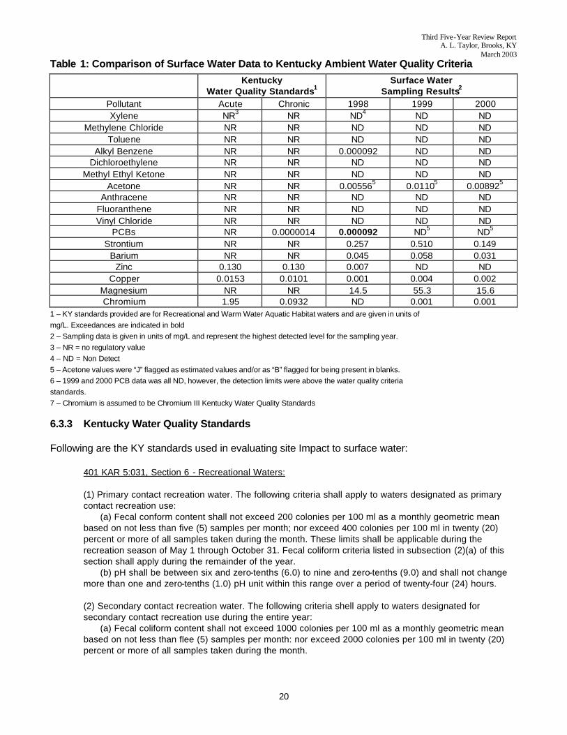
Therefore, any discharges of site contaminants to surface water from the Site should not cause total stream concentrations to exceed those numeric standards specified in 401 KAR 5:031, Section 4 for warm water aquatic habitat or those for recreational waters listed in 401 KAR 5:031 Section 6. [Note: These numeric standards are not intended as specific discharge limits, but rather the “overall” ambient concentration for each regulated pollutant that is not to be exceeded within the drainage basin.] As the groundwater does not provide adequate quality or quantity of water to be considered a drinking water source, Safe Drinking Water Act Maximum Contaminant Levels (MCLs) were not identified in the ROD as ARARs nor are they evaluated in this Five-Year Review. 6.3.2 Comparison of Surface Water Data to Kentucky Ambient Water Quality Criteria In order to compare site contaminant concentrations in surface water against Kentucky standards, it was necessary to determine the hardness (in mg/L CaCO3) of the surface water in Wilson Creek. Using guidance from the USC3S Water-Supply Paper 2254, third edition, the determination of water hardness in Wilson Creek was done using the sum of the milli-equivalents (meq) of total Calcium and Magnesium multiplied by 50. The average hardness calculated for Wilson Creek was 110. A comparison was made between regulatory levels of chemicals of concern and surface water data. Only one exceedance occurred for Aroclor 1254 in the 1898 sampling data. Overall results of the comparison indicate that the Site is having no adverse impact to adjacent surface water, Table 1 shows results of the comparison.
Third Five-Year Review Report A. L. Taylor, Brooks, KY
March 2003
20
Table 1: Comparison of Surface Water Data to Kentucky Ambient Water Quality Criteria
Kentucky
Water Quality Standards1 Surface Water
Sampling Results2 Pollutant Acute Chronic 1998 1999 2000 Xylene NR3 NR ND4 ND ND
Methylene Chloride NR NR ND ND ND Toluene NR NR ND ND ND
Alkyl Benzene NR NR 0.000092 ND ND Dichloroethylene NR NR ND ND ND
Methyl Ethyl Ketone NR NR ND ND ND Acetone NR NR 0.005565 0.01105 0.008925
Anthracene NR NR ND ND ND Fluoranthene NR NR ND ND ND Vinyl Chloride NR NR ND ND ND
PCBs NR 0.0000014 0.000092 ND5 ND5
Strontium NR NR 0.257 0.510 0.149 Barium NR NR 0.045 0.058 0.031
Zinc 0.130 0.130 0.007 ND ND Copper 0.0153 0.0101 0.001 0.004 0.002
Magnesium NR NR 14.5 55.3 15.6 Chromium 1.95 0.0932 ND 0.001 0.001
1 – KY standards provided are for Recreational and Warm Water Aquatic Habitat waters and are given in units of mg/L. Exceedances are indicated in bold 2 – Sampling data is given in units of mg/L and represent the highest detected level for the sampling year. 3 – NR = no regulatory value 4 – ND = Non Detect 5 – Acetone values were “J” flagged as estimated values and/or as “B” flagged for being present in blanks. 6 – 1999 and 2000 PCB data was all ND, however, the detection limits were above the water quality criteria standards. 7 – Chromium is assumed to be Chromium III Kentucky Water Quality Standards 6.3.3 Kentucky Water Quality Standards Following are the KY standards used in evaluating site Impact to surface water:
401 KAR 5:031, Section 6 - Recreational Waters: (1) Primary contact recreation water. The following criteria shall apply to waters designated as primary contact recreation use: (a) Fecal conform content shall not exceed 200 colonies per 100 ml as a monthly geometric mean based on not less than five (5) samples per month; nor exceed 400 colonies per 100 ml in twenty (20) percent or more of all samples taken during the month. These limits shall be applicable during the recreation season of May 1 through October 31. Fecal coliform criteria listed in subsection (2)(a) of this section shall apply during the remainder of the year. (b) pH shall be between six and zero-tenths (6.0) to nine and zero-tenths (9.0) and shall not change more than one and zero-tenths (1.0) pH unit within this range over a period of twenty-four (24) hours. (2) Secondary contact recreation water. The following criteria shell apply to waters designated for secondary contact recreation use during the entire year: (a) Fecal coliform content shall not exceed 1000 colonies per 100 ml as a monthly geometric mean based on not less than flee (5) samples per month: nor exceed 2000 colonies per 100 ml in twenty (20) percent or more of all samples taken during the month.
Third Five-Year Review Report A. L. Taylor, Brooks, KY
March 2003
21
(b) pH shall be between six and zero-tenths (6.0) to nine and zero-tenths (9.0) and shall not change more than one and zero-tenths (1.0) pH unit within this range over a period of twenty-four(24) hours. 401 KAR 5:026, Section 4 - Warm Water Aquatic Habitat: (1) Warm water aquatic habitat. The following parameters and associated criteria shall apply for the protection of productive warm water aquatic communities, fowl, animal wildlife, arborous growth and agricultural and industrial uses: (a) Natural alkalinity as CaCO3 shall not be reduced by more than twenty-five (25) percent. If natural alkalinity is below twenty (20) mg/L CaCO3, there shall not be a reduction below the natural level. Alkalinity shall not be reduced or increased to a degree that may adversely affect the aquatic community. (b) pH shall not be less than six and zero-tenths (6.0) nor more than nine and zero-tenths (9.0) and shall not fluctuate more than one and zero-tenths (1.0) pH unit over a period of twenty-four (24) hours. (c) Flow shall not be altered to a degree that will adversely affect the aquatic community. (d) Temperature shall not exceed thirty-one and seven-tenths (31.7) degrees Celsius (eighty-nine (89) degrees Fahrenheit). (e) Dissolved oxygen.
1. Dissolved oxygen shall be maintained at a minimum concentration of five and zero-tenths (5.0) mg/L daily average; the instantaneous minimum shall not be less than four and zero-tenths (4.0) mg/L.
2. The dissolved oxygen concentration shall be measured at mid-depth in waters having a total depth of ten (10) feet or less and at representative depths in other waters. (f) Solids. 1. Total dissolved solids. Total dissolved solids shall not be changed to the extent that the indigenous aquatic community is adversely affected.
2. Total suspended solids. Total suspended solids shall not be changed to the extent that the indigenous aquatic community is adversely affected.
3. Settleable solids. The addition of settleable solids that may alter the stream bottom so as to adversely affect productive aquatic communities is prohibited. (g) Ammonia. The concentration of the en-ionized form shall not be greater than 0.05 mg/L at any time In-stream after mixing. Un-ionized ammonia shall be determined from values for total ammonia-N, in mg/L, pH and temperature, by means of the following equation:
Y = 1,2 (Total ammonia–N) / (1 + 10[pKa - pH])
Where: Y = un-ionized ammonia (mg/L)
pK(a) = 0.0902 + [2730 / 273.2 + TC
and: TC = temperature, degrees Celsius. (h) Toxics.
1. The allowable in-stream concentration of toxic substances, or whole effluents containing toxic substances, which are non-cumulative or non-persistent with a half-life of less than ninety-six (96) hours shall not exceed: a. One-tenth (0.1) of the ninety-six (96) hour median lethal concentration (LC50) of representative indigenous or indicator aquatic organisms; or b. A chronic toxicity unit of 1.00 utilizing the twenty-five (25) percent inhibition concentration, or LC25.
2. The allowable in-stream concentration of toxic substances, or whole effluents, containing toxic substances, which are bioaccumulative or persistent, including pesticides, when not specified elsewhere in this section, shall not exceed: a. 0.01 of the ninety-six (96) hour median lethal concentration (LC50) of representative
Third Five-Year Review Report A. L. Taylor, Brooks, KY
March 2003
22
indigenous or indicator aquatic organisms; or b. A chronic toxicity unit of 1.00 utilizing the LC25.
3. In the absence of acute criteria for substances listed in Table 2 or for other substances known to be toxic but not listed in this regulation, or for whole effluents which are acutely toxic, the allowable in-stream concentration shall rot exceed the LC(1) or one-third (1/3) LC50 concentration derived from toxicity tests an representative indigenous or indicator aquatic organisms or exceed three-tenths (0.3) acute toxicity units.
4. If specific application factors have been determined for a toxic substance or whole effluent such as an acute to chronic ratio or water effect ratio, they may be used Instead of the one-tenth (0.1) and 0.01 factors listed in this subsection upon approval by the cabinet.
5. Allowable in-stream concentrations for specific substances are listed in Table 2. These concentrations are based on protecting aquatic life from acute and chronic toxicity and shall not be exceeded.
6.4 DATA REVIEW As required In the ROD, groundwater, surface water, and sediment have been sampled and analyzed annually between 1998 and this current Five-Year Review. The following sections present a brief review of each media sampled and reported in annual reports to EPA. The data was reviewed for possible exceedances of State and Federal standards and to determine if patterns or trends of exceedances within certain media exist. Tables 1 and 3 summarize the annual data and exceedances for the annual data from 1998 through 2000. Table 3 also compares the historical exceedances in certain monitoring wells since 1995. 6.4.1 Groundwater October 1998 • Results showed low levels of chlorinated compounds in wells ALT-04 and ALT-09 and detection of Aroclor 1254 in well ALT-04. • No exceedances of TBC criteria were detected for inorganic chemicals. 1999 • Results showed low levels of volatile organic compounds (VOCs) In wells ALT-03, ALT-04, and ALT-09. There were no detections of PCBs in any of the groundwater monitoring wells. 2000 • Results of the annual sampling of monitoring wells conducted in October 2000 showed little evidence of contamination. 2001 • Results of annual sampling of monitoring wells conducted in November 2001 showed no evidence of contamination above chronic criteria in 10 of the 12 wells. Wells ALT-03 and ALT-09 showed low levels of several organic compounds. ALT-03 had detectable levels of Aroclor 1254 at 0.46 parts per billion (ppb). It was noted that well ALT-03 had become flied with mud and appeared to be compromised internally. The sample was turbid and determined to not be representative of groundwater conditions.
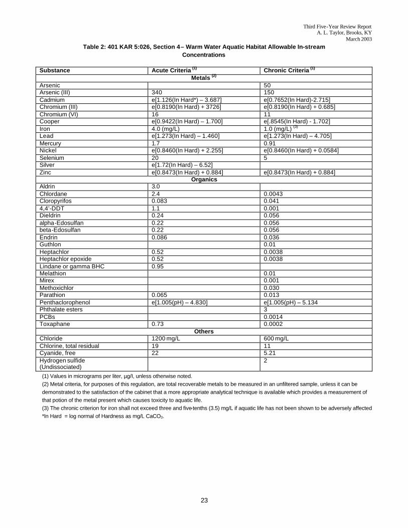
Third Five-Year Review Report A. L. Taylor, Brooks, KY
March 2003
23
Table 2: 401 KAR 5:026, Section 4 – Warm Water Aquatic Habitat Allowable In-stream Concentrations
Substance Acute Criteria (1) Chronic Criteria (1)
Metals (2) Arsenic 50 Arsenic (III) 340 150 Cadmium e[1.126(In Hard*) – 3.687] e[0.7652(In Hard)-2.715] Chromium (III) e[0.8190(In Hard) + 3726] e[0.8190(In Hard) + 0.685] Chromium (VI) 16 11 Cooper e[0.9422(In Hard) – 1.700] e[.8545(In Hard) - 1.702] Iron 4.0 (mg/L) 1.0 (mg/L) (3) Lead e[1.273(In Hard) – 1.460] e[1.273(In Hard) – 4.705] Mercury 1.7 0.91 Nickel e[0.8460(In Hard) + 2.255] e[0.8460(In Hard) + 0.0584] Selenium 20 5 Silver e[1.72(In Hard) – 6.52] Zinc e[0.8473(In Hard) + 0.884] e[0.8473(In Hard) + 0.884]
Organics Aldrin 3.0 Chlordane 2.4 0.0043 Cloropyrifos 0.083 0.041 4,4’-DDT 1.1 0.001 Dieldrin 0.24 0.056 alpha-Edosulfan 0.22 0.056 beta-Edosulfan 0.22 0.056 Endrin 0.086 0.036 Guthlon 0.01 Heptachlor 0.52 0.0038 Heptachlor epoxide 0.52 0.0038 Lindane or gamma BHC 0.95 Melathion 0.01 Mirex 0.001 Methoxichlor 0.030 Parathion 0.065 0.013 Penthaclorophenol e[1.005(pH) – 4.830] e[1.005(pH) – 5.134 Phthalate esters 3 PCBs 0.0014 Toxaphane 0.73 0.0002
Others Chloride 1200 mg/L 600 mg/L Chlorine, total residual 19 11 Cyanide, free 22 5.21 Hydrogen sulfide (Undissociated)
2
(1) Values in micrograms per liter, µg/I, unless otherwise noted. (2) Metal criteria, for purposes of this regulation, are total recoverable metals to be measured in an unfiltered sample, unless it can be demonstrated to the satisfaction of the cabinet that a more appropriate analytical technique is available which provides a measurement of that potion of the metal present which causes toxicity to aquatic life. (3) The chronic criterion for iron shall not exceed three and five-tenths (3.5) mg/L if aquatic life has not been shown to be adversely affected *In Hard = log normal of Hardness as mg/L CaCO3.
Third Five-Year Review Report A. L. Taylor, Brooks, KY
March 2003
24
2002 • Annual sampling of monitoring wells, surface water, and sediment normally conducted in the fall (October/November) was delayed due to wet weather preventing vehicle access to the wells. Sampling was deferred and completed in the second week of January 2003; however, laboratory results have not been reported to KDNREPC as of the date of this report. 6.4.2 Surface Water 1998 • Detection of Aroclor 1254 in surface water monitoring point SW-01. 1999 • Results of a single downstream surface water sample showed no detections of chemicals. 2000 • Results of the annual sampling of surface water conducted in October 2000 showed little evidence of contamination. SW-01 showed an exceedance of the MCL for bis (2-ethylhexyl) phthalate. 2001 • Results of the annual sampling of surface water conducted in 2001 showed little evidence of contamination. 2002 • Annual sampling of surface water normally conducted in the fall (October/November) was delayed due to wet weather preventing vehicle access to the sample points. Sampling was deferred and completed in the second week of January 2003; however, laboratory results have not been reported to KDNREPC as of the date of this report. 6.4.3 Sediment 1998 • Results showed no detections of PCBs in any ditch swale or pond sediment. 1999 • Results of sediment sampling, conducted in May 1999 along Wilson Creek show that PCBs on the order of 1.0 mg/Kg are contained within sediments to a distance of approximately 1200 to 1600 feet downstream from the Site. 2000 • No sediment sampling reported.
Third Five-Year Review Report A. L. Taylor, Brooks, KY
March 2003
25
2001 • No sediment sampling reported. 2002 • Annual sampling of sediment conducted in the fall (October/November) was delayed due to wet weather preventing vehicle access to the sample points. Sampling was deferred and completed in the second week of January 2003; however, laboratory results have not been reported to KDNREPC as of tie date of this Five-Year report. 2003 • Sediment samples taken in Wilson Creek on January 8, 2003, reported 2.70 mg/Kg Aroclor 1254 from sample point SD-05 and 1.27 mg/Kg Aroclor 1254 from sample point SD-09. 6.4.4 Summary of Sampling Results Groundwater. Based on a review of the analytical data contained within Tables 1 and 3, groundwater collected from monitoring wells ALT-12, -01, -02, -05, -06, -08, and -11 have had consistent exceedances of MCLs. Within samples for these wells, the concentrations of bis (2-ethylhexyl) phthalate has been consistently, and inexplicably, increasing since 1995. Monitoring well ALT-04 showed isolated exceedances of the MCL for bis (2-ethylhexyl) phthalate in 1999 and Aroclor 1254 in 2000. Surface Water. Surface water samples collected downstream from the landfill in Wilson Creek have shown detections of PCBs Aroclor 1254 and 1260 during 1998 and 2000 but no exceedances of MCLs except one exceedance of Aroclor 1254 in SW-01 in 2000. Sediment. During the 1998 sampling, no PCBs were detected in sediment samples taken from sample points SD-06 (pond), SD-07 (north swale), SWD-08 (north ditch), SD-09 (south swale), SD-10 (pond outlet), or SD-11 (Wilson Creek downstream). During the 1999 sampling, Aroclor 1254 was detected in sediment samples taken from sample points 01, and 03 through 08. Aroclor was also detected at sampling points 02, 07, and 08 (Figure 6). Sediment samples taken in Wilson Creek on January 8, 2003, as part of the 2002 data collection effort, reported 2.70 mg/Kg Aroclor 1254 from sample point 05 and 1.27 mg/Kg Aroclor 1254 from sample point 49 (Figure 6). The remedial action objective of preventing direct contact or ingestion of contaminated soils and groundwater continues to be met by the intact cap. Monitoring wells Alt-03, -09, and -10 show no or decreased concentrations of contaminants at the compliance monitoring points during the 1998-2001 sampling events. Seven wells show consistent exceedances of at least one chemical MCL [bis(2-ethylhexyl) phthalate].
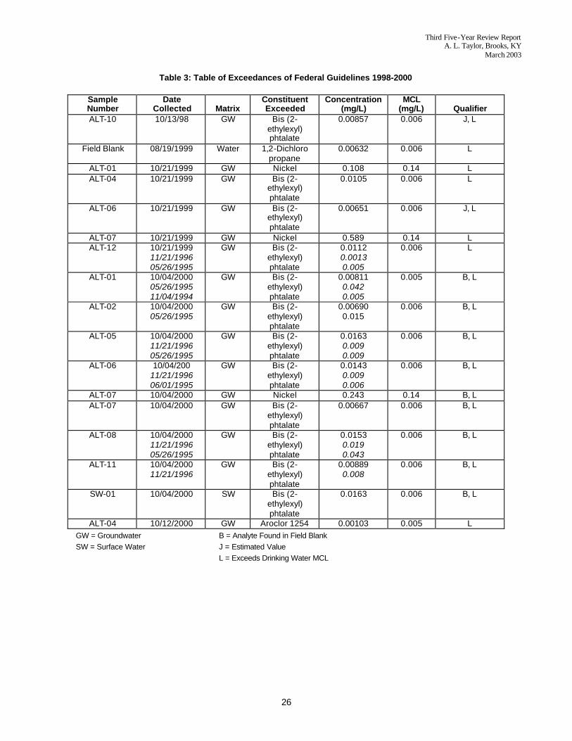
Third Five-Year Review Report A. L. Taylor, Brooks, KY
March 2003
26
Table 3: Table of Exceedances of Federal Guidelines 1998-2000
Sample Number
Date Collected Matrix
Constituent Exceeded
Concentration (mg/L)
MCL (mg/L) Qualifier
ALT-10 10/13/98 GW Bis (2- ethylexyl) phtalate
0.00857 0.006 J, L
Field Blank 08/19/1999 Water 1,2-Dichloro propane
0.00632 0.006 L
ALT-01 10/21/1999 GW Nickel 0.108 0.14 L ALT-04 10/21/1999 GW Bis (2-
ethylexyl) phtalate
0.0105 0.006 L
ALT-06 10/21/1999 GW Bis (2- ethylexyl) phtalate
0.00651 0.006 J, L
ALT-07 10/21/1999 GW Nickel 0.589 0.14 L ALT-12 10/21/1999
11/21/1996 05/26/1995
GW Bis (2- ethylexyl) phtalate
0.0112 0.0013 0.005
0.006 L
ALT-01 10/04/2000 05/26/1995 11/04/1994
GW Bis (2- ethylexyl) phtalate
0.00811 0.042 0.005
0.005 B, L
ALT-02 10/04/2000 05/26/1995
GW Bis (2- ethylexyl) phtalate
0.00690 0.015
0.006 B, L
ALT-05 10/04/2000 11/21/1996 05/26/1995
GW Bis (2- ethylexyl) phtalate
0.0163 0.009 0.009
0.006 B, L
ALT-06 10/04/200 11/21/1996 06/01/1995
GW Bis (2- ethylexyl) phtalate
0.0143 0.009 0.006
0.006 B, L
ALT-07 10/04/2000 GW Nickel 0.243 0.14 B, L ALT-07 10/04/2000 GW Bis (2-
ethylexyl) phtalate
0.00667 0.006 B, L
ALT-08 10/04/2000 11/21/1996 05/26/1995
GW Bis (2- ethylexyl) phtalate
0.0153 0.019 0.043
0.006 B, L
ALT-11 10/04/2000 11/21/1996
GW Bis (2- ethylexyl) phtalate
0.00889 0.008
0.006 B, L
SW-01 10/04/2000 SW Bis (2- ethylexyl) phtalate
0.0163 0.006 B, L
ALT-04 10/12/2000 GW Aroclor 1254 0.00103 0.005 L GW = Groundwater B = Analyte Found in Field Blank SW = Surface Water J = Estimated Value L = Exceeds Drinking Water MCL
Third Five-Year Review Report A. L. Taylor, Brooks, KY
March 2003
27
The Record of Decision for the Site requires a ban on the installation of domestic wells or use of groundwater for any purpose and continued monitoring of groundwater and surface water. These requirements continue to be maintained. Monitoring results Indicate the levels for the chemicals sampled, with the exception of PCBs and possibly bis (2-ethyihexyl) phthalate, are being met at this time. As stated above, action levels were not established for surface water. Therefore, TBC Kentucky Surface Water Standards, January 1992, were used to evaluate surface water data for potential exceedances. Samples were collected front: (1) upstream of the Site (SW-03); (2) midstream, below the discharge overflow of the pond (SW-02); and (3) in Wilson Creek near compliance monitoring well ALT-12 (SW-01) at the NE corner of the landfill. Table 1 summarizes the annual data for 1995 through 2000. The only compound exceeded at the Wilson Creek location, SW-01, was bis (2-ethylhexyl) phthalate SECTION 7 ISSUES Several issues were identified during this Five-Year Review as noted below. None of these issues is sufficient to render the remedy at the Site ineffective as long as corrective action is taken in the future to avoid deterioration of current conditions. 7.1 SURFACE/COVER
1. Minor weeds, brush and saplings are growing in the riprap drainage ditch at several locations around the Site.
2. Minor tire tracks on the cap west of Access Road between entrance gate and Terrace 1
probably due to mowing equipment.
3. A small washout area has formed in the east side ditch of the entrance road due to recent construction on adjacent property.
7.2 GROUNDWATER MONITORING WELLS
1. In the recent past, monitoring well ALT-03 has become filled with mud and appears to be compromised internally. Samples taken have been turbid and determined to not be representative of groundwater conditions.
2. Most wells are unmarked and cannot be identified from a distance. Any wells that are improperly or incorrectly marked should be corrected.
3. An unmarked locked riser pipe or well casing was discovered in the NE quadrant of the property between the security fence and drainage ditch and in the vicinity of monitoring well ALT-10. Condition is unknown. The State indicated this was not a monitoring well and suggested this well should be investigated and abandoned in accordance with KDEP 401 KAR 6:310, Water Well Construction Practices and Standards.
7.3 INSTITUTIONAL CONTROLS
1. There is no project sign identifying the A. L Taylor as a Superfund site at the Entrance Road.
2. There are no warning signs on gates or security fence.
Third Five-Year Review Report A. L. Taylor, Brooks, KY
March 2003
28
SECTION 8 RECOMMENDATIONS 8.1 SURFACE/COVER Maintenance of the cover should continue as currently scheduled. The grass cover should be mowed at least twice per year. Areas of erosion or stressed vegetation should be filled with appropriate cover materials, graded to drain, and reseeded to prevent further erosion. The perimeter of terraces and riprap drainage ditches should be kept free of vegetation to prevent possible damage to the structural Integrity of the clay cover. Herbicide spraying should be continued on a semi-annual basis. Areas of standing or ponded water should be filled with appropriate cover material, regraded to drain, and reseeded to prevent possible infiltration through the clay cover and for mosquito control. Inspection of the Site should be performed at least once quarterly to ensure that the entrance and rear gates are secure, that there are no areas of erosion, seepage, or other types of damage on the cap, that all perimeter ditches and the culverts are free of debris, and that groundwater monitoring wells and the security fence around the Site are intact. All activities should he performed in accordance with the A. L. Taylor Operations and Maintenance Plan (O&M Plan), November 13, 1989 until the EPA makes a decision that the Site is considered “clean-closed”. 8.2 GROUNDWATER AND SURFACE WATER MONITORING
1. Surface water samples collected from Wilson Creek indicate PCBs are present in levels above TBC criteria. Based upon this information, USAGE recommends that surface water sampling be continued at the Site in accordance with the O&M Plan on an annual basis.
2. In addition, since the Site is a landfill with known PCB and other organic contamination and is
located upstream of a designated recreational water and warm water habitat, it is recommended that surface water sampling include continued analysis of organic compounds.
3. If PCBs and/or bis (2-ethylhexyl) phthalate occur in subsequent media sampling at an
appreciable level, then a focused study of its source and effect on human health and the environment would be appropriate and is recommended.
4. Consideration should be given to discontinuing groundwater monitoring in certain monitoring
wells, which have had a history of non-detections or non-exceedances of Federal and State standards.
8.3 GROUNDWATER MONITORING WELLS
1. Well ALT-03 is a critical down-gradient sampling point known to have become fouled Examination of the well section (Figure 5) indicates that the top of the well sand pack is less than 6-inches above the top of the well screen. For standard construction of wells it Is preferred to have at least 2 feet of sand pack above the well screen to prevent the bentonite seal from impacting the screen. Based on the depth of the well, there is
Third Five-Year Review Report A. L. Taylor, Brooks, KY
March 2003
29
sufficient room for 2 feet of sand pack and then the seal. The well has become fouled with silt and thus the well laboratory results could be in question. It is recommended that the well be surged and purged to remove the silt and the well re-developed and re-sampled. A replacement well may be necessary if ALT-03 cannot be re-developed.
2. It is recommended that all wells be appropriately marked on the outside for easy identification
from a distance.
3. The unidentified pipe riser or well discovered in the NE quadrant of the property between the security fence and drainage ditch in the vicinity of monitoring well ALT-10 should be investigated. If it is a well, then it is recommended to be abandoned in accordance with KDEP 401 KAR 6:310, Water Well Construction Practices and Standards in order to prevent a potential pathway of water around the well casing and into the cap.
8.4 INSTITUTIONAL CONTROLS
1. Consider installing a cable or chain stretched between two embedded posts across the Entrance Road to prevent unauthorized entry to the Site.
2. Consider installing a permanent project sign at the beginning of the Entrance Road to identify
the Site.
3. Consider adding warning signs on gates and on perimeter security fence. SECTION 9 STATEMENT OF PROTECTIVENESS Based upon a review of analytical data for the groundwater, surface water, and sediment samples and site visits, the remedial action taken at the Site has been effective in protecting human health and the environment As long as the cap remains in good condition, the Site is kept free of development, no penetrations through the cap are made, and groundwater is not used for private or industrial purposes, the remedial action should remain effective. The remedy at the Site currently protects human health and the environment because the 13-acre landfill cap prevents Infiltration and subsequent migration of contaminated groundwater off-site. Also, institutional controls have been implemented to prevent disturbance of the cap, and development of die property. Mowing and cap maintenance activities are ongoing and are adequate. There is no evidence of cracking, sliding, settlement, or ponding of the cap. There is no evidence of any human or ecological exposure from hazardous materials. Therefore, the remedy is considered protective in the short-term. However, in order for the remedy to remain protective in the long-term, institutional controls, monitoring and maintenance should be kept in place until terminated by the EPA. SECTION 10 NEXT REVIEW Due to the presence of buried waste and to ensure that the Site continues to be protective of human health and the environment, another review should be conducted by March 2008.

FIGURES ALTaylor.wpd
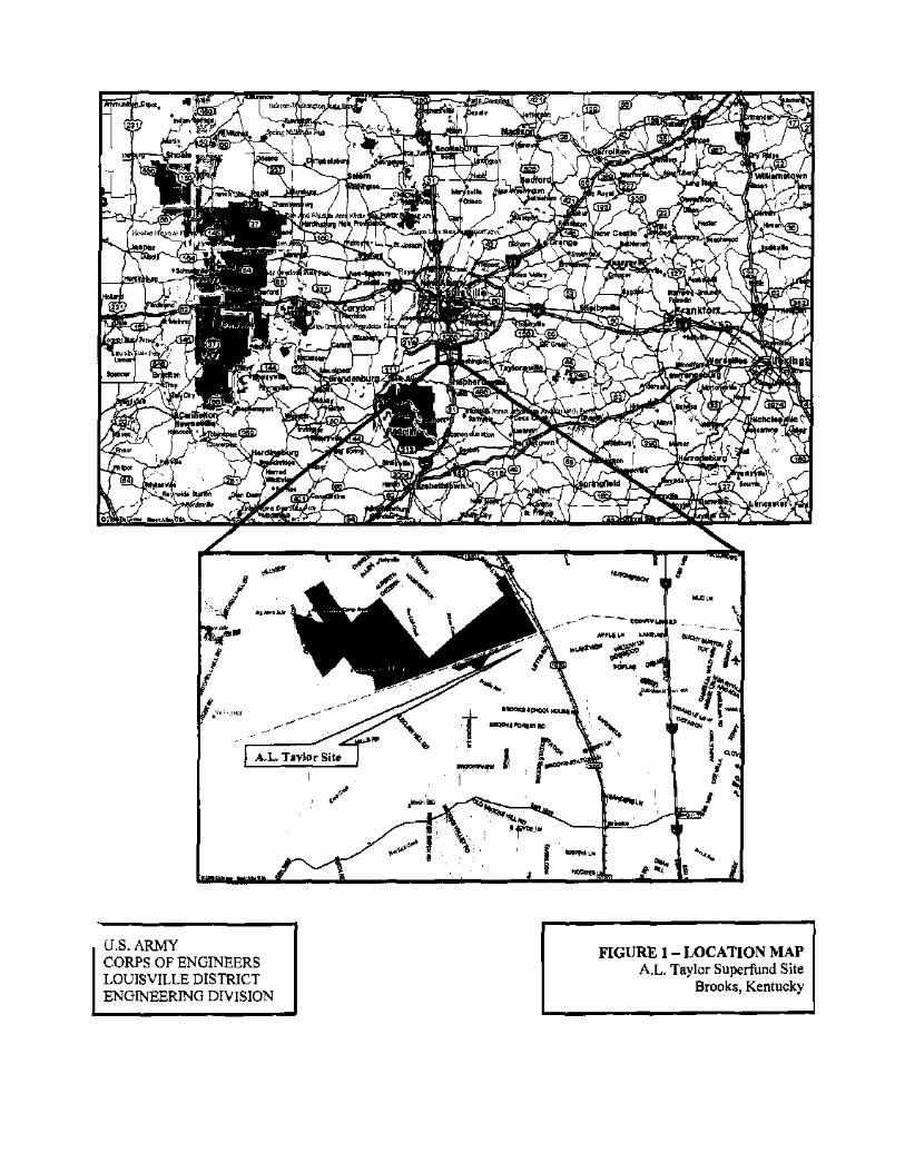
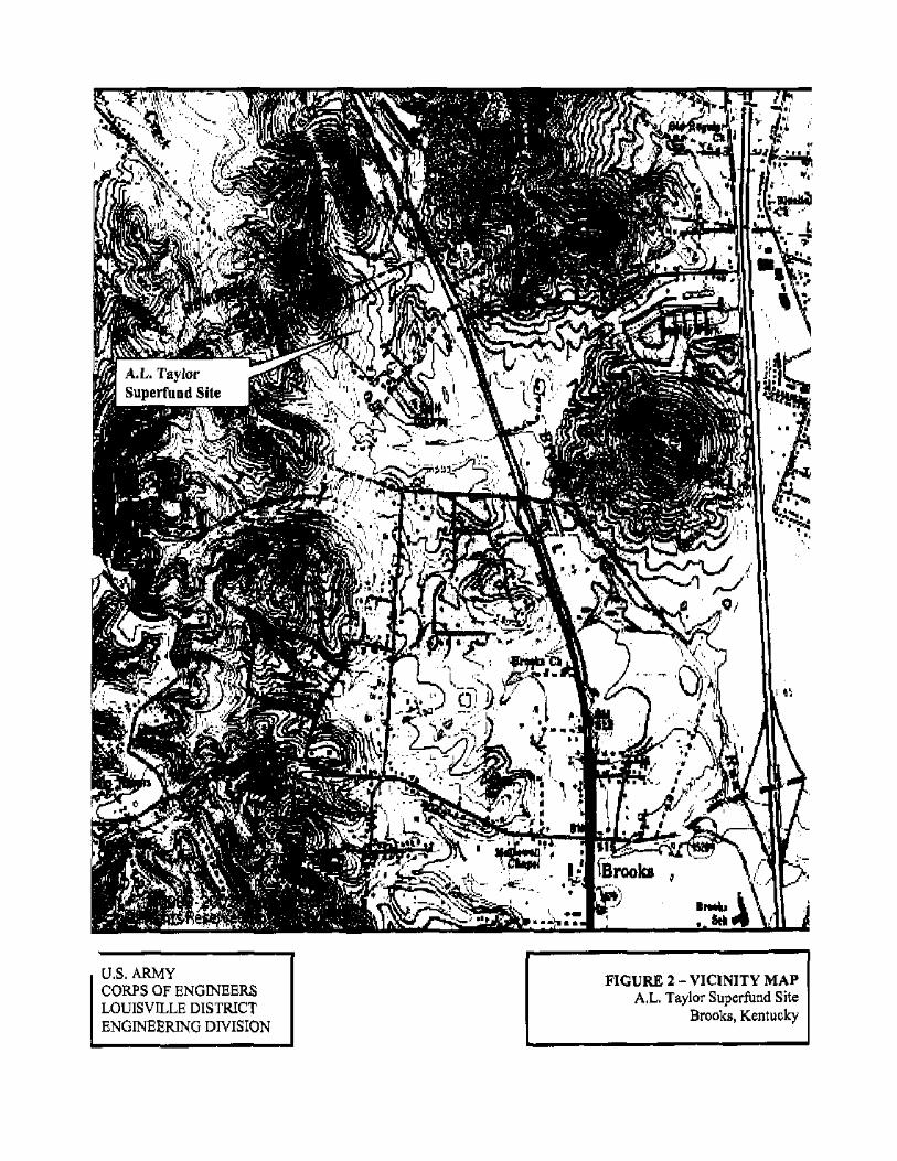
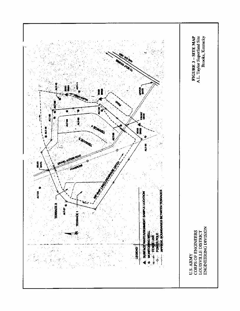
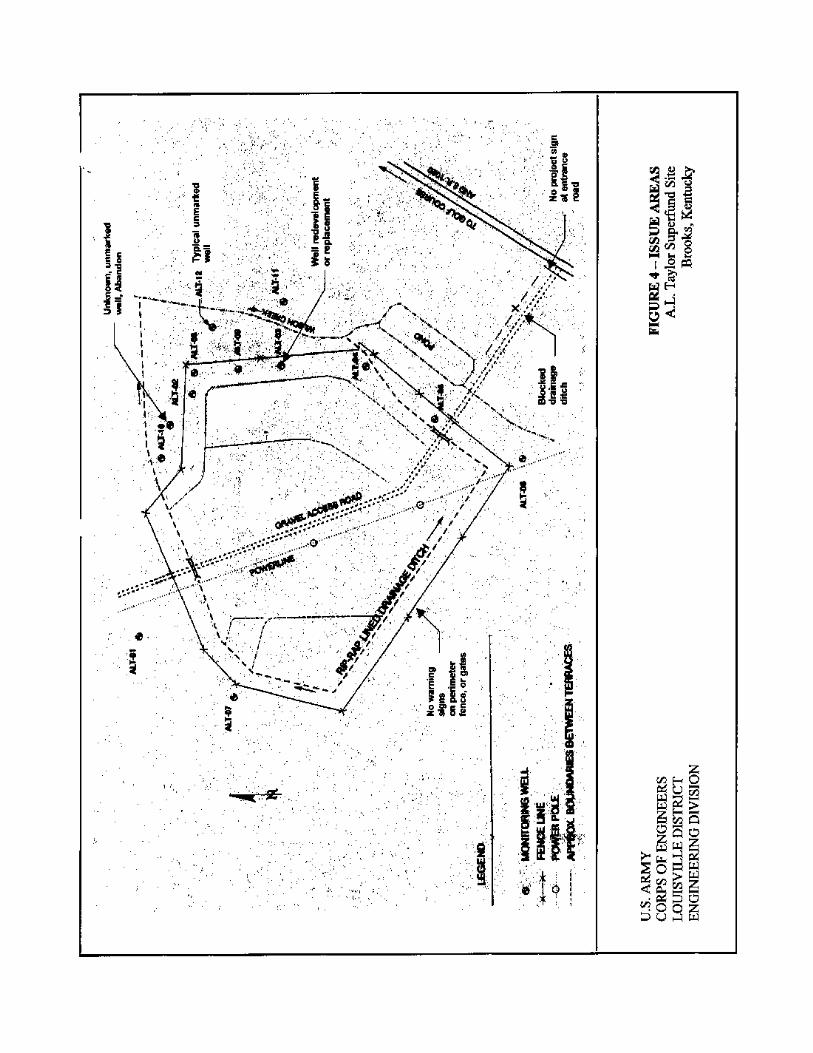
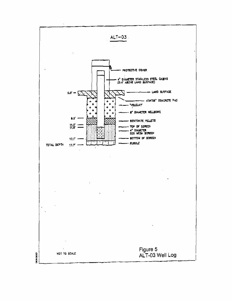
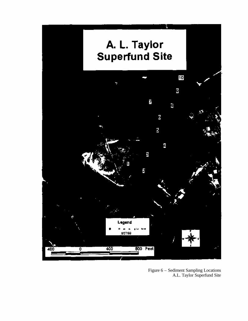
Figure 6 – Sediment Sampling Locations A.L. Taylor Superfund Site
APPENDIX A
LIST OF DOCUMENTS REVIEWED Note: Throughout this report, text has been extracted, summarized, and/or edited from the following A. L. Taylor Super-Fund Site documents: 1. Record of Decision (ROD) for Operable Unit -1(OU - 1) dated March 27, 1987. http://www.epa.gov/superfund/sites/rods/fulltext/r0486009.pdf 2. NPL Site Narrative for A. L. Taylor: http://www.epa.gov/region4/waste/npl/nplky/altayrky.htm 3. Notice of deletion - A. L. Taylor Superfund Site, Brooks, Kentucky from the National Priorities List (May 6, 1996). http://www.epa.gov/superfund/sites/npl/d960517.htm. 4. ROD Abstract: http://cfpub.epa.gov/superroads/rodinfo_cfm?mRod=04020721986ROD009 5. Final A. L. Taylor Site Operation and Maintenance Plan, May 1988, Revised November 13, 1989 6. Annual and Quarterly O&M Reports, FY1996/1997/1998/1999/2000/2001 and 2002, for OU-1. 7 (First) Five-Year Review Final Report, A. L. Taylor, Resource Applications , Inc., June 1992. 8. (Second) Five-Year Review Final Report, A. L. Taylor, Roy F. Weston, Inc., November 1997 ALTaylor.wpd
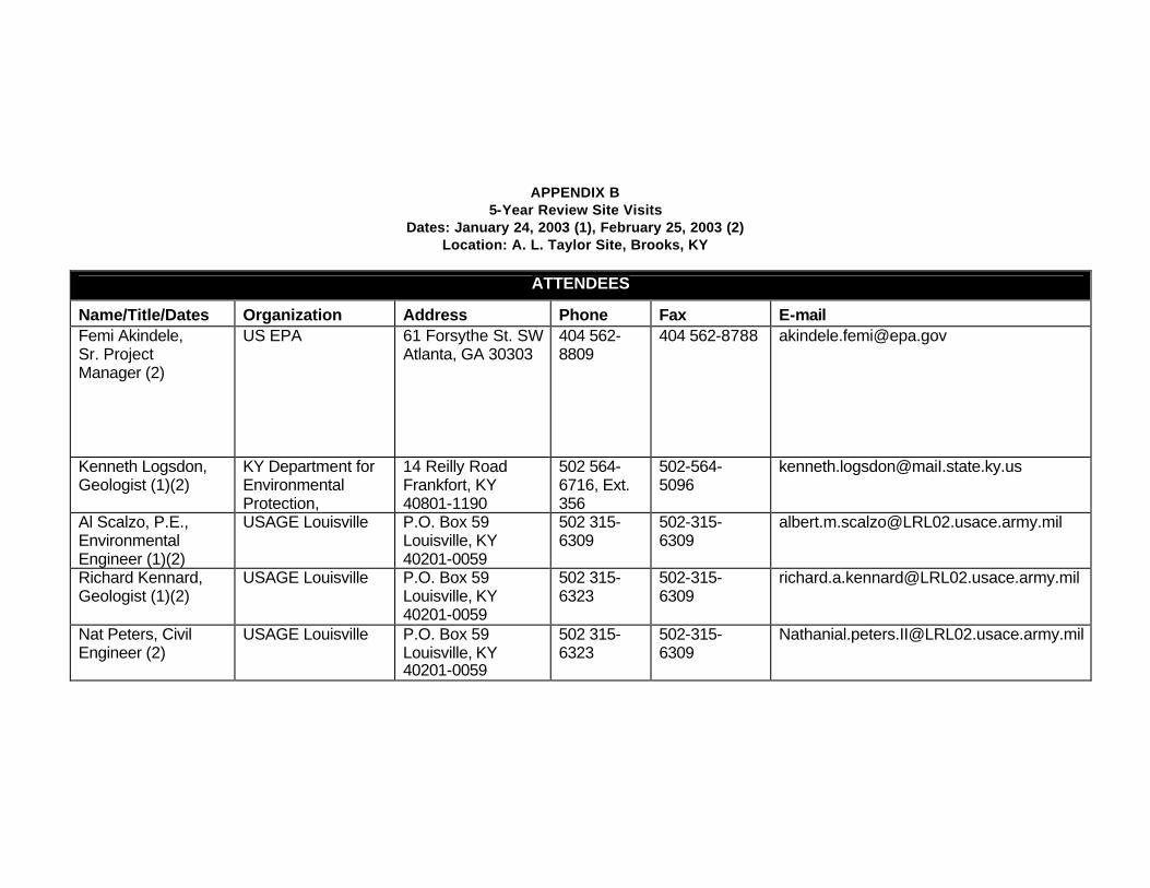
APPENDIX B 5-Year Review Site Visits
Dates: January 24, 2003 (1), February 25, 2003 (2) Location: A. L. Taylor Site, Brooks, KY
ATTENDEES
Name/Title/Dates Organization Address Phone Fax E-mail Femi Akindele, Sr. Project Manager (2)
US EPA 61 Forsythe St. SW Atlanta, GA 30303
404 562-8809
404 562-8788 [email protected]
Kenneth Logsdon, Geologist (1)(2)
KY Department for Environmental Protection,
14 Reilly Road Frankfort, KY 40801-1190
502 564- 6716, Ext. 356
502-564- 5096
Al Scalzo, P.E., Environmental Engineer (1)(2)
USAGE Louisville P.O. Box 59 Louisville, KY 40201-0059
502 315- 6309
502-315- 6309
Richard Kennard, Geologist (1)(2)
USAGE Louisville P.O. Box 59 Louisville, KY 40201-0059
502 315- 6323
502-315- 6309
Nat Peters, Civil Engineer (2)
USAGE Louisville P.O. Box 59 Louisville, KY 40201-0059
502 315- 6323
502-315- 6309

APPENDIX C
Site Inspection Checklists
ALTaylor.wpd
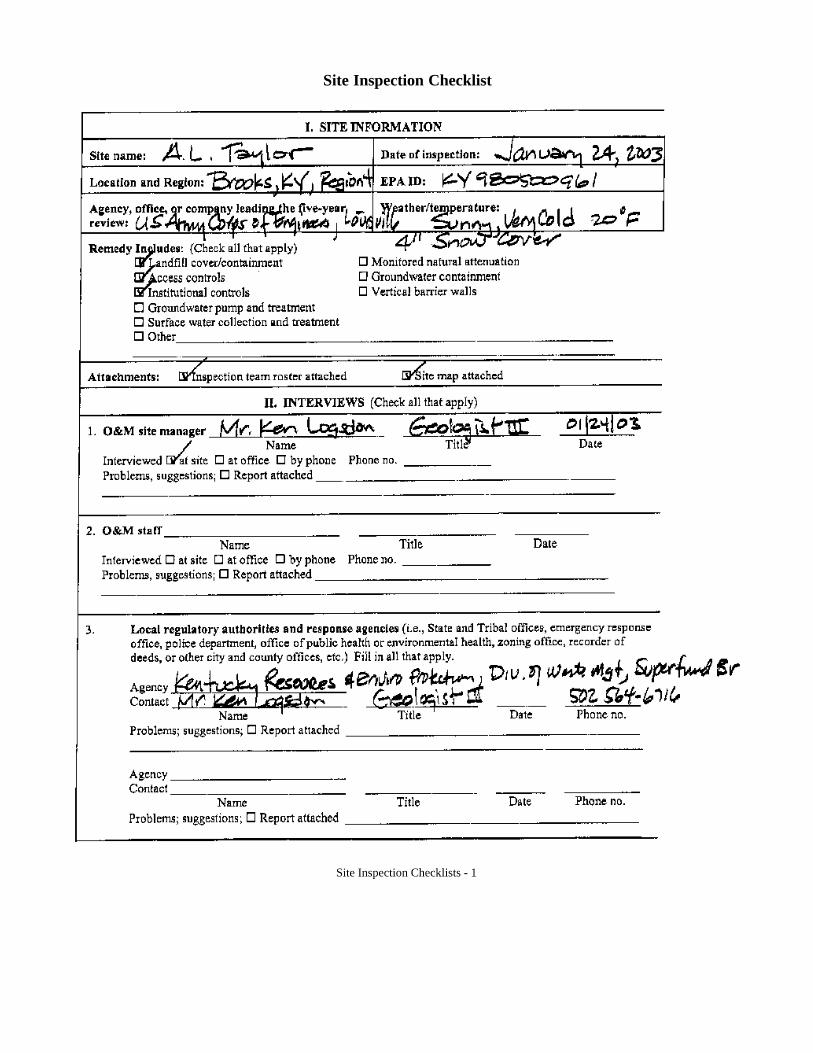
Site Inspection Checklist
Site Inspection Checklists - 1
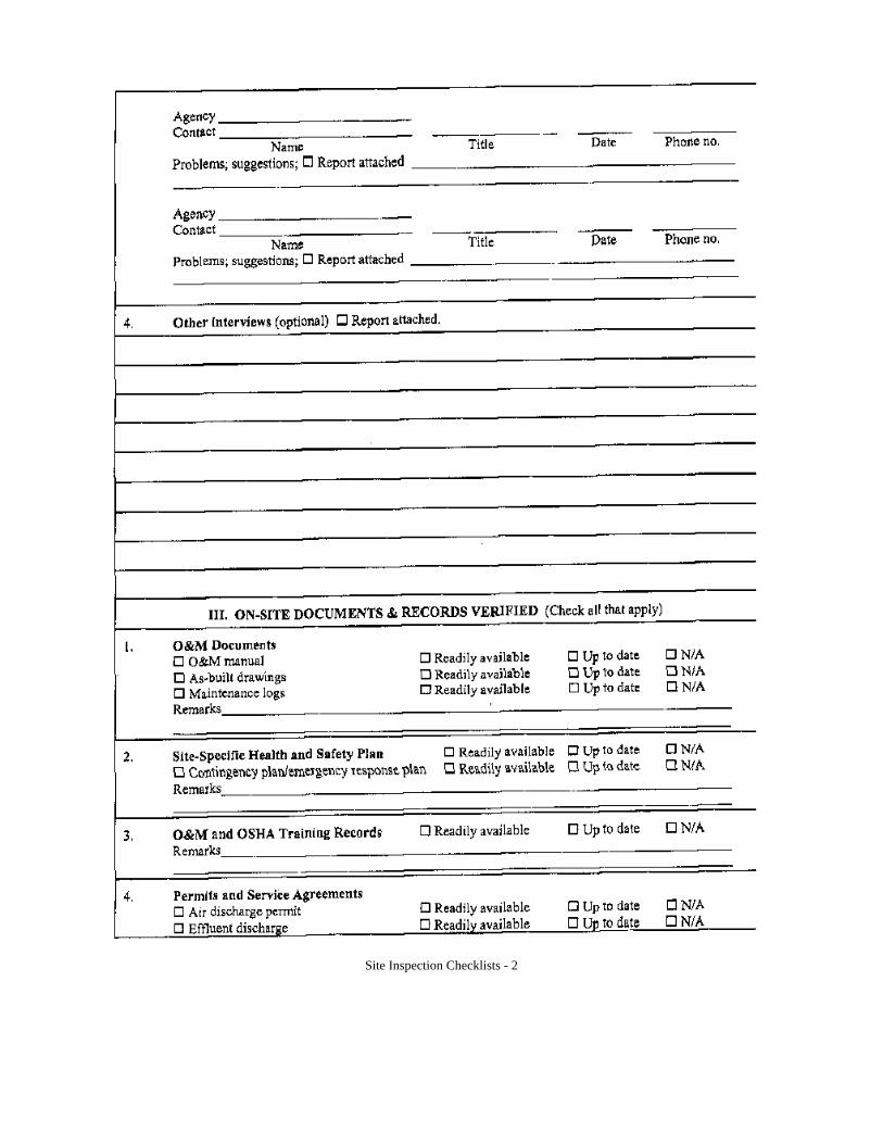
Site Inspection Checklists - 2
Site Inspection Checklists - 3
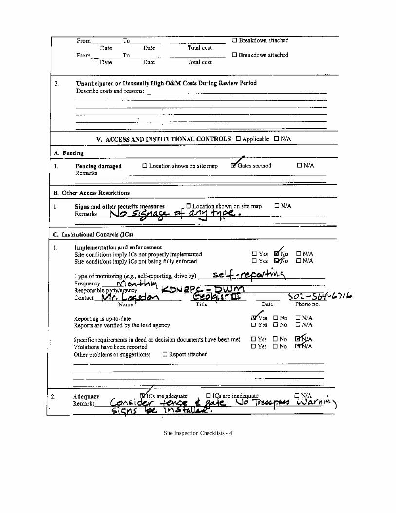
Site Inspection Checklists - 4
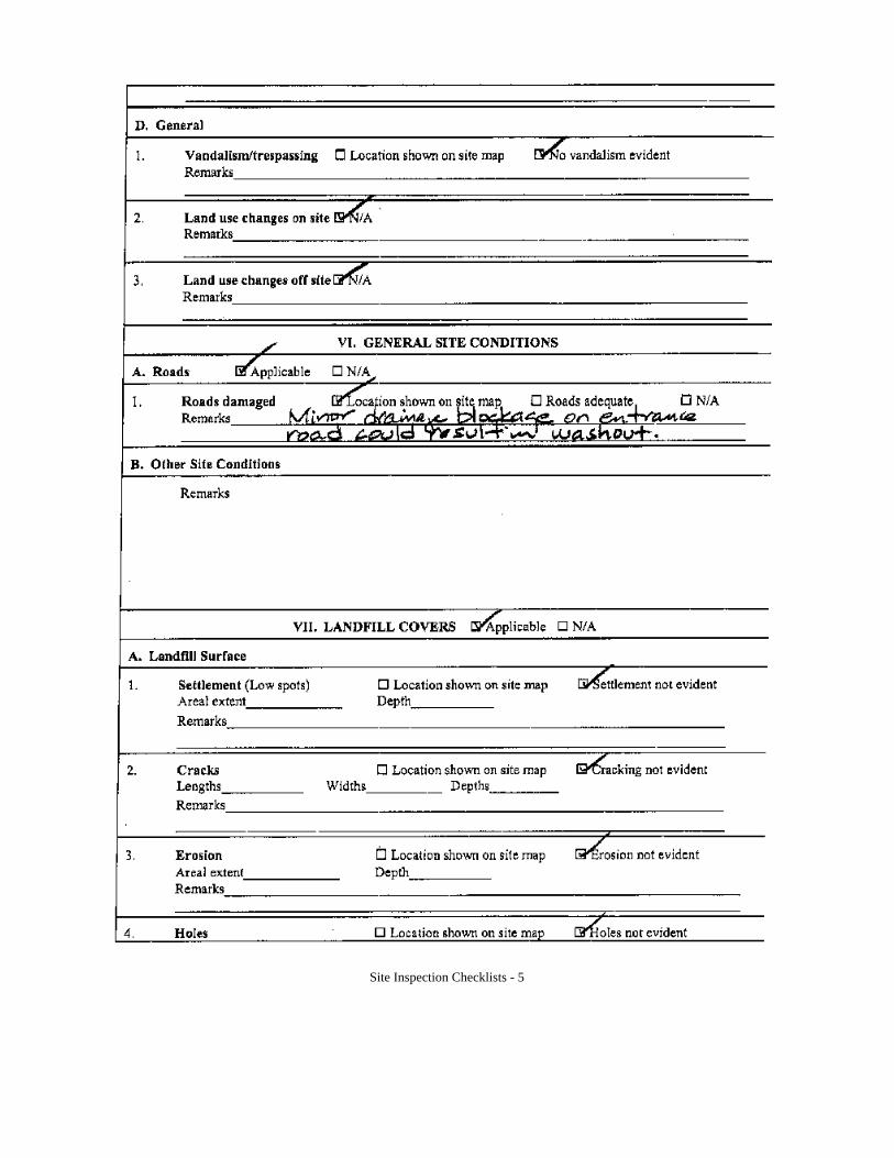
Site Inspection Checklists - 5
Site Inspection Checklists - 6
Site Inspection Checklists - 7
Site Inspection Checklists - 8
Site Inspection Checklists - 9
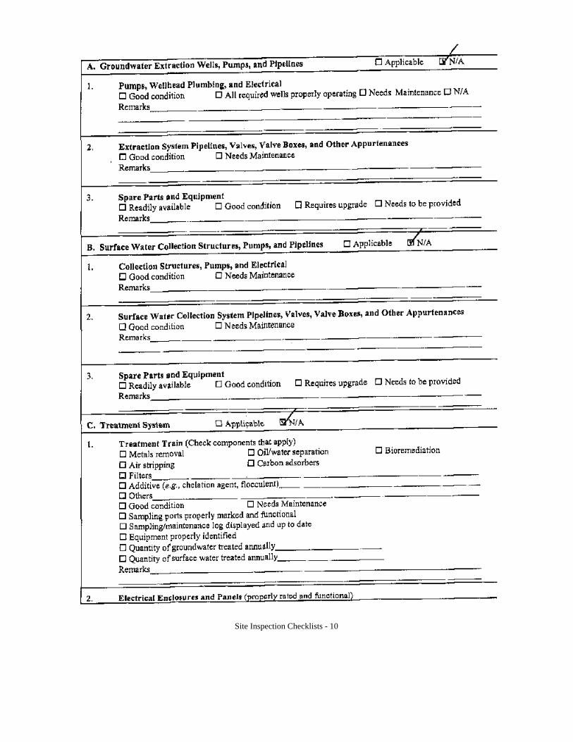
Site Inspection Checklists - 10
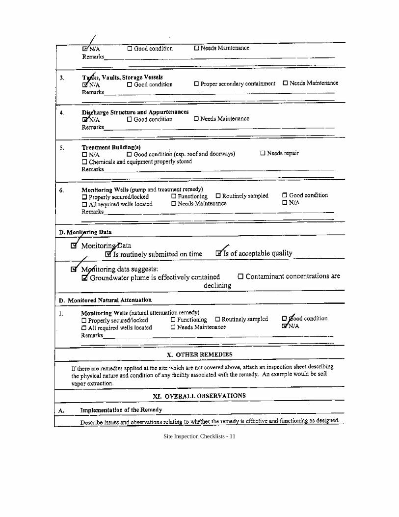
Site Inspection Checklists - 11
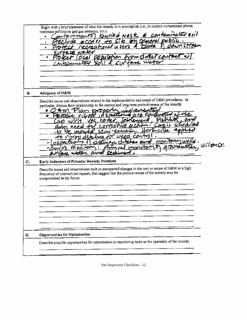
Site Inspection Checklists - 12
Site Inspection Checklists - 13

APPENDIX D
Photographs
ALTaylor.wpd
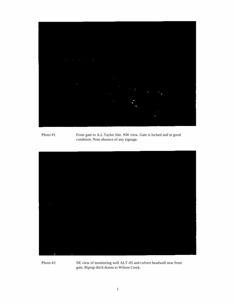
1
Photo #1 Front gate to A.L.Taylor Site. NW view. Gate is locked and in good condition. Note absence of any signage.
Photo #2 NE view of monitoring well ALT-05 and culvert headwall near front gate, Riprap ditch drains to Wilson Creek.
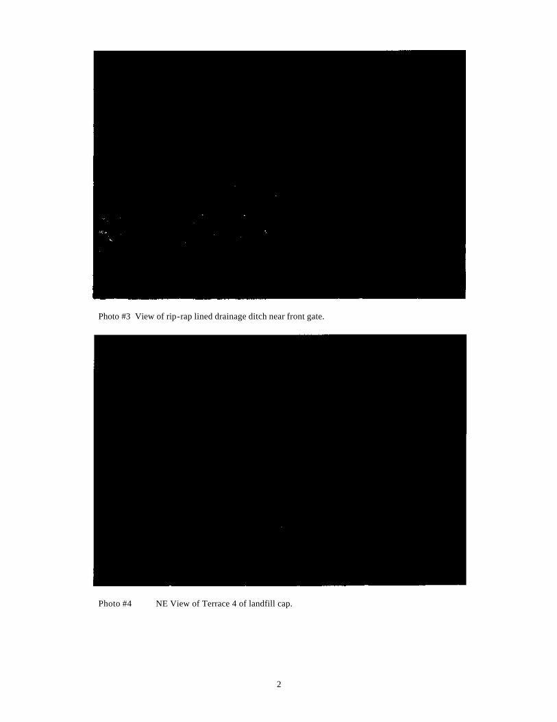
2
Photo #3 View of rip-rap lined drainage ditch near front gate.
Photo #4 NE View of Terrace 4 of landfill cap.
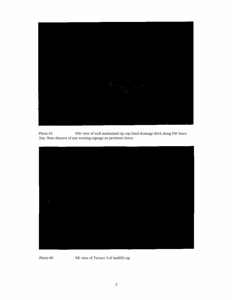
3
Photo #5 NW view of well maintained rip-rap lined drainage ditch along SW fence line. Note absence of any warning signage on perimeter fence.
Photo #6 NE view of Terrace 3 of landfill cap
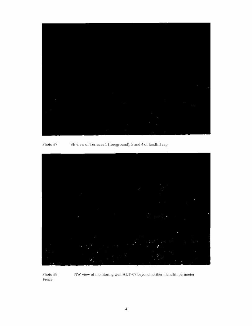
4
Photo #7 SE view of Terraces 1 (foreground), 3 and 4 of landfill cap.
Photo #8 NW view of monitoring well ALT -07 beyond northern landfill perimeter Fence.
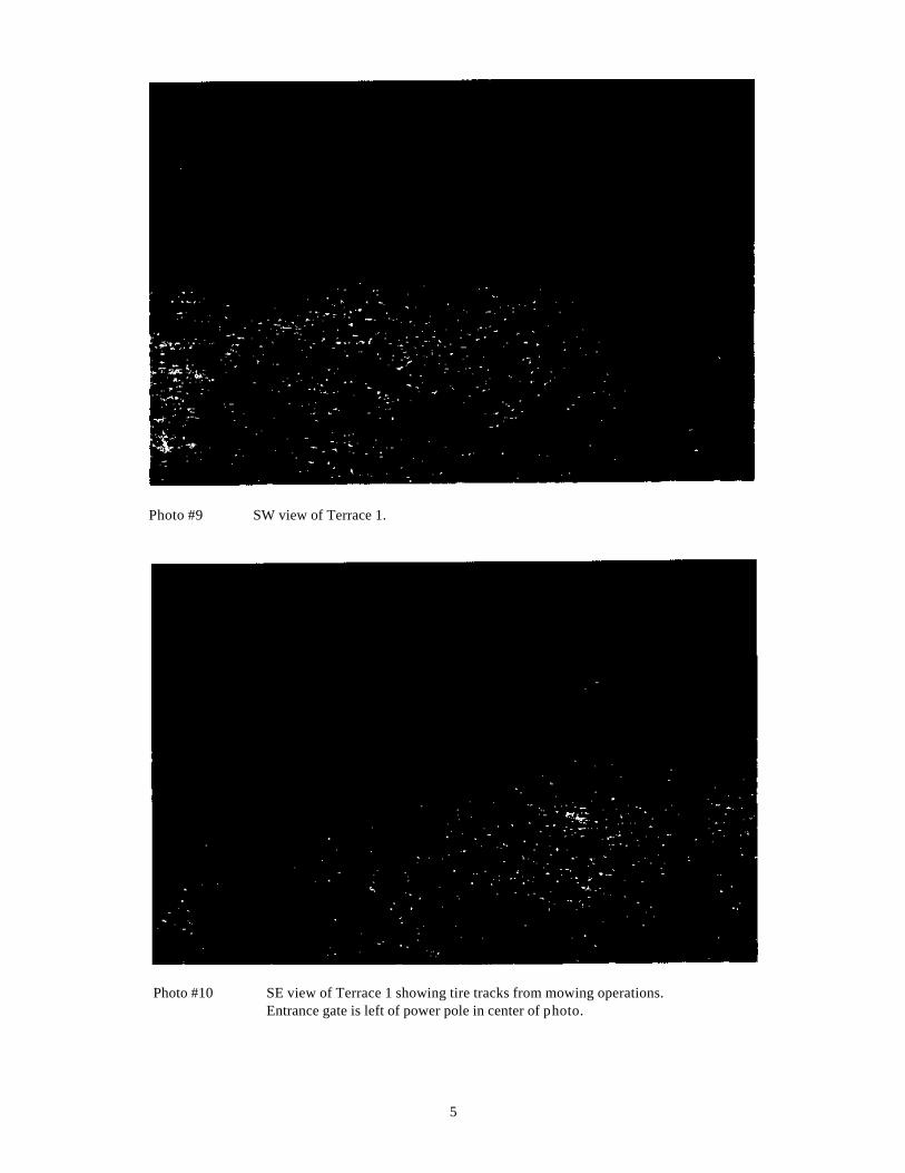
5
Photo #9 SW view of Terrace 1.
Photo #10 SE view of Terrace 1 showing tire tracks from mowing operations. Entrance gate is left of power pole in center of photo.
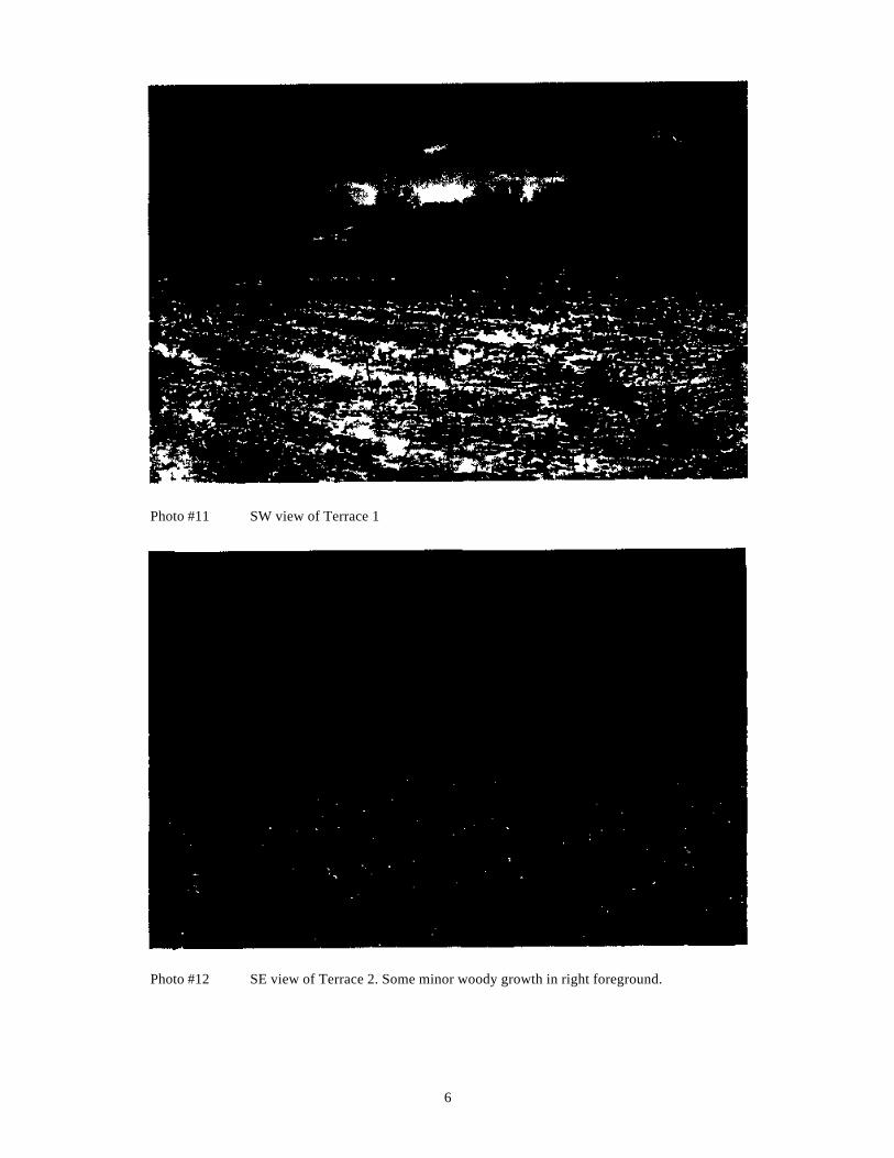
6
Photo #11 SW view of Terrace 1
Photo #12 SE view of Terrace 2. Some minor woody growth in right foreground.
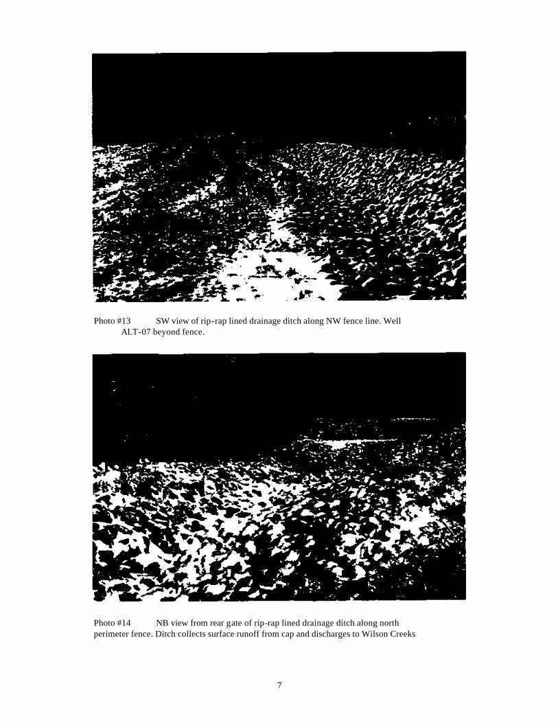
7
Photo #13 SW view of rip-rap lined drainage ditch along NW fence line. Well ALT-07 beyond fence.
Photo #14 NB view from rear gate of rip-rap lined drainage ditch along north perimeter fence. Ditch collects surface runoff from cap and discharges to Wilson Creeks
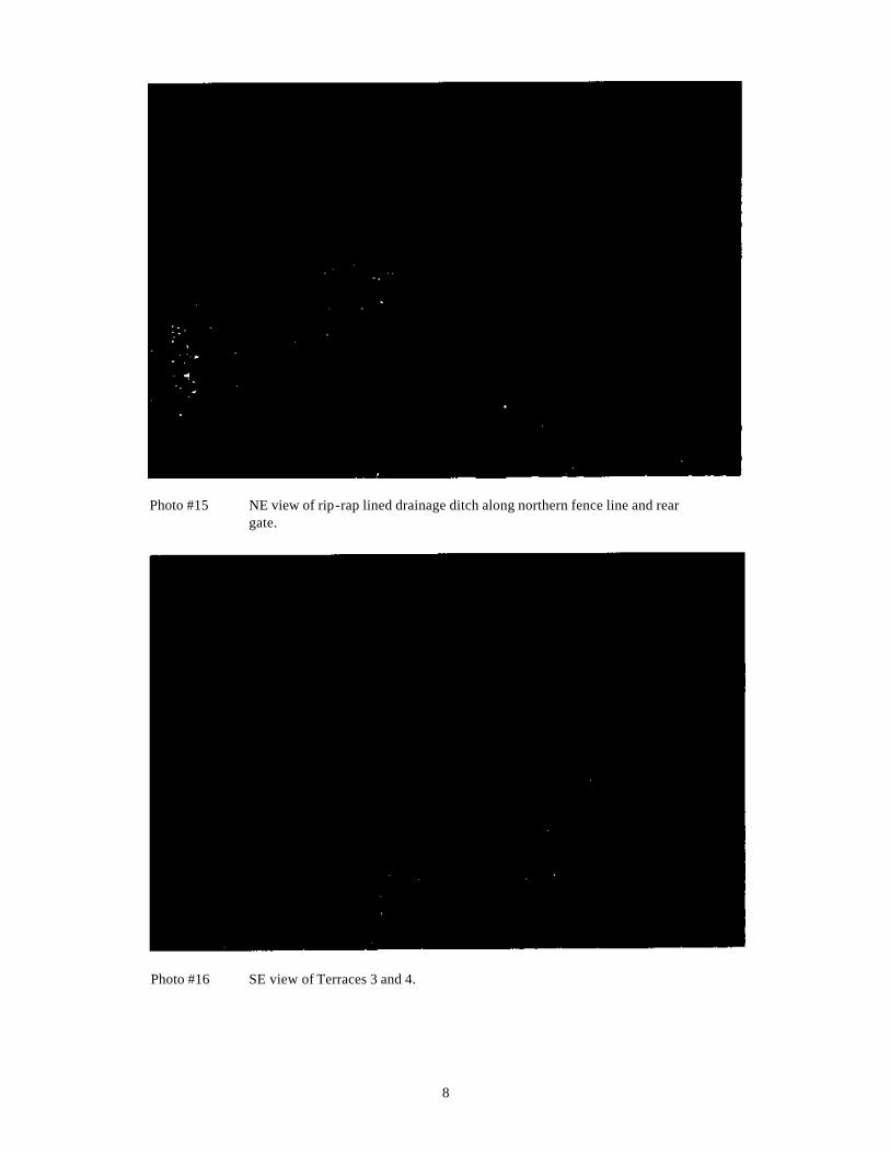
8
Photo #15 NE view of rip-rap lined drainage ditch along northern fence line and rear gate.
Photo #16 SE view of Terraces 3 and 4.
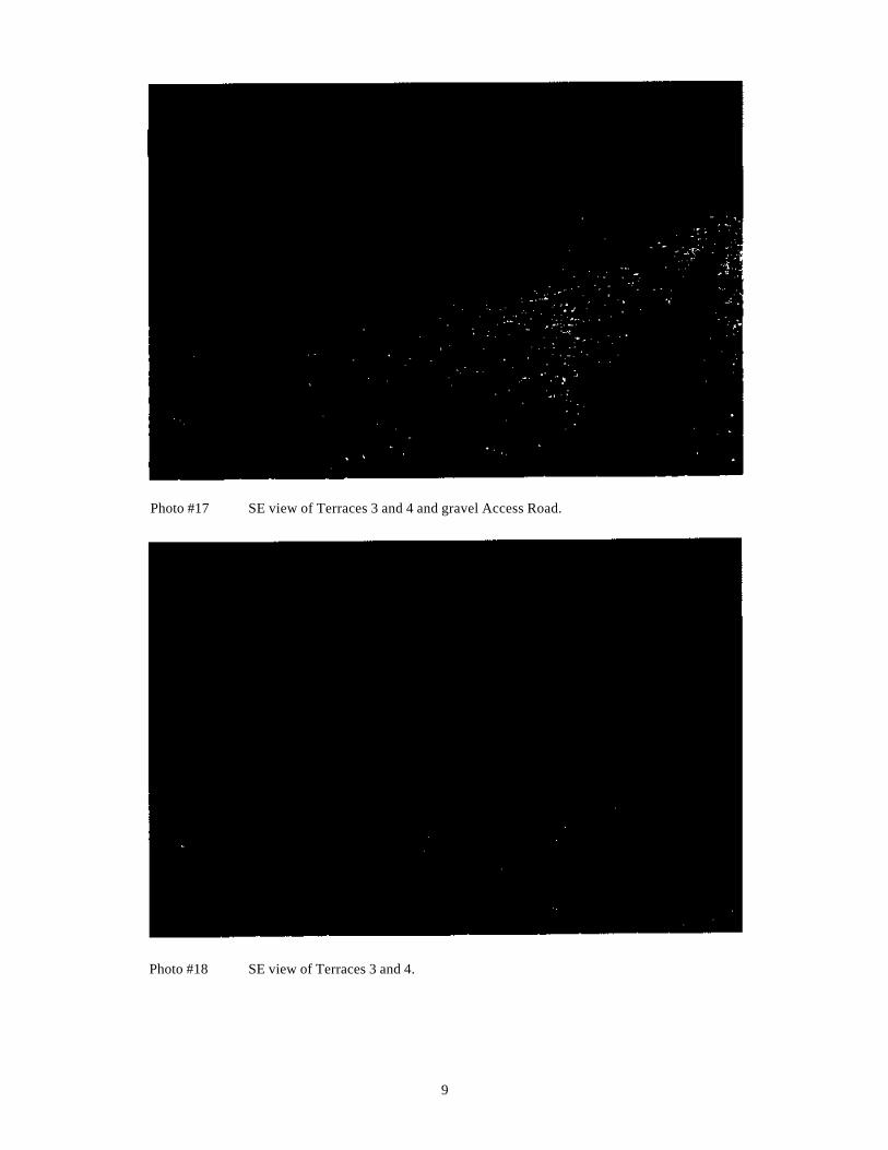
9
Photo #17 SE view of Terraces 3 and 4 and gravel Access Road.
Photo #18 SE view of Terraces 3 and 4.
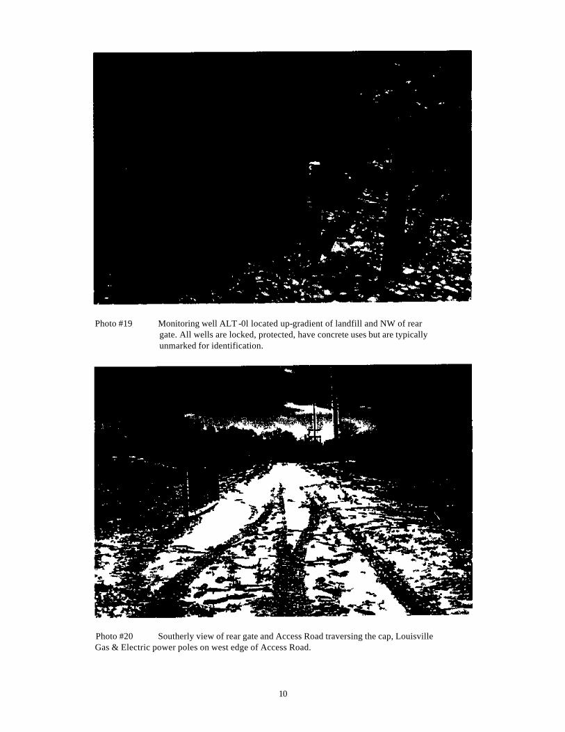
10
Photo #19 Monitoring well ALT -0l located up-gradient of landfill and NW of rear gate. All wells are locked, protected, have concrete uses but are typically unmarked for identification.
Photo #20 Southerly view of rear gate and Access Road traversing the cap, Louisville Gas & Electric power poles on west edge of Access Road.
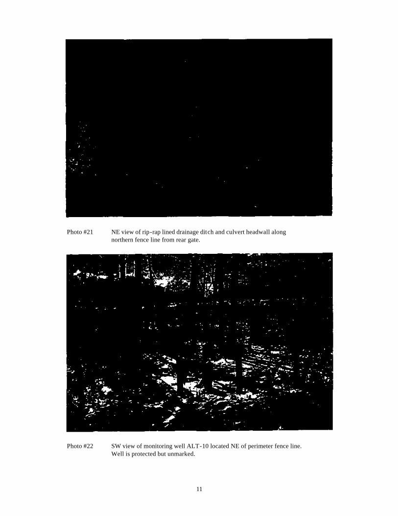
11
Photo #21 NE view of rip-rap lined drainage ditch and culvert headwall along northern fence line from rear gate.
Photo #22 SW view of monitoring well ALT-10 located NE of perimeter fence line. Well is protected but unmarked.
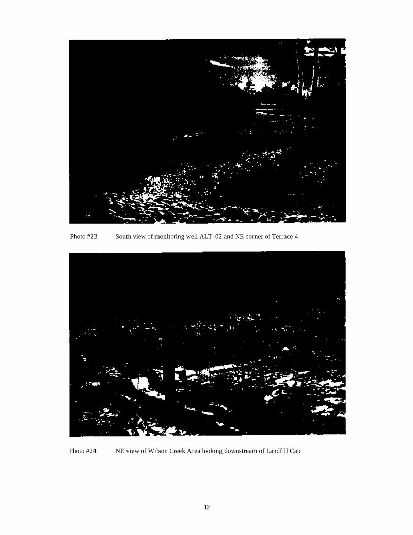
12
Photo #23 South view of monitoring well ALT-02 and NE corner of Terrace 4.
Photo #24 NE view of Wilson Creek Area looking downstream of Landfill Cap
13
Photo #25 Monitoring Well ALT -09 inside eastern perimeter fence line
Photo #26 Down-gradient monitoring well ALT-03 inside eastern fence line. This well has become fouled with silt.
14
Photo 27 View of Landfill NE corner showing Terrace #4 (left), monitoring well
ALT-02 (center), and ALT-08 (right) inside perimeter fence.
Photo #28 Monitoring well ALT -12 outside eastern fence line near Wilson Creek.
15
Photo #29 Monitoring well ALT -04 inside SE corner of fence line.
Photo #30 SW view at outfall of Pond SE of perimeter fence. Approximate location of surface water (SW-02) and sediment (SD-02) sampling points in Wilson Creek.
16
Photo #31 Outfall pipe at Pond SE of perimeter fence discharging to Wilson Creek..
Photo #32 Pond SE of perimeter fence
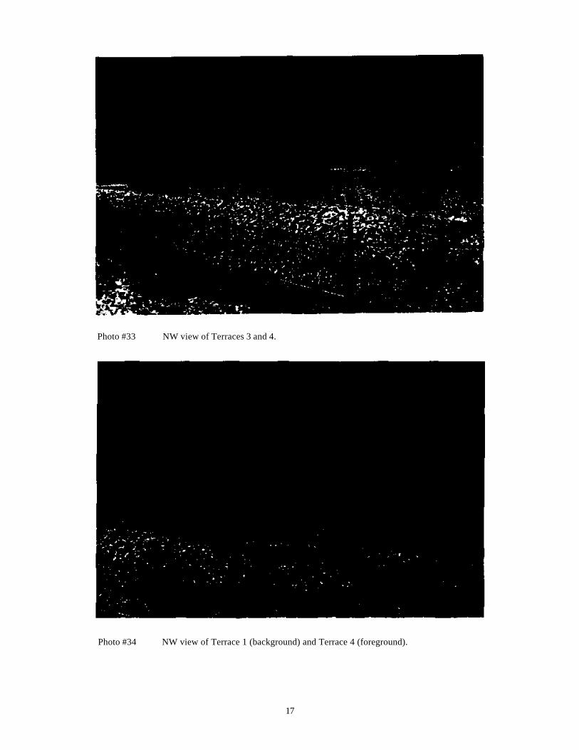
17
Photo #33 NW view of Terraces 3 and 4.
Photo #34 NW view of Terrace 1 (background) and Terrace 4 (foreground).
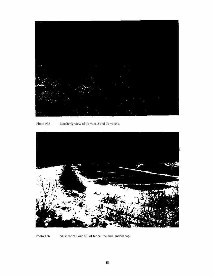
18
Photo #35 Northerly view of Terrace 3 and Terrace 4.
Photo #36 SE view of Pond SE of fence line and landfill cap.
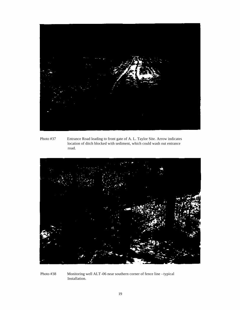
19
Photo #37 Entrance Road leading to front gate of A. L. Taylor Site. Arrow indicates location of ditch blocked with sediment, which could wash out entrance road.
Photo #38 Monitoring well ALT -06 near southern corner of fence line - typical Installation.
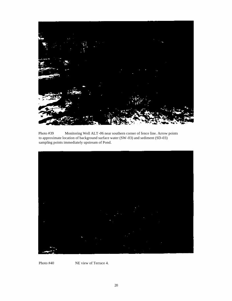
20
Photo #39 Monitoring Well ALT -06 near southern corner of fence line. Arrow points to approximate location of background surface water (SW-03) and sediment (SD-03) sampling points immediately upstream of Pond.
Photo #40 NE view of Terrace 4.

APPENDIX E
O&M Field Operations Report Form
ALTaylor.wpd
3-2
Table 5-1 Schedule for Frequency of Facility Observations Operations and Maintenance Plan for the A.L. Taylor Site, Bullitt County, Kentucky
Source: ESE, 1988. Notes: (3.x) refers to appropriate section of the facility’s Operations and Maintenance Plan
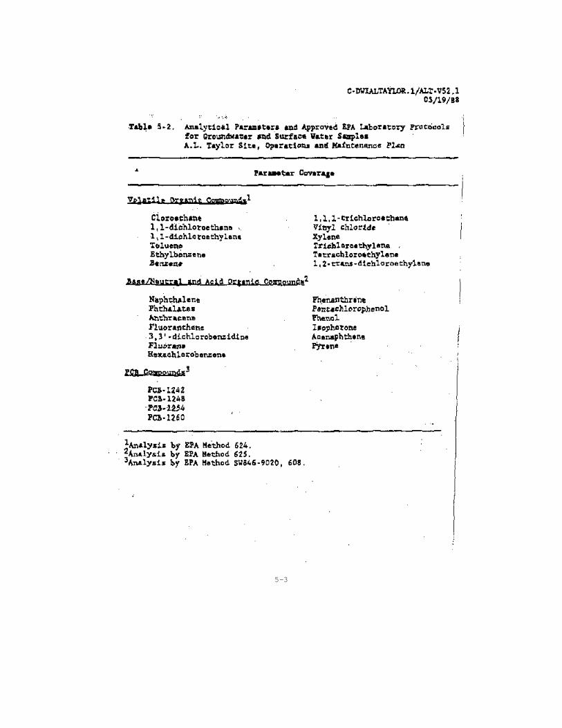
5-3
Related Documents