Agricultural Site Assessment Tool AgSite.missouri.edu Ray Massey University of Missouri Department of Agricultural and Applied Economics

Welcome message from author
This document is posted to help you gain knowledge. Please leave a comment to let me know what you think about it! Share it to your friends and learn new things together.
Transcript

Agricultural Site Assessment ToolAgSite.missouri.edu
Ray MasseyUniversity of MissouriDepartment of Agricultural and Applied Economics

Acknowledgements
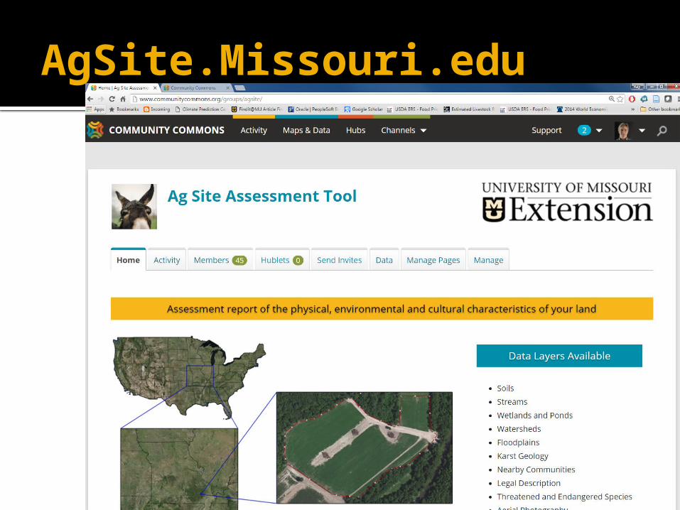
AgSite.Missouri.edu
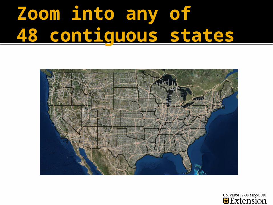
Zoom into any of 48 contiguous states

Outline Your Field;Click “Generate Report”
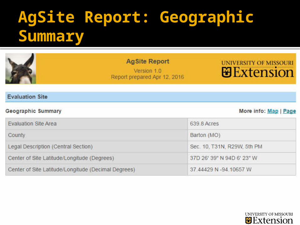
AgSite Report: Geographic Summary

AgSite Report: Demographics

AgSite: Educational Pages
Each table has a “Page” and/or “Map” associated with it.
The “Page” is a link to text on Educational Regulatory and Assistance for management
The “Map” is a link to a map with the table’s features highlighted

AgSite Report: Hydrologic Summary

AgSite Report: Background Page Example

AgSite: Wetland Map

AgSite Report: Slope and Soils

AgSite: Soils Definition

AgSite: Soils Detailed Report

AgSite Report: Environmental Concerns
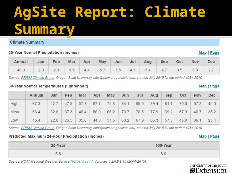
AgSite Report: Climate Summary

AgSite Report: Climate Summary

AgSite Report: Land Use
AgSite.Missouri.edu
Free to anyone without registering or leaving any information.
Suggested that users join the Community Common AgSite hub in order to: Save the field boundaries for later use Save reports for easy access Access hundreds of additional data layers housed
at Community Commons Communicate easily with the developers
Other options – if signed in as user
To Access other map layers you must Be a Community Commons subscriber – free The data layer must be present for your location
Examples of other layers Tribal lands – many states topography 303(d) streams and lakes – only in MO
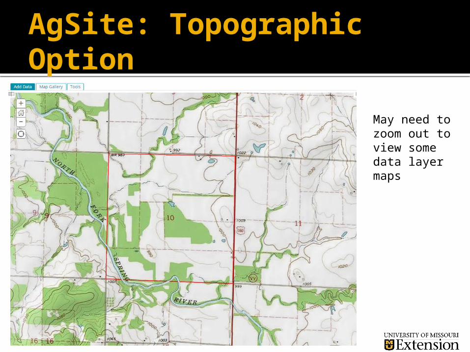
AgSite: Topographic Option
May need to zoom out to view some data layer maps
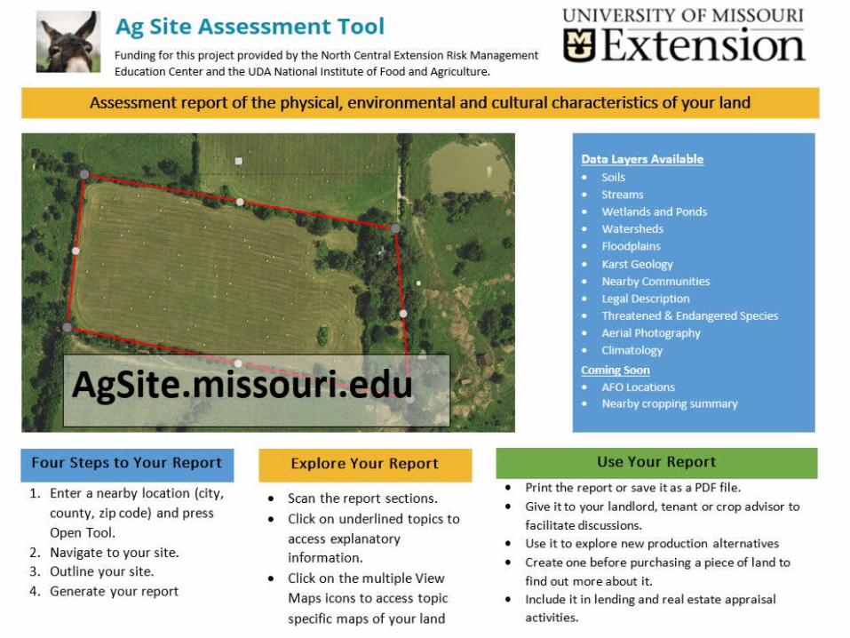
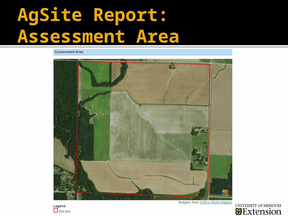
AgSite Report: Assessment Area
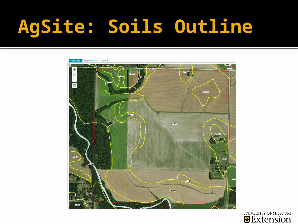
AgSite: Soils Outline

AgSite: Floodplain Designation
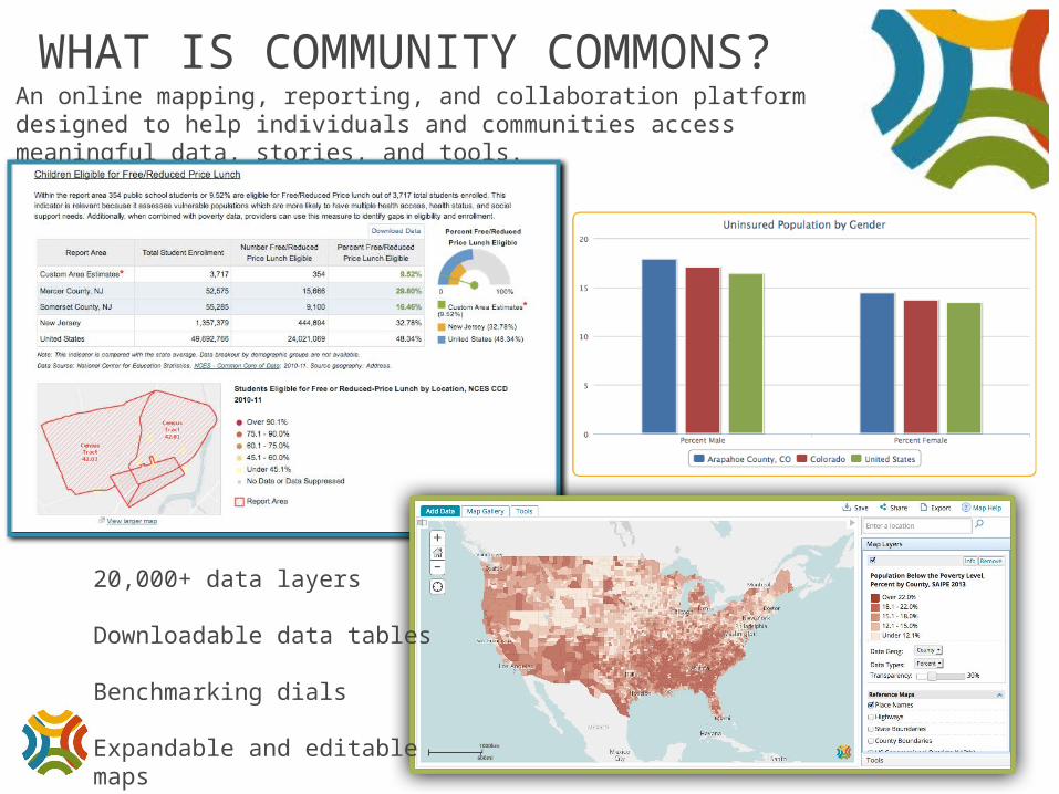
WHAT IS COMMUNITY COMMONS?An online mapping, reporting, and collaboration platform designed to help individuals and communities access meaningful data, stories, and tools.
20,000+ data layers
Downloadable data tables
Benchmarking dials
Expandable and editable maps

COLLABORATION HUBS• Customizable online platform• Access data upload and sharing tools
• Access collaboration tools• Share and co-create documents, maps, and reports• Have targeted discussions in Hub forums
Related Documents