AFRICA: RELIEF AND WATERS 1ºESO – IES Camilo José Cela Teacher: Rocío Bautista

Welcome message from author
This document is posted to help you gain knowledge. Please leave a comment to let me know what you think about it! Share it to your friends and learn new things together.
Transcript
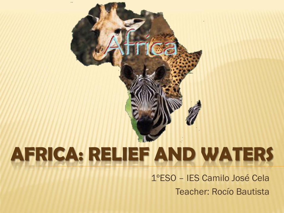
AFRICA: RELIEF AND WATERS 1ºESO – IES Camilo José Cela
Teacher: Rocío Bautista
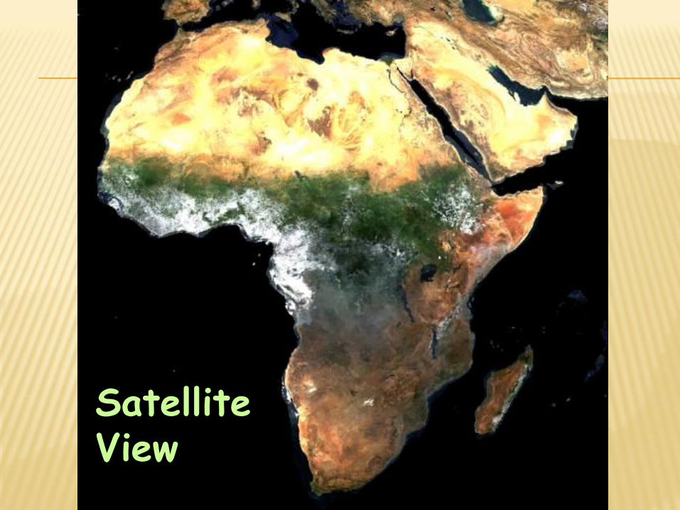
Satellite View
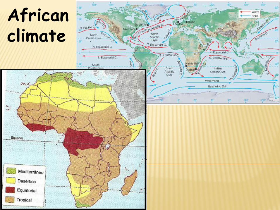
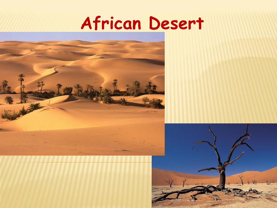
African climate
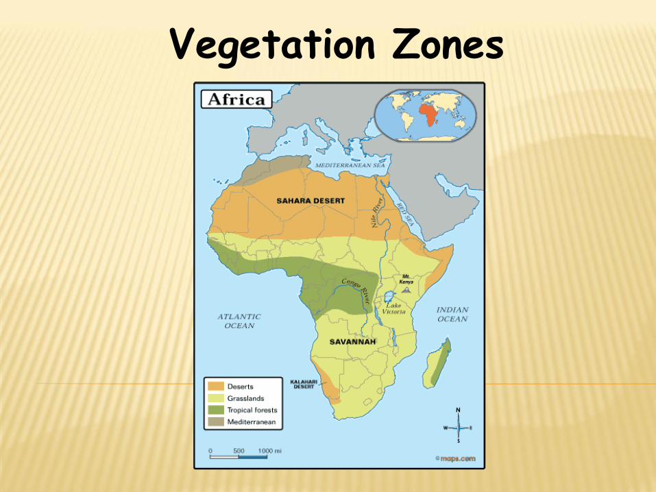
Vegetation Zones
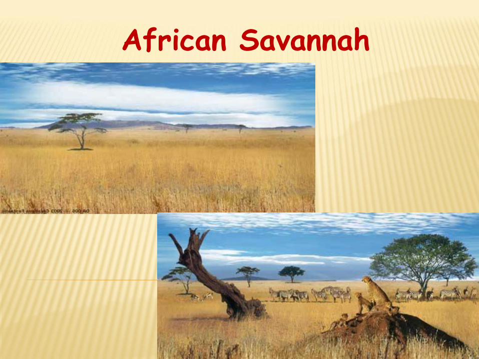
African Savannah
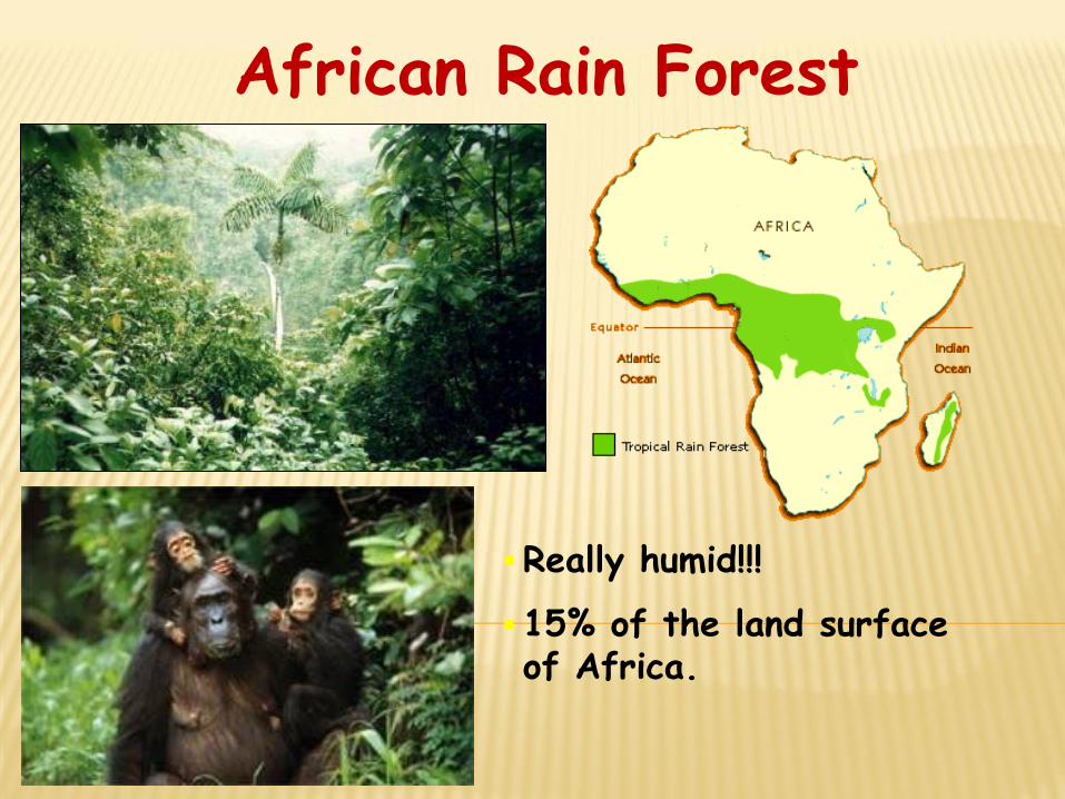
African Rain Forest
Really humid!!!
15% of the land surface of Africa.
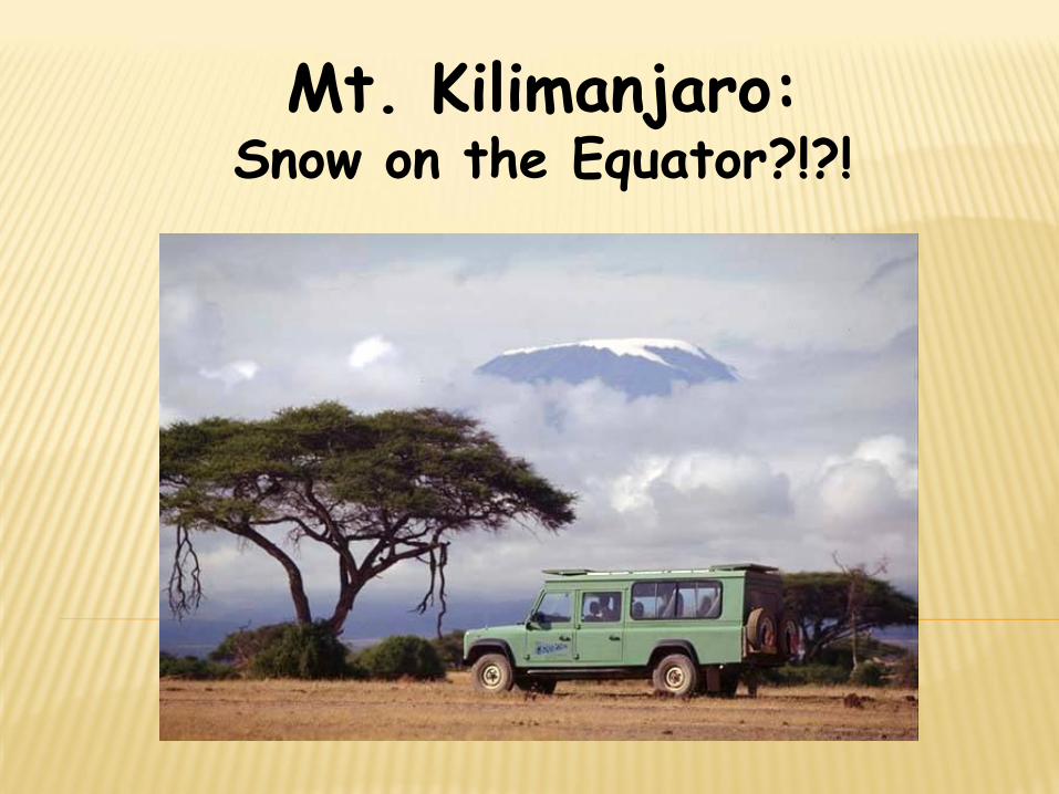
Mt. Kilimanjaro: Snow on the Equator?!?!
CHARACTERISTICS:
It is located between the _________________Sea , ______, the
_________ Ocean & the __________ Ocean.
It is separated from Europe by the ____________________.
It is separated from Asia by the ________ Peninsula and the
______ Sea.
It is the ___rd largest continent ( _____ million km2)
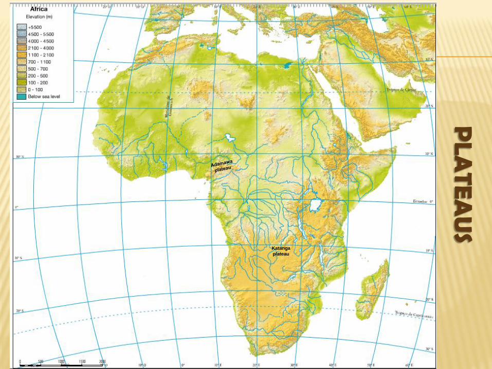
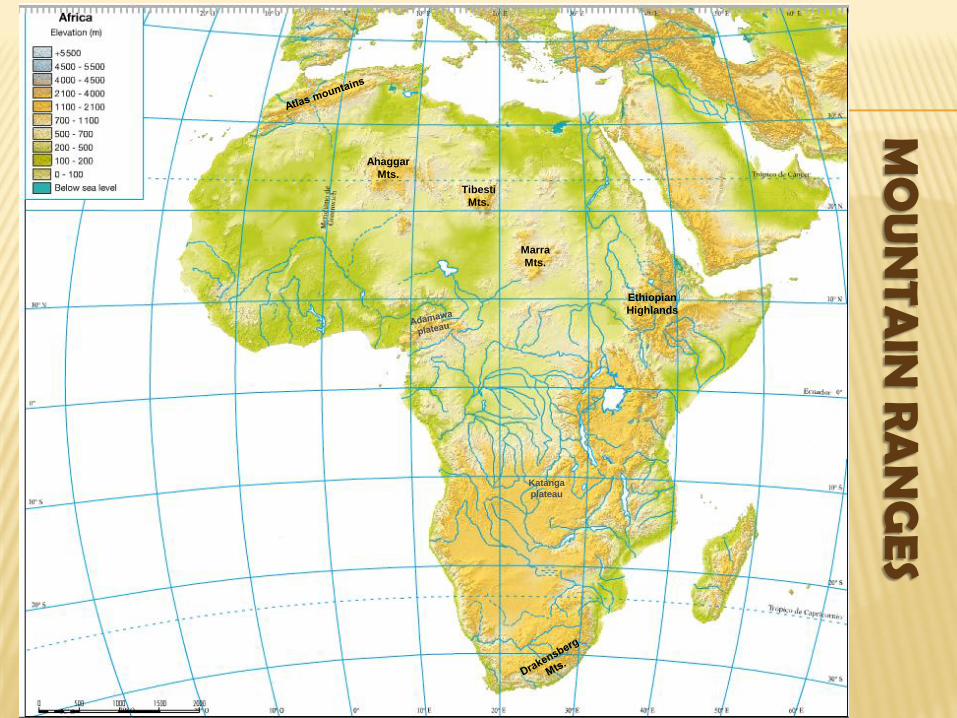
AFRICAN RELIEF:
It is _____ but its average altitude is ______ (750m) due to its
____________ and ___________.
Landforms in Africa:
Plateaus: Bié / Katanga
Old massifs: Ethiopian Highlands / Tibesti Mountains / Ahaggar Mountains
Depressions: Niger, Chad, Congo
Geological Rifts: Rift Valley
Plains
Young mountain ranges: Atlas, Drakensberg Mountains
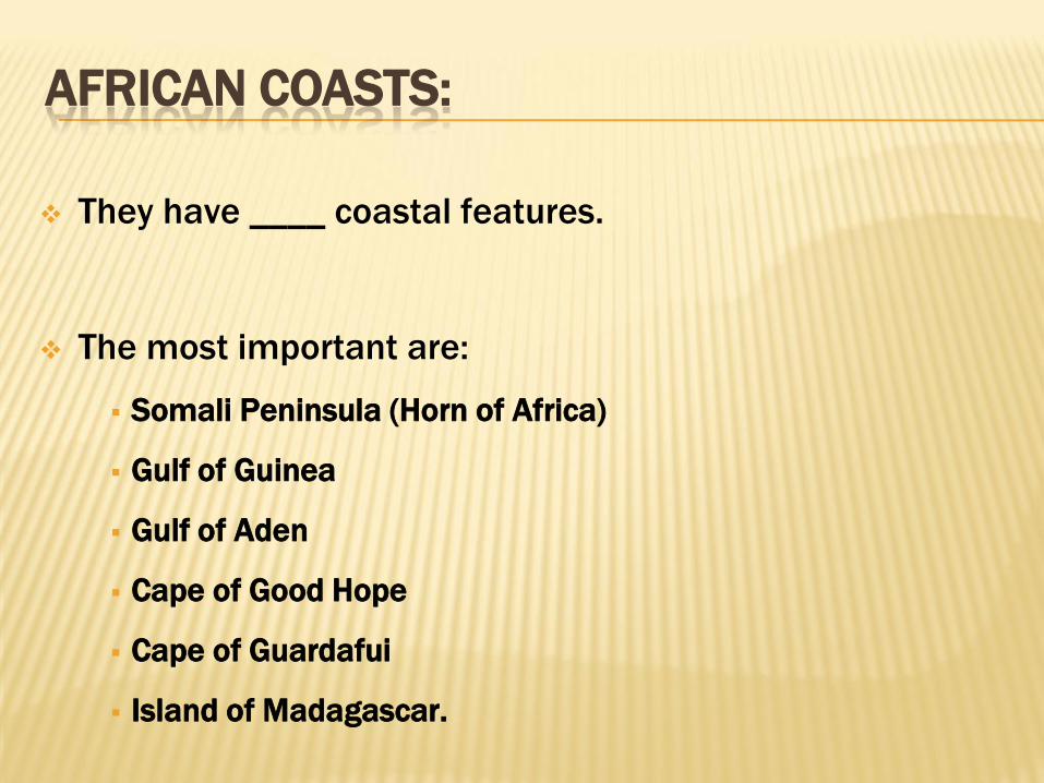
AFRICAN COASTS:
They have ____ coastal features.
The most important are:
Somali Peninsula (Horn of Africa)
Gulf of Guinea
Gulf of Aden
Cape of Good Hope
Cape of Guardafui
Island of Madagascar.
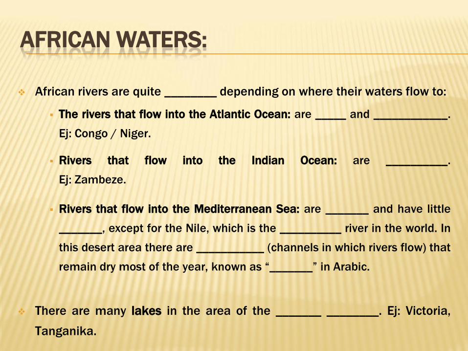
AFRICAN WATERS:
African rivers are quite ________ depending on where their waters flow to:
The rivers that flow into the Atlantic Ocean: are _____ and ____________.
Ej: Congo / Niger.
Rivers that flow into the Indian Ocean: are __________.
Ej: Zambeze.
Rivers that flow into the Mediterranean Sea: are _______ and have little
_______, except for the Nile, which is the __________ river in the world. In
this desert area there are ___________ (channels in which rivers flow) that
remain dry most of the year, known as “_______” in Arabic.
There are many lakes in the area of the _______ ________. Ej: Victoria,
Tanganika.

RELIEF
PLA
TEA
US
Katanga
plateau
MO
UN
TAIN
RA
NG
ES
Katanga
plateau
Ahaggar
Mts.
Tibesti
Mts.
Marra
Mts.
Ethiopian
Highlands

PE
AK
S
Katanga
plateau
Ahaggar
Mts.
Tibesti
Mts.
Marra
Mts.
Ethiopian
Highlands
Mt. Kenya
Mt. Kilimanjaro

DE
PR
ESSIO
NS Katanga
plateau
Ahaggar
Mts.
Tibesti
Mts.
Marra
Mts.
Ethiopian
Highlands
Mt. Kenya
Mt. Kilimanjaro
Chad
basin
Congo
basin
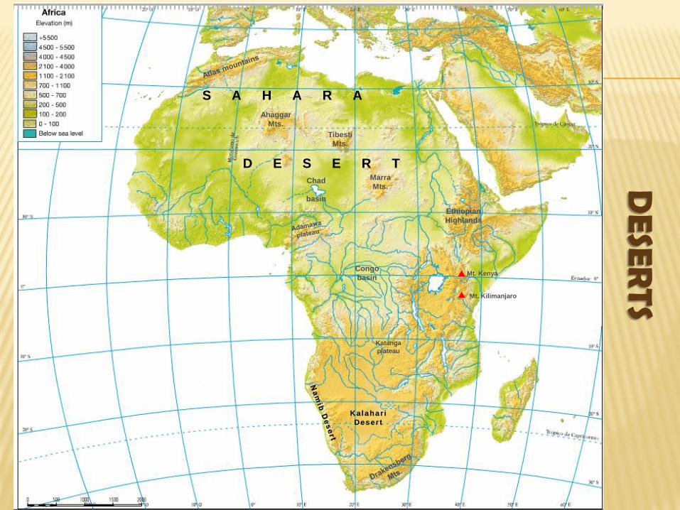
DE
SERTS
Katanga
plateau
Ahaggar
Mts.
Tibesti
Mts.
Marra
Mts.
Ethiopian
Highlands
Mt. Kenya
Mt. Kilimanjaro
Chad
basin
Congo
basin
Kalahar i
Desert
S A H A R A
D E S E R T
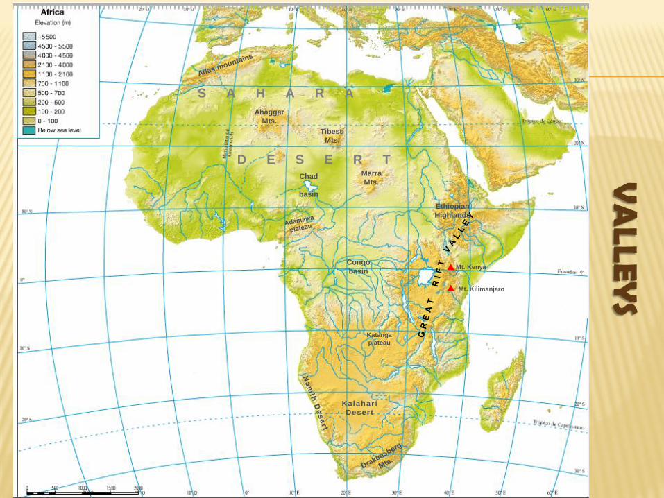
VA
LLEY
S
Katanga
plateau
Ahaggar
Mts.
Tibesti
Mts.
Marra
Mts.
Ethiopian
Highlands
Mt. Kenya
Mt. Kilimanjaro
Chad
basin
Congo
basin
Kalahar i
Desert
S A H A R A
D E S E R T
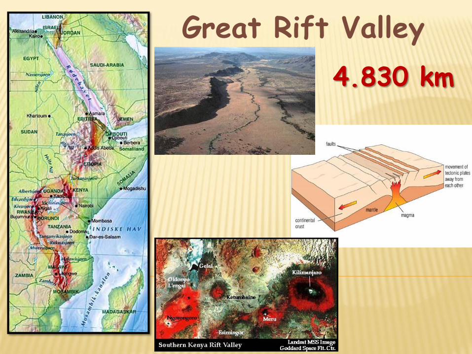
Great Rift Valley
4.830 km
COASTS

ISLAN
DS
Katanga
plateau
Ahaggar
Mts.
Tibesti
Mts.
Marra
Mts.
Ethiopian
Highlands
Mt. Kenya
Mt. Kilimanjaro
Chad
basin
Congo
basin
Kalahar i
Desert
Madeira
Seychelles
Islands
Cape
Verde
Islands
Canary Islands
S A H A R A
D E S E R T
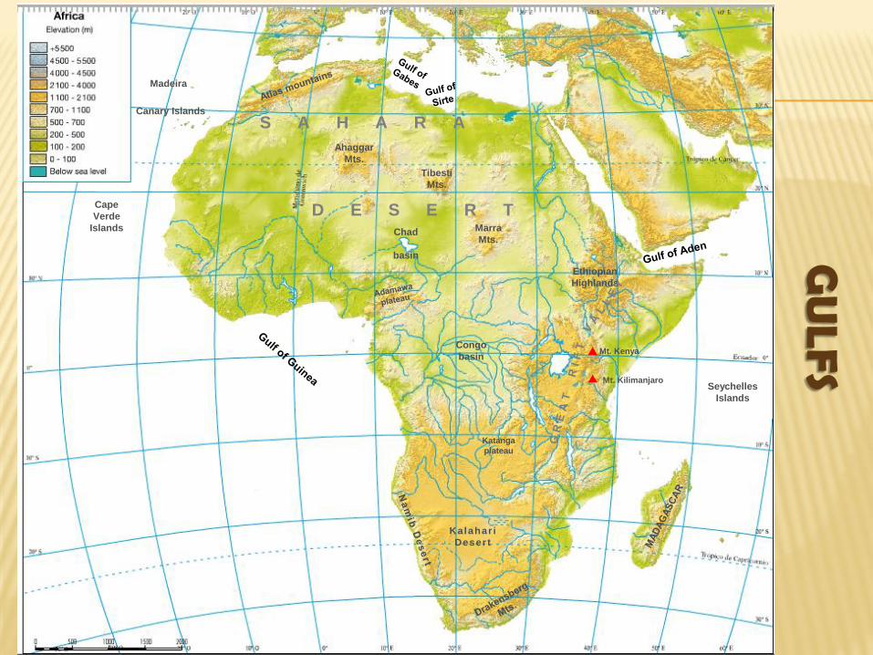
GU
LFS
Katanga
plateau
Ahaggar
Mts.
Tibesti
Mts.
Marra
Mts.
Ethiopian
Highlands
Mt. Kenya
Mt. Kilimanjaro
Chad
basin
Congo
basin
Kalahar i
Desert
Madeira
Seychelles
Islands
Cape
Verde
Islands
Canary Islands
S A H A R A
D E S E R T

CA
PE
S
Katanga
plateau
Ahaggar
Mts.
Tibesti
Mts.
Marra
Mts.
Ethiopian
Highlands
Mt. Kenya
Mt. Kilimanjaro
Chad
basin
Congo
basin
Kalahar i
Desert
Canary Islands
Madeira
Seychelles
Islands
Cape
Verde
Islands
Cape Bojador
Cape
Blanc
Cape
Verde
Cape of Good Hope
Cape
Guardafuí
S A H A R A
D E S E R T
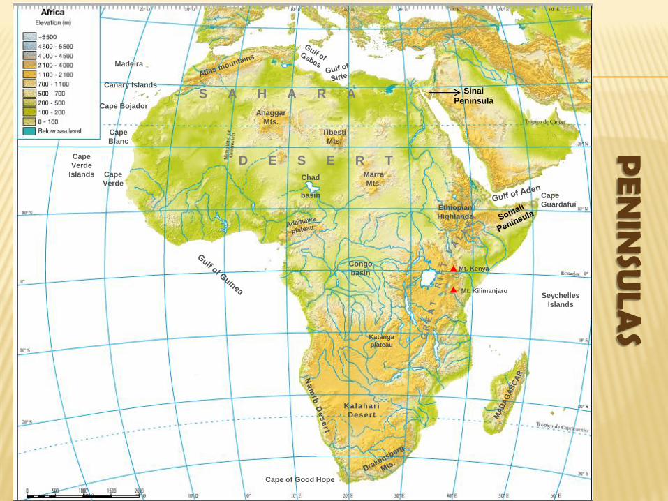
PE
NIN
SULA
S Katanga
plateau
Ahaggar
Mts.
Tibesti
Mts.
Marra
Mts.
Ethiopian
Highlands
Mt. Kenya
Mt. Kilimanjaro
Chad
basin
Congo
basin
Kalahar i
Desert
Canary Islands
Madeira
Seychelles
Islands
Cape
Verde
Islands
Cape Bojador
Cape
Blanc
Cape
Verde
Cape of Good Hope
Cape
Guardafuí
Sinai
Peninsula S A H A R A
D E S E R T
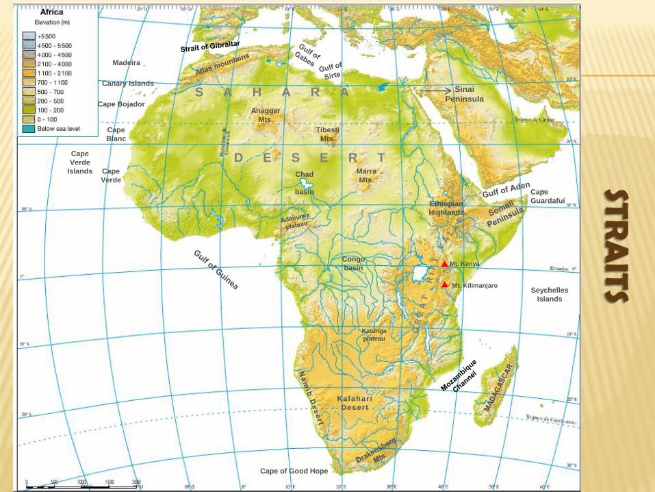
STRA
ITS
Katanga
plateau
Ahaggar
Mts.
Tibesti
Mts.
Marra
Mts.
Ethiopian
Highlands
Mt. Kenya
Mt. Kilimanjaro
Chad
basin
Congo
basin
Kalahar i
Desert
Canary Islands
Madeira
Seychelles
Islands
Cape
Verde
Islands
Cape Bojador
Cape
Blanc
Cape
Verde
Cape of Good Hope
Cape
Guardafuí
Sinai
Peninsula S A H A R A
D E S E R T
WATERS
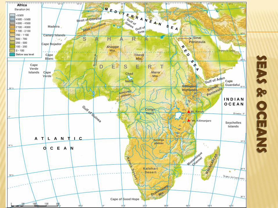
SEA
S & O
CEA
NS
Katanga
plateau
Ahaggar
Mts.
Tibesti
Mts.
Marra
Mts.
Ethiopian
Highlands
Mt. Kenya
Mt. Kilimanjaro
Chad
basin
Congo
basin
Kalahar i
Desert
Canary Islands
Madeira
Seychelles
Islands
Cape
Verde
Islands
Cape Bojador
Cape
Blanc
Cape
Verde
Cape of Good Hope
Cape
Guardafuí
Sinai
Peninsula
A T L A N T I C
O C E A N
I N D I A N
O C E A N
S A H A R A
D E S E R T

RIV
ERS
Katanga
plateau
Ahaggar
Mts.
Tibesti
Mts.
Marra
Mts.
Ethiopian
Highlands
Mt. Kenya
Mt. Kilimanjaro
Chad
basin
Congo
basin
Kalahar i
Desert
Canary Islands
Madeira
Seychelles
Islands
Cape
Verde
Islands
Cape Bojador
Cape
Blanc
Cape
Verde
Cape of Good Hope
Cape
Guardafuí
Sinai
Peninsula
A T L A N T I C
O C E A N
I N D I A N
O C E A N
S A H A R A
D E S E R T

LAK
ES
Katanga
plateau
Ahaggar
Mts.
Tibesti
Mts.
Marra
Mts.
Ethiopian
Highlands
Mt. Kenya
Mt. Kilimanjaro
Chad
basin
Congo
basin
Kalahar i
Desert
Canary Islands
Madeira
Seychelles
Islands
Cape
Verde
Islands
Cape Bojador
Cape
Blanc
Cape
Verde
Cape of Good Hope
Cape
Guardafuí
Sinai
Peninsula
A T L A N T I C
O C E A N
I N D I A N
O C E A N
Lake Chad
Lake
Victoria
Lake Tanganika
Lake
Malawi
S A H A R A
D E S E R T

OTH
ER
S
Katanga
plateau
Ahaggar
Mts.
Tibesti
Mts.
Marra
Mts.
Ethiopian
Highlands
Mt. Kenya
Mt. Kilimanjaro
Chad
basin
Congo
basin
Kalahar i
Desert
Canary Islands
Madeira
Seychelles
Islands
Cape
Verde
Islands
Cape Bojador
Cape
Blanc
Cape
Verde
Cape of Good Hope
Cape
Guardafuí
Sinai
Peninsula
A T L A N T I C
O C E A N
I N D I A N
O C E A N
Lake Chad
Lake
Victoria
Lake Tanganika
Lake
Malawi
Victoria Falls
S A H A R A
D E S E R T
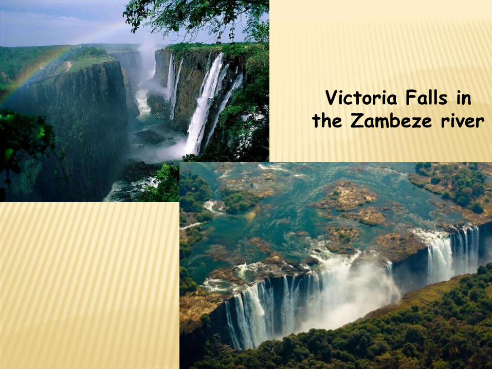
Victoria Falls in the Zambeze river
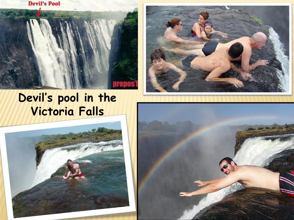
Devil’s pool in the Victoria Falls
Related Documents