AFRICA https://www.youtube.com/w atch?v=BPjQGYaBDtg

Welcome message from author
This document is posted to help you gain knowledge. Please leave a comment to let me know what you think about it! Share it to your friends and learn new things together.
Transcript

AFRICA https://www.youtube.com/watch?v=BPjQGYaBDtg

Africa is a huge, diverse continent home to many different kinds of physical features from deserts to plains, and highlands to rainforests. - The Sahara is the world’s
largest desert, dominates land and life in North Africa
- Grassy plains called Savannas stretch across large parts of the continent. Home to much African wildlife
- In East Africa, Earth’s crust is slowly being pulled apart causing wide rift valleys to form.
The Sahara
Savannas
Rift Valleys

Political Map V. Resources Map
• Turn to pages 484-485. • Look at the Resources map. • What are the major resources of Africa? • Coal, natural gas, oil, hydroelectric power, gold, silver,
platinum, diamonds, uranium, other minerals, seafood
• Where is oil found? How does it affect economies in the region?
• Most oil is located along the west-central coast and in northern Africa. These countries may have strong economies because they can export so much oil.
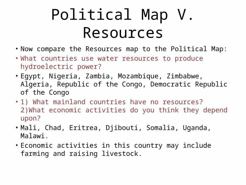
Political Map V. Resources
• Now compare the Resources map to the Political Map: • What countries use water resources to produce
hydroelectric power? • Egypt, Nigeria, Zambia, Mozambique, Zimbabwe, Algeria,
Republic of the Congo, Democratic Republic of the Congo • 1) What mainland countries have no resources? 2)What
economic activities do you think they depend upon? • Mali, Chad, Eritrea, Djibouti, Somalia, Uganda, Malawi.• Economic activities in this country may include farming
and raising livestock.
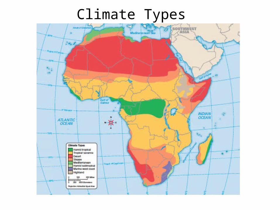
Climate Types
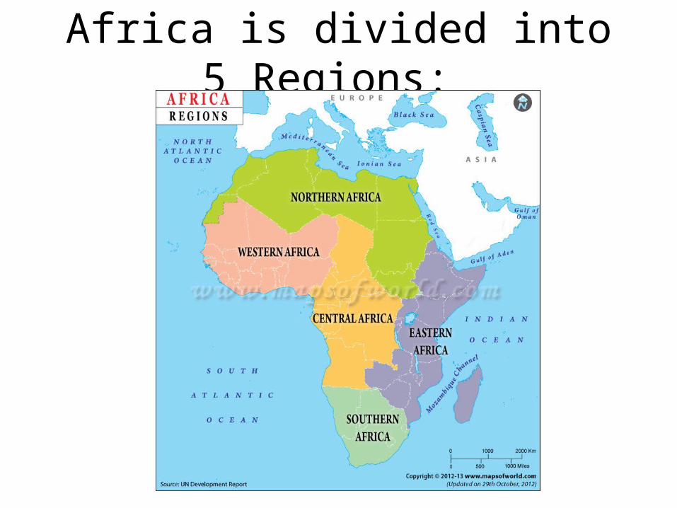
Africa is divided into 5 Regions:
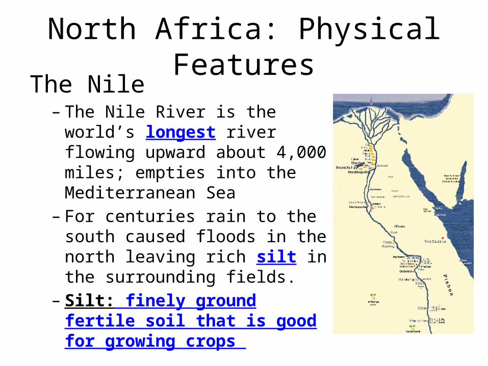
North Africa: Physical FeaturesThe Nile – The Nile River is the world’s
longest river flowing upward about 4,000 miles; empties into the Mediterranean Sea
– For centuries rain to the south caused floods in the north leaving rich silt in the surrounding fields.
– Silt: finely ground fertile soil that is good for growing crops
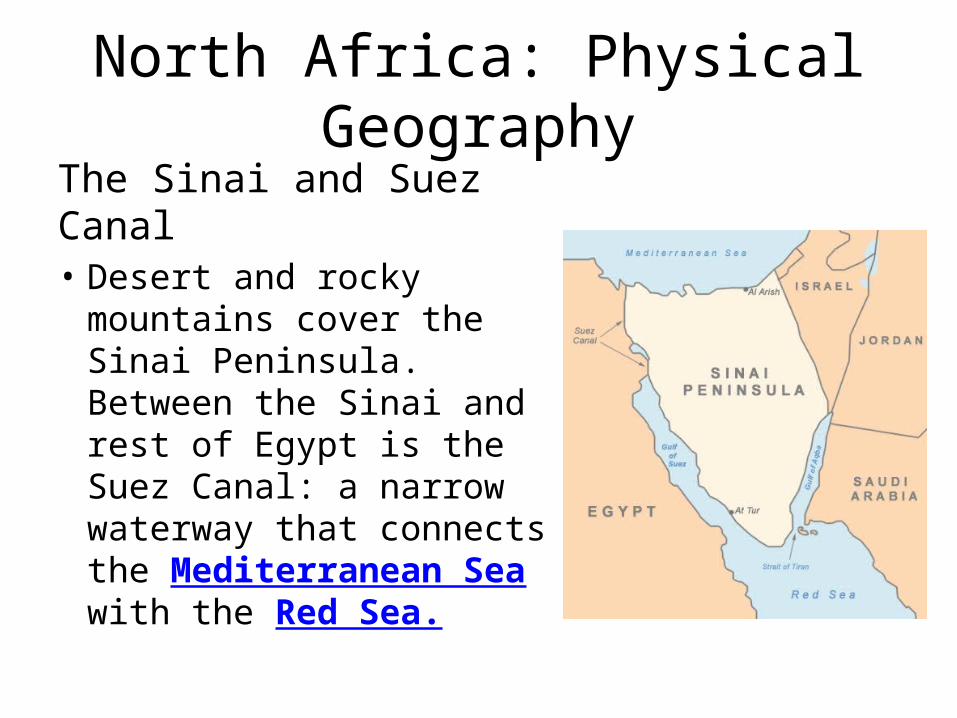
North Africa: Physical GeographyThe Sinai and Suez Canal• Desert and rocky
mountains cover the Sinai Peninsula. Between the Sinai and rest of Egypt is the Suez Canal: a narrow waterway that connects the Mediterranean Sea with the Red Sea.
North Africa: Physical Geography
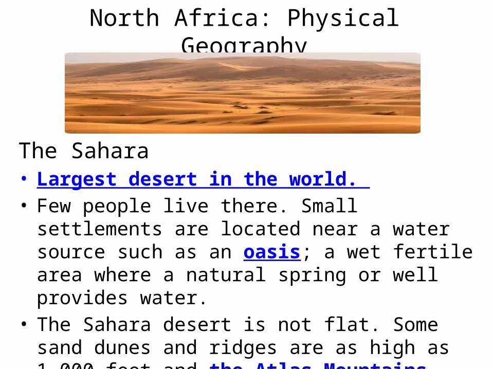
The Sahara • Largest desert in the world. • Few people live there. Small settlements are located
near a water source such as an oasis; a wet fertile area where a natural spring or well provides water.
• The Sahara desert is not flat. Some sand dunes and ridges are as high as 1,000 feet and the Atlas Mountains rise as high as 13,600 feet!

North Africa: Climate and Resources
• Three Main Climates: 1. Desert: Very dry covers most of the region. Very
hot during the day ( up to 136° F) and drop quickly after sunset.
2. Mediterranean: northern coast consists of moist, mild winters and hot, dry summers.
3. Steppe: Areas between coast and Sahara • Oil and gas are important resources.

West Africa: Physical Features• Plains and Highlands: – Coastal plain is home to most of the
region’s cities. Interior plains provide land where people grow crops.
– Tibesti Mountains to the northeast• The Niger River – Flows 2,600 miles, empties into the
Gulf of Guinea – Many people farm along its banks or
fish– Important transportation route
especially during rainy season
West Africa: Climate• Four different climate regions: “zonal”, meaning
organized by zoneo Sahara- hardly any vegetation, dry climate, few or no
peopleo Sahel- strip of land dividing desert from wetter areas,
steppe climate. Desertification- spread of desert-like conditions
o Savanna- Tall grasses, scattered trees and shrubso Humid tropical- lies along coasts of Atlantic and Gulf
of Guinea
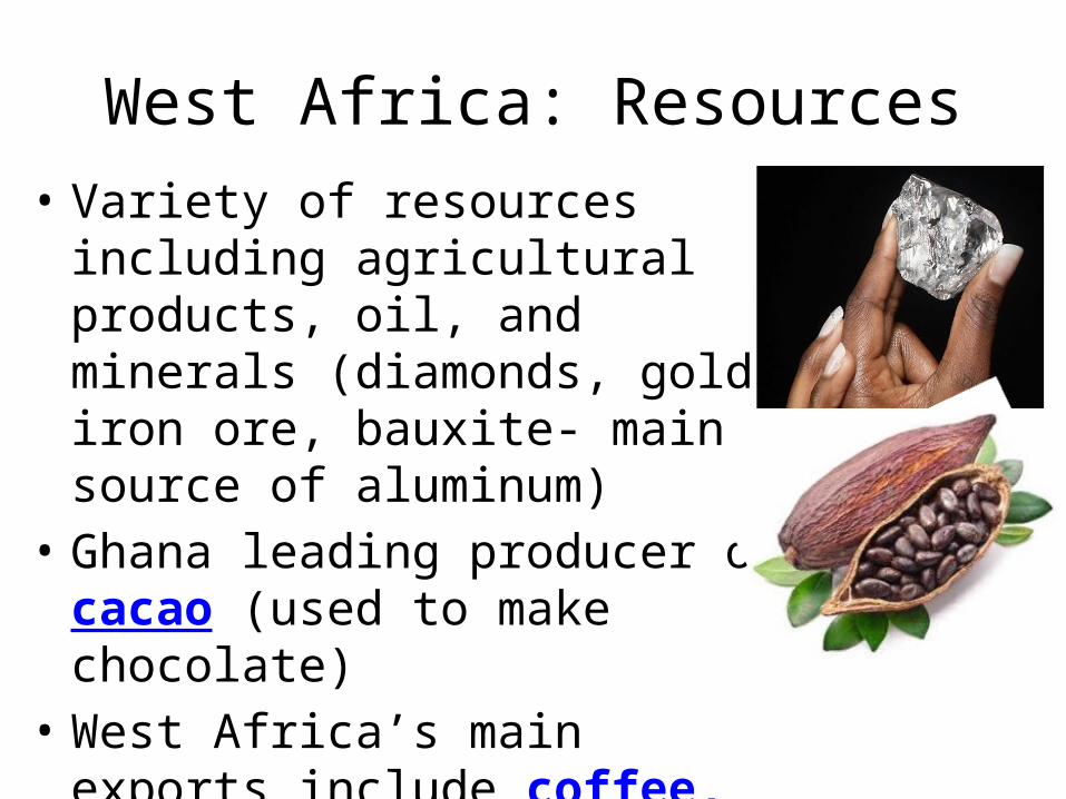
West Africa: Resources• Variety of resources including
agricultural products, oil, and minerals (diamonds, gold, iron ore, bauxite- main source of aluminum)
• Ghana leading producer of cacao (used to make chocolate)
• West Africa’s main exports include coffee, coconuts, and peanuts

West Africa: History • One of the earliest kingdoms was Ghana. Controlled
the Sahara trade in gold and salt became rich and powerful in 800.
• Empire of Mali replaced Ghana in about 1300 gaining control of the trade routes– Mansa Musa was Mali’s most famous king – Invasions caused the decline of Mali in the 1500s
• Replaced by kingdom of Songhai– Timbuktu was the cultural center with a university,
mosques, and over 100 schools– Declined around 1600 when Europeans began trading
along coast
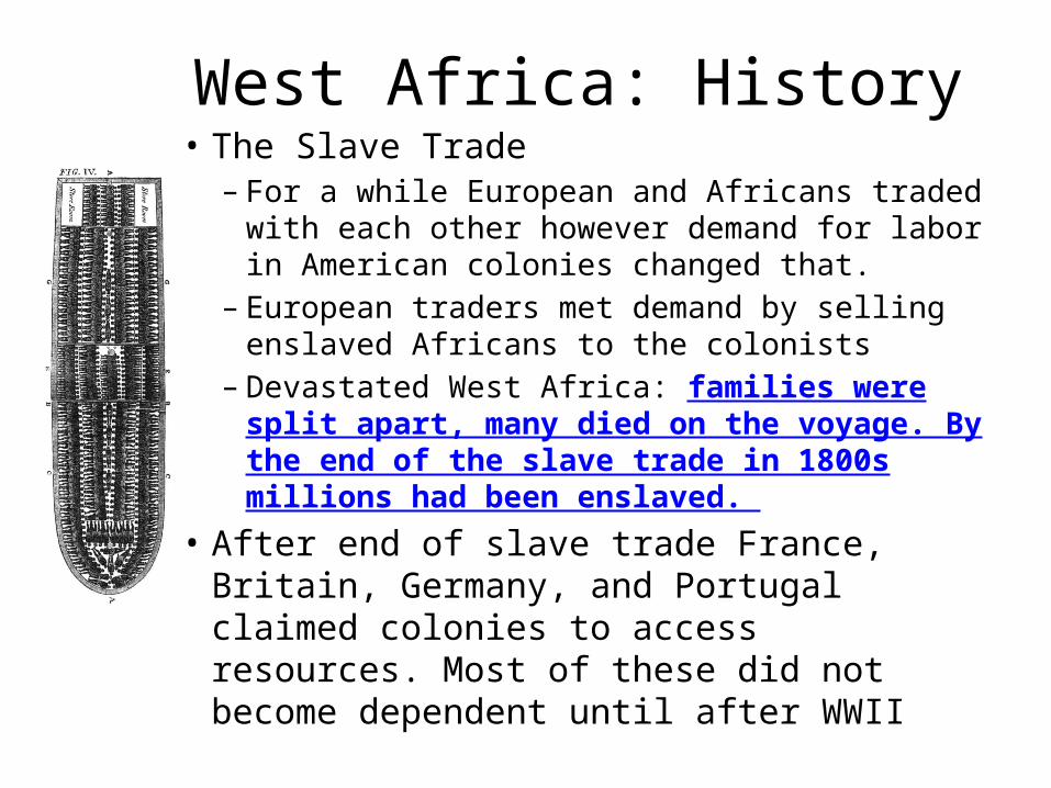
West Africa: History• The Slave Trade – For a while European and Africans traded with
each other however demand for labor in American colonies changed that.
– European traders met demand by selling enslaved Africans to the colonists
– Devastated West Africa: families were split apart, many died on the voyage. By the end of the slave trade in 1800s millions had been enslaved.
• After end of slave trade France, Britain, Germany, and Portugal claimed colonies to access resources. Most of these did not become dependent until after WWII
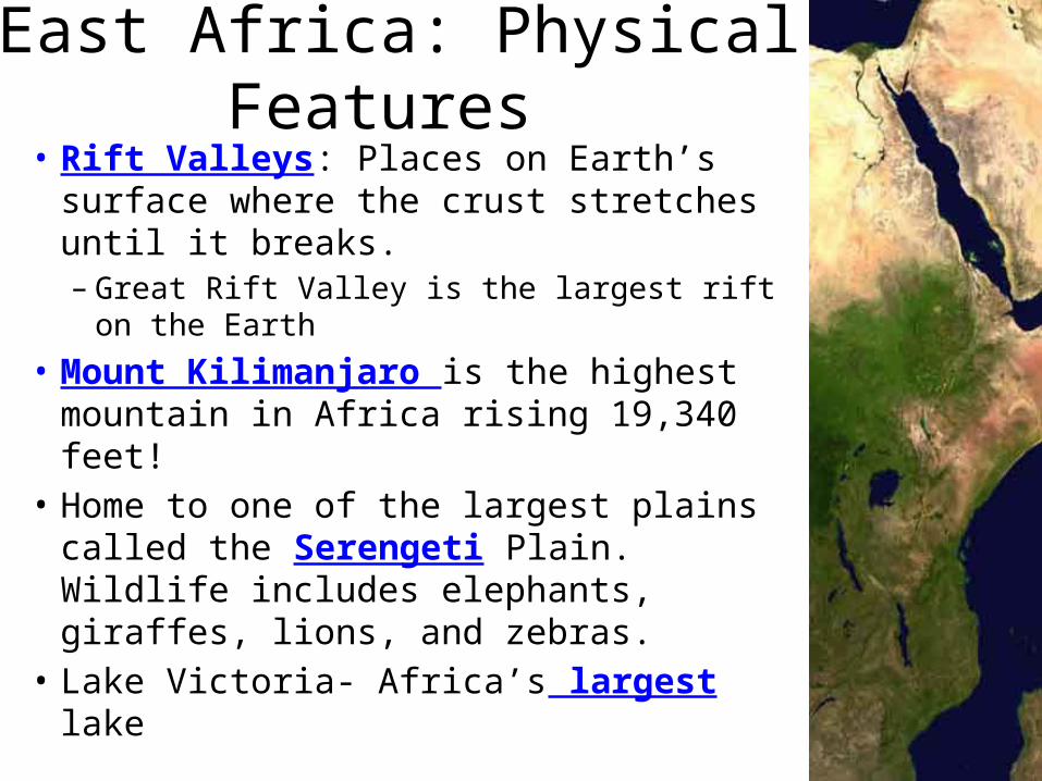
East Africa: Physical Features • Rift Valleys: Places on Earth’s surface
where the crust stretches until it breaks.– Great Rift Valley is the largest rift on the
Earth• Mount Kilimanjaro is the highest
mountain in Africa rising 19,340 feet! • Home to one of the largest plains called
the Serengeti Plain. Wildlife includes elephants, giraffes, lions, and zebras.
• Lake Victoria- Africa’s largest lake

East Africa: Climate and Vegetation• Location on equator and differences in
elevation influence climate and vegetation.• North of the equator has cool, highland
climate. Most of the population lives in highland region.
• Areas near equator receive greatest amount of rainfall
• Areas farther from equator are much drier and droughts are common causing crops and grasses for cattle die, people begin to starve

East Africa: ReligionChristianity and Islam influenced the lives of many East Africans. Other influences included trade, the arrival of Europeans, ethnic conflict, and independence• Christianity was first introduced as early as 300
AD • By about 700 AD Islam spread from Egypt to
Northern Sudan and spread to the Indian Ocean coast to what is now Somalia– Many city-states became major Islamic centers
controlling trade on the coast
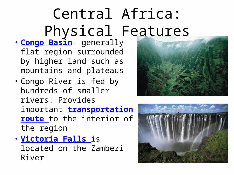
Central Africa: Physical Features• Congo Basin- generally flat
region surrounded by higher land such as mountains and plateaus
• Congo River is fed by hundreds of smaller rivers. Provides important transportation route to the interior of the region
• Victoria Falls is located on the Zambezi River

Central Africa: Climate, Vegetation, and Animals
• Lies along the equator. Congo Basin has a humid tropical climate. – Large, dense tropical forest – Gorillas, elephants, wild boars,
okapis live on the forest floor. People hunt large animals for food. National Parks have been set up to promote protection
– Forests are in danger: rapidly being cleared for farming and logging.
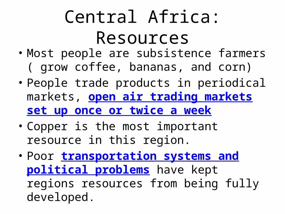
Central Africa: Resources• Most people are subsistence farmers ( grow
coffee, bananas, and corn) • People trade products in periodical markets,
open air trading markets set up once or twice a week
• Copper is the most important resource in this region.
• Poor transportation systems and political problems have kept regions resources from being fully developed.

Daily life in Cameroon• Mosquito netting on
bed to protect from insects and Malaria
• My friend with her “host sister”
• Eating with her “host family”, the family she lived with while in the Peace Corps

Lokoti, Cameroon
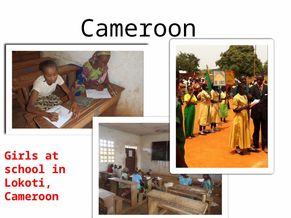
Cameroon
Girls at school in Lokoti, Cameroon

Southern Africa: Physical Geography
• Most of the land lies on a large plateau. The steep face at the edge of the plateau is called an escarpment.
• Many rivers flow in this regions providing irrigation for farmland. Also home to animals such as crocodiles, zebra, hippos.

Southern Africa: Climate and Vegetation
• Climate varies from east to west. The east coast is wet, whereas the west is very dry.
Related Documents