Advances in Hydrographic Surveying Equipment and Techniques Techniques BY PAT SANDERS, TECHNICAL DIRECTOR HYPACK - YSI

Welcome message from author
This document is posted to help you gain knowledge. Please leave a comment to let me know what you think about it! Share it to your friends and learn new things together.
Transcript

Advances in Hydrographic Surveying Equipment and TechniquesTechniquesBY PAT SANDERS, TECHNICAL DIRECTOR
HYPACK - YSI
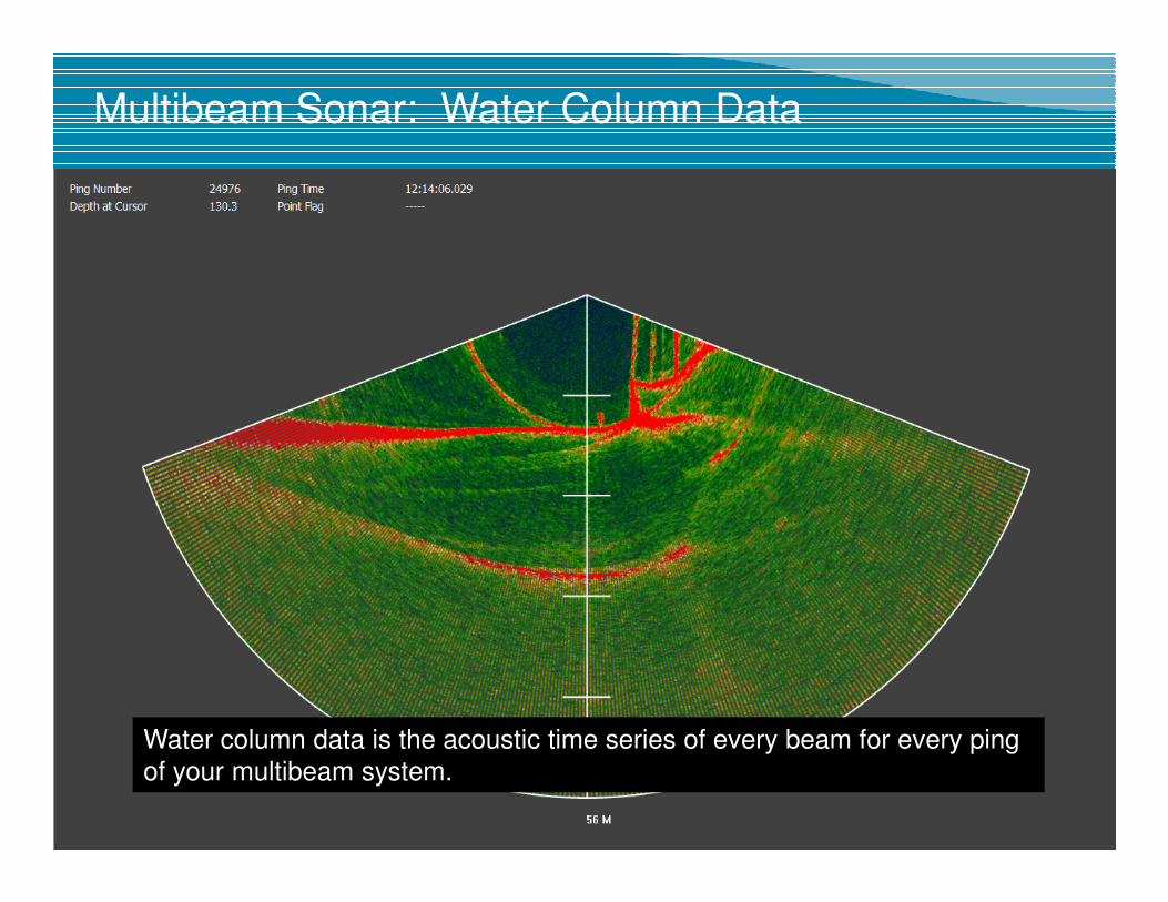
Multibeam Sonar: Water Column Data
Water column data is the acoustic time series of every beam for every ping
of your multibeam system.

Water column: Real Time Visualization
3
Typical data rates can be 2Gb/Minute!
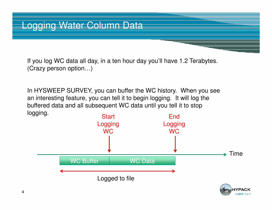
Logging Water Column Data
If you log WC data all day, in a ten hour day you’ll have 1.2 Terabytes.
(Crazy person option…)
In HYSWEEP SURVEY, you can buffer the WC history. When you see
an interesting feature, you can tell it to begin logging. It will log the
buffered data and all subsequent WC data until you tell it to stop
4
buffered data and all subsequent WC data until you tell it to stop
logging.
Time
WC Buffer WC Data
Start
Logging
WC
End
Logging
WC
Logged to file

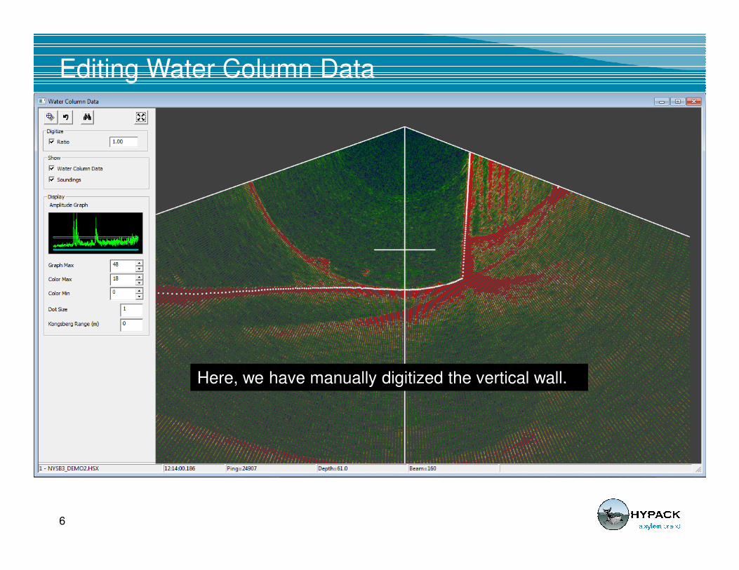
Editing Water Column Data
5
A Water Column Data window in MBMAX-64 (HYPACK Multibeam Editor)
shows the bottom detection points (one per beam) superimposed with the
acoustic time series info.
Editing Water Column Data
6
Here, we have manually digitized the vertical wall.
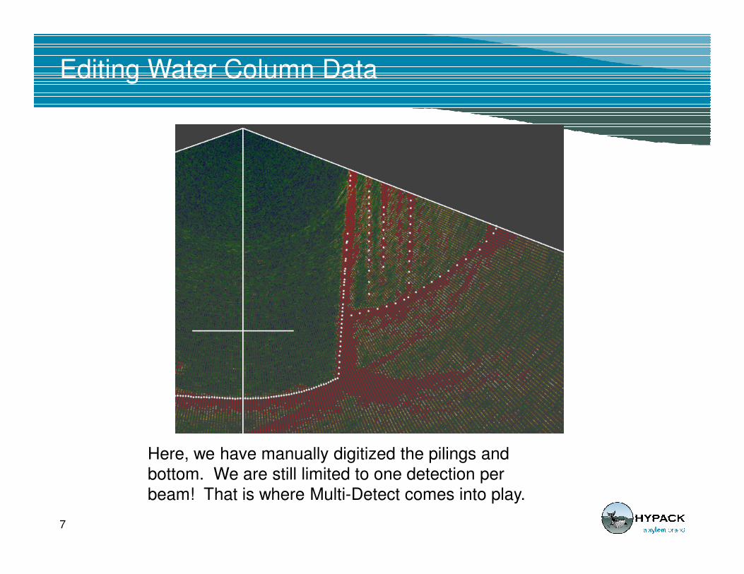
Editing Water Column Data
7
Here, we have manually digitized the pilings and
bottom. We are still limited to one detection per
beam! That is where Multi-Detect comes into play.
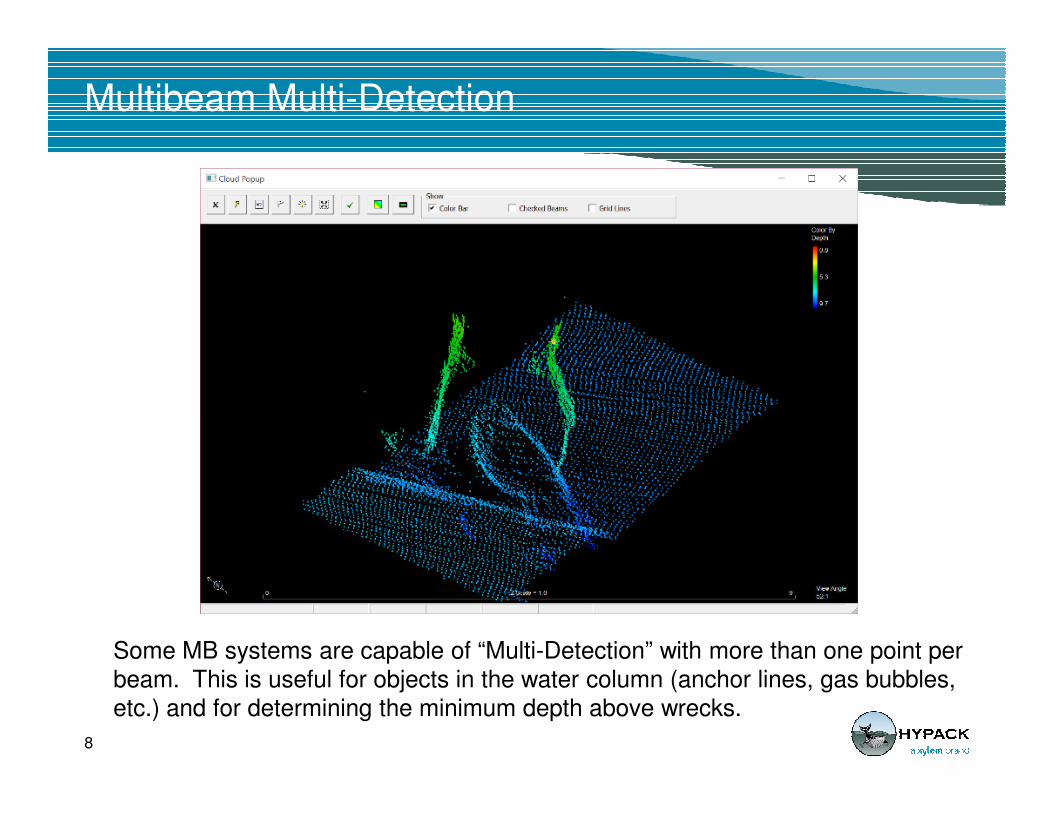
Multibeam Multi-Detection
8
Some MB systems are capable of “Multi-Detection” with more than one point per
beam. This is useful for objects in the water column (anchor lines, gas bubbles,
etc.) and for determining the minimum depth above wrecks.

Multi-Detect MB Data
1st Return
2nd Return
9
2nd Return
3rd Return
CLOUD window of multiple pings, all returns.
HYSWEEP can record up to 5 detections per beam. While editing the user can color-code the returns by depth or by return number.
Good: More detail over wrecks and objects in the water column that would normally be missed.
Bad: A lot more noise to be removed.
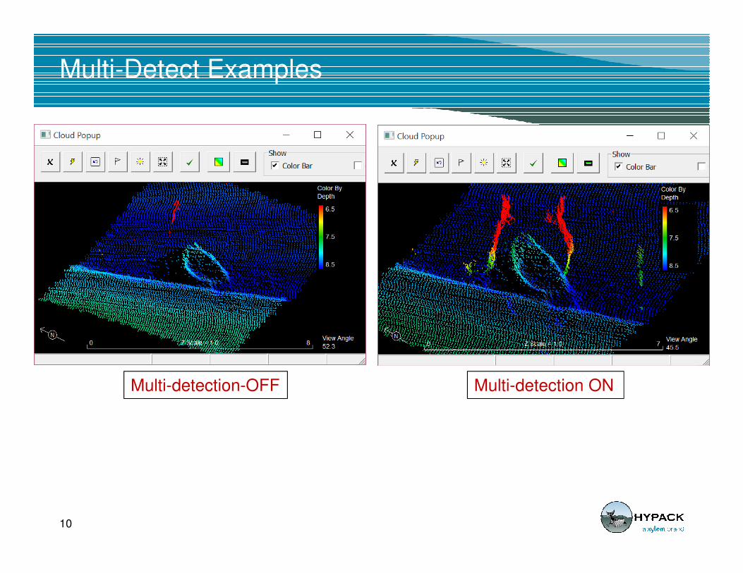
Multi-Detect Examples
10
Multi-detection-OFF Multi-detection ON
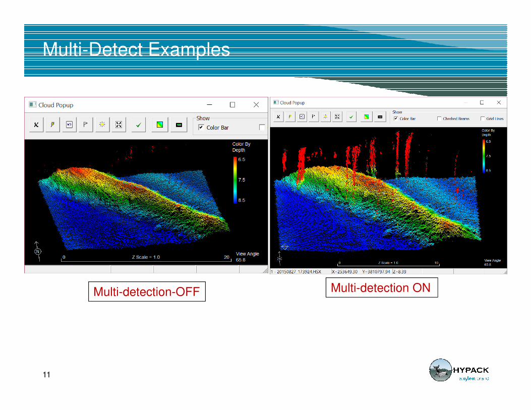
Multi-Detect Examples
11
Multi-detection-OFF Multi-detection ON

Wobble: The ability to address time delays or mounting errors in your MB data
12
The original data (left) has a time offset between the MB and the MRU.
Using Wobble-64 (right), you can adjust the time delay and save the data!
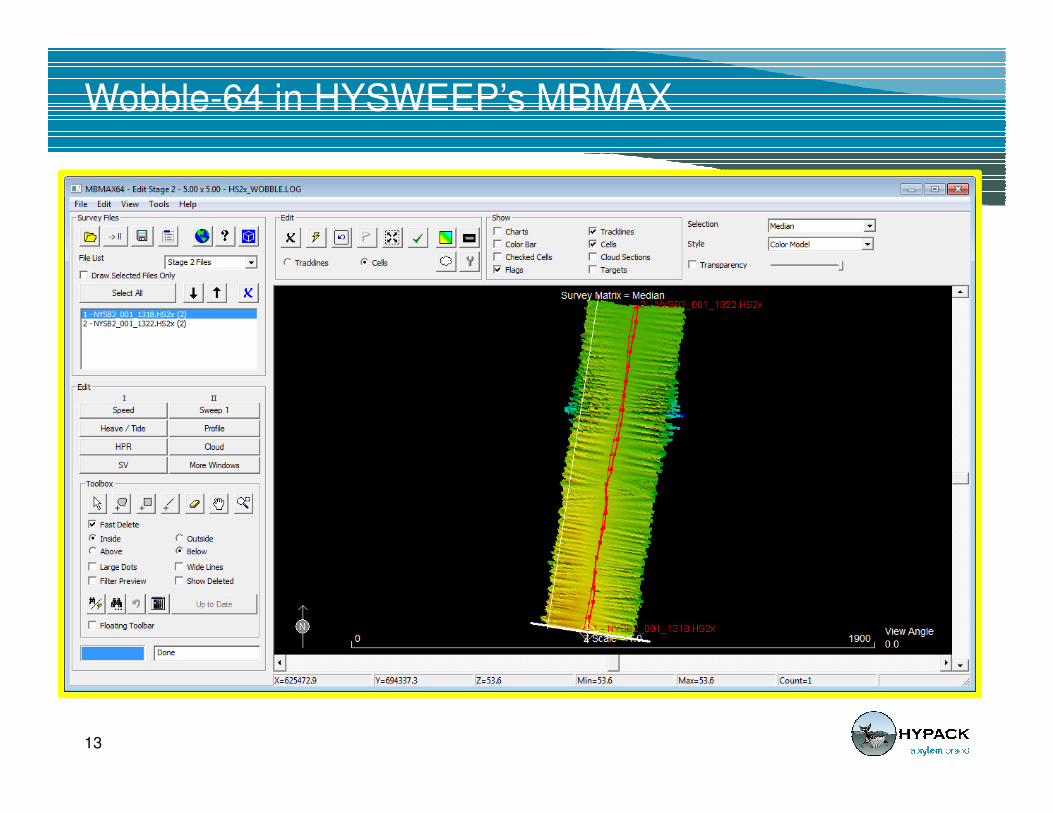
Wobble-64 in HYSWEEP’s MBMAX
13
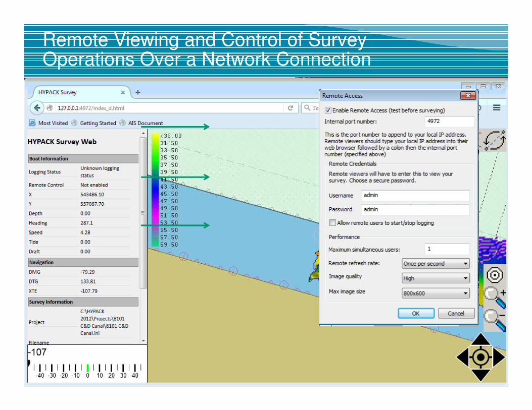
Remote Viewing and Control of Survey Operations Over a Network Connection
SURVEY
Computer
Remote
Computer
LAN
SURVEY
Computer
Remote
Computer
WiFi
14AVI
SURVEY
Computer
Remote
Computer
Internet
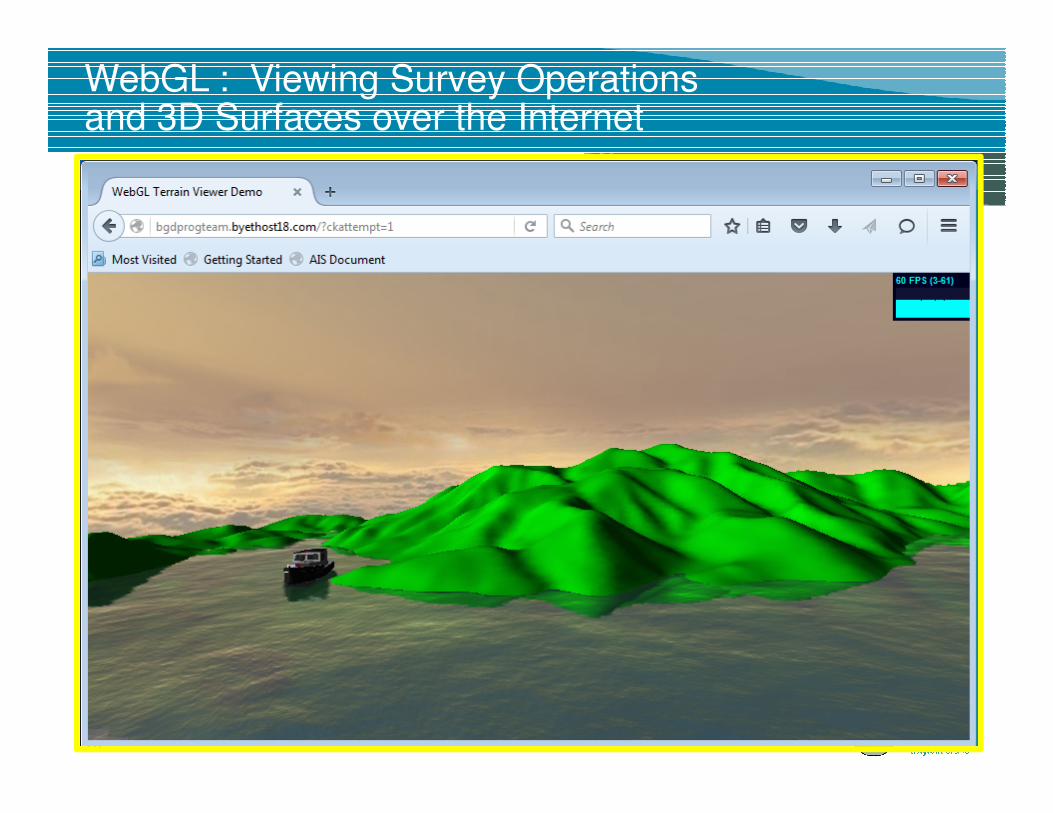
WebGL : Viewing Survey Operations and 3D Surfaces over the Internet
15
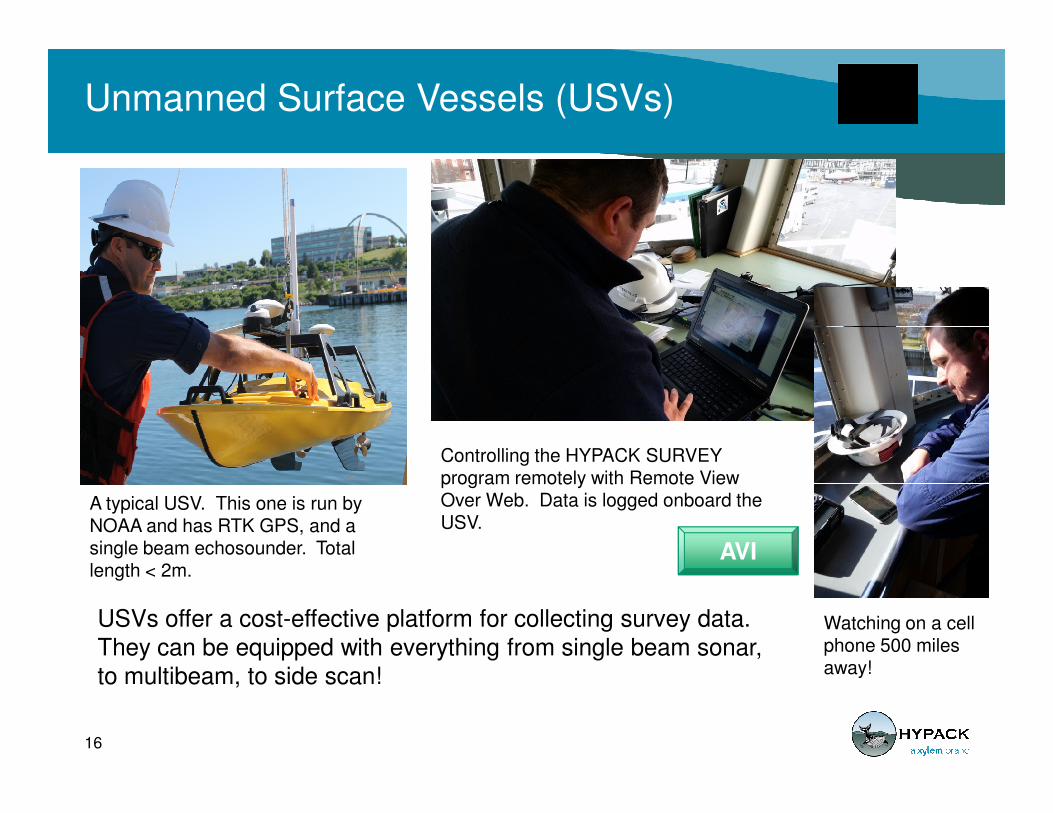
Unmanned Surface Vessels (USVs)
USVs offer a cost-effective platform for collecting survey data.
They can be equipped with everything from single beam sonar,
to multibeam, to side scan!
16
AVI
A typical USV. This one is run by NOAA and has RTK GPS, and a single beam echosounder. Total length < 2m.
Controlling the HYPACK SURVEY program remotely with Remote View Over Web. Data is logged onboard the USV.
Watching on a cell phone 500 miles away!

Unmanned Aerial Vehicles (UAVs)
SBG Eclipse D Inertial-RTK GPS Sensor with Directional Antenna
Velodyne VLP-16
17
Velodyne VLP-16
Topo Lidar Laser
HYSWEEP Survey
logging on-board.
AVI
Hydrographers are probably better equipped to make land
measurements using topographic lidar than land surveyors!
Survey platform from Infinite Jib (Canada)
Related Documents