55 Egyptian Journal of Archaeological and Restoration Studies "EJARS" An International peer-reviewed journal published bi-annually Volume 4, Issue 1, June - 2014: pp: 55-63 www. ejars.sohag-univ.edu.eg Original article THE ROLE OF WATER IN ISFAHAN: A STUDY OF SAMPLES OF BRIDGES AND DAMS ON Z´YAND-RD El Gemaiey, Gh. Lecturer. Islamic Archeology dept., Faculty of Archaeology, Cairo Univ., Giza, Egypt E-mail: [email protected] Received 3/1/2014 Accepted 18/4/2014 Abstract This paper is aimed to study the main characteristics of the bridges in Isfahan at the Safavid Period through an archeological scope, along with adopting other scientific methods to have a holistic vision of the creativity of the bridges around the most important river in Iran plateau. Keywords: Joui, Khaju, Marnan, Shaa Abbas, Si-o-Se Pol 1. Introduction Iran is located in an arid, semi arid area, which is located in the south of Asia between 44 02 and 63 20 eastern longitudes and 25 03 to 39 46 northern latitude, with 73% of it covered by dry weather [1]. Isfahan is located on the main north-south and east-west routes crossing Iran, thus, it is situated on the trade routes which traverse the country, fig. (1). Zayandeh Rud means the valley of gold [2], or the life giving river (a) . The basin constitutes of an area of 41,500 km. 2 , altitude from 3,974 m. to 1,466 m., an average rain fall of 130 mm. and a monthly average temperature of 3 C (37 F) to 29 C (84 F) [3]. There are 2,700 km. of irrigated land in the Zayandeh River basin, with water derived from the nine main hydraulic units of the River, wells, channels and springs in lateral valleys. Zayandeh Rud springs from the Zagros Mountains, goes to the east, passes over Bakhtiari, Fars, and Yazd and ends at the Gavkhuni swamp [4]. The allocation of the water to the different diversion channels branching off the Zayandeh Rud and the springs below were established earlier in the 16 th century, as documented in Sheikh Bahaii Documents. The construction of the Chadegan dam was in 1972 and the modern irrigation infrastructures overrode. Allocation is now decided by the provincial authorities, while qanat (channel) based irrigation is based on traditional communal rights [5]. Beside the role of climatology which represents the importance of water in the Iranian life, the researcher is faced with the role of the Shiite ideology which reformed this role and increased it by establishing many hydraulic structures and water management building systems to use water wrought by the faith of Hussain tragedy. This is why, in the Safavid Period, Isfahan was seen as different from any other time, as it became a city of gardens. Shah Abbas was keen to establish new buildings around the river, some of them to manage the river, and others to amuse himself by the water view. He built a new channel to transfer the water to all of the mosques

Welcome message from author
This document is posted to help you gain knowledge. Please leave a comment to let me know what you think about it! Share it to your friends and learn new things together.
Transcript
55
Egyptian Journal of Archaeological and Restoration Studies "EJARS" An International peer-reviewed journal published bi-annually
Volume 4, Issue 1, June - 2014: pp: 55-63 www. ejars.sohag-univ.edu.eg
Original article
THE ROLE OF WATER IN ISFAHAN: A STUDY OF SAMPLES OF BRIDGES AND DAMS ON ZÂYANDÉ-RÛD
El Gemaiey, Gh.
Lecturer. Islamic Archeology dept., Faculty of Archaeology, Cairo Univ., Giza, Egypt
E-mail: [email protected]
Received 3/1/2014 Accepted 18/4/2014
Abstract This paper is aimed to study the main characteristics of the bridges in Isfahan at the Safavid Period through an archeological scope, along with adopting other scientific methods to have a holistic vision of the creativity of the bridges around the most important river in Iran plateau.
Keywords: Joui, Khaju, Marnan, Shaa Abbas, Si-o-Se Pol 1. Introduction
Iran is located in an arid, semi arid area, which is located in the south of Asia between 44° 02 and 63° 20 eastern longitudes and 25° 03 to 39° 46 northern latitude, with 73% of it covered by dry weather [1]. Isfahan is located on the main north-south and east-west routes crossing Iran, thus, it is situated on the trade routes which traverse the country, fig. (1). Zayandeh Rud means the valley of gold [2], or the life giving river(a). The basin constitutes of an area of 41,500 km.2, altitude from 3,974 m. to 1,466 m., an average rain fall of 130 mm. and a monthly average temperature of 3 °C (37 °F) to 29 °C (84 °F) [3]. There are 2,700 km. of irrigated land in the Zayandeh River basin, with water derived from the nine main hydraulic units of the River, wells, channels and springs in lateral valleys. Zayandeh Rud springs from the Zagros Mountains, goes to the east, passes over Bakhtiari, Fars, and Yazd�and ends at the Gavkhuni swamp [4]. The allocation of the water to the different diversion channels branching off the
Zayandeh Rud and the springs below were established earlier in the 16th century, as documented in �Sheikh Bahaii Documents�. The construction of the Chadegan dam was in 1972 and the modern irrigation infrastructures overrode. Allocation is now decided by the provincial authorities, while qanat (channel) based irrigation is based on traditional communal rights [5]. Beside the role of climatology which represents the importance of water in the Iranian life, the researcher is faced with the role of the Shiite ideology which reformed this role and increased it by establishing many hydraulic structures and water management building systems to use water wrought by the faith of Hussain tragedy. This is why, in the Safavid Period, Isfahan was seen as different from any other time, as it became a city of gardens. Shah �Abbas was keen to establish new buildings around the river, some of them to manage the river, and others to amuse himself by the water view. He built a new channel to transfer the water to all of the mosques
id1649312 pdfMachine by Broadgun Software - a great PDF writer! - a great PDF creator! - http://www.pdfmachine.com http://www.broadgun.com
56
and madrasas in his new capital. Hence, the Zayandeh Rud plays an important role in the growth of the city, compared to its neighboring cities especially in the Safavid Period. Also, the bridges play an important role in the reformation of the urban planning of the city according to the garden style. Conditions on the
Zayandeh River have considerably changed since the construction of the Shah 'Abbâs Dam [6]. The role of Shah Abbas Dam is clear when there is a look at its progress according to electricity, cultivation and also the existence of drinkable water throughout the day after many centuries, tabs. (1& 2).
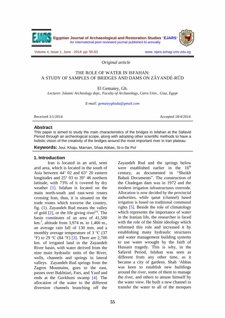
Figure (1) plan of Isfahan , PL. LIV ( after Coast ,1867) [7]
Table (1) major reservoir dams on the Iranian plateau, http://www.iranicaonline.org/articles/ab-iii-the-hydrology-and-water-resources-of-the-iranian-plateau
Table (2) discharge of selected rivers on the Iranian plateau, http://www.iranicaonline.org/articles/ab-iii-the-hydrology-and-water-resources-of-the-iranian-plateau
57
2. Bridges of Isfahan City Most of the bridges in Isfahan
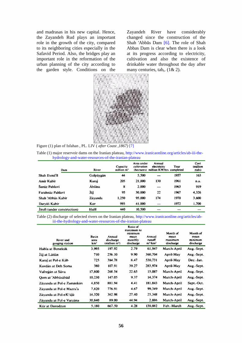
province were built in the Islamic period, especially in the Safavid time. They built bridges and dams which represent water- art, the total of which are 11 bridges(b) in which some of them were used as bridges, dams, and pedestrian paths, like Si-o-Se Pol and Khaju Bridges. Although both of them were built as a bridge and a dam in the first place, they are now used as a passage, park and café, fig. (2), to sit at its stairs and between its arches. At the current time, it is rarely used as a dam because the government built a reservoir and a new dam at the source of the river, and the water is stored and transported to through another direction. It must be noticed that at the Safavid Period the garden was expanded because of the increase in the number of dams and cannels which were built upon the river to help reduce the wastage of water. For that, the Mola and some others wrote
volumes about the Alma Shari�a, the rights of people and the government in the water, and the most suitable way to divide water between people and the irrigated land. At the time of Shah Tahmasp, he selected the amount of water shares, which differed from year to another according to the increase or decrease in the water level [3]. Also, Shahs at the beginning of the Safavid Era divided the river to many branches(c) to reach all Isfahan, to be used for domestic reasons and for irrigation. Fortunately, the Zayandeh Rud is not navigable, so the architecture of the bridges was not concerned with the height of the boats or the traffic. Architects planned and paved the bridges based upon two things; the first was to reserve and divide the water to distribute it at times of need, and the second was for the luxury and amusement of the Shah and the people.
Figure (2) coffee shop at Si-o-Se Pol 3. The Style of the Bridges
Bridges in Isfahan are divided into two styles; the first constitutes of two floors like Si-o-Se Pol and Khaju
Bridges, while the second is made of one floor only, like the rest of Isfahan bridges.
3.1. The first style The main bridges that reflect the
characteristics of this style in Zayandeh River are Khaju and Si-o-Se Pol, because of their construction and function to irrigate �many square miles of richest meadow-land�on both sides� [8][9]. The bridge is constructed on two tiers. At the
lower level, the open niches and closed pylons alternate and accommodate visitors with shaded places to sit and water flows with structures to regulate it. The upper level consists of a �walled� passageway that is lined with an arcade of double niches. The main central aisle
58
at the upper level was slightly lower and was used by horses and carts, while the raised outer vaulted paths on both sides of the bridge were for pedestrian use. Until the 19th century the interior arches
in Si-o-Se Pol and Khaju were decorated with paintings or mosaic of humanity or floral subjects often referred to by European travelers [8][10].
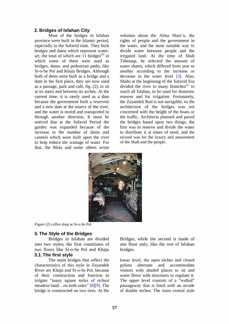
3.1.1. Si-o-Se Pol It was known as Alla-hverdi Khan
bridge and was built in 1632. It was established at the time of Shah Abbas as an integral part of his new town planning, becoming a major work combining the elements of the bridge, dam, and pedestrian path together, fig. (3-a) [11]. It measures approximately 300 m., and consists of 40
springs, 7 of which were distorted, so it is known as the 33 spring bridge, fig. (3-b) [3]. It consists of two rows of arches, and each row contains 33 arches. Along the walkway, the arches form small pavilions, where passersby can rest, fig. (3-c).
Figure (3) a one of the entrance of the Si-o-Se Pol passageway. b plan of Si-o-Se Pol, shows the channel of the bridge, PL.XLVIII ( after Coste ,1867) [7], c multi-storey of Si-o-Se
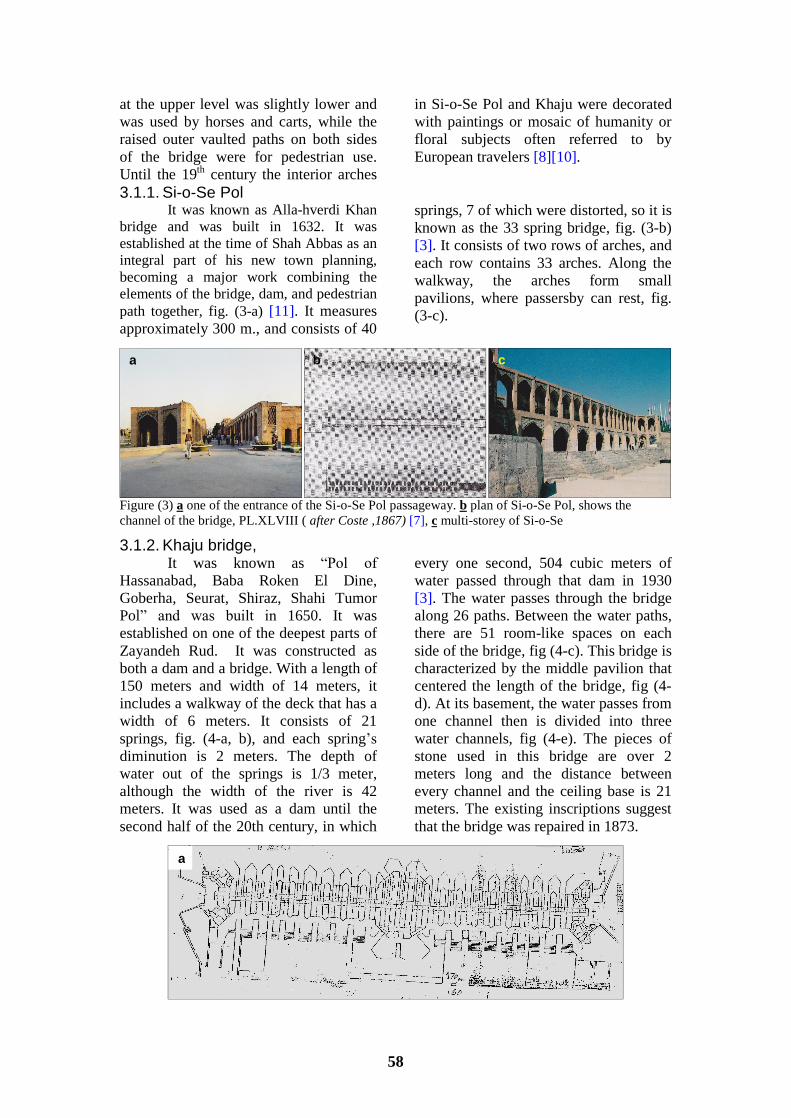
3.1.2. Khaju bridge, It was known as �Pol of
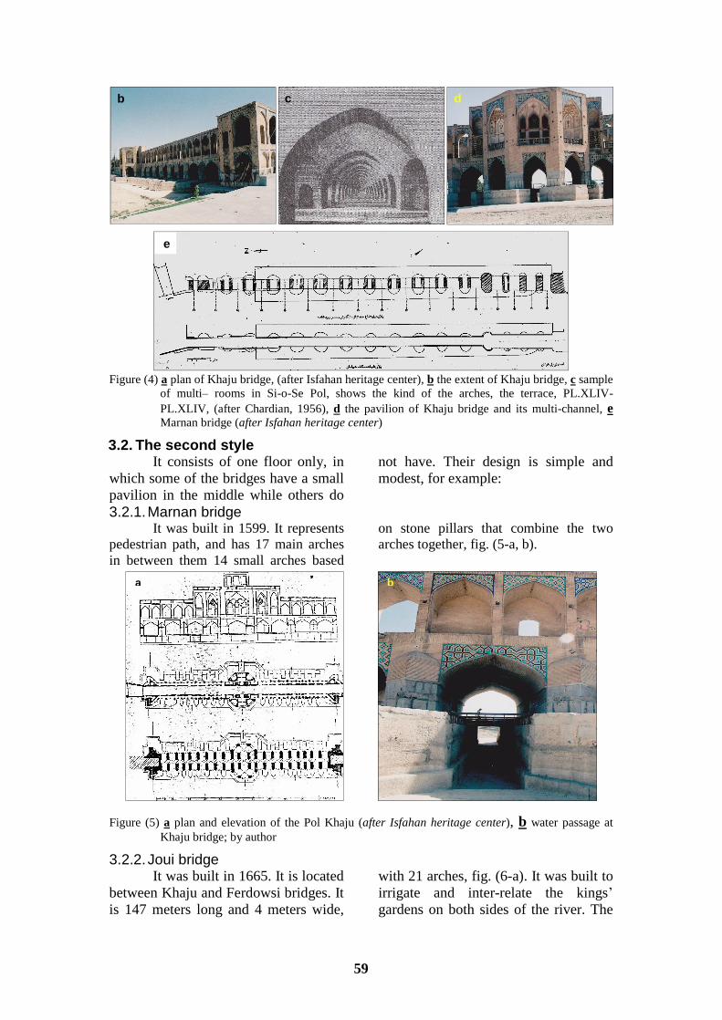
Hassanabad, Baba Roken El Dine, Goberha, Seurat, Shiraz, Shahi Tumor Pol� and was built in 1650. It was established on one of the deepest parts of Zayandeh Rud. It was constructed as both a dam and a bridge. With a length of 150 meters and width of 14 meters, it includes a walkway of the deck that has a width of 6 meters. It consists of 21 springs, fig. (4-a, b), and each spring�s diminution is 2 meters. The depth of water out of the springs is 1/3 meter, although the width of the river is 42 meters. It was used as a dam until the second half of the 20th century, in which
every one second, 504 cubic meters of water passed through that dam in 1930 [3]. The water passes through the bridge along 26 paths. Between the water paths, there are 51 room-like spaces on each side of the bridge, fig (4-c). This bridge is characterized by the middle pavilion that centered the length of the bridge, fig (4-d). At its basement, the water passes from one channel then is divided into three water channels, fig (4-e). The pieces of stone used in this bridge are over 2 meters long and the distance between every channel and the ceiling base is 21 meters. The existing inscriptions suggest that the bridge was repaired in 1873.
a b c
a
59
Figure (4) a plan of Khaju bridge, (after Isfahan heritage center), b the extent of Khaju bridge, c sample
of multi� rooms in Si-o-Se Pol, shows the kind of the arches, the terrace, PL.XLIV-PL.XLIV, (after Chardian, 1956), d the pavilion of Khaju bridge and its multi-channel, e Marnan bridge (after Isfahan heritage center)
3.2. The second style It consists of one floor only, in
which some of the bridges have a small pavilion in the middle while others do
not have. Their design is simple and modest, for example:
3.2.1. Marnan bridge It was built in 1599. It represents
pedestrian path, and has 17 main arches in between them 14 small arches based
on stone pillars that combine the two arches together, fig. (5-a, b).
Figure (5) a plan and elevation of the Pol Khaju (after Isfahan heritage center), b water passage at Khaju bridge; by author
3.2.2. Joui bridge It was built in 1665. It is located
between Khaju and Ferdowsi bridges. It is 147 meters long and 4 meters wide,
with 21 arches, fig. (6-a). It was built to irrigate and inter-relate the kings� gardens on both sides of the river. The
b c d
e
a b

60
bridge and the two pavilions within were for the exclusive use of the Shah and his courtiers, fig. (6-b, c). Nowadays the pavilions are being used
as tea houses, for the exclusive use of the harem for connecting the riverfront palaces across the two banks of the River [12][13][14].
Figure (6) Joui bridge a its plan (after Isfahan heritage center), b its arches, c its pavilion 4. The Materials and Construction of the Bridges 4.1. The materials
The architect used the dressed stone blocks with special mortar called Sarooj made of sand, ash, clay, lime and other materials [15], which were subject to the continuous action of water. Important differences can be observed in the consistency of the mortar used in the piers and in the vaulted portions of the bridge. Squared stones in the main body of the bridges, and the gravel at the building foundation, fig. (7) in the middle of each arch were made of wooden boards [16], to reduce the load resulting from the rise of the arch, and at the same time it is the best
building material to react against water. Wood played only a subordinate role in such constructions, being used for scaff-olding, building forms, pulley weights, temporary supports, to link between the bridge shoulders, and often for reinfor-cement in the vaulting. Clamps were used to link arches, piers, or bands together, and were mostly from iron which is an old technique used in ancient Iran. Some stones of the structure are replaced and have been dropped into the water. This has made the depth of the water become less.
Figure (7) the bridges� materials , way of the building, and the used arches (after Isfahan heritage
center and author modification),
a
b c
61
4.2. The design and units This part will briefly discuss the
main units used in the bridges and dams� construction and the reasons for using them.
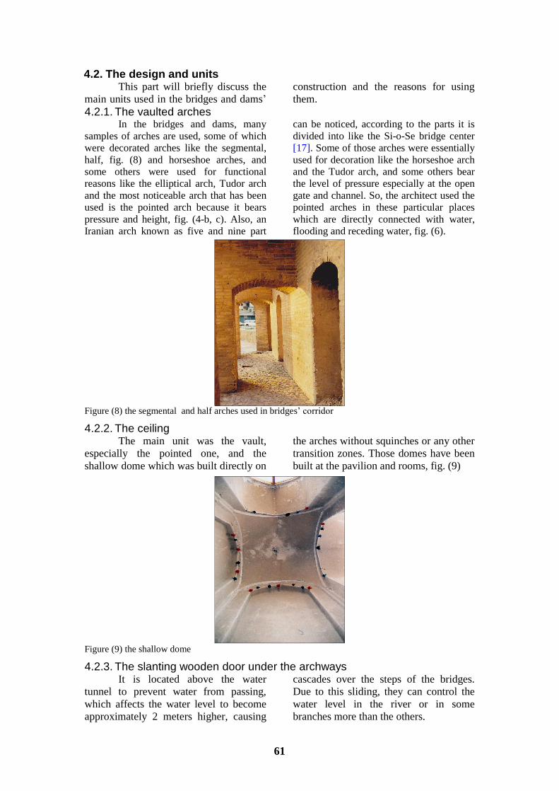
4.2.1. The vaulted arches In the bridges and dams, many
samples of arches are used, some of which were decorated arches like the segmental, half, fig. (8) and horseshoe arches, and some others were used for functional reasons like the elliptical arch, Tudor arch and the most noticeable arch that has been used is the pointed arch because it bears pressure and height, fig. (4-b, c). Also, an Iranian arch known as five and nine part
can be noticed, according to the parts it is divided into like the Si-o-Se bridge center [17]. Some of those arches were essentially used for decoration like the horseshoe arch and the Tudor arch, and some others bear the level of pressure especially at the open gate and channel. So, the architect used the pointed arches in these particular places which are directly connected with water, flooding and receding water, fig. (6).
Figure (8) the segmental and half arches used in bridges� corridor
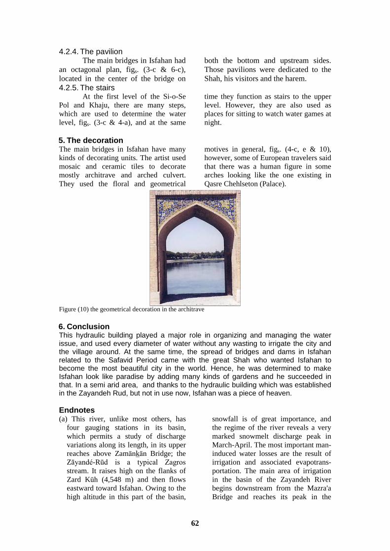
4.2.2. The ceiling The main unit was the vault,
especially the pointed one, and the shallow dome which was built directly on
the arches without squinches or any other transition zones. Those domes have been built at the pavilion and rooms, fig. (9)
Figure (9) the shallow dome
4.2.3. The slanting wooden door under the archways It is located above the water
tunnel to prevent water from passing, which affects the water level to become approximately 2 meters higher, causing
cascades over the steps of the bridges. Due to this sliding, they can control the water level in the river or in some branches more than the others.
62
4.2.4. The pavilion The main bridges in Isfahan had
an octagonal plan, figs. (3-c & 6-c), located in the center of the bridge on
both the bottom and upstream sides. Those pavilions were dedicated to the Shah, his visitors and the harem.
4.2.5. The stairs At the first level of the Si-o-Se
Pol and Khaju, there are many steps, which are used to determine the water level, figs. (3-c & 4-a), and at the same
time they function as stairs to the upper level. However, they are also used as places for sitting to watch water games at night.
5. The decoration The main bridges in Isfahan have many kinds of decorating units. The artist used mosaic and ceramic tiles to decorate mostly architrave and arched culvert. They used the floral and geometrical
motives in general, figs. (4-c, e & 10), however, some of European travelers said that there was a human figure in some arches looking like the one existing in Qasre Chehlseton (Palace).
Figure (10) the geometrical decoration in the architrave 6. Conclusion This hydraulic building played a major role in organizing and managing the water issue, and used every diameter of water without any wasting to irrigate the city and the village around. At the same time, the spread of bridges and dams in Isfahan related to the Safavid Period came with the great Shah who wanted Isfahan to become the most beautiful city in the world. Hence, he was determined to make Isfahan look like paradise by adding many kinds of gardens and he succeeded in that. In a semi arid area, and thanks to the hydraulic building which was established in the Zayandeh Rud, but not in use now, Isfahan was a piece of heaven. Endnotes (a) This river, unlike most others, has
four gauging stations in its basin, which permits a study of discharge variations along its length, in its upper reaches above Zamânkân Bridge; the Zâyandé-Rûd is a typical Zagros stream. It raises high on the flanks of Zard Kûh (4,548 m) and then flows eastward toward Isfahan. Owing to the high altitude in this part of the basin,
snowfall is of great importance, and the regime of the river reveals a very marked snowmelt discharge peak in March-April. The most important man-induced water losses are the result of irrigation and associated evapotrans-portation. The main area of irrigation in the basin of the Zayandeh River begins downstream from the Mazra'a Bridge and reaches its peak in the

63
stretch about 25 km above and below the Kvâĵû Bridge. The Kvâĵû Bridge is situated in the center of Isfahan. By the time the river reaches Varzâna Bridge, just upstream from the salt desert known as the Gâvûnî, the annual discharge value dropped to 89 million m3-almost exactly one tenth the discharges recorded at the upstream gauging station of Zamânkân Bridge (Beaumont, 1982).
(b) Orkan Pol , Baba Mahmud Pol, Zman khan Pol, Wrznh Pol, Srouch Pol,
Goum Pol, Goby Pol, Flowerjan Pol, Nyaserm Pol, Marnan Pol, Shahrestan �Gee- Housien� Pol, Khaju Pol, Si-o-So Pol, Golh Pol, Sherry Pol (Janab, Chardian, p.197).
(c) Up to 77 branches as Sheikh Bahaii documents and Mosa Ansare Athar, (Janab, Chardian, p.197) [18] for more information about Zayandeh water rights (Francois, Iran, Hammond, 2009, pp196-213)
References [1] Kolahduzan, M., (2005). Iran the land
of water and light, Bohar publisher, Tehran, Iran
[2] Mafrokhey, M., (1933). Mhasen Isfahan, Mjlesy publisher, Tehran, Iran
[3] Chardian, J., (1956). Al Isfahan, minister of culture heritage, Tehran
[4] Nasri, M. & Najafi, A., (2011). Sustainable development and compr-ehensive watershed management in Zayandehrud River, J. World academy of science, engineering and technology, Vol.5, pp. 484-489
[5] Molle, F., Ghazi, I. & Murray-Rust, H., (2009). Buying respite: Esfahan and the Zayandeh Rud river basin, Iran, in: Molle, F. & Wester, Ph., CAB Int. River Basin Trajectories: Societies, Environments and Development, pp. 196-213
[6] Beaumont, P., (1982). ÂB iii. The hydrology and water resources of the Iranian plateau, Encyclopedia Iranica, Online Ed., http://www.iranicaonline.org /art-icles/ab-iii-the-hydrology-and-water resources-of-the-iranian-plateau - 20-3-2014
[7] Coast, P, (1867), Monuments moderns de la Persa, Paris: A. Morel, Paris
[8] Pope, A., (1938). A survey of Persian art, Vol. lll, Soroush press, Tehran
[9] Wûrfel, K., (1974). Isfahan, nisf-i-dschahan; das ist die +llfte der Welt, .�snacht-=�rich: Raggi-Verlag, Germany
[10] Babaie, S. & Haug, R., (2007), Isfahan x. monuments (5) bridges,
Encyclopedia Iranica articles, Vol. XIV, Fasc. 1, pp. 6-40
[11] Group of researcher, (1997) Zayandeh River Basin short profile, Int. Water Management Institute, Sri Lanka.
[12] Godard, A. (1956), Les anciennes mosquées de l'Iran, A. Maisonneuve, Paris
[13] Lutfallah, H., (1931). The historical monumental building in Isfahan, 2nd ed., Zyba publisher, Tehran
[14] Mehrâbâdi, R., (1352). Historical monuments in Isfahan, Zyba publisher, Tehran
[15] Sanizadah, Sh., (2008), Novel hydraulic structure and water management in Iran: a historical perspective, in: El Moujabber, M., Shatanawi M., Trisorio-Liuzzi, G., Ouessar, M., Laureano, P. & Rodríguez, R. (Eds.). Water culture and water conflict in the Mediterranean area. Bari, CIHEAM, pp. 25-43.
[16] Luschey, H., (1985). The Pul-i Khwaju in Isfahan: A combination of bridge, dam and water art, Iran, Vol 23, pp. 143-151
[17] Zomorshidey, H., (1999). Arches in Iranian architecture, Kyahan, Tehran
[18] J. Chardin, (1711), Voyages en Perse, Vol. Vlll, Amsterdam.
Related Documents