Overview Students research information about Cascade volcanoes in Washington, Oregon, and California, and then transfer information onto appropriate mobile piece before constructing the mobile A String of Cascade Volcanoes. Teacher Background Refer to U.S. Geological Survey Fact Sheet 165–97 for general information about Cascade volcanoes and their locations in the Cascade Range. Find additional information in related activities, including Cascade Volcano Timeline, Volcano Hall of Fame, and Surrounded by Volcanoes. Procedure What to do Before Class Begins Assemble grade-appropriate resources for student research. Cut string to required lengths. 1. Provide each student or student group with “A String of Volcanoes” student page and “A String of Volcanoes—Mobile Pieces.” 2. Students research information from Internet, library resources, or USGS Fact Sheets and write it on volcano mobile pieces before coloring and assembling mobile. Most answers can be found at the U.S. Geological Survey Web sites. 3. Construct the mobile for one, two or three states using instructions using one of two methods proposed on the student page. Learner Objectives: Students will: ● Become familiar with important aspects about each of the Cascade volcanoes ● Identify sources of information about Cascade volcanoes, in Washington, Oregon, and California Setting: Classroom Timeframe: 50 minutes—research; 50 minutes—mobile construction Materials: ● Crayons or colored pencils ● USGS Fact Sheet 165–97 (optional) ● Scissors ● Glue ● Internet access or library resources ● Copies of “A String of Volcanoes” student page ● Copies of “A String of Volcanoes Mobile Pieces” Grade Level: 3–9 A String of Volcanoes 1 Materials continued.... Activity last modified: November 21, 2014 U.S. Department of the Interior U.S. Geological Survey General Information Product 19 Living with a Volcano in Your Backyard- An Educator' s Guide with Emphasis on Mount Rainier Prepared in collaboration with the National Park Service NATIONAL PARK SERVICE

Welcome message from author
This document is posted to help you gain knowledge. Please leave a comment to let me know what you think about it! Share it to your friends and learn new things together.
Transcript

Overview Students research information about Cascade volcanoes in Washington, Oregon, and California, and then transfer information onto appropriate mobile piece before constructing the mobile A String of Cascade Volcanoes.
Teacher BackgroundRefer to U.S. Geological Survey Fact Sheet 165–97 for general information about Cascade volcanoes and their locations in the Cascade Range. Find additional information in related activities, including Cascade Volcano Timeline, Volcano Hall of Fame, and Surrounded by Volcanoes.
ProcedureWhat to do Before Class Begins
Assemble grade-appropriate resources for student research. Cut string to required lengths.
1. Provide each student or student group with “A String of Volcanoes” student page and “A String of Volcanoes—Mobile Pieces.”
2. Students research information from Internet, library resources, or USGS Fact Sheets and write it on volcano mobile pieces before coloring and assembling mobile. Most answers can be found at the U.S. Geological Survey Web sites.
3. Construct the mobile for one, two or three states using instructions using one of two methods proposed on the student page.
Learner Objectives:Students will:
● Become familiar with important aspects about each of the Cascade volcanoes● Identify sources of information about Cascade volcanoes, in Washington, Oregon, and California
Setting: Classroom
Timeframe: 50 minutes—research; 50 minutes—mobile construction
Materials: ● Crayons or colored pencils ● USGS Fact Sheet 165–97 (optional) ● Scissors ● Glue ● Internet access or library resources ● Copies of “A String of Volcanoes” student page ● Copies of “A String of Volcanoes Mobile
Pieces”
Grade Level: 3–9
A String of Volcanoes
1
Materials continued....
Activity last modified: November 21, 2014
U.S. Department of the InteriorU.S. Geological Survey
General Information Product 19
Living with a Volcano in Your Backyard-An Educator's Guide with Emphasis onMount Rainier
Prepared in collaboration with the National Park Service
NATIONALPARK
SERVICE

● Kite string or yarn for mobile: 4.3 meters (approximately 14 feet) for single string; 5 meters (approximately 17 feet) for either mobile arrangement● 1 paper clip for hanging mobile
Vocabulary: Caldera, cinder cone, eruption, debris avalanche, debris flow, lahar, landslide, lava dome, lava flows, pyroclastic flow, shield volcano, steam explosion, stratovolcano, tephra, volcanic ash
Skills: Data collection, ordering, researching
Benchmarks:
See benchmarks in Introduction.
Assessment Use A String of Volcanoes as a learning tool, and Volcano Hall of Fame as an assessment of students’ knowledge about important aspects of Cascade volcanoes. After completing these two activities, students should be able to identify important aspects of Cascade volcanoes and identify sources of information. Assess each student’s ability to identify important aspects and to record them.
ReferencesDzurisin, D., Stauffer, P., and Hendley, J.W., II, 2003, Living with volcanic risk in the Cascades (revised March, 2008): U.S. Geological Survey Fact Sheet 165–97, 2 p.
Harris, S.L., 2005, Fire mountains of the West: the Cascade and Mono Lake volcanoes: Missoula, Mont., Mountain Press Publishing Company, 3rd ed., 454 p.
Tilling, R.I., Topinka, L., and Swanson, D.A., 1990, Eruptions of Mount St. Helens: past, present, and future: U.S. Geological Survey General Interest Publication (revised edition), 57 p.
A String of Volcanoes-continued . . .
2
Refer to Internet Resources Page for a list of resources available as a supplement to this activity.
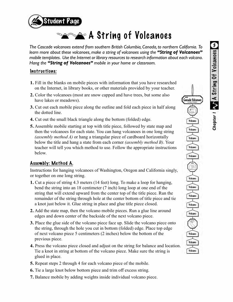
The Cascade volcanoes extend from southern British Columbia, Canada, to northern California. To learn more about these volcanoes, make a string of volcanoes using the “String of Volcanoes” mobile templates. Use the Internet or library resources to research information about each volcano. Hang the “String of Volcanoes” mobile in your home or classroom.
Instructions:
1. Fill in the blanks on mobile pieces with information that you have researched on the Internet, in library books, or other materials provided by your teacher.2. Color the volcanoes (most are snow capped and have trees, but some also have lakes or meadows).3. Cut out each mobile piece along the outline and fold each piece in half along the dotted line.4. Cut out the small black triangle along the bottom (folded) edge.5. Assemble mobile starting at top with title piece, followed by state map and then the volcanoes for each state. You can hang volcanoes in one long string (assembly method A) or hang a triangular piece of cardboard horizontally below the title and hang a state from each corner (assembly method B). Your teacher will tell you which method to use. Follow the appropriate instructions below.
Assembly: Method A.
Instructions for hanging volcanoes of Washington, Oregon and California singly,or together on one long string.1. Cut a piece of string 4.3 meters (14 feet) long. To make a loop for hanging, bend the string into an 18 centimeter (7 inch) long loop at one end of the string that will extend upward from the center top of the title piece. Run the remainder of the string through hole at the center bottom of title piece and tie a knot just below it. Glue string in place and glue title piece closed. 2. Add the state map, then the volcano mobile pieces. Run a glue line around edges and down center of the backside of the next volcano piece. 3. Place the glue side of the volcano piece face up. Slide the volcano piece onto the string, through the hole you cut in bottom (folded) edge. Place top edge of next volcano piece 5 centimeters (2 inches) below the bottom of the previous piece.4. Press the volcano piece closed and adjust on the string for balance and location. Tie a knot in string at bottom of the volcano piece. Make sure the string is glued in place.5. Repeat steps 2 through 4 for each volcano piece of the mobile.6. Tie a large knot below bottom piece and trim off excess string.7. Balance mobile by adding weights inside individual volcano piece.
3
A String of Volcanoes

A String of Volcanoes-cont inued
Living with a Volcano in Your Backyard–An Educator's Guide: U. S. Geological Survey GIP 19
Assembly: Method B. Instructions for hanging volcanoes for the states of Washington,Oregon, and California side-by-side. 1. Cut a triangular piece of cardboard that will be suspended horizontally below the title piece, for the purpose of separating the three strings of volcano pieces. Make each side of the triangle about 25 centimeters (approximately 10 inches) long. 2. Make a loop above the title piece for hanging the mobile. Do so by cutting three pieces of string 1.7 meters (5 feet long). Make an 18 centimeter-long (7 inch-long) loop that extends above the center of the title piece. Tie a knot to secure all three strings at the bottom of the loop.
3. Run the three pieces of string through the hole at the bottom of the title piece and glue the string in place. Now glue title piece closed and tie a knot below the bottom of the title piece.
4. Add the cardboard triangular spacer. Punch a small hole in each corner of the cardboard triangle. Suspend the triangle 7 to 10 centimeters (3 to 4 inches) below title by running each string through a different hole. Knot each string below triangle (try to keep triangle hanging evenly).
5. Add the state map and volcano pieces using instructions 2 through 7 in Method A.
Is Mount St. Helens north or south of Mount Adams? Since they are at almost the same latitude you may want to hang them side-by-side. If so, cut two small triangles in the bottom of Mount Rainier (one on each side about 1.3 centimeters or 0.5 inch), from the edge. Cut two pieces of string 30 centimeters (1 foot) long and tie knots in the tops. Pull string through new holes and secure knot inside with glue. Hang Mount St. Helens and Mount Adams on strings as instructed in steps 2 through 7.
4
The knots you tie help support pieces in the event that the glue does not hold. You will need to tie big knots if you make big holes. Or, tie the knots around matchsticks.

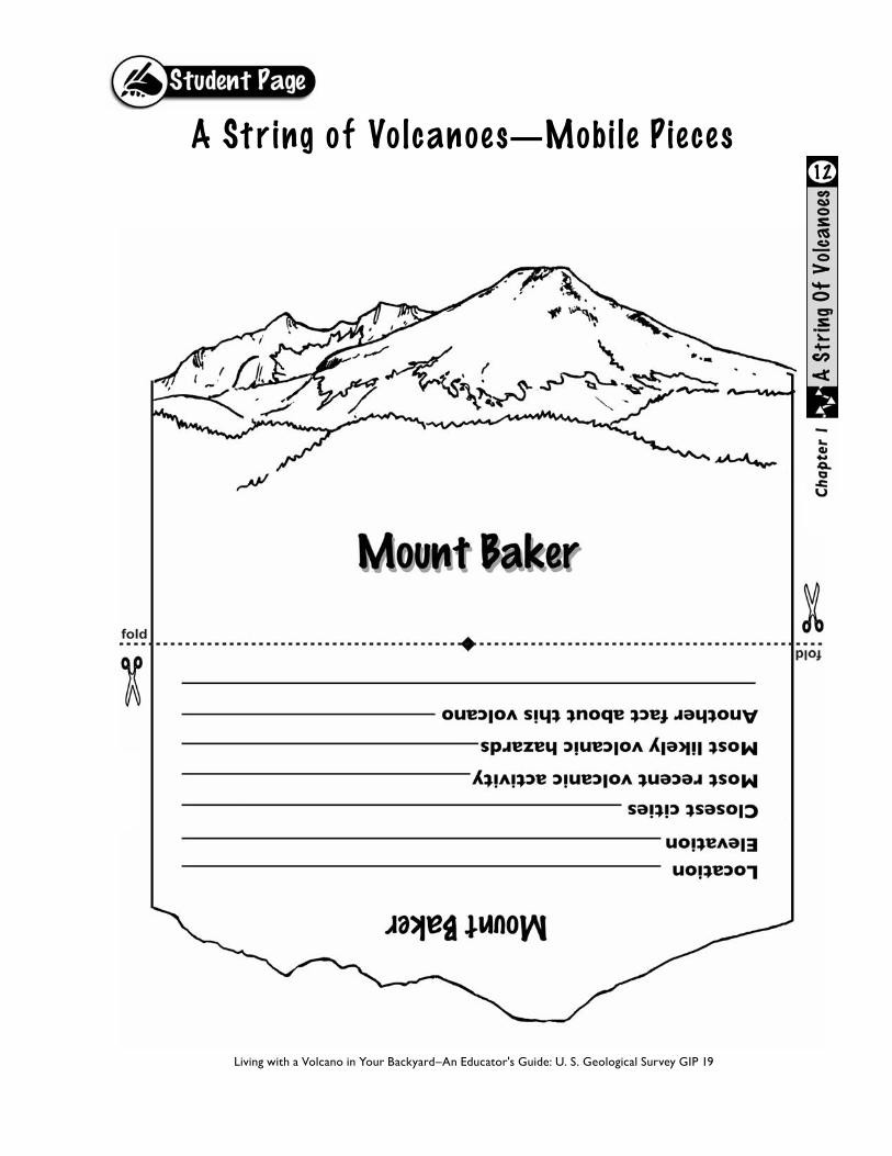
Mount Baker
Location: Northwestern Washington Elevation: 3,285 meters (10,781 feet or 10,778, depending on source)Closest cities: Bellingham, Washington; Vancouver, British ColumbiaMost recent volcanic activity: Landslide and lahar in 1891; increased steam and heat in1975Most likely volcano hazards: Lahars and landslides, lava flows, pyroclastic flows, minortephraAnother fact about this volcano: Stratovolcano; known by Native Americans as Kulshan; named after Joseph Baker, a third lieutenant with British explorer George Vancouver; secondmost glacier ice of volcanoes in Cascades, public often reports steaming of Sherman Crater
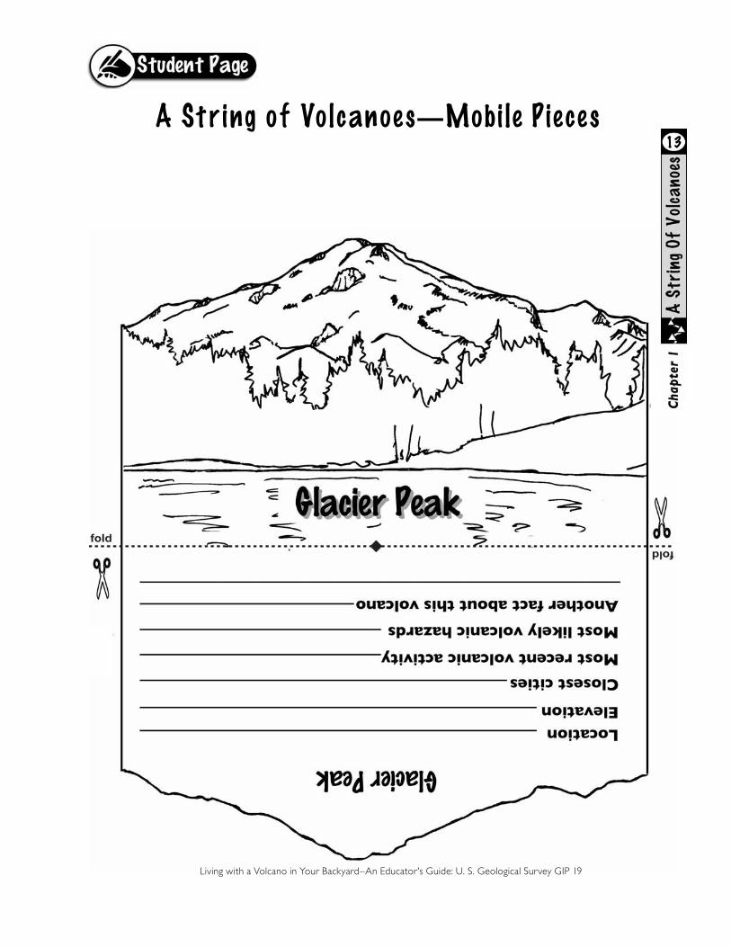
Glacier Peak
Location: Northern WashingtonElevation: 3,213 meters (10,541 feet)Closest cities: Everett and Seattle, WashingtonMost recent volcanic activity: Small steam explosion approximately 300 years agoMost likely volcano hazards: Tephra, lava flows and domes, pyroclastic flows, laharsAnother fact about this volcano: Stratovolcano; most remote of the Cascade volcanoes; not prominently visible from metropolitan centers; did not appear on maps under current name until 1898
Note to teacher: Most answers can be found on web pages of the U.S. Geological Survey’s Volcano Hazards Program. For filling in the blanks on the individual volcano cutouts, there is a broad range of good answers from detailed scientific, to historic (like “volcano named after…”), to personal (like “went there on vacation last year”). The elevation of several volcanoes has multiple correct answers depending on which publication or topographic map is used for research. Older students could determine latitude and longitude.
5A String of Volcanoes

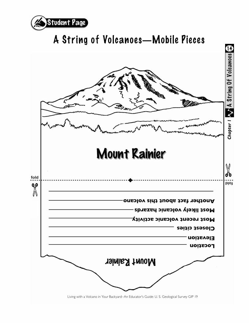
Mount Rainier
Location: West central WashingtonElevation: 4,392 meters (14, 410 feet)Closest cities: Tacoma, Seattle, Olympia, and Yakima, WashingtonMost recent volcanic activity: Small steam explosions during nineteenth-centuryMost likely volcano hazards: Lahars (greatest hazard in terms of effect), lava flows, pyroclastic flows, landslides Another fact about this volcano: Stratovolcano; named Tahoma by Native Americans; named after Rear Admiral Peter Rainier in 1792; highest peak in the Cascades; volume of ice and perennial snow is equivalent to the volume on all other Cascade volcanoes combined—a major hazard during an eruption
Mount St. Helens
Location: Southwest WashingtonElevation: 2,549 meters (crater rim 8,364 feet)Closest cities: Vancouver, Kelso, and Longview Washington; Portland, Oregon Most recent volcanic activity: Landslides, eruptions and lahars on May 18, 1980, followed by eruptions of tephra and lava-dome building eruptions between 1980 and 1986; small eruptions in 1989–1991; steam and ash eruptions in 2004; dome-building eruptions in 2004 through 2008 Most likely volcano hazards: Tephra, pyroclastic flows, lahars, lava flowsAnother fact about this volcano: Stratovolcano; known by Native Americans as Loowit; most frequently active volcano in the Cascades during the last 4,000 years; 1980 eruptions and lahars caused one billion dollars in damage―most expensive volcanic event in United States history; summit elevation was 9,677 feet before landslide and eruptions of May 18, 1980; dome-building eruptions of 2004–08 helped to rebuild the mountain
Mount Adams
Location: South central WashingtonElevation: 3,742 meters (12,276 feet)Closest cities: White Salmon, Yakima, Washington; Hood River, OregonMost recent volcanic activity: Approximately one thousand years ago there were eruptions of lava and tephraMost likely volcano hazards: Lava flows, landslide, laharsAnother fact about this volcano: Stratovolcano; known by Native Americans as Pahto or Klickitat; second highest of the volcanoes in Washington; about 6,000 years ago, a lahar inundated about fifteen square kilometers (6 square miles) of the lowland and dammed a stream to form Trout Lake; sulfur was mined near summit during the 1930s
6A String of Volcanoes-continued
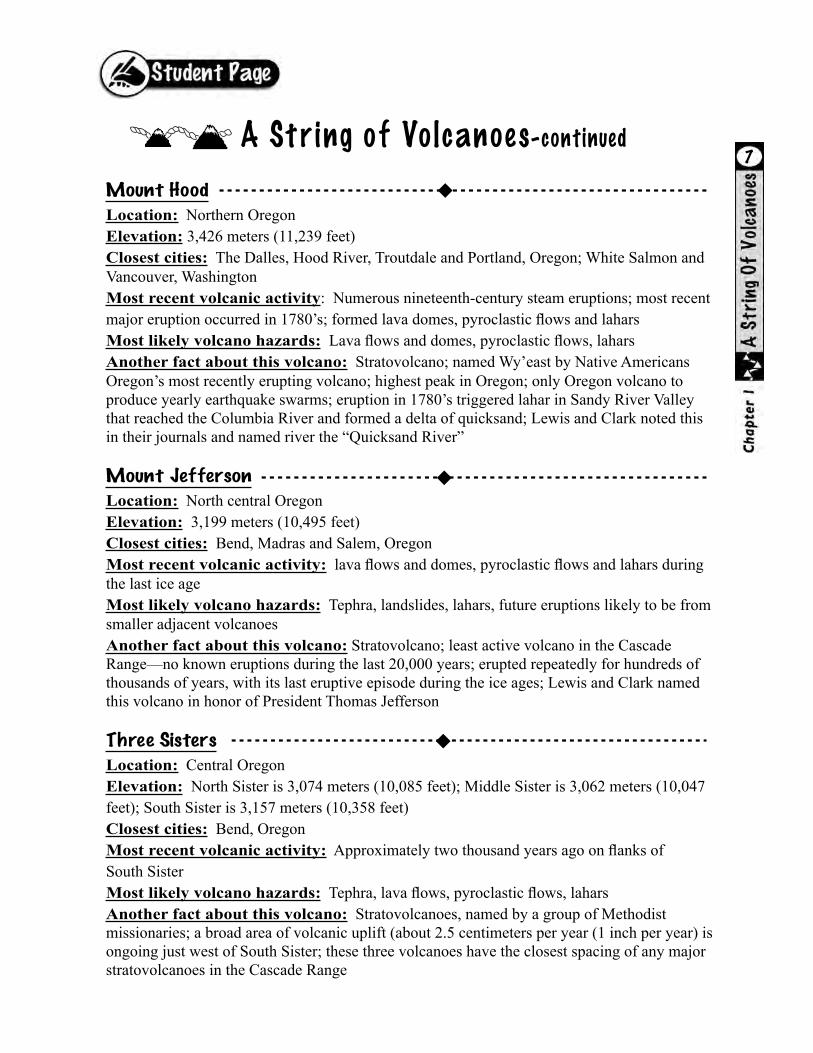
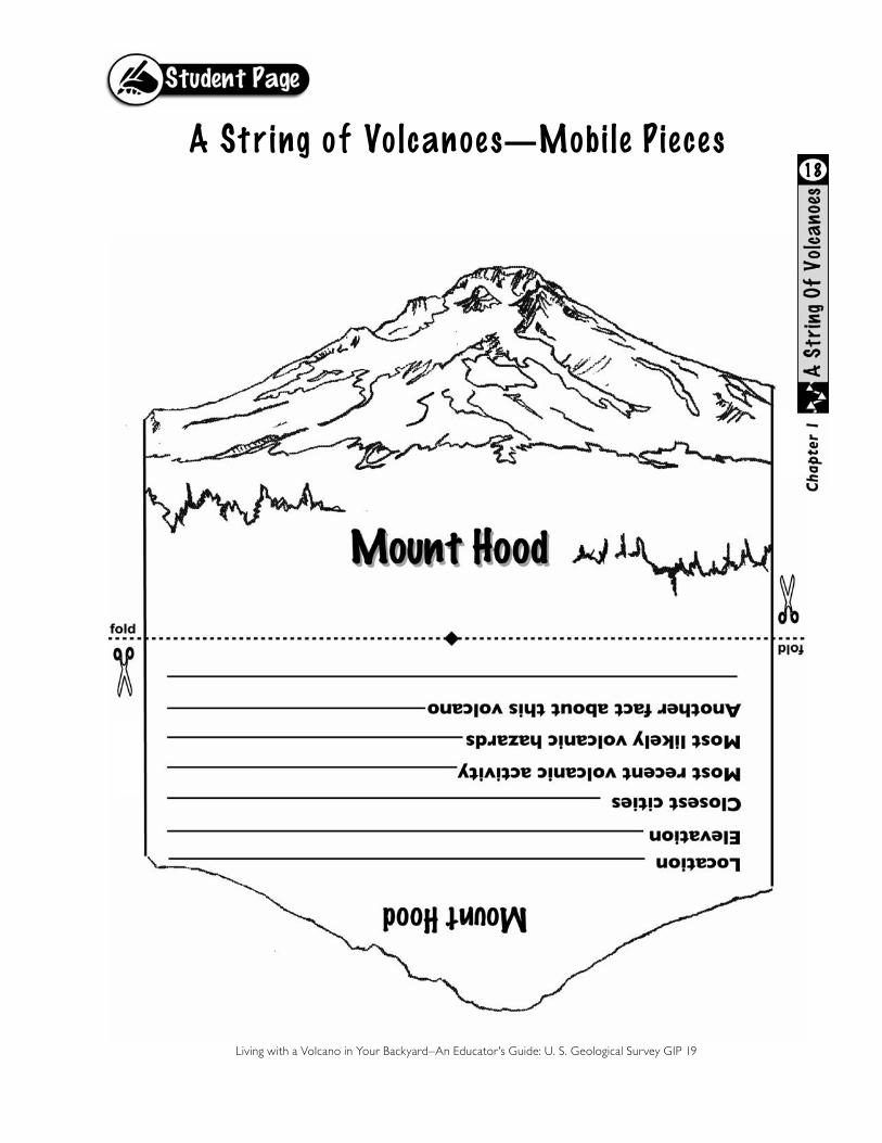
Mount Hood
Location: Northern OregonElevation: 3,426 meters (11,239 feet)Closest cities: The Dalles, Hood River, Troutdale and Portland, Oregon; White Salmon and Vancouver, WashingtonMost recent volcanic activity: Numerous nineteenth-century steam eruptions; most recent major eruption occurred in 1780’s; formed lava domes, pyroclastic flows and laharsMost likely volcano hazards: Lava flows and domes, pyroclastic flows, laharsAnother fact about this volcano: Stratovolcano; named Wy’east by Native Americans Oregon’s most recently erupting volcano; highest peak in Oregon; only Oregon volcano to produce yearly earthquake swarms; eruption in 1780’s triggered lahar in Sandy River Valley that reached the Columbia River and formed a delta of quicksand; Lewis and Clark noted this in their journals and named river the “Quicksand River”
Mount Jefferson
Location: North central OregonElevation: 3,199 meters (10,495 feet)Closest cities: Bend, Madras and Salem, OregonMost recent volcanic activity: lava flows and domes, pyroclastic flows and lahars during the last ice ageMost likely volcano hazards: Tephra, landslides, lahars, future eruptions likely to be from smaller adjacent volcanoesAnother fact about this volcano: Stratovolcano; least active volcano in the Cascade Range—no known eruptions during the last 20,000 years; erupted repeatedly for hundreds of thousands of years, with its last eruptive episode during the ice ages; Lewis and Clark named this volcano in honor of President Thomas Jefferson
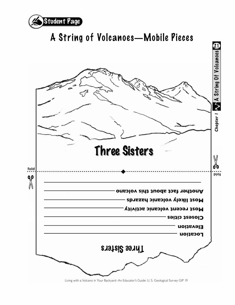
Three Sisters
Location: Central OregonElevation: North Sister is 3,074 meters (10,085 feet); Middle Sister is 3,062 meters (10,047 feet); South Sister is 3,157 meters (10,358 feet)Closest cities: Bend, OregonMost recent volcanic activity: Approximately two thousand years ago on flanks of South SisterMost likely volcano hazards: Tephra, lava flows, pyroclastic flows, laharsAnother fact about this volcano: Stratovolcanoes, named by a group of Methodist missionaries; a broad area of volcanic uplift (about 2.5 centimeters per year (1 inch per year) is ongoing just west of South Sister; these three volcanoes have the closest spacing of any major stratovolcanoes in the Cascade Range
7A String of Volcanoes-continued
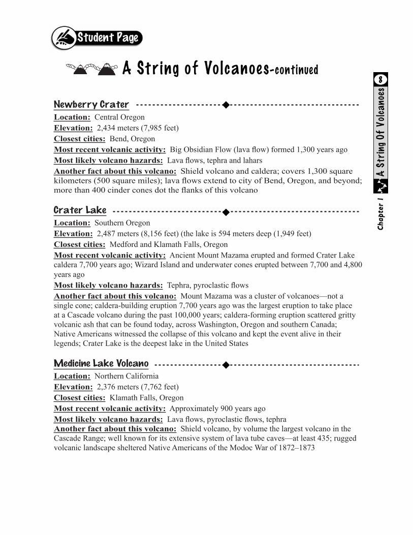
Newberry Crater
Location: Central OregonElevation: 2,434 meters (7,985 feet)Closest cities: Bend, OregonMost recent volcanic activity: Big Obsidian Flow (lava flow) formed 1,300 years agoMost likely volcano hazards: Lava flows, tephra and laharsAnother fact about this volcano: Shield volcano and caldera; covers 1,300 square kilometers (500 square miles); lava flows extend to city of Bend, Oregon, and beyond; more than 400 cinder cones dot the flanks of this volcano
Crater Lake
Location: Southern OregonElevation: 2,487 meters (8,156 feet) (the lake is 594 meters deep (1,949 feet)Closest cities: Medford and Klamath Falls, OregonMost recent volcanic activity: Ancient Mount Mazama erupted and formed Crater Lake caldera 7,700 years ago; Wizard Island and underwater cones erupted between 7,700 and 4,800 years agoMost likely volcano hazards: Tephra, pyroclastic flowsAnother fact about this volcano: Mount Mazama was a cluster of volcanoes—not a single cone; caldera-building eruption 7,700 years ago was the largest eruption to take place at a Cascade volcano during the past 100,000 years; caldera-forming eruption scattered gritty volcanic ash that can be found today, across Washington, Oregon and southern Canada; Native Americans witnessed the collapse of this volcano and kept the event alive in their legends; Crater Lake is the deepest lake in the United States
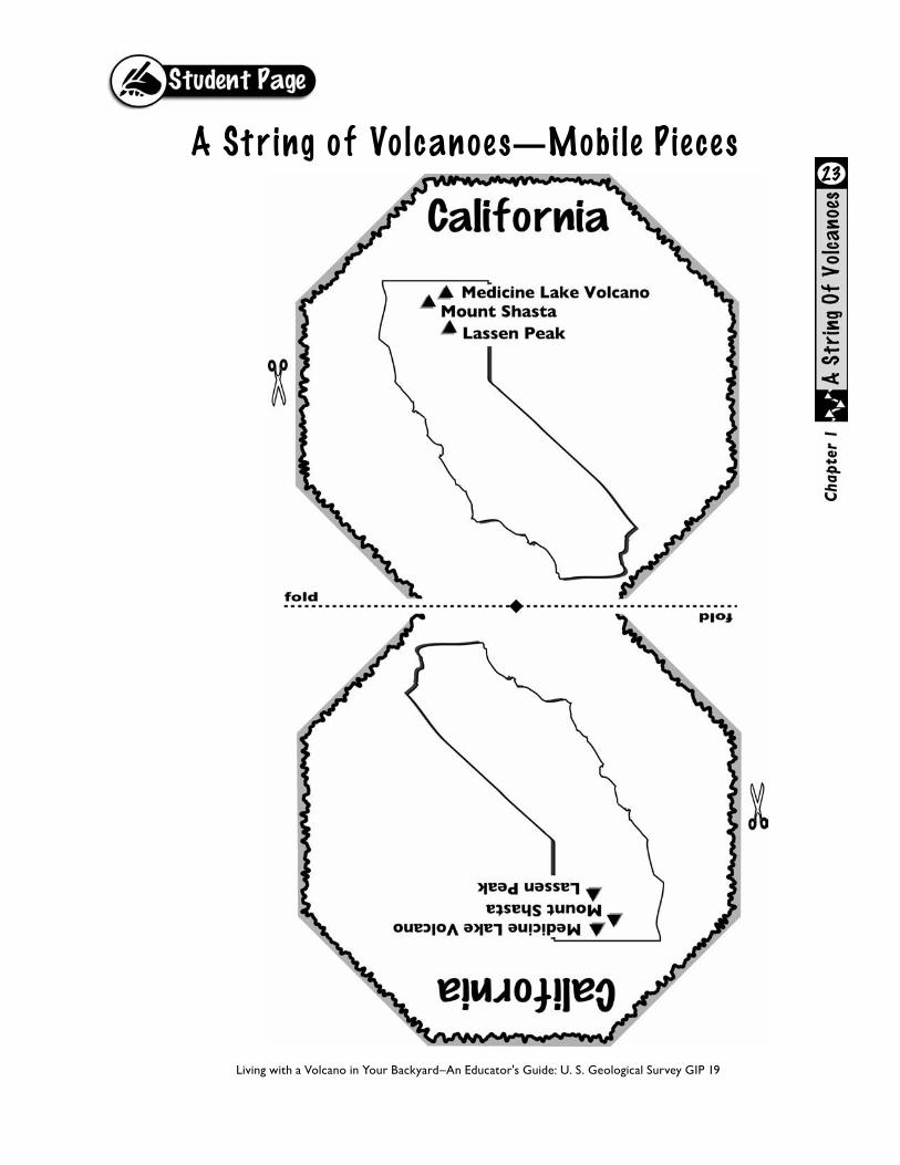
Medicine Lake Volcano
Location: Northern CaliforniaElevation: 2,376 meters (7,762 feet)Closest cities: Klamath Falls, OregonMost recent volcanic activity: Approximately 900 years agoMost likely volcano hazards: Lava flows, pyroclastic flows, tephraAnother fact about this volcano: Shield volcano, by volume the largest volcano in the Cascade Range; well known for its extensive system of lava tube caves—at least 435; rugged volcanic landscape sheltered Native Americans of the Modoc War of 1872–1873
8A String of Volcanoes-continued

Mount Shasta
Location: Northern CaliforniaElevation: 4,317 meters, (14,161 feet)Closest cities: Mount Shasta City and McCloud, CaliforniaMost recent volcanic activity: 1786 eruptions of steam and ashMost likely volcano hazards: Lava flows and domes, pyroclastic flows, tephra, laharsAnother fact about this volcano: Mount Shasta is a large stratovolcano that has erupted every 600 to 800 years for past 10,000 years; debris avalanche (landslide) 300,000 years ago spread at least 45 cubic kilometers (6.2 cubic miles) of rock debris over surface ten times larger than debris avalanche at Mount St. Helens in 1980; smaller cone Shastina was formed between 9,700 and 9,400 years before present
Lassen Peak
Location: Northern CaliforniaElevation: 3,187 meters (10,457 feet)Closest cities: Redding, Red Bluff, CaliforniaMost recent volcanic activity: 1914–1917 eruptions of steam, tephra and lava flows caused pyroclastic flows, lahars, and new dome growth Most likely volcano hazards: Lava flows and domes, pyroclastic flows, laharsAnother fact about this volcano: Lassen Peak in large part consists of overlapping lava domes; named Tehama by Native Americans; Bumpass Hell is the largest geothermal area in the Cascades—it has bubbling mud pots, steaming fumaroles, and pools of boiling water
Living with a Volcano in Your Backyard–An Educator's Guide: U. S. Geological Survey GIP 19
9A String of Volcanoes-continued
Living with a Volcano in Your Backyard–An Educator's Guide: U. S. Geological Survey GIP 19
10
A String of Volcanoes—Mobi l e Piece s

Living with a Volcano in Your Backyard–An Educator's Guide: U. S. Geological Survey GIP 19
11
A String of Volcanoes—Mobi l e Piece s
Living with a Volcano in Your Backyard–An Educator's Guide: U. S. Geological Survey GIP 19
A String of Volcanoes—Mobi l e Piece s12
A String of Volcanoes—Mobi l e Piece s
Living with a Volcano in Your Backyard–An Educator's Guide: U. S. Geological Survey GIP 19
13
A String of Volcanoes—Mobi l e Piece s
Living with a Volcano in Your Backyard–An Educator's Guide: U. S. Geological Survey GIP 19
14

A String of Volcanoes—Mobi l e Piece s
Living with a Volcano in Your Backyard–An Educator's Guide: U. S. Geological Survey GIP 19
15

A String of Volcanoes—Mobi l e Piece s
Living with a Volcano in Your Backyard–An Educator's Guide: U. S. Geological Survey GIP 19
16

Living with a Volcano in Your Backyard–An Educator's Guide: U. S. Geological Survey GIP 19
17
A String of Volcanoes—Mobi l e Piece s
A String of Volcanoes—Mobi l e Piece s
Living with a Volcano in Your Backyard–An Educator's Guide: U. S. Geological Survey GIP 19
18

Living with a Volcano in Your Backyard–An Educator's Guide: U. S. Geological Survey GIP 19
19
A String of Volcanoes—Mobi l e Piece s

Living with a Volcano in Your Backyard–An Educator's Guide: U. S. Geological Survey GIP 19
20
A String of Volcanoes—Mobi l e Piece s
Living with a Volcano in Your Backyard–An Educator's Guide: U. S. Geological Survey GIP 19
21
A String of Volcanoes—Mobi l e Piece s

Living with a Volcano in Your Backyard–An Educator's Guide: U. S. Geological Survey GIP 19
22
A String of Volcanoes—Mobi l e Piece s
Living with a Volcano in Your Backyard–An Educator's Guide: U. S. Geological Survey GIP 19
23
A String of Volcanoes—Mobi l e Piece s

Living with a Volcano in Your Backyard–An Educator's Guide: U. S. Geological Survey GIP 19
24
A String of Volcanoes—Mobi l e Piece s

Living with a Volcano in Your Backyard–An Educator's Guide: U. S. Geological Survey GIP 19
25
A String of Volcanoes—Mobi l e Piece s

Living with a Volcano in Your Backyard–An Educator's Guide: U. S. Geological Survey GIP 19
26
A String of Volcanoes—Mobi l e Piece s
Related Documents