SUAV Operations in GPS-Denied Environments Using Timing Advance Measurements Jordan Larson Trevor Layh John Jackson Brian Taylor Demoz Gebre-Egziabher Department of Aerospace Engineering and Mechanics University of Minnesota, Twin Cities Institute of Navigation – International Technical Meeting January 27 th 2015

A Recovery System for SUAV Operations in GPS-Denied Environments Using Timing Advance Measurements Jordan Larson Trevor Layh John Jackson Brian Taylor.
Dec 23, 2015
Welcome message from author
This document is posted to help you gain knowledge. Please leave a comment to let me know what you think about it! Share it to your friends and learn new things together.
Transcript
A Recovery System for SUAVOperations in GPS-Denied
Environments Using Timing Advance Measurements
Jordan LarsonTrevor Layh
John JacksonBrian Taylor
Demoz Gebre-Egziabher
Department of Aerospace Engineering and MechanicsUniversity of Minnesota, Twin Cities
Institute of Navigation – International Technical MeetingJanuary 27th 2015

Part 1: Background
3
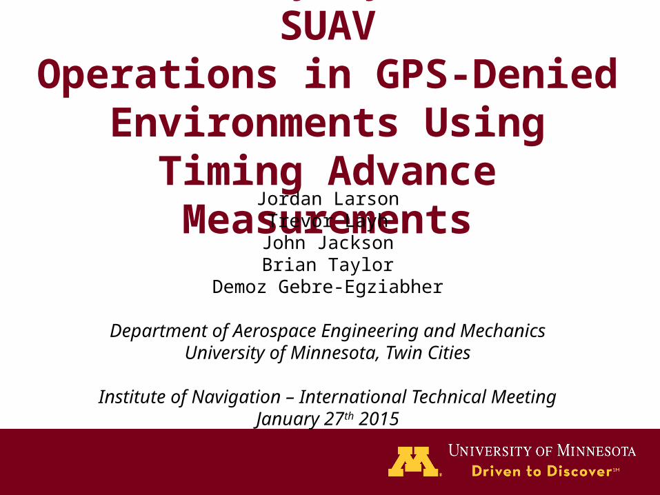
Motivation: “Limp Back Home” Capability
Photo courtesy of http://www.cops.usdoj.gov/
• Many envisioned law enforcement missions in remote, border areas.
• Dependence on GPS for navigation can be disrupted.
• Design recovery system for – Small UAV (SUAV)– We need this system
YESTERDAY! (i.e., use current COTS)
4
?
?GPS
GPS
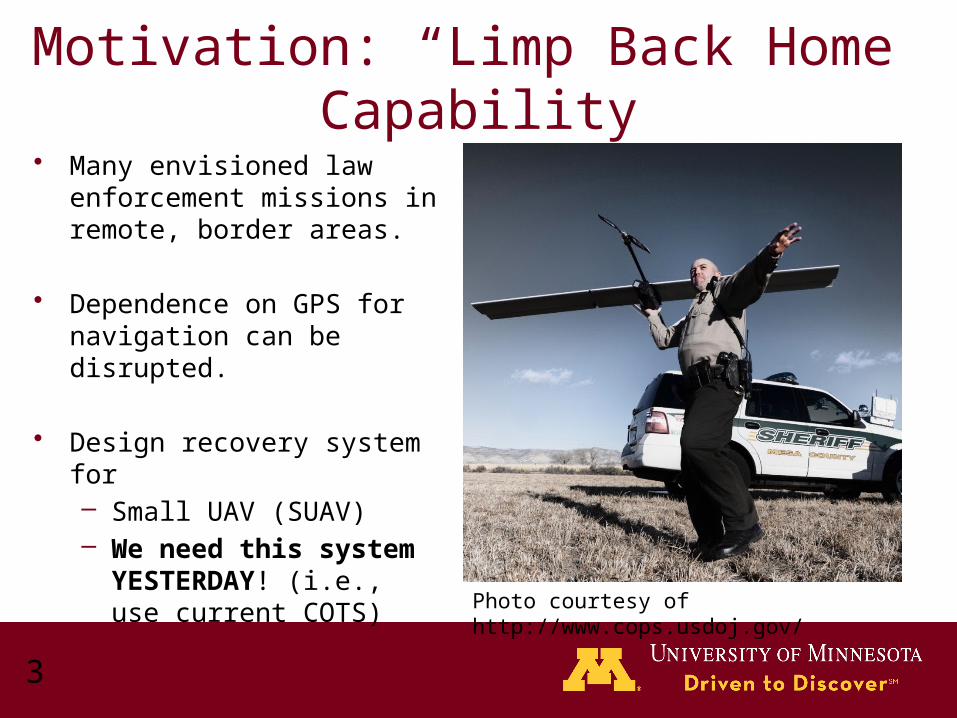
Generic SUAV Navigation System Architectures (Current)
• INS/GPS• Many off-the-shelf SUAV
autopilots feature this architecture.
• GPS outage implies loss of all three navigation, guidance and control functions.
• Can we replace the GPS functionality by a system (of low quality of course) which will allow recovery?
AHRS DR BlendedStateEstimate
INS BlendedStateEstimate
• AHRS+airspeed/DR
5
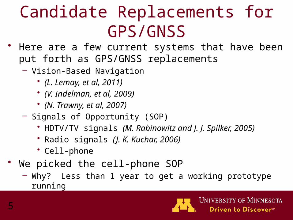
Candidate Replacements for GPS/GNSS
• Here are a few current systems that have been put forth as GPS/GNSS replacements– Vision-Based Navigation
• (L. Lemay, et al, 2011)• (V. Indelman, et al, 2009)• (N. Trawny, et al, 2007)
– Signals of Opportunity (SOP)• HDTV/TV signals (M. Rabinowitz and J. J. Spilker, 2005)• Radio signals (J. K. Kuchar, 2006)• Cell-phone
• We picked the cell-phone SOP– Why? Less than 1 year to get a working prototype running
6
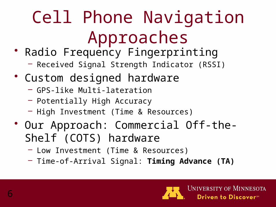
Cell Phone Navigation Approaches• Radio Frequency Fingerprinting
– Received Signal Strength Indicator (RSSI)
• Custom designed hardware– GPS-like Multi-lateration– Potentially High Accuracy– High Investment (Time & Resources)
• Our Approach: Commercial Off-the-Shelf (COTS) hardware– Low Investment (Time & Resources)– Time-of-Arrival Signal: Timing Advance (TA)
Part 2: Multi-lateration Using Cell-Phone Signals
(“Out-of-the-box” not modified cell-phone signals)

8
Cell-Signal Multi-lateration: Basic Theory
r1 = c*t
r2
r3
Cell Tower#1
Cell Tower#3
Cell Tower #2
(x1,y1)
(x2,y2)
(x3,y3)
Line of Position (LOP) #1LOP #2
LOP #3
(Xuav ,Yuav)

9
TA = 2 ~1100m
TA = 1 ~550m
Challenge #1: Discrete MeasurementsTA = 3 ~1650m
Cell Tower #2
(x1,y1)
(x2,y2)
Cell Tower#3
(x3,y3)Cell Tower
#1
Region of possible positions
TA = Timing Advance (Cell-phone observable)
10
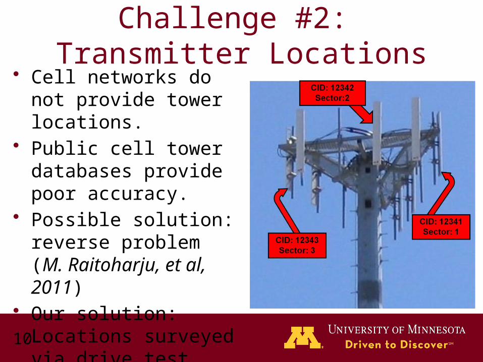
Challenge #2: Transmitter Locations
• Cell networks do not provide tower locations.
• Public cell tower databases provide poor accuracy.
• Possible solution: reverse problem (M. Raitoharju, et al, 2011)
• Our solution: Locations surveyed via drive test

Part 3: Navigation System Design
12
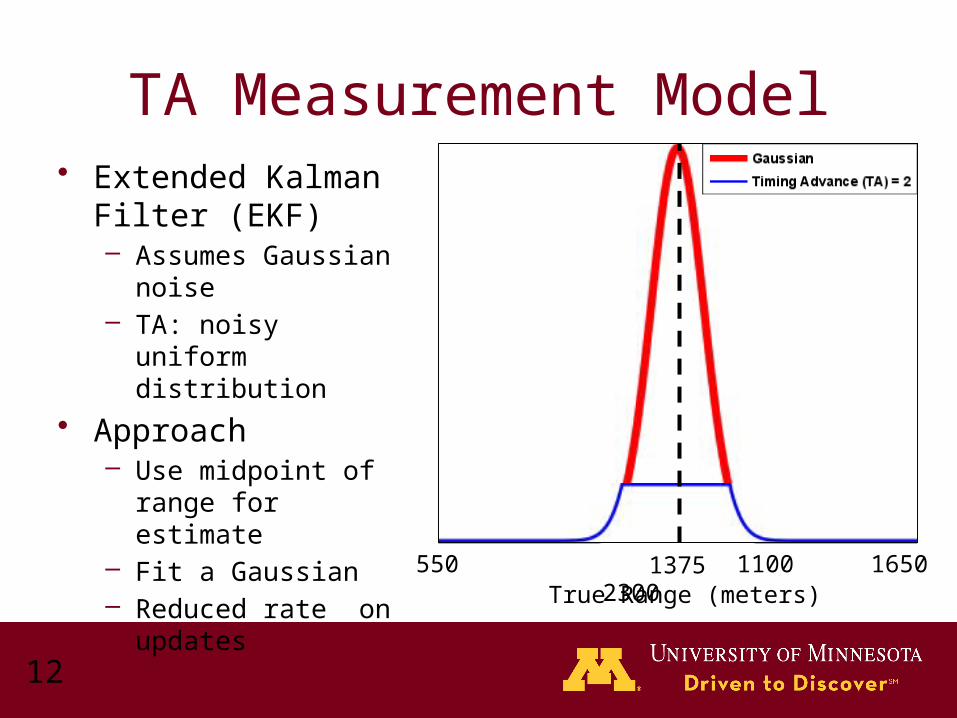
TA Measurement Model• Extended Kalman
Filter (EKF)– Assumes Gaussian
noise– TA: noisy uniform
distribution
• Approach– Use midpoint of range
for estimate– Fit a Gaussian– Reduced rate on
updatesTrue Range (meters)
550 1100 1650 23001375
13
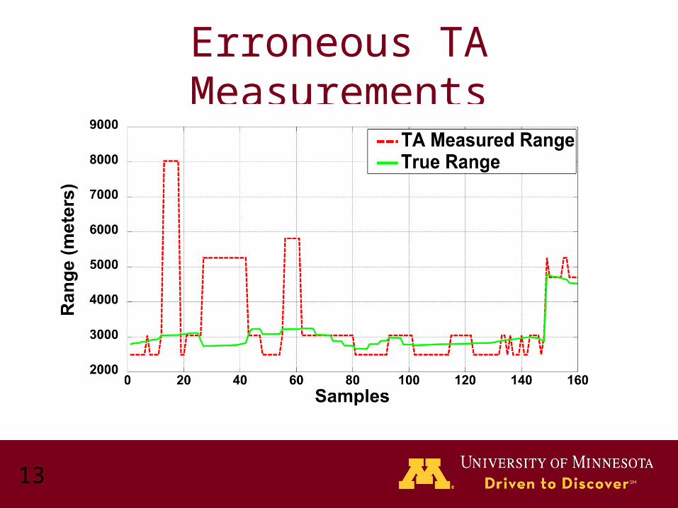
Erroneous TA Measurements
14
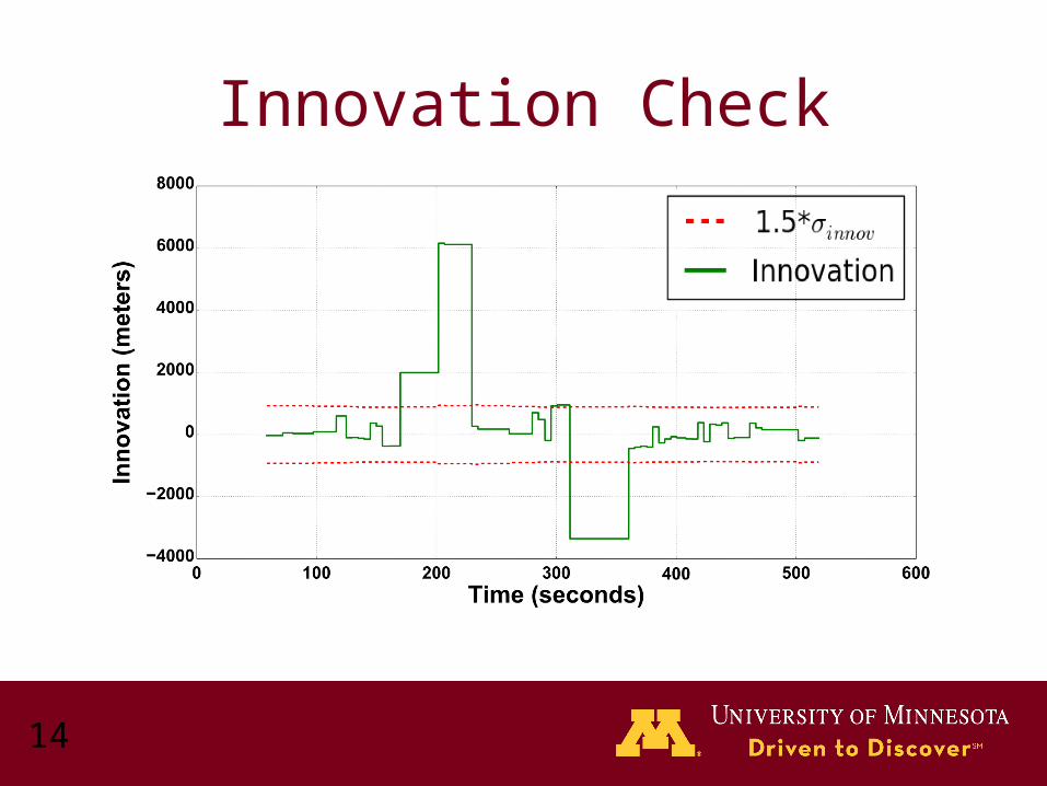
Innovation Check
15
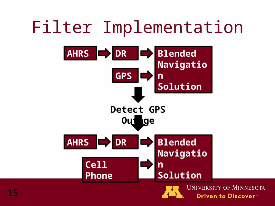
Filter Implementation
AHRS DR
GPS
BlendedNavigation Solution
Detect GPS Outage
AHRS DR
Cell Phone
BlendedNavigation Solution
16
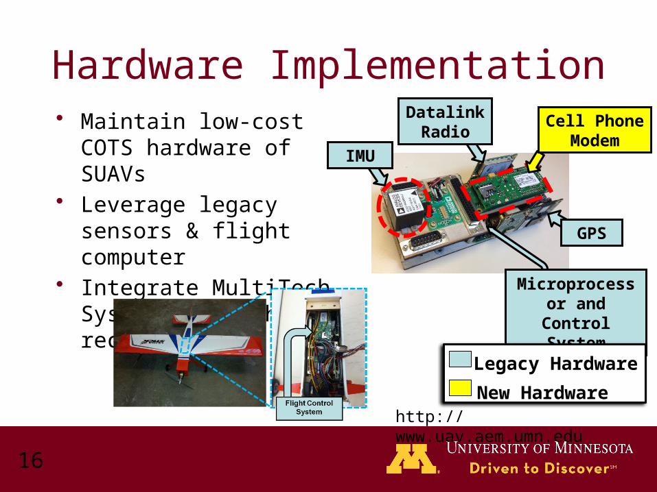
Hardware Implementation• Maintain low-cost COTS
hardware of SUAVs• Leverage legacy sensors &
flight computer• Integrate MultiTech Systems
cell phone receiver
IMU
GPS
Datalink Radio
Cell Phone Modem
Microprocessor and Control
System
Legacy Hardware
New Hardwarehttp://www.uav.aem.umn.edu

Part 4: Flight Tests
18
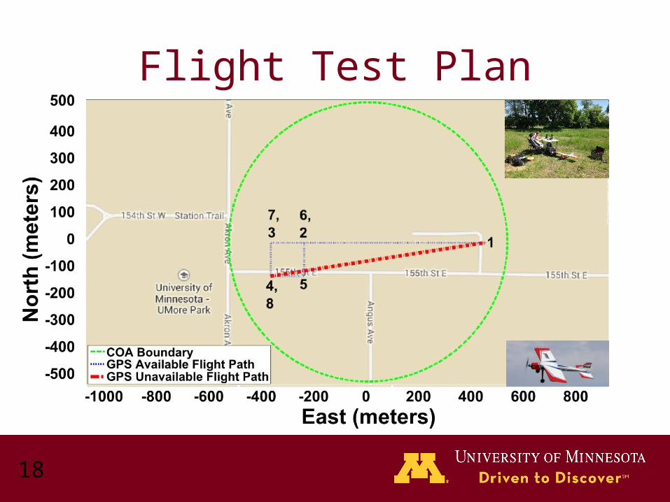
Flight Test Plan
19
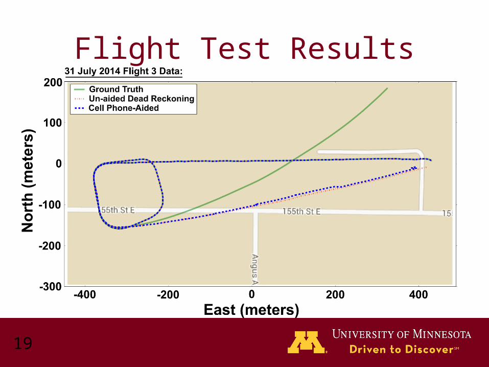
Flight Test Results
Part 5: Hardware-in-the-Loop (HIL) Monte Carlo Simulations
21
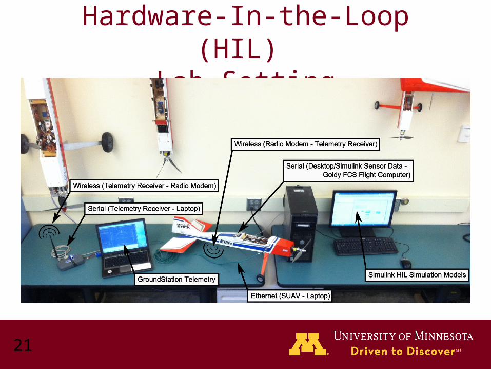
Hardware-In-the-Loop (HIL) Lab Setting
22
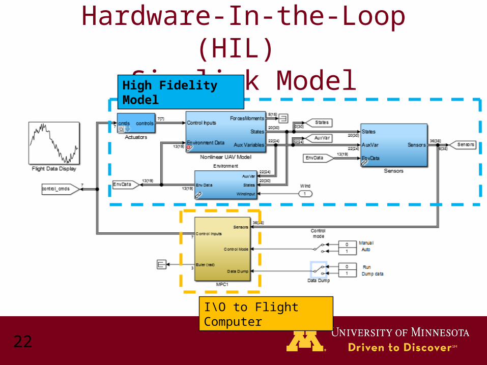
Hardware-In-the-Loop (HIL) Simulink Model
High Fidelity Model
I\O to Flight Computer
23
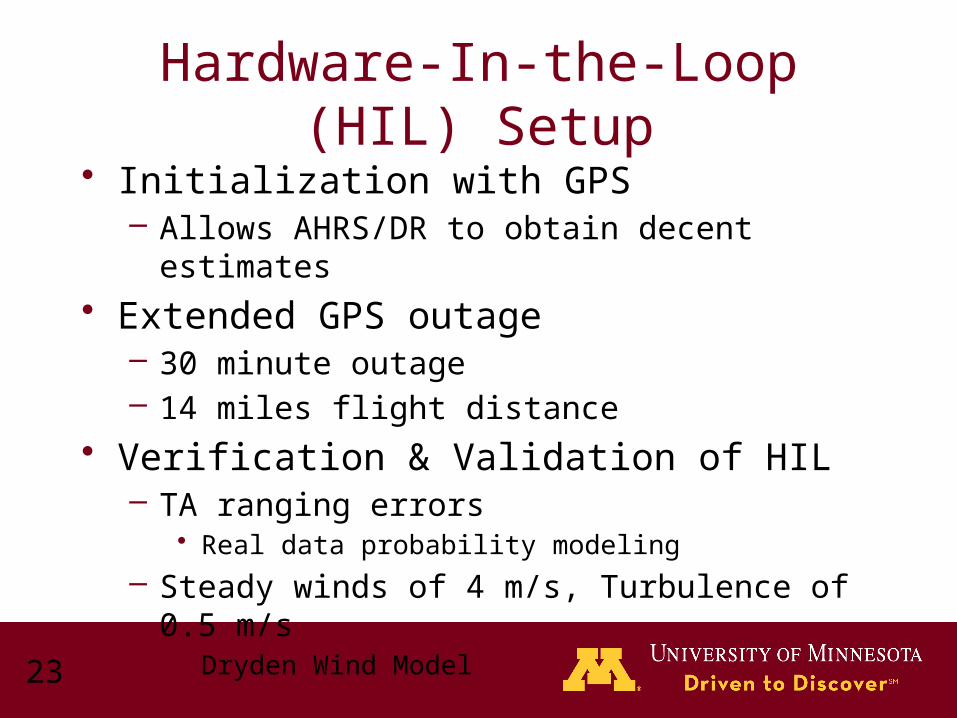
• Initialization with GPS– Allows AHRS/DR to obtain decent estimates
• Extended GPS outage – 30 minute outage– 14 miles flight distance
• Verification & Validation of HIL– TA ranging errors
• Real data probability modeling
– Steady winds of 4 m/s, Turbulence of 0.5 m/s • Dryden Wind Model
Hardware-In-the-Loop (HIL) Setup
24
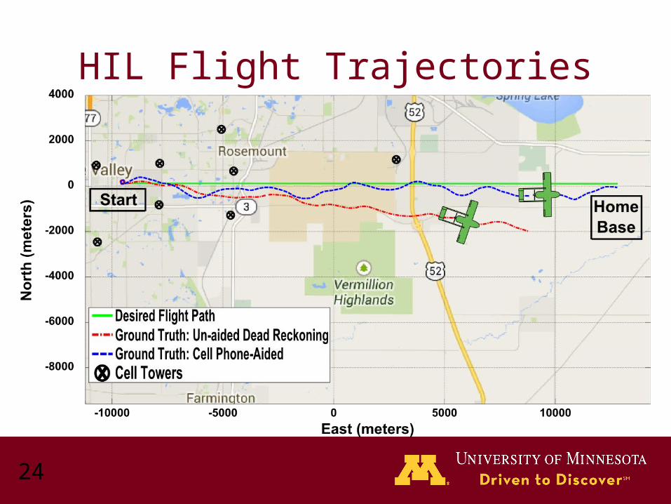
HIL Flight Trajectories
25
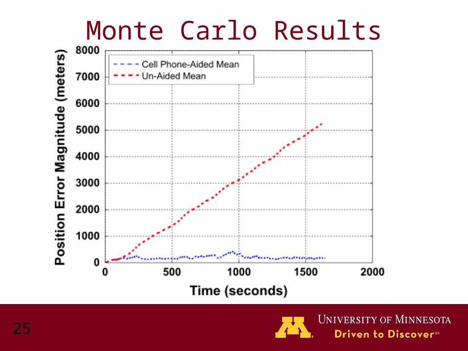
Monte Carlo Results
26
Summary
• Developed a Recovery Navigation System – Operated in real-time– Utilizes COTS technology
• Errors of approximately 200 meters– Discretized TA measurements
• Survey required for cell tower locations• Validated performance
– Flight tests (limited airspace)– HIL Monte Carlo simulations

27
Acknowledgements
• United States Department of Homeland Security
• MultiTech Systems
• Polaris Wireless• A
– Dr. David De Lorenzo
The contents of this presentation reflect the views of the authors, who are responsible for the facts and the accuracy of the information presented herein. The authors acknowledge the United States Department of Homeland Security for supporting the work reported here through the National Center for Border Security and Immigration under grant number 2008-ST-061-BS0002. However, any opinions, findings, conclusions or recommendations in this paper are those of the authors and do not necessarily reflect views of the United States Department of Homeland Security.

Questions
Backups
30
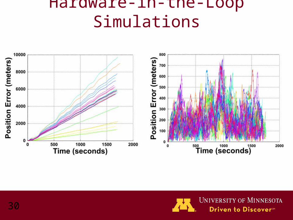
Hardware-in-the-Loop Simulations

31
Hardware-in-the-Loop Simulations
HIL SimulationFlight Data
Related Documents