5 Marzo 2007 Census Mapping and Gis Fabio Crescenzi Istat, Central Directorate on General Censuses UNECE Training Workshop on Census Technology for SPECA Member Countries (Astana, 7-8 June 2007) Training module on

5 Marzo 2007 Census Mapping and Gis Fabio Crescenzi Istat, Central Directorate on General Censuses UNECE Training Workshop on Census Technology for SPECA.
Jan 03, 2016
Welcome message from author
This document is posted to help you gain knowledge. Please leave a comment to let me know what you think about it! Share it to your friends and learn new things together.
Transcript
5 Marzo 2007
Census Mapping and Gis
Fabio Crescenzi Istat, Central Directorate on General Censuses
UNECE Training Workshop on Census Technology for SPECA Member Countries
(Astana, 7-8 June 2007)
Training module on

Reference training material
2/31
Handbook on geographic information systems and digital mapping
Chapter II
UNITED NATIONS (2000) - Department of Economic and Social Affairs Statistics Division Studies in Methods Series F No. 79 ______________________ST/ESA/STAT/SER.F/79UNITED NATIONS PUBLICATIONSALES No. 00.XVII.12
Census Mapping
3/31
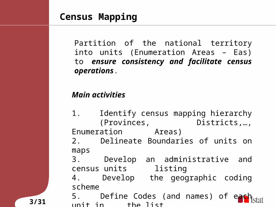
Partition of the national territory into units (Enumeration Areas – Eas) to ensure consistency and facilitate census operations.
Main activities
1. Identify census mapping hierarchy (Provinces, Districts,…, Enumeration Areas)2. Delineate Boundaries of units on maps 3. Develop an administrative and census units
listing4. Develop the geographic coding scheme5. Define Codes (and names) of each unit in
the list

Role of mapping in the census
4/31
Census Mapping support data collection and can help monitor census activities.
Census mapping ensure that enumerators can easily identify their assigned set of households. Maps are also issued to census supervisors to support planning and control tasks. Maps can thus also play a role in monitoring and to identify problem areas and implement remedial action quickly.
Census Mapping make it easier to present, analyse and disseminate census results (post-enumeration). Cartographic presentation of census results provides a powerful means for visualizing the results of a census. This supports the identification of local patterns of important demographic and social indicators.

Census Mapping Hierarchy
5/31
Boundaries delineation
6/31
Localities or urbanized areas boundaries. A morphological approach to the delineation of localities or urbanized areas is possible where recent air photos or satellite images are available for the most densely populated areas of the country.
Enumeration areas boundaries. Boundaries need to be clearly observable on the ground. Natural features that can be used for this purpose are roads, railroads, creeks and rivers, lakes, fences or any other feature that defines a sharp boundary.
Locality (UNECE-EUROSTAT Recommendations)
7/31
For census purposes, a locality is defined as a distinct population cluster, that is, the population living in neighboring buildings which either:
(a) form a continuous built-up area with a clearly recognizable street formation; or(b) though not part of such a built-up area, form a group to which a locally recognized place name is uniquely attached; or(c) though not coming within either of the above two requirements constitute a group, none of which is separated from its nearest neighbour by more than 200 metres.
The population not living in clusters as defined above may be described as living in scattered buildings. The definition of a locality adopted for the census should be given in detail in the census report.

Output products
8/31
- A set of digital enumeration area maps that are designed to enable the production of all output products that will be disseminated to government departments and the public;
- Geographic boundary files for all statistical reporting units for which census indicators will be tabulated;
- Listings of all statistical and administrative reporting units, including towns and villages;
- Geographic equivalency files that indicate how current reporting units relate to those used in previous censuses, or how one set of reporting units relates to another set;
- Street index listings for all major urban areas;
- centroid files that provide a representative geographic point reference for each reporting unit;
- Gazetteers that provide geographic coordinates for all settlements and other important geographic features in the country.
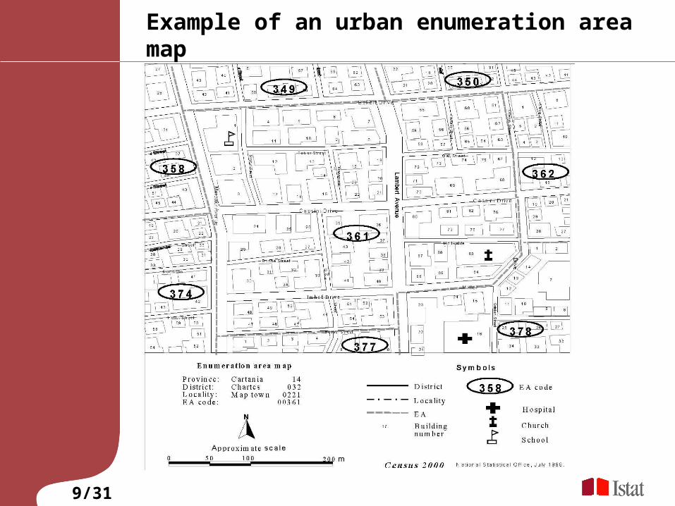
Example of an urban enumeration area map
9/31


Census Mapping update from previous cenuses
11/31
It is important as possible to preserve boundaries from the previous census. When necessary, it is always preferable to subdivide an existing enumeration area rather than to change the boundaries.
Compilation of Compatibility or equivalency files can facilitate change analysis. These list the codes of each enumeration area in the current census and the corresponding code in a previous enumeration. If units have been split or aggregated, this is indicated in these files.
Centralisation/Decentralisation of Census mapping activities
12/31
In a relatively small country, census mapping can be carried out by a centralized cartography unit in the national office of the census organization.
The decentralization of mapping activities has several advantages. Local staff are more knowledgeable of the geography, administrative structure and recent changes in their assigned region. Field work will be less expensive, since travel distances are smaller.
Discussion 1
13/31
In your opinion which is the best approach for Census mapping activities in your Country?
1. A centralised approach. One office in the national office of statistics prepare all maps
2. A decentralised approach. Several local/regional offices prepare local maps
Cartographic data sources for enumeration area mapping (secondary acquisition)
14/31
In nearly all cases, a census cartographic program will have to consult existing hard-copy maps, including the following types of maps :
National overview maps, usually at scales between 1:250,000 and 1:5,000,000, depending on the size of the country. These maps should show major civil divisions, the location of urban areas, and major physical features such as important roads, rivers, lakes, elevation, and special points of reference. These maps are used for planning purposes; Topographic maps at large and medium cartographic scales. The availability of maps at these scales will vary by country. While some countries have complete coverage at 1:25,000 or 1:50,000, the largest complete map series in others is only 1:100,000 or 1:250,000 scale; Town and city maps at large cartographic scales, showing roads, city blocks, parks and so on;

Cartographic data sources for enumeration area mapping (primary acquisition)
15/31
Aerial photography / Remote images
Aerial photography and Remote images are used to create and update topographic base maps, and to carry out agricultural and soil surveys, and for many aspects of urban and regional planning.. An aerial survey flown shortly before a census will provide the most complete basis for the delineation of enumeration areas within a reasonably short time-frame.
Global positioning systems
GPS technology has obvious application in any kind of mapping activity, including the preparation of enumerator maps for census activities. Coordinates can be downloaded or entered manually into a digital mapping system or GIS, and can be combined with existing, georeferenced information.
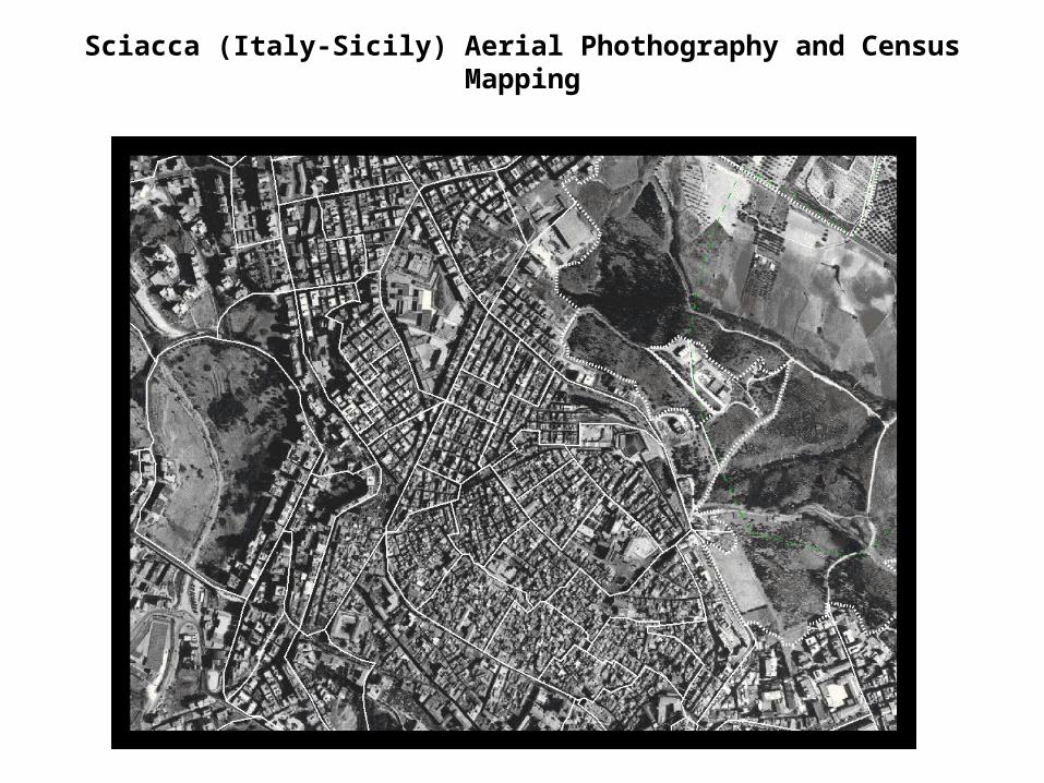
Sciacca (Italy-Sicily) Aerial Phothography and Census Mapping
Full census mapping program (complete enumeration area database)
17/31
An ambitious strategy for census mapping is to produce a complete georeferenced digital database of enumeration areas. The resulting database will allow aggregation, combination with other digital map layers and dissemination for users who require detailed, spatially referenced population data.
There are several options for producing this database of digital boundaries:
- from available hard-copy sketch maps that may have been produced for the previous census.
- from topographic maps,
- during fieldwork, using global positioning systems.
Geographic information system (GIS)
18/31
Geographic information systems (GIS) are fruitfully employed in all census mapping activities. GIS is a system for capturing, storing, analyzing and managing data and associated attributes which are spatially referenced to the earth. GIS is a tool that allows users to create interactive queries (user created searches), analyze the spatial information, edit data, maps, and present the results of all these operations.
Integration in GIS, is the process of compiling a consistent set of spatial data from heterogeneous sources. Vertical integration refers to the ability of GIS to combine different data layers that are referenced in the same coordinate system.
Web Mapping
19/31
In recent years there has been an explosion of mapping applications on the web such as Google Maps, MapQuest, Yahoo! Maps, Rand McNally. These websites give the public access to huge amounts of geographic data with an emphasis on aerial photography.
In the next future an emerging role of web applications in census mapping is expected .
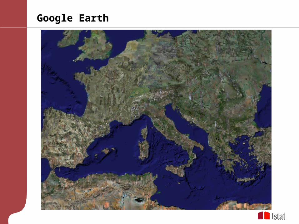
Google Earth

Google Maps API

Discussion 2: Cartographic data sources for census mapping
22/31
Which are in your opinion pro and cons of the use of the following data sources in census mapping activities?
Aerial photographyRemote Sensing ImagesLocal topographic mapsCommercial Street networks
Census and addresses
23/31
Main phases of census design and fieldwork would be fruitfully supported by the availability of a good quality and list of geocoded address numbers. - to keep under control the expected
number of buildings in each EA; - to preprint lists of address numbers for
enumerators; - to allow enumerators to find, to enumerate and to survey statistical units; - to allow fieldwork and centralized check
of coverage

National Address Point System
24/31
Each building address is represented by a coordinate in a proper geographic reference systemA National Address Point System project requires a considerable large amount of financial and human resources. It is usually only employed in countries where other authorities, such as the postal office, also have an interest in creating such a database

Geocoded list of address numbers
25/31
A “second best” approach is possible when a National Street Network is available. Often, it is the private sector that is creating a street network for commercial and marketing applications. A National Street Network consists of streets and road segments.
When a good external list of addresses is available, a National Street Network may be employed to approximate location of addresses in this list and to assign them to EAs.

Discussion 3: Address systems
26/31
Do you have a National Address Point system in your country? Otherwise, how streets and adresses databases are organised?
Do you employ addresses in censuses? How?

Metadata and data quality
27/31
Detailed documentation of all steps involved in developing the digital spatial census database, information about data quality, formats, processing steps and all other information pertaining to a data set, have several tasks:
- To support the maintenance and updates of digital data sets held by an organization;
- To support data distribution by providing i
nformation about a data set’s fitness for use to outside users;
- To support the integration of externally produced data sets into an organization’s data holdings.
Data quality issues
28/31
- Logical accuracy
- Positional accuracy
- Semantic accuracy
- Temporal information
- Data set completeness
Logical and positional accuracy
29/31
Logical accuracy refers to the integrity of relationships among geographic features. A town represented as a point in one GIS database should fall into its corresponding administrative unit in another GIS layer.
Positional accuracy, in contrast, maintains that the coordinates of features in the GIS database are correct relative to their true positions on the earth’s surface.

Problems if positional accuracy is not maintained
30/31
Figure on the left, for instance, shows a set of sample survey sites that have been determined, using a very accurate global positioning system. The base map in figure on the right, in contrast, while logically accurate, has a low degree of positional accuracy. Some of the accurately measured GPS points, therefore, fall into the wrong administrative units.

Discussion 4: Metadata and Data Quality
31/31
Do you have a Comprehensive Census mapping Database in digital format?
Which are the main information on data (referencing of originator, time period, contact information, etc..)?
Do you measure accuracy? How?
Related Documents