SOUTHERN AREA PLANNING SUB-COMMITTEE 20 AUGUST 2008 Further information on the subject of this report is available from Mrs Y Coleman on 01432 383083 5 DCSE2008/0996/F - TO CONTINUE TO ERECT, TAKE DOWN AND RE-ERECT POLYTUNNELS ROTATED AROUND FIELDS AS REQUIRED BY THE CROPS UNDER CULTIVATION, HOMME FARM, HOM GREEN, ROSS-ON-WYE, HEREFORDSHIRE, HR9 7TF. For: E.C. Drummond & Son per Antony Aspbury Assoc. Ltd, 20 Park Lane, Business Centre Park, Lane Basford, Nottingham, NG6 0DW. Date Received: 14 April 2008 Ward: Kerne Bridge Grid Ref: 57814, 21926 Expiry Date: 14 July 2008 Local Member: Councillor JG Jarvis 1. Site Description and Proposal 1.1 Homme Farm is located approximately one kilometre to the south-west of Ross-on- Wye, on land enclosed along its western edge by the River Wye. The whole of the application site is located within the open countryside and within the Wye Valley Area of Outstanding Natural Beauty (AONB). The application site comprises 377 hectares of land that extends eastwards, from the River Wye, towards the B4234, the Ross-on- Wye - Walford road. 1.2 The Council's Landscape Character Assessment identifies part of the site that comprises the floodplain of the River Wye as Riverside Meadows with the remainder of the site being described as Principal Settled Farmlands. The area is of significant landscape and built historic interest: Hill Court is a listed building and registered garden and Old Hill Court is a listed building and unregistered garden. There are a number of other listed buildings within the application site. In addition, Goodrich Castle, a Scheduled Ancient Monument (SAM), occupies a spur of land to the south, and overlooks the application site. Howle Hill, Bulls Hill and Coppett Hill are located to the east of the application site. The site abuts the River Wye Special Area of Conservation (SAC) and Site of Special Scientific Interest (SSSI). Parts of the site are within the flood plain of the River Wye. Various Public Rights of Way cross and provide views towards the application site. 1.3 The application is for the erection of (Spanish) polytunnels to be used for the growing of soft fruit to be rotated around the holding. The polytunnels comprise curved and interlinked metal frames, the legs of which are inserted into the ground and typically their width is 6.5 - 8 metres with the height of 3 - 3.7 metres. Their length varies. The frames are covered with clear polythene during the harvesting period. The polythene is removed from November to January. 1.4 This proposal relates to some 377 ha of land owned by the applicant. Of the total 377 hectares, 152 hectares (which are shaded pink on Plan DLA 1226/06 Rev A) would not be tunnelled at any time for a variety of landscape, amenity, environmental and operational reasons. The net area of resulting land on which tunnels will be rotated from year to year would be 225 hectares. Within these 225 hectares, no more than

Welcome message from author
This document is posted to help you gain knowledge. Please leave a comment to let me know what you think about it! Share it to your friends and learn new things together.
Transcript

SOUTHERN AREA PLANNING SUB-COMMITTEE 20 AUGUST 2008
Further information on the subject of this report is available from Mrs Y Coleman on 01432 383083
5 DCSE2008/0996/F - TO CONTINUE TO ERECT, TAKE DOWN AND RE-ERECT POLYTUNNELS ROTATED AROUND FIELDS AS REQUIRED BY THE CROPS UNDER CULTIVATION, HOMME FARM, HOM GREEN, ROSS-ON-WYE, HEREFORDSHIRE, HR9 7TF. For: E.C. Drummond & Son per Antony Aspbury Assoc. Ltd, 20 Park Lane, Business Centre Park, Lane Basford, Nottingham, NG6 0DW.
Date Received: 14 April 2008 Ward: Kerne Bridge Grid Ref: 57814, 21926 Expiry Date: 14 July 2008 Local Member: Councillor JG Jarvis 1. Site Description and Proposal 1.1 Homme Farm is located approximately one kilometre to the south-west of Ross-on-
Wye, on land enclosed along its western edge by the River Wye. The whole of the application site is located within the open countryside and within the Wye Valley Area of Outstanding Natural Beauty (AONB). The application site comprises 377 hectares of land that extends eastwards, from the River Wye, towards the B4234, the Ross-on-Wye - Walford road.
1.2 The Council's Landscape Character Assessment identifies part of the site that
comprises the floodplain of the River Wye as Riverside Meadows with the remainder of the site being described as Principal Settled Farmlands. The area is of significant landscape and built historic interest: Hill Court is a listed building and registered garden and Old Hill Court is a listed building and unregistered garden. There are a number of other listed buildings within the application site. In addition, Goodrich Castle, a Scheduled Ancient Monument (SAM), occupies a spur of land to the south, and overlooks the application site. Howle Hill, Bulls Hill and Coppett Hill are located to the east of the application site. The site abuts the River Wye Special Area of Conservation (SAC) and Site of Special Scientific Interest (SSSI). Parts of the site are within the flood plain of the River Wye. Various Public Rights of Way cross and provide views towards the application site.
1.3 The application is for the erection of (Spanish) polytunnels to be used for the growing
of soft fruit to be rotated around the holding. The polytunnels comprise curved and interlinked metal frames, the legs of which are inserted into the ground and typically their width is 6.5 - 8 metres with the height of 3 - 3.7 metres. Their length varies. The frames are covered with clear polythene during the harvesting period. The polythene is removed from November to January.
1.4 This proposal relates to some 377 ha of land owned by the applicant. Of the total
377 hectares, 152 hectares (which are shaded pink on Plan DLA 1226/06 Rev A) would not be tunnelled at any time for a variety of landscape, amenity, environmental and operational reasons. The net area of resulting land on which tunnels will be rotated from year to year would be 225 hectares. Within these 225 hectares, no more than

SOUTHERN AREA PLANNING SUB-COMMITTEE 20 AUGUST 2008
Further information on the subject of this report is available from Mrs Y Coleman on 01432 383083
54 hectares (24%) will be covered with tunnels at any one time and there would be a limit of 10 hectares on the coverage in any single block of tunnels.
1.5 The application is supported by a number of documents:
Town Planning Statement Proposes that a balance should be struck between any perceived harm to interests of acknowledged importance and the demonstrable benefits of the development. The principal consideration in this instance is the degree of any impact on the natural beauty and amenity of the Wye Valley AONB, how far this impact can be mitigated and, to what extent any residual adverse impact is outweighed by the benefits to agriculture, to the economy, to biodiversity and to sustainability.
Design and Access Statement This points out that the tunnels are physically and functionally related to their agricultural use (the growing of soft fruit), the tunnels are temporary, and consist of tubular steel, galvanised framework made up of: - Y shaped legs of 1.5 - 2 metre length, with a flighted end, which are wound into the
ground (usually by machine) to a depth of 0.5 to 0.75 metres. - A semi circular hoop slots over the legs and thus forms blocks of tunnels several
bays wide. - Bracing bars known as end kits secure the first and last hoops of the polytunnel. - The size of the tunnel varies according to the crop and other considerations, but
the bay width typically varies between 6.5 and 8 metres and the height between 3 and 3.7 metres.
The Landscape and Visual Assessment This provides a detailed appraisal with plans and photographs of the landscape and visual effects of the development. It concludes with regard to the landscape that there will be a high impact on the character of the AONB, but that the magnitude is moderate due to the limited impact on the surrounding area as a result of the location, topography and presence of mature vegetation, including woodlands, orchards and hedgerows. In addition, the commitment not to erect any tunnels at all in sensitive areas of the application site, the overall limit on the extent of tunnel coverage at any one time; the limit on coverage in any single block, long term landscape management arrangements minimise the visual impact is described.
Business and Economic Appraisal The business depends on the income of the soft fruit enterprise as a core profitable enterprise. EC Drummond and Son has used this enterprise to build the business as a whole and it is integral to overall business profitability. The business as a whole spends 46% of total expenditure within the local area. 44% of spending by local businesses supplying EC Drummond was in the local area. The business impact on the local economy is over £26 million. If polytunnels are not used the soft fruit enterprise would cease and the impact would be reduced by £6 million, this is a substantial negative impact on the local economy. Employment in soft fruit at the farm is 3 full-time partners, 14 full-time equivalents and up to 450 staff employed for picking and packing.

SOUTHERN AREA PLANNING SUB-COMMITTEE 20 AUGUST 2008
Further information on the subject of this report is available from Mrs Y Coleman on 01432 383083
Drainage Appraisal This explains the water management regime at The Homme and the special measures for irrigating crops (called 'trickle irrigation') and for managing the water draining from the cropped areas. It concludes that the tunnels will have no detrimental impact on drainage when compared to the alternative use, row crops.
Water Resources Risk Evaluation This demonstrates that although the water abstraction predates the Water Act 2003 and is, accordingly unregulated, it complies with the current legal framework.
Ecology Survey Examines the ecological impacts of the proposed tunnels.
Miscellaneous Documents Document containing 81 letters of support from customers and suppliers of the applicant’s farm business and from interested local residents. The applicant undertook public consultation exhibition in March 2008. 86 local people visited the exhibition and 78 made written comments that are submitted in a further document.
Following concerns raised in response to the initial consultation by the Environment Agency, Natural England and the Wye Valley Area of Outstanding Natural Beauty Partnership the scheme has been amended to include the following additional information: - A reduction in covered tunnels at any one time from 60 hectares to 54 hectares - Additional land adjacent to the River Wye to be included within the exclusion zone - A projected 10 year rotational plan - Additional ecological report incorporating a survey of fields not assessed in the first
ecological report, an assessment of watercourses on the holding, badger sett location and mitigation proposals
- A supplementary drainage report relating to run-off, polytunnel location and siting, flood risk and site management
- Confirmation that no polytunnels to be erected on land below 35 metres AOD - Additional landscape proposal showing three additional lateral (east/west aligned)
hedgerows due east of the dismantled railway 2. Policies 2.1 Planning Policy Statements
PPS1 - Delivering Sustainable Development PPS7 - Sustainable Development in Rural Areas PPS9 - Biodiversity and Geological Conservation PPG13 - Transport PPG15 - Planning and the Historic Environment PPG21 - Tourism PPG25 - Planning and Flood Risk

SOUTHERN AREA PLANNING SUB-COMMITTEE 20 AUGUST 2008
Further information on the subject of this report is available from Mrs Y Coleman on 01432 383083
2.2 Regional Spatial Strategy for the West Midlands
Policy PA14 - Economic Development and the Rural Economy Policy PA 15 - Agriculture and Farm Diversification Policy QE1 - Conserving and Enhancing the Environment Policy QE5 - Protection and Enhancement of the Historic Environment Policy QE6 - The Conservation, Enhancement and Restoration of the
Region’s Landscape Policy QE7 - Protecting, Managing and Enhancing the Region’s Biodiversity
and Nature Conservation Resources Policy QE8 - The Water Environment
2.3 Herefordshire Unitary Development Plan 2007
Part I Policy S1 - Sustainable Development Policy S2 - Development Requirements Policy S4 - Employment Policy S6 - Transport Policy S7 - Natural and Historic Heritage Part II Policy DR1 - Design Policy DR3 - Movement Policy DR4 - Environment Policy DR6 - Water Resources Policy DR7 - Flood Risk Policy E13 - Agricultural and Forestry Development Policy LA1 - Areas of Outstanding Natural Beauty Policy LA2 - Landscape Character
Policy LA4 - Protection of Historic Parks and Gardens Policy LA5 - Protection of Trees, Woodlands and Hedgerows Policy LA6 - Landscaping Schemes Policy NC1 - Biodiversity and Development Policy NC2 - Sites of International Importance Policy NC3 - Sites of National Importance Policy NC5 - European and Nationally Protected Species Policy NC6 - Biodiversity Action Plan Priority Habitats and Species Policy NC7 - Compensation for Loss of Biodiversity Policy NC8 - Habitat Creation, Restoration and Enhancement Policy NC9 - Management of Features of the Landscape Important for Flora
and Fauna Policy HBA4 - Setting of Listed Buildings
2.4 Other Policy and Guidance
Draft Polytunnel Supplementary Planning Document Landscape Character Assessment Wye Valley Area of Outstanding Natural Beauty Management Plan 2004-2009
SOUTHERN AREA PLANNING SUB-COMMITTEE 20 AUGUST 2008
Further information on the subject of this report is available from Mrs Y Coleman on 01432 383083
3. Planning History 3.1 DCSE2002/2715/S Offices and amenities. - Prior approval
not required 01.10.2002
DCSE2002/3635/S Implement store - Prior approval not required 15.01.2003
DCSE2008/0995/F Construction of irrigation lakes and associated conservation ponds.
- Withdrawn
4. Consultation Summary
Statutory Consultations
4.1 The Environment Agency originally objected to the proposal but following consultation on the additional information their objection has been withdrawn subject to the following:
Our previous letter of objection sought clarification on the siting of polytunnels within the 'floodplain' and clarification on surface water proposals for area C in the absence of the proposed reservoir being in place, to attenuate this water.
The supplementary report from JDIH dated 26 June 2008 addresses the concerns raised in previous consultations.
1. Fluvial Flood Risk We are satisfied with the reports recommendations that no development should be situated below the 35m AOD contour line.
We would recommend a condition be imposed to ensure that there are no polytunnels (subject to this permission) sited on land lower than 35m AOD (nominal extent of the 1% plus climate change) as follows.
CONDITION: There shall be no polytunnels sited on land lower than 35.0m AOD, as indicated upon Figure 3 'Flood Elevations' The Homme Supplementary Report dated 26/06/08, unless otherwise agreed in writing by the Local Planning Authority.
REASON - To maintain the conveyance of flood flows and to prevent the increased risk of flooding elsewhere.
Note - We note that SuDs techniques will be incorporated at the lowest point down catchment of each tunnel block below the 35m AOD contour, including grassed buffer strips and swales, where buffer strips already exist (to be extended) and we have no objection to this.
CONDITION: There shall be no new buildings, structures (including polytunnels, gates, walls and fences) or raised ground levels within 8 metres of the top of bank of the River Wye (Main River), inside or along the boundary of the site, unless agreed otherwise in writing by the Local Planning Authority.

SOUTHERN AREA PLANNING SUB-COMMITTEE 20 AUGUST 2008
Further information on the subject of this report is available from Mrs Y Coleman on 01432 383083
REASON: To maintain access to the watercourse for maintenance or improvements.
Consent note to above - Under the terms of the Water Resources Act 1991 and the Land Drainage Byelaws, the prior written consent of The Agency is required for any proposed works or structures in, under, over or within 8 metres of the top of the bank of the main river.
2. Surface Water The drainage strategy for Area C has been re-assessed to ensure that a "Greenfield" scenario is generated with the development of leg row channels. The range of values for the critical storm events, including 1% with climate change, is considered acceptable based upon the calculations put forward within the supplementary report.
The report makes note of the long term strategy to attenuate Area C runoff via the adjacent Coughton Marsh reservoir development. Whereas we note the proposals for the reservoir are dependent on a successful (separate) planning application we would support the utilisation of this option as part of a sustainable long term solution for surface water runoff management and water recycling/harvesting.
Given that the re-assessed runoff calculations for this planning application are considered acceptable irrespective of the Coughton Marsh reservoir development proposal and provided that the drainage of the polytunnels is actively managed as suggested within the report, we would have no objection to this aspect of the proposal and would recommend the following condition to secure the above.
CONDITION: Surface Water generated from the site shall be limited to the equivalent Greenfield run-off rate. The scheme shall be implemented in accordance with the approved details including Drainage Appraisal, as produced by JDIH (Water & Environment) Ltd, dated June 2007, addendum dated 1 April 2008, and Supplementary Report dated 26 June 2008 unless otherwise agreed in writing by the Local Planning Authority.
REASON: To prevent the increased risk of flooding.
Informative (note to above) - Whatever regulation method is adopted to control the rate of surface water run-off from the development, it is essential that the developer makes suitable provision to ensure satisfactory long-term maintenance and management of the system/structures installed.
We would also recommend that the LPA consult with their Land Drainage Officer.
Our previous 'water resources' comments, as outlined in our letter dated 29 May 2008, should also be noted.
4.2 Natural England
Natural England originally objected to the proposal but having been consulted on the additional information they have withdrawn their objection in relation to the impact of run-off on the River Wye SAC, and provide the following comments: “In our previous objection to this application we recommended a number of amendments which, if implemented, could allow us to consider withdrawing our objection.

SOUTHERN AREA PLANNING SUB-COMMITTEE 20 AUGUST 2008
Further information on the subject of this report is available from Mrs Y Coleman on 01432 383083
1) Impacts on the Wye Valley Area of Outstanding Natural Beauty
We are aware that the AONB partnership have recommended conditions to further restrict the total fields of polytunnels in the most sensitive locations. Natural England regards these recommendations as a workable compromise, and therefore fully endorses the comments of the AONB partnership.
We therefore withdraw our objection with reference to the AONB, subject to the inclusion of appropriate planning conditions in line with the recommendations of the AONB Partnership.
2) Water management and potential impacts upon the River Wye Special Area of Conservation and Site of Special Scientific Interest
The applicant has proposed the provision of SuDS “where applicable”. The inclusion of SuDS meets with approval. There remains, however, a need to clarify the form and locations of the proposed SuDS.
We therefore withdraw our objection with reference to the River Wye SAC, subject to the inclusion of an appropriate planning condition to secure the provision and implementation of a surface water regulation system which includes the use of SuDS, and which is agreed with the Local Planning Authority.”
4.3 English Heritage – Comments are awaited.
Internal Council Advice 4.4 Traffic Manager:
I visited the area last week, silt and sediment lined the C1274 and the u74212. How is the applicant going to mitigate the effects of this development? 20 -40% of silt reaches the river from the highway network, this needs to be managed and measures implemented such as silt traps and grass buffer trips. We must ensure great care is taken with this type of farming near roads and properties, the applicant needs to show he understands and will implement the principles of controlling run-off. The proposal is adjacent to the disused railway line which the UDP protects and promotes for transport uses, this has not happened in this location. Is the applicant willing to grant public access rights for the path through dedication?
4.5 Public Rights of Way Manager: The proposal 'to continue to erect, take down and re-erect polytunnels rotated around fields as required' will affect use of public rights of way in the area, in particular public footpaths WA1, WA5 and WA6 (identified incorrectly as WA8 on the application plans). Plans are attached to show the legal alignment of these public footpaths recorded on the current definitive map.
The PROW Manager has no objections to this application, but requests the following
condition in accordance with the SPD Polytunnels Consultation Draft, Supplementary Guideline 11, and UDP Policy T6:

SOUTHERN AREA PLANNING SUB-COMMITTEE 20 AUGUST 2008
Further information on the subject of this report is available from Mrs Y Coleman on 01432 383083
There shall be no polytunnels erected within 2 metres of the centre line of a public footpath.
This condition has already been imposed at other polytunnel sites.
The main concern with this application is to protect the public's use and enjoyment of the footpaths crossing the site. With regard to the impact of the polytunnels on longer distance views towards the application site from surrounding PROWs, the PROW Manager offers no opinion, and suggests that you make a determination on this aspect from comments and reports you receive from other parties.
4.6 Conservation Manager: -
(a) Building Conservation Officer -
The built heritage dimension of this 'whole farm' polytunnel application, which covers an extensive area, primarily concerns the setting of a number of listed buildings, which will be dealt with in turn.
Paraclete Chapel (Grade II) Isolated 1906 memorial chapel (not serving parish). The fields adjoining this building are part of the 'exclusion zone' which will not be subject to polytunnel development, so there is no significant impact on its setting.
Old Hill Court (Grade II) Early C17 high status farmhouse. The view of the principal elevation from the C road to the west is across the 'exclusion zone' and the building is screened from the east by its curtilage buildings so there is no significant impact on its setting.
Hill Court (Grade I) with numerous individually listed curtilage buildings 1698-1700 country house in landscaped grounds (registered garden). Hill Court itself is somewhat isolated from its surroundings by its extensive, heavily wooded grounds, which provide a visual buffer in addition to the 'exclusion zone'. The most visible areas of polytunnel development will be to the south of a range of ancillary curtilage buildings, where the intervening field is within the 'exclusion zone'. Thus notwithstanding the impact on the registered garden, which will be addressed separately, it is not likely that the application will have a significant impact on the setting of Hill Court itself.
Barn, stable & cider house (Grade II), Callow Farm C17-C18 heterogeneous farm building range (NB Callow Farmhouse itself is not listed). All of the surrounding fields are within the applicant’s control and as such will be subject to polytunnel development. However the listed buildings, which are agricultural rather than residential buildings, have a very limited setting which focuses primarily towards the farmhouse and it is not likely that the application will have a significant impact on their setting, particularly if mitigation planting is undertaken.
Warryfield Farm (Grade II) Predominantly C17 farmhouse with later alterations and C19 curtilage buildings. This complex has an introverted focus on its fully enclosed farmyard and the garden to the south of the farmhouse is well-screened by existing vegetation. It is therefore not likely that the application will have a significant impact on its setting, particularly if mitigation planting is undertaken.

SOUTHERN AREA PLANNING SUB-COMMITTEE 20 AUGUST 2008
Further information on the subject of this report is available from Mrs Y Coleman on 01432 383083
Goodrich Castle (Grade I & SAM) C12-C14 castle, partly ruinous. Like most medieval military installations, Goodrich Castle was located on high ground for strategic and symbolic reasons and by its nature its site above the River Wye commands extensive views of the valley to the north. Its setting is therefore difficult to define precisely but given the castle's status and deliberate visibility, it should be taken to include a wide sweep of land to the north.
This means that virtually all of the application site falls within the castle's setting but pragmatically only those areas closest to the castle, ie the fields north of the River Wye, are of critical concern. Unfortunately this includes what is currently the largest undifferentiated field on the site and notwithstanding the floodplain 'exclusion zone', this features very prominently in middle distance views from the castle. Whilst accepting that polytunnel coverage is both seasonal and phased, any large-scale development in this location will have some adverse impact on the setting of Goodrich Castle. However the landscaping design recognises this problem and proposes additional planting which in the longer term will at least ameliorate, although not neutralise, the visual impact of polytunnels in this location.
This application has recognised the setting issues relating to listed buildings and given the number and distribution of buildings involved, has largely addressed them by proposing 'exclusion zones', phased, rotating coverage and by introducing mitigation planting. The only serious conflict surrounds the area immediately north of Goodrich Castle but additional planting will, over time, go some way to resolving even this.
(b) Landscape Officer -
I have visited the site in order to assess the visual impact of the proposed development and to evaluate the findings of the Landscape & Visual Assessment by DLA Ltd.
Selection of viewpoints I consider that most of the relevant viewpoints have been identified. However, I consider that more views of the application site should have been shown from the continuous footpath, comprising M020 and BW23, considering that it runs all the way from Wilton Road in Ross-on-Wye down to Kerne Bridge, near Goodrich. The one view (viewpoint 22, from the junction of footpath M020 and MO20A) that is illustrated, is not representative of the views of the polytunnels that can be obtained from the northern section, in particular, of this riverside footpath. Although views of the polytunnels are intermittent, due to the presence of riverside trees and vegetation, I noted that there are quite expansive views of the polytunnels on the west facing slope below The Homme, particularly from the sections of the footpath at Moor Meadow, Weirend Farm, and the footbridges at Little Weirend and Crow Brook.
With regard to the selection of viewpoints on the hills to the south-east of the application site: Leys Hill, Bull's Hill and Howle Hill, I consider that the impact of the polytunnel development has been downplayed a little by only selecting two viewpoints in these hills (viewpoints 23 and 24), and by the nature of these viewpoints. Viewpoint 23 is not from a public vantage point and from viewpoint 24, views of the polytunnels are blocked by woodland. I acknowledge that from many parts of these hills, views of the application site are screened by woodland. However, I feel that in order to give a full representation of the types of views available form these hills, it would be necessary to include also an intermittent view, from a short section of road or footpath, for example, the section of road on Howle Hill in the vicinity of the Hill House or from footpath WA50, which contours along the slope below the Hill House.

SOUTHERN AREA PLANNING SUB-COMMITTEE 20 AUGUST 2008
Further information on the subject of this report is available from Mrs Y Coleman on 01432 383083
Visual Impact With regard to the capacity of the landscape to accommodate polytunnel development, topography, the existing tree and hedgerow cover pattern and the scale of the proposed development are key issues. As described in the Landscape and Visual Assessment, the application site is divided by two parallel minor ridgelines that run north - south. In the case of the close distance views, in the vicinity of Hom Green, the low ridges are advantageous in that they, together with the field hedgerows and trees, compartmentalise views of the polytunnels. However, the fact that the application site is encircled to the east, south and west by higher ground, is disadvantageous, because there are views down onto the polytunnel development. In particular, the polytunnel development has a detrimental impact on the views northwards from Goodrich Castle. It is acknowledged in the Landscape and Visual Assessment that there has been a significant loss of hedgerows and hedgerow trees in lowland Herefordshire, including the application site, since the beginning of the C20th and this has resulted in a more open landscape. Comparing the Tithe Maps for Ross (1823) and Walford (1840) with current mapping data, it is evident that in the region of 80 hedgerows have been lost from the application site, particularly in the Homme Green and Riverside Meadow zone and that this has resulted in some larger scale fields. Where larger scale fields are covered in polytunnels there is an increase in the adverse impact. However, the fact that the polytunnel development is dispersed over a large landholding significantly reduces the cumulative adverse visual impact. I note that in the polytunnel rotation plans, the polytunnel development remains fairly dispersed.
In terms of the impact on the historic landscape, I am in agreement with the findings of the Landscape and Visual Assessment. At Hill Court, there are limited views out of the site due to its woodland setting, although there are views to the south. At Old Hill Court, there are close distance views of the polytunnels.
Mitigation The topography of the Wye valley will limit the efficacy of screening planting from elevated viewpoints, in particular, from Goodrich Castle, Leys Hill, Bull's Hill, Howle Hill and the A40. However, it is possible to filter and break up views of the polytunnels from elevated viewpoints. From the viewpoints within the application site, the proposed structural hedgerow and woodland planting will be more effective in screening views of the polytunnels.
In the case of the historic gardens, Hill Court and Old Hill Court, the topographical position of these sites, between the two low ridgelines and the presence of some existing woodland screening, makes it easier to achieve an acceptable level of mitigation.
Conclusion The polytunnel development is visible from numerous viewpoints within the application site and from surrounding elevated areas, all within the Wye Valley AONB and it will remain visible, albeit with a reduced adverse impact, even if the mitigation planting is carried out. As a landscape officer, I could not advocate the proposed development, because it will cause some harm to the AONB.
However, the decision made in the appeal concerning polytunnel development at Pennoxstone Court, also in the Wye Valley AONB, indicated that some polytunnel development is acceptable in AONBs. If it is determined that some polytunnel development is acceptable in principle on this site, then I consider that the proposed scale of polytunnel development is acceptable, because it is dispersed across a large

SOUTHERN AREA PLANNING SUB-COMMITTEE 20 AUGUST 2008
Further information on the subject of this report is available from Mrs Y Coleman on 01432 383083
area, reducing the cumulative impact and because the existing framework of hedgerows, trees and woodlands, reduces its impact to some degree.
I support the main objectives of the mitigation proposals - to provide polytunnel exclusion zones in the Riverside Meadow zone and around the historic garden sites and to try to reinstate a denser framework of field boundary hedgerows, hedgerow trees and small areas of woodland. Meeting these objectives would enhance the character of both the Riverside Meadows and Principal Settled Farmlands. I would recommend that more hedgerows are planted, to sub-divide fields, due to the large number of hedgerows lost from this area. For example, it may be appropriate to sub-divide the field to the south of Ball's Farm.
I have some comments regarding the selection of species for the proposed planting. With regard to the specification for the woodland tree belt planting, Rowan, Aspen and Downy Birch are characteristic of upland woodland, not lowland woodland. Alder and Crack Willow are normally found in areas of wet woodland. Given that the woodland planting would be on the Herefordshire lowlands, an Oak-Ash dominated woodland mix would be appropriate, with Wild Cherry, Small-leafed Lime, Field Maple, and an under storey of shrub species: Hawthorn, Hazel and Holly. With regard to the hedgerow tree planting, Walnut might be appropriate within hedgerows close to farms but it is not normally found in open countryside. If permission is granted for this development, I would recommend that a condition is attached requiring the submission of a ten year landscape management plan, to ensure the successful establishment and maintenance of the landscape proposals, as suggested by the landscape consultants. (c) Ecologist -
I have received the updated ecological survey information by DLA dated June 08, and am now satisfied with the assessment of habitats present on the site. I welcome the enhancement and management suggestions detailed in Section 5, although note that the SSSI and SWS are still not mentioned specifically. Implementation of a nature conservation enhancement and management scheme (to include the grassland buffer strips) could be the subject of a planning condition. I would also like to see restoration of the field boundary to the east of Green Meadow housing estate included. I note that some of the fields in close proximity to the River Wye SAC that were proposed to have polytunnels have now been excluded from the development zone in order to reduce the potential for nutrient and sediment runoff into the river. However, I also note the comments of Natural England that whilst they welcome the provision of grassland buffer strips and swales, they remain concerned that the runoff issue is not resolved to their satisfaction. If the concerns of Natural England can be resolved, I shall have no objection to approval of this planning application, subject to the inclusion of planning conditions for the protection of the conservation status of the River Wye SAC/SSSI and the implementation of a SuDS and a biodiversity enhancement scheme.
I broadly welcome the recommendations regarding hedgerow management, and the further hedgerow, tree and woodland planting, but a management regime will need to be established. I understand that there was abundant dead elm in the boundary to the east of 'Green Meadow' and that this has been removed this year. I would also expect

SOUTHERN AREA PLANNING SUB-COMMITTEE 20 AUGUST 2008
Further information on the subject of this report is available from Mrs Y Coleman on 01432 383083
the trees/hedgerow shrubs that formed this feature to be replanted. The proposed species for planting are broadly satisfactory.
5. Representations 5.1 The applicant has provided further information and clarification in respect of the
concerns of the Wye Valley AONB Officer and Natural England. Water Management and SuDs
As stated in the previous JDIH Envireau addendum to the planning application (P:\Drummond (5567)\Tunnel addendum let v1.doc, dated 26th June 2008), the management of runoff from Area C is not dependant upon the separate Coughton Marsh Reservoir planning application.
The runoff from the polytunnels will be less than Greenfield runoff and this has been agreed with the Environment Agency (ref: P:\Drummond (5567)\Tunnel addendum let v1.doc, dated 26th
June 2008). Additional control is not required. The technical reports from JDIH fully and clearly describe the water management system.
The long term proposal for Area C runoff management is that runoff water will be channelled into the adjacent planned Coughton Marsh reservoir development. The drainage system within the polytunnel development is not dependent on the reservoir for success. The reservoir proposal simply fits into the overall water management scheme on the farm, positively.
EC Drummond and Son have a water requirement that must be met through predictable sources, for example abstraction licences. While capture of rainfall runoff can contribute to reducing ‘actual’ abstraction, it cannot replace ‘licensed’ abstraction.
The use of flow restrictors into the leg row channels of the polytunnels means that water will be trapped behind the flow restrictors after a rainfall event and will result in the water soaking into the soil, therefore reducing irrigation need.
The reduction of flow velocities in the leg row channels prevents soil mobilisation. Well managed polytunnels, such as those operated by EC Drummond and Son do not generate erosion and a suspended solids load to surface water. There is a net decrease in nutrient runoff from polytunnel growing over open field growing, due to the controlled conditions under the tunnels. This is a fundamental reason for using tunnels. There is no evidence, as far as we are aware of increased nutrient runoff.
Many references are made to SuDs systems. The whole water management approach described for this development is a SuDs system. Conventional drainage systems involve the installation of piped or culverted drainage direct to water courses. SuDs, a term developed for urban drainage systems, aims to attempt to replicate rural field drainage in an urban setting by increasing the potential for infiltration, by reducing runoff velocities. Well managed polytunnel drainage replicates a rural drainage system in a rural setting, by allowing runoff to infiltrate in leg rows, and over buffer strips. The technical work undertaken by JDIH clearly demonstrates that this is case for this development; and this has been agreed with the Environment Agency.
Abstraction from the River Wye Abstraction from the River Wye currently takes place during the summer months in response to irrigation demand, and under the trickle irrigation exemption from abstraction licensing.

SOUTHERN AREA PLANNING SUB-COMMITTEE 20 AUGUST 2008
Further information on the subject of this report is available from Mrs Y Coleman on 01432 383083
The planned development will not alter the abstraction system. In the event that the abstraction for trickle irrigation requires an abstraction licence in the future, then we are confident that an appropriate assessment will be required by the Environment Agency; and that statutory consultees will be given opportunity to comment on this issue at the appropriate time.
Water Recycling EC Drummond & Son are committed to efficient use of water resources.
Collection and recycling of runoff water is not practical in the crop rotation in place at the site, due to the cost of installing and moving the infrastructure. During the history of the project a crop rotation plan has been encouraged by all parties concerned in terms of polytunnel placement.
Landscape Impact I was extremely concerned to read the comments of the AONB Officer (dated 17.7.08), as there are some seriously fundamental misunderstandings in his interpretation of the scheme as amended. His main point, starting at the fourth paragraph, will necessitate abandoning the concept of ‘rotating’ polytunnels, which already has support from the Planning Authority, as this dilutes the effect of such structures in the local landscape. The rotation of the polytunnels is fundamental in terms of limiting mass, magnitude and impact in all pertinent views, including those from the elevated Goodrich Castle. The suggestion of limiting polytunnel coverage further within the ‘valley’, (his bullet points one and two) would increase the potential impacts in other areas of the farm. As such the existing proposals offer a fair and limited spread of landscape and visual impacts within the locale and have secondary benefits of enabling the farming unit to have operational flexibility. Through dialogue with your Offices, the exclusion zones have been increased and the overall area under tunnels reduced with the attendant buffer strips and screening elements increased in the revised plans. The sensitive meadow areas (valley floor) are already included in the plans as areas where polytunnels are not to be erected. Impacts close to the River Wye (his areas shown yellow and pink) are very well mitigated with the proposed landscape treatments and coupled with the fact that users of this are generally at lower levels, looking upwards through perimeter landscape screening. At his seventh paragraph, Mr Blake knows full well that should a consent be forthcoming the landscape and ecological management will be specified and controlled through the application of an appropriate ‘planning condition’, requiring Management Plans to be submitted and agreed. Hedgerow management is already being carried out as prescribed in the extensive Countryside Stewardship Management scheme. This requires tall wide hedgerows, which are cut infrequently. The Management principles have already been agreed with the County Landscape Architect and Ecologist to follow a trimming regime that will allow the hedges to grow to around 4.5m high, with the additional habitat benefits that this brings.

SOUTHERN AREA PLANNING SUB-COMMITTEE 20 AUGUST 2008
Further information on the subject of this report is available from Mrs Y Coleman on 01432 383083
5.2 Walford Parish Council - The majority of Councillors were in favour of this application as it was felt that the sustainability of the working community in an AONB over-rode the visual disturbance of the landscape by non-permanent structures that were not going to increase in coverage of the land in the foreseeable future.
5.3 Goodrich Parish Council - Refer the matter to Walford Parish Council. 5.4 Ross-on-Wye Town Council - No objection to the proposal. 5.5 Marstow Parish Council - Objects to the application. Residents complain of the AONB
area being gradually taken over by polytunnels with a dramatic negative effect on landscape and tourism. Tourism is much needed in this area.
5.6 Bridstow Parish Council - No objection to the proposal. 5.7 95 letters of objection have been received. The grounds for these are as follows:
- Proposal is contrary to Government Guidance, policies of the Development Plan and draft Polytunnel Supplementary Planning Document.
- The site is within an Area of Outstanding Natural Beauty, a site of Special Scientific Interest (SSSI) and Special Area of Conservation (SAC). The development will cause significant harm to the area.
- Polytunnels are highly intrusive in the landscape. - Due to the scale, location and topography it is virtually impossible to mitigate the
damaging effect on the landscape. - Unacceptable visual impact on the skyline can not be mitigated - Adverse impact on the view from Goodrich Castle - The setting of Goodrich Castle and various listed buildings are affected - Adverse impact on the economy derived from tourism - Inherently unsustainable form of agriculture - Added strain on local infrastructure and services - Noise nuisance from people working on site and equipment - Increase in rubbish in the area - Local highway network is not capable of safely accommodating traffic generated by
the proposal - Glare from polythene is a danger to road users - It is contrary to the precedence of legal decisions - Should not have taken the risk and invested when the applicant knew that planning
permission may have been required. - Detrimental effect of siting polytunnels in the floodplain - High levels of water run-off containing pesticides and fertilisers into water courses - Permanent loss of habitat - Adverse impact on users of the Public Rights of Way in the Area - Large amount of waste plastic remains on site - The process leads to soil destruction and soil erosion - Use of large quantities of irrigation water - Adverse impact on tourism - Planning application required for accommodation for seasonal agricultural workers
5.8 101 letters of support have been received. The grounds for these are as follows: -
- Appreciate the importance of polytunnels to local farmers in supporting local businesses and employing local people.
- No accountable negative impact on tourism.

SOUTHERN AREA PLANNING SUB-COMMITTEE 20 AUGUST 2008
Further information on the subject of this report is available from Mrs Y Coleman on 01432 383083
- Structures are uncovered for much of the year, and in any case move from field to field with crop rotation.
- Without a viable farming industry, the maintenance and husbandry of the countryside would be left to local government and ultimately taxpayer, with disastrous repercussions for employment and the biodiversity of our beautiful county.
- My job and that of many others depend on the tunnels being allowed to stay - Must appreciate that we do not buy the view along with our houses - Agriculture is an industry; those who cohabit with it should not expect better
treatment than those who cohabit with any other industry. 5.9 4 letters of a mixed response have been received requesting conditions limiting the
extent of polytunnels and the length of time in situ. 5.10 Representations have been received from other organisations, as follows: -
Wye Valley AONB Partnership - express serious concern about the scale and landscape impact and that the application is contrary to policy. Total area of polytunnels need to be scaled down, polytunnels in sensitive areas at Goodrich and along the slopes of the Wye Valley should be greatly reduced or eliminated, and mechanisms put in place to control the size of individual blocks and ensure that there are adequate spaces between them. Concerned about water management, run-off into River Wye and orientation of polytunnels.
Wye Valley AONB were consulted on the additional information received as a result of their initial objection and maintain their objection for the following reasons:
In terms of the landscape impacts, the rotation plans show polytunnels continuing to be sited on the slopes facing the river and below Goodrich Castle in future years. The AONB unit would like to see polytunnels restricted in these areas. The applicant has indicated that the plans only show indicative locations for each year and we do not believe that this provides sufficient safeguards to prevent overdevelopment of polytunnels in these sensitive areas. We suggest, therefore that conditions are placed on any planning permission as follows.
- In the area facing the river, polytunnels should be restricted to only one of the four
fields at any one time, or a quarter of the total area. - In the area below Goodrich Castle, polytunnels should be restricted to one of the
five fields or a fifth of the total area
Management of hedgerows needs clarifying. Water management system is still unclear.
The Ramblers Association provide the following comments:
Appreciate that Mr Drummond is applying retrospectively and has invested a considerable amount in this enterprise and employs 40 local staff. He seems aware of the great sensitivity of this type of intensive farming and the negative appearance vast areas of polytunnels have on the countryside. His proposals at least make some attempts to try and minimise the impact of polytunnels in an AONB.
Perhaps approval can be granted on the basis that there would be no extension beyond 10 years and the polytunnels and frames would then be completely removed.

SOUTHERN AREA PLANNING SUB-COMMITTEE 20 AUGUST 2008
Further information on the subject of this report is available from Mrs Y Coleman on 01432 383083
Could the old railway track which crosses the site become a dedicated footpath and cycleway? Should not create a precedent for applications for similar new developments within the AONB. Important that all PRoW are kept clear and remain accessible to the public at all times.
The Open Spaces Society provides the following comments: Should your authority be minded to grant planning permission, the tunnels must be erected and orientated in such a manner that they do not cause obstructions to public rights of way.
CPRE Herefordshire - object for the reasons that it is contrary to national and local planning policy and there is an unacceptable impact on the landscape. Herefordshire Wye Valley AONB Society - object for the reasons that there will be a damaging effect on the landscape and the development is contrary to policy. Concern is raised with regard to environmental degradation through run-off, use of pesticides,destruction of soil and the consequences for wildlife. They consider there will be a negative impact on the local economy. Ross on Wye and District Civic Society - recognise the problems posed by polytunnels, acknowledge the economic case and suggest that permission could offer protection that the Code cannot. They do have strong reservations with regard to the monitoring of any permission, tunnels in one area for an indeterminate period could result in a permanent eyesore and it is difficult to see how screening will be effective in the future. They are not adamantly opposed to all polytunnels. Wye Valley Tourism Association - urge refusal. County Land and Business Association support the application. They point out it is a well established business supplying a high quality product, it is a land use rather than building development, the tunnels are a feature of the farming countryside, imports are reduced, less chemicals are used, the micro-climate is particularly suitable on this farm and strawberry production is a success story in Herefordshire. National Farmers Union support the application. The continued viability of this farm is dependant on the continuation of its soft fruit growing enterprise.
The full text of these letters can be inspected at Southern Planning Services, Garrick
House, Widemarsh Street, Hereford and prior to the Sub-Committee meeting. 6. Officer’s Appraisal 6.1 The main issues for consideration in the application are:
(i) The effect of the polytunnels on the natural beauty of the landscape and the countryside of the Wye Valley Area of Outstanding Natural Beauty (AONB) and the weight to be attached to the benefits of the polytunnels in terms of the quantity and quality of the soft fruit produced, the contribution made to the rural economy and the substitution of locally grown fruit for imported fruit.
(ii) The effect of the polytunnels on the setting of various listed buildings and
Goodrich Castle, a scheduled ancient monument

SOUTHERN AREA PLANNING SUB-COMMITTEE 20 AUGUST 2008
Further information on the subject of this report is available from Mrs Y Coleman on 01432 383083
(iii) The effect of the polytunnels on the River Wye, SSSI and SAC through surface water drainage
Effect on Wye Valley AONB
6.2 The primary purpose of AONBs is to conserve and enhance natural beauty. AONBs
share equal status with National Parks in terms of scenic beauty and landscape protection. National planning policy in Planning Policy Statement 7: Sustainable Development in Rural Areas (PPS7) states that “The conservation of the natural beauty of the landscape and countryside should therefore be given great weight in planning policies and development control decisions in these areas”.
6.3 The development plan for the area comprises the Regional Spatial Strategy for the
West Midlands (RSS) and the Herefordshire Unitary Development Plan (UDP). There are a large number of policies in the Unitary Development Plan that are relevant to the application. These are listed in Section 2.3 above. However I consider that the principle issue on which to focus is the impact of the development on the Wye Valley AONB. Whilst all current policy documents do include policies with regard to agriculture and particularly agricultural buildings (which is essentially the proposal) for which there is general encouragement, these policies do cross reference to landscape policies and the requirement to ensure that new buildings are not visually intrusive.
6.4 Policy LA1 places a paramount importance on the protection of the natural beauty of
the AONB, which is of national importance. For this reason the policy is particularly restrictive and development should only be permitted when it meets the specific requirements of the policy. Policy LA1 of the UDP states that within the AONB, priority will be given to the protection and enhancement of the natural beauty and amenity of the area in the national interest and further that development will only be permitted where it is small scale, does not affect the intrinsic natural beauty of the landscape and is necessary to facilitate the economic and social well-being of the communities or otherwise can enhance the quality of the landscape or biodiversity. The policy goes on to clarify that if these tests are not met then exceptions can be made when all of the following have been demonstrated:
(a) the development is of greater national interest than the purpose of the AONB; (b) there is unlikely to be any adverse impact on the local economy; (c) no alternative site is available, including outside the AONB; and (d) any detrimental effect upon the landscape, biodiversity and historic assets can be
mitigated or compensated for adequately
6.5 The first policy issue is whether the development is small scale. There is no specific guidance on the interpretation of small scale. The application seeks permission for the erection of polytunnels but with them to be rotated around the holding. Although submitted for the whole farm, which is some 377 hectares, the application makes it clear that there is a requirement for coverage at any one time of 54 hectares but that this will be within an identified area of 152 hectares. The total area of land to be used for the rotation of polytunnels amounts to 14% of the whole of the application site/Farm. In the context of the overall size of this site and the wider AONB, it is questionable as to whether this proposal represents small-scale development with opposing views asserted by the applicants’ supporting information and a number of other consultation responses. In this context it is important to weigh the policy objectives of Policy LA1 against the other benefits accruing from the proposal. A balance that was accepted by the Inspector in his consideration of the Kings Caple site and which is addressed later in the appraisal.

SOUTHERN AREA PLANNING SUB-COMMITTEE 20 AUGUST 2008
Further information on the subject of this report is available from Mrs Y Coleman on 01432 383083
6.6 The second issue is whether there is an adverse effect on the intrinsic natural beauty
of the area. The applicant has been using polytunnels at Homme Farm for approximately nine years. It is recognised that the use of polytunnels is an established feature in the landscape following changes in agricultural practice. The decision made in the appeal concerning polytunnel development at Pennoxstone Court, also within the AONB, indicated that some polytunnel development is acceptable in AONB’s.
6.7 The applicants approach to polytunnels has recognised that regular rotation can
reduce their adverse visual impact, since the harm is not a constant feature in any one location. The application includes an indicative 10-year scheme for the rotation of polytunnels. In addition, the application includes a detailed assessment by the applicant’s landscape consultant and this issue has been assessed by the Landscape Officer. These reports both conclude that there is a degree of harm to the AONB. The main adverse visual impact of the polytunnels results from the large expanses of shiny, white polythene coverings, which are an eye-catching and obviously un-natural element in the landscape.
6.8 The applicant has considered the constraints of the site/farm and produced a map
incorporating ‘exclusion zones’ where polytunnels would not be sited. The following areas are identified as being particularly sensitive, where polytunnels will be excluded:
- The River Wye floodplain - The lower sections of fields that form a ‘pinch point’ with the River Wye - Land where the siting of polytunnels may affect the setting of listed buildings - Land where the siting of polytunnels would affect the amenity of dwellings
6.9 The above leaves a considerable number of fields and a considerable area where it is
considered that polytunnels could be satisfactorily accommodated. However, this does not mean that they should all accommodate polytunnels, as it is considered that whilst individually each field may be able to satisfactorily accommodate polytunnels, if they all did at the same time the cumulative visual impact would be too great. It is considered that continuous expanses of polythene should be avoided and that as such polytunnels should appear in the landscape as a series of sporadic smaller blocks. In this regard it is considered that a limit should be imposed with regard the total area of the entire application site / Farm that can accommodate polytunnels. It is considered that a limit of 54 hectares should be imposed. This amounts to 14% of the application site/Farm. It must be stressed that this is a limit considered appropriate to this particular site and should not be regarded as a universal rule to be applied to all sites.
6.10 In addition, it is considered that this 14% coverage of the entire holding / Farm should
not be concentrated in one particular area. Therefore it is recommended that a limit of 10 hectares on the coverage of any single block of polytunnels be imposed. In this way the cumulative landscape impact can be satisfactorily controlled. It is considered that the proposed scale of polytunnel development is acceptable, because it is dispersed across a large area, reducing the cumulative impact and because of the existing framework of hedgerows, trees and woodlands that dilute the impact.
6.11 Notwithstanding the recommendation that the application site can satisfactorily
accommodate a certain level of polytunnel coverage their visual impact still needs to be mitigated. In this respect comprehensive landscaping proposals have been submitted which include the planting of woodland areas, the enhanced planting of existing hedgerows, new hedgerows /planting belts. This will assist in mitigating any adverse impact on the landscape qualities of the area. A condition will be imposed to
SOUTHERN AREA PLANNING SUB-COMMITTEE 20 AUGUST 2008
Further information on the subject of this report is available from Mrs Y Coleman on 01432 383083
ensure that species and size of trees and shrubs are agreed along with a comprehensive management plan, including replanting if any species fail, over a 10 year period.
6.12 Having regard to the comments of Natural England and the AONB Partnership, it is
clear that the greatest sensitivity relates to the fields that slope down to the River Wye and within the vicinity of Goodrich Castle and their comments suggest that subject to appropriate rotation the impact of polytunnels can be successfully mitigated. The applicant has resisted this recommendation in terms of its effect on the viability of the operation and the fact that relocating polytunnels to elsewhere within the holding would produce a greater cumulative impact. When the views of the Conservation Manager are taken into account together with the fact that a degree of rotation is proposed in this most sensitive locality, your officers consider that the proposal, as submitted, is acceptable.
6.13 There is clearly a conflict between the priority afforded to the landscape character of
the AONB, and the impact on the local economy and the wider implications of supplying the demand for UK grown soft fruit. Accordingly, the third issue relates to the economic and social well being of the area. It is necessary to weigh against the harm to the landscape of the AONB the benefits of the use of polytunnels at Homme Farm. From the information submitted in support of the application, there is no doubt that polytunnels have enabled greater quantities and better quality of soft fruit to be produced and as the Business and Economic Assessment shows, the success and viability of the business has made a positive contribution to the rural economy.
6.14 The Homme Farm enterprise is a well-established family business with close links to
the community. It is a member of a co-operative that provides marketing expertise, services, research and development into new fruit varieties and growing techniques. It is one of only two farms in the AONB in Herefordshire that produce soft fruit under polytunnels, but there are many more growers using polytunnels in the non-AONB parts of the county. The Business and Economic Assessment shows that without polytunnels the soft fruit business at Homme Farm would be neither feasible nor viable.
6.15 Planning policies at national, regional and local levels recognise the importance of the
agricultural sector. PPS7 advises authorities to support development proposals that enable farming to become more competitive, sustainable and environmentally friendly and to adapt to changing markets. Herefordshire is part of a Rural Renaissance Zone defined by the Regional Spatial Strategy for the West Midlands (RSS). Policy PA15 seeks to promote agriculture and farm diversification, including new and innovative crops, on-farm processing and local marketing.
6.16 UDP policy E13 deals with agricultural development and the supporting text refers to
the need to balance landscape impact against the operational needs of agriculture, recognising that necessary developments are often prominent in the rural landscape.
6.17 The Management Plan for the Wye Valley AONB for the period 2004-2009 seeks to
reconcile the sometimes conflicting aims of conserving and enhancing natural beauty and the needs of agriculture. This includes reference to the supplementary purposes for AONBs, developed by the Countryside Commission and the Countryside Council for Wales. These state that “In pursuing the primary purpose, account should be taken of the needs of agriculture, forestry and other rural industries and the economic and social need of the local communities”. It also states that “It is neither possible nor desirable to “fossilise” an area, and we must aim to keep a living and working countryside”, and “the production of food must return to being a viable business”.

SOUTHERN AREA PLANNING SUB-COMMITTEE 20 AUGUST 2008
Further information on the subject of this report is available from Mrs Y Coleman on 01432 383083
6.18 Clearly, the recent development of large-scale polytunnel use has brought into stark
opposition the aims of protecting the landscape whilst supporting a viable farming industry.
6.19 There are two main benefits of polytunnels for British growers. They protect the
developing fruit from rain damage, thereby greatly reducing losses from rot and fungus, whilst allowing continual picking at harvest-time, unconstrained by the weather. Secondly, they extend the growing season, allowing fruit to be harvested from May to November, instead of being limited to the traditional June/July period. At Homme Farm the fruit is graded and packed on-site and is mostly sold in supermarkets in the Midlands and South West.
6.20 According to the national soft fruit trade association and a fruit marketing company,
British strawberry and raspberry production has increased more than five-fold since 1996; most of that growth being attributable to the use of polytunnels. Ninety percent of strawberries and 98% of raspberries are now grown under polytunnels, compared with no raspberries and only 4% of strawberries ten years ago. The use of polytunnels has allowed the appellant and other growers to supply a growing demand for fresh fruit in response to national healthy eating campaigns.
6.21 A further indication of the transformation that has taken place in British soft fruit
growing is that in 1996, 60% of UK sales were supplied by domestic growers, whereas in 2007, 95% of all berries sold in the UK were grown in the UK. This substitution of local fruit for imported fruit has therefore resulted in significant sustainability benefits in reducing the international transportation of fruit by air and road (the food miles issue). For instance, until recent years fruit was air-freighted from California as the main source of late summer and early autumn soft fruit, but those imports have been eliminated. The contribution of Homme Farm must be a small percentage of this national figure, but nonetheless, it is considered that weight can be attributed to its share of the overall success.
6.22 Soft fruit growing, picking and packing is a labour intensive activity, and it is accepted
that the expansion of the business at Homme Farm has made a positive contribution to the rural economy by providing for local full time employment. The farms current employment in soft fruit is 3 full-time partners, 14 full-time equivalents and up to 450 staff employed for picking and packing. Clearly, such employment could not be generated by, say, arable farming.
6.23 The Business and Economic Assessment sets out the local spending of the business -
£26 million, of which £6 million is from the soft fruit enterprise. In addition, it is clear that the business at Homme Farm must purchase good and services in the UK, helping to support jobs in supplier companies. Whilst some of these suppliers may be national businesses, the planning application is accompanied by letters of support from local agricultural suppliers that benefit directly from the success of the soft fruit business at Homme Farm.
6.24 Therefore it is concluded on the economic issue that the benefits of polytunnels, in
enabling the production of increased quantities and qualities of soft fruit; the sustainability benefits of reducing food miles and the positive contribution to the rural economy are all matters to which considerable weight should be accorded in the balance of considerations. This conclusion is supported by the comments of the Inspector on the recent appeal decision on a soft fruit enterprise at Kings Caple.
SOUTHERN AREA PLANNING SUB-COMMITTEE 20 AUGUST 2008
Further information on the subject of this report is available from Mrs Y Coleman on 01432 383083
6.25 The question has been raised about the option of completely relocating soft fruit production out of the AONB. It is not considered a realistic option for the applicant, given the limited availability of land of the necessary quality and other financial and personal constraints that are outlined in the Business and Economic Assessment.
6.26 On balance therefore, the extensive mitigation measures proposed together with the
social and economic benefits accruing from the development weigh in favour of supporting the application subject to appropriate conditional control.
Effect on Setting of listed buildings and Goodrich Castle
6.27 The application has recognised the setting issues relating to listed buildings and given
the number and distribution of buildings involved, has largely addressed them by proposing ‘exclusion zones’, phased, rotating coverage and by introducing mitigation planting. The only serious conflict surrounds the area immediately north of Goodrich Castle. It is acknowledged in the landscape and visual assessment that there has been a significant loss of hedgerows and hedgerow trees within the vicinity of Goodrich Castle, resulting in the enlargement of individual windows. The proposed landscaping scheme reintroduces these features, subdividing these fields and reducing the mass of polytunnels. The additional planting and the scheme of rotation will, over time, go some way to resolving the impact on the setting of Goodrich Castle.
Drainage and impact on River Wye
6.28 With regard to land drainage the Environment Agency have examined the revised
submission and are satisfied that the proposal is acceptable subject to conditions. It has been concluded in discussions with the Environment Agency that due to potential flood risk from the River Wye there should be no polytunnels sited on land lower than 35 metres above ordnance datum. This not only takes into account the historic flood zone but also models in climate change predictions. This approach ensures compliance with policy DR7 of the Herefordshire Unitary Development Plan 2007 and goes some way to addressing the concerns raised by Natural England.
6.29 Natural England is concerned with regard to water supply and possible effects on the
River Wye, SSSI and SAC. The drainage appraisals submitted with the application and the additional information that has been submitted during the course of the application has confirmed that the runoff from the polytunnels will be less than Greenfield runoff and this has been agreed with the Environment Agency. The use of flow restrictors into the leg row channels of the polytunnels means that water will be trapped behind the flow restrictors after a rainfall event and will result in the water soaking into the soil, therefore reducing irrigation need. A condition will be attached to ensure that development is constructed in accordance with the drainage details submitted with the application.
6.30 Concern has been expressed about the impact of the use of polytunnels and
associated run-off into the River Wye. The River Wye SAC in this area is currently failing its favourable condition standards due to sedimentation and the associated nutrient enrichment which this leads to. Given the nature of diffuse pollution, (i.e. it is the collective effect of innumerable sources of pollution), it is impossible to say whether or not any one location and/or practice are responsible. The water management regime operated at Homme Farm includes specific measures to filter out sediment before any water is returned to the Wye and this is explained in the Drainage and Water Management Appraisal. The latter demonstrates that this form of crop cultivation is in fact significantly better than other forms of arable agriculture in contributing fluvial

SOUTHERN AREA PLANNING SUB-COMMITTEE 20 AUGUST 2008
Further information on the subject of this report is available from Mrs Y Coleman on 01432 383083
sedimentation and other forms of pollution. The water management approach described for this development is a SuDs system. The reduction of flow velocities in the leg row channels prevents soil mobilisation. Well managed polytunnels do not generate erosion and a suspended solids load to surface water. There is a net decrease in nutrient runoff from polytunnel growing over open field growing, due to the controlled conditions under the tunnels. This is a fundamental reason for using tunnels.
6.31 The applicant has excluded the siting of polytunnels on the flood plain and increased
the exclusion zone of those fields that have a pinch point with the River Wye. In addition, where applicable, sustainable Urban Drainage Systems will be incorporated down catchment of each tunnel block below the 35m AOD, including the extension of grassed buffer strips and swales. A condition will be attached to require submission of details of a SuDs scheme for approval by the local planning authority in consultation with the Environment Agency and Natural England.
Other matters
6.32 The Public Rights of Way Manager has undertaken a comprehensive assessment of
the rotational siting of the polytunnels and their impact on users of footpaths WA1, WA5, WA6 and WA8. There is no objection to the proposal providing a condition limiting no polytunnels to be erected within 2 metres of the centre line of a public footpath. This will provide a level of long term protection and assertion of the public’s right to the use and enjoyment of the PROWs across the site. This ensures compliance with policy T6 of the Herefordshire Unitary Development Plan. This approach is generally endorsed by the Ramblers Association and the Open Spaces Society.
6.33 The applicant has undertaken 2 ecological assessments of the proposal with
recommendations for mitigation. The Conservation Manager is satisfied with the proposals and recommends a condition requiring the submission of a biodiversity management and enhancement scheme. This ensures compliance with Policies NC1, NC5, NC6, NC7, NC8 and NC9.
6.34 The siting of polytunnels in close proximity to neighbouring residential dwellings tends
to give rise for concern. This is not only due to their visual impact but also due to noise and disturbance associated with the activity. In this regard and having regard to this specific case, it is considered there should be no polytunnels within 30 metres of any residential dwelling house.
Conclusion:
6.35 It is recognised that national, regional and local policy places priority on the protection
and enhancement of the AONB. However, it also provides support to enable farming to become more competitive, sustainable, environmentally friendly and adaptable to changing markets. Clearly a balance needs to be struck between these two competing interests. It is acknowledged that there would be harm to the AONB. However, that harm can be satisfactorily mitigated by restricting the size and siting of polytunnels in the most sensitive areas, ensuring that the cumulative impact of the polytunnels can be controlled and providing a mitigation scheme that both reintroduces historic landscape features and encourages biodiversity. Weighed against the significant economic benefits that the application provides and having satisfactorily addressed all other relevant matters it is considered that the proposal is acceptable and is recommended for conditional approval.

SOUTHERN AREA PLANNING SUB-COMMITTEE 20 AUGUST 2008
Further information on the subject of this report is available from Mrs Y Coleman on 01432 383083
RECOMMENDATION That planning permission be granted subject to the following conditions: 1 Development shall take place only in accordance with the supporting letter
received on 3rd April 2008, landscape proposals described in the Landscape Statement prepared by DLA Ltd and accompanying plan DLA 1226/06 Rev A. Particularly, a) Not more than 54 hectares of the land shall be covered with polytunnels, or
any part or parts thereof excepting the legs, at any time, for which purposes any uncovered hoops in a row shall be measured from the first to the last to be included in this coverage
b) There shall be no polytunnels sited within those areas coloured pink and annotated as "Polytunnel exclusion/buffer zones" as shown on plan DLA 1226/06 Rev A
c) Notwithstanding the above conditions, there shall be a limit of 10 hectares on the coverage in any single block of tunnels
d) The polytunnels hereby permitted shall be removed and the land restored to its former condition on or before 10 years in accordance with a scheme of work submitted to and approved in writing by the local planning authority.
Reason: In order to safeguard and maintain the visual amenity of the area and to ensure that the development conforms with Policies DR1, LA1, LA2, LA5, LA6 and HBA4.
2 Not later than 30 November in any calendar year, the applicant (or its successor
in title to the parcel of land in question, as the case may be) shall apply in writing to the Local Planning Authority for its approval of a proposed scheme for the siting and rotation of polytunnels for the following year. The application shall be delivered to the Head of Planning and Transportation of the Authority. The scheme shall be implemented as approved or amended by the Local Planning Authority, save that where no approval or amendment to the proposed scheme is given in writing by the Local Planning Authority within eight weeks of its delivery, the scheme shall be implemented as proposed.
Reason: In order to safeguard and maintain the visual amenity of the area and to ensure that the development conforms with Herefordshire Unitary Development Plan Policies DR1, LA1, LA2, LA5, LA6 and HBA4 4.
3 No polytunnels shall be sited within 2 metres of the centre line of any public
right of way.
Reason: To ensure that no public right of way is obstructed and to ensure that their enjoyment is safeguarded in accordance with policy T6 of the Herefordshire Unitary Development Plan 2007.
4 No polytunnel shall be sited within 30 metres of the boundary of any residential
curtilage of any dwelling house unless otherwise agreed in writing with the Local Planning Authority.

SOUTHERN AREA PLANNING SUB-COMMITTEE 20 AUGUST 2008
Further information on the subject of this report is available from Mrs Y Coleman on 01432 383083
Reason: To safeguard the amenities of the occupiers of dwelling houses in the immediate vicinity in accordance with policy DR1 of the Herefordshire Unitary Development Plan 2007.
5 None of the polytunnels hereby permitted shall be covered with polythene from
30th November until 31st December in any calendar year nor during the month of January in any calendar year, unless otherwise agreed in writing by the Local Planning Authority.
Reason: To ensure that the visual impact of the development hereby permitted is limited to the growing periods in accordance with policy LA1 of the Herefordshire Unitary Development Plan 2007.
6 Within 3 months of the date of this decision a plan showing additional hedge and
shrub planting in addition to that shown on Landscape Masterplan drawing no. DLA 1226/06 shall be submitted for approval in writing by the Local Planning Authority. A written specification clearly describing the species, sizes and positions or density of the proposed woodland blocks, hedges and hedgerow trees in the locations shall be submitted for approval by the Local Planning Authority. The planting scheme shall be carried out as approved by the Local Planning Authority (which approval may constitute, or include, the Authority's direction to amend the proposed scheme). If the planting scheme is not carried out within one year of the written approval of the planting scheme, whichever is the later, all polytunnels shall be permanently removed from the land.
The planting shall be maintained for a period of 10 years. During this time any trees or shrubs that are removed, die or are seriously retarded shall be replaced during the next planting season with others of similar sizes and species unless the Local Planning Authority gives written consent to any variation. If any trees fail more than once they shall continue to be replaced on an annual basis until the end of the 10-year maintenance period.
Reason: In order to safeguard and maintain the visual amenity of the area and to ensure that the development conforms with Policies DR1, LA1, LA2, LA5, LA6 and HBA4
7 A landscape management plan, including long term design objectives,
management responsibilities and maintenance schedules for all landscape areas, other than privately owned domestic gardens shall be submitted to and approved in writing by the Local Planning Authority prior to the occupation of the development or any phase of the development, whichever is the sooner, for its permitted use. The landscape management plan shall be carried out as approved.
Reason: In order to maintain the visual amenity of the area and to comply with Policy LA6 of Herefordshire Unitary Development Plan.
8 All existing trees and hedgerows upon the land shall be retained unless
otherwise agreed in writing by the Local Planning Authority.
Reason: To ensure that the development hereby permitted is satisfactorily integrated into the landscape in accordance with policy LA2 of the Herefordshire Unitary Development Plan 2007.

SOUTHERN AREA PLANNING SUB-COMMITTEE 20 AUGUST 2008
Further information on the subject of this report is available from Mrs Y Coleman on 01432 383083
9 Within 3 months of the date of this decision a habitat enhancement and management scheme (based on the recommendations for habitats and protected species set out in the Ecological Appraisal received 3.04.2008 - Ref: 1226/ecorpt-1 and received 27th June 2008 - Ref: 1226/ecorpt-2 prepared by Davies Light Associates) to include the grassland buffer strips, and the restoration of the field boundary to the east of Green Meadow housing estate shall be followed unless otherwise agreed in writing by the Local Planning Authority. The implementation of the ecological mitigation works shall be overseen by an appropriately qualified and experienced ecological clerk of works.
Reasons: To ensure the protection of all species covered under the Wildlife and Countryside Act 1981, the Conservation (Natural Habitats, & c.) Regulations 1994 (as amended), the Badger Act 1992 and policies NC1, NC5, NC6 and NC7 of the Herefordshire Unitary Development Plan 2007.
To ensure that the law is not breached with regard to nesting birds which are protected under the Wildlife and Countryside Act 1981, the Conservation (Natural Habitats, &c.) Regulations 1994 (as amended) and policies NC1, NC5, NC6 and NC7 of the Herefordshire Unitary Development Plan 2007.
To comply with Herefordshire council's Unitary Development Plan policies NC8 and NC9 in relation to Nature Conservation and Biodiversity and Geological Conservation and the NERC Act 2006.
10 There shall be no variation to the design or appearance of any polytunnel
without the prior written approval of the Local Planning Authority.
Reason: In order to safeguard and maintain the visual amenity of the area and to ensure that the development conforms with Policies DR1, LA1, LA2, LA5, LA6 and HBA4 4.
11 There shall be no polytunnels sited on land lower than 35.0m AOD, as indicated
upon Figure 3 'Flood Elevations' The Homme Supplementary Report dated 26/06/08, unless otherwise agreed in writing by the Local Planning Authority.
Reason: To maintain the conveyance of flood flows and to prevent the increased risk of flooding elsewhere to ensure that the development complies with Policy DR4.
12 There shall be no new buildings, structures (including polytunnels, gates, walls
and fences) or raised ground levels within 8 metres of the top of bank of the River Wye (Main River), inside or along the boundary of the site, unless agreed otherwise in writing by the Local Planning Authority.
Reason: To maintain access to the watercourse for maintenance or improvements in accordance with Policy DR4.
13 Surface Water generated from the site shall be limited to the equivalent
Greenfield run-off rate. The scheme shall be implemented in accordance with the approved details including Drainage Appraisal, as produced by JDIH (Water & Environment) Ltd, dated June 2007, addendum dated 1 April 2008, and Supplementary Report dated 26 June 2008 unless otherwise agreed in writing by the Local Planning Authority.

SOUTHERN AREA PLANNING SUB-COMMITTEE 20 AUGUST 2008
Further information on the subject of this report is available from Mrs Y Coleman on 01432 383083
Reason: To prevent the increased risk of flooding by ensuring the provision of a satisfactory means of surface water disposal in accordance with Herefordshire Unitary Development Plan Policy DR7.
14 Within three months of the date of this decision a scheme for the provision and
implementation of a surface water regulation system, including the use of sustainable drainage systems, as detailed within page 5 of the JDIH Ref. P:\Drummond(5567\Tunnel addendum let v1.doc shall be submitted to and approved in writing by the local planning authority. The scheme shall be implemented in accordance with the approved details before February 2009, unless otherwise agreed in writing by the local planning authority, in consultation with the Environment Agency and Natural England.
Reason: To prevent the increased risk of flooding and prevent adverse impact on the SSSI and SAC by ensuring the satisfactory means of surface water disposal in accordance with Herefordshire Unitary Development Plan Policies DR4, DR5, NC1, NC2 and NC5.
15 In the event of the polytunnels hereby permitted becoming redundant for the
growing of soft fruit upon the application site, the polytunnels which including the supporting structures shall be permanently removed from application site within a period of twelve months.
Reason: To ensure that buildings / structures that are redundant for agricultural purposes do not remain in the landscape unnecessarily.
INFORMATIVES:
1 N19 - Avoidance of doubt - Approved Plans
2 N15 - Reason(s) for the Grant of Planning Permission
The reason for granting planning permission in respect of the development is that it is considered by the Local Planning Authority that the development gives rise to benefits to the local rural economy and that the environmental impacts can satisfactorily be overcome by way of the imposition of appropriate conditions in compliance with the relevant Development Plan policies.
Decision: ................................................................................................................................ Notes: .................................................................................................................................... ............................................................................................................................................... Background Papers Internal departmental consultation replies.
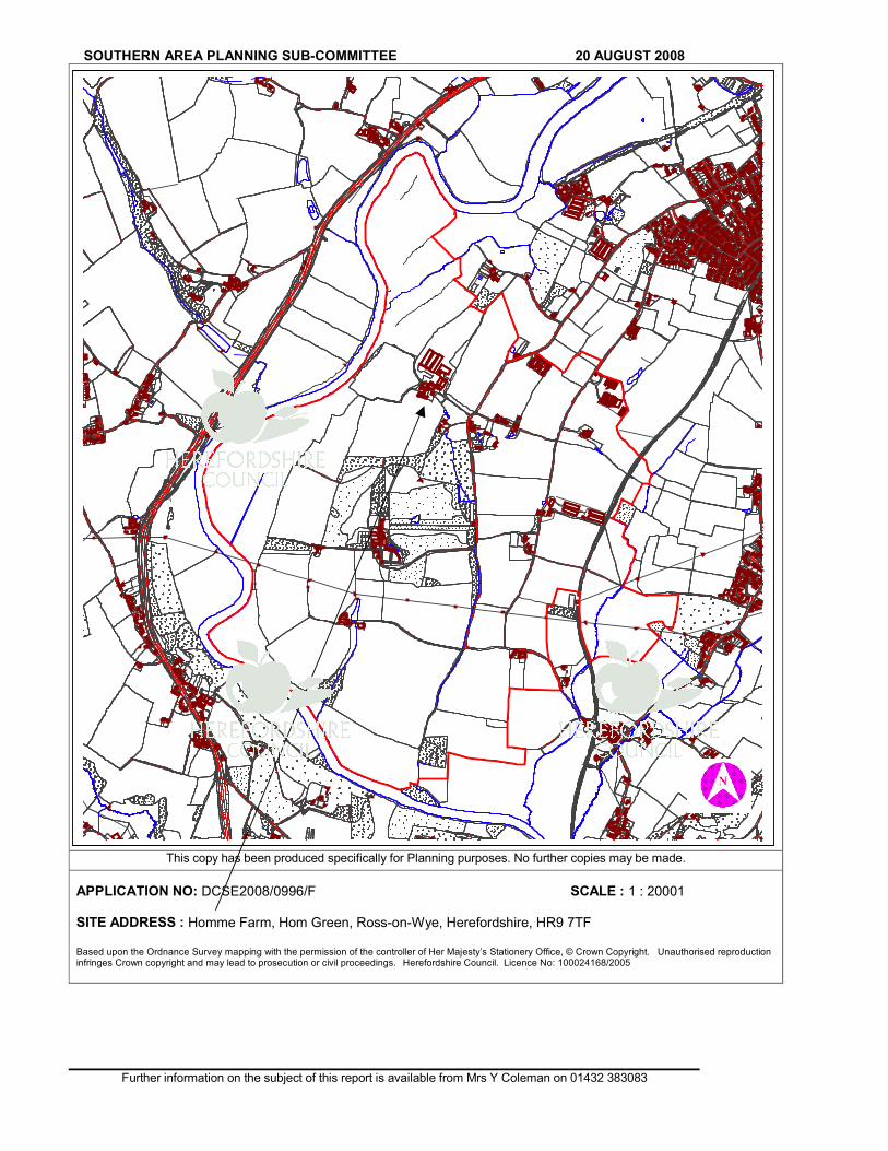
SOUTHERN AREA PLANNING SUB-COMMITTEE 20 AUGUST 2008
Further information on the subject of this report is available from Mrs Y Coleman on 01432 383083
This copy has been produced specifically for Planning purposes. No further copies may be made.
APPLICATION NO: DCSE2008/0996/F SCALE : 1 : 20001 SITE ADDRESS : Homme Farm, Hom Green, Ross-on-Wye, Herefordshire, HR9 7TF Based upon the Ordnance Survey mapping with the permission of the controller of Her Majesty’s Stationery Office, © Crown Copyright. Unauthorised reproduction infringes Crown copyright and may lead to prosecution or civil proceedings. Herefordshire Council. Licence No: 100024168/2005
Related Documents