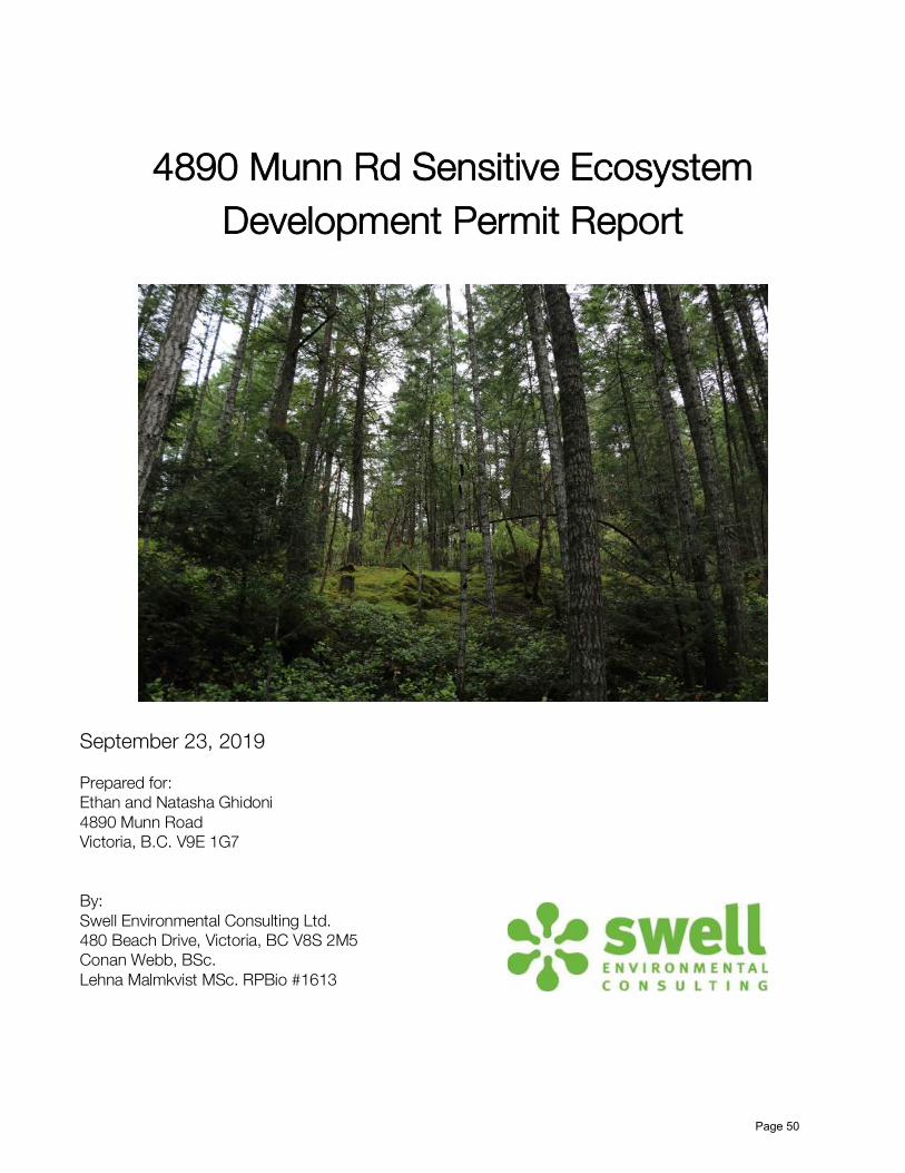
4890 Munn Rd Sensitive Ecosystem Development Permit Report September 23, 2019 Prepared for: Ethan and Natasha Ghidoni 4890 Munn Road Victoria, B.C. V9E 1G7 By: Swell Environmental Consulting Ltd. 480 Beach Drive, Victoria, BC V8S 2M5 Conan Webb, BSc. Lehna Malmkvist MSc. RPBio #1613 Page 50

Welcome message from author
This document is posted to help you gain knowledge. Please leave a comment to let me know what you think about it! Share it to your friends and learn new things together.
Transcript
4890 Munn Rd Sensitive Ecosystem
Development Permit Report
September 23, 2019
Prepared for: Ethan and Natasha Ghidoni 4890 Munn Road Victoria, B.C. V9E 1G7 By: Swell Environmental Consulting Ltd. 480 Beach Drive, Victoria, BC V8S 2M5 Conan Webb, BSc. Lehna Malmkvist MSc. RPBio #1613
Page 50
Table of Contents Introduction 3 Methods 5 Background Information 6 Ecological Overview 7
Birds 8 Other Wildlife 8 Vegetation 9
Recommendations 11 House Site Selection 11 Protecting Ecological Features 11 Environmental Protection During Construction 12
Summary 14 References 16
Appendix 1 - Plant List 36 Appendix 2 – Bird List 37
Page 51
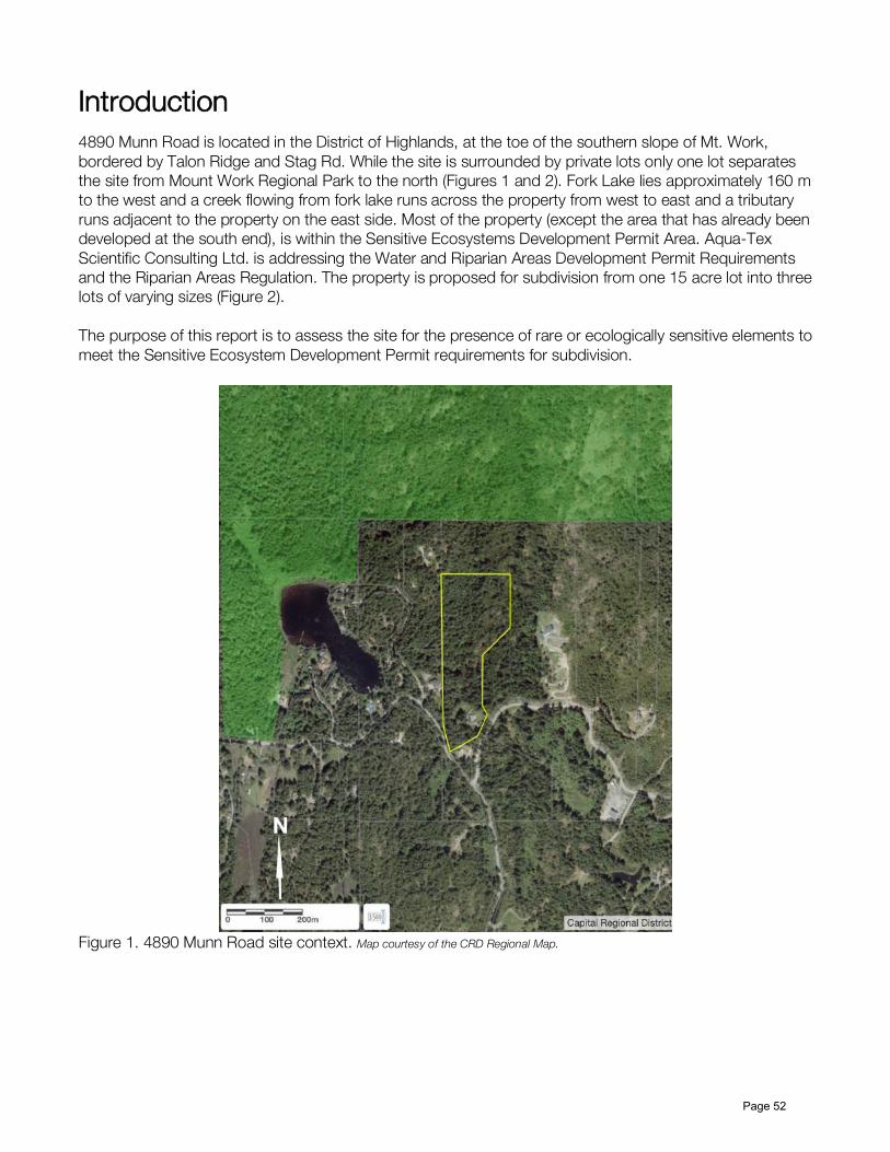
Introduction 4890 Munn Road is located in the District of Highlands, at the toe of the southern slope of Mt. Work, bordered by Talon Ridge and Stag Rd. While the site is surrounded by private lots only one lot separates the site from Mount Work Regional Park to the north (Figures 1 and 2). Fork Lake lies approximately 160 m to the west and a creek flowing from fork lake runs across the property from west to east and a tributary runs adjacent to the property on the east side. Most of the property (except the area that has already been developed at the south end), is within the Sensitive Ecosystems Development Permit Area. Aqua-Tex Scientific Consulting Ltd. is addressing the Water and Riparian Areas Development Permit Requirements and the Riparian Areas Regulation. The property is proposed for subdivision from one 15 acre lot into three lots of varying sizes (Figure 2). The purpose of this report is to assess the site for the presence of rare or ecologically sensitive elements to meet the Sensitive Ecosystem Development Permit requirements for subdivision.
Figure 1. 4890 Munn Road site context. Map courtesy of the CRD Regional Map.
Page 52
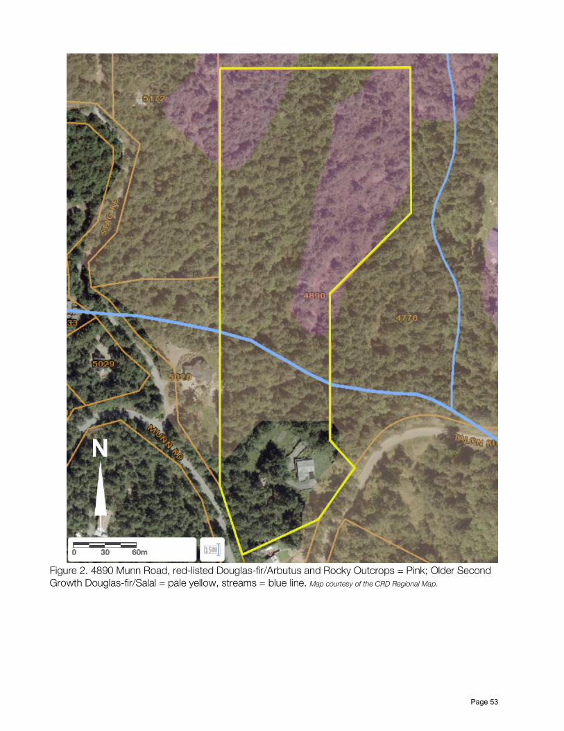
Figure 2. 4890 Munn Road, red-listed Douglas-fir/Arbutus and Rocky Outcrops = Pink; Older Second Growth Douglas-fir/Salal = pale yellow, streams = blue line. Map courtesy of the CRD Regional Map.
Page 53
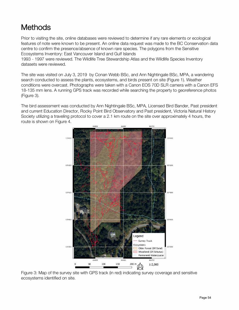
Methods Prior to visiting the site, online databases were reviewed to determine if any rare elements or ecological features of note were known to be present. An online data request was made to the BC Conservation data centre to confirm the presence/absence of known rare species. The polygons from the Sensitive Ecosystems Inventory: East Vancouver Island and Gulf Islands 1993 - 1997 were reviewed. The Wildlife Tree Stewardship Atlas and the Wildlife Species Inventory datasets were reviewed. The site was visited on July 3, 2019 by Conan Webb BSc, and Ann Nightingale BSc, MPA, a wandering search conducted to assess the plants, ecosystems, and birds present on site (Figure 1). Weather conditions were overcast. Photographs were taken with a Canon EOS 70D SLR camera with a Canon EFS 18-135 mm lens. A running GPS track was recorded while searching the property to georeference photos (Figure 3). The bird assessment was conducted by Ann Nightingale BSc, MPA, Licensed Bird Bander, Past president and current Education Director, Rocky Point Bird Observatory and Past president, Victoria Natural History Society utilizing a traveling protocol to cover a 2.1 km route on the site over approximately 4 hours, the route is shown on Figure 4.
Figure 3: Map of the survey site with GPS track (in red) indicating survey coverage and sensitive ecosystems identified on site.
Page 54
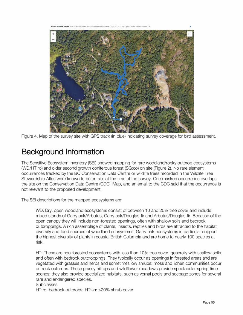
Figure 4. Map of the survey site with GPS track (in blue) indicating survey coverage for bird assessment.
Background Information The Sensitive Ecosystem Inventory (SEI) showed mapping for rare woodland/rocky outcrop ecosystems (WD/HT:ro) and older second growth coniferous forest (SG:co) on site (Figure 2). No rare element occurrences tracked by the BC Conservation Data Centre or wildlife trees recorded in the Wildlife Tree Stewardship Atlas were known to be on site at the time of the survey. One masked occurrence overlaps the site on the Conservation Data Centre (CDC) iMap, and an email to the CDC said that the occurrence is not relevant to the proposed development. The SEI descriptions for the mapped ecosystems are:
WD: Dry, open woodland ecosystems consist of between 10 and 25% tree cover and include mixed stands of Garry oak/Arbutus, Garry oak/Douglas-fir and Arbutus/Douglas-fir. Because of the open canopy they will include non-forested openings, often with shallow soils and bedrock outcroppings. A rich assemblage of plants, insects, reptiles and birds are attracted to the habitat diversity and food sources of woodland ecosystems. Garry oak ecosystems in particular support the highest diversity of plants in coastal British Columbia and are home to nearly 100 species at risk. HT: These are non-forested ecosystems with less than 10% tree cover, generally with shallow soils and often with bedrock outcroppings. They typically occur as openings in forested areas and are vegetated with grasses and herbs and sometimes low shrubs; moss and lichen communities occur on rock outcrops. These grassy hilltops and wildflower meadows provide spectacular spring time scenes; they also provide specialized habitats, such as vernal pools and seepage zones for several rare and endangered species. Subclasses HT:ro: bedrock outcrops; HT:sh: >20% shrub cover
Page 55
SG: These forested ecosystems have a dominant age class of 60 - 100 years. While not as biologically rich as Older Forests, they can serve as important buffers around sensitive ecosystems and vital links between habitat patches. They often provide critical habitat for species that require both open and forested areas during their life-cycle. The biological diversity of forests generally increases with age. Where older forests are rare or absent, older second growth forests become more important as they gradually develop old forest characteristics. Subclasses SG:co (conifer-dominated): >85% coniferous species; SG:mx (mixed conifer and deciduous): a minimum of 15% cover of either group is included in the total tree cover
Ecological Overview The onsite survey confirmed the presence of the sensitive woodland ecosystems, red listed Douglas-fir/Arbutus, with rocky outcrops, in the northwest and northeast portions of the property (Figure 2). While the second growth ecosystem is present on the remainder of the site except where the development has occurred for the existing single family home. It appears to be younger than anticipated and may be on the younger end of the SEI category of Older Second Growth forest (60-100 years old). However, tree size depends largely on site conditions and much of the site has thin soil and a low nutrient regime which would cause slower tree growth and cause the forest to appear younger with smaller trees and higher stand density. During the site visit three broad ecotypes were identified on site:
● Douglas-fir/salal forest ● Douglas-fir/salal - riparian ● Douglas-fir/arbutus woodland
The overall habitat is Douglas-fir/salal forest in the south and gully bottoms grading into Douglas-fir/Arbutus woodland with rocky outcrops were bedrock is closer to the surface upslope to the north and up to the ridges to the northeast and northwest. The entire site has been previously cleared at least twice with evidence of second growth logging (larger more decomposed stumps and relatively small less decomposed stumps found in the understory). Several introduced and invasive species were noted on site; however, their density is currently low. The exact age of the ecosystems on site is difficult to determine and while it they appear younger than expected for an Older Second Growth Sensitive ecosystem polygon this may be due to slower tree growth on this thin soiled and lower nutrient site. It is possible that the stand age is less than 60 years and does not fit the category of Older Second Growth forest, however, further work involving tree coring or determining the date of logging from the previous land owner would be required to confirm. Regardless of the exact age of the ecosystems on site, they are well connected to adjacent habitat and in less than 50 years, if not cleared, will begin to exhibit the characteristics of Older Second Growth. While previous clearing has been undertaken several larger diameter rotting logs are present on site and provide habitat for amphibians. In addition some snags are present on site and provide habitat as wildlife trees. Several old logging roads run through the site and onto adjacent properties. The main road runs north and slightly east the length of the property and lies in the bottom of a gully. Other than the stream running through the southern portion of the site and the wet gully down the middle no other unique habitat sites (such as wetlands or vernal pools were noted on site).
Page 56
The site generally had low plant diversity with a lower than expected number of species especially in the shrub and herb layers. This could be due to the age of the forest and could also be due in part to large deer populations. Several introduced and invasive species were noted on site, however, their density is currently low. While no exotic plant species found on site are regulated noxious weeds in BC some are unregulated invasive plants of concern listed by the Invasive Species Council of BC:
○ spurge-laurel (Daphne laureola) ○ English holly (Ilex aquifolium) ○ Scotch broom (Cytisus scoparius)
Birds Ann Nightingale conducted an assessment for protected bird nests protected, as well as a general survey for bird habitat, including wildlife trees, and species utlizing the site. There was no evidence of nests of any of the species offered special protection under the Wildlife Protection Act. Specifically, there were no nests of eagles, peregrines, gyrfalcons, wsprey, herons, or burrowing owls. The site contained only a few trees large enough for eagles and was unsuitable for peregrines, gyrfalcons and burrowing owls. While the trees may have supported osprey or herons, there were many similar or larger trees closer to the nearby lakes, and therefore, more suitable for nesting. Of the 26 species listied in Appendix 2, those listed as “flyover” are unlikely breeders for the site. All of the others are potential breeders on the property. Recently fledged juvenile Chestnut-backed Chickadee and Orange-crowned Warbler were present, Hammond Flycatchers were carrying food (indicating a nest nearby), and most of the other species were singing, suggesting birds on territory (Photos 2-5). There are several other species that were not detected on this survey, but are likely feeders, if not breeders on the site. These include Pacific Wren, Swainson’s Thrush, Rufous Hummingbird, Downy Woodpecker, and Western Tanager, among others. There were several wildlife trees on the site, including one with a cavity suitable for Western Screech Owl. This is a species that used to be common in the Victoria area, but now are present in small numbers throughout the region. There is a known nest site within 2 km of the subject site, so this cavity should be checked if the tree is going to be removed. The tree is at 10 U 464607 5374297. And is located at the north end of the property (Figure 3, Photo 1).
Other Wildlife Stunted heavily browsed shrubs and trees were noted as well as extensive deer trails and live deer sightings, signs of eastern grey squirrel (non-native) were also observed. Several large diameter logs were noted on site and such coarse woody debris provides habitat for amphibians, and a red-legged frog was observed within the riparian zone of the stream crossing the property (Photos 6 and 7). Red-legged frogs (Ranus Other species which may be present on such a large forested site are raccoon, deer mouse, other small mammals (bats, shrews, Townsend’s Vole), reptiles (garter snakes), and potentially cougar.
Page 57
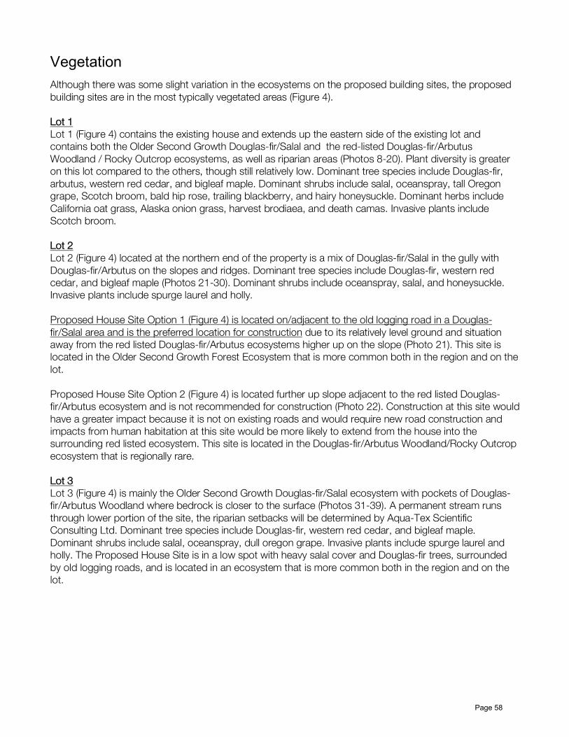
Vegetation Although there was some slight variation in the ecosystems on the proposed building sites, the proposed building sites are in the most typically vegetated areas (Figure 4). Lot 1 Lot 1 (Figure 4) contains the existing house and extends up the eastern side of the existing lot and contains both the Older Second Growth Douglas-fir/Salal and the red-listed Douglas-fir/Arbutus Woodland / Rocky Outcrop ecosystems, as well as riparian areas (Photos 8-20). Plant diversity is greater on this lot compared to the others, though still relatively low. Dominant tree species include Douglas-fir, arbutus, western red cedar, and bigleaf maple. Dominant shrubs include salal, oceanspray, tall Oregon grape, Scotch broom, bald hip rose, trailing blackberry, and hairy honeysuckle. Dominant herbs include California oat grass, Alaska onion grass, harvest brodiaea, and death camas. Invasive plants include Scotch broom. Lot 2 Lot 2 (Figure 4) located at the northern end of the property is a mix of Douglas-fir/Salal in the gully with Douglas-fir/Arbutus on the slopes and ridges. Dominant tree species include Douglas-fir, western red cedar, and bigleaf maple (Photos 21-30). Dominant shrubs include oceanspray, salal, and honeysuckle. Invasive plants include spurge laurel and holly. Proposed House Site Option 1 (Figure 4) is located on/adjacent to the old logging road in a Douglas-fir/Salal area and is the preferred location for construction due to its relatively level ground and situation away from the red listed Douglas-fir/Arbutus ecosystems higher up on the slope (Photo 21). This site is located in the Older Second Growth Forest Ecosystem that is more common both in the region and on the lot. Proposed House Site Option 2 (Figure 4) is located further up slope adjacent to the red listed Douglas-fir/Arbutus ecosystem and is not recommended for construction (Photo 22). Construction at this site would have a greater impact because it is not on existing roads and would require new road construction and impacts from human habitation at this site would be more likely to extend from the house into the surrounding red listed ecosystem. This site is located in the Douglas-fir/Arbutus Woodland/Rocky Outcrop ecosystem that is regionally rare. Lot 3 Lot 3 (Figure 4) is mainly the Older Second Growth Douglas-fir/Salal ecosystem with pockets of Douglas-fir/Arbutus Woodland where bedrock is closer to the surface (Photos 31-39). A permanent stream runs through lower portion of the site, the riparian setbacks will be determined by Aqua-Tex Scientific Consulting Ltd. Dominant tree species include Douglas-fir, western red cedar, and bigleaf maple. Dominant shrubs include salal, oceanspray, dull oregon grape. Invasive plants include spurge laurel and holly. The Proposed House Site is in a low spot with heavy salal cover and Douglas-fir trees, surrounded by old logging roads, and is located in an ecosystem that is more common both in the region and on the lot.
Page 58
Figure 4: Sensitive ecosystems overlay with proposed house sites and lot subdivision, yellow dot is the location of the wildlife tree noted in the bird assessment.
Page 59
Recommendations
House Site Selection The house sites should be selected to utilize existing roads and disturbed areas, as well as to preserve the red-listed Douglas-fir/Arbutus Woodlands and Herbaceous Terrestrial areas in the northeast and northwest portions of the site:
• Lot 1: the existing house will be utilized, no new houses are proposed • Lot 2: the recommended house site is Option 1, which is located in the more common Older
Second Growth ecosystem, and is located where this is historic disturbance and logging roads. • Lot 3: the proposed house site is within the more common Older Second Growth ecosystem and
is surrounded by existing logging roads. The access to the house sites should utilize existing logging roads and cleared areas as much as possible to maintain habitat contiguity, minimize ecosystem fragmentation and minimize tree and native understory removal. The clearing should be limited to the extent required for the construction and landscaping footprint of the house sites, and as is required for fire protection.
Protecting Ecological Features • Avoid construction within the red-listed Douglas-fir/Arbutus and Herbacious terrestrial rocky
outcrop habitats in the northwest and northeast portions of the site (Figure 5). • Minimize development within 30m of the stream that crosses the property to ensure that the blue-
listed red-legged frog habitat on site is protected. The development should be limited to a steam crossing that utilizes the existing road and stream crossing location to access the house sites north of the stream. It is important that naturally vegetated wildlife corridors be retained that connect the wetlands to large patches of forest (Develop with Care, 2014) (Figure 5)
• From Best Management Practices for Amphibian and Reptile Salvages in British Columbia (FLNRO 2016) “ AVOIDANCE TIP – One way to avoid the accidental harming of reptiles (and some amphibians) by equipment is to remove or disturb cover objects in the workspace well in advance of construction. The removal of cover objects [such as coarse woody debris] before work begins may exclude animals from entering, and force animals to move away from, the workspace. Small cover objects can be removed by hand and larger ones using light machinery.”
• Protect streams on and adjacent to the site, as per the Riparian Areas Regulation Assessment Report by Aqua-Tex Scientific Consulting Ltd.
• Wherever feasible, snags/standing dying or dead trees (wildlife trees) should be allowed to remain to provided nesting sites for many of the cavity nesters and provide perching locations and food sources. Preserving large trees, understory shrubs and forbs, and coarse woody debris on the site, will help site retain moisture in the summer and provide habitat for red-legged frogs, salamanders, Pacific chorus Frogs, alligator lizards, garter snakes, and their prey – slugs, snail, and forest arthropods.
• If clearing between February 15 to August 15, conduct a pre-clearing nesting bird survey to ensure no nesting birds will be affected by the construction. Section 34 of the BC Wildlife Act protects birds and their eggs from possession, molestation or destruction. The nests of eagles, peregrine falcons, gyrfalcons, ospreys, herons, and burrowing owls are protected at all times of the year. The nests of all other species are protected when the birds or their eggs are in the nest.
Page 60
• Confine equipment to the construction footprint and avoid placing soil/gravel piles or heavy construction materials around roots of trees to be retained, or otherwise compacting soils or cutting into root zones. Protective tree fencing is helpful for delineating protected areas.
§ Minimize the construction footprint as much as possible to avoid damaging native vegetation, especially rock outcrops, riparian areas, and other sensitive
§ Work with an ISA Certified Arborist to retain trees on the edge of the footprint and to provide guidance on Critical Root Zones and tree protection:
o Minimize tree removals beyond the construction footprint prevent spills or other contamination
o Trim overhanging branches rather than removing trees, where possible § Locations of SPEA, red-legged frog buffer, no-go zones, retained trees and vegetation, and
sensitive areas are fenced, signed and communicated to all personnel. § Water Sustainability Act Section 11 application should be submitted for any works in and about a
stream (e.g. driveway crossing culvert) § Stormwater management should be designed to ensure runoff is detained and treated and does
not deposit sediment or other pollutants into the onsite stream. § Implement Environmental Monitoring mitigation measures to:
o ensure that no sediment laden water enters downstream aquatic ecosystems o prevent spills or other contamination o minimize habitat disturbance o oversee habitat restoration efforts
Environmental Protection During Construction An Environmental Protection Plan with Best Management Practices (BMPs) should be developed once detailed plans have been proposed for the site in order to protect wildlife and both the terrestrial and aquatic environments from construction activities. Develop with Care 2014 provides recommendations for environmental protection for planning development and during construction, combined with the experience of Swell Environmental Consulting Ltd. the following environmental protection measures should be incorporated with the previous recommendations above to minimize ecological damage from construction activities. Erosion and Sediment Control
• Minimize vegetation removal to area currently under development (ie in stages according to construction timetable, as opposed to comprehensive advanced clearing)
• Site clearing should be undertaken immediately prior to construction in order to minimize the amount of time that disturbed soils are exposed to weathering.
• Schedule excavation activities during dry weather, where possible, and utilizing extra caution if working during wet weather
• Do not direct water runoff from the site or dewatering from excavations directly into waterbodies • Cover exposed soils (e.g. tarps, poly, grass seed) and using Polster ‘rough and loose’ method of
soil contouring • Install erosion and sediment control structures (e.g. sediment fence) between the construction
zone and waterbodies, at start of construction, if needed • Ensure soil and debris stockpiles are placed away from the streams and sediment-laden water
cannot flow into the waterbodies. • Contact Environmental Monitors immediately with any concerns.
Page 61
Spill Prevention and Response • Equipment is inspected for leaks prior to beginning work. • Spill response kits (capable of addressing the volume of fuel/oils/chemicals on site) are on site
when any heavy machinery is working, and operators are trained in their use. • Equipment refueling is at a designated location and >30 m from aquatic ecosystems or isolated
from stormdrains. • Fuel generators must be placed in a spill-proof container (e.g. plastic bin, or other impermeable
containment area such as poly-lined bermed depression. • Store all fuel cans in spill-proof containers (e.g. as above). • Concrete wash-water and wet concrete is highly alkaline and toxic to fish and other aquatic
organisms. All concrete wash-water from equipment, trucks and/or hand tools needs to be directed to a settling area away from runoff paths to the waterbodies. Freshly poured concrete needs to be covered when rain is forecasted or runoff needs to be isolated from waterbodies during the curing process.
• In case of spills, the following general steps are recommended: 1. Stop source of spill/prevent further spillage (turn off valves, right overturned containers) 2. Block spill from reaching aquatic (marine or freshwater) environment or pathways to
waterbodies 3. Block spill from spreading 4. Call Environmental Monitors 5. Clean up spilled materials
Environmental Monitoring At a minimum, environmental monitoring should include:
• A pre-construction meeting on-site with the QEP, the owner’s representative, consulting team, and the contractor(s).
• Site visits timed to coincide with key construction activities and based on weather conditions to ensure that all development activities remain outside of the SPEAs, red-legged frog buffer, and that erosion & sediment control and other protective structures are in good working order. Key stages should be agreed upon by the QEP and contractor and include:
• After installation of erosion & sediment control measures • Tree removal • Vegetation clearing • Excavations • Invasive species removal • Native species plantings • Others, as needed
• Site visits for heavy rainfall events (e.g. >15 mm) until such time that the QEP is satisfied that the erosion & sediment control and other protective structures are containing heavy rainfall as designed.
• Site visits for emergencies (e.g. spills). • A post-development visit to inspect works for the conformance statement to the development
permit requirements, and post-development report. • Photo-point monitoring and site visit checklists should be used for clarity of post-development
reporting. • The owner’s representative must notify the QEP a minimum of 2 weeks prior to the project start up
to arrange for the pre-construction meeting.
Page 62
Maintenance • There are currently low densities of invasive plants on site, however, these plants are likely to
spread with time and could be easily controlled before they spread. Further, construction will provide excellent conditions to facilitate their spread.
• Remove noxious weeds and invasive plants of concern from vegetated areas that are to be retained.
• Removal of invasive species, they are currently sparsely distributed on the site, particularly those listed under the Weed Control Act
• Use native plants in landscaping around the houses and include species with fruit or many flowers to provide resources for birds and other pollinators
• Maintain the recovering construction footprint for at least 2 years to avoid invasive species growth in disturbed areas
• Practice strict garbage control to ensure feral animals and opportunistic predators are not inadvertently fed or attracted to the home (MWLAP 2004)
• Avoid herbicides and pesticides in yard maintenance, as these can be detrimental to wildlife, especially amphibians and pollinators
Summary The site assessment confirmed the presence of Sensitive Ecosystem Inventory (SEI) sensitive Woodland/Herbaceous Terrestrial Rocky Outcrop ecosystem (red-listed Douglas-fir/Arbutus ecosystem) in the northwest and northeast portions of the site. The remainder of the undeveloped portion of the property is categorized in the SEI as Older Second Growth. The site generally has low plant diversity with a lower than expected number of species especially in the shrub and herb layers. This could be due to historic disturbance, the site appears to have been logged twice, and could also be due in part to large deer populations. Several introduced and invasive species were noted on site; however, their density is currently low, and manageable. The selected house locations for Lot 2 (Option 1) and Lot 3 minimize disturbance to the site by utilizing areas of historic disturbance, such as existing logging roads, and are outside the red-listed Douglas-fir/Arbutus woodland area and the riparian area. The proposed development should meet the requirements for the Sensitive Ecosystem Development Permit Area provided the proposed house sites are used, existing logging roads are utilized to create the driveway access, clearing is minimized for construction and to meet fire protection requirements, wildlife trees are retained, wildlife corridors left intact, and the recommended areas for protection for riparian areas, red-legged frog habitat, and red-listed ecosystems are implemented, along with the recommended environmental protection measures during construction.
Page 63
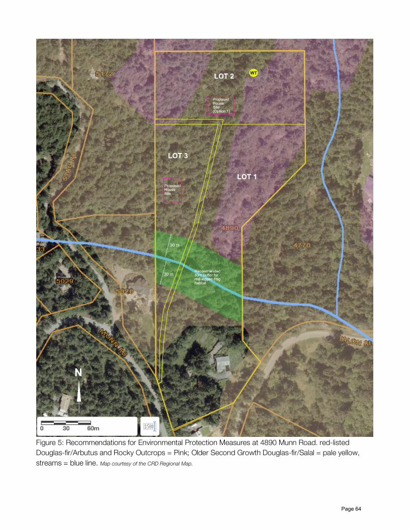
Figure 5: Recommendations for Environmental Protection Measures at 4890 Munn Road. red-listed Douglas-fir/Arbutus and Rocky Outcrops = Pink; Older Second Growth Douglas-fir/Salal = pale yellow, streams = blue line. Map courtesy of the CRD Regional Map.
Page 64
References BC Conservation Data Centre. 2019. Province of British Columbia. 2019. imap online web mapping service, Wildlife Species Inventory datasets. Province of British Columbia. 2014. Develop with Care: Environmental Guidelines for Urban and Rural Land Development in British Columbia
Page 65
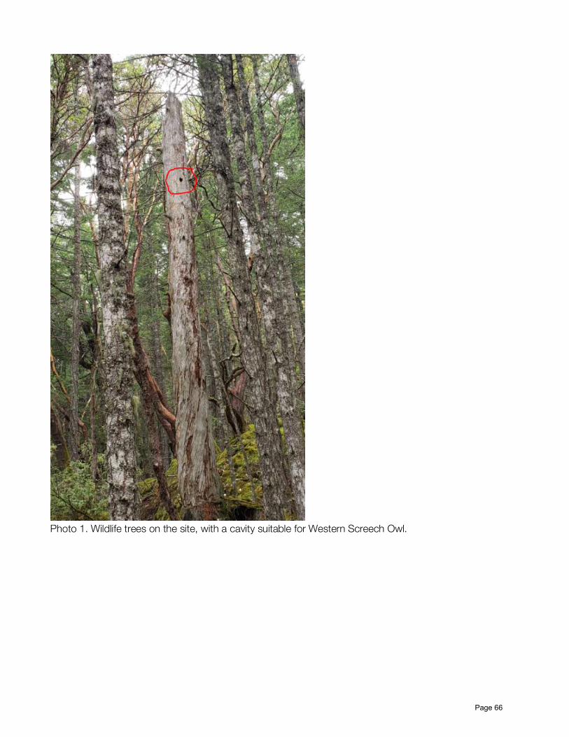
Photo 1. Wildlife trees on the site, with a cavity suitable for Western Screech Owl.
Page 66
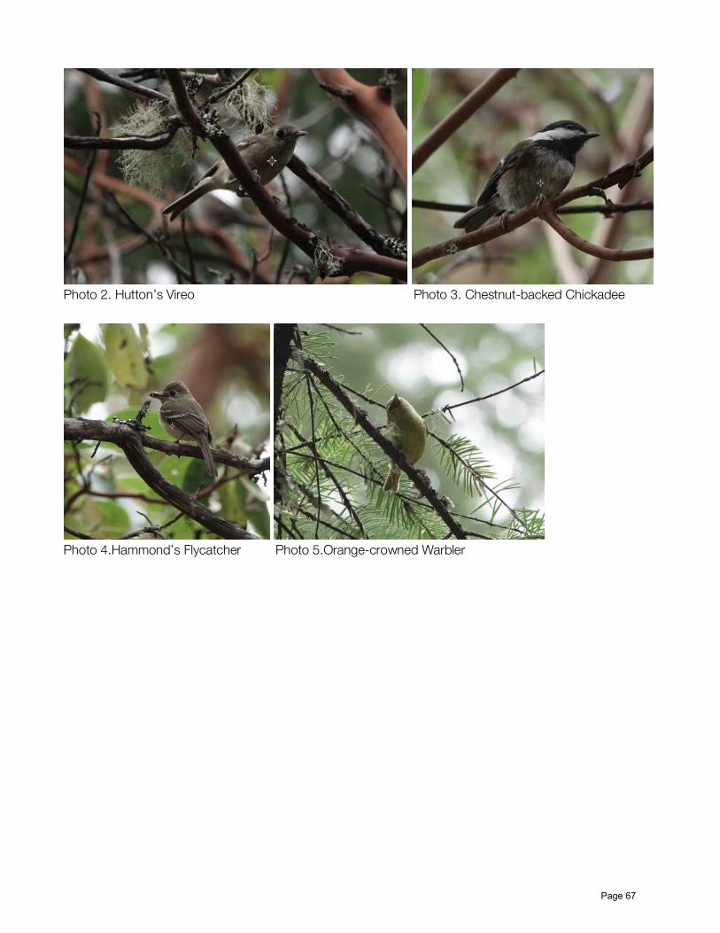
Photo 2. Hutton’s Vireo Photo 3. Chestnut-backed Chickadee
Photo 4.Hammond’s Flycatcher Photo 5.Orange-crowned Warbler
Page 67
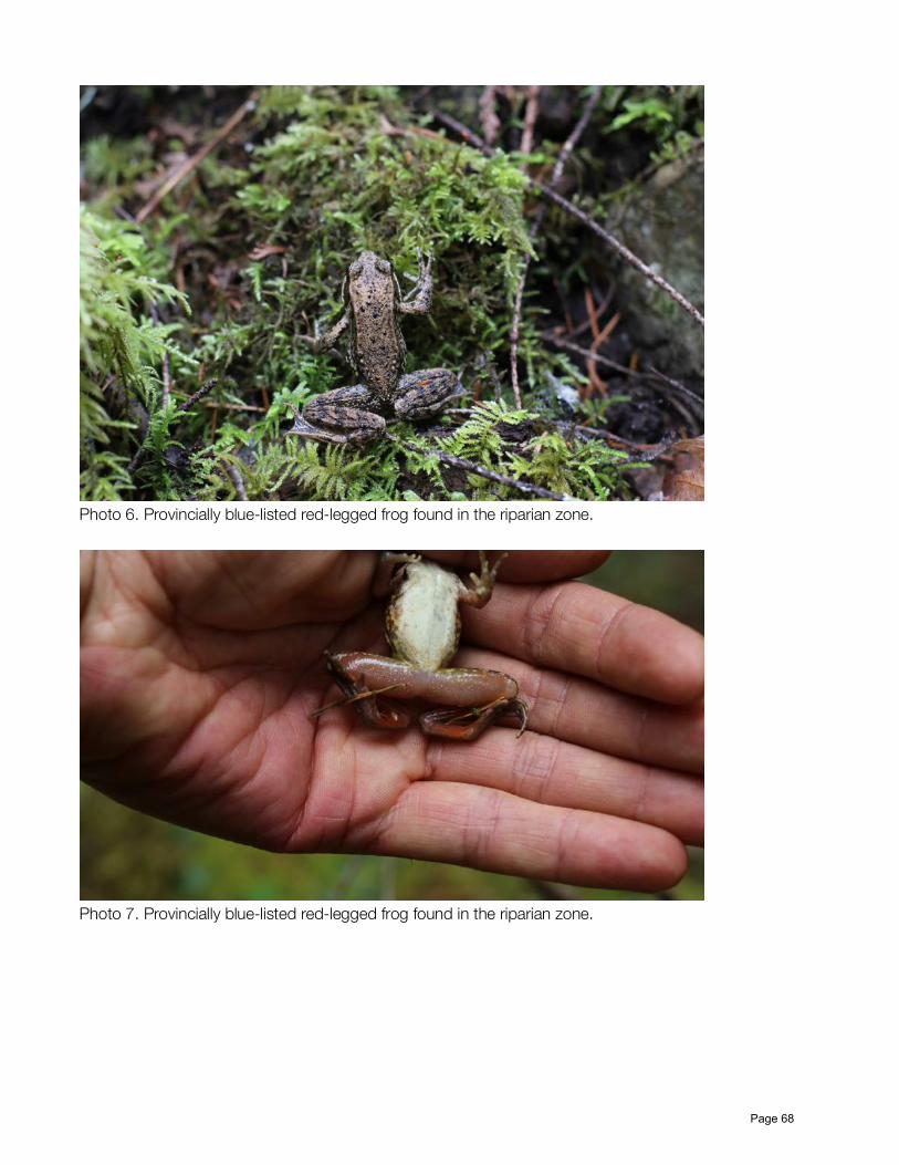
Photo 6. Provincially blue-listed red-legged frog found in the riparian zone.
Photo 7. Provincially blue-listed red-legged frog found in the riparian zone.
Page 68
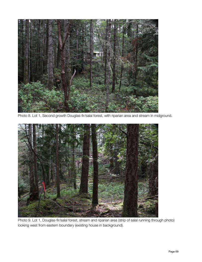
Photo 8. Lot 1, Second growth Douglas-fir/salal forest, with riparian area and stream in midground.
Photo 9. Lot 1, Douglas-fir/salal forest, stream and riparian area (strip of salal running through photo) looking west from eastern boundary (existing house in background).
Page 69
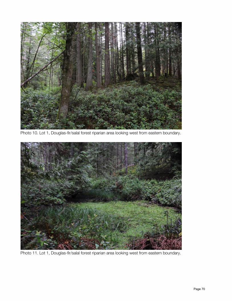
Photo 10. Lot 1, Douglas-fir/salal forest riparian area looking west from eastern boundary.
Photo 11. Lot 1, Douglas-fir/salal forest riparian area looking west from eastern boundary.
Page 70
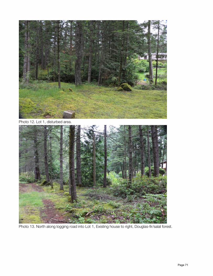
Photo 12. Lot 1, disturbed area.
Photo 13. North along logging road into Lot 1, Existing house to right, Douglas-fir/salal forest.
Page 71
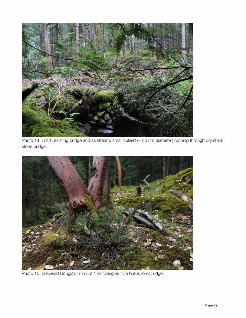
Photo 14. Lot 1, existing bridge across stream, small culvert (~ 30 cm diameter) running through dry stack stone bridge.
Photo 15. Browsed Douglas-fir in Lot 1 on Douglas-fir/arbutus forest ridge.
Page 72
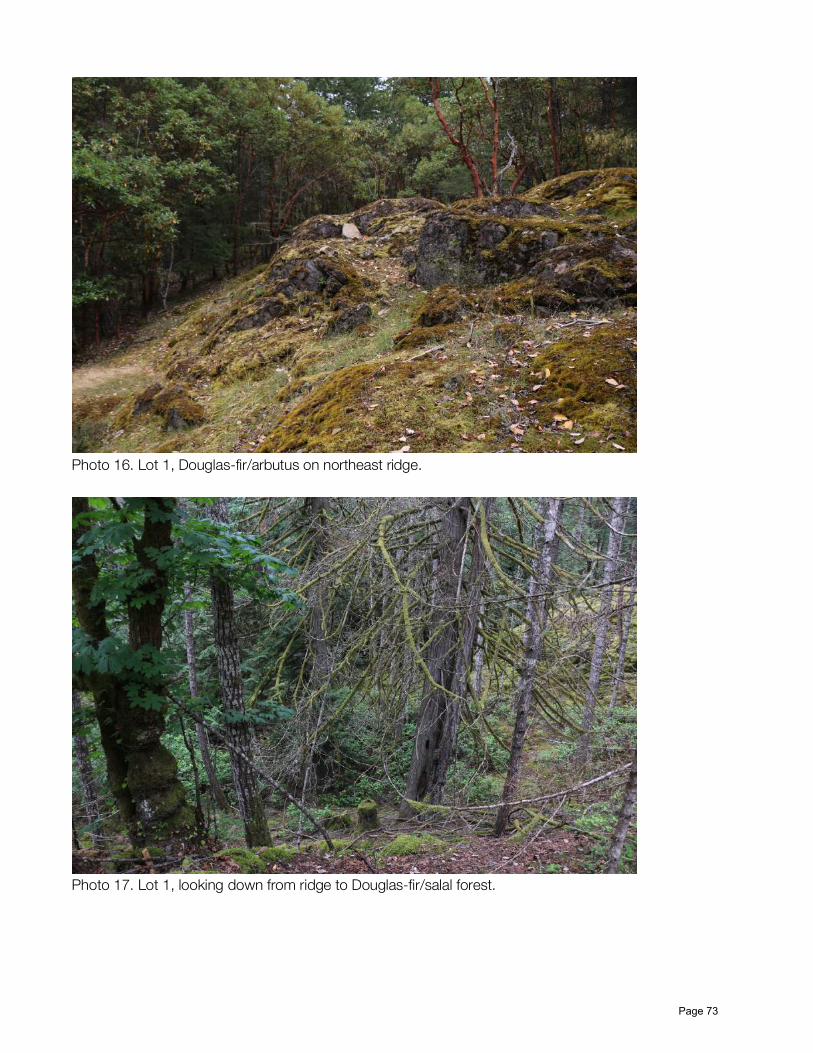
Photo 16. Lot 1, Douglas-fir/arbutus on northeast ridge.
Photo 17. Lot 1, looking down from ridge to Douglas-fir/salal forest.
Page 73
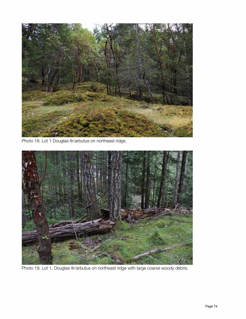
Photo 18. Lot 1 Douglas-fir/arbutus on northeast ridge.
Photo 19. Lot 1, Douglas-fir/arbutus on northeast ridge with large coarse woody debris.
Page 74
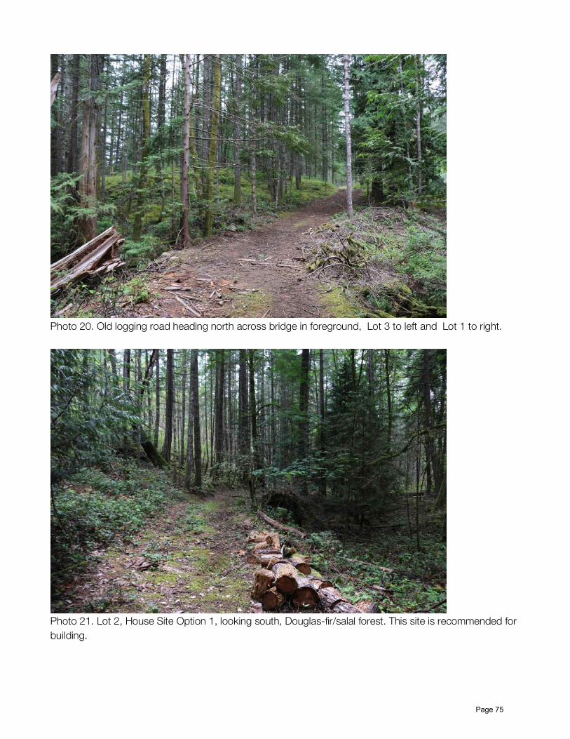
Photo 20. Old logging road heading north across bridge in foreground, Lot 3 to left and Lot 1 to right.
Photo 21. Lot 2, House Site Option 1, looking south, Douglas-fir/salal forest. This site is recommended for building.
Page 75
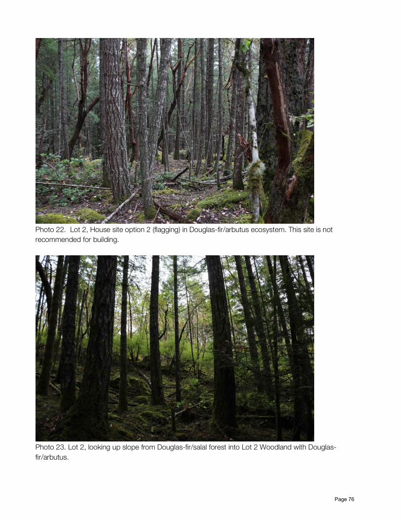
Photo 22. Lot 2, House site option 2 (flagging) in Douglas-fir/arbutus ecosystem. This site is not recommended for building.
Photo 23. Lot 2, looking up slope from Douglas-fir/salal forest into Lot 2 Woodland with Douglas-fir/arbutus.
Page 76
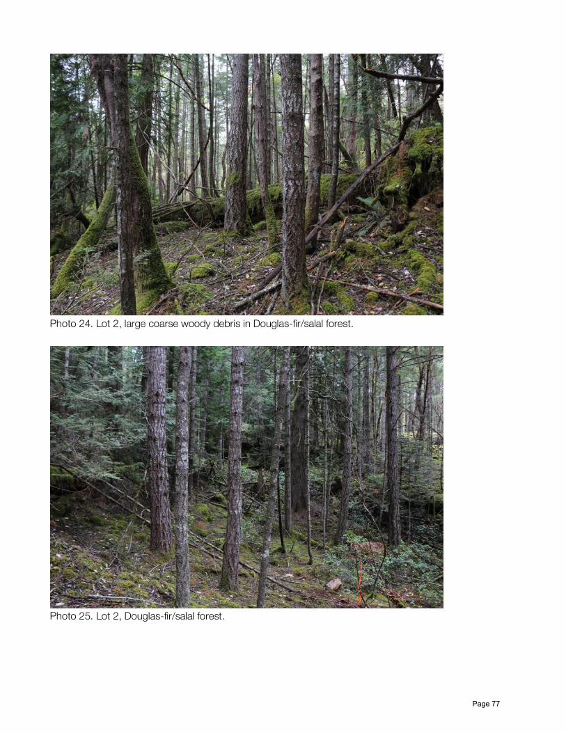
Photo 24. Lot 2, large coarse woody debris in Douglas-fir/salal forest.
Photo 25. Lot 2, Douglas-fir/salal forest.
Page 77
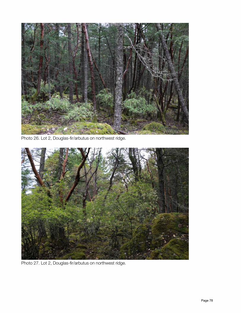
Photo 26. Lot 2, Douglas-fir/arbutus on northwest ridge.
Photo 27. Lot 2, Douglas-fir/arbutus on northwest ridge.
Page 78
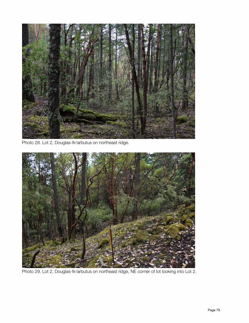
Photo 28. Lot 2, Douglas-fir/arbutus on northeast ridge.
Photo 29. Lot 2, Douglas-fir/arbutus on northeast ridge, NE corner of lot looking into Lot 2.
Page 79
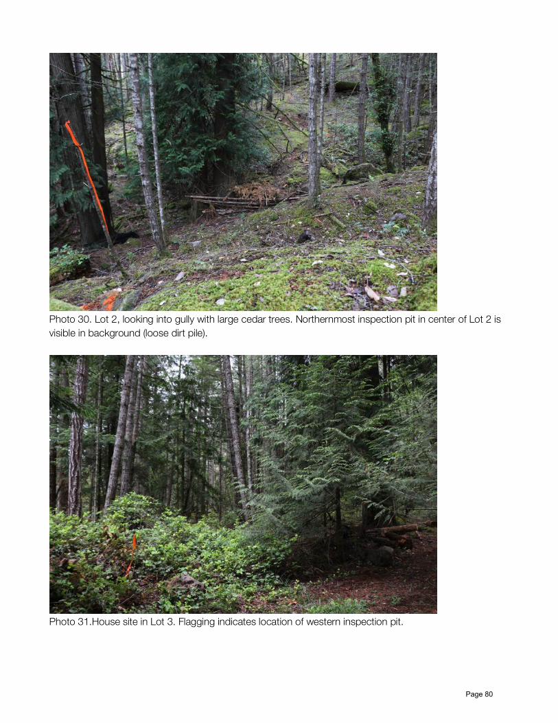
Photo 30. Lot 2, looking into gully with large cedar trees. Northernmost inspection pit in center of Lot 2 is visible in background (loose dirt pile).
Photo 31.House site in Lot 3. Flagging indicates location of western inspection pit.
Page 80
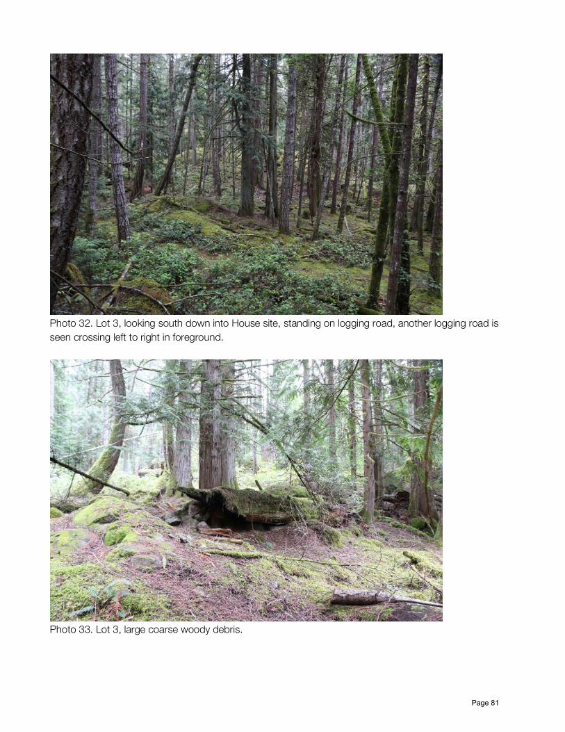
Photo 32. Lot 3, looking south down into House site, standing on logging road, another logging road is seen crossing left to right in foreground.
Photo 33. Lot 3, large coarse woody debris.
Page 81
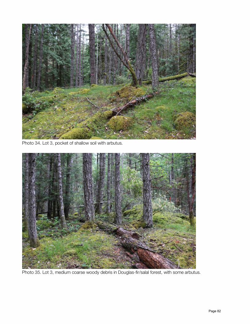
Photo 34. Lot 3, pocket of shallow soil with arbutus.
Photo 35. Lot 3, medium coarse woody debris in Douglas-fir/salal forest, with some arbutus.
Page 82
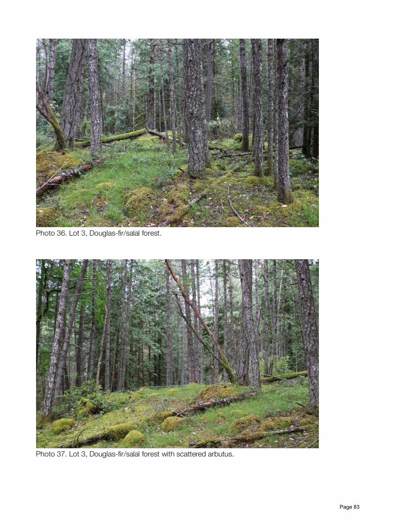
Photo 36. Lot 3, Douglas-fir/salal forest.
Photo 37. Lot 3, Douglas-fir/salal forest with scattered arbutus.
Page 83
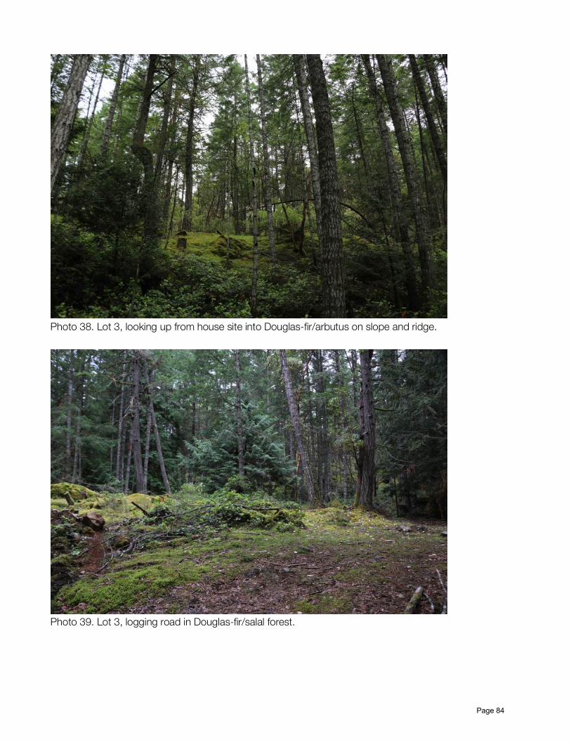
Photo 38. Lot 3, looking up from house site into Douglas-fir/arbutus on slope and ridge.
Photo 39. Lot 3, logging road in Douglas-fir/salal forest.
Page 84
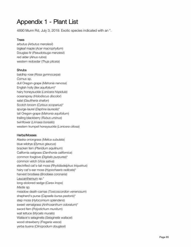
Appendix 1 - Plant List 4890 Munn Rd, July 3, 2019. Exotic species indicated with an *. Trees arbutus (Arbutus menziesii) bigleaf maple (Acer macrophyllum) Douglas-fir (Pseudotsuga menziesii) red alder (Alnus rubra) western redcedar (Thuja plicata) Shrubs baldhip rose (Rosa gymnocarpa) Cornus sp. dull Oregon-grape (Mahonia nervosa) English holly (Ilex aquifolium)* hairy honeysuckle (Lonicera hispidula) oceanspray (Holodiscus discolor) salal (Gaultheria shallon) Scotch broom (Cytisus scoparius)* spurge-laurel (Daphne laureola)* tall Oregon-grape (Mahonia aquifolium) trailing blackberry (Rubus ursinus) twinflower (Linnaea borealis) western trumpet honeysuckle (Lonicera ciliosa) Herbs/Mosses Alaska oniongrass (Melica subulata) blue wildrye (Elymus glaucus) bracken fern (Pteridium aquilinum) California oatgrass (Danthonia californica) common foxglove (Digitalis purpurea)* common vetch (Vicia sativa) electrified cat's-tail moss (Rhytidiadelphus triquetrus) hairy cat's-ear moss (Hypochaeris radicata)* harvest brodiaea (Brodiaea coronaria) Leucanthemum sp.* long-stoloned sedge (Carex inops) Madia sp. meadow death-camas (Toxicoscordion venenosum) shepherd's purse (Capsella bursa-pastoris)* step moss (Hylocomium splendens) sweet vernalgrass (Anthoxanthum odoratum)* sword fern (Polystichum munitum) wall lettuce (Mycelis muralis) Wallace's selaginella (Selaginella wallacei) wood strawberry (Fragaria vesca) yerba buena (Clinopodium douglasii)
Page 85
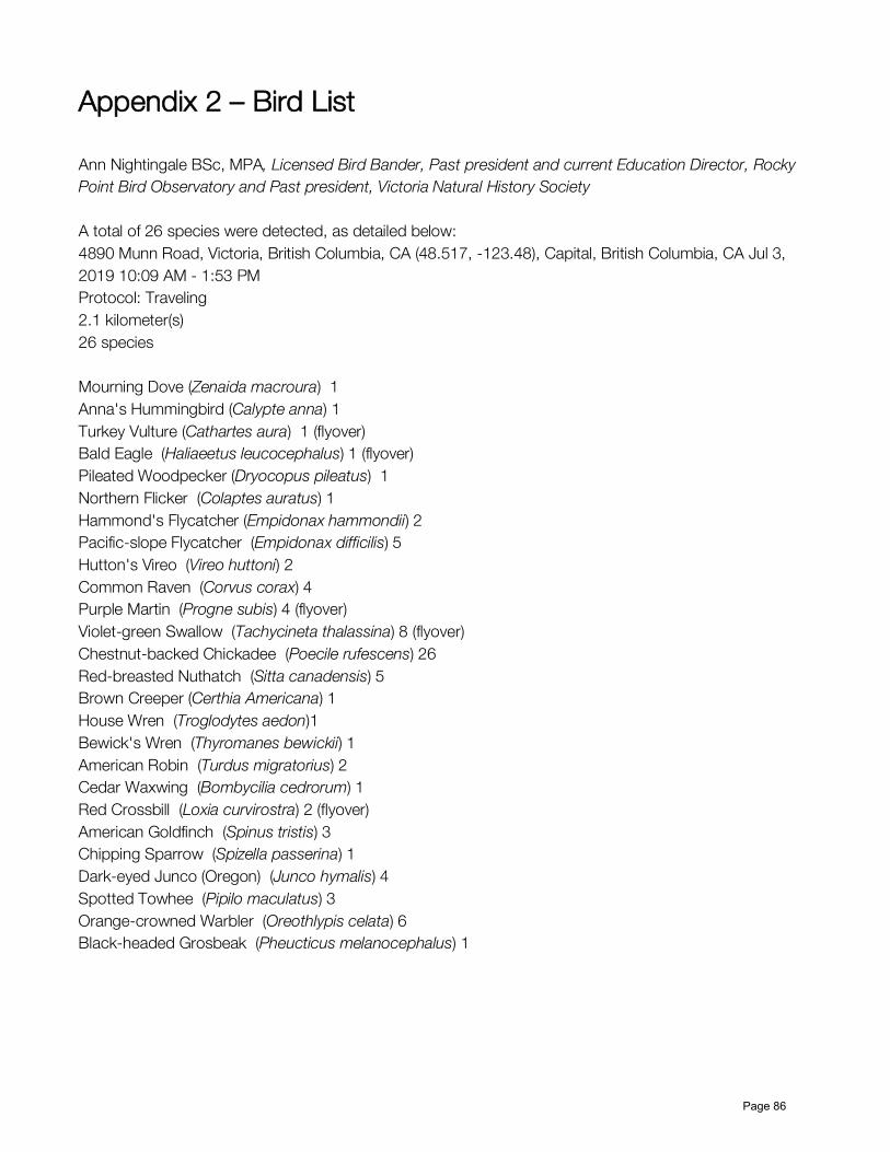
Appendix 2 – Bird List Ann Nightingale BSc, MPA, Licensed Bird Bander, Past president and current Education Director, Rocky Point Bird Observatory and Past president, Victoria Natural History Society A total of 26 species were detected, as detailed below: 4890 Munn Road, Victoria, British Columbia, CA (48.517, -123.48), Capital, British Columbia, CA Jul 3, 2019 10:09 AM - 1:53 PM Protocol: Traveling 2.1 kilometer(s) 26 species Mourning Dove (Zenaida macroura) 1 Anna's Hummingbird (Calypte anna) 1 Turkey Vulture (Cathartes aura) 1 (flyover) Bald Eagle (Haliaeetus leucocephalus) 1 (flyover) Pileated Woodpecker (Dryocopus pileatus) 1 Northern Flicker (Colaptes auratus) 1 Hammond's Flycatcher (Empidonax hammondii) 2 Pacific-slope Flycatcher (Empidonax difficilis) 5 Hutton's Vireo (Vireo huttoni) 2 Common Raven (Corvus corax) 4 Purple Martin (Progne subis) 4 (flyover) Violet-green Swallow (Tachycineta thalassina) 8 (flyover) Chestnut-backed Chickadee (Poecile rufescens) 26 Red-breasted Nuthatch (Sitta canadensis) 5 Brown Creeper (Certhia Americana) 1 House Wren (Troglodytes aedon)1 Bewick's Wren (Thyromanes bewickii) 1 American Robin (Turdus migratorius) 2 Cedar Waxwing (Bombycilia cedrorum) 1 Red Crossbill (Loxia curvirostra) 2 (flyover) American Goldfinch (Spinus tristis) 3 Chipping Sparrow (Spizella passerina) 1 Dark-eyed Junco (Oregon) (Junco hymalis) 4 Spotted Towhee (Pipilo maculatus) 3 Orange-crowned Warbler (Oreothlypis celata) 6 Black-headed Grosbeak (Pheucticus melanocephalus) 1
Page 86
Related Documents