, BARRIE, ON L TEL: (705) 812-3281 FAX: (705) 812-3438 EMAIL: [email protected] WEB: www.ipsconsultinginc.com IPS INNOVATIVE PLANNING SOLUTIONS P L A N N E R S • P R O J E C T M A N A G E R S • L A N D D E V E L O P E R S IPS 520 & 526 BIG BAY POINT ROAD PLANNING JUSTIFICATION REPORT CITY OF BARRIE IPS NO. 20-1009 April 2021

Welcome message from author
This document is posted to help you gain knowledge. Please leave a comment to let me know what you think about it! Share it to your friends and learn new things together.
Transcript

,BARRIE, ON L
TEL: (705) 812-3281FAX: (705) 812-3438
EMAIL: [email protected]: www.ipsconsultinginc.com
IPSINNOVATIVE PLANNING SOLUTIONSP L A N N E R S • P R O J E C T M A N A G E R S • L A N D D E V E L O P E R S
IPS
520 & 526 BIG BAY POINT ROAD
PLANNING JUSTIFICATION REPORTCITY OF BARRIE
IPS NO. 20-1009
April 2021

Planning Justification Report CITY OF BARRIE IPS File No: 20-1009 PAGE i
520 & 526 BIG BAY POINT ROAD
Part of Lot 13, Concession 13
CITY OF BARRIE,
COUNTY OF SIMCOE
APPLICATION FOR
ZONING BY-LAW AMENDMENT
PREPARED BY
INNOVATIVE PLANNING SOLUTIONS
647 Welham Road, Unit 9A Barrie, ON L4N 0B7
TEL: (705) 812-3281 FAX: (705) 812-3438
ON BEHALF OF
MORRIELLO CONSTRUCTION LTD.
APRIL 2021

PLANNING JUSTIFICATION REPORT
Planning Justification Report CITY OF BARRIE IPS File No: 20-1009 PAGE 2
TABLE OF CONTENTS 1.0 INTRODUCTION ................................................................................................. 4
2.0 SITE DESCRIPTION ........................................................................................... 5
3.0 SURROUNDING LAND USES ............................................................................ 5
4.0 DESCRIPTION OF DEVELOPMENT .................................................................. 8
5.0 CONSULTATION .............................................................................................. 11
6.0 ZONING BY-LAW AMENDMENT ...................................................................... 11
7.0 PLANNING POLICY & ANALYSIS .................................................................... 19
7.1 THE PLANNING ACT – PROVINCIAL INTEREST .......................................... 19 7.2 PROVINCIAL POLICY STATEMENT .............................................................. 20 7.3 GROWTH PLAN FOR THE GREATER GOLDEN HORSESHOE ................... 21 7.4 CITY OF BARRIE OFFICIAL PLAN ................................................................ 24
7.4.1 HOUSING .................................................................................................... 27 7.4.2 RESIDENTIAL LAND USE DESIGNATION & INTENSIFICATION ............... 29 7.4.3 SERVICING & TRANSPORTATION ............................................................ 30 7.4.5 TALL BUILDINGS & HEIGHT CONTROL .................................................... 32 7.4.5 NATURAL HERITAGE & ENVIRONMENT................................................... 32
7.5 LAKE SIMCOE PROTECTION PLAN (LSPP) ................................................. 33 7.6 CITY OF BARRIE OFFICIAL PLAN URBAN DESIGN GUIDELINES & URBAN DESIGN MANUAL..................................................................................................... 34
7.6.1 PHYSICAL ENVIRONMENT & BUILDING SITING ..................................... 34 7.6.2 SITE CIRCULATION & PARKING AREAS .................................................. 35 7.6.3 SITE SERVICES & UTILITIES .................................................................... 35 7.6.4 LIGHTING, SIGNAGE & FENCING............................................................. 36 7.6.5 ARCHITECURAL DESIGN ......................................................................... 36 7.6.6 LANDSCAPE DESIGN................................................................................ 37 7.6.7 TRANSIT .................................................................................................... 37 7.6.8 ENERGY EFFICIENCY ............................................................................... 38
7.7 INTENSIFCATION AREA URBAN DESIGN GUIDELINES ............................. 39 7.7.1 INTENSIFCATION NODES ........................................................................ 41 7.7.2 MIXED-USE AND RESIDENTIAL AREAS .................................................. 41 7.7.3 MJOR TRANSIT STATIONS ....................................................................... 42 7.7.4 GENERAL DEVELOPMENT GUIDELINES ................................................. 43 7.7.5 NATURAL HERITAGE ................................................................................ 44
8.0 CONCLUSION .................................................................................................. 45
PLANNING JUSTIFICATION REPORT
Planning Justification Report CITY OF BARRIE IPS File No: 20-1009 PAGE 3
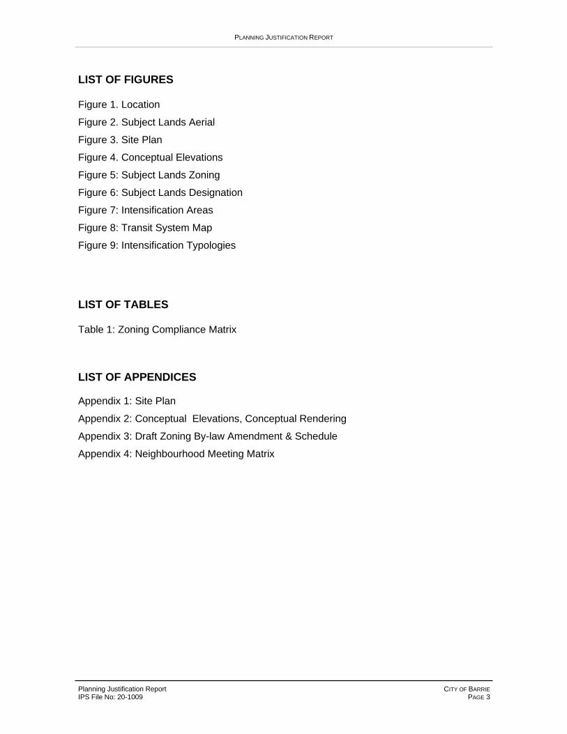
LIST OF FIGURES Figure 1. Location
Figure 2. Subject Lands Aerial
Figure 3. Site Plan
Figure 4. Conceptual Elevations
Figure 5: Subject Lands Zoning
Figure 6: Subject Lands Designation
Figure 7: Intensification Areas
Figure 8: Transit System Map
Figure 9: Intensification Typologies
LIST OF TABLES Table 1: Zoning Compliance Matrix
LIST OF APPENDICES Appendix 1: Site Plan
Appendix 2: Conceptual Elevations, Conceptual Rendering
Appendix 3: Draft Zoning By-law Amendment & Schedule
Appendix 4: Neighbourhood Meeting Matrix

PLANNING JUSTIFICATION REPORT
Planning Justification Report CITY OF BARRIE IPS File No: 20-1009 PAGE 4
1.0 INTRODUCTION
Innovative Planning Solutions (IPS) has been retained by Morriello Construction Ltd. (the
Applicant) to complete a Planning Justification Report for a Zoning By-Law Amendment
(ZBA) application, for lands located at 520 & 526 Big Bay Point Road in the City of Barrie.
The intent of the proposed ZBA is to amend the City of Barrie Zoning By-law (2009-141) to
rezone the subject lands from the ‘Residential Single Detached Dwelling First Density (R1)’
zone to the ‘Residential Apartment Dwelling First Density - 2 (RA1-2)’ zone.
This Report will review the proposed Zoning By-law Amendment in the context of
applicable Provincial and Municipal policies to provide necessary rationale for the approval
of the proposed development.
This Report will review the following documents to demonstrate consistency:
• Planning Act
• Provincial Policy Statement
• Places to Grow - Growth Plan for the Greater Golden Horseshoe
• City of Barrie Official Plan
• City of Barrie Comprehensive Zoning By-Law
• City of Barrie Intensification Area Urban Design Guidelines
• City of Barrie Urban Design Manual
• Lake Simcoe Protection Plan

PLANNING JUSTIFICATION REPORT
Planning Justification Report CITY OF BARRIE IPS File No: 20-1009 PAGE 5
2.0 SITE DESCRIPTION
The proposed development applies to two (2) properties, located at 520 & 526 Big Bay
Point Road in the City of Barrie. The combined site is located approximately 160 metres to
the east of the Big Bay Point Road and Yonge Street intersection. The subject properties
are currently used for low-density residential uses, with a single detached dwelling and
accessory uses located on each lot.
The subject lands contain 65.4 metres of frontage along Big Bay Point Road and a
combined area of 3,500 m2 (0.35 ha. / 0.86 ac.). The lands are designated ‘Residential’ by
the City of Barrie Official Plan (Schedule A), where all forms of housing is permitted. The
lands are also located within the Big Bay Point Road / Yonge Street ‘Primary Intensification
Node’ (Schedule I), where high-density residential development is directed and
encouraged by the City.
3.0 SURROUNDING LAND USES
Surrounding land uses includes the following:
North: Warnica Public School. Low-density residential uses are located further to
the north.
East: Low-density residential land uses containing single detached dwellings.
South: A residential development is underway for 58 back-to-back townhouse units
in three buildings.
West: A low-density residential use abuts, with various commercial uses located
further west along Big Bay Point Road and along Yonge Street.
Figure 1 provides an aerial illustration of the location and the surrounding land uses.
Figure 2 provides an aerial illustration of the subject lands and the current land uses.

PLANNING JUSTIFICATION REPORT
Planning Justification Report CITY OF BARRIE IPS File No: 20-1009 PAGE 6

PLANNING JUSTIFICATION REPORT
Planning Justification Report CITY OF BARRIE IPS File No: 20-1009 PAGE 7

PLANNING JUSTIFICATION REPORT
Planning Justification Report CITY OF BARRIE IPS File No: 20-1009 PAGE 8
4.0 DESCRIPTION OF DEVELOPMENT
The proposed development consists of a 6-storey condominium building at a height of 16.8
m. with 46 residential units, offering a density of 131 units per hectare.
The proposed built form has been designed to frame the site, promoting a strong street
presence and establishing an urban streetscape. Primary entrances are proposed at the
north, east and south sides of the building, providing convenient and direct access to
parking areas and the municipal sidewalk. A secondary means of access is provided at the
west side of the building for pedestrian connection into the rear yard.
A total of 57 surface parking spaces are provided, for a ratio of 1.24 spaces per unit. Three
(3) barrier-free accessible parking spaces are provided at the rear of the building, with
direct and seamless connection to the building entrance. Site access is provided off Big
Bay Point Road entering an internal driving aisle provided for site circulation and traffic
movement. No additonal road widening was identified by the City at the time of application.
Various amenity and open spaces are provided throughout the site, for a total of 891 m2 of
landscaped open area. Primary landscaped open spaces are provided at the rear of the
building, providing the opportunity for communal amenity space. Private balconies are
provided to serve as individual amenity spaces for the residents. Landscape buffer strips
are provided along the interior and rear property lines to provide additonal privacy and
screening to neighbouring properties, through tree planting and other landscape measures.
Interior to the building there is a common lobby where the elevator is located, along with a
common amenity room available for the residents to utilize. Lockers will also be available
for residents if they need additional space for storage. Garbage collection will be provided
through the use of a EarthBin in-ground system, located at the north-east corner of the
building within a raised traffic island where it can be easily picked up.
The proposed Site Plan is exhibited as Figure 3 and included as Appendix 1.
Conceptual Elevations/Renderings are illustrated as Figure 4 and included as Appendix
2.

PLANNING JUSTIFICATION REPORT
Planning Justification Report CITY OF BARRIE IPS File No: 20-1009 PAGE 9

PLANNING JUSTIFICATION REPORT
Planning Justification Report CITY OF BARRIE IPS File No: 20-1009 PAGE 10

PLANNING JUSTIFICATION REPORT
Planning Justification Report CITY OF BARRIE IPS File No: 20-1009 PAGE 11
5.0 CONSULTATION
A Pre-consultation Application was submitted to the City of Barrie and a Technical Meeting
was held with City staff on March 13th, 2020. The requirements established through this
process are included with the subject application.
As part of the Zoning By-law Amendment application process, the City of Barrie requires a
Neighbourhood Meeting to be conducted prior to a formal application. The Neighbourhood
Meeting provides the public with an opportunity to hear details regarding the proposal and
ask questions or provide comments. The meeting was held on February 3rd, 2021, through
a virtual format. A presentation was provided by IPS that introduced the proposed
development and Zoning By-law Amendment application. Approximately twenty-five (25)
members of the public attended the Neighbourhood Meeting, including the Ward 8
Councillor Jim Harris.
A Neighbourhood Meeting Comment & Response Matrix is included with the application
and attached as Appendix 4 to this report.
6.0 ZONING BY-LAW AMENDMENT
The subject lands are zoned ‘Residential Single Detached Dwelling First Density (R1)’ in
the City of Barrie Zoning By-law (2009-141), illustrated on Figure 5.
To facilitate the proposed development, a Zoning By-law Amendment is requested to
rezone the subject lands to ‘Residential Apartment Dwelling First Density - 2 with
Special Provisions (RA1-2)(SP-XXX). A Draft Zoning By-law Amendment and Schedule
are included as Appendix 3 of this report.
Table 1 provides a zoning matrix of the ‘RA1-2’ zone in relation to the proposed
development. The site-specific special provisions requested with the Amendment are
highlighted. An overview and analysis of the site-specific special provisions is included
below.

PLANNING JUSTIFICATION REPORT
Planning Justification Report CITY OF BARRIE IPS File No: 20-1009 PAGE 12

PLANNING JUSTIFICATION REPORT
Planning Justification Report CITY OF BARRIE IPS File No: 20-1009 PAGE 13
Table 1: Zoning Compliance Matrix – RA1-2 Zone
Residential Apartment Dwelling First Density - 2 (RA1-2) Zone
PROVISION REQUIRED
PROVIDED
Permitted Uses Apartment Dwelling
Apartment Dwelling (Condominium)
Lot Area (Min.) 1,100 m2 3,500 m2
Lot Frontage (Min.) 24 m. 65.49 m.
Front Yard Setback (Min.) 7 m. 3.22 m. (building)
Side Yards (Min.) - East 5 m. 23.23 m.
Side Yards (Min.) - West 5 m. 3.71 m.
Rear Yard (Min.) 7m. 29.39 m.
Landscaped Open Space (Min. % of lot area)
35 % 30.5% (891 m2 open sapce, 177 m2 sidewalks = 1,068 m2 provided)
Dwelling Unit Floor Area (Min.)
35 m2 / dwelling unit + 10 m2 / bedroom
< 35 m2 / dwelling unit + 10 m2 / bedroom (Approx. 70-90 m2 / unit)
Lot Coverage (Max. % of Lot Area)
35 % 21.8% (Approx. 766 m2)
Gross Floor Area (Max. % of Lot Area)
100 % 131% (4,600 m2)
Height of Main Building (Max.)
15 m. (RA1-2) 16.85 m.
Parking for Apartment Dwellings – Lot Coverage (5.3.6.2.a)
Parking spaces including aisles required for an apartment dwelling unit in any zone shall have a maximum lot coverage of 35%.
43.6% (1,526 m2)
Parking for Apartment Dwellings – Front Yard (5.3.6.2.b)
A maximum of 20% of the total parking area required for an apartment building shall be permitted in the front yard.
0.05% (Approx. 20 m2)
Landscaped Buffer Areas – Parking Areas (5.3.7.1)
A parking area which provides for more than 4 parking spaces adjoining a residentially zoned lot requires a continuous landscaped buffer area with a minimum width of 3m shall be provided along the abutting lot line and a continuous tight board fence with a minimum
Landscaped buffer (east): 2.4 m. Landscaped buffer (west): 0.5 m. 2m. tight board fence provided.

PLANNING JUSTIFICATION REPORT
Planning Justification Report CITY OF BARRIE IPS File No: 20-1009 PAGE 14
height of 2m is to be constructed along the lot line. The landscaped buffer area shall be planted with appropriate vegetation to effectively screen the parking area.
Landscaped Buffer Areas – Landscaped Buffer Strip (Apartment) (5.3.7.2)
A continuous landscaped buffer area shall be provided along the side and rear lot lines of any lot which is occupied by an Apartment Dwelling. The landscaped buffer area shall be 3m in width along the side and rear lot lines.
Landscaped buffer (east): 2.4 m. Landscaped buffer (west): 0.5 m.
Parking Spaces (Table 4.6)
1.5 spaces per dwelling unit. (69 spaces required)
57 parking spaces provided (1.24 spaces / unit)
Parking Spaces – Barrier Free (4.6.4)
1 Type ‘A’, 2 Type ‘B’ spaces required.
1 Type ‘A’, 2 Type ‘B’ spaces provided.
Density No provision. 131 units per hectare.
Yard Variations: Apartment Balconies – Projection (5.3.3.1.e)
Every part of any required yard, required by this By-law shall be open and unobstructed by any structure from grade level to the sky, with the following exceptions: Balconies on apartment dwellings, where located at a greater height than the bottom of the first floor ceiling joists, may project a distance of not more than 1.5m into a required yard, but in no case shall the side yard, except where none is required, be reduced to less than 1.8m to any side lot line.
Balconies may be permitted to project a distance of 2.2 metres into the required front yard setback.

PLANNING JUSTIFICATION REPORT
Planning Justification Report CITY OF BARRIE IPS File No: 20-1009 PAGE 15
The following provides an overview of the site-specific special provisions requested with
the Zoning By-law Amendment.
1. Reduced Front Yard Setback – 3.2 m.
A reduced front yard setback of 3.22 m. is provided, where 7.0 m. is required. The reduced
front yard setback will facilitate an improved public realm and streetscape along Big Bay
Point Road. A reduced front yard setback aligns with the City’s goals for urban design,
supporting buildings at a pedestrian scale that contributes to a desirable streetscape.
Within the Intensification Nodes, development is further directed to support high levels of
pedestrian activity. The reduced front yard setback would allow a seamless connection of
the municipal sidewalks to the main building entrance facing Big Bay Point Road, adding
comfort for pedestrians, increased accessibility and safety along the street.
From a functional perspective, the reduced front yard setback facilitates increased parking
and landscaped open space in the rear portion of the site, screening parking spaces from
street side views and providing amenity spaces for residents to enjoy. Additionally, the
reduced front yard setback provides an increased setback to the rear property line,
providing transition to more sensitive uses. Built form is encouraged to front the property
line, to create a continuous streetwall and frame the site, particularly when fronting an
Arterial road.
Provided the above rationale, the reduced front yard setback is appropriate for the
proposed development.
2. Reduced Side Yard Setback (West) – 3.7 m.
A reduced side yard setback of 3.71 m. (west) is requested, where 5.0 m. is required. The
reduced interior side yard setback of 3.71 m. is proposed to increase the interior side yard
setback to the residential uses located adjacent to the east and to accommodate the
driving aisle and parking spaces on the eastern portion of the site.
Within the Intensification Nodes, the highest densities are supported by the City. The
subject site is located at the western border of the Node, where it would provide a
transition from the development occurring and expected along the Intensification Corridor
and Intensification Node, to the established residential neighbourhood to the east. By
reducing the western side yard setback to 3.71 m., a 23.2 m. side yard setback is provided
to the eastern property boundary. Adjacent to low-density residential uses to the east and
PLANNING JUSTIFICATION REPORT
Planning Justification Report CITY OF BARRIE IPS File No: 20-1009 PAGE 16
north-east, the eastern setback is viewed as the suitable location for buffering and
increased setbacks. Where the 3.71 m. side yard setback is proposed to the west property
boundary, it is expected that the adjacent isolated residential property will be subject to
future development at a higher density, in line with the City’s direction for the Intensification
Nodes.
To provide site access off Big Bay Point Road, the driving aisle and parking spaces are
located along the eastern boundary and the required width has shifted the building to the
west boundary of the site. The 1.2 m. variance is not anticipated to have an adverse impact
on the intent of this provision, given the building height proposed (16.8 m.).
3. Landscaped Open Space – 30.5%
A minimum 35% of the lot area is required for landscaped open space, where 30.5% is
provided. These areas are comprised of open space for planting of shrubs, flowers and
trees, and includes walkway links to a road or public sidewalk. Due to the site
configuration, siting of the building and parking areas required, the remaining space has
been utilized for landscaped open space. With the open space areas provided, suitable
landscaped open space has been provided. An increase in landscape open space would
result in a loss of available parking spaces for residents. The importance of establishing a
built form and massing that is consistent with the intensification node policies is a
paramount consideration for this site that respects the abutting low density uses to the east
and north.
4. Gross Floor Area – 131%
Under the ‘RA1’ zone, a maximum gross floor area of 100% of lot area is permitted, where
131% is provided. The provided GFA provides for an efficient use of land and resources,
supported by Provincial policy and the City’s Official Plan and design guidelines. High-
density developments are further supported within the Intensification Nodes, with support
for infill and redevelopment to promote an increase in the built densities and to achieve a
desirable compact urban form. According to the Official Plan, an average density of 120
units per hectare is targeted within the Nodes. If this were a mixed-use project in this
location, there would be no maximum GFA (MU1 zone). To achieve the built form desired
by the Province and City, an increase to the GFA is required.

PLANNING JUSTIFICATION REPORT
Planning Justification Report CITY OF BARRIE IPS File No: 20-1009 PAGE 17
5. Building Height – 16.8 m.
Under the ‘RA1-2’ zone, a building height of 15 m. is permitted, where 16.8 m. is provided.
At the proposed height of 16.8 m., the built form will maintain an appropriate height to
blend the existing residential neighbourhood to the east with the development anticipated
within the Intensification Node, where a minimum building height of 10.5 m. is required and
a building height of up to 25.5 m. is supported (MU1 zone).
6. Lot Coverage for Parking Areas – 43.6%
Parking spaces including aisles required for an apartment dwelling unit shall have a
maximum lot coverage of 35%, where 43.6% is provided. High-density developments are
supported within the Intensification Nodes, where the required parking spaces equate to
increased parking coverage on site. To facilitate intensification on these lands as directed
by the City’s Official Plan, a parking ratio of 1.24 spaces per unit is provided and this
results in an increased lot coverage, 8.6% over the permitted by the By-law. As directed by
the objectives and policies of the City’s Urban Design Manual and Guidelines, the parking
areas are largely screened from the street side or public view at the rear portion of the site
and concealed behind the built form. The variance requested is not a perceivable amount
of increased coverage given the scale of the development.
7 / 8. Reduced Landscape Buffer – 0.5 m. and 2.4 m.
A parking area which provides for more than 4 parking spaces adjoining a residentially
zoned lot requires a continuous landscaped buffer area with a minimum width of 3.0 m.
Apartment dwellings are required to provide a 3.0 m. landscaped buffer along the side and
rear lot lines.
A landscaped buffer of 2.4 m. is provided along the eastern lot line, a 0.6 m. variance. The
reduction of the buffer has resulted through site design and accommodating the required
parking spaces. Through discussions with the arborist/landscape consultant, it was
determined that suitable and sufficient landscaping can occur within the 2.4 m. buffer.
A landscaped buffer of 0.5 m. is provided along the westerly boundary of the site, between
the parking hammer-head and the lot line. The 0.5 m. setback only occurs for a short
distance where the hammer-head is provided, with the remaining portion of the westerly
side yard maintains a suitable landscape buffer (approx. 1.5-3.71 m.) to accommodate tree
planting and vegetation. The intent of this buffer is to provide landscaped open space for
PLANNING JUSTIFICATION REPORT
Planning Justification Report CITY OF BARRIE IPS File No: 20-1009 PAGE 18
trees, planting and where required a walkway. The variances requested to the landscaped
buffer are reasonable, as suitable areas would remain for landscaped purposes.
9. Reduced Parking Ratio – 1.24 spaces/unit
A parking ratio of 1.24 spaces per dwelling unit is proposed, where the By-law requires 1.5
spaces per dwelling unit for residential buildings containing more than 3 dwelling units.
Discussed as a common theme throughout the City of Barrie Official Plan, reduced auto
dependency is encouraged, and alternative modes of transportation is supported. The
subject lands are located where residents can take advantage of existing transit options,
supporting a viable network. The Official Plan and Urban Design Guidelines identifies the
Big Bay Point Road / Yonge Street Node as a primary Intensification Node. These
locations are considered to be the most accessible areas in the City, with close or direct
access to amenities, services, public transit, and everyday essentials. Due to this,
development within the Nodes is directed to be transit supportive and encourage usage.
A Traffic Brief has been further prepared in support of the subject application, that explores
the merits of the 1.24 parking ratio. The Traffic Brief includes the following summary
regarding parking:
In summary, based on our review of the proposed development and the surrounding
area, and in consideration of the recommended transportation demand management
measures, the proposed parking supply of 46 resident parking spaces and 11 visitor
parking spaces (1.24 parking spaces per unit) is acceptable for the intended use.
10. Yard Variation, Balconies
The proposed development includes balconies in the front yard that project a distance of
2.2 m. into the required front yard setback, where they may not project more than 1.5 m.
into a required yard. The Urban Design Manual encourages large balconies to provide
useable amenity area for residents and increased opportunities for residents to overlook
public areas, providing increased safety and an enhanced public realm. The Urban Design
Guidelines also encourages human-scaled buildings that line to street, providing eyes on
the street and enhanced safety at all hours. Due to the siting of the built form on the site, a
reduced front yard setback creates the balcony projection into the front yard that will be
desirable and achieve many of the urban design objectives.
PLANNING JUSTIFICATION REPORT
Planning Justification Report CITY OF BARRIE IPS File No: 20-1009 PAGE 19
7.0 PLANNING POLICY & ANALYSIS
This Section will outline the applicable policies guiding the development of the subject
lands. Each section will outline applicable plans and polices with a planning rationale on
conformity and development principles.
7.1 THE PLANNING ACT – PROVINCIAL INTEREST
The Planning Act (The Act) is provincial legislation that establishes the ground rules to
describe how land uses are controlled, and by whom. The Act promotes sustainable
development while balancing factors such as economic development, preservation of the
natural environment and the creation of healthy communities, within a provincial framework
focused on provincial interests and fairness.
The policies as set out in Section 2 of the Planning Act, inform the Provincial Policy
Statement (PPS), Growth Plan, and other matters of provincial interest, ensuring
consistency with the PPS.
Under Section 2 of the Planning Act, key matters of provincial interest includes:
• The supply and efficient use and of energy and water to promote conservation, and
the adequate provision and efficient use of municipal services.
• The orderly development of safe and healthy communities.
• The adequate provision of a full range of housing, including affordable housing.
• The appropriate location of growth and development.
• The promotion of built form that is well designed, encourages a sense of place, and
provides for public spaces that are of high quality, safe, accessible, attractive and
vibrant.
The proposed development is located within a Settlement Area where growth and
development is focused. Emphasis for development is further targeted to the delineated
built-up and strategic growth areas, including Intensification Nodes. The proposed built
form will contribute to the provision of a full range of housing, including a more affordable
housing option and addition to the housing stock within the City. A high-quality built form
will contribute to an attractive streetscape and environment, encouraging a sense of place

PLANNING JUSTIFICATION REPORT
Planning Justification Report CITY OF BARRIE IPS File No: 20-1009 PAGE 20
and fostering a vibrant public realm. Existing infrastructure and services are available,
without uneconomical need for expansion. The proposed development would occur on
lands that are identified and designated as an appropriate location for residential
development and intensification, supported by the Planning Act.
In our professional opinion, according to the Planning Act and the interests of the Province,
the proposed development aligns with the Province’s Interest in land use planning.
7.2 PROVINCIAL POLICY STATEMENT
The Provincial Policy Statement (PPS 2020) is a vital part of Ontario’s policy-led planning
system. The PPS provides the policy foundation that regulates development in order to
protect resources, public health and safety, and the quality of the natural and built
environment. The PPS contains policies that fall under three overarching sections, with the
goal of fostering an effective and efficient land use planning system:
1. Building Strong Healthy Communities
2. The Wise Use and Management of Resources
3. Protecting Public Health and Safety
Section 1.1.1 of the PPS provides various strategies on how to manage and direct land use
to achieve efficient and resilient development and land use patterns. Healthy, liveable and
safe communities are sustained through the promotion of efficient development and land
use patterns which sustain the financial well-being of the Province and municipalities over
the long term. Building upon this, the Plan encourages the accommodation of an
appropriate market based range and mix of residential types to meet the long term needs,
including multi-unit housing and more affordable options. Further, the Plan promotes cost-
effective development and land use patterns through intensification and redevelopment, to
minimize land consumption and servicing costs and to increase the use of public transit.
Building upon the policies of section 1.1.1, section 1.1.3 recognizes that Settlement Areas
are critical to the long-term economic prosperity of our communities. Development and
land use patterns are directed to be based on a range of uses and opportunities to facilitate
intensification and redevelopment. New development within the designated growth areas
(Intensification Nodes) are encouraged to have a compact built form and provide a density
to allow for the efficient use of land, infrastructure, and public service facilities.

PLANNING JUSTIFICATION REPORT
Planning Justification Report CITY OF BARRIE IPS File No: 20-1009 PAGE 21
The proposed development is further strengthened by Section 1.4 housing of the PPS,
which encourages an appropriate range and mix of housing options and densities, to meet
the projected needs of current and future residents. All types of residential intensification is
encouraged and permitted, including additional residential units and redevelopment.
Emphasis is placed on directing the development of new housing towards locations such
as Big Bay Point Road, where appropriate levels of infrastructure and public service
facilities are available. Support is also concentrated towards residential development,
redevelopment, and intensification, as it will minimize the cost of housing and enable a
compact built form.
The PPS encourages long-term economic prosperity through residential uses that respond
to dynamic market-based needs and provide a range of housing options for a diverse
workforce (1.7.1). Transit supportive development, a compact built form, and intensification
is supported to improve the mix of employment and housing options to shorten commutes,
decrease transportation congestion, and vehicle trips generated (1.6.7/1.8). Reduced auto
dependency is encouraged through the proposed development where residents can take
advantage of the transit system available and active transportation is promoted. The
available transit connections additionally provide access to regional transit, including the
Barrie South GO station located approximately 1.7 kilometres away.
The subject application is consistent with the policies and intent of the PPS.
7.3 GROWTH PLAN FOR THE GREATER GOLDEN HORSESHOE
The Growth Plan for the Greater Golden Horseshoe (August 2020) has been prepared and
approved under the Places to Grow Act. The Plan builds on the PPS together with other
Provincial Plans to inform decision-making regarding growth management, environmental
protection, and other planning principles particular to the Greater Horseshoe. As the
Region continues to grow, the Plan provides policy direction to address the challenges of
growth.
The City of Barrie is designated a ‘Settlement Area’ and recognized as the principal
‘Primary Settlement Area’.
The Growth Plan provides guiding principles in Section 1.2.1, identifying that different
approaches are required to manage growth that recognizes the diversity of communities.
The principles support developments that contribute to the achievement of complete

PLANNING JUSTIFICATION REPORT
Planning Justification Report CITY OF BARRIE IPS File No: 20-1009 PAGE 22
communities, that will provide for healthy and active lifestyles and meet people needs for
daily living throughout an entire lifetime. Intensification and higher densities are
encouraged in strategic growth areas such as the Intensification Nodes to create efficient
use of land, infrastructure, and transit services. Development is further supported that
provides a range and mix of housing options to serve all household sizes, incomes and
ages of households.
The Growth Plan places further emphasis on the guiding principles through section 2.1.
With the pace of growth anticipated for the Greater Golden Horseshoe, the plan places
importance on building healthy and balanced communities. Better use of land and
infrastructure can be made by directing growth to Settlements and prioritizing
intensification within the strategic growth areas. The Plan takes an “intensification first”
approach to focus on making better use of the existing infrastructure and public service
facilities, with the goal of avoiding the continuous expansion or sprawl of the urban area.
Section 2.2.1 of the Growth Plan establishes policies for managing growth. Development
and growth is directed to lands within Settlement areas that are located within strategic
growth areas such as Intensification Nodes, with particular emphasis on locations with
existing and accessible transit and public service facilities. Reflecting the principles of the
Plan, the growth policies seek to provide a diverse range and mix of housing options, and
to provide for a more compact built form and vibrant public realm, contributing to the
achievement of complete communities.
Section 2.2.2 includes the intensification targets that are established for the delineated
built-up areas. The Plan directs a minimum of 50% of all residential development annually
within the City of Barrie to be within the delineated built-up areas, which encompasses the
subject lands (2.2.2.1.a). This target will maintain and improve the minimum intensification
targets established by the City of Barrie Official Plan. The strategic growth areas
(intensification areas) are recognized as the key focus for development, with intensification
as the priority.
The Growth Plan sets out intensification and density targets that recognizes the growth
occurring within the Plan’s area, such as the City of Barrie. The Growth Plan identifies that
by the year 2051, population is targeted for 298,000 people and employment of 150,000
(Schedule 3). With the significant amount of growth anticipated and targeted, higher
density developments are required to efficiently utilize land, accommodate growth, and
create housing options for a rapidly growing City.

PLANNING JUSTIFICATION REPORT
Planning Justification Report CITY OF BARRIE IPS File No: 20-1009 PAGE 23
Section 2.2.6 of the Growth Plan encourages municipalities to develop a housing strategy
that supports the achievement of the minimum intensification and density targets, to
provide a diverse range and mix of housing options and densities to meet projected needs
of current and future residents. Implementing the housing strategies of the Plan will support
the achievement of complete communities, through the accommodation of a range and mix
of housing options and densities, diversifying the overall housing stock of municipalities
and providing more affordable options as growth continues to occur.
Section 6 of the Growth Plan applies to the Simcoe Sub-area, which includes the City of
Barrie as the principal ‘Primary Settlement Area’, where growth and development is
emphasized. A significant portion of growth is directed to Settlements where developments
can most effectively be serviced, and where growth improves the range of opportunities for
people to live, play, and work in their communities. Development within Settlements also
creates a more livable, compact and complete urban structure through good design and
built form. Additionally, development within these areas supports active transportation and
public transit, encouraging healthy and active lifestyles.
The Growth Plan directs development to designated strategic growth areas, such as
Intensification Nodes within the City of Barrie. The proposed rezoning is reflective of the
variety of land uses supported by the Growth Plan, contributing to the establishment and
creation of a complete community. The application is considered a redevelopment and
intensification project within an intensification area, where the form of the development
proposed reflects the desired urban structure of both Provincial and Municipal legislation.
The Plan places emphasis on optimizing the use of the existing urban land supply, as an
intensification first approach to development and city building.
For the above stated reasons, the application conforms to the direction provided in the
Growth Plan for the Greater Golden Horseshoe.
PLANNING JUSTIFICATION REPORT
Planning Justification Report CITY OF BARRIE IPS File No: 20-1009 PAGE 24
7.4 CITY OF BARRIE OFFICIAL PLAN
The City of Barrie Official Plan (January 2018) provides general policy direction and
establishes a long-term vision for land use planning for the municipality.
The Official Plan designates the subject lands as the following:
• Schedule A – Land Use: ‘Residential’
• Schedule B – Planning Areas: ‘Residential – Painswick North’
• Schedule D – Roads Plan: ‘Arterial’
• Schedule E – Road Widening Plan: ‘34 m. ROW width’
• Schedule F – Conservation Authority Regulation Limits: ‘Lake Simcoe Regional
Conservation Authority Regulation Limits’
o Outside LSRCA Regulated Areas.
• Schedule G – Drinking Water System Vulnerable Areas: ‘Intake Protection Zone 2’.
• Schedule I – Intensification Areas: ‘ Built-up Area’, ‘Primary Node / Major Transit
Node’
• Schedule J – Lake Simcoe Watershed: ‘Lake Simcoe Watershed Boundary’
The Official Plan land use designation is shown on Figure 6 and the Intensification Areas
are displayed on Figure 7.

PLANNING JUSTIFICATION REPORT
Planning Justification Report CITY OF BARRIE IPS File No: 20-1009 PAGE 25

PLANNING JUSTIFICATION REPORT
Planning Justification Report CITY OF BARRIE IPS File No: 20-1009 PAGE 26

PLANNING JUSTIFICATION REPORT
Planning Justification Report CITY OF BARRIE IPS File No: 20-1009 PAGE 27
7.4.1 HOUSING
The City of Barrie Official Plan reflects the policies of Provincial legislation relating to
housing, recognizing that population growth will need to be accommodated for through a
mix of new development, redevelopment and intensification.
The growth management goals aim to accommodate the projected needs for residential
lands in order to achieve a complete community with an appropriate mix of housing
opportunities. The Plan seeks to guide, direct and monitor the rate of growth to match the
supply of land, municipal services and facilities with the needs of residents and employers;
in accordance with the City’s population, employment, intensification and density targets.
Growth is directed to take advantage of existing services and infrastructure where possible,
to minimize the cost of infrastructure extension (3.1.1).
The approval of specific development applications is governed by a number of principles
for staging and phasing of development (3.1.2.2). The proposed development would align
with existing and planned development, as the area surrounding the subject lands is
targeted by the City for growth and development, with emphasis placed on the
Intensification Areas. With Yonge Street designated as a Primary Intensification Corridor
and the lands falling within a Primary Intensification Node, development is expected to
occur.
Relating to existing development, the proposed development will be compatible with
growth occurring and anticipated. The lands adjacent on the south side of Big Bay Point
Road (521-527 Big Bay Point Road) are approved for 58 back-to-back townhouse units
and a number of residential lots adjacent to the subject lands are underutilized and isolated
parcels, regarded as prime candidates for redevelopment and intensification. The area also
contains an abundant amount of community services, in addition to schools, parks, and
other amenities. The lands can further take advantage of access to public transit and the
utilization of existing sewage and water services. Collectively reviewing the staging and
phasing principles of the Plan, the proposed development meet’s the City’s criteria for
approval.
The subject application is strengthened by Section 3.3 (housing) of the Official Plan. Goals
of the housing policies encourage all forms of housing, including the provision of an
appropriate range of housing types, unit sizes, affordability and tenure at various scales
and densities to meet the needs and income levels of current and future residents. This will

PLANNING JUSTIFICATION REPORT
Planning Justification Report CITY OF BARRIE IPS File No: 20-1009 PAGE 28
further ensure that the quality and variety of housing stock is maintained and improved.
Development is further supported that contributes to the creation of complete communities,
with a diverse mix of land uses, a range and mix of housing types, high quality public
spaces, and easy access to local stores and services.
The City encourages the maintenance of reasonable housing costs through a varied
selection of size, density and tenure. The Official supports amendments to the Zoning By-
law to allow for innovative housing, where it is recognized to be in accordance with good
land use planning principles (3.3.2.1.a). As demonstrated through this report, the subject
application would facilitate a residential development within an Intensification Node, where
it is supported and directed. The development would provide 46 residential units to the
City’s housing stock, offering additonal options and more affordable choices for residents.
In accordance with Provincial policy, affordable housing options are encouraged
throughout the City. The City’s Official Plan includes the goal of achieving 10% of all new
housing units per annum in the affordable category, including rental units or ownership at
an affordable rate. High density housing is supported that provides affordable housing
options, where it is in close proximity to shopping, transit and other amenities (3.3.2.2). The
Applicant is open to discussions with the City regarding affordable housing options, based
on demand or need in this location.
Intensification represents an essential component of the City’s Growth Management
Strategy. The City’s Official Plan envisions development at higher densities in order to
provide a complete range of housing options for residents. The subject lands are included
in the ‘Built-up Area’, where at least 40% of residential dwelling unit development is
directed within these areas annually (3.1.2.3.b). The City’s Growth Management Strategy
further identifies that the Built-up Area can accommodate an additional 13,500 housing
units, of which 61% are located outside of the UGC, to accommodate population growth
targets of the Growth Plan for the City of Barrie (3.1.2.3.d).
The City’s Official Plan further encourages residential revitalization and intensification
throughout the built-up area, in order to support the viability of healthy neighbourhoods and
to provide opportunities for a variety of housing types (3.3.2.1). The proposed development
aligns with the housing policies of the Official Plan as it offers residential intensification in
the built-up area, offering a conversion of existing housing into multiple unit forms. This is
considered an innovative strategy and supported by the Official Plan (3.3.2.1.c).

PLANNING JUSTIFICATION REPORT
Planning Justification Report CITY OF BARRIE IPS File No: 20-1009 PAGE 29
With the limited supply of vacant land and properties for residential development within the
City of Barrie, development is focused to intensification, infill, and redevelopment options.
7.4.2 RESIDENTIAL LAND USE DESIGNATION & INTENSIFICATION
The subject lands are designated as ‘Residential’ on Schedule A (Land Use) of the City of
Barrie Official Plan, shown previously on Figure 6. The predominant land use under the
designation shall be for all forms and tenure of housing (4.2.2.1.a).
The proposed development is supported by the goals of the Residential land use
designation as it encourages the creation of complete communities through a mix of land
uses to maximize convenient access to community facilities and services, with support for
active transportation and public transit usage. New developments with high-quality urban
design are supported in the medium and high-density categories within the Intensification
Areas, while continuing to support the integrity of stable neighbourhoods and maintaining
compatibility between dwelling types at different densities (4.2.1).
The subject lands fall within a designated ‘Primary Intensification Node’, as identified by
Schedule I of the Official Plan and previously reflected on Figure 7. The Primary Nodes
are identified for growth and development, with 50-120 units per hectare as the minimum
target (4.2.2.6.g). The proposed density is 131 units per net hectare and the application
falls under the ‘high density residential’ category (4.2.2.2.e). Located along an Arterial road
(Big Bay Point Road), the site is in close proximity to public transit, facilities such as
schools and commercial development, and contains direct connection to municipal
services (4.2.2.3). In accordance with the locational criteria of the City’s Official Plan, high-
density development’s are supported in the Intensification Nodes.
Intensification policies are discussed under section 4.2.2.6 of the Official Plan.
Intensification can be achieved through residential conversions, infill, and redevelopment to
promote an increase in planned and build densities and supported to achieve a desirable
compact urban form. Residential intensification is encouraged in a number of locations
throughout the City and focused to the Intensification Nodes. As proposed, development
through intensification is supported as it contributes to a more compact form, which
efficiently uses land and resources, existing infrastructure and services; with additonal
support for public transit and active transportation usage.

PLANNING JUSTIFICATION REPORT
Planning Justification Report CITY OF BARRIE IPS File No: 20-1009 PAGE 30
7.4.3 SERVICING & TRANSPORTATION
The City of Barrie Official Plan aims to ensure that adequate water supply, sewage
collection and treatment, electrical supply, and stormwater management systems are
provided to the residents of the City (5.1). The proposed development will provide full
municipal services.
The efficient and sustainable use of water resources is encouraged by the Official Plan
(5.2). This includes efficient stormwater management practices to control the quantity and
quality of water (5.3.1). A Functional Servicing has been prepared with the application to
demonstrate servicing and infrastructure considerations to support the development
proposal, along with a Stormwater Management Plan to evaluate the effects of the
proposed development against the stormwater drainage system, and recommendations to
manage the rainwater / snowmelt.
A primary objective of the City of Barrie Official Plan is the achievement of a sustainable
transportation system for the safe, efficient, and convenient movement of people and
goods (5.4.1). The transportation goals aim to develop the Intensification Areas (Nodes) at
densities that are transit supportive and provide linkages to transit routes.
High density residential development is encouraged to located adjacent to public transit
routes (5.4.2.3). The City’s transit routes provide connection to the proposed development,
as shown on Figure 8, illustrating the City’s Transit Map. The site offers convenient and
direct access to public transit routes, by municipal sidewalks. Access is provided to public
transit, with multiple stops to the west at the intersection of Big Bay Point Road / Yonge
Street (approx. 150 m.), and Big Bay Point Road / Ashford Drive to the east (approx. 270
m.). Transit routes 4A and 4B along are Big Bay Point Road, with additional access to
routes 8A and 8B located along Yonge Street. Transit route 3 also runs along Big Bay
Point Road and through the Painswick area. These transit routes provide convenient and
direct access to various locations throughout the City of Barrie and connection to regional
transit networks, including the Barrie South GO station located approximately 1.7
kilometres south (2-minute drive / 6-minute bike) of the subject lands.

PLANNING JUSTIFICATION REPORT
Planning Justification Report CITY OF BARRIE IPS File No: 20-1009 PAGE 31
PLANNING JUSTIFICATION REPORT
Planning Justification Report CITY OF BARRIE IPS File No: 20-1009 PAGE 32
7.4.5 TALL BUILDINGS & HEIGHT CONTROL
Within the City of Barrie, the tall buildings and height control policies (section 6.6) are
applicable to any building over three (3) storeys in height.
Building shadowing will be evaluated at Site Plan Control through the preparation of a
Shadow Impact Study, to demonstrate the impact of shadows on the adjacent lands
throughout the day.
The tall building application submission requirements of the Official Plan will be addressed
through Site Plan Control.
7.4.5 NATURAL HERITAGE & ENVIRONMENT
The City of Barrie Official Plan places importance on the conservation and preservation of
the natural environment. The Plan aims to identify, protect and enhance natural heritage
features and areas and their connecting linkages (3.5.1). No natural heritage features or
areas are identified on the subject lands by the Official Plan (Schedule H).
Through the land management policies of the Official Plan, the City encourages tree
planting, tree preservation, and other strategies to maintain and enhance the vegetation
cover (3.5.2.2). The proposed development will maintain viable boundary trees, with
strategies to re-plant native species around the built form to enhance the vegetation cover.
An Arborist Assessment is included with the application and detailed landscaping plans will
be included at the Site Plan stage.
The Official Plan takes priority in the protection, maintenance and enhancement of water
and water related resources on an integrated watershed management basis (3.5.2.3). A
Functional Servicing Report (FSR) has been prepared for the subject application, providing
an assessment for the provision of sanitary drainage, water distribution, and stormwater
management. The recommendations and quality control measures outlined in the FSR will
be implemented to ensure protection of water resources.
Schedule G of the Official Plan (Drinking Water System Vulnerable Areas) identifies areas
where control measures are implemented to protect groundwater resources. The subject
lands are within ‘Intake Protection Zone 2’. Development is required to demonstrate that
the vulnerability of the area would not increase and threats to drinking water is avoided
(3.5.2.3.3). The lands are not within a significant groundwater recharge area (SGRA), nor a
Wellhead Protection Area (WHPA), therefore infiltration based practices are permitted and

PLANNING JUSTIFICATION REPORT
Planning Justification Report CITY OF BARRIE IPS File No: 20-1009 PAGE 33
implemented through the Functional Servicing Report; including quality control, water
budget and phosphorus budget.
Section 3.7 of the Official Plan encourages energy conservation and renewable energy
systems. The goals aim to ensure that land use and development patterns support energy
efficiency / conservation and improved air quality, the reduction of emissions from vehicles
and residential sources, and other initiatives. The proposed development is supported by
the energy conservation policies as it provides a compact urban form, which supports
active transportation and transit use, reducing trips generated and reducing energy
consumption. Additionally, energy conservation measures encouraged includes energy
efficient materials, increased densities, and the use of landscaping. Subject to detailed
landscape design through Site Plan Control, the proposed development aims to enhance
the urban forest and tree cover as a means of improving air quality and reduced energy
consumption, by providing natural shading, buffering and screening.
The subject applications maintains the polices and intent of the City of Barrie Official Plan.
7.5 LAKE SIMCOE PROTECTION PLAN (LSPP)
On Schedule J of the City of Barrie Official Plan, the lands are identified within the Lake
Simcoe Region Conservation Authority watershed boundary, however, are located outside
of the LSRCA regulated areas according to the LSRCA mapping.
Key policies as outlined in the City of Barrie Official Plan includes:
• “To protect, improve or restore the elements that contribute to the ecological health
of the Lake Simcoe watershed, including, water quality, hydrology, key natural
heritage features and their functions, and key hydrologic features and their
functions” (3.9.1.a).
• “To promote environmentally sustainable land and water uses, activities and
development practices” (3.9.1.b).
The LSPP policies call for comprehensive plans and initiatives to improve the management
of stormwater for planned developments. Applications for new major development must
demonstrate how phosphorus loadings and changes in water balance will be minimized
(4.5.sa). Considered “major development” by the LSRCA guidelines, the proposed
development is evaluated through a Stormwater Management Assessment within the

PLANNING JUSTIFICATION REPORT
Planning Justification Report CITY OF BARRIE IPS File No: 20-1009 PAGE 34
Functional Servicing Report, to ensure the watershed is protected. Stormwater quality and
quantity control measures are required in accordance with the Lake Simcoe Regional
Conservation Authority (LSRCA). Further assessment will be provided through the Site
Plan Control process.
The subject applications maintains the polices and intent of the LSPP.
7.6 CITY OF BARRIE OFFICIAL PLAN URBAN DESIGN GUIDELINES &
URBAN DESIGN MANUAL
The City of Barrie Official Plan (January 2018) contains Urban Design Guidelines under
section 6.5 of the Plan. The policies are intended to provide general design guidelines,
including a framework for the development of healthy, safe, convenient, efficient and
aesthetically pleasing urban environment.
The City of Barrie Urban Design Manual (October 2014) provides a framework for
establishing Barrie’s future urban form, and to ensure that new development is consistent
with the City’s vision for urban design.
The design polices of the City of Barrie Official Plan and the City of Barrie Urban Design
Manual have been evaluated comprehensively, to address the shared design policies
found within these documents.
Detailed design considerations will be evaluated through the Site Plan process.
7.6.1 PHYSICAL ENVIRONMENT & BUILDING SITING
The design polices of the Official Plan and Urban Design Manual aim to ensure that
development measures are incorporated to appropriately address the physical environment
of the site and adjacent uses when siting the building.
The proposed development aims to achieve compatibility with the adjacent uses through
the orientation and position of the built form. The building is located close to the street, to
increase separation to adjacent uses and create a consistent street wall. The siting will
frame the street and create a consistent street edge, contributing to an urbanized public
realm and reinforcing the prominence of Big Bay Point Road; an Arterial road.

PLANNING JUSTIFICATION REPORT
Planning Justification Report CITY OF BARRIE IPS File No: 20-1009 PAGE 35
By locating the built form close to the street, open and amenity spaces are provided at the
rear of the building and away from the street, encouraging pedestrian activity and fostering
social gathering opportunities for residents.
The proposal aims to complement the existing and planned built form of the community. A
more slender building floorplate aims to reduce the impacts on adjacent uses, respecting
the general scale, height and massing of the immediate area. At a height of 6-storeys, the
proposed development will provide a transition from the growth targeted and anticipated
within the Intensification Node, to the lower density neighbourhoods to the east of the
subject lands. As development occurs, the proposed development is reflective of what the
City’s policies aim to facilitate and the built form will blend in with development occurring
within the designated Intensification Area’s.
7.6.2 SITE CIRCULATION & PARKING AREAS
The siting and location of the built form will promote safe pedestrian linkages. To prioritize
pedestrian movements, main entrances provide convenient and direct access to walkways,
parking areas, open and amenity spaces. The location of walkways further provide direct
and seamless connection to the municipal sidewalks, facilitating mobility.
A singular site access is provided off Big Bay Point Road to reduce the number of turns
onto and off an Arterial road. The internal driving aisle has been designed to improve site
circulation and user safety, distributing traffic movements and minimizing movements near
the entrance/exit of the site. The parking layout allows continuous traffic flow and turning
radii to provide for safe movement within the parking areas. Accessible parking spaces are
located close to the building entrance to provide direct entry into the building and ensure
safe, barrier free access.
Contributing to site safety for the user, feature or spot lighting will be utilized to highlight
entrances, pedestrian connections, and key areas of movement. Design elements such as
the use of signage and pavement markings will be implemented as part of the Site Plan
Approval process, to provide added safety to the user and support a safe public realm.
7.6.3 SITE SERVICES & UTILITIES
As directed by the design policies of the City, recycling and garbage storage facilities are
located away from the public street and screened through the use of an EarthBin garbage

PLANNING JUSTIFICATION REPORT
Planning Justification Report CITY OF BARRIE IPS File No: 20-1009 PAGE 36
storage system, located in-ground. This system provides a quick and efficient method for
pick-up, reducing the timeframe a waste collection vehicle is on site.
The location of the truck turnaround has been designed to reduce conflicts between the
loading area and vehicular/pedestrian routes. Further, the on-site circulation eliminates the
reversing or manoeuvring on the public street.
The location of utilities and their integration within the built form and site will be detailed
through the Site Plan approval process. Utilities will be located underground to improve the
appearance of the development. Where necessary, above ground utilities will be screened
from public view or incorporated into design.
7.6.4 LIGHTING, SIGNAGE & FENCING
Subject to detailed design through Site Plan Control, exterior lighting fixtures will
complement the building and feature lighting will be applied to highlight architectural
design. The use of lighting will be used to enhance the ability for surveillance and safety of
the user. Focal lighting will be placed in strategic areas, to increase visibility and highlight
high areas of traffic, including the building entrances, amenity/open spaces, and parking
areas. Particular attention will be paid to pedestrian areas such as the barrier free travel
paths and walkways. The use of cut-off light fixtures will be explored for exterior spaces
such as the parking areas and locations with wall mounted lighting, to eliminate glare and
light spillage on the neighbouring properties or street.
A 2.0 metre tight board fence will frame the perimeter of the site, in accordance with the
Zoning By-law standards. The use of fencing will further provide privacy screening and aid
as a buffer to adjacent residential uses.
Signage used will be minimal to maintain visual appeal, compliment the design and
materials of the built form. Details regarding signage will be developed through the Site
Plan Approval process to ensure that City guidelines are addressed, and all signage will be
in accordance with the standards of the City’s Sign By-law (2018-029).
7.6.5 ARCHITECURAL DESIGN
The proposed architectural design will be compatible and compliment the developing
character of the area. The building façade treatment has been designed with an emphasis
placed on high-quality materials and a high-standard of design. The proposed development
PLANNING JUSTIFICATION REPORT
Planning Justification Report CITY OF BARRIE IPS File No: 20-1009 PAGE 37
will enhance the visual character of the area through the use of architectural treatments,
creating a variety of architectural styles within the area.
The proposed building orientation to front Big Bay Point Road will promote an engaging
streetscape through architectural treatments that will reinforce the street edge and promote
a pedestrian friendly public realm. Main entrances to the building are designed to remain
prominent, to encourage pedestrian use and direct visitors towards the main entry points,
where it is observable by residents and clearly visible from the street.
Balconies are offered to provide useable space for the residents, creating their own unique
amenity space. The use of balconies also increases opportunities for residents to overlook
the common open/amenity spaces and public areas.
Subject to detailed design through Site Plan Approval, the use of architectural techniques,
landscaping, and design features will be implemented to enhance the building elevation.
7.6.6 LANDSCAPE DESIGN
Landscaping will be designed to encourage positive functional relationships between the
site uses and their surroundings. Landscaping and tree planting strips/buffers are provided
around the exterior of the site, encouraging features to soften the visual impact of parking
areas and paved surfaces. These areas further delineate the boundaries of the site and
provide spatial separation between uses.
The use of landscaping treatments will be provided to improve the visual character of the
site and soften the built form. The use of landscaping around the exterior of the building will
further enhance the vegetation cover and provide natural shading. Additonal landscaped
areas are available adjacent to Big Bay Point Road to enhance the public realm street side,
to create an attractive streetscape and heighten visual interest.
A detailed Arborist Assessment including a Tree Preservation Plan has been completed in
support of the proposed development. Detailed Landscape Plans will be prepared for Site
Plan Approval. Appropriate plant species will be selected based on their hardiness and
capability to tolerate urban conditions and seasonal effects.
7.6.7 TRANSIT
The subject development is transit supportive as the location offers convenient and direct
access to public transit routes, linked by public sidewalks. Residents will be able to access

PLANNING JUSTIFICATION REPORT
Planning Justification Report CITY OF BARRIE IPS File No: 20-1009 PAGE 38
the public transit system within a 2-4 minute walk (250-300 m.), with connection to the
Barrie South GO station in a short matter of time.
The proximity of the location to commercial uses and amenities encourages a walkable
form of development. Residents will be influenced to choose alternative methods of
transportation, including active transportation such as walking or biking.
As previously discussed throughout this report, higher density residential developments are
encouraged to be located adjacent or in close proximity to public transit routes, promoting
transit usage. The lands fall within a Primary Node / Major Transit Node, where transit
supportive development is encouraged.
7.6.8 ENERGY EFFICIENCY
The policies of the Urban Design Manual and Official Plan encourage energy efficient
urban design. The proposed built form is oriented on the site to maximize sunlight
exposure. As a new build, energy efficiency measures can be explored, including
construction methods to improve insulation, reduce heat loss during the colder months,
and overall reduced monthly servicing costs. The use of directional and downcast lighting
can also be applied to reduce wasted energy.
Tree retention and re-planting, along with other landscaping improvements provides
natural shade, contributes to the urban tree cover, and reduces the urban heat island
effect. Additionally, trees contribute to measures of reducing climate change by removing
carbon dioxide from the air, storing carbon in the trees and soil, and releasing oxygen into
the atmosphere.
Energy efficiency is promoted through the development of a compact urban form,
encouraging the use of transit, active transportation, and a mix of housing and employment
uses. This contributes to shortened commuting trips, reduced reliance on the automobile
and supported use of transit routes.

PLANNING JUSTIFICATION REPORT
Planning Justification Report CITY OF BARRIE IPS File No: 20-1009 PAGE 39
7.7 INTENSIFCATION AREA URBAN DESIGN GUIDELINES
The City of Barrie Intensification Area Urban Design Guidelines serve to provide a vision
and policy direction to ensure that new developments are compatible with the existing built
fabric, creates an attractive and safe pedestrian realm, supports alternative modes of
transportation, and are environmentally sustainable.
The subject lands are identified within the guidelines as follows:
• Intensification Typologies / Intensification Areas: ‘Primary Node’
• Existing typologies within the Intensification Areas: ‘Major Transit Stations’
The Intensification Typologies are illustrated on Figure 9.

PLANNING JUSTIFICATION REPORT
Planning Justification Report CITY OF BARRIE IPS File No: 20-1009 PAGE 40
PLANNING JUSTIFICATION REPORT
Planning Justification Report CITY OF BARRIE IPS File No: 20-1009 PAGE 41
7.7.1 INTENSIFCATION NODES
Along the Intensification Corridors are a series of Primary Intensification Nodes located at
the intersection of major transportation corridors. The subject lands are located within the
‘Primary Node’ of Big Bay Point Road / Yonge Street.
Short-term redevelopment of lands along the Corridors should be focused to the
Intensification Nodes, to spur development on the remainder of the corridor and set a
standard for design. Taller buildings and the highest densities are encouraged at the
Nodes to indicate prominence of these areas, as development occurs.
The Nodes are directed to act as the focal points for the neighbourhood, with higher
density mixed land uses to support the needs of local residents. The mix of land uses will
support live / work opportunities, encourage the use of transit, and convenient access to
commercial uses. Given the location of the subject lands, residents will have close access
to various commercial services and employment opportunities along Yonge Street.
As development occurs on the Intensification Corridors, the Nodes should evolve into
intensive, pedestrian supportive destinations within the City. To support this, Primary
Nodes are located at the intersection of major transportation corridors. The subject lands
are in a location where automobile reliance is reduced, active transportation is encouraged,
and public transportation is readily available.
7.7.2 MIXED-USE AND RESIDENTIAL AREAS
As new development occurs along the Intensification Corridors, the Intensification Nodes
are directed to evolve and reflect the characteristics of the ‘Mixed-Use and Residential
Avenues’. The subject lands are adjoining the Mixed-Use and Residential Avenues
identification, which follows Yonge Street and covers the adjacent lands to the north, west
and south.
Key opportunities for the Mixed-Use and Residential Avenues includes the redevelopment
of underutilized parcels of land for street oriented mixed-use development in the higher
density category. Key recommendations further involves redevelopment focused to the
Intensification Nodes, such as the Big Bay Point Road / Yonge Street Primary Node and
the subject lands. Human-scaled development is encouraged to line the street and create
eyes on the street, enhancing safety and activity at all hours of the day.
PLANNING JUSTIFICATION REPORT
Planning Justification Report CITY OF BARRIE IPS File No: 20-1009 PAGE 42
As growth occurs along the Intensification Corridor (Yonge Street), development as
proposed by the subject application will provide a transition to the lower density or more
established residential areas, while complimenting the higher densities directed within the
Primary Node. This aligns with the intent and direction of the Urban Design Guidelines.
7.7.3 MJOR TRANSIT STATIONS
Located within the a ‘Major Transit Station’ at the Big Bay Point Road / Yonge Street
intersection, the goal is to create developments with higher densities within a 10-minute
(500 m.) walking distance of the station. The subject lands are located approximately 160
m. from the intersection, and within the limits of the major Transit Station area. This will
support a viable transit network, promote active transportation and the use of public transit
available; ultimately providing alternative uses and reduced reliance on personal vehicles.
Developments are encouraged to limit surface parking areas to what is deemed required,
in order to further encourage alternative modes of transportation. Parking for the proposed
development is limited from the street side views, to promote an improved streetscape and
public realm; fostering an enhanced environment for residents travelling through the Major
Transit Station.
As intensification occurs within the Major Transit Station areas, development is
encouraged to generally evolve to the Intensification Typology they are situated within.
Within a Primary Node, higher densities are supported to achieve a variety of built forms,
and to concentrate the density and people working or living within a walking radius of the
Transit Station. The proposed development aims to create a higher density built form;
however, it has been limited to 6-storeys to provide a pedestrian scaled building street side
where residents can comfortably walk/cycle to and from the transit station, without feeling
overwhelmed by towering built form.
Clear, weather protected paths are encouraged to provide comfortable connections for
residents travelling in the station area. As proposed by the subject development, sidewalk
connections are integrated between the building and the adjacent public network, offering
residents a seamless connection to access nearby transit by public sidewalks.
As previously outlined under section 2.0 of this report, access is provided to City of Barrie
Public Transit for the subject lands, with multiple stops at the intersection of Big Bay Point
Road / Yonge Street to the west (at approx. 250 m.), and Big Bay Point Road / Ashford
Drive to the east (approx. 270 m.). These transit routes provide convenient and direct
PLANNING JUSTIFICATION REPORT
Planning Justification Report CITY OF BARRIE IPS File No: 20-1009 PAGE 43
access to various locations throughout the City of Barrie and connection to regional transit
networks. The convenient access to transit is the intent of the policies surrounding the
Major Transit Stations, as this is a focus in the City of Barrie as residential growth and
population occurs, requiring transit options.
The guidelines reveal that transit use must be encouraged to ensure successful
intensification in the City. A mix of land uses, and higher density developments are
promoted around the Major Transit Nodes to create the mass required to make transit a
viable option.
7.7.4 GENERAL DEVELOPMENT GUIDELINES
As directed by the priority directions for new developments within the Intensification Areas,
the proposed development provides rational intensification that achieves a built form which
is compatible with the scale of the development occurring in the area, while maintaining
transition to adjacent residential areas. This will achieve the desired building fabric for the
Intensification Areas.
The proposed development is considered a mid-rise building by the guidelines at 6-storeys,
where heights in the range of 4 to 8 storeys are encouraged within the Intensification
Areas. A diversity of built form is further encouraged to improve public realm and safety,
while new development contributes to housing and population targets to support local
businesses and services in the area.
Intensification is promoted by the City to ensure the most efficient use of existing
infrastructure and services. The site contains direct access to full municipal services and
infrastructure, including the City’s transit system. The provision of these services acts as a
spark for growth and new developments.
The site layout has been designed to frame Big Bay Point Road, creating a consistent
streetwall and the orientation frames internal drive aisles, open spaces, sidewalks and
parking areas. The main building entrances are directly accessible from public sidewalks
and connect to the various walkways around the site. The façade of the building will be
designed to express the individual residential units through architectural details, choice of
materials, entrance and window design.
The design of lighting will be created to downcast and provide pedestrian scaled
illumination. Focus will be placed on key access points, areas of movement or pedestrian

PLANNING JUSTIFICATION REPORT
Planning Justification Report CITY OF BARRIE IPS File No: 20-1009 PAGE 44
activity, and building entrances to enhance safety to the user. Lighting will also serve as a
design component to enhance architectural features and highlight design elements.
Surface parking is located at the rear and side of the building, to minimize impacts on the
public realm. Landscaping around parking areas is also supported to define vehicle routes,
improve edge conditions, and minimize the aesthetic impact of surface parking. Through
the additional use of site lighting, tree planting and pavement markings, the proposed
development will create visual interest and avoid large surface parking areas, as
traditionally seen throughout the Intensification Areas.
7.7.5 NATURAL HERITAGE
The Urban Design Guidelines recognize that there is a significant amount of existing
natural heritage features in the Intensification Areas. Development and intensification
within these areas shall protect and promote connectivity of these features. The subject
lands are located outside of the identified Natural Heritage Resources of the City (OP
Schedule H).
Efforts are being made to retain viable existing trees on site with strategies of re-planting,
to maintain and improve the urban forest cover. The proposed development includes
landscaped open space areas along the frontage of the property, which is considered as
semi-private space by the guidelines. These spaces provide opportunities for socialization
and can function as gathering spaces, in a semi-private environment. In addition, these
areas can be utilized to implement enhanced streetscape measures, through tree planting
and landscape features to encourage green street design. This further improves the
boulevard design to create a pedestrian supportive and enhanced visual environment.
Subject to detailed design through the Site Plan process, the subject application aligns with
the policies and objectives of the City of Barrie Intensification Area Urban Design
Guidelines, Official Plan, and Urban Design Manual.
PLANNING JUSTIFICATION REPORT
Planning Justification Report CITY OF BARRIE IPS File No: 20-1009 PAGE 45
8.0 CONCLUSION
This report explores the merits of the proposed development as it relates to all levels of
applicable planning policy. The proposed Zoning By-law Amendment will facilitate the
development of a 6-storey, 46-unit residential condominium at 520 & 526 Big Bay Point
Road in the City of Barrie.
The application would amend the City of Barrie Zoning By-law, to rezone the subject lands
from ‘Residential Single Detached Dwelling First Density (R1)’ to ‘Residential Apartment
Dwelling First Density - 2 with Special Provisions (RA1-2)(SP-XXX)’.
As demonstrated in this report, the proposed development aligns with all levels of planning
policy, guidelines, goals and objectives. Provincial plans support a full range and variety of
housing, including more affordable options. Growth is directed to Settlement Areas such as
the City of Barrie, with support for more compact housing types such as residential
conversions and intensification to efficiently utilize land, infrastructure, and reduce
servicing costs. The City’s Official Plan encourages development that contributes to the
creation of complete communities and offers intensification, an essential component of the
City’s Growth Management Strategy. The existing Residential designation permits all forms
of housing with development concentrated to the Primary Intensification Nodes, where
higher density categories are targeted and supported by policy and the City’s vison for
growth. Collectively, the plans and policies support development that will contribute to the
City’s housing, density, and intensification targets.
It is our professional planning opinion that the subject Zoning By-law Amendment
application represents good planning.
Respectfully submitted,
Innovative Planning Solutions
Darren Vella, MCIP, RPP James Hunter, BURPl. President & Director of Planning Senior Planner

Planning Justification Report CITY OF BARRIE IPS File No: 20-1009 PAGE 46
Appendices

Planning Justification Report CITY OF BARRIE IPS File No: 20-1009 PAGE 47
APPENDIX 1: SITE PLAN

PROPOSED 6 STOREY
APARTMENT BUILDING
46 UNITS
SITE PLAN
A100
PB
SCALE 1:150
SITE PLAN
1
ON
T
A
R
I
O
A
SS
O
C
I
A
T
I
O
N
ARCHITECTS
2853
OF
LICENCE
IAN S. MALCOLM
PROJECT INFORMATION
DRAWING
DRAWING No.
ORIENTATION
STAMP
No. ISSUE/ REVISION DATE
DO
N
OT
S
CA
LE
D
RA
WIN
GS
.
TH
E C
ON
TR
AC
TO
R S
HA
LL C
HE
CK
A
ND
V
ER
IF
Y A
LL D
IM
EN
SIO
NS
A
ND
RE
PO
RT
A
LL E
RR
OR
S A
ND
O
MIS
SIO
NS
T
O T
HE
A
RC
HIT
EC
T B
EF
OR
E
PR
OC
EE
DIN
G W
IT
H T
HE
W
OR
K.
AD
ET
AIL N
o.
BS
HE
ET
N
o. W
HE
RE
D
ET
AILE
D
A B
IS
MA
rch
ite
cts In
c.
97 T
oronto S
treet
Barrie, O
N L4N
1V
1
T: 705.726.2342
E: ian@
ism
architects.ca
Apr. 9, 21
PROJECT No.:
DRAWN BY:
CHECKED BY:
DATE:
SCALE:
194095
ISM
AS NOTED
PROJECT
CLIENT
6 STOREY
28 APARTMENT UNIT BUILDING
520 BIG BAY POINT RD
BARRIE, ON L4N 3Z5
MORRIELLO CONSTRUCTION
OFFICE: 705 436 2263
CEL.: 705 790 1441
KEY PLAN
SITE
B
IG
B
A
Y
P
O
IN
T
R
D
.
Y
O
N
G
E
S
T
R
E
E
T
1 PRECONSULT SPC MAR 23/20
2 PER CITY COMMENTS OCT 22/20
3 PER LANDSCAPE ARCH. DEC 07/20
4
WIDEN LANDSCAPE STRIP.
ADD FENCE
DEC 14/20
D28-012-2020
5 PER CITY COMMENTS MAR 05/21
6 AREA UPDATES MAR 26/21
7 ISSUE FOR REVIEW APR 09/21
AutoCAD SHX Text
EARTHBIN GARBAGE STORAGE
AutoCAD SHX Text
SCHOOL PLAYGROUND
AutoCAD SHX Text
EXISTING RESIDENCE
AutoCAD SHX Text
EXISTING RESIDENCE
AutoCAD SHX Text
FACE OF CURB
AutoCAD SHX Text
N72°13'00"E
AutoCAD SHX Text
38.20
AutoCAD SHX Text
N15°15'55"W
AutoCAD SHX Text
54.85
AutoCAD SHX Text
N15°14'20"W
AutoCAD SHX Text
54.58
AutoCAD SHX Text
N71°51'40"E
AutoCAD SHX Text
38.18
AutoCAD SHX Text
IB (1448)
AutoCAD SHX Text
IB (1546)
AutoCAD SHX Text
B
AutoCAD SHX Text
22.87
AutoCAD SHX Text
(P1&SET)
AutoCAD SHX Text
(P1&MEAS)
AutoCAD SHX Text
27.31
AutoCAD SHX Text
(P1&MEAS)
AutoCAD SHX Text
61.05
AutoCAD SHX Text
SIB (738)
AutoCAD SHX Text
22.85
AutoCAD SHX Text
(P1&SET)
AutoCAD SHX Text
24.58
AutoCAD SHX Text
85.63
AutoCAD SHX Text
WIDENING BY REGISTERED PLAN 1019
AutoCAD SHX Text
ORIGINAL ROAD ALLOWANCE BETWEEN CONCESSIONS 12 AND 13
AutoCAD SHX Text
BIG BAY POINT ROAD
AutoCAD SHX Text
PART 23
AutoCAD SHX Text
PART 1, PLAN 51R - 18630
AutoCAD SHX Text
LOT 13
AutoCAD SHX Text
PART 22
AutoCAD SHX Text
P.I.N. 58739 - 0199 (LT)
AutoCAD SHX Text
CONCESSION 13
AutoCAD SHX Text
PART 21
AutoCAD SHX Text
(KNOWN AS)
AutoCAD SHX Text
PART 24
AutoCAD SHX Text
REGISTERED PLAN 1019
AutoCAD SHX Text
LOT 11
AutoCAD SHX Text
P.I.N. 58739 - 0173 (LT)
AutoCAD SHX Text
P.I.N. 58739 - 0179 (LT)
AutoCAD SHX Text
PART 2, PLAN 51R - 18630
AutoCAD SHX Text
PLAN 51R - 33123
AutoCAD SHX Text
ORP B
AutoCAD SHX Text
CROWN OF ASPHALT
AutoCAD SHX Text
CROWN OF ASPHALT
AutoCAD SHX Text
EDGE OF ASPHALT
AutoCAD SHX Text
EDGE OF ASPHALT
AutoCAD SHX Text
EDGE OF ASPHALT
AutoCAD SHX Text
P.I.N. 58739 - 0198 (LT)
AutoCAD SHX Text
P.I.N. 58739 - 0178 (LT)
AutoCAD SHX Text
P.I.N. 58739-0172 (LT)
AutoCAD SHX Text
M
AutoCAD SHX Text
M
AutoCAD SHX Text
2.43
AutoCAD SHX Text
2.41
AutoCAD SHX Text
CONCRETE SIDEWALK
AutoCAD SHX Text
1-STOREY BRICK DWELLING #516
AutoCAD SHX Text
(P2&MEAS)
AutoCAD SHX Text
(2.47 P2)
AutoCAD SHX Text
1-STOREY METAL CLAD DWELLING #520
AutoCAD SHX Text
WOOD DECK
AutoCAD SHX Text
DRIVEWAY
AutoCAD SHX Text
ASPHALT DRIVEWAY
AutoCAD SHX Text
METAL CLAD GARAGE
AutoCAD SHX Text
CONCRETE PAD
AutoCAD SHX Text
(P2&MEAS)
AutoCAD SHX Text
(P2&MEAS)
AutoCAD SHX Text
1-STOREY BRICK DWELLING #526
AutoCAD SHX Text
WOOD SHED
AutoCAD SHX Text
W
AutoCAD SHX Text
SILL
AutoCAD SHX Text
SSIB
AutoCAD SHX Text
B
AutoCAD SHX Text
(N72°15'35"E P1)
AutoCAD SHX Text
(N71°46'30"E P1)
AutoCAD SHX Text
N71°47'50"E
AutoCAD SHX Text
(N71°51'10"E P1)
AutoCAD SHX Text
(N15°14'45"W P1)
AutoCAD SHX Text
(N15°12'30"W P1)
AutoCAD SHX Text
(P1&MEAS)
AutoCAD SHX Text
(P1&MEAS)
AutoCAD SHX Text
BACK OF CURB
AutoCAD SHX Text
FACE OF CURB
AutoCAD SHX Text
BACK OF CURB
AutoCAD SHX Text
FACE OF CURB
AutoCAD SHX Text
BACK OF CURB
AutoCAD SHX Text
57 PARKING
AutoCAD SHX Text
18
AutoCAD SHX Text
14
AutoCAD SHX Text
B
AutoCAD SHX Text
B
AutoCAD SHX Text
A
AutoCAD SHX Text
11
AutoCAD SHX Text
14
AutoCAD SHX Text
HVAC
AutoCAD SHX Text
HVAC
AutoCAD SHX Text
HVAC
AutoCAD SHX Text
HVAC
AutoCAD SHX Text
HVAC
AutoCAD SHX Text
HVAC
AutoCAD SHX Text
HVAC
AutoCAD SHX Text
HVAC
AutoCAD SHX Text
TRUCK TURNAROUND
AutoCAD SHX Text
CLOSED BOARD FENCE AS PER CITY STANDARDS
AutoCAD SHX Text
CLOSED BOARD FENCE AS PER CITY STANDARDS
AutoCAD SHX Text
EXISTING CHAINLINK FENCE TO REMAIN
AutoCAD SHX Text
REQUIRED BY RA1-2RA1-2
AutoCAD SHX Text
PROPOSED
AutoCAD SHX Text
LOT AREA (min.)
AutoCAD SHX Text
LOT FRONTAGE (min.)
AutoCAD SHX Text
FRONT YARD (min.)
AutoCAD SHX Text
WEST SIDE YARD (min.)
AutoCAD SHX Text
REAR YARD (min.)
AutoCAD SHX Text
ZONE RA1-2 SITE STATISTICS
AutoCAD SHX Text
7.00 m
AutoCAD SHX Text
EAST SIDE YARD (min.)
AutoCAD SHX Text
STANDARD
AutoCAD SHX Text
No. OF APTS. (max.)
AutoCAD SHX Text
No. OF CARS (min.)
AutoCAD SHX Text
AMENITY SPACE (min.)
AutoCAD SHX Text
5.00 m
AutoCAD SHX Text
69
AutoCAD SHX Text
552 m2
AutoCAD SHX Text
3500 m2
AutoCAD SHX Text
65.49 m
AutoCAD SHX Text
3.22 m
AutoCAD SHX Text
3.71 m
AutoCAD SHX Text
23.23 m
AutoCAD SHX Text
29.39 m
AutoCAD SHX Text
46
AutoCAD SHX Text
57
AutoCAD SHX Text
5.00 m
AutoCAD SHX Text
7.00 m
AutoCAD SHX Text
16.85 m
AutoCAD SHX Text
15.00 m
AutoCAD SHX Text
BUILDING HT. (max.)
AutoCAD SHX Text
B.F. PARKING (min.)
AutoCAD SHX Text
TYPE A - 1
AutoCAD SHX Text
TYPE B - 2
AutoCAD SHX Text
TYPE A - 1
AutoCAD SHX Text
TYPE B - 2
AutoCAD SHX Text
1100.0 m2
AutoCAD SHX Text
24.00 m
AutoCAD SHX Text
LOT COVERAGE (max.)
AutoCAD SHX Text
35.00 %
AutoCAD SHX Text
21.88 %
AutoCAD SHX Text
GFA (max.)
AutoCAD SHX Text
100.00 %
AutoCAD SHX Text
LANDSCP OPEN SPACE
AutoCAD SHX Text
891 m2
AutoCAD SHX Text
766 m2
AutoCAD SHX Text
BUILDING AREA
AutoCAD SHX Text
4600m2
AutoCAD SHX Text
N

Planning Justification Report CITY OF BARRIE IPS File No: 20-1009 PAGE 48
APPENDIX 2: CONCEPTUAL ELEVATIONS, CONCEPTUAL RENDERING


Planning Justification Report CITY OF BARRIE IPS File No: 20-1009 PAGE 49
APPENDIX 3: DRAFT ZONING BY-LAW AMDNMENT & SCHEDULE

Planning Justification Report CITY OF BARRIE IPS File No: 20-1009 PAGE 50
BY-LAW NUMBER 2021-XXX
A By-law of the Corporation of the City of Barrie to amend Zoning By-Law No. 2009-141 by rezoning lands described as Part of Lot 13, Concession 13, City of Barrie, County of Simcoe, municipally known as
520 Big Bay Point Road and 526 Big Bay Point Road, from Residential Single Detached Dwelling First Density (R1) to Residential Apartment Dwelling First Density - 2 with Special Provisions (RA1-2)(SP-
XXX).
WHEREAS the Council of the Corporation of the City of Barrie adopted Motion 21-X-XXX. AND WHEREAS the Council of the Corporation of the City of Barrie has determined a need to rezone parcels of land known municipally as 520 Big Bay Point Road and 526 Big Bay Point Road; AND WHEREAS the Council of the Corporation of the City of Barrie deems the said application to be in conformity with the Official Plan of the City of Barrie, as amended, and deems it advisable to amend By-law 2009-141. NOW THEREFORE the Council of The Corporation of the City of Barrie enacts the following:
1. THAT the Zoning By-Law Map, is hereby further amended by rezoning those lands municipally known as 520 and 526 Big Bay Point Road, from Residential Single Detached Dwelling First Density (R1), to Residential Apartment Dwelling First Density - 2 with Special Provisions (RA1-2)(SP-XXX).
2. THAT Schedule “A” attached hereto forms part of By-Law 2009-141 as amended;
3. NOTWITHSTANDING the provisions of the By-law, the following shall apply;
1) THAT notwithstanding Table 5.3, a front yard setback of 3.2 metres is permitted.
2) THAT notwithstanding Table 5.3, a side yard setback (west) of 3.7 m. is permitted.
3) THAT notwithstanding Table 5.3, landscaped open space of 30.5% is permitted.
4) THAT notwithstanding Table 5.3, a gross floor area of 131% is permitted.
5) THAT notwithstanding Provision 5.3.2.b., a building height of 16.8 m. is permitted.
6) THAT notwithstanding Provisions 5.3.6.2.a., a maximum lot coverage of 43.6% is
permitted for parking areas.
7) THAT notwithstanding Provisions 5.3.7.1 and 5.3.7.2, a landscaped buffer area of 0.5 m.
(west) is permitted.
8) THAT notwithstanding Provisions 5.3.7.1 and 5.3.7.2, a landscaped buffer area of 2.4 m.
(east) is permitted.
9) THAT notwithstanding Table 4.6, a parking ratio of 1.24 spaces/unit is permitted.
10) THAT notwithstanding Provision 5.3.3.1.e., balconies may project a distance of 2.2 m.
into the required front yard.

Planning Justification Report CITY OF BARRIE IPS File No: 20-1009 PAGE 51
4. THAT the remaining provisions of By-law 2009-141, as amended from time to time, applicable to the above described lands as shown on Schedule “A” to this By-law, shall apply to the said lands except as varied by this By-law.
5. THAT this by-law shall come into force and effect immediately upon the final passing thereof.
BY-LAW read a FIRST, SECOND, and THIRD time and finally PASSED this _____ day of_______ 2021.
THE CORPORATION OF THE CITY OF BARRIE
_________________________ Mayor
_________________________ Clerk

520 and 526 Big Bay Point Road,Barrie
INNOVATIVE PLANNING SOLUTIONSP L A N N E R S • P R O J E C T M A N A G E R S • L A N D D E V E L O P E R S
647 Welham Road, Unit 9A, Barrie, ON L4N 0B7
tel: 705 • 812 • 3281 fax: 705 • 812 • 3434 e: [email protected] www.ipsconsultinginc.com
File: 20-1009
Date: March 31, 2021 Drawn By: M.P.
Checked: D.V. / J.H.
Source: City of Barrie Comprehensive Zoning By-Law 2009-141Note: Information shown is approximate and subject to change.
N
LEGEND
Subject Site
Lands to be rezoned from'Residential Single Detached FirstDensity (R1)' zone to 'ResidentialApartment Dwelling First Density - 2with Special Provisions(RA1-2)(SP-XXX)'
SCHEDULE "A"ZONING BY-LAW AMENDMENT
0 10 20 30 40 50m
Scale
BIG BAY POINT ROAD
YONGE STREET
I - E
Planning Justification Report CITY OF BARRIE IPS File No: 20-1009 PAGE 52
APPENDIX 4: NEIGHBOURHOOD MEETING MATRIX

520 & 526 Big Bay Point Road
Neighbourhood Meeting - Comment and Response Matrix
Meeting Date: February 3, 2021
City File. D28-012-2020 IPS File. 20-1009
The following table has been prepared to address comments and questions received at the Neighbourhood Meeting. Due to the
number of comments and questions received at the meeting, the responses have been addressed comprehensively by topic.
# Comment / Question Consultant Response
Traffic
1 There is a townhouse development approved adjacent to the south. Does the TIS look at traffic from future development?
JD Engineering
The volume of traffic on Big Bay Point Road used in our study is based on the future 2031 traffic projections from the City’s Transportation Master Plan, specifically the Emme Transportation Model. This model takes into account existing development and future development / redevelopment in and around the study area. Consequently, the traffic generation from the proposed redevelopment to the south is intrinsically included in the traffic projections and analysis in the report.
2 Is the TIS being completed entirely during COVID, or during times outside COVID? There is a reduced number of cars at this time on Big Bay Point Road.
JD Engineering
As outlined above, the traffic estimates are based on the future traffic projections from the City’s Transportation Master Plan, which was completed before COVID.
3 Will the traffic study become an item the public can review?
IPS Yes. Once a formal application is made the supporting documents and technical studies are posted online by the City. You can access them through the Proposed Developments page by Ward.

Zoning / Policy
1 Is 6-storeys a permitted height in this location?
IPS Building heights in this range are permitted in this location. The subject Zoning By-law Amendment application would permit development at a higher density in the height of 6-storeys.
2 Are the subject lands within the Intensification Node?
IPS Yes, the lands are within an Intensification Area and within a designated Intensification Node. These lands are targeted for growth and development.
3 What is permitted within the Node? Why does the Node permit higher density uses?
IPS Residential intensification is encouraged throughout the City is a number of locations, with development at higher densities focused to the Intensification Nodes and Corridors. The City has targeted development to certain areas based on their goals for directing growth, redevelopment, and land use.
4 What type of density is permitted in this location? Is this a City standard?
IPS The Official Plan permits developments within the Intensification Nodes of 50-120 units per hectare.
5 Does the rezoning apply to only the lands with the application? Or can it extend to adjacent lands?
IPS The rezoning application would rezone only the subject lands.
6 Can multiple property owners on the same street apply for rezoning? Can you rezone a property, skip one, then rezone others?
IPS Yes. Property owners may rezone their property if they see fit and the policy support is justifiable. Owners would be required to

submit a Zoning By-law Amendment application.
7 Does City policy support development of this type?
IPS Yes. Compact built form and a density as proposed is supported. The lands are within a designated intensification area (Node), where high-density development is targeted.
8 The City has a new Official Plan drafted – are applications evaluated under the current OP, or the drafted version?
IPS All applications are evaluated under the policies of the current Official Plan.
9 Did the townhouse development to the south go through a rezoning process?
IPS Yes, the development did go through a rezoning process to permit the current development.
Site Design / Built Form
1 Has the developer considered underground parking?
IPS Yes, however at-grad parking is more feasible for a development of this size.
2 Can the Site Plan be revised to change the surface parking locations? There is a lot of parking at the perimeter of the property.
IPS / ISM Parking has been situated on the site to try and limit exposure from the street side views. The location of the parking and aisles does further act as a setback to adjacent low-density residential uses.
3 6-storeys is tall for the area and will stand out in the location.
IPS The proposed development aligns with the City’s vison for the Intensification Nodes.
4 Underground parking would hide more cars than surface parking.
IPS Noted.
5 The provided parking is not enough.
IPS A parking justification has been included with the application. The location of the site encourages active transportation and public transit usage. In addition, the proximity to

commercial uses and services supports reduced car reliance.
6 Are there visitor parking spaces?
ISM The ratio provided aims to account for visitor parking on site.
7 Has the developer considered townhomes, such as the project located to the south?
IPS Yes, however the proposed built form was chosen as this is a compact built form supported by policy, will efficiently utilize the lands available, and align with the future development anticipated within the intensification area.
8 The building leaves a small setback to the west property boundary. Can this be increased?
IPS The siting of the built form aims to create the maximum setback to the residential uses to the east, where the lands to the west are expected to be developed in the future; as they are isolated and within an Intensification Node.
9 Where is the garbage storage and collection? How is it picked up?
ISM Garbage is stored in a common EarthBin storage system, located at the north-east corner of the building. A waste collection truck can enter the site, pick up the waste, and safely turn around on site before exiting.
10 Balconies?
IPS Yes, private amenity spaces are provided through the provision of balconies.
11 What privacy measures can be implemented? Tree planting, fencing, etc.
IPS The boundary of the lands will be replanted through trees and planting to enhance privacy. Other measures can be explored through detailed design during the Site Plan Approval process.
12 Will the property boundary be fenced? What height of fence?
IPS The boundary will be fenced. A 2m. tight board fence is required by the Zoning By-law provisions.

13 The development should aim to compliment the area and maintain high-quality design.
ISM Noted. The development will be a high-quality design.
14 Can the common or open spaces be increased? Residents should have a place to barbeque, hang out, walk dog, etc.
IPS The layout of the open/amenity spaces will be refined through detailed design. The space provided will allow common gathering spaces for residents. Further, private balconies will offer individual private amenity space.
General
1 What is the ownership?
IPS Tenure proposed is Condominium.
2 Owned units are preferred. Then they are people’s property and maintained better.
IPS Noted.
3 Are developers required to complete a shadow assessment to ensure that the adjacent properties are not greatly impacted?
IPS A Shadow Impact Study is required at Site Plan Control.
4 This is a smaller property for development.
IPS Noted. The site has been designed to utilize the lands available.
5 Why do development proposals now often propose redevelopment? Many projects seen consolidate lots.
IPS With the limited supply of greenfield and vacant land for development within the City of Barrie, a rapidly growing City, development options are now focused on infill, intensification, and redevelopment.
6 Developers are in the business to make money.
IPS Noted.
7 How long would the construction of the development take?
Applicant Approx. 24-30 months from approval.
8 What does the City consider when evaluating the proposal?
IPS The City reviews a wide range of considerations, including all levels of applicable policy and guidelines, the

required technical reports and drawings, their vision for development, etc.
9 Is this considered affordable housing?
IPS Condominium units are considered a more affordable housing type; however, the unit types are not targeted as affordable housing.
10 Can the developer purchase the property to the west and incorporate this into the project?
IPS Efforts were made to acquire this property and a deal was not feasible for the applicant.
Environmental
1 Is there a landscaped buffer on site? What is a standard landscaped buffer required by the City?
IPS Yes, landscaped buffer areas are provided on site. A 3 m. buffer is required by the zone.
2 Is there mitigation/compensation for clearing of trees? Landmark
While the City of Barrie does not require compensation, the urban design guidelines require trees to be added to the landscape plan based on lot size.
3 Can the developer retain the large trees are the north (back) of the property?
Landmark Upon completing the tree inventory and arbor report, many of the trees at the north of the property are recommended to be retained and protected with tree preservation fencing.
4 When developers replant trees after removal, is there a standard or caliber of tree types? Can developers be encouraged to plant larger trees to appear such as those before.
Landmark The City of Barrie has urban design guidelines relating to acceptable size (caliper/height) of trees proposed within new developments to ensure a high likelihood of survival post-construction. Deciduous trees are to be 60mm (caliper), and Evergreen trees are to be 2m (height).
Engineering

1 What are the plans for snow management? Where is snow stored on site?
PEL Designated snow storage areas are illustrated on preliminary drawing GP-1 included in Appendix E of the Functional Servicing Report.
2 How is light pollution evaluated? How can residents ensure light will not impact their properties adjacent?
IPS This will be evaluated through the Site Plan Approval application.

IPSI N N O V A T I V EP L A N N I N G S O L U T I O N S
WWW.IPSCONSULTINGINC.COM
Related Documents