2018 ASSESSMENT METHODOLOGY RESIDENTIAL IMPROVED PROPERTIES (1 TO 3 UNITS) A summary of the methods used by the City of Edmonton in determining the value of residential improved properties with 1 to 3 units in Edmonton for assessment purposes. edmonton.ca/assessment Revised: January 22, 2018

Welcome message from author
This document is posted to help you gain knowledge. Please leave a comment to let me know what you think about it! Share it to your friends and learn new things together.
Transcript

2018 ASSESSMENT METHODOLOGY RESIDENTIAL IMPROVED PROPERTIES (1 TO 3 UNITS)
A summary of the methods used by the City of Edmonton in determining the value of residential improved properties with 1 to 3 units in Edmonton for assessment purposes.
edmonton.ca/assessment
Revised: January 22, 2018
2018 Residential Improved Properties (1 to 3 units) Assessment Methodology Page | 1
Table of Contents
Scope 2
Introduction 2
Mass Appraisal 4
Valuation Models 6
Approaches to Value 7
Property Groups 7
Zoning 8
Factors Affecting Value 9
Location 9
Positive Site Influences 12
Negative Site Influences 16
Lot Characteristics 19
Improvements 21
Adjustments 28
Sample Assessment Detail Report 30
Provincial Quality Standards 31
References 31
Appendix 31
Zone Chart: Residential 32
Measure Conversion Chart 34

2018 Residential Improved Properties (1 to 3 units) Assessment Methodology Page | 2
Scope This guide is an aid in explaining how properties are valued for assessment purposes. It sets out the valuation method and procedure to derive market values. The information presented in this guide is aimed at deriving values for a group of properties with similar property characteristics. In some circumstances, not every property’s valuation parameters will be covered. The guide is intended as a tool; it is not intended to replace the assessor’s judgment in the valuation process.
This icon signifies when legislation is quoted.
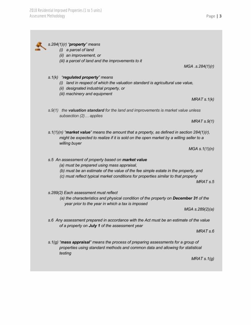
Introduction The Alberta assessment and taxation system is based on the laws outlined in the Municipal Government Act, RSA 2000, cM-26 [MGA], and all associated regulations, including, for example Matters Relating to Assessment and Taxation Regulation, 2018, Alta Reg 203/17. The MGA requires the assessment of property be prepared using mass appraisal. Properties are valued based on a valuation date of July 1, 2017 and the property’s condition of December 31, 2017. Many of these terms are defined in the legislation.
2018 Residential Improved Properties (1 to 3 units) Assessment Methodology Page | 3
2018 Residential Improved Properties (1 to 3 units) Assessment Methodology Page | 4
While there are many forms of ownership, the legislation requires the City of Edmonton to assess the fee simple estate. The fee simple estate is unencumbered by any other interest or estate, and subject only to the limitations of government.
In summary, a property assessment is:
● an estimate of the property’s market value on July 1, 2017
● prepared using mass appraisal
● an estimate of the value of the fee simple estate in the property
● a reflection of the property’s condition on December 31, 2017
● prepared assuming typical market conditions on the open market by a willing seller to a willing buyer
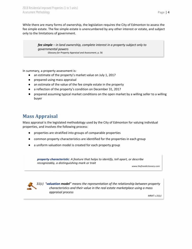
Mass Appraisal Mass appraisal is the legislated methodology used by the City of Edmonton for valuing individual properties, and involves the following process:
● properties are stratified into groups of comparable properties
● common property characteristics are identified for the properties in each group
● a uniform valuation model is created for each property group
2018 Residential Improved Properties (1 to 3 units) Assessment Methodology Page | 5
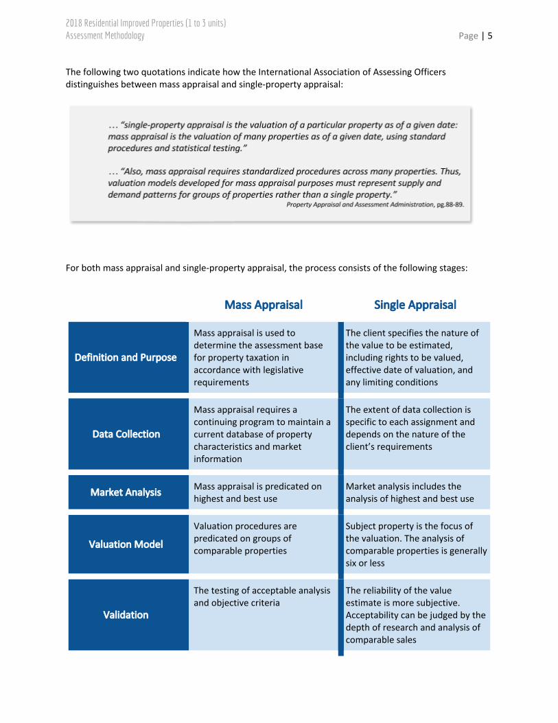
The following two quotations indicate how the International Association of Assessing Officers distinguishes between mass appraisal and single-property appraisal:
For both mass appraisal and single-property appraisal, the process consists of the following stages:
Mass Appraisal Single Appraisal
Definition and Purpose
Mass appraisal is used to determine the assessment base for property taxation in accordance with legislative requirements
The client specifies the nature of the value to be estimated, including rights to be valued, effective date of valuation, and any limiting conditions
Data Collection
Mass appraisal requires a continuing program to maintain a current database of property characteristics and market information
The extent of data collection is specific to each assignment and depends on the nature of the client’s requirements
Market Analysis Mass appraisal is predicated on highest and best use
Market analysis includes the analysis of highest and best use
Valuation Model
Valuation procedures are predicated on groups of comparable properties
Subject property is the focus of the valuation. The analysis of comparable properties is generally six or less
Validation
The testing of acceptable analysis and objective criteria
The reliability of the value estimate is more subjective. Acceptability can be judged by the depth of research and analysis of comparable sales

2018 Residential Improved Properties (1 to 3 units) Assessment Methodology Page | 6
Valuation Models A valuation model creates an equation of variables, factors and coefficients that explains the relationship between estimated market value and property characteristics.
Valuation Model
● variables are created from property characteristics
● analysis of how variables affect market value
● factors and coefficients are determined
● the resulting valuation models are applied to property characteristics
Depending on the property type, multiple regression analysis or other mass appraisal techniques are used to determine factors, variables and coefficients.
An assessed value is calculated by applying the appropriate valuation model to individual properties within a group.
2018 Residential Improved Properties (1 to 3 units) Assessment Methodology Page | 7
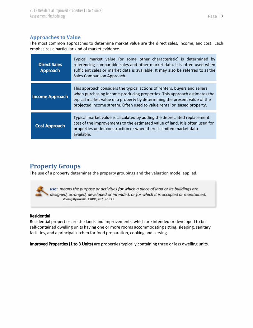
Approaches to Value The most common approaches to determine market value are the direct sales, income, and cost. Each emphasizes a particular kind of market evidence.
Direct Sales Approach
Typical market value (or some other characteristic) is determined by referencing comparable sales and other market data. It is often used when sufficient sales or market data is available. It may also be referred to as the Sales Comparison Approach.
Income Approach
This approach considers the typical actions of renters, buyers and sellers when purchasing income-producing properties. This approach estimates the typical market value of a property by determining the present value of the projected income stream. Often used to value rental or leased property.
Cost Approach
Typical market value is calculated by adding the depreciated replacement cost of the improvements to the estimated value of land. It is often used for properties under construction or when there is limited market data available.
Property Groups The use of a property determines the property groupings and the valuation model applied.
Residential Residential properties are the lands and improvements, which are intended or developed to be self-contained dwelling units having one or more rooms accommodating sitting, sleeping, sanitary facilities, and a principal kitchen for food preparation, cooking and serving. Improved Properties (1 to 3 Units) are properties typically containing three or less dwelling units.

2018 Residential Improved Properties (1 to 3 units) Assessment Methodology Page | 8
Direct Sales Approach For this property group, the assessment is determined using the direct sales approach. It is the most appropriate method of valuation for Residential Improved Properties (1 to 3 Units) in the City of Edmonton as it mirrors the actions of buyers and sellers in the market place. There is sufficient sale data to derive reliable market estimates. The income and cost approaches were not used in the valuation of this property group, as these approaches are more applicable to income producing properties or in limited markets, respectively. The majority of these properties in this inventory are owner occupied with only a portion of the inventory traded based on the property’s ability to generate income. The City of Edmonton validates all land title transactions (sales). The validation process can include site inspections, interviews with parties involved, a review of land title documents, corporate searches, and third party information. The City of Edmonton reviews sales occurring from July 1, 2012 to June 30, 2017 in valuing Improved Properties (1 to 3 Units). Time adjustments are applied to sale prices to account for any market fluctuations occurring between the sale date and the legislated valuation date. The City of Edmonton uses the date the legal title transfer was registered at the Land Titles Office as the sale date of a property. Sale price reflects the condition of a property on the sale date and may not be equal to the assessment.
Zoning The rules and regulations for land development within Edmonton are contained in the Zoning Bylaw, No. 12800.
Residential land use zones vary in part due to density.
A residential zone summary is in the appendix.
2018 Residential Improved Properties (1 to 3 units) Assessment Methodology Page | 9
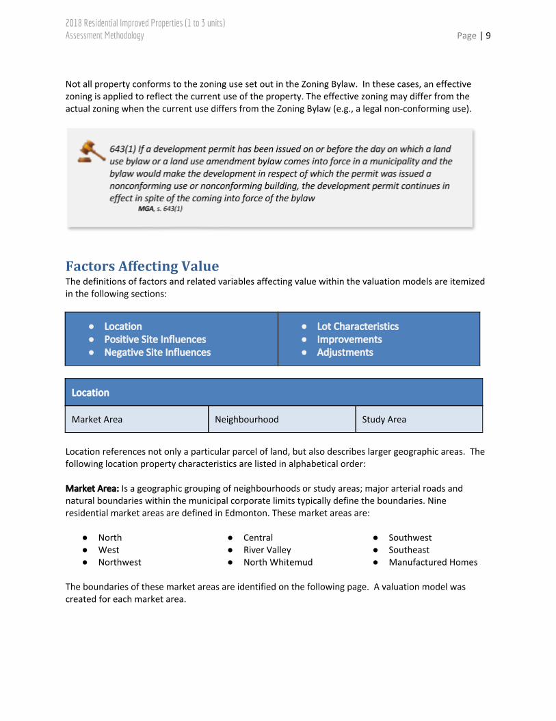
Not all property conforms to the zoning use set out in the Zoning Bylaw. In these cases, an effective zoning is applied to reflect the current use of the property. The effective zoning may differ from the actual zoning when the current use differs from the Zoning Bylaw (e.g., a legal non-conforming use).
Factors Affecting Value The definitions of factors and related variables affecting value within the valuation models are itemized in the following sections:
● Location ● Positive Site Influences ● Negative Site Influences
● Lot Characteristics ● Improvements ● Adjustments
Location
Market Area Neighbourhood Study Area
Location references not only a particular parcel of land, but also describes larger geographic areas. The following location property characteristics are listed in alphabetical order: Market Area: Is a geographic grouping of neighbourhoods or study areas; major arterial roads and natural boundaries within the municipal corporate limits typically define the boundaries. Nine residential market areas are defined in Edmonton. These market areas are:
● North ● West ● Northwest
● Central ● River Valley ● North Whitemud
● Southwest ● Southeast ● Manufactured Homes
The boundaries of these market areas are identified on the following page. A valuation model was created for each market area.

2018 Residential Improved Properties (1 to 3 units) Assessment Methodology Page | 10

2018 Residential Improved Properties (1 to 3 units) Assessment Methodology Page | 11
Neighbourhood: Each property is located in a neighbourhood according to boundaries set by the City of Edmonton. Maps identifying these neighbourhood boundaries are accessible on the City website, http://maps.edmonton.ca/map.aspx (click on “Areas” in the Legend and select “Neighbourhood” in the “I’m looking for” drop-down menu). Study Area: Within the nine market areas, there are sub-groups or sub-sectors of properties within neighbourhoods that show different market trends from the rest of the neighbourhood they are located in. These properties are assigned to study areas to more accurately analyze and value the market trends in these locations.
● Neighbourhood Study Areas: Maps identifying these study areas are accessible on the City website, https://www.edmonton.ca/residential_neighbourhoods/property_tax_assessment/reference-materials.aspx . See the document, 2018 Residential Neighbourhood – Study Areas.
● Rural Residential Study Areas: The market areas also contain groups of rural residential
properties identified by their assigned effective zoning code (‘RR’) and applicable land use code. These properties, with larger acreage sized lots, exist in recognized subdivisions with servicing that may differ from the rest of the surrounding neighbourhoods. Maps identifying these study areas are accessible on the City website, https://www.edmonton.ca/residential_neighbourhoods/property_tax_assessment/reference-materials.aspx . See the document, 2018 Rural Residential – Study Areas.
● First Place Program/Seniors Housing Initiative/Building Housing Choices Study Areas: The First
Place Home Ownership Program (FPP), the Seniors Housing Initiative (SHI), and the Building Housing Choices (BHC) are part of Edmonton’s housing strategy to help create a wider range of housing options to address population growth needs. FPP, SHI, and BHC sites are located throughout the City (see neighbourhood study area maps) and will be developed on building sites that were originally intended as new school sites, but have since been declared surplus by local school boards. The Seniors Housing Initiative will create dedicated seniors’ housing; while the First Place Home Ownership Program will create new town homes for qualified homebuyers whose household income places them just out of reach of the first-time homebuyers market. For more information, please see http://www.firstplaceprogram.com/ or https://www.edmonton.ca/surplusschoolsites.
● Manufactured Home Study Areas: Manufactured home properties are identified by their
assigned effective zoning code (‘RMH’) and applicable land use codes (LUC 113, LUC 114). This group, assessed in its own separate market area model, includes only the manufactured (mobile) home units located in mobile home parks where the manufactured home owner does not own the land parcel. (For details of the assessment of manufactured home park lands associated with this study area, please refer to the 2018 Multi-Residential Manufactured Home Park Land assessment methodology guide.) The manufactured home group consists of three named neighbourhoods and several smaller study areas found within other existing subdivisions. Properties that are part of the manufactured home market are assigned to study areas. Maps identifying these study areas is accessible on the City website, https://www.edmonton.ca/residential_neighbourhoods/property_tax_assessment/reference-materials.aspx . See the document, 2018 Manufactured Home – Study Areas.
2018 Residential Improved Properties (1 to 3 units) Assessment Methodology Page | 12
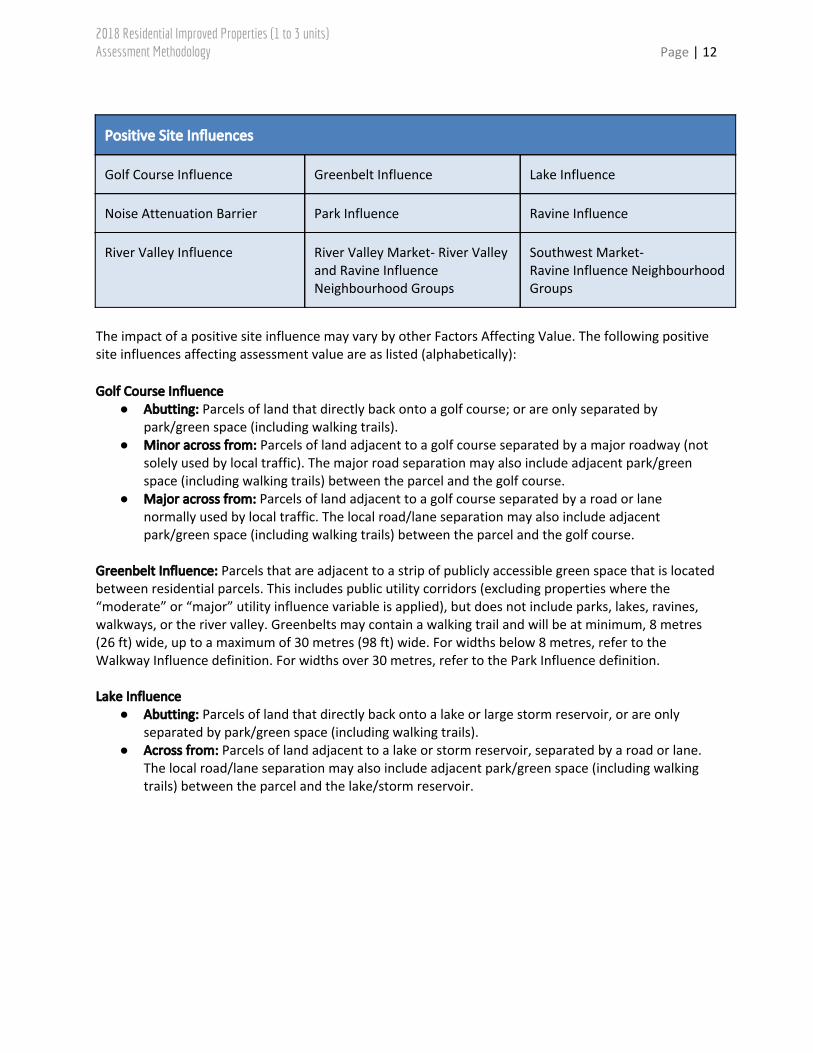
Positive Site Influences
Golf Course Influence Greenbelt Influence Lake Influence
Noise Attenuation Barrier Park Influence Ravine Influence
River Valley Influence River Valley Market- River Valley and Ravine Influence Neighbourhood Groups
Southwest Market- Ravine Influence Neighbourhood Groups
The impact of a positive site influence may vary by other Factors Affecting Value. The following positive site influences affecting assessment value are as listed (alphabetically): Golf Course Influence
● Abutting: Parcels of land that directly back onto a golf course; or are only separated by park/green space (including walking trails).
● Minor across from: Parcels of land adjacent to a golf course separated by a major roadway (not solely used by local traffic). The major road separation may also include adjacent park/green space (including walking trails) between the parcel and the golf course.
● Major across from: Parcels of land adjacent to a golf course separated by a road or lane normally used by local traffic. The local road/lane separation may also include adjacent park/green space (including walking trails) between the parcel and the golf course.
Greenbelt Influence: Parcels that are adjacent to a strip of publicly accessible green space that is located between residential parcels. This includes public utility corridors (excluding properties where the “moderate” or “major” utility influence variable is applied), but does not include parks, lakes, ravines, walkways, or the river valley. Greenbelts may contain a walking trail and will be at minimum, 8 metres (26 ft) wide, up to a maximum of 30 metres (98 ft) wide. For widths below 8 metres, refer to the Walkway Influence definition. For widths over 30 metres, refer to the Park Influence definition. Lake Influence
● Abutting: Parcels of land that directly back onto a lake or large storm reservoir, or are only separated by park/green space (including walking trails).
● Across from: Parcels of land adjacent to a lake or storm reservoir, separated by a road or lane. The local road/lane separation may also include adjacent park/green space (including walking trails) between the parcel and the lake/storm reservoir.
2018 Residential Improved Properties (1 to 3 units) Assessment Methodology Page | 13
Noise Attenuation Barrier: These barriers are considered a positive influence and include any combination of earthen berm, concrete wall structures, or corrugated steel wall structures with a minimum combined height of six (6) feet facing the residence. This does not include wooden “screen” fences typically erected by either the City or residential property owners. Only noise attenuation walls, typically constructed from concrete or corrugated steel are considered. Classification is based on the effective height of the noise barrier facing the noise source as follows:
● Minor: A moderate category barrier located on the property line. ● Moderate: From 6 feet up to 10 feet effective height facing the noise source or a Major category
barrier located on the property line. ● Major: Over 10 and up to 20 feet effective height facing the noise source or an Extreme
category barrier located on the property line. ● Extreme: Over 20 feet effective height facing the noise source.
Where a barrier is constructed on or next to the residential property line, its classification is downgraded by one category to both recognize the closer proximity of the noise source and the likelihood of negative topographical impacts on the property. For example, berms constructed on the property line typically create a significant sloped area within the affected property. Therefore, if the berm sitting on the property line is normally classed as moderate it will be downgraded to minor. If the berm is not located in proximity to any negative influences including commercial, industrial, institutional, LRT, multi-residential, utilities, railway or traffic, then no positive adjustment is given for the berm. Park Influence
● Minor abutting: Properties abutting a park or undeveloped green space with a size ranging between 0.25 hectares (0.62 ac) and 0.75 hectares (1.85 ac) and a minimum width of 30 metres (98 ft), but excluding any area used for overhead transmission lines (See Utility Influence[Moderate] definition). The park or undeveloped green space may include walking trails.
● Minor across from: Properties across a road or lane from a park or undeveloped green space with a size ranging between 0.25 hectares (0.62 ac) and 0.75 hectares (1.85 ac) and a minimum width of 30 metres (98 ft), but excluding any area used for overhead transmission lines (See Utility Influence[Moderate] definition). The park or undeveloped green space may include walking trails and cul-de-sac islands.
● Major abutting: Properties abutting a park or undeveloped green space that have an overall area greater than 0.75 hectares (1.85 ac) and a minimum width of 30 metres (98 ft), but excluding any area used for overhead transmission lines (See Utility Influence[Moderate] definition). This includes all large green spaces, flat wooded areas (not connected to ravines) and neighbourhood parks. The park or undeveloped green space may include walking trails.
● Major across from: Properties across a road or lane from a park or undeveloped green space that have an overall area greater than 0.75 hectares (1.85 ac) and a minimum width of 30 metres (98 ft), but excluding any area used for overhead transmission lines (See Utility Influence[Moderate] definition). This includes all large green spaces, flat wooded areas (not connected to ravines) and neighbourhood parks. The park or undeveloped green space may include walking trails and cul-de-sac islands.
● Recreational abutting: Properties abutting a park or green space that is used for recreational purposes. This includes properties abutting locations such as playgrounds, soccer or football fields, baseball diamonds, outdoor hockey rinks, or school fields.
● Recreational across from: Properties across a road or lane from a park or green space that is used for recreational purposes. This includes properties across from locations such as playgrounds, soccer or football fields, baseball diamonds, outdoor hockey rinks, or school fields.

2018 Residential Improved Properties (1 to 3 units) Assessment Methodology Page | 14
Ravine Influence: The adjacency or proximity of ravine influenced residential properties will be in reference to the boundaries of the North Saskatchewan River Valley and Ravine System Protection Overlay as defined in Edmonton Zoning Bylaw 12800. Also refer to the definition for River Valley Market- River Valley and Ravine Influence Neighbourhood Groups and Southwest Market- Ravine Influence Neighbourhood Groups for specific neighbourhood groupings applied to this influence.
● Abutting: Parcels of land that directly back onto a ravine or thickly wooded area, or are only separated by park/green space (including walking trails).
● Minor across from: Parcels of land adjacent to the ravine or thickly wooded area separated by a major roadway (not solely used by local traffic). The major road separation may also include adjacent park/green space (including walking trails) between the parcel and the ravine/wooded area.
● Major across from: Parcels of land adjacent to a ravine or thickly wooded area separated by a road or lane normally used by local traffic. The local road/lane separation may also include adjacent park/green space (including walking trails) between the parcel and the ravine/wooded area.
River Valley Influence: The adjacency or proximity of river valley influenced residential properties will be in reference to the boundaries of the North Saskatchewan River Valley and Ravine System Protection Overlay as defined in Edmonton Zoning Bylaw 12800. Also refer to the definition for River Valley Market- River Valley and Ravine Influence Neighbourhood Groups for specific neighbourhood groupings applied to this influence.
● Abutting: These are parcels of land that directly back onto the boundaries of the North Saskatchewan River Valley, or are only separated by park/green space/wooded area (including walking trails and golf courses). Where neighbourhoods are located within the River Valley (eg: Rossdale, Riverdale, Cloverdale), this refers to parcels of land relative to the banks of the North Saskatchewan River.
● Minor across from: Parcels of land adjacent to the boundaries of the River Valley separated by a major roadway (not solely used by local traffic). The major road separation may also include adjacent park/green space/wooded area (including walking trails and golf courses) between the parcel and River Valley. Where neighbourhoods are located within the River Valley (eg: Rossdale, Riverdale, Cloverdale), this refers to parcels of land relative to the banks of the North Saskatchewan River.
● Major across from: Parcels of land adjacent to the boundaries of the River Valley separated by a road or lane normally used by local traffic. The local road/lane separation may also include adjacent park/green space/wooded area (including walking trails and golf courses) between the parcel and the River Valley. Where neighbourhoods are located within the River Valley (eg: Rossdale, Riverdale, Cloverdale), this refers to parcels of land relative to the banks of the North Saskatchewan River.
River Valley Market- River Valley and Ravine Influence Neighbourhood Groups: Within the River Valley market area, geographic sub-groups of neighbourhoods are used specifically for the valuation of river valley and ravine influenced residential properties along each section of the North Saskatchewan River Valley. The neighbourhoods within each sub-group are:
● Group 1: 2030 (Bannerman), 2100 (Beverly Heights), 2120 (Canon Ridge), 2280 (Fraser), 2390 (Kernohan), 2630 (River Valley Hermitage), 2640 (River Valley Highlands), 2650 (River Valley Rundle), 2660 (Rundle Heights), 6270 (Gold Bar), 6620 (River Valley Gold Bar).
2018 Residential Improved Properties (1 to 3 units) Assessment Methodology Page | 15
● Group 2: 1070 (Cromdale), 1190 (River Valley Kinnaird), 1240 (Virginia Park), 2060 (Bellevue), 2330 (Highlands), 5200 (Garneau), 5390 (River Valley Walterdale), 5480 (Strathcona), 6040 (Bonnie Doon), 6061 (Capilano), 6230 (Forest Heights), 6491 (Mill Creek Ravine North), 6630 (River Valley Riverside), 6710 (Strathearn).
● Group 3: 1090 (Downtown), 1150 (Oliver), 1200 (River Valley Victoria), 3140 (Crestwood), 3200 (Glenora), 3210 (Grovenor), 3270 (Laurier Heights), 3330 (Parkview), 3380 (River Valley Capitol Hill), 3381 (River Valley Glenora), 3382 (River Valley Laurier), 3440 (Westmount), 5040 (Belgravia), 5090 (Brookside), 5210 (Grandview Heights), 5370 (River Valley Mayfair), 5400 (River Valley Whitemud), 5580 (Windsor Park).
● Group 4: 4120 (Donsdale), 4160 (Gariepy), 4360 (Oleskiw), 4390 (Patricia Heights), 4420 (Quesnell Heights), 4430 (Rio Terrace), 4440 (River Valley Lessard), 4451 (River Valley Oleskiw), 4466 (Cameron Heights), 4467 (River Valley Cameron), 4570 (Wedgewood Heights), 4610 (Westridge), 5080 (Brander Gardens), 5190 (Falconer Heights), 5230 (Henderson Estates), 5340 (Ramsay Heights), 5350 (Rhatigan Ridge), 5380 (River Valley Terwillegar), 5401 (River Valley Fort Edmonton), 5610 (Haddow). Group 4 excludes Rural Residential Study Areas 3054 (Donsdale), 3065 (Patricia Heights), 3074 (River Valley Isolated) and 3080 (Wedgewood).
● Group 5: 4463 (Riverview Area), 4469 (River’s Edge), 4472 (Grandisle), 4476 (White Birch), 5405 (River Valley Windermere), 5570 (Windermere), 5575 (Windermere Area), 5576 (Keswick Area). Group 5 includes Rural Residential Study Areas 3054 (Donsdale), 3065 (Patricia Heights), 3074 (River Valley Isolated), 3080 (Wedgewood), 3082 (West Point Estates), 3083 (Windermere Estates), 3084 (Windermere Ridge).
● Group 6: 1210 (Riverdale), 1220 (Rossdale), 6070 (Cloverdale). Southwest Market- Ravine Influence Neighbourhood Groups: Within the Southwest market area, geographic sub-groups of neighbourhoods are used specifically for the valuation of ravine influenced residential properties. The neighbourhoods within each sub-group are:
● Group 1: 5020 (Aspen Gardens), 5060 (Blue Quill), 5070 (Blue Quill West), 5100 (Bulyea Heights), 5120 (Calgary Trail South), 5130 (Carter Crest), 5160 (Duggan), 5180 (Ermineskin), 5220 (Greenfield), 5300 (Ogilvie Ridge), 5360 (Rideau Park), 5430 (Royal Gardens), 5470 (Steinhauer), 5490 (Sweet Grass), 5540 (Westbrook Estates), 5560 (Whitemud Creek Ravine South), 5620 (Hodgson), 5630 (Leger).
● Group 2: 5030 (Bearspaw), 5050 (Blackmud Creek Ravine), 5250 (Keheewin), 5460 (Skyrattler), 5476 (Magrath Heights), 5477 (Mactaggart Heights), 5511 (Twin Brooks), 5050 (Blackmud Creek Ravine), 5565 (Whitemud Creek Ravine Twin Brooks), 5640 (Terwillegar Towne), 5642 (South Terwillegar).
● Group 3: 4013 (Anthony Henday Terwillegar), 4014 (Anthony Henday South), 5451 (Richford), 5452 (Macewan), 5453 (Blackmud Creek), 5454 (Rutherford), 5456 (Heritage Valley Area), 5457 (Callaghan), 5458 (Allard), 5462 (Chappelle Area), 5463 (Desrochers Area), 5464 (Heritage Valley Town Centre Area), 5465 (Hays Ridge Area), 5466 (Cashman), 5467 (Cavanagh), 5468 (Graydon Hill), 5469 (Paisley), 5505 (Ambleside), 5577 (Glenridding Area), 5590 (Blackburne).

2018 Residential Improved Properties (1 to 3 units) Assessment Methodology Page | 16
Negative Site Influences
Cemetery Influence Commercial Influence Industrial Influence
Institutional Influence LRT Influence Multi-Residential Influence
Railway Influence Traffic Influence Utilities Influence
Walkway Influence
The impact of a negative site influence may vary by other Factors Affecting Value. The following negative site influences affecting assessment value are as listed (alphabetically): Cemetery Influence
● Abutting: Parcels of land that directly back onto a cemetery. ● Across from: Parcels of land that are across the street from a cemetery.
Commercial Influence
● Minor: Any parcel of land that has one minor commercial influence in front, behind or beside the parcel. These are commercial buildings such as neighbourhood corner stores, shops and convenience stores.
● Moderate: Any parcel of land that has one moderate commercial influence in front, behind or beside the parcel, such as neighbourhood strip malls, hotels, or fast food facilities; or a parcel that is adjacent to two minor commercial influences.
● Major: Any parcel of land that has one major commercial influence in front, behind or beside the parcel, such as malls, box centres and bars. This may also be used if there are three or more minor commercial influences that surround the parcel, as well as two or more moderate influences, or a combination of both surrounding the parcel of land.
Industrial Influence
● Minor: Any parcel that has an industrial property in front of, behind, or beside the parcel. ● Moderate: Any parcel that has 2 or 3 smaller industrial properties in front of, behind, or beside
the parcel. ● Major: Any parcel that has an industrial property in front of, behind, or beside that emits a large
amount of pollution or smell (e.g. Gold Bar water treatment plant), or has 3 or more industrial influences surrounding the parcel.

2018 Residential Improved Properties (1 to 3 units) Assessment Methodology Page | 17
Institutional Influence ● Minor: Any parcel that has an institutional facility in front of, behind, or beside the parcel, such
as a church, elementary school or community hall. ● Moderate: Any parcel that has an institutional facility in front of, behind, or beside the parcel,
such as a high school, junior high school, recreation facility, or community pool. This may also be used if there are two minor influences surrounding the parcel.
● Major: Any parcel that has an institutional facility in front of, behind, or beside the parcel where the institution is very active in nature, such as a hospital, large sports facility (e.g. Commonwealth Stadium or Telus Field), post-secondary institution, or other emergency facility. This may also be used if there are three or more minor institutional influences that surround the parcel, or two or more moderate influences, or a combination of both surrounding the parcel of land.
LRT Influence
● Abutting: Parcels of land that directly back onto the LRT right-of-way, or are only separated by park/green space (including walking trails and walkways).
● Across from: Parcels of land adjacent to an LRT right-of-way, separated by a road or lane. The local road/lane separation may also include adjacent park/green space (including walking trails and walkways) between the parcel and right-of-way.
Multi-Residential Influence: This is the adjacent influence of multi-residential (condominium, rowhouse rental, or apartment rental, but excluding individually titled non-condominium row housing units) properties in front of, behind, or beside the parcel. This includes multi-residential properties that are in proximity and across roadways with ‘minor’ or ‘moderate’ traffic counts, but not properties across roadways where ‘major’ traffic counts exist. This influence also includes multi-residential properties that are within 50m (164 ft) of the parcel and separated by utility right-of-ways, parks, lakes, or other green space. Classifications are based on the following total dwelling unit counts from the adjacent multi-residential property, and other multi-residential properties contiguous to it (including those separated by a walkway, greenbelt, or lane, but excluding those separated by a roadway or park):
● Minor: 4 to 30 dwelling units. ● Moderate: 31 to 75 dwelling units. ● Major: Greater than 75 dwelling units.
Railway Influence
● Minor: Parcels of land that directly back onto or are adjacent to a railroad right-of-way with a single or multiple rail lines. The parcel may also be separated from the railroad right-of-way by any type of road or lane.
● Moderate: Parcels of land that directly back onto or are adjacent to a railroad yard or switching station. The parcel may also be separated from the railroad yard or switching station by any type of road or lane.

2018 Residential Improved Properties (1 to 3 units) Assessment Methodology Page | 18
Traffic Influence: This attribute is only applied to those properties whose property line is considered the most "adjacent" to the traffic source. The level of influence is based on the 2015 AAWDT Report: Average Annual Weekday Traffic Volumes, published by the City of Edmonton Transportation Planning Branch. The latest report is accessible on the City website, https://www.edmonton.ca/transportation/traffic_reports/traffic-reports-flow-maps.aspx. See the document, 2010-2015 Average Annual Weekday Traffic Volumes. Within this report, refer to the 2015 column of data.
● Minor: Interior roads with recorded traffic flows of 1,500-5,000 vehicles per day or ETS (Edmonton Transit System) bus routes.
● Moderate: Neighborhood collector roads, with recorded traffic flows of 5,001-15,000 vehicles per day.
● Major: Main arterial roads (e.g. 50th Street, 170th Street, 97th Street), with recorded traffic flows of 15,001-50,000 vehicles per day.
● Extreme: Freeways (e.g. Whitemud Drive, Yellowhead Trail), with recorded traffic flows of over 50,000 vehicles per day.
● Anthony Henday: Anthony Henday Drive ring road traffic. Utilities Influence
● Minor: Underground utilities such as high pressure pipelines running adjacent to the property, generally located within a green belt. Municipal utility services such as low-voltage power lines, gas lines, telecommunications lines, and municipal water, sanitary and storm sewer lines are not included in this category.
● Moderate: A property adjacent to overhead transmission lines (OTL) generally located within a green-belt, or adjacent to telecommunication transmission towers. Municipal utility services such as low-voltage power lines, gas lines, telecommunications lines, and municipal water, sanitary and storm sewer lines are not included in this category.
● Major: A property with one or more overhead or underground utility lines running within the property boundary resulting in a restricted building pocket. The restricted building pocket may also arise from a restrictive covenant for utility purposes. Municipal utility services such as low-voltage power lines, gas lines, telecommunications lines, and municipal water, sanitary and storm sewer lines are not included in this category.
● Substation minor: Property adjacent to a utility substation other than an overhead transmission line (OTL) substation. This includes substations for municipal utility services such as low-voltage power substations, gas substations, telecommunications substations, and municipal water, sanitary and storm sewer substations.
● Substation major: Property adjacent to an overhead transmission line (OTL) substation. Walkway Influence
● Minor: Any parcel adjacent to walkways that connect (either directly, or as part of a larger trail system) one residential area to another, or are used as access points to greenbelts, parks, ravines, or the river valley. These do not include walking paths that are within greenbelts, parks, lakes, ravines, the river valley or LRT right-of-ways. Walkways are less than 8 metres (26 ft) in width. For widths over 8 metres, see the Greenbelt Influence definition.
● Moderate: Any parcel adjacent to walkways that connect (either directly, or as part of a larger trail system) a residential area to areas with commercial uses, institutional uses, or major roadways. Walkways are less than 8 meters (26 ft) in width. For widths over 8 metres, see the Greenbelt Influence definition.
2018 Residential Improved Properties (1 to 3 units) Assessment Methodology Page | 19
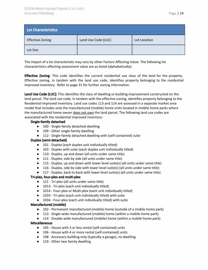
Lot Characteristics
Effective Zoning Land Use Code (LUC) Lot Location
Lot Size
The impact of a lot characteristic may vary by other Factors Affecting Value. The following lot characteristics affecting assessment value are as listed (alphabetically):
Effective Zoning: This code identifies the current residential use class of the land for the property. Effective zoning, in tandem with the land use code, identifies property belonging to the residential improved inventory. Refer to page 31 for further zoning information. Land Use Code (LUC): This identifies the class of dwelling or building improvement constructed on the land parcel. The land use code, in tandem with the effective zoning, identifies property belonging to the Residential Improved inventory. Land use codes 113 and 114 are assessed in a separate market area model that includes only the manufactured (mobile) home units located in mobile home parks where the manufactured home owner does not own the land parcel. The following land use codes are associated with the residential improved inventory:
Single-family detached ● 100 - Single-family detached dwelling ● 109 - Other single-family dwelling ● 112 - Single-family detached dwelling with (self-contained) suite
Duplex (semi-detached) ● 101 - Duplex (each duplex unit individually titled) ● 103 - Duplex with suite (each duplex unit individually titled) ● 110 - Duplex, up and down (all units under same title) ● 111 - Duplex, side by side (all units under same title) ● 115 - Duplex, up and down with lower level suite(s) (all units under same title) ● 116 - Duplex, side by side with lower level suite(s) (all units under same title) ● 117 - Duplex, back to back with lower level suite(s) (all units under same title)
Tri-plex, four-plex and multi-plex ● 121 - Tri-plex (all units under same title) ● 1013 - Tri-plex (each unit individually titled) ● 1014 - Four-plex or Multi-plex (each unit individually titled) ● 1033 - Tri-plex (each unit individually titled) with suite ● 1034 - Four-plex (each unit individually titled) with suite
Manufactured (mobile) ● 102 - Permanent manufactured (mobile) home (outside of a mobile home park) ● 113 - Single-wide manufactured (mobile) home (within a mobile home park) ● 114 - Double-wide manufactured (mobile) home (within a mobile home park)
Miscellaneous ● 105 - House with 3 or less rental (self-contained) units ● 106 - House with 4 or more rental (self-contained) units ● 108 - Accessory building only (typically a garage), no dwelling ● 119 - Other two family dwelling

2018 Residential Improved Properties (1 to 3 units) Assessment Methodology Page | 20
● 120 - Two or more single-family dwellings on one parcel● 129 - Other three/four family dwelling● 149 - Other collective residence● 162 - Co-op / Non-profit housing or detached unit● 190 - Derelict residential (See ‘Derelict Property’ under Adjustments)
Lot Location● Corner Lot: A parcel of land located at the intersection of two public roadways, other than lanes.
Refer to Part I, Section 6.1(18) of the Edmonton Zoning Bylaw 12800 for further details. This is not applicable to manufactured (mobile) home parks where homeowners do not own the lot. This variable negatively affects value.
Lot Size: The area of the assessed land parcel as determined by its legal description and calculated by the City of Edmonton GIS (Global Information System). This is not applicable to manufactured (mobile) home parks where homeowners do not own the lot.

2018 Residential Improved Properties (1 to 3 units) Assessment Methodology Page | 21
Improvements
Air Conditioning Basement (Walkout Variations) Building Areas and Sizes
Built-in Audio/Visual Systems Condition of Improvement Effective Year Built
Elevators Exterior Wall Finish Fireplace(s)
Heating System Heritage Homes Market Building Class (MBC)
Quality Classifications Quality Upgrade Replacements (Renovations)
Roof Finish Secondary Suites Unit Location
The impact of an improvement may vary by other Factors Affecting Value. The following improvement characteristics affecting assessment value are as listed (alphabetically): Air Conditioning: Presence of air conditioning unit(s). Basement (Walkout Variations)
● Walkout: A basement built on a sloping site where one side of the basement has exterior access and is fully exposed, allowing for windows and a door that opens onto grade level.
● Partial walkout: A basement built on a sloping site where one side of the basement has exterior access with only partial exposure, allowing for windows and a door that opens onto grade level.
● Forced walkout: A basement built on a site that does not have a slope. In these situations, the yard has been dug down to expose one of the basement walls. This variation relies on multiple retaining walls.
● Forced partial walkout: A basement built on a site that does not have a slope. In these situations, the yard has been dug down to partially expose one of the basement walls. This variation relies on multiple retaining walls.
● Walkout Basement - No Positive Influence: Any of the above walkout basement types on a property that are not abutting any positive influences such as golf course, lake, park, ravine or river valley.

2018 Residential Improved Properties (1 to 3 units) Assessment Methodology Page | 22
Building Areas and Sizes: Building area size measurements are based on the external building envelope measurements, less any internal missing floor area (Stairwells are considered as assessable net area and are not removed as part of internal missing floor area). The following building areas are factored into the assessment:
● Building net area: The above grade living area of a house. This may also be referred to as Net Liveable Area.
● Basement area: Area of a building that is either completely or partially below the ground floor. ● Basement finished area: A basement area that has been designed and finished, either during
construction or at a later point, to function as a fully habitable space within the house. ● Partial basement area: The majority of partial basements are found in homes built prior to
1950. These were usually created to only accommodate a furnace and are typically used as storage cellars.
● Lower level area: For split level houses, this is the floor area between the main floor and the basement, which is partially below grade.
● Lower level finished area: For split level houses, this is where the lower level has been finished into living area.
● Loft area: An open area in a house extending from an upper floor where there are no partitions or doors.
● Garage area: The area of a garage that may be attached or detached from a house. Attached garages can be constructed on grade, or as part of the basement or lower level of the house.
● Carport area: The area of a carport structure that may be attached or detached from a house. Carports are any roofed open structures without enclosed walls, used to offer limited protection from the elements, for vehicles or other storage.
● Solarium area: The area of a glass enclosed room or living area that is covered by a glass roof and forms part of an extension to an existing residence or structure.
● Sunroom area: The area of a glass enclosed room or living area that is covered by a conventional roof and forms part of an extension to an existing residence or structure.
● Veranda area: An unheated exterior floor area that is protected by a roof and extends along an exterior wall on any storey of a house. A veranda may be enclosed. A veranda must have a railing, except for where access to building is required. Only verandas in excess of 3 square meters (32.3 sq ft) are assessed.
● Pool building area: The portion of an improvement that houses a swimming pool. ● Pool area: The rectangular area of an outdoor swimming pool. In the case of irregular shaped
pools, the area is the smallest rectangular area that will enclose the irregular shape. Built-in Audio/Visual Systems:
● Private Cinema: A room that allows space for theatre-style seating on multi-tiered theatre-style floors, acoustic soundproofing, and dedicated electrical wiring for audio-visual systems. Often found with custom lighting or architectural features.
● Home Theatre: A room that allows space for theatre-style seating, usually on a raised theatre-style floor, and includes dedicated electrical wiring for audio-visual systems.
● Home Entertainment System: Dedicated electrical wiring in a house for the purpose of connecting a TV or projection screen to a built-in stereo system.

2018 Residential Improved Properties (1 to 3 units) Assessment Methodology Page | 23
Condition of Improvement ● Poor: Borderline derelict, many items need immediate repair. ● Fair: General maintenance, typical for the age of the improvements, has not been performed; a
few items need immediate repair. ● Average: Average maintenance, typical for the age of the improvements, has taken place. ● Good: The property has been very well maintained for its age.
Effective Year Built: The effective year built is not always the same as the chronological year built, as additions to an existing structure may require blending the age of the new area with the original area. This is important in establishing value as it measures the subject property in comparison to a typical property with respect to utility and condition for the year it was built. Elevators: Elevator transportation equipment for the vertical movement of people or goods is built into the house. Exterior Wall Finish: Wall finishes, such as brick or stone veneer, used for the entire exterior wall finish and on a building rated as Quality 7 or higher, are classified as premium quality. Fireplace(s):
● Total Fireplace(s): The number of built-in fireplace units, excluding free-standing wood stoves and electric fireplaces.
● Electric Fireplace(s): The number of built-in fireplaces that use no other source of fuel except electricity.
Heating System:
● Zoned Heating System: A zoned heating system allows homeowners to control the temperature of each room or zone individually.
● Geothermal System: A system that uses ground-source heat pumps to act as either a heating or cooling system.
Heritage Homes: These are properties identified by Sustainable Development, in conjunction with the Edmonton Historical Board, for inclusion in the City’s Inventory of Historic Resources. The Inventory is a list of structures/resources in Edmonton that may merit conservation because they are of architectural or social significance to the development of Edmonton and its neighbourhoods. Properties from the list may be eligible or may already be promoted to the Register of Historic Resources, where Municipal Historic Resource status and legal protection has been applied. The latest list is accessible on the City website, https://www.edmonton.ca/city_government/edmonton_archives/historic-resources-inventory-register.aspx. Refer to the linked document, The Inventory and Register of Historic Resources in Edmonton. Market Building Class (MBC): The MBC code indicates the class of the primary building structure on the property. The following MBC codes are associated with this inventory.
Detached structures 1, 1-1/2, 1-3/4 storey ● 1 STY BSMT – 1 storey (bungalow) with basement ● 1 STY NOBSMT – 1 storey (bungalow) without basement ● BI-LEVEL – 1 storey, split-level entry, with basement ● SPLITLEVEL CRWL – 1 storey, split levels, with crawlspace ● SPLITLEVEL – 1 storey, split levels, with no crawlspace

2018 Residential Improved Properties (1 to 3 units) Assessment Methodology Page | 24
● 1.5 STY BSMT – 1-1/2 storey with basement ● 1.5 STY NOBSMT – 1-1/2 storey without basement ● 1.75 STY BSMT – 1-3/4 storey with basement ● 1.75 STY NOBSMT – 1-3/4 storey without basement
Detached structures 2, 2-1/2, 2-3/4 storey ● 2 STY BSMT – 2 storey with basement ● 2 STY NOBSMT – 2 storey without basement ● 2.5 STY BSMT – 2-1/2 storey with basement ● 2.5 STY NOBSMT – 2-1/2 storey without basement ● 2.75 STY BSMT – 2-3/4 storey with basement ● 2.75 STY NOBSMT – 2-3/4 storey without basement
Detached structures 3 storey ● 3STY BSMT – 3 storey with basement ● 3STY NOBSMT – 3 storey without basement
Duplex structures 1, 1-1/2 storey ● 1STY BSMT DUP SXS – 1 storey duplex, side by side, with basements ● 1STY NOBSMT DUP SXS - 1 storey duplex, side by side, without basements ● DUP BILEVEL SXS – 1 storey duplex, side by side, split-level entries, with basements ● SPLT CRWL DUP SXS - 1 storey duplex, split levels, with crawlspaces ● SPLT DUP SXS - 1 storey duplex, split levels, with no crawlspaces ● 1 STY FOURPLX BSMT - 1 storey duplex, back to back, with basements ● 1 STY FOURPLX NOBSMT - 1 storey duplex, back to back, without basements ● BILEVEL FOURPLX - 1 storey duplex, split-level entries, back to back, with basements ● 1.5 STY DUPLEX – 1-1/2 storey duplex with basements ● 1.5 STY DUP NOBSMT - 1-1/2 storey duplex without basements
Duplex structures 2 storey ● 2 STY BSMT DUP SXS - 2 storey duplex, side by side, with basements ● 2 STY NOBSMT DUP SXS - 2 storey duplex, side by side, without basements ● 2 STY FOURPLX BSMT - 2 storey duplex, back to back, with basements ● 2 STY FOURPLX NOBSMT - 2 storey duplex, back to back, without basements
Duplex structures 3 storey ● 3 STY BSMT DUP SXS - 3 storey duplex, side by side, with basements ● 3 STY NOBSMT DUP SXS - 3 storey duplex, side by side, without basements ● 3 STY FOURPLX BSMT - 3 storey duplex, back to back, with basements ● 3 STY FOURPLX NOBSMT - 3 storey duplex, back to back, without basements
Multi-plex structures ● MULT SXS BSMT – 1 storey multi-plex, side by side, with basements ● MULT SXS BILEVEL - storey multi-plex, side by side, split-level entries, with basements ● MULT SXS SPLT CRWL – 1 storey multi-plex, side by side, split levels, with crawlspaces ● 2 STY MULTI SXS - 2 storey multi-plex, side by side, with basements ● 2STYMULT BK2BK BSMT - 2 storey multi-plex, back to back, with basements ● 3STY MULT SXS BSMT - 3 storey multi-plex, side by side, with basements
Manufactured homes (mobile) ● MOBILEHM SGL BSMT – Manufactured (mobile) home, single-wide, with basement ● MOBILEHM SGL NOBSMT – Manufactured (mobile) home, single-wide, without basement ● MOBILEHM DBL BSMT – Manufactured (mobile) home, double-wide, with basement ● MOBILEHM DBL NOBSMT – Manufactured (mobile) home, double-wide, without basement
2018 Residential Improved Properties (1 to 3 units) Assessment Methodology Page | 25
Miscellaneous structures ● GARAGE – garage accessory building ● ROWHOUSING – rowhouse
Quality Classifications
● Economy (01): Usually found in old urban neighbourhoods or rural areas, this class represents low-cost housing that seldom meets building requirements. It is basically square or rectangular and the interior has an inadequate floor plan of small rooms with limited or no hallways. Materials and workmanship are economy grade with little attention given to exterior or interior finishing.
● Substandard (02): This class includes low to moderate cost housing where building requirements are only occasionally satisfied. It is basically square or rectangular and the interior has a simple floor plan of relatively small rooms with limited or no hallway. Finishing materials are substandard quality and no attention is given to decorative features.
● Fair (03): This class satisfies present demands for moderate cost energy efficient housing. The exterior usually has a common style and is basically square or rectangular. It has an adequate floor plan, finishes are fair to average quality materials, and there is little or no attention given to decorative features.
● Standard (04): This quality represents average project housing that meets building requirements for the era. The exterior is a typical style that is generally rectangular and may include entry porches or verandas. The floor plan is functional, and finishes are normally limited to standard quality pre-manufactured materials with a minimum number of decorative features.
● Semi-custom (05): This quality represents above average housing exceeding building requirements for the era. More attention to the exterior details such as breaks in the roof line may be evident. Architectural design is used in living areas of all “move up” home construction. The floor plan is functional with a sense of spaciousness. Finishes are generally upgraded with a mixture of standard and better quality materials with decorative features. A minimum number of interior construction features may be encountered.
● Custom (06): This quality represents good housing exceeding building requirements for the era. It may be contract built. The exterior has an attractive style and often there are breaks in the roof line. The floor plan is functional, with an open design concept creating a sense of spaciousness. Architectural design is used in living areas of all “move up” home construction. Finishes are of good quality materials and workmanship. A number of interior features will be present.
● Good custom (07): This class represents good to expensive quality, energy efficient housing that is normally custom or contract built and, on occasion, may be constructed under the supervision of an architect. Large verandas or covered entrance ways are common with large or stylish columns. The exterior style may be innovative and breaks in the roof line are common. The interior design often shows originality, includes built-in features and has spacious rooms. A number of interior features will be present. Attention to detail is evident. Finishes in this quality are normally the best pre-manufactured or good to expensive materials.
● Expensive (08): This quality represents unique design and style in housing exceeding building requirements for the era. It may be contract built under the supervision of an architect and is commonly built on large sites in prime residential neighborhoods. The exterior often has large window areas and a unique roof style. Exterior finishes are selected for their attractiveness and durability, and may consist of limited amounts of costly ornamentation. The interior design is innovative with a considerable number of built-in features. Rooms are usually spacious and the
2018 Residential Improved Properties (1 to 3 units) Assessment Methodology Page | 26
floor plan often includes special purpose rooms. Decorative features and finishes are normally selected from expensive materials and attention to detail is evident.
● Luxurious (09): This quality represents the ultimate in housing exceeding building requirements for the era. It is contract built under the supervision of an architect. It is situated on large exclusive sites, and is characterized by an abundance of large windows and a unique roof style. The exterior is innovative with finishes selected for attractiveness and durability including costly ornamentation. The interior design is unique and exquisite to meet individual specifications and taste. Rooms are spacious and floor plans include special purpose rooms including many built-in features. Finishes are of luxurious quality materials and may be imported. Decorative features and workmanship is the highest quality with elaborate detail.
Quality Upgrade: A quality upgrade is used to distinguish structures where the interior and exterior quality of construction differs. It is based on the original quality class of the structure. It is not used to account for replacements (i.e. renovations). For example, when the exterior finishes of a home meet a Standard (4) Quality classification that is typical in a neighbourhood, yet has interior finishes that are superior to what is typical in the same Standard (4) Quality homes in a neighbourhood, this would be considered as a quality upgrade. Replacements (Renovations): Replacements can be identified on the interior and/or exterior of a building improvement. The age of the replacements as well as the number of replacements is important when assigning the level of replacement as minor, moderate or major. The following is used as a guide to assign the level of replacement.
● Minor: Up to three replacements. ● Moderate: Four to six replacements. ● Major: Seven or more replacements.
Types of replacements include but are not limited to: ● Exterior:
o Windows o Exterior wall finish o Exterior doors o Roof coverings, soffits and eavestroughs o Roof trusses
● Interior o Kitchen cabinets o Floor coverings o Bathroom fixtures o Interior finish (baseboards, trim, wall finish, doors, etc) o Partitions removed
● Mechanical: o Plumbing stacks and fixtures o Heating o Electrical o Electrical panel
When major structural changes or additions are made, the effective age of the building can be adjusted instead of using replacement codes.
2018 Residential Improved Properties (1 to 3 units) Assessment Methodology Page | 27
Roof Finish: Roof finishes, such as wood shakes, on a building rated as Quality 6 or lower, are classified as premium quality. Roofing materials associated with this factor include:
● Wood shakes/shingles ● Concrete/clay tile
● Metal roofing ● Vinyl roofing
● Rubber roofing ● Slate roofing
Asphalt shingles, Tar/gravel roofing, Flat roof systems, and Untreated pine shakes are also included but are not considered a premium roof finish. Secondary Suites
● Basement, main, upper or lower floor suites: These types of secondary suites are located inside the main dwelling and can be located in the basement, as part of the main floor, an upper floor, or the lower level (of a split-level house). It is a separate dwelling area containing separate cooking, sleeping and bathroom facilities. These suites will have an entrance separate from the main dwelling, either from a common indoor landing or directly from the exterior of the house.
● Upper garage suites: This type of secondary suite is a dwelling area located above a detached garage that is an accessory building to a single detached house. The suite has its own cooking, sleeping and bathroom facilities. These suites will have an entrance either from a common landing or directly from the exterior of the garage, separate from the vehicle entrance to the garage.
● Main floor garage suites: This type of secondary suite is a dwelling area located at grade level, attached to a detached garage that is an accessory building to a single detached house. The suite has its own cooking, sleeping and bathroom facilities. These suites will have an entrance either from a common landing or directly from the exterior of the garage, separate from the vehicle entrance to the garage.
● Garden suites: This type of secondary suite is a self-contained single-storey dwelling that is separate from the principal single detached house. The suite has its own cooking, sleeping and bathroom facilities.
Unit Location
● End unit: End units of individually titled row-housing containing 3 or more units. ● Inside unit: Interior units of individually titled row-housing containing 3 or more units.

2018 Residential Improved Properties (1 to 3 units) Assessment Methodology Page | 28
Adjustments
Adverse Topography Auxiliary Building(s) Derelict Property
Lot Instability Servicing Site Contamination
Adjustments may also be made for the following: Adverse Topography – Adjustments are applied when topographical constraints affect the overall suitability of a land parcel for residential development. This includes property affected by wetland sub-soil conditions resulting from sloughs, ponds and natural drainage onto the property, as well as other sub-soil conditions that do not permit typical foundations to be employed. Auxiliary Building(s) – The value of auxiliary buildings, other than garages, are valued separately using the cost approach on the basis of the Marshall and Swift manual and added to the assessed value. This accounts for building types not typically found on most residential properties, such as storage structures found on rural residential properties (barns, quonsets, greenhouses, warehouses), which are not used for agricultural operations. Derelict Property – An improvement may constitute a derelict property where the improvement is unfit for occupancy and demonstrates severe deterioration to its physical condition. Derelict properties will generally have exterior doors and windows boarded up, and will often be uninhabitable on the basis of an order from Alberta Health Services, a Safety Codes Officer, or the City of Edmonton Sustainable Development Department, Community Standards Branch, or Fire Rescue Service. Lot Instability – Adjustments for lot instability are applied on properties where the bearing capacity of the ground is diminished. Typical improved properties adjacent to natural slopes and along rivers and ravines are not discounted unless lot instability has already occurred. Classification is based on the following criteria:
● Minor: Any parcel that has experienced slope instability and/or erosion to the top of bank area, where such instability or erosion: (a) is apparent and more than incidental in scope, but does not immediately threaten structures or the use of the amenities on that parcel; or (b) has led to ongoing monitoring by a geotechnical professional to ensure continued slope stability.
● Moderate: Any parcel that has experienced slope instability and/or erosion to the top of bank area, where such instability or erosion: (a) impairs or precludes use of a significant portion of the developed part of the property; (b) has resulted in ongoing monitoring by Safety Codes Officers; or (c) poses a risk to the ongoing safe occupancy of the residence or primary structure on the property.
● Major: Any parcel that has experienced severe slope instability and/or erosion to the top of bank area, where: (a) a landslide or major slope failure has occurred, rendering a substantial portion of the top of bank area of the property unusable, hazardous or in need of substantial stabilization works;
2018 Residential Improved Properties (1 to 3 units) Assessment Methodology Page | 29
(b) the property is, or has been, the subject of a Safety Codes Act Order requiring ongoing geotechnical monitoring and/or conditions regarding the continued use of the property or structures thereon; or (c) the residence or primary structure is unsafe for continued occupancy, or where any continued occupancy is contingent upon compliance with conditions in a Safety Codes Act order.
Servicing: Servicing refers to the utility infrastructure services available to a property. Servicing includes sanitary sewer and water service. If a property does not have a specific service, a negative adjustment may be applied. A property is considered as serviced if a branch (stub) line from the City/Epcor main line to the property line exists. Site Contamination – Adjustments are applied to address situations where environmental site contamination has occurred to a property from an outside source beyond the control of the property owner. Refer to the City of Edmonton Assessment Valuation Procedures in Relation to Contaminated Properties.

2018 Residential Improved Properties (1 to 3 units) Assessment Methodology Page | 30
Sample Assessment Detail Report In the nine residential market areas, factors and variables were analyzed to determine those that affect value in each market area. On the sample shown below, the factors and variables used to calculate each individual property assessment are displayed in the Direct Sales Approach Summary section of each property’s Assessment Detail Report.
2018 Residential Improved Properties (1 to 3 units) Assessment Methodology Page | 31
Provincial Quality Standards For Improved Properties (1 to 3 Units) properties the City of Edmonton used the direct sales approach to calculate the 2018 assessments. The assessment models, the process utilized, and the results are submitted annually to the Assessment Services Branch of the Department of Municipal Affairs for audit purposes. This audit is used to determine the accuracy of our predictions relative to the marketplace, and is a direct reflection on the accuracy of our models. The results indicated that our assessments meet Provincial Quality Standards as set out in MRAT.
References City of Edmonton. (2017). Zoning Bylaw No. 12800. Retrieved from City of Edmonton:
http://webdocs.edmonton.ca/InfraPlan/zoningbylaw/bylaw_12800.htm Eckert, J., Gloudemans, R., & Almy, R. (1990). Property Appraisal and Assessment Administration.
Chicago, Illinois: International Association of Assessing Officers. Farlex. (2015). Retrieved from The Free Dictionary: www.thefreedictionary.com International Association of Assessing Officers [IAAO]. (1997). Glossary for Property Appraisal and
Assessment. Chicago IL. Province of Alberta. (2017). Matters Relating to Assessment and Taxation Regulation, 2018. Retrieved
from Service Alberta, Queen's Printer: http://www.qp.alberta.ca Province of Alberta. (2017). Municipal Government Act. Edmonton, AB: Queen's Printer.
Revision History Jan 22, 2018 - Revised Sample Assessment Detail Report - pg 30
Appendix Zone Chart: Residential Measure Conversion Chart
2018 Residential Improved Properties (1 to 3 units) Assessment Methodology Page | 32
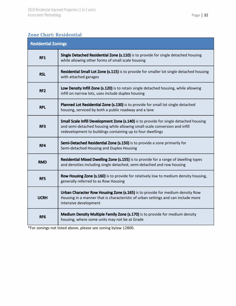
Zone Chart: Residential
Residential Zonings
RF1 Single Detached Residential Zone (s.110) is to provide for single detached housing while allowing other forms of small scale housing
RSL Residential Small Lot Zone (s.115) is to provide for smaller lot single detached housing with attached garages
RF2 Low Density Infill Zone (s.120) is to retain single detached housing, while allowing infill on narrow lots, uses include duplex housing
RPL Planned Lot Residential Zone (s.130) is to provide for small lot single detached housing, serviced by both a public roadway and a lane
RF3 Small Scale Infill Development Zone (s.140) is to provide for single detached housing and semi-detached housing while allowing small-scale conversion and infill redevelopment to buildings containing up to four dwellings
RF4 Semi-Detached Residential Zone (s.150) is to provide a zone primarily for Semi-detached Housing and Duplex Housing
RMD Residential Mixed Dwelling Zone (s.155) is to provide for a range of dwelling types and densities including single detached, semi-detached and row housing
RF5 Row Housing Zone (s.160) is to provide for relatively low to medium density housing, generally referred to as Row Housing
UCRH Urban Character Row Housing Zone (s.165) is to provide for medium density Row Housing in a manner that is characteristic of urban settings and can include more intensive development
RF6 Medium Density Multiple Family Zone (s.170) is to provide for medium density housing, where some units may not be at Grade
*For zonings not listed above, please see zoning bylaw 12800.

2018 Residential Improved Properties (1 to 3 units) Assessment Methodology Page | 33
Residential Zonings
RA7 Low Rise Apartment Zone (s.210) provides for low rise apartment buildings
RA8 Medium Rise Apartment Zone (s.220) provides for medium rise apartment buildings
RA9 High Rise Apartment Zone (s.230) provides for high rise apartment buildings
RR Rural Residential Zone (s.240) is to provide for single detached residential development of a permanent nature in a rural setting, generally without the provision of the full range of urban utility services
RMH Mobile Home Zone (s.250) is to provide for Mobile Homes developed within a Mobile Home Park or Mobile Home Subdivision.
*For zonings not listed above, please see zoning bylaw 12800.

2018 Residential Improved Properties (1 to 3 units) Assessment Methodology Page | 34
Measure Conversion Chart
Imperial to Metric – Length Imperial to Metric – Area
1 inch (in) = 2.54 centimetres (cm) 1 square foot (sqft) = 0.09290 square metre (m2)
1 foot (ft) = 0.3048 metres (m) 1 acre (ac) = 4,046.86 square metre (m2)
Imperial Conversions 1 acre (ac) = 0.40469 hectares (ha)
1 acre (ac) = 43,560 square feet (sqft) Metric Conversions
1 square mile = 640 acres (ac) 1 square kilometer (sq km) = 100 hectares (ha)
1 section = 640 acres (ac) 1 hectare (ha) = 10,000 square metres (m2)
Related Documents