INRMP – Land-use 2-1 MCAS Miramar, California 2.0 MCAS MIRAMAR LAND-USE 2.1 Location and Environmental Setting MCAS Miramar is located approximately 13 miles north of downtown San Diego and 4 miles east of the Pacific Ocean (Figure 2.1a). The MCAS Miramar property is about 12 miles long from east to west and about 4 miles from north to south encompassing 23,065 acres 3 . State Route 52 and Interstate 805 (I-805) form the southern and western borders of the installation, respectively. I-15, State Route 163, and Kearny Villa Road bisect the Station into east and west. I-15 and Miramar Road are the main access roads to the Station. Several nearby communities continue to grow in the vicinity of MCAS Miramar including the City of Poway, City of Santee, Mira Mesa, Scripps Ranch, Clairemont, Kearny Mesa, and others (Figure 2.1b). The western portion of MCAS Miramar is located on a marine terrace, or mesa, on the coastal plain that rises gradually from the Pacific Ocean. Western Miramar is relatively flat with deeply incised canyons. East Miramar is made up of coastal foothills and canyons with moderate to steep slopes. Elevations range from 240 feet in the west to 1,178 feet in eastern areas of the Station. Major vegetation types on MCAS Miramar include chaparral, coastal sage scrub, grassland, and riparian vegetation. 2.2 Overview The Marine Corps is assigned the unique defense mission among the nation’s armed services of being able to field, on virtually immediate notice, a self-sufficient air and ground combat force trained to fight as an integrated team under a single command. To prepare for this mission, the Marine Corps must maintain training facilities that offer diversity and flexibility to train its units, so they are prepared for the challenges they may face in combat. MCAS Miramar is an important facility for satisfying these training, deployment, and personnel support requirements. MCAS Miramar encompasses 23,065 acres and is generally bisected by Kearny Villa Road. The area west of Kearny Villa Road (the Main Station and South/West Miramar) supports the military need for commercial, administrative, operational, and residential facilities. The area east of Kearny Villa Road (East Miramar) is primarily undeveloped, is used for military training and operational exercises, warehousing, and supports the military need for encroachment and access control. Land-use controls for lands underlying flight paths prevent certain types of land-uses that would be incompatible because of noise levels and safety considerations associated with aircraft operations. In addition, undeveloped lands of East Miramar are used for land navigation training, troop maneuvers, bivouacking/over-night camping, aircraft/personnel support exercises, tactical vehicle driver training, and weapons instruction training. The south, central part of East Miramar (south of the aircraft approach corridor) is being planned for construction of military family housing. Military land-uses at MCAS Miramar include operational (e.g., aircraft operations) and non-operational (e.g., community support) uses and functions. Land-uses not directly related to or supportive of the military mission also take place within MCAS Miramar. These non-military uses primarily include outleases and easements for public highways, roadways, utilities, and landfills, encompassing about 2,900 acres. Implementation of Sikes Act Improvement Amendments: Supplemental Guidance concerning Leased Lands (Memorandum, Assistant Deputy Under Secretary of Defense, May 17, 2005) (used in conjunction with Office of the Secretary of Defense 3 Acreages within this INRMP may not be completely consistent with each other, primarily due to land transfers, different geospatial data system (GIS) software, or time of data collection. This total acreage for MCAS Miramar is considered official (MI.MI>dod_rpi_site_area).

Welcome message from author
This document is posted to help you gain knowledge. Please leave a comment to let me know what you think about it! Share it to your friends and learn new things together.
Transcript

INRMP – Land-use 2-1 MCAS Miramar, California
2.0 MCAS MIRAMAR LAND-USE
2.1 Location and Environmental Setting MCAS Miramar is located approximately 13 miles north of downtown San Diego and 4 miles east of the
Pacific Ocean (Figure 2.1a). The MCAS Miramar property is about 12 miles long from east to west and about
4 miles from north to south encompassing 23,065 acres3. State Route 52 and Interstate 805 (I-805) form the
southern and western borders of the installation, respectively. I-15, State Route 163, and Kearny Villa Road
bisect the Station into east and west. I-15 and Miramar Road are the main access roads to the Station. Several
nearby communities continue to grow in the vicinity of MCAS Miramar including the City of Poway, City of
Santee, Mira Mesa, Scripps Ranch, Clairemont, Kearny Mesa, and others (Figure 2.1b).
The western portion of MCAS Miramar is located on a marine terrace, or mesa, on the coastal plain that rises
gradually from the Pacific Ocean. Western Miramar is relatively flat with deeply incised canyons. East
Miramar is made up of coastal foothills and canyons with moderate to steep slopes. Elevations range from 240
feet in the west to 1,178 feet in eastern areas of the Station. Major vegetation types on MCAS Miramar include
chaparral, coastal sage scrub, grassland, and riparian vegetation.
2.2 Overview
The Marine Corps is assigned the unique defense mission among the nation’s armed services of being able to
field, on virtually immediate notice, a self-sufficient air and ground combat force trained to fight as an
integrated team under a single command. To prepare for this mission, the Marine Corps must maintain training
facilities that offer diversity and flexibility to train its units, so they are prepared for the challenges they may
face in combat. MCAS Miramar is an important facility for satisfying these training, deployment, and
personnel support requirements.
MCAS Miramar encompasses 23,065 acres and is generally bisected by Kearny Villa Road. The area west of
Kearny Villa Road (the Main Station and South/West Miramar) supports the military need for commercial,
administrative, operational, and residential facilities. The area east of Kearny Villa Road (East Miramar) is
primarily undeveloped, is used for military training and operational exercises, warehousing, and supports the
military need for encroachment and access control. Land-use controls for lands underlying flight paths prevent
certain types of land-uses that would be incompatible because of noise levels and safety considerations
associated with aircraft operations. In addition, undeveloped lands of East Miramar are used for land
navigation training, troop maneuvers, bivouacking/over-night camping, aircraft/personnel support exercises,
tactical vehicle driver training, and weapons instruction training. The south, central part of East Miramar (south
of the aircraft approach corridor) is being planned for construction of military family housing.
Military land-uses at MCAS Miramar include operational (e.g., aircraft operations) and non-operational (e.g.,
community support) uses and functions. Land-uses not directly related to or supportive of the military mission
also take place within MCAS Miramar. These non-military uses primarily include outleases and easements for
public highways, roadways, utilities, and landfills, encompassing about 2,900 acres. Implementation of Sikes
Act Improvement Amendments: Supplemental Guidance concerning Leased Lands (Memorandum, Assistant
Deputy Under Secretary of Defense, May 17, 2005) (used in conjunction with Office of the Secretary of
Defense
3 Acreages within this INRMP may not be completely consistent with each other, primarily due to land transfers, different
geospatial data system (GIS) software, or time of data collection. This total acreage for MCAS Miramar is considered
official (MI.MI>dod_rpi_site_area).

INRMP – Land-use 2-2 MCAS Miramar, California
Figure 2.1a. Regional Location of MCAS Miramar

INRMP – Land-use 2-3 MCAS Miramar, California
Figure 2.1b. MCAS Miramar and Surrounding Areas
policy memo “Implementation of Sikes Act Improvement Act: Updated Guidance, October 10, 2002 and
November 1, 2004) requires that the MCAS Miramar INRMP address resource management on “lands
occupied by tenants or lessees or being used by others pursuant to a permit, license, right of way, or any other
form of permission.”
Developed areas within MCAS Miramar cover about 4,088 acres and include aircraft operation and
maintenance facilities, administrative and residential buildings, storage and supply facilities, research facilities,
recreation areas, and civilian outleases. Facilities at MCAS Miramar include 350 buildings with more than
4,200,000 square feet (96.4 acres) of building area and other structures and facilities, such as runways, utilities,
roadways, and fuel storage.
Most major construction described in the 2000 INRMP (MCAS Miramar INRMP 2000) was to support the
transfer of the Station from NAS Miramar to MCAS Miramar. All of these projects have been completed. The
Station Master Plan (Southwest Division, Naval Facilities Engineering Command, in preparation) defines land-
use strategies for MCAS Miramar (e.g., development areas, training areas).
Five military training areas have been designated for field training within the boundaries of the Station (Figure

INRMP – Land-use 2-4 MCAS Miramar, California
2.2). In addition, many other facilities provide important military readiness training. During the BRAC process,
the Marine Corps indicated that it intended to use training areas consistent with guidelines and procedures
established by NAS Miramar (NAS Miramar Instruction 7050.2D). The Marine Corps developed MCAS
Miramar Station Order P3500.2, which includes specific instructions for use of these training areas. However,
as new mission requirements are identified, ground training areas may be modified.
Undeveloped land makes up the remainder of the area within MCAS Miramar. Most of these lands remain
undeveloped to support the military need for encroachment and access control by segregating land-uses that
may be incompatible because of noise levels and safety considerations associated with military activities.
Undeveloped lands within MCAS Miramar form one of the largest parcels of contiguous natural area in the
rapidly developing San Diego area.
2.3 Land-use History
Appendix A of the MCAS Miramar Integrated Cultural Resources Management Plan (MCAS Miramar
Integrated Cultural Resources Management Plan 2004) has a detailed description of the history of the land
comprising MCAS Miramar. Native Americans were the first recorded users of the area in the vicinity of
MCAS Miramar. The area was likely used as an inland hunting and collecting area for coastal tidepool
gatherers.
The area then became part of a Spanish land grant owned by Don Santiago Arguello and was grazed. He
divided and sold portions of the land grant after the Civil War. During the mid- to late 1800s, the land was
grazed and used for non-irrigated agriculture. In the late 1800s and early 1900s, the farming community of
Linda Vista was situated in an area east of what is now I-15.
During World War I, an Army infantry training center called Camp Kearny was established on the location of
present day MCAS Miramar. In 1917 the
Army leased about 8,000 acres for Camp
Kearny and soon added an adjacent 5,000
acres for training and maneuvering
activities. Approximately 5,000 men and
20,000 horses and mules were housed at
Camp Kearny. An estimated 1,262
buildings were constructed over a five-year
period, most of which were demolished
when Camp Kearny was closed in 1922. By
the time the war ended, the strategic
importance of aviation for the military and
the Miramar area as an aircraft launching
site was secured. Between the two World
Wars, the property was operated briefly as a
dirigible base, and was known as Army
Infantry Training Center Camp Kearny.
At the start of World War II, the Station was expanded and reorganized into two activities. The southern half
became an auxiliary field for NAS North Island, and the northern portion became Marine Corps Air Depot. In
1941, the Air Depot expanded to more than 29,000 acres and was called Camp Elliott. The Camp was located
east of I-15 and included all of present-day East Miramar. In 1943 the Station was commissioned MCAS
Kearny Mesa.
Camp Kearny San Diego Historical Society

Interstate 805
State Route 52
Interstate 15
State Rou
te 163
Miramar Wy
H Avenue
Missile Rd
Miramar MoundsNational Natural
Landmark
ResearchNaturalArea
E A S T M I R A M A R
S O U T H / W E S TM I R A M A R
M A I NS T A T I O N
Rifle Range
County Sheriff/ USMC Pistol Range
EOD TrainingRange
PistolRange
MiramarWholesale
Nursery
LZ 25
MAL Site
TRAININGAREA 1
TRAININGAREA 2
TRAININGAREA 4
TRAININGAREA 3
TRAINING
AREA 5
This map is for planning purposes only. Some data may be incomplete, inaccurately positioned, and/or generalized.
Land Use Sectors, TrainingAreas, Constraints, and
Special Natural Resource Areas
LZ 25MAL SITEAccident Potential Zone IAccident Potential Zone IIClear ZoneLand Use SectorExplosive Safety Quantity DistancePistol and Rifle Range SDZTraining AreaDeveloped AreaSpecial Natural Area
2010GeomorphISFigure 2.20 1 2 30.5
Miles
PlannedHousing
Development
VA CemeteryPlannedBuild Out

INRMP – Land-use 2-6 MCAS Miramar, California
MV-22, Osprey MCAS Miramar
Combat Camera Division
In 1946, the Station was designated MCAS Miramar, until the Marine air units were moved to El Toro in 1947.
The Station was designated NAS Miramar on 1 April 1952, when it became the Master Jet Station for the
Pacific Fleet.
The easternmost portion of present-day MCAS Miramar, referred to in the past as the Sycamore Canyon
Annex; was transferred to the U.S. Air Force in 1960 and later to the National Aeronautics and Space
Administration for missile testing. In 1977, the remaining portion of Camp Elliott and the National Aeronautics
and Space Administration testing site were transferred back to NAS Miramar.
NAS Miramar remained relatively unchanged until 1993, when MCAS El Toro and MCAS Tustin were
selected for closure as a result of the Defense Base Closure and Realignment Act of 1990 (Public Law 101-
510) that was accepted by Congress in September 1993 and September 1995. As a result of this selection,
Marine Corps units were realigned to NAS Miramar; NAS Miramar officially became MCAS Miramar on 1
October 1997.
2.4 Military Operational Requirements
All Marines must annually satisfy mandatory training
requirements designed to ensure that all personnel are
prepared for immediate deployment and combat
operations. These training operations can be classified as
Marine Corps Common Combat Skills Training, vehicle
operations, Marine Wing Service Support, and Air
Operations Training. This training consists of open area
classes, fieldwork (including land navigation and static
displays), weapons qualifications, and overnight bivouac
activities. Of the approximately 23,065 acres that comprise
MCAS Miramar, approximately 4,698 acres in five
specified training areas, have been designated specifically
for ground training operations. These training areas are
utilized for field training operations by ground and aviation
units of the Marine Corps, other active duty and reserve
components of the DoD, and nonmilitary federal, state and
local law enforcement agencies. Although other
undeveloped areas within East Miramar are not presently
identified for current ground training, they serve as part of
the Marine Corps inventory for potential future use as
training ranges. Additionally, other developed sites on the
Station may also be used to support operational training
requirements. Impacts associated with training activities
may result from foot traffic, tracked and wheeled motor
vehicle operations, combat engineering support operations,
temporary encampments, and fixed and rotary wing
aviation operations that are conducted during day and night.
Types, frequency, intensity, and duration of training activities vary by location and training requirements. Each
of the five dedicated training areas experiences a level of activity and frequency of use that is based on specific
training requirements that may require unique physical attributes and/or Station assets in that area. This results
INRMP – Land-use 2-7 MCAS Miramar, California
in some areas of the Station experiencing most, if not all of the various activities listed above, while others may
experience little or no activity. All Station training activities affect natural resources to some degree, but in
many cases, these effects are temporary, of a short duration, and have a low to minimal impact.
2.4.1 Marine Corps Common Combat Skills Training
Basic Marine Corps Common Combat Skills Training is required of every Marine, regardless of his/her
military occupational specialty. Battle skills training primarily consists of ground combat training conducted to
teach or refresh field skills that include infantry; small arms weapons qualifications; Chemical, Biological,
Radiological and Nuclear Defense training; and individual and unit training operations. These activities may
vary from small groups (2 -13 Marines) to several hundred Marines participating in patrol and land navigation
exercises or in organized marches on established roads. Training may occur within any one or a combination of
training areas across the Station. Field training also includes training in offensive and defensive maneuvers,
patrolling, land navigation, communications, and other associated field activities for engineering support
operations. Most training operations last from several hours up to a full day or more, with some activities being
scheduled for up to several weeks with bivouacking/overnight camping. Most activities are conducted either on
foot or by vehicle, being limited by established range scheduling, training scenario, scheme of exercise
maneuver, slope of terrain, and vegetative cover. The following activities are representative of the scope of
ongoing Marine Corps Common Combat Skills Training at MCAS Miramar.
Chemical, Biological, Radiological and Nuclear Defense training in the practical application of
decontamination and/or neutralizing agents on personnel, unit field equipment, the use of the M-40
gas mask with exposure to a CS (tear gas) in a confined gas chamber training facility, protective suits
to protect individuals from biological or chemical agents, and first aid measures for individuals
exposed to such agents. This training also addresses first aid treatments in a field environment and
field sanitation for eating utensils, individual water purification, personnel hygiene, and human waste
removal/disposal.
Land navigation training instruction in the use of standard issue 1:25,000 maps and compass and
plotting and practical application in the movement from location to location utilizing maps, compass,
and terrain association.
Instruction in the setup and use of mobile field communications equipment that include radios,
telecommunications satellite up and down links, computer equipment, and power generation
equipment in a field environment.
Individual training consisting of instruction and testing of individual personnel in basic conditioning
and survival skills, which includes physical fitness, swim qualification, and motor vehicle drivers
improvement.
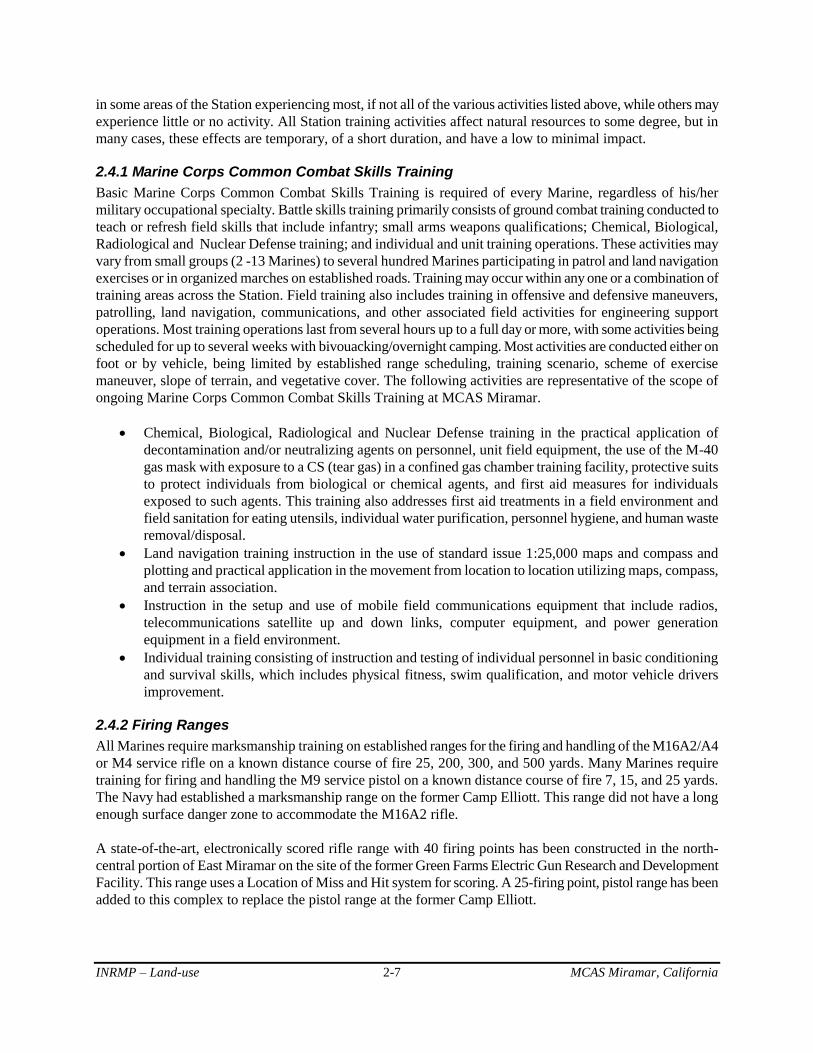
2.4.2 Firing Ranges
All Marines require marksmanship training on established ranges for the firing and handling of the M16A2/A4
or M4 service rifle on a known distance course of fire 25, 200, 300, and 500 yards. Many Marines require
training for firing and handling the M9 service pistol on a known distance course of fire 7, 15, and 25 yards.
The Navy had established a marksmanship range on the former Camp Elliott. This range did not have a long
enough surface danger zone to accommodate the M16A2 rifle.
A state-of-the-art, electronically scored rifle range with 40 firing points has been constructed in the north-
central portion of East Miramar on the site of the former Green Farms Electric Gun Research and Development
Facility. This range uses a Location of Miss and Hit system for scoring. A 25-firing point, pistol range has been
added to this complex to replace the pistol range at the former Camp Elliott.
Sgt. Jason C. Huffins Sgt. Jason C. Huffins
INRMP – Land-use 2-8 MCAS Miramar, California
Small Arms Training
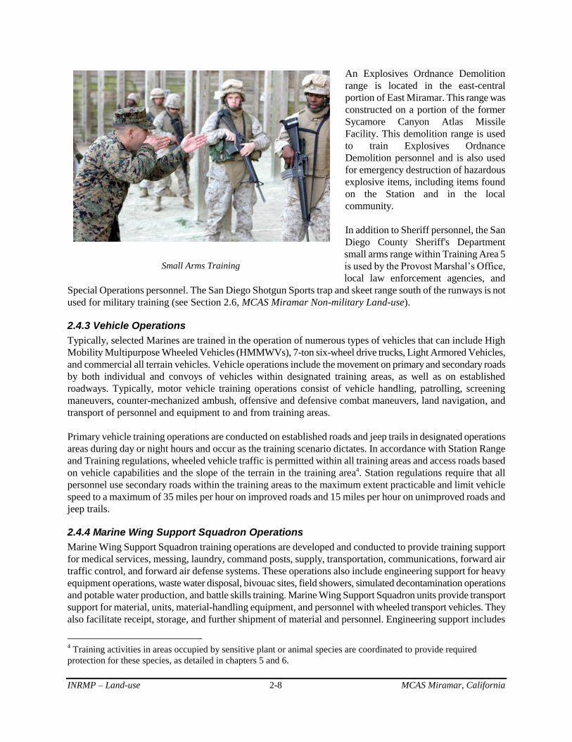
An Explosives Ordnance Demolition
range is located in the east-central
portion of East Miramar. This range was
constructed on a portion of the former
Sycamore Canyon Atlas Missile
Facility. This demolition range is used
to train Explosives Ordnance
Demolition personnel and is also used
for emergency destruction of hazardous
explosive items, including items found
on the Station and in the local
community.
In addition to Sheriff personnel, the San
Diego County Sheriff's Department
small arms range within Training Area 5
is used by the Provost Marshal’s Office,
local law enforcement agencies, and
Special Operations personnel. The San Diego Shotgun Sports trap and skeet range south of the runways is not
used for military training (see Section 2.6, MCAS Miramar Non-military Land-use).
2.4.3 Vehicle Operations
Typically, selected Marines are trained in the operation of numerous types of vehicles that can include High
Mobility Multipurpose Wheeled Vehicles (HMMWVs), 7-ton six-wheel drive trucks, Light Armored Vehicles,
and commercial all terrain vehicles. Vehicle operations include the movement on primary and secondary roads
by both individual and convoys of vehicles within designated training areas, as well as on established
roadways. Typically, motor vehicle training operations consist of vehicle handling, patrolling, screening
maneuvers, counter-mechanized ambush, offensive and defensive combat maneuvers, land navigation, and
transport of personnel and equipment to and from training areas.
Primary vehicle training operations are conducted on established roads and jeep trails in designated operations
areas during day or night hours and occur as the training scenario dictates. In accordance with Station Range
and Training regulations, wheeled vehicle traffic is permitted within all training areas and access roads based
on vehicle capabilities and the slope of the terrain in the training area4. Station regulations require that all
personnel use secondary roads within the training areas to the maximum extent practicable and limit vehicle
speed to a maximum of 35 miles per hour on improved roads and 15 miles per hour on unimproved roads and
jeep trails.
2.4.4 Marine Wing Support Squadron Operations
Marine Wing Support Squadron training operations are developed and conducted to provide training support
for medical services, messing, laundry, command posts, supply, transportation, communications, forward air
traffic control, and forward air defense systems. These operations also include engineering support for heavy
equipment operations, waste water disposal, bivouac sites, field showers, simulated decontamination operations
and potable water production, and battle skills training. Marine Wing Support Squadron units provide transport
support for material, units, material-handling equipment, and personnel with wheeled transport vehicles. They
also facilitate receipt, storage, and further shipment of material and personnel. Engineering support includes
4 Training activities in areas occupied by sensitive plant or animal species are coordinated to provide required
protection for these species, as detailed in chapters 5 and 6.

INRMP – Land-use 2-9 MCAS Miramar, California
CH 53 lifting HMMWV
reconnaissance, construction of temporary camps, forward field bases to refuel and rearm vehicles and aircraft
(including laying down temporary matting, connecting fuel bladders, and utilizing power generation
equipment), and removal of landing obstacles.
Typically, combat engineers employ bulldozers, graders, backhoes, 5-ton six wheel drive trucks, High Mobility
Multipurpose Wheeled Vehicles, bulk refueling equipment, reverse osmosis water purification units, and all -
terrain forklifts of varying tonnage to move supplies and equipment within training areas. This equipment can
also include road graders, forklifts, loaders, bulldozers, small cranes, and light and heavy trucks. Typically,
engineering operations involves training 12-20 Marines in the use of a variety of heavy equipment used for
earth moving and logistics operations. Engineering training operations are also conducted station-wide in
support of road and drainage system maintenance, minor projects (e.g., Fish Pond restoration), and range
grading and maintenance operations.
Marine Wing Support Squadron training is usually restricted to relatively flat areas lacking significant
vegetation. Most, if not all of these training sites have been highly disturbed during previous training
operations, and no new sites are created due to a lack of time, equipment, and financial resources. There is a
need for a dedicated engineer training site that could be heavily disturbed. One site used for some training is
behind the former Camp Elliott known-distance rifle range.
2.4.5 Aviation Operations
Aviation operations, fixed and rotary wing, occur year-round and consist of training exercises involving
landings, takeoff, field carrier landing practice, ordnance loading/unloading, and the transport of personnel or
material. This training is either flight operations of fixed-wing or rotary-wing aircraft or aircraft rescue/fire
fighting training operations.
All fixed-wing aircraft confine take off and landing
operations to runways at the Station. Rotary-wing flight
operations are conducted over all training areas of
Miramar. Takeoffs and landings are conducted from
established landing zones, confined area landing sites,
and any other location not specifically prohibited to
aircraft. Local rotary wing flight operations are
typically conducted 100 to 200 feet above ground level,
depending on the training scenario and the numbers of
aircraft. Training in rotary-wing aircraft also includes
the following:
External load practice, which is the application
of lifting, by a helicopter, a load of materials or
equipment slung under a helicopter. This also
includes slinging a water bucket unit utilized
for fire fighting.
Mountainous and/or confined area landings,
which includes instruction and training in use of a helicopter landing zone in a mountainous area or
one with limited clearance obstacles in close proximity to the landing zone.
Shipboard landing practice on a simulated LHD ship deck next to the heavy lift pad located just south
of Runway 6R/24L.
Flight operations using light intensifying equipment (night vision) while flying a helicopter in night or
low-light situations.

INRMP – Land-use 2-10 MCAS Miramar, California
Corbis Digital Stack
Typically aircraft rescue/firefighting training operations include:
removing aircrew members from a downed or crashed aircraft,
extinguishing fires associated with aircraft at an airfield or in remote locations,
the use of rescue equipment,
use and operation of firefighting and rescue vehicles, and
emergency first aid for injured aircrew members.
These training operations are generally conducted in close proximity to the existing runways. Aircraft
rescue/fire fighting training uses a burn pit located south of the runways to simulate burning aircraft and/or
fuel.
Eight squadrons of the MV-22 Osprey are planned to be stationed at MCAS Miramar to replace the CH-46
helicopter. The environmental impact statement for this project has been completed, and the first aircraft have
arrived. This action will require the construction of an in-line fueling facility for helicopters and Ospreys at
MCAS Miramar, which will add developed land.
MCAS Miramar is being considered as a site for stationing the Joint Strike Fighter F-35B. The environmental
impact statement for this proposed action is being developed to include training activities as well as stationing
impacts; MCAS Miramar is an alternative being considered for this stationing. This action is proposed for
2012-2024 to replace AV-8 Harriers at MCAS Yuma and F/A-18A/C/D Hornets at MCAS Miramar.
2.5 MCAS Miramar Military Land-use
2.5.1 Operational Military Uses of MCAS Miramar
MCAS Miramar can be divided into three general geographic
and functional sectors: (1) Main Station, (2) South/West
Miramar, and (3) East Miramar (Figure 2.2). Marine Corps
land-use needs and requirements within each of these areas
are described in this section.
Main Station
The Main Station is largely developed and contains facilities that
support primary military functions of MCAS Miramar. Military
land-uses include the airfield and aircraft operation areas and
maintenance, supply, community support, recreation, and
residential facilities.
Implementation of the BRAC action required expansion and
reconfiguration of runways and aircraft aprons, expansion and
construction of hangars, and various administrative,
maintenance, storage, and housing facilities at the Main Station. All of this has been completed.
South/West Miramar
South/West Miramar includes the area west of Kearny Villa Road and south and west of the Main Station.
There are several non-military and non-operational developments in the area, but currently there are few
INRMP – Land-use 2-11 MCAS Miramar, California
operational uses. Constraints to land-use in this area include the airfield clear zone, accident potential zones,
noise zones, horizontal planes and transitional surfaces, areas of electromagnetic interference, and large
concentrations of vernal pool habitat.
East Miramar
East Miramar is located east of Kearny Villa Road (Figure 2.2). Primary military land-uses in this area include
field training, ordnance storage and assembly, small arms ranges, and warehousing. Land-use constraints in
this area include accident potential zones, noise zones, small arms surface danger zones, areas of
electromagnetic interference, Explosive Ordnance Disposal Training Range, and Explosive Safety Quantity
Distance arcs that surround ordnance magazines.
Five training areas in East Miramar total about 5,000 acres: Training Area 1 (2,132 acres), Training Area 2
(1,021 acres), Training Area 3 (304 acres), Training Area 4 (928 acres), and Training Area 5 (298 acres).
Encompassed within or adjacent to Training Area 5 are an inactive rifle range, the San Diego County Sheriff's
Department small arms range and range operation center, and the three military small arms ranges.
Other facilities include firing ranges and explosive ordnance training facilities, Mountainous Area Landing
sites (Training Areas 1 and 3); a Confined Area Landing/External Load site (Training Area 1); and a Chemical,
Biological, Radiological and Nuclear Defense training site (Training Area 5).
2.5.2 Non-operational Military Uses of MCAS Miramar
Non-operational military uses are land-uses that indirectly support primary military functions of MCAS
Miramar. Non-operational uses include housing, community support, and recreation. Most are within the Main
Station, although some non-operational uses occur or are proposed in more remote locations of the Station.
Non-operational military land-uses associated with the Marine Corps Community Service Department facilities
include a recreational vehicle storage lot, a recreational fishing pond, and a golf course. A recreational vehicle
campground is planned on Main Station.
The Department of the Navy plans to develop military family housing is an area in south-central East Miramar
north of State Route 52. There is a military family housing shortfall in the region, and this shortfall has been
estimated to further increase. The availability of affordable housing to military personnel and their families is
important to their quality of life, and retention of personnel is important to the mission of local Navy and
Marine Corps commands. This project will provide up to 1,400 suitable, affordable housing units for junior
enlisted military personnel and their families in proximity to San Diego area military installations to which
personnel are assigned. An environmental impact statement was finalized with a Record of Decision on August
12, 2004; a supplemental EA was completed on December 2008. Adverse effects to threatened and endangered
species have been largely avoided; effects to the endangered Del Mar manzanita on the eastern edge and San
Diego fairy shrimp in some dirt road puddles from the housing development will be mitigated. The loss of
regionally rare plant community types and wetlands will be compensated for by restoration and/or preservation
off-site.
The Miramar Wholesale Nursery is an agricultural outlease on the western edge of MCAS Miramar at the
Governor Drive off-ramp to I-805. MCAS Miramar may pursue the re-issuance of the native seed collection
outlease. Due to the unique type and nature of agricultural outleases, they are considered in this document as
non-operational military land-uses because receipts from lease payments provide significant funding that
supports implementation of this INRMP. Outlease contracts may not exceed 10 years, and all proceeds beyond
lease management costs may only be expended for natural resource management, including implementation of
planned actions in this INRMP.

INRMP – Land-use 2-12 MCAS Miramar, California
2.6 MCAS Miramar Non-military Land-Use
This section describes existing, planned or proposed civilian or other agency land-use developments that have
been identified within or immediately adjacent to MCAS Miramar (Figure 2.6).
Non-military land-use of MCAS Miramar occurs primarily as a result of private inholdings, lease and land-use
agreements, and easements. Non-military use of the Station is subject to constraints of military activities
supporting the overriding military mission and environmental considerations. Primary constraints include areas
managed for resource conservation and areas affected by accident potential zones, areas of high noise exposure
levels, surface danger zones, and Explosive Safety Quantity Distance arcs. Due to the relatively small or linear
nature of leases and easements on MCAS Miramar, natural resource management is executed on all Station
property based on the resources present with minimal, or no, modification due to associated boundaries. Station
personnel work in coordination with applicable tenants, as necessary, to assure natural resource management
access and encourage their efforts toward furthering the goals of this plan.
As surrounding areas have become more urbanized, there has been increasing demand from the public to
access MCAS Miramar for recreational purposes. Select locations of the Station are accessible to the public;
however, military constraints limit the amount of land available for recreation. Public access for recreation also
must be limited due to 1) military operational and security needs; 2) safety hazards such as explosive safety
distances, firing range surface danger zones, and aircraft operation compatible use/clear zones; 3) staffing
limitations; and 4) resources conservation needs. Recreational access to undeveloped areas is extremely limited
to a few activities approved by the Commanding Officer and managed by Marine Corps Community Services
(e.g., Miramar Fish Pond). Occasional natural resource-related field tours are also conducted on MCAS
Miramar. Non-military land-uses not related to recreation or natural resources are described below.
San Diego Gas & Electric (SDG&E) Facilities and Maintenance Activities
Numerous SDG&E facilities are located on MCAS Miramar (Figure 2.6). These include:
a substation in the northern portion of East Miramar;
14 electricity transmission lines, 4 gas transmission lines, and a communications line; and
multiple overhead 12 kV electric distribution lines, located primarily west of I-15.
Construction activities associated with SDG&E facilities include new overhead electric transmission,
distribution, and communications lines within existing easements and/or licenses, natural gas transmission,
natural gas distribution, and/or communications line in existing easements and/or licenses (access provided by
existing roads).
Regular access, reconstruction, repair, replacement, maintenance, and emergency maintenance activities
associated with SDG&E facilities include maintenance of electric distribution, electric transmission, and gas
transmission corridors. These facilities consist of power and other poles and/or above-ground facilities
associated with underground pipelines located in the easement and/or license. These facilities and access routes
must be regularly cleaned and maintained and in emergencies repaired. This may require some brush clearing
and grading.
There are instances when SDG&E may perform activities requiring excavation that could affect sensitive
habitat. SDG&E performs these activities in conformance with guidelines and procedures of the company’s
Habitat Conservation Plan and Subregional Natural Community Conservation Plan. When this occurs,
disturbed areas are re-vegetated, but in some cases there is permanent loss of habitat, which are mitigated off-
Station, in accordance with these plans and coordination with the Station and, as applicable, the CDFG and
USFWS.
INRMP – Land-use 2-13 MCAS Miramar, California
Main Station
San Diego Shotgun Sports Club
The San Diego Shotgun Sports Club is located south of the runways and adjacent to a private inholding
belonging to the Hanson Aggregates, Harris Plant. This facility is privately operated but has been available for
public use, with special considerations for use by military personnel. Work is underway to assess impacts of
lead shot deposition and the feasibility of continuing recreational shooting operations.
South/West Miramar
The area south of Main Station and west of I-15 receives most non-military use on MCAS Miramar.
City Landfills
The City of San Diego has been operating sanitary landfills on MCAS Miramar property since 1952. These
non-hazardous, Title 14 landfills were developed in four phases. South Landfill was started in 1952 and
completed in 1979. North Landfill was started under separate permit in 1979 and completed in 1985. North
Landfill is now being managed and monitored as an inactive landfill. West Landfill began under an extension
of the state permit for the North Miramar Landfill and is broken into Phase I and Phase II. These active landfill
areas are expected to provide capacity through the year 2022. Although the inactive landfill surfaces may
provide some wildlife habitat value, they are considered developed facilities as long as monitoring and
maintenance requirements remain in effect. Monitoring is required by state law for a minimum of 30 years after
closure.
The Miramar Landfill General Development Plan calls for incorporation of several landfill-related projects into
the existing landfill area. Phase II of this plan was a programmatic environmental impact statement completed
in 1996. The principal project is the Northern Sludge Processing Facility and associated pipeline, which
processes sludge from the North City Water Reclamation Project and Point Loma Sewage Treatment Facility.
Other projects related to the existing landfill include a (1) cogeneration facility, which generates heat and
electricity from sewer gas and landfill gas; (2) household hazardous waste recycling facility; (3) greens
recycling facility, which generates mulch; (4) materials recycling facility, which will handle those parts of the
waste stream that are recyclable; and (5) a revegetation nursery.
Santa Fe Pacific Pipeline Bulk Fuel Storage Tank Facility
Santa Fe Pacific Pipeline Partners, L.P., an operating company of Kinder Morgan Energy Partners, L.P.
operates a bulk fuel storage facility on about six acres of MCAS Miramar along their pipeline and immediately
north of SR 52 in South Miramar. This facility provides an important fuel transfer capability between the Santa
Fe Pacific Pipeline and Navy fuel transport pipelines that flow to Naval Base Point Loma and MCAS Miramar.
Kinder Morgan also maintains two pipelines on the west side of MCAS Miramar, an active 16-inch diameter
refined petroleum pipeline and an inactive 10-inch pipeline. In accordance with federal regulations, Kinder
Morgan performs routine monitoring and maintenance of these pipelines, including visual inspections, periodic
internal inspections, and potential anomaly digs and/or repair work as needed.
Hanson Aggregates, Harris Plant
A 76-acre private inholding, located south of the Main Station, is within the boundaries of MCAS Miramar.
Extraction activities at the site have ceased, and the company now imports aggregate for the production of
asphalt and concrete products. Adjacent to this property, the company obtained mineral extraction leases to two
separate parcels on MCAS Miramar. The presence of vernal pool habitat required cancellation of the lease to
one of the parcels (Parcel A). Within the second parcel (Parcel B), all available aggregate has been mined.

Interstate 805
Interstate 15
County SheriffsTraining Facility
Atchison Topeka andSanta Fe Railroad
San Diego ShotgunSports Club
SDG&ESubstation
Next GenerationWeather Radar Site
San Diego CountyWater AuthorityAqueduct
National WeatherService
FAA
North City WaterReclamation Plant
Convoy PartnershipMethane Pipeline
MetropolitanWastewaterDepartment
Pipeline
San DiegoCommunity CollegeFire Fighter School
CALTRANS Easement
Miramar RadioControl Flyer Club
KinderMorgan
PetroleumPipeline
Old "South"Landfill
Northern SludgeProcessing Facility
Kinder MorganPetroleum Tanks
Possible Stowe TrailLand Transfer
Navy FederalCredit Union
MiramarWholesale
Nursery
West MiramarLandfill
NorthMiramarLandfill
KinderMorgan
PetroleumPipeline
0 1 2 30.5Miles
This map is for planning purposes only. Some data may be incomplete, inaccurately positioned, and/or generalized.
Current and ProposedNon-military Uses of
MCAS Miramar
Underground Gas/Petroleum PipelineSDG&E Electrical Transmission/EasementNon-Military UsePrivate Inholdings
2010GeomorphISFigure 2.6
INRMP – Land-use 2-15 MCAS Miramar, California
Reclaimed Water Program Facilities and Pipeline
The City of San Diego recently upgraded its sewage treatment program and is recycling water in a secondary
treatment system as part of the Reclaimed Water Program. The Metropolitan Wastewater Department has
completed the North City Water Reclamation Facility, adjacent to the western border of MCAS Miramar
which, in conjunction with the Northern Sludge Processing Facility, is generating usable (not potable) water
from sewage. The Northern Sludge Processing Facility is in the southwest portion of MCAS Miramar.
Pipelines run north-south between these facilities through West Miramar. One main distribution line runs east
along Miramar Road, past the golf course and housing, and then north along Black Mountain Road. The Water
Utilities Department is distributing the reclaimed water, some of which is being used on MCAS Miramar for
the golf course and landscaping on Main Station.
Veterans Administration Cemetery
About 214 acres of a 323-acre parcel in the northwestern portion of West Miramar is being developed into a
Veterans Administration Cemetery. An Environmental Impact Statement was prepared for this project. The
Record of Decision was published in the Federal Register on April 10, 2008 (Volume 73(70):19590-19593).
The land-use agreement (N6247308RP00049) between the Department of the Navy and the Department of
Veteran Affairs will govern the construction and operation of the cemetery. The Department of Veterans
Affiars held a ground-breaking ceremony on January 30, 2010.
The development footprint includes 17.16 acres of regionally rare plant communities. Approximately 12.97
acres of largely disturbed habitat recently occupied by coastal California gnatcatcher will also be impacted.
Two vernal pools (0.010 acre) and 27 man-made depressions (0.299 acre) with San Diego fairy shrimp, and 4
vernal pools (0.013 acre) with no federally listed species will be directly impacted. Development of the site will
also impact five ephemeral drainages totaling approximately 3,333 feet and 0.230 acres.
Mitigation measures identified in the Final Environmental Impact Statement and the USFWS Biological
Opinion are the responsibility of the Veterans Administration, and such measures are specified in the land-use
agreement. Mitigation measures for impacts to biological resources will be implemented in accordance with the
mitigation planning guidance in the MCAS Miramar INRMP. All reasonable and prudent measures and terms
and conditions of the USFWS Biological Opinion issued on 6 April 2007 (1–6–06–F–4652.3) will be
incorporated into the project.
The cemetery will be managed to conserve natural resources to the greatest extent possible. A Natural
Resources Management Plan was prepared for management of this property, consistent with and under the
overall guidance provided by this INRMP. About 109 acres of the cemetery property will remain undeveloped,
including those areas with most vernal pools.
East Miramar
Located within East Miramar are the San Diego County Sheriff's Department working dog training area and
small arms range, the San Diego Community College Fire Academy, National Weather Service facilities,
SDG&E substation and transmission lines, and three San Diego County Water Authority aqueducts.
San Diego County Sheriff's Department Small Arms Range
The San Diego County Sheriff's Department small arms range is a 92-acre facility within Training Area 5 in
old Camp Elliott. County, state, federal, and local law enforcement agencies and military personnel use this site
to conduct role-play scenarios and live-fire training exercises, as well as practice rescue training techniques.
Associated with the facility is a dog-training facility, an urban disaster training facility, an obstacle course,
firearms ranges, a mock town (known as Duffy’s Town), and administrative buildings. The tactical training site

INRMP – Land-use 2-16 MCAS Miramar, California
known as Duffy’s Town provides a location for realistic training scenarios, including routine patrol procedures,
tactical entry into buildings, and live-fire exercises.
San Diego Community College Fire Academy
The San Diego Community College Fire Academy facility encompasses about four acres of land in the old
Camp Elliot area. The facility is used for training students from the Community College in urban fire fighting
and urban disaster rescue techniques. The main facility is north of the San Diego County Sheriff's Department
small arms range.
National Weather Service Station
The National Weather Service has a weather station in the northern portion of East Miramar. The site includes
facilities that support the Next Generation Weather Radar, which analyzes storm clouds and assists in
predicting tornadoes and violent thunderstorms.
San Diego County Water Authority Aqueduct
The San Diego County Water Authority (SDCWA) possesses a 78-acre easement that is about 130 feet wide
running north and south through East Miramar referred to as the “Second Aqueduct”. This easement contains
one 97-inch, one 84-inch, and one 69-inch diameter water transmission pipelines and associated surface
structures (air vents at high points and blow-offs at low points) along the pipeline that require frequent
inspection and periodic maintenance. Most of the easement is overlain by Aqueduct Road, which serves as
access to SDCWA facilities, as well as a fuelbreak/fire road (NS-4) for the Station.
Construction activities associated with SDCWA facilities include new installation and repair/replacement of
buried pipelines, conduits, and surface structures within the existing easement. This involves internal pipeline
relining or replacement of pipe sections that require excavation of the pipeline and may require some brush
clearing and re-grading.
Regular maintenance activities include weekly patrol and inspection of facilities and access roads and periodic
pipeline draining for internal inspections. Access road maintenance to retain existing road width includes
repairs and improvements to culverts, road grading, and placement of gravel. Periodic pipeline draining and
internal inspections involve discharging water from the pipeline from blow-offs into natural drainages in a
manner that minimizes erosion and downstream sedimentation.
There are some instances where construction and maintenance activities could affect federally listed threatened
and endangered species. A Section 7, Endangered Species Act, Biological Opinion (1-6-93-F-28), which was
issued to the Navy on July 19, 1993 during easement document modification, contemplated potential impacts
to the threatened California gnatcatcher from aqueduct installation and operation. The SDCWA is currently
processing a Section 10, Endangered Species Act, Habitat Conservation Plan through the USFWS to cover
effects of its activities on threatened and endangered species throughout San Diego County, including those on
MCAS Miramar.
Special Natural Areas
Special natural areas within the boundaries of MCAS Miramar include Miramar Mounds National Natural
Landmark and the Research Natural Area.
The Miramar Mounds National Natural Landmark is located on the southern boundary of MCAS Miramar
(Figure 2.2). It was designated by NAS Miramar as a natural landmark overlay with the National Park Service
in 1972 but remains Station property. The landmark contains approximately 400 acres of vernal pool habitat
basin and associated mima mound topography. This area is believed to represent the largest and best example

INRMP – Land-use 2-17 MCAS Miramar, California
of vernal pool habitat with mima mound topography that remains in coastal Southern California. The Station
also focuses some of its vernal pool habitat restoration and mitigation needs in this area. Conservation of this
area also maintains compatible land-use with aircraft accident potential zones and preventing encroachment of
incompatible land-uses.
The 991-acre Research Natural Area (RNA) contains undisturbed Diegan coastal sage scrub, chamise
chaparral, coast live oak woodland, and native grasslands (NAS Miramar 1987). The RNA was designated by
the Navy in 1987 (about 2,000 acres then) to assist in conserving these relatively undisturbed vegetation types
to provide educational opportunities and research areas for scientists to study the ecology, successional trends,
and other aspects of the natural environment. The RNA designation was viewed as a buffer zone against
encroaching development on the Station’s southern boundary. There were no listed threatened or endangered
species in the RNA at the time of its designation. The current RNA area supports few regionally rare natural
resources and no listed threatened or endangered species. Very little ecological research has been conducted in
the RNA because on-site vegetation types are relatively common within the region.
Management of the RNA is similar among various federal agencies designating RNAs with the objective of
protecting the educational and scientific values. The underlying emphasis in RNA management involves
controlling disruptive use, encroachment, and development. Activities such as logging, grazing, and burning
are generally prohibited, and many low-impact uses are also discouraged. Managing agencies do not encourage
public or recreational use, and as such, the five ground training areas in East Miramar do not overlap the RNA.
Should lands of the RNA be needed for military purposes, the designation may be removed through a formal
decision-making process, such as a NEPA document.
In 2004, with completion of an environmental impact statement for Military Family Housing in the San Diego
Region (Record of Decision, August 12, 2004), 1,009 acres of the original RNA were withdrawn for planned
use as military family housing. A small population of the endangered Del Mar manzanita was found in the area
removed from the RNA for construction of military family housing. Adverse effects to this species will be
mitigated as a part of the military family housing project, consistent with the Section 7 Endangered Species Act
Biological Opinion for the housing project. This small population represented only a small proportion of the
known population on Station. This species is much more abundant in more actively used portions of East
Miramar.
The Marine Corps evaluates land-use designations based on operational and other mission requirements. The
RNA cannot be considered a permanent preserve due to the DoD’s requirement to maintain flexibility to adapt
the defense mission to political and technological developments. Portions of installations may be set aside for
conservation of significant natural resources; however, such areas shall be reassessed based on the evolving
military needs of the installation (DoD Instruction 4715.3 paragraph F.1.i.[4]).
2.7 Adjacent Land-use
Land-use in the vicinity of MCAS Miramar is primarily open space, industrial, commercial, office, and
residential. Industrial, commercial, and office land surround West Miramar. San Diego County has jurisdiction
over unincorporated lands northeast of East Miramar. Also abutting MCAS Miramar are areas within the
Multiple Habitat Planning Area, as designated by the Multiple Species Conservation Program (Figure 5.3). The
Multiple Habitat Planning Area is the area within which the permanent MSCP preserve will be assembled and
managed for its biological resources. The Multiple Habitat Planning Area includes the majority of undeveloped
public lands (excluding military lands) in the MSCP study area.
Communities in the vicinity of MCAS Miramar include Scripps Ranch, Mira Mesa, University City,
Clairemont, Kearny Mesa, Tierrasanta, and the City of Santee (Figure 2.1b). Scripps Ranch is along the

INRMP – Land-use 2-18 MCAS Miramar, California
northern boundary of the station east of I-15. Land-uses in the western portion of the Scripps Ranch
community are primarily industrial, commercial, educational, and residential, while land-use in the eastern
portion is primarily residential. Mira Mesa is directly north of Main Station; land-uses are primarily industrial
and residential, with some areas of undeveloped land. University City is due west of MCAS Miramar. Land-
use in University City is diverse, with the University of California San Diego, commercial, industrial, and
medical centers making up the majority of the northern portion of the city and residential, recreation, and open
space areas located in the southern part of the community.
Clairemont is to the southwest of MCAS Miramar; predominant land-uses include residential, industrial,
commercial, and areas of undeveloped land. Kearny Mesa is south of MCAS Miramar; primary land-uses
include industrial and commercial development. Tierrasanta is a residential community south of MCAS
Miramar. The City of Santee is to the southeast; predominant land-use is residential, although some large
sections remain undeveloped adjacent to the Station.
Other specific land-uses adjacent to MCAS Miramar include the Sycamore Canyon Preserve, Mission Trails
Regional Park, Santee Lakes Regional Park, Marian Bear Memorial Park, Alliant International University,
Goodan Ranch, and the Sycamore Canyon Landfill.
Goodan Ranch abuts MCAS Miramar to the northeast. Goodan Ranch is a 321-acre regional park owned
jointly by the State of California, San Diego County, and cities of Poway and Santee.
Sycamore Canyon Open Space Preserve lies immediately east of Goodan Ranch. Formerly a large ranch, this
1,820 acre preserve primarily consists of undeveloped recreational facilities and open space.
Mission Trails Regional Park is operated and maintained by the City of San Diego and with about 5,800
acres, is one of the largest urban parks in the country. The park attempts to be a major information resource of
Native American and natural history in the region, preserve habitats of plants and animals native to San Diego,
and provide appropriate recreational opportunities.
Santee Lakes Regional Park is owned and operated by the Padre Dam Municipal Water District. The
approximately 200-acre site was designed as part of an innovative water reclamation system used for irrigation
and recreational purposes. This park contains a campground and recreational fishing ponds.
Marian Bear Memorial Park lies to the west of the Air Station. It is a 467-acre natural park owned by the City
of San Diego, which is managed and maintained to preserve the wildlife and habitat native to San Clemente
Canyon.
Alliant International University is located north of the Station, adjacent to and southwest of Scripps Ranch.
The University is located on about 160 acres and has about 1,700 students.
The Sycamore Canyon Landfill, privately operated, is located immediately south of East Miramar.
Fanita Ranch, a 2,589-acre property east of MCAS Miramar has been proposed for a mixed-use development,
primarily residential units. If developed, there will be an extensive on-site biological preserve associated with
the Fanita Ranch Project. This preserve will be directly adjacent to MCAS Miramar; the Fanita Ranch Project
has specific features designated to maintain connectivity between the preserve and open spaces on MCAS
Miramar. Recent changes in the regional housing market and local land use limitations have affected the
potential economic viability of developing the parcel such that the owners have also offered to sell the parcel
for conservation. At this time, the future status of this parcel cannot be predicted.
The Fiscal Year 2006 National Defense Authorization Act authorized the Department of the Navy to convey to
the County of San Diego approximately 230 acres along the eastern edge of MCAS Miramar, to allow the
historic Stowe Trail to be reopened for use as passive park/recreation connecting Goodan Ranch, Sycamore
Canyon County Open Space Preserve to Mission Trails Regional Park. Appropriate NEPA documentation and
agency consultations will be completed to analyze such a conveyance.
INRMP – Land-use 2-19 MCAS Miramar, California
The Fiscal Year 2001 National Defense Authorization Act authorized the transfer of the MCAS Miramar area
south of State Route 52 (i.e., Parcel “G”, refer to Figure 2.5.1) to the USFWS for inclusion in the San Diego
National Wildlife Refuge, Vernal Pools Stewardship Project. Long-term mitigation planning is an important
consideration if this transfer is completed. USFWS involvement would be used to develop an agreement
regarding mitigation credit for the transfer. That mitigation credit from permanent preservation would be used
to help offset unavoidable impacts to other areas on MCAS Miramar for exclusive use by the Marine Corps.
Concerns regarding the potential presence of munitions of explosive concern at the site have delayed all
progress related to transfer of the parcel.
Parcels of land located immediately adjacent to MCAS Miramar with undetermined futures include parcels
owned by CalTrans and the San Diego Unified School District. CalTrans owns a 12.6-acre parcel of land north
of State Route 52 and east of I-15. The north, west, and east sides of the parcel are directly adjacent to MCAS
Miramar. The southern portion of the parcel connects to State Route 52. Ultimate use of this parcel has not
been determined. The San Diego Unified School District owns a 58.5-acre parcel of undeveloped land
surrounded on all four sides by MCAS Miramar. This parcel is north of State Route 52 and east of I-15.
Related Documents