Welcome message from author
This document is posted to help you gain knowledge. Please leave a comment to let me know what you think about it! Share it to your friends and learn new things together.
Transcript

EditorPatricia Kambesis
Artwork and GraphicsLinda Heslop, Jerry Wallace
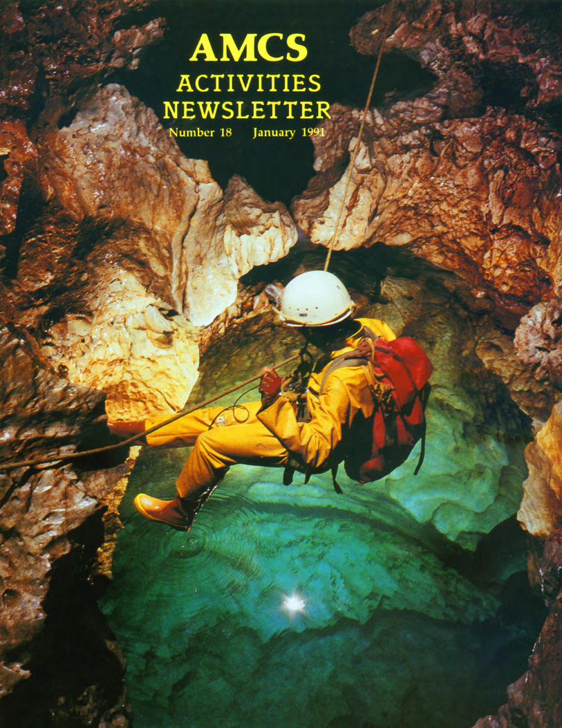
Front CoverRolf Adams at the Swim Gym,
Sistema Cuicateco, Oaxaca (Bill Stone)
TranslationsPeter Bosted, Raul Puente, Jorge Riano, Peter Sprouse
Editorial
Mexico remains on the forefront of world-class speleologyoffering opportunities to cavers, both local and international,whose common pursuit is the exploration, study and documentation of the country's many caving areas. This is reflected inthe exploration and project reports submitted to this publication.
Caves that have systematically been worked over the yearsstill yield new discoveries. Ongoing explorations in the Purificaci6n area caves delineate the complexity and extensiveness of these systems. The secrets of the deep and extensiveSistema Huautla continue to be revealed through explorationscoupled with scientific investigations. Renewed interest inknown areas due to the availability of updated topographicmaps orothernew information, has inspired more than one tripto places that had been worked in the past as evidenced byrecent excursions to Acathin (Puebla) and Yerbabuena (Chiapas). And, even heavily visited areas still offer surprises.Explorations instigated by Mexican cavers in the San Francisco area (San Luis PotosI) resulted in the discovery of asignificant new cave called Resumidero el Borbo1l6n, notedfor its 217 meter, in-cave pit. A major extension in Pozo deMontemayor (near Bustamante), makes it northern Mexico'sfirst 500-meter deep cave.
Ventures to southern Mexico's remote mountains haveopened up some new, exciting areas. Sistema Cuicateco hasthe potential to be the world's deepest cave; it already claimsthe world's deepest dye trace. The remote and mysteriousCerro RabOn, another area of great depth potential, is beingexplored by a Swiss-American contingent of cavers. TheAustralians continue to tenaciously pursue deep caves inChilchotla, Zongolica and near Huautla.
And, one must not overlook the major ~ave diving effortsin Quintana Roo where persistence in exploration and surveyhave resulted in the discovery and documentation ofextensiveunderwater caverns.
Curiosity and subsequent explorations take us farther anddeeper underground as we push the physical boundaries of thecaves. The extremes of underground camping, technical rigging, and the logistics of cave diving are the tools necessary topush the limits of exploration. Consequently, these also pressthe limits ofour endurance and make for a much leaner marginfor error. As Bill Stone said (AMCS #6,1977) "as the holesget tougher, then we had best get tough on safety".
JANUARY 1991
AMCSACTIVITIES
NEWSLETTER
PublisherAssociation for Mexican Cave Studieswith assistance from William Russell
StaffCarl Anderson, Kris Green, Dave Hughes,
Susie Lasko, Bill Mixon, Karen Sotona, Shirley Sotona,Peter Sprouse, Carol Vesely
NUMBER 18
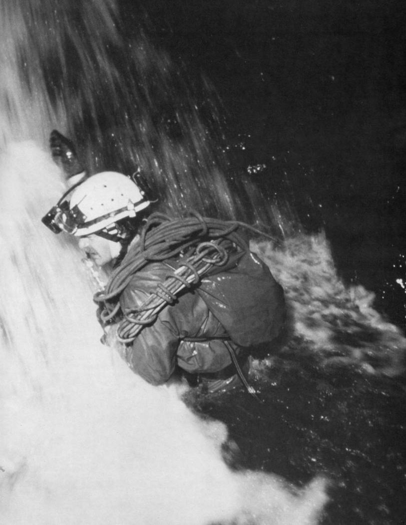
FrontispieceBill Storage at the fifth drop in
Cueva de Agua Carlota, Oaxaca (Jim Smith)
Pat Kambesis
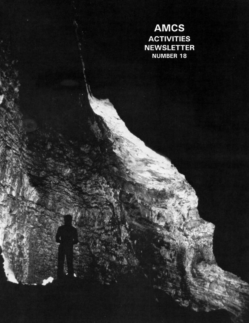
Title PageSan Agustin, Sistema Huautla
Oaxaca (Jim Smith)
Back CoverBrian Steele at second pitch in Nita Ka,
Oaxaca (Jim Smith)
Association for Mexican Cave Studies
P.O. Box 7672Austin, Texas 78713
Copyright 1991 by AMCS Membership Committee
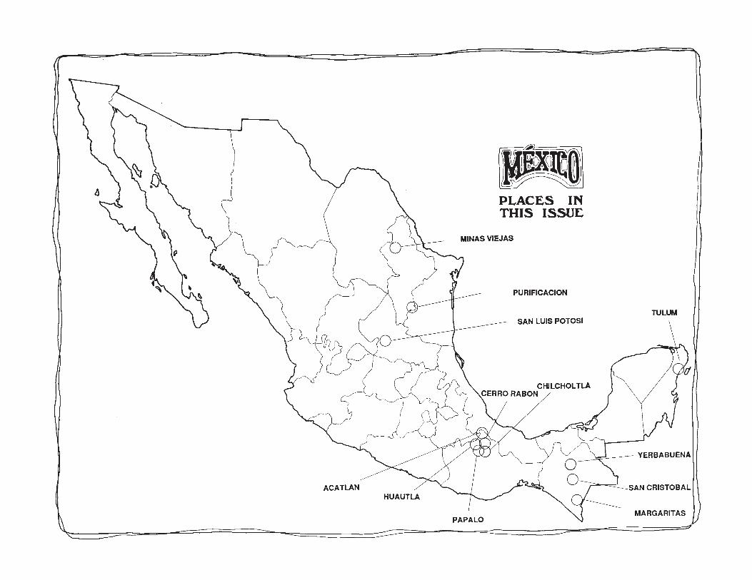
TULUM
MARGARITAS
SAN CRISTOBAL
SAN LUIS POTOSI
PURIFICACION
~ YERBABUENA
PLACES INTHIS ISSUI:
MINAS VIEJAS
HUAUTLAACATLAN
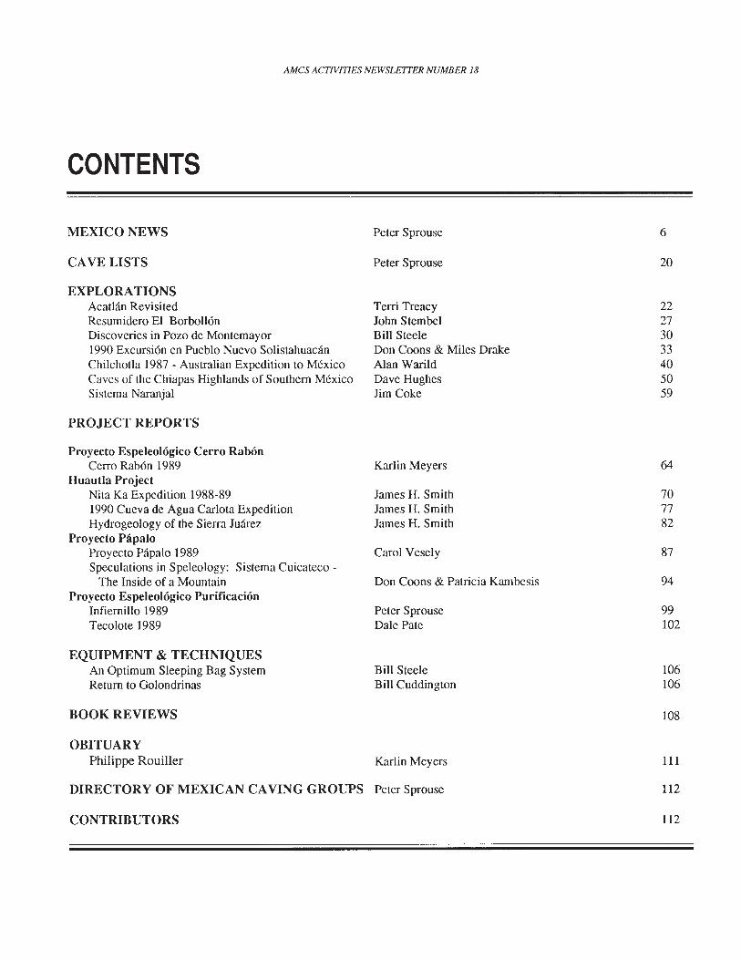
AMCS ACTIVITIES NEWSLETTER NUMBER 18
CONTENTS
MEXICO NEWS
CAVE LISTS
EXPLORATIONSAcatlan RevisitedResumidero El BorbollonDiscoveries in Pozo de Montemayor1990 Excursion en Pueblo Nuevo SolistahuacanChilchotla 1987 - Australian Expedition to MexicoCaves of the Chiapas Highlands of Southern MexicoSistema Naranjal
PROJECT REPORTS
Proyecto Espeleologico Cerro RabonCerro Rabon 1989
Huautla ProjectNita Ka Expedition 1988-891990 Cueva de Agua Carlota ExpeditionHydrogeology of the Sierra Juarez
Proyecto PapaloProyecto Papalo 1989Speculations in Speleology: Sistema Cuicateco
The Inside of a MountainProyecto Espeleologico Purificacion
Infiernillo 1989Tecolote 1989
EQUIPMENT & TECHNIQUESAn Optimum Sleeping Bag SystemReturn to Golondrinas
BOOK REVIEWS
OBITUARYPhilippe Rouiller
Peter Sprouse
Peter Sprouse
Terri TreacyJohn StembelBill SteeleDon Coons & Miles DrakeAlan WarildDave HughesJim Coke
Karlin Meyers
James H. SmithJames H. SmithJames H. Smith
Carol Vesely
Don Coons & Patricia Kambesis
Peter SprouseDale Pate
Bill SteeleBill Cuddington
Karlin Meyers
6
20
22273033405059
64
707782
87
94
99102
106106
108
111
DIRECTORY OF MEXICAN CAVING GROUPS Peter Sprouse
CONTRIBUTORS
112
112
AMes ACTIVITIES NEWSLETTER NUMBER 18
MEXICO NEWS
CHIAPAS
In March 1990, Guy Meauxsoone andcompanions took on the exploration of theawesome river cave Shumubt, or Yochibhli, unaware that SMES cavers were planning their own assault for April. After thefIrst two large cascades, the cave leveled outinto a lake for the remaining nine hundredmeters to the resurgence.
source: Ram6n Espinasa
GUERRERO
In late December 1989, Australians JimBlyde, Mark Wilson and Alan Warild spentfour days looking at the Sierra Tigre (orMojarona) near Chilpancingo. This 2200meter-high ridge turned out to be dry andmore dirt than rock. They found and markedwith red paint, ten holes altogether. The besttwo were located about two hundred meterspast two brown ponds beyond the last bendin the road before it heads off the ridge. ST7 was a nice shaft a hundred meters deep,
andjustbesideitwas ST8, which went downfIve pitches to a dirt choke at -150 meters.
source: Alan Warild
SMES cavers mapped Cueva de AguaBrava near Cacahuamilpa in March 1990.After mapping 819 meters, they couldn'tfInd a way on from the fmal chamber. Amonth later, in the same area, they foundCueva del Coyote near Mogote. Althoughonly 248 meters long, the cave is unusual inthat it is formed in Tertiary conglomerates.On September 1, 1990 they mapped Michapa,a 256-meter-long cave.
source: Ram6n Espinasa
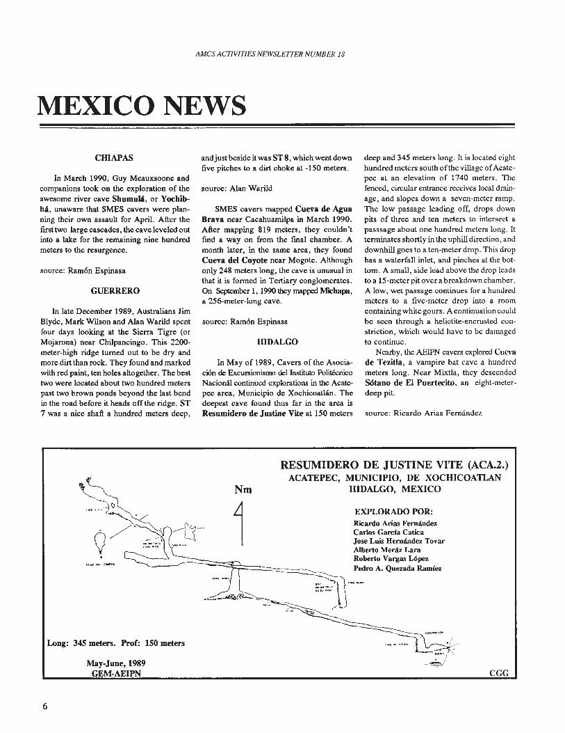
HIDALGO
In May of 1989, Cavers of the Asociaci6n de Excursionismo del Instituto PoliteenicoNaciomU continued explorations in the Acatepee area, Municipio de Xochicoatlan. Thedeepest cave found thus far in the area isResumidero de Justine Vite at 150 meters
deep and 345 meters long. It is located eighthundred meters south ofthe village ofAcatepee at an elevation of 1740 meters. Thefenced, circular entrance receives local drainage, and slopes down a seven-meter ramp.The low passage leading off, drops downpits of three and ten meters to intersect apasssage about one hundred meters long. Itterminates shortly in the uphill direction, anddownhill goes to a ten-meter drop. This drophas a waterfall inlet, and pinches at the bottom. A small, side lead above the drop leadsto a 15-meterpit over a breakdown chamber.A low, wet passage continues for a hundredmeters to a fIve-meter drop into a roomcontaining white gours. A continuation couldbe seen through a helictite-encrusted constriction, which would have to be damagedto continue.
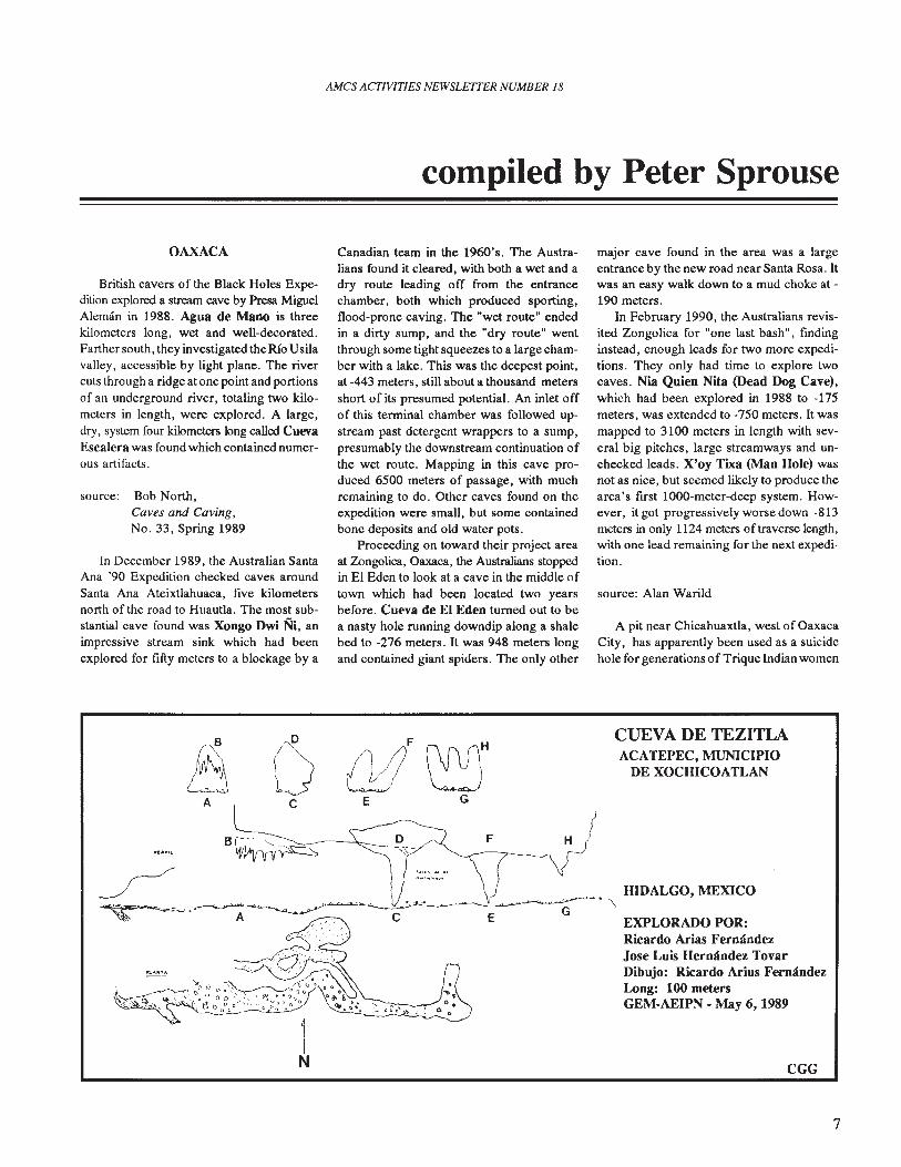
Nearby, the AEIPN cavers explored Cuevade TezitIa, a vampire bat cave a hundredmeters long. Near Mixtla, they descendedSOtano de EI Puertecito, an eight-meterdeep pit.
source: Ricardo Arias Fernandez
RESUMIDERO DE JUSTINE VITE (ACA.2.)ACATEPEC, MUNICIPIO, DE XOCHICOATLAN
HIDALGO, MEXICONm
1 EXPLORADO POR:Ricardo Arias FernandezCarlos Garcia CaticaJose Luis Hernandez TovarAlberto Menu LaraRoberto Vargas L6pez
---~ Pedro A. Quezada Ramfez
.." -,\ ._.-__ .....0
r"H"~
._~~-
/-
~~-
--: Cl..,.... "/
./'Q
Long: 345 meters. Prof: 150 meters
May-June, 1989GEM-AEIPN
"'''~"A;'O(llJOO'/ ", ,--~/
CGG
6
AMCS ACTIVITIES NEWSLE1TER NUMBER 18
compiled by Peter Sprouse
OAXACA
British cavers of the Black Holes Expedition explored a stream cave by Presa MiguelAleman in 1988. Agua de Mano is threekilometers long, wet and well-decorated.Farther south, they investigated the RIo Usilavalley, accessible by light plane. The rivercuts through a ridge at one point and portionsof an underground river, totaling two kilometers in length, were explored. A large,dry, system four kilometers long called CuevaEscalera was found which contained numerous artifacts.
source: Bob North,Caves and Caving,No. 33, Spring 1989
In December 1989, the Australian SantaAna '90 Expedition checked caves aroundSanta Ana Ateixtlahuaca, five kilometersnorth of the road to Huautla. The most substantial cave found was Xongo Dwi Ni, animpressive stream sink which had beenexplored for fifty meters to a blockage by a
Canadian team in the 1960's. The Australians found it cleared, with both a wet and adry route leading off from the entrancechamber, both which produced sporting,flood-prone caving. The "wet route" endedin a dirty sump, and the "dry route" wentthrough some tight squeezes to a large chamber with a lake. This was the deepest point,at -443 meters, still about a thousand metersshort of its presumed potential. An inlet offof this terminal chamber was followed upstream past detergent wrappers to a sump,presumably the downstream continuation ofthe wet route. Mapping in this cave produced 6500 meters of passage, with muchremaining to do. Other caves found on theexpedition were small, but some containedbone deposits and old water pots.
Proceeding on toward their project areaat Zongolica, Oaxaca, the Australians stoppedin EI Eden to look at a cave in the middle oftown which had been located two yearsbefore. Cueva de El Eden turned out to bea nasty hole running downdip along a shalebed to -276 meters. It was 948 meters longand contained giant spiders. The only other
major cave found in the area was a largeentrance by the new road near Santa Rosa. Itwas an easy walk down to a mud choke at 190 meters.
In February 1990, the Australians revisited Zongolica for "one last bash", fmdinginstead, enough leads for two more expeditions. They only had time to explore twocaves. Nia Quien Nita (Dead Dog Cave),which had been explored in 1988 to -175meters, was extended to -750 meters. It wasmapped to 3100 meters in length with several big pitches, large streamways and unchecked leads. X'oy Tixa (Man Hole) wasnot as nice, but seemed likely to produce thearea's first 1000-meter-deep system. However, it got progressively worse down -813meters in only 1124 meters of traverse length,with one lead remaining for the next expedition.
source: Alan Warild
A pit near Chicahuaxtla, west of OaxacaCity, has apparently been used as a suicidehole for generations of Trique Indian women
11 () {J!!~HACE G
1N
CUEVA DE TEZITLAACATEPEC, MUNICIPIO
DE XOCHICOATLAN
HIDALGO, MEXICO. ~EXPLORADO POR:Ricardo Arias FernandezJose Luis Hernandez TovarDibujo: Ricardo Arius FernandezLong: 100 metersGEM-AEIPN - May 6, 1989
CGG
7
AMes ACTIVITIES NEWSLEITER NUMBER 18
Explorado por:
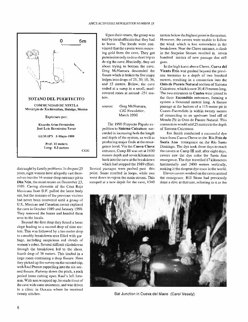
SOTANO DEL PUERTECITO
meters below the highest point in the system.However, the cavers were unable to followthe wind, which is lost somewhere in thebreakdown. Near the Cheve entrance, a climbin the Surprise Stream resulted in sevenhundred meters of new passage that stillgoes.
In the high karst above Cheve, Cueva delViento Frio was pushed beyond the previous terminus to a depth of two hundredmeters, resulting in a connection into theOsto de Puente Natural section of SistemaCuicateco, which is now 20,415 meters long.The two entrances to Cuates were joined tothe three Escondido entrances, forming asystem a thousand meters long. A fissurepassage at the bottom of a liS-meter pit inCuates-Escondido is within twenty metersof connecting to an upstream lead off ofMondo Pit in Osto de Puente Natural. Thisconnection would add 25 meters to the depthof Sistema Cuicateco.
Jim Smith conducted a successful dyetrace from Cueva Cheve to the Rio Frio deSanta Ana resurgence on the RIO SantoDomingo. The dye took three days to reachthe cavers at Camp III and, after eight days,cavers saw the dye color the Santa Anaresurgence. The dye travelled 17 kilometershorizontally and 2400 meters vertically,making it the deepest dye trace in the world.
Eleven cavers worked on the caves aroundthe resurgence. Bill Stone had previouslydone a dive at that site, referring to it as the
Greg McNamara,CIG Newsletter,March 1990
source:
Bat Junction in Cueva del Mano (Carol Vesely)
Upon their return, the group wastold by local officials that they hadto leave. The locals were convinced that the cavers were removing gold from the cave. They gotpermission only to do a short trip tode-rig the cave. Hurriedly, they setabout trying to bottom the cave.Greg McNamara descended thefissure which is broken by five majorledges into drops of 25,30, 10,36,and IS meters. Below, the caveended at a sump in a small, mudcovered room at around -251 meters.
The 1990 Proyecto Piipalo expedition to Sistema Cuicateco succeeded in increasing both the lengthand depth of the system, as well asproducing major finds at the resurgence level. Via the Cueva Cheveentrance, Camp III was set at 1100meters depth and seven kilometersback into the cave at the breakdownwhich had stopped the 1989 effort.
Several passages were pushed past thispoint. Some resulted in loops, while onewent down to rejoin the main stream. Thissumped at a new depth for the cave, 1340
N
CGG
Smo
Prof: 10 metersLong: 8.5 meters
GEM-IPN 5·Mayo-1989
COMMUNIDAD DE MIXTLAMunicipio de Xochicoatlan, Hidalgo, Mexico
Ricardo Arias FernandezJose Luis Hernandez Tovar
distraught by family problems. In the past 25years, eight women have allegedly cast themselves into the 16-meter-deep entrance pit toDua Nun, the most recent on December 23,1989. Caving elements of the Cruz RojaMexicana from D.F. pulled the latest bodyout, but the remains of the previous victimshad never been recovered until a group ofU.S., Mexican and Canadian cavers exploredthe cave in October 1989 and January 1990.They removed the bones and handed themover to the locals.
Beyond the first drop they found a looseslope leading to a second drop of nine meters. This was followed by a ten-meter dropto a muddy breakdown area filled with garbage, including suspicious red shreds ofwomen's robes. Several difficult climbdownsthrough the breakdown led to the sheer,fourth drop of 38 meters. This landed in alarge room containing a deep fissure. Herethey picked up the survey on the second trip,with Raul Puente rappelling into the six-second fissure. Partway down the pitch, a rockpeeled loose cutting open Raul's left forearm. With arm wrapped up, he made it out ofthe cave with some assistance, and was drivento a clinic in Oaxaca where he receivedtwenty stitches.
8
AMCS ACTIVITIES NEWSLETTER NUMBER 18
COUPE proj.part, N· S
~
1'"\\ i;,,\r "
"h ,,""~,/:;'
~."•• t
o·-
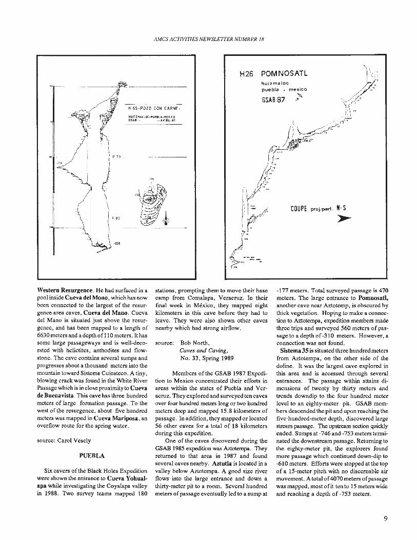
huizmalocpuebla - mexico
GSAB 87 ~
POMNOSATLH26
-lH
HUIT ZP1AllOC ·PUf8lA-H[XI(OGSA8-- --AV IUl-"
H65-POZO CON CARNE-
-2J2
P 70 ---------
P 80
;,"
II
II
"1-------.1,')00
Western Resurgence. He had surfaced in apool inside Cueva del Mono, which has nowbeen connected to the largest of the resurgence area caves, Cueva del Mano. Cuevadel Mano is situated just above the resurgence, and has been mapped to a length of6630 meters and a depth of110 meters. It hassome large passageways and is well-decorated with helictites, anthodites and flowstone. The cave contains several sumps andprogresses about a thousand meters into themountain toward Sistema Cuicateco. A tiny,blowing crack was found in the White RiverPassage which is in close proximity to Cuevade Buenavista. This cave has three hundredmeters of large formation passage. To thewest of the resurgence, about five hundredmeters was mapped in Cueva Mariposa, anoverflow route for the spring water.
source: Carol Vesely
PUEBLA
Six cavers oflhe Black Holes Expeditionwere shown the entrance to Cueva Yohualapa while investigating the Coyalapa valleyin 1988. Two survey teams mapped 180
stations, prompting them to move their basecamp from Comalapa, Veracruz. In theirfinal week in Mexico, they mapped eightkilometers in this cave before they had toleave. They were also shown other cavesnearby which had strong airflow.
source: Bob North,Caves and Caving,No. 33, Spring 1989
Members of the GSAB 1987 Expedition to Mexico concentrated their efforts inareas within the states of Puebla and Veracruz. They explored and surveyed ten cavesover four hundred meters long or two hundredmeters deep and mapped 15.8 kilometers ofpassage. In addition, they mapped or located56 other caves for a total of 18 kilometersduring this expedition.
One of the caves discovered during theGSAB 1985 expedition was Aztotempa. Theyreturned to that area in 1987 and foundseveral caves nearby. Aztutla is located in avalley below Aztotempa. A good size riverflows into the large entrance and down athirty-meter pit to a room. Several hundredmeters ofpassage eventually led to a sump at
-177 meters. Total surveyed passage is 470meters. The large entrance to Pomnosatl,another cave near Aztotemp, is obscured bythick vegetation. Hop!ng to make a connection to Aztotempa, expedition members madethree trips and surveyed 560 meters of passage to a depth of -310 meters. However, aconnection was not found.
Sistema 3S is situated three hundred metersfrom Aztotempa, on the other side of thedoline. It was the largest cave explored inthis area and is accessed through severalentrances. The passage within attains dimensions of twenty by thirty meters andtrends downdip to the four hundred meterlevel to an eighty-meter pit. GSAB members descended the pit and upon reaching thefive-hundred-meter depth, discovered largestream passage. The upstream section quicklyended. Sumps at -746 and -753 meters terminated the downstream passage. Returning tothe eighty-meter pit, the explorers foundmore passage which continued down-dip to-610 meters. Efforts were stopped at the topof a 15-meter pitch with no discernable airmovement. A total 0 f 4070 meters 0 fpassagewas mapped, most ofit ten to 15 meters wideand reaching a depth of -753 meters.
9
PtAN
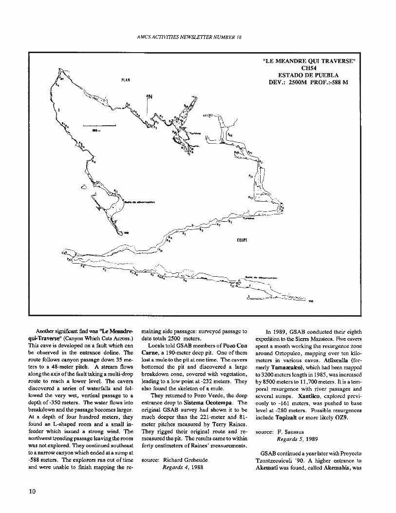
Another significant find was "I.e Meandrequi-Traverse" (Canyon Which Cuts Across.)This cave is developed on a fault which canbe observed in the entrance doline. Theroute follows canyon passage down 35 meters to a 48-meter pitch. A stream flowsalong the axis ofthe fault taking a multi-droproute to reach a lower level. The caversdiscovered a series of waterfalls and followed the very wet, vertical passage to adepth of -350 meters. The water flows intobreakdown and the passage becomes larger.At a depth of four hundred meters, theyfound an L-shaped room and a small infeeder which issued a strong wind. Thenorthwest trending passage leaving the roomwas not explored. They continued southeastto a narrow canyon which ended at a sump at-588 meters. The explorers ran out of timeand were unable to finish mapping the re-
10
AMes ACTIVITIES NEWSLE1TER NUMBER 18
maining side passages: surveyed passage todate totals 2500 meters.
Locals told GSAB members ofPozo ConCarne, a 190-meter deep pit. One of themlost a mule to the pit at one time. The caversbottomed the pit and discovered a largebreakdown cone, covered with vegetation,leading to a low point at -232 meters. Theyalso found the skeleton of a mule.
They returned to Pozo Verde, the deepentrance drop to Sistema Ocotempa. Theoriginal GSAB survey had shown it to bemuch deeper than the 221-meter and 81meter pitches measured by Terry Raines.They rigged their original route and remeasured the pit. The results came to withinforty centimeters of Raines' measurements.
source: Richard GrebeudeRegards 4, 1988
"LE MEANDRE QUI TRAVERSE"CH54
ESTADO DE PUEBLADEV.: 2500M PROF.:-588 M
In 1989, GSAB conducted their eighthexpedition to the Siena Mazateea. Five caversspent a month working the resurgence zonearound Oztopulco, mapping over ten kilometers in various caves. Atlixcalla (formerly Tamazcako), which had been mappedto 3200 meters length in 1985, was increasedby 8500 meters to 11,700 meters. It is a temporal resurgence with river passages andseveral sumps. Xantiko, explored previously to -161 meters, was pushed to baselevel at -280 meters. Possible resurgencesinclude Topizalt or more likely OZ9.
source: F. SaussusRegards 5, 1989
GSAB continued a year later with ProyectoTzontzecuiculi '90. A higher entrance toAkemati was found, called Akemabis, was
AMCS ACTIVITIES NEWSLETTER NUMBER 18
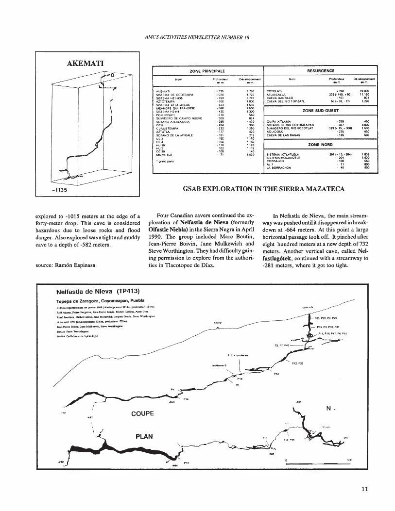
AKEMATI
-1135
ZONE PRINCIPALE RESURGENCE
Nom Prolondeuf Ot....eloppem.nl Nom Protondet.l 00_.onm 8nm onm onm
AKEMATI ·1135 3_7~O COYOLATL ,240 "000SiSTEMA DE OCOTEMPA ·1070 4.720 ATUXICAlLA 232 (. 140. + 921 ".120SiSTEMA H31·H3S ·7!03 5.745 CUEVA XANTllCO ·16) 80'AlTOTEMPA ·700 4000 CUEVA DEL RIO TOPIZATl 60 1+ 33.·171 1.290SISTEMA A n.ALAOUIA ·623 4 !o30MEANQAE aUI TRAVERSE ·598 2600
ZONE SUD·OUESTSiSTEMA Hl-H4 430 1.300POMNOSATl 310 560SUMIOERQ DE CAMPO NUEVO ·309 924SOTANO ATLALAOUIA ·29'i ·470 QUIPA XITLAMA ·33' 4SOoc. ·264 300 SOlANO De RIO COYOMEAPAN ·337 3.900CUAUBIEMPA ·232 • 250 SUMIOERO DEL RIO XOCOTLAT 3231+ 16. - 30Bl 1.600AlTUTLA ·171 '20 AOUIOOUCI ·235 6SOSOTANO DE LA MVGALE -161 212 CUEVA DE LAS RANAS ·136 60000 · ,so • lSOOC' · '60 • ,soHU 10 ·116 • 120 ZONE NORDHU 7 '02 • 115OC30 · '00 140MONTllLA 71 1.020 SISTEMA ICTLATLELA 2811+ 13.·2841 1.836
SISTEMA HOWUAZTLE ·204 1630• grand PUltS CORRAlCO ·'80 660
AL 7 71 lIlOLA 80ARACHON 40 lIlO
GSAB EXPLORATION IN THE SIERRA MAZATECA
explored to -1015 meters at the edge of aforty-meter drop. This cave is consideredhazardous due to loose rocks and flooddanger. Also explored was a tightand muddycave to a depth of -582 meters.
source: Ram6n Espinasa
Four Canadian cavers continued the exploration of Nelfastla de Nieva (formerlyOlfasUe Niebla) in the Sierra Negra in April1990. The group included Marc Boutin,Jean-Pierre Boivin, Jane Mulkewich andSteve Worthington. They had difficulty gaining permission to explore from the authorities in Tlacotopec de Diaz.
In Nefastla de Nieva, the main streamway was pushed until itdisappeared in breakdown at -664 meters. At this point a largehorizontal passage took off. It pinched aftereight hundred meters at a new depth of732meters. Another vertical cave, called NelfasUag6telt, continued with a streamway to-281 meters, where it got too tight.
Nelfastla de Nieva (TP413)
Tepepa de Zaragoza, Coyomeapan, PueblaRelevtllOpomtUiqUCS en jlUlYkr 1989 (dtveloppemenl 11 14m. prololldcur ..'i14m)
Roll AdaITD,. PieRe Berzeron, Jean·Pi«rt 80MB. Mkbel CadieUJ., AIIIM: Gray.
Rent Jou:rcbiA, MKbcI Labrie. Jane Muncewich. JatqutS Onob. Sieve Wonhln&IOn
e1 en aYriI 1990 (dt'l'doppcmenl 5J8Om. profoDdeur .732.IIl):
Jeaa.PierTe 8oMn, Jane Mulkcwich, Steve Wonll.lop.
Dcssin: SIe'Ye Wonhio&lon
SocitleO~<SeSptltolog;e
camp
Pl1 ... !:yftllierroe
entrada
- P35. P20. P4. P20
P13
Sill
·207
·205
P13
Pl.
PI<
PLAN
COUPE
\ ~
.."
11
AMes ACTIVITIES NEWSLETTER NUMBER 18
In both of these caves, the cavers had towait out sudden floods caused by episodes often-eentimeter rains on the surface. In thefirst incident in Nefastla de Nieva, Boivinand Worthington werecoming up the streamway when the flow increased twenty-fold.They managed to get up two pitches beforebeing stopped at a third. They slept overnight on a dry ledge, huddled in emergencyblankets until the flood subsided the nextmorning. The second flood was in Nelfastlag6telt, where Mulkewich and Worthington were forced to wait by a waterfall for 11hours.
source: Steve Worthington
QUINTANA ROO
o
tion. They motored to the end of the 1988line on spare bottles, parked the scooters anddonned their fresh, double 104 tank rigs.Pulling huge dive reels, they quickly entereda huge, beautiful dome room. Even afterlaying 2700 meters of new line, they couldnot fmd a main way on through the swisscheese maze. But the seventeen dome roomsthey found were stunningly decorated.
Meanwhile, Bill Carlson and Tony Youngworked on leads within reach of the Dinnerhole, using stage bottles. They found twosignificant passages which eventually ~tered out. On the downstream side of theNohoch Cenote, these two divers pushedpast the previous nine hundred-meter limit
N ---=@
_G",l'lca -.
A'
PIA-2"SOTANO LA CACALOTERA
I'IEDIIA AHIJ..EIlAOA. S-L.P
Brunton 1 clnta01_ <1.'_Rau'I'II M.,...'.... 11 L.
LDnGHu<l 27: 0 '"Profuntlldad nt.O m
A.P.M.£.
20'
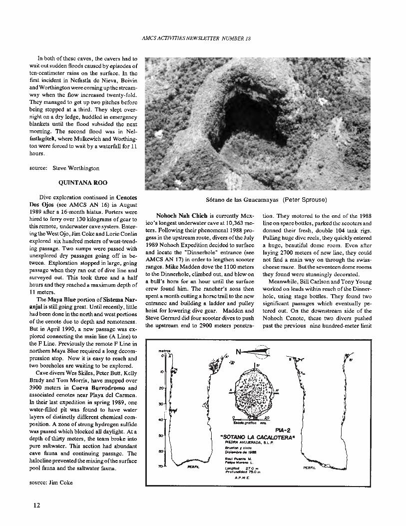
S6tano de las Guacamayas (Peter Sprouse)
Nohoch Nab Cbich is currently Mexico's longest underwater cave at 10,363 m~ters. Following their phenomenal 1988 progess in the upstream route, divers of the July1989 Nohoch Expedition decided to surfaceand locate the "Dinnerhole" entrance (seeAMCS AN 17) in order to lengthen scooterranges. Mike Madden dove the 1100 metersto the Dinnerhole, climbed out, and blew ona bull's horn for an hour until the surfacecrew found him. The rancher's sons thenspent a month cutting a horse trail to the newentrance and building a ladder and pulleyhoist for lowering dive gear. Madden andSteve Gerrard did four scooter dives to pushthe upstream end to 2900 meters penetra-
source: Jim Coke
Dive exploration continued in CenotesDos Ojos (see AMCS AN 16) in August1989 after a 16-month hiatus. Porters werehired to ferry over 130 kilograms of gear tothis remote, underwater cave system. Entering the West Ojo, Jim Coke and Lorie Conlinexplored six hundred meters ofwest-trending passage. Two sumps were passed withunexplored dry passages going off in b~
tween. Exploration stopped in large, goingpassage when they ran out of dive line andsurveyed out. This took three and a halfhours and they reached a maximum depth of11 meters.
The Maya Blue portion of Sistema Naranjal is still going great. Until recently, littlehad been done in the north and west portionsof the cenote due to depth and remoteness.But in April 1990, a new passage was explored connecting the main line (A Line) tothe F Line. Previously the remote F Line innorthern Maya Blue required a long decompression stop. Now it is easy to reach andtwo boreholes are waiting to be explored.
Cave divers Wes Skiles, Peter Butt, KellyBrady and Tom Morris, have mapped over3900 meters in Cueva Burrodromo andassociated cenotes near Playa del Cannen.In their last expedition in spring 1989, onewater-filled pit was found to have waterlayers of distinctly different chemical composition. A zone of strong hydrogen sulfidewas passed which blocked all daylight. At adepth of thirty meters, the team broke intopure saltwater. This section had abundantcave fauna and continuing passage. Thehalocline prevented the mixing ofthe surfacepool fauna and the saltwater fauna.
12
AMes ACTIVITIES NEWSLE1TER NUMBER 18
10
20
30
I
I
rALT-'
m. o
PERFIL.
SOTANO DEL JOCONOSTLEALTAMIRA, SLP
Escolo grafico
o 5 10I ! !
source: Steve Gerrard,Underwater Speleology,November-December 1989
source: Steve Knutson, Mike Madden,NSS News,December 1989, Part II
On June 19, 1988, two divers enteredCueva Chacalal in Chacalal Lagoon, nearAkumal. They were not trained in cavediving, but intended to recover SCUBA gearleft from a double diving fatality of May 3,1987. Using improper diveline techniques,they were sixty meters in when the rear diverpanicked and retreated to the entrance withthe dive reel. Expert cave diver Jim Cokewas summoned and the fIrst diver's bodywas located. He had run out of air andevidently panicked, since his "fmgers appeared to have clawed at the rock. "
for an additional six hundred meters. Thepassage still goes, and a pristine room withan exit to the surface was found.
SAN LUIS POTOSI
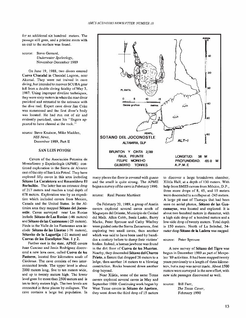
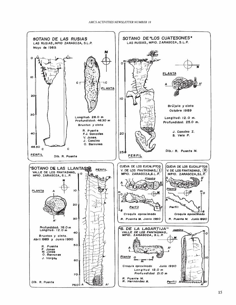
Cavers of the Asociaci6n Potosina deMontaiiismo y Espeleologia (APME) continued exploration in the Sierra de Alvarezeast ofthe city ofSan Luis PotosI. They haveexplored fIfty caves in this area includingSOtano La Cacalotera and Resumidero EIBorbo1l6n. The latter has an entrance dropof 217 meters and reaches a total depth of678 meters. Exploration was by an expedition which included cavers from Mexico,Canada and the United States. In the Altimira area they mapped SOtano del JoconostIe. Caves surveyed near Las Rusiasinclude SOtano de Las Rusias (-46 meters)and SOtano de las Cuatesones (-25 meters).Finds in the Valle de los Fantasmas area include SOtano de las Llantas (-76 meters),SOtanito de la Lagartija (-21 meters) andCuevas de los Eucaliptos Nos. 1 y 2.
Farther east in the state, APME caversJuan Cancino and Jesus Rodriguez discovered a new lava cave, called Cueva de losPastores, located four kilometers south ofCardenas. The cave consists of two interconnected levels. The upper level is about2000 meters long, fIve to ten meters wide,and up to twenty meters high. The lowerlevel goes for more than 2500 meters and isten to thirty meters high. The two levels areconnected in three places by collapses. Thecave contains a large bat population. In
BRUNTON Y CINTA 2/89RAUL PEUNTE
FEUPE MOREHOGILBERTa TORRES
many places the floor is covered with guanoand the smell is quite strong. The APMEbegan a survey ofthe cave in February 1990.
source: Raul Puente Martinez
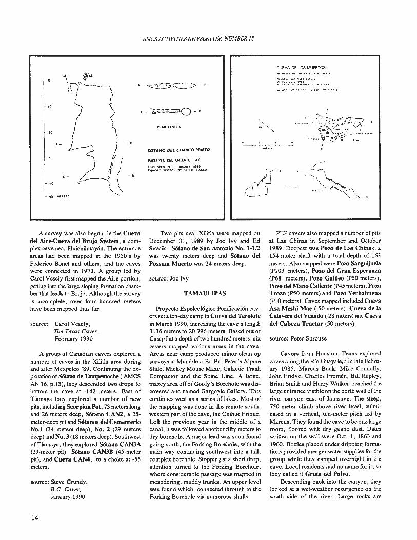
On February 20,1989, a group of Austincavers explored several caves south ofMagueyes del Oriente, Municipio de Cuidaddel Malz. Allen Cobb, Susie Lasko, BarryMarks, Peter Sprouse and Cathy Winfreywere guided onto the Sierra Zarzamora, fIrstexploring two small caves, then anotherwhich was said to have been used by bandidos a century before to dump their victims 0
bodies. Indeed, a human jawbone was foundin the dirt floor of Cueva de los Muertos.Nearby, they descended SOtano del CharcoPrieto, a fIssure that dropped 26 meters to aledge, then another 14 meters to a blowingconstriction. Rocks bounced down anotherdrop beyond.
Near Xilitla, some of the same Texascavers explored several caves in May andSeptember 1989. Continuing work begun byWest Texas cavers in SOtano de Apetzco,they went down the third drop of 15 meters
LONGITUD: 38 MPROFUNDIDAD: -65.0 MA.P.M.E
to discover a large breakdown chamber,Xilitla Hall, at a depth of 130 meters. Withhelp from SMES caver.s from Mexico, D.F.,three more drops of 8, 45, and 15 meterswere descended to a collapse at -245 meters.A large pit east of Tlamaya that had beenseen on aerial photos, SOtano de las Guacamayas, was located and explored. It isabout two hundred meters in diameter, witha high-side drop of a hundred meters and alow-side drop of twenty meters. Total depthis 150 meters. North of La Soledad, 34meter-deep SdtJmo de la Ladera was mapped.
source: Peter Sprouse
A new survey of SOtano del Tigre wasbegun in December 1989 as part of Mexpeleo '89 activities. It had been mapped twentyyears previously to a length of three kilometers, but a map was never made. About 1500meters were surveyed in the new effort, withnew side passages discovered as well.
source: Bill Farr,The Texas Caver,February 1990
13
AMes ACTIVITIES NEWSLETTER NUMBER 18
CUEVA DE LOS MUERTOS
~" .... I d I.". ....,...,III , , , •••4. C..ltb. ,. 5" ....... C. VI .."."
PL.-.N LEVELS
r1AGUEYES DEl ORIENTE. SlP
EKPLORED 20 f£SRU"AY 1989"'EMORv SKETCH BY SUSI£ LASKO
SOTANO on CHARCO PRIETO
.,~
c-~~-o
A_~-B
-8
.
"~(-"\ \, ', ,
'"45 "HERS
A-
40
c-
20
10
10
o
A survey was also begun in the Cuevadel Aire-Cueva del Brujo System, a complex cave near Huichihuayan. The entranceareas had been mapped in the 1950's byFederico Bonet and others, and the caveswere connected in 1973. A group led byCarol Vesely first mapped the Aire portion,getting into the large sloping formation chamber that leads to Brujo. Although the surveyis incomplete, over four hundred metershave been mapped thus far.
source: Carol Vesely,The Texas Caver,February 1990
A group of Canadian cavers explored anumber of caves in the Xilitla area duringand after Mexpeleo '89. Continuing the exploration of SCStano de Tampemocbe ( AMCSAN 16, p.13), they descended two drops tobottom the cave at -142 meters. East ofTlamaya they explored a number of newpits, including Scorpion Pot, 73 meters longand 26 meters deep, SOtano CAN2, a 25meter-deep pit and SOtanos del CementerioNo.1 (34 meters deep), No.2 (29 metersdeep) and No.3 (18 meters deep). Southwestof Tlamaya, they explored SOtano CAN3A(29-meter pit) SOtano CAN3B (45-meterpit), and Cueva CAN4, to a choke at -55meters.
source: Steve Grundy,B.C. Caver,January 1990
Two pits near Xilitla were mapped onDecember 31, 1989 by Joe Ivy and EdSevcik. SOtano de San Antonio No. 1-112was twenty meters deep and SOtano delPossum Muerto was 24 meters deep.
source: Joe Ivy
TAMAULIPAS
Proyecto Espeleol6gico Purificaci6n cavers seta ten-day camp in Cueva del Tecolotein March 1990, increasing the cave's length3136 meters to 20,796 meters. Based out ofCamp I at a depth oftwo hundred meters, sixcavers mapped various areas in the cave.Areas near camp produced minor clean-upsurveys at Mumble-a-Bit Pit, Peter's AlpineSlide, Mickey Mouse Maze, Galactic TrashCompactor and the Spine Line. A large,mazey area offof Goofy's Borehole was discovered and named Gargoyle Gallery. Thiscontinues west as a series of lakes. Most ofthe mapping was done in the remote southwestern part ofthe cave, the Chihue Frihue.Left the previous year in the middle of acanal, it was followed another fifty meters todry borehole. A major lead was soon foundgoing north, the Forking Borehole, with themain way continuing southwest into a tall,complex borehole. Stopping at a short drop,attention turned to the Forking Borehole,where considerable passage was mapped inmeandering, muddy trunks. An upper levelwas found which connected through to theForking Borehole via numerous shafts.
PEP cavers also mapped a number ofpitsat Las Chinas in September and October1989. Deepest was Pow de Las Chinas, a154-meter shaft with a total depth of 163meters. Also mapped were Pow Sanguijuela(PI03 meters), Pow del Gran Esperanza(p68 meters), Pow Galileo (P50 meters),Pow del Mano Caliente (P45 meters), PowTrow (P50 meters) and Pow Yerbabuena(pI0 meters). Caves mapped included CuevaAsa Meshi Mae (-50 meters), Cueva de laCalavera del Vmado (-28 meters) and Cuevadel Cabeza Tractor (50 meters).
source: Peter Sprouse
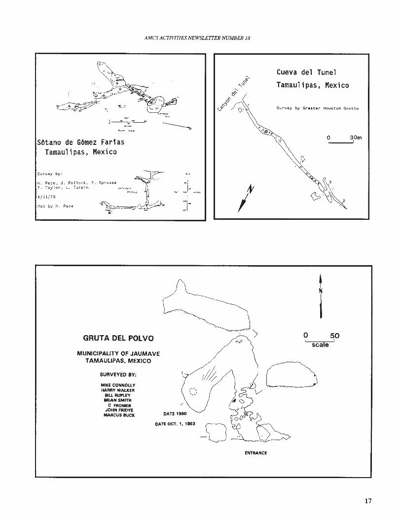
Cavers from Houston, Texas exploredcaves along the Rio Guayalejo in late February 1985. Marcus Buck, Mike Connolly,John Fridye, Charles Fromen, Bill Rupley,Brian Smith and Harry Walker reached thelarge entrance visible on the north wall 0 f theriver canyon east of Jaumave. The steep,75G-meter climb above river level, culminated in a vertical, ten-meter pitch led byMarcus. They found the cave to be one largeroom, floored with dry guano dust. Dateswritten on the wall were Oct. 1, 1863 and1960. Bottles placed under dripping formations provided meager water supplies for thegroup while they camped overnight in thecave. Local residents had no name for it, sothey called it Gruta del Polvo.
Descending back into the canyon, theylooked at a wet-weather resurgence on thesouth side of the river. Large rocks are
14
AMes ACTIVITIES NEWSLETTER NUMBER 18
SOTANO DE LAS RUSIASLAS RUS'AS, MPIO ZARAGOZA, S.L.P.Mayo de 1989.
SOTANO DE IILOS CUATESONES·LAS RUSIAS, MPIO. ZARAGOZA, S.L.P.
30
A'
J. Cancino Z.S. Vela P.
Bru'jula y cinta
Oct,ubre 1999
Dlb.: R. Puente M.
A
Longltud: 12.0 m.Profundldad: 25.0 m.
PLANTA
PER F/L
10
R. PuenteF.J. GonzolesV. Jonea.J. CancinoO. Berronea
C
Longltud, 28.0 mProfundldod: 48.30 m
Brunton y clnto
C
Dlb. R. Puente
2
40
48.30C
PERFIL
o
- - - - - - - --A
Perfil
OJEVA DE LOS EUCAUPlOSV. DE LOS FANTASMAS, @MP/O. ZARAGOZA,S.L.P.
~"" A'"~" ...., .. ",
""'; '. '. ~ ~ I:.....~. ',. '" .
P/anta--~ mo
~rl" J_~ .. 8
Croqul. apro)(lfriado
R. Puente M. Junia /990
Croqu;s aprox/modo .Junia 1990Long/tud 12.0 mPrafu nd/dod 2/.0 m
R. Puente M.R. Hernandez R.
Croquls aprolC 1mado
R. Puente M. .Junia 1990
CUEVA DE LOS EUCALIPlOSV. DE LDS FANTASMAS,@MPIO. ZARAGOZA,S.L.P.
~
"5. DE LA LAGARTlJA"VALLE DE LOS FANTA"SMAS I
MPIO. ZARAGOZA, S.L~P."
Ii· ,.S ..
A ~~~~.~~~~~~:~~~
40
70
60
20
30
R. PuenteF. JonesM. Jane.O. BerronesJ. Vargas
A'
Profundidad, 76.0 mLongltud, 12.0 m
Brunton y clnta.Abril 1989 y Junia 1990
Dlb. R. Puente
"SOTANO DE LAS LLANTAVALLE DE LOS FANTASMAS.MPIO. ZARAGOZA, S.L. P.
N
A-$-,o
15
AMes ACTIVITIES NEWSLETTER NUMBER 18
SOlANO DE TAMPEMOCHE
AaJ&smoIl. S.I..P.
s..-...-S.I'l....... T.'"'I........ P~.o cr~", a Whl~. R KcDMI. S. G"'''I0Y,J J~~J'·...6&21·12-.11!tlar-. p ~. r.~. s.~.
"""""omO_l<1Zrn8CRA ~
Nacimiento del Rio Sabinas.Cueva de Montecristo turned outto be a collapse sink with a largeshelter cave on one side. Thisentrance is about a hundred meters wide and extends in thirtymeters. Ladders had been erectedby locals to reach bechives on thewalls. The cavers were also toldof another pit but were unable tovisit it. Driving an overgrownroad up the scarp to the west, theylocated a ten-meter pit which wasfree-climbed with a scaling pole.After driving back down the mountain and up again via ]ulilo, theyhad a look at the karst northeast of]oya de Salas. They found a threemeter-wide crack into whieh roeksbounced out ofhearing range, butthey lacked the rope to explore it.
by the local residents. Cueva de la CimaSan Jose, located on a hill a thousand metersfrom the village, had a 25-meter-high entrance opening into a huge chamber measuring three hundred meters long, one hundredmeters wide and sixty meters high. It is fullof large formations and has lakes along theright and left walls. At the rear of the chamber a flowstone slope descends to the rightfor one hundred meters to a mud sump.
A dolina to the south contained a logjammed headwall into which drained three,small arroyos. A cold breeze encouragedthem to dig an opening and, passing a secondlogjam, they discovered six hundred metersof horizontal passage and several other entrances. They named this cave Cueva de losMaderos Perdidos. Along the west side ofthe village the group explored a ten-meterdiameter, thirty-meter-deep shaft. Hoya dela Ventana Malvada had a window into aparallel shaft containing vampire bats.
expelled by floodwaters, presumably fromthe Sierra de Guatemala which rises to thesouth. It would make a good dive prospect.Also visited was Cueva del Tunel, locatedin a side canyon southeast of ]aumave.
source: Charles Fromen
source: William Russell
In May 1990, five cavers investigated thekarst south of the village of San Jose, in thesouthern Sierra de Guatemala. Brent Bartlett,Dan Love, Charley Savvas, Glen Schneiderand Mike Warton were shown several caves
source: Mike Warton
VERACRUZ
SMES cavers have concentrated their1990 activities on SOtano de EI Berro, a
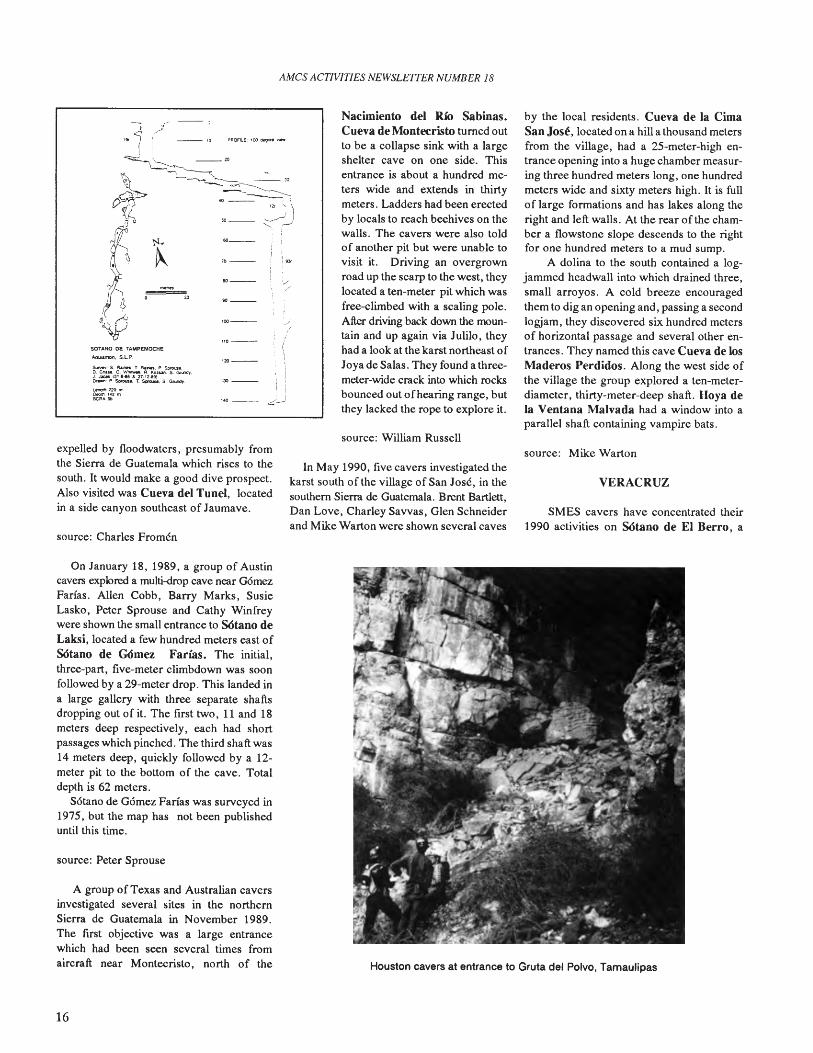
On January 18, 1989, a group of Austincavers explored a multi-drop cave near GomezFarias. Allen Cobb, Barry Marks, SusieLasko, Peter Sprouse and Cathy Winfreywere shown the small entrance to SOtano deLaksi, located a few hundred meters east ofSOtano de GOmez Farias. The initial,three-part, five-meter climbdown was soonfollowed by a 29-meter drop. This landed ina large gallery with three separate shaftsdropping out of it. The first two, 11 and 18meters deep respectively, each had shortpassages which pinched. The third shaft was14 meters deep, quickly followed by a 12meter pit to the bottom of the cave. Totaldepth is 62 meters.
Sotano de Gomez Farias was surveyed in1975, but the map has not been publisheduntil this time.
source: Peter Sprouse
A group of Texas and Australian caversinvestigated several sites in the northernSierra de Guatemala in November 1989.The fust objective was a large entrancewhich had been seen several times fromaircraft near Montecristo, north of the
16
Houston cavers at entrance to Gruta del Polvo, Tamaulipas
AMes ACTIVITIES NEWSLE1TER NUMBER 18
SOtano de GOmez FariasTamaulipas, Mexico
o 30mI
Survey by Greater Houston Grotto
Cueva del Tunel
Tamaulipas, Mexico
//I"
Sprouse ' .....
["[-0[0 C
LP"""u..( ,
~~~~~,.~ --
6/11/75
Map by N. Pace
N. Pace, J, Pollock, P,T. Taylor, L. Turpin
Survey by:
GRUTA DEL POLVO > ? 9°scale
MUNICIPALITY OF JAUMAVETAMAULIPAS. MEXICO
SURVEYED BY:
MIKE CONNOUYHARRY WALKER
8lU RUPUYBRIAN SMITH
C FROME"JOHN FRJDYE
MARCUS BUCK
DATE OCT. 1, 1863
ENTRANCE
17
AMes ACTIVITIES NEWSLETTER NUMBER 18
Allan Cobb in S6tano de Laksi, G6mez Farias,Tamaulipas (Peter Sprouse)
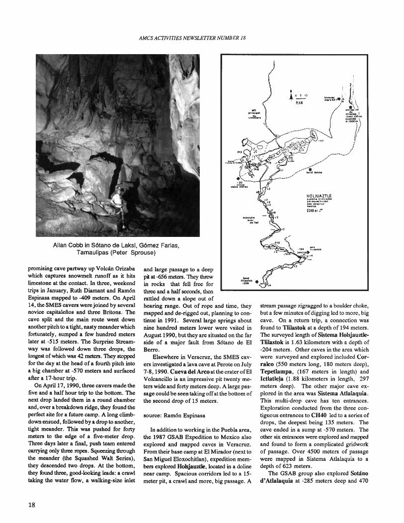
promising cave partway up Volcl1n Orizabawhich captures snowmelt runoff as it hitslimestone at the contact. In three, weekendtrips in January, Ruth Diamant and Ram6nEspinasa mapped to -409 meters. On April14, the SMES caven werejoined by severalnovice capitaleiios and three Britons. Thecave split and the main route went downanother pitch to a tight, nasty meanderwhichfortunately, sumped a few hundred meterslater at -515 meters. The Surprise Streamway was followed down three drops, thelongest ofwhich was 42 meters. They stoppedfor the day at the head of a fourth pitch intoa big chamber at -570 meters and surfacedafter a 17-hour trip.
On April 17, 1990, three caven made thefive and a half hour trip to the bottom. Thenext drop landed them in a round chamberand, over a breakdown ridge, they found theperfect site for a future camp. A long climbdown ensued, followed by a drop to another,tight meander. This was pushed for fortymeters to the edge of a five-meter drop.Three days later a final, push team enteredcarrying only three ropes. Squeezing throughthe meander (the Squashed Walt Series),they descended two drops. At the bottom,they found three, good-looking leads: a crawltaking the water flow, a walking-size inlet
18
and large passage to a deepp. at -656 meters. They threwin rocks that fell free forthree and a half seconds, thenrattled down a slope out ofhearing range. Out of rope and time, theymapped and de-rigged out, planning to continue in 1991. Several large springs aboutnine hundred meters lower were vsited inAugust 1990, but they are situated on the farside of a major fault from S6tano de ElBerro.
Elsewhere in Veracruz, the SMES cavers investigated a lava cave at Perote on July7-8,1990. Cueva del Arcoat thecraterofElVolcancillo is an impressive pit twenty meters wide and forty meters deep. A large passage could be seen taking offat the bottom ofthe second drop of 15 meters.
source: Ram6n Espinasa
In addition to working in the Puebla area,the 1987 GSAB Expedition to Mexico alsoexplored and mapped caves in Veracruz.From their base camp at El Mirador (next toSan Miguel Eloxochitlan), expedition members explored Holsjauztle, located in a dolinenear camp. Spacious corridors led to a 15meter pit, a crawl and more, big passage. A
Nt 0--:-:0PLAN
HOLJUAZTLEI.i,tent. ~I miradOf""I.Io..O(t'oillanedo. ..,.-.c:ru!~.IU>
GSAB 87:r
stream passage zigzagged to a boulder choke,but a few minutes ofdigging led to more, bigcave. On a return trip, a connection wasfound to Tlilastok at a depth of 194 meters.The surveyed length ofSistema HolsjauztJeTlilastok is 1.63 kilometers with a depth of-204 meters. Other caves in the area whichwere surveyed and explored included Corralco (550 meters long, 180 meters deep),TepetIampa, (167 meters in length) andIctlatleJa (1.88 kilometers in length, 297meters deep). The other major cave explored in the area was Sistema Atlalaquia.This multi-drop cave has ten entrances.Exploration conducted from the three contiguous entrances to CH40 led to a series ofdrops, the deepest being 135 meters. Thecave ended in a sump at -570 meters. Theother six entrances were explored and mappedand found to form a complicated gridworkof passage. Over 4500 meters of passagewere mapped in Sistema Atlalaquia to adepth of 623 meters.
The GSAB group also explored Sobinod'Atlalaquia at -285 meters deep and 470
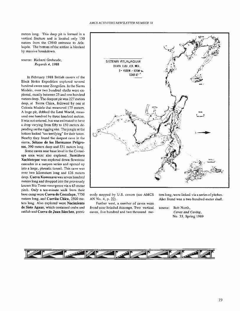
meters long. This deep pit is formed in avertical fracture and is located only 150meters from the CH40 entrance to Atlalaquia. The bottom of the soLano is blockedby massive breakdown.
source: Richard Grebeude,Regards 4, 1988
In February 1988 British cavers of theBlack Holes Expedition explored severalhundred caves near Zongolica. In the SierraModelo, over two hundred shafts were explored, mostly between 25 and one hundredmeters deep. The deepest pit was 227 metersdeep, at Sierra Chica, followed by one atColonia Modelo that measured 175 meters.A huge pit, dubbed the Lost World, measured one hundred by three hundred meters.It was not entered, but was estimated to havea drop varying from fifty to 150 meters depending on the rigging site. Thejungle at thebottom looked "too terrifying" for their tastes.Nearby they found the deepest cave in thesierra, S6tano de los Hermanos Peligrosos, 390 meters deep and 531 meters long.
Some caves near base level in the Coma1apa area were also explored. SumideroXochiotepec was explored down flowstonecascades in a canyon series and opened upinto a large, phreatic tunnel. This cave wasover two kilometers long and 126 metersdeep. Cueva Komosavewas seven hundredmeters long and dropped into the previouslyknown Rio Tonto resurgence via a 45-meterpitch. Only a ten-minute walk from theirbase camp were Cueva de Comalapa, 7750meters long, and Cuevita Chica, 2500 meters long. Also explored were Nacimientode Siete Aguas, which contained crabs andcatfish and Cueva de Juan Sl1nchez, previ-
AMes ACTIVITIES NEWSLETTER NUMBER 18
SISTEMA ATLALAQUIA
CHIAPA. ELeXVER.MEl
O~ mOM.- 62611 ....GSAB 97 ~
'.4.
ously mapped by U.S. cavers (see AMCSAN No.4, p. 22).
Farther west, a number of caves werefound near Soledad Atzompa. Two verticalcaves, five hundred and two thousand me-
ters long, were linked via a series ofpitches.Also found was a two hundred-meter shaft.
source: Bob North,Caves and Caving,No. 33, Spring 1989
19
AMes ACTIVITIES NEWSLETTER NUMBER 18
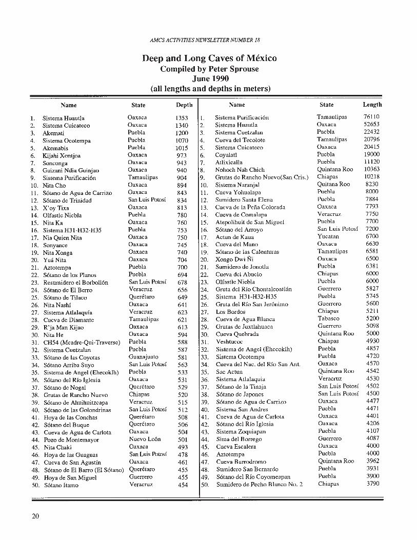
Deep and Long Caves of MexicoCompiled by Peter Sprouse
June 1990(all lengths and depths in meters)
Name State Depth Name State Length
1. Sistema Huautla Oaxaca 1353 1. Sistema Purificacion Tamaulipas 761102. Sistema Cuicateco Oaxaca 1340 2. Sistema Huautla Oaxaca 526533. Akemati Puebla 1200 3. Sistema Cuetzalan Puebla 224324. Sistema Ocotempa Puebla 1070 4. Cueva del Tecolote Tamaulipas 207965. Akemabis Puebla 1015 5. Sistema Cuicateco Oaxaca 204156. Kijahi Xontjoa Oaxaca 973 6. Coyalatl Puebla 190007. Sonconga Oaxaca 943 7. Atlixicalla Puebla 111208. Guizani Ndia Guinjao Oaxaca 940 8. Nohoch Nah Chich Quintana Roo 103639. Sistema Purificacion Tamaulipas 904 9. Grutas de Rancho Nuevo(San Cris.) Chiapas 1021810. NitaCho Oaxaca 894 10. Sistema Naranjal Quitana Roo 823011. Sotano de Agua de Carrizo Oaxaca 843 11. Cueva Yohualapa Puebla 800012. Sotano de Trinidad San Luis Potosi 834 12. Sumidero Santa Elena Puebla 788413. X'oy Tixa Oaxaca 813 13. Cueva de la Perra Colorada Oaxaca 779314. Olfastle Niebla Puebla 780 14. Cueva de Comalapa Veracruz 775015. Nita Ka Oaxaca 760 15. Atepolihuit de San Miguel Puebla 7700
16. Sistema H31-H32-H35 Puebla 753 16. Sotano del Arroyo San Luis Potosi 7200
17. Nia Quien Nita Oaxaca 750 17. Actun de Kaua Yucatan 670018. Sonyance Oaxaca 745 18. Cueva del Mana Oaxaca 6630
19. NitaXonga Oaxaca 740 19. Sotano de las Calenturas Tamaulipas 658120. YU3 Nita Oaxaca 704 20. Xongo DwiNi Oaxaca 6500
21. Aztotempa Puebla 700 21. Sumidero de Jonotla Puebla 638122. Sotano de los Planas Puebla 694 22. Cueva del Abuelo Chiapas 600023. Resumidero el Borbollon San Luis Potosi 678 23. Olfastle Niebla Puebla 600024. Sotano de EI Berro Veracruz 656 24. Gruta del Rio Chontalcoatlan Guerrero 5827
25. Sotano de Tilaco Queretaro 649 25. Sistema H31-H32-H35 Puebla 5745
26. Nita Nash! Oaxaca 641 26. Gruta del Rio San Jeronimo Guerrero 560027. Sistema Atlalaquia Veracruz 623 27. Los Bordas Chiapas 5211
28. Cueva de Diamante Tamaulipas 621 28. Cueva de Agua Blanca Tabasco 5200
29. R'ja Man Kijao Oaxaca 613 29. Grutas de Juxtlahuaca Guerrero 5098
30. Nita He Oaxaca 594 30. Cueva Quebrada Quintana Roo 5000
31. CH54 (Meadre-Qui-Traverse) Puebla 588 31. Veshtucoc Chiapas 4930
32. Sistema Cuetzalan Puebla 587 32. Sistema de Angel (Ehecoklh) Puebla 4857
33. Sotano de las Coyotas Guanajuato 581 33. Sistema Ocotempa Puebla 4720
34. Sotana Arriba Suyo San Luis Potosi 563 34. Cueva del Nac. del Rio San Ant. Oaxaca 4570
35. Sistema de Angel (Ehecoklh) Puebla 533 35. Sac Actun Quintana Roo 4542
36. Sotano del Rio Iglesia Oaxaca 531 36. Sistema Atlalaquia Veracruz 4530
37. Sotano de Nogal Queretaro 529 37. Sotano de la Tinaja San Luis Potosi 4502
38. Grutas de Rancho Nuevo Chiapas 520 38. Sotano de Japones San Luis Potosi 4500
39. Sotano de Ahuihuitzcapa Veracruz 515 39. Sotano de Agua de Carrizo Oaxaca 4477
40. S6tano de las Golondrinas San Luis Potosi 512 40. Sistema San Andres Puebla 4471
41. Hoya de las Conchas Queretaro 508 41. Cueva de Agua de Carlota Oaxaca 4401
42. S6tano del Buque Queretaro 506 42. S6tano del Rio Iglesia Oaxaca 4206
43. Cueva de Agua de Carlota Oaxaca 504 43. Sistema Zoquiapan Puebla 4107
44. Pozo de Montemayor Nuevo LeOn 501 44. Sima del Borrego Guerrero 4087
45. Nita Chaki Oaxaca 493 45. Cueva Escalera Oaxaca 4000
46. Hoya de las Guaguas San Luis Potosi 478 46. Aztotempa Puebla 4000
47. Cueva de San Agustin Oaxaca 461 47. Cueva Burrodromo Quintana Roo 3962
48. S6tano de EI Barro (EI Sotano) Queretaro 455 48. Sumidero San Bernardo Puebla 3931
49. Hoya de San Miguel Guerrero 455 49. S6tano del Rio Coyomeapan Puebla 390050. S6tano llama Veracruz 454 50. Sumidero de Pecha Blanco No.2 Chiapas 3790
20
AMes ACIWITIES NEWSLEITER NUMBER 18
21
AMes ACJIVITIES NEWSLETTER NUMBER 18
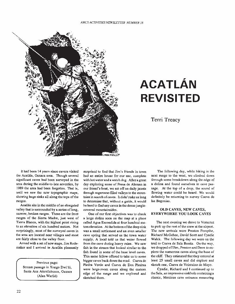
ACATLANREVISITED
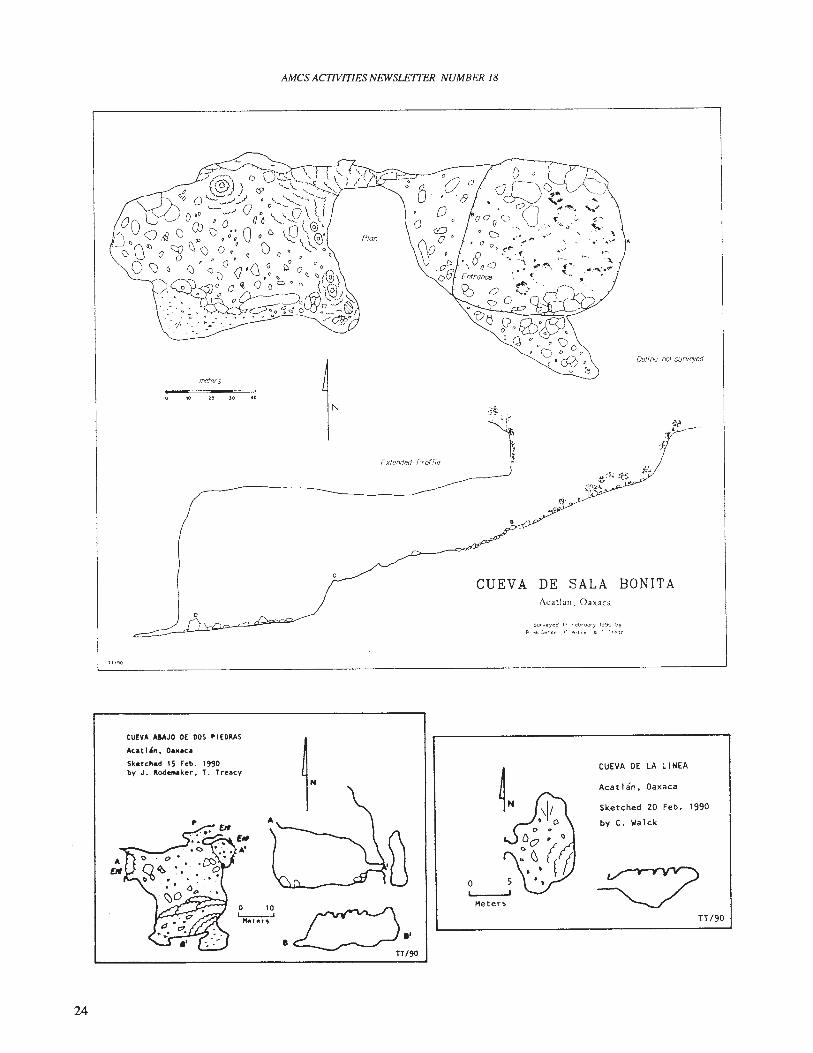
Terri Treacy
It had been 14 years since cavers visitedthe AcatIan, Oaxaca area. Though severalsignificant caves had been surveyed in thearea during the middle-to-Iate seventies, by1989 the area had been forgotten. That is,until we saw the new topographic maps,showing huge sinks all along the tops of theranges.
Acatlan sits in the middle of an elongatedvalley that is surrounded by a series oflong,narrow, broken ranges. These are the frontranges of the Sierra Madre, just west ofTierra Blanca, with the highest point risingto an elevation of six hundred meters. Notsurprisingly, most of the surveyed caves inthe area are located near villages and mostare fairly close to the valley floor.
Armed with a set of new maps, Jim Rodemaker and I arrived in Acatlan pleasantly
Previous page:Stream passage in Xongo Dwi'iii,Santa Ana Atiextlahuaca, Oaxaca
(Alan WariJd)
22
surprised to find that Jim's friends in townhad an entire house for our use, completewith hot water and a watch dog. After a greatday exploring some of Presa de Aleman inour friend's boat, we set off on daily jauntsthrough sugarcane-filled valleys to the mountains in search ofcaves. It didn't take us longto detennine that, without a guide, it wouldbe hard to fmd any caves in the dense junglecovered mountainsides.
One of our first objectives was to checka large dolina seen on the map at a placecalled Agua Escondida at four hundred meters elevation. At the bottom ofthe deep sinkwas a small settlement and an even smallercave spring that served as the town watersupply. A local told us that water flowedfrom the cave during heavy rains. We sawfish in the stream that looked similar to thefish found in some of the base level caves.This same fellow offered to take us to somebigger caves back down the road. Cueva dePiedra Verde and Cueva de Dos Piedraswere large-room caves along the easternedge of the range and we explored andsketched them.
The following day, while hiking in thenext range to the west, we climbed downthrough some breakdown along the edge ofa dolina and found ourselves in cave passage. At the top of a drop, the sound offlowing water could be heard. We woulddefmitely be returning to survey Cueva delas Begonias.
OLD CAVES, NEW CAVES,EVERYWHERE YOU LOOK CAVES
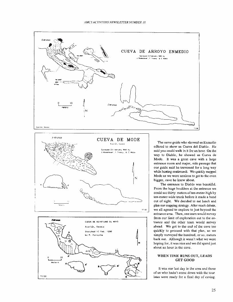
The next evening we drove to Veracruzto pick up the rest of the crew at the airport.The new arrivals were Preston Forsythe,Richard McGehee, David Scott and CyndieWalck. The following day we were on thetrail to Cueva de Sala Bonita. On the way,we dropped offJim , Preston and Dave to explore the numerous caves along the base ofthe cliff. They estimated that they entered atleast 25 small caves and did explore andsketch one, Cueva de Veintuino de Mayo.
Cyndie, Richard and I continued up tothe Sala, an impressive sinkhole containing aclassic, Mexican cave entrance measuring
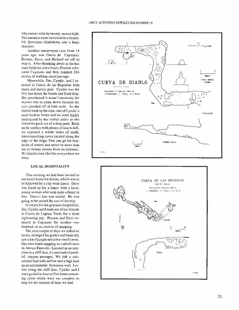
fifty meters wide by twenty meters high.The entrance room narrowed to a beautiful, flowstone climbdown into a hugechamber.
Another unsurveyed cave from 14years ago, was Cueva de Cayatano.Preston, Dave, and Richard set off tomap it. After thrashing about in the hotcane fields for a few hours, Preston relocated Cayatano and they mapped 216meters of walking-sized passage.
Meanwhile, Jim, Cyndie, and I returned to Cueva de las Begonias withropes and survey gear. Cyndie was thefirst one down the fourth and final drop.She proclaimed it wasn't necessary foranyone else to come down because thecave pinched off at both ends. As shestarted back up the rope, one ofCyndie' spack buckles broke and we were highlyentertained by her verbal antics as shefished the pack out of a deep pool. Backon the surface with plenty of time to kill,we explored a whole series of small,interconnecting caves located along theedge of the ridge. One can go for hundreds of meters and never be more thanten or twenty meters from an entrance.We found caves like this everywhere wewent.
LOCAL HOSPITALITY
AMes ACTIVITIES NEWSLEITER NUMBER 18
CUEVA DE"C.II~", O,udta
Surveyed 22 F"ebtuory '990 byJ. Rademaker. T. Treacy," C, Walck
E.rtw'wIed Pram,
TT/<jO
J
." .. .
Entrance
'0
That evening we had been invited toour host's home for dinner, which was tobe followed by a city-wide dance. Davewas fixed up for a dance with a local,young woman who took quite a fancy tohim. Dave's fate was sealed. He wasgoing to be teased the rest of the trip.
In return for the gracious hospitality,Jim, Cyndie and I took one ofour friendsto Cueva de Laguna Verde for a shortsightseeing trip. Preston and Dave returned to Cayatano for another twohundred, or so, meters of mapping.
The next couple of days we talked tolocals, arranged for guides and basicallysaw a lot ofjungle and a few small caves.One cave worth mapping we called Cuevade Arroyo Enmedio. Located in an anticline in a cliff face, it consisted of parallel canyon passages. We left a constricted lead with airflow and a high leadup an unclimbable flows tone wall. Further along the cliff face, Cyndie and Iwere guided to four or five interconnecting caves which were too complex tomap for the amount of time we had.
CUEVA DE LAS BEGONIASA, .. tl.". Oa.acd
Sur",eyed 12 Febru.ry 1990 by
J. ll:odel!l4ker, T. Treac.,. , C. Wililek
,.,
TT /'}O
23
AMes ACJlVITIES NEWSLETTER NUMBER 18
.of
meters
20 40
Dollno not surveyed
lT/~O
Extended Profile
CUEVA DE SALA BONITAAeallan. Oaxaca
Surveyed 11 f'etl.uo.)' 1990 byR ....kGehcf' C V. 'lid, t. ) 11"0(,
24
CUEVA AIAJO OE OOS PI EOMS
Acat 1'n I Oaxaca
Sketched 15 Feb. 1990by J. Rodetftllker, T. Treacy
A'
o 10'-------'Meters
o
Meters
CUEVA DE LA LINEA
Acatlan. Oaxaca
Sketched 20 Feb. 1990
by C. Walck
TT/90
AMes ACTIVITIES NEWSLETTER NUMBER 18
trrronce
~.:~.,\~
a-w' ~_~~ "",, ...'----_·_n :~~-- --
o 10I I
-",.,
CUEV A DE ARROYO ENMEDIOSur".yed '" ebl"vor\l' li90 b,
J, Rodemok., . f ".ocy ., c "Ok"
ft/90
It was our last day in the area and thoseof us who hadn't come down with the touristas were ready for a final day of caving.
WHEN TIME RUNS OUT, LEADSGET GOOD
The same guide who showed us Enmediooffered to show us Cueva del Diablo. Hesaid you could walk: in it for an hour. On theway to Diablo, he showed us Cueva deMode. It was a great cave with a largeentrance room and major, side passage thatour guide said he traversed for a long waywhile hunting coatimundi. We quickly mappedMode as we were anxious to get to the evenbigger, cave he knew about.
The entrance to Diablo was beautiful.From the huge boulders at the entrance wecould see thirty meters often-meter-high byten-meter-wide trunk before it made a bendout of sight. We decided to eat lunch andplan our mapping strategy. After much debate,we all agreed to explore to just beyond theentrance area. Then, one team would surveyfrom our limit of exploration out to the entrance and the other team would surveyahead. We got to the end of the cave tooquickly to proceed with that plan, so wesimply surveyed the hundred, or so, metersback out. Although it wasn't what we werehoping for. it was nice and we did spend justabout an hour in the cave.
1l/'jO
Surveyed 22 r et>rulYy 1990 by
J. Rodemoker , T. Treacy ." C Wolck
CUEVA DE MODE
Sketched 17 Feb. 1990
by P. Forsythe
Acat lan. Oa",ec.a
CUEVA DE VE' NT I UNO DE "AYO
Fntronce
'0
"eters
a 20,
TT /90
.Q,
25
AMes ACTIVITIES NEWSLETTER NUMBER 18
seemed afraid 0fthem. Ourbestguides turnedout to be hunters who roamed the mountainsides and discovered entrances.
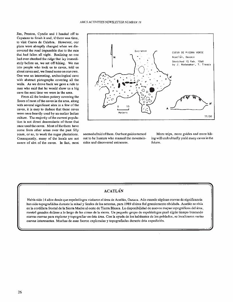
Jim, Preston, Cyndie and I headed off toCayatano to fmish it and, if there was time,to visit Cueva de Culebra. However, ourplans were abruptly changed when we discovered the road impassible due to the rainthat had fallen all night. Realizing no onehad ever checked the ridge that lay immediately before us, we set off hiking. We raninto people who took us to caves, told usabout caves and, we found some on our own.One was an interesting, archeological cavewith abstract pictographs covering all thewalls. As we drove back we gave a ride toman who said that he would show us a bigcave the next time we were in the area.
From all the broken pottery covering thefloors ofmost ofthe caves in the area, alongwith several significant sites in a few of thecaves, it is easy to deduce that these caveswere once heavily used by an earlier Indianculture. The majority ofthe current population is not direct descendants of those thatonce used the caves. Most of the them havecome from other areas over the past fiftyyears, or so, to work the sugar plantations.Consequently, many of the locals are notaware of alot of the caves. In fact, most
.'
IN
o 10L...--..J
Meters
Entrance
- ,
- tr
CUEVA DE PIEDRA VERDE
Acatlan, Oaxaca
Sketched 15 Feb. 19~D
by J. Rademaker, T. Treacy
.f>.,TT/9D
More trips, more guides and more hiking will undoubtedly yield many caves in thefuture.
ACATLAN
Habi'a sido 14 anos desde que espele610gos visitaron el area de Acatlan, Oaxaca. Aun cuando algunas cuevas de significanciahan sido topografilidas durante la mitad y fmales de los setentas, para 1989 el area fue grandemente olvidada. Acatlan se situaen la cordillera frontal de la Sierra Madre al oeste de Tierra Blanca. La disponibilidad de nuevos mapas topograficos del area,mostr6 grandes dolinas a 10 largo de las cimas de la sierra. Un pequeno grupo de espeleologos pas6 algun tiempo buscandonuevas cuevas para explorar y topografiar en esta area. Con la ayuda de los habitantes de los poblados, se localizaron variascuevas interesantes. Muchas de esas fueron exploradas y topografiadas durante esta expedici6n.
26
AMes ACTIVITIES NEWSLETTER NUMBER 18
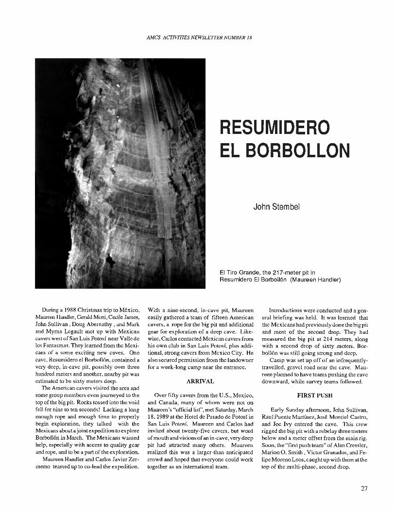
RESUMIDEROEL BORBOLLON
John Stembel
EI Tiro Grande, the 217-meter pit inResumidero EI Borboll6n (Maureen Handler)
During a 1988 Christmas trip to Mexico,Maureen Handler, Gerald Moni, Cecile James,John Sullivan, Doug Abernathy, and Markand Myrna Legault met up with Mexicancavers west of San Luis Potosi near Valle delos Fantasmas. They learned from the Mexicans of a some exciting new caves. Onecave, Resumidero el Borbo1l6n, contained avery deep, in-cave pit, possibly over threehundred meters and another, nearby pit wasestimated to be sixty meters deep.
The American cavers visited the area andsome group members even journeyed to thetop of the big pit. Rocks tossed into the voidfell for nine to ten seconds! Lacking a longenough rope and enough time to properlybegin exploration, they talked with theMexicans about ajoint expedition to exploreBorbo1l6n in March. The Mexicans wantedhelp, especially with access to quality gearand rope, and to be a part of the exploration.
Maureen Handler and Carlos Javier Zermemo teamed up to co-lead the expedition.
With a nine-second, in-cave pit, Maureeneasily gathered a team of fifteen Americancavers, a rope for the big pit and additionalgear for exploration of a deep cave. Likewise, Carlos contacted Mexican cavers fromhis own club in San Luis Potosi, plus additional, strong cavers from Mexico City. Healso secured permission from the landownerfor a week-long camp near the entrance.
ARRIVAL
Over fifty cavers from the U.S., Mexico,and Canada, many of whom were not onMaureen's "official list", met Saturday, March18,1989 at the Hotel de Pasado de Potosi inSan Luis Potosi. Maureen and Carlos hadinvited about twenty-five cavers, but wordofmouth and visions ofan in-cave, very deeppit had attracted many others. Maureenrealized this was a larger-than-anticipatedcrowd and hoped that everyone could worktogether as an international team.
Introductions were conducted and a general briefmg was held. It was learned thatthe Mexicans had previously done the big pitand most of the second drop. They hadmeasured the big pit at 214 meters, alongwith a second drop of sixty meters. Borbo1l6n was still going strong and deep.
Camp was set up off of an infrequentlytravelled, gravel road near the cave. Maureen planned to have teams pushing the cavedownward, while survey teams followed.
FIRST PUSH
Early Sunday afternoon, John Sullivan,Raul Puente Martinez, Jose Montiel Castro,and Joe Ivy entered the cave. This crewrigged the big pit with a rebelay three metersbelow and a meter offset from the main rig.Soon, the "first push team" of Alan Cressler,Marion O. Smith, Victor Granados, and Felipe Moreno Leos, caught up with them at thetop of the multi-phase, second drop.
27
AMes ACfIVITIES NEWLE1TER NUMBER 18
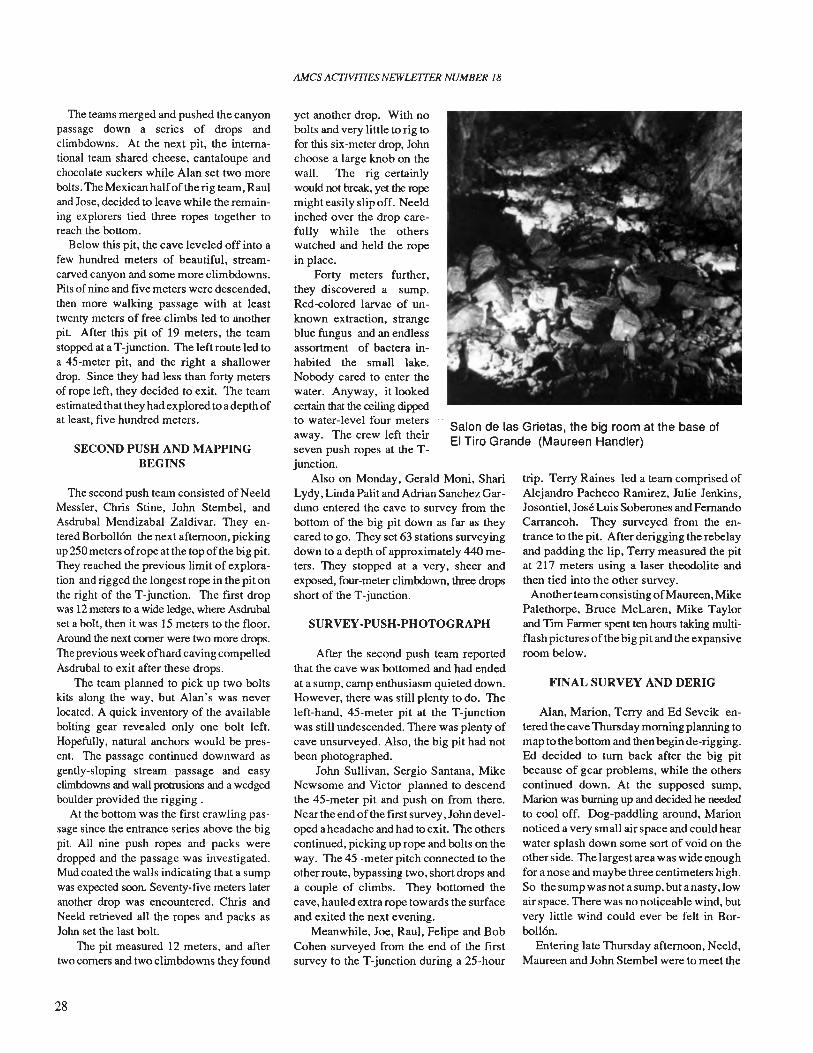
Salon de las Grietas, the big room at the base ofEI Tiro Grande (Maureen Handler)
The teams merged and pushed the canyonpassage down a series of drops andclimbdowns. At the next pit, the international team shared cheese, cantaloupe andchocolate suckers while Alan set two morebolts. The Mexican halfof the rig team, Rauland Jose, decided to leave while the remaining explorers tied three ropes together toreach the bottom.
Below this pit, the cave leveled off into afew hundred meters of beautiful, streamcarved canyon and some more climbdowns.Pits ofnine and five meters were descended,then more walking passage with at leasttwenty meters of free climbs led to anotherpit. After this pit of 19 meters, the teamstopped at aT-junction. The left route led toa 45-meter pit, and the right a shallowerdrop. Since they had less than forty metersof rope left, they decided to exit. The teamestimated that they had explored to a depth ofat least, five hundred meters.
SECOND PUSH AND MAPPINGBEGINS
The second push team consisted of NeeldMessler, Chris Stine, John Stembel, andAsdrubal Mendizabal Zaldivar. They entered Borbollon the next afternoon, pickingup 250 meters ofrope at the top ofthe big pit.They reached the previous limit of exploration and rigged the longest rope in the pit onthe right of the T-junction. The first dropwas 12 meters to a wide ledge, where Asdrubalset a bolt, then it was 15 meters to the floor.Around the next corner were two more drops.The previous week ofhard caving compelledAsdrubal to exit after these drops.
The team planned to pick up two boltskits along the way, but Alan's was neverlocated. A quick inventory of the availablebolting gear revealed only one bolt left.Hopefully, natural anchors would be present. The passage continued downward asgently-sloping stream passage and easyclimbdowns and wall protrusions and a wedgedboulder provided the rigging .
At the bottom was the first crawling passage since the entrance series above the bigpit. All nine push ropes and packs weredropped and the passage was investigated.Mud coated the walls indicating that a sumpwas expected soon. Seventy-five meters lateranother drop was encountered. Chris andNeeld retrieved all the ropes and packs asJohn set the last bolt.
The pit measured 12 meters, and aftertwo corners and two climbdowns they found
28
yet another drop. With nobolts and very little to rig tofor this six-meter drop, Johnchoose a large knob on thewall. The rig certainlywould not break, yet the ropemight easily slip off. Neeldinched over the drop carefully while the otherswatched and held the ropein place.
Forty meters further,they discovered a sump.Red-colored larvae of unknown extraction, strangeblue fungus and an endlessassortment of bactera inhabited the small lake.Nobody cared to enter thewater. Anyway, it lookedcertain that the ceiling dippedto water-level four metersaway. The crew left theirseven push ropes at the Tjunction.
Also on Monday, Gerald Moni, ShariLydy, Linda Palit and Adrian Sanchez Garduno entered the cave to survey from thebottom of the big pit down as far as theycared to go. They set 63 stations surveyingdown to a depth of approximately 440 meters. They stopped at avery, sheer andexposed, four-meter climbdown, three dropsshort of the T-junction.
SURVEY-PUSH-PHOTOGRAPH
After the second push team reportedthat the cave was bottomed and had endedat a sump, camp enthusiasm quieted down.However, there was still plenty to do. Theleft-hand, 45-meter pit at the T-junctionwas still undescended. There was plenty ofcave unsurveyed. Also, the big pit had notbeen photographed.
John Sullivan, Sergio Santana, MikeNewsome and Victor planned to descendthe 45-meter pit and push on from there.Near the end of the first survey, Johndeveloped a headache and had to exit. The otherscontinued, picking up rope and bolts on theway. The 45 -meter pitch connected to theotherroute, bypassing two, short drops anda couple of climbs. They bottomed thecave, hauled extra rope towards the surfaceand exited the next evening.
Meanwhile, Joe, Raul, Felipe and BobCohen surveyed from the end of the firstsurvey to the T-junction during a 25-hour
trip. Terry Raines led a team comprised ofAlejandro Pacheco Ramirez, Julie Jenkins,Josontiel, Jose Luis Soberones and FernandoCarrancoh. They surveyed from the entrance to the pit. After derigging the rebelayand padding the lip, Terry measured the pitat 217 meters using a laser theodolite andthen tied into the other survey.
Another team consisting ofMaureen, MikePalethorpe, Bruce McLaren, Mike Taylorand Tim Farmer spent ten hours taking multiflash pictures ofthe big pit and the expansiveroom below.
FINAL SURVEY AND DERIG
Alan, Marion, Terry and Ed Sevcik entered the cave Thursday morning planning tomap to the bottom and then beginde-rigging.Ed decided to turn back after the big pitbecause of gear problems, while the otherscontinued down. At the supposed sump,Marion was burning up and decided he neededto cool off. Dog-paddling around, Marionnoticed a very small air space and could hearwater splash down some sort of void on theother side. The largest area was wide enoughfor anose and maybe three centimeters high.So thesumpwasnotasump,butanasty,lowair space. There was no noticeable wind, butvery little wind could ever be felt in Borbollon.
Entering late Thursday afternoon, Neeld,Maureen and John Stembel were to meet the
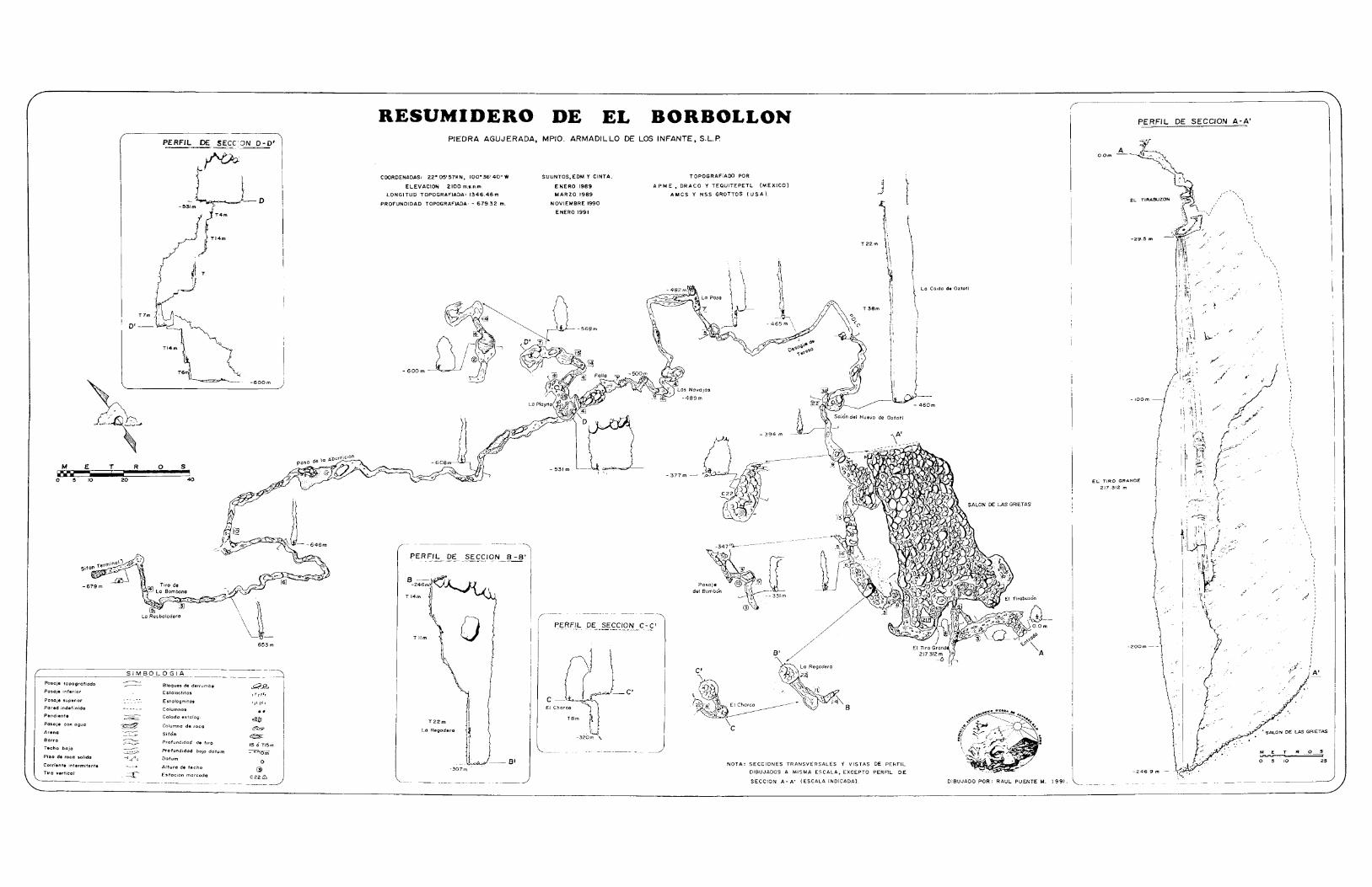
RESUMIDERO DE EL BORBOLLON PERFIL DE SECCION A-A'
I
I
I
II
I
II
)K.~:
10 25
/'
~. Eo
/
-246.9 m-
/
-29.5 m
AO.Om
EL TIRO GRANDE
217.312 m
DIBUJADO POR: RAUL PUENTE M. 1991.
La Caido de Oztotl
J
T 38m
T22m
NOTA: SECCIONES TRANSVERSALES Y VISTAS DE PERFIL
DIBUJADOS A MISMA ESCALA, EXCEPTO PERFIL DE
SECCION A - A' (ESCALA INDICADA).
T OPOGRAFIADO POR
APME. DRACO Y TEQUITEPETL (MEXICO)
AMCS Y NSS GROTTOS (USA).
-347~-----
- 377m -
-320m \.
SUUNTOS, EDM Y CINTA.
ENERO 1989
MARZO 1989
NOVIEMBRE 1990
ENERO 1991
--8'
a
-307m
T22m
La Regadera
Tllm
PIEDRA AGUJERADA, MPIO. ARMADILLO DE LOS INFANTE, S.L.R
8-~r to-246m'~T 14m
COORDENADAS: 22- 05' 5711 N, 100- 36' 40" W
ELEVACION 2100 m,'.n.m.
LONGI TUD TOPOGRAFIADA: 1346.46 m
PROFUNDIDAD TOPOGRAFIADA: - 679.32 m.
- 653m
- -600m
T
('00
-U-O_531mj'T4m
TI4m
40
s
PERFIL DE SEeC'ON 0-0'
~~TI4m ~
oR
T7m, I
0'--
SIMBOLOGIA
20
------
---~ BloQues de derrumb. UJ?<:>Estoloctilas ,Tyrrr
Estologmitos'1·).,*'
Columno.
--=--- Colada estorog:!mID
~ COlumno de roco~
-"---:Y Sifon~
~ Profundidod de tiro 15 <> TI5m
~ Profundidod bojo datum - O"')Om-{-->~-{ Dotum
0Alturo d. techo G>-=r Estocion morcado
C226
T
-679m
M E"Il'a••~o 5 10
PosoJe topogrofiodo
Pasaje inferior
Posaje superior
Pored indefinida
Pendient.
Pasaje can oguo
Arena
Borro
Techa bojo
Pilo de roco solido
Corrient. intermitent.
Tiro vertical

mapping team on their way out and help withthe de-rig. Passing Terry, they continueddown and met Alan and Marion near the Tjunction. Neeld saddled seven, lengthy ropesand headed for the surface. Outside, he alertedthe camp that the de-rig crews would be atthe bottom of the pit soon and that help wasneeded to haul out the ropes.
A crew of thirty cavers spread out fromthe entrance to the top of the pit. Marion,Alan and John uncoiled all the ropes andsnaked them end to end. Maureen and Alanclimbed the pit, then Marion and John waitedas the eight hundred meters of rope washauled out. An old Modelo beer can affixedto the tail of the rope signaled the end. Aftersix hours ofhauling ,everyone was out of thecave at sumise Friday morning.
WRAPUP
Friday was spent sorting gear, makingplans for a return trip and collecting addresses of new friends. Americans, Mexicans and Canadians had worked together tomake the expedition a great success. Resumidero el Borbo1l6n is currently 678 meters deep and 1324 meters long with a nasty,low air space waiting to be pushed.
AMCS ACTIVITIES NEWSLETTER NUMBER 18
Besides exploring thecave, Bruce Smith and otherexpedition members hadspent many hours teachingvertical techniques to theMexicans. Since qualitygear is hard to come by inMexico, many folks soldany extra gear they had, aswell as some essential gearthat the Americans couldeasily replace when theyreturned home.
Other participants:Miguel Angel Flores, Bertha Jimenez, Jesus GarciaMarquez, Norma Hatch &Fernando Chavez, AngelMendizabal, Arriba! Mendizabal, Alfredo Varela, Eduardo Pena, Antonio Bautista, Ana Lara, JuanCancino, Francisco JavierJones, Silvia Yolando VelaPalos, Francisco JavierGonzalez, Miguel AngelJones, Rogelio Shez, Clau-dio Espinosa Anguiano, Cesar Torres, Josilberto Torres Jimenez, Oscar Berrones Con-
RESUMIDERO EL BORBOLLON
LINDA. HESLOP
tereras, Bethany Jablonsky, Jim Hodsen,Gretchen Reinhardt and B. Daniel Stickney.
Durante Mayo de 1989, un grupo Americano-Mexicano-Canadiense exploraron y topografiaron la Cueva del Borbo1l6nhasta una profundidad de 678 metros. EI total de pasaje horizontal topografiado fue de 1324 metros. Un gran tiro en la partesuperior de la cueva fue medido siendo de 217 metros. EI punto mas alejado durante la exploraci6n fue en una poza con unpequeno espacio de aire. Los cueveros reportaron haber escuchado agua corriendo en el otro lado a pesar de que no se observ6movimiento de aire. Se planea volver para continuar con la exploraci6n y topograffa.
29
AMes ACTIVITIES NEWSLE7TER NUMBER 18
DISCOVERIES IN POZODE MONTEMAYOR
Bill Steele
30
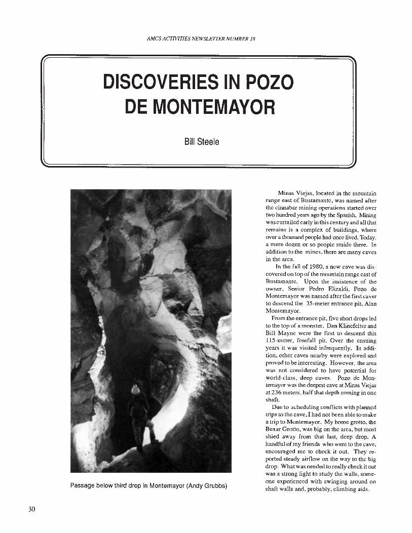
Passage below third drop in Montemayor (Andy Grubbs)
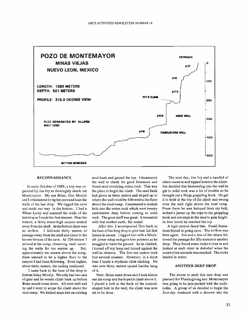
Minas Viejas, located in the mountainrange east of Bustamante, was named afterthe cinnabar mining operations started overtwo hundred years ago by the Spanish. Miningwas curtailed early in this century and all thatremains is a complex of buildings, whereover a thousand people had once lived. Today,a mere dozen or so people reside there. Inaddition to the mines, there are many cavesin the area.
In the fall of 1980, a new cave was discovered on top of the mountain range east ofBustamante. Upon the insistence of theowner, Senior Pedro Elizaldi, Pozo deMontemayor was named after the first caverto descend the 35-meter entrance pit, AlanMontemayor.
From the entrance pit, five short drops ledto the top of a monster. Dan Klinefelter andBill Mayne were the first to descend thislI5-meter, freefall pit. Over the ensuingyears it was visited infrequently. In addition, other caves nearby were explored andproved to be interesting. However, the areawas not considered to have potential forworld-class, deep caves. Pozo de Montemayor was the deepest cave at Minas Viejasat 236 meters, half that depth coming in oneshaft.
Due to scheduling conflicts with plannedtrips to the cave, I had not been able to makea trip to Montemayor. My home grotto, theBexar Grotto, was big on the area, but mostshied away from that last, deep drop. Ahandful ofmy friends who went to the cave.encouraged me to check it out. They reported steady airflow on the way to the bigdrop. What was needed to really check it outwas a strong light to study the walls, someone experienced with swinging around onshaft walls and, probably, climbing aids.
AMCS ACTIVITIES NEWSLETTER NUMBER 18
POZO DE MONTEMAVORMINAS VIEJAS
NUEVO LEON, MEXICO
LENGTH: 1380 METERSDEPTH: 601 METERS
p18
p113
p37o
100
PROFILE: 316.0 DEGREE VIEWIVY.' CUI.-
-200
p106 ARGO MU.
PLOT GENERATED.V ELLIPSEMAY 1990
IOTTOM .c>flEHOl£
300
500
RECONNAISSANCE
In early October of 1989, a trip was organized by Ioe Ivy to thoroughly check outMontemayor. My son Brian, Don More1yand I volunteered to rig the cave and scan thewalls of the last drop. We rigged the caveand made our way to the bottom. I had aWheat Lamp and scanned the walls of thelast drop as I made the first descent. Near thebottom, a thirty-meter-high canyon snakedaway from the shaft. At the bottom there wasno airflow. I followed thirty meters ofpassage away from the shaft and came to theknown bottom of the cave. At -236 meters Iarrived at the sump, observing mud covering the walls for ten meters up. But,approximately ten meters above the sump,there seemed to be a higher floor to thecanyon I had been following. Even higher,about thirty meters, the ceiling continued.
I came back to the base of the drop tobottom-belay More1y. We only had two setsof gear and he would climb back up beforeBrian would come down. All went well andhe and I went to scope the climb above themud sump. We kicked steps into an existing
mud bank and gained the top. I hammeredthe wall to check for good limestone andfound mud overlying rotten rock. This wasthe place to begin the climb. The mud bankhad given us three meters and sloped up towhere the wall could be followed to the floorabove the mud sump. I hammered a conicalhole into the rotten rock which went twentycentimeters deep before coming to solidrock. The good stuffwas great. It resonatedwith that mother earth, flat sound.
After this, I accompanied Don back tothe base of the long drop to give him his firstlesson in ascent. I rigged him with a Mitchell- jumar setup and gave him pointers as hestruggled to leave the ground. As he climbed,I turned off my lamp and leaned against thewall to observe. The first ten meters tookhim several minutes. However, in a shorttime I heard a rhythmic click-elicking. Hewas now thirty meters up and had the hangof it.
Next, Brian came down and I took him tosee the sump and the hopeful climb above it.I placed a bolt at the back of the conicalshaped hole in the wall; the climb was nowset to be done.
The next day, Ioe Ivy and a handful ofothers came in and zipped down to the climb.Ioe decided that hammering into the wall toget to solid rock was a lot of trouble so hebrought out a Ninja grappling hook. He gotit to hold at the top of the climb and swungover the wall right above the mud sump.From there he was belayed from my bolt,inched a jumar up the rope to the grapplinghook and cut steps in the mud to gain height.In four hours he reached the top.
A high canyon faced him. Fossil formations hinted at going cave. The airflow washere again. Ioe and a few of the others followed the passage for fifty meters to anotherdrop. They found some rocks to toss in andlooked at each other in disbelief when thecount ofsix seconds was reached. The rockslanded in water.
ANOTHER DEEP DROP
The return to push this new drop wasplanned for Thanksgiving and Montemayorwas going to be jam-packed with the multitudes. A group of us decided to begin thefour-day weekend with a descent into the
31
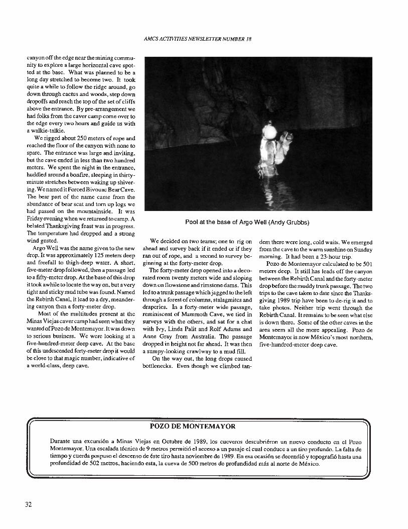
AMes ACTIVITIES NEWSLEITER NUMBER 18
Pool at the base of Argo Well (Andy Grubbs)
canyonoff the edge near the mining community to explore a large horizontal cave spotted at the base. What was planned to be along day stretched to become two. It tookquite a while to follow the ridge around, godown through cactus and woods, step downdropoffs and reach the top of the set of cliffsabove the entrance. By pre-arrangement wehad folks from the caver camp come over tothe edge every two hours and guide us witha walkie-talkie.
We rigged about 250 meters of rope andreached the floor of the canyon with none tospare. The entrance was large and inviting,but the cave ended in less than two hundredmeters. We spent the night in the entrance,huddled around a bonfire, sleeping in thirtyminute stretches between waking up shivering. We named it ForcedBivouac BearCave.The bear part of the name came from theabundance of bear scat and torn up logs wehad passed on the mountainside. It wasFriday evening when we returned tocamp. Abelated Thanksgiving feast was in progress.The temperature had dropped and a strongwind gusted.
Argo Well was the name given to the newdrop. It was approximately 125 meters deepand freefall to thigh-deep water. A short,five-meter drop followed, then a passage ledto a fifty-meter drop. At the base of this dropit took awhile to locate the way on, but a verytight and sticky mud tube was found. Namedthe Rebirth Canal, it lead to a dry, meandering canyon then a forty-meter drop.
Most of the multitudes present at theMinas Viejas caver camp had seen what theywantedofPOlo de Montemayor. Itwas downto serious business. We were looking at afive-hundred-meter deep cave. At the baseof this undescended forty-meter drop it wouldbe close to that magic number, indicative ofa world-class, deep cave.
We decided on two teams; one to rig onahead and survey back if it ended or if theyran out of rope, and a second to survey beginning at the forty-meter drop.
The forty-meter drop opened into a decorated room twenty meters wide and slopingdown on flowstone and rimstone dams. Thisled to a trunk passage which jagged to the leftthrough a forest ofcolumns, stalagmites anddraperies. In a forty-meter wide passage,reminiscent of Mammoth Cave, we tied insurveys with the others, and sat for a chatwith Ivy, Linda Palit and Rolf Adams andAnne Gray from Australia. The passagedropped in height not far ahead. It was thena sumpy-looking crawlway to a mud fill.
On the way out, the long drops causedbottlenecks. Even though we climbed tan-
POZO DE MONTEMAYOR
dem there were long, cold waits. We emergedfrom the cave to the warm sunshine on Sundaymorning. It had been a 23-hour trip.
Pozo de Montemayor calculated to be 501meters deep. It still has leads off the canyonbetween the Rebirth Canal and the forty-meterdrop before the muddy trunk passage. The twotrips to the cave taken to date since the Thanksgiving 1989 trip have been to de-rig it and totake photos. Neither trip went through theRebirth Canal. It remains to be seen what elseis down there. Some of the other caves in thearea seem all the more appealing. POlO deMontemayor is now Mexico's most northern,five-hundred-meter deep cave.
Durante una excursi6n a Minas Viejas en Octubre de 1989, los cueveros descubrieron un nuevo conducto en el POlOMontemayor. Una escalada tecnica de 9 metros permiti6 el acceso a un pasaje el cual conduce a un tiro profundo. La falta detiempo y cuerda pospuso el descenso de este tiro hasta noviembre de 1989. En esa ocasi6n se decendi6 y topografi6 hasta unaprofundidad de 502 metros, haciendo esta, la cueva de 500 metros de profundidad mas al norte de Mexico.
32
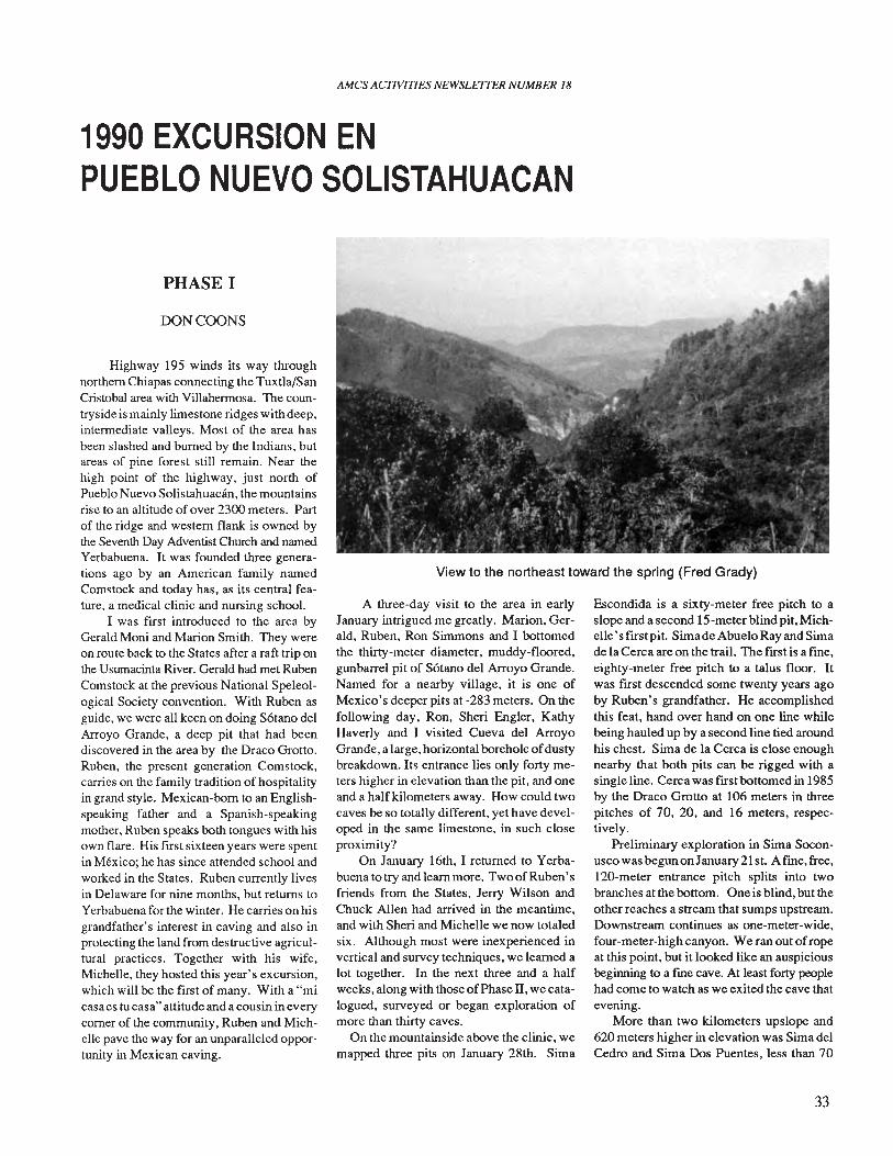
AMes AITIVITIES NEWSLETTER NUMBER 18
1990 EXCURSION ENPUEBLO NUEVO SOLISTAHUACAN
View to the northeast toward the spring (Fred Grady)
PHASE I
OONCOONS
Highway 195 winds its way throughnorthern Chiapas connecting the Tuxtla/SanCristobal area with Villahermosa. The countryside is mainly limestone ridges with deep,intermediate valleys. Most of the area hasbeen slashed and burned by the Indians, butareas of pine forest still remain. Near thehigh point of the highway, just north ofPueblo Nuevo Solistahuacan, the mountainsrise to an altitude of over 2300 meters. Partof the ridge and western flank is owned bythe Seventh Day Adventist Church and namedYerbabuena. It was founded three generations ago by an American family namedComstock and today has, as its central feature, a medical clinic and nursing school.
I was first introduced to the area byGerald Moni and Marion Smith. They wereon route back to the States after a raft trip onthe Usumacinta River. Gerald had met RubenComstock at the previous National Speleological Society convention. With Ruben asguide, we were all keen on doing S6tano delArroyo Grande, a deep pit that had beendiscovered in the area by the Draco Grotto.Ruben, the present generation Comstock,carries on the family tradition of hospitalityin grand style. Mexican-born to an Englishspeaking father and a Spanish-speakingmother, Ruben speaks both tongues with hisown flare. His first sixteen years were spentin Mexico; he has since attended school andworked in the States. Ruben currently livesin Delaware for nine months, but returns toYerbabuena for the winter. He carries on hisgrandfather's interest in caving and also inprotecting the land from destructive agricultural practices. Together with his wife,Michelle, they hosted this year's excursion,which will be the first of many. With a "micasa es tu casa" attitude and a cousin in everycomer of the community, Ruben and Michelle pave the way for an unparalleled opportunity in Mexican caving.
A three-day visit to the area in earlyJanuary intrigued me greatly. Marion, Gerald, Ruben, Ron Simmons and I bottomedthe thirty-meter diameter, muddy-floored,gunbarrel pit of Sotano del Arroyo Grande.Named for a nearby village, it is one ofMexico's deeper pits at -283 meters. On thefollowing day, Ron, Sheri Engler, KathyHaverly and I visited Cueva del ArroyoGrande, a large, horizontal borehole ofdustybreakdown. Its entrance lies only forty meters higher in elevation than the pit, and oneand a half kilometers away. How could twocaves be so totally different, yet have developed in the same limestone, in such closeproximity?
On January 16th, I returned to Yerbabuena to try and learn more. TwoofRuben'sfriends from the States, Jerry Wilson andChuck Allen had arrived in the meantime,and with Sheri and Michelle we now totaledsix. Although most were inexperienced invertical and survey techniques, we learned alot together. In the next three and a halfweeks, along with those ofPhase II, we catalogued, surveyed or began exploration ofmore than thirty caves.
On the mountainside above the clinic, wemapped three pits on January 28th. Sima
Escondida is a sixty-meter free pitch to aslope and a second l5-meter blind pit, Michelle's flTst pit. Simade Abuelo Ray and Simade la Cerca are on the trail. The flTst is a fme,eighty-meter free pitch to a talus floor. Itwas first descended some twenty years agoby Ruben's grandfather. He accomplishedthis feat, hand over hand on one line whilebeing hauled up by a second line tied aroundhis chest. Sima de la Cerca is close enoughnearby that both pits can be rigged with asingle line. Cerca was flTst bottomed in 1985by the Draco Grotto at 106 meters in threepitches of 70, 20, and 16 meters, respectively.
Preliminary exploration in Sima SoconuscowasbegunonJanuary2lst. Afme,free,l20-meter entrance pitch splits into twobranches at the bottom. One is blind, but theother reaches a stream that sumps upstream.Downstream continues as one-meter-wide,four-meter-high canyon. We ran out ofropeat this point, but it looked like an auspiciousbeginning to a fme cave. At least forty peoplehad come to watch as we exited the cave thatevening.
More than two kilometers upslope and620 meters higher in elevation was Sima delCedro and Sima Dos Puentes, less than 70
33
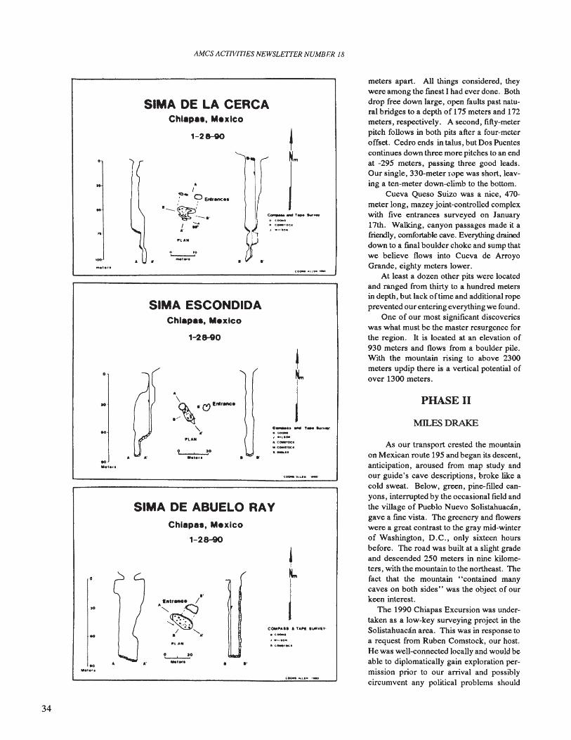
AMCS ACTIVITIES NEWSLETTER NUMBER 18
MILES DRAKE
PHASE II
meters apart. All things considered, theywere among the finest I had ever done. Bothdrop free down large, open faults past natural bridges to a depth of 175 meters and 172meters, respectively. A second, fifty-meterpitch follows in both pits after a four-meteroffset. Cedro ends in talus, but Dos Puentescontinues down three more pitches to an endat -295 meters, passing three good leads.Our single, 330-meter T.:>pe was short, leaving a ten-meter down-elimb to the bottom.
Cueva Queso Suizo was a nice, 470meter long, mazey joint-controlled complexwith five entrances surveyed on January17th. Walking, canyon passages made it afriendly, comfortable cave. Everything draineddown to a final boulder choke and sump thatwe believe flows into Cueva de ArroyoGrande, eighty meters lower.
At least a dozen other pits were locatedand ranged from thirty to a hundred metersin depth, but lack oftime and additional ropeprevented our entering everything we found.
One of our most significant discoverieswas what must be the master resurgence forthe region. It is located at an elevation of930 meters and flows from a boulder pile.With the mountain rising to above 2300meters updip there is a vertical potential ofover 1300 meters.
As our transport crested the mountainon Mexican route 195 and began its descent,anticipation, aroused from map study andour guide's cave descriptions, broke like acold sweat. Below, green, pine-filled canyons, interrupted by the occasional field andthe village of Pueblo Nuevo Solistahuacan,gave a fme vista. The greenery and flowerswere a great contrast to the gray mid-winterof Washington, D.C., only sixteen hoursbefore. The road was built at a slight gradeand descended 250 meters in nine kilometers, with the mountain to the northeast. Thefact that the mountain "contained manycaves on both sides" was the object of ourkeen interest.
The 1990 Chiapas Excursion was undertaken as a low-key surveying project in theSolistahuacan area. This was in response toa request from Ruben Comstock, our host.He was well-eonnected locally and would beable to diplomatically gain exploration permission prior to our arrival and possiblycircumvent any political problems should
0 .......... ,... eu,,,•.~
4 .,~ ...
" c....-oc:•• COll~ •.-..
.'
.'
..•
• 0
1-28-90
fIIe'.r.
L-....-20...,...~l ••
Chlapa., Mexico
Chlapa., Mexico
1-28-90
.',,,.,-- /." <:::;~'
""~I "'-. "
"
SIMA ESCONDIDA
SIMA DE LA CERCAChl.p••, M••lco
1-28-90
.'
SIMA DE ABUELO RAY
• 0
10
00...,.,.
"'...,.
'0Me'e',
34
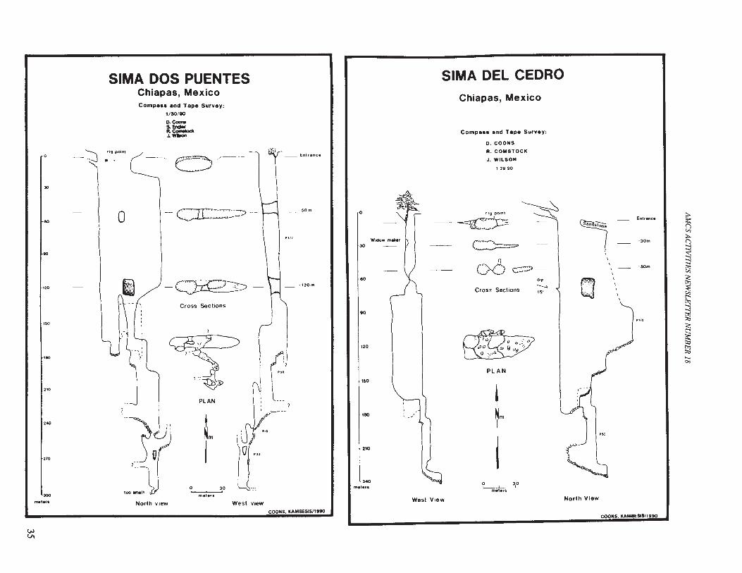
~;..
9::s:::j
~
~~~
~::.;,<:~tli
~.....Co:>
-30m
-SCm
__ Entranc.
\\,
\\
\
\
\C1
I
North View
di,........,15'
~
~Nm
PLAN
12990
o 30l.-..---"-------'
met.rs
Cross Sections
Compa.. and Tape Survey:
D. COONS
A. COMSTOCK
J. WILSON
Chiapas, Mexico
~~
OO~--
SIMA DEL CEDRO
West View
Widow m"r
'50
180
120
00
2'0
eo
30
{)
240me'."
-120m
50m
(:,l',·'
1_Enl,.nee
.~
,I,
, ', '
West view
tI
PLAN
o 30
meters
Cross Sections
c::rr: ,.,?--
", I
~_.
-'- -,,/
~ e:::J /~- -
Compa•• and Tape Survey:1/30/110
D.CoonoSo EnalorR.e-.1._
North view
SIMA DOS PUENTESChiapas, Mexico
o
rig point..-~
l
210
00
240
270
110
00
150
120
-30
JOO
met.f.
COONS. KAMBESlS/,990COONS. KAMBESIS/1990
wVI
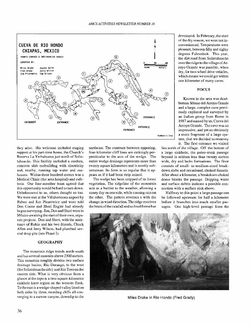
AMes ACTIVITIES NEWSLETTER NUMBER 18
SUUNTO CONPASS l INCLlNONETER SURVEY
GEOGRAPHY
FOCUS
developed. In February, the startof the dry season, we were not inconvenienced. Temperatures werepleasant, between fIfty and eight)'degrees Fahrenheit. This year,the dirt road from Solistahuacanover the ridge to the village ofArroyo Grande was passible, whendry, for two-wheel drive vehicles,which means we could get withinone kilometer of many caves.
Known in the area was deadbottom SOtano del Arroyo Grandeand a large, complex cave previously explored and surveyed byan Italian group from Rome in1987 and named by us, Cueva delArroyo Grande. The cave was soimpressive, and yet so obviously
Kambe.i.1990 a mere fragment of a large sys-tem, that we decided to resurveyit. The first entrance we visited
lies north of the village. Off the bottom ofa large sinkhole, the paleo-trunk passagebeyond is seldom less than twenty meterswide, dry and lacks formations. The floorconsists of small- to medium-sized breakdown slabs and occasional, choked funnels.After about a kilometer, a breakdown-chokeddome blocks the passage. Dripping waterand surface debris indicate a possible connection with a surface sink above.
Halfway to this point a large passage canbe followed upstream for half a kilometerbefore it branches into much smaller passages. One high-level passage from the
~N
I0 2. .ei I
~ meters
ENTRANCE
ENTRANCEENTRANCE
Miles Drake in Rfo Hondo (Fred Grady)
northeast. The contours between opposing,four-kilometer cliff lines are strikingly perpendicular to the axis of the wedge. Theentire wedge drainage represents more thantwenty square kilometers and is mostly subterranean. Its form is so regular that it appears as if it had been strip-mined.
The wedge has been stripped of its forestvegetation. The ridgeline of the mountainacts as a barrier to the weather, allowing asunny day on one side, while causing rain onthe other. The pattern reverses s with thechange in wind direction. The ridge receivesthe brunt ofthe rainfall and a cloud forest has
Joanne SIIi thJerry W11 sonTOftl Wi hon
SURVEYED BY:
"iles DrakeFred GradyJill P1sarow1cz
CUEVA DE RIO HONDOCHIAPAS, MEXICO
they arise. His welcome included stagingsupport at his part-time home, the Church'sReserva La Yerbabuena just north of Solistahuacan. This facility included a modem,concrete slab outbuilding with electricityand, nearby, running tap water and outhouses. Within three hundred meters was aMedical Clinic (the area hospital) and cafeteria. Our four-member team agreed thatthis opportunity would be hard to tum down.Unbeknownst to us, others thought so too.We were met at the Villahermosa airport byRuben and Jim Pisarowicz and were toldDon Coons and Sheri Engler had alreadybegun surveying. Jim, Don and Sheri were inMexico awaiting the start of their own, separate projects. Don and Sheri, with the assistance of Rubin and his two friends, ChuckAllen and Jerry Wilson, had plumbed several deep pits (see Phase I).
The mountain ridge trends north-southand has several summits above 2300 meters.This mountain roughly divides two surfacedrainage basins; Rio Durango, to the west(the Solistahuacan side) and Rio Toro on theeastern side. What is very obvious from aglance at the topo is a two-square-kilometersinkhole karst region on the western flank.To the east is a wedge-shaped valley lined onboth sides by three, receding cliffs all converging to a narrow canyon, downdip to the
36
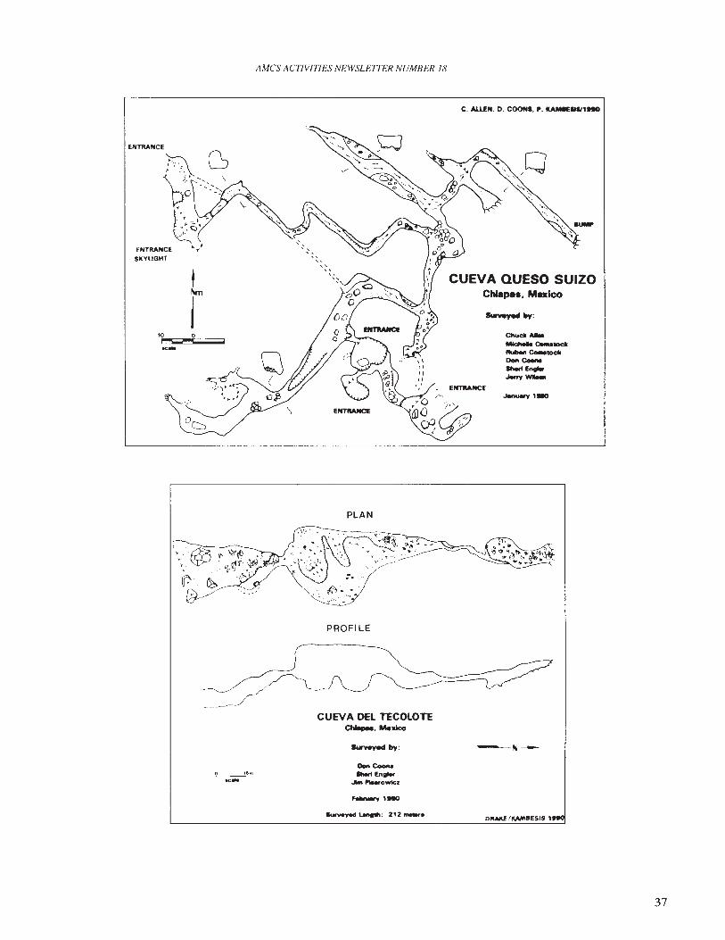
ENTRANCE
ENTRANCESKYLIGHT
10 0~-
AMCS ACTIVITIES NEWSLETTER NUMBER 18
PLAN
C. AllEN. D. COONS. ,. KAM_III1'..
CUEVA QUESO SUIZOChiapea, Mexico
ENTlIANCfJenu8ry ,-
PROFILE
o 16m
~
CUEVA DEL TECOLOTEChIepee. Mexico
Surveyed by:
__ved 1.eftlIlh' 212 __
~N---
37
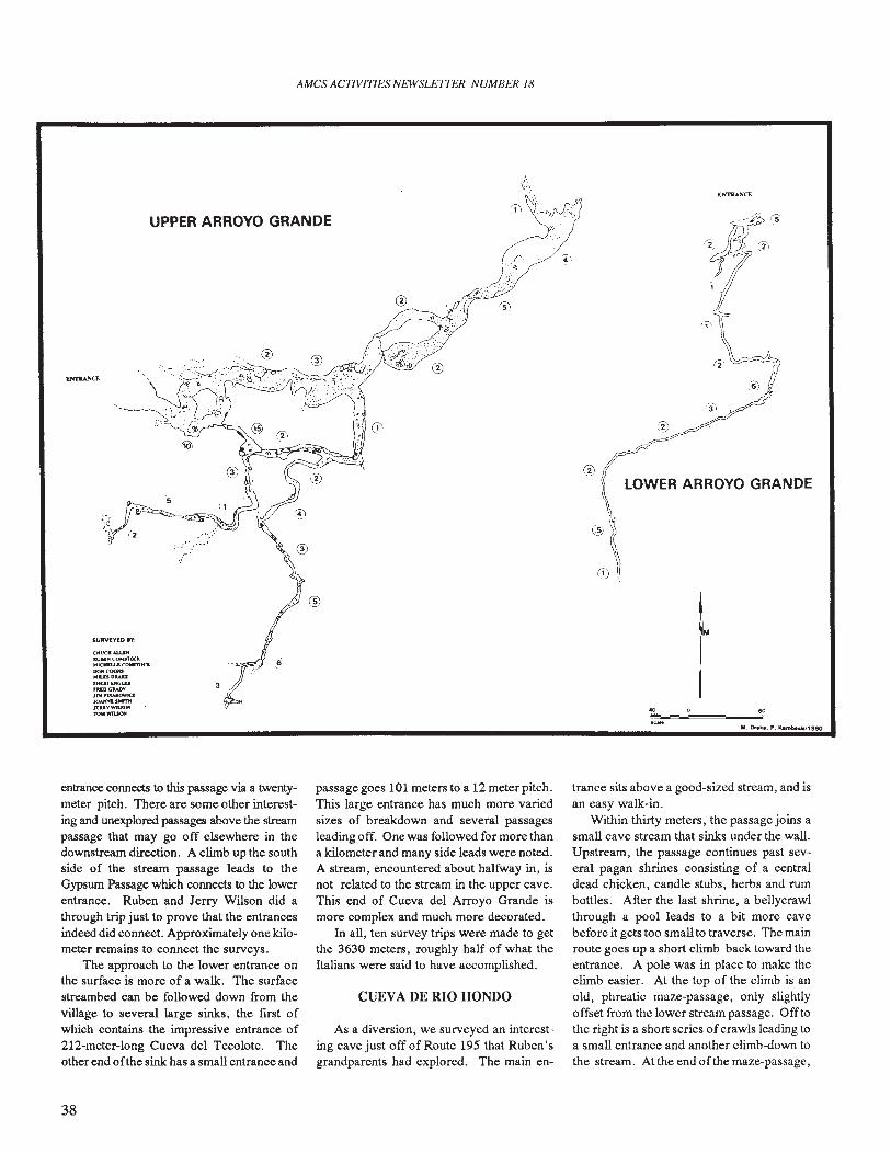
AMes ACTIVITIES NEWSLE1TER NUMBER 18
LOWER ARROYO GRANDE
eo'"H
SURVEYED .,:
UPPER ARROYO GRANDE
CMUCKAUD.U.N~
MK'HIlUCONr1"OC&OO!<COONSMUS ......SH£tI£NC....tuDG&4DYJIM ttsAJ;()W)OJOA.NI'Q.JMmtItUYwn.1OHroMWll..5OO'
entrance connects to this passage via a twentymeter pitch. There are some other interesting and unexplored passages above the streampassage that may go off elsewhere in thedownstream direction. A climb up the southside of the stream passage leads to theGypsum Passage which connects to the lowerentrance. Ruben and Jerry Wilson did athrough trip just to prove that the entrancesindeed did connect. Approximately one kilometer remains to connect the surveys.
The approach to the lower entrance onthe surface is more of a walk. The surfacestreambed can be followed down from thevillage to several large sinks, the first ofwhich contains the impressive entrance of212-meter-Iong Cueva del Tecolote. Theother end 0 fthe sink has a small entrance and
passage goes 101 meters to a 12 meter pitch.This large entrance has much more variedsizes of breakdown and several passagesleading off. One was followed for more thana kilometer and many side leads were noted.A stream, encountered about halfway in, isnot related to the stream in the upper cave.This end of Cueva del Arroyo Grande ismore complex and much more decorated.
In all, ten survey trips were made to getthe 3630 meters, roughly half of what theItalians were said to have accomplished.
CUEVA DE RIO HONDO
As a diversion, we surveyed an interesting cave just off of Route 195 that Ruben'sgrandparents had explored. The main en-
trance sits above a good-sized stream, and isan easy walk-in.
Within thirty meters, the passage joins asmall cave stream that sinks under the wall.Upstream, the passage continues past several pagan shrines consisting of a centraldead chicken, candle stubs, herbs and rumbottles. After the last shrine, a bellycrawlthrough a pool leads to a bit more cavebefore it gets too small to traverse. The mainroute goes up a short climb back toward theentrance. A pole was in place to make theclimb easier. At the top of the climb is anold, phreatic maze-passage, only slightlyoffset from the lower stream passage. Off tothe right is a short series ofcrawls leading toa small entrance and another climb-down tothe stream. Atthe end of the maze-passage,
38
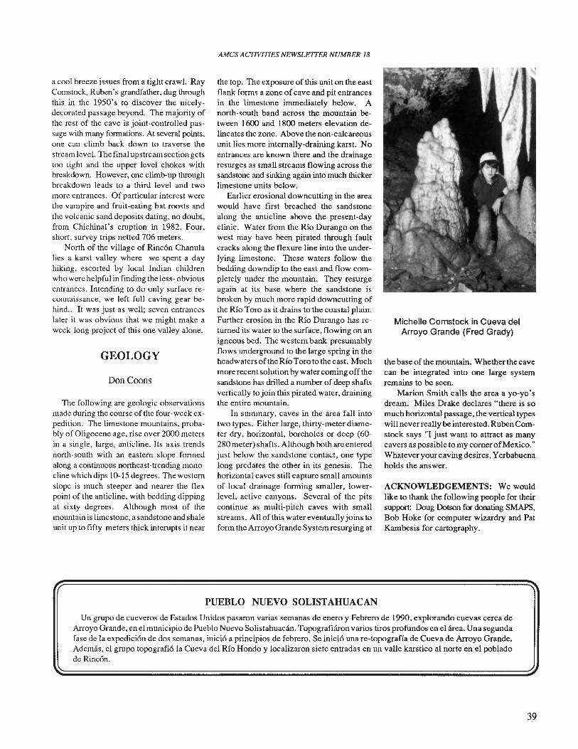
a cool breeze issues from a tight craw1. RayComstock, Ruben's grandfather, dug throughthis in the 1950's to discover the nicelydecorated passage beyond. The majority ofthe rest of the cave is joint-controlled passage with many formations. At several points,one can climb back down to traverse thestream level. The final upstream section getstoo tight and the upper level chokes withbreakdown. However, one climb-up throughbreakdown leads to a third level and twomore entrances. Of particular interest werethe vampire and fruit-eating bat roosts andthe volcanic sand deposits dating, no doubt,from Chichinal's eruption in 1982. Four,short, survey trips netted 706 meters.
North of the village of Rincon Chanulalies a karst valley where we spent a dayhiking, escorted by local Indian childrenwho were helpful in finding the less- obviousentrances. Intending to do only surface reconnaissance, we left full caving gear behind.. It was just as well; seven entranceslater it was obvious that we might make aweek-long project of this one valley alone.
GEOLOGY
Don Coons
The following are geologic observationsmade during the course of the four-week expedition. The limestone mountains, probably of Oligocene age, rise over 2000 metersin a single, large, anticline. Its axis trendsnorth-south with an eastern slope formedalong a continuous northeast-trending monocline which dips 10-15 degrees. The westernslope is much steeper and nearer the flexpoint of the anticline, with bedding dippingat sixty degrees. Although most of themountain is limestone, a sandstone and shaleunit up to fifty meters thick interupts it near
AMes ACTIVITIES NEWSLEITER NUMBER 18
the top. The exposure of this unit on the eastflank forms a zone of cave and pit entrancesin the limestone immediately below. Anorth-south band across the mountain between 1600 and 1800 meters elevation delineates the zone. Above the non-calcareousunit lies more internally-draining karst. Noentrances are known there and the drainageresurges as small streams flowing across thesandstone and sinking again into much thickerlimestone units below.
Earlier erosional downcutting in the areawould have first breached the sandstonealong the anticline above the present-dayclinic. Water from the Rio Durango on thewest may have been pirated through faultcracks along the flexure line into the underlying limestone. These waters follow thebedding downdip to the east and flow completely under the mountain. They resurgeagain at its base where the sandstone isbroken by much more rapid downcutting ofthe Rio Toro as it drains to the coastal plain.Further erosion in the Rio Durango has returned its water to the surface, flowing on anigneous bed. The western bank presumablyflows underground to the large spring in theheadwaters of the Rio Toro to the east. Muchmore recent solution by water coming offthesandstone has drilled a number of deep shaftsvertically to join this pirated water, drainingthe entire mountain.
In summary, caves in the area fall intotwo types. Either large, thirty-meter diameter dry, horizontal, boreholes or deep (60280 meter) shafts. Although both are enteredjust below the sandstone contact, one typelong predates the other in its genesis. Thehorizontal caves still capture small amountsof local drainage forming smaller, lowerlevel, active canyons. Several of the pitscontinue as multi-pitch caves with smallstreams. All of this water eventually joins toform the Arroyo Grande System resurging at
Michelle Comstock in Cueva delArroyo Grande (Fred Grady)
the base of the mountain. Whether the cavecan be integrated into one large systemremains to be seen.
Marion Smith calls the area a yo-yo'sdream. Miles Drake declares "there is somuch horizontal passage, the vertical typeswill neverreally be interested. Ruben Comstock says "I just want to attract as manycavers as possible to my corner ofMexico."Whatever your caving desires, Yerbabuenaholds the answer.
ACKNOWLEDGEMENTS: We wouldlike to thank the following people for theirsupport: Doug Dotson f<r donating SMAPS,Bob Hoke for computer wizardry and PatKambesis for cartography.
PUEBLO NUEVO SOLISTAHUACAN
Un grupo de cueveros de Estados Unidos pasaron varias semanas de enero y Febrero de 1990, explorando cuevas cerca deArroyo Grande, en el municipio de Pueblo Nuevo Solistahuacan. Topografiliron varios tiros profundos en el area. Una segundafase de la expedicion de dos semanas, inicio a principios de febrero. Se inicio una re-topograffa de Cueva de Arroyo Grande.Ademas, el grupo topografio la Cueva del Rio Hondo y localizaron siete entradas en un valle karstico al norte en el pobladode Rincon.
39
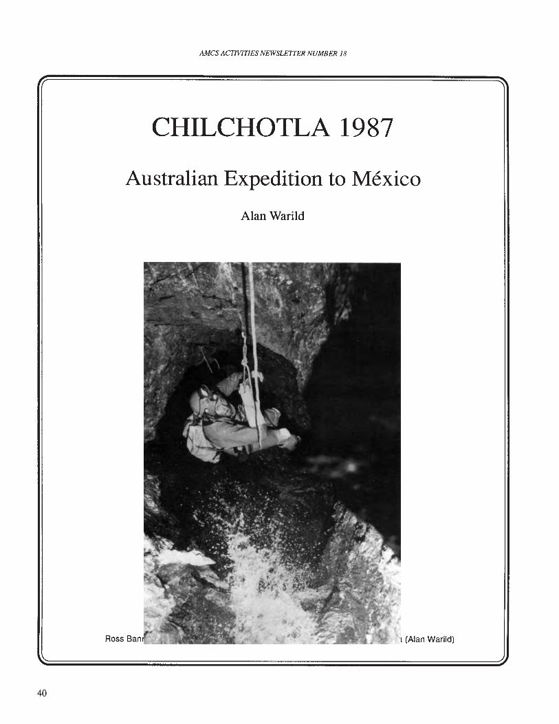
AMCS ACTIVITIES NEWSLETTER NUMBER 18
CHILCHOTLA 1987
Australian Expedition to Mexico
Alan Warild
40
Ross Ban I (Alan Warild)
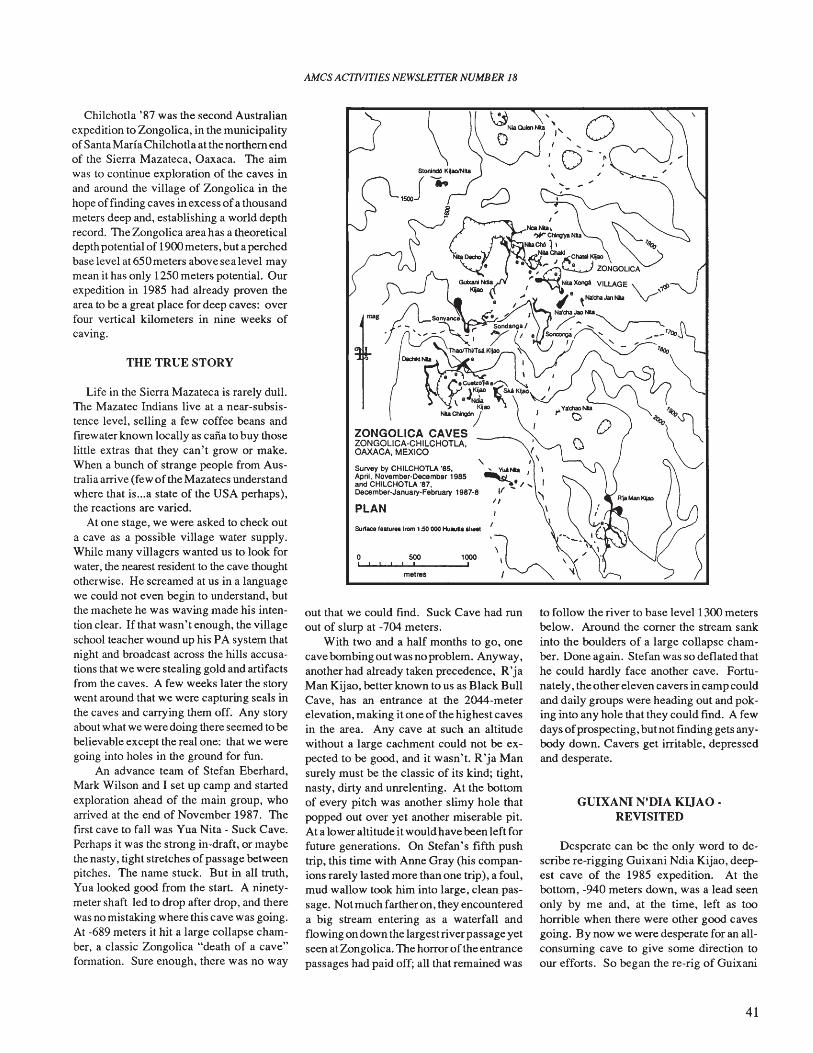
AMes ACTIVITIES NEWSLETTER NUMBER 18
Desperate can be the only word to describe re-rigging Guixani Ndia Kijao, deepest cave of the 1985 expedition. At thebottom, -940 meters down, was a lead seenonly by me and, at the time, left as toohorrible when there were other good cavesgoing. By now we were desperate for an allconsuming cave to give some direction toour efforts. So began the re-rig of Guixani
GUIXANI N'DIA KUAO •REVISITED
to follow the river to base level 1300 metersbelow. Around the comer the stream sankinto the boulders of a large collapse chamber. Done again. Stefan was so deflated thathe could hardly face another cave. Fortunately, the other eleven cavers in camp couldand daily groups were heading out and poking into any hole that they could find. A fewdays ofprospecting, but not finding gets anybody down. Cavers get irritable, depressedand desperate.
1000,metres
500, I
\ ~:::})" ,pSlonl~KII"""1Ia ',0 "J .. ... ~"'
1500 ~ ,,-
g
I" ,,Survey by CHILCHOTlA '85. ' _.... I \April. November-Decembel1985 -.,;,- ,and CHILCHOTLA '87, ~. / ...December-January-February 1987.8 If ~
1/PLAN I \
I \Surface featuret from 150 000 HUlUU& ahe"
out that we could find. Suck Cave had runout of slurp at -704 meters.
With two and a half months to go, onecave bombing out was no problem. Anyway,another had already taken precedence, R'jaMan Kijao, better known to us as Black BullCave, has an entrance at the 2044-meterelevation, making it one of the highest cavesin the area. Any cave at such an altitudewithout a large cachment could not be expected to be good, and it wasn't. R'ja Mansurely must be the classic of its kind; tight,nasty, dirty and unrelenting. At the bottomof every pitch was another slimy hole thatpopped out over yet another miserable pit.At a lower altitude it would have been left forfuture generations. On Stefan's fifth pushtrip, this time with Arme Gray (his companions rarely lasted more than one trip), a foul,mud wallow took him into large, clean passage. Not much farther on, they encountereda big stream entering as a waterfall andflowing on down the largest river passage yetseen at Zongolica. The horror of the entrancepassages had paid off; all that remained was
Life in the Sierra Mazateca is rarely dull.The Mazatec Indians live at a near-subsistence level, selling a few coffee beans andfirewater known locally as calla to buy thoselittle extras that they can't grow or make.When a bunch of strange people from Australia arrive (few of the Mazatecs understandwhere that is ...a state of the USA perhaps),the reactions are varied.
At one stage, we were asked to check outa cave as a possible village water supply.While many villagers wanted us to look forwater, the nearest resident to the cave thoughtotherwise. He screamed at us in a languagewe could not even begin to understand, butthe machete he was waving made his intention clear. If tllat wasn't enough, the villageschool teacher wound up his PA system thatnight and broadcast across the hills accusations that we were stealing gold and artifactsfrom the caves. A few weeks later the storywent around that we were capturing seals inthe caves and carrying them off. Any storyabout what we were doing there seemed to bebelievable except the real one: that we weregoing into holes in the ground for fun.
An advance team of Stefan Eberhard,Mark Wilson and I set up camp and startedexploration ahead of the main group, whoarrived at the end of November 1987. Thefirst cave to fall was Yua Nita - Suck Cave.Perhaps it was the strong in-draft, or maybethe nasty, tight stretches ofpassage betweenpitches. The name stuck. But in all truth,Yua looked good from the start. A ninetymeter shaft led to drop after drop, and therewas no mistaking where this cave was going.At -689 meters it hit a large collapse chamber, a classic Zongolica "death of a cave"fonnation. Sure enough, there was no way
THE TRUE STORY
Chilchotla '87 was the second Australianexpedition to Zongolica, in the municipalityofSanta Marfa Chilchotla at the northern endof the Sierra Mazateca, Oaxaca. The aimwas to continue exploration of the caves inand around the village of Zongolica in thehope of finding caves in excess ofa thousandmeters deep and, establishing a world depthrecord. The Zongolica area has a theoreticaldepth potential of 1900meters, but a perchedbase level at 650 meters above sea level maymean it has only 1250 meters potential. Ourexpedition in 1985 had already proven thearea to be a great place for deep caves: overfour vertical kilometers in nine weeks ofcaving.
41
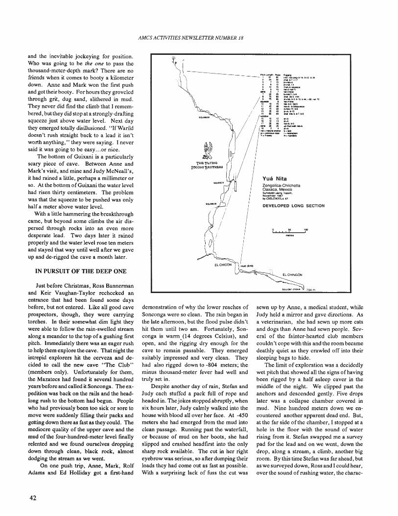
AMCS ACTIVITIES NEWSLETTER NUMBER 18
DEVELOPED LONG SECTION
o 50 '00"" " !
YU8 NitaZongoHca-ChilchotlaOaxaca. MexicoSUrvrted uaI~ Topotil.Nowmber 1987by 0iD..0Km--\ '17.
·704 m
~..~..rwotl.tt-Sl4l1TUS .... NI'O~.......,.N._
....'"1....,I'W~~16.ll-2Z.b·J6211M, 1>7,'-17~_..p.., .... , ...2N1.b~u
NI-0.2na1(V)NI(n-..,~(Y1.l)-$
2nIIl.2b-2.1-641If""'.b-3.b-lJ.b-<64.r-lO,nM·70NI("-'--'IYI.b-2.1'\;II·!iftal+b.b-~....~1V).W
lIfoO.1>15~.1""1I.D-7.b-9
ELCHINGOO
sewn up by Anne, a medical student, whileJudy held a mirror and gave directions. Asa veterinarian, she had sewn up more catsand dogs than Anne had sewn people. Several of the fainter-hearted club memberscouldn't cope with this and the room becamedeathly quiet as they crawled off into theirsleeping bags to hide.
The limit of exploration was a decidedlywet pitch that showed all the signs of havingbeen rigged by a half asleep caver in themiddle of the night. We clipped past theanchors and descended gently. Five dropslater was a collapse chamber covered inmud. Nine hundred meters down we encountered another apparent dead end. But,at the far side 0 f the chamber, I stopped at ahole in the floor with the sound of waterrising from it. Stefan swapped me a surveypad for the lead and on we went, down thedrop, along a stream, a climb, another bigroom. By this time Stefan was far ahead, butas we surveyed down, Ross and I could hear,over the sound of rushing water, the charac-
~.~~
'I'l'n,,"Y1HGzaCCIHI'llRO'rHnR&
l- ."",,- -1 at 90
2 " '"3 1 10.. , 125 12 15I> I> 10..... , ,, .. 25
/ 4--: iII Cl •1l 1S 2013 35 CI,. 8) ill
/~10 12Ie '0 '311 35 CI....... ",a 2 ..f\II __ -.:hlr
PJ·~n:ope
y.'t~
demonstration of why the lower reaches ofSonconga were so clean. The rain began inthe late afternoon, but the flood pulse didn'thit them until two am. Fortunately, Sonconga is warm (14 degrees Celsius), andopen, and the rigging dry enough for thecave to remain passable. They emergedsuitably impressed and very clean. Theyhad also rigged down to -804 meters; theminus thousand-meter fever had well andtruly set in.
Despite another day of rain, Stefan andJudy each stuffed a pack full of rope andheaded in. Thejokes stopped abruptly, whensix hours later, Judy calmly walked into thehouse with blood all over her face. At -450meters she had emerged from the mud intoclean passage. Running past the waterfall,or beeause of mud on her boots, she hadslipped and crashed headflJ'st into the onlysharp rock available. The cut in her righteyebrow was serious, so after dumping theirloads they had come out as fast as possible.With a surprising lack of fuss the cut was
Just before Christmas, Ross Bannermanand Keir Vaughan-Taylor rechecked anentrance that had been found some daysbefore, but not entered. Like all good caveprospectors, though, they were carryingtorches. In their somewhat dim light theywere able to follow the rain-swelled streamalong a meander to the top of a gushing firstpitch. Immediately there was an eager rushto help them explore the cave. That night theintrepid explorers hit the cerveza and decided to call the new cave "The Club"(members only). Unfortunately for them,the Mazatecs had found it several hundredyears before and called it Sonconga. The expedition was back on the rails and the headlong rush to the bottom had begun. Peoplewho had previously been too sick or sore tomove were suddenly filling their packs andgetting down there as fast as they could. Themediocre quality of the upper cave and themud of the four-hundred-meter level fmallyrelented and we found ourselves droppingdown through clean, black rock, almostdodging the stream as we went.
On one push trip, Anne, Mark, RolfAdams and Ed Holliday got a flJ'st-hand
IN PURSUIT OF THE DEEP ONE
and the inevitable jockeying for position.Who was going to be the one to pass thethousand-meter-depth mark? There are nofriends when it comes to booty a kilometerdown. Anne and Mark won the first pushand got their booty. For hours they groveledthrough grit, dug sand, slithered in mud.They never did find the climb that I remembered, but they did stop at a strongly-draftingsqueeze just above water level. Next daythey emerged totally disillusioned.• 'IfWarilddoesn't rush straight back to a lead it isn'tworth anything," they were saying. I neversaid it was going to be easy...or nice.
The bottom of Guixani is a particularlyscary piece of cave. Between Anne andMark's visit, and mine and Judy McNeall's,it had rained a little, perhaps a millimeter orso. At the bottom of Guixani the water levelhad risen thirty centimeters. The problemwas that the squeeze to be pushed was onlyhalf a meter above water level.
With a little hammering the breakthroughcame, but beyond some climbs the air dispersed through rocks into an even moredesperate lead. Two days later it rainedproperly and the water level rose ten metersand stayed that way until well after we gaveup and de-rigged the cave a month later.
42
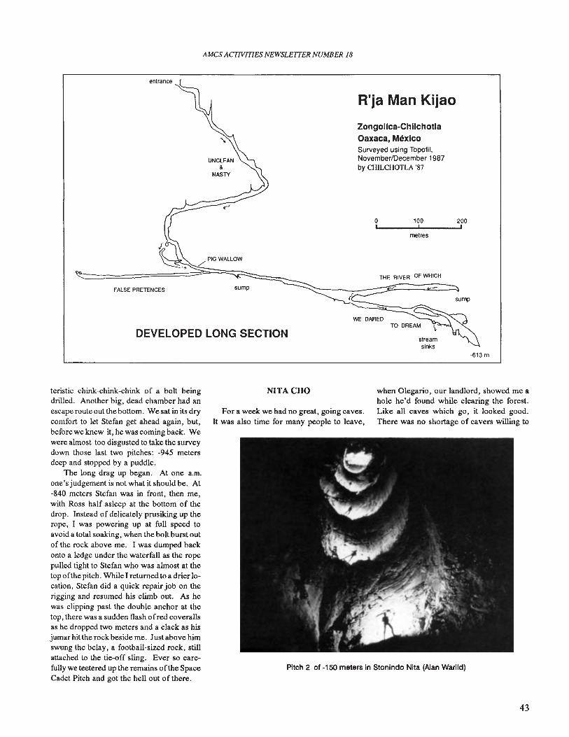
AMes ACTIVITIES NEWSLETTER NUMBER 18
DEVELOPED LONG SECTION
R'ja Man Kijao
streamsinks
200,
sump
100,metres
THE RIVER OF WHICH
o,
Zongolica-ChilchotlaOaxaca, MexicoSurveyed using Topofil,November/December 1987by CHILCHOTLA '87
WE DARED
sumpFALSE PRETENCES
-613 m
Pitch 2 of -150 meters in Stonindo Nita (Alan Warild)
teristic chink-chink-chink of a bolt beingdrilled. Another big, dead chamber had anescape route out the bottom. We sat in its drycomfort to let Stefan get ahead again, but,before we knew it, he was coming back. Wewere almost too disgusted to take the surveydown those last two pitches: -945 metersdeep and stopped by a puddle.
The long drag up began. At one a.m.one's judgement is not what it should be. At-840 meters Stefan was in front, then me,with Ross half asleep at the bottom of thedrop. Instead of delicately prusiking up therope, I was powering up at full speed toavoid a total soaking, when the bolt burst outof the rock above me. I was dumped backonto a ledge under the waterfall as the ropepulled tight to Stefan who was almost at thetop ofthe pitch. While I returned to a drier location, Stefan did a quick repair job on therigging and resumed his climb out. As hewas clipping past the double anchor at thetop, there was a sudden flash ofred coverallsas he dropped two meters and a clack as hisjumar hit the rock beside me. Just above himswung the belay, a football-sized rock, stillattached to the tie-off sling. Ever so carefully we teetered up the remains of the SpaceCadet Pitch and got the hell out of there.
NITACHO
For a week we had no great, going caves.It was also time for many people to leave,
when Olegario, our landlord, showed me ahole he'd found while clearing the forest.Like all caves which go, it looked good.There was no shortage of cavers willing to
43
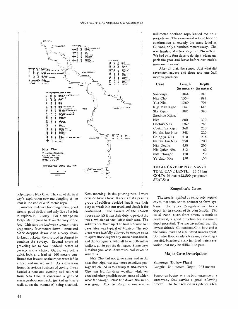
AMes ACTIVITIES NEWSLETTER NUMBER 18
DEVELOPED LONG SECTION
Nita Ch6Zongollca·Chtichotla.Oaxaca. MexIC:O.~,*"",TOOOIl
~IFetWUarv'".. 0<Il..Clf0TU Tl
TOTAL CAVE DEPTH: 5.46 kmTOAL CAVE LENTH: 13.57 kmGOLD: Minus A$2,500 per personSEALS: 0
330283220220216200200160150150
943894704613380
6001769368348310250450312150150
18441554136013471095
Length Depth(in meters) (in meters)
Cave
millimeter bootlace rope landed me on arock choke. The cave ended with no hope ofcontinuation at exactly the same level asGuixani, only a hundred meters away. Chowas finished at a fmal depth of 894 meters.We had only four days to de-rig it, clean andpack the gear and leave before our truck'sinsurance ran out.
After all that, the score. Just what didseventeen cavers and three and one halfmonths produce?
SoncongaNita ChoYua NitaR 'ja Man KijaoSka KijaoStonindo KijaolNitaDachiki NitaCuetzo 'jia KijaoNa'cha Jao NitaChing'ya NitaNa 'cha Jan NitaNita DechoNia Quien NitaNita ChingonYa'chao Nita
-~-~.. ~o.l'lI~-~...___ PI
2D(Y).10
-~-, .... ~,..":tl-l:'-=~"1:w.a,'0.. (11....1
.",.50,
Zongolica's Caves
help explore Nita Cho. The end of the firstday's exploration saw me dangling at theknot in the end of a 45-meter rope.
Another real cave booming down, goodstream, good airflow and only five ofus leftto explore it. Luxury! For a change nofootprints up your back on the way to thelead. This time the lead was a twenty-meterdrop nearly four meters down. Anne andMark dropped down it to a very deadlooking rockpile, then retired in disgust tocontinue the survey. Several hours ofgroveling led to two hundred meters ofpassage and a choke. On the way out, aquick look at a lead at -160 meters confirmed that it went, so the ropes were left ina heap and out we went. As a diversionfrom this serious business of caving, I washanded a note one evening as I returnedfrom Nita Cho. It contained a garbledmessage about our truck, (parked an hour'swalk down the mountain) being attacked.
Next morning, in the pouring rain, I wentdown to have a look. It seems that a passinggroup of soldiers decided that it was theirduty to break into our truck and check it forcontraband. The owners of the nearesthouse also felt it was their duty to protect thetruck, which had been left in their care. Thesoldiers beat them up. The final outcome twodays later was typical of Mexico. The soldiers were tactfully allowed to escape so asto spare the villagers any more harassment,and the foreigners, who all have bottomlesswallets, got to pay the damages. Some daysit makes you wish there were real caves inAustralia.
Nita Cho had not gone away and in thenext few trips, we saw more excellent passage which led us to a sump at -864 meters.Cho was left for drier weather while wechecked other possible caves, none ofwhichwent far enough. Next trip down, the sumpwas gone. One last drop on our seven-
The area is typified by extremely verticalcaves that tend not to connect to form systems. Thc typical Zongolica cave has adepth far in excess of its plan length. Theusual trcnd, apart from down, is north tonorthwest, a good direction for maximumdepth potential. The two cavcs that reach thelowest altitude, Guixani and Cho, both end atthe same level and a hundred meters apart.Both also flood easily after rain, indicating apossible base level at six hundred meters elevation that may be difficult to pass.
Major Cave Descriptions
Sonconga (Hollow Place)Length: 1844 meters, Depth: 943 meters
Sonconga begins as a walk-in entrance to astreamway that carries a good in flowingbreeze. The first section has pitches alter-
44
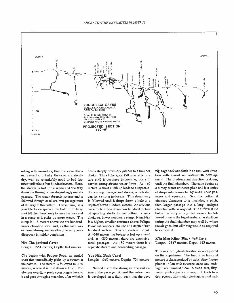
SOUTH
AMes ACTIVITIES NEWSLETTER NUMBER 18
NORTH
2044
1500
1000
500
ZONGOLICA CAVESZONGOLlCA-CHILCHOTLA,OAXACA, MEXICO
Survoy by CHllCHOTLA '85,April, November-December t965and CHllCHOTLA '87,December·January-February 1987·8
PROJECTED SECTION180°-0°
/
metres as!
nating with meanders, then the cave dropsmore steeply. Initially, the cave is relativelydry, with no remarkably good or bad features until minus four hundred meters. Here,the stream is lost for a while and the waydown lies through some disgustingly muddypassage. The water abruptly returns and isfollowed through excellent, wet passage mostofthe way to the bottom. Three times, it ispossible to escape out the bottom of largerockfall chambers, only to have the cave endin a sump as it picks up more water. Thesump is 115 meters above the six-hundredmeter elevation level and, as the cave wasexplored during wet weather, the sump maydisappear in milder conditions.
NiaCho(AnUnaICav~
Length: 1554 meters, Depth: 894 meters
Cho begins with Pelique Pozo, an angledshaft that immediately picks up a stream atthe bottom. The stream is followed to -160meters, where it is lost down a hole. Theobvious overflow route soon comes back toit and goes through a meander, after which it
drops steeply down dry pitches to a boulderchoke. The choke goes 150 miserable meters until it becomes impassible, but stillcarries strong air and water flows. At -160meters, a short climb up leads to a separate,descending passage and stream, which alsocarries a strong in-breeze. This streamwayis followed until it drops down a hole at adepth of seven hundred meters. An obviousover-route drops down two hundred metersof spiraling shafts to the bottom: a rockchoke or, in wet weather, a sump. NanaNitais a higher, smaller entrance above PeliquePozo that connects into Cho at a depth oftwohundred meters. Several leads still exist.At -640 meters the breeze is lost up a shaftand, at -250 meters, there are extensive,fossil passages. At -180 meters there is aseparate stream and descending passage.
Yua Nia (Suck Cave)Length: 1360 meters, Depth: 704 meters
Named due to the strong airflow and nature of the passage. Almost the entire caveis developed on a fault, such that the cave
zig-zags back and forth in an east-west direction with almost no north-south development. The predominant direction is down,until the final chamber. The cave begins asa nintcy-meter entrance pitch and is a seriesof drops interconnected by small, short passages and squeezes. Near the bottom itchanges character to a meander, a pitch,then larger passage into a long, collapsechamber with no way out. The airflow at thebottom is very strong, but cannot be followed once in the big chambers. A shaft entering the final chamber may well be wherethe air goes, but climbing would be requiredto explore it.
R'ja Man Kijao (Black Bull Cave)Length: 2347 meters, Depth: 613 meters
This was the highest elevation cave exploredon the expedition. The first three hundredmeters is characterized by tight, dirty fissurepitches, often with squeeze starts and nothing to recommend them. A clean, wet, fIftymeter pitch signals a change. It leads to adry, rotten, fifty-meter pitch and a mud wal-
45
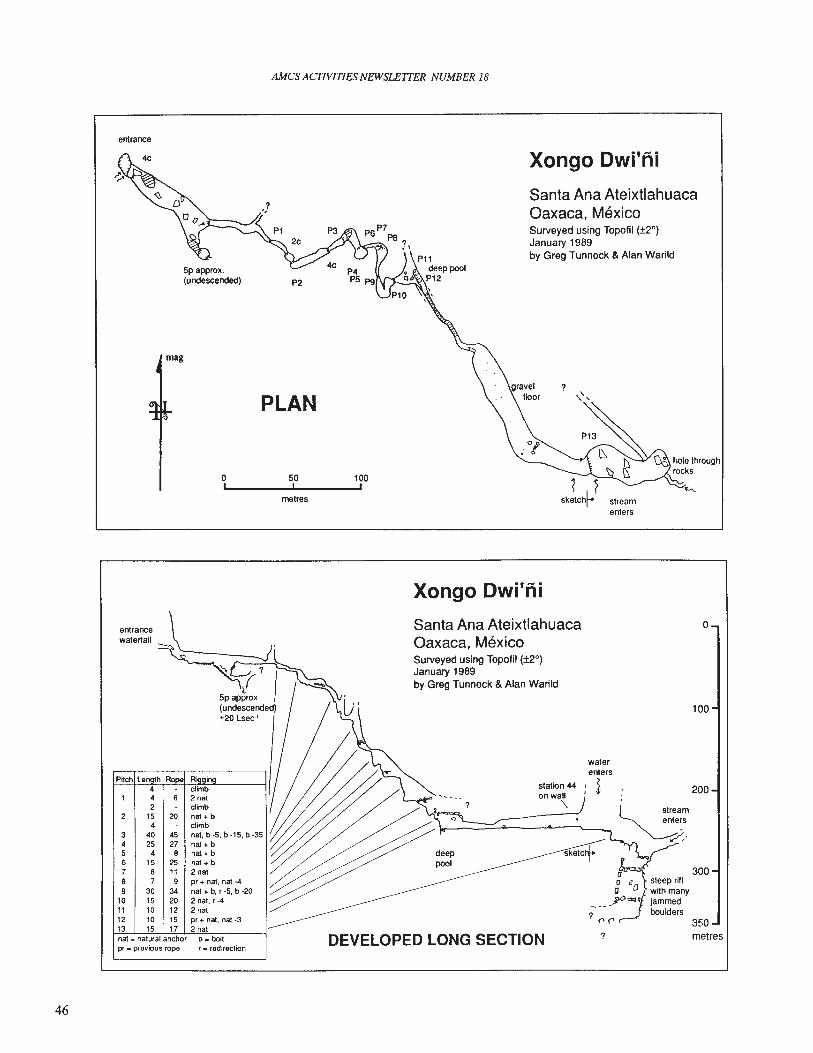
AMes ACJIVITIES NEWSLEITER NUMBER 18
entrance
mag
o,
PLAN
50I
metres
100,
Xongo Dwi'ni
Santa Ana AteixtlahuacaOaxaca, MexicoSurveyed using Topofil (±20
)
January 1989by Greg Tunnock & Alan Warild
?
streamenters
Xongo Dwi'ni
46
entrancewaterfall
P~ch Len th Ro R' in4 climb4 2 nat2 climb
2 15 20 nat+b4 climb
3 40 45 nat, b -5, b -15, b-354 25 27 nat + b5 4 8 nat + b6 15 25 nat+b7 8 11 2 nat8 7 9 pr + nat, nat -49 3034 nat+b,r-5,b-20
10 15 20 2nat,r-411 10 12 2nat12 10 15 pr + nat, nat-313 15 17 2 natnat - natural anchor b • boltpr • previous rope r _ redirection
Santa Ana AteixtlahuacaOaxaca, MexicoSurveyed using Topofil (±20
)
January 1989by Greg Tunnock &Alan Warild
DEVELOPED LONG SECTION ?
o
100
200
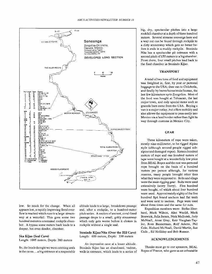
AMes ACTIVITIES NEWSLETTER NUMBER 18
ACKNOWLEDGEMENTS
TRANSPORT
A total of two tons offood and equipmentwas freighted in, fIrst, by post or personalbaggage to the USA; then van to Chilchotla,and fmally by burro/horse/mule/human, thelast few kilometers up to Zongolica. Most ofthe food was bought at Tehuacan, the lastmajor town, and only special items such asgranola bars came from the USA. Buying avan is a major outlay, but offers mobility andalso allows the equipment to pass easily intoMexico via a land border rather than fIght itsway through customs in Mexico City.
GEAR
Three kilometers of rope were taken,mostly nine-millimeter, to be rigged Alpinestyle (although several people rigged subalpine and damaged ropes). Sixteen hundredmeters of rope and one hundred meters oftape were bought at a wonderfully low pricefrom BEAL Ropes and the rest was personalrope brought on the basis of a hundredmeters per person although, for variousreasons, many people brought other thanwhat they were supposed to. Bolts and slingswere the main rigging gear. Bolts were usedextensively (sorry Terry). Five hundredwere bought, of which about four hundredwere used. Approximately eighty ofthe fIvehundred Spit brand anchors had flat teethand were next to useless. Pegs were usedabout three times and the same for nuts.
Expedition members were: Stefan Eberhard, Mark Wilson, Alan Warild, MarkBonwick, Julia James, Nick Melhuish, JudyMcNeall, Anne Gray, Keir Vaughan-Taylor, Ross Bannennan, Rolf Adams, PhilCole, Richard McNeall, David Martin, SueCade , Ed Holliday and Bob Runser.
big, dry, spectacular pitches into a largerockfall chamber at a depth ofthree hundredmeters. Several streams converge here anda way out can be found through rockpile toa dirty streamway which gets no better before it ends in a muddy rockpile. StonindoNita has a spectacular pit entrance with asecond pitch of 150 meters to a big chamber.From there, four small pitches lead back tothe fmal chamber in Stonindo Kijao.
SPACE KAOET PITCH ,;."
metres
50 100'-_-.L'_-J'
DEVELOPED LONG SECTION
SoncongaZongolica-Chilchotla,Oaxaca. Mexico.Surveyed using Topohl.December/January 1987/8by CHll..CHOTLA '87.
altitude leads to a large, breakdown passageand, after a rockpile, to a hundred-meterpitch series. A section ofancient, coral-linedpassage drops to a small, gritty streamwaywhich only gets worse before it chokes inrockpile without a single seal.
Stonindo Kijao/Nita (Over the Hill Cave)Length: 600 meters, Depth: 330 meters
~~.':•. ""'8 /2nII.,·7.r·152na1.1>17.,·3(I2nal+tl2nal+O2""2nat2nal:(y),b-4.,.-4I)
2""pr+t*.f·Spt.nat~Jl,t·1S,
nal·20.r·30
ENTRANCE FOYER
....~"*"0(h1int1 ~naJ+b.'·20 ~Itv'ou9h"' fClCN_....tIoI.l+b.NI-2
"'-up31'111,b-13.~20
M1+b. r-3. Nt·tO
~~".a~5b-2------------ _",.."*l.b-2.r-61\IIt+O. Nt·l. f·3_V)pr.2N1t,,-5nII.nM·2,..1+0. ,~. 1>-8.1>15. MI·20M1eKh end KtOU pool2Nll.b-3.''''pr+2~Y),r-8.......t\II+b.r-tpt.nal+bpr+fWll,I>5"',..nat.bo2pr+nal~Y)
•• POI,.reciltlclionhi. handline
PitctlLanglh~
1 .. 502 20 2S
3 " '"" 13 1$
5 " 326 10 127 5 7850"9 15 18
10 10 1211 as 45
'*'" 312 12 , •13 20 2S'4 1S 2015 3S 40
""" 8_ 5
16 5 1017 " , ..
'*'" 218 35 4019 15 2520 18 2521 10 1622 2Il :Jl23 10 1324 8 12..... 6 1025 12 ,.2& 13 16" 2S :JlQYtrMtO 1528 a 122Il 20 2S30 8 1231 8 832 8 10:D 8 834 17 22315 • •36 20 2S:r7 7 10nat_ncuraland'lOtpt.~viousrope
'(.'t'~
Ska Kijao (Seal Cave)Length: 1095 meters, Depth: 380 meters
low. So much for the change. When allappears lost, a rapidly improving flood overflow is reached which runs to a large streamway at a waterfall. This goes some twohundred meters to a tenninal rockpile chamber. A bypass some meters back leads to adeeper, but even deader, chamber.
So, the locals thought we were catching sealsin the caves ....a big entrance at a respectable
An impressive cave at a lower altitude.Stonindo Kijao has an abandoned, vadose,walk-in entrance, which leads to a series of
Thanks must go to our sponsors, BEALRopes ofFrance, who gave us an unbeatable
47
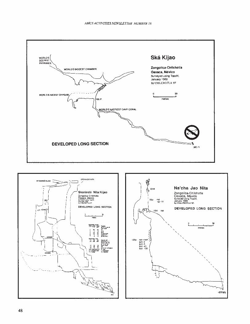
AMes ACTIVITIES NEWSLETTER NUMBER 18
WORLD'SDEEPESTENTRANCE
Ska Kijao
Zongollca-ChllchotlaOaxaca, MexicoSurveyed using Topolil,January 1988by CHILCH011..A '87
WORLD'S BIGGEST CHAMBER
DEVELOPED LONG SECTION
o 50
metres
,380m
DEVELOPED LONG SECTION
-220m
50,
,", ,
"
metres
"" "- ,
","
DEVELOPED LONG SECTION
Na'cha Jao NitaZongolfca-ChilchDtlaOaxaca. MexicoSurveyed using TOpOtil.January 1988by ctm.CHOTLA '87,
, ," , , ,
"
nat
natnat ·15
120p
·330
f~-·:!~:
~K~
10 U, ,...,20 n, ", "
STQNINOO NITA
~
Stonind6 Nlta/KijaoZongolfea-ChilchotlaOaxaca. MexIcos.........,... Ulin~ looolti.F.DtIIaty 1986tJrOUl..OtO'Tt..A'I1.
48
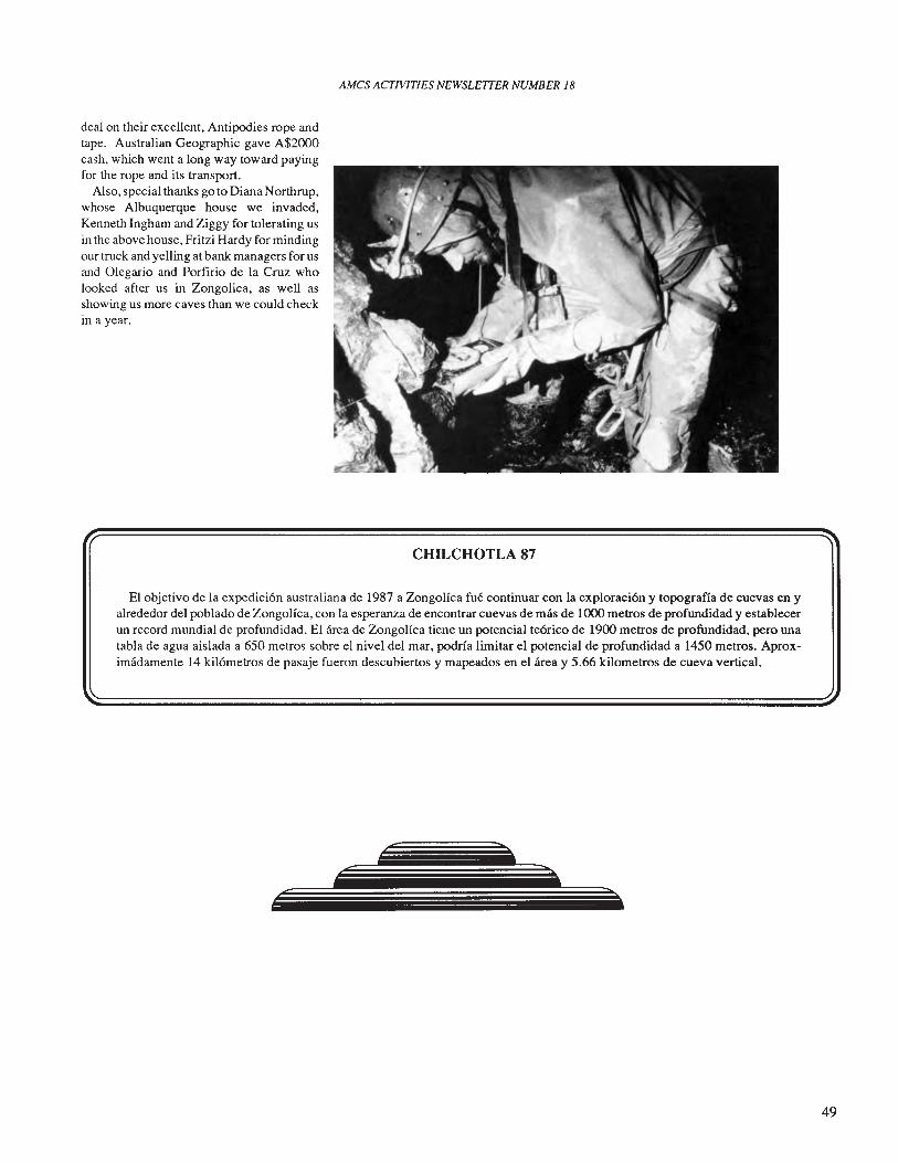
AMCS ACTIVITIES NEWSLEITER NUMBER 18
deal on their excellent, Antipodies rope andtape. Australian Geographic gave A$2000cash, which went a long way toward payingfor the rope and its transport.
Also, special thanks go to Diana Northrup,whose Albuquerque house we invaded,Kenneth Ingham and Ziggy for tolerating usin the above house, Fritzi Hardy for mindingour truck and yelling at bank managers for usand Olegario and Porfirio de la Cruz wholooked after us in Zongolica, as well asshowing us more caves than we could checkin a year.
CHILCHOTLA 87
EI objetivo de la expedici6n australiana de 1987 a Zongolfca fue continuar con la exploraci6n y topografla de cuevas en yalrededor del poblado de Zongolica, con la esperanza de encontrar cuevas de mas de 1000 metros de profundidad y establecerun record mundial de profundidad. EI area de Zongolfca tiene un potencial te6rico de 1900 metros de profundidad, pero unatabla de agua aislada a 650 metros sobre el nivel del mar, podrfa limitar el potencial de profundidad a 1450 metros. Aproximadamente 14 kilometros de pasaje fueron descubiertos y mapeados en el area y 5.66 kilometros de cueva vertical.
>
>..:====::::==::-------~------~-----------
49
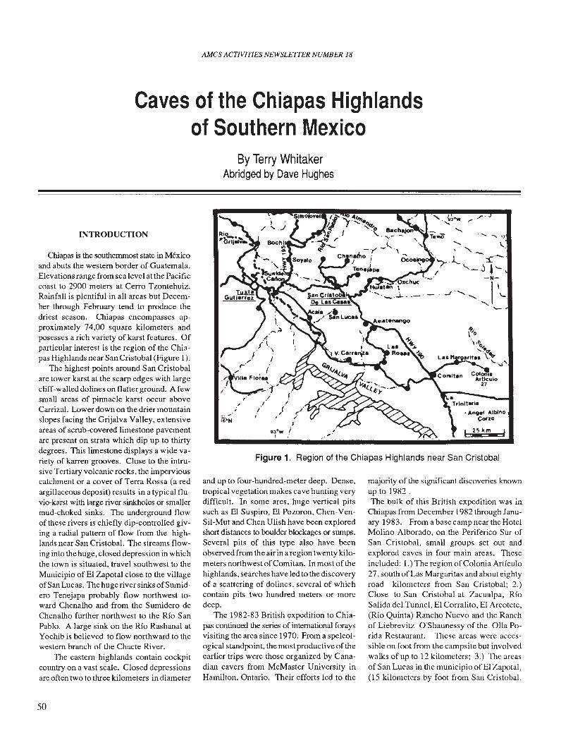
AMCS ACTNITIES NEWSLETTER NUMBER 18
Caves of the Chiapas Highlandsof Southern Mexico
By Terry WhitakerAbridged by Dave Hughes
Figure 1. Region of the Chiapas Highlands near San Cristobal
majority of the significant discoveries knownup to 1982 .The bulk of this British expedition was in
Chiapas from December 1982 through January 1983. FromabasecampneartheHotclMolino Alborado, on the Periferico Sur ofSan Cristobal, small groups set out andexplored caves in four main areas. Theseincluded: 1.) The region ofColonia ArtIculo27, south of Las Margaritas and about eightyroad kilometers from San Cristobal; 2.)Close to San Cristobal at Zacualpa, RIOSalida del Tunnel, El Corralito, El Arcotete,(Rio Quinta) Rancho Nuevo and the Ranchof Liebrevitz O'Shaunessy of the alia Porida Restaurant. These areas were accessible on foot from the campsite but involvedwalks of up to 12 kilometers; 3.) The areasof San Lucas in the municipio of El Zapotal,(15 kilometers by foot from San Cristobal,
INTRODUCTION
Chiapas is the southernmost state in Mexicoand abuts the western border of Guatemala.Elevations range from sea level at the Pacificcoast to 2900 meters at Cerro Tzontehuiz.Rainfall is plentiful in all areas but December through February tend to produce thedriest season. Chiapas encompasses approximately 74,00 square kilometers andposesses a rich variety of karst features. Ofparticular interest is the region of the Chiapas Highlands near San Cristobal (Figure 1).
The highest points around San Cristobalare tower karst at the scarp edges with largecliff-walled dolines on flatter ground. A fewsmall areas of pinnacle karst occur aboveCarrizal. Lower down on the drier mountainslopes facing the Grijalva Valley, extensiveareas of scrub-covered limestone pavementare present on strata which dip up to thirtydegrees. This limestone displays a wide variety of karren grooves. Close to the intrusive Tertiary volcanic rocks, the imperviouscatchment or a cover of Terra Rossa (a redargillaceous deposit) results in a typical fluvio-karst with large river sinkholes or smallermud-choked sinks. The underground flowof these rivers is chiefly dip-controlled giving a radial pattern of flow from the highlands near San Cristobal. The streams flowing into the huge, closed depression in whichthe town is situated, travel southwest to theMunicipio of El Zapotal close to the villageofSan Lucas. ThehugeriversinksofSumidero Tenejapa probably flow northwest toward Chenalho and from the Sumidero deChenalho further northwest to the RIO SanPablo. A large sink on the RIO Rashanal atYochib is believed to flow northward to thewestern branch of the Chacte River.
The eastern highlands contain cockpitcountry on a vast scale. Closed depressionsare often two to three kilometers in diameter
50
and up to four-hundred-meter deep. Dense,tropical vegetation makes cave hunting verydifficult. In some ares, huge vertical pitssuch as El Suspiro, El Pozoron, Chen-VenSil-Mut and Chen Ulish have been exploredshort distances to boulder blockages or sumps.Several pits of this type also have beenobserved from the air in a region twenty kilometers northwest ofComitan. In most of thehighlands, searches have led to the discoveryof a scattering of dolines, several of whichcontain pits two hundred meters or moredeep.
The 1982-83 British expedition to Chiapas continued the series of international foraysvisiting the area since 1970. From a speleological standpoint, the most productive of theearlier trips were those organized by Canadian cavers from McMaster University inHamilton, Ontario. Their efforts led to the
"'. ~2.W .f·...... r
.......
I 2">km
..... 17
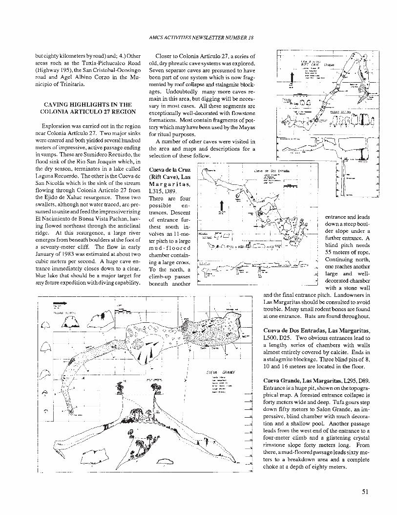
AMes ACTIVITIES NEWSLETTER NUMBER 18
j.1
('.A:-.. cr~. {~Z
RIFT (AvE
t --"-:----..::--_ ..~ _....
'~'-ao.' -_.- ---..._~-
entrance and leadsdown a steep boulder slope under afurther entrance. Ablind pitch needs55 meters of rope.Continuing north,one reaches anotherlarge and welldecorated chamberwith a stone wall
and the final entrance pitch. Landowners inLas Margaritas should be consulted to avoidtrouble. Many small rodent bones are foundat one entrance. Bats are found throughout.
Cueva de Dos Entradas, Las Margaritas,L500, 025. Two obvious entrances lead toa lengthy series of chambers with wallsalmost entirely covered by calcite. Ends ina stalagmite blockage. Three blind pits of 8,10 and 16 meters are located in the floor.
Cueva Grande, Las Margaritas, L295, 089.Entrance is a huge pit, shown on the topographical map. A forested entrance collapse isforty meters wide and deep. Tufa gours stepdown fifty meters to Salon Grande, an impressive, blind chamber with much decoration and a shallow pool. Another passageleads from the west end of the entrance to afour-meter climb and a glistening crystalrirnstone slope forty meters long. Fromthere, a mud-floored passage leads sixty meters to a breakdown area and a completechoke at a depth of eighty meters.
l."lJIt!'o'a de Dos {ntrtN»:s
CUfVA GRAl()f
-i---L----i---L--.L------L---'------J
iI
-----~
Closer to Colonia Articulo 27, a series ofold, dry phreatic cave systems was explored.Seven separate caves are presumed to havebeen part of one system which is now fragmented by roof collapse and stalagmite blockages. Undoubtedly many more caves remain in this area, but digging will be necessary in most cases. All these segments areexceptionally well-decorated with flowstoneformations. Most contain fragments of pottery which may have been used by the Mayasfor ritual purposes.
A number of other caves were visited inthe area and maps and descriptions for aselection of these follow.
Cueva de la Cruz(Rift Cave), LasMar gar it a s,L315,D89.There are fourpossible entrances. Descentof entrance furthest south involves an II-meter pitch to a largemud-flooredchamber containing a large cross.To the north, aclimb-up passesbeneath another
-1
~--------------------------
~.
Q,
CAVING HIGHLIGHTS IN THECOLONIA ARTICULO 27 REGION
but eighty kilometers by road) and; 4.) Otherareas such as the Tuxla-Pichucalco Road(Highway 195), the San Cristobal-Ocosingoroad and Agel Albino Corzo in the Municipio of Trinitaria.
Exploration was carried out in the regionnear Colonia Articulo 27. Two major sinkswere entered and both yielded several hundredmeters of impressive, active passage endingin sumps. These are Sumidero Recuirdo, theflood sink of the Rio San Joaquin which, inthe dry season, terminates in a lake calledLaguna Recuerdo. The other is the Cueva deSan Nicolas which is the sink of the streamflowing through Colonia Articulo 27 fromthe Ejido de Xahac resurgence. These twoswallets, although not water traced, are presumed to unite and feed the impressive risingEl Nacimiento de Buena Vista Pachan, having flowed northeast through the anticlinalridge. At this resurgence, a large riveremerges from beneath boulders at the foot ofa seventy-meter cliff. The flow in earlyJanuary of 1983 was estimated at about twocubic meters per second. A huge cave entrance immediately closes down to a clear,blue lake that should be a major target forany future expedition with diving capability.
51
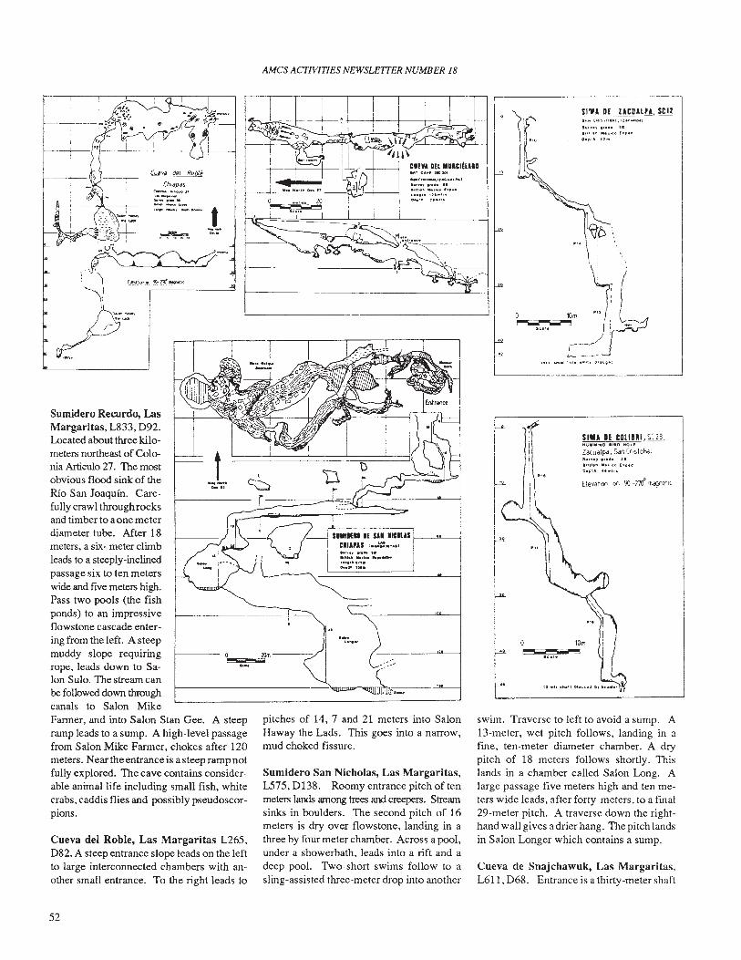
AMes ACTlVlTIES NEWSLETTER NUMBER 18
.~~...IOm---,/
Elevdll"" on '10 -no' "'dlJnel"
SIMA If COllaRl, SC23,HU""IWO·'liIIIO MOll
Zd'Udlpo, Soln (r,slobolt., ' 6. J.."Il col.' .o.plf' ".
SA.. ( ..IIS-lCBA: .'l:.< .... ,~Js"... , ,n6. 58
'''1'.'' ,"' ..CO f.p."O.p'" 12'"
swim. Traverse to left to avoid a sump. A13-meter, wet pitch follows, landing in afme, ten-meter diameter chamber. A drypitch of 18 meters follows shortly. Thislands in a chamber called Salon Long. Alarge passage five meters high and ten meters wide leads, after forty meters, to a fmal29-meter pitch. A traverse down the righthand wall gives adrier hang. The pitch landsin Salon Longer which contains a sump.
Cueva de Snajchawuk, Las Margaritas,L611, D68. Entrance is a thirty-meter shaft
••ye lecJOI
...c -.aA(:\I... l .. t..............
..." _"u •••••l ' .. " " •0..'. J , ••
,f--
pitches of 14, 7 and 21 meters into SalonHaway the Lads. This goes into a narrow,mud choked fissure.
Sumidero San Nicholas, Las Margaritas,L575, D138. Roomy entrance pitch of tenmeters lands among trees and creepers. Streamsinks in boulders. The second pitch of 16meters is dry over flows tone, landing in athree by four meter chamber. Across a pool,under a showerbath, leads into a rift and adeep pool. Two short swims follow to asling-assisted three-meter drop into another
t--.~.
(U~V<l dt!'l Roble
(hldP.zSc.-... "'loc_T1...__..- ..--"'__.l_'...... -._.-
",~~-,:~ ~,_"_-"'_"""_O!'!<_' =>
~"'::='J--
-~~...
Cueva del Roble, Las Margaritas L265,D82. A steep entrance slope leads on the leftto large interconnected chambers with another small entrance. To the right leads to
Sumidero Recurdo, LasMargaritas, L833, D92.Located about three kilometers northeast of Colonia Articulo 27. The mostobvious flood sink of theRio San Joaquin. Carefully crawl through rocksand timber to aone meterdiameter tube. After 18meters, a six- meter climbleads to a steeply-inclinedpassage six to ten meterswide and five meters high.Pass two pools (the fishponds) to an impressiveflowstone cascade enter-ing from the left. A steepmuddy slope requiringrope, leads down to Salon Sulo. The stream canbe followed down throughcanals to Salon MikeFarmer, and into Salon Stan Gee. A steepramp leads to a sump. A high-level passagefrom Salon Mike Farmer, chokes after 120meters. Near the entrance is a steep ramp notfully explored. The cave contains considerable animal life including small fish, whitecrabs, caddis flies and possibly pseudoscorpions.
52
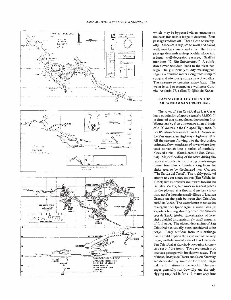
AMes ACTIVITIES NEWSLETTER NUMBER 18
."""00]_(
- ~"-:"'.~-~-
.......~.~._.clii
which may be bypassed via an entrance tothe east; this uses a ledge to descend. Fourpassages radiate off. Three close down rapidly. All contain dry, stone walls and cairnswith wooden crosses and urns. The fourthpassage descends a steep boulder slope intoa large, well-decorated passage. Graffittimentions "El Rio Subterraneo." A climbdown over boulders leads to the river passage. This glutinously muddy, walking passage is a hundred meters long from sump tosump and obviously sumps in wet weather.The streamway contains many bats. Thewater is said to resurge at a well near Colonia Artfculo 27, called El Ejido de Xahac.
CAVING HIGHLIGHTS IN THEAREA NEAR SAN CRISTOBAL__________~ ___L__ _.J
The town of San Cristobal de Las Casashas a population ofapproximately 35,000. Itis situated in a huge, closed depression fourkilometers by five kilometers at an altitudeof 2100 meters in the Chiapas Highlands. Itlies 85 kilometers east ofTuxla Gutierrez onthe Pan American Highway (Highway 190).All the streams flowing into the depressionunite and flow southeast of town where theyused to vanish into a series of partiallyblocked sinks. (Sumideros de San Cristobal). Major flooding of the town during therainy seasons led to the driving of a drainagetunnel four plus kilometers long from thesinks area to be discharged near Carrizal(The Salida del Tunel). The highly-pollutedstream has cut a new course (Rio Salida delTunel) five kilometers southward toward theGrijalva Valley, but sinks in several placeson the plateau at a thousand meters elevation, not far from the small village ofLagunaGrande on the path between San Cristobaland San Lucas. The water is next seen at theresurgence of Ojo de Agua, at San Lucas (ElZapotal) feeding directly from the Sumideros de San Cristobal. Investigation of thesesinks yielded disappointingly small amountsof foul cave. The closed depression of SanCristobal has usually been considered to bepolje. Early outflow from this drainagebasin could explain the existence of the verylarge, well-decorated cave of Las Grutas deSan Cristobal at Rancho Nuevo nine kilometers east of the town. The cave consists ofone vast passage with breakdown areas. Twoof these, Bosque de Piedra and Salon Kramskyare decorated by some of the fmest, largecalcite formations in the world. The passages generally run downdip and the onlyrigging required is for a 15 meter drop into
):::T1C\.·-': __~~~~
ill
SUMIDERO RECUERDOCHIAPAS '."U'''IS)Ill. If II' sal JU"tlSinn 'UI( 51IInlSl .flltl u,n.Ulln us.Iml IZ.
ESi£J -~E 1-=-. [J
I
iII--------i
II
-------------.J'!!!!!!!S\...,,,,.,,r;:::::::.~..--<=~-------
(iJev.~ _dt?
5..r~aJ(I)fIt!Y~. _~.!:.: :. ~'. ~ ~~e~._~~
------------------
53
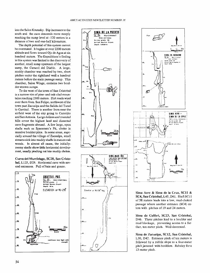
AMes ACTIVITIES NEWSLETTER NUMBER 18
t
SIM' II IlIACII~ ca"C"......1
..... ".rOllll"..'_ ."Ill'" _ I ....~·_
1M.... Hili
! '1111" OE LA CIIUZ
10 ZOm
Sima de Zacualpa, SC12, San Cristobal,L30, D42. Entrance pitch of ten meters isfollowed by a rubble slope to a four-meterpitch jammed with boulders. Rebelay for a13-meter pitch.
Sima de Colibri, SC23, San Cristobal,D46. Three pitches lead to a boulder andmud blockage, preventing access to a further, ten meter pitch. Well-decorated.
Sima Aere & Sima de la Cruz, SCll &SC4, San Cristobal, L45, D61. Shaft SCllof 58 meters leads into a low, mud-chokedpassage where another entrance (SC4) enters with pitches of 19 and 24 meters.
SIM' Mlil illZACUAlPA.$o1nCr\<tcbal~.~.-.,,11•• ".let 1 ..._
0.,1111 J.oo.
o 20m.,...................lui.
r"--.--"-.---J
$1111 IE LA PUERTOSC 3( <s.,. Cristobal»
SA. ANTONIA
'v"'., .,ada 51Irltl....... Ieo h.ped.
De,.It l3'II'r•.
o~
.....
CO"I""......" .....' wlttldr••,tlt
SIITTLE POISC 33 , u. COISTOS..lur••, ,'ad. 3'rUl." " ••ko f..pad.
0..'" '7M.
ELEVATION ($190-m
PIS
P4
Cueva del Murcielago, SC20, San Cristobal, L125, D29. Horizontal cave with several entrances. Full of bats and guano.
into the Salon Kramsky. Dip increases to thesouth and the cave descends more steeplyreaching the sump level at -120 meters in adistance of two and one-half kilometers.
The depth potential of this system cannotbe overstated. It begins at over 2200 metersaltitude and flows toward Ojo de Agua at sixhundred meters. The Expeditions's rmdingin this system was limited to the discovery ofanother, small sump upstream 0 f the largestsump, the Caracol del Diablo. A large,muddy chamber was reached by two, shortpitches under the righthand wall a hundredmeters before the main passage sump. Thischamber, Salon Winge, contains two boulder-strewn sumps.
To the west of the town of San Cristobalis a narrow rim ofpine- and oak-elad mountains reaching 2300 meters. Dirt roads windover them from San Felipe, northwest ofthetown past Zacualpa and the Salida del Tunelto Carrizal. There is another from near theairfield west of the city going to Carrolitoand San Antonia. Large dolines and roundedhills cover the highest land and dissectedcave fragments abound. A few large, openshafts such as Spacemen's Pit, choke inmassive boulder piles. In some areas, especially around the village of Zacualpa, smallstreams sink into muddy shafts in mature oakwoods. In almost all cases, the initiallyroomy shafts show little horizontal development, usually pinching out into muddy chokes.
54
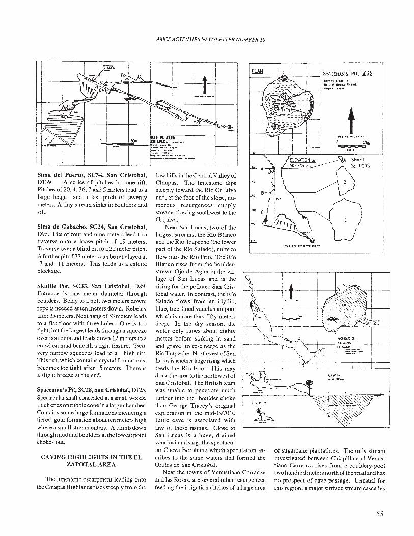
AMes ACfIVITIES NEWSLETTER NUMBER 18
to 40m
P""lj IIiiiIiI
Ica.o
Sun.., ., ).,.t., Ic. , ••••.
0 ••1" ':15.
SPAUMAN'S PIT, SC 28
Ii~
~---i~,'\ I.- Ilil ~I
y.' I ----,-;,:".' ! ==----:----.,-----+---~
of sugarcane plantations. The only streaminvestigated between Chiapilla and Venustiano Carranza rises from a bouldery-pooltwo hundred meters north ofthe road and hasno prospect of cave passage. Unusual forthis region, a major surface stream cascades
I
-_.-:-t-!-+-----+), I .I
low hills in the Central Valley ofChiapas. The limestone dipssteeply toward the Rio Grijalvaand, at the foot of the slope, numerous resurgences supplystreams flowing southwest to theGrijalva.
Near San Lucas, two of thelargest streams, the Rio Blancoand the Rio Trapeche (the lowerpart of the Rio Salado), unite toflow into the Rio Frio. The RioBlanco rises from the boulder-strewn Ojo de Agua in the village of San Lucas and is therising for the polluted San Cristobal water. In contrast, the RioSalado flows from an idyllic,blue, tree-lined vauclusian poolwhich is more than fifty metersdeep. In the dry season, thewater only flows about eightymeters before sinking in sandand gravel to re-emerge as theRio Trapeche. Northwest ofSanLucas is another large rising whichfeeds the Rio Frio. This maydrain tlle area to the northwest ofSan Cristobal. The British teamwas unable to penetrate muchfurtller into the boulder chokethan George Tracey's originalexploration in the mid-1970's.Little cave is associated withany of these risings. Close toSan Lucas is a huge, drainedvauclusian rising, the spectacu-lar Cueva Borohuitz which speculation ascribes to the same waters that formed theGrutas de San Cristobal.
Near the towns of Venustiano Carranzaand las Rosas, are several other resurgencesfeeding the irrigation ditches of a large area
CAVING HIGHLIGHTS IN THE ELZAPOTAL AREA
TIle limestone escarpment leading ontothe Chiapas Highlands rises steeply from the
Spaceman's Pit, SC28, San Cristobal, D125.Spectacular shaft concealed in a small woods.Pitch ends onrubble cone in a large chamber.Contains some large formations including atiered, gour formation about ten meters highwhere a small stream enters. A climb downthrough mud and boulders at the lowest pointchokes out.
Skuttle Pot, SC33, San Cristobal, D89.Entrance is one meter diameter throughboulders. Belay to a bolt two meters down;rope is needed at ten meters down. Rebelayafter 35 meters. Next hang of33 meters leadsto a flat floor with three holes. One is tootight, but the largest leads through a squeezeover boulders and leads down 12 meters to acrawl on mud beneath a tight fissure. Twovery narrow squeezes lead to a high rift.This rift, which contains crystal formations,becomes too tight after 15 meters. There isa slight breeze at the end.
Sima de Gabacho. SC24, San Cristobal,095. Pits of four and nine meters lead to atraverse onto a loose pitch of 19 meters.Traverse over a blind pit to a 22 meter pitch.A further pit of 37 meters can be rebelayed at-7 and -11 meters. This leads to a calciteblockage.
Sima del Puerto, SC34, San Cristobal,D139. A series of pitches in one rift.Pitches of 20, 4, 36, 7 and 5 meters lead to alarge ledge and a last pitch of seventymeters. A tiny stream sinks in boulders andsilt.
I // IJI II ....H....5.c.,--P'W--+-----"~iiiiIi~iI!!!!!~3OInL-...j~~~~~~".~ U.OU~I.m .
...- , •.......... ~ ....
... .... 'rH""· .r••·•·__••••__ IC. .._.
55
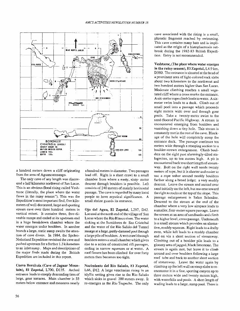
AMes ACfIVITlES NEWSLETTER NUMBER 18
Veshtucoc, (The place where water emergesin the rainy season), EI Zapotal, L4.9 km,D380. The entrance is situated at the head ofa prominent area of light-colored rock slabsabout two kilometers to the northwest andtwo hundred meters higher than San Lucas.Moderate climbing reaches a small vegetated cliff where a cross marks the entrance.A six-meterrope climb leads to water. A sixmeter swim leads to a duck. Climb out ofsmall pool into a passage which proceedseight meters wide over and through gourpools. Take a twenty-meter swim to thesand-floored Pacific Highway. A stream isencountered emerging from boulders andvanishing down a tiny hole. This stream isconstantly met in the rest of the cave. Blockage of the hole will completely sump theentrance duck. The passage continues tenmeters wide through a stooping section to aboulder-strewn enlargement. Climb boulders on the right past alarmingly-tilted stalagmites, up to ten meters high. A pit isencountered back to a short length ofStreamway. Bolt on the right wall needs twentymeters of rope, but it is shorter and easier touse a rope tether around muddy bouldersfurther along a broad ledge; a very muddydescent. Leave the stream and ascend oversand initially on the left, but traverse towardthe right to rocks at the top of the slope. Thispassage enlargement is Salon Schenker.Descend to the stream at the end of thechamber where a very low airspace leads toa smaller, four-meter square passage. Leavethe stream at an area of sandbanks and climbto a higher level, cross passage. Underneathis a small stream which provides an altemative, muddy squeeze. Right leads to a draftyaven, while left leads to a muddy chamberand on via a short section of streamway.Climbing out of a boulder pile leads to agloomy area ofjagged, black limestone. Thestream is again met, but leave it to climbaround and over boulders following a largeroof tube and back to another short sectionof streamway. Leave the water again byclimbing up the left wall on steep slabs to reencounter it in a fme, sporting canyon up tothree meters wide and twenty meters high,with waterfalls and pools. A short length ofwading leads to a large, sump pool. There is
cave associated with the rising is a small,phreatic fragment reached by swimming.This cave contains many bats and is implicated as the origin of a histoplasmosis outbreak during the 1982-83 British Expedition. Entry is not recommended.
Ojo del Agua, El Zapotal, L297, D42.Located at the north end of the village of SanLucas where the Rio Blanco rises. The watersinking at the Sumideros de San Cristobaland the water of the Rio Salido del Tunnelresurge at a large, partly-dammed pool througha large pile ofboulders. A wetcraw1throughboulders enters a small chamber which givesrise to a series of constricted rift passages,ending in narrow squeezes or at water. Aroof fissure has been climbed for over fortymeters then becomes too tight.
a hundred meters in diameter. Two passageslead off. Right is a short crawl to a smallchamber from where a nasty, sixty- meterdescent through boulders is possible. Leftconsists of 240 meters of mainly horizontalpassage. The cave is regarded by many localpeople to have mystical significance. Asmall shrine guards its entrance.
Nacimiento del Rio Salado, El Zapotal,L66, D12. A large vauclusian rising in anidyllic setting gives rise to the Rio Saladowhich sinks in gravel 200 meters away. Itre-emerges as the Rio Trapeche. The only
r-----,r-----,r-----,--~-----__r--___r--"-~I---"1"----r---....,..,
BOROHUIXCHIAPASIIl urallunnn IIUI IIIII11n .UICI IIPII.LIIIII 711.11"1 Ul.
Cueva Borohuix (Cave of Jaguar Mountain), El Zapotal, L700, D135. Archedentrance leads to steeply descending tiers oflarge, gour terraces. Main chamber is 55meters below entrance and measures nearly
a hundred meters down a cliff originatingfrom the area of Aguancatenango.
The only cave of any length was discovered a half kilometer northwest of San Lucas.This is an obvious flood rising called Veshtucoc (literally, the place where the waterflows in the rainy season"). This was theExpedition's most important fmd, five kilometers of well-decorated, large and sportingstream cave over three hundred meters invertical extent. It contains three, free-diveable sumps and ended at its upstream endin a huge breakdown chamber where thewater emerges under boulders. In anotherbranch a large, static sump awaits the attention of cave divers. In 1984, the SpeleoNederland Expedition revisited the cave andpushed upstream for a further 1.3 kilometersto an inlet sump. Maps and descriptions ofthe major fmds made during the BritishExpedition are included in this report.
56
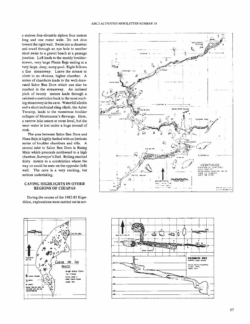
AMes ACTIVITIES NEWSLETJER NUMBER 18
Elor. ~ot.·o"s ,,~,(
ouU.. e418S()tT~
VESHTUCOCCHIAPAS (EL ZAPOTAL)$ut"n 'un ~,
'1IITIn NexiCO UPfl)tTlON I!UI: nUNStl )" 11llOlillHIliSM(lln , ....ETlUS
II
THE&UPM AOlq
. I
OoUl'SII 'UTl'l'H.UAH
,. UlUIn'
'-- --+---D-' J.
--1-- 1
I.. ~_ .. _.~ -- H[V'AllOM-e ----~-..,
. ,\'-.~--
~
~~:':~"
r-------------------------------------,i ~ ~
__~...----J - . -~O<~~~~~~'E l-h~'T
A--------- -----1.,1- . -~-
._- fUVAtlON·( --- - --- u--~--~--
.. n-fi-. ~
-1Ja--+-:: -
a serious free-diveable siphon four meterslong and one meter wide. Do not divetoward the right wall. Swim into a chamberand crawl through an eye hole to anothershort swim to a gravel beach at a passagejunction. Left leads to the muddy boulderstrewn, very large Planta Baja ending at avery large, deep, sump pool. Right followsa fme streamway. Leave the stream toclimb to an obvious, higher chamber. Aseries of chambers leads to the well-decorated Salon Ben Dors which can also bereached in the streamway. An inclinedpitch of twenty meters leads through acalcited-constriction back to the most exciting streamway in thecave. Waterfall climbsand a short technical sling climb, the AztecTwostep, leads to the monstrous bouldercollapse of Montezuma's Revenge. Here,a narrow inlet enters at room level, but themain water is lost under a huge mound ofrock.
The area between Salon Ben Dors andPlana Baja is highly faulted with an intricateseries of boulder chambers and rifts. Asecond inlet to Salon Ben Dors is RisingMain which proceeds northward to a highchamber, Surveyor's End. Bolting reachedthirty meters to a constriction where theway on could be seen on the opposite (left)wall. The cave is a very exciting, butserious undertaking.
CAVING HIGHLIGHTS IN OTHERREGIONS OF CHIAPAS
During the course of the 1982-83 Expedition, explorations were carried out in sev-
de losB.&.NCOS
""gel A1bno C<no(U;t~
"'- -'~Nill.ico~L"'" 5&".
57
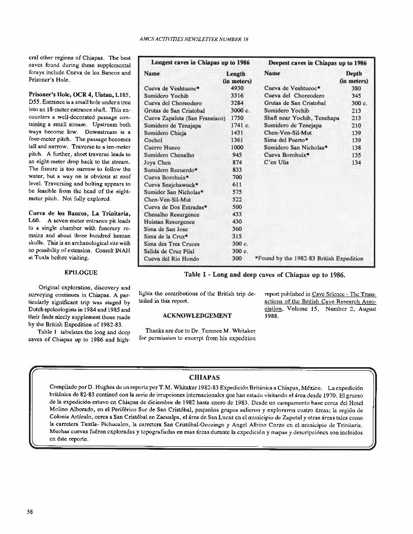
AMes ACTIVITIES NEWSLETTER NUMBER 18
Deepest caves in Cbiapas up to 1986
Name Depth(in meters)
3803453000.213213210139139138135134
Cueva de Veshtucoc*Cueva del ChoreoderoGrutas de San CristobalSumidero YochibShaft near Yochib, TenehapaSumidero de TenejapaChen-Ven-Sil-MutSima del Puerto*Sumidero San Nicholas.Cueva ,Bo~ohuix*C'en UUs:-..}(.::;.
*Found by the 1982-83 British Expedition
Length'(in metbs)
49303316,32843000 c.17501741 c.143113611000,945:: ,.;,
87~833 .".700611575522500433430360315300 c.'300c.300
.::'
Longest caves in Cbiapas up to 1986
Name ",,":'::;';'
Cueva d~'Veshtucoc*Sumidero YochibCueva del ChoreoderoGrutas de San CristobalCueva Zapaluta (San Fransisco)Sumidero de TenajapaSumidero ChicjaCochoiCuerro 'RuccoSumidero Chenalho ,Joya C~:er..'Sumideft{Recuerdo'"Cueva'Botohuix*Cueva Snajchawuck*Sumider San Nicholas·Chen-Ven-Sil-MutCueva de Dos Entradas*Chenalho ResurgenceHuistan ResurgenceSima de San JoseSima deli Cruz.Sima des Ttes CrucesSalida de Cruz Pilal:'Cueva dCl Rio 'Rondo
Cueva de los Bancos, La Trinitaria,L6O. A seven-meter entrance pit leadsto a single chamber with funerary remains and about three hundred humanskulls. This is an archaeological site withno possibility of extension. Consult INAHat Tuxla before visiting.
Prisoner's Hole, OCR 4, Uistan, L185,D55. Entrance is a small hole under a treeinto an 18-meter entrance shaft. This encounters a well-dccorated passage containing a small stream. Upstream bothways become low. Downstream is afour-meter pitch. The passage becomestall and narrow. Traverse to a ten-meterpitch. A further, short traverse leads toan eight-meter drop back to the stream.The fissure is too narrow to follow thewater, but a way on is obvious at rooflevel. Traversing and bolting appears tobe feasible from the head of the eightmeter pitch. Not fully explored.
eral other regions of Chiapas. The bestcaves found during these supplementalforays include Cueva de los Bancos andPrisoner's Hole.
EPILOGUE Table 1 - Long and deep caves of Chiapas up to 1986.
Original exploration, discovery andsurveying continues in Chiapas. A particularly significant trip was staged byDutch speleologists in 1984 and 1985 andtheir finds nicely supplement those madeby the British Expedition of 1982-83.
Table 1 tabulates the long and deepcaves of Chiapas up to 1986 and high-
lights the contributions of the British trip detailed in this report.
ACKNOWLEDGEMENT
Thanks are due to Dr. Terence M. Whitakerfor permission to excerpt from his expedition
report published in Cave Science - The Transactions of the British Cave Research Association, Volume 15, Number 2, August1988.
CHIAPAS
Compilado por D. Hughes de un reporte porT.M. Whitaker 1982-83 EXpedici6n BriUinica a Chiapas, Mexico. La expedici6nbriUinica de 82-83 continu6 con la serie de irrupciones internacionales que han estado visitando el area desde 1970. EI gruesode la expedici6n estuvo en Chiapas de diciembre de 1982 hasta enero de 1983. Desde un campamento base cerca del HotelMolino A1borado, en el Periferico Sur de San Crist6bal, pequenos gropos salieron y exploraron cuatro areas; la regi6n deColonia Articulo, cerca a San Crist6bal en Zacualpa. el area de San Lucas en el municipio de Zapotal y otras areas tales comola carretera Tuxtla- Pichucalco, la oarretera San Crist6bal-Ocozingo y Angel Albino Corzo en el municipio de Trinitaria.Muchas cuevas fueron exploradas y topografiadas en esas areas durante la expedici6n y mapas y descripci6nes son incluidosen este reporte.
58
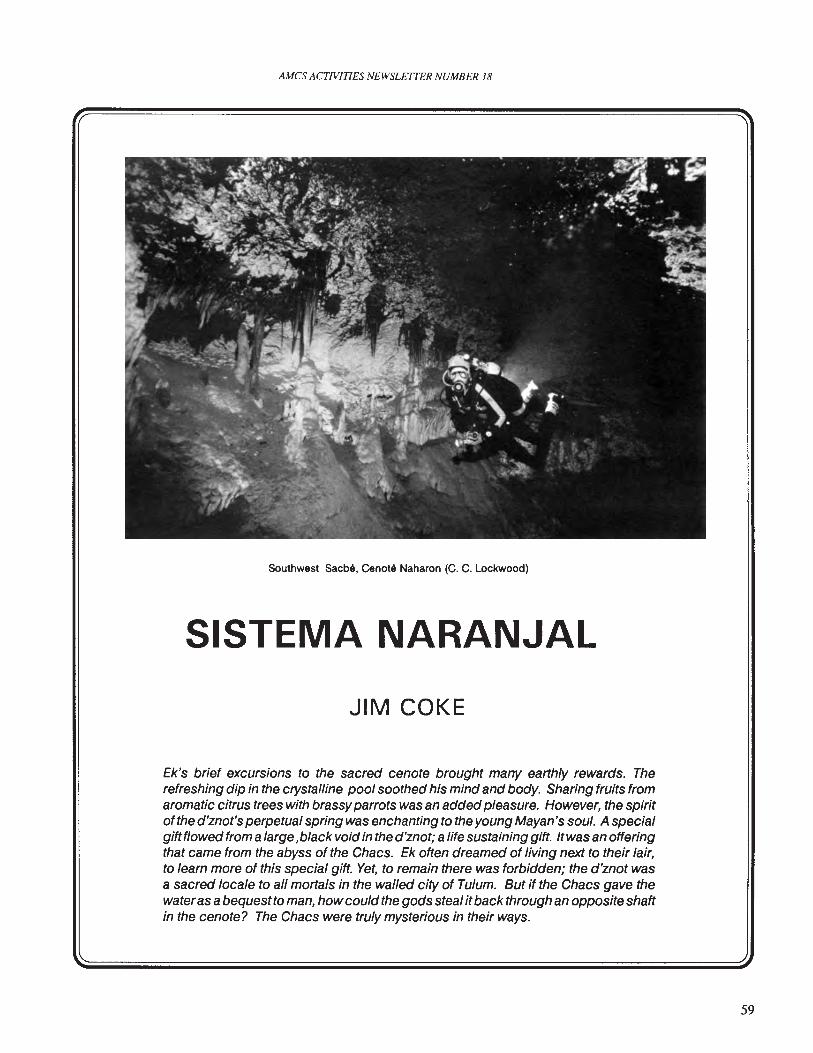
AMCS ACTIVITIES NEWSLETTER NUMBER 18
Southwest Sacba, Cenota Naharon (C. C. Lockwood)
SISTEMA NARANJAL
JIM COKE
Ek's brief excursions to the sacred cenote brought many earthly rewards. Therefreshing dip in the crystalline pool soothed his mind and body. Sharing fruits fromaromatic citrus trees with brassyparrots was an added pleasure. However, the spiritof the d'znot's perpetual spring was enchanting to the young Mayan's soul. A specialgiftt/owed from a large ,black void in the d'znot; a life sustaining gift. Itwas an offeringthat came from the abyss of the Chacs. Ek often dreamed of living next to their lair,to learn more of this special gift. Yet, to remain there was forbidden; the d'znot wasa sacred locale to all mortals in the walled city of Tulum. But if the Chacs gave thewateras abequestto man, howcould the gods steal it back through an opposite shaftin the cenote? The Chacs were truly mysterious in their ways.
59
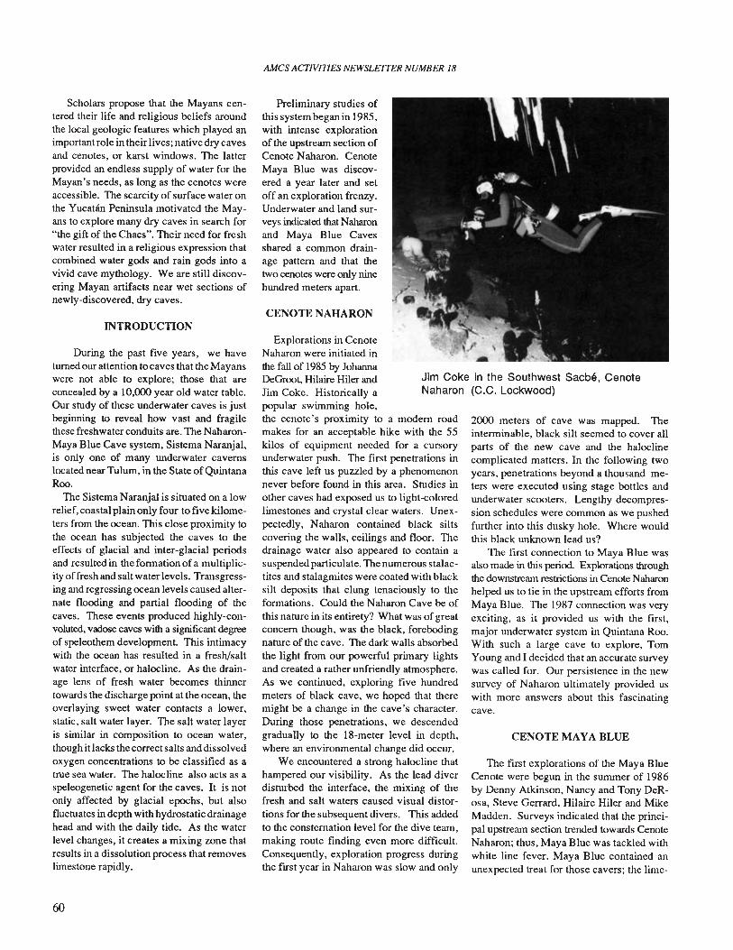
AMes ACTIVITIES NEWSLETTER NUMBER 18
Jim Coke in the Southwest Sacbe, CenoteNaharon (C.C. Lockwood)
Scholars propose that the Mayans centered their life and religious beliefs aroundthe local geologic features which played animportant role in their lives; native dry cavesand cenotes, or karst windows. The latterprovided an endless supply of water for theMayan's needs, as long as the cenotes wereaccessible. The scarcity of surface water onthe Yucatan Peninsula motivated the Mayans to explore many dry caves in search for"the gift of the Chacs". Their need for freshwater resulted in a religious expression thatcombined water gods and rain gods into avivid cave mythology. We are still discovering Mayan artifacts near wet sections ofnewly-discovered, dry caves.
INTRODUCTION
During the past five years, we haveturned our attention to caves that the Mayanswere not able to explore; those that areconcealed by a 10,000 year old water table.Our study of these underwater caves is justbeginning to reveal how vast and fragilethese freshwater conduits are. The NaharonMaya Blue Cave system, Sistema Naranjal,is only one of many underwater cavernslocated near Tulum, in the State of QuintanaRoo.
The Sistema Naranjal is situated on a lowrelief, coastal plain only four to five kilometers from the ocean. This close proximity tothe ocean has subjected the caves to theeffects of glacial and inter-glacial periodsand resulted in the formation of a multiplicity of fresh and salt water levels. Transgressing and regressing ocean levels caused alternate flooding and partial flooding of thecaves. These events produced highly-convoluted, vadose caves with a significant degreeof speleothem development. This intimacywith the ocean has resulted in a fresh/saltwater interface, or halocline. As the drainage lens of fresh water becomes thinnertowards the discharge point at the ocean, theoverlaying sweet water contacts a lower,static, salt water layer. The salt water layeris similar in composition to ocean water,though it lacks the correct salts and dissolvedoxygen concentrations to be classified as atrue sea water. The halocline also acts as aspeleogenetic agent for the caves. It is notonly affected by glacial epochs, but alsofluctuates in depth with hydrostatic drainagehead and with the daily tide. As the waterlevel changes, it creates a mixing zone thatresults in a dissolution process that removeslimestone rapidly.
60
Preliminary studies ofthis system began in 1985,with intense explorationof the upstream section ofCenote Naharon. CenoteMaya Blue was discovered a year later and setoff an exploration frenzy.Underwater and land surveys indicated that Naharonand Maya Blue Cavesshared a common drainage pattern and that thetwo cenotes were only ninehundred meters apart.
CENOTE NAHARON
Explorations in CenoteNaharon were initiated inthe fall of 1985 by JohannaDeGroot, Hilaire Hiler andJim Coke. Historically apopular swimming hole,the cenote's proximity to a modem roadmakes for an acceptable hike with the 55kilos of equipment needed for a cursoryunderwater push. The first penetrations inthis cave left us puzzled by a phenomenonnever before found in this area. Studies inother caves had exposed us to light-<:oloredlimestones and crystal clear waters. Unexpectedly, Naharon contained black siltscovering the walls, ceilings and floor. Thedrainage water also appeared to contain asuspendedparticulate. The numerous stalactites and stalagmites were coated with blacksilt deposits that clung tenaciously to theformations. Could the Naharon Cave be ofthis nature in its entirety? What was ofgreatconcern though, was the black, forebodingnature of the cave. The dark walls absorbedthe light from our powerful primary lightsand created a rather unfriendly atmosphere.As we continued, exploring five hundredmeters of black cave, we hoped that theremight be a change in the cave's character.During those penetrations, we descendedgradually to the 18-meter level in depth,where an environmental change did occur.
We encountered a strong halocline thathampered our visibility. As the lead diverdisturbed the interface, the mixing of thefresh and salt waters caused visual distortions for the subsequent divers. This addedto the consternation level for the dive team,making route finding even more difficult.Consequently, exploration progress duringthe first year in Naharon was slow and only
2000 meters of cave was mapped. Theinterminable, black silt seemed to cover allparts of the new cave and the haloclinecomplicated matters. In the following twoyears, penetrations beyond a thousand meters were executed using stage bottles andunderwater scooters. Lengthy decompression schedules were common as we pushedfurther into this dusky hole. Where wouldthis black unknown lead us?
The first connection to Maya Blue wasalso made in this period. Explorations throughthe downstream restrictions in Cenote Naharonhelped us to tie in the upstream efforts fromMaya Blue. The 1987 connection was veryexciting, as it provided us with the first,major underwater system in Quintana Roo.With such a large cave to explore, TomYoung and I decided that an accurate surveywas called for. Our persistence in the newsurvey of Naharon ultimately provided uswith more answers about this fascinatingcave.
CENOTE MAYA BLUE
The first explorations of the Maya BlueCenote were begun in the summer of 1986by Denny Atkinson, Nancy and Tony DeRosa, Steve Gerrard, Hilaire Hiler and MikeMadden. Surveys indicated that the principal upstream section trended towards CenoteNaharon; thus, Maya Blue was tackled withwhite line fever. Maya Blue contained anunexpected treat for those cavers; the lime-
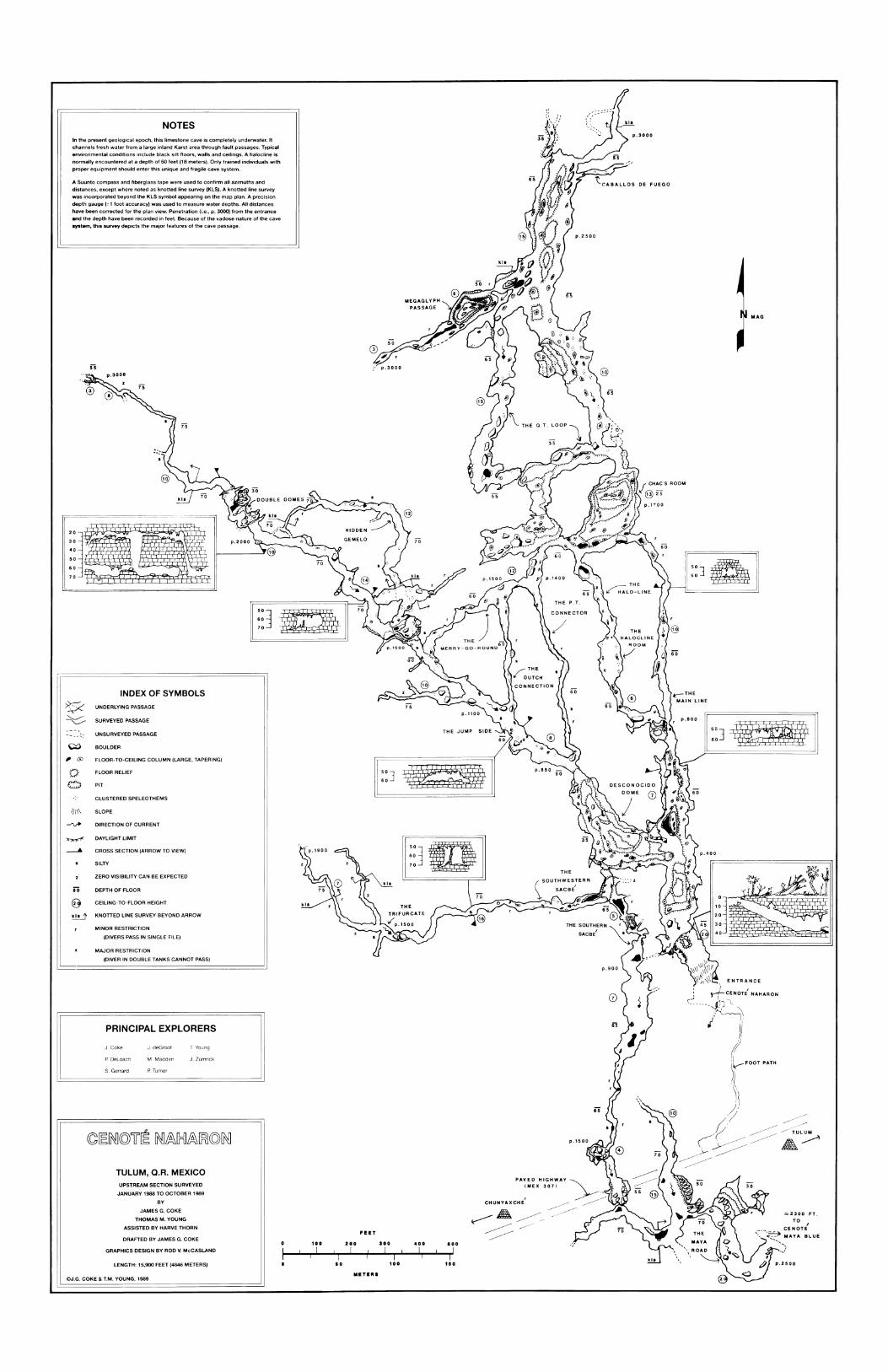
MEGAGLYPH
PASSAGE
ZERO VISIBILITY CAN BE EXPECTED
MAG
ENTRANCE
l:JAI
z2300 FT.
TO I
CENOTE---:':=3 MAYA BLUE
'- ..........}
-'
rJ
yf- CE NOT~',u.u,j:-;" NAHARON
.// "\
.;/~\
, ''j).
(()l--FOOT PATH
,(~'
, ~),'/
.~ ~~:;=:~/;::: /~ TULUM
?~ A~
DE FUEGO
p.3000
p.900
PAVED HIGHWAYIMEX 307) ~
CHUNYAXCHE' ~~A~~=/~""~ ~//
~
I::]~I
kls
FEET
o 100 200 100 400 aooI I! I ! I I Iiii i i
o ao 100 no
METE'"
J, Zumrlck
T Young
M, Madden
p, Turner
J, deGroot
LENGTH: 15,900 FEET (4846 METERS)
UPSTREAM SECTION SURVEYED
JANUARY 1988 TO OCTOBER 1989
BY
JAMES G. COKE
THOMAS M. YOUNG
ASSISTED BY HARVE THORN
DRAFTED BY JAMES G. COKE
GRAPHICS DESIGN BY ROD V. McCASLAND
J, Coke
TULUM, Q.R. MEXICO
PRINCIPAL EXPLORERS
p, Deloach
S, Gerrard
I;]~I
IIINDEX OF SYMBOLS
UNDERLYING PASSAGE I
SURVEYED PASSAGE
UNSURVEYED PASSAGE
PIT
CLUSTERED SPELEOTHEMS
BOULDER
FLOOR RELIEF
MAJOR RESTRICTION
(DIVER IN DOUBLE TANKS CANNOT PASS)
FLOOR-TO-CEILING COLUMN (LARGE, TAPERING)
CEllING-TO-FLOOR HEIGHT
~~[N]©lF~ [N]~[}={]~~©[N]
iO DEPTH OF FLOOR
~ KNOTTED LINE SURVEY BEYOND ARROW
MINOR RESTRICTION
(DIVERS PASS IN SINGLE FILE)
@
SILTY
//\\\ SLOPE
In the present geological epoch, this limestone cave is completely underwater. It
channels fresh water from a large inland Karst area through fault passages. Typical
environmental conditions include black silt floors, walls and ceilings. A halocline is
normally encountered at a depth of 60 feet (18 meters). Only trained individuals with
proper equipment should enter this unique andiragile cave system.
A Suunto compass and fiberglass tape were used to confirm all azimuths and
distances, except where noted as knotted line survey (KLS). A knotted line survey
was incorporated beyond the KLS symbol appearing on the map plan. A precision
depth gauge (+ 1 foot accuracy) was used to measure water depths. All distances
have been corrected for the plan view. Penetration (i.e., p. 3000) from the entrance
and the depth have been recorded in feet. Because of the vadose nature of the cave
system, this survey depicts the major features of the cave passage.
i~J
NOTES
o~
~
~ DIRECTION OF CURRENT
©J.G. COKE & T.M. YOUNG, 1989
~ DAYLIGHT LIMIT
----A CROSS SECTION (ARROW TO VIEW)
-- ...... ~:
, C!)
~~

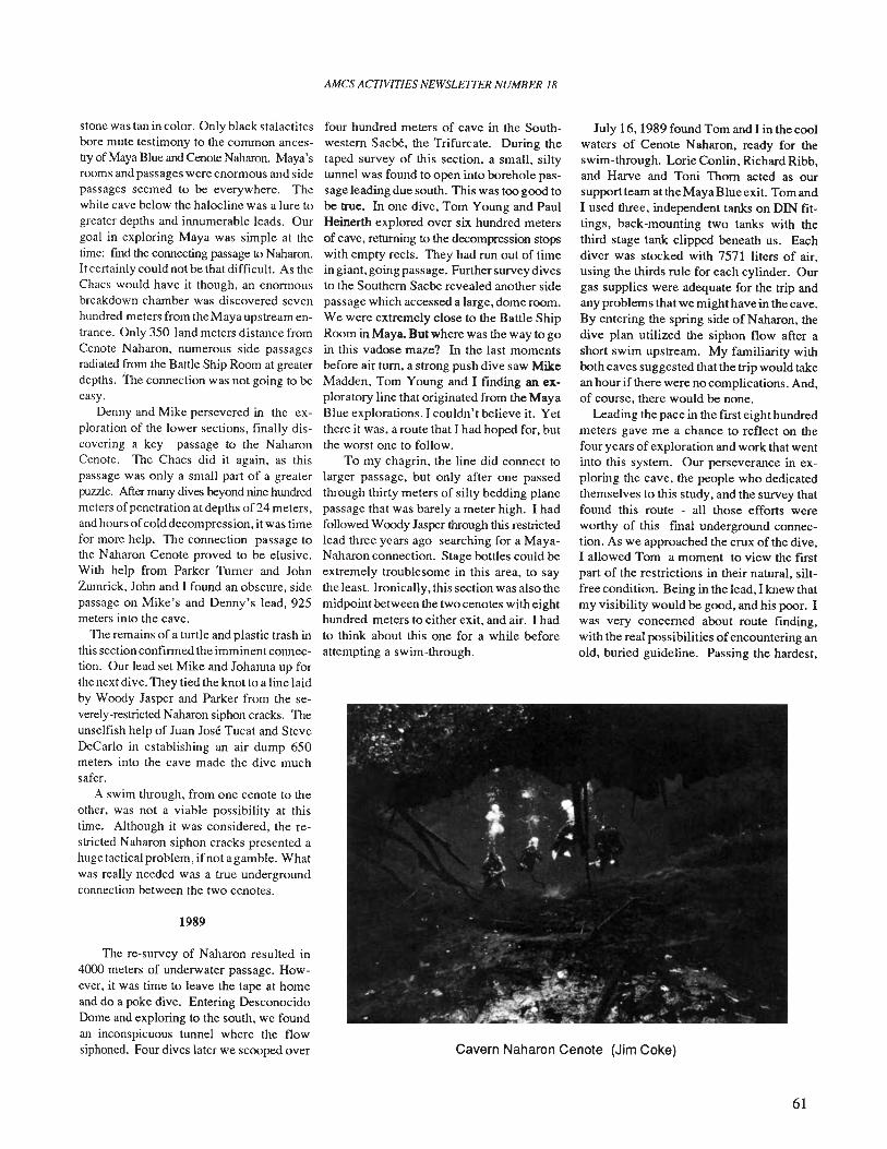
Cavern Naharon Cenote (Jim Coke)
stone was tan in color. Only black stalactitesbore mute testimony to the common ancestry of Maya Blue and CenoteNaharon. Maya'srooms and passages were enonnous and sidepassages seemed to be everywhere. Thewhite cave below the halocline was a lure togreater depths and innumerable leads. Ourgoal in exploring Maya was simple at thetime: fmd the connecting passage to Naharon.Itcertainly could not be that difficult. As theChacs would have it though, an enonnousbreakdown chamber was discovered sevenhundred meters from the Maya upstream entrance. Only 350 land meters distance fromCenote Naharon, numerous side passagesradiated from the Battle Ship Room at greaterdepths. The connection was not going to beeasy.
Denny and Mike persevered in the exploration of the lower sections, finally discovering a key passage to the NaharonCenote. The Chacs did it again, as thispassage was only a small part of a greaterpuuJe. After many dives beyond nine hundredmeters ofpenetration at depths of 24 meters,and hours ofcold decompression, it was timefor more help. The connection passage tothe Naharon Cenote proved to be elusive.With help from Parker Turner and JohnZumrick, Jolm and I found an obscure, sidepassage on Mike's and Denny's lead, 925meters into the cave.
The remains of a turtle and plastic trash inthis section confinned the imminent connection. Our lead set Mike and Johanna up forthe next dive. They tied the knot to a line laidby Woody Jasper and Parker from the severely-restricted Naharon siphon cracks. Theunselfish help of Juan Jose Tucat and SteveDeCarlo in establishing an air dump 650meters into the cave made the dive muchsafer.
A swim through, from one cenote to theother, was not a viable possibility at thistime. Although it was considered, the restricted Naharon siphon cracks presented ahuge tactical problem, ifnot a gamble. Whatwas really needed was a true undergroundconnection between the two cenotes.
1989
The re-survey of Naharon resulted in4000 meters of underwater passage. However, it was time to leave the tape at homeand do a poke dive. Entering DesconocidoDome and exploring to the south, we foundan inconspicuous tunnel where the flowsiphoned. Four dives later we scooped over
AMes ACTIVITIES NEWSLFlTER NUMBER 18
four hundred meters of cave in the Southwestern Sacl,e, the Trifurcate. During thetaped survey of this section, a small, siltytunnel was found to open into borehole passage leading due south. This was too good tobe true. In one dive. Tom Young and PaulHeinerth explored over six hundred metersof cave, returning to the decompression stopswith empty reels. They had run out of timein giant, going passage. Further survey divesto the Southern Sacbe revealed another sidepassage which accessed a large, dome room.We were extremely close to the Battle ShipRoom in Maya. But where was the way to goin this vadose maze? In the last momentsbefore air tum, a strong push dive saw MikeMadden, Tom Young and I finding an exploratory line that originated from the MayaBlue explorations. I couldn't believe it. Yetthere it was, a route that I had hoped for, butthe worst one to follow.
To my chagrin. the line did connect tolarger passage, but only after one passedthrough thirty meters of silty bedding planepassage that was barely a meter high. I hadfollowed Woody Jasper through this restrictedlead three years ago searching for a MayaNaharon connection. Stage bottles could beextremely troublesome in this area, to saythe least. Ironically, this section was also themidpoint between the two cenotes with eighthundred meters to either exit, and air. I hadto think about this one for a while beforeattempting a swim-through.
July 16, 1989 found Tom and I in the coolwaters of Cenote Naharon, ready for theswim-through. Lorie Conlin, Richard Ribb,and Harve and Toni Thorn acted as oursupportteam at the Maya Blueexit. Tom andI used three, independent tanks on DIN fittings, back-mounting two tanks with thethird stage tank clipped beneath us. Eachdiver was stocked with 7571 liters of air,using the thirds rule for each cylinder. Ourgas supplies were adequate for the trip andany problems that we might have in the cave.By entering the spring side of Naharon, thedive plan utilized the siphon flow after ashort swim upstream. My familiarity withboth caves suggested that the trip would takean hour if there were no complications. And,of course, there would be none.
Leading the pace in the first eight hundredmeters gave me a chance to reflect on thefour years of exploration and work that wentinto this system. Our perseverance in exploring the cave, the people who dedicatedthemselves to this study, and the survey thatfound this route - all those efforts wereworthy of this final underground connection. As we approached the crux of the dive,I allowed Tom a moment to view the frrstpart of the restrictions in their natural, siltfree condition. Being in the lead, I knew thatmy visibility would be good, and his poor. Iwas very concerned about route finding,with the real possibilities ofencountering anold, buried guideline. Passing the hardest,
61
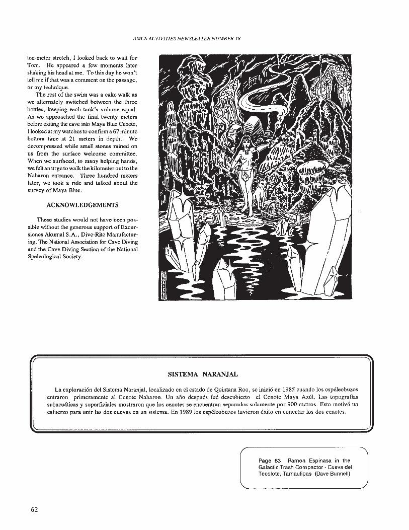
AMCS ACTIVITIES NEWSLETTER NUMBER 18
ten-meter stretch, I looked back to wait forTom. He appeared a few moments latershaking his head at me. To this day he won'ttell me if that was a comment on the passage,or my technique.
The rest of the swim was a cake walk aswe alternately switched between the threebottles, keeping each tank's volume equal.As we approached the fmal twenty metersbefore exiting the cave into Maya Blue Cenote,I looked at my watches to confirm a 67 minutebottom time at 21 meters in depth. Wedecompressed while small stones rained onus from the surface welcome committee.When we surfaced, to many helping hands,we felt an urge to walk the kilometer out to theNaharon entrance. Three hundred meterslater, we took a ride and talked about thesurvey of Maya Blue.
ACKNOWLEDGEMENTS
These studies would not have been possible without the generous support of Excursiones Akumal S.A., Dive-Rite Manufacturing, The National Association for Cave Divingand the Cave Diving Section of the NationalSpeleological Society.
SISTEMA NARANJAL
La exploraci6n del Sistema Naranjal,localizado en el estado de Quintana Roo, se inici6 en 1985 cuando los espeleobuzosentraron primeramente al Cenote Naharon. Un ano despues fue descubierto el Cenote Maya Azul. Las topograffassubacwlticas y superfIciales mostraron que los cenotes se encuentran separados solamente por 900 metros. Esto motiv6 unesfuerzo para unir las dos cuevas en un sistema. En 1989 los espeleobuzos tuvieron exito en conectar los dos cenotes.
62
Page 63 Ramon Espinasa in theGalactic Trash Compactor - Cueva delTecolote, Tamaulipas (Dave Bunnell)
AMes ACfWITIES NEWSLE1TER NUMBER 18
63
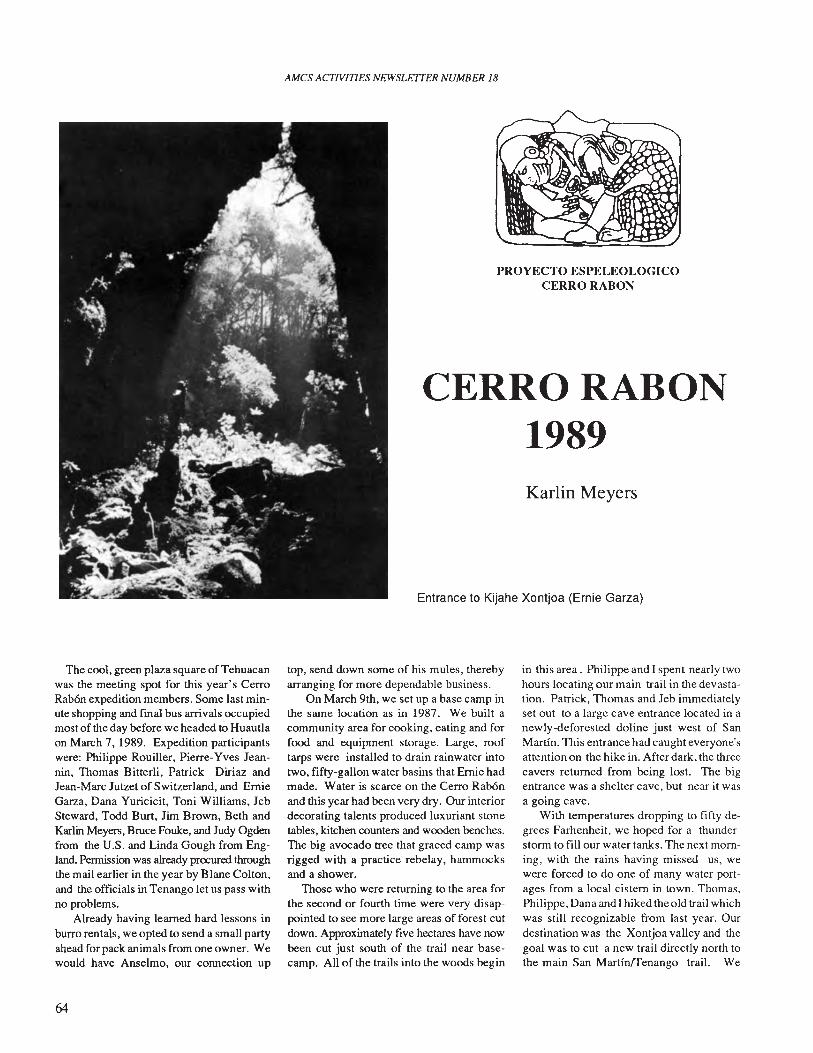
AMes ACTNITIES NEWSLETTER NUMBER 18
PROYECTO ESPELEOLOGICOCERRO RABON
CERRO RABON1989Karlin Meyers
Entrance to Kijahe Xontjoa (Ernie Garza)
The cool, green plaza square ofTehuacanwas the meeting spot for this year's CerroRabon expedition members. Some last minute shopping and fmal bus arrivals occupiedmost of the day before we headed to Huautlaon March 7, 1989. Expedition participantswere: Philippe Rouiller, Pierre-Yves Jeannin, Thomas Bitterli, Patrick Diriaz andJean-Marc Jutzet of Switzerland, and ErnieGarza, Dana Yuricicit, Toni Williams, JebSteward, Todd Burt, Jim Brown, Beth andKarlin Meyers, Bruce Fouke, and Judy Ogdenfrom the U.S. and Linda Gough from England. Permission was already procured throughthe mail earlier in the year by Blane Colton,and the officials in Tenango let us pass withno problems.
Already having learned hard lessons inburro rentals, we opted to send a small partyahead for pack animals from one owner. Wewould have Anselmo, our connection up
64
top, send down some of his mules, therebyarranging for more dependable business.
On March 9th, we set up a base camp inthe same location as in 1987. We built acommunity area for cooking, eating and forfood and equipment storage. Large, rooftarps were installed to drain rainwater intotwo, fifty-gallon water basins that Ernie hadmade. Water is scarce on the Cerro RabOnand this year had been very dry. Our interiordecorating talents produced luxuriant stonetables, kitchen counters and wooden benches.The big avocado tree that graced camp wasrigged with a practice rebelay, hammocksand a shower.
Those who were returning to the area forthe second or fourth time were very disappointed to see more large areas of forest cutdown. Approximately five hectares have nowbeen cut just south of the trail near basecamp. All of the trails into the woods begin
in this area. Philippe and I spent nearly twohours locating our main trail in the devastation. Patrick, Thomas and Jeb immediatelyset out to a large cave entrance located in anewly-deforested doline just west of SanMartin. This entrance had caught everyone'sattention on the hike in. After dark, the threecavers returned from being lost. The bigentrance was a shelter cave, but near it wasa going cave.
With temperatures dropping to fifty degrees Farhenheit, we hoped for a thunderstorm to fill our water tanks. The next morning, with the rains having missed us, wewere forced to do one of many water portages from a local cistern in town. Thomas.Philippe, Dana and I hiked the old trail whichwas still recognizable from last year. Ourdestination was the Xontjoa valley and thegoal was to cut a new trail directly north tothe main San Martin/Tenango trail. We
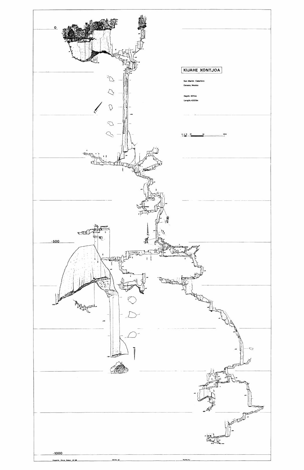
~
Depth:-973m
Length: 4300m
San Martin Caballero
Oaxaca, Mexico
i•.... ,; .~. '."': '. ".;. . ,..~ ,'. !. :,:;
0J.
:~
·~
I \)'\ .'
~

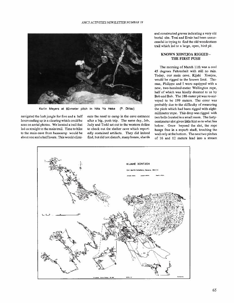
AMes ACTlVlTIES NEWSLETTER NUMBER 18
Karlin Meyers at 6O-meter pitch in Nita Ya Heke (P. Diriaz)
navigated the lush jungle for five and a halfhours ending up in a clearing which could beseen on aerial photos. We located a trail thatled us straight to the main trail. Time to hiketo the main cave from basecamp would beabout one and a halfhours. This would elimi-
nate the need to camp in the cave entranceafter a big, push trip. The same day, Jeb,Judy and Todd set out to the western dolineto check out the shelter cave which reportedly contained artifacts. They did indeedfind, but did not disturb, many bones, shards
KIJAHE XONTJOA
and constructed graves indicating a very oldburial site. Toni and Ernie had been unsuccessful in trying to fmd the old woodcutterstrail which led to a large, open, bird pit.
KNOWN XONTJOA RIGGED·THE FIRST PUSH
The morning of March 11th was a cool45 degrees Fahrenheit with still no rain.Today, our main cave, Kijahi Xontjoa,would be rigged to the known limit. Thomas, Philippe and I were equipped with anew, two-hundred-meter Wellington rope,half of which was kindly donated to us byBob and Bob. The 188-meterpitwas re-surveyed to be 199 meters. The error wasprobably due to the difficulty of measuringthe pitch which had been rigged with eightmillimeter rope. This drop was rigged withtwo bolts located in a small room. The fortycentimeter slot gives little hint as to what liesbelow. Once beyond the slot, the ropehangs free in a superb shaft, touching thewall only at the bottom. The next two pitchesof 16 and 12 meters lead into a stream
65
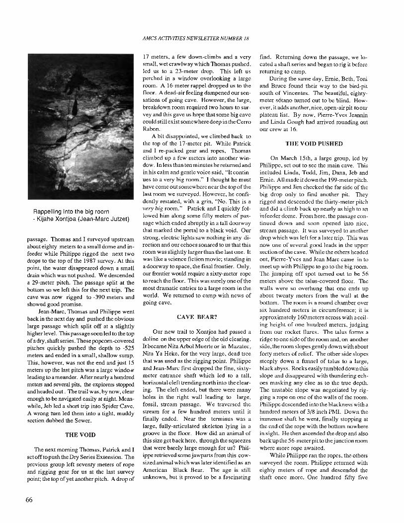
Rappelling into the big room- Kijahe Xontjoa (Jean-Marc Jutzet)
passage. Thomas and I surveyed upstreamabout eighty meters to a small dome and infeeder while Philippe rigged the next twodrops to the top of the 1987 survey. At thispoint, the water disappeared down a smalldrain which was not pushed. We descendeda 29-meter pitch. The passage split at thebottom so we left this for the next trip. Thecave was now rigged to -390 meters andshowed good promise.
Jean-Marc, Thomas and Philippe wentback in the next day and pushed the obviouslarge passage which split off at a slightlyhigher level. This passage soon led to the topofa dry, shaft series. These popcorn-coveredpitches quickly pushed the depth to -525meters and ended in a small, shallow sump.This, however, was not the end and just 15meters up the last pitch was a large windo>\'leading to a meander. After nearly a hundredmeters and several pits, the explorers stoppedand headed out. The trail was, by now, clearenough to be navigated easily at night. Meanwhile, Jeb led a short trip into Spider Cave.A wrong turn led them into a tight, muddysection dubbed the Sewer.
THE VOID
The next morning Thomas, Patrick and Iset off to push the Dry Series Extension. Theprevious group left seventy meters of ropeand rigging gear for us at the last surveypoint; the top ofyet another pitch. A drop of
66
AMes ACTIVITIES NEWSLE1TER NUMBER 18
17 meters, a few down-climbs and a verysmall, wet crawlway which Thomas pushed,led us to a 23-meter drop. This left usperched in a window overlooking a largeroom. A 16-meter rappel dropped us to thefloor. A dead-air feeling dampened our sensations of going cave. However, the large,breakdown room required two hours to survey and this gave us hope that some big cavecould still exist somewhere deep in the CerroRabon.
A bit disappointed, we climbed back tothe top of the 17-meter pit. While Patrickand I re-packed gear and ropes, Thomasclimbed up a few meters into another window. In less than ten minutes he returned andin his calm and gentle voice said, "It continues to a very big room." I thought he musthave come out somewhere near the top of thelast room we surveyed. However, he confidently restated, with a grin, "No. This is avery big room." Patrick and I quickly followed him along some fifty meters of passage which ended abruptly in a tall doorwaythat marked the portal to a black void. Ourstrong, electric lights saw nothing in any direction and our echoes sonared to us that thisroom was slightly larger than the last one. Itwas like a science fiction movie; standing ina doorway to space, the final frontier. Only,our frontier would require a sixty-meter ropeto reach the floor. This was surely one of themost dramatic entries to a large room in theworld. We returned to camp with news ofgoing cave.
CAVE BEAR?
Our new trail to Xontjoa had passed adoline on the upper edge of the old clearing.Itbecame Nita Arbol Muerte or in Mazatec,Nita Ya Heke, for the very large, dead treethat was used as the rigging point. Philippeand Jean-Marc frrst dropped the fine, sixtymeter entrance shaft which led to a tall,horizontal cleft trending north into the clearing. The cleft ended, but there were manyholes in the right wall leading to large,fossil, stream passage. We traversed thestream for a few hundred meters until itfmally ended. Near the terminus was alarge, fully-articulated skeleton lying in agroove in the floor. How did an animal ofthis size get back here, through the squeezesthat were barely large enough for us? Philippe retrieved some jawparts from this cowsized animal which was later identified as anAmerican Black Bear. The age is stillunknown, but it proved to be a fascinating
fmd. Returning down the passage, we located a shaft series and began to rig it beforereturning to camp.
During the same day, Ernie, Beth, Toniand Bruce found their way to the bird-pitsouth of Vincentes. The beautiful, eightymeter s6tano turned out to be blind. However, it adds another, nice, open-air pit to ourplateau list. By now, Pierre-Yves Jeanninand Linda Gough had arrived rounding outour crew at 16.
THE VOID PUSHED
On March 15th, a large group, led byPhilippe, set out to see the main cave. Thisincluded Linda, Todd, Jim, Dana, Jeb andErnie. All made itdown the 199-meterpitch.Philippe and Jim checked the far side of thebig drop only to fmd another pit. Theyrigged and descended the thirty-meter pitchand did a climb back up nearly as high to aninfeeder dome. From here, the passage continued down and soon opened into nice,stream passage. It was surveyed to anotherdrop which was left for a later trip. This wasnow one of several good leads in the uppersection of the cave. While the others headedout, Pierre-Yves and Jean Marc came in tomeet up with Philippe to go to the big room.The jumping off spot turned out to be 56meters above the talus-covered floor. Thewalls were so overhung that one ends upabout twenty meters from the wall at thebottom. The room is a round chamber oversix hundred meters in circumference; it isapprox imately 160 meters across with a ceiling height of one hundred meters, judgingfrom our rocket flares. The talus forms aridge to one side of the room and, on anotherside, the room slopes gently down with aboutforty meters of relief. The other side slopessteeply down a funnel of talus to a large,black abyss. Rocks easily tumbled down thisslope and disappeared with thundering echoes masking any clue as to the true depth.The unstable slope was negotiated by rigging a rope on one of the walls of the room.Philippe descended into the blackness with ahundred meters of 3/8 inch PMI. Down theimmense shaft he went, finally stopping atthe end of the rope with the bottom nowherein sight. He then ascended the drop and alsoback up the 56-meter pit to thejunction roomwhere more rope awaited.
While Philippe ran the ropes, the otherssurveyed the room. Philippe returned witheighty meters of rope and descended theshaft once more. One hundred fifty five
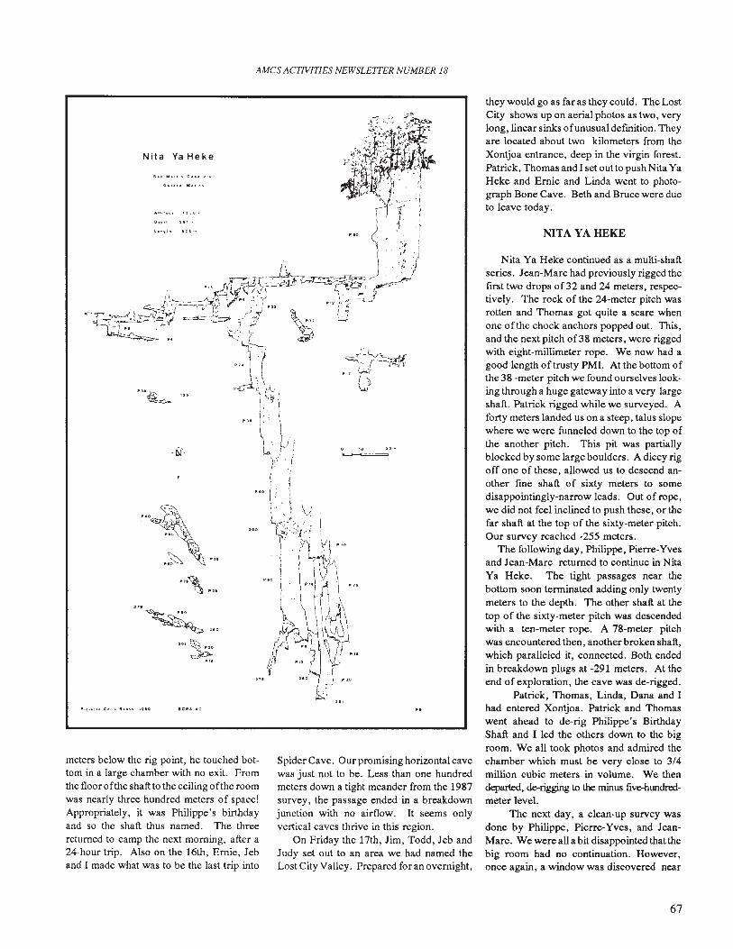
AMes ACTIVITIES NEWSLETTER NUMBER 18
Nita Va Heke
t. ~9' h
":URJ~']$
. b)'.
"'~'>"'"- ..~~ ~..,'0-..- >- '",.e~
...~~l"H
~~'~
,.. ~'"~...
,.,., .... c.". 1II." ... "Ill
meters below the rig point, he touched bottom in a large chamber with no exit. Fromthe floor ofthe shaft to the ceiling ofthe roomwas nearly three hundred meters of space!Appropriately, it was Philippe's birthdayand so the shaft thus named. The threereturned to camp the next morning, after a24-hour trip. Also on the 16th, Ernie, Jeband I made what was to be the last trip into
~.
--.-r- .-......:" ..:.. ...,
Spider Cave. Our promising horizontal cavewas just not to be. Less than one hundredmeters down a tight meander from the 1987survey, the passage ended in a breakdownjunction with no airflow. It seems onlyvertical caves thrive in this region.
On Friday the 17th, Jim, Todd, Jeb andJudy set out to an area we had named theLost City Valley. Prepared for an overnight,
they would go as far as they could. The LostCity shows up on aerial photos as two, verylong, linear sinks 0 f unusual defmition. Theyare located about two kilometers from theXontjoa entrance, deep in the virgin forest.Patrick, Thomas and I set out to push Nita YaHeke and Ernie and Linda went to photograph Bone Cave. Beth and Bruce were dueto leave today.
NITA VA HEKE
Nita Ya Heke continued as a multi-shaftseries. Jean-Marc had previously rigged theflfst two drops of32 and 24 meters, respectively. The rock of the 24-meter pitch wasrotten and Thomas got quite a scare whenone of the chock anchors popped out. This,and the next pitch of38 meters, were riggedwith eight-millimeter rope. We now had agood length of trusty PMI. At the bottom ofthe 38 -meter pitch we found ourselves looking through a huge gateway into a very largeshaft. Patrick rigged while we surveyed. Aforty meters landed us on a steep, talus slopewhere we were funneled down to the top ofthe another pitch. This pit was partiallyblocked by some large boulders. A dicey rigoff one of these, allowed us to descend another flOe shaft of sixty meters to somedisappointingly-narrow leads. Out of rope,we did not feel inclined to push these, or thefar shaft at the top of the sixty-meter pitch.Our survey reached -255 meters .
The following day, Philippe, Pierre-Yvesand Jean-Marc returned to continue in NitaYa Heke. The tight passages near thebottom soon terminated adding only twentymeters to the depth. The other shaft at thetop of the sixty-meter pitch was descendedwith a ten-meter rope. A 78-meter pitchwas encountered then, another broken shaft,which paralleled it, connected. Both endedin breakdown plugs at -291 meters. At theend of exploration, the cave was de-rigged.
Patrick, Thomas, Linda, Dana and Ihad entered Xontjoa. Patrick and Thomaswent ahead to de-rig Philippe's BirthdayShaft and I led the others down to the bigroom. We all took photos and admired thechamber which must be very close to 3/4million cubic meters in volume. We thendeparted, de--rigging to the minus five--hundredmeter level.
The next day, a clean-up survey wasdone by Philippe, Pierre-Yves, and JeanMarc. We were all a bit disappointed that thebig room had no continuation. However,once again, a window was discovered near
67
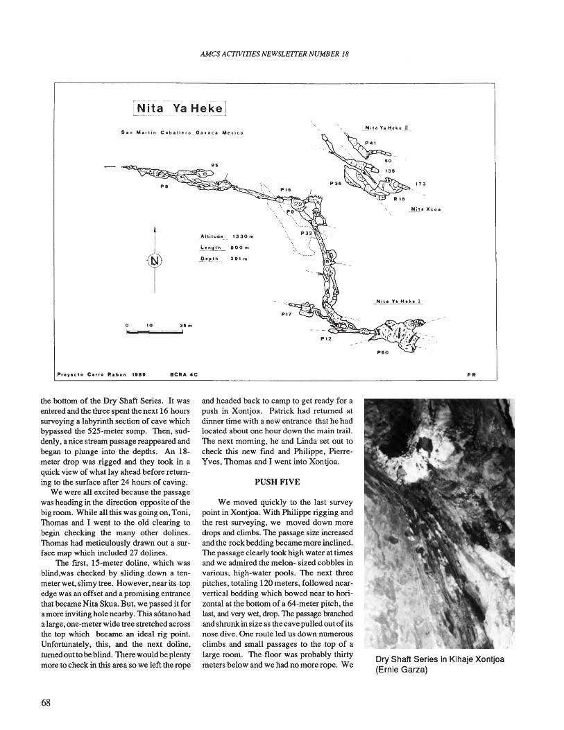
AMes ACTIVITIES NEWSLE1TER NUMBER 18
l~ita .Va He~~J
P8
P80
\ _~~._~c_o_.__,
_Nita Ya "eke I
Nita Ya Heke II
'0 28 m
Siii...........iiiiiiiiiiii=d=do
San Martin Cab.ll~ro Oa.aca Mexico
Proyeeto Cerro Rabon 1080 SCRA 4C PR
the bottom of the Dry Shaft Series. It wasentered and the three spent the next 16 hourssurveying a labyrinth section of cave whichbypassed the 525-meter sump. Then, suddenly, a nice stream passage reappeared andbegan to plunge into the depths. An 18meter drop was rigged and they took in aquick view of what lay ahead before returning to the surface after 24 hours of caving.
We were all excited because the passagewas heading in the direction opposite of thebig room. While all this was going on, Toni,Thomas and I went to the old clearing tobegin checking the many other dolines.Thomas had meticulously drawn out a surface map which included 27 dolines.
The fIrst, 15-meter doline, which wasblind,was checked by sliding down a tenmeter wet, slimy tree. However, near its topedge was an offset and a promising entrancethat became Nita Skua. But, we passed it fora more inviting hole nearby. This s6tano hada large, one-meter wide tree stretched acrossthe top which became an ideal rig point.Unfortunately, this, and the next doline,turnedoutto beblind. There would be plentymore to check in this area so we left the rope
and headed back to camp to get ready for apush in Xontjoa. Patrick had returned atdinner time with a new entrance that he hadlocated about one hour down the main trail.The next morning, he and Linda set out tocheck this new fmd and Philippe, PierreYves, Thomas and I went into Xontjoa.
PUSH FIVE
We moved quickly to the last surveypoint in Xontjoa. With Philippe rigging andthe rest surveying, we moved down moredrops and climbs. The passage size increasedand the rock bedding became more inclined.The passage clearly took high water at timesand we admired the melon- sized cobbles invarious, high-water pools. The next threepitches, totaling 120 meters, followed nearvertical bedding which bowed near to horizontal at the bottom of a 64-meter pitch, thelast, and very wet, drop. The passage branchedand shrunk in size as the cave pulled out ofitsnose dive. One route led us down numerousclimbs and small passages to the top of alarge room. The floor was probably thirtymeters below and we had no more rope. We
Dry Shaft Series in Kihaje Xontjoa(Ernie Garza)
68
AMes ACflVlTlES NEWSLETTER NUMBER 18
returned to camp. Patrick and Linda alsoreturned, their cave bottoming out at nintymeters depth in a tight meander.
XONTJOA - PUSH SIX
On the 24th, the five Swiss left for the lastpush in Xontjoa. My foot disabled me, so Iwould miss out on this trip. The team wouldundoubtedly be moving fast. They took twohundred meters of eight-millimeter push ropeto continue from the -840 meter level. Thenext morning, Ernie hiked to the Lost Citywhile Anselmo came into camp and taught ushow to make baskets from philodendronvines. The deep team had not returned at11:00 a.m. so we guessed, optimistically,that they had gone much deeper.
At one p.m. they plodded into camp aftera 28-hour trip. The large room at -840meters was entered via a 32-meter pitch.The chamber measured forty meters acrossand had a series ofpitches and climbs whichended in tight passage at -897 meters. Themain split descended 13 meters to a crawlway,across a pool of water, and through a tightconstriction and another shaft was encountered. Beyond, the cave is wet and would beuncomfortable during higher water. A 15meter drop led to another drop of56 meters.A stream passage followed the bedding withmany plunge pools to climb around. Thestream dives down two more drops (13meters and 28 meters) to a sloped walkingpassage. A 12-meter drop leads to a sump at-973 meters, the deepest point of the cave.
CERRO RABON
At the top of the 12-meter pitch was,again, the omnipresent window that alwaysleads to more cave. This accessed a largegallery with two, horizontal tunnels takingoff into the blackness. These two passages,about four meters wide and three metershigh, looked very promising. The leadsmoved alot of air and the cavers anticipatedthat a great deal of time would be necessaryto throughly check them out. Perhaps, ajunction with another, larger cave was possible. The cavers stopped exploration andheaded out.
Everyone was elated with the new discovery and very curious as to what would liedown those tunnels. We broke camp and organized ourselves for the hike out, alreadyeager to return in the spring of 1991.
La planicie de Cerro Rabon esta situada a 300 km al SE de la Ciudad de Mexico en la Sierra Mazateca. Formacioneskarsticas esUin esparcidas y bien desarrolladas en esta area. Las cuevas hasta ahora deseubiertas han mostrado mascaracteristicas alpinas que las tfpicas para Mexico. Generalmente, presentan una serie cpmpleja de tiros separados pormeandros cortos. Frecuentemente, las cuevas intersectan galerias f6siles las cuales representan etapas antiguas de desarrollode las cavidades. La presente direcci6n de las corrientes de agua es todavfa desconocida.Sin embargo, una gran resurgenciase encuentra directamente al sur, en la base de la planicie. Se han descubierto muchas cuevas pequeiias. Algl1nas de las cuevasmas grandes pueden alcanzar 200 a 300 metros de profundidad. La extenci6n vertical del sistema principal es de -973 metros.
69
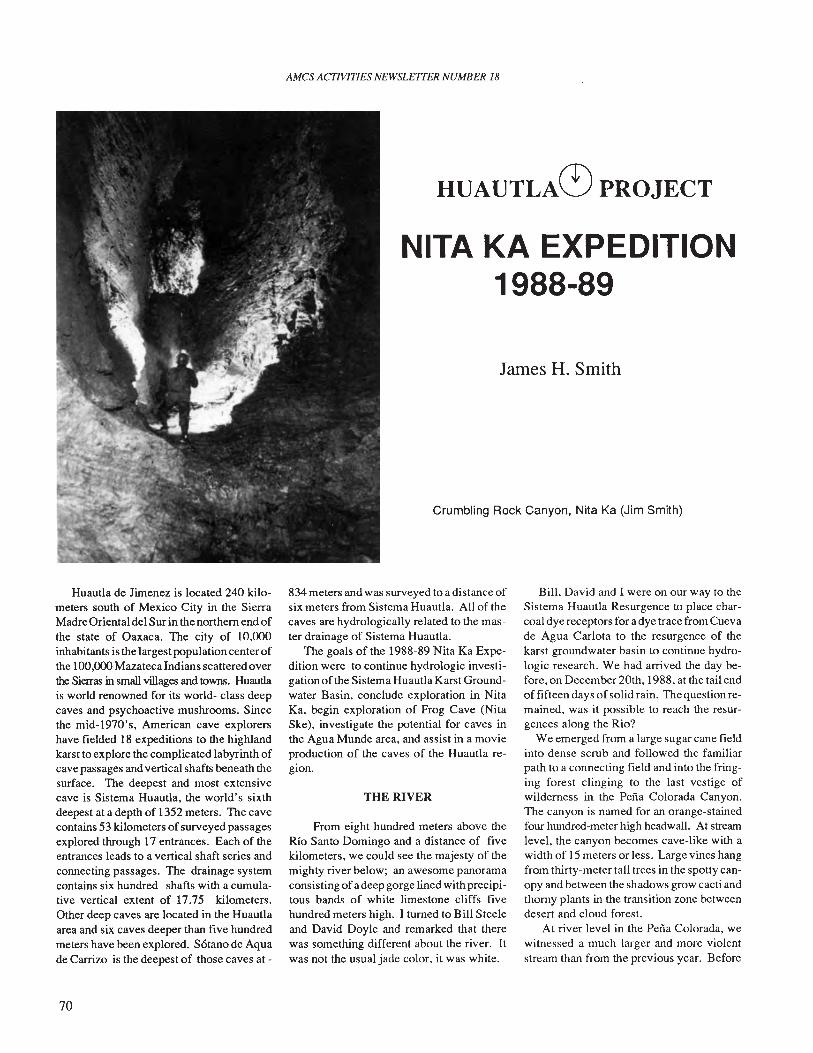
AMes ACTIVITIES NEWSLETTER NUMBER 18
HUAUTLAC':) PROJECT
NITA KA EXPEDITION1988·89
James H. Smith
Crumbling Rock Canyon, Nita Ka (Jim Smith)
Huautla de Jimenez is located 240 kilometers south of Mexico City in the SierraMadre Oriental del Sur in the northern end ofthe state of Oaxaca. The city of 10,000inhabitants is the largest populationcenter ofthe 100,000MazatecaIndians scattered overthe Sierras in small villages and towns. Huautlais world renowned for its world- class deepcaves and psychoactive mushrooms. Sincethe mid-1970's, American cave explorershave fielded 18 expeditions to the highlandkarst to explore the complicated labyrinth ofcave passages and vertical shafts beneath thesurface. The deepest and most extensivecave is Sistema Huautla, the world's sixthdeepest at a depth of 1352 meters. The cavecontains 53 kilometers ofsurveyed passagesexplored through 17 entrances. Each of theentrances leads to a vertical shaft series andconnecting passages. The drainage systemcontains six hundred shafts with a cumulative vertical extent of 17.75 kilometers.Other deep caves are located in the Huautlaarea and six caves deeper than five hundredmeters have been explored. Sotano de Aquade Carrizo is the deepest of those caves at -
70
834 meters and was surveyed to a distance ofsix meters from Sistema Huautla. All of thecaves are hydrologically related to the master drainage of Sistema Huautla.
The goals of the 1988-89 Nita Ka Expedition were to continue hydrologic investigation ofthe Sistema Huautla Karst Groundwater Basin, conclude exploration in NitaKa, begin exploration of Frog Cave (NitaSke), investigate the potentia] for caves inthe Agua Munde area. and assist in a movieproduction of the caves of the Huautla region.
THE RIVER
From eight hundred meters above theRio Santo Domingo and a distance of fivekilometers, we could see the majesty of themighty river below; an awesome panoramaconsisting ofa deep gorge lined with precipitous bands of white limestone cliffs fivehundred meters high. I turned to Bill Steeleand David Doyle and remarked that therewas something different about the river. Itwas not the usual jade color, it was white.
Bill, David and I were on our way to theSistema Huautla Resurgence to place charcoal dye receptors for a dye trace from Cuevade Agua Carlota to the resurgence of thekarst groundwater basin to continue hydrologic research. We had arrived the day before, on December 20th, 1988, at the tail endof fifteen days of solid rain. The question remained, was it possible to reach the resurgences along the Rio?
We emerged from a large sugarcane fieldinto dense scrub and followed the familiarpath to a connecting field and into the fringing forest clinging to the last vestige ofwilderness in the Perra Colorada Canyon.The canyon is named for an orange-stainedfour hundred-meter high headwall. At streamlevel, the canyon becomes cave-like with awidth of 15 meters or less. Large vines hangfrom thirty-meter tall trees in the spotty canopy and between the shadows grow cacti andthorny plants in the transition zone betweendesert and cloud forest.
At river level in the Perra Colorada, wewitnessed a much larger and more violentstream than from the previous year. Before
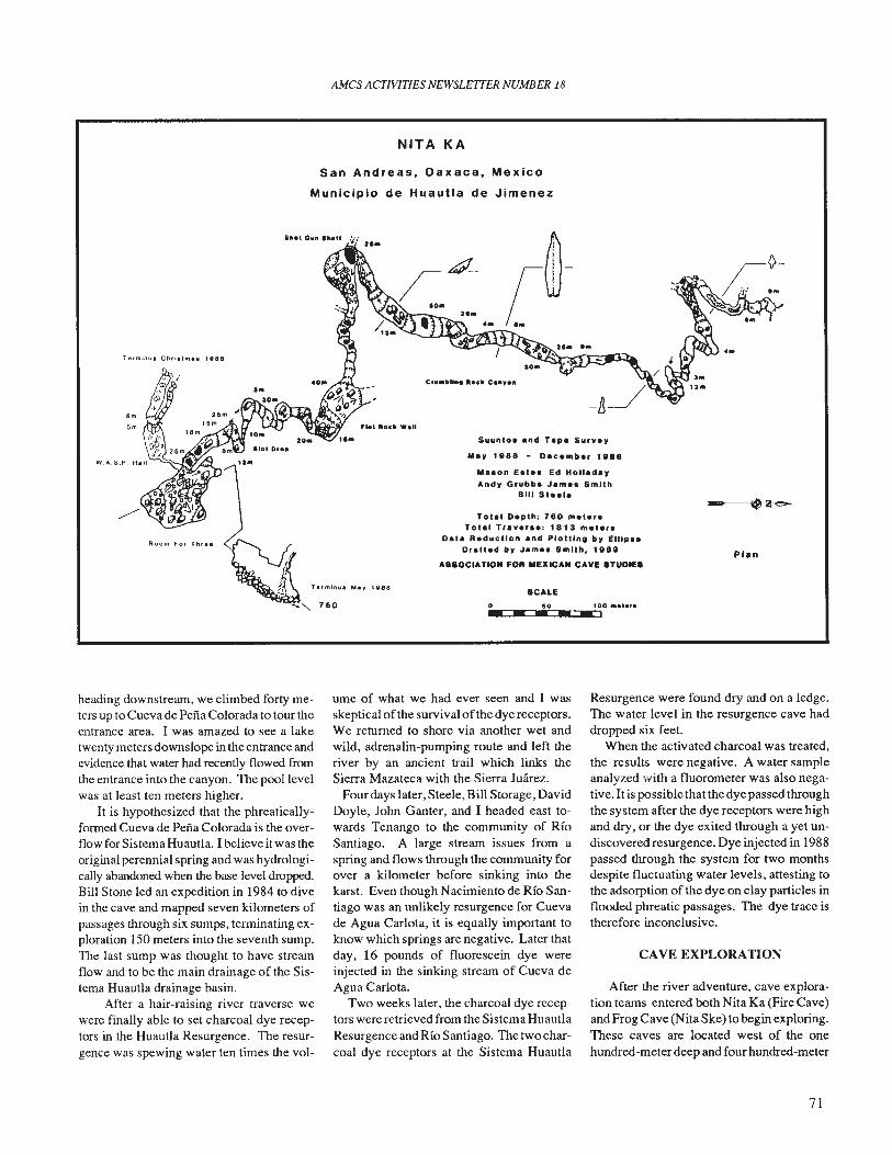
AMes ACTIVITIES NEWSLE7TER NUMBER 18
NITA KA
San Andreas, Oaxaca, Mexico
Municipio de Huautla de Jimenez
6m
5m
W.A.S.P.
Room For Thr ••
..... Oil" .".n
J~ h,."" ••,
""''''- 760
1888
[~-W.. .. '.
Suuntol end Tape Surv.y
M'1 11188 - Olclmb .. 11188
Ma.on ea'.' Ed HolladayAnd1 Grubb. Jlml. Smith
Bill 511.11
Tota. Depth: 780 met.,.Tota. Trav.r •• ; 1813 met.r.
Data Reduction and PloUlng by Elllp ••Drafted by Jam•• Smith, 1888
ASSOCIATION FOil MElllCAN CAVE STUDIES
SCALE
o so 100 "'.....--- - ..
-Plan
heading downstream, we climbed forty meters up to Cueva de Peiia Colorada to tour theentrance area. I was amazed to see a laketwenty meters downslope in the entrance andevidence that water had recently flowed fromthe entrance into the canyon. The pool levelwas at least ten meters higher.
It is hypothesized that the phreaticallyformed Cueva de Peiia Colorada is the overflow for Sistema Huautla. I believe it was theoriginal perennial spring and was hydrologically abandoned when the base level dropped.Bill Stone led an expedition in 1984 to divein the cave and mapped seven kilometers ofpassages through six sumps, terminating exploration 150 meters into the seventh sump.The last sump was thought to have streamflow and to be the main drainage of the Sistema Huautla drainage basin.
After a hair-raising river traverse wewere finally able to set charcoal dye receptors in the Huautla Resurgence. The resurgence was spewing water ten times the vol-
ume of what we had ever seen and I wasskeptical ofthe survival ofthe dye receptors.We returned to shore via another wet andwild, adrenalin-pumping route and left theriver by an ancient trail which links theSierra Mazateca with the Sierra Juarez.
Four days later, Steele, Bill Storage, DavidDoyle, John Ganter, and I headed east towards Tenango to the community of RioSantiago. A large stream issues from aspring and flows through the community forover a kilometer before sinking into thekarst. Even though Nacimiento de Rio Santiago was an unlikely resurgence for Cuevade Agua Carlota, it is equally important toknow which springs are negative. Later thatday, 16 pounds of fluorescein dye wereinjected in the sinking stream of Cueva deAgua Carlota.
Two weeks later, the charcoal dye receptors were retrieved from the Sistema HuautlaResurgence and Rio Santiago. The two charcoal dye receptors at the Sistema Huautla
Resurgence were found dry and on a ledge.The water level in the resurgence cave haddropped six feet.
When the activated charcoal was treated,the results were negative. A water sampleanalyzed with a fluorometer was also negative.1t is possible that the dye passed throughthe system after the dye receptors were highand dry, or the dye exited through a yet undiscovered resurgence. Dye injected in 1988passed through the system for two monthsdespite fluctuating water levels, attesting tothe adsorption of the dye on clay particles inflooded phreatic passages. The dye trace istherefore inconclusive.
CAVE EXPLORATION
After the river adventure, cave exploration teams entered both Nita Ka (Fire Cave)and Frog Cave (Nita Ske) to begin exploring.These caves are located west of the onehundred-meter deep and four hundred-meter
71
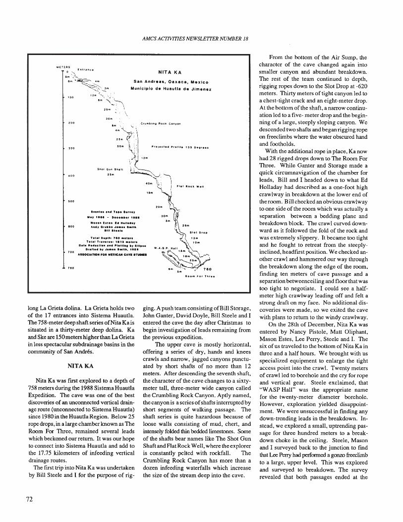
AMes ACTIVITIES NEWSLETTER NUMBER 18
From the bottom of the Air Sump, thecharacter of the cave changed again intosmaller canyon and abundant breakdown.The rest of the team continued to depth,rigging ropes down to the Slot Drop at -620meters. Thirty meters of tight canyon led toa chest-tight crack and an eight-meter drop.At the bottom of the shaft, a narrow continuation led to a fIve- meter drop and the beginning of a large, steeply sloping canyon. Wedescended two shafts and began rigging ropeon freeclimbs where the water obscured handand footholds.
With the additional rope in place, Ka nowhad 28 rigged drops down to The Room ForThree. While Ganter and Storage made aquick circumnavigation of the chamber forleads, Bill and I headed down to what EdHolladay had described as a one-foot highcrawlway in breakdown at the lower end oftheroom. Bill checked an obvious crawlwayto one side of the room which was actually aseparation between a bedding plane andbreakdown block. The crawl curved downward as it followed the fold of the rock andwas extremely slippery. It became too tightand he fought to retreat from the steeplyinclined, headfIrst position. We checked another crawl and hammered our way throughthe breakdown along the edge of the room,fmding ten meters of cave passage and aseparation betweenceiling and floor that wastoo tight to negotiate. I could see a halfmeter high crawlway leading off and felt astrong draft on my face. No additional discoveries were made, so we exited the cavewith plans to return to the windy crawlway.
On the 28th of December, Nita Ka wasentered by Nancy Pistole, Matt Oliphant,Mason Estes, Lee Perry, Steele and I. Thesix of us traveled to the bottom of Nita Ka inthree and a half hours. We brought with usspecialized equipment to enlarge the tightaccess point into the crawl. Twenty metersof crawl led to borehole and the cry for ropeand vertical gear. Steele exclaimed, that"WASP Hall" was the appropriate namefor the twenty-meter diameter borehole.However, exploration yielded disappointment. We were unsuccessful in fmding anydown-trending leads in the breakdown. Instead, we explored a small, uptrending passage for three hundred meters to a breakdown choke in the ceiling. Steele, Masonand I surveyed back to the junction to fmdthat Lee Perry had performed a gOl1lD freeclimbto a large, upper level. This was exploredand surveyed to breakdown. The surveyrevealed that both passages ended at the
NITA KA
ging. A push team consisting ofBill Storage,John Ganter, David Doyle, Bill Steele and Ientered the cave the day after Christmas tobegin investigation of leads remaining fromthe previous expedition.
The upper cave is mostly horizontal,offering a series of dry, hands and kneescrawls and narrow, jagged canyons punctuated by short shafts of no more than 12meters. After descending the seventh shaft,the character of the cave changes to a sixtymeter tall, three-meter wide canyon calledthe Crumbling Rock Canyon. Aptly named,the canyon is a series ofshafts interrupted byshort segments of walking passage. Theshaft series is quite hazardous because ofloose walls consisting of mud, chert, andintensely folded thin bedded limestones. Someof the shafts bear names like The Shot GunShaft and Flat Rock Well, where the exploreris constantly pelted with rockfall. TheCrumbling Rock Canyon has more than adozen infeeding waterfalls which increasethe size of the stream deep into the cave.
S.n Andr•••• O.x.c •• Mexico
Municipio de Hu.uU. de Jlmen.z
20m
Room For flu ••
~~:l'"40M \_::~:, Flel Rock Wall....
"...., ••••• h , ,o:om ",
M.y ,." - D••••••, ""Om
...... E•••• 14 "en•••, . 21..,A.lIIy 0 '.It•
1111 .,.... Slot Drop
Te.el D••'''; "0 ••'.r. t 3mTo'a' Tr....' ••: "" ••t.r. '-\ to'"
Dat. 1It •••eUa•• ,... IItla.tt_. It, 1111... XD,a"a.,lt, "•••• '."", ,." Hall,s""
\
s••
.00
•0.
reo
300
.00
30..
NITAKA
Nita Ka was fIrst explored to a depth of758 meters during the 1988 Sistema HuautlaExpedition. The cave was one of the bestdiscoveries of an unconnected vertical drainage route (unconnected to Sistema Huautla)since 1980 in the Huautla Region. Below 25rope drops, in a large chamber known as TheRoom For Three, remained several leadswhich beckoned our return. It was our hopeto connect into Sistema Huautla and add tothe 17.75 kilometers of infeeding verticaldrainage routes.
The fIrst trip into Nita Ka was undertakenby Bill Steele and I for the purpose of rig-
long La Grieta dolina. La Grieta holds twoof the 17 entrances into Sistema Huautla.The 758-meterdeep shaft series ofNita Ka issituated in a thirty-meter deep dolina. Kaand Ske are 150meters higher than La Grietain less spectacular subdrainage basins in thecommunity of San Andres.
72
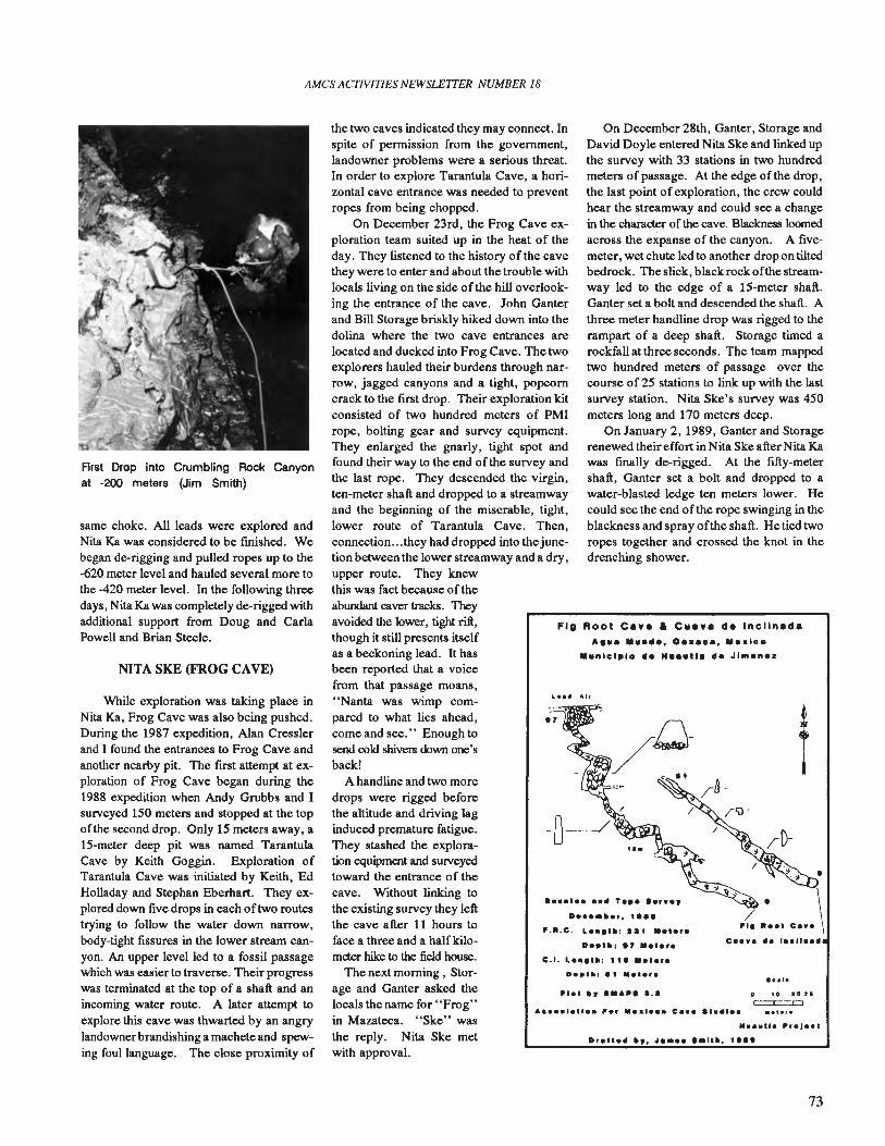
AMes ACTIVITIES NEWSLEITER NUMBER 18
FlO Root Ce•• a CII•• e de Incllnede
o to ,0"C=:C:::X:J..,.,.
M••utla Itr.J •• '
DraU•• It" tI •••• ••"". ,."
On December 28th, Ganter, Storage andDavid Doyle entered Nita Ske and linked upthe survey with 33 stations in two hundredmeters ofpassage. At the edge of the drop,the last point of exploration, the crew couldhear the streamway and could see a changein the character of the cave. Blackness loomedacross the expanse of the canyon. A fIvemeter, wet chute led to another drop on tiltedbedrock. The slick, black rock ofthe streamway led to the edge of a IS-meter shaft.Ganter set a bolt and descended the shaft. Athree meter handline drop was rigged to therampart of a deep shaft. Storage timed arockfall at three seconds. The team mappedtwo hundred meters of passage over thecourse of 25 stations to link up with the lastsurvey station. Nita Ske's survey was 450meters long and 170 meters deep.
On January 2,1989, Ganter and Storagerenewed their effort in Nita Ske after Nita Kawas fmally de-rigged. At the fIfty-metershaft, Ganter set a bolt and dropped to awater-blasted ledge ten meters lower. Hecould see the end ofthe rope swinging in theblackness and spray ofthe shaft. He tied tworopes together and crossed the knot in thedrenching shower.
D.~tlt I ., "a'.'.
A 111 •• 0 •••0., 100
".nlclplo III. M•••U. d. JI n.z
PI.t "y ••,.,. a.a
•••••••••• T.~••• r •• ,
F.•.C. L••• ''': la, ••, ...
c .•. L ••• ''': 11 •••'.r.
....... ,..... Par ••• , ••• Ca •• at ......
the reply. Nita Ske metwith approval.
the two caves indicated they may connect. Inspite of permission from the government,landowner problems were a serious threat.In order to explore Tarantula Cave, a horizontal cave entrance was needed to preventropes from being chopped.
On December 23rd, the Frog Cave exploration team suited up in the heat of theday. They listened to the history of the cavethey were to enter and about the trouble withlocals living on the side ofthe hill overlooking the entrance of the cave. John Ganterand Bill Storage briskly hiked down into thedolina where the two cave entrances arelocated and ducked into Frog Cave. The twoexplorers hauled their burdens through narrow, jagged canyons and a tight, popcorncrack to the fIrst drop. Their exploration kitconsisted of two hundred meters of PMIrope, bolting gear and survey equipment.They enlarged the gnarly, tight spot andfound their way to the end of the survey andthe last rope. They descended the virgin,ten-meter shaft and dropped to a streamwayand the beginning of the miserable, tight,lower route of Tarantula Cave. Then,connection...they had dropped into thejunction between the lower streamway and a dry,upper route. They knewthis was fact because of theabundant caver tracks. Theyavoided the lower, tight rift,though it still presents itselfas a beckoning lead. It hasbeen reported that a voicefrom that passage moans,"Nanta was wimp compared to what lies ahead,come and see. " Enough tosend cold shivers down one'sback!
A handline and two moredrops were rigged beforethe altitude and driving laginduced premature fatigue.They stashed the exploration equipment and surveyedtoward the entrance of thecave. Without linking tothe existing survey they leftthe cave after 11 hours toface a three and a halfki1ometer hike to the field house.
The next morning, Storage and Ganter asked thelocals the name for "Frog"in Mazateca. "Ske" was
While exploration was taking place inNita Ka, Frog Cave was also being pushed.During the 1987 expedition, Alan Cresslerand I found the entrances to Frog Cave andanother nearby pit. The fIrst attempt at exploration of Frog Cave began during the1988 expedition when Andy Grubbs and Isurveyed ISO meters and stopped at the topof the second drop. Only 15 meters away, aIS-meter deep pit was named TarantulaCave by Keith Goggin. Exploration ofTarantula Cave was initiated by Keith, EdHolladay and Stephan Eberhart. They explored down fIve drops in each of two routestrying to follow the water down narrow,body-tight fIssures in the lower stream canyon. An upper level led to a fossil passagewhich was easier to traverse. Their progresswas terminated at the top of a shaft and anincoming water route. A later attempt toexplore this cave was thwarted by an angrylandownerbrandishing a machete and spewing foul language. The close proximity of
First Drop into Crumbling Rock Canyonat -200 meters (Jim Smith)
NITA SKE (FROG CAVE)
same choke. All leads were explored andNita Ka was considered to be fmished. Webegan de-rigging and pulled ropes up to the-620 meter level and hauled several more tothe -420 meter level. In the following threedays, Nita Ka was completely de-rigged withadditional support from Doug and CarlaPowell and Brian Steele.
73
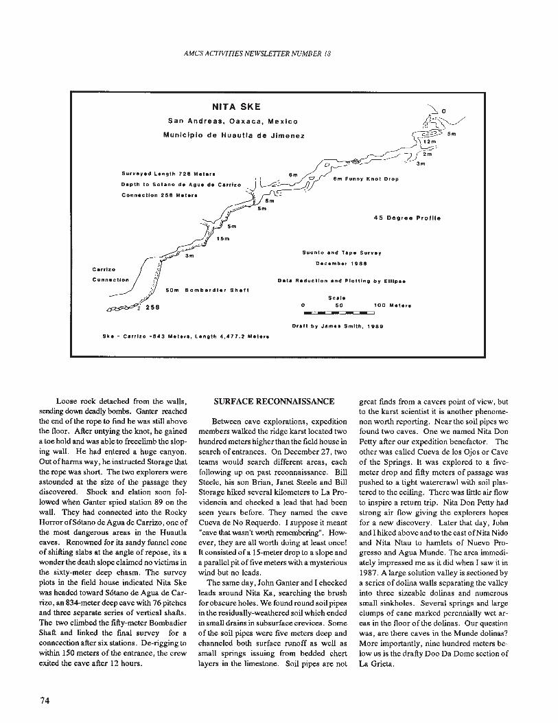
AMes ACfIVITlES NEWSLETTER NUMBER /8
Municipio de Huautla de Jimenez
100 MeIer.
45 Degree Profile
Suunto and Tape Survey
December 1 GSe
-----Sca'.
o 50
Oata Reductlon and Plotting by EIUp ••
3m
50m Bombardle'Shall
Surveyed Lenglh 728 Mele.. 8mI I.. C1
Deplh 10 Solano de Agua de Carrizo ,-J~~Connecllon 258 Mele.. 1; =
.-----:"1 5 m
~_>'.6 5m
, '
'7" ',. 5m~;. 15m
/c'
~258
San Andreas, Oaxaca, Mexico
NITA SKE
Dra" by Jame. Smith, 1 989
Ske - Carrizo -843 Metar., Length 4,477.2 Me'er.
Loose rock detached from the walls,sending down deadly bombs. Ganter reachedthe end ofthe rope to find he was still abovethe floor. After untying the knot, he gaineda toe hold and was able to freeclirnb the sloping wall. He had entered a huge canyon.Out of harms way, he instructed Storage thatthe rope was short. The two explorers wereastounded at the size of the passage theydiscovered. Shock and elation soon followed when Ganter spied station 89 on thewall. They had connected into the RockyHorror ofS6tano de Agua de Carrizo, one ofthe most dangerous areas in the Huautlacaves. Renowned for its sandy funnel coneof shifting slabs at the angle of repose, its awonder the death slope claimed no victims inthe sixty-meter deep chasm. The surveyplots in the field house indicated Nita Skewas headed toward S6tano de Agua de Carrizo, an 834-meter deep cave with 76 pitchesand three separate series of vertical shafts.The two climbed the fifty-meter BombadierShaft and linked the fmal survey for aconncection after six stations. De-rigging towithin 150 meters of the entrance, the crewexited the cave after 12 hours.
SURFACE RECONNAISSANCE
Between cave explorations, expeditionmembers walked the ridge karst located twohundred meters higher than the field house insearch of entrances. On December 27, twoteams would search different areas, eachfollowing up on past reconnaissance. BillSteele, his son Brian, Janet Steele and BillStorage hiked several kilometers to La Providencia and checked a lead that had beenseen years before. They named the caveCueva de No Requerdo. I suppose it meant"cave that wasn't worth remembering". However, they are all worth doing at least once!It consisted of a IS-meter drop to a slope anda parallel pit of five meters with a mysteriouswind but no leads.
The same day, John Ganter and I checkedleads around Nita Ka, searching the brushfor obscure holes. We found round soil pipesin the residually-weathered soil which endedin small drains in subsurface crevices. Someof the soil pipes were five meters deep andchanneled both surface runoff as well assmall springs issuing from bedded chertlayers in the limestone. Soil pipes are not
great fmds from a cavers point of view, butto the karst scientist it is another phenomenon worth reporting. Near the soil pipes wefound two caves. One we named Nita DonPetty after our expedition benefactor. Theother was called Cueva de los Ojos or Caveof the Springs. It was explored to a fIvemeter drop and fifty meters 0 f passage waspushed to a tight watercrawl with soil plastered to the ceiling. There was little air flowto inspire a return trip. Nita Don Petty hadstrong air flow giving the explorers hopesfor a new discovery. Later that day, Johnand I hiked above and to the east ofNita Nidoand Nita Ntau to hamlets of Nuevo Progresso and Agua Munde. The area immediately impressed me as it did when I saw it in1987. A large solution valley is sectioned bya series of dolina walls separating the valleyinto three sizeable dolinas and numeroussmall sinkholes. Several springs and largeclumps of cane marked perennially wet areas in the floor of the dolinas. Our questionwas, are there caves in the Munde dolinas?More importantly, nine hundred meters below us is the drafty Doo Da Dome section ofLa Grieta.
74
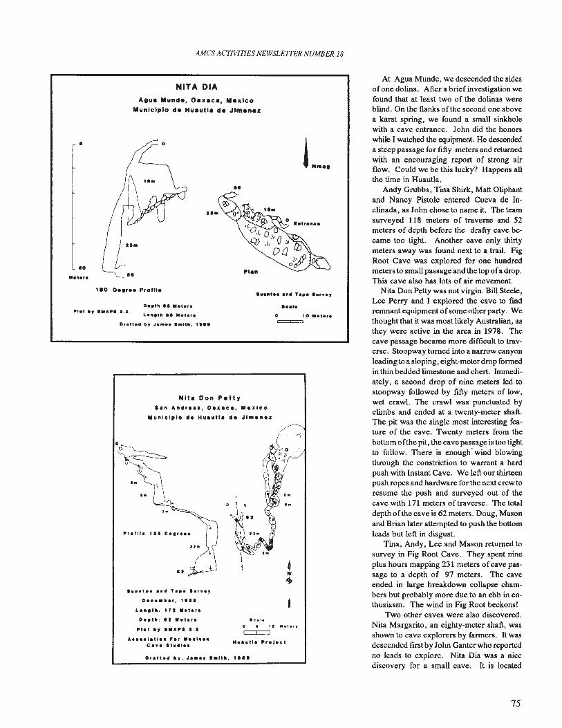
AMes ACTIVITIES NEWSLETTER NUMBER 18
At Agua Munde, we descended the sidesofone dolina. After a brief investigation wefound that at least two of the dolinas wereblind. On the flanks of the second one abovea karst spring, we found a small sinkholewith a cave entrance. John did the honorswhile I watched the equipment. He descendeda steep passage for fifty meters and returnedwith an encouraging report of strong airflow. Could we be this lucky? Happens allthe time in Huautla.
Andy Grubbs, Tina Shirk, Matt Oliphantand Nancy Pistole entered Cueva de Inclinada, as John chose to name it. The teamsurveyed 118 meters of traverse and 52meters of depth before the drafty cave became too tight. Another cave only thirtymeters away was found next to a trail. FigRoot Cave was explored for one hundredmeters to small passage and the top ofa drop.This cave also has lots of air movement.
Nita Don Petty was not virgin. Bill Steele,Lee Perry and I explored the cave to findremnant equipment ofsome other party. Wethought that it was most likely Australian, asthey were active in the area in 1978. Thecave passage became more difficult to traverse. Stoopway turned into a narrow canyonleading to a sloping, eight-meterdrop formedin thin bedded limestone and chert. Immediately, a second drop of nine meters led tostoopway followed by fifty meters of low,wet crawl. The crawl was punctuated byclimbs and ended at a twenty-meter shaft.The pit was the single most interesting feature of the cave. Twenty meters from thebottom ofthe pit, the cave passage is too tightto follow. There is enough· wind blowingthrough the constriction to warrant a hardpush with Instant Cave. We left our thirteenpush ropes and hardware for the next crew toresume the push and surveyed out of thecave with 171 meters oftraverse. The totaldepth ofthe cave is 62 meters. Doug, Masonand Brian later attempted to push the bottomleads but left in disgust.
Tina, Andy, Lee and Mason returned tosurvey in Fig Root Cave. They spent nineplus hours mapping 231 meters ofcave passage to a depth of 97 meters. The caveended in large breakdown collapse chambers but probably more due to an ebb in enthusiasm. The wind in Fig Root beckons!
Two other caves were also discovered.Nita Margarito, an eighty-meter shaft, wasshown to cave explorers by farmers. It wasdescended frrstby John Ganter who reportedno leads to explore. Nita Dia was a nicediscovery for a small cave. It is located
L..
o 10 ".'.r.=
••
D."." I' ".t.,.L ,.,.
Nita Don P.ttyI.n Andr •••• O••• c •• 1II •• lco
lIIunlclplo d. Hu.utl. d. JI",.n ••
Ora"," It, '.ltll, ""
NITA DIA
Agua Mundo, Oaxaca, Moxlco
Municipio do Huautla de Jlmenoz
A•••• I.tI •• ".r .... 1•••c •••• t.~I••
.....,••••• T.,. '.r••,Da"."ar, , •• ,
L ...... : '71 ."ar.D.,t .. : I ••• '.r."'et ., DIU'" 1.1
Drafta" b, JaM••••Itlll. , •••
1ao O••r•• ProW.
o
.0
1111 •• Ity ."A". a.a
.....,.
75
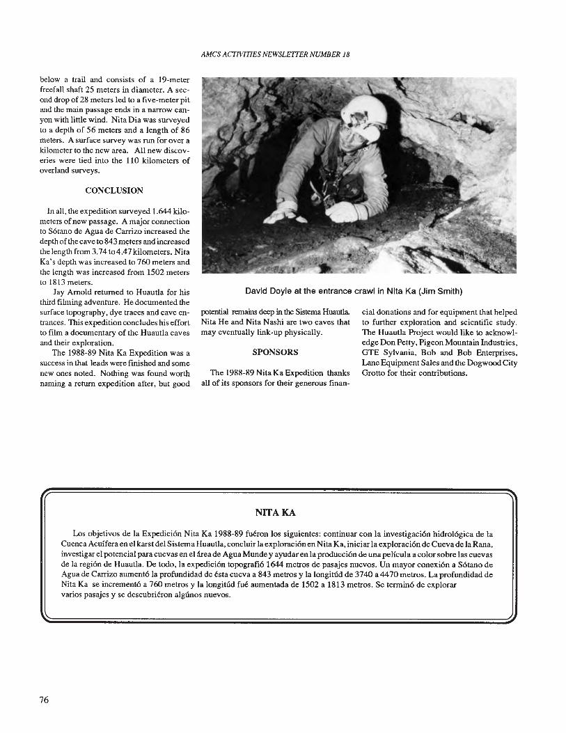
AMes ACTIVITIES NEWSLETTER NUMBER 18
David Doyle at the entrance crawl in Nita Ka (Jim Smith)
below a trail and consists of a 19-meterfreefall shaft 25 meters in diameter. A second drop of28 meters led to a five-meter pitand the main passage ends in a narrow canyon with little wind. Nita Dia was surveyedto a depth of 56 meters and a length of 86meters. A surface survey was run for over akilometer to the new area. All new discoveries were tied into the 110 kilometers ofoverland surveys.
CONCLUSION
In all, the expedition surveyed 1.644 kilometers ofnew passage. A major connectionto S6tano de Agua de Carrizo increased thedepth of the cave to 843 myters and increasedthe length from 3.74 to 4.47 kilometers. NitaKa's depth was increased to 760 meters andthe length was increased from 1502 metersto 1813 meters.
Jay Arnold returned to Huautla for histhird filming adventure. He documented thesurface topography, dye traces and cave entrances. TIlls expedition concludes his effortto film a documentary of the Huautla cavesand their exploration.
The 1988-89 Nita Ka Expedition was asuccess in that leads were fmished and somenew ones noted. Nothing was found worthnaming a return expedition after, but good
potential remains deep in the Sistema HuautlaNita He and Nita Nashi are two caves thatmay eventually link-up physically.
SPONSORS
The 1988-89 Nita Ka Expedition thanksall of its sponsors for their generous finan-
NITA KA
cial donations and for equipment that helpedto further exploration and scientific study.The Huautla Project would like to acknowledge Don Petty, Pigeon Mountain Industries,GTE Sylvania, Bob and Bob Enterprises,Lane Equipment Sales and the Dogwood CityGrotto for their contributions.
Los objetivos de la Expedici6n Nita Ka 1988-89 fueron los siguientes: continuar con la investigaci6n hidrol6gica de laCuenca Acuffera en el karst del Sistema Huautla, concluir la exploraci6n en Nita Ka, iniciar la exploraci6n de Cueva de la Rana,investigar el potencial para cuevas en el area de Agua Munde y ayudar en la producci6n de una peHcula a color sobre las cuevasde la regi6n de Huautla. De todo, la expedici6n topografi61644 metros de pasajes nuevos. Un mayor conexi6n a S6tano deAgua de Carrizo aument6la profundidad de esta cueva a 843 metros y la longitud de 3740 a 4470 metros. La profundidad deNita Ka se increment6 a 760 metros y la longitlid fue aumentada de 1502 a 1813 metros. Se termin6 de explorarvarios pasajes y se descubrieron algUnos nuevos.
76
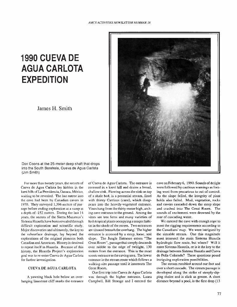
AMes ACTIVITIES NEWSLEITER NUMBER 18
1990 CUEVA DEAGUA CARLOTAEXPEDITION
James H. Smith
Don Coons at the 25-meter deep shaft that dropsinto the South Borehole, Cueva de Agua Carlota(Jim Smith)
For more than twenty years, the secrets ofCueva de Agua Carlota lay hidden in thekarst hills ofLa Providencia, Oaxaca, Mexico,waiting to be revealed. The last entree intothe cave had been by Canadian cavers in1970. They surveyed 1,396 meters of passage before ending exploration at a sump ata depth of -152 meters. During the last 14years, the secrets of the Sierra Mazateca'sSistema Huautla have been revealed throughdifficult exploration and scientific study.Major discoveries and ultimately, the key tothe subsurface drainage, lay beyond theexplorations of the original pioneers bothCanadian and American. History is destinedto repeat itself in Huautla. Because of thishistory, the Huautla Project's explorationgoal was to re-enter Cueva de Agua Carlotafor further investigation.
CUEVA DE AGUA CARLOTA
A yawning black hole below an overhanging limestone cliff marks the entrance
of Cueva de Agua Carlota. The entrance isrecessed in a karst hill and drains a broad,shallow sink. Flowing across the sink on topof a shale bed, is a perennial stream, linedwith thirsty Carrizos (cane), which disappears into the heavily-vegetated entrance.Vines hang from the thirty-meter high, arching cave entrance to the ground. Among thevines are tree ferns and many varieties oflush tropical plants occupying a uniquehabitat in the shade of the recess. Two entrancesare situated beneath the overhang. The higherentrance is accessed by a steep, loose, soilslope. The Jungle Entrance enters "TheGreat Room", passage that steeply descendsover rubble to the edge of twilight, 130meters from the entrance. This is the mostscenic entrance in the caving area. The lowerentrance is the stream route which follows awalking-size passage until it intersects TheGreat Room.
Our first trip into Cueva de Agua Carlotawas through the higher entrance. LauraCampbell, Bill Storage and I entered the
cave on February 6, 1990. Sounds ofdelightwere followed by cautious warnings as footing went from precarious to out-of-control.As the slope failed, the integrity of plantholds also failed. Mud, vegetation, rocksand cavers cascaded down the steep slopeand crashed into The Great Room. Thesounds of excitement were drowned by theroar of cascading water.
We entered the cave with enough rope tomeet the rigging requirements according tothe Canadians' map. We were intrigued bythe sizeable stream. One this magnitudemust intersect the main Sistema Huautlahydrologic flow route, but where? Will itenter Sistema Huautla, or is it the key to thedrainage between Sistema Huautla and Cuevade Perra Colorada? These questions posedintriguing exploration possibilities.
The stream rumbled around our feet andover a short cascade. The stream passage isdeveloped along the strike of steeply-dipping shales and is slick as grease. A shortdistance beyond a pool, is the fust drop (13
77
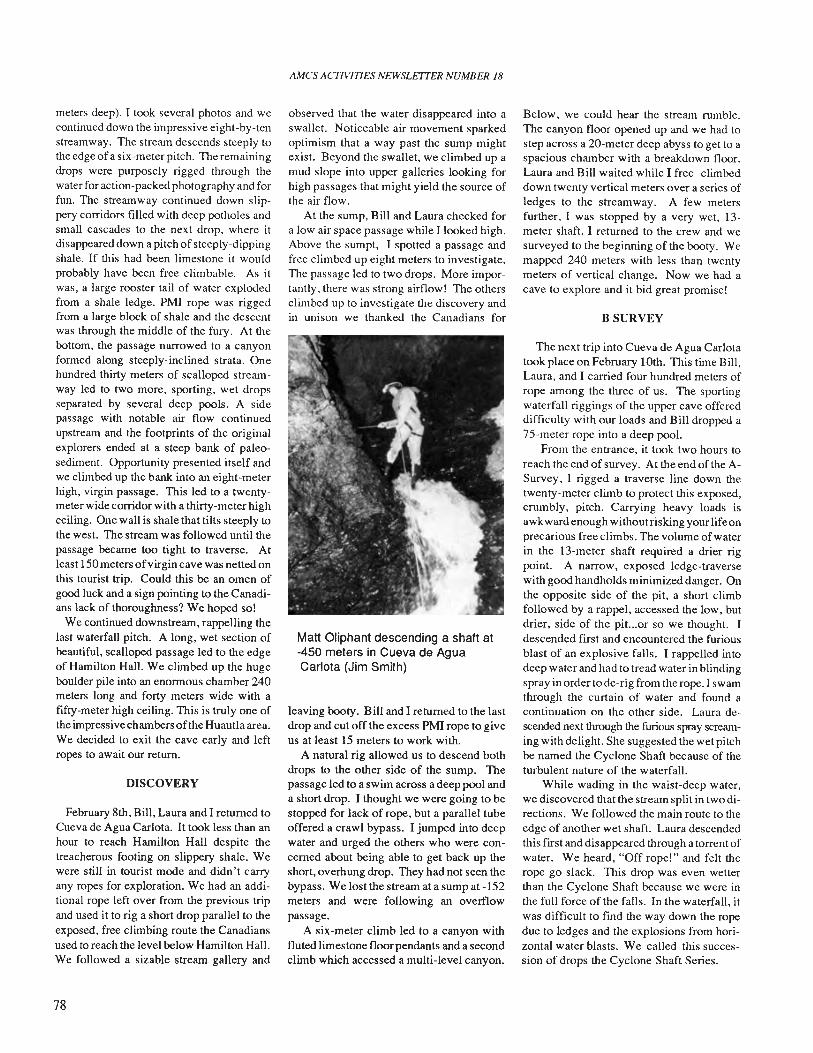
meters deep). I took several photos and wecontinued down the impressive eight-by-tenstreamway. The stream descends steeply tothe edge ofa six-meter pitch. The remainingdrops were purposely rigged through thewater for action-packed photography and forfun. The streamway continued down slippery corridors filled with deep potholes andsmall cascades to the next drop. where itdisappeared down a pitch of steeply-dippingshale. If this had been limestone it wouldprobably have been free climbable. As itwas, a large rooster tail of water explodedfrom a shale ledge. PMI rope was riggedfrom a large block of shale and the descentwas through the middle of the fury. At thebottom, the passage narrowed to a canyonformed along steeply-inclined strata. Onehundred thirty meters of scalloped streamway led to two more, sporting. wet dropsseparated by several deep pools. A sidepassage with notable air flow continuedupstream and the footprints of the originalexplorers ended at a steep bank of paleosediment. Opportunity presented itself andwe climbed up the bank into an eight-meterhigh. virgin passage. This led to a twentymeter wide corridor with a thirty-meter highceiling. One wall is shale that tilts steeply tothe west. The stream was followed until thepassage became too tight to traverse. Atleast 150 meters ofvirgin cave was netted onthis tourist trip. Could this be an omen ofgood luck and a sign pointing to the Canadians lack of thoroughness? We hoped so!
We continued downstream, rappelling thelast waterfall pitch. A long, wet section ofbeautiful, scalloped passage led to the edgeof Hamilton Hall. We climbed up the hugeboulder pile into an enormous chamber 240meters long and forty meters wide with afifty-meter high ceiling. This is truly one ofthe impressive chambers ofthe Huautla area.We decided to exit the cave early and leftropes to await our return.
DISCOVERY
February 8th, Bill, Laura and I returned toCueva de Agua Carlota. It took less than anhour to reach Hamilton Hall despite thetreacherous footing on slippery shale. Wewere still in tourist mode and didn't carryany ropes for exploration. We had an additional rope left over from the previous tripand used it to rig a short drop parallel to theexposed, free climbing route the Canadiansused to reach the level below Hamilton Hall.We followed a sizable stream gallery and
78
AMes ACTIVITIES NEWSLETfER NUMBER 18
observed that the water disappeared into aswallet. Noticeable air movement sparkedoptimism that a way past the sump mightexist. Beyond the swallet, we climbed up amud slope into upper galleries looking forhigh passages that might yield the source ofthe air flow.
At the sump, Bill and Laura checked fora low air space passage while I looked high.Above the sumpt, I spotted a passage andfree climbed up eight meters to investigate.TIle passage led to two drops. More importantly, there was strong airflow! The othersclimbed up to investigate the discovery andin unison we thanked the Canadians for
Matt Oliphant descending a shaft at-450 meters in Cueva de AguaCarlota (Jim Smith)
leaving booty. Bill and I returned to the lastdrop and cut off the excess PMI rope to giveus at least 15 meters to work with.
A natural rig allowed us to descend bothdrops to the other side of the sump. Thepassage led to a swim across a deep pool anda short drop. I thought we were going to bestopped for lack of rope, but a parallel tubeoffered a crawl bypass. I jumped into deepwater and urged the others who were concerned about being able to get back up theshort, overhung drop. They had not seen thebypass. We lost the stream at a sump at -152meters and were following an overflowpassage.
A six-meter climb led to a canyon withfluted limestone floor pendants and a secondclimb which accessed a multi-level canyon.
Below, we could hear the stream rumble.The canyon floor opened up and we had tostep across a 20-meter deep abyss to get to aspacious chamber with a breakdown floor.Laura and Bill waited while I free- climbeddown twenty vertical meters over a series ofledges to the streamway. A few metersfurther, I was stopped by a very wet, 13meter shaft. I returned to the crew and wesurveyed to the beginning of the booty. Wemapped 240 meters with less than twentymeters of vertical change. Now we had acave to explore and it bid great promise!
BSURVEY
The next trip into Cueva de Agua Carlotatook place on February 10th. This time Bill,Laura, and I carried four hundred meters ofrope among the three of us. The sportingwaterfall riggings of the upper cave offereddifficulty with our loads and Bill dropped a75-meter rope into a deep pool.
From the entrance, it took two hours toreach the end of survey. At the end ofthe ASurvey, I rigged a traverse line down thetwenty-meter climb to protect this exposed,crumbly, pitch. Carrying heavy loads isawkward enough without risking your life onprecarious free climbs. The volume of waterin the 13-meter shaft required a drier rigpoint. A narrow, exposed ledge-traversewith good handholds minimized danger. Onthe opposite side of the pit. a short climbfollowed by a rappel, accessed the low. butdrier, side of the pit...or so we thought. Idescended first and encountered the furiousblast of an explosive falls. I rappelled intodeep water and had to tread water in blindingspray in order to de-rig from the rope. I swamthrough the curtain of water and found acontinuation on the other side. Laura descended next through the furious spray screaming with delight. She suggested the wet pitchbe named the Cyclone Shaft because of theturbulent nature of the waterfall.
While wading in the waist-deep water,we discovered that the stream split in twodirections. We followed the main route to theedge of another wet shaft. Laura descendedthis first and disappeared through a torrent ofwater. We heard, "Off rope!" and felt therope go slack. This drop was even wetterthan the Cyclone Shaft because we were inthe full force of the falls. In the waterfall. itwas difficult to fmd the way down the ropedue to ledges and the explosions from horizontal water blasts. We called this succession of drops the Cyclone Shaft Series.
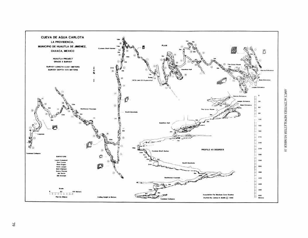
~I--- .............
:tJ
;,.
r ~;,.(J::j
I. :sH 10
::j
I[;;
_.~i' 120
I: ~~ '0.
t'-'
j "0
t>l
~h
::.:.~ 210
<;
H ~H 240
Htl:l
b 270
~.....
~~ 100
c.,
ru •
u.
~ ::,".1.1
••'Ir.......o..ttoft , _. c•.,•• tlM....
o.,n" 'f: " N....... (!) t Ito
PIIOFILE U DEOIIEES
,.
, ...... c.....
"'G""~
~_ J •• /-:.
Ho."'o" Ho' ,/..' -.:.- ~ __ /) ....
\. "•• "?)< ,
.o.
,iI'o.
o
(j)
''''i_f}_
€I
o
0\\
(If)
,..
e'c........" hftM·
c ....
.f'
£~
L_.C_ ..Delli C ....
allen ' ,_l_...no......'....'~..I*.....ttlrl
.. IIOf'"
I&HtYITO.I
hat IT '."
HUAUTLA ~OJl!CT
OIlAOE 5 IUtlVEY
.....o 12 t04 "'WI
e1.1 LI.rLTJ
SUIIVEY LEItClTH .,.0' llIII!TEIIS
SURVIY DEPTH 505 MITE'"
CUEVA DE AGUA CARLOTA
LA PROVIOENCIA.
MUNICIPIO DE HUAUTLA DE JIMENEZ,
OAXACA, MEXICO
' ....... c......
-J\0
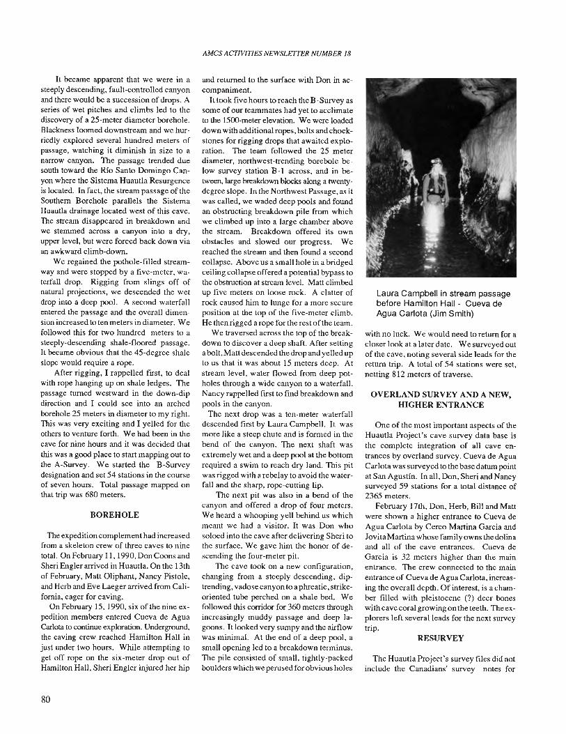
It became apparent that we were in asteeply descending, fault-controlled canyonand there would be a succession of drops. Aseries of wet pitches and climbs led to thediscovery of a 25-meter diameter borehole.Blackness loomed downstream and we hurriedly explored several hundred meters ofpassage, watching it diminish in size to anarrow canyon. The passage trended duesouth toward the RIo Santo Domingo Canyon where the Sistema Huautla Resurgenceis located. In fact, the stream passage of theSouthern Borehole parallels the SistemaHuautla drainage located west of this cave.The stream disappeared in breakdown andwe stemmed across a canyon into a dry,upper level, but were forced back down viaan awkward climb-down.
We regained the pothole-filled streamway and were stopped by a five-meter, waterfall drop. Rigging from slings off ofnatural projections, we descended the wetdrop into a deep pool. A second waterfallentered the passage and the overall dimension increased to ten meters in diameter. Wefollowed this for two hundred meters to asteeply-descending shale-floored passage.It became obvious that the 45-degree shaleslope would require a rope.
After rigging, I rappelled first, to dealwith rope hanging up on shale ledges. Thepassage turned westward in the down-dipdirection and I could see into an archedborehole 25 meters in diameter to my right.This was very exciting and I yelled for theothers to venture forth. We had been in thecave for nine hours and it was decided thatthis was a good place to start mapping out tothe A-Survey. We started the B-Surveydesignation and set 54 stations in the courseof seven hours. Total passage mapped onthat trip was 680 meters.
BOREHOLE
The expedition complement had increasedfrom a skeleton crew of three caves to ninetotal. On February 11, 1990, Don Coons andSheri Engler arrived in Huautla. On the 13thof February, Matt Oliphant, Nancy Pistole,and Herb and Eve Laeger arrived from California, eager for caving.
On February IS, 1990, six of the nine expedition members entered Cueva de AguaCarlota to continue exploration. Underground,the caving crew reached Hamilton Hall injust under two hours. While attempting toget off rope on the six-meter drop out ofHamilton Hall, Sheri Engler injured her hip
80
AMes ACTIVITIES NEWSLETTER NUMBER 18
and returned to the surface with Don in accompaniment.
It took five hours to reach the B-Survey assome of our teammates had yet to acclimateto the 1500-meter elevation. We were loadeddown with additional ropes, bolts and chockstones for rigging drops that awaited exploration. The team followed the 25 meterdiameter, northwest-trending borebole below survey station B-1 across, and in between, large breakdown blocks along a twentydegree slope. In the Northwest Passage, as itwas called, we waded deep pools and foundan obstructing breakdown pile from whichwe climbed up into a large chamber abovethe stream. Breakdown offered its ownobstacles and slowed our progress. Wereached the stream and then found a secondcollapse. Above us a small hole in a bridgedceiling collapse offered a potential bypass tothe obstruction at stream level. Matt climbedup five meters on loose rock. A clatter ofrock caused him to lunge for a more secureposition at the top of the five-meter climb.He then rigged a rope for the rest of the team.
We traversed across the top of the breakdown to discover a deep shaft. After settinga bolt, Matt descended the drop and yelled upto us that it was about 15 meters deep. Atstream level, water flowed from deep potholes through a wide canyon to a waterfall.Nancy rappelled frrst to find breakdown andpools in the canyon.
The next drop was a ten-meter waterfalldescended first by Laura Campbell. It wasmore like a steep chute and is formed in thebend of the canyon. The next shaft wasextremely wet and a deep pool at the bottomrequired a swim to reach dry land. This pitwas rigged with a rebelay to avoid the waterfall and the sharp, rope-cutting lip.
The next pit was also in a bend of thecanyon and offered a drop of four meters.We heard a whooping yell behind us whichmeant we had a visitor. It was Don whosoloed into the cave after delivering Sheri tothe surface. We gave him the honor of descending the four-meter pit.
The cave took on a new configuration,changing from a steeply-descending, diptrending, vadose canyon to a phreatic, strikeoriented tube perched on a shale bed. Wefollowed this corridor for 360 meters throughincreasingly muddy passage and deep lagoons. It looked very sumpy and the airflowwas minimal. At the end of a deep pool, asmall opening led to a breakdown terminus.The pile consisted of small, tightly-packedboulders which we perused for obvious holes
Laura Campbell in stream passagebefore Hamilton Hall - Cueva deAgua Canota (Jim Smith)
with no luck. We would need to return for acloser look at a later date. We surveyed outof the cave, noting several side leads for thereturn trip. A total of 54 stations were set,netting 812 meters of traverse.
OVERLAND SURVEY AND A NEW,HIGHER ENTRANCE
One of the most important aspects of theHuautla Project's cave survey data base isthe complete integration of all cave entrances by overland survey. Cueva de AguaCarlota was surveyed to the base datum pointat San Agustin. In all, Don, Sheri and Nancysurveyed 59 stations for a total distance of2365 meters.
February 17th, Don, Herb, Bill and Mattwere shown a higher entrance to Cueva deAgua Carlota by Cerco Martina Garcia andJovita Martina whose family owns the dol inaand all of the cave entrances. Cueva deGarcia is 32 meters higher than the mainentrance. The crew connected to the mainentrance of Cueva de Agua Carlota, increasing the overall depth. Of interest, is a chamber filled with pleistocene (?) deer boneswi th cave coral growing on the teeth. The exp�orers left several leads for the next surveytrip.
RESURVEY
The Huautla Project's survey files did notinclude the Canadians' survey notes for
Cueva de Agua Carlota. On February 18th,two survey crews entered Cueva de AguaCarlota for the purpose of resurveying thepassage explored by the Canadians.
Don, Sheri and Herb started at the ASurvey and mapped from the sump area toHamilton Hall, and up the mainstream passage. They surveyed two drops and stoppedat the first side passage discovered duringthe expedition. Matt and Nancy surveyedfrom the entrance into the cave and tied intothe other crew's last survey station. The totaleffort yielded 1204 meters of resurvey.
CUEVA DE GARCIA
February 19th, Don and I began the survey of Cueva de Garcia. At the entrance, Itumed around to see Joveta, her brother andseveral friends who had followed us to theentrance, curious of our intentions. Don andI surveyed down the steeply-descendingpassage with the Mazatecs on our heels. Donloaned one of them his backup light andeventually the rugged passage filtered themout. We surveyed through a gallery ofmeterlong stalagmites to a sporting c1imb-downon slippery flowstone which sloped downeight meters to a passage junction. Wefollowed this route, passing through a chamber with a sizable bat colony. Climbing to alower level we were able to see the twilightofThe Great Room in the Jungle Entrance ofCueva de Agua Carlota.
After linking the survey, we backtrackedto the junction and carried rope and verticalgear to an undescended drop Don had discovered on the scoop trip. From the top of thefive-meter drop we could see passage trending in two directions. We rappelled the
AMes ACTIVITIES NEWSLETTER NUMBER 18
popcom-encrusted pit into spacious passage.Don climbed down a slope while I checked
for a couple hundred meters in the otherdirection. We began up the route I chose firstand surveyed 250 meters to a terminal collapse chamber through comfortable walkingpassage. All total, we had surveyed 688meters of passage in three hours.
THE BOTTOM OF CARLOTA
February 20th, Bill, Herb, Laura, Nancy,Don, Matt and I entered Cueva de AguaCarlota to push the bottom cave and surveyside passages beyond the 1970 terminus ofthe cave. Our best lead was a borehole passage above the IS-meter drop that Matt hadbolted. I moved a few rocks and found abypass. We followed the gallery which gradually diminished in size until it ended in smallbreakdown after 124 meters. It trended northwest, away from the main stream canyon.
We then tumed our attention to the bottom of the cave in an effort to bypass thebreakdown. Every passage that intersectedthe north-south trend ended in breakdown.Bill discovered an inhumanly-small, vertical tube rising five, or more, meters thatmoved air. It was the only unobstructedpassage we found. However, it would takevery extensive mining to push it. Attemptsto fmd a way through the breakdown atstream level were also futile.
A large, side passage with an infeedingstream was surveyed upstream by Don, Laura,Matt and I. We entered a breakdown chamber and skirted its treacherous slope of talusto a dry crawl-stoopway. It had a lot of airand we surveyed 330 meters up the passageuntil we connected atop the twenty-meter,
CUEVA DE AGUA CARLOTA
wet, shale drop, closing a loop. We backtracked to the chamber where we lost thestream. A six-meter climb-down gainedaccess to the stream. We followed a nicelysculpted stream canyon for 95 meters until itended in collapse. We exited the cave with540 meters of surveyed passage.
FINAL SURVEY AND DE-RIG TRIP
Bill, Laura and I returned to Cueva deAgua Carlota on February 22 to finish derigging, photographing and to mop up somecave survey in the entrance area.
Below the first drop in the cave, wemapped a side passage for 155 meters. Wewere unable to finish the survey of an additional hundred meters of crawls and multilevel breakdown. In this portion of the cave,we found human skulls that had been flattened during early growth. This was a practice ofPre-Columbian indians, who used thisdisfigurement to distinguish aristocracy. Afew pottery shards were found along withmany scattered bones. The total survey ofCueva de Agua Carlota reached 4.4 kilometers and a depth of 504 meters.
ACKNOWLEDGEMENTS
The 1990 Cueva de Agua Carlota Expedition thanks the following sponsors for donations and grants which aided cave exploration and scientific study conducted duringthe expedition. The Explorers Club forawarding Flag #24, Nalgene Company, Pigeon Mountain Industries and Dr. NicholasC. Crawford (thesis advisor) of the CenterFor Cave And Karst Studies, Westem Kentucky University, Bowling Green, Kentucky.
En febrero de 1990, los espele610gos del Proyecto Huautla visitaron la Cueva de Agua Carlota, una cueva de 1396 metrosde longitud cerca del Sistema Huautla. Una escalada de 8 metros en el fondodelacueva sobrepasoel sifon terminalconduciendoa un pasaje amplio donde eI arroyo se pierdeentre los bloques de derrumbe. Desde ahf el Pasaje Noroeste conduce entre bloquesy cursos de agua, eventualmente se hace horizontal y termina en una constriccion sin aire. Una nueva entrada lIamada Cuevade Garcia fe encontrada y conectada a Agua Carlota, aumentando 32 metros de profundidad a 1a cueva. La topografla de Cuevade Agua Carlota ahora permaneca a 4401 metros de 10ngitUrl y 504 metros de profundidad.
81
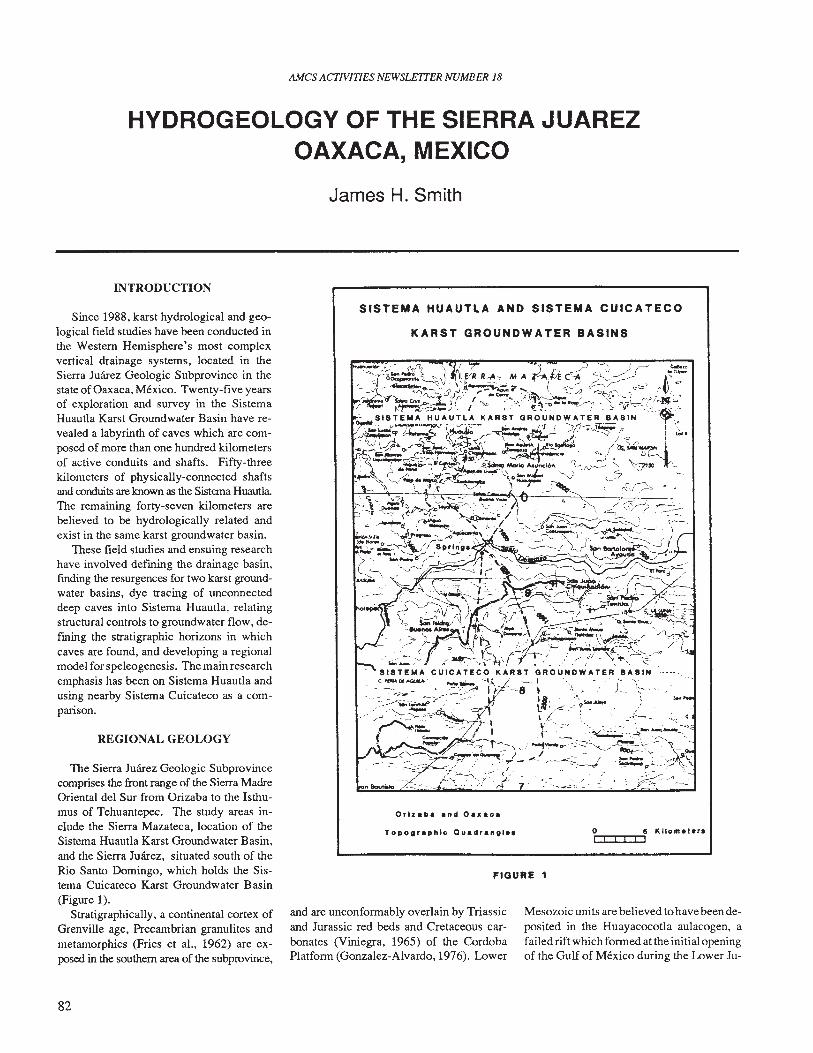
AMes ACTIVITIES NEWSLETTER NUMBER 18
HYDROGEOLOGY OF THE SIERRA JUAREZOAXACA, MEXICO
James H. Smith
INTRODUCTION
SISTEMA HUAUTLA AND SISTEMA CUICATECO
KARST GROUNDWATER BASINS
FIGURE 1
Since 1988, karst hydrological and geological field studies have been conducted inthe Western Hemisphere's most complexvertical drainage systems, located in theSierra Juarez Geologic Subprovince in thestate of Oaxaca, Mexico. Twenty-five yearsof exploration and survey in the SistemaHuautla Karst Groundwater Basin have revealed a labyrinth of caves which are composed of more than one hundred kilometersof active conduits and shafts. Fifty-threekilometers of physically-connected shaftsand conduits are known as the Sistema HuautlaThe remaining forty-seven kilometers arebelieved to be hydrologically related andexist in the same karst groundwater basin.
These field studies and ensuing researchhave involved defming the drainage basin,fmding the resurgences for two karst groundwater basins, dye tracing of unconnecteddeep caves into Sistema Huautla, relatingstructural controls to groundwater flow, defming the stratigraphic horizons in whichcaves are found, and developing a regionalmodel for speleogenesis. The main researchemphasis has been on Sistema Huautla andusing nearby Sistema Cuicateco as a comparison.
REGIONAL GEOLOGY
The Sierra Juarez Geologic Subprovincecomprises the front range of the Sierra MadreOriental del Sur from Orizaba to the Isthumus of Tehuantepec. The study areas include the Sierra Mazateca, location of theSistema Huautla Karst Groundwater Basin,and the Sierra Juarez, situated south of theRio Santo Domingo, which holds the Sistema Cuicateco Karst Groundwater Basin(Figure 1).
Stratigraphically, a continental cortex ofGrenville age, Precambrian granulites andmetamorphics (Fries et aI., 1962) are exposed in the southern area of the subprovince,
82
Orlzaba and Oa.aca
Topographic Quadrangl••
and are unconformably overlain by Triassicand Jurassic red beds and Cretaceous carbonates (Viniegra, 1965) of the CordobaPlatform (Gonzalez-Alvardo, 1976). Lower
0[1::r::oo:::if Kilo m• t • ra
Mesozoic units are believed to have been deposited in the Huayacocotla aulacogen, afailed rift which formed at the initial openingof the Gulf of Mexico during the Lower Ju-
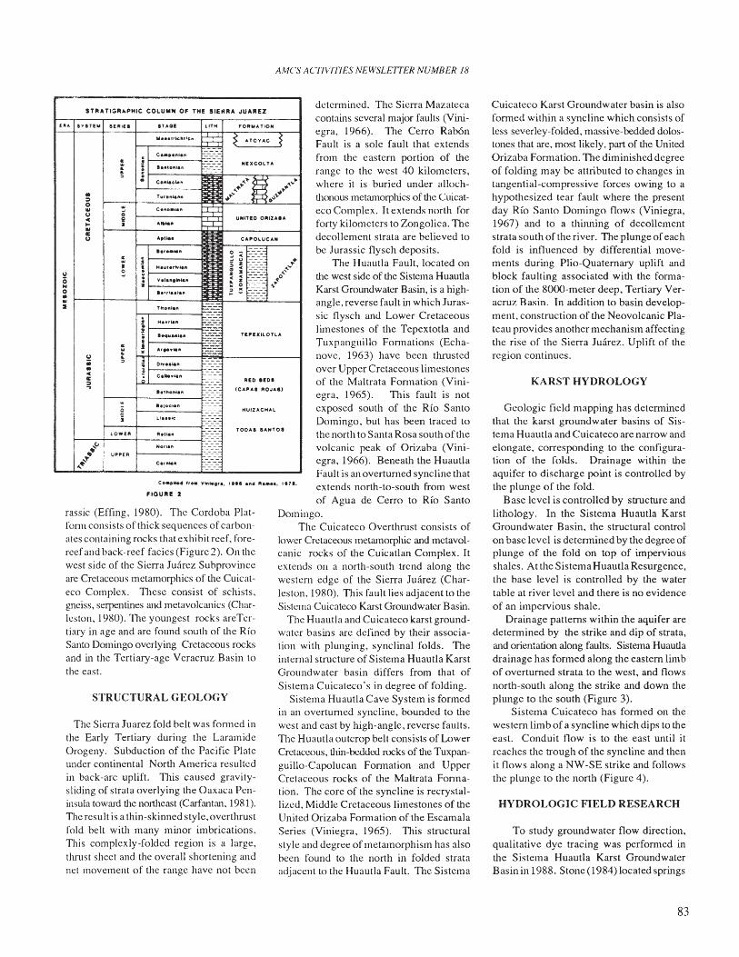
AMes ACTIVITIES NEWSLETTER NUMBER 18
~-"-----------------.,STR" T1:lRI.PHIC COLUMN OF TH! SIERR" JUAREZ
To study groundwater now direction,qualitative dye tracing was performed intlle Sistema Huautla Karst GroundwaterBasinin 1988. Stone (1984) located springs
HYDROLOGIC FIELD RESEARCH
Geologic field mapping has detenninedthat thc karst groundwater basins of Sistema Huautla and Cuicateco are narrow andelongate, corresponding to the configuration of the folds. Drainage within theaquifer to discharge point is controlled bythe plunge of the fold.
Base level is controlled by structure andlithology. In the Sistema Huautla KarstGroundwater Basin, the structural controlon base level is detennined by the degree ofplunge of the fold on top of imperviousshales. At the Sistema Huautla Resurgence,the base level is controlled by the watertable at river level and there is no evidenceof an impervious shale.
Drainage patterns within the aquifer aredetennined by the strike and dip of strata,and orientation along faults. Sistema Huautladrainage has fonned along the eastern limbof overturned strata to the west, and flowsnorth-south along the strike and down theplunge to the south (Figure 3).
Sistema Cuicateco has fonned on thewesten! limb of a syncline which dips to tlleeast. Conduit now is to the east until itreaches the tTough of the syncline and thenit flows along a NW-SE strike and followsthe plunge to the north (Figure 4).
KARST HYDROLOGY
Cuicateco Karst Groundwater basin is alsofonned within a syncline which consists ofless severlcy-folded, massive-bedded dolostones that are. most likely. part of the UnitedOrizaba Fonnation. The diminished degreeof folding may be attributed to changes intangential-compressive forces owing to ahypothesized tear fault where the presentday Rio Santo Domingo flows (Viniegra,1967) and to a thiJUling of decollementstrata south of the river. The plunge ofeachfold is influenced by differential movements during Plio-Quaternary uplift andblock faulting associated with the fonnation of tlle 8OC)()-meter deep, Tertiary Veracruz Basin. In addition to basin development, construction of the Neovolcanic Plateau provides another mechanism affectingthe rise of the Sierra Juarez. Uplift of meregion continues.
detennined. The Sierra Mazatecacontains several major faults (Viniegra, 1966). The Cerro RabOnFault is a sole fault that extendsfrom the eastern portion of therange to the west 40 kilometers,where it is buried under allochthonous metamorphics of the Cuicateco Complex. It extends north forforty kilometers to Zongolica. Thedecollement strata are believed tobe Jurassic flysch deposits.
The Huautla Fault, located onthe west side of the Sistema HuautlaKarst Groundwater Basin, is a highangle, reverse fault in which Jurassic flysch and Lower Cretaceouslimestones of the Tepextotla andTuxpanguillo Fonnations (Echanove, 1963) have been thrustedover Upper Cretaceous limestonesof the Maltrata Fonnation (Vini-egra, 1965). This fault is notexposed south of the Rio SantoDomingo. but has been traced tothe north to Santa Rosa south oftllevolcanic peak of Orizaba (Vini-egra, 1966). Beneath the HuautlaFault is an overturned syncline thatextends north-to-south from westof Agua de Cerro to Rio Santo
Domingo.The Cuicateco Overthrust consists of
lower Cretaceous metamorphic and metavolcanic rocks of the Cuicatlan Complex. Itextends on a north-south trend along tllewestern edge of the Sierra Juarez (Charleston. 1980). This fault lies adjacent to theSistema Cuicateco Karst Groundwater Basin.
The Huautla and Cuicateco karst groundwater basins are defined by their association with plunging, synclinal folds. Theinternal structure of Sistema Huautla KarstGroundwater basin differs from that ofSistema Cuicateco's in degree of folding.
Sistema Huautla Cave System is fonnedin an overturned syncline, bounded to thewest and cast by high-angle, reverse faults.The Huautla outcrop belt consists of LowerCretaceous, thin-bedded rocks of the Tuxpanguillo-Capolucan Fonnation and UpperCretaceous rocks of the Maltrata Fonnation. The core of the syncline is recrystallized, Middle Cretaceous limestones of tlleUnited Orizaba Fonnation of the EscamalaSeries (Viniegra. 1965). This structuralstyle and degree of metamorphism has alsobeen found to the north in folded strataadjacent to the Huautla Fault. TIle Sistema
PlIED aEO'
MUIZ .... CMAL
CA"OL-UCA"
TE"!XllOnA
FORMATION
TODA' .... NTO.
UNITeD O"'Z"."
(CAP"S ROJ"'''
liTHIiAG!
COIlO••O" ~Atltl••
IA,n••
,.,....".!
IiHaIt1.rtvl."
V.I.".Irt~"a
'."talillt
THo"IO" --c ---· HI'..,lan• ---~ ' ••"."'0" ~~:•J ...,~",,-.· --; DI.... lall
.! Calto"I_,.;.
1.11'101\1.11
_.Ioe.an
Lia•• le
"all." -Not'."
Ca,,,".
Co_".... f, •• ~11l".'•.FlOUR! :I
STRUCTURAL GEOLOGY
The Sierra Juarez fold belt was fonned inthe Early Tertiary during the LaramideOrogeny. Subduction of the Pacific Plateunder continental North America resultedin back-arc uplift. TIlis caused gravitysliding of strata overlying the Oaxaca Peninsula toward the nortlleast (Carfrultrul, 1981).TIle result is a thin-skinned style, overthrustfold belt with many minor imbrications.TIlis complexly-folded region is a large,thrust sheet and the overall shortening andnel movement of the range have not been
rassic (Effing, 1980). The Cordoba Platform consists of thick seq uences of carbonates containing rocks that exhibit reef, forereef and back-reef facies (Figure 2). On thewest side of the Sierra Juarez Subprovinceare Cretaceous metamorphics of the Cuicatceo Complex. TIlese consist of schists.gnciss, serpentines and metavolcruucs (Charleston, 1980). The youngest rocks areTcrtiary in age and arc found south of the RioSanto Domingo overlying Cretaceous rocksand in the Tertiary-age Veracruz Basin tothe east.
~·~•:>0 w..U 0c II.. •.."u
c;
U ~0..0•..1I
~u ~;; ,•c"::
Q2•
lOWEll
I .~~ UPPER,'",,"
ElU. IVIn.. SERlE.
83
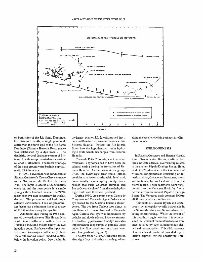
•
SISTEt.lA HUAUTLAOAXACA, lloIEXICO'o'I:It!llOft ,nltUjl,lty, "to (.....::S)
PLAN' "OlATEO J52.0 OEGR[(S
t '''2 l00! 1009C,ta.
AMes ACflVlTIES NEWSLETTER NUMBER 18
SISTEMA HUAUTLA HYDROLOGIC NETWORK
o,.f.c.,.'.....7·.......n ... HUAunA REII.HItGlWCI "-
""'" 0~'/~
""'M "YOtltOLOGIC PLOW "oun CHY"OTHf.IIZao,)',-------\~'''.... In. IWIUllIn_cu.y ... 01 P'NA COLO"ADA
'aY
..... H,~o'•••"'''' ftow ....t. of C..... de ...... Carlot••
FlOUR. :s
on both sides of the Rio Santo Domingo.For Sistema Huautla, a single perennial,outflow on the north wall of the Rio SantoDomingo (Sistema Huautla Resurgence)was established by a dye trace. Thedendritic, vertical drainage system of Sistema Huautla was proven to have a verticalrelief of 1770 meters. The linear drainageof the karst groundwater basin is approximatly 17 kilometers.
In 1990, a dye trace was conducted atSistema Cuicateco's Cueva Cheve entranceto the Nacimiento de Rio Frio de SantaAna. The input is located at 2720 meterselevation and the resurgence is a singlespring at three hundred meters. The 2420meter-deep dye trace is currently the world'sdeepest. The proven vertical hydrologicextent is 2580 meters. The elongate drainage basin has a minimum linear drainageof 21 kilometers along the syncline.
Additional dye tracing in 1988 connected the vertical caves Nita He and NitaNashi into confluences within SistemaHuautla a thousand meters below the dyeinjection point. Surface swallet input wasalso traced to a major confluence (Li NitaWaterfall Room) seven hundred metersbelow the injection point. Dye tracing in
84
the largest swallet, Rio Iglesia, proved that itdoes not flow into stream confluences withinSistema Huautla. Instead, the Rio Iglesiaflows into the hypothesized main hydrologic route which discharges from SistemaHuautla.
Cueva de Pena Colorada, a wet weatheroverflow, is hypothesized to have been theoriginal spring during the fonnation of Sistema Huautla. As the mountain range uplifted, the hydrologic flow route fonnedconduits at a lower stratigraphic level and,consequently, a new spring. A dye traceproved that Pena Colorada entrance andSump One are isolated from the main hydrologic route and therefore perched.
During 1990, the stream caves Cueva deCongrueo and Cueva de Agua Carlota weredye traced to the Sistema Huautla Resurgence. The dye from Carlota took almost amonth to exit. It was observed in Cueva deAgua Carlota that dye was impounded bypotholes and slowly released into cave streams.It is further hypothesized that dye was alsoimpounded in deep sumps in phreatic loopsunder low flow conditions at a base levelwith low gradient (Figure 3).
TIle dye from Sistema Cuicateco exitedafter eight days, indicating a steady gradient
along the base level with, perhaps, briefimpoundments.
SPELEOGENESIS
In Sistema Cuicateco and Sistema HuautlaKarst Groundwater Basins, surficial features indicate a fluvial overprinting relatedto the ancient Papalo Drainge Basin. Helu,et al.. (1977) described a thick sequence ofMiocene conglomerates consisting of Jurassic clastics, Cretaceous limestones, chertsand metamorphic rocks derived from theSierra Juarez. These sediments were transported into the Veracruz Basin by fluvialcurrents from an ancient Papalo DrainageBasin. The Veracruz basin contains 5000 to8000 meters of such sediments.
Remnants of Jurassic flysch and Cretaceous metamorphics overlie carbonates inthe Sierra Mazateca and Sierra Juarez indicating overthrusting. While the extent ofthis overthrusting is not clear, it is hypothesized that much of the western Sierras wereonce covered by such allochthonous clastics and metamorphics. This thick sequenceof noncarbonate material provided a protective caprock for the underlying limestones.
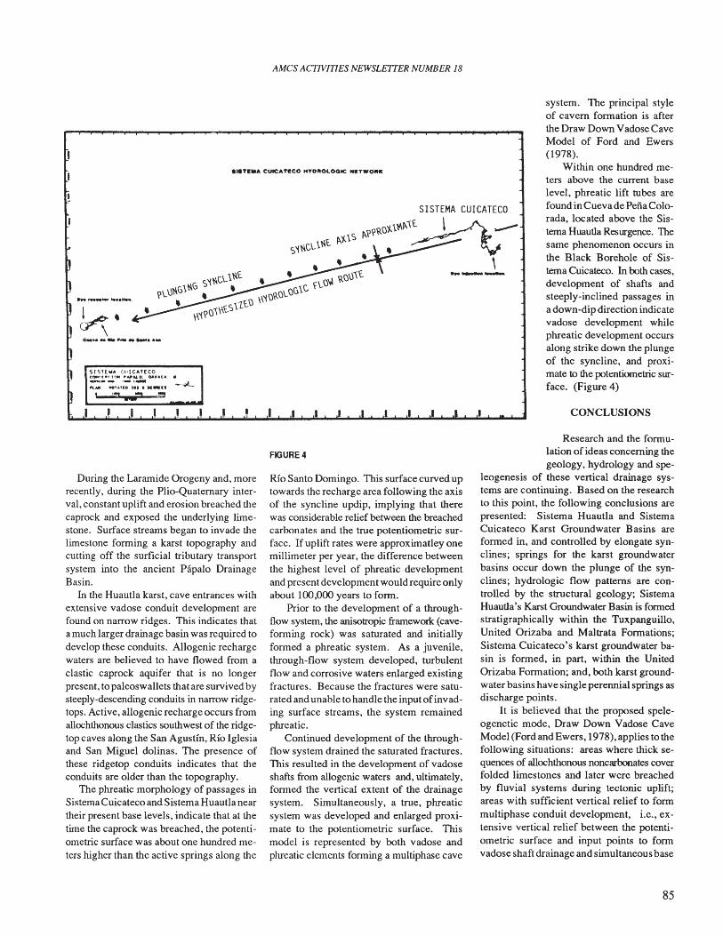
AMCS ACTIVITIES NEWSLETTER NUMBER 18
•••T••• CUICATI!CO HYOJIIOLOOtC NIT_OIlt.
~.\
0 ,.. ..
system. The principal styleof cavern formation is afterthe Draw Down Vadose CaveModel of Ford and Ewers(1978).
Within one hundred meters above the current baselevel, phreatic lift tubes arefound in Cueva de PenaColorada, located above the Sistema Huautla Resurgence. Thesame phenomenon occurs inthe Black Borehole of Sistema Cuicateco. In both cases,development of shafts andsteeply-inclined passages ina down-dip direction indicatevadose development whilephreatic development occursalong strike down the plungeof the syncline, and proximate to the potentiometric surface. (Figure 4)
CONCLUSIONS
During the Laramide Orogeny and, morerecently, during the Plio-Quaternary interval, constant uplift and erosion breached thecaprock and exposed the underlying limestone. Surface streams began to invade thelimestone forming a karst topography andcutting off the surficial tributary transportsystem into the ancient Papalo DrainageBasin.
In the Huautla karst, cave entrances withextensive vadose conduit development arefound on narrow ridges. This indicates thata much larger drainage basin was required todevelop these conduits. Allogenic rechargewaters are believed to have flowed from aclastic caprock aquifer that is no longerpresent, topaleoswallets that are survived bysteeply-descending conduits in narrow ridgetops. Active, allogenic recharge occurs fromallochthonous clastics southwest of the ridgetop caves along the San Agustin, Rio Iglesiaand San Miguel dolinas. The presence ofthese ridgetop conduits indicates that theconduits are older than the topography.
The phreatic morphology of passages inSistema Cuicateco and Sistema Huautla neartheir present base levels, indicate that at thetime the caprock was breached, the potentiometric surface was about one hundred meters higher than the active springs along the
FIGURE 4
Rio Santo Domingo. This surface curved uptowards the recharge area following the axisof the syncline updip, implying that therewas considerable relief between the breachedcarbonates and the true potentiometric surface. If uplift rates were approximatley onemillimeter per year, the difference betweenthe highest level of phreatic developmentand present development would require onlyabout 100,000 years to form.
Prior to the development of a throughflow system, the anisotropic framework (caveforming rock) was saturated and initiallyformed a phreatic system. As a juvenile,through-flow system developed, turbulentflow and corrosive waters enlarged existingfractures. Because the fractures were saturated and unable to handle the input ofinvading surface streams, the system remainedphreatic.
Continued development of the throughflow system drained the saturated fractures.This resulted in the development of vadoseshafts from allogenic waters and, ultimately,formed the vertical extent of the drainagesystem. Simultaneously, a true, phreaticsystem was developed and enlarged proximate to the potentiometric surface. Thismodel is represented by both vadose andphreatic elements fornling a multiphase cave
Research and the formulation of ideas concerning thegeology, hydrology and spe
leogenesis of these vertical drainage systems are continuing. Based on the researchto this point, the following conclusions arepresented: Sistema Huautla and SistemaCuicateco Karst Groundwater Basins areformed in, and controlled by elongate synclines; springs for the karst groundwaterbasins occur down the plunge of the synclines; hydrologic flow patterns are controlled by the structural geology; SistemaHuautla's Karst Groundwater Basin is formedstratigraphically within the Tuxpanguillo,United Orizaba and Maltrata Formations;Sistema Cuicateco's karst groundwater basin is formed, in part, within the UnitedOrizaba Formation; and, both karst groundwater basins have single perennial springs asdischarge points.
It is believed that the proposed speleogenetic mode, Draw Down Vadose CaveModel (Ford and Ewers, 1978), applies to thefollowing situations: areas where thick sequences of allochthonous noncarbonates coverfolded limestones and later were breachedby fluvial systems during tectonic uplift;areas with sufficient vertical relief to formmultiphase conduit development, i.e., extensive vertical relief between the potentiometric surface and input points to formvadose shaft drainage and simultaneous base
85
AMCS ACTIVITIES NEWSLETTER NUMBER 18
level phreatic development; areas where allogenic waters from a clastic or metamorphic caprock flow into a vadose cave system;and, areas with an anisotropic frameworkdeveloped in a folded syncline. This may beapplicable as a regional model for similarhydrogeologic conditions.
This research will culminate in a Master's thesis advised by Dr. Nicholas C.Crawford, director of the Center for Caveand Karst Studies, Western Kentucky University.
REFERENCES
Carfantan, J. Ch. (1981) Paleogeographyand Tectonics Of The Sierra De JuarezIsthumus Of Tehuantepec Area And ItsRelations With Other Terranes Of Southern Mexico and Central America. Geological Society Of America Abstract WithPrograms, Vol. 13 (2), p.48.
Carfantan, J. Ch. (1981) Evolucion Estructural Del Sureste De Mexico; PaleogerafiaE Historia Tectonica De Las Zonas Internas Mesozoicas. Univ. Nal. Auton. Mexico,Inst. Geologia, Revista, Vol. 5 (2), pp.207-216.
Charleston, S. (1980) Stratigraphy and Teetonics of the Rio Santo Domingo Area,State Of Oaxaca, Mexico. 260. CongresGeologique Int. (Paris) Resume(Abstracts),Vol. 1, sections 1 a 5 , p. 324.
Effing, Reinhard S. (1980) The HuayacoctlaAulacogen In Mexico (Lower Jurassic)and The Origin Of The Gulf Of Mexico.The Ori-gin Of The Gulf Of Mexico AndThe Early Opening Of The Central NorthAtlantic Ocean. (Rex Pilger, ed.) Proceedings Of A Symposium at Lousiana StateUniversity, Baton Rouge, March 3, 4, 5,pp.79-86.
Echanove, O. A. E. (1963) Estratigrafia DeUna Porcion De La Sierra Madre Oriental
Comprendida Entre Huautla De Jimenz,Oaxaca Y Coyomeapan, Puebla. Tesis Profesional, U.N.A.M., Mexico, D.F., 112 p.
Ford, D. C. and Ewers, R. O. (1978) TheDevelopment Of Limestone Cave Systems In The Dimensions Of Length AndDepth. Canadian Journal Of Science, Vol.15 (11), pp.1783-1798.
Fries, C. Jr. and Schmitter, E. (1962) RocasPrecambricas De Edad Grenvilliana de laParte Central De Oaxaca En Oaxaca EnSur De Mexico. Boletin Universidad NacionalAutonoma de Mexico, Instituto de Geologia, Vol. 64 (3), pp. 45-53.
Gonzalez-Alvardo, J. (1976) ResultadosObtiendos en la Exploracion dela Platforma Cordoba y Principales Campos Productores. Bol. Soc. Geol. Mexicana TomoXXXVII, No.2, pp. 53-60.
Helu, P. C., Verdugo, R. V., and RodolfoBarcenas P. (1977) Origin and DistributionOf Tertiary Conglomerates, Veracruz Basin,Mexico. American Association Of Petroleum Geologists, Vol. 61, No.2, pp. 207222.
Stone, W. (1984) The 1984 Pena ColoradaExpedition. Report submitted to the government of Mexico, July 6th, 1984, p104
Viniegra, O. F. (1965) Geologia del Macizode Teziutlan y Cuenca Cenozoica deVeracruz. Bol. Asoc. Mex. de Geo. Petroleros, Vol. 17, pp. 101-163.
Viniegra, O. F. (1966) Paleogeografia Y Teetonica Del Mesozoico En La Provincia DeLa Sierra Madre Y Macizo De Teziutlan.Bol. Asoc. Mex. de Geo. Petroleros, Vol.18 (7-8), pp. 147- 171.
HIDROGEOLOGIA DE LA SIERRA JUAREZ, OAXACA
Desde 1988, se han estado realizando estudios hidrol6gicos y geol6gicos en el sistema de drenaje vertical mas complejo conocidoen el hemisferio occidental, localizado en la subprovincia geol6gica de la Sierra Juarez en el estado de Oaxaca. Veintecinco ariasde exploraci6n y topografia en la cuenca acuffera de Huautla han revelado un laberinto de cuevas, las cuales estan formadas pormas de 100 kil6mctros de conductos activos y tiros. Cincucnta y tres kil6metros de pozos y conductos ffsicamente conectados sonconocidos como Sistema Huautla. Los rcstantes 47 kil6metros se considera estan hidrologicamentc relacionados y existen en lamisma cuenca acuffera. El principal enfasis de la investigaci6n ha sido en Sistema Huautla, emplcando el ccrcano Sistema Cuicatecocomo un comparaci6n.
86
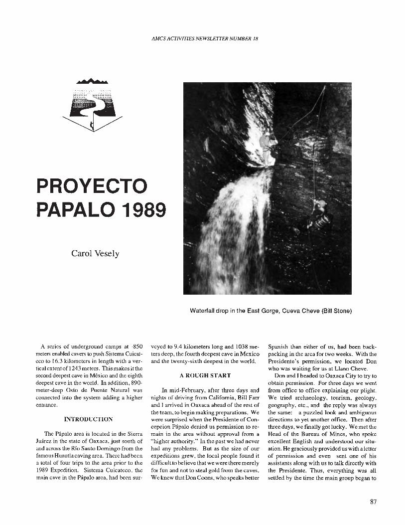
AMes ACTIVITIES NEWSLETTER NUMBER 18
• °1"'to ao
PROVECTOPAPALO 1989
Carol Vesely
Waterfall drop in the East Gorge, Cueva Cheve (Bill Stone)
A series of underground camps at -850meters enabled cavers to push Sistema Cuicateco to 16.3 kilometers in length with a vertical extent of1243 meters. This makes it thesecond deepest cave in Mexico and the eighthdeepest cave in the world. In addition, 890meter-deep Osto de Puente Natural wasconnected into the system adding a higherentrance.
INTRODUCTION
The Papalo area is located in the SierraJuarez in the state of Oaxaca, just south ofand across the RIO Santo Domingo from thefamous Huautla caving area. There had beena total of four trips to the area prior to the1989 Expedition. Sistema Cuicateco, themain cave in the Papalo area, had been sur-
veyed to 9.4 kilometers long and 1038 meters deep, the fourth deepest cave in Mexicoand the twenty-sixth deepest in the world.
A ROUGH START
In mid-February, after three days andnights of driving from California, Bill Farrand I arrived in Oaxaca ahead of the rest ofthe team, to begin making preparations. Wewere surprised when the Presidente of Concepcion Papalo denied us permission to remain in the area without approval from a"higher authority." In the past we had neverhad any problems. But as the size of ourexpeditions grew, the local people found itdifficult to believe that we were there merelyfor fun and not to steal gold from the caves.We knew that Don Coons, who speaks better
Spanish than either of us, had been backpacking in the area for two weeks. With thePresidente's permission, we located Donwho was waiting for us at Llano Cheve.
Don and I headed to Oaxaca City to try toobtain permission. For three days we wentfrom office to office explaining our plight.We tried archaeology, tourism, geology,geography, etc., and the reply was alwaysthe same: a puzzled look and ambiguousdirections to yet another office. Then afterthree days, we fmally got lucky. Wernet theHead of the Bureau of Mines, who spokeexcellent English and understood our situation. He graciously provided us with a letterof permission and even sent one of hisassistants along with us to talk directly withthe Presidente. Thus, everything was allsettled by the time the main group began to
87
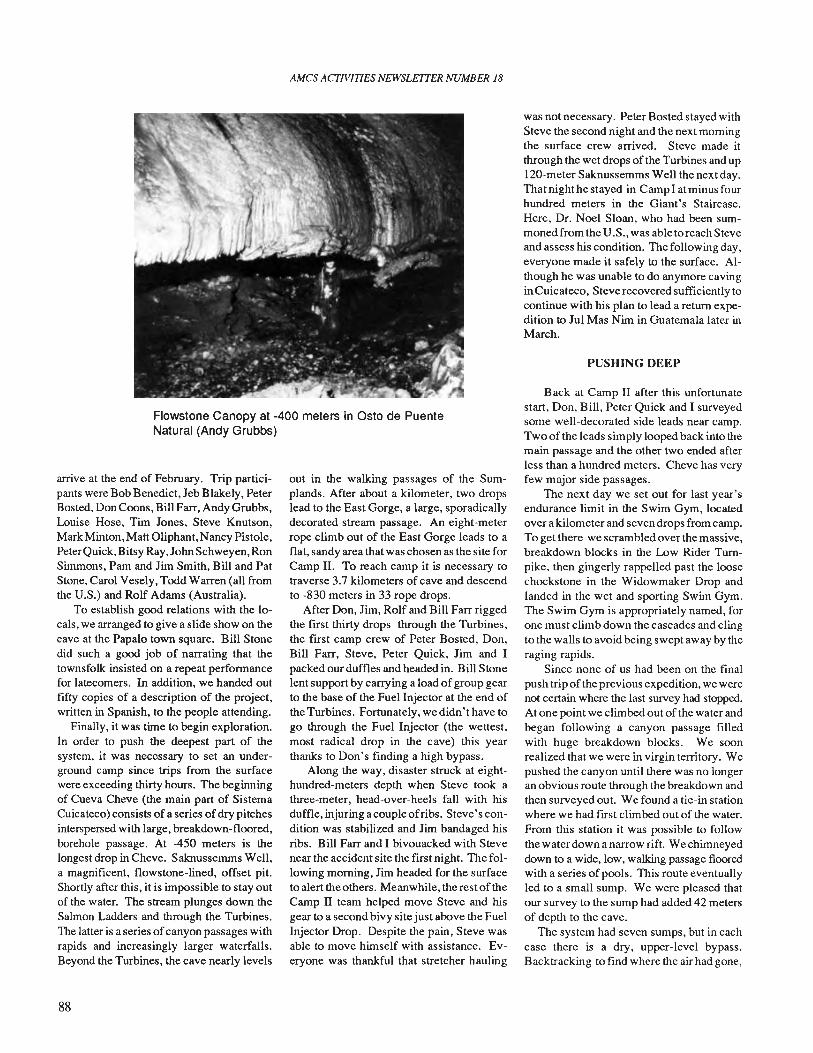
AMes ACfIVITIES NEWSLETTER NUMBER 18
Flowstone Canopy at -400 meters in Osto de PuenteNatural (Andy Grubbs)
arrive at the end of February. Trip participants were Bob Benedict, Jeb Blakely, PeterBosted, Don Coons, Bill Farr, Andy Grubbs,Louise Hose, Tim Jones, Steve Knutson,Mark Minton, Matt Oliphant, Nancy Pistole,PeterQuick,Bitsy Ray, John Schweyen, RonSimmons, Pam and Jim Smith, Bill and PatStone, Carol Vesely, Todd Warren (all fromthe V.S.) and Rolf Adams (Australia).
To establish good relations with the locals, we arranged to give a slide show on thecave at the Papalo town square. Bill Stonedid such a good job of narrating that thetownsfolk insisted on a repeat performancefor latecomers. In addition, we handed outfifty copies of a description of the project,written in Spanish, to the people attending.
Finally, it was time to begin exploration.In order to push the deepest part of thesystem, it was necessary to set an underground camp since trips from the surfacewere exceeding thirty hours. The beginningof Cueva Cheve (the main part of SistemaCuicateco) consists of a series of dry pitchesinterspersed with large, breakdown-floored,borehole passage. At -450 meters is thelongest drop in Cheve. Saknussemms Well,a magnificent, flowstone-lined, offset pit.Shortly after this, it is impossible to stay outof the water. The stream plunges down theSalmon Ladders and through the Turbines.The latter is a series ofcanyon passages withrapids and increasingly larger waterfalls.Beyond the Turbines, the cave nearly levels
88
out in the walking passages of the Sumplands. After about a kilometer, two dropslead to the East Gorge, a large, sporadicallydecorated stream passage. An eight-meterrope climb out of the East Gorge leads to aflat, sandy area that was chosen as the site forCamp II. To reach camp it is necessary totraverse 3.7 kilometers of cave and descendto -830 meters in 33 rope drops.
After Don, Jim, Rolf and Bill Farr riggedthe first thirty drops through the Turbines,the first camp crew of Peter Bosted, Don,Bill Farr, Steve, Peter Quick, Jim and Ipacked our duffles and headed in. Bill Stonelent support by carrying a load ofgroup gearto the base of the Fuel Injector at the end ofthe Turbines. Fortunately, we didn't have togo through the Fuel Injector (the wettest,most radical drop in the cave) this yearthanks to Don's finding a high bypass.
Along the way, disaster struck at eighthundred-meters depth when Steve took athree-meter, head-over-heels fall with hisduffle, injuring a couple ofribs. Steve's condition was stabilized and Jim bandaged hisribs. Bill Farr and I bivouacked with Stevenear the accident site the first night. The following morning, Jim headed for the surfaceto alert the others. Meanwhile, the rest oftheCamp II team helped move Steve and hisgear to a second bivy site just above the FuelInjector Drop. Despite the pain, Steve wasable to move himself with assistance. Everyone was thankful that stretcher hauling
was not necessary. Peter Bosted stayed withSteve the second night and the next morningthe surface crew arrived. Steve made itthrough the wet drops of the Turbines and upl20-meter Saknussemms Well the next day.That night he stayed in Camp I at minus fourhundred meters in the Giant's Staircase.Here, Dr. Noel Sloan, who had been summoned from the V .S., was able to reach Steveand assess his condition. The following day,everyone made it safely to the surface. Although he was unable to do anymore cavinginCuicateco, Steve recovered sufficiently tocontinue with his plan to lead a return expedition to Jul Mas Nim in Guatemala later inMarch.
PUSHING DEEP
Back at Camp II after this unfortunatestart, Don, Bill, Peter Quick and I surveyedsome well-decorated side leads near camp.Two of the leads simply looped back into themain passage and the other two ended afterless than a hundred meters. Cheve has veryfew major side passages.
The next day we set out for last year'sendurance limit in the Swim Gym, locatedover a kilometer and seven drops from camp.To get there we scrambled over the massive,breakdown blocks in the Low Rider Turnpike, then gingerly rappelled past the loosechockstone in the Widowmaker Drop andlanded in the wet and sporting Swim Gym.The Swim Gym is appropriately named, forone must climb down the cascades and clingto the walls to avoid being swept away by theraging rapids.
Since none of us had been on the finalpush trip ofthe previous expedition, we werenot certain where the last survey had stopped.At one point we climbed out of the water andbegan following a canyon passage filledwith huge breakdown blocks. We soonrealized that we were in virgin territory. Wepushed the canyon until there was no longeran obvious route through the breakdown andthen surveyed out. We found a tie-in stationwhere we had first climbed out of the water.From this station it was possible to followthe water down a narrow rift. We chimneyeddown to a wide, low, walking passage flooredwith a series of pools. This route eventuallyled to a small sump. We were pleased thatour survey to the sump had added 42 metersof depth to the cave.
The system had seven sumps, but in eachcase there is a dry, upper-level bypass.Backtracking to find where the air had gone,
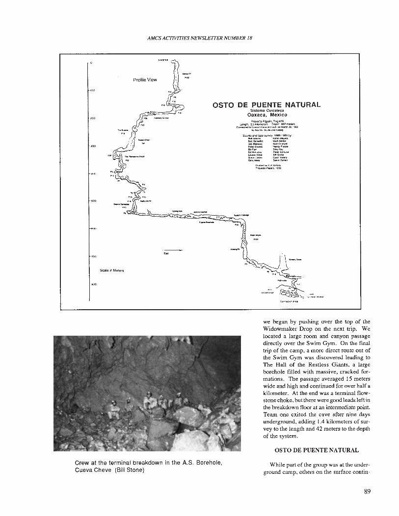
AMes ACTIVITIES NEWSLE1TER NUMBER 18
H'O
200
JOO
500
600
100
600
....
Scale in Meiers
OSTO DE PUENTE NATURALSistema Cuicateca
Oaxaca, MexicoProyecto Papalo. Tag_20
Lenglh: 2.5 kilometers Depth: 887 mel8f'SConnK1«l1O~... Che..... 2 ;ILm. on r.Qrd'I 2'9. 1989
tlyAcWl,.....s.on.anllV.M!y
Suunto and tape survey 1988·1989 by:RoItAdami K&rton Me.,enBobS.1'edoa M41"" .... l'Ilon"'-b BWtelt>y Uan 0I'9hfi1llPet... BoSltd N&t\Cf P,stolite._Fan 8IlsyRayEdHoIladay Pet., S9r0uHL.oui•• Ho" 601 SloneSuM t.u.ko CatOl v ....,.Gary Mele Steve Z.m111'
Orlfled tly C A.\lES~
P~tclo P6palO. 19119
Crew at the terminal breakdown in the A.S. Borehole,Cueva Cheve (Bill Stone)
we began by pushing over the top of theWidowmaker Drop on the next trip. Welocated a large room and canyon passagedirectly over the Swim Gym. On the finaltrip of the camp. a more direct route out ofthe Swim Gym was discovered leading toThe Hall of the Restless Giants, a largeborehole filled with massive. cracked formations. The passage averaged 15 meterswide and high and continued for over half akilometer. At the end was a terminal flowstone choke, but there were good leads left inthe breakdown floor at an intermediate point.Team one exited the cave after nine daysunderground. adding 1.4 kilometers of survey to the length and 42 meters to the depthof the system.
OSTO DE PUENTE NATURAL
While part of the group was at the underground camp, others on the surface contin-
89
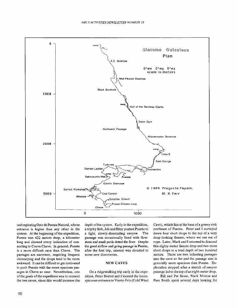
AMes ACTIVITIES NEWSLETfER NUMBER 18
oS","p
®o ~U@IHtl~ ©Q!Jn©tflU@@~
PlanA.S. Borehole
1000
Nonhwest Passage
O·BH O·By O·BZ
scole in meters
2000
3000Santa's Worl<shop·~:e;';;i:.:r....
o
Frozen Chicken Loop
1000
Widowmaker Borehole
© 1989 Proyecto Popolo,
W. H. rorr
ued exploring Osto de Puente Natural, whoseentrance is higher than any other in thesystem. At the beginning of the expedition,Puente was 422 meters deep, a kilometerlong and showed every indication of connecting to Cueva Cheve. In general, Puenteis a more difficult cave than Cheve. Thepassages are narrower, requiring frequentchimneying and the drops tend to be moreawkward. It can be difficult to get motivatedto push Puente with the more spacious passages in Cheve so near. Nevertheless, oneofthe goals of the expedition was to connectthe two caves, since this would increase the
90
depth ofthe system. Early in the expedition,a trip by Bob, Jeb and Bitsy pushed Puente toa tight, slowly-descending canyon. Thepassage was occasionally lined with flowstone and small pools dotted the floor. Despitethe good airflow and going passage in Puente,after the first trip, interest was diverted tosome new discoveries.
NEW CAVES
On a ridgewalking trip early in the expedition, Peter Bosted and I located the inconspicuous entrance to Viento Frio (Cold Wind
Cave), which lies at the base ofa grassy sinknortheast of Puente. Peter and I surveyeddown four short drops to the top of a verydeep-looking fissure, where we ran out ofrope. Later, Mark and I returned to descendthis eighty-meter fissure drop and two moreshort drops to a total depth of two hundredmeters. There are two infeeding passagesinto the cave so far and the passage size isgenerally more spacious than Puente. Exploration stopped after a stretch of canyonpassage led to the top ofan eight-meter drop.
Bill and Pat Stone, Mark Minton andPam Smith spent several days looking for
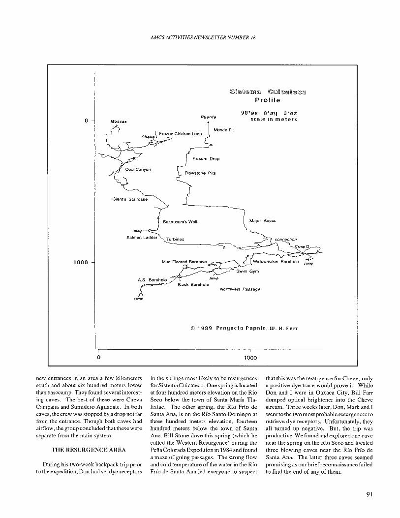
AMCS ACTIVITIES NEWSLETTER NUMBER 18
~aiS\i@:mt;) ©I!!ln@t;)u@@~
Profi Ie
o MoscasPuente
90 09M 009Y 0°02scole in meters
1000
o
Giant's Staircase
A.S. Borehole
Mondo Pit
Fissure Drop
Flowstone Pits
Northwest Passage
© 1989 Proyecto Popolo. W. H. forr
1000
new entrances in an area a few kilometerssouth and about six hundred meters lowerthan basecamp. They found several interesting caves. The best of these were CuevaCampana and Sumidero Aguacate. In bothcaves, the crew was stopped by a drop not farfrom the entrance. Though both caves hadairflow, the group concluded that these wereseparate from the main system.
THE RESURGENCE AREA
During his two-week backpack trip priorto the expedition, Don had set dye receptors
in the springs most likely to be resurgencesfor Sistema Cuicateco. One spring is locatedat four hundred meters elevation on the RioSeco below the town of Santa Maria Tlalixtac. The other spring, the Rio Frio deSanta Ana, is on the Rio Santo Domingo atthree hundred meters elevation, fourteenhundred meters below the town of SantaAna. Bill Stone dove this spring (which hecalled the Western Resurgence) during thePena Colorada Expedition in 1984 and founda maze of going passages. The strong flowand cold temperature of the water in the RioFrio de Santa Ana led everyone to suspect
that this was the resurgence for Cheve; onlya positive dye trace would prove it. WhileDon and I were in Oaxaca City, Bill Farrdumped optical brightener into the Chevestream. Three weeks later, Don, Mark and Iwent to the two most probable resurgences toretrieve dye receptors. Unfortunately, theyall turned up negative. But, the trip wasproductive. We found and explored one cavenear the spring on the Rio Seco and locatedthree blowing caves near the Rio Frio deSanta Ana. The latter three caves seemedpromising as our brief reconnaissance failedto find the end of any of them.
91
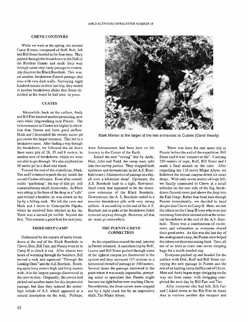
AMCS ACTIVITIES NEWSLETTER NUMBER 18
Marl< Minton at the larger of the two entrances to Cuates (Carol Vesely)
CHEVE CONTINUES
While we were at the spring, the secondCamp II team, composed of Rolf, Bob, Jeband Bill Stone headed in for four days. Theypushed through the breakdown in the Hall ofthe Restless Giants and made their waythrough some very nasty passage to eventually discover the Black Borehole. This was,yet another, breakdown-floored passage, thistime with very dark walls. Surveying eighthundred meters on their last trip, they endedat another breakdown choke that Stone described as the worst he had seen in years.
CUATES
Meanwhile, back on the surface, Andyand Bill Farr located another promising, newcave while ridgewalking near Puente. Thetwin entrances to Cuates are higher in elevation than Puente and have good airflow.Mark and I descended the twenty-meter pitjust inside the larger entrance. This led to abreakdown room. After fInding a way throughthe breakdown, we followed the air downthree more pits of 28, 35 and 8 meters, toanother area of breakdown, which we werenot able to get through. We also explored an18-meter pit in a dead-end room.
Toward the end of the expedition, Mark,Tim and I returned to push the pit inside thesecond Cuates entrance. Even after considerable "gardening", the top of this pit stillcontained many small, loose rocks. As Markwas sitting at the base of the drop in a "safe"spot behind a boulder, he was struck on thelip by a falling rock. We left the cave andMark and I drove to Concepcion Papalo,where he received four stitches in his lip.There was a second pit visible beyond thefIrst. This remains a good lead for next year.
THIRD DEEP CAMP
Undaunted by the reports of nasty breakdown at the end of the Black Borehole inCheve, Don, Bill Farr, and Nancy went in toCamp II to check it out. After almost twohours of worming through the boulders, Billmoved a rock and squeezed "Through theLooking Glass" into the AS. Borehole. Reaching up to forty meters high and forty meterswide, it is the largest passage discovered inthe cave to date. Originally, the cavers hadpicked out another name for this impressivepassage, but then they noticed the meterhigh initials of A.S. which appeared as anatural inscription on the wall. Perhaps,
92
Arne Saknussemm had been here on hisJourney to the Center of the Earth.
Joined the next "caving" day by Andy,Matt, John and Todd, the camp team splitinto two survey parties. They mapped bothupstream and downstream in the A.S. Borehole to net 1.6 kilometers ofpassage in a day,all over a kilometer deep! Upstream, theAS. Borehole lead to a tight, flowstonelined crack that appeared to be the downcave extension of the Black Borehole.Downstream, the A S. Borehole ended in amassive breakdown pile with very strongairflow. A second trip to the end of the A.S.Borehole just to poke at the breakdown failedto reveal anyway through. However, all thatair must go somewhere.
THE PUENTE-CHEVECONNECTION
As the expedition neared the end, interestin Puente returned. A marathon trip by Rolf,Louise and Bill Stone pushed through someof the tightest canyon yet discovered in thesystem and they surveyed 117 stations in ahorizontal stretch of passage at -560 meters.Several times the passage narrowed to thepoint where it was nearly impassable, prompting some to speculate that Puente mightbecome too tight before ever reaching Cheve.Nevertheless, the three cavers were stoppednot by a tight crack but by an impressiveshaft, The Major Abyss.
There was time for one more trip toPuente before the end of the expedition. BillStone said it was 'connect or die". Carrying250 meters of rope, Rolf, Bill Stone and Imade a final assault on the cave. Afterrappelling the 118-meter Major Abyss, wefollowed the stream canyon down six moredrops. With only seven meters of rope left,we fmally connected to Cheve at a smallinfeeder on the east side of the big, breakdown-floored room just above the drop intothe East Gorge. Rather than head back throughPuente immediately, we decided to headdeeper into Cheve to Camp II. Here, we metthe others on the Camp II team who were justreturning from their second stab at the terminal breakdown at the end of the AS. Borehole. There was a combination of excitement and exhaustion as everyone sharedtheir good news. As this was the last day ofthe underground camp, the Puente crew helpedthe others eat theirremaining food. Then, allten of us tried to cram into seven sleepingbags for a much-needed nap.
Everyone packed up and headed for thesurface with Don, Rolf and Bill Stone surveying the new passage in Puente and therest ofus hauling camp duffles out ofCheve.Matt and Andy began stage-derigging on theway out from camp, with derigging completed the next day by Bill Farr and Tim.
After everyone else had left, Bill Farrand I hiked down to the Rio Frio de SantaAna to retrieve another dye receptor and
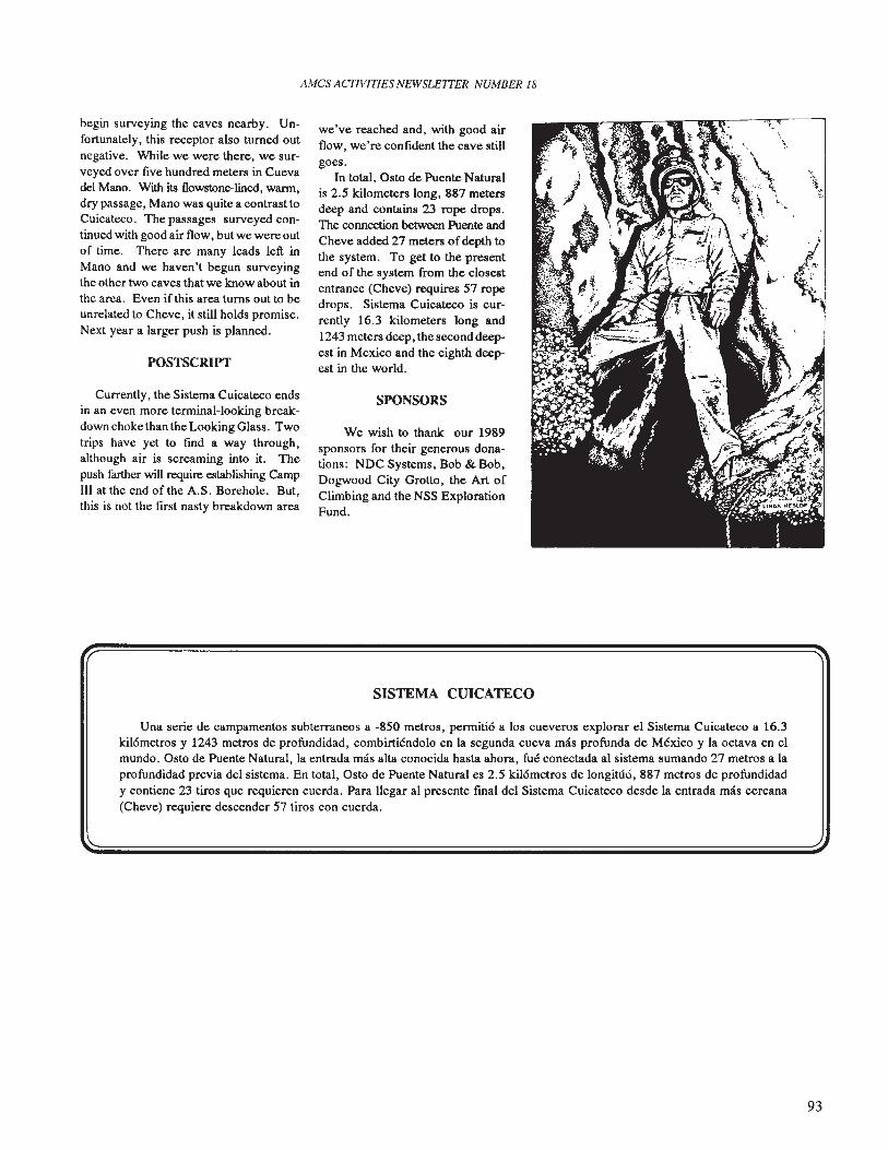
AMes ACfIVITlES NEWSLE1TER NUMBER 18
begin surveying the caves nearby. Unfortunately, this receptor also turned outnegative. While we were there, we surveyed over five hundred meters in Cuevadel Mano. With its tlowstone-lined, warm,dry passage, Mano was quite a contrast toCuicateco. The passages surveyed continued with good air flow, but we were outof time. There are many leads left inMano and we haven't begun surveyingthe other two caves that we know about inthe area. Even if this area turns out to beunrelated to Cheve, it still holds promise.Next year a larger push is planned.
POSTSCRIPT
Currently, the Sistema Cuicateco endsin an even more terminal-looking breakdown choke than the Looking Glass. Twotrips have yet to find a way through,although air is screaming into it. Thepush farther will require establishing CampIII at the end of the A.S. Borehole. But,this is not the first nasty breakdown area
we've reached and, with good airflow, we're confident the cave stillgoes.
In total, Osto de Puente Naturalis 2.5 kilometers long, 887 metersdeep and contains 23 rope drops.The connection between Puente andCheve added 27 meters ofdepth tothe system. To get to the presentend of the system from the closestentrance (Cheve) requires 57 ropedrops. Sistema Cuicateco is currently 16.3 kilometers long and1243 meters deep, the second deepest in Mexico and the eighth deepest in the world.
SPONSORS
We wish to thank our 1989sponsors for their generous donations: NDC Systems, Bob & Bob,Dogwood City Grotto, the Art ofClimbing and the NSS ExplorationFund.
SISTEMA CUICATECO
Una serie de campamentos subterraneos a -850 metros, permiti6 a los cueveros explorar el Sistema Cuicateco a 16.3kil6metros y 1243 metros de profundidad, combirtiendolo en la segunda cueva mas profunda de Mexico y la octava en elmundo. Osto de Puente Natural, la entrada mas alta conocida hasta ahora, fue conectada al sistema sumando 27 metros a laprofundidad previa del sistema. En total, Osto de Puente Natural es 2.5 kil6metros de 10ngitt1o, 887 metros de profundidady contiene 23 tiros que requieren cuerda. Para llegar al presente fmal del Sistema Cuicateco desde la entrada mas cercana(Cheve) requiere descender 57 tiros con cuerda.
93
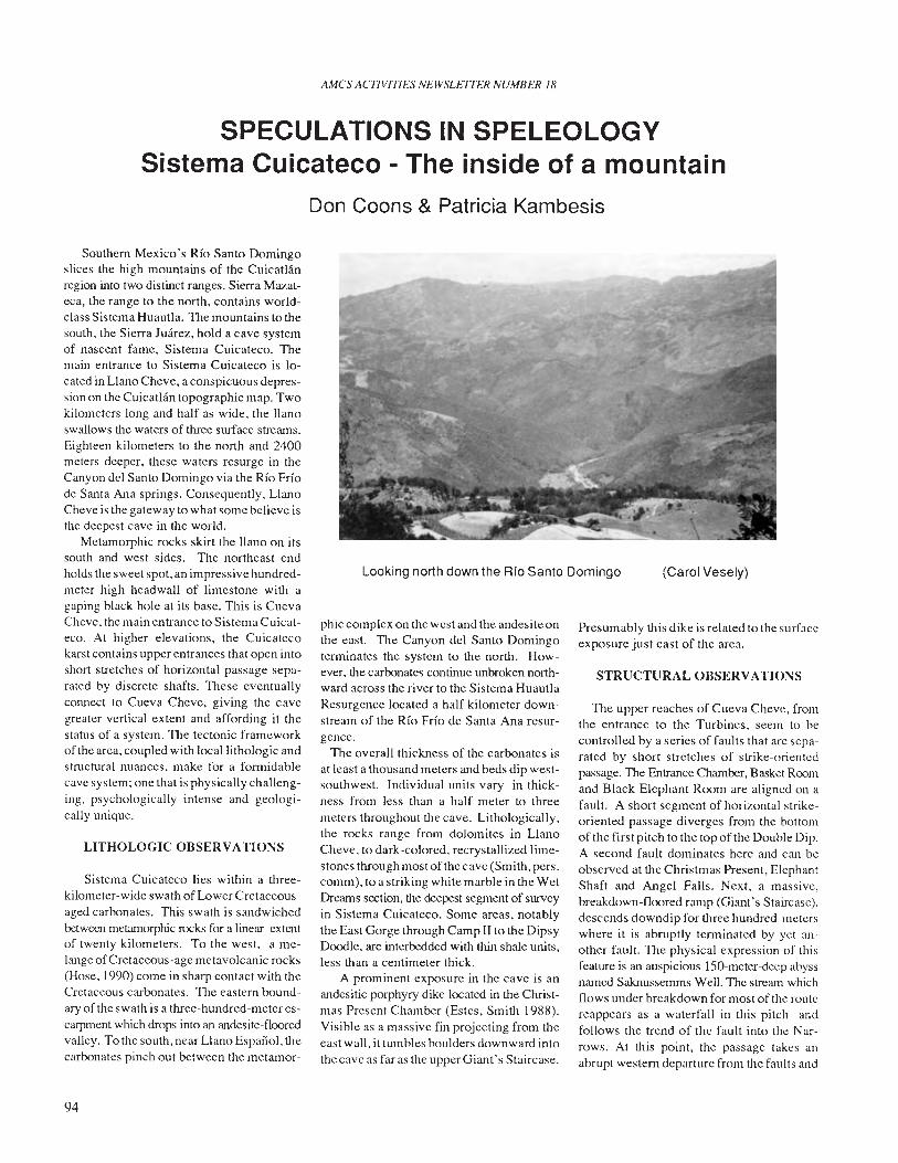
AMes ACTIVITIES NEWSLE1TER NUMBER 18
SPECULATIONS IN SPELEOLOGYSistema Cuicateco - The inside of a mountain
Don Coons & Patricia Kambesis
STRUCTURAL OBSERVAnONS
Looking north down the Rfo Santo Domingo
Southem Mexico's Rio Santo Domingoslices the high mountains of the Cuicatlanregion into two distinct ranges. Sierra Mazateca, the range to the north, contains worldclass Sistema Huautla. The mountains to thesouth. the Sierra Juarez, hold a cave systemof nascent fame, Sistema Cuicateco. Themain entrance to Sistema Cuicateco is located in Llano Cheve, a conspicuous depression on the Cuicatlan topographic map. Twokilometers long and half as wide, the llanoswallows the waters of three surface streams.Eighteen kilometers to the north and 2400meters deeper, these waters resurge in theCanyon del Santo Domingo via the Rio Friode Santa Ana springs. Consequently, LlanoCheve is the gateway to what some believe isthe deepest eave in the world.
Metamorphic rocks skirt the llano on itssouth and west sides. The northeast endholds the sweet spot, an impressive hundredmeter high headwall of limestone with agaping black hole at its base. This is CuevaCheve, the main entrance to Sistema Cuicateco. At higher elevations, the Cuieatecokarst contains upper entrances that open intoshort stretches of horizontal passage separated by discrete shafts. TIlese eventuallyconnect to Cueva Cheve, giving the cavegreater vertical extent and affording it thestatus of a system. The tectonic frameworkof the area, coupled with local lithologic andstructural nuances, make for a fonnidablecave system; one that is physically challenging. psychologically intense and geologically unique.
LITHOLOGIC OBSERVATIONS
Sistema Cuicateco lies within a threekilometer-wide swath of Lower Cretaceousaged carbonates. This swath is sandwichedbetween metanlOrphic rocks for a linear extentof twenty kilometers. To the west, a melange of Cretaceous-age metavolcanic rocks(Hose, 1990) come in sharp contact with theCretaceous carbonates. The eastem boundary of the swath is a three-hundred-meter escarpment which drops into an andesite-flooredvalley. To the south, near Llano Espai'ioL thecarbonates pinch out between the metamor-
94
phic complex on the west and the andesite onthe east. TIle Canyon del Santo Domingotenninates the system to the north. However, the carbonates continue unbroken northward across the river to the Sistema HuautlaResurgence located a half kilometer downstream of the Rio Frio de Santa Ana resurgence.
The overall thickness of the carbonates isat least a thousand meters and beds dip westsouthwest. Individual units vary in thickness from less than a half meter to threemeters throughout the cave. Lithologically,the rocks range from dolomites in LlanoCheve, to dark-colored. recrystallized limestones through most ofthecave (Smith, pers.comm), to a striking white marble in the WetDreams section. the deepest segment of surveyin Sistema Cuicateco. Some areas, notablythe East Gorge through Camp II to the DipsyDoodle, are interbedded with thin shale units,less than a centimeter thick.
A prominent exposure in the cave is anandesitic porphyry dike located in the Christmas Present Chamber (Estes, Smith 1988).Visible as a massive fin projecting from theeast wall, it tumbles boulders downward intothe cave as far as the upper Giant's Staircase.
(Carol Vesely)
Presumably this dike is related to the surfaceexposure just east of the area.
TIle upper reaches of Cueva Cheve. fromthe entrance to the Turbines, seem to becontrolled by a series of faults that are separated by short stretches of strike-orientedpassage. The Entrance Olamber, Basket Roomand Black Elephant Room are aligned on afault. A short segment of horizontal strikeoriented passage diverges from the bottomof the lirstpitch to the topofthe Douhle Dip.A second fault dominates here and can beobserved at the Christmas Present, ElephantShaft and Angel Falls. Next, a massive.breakdown-floored ramp (Giant's Staircase).descends downdip for three hundred meterswhere it is abruptly tenninated by yet another fault. The physical expression of thisfeature is an auspicious ISO-meter-deep abyssnamed Sakllussemms Well. The streanl whichflows under breakdown for most of the routereappears as a waterfall in this pitch andfollows the trend of the fault into the Narrows. At this point, the passage takes anabrupt westem departure from the faults and
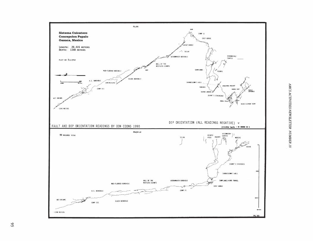
PLAN
:to
~:to
9:s:::!t;;
~~t'>l
~:>;:j
<;
~I:!:l
~......Co:>
.'
SAKNUSSEMH'S WELL
GIANT'S STAIRCASE
possible faults I • _ ••
SlIlPLANDS/WIHO TUNNEL
ESCONOIOA-
PUENTE CUATES ) I~ MOSCAS
VIENTO
( FRIO
)
CAMP II
CAMP II
SELVA
.-'\ SELVA
J
.,;!,."'./OIPSEYOOOOlE
WIOOWHAKER BOREHOLE
DIP ORIENTATION (ALL READINGS NEGATIVE) T
HALL OF THERESTLESS GIANTS
HALL Of THERESTLESS GIAIHS
CAMP III
A.S. BOREHOLE
20,415 METERS
1340 METERS
MUD-FLOORED BOREHOLE
A.S. BOREHOLE
MUD-FLOORED BOREHOLE
PLOT BY ELLIPSE
PROFILE
90 DEGREE VI EW
LENGTH:DEPTH:
Sistema CuicatecoConcepcion Papal0Oaxaca, Mexico
,..
__.J.--~__
./ -1340 METERS
WET DREAMS
FAULT AND DIP ORIENTATION READINGS BY DON COONS 1990
WET DREAMS
CAMP IIIBLACK BOREHOLE
-1340 METERS
I,QVI
the stream picks up gradient as it cascadesdowndip through the Salmon Ladders andout into the Turbines.
Here, the nature of the cave changesdramatically. What had been a steeply descending series of vertical shafts and ramps,becomes horizontal streamway, shifting fromahigh, narrow canyon above the Turbines, toa wide elliptical tube through the Sumplands. A tributary just above the WindTunnel brings in a major infeeder, possiblydraining as far south as Llano Espanol. Thedimensions of the cave increase past thePuente connection and into the East Gorgewhere the character of the passage changesagain to a high, bi-Ievel canyon before plunging into a sump. The passage continues totrend east-southeast at first, then curves tothe northeast. Dip and strike readings indicate a structural depression west ofCamp n.
From Camp II to the known end of thesystem, the character of the cave changessignificantly. Most of the passage is typified by massive breakdown-floored boreholes which follow the northwest strike ofthe structural trend. However, perturbationsaway from this main trend have been observed as a periodic series of eastward-trending "doglegs". Each is characterized by acomplex of multi-level passages complicated by breakdown and sumps and may bea result of local faults, fissures, changes inlithology, or as a consequence of some aspect of the initial phreatic development ofthe lower reaches of the system. Three ofthese "doglegs" have been passed by explorers at the Widowmaker, the downstream endof the Hall of the Restless Giants, and theLooking Glass. The fourth is the presentnemesis at the end of exploration wherebreakdown is more confusing and the current downward route ends in a sump at -1340meters below the highest entrance, ninekilometers distance from the Cheve entrance,and 11 straight-line surface kilometers fromthe resurgence at the RIO Frio de Santa Ana.
DESCRIPTION OF SURFACE ANDSUBSURFACE DRAINAGE
Sistema Cuicateco drains a surface areaof approximately eighty square kilometers,from elevations as high as 2970 meters abovesea level. Waters flow across the impermeable metamorphics that make up the steeprock slopes and sink at or near the carbonate/metamorphic contact. The seven known entrances to the system occur on this contact.Gradients of these shaft-drain routes (Osto
96
AMes ACflV1T1ES NEWSLETTER NUMBER 18
de Puente Natural, Viento Frio, Cuates, andCueva Cheve from the entrance to the Turbines) approach 45 degrees. The water isfunneled seven to nine hundred meters downward into the main drain of the system via aseries of shafts and steep ramps.
Between Camp n and the current end ofthe cave, the hydrologic trend of the masterdrainage is to the northwest. The streamgradient is a gentle seven degrees and thewater flows under breakdown for most oftheroute with the exception of the Swim Gymand Wet Dreams. The gradient in these twosegments is considerably steeper and thewater traverses are quite sporting.
Hydrogeologic conditions for the existence of the world's deepest cave are favorable in Sistema Cuicateco as proven by asuccessful fluorescein dye trace instigatedby Jim Smith in the spring of 1990. Smithdispensed dye at the Cueva Cheve entranceof the system. Eight days later the waters ofthe RIO Frfo de Santa Ana ran green. Thismakes the Sistema Cuicateco dye trace theworld's deepest with a vertical extent of2440 meters and giving the system a provenhydrologic vertical extent of 2570 meters(Smith 1990).
THE RESURGENCE AREA
Eighteen kilometers north of the CuevaCheve entrance, the RIO Frio spring discharges through the lowest levels of a mazecomplex in Cueva della Mano. Composedlargely of a network of smaller passageswhich bear some evidence of faulting, thecave is complicated by flowstone and sumps.From east to west downdip, each passage issuccessively lower in elevation than the lastreflecting the gradual lowering ofbase leveldue to the combination of uplift and consequent downcutting of the RIO Santo Domingo. Though most of this subterranean network is hydrologically abandoned, it forms adistributary system that is still evident in atleast three different risings along the presentspring run.
SPECULATIONS
In order to understand the subtleties andcomplexities of Sistema Cuicateco and itsspeleogenesis, it is important to first consider the geologic context of the system ona regional basis. The Sierra Juarez is just oneof a series of north-south trending mountainranges that make up the Sierra Madre Oriental, the eastern structural "backbone" of
Mexico. The tectonic style of this region isthat of a fold/thrust belt. By definition,stratigraphic units have been folded into aseries of anticlines and synclines and tectonically transported along a detachmentsurface. The brittle nature of the rock hasresulted in a succession of thrust faults whichare closely associated with the folds. Thisstructural style has undoubtedly influencedspeleogenesis in the region.
Local hydrogeology ( surface and subsurface) and subsequent cave development area function of the folds and their orientations(Jennings 1971). Because the carbonateshave been subjected to stresses resultingfrom overburden pressures and mountainbuilding (orogeny), fissures (or joints) developed in the folded strata due to tangentialstresses. These features tend to be localizedin the troughs of the synclines and the upperarms of the anticlines (Jakucs, 1977). Thus,the joints that have formed at or near theaxial planes of the anticlinal folds, alongwith associated local faults, probably playamajor role in the vertical development of thesystem. The fissurization associated withthe trough of the syncline may have influenced passage develpment along that trend.Regional deformation, extensive uplift, anderosion have led to the developmentofa highrelief karst.
Over time, as waters drained into thefissure network of the limestone, shaft caverns developed, often to great depths, as istypical in other mountain karsts. Consquently,the high karst caves tend to be predominantly vertical. The upper entrances to Sistema Cuicateco and the upper portion ofCueva Cheve (down to -850 meters) consistof a series of shafts and dip-ramps which areseparated by segments of strike-orientedpassage. These features are the structuralexpressions of fissures, local faults and thedip of the bedding which serve to funnel thedrainage deep within the carbonate corridor.
Beyond the East Gorge, there appears tobe a structural manifestation that overridesthe joints, faults and dip in channelling of thewaters through the cave. Jennings (1971)observes that in folded structures, fold axesmay deflect underground drainage away fromthe surface courses and notes that synclinaltroughs, in particular, act in this way. Perhaps, in Sistema Cuicateco, the upper, vertically-oriented passages intersect the axialplane (or trough) of a faulted synclinal fold.The dominant control on the drainage routewould become the plunge of the fold andfault trends associated with that fold.
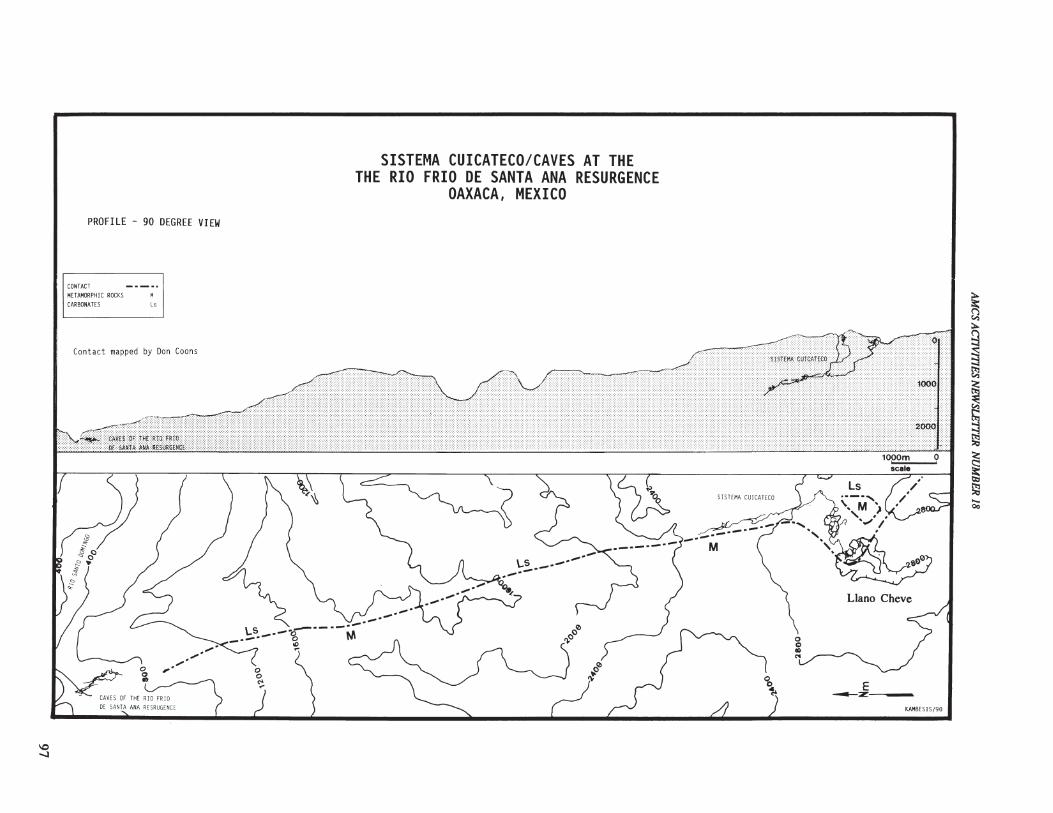
\0.....:l
PROFILE - 90 DEGREE VIEW
CONTACT
METAMORPHIC ROCKS M
CARBONATES Ls
Contact mapped by Don Coons
!))&0°~.
Zj'
'"'"
SISTEMA CUICATECO/CAVES AT THETHE RIO FRIO DE SANTA ANA RESURGENCE
OAXACA, MEXICO
'b~
o0:>III
'"
Llano Cheve
E_z-~__
KAMBES1S/90
~t-:l:l>-
~~~
~~~~
<!:
~ll:I
~......00
Though these speculations are simplified, they do attempt to put the geologic observations within the context of the regionalgeology. Offurther interest, with respect tospeleogenesis, is the dual nature ofthe cave:the vertical shafts and dip ramps in the uppercave versus the the lower level boreholes.Do the deep. low-gradient boreholes of theEast Gorge and beyond reflect karst evolution of a much earlier period; and did thevertically oriented network of passages inthe upper karst, which are obviously relatedto current surface conditions, fortuitouslyintersect this much older trend? Or, is thedevelopment of the Upper Karst and thedeep phreatic cave just multiple phases ofthe same speleogenetic conditions? Continued exploration. survey and geologic observations will help answer these questions.
SUMMARY
In general, the circumstances surrounding the formation ofSistema Cuicateco seemto be a function of the regional structuralstyle. local structural features and their orientations. stratigraphy, and gradient.
AMes ACflVITIES NEWSLE7TER NUMBER 18
Drainage flows across a large upland areaof impervious metamorphic rocks. Whenthe water encounters the contact between themetamorphic and sedimentary rocks. it sinksinto a long narrow band of carbonates. Faults,fissures and the local dip of the beddingfunnel the drainge deep witihin the carbonate corridor until it interesects a strong northern structural trend. The waters coalesce inthis master drainage and flow at a low gradient until they resurge via springs into the RioSanto Domingo. This whole setting occupies an area as large as some counties, witha vertical extent deeper than the U.S.'s GrandCanyon.
The current survey traverse in SistemaCuicateco, from the Cueva Cheve entrance,covers less than four kilometers straight-linedistance on the surface heading north. Thesurvey line in Cueva de la Mano covers onekilometer surface distance heading south;eleven kilometers separate the two. Explorers are not certain as to the potential lengthof a through-trip, or how many years of explcration it would take to fmd a route. However,of one thing they are very certain - SistemaCuicateco is a superlative cave.
GEOLOGIA DE SISTEMA CUICATECO
REFERENCES
Billings, M. (1972): Structural Geology,Prentice Hall, New Jersey.
Estes, Mason, (1988) Pers. Comm.
Herak-Stringfield (1972): Karst - Important karstregions of the Northern Hemisphere, ElsevierPublishing Company, Amsterdam.
Hose, L. Geologic Setting of the SistemaCuicateco, Oaxaco, Mexico (Abs!.),1990 NSS Convention, California
Jakucks, L. (1977): Morphogentics ofkarst regions, Wiley & Sons, New York
Jennings, J.N.(1971): Karst. MIT PressCambridge.
Kunaver, J. (1973): The high mountainous karstof the Julian Alps in the system of AlpineKarst, IGY Symp. on Kart Morphogenesis,Papers, Hungary, pp. 209-226.
Smith, J.H. (1990): Sistema Cuicateco resurgence located., Georgia Underground,Vol. 27, No.1, p. 9.
Smith, J.H. (1988, (990), Pees. Comm.
Una area extensiva de las terrias altas que esta composdad de piedras metamorphica esta localizada en la Sierra Juarez desurde Mexico. Aguas superficia corren por ariba de las metamorphica impenetrable y se unden entre bandas estrecha de piedracaliza. Dieciocho kilometros para el norte y mas de 2400 metros abajo, estas aguas salen por la base de la montana dentroel Rio Santo Domingo por un rio que se llama Rio Frio de Santa Ana. Esto se ratificado por un vestigio de tinte conductadopor Jim Smith en al ano 1990. El conducto bajo de tierra para este desague es el Sistema Cuicateco. Hasta, horo, veintekilometros de passage se an trazado en un mapa a una profundidad de 1340 metros. Este report certidica observacioneshidrologica y geologica.
98
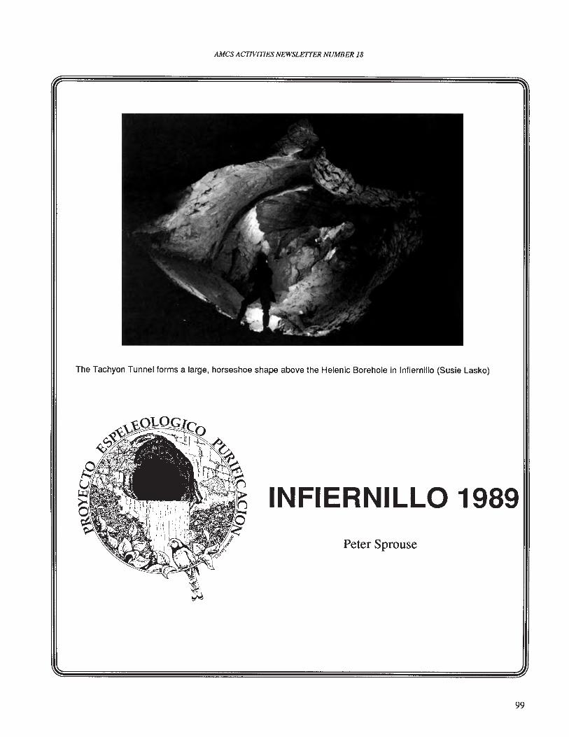
AMes ACTIVITIES NEWSLE1TER NUMBER 18
The Tachyon Tunnel forms a large, horseshoe shape above the Helenic Borehole in Infiernillo (Susie Lasko)
INFIERNILLO 1989Peter Sprouse
99
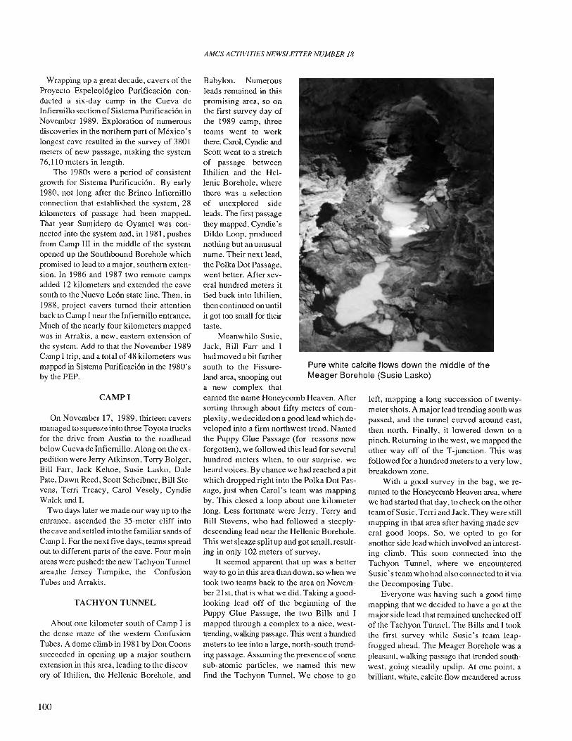
AMCS ACTIVITIES NEWSLETTER NUMBER 18
Pure white calcite flows down the middle of theMeager Borehole (Susie Lasko)
Wrapping up a great decade, cavers of theProyecto Espeleologico Purificacion conducted a six -day camp in the Cueva deInfiernillo section ofSistema Purificacion inNovember 1989. Exploration of numerousdiscoveries in the northern part of Mexico'slongest cave resulted in the survey of 3801meters of new passage, making the system76,110 meters in length.
The 1980s were a period of consistentgrowth for Sistema Purificacion. By early1980. not long after the Brinco-Infiernilloconnection that established the system, 28kilometers of passage had been mapped.That year Sumidero de Oyamel was connected into the system and. in 1981. pushesfrom Camp III in the middle of the systemopened up the Southbound Borehole whichpromised to lead to a major, southern extension. In 1986 and 1987 two remote campsadded 12 kilometers and extended the cavesouth to the Nuevo Leon state line. Then. in1988. project cavers turned their attentionback to Camp I near the Infiernillo entrance.Much of the nearly four kilometers mappedwas in Arrakis. a new. eastern extension ofthe system. Add to that the November 1989Camp I trip, and a total of48 kilometers wasmapped in Sistema Purificacion in the 1980'sby the PEP.
CAMPI
On November 17. 1989. thirteen caversmanaged to squeeze into three Toyota trucksfor the drive from Austin to the roadheadbelow Cueva de Infiernillo. Along on the expedition were Jerry Atkinson, Terry Bolger.Bill Farr, Jack Kehoe, Susie Lasko. DalePate, Dawn Reed. Scott Scheibner. Bill Stevens, Terri Treacy, Carol Vesely. CyndieWalck and 1.
Two days later we made our way up to theentrance, ascended the 35-meter cliff intothe cave and settled into the familiar sands ofCamp 1. For the next five days. teams spreadout to different parts of the cave. Four mainareas were pushed: the new Tachyon Tunnelarea,the Jersey Turnpike. the ConfusionTubes and Arrakis.
TACHYON TUNNEL
About one kilometer south of Camp I isthe dense maze of the western ConfusionTubes. A dome climb in 1981 by Don Coonssucceeded in opening up a major southernextension in this area, leading to the discovery of Ithilien. the Hellenic Borehole, and
100
Babylon. Numerousleads remained in thispromising area, so onthe first survey day ofthe 1989 camp. threeteams went to workthere. Carol, Cyndie andScott went to a stretchof passage betweenIthilien and the Hellenic Borehole. wherethere was a selectionof unexplored sideleads. The first passagethey mapped. Cyndie'sDildo Loop, producednothing but an unusualname. Their next lead,the Polka Dot Passage,went better. After several hundred meters ittied back into Ithilien,then continued on untilit got too small for theirtaste.
Meanwhile Susie,Jack, Bill Farr and Ihad moved a bit farthersouth to the Fissureland area, snooping outa new complex thatearned the name Honeycomb Heaven. Aftersorting through about fifty meters of complexity, we decided on a good lead which developed into a fmn northwest trend. Namedthe Puppy Glue Passage (for reasons nowforgotten), we followed this lead for severalhundred meters when, to our surprise, weheard voices. By chance we had reached a pitwhich dropped right into the Polka Dot Passage, just when Carol's team was mappingby. This closed a loop about one kilometerlong. Less fortunate were Jerry. Terry andBill Stevens, who had followed a steeplydescending lead near the Hellenic Borehole.This wet sleaze split up and got small, resulting in only 102 meters of survey.
It seemed apparent that up was a betterway to go in this area than down, so when wetook two teams back to the area on November 21 st, that is what we did. Taking a goodlooking lead off of the beginning of thePuppy Glue Passage, the two Bills and Imapped through a complex to a nice, westtrending, walking passage. This went a hundredmeters to tee into a large. north-south trending passage. Assuming the presence of somesub-atomic particles, we named this newfmd the Tachyon Tunnel. We chose to go
left, mapping a long succession of twentymeter shots. A major lead trending south waspassed, and the tunnel curved around east,then north. Finally, it lowered down to apinch. Returning to the west, we mapped theother way off of the T-junction. This wasfollowed for a hundred meters to a very low,breakdown zone.
With a good survey in the bag, we returned to the Honeycomb Heaven area. wherewe had started that day. to check on the otherteam of Susie, Terri and Jack. They were stillmapping in that area after having made several good loops. So, we opted to go foranother side lead which involved an interesting climb. This soon connected into theTachyon Tunnel, where we encounteredSusie's team who had also connected to it viathe Decomposing Tube.
Everyone was having such a good timemapping that we decided to have a go at themajor side lead that remained unchecked offof the Tachyon Tunnel. The Bills and I tookthe first survey while Susie's team leapfrogged ahead. The Meager Borehole was apleasant, walking passage that trended southwest. going steadily updip. At one point, abrilliant, white, calcite flow meandered across
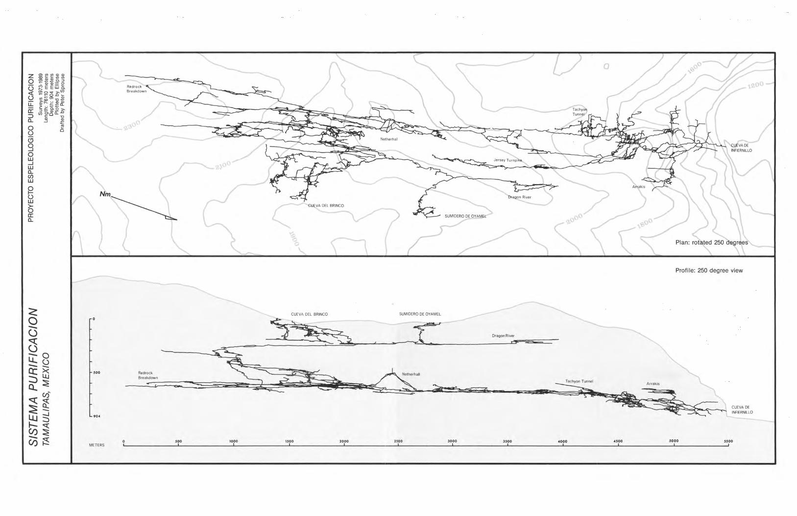
Profi Ie: 250 degree view
<: SUMIDERO DE
0 0
---() Dragon River
()--- 0lJ... ()
--- """-a: GS 500 Redrock
:::> Breakdown
a... ~q: CIS'
~::E """--.J
~ ::> 90.
q:CI) ~--- ~CI) 0 500 1000 1500 2000 2500 3000 3500 ..000 .500 5000 5500
METERS , , I , , , , , , , , ,

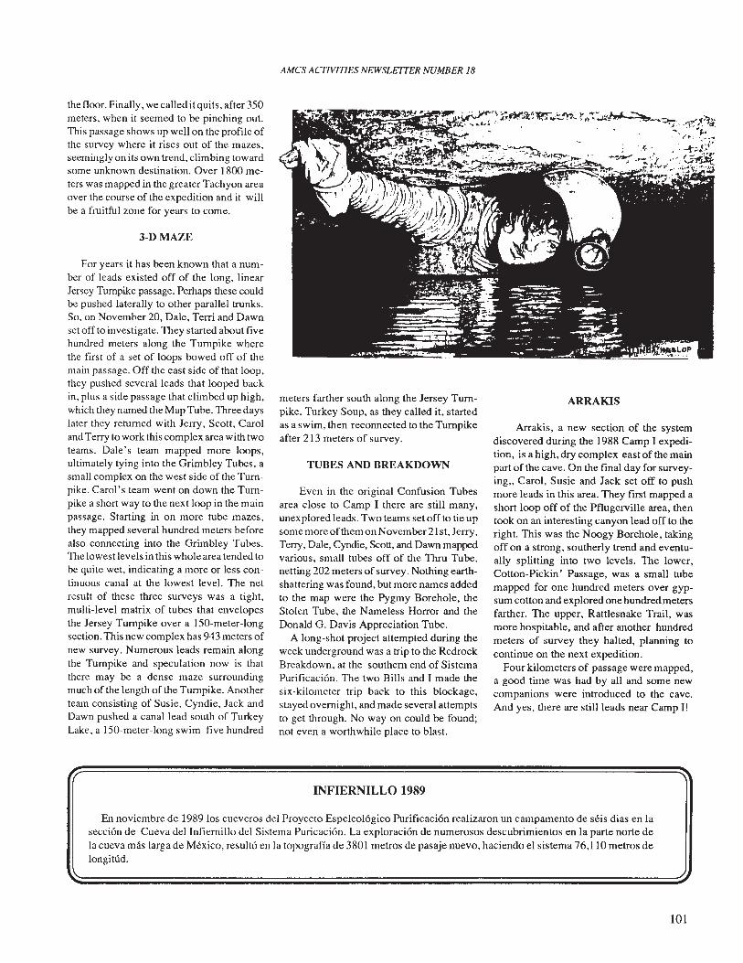
AMCS ACTIVITIES NEWSLETTER NUMBER 18
the floor. Finally, we called it quits, after 350meters, when it seemed to be pinching out.This passage shows up well on the profile ofthe survey where it rises out of the mazes,seemingly on its own trend, climbing towardsome unknown destination. Over 1800 meters was mapped in the greater Tachyon areaover the course of the expedition and it willbe a fruitful zone for years to come.
3-D MAZE
For years it has been known that a number of leads existed off of the long, linearJersey Turnpike passage. Perhaps these couldbe pushed laterally to other parallel trunks.So, on November 20, Dale, Terri and Dawnset off to investigate. They started about fivehundred meters along the Turnpike wherethe first of a set of loops bowed off of themain passage. Off the east side of that loop,they pushed several leads that looped baekin, plus a side passage that climbed up high,which they named the Map Tube. Three dayslater they returned with Jerry, Seott, Caroland Terry to work this complex area with twoteams. Dale's team mapped more loops,ultimately tying into the Grimbley Tubes, asmall complex on the west side of the Turnpike. Carol's team went on down the Turnpike a short way to the next loop in the mainpassage. Starting in on more tube mazes,they mapped several hundred meters beforealso connecting into the Grimbley Tubes.The lowest levels in this whole area tended tobe quite wet, indicating a more or less continuous canal at the lowest level. The netresult of these three surveys was a tight,multi-level matrix of tubes that envelopesthe Jersey Turnpike over a 150-meter-longsection. This new complex has 943 meters ofnew survey. Numerous leads remain alongthe Turnpike and speculation now is thatthere may be a dense maze surroundingmuch of the length of the Turnpike. Anotherteam consisting of Susie, Cyndie, Jack andDawn pushed a canal lead south of TurkeyLake, a 150-meter-long swim five hundred
meters farther south along the Jersey Turnpike. Turkey Soup, as they called it, startedas a swim, then reconnected to the Turnpikeafter 213 meters of survey.
TUBES AND BREAKDOWN
Even in the original Confusion Tubesarea close to Camp I there are still many,unexplored leads. Two teams set off to tie upsome more of them onNovember21st, Jerry,Terry, Dale, Cyndie, Scott, and Dawn mappedvarious, small tubes off of the Thru Tube,netting 202 meters of survey. Nothing earthshattering was found, but more names addedto the map were the Pygmy Borehole, theStolen Tube, the Nameless Horror and theDonald G. Davis Appreciation Tube.
A long-shot project attempted during theweek underground was a trip to the RedrockBreakdown, at the southern end of SistemaPurificaci6n. The two Bills and I made thesix-kilometer trip back to this blockage,stayed overnight, and made several attemptsto get through. No way on could be found;not even a worthwhile place to blast.
INFIERNILLO 1989
ARRAKIS
Arrakis, a new section of the systemdiscovered during the 1988 Camp I expedition, is a high, dry complex east of the mainpart of the cave. On the final day for surveying" Carol, Susie and Jack set off to pushmore leads in this area. They first mapped ashort loop off of the Pflugerville area, thentook on an interesting canyon lead off to theright. This was the Noogy Borehole, takingoff on a strong, southerly trend and eventually splitting into two levels. The lower,Cotton-Pickin' Passage, was a small tubemapped for one hundred meters over gypsum cotton and explored one hundred metersfarther. The upper, Rattlesnake Trail, wasmore hospitable, and after another hundredmeters of survey they halted, planning tocontinue on the next expedition.
Four kilometers of passage were mapped,a good time was had by all and some newcompanions were introduced to the cave.And yes, there are still leads near Camp I!
En noviembre de 1989 los cueveros del Proyecto Espeleol6gico Purificaci6n realizaron un campamento de seis dias en lasecci6n de Cueva del Infiernillo del Sistema Puricaci6n. La exploraci6n de numerosos descubrimientos en la parte norte dela cueva mas larga de Mexico, result6 en la topograffa de 3801 metros de pasaje nuevo, haciendo el sistema 76,110 metros delongitud.
101
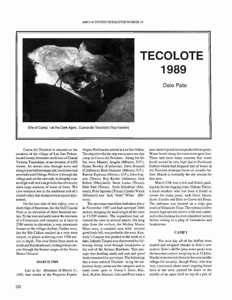
AMes ACTIVITIES NEWSLEITER NUMBER 18
TECOLOTE1989Dale Pate
Site of Camp I at the Dar!< Ages. Cueva del Tecolote (Ray Keeler)
Cueva del Tecolote is situated on theoutskirts of the village of Los San Pedros,located twenty kilometers northwest of CiudadVictoria, Tamaulipas, at an elevation of 1450meters. An arroyo runs through town andalong it you will see many old, truck tires andassorted castoff things. Follow it through thevillage and, on the east side, it abruptly endsat a high wall and a large hole that obviouslytakes large amounts of water at times. Thecave entrance lies at the southeast end of aclosed valley that drains several square kilometers.
On the east side of this valley, over ashort ridge of limestone, lies the Gulf CoastalPlain at an elevation of three hundred meters. To the west and north tower the remnantsof a Cretaceous reef complex as it rises to2780 meters in elevation; a very prominentfeature on the village skyline. Farther west,lies the Rio Chihue encised in a very deepcanyon, in places achieving over 1700 meters in depth. The river flows from north tosouth and then heads east, cutting a deep canyon through the frontal ranges of the SierraMadre Oriental.
MARCH 1989
Late in the afternoon of March 11,1989, four trucks of the Proyecto Espele-
102
016gico Pl.lrificaci6n arrived in Los San PedrosoThe objective for the trip was to seta ten-daycamp in Cueva del Tecolote. Along for thefun were Manuel Arag6n (Mexico, D.F.).Djuna Bewley (California), Dave Bunnell(California), Ruth Diamant (Mexico, D.F.).Ram6n Espinasa (Mexico, D.F.), John Fogarty (Texas), Ray Keeler (Arizona), JackKehoe (Maryland). Susie Lasko (Texas),Dale Pate (Texas), Scott Scheibner (Missouri), Peter Sprouse (Texas), Cyndie Walck(Missouri) and Jack "Solo" White (Illinois).
The previous expedition had taken placein November 1987 and had surveyed 2466meters, bringing the total length of the caveto 13,550 meters. The expedition had advanced the cave in several places. On longtrips from the surface, the Mickey MouseMaze area, a complex area with severalgood leads left, was pushed to the west. Kennedy's Canyon was pushed to the north to alake. Infinity Tunnel was discovered by following strong wind through breakdown atthe end of the Serious Borehole. This passage was heading north and east and goodleads remained for our return. The followingday a team entered Tecolote to rig the numerous drops, scout out the campsite and tocarry some gear to Camp I. Susie, Ray,Jack, Ruthie, Manuel, John and Peter took a
nine-hour trip and accomplished these goals.Water levels along the route were quite low.There had been some concern that waterlevels would be very high due to HurricaneGilbert which had dropped lots of water inthe Tecolote drainage basin six months before. March is normally the dry season forthis area.
March 13th was a rest-and-finish-packing day for the rigging team. Gabino Torres,a local resident who has been a friend tocavers for many years, took Dave, Djuna,Scott, Cyndie and Dale to Cueva del Brujo.The entrance was located on a ridge justsouth ofS6tano de Trejo. The entrance is fivemeters high and ten meters wide and continued in this fashion for over a hundred metersbefore ending in a plug of formations andbreakdown.
CAMPI
The next day all of the duffles wereloaded and weighed (thanks to Solo's newscales). Solo's duffle (plus extra pack) wonthe heaviest contest weighing in at 32 kilos.Trucks were moved closer to the cave and thevillage for security, though Peter, who wasvery concerned about some ongoing forestfires in the area, parked his truck in themiddle of an open field on top of a pile of
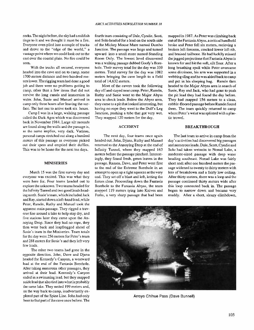
Arroyo Chihue Pass (Dave Bunnell)
rocks. The night before, the sky had areddishtinge to it and we thought it must be a fire.Everyone even piled into a couple of trucksand drove to the "edge of the world," avantage point where we could look out to theeast over the coastal plain. No fire could beseen.
With the trucks all secured, everyoneheaded into the cave and on to camp, some1700 meters distance and two hundred meters lower. The rigging team had done a goodjob and there were no problems getting tocamp, other than a few items that did notsurvive the long canals and immersion inwater. John, Susie and Manuel arrived incamp only three hours after leaving the surface. The last one to arrive took six hours.
Camp I was in a large, walking passagecalled the Dark Ages which was discoveredback in November 1984. Large silt moundsare found along the walls and the passage is,as the name implies, very dark. Various,personal camps stretched out along a hundredmeters of this passage as everyone pickedout their spots and emptied their duffles.This was to be home for the next ten days.
MINISERIES
March 15 was the first survey day andeveryone was excited. This was what theywere here for. Four teams headed out toexplore the unknown. Two teams headed forthe Infmity Tunnel and two good leads heading north. Susie's team, which included Jackand Ray, started down a left-hand lead, whilePeter, Ramon, Ruthy and Manuel took theapparent main passage. They rigged a traverse line around a lake to help stay dry, andfive stations later they came upon the Annoying Drop. Since they had no rope, theythen went back and leapfrogged ahead ofSusie's team in the Miniseries. Team totalsfor the day were 256 meters for Peter's teamand 288 meters for Susie's and they left veryfew leads.
The other two teams had gone in theopposite direction. John, Dave and Djunaheaded for Kennedy's Canyon, a westwardlead at the end of the Fantasia Borehole.After taking numerous other passages, theyarrived at their lead. Kennedy's Canyonended in a swimming lead, but they mappedaside lead that also tied into what is probablythe same lake. They netted 199 meters and,on the way back to camp, inadvertantly explored part of the Spine Line. John had onlybeen to that partof the cave once before. The
AMes ACTIVITIES NEWSLETTER NUMBER 18
fourth team consisting of Dale, Cyndie, Scott,and Solo headed for a lead on the south sideof the Mickey Mouse Maze named DumboJunction. The passage was large and turnedupward into a small maze named StandingRoom Only. The lowest level discoveredwas a walking passage dubbed Goofy's Borehole. Their survey total for the day was 339meters. Total survey for the day was 1082meters bringing the cave length to a fieldtotal of 14,632 meters.
Most of the cavers took the followingday off and stayed nearcamp. Peter, Ramon,Ruthy and Susie went to the Major Abyssarea to check leads. Below the Abyss area,they came to a pit that looked interesting, buthaving no rope they went to the Doll's LegJunction, pushing a tube that got very wet.They mapped 120 meters for the day.
ACCIDENT
The next day, four teams once againheaded out. John, Djuna, Ruthy and Manuelreturned to the Annoying Drop at the end ofInfmity Tunnel, where they mapped 163meters before the passage pinched. Interestingly, they found fresh, green leaves in thepassage. Ramon, Dave, and Peter went firstto the end of the Extreme Borehole in anattempt to open up a tight squeeze at the veryend. They set off a blast and left, letting thefumes clear. Proceeding down the FantasiaBorehole to the Fantasia Abyss, the teammapped 119 meters tying into Knives andForks, a very sharp passage that had been
mapped in 1987. As Peter was climbing backout ofthe Fantasia Abyss, a critical handholdbroke and Peter fell six meters, recieving abroken left forearm, cracked lower left rib,and bruised tailbone. He had luckily missedthe jagged projections that Fantasia Abyss isknown for and hit the soft, silt floor. After along breathing spell while Peter overcamesome dizziness, his arm was supported in awebbing sling and he was aided back to campand put in his sleeping bag. Ramon thenheaded to the Major Abyss area in search ofSusie, Ray and Jack, who had gone to pushthe pit lead they had found the day before.They had mapped 156 meters to a clean,cobble-floored passage before Ramon foundthem. The team quickly returned to campwhere Peter's wrist was splinted with a plastic trowel.
BREAKTHROUGH
The last team to arrive in camp from theday's activities had discovered big passagesand numerous leads. Dale, Scott, Cyndie andSolo had taken wetsuits to Nonad Lake, amoderate-sized passage with deep waterheading southeast. Nonad Lake was fairlyshort and; after one hundred meters the passage widened to twenty to thirty meters withlots of breakdown and a fairly low ceiling.After thirty meters, there was a loop and thepassage continued thirty meters wide afterthis loop connected back in. The passagebegan to narrow down and became verymuddy. After a short, sleazy climbdown,
103
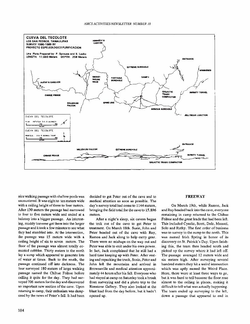
AMes ACTIVITIES NEWSLETTER NUMBER 18
CUEVA DEL TECOLOTELOS SAN PEDROS, TAMAUlIPASSURVEY 1980·1989 BYPROYECTO ESPELEOLOGICO PURIFICACION
Line P10ta Prepared by P. Sprouse and S. La.koLENGTH: 17,660 Mete.. DEPTH: 258 Mete..
CMHUE FIIIHUE
MLUNIUM'Al.CON
CUEVA DEL TECOLOTE
Pl,t.N: ROTATED J10.0 DECREES, 111 .,
oa,...CUEVA DEL TECOLOTE
PftDf'JLI:: ]10.0 D[Gft([ vuw 1, = ... i
EXTllEME IOREHOLE
CAMPI
, JEU.YaEAN JUNCllON
MLUNIUM 'ALCON
_==.._...ctIHUEFllIIt_UE_-~~ ~GALACTIC TRASH COMPACTOll
nice walking passage with shallow pools wasencountered. It was eight to ten meters widewith a ceiling height of three to four meters.After 130 meters the passage had narrowedto four to five meters wide and ended at abalcony into a bigger passage. An interesting, muddy traverse got them into the largerpassage and it took a few minutes to see whatthey had stumbled into. At the intersection,the passage was 15 meters wide with aceiling height of six to seven meters. Thefloor of the passage was almost totally cemented cobbles. Thirty meters to the northlay a sump which appeared to generate lotsof water at times. Back to the south, thepassage continued off into darkness. Thefour surveyed 180 meters of large walkingpassage named the Chihue Frihue beforecalling it quits for the day. They had surveyed 706 meters for the day and discoveredan important new section of the cave. Uponreturning to camp, their enthusiam was dampened by the news of Peter's fall. It had been
104
decided to get Peter out of the cave and tomedical attention as soon as possible. Theday's survey total had come to 1144 meters,bringing the field totalforthe cave to 15,896meters.
After a night's sleep, six cavers beganthe trek out of the cave to get Peter totreatment. On March 18th. Susie, John andPeter headed out of the cave with Ray,Ramon and Jack along to help carry gear.There were no mishaps on the way out andPeter was able to exit under his own power.In fact, Jack complained that he still had ahard time keeping up with Peter. After resting and repacking the truck, Susie, Peter andJohn left the mountains and arrived inBrownsville and medical attention approximately 44 hours after his fall. Everyone whohad stayed at camp on Saturday took a breakfrom surveying and did a photo trip to theRimstone Gallery. They also looked at theblast lead from the day before, but it hadn'topened up.
FREEWAY
On March 19th, while Ramon, Jackand Ray headed back into the cave, everyoneremaining in camp returned to the ChihueFrihue and the great leads that had been left.This included Cyndie, Scott, Dale, Manuel,Solo and Ruthy. The first order of businesswas to survey to the sump to the north. Thiswas named Irish Spring in honor of itsdiscovery on St. Patrick's Day. Upon fmishing this, the team then headed south andpicked up the survey where it had left off.The passage averaged 12 meters wide andsix meters high. After surveying severalhundred meters they hit a weird intersectionwhich was aptly named the Weird Place.Here, there were at least three ways to go,but it was hard to tell because the floor rosealmost to the ceiling in places, making itdifficult to tell what was actually happening.The team ended up surveying to the left,down a passage that appeared to end in
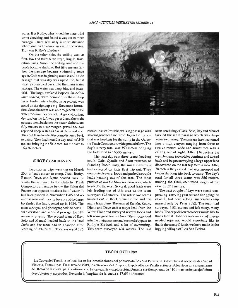
water. But Ruthy, who loved the water, didsome checking and found a way on to morepassage. There was only a short distancewhere one had to duck an ear in the water.This was Ruthy's Earduck.
On the other side, the ceiling was, atftrst, low and there were large, fragile, travertine dams. Soon, the ceiling rose and thepools became shallow. But ftfty meters farther the passage became swimming onceagain. Cold was beginning to set in and a sidepassage that was dry was opted for, but itshortly connected back into the main waterpassage. The water was deep, blue and beautiful. The large, cirolanid isopods, Speocirolana endeca, were common in these deeplakes. Forty meters farther, a large,lead wasnoted on the right up a big, flows tone formation. Soon the team was able to get out of thewater for anumberofshots. A good-looking,dry lead on the left was passed and the mainpassage went back into the water. Solo swamftfty meters to a submerged gravel bar andreported deep water as far as he could see.The cold team headed the long distance backto camp. They had netted a day total of 540meters, bringing the fteld total for the cave to16,436 meters.
SURVEY CARRIES ON
Two shorter trips went out on March20th to leads closer to camp. Jack, Ruthy,Ramon, Dave, and Djuna headed back towards the entrance to the Galactic TrashCompactor, a passage below the Salon delPuente that appears to take a lot of water. Ithad been pushed in November 1985 and noone had returned, mostly because of the largeboreholes that had opened up in 1984. Theteam surveyed and photographed the beautifu� flowstone and scoured passage for 184meters to a sump. The second team of Ray,Solo and Manuel headed back to the leadSusie and her team had to abandon afterlearning of Peter's fall. They surveyed 175
AMes ACTIVITIES NEWSLE1TER NUMBER 18
meters in comfortable, walking passage withseveral good leads to return to, including onethat was heading for the sump in the Galactic Trash Compactor, with good airflow. Theday's survey total was 359 meters bringingthe fteld total to 16,795 meters.
The next day saw three teams headingsouth. Dale, Cyndie and Scott returned toStanding Room Only, the small maze theyhad explored on their first trip out. Theycompleted several loops and pushed a coupleleads heading out of the area. The mostproductive was the Missouri Crawlway, whichheaded to the west. Several, good leads wereleft leading out of this area as the teamsurveyed 198 meters. The other two teamsheaded out to the Chihue Frihue and themany leads there. The team of Ram6n, Ruthy,Djuna and Dave took a major lead from theWeird Place and surveyed several loops andleft some good leads. One of their loops tiedinto the main passage and created a bypass toRuthy's Earduck and a lot of swimming.This team surveyed 404 meters. The last
TECOLOTE 1989
team consisting ofJack, Solo, Ray and Manueltackled the main passage which was deepwater swimming. The passage here had nunedinto a high canyon ranging from three totwelve meters wide and sometimes with aceiling out of sight. After 176 meters theteam became too cold to continue and turnedback and began surveying a large upper leaddiscovered on the last trip to this area. After78 meters they called it a day, regrouped andbegan the long trip back to camp. The day'stotal for all three teams was 856 meters,making the fmal, computed length of thecave 17,651 meters.
The next couple of days were spent recuperating, carrying gear out and derigging thecave. It had been a long, successful campmarred only by Peter's fall. The team hadsurveyed 4101 meters and left many, manyleads. The expeditionmembers would like tothank Bob & Bob for the donation of muchneeded rope and would especially like tothank the many friends we have made in thelogging village of Los San Pedroso
La Cueva del Tecolote se localiza en las inmediaciones del poblado de Los San Pedros, 20 kil6metros al noroeste de CiudadVictoria, Tamaulipas. En marzo de 1989, los cueveros del Proyecto Espeleol6gico Purificaci6n establecieron un campamentode 10 dfas en la cueva, para continuar con la topograffa y exploraci6n. Durante ese tiempo mas de41 01 metros de pasaje fuerondescubiertos y mapeados, llevando la longirud de la cueva a 17.65 kil6metros.
105
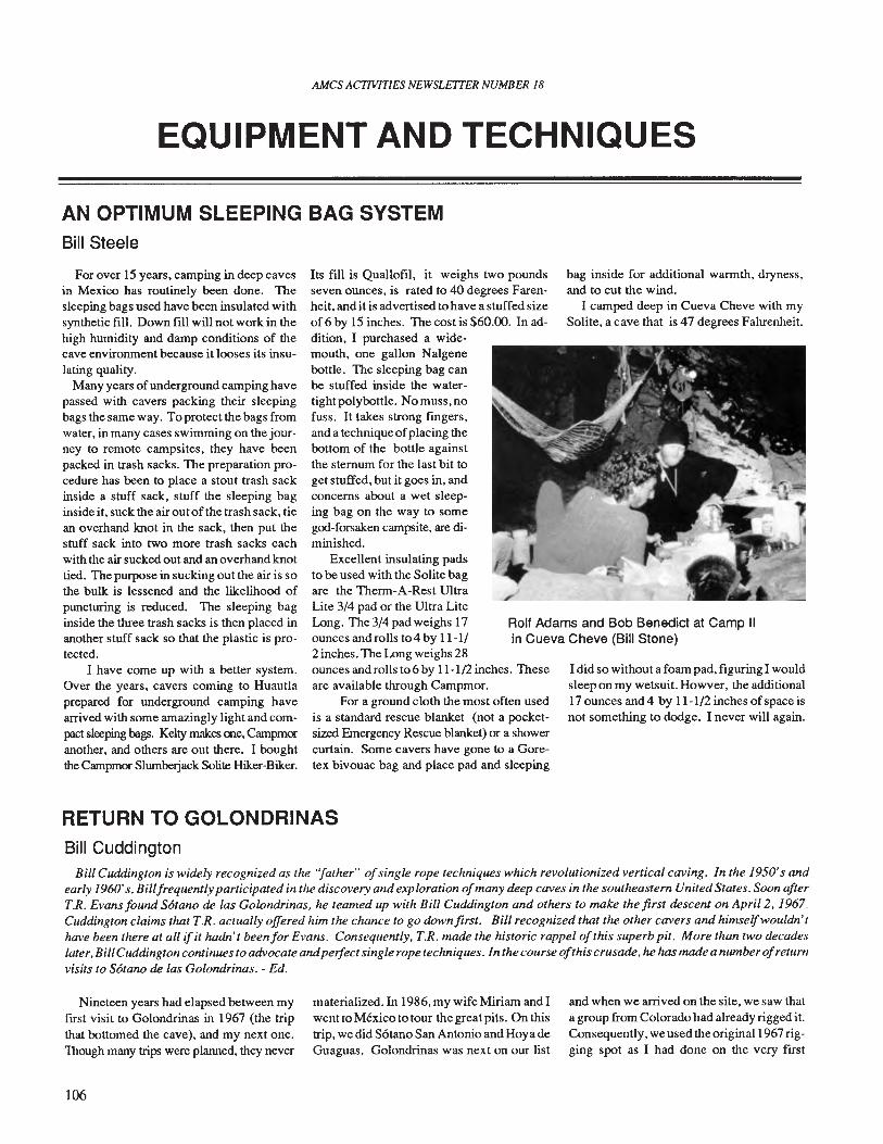
AMes ACTIVITIES NEWSLETTER NUMBER 18
EQUIPMENT AND TECHNIQUES
AN OPTIMUM SLEEPING BAG SYSTEMBill Steele
Rolf Adams and Bob Benedict at Camp IIin Cueva Cheve (Bill Stone)
For over 15 years, camping in deep cavesin Mexico has routinely been done. Thesleeping bags used have been insulated withsynthetic fill. Down fill will not work in thehigh humidity and damp conditions of thecave environment because it looses its insulating quality.
Many years ofunderground camping havepassed with cavers packing their sleepingbags the same way. To protect the bags fromwater, in many cases swimming on the journey to remote campsites, they have beenpacked in trash sacks. The preparation procedure has been to place a stout trash sackinside a stuff sack, stuff the sleeping baginside it, suck the air outof the trash sack, tiean overhand knot in the sack, then put thestuff sack into two more trash sacks eachwith the air sucked out and an overhand knottied. The purpose in sucking out the air is sothe bulk is lessened and the likelihood ofpuncturing is reduced. The sleeping baginside the three trash sacks is then placed inanother stuff sack so that the plastic is protected.
I have come up with a better system.Over the years, cavers coming to Huautlaprepared for underground camping havearrived with some amazingly light and compact sleeping bags. Kelty makes me, Campmocanother, and others are out there. I boughtthe Campmor SlumbeIjack Satite Hiker-Biker.
Its fill is Quallofil, it weighs two poundsseven ounces, is rated to 40 degrees Farenheit, and it is advertised to have a stuffed sizeof 6 by 15 inches. The cost is $60.00. In addition, I purchased a widemouth, one gallon Nalgenebottle. The sleeping bag canbe stuffed inside the watertightpolybottle. Nomuss,nofuss. It takes strong fingers,and a technique ofplacing thebottom of the bottle againstthe sternum for the last bit toget stuffed, but it goes in, andconcerns about a wet sleeping bag on the way to somegod-forsaken campsite, are diminished.
Excellent insulating padsto be used with the Solite bagare the Therm-A-Rest UltraLite 3/4 pad or the Ultra LiteLong. The 3/4 pad weighs 17ounces and rolls to 4 by 11-1/2 inches. The Long weighs 28ounces and rolls to 6 by 11-1/2 inches. Theseare available through Campmor.
For a ground cloth the most often usedis a standard rescue blanket (not a pocketsized Emergency Rescue blanket) or a showercurtain. Some cavers have gone to a Goretex bivouac bag and place pad and sleeping
bag inside for additional warmth, dryness,and to cut the wind.
I camped deep in Cueva Cheve with mySolite, a cave that is 47 degrees Fahrenheit.
I did so without a foam pad, figuring I wouldsleep on my wetsuit. Howver, the additional17 ounces and 4 by 11-1/2 inches of space isnot something to dodge. I never will again.
RETURN TO GOLONDRINASBill Cuddington
Bill Cuddington is widely recognized as the ''father'' ofsingle rope techniques which revolutionized vertical caving. In the 1950'sandearly 1960's, Billfrequently participated in the discovery and exploration ofmany deep caves in the southeastern United States. Soon afterT.R. Evans found Sotano de las Golondrinas, he teamed up with Bill Cuddington and others to make the first descent on Apri12,1967.Cuddington claims that T.R. actually offered him the chance to go down first. Bill recognized that the other cavers and himselfwouldn'thave been there at all if it hadn't beenfor Evans. Consequently, T.R. made the historic rappel ofthis superb pit. More than two decadeslater, BillCuddington continues to advocate andperfect single rope techniques. In the course ofthis crusade, he has madea numberofreturnvisits to Sotano de las Golondrinas. - Ed.
Nineteen years had elapsed between myfirst visit to Golondrinas in 1967 (the tripthat bottomed the cave), and my next one.Though many trips were planned, they never
106
materialized. In 1986, my wife Miriam and Iwent to Mexico to tour the great pits. On thistrip, we did Solano San Antonio and Hoya deGuaguas. Golondrinas was next on our list
and when we arrived on the site, we saw thata group from Colorado had already rigged it.Consequently, we used the original 1967 rigging spot as I had done on the very first
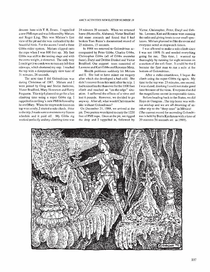
descent here with T. R. Evans. I rappelledanew PMI rope and was followed by Miriamand Roger Ling. This was Miriam's firstview of the pit and she was enthralled by thebeautiful birds. For the ascent I used a threeGibbs-roller system. Miriam clipped ontothe rope when I was 800 feet up. My footGibbs was still in the testing stage and withthe extra weight, it distorted. The only wayI could get it to catch was to tum my left footsideways, which shortened my step. I reachedthe top with a disappointingly slow time of31 minutes, 28 seconds.
The next time I did Golondrinas wasduring Christmas of 1987. Miriam and Iwere joined by Greg and Shelia Andrews,Victor Bradford, Mary Howerton and BarryFerguson. This trip I planned to go for a fastclimbing time using a super Gibbs rig. Irappelled in on Greg's new PMI followed byhe and Mary. When the stopwatch timers ontop were ready, I started a solo climb. Priorto the trip, I made sure to maintain my fitnessschedule and it paid off. My Gibbs rigworked perfectly and my climbing time was
AMes ACTIVITIES NEWSLETTER NUMBER 18
24 minutes 39 seconds. When we returnedhome (Huntsville, Alabama), Victor Bradforddid some research and found that I hadbroken Tom Baine's documented record of25 minutes, 15 seconds.
In 1988 we returned to Golondrinas accompanied by Peter Gibbs, Charles Gibbs,Christopher Gibbs (all of Gibbs ascenderfame), Daryl and Debbie Dunkel and VictorBradford. Our support team consisted ofLavonne and Kari Gibbs and Roxanne Metz.
Health problems suddenly hit Miriamand I. She had to have minor ear surgeryafter which she developed a bad cold. Shedidn't recover from this until after the trip. Ihad trained harder than ever for the 1100 footclimb and reached an "on-the-edge" situation. I sufferred the effects of a virus andlost 6 pounds. However, we decided to goanyway. After all, what would Christmas belike without Golondrinas?
On December 21, 1988, we arrived at thepit. Two porters were hired to carry the 1220feet ofPMI rope. Once at the pit, we riggedthe drop and I rappelled in, followed by
Victor, Christopher, Peter, Daryl and Debbie. Lavonne, Kari and Roxanne were manningthe radio and giving treats to our small spectators. Miriam planned to film the event andeveryone acted as stopwatch timers.
I was allowed to make a solo climb sinceI was not 100% fit and needed everythinggoing for me. This time, I warmed upthoroughly by running for eight minutes ona section of the soft floor. It could be that Ibecame the first man to run a mile at thebottom of Golondrinas.
After a radio-countdown, I began theclimb using the super-Gibbs rig again. Mytime to the top was 23 minutes, one second.I was elated, thinking I could not make goodtime because of the virus. Everyone else didthe magnificent ascent in respectable times.
Before heading back to the States, we didHoya de Guaguas . The trip home was without mishap and we are all dreaming of another trip to the "deep ones" in Mexico!(The current record for ascending Golondrinas is held by Berta Kirchman with a time of20 minutes 56 seconds set in 1989).
107
AMes ACflVlTlES NEWSLEITER NUMBER 18
BOOK REVIEWS
Expe Sous Sierra, Mars Avril87, Sierra deZongolica, Mexique. Report de I'Expedtionde l'Union Beige de Speleologie. 1989. 66pages, comb-bound. Reviewed by BillMixon.
This is the report of a Belgian expeditionto the Sierra Zongolica in Veracruz. Overone hundred caves in the area were exploredand are described in the publication, whichincludes over thirty cave maps. There arealso nice area maps for the regions explored,based on topographic maps and showing thelocations of the cave entrances. The resurgence cave for the RIO Tonto was surveyedfor over a kilometer. and three other cavesalso exceeded that length. Five of the cavesinclude pits over one hundred meters deep.
The cave descriptions and maps make upmost of the report. There is also a chapter onthe geology and hydrology of the area, and itincludes infonnation on water-ehemistry studies and water-tracing they did. There aresome briefcomments on biospeleology. Thereport has only brief summaries in Englishand Spanish, but any caver will be able tounderstand the maps and much of the information in the cave descriptions withoutknowing French. Available from the AMCS,Box 7672, Austin, Texas 78713.
Le Spedizioni Speleologiche Malpaso '86e Rancho Nuevo '87 in Chiapas (Messico),Notiziario del Circolo Speleologico Romano,Nuova Serie, No. 2, 1987, 176 p. Reviewed by Mark Minton.
Like its predecessor, this handsome volume covers two Italian caving expeditions toChiapas in its eleven chapters. There is a listof personnel, objectives, and itinerary followed by a narrative account of the expeditions, covering surface, as well as underground, activities. A brief synopsis is givenof discoveries beyond the previously- knownend of Gruta de San Cristobal (RanchoNuevo). The geology and speleogenesis ofthe areas are also described. Chapter fivecontains the meat of the work: descriptionsand maps of the caves explored, with specialattention given to Grutas de Rancho Nuevo.Next, is a report on biospeleology, includinga cave-by-cave list of fauna. There is also a
108
more in-depth report on crayfish from Cuevade los Camarones. The radio communication setup used in the field, is described.Also, a chapter covers medical aspects, including dietary needs for tropical caving.The location and exploration of the remoteOjos del Tigre system is covered. The [malchapter concerns the expedition logo.
Several important caves were exploredduring these expeditions. Most significantwas a major extension of Grutas de RanchoNuevo (also called Grutas de San Cristobal),making it the longest (10,218 meters) anddeepest (520 meters) in Chiapas. A verylarge map of this cave is included in a specialinsert at the end of the book. A sump diveconnection between Mostro and 2 Sumidero de Pecho Blanco brought that system to4435 meters in length (depth unchanged at253 meters). Sistema de los OJos del Tigresis 1840 meters long and 177 meters deep. Itcontains three, large pit entrances (eighty toa hundred meters deep) in the jungle, presenting a formidable logistical challenge.Cueva del Achin is 1585 meters long, witha vertical range ofonly three meters. A new,deep pit, Sotano de la Luz drops 140 metersinto a single, large chamber.
There are many excellent photographs,including some of extremely large passagesand impressive, black-hole entrances. Thereare also maps of all the caves, no matter howsmall. (One is only five meters long anddeep.) Although written in Italian, the bookcontains a wealth of information on Chiapas,most of which can be appreciated withoutknowledge ofthe language. This publicationis available through the AMCS, Box 7672,Austin, Texas 78713.
Excursionismo Politicnico No.1, Autumn1989, 19 pgs. Edited by Carlos RodrezRubio. Available from AEIPN, ApartadoPostal 75-84, Col. Lindavista, 07300 Mexiro,D.F. Reviewed by Peter Sprouse.
This is (apparently) the first newsletter ofthe Asociaci6n de Excursionismo of the Instituto Politecnico Nacional. While mostlyconcerned with mountain climbing, this issue does contain an account of a trip to Hoyade la Luz on the Xilitla Plateau.
Ecursionismo Politico No.2, Winter 1989,31 pages. Reviewed by Peter Sprouse.
This issue contains two articles on caves.The first concerns Sotano de los Monos, SanLuis POtOSI and contains renditions by Ricardo Arias of numerous cave paintings inthe entrance area. Also included is an overview of Sotano de las Golondrinas with aninteresting account ofold Huastecan legendsconcerning the pit.
Sous Terre, newsletter ofthe Societe Quebecoise de Spelelogie, (July 1988, December 1989.) Reviewed by Bill Mixon.
These two issues summarize the group'sexpeditions to the Sierra Negra, Puebla,Mexico. The twenty-page, July 1988 issuecovers work done in December 1987 andJanuary 1988, including the exploration andmapping of Sotano de los Pianos, 694 meters deep, and Sotano de Alhuastle, at 410meters deep, including a 328-meter pit inside. The 24-page, December 1989 issuecovers the "phase 2" expedition in January1988 and features Sistema de Angel at adepth of533 meters and 4,857 meters long,and Olfastle Niebla, explored, so far, to adepth of 518 meters. Both issues have colorcovers and numerous photos and maps inside. The text is in French, with English andSpanish abstracts.
The earlier issue is CAN$4.oo postpaid toCanada and the U.S.$6.OO "overseas". I'mnot sure where that leaves Mexico. Thesecond issue has a cover price ofCAN$5.oo.Write the SQS at 4545 avo Pierre-de-Coubertin,C.P.l000,SuccursaleM.,Monlreal,QuebecHI V 3R2 Canada. Both issues are availablealso, for US$4.50 each, postpaid, from theAMCS, Box 7672, Austin, Texas 78713.
Sierra de EI Abra Cave Map FolioDecember 1989, 10 sheets. By Neal Morris. Association for Mexican Cave Studies,P.O. Box 7672, Austin, Texas 78713, $6.50postpaid. Reviewed by Peter Sprouse.
This collection of cave maps was originally prepared in 1974 for a publication onthe caves of the Sierra de El Abra, San Luis
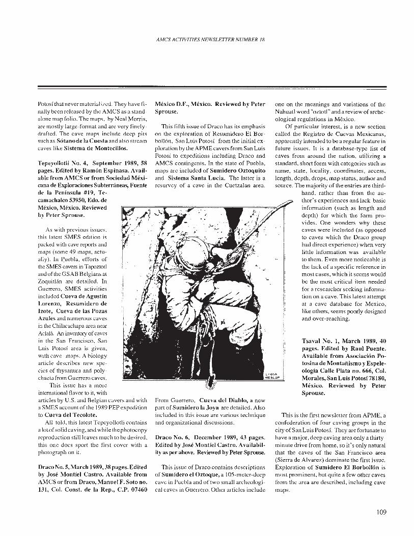
AMCS ACTIVITIES NEWSLETTER NUMBER 18
Tsaval No.1, March 1989, 40pages. Edited by Raul Puente.Available from Asociacion Potosina de MontafJismo y Espeleologia Calle Plata no. 666, Col.Morales, San Luis Potosi 78180,Mexico. Reviewed by PeterSprouse.
111is is the first newsletter from ApME, aconfederation of four caving groups in thecity of San Luis Potosi. They are fortunate tohave a major, deep caving area only a thirtyminute drive from home, so it's only naturalthat the caves of the San Francisco area(Sierra de Alvarez) dominate the first issue.Exploration of Sumidero EI Borbollon ismost prominent, but quite a few other cavesfrom the area are described, including cavemaps.
one on the meanings and variations of theNahuatl word "oztotl" and a review of archeological regulations in Mexico.
Of particular interest, is a new sectioncalled the Registro de Cuevas Mexicanas,apparently intended to be a regular feature infuture issues. It is a database-type list ofcaves from around the nation, utilizing astandard, short form with categories such asname, state, locality, coordinates, access,length, depth, drops, map status, author andsource. The majority of the entries are third-
hand, rather than from the author's experiences and lack basicinformation (such as length anddepth) for which the form provides. One wonders why thesecaves were included (as opposedto caves which the Draco grouphad direct experience) when verylittle information was availableto them. Even more noticeable isthe lack of a specific reference inmost cases, which it seems wouldbe the most critical item neededfor a researcher seeking information on a cave. This latest attemptat a cave database for Mexico,like others, seems poorly designedand over-reaching.
111is issue of Draco contains descriptionsof Sumidero el Oztoque, a lOS-meter-deepcave in Puebla and of two small archeological caves in Guerrero. Other articles include
Draco No.6, December 1989,43 pages.Edited by Jose Montiel Castro. Availability as per above. Reviewed by Peter Sprouse.
From Guerrero, Cueva del Diablo, a newpart of Sumidero la Joya are detailed. Alsoincluded in this issue are various techniqueand organizational discussions.
111is fifth issue of Draco has its emphasison the exploration of Resumidero EI Borbollon, San Luis Potosi from the initial exploration by the ApME cavers from San LuisPotosi to expeditions including Draco andAMCS contingents. In the state of Puebla,maps are included of Sumidero Oztoquitoand Sistema Santa Lucia. The latter is aresurvey of a cave in the Cuetzalan area.
Mexico D.F., Mexico. Reviewed by PeterSprouse.
I~ ..~I ' :/}".I. l'~/~'r,I·-:1
Draco No.5, March 1989,38 pages. Editedby Jose Montiel Castro. Available fromAMCS or from Draco, Manuel F. Soto no.131, Col. Const. de la Rep., c.P. 07460
As with previous issues,this latest SMES edition ispacked with cave reports andmaps (some 49 maps, actually). In ~uebla, efforts ofthe SMES cavers in TapoztotlandoftheGSAB Belgians atZoquitliin are detailed. InGuerrero, SMES activitiesincluded Cueva de AgustinLorenzo, Resumidero deIzote, Cueva de las PozasAzules and numerous cavesin the Chilacachapa area nearAclalii. An inventory of cavesin the San Francisco, SanLuis Potosi area is given,with cave maps. A biologyarticle describes new species of thysanura and polychaeta from Guerrero caves.
111is issue has a moreintemational flavor to it, Witllarticles by U.S. and Belgian cavers and witha SMES account of the 1989 PEP expeditionto Cueva del Tecolote.
All told, this latest Tepeyollotli containsa lotofsolid caving, and while the photocopyreproduction still leaves much to be desired,this one does sport the first cover with aphotograph on it.
Tepeyollotli No.4, September 1989, 58pages. Edited by Ramon Espinasa. Available from AMCS or from Sociedad Mexicana de Exploraciones Subterraneas, Fuentede la Peninsula #19, Te-camachalco 53950, Edo. deMexico, Mexico. Reviewedby Peter Sprouse.
Potosi that never material ized. They have finally been released by the AMCS as a standalone map folio. The maps, by Neal Morris,are mostly large-format and are very finelydrafted. The cave maps include deep pitssuch as Sotano de la Cuesta and also streamcaves like Sistema de Montecillos,
109
Caves ofMexico Compiled by Terry Raines.Association for Mexican Cave Studies,1989, about 250 pages, hardbound. $20postpaid from the author at Box 7037,Austin, Texas 78712. Reviewed by BillMixon.
Despite its somewhat pretentious titleand expensive production, this is really justa prototype of what a computer database onthe caves of Mexico might look like. Terryhas designed adatabase with fields for thingslike name, state, nearest city, nearest namedplace, map coordinates, cave length anddepth, and narrative descriptions of the location and the cave. There is not really as muchin the book as the number of pages wouldsuggest, since large type and a very openformat were used to print out the data on alaser printer. The fact that most ofthe blanksare not filled in makes the format appeareven airier. Only a small fraction of theeasily-available data on Mexican caves isincluded in this edition. Nevertheless, it isan interesting effort and it will provide ideasfor others attempting computerized, cavedatabases. The software has not been entirely tamed. The caves are alphabetizedwithin states, but in a pretty useless way. Itcan be a pain to fmd a cave ifyou don't knowwhether its name starts out "Cueva de" or"Cueva del." Heaven help you if you don'tknow whether it is a cueva or a sotano,especially since the program has put thesotanos after the sumideros. The hardboundedition does, however, have a nice index thatis alphabetized by useful words such asGolondrinas and Guaguas.
The book is a fair example of a cavedatabase. Unfortunately, it is also an excellent example of why cavers often look uponcave files and their compilers with suspicion. Over 85 percent of the caves in SanLuis Potosi and 75 percent of the caves inQueretaro are copied virtually word-for-word,without permission or credit, from adraft of an unpublished bulletin on the cavesofthe Xilitla area by Peter Sprouse and TerriTreacy. This material adds up to half thepages in the book and way over half of thedecent cave descriptions. The uninitiatedmight wonder why Peter is not even mentioned in the acknowledgements. A usefuldatabase on the caves of Mexico, especiallyifitis to include material not generally available in any other form, will have to becompiled by someone who is aware of thecourtesy due his fellow cavers and the proprieties of handling other people's data;
110
AMes ACJWITIES NEWSLETTER NUMBER 18
someone who is respected and trusted by thegreat majority of cavers working in Mexico.
Cimas Y Simas de Mexico, by GerardoRuiz, Reviewed by Alejandro Villag6mezMuiiiz.
At first glance, I was very pleased to seea publication ofsuch good quality written bya Mexican author about the mountains andcaves ofMexico. There are excellent photographs throughout, it is well-printed and thetext is interesting and very poetic.
Ruiz writes very modestly, which I foundunusual. He always makes a point ofnamingthose who were along on the trip and givingdue credit to all who participated in initialexploration and first descents.
The book is divided into two sections:Cimas (Sununits) and Simas or S6tanos (Sinkholes). In the first part, Ruiz describes thehistory and beauty of the four most important volcanos in the country. In one chapter,Ruiz makes a fair attempt at poetry, revealing the more sentimental side of the scientist. In the second, and more extensive, parthe offers us a general description of most ofthe Mexican caving scene from the traditional subterranean rivers ofChontalcoatIanand San Jeronimo, to Sistema Huautla. Ruizalso mentions his visits to other areas such asCuetzalan, S6tano del Barro, S6tano delas Golondrinas, Grutas de Juxtlahuacaand also an ice cave that can be found on thevolcano Popocatepetl.
Since Ruiz is a biologist, it is not surprising to fmd an informative chapter on theflora and fauna of the mountains and anotheron the subterranean life that is found.
I would recommend this book to thosewho want to get an overall picture of Mexico's mountains and caves. Perhaps in thefuture, Ruiz will devote the time to writemore in-depth about specific caving andmountaineering areas.
Subterraneo Issues 3-6, Nov. 88-May 90.Edited by John Pint. Available from AMCSor from: Espeleoclub Zotz, Apto.l03, CP45010 CD Granja, Jalisco, Mexico. Subscription is $10 per year. Reviewed byMack Pitchford.
My first introduction to organized Mexican cavers was seeing "CONDOR CAVINGCLUB" spray painted all over the formationsin Palmito. Needless to say, my impressionof such groups was that they were trying to
boldly spray paint where no man had spraypainted before.
Well, thanks to issues 3-6 of Subterraneo, my impression has been changed. Subterraneo is the newsletter of the Guadalajarabased Espeleoclub ZOTZ, edited by John J.Pint and illustrated by Jesus Moreno. Throughall four issues, the newsletter maintains aconsistently humorous approach to caving inMexico without being frivolous.
Most articles are presented in both Spanish and English and appear to be separatelywritten, not just rote translations ofeach another. The English portions are well-written,entertaining and informative. The artwork isgood, too. Jesus Moreno is a prolific cavecartoonist. He does the covers, margin artand illustrates the articles. He has agood eyefor humorous art. IfSubterraneo is the onlyplace his work is published, Moreno is squandering his talent. Subterraneo is publishedthree times a year, but only one issue for1990 has come out so far.
Proyecto Cerro RabOn, Mexico, 1985-1989,T. Bitterli, P. Y. Jeannin, K. Meyer, Ph.Rouiller, 1990. 58 pages. Published bySpeleo Projects, Basel, Switzerland. Reviewed by Patricia Kambesis.
This publication summarizes the resultsof systematic explorations that have takenplace over the past six years in the remoteCerro RabOn in Oaxaca, Mexico. A comprehensive abstract is provided in English,German, French and Spanish. The main textis given in German and/or English.
The report is a compilation of all important information on the area to date (1990)and includes summaries of the geology ofthe area, a short section on speleogenesis, biology (summarized in text and compiled inchart form) and paleontology (the latter twogiven in German only). There is also a section (in English) that recounts the initial tworeconnaissance trips and reports on the the1987 and 1989 expeditions to the area. Thedetailed cave descriptions, area maps, andlist of caves explored and surveyed, are provided in German. Included is a superb set of32 maps.
There is great cave potential in the CerroRabon. If this report is any indication of thework that the joint Swiss-American teamplans to do in the area, then it stands as anexemplary effort for all major cave projectsin Mexico. Available from AMCS, Box7672, Austin, Texas 78713, $15.00 postpaid.
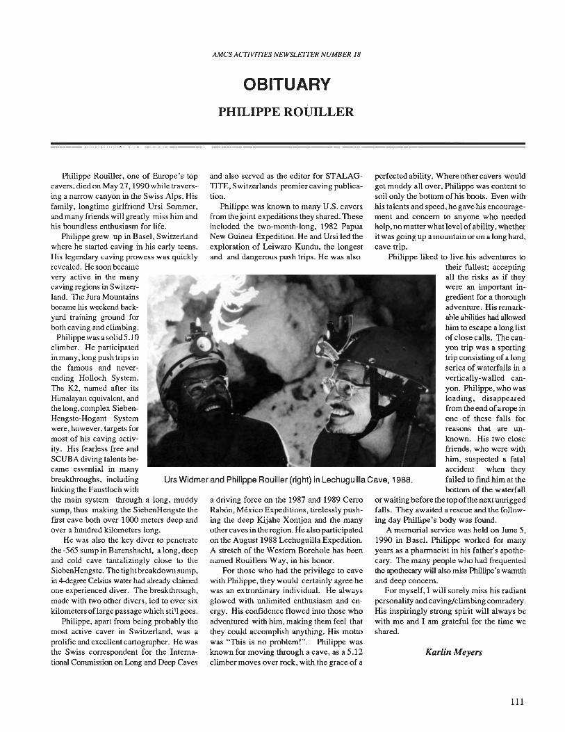
AMes ACTIVITIES NEWSLEITER NUMBER 18
OBITUARY
PHILIPPE ROUILLER
Urs Widmer and Philippe Rouiller (right) in Lechuguilla Cave, 1988.
Philippe Rouiller, one of Europe's topcavers, died on May 27,1990 while traversing a narrow canyon in the Swiss Alps. Hisfamily, longtime girlfriend Ursi Sommer,and many friends will greatly miss him andhis boundless enthusiasm for life.
Philippe grew up in Basel, Switzerlandwhere he started caving in his early teens.His legendary caving prowess was quicklyrevealed. He soon becamevery active in the manycaving regions in Switzerland. The Jura Mountainsbecame his weekend backyard training ground forboth caving and climbing.
Philippe was asolid5.10climber. He participatedin many, long push trips inthe famous and neverending Holloch System.The K2, named after itsHimalayan equivalent, andthe long, complex SiebenHengste-Hogant Systemwere, however, targets formost of his caving activity. His fearless free andSCUBA diving talents became essential in manybreakthroughs, includinglinking the Faustloch withthe main system through a long, muddysump, thus making the SiebenHengste thefirst cave both over 1000 meters deep andover a hundred kilometers long.
He was also the key diver to penetratethe -565 sump in Barenshacht, a long, deepand cold cave tantalizingly close to theSiebenHengste. The tight breakdown sump,in 4-degree Celsius water had already claimedone experienced diver. The breakthrough,made with two other divers, led to over sixkilometers oflarge passage which still goes.
Philippe, apart from being probably themost active caver in Switzerland, was aprolific and excellent cartographer. He wasthe Swiss correspondent for the International Commission on Long and Deep Caves
and also served as the editor for STALAGTITE, Switzerlands premier caving publication.
Philippe was known to many U.S. caversfrom the joint expeditions they shared. Theseincluded the two-month-long, 1982 PapuaNew Guinea Expedition. He and Ursi led theexploration of Leiwaro Kundu, the longestand and dangerous push trips. He was also
a driving force on the 1987 and 1989 CerroRabon, Mexico Expeditions, tirelessly pushing the deep Kijahe Xontjoa and the manyother caves in the region. He also participatedon the August 1988 Lechuguilla Expedition.A stretch of the Western Borehole has beennamed Rouillers Way, in his honor.
For those who had the privilege to cavewith Philippe, they would certainly agree hewas an extrordinary individual. He alwaysglowed with unlimited enthusiasm and energy. His confidence flowed into those whoadventured with him, making them feel thatthey could accomplish anything. His mottowas "This is no problem!". Philippe wasknown for moving through a cave, as a 5.12climber moves over rock, with the grace of a
perfected ability. Where other cavers wouldget muddy all over, Philippe was content tosoil only the bottom ofhis boots. Even withhis talents and speed, he gave his encouragement and concern to anyone who neededhelp, no matter what level ofability, whetherit was going up a mountain or on a long hard,cave trip.
Philippe liked to live his adventures totheir fullest; acceptingall the risks as if theywere an important ingredient for a thoroughadventure. His remarkable abilities had allowedhim to escape a long listof close calls. The canyon trip was a sportingtrip consisting of a longseries of waterfalls in avertically-walled canyon. Philippe, who wasleading, disappearedfrom the end ofa rope inone of these falls forreasons that are unknown. His two closefriends, who were withhim, suspected a fatalaccident when theyfailed to find him at thebottom of the waterfall
or waiting before the top ofthe next unriggedfalls. They awaited a rescue and the following day Phillipe's body was found.
A memorial service was held on June 5,1990 in Basel. Philippe worked for manyyears as a pharmacist in his father's apothecary. The many people who had frequentedthe apothecary will also miss Phillipe's wannthand deep concern.
For myself, I will sorely miss his radiantpersonality and caving/climbing comradery.His inspiringly strong spirit will always bewith me and I am grateful for the time weshared.
Karlin Meyers
111
AMes ACfIVITIES NEWSLETTER NUMBER 18
DIRECTORY OF MEXICAN CAVING GROUPS Compiled by Peter Sprouse
DISTRITO FEDERAL SOCIEDADMEXICANA DE EXPLORACIONESSUBTERRANEASRam6n Espinasa (fel25I-29-86)Perea Fuenle de la Pennlsula #19Tecamachalco 53950, Mexico
DRACOJose Montiel Castro (feI7-57-76-76)Manuel F. Soto No. 131Colonia Constituci6n de la RepUblica07460 Mexico, D.F.
GRUPO ESPELEOLOGICOUNIVERSITARIOAvenida San Jeronimo 1032San Jeronimo Aculco Lfdice10200 Mexico, D.F.
CRUZ ROlA MEXICANAEscuela Nacional de EspeleologaArturo Montero Garca (feI395-11-1l Extl06)Luis Vives No. 200Polanco, Mexico, D.F.
GRUPO EXPEDICIONARIO XAMAN·EKCalle 13 No. 10Colonia PorvenirMexico 15, D.F.(feI556-88-04)
ESCUELA DE GUlAS ALPINISTASDE MEXICO, S.C.Jose Luis Beleta BetetaAv. Baja California No. 200Mexico, D.F. 06760
ContributorsJim CokePostal IPlaya Del CarmenQuintana Roo, Mexico 77710
Don CoonsR.R.IRulland, Illinois 61358
Miles Drake10810 Joycelon Ct.Upper Marlboro, Maryland 20772
Dave Hughes3107-G Colonial WayChamblee, Georgia 30341
Patricia Kambesis1026 S. Candler SlreelDecalur, Georgia 30030
112
ASOCIACION DE EXCURSIONISMO DELINSTITUTO POLITECNICO NACIONALRicardo Arias Fern~ndez (Tel 5-87-17-23)Av. Olh6n de Mendizabal Ole. #20-264Col. La Palera VallejoMexico D.F., 07710
GRUPOGEOAna MarthaSabirio No. 262Col. Santa Ma. de la RiberaMexico, D.F.
ASOCIACION ALPINA DE MEXICOSergio Zambrano (Tel 5-48-3035)Las Huertas 93-CColonia del Valle03100 Mexico, D.F.
ASOCIACION MEXICANA DEBUCEO EN CUEVASAngel SOlO PonuaAv. Presa Don MartIn 21Col. Irrigaci6n 11500Mexico,D.F
GRUPO ESPELEOLOGICO MEXICANOJorge de Urquijo Tovar (Tel 3-96-16-36)Salnica #233 Col. ElectricistasMexico D.F.
ESPELEOCLUB ZOTZJohn Pint Tel 13-94-43 (Guadalajara)Apartado 103 CP 45010Cd. Granja, Jalisco
Karlin MeyersP.O. Box 1604Bridgehamplon, New York 11932
Dale PaleP.O. Box 1251Auslin, Texas 78767
JirnSmilhDepartment of GeographyWeslern Kentucky UniversilyBowling Green, Kenlucky 42107
Peler SprouseP.O. Box 8424Auslin, Texas 78713
Bill Sleele152 Bluet LaneSan Anlonio, Texas 78213
CLUB ALPINO ESPELEOLOGICO TRESDE MONTERREYFederico Aguilar (feI43-34-36)Apartado Postal 59Monlerrey, Nuevo Le6n
ASOCACIN POTOSINO DEMONTAISMO Y ESPELEOLOGAFelipe Moreno (feI2-14-85)Verdi No. 140Col. Hirnno Nacional c.P. 78280San Luis Potosf, SLP
GRUPO DE EXPLORACIONES SUBTER·RANEAS DE TABASCOViclor Doranles (feI931-55592)Gregorio Mendez 1110, Piso 4Esq. Ruiz de la PenaVillahermosa, Tabasco
GRUPO ACTUNOOBEnrique Duhne BackhaussCalle 6a. No. 164 X 13Col. Prado NorteMerida, Yucatan(fel 27-78-67)
John Slernbel750 Bellerneade AvenueAllanta, Georgia 30318
Terri TreacyP. O. Box 4Carbondale, Illinois 62901
Carol Vesely817 Wildrose AvenueMonrovia, California 91016
Alan Warild41 Northwood SlreelNewlon 2042 Auslrailia

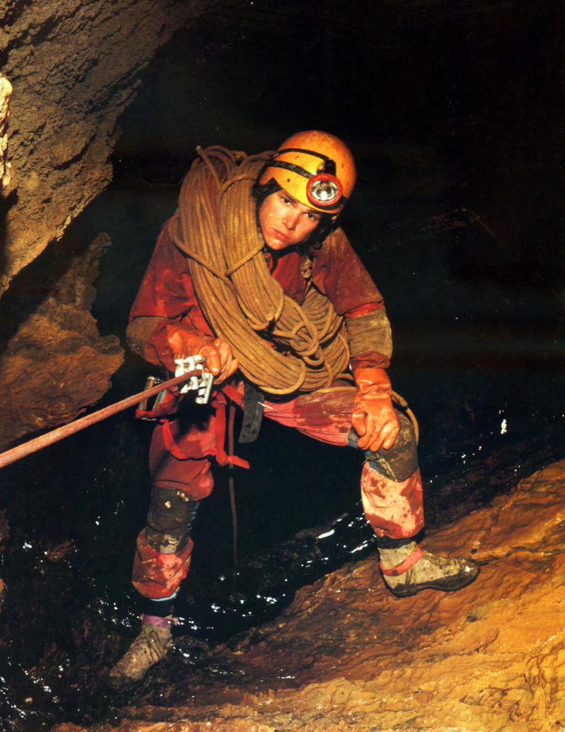
Related Documents