Landscape

The land survey systems are geometric patterns used to subdivide land. They shape land ownership patterns, guides rural settlement, and sometimes directs.
Dec 17, 2015
Welcome message from author
This document is posted to help you gain knowledge. Please leave a comment to let me know what you think about it! Share it to your friends and learn new things together.
Transcript

Landscape

The land survey systems are geometric patterns used to subdivide land. They shape land ownership patterns, guides rural settlement, and sometimes directs road network
Land Survey Systems

French Arpent: an arpent is a French measurement of approximately 192 feet (59 m), and a square arpent (also referred to as an arpent) is about 0.84 acres (3,400 m2).

French arpent land divisions are long narrow parcels of land usually found along the navigable streams of southern Louisiana, and also found along major waterways in other areas. This system of land subdivision was begun by French settlers in the 18th century, according to typical French practice at the time and was continued by both the Spanish and by the American government after the acquisition of the Louisiana Purchase.

This method of land division provided each land-owner with river frontage as well as land suitable for cultivation and habitation.

British Metes and Bounds: limits or boundaries of a tract of land as identified by natural landmarks, such as rivers, or by man-made structures, such as roads, or by stakes or other markers.

Public Land Survey System: typically divides land into 6-mile-square townships, which is the level of information included in the National Atlas. Townships are subdivided into 36 one-mile- square sections. Sections can be further subdivided into quarter sections, quarter-quarter sections, or irregular government lots.

Housing French Creole House

The typical rural French Creole house can be described as follows. Its most important features include: 1) generous galleries 2) a broad spreading roofline 3) placement of the principal rooms well above
grade (sometimes a full story) 4) multiple French doors5) French wraparound mantels.

Influence from Anglo settlers Single pen houses: made of horizontally
placed logs. Galleries are additions and not incorporated in the roofline.

Variations of single pen housesDouble pen houses: attach a second pen to the wall without the chimney, creating a pair of rooms with fireplaces on the outer walls.
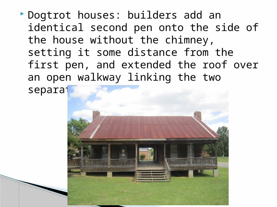
Dogtrot houses: builders add an identical second pen onto the side of the house without the chimney, setting it some distance from the first pen, and extended the roof over an open walkway linking the two separate structures.

I-house: similar to dogtrot but different by standing two stories high.
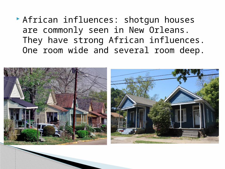
African influences: shotgun houses are commonly seen in New Orleans. They have strong African influences. One room wide and several room deep.

In almost every Louisiana town, there is a small section near the central business district with large ornate houses. Geographers call this district “alpha boulevard.”
Geography of Folk Housing

Italianate houses

Queen Anne houses

Arts and crafts houses: typically found in areas close to the urban center, just beyond the alpha boulevard.

Some features of arts and crafts houses:
•Wood, stone, or stucco siding•Low-pitched roof•Exposed roof rafters•Porch with thick square or round columns•Stone porch supports•Exterior chimney made with stone•Open floor plans; few hallways•Numerous windows

Ranch houses

River Road
Louisiana's fabled Great Mississippi River Road consists of a corridor approximately 70 miles in length located on each side of the river between Baton Rouge and New Orleans.


Mark Twin records: "From Baton Rouge to New Orleans, the great sugar plantations border both sides of the river all the way, . . . Plenty of dwellings . . . standing so close together, for long distances, that the broad river lying between two rows, becomes a sort of spacious street. A most home-like and happy-looking region."

French-Catholic cemetery: above ground burial.
Cemeteries

Upland South protestant section:
Related Documents