{ GEOG 346: Day 6 Land Use Mix and Density https://www.google.ca/search? q=images+of+different+land+use+mixes+and+densities&biw=1350& bih=527&tbm=isch&imgil=GcGEJ3F7doKbHM%253A %253BsPTRTRyyMVVNXM%253Bhttp%25253A%25252F %25252Fwww.toolkit.bc.ca%25252FAction-What%25252Fwhat %25252FSustainable- Transportation&source=iu&pf=m&fir=GcGEJ3F7doKbHM%253A %252CsPTRTRyyMVVNXM%252C_&usg=__uvhsav6K-L_phE9zmxK2OP-U1VI %3D

{ GEOG 346: Day 6 Land Use Mix and Density ities&biw=1350&bih=527&tbm=isch&imgil=GcGEJ3F7doKbHM%253A%253BsPT.
Dec 27, 2015
Welcome message from author
This document is posted to help you gain knowledge. Please leave a comment to let me know what you think about it! Share it to your friends and learn new things together.
Transcript

{GEOG 346: Day 6
Land Use Mix and Density
https://www.google.ca/search?q=images+of+different+land+use+mixes+and+densities&biw=1350&bih=527&tbm=isch&imgil=GcGEJ3F7doKbHM%253A%253BsPTRTRyyMVVNXM%253Bhttp%25253A%25252F%25252Fwww.toolkit.bc.ca%25252FAction-What%25252Fwhat%25252FSustainable-Transportation&source=iu&pf=m&fir=GcGEJ3F7doKbHM%253A%252CsPTRTRyyMVVNXM%252C_&usg=__uvhsav6K-L_phE9zmxK2OP-U1VI%3D
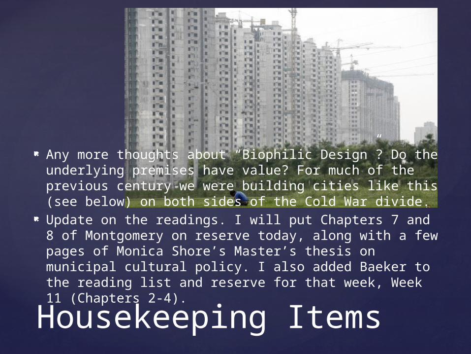
Any more thoughts about “Biophilic Design”? Do the underlying premises have value? For much of the previous century we were building cities like this (see below) on both sides of the Cold War divide.
Update on the readings. I will put Chapters 7 and 8 of Montgomery on reserve today, along with a few pages of Monica Shore’s Master’s thesis on municipal cultural policy. I also added Baeker to the reading list and reserve for that week, Week 11 (Chapters 2-4).
Housekeeping Items

I briefly mentioned Masdar City last time, and I’m passing around something from Wikipedia about it.
It’s in Abu Dhabi, not Dubai. The design is from the firm of Norman Foster,
which designed the new Reichstag (German parliament) in Berlin.
They first toured Arab cities to learn from traditional designs of how buildings and streets were constructed in a desert environment to minimize heat and wind tunneling effects.
The complex relies 100% on renewable energy and features mass transit, and personal electric vehicles. Its progress has been slowed by global economic issues.
Housekeeping Items

Masdar City
The readings for this week are Grant, pp. 350-358 (347-350 optional); Condon. Ch. 4 [see bib. – e-book in library], and Montgomery, Ch. 6. The optional reading in Grant is worth it because it is extremely funny – a look at zoning through the eyes of a Sam Spade/ Raymond Chandler-type character.
The first reading by Gabor and Lewinberg makes it clear that our current built environment is not an accident. It is mostly the product of zoning.
In the past, and for the most part today, zoning mandated:• Low densities• Homogeneity of building styles and land uses• Segregation of higher density buildings and non-
residential land uses away from low-density residential• Treatment of the street as automobile territory• An absence of central public spaces, for the most part.
Land Use Mix and Density

Gabor and Lewinberg are part of a movement that arose in the late ‘80s and early ‘90s called New Urbanism [see http://digital.films.com/PortalViewVideo.aspx?xtid=10599]
In reality, it is about making neighbourhoods more like they used to be:• Mixed housing types• More pedestrian and bike-friendly streets• A mix of housing types and land uses, and• Central public spaces.
Land Use Mix and Density
See Table 14.1on p. 354 for a comparison

The new urbanist communities, according to Gabor and Lewinberg:
“have a connected and permeable public framework of streets and open spaces as the main structuring element of the community”;
Are pedestrian, bike, and transit-friendly, while accommodating cars;
Provide “an attractive, safe, and inviting public realm”; Accommodate and integrate “a diverse and wide range
of land uses, densities, and building types within each neighbourhood”;
Integrate “the natural environment into the new community, and provide “accessible public open spaces and community institutions that provide a sense of place and act as landmarks of community identity.”
Land Use Mix and Density

Historical Precedents for the Latter Point
The authors note that a number of communities in Canada are adopting New Urbanism and creating codes that embody its principles. It’s not an avalanche yet, but it’s a significant start. Any thoughts on why this might be happening?
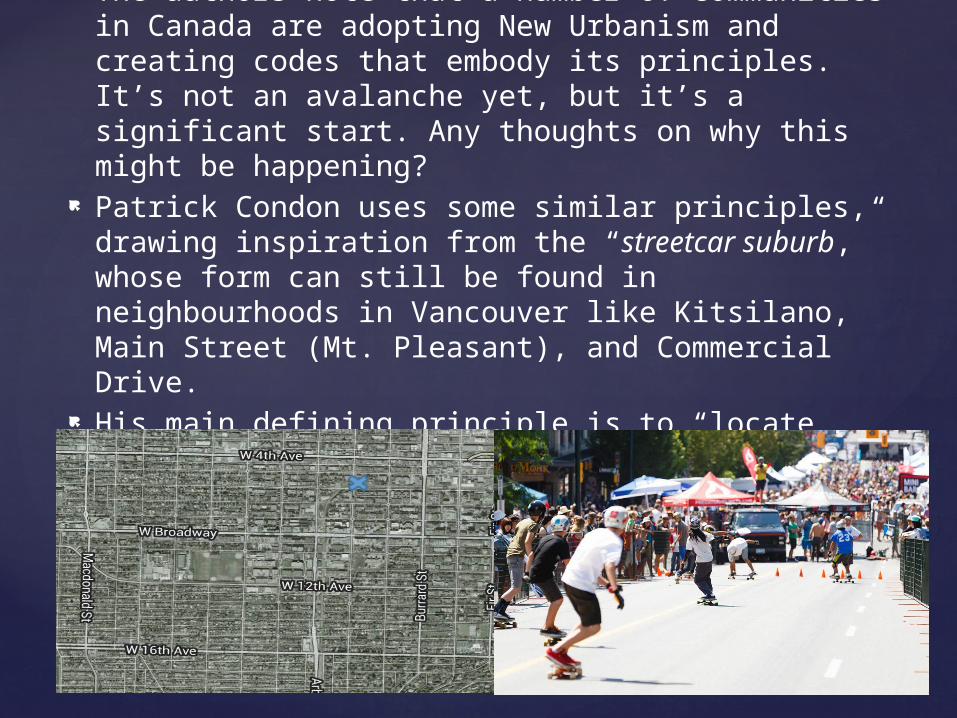
Patrick Condon uses some similar principles, drawing inspiration from the “streetcar suburb,” whose form can still be found in neighbourhoods in Vancouver like Kitsilano, Main Street (Mt. Pleasant), and Commercial Drive.
His main defining principle is to “locate commercial services, frequent transit, and schools within a five-minute walk.”

He notes that centralized nodes are not the only way to successfully organize urban space. Linear main streets running parallel to one another, and approximately a ten minute walk apart – as in Kitsilano – are also quite workable.
The Kitsilano neighbourhood has a mix of single-family homes (often with a secondary suite), four-storey apartment buildings, and high-rise condo developments (a recent development). Major destination parks are mixed in with small local parks and playing fields.
Land Use Mix and Density

Kitsilano meets and exceeds the minimum requirement for a sufficient density of units (10 dwelling units per gross acre [many subdivisions are 1-4]) and residents (25 residents per gross acre) to allow for frequent bus service, and bus service is frequent on both 4th Avenue and Broadway.
Kitsilano residents frequently “trip chain” – combine errands in the same errand and/or hop on and off the bus with the same transfer going in the same direction, something our Nanaimo bus system does not allow.
In Kitsilano the headway (frequency of bus service) sought by transit planners – four to seven minutes – is often achieved during rush hour. Otherwise, one has to time one’s life around the bus schedule, as I do here, and I live on one of the more frequent routes – the #4.
Land Use Mix and Density

Enlightened planners have always designed neighbourhoods so that kids can walk or ride their bikes to school.
This requires two things: the centrality of the school, and an interconnected grid pattern.
This also means smaller schools, not their “big box” equivalents.
From saferoutesinfo.org re the U.S.:• In 1969, 48 percent of children 5 to 14 years of age usually
walked or bicycled to school. [2]• In 2009, 13 percent of children 5 to 14 years of age usually
walked or bicycled to school. [2]• In 1969, 41 percent of children in grades K–8 lived within one
mile of school; • 89 percent of these children usually walked or bicycled to school. [3]• In 2009, 31 percent of children in grades K–8 lived within one
mile of school; • 35 percent of these children usually walked or bicycled to school. [2]
Land Use Mix and Density

How did you get to school in elementary and high school?
Could you walk to a corner store? Where did you hang out with your friends? Were there parks and playing fields nearby? What type of urban environment – one or two-
storey, 4-5 storey, or high-rise – has the least environmental impact, especially in terms of energy consumption and greenhouse gas production?
What could be done to encourage more environ-mentally-friendly urban development, or is this already happening?
Discussion Questions
Related Documents

![Notes from Sidney Coleman’s Physics 253a arXiv:1110 ...1110.5013v5 [physics.ed-ph] 21 Feb 2013 Notes from Sidney Coleman’s Physics 253a Sidney Coleman∗ Harvard, Fall 1986†](https://static.cupdf.com/doc/110x72/5ab917a57f8b9ac1058d6e62/notes-from-sidney-colemans-physics-253a-arxiv1110-11105013v5-physicsed-ph.jpg)