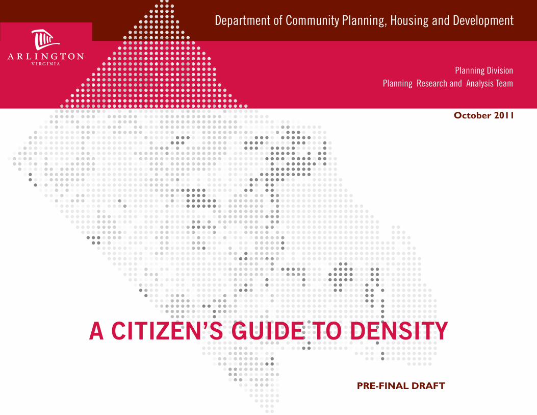
October 2011
PRE-FINAL DRAFT
A CITIZEN’S GUIDE TO DENSITY
Department of Community Planning, Housing and Development
Planning Division Planning Research and Analysis Team
The information in this document is meant to be educational, to show that density comes in a variety of forms, and to help residents understand and effectively participate in the public process.
ACKNOWLEDGEMENTS AND CREDITS
The density images and related calculations in this document are meant to provide visual references to what various densities look like in Arlington and are intended to be used for comparative purposes within the framework of this guide. This is not a legal document. For specific development densities and project information, please refer to the Zoning Office.
I
Image Sources:
Oblique aerial and context photographs courtesy of Pictometry International Corporation.Cover photographs courtesy of © Cameron Davidson 2010.Geographic Information Systems Data courtesy of the Arlington County GIS Mapping Center.Streetview photographs courtesy of Arlington County Staff.
Arlington County Management Team
Tom Miller, Acting Planning Director, DCPHDClaude Williamson, Comprehensive Planning Supervisor, DCPHDLeon Vignes, Acting Planning Research and Graphics Supervisor, DCPHD
Arlington County Project Team
Andrew D’huyvetter, Planner, DCPHDC. Juliana Villabona, Planner, DCPHDAnthony Fusarelli, Senior Planner, DCPHD
This guide was inspired by “Visualizing Density” by Julie Campoli and Alex S. MacLean and the work of the Lincoln Institute of Land Policy.
TABLE OF CONTENTS
ACKNOWLEDGEMENTS AND CREDITS.........................................................................
INTRODUCTION ...................................................................................................................
Understanding density in units per acre................................................................ Understanding density in floor area ratios............................................................
ARLINGTON’S DEVELOPMENT PROCESS ...................................................................... Development Process at a Glance...........................................................................
METHODOLOGY......................................................................................................................
PROJECT LOCATIONS MAP..................................................................................................
RESIDENTIAL DEVELOPMENTS CALCULATED BY UNITS PER ACRE.................... 1-10 Units per Acre ................................................................................................ 10-20 Units per Acre ................................................................................................. 20-40 Units per Acre ................................................................................................. 40-60 Units per Acre ................................................................................................. 60-90 Units per Acre .................................................................................................
RESIDENTIAL, COMMERCIAL AND MIXED-USE DEVELOPMENTS CALCULATED BY FLOOR AREA RATIOS.........................................................................
0 - 1 Floor Area Ratio ............................................................................................ 1 - 2 Floor Area Ratio.............................................................................................. 2 - 4 Floor Area Ratio.............................................................................................. 4 - 6 Floor Area Ratio ............................................................................................ 6 - 8 Floor Area Ratio ............................................................................................ 8 - 10 Floor Area Ratio..............................................................................................
APPENDIX ................................................................................................................................. Appendix A: Units per Acre...................................................................................... Appendix B: Floor Area Ratios................................................................................. Data Sources................................................................................................................
I
IV
VVI
VIIVIII
IX
X
12
1318192325
28
293135414851
54555761
II

Intentionally left blank
Since the completion of the Metrorail system and the adoption of land use policies that concentrate development in the Metro Corridors, Arlington has grown to possess a great diversity of neighborhood densities. These densities range from low density neighborhoods dominated by single family homes to high density, mixed-use neighborhoods located near Metro stations, and a great variety exists somewhere in between.
Density is a complex concept. Even for trained professionals, it is difficult to determine the density of a neighborhood by observation alone. The design of a project (the arrangement of buildings, parking, and open space) guides how an individual perceives density. Two different projects can have the same density, but they can be perceived in very different ways. “A Citizen’s Guide to Density” is a visual guide to understanding and illustrating density in Arlington County.
The General Land Use Plan (GLUP) is the primary policy guide for the future development of Arlington County. The GLUP establishes the overall character, extent and location of various land uses and serves as a guide to communicate the policy of the County Board to citizens, the business community, developers, and others involved in the development of Arlington County. Each land use designation on the GLUP map indicates a range of densities (in units per acre or F.A.R.) and typical uses. This guide provides illustrative, visual examples of these density ranges so that Arlington residents may understand and effectively participate in the public process. It is organized into four sections:
I. IntroductionII. Residential developments calculated by units per acreIII. Residential, commercial and mixed-used developments calculated by Floor Area Ratios IV. Appendix
Section I, Introduction, explains density concepts as they relate to the development process in Arlington County. Section II, Units per Acre Projects, displays residential neighborhoods or developments by their density in terms of units per acre. Section III, Floor Area Ratio Projects, displays developments by their density in terms of Floor Area Ratios (F.A.R.). Finally, Section IV, Appendix, provides detailed background information on project or neighborhood specific calculations.
In sections II and III, each page shows a development’s density and contains photographs and diagrams that demonstrate scale, massing, neighborhood composition, and context. Street view photographs provide a pedestrian perspective and give a feel for the scale of the project. An aerial image denotes the site boundary and shows the development in relation to its surrounding neighborhood. Plan view diagrams show neighborhood composition by emphasizing built areas, open spaces, the street network, and proximity to Metrorail stations. These diagrams are shown at the same scale of 1”= 2640’ (half a mile radius) to provide a consistent framework with which to compare developments and their associated densities.
Developments were selected to show a range of densities and are or-dered from low to high. Developments cover a variety of housing types, uses, and neighborhoods in Arlington. Since a development may include multiple buildings, open spaces, or other public amenities, each develop-ment page illustrates the boundary used in its density calculations. The appendix contains additional detailed project boundary information.
I. INTRODUCTION
In Arlington, density is measured in terms of units per acre or floor area ratios.
Density is the quantity and concentration of development in a particular area.
IV
1 acre
1 acre
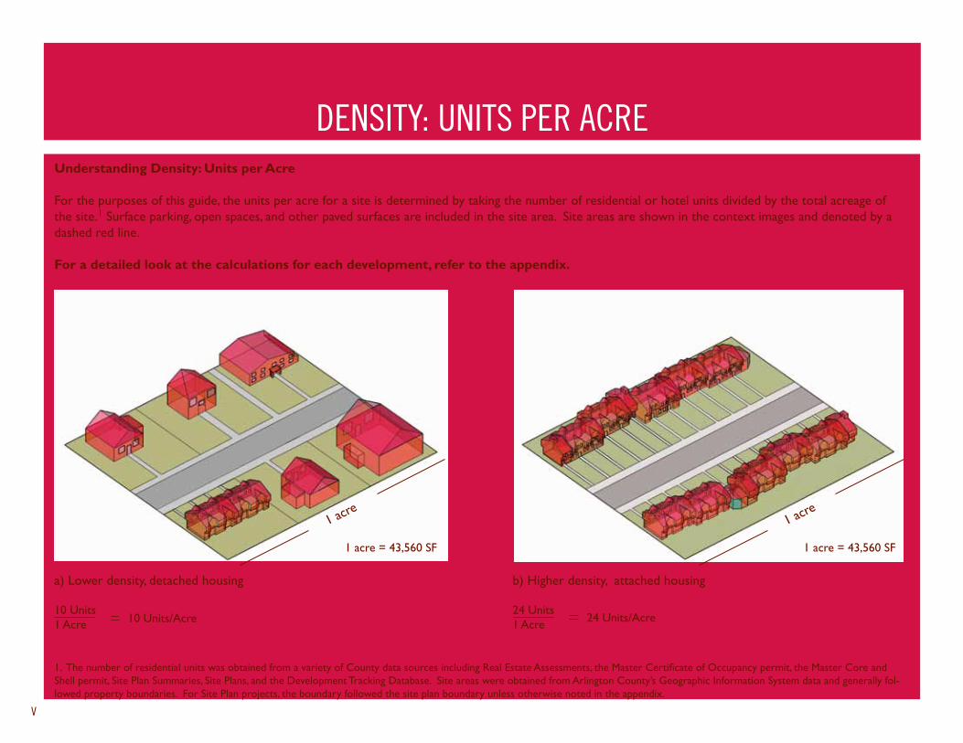
Understanding Density: Units per Acre
For the purposes of this guide, the units per acre for a site is determined by taking the number of residential or hotel units divided by the total acreage of the site.1 Surface parking, open spaces, and other paved surfaces are included in the site area. Site areas are shown in the context images and denoted by a dashed red line.
For a detailed look at the calculations for each development, refer to the appendix.
1. The number of residential units was obtained from a variety of County data sources including Real Estate Assessments, the Master Certificate of Occupancy permit, the Master Core and Shell permit, Site Plan Summaries, Site Plans, and the Development Tracking Database. Site areas were obtained from Arlington County’s Geographic Information System data and generally fol-lowed property boundaries. For Site Plan projects, the boundary followed the site plan boundary unless otherwise noted in the appendix.
DENSITY: UNITS PER ACRE
a) Lower density, detached housing
10 Units1 Acre
1 acre = 43,560 SF 1 acre = 43,560 SF
b) Higher density, attached housing
24 Units1 Acre
V
24 Units/Acre10 Units/Acre
ARLINGTON’S DEVELOPMENT PROCESS
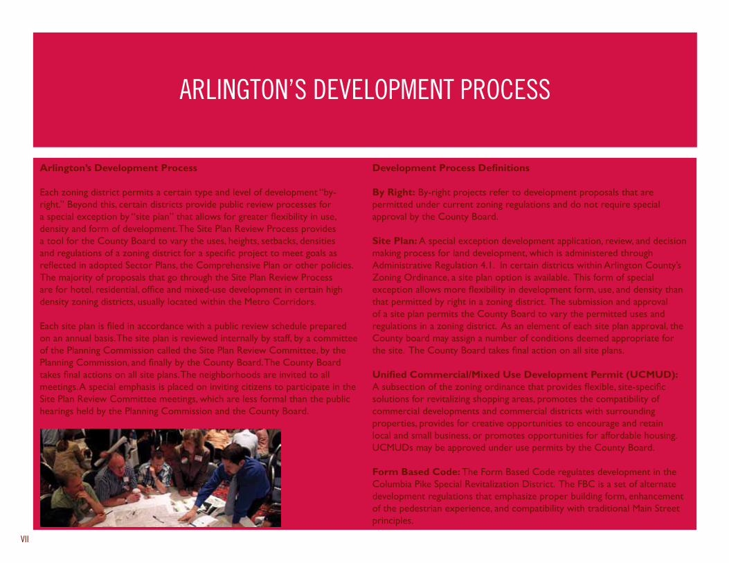
Arlington’s Development Process
Each zoning district permits a certain type and level of development “by-right.” Beyond this, certain districts provide public review processes for a special exception by “site plan” that allows for greater flexibility in use, density and form of development. The Site Plan Review Process provides a tool for the County Board to vary the uses, heights, setbacks, densities and regulations of a zoning district for a specific project to meet goals as reflected in adopted Sector Plans, the Comprehensive Plan or other policies. The majority of proposals that go through the Site Plan Review Process are for hotel, residential, office and mixed-use development in certain high density zoning districts, usually located within the Metro Corridors.
Each site plan is filed in accordance with a public review schedule prepared on an annual basis. The site plan is reviewed internally by staff, by a committee of the Planning Commission called the Site Plan Review Committee, by the Planning Commission, and finally by the County Board. The County Board takes final actions on all site plans. The neighborhoods are invited to all meetings. A special emphasis is placed on inviting citizens to participate in the Site Plan Review Committee meetings, which are less formal than the public hearings held by the Planning Commission and the County Board.
Development Process Definitions
By Right: By-right projects refer to development proposals that are permitted under current zoning regulations and do not require special approval by the County Board.
Site Plan: A special exception development application, review, and decision making process for land development, which is administered through Administrative Regulation 4.1. In certain districts within Arlington County’s Zoning Ordinance, a site plan option is available. This form of special exception allows more flexibility in development form, use, and density than that permitted by right in a zoning district. The submission and approval of a site plan permits the County Board to vary the permitted uses and regulations in a zoning district. As an element of each site plan approval, the County board may assign a number of conditions deemed appropriate for the site. The County Board takes final action on all site plans.
Unified Commercial/Mixed Use Development Permit (UCMUD): A subsection of the zoning ordinance that provides flexible, site-specific solutions for revitalizing shopping areas, promotes the compatibility of commercial developments and commercial districts with surrounding properties, provides for creative opportunities to encourage and retain local and small business, or promotes opportunities for affordable housing. UCMUDs may be approved under use permits by the County Board.
Form Based Code: The Form Based Code regulates development in the Columbia Pike Special Revitalization District. The FBC is a set of alternate development regulations that emphasize proper building form, enhancement of the pedestrian experience, and compatibility with traditional Main Street principles.
VII

Intentionally left blank
Context
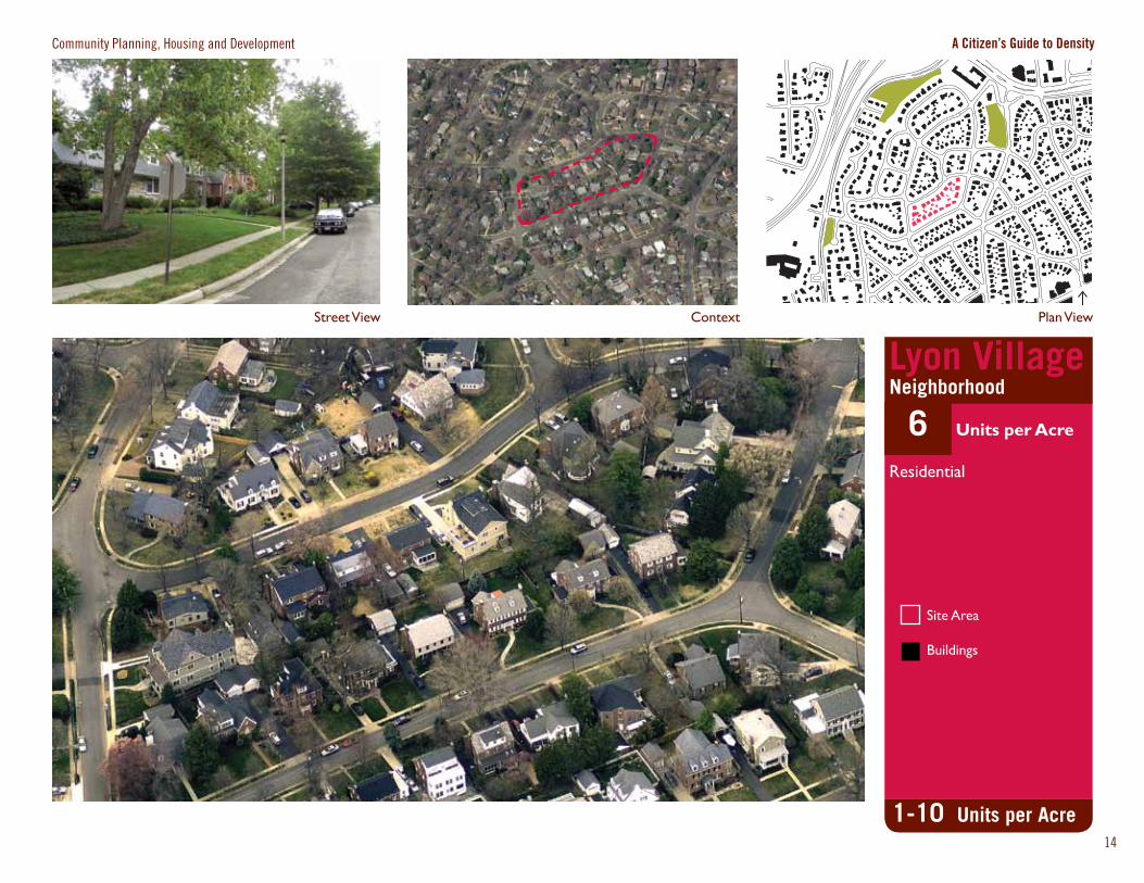
Community Planning, Housing and Development A Citizen’s Guide to Density
Plan ViewStreet View
Site Area
Buildings
1-10 Units per Acre
Lyon VillageNeighborhood
6 Units per Acre
Residential
14
Context
Community Planning, Housing and Development A Citizen’s Guide to Density
15
Plan View Street View
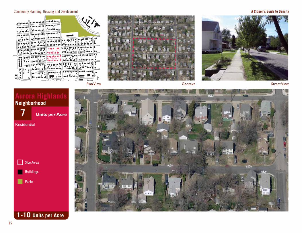
1-10 Units per Acre
Aurora HighlandsNeighborhood
7 Units per Acre
Residential
Site Area
Buildings
Parks
Context
Community Planning, Housing and Development A Citizen’s Guide to Density
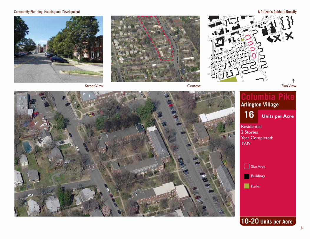
Site Area
Buildings
Parks
Street View
10-20 Units per Acre
Plan View
Columbia PikeArlington Village
16 Units per Acre
Residential2 StoriesYear Completed:1939
18
Context
Community Planning, Housing and Development A Citizen’s Guide to Density
19
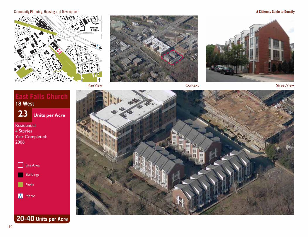
Street ViewPlan View
20-40 Units per Acre
East Falls Church18 West
23 Units per Acre
Residential4 StoriesYear Completed: 2006
Site Area
Buildings
Parks
Metro

Intentionally left blank
Context
Community Planning, Housing and Development A Citizen’s Guide to Density
Site Area
Buildings
Parks
Street View Plan View
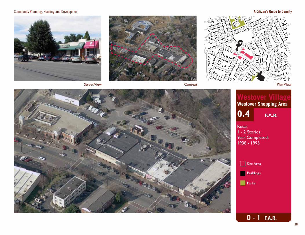
Westover VillageWestover Shopping Area
0.4 F.A.R.
Retail1 - 2 StoriesYear Completed:1938 - 1995
0 - 1 F.A.R.30
Street ViewContext
Community Planning, Housing and Development A Citizen’s Guide to Density
33
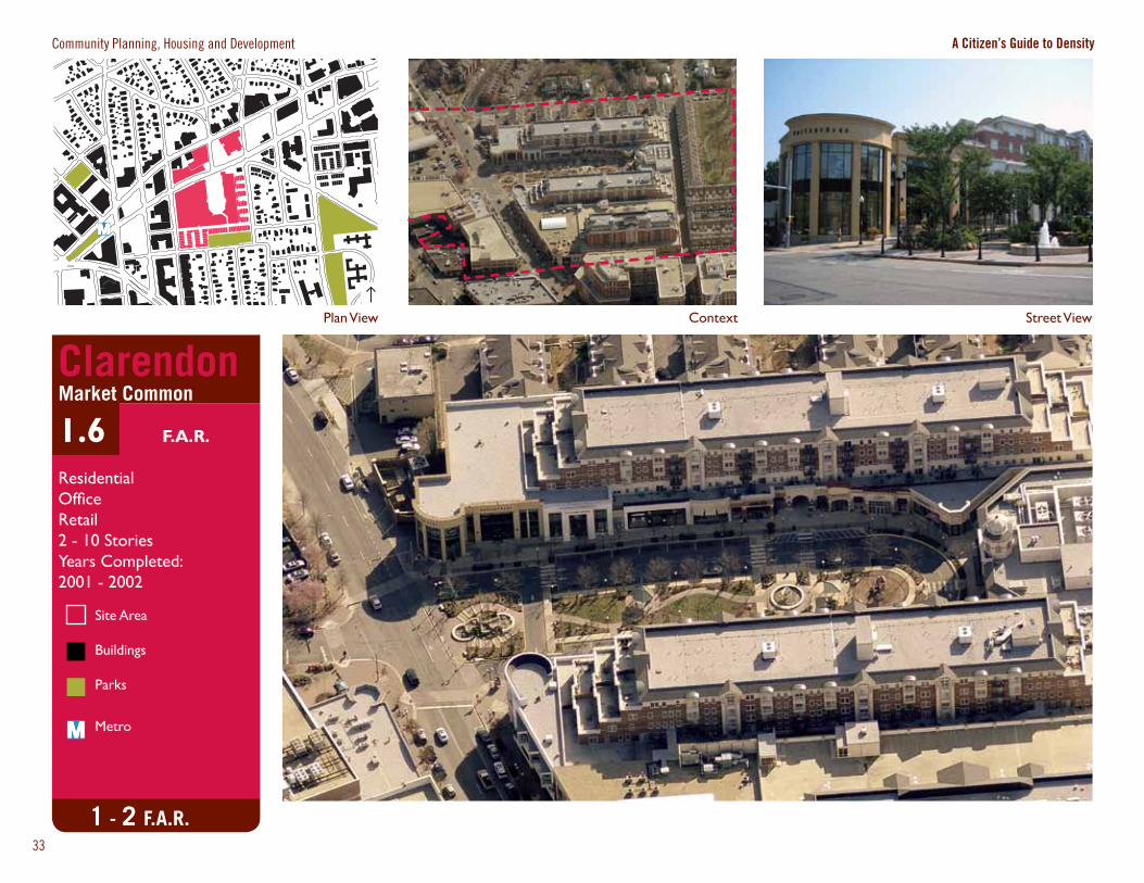
ClarendonMarket Common
1.6 F.A.R.
ResidentialOfficeRetail2 - 10 StoriesYears Completed:2001 - 2002
1 - 2 F.A.R.
Plan View
Site Area
Buildings
Parks
Metro
Context
Community Planning, Housing and Development A Citizen’s Guide to Density
Site Area
Buildings
Parks
Plan ViewStreet View
4 - 6 F.A.R.
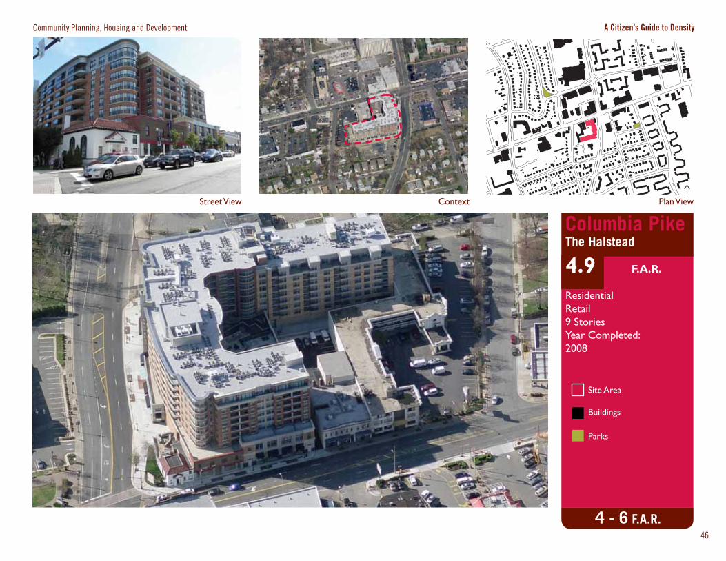
Columbia PikeThe Halstead
4.9 F.A.R.
ResidentialRetail9 StoriesYear Completed:2008
46
Site Area
Buildings
Parks
Metro
Street ViewContext
Community Planning, Housing and Development A Citizen’s Guide to Density
Plan View
47
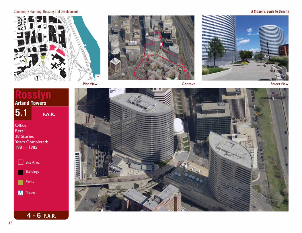
4 - 6 F.A.R.
RosslynArland Towers
5.1 F.A.R.
OfficeRetail28 StoriesYears Completed:1981 - 1985