Bay Delta Science Conference 2014 Jai Singh, BS Chris Bowles, PhD, P.E. Chris Campbell, MS Yolo Bypass Widening into the Elkhorn Basin: A Multi-Benefit Opportunity for Flood Control, Floodplain Habitat and Fish Passage

Welcome message from author
This document is posted to help you gain knowledge. Please leave a comment to let me know what you think about it! Share it to your friends and learn new things together.
Transcript

Insert Main Title Insert Subtitle
Insert Date
Presenter #1 Presenter #2
Bay Delta Science Conference 2014
Jai Singh, BS Chris Bowles, PhD, P.E. Chris Campbell, MS
Yolo Bypass Widening into the Elkhorn Basin: A Multi-Benefit Opportunity for Flood Control, Floodplain Habitat and Fish Passage
Acknowledgements
• DWR
• USBR
• SAFCA
• Yolo County
• Knaggs Ranch
• CalTrout
• HDR
• MBK Engineers
• American Rivers
• Douglas Environmental
• AECOM
• ICF International
• Sacramento County
• Mick Klasson
• 2014 BiOp Hydrodynamic Modeling
• 2014 SAFCA Hydrodynamic Modeling
Yolo Bypass Widening into the Elkhorn Basin – BDSC 2014
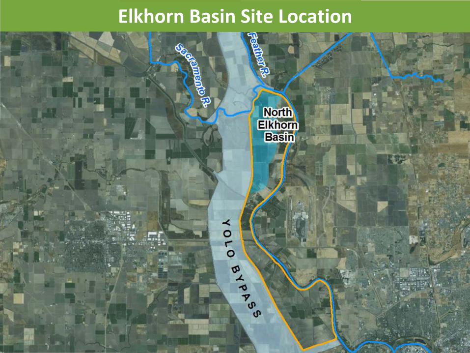
Elkhorn Basin Site Location

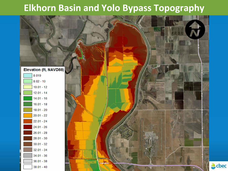
Elkhorn Basin and Yolo Bypass Topography
Elevation (ft, NAVD88)
LJ S.019
c::::J s.02 - 10
0 10.01-1 2
LJ 12.01-14
- 14.01 - 16
- 16.01- 18
- 18.01 - 20
- 20.01 - 22
- 22.01-24
- 24.01- 26
- 26.01 -28
- 28.01-30
- 30.01 - 32
- 32.01 -34
- 34.01 - 36
LJ36.01 - 38
LJ 38.01 - 40
Elevation (ft, NAVD88)
D 8_019
D 8_02-10
D 10_01 - 12
D 12_0 1 - 14
- 14.0 1 - 16
- 16 .0 1 - 18
- 18.01 -20
26.01 -28
- 28.0 1 - 30
- 30.0 1 - 32
- 32.01 - 34
D 34 .01 - 36
D 36.0 1 - 38
D 38.0 1 - 40

Elkhorn Basin Historical Habitat SFEI Historical
Ecology
fluvial open water
tidal freshwater emergent wetland
non-tidal freshwater emergent wetland
wet meadow/seasonal wetland
vernal pool complex
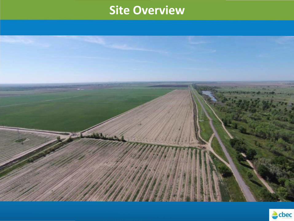
Site Overview
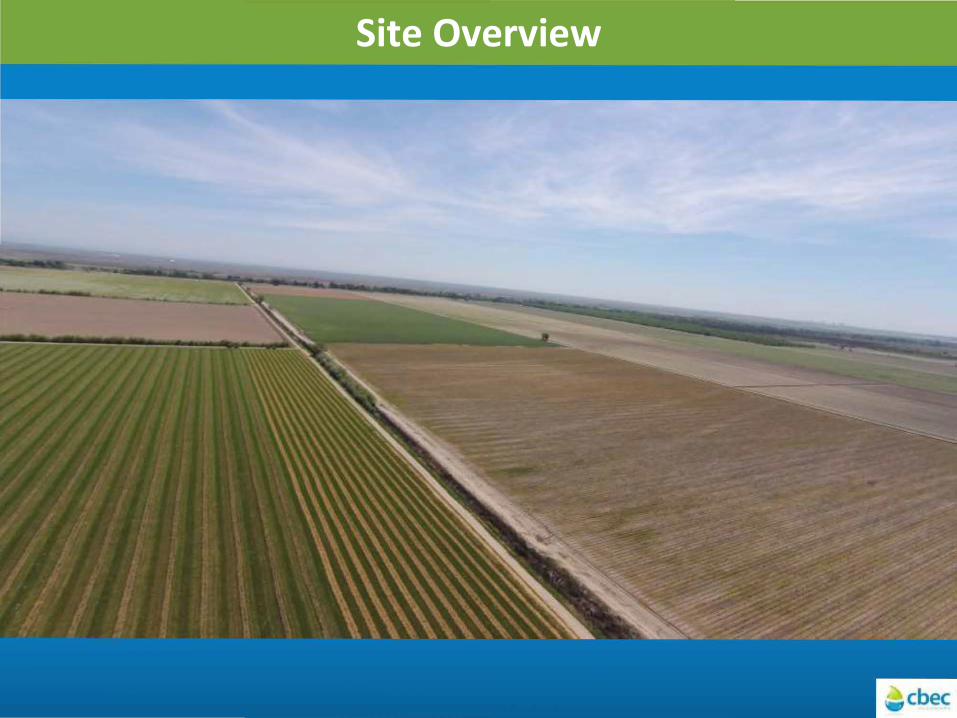
Site Overview
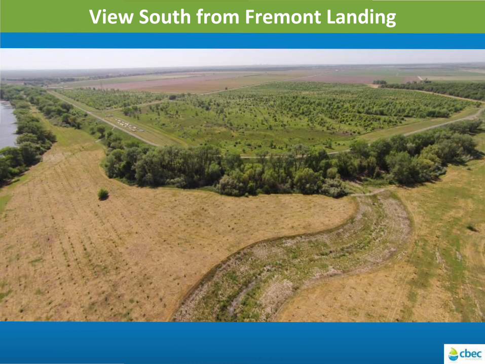
View South from Fremont Landing
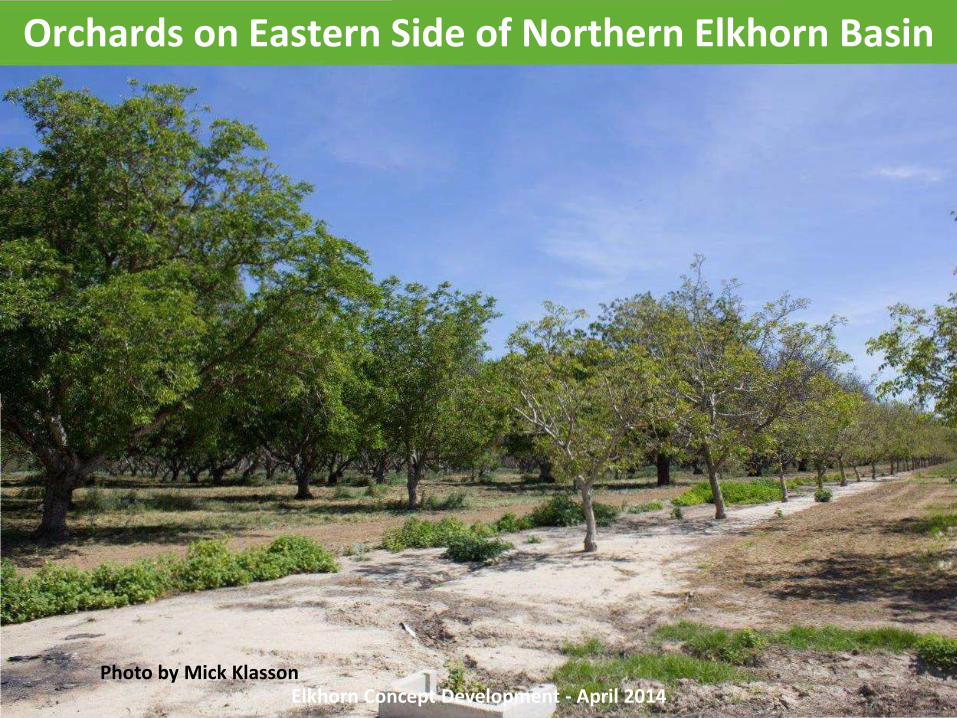
Orchards on Eastern Side of Northern Elkhorn Basin
Elkhorn Concept Development - April 2014 Photo by Mick Klasson
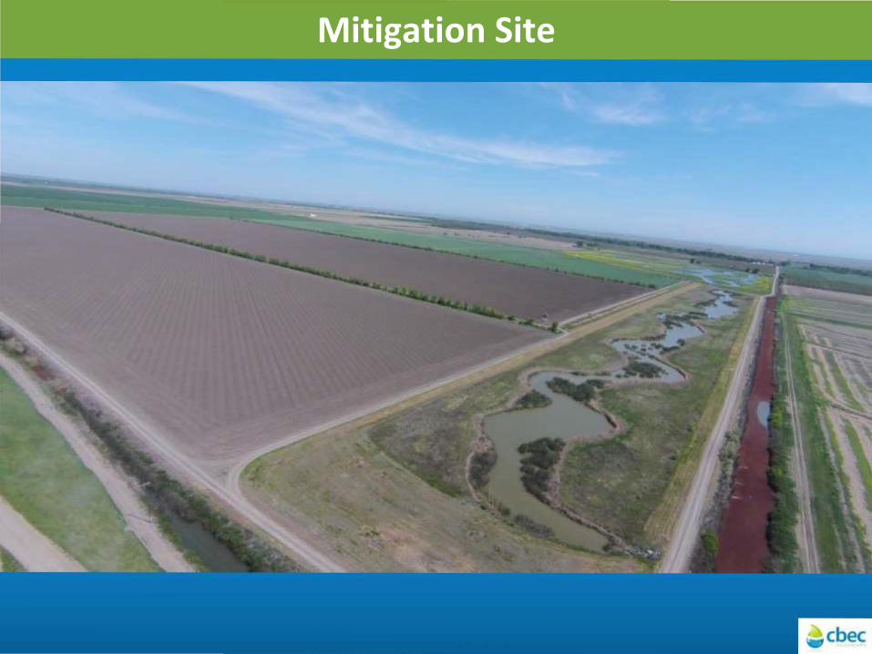
Mitigation Site
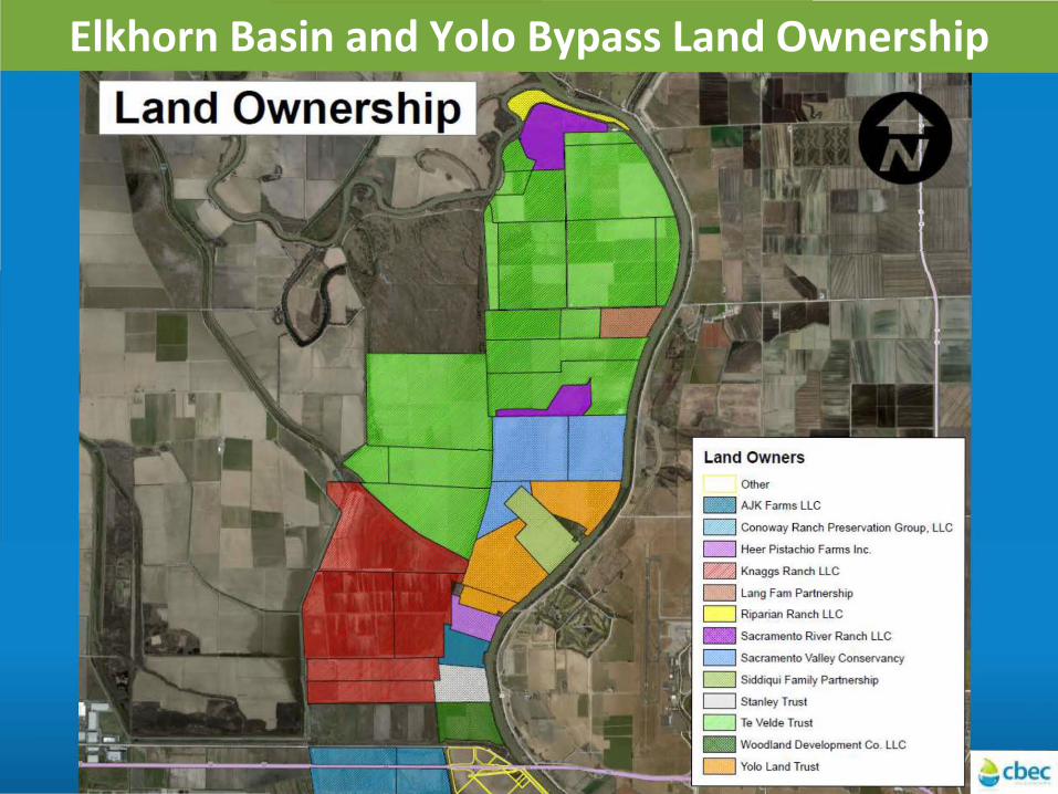
Elkhorn Basin and Yolo Bypass Land Ownership .. Land Ownership
c::::J Conoway Ranch Preservation Group, LLC
c::::J Heer Pistachio Farms Inc.
~ Knaggs Ranch LLC
c::::J Lang Fam Partnership
c::::J Riparian Ranch LLC
[ZZJ Sacramento River Ranch LLC
LJ Sacramento Valley Conservancy
LJ Siddiqui Family Partnership
D Stanley Trust
LJ Te Velde Trust
[;52.J Woodland Development Co. LLC
c::::J Yolo Land Trust
Benefits of Yolo Bypass Expansion into Elkhorn
• Flood relief
– Decreased peak flood stage at Verona and reduced backwater effects on Natomas Cross Canal tributaries
– Decreased peak flood stages along Sacramento River further downstream (Sacramento metro area)
• Floodplain habitat creation
– Increased acreage of juvenile salmonid rearing habitat
– Increased duration and improved timing of inundation
• Fish passage
– Improved upstream passage for sturgeon and salmonids
Yolo Bypass Widening into the Elkhorn Basin – BDSC 2014
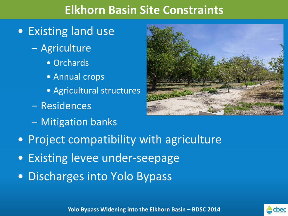
Elkhorn Basin Site Constraints
• Existing land use
– Agriculture
• Orchards
• Annual crops
• Agricultural structures
– Residences
– Mitigation banks
• Project compatibility with agriculture
• Existing levee under-seepage
• Discharges into Yolo Bypass
Yolo Bypass Widening into the Elkhorn Basin – BDSC 2014
Elkhorn Basin and Yolo Bypass Topography
Elevation (ft, NAVD88)
~8.019
0 8.02 - 10
~ 10.01 - 12
O 12.01 - 14
11111 14.01 - 16
- 16.01 - 18
11111 18.01 - 20
20.01 - 22
11111 22.01 - 24
- 24 .01 - 26
11111 26 .01 -28
- 28 .01 -30
11111 30.01 - 32
11111 32.01 - 34
0 34.01 - 36
0 36.01 -38
O 38.01 - 4o

Elkhorn Basin Site Constraints
• Existing land use
– Residences
– Agriculture
• Orchards
• Annual crops
• Agricultural structures
– Mitigation banks
• Project compatibility with agriculture
• Existing levee under-seepage
• Discharges into Yolo Bypass
Yolo Bypass Widening into the Elkhorn Basin – BDSC 2014
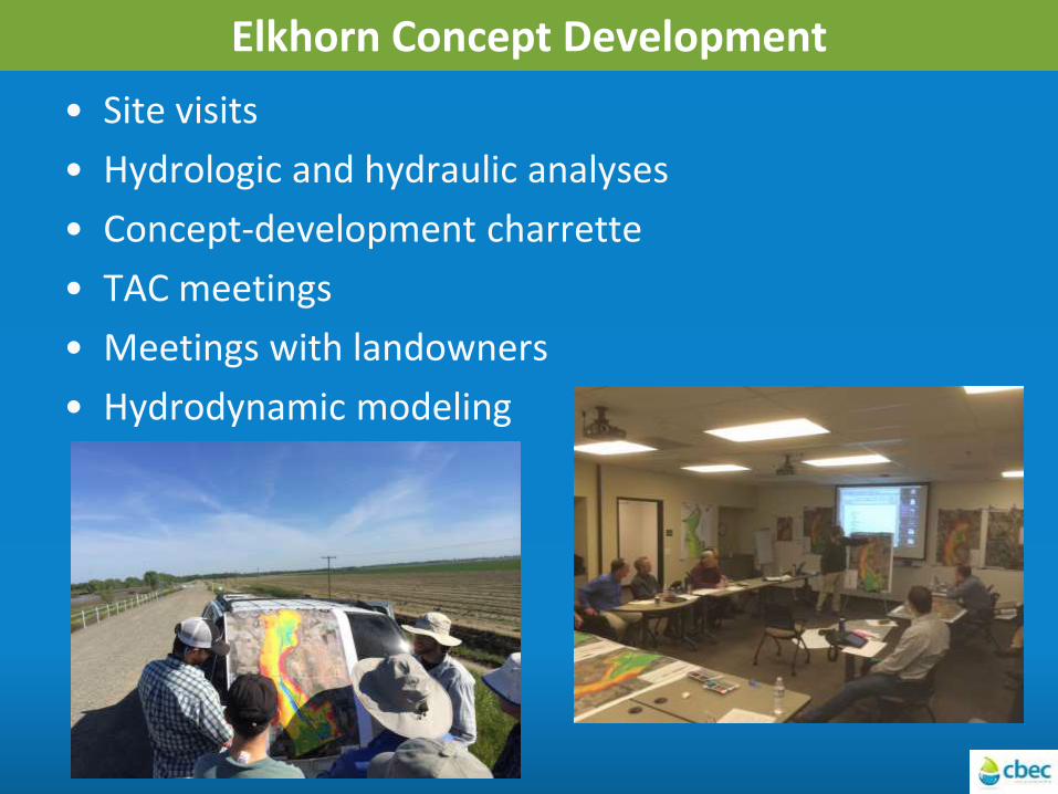
Elkhorn Concept Development
• Site visits
• Hydrologic and hydraulic analyses
• Concept-development charrette
• TAC meetings
• Meetings with landowners
• Hydrodynamic modeling
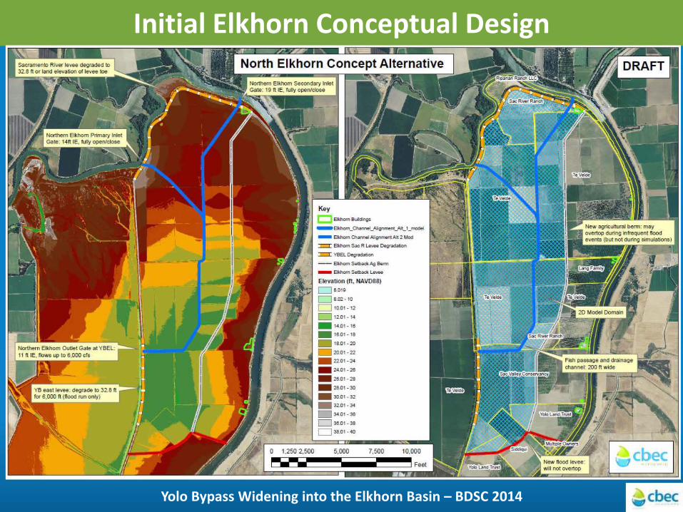
Initial Elkhorn Conceptual Design
Yolo Bypass Widening into the Elkhorn Basin – BDSC 2014
Elevation Ill, NAVD88) c:::J 8.01Q
c:::J s .02-10
0 10.01-12
0 12.01.14
- 14.01 - 18
- 18.01-18
- 18.01-20
. 20.01· 22
. 22.01-24
- 24.01-28
. 28.01·28
- 28.01·30
. 30.01· 32
- 32.01·34
. 34.01-Je
LJ3e.ol·38
c:::J 38.01· 40
5,000 7,500 10,000

Model Animations
• Animations for WY 2005 (wet conditions) and WY 2007 (dry conditions)
Yolo Bypass Widening into the Elkhorn Basin – BDSC 2014

Wetted Acres Comparison – 2005 (Wet Conditions)
Yolo Bypass Widening into the Elkhorn Basin – BDSC 2014
7,000 6,000
.--. 5,000 tf) 4-u
4,000 .__,
:? 0 3,000
LL 2,000 1,000
35,000
30,000
25,000
Q)
b 20,000 ro ro ~ 15,000 <(
10,000
5,000
Oct 2004
t-
t-
t-
t-
t-
-- GATE ELKHORN FLOW
Dec Jan Feb Mar
- WETIED AREA ELKHORN2 AREA
_j t- t-
+ t-
+ t-
- WETIED AREA EXG AREA
Jun 2005
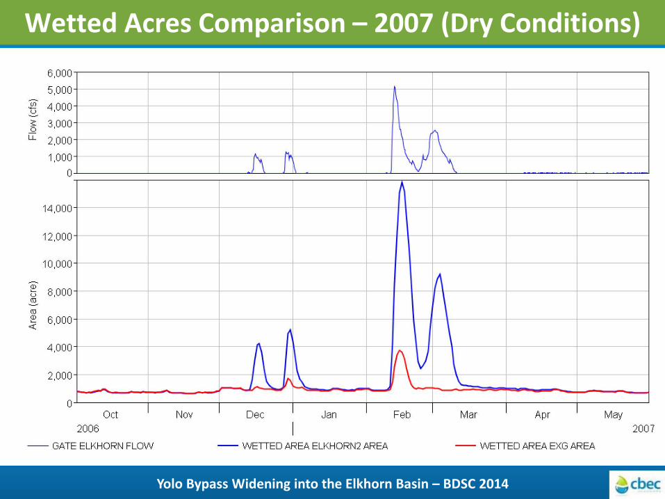
Wetted Acres Comparison – 2007 (Dry Conditions)
Yolo Bypass Widening into the Elkhorn Basin – BDSC 2014
6,000
5,000 ~
(f) 4,000 ,._ u -$ 0
3,000 LL 2,000
1,000
0
14,000
12,000
10,000
~
Q)
8,000 ,_ u (I) -(I) Q) 6,000 ,_ <(
4,000
2,000
0
-
--
-
-
-
-
-
-
-
-
-
--
Oct
2006
I
- GATE ELKHORN FLOW
Nov
)\ I\
I
~ J~ r{ --- I
- -
I Dec I Jan I
- WETTED AREA ELKHORN2 AREA
-\}\ A
>-- +
-
I ...
... I
(\ v ~ I
Feb I Mar I Apr I May 2007
- WETTED AREA EXG AREA
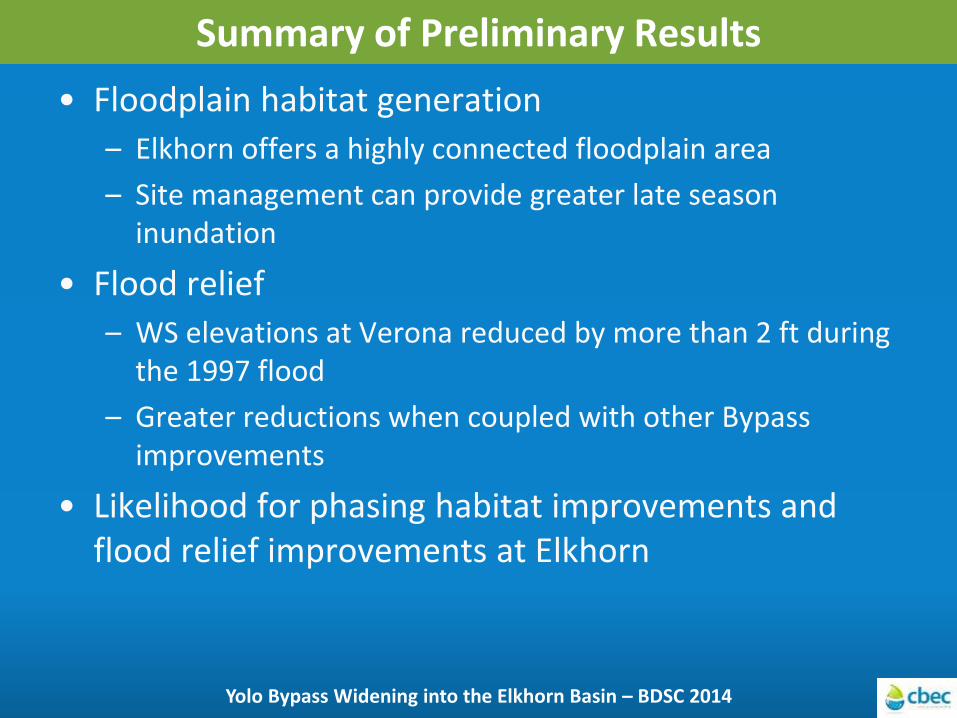
Summary of Preliminary Results
• Floodplain habitat generation
– Elkhorn offers a highly connected floodplain area
– Site management can provide greater late season inundation
• Flood relief
– WS elevations at Verona reduced by more than 2 ft during the 1997 flood
– Greater reductions when coupled with other Bypass improvements
• Likelihood for phasing habitat improvements and flood relief improvements at Elkhorn
Yolo Bypass Widening into the Elkhorn Basin – BDSC 2014
Thank You
Yolo Bypass Widening into the Elkhorn Basin – BDSC 2014
Questions? Jai Singh: [email protected] Chris Bowles: [email protected]

Impact of Different Post-Gate Closure Flow Rates
Yolo Bypass Widening into the Elkhorn Basin – BDSC 2014
1,600
- 1,200 (J) ,._ (_) -s 0 U:
800
400
35,000
30,000
25,000
-b 20,000 (U
(U
~ 15,000 .:!:
10,000
5,000
22
May2005
- GATE ELKHORN FLOW
---+
29
- WETIED AREA ELKHORN2 1 OOOCFS AREA
~
... ~
.. ...
...
5 12 19 Jun2005
- GATE ELKHORN 1 OOOCFS FLOW - W ETIED AREA ELKHORN2 AREA
- WETIED AREA EXG AREA

Wetted Acres Comparison – 1997 (Wet Conditions)
Yolo Bypass Widening into the Elkhorn Basin – BDSC 2014
7,000
6,000
~ 5,000 ~ 4,000 ;$: 0 3,000 u:::
2,000
1,000
0
50 ,000
40,000
Q) u 30,000 ~ ('\)
~
<{ 20,000
10,000
Oct 1996
..
...
...
- GATE ELKHORN FLOW
Nov
"" ~ -~
I -
.. -
~ A-~ ...
J
Dec Jan Feb Mar Apr May
1997
- W ETTED AREA ELKHORN2 AREA - WETTED AREA EXG AREA
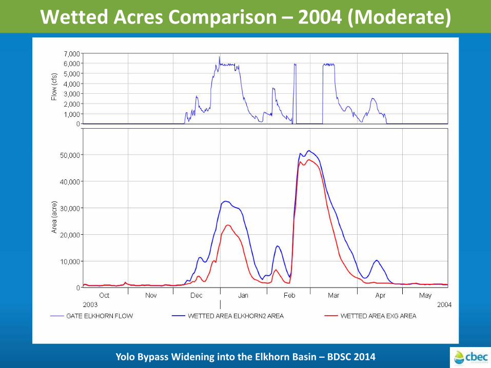
Wetted Acres Comparison – 2004 (Moderate)
Yolo Bypass Widening into the Elkhorn Basin – BDSC 2014
7,000
6,000
c.n 5,000 ~ 4,000 s 0 3,000 u:::
2,000
1,000 0
50,000
40,000
Q)
b 30,000 ~ l.U Q)
~ 20,000
10,000
Oct
2003
...
..
..
-- GATE ELKHORN FLOW
... ...
.. ..
..
+
Nov Mar Apr May
2004
- WETIED AREA ELKHORN2 AREA - WETIED AREA EXG AREA
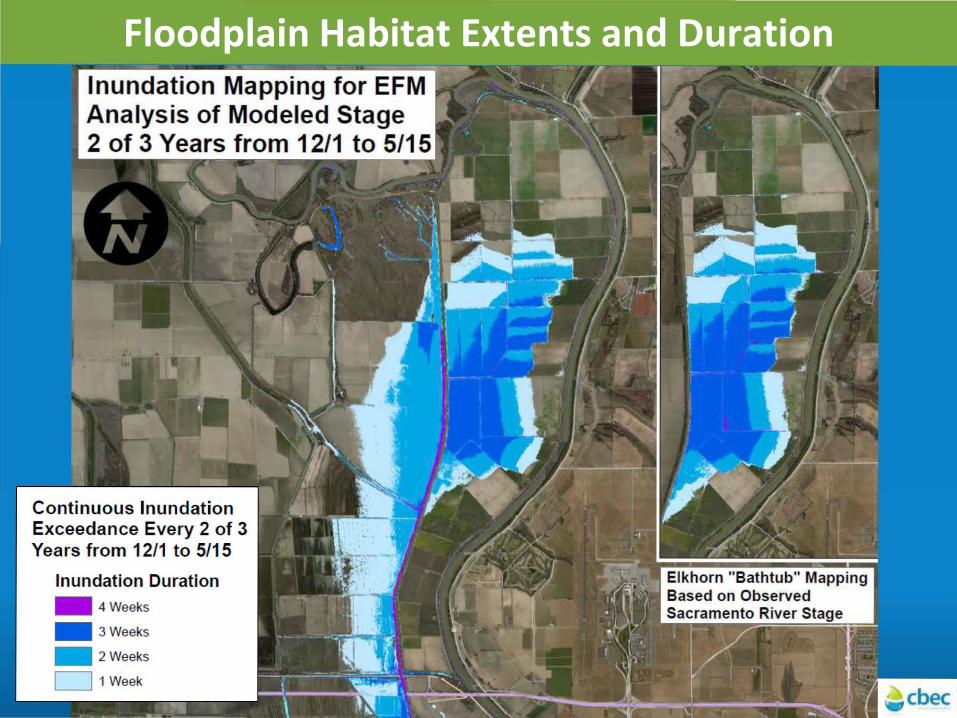
Floodplain Habitat Extents and Duration Inundation Mapping for EFM Analysis of Modeled Stage 2 of 3 Years from 12/1 to 5/15
Cont inuous Inundat ion Exceedance Every 2 of 3 Years from 12/1 to 5/15
Inundation Duration .. 4Weeks
.. 3 Weeks
- 2 Weeks
D 1 Week

Integrating Elkhorn Expansion with Other Bypass Improvements
• DWR/Bureau improvements for YB BiOp
• Yolo Bypass east levee setbacks further south
• Enhanced Tule Corridor
Yolo Bypass Widening into the Elkhorn Basin – FMA 2014
Related Documents