THE INTERNATIONAL HYDROGRAPHIC ORGANIZATION (IHO)

Welcome message from author
This document is posted to help you gain knowledge. Please leave a comment to let me know what you think about it! Share it to your friends and learn new things together.
Transcript
THE
INTERNATIONAL HYDROGRAPHIC
ORGANIZATION(IHO)
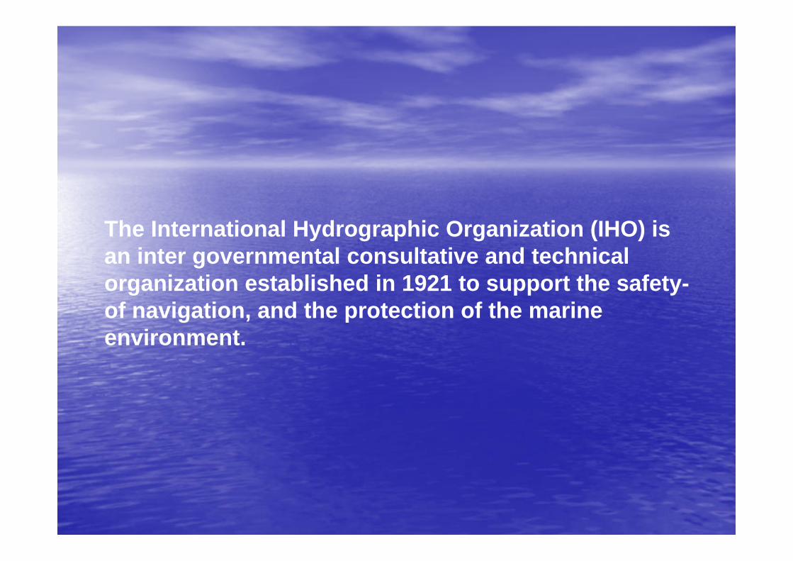
The International Hydrographic Organization (IHO) is an inter governmental consultative and technical organization established in 1921 to support the safety-of navigation, and the protection of the marine environment.
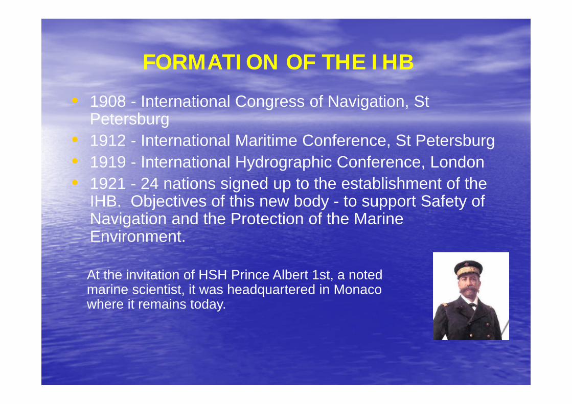
FORMATION OF THE IHB
• 1908 - International Congress of Navigation, St Petersburg
• 1912 - International Maritime Conference, St Petersburg• 1919 - International Hydrographic Conference, London• 1921 - 24 nations signed up to the establishment of the
IHB. Objectives of this new body - to support Safety of Navigation and the Protection of the Marine Environment.
At the invitation of HSH Prince Albert 1st, a noted marine scientist, it was headquartered in Monaco where it remains today.
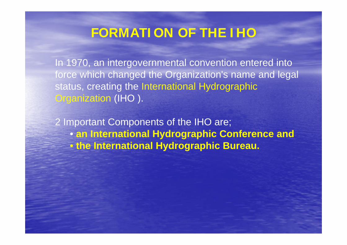
FORMATION OF THE IHO
In 1970, an intergovernmental convention entered into force which changed the Organization's name and legal status, creating the International Hydrographic Organization (IHO ).
2 Important Components of the IHO are;• an International Hydrographic Conference and • the International Hydrographic Bureau.
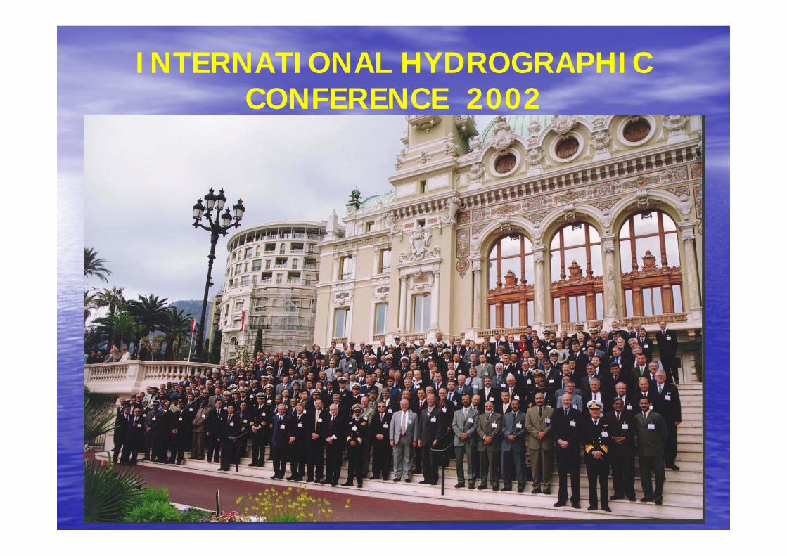
INTERNATIONAL HYDROGRAPHIC CONFERENCE 2002
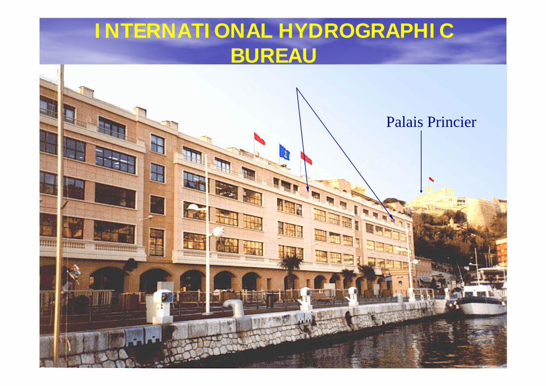
INTERNATIONAL HYDROGRAPHIC BUREAU
Palais Princier
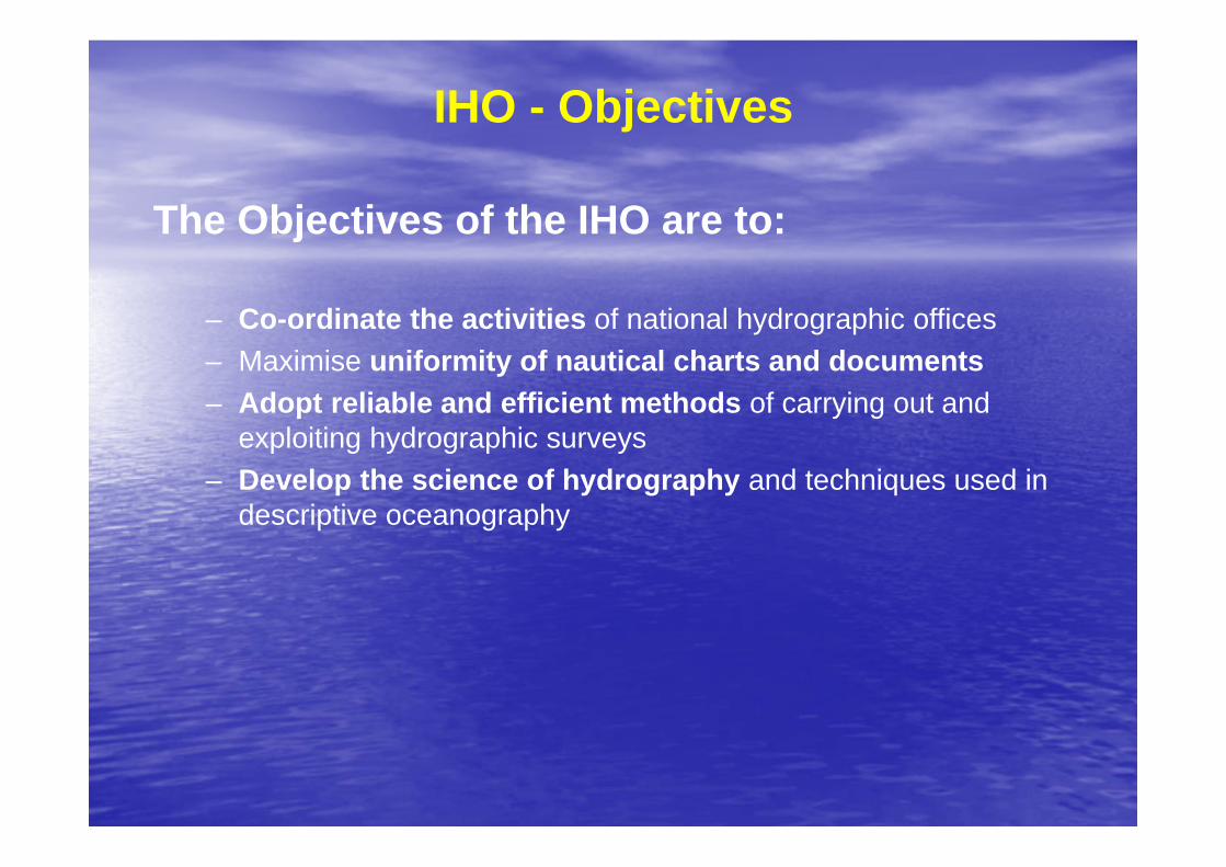
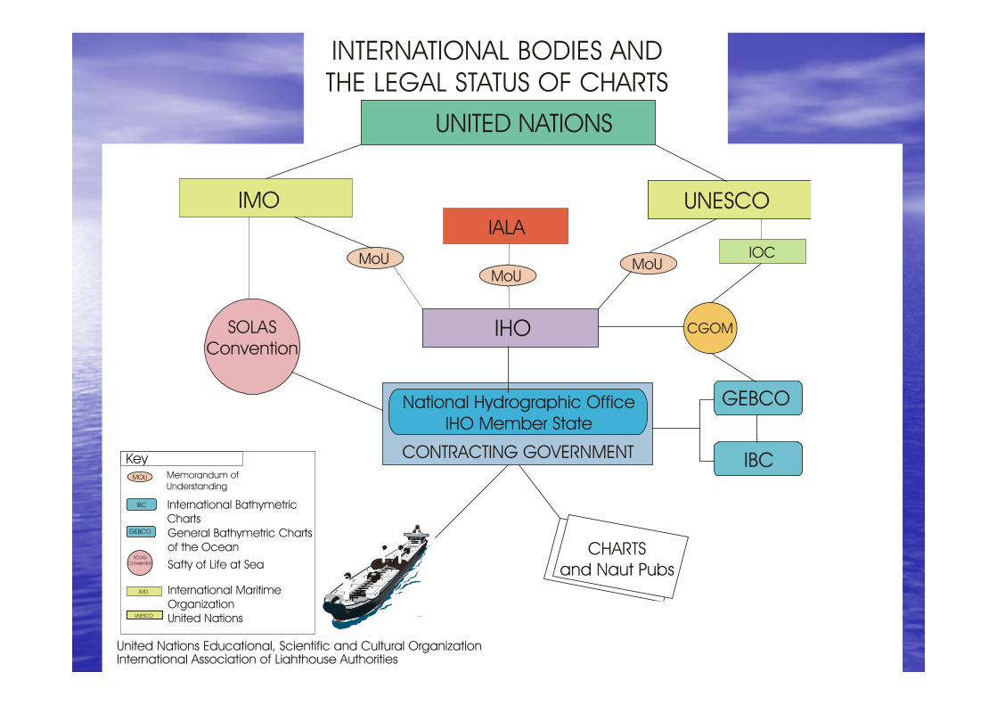
IHO - Objectives
The Objectives of the IHO are to:
– Co-ordinate the activities of national hydrographic offices– Maximise uniformity of nautical charts and documents– Adopt reliable and efficient methods of carrying out and
exploiting hydrographic surveys– Develop the science of hydrography and techniques used in
descriptive oceanography
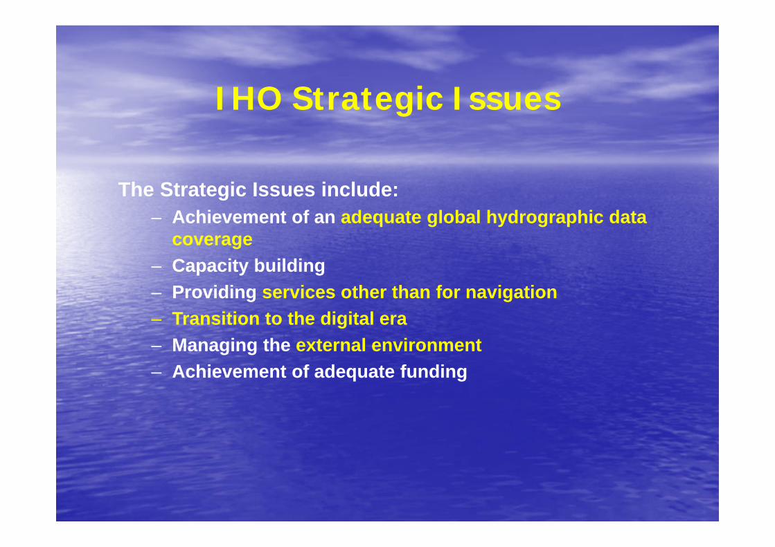
IHO Strategic Issues
The Strategic Issues include:– Achievement of an adequate global hydrographic data
coverage– Capacity building– Providing services other than for navigation– Transition to the digital era– Managing the external environment– Achievement of adequate funding
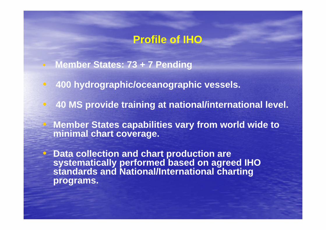
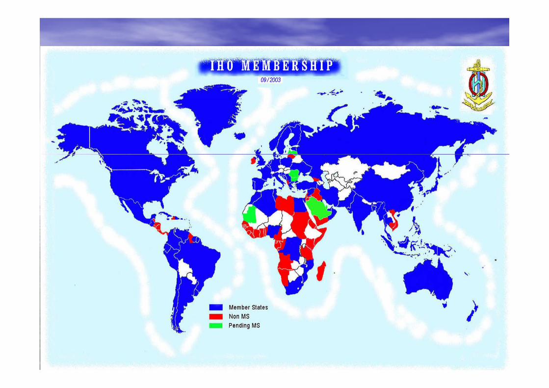
Profile of IHO
• Member States: 73 + 7 Pending
• 400 hydrographic/oceanographic vessels.
• 40 MS provide training at national/international level.
• Member States capabilities vary from world wide to minimal chart coverage.
• Data collection and chart production are systematically performed based on agreed IHO standards and National/International charting programs.
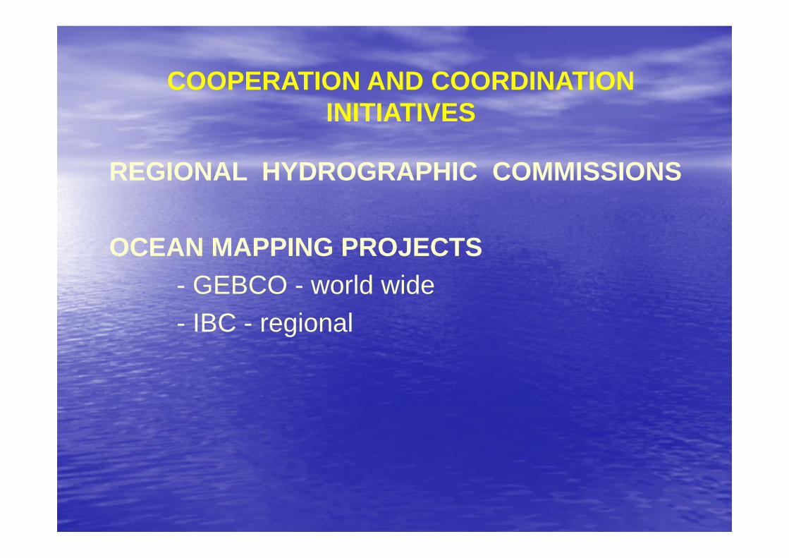
COOPERATION AND COORDINATION INITIATIVES
REGIONAL HYDROGRAPHIC COMMISSIONS
OCEAN MAPPING PROJECTS- GEBCO - world wide- IBC - regional
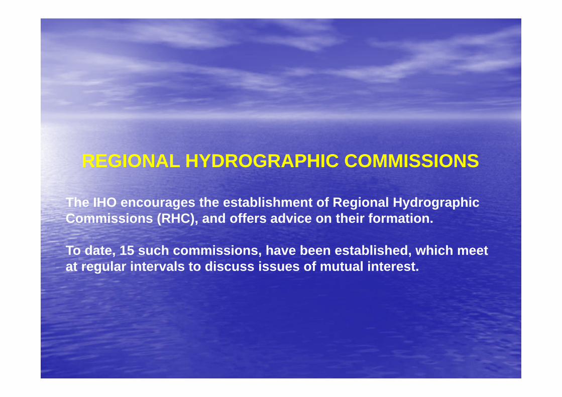
REGIONAL HYDROGRAPHIC COMMISSIONS
The IHO encourages the establishment of Regional Hydrographic Commissions (RHC), and offers advice on their formation.
To date, 15 such commissions, have been established, which meet at regular intervals to discuss issues of mutual interest.
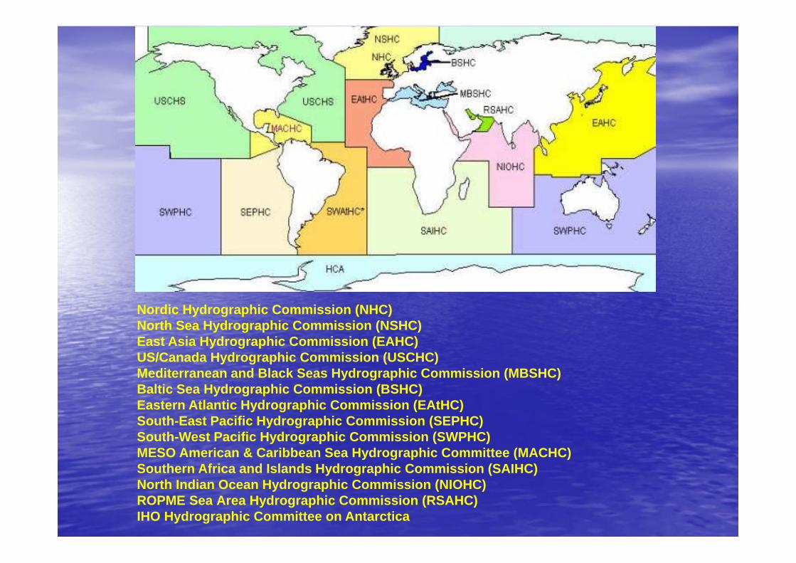
Nordic Hydrographic Commission (NHC)North Sea Hydrographic Commission (NSHC)East Asia Hydrographic Commission (EAHC)US/Canada Hydrographic Commission (USCHC) Mediterranean and Black Seas Hydrographic Commission (MBSHC)Baltic Sea Hydrographic Commission (BSHC)Eastern Atlantic Hydrographic Commission (EAtHC) South-East Pacific Hydrographic Commission (SEPHC) South-West Pacific Hydrographic Commission (SWPHC) MESO American & Caribbean Sea Hydrographic Committee (MACHC) Southern Africa and Islands Hydrographic Commission (SAIHC)North Indian Ocean Hydrographic Commission (NIOHC) ROPME Sea Area Hydrographic Commission (RSAHC)IHO Hydrographic Committee on Antarctica
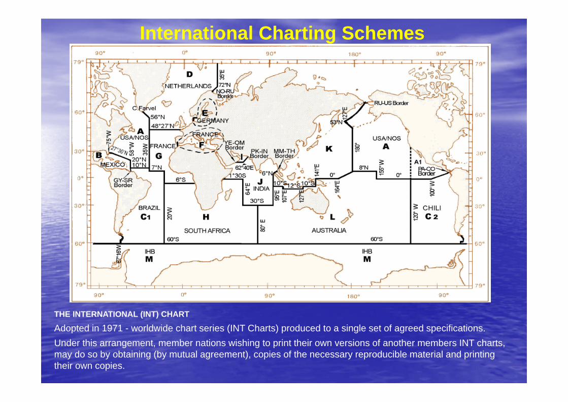
International Charting Schemes
THE INTERNATIONAL (INT) CHART
Adopted in 1971 - worldwide chart series (INT Charts) produced to a single set of agreed specifications.Under this arrangement, member nations wishing to print their own versions of another members INT charts, may do so by obtaining (by mutual agreement), copies of the necessary reproducible material and printing their own copies.
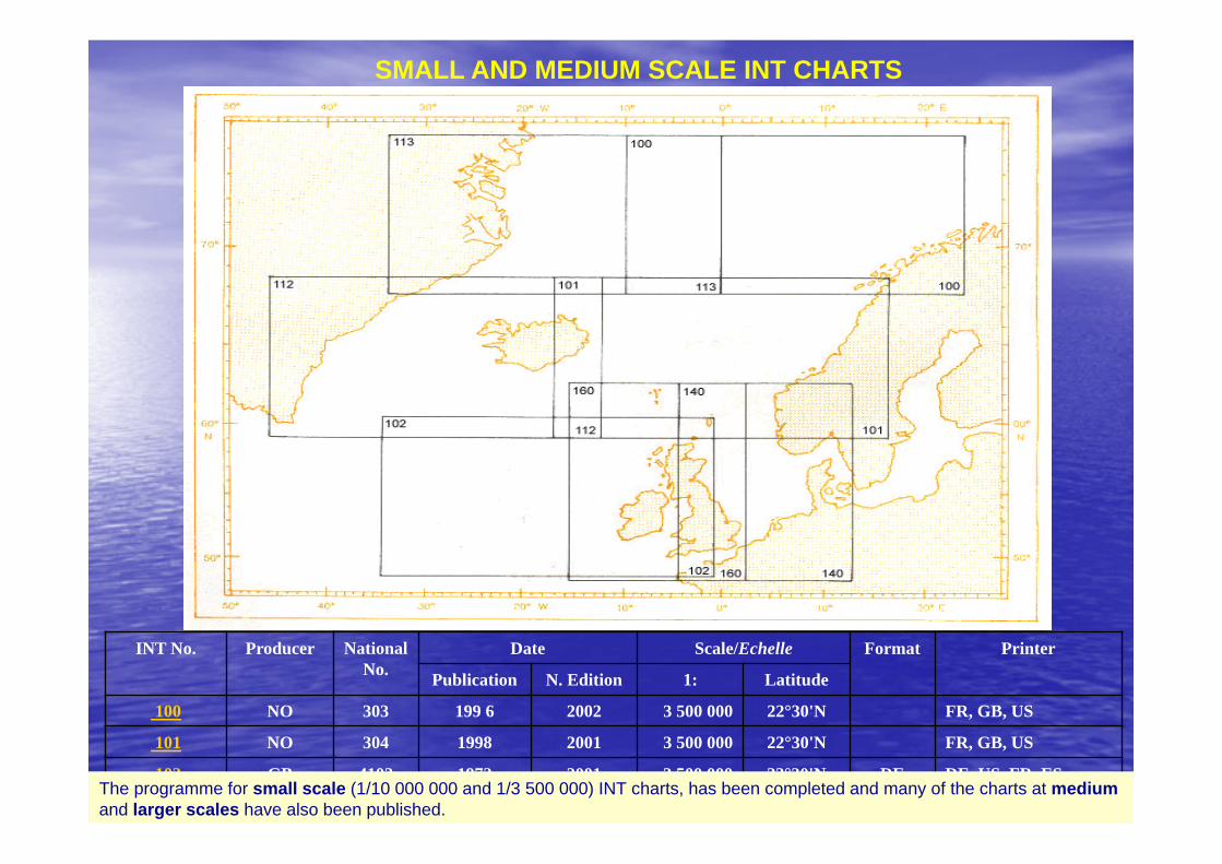
SMALL AND MEDIUM SCALE INT CHARTS
INT No. Producer National No.
Date Scale/Echelle Format Printer
Publication N. Edition 1: Latitude
100 NO 303 199 6 2002 3 500 000 22°30'N FR, GB, US
101 NO 304 1998 2001 3 500 000 22°30'N FR, GB, US
102 GB 4102 1972 2001 3 500 000 22°30'N DE DE, US, FR, ES
112 DE 960 1972 2002 3 500 000 22°30'N US, FR, GBThe programme for small scale (1/10 000 000 and 1/3 500 000) INT charts, has been completed and many of the charts at mediumand larger scales have also been published.
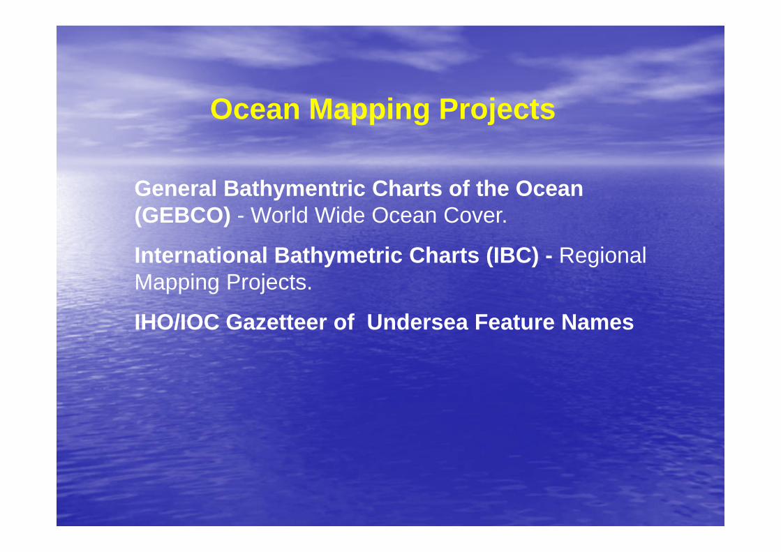
Ocean Mapping Projects
General Bathymentric Charts of the Ocean (GEBCO) - World Wide Ocean Cover.
International Bathymetric Charts (IBC) - Regional Mapping Projects.
IHO/IOC Gazetteer of Undersea Feature Names
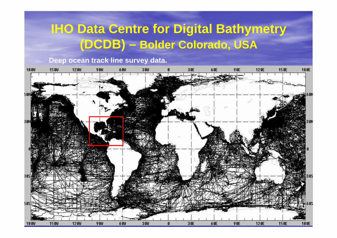
IHO Data Centre for Digital Bathymetry (DCDB) – Bolder Colorado, USA
Deep ocean track line survey data.
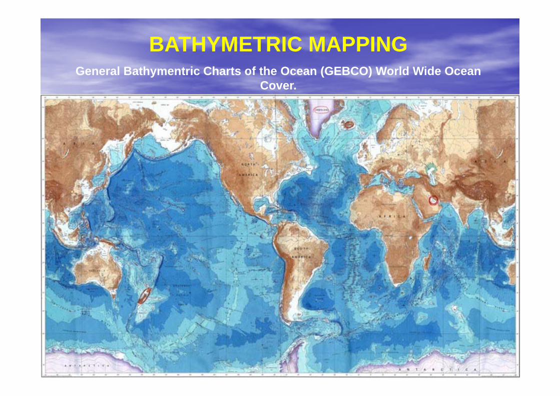
BATHYMETRIC MAPPINGGeneral Bathymentric Charts of the Ocean (GEBCO) World Wide Ocean
Cover.
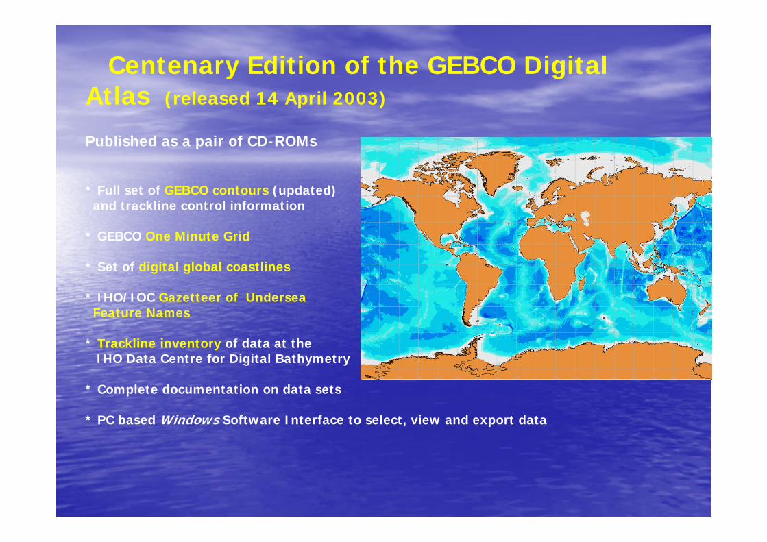
Centenary Edition of the GEBCO Digital Atlas (released 14 April 2003)
Published as a pair of CD-ROMs
* Full set of GEBCO contours (updated) and trackline control information
* GEBCO One Minute Grid
* Set of digital global coastlines
* IHO/IOC Gazetteer of UnderseaFeature Names
* Trackline inventory of data at theIHO Data Centre for Digital Bathymetry
* Complete documentation on data sets
* PC based Windows Software Interface to select, view and export data
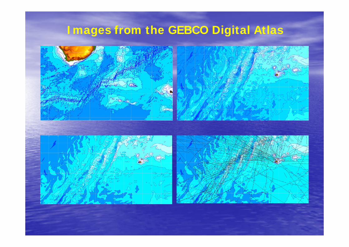
Images from the GEBCO Digital Atlas
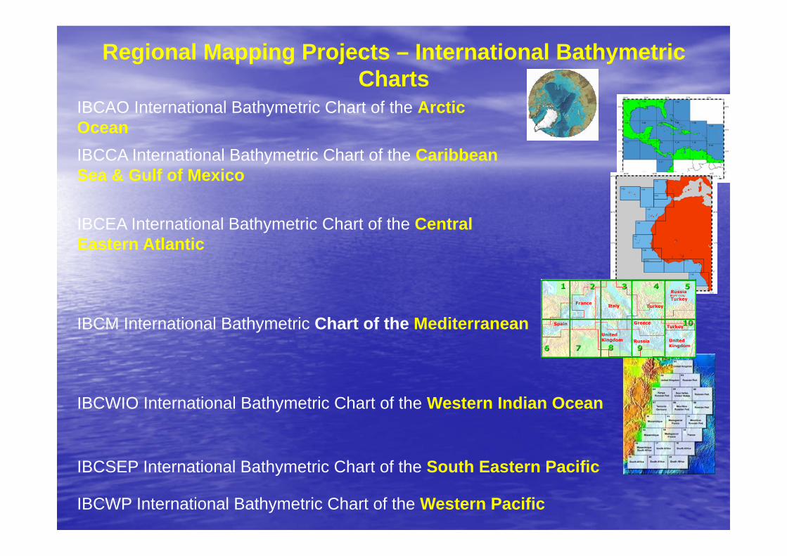
Regional Mapping Projects – International Bathymetric Charts
IBCWP International Bathymetric Chart of the Western Pacific
IBCAO International Bathymetric Chart of the Arctic OceanIBCCA International Bathymetric Chart of the Caribbean Sea & Gulf of Mexico
IBCEA International Bathymetric Chart of the Central Eastern Atlantic
IBCM International Bathymetric Chart of the Mediterranean
IBCSEP International Bathymetric Chart of the South Eastern Pacific
IBCWIO International Bathymetric Chart of the Western Indian Ocean
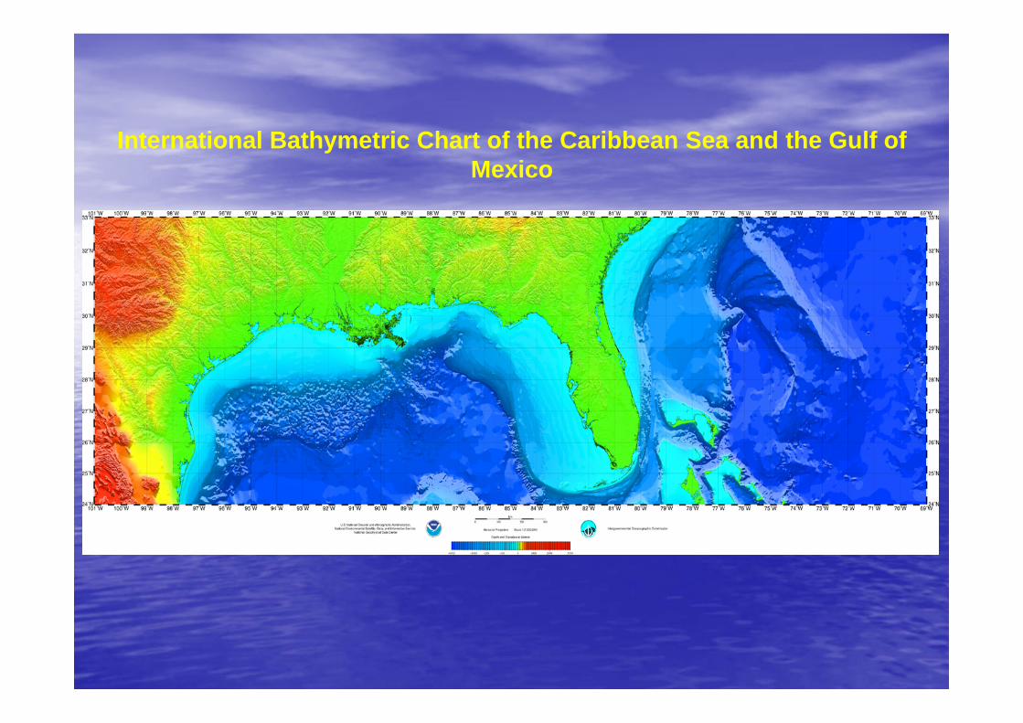
International Bathymetric Chart of the Caribbean Sea and the Gulf of Mexico
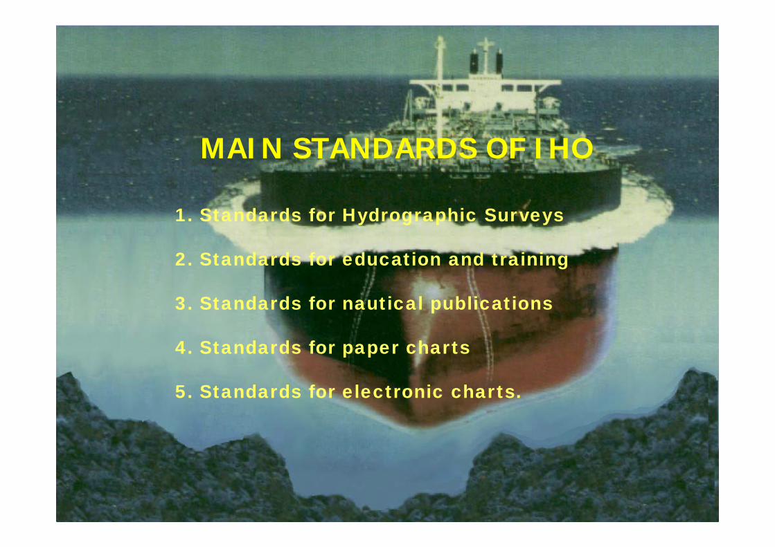
MAIN STANDARDS OF IHO
1. Standards for Hydrographic Surveys
2. Standards for education and training
3. Standards for nautical publications
4. Standards for paper charts
5. Standards for electronic charts.
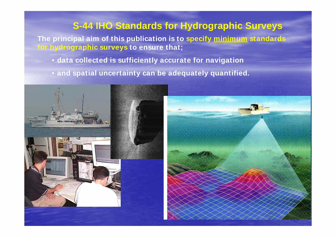
S-44 IHO Standards for Hydrographic SurveysThe principal aim of this publication is to specify minimum standards for hydrographic surveys to ensure that;
• data collected is sufficiently accurate for navigation
• and spatial uncertainty can be adequately quantified.
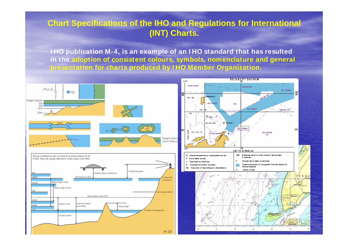
Chart Specifications of the IHO and Regulations for International (INT) Charts.
IHO publication M-4, is an example of an IHO standard that has resulted in the adoption of consistent colours, symbols, nomenclature and general presentation for charts produced by IHO Member Organization.
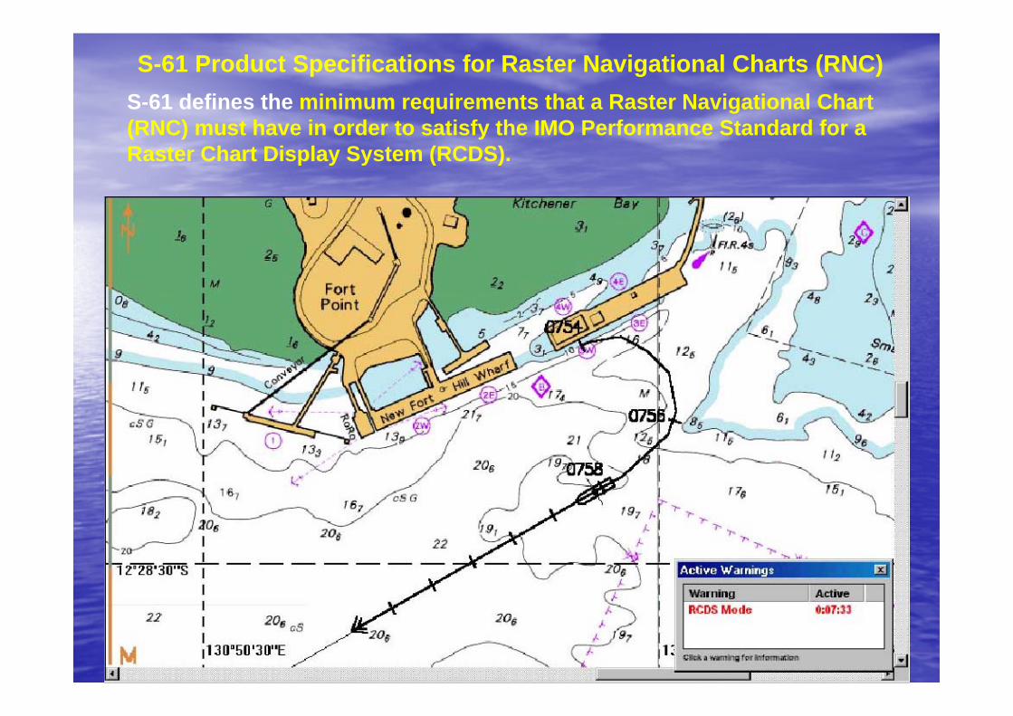
S-61 Product Specifications for Raster Navigational Charts (RNC) S-61 defines the minimum requirements that a Raster Navigational Chart (RNC) must have in order to satisfy the IMO Performance Standard for a Raster Chart Display System (RCDS).
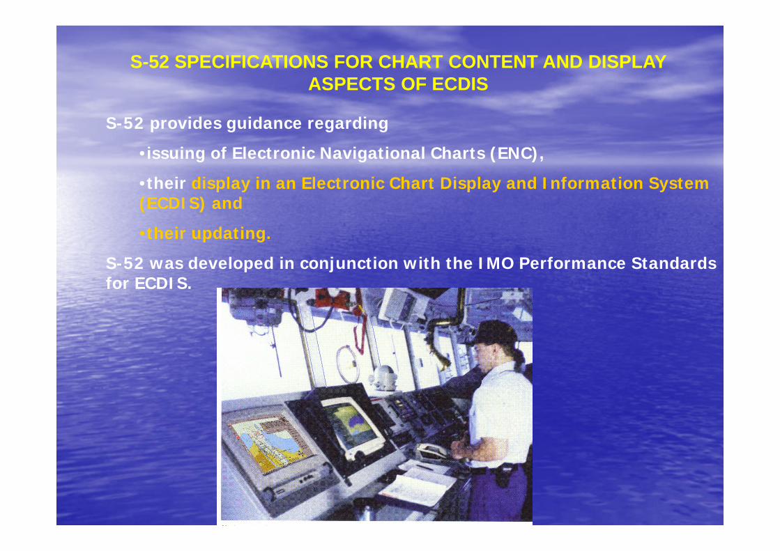
S-52 provides guidance regarding
•issuing of Electronic Navigational Charts (ENC),
•their display in an Electronic Chart Display and Information System (ECDIS) and
•their updating.
S-52 was developed in conjunction with the IMO Performance Standards for ECDIS.
S-52 SPECIFICATIONS FOR CHART CONTENT AND DISPLAY ASPECTS OF ECDIS
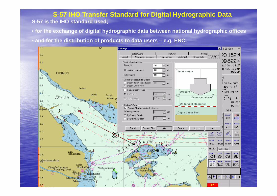
S-57 IHO Transfer Standard for Digital Hydrographic Data S-57 is the IHO standard used;
• for the exchange of digital hydrographic data between national hydrographic offices
• and for the distribution of products to data users – e.g. ENC.
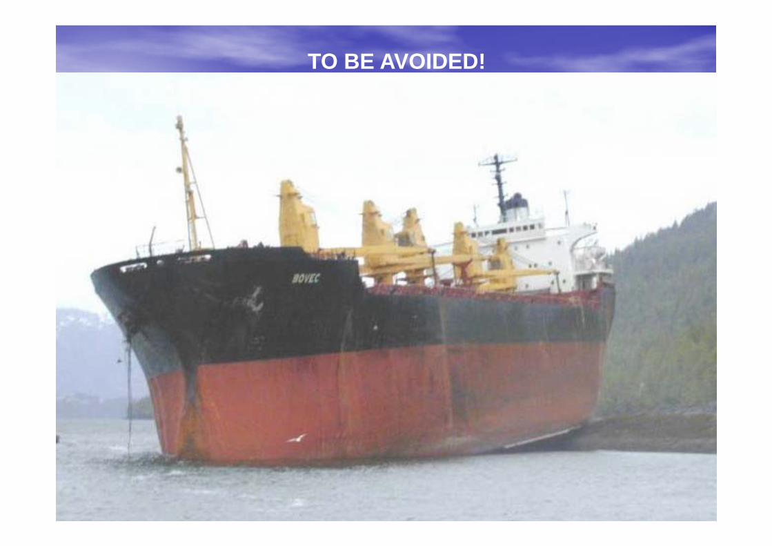
TO BE AVOIDED!
S-57 EDITION 4.0
BARRIE GREENSLADE
UNITED KINGDOM
HYDROGRAPHIC OFFICE
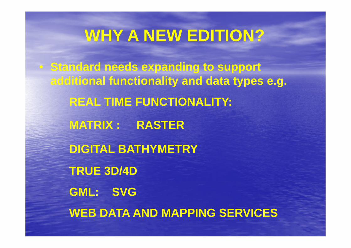
• Standard needs expanding to support additional functionality and data types e.g.
REAL TIME FUNCTIONALITY:
MATRIX : RASTER
DIGITAL BATHYMETRY
TRUE 3D/4D
GML: SVG
WEB DATA AND MAPPING SERVICES
WHY A NEW EDITION?
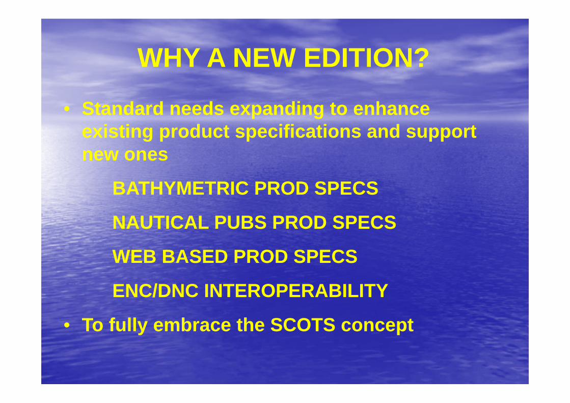
• Standard needs expanding to enhance existing product specifications and support new ones
BATHYMETRIC PROD SPECS
NAUTICAL PUBS PROD SPECS
WEB BASED PROD SPECS
ENC/DNC INTEROPERABILITY
• To fully embrace the SCOTS concept
WHY A NEW EDITION?
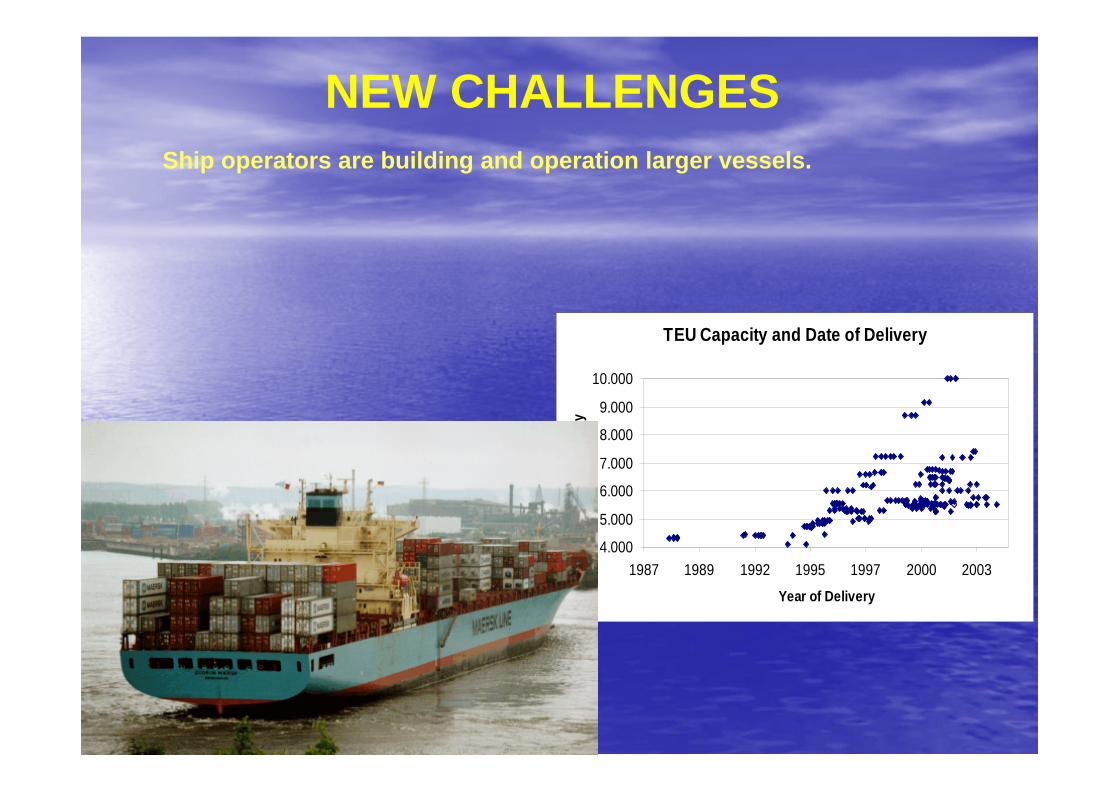
TEU Capacity and Date of Delivery
4.000
5.000
6.000
7.000
8.000
9.000
10.000
1987 1989 1992 1995 1997 2000 2003Year of Delivery
TEU
Cap
acity
NEW CHALLENGESShip operators are building and operation larger vessels.
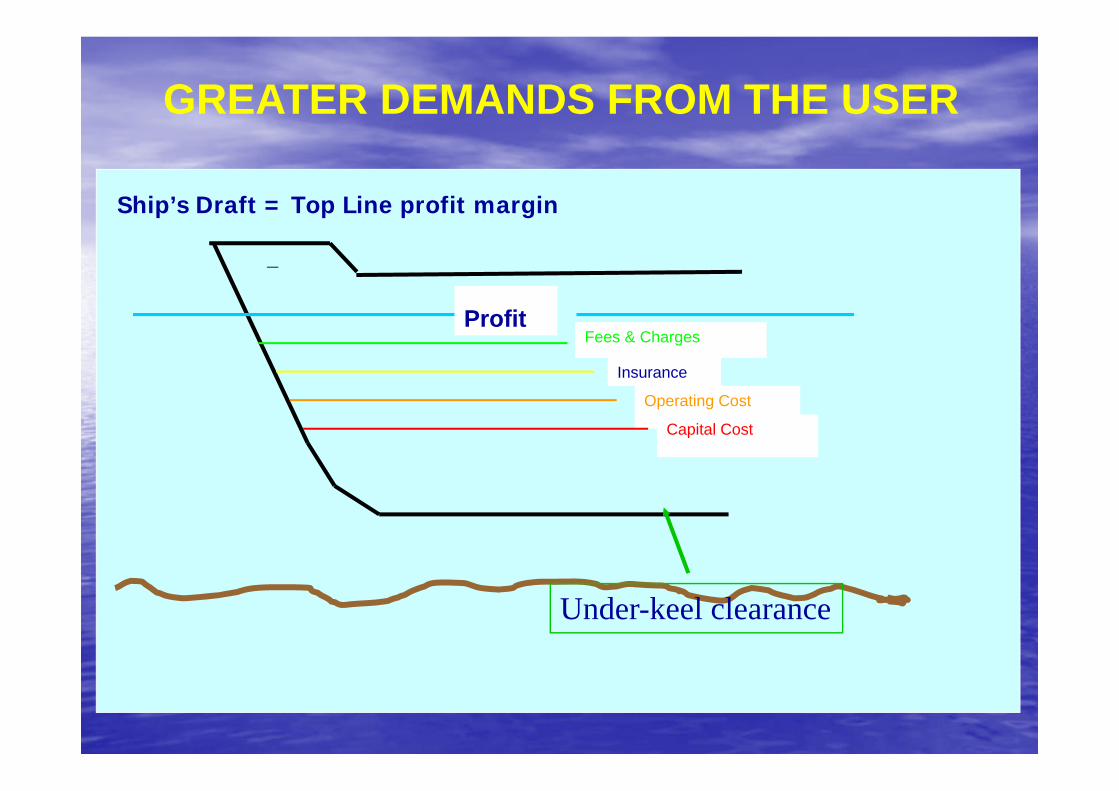
GREATER DEMANDS FROM THE USER
Fees & ChargesProfit
Insurance
Operating Cost
Capital Cost
Under-keel clearance
Ship’s Draft = Top Line profit margin
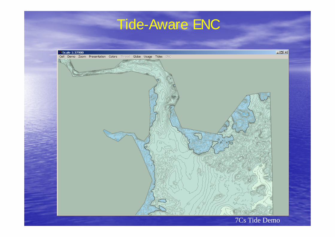
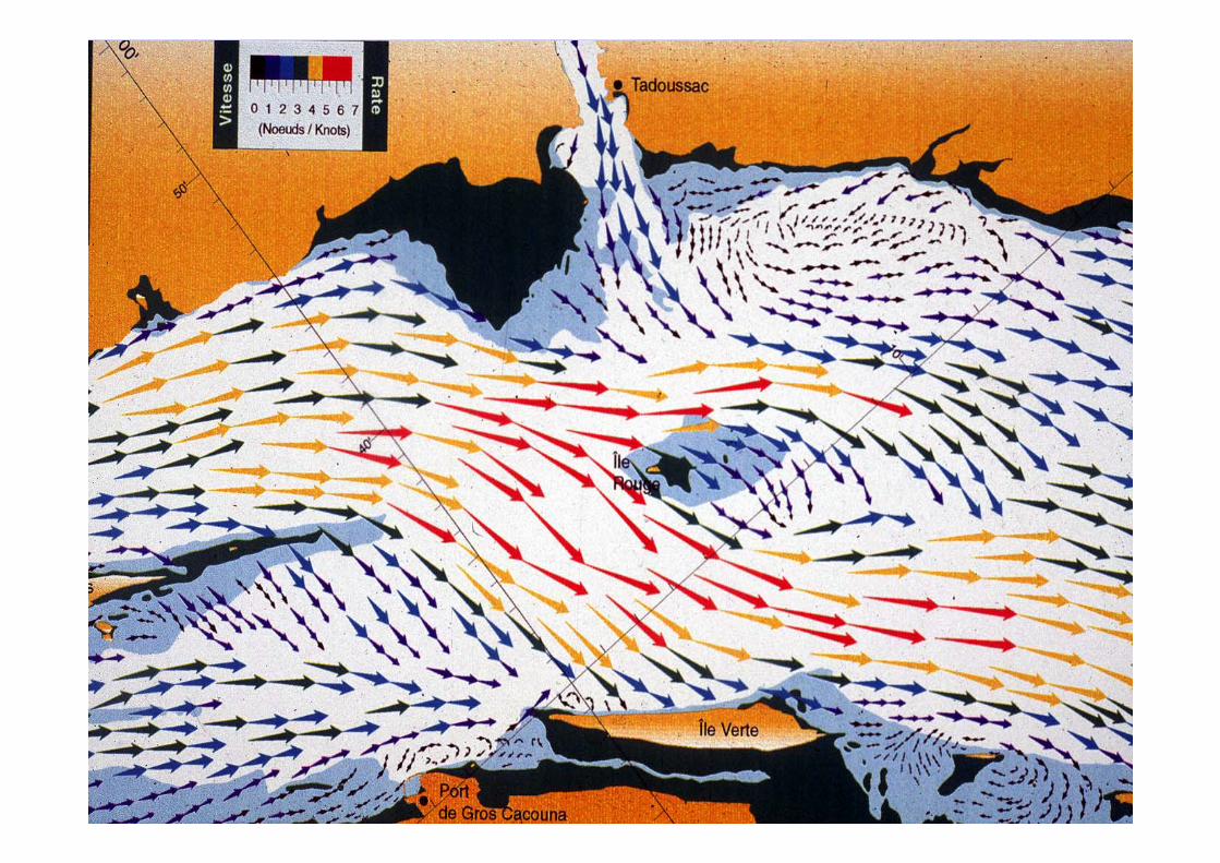
Tide-Aware ENC
7Cs Tide Demo
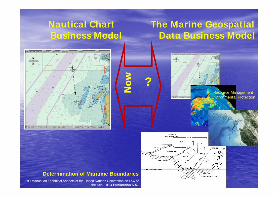
Nautical Chart Business Model
?
The Marine Geospatial Data Business Model
Determination of Maritime BoundariesIHO Manual on Technical Aspects of the United Nations Convention on Law of
the Sea – IHO Publication S-51
Resource Management Environmental Protection
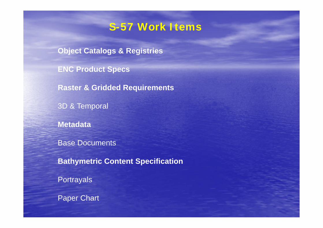
Object Catalogs & Registries
ENC Product Specs
Raster & Gridded Requirements
3D & Temporal
Metadata
Base Documents
Bathymetric Content Specification
Portrayals
Paper Chart
S-57 Work Items
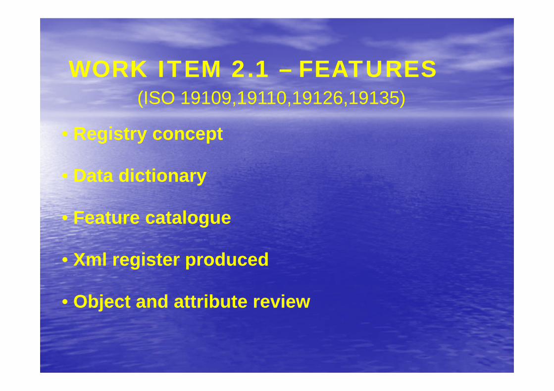
WORK ITEM 2.1 – FEATURES
• Registry concept
• Data dictionary
• Feature catalogue
• Xml register produced
• Object and attribute review
(ISO 19109,19110,19126,19135)
W. I. 2.2 – ENC PRODUCT SPEC
• Some effort but in reality cannot be progressedfurther until S-57 profiles are completed
• New version will be inclusive instead ofexclusive as now
• Study to widen the mandatory scope – moreprescriptive
(ISO 19131)
The Imagery and Gridded component of S-57 will be built upon theframework given in 19129 (Imagery, Gridded and Coverage DataFramework).
S-57 takes from ISO 19123 various types of grid structures including a rectangular grid, a tiled grid, an irregularly shaped grid, a grid with variable cell sizes and a multi-dimensional grid.
W. I. 2.3 – COVERAGES, RASTER & MATRIX
W. I. 2.3 – COVERAGES, RASTER & MATRIX
• ISO 19129 - Standard for Imagery, Gridded andCoverage delayed
• IHO taking a leading part in progressing thestandard as quickly as possible
• IMAGERY – XML meta, JPEG2000
• GRIDDED - XML meta, neutral array definition -possibly Network Common Data Form (NetCDF)
(ISO 19123,19129)
W. I. 2.4 – TEMPORAL & 3D
• Requirement study completed at SWG 4 –May 2003
• Further discussions at SWG 6 – Mar 2004
Sparse Quadrilateral grid with Morton traversal order and variable pixel/voxel size in Riemann hyperspace
(ISO 19108,19109)
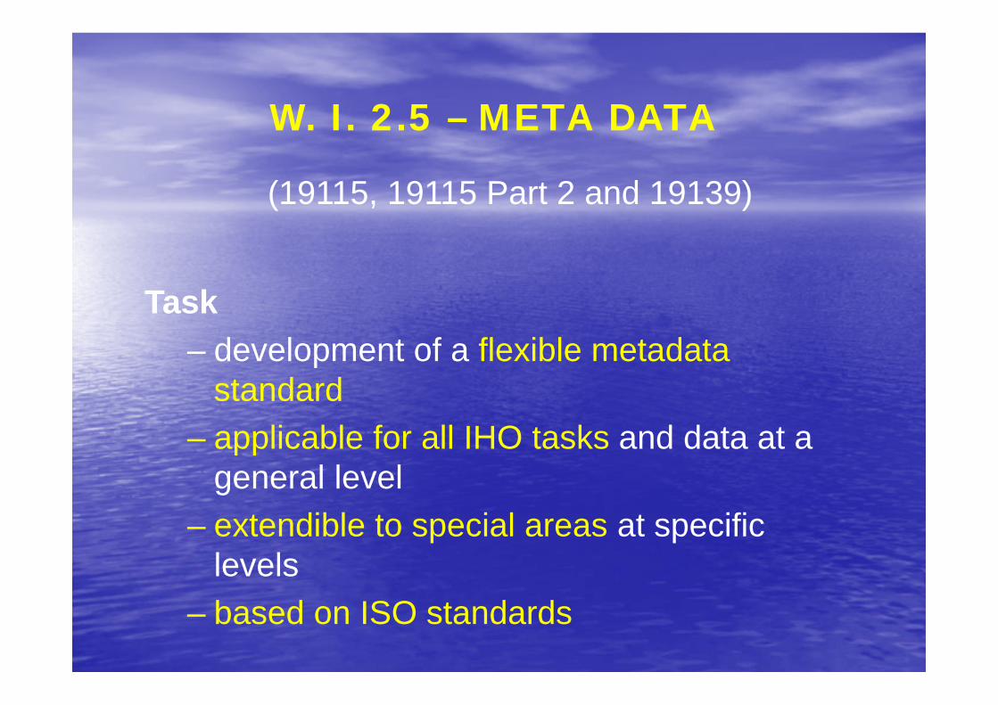
(19115, 19115 Part 2 and 19139)
Task– development of a flexible metadata
standard– applicable for all IHO tasks and data at a
general level– extendible to special areas at specific
levels– based on ISO standards
W. I. 2.5 – META DATA
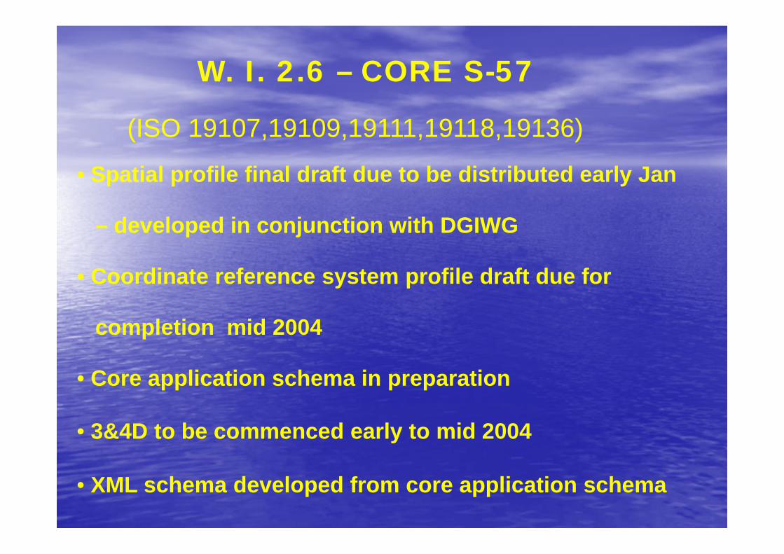
• Spatial profile final draft due to be distributed early Jan
– developed in conjunction with DGIWG
• Coordinate reference system profile draft due for
completion mid 2004
• Core application schema in preparation
• 3&4D to be commenced early to mid 2004
• XML schema developed from core application schema
W. I. 2.6 – CORE S-57
(ISO 19107,19109,19111,19118,19136)
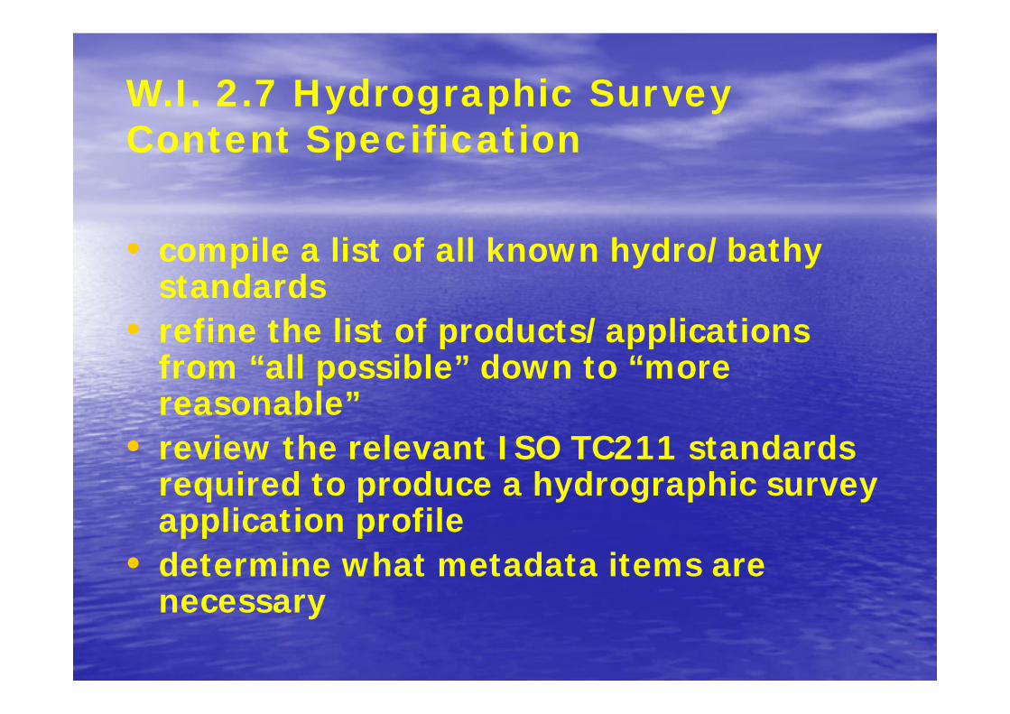
W.I. 2.7 Hydrographic Survey Content Specification
• compile a list of all known hydro/bathy standards
• refine the list of products/applications from “all possible” down to “more reasonable”
• review the relevant ISO TC211 standards required to produce a hydrographic survey application profile
• determine what metadata items are necessary
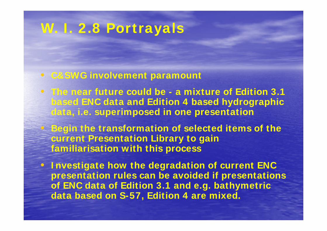
W. I. 2.8 Portrayals
• C&SWG involvement paramount
• The near future could be - a mixture of Edition 3.1 based ENC data and Edition 4 based hydrographic data, i.e. superimposed in one presentation
• Begin the transformation of selected items of the current Presentation Library to gain familiarisation with this process
• Investigate how the degradation of current ENC presentation rules can be avoided if presentations of ENC data of Edition 3.1 and e.g. bathymetric data based on S-57, Edition 4 are mixed.
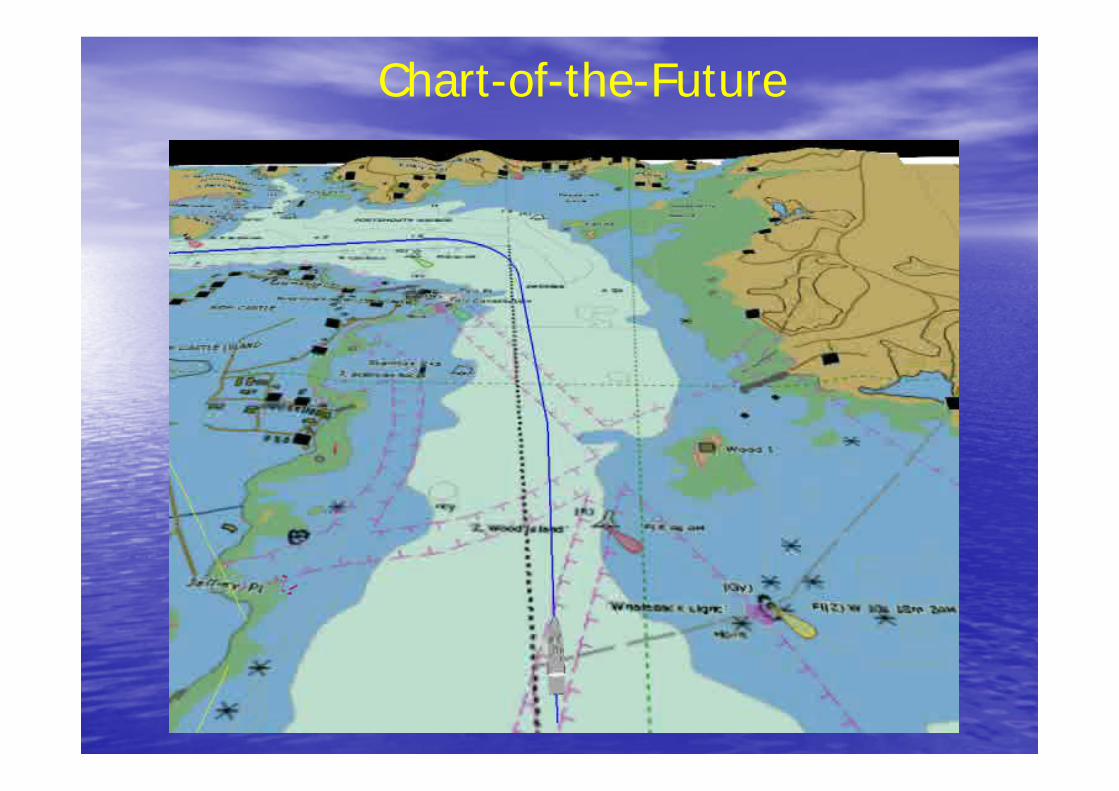
Chart-of-the-Future

www.iho.shom.fr
Related Documents

![IHO S-100: The New IHO Hydrographic Geospatial … hydrographic review may 2009 →iho s-100) iho s-100 [] .Published in: International Hydrographic Review · 2009Authors: Robert Ward](https://static.cupdf.com/doc/110x72/5ae4a48c7f8b9a495c8ed661/iho-s-100-the-new-iho-hydrographic-geospatial-hydrographic-review-may-2009.jpg)