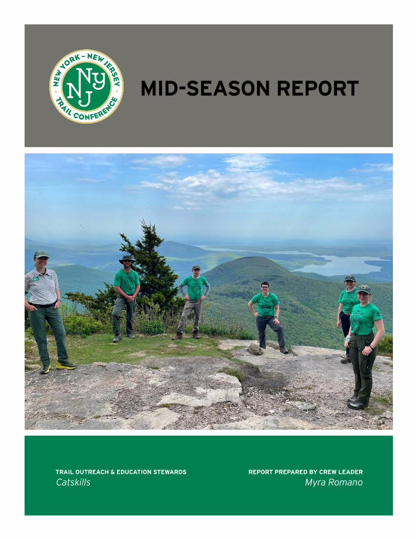
STATISTICS TRAIL OUTREACH & EDUCATION STEWARDS Catskills REPORT PREPARED BY CREW LEADER Myra Romano MID-SEASON REPORT Conservation Corps Catskill Stewards, May – July 2021

Welcome message from author
This document is posted to help you gain knowledge. Please leave a comment to let me know what you think about it! Share it to your friends and learn new things together.
Transcript
STATISTICS
TRAIL OUTREACH & EDUCATION STEWARDS
Catskills REPORT PREPARED BY CREW LEADER
Myra Romano
MID-SEASON REPORT Conservation Corps
Catskill Stewards, May – July 2021
New York-New Jersey Trail Conference Conservation Corps Mid-Season Report
INTRODUCTION
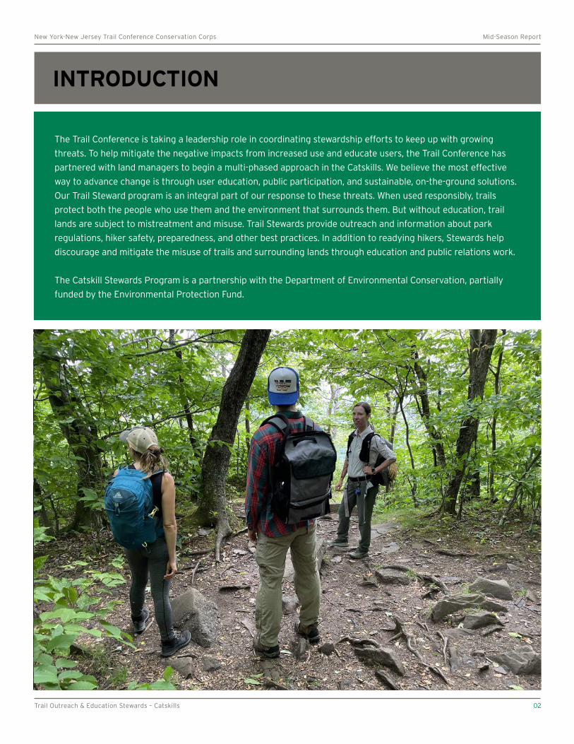
The Trail Conference is taking a leadership role in coordinating stewardship efforts to keep up with growing
threats. To help mitigate the negative impacts from increased use and educate users, the Trail Conference has
partnered with land managers to begin a multi-phased approach in the Catskills. We believe the most effective
way to advance change is through user education, public participation, and sustainable, on-the-ground solutions.
Our Trail Steward program is an integral part of our response to these threats. When used responsibly, trails
protect both the people who use them and the environment that surrounds them. But without education, trail
lands are subject to mistreatment and misuse. Trail Stewards provide outreach and information about park
regulations, hiker safety, preparedness, and other best practices. In addition to readying hikers, Stewards help
discourage and mitigate the misuse of trails and surrounding lands through education and public relations work.
The Catskill Stewards Program is a partnership with the Department of Environmental Conservation, partially
funded by the Environmental Protection Fund.
Trail Outreach & Education Stewards – Catskills 02
° °
New York-New Jersey Trail Conference Conservation Corps Mid-Season Report
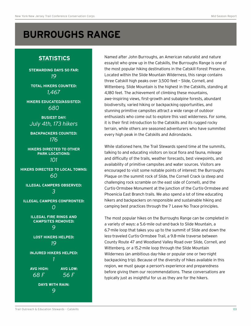
BURROUGHS RANGE Slide, Cornell, and Wittenberg
STATISTICS
STEWARDING DAYS SO FAR:
19
TOTAL HIKERS COUNTED:
1,467
HIKERS EDUCATED/ASSISTED:
680
BUSIEST DAY:
July 4th, 173 hikers
BACKPACKERS COUNTED:
176
HIKERS DIRECTED TO OTHER PARK LOCATIONS:
101
HIKERS DIRECTED TO LOCAL TOWNS:
60
ILLEGAL CAMPERS OBSERVED:
3
ILLEGAL CAMPERS CONFRONTED:
0
ILLEGAL FIRE RINGS AND CAMPSITES REMOVED:
9
LOST HIKERS HELPED:
19
INJURED HIKERS HELPED:
1
AVG HIGH: AVG LOW:
68 F 56 F
DAYS WITH RAIN:
9
Named after John Burroughs, an American naturalist and nature
essayist who grew up in the Catskills, the Burroughs Range is one of
the most popular hiking destinations in the Catskill Forest Preserve.
Located within the Slide Mountain Wilderness, this range contains
three Catskill high peaks over 3,500 feet – Slide, Cornell, and
Wittenberg. Slide Mountain is the highest in the Catskills, standing at
4,180 feet. The achievement of climbing these mountains,
awe-inspiring views, first-growth and subalpine forests, abundant
biodiversity, varied hiking or backpacking opportunities, and
stunning primitive campsites attract a wide range of outdoor
enthusiasts who come out to explore this vast wilderness. For some,
it is their first introduction to the Catskills and its rugged rocky
terrain, while others are seasoned adventurers who have summited
every high peak in the Catskills and Adirondacks.
While stationed here, the Trail Stewards spend time at the summits,
talking to and educating visitors on local flora and fauna, mileage
and difficulty of the trails, weather forecasts, best viewpoints, and
availability of primitive campsites and water sources. Visitors are
encouraged to visit some notable points of interest: the Burroughs
Plaque on the summit rock of Slide, the Cornell Crack (a steep and
challenging rock scramble on the east side of Cornell), and the
Curtis-Ormsbee Monument at the junction of the Curtis-Ormsbee and
Phoenicia East Branch trails. We also spend a lot of time educating
hikers and backpackers on responsible and sustainable hiking and
camping best practices through the 7 Leave No Trace principles.
The most popular hikes on the Burroughs Range can be completed in
a variety of ways: a 5.6-mile out-and-back to Slide Mountain, a
6.7-mile loop that takes you up to the summit of Slide and down the
less-traveled Curtis-Ormsbee Trail, a 9.8-mile traverse between
County Route 47 and Woodland Valley Road over Slide, Cornell, and
Wittenberg, or a 15.2-mile loop through the Slide Mountain
Wilderness (an ambitious day-hike or popular one or two-night
backpacking trip). Because of the diversity of hikes available in this
region, we must gauge a person's experience and preparedness
before giving them our recommendations. These conversations are
typically just as insightful for us as they are for the hikers.
Trail Outreach & Education Stewards – Catskills 03
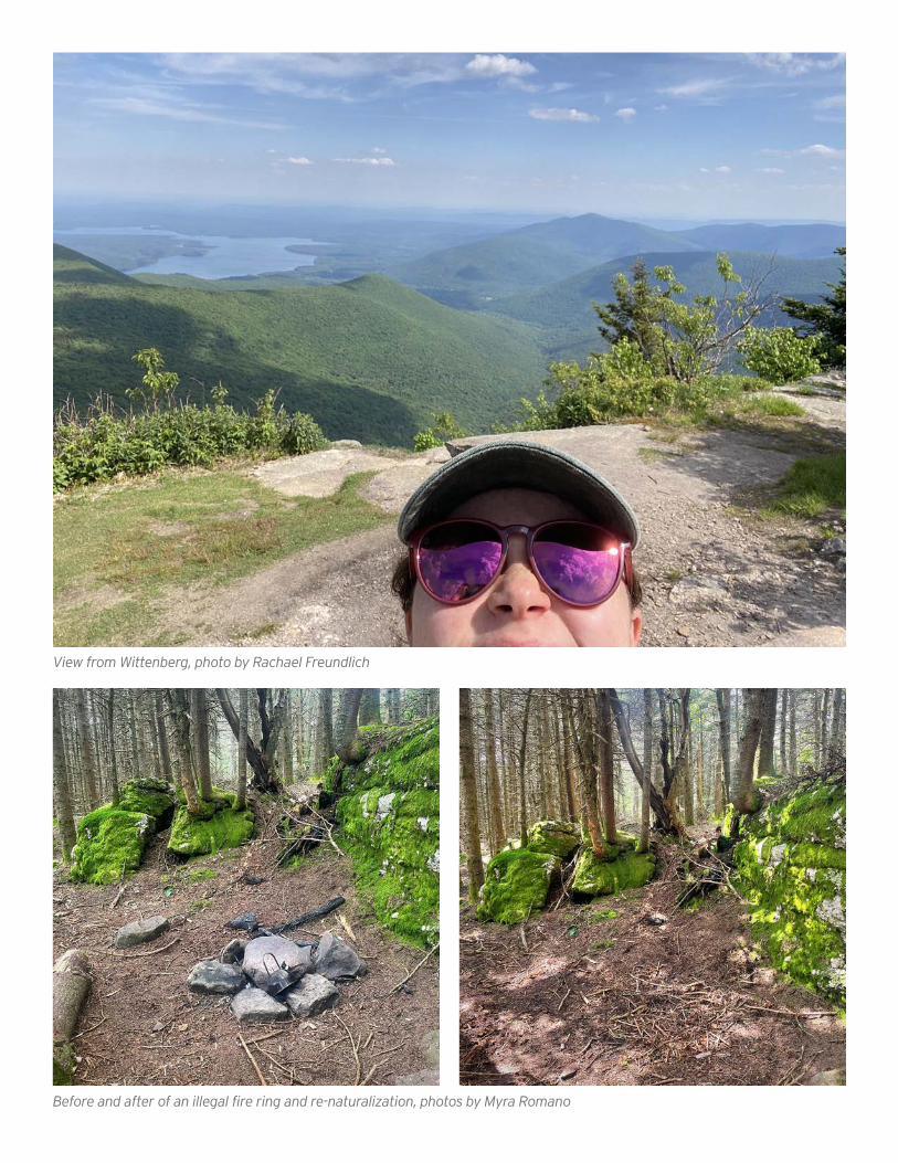
View from Wittenberg, photo by Rachael Freundlich
Before and after of an illegal fire ring and re-naturalization, photos by Myra Romano
° °
New York-New Jersey Trail Conference Conservation Corps Mid-Season Report
GIANT LEDGE & PANTHER MOUNTAIN
STATISTICS
STEWARDING DAYS SO FAR:
20
TOTAL HIKERS COUNTED:
1,850
HIKERS EDUCATED/ASSISTED:
1,092
BUSIEST DAY:
July 5th, 156 hikers
BACKPACKERS COUNTED:
82
HIKERS DIRECTED TO OTHER PARK LOCATIONS:
92
HIKERS DIRECTED TO LOCAL TOWNS:
60
ILLEGAL CAMPERS OBSERVED:
4
ILLEGAL CAMPERS CONFRONTED:
2
ILLEGAL FIRE RINGS AND CAMPSITES REMOVED:
8
LOST HIKERS HELPED:
31
INJURED HIKERS HELPED:
4
AVG HIGH: AVG LOW:
72 F 61 F
DAYS WITH RAIN:
7
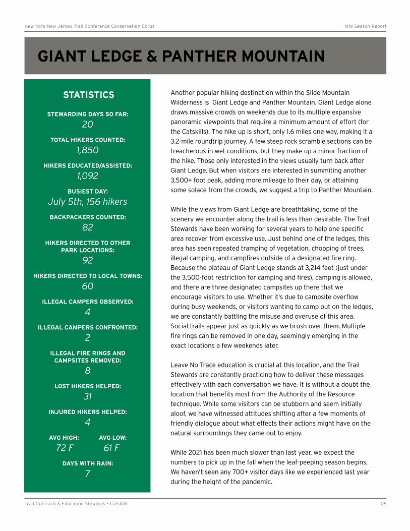
Another popular hiking destination within the Slide Mountain
Wilderness is Giant Ledge and Panther Mountain. Giant Ledge alone
draws massive crowds on weekends due to its multiple expansive
panoramic viewpoints that require a minimum amount of effort (for
the Catskills). The hike up is short, only 1.6 miles one way, making it a
3.2-mile roundtrip journey. A few steep rock scramble sections can be
treacherous in wet conditions, but they make up a minor fraction of
the hike. Those only interested in the views usually turn back after
Giant Ledge. But when visitors are interested in summiting another
3,500+ foot peak, adding more mileage to their day, or attaining
some solace from the crowds, we suggest a trip to Panther Mountain.
While the views from Giant Ledge are breathtaking, some of the
scenery we encounter along the trail is less than desirable. The Trail
Stewards have been working for several years to help one specific
area recover from excessive use. Just behind one of the ledges, this
area has seen repeated tramping of vegetation, chopping of trees,
illegal camping, and campfires outside of a designated fire ring.
Because the plateau of Giant Ledge stands at 3,214 feet (just under
the 3,500-foot restriction for camping and fires), camping is allowed,
and there are three designated campsites up there that we
encourage visitors to use. Whether it's due to campsite overflow
during busy weekends, or visitors wanting to camp out on the ledges,
we are constantly battling the misuse and overuse of this area.
Social trails appear just as quickly as we brush over them. Multiple
fire rings can be removed in one day, seemingly emerging in the
exact locations a few weekends later.
Leave No Trace education is crucial at this location, and the Trail
Stewards are constantly practicing how to deliver these messages
effectively with each conversation we have. It is without a doubt the
location that benefits most from the Authority of the Resource
technique. While some visitors can be stubborn and seem initially
aloof, we have witnessed attitudes shifting after a few moments of
friendly dialogue about what effects their actions might have on the
natural surroundings they came out to enjoy.
While 2021 has been much slower than last year, we expect the
numbers to pick up in the fall when the leaf-peeping season begins.
We haven't seen any 700+ visitor days like we experienced last year
during the height of the pandemic.
Trail Outreach & Education Stewards – Catskills 05
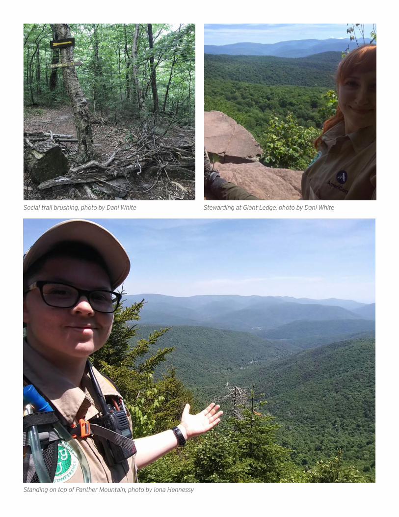
Social trail brushing, photo by Dani White Stewarding at Giant Ledge, photo by Dani White
Standing on top of Panther Mountain, photo by Iona Hennessy
° °
New York-New Jersey Trail Conference Conservation Corps Mid-Season Report
NORTH POINT
STATISTICS
STEWARDING DAYS SO FAR:
20
TOTAL HIKERS COUNTED:
1,305
HIKERS EDUCATED/ASSISTED:
549
BUSIEST DAY:
July 24th, 197 hikers
BACKPACKERS COUNTED:
45
HIKERS DIRECTED TO OTHER PARK LOCATIONS:
48
HIKERS DIRECTED TO LOCAL TOWNS:
49
ILLEGAL CAMPERS OBSERVED:
0
ILLEGAL CAMPERS CONFRONTED:
0
ILLEGAL FIRE RINGS AND CAMPSITES REMOVED:
4
LOST HIKERS HELPED:
47
INJURED HIKERS HELPED:
1
AVG HIGH: AVG LOW:
74 F 61 F
DAYS WITH RAIN:
6
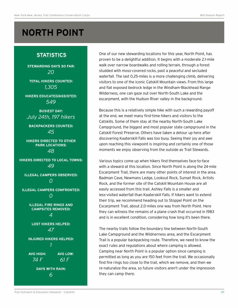
One of our new stewarding locations for this year, North Point, has
proven to be a delightful addition. It begins with a moderate 2.1-mile
walk over narrow boardwalks and rolling terrain, through a forest
studded with moss-covered rocks, past a peaceful and secluded
waterfall. The last 0.25-miles is a more challenging climb, delivering
visitors to one of the iconic Catskill Mountain views. From this large
and flat exposed bedrock ledge in the Windham-Blackhead Range
Wilderness, one can gaze out over North-South Lake and the
escarpment, with the Hudson River valley in the background.
Because this is a relatively simple hike with such a rewarding payoff
at the end, we meet many first-time hikers and visitors to the
Catskills. Some of them stay at the nearby North-South Lake
Campground, the biggest and most popular state campground in the
Catskill Forest Preserve. Others have taken a detour up here after
discovering Kaaterskill Falls was too busy. Seeing their joy and awe
upon reaching this viewpoint is inspiring and certainly one of those
moments we enjoy observing from the outside as Trail Stewards.
Various topics come up when hikers find themselves face-to-face
with a steward at this location. Since North Point is along the 24-mile
Escarpment Trail, there are many other points of interest in the area.
Badman Cave, Newmans Ledge, Lookout Rock, Sunset Rock, Artists
Rock, and the former site of the Catskill Mountain House are all
easily accessed from this trail. Ashley Falls is a smaller and
less-visited waterfall than Kaaterskill Falls. If hikers want to extend
their trip, we recommend heading out to Stoppel Point on the
Escarpment Trail, about 2.0-miles one way from North Point. Here
they can witness the remains of a plane crash that occurred in 1983
and is in excellent condition, considering how long it's been there.
The nearby trails follow the boundary line between North-South
Lake Campground and the Wildnerness area, and the Escarpment
Trail is a popular backpacking route. Therefore, we need to know the
exact rules and regulations about where camping is allowed.
Camping near North Point is a popular option since camping is
permitted as long as you are 150 feet from the trail. We occasionally
find fire rings too close to the trail, which we remove, and then we
re-naturalize the area, so future visitors aren't under the impression
they can camp there.
Trail Outreach & Education Stewards – Catskills 07
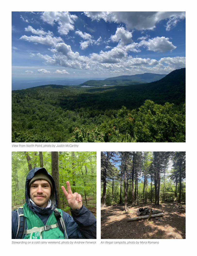
View from North Point, photo by Justin McCarthy
Stewarding on a cold rainy weekend, photo by Andrew Fenwick An illegal campsite, photo by Myra Romano
° °
New York-New Jersey Trail Conference Conservation Corps Mid-Season Report
BLACKHEAD RANGE Blackhead, Black Dome, and Thomas Cole
STATISTICS
STEWARDING DAYS SO FAR:
16
TOTAL HIKERS COUNTED:
595
HIKERS EDUCATED/ASSISTED:
228
BUSIEST DAY:
June 26th, 144 hikers*
BACKPACKERS COUNTED:
42
HIKERS DIRECTED TO OTHER PARK LOCATIONS:
29
HIKERS DIRECTED TO LOCAL TOWNS:
35
ILLEGAL CAMPERS OBSERVED:
0
ILLEGAL CAMPERS CONFRONTED:
0
ILLEGAL FIRE RINGS AND CAMPSITES REMOVED:
11
LOST HIKERS HELPED:
22
INJURED HIKERS HELPED:
0
AVG HIGH: AVG LOW:
70 F 59 F
DAYS WITH RAIN:
6
In the North-East corner of the Catskills, the Blackhead Range is
another new location for us in 2021. Part of the Windham-Blackhead
Range Wilderness, these mountains are the third, fourth, and
fifth-highest peaks in the Catskills: Black Dome (3,980'), Blackhead
(3940'), and Thomas Cole (3,940'). The range forms a prominent
rooster comb feature that can be seen from many viewpoints in the
Catskills and as far away as Albany. The most popular way to access
these peaks is from a small parking area at the Big Hollow Road
Trailhead. Other routes include coming in from the north on the
Escarpment Trail or from the west at Elmer Barnum Road Trailhead.
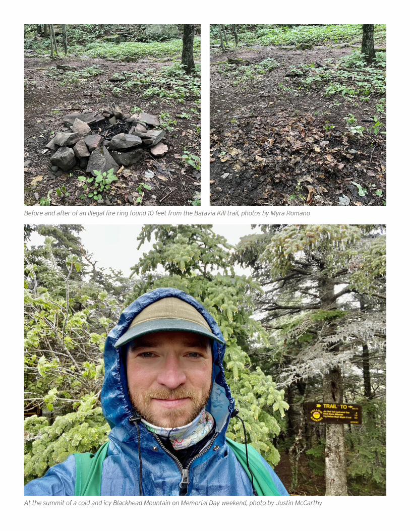
While in the Blackhead Range, we station ourselves at the summit of
Blackhead, at the junction of the Escarpment and Black Dome Range
Trails. This intersection can be confusing for some less-experienced
visitors, as the signage and lack of a viewpoint do not indicate that
they have reached the summit. We also spend time traversing the
trails to Black Dome and Thomas Cole. Lockwood Gap (between
Blackhead and Black Dome) is another high visibility area for us
because it's a major junction and an excellent spot to interact with
numerous backcountry visitors. Because this is a strenuous and
challenging hike, most of the hikers we interact with come prepared
and generally understand Leave No Trace principles.
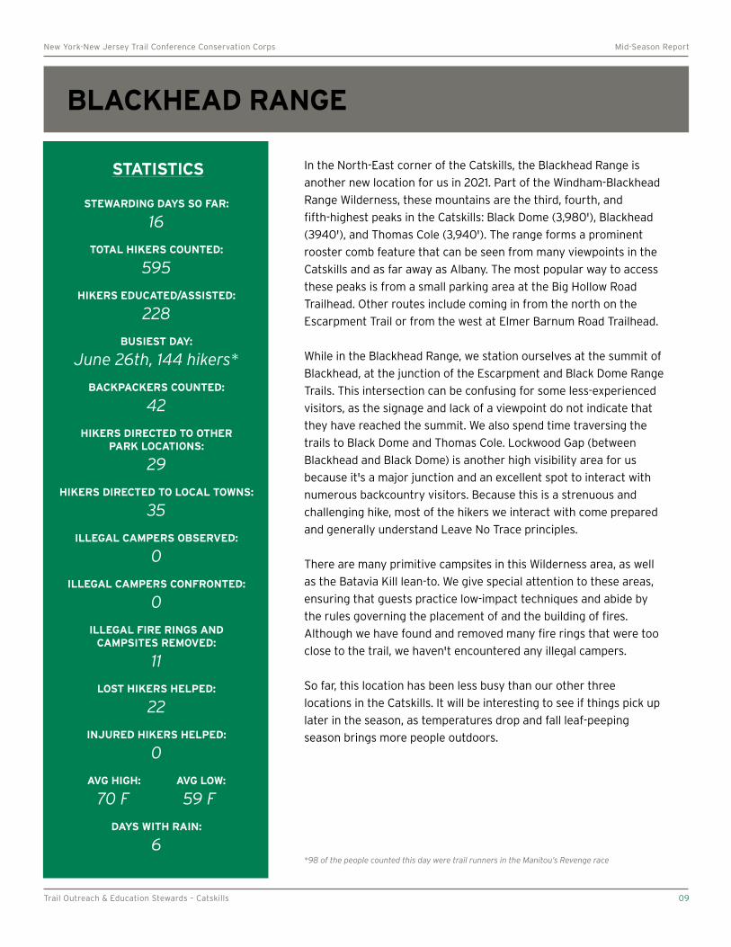
There are many primitive campsites in this Wilderness area, as well
as the Batavia Kill lean-to. We give special attention to these areas,
ensuring that guests practice low-impact techniques and abide by
the rules governing the placement of and the building of fires.
Although we have found and removed many fire rings that were too
close to the trail, we haven't encountered any illegal campers.
So far, this location has been less busy than our other three
locations in the Catskills. It will be interesting to see if things pick up
later in the season, as temperatures drop and fall leaf-peeping
season brings more people outdoors.
*98 of the people counted this day were trail runners in the Manitou’s Revenge race
Trail Outreach & Education Stewards – Catskills 09
Before and after of an illegal fire ring found 10 feet from the Batavia Kill trail, photos by Myra Romano
At the summit of a cold and icy Blackhead Mountain on Memorial Day weekend, photo by Justin McCarthy
Related Documents