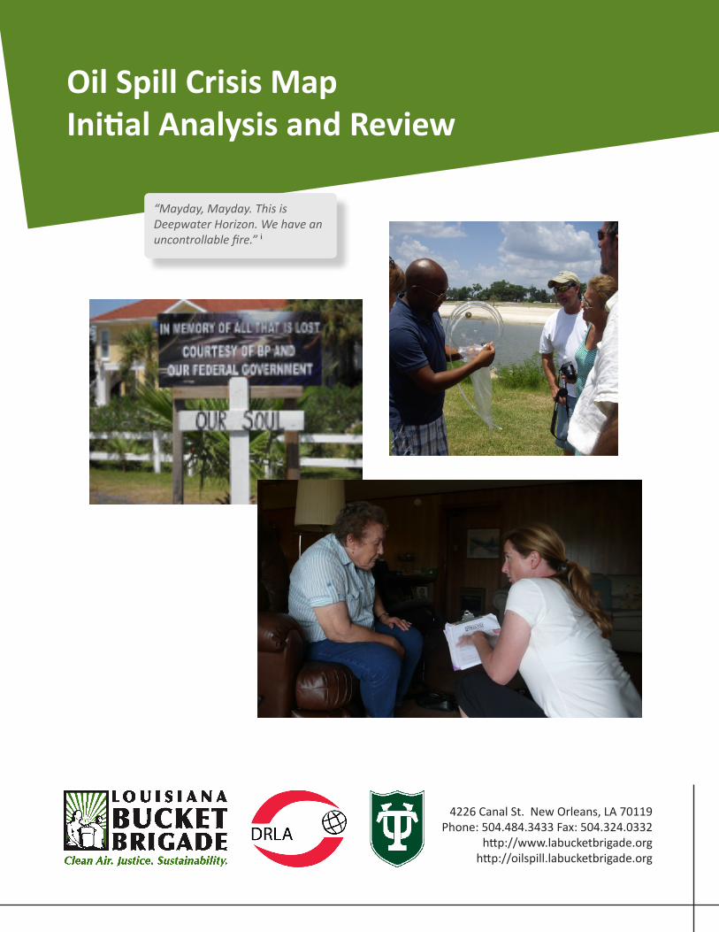
Oil Spill Crisis Map Inial Analysis and Review 4226 Canal St. New Orleans, LA 70119 Phone: 504.484.3433 Fax: 504.324.0332 hp://www.labucketbrigade.org hp://oilspill.labucketbrigade.org “Mayday, Mayday. This is Deepwater Horizon. We have an uncontrollable fire.” i

Welcome message from author
This document is posted to help you gain knowledge. Please leave a comment to let me know what you think about it! Share it to your friends and learn new things together.
Transcript
Oil Spill Crisis Map Initial Analysis and Review
4226 Canal St. New Orleans, LA 70119 Phone: 504.484.3433 Fax: 504.324.0332
http://www.labucketbrigade.orghttp://oilspill.labucketbrigade.org
“Mayday, Mayday. This is Deepwater Horizon. We have an uncontrollable fire.” i
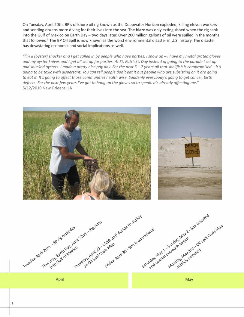
On Tuesday, April 20th, BP’s offshore oil rig known as the Deepwater Horizon exploded, killing eleven workers and sending dozens more diving for their lives into the sea. The blaze was only extinguished when the rig sank into the Gulf of Mexico on Earth Day – two days later. Over 200 million gallons of oil were spilled in the months that followed. The BP Oil Spill is now known as the worst environmental disaster in U.S. history. The disaster has devastating economic and social implications as well.
“I’m a (oyster) shucker and I get called in by people who have parties. I show up – I have my metal grated gloves and my oyster knives and I get all set up for parties. At St. Patrick’s Day instead of going to the parade I set up and shucked oysters. I made a pretty nice pay day. For the next 5 – 7 years all that shellfish is compromised – it’s going to be toxic with dispersant. You can tell people don’t eat it but people who are subsisting on it are going to eat it. It’s going to affect those communities health wise. Suddenly everybody’s going to get cancer, birth defects. For the next few years I’ve got to hang up the gloves so to speak. It’s already affecting me.” 5/12/2010 New Orleans, LA
Tuesday, A
pril 20th – BP rig
explodes
April May
Thursday, E
arth Day, A
pril 22nd – Rig sin
ks
in
to Gulf of M
exico
Thursday, A
pril 29 – LA
BB staff decid
e to deploy
a
n Oil Spill C
risis M
ap
Friday, A
pril 30 - S
ite is
operational
Saturday, May 1 – Sunday, M
ay 2 - Site
is teste
d
and co
astal o
utreach
begins
Monday, May 3rd – Oil S
pill Cris
is Map
publicl
y released
ii
1
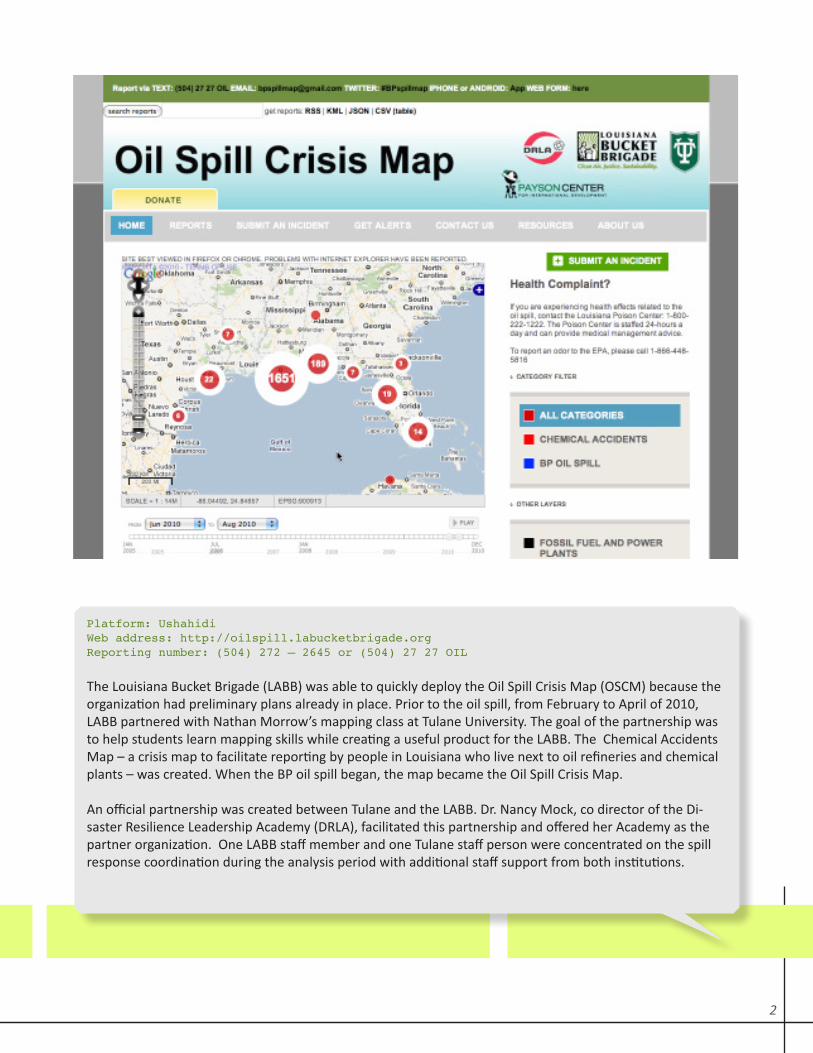
Platform: UshahidiWeb address: http://oilspill.labucketbrigade.org Reporting number: (504) 272 – 2645 or (504) 27 27 OIL
The Louisiana Bucket Brigade (LABB) was able to quickly deploy the Oil Spill Crisis Map (OSCM) because the organization had preliminary plans already in place. Prior to the oil spill, from February to April of 2010, LABB partnered with Nathan Morrow’s mapping class at Tulane University. The goal of the partnership was to help students learn mapping skills while creating a useful product for the LABB. The Chemical Accidents Map – a crisis map to facilitate reporting by people in Louisiana who live next to oil refineries and chemical plants – was created. When the BP oil spill began, the map became the Oil Spill Crisis Map.
An official partnership was created between Tulane and the LABB. Dr. Nancy Mock, co director of the Di-saster Resilience Leadership Academy (DRLA), facilitated this partnership and offered her Academy as the partner organization. One LABB staff member and one Tulane staff person were concentrated on the spill response coordination during the analysis period with additional staff support from both institutions.
2

Scope of Analysis and MethodsThough this deployment took place in the United States, the application does have resonance for crisis map-ping’s use in the developing world. Among the parallels:
1/ Community members in impacted areas have little access to advanced technologies like Twitter, Droids and iPhones;2/ A glut of agencies responded to the disaster and there was little central management; navigating the crowd-ed landscape and maintaining the OSCM’s prominence was important;3/ Local agencies already working in the area are well positioned to respond; their capacity is an issue;4/ Volunteers – both tech and site based volunteers – are crucial.
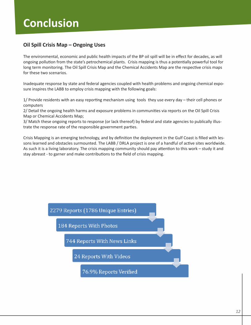
The scope of data analysis in this report covers the initial 3.25 month period from April 21-July 31, 2010. During this period there were 1,768 unique reports (individual reports) filed and 2,279 categorical reports (the number of categories that people reported under with multiple category reports per unique report) filed. As of Sep-tember 23, 2010, at the writing of this review, reports continue to come in. There are currently 2,628 unique reports.
Number of Reports Per Category
April 21, 2010 – July 31, 2010
3
Key Findings
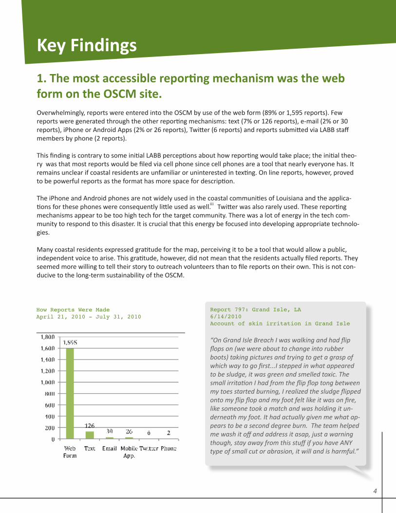
1. The most accessible reporting mechanism was the web form on the OSCM site. Overwhelmingly, reports were entered into the OSCM by use of the web form (89% or 1,595 reports). Few reports were generated through the other reporting mechanisms: text (7% or 126 reports), e-mail (2% or 30 reports), iPhone or Android Apps (2% or 26 reports), Twitter (6 reports) and reports submitted via LABB staff members by phone (2 reports).
This finding is contrary to some initial LABB perceptions about how reporting would take place; the initial theo-ry was that most reports would be filed via cell phone since cell phones are a tool that nearly everyone has. It remains unclear if coastal residents are unfamiliar or uninterested in texting. On line reports, however, proved to be powerful reports as the format has more space for description.
The iPhone and Android phones are not widely used in the coastal communities of Louisiana and the applica-tions for these phones were consequently little used as well. Twitter was also rarely used. These reporting mechanisms appear to be too high tech for the target community. There was a lot of energy in the tech com-munity to respond to this disaster. It is crucial that this energy be focused into developing appropriate technolo-gies.
Many coastal residents expressed gratitude for the map, perceiving it to be a tool that would allow a public, independent voice to arise. This gratitude, however, did not mean that the residents actually filed reports. They seemed more willing to tell their story to outreach volunteers than to file reports on their own. This is not con-ducive to the long-term sustainability of the OSCM.
Report 797: Grand Isle, LA 6/14/2010Account of skin irritation in Grand Isle
“On Grand Isle Breach I was walking and had flip flops on (we were about to change into rubber boots) taking pictures and trying to get a grasp of which way to go first...I stepped in what appeared to be sludge, it was green and smelled toxic. The small irritation I had from the flip flop tong between my toes started burning, I realized the sludge flipped onto my flip flop and my foot felt like it was on fire, like someone took a match and was holding it un-derneath my foot. It had actually given me what ap-pears to be a second degree burn. The team helped me wash it off and address it asap, just a warning though, stay away from this stuff if you have ANY type of small cut or abrasion, it will and is harmful.”
How Reports Were Made April 21, 2010 - July 31, 2010
iii
4
Report 1495: Plaquemines, LA7/27/10 Not only marine wildlife affected
“The coyotes are looking very scraggly. they are eating all the dead birds. We don’t find a lot of birds, we find a lot of feathers. We have pictures of a coyote from last week that we now found dead along with 3 dead birds and a pile of about 14 dead mullets. We found them between Last Pass and Grenier Pass.”
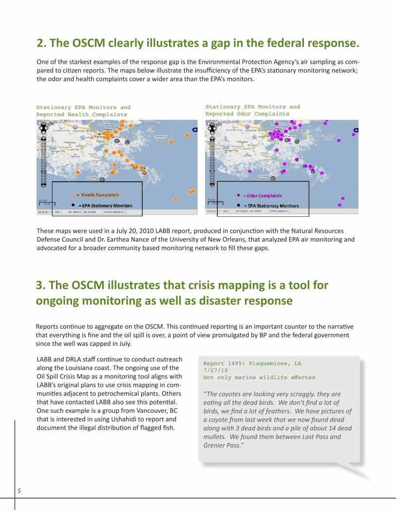
2. The OSCM clearly illustrates a gap in the federal response. One of the starkest examples of the response gap is the Environmental Protection Agency’s air sampling as com-pared to citizen reports. The maps below illustrate the insufficiency of the EPA’s stationary monitoring network; the odor and health complaints cover a wider area than the EPA’s monitors.
These maps were used in a July 20, 2010 LABB report, produced in conjunction with the Natural Resources Defense Council and Dr. Earthea Nance of the University of New Orleans, that analyzed EPA air monitoring and advocated for a broader community based monitoring network to fill these gaps.
Stationary EPA Monitors and Reported Odor Complaints
Stationary EPA Monitors and Reported Health Complaints
3. The OSCM illustrates that crisis mapping is a tool for ongoing monitoring as well as disaster response
Reports continue to aggregate on the OSCM. This continued reporting is an important counter to the narrative that everything is fine and the oil spill is over, a point of view promulgated by BP and the federal government since the well was capped in July.
LABB and DRLA staff continue to conduct outreach along the Louisiana coast. The ongoing use of the Oil Spill Crisis Map as a monitoring tool aligns with LABB’s original plans to use crisis mapping in com-munities adjacent to petrochemical plants. Others that have contacted LABB also see this potential. One such example is a group from Vancouver, BC that is interested in using Ushahidi to report and document the illegal distribution of flagged fish.
5
Report 1500: Dulac, LA7/28/10Not only shrimpers are affected but also all those who work in shrimp processing.
“A woman who has worked at Lafitte Frozen Foods (shrimp processing) for 10 years was laid off be-cause of fishing closures. The only work that is being done at the processing plant is maintenance. She said that 20 women (many who are older) were the ones laid off because they primarily work the factory line. Some went to work for BP only because they need a way to support their family.
She said that, ‘they (BP) really have me in a tough place,’ as she had just bought a trailer which they are trying to repossess and she hasn’t been able to pay her bills because she does not have money com-ing in.”
4. The map should be part of emergency response prepara-tion; people in a crisis may be too overwhelmed and con-cerned with survival to learn about the technology and then file reportsCoastal community outreach teams were created as one method of introducing Gulf Coast residents to the use and value of crisis mapping and to encourage reports. These teams were comprised of volunteers, many from Tulane University, but others from across the community and the U.S. From May 1 to July 31, the metrics were as follows
• Twenty-nine outreach trips to five of the coastal parishes of Southeastern Louisiana• Forty-six volunteers • Total hours: 2,200
Reporter Number of Reports Filed Percentage of Total
Anonymous 499 28%
Outreach volunteers 494 28%
Residents impacted by the spill 302 17%
LABB staff 302 17%
Patagonia volunteers 177 10%
Call in recorded by LABB staff 5 -
As assumption that the anonymous reports were filed by impacted communities means that, in the best case scenario, impacted people filed 45% of reports. Even this level of reporting cannot be considered robust given the scope of the disaster. This raises ques-tion for crisis mapping: will people in crisis file reports? A similar breakdown of the Haiti reports would be useful.
Integrating crisis mapping into a community’s emergency preparedness might overcome the reporting barriers that arise when the map is introduced in the midst of a crisis. If crisis mapping were a known tool – like 911 or hurricane tracking – the likelihood of use would increase, and residents and first responders would benefit.
This finding regarding reporting is among the most important, and leads to a discussion of barriers.
6
Reporting Barriers
Threatened by BP if reported
This is one barrier that advanced knowledge of crisis mapping could not have overcome.
The outreach teams encountered a prevalent fear about disclosure of information. As in many other humani-tarian disasters, the governments or corporations that have had a hand in creating the crisis have significant power. In this instance, coastal residents contracted by BP were not allowed to speak to anyone - media, NGOs, other community members - about what they were seeing or experiencing while working on oil clean-up. They were told that they would lose their jobs if they spoke, and many signed gag orders as a condition of employ-ment. This censorship silenced other community residents including friends and family. The ability to report anonymously to the OSCM was a strength.
Little Capacity to Make the Map Prominent
The extended nature of the immediate crisis period, from explosions to well cap, was 91 days. To generate reports, it was necessary to repeatedly connect with community members about documenting impacts, which became an issue of capacity for a small organization. Adequate funds to advertise the OSCM and the phone number on the radio, TV and billboards might have facilitated reporting, but neither of the organizations involved – LABB nor Tulane’s DRLA – had or have the funds for this. A government partner would have been helpful for this reason
The Phone Number and Web Address
The phone number, with an area code specific to New Orleans, might have been a barrier to residents from the Louisiana coast and other Gulf Coast states reporting to the OSCM. A short code may have been preferable for this reason. Likewise, the web address (www.oilspill.labucketbrigade.org) was overly complex.
7
Contributions of the Oil Spill Crisis Map
To the Field of Crisis Mapping
First Ever Use in an Environmental Disaster and First Humanitarian Use in the United States
Crisis mapping has been used in the U.S. in Atlanta for crime mapping and in Washington D.C. during the snow-storms of 2009. The deployment of Ushahidi and crisis mapping for the BP oil spill is the first known application for humanitarian purposes in the U.S. and the first ever known use for environmental disaster response in any part of the world.
Introduction to the Gulf Coast Region
The Oil Spill Crisis Map has introduced crisis mapping technology to the region. This technology would have been useful during humanitarian/environmental disasters such as Hurricane Katrina; there is no long-standing participatory documentation of this event. Looking forward, while LABB and DRLA hope that the technology will be applied in other ways, a dedicated outreach to disaster agencies, foundations, emergency responders, city government and other entities would be useful. Neither LABB nor DRLA currently has the capacity for this outreach though both groups are trying to gain the capacity to do so.
LABB continues to document oil spill impacts with the OSCM and is currently deploying the crisis mapping technology for its original intent – reporting of accidents by neighbors of Louisiana’s oil refineries and chemical plants. The Chemical Accidents Map was launched in September 2010.
To the Oil Spill Response
Community Reports Precede Media Reports
While further analysis is needed to confirm this trend, it appears that citizen reporting preceded media stories by a week to ten days. This both confirms the accuracy of some of the reporting and details the importance of eyewitness, on the ground testimony.
Report 1300: Port Sulphur, LA6/30/2010Account of a fisherman who talks about how
fishing is all he knows.
“We spoke with a young man applying for claims who spoke of his experience thus far. He grew up the son of a shrimper and dropped out of school in the 7th grade to begin a career as a shrimp fisher-man. He expressed that shrimp fishing is a hard way of life, long hours and grueling labor. He went on to say that his sadness at losing his livelihood was exacerbated by the birth of hist first child two weeks prior. “Fishing is all I know,” was what he said and is what we have heard echoed over and over.”
8
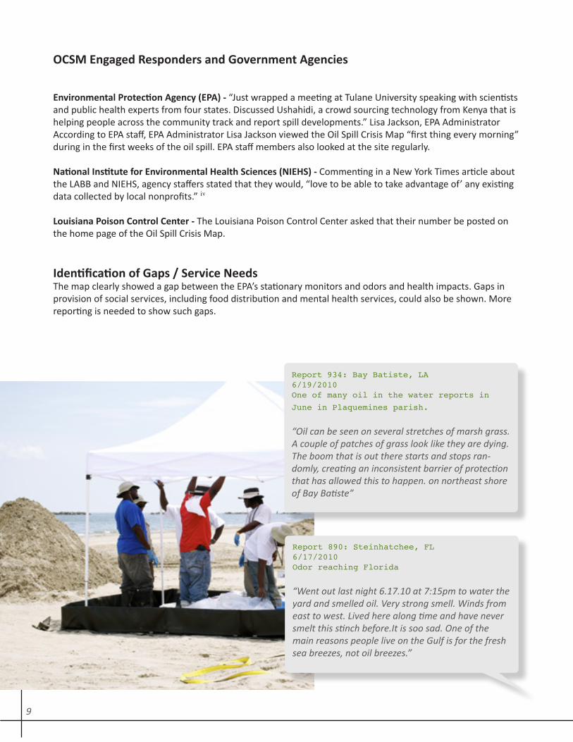
OCSM Engaged Responders and Government Agencies
Environmental Protection Agency (EPA) - “Just wrapped a meeting at Tulane University speaking with scientists and public health experts from four states. Discussed Ushahidi, a crowd sourcing technology from Kenya that is helping people across the community track and report spill developments.” Lisa Jackson, EPA AdministratorAccording to EPA staff, EPA Administrator Lisa Jackson viewed the Oil Spill Crisis Map “first thing every morning” during in the first weeks of the oil spill. EPA staff members also looked at the site regularly.
National Institute for Environmental Health Sciences (NIEHS) - Commenting in a New York Times article about the LABB and NIEHS, agency staffers stated that they would, “love to be able to take advantage of’ any existing data collected by local nonprofits.”
Louisiana Poison Control Center - The Louisiana Poison Control Center asked that their number be posted on the home page of the Oil Spill Crisis Map.
Identification of Gaps / Service Needs The map clearly showed a gap between the EPA’s stationary monitors and odors and health impacts. Gaps in provision of social services, including food distribution and mental health services, could also be shown. More reporting is needed to show such gaps.
Report 934: Bay Batiste, LA6/19/2010One of many oil in the water reports in
June in Plaquemines parish.
“Oil can be seen on several stretches of marsh grass. A couple of patches of grass look like they are dying. The boom that is out there starts and stops ran-domly, creating an inconsistent barrier of protection that has allowed this to happen. on northeast shore of Bay Batiste”
Report 890: Steinhatchee, FL6/17/2010Odor reaching Florida
“Went out last night 6.17.10 at 7:15pm to water the yard and smelled oil. Very strong smell. Winds from east to west. Lived here along time and have never smelt this stinch before.It is soo sad. One of the main reasons people live on the Gulf is for the fresh sea breezes, not oil breezes.”
iv
9
Largest Compilation of Impact
There are 2,628 reports on the Oil Spill Crisis Map as of September 23, 2010. This averages to 17 reports a day. LABB review of various reporting mechanisms – including CNN’s i reports, the Times Picayune citizen reporting, various blogs and Skytruth’s use of Ushahidi – has found that the Oil Spill Crisis Map has the most collected, publicly available community reports. BP has collected reports via an advertised number, but this data is not publicly available.
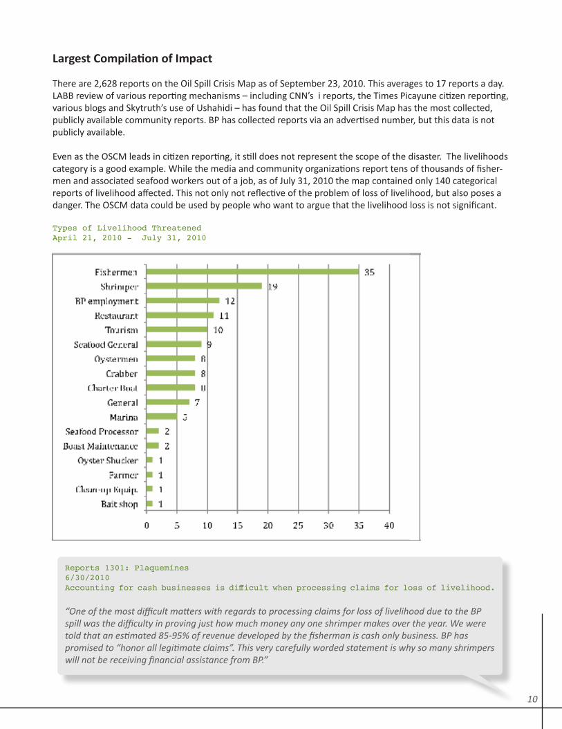
Even as the OSCM leads in citizen reporting, it still does not represent the scope of the disaster. The livelihoods category is a good example. While the media and community organizations report tens of thousands of fisher-men and associated seafood workers out of a job, as of July 31, 2010 the map contained only 140 categorical reports of livelihood affected. This not only not reflective of the problem of loss of livelihood, but also poses a danger. The OSCM data could be used by people who want to argue that the livelihood loss is not significant.
Types of Livelihood ThreatenedApril 21, 2010 - July 31, 2010
Reports 1301: Plaquemines6/30/2010Accounting for cash businesses is difficult when processing claims for loss of livelihood.
“One of the most difficult matters with regards to processing claims for loss of livelihood due to the BP spill was the difficulty in proving just how much money any one shrimper makes over the year. We were told that an estimated 85-95% of revenue developed by the fisherman is cash only business. BP has promised to “honor all legitimate claims”. This very carefully worded statement is why so many shrimpers will not be receiving financial assistance from BP.”
10
Questions Going Forward
What Institution is Best to Launch a Crisis Map?
The advantage of the LABB / DRLA partnership is that the organizations are independent of the government. That independence was vital given Gulf Coast residents’ suspicion of collusion between the government and BP. There would, however, be advantages to government operation of the map in a different scenario. The pros and cons are as follows:
Pros1/ Government has the capacity to widely distribute the reporting number and might have been able to create a dominant, central reporting location that is also publicly available;2/ The public would likely respond to a government directive to report and more reports may be filed;3/ Government officials – including clean-up workers and first responders - might be more likely to use the information if it comes from a government source and they are allowed to speak about their roles.
Cons1/ Given the collaboration of the government and of BP as well as the requirements of the Oil Pollution Act, information would have been controlled by BP;2/ There would have been a perception of collusion with BP and thus a distrust of the information; this might affect reporting;3/ There would be no assurance of the availability of the site or the reports over the long term;4/ Loss of an independent format for citizen reporting.
A partnership between government and nongovernmental organizations might be the best idea.
The LABB is an advocacy organization that holds the petrochemical industry accountable for pollution. When the OSCM was launched, there were some organizations, especially those that work with the oil industry, that did not want to collaborate on the Oil Spill Crisis Map because of the LABB’s reputation as an industry critic.
References Blackmon, Douglas, “There Was Nobody in Charge,” Wall Street Journal, May 27, 2010, http://online.wsj.com/article/SB10001424052748704113504575264721101985024.html Smith, Ryan, “Oil Containment Efforts, Amount of Oil Spilled,” Times Picayune, July 11, 2010, p. B1 The iPhone application became available 7/9/10 and the Android application on 7/7/10. This is one of the reasons for lower reporting through these methods. However, the MoGo application (iPhone) only received a couple of reports submitted via this method. The Android application, linked to the OSCM and SpillMap.org provided a significant volume of reports, though many were not relevant, such as “there is oil everywhere”. Schor, Elana, “Locals Track Gulf Oil Spill’s Health Impacts, Paving Way for Federal Study,” New York Times, August, 19, 2010, http://www.nytimes.com/gwire/2010/08/19/19greenwire-locals-track-gulf-oil-spills-health-impacts-pa-41267.html
ii
i
iii
iv
11
Conclusion
Oil Spill Crisis Map – Ongoing Uses
The environmental, economic and public health impacts of the BP oil spill will be in effect for decades, as will ongoing pollution from the state’s petrochemical plants. Crisis mapping is thus a potentially powerful tool for long term monitoring. The Oil Spill Crisis Map and the Chemical Accidents Map are the respective crisis maps for these two scenarios.
Inadequate response by state and federal agencies coupled with health problems and ongoing chemical expo-sure inspires the LABB to employ crisis mapping with the following goals:
1/ Provide residents with an easy reporting mechanism using tools they use every day – their cell phones or computers2/ Detail the ongoing health harms and exposure problems in communities via reports on the Oil Spill Crisis Map or Chemical Accidents Map; 3/ Match these ongoing reports to response (or lack thereof) by federal and state agencies to publically illus-trate the response rate of the responsible government parties.
Crisis Mapping is an emerging technology, and by definition the deployment in the Gulf Coast is filled with les-sons learned and obstacles surmounted. The LABB / DRLA project is one of a handful of active sites worldwide. As such it is a living laboratory. The crisis mapping community should pay attention to this work – study it and stay abreast - to garner and make contributions to the field of crisis mapping.
12
4226 Canal St. New Orleans, LA 70119 Phone: 504.484.3433 Fax: 504.324.0332
http://www.labucketbrigade.orghttp://oilspill.labucketbrigade.org
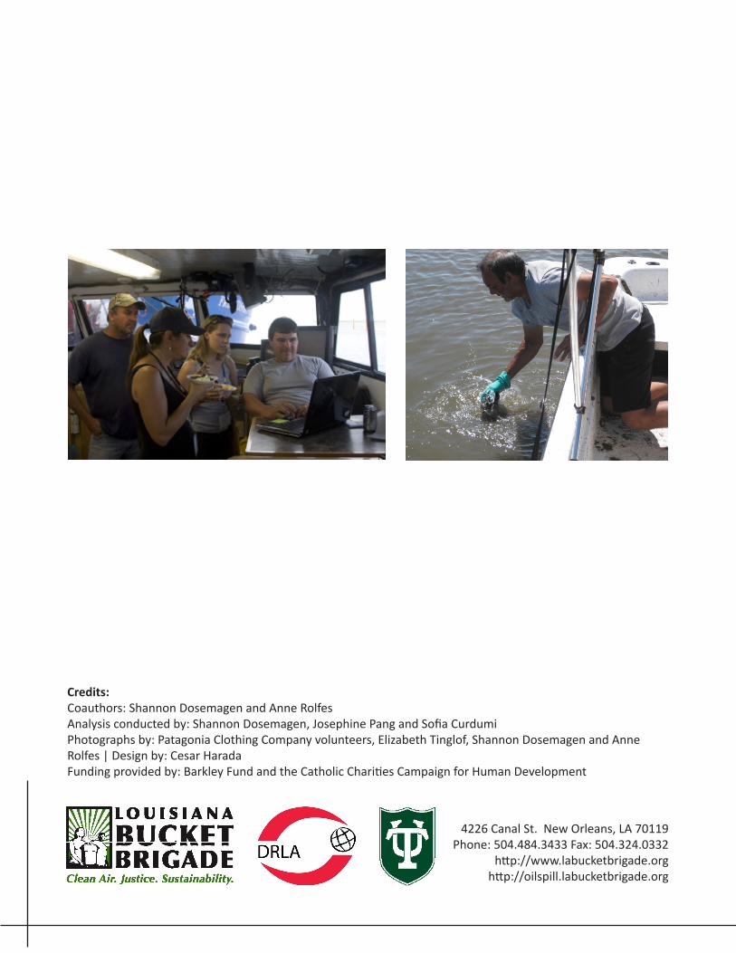
Credits:Coauthors: Shannon Dosemagen and Anne RolfesAnalysis conducted by: Shannon Dosemagen, Josephine Pang and Sofia CurdumiPhotographs by: Patagonia Clothing Company volunteers, Elizabeth Tinglof, Shannon Dosemagen and Anne Rolfes | Design by: Cesar HaradaFunding provided by: Barkley Fund and the Catholic Charities Campaign for Human Development
Related Documents