Welcome message from author
This document is posted to help you gain knowledge. Please leave a comment to let me know what you think about it! Share it to your friends and learn new things together.
Transcript
Lithospheric Plates
The Earth's rocky outer crust solidified
billions of years ago, soon after the Earth
formed. This crust is not a solid shell.
It is broken up into huge, thick plates that
drift atop the soft, underlying mantle.
A number of rigid, but moving, pieces of
the Earth‟s surface.
Also called lithospheric plates
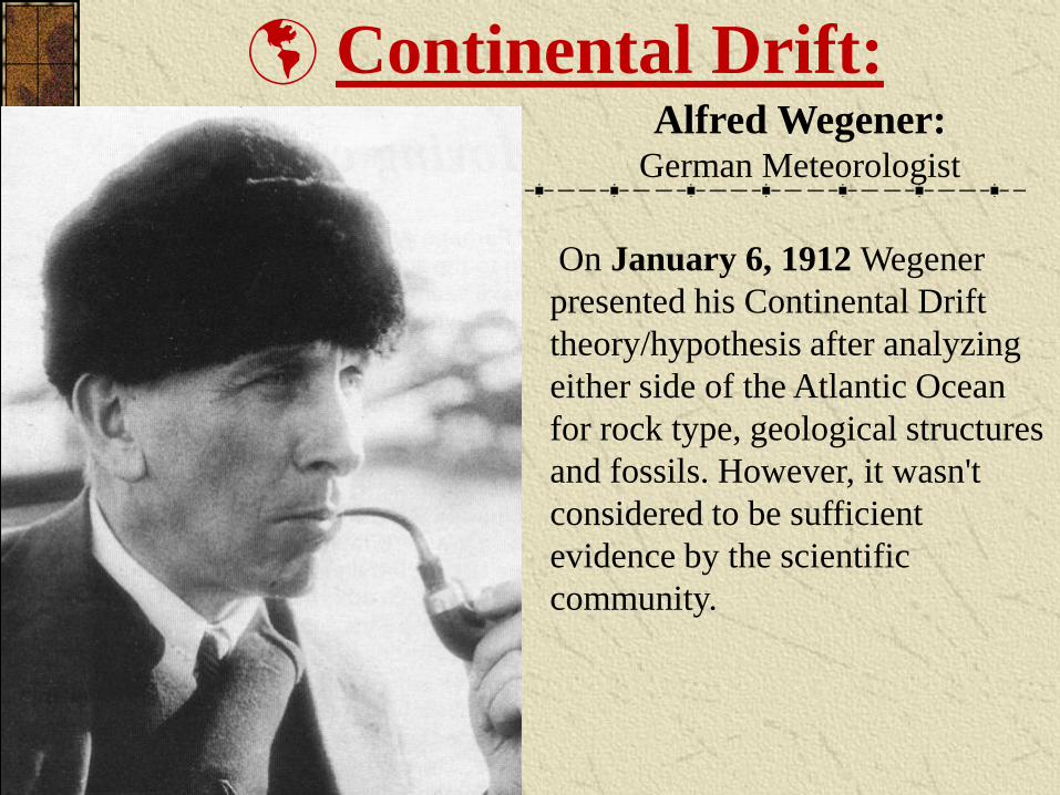
Alfred Wegener:German Meteorologist
On January 6, 1912 Wegener
presented his Continental Drift
theory/hypothesis after analyzing
either side of the Atlantic Ocean
for rock type, geological structures
and fossils. However, it wasn't
considered to be sufficient
evidence by the scientific
community.
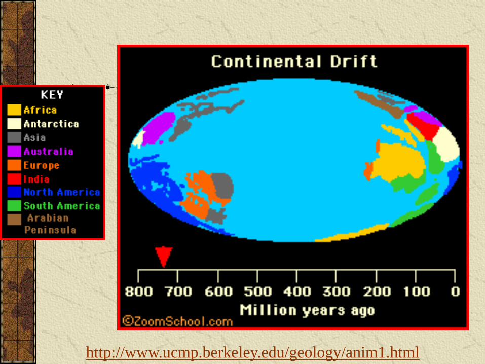
Continental Drift:
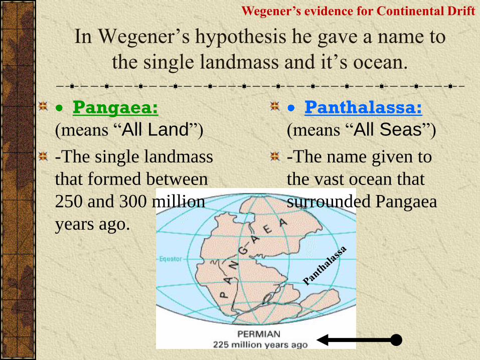
In Wegener‟s hypothesis he gave a name to
the single landmass and it‟s ocean.
Pangaea:
(means “All Land”)
-The single landmass
that formed between
250 and 300 million
years ago.
Panthalassa:
(means “All Seas”)
-The name given to
the vast ocean that
surrounded Pangaea
Wegener’s evidence for Continental Drift
Wegener’s evidence for Continental Drift
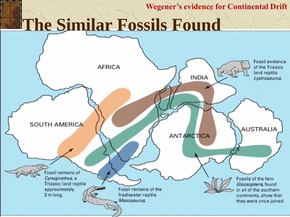
The Similar Fossils Found
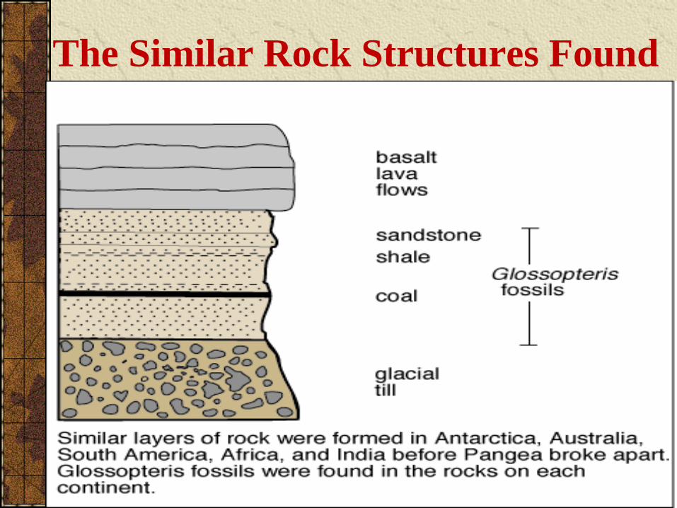
The Similar Rock Structures Found
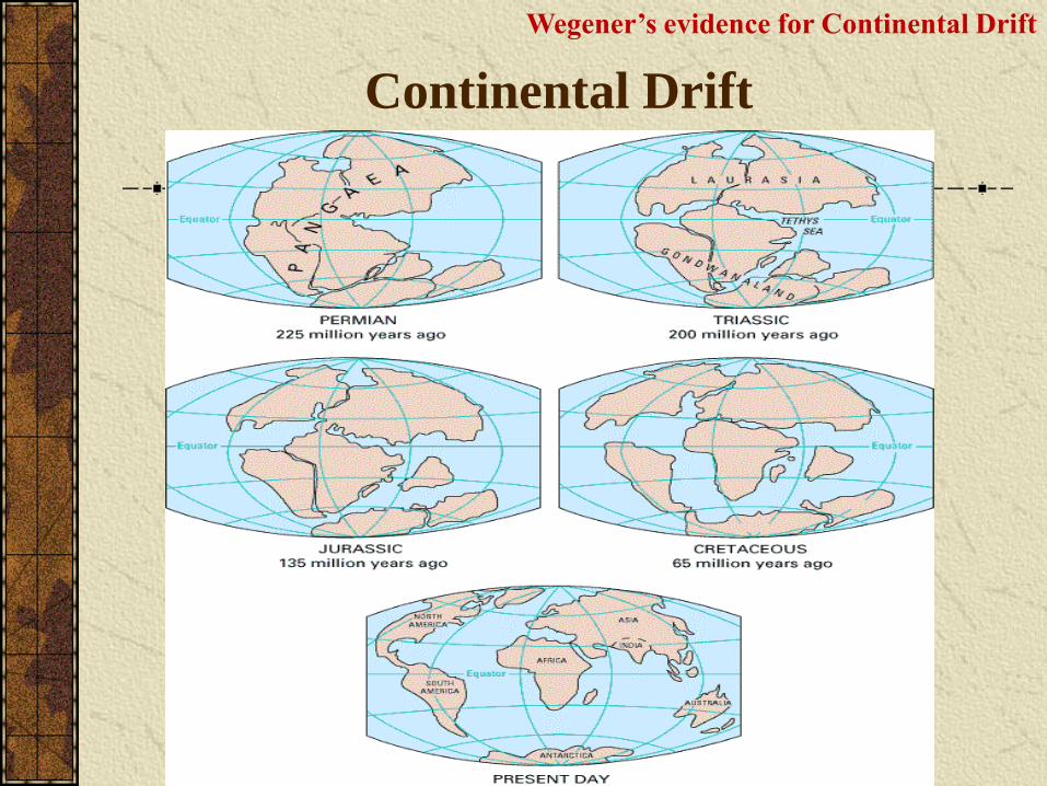
Continental Drift
Wegener’s evidence for Continental Drift
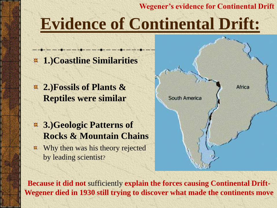
Evidence of Continental Drift:
1.)Coastline Similarities
2.)Fossils of Plants &
Reptiles were similar
3.)Geologic Patterns of
Rocks & Mountain Chains
Why then was his theory rejected
by leading scientist?
Because it did not sufficiently explain the forces causing Continental Drift-
Wegener died in 1930 still trying to discover what made the continents move
Wegener’s evidence for Continental Drift
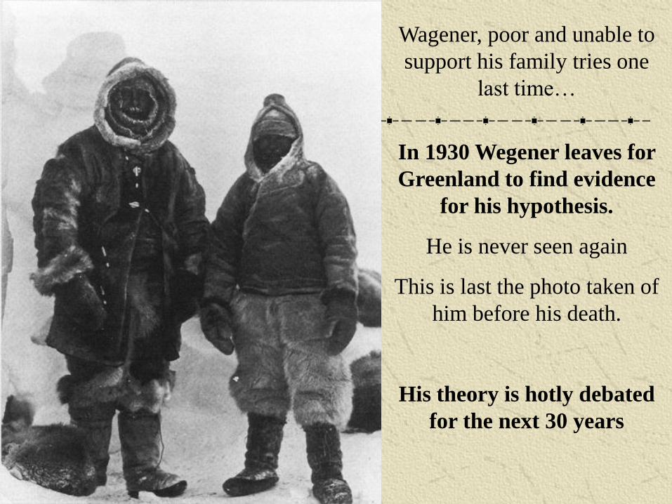
In 1930 Wegener leaves for
Greenland to find evidence
for his hypothesis.
He is never seen again
This is last the photo taken of
him before his death.
His theory is hotly debated
for the next 30 years
Wagener, poor and unable to
support his family tries one
last time…
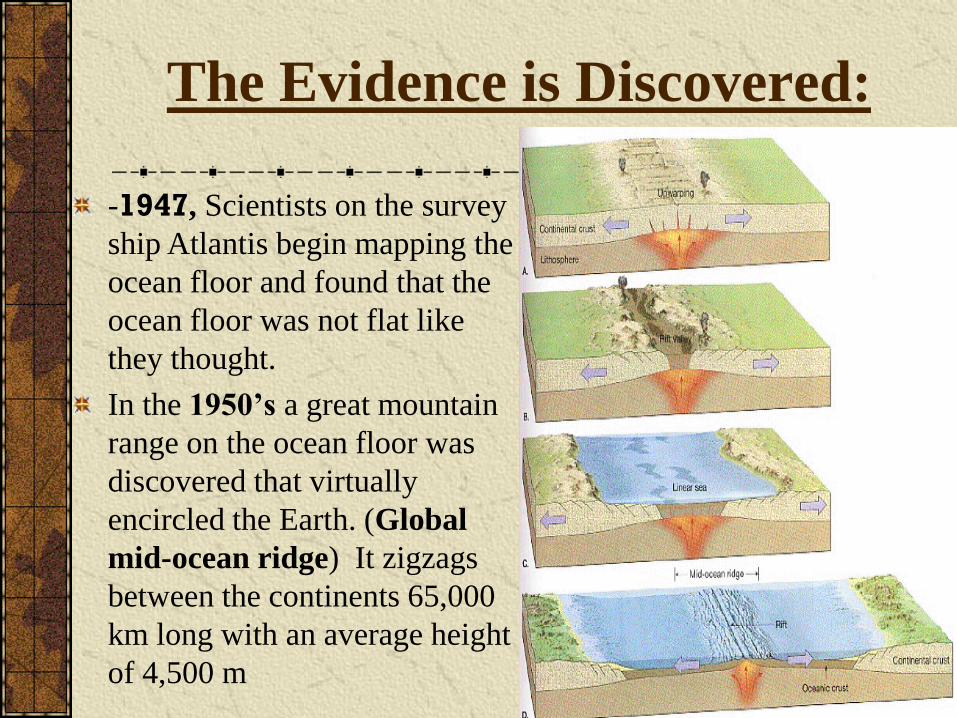
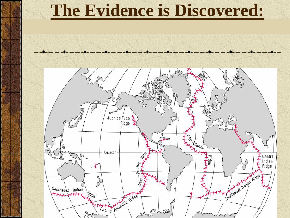
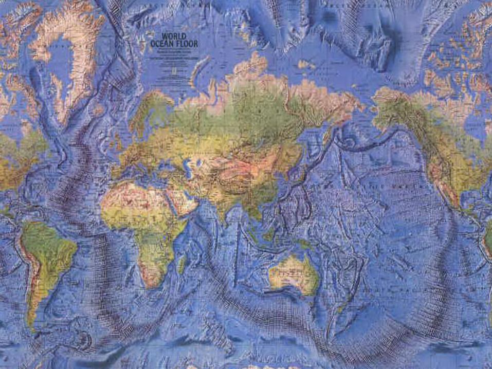
The Evidence is Discovered:
-1947, Scientists on the survey
ship Atlantis begin mapping the
ocean floor and found that the
ocean floor was not flat like
they thought.
In the 1950’s a great mountain
range on the ocean floor was
discovered that virtually
encircled the Earth. (Global
mid-ocean ridge) It zigzags
between the continents 65,000
km long with an average height
of 4,500 m
The Evidence is Discovered:
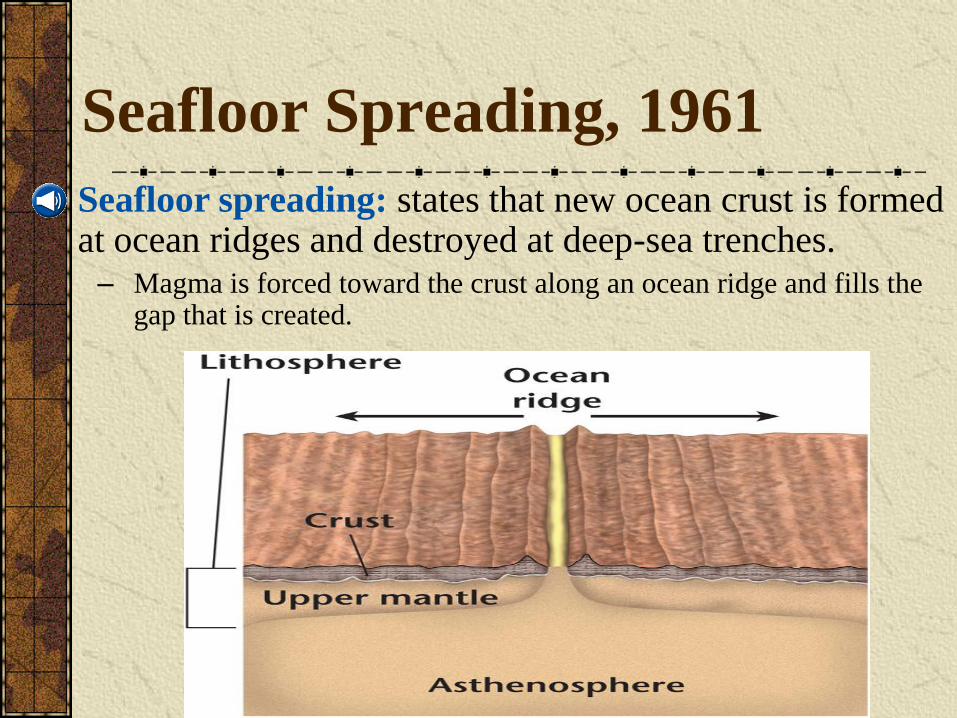
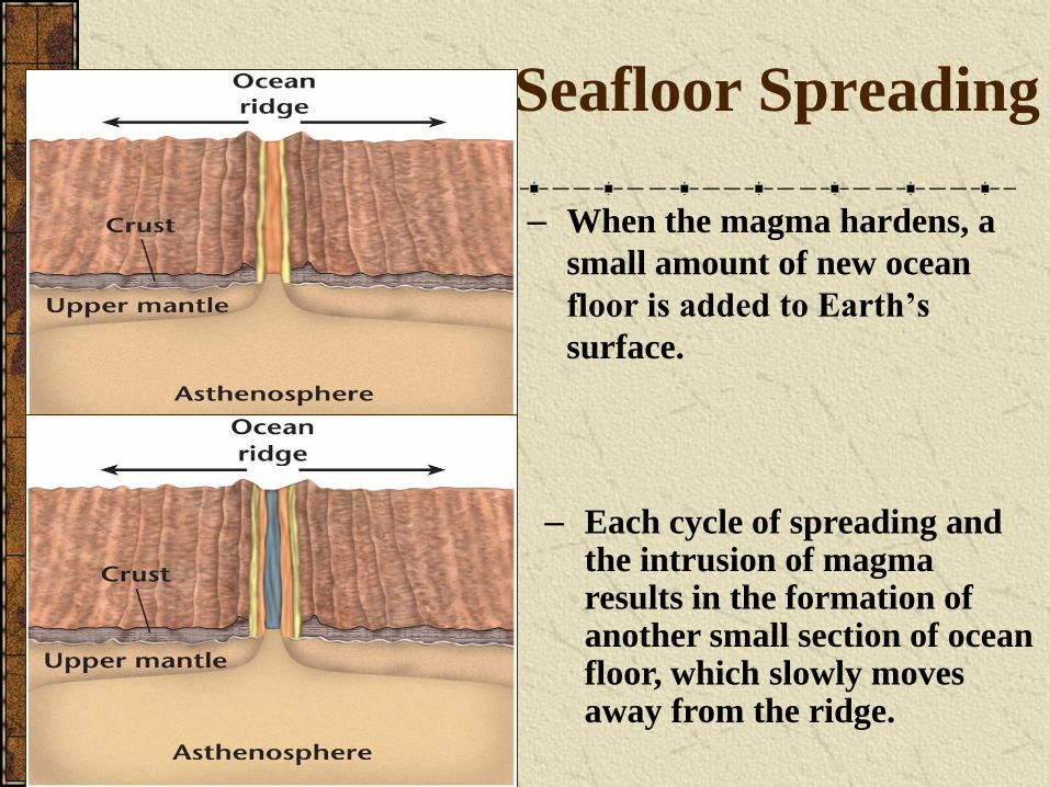
Seafloor Spreading, 1961
– Magma is forced toward the crust along an ocean ridge and fills the gap that is created.
• Seafloor spreading: states that new ocean crust is formed at ocean ridges and destroyed at deep-sea trenches.
Seafloor Spreading
– Each cycle of spreading and the intrusion of magma results in the formation of another small section of ocean floor, which slowly moves away from the ridge.
– When the magma hardens, a
small amount of new ocean
floor is added to Earth’s
surface.
– Seafloor spreading was the missing link needed by Wegener to complete his model of continental drift.
– Continents are not pushing through ocean crust, as Wegener proposed; they ride with ocean crust as it slowly moves away from ocean ridges.
The Missing Link
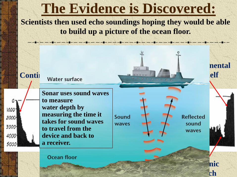
Scientists then used echo soundings hoping they would be able
to build up a picture of the ocean floor.
ContinentMid-ocean
ridgeSea mount
Oceanic
trenchAbyssal plain
Continental
shelf
Central rift
zone
The Evidence is Discovered:
This is what they found
Sonar uses sound waves to measure water depth by measuring the time it takes for sound waves to travel from the device and back to a receiver.
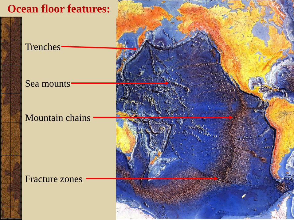
Ocean floor features:
Trenches
Mountain chains
Sea mounts
Fracture zones
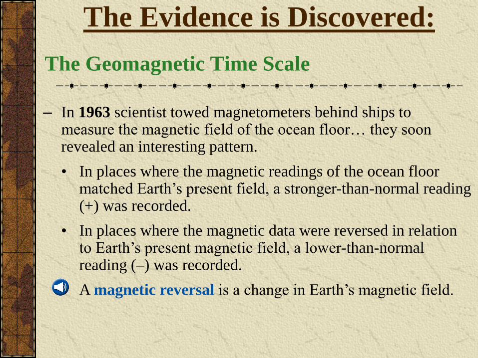
• In places where the magnetic readings of the ocean floor matched Earth‟s present field, a stronger-than-normal reading (+) was recorded.
• In places where the magnetic data were reversed in relation to Earth‟s present magnetic field, a lower-than-normal reading (–) was recorded.
• A magnetic reversal is a change in Earth‟s magnetic field.
The Geomagnetic Time Scale
– In 1963 scientist towed magnetometers behind ships to measure the magnetic field of the ocean floor… they soon revealed an interesting pattern.
The Evidence is Discovered:
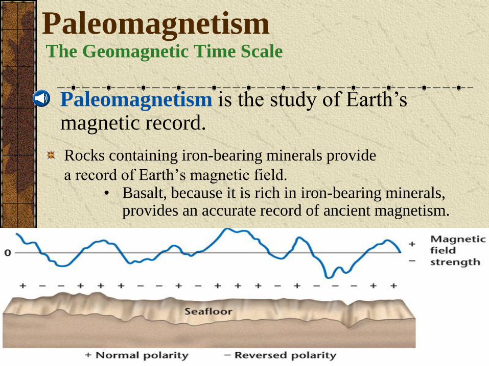
Rocks containing iron-bearing minerals provide
a record of Earth‟s magnetic field.
• Paleomagnetism is the study of Earth‟s magnetic record.
• Basalt, because it is rich in iron-bearing minerals, provides an accurate record of ancient magnetism.
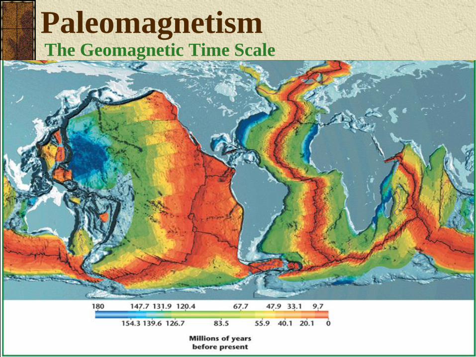
PaleomagnetismThe Geomagnetic Time Scale
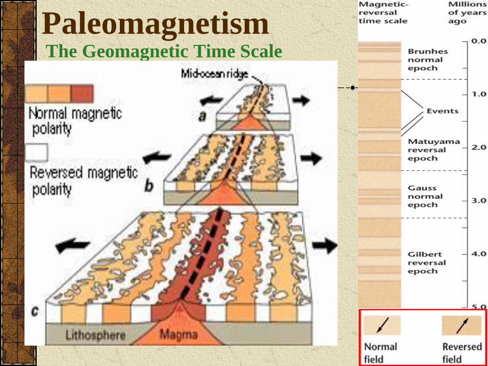
The Geomagnetic Time Scale
Paleomagnetism
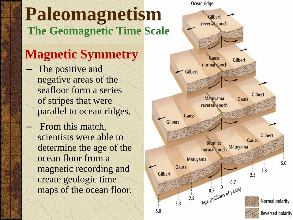
Magnetic Symmetry– The positive and
negative areas of the seafloor form a series of stripes that were parallel to ocean ridges.
– From this match, scientists were able to determine the age of the ocean floor from a magnetic recording and create geologic time maps of the ocean floor.
PaleomagnetismThe Geomagnetic Time Scale
PaleomagnetismThe Geomagnetic Time Scale
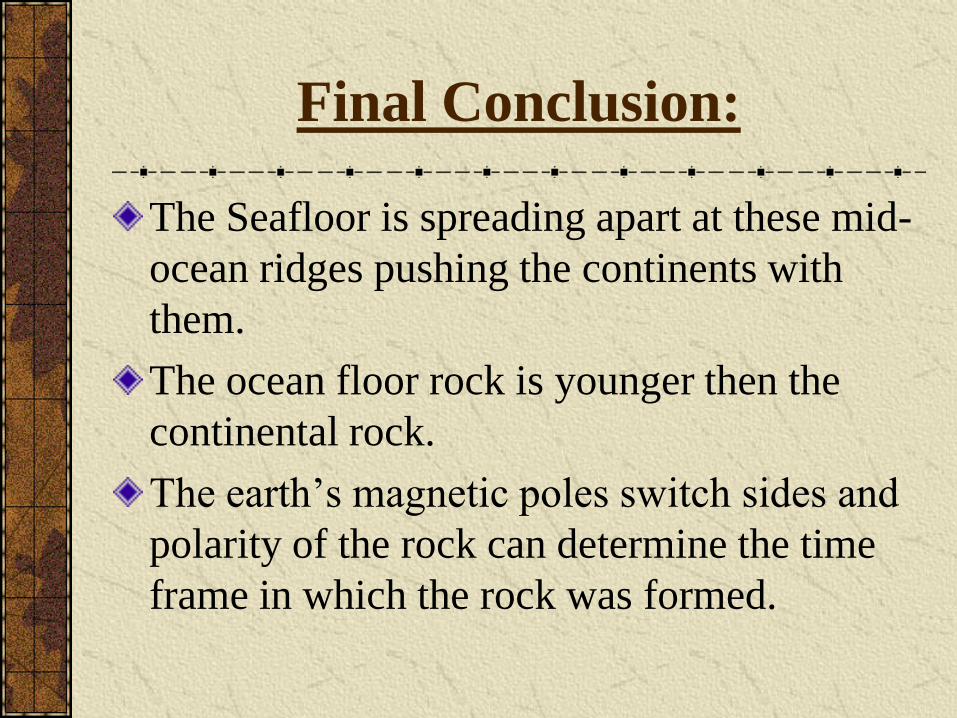
Final Conclusion:
The Seafloor is spreading apart at these mid-
ocean ridges pushing the continents with
them.
The ocean floor rock is younger then the
continental rock.
The earth‟s magnetic poles switch sides and
polarity of the rock can determine the time
frame in which the rock was formed.
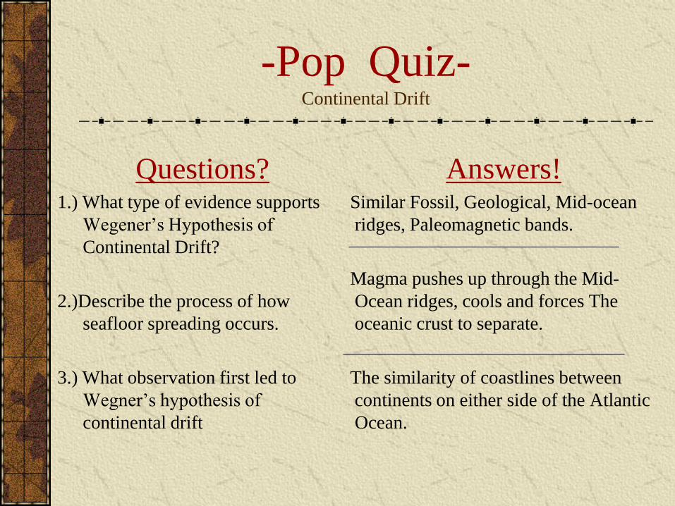
-Pop Quiz-Continental Drift
Questions?1.) What type of evidence supports
Wegener‟s Hypothesis of
Continental Drift?
2.)Describe the process of how
seafloor spreading occurs.
3.) What observation first led to
Wegner‟s hypothesis of
continental drift
Answers!Similar Fossil, Geological, Mid-ocean
ridges, Paleomagnetic bands.
Magma pushes up through the Mid-
Ocean ridges, cools and forces The
oceanic crust to separate.
The similarity of coastlines between
continents on either side of the Atlantic
Ocean.
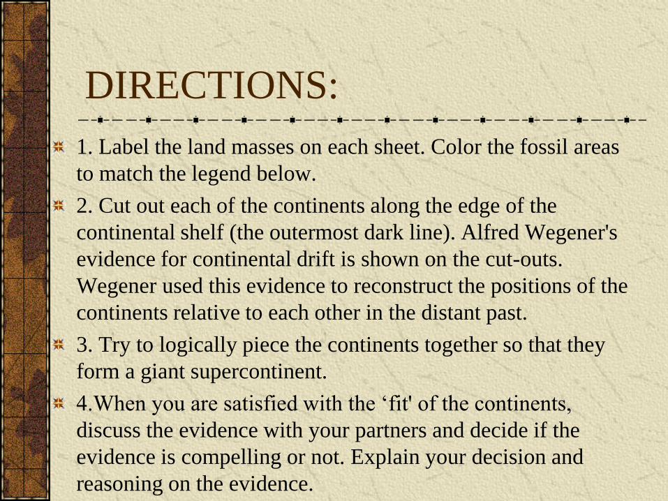
DIRECTIONS:
1. Label the land masses on each sheet. Color the fossil areas
to match the legend below.
2. Cut out each of the continents along the edge of the
continental shelf (the outermost dark line). Alfred Wegener's
evidence for continental drift is shown on the cut-outs.
Wegener used this evidence to reconstruct the positions of the
continents relative to each other in the distant past.
3. Try to logically piece the continents together so that they
form a giant supercontinent.
4.When you are satisfied with the „fit' of the continents,
discuss the evidence with your partners and decide if the
evidence is compelling or not. Explain your decision and
reasoning on the evidence.
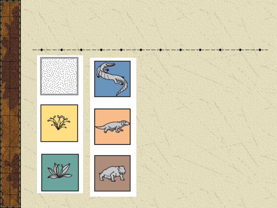
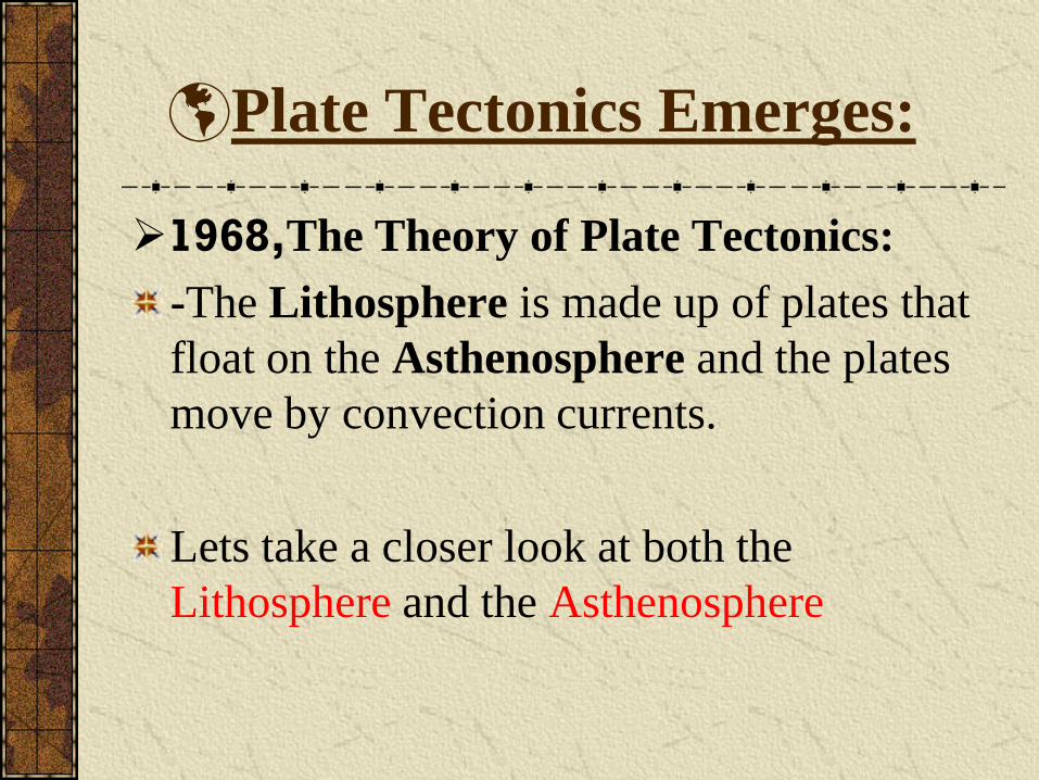
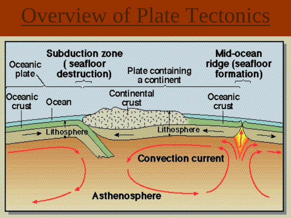
Plate Tectonics Emerges:
1968,The Theory of Plate Tectonics:
-The Lithosphere is made up of plates that
float on the Asthenosphere and the plates
move by convection currents.
Lets take a closer look at both the
Lithosphere and the Asthenosphere
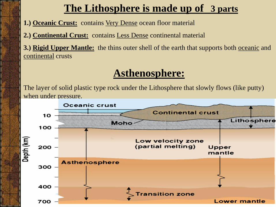
The Lithosphere is made up of 3 parts
1.) Oceanic Crust: contains Very Dense ocean floor material
2.) Continental Crust: contains Less Dense continental material
3.) Rigid Upper Mantle: the thins outer shell of the earth that supports both oceanic and
continental crusts
Asthenosphere:
The layer of solid plastic type rock under the Lithosphere that slowly flows (like putty)
when under pressure.
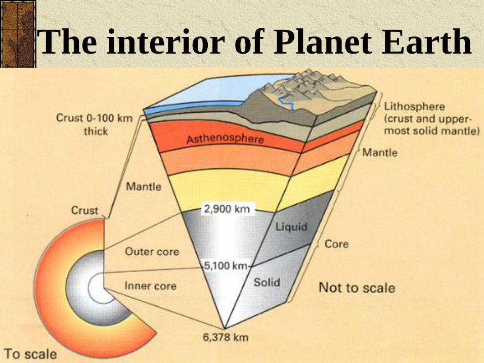
The interior of Planet Earth
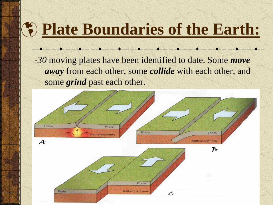
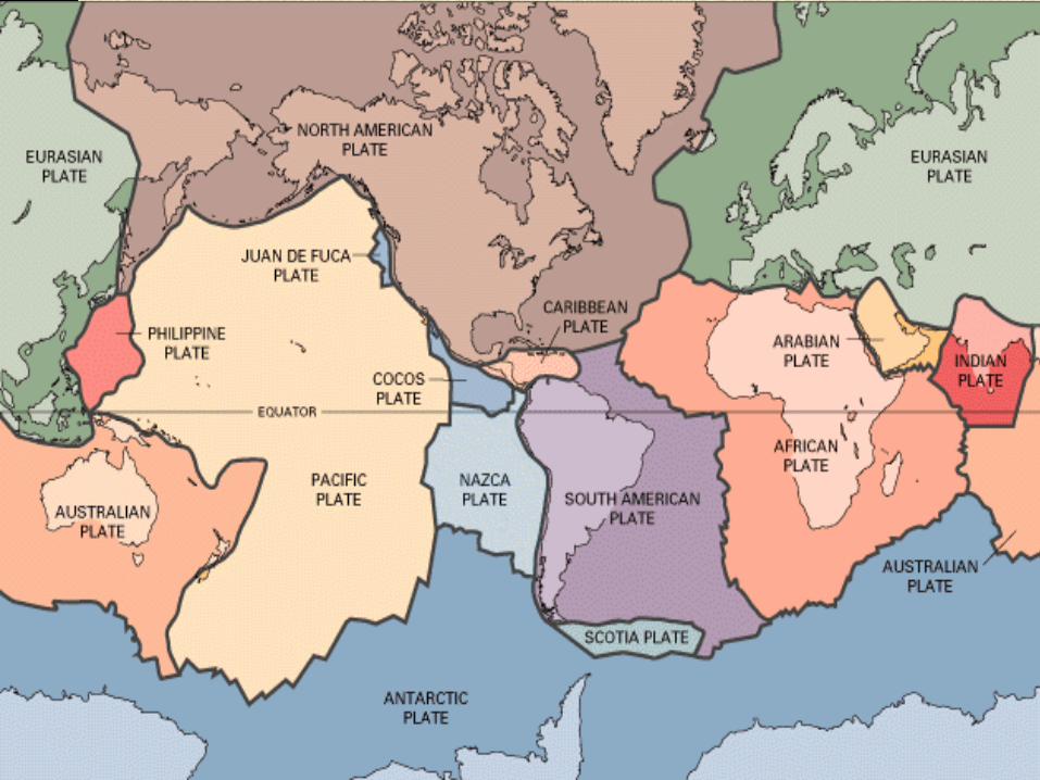
Plate Boundaries of the Earth:
-30 moving plates have been identified to date. Some move
away from each other, some collide with each other, and
some grind past each other.
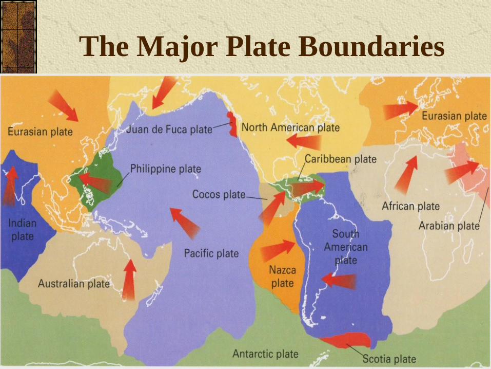
The Major Plate Boundaries
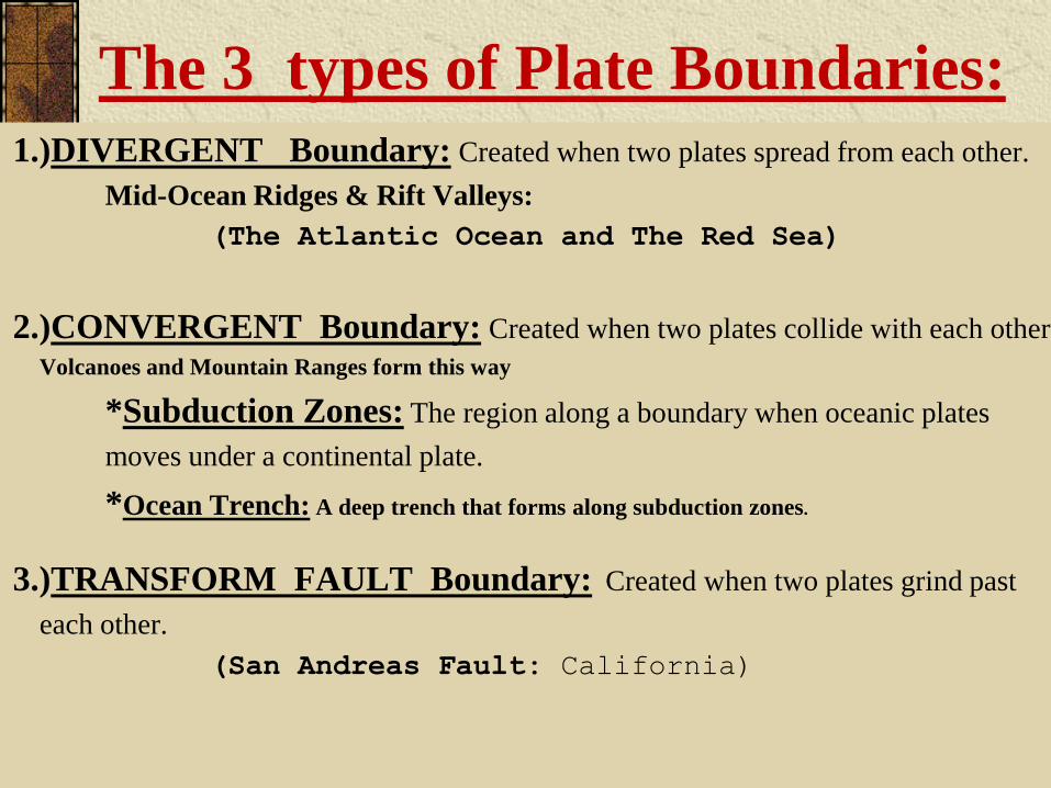
The 3 types of Plate Boundaries:
1.)DIVERGENT Boundary: Created when two plates spread from each other.
Mid-Ocean Ridges & Rift Valleys:
(The Atlantic Ocean and The Red Sea)
2.)CONVERGENT Boundary: Created when two plates collide with each other.
Volcanoes and Mountain Ranges form this way
*Subduction Zones: The region along a boundary when oceanic plates
moves under a continental plate.
*Ocean Trench: A deep trench that forms along subduction zones.
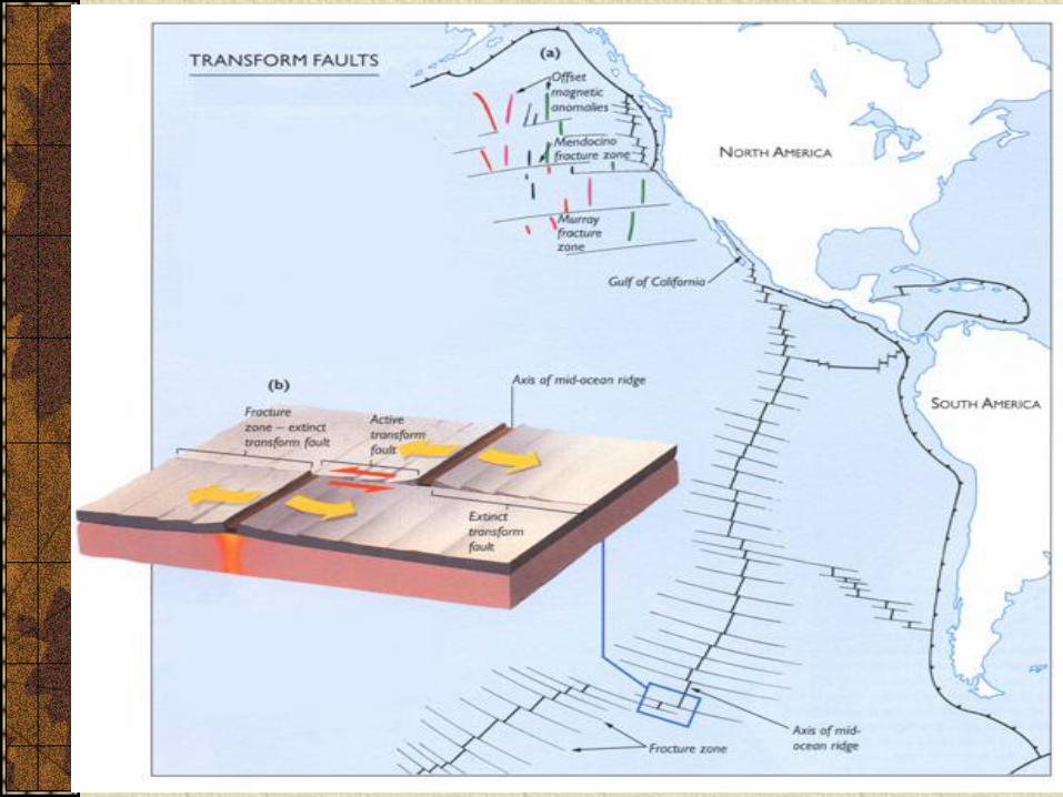
3.)TRANSFORM FAULT Boundary: Created when two plates grind past
each other.
(San Andreas Fault: California)
Divergent
plate boundaries
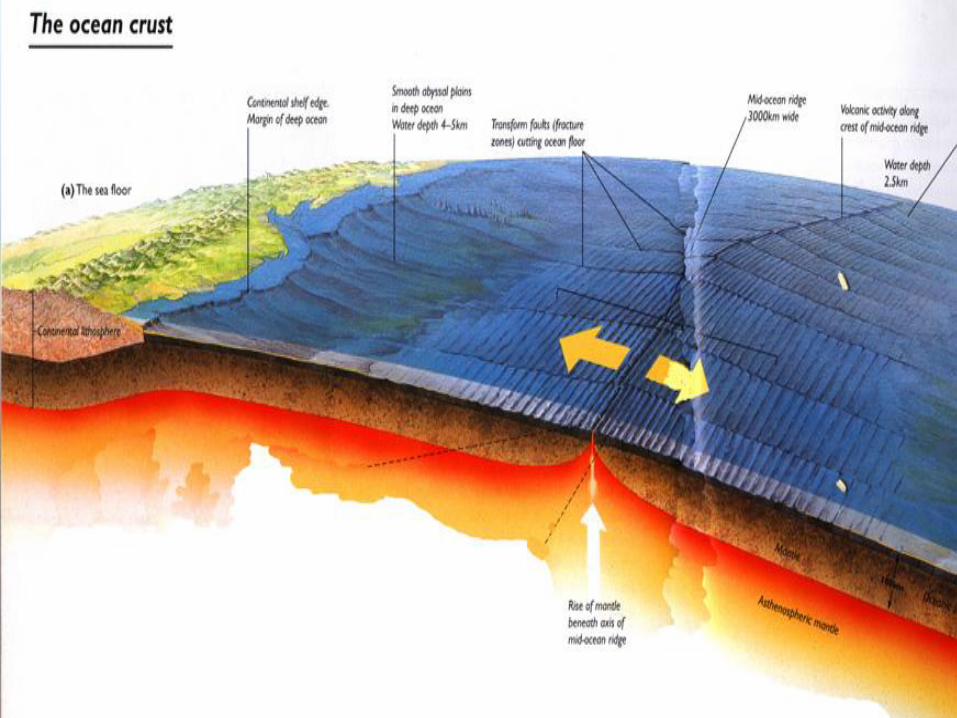
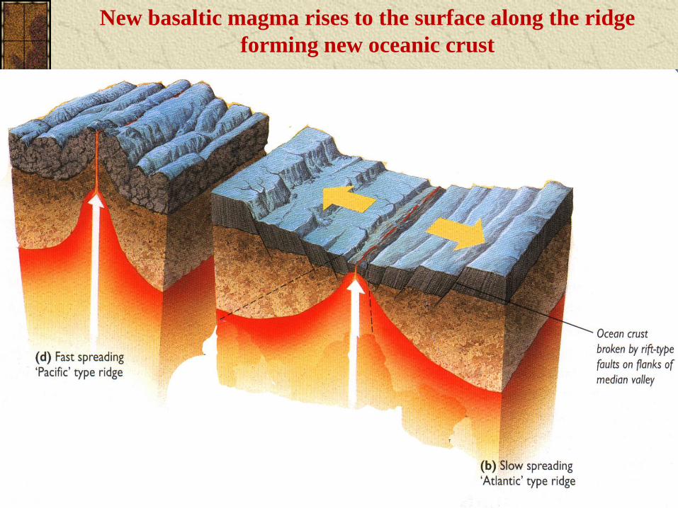
New basaltic magma rises to the surface along the ridge
forming new oceanic crust
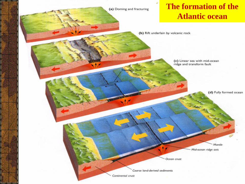
The formation of the
Atlantic ocean
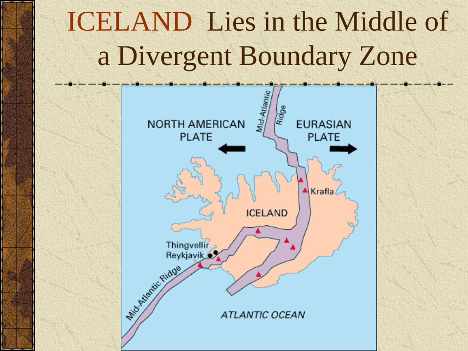
ICELAND Lies in the Middle of
a Divergent Boundary Zone
Convergentplate boundaries
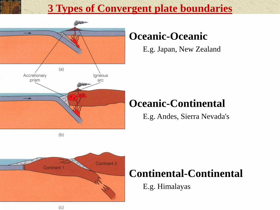
Oceanic-OceanicE.g. Japan, New Zealand
Oceanic-ContinentalE.g. Andes, Sierra Nevada's
Continental-ContinentalE.g. Himalayas
3 Types of Convergent plate boundaries
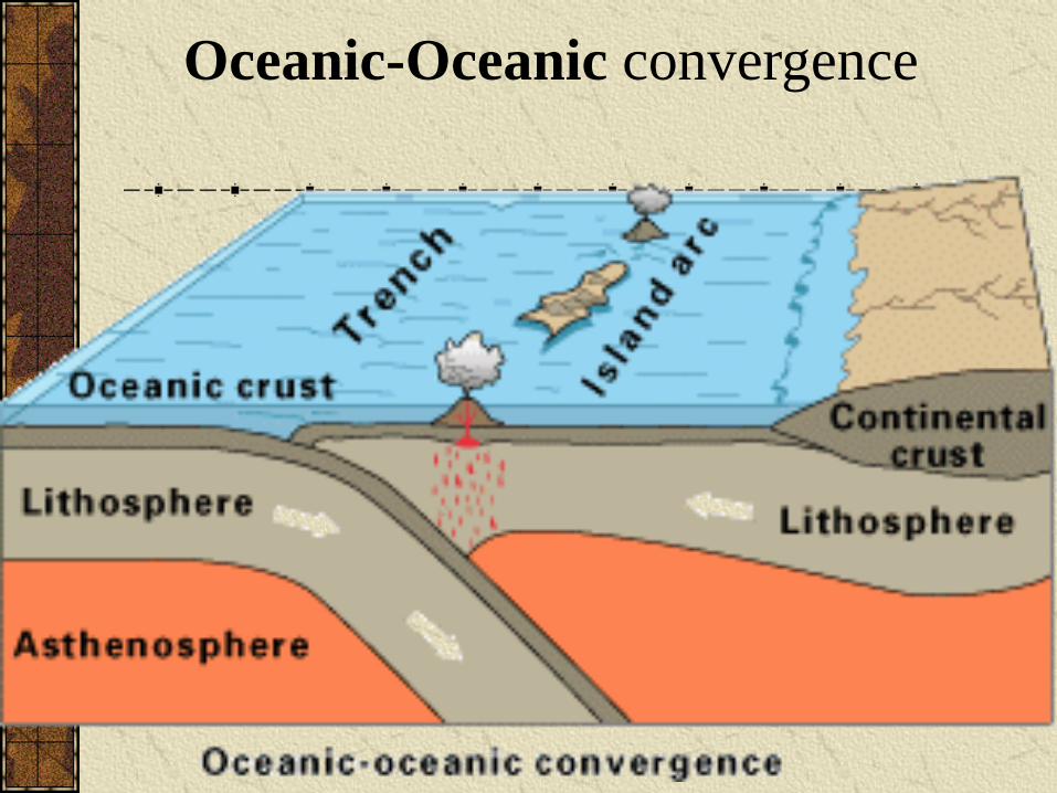
Oceanic-Oceanic convergence
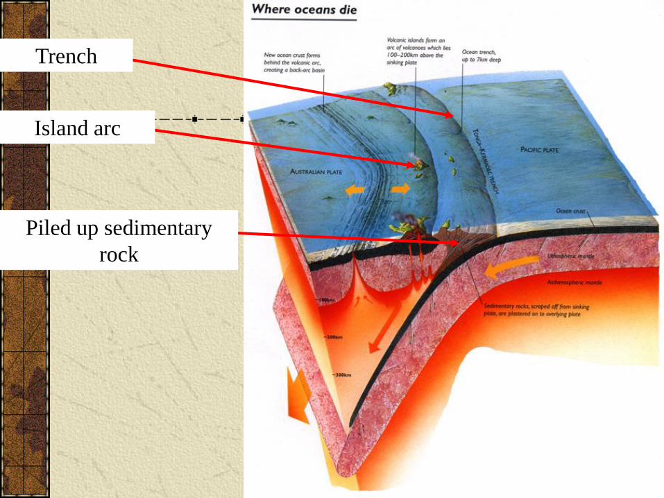
Island arc
Piled up sedimentary
rock
Trench
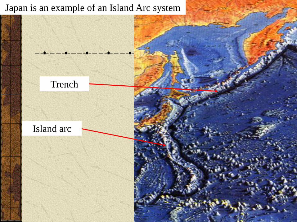
Japan is an example of an Island Arc system
Trench
Island arc
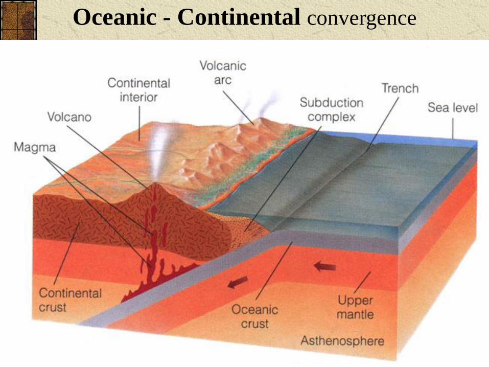
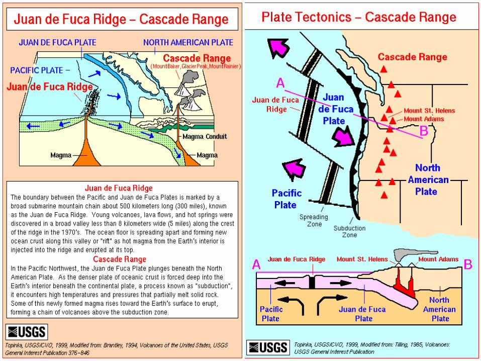
Oceanic - Continental convergence
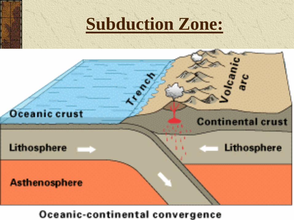
Subduction Zone:
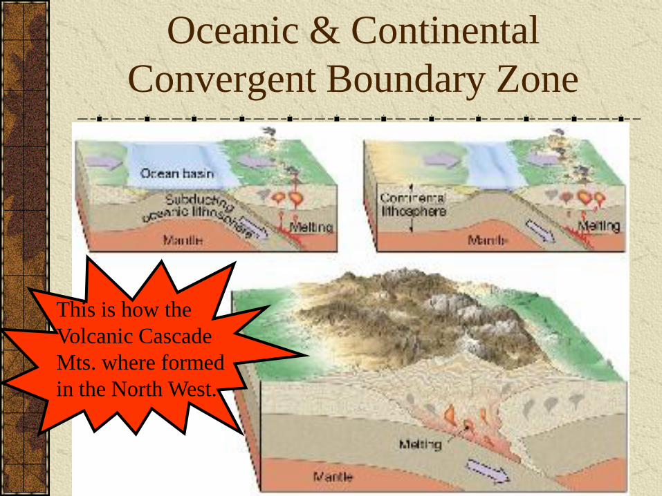
Oceanic & Continental
Convergent Boundary Zone
This is how the
Volcanic Cascade
Mts. where formed
in the North West.
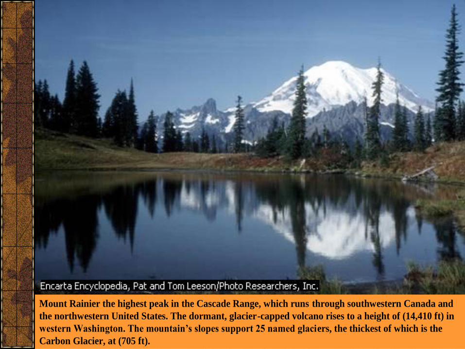
Mount Rainier the highest peak in the Cascade Range, which runs through southwestern Canada and
the northwestern United States. The dormant, glacier-capped volcano rises to a height of (14,410 ft) in
western Washington. The mountain’s slopes support 25 named glaciers, the thickest of which is the
Carbon Glacier, at (705 ft).

The bathyscaph, designed by Belgian scientist Auguste Piccard (1884-1962), was
not suspended from a surface vessel but rather attached to a free-floating tank.
(The tank was filled with petroleum liquid, which is lighter than water and hence
buoyant.) Piccard's first bathyscaph, the FNRS-2, was referred to as the
"submarine balloon" because its heavy-metal ballast, attached by
electromagnets, allowed it to sink to a desired depth when engaged and rise to
the surface when released. It had greater maneuverability than the bathysphere,
though it did not fare well in tests. Piccard and his son Jacques later designed
and built a new bathyscaph, the Trieste. In 1953, they descended in it to a depth
of 10,330 feet in the Mediterranean. The Piccards sold the Trieste to the U.S.
Navy in 1958. On January 23, 1960, the Trieste set a new world record of
35,800 feet when it touched bottom in the Marianas Trench near Guam.
The History of the Bathyscaph
Finding the Deepest place on Earth!
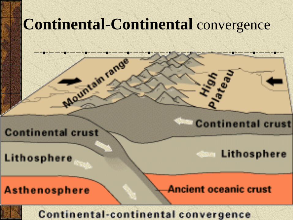
Continental-Continental convergence
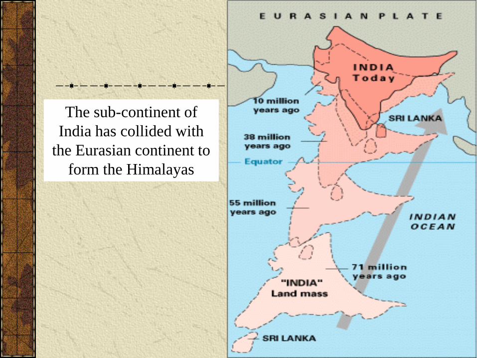
The sub-continent of
India has collided with
the Eurasian continent to
form the Himalayas
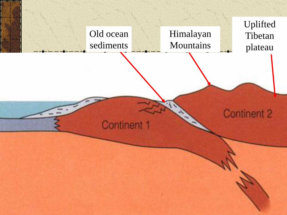
Old ocean
sediments
Uplifted
Tibetan
plateau
Himalayan
Mountains
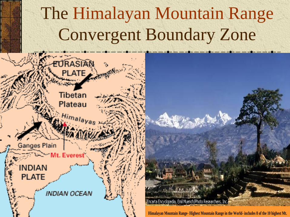
The Himalayan Mountain Range
Convergent Boundary Zone
Himalayan Mountain Range- Highest Mountain Range in the World- includes 8 of the 10 highest Mt.
Transformplate boundaries
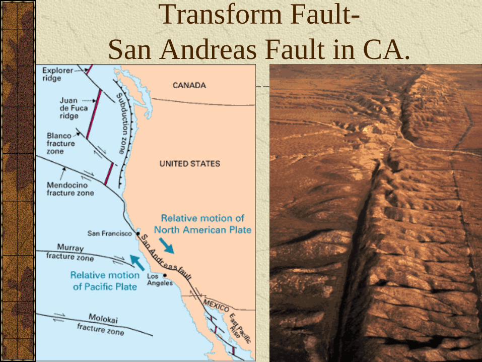
Transform Fault-
San Andreas Fault in CA.
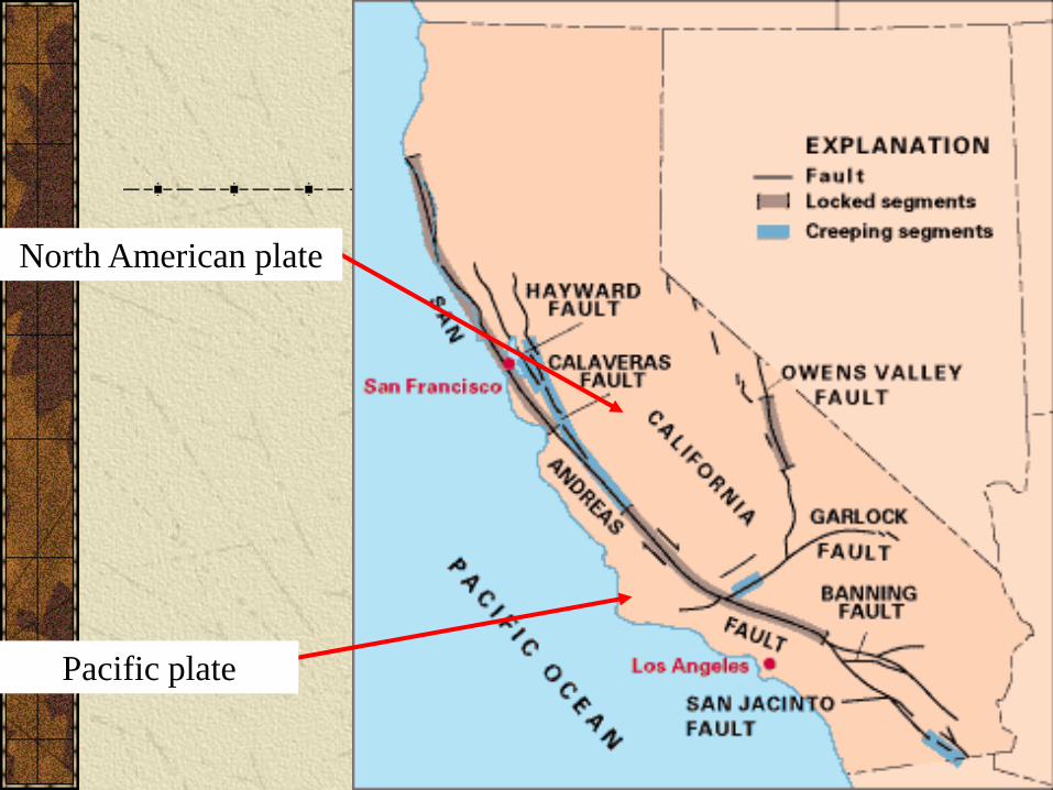
North American plate
Pacific plate
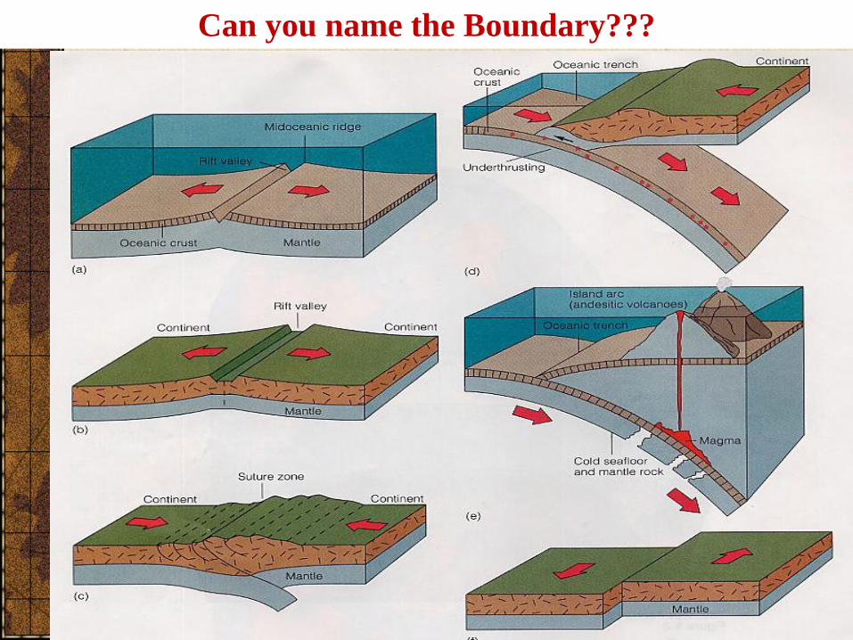
Can you name the Boundary???
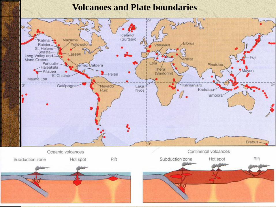
Volcanoes and Plate boundaries
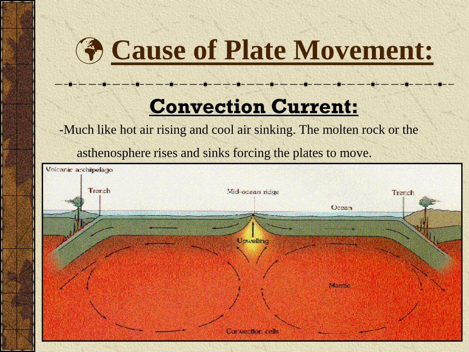
Cause of Plate Movement:
Convection Current:-Much like hot air rising and cool air sinking. The molten rock or the
asthenosphere rises and sinks forcing the plates to move.
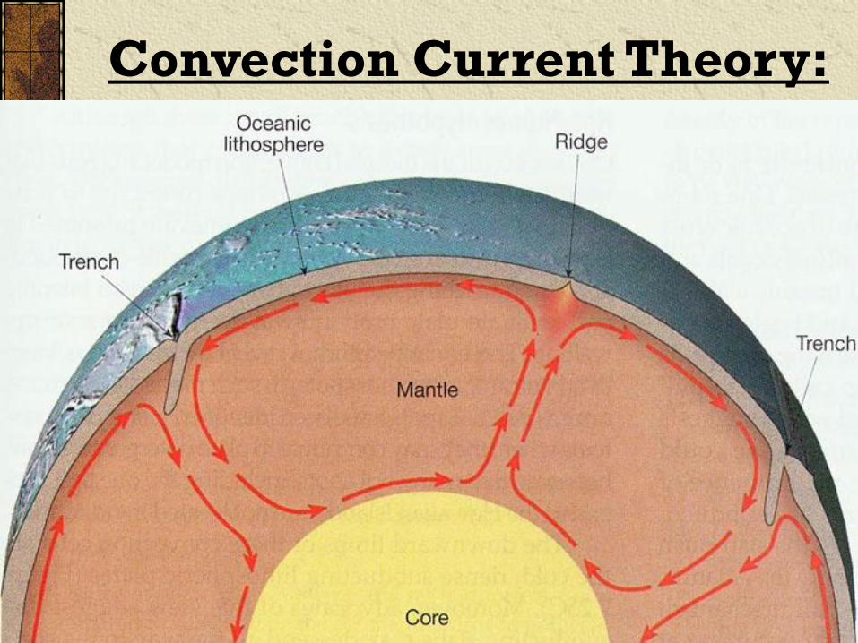
Convection Current Theory:
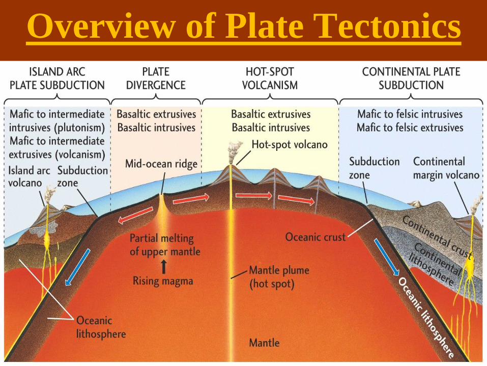
Overview of Plate Tectonics

Overview of Plate Tectonics
Overview of Plate Tectonics
http://www.ucmp.berkeley.edu/geology/tecall1_4.mov
http://www.ucmp.berkeley.edu/geology/anim3.html
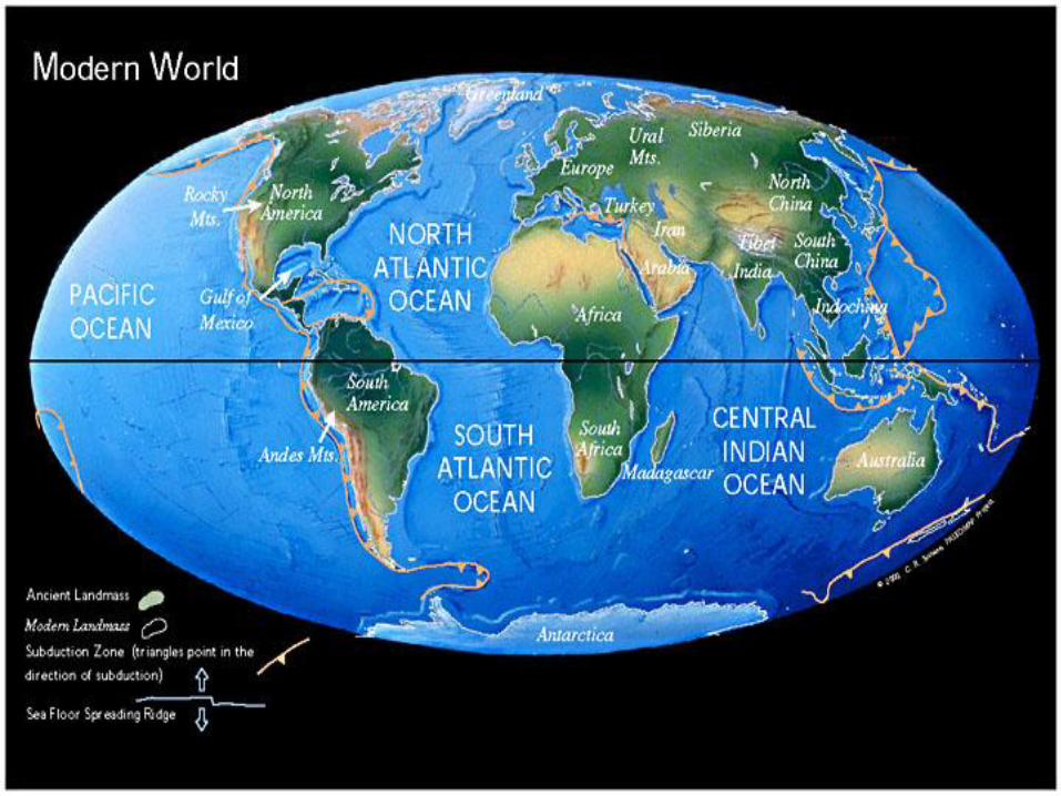
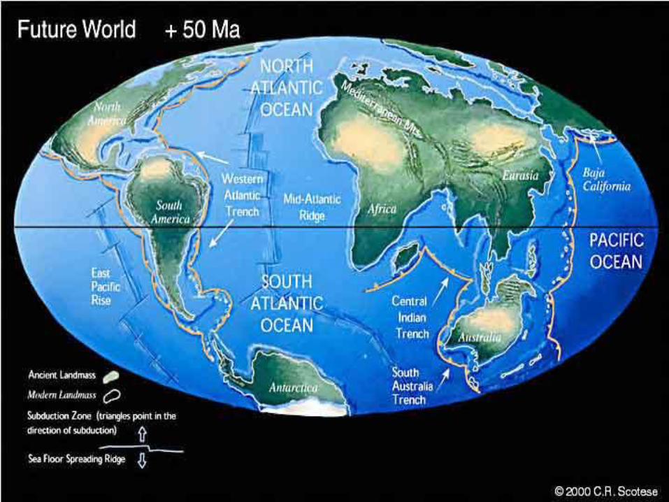
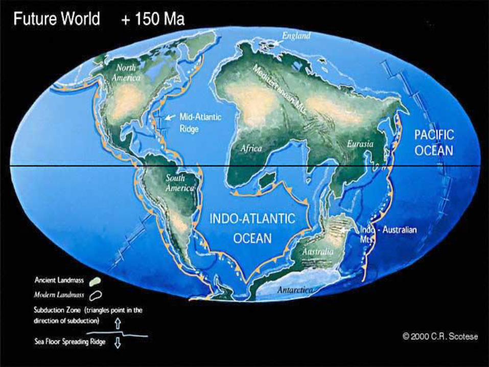
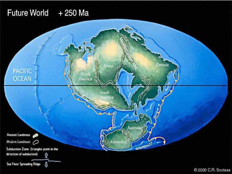
Are the Plates Still
Moving?
Lets take a look as to what
the Future may hold.
Related Documents