THE BYZANTINE/EARLY ISLAMIC SITE OF KHIRBAT SHUWAYKA IN PALESTINE (THE MONASTERY OF THE PROPHET SAMUEL?) ROBERT HOYLAND * Résumé : Cet article décrit les résultats des fouilles de l’Université d’al-Quds sur le site de Khirbat al-Shuwayka, qui se trouve très près du site de l’âge du fer de Tell en-Nasbeh, la capitale de Judée du Nord, et sur la route ancienne qui relie Nablus et Jérusalem, à seulement 12 km au nord de celle-ci. Les fouilles ont révélé une église, une installation pour fabriquer le vin, un complexe de pièces et un assemblage d’objets qui datent des V e et VI e siècles. L’interprétation la plus vraisemblable est qu’il y avait ici un monastère. La question s’est posée de savoir s’il s’agissait du monastère byzantin de Samuel, dont parle Procope, mais des fouilles récentes à Nabi Samwil ont montré de manière définitive que c’était en cet endroit que se trouvait le monastère de Samuel. Le site eut sa période de floraison aux VI e -VII e siècles avant d’être abandonné et réoccupé, mais seulement comme un complexe domestique, à l’époque abbasside (VIII e -X e siècles), sans que la chronologie soit encore très claire. An interim report on this very interesting site, just south of Ramallah on the main Jerusalem-Nablus road, was published by myself, Professor Marwan Abu Khalaf and Drs Salah al-Hudaliyya and Ibrahim Abu ʿAmar of al-Quds University in the web journal of Centro Telematico di Ateneo, Università degli Studi di Napoli ‘L’Orientale’ (2006). 1 This report focused on the results of the 2003 season excavations which revealed a church, some sort of residential area and a substantial wine-making installation at the site. Since this journal, although highly accessible, is not very well known to scholars, I would like here to draw further attention to this fascinating site and also to aspects of it not noted in the aforementioned publication. I. ARCHAEOLOGICAL WORK CONDUCTED AT KHIRBAT SHUWAYKA Some archaeological prospection was carried out at Khirbat Shuwayka as part of the 1920/30s American exca- vations of the nearby Iron Age site of Tell en-Nasbeh (visible in figure 15) and this revealed the presence of Roman and Byzantine tombs and also the mosaic floor of a Byzantine church. 2 And in the 1980s the Israel Antiquities * I am very grateful to the Carnegie Trust for the Universities of Scotland for a grant that allowed me to revisit the site of Khirbat Shuwayka in the summer of 2005 in order to write up this article. 1. http://www.webjournal.unior.it/Dati/18/55/3.%20Palestina,%20 Abu%20Khalaf.pdf 2. C. C. McCown, Tell en-Nesbeh, Berkeley and New Haven, 1947, vol. 1, p. 8-9, 54, 109-28. C. R. Conder and H. H. Kitchener, Survey of Western Palestine, London, 1882-88, vol. 3, p. 126 (map: sheet 17 ms), noted the existence there of “walls, foundations and heaps of stones; pieces of tessellated pavement”. Authority conducted a survey which found evidence of “terraces, traces of monumental building with columns, arcosolia, burial cave, cisterns” and produced the following breakdown of surface sherds: “Hellenistic – 9%, Roman – 8%, Byzantine – 79%, Early Islamic – 4%”. 3 But no real work was done until 1996 when small-scale excavations were undertaken by the Institute of Islamic Archaeology (al-Quds University) under the direction of Professor Marwan Abu Khalaf which ascertained the importance of the site in Byzantine and early Islamic times. The site proved useful as a practice dig for the students enrolled in the Masters of Archaeology course at al-Quds University and in this capacity it has continued in use until today. 4 The Palestinian excavators of Khirbat Shuwayka have focused on a core area, which is about 100 m east-west by 75 m north-south, bounded on the north, east and west by modern streets and on the south by modern houses (figure 1). The area had been substantially cleared for agri- culture, and the three very large rock piles visible on the site were the result of that clearance. The ancient site was very likely much more extensive, but modern houses built on the east, south and west sides preclude further investiga- tion. To the north there is still an open area, and there are 3. I. Finkelstein and Y. Magen, Archaeological survey of the hill country of Benjamin, Jerusalem, 1993, no. 174. 4. The results of their excavations in 1996-97 were summarized in a short private publication (by Marwan Abu Khalaf, Hani Nur Eddine, and Robert Schick, Khirbat Shuwayka, preliminary report: summer 1996 and summer 1997 excavations, Jerusalem, 1998 [Institute of Islamic Archaeology, al-Quds University]), but nothing was published of the 1998-2001 seasons (no excavation took place in 2002 due to the political situation).

Welcome message from author
This document is posted to help you gain knowledge. Please leave a comment to let me know what you think about it! Share it to your friends and learn new things together.
Transcript
The ByzanTine/early islamic siTe of KhirBaT shuwayKa in PalesTine
(The monasTery of The ProPheT samuel?)
RobeRt Hoyland*
Résumé : Cet article décrit les résultats des fouilles de l’Université d’al-Quds sur le site de Khirbat al-Shuwayka, qui se trouve très près du site de l’âge du fer de Tell en-Nasbeh, la capitale de Judée du Nord, et sur la route ancienne qui relie Nablus et Jérusalem, à seulement 12 km au nord de celle-ci. Les fouilles ont révélé une église, une installation pour fabriquer le vin, un complexe de pièces et un assemblage d’objets qui datent des ve et vie siècles. L’interprétation la plus vraisemblable est qu’il y avait ici un monastère. La question s’est posée de savoir s’il s’agissait du monastère byzantin de Samuel, dont parle Procope, mais des fouilles récentes à Nabi Samwil ont montré de manière définitive que c’était en cet endroit que se trouvait le monastère de Samuel. Le site eut sa période de floraison aux vie-viie siècles avant d’être abandonné et réoccupé, mais seulement comme un complexe domestique, à l’époque abbasside (viiie-xe siècles), sans que la chronologie soit encore très claire.
An interim report on this very interesting site, just south of Ramallah on the main Jerusalem-Nablus road, was published by myself, Professor Marwan Abu Khalaf and Drs Salah al-Hudaliyya and Ibrahim Abu ʿAmar of al-Quds University in the web journal of Centro Telematico di Ateneo, Università degli Studi di Napoli ‘L’Orientale’ (2006).1 This report focused on the results of the 2003 season excavations which revealed a church, some sort of residential area and a substantial wine-making installation at the site. Since this journal, although highly accessible, is not very well known to scholars, I would like here to draw further attention to this fascinating site and also to aspects of it not noted in the aforementioned publication.
I. aRcHaeologIcal woRk conducted at kHIRbat SHuwayka
Some archaeological prospection was carried out at Khirbat Shuwayka as part of the 1920/30s American exca-vations of the nearby Iron Age site of Tell en-Nasbeh (visible in figure 15) and this revealed the presence of Roman and Byzantine tombs and also the mosaic floor of a Byzantine church.2 And in the 1980s the Israel Antiquities
* I am very grateful to the Carnegie Trust for the Universities of Scotland for a grant that allowed me to revisit the site of Khirbat Shuwayka in the summer of 2005 in order to write up this article.
1. http://www.webjournal.unior.it/Dati/18/55/3.%20Palestina,%20Abu%20Khalaf.pdf
2. C. C. McCown, Tell en-Nesbeh, Berkeley and New Haven, 1947, vol. 1, p. 8-9, 54, 109-28. C. R. Conder and H. H. Kitchener, Survey of Western Palestine, London, 1882-88, vol. 3, p. 126 (map: sheet 17 ms), noted the existence there of “walls, foundations and heaps of stones; pieces of tessellated pavement”.
Authority conducted a survey which found evidence of “terraces, traces of monumental building with columns, arcosolia, burial cave, cisterns” and produced the following breakdown of surface sherds: “Hellenistic – 9%, Roman – 8%, Byzantine – 79%, Early Islamic – 4%”.3 But no real work was done until 1996 when small-scale excavations were undertaken by the Institute of Islamic Archaeology (al-Quds University) under the direction of Professor Marwan Abu Khalaf which ascertained the importance of the site in Byzantine and early Islamic times. The site proved useful as a practice dig for the students enrolled in the Masters of Archaeology course at al-Quds University and in this capacity it has continued in use until today.4
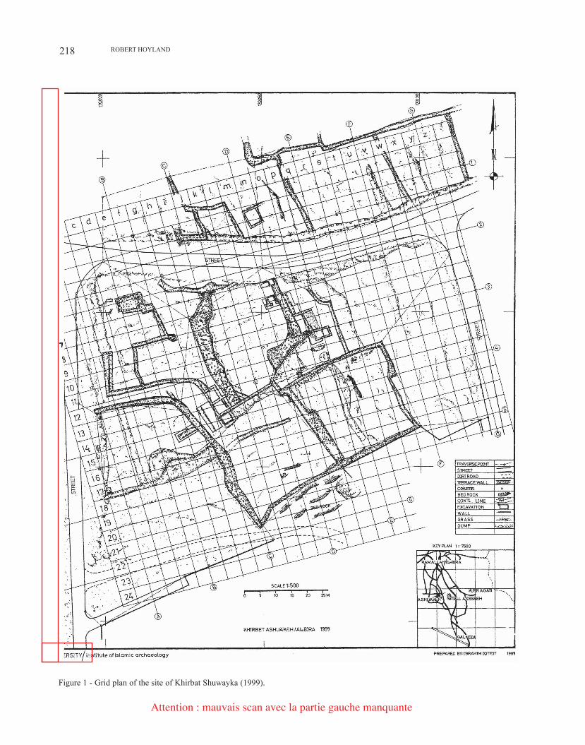
The Palestinian excavators of Khirbat Shuwayka have focused on a core area, which is about 100 m east-west by 75 m north-south, bounded on the north, east and west by modern streets and on the south by modern houses (figure 1). The area had been substantially cleared for agri-culture, and the three very large rock piles visible on the site were the result of that clearance. The ancient site was very likely much more extensive, but modern houses built on the east, south and west sides preclude further investiga-tion. To the north there is still an open area, and there are
3. I. Finkelstein and Y. Magen, Archaeological survey of the hill country of Benjamin, Jerusalem, 1993, no. 174.
4. The results of their excavations in 1996-97 were summarized in a short private publication (by Marwan Abu Khalaf, Hani Nur Eddine, and Robert Schick, Khirbat Shuwayka, preliminary report: summer 1996 and summer 1997 excavations, Jerusalem, 1998 [Institute of Islamic Archaeology, al-Quds University]), but nothing was published of the 1998-2001 seasons (no excavation took place in 2002 due to the political situation).
RoBERT HoylAND218
Figure 1 - Grid plan of the site of Khirbat Shuwayka (1999).
Attention : mauvais scan avec la partie gauche manquante
219THE ByzANTINE/EARly ISlAMIC SITE of KHIRBAT SHUwAyKA IN PAlESTINE
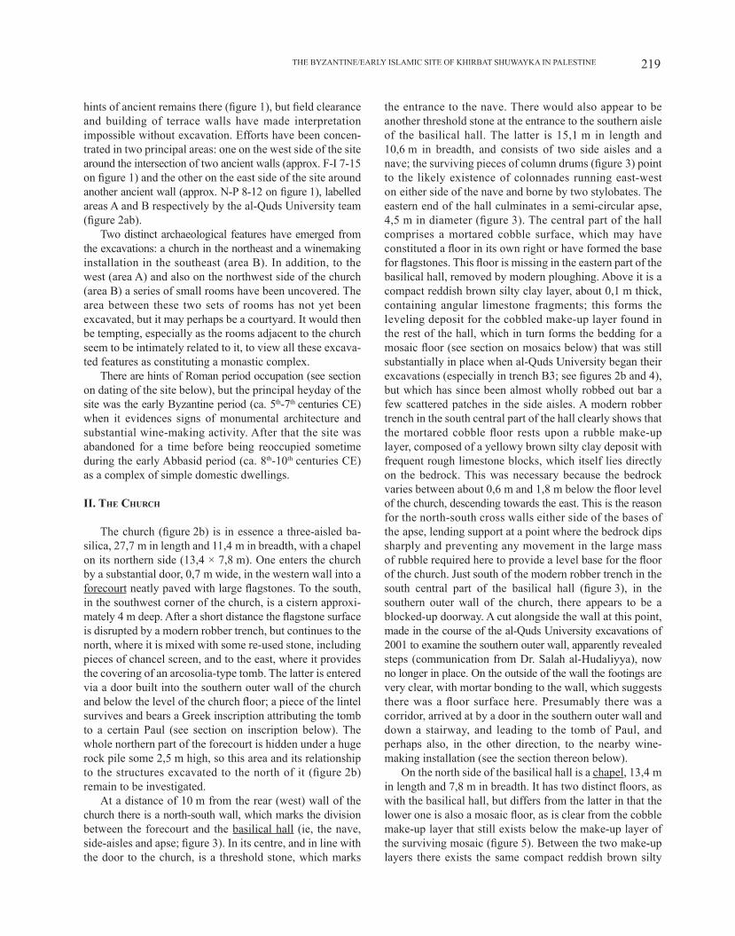
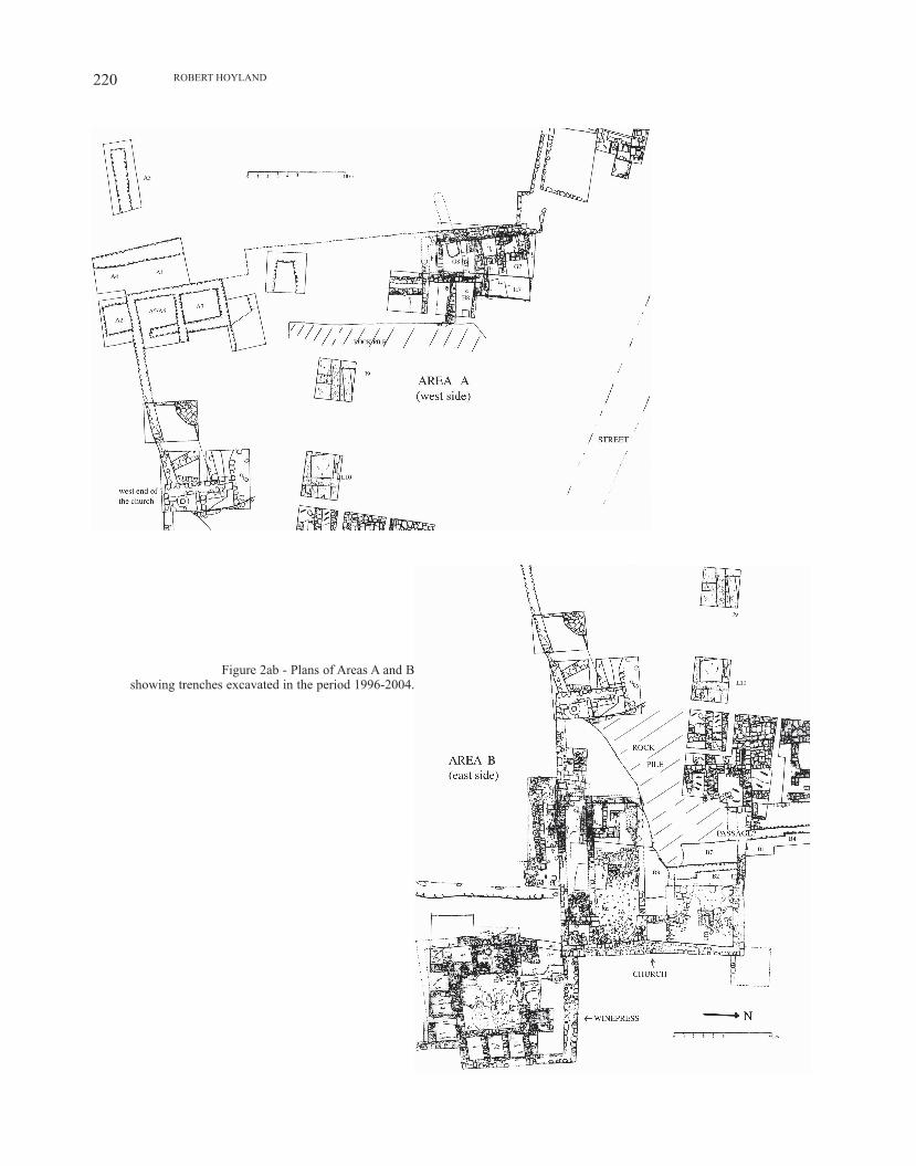
hints of ancient remains there (figure 1), but field clearance and building of terrace walls have made interpretation impossible without excavation. Efforts have been concen-trated in two principal areas: one on the west side of the site around the intersection of two ancient walls (approx. f-I 7-15 on figure 1) and the other on the east side of the site around another ancient wall (approx. N-P 8-12 on figure 1), labelled areas A and B respectively by the al-Quds University team (figure 2ab).
Two distinct archaeological features have emerged from the excavations: a church in the northeast and a winemaking installation in the southeast (area B). In addition, to the west (area A) and also on the northwest side of the church (area B) a series of small rooms have been uncovered. The area between these two sets of rooms has not yet been excavated, but it may perhaps be a courtyard. It would then be tempting, especially as the rooms adjacent to the church seem to be intimately related to it, to view all these excava-ted features as constituting a monastic complex.
There are hints of Roman period occupation (see section on dating of the site below), but the principal heyday of the site was the early Byzantine period (ca. 5th-7th centuries CE) when it evidences signs of monumental architecture and substantial wine-making activity. After that the site was abandoned for a time before being reoccupied sometime during the early Abbasid period (ca. 8th-10th centuries CE) as a complex of simple domestic dwellings.
II. tHe cHuRcH
The church (figure 2b) is in essence a three-aisled ba-silica, 27,7 m in length and 11,4 m in breadth, with a chapel on its northern side (13,4 × 7,8 m). One enters the church by a substantial door, 0,7 m wide, in the western wall into a forecourt neatly paved with large flagstones. To the south, in the southwest corner of the church, is a cistern approxi-mately 4 m deep. After a short distance the flagstone surface is disrupted by a modern robber trench, but continues to the north, where it is mixed with some re-used stone, including pieces of chancel screen, and to the east, where it provides the covering of an arcosolia-type tomb. The latter is entered via a door built into the southern outer wall of the church and below the level of the church floor; a piece of the lintel survives and bears a Greek inscription attributing the tomb to a certain Paul (see section on inscription below). The whole northern part of the forecourt is hidden under a huge rock pile some 2,5 m high, so this area and its relationship to the structures excavated to the north of it (figure 2b) remain to be investigated.
At a distance of 10 m from the rear (west) wall of the church there is a north-south wall, which marks the division between the forecourt and the basilical hall (ie, the nave, side-aisles and apse; figure 3). In its centre, and in line with the door to the church, is a threshold stone, which marks
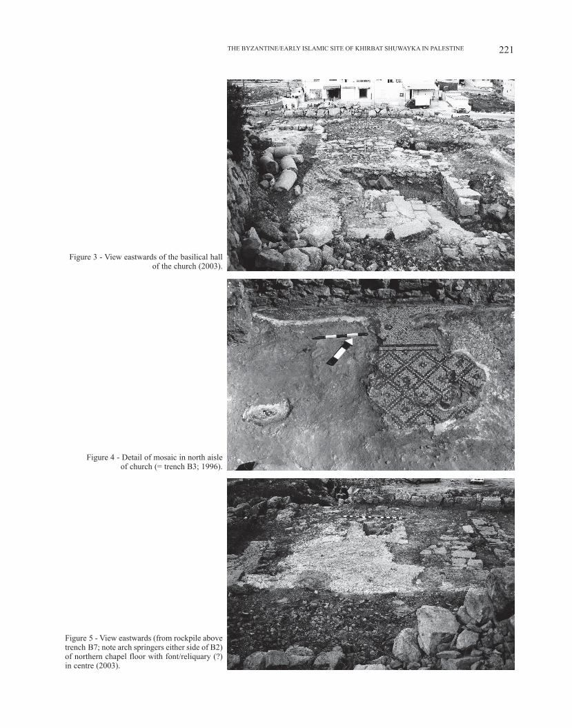
the entrance to the nave. There would also appear to be another threshold stone at the entrance to the southern aisle of the basilical hall. The latter is 15,1 m in length and 10,6 m in breadth, and consists of two side aisles and a nave; the surviving pieces of column drums (figure 3) point to the likely existence of colonnades running east-west on either side of the nave and borne by two stylobates. The eastern end of the hall culminates in a semi-circular apse, 4,5 m in diameter (figure 3). The central part of the hall comprises a mortared cobble surface, which may have constituted a floor in its own right or have formed the base for flagstones. This floor is missing in the eastern part of the basilical hall, removed by modern ploughing. Above it is a compact reddish brown silty clay layer, about 0,1 m thick, containing angular limestone fragments; this forms the leveling deposit for the cobbled make-up layer found in the rest of the hall, which in turn forms the bedding for a mosaic floor (see section on mosaics below) that was still substantially in place when al-Quds University began their excavations (especially in trench B3; see figures 2b and 4), but which has since been almost wholly robbed out bar a few scattered patches in the side aisles. A modern robber trench in the south central part of the hall clearly shows that the mortared cobble floor rests upon a rubble make-up layer, composed of a yellowy brown silty clay deposit with frequent rough limestone blocks, which itself lies directly on the bedrock. This was necessary because the bedrock varies between about 0,6 m and 1,8 m below the floor level of the church, descending towards the east. This is the reason for the north-south cross walls either side of the bases of the apse, lending support at a point where the bedrock dips sharply and preventing any movement in the large mass of rubble required here to provide a level base for the floor of the church. Just south of the modern robber trench in the south central part of the basilical hall (figure 3), in the southern outer wall of the church, there appears to be a blocked-up doorway. A cut alongside the wall at this point, made in the course of the al-Quds University excavations of 2001 to examine the southern outer wall, apparently revealed steps (communication from Dr. Salah al-Hudaliyya), now no longer in place. On the outside of the wall the footings are very clear, with mortar bonding to the wall, which suggests there was a floor surface here. Presumably there was a corridor, arrived at by a door in the southern outer wall and down a stairway, and leading to the tomb of Paul, and perhaps also, in the other direction, to the nearby wine-making installation (see the section thereon below).
On the north side of the basilical hall is a chapel, 13,4 m in length and 7,8 m in breadth. It has two distinct floors, as with the basilical hall, but differs from the latter in that the lower one is also a mosaic floor, as is clear from the cobble make-up layer that still exists below the make-up layer of the surviving mosaic (figure 5). Between the two make-up layers there exists the same compact reddish brown silty
RoBERT HoylAND220
Figure 2ab - Plans of Areas A and B showing trenches excavated in the period 1996-2004.
221THE ByzANTINE/EARly ISlAMIC SITE of KHIRBAT SHUwAyKA IN PAlESTINE
Figure 3 - View eastwards of the basilical hall of the church (2003).
Figure 4 - Detail of mosaic in north aisle of church (= trench B3; 1996).
figure 5 - View eastwards (from rockpile above trench B7; note arch springers either side of B2) of northern chapel floor with font/reliquary (?) in centre (2003).
RoBERT HoylAND222
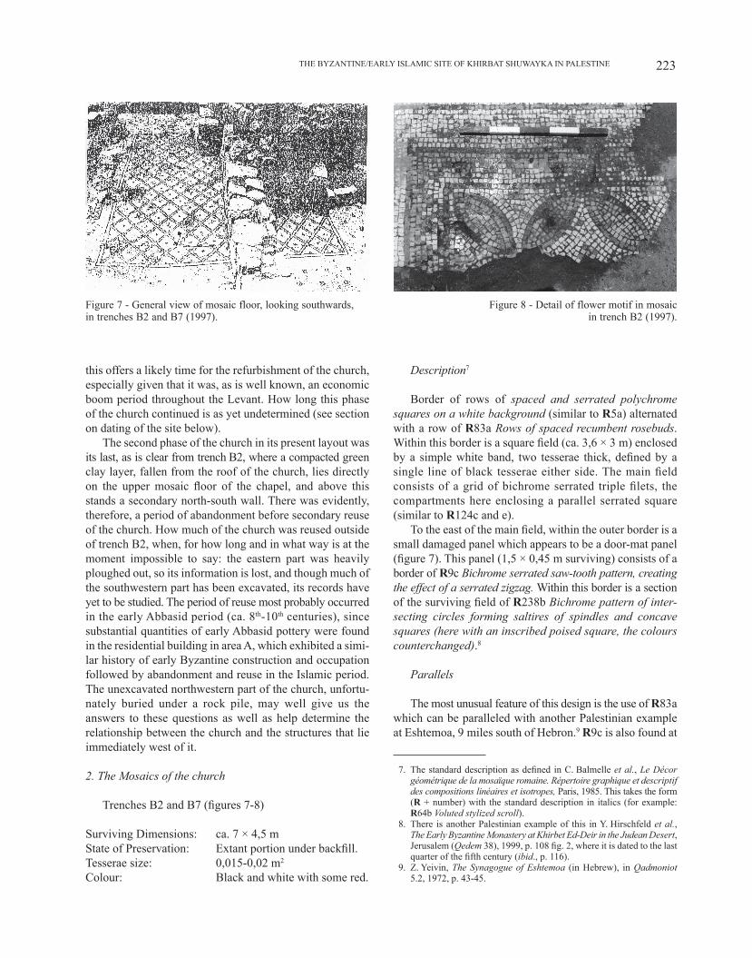
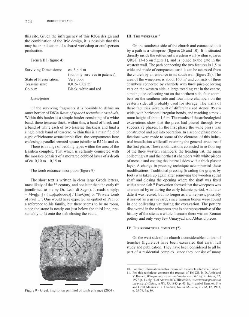
clay deposit as is found in the basilical hall, presumably having the same function, namely to act as a leveling deposit. The upper mosaic is still intact in trenches B2 and B7 (figures 7-8); elsewhere in the chapel modern ploughing – its marks clearly visible on the make-up layer – has destroyed the mosaic and only small patches and loose tesserae remain, mostly blue, red and white in colour. On the eastern edge of trench B2 are evenly spaced pillar bases (figure 5), and in the centre of the part of the chapel east of this is a square limestone-block installation (1,6 × 1,6 m) with a projecting ceramic pipe at the northeast corner (figure 5). This is most probably either a font or a reliquary, and the pipe the conduit either for water or for holy oil (leading down to a saint’s relics housed there). In the north-west corner of the chapel (in the west wall of trench B7) there appears to be a blocked-up doorway, which would then have led through to the rooms behind it that were exca-vated by al-Quds University in previous seasons (figures 2b and 15). If this is so, then it is likely that the church was part of a monastic complex, and this idea receives additional support from the proximity of a substantial wine-making installation (see section thereon below).
1. The phasing of the church
In brief, we can say that there are three phases to con-struction on this site:Phase 1: either a smaller church or a different building
together;Phase 2: construction of the church according to the layout
that we see now;Phase 3: refurbishment of the church, especially the laying
of a new mosaic floor.
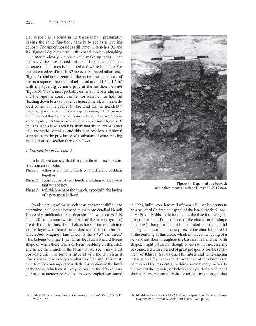
Precise dating of the church is as yet rather difficult to determine. As I have discussed in the more detailed Napoli University publication, the deposits below mosaics L19 and l20 in the southwestern end of the nave (figure 6) are different to those found elsewhere in the church and in this layer were found some sherds of rilled-rim basins, which Jodi Magness has dated to the 3rd-5th centuries.5 This belongs to phase 1 (i.e. when the church was a different shape or when there was a different building on this site), and hence the church in the form that we see it now must post-date this. The tomb is integral with the church as it now stands and so belongs to phase 2 of the site. This must, therefore, be contemporary with the inscription on the lintel of the tomb, which most likely belongs to the fifth century (see section thereon below). A limestone capital was found
5. J. Magness, Jerusalem Ceramic Chronology: ca. 200-800 CE, Sheffield, 1993, p. 157.
in 1996, built into a late wall of trench B4, which seems to be a standard Corinthian capital of the late 4th/early 5th cen-tury.6 Possibly this could be taken as the date for the begin-ning of phase 2 of the site (i.e. of the church in the shape it is now), though it cannot be excluded that the capital belongs to phase 1. The next phase of the church (phase III of the building in this area), which involved the laying of a new mosaic floor throughout the basilical hall and the north chapel, might plausibly, though of course not necessarily, be connected with a period of great prosperity for the settle-ment of Khirbat Shuwayka. The substantial wine-making installation a few metres to the southeast of the church (see below) and the residential building some twenty metres to the west of the church (see below) both yielded a number of sixth-century Byzantine coins. And one might argue that
6. Identification courtesy of J.-P. Sodini; compare J. wilkinson, Column Capitals in Al-Haram al-Sharif Jerusalem, 1987, p. 122.
Figure 6 - Deposit above bedrock and below mosaic sections L19 and L20 (2003).
223THE ByzANTINE/EARly ISlAMIC SITE of KHIRBAT SHUwAyKA IN PAlESTINE
this offers a likely time for the refurbishment of the church, especially given that it was, as is well known, an economic boom period throughout the Levant. How long this phase of the church continued is as yet undetermined (see section on dating of the site below).
The second phase of the church in its present layout was its last, as is clear from trench B2, where a compacted green clay layer, fallen from the roof of the church, lies directly on the upper mosaic floor of the chapel, and above this stands a secondary north-south wall. There was evidently, therefore, a period of abandonment before secondary reuse of the church. How much of the church was reused outside of trench B2, when, for how long and in what way is at the moment impossible to say: the eastern part was heavily ploughed out, so its information is lost, and though much of the southwestern part has been excavated, its records have yet to be studied. The period of reuse most probably occurred in the early Abbasid period (ca. 8th-10th centuries), since substantial quantities of early Abbasid pottery were found in the residential building in area A, which exhibited a simi-lar history of early Byzantine construction and occupation followed by abandonment and reuse in the Islamic period. The unexcavated northwestern part of the church, unfortu-nately buried under a rock pile, may well give us the answers to these questions as well as help determine the relationship between the church and the structures that lie immediately west of it.
2. The Mosaics of the church
Trenches B2 and B7 (figures 7-8)
Surviving Dimensions: ca. 7 × 4,5 mState of Preservation: Extant portion under backfill.Tesserae size: 0,015-0,02 m2
Colour: Black and white with some red.
Description7
Border of rows of spaced and serrated polychrome squares on a white background (similar to r5a) alternated with a row of r83a Rows of spaced recumbent rosebuds. within this border is a square field (ca. 3,6 × 3 m) enclosed by a simple white band, two tesserae thick, defined by a single line of black tesserae either side. The main field consists of a grid of bichrome serrated triple filets, the compartments here enclosing a parallel serrated square (similar to r124c and e).
To the east of the main field, within the outer border is a small damaged panel which appears to be a door-mat panel (figure 7). This panel (1,5 × 0,45 m surviving) consists of a border of r9c Bichrome serrated saw-tooth pattern, creating the effect of a serrated zigzag. within this border is a section of the surviving field of r238b Bichrome pattern of inter-secting circles forming saltires of spindles and concave squares (here with an inscribed poised square, the colours counterchanged).8
Parallels
The most unusual feature of this design is the use of r83a which can be paralleled with another Palestinian example at Eshtemoa, 9 miles south of Hebron.9 r9c is also found at
7. The standard description as defined in C. Balmelle et al., Le Décor géométrique de la mosaïque romaine. Répertoire graphique et descriptif des compositions linéaires et isotropes, Paris, 1985. This takes the form (r + number) with the standard description in italics (for example: r64b Voluted stylized scroll).
8. There is another Palestinian example of this in Y. Hirschfeld et al., The Early Byzantine Monastery at Khirbet Ed-Deir in the Judean Desert, Jerusalem (Qedem 38), 1999, p. 108 fig. 2, where it is dated to the last quarter of the fifth century (ibid., p. 116).
9. z. yeivin, The Synagogue of Eshtemoa (in Hebrew), in Qadmoniot 5.2, 1972, p. 43-45.
Figure 7 - General view of mosaic floor, looking southwards, in trenches B2 and B7 (1997).
Figure 8 - Detail of flower motif in mosaic in trench B2 (1997).
RoBERT HoylAND224
this site. Given the infrequency of this r83a design and the combination of the r9c design, it is possible that this may be an indication of a shared workshop or craftsperson production.
Trench B3 (figure 4)
Surviving Dimensions: ca. 3 × 4 m (but only survives in patches).State of Preservation: Very poorTesserae size: 0,015- 0,02 m2
Colour: Black, white and red
Description
of the surviving fragments it is possible to define an outer border of r83a Rows of spaced recumbent rosebuds. within this border is a simple border consisting of a white band, three tesserae thick, within this, a band of black and a band of white each of two tesserae thickness and final a single black band of tesserae. within this is a main field of a grid of bichrome serrated triple filets, the compartments here enclosing a parallel serrated square (similar to r124c and e).
There is a range of bedding types within the area of the Basilica complex. That which is certainly connected with the mosaics consists of a mortared cobbled layer of a depth of ca. 0,10 m – 0,15 m.
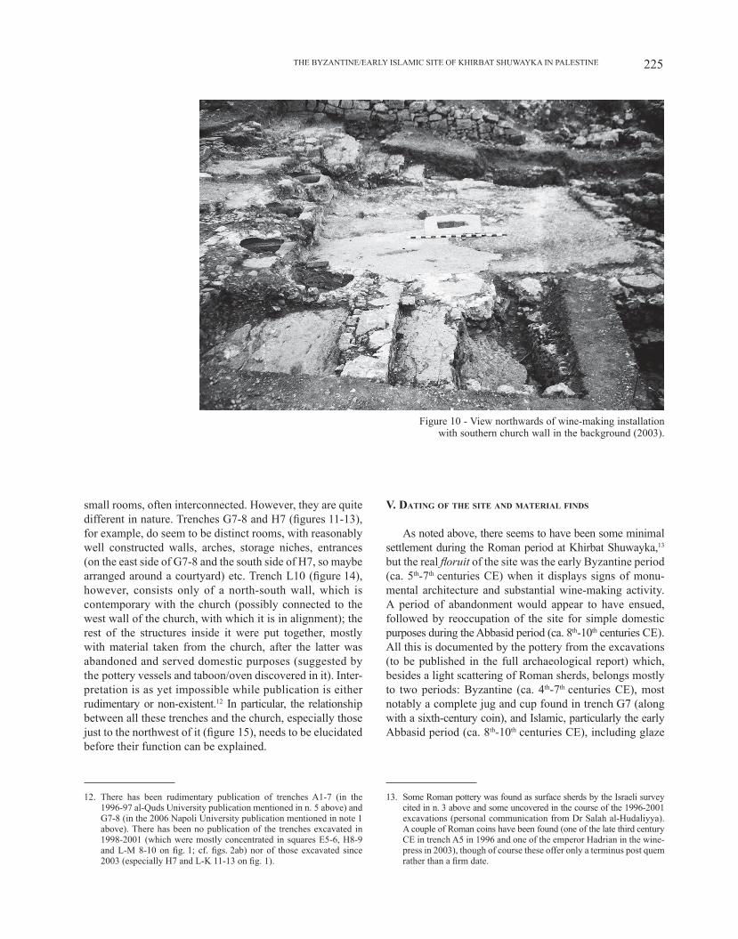
The tomb entrance inscription (figure 9)
The short text is written in clear large Greek letters, most likely of the 5th century, and not later than the early 6th (confirmed to me by Dr. leah di Segni). It reads simply: + Mνη[μη] / διαφ[ερ(ουσα)] / Пαυλ[ου] or “Private tomb of Paul…”. One would have expected an epithet of Paul or a reference to his family, but there seems to be no room, since the stone is neatly cut just below the third line, pre-sumably to fit onto the slab closing the vault.
Figure 9 - Greek inscription on lintel of tomb entrance (2003).
III. tHe wInepReSS10
On the southeast side of the church and connected to it by a path is a winepress (figures 2b and 10). It is situated directly inside the settlement’s western wall (within squares QRST 13-16 on figure 1), and is joined to the gate in the western wall. The path connecting the two features is 1,5 m wide and made of compacted earth it can be accessed from the church by an entrance in its south wall (figure 2b). The area of the winepress is about 160 m² and consists of three chambers connected by channels with three juice-collecting vats on the western side, a large treading vat in the centre, a main juice-collecting vat on the northern side, four cham-bers on the southern side and four more chambers on the eastern side, all probably used for storage. The walls of these facilities were built of different sized stones, 95 cm wide, with horizontal irregular bonds, and reaching a maxi-mum height of about 1,6 m. The results of the archeological excavations show that the press had passed through two successive phases. In the first phase the wine press was constructed and put into operation. In a second phase modi-fications were made to some of the elements of this indus-trial installation while still retaining the general structure of the first phase. These modifications consisted in re-flooring of the three western chambers, the treading vat, the main collecting vat and the northeast chambers with white pieces of mosaic and coating the internal sides with a thick plaster layer. A change in pressing technique accompanied these modifications. Traditional pressing (treading the grapes by foot) was taken up again after removing the wooden spiral shaft and closing the opening where the shaft was fixed with a stone slab.11 Excavation showed that the winepress was abandoned by or during the early Islamic period. At a later date it was reused, but no longer as a winepress; possibly it served as a graveyard, since human bones were found in one collecting vat during the excavation. The pottery discovered in the winepress area is not representative of the history of the site as a whole, because there was no Roman pottery and only very few Umayyad and Abbasid pieces.
IV. tHe ReSIdentIal complex (?)
On the west side of the church a considerable number of trenches (figure 2b) have been excavated that await full study and publication. They have been considered to all be part of a residential complex, since they consist of many
10. For more information on this feature see the article cited in n. 1 above.11. for this technique compare the presses of Tel zif, in D. Amit and
Y. Brauch, Winepresses, caves and tombs near Tel Zif, in Atiqot, 32, 1997, p. 43, fig. 4, of Amwas in y. Hirschfeld, Ancient winepresses in the park of Aijalon, in IEJ, 33, 1983, p. 43, fig. 4, and of Taannek, Sile and Givat Massua in R. Ovadiah, Giv’at Massu’a, in ESI, 12, 1993, p. 75-76, fig. 89.
225THE ByzANTINE/EARly ISlAMIC SITE of KHIRBAT SHUwAyKA IN PAlESTINE
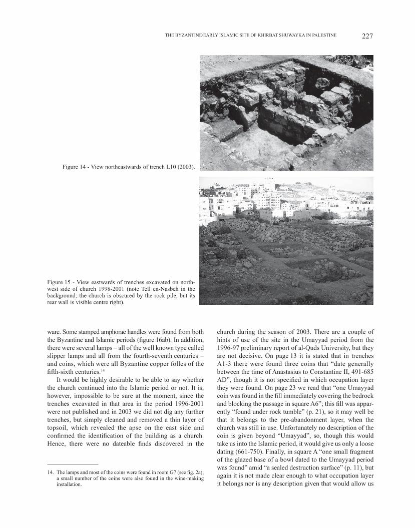
small rooms, often interconnected. However, they are quite different in nature. Trenches G7-8 and H7 (figures 11-13), for example, do seem to be distinct rooms, with reasonably well constructed walls, arches, storage niches, entrances (on the east side of G7-8 and the south side of H7, so maybe arranged around a courtyard) etc. Trench l10 (figure 14), however, consists only of a north-south wall, which is contemporary with the church (possibly connected to the west wall of the church, with which it is in alignment); the rest of the structures inside it were put together, mostly with material taken from the church, after the latter was abandoned and served domestic purposes (suggested by the pottery vessels and taboon/oven discovered in it). Inter-pretation is as yet impossible while publication is either rudimentary or non-existent.12 In particular, the relationship between all these trenches and the church, especially those just to the northwest of it (figure 15), needs to be elucidated before their function can be explained.
12. There has been rudimentary publication of trenches A1-7 (in the 1996-97 al-Quds University publication mentioned in n. 5 above) and G7-8 (in the 2006 Napoli University publication mentioned in note 1 above). There has been no publication of the trenches excavated in 1998-2001 (which were mostly concentrated in squares E5-6, H8-9 and l-M 8-10 on fig. 1; cf. figs. 2ab) nor of those excavated since 2003 (especially H7 and l-K 11-13 on fig. 1).
V. datIng of tHe SIte and mateRIal fIndS
As noted above, there seems to have been some minimal settlement during the Roman period at Khirbat Shuwayka,13 but the real floruit of the site was the early Byzantine period (ca. 5th-7th centuries CE) when it displays signs of monu-mental architecture and substantial wine-making activity. A period of abandonment would appear to have ensued, followed by reoccupation of the site for simple domestic purposes during the Abbasid period (ca. 8th-10th centuries CE). All this is documented by the pottery from the excavations (to be published in the full archaeological report) which, besides a light scattering of Roman sherds, belongs mostly to two periods: Byzantine (ca. 4th-7th centuries CE), most notably a complete jug and cup found in trench G7 (along with a sixth-century coin), and Islamic, particularly the early Abbasid period (ca. 8th-10th centuries CE), including glaze
13. Some Roman pottery was found as surface sherds by the Israeli survey cited in n. 3 above and some uncovered in the course of the 1996-2001 excavations (personal communication from Dr Salah al-Hudaliyya). A couple of Roman coins have been found (one of the late third century CE in trench A5 in 1996 and one of the emperor Hadrian in the wine-press in 2003), though of course these offer only a terminus post quem rather than a firm date.
Figure 10 - View northwards of wine-making installation with southern church wall in the background (2003).
RoBERT HoylAND226
Figure 11 - View eastwards of trench G8 (tumble = collapsed arches), with H8 behind (2003).
Figure 12 - View northwestwards of trench G7 (2003)
Figure 13 - View westwards of trench H7, with G7 behind (2005).
227THE ByzANTINE/EARly ISlAMIC SITE of KHIRBAT SHUwAyKA IN PAlESTINE
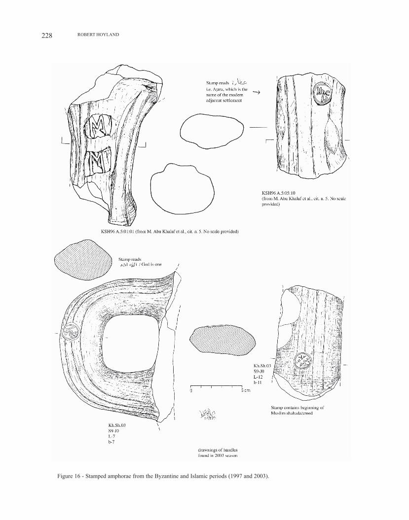
ware. Some stamped amphorae handles were found from both the Byzantine and Islamic periods (figure 16ab). In addition, there were several lamps – all of the well known type called slipper lamps and all from the fourth-seventh centuries – and coins, which were all Byzantine copper folles of the fifth-sixth centuries.14
It would be highly desirable to be able to say whether the church continued into the Islamic period or not. It is, however, impossible to be sure at the moment, since the trenches excavated in that area in the period 1996-2001 were not published and in 2003 we did not dig any further trenches, but simply cleaned and removed a thin layer of topsoil, which revealed the apse on the east side and confirmed the identification of the building as a church. Hence, there were no dateable finds discovered in the
14. The lamps and most of the coins were found in room G7 (see fig. 2a); a small number of the coins were also found in the wine-making installation.
church during the season of 2003. There are a couple of hints of use of the site in the Umayyad period from the 1996-97 preliminary report of al-Quds University, but they are not decisive. On page 13 it is stated that in trenches A1-3 there were found three coins that “date generally between the time of Anastasius to Constantine II, 491-685 AD”, though it is not specified in which occupation layer they were found. On page 23 we read that “one Umayyad coin was found in the fill immediately covering the bedrock and blocking the passage in square A6”; this fill was appar-ently “found under rock tumble” (p. 21), so it may well be that it belongs to the pre-abandonment layer, when the church was still in use. Unfortunately no description of the coin is given beyond “Umayyad”, so, though this would take us into the Islamic period, it would give us only a loose dating (661-750). finally, in square A “one small fragment of the glazed base of a bowl dated to the Umayyad period was found” amid “a sealed destruction surface” (p. 11), but again it is not made clear enough to what occupation layer it belongs nor is any description given that would allow us
Figure 14 - View northeastwards of trench L10 (2003).
figure 15 - View eastwards of trenches excavated on north-west side of church 1998-2001 (note Tell en-Nasbeh in the background; the church is obscured by the rock pile, but its rear wall is visible centre right).
RoBERT HoylAND228
Figure 16 - Stamped amphorae from the Byzantine and Islamic periods (1997 and 2003).
229THE ByzANTINE/EARly ISlAMIC SITE of KHIRBAT SHUwAyKA IN PAlESTINE
to identify it properly. within this same destruction surface there was uncovered a “stamped seal handle of jar, early Umayyad period” (p. 12), but from the drawing (figure 16a; lower image) provided the Arabic seal stamp could as easily be Abbasid as Umayyad, and again we do not know whether it belongs to the period before or after the aban-donment of the church. This question might be able to be settled if the large quantity of pottery that has been lumped together into the category of Byzantine-Umayyad (approx. 6th-7th century) were studied fully and a typology established, but that still lies in the future.
concluSIon: IdentIfIcatIon of tHe SIte
The authors of the Survey of western Palestine identified Khirbat Shuwayka with Biblical Sheku (1 Samuel 19.22), where it is related how king David fled the murderous machinations of Saul, going to meet the prophet Samuel at Ramah, and how Saul then attempted to pursue him there “and came to the great well that is in Sheku”.15 Besides the similarity of the name and its position in the general proximity of the events narrated in 1 Samuel, there is, how-ever, no cogent reason to make this identification. More compelling is the equation of nearby Tell en-Nasbeh with Biblical Mitzpeh, Judah’s northernmost border fortress, where the Biblical text records that the Israelite tribes gathered before their battle against Gibeah (Judges 20:1, 3; 21:1, 5, 8), and later against the Philistines (I Samuel 7:5-12), where Saul was appointed king (I Samuel 10:17), where the prophet Samuel meted out justice (I Samuel 7, 10:17), and where Gedaliah, the son of Ahikam, based his capital over what remained of the area of Judah (II Kings 25:23,25; Jeremiah 40:6-15; 41:6-15).16 The only other major contender is the present-day Nabi Samwil, which the Christian Crusaders identified with Samuel’s resting place of Ramah and subse-quently founded a church there. However, it does not seem to be the site of an iron-age settlement, as has been estab-lished to be the case at Tell en-Nasbeh by the American excavations there in the 1920s/30s.
If the identification of Tell en-Nasbeh with Mitzpeh is accepted, the next question is did the memory of Samuel continue to be attached to this site into the Christian Era? The site itself ceased to be a centre of major occupation after the Persian period and thereafter it would seem to have been no more than part of an agricultural estate. But was the original connection with Samuel forgotten? The sixth-century Byzantine historian Procopius of Caesarea
15. C. R. Conder and H. H. Kitchener, The Survey of Western Palestine, cit. (n. 3), vol. 3, p. 52; rejected by f. M. Abel, Géographie de la Palestine, Paris, 1833-38, vol. 2, p. 453, as being too far from the sites mentioned in the Bible.
16. Full references and discussion in C. C. McCown, Tell en-Nasbeh, cit. (n. 3), vol. 1, p. 13-59.
records that the emperor Justinian (527-65 CE) built a well and a wall at a monastery of St. Samuel, but he does not specify its whereabouts and he could be referring to Nabi Samwil/Ramah.17 Our other major source is a tenth-century Palestino-Georgian calendar of Jerusalem that makes the observation that “on 20th August the prophet Samuel is ven-erated in the village called Masephta”.18 Milik, following the notes given to him by Bagatti from his 1951 visit, confidently identified Masephta with the church and other remains of Khirbat Shuwayka.19 By the tenth century there would have been a Muslim presence here, as can be seen from the Muslim Arabic stamps on some of the amphorae handles unearthed in the course of Al-Quds University excavations. Yet there still could have been Arab Christians who adhered to the memory of Samuel/Samwil and, of course, given Islam’s receptivity to pre-Islamic prophets sent by God, it is possible that the Muslim population at Khirbat Shuwayka would have maintained his connection with the site. It is to be hoped that further excavation will shed light on these questions and on the nature of the settlement at Khirbat Shuwayka. However, recent excavations at Nabi Samwil have turned up convincing evidence that it was there that Samuel came to be associated in the Byzantine period. In particular, four Umayyad pottery kilns in the southeast corner of the site yielded up large jars with seal-impressed handles bearing various Arabic texts, including “from the monastery of Samuel” (min dayr samwīl).20 Of course, it is not impossible that Samuel was revered at both sites – indeed, rival locations for holy sites is a feature of Judaism, Christianity and Islam, both within and between their communities. But with the coming of the Crusaders the argument over the location of Biblical Mitzpeh was certainly clinched in favour of Nabi Samwil. The small Muslim settle-ment at Khirbat Shuwayka was abandoned and henceforth neighbouring al-Bira, where the Crusaders built a church dedicated to the Holy Family and the Ayyubids a mosque dedicated to ʿUmar ibn al-Khattab, became the principal town in the area.
17. Procopius, Buildings, ed./tr. H. B. Dewing (Loeb; Cambridge, M.A., 1961), 5.9.15; on the equation of Nabi Samwil with Ramah see A. Abel and J. Savignac, Chronique: Neby Samouil, in Revue Biblique, 9, 1912, p. 267-279.
18. G. Garitte, Le calendrier palestino-géorgien du Sinaiticus 34 (xe siècle), Brussels (Subsidia Hagiographica 30), 1958, p. 85 et 307 (20 août); the place name is attested earlier in the Georgian Lectionary: M. Tarchnischvili, Le grand lectionnaire de Jérusalem, ve-viiie siècle, leuven (CSCo scr. Iberici 10), 1959.
19. J. T. Milik, Notes d’épigraphie et de topographie palestiniennes, in Revue Biblique, 67, 1960, p. 578-579. Note that A. ovadiah, Corpus of the Byzantine churches in the Holy Land, Bonn, 1970, p. 125-126, no. 127, mentions a church of St. Varus at “Kh. Suweikeh”; this is because Milik put an image of Khirbat Shuwayka on the same plate as an inscription of St. Varus from the Hebron region, and Ovadiah mistakenly thought they were both from Khirbat Shuwayka.
20. Y. Magen and M. Dadon, Nebi Samwil (Montjoie), in G. C. Bottini et al., One Land, Many Cultures: archaeological studies in honour of S. Loffreda, Jerusalem (SBF 41), 2003 p. 123-138.

Related Documents