9th Regional EST Forum in Asia, 17-20 November 2015, Kathmandu, Nepal 1/31 Intergovernmental Ninth Regional Environmentally Sustainable Transport (EST) Forum in Asia EST for Resiliency – Building Safe, Smart, Low-carbon and Resilient Cities in Asia City Report (Draft) <Colombo, Sri Lanka> This country report was prepared by Colombo, Sri Lanka as an input for the Ninth Regional EST Forum in Asia. The views expressed herein do not necessarily reflect the views of the United Nations.

Welcome message from author
This document is posted to help you gain knowledge. Please leave a comment to let me know what you think about it! Share it to your friends and learn new things together.
Transcript
9th Regional EST Forum in Asia, 17-20 November 2015, Kathmandu, Nepal
1/31
Intergovernmental Ninth Regional Environmentally Sustainable Transport (EST) Forum in Asia
EST for Resiliency – Building Safe, Smart, Low-carbon and Resilient Cities in Asia
City Report
(Draft)
<Colombo, Sri Lanka>
This country report was prepared by Colombo, Sri Lanka as an input for the Ninth Regional EST Forum in Asia. The views expressed herein do not necessarily reflect the
views of the United Nations.
Development of a Disaster Resilient Transport Infrastructure for the City of
Colombo For Proceedings at Ninth Intergovernmental Regional Environmentally Sustainable
Transport (EST) Forum in Asia
THERCY DEVIKA ABEYSURIYA COLOMBO MUNICIPAL COUNCIL, SRI LANKA
1
1. Introduction
The ever intensifying threats of the changing climate has turned out to be a noteworthy
vulnerability that has confronted todays’ global transportation system. These changes come in
the form of rising ambient temperatures to rising sea levels, to powerful storms to dangerous
droughts. (Office of Strategic Initiatives for Research and Innovation, 2014)
Super storm ‘Sandy’ struck the densely populated Eastern seaboard of the U.S in October 2012
unfolding a devastation beyond imagination, uprooting the entire infrastructure system
including roads, bridges, mass transit, water and electricity networks, bringing the whole city
to a standstill (Ceres, 2013). It has taken several such tragedies for the discussion on building
cities resilient to climatic change to come to the limelight.
In order to derive solutions for resilience building, the extremely complex ecosystems of the
cities needs to be clearly understood. This requires reinforcing the understanding of the history,
geography, economic and cultural background of the city.
Colombo, the commercial capital of Sri Lanka, a country who’s seen its development as a
nation marching backwards throughout the 30 years of the civil war that ended in 2009, is
emerging to becoming a noteworthy member of the global village. The recent post-war era in
Sri Lanka has seen a lot of developments with regards to enhancing the infrastructure systems
to meet the demands of the future.
This report aims to evaluate the current transport infrastructure system in Colombo, in order to
understand its capabilities of meeting the present and future transport demands, hence, identify
the underlying problems to come up with a set of mitigations to rehabilitate the existing system
to become resilient in the face of climate change. Furthermore, the integration of such
mitigations in the context of mega polis development projects are gauged, and the current
progress is benchmarked with the internationally accepted conventions.
2. History of Colombo
Colombo is a naturally formed harbor utilized by regional traders for local imports and exports
some 2000 years ago. Its strategic location as a potential seaport in international trade was
realized by Portuguese expeditors who fortuitously landed in Colombo in 1505, who later
developed the port to support their military and trade activities in the Indian Ocean. Since then,

2
Colombo has been at the center of the silk route, bringing a substantial amount of foreign
currency in to country’s economy. The British who took authority over country’s
administrative powers in 1815 selected Colombo at the capital city of colonial Ceylon.
The foundation for the current transport
infrastructure system in Colombo was laid
by the British rulers who introduced tram
and bus services to Colombo’s metropolitan
areas and a railway network to branch out
from central Colombo covering the major
cities of economic importance in the island.
Prior to the public transport reinforcement by
British, bullock and elephant carts were the
favorite mode of transport among the locals,
especially for transport of goods. Horse
carriages and manned rickshaws were also
used in metropolitan areas of the country as a
personal mode of transportation.
Colombo continued to be the capital city of Ceylon upon granting of independence in 1948.
The constitutional introduction of Free Trade Policy (FTP) to the country’s economy in 1978
saw a colossal rise in commercial establishments within Colombo, increasing the congestion
within Colombo metropolitan area. In an attempt to reduce this congestion, the administrative
functions of the capital city were moved to Sri Jayawardenapura in 1982. Furthermore, Free
Figure 1: Bus Service in Colombo during British Rule
Figure 2: Tram Service in Colombo during British Rule
Figure 3: Transportation Modes in Ceylon Prior to the Introduction of Public Transport System by British
3
Trade Zones (FTZ’s) were introduced in Colombo suburbs in an effort to move some of the
commercial activities out of Colombo.
However, still a majority the commercial activities are centralized at the heart of Colombo
giving rise to an ever increasing population density and an overwhelming traffic congestion in
and out of the city.
The city of Colombo had undertaken several city development plans in the last century. First
started by the British towards the latter part of their colonial rule in Ceylon, initiated the Patrick
Geddes Plan and Patrick Abercrombie Plan in 1921 and 1948 respectively. Introduction of Free
Trade Policy saw the instigation of Colombo Master Plan Project in 1978 to be followed by
City of Colombo Development Plan in 1985. The newly elected socialist government in 1994
continued the good work in relation to developing Colombo with their CMRSP-CMR Structure
Plan in 1996. Following the establishment of Urban Development Authority (UDA), the City
of Colombo Development Plant of 1999 was introduced, which was amended later in 2008.
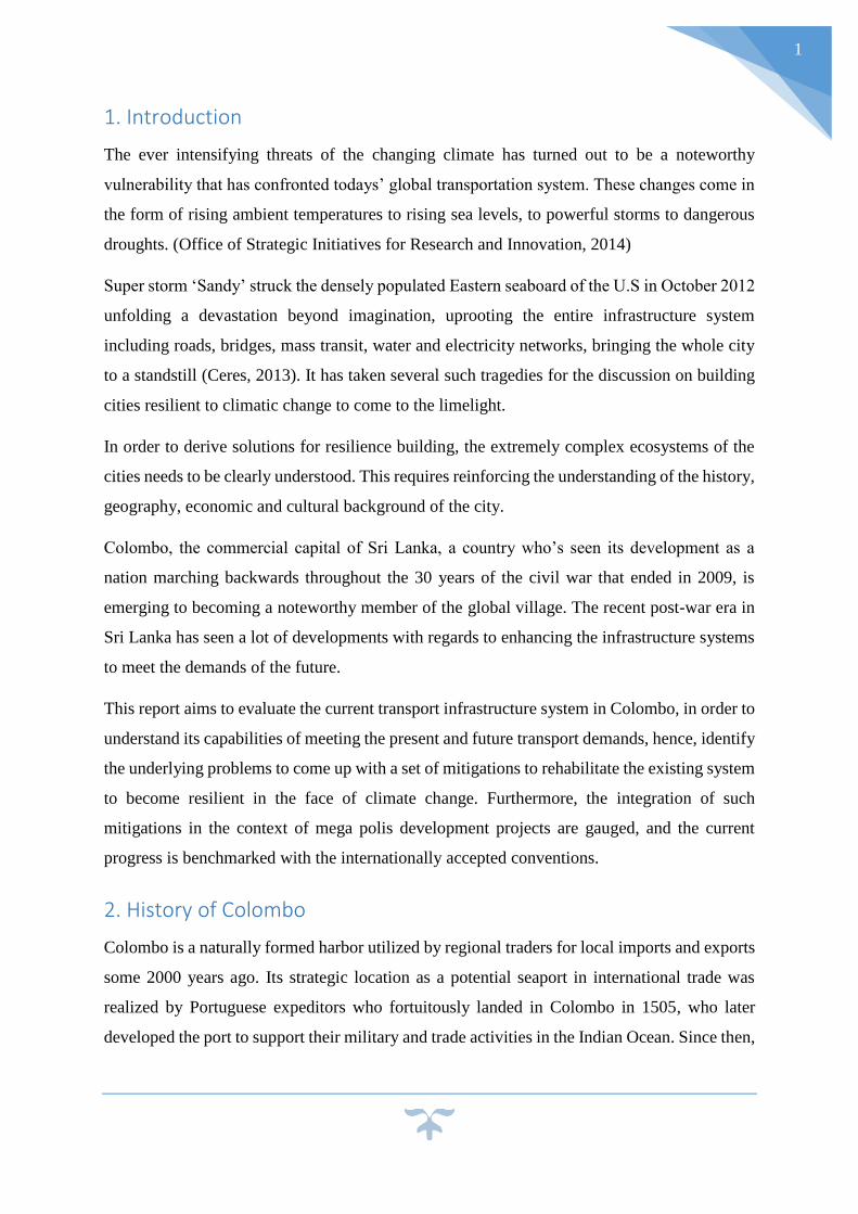
3. Colombo Today
The self-proclaimed commercial hub of
present Sri Lanka has turned out to
become a bustling city and a hopping off
pivot to the picturesque beaches in the
island’s south. The country’s heritage is
reflected in every corner of the city,
proudly looking back at her eventful
history as a strategic point on the East-
West trade route and the center for
colonial administration of Portuguese,
Dutch and British. ‘The legacies of
colonial Colombo's garden roots are
still very much intact along its often
shady boulevards. Fort is in the midst of
widespread historic restoration of its
landmark colonial architecture, while
Figure 4: Birds Eye View of Colombo City at Night
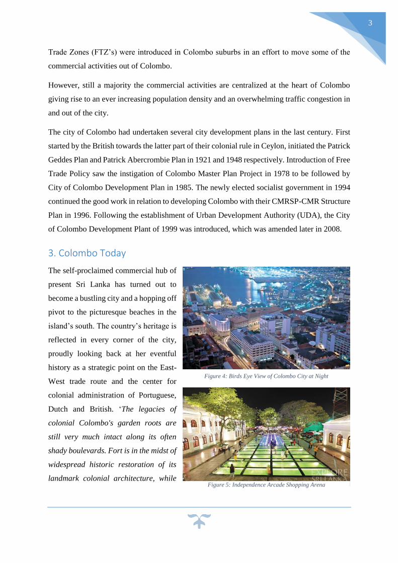
Figure 5: Independence Arcade Shopping Arena
4
Pettah brims with markets and rampant commerce.’ (Lonely Planet, 2015)
The post-war era of Colombo has seen it
evolution from a mere commercial hub
to a vibrant city with rich colonial
architecture, public recreational
facilities, relaxing beaches, fine dining,
high end shopping malls also providing
a colourful nightlife to tourists as well as
locals.
3.1 Governance of Colombo
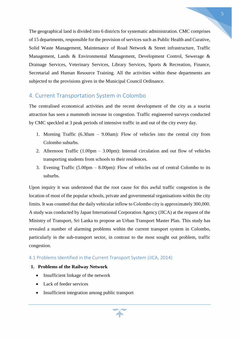
The land and water combined total area
of Colombo comprised 37 km2. The
irrigation system of city including the
famous Beira Lake, covers an area of
approximately 160 acres. The North-
Eastern boarder of the city is defined by
the third longest river in the country
Kelani River meeting the sea in Modara.
The multi-cultural, multi-ethnical Colombo’s largest communities are Sinhalese, Sri Lankan
Moors and Tamils. The residential population of the city as per government’s census records
in 2012 is 555,031 and 647,100 in 2001 (Department of Census and Statistics, 2012), with an
approximate average floating population of 500,000.
The body of authority in charge of the administration of the charter city is Colombo Municipal
Council (CMC) based at their headquarters in Town hall, yet another architectural attraction of
the city. The head of political body for the
city is the Mayor while the head of
administrative body is the Municipal
Commissioner. The Colombo Municipal
Council which was established in 1865
during the British rule is celebrating her
150th anniversary in 2015.
Figure 6: Floating Market in Colombo
Figure 7: Beira Lake, the Heart of Colombo's Irrigation Network
Figure 8: Town Hall Building
5
The geographical land is divided into 6 districts for systematic administration. CMC comprises
of 15 departments, responsible for the provision of services such as Public Health and Curative,
Solid Waste Management, Maintenance of Road Network & Street infrastructure, Traffic
Management, Lands & Environmental Management, Development Control, Sewerage &
Drainage Services, Veterinary Services, Library Services, Sports & Recreation, Finance,
Secretarial and Human Resource Training. All the activities within these departments are
subjected to the provisions given in the Municipal Council Ordinance.
4. Current Transportation System in Colombo
The centralised economical activities and the recent development of the city as a tourist
attraction has seen a mammoth increase in congestion. Traffic engineered surveys conducted
by CMC speckled at 3 peak periods of intensive traffic in and out of the city every day.
1. Morning Traffic (6.30am – 9.00am): Flow of vehicles into the central city from
Colombo suburbs.
2. Afternoon Traffic (1.00pm – 3.00pm): Internal circulation and out flow of vehicles
transporting students from schools to their residences.
3. Evening Traffic (5.00pm – 8.00pm): Flow of vehicles out of central Colombo to its
suburbs.
Upon inquiry it was understood that the root cause for this awful traffic congestion is the
location of most of the popular schools, private and governmental organisations within the city
limits. It was counted that the daily vehicular inflow to Colombo city is approximately 300,000.
A study was conducted by Japan International Corporation Agency (JICA) at the request of the
Ministry of Transport, Sri Lanka to propose an Urban Transport Master Plan. This study has
revealed a number of alarming problems within the current transport system in Colombo,
particularly in the sub-transport sector, in contrast to the most sought out problem, traffic
congestion.
4.1 Problems Identified in the Current Transport System (JICA, 2014)
1. Problems of the Railway Network
Insufficient linkage of the network
Lack of feeder services
Insufficient integration among public transport
6
Lack of railway access to the international airports
Slow operational speed of rolling stock
Deteriorated rolling stock, track and signalling systems
Insufficient line capacity
Insufficient revenue of Sri Lanka Railways Authority
Insufficient expenditure for maintenance
Low level service of ‘Kelani’ Valley Line
2. Problems in Bus Transport and Other Road Based Public Transport
Low bus operation speed due to traffic congestion on roads
‘Pettah’ centred bus network
Lack of integration with railways other bus terminals
Low service level of bus operations
Difficulty in improvement of government owned bus services
Inconvenient bus operation for passengers due to the bus rental system of private bus
operators
Difficult coordination between public and private bus operators
Insufficient support for bus fare discount for the transport poor
Insufficient management on bus operations
Market driven regulatory scheme of road based public transport modes
3. Problems on Road Network
Insufficient road network
Lack of pedestrian space
Lack of a robust road network master plan for the Colombo metropolitan region
Lack of engineering design standards for urban roads
Low accessibility of the existing expressway network
Necessity to enhance access to Colombo port and cargo transport
Lack of linkage of expressway network
7
4. Problems on Traffic Control and Traffic Management
Traffic congestion at intersections
Reduction of traffic capacity due to on street parking
Increasing traffic accidents involving pedestrians and motorcycles
4.2 Rehabilitation and Improvement Program for a Better Transport System
The study conducted by JICA outlined a series of policy measures for urban transport
development programs to be implemented in order to minimise the current concerns in the
transport system in Colombo.
1. Program for Promotion of Public Transport
Introduction of a monorail system
Modernization of the existing railway system
Construction of an airport connection line
Development of access roads to railway stations and the proposed transit systems
Introduction of bus rapid transit (BRT)
Road development to introduce BRT
Regulatory scheme for road-based public transport modes
2. Program for Alleviation of Traffic Congestion
Ring road development
Expressway network development
Flyover development
Port access road
Traffic control measures such as traffic signal control development, traffic information
system and parking information system
Transport demand management (TDM)
3. Program for Reduction of Air Pollution, Noise Control and Promotion of Health
Establishment of environmental management system
Establishment and enhancement of air pollutant emission standards for newly
manufactured and imported vehicles
Enhancement of vehicle inspection and maintenance programs
8
Low Sulphur diesel programs
Promotion of natural gas vehicles
Promotion of hybrid cars and electric vehicles
Promotion of walking and bicycle use for energy saving and to promote health
Provision of side walks
4. Program for the reduction of fatalities and injuries in traffic accidents and
improvement of safety
Education on traffic safety
Rehabilitation and installation of traffic signal system
Rehabilitation of railway signal system
Analysis on causes of traffic accidents
Provision of sidewalks and pedestrian crossings
Establishment of urban rad design standard for sidewalks
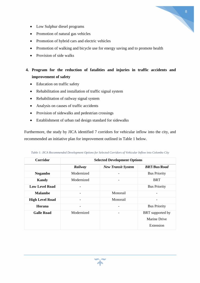
Furthermore, the study by JICA identified 7 corridors for vehicular inflow into the city, and
recommended an initiative plan for improvement outlined in Table 1 below.
Table 1: JICA Recommended Development Options for Selected Corridors of Vehicular Inflow into Colombo City
Corridor Selected Development Options
Railway New Transit System BRT/Bus/Road
Negambo Modernized - Bus Priority
Kandy Modernized - BRT
Low Level Road - Bus Priority
Malambe - Monorail -
High Level Road - Monorail -
Horana - - Bus Priority
Galle Road Modernized - BRT supported by
Marine Drive
Extension
9
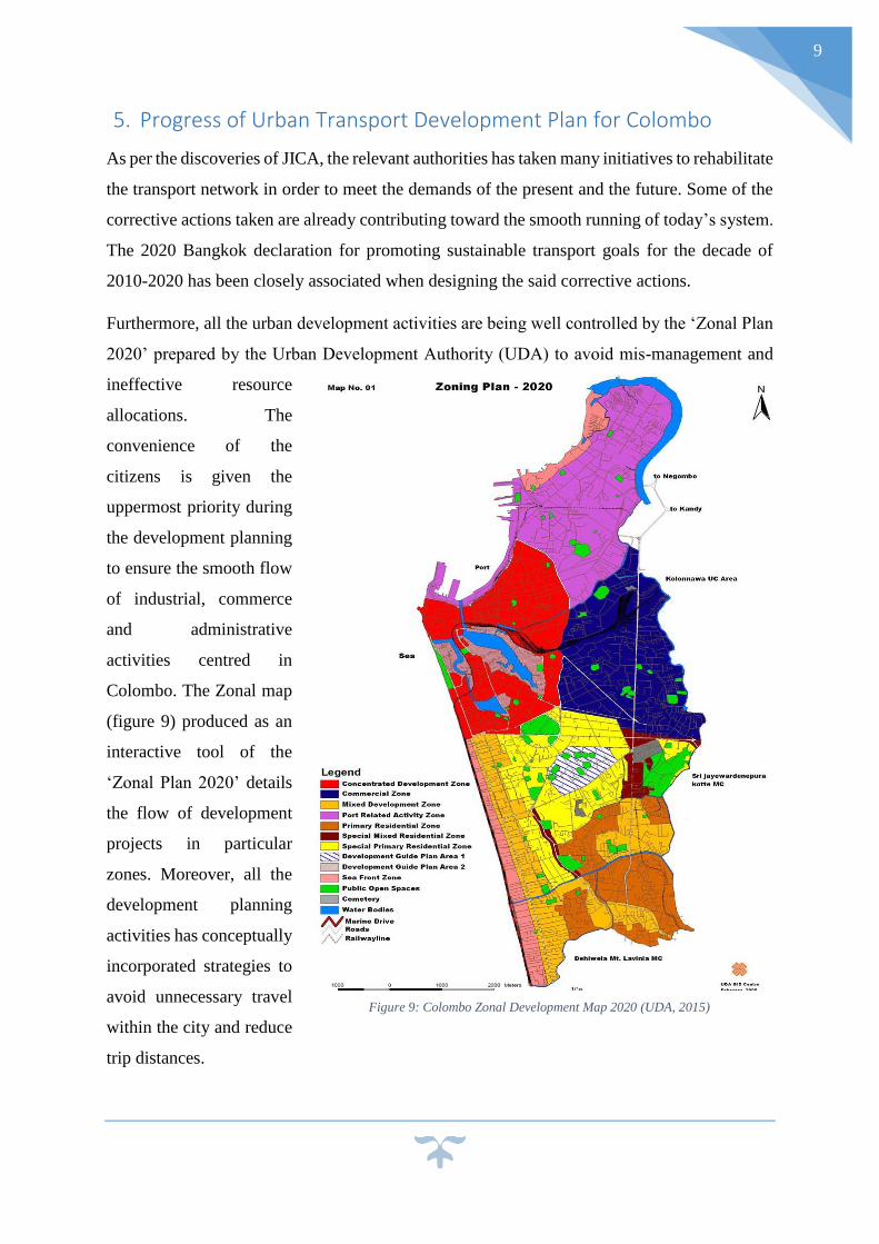
5. Progress of Urban Transport Development Plan for Colombo
As per the discoveries of JICA, the relevant authorities has taken many initiatives to rehabilitate
the transport network in order to meet the demands of the present and the future. Some of the
corrective actions taken are already contributing toward the smooth running of today’s system.
The 2020 Bangkok declaration for promoting sustainable transport goals for the decade of
2010-2020 has been closely associated when designing the said corrective actions.
Furthermore, all the urban development activities are being well controlled by the ‘Zonal Plan
2020’ prepared by the Urban Development Authority (UDA) to avoid mis-management and
ineffective resource
allocations. The
convenience of the
citizens is given the
uppermost priority during
the development planning
to ensure the smooth flow
of industrial, commerce
and administrative
activities centred in
Colombo. The Zonal map
(figure 9) produced as an
interactive tool of the
‘Zonal Plan 2020’ details
the flow of development
projects in particular
zones. Moreover, all the
development planning
activities has conceptually
incorporated strategies to
avoid unnecessary travel
within the city and reduce
trip distances.
Figure 9: Colombo Zonal Development Map 2020 (UDA, 2015)
10
5.1 Strategies to Shift Towards Sustainable Development Modes
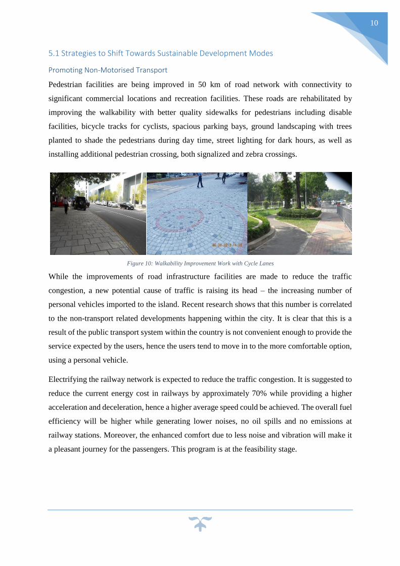
Promoting Non-Motorised Transport
Pedestrian facilities are being improved in 50 km of road network with connectivity to
significant commercial locations and recreation facilities. These roads are rehabilitated by
improving the walkability with better quality sidewalks for pedestrians including disable
facilities, bicycle tracks for cyclists, spacious parking bays, ground landscaping with trees
planted to shade the pedestrians during day time, street lighting for dark hours, as well as
installing additional pedestrian crossing, both signalized and zebra crossings.
While the improvements of road infrastructure facilities are made to reduce the traffic
congestion, a new potential cause of traffic is raising its head – the increasing number of
personal vehicles imported to the island. Recent research shows that this number is correlated
to the non-transport related developments happening within the city. It is clear that this is a
result of the public transport system within the country is not convenient enough to provide the
service expected by the users, hence the users tend to move in to the more comfortable option,
using a personal vehicle.
Electrifying the railway network is expected to reduce the traffic congestion. It is suggested to
reduce the current energy cost in railways by approximately 70% while providing a higher
acceleration and deceleration, hence a higher average speed could be achieved. The overall fuel
efficiency will be higher while generating lower noises, no oil spills and no emissions at
railway stations. Moreover, the enhanced comfort due to less noise and vibration will make it
a pleasant journey for the passengers. This program is at the feasibility stage.
Figure 10: Walkability Improvement Work with Cycle Lanes
11
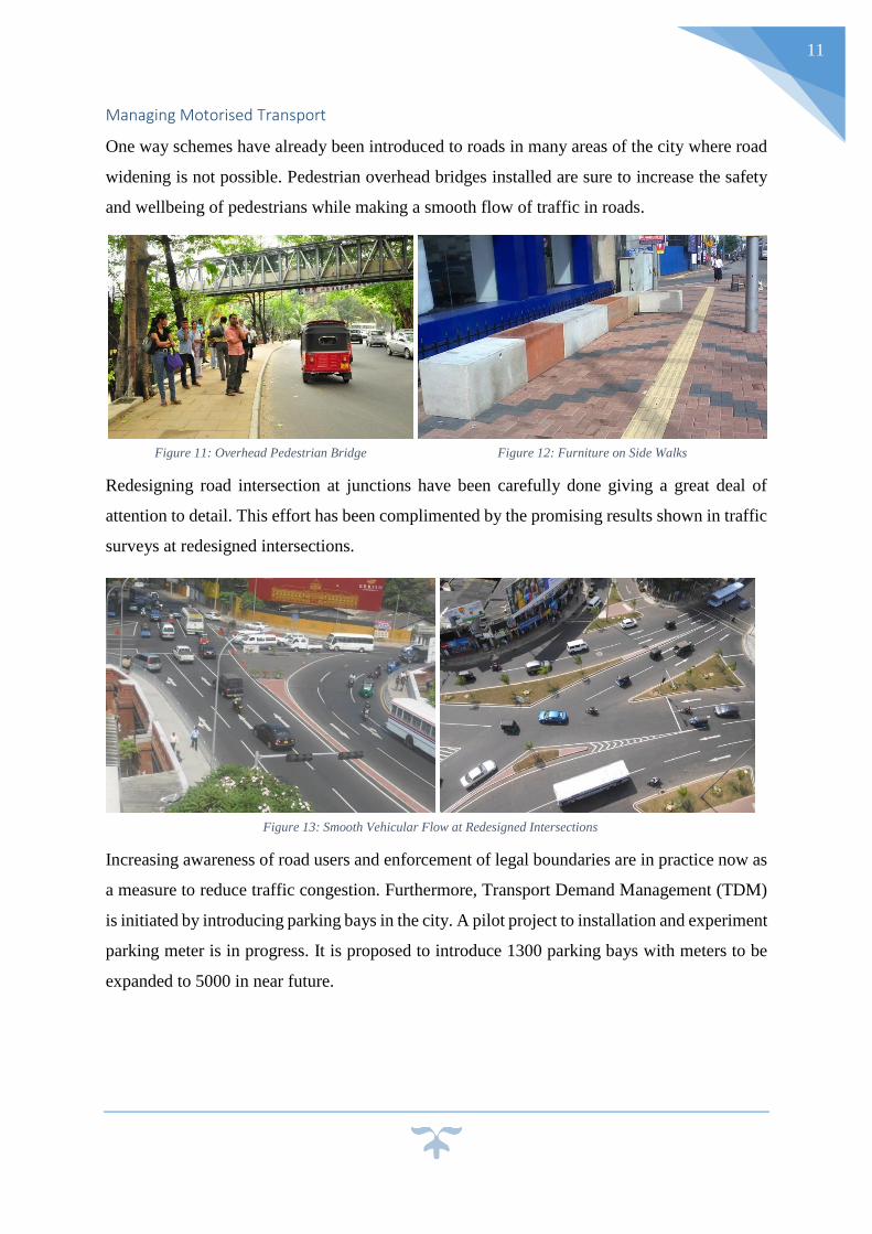
Managing Motorised Transport
One way schemes have already been introduced to roads in many areas of the city where road
widening is not possible. Pedestrian overhead bridges installed are sure to increase the safety
and wellbeing of pedestrians while making a smooth flow of traffic in roads.
Redesigning road intersection at junctions have been carefully done giving a great deal of
attention to detail. This effort has been complimented by the promising results shown in traffic
surveys at redesigned intersections.
Increasing awareness of road users and enforcement of legal boundaries are in practice now as
a measure to reduce traffic congestion. Furthermore, Transport Demand Management (TDM)
is initiated by introducing parking bays in the city. A pilot project to installation and experiment
parking meter is in progress. It is proposed to introduce 1300 parking bays with meters to be
expanded to 5000 in near future.
Figure 11: Overhead Pedestrian Bridge Figure 12: Furniture on Side Walks
Figure 13: Smooth Vehicular Flow at Redesigned Intersections
12
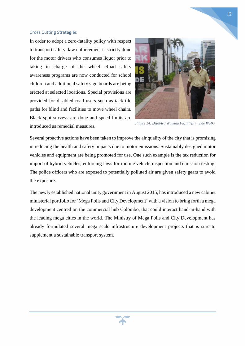
Cross Cutting Strategies
In order to adopt a zero-fatality policy with respect
to transport safety, law enforcement is strictly done
for the motor drivers who consumes liquor prior to
taking in charge of the wheel. Road safety
awareness programs are now conducted for school
children and additional safety sign boards are being
erected at selected locations. Special provisions are
provided for disabled road users such as tack tile
paths for blind and facilities to move wheel chairs.
Black spot surveys are done and speed limits are
introduced as remedial measures.
Several proactive actions have been taken to improve the air quality of the city that is promising
in reducing the health and safety impacts due to motor emissions. Sustainably designed motor
vehicles and equipment are being promoted for use. One such example is the tax reduction for
import of hybrid vehicles, enforcing laws for routine vehicle inspection and emission testing.
The police officers who are exposed to potentially polluted air are given safety gears to avoid
the exposure.
The newly established national unity government in August 2015, has introduced a new cabinet
ministerial portfolio for ‘Mega Polis and City Development’ with a vision to bring forth a mega
development centred on the commercial hub Colombo, that could interact hand-in-hand with
the leading mega cities in the world. The Ministry of Mega Polis and City Development has
already formulated several mega scale infrastructure development projects that is sure to
supplement a sustainable transport system.
Figure 14: Disabled Walking Facilities in Side Walks
13
Bibliography
[1] Ceres, 2013. Building Climate Resiliant Cities. [Online]
Available at: http://www.ceres.org/industry-initiatives/insurance/building-climate-resilient-
cities
[2] Department of Census and Statistics, 2012. Population of Sri Lanka, s.l.: s.n.
[3] JICA, 2014. Urban Transport System Development Project for Colombo Metropolitant
Region and Suburbs, Colombo: Japan International Cooperation Agency and Oriental
Consultants Co. Ltd.
[4] Lonely Planet, 2015. Introducing Colombo. [Online]
Available at: http://www.lonelyplanet.com/sri-lanka/colombo
[5] Office of Strategic Initiatives for Research and Innovation, 2014. Transportation System
Resiliant, Extreme Weather and Climate Change, Cambridge, MA 02142-1093: U.S.
Department of Transportation.
[6] UDA, 2015. Urban Development Authority. [Online]
Available at: www.uda.lk
[Accessed 12 November 2015].
Related Documents