INTEGRATED GREEN INFRASTRUCTURE

Welcome message from author
This document is posted to help you gain knowledge. Please leave a comment to let me know what you think about it! Share it to your friends and learn new things together.
Transcript
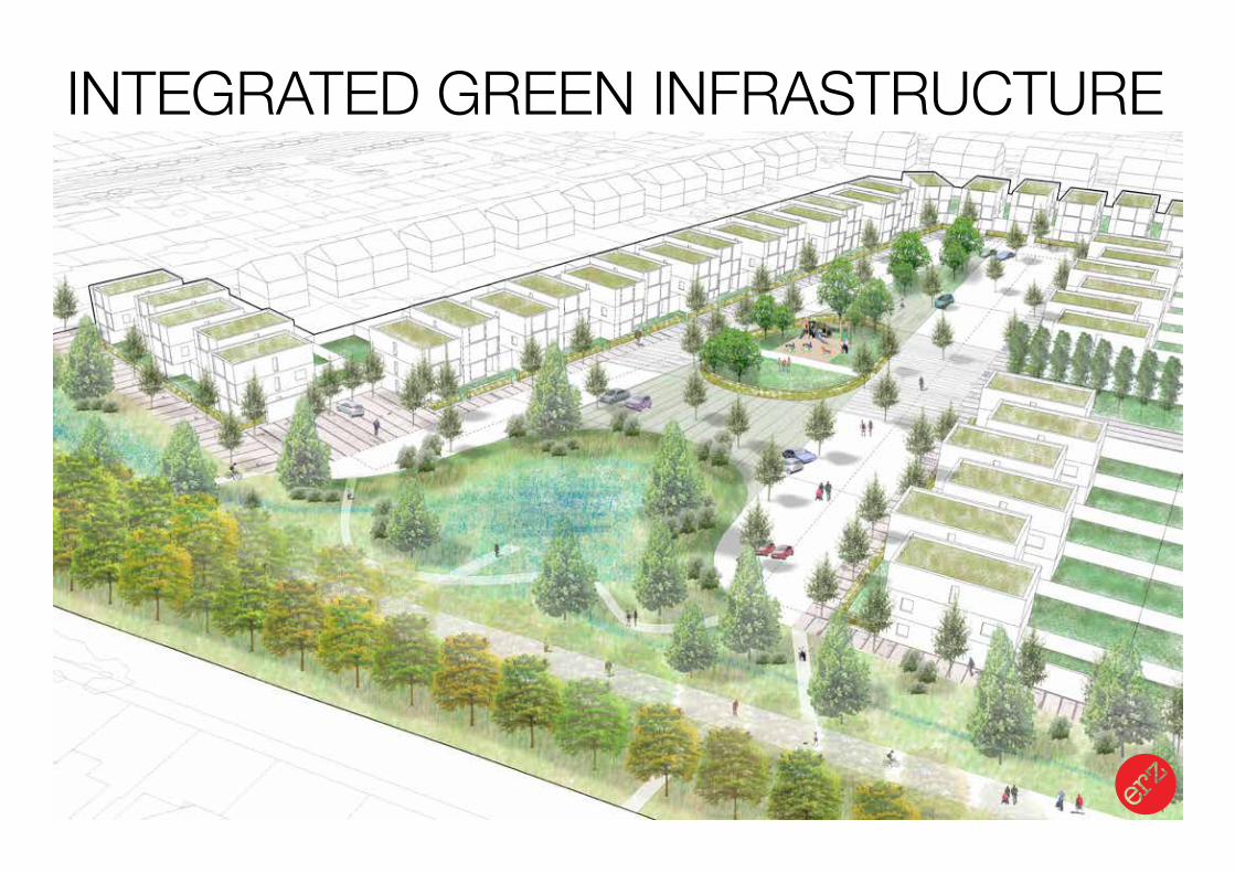
INTEGRATED GREEN INFRASTRUCTURE
Landscape Urbanism Design Strategy
INTEGRATED GREEN INFRASTRUCTURE
Landscape Urbanism Design Strategy
WHY?
Landscape Urbanism Design Strategy
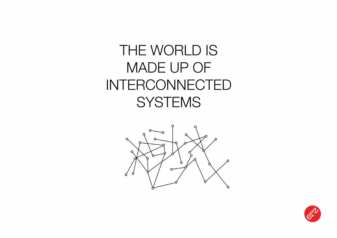
THE WORLD IS MADE UP OF
INTERCONNECTED SYSTEMS
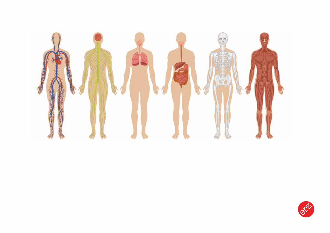
Landscape Urbanism Design Strategy
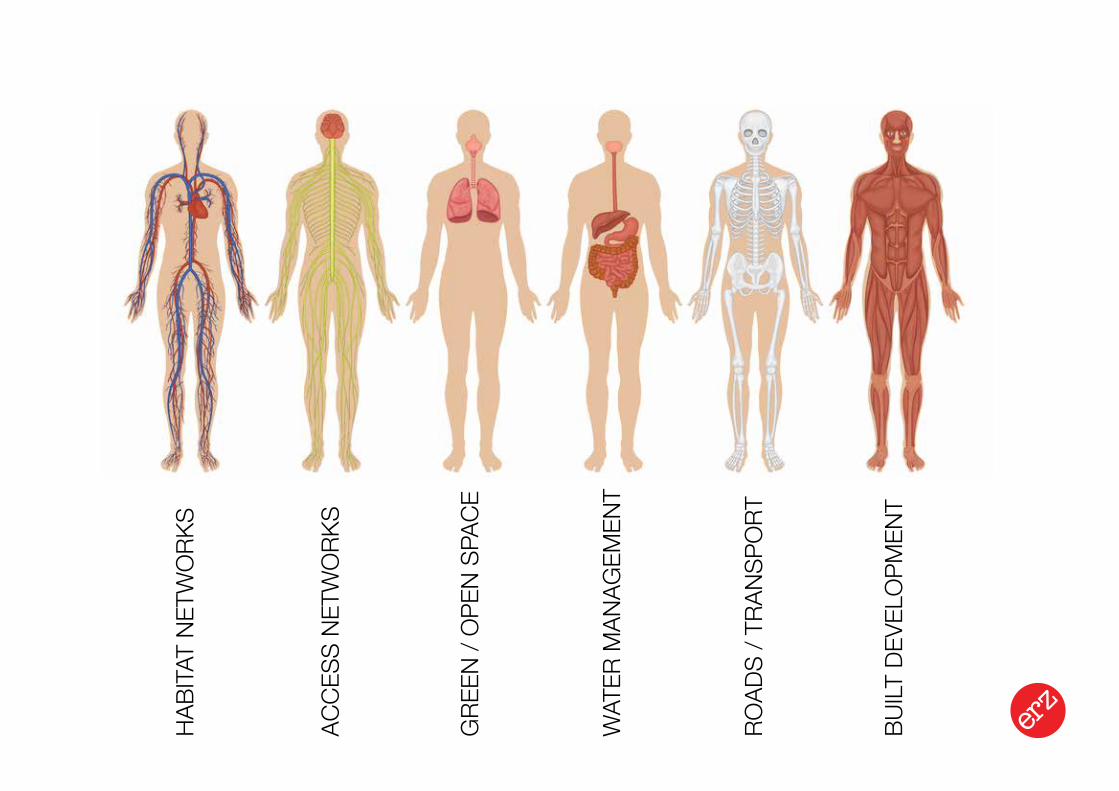
Landscape Urbanism Design StrategyRO
ADS
/ TRA
NSPO
RT
HABI
TAT
NETW
ORK
S
ACCE
SS N
ETW
ORK
S
BUILT
DEV
ELO
PMEN
T
WAT
ER M
ANAG
EMEN
T
GRE
EN /
OPE
N SP
ACE
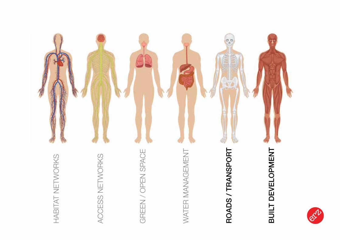
Landscape Urbanism Design StrategyRO
ADS
/ TRA
NSP
ORT
HABI
TAT
NETW
ORK
S
ACCE
SS N
ETW
ORK
S
BUIL
T D
EVEL
OPM
ENT
WAT
ER M
ANAG
EMEN
T
GRE
EN /
OPE
N SP
ACE
Existing Woodland
Proposed woodland creation
proposed meadow creation
proposed / consolodated developed public open space
existing green belt
Dams to Darnley Country Park
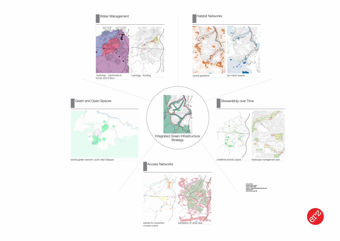
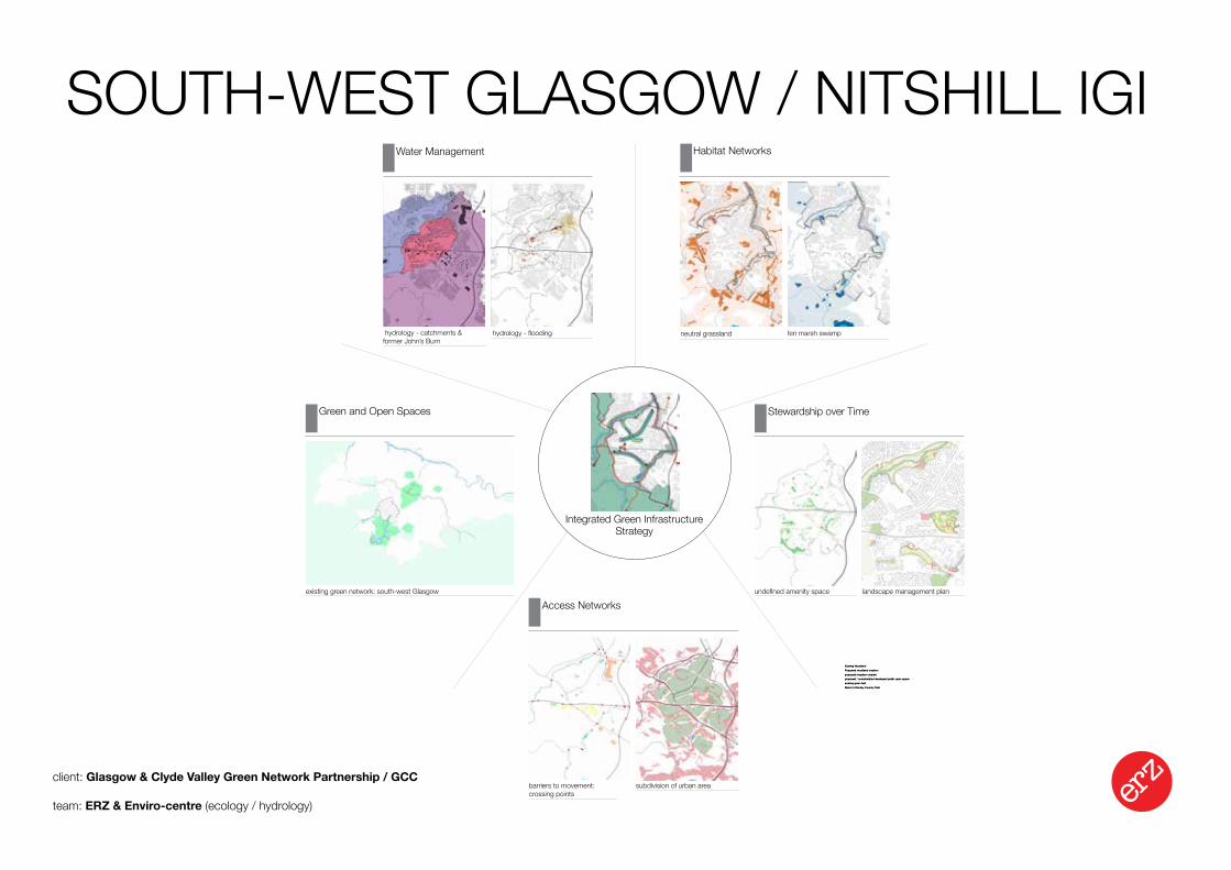
Integrated Green Infrastructure Strategy
Access Networks
barriers to movement: crossing points
subdivision of urban area
Stewardship over Time
undefined amenity space landscape management plan
neutral grassland fen marsh swamp
Habitat NetworksWater Management
hydrology - flooding hydrology - catchments & former John’s Burn
existing green network: south-west Glasgow
Green and Open Spaces
Landscape Urbanism Design Strategy
INTEGRATED GREEN INFRASTRUCTURE
Landscape Urbanism Design Strategy
POLICY
DELIVERY
INTEGRATED GREEN INFRASTRUCTURE
Landscape Urbanism Design Strategy
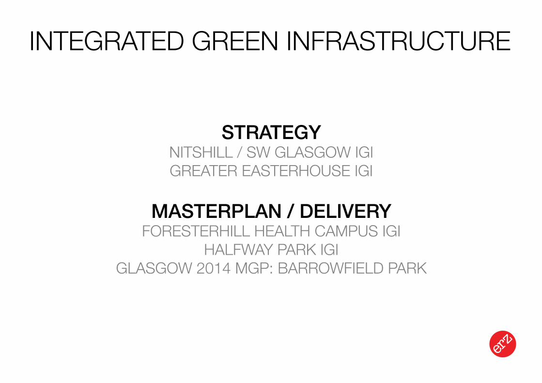
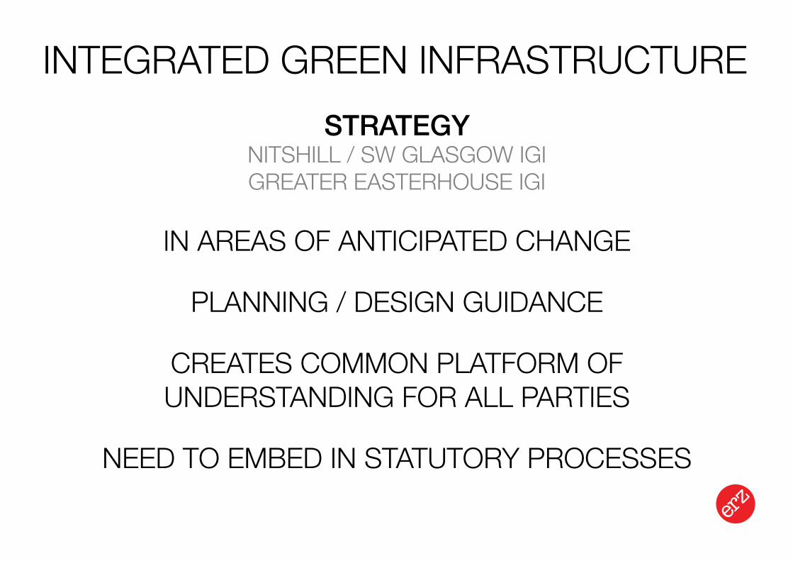
STRATEGYNITSHILL / SW GLASGOW IGIGREATER EASTERHOUSE IGI
MASTERPLAN / DELIVERYFORESTERHILL HEALTH CAMPUS IGI
HALFWAY PARK IGIGLASGOW 2014 MGP: BARROWFIELD PARK
INTEGRATED GREEN INFRASTRUCTURE
Landscape Urbanism Design Strategy
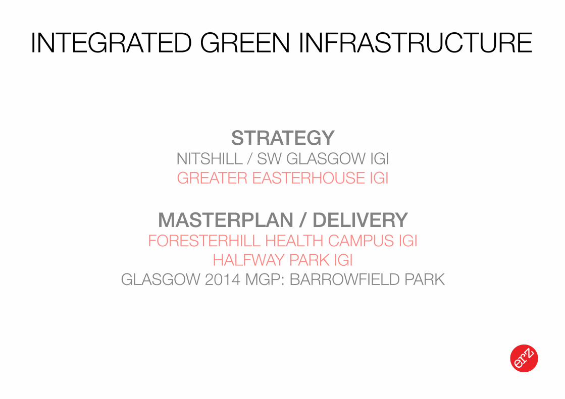
STRATEGYNITSHILL / SW GLASGOW IGIGREATER EASTERHOUSE IGI
MASTERPLAN / DELIVERYFORESTERHILL HEALTH CAMPUS IGI
HALFWAY PARK IGIGLASGOW 2014 MGP: BARROWFIELD PARK
Existing Woodland
Proposed woodland creation
proposed meadow creation
proposed / consolodated developed public open space
existing green belt
Dams to Darnley Country Park
Integrated Green Infrastructure Strategy
Access Networks
barriers to movement: crossing points
subdivision of urban area
Stewardship over Time
undefined amenity space landscape management plan
neutral grassland fen marsh swamp
Habitat NetworksWater Management
hydrology - flooding hydrology - catchments & former John’s Burn
existing green network: south-west Glasgow
Green and Open Spaces
Landscape Urbanism Design Strategy
SOUTH-WEST GLASGOW / NITSHILL IGI
client: Glasgow & Clyde Valley Green Network Partnership / GCC
team: ERZ & Enviro-centre (ecology / hydrology)
Landscape Urbanism Design Strategy
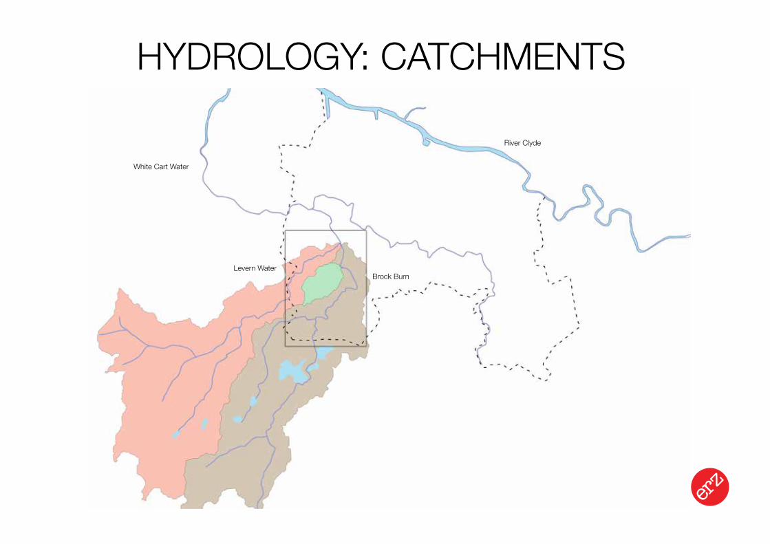
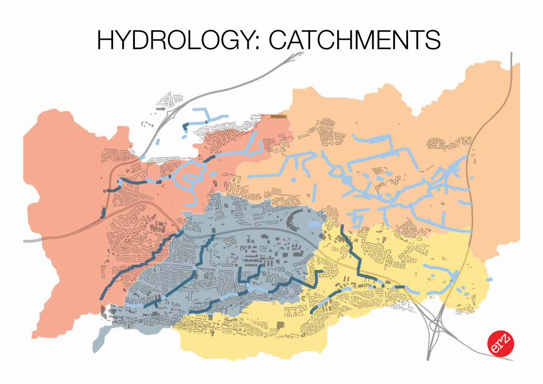
HYDROLOGY: CATCHMENTS
Levern WaterBrock Burn
White Cart Water
River Clyde
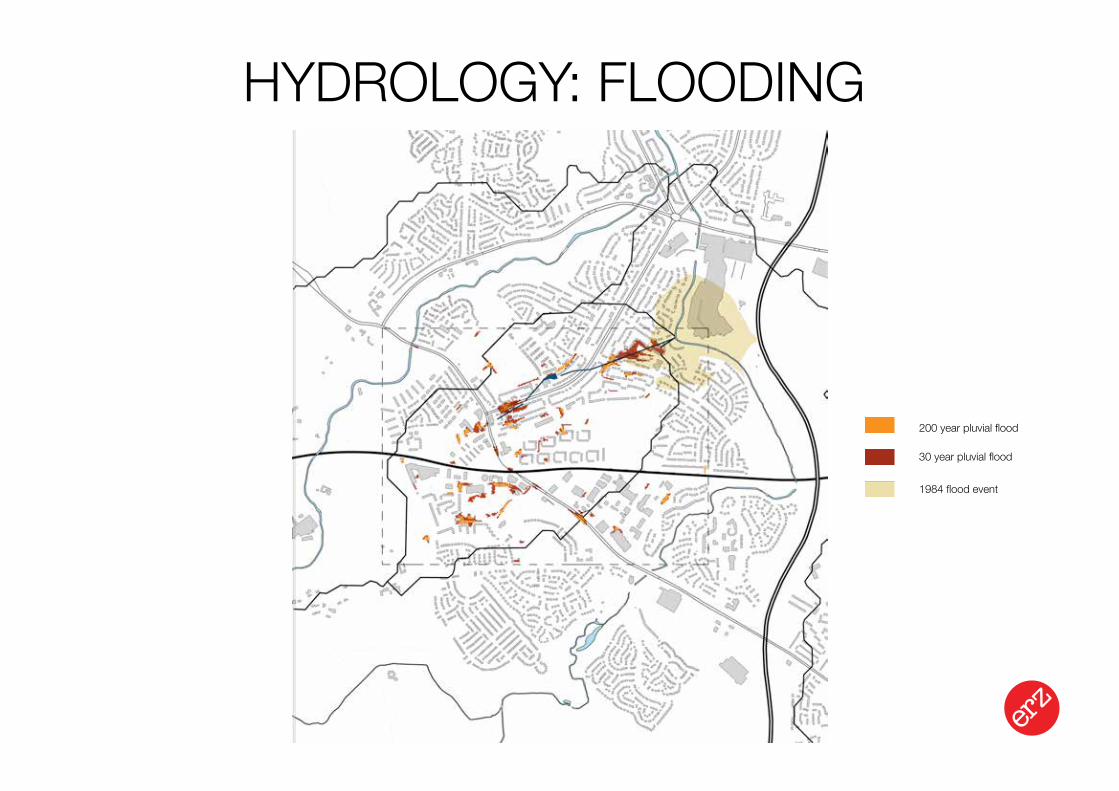
Landscape Urbanism Design Strategy
HYDROLOGY: FLOODING
200 year pluvial flood
30 year pluvial flood
1984 flood event
Landscape Urbanism Design Strategy
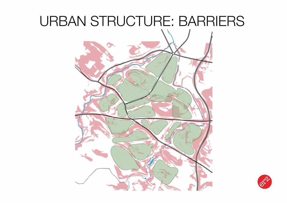
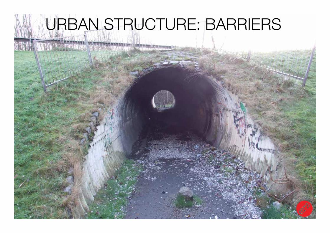
URBAN STRUCTURE: BARRIERS
Landscape Urbanism Design Strategy
URBAN STRUCTURE: BARRIERS

Landscape Urbanism Design Strategy
URBAN STRUCTURE: DESTINATIONS800m = 10 min walk
400m = 5 min walk
Landscape Urbanism Design Strategy
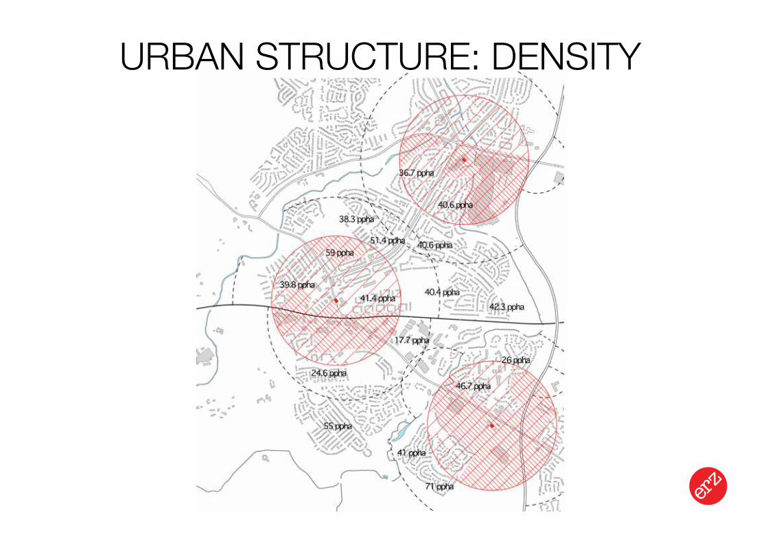
URBAN STRUCTURE: DENSITY
Landscape Urbanism Design Strategy
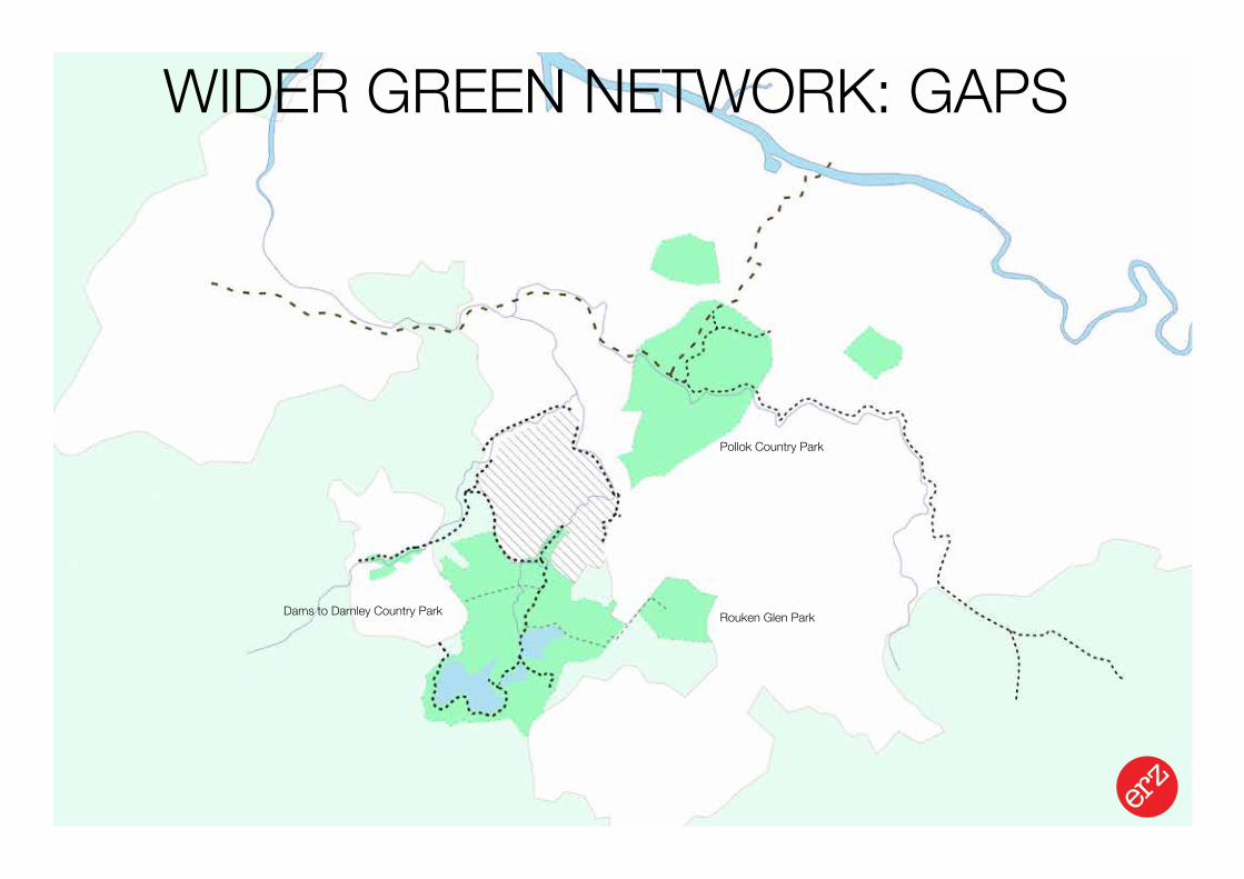
WIDER GREEN NETWORK: GAPS
Pollok Country Park
Dams to Darnley Country Park Rouken Glen Park
Landscape Urbanism Design Strategy
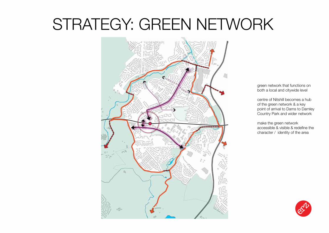
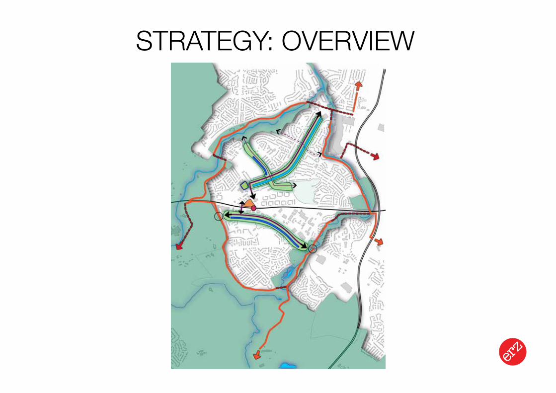
STRATEGY: GREEN NETWORK
green network that functions on both a local and citywide level
centre of Nitshill becomes a hub of the green network & a key point of arrival to Dams to Darnley Country Park and wider network
make the green network accessible & visible & redefine the character / identity of the area
Landscape Urbanism Design Strategy
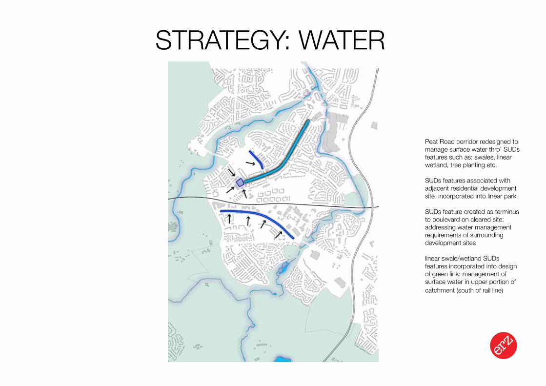
STRATEGY: WATER
Peat Road corridor redesigned to manage surface water thro’ SUDs features such as: swales, linear wetland, tree planting etc.
SUDs features associated with adjacent residential development site incorporated into linear park
SUDs feature created as terminus to boulevard on cleared site: addressing water management requirements of surrounding development sites
linear swale/wetland SUDs features incorporated into design of green link: management of surface water in upper portion of catchment (south of rail line)
Landscape Urbanism Design Strategy
STRATEGY: OVERVIEW
Landscape Urbanism Design Strategy
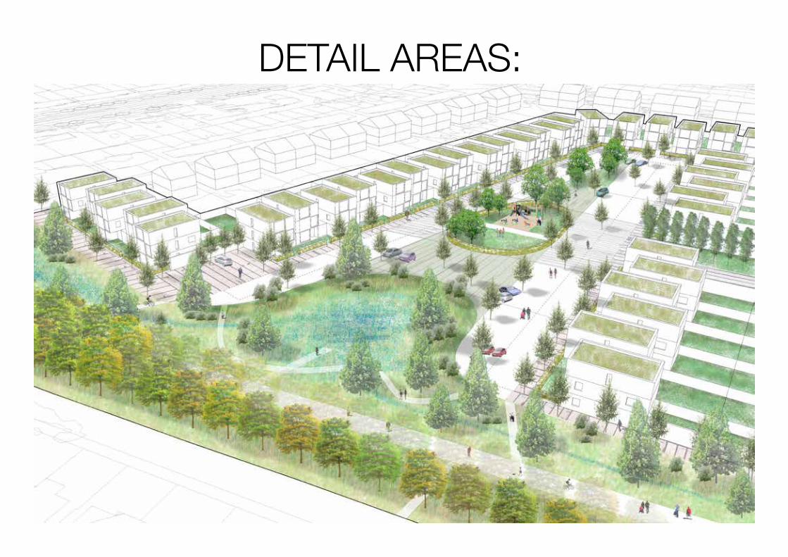
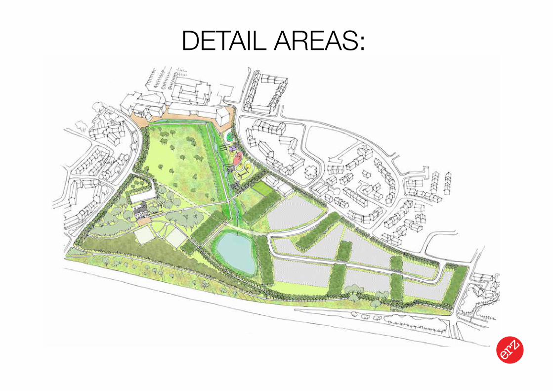
DETAIL AREAS:
Landscape Urbanism Design Strategy
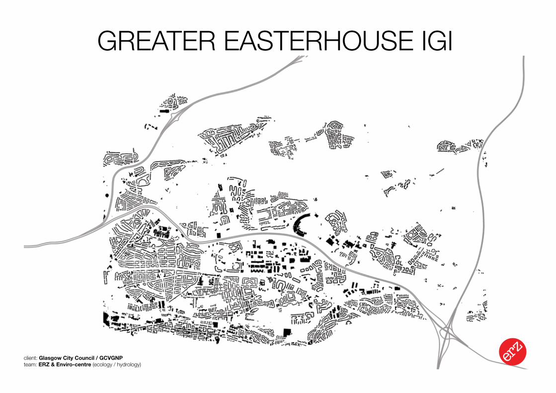
GREATER EASTERHOUSE IGI
client: Glasgow City Council / GCVGNPteam: ERZ & Enviro-centre (ecology / hydrology)
Landscape Urbanism Design Strategy
HYDROLOGY: CATCHMENTS
Landscape Urbanism Design Strategy
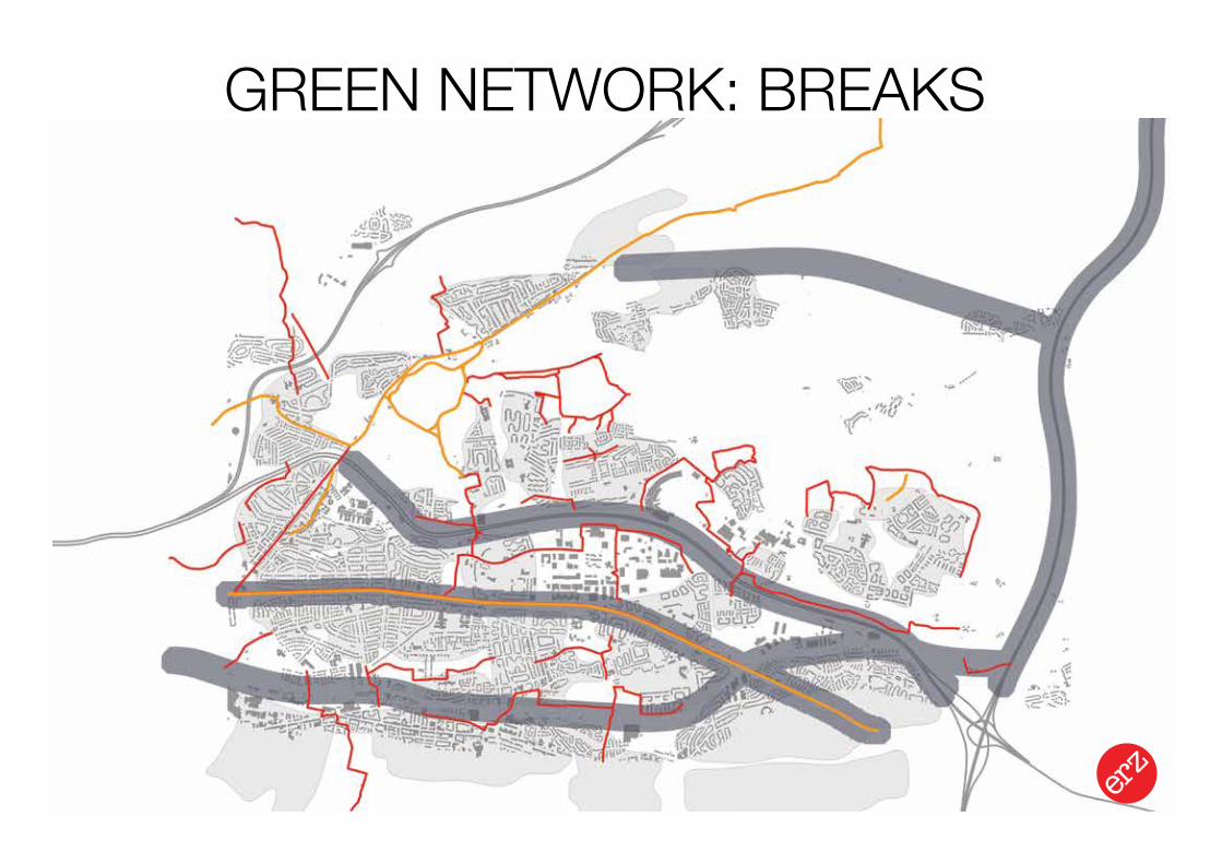
GREEN NETWORK: BREAKS
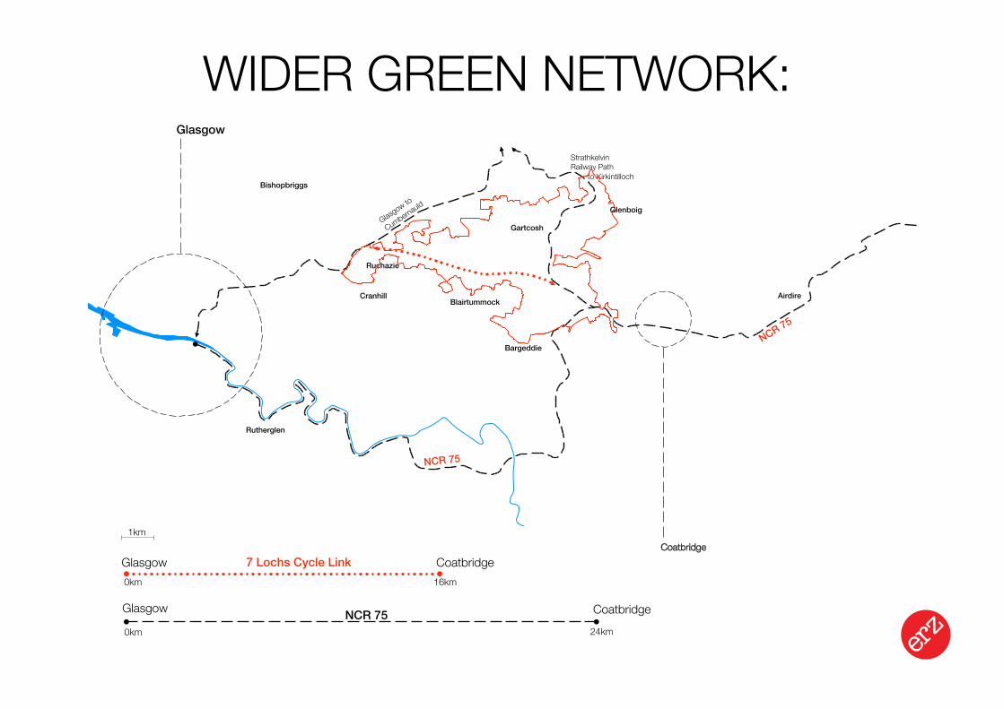
Glasgow
NCR 75
NCR 75
Strathkelvin Railway Path
Glasgow to
Cumbernauld
1km
Glasgow Coatbridge
0km 24km
Glasgow Coatbridge0km 16km
NCR 75
7 Lochs Cycle LinkCoatbridge
to Kirkintilloch
Gartcosh
Glenboig
Bargeddie
Rutherglen
Bishopbriggs
AirdireBlairtummock
Cranhill
Ruchazie
Landscape Urbanism Design Strategy
WIDER GREEN NETWORK:
Landscape Urbanism Design Strategy
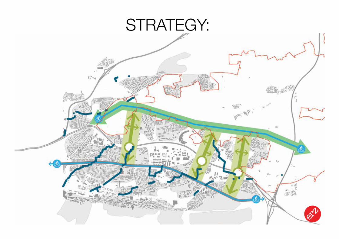
STRATEGY:
Landscape Urbanism Design Strategy
DETAIL AREAS:
INTEGRATED GREEN INFRASTRUCTURE
Landscape Urbanism Design Strategy
STRATEGYNITSHILL / SW GLASGOW IGIGREATER EASTERHOUSE IGI
IN AREAS OF ANTICIPATED CHANGE
PLANNING / DESIGN GUIDANCE
CREATES COMMON PLATFORM OF UNDERSTANDING FOR ALL PARTIES
NEED TO EMBED IN STATUTORY PROCESSES
INTEGRATED GREEN INFRASTRUCTURE
Landscape Urbanism Design Strategy
MASTERPLAN / DELIVERYFORESTERHILL HEALTH CAMPUS IGI
HALFWAY PARK IGIGLASGOW 2014 MGP: BARROWFIELD PARK
Landscape Urbanism Design Strategy
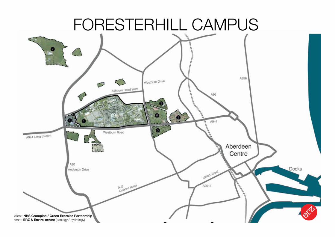
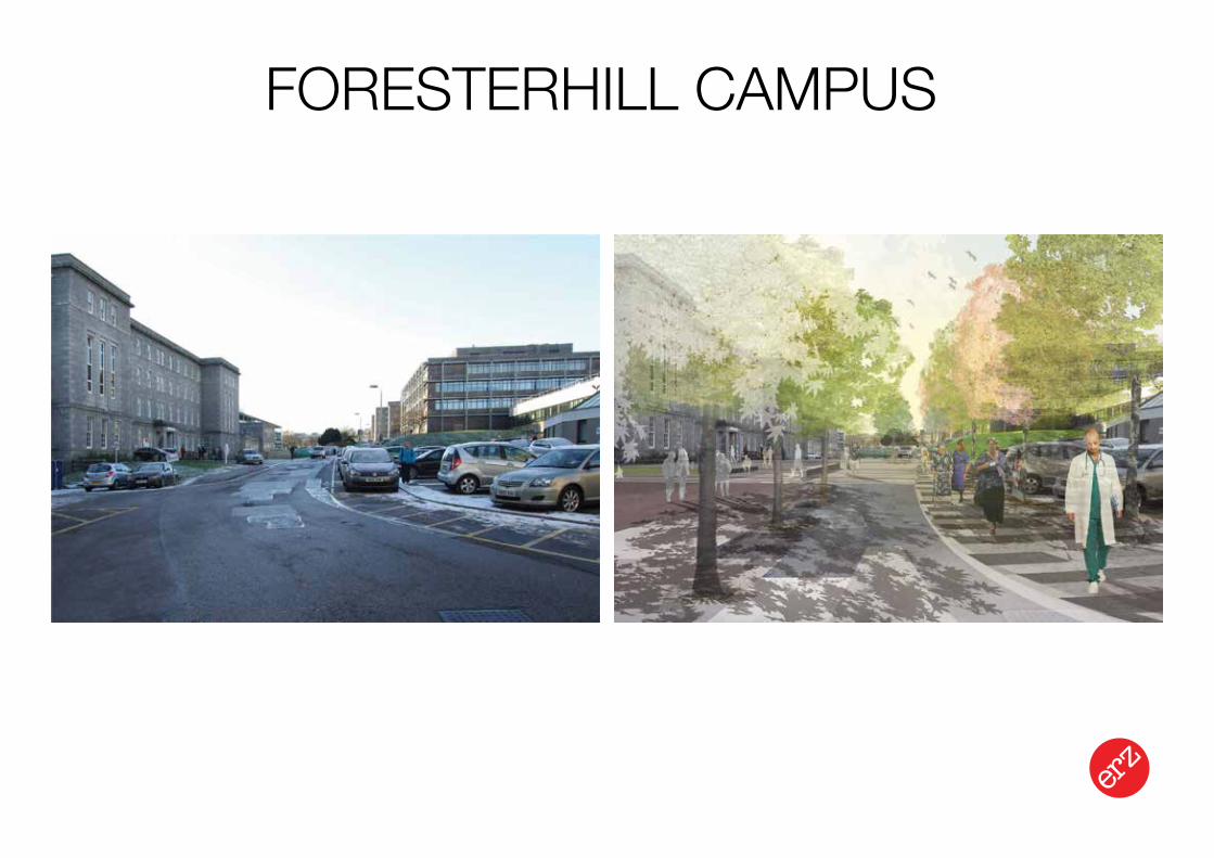
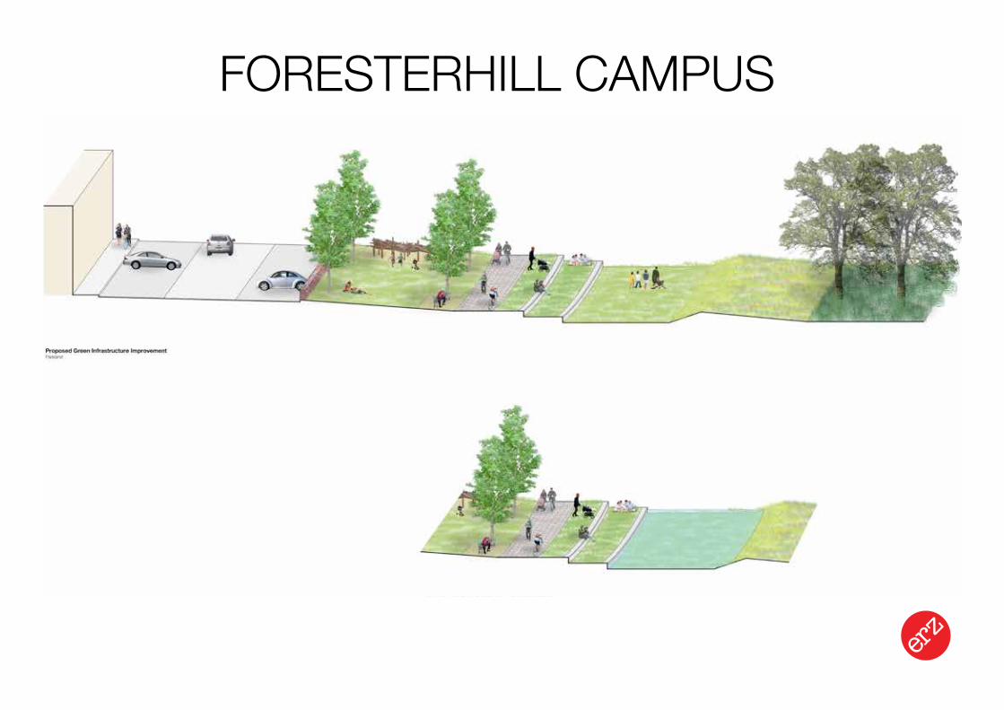
FORESTERHILL CAMPUS
client: NHS Grampian / Green Exercise Partnershipteam: ERZ & Enviro-centre (ecology / hydrology)
Landscape Urbanism Design Strategy
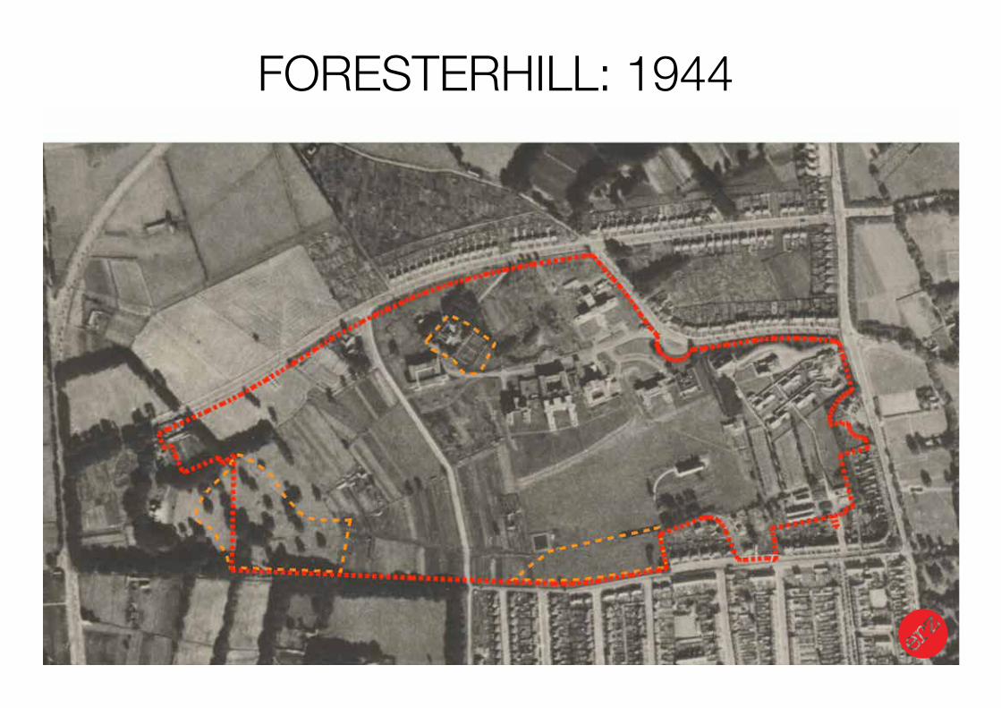
FORESTERHILL: 1944
Landscape Urbanism Design Strategy
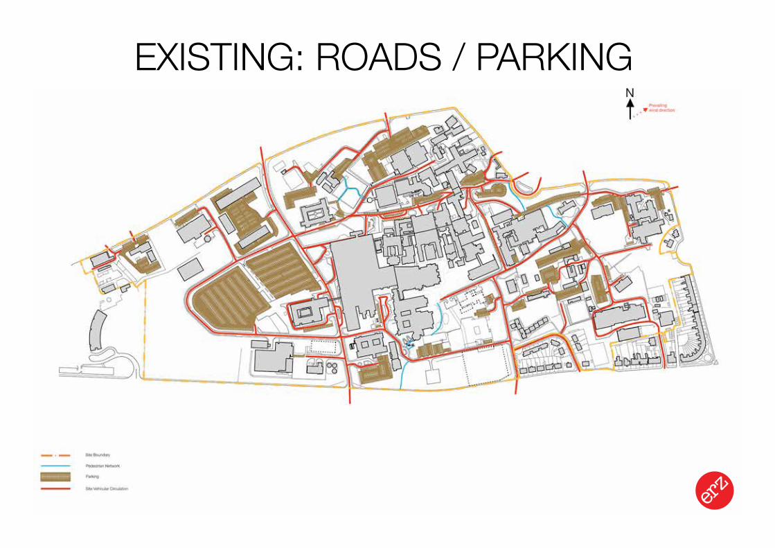
EXISTING: ROADS / PARKING
Landscape Urbanism Design Strategy
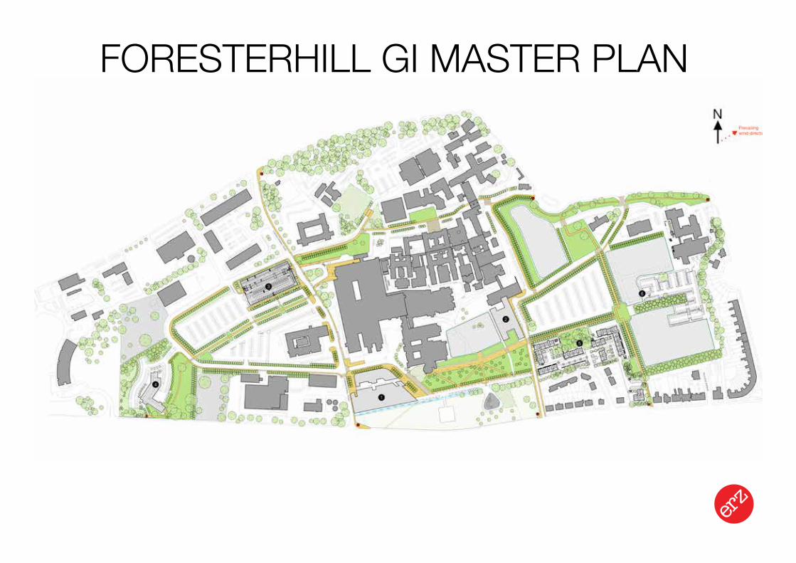
FORESTERHILL GI MASTER PLAN
Landscape Urbanism Design Strategy
FORESTERHILL CAMPUS
Landscape Urbanism Design Strategy
FORESTERHILL CAMPUS
Landscape Urbanism Design Strategy
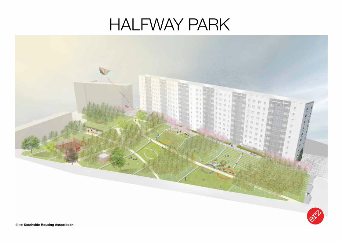
HALFWAY PARK
client: Southside Housing Association
erz
Limite
d 21
Jam
es M
orris
on S
treet
Glas
gow
G1
5PE
T/F:
014
1 55
2 08
88
E: in
fo@
erzs
tudi
o.co
.uk
W: w
ww
.erz
stud
io.c
o.uk
Project Title:
Drawing Title:
Client:
Notes:
Scale:
Drawing Number:
Revision Number:
Moss Heights 'Halfway Park'
Date:
erz/13/13/
13.07.2015
Planning
Southside Housing Association
All dimensions are to be verified on site. Do not scale from this drawing. The contractor is to bring to the attention of the Landscape Architect any discrepancies contained in this drawing prior to work commencing.
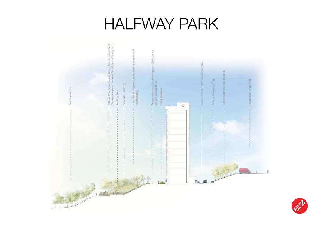
Site Section 2
NTS
P 09
Landscape Urbanism Design Strategy
HALFWAY PARK
Landscape Urbanism Design Strategy
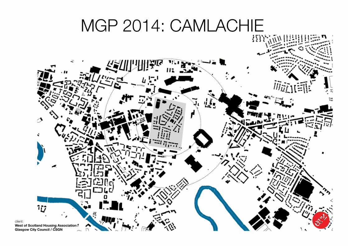
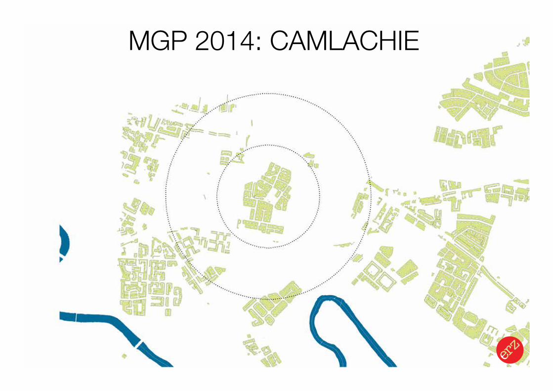
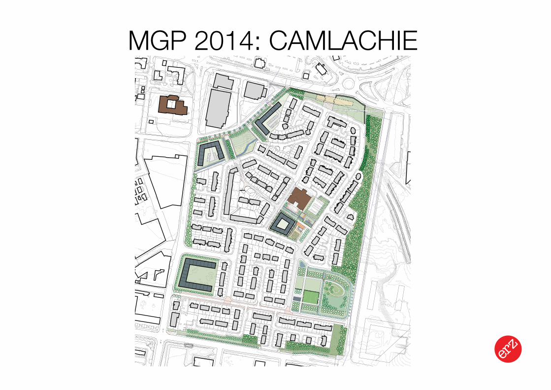
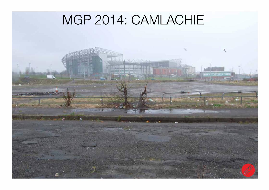
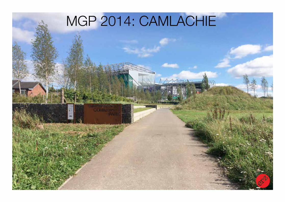
MGP 2014: CAMLACHIE
client: West of Scotland Housing Association / Glasgow City Council / CSGN
Landscape Urbanism Design Strategy
MGP 2014: CAMLACHIE
Landscape Urbanism Design Strategy
MGP 2014: CAMLACHIE
Landscape Urbanism Design Strategy
MGP 2014: CAMLACHIE
Landscape Urbanism Design Strategy
MGP 2014: CAMLACHIE
INTEGRATED GREEN INFRASTRUCTURE
Landscape Urbanism Design Strategy
MASTERPLAN / DELIVERYFORESTERHILL HEALTH CAMPUS IGI
HALFWAY PARK IGIGLASGOW 2014 MGP: BARROWFIELD PARK
PROBLEM SOLVING INTERVENTIONS
DRIVEN BY NEED FOR CHANGE
SEEK BETTER BALANCE OF ‘SYSTEMS’ IN BUILT ENVIRONMENT

Landscape Urbanism Design StrategyRO
ADS
/ TRA
NSPO
RT
HABI
TAT
NETW
ORK
S
ACCE
SS N
ETW
ORK
S
BUILT
DEV
ELO
PMEN
T
WAT
ER M
ANAG
EMEN
T
GRE
EN /
OPE
N SP
ACE
Related Documents