RECOMMENDATIONS JUNE 2005 48 SAN DIEGO RIVER PARK DRAFT MASTER PLAN, CITY OF SAN DIEGO Executive Summary Introduction Principles Design Guidelines Implementation A Appendices Recommendations Green Gateways Create a habitat corridor from Mission Bay Park to Mission Trails Regional Park General Recommendations: Habitat and Wildlife Intent The San Diego River Park seeks enhanced connectivity on three primary levels. Linear connectivity along the river corridor allows animals, energy and nutrients to move more freely and extensively throughout the landscape system. Lateral connectivity between the river corridor and adjacent upland habitat areas is also important, reducing habitat fragmentation and allowing a natural progression of habitat types. Finally, connectivity between the river and its tributaries is vital to the health of the river, measured in water quality, and of the surrounding habitat. Healthy and continuous native plant communities are essential to encouraging the movement and inhabitation of wildlife. Today the canyons, undeveloped slopes and upland spaces provide significant refuge for wildlife. Connecting these lands with the river valley creates ref the potential for wildlife movement between uplands and the river. the Therefore the extent to which these uplands remain undeveloped is of benefit to the River Park. The objective is to create a continuous native riparian corridor along the river and a continuum of native plant communities from riparian to upland in the canyons. These corridors should be of sufficient width to encourage the presence of a variety of bird and animal species, and contribute to reducing the existing condition that isolates most canyons from the river. An important step to enhance connectivity is to integrate both “infrastructure” and “ecostructure” to improve the connectivity of natural habitat. Infrastructure describes such services as transportation, utilities, and stormwater, while the term ecostructure encompasses rivers, vegetation, wildlife corridors and habitat. r To be included in this ecostructure designation, lands must meet two or more of the following conditions: be located within the San Diego River watershed, part of the river corridor/floodplain (as identified in the reach sections of this document), functioning natural habitat, designated park or open space or an easement. Generally, areas that eet more than one of these conditions are undevelopable because me they flood regularly, present steep side slopes and canyons, or are the areas designated for recreation, or conservation. As the last remnants of native habitat, these areas were identified as biologically significant and incorporated into the San Diego MSCP Subarea Plan. Ecostructure of the San Diego River Park

Welcome message from author
This document is posted to help you gain knowledge. Please leave a comment to let me know what you think about it! Share it to your friends and learn new things together.
Transcript
RECOMMENDATIONS RECOMMENDATIONSJUNE 200548SAN DIEGO RIVER PARK DRAFT MASTER PLAN, CITY OF SAN DIEGO
Executive Summary
Introduction
Principles
Design Guidelines
Implementation
AppendicesAppendices
Recommendations
JUNE 200549 SAN DIEGO RIVER PARK DRAFT MASTER PLAN, CITY OF SAN DIEGO
Recommendations
Mission Bay Park
Improve connectivity to surrounding canyon habitat
Green Gateways
Mission Trails Regional Park
Create a habitat corridor from Mission Bay Park to Mission Trails Regional Park
General Recommendations:Habitat and Wildlife Intent The San Diego River Park seeks enhanced connectivity on three primary levels. Linear connectivity along the river corridor allows animals, energy and nutrients to move more freely and extensively throughout the landscape system. Lateral connectivity between the river corridor and adjacent upland habitat areas is also important, reducing habitat fragmentation and allowing a natural progression of habitat types. Finally, connectivity between the river and its tributaries is vital to the health of the river, measured in water quality, and of the surrounding habitat.
Healthy and continuous native plant communities are essential to encouraging the movement and inhabitation of wildlife. Today the canyons, undeveloped slopes and upland spaces provide signifi cant refuge for wildlife. Connecting these lands with the river valley creates refuge for wildlife. Connecting these lands with the river valley creates the potential for wildlife movement between uplands and the river. the potential for wildlife movement between uplands and the river. Therefore the extent to which these uplands remain undeveloped is of benefi t to the River Park. The objective is to create a continuous native riparian corridor along the river and a continuum of native plant communities from riparian to upland in the canyons. These corridors should be of suffi cient width to encourage the presence of a variety of bird and animal species, and contribute to reducing the existing condition that isolates most canyons from the river.
An important step to enhance connectivity is to integrate both “infrastructure” and “ecostructure” to improve the connectivity of natural habitat. Infrastructure describes such services as transportation, utilities, and stormwater, while the term ecostructure encompasses utilities, and stormwater, while the term ecostructure encompasses rivers, vegetation, wildlife corridors and habitat. rivers, vegetation, wildlife corridors and habitat.
To be included in this ecostructure designation, lands must meet two or more of the following conditions: be located within the San Diego River watershed, part of the river corridor/fl oodplain (as identifi ed in the reach sections of this document), functioning natural habitat, designated park or open space or an easement. Generally, areas that designated park or open space or an easement. Generally, areas that meet more than one of these conditions are undevelopable because meet more than one of these conditions are undevelopable because they fl ood regularly, present steep side slopes and canyons, or are they fl ood regularly, present steep side slopes and canyons, or are areas designated for recreation, or conservation. As the last remnants of native habitat, these areas were identifi ed as biologically signifi cant and incorporated into the San Diego MSCP Subarea Plan.
Ecostructure of the San Diego River Park
RECOMMENDATIONS RECOMMENDATIONSJUNE 200548SAN DIEGO RIVER PARK DRAFT MASTER PLAN, CITY OF SAN DIEGO
Recommendations
JUNE 200549 SAN DIEGO RIVER PARK DRAFT MASTER PLAN, CITY OF SAN DIEGO
Executive Summary
Introduction
Principles
Design Guidelines
Implementation
Appendices
Recommendations
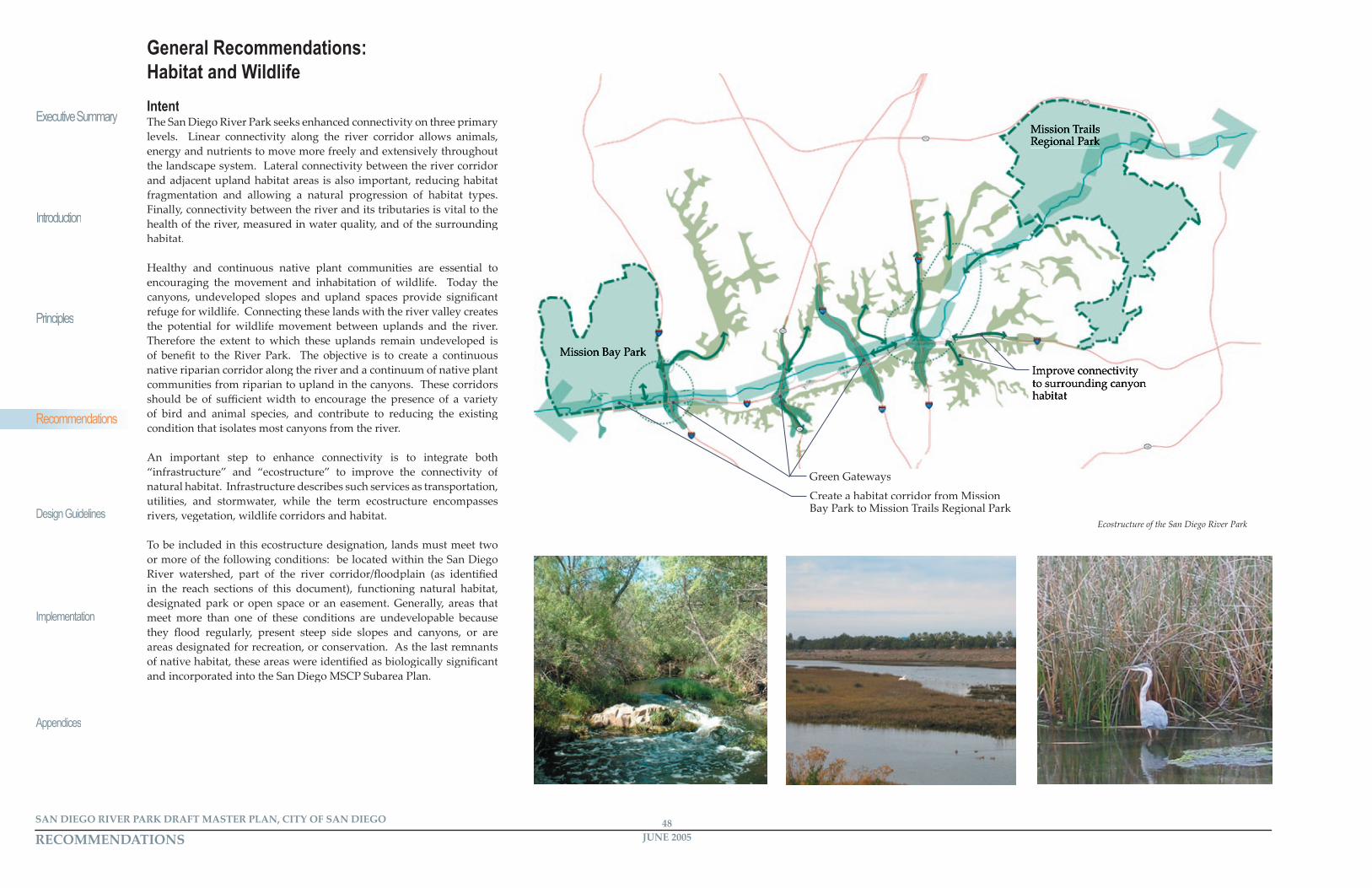
Reduction, or loss of habitat and associated fragmentation are two of the biggest factors in the viability of habitat to continue to support wildlife, particularly in regard to the riparian, coastal sage scrub, and chaparral plant communities that comprise the majority of natural habitat in the study area. In urban areas, the existing habitat is limited to the immediate riparian corridor of the river, or fragmented and isolated upland habitat. Opportunities to increase habitat are limited, focusing San Diego River Park eff orts on creating or improving habitat in places where it also improves connectivity between existing habitat areas is the key.
Recommendations• Establish appropriate corridor widths to achieve objectives.• Acquire open lands and pursue open space easements.• Eliminate invasive plant species and reintroduce native species.• Encourage multi-use redevelopment.• Reclaim frontage roads as pedestrian and bicycle-only green buff ers.• Naturalize fl oodplain areas.• Daylight the river’s tributaries.• Use biological systems to treat all stormwater before it enters the river.• Separate pedestrian/wildlife and vehicular river crossings.• Establish ‘Green Gateways’ as defi ned in this section.• Establish habitat corridors as secondary gateways at side canyons and tributaries.• Convert smaller, adjacent streets to ‘Green Streets’ as defi ned in this section.• Provide interpretive information regarding natural systems and the rehabilitation of the river
Establish desirable and appropriate corridor width objectivesWater bodies and wildlife need ‘breathing room’ to maintain health and integrity. Open space corridors function as water quality buff ers and as valuable habitat areas. Corridor widths must be determined based on available land and specifi c wildlife populations along each section of the river*.
An important element of establishing adequate corridors is encouraging development and redevelopment to take place an appropriate distance from the river’s edge. This concept aligns with Army Corps of Engineers (ACOE) recommendations for fl oodplain management. The San Diego County Multiple Species Conservation Program (MSCP) Final Plan identifi es the San Diego River valley as a habitat linkage from Mission Trails Regional Park to the ocean, and therefore the open space and habitat corridor should provide adequate space for wildlife
movement. The presence of specifi c animal species is closely related to the width of the undisturbed open space available. The width also impacts whether the species inhabit or merely transit through the open space. Substantial wildlife habitat exists in Mission Trails Regional Park (MTRP) and in the canyons adjacent to the river valley. Maintaining corridors through the river valley will create a network of open space for habitat that will encourage wildlife movement through and residence within the valley. The objective is to preserve a wider optimum corridor in undeveloped land between Mission Trails Regional Park and Friars Road to create the potential for movement of larger wildlife from MTRP through the river valley and to Elanus Canyon above Admiral Baker Golf Course and back to MTRP. The river valley narrows and infrastructure impacts increase downstream of Friars Road, limiting the opportunity for larger animal species movement and residence of smaller species. The objective between Friars Road and Mission Valley Preserve is to preserve or create a continuous habitat corridor adequate to encourage movement and residence of smaller species. As the River Park Master Plan is implemented in specifi c areas within the valley, specifi c land development plans should be prepared to test the objectives for each site. The actual width of habitat corridors in various locations should be determined at the time of site specifi c planning and in conjunction with balancing the achievement of other objectives such as the quality and viability of private development, trail connections and other considerations. Refer to the Design Guidelines in the document for specifi c information regarding corridor objectives and recommendations.
*Studies of wildlife movement and resident populations (Integrated Natural Resources Management Plan for Marine Corps Air Station Mirimar) suggest that a corridor width of 300 feet is generally adequate to support resident species of birds and smaller mammals, while a corridor width of 500 feet is generally optimum to allow movement of larger mammals as well as increased resident populations of birds and small mammals. The City of San Diego Land Development Code - Biology Guidelines, Section III Biological Impact Analysis and Mitigation Procedures, recommends that areas of native vegetation that are less than 400 feet wide for a length greater than 500 feet are considered isolated (p. 21). The guidelines further reference the MSCP recommendation that at urban interface edge conditions widths should range from 200 to 600 feet depending on adjacent land uses (p. 21).
Acquire open lands and pursue easements.To expand, unify, and connect the river corridor, open space parcels or easements on private property should be acquired.
Eliminate invasive plant species, reintroduce native species and develop long-term management plans.Floodplains recaptured in natural vegetation off er great promise in improving ecological function. Invasive, non-native plant species disrupt the balance and function of natural ecosystems, o� en choking out native species. The San Diego River Park planning process should coordinate with agencies, community groups and land owners to develop and implement vegetation management programs to remove exotic species and plant native riparian vegetation. Such plans should also consider Water Primrose, a native aquatic plant that requires management to control it spread. Special concern needs to be given to the timing of this work in order to minimize impacts to existing habitat, the timing of this work in order to minimize impacts to existing habitat, species, and wildlife use. On going management and maintenance is species, and wildlife use. On going management and maintenance is necessary to ensure establishment of native species and to prevent the return of invasive species. Programs should be developed to educate and coordinate vegetation management on both public and private lands.
Naturalize fl oodplain areas.Naturalization should address both current and potential future hydrologic regimes. Similar to previously executed work in the Mission Valley Preserve, naturalization should consider the regrading of areas to create upland habitat adjacent to or in the fl oodplain and a continuous transition of native plant communities between the riparian corridor and upland habitat areas. A next step would use the naturalized fl oodplain areas to restore river channel dynamics to a more natural hydrologic regime. This naturalized regime would result in improved riparian habitat, particularly for listed species that depend on the river as an agent of disturbance in the fl oodplain.
Encourage multi-use redevelopment.Development that can accommodate multiple uses, reduce the amount Development that can accommodate multiple uses, reduce the amount of land locked in development, and free more land for open space uses. of land locked in development, and free more land for open space uses. By way of example, an under-utilized asphalt parking lot could be replaced with multi-function areas such as natural habitat areas, multi-use green space (recreation, temporary seasonal parking, etc.) for active and passive recreation.
RECOMMENDATIONS RECOMMENDATIONSJUNE 200550SAN DIEGO RIVER PARK DRAFT MASTER PLAN, CITY OF SAN DIEGO
Executive Summary
Introduction
Principles
Design Guidelines
Implementation
AppendicesAppendices
Recommendations
JUNE 200551 SAN DIEGO RIVER PARK DRAFT MASTER PLAN, CITY OF SAN DIEGO
Recommendations
Reclaim frontage roads as pedestrian and bicycle-only green buffers.The San Diego River Park planning eff ort should examine existing frontage roads to assess daily traffi c and availability of alternate routes. Where possible, li� le-used frontage roads, or segments of frontage roads, should be converted to green, vegetated buff ers for non-motorized use.
Daylight the river and it’s tributaries. Many of the road crossings and tributaries of the San Diego River are contained in culverts, including Alvarado, Murray, Murphy and Ruffi n creeks. Removing pipes, culverts and covered channels to expose the river to daylight combined with widening the channel and gently sloping the banks will reveal the true structure and pa� ern of the river, and support the naturalization of the fl oodplain and river corridor. Culverts should be replaced with bridges to reduce fl ow constraints, expand riparian habitat and encourage wildlife movement.expand riparian habitat and encourage wildlife movement.
Use biological systems to treat all stormwater before it enters the river.Biological treatment systems (constructed wetlands) provide water quality buff ering that illustrates natural processes, provides wildlife habitat and maintains the character of the river corridor. This method of water fi ltering aligns with the Bureau of Reclamation Stormwater Treatment Program goals. Include interpretive signage to educate visitors about the value and function of such systems.
The San Diego River Park should also make stormwater treatment locations visible and educational features that interpret the day-to-day function and cycles of a river. Refer to Hydrology and Water Quality function and cycles of a river. Refer to Hydrology and Water Quality Recommendations.Recommendations.
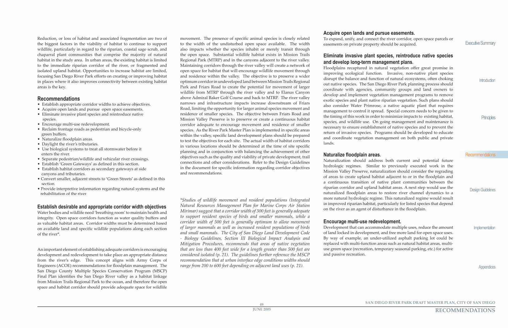
Separate pedestrian/wildlife and vehicular river crossings.San Diego River Park improvements should retrofi t existing river crossing to allow grade-separated crossings for wildlife, San Diego River Park users, and vehicles. These bridges should address crossings at all scales, from trails to roads to highways. Pedestrian safety and continuity of pedestrian movement is improved by eliminating confl icts and interactions with vehicles. The construction and use of grade separated pedestrian passages is encouraged, such as the one under Friars Road at Fenton Marketplace. Similar passages should be created to improve pedestrian movement between the river valley and upland neighborhoods and canyons.
Establish ‘Green Gateways.’Green Gateways are key landscape elements located at the entries to and along the corridors through the San Diego River’s domain. The gateways consist of large-scale plantings within public rights-of-way. Green Gateways create visual and functional connectivity to the San Diego River corridor and adjacent landscapes. Visually, these gateways mark the domain of the river corridor, providing a variety of view and access experiences. Depending upon each highway’s elevation in relation to the ground plane of the valley bo� om, the goal is to convey the sense of going “over”, or “through”, the riparian canopy of the river corridor. Visually, these gateways will counterbalance the overwhelming presence of the existing highway infrastructure. Functionally, these gateways will provide additional habitat and connectivity between the riparian corridor and adjacent upland areas.
The San Diego River Park should implement gateways at a range of scales, sized to fi t the visual and functional needs of the connections being made. Large-scale gateways are appropriate at locations where highways such as I-5, SR-163, and I-15 cross the San Diego River Valley. I-805 off ers a visual gateway to the valley below. These plantings include native trees and understory vegetation selected from the Native Plant Species Lists in Appendix i. Fremont Poplar (Populus fremontii) is recommended for this application; this species is a large, easily-recognizable tree that is a signature element of the region’s riparian corridors. An iconic tree such as this one will emphasize river proximity. Open space parcels, whether acquired outright or through easements, that are contiguous with the gateways can contribute to and enhance their eff ect. These open space corridors will extend the native vegetation of the gateways.
Tunnel under Friars Road provides a link between the valley fl oor and the valley wall and Ruffi n Canyon
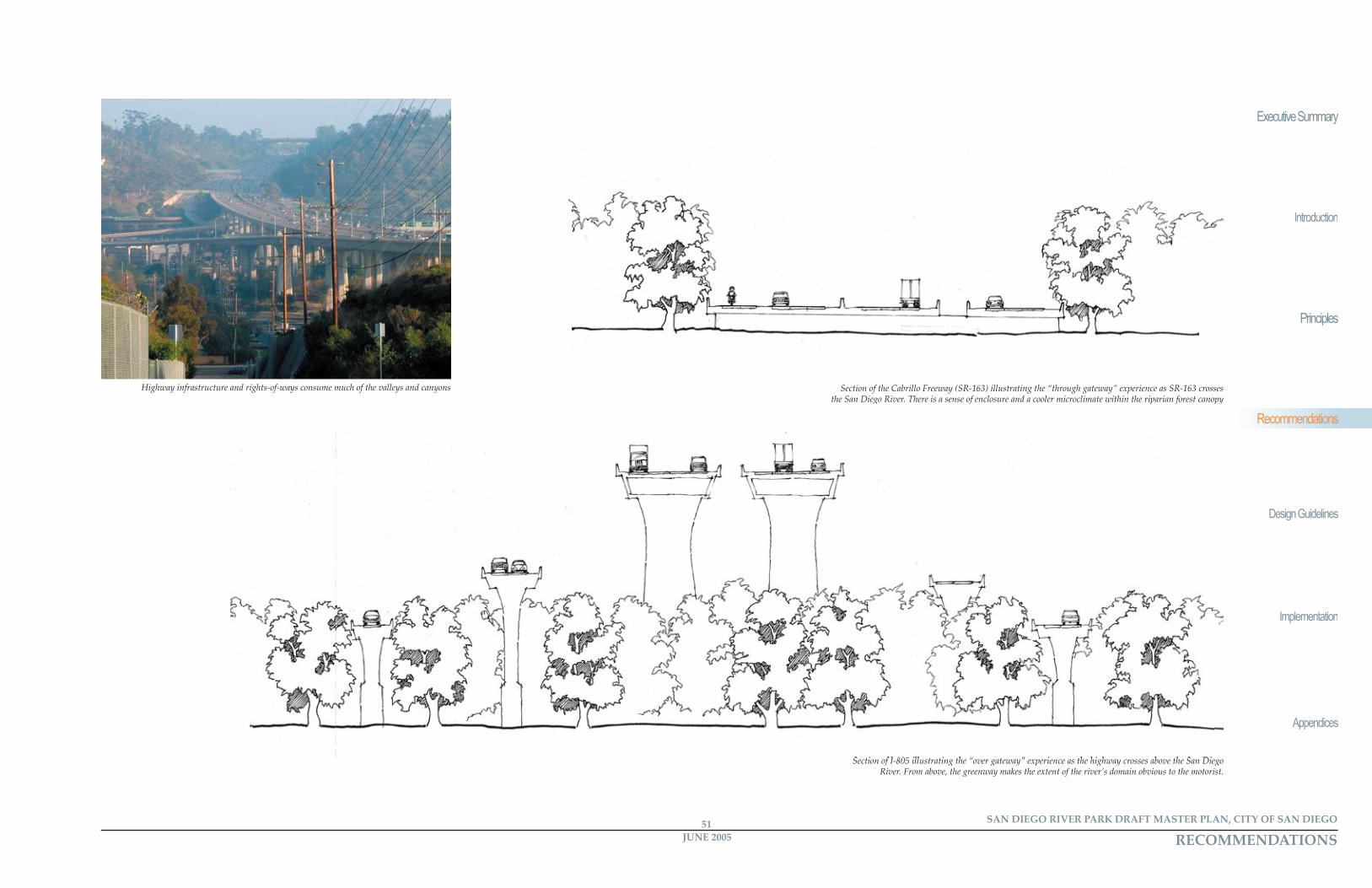
Section of the Cabrillo Freeway (SR-163) illustrating the “through gateway” experience as SR-163 crosses the San Diego River. There is a sense of enclosure and a cooler microclimate within the riparian forest canopy
Section of I-805 illustrating the “over gateway” experience as the highway crosses above the San Diego Section of I-805 illustrating the “over gateway” experience as the highway crosses above the San Diego River. From above, the greenway makes the extent of the river’s domain obvious to the motorist.
RECOMMENDATIONS RECOMMENDATIONSJUNE 200550SAN DIEGO RIVER PARK DRAFT MASTER PLAN, CITY OF SAN DIEGO
Recommendations
JUNE 200551 SAN DIEGO RIVER PARK DRAFT MASTER PLAN, CITY OF SAN DIEGO
Executive Summary
Introduction
Principles
Design Guidelines
Implementation
Appendices
Recommendations
Highway infrastructure and rights-of-ways consume much of the valleys and canyons
RECOMMENDATIONS RECOMMENDATIONSJUNE 200552SAN DIEGO RIVER PARK DRAFT MASTER PLAN, CITY OF SAN DIEGO
Executive Summary
Introduction
Principles
Design Guidelines
Implementation
AppendicesAppendices
Recommendations
JUNE 200553 SAN DIEGO RIVER PARK DRAFT MASTER PLAN, CITY OF SAN DIEGO
Recommendations
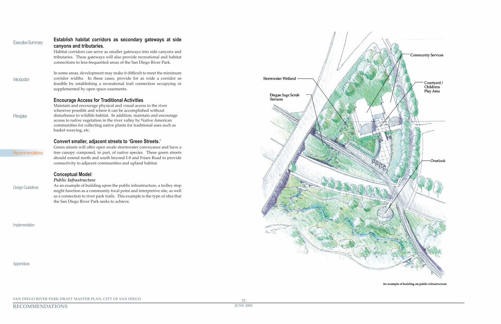
Stormwater Wetland
Overlook
Diegan Sage Scrub Terraces
Courtyard / Childrens Play Area
Community Services
Establish habitat corridors as secondary gateways at side canyons and tributaries.Habitat corridors can serve as smaller gateways into side canyons and tributaries. These gateways will also provide recreational and habitat connections to less-frequented areas of the San Diego River Park.
In some areas, development may make it diffi cult to meet the minimum corridor widths. In these cases, provide for as wide a corridor as feasible by establishing a recreational trail connection occupying or supplemented by open space easements.
Encourage Access for Traditional ActivitiesMaintain and encourage physical and visual access to the river wherever possible and where it can be accomplished without wherever possible and where it can be accomplished without disturbance to wildlife habitat. In addition, maintain and encourage disturbance to wildlife habitat. In addition, maintain and encourage access to native vegetation in the river valley by Native American access to native vegetation in the river valley by Native American communities for collecting native plants for traditional uses such as basket weaving, etc.
Convert smaller, adjacent streets to ‘Green Streets.’Green streets will off er open swale stormwater conveyance and have a tree canopy composed, in part, of native species. These green streets should extend north and south beyond I-8 and Friars Road to provide connectivity to adjacent communities and upland habitat.
Conceptual Model:Public InfrastructureAs an example of building upon the public infrastructure, a trolley stop As an example of building upon the public infrastructure, a trolley stop might function as a community focal point and interpretive site, as well might function as a community focal point and interpretive site, as well as a connection to river park trails. This example is the type of idea that as a connection to river park trails. This example is the type of idea that the San Diego River Park seeks to achieve.
An example of building on public infrastructure
RECOMMENDATIONS RECOMMENDATIONSJUNE 200552SAN DIEGO RIVER PARK DRAFT MASTER PLAN, CITY OF SAN DIEGO
Recommendations
JUNE 200553 SAN DIEGO RIVER PARK DRAFT MASTER PLAN, CITY OF SAN DIEGO
Executive Summary
Introduction
Principles
Design Guidelines
Implementation
Appendices
Recommendations
IntentThe San Diego River Park Dra� Master Plan proposes recreation facilities where the need exists, where such facilities would be accessible to the community and where recreational facilities would not require displacement of existing development. The proposed east-west multi-use trail, as well as connecting lateral bike paths and pedestrian trails, are proposed to link neighborhoods to new parks and regional recreation facilities. Interpretive areas and passive park uses are recommended where cultural and natural resources are most signifi cant.
The San Diego River Park planning eff ort seeks to identify recreation needs and opportunities in the river corridor. Although the recommendations that follow focus on the one mile wide San Diego River Park planning corridor, existing facilities and recreation needs were examined within the fi � een adjacent community planning areas. According to Park & Recreation standards, many of the communities have major parkland defi cits. Open, developable land for new parks is very limited throughout these communities. The river corridor is an appropriate place to provide additional recreation, given the valley’s central location. As an added benefi t, expanding park lands within the corridor can contribute to open space preservation.
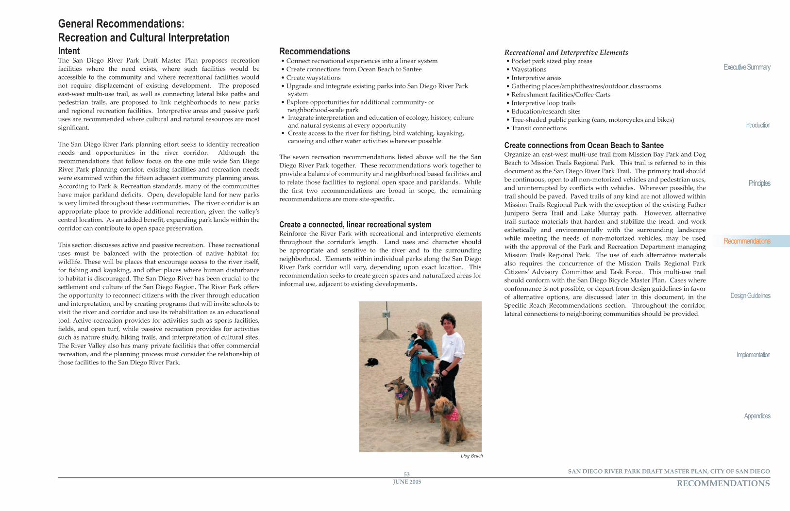
This section discusses active and passive recreation. These recreational uses must be balanced with the protection of native habitat for wildlife. These will be places that encourage access to the river itself, for fi shing and kayaking, and other places where human disturbance to habitat is discouraged. The San Diego River has been crucial to the se� lement and culture of the San Diego Region. The River Park off ers the opportunity to reconnect citizens with the river through education and interpretation, and by creating programs that will invite schools to visit the river and corridor and use its rehabilitation as an educational tool. Active recreation provides for activities such as sports facilities, fi elds, and open turf, while passive recreation provides for activities such as nature study, hiking trails, and interpretation of cultural sites. The River Valley also has many private facilities that off er commercial recreation, and the planning process must consider the relationship of those facilities to the San Diego River Park.
Recommendations• Connect recreational experiences into a linear system• Create connections from Ocean Beach to Santee• Create waystations• Upgrade and integrate existing parks into San Diego River Park
system• Explore opportunities for additional community- or neighborhood-scale park• Integrate interpretation and education of ecology, history, culture
and natural systems at every opportunity• Create access to the river for fi shing, bird watching, kayaking,
canoeing and other water activities wherever possible.
The seven recreation recommendations listed above will tie the San Diego River Park together. These recommendations work together to provide a balance of community and neighborhood based facilities and to relate those facilities to regional open space and parklands. While the fi rst two recommendations are broad in scope, the remaining recommendations are more site-specifi c.
Create a connected, linear recreational systemReinforce the River Park with recreational and interpretive elements throughout the corridor’s length. Land uses and character should be appropriate and sensitive to the river and to the surrounding neighborhood. Elements within individual parks along the San Diego River Park corridor will vary, depending upon exact location. This recommendation seeks to create green spaces and naturalized areas for informal use, adjacent to existing developments.
Recreational and Interpretive Elements• Pocket park sized play areas• Waystations• Interpretive areas• Gathering places/amphitheatres/outdoor classrooms• Refreshment facilities/Coff ee Carts• Interpretive loop trails• Education/research sites• Tree-shaded public parking (cars, motorcycles and bikes)• Transit connections
Create connections from Ocean Beach to Santee Organize an east-west multi-use trail from Mission Bay Park and Dog Beach to Mission Trails Regional Park. This trail is referred to in this document as the San Diego River Park Trail. The primary trail should be continuous, open to all non-motorized vehicles and pedestrian uses, be continuous, open to all non-motorized vehicles and pedestrian uses, and uninterrupted by confl icts with vehicles. Wherever possible, the and uninterrupted by confl icts with vehicles. Wherever possible, the trail should be paved. Paved trails of any kind are not allowed within Mission Trails Regional Park with the exception of the existing Father Junipero Serra Trail and Lake Murray path. However, alternative trail surface materials that harden and stabilize the tread, and work esthetically and environmentally with the surrounding landscape while meeting the needs of non-motorized vehicles, may be used while meeting the needs of non-motorized vehicles, may be used with the approval of the Park and Recreation Department managing with the approval of the Park and Recreation Department managing Mission Trails Regional Park. The use of such alternative materials also requires the concurrence of the Mission Trails Regional Park Citizens’ Advisory Commi� ee and Task Force. This multi-use trail should conform with the San Diego Bicycle Master Plan. Cases where conformance is not possible, or depart from design guidelines in favor conformance is not possible, or depart from design guidelines in favor of alternative options, are discussed later in this document, in the of alternative options, are discussed later in this document, in the Specifi c Reach Recommendations section. Throughout the corridor, Specifi c Reach Recommendations section. Throughout the corridor, lateral connections to neighboring communities should be provided.
General Recommendations:Recreation and Cultural Interpretation
Dog Beach
RECOMMENDATIONS RECOMMENDATIONSJUNE 200554SAN DIEGO RIVER PARK DRAFT MASTER PLAN, CITY OF SAN DIEGO
Executive Summary
Introduction
Principles
Design Guidelines
Implementation
AppendicesAppendices
Recommendations
JUNE 200555 SAN DIEGO RIVER PARK DRAFT MASTER PLAN, CITY OF SAN DIEGO
Recommendations
Path and Trail Elements• Multi-use path on one side of the river only, except in Mission Trails
Regional Park• Unpaved pedestrian trail, generally on opposite side of the river
from the multi-use trail, where appropriate• Separate all portions of multi-use path from vehicular uses• Above and/or below grade crossings at all intersections of the
multi-use path with vehicular traffi c• Design guidelines for incorporating the multi-use path into future developments• Lateral connections to neighborhoods: -Primary links: Morena Boulevard, Jackson Drive, Mission Gorge Road, Texas Street, Ulric Street -Secondary links: Princess View Drive, Tierrasanta Boulevard, Zion Avenue, Mission Village Drive, Mission Center Road and Bachman Place• • Connections to businesses and activity/shopping centersConnections to businesses and activity/shopping centers• Connections to resource based parks: Balboa Park, Presidio Park, Connections to resource based parks: Balboa Park, Presidio Park,
Mission Bay Park, and Mission Trails Regional Park
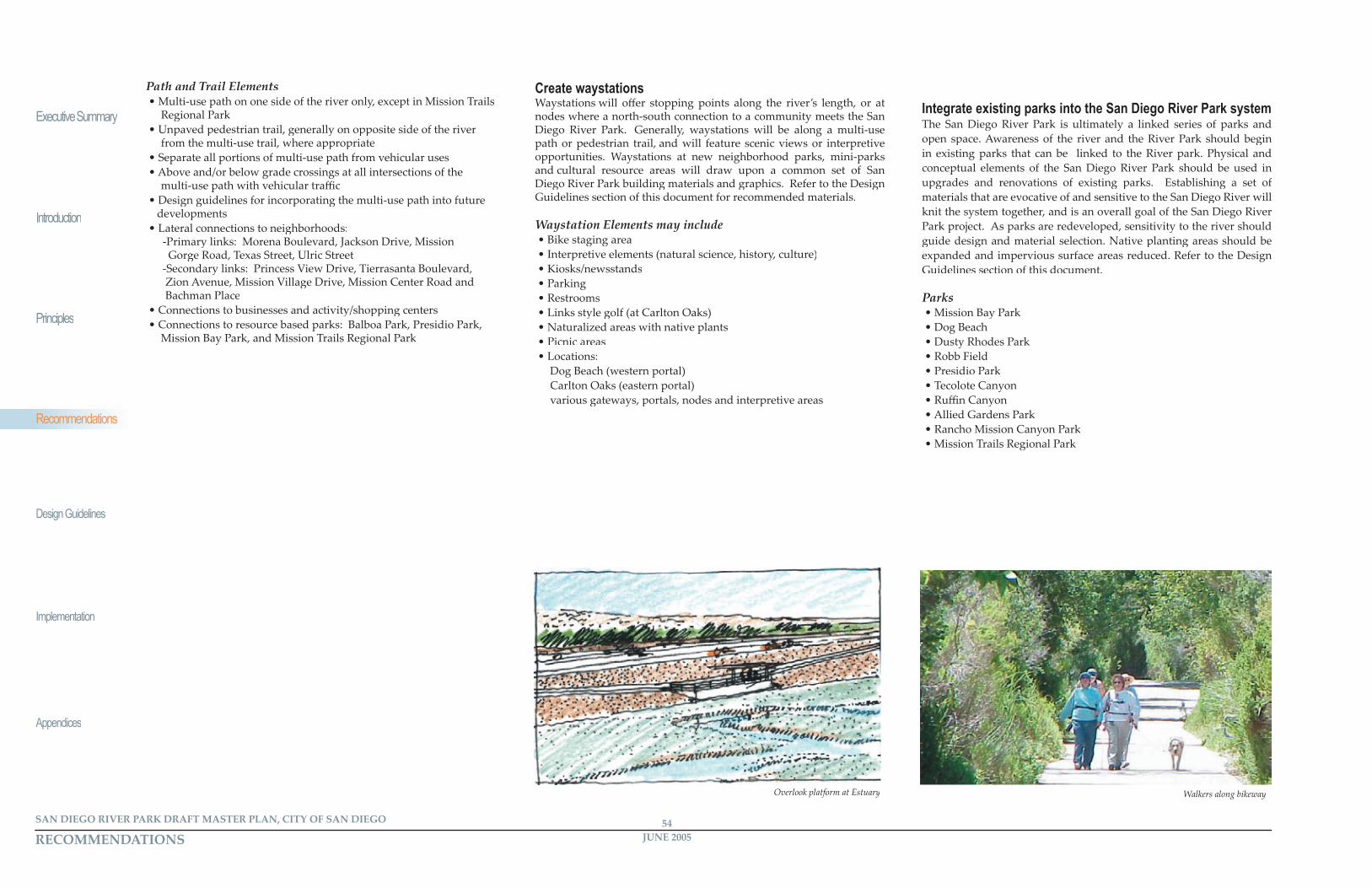
Create waystationsWaystations will off er stopping points along the river’s length, or at nodes where a north-south connection to a community meets the San Diego River Park. Generally, waystations will be along a multi-use path or pedestrian trail, and will feature scenic views or interpretive opportunities. Waystations at new neighborhood parks, mini-parks and cultural resource areas will draw upon a common set of San Diego River Park building materials and graphics. Refer to the Design Guidelines section of this document for recommended materials.
Waystation Elements may include• Bike staging area• Interpretive elements (natural science, history, culture)• Kiosks/newsstands• Parking• Restrooms• Links style golf (at Carlton Oaks)• Naturalized areas with native plants• Picnic areas• Locations:
Dog Beach (western portal)Carlton Oaks (eastern portal)various gateways, portals, nodes and interpretive areas
Integrate existing parks into the San Diego River Park systemThe San Diego River Park is ultimately a linked series of parks and open space. Awareness of the river and the River Park should begin in existing parks that can be linked to the River park. Physical and conceptual elements of the San Diego River Park should be used in upgrades and renovations of existing parks. Establishing a set of materials that are evocative of and sensitive to the San Diego River will knit the system together, and is an overall goal of the San Diego River Park project. As parks are redeveloped, sensitivity to the river should guide design and material selection. Native planting areas should be expanded and impervious surface areas reduced. Refer to the Design Guidelines section of this document.
Parks• Mission Bay Park• Dog Beach• Dusty Rhodes Park• Robb Field• Presidio Park• Tecolote Canyon• Ruffi n Canyon• Allied Gardens Park• Rancho Mission Canyon Park• Mission Trails Regional Park
Overlook platform at Estuary Walkers along bikeway
RECOMMENDATIONS RECOMMENDATIONSJUNE 200554SAN DIEGO RIVER PARK DRAFT MASTER PLAN, CITY OF SAN DIEGO
Recommendations
JUNE 200555 SAN DIEGO RIVER PARK DRAFT MASTER PLAN, CITY OF SAN DIEGO
Executive Summary
Introduction
Principles
Design Guidelines
Implementation
Appendices
Recommendations
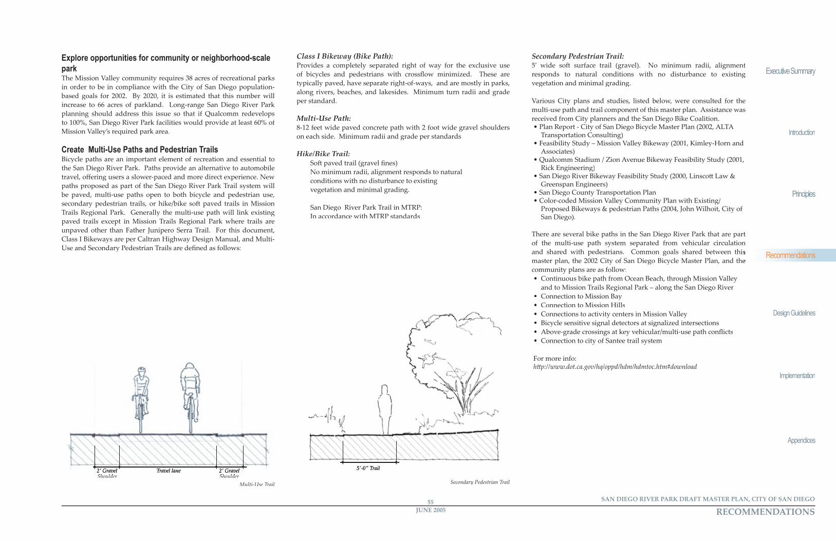
Multi-Use Trail
2’ Gravel ShoulderShoulder
2’ Gravel ShoulderShoulder
Travel lane
Explore opportunities for community or neighborhood-scale parkThe Mission Valley community requires 38 acres of recreational parks in order to be in compliance with the City of San Diego population-based goals for 2002. By 2020, it is estimated that this number will increase to 66 acres of parkland. Long-range San Diego River Park planning should address this issue so that if Qualcomm redevelops to 100%, San Diego River Park facilities would provide at least 60% of Mission Valley’s required park area.
Create Multi-Use Paths and Pedestrian TrailsBicycle paths are an important element of recreation and essential to the San Diego River Park. Paths provide an alternative to automobile travel, off ering users a slower-paced and more direct experience. New paths proposed as part of the San Diego River Park Trail system will be paved, multi-use paths open to both bicycle and pedestrian use, secondary pedestrian trails, or hike/bike so� paved trails in Mission Trails Regional Park. Generally the multi-use path will link existing paved trails except in Mission Trails Regional Park where trails are unpaved other than Father Junipero Serra Trail. For this document, Class I Bikeways are per Caltran Highway Design Manual, and Multi-Use and Secondary Pedestrian Trails are defi ned as follows:
Class I Bikeway (Bike Path):Provides a completely separated right of way for the exclusive use of bicycles and pedestrians with crossfl ow minimized. These are typically paved, have separate right-of-ways, and are mostly in parks, along rivers, beaches, and lakesides. Minimum turn radii and grade per standard.
Multi-Use Path:8-12 feet wide paved concrete path with 2 foot wide gravel shoulders on each side. Minimum radii and grade per standards
Hike/Bike Trail:So� paved trail (gravel fi nes)No minimum radii, alignment responds to natural
conditions with no disturbance to existing vegetation and minimal grading.
San Diego River Park Trail in MTRP: In accordance with MTRP standards
Secondary Pedestrian Trail:5’ wide so� surface trail (gravel). No minimum radii, alignment responds to natural conditions with no disturbance to existing vegetation and minimal grading.
Various City plans and studies, listed below, were consulted for the multi-use path and trail component of this master plan. Assistance was received from City planners and the San Diego Bike Coalition. • Plan Report - City of San Diego Bicycle Master Plan (2002, ALTA
Transportation Consulting)• Feasibility Study – Mission Valley Bikeway (2001, Kimley-Horn and
Associates)• Qualcomm Stadium / Zion Avenue Bikeway Feasibility Study (2001,
Rick Engineering)• San Diego River Bikeway Feasibility Study (2000, Linsco� Law &
Greenspan Engineers)• San Diego County Transportation Plan• Color-coded Mission Valley Community Plan with Existing/
Proposed Bikeways & pedestrian Paths (2004, John Wilhoit, City of San Diego).
There are several bike paths in the San Diego River Park that are part of the multi-use path system separated from vehicular circulation and shared with pedestrians. Common goals shared between this and shared with pedestrians. Common goals shared between this master plan, the 2002 City of San Diego Bicycle Master Plan, and the master plan, the 2002 City of San Diego Bicycle Master Plan, and the community plans are as follow:• Continuous bike path from Ocean Beach, through Mission Valley
and to Mission Trails Regional Park – along the San Diego River• Connection to Mission Bay• Connection to Mission Hills• Connections to activity centers in Mission Valley• Bicycle sensitive signal detectors at signalized intersections• Above-grade crossings at key vehicular/multi-use path confl icts• Connection to city of Santee trail system
For more info:h� p://www.dot.ca.gov/hq/oppd/hdm/hdmtoc.htm#download
Secondary Pedestrian Trail
5’-0” Trail
RECOMMENDATIONS RECOMMENDATIONSJUNE 200556SAN DIEGO RIVER PARK DRAFT MASTER PLAN, CITY OF SAN DIEGO
Executive Summary
Introduction
Principles
Design Guidelines
Implementation
AppendicesAppendices
Recommendations
JUNE 200557 SAN DIEGO RIVER PARK DRAFT MASTER PLAN, CITY OF SAN DIEGO
Recommendations
IntentPublic art has a potent role in bringing life to the San Diego River Park. The diversity of history and culture in the San Diego region and specifi cally in the San Diego River Valley off ers a tremendous opportunity to engage the community with the experience of the river. Public art should integrate with cultural and natural systems, interpret the river and its ecosystems and build upon the specifi c circumstances of the diverse environments along the river corridor. The City of San Diego has adopted a public art policy that promotes artist involvement in selected City design and construction projects. Such involvement is encouraged with all projects associated with the San Diego River Park.
Recommendations• Create identity with art• Integrate art that interprets the river into the San Diego River Park
experience• Include artists in the design process and provide for an artist in
residence program• Make art accessible to everyone
Create identity with art.San Diego River Park Trail SystemAt every opportunity, art should be incorporated into the San Diego River Park Trail. Art elements should be a component of trail access points, interpretive areas and signage, fountains where appropriate, fencing, furnishings and in the paving texture and color of the trail itself at locations of signifi cance such as intersections, street crossings and entrances.
Integrate art into the San Diego River Park experience.Public Art in Parks and Open SpaceArt should play a role in the design of parks and natural open space. In parks, art elements should be incorporated into entrances, furnishings, lighting, fencing, interpretive areas and signage, as interactive elements and as sculpture. In natural areas, a sense of design should be incorporated with the science of ecological restoration of native habitat to create identifi able and memorable places, as the form can add richness and understanding of how the natural systems function. In addition, art should be incorporated into the interpretation of the systems.
Include artists in the design process.Public Art in Public Projects
In projects initiated by public entities, art and artists should be involved in a signifi cant role to contribute to the project design. An artist in residence program could create the opportunity for an individual artist to focus on the river for an extended period of time, creating art that interprets the river and off ering the potential opportunity to teach, interact with schools, and to actively engage people with art and the river.
General Recommendations: Public Art Recommendations
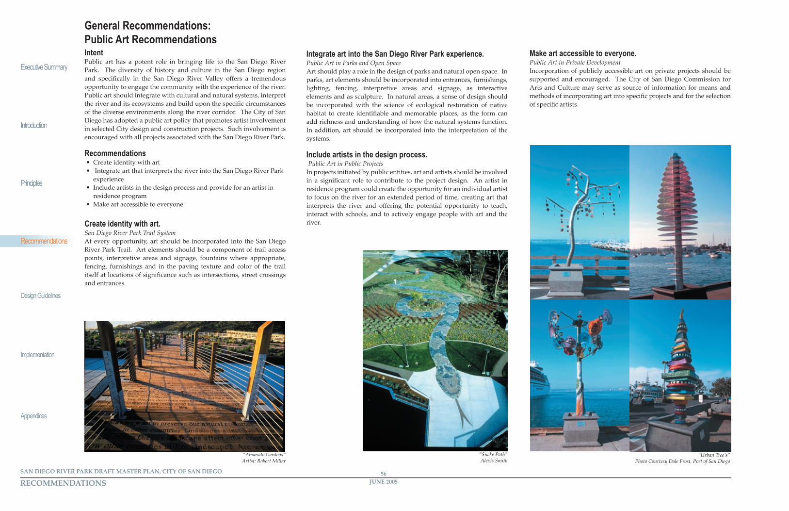
“Alvarado Gardens” Artist: Robert Millar
“Snake Path” Alexis Smith
“Urban Tree’s” Photo Courtesy Dale Frost, Port of San Diego
Make art accessible to everyone.Public Art in Private DevelopmentIncorporation of publicly accessible art on private projects should be supported and encouraged. The City of San Diego Commission for Arts and Culture may serve as source of information for means and methods of incorporating art into specifi c projects and for the selection of specifi c artists.
R e a c h R e c o m m e n d a t i o n s
Related Documents