THE COMPROMISES - MAPS 45 The Missouri Compromise, 1820 1. Locate and label the states and territories outlined on their maps. 2. Use one color or pattern to shade free states in 1820 and another color or pattern to shade slave states in 1820. 3. Use a solid line to show the Missouri Compromise line .. Use the colors or patterns fron1 2. above to shade the territories where slavery was prohibited and where it was allowed according to the Missouri Comprolnise. 4. Create a key in the blank box. 5. Which of the following statements are supported by the map and correct the incorrect stateluents. A .. Pennsylvania was a free state in 1820 B. According to the Missouri Compromise, slavery would be prohibited in the Michigan Territory and permitted in the Arkansas Territory. C. In 1818, the slave states held most of the seats in the Senate. D. The Missouri Compromise allowed slavery in the Michigan Territory. E. Florida Territory was slave territory because it was south of the latitude 36 30 OF. Most of the Louisiana Purchase was south of the Missouri Compromise line. 46 The Compromise of 1850 1. Locate the area or areas described in each phrase below. Then label each area with its name and the letter of the description. A. two territories that could choose to become slave states through popular sovereignty according to the Compromise of 1850 B. first territory from the Mexican Cession to ask for admission to the nation C. territory set aside for Indians D. territory divided at the 49th parallel in an agreement with Britain 2. Locate and label the remainder of the states and territories outlined on their maps. Then use a solid line to show the Missouri Compromise line. 3. Use different colors or patterns to shade each of the following: (1) free states and territories in 1850; (2) slave states and territories in 1850; (3) territories open to slavery by popular sovereignty under the Compromise 'of 1850. 4. Create a key in the blank box. 5. (a) How many free states existed in 1850? How many slave states? (b) Which territories were affected by the Conlpromise of 1850? How were they affected? (c) How did the number of free states and slave states affect representation in Congress? 47 The Kansas-Nebraska Act, 1854 1. Label and locate the states and territories outlined on their maps. Then use a line to show the Missouri Compromise line. 2. Ask students to use different colors or patterns to shade (1) free states and territories in 1854; (2) slave states and territories in 1854; (3) territory open to slavery by popular sovereignty according to the Compromise of 1850; (4) territory open to slavery by popular sovereignty according to the Kansas-Nebraska Act of 1854. 3. Create a key in the blank box. 4. Which of the following statements are supported by the map; correct the incorrect statements. A. Missouri was a free state because it was north of the Missouri Compromise line. B. The New England states were free states. C. States carved from the Nebraska Territory were to decide on slavery through popular sovereignty. D. Slavery was allowed in the Utah Territory according to the Compromise of 1850. E. The Kansas-Nebraska Act repealed the Compromise of 1850.

Welcome message from author
This document is posted to help you gain knowledge. Please leave a comment to let me know what you think about it! Share it to your friends and learn new things together.
Transcript
THE COMPROMISES - MAPS
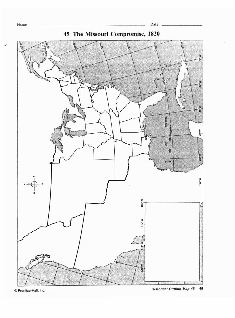
45 The Missouri Compromise, 1820
1. Locate and label the states and territories outlined on their maps.
2. Use one color or pattern to shade free states in 1820 and another color or pattern to shade slave states in 1820.
3. Use a solid line to show the Missouri Compromise line.. Use the colors or patterns fron1 2. above to shade the territories where slavery was prohibited and where it was allowed according to the Missouri Comprolnise.
4. Create a key in the blank box.
5. Which of the following statements are supported by the map and correct the incorrect stateluents.
A .. Pennsylvania was a free state in 1820
B. According to the Missouri Compromise, slavery would be prohibited in the Michigan Territory and permitted in the Arkansas Territory.
C. In 1818, the slave states held most of the seats in the Senate.
D. The Missouri Compromise allowed slavery in the Michigan Territory.
E. Florida Territory was slave territory because it was south of the latitude 36 30
OF. Most of the Louisiana Purchase was south of the Missouri Compromise line.
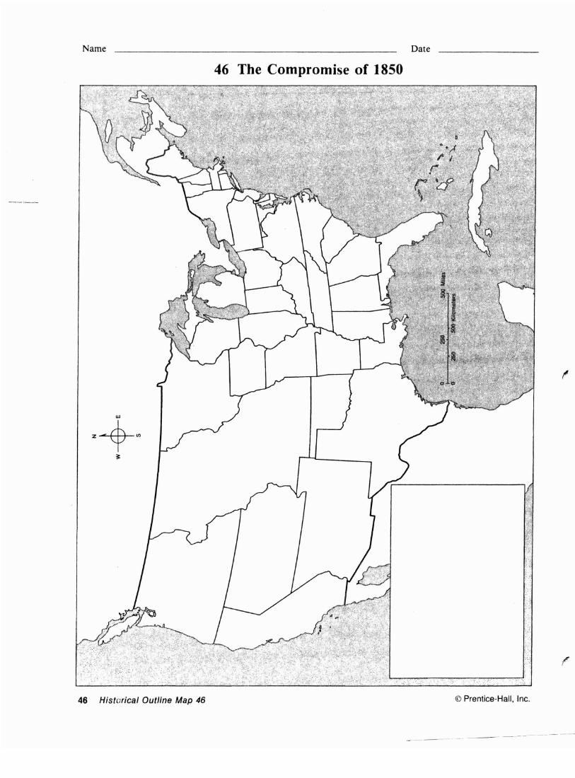
46 The Compromise of 1850
1. Locate the area or areas described in each phrase below. Then label each area with its name and the letter of the description.
A. two territories that could choose to become slave states through popular sovereignty according to the Compromise of 1850
B. first territory from the Mexican Cession to ask for admission to the nation
C. territory set aside for Indians
D. territory divided at the 49th parallel in an agreement with Britain
2. Locate and label the remainder of the states and territories outlined on their maps. Then use a solid line to show the Missouri Compromise line.
3. Use different colors or patterns to shade each of the following: (1) free states and territories in 1850; (2) slave states and territories in 1850; (3) territories open to slavery by popular sovereignty under the Compromise 'of 1850.
4. Create a key in the blank box.
5. (a) How many free states existed in 1850? How many slave states? (b) Which territories were affected by the Conlpromise of 1850? How were they affected? (c) How did the number of free states and slave states affect representation in Congress?
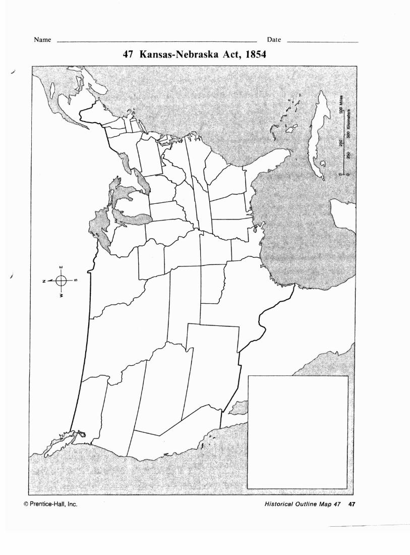
47 The Kansas-Nebraska Act, 1854
1. Label and locate the states and territories outlined on their maps. Then use a line to show the Missouri Compromise line.
2. Ask students to use different colors or patterns to shade (1) free states and territories in 1854; (2) slave states and territories in 1854; (3) territory open to slavery by popular sovereignty according to the Compromise of 1850; (4) territory open to slavery by popular sovereignty according to the Kansas-Nebraska Act of 1854.
3. Create a key in the blank box.
4. Which of the following statements are supported by the map; correct the incorrect statements.
A. Missouri was a free state because it was north of the Missouri Compromise line.
B. The New England states were free states.
C. States carved from the Nebraska Territory were to decide on slavery through popular sovereignty.
D. Slavery was allowed in the Utah Territory according to the Compromise of 1850.
E. The Kansas-Nebraska Act repealed the Compromise of 1850.
Name Date
45 The Missouri Compromise, 1820
~ :g"------------------., ;'~
.~
~. o ;:
Historical Outline Map 45 45© Prentice-Hall, Inc.
Name Date
47 Kansas-Nebraska Act, 1854
./
j
© Prentice-Hall, Inc. Historical Outline Map 47 47
-------
Name Date
46 The Compromise of 1850
----
46 Historical Outline Map 46 © Prentice-Hall, Inc.
Related Documents