DECADE VOLCANOES A collection of articles from Wikipedia, the free encyclopedia Created on 2 June 2006

Welcome message from author
This document is posted to help you gain knowledge. Please leave a comment to let me know what you think about it! Share it to your friends and learn new things together.
Transcript
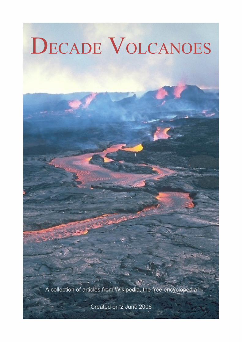
DECADE VOLCANOES
A collection of articles from Wikipedia, the free encyclopedia
Created on 2 June 2006
NOTES
Publishers: The editors and developers of the English-language WikipediaWikipedia URL: http://en.wikipedia.orgURL of this WikiReader: http://en.wikipedia.org/wiki/Wikipedia:WikiReader/Decade_VolcanoesCompiled and edited by: User:WorldtravellerCover Photo: Decade Volcano Mauna Loa erupts in 1984. Photo by J.D. Griggs, US Geological Survey. From http://volcanoes.usgs.gov/Imgs/Jpg/MaunaLoa/16112441_061_caption.htmlMost recent edit to this work: 02 June 2006A complete list of the articles used and the names of people who have contributed can be found at the end of this WikiReader.
ABOUT WIKIPEDIA
Wikipedia is a free-content encyclopedia, written collaboratively by people from around the world. The site is a wiki, which means that anyone can edit articles simply by clicking on the edit this page link which is on every page. All the text in Wikipedia, and most images and other content, is licensed under the GNU Free Documentation License (GFDL). This means that while contributions remain the property of their creators, all content is freely distributable and reproducible.
Wikipedia is one of the most popular reference sources on the Internet, and one of the 50 most popular websites in the world. As of September 2005 is contains more than 2.3 million articles in over 100 languages.
ABOUT WIKIREADERS
WikiReaders are an occasionally published series of collections of Wikipedia articles, providing a detailed overview over a certain topic presented in a edited form, and are available to download in PDF format. A complete list of all currently available WikiReaders can be found on Wikipedia's website at http://en.wikipedia.org/wiki/Wikipedia:WikiReader. We encourage our readers to help to improve the next edition of this WikiReader by working on the source articles on Wikipedia's website.
LICENSE
Like Wikipedia, this document is licensed under the GNU Free Documentation License (GNU FDL), a copy of which can be found in the appendix at the end of this document. Permission is granted to copy, distribute and/or modify this document under the terms of the GNU Free Documentation License, Version 1.2, or any later version published by the Free Software Foundation.
TABLE OF CONTENTS
NOTES.....................................................................................................................................................2ABOUT WIKIPEDIA............................................................................................................................... 2ABOUT WIKIREADERS.......................................................................................................................... 2LICENSE..............................................................................................................................................2
DECADE VOLCANOES.................................................................................................................................6AIMS OF THE DECADE VOLCANO PROGRAM..............................................................................................6FUNDING.............................................................................................................................................6ACHIEVEMENTS....................................................................................................................................7PROBLEMS...........................................................................................................................................7EXTERNAL LINKS..................................................................................................................................8
AVACHINSKY............................................................................................................................................9GEOLOGICAL HISTORY........................................................................................................................... 9RECENT ACTIVITY.................................................................................................................................9EXTERNAL LINKS..................................................................................................................................9
COLIMA.................................................................................................................................................10GEOLOGICAL HISTORY......................................................................................................................... 10CURRENT ACTIVITY.............................................................................................................................10EXTERNAL LINKS................................................................................................................................11
GALERAS............................................................................................................................................... 12GEOLOGICAL HISTORY......................................................................................................................... 121993 ERUPTION................................................................................................................................. 12CURRENT ACTIVITY.............................................................................................................................13EXTERNAL LINKS................................................................................................................................13
KORYAKSKY...........................................................................................................................................14GEOLOGICAL HISTORY......................................................................................................................... 14RECENT ACTIVITY...............................................................................................................................14EXTERNAL LINKS................................................................................................................................15
MAUNA LOA..........................................................................................................................................16SCIENTIFIC OBSERVATIONS................................................................................................................... 16OTHER HAWAIIAN VOLCANOES............................................................................................................. 16EXTERNAL LINKS................................................................................................................................16RELATED IMAGES............................................................................................................................... 17
MOUNT ETNA........................................................................................................................................ 18NAME AND LEGENDS........................................................................................................................... 18MORPHOLOGY....................................................................................................................................19GEOLOGICAL HISTORY......................................................................................................................... 19HISTORICAL ERUPTIONS....................................................................................................................... 201669 ERUPTION................................................................................................................................. 20RECENT ERUPTIONS.............................................................................................................................21EXTERNAL LINKS................................................................................................................................21
MOUNT MERAPI..................................................................................................................................... 22GEOLOGICAL HISTORY......................................................................................................................... 221992 ERUPTION................................................................................................................................. 222006 ERUPTION................................................................................................................................. 23MONITORING..................................................................................................................................... 23EXTERNAL LINKS................................................................................................................................24
MOUNT NYIRAGONGO............................................................................................................................. 25GEOLOGY..........................................................................................................................................251977 ERUPTION................................................................................................................................. 252002 ERUPTION................................................................................................................................. 26EXTERNAL LINKS................................................................................................................................26
MOUNT UNZEN...................................................................................................................................... 27GEOLOGICAL HISTORY......................................................................................................................... 271990-1995 ERUPTIONS.......................................................................................................................28UNZEN SCIENTIFIC DRILLING PROJECT (USDP).................................................................................... 28EXTERNAL LINKS................................................................................................................................29
MOUNT RAINIER.....................................................................................................................................30HISTORY........................................................................................................................................... 30OTHER VIEWS.................................................................................................................................... 31EXTERNAL LINKS................................................................................................................................31
MOUNT VESUVIUS.................................................................................................................................. 33ORIGIN OF THE NAME.......................................................................................................................... 33PHYSICAL ASPECTS............................................................................................................................. 33ERUPTIONS........................................................................................................................................ 34
BEFORE 79AD...........................................................................................................................................34ERUPTION OF 79AD................................................................................................................................... 34LATER ERUPTIONS........................................................................................................................................36
EXTERNAL LINKS................................................................................................................................36SAKURAJIMA.......................................................................................................................................... 37
GEOLOGICAL HISTORY......................................................................................................................... 371914 ERUPTION................................................................................................................................. 37CURRENT ACTIVITY.............................................................................................................................38EXTERNAL LINKS................................................................................................................................38
VOLCÁN SANTAMARÍA.............................................................................................................................39GEOLOGICAL HISTORY......................................................................................................................... 391902 ERUPTION................................................................................................................................. 40SANTIAGUITO.....................................................................................................................................40VOLCANIC HAZARDS AT SANTAMARÍA....................................................................................................41EXTERNAL LINKS................................................................................................................................41
SANTORINI............................................................................................................................................. 42"MINOAN" AKROTIRI..........................................................................................................................421500AD VOLCANIC ERUPTION............................................................................................................... 43
PHYSICAL EFFECTS OF THE ERUPTION.............................................................................................................. 43DATING THE VOLCANIC ERUPTION...................................................................................................................44CHINESE RECORDS....................................................................................................................................... 44EGYPTIAN RECORDS..................................................................................................................................... 45ASSOCIATION WITH ATLANTIS....................................................................................................................... 45
GREEK, BYZANTINE AND OTTOMAN SANTORINI......................................................................................45MODERN SANTORINI...........................................................................................................................45EXTERNAL LINKS................................................................................................................................46....................................................................................................................................................... 46
TAAL VOLCANO..................................................................................................................................... 47GEOLOGICAL HISTORY......................................................................................................................... 47RECENT ACTIVITY...............................................................................................................................47ERUPTION PRECURSORS AT TAAL.......................................................................................................... 48EARTHQUAKE PRECURSORS IN THE TAAL REGION..................................................................................... 48EXTERNAL LINKS................................................................................................................................48

TEIDE....................................................................................................................................................49ULAWUN............................................................................................................................................... 50
GEOLOGICAL HISTORY......................................................................................................................... 50RECENT ACTIVITY...............................................................................................................................50EXTERNAL LINKS................................................................................................................................50
REFERENCES...........................................................................................................................................51APPENDICES........................................................................................................................................... 53
ORIGINAL AUTHORS............................................................................................................................ 53LAST CHANGES TO SOURCE ARTICLES..................................................................................................... 53GNU FREE DOCUMENTATION LICENSE.................................................................................................54
INDEX................................................................................................................................................... 57
DECADE VOLCANOES
The Decade Volcanoes are 16 volcanoes identified by the International Association of Volcanology and Chemistry of the Earth's Interior (IAVCEI) as being worthy of particular study in light of their history of large, destructive eruptions and proximity to populated areas. The Decade Volcanoes project encourages studies and public-awareness activities at these volcanoes, with the aim of achieving a better understanding of the volcanoes and the dangers they present, and thus being able to reduce the severity of natural disasters. They are named Decade Volcanoes because the project was initiated as part of the United Nations-sponsored International Decade for Natural Disaster Reduction.
A volcano may be designated a Decade Volcano if it exhibits more than one volcanic hazard (people living near the Decade Volcanoes may experience tephra fall, pyroclastic flows, silicic lava flows, lahars, volcanic edifice instability and lava dome collapse); shows recent geological activity; is located in a populated area (eruptions at any of the Decade Volcanoes may threaten tens or hundreds of thousands of people, and therefore mitigating eruptions hazards at these volcanoes is crucial); is politically and physically accessible for study; and there is local support for the work.
AIMS OF THE DECADE VOLCANO PROGRAM
The general approach of Decade Volcano projects has been to convene a planning workshop, identify the major strengths and weaknesses of risk mitigation at each volcano, and to plan how to address the weaknesses identified. One of the difficulties faced in mitigating hazards at volcanoes is ensuring that geoscientists and those who will enact the mitigation measures communicate adequately with each other, and the Decade Volcano program has attempted to ensure this by making sure both groups are well represented at Decade Volcano workshops.
FUNDING
Hopes that United Nations funding might be available for Decade Volcano projects did not come to fruition, and funding was sought instead from a variety of sources. For example, Mexican scientific and civil defence bodies funded work at Colima, principally for Mexican scientists but also for a few foreign colleagues; major bilateral French-Indonesian and German-Indonesian programmes were initiated at Merapi; and the European Union has provided funding for many of the studies carried out at European volcanoes.
One particular activity that has not been funded -- because it typically is not allowable under most national or bilateral funding -- is the exchange of scientists and civil defense leaders between the various Decade Volcano projects of developing countries, for example, between the Philippines and Indonesia, or between Mexico, Guatemala, and Colombia, or across the Pacific and Atlantic. Often, scientists and civil defense leaders from developing countries can relate better to each other's experiences than they can to the experience of counterparts from industrialized countries. Also, civil defence leaders who have experienced volcanic crises are far more credible witnesses, in the eyes of local civil defence leaders, than either local or visiting scientists might be.
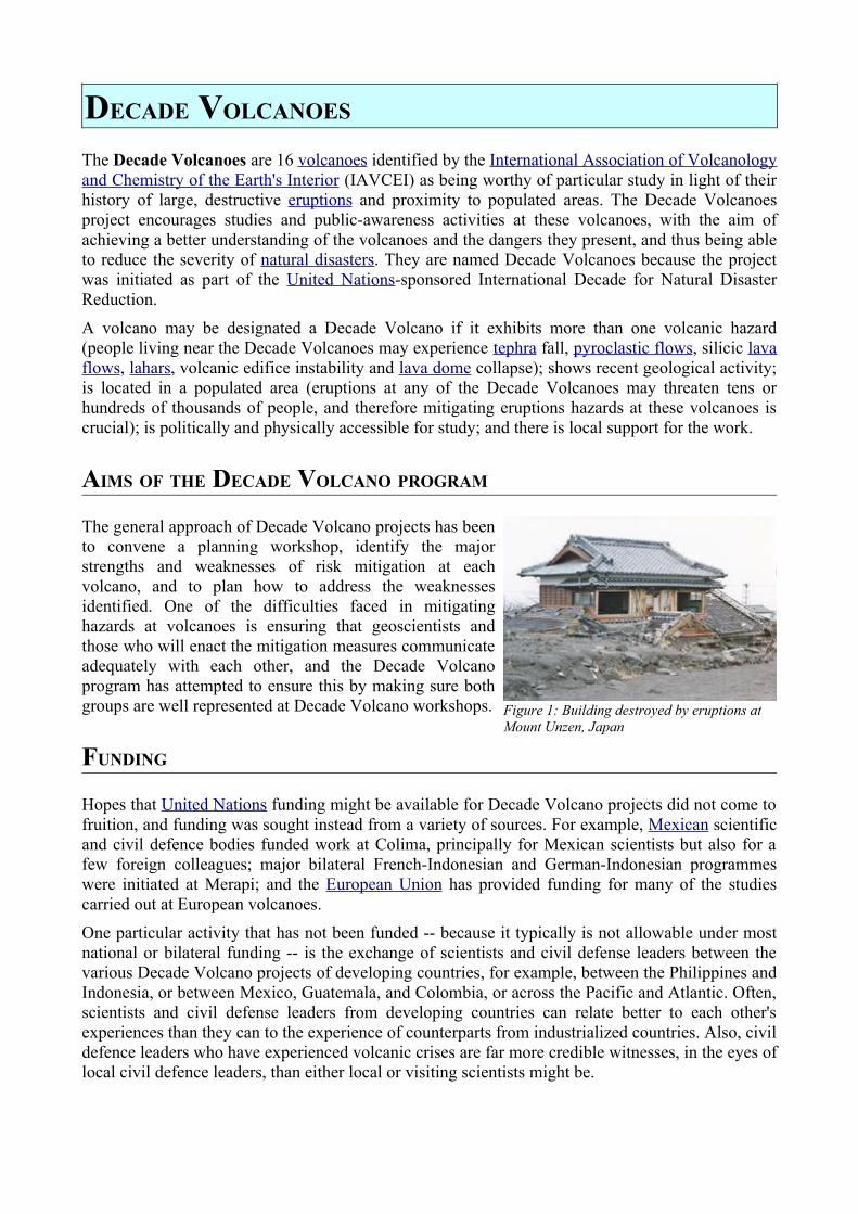
Figure 1: Building destroyed by eruptions at Mount Unzen, Japan
ACHIEVEMENTS
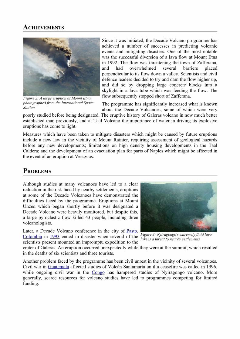
Since it was initiated, the Decade Volcano programme has achieved a number of successes in predicting volcanic events and mitigating disasters. One of the most notable was the successful diversion of a lava flow at Mount Etna in 1992. The flow was threatening the town of Zafferana, and had overwhelmed several barriers placed perpendicular to its flow down a valley. Scientists and civil defence leaders decided to try and dam the flow higher up, and did so by dropping large concrete blocks into a skylight in a lava tube which was feeding the flow. The flow subsequently stopped short of Zafferana.
The programme has significantly increased what is known about the Decade Volcanoes, some of which were very
poorly studied before being designated. The eruptive history of Galeras volcano in now much better established than previously, and at Taal Volcano the importance of water in driving its explosive eruptions has come to light.
Measures which have been taken to mitigate disasters which might be caused by future eruptions include a new law in the vicinity of Mount Rainier, requiring assessment of geological hazards before any new developments; limitations on high density housing developments in the Taal Caldera; and the development of an evacuation plan for parts of Naples which might be affected in the event of an eruption at Vesuvius.
PROBLEMS
Although studies at many volcanoes have led to a clear reduction in the risk faced by nearby settlements, eruptions at some of the Decade Volcanoes have demonstrated the difficulties faced by the programme. Eruptions at Mount Unzen which began shortly before it was designated a Decade Volcano were heavily monitored, but despite this, a large pyroclastic flow killed 43 people, including three volcanologists.
Later, a Decade Volcano conference in the city of Pasto, Colombia in 1993 ended in disaster when several of the scientists present mounted an impromptu expedition to the crater of Galeras. An eruption occurred unexpectedly while they were at the summit, which resulted in the deaths of six scientists and three tourists.
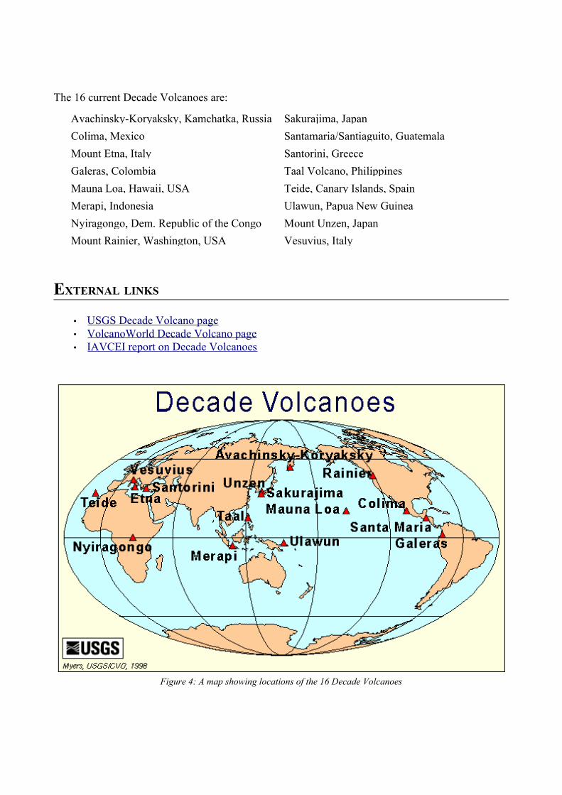
Another problem faced by the programme has been civil unrest in the vicinity of several volcanoes. Civil war in Guatemala affected studies of Volcán Santamaría until a ceasefire was called in 1996, while ongoing civil war in the Congo has hampered studies of Nyiragongo volcano. More generally, scarce resources for volcano studies have led to programmes competing for limited funding.
Figure 2: A large eruption at Mount Etna, photographed from the International Space Station
Figure 3: Nyiragongo's extremely fluid lava lake is a threat to nearby settlements
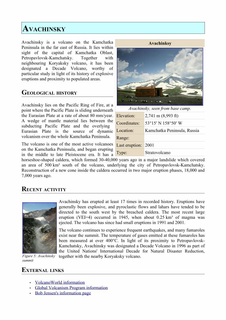
The 16 current Decade Volcanoes are:
Avachinsky-Koryaksky, Kamchatka, Russia Sakurajima, JapanColima, Mexico Santamaria/Santiaguito, GuatemalaMount Etna, Italy Santorini, GreeceGaleras, Colombia Taal Volcano, PhilippinesMauna Loa, Hawaii, USA Teide, Canary Islands, SpainMerapi, Indonesia Ulawun, Papua New GuineaNyiragongo, Dem. Republic of the Congo Mount Unzen, JapanMount Rainier, Washington, USA Vesuvius, Italy
EXTERNAL LINKS
• USGS Decade Volcano page • VolcanoWorld Decade Volcano page • IAVCEI report on Decade Volcanoes
Figure 4: A map showing locations of the 16 Decade Volcanoes
AVACHINSKY
Avachinsky is a volcano on the Kamchatka Peninsula in the far east of Russia. It lies within sight of the capital of Kamchatka Oblast, Petropavlovsk-Kamchatsky. Together with neighbouring Koryaksky volcano, it has been designated a Decade Volcano, worthy of particular study in light of its history of explosive eruptions and proximity to populated areas.
GEOLOGICAL HISTORY
Avachinsky lies on the Pacific Ring of Fire, at a point where the Pacific Plate is sliding underneath the Eurasian Plate at a rate of about 80 mm/year. A wedge of mantle material lies between the subducting Pacific Plate and the overlying Eurasian Plate is the source of dynamic volcanism over the whole Kamchatka Peninsula.
The volcano is one of the most active volcanoes on the Kamchatka Peninsula, and began erupting in the middle to late Pleistocene era. It has a horseshoe-shaped caldera, which formed 30-40,000 years ago in a major landslide which covered an area of 500 km² south of the volcano, underlying the city of Petropavlovsk-Kamchatsky. Reconstruction of a new cone inside the caldera occurred in two major eruption phases, 18,000 and 7,000 years ago.
RECENT ACTIVITY
Avachinsky has erupted at least 17 times in recorded history. Eruptions have generally been explosive, and pyroclastic flows and lahars have tended to be directed to the south west by the breached caldera. The most recent large eruption (VEI=4) occurred in 1945, when about 0.25 km³ of magma was ejected. The volcano has since had small eruptions in 1991 and 2001.
The volcano continues to experience frequent earthquakes, and many fumaroles exist near the summit. The temperature of gases emitted at these fumaroles has been measured at over 400°C. In light of its proximity to Petropavlovsk-Kamchatsky, Avachinsky was designated a Decade Volcano in 1996 as part of the United Nations' International Decade for Natural Disaster Reduction, together with the nearby Koryaksky volcano.
EXTERNAL LINKS
• VolcanoWorld information • Global Volcanism Program information • Bob Jensen's information page
Avachinksy
Avachinsky, seen from base camp.Elevation: 2,741 m (8,993 ft)Coordinates: 53°15′ N 158°50′ WLocation: Kamchatka Peninsula, RussiaRange:Last eruption: 2001Type: Stratovolcano
Figure 5: Avachinsky summit
COLIMA
Colima Volcano is the most active volcano in Mexico, and has erupted more than 40 times since 1576. Despite its name, it is not located in the Mexican state of Colima but rather just over the border in the neighboring state of Jalisco, toward the western end of the Eje Volcánico Transversal mountain range. It is about 300 miles (485 kilometres) west of Mexico City and 75 miles (125 km) south of Guadalajara, Jalisco. There are actually two peaks in the volcano complex: Nevado de Colima (4330 m), which is older and inactive, lies about 5km north of the younger and very active 3860m-tall Volcán de Colima (also called Volcán de Fuego de Colima).
GEOLOGICAL HISTORY
Colima has been the site of volcanic activity for about 5 million years. In the late Pleistocene era, a huge landslide occurred at the mountain, with approximately 25 km³ of debris travelling some 120 km, reaching the Pacific Ocean. An area of some 2,200 km² was covered in landslide deposits. Massive collapse events seem to recur at Colima every few thousand years.
The currently active cone is situated within a large caldera formed probably by a combination of landslides and large eruptions. About 300,000 people live within 40 km of the volcano, and in light of its history of large eruptions and situation in a densely populated area, it has been designated a Decade Volcano, singling it out for particular study.
CURRENT ACTIVITY
In recent years there have been frequent temporary evacuations of nearby villagers due to threatening volcanic activity. Eruptions have occurred in 1991, 1998-1999 and from 2001 to the present day, with activity being characterised by extrusion of viscous lava forming a lava dome, and occasional larger explosions, forming pyroclastic flows and dusting the areas surrounding the volcano with ash and tephra.
The largest eruption for several years occurred on 24 May 2005. An ash cloud rose to over 3 km over the volcano, and satellite monitoring indicated that the cloud spread over an area extending 110 nautical miles west of the volcano in the hours after the eruption. Pyroclastic flows travelled 4-5 km from the vent, and lava bombs landed 3–4 km away. Authorities set up an exclusion zone within 6.5 km of the summit.
On 7 June 2005, Colima erupted again in the largest recorded eruption there in several decades. Plumes from this eruption reached heights of 5 km (>3 miles) above the crater rim, prompting the evacuation of at least three neighboring villages.
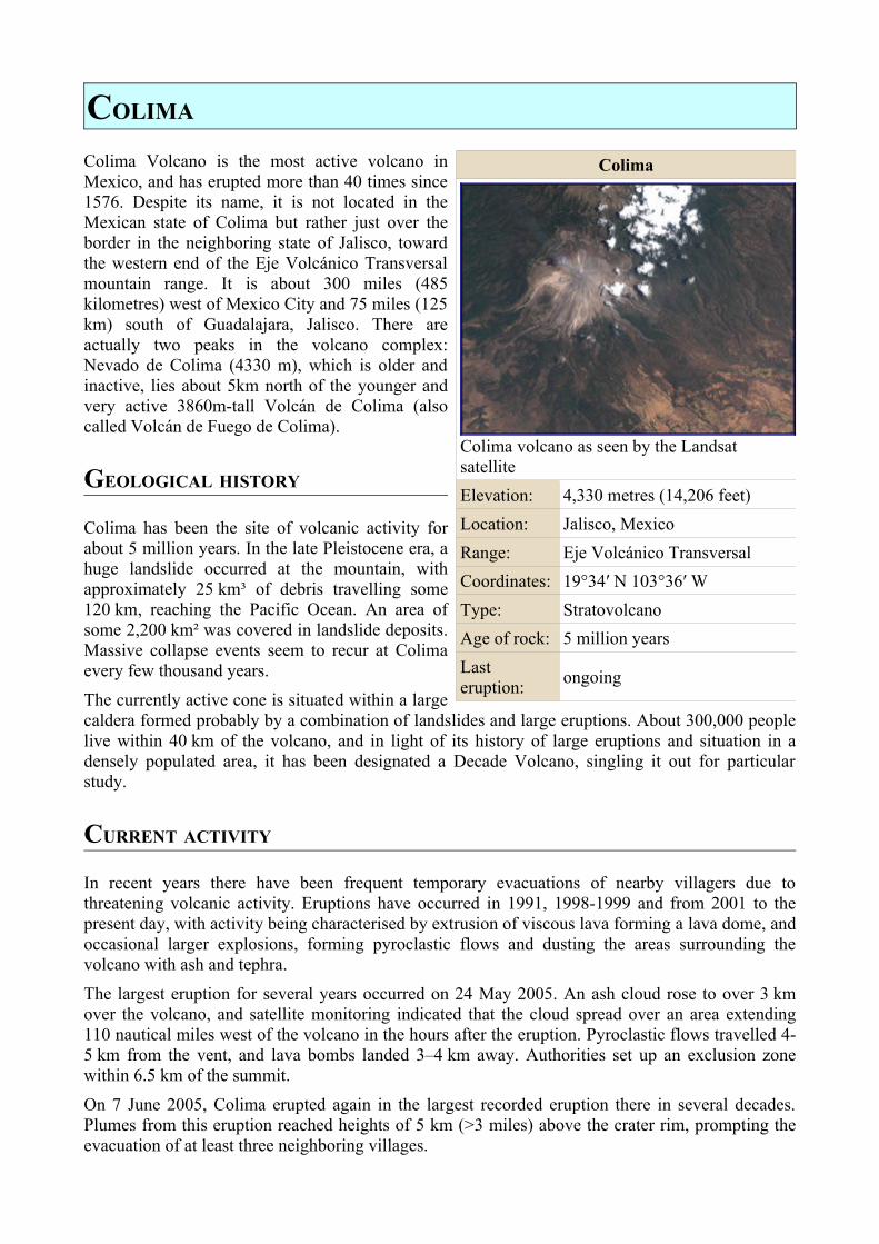
Colima
Colima volcano as seen by the Landsat satelliteElevation: 4,330 metres (14,206 feet)Location: Jalisco, MexicoRange: Eje Volcánico TransversalCoordinates: 19°34′ N 103°36′ WType: StratovolcanoAge of rock: 5 million yearsLast eruption: ongoing

EXTERNAL LINKS
• Universidad de Colima, Observatorio Vulcanológico (in Spanish) • Experiments at Colima by the Alaska Volcano Observatory • Global Volcanism Program information page
GALERAS
Galeras is a volcano in Colombia, near the city of Pasto. Its summit lies 14,029 feet (4276 m) above sea level. It has erupted frequently since the Spanish conquest, and in 1993 an eruption killed six volcanologists and three tourists who were in the crater at the time
GEOLOGICAL HISTORY
Galeras has been an active volcano for at least a million years. Two major caldera-forming eruptions have occurred, the first about 560,000 years ago in an eruption which expelled about 15 cubic kilometres of material, and the second some time between 40,000 and 150,000 years ago, in a smaller but still sizable eruption of 2km³ of material. Subsequently, part of the caldera wall has collapsed, probably due to instabilities caused by hydrothermal activity, and later eruptions have built up a smaller cone inside the now horseshoe-shaped caldera.
At least six large eruptions have occurred in the last 5000 years, most recently in 1886, and there have been at least 20 small to medium sized eruptions since the 1500s. In light of its violent eruption history and proximity to the 300,000 people of Pasto, Galeras was designated a Decade Volcano in 1991, identifying it as a target for detailed study as part of the United Nations' International Decade for Natural Disaster Reduction.
1993 ERUPTION
Galeras had become active in 1988 after 10 years of dormancy. In 1993, the volcano erupted when several volcanologists were inside the crater taking measurements. The scientists had been visiting Pasto for a conference related to the volcano's designation as a Decade Volcano. Six were killed, together with three tourists on the rim of the crater. Stanley Williams was one of the survivors. He suffered serious injuries after being struck by lava bombs, but was rescued from the crater some hours later.
Williams later wrote a book about his ordeal, entitled Surviving Galeras. However, controversy has since surrounded many of his claims. Detractors claim that his aim was to glorify himself, to the extent of claiming to be the only survivor among those on the mountain that day, when in fact seven others survived. It is also claimed that Williams ignored clear signs that an eruption was imminent, thus placing himself and others in danger unnecessarily.
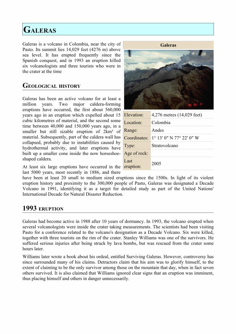
Galeras
Elevation: 4,276 metres (14,029 feet)Location: ColombiaRange: AndesCoordinates: 1° 13′ 0″ N 77° 22′ 0″ WType: StratovolcanoAge of rock:Last eruption: 2005
CURRENT ACTIVITY
Activity at a low level has continued at Galeras, with small explosions occasionally dusting nearby villages and towns with ash. The volcano has continued to be well studied, and predictions of eruptions at the volcano have improved. One phenomenon which seems to be a reliable precursor to eruptive activity is a low-frequency seismic event known as a 'tornillo'. These have occurred before about four-fifths of the explosions at Galeras, and the number of tornillo events recorded before an eruption is also correlated with the size of the ensuing eruption.
EXTERNAL LINKS
• VolcanoWorld information • Information from the Instituto Colombiano de Geología y Minería
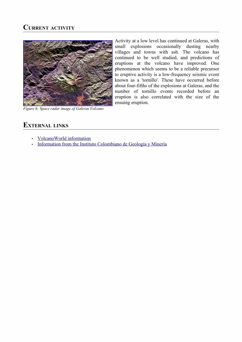
Figure 6: Space radar image of Galeras Volcano
KORYAKSKY
Koryaksky is a volcano on the Kamchatka Peninsula in the far east of Russia. It lies within sight of the capital of Kamchatka Oblast, Petropavlovsk-Kamchatsky. Together with neighbouring Avachinsky volcano, it has been designated a Decade Volcano, worthy of particular study in light of its history of explosive eruptions and proximity to populated areas.
GEOLOGICAL HISTORY
Koryaksky lies on the Pacific Ring of Fire, at a point where the Pacific Plate is sliding underneath the Eurasian Plate at a rate of about 80 mm/year. A wedge of mantle material lies between the subducting Pacific Plate and the overlying Eurasian Plate is the source of dynamic volcanism over the whole Kamchatka Peninsula.
The volcano has probably been active for at tens of thousands of years. Geological records indicate that there have been three major eruptions in the last 10,000 years, at 5500 BC, 1950 BC and 1550 BC. These three eruptions seem to have been mainly effusive, generating extensive lava flows.
RECENT ACTIVITY
Koryaksky erupted for the first time in recorded history in 1890, in an eruption characterised by the emission of lava from fissures which opened up on the south western flank of the volcano, and phreatic explosions. It was thought to have erupted again five years later, but it was later shown that no eruption had occurred; what was thought to be an eruption column was simply steam generated by strong fumarolic activity.
Another brief, moderately explosive eruption occurred in 1926, after which the volcano was dormant until 1956. The
1956 eruption was more explosive than the previous known eruptions, with VEI=3, and generated pyroclastic flows and lahars. The eruption continued until June 1957.
Since then, the volcano has seen no further eruptions, but occasional seismic activity and ongoing fumarolic activity has indicated that the volcano is still active. In light of its proximity to Petropavlovsk-Kamchatsky, Koryaksky was designated a Decade Volcano in 1996 as part of the United Nations' International Decade for Natural Disaster Reduction, together with the nearby Avachinsky volcano.
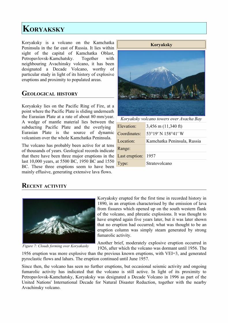
Koryaksky
Koryaksky volcano towers over Avacha BayElevation: 3,456 m (11,340 ft)Coordinates: 53°19′ N 158°41′ WLocation: Kamchatka Peninsula, RussiaRange:Last eruption: 1957Type: Stratovolcano
Figure 7: Clouds forming over Koryakasky

EXTERNAL LINKS
• VolcanoWorld information • Global Volcanism Program information • Pravda article about seismic activity at Koryaksky
MAUNA LOA
Mauna Loa is an active shield volcano in the Hawaiian Islands, one of five volcanic peaks that together form the . In Hawaiian, Mauna loa means "long mountain". The summit caldera of the volcano is called Moku‘āweoweo.
Mauna Loa is Earth's largest volcano and is the exposed (subareal) part of an enormous mid-ocean mountain. Indeed, it is the Earth's most massive mountain, with a volume estimated at 10,000 cubic miles (42,000 km³) and a height—measured from its base some 5000 m (over 16,000 ft) below the ocean surface to the highest point at 4,170 m (13,680 ft) above sea level—of over 9,000 m (> 30,000 ft). Mauna Loa is about 36 m (120 ft) lower than its neighbor, Mauna Kea.
Mauna Loa is part of the Hawaii Volcanoes National Park. There have been some 33 eruptions of Mauna Loa in historical time, the last in March-April, 1984.
SCIENTIFIC OBSERVATIONS
The elevation and location of Mauna Loa have made it an important location for atmospheric and other scientific observations. The Mauna Loa Solar Observatory (MLSO), located at 3,400 m (11,155 ft) on the northern slope of the mountain, has long been prominent in observations of the Sun. The NOAA Mauna Loa Observatory (MLO), located close by, monitors the global atmosphere
at its location well above local influences. Atmospheric carbon dioxide has been measured regularly since 1958 and shows the steadily increasing trend associated with the "greenhouse effect" and global warming.
Mauna Loa is itself observed by the USGS Hawaiian Volcano Observatory.
OTHER HAWAIIAN VOLCANOES
Other prominent Hawaiian volcanoes are Kīlauea, Hualālai, Mauna Kea, and Haleakalā.
EXTERNAL LINKS
• Mauna Loa – USGS website • Mauna Loa Observatory (MLO) – NOAA
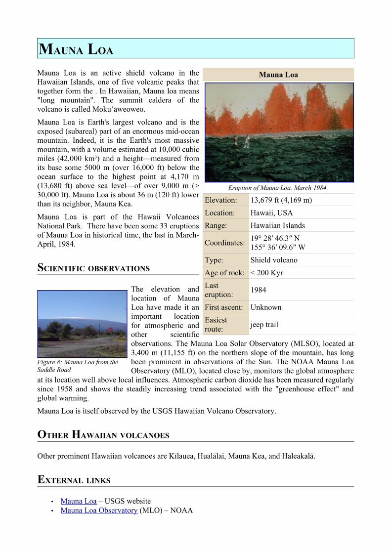
Mauna Loa
Eruption of Mauna Loa, March 1984.
Elevation: 13,679 ft (4,169 m)Location: Hawaii, USARange: Hawaiian Islands
Coordinates: 19° 28′ 46.3″ N 155° 36′ 09.6″ W
Type: Shield volcanoAge of rock: < 200 KyrLast eruption: 1984
First ascent: UnknownEasiest route: jeep trail
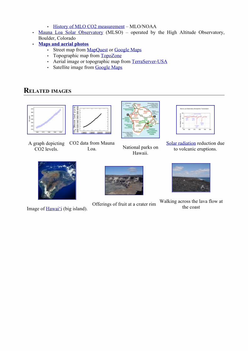
Figure 8: Mauna Loa from the Saddle Road
• History of MLO CO2 measurement – MLO/NOAA • Mauna Loa Solar Observatory (MLSO) – operated by the High Altitude Observatory,
Boulder, Colorado • Maps and aerial photos
• Street map from MapQuest or Google Maps • Topographic map from TopoZone • Aerial image or topographic map from TerraServer-USA • Satellite image from Google Maps
RELATED IMAGES
A graph depicting CO2 levels.
CO2 data from Mauna Loa. National parks on
Hawaii.
Solar radiation reduction due to volcanic eruptions.
Image of Hawai‘i (big island).Offerings of fruit at a crater rim Walking across the lava flow at
the coast
MOUNT ETNA
Mount Etna (also known locally as Mongibello or simply 'a muntagna (the mountain) in Sicilian) is an active volcano on the east coast of Sicily (Italian Sicilia), close to Messina and Catania. It is the largest volcano in Europe, standing about 3,320 m (10,900 ft) high with a basal circumference of 140 km, making it the highest mountain in Italy south of the Alps. Etna covers an area of 460 square miles (1190 km²).
It is by far the largest of the three active volcanoes in Italy, being nearly three times the height of the next largest, Mount Vesuvius, and it is one of the most active volcanoes in the world, being in an almost constant state of eruption.
Although it can occasionally be very destructive, it is not generally regarded as being particularly dangerous, and thousands of people live on its slopes and in the surrounding areas. The fertile volcanic soils support extensive agriculture, with vinyards and orchards spread across the lower slopes of the mountain.
NAME AND LEGENDS
Etna was known in Roman times as Aetna, a name thought to have derived either from the Greek word aitho ("to burn") or the earlier Phoenician word attano. The Arabs called the mountain Gibel Utlamat ("the mountain of fire"); this name was later corrupted into Mons Gibel (translating from its Roman and Arab parts as 'Mount Mountain') and subsequently Etna's current local name Mongibello.
The mountain's regular and often dramatic eruptions made it a major subject of interest for Classical mythologists and their later successors, who sought to explain its behaviour in terms of the various gods and giants of Roman and Greek legend. Aeolus, the king of the winds, was said to
have imprisoned the winds in caves below Etna. The giant Typhon was confined under Etna, according to the poet Aeschylus, and was the cause of the mountain's eruptions. Another giant, Enceladus, rebelled against the gods, was killed and was buried under Etna. Hephaestus or Vulcan, the god of fire and the forge, was said to have had his forge under Etna and drove the fire-demon Adranus out from the mountain, while the Cyclopes maintained a smithy there where they fashioned lightning bolts for Zeus to use as a weapon. The Greek underworld, Tartarus, was supposed to be situated beneath Etna.
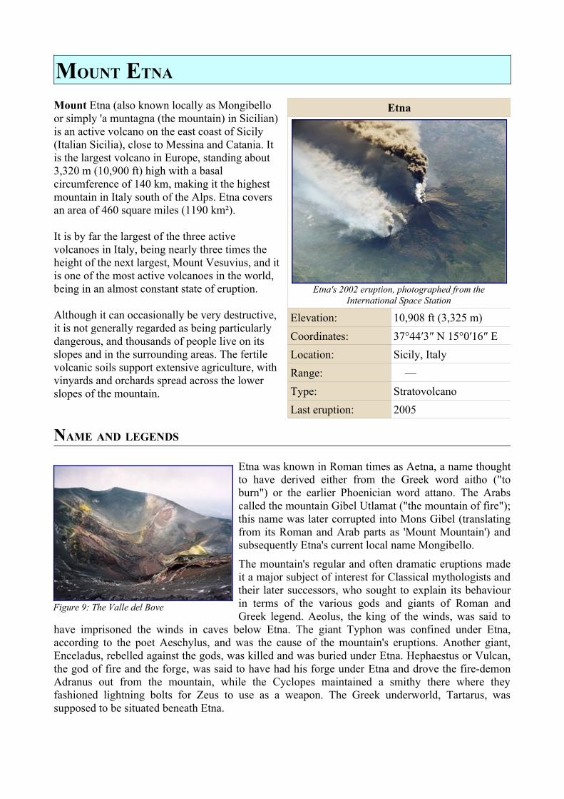
Etna
Etna's 2002 eruption, photographed from the International Space Station
Elevation: 10,908 ft (3,325 m)Coordinates: 37°44′3″ N 15°0′16″ ELocation: Sicily, ItalyRange: —Type: StratovolcanoLast eruption: 2005
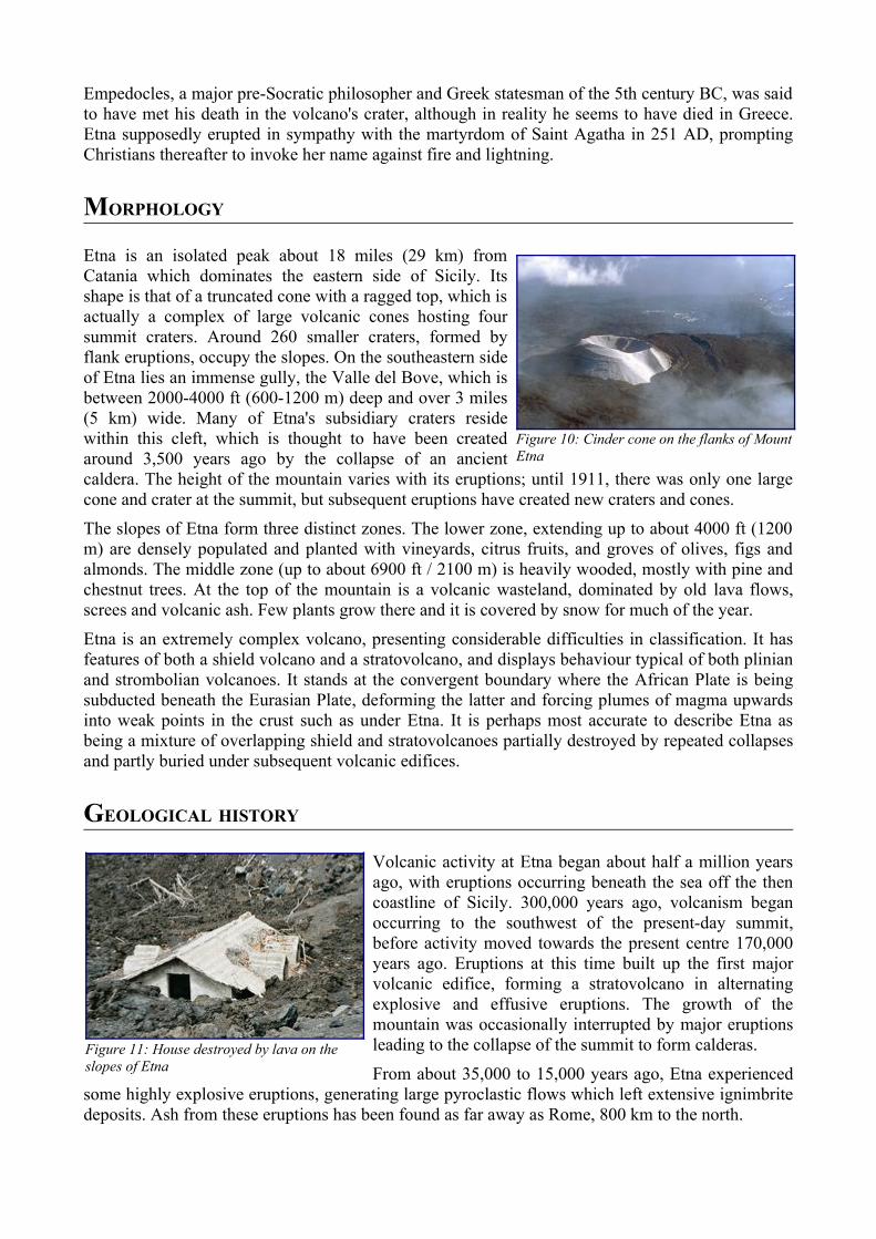
Figure 9: The Valle del Bove
Empedocles, a major pre-Socratic philosopher and Greek statesman of the 5th century BC, was said to have met his death in the volcano's crater, although in reality he seems to have died in Greece. Etna supposedly erupted in sympathy with the martyrdom of Saint Agatha in 251 AD, prompting Christians thereafter to invoke her name against fire and lightning.
MORPHOLOGY
Etna is an isolated peak about 18 miles (29 km) from Catania which dominates the eastern side of Sicily. Its shape is that of a truncated cone with a ragged top, which is actually a complex of large volcanic cones hosting four summit craters. Around 260 smaller craters, formed by flank eruptions, occupy the slopes. On the southeastern side of Etna lies an immense gully, the Valle del Bove, which is between 2000-4000 ft (600-1200 m) deep and over 3 miles (5 km) wide. Many of Etna's subsidiary craters reside within this cleft, which is thought to have been created around 3,500 years ago by the collapse of an ancient caldera. The height of the mountain varies with its eruptions; until 1911, there was only one large cone and crater at the summit, but subsequent eruptions have created new craters and cones.
The slopes of Etna form three distinct zones. The lower zone, extending up to about 4000 ft (1200 m) are densely populated and planted with vineyards, citrus fruits, and groves of olives, figs and almonds. The middle zone (up to about 6900 ft / 2100 m) is heavily wooded, mostly with pine and chestnut trees. At the top of the mountain is a volcanic wasteland, dominated by old lava flows, screes and volcanic ash. Few plants grow there and it is covered by snow for much of the year.
Etna is an extremely complex volcano, presenting considerable difficulties in classification. It has features of both a shield volcano and a stratovolcano, and displays behaviour typical of both plinian and strombolian volcanoes. It stands at the convergent boundary where the African Plate is being subducted beneath the Eurasian Plate, deforming the latter and forcing plumes of magma upwards into weak points in the crust such as under Etna. It is perhaps most accurate to describe Etna as being a mixture of overlapping shield and stratovolcanoes partially destroyed by repeated collapses and partly buried under subsequent volcanic edifices.
GEOLOGICAL HISTORY
Volcanic activity at Etna began about half a million years ago, with eruptions occurring beneath the sea off the then coastline of Sicily. 300,000 years ago, volcanism began occurring to the southwest of the present-day summit, before activity moved towards the present centre 170,000 years ago. Eruptions at this time built up the first major volcanic edifice, forming a stratovolcano in alternating explosive and effusive eruptions. The growth of the mountain was occasionally interrupted by major eruptions leading to the collapse of the summit to form calderas.
From about 35,000 to 15,000 years ago, Etna experienced some highly explosive eruptions, generating large pyroclastic flows which left extensive ignimbrite deposits. Ash from these eruptions has been found as far away as Rome, 800 km to the north.
Figure 11: House destroyed by lava on the slopes of Etna
Figure 10: Cinder cone on the flanks of Mount Etna
HISTORICAL ERUPTIONS
About 3,500 years ago, the eastern flank of the mountain experienced a catastrophic collapse, generating an enormous landslide in an event similar to that seen at Mount St. Helens in 1980. The eruption which is thought to have caused this collapse was recorded by Diodore of Sicily, the first known record of an eruption at Etna. The landslide left a large depression in the side of the volcano, known as 'Valle del Bove' (Valley of the Oxen). The steep walls of the Valle have suffered subsequent collapse on numerous occasions. The strata exposed in the valley walls provide an important and easily accessible record of Etna's eruptive history.
The most recent collapse event at the summit of Etna is thought to have occurred about 2,000 years ago, forming what is known as the Piano Caldera. This caldera has been almost entirely filled by subsequent lava eruptions, but is still visible as a distinct break in the slope of the mountain near the base of the present-day summit cone.
The Roman poet Virgil gave what was probably a first-hand description of an eruption in the Aeneid:
The port capacious, and secure from wind, Is to the foot of thund'ring Etna joined. By turns a pitchy cloud she rolls on high: By turns hot embers from her entrails fly, And flakes of mounting flames, that lick the sky. Oft from her bowels massy rocks are thrown, And shivered by the force come piece-meal down. Oft liquid lakes of burning sulphur flow, Fed from the fiery springs that boil below."
1669 ERUPTION
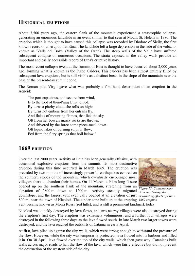
Over the last 2000 years, activity at Etna has been generally effusive, with occasional explosive eruptions from the summit. Its most destructive eruption during this time occurred in March 1669. The eruption was preceded by two months of increasingly powerful earthquakes centred on the southern slopes of the mountain, which eventually encouraged most villagers there to abandon their homes. On 11 March, a 9 km-long fissure opened up on the southern flank of the mountain, stretching from an elevation of 2800 m down to 1200 m. Activity steadily migrated downslope, and the largest vent eventually opened at an elevation of just 800 m, near the town of Nicolosi. The cinder cone built up at the erupting vent became known as Monti Rossi (red hills), and is still a prominent landmark today.
Nicolosi was quickly destroyed by lava flows, and two nearby villages were also destroyed during the eruption's first day. The eruption was extremely voluminous, and a further four villages were destroyed in the following three days as the lava flowed south. In late March two larger towns were destroyed, and the lava reached the outskirts of Catania in early April.
At first, lava piled up against the city walls, which were strong enough to withstand the pressure of the flow. However, while the city was temporarily protected, lava flowed into its harbour and filled it in. On 30 April, lava flowed over the top of the city walls, which then gave way. Catanians built walls across major roads to halt the flow of the lava, which were fairly effective but did not prevent the destruction of the western side of the city.
Figure 12: Contemporary drawing showing the devastating effects of Etna's 1669 eruption
During the eruption, Catania residents also attempted to divert the flows much further upstream. According to a possibly apocryphal tale, their efforts were met with armed resistance from the citizens of a town which would have been threatened by the diverted flow. Whether this event really occurred or not, a law was subsequently passed to forbid the artificial diversion of lava flows. This law was only repealed in 1983.
RECENT ERUPTIONS
Another very large lava flow from an eruption in 1928 led to the first destruction of a town since the 1669 eruption. In this case, the town of Mascali was destroyed in just two days, with the lava destroying every building. The event was used by Benito Mussolini's Fascist regime for propaganda purposes, with the evacuation, aid and rebuilding operations being presented as models of fascist planning. Mascali was rebuilt on a new site, and its church contains the Italian fascist symbol of the torch, placed above the statue of Christ.
Other major 20th century eruptions occurred in 1949, 1971, 1983, 1992, and 2000. The 1992 eruption saw the
town of Zafferana threatened by a lava flow, but successful diversion efforts saved the town with the loss of only one building a few hundred metres outside it.
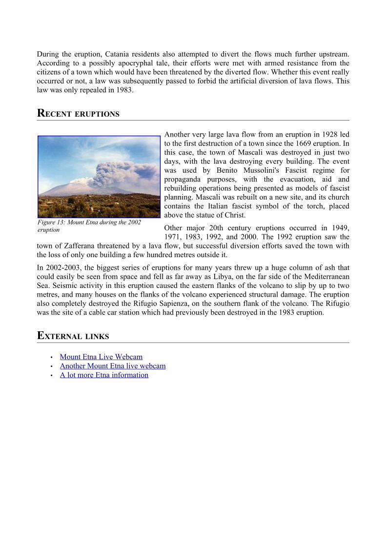
In 2002-2003, the biggest series of eruptions for many years threw up a huge column of ash that could easily be seen from space and fell as far away as Libya, on the far side of the Mediterranean Sea. Seismic activity in this eruption caused the eastern flanks of the volcano to slip by up to two metres, and many houses on the flanks of the volcano experienced structural damage. The eruption also completely destroyed the Rifugio Sapienza, on the southern flank of the volcano. The Rifugio was the site of a cable car station which had previously been destroyed in the 1983 eruption.
EXTERNAL LINKS
• Mount Etna Live Webcam • Another Mount Etna live webcam • A lot more Etna information
Figure 13: Mount Etna during the 2002 eruption
MOUNT MERAPI
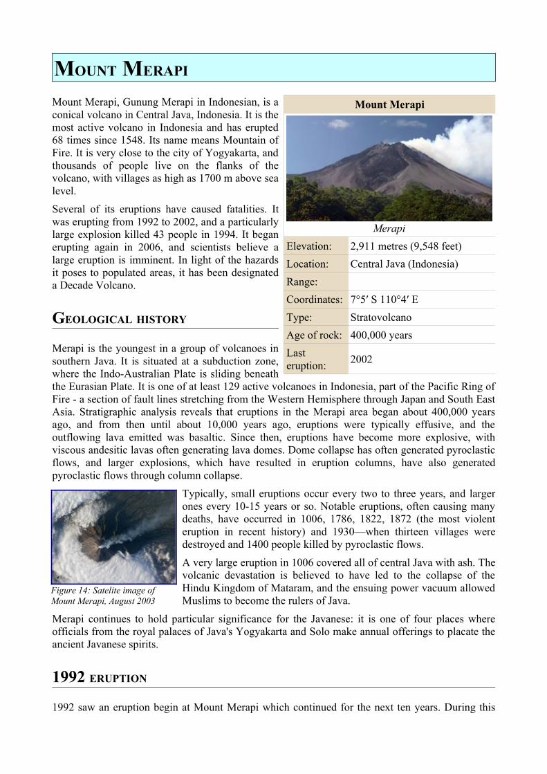
Mount Merapi, Gunung Merapi in Indonesian, is a conical volcano in Central Java, Indonesia. It is the most active volcano in Indonesia and has erupted 68 times since 1548. Its name means Mountain of Fire. It is very close to the city of Yogyakarta, and thousands of people live on the flanks of the volcano, with villages as high as 1700 m above sea level.
Several of its eruptions have caused fatalities. It was erupting from 1992 to 2002, and a particularly large explosion killed 43 people in 1994. It began erupting again in 2006, and scientists believe a large eruption is imminent. In light of the hazards it poses to populated areas, it has been designated a Decade Volcano.
GEOLOGICAL HISTORY
Merapi is the youngest in a group of volcanoes in southern Java. It is situated at a subduction zone, where the Indo-Australian Plate is sliding beneath the Eurasian Plate. It is one of at least 129 active volcanoes in Indonesia, part of the Pacific Ring of Fire - a section of fault lines stretching from the Western Hemisphere through Japan and South East Asia. Stratigraphic analysis reveals that eruptions in the Merapi area began about 400,000 years ago, and from then until about 10,000 years ago, eruptions were typically effusive, and the outflowing lava emitted was basaltic. Since then, eruptions have become more explosive, with viscous andesitic lavas often generating lava domes. Dome collapse has often generated pyroclastic flows, and larger explosions, which have resulted in eruption columns, have also generated pyroclastic flows through column collapse.
Typically, small eruptions occur every two to three years, and larger ones every 10-15 years or so. Notable eruptions, often causing many deaths, have occurred in 1006, 1786, 1822, 1872 (the most violent eruption in recent history) and 1930—when thirteen villages were destroyed and 1400 people killed by pyroclastic flows.
A very large eruption in 1006 covered all of central Java with ash. The volcanic devastation is believed to have led to the collapse of the Hindu Kingdom of Mataram, and the ensuing power vacuum allowed Muslims to become the rulers of Java.
Merapi continues to hold particular significance for the Javanese: it is one of four places where officials from the royal palaces of Java's Yogyakarta and Solo make annual offerings to placate the ancient Javanese spirits.
1992 ERUPTION
1992 saw an eruption begin at Mount Merapi which continued for the next ten years. During this
Mount Merapi
MerapiElevation: 2,911 metres (9,548 feet)Location: Central Java (Indonesia)Range:Coordinates: 7°5′ S 110°4′ EType: StratovolcanoAge of rock: 400,000 yearsLast eruption: 2002
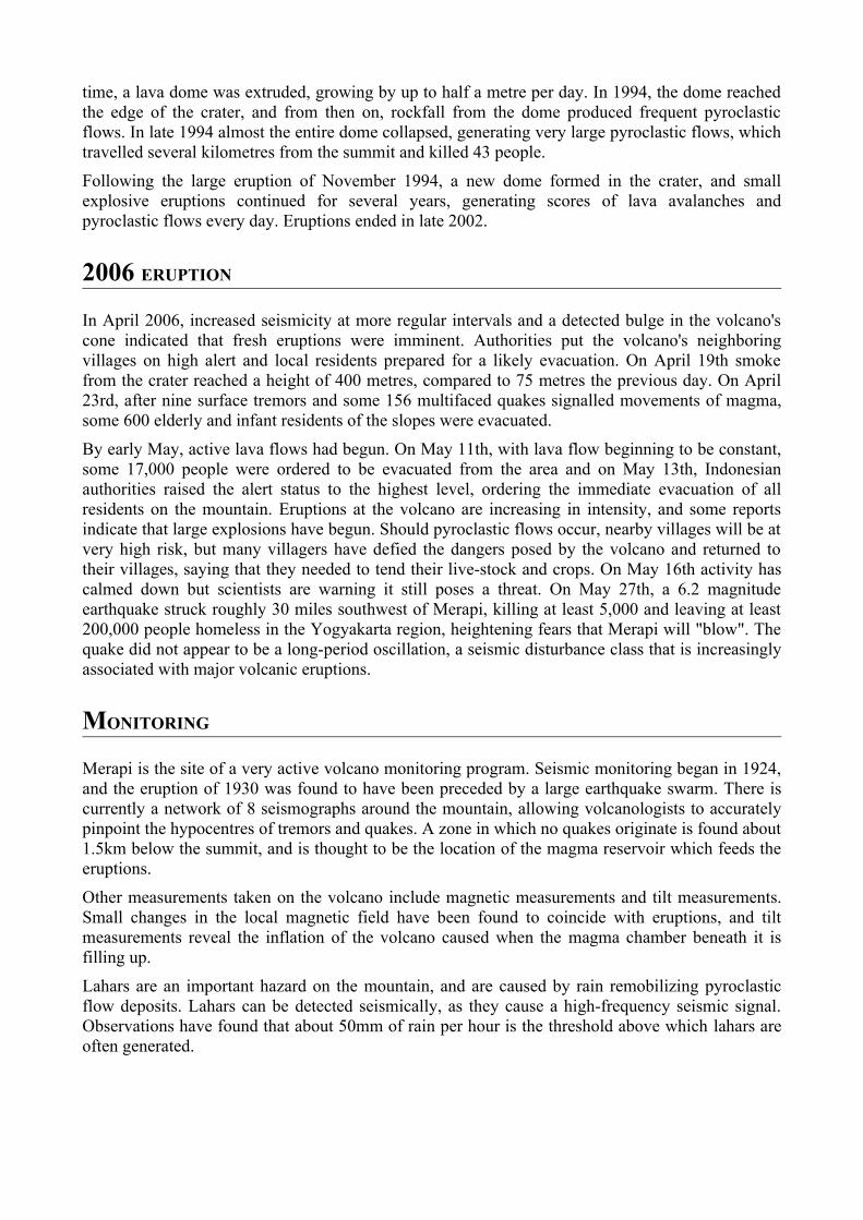
Figure 14: Satelite image of Mount Merapi, August 2003
time, a lava dome was extruded, growing by up to half a metre per day. In 1994, the dome reached the edge of the crater, and from then on, rockfall from the dome produced frequent pyroclastic flows. In late 1994 almost the entire dome collapsed, generating very large pyroclastic flows, which travelled several kilometres from the summit and killed 43 people.
Following the large eruption of November 1994, a new dome formed in the crater, and small explosive eruptions continued for several years, generating scores of lava avalanches and pyroclastic flows every day. Eruptions ended in late 2002.
2006 ERUPTION
In April 2006, increased seismicity at more regular intervals and a detected bulge in the volcano's cone indicated that fresh eruptions were imminent. Authorities put the volcano's neighboring villages on high alert and local residents prepared for a likely evacuation. On April 19th smoke from the crater reached a height of 400 metres, compared to 75 metres the previous day. On April 23rd, after nine surface tremors and some 156 multifaced quakes signalled movements of magma, some 600 elderly and infant residents of the slopes were evacuated.
By early May, active lava flows had begun. On May 11th, with lava flow beginning to be constant, some 17,000 people were ordered to be evacuated from the area and on May 13th, Indonesian authorities raised the alert status to the highest level, ordering the immediate evacuation of all residents on the mountain. Eruptions at the volcano are increasing in intensity, and some reports indicate that large explosions have begun. Should pyroclastic flows occur, nearby villages will be at very high risk, but many villagers have defied the dangers posed by the volcano and returned to their villages, saying that they needed to tend their live-stock and crops. On May 16th activity has calmed down but scientists are warning it still poses a threat. On May 27th, a 6.2 magnitude earthquake struck roughly 30 miles southwest of Merapi, killing at least 5,000 and leaving at least 200,000 people homeless in the Yogyakarta region, heightening fears that Merapi will "blow". The quake did not appear to be a long-period oscillation, a seismic disturbance class that is increasingly associated with major volcanic eruptions.
MONITORING
Merapi is the site of a very active volcano monitoring program. Seismic monitoring began in 1924, and the eruption of 1930 was found to have been preceded by a large earthquake swarm. There is currently a network of 8 seismographs around the mountain, allowing volcanologists to accurately pinpoint the hypocentres of tremors and quakes. A zone in which no quakes originate is found about 1.5km below the summit, and is thought to be the location of the magma reservoir which feeds the eruptions.
Other measurements taken on the volcano include magnetic measurements and tilt measurements. Small changes in the local magnetic field have been found to coincide with eruptions, and tilt measurements reveal the inflation of the volcano caused when the magma chamber beneath it is filling up.
Lahars are an important hazard on the mountain, and are caused by rain remobilizing pyroclastic flow deposits. Lahars can be detected seismically, as they cause a high-frequency seismic signal. Observations have found that about 50mm of rain per hour is the threshold above which lahars are often generated.

EXTERNAL LINKS
• Volcanological Survey of Indonesia • Info and pictures • Info and pictures
MOUNT NYIRAGONGO
Mount Nyiragongo is a volcano in the Virunga Mountains associated with the Great Rift Valley. It is located in the Democratic Republic of the Congo, about 19km north of the town of Goma and the Lake Kivu and just west of the border with Rwanda. The main crater is 250m deep, 2km wide and sometimes contains a lava lake. Nyiragongo and nearby Nyamuragira are together responsible for 40% of Africa's historical volcanic eruptions.
GEOLOGY
Not much is known about how long the volcano has been erupting for, but since 1883 it has erupted at least 15 times, including many periods where activity was continuous for years at a time, often in the form of a churning lava lake in the crater. The volcano partly overlaps with two older volcanoes, Baratu and Shaheru, and is also surrounded by hundreds of small volcanic cones from flank eruptions.
Volcanism at Nyiragongo is caused by the rifting of the Earth's crust where two parts of the African Plate are breaking apart. A hot spot is probably also partly responsible for the great activity at Nyiragongo and Nyamuragira.
The lava emitted in eruptions at Nyiragongo is often unusually fluid. Whereas most lava flows move rather slowly and rarely pose a danger to human life, Nyiragongo's lava flows may race downhill at up to 60 miles per hour. This is because of their extremely low silica content. Hawaiian volcanic eruptions are also characterised by lavas with low silica content, but the Hawaiian volcanoes are broad, shallow-sloped shield volcanoes in contrast to the steep-sided cone of Nyiragongo, and the silica content is high enough to slow most flows to walking pace.
1977 ERUPTION
Between 1894 and 1977 the crater contained an active lava lake. On 10 January 1977, the crater walls fractured, and the lava lake drained in less than an hour. The lava flowed down the flanks of the volcano at speeds of up to 60 miles per hour on the upper slopes, overwhelming villages and killing at least 70 people. Some reports quote much higher figures of up to several thousand people. The hazards posed by eruptions like this are unique to Nyiragongo. Nowhere else in the world does such a steep-sided stratovolcano contain a lava lake containing such fluid lavas. Nyiragongo's proximity to heavily populated areas increases its potential for causing natural disasters. The 1977 eruption raised awareness of the unique dangers posed by Nyiragongo, and because of this it was designated a Decade Volcano, worthy of particular study, in 1991.
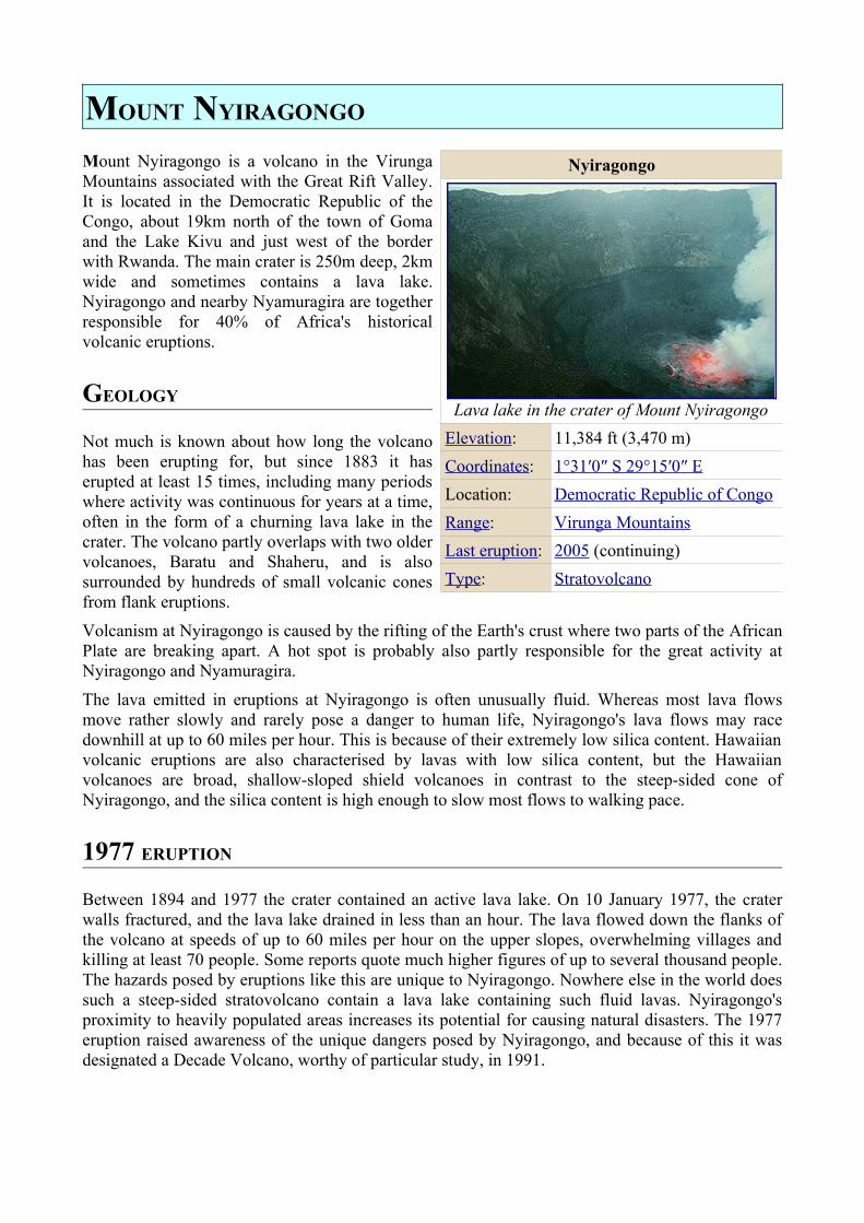
Nyiragongo
Lava lake in the crater of Mount NyiragongoElevation: 11,384 ft (3,470 m)Coordinates: 1°31′0″ S 29°15′0″ E Location: Democratic Republic of CongoRange: Virunga MountainsLast eruption: 2005 (continuing)Type: Stratovolcano
2002 ERUPTION
Lava lakes reformed in the crater in eruptions in 1982-1983 and 1994. Another major eruption of the volcano began on 17 January 2002, after several months of increased seismic and fumarolic activity. An 18km fissure opened in the south flank of the volcano, spreading in a few hours from 2800 m to 1550 m elevation.
The fissure emitted three streams of lava, one of which flowed through the city of Goma. 400,000 people were evacuated from the city during the eruption. Lava also destroyed Goma Airport, and reached nearby Lake Kivu. This raised fears that the lava might cause gas-saturated waters deep in the lake to suddenly rise to the surface, releasing large amounts of carbon dioxide and methane, in a similar event to the disaster at Lake Nyos in Cameroon in 1986. This did not happen, but volcanologists continue to monitor the area closely.
About 45 people died in the eruption, but property damage was extensive. At least 15% of Goma was destroyed, leaving about 120,000 people homeless. The eruption was the most destructive effusive eruption in modern history.
Six months after the start of the 2002 eruption, Nyamuragira volcano also erupted. Activity at Nyiragongo is ongoing, but currently confined to the crater, where another lava lake has formed.
EXTERNAL LINKS
• Volcano World Nyiragongo page • BBC News pictures of the 2002 eruption
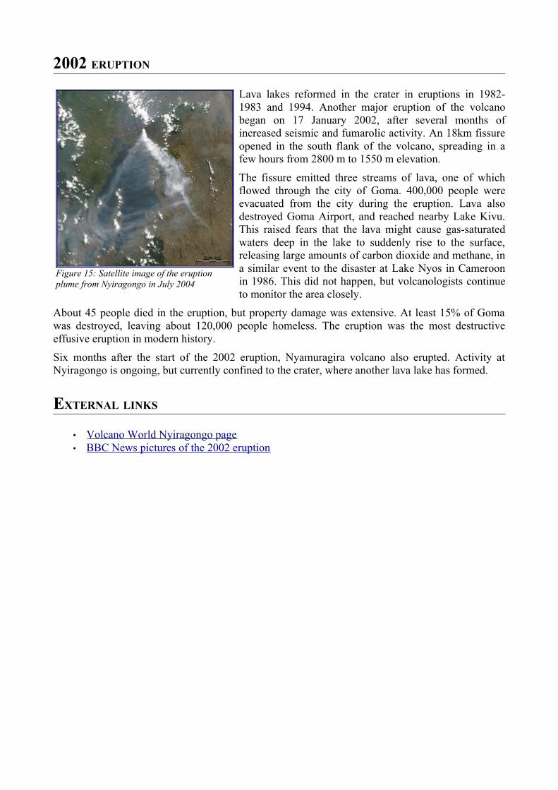
Figure 15: Satellite image of the eruption plume from Nyiragongo in July 2004
MOUNT UNZEN
Mount Unzen (雲仙岳 ) is an active volcano near the city of Shimabara in Nagasaki Prefecture on the island of Kyushu in Japan. It is a volcanic complex consisting of several overlapping peaks.
In 1792, the collapse of one of its several lava domes triggered a tsunami which killed about 15,000 people in Japan's worst ever volcanic disaster. The volcano was most recently active from 1990 to 1995, and a large eruption in 1991 generated a pyroclastic flow which killed 43 people, including three volcanologists.
GEOLOGICAL HISTORY
The Shimabara peninsula on which Unzen lies has seen extensive volcanism over millions of years. The oldest volcanic deposits in the region are about 6 million years old, and extensive eruptions occurred over the whole peninsula between 2.5 and 0.5 million years ago.
At this time, a graben formed through crustal faulting, and parts of the peninsula dropped to up to 1000 m below sea level. The formation of the graben may have caused the eruptive activity to become concentrated at one site, and the Unzen complex began to form within this graben. Eruptions of dacitic lava began from a site slightly to the south of today's Mount Unzen, and migrated north over time.
The volcano grew rapidly during its first 200,000 years, forming a large cone. Later eruptions over the following 150,000 years filled in much of the graben. Initially, activity was dominated by andesitic blocky lava and ash flows, changing to dacitic pumice flows and airfall deposits from 500,000 to 400,000 years ago. The period from 400,000 to 300,000 years ago saw the emplacement of large areas of pyroclastic flow and lahar deposits, which form the major part of the volcanic fan surrounding the volcano. From 300,000 to 150,000 years ago, thick phreatomagmatic deposits were laid down, suggesting the subsidence of the volcano into its graben was rapid during this time.
Activity from 150,000 years ago to the present day has occurred at a number of sites around the volcanic complex, building four main domes at different times: Nodake (70-150,000 years old), Myokendake (25-40,000 years old), Fugen-dake (younger than 25,000 years old) and Mayuyama (4,000 years old) volcanoes. Fugen-dake has been the site of most eruptions in the past 20,000 years, and lies about 6km from the centre of Shimabara city.
Unzen's most serious eruption came in 1792, with a large dacitic lave flow coming from Fugen-dake. The east flank of the Mayuyama dome collapsed unexpectedly following an earthquake after the end of the eruption, creating an avalanche and tsunami which killed an estimated 15,000 people. This remains Japan's worst ever volcanic disaster.
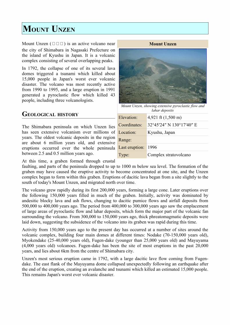
Mount Unzen
Mount Unzen, showing extensive pyroclastic flow and lahar deposits
Elevation: 4,921 ft (1,500 m)Coordinates: 32°45′24″ N 130°17′40″ ELocation: Kyushu, JapanRange:Last eruption: 1996Type: Complex stratovolcano
1990-1995 ERUPTIONS
After 1792, the volcano remained dormant until November 1989, when an earthquake swarm began about 20km down and 10km west of Fugen-dake. Over the next year, earthquakes continued, with their hypocentres gradually migrating towards the summit. The first phreatic eruptions began in November 1990, and after inflation of the summit area, fresh lava began to emerge on 20 June 1990.
Due to the volcanic threat, 12,000 local residents were evacuated from their homes. On 3 June 1991, the volcano erupted violently, possibly as a result of depressurization of the magma column after a landslide in the crater. A pyroclastic flow reached 4.5km from the crater, and claimed the lives of 43 scientists and journalists, including well-known volcanologists Katia and Maurice Krafft and Harry Glicken.
From 1991 to 1994 the volcano generated at least 10,000 small pyroclastic flows. In total, about 2,000 houses were destroyed.
From 1993 onwards, the rate of lava effusion gradually decreased, and eruptions came to an end in 1995. Since eruptions ended, heavy rains have frequently remobilised pyroclastic material, generating lahars. Dikes have been constructed in several river valleys to channel lahar flows away from vulnerable areas, and warning systems and evacuation plans have been developed.
The volcano was designated a Decade Volcano in 1991 as part of the United Nations' International Decade for Natural Disaster Reduction, due to its history of violent activity and location in a densely populated area
UNZEN SCIENTIFIC DRILLING PROJECT (USDP)
In 1999, an ambitious project began at Mt. Unzen to drill deep inside the volcano and sample magma in the 1990-1995 eruption conduit. The project hoped to shed light on some fundamental questions in volcanology, such as why magma repeatedly travels in the same conduits despite the solidification of magma in them at the end of each eruption, and how it can lose enough gas on its ascent to erupt effusively rather than explosively.
Drilling began with test bores to assess the viability of a deep borehole. Two holes were bored, 750m and 1500m deep, and cores taken from these holes were used to better determine Unzen's eruptive history. One further 350m-deep borehole was drilled to test the methods to be used in the final drilling project.
The main drill began in 2003, starting from the northern flank of the volcano with a 17.5 inch wide hole at an angle of 25 degrees from vertical. At greater depths, the direction of boring was tilted towards the conduit, reaching an angle of 75 degrees from vertical at a depth of 800m. Drilling reached 1800m, the original target depth, without reaching the conduit, but in July 2004 at a depth of 1995m, the conduit was finally reached. The vertical depth below the summit was 1500m.
Figure 17: Devastation from Mt. Unzen's 1991 eruption
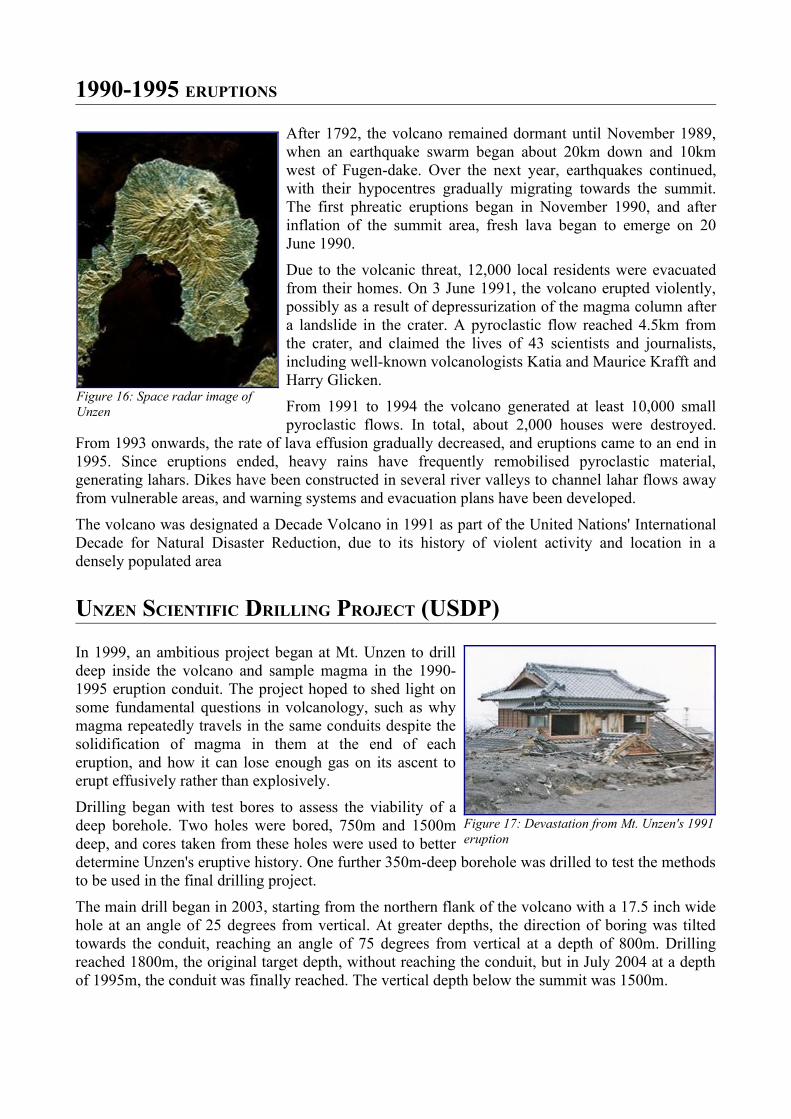
Figure 16: Space radar image of Unzen

The temperature at the conduit was about 155°C, much lower than pre-drill estimations of 500°C and over. This was attributed to hydrothermal circulation accelerating the cooling of the magma over the nine years since the end of the eruption.
EXTERNAL LINKS
• Unzen Decade Volcano home page • Global Volcanism Program page • USGS description page • Article about the USDP
MOUNT RAINIER
Mount Rainier is a stratovolcano (and national park) located 54 miles (87 km) southeast of Seattle, Washington in Pierce County. One of the monarchs of the Cascade Range, it was originally known as Tahoma or Tacoma, from the Puyallup word tacobet, or "mother of waters." Due to its prominence on the southern horizon—its prominence is greater than that of K2—Seattle-area residents refer to it as The Mountain.
Climbing Mt. Rainier is not an easy endeavour. It is a technical glacier climb and most climbers require two to three days to reach the summit, with weather and conditioning being the most common reasons for failure. Climbing teams require experience in glacier travel, self rescue, and wilderness travel. In most years, dangerous route conditions and/or storms take the lives of several climbers.
Hiking, photography, and nature watching are very popular in the park. There are numerous hiking trails including the Wonderland Trail, a 93 mile circumnavigation of the peak.
Mount Rainier is a good place for winter sports, including snowshoeing and cross-country skiing. Above 6000 feet (1800m) elevation, Rainier is mostly covered by snow and glaciers, but heat from the volcano keeps areas of the crater rim on its summit cone mostly ice-free.
Mount Rainier's earliest lavas are about 500,000 years old (Sisson and others, 2001). The most recent recorded eruption was between 1820 and 1854, but many eyewitnesses reported eruptive activity in the late 1800s (Harris, 1988). As of 2002, there is no imminent risk of eruption, but geologists expect that the volcano will erupt again. Lahars (large volcanic debris flows) from Rainier pose the most risk to life and property. However, Rainier is also capable of producing pyroclastic flows as well as lava.
The White, Carbon, Puyallup, Nisqually, and Cowlitz Rivers arise on the slopes of Mount Rainier. The first three combine as the Puyallup and empty into Commencement Bay at Tacoma; the Nisqually empties into Puget Sound east of Lacey; and the Cowlitz empties into the Columbia River between Kelso and Longview.
HISTORY
Mount Rainier was first discovered by the Native Americans. At the time Europeans reached the area, it was inhabited by the Nisqually, Cowlitz, Yakama, Puyallup, and Muckleshoot tribes. Residents of the mountain's river valleys, they hunted and gathered berries in the forests and mountain meadows.
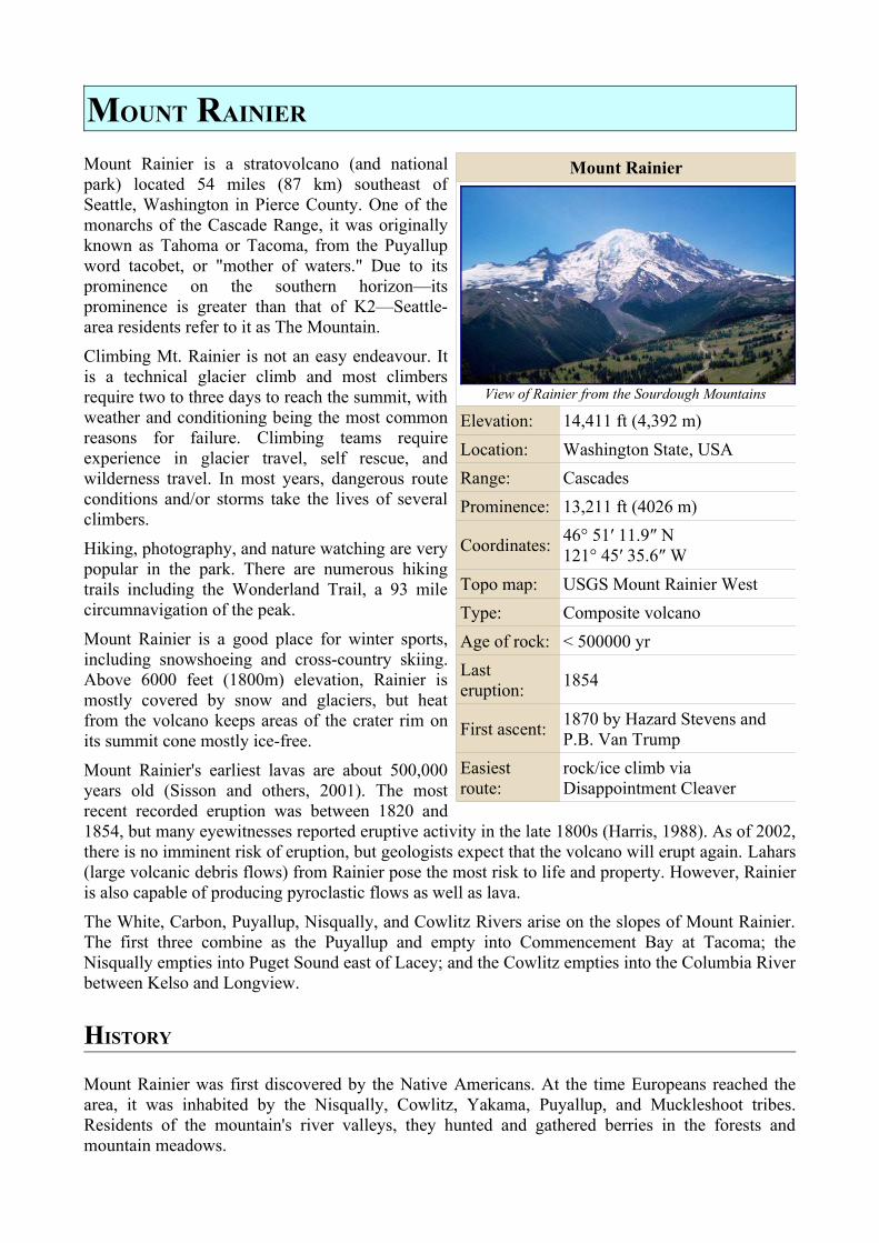
Mount Rainier
View of Rainier from the Sourdough Mountains
Elevation: 14,411 ft (4,392 m)Location: Washington State, USARange: CascadesProminence: 13,211 ft (4026 m)
Coordinates: 46° 51′ 11.9″ N 121° 45′ 35.6″ W
Topo map: USGS Mount Rainier WestType: Composite volcanoAge of rock: < 500000 yrLast eruption: 1854
First ascent: 1870 by Hazard Stevens and P.B. Van Trump
Easiest route:
rock/ice climb via Disappointment Cleaver
Captain George Vancouver sailed into Puget Sound in 1792, and became the first European to see the mountain. He named it in honor of his friend, Rear Admiral Peter Rainier.
In 1833, Dr. William Tolmie explored the area looking for medicinal plants. He was followed by other explorers seeking challenge. Hazard Stevens and P.B. Van Trump received a hero's welcome in the streets of Olympia after their successful summit climb in 1870. John Muir climbed Mount Rainier in 1888, and although he enjoyed the view, he conceded that it was best appreciated from below. Muir was one of many who advocated protecting the mountain. In 1893, the area was set aside as part of the Pacific Forest Reserve in order to protect its physical/economic resources: timber and watersheds.
Citing the need to also protect scenery and provide for public enjoyment, railroads and local businesses urged the creation of a
national park in hopes of increased tourism. On 2 March 1899, President William McKinley established Mount Rainier National Park as America's fifth national park. Congress dedicated the new park "for the benefit and enjoyment of the people; and...for the preservation from injury or spoliation of all timber, mineral deposits, natural curiosities, or wonders within said park, and their retention in their natural condition."
In 1998, the United States Geological Survey began putting together the Mount Rainier Volcano Lahar Warning System to assist in the evacuation of the Puyallup River valley in the event of a catastrophic debris flow. It is now run by the Pierce County Department of Emergency Management. Tacoma, at the mouth of the Puyallup, is only 37 miles west of Rainier, and moderately sized towns such as Puyallup and Orting are only 27 and 20 miles away, respectively.
OTHER VIEWS
Mount Rainier, as seen from Gig Harbor on Puget Sound, about 45 mi (70 km) away.
Mount Rainier with Tacoma in foreground. Another view of the NE slope.
EXTERNAL LINKS
• National Parks Service (also used as a reference) • USGS: Mount Rainier -- Learning to Live with Volcanic Risk • Mount Rainier Volcano Lahar Warning System • Mount Rainier stream drainage • Mount Rainier Trail Descriptions • Mount Rainier on Peakbagger.com
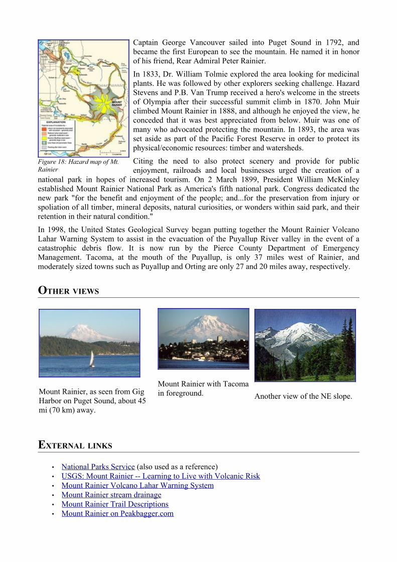
Figure 18: Hazard map of Mt. Rainier

• Mount Rainier on Bivouac.com • Photos of Mount Rainier National Park - Terra Galleria • Mount Rainier Pictures - NationalParksGallery.com • Time-lapse animation of Mt. Rainier Web Cam
• Maps and aerial photos • Topographic map from TopoZone • Aerial image from TerraServer-USA • Surrounding area map from Google Maps • Location in the United States from the Census Bureau
MOUNT VESUVIUS
Mount Vesuvius (Italian: Monte Vesuvio) is a volcano east of Naples, Italy, located at 40°49′ N 14°26′ E. It is the only active volcano on the European mainland, although it is not currently erupting. There are two other active volcanoes in Italy, although not located on the Italian mainland.
Vesuvius is situated on the coast of the Bay of Naples, about nine kilometers (six miles) to the east of the city and a short distance inland from the shore. It forms a conspicuous feature in the beautiful landscape presented by that bay, when viewed from the sea, with the city in the foreground.
The mountain is notorious for its destruction of the Roman city of Pompeii in AD 79; it has erupted many times since and is today regarded as one of the most dangerous volcanoes in the world.
ORIGIN OF THE NAME
Mount Vesuvius was regarded by the Greeks and Romans as being sacred to the hero and demigod Hercules/Heracles, and the town of Herculaneum, built at its base, was named after him. The mountain is also named after Hercules in a less direct manner: he was the son of the god Zeus and Alcmene of Thebes. Zeus was also known as Ves ( ης) in his aspect as the god of rains and dews.Ὓ Hercules was thus alternatively known as Vesouvios ( σου υ ός), "Son of Ves." This name wasὛ ἱ corrupted into "Vesuvius."According to other sources, Vesuvius came from the Oscan word fesf which means "smoke.", and there is a theory that the name "Vesuvius" is derived from the Indo-European root ves- = "hearth".
PHYSICAL ASPECTS
Vesuvius is a distinctive "humpbacked" mountain, consisting of a large cone partially encircled by a large secondary summit, Monte Somma (actually the remains of a huge ancient cone destroyed in a catastrophic eruption, probably the famous one of AD 79). The height of the main cone is constantly modified by eruptions but presently stands at 1,281m (4,202ft). Monte Somma is 1,149m (3,770ft) high, separated from the main cone by the valley of Atrio di Cavallo, which is some 3 miles (5 km) long. The slopes of the mountain are scarred by lava flows but are heavily vegetated, with scrub at higher altitudes and vineyards lower down. It is still regarded as an active volcano
although its activity currently is limited to little more than steam from vents at the bottom of the
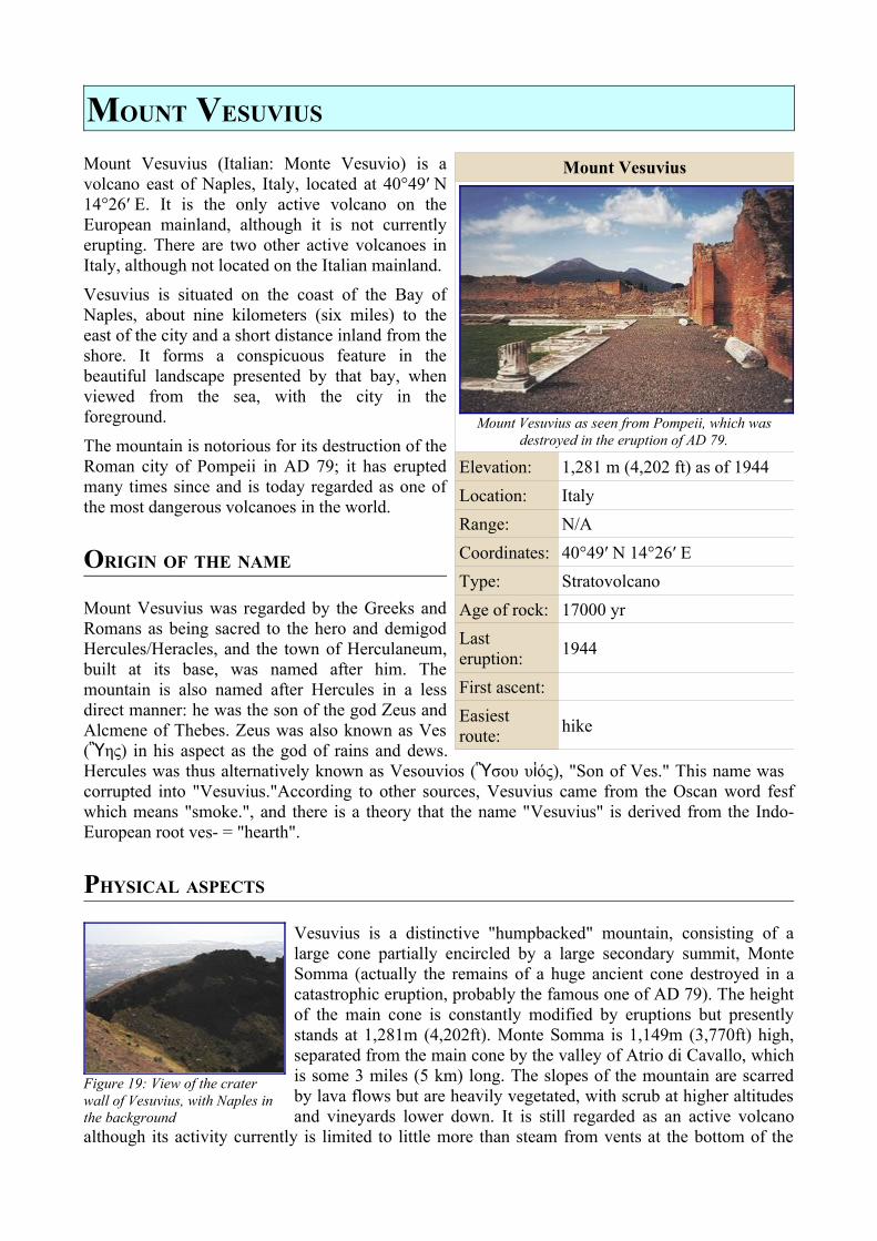
Mount Vesuvius
Mount Vesuvius as seen from Pompeii, which was destroyed in the eruption of AD 79.
Elevation: 1,281 m (4,202 ft) as of 1944Location: ItalyRange: N/ACoordinates: 40°49′ N 14°26′ EType: StratovolcanoAge of rock: 17000 yrLast eruption: 1944
First ascent:Easiest route: hike
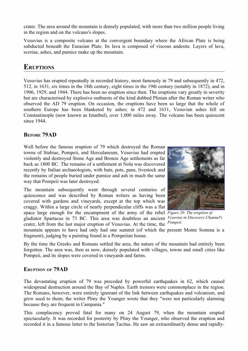
Figure 19: View of the crater wall of Vesuvius, with Naples in the background
crater. The area around the mountain is densely populated, with more than two million people living in the region and on the volcano's slopes.
Vesuvius is a composite volcano at the convergent boundary where the African Plate is being subducted beneath the Eurasian Plate. Its lava is composed of viscous andesite. Layers of lava, scoriae, ashes, and pumice make up the mountain.
ERUPTIONS
Vesuvius has erupted repeatedly in recorded history, most famously in 79 and subsequently in 472, 512, in 1631, six times in the 18th century, eight times in the 19th century (notably in 1872), and in 1906, 1929, and 1944. There has been no eruption since then. The eruptions vary greatly in severity but are characterised by explosive outbursts of the kind dubbed Plinian after the Roman writer who observed the AD 79 eruption. On occasion, the eruptions have been so large that the whole of southern Europe has been blanketed by ashes; in 472 and 1631, Vesuvian ashes fell on Constantinople (now known as Istanbul), over 1,000 miles away. The volcano has been quiescent since 1944.
BEFORE 79AD
Well before the famous eruption of 79 which destroyed the Roman towns of Stabiae, Pompeii, and Herculaneum, Vesuvius had erupted violently and destroyed Stone Age and Bronze Age settlements as far back as 1800 BC. The remains of a settlement at Nola was discovered recently by Italian archaeologists, with huts, pots, pans, livestock and the remains of people buried under pumice and ash in much the same way that Pompeii was later destroyed.
The mountain subsequently went through several centuries of quiescence and was described by Roman writers as having been covered with gardens and vineyards, except at the top which was craggy. Within a large circle of nearly perpendicular cliffs was a flat space large enough for the encampment of the army of the rebel gladiator Spartacus in 73 BC. This area was doubtless an ancient crater, left from the last major eruption of Vesuvius. At the time, the mountain appears to have had only had one summit (of which the present Monte Somma is a fragment), judging by a painting found in a Pompeiian house.
By the time the Greeks and Romans settled the area, the nature of the mountain had entirely been forgotten. The area was, then as now, densely populated with villages, towns and small cities like Pompeii, and its slopes were covered in vineyards and farms.
ERUPTION OF 79AD
The devastating eruption of 79 was preceded by powerful earthquakes in 62, which caused widespread destruction around the Bay of Naples. Earth tremors were commonplace in the region. The Romans, however, were entirely ignorant of the link between earthquakes and volcanism, and grew used to them; the writer Pliny the Younger wrote that they "were not particularly alarming because they are frequent in Campania."
This complacency proved fatal for many on 24 August 79, when the mountain erupted spectacularly. It was recorded for posterity by Pliny the Younger, who observed the eruption and recorded it in a famous letter to the historian Tacitus. He saw an extraordinarily dense and rapidly-
Figure 20: The eruption of Vesuvius in Discovery Channel's Pompeii
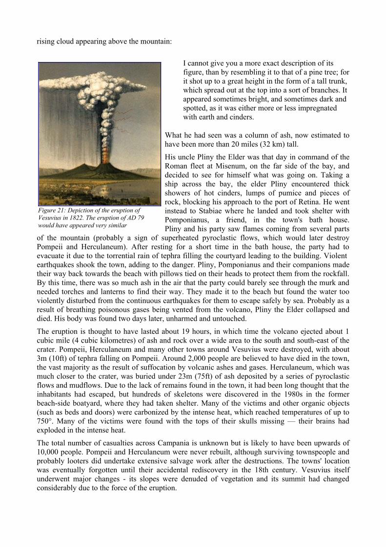
rising cloud appearing above the mountain:
I cannot give you a more exact description of its figure, than by resembling it to that of a pine tree; for it shot up to a great height in the form of a tall trunk, which spread out at the top into a sort of branches. It appeared sometimes bright, and sometimes dark and spotted, as it was either more or less impregnated with earth and cinders.
What he had seen was a column of ash, now estimated to have been more than 20 miles (32 km) tall.
His uncle Pliny the Elder was that day in command of the Roman fleet at Misenum, on the far side of the bay, and decided to see for himself what was going on. Taking a ship across the bay, the elder Pliny encountered thick showers of hot cinders, lumps of pumice and pieces of rock, blocking his approach to the port of Retina. He went instead to Stabiae where he landed and took shelter with Pomponianus, a friend, in the town's bath house.Pliny and his party saw flames coming from several parts
of the mountain (probably a sign of superheated pyroclastic flows, which would later destroy Pompeii and Herculaneum). After resting for a short time in the bath house, the party had to evacuate it due to the torrential rain of tephra filling the courtyard leading to the building. Violent earthquakes shook the town, adding to the danger. Pliny, Pomponianus and their companions made their way back towards the beach with pillows tied on their heads to protect them from the rockfall. By this time, there was so much ash in the air that the party could barely see through the murk and needed torches and lanterns to find their way. They made it to the beach but found the water too violently disturbed from the continuous earthquakes for them to escape safely by sea. Probably as a result of breathing poisonous gases being vented from the volcano, Pliny the Elder collapsed and died. His body was found two days later, unharmed and untouched.
The eruption is thought to have lasted about 19 hours, in which time the volcano ejected about 1 cubic mile (4 cubic kilometres) of ash and rock over a wide area to the south and south-east of the crater. Pompeii, Herculaneum and many other towns around Vesuvius were destroyed, with about 3m (10ft) of tephra falling on Pompeii. Around 2,000 people are believed to have died in the town, the vast majority as the result of suffocation by volcanic ashes and gases. Herculaneum, which was much closer to the crater, was buried under 23m (75ft) of ash deposited by a series of pyroclastic flows and mudflows. Due to the lack of remains found in the town, it had been long thought that the inhabitants had escaped, but hundreds of skeletons were discovered in the 1980s in the former beach-side boatyard, where they had taken shelter. Many of the victims and other organic objects (such as beds and doors) were carbonized by the intense heat, which reached temperatures of up to 750°. Many of the victims were found with the tops of their skulls missing — their brains had exploded in the intense heat.
The total number of casualties across Campania is unknown but is likely to have been upwards of 10,000 people. Pompeii and Herculaneum were never rebuilt, although surviving townspeople and probably looters did undertake extensive salvage work after the destructions. The towns' location was eventually forgotten until their accidental rediscovery in the 18th century. Vesuvius itself underwent major changes - its slopes were denuded of vegetation and its summit had changed considerably due to the force of the eruption.
Figure 21: Depiction of the eruption of Vesuvius in 1822. The eruption of AD 79 would have appeared very similar
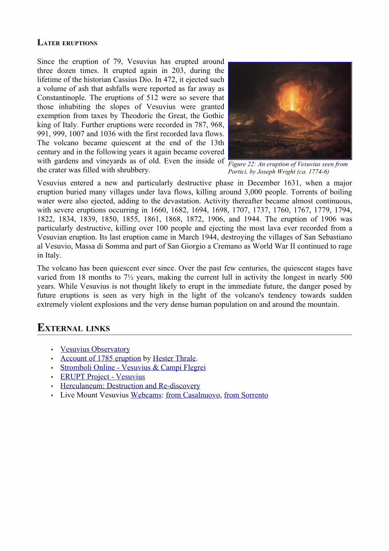
LATER ERUPTIONS
Since the eruption of 79, Vesuvius has erupted around three dozen times. It erupted again in 203, during the lifetime of the historian Cassius Dio. In 472, it ejected such a volume of ash that ashfalls were reported as far away as Constantinople. The eruptions of 512 were so severe that those inhabiting the slopes of Vesuvius were granted exemption from taxes by Theodoric the Great, the Gothic king of Italy. Further eruptions were recorded in 787, 968, 991, 999, 1007 and 1036 with the first recorded lava flows. The volcano became quiescent at the end of the 13th century and in the following years it again became covered with gardens and vineyards as of old. Even the inside of the crater was filled with shrubbery.
Vesuvius entered a new and particularly destructive phase in December 1631, when a major eruption buried many villages under lava flows, killing around 3,000 people. Torrents of boiling water were also ejected, adding to the devastation. Activity thereafter became almost continuous, with severe eruptions occurring in 1660, 1682, 1694, 1698, 1707, 1737, 1760, 1767, 1779, 1794, 1822, 1834, 1839, 1850, 1855, 1861, 1868, 1872, 1906, and 1944. The eruption of 1906 was particularly destructive, killing over 100 people and ejecting the most lava ever recorded from a Vesuvian eruption. Its last eruption came in March 1944, destroying the villages of San Sebastiano al Vesuvio, Massa di Somma and part of San Giorgio a Cremano as World War II continued to rage in Italy.
The volcano has been quiescent ever since. Over the past few centuries, the quiescent stages have varied from 18 months to 7½ years, making the current lull in activity the longest in nearly 500 years. While Vesuvius is not thought likely to erupt in the immediate future, the danger posed by future eruptions is seen as very high in the light of the volcano's tendency towards sudden extremely violent explosions and the very dense human population on and around the mountain.
EXTERNAL LINKS
• Vesuvius Observatory • Account of 1785 eruption by Hester Thrale. • Stromboli Online - Vesuvius & Campi Flegrei • ERUPT Project - Vesuvius • Herculaneum : Destruction and Re-discovery • Live Mount Vesuvius Webcams: from Casalnuovo, from Sorrento
Figure 22: An eruption of Vesuvius seen from Portici, by Joseph Wright (ca. 1774-6)
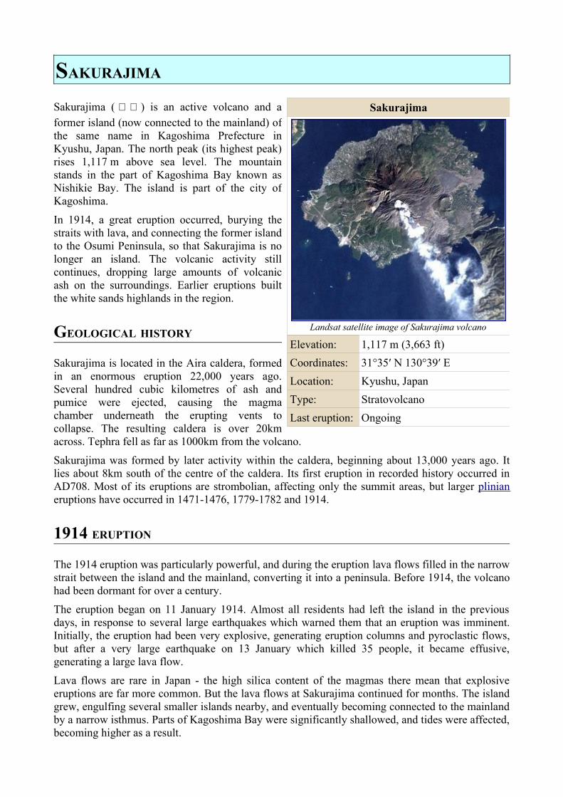
SAKURAJIMA
Sakurajima ( 桜 島 ) is an active volcano and a former island (now connected to the mainland) of the same name in Kagoshima Prefecture in Kyushu, Japan. The north peak (its highest peak) rises 1,117 m above sea level. The mountain stands in the part of Kagoshima Bay known as Nishikie Bay. The island is part of the city of Kagoshima.
In 1914, a great eruption occurred, burying the straits with lava, and connecting the former island to the Osumi Peninsula, so that Sakurajima is no longer an island. The volcanic activity still continues, dropping large amounts of volcanic ash on the surroundings. Earlier eruptions built the white sands highlands in the region.
GEOLOGICAL HISTORY
Sakurajima is located in the Aira caldera, formed in an enormous eruption 22,000 years ago. Several hundred cubic kilometres of ash and pumice were ejected, causing the magma chamber underneath the erupting vents to collapse. The resulting caldera is over 20km across. Tephra fell as far as 1000km from the volcano.
Sakurajima was formed by later activity within the caldera, beginning about 13,000 years ago. It lies about 8km south of the centre of the caldera. Its first eruption in recorded history occurred in AD708. Most of its eruptions are strombolian, affecting only the summit areas, but larger plinian eruptions have occurred in 1471-1476, 1779-1782 and 1914.
1914 ERUPTION
The 1914 eruption was particularly powerful, and during the eruption lava flows filled in the narrow strait between the island and the mainland, converting it into a peninsula. Before 1914, the volcano had been dormant for over a century.
The eruption began on 11 January 1914. Almost all residents had left the island in the previous days, in response to several large earthquakes which warned them that an eruption was imminent. Initially, the eruption had been very explosive, generating eruption columns and pyroclastic flows, but after a very large earthquake on 13 January which killed 35 people, it became effusive, generating a large lava flow.
Lava flows are rare in Japan - the high silica content of the magmas there mean that explosive eruptions are far more common. But the lava flows at Sakurajima continued for months. The island grew, engulfing several smaller islands nearby, and eventually becoming connected to the mainland by a narrow isthmus. Parts of Kagoshima Bay were significantly shallowed, and tides were affected, becoming higher as a result.
Sakurajima
Landsat satellite image of Sakurajima volcano
Elevation: 1,117 m (3,663 ft)Coordinates: 31°35′ N 130°39′ ELocation: Kyushu, JapanType: StratovolcanoLast eruption: Ongoing
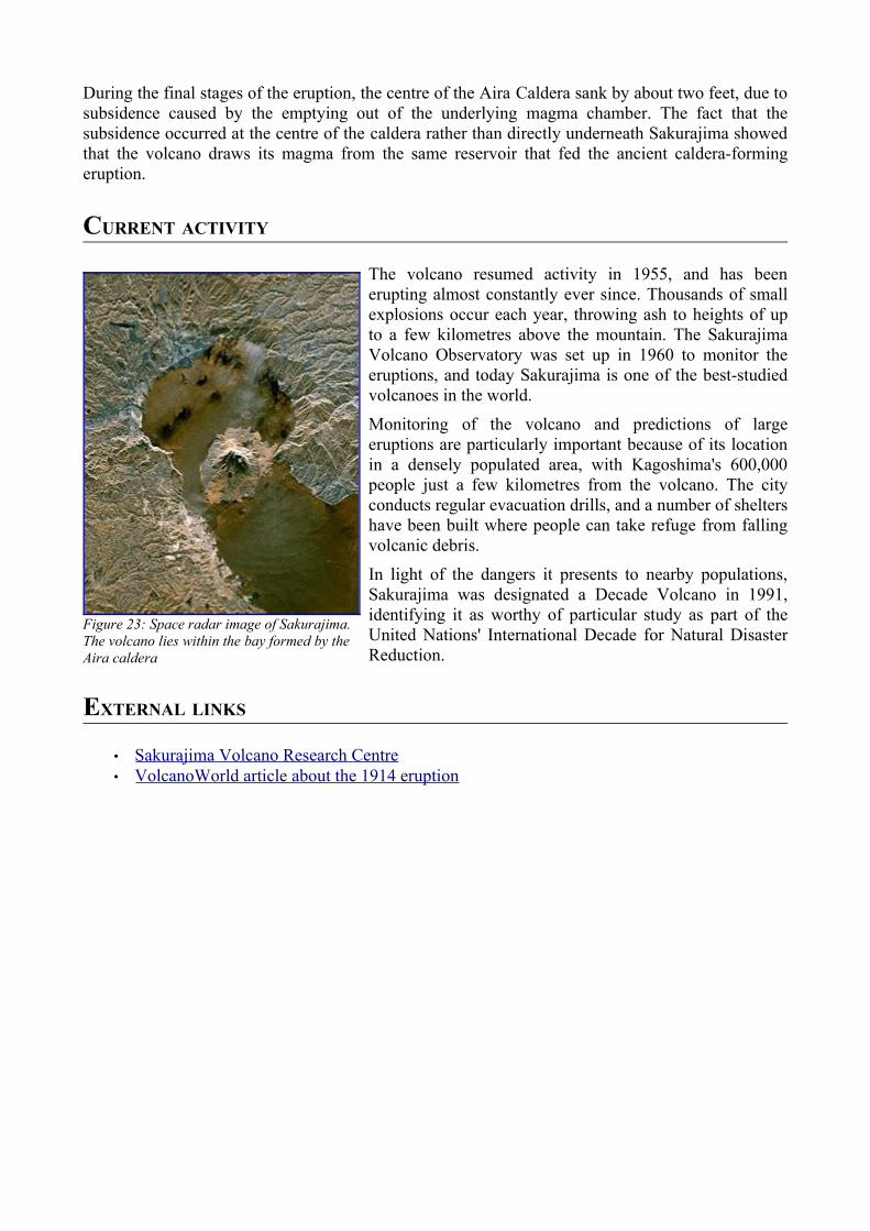
During the final stages of the eruption, the centre of the Aira Caldera sank by about two feet, due to subsidence caused by the emptying out of the underlying magma chamber. The fact that the subsidence occurred at the centre of the caldera rather than directly underneath Sakurajima showed that the volcano draws its magma from the same reservoir that fed the ancient caldera-forming eruption.
CURRENT ACTIVITY
The volcano resumed activity in 1955, and has been erupting almost constantly ever since. Thousands of small explosions occur each year, throwing ash to heights of up to a few kilometres above the mountain. The Sakurajima Volcano Observatory was set up in 1960 to monitor the eruptions, and today Sakurajima is one of the best-studied volcanoes in the world.
Monitoring of the volcano and predictions of large eruptions are particularly important because of its location in a densely populated area, with Kagoshima's 600,000 people just a few kilometres from the volcano. The city conducts regular evacuation drills, and a number of shelters have been built where people can take refuge from falling volcanic debris.
In light of the dangers it presents to nearby populations, Sakurajima was designated a Decade Volcano in 1991, identifying it as worthy of particular study as part of the United Nations' International Decade for Natural Disaster Reduction.
EXTERNAL LINKS
• Sakurajima Volcano Research Centre • VolcanoWorld article about the 1914 eruption
Figure 23: Space radar image of Sakurajima. The volcano lies within the bay formed by the Aira caldera
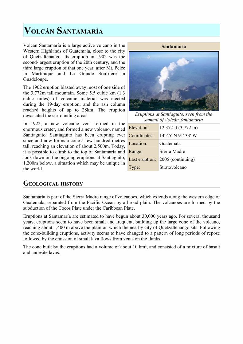
VOLCÁN SANTAMARÍA
Volcán Santamaría is a large active volcano in the Western Highlands of Guatemala, close to the city of Quetzaltenango. Its eruption in 1902 was the second-largest eruption of the 20th century, and the third large eruption of that one year, after Mt. Pelée in Martinique and La Grande Soufrière in Guadeloupe.
The 1902 eruption blasted away most of one side of the 3,772m tall mountain. Some 5.5 cubic km (1.3 cubic miles) of volcanic material was ejected during the 19-day eruption, and the ash column reached heights of up to 28km. The eruption devastated the surrounding areas.
In 1922, a new volcanic vent formed in the enormous crater, and formed a new volcano, named Santiaguito. Santiaguito has been erupting ever since and now forms a cone a few hundred metres tall, reaching an elevation of about 2,500m. Today, it is possible to climb to the top of Santamaría and look down on the ongoing eruptions at Santiaguito, 1,200m below, a situation which may be unique in the world.
GEOLOGICAL HISTORY
Santamaría is part of the Sierra Madre range of volcanoes, which extends along the western edge of Guatemala, separated from the Pacific Ocean by a broad plain. The volcanoes are formed by the subduction of the Cocos Plate under the Caribbean Plate.
Eruptions at Santamaría are estimated to have begun about 30,000 years ago. For several thousand years, eruptions seem to have been small and frequent, building up the large cone of the volcano, reaching about 1,400 m above the plain on which the nearby city of Quetzaltenango sits. Following the cone-building eruptions, activity seems to have changed to a pattern of long periods of repose followed by the emission of small lava flows from vents on the flanks.
The cone built by the eruptions had a volume of about 10 km³, and consisted of a mixture of basalt and andesite lavas.
Santamaría
Eruptions at Santiaguito, seen from the summit of Volcán Santamaría
Elevation: 12,372 ft (3,772 m)Coordinates: 14°45′ N 91°33′ WLocation: GuatemalaRange: Sierra MadreLast eruption: 2005 (continuing)Type: Stratovolcano
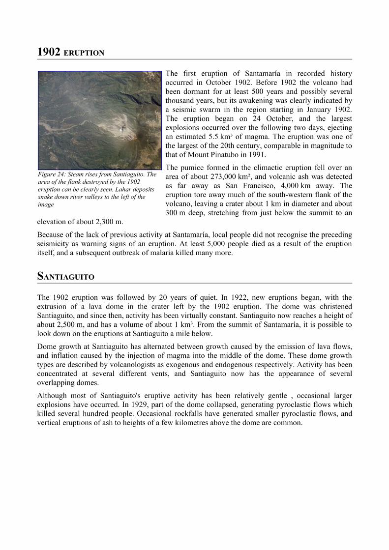
1902 ERUPTION
The first eruption of Santamaría in recorded history occurred in October 1902. Before 1902 the volcano had been dormant for at least 500 years and possibly several thousand years, but its awakening was clearly indicated by a seismic swarm in the region starting in January 1902. The eruption began on 24 October, and the largest explosions occurred over the following two days, ejecting an estimated 5.5 km³ of magma. The eruption was one of the largest of the 20th century, comparable in magnitude to that of Mount Pinatubo in 1991.
The pumice formed in the climactic eruption fell over an area of about 273,000 km², and volcanic ash was detected as far away as San Francisco, 4,000 km away. The eruption tore away much of the south-western flank of the volcano, leaving a crater about 1 km in diameter and about 300 m deep, stretching from just below the summit to an
elevation of about 2,300 m.
Because of the lack of previous activity at Santamaría, local people did not recognise the preceding seismicity as warning signs of an eruption. At least 5,000 people died as a result of the eruption itself, and a subsequent outbreak of malaria killed many more.
SANTIAGUITO
The 1902 eruption was followed by 20 years of quiet. In 1922, new eruptions began, with the extrusion of a lava dome in the crater left by the 1902 eruption. The dome was christened Santiaguito, and since then, activity has been virtually constant. Santiaguito now reaches a height of about 2,500 m, and has a volume of about 1 km³. From the summit of Santamaría, it is possible to look down on the eruptions at Santiaguito a mile below.
Dome growth at Santiaguito has alternated between growth caused by the emission of lava flows, and inflation caused by the injection of magma into the middle of the dome. These dome growth types are described by volcanologists as exogenous and endogenous respectively. Activity has been concentrated at several different vents, and Santiaguito now has the appearance of several overlapping domes.
Although most of Santiaguito's eruptive activity has been relatively gentle , occasional larger explosions have occurred. In 1929, part of the dome collapsed, generating pyroclastic flows which killed several hundred people. Occasional rockfalls have generated smaller pyroclastic flows, and vertical eruptions of ash to heights of a few kilometres above the dome are common.
Figure 24: Steam rises from Santiaguito. The area of the flank destroyed by the 1902 eruption can be clearly seen. Lahar deposits snake down river valleys to the left of the image
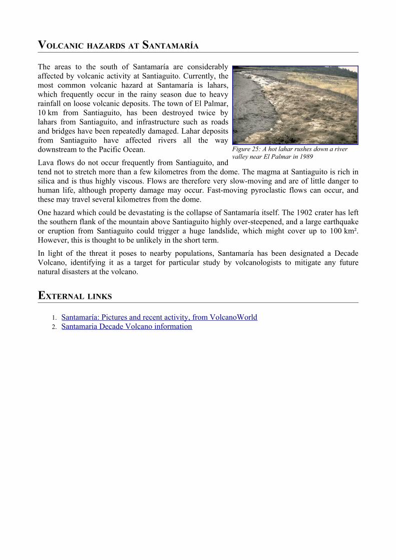
VOLCANIC HAZARDS AT SANTAMARÍA
The areas to the south of Santamaría are considerably affected by volcanic activity at Santiaguito. Currently, the most common volcanic hazard at Santamaría is lahars, which frequently occur in the rainy season due to heavy rainfall on loose volcanic deposits. The town of El Palmar, 10 km from Santiaguito, has been destroyed twice by lahars from Santiaguito, and infrastructure such as roads and bridges have been repeatedly damaged. Lahar deposits from Santiaguito have affected rivers all the way downstream to the Pacific Ocean.
Lava flows do not occur frequently from Santiaguito, and tend not to stretch more than a few kilometres from the dome. The magma at Santiaguito is rich in silica and is thus highly viscous. Flows are therefore very slow-moving and are of little danger to human life, although property damage may occur. Fast-moving pyroclastic flows can occur, and these may travel several kilometres from the dome.
One hazard which could be devastating is the collapse of Santamaría itself. The 1902 crater has left the southern flank of the mountain above Santiaguito highly over-steepened, and a large earthquake or eruption from Santiaguito could trigger a huge landslide, which might cover up to 100 km². However, this is thought to be unlikely in the short term.
In light of the threat it poses to nearby populations, Santamaría has been designated a Decade Volcano, identifying it as a target for particular study by volcanologists to mitigate any future natural disasters at the volcano.
EXTERNAL LINKS
1. Santamaría: Pictures and recent activity, from VolcanoWorld 2. Santamaria Decade Volcano information
Figure 25: A hot lahar rushes down a river valley near El Palmar in 1989
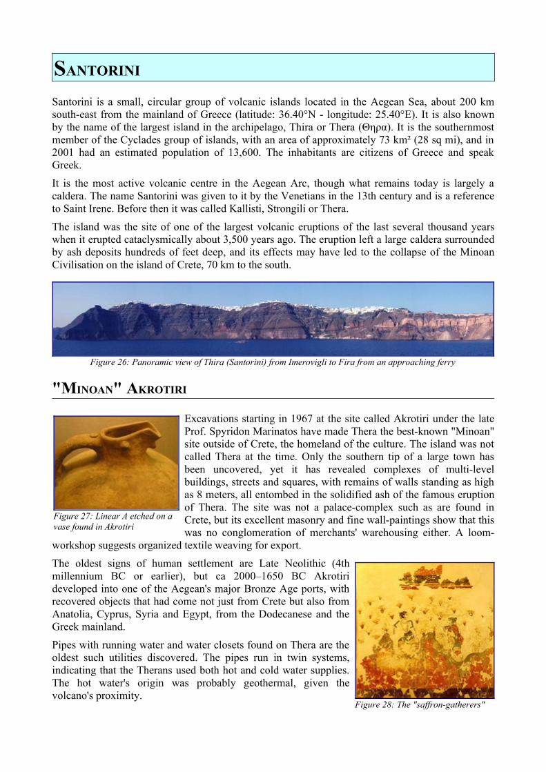
SANTORINI
Santorini is a small, circular group of volcanic islands located in the Aegean Sea, about 200 km south-east from the mainland of Greece (latitude: 36.40°N - longitude: 25.40°E). It is also known by the name of the largest island in the archipelago, Thira or Thera (Θηρα). It is the southernmost member of the Cyclades group of islands, with an area of approximately 73 km² (28 sq mi), and in 2001 had an estimated population of 13,600. The inhabitants are citizens of Greece and speak Greek.
It is the most active volcanic centre in the Aegean Arc, though what remains today is largely a caldera. The name Santorini was given to it by the Venetians in the 13th century and is a reference to Saint Irene. Before then it was called Kallisti, Strongili or Thera.
The island was the site of one of the largest volcanic eruptions of the last several thousand years when it erupted cataclysmically about 3,500 years ago. The eruption left a large caldera surrounded by ash deposits hundreds of feet deep, and its effects may have led to the collapse of the Minoan Civilisation on the island of Crete, 70 km to the south.
Figure 26: Panoramic view of Thira (Santorini) from Imerovigli to Fira from an approaching ferry
"MINOAN" AKROTIRI
Excavations starting in 1967 at the site called Akrotiri under the late Prof. Spyridon Marinatos have made Thera the best-known "Minoan" site outside of Crete, the homeland of the culture. The island was not called Thera at the time. Only the southern tip of a large town has been uncovered, yet it has revealed complexes of multi-level buildings, streets and squares, with remains of walls standing as high as 8 meters, all entombed in the solidified ash of the famous eruption of Thera. The site was not a palace-complex such as are found in Crete, but its excellent masonry and fine wall-paintings show that this was no conglomeration of merchants' warehousing either. A loom-
workshop suggests organized textile weaving for export.
The oldest signs of human settlement are Late Neolithic (4th millennium BC or earlier), but ca 2000–1650 BC Akrotiri developed into one of the Aegean's major Bronze Age ports, with recovered objects that had come not just from Crete but also from Anatolia, Cyprus, Syria and Egypt, from the Dodecanese and the Greek mainland.
Pipes with running water and water closets found on Thera are the oldest such utilities discovered. The pipes run in twin systems, indicating that the Therans used both hot and cold water supplies. The hot water's origin was probably geothermal, given the volcano's proximity.
Figure 28: The "saffron-gatherers"
Figure 27: Linear A etched on a vase found in Akrotiri
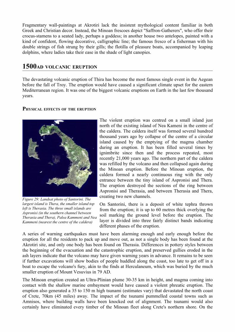
Fragmentary wall-paintings at Akrotiri lack the insistent mythological content familiar in both Greek and Christian decor. Instead, the Minoan frescoes depict "Saffron-Gatherers", who offer their crocus-stamens to a seated lady, perhaps a goddess; in another house two antelopes, painted with a kind of confident, flowing decorative, calligraphic line; the famous fresco of a fisherman with his double strings of fish strung by their gills; the flotilla of pleasure boats, accompanied by leaping dolphins, where ladies take their ease in the shade of light canopies.
1500AD VOLCANIC ERUPTION
The devastating volcanic eruption of Thira has become the most famous single event in the Aegean before the fall of Troy. The eruption would have caused a significant climate upset for the eastern Mediterranean region. It was one of the biggest volcanic eruptions on Earth in the last few thousand years.
PHYSICAL EFFECTS OF THE ERUPTION
The violent eruption was centred on a small island just north of the existing island of Nea Kameni in the centre of the caldera. The caldera itself was formed several hundred thousand years ago by collapse of the centre of a circular island caused by the emptying of the magma chamber during an eruption. It has been filled several times by ignimbrite since then and the process repeated, most recently 21,000 years ago. The northern part of the caldera was refilled by the volcano and then collapsed again during the Minoan eruption. Before the Minoan eruption, the caldera formed a nearly continuous ring with the only entrance between the tiny island of Aspronisi and Thera. The eruption destroyed the sections of the ring between Aspronisi and Therasia, and between Therasia and Thera, creating two new channels.
On Santorini, there is a deposit of white tephra thrown from the eruption; it is up to 60 metres thick overlying the soil marking the ground level before the eruption. The layer is divided into three fairly distinct bands indicating different phases of the eruption.
A series of warning earthquakes must have been alarming enough and early enough before the eruption for all the residents to pack up and move out, as not a single body has been found at the Akrotiri site, and only one body has been found on Therasia. Differences in pottery styles between the beginning of the evacuation and the catastrophic eruption, and preserved gullies eroded in the ash layers indicate that the volcano may have given warning years in advance. It remains to be seen if further excavations will show bodies of people huddled along the coast, too late to get off in a boat to escape the volcano's fury, akin to the finds at Herculaneum, which was buried by the much smaller eruption of Mount Vesuvius in 79 AD.
The Minoan eruption created an Ultra-Plinian plume 30-35 km in height, and magma coming into contact with the shallow marine embayment would have caused a violent phreatic eruption. The eruption also generated a 35 to 150 m high tsunami (estimates vary) that devastated the north coast of Crete, 70km (45 miles) away. The impact of the tsunami pummelled coastal towns such as Amnisos, where building walls have been knocked out of alignment. The tsunami would also certainly have eliminated every timber of the Minoan fleet along Crete's northern shore. On the
Figure 29: Landsat photo of Santorini. The largest island is Thera, the smaller island top left is Therasia. The three small islands are Aspronisi (in the southern channel between Therasia and Thera), Palea Kammeni and Nea Kammeni (nearest the centre of the caldera)
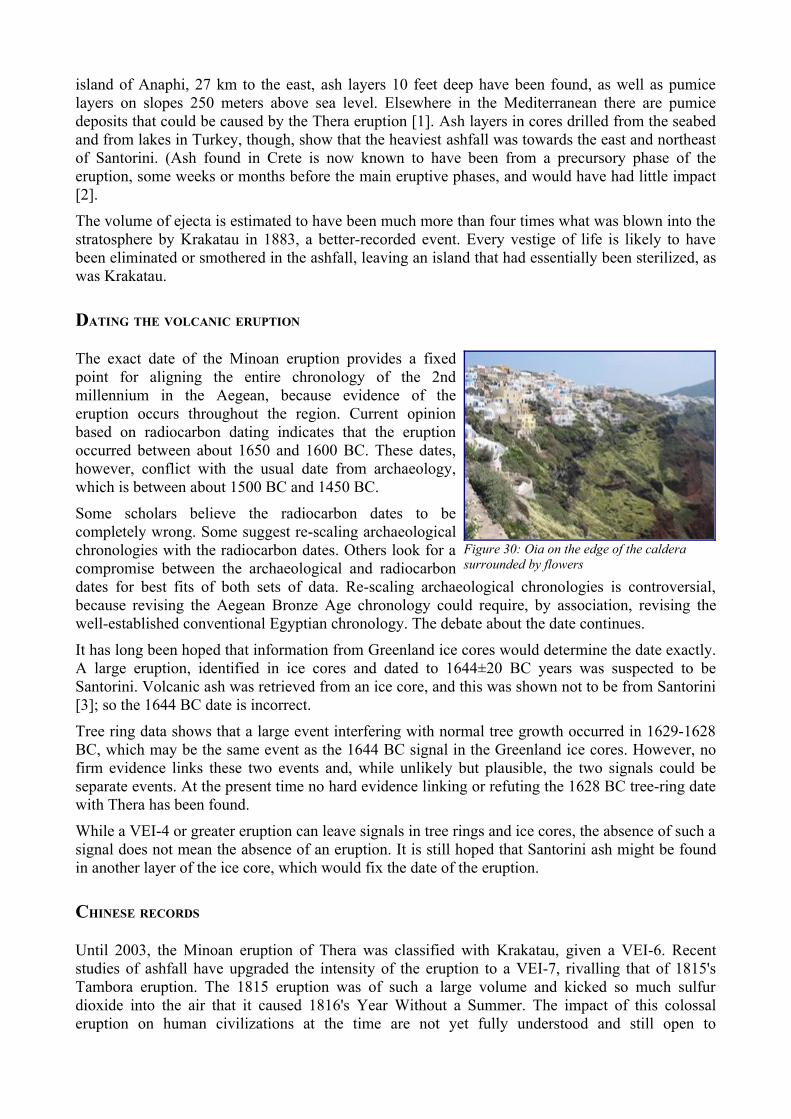
island of Anaphi, 27 km to the east, ash layers 10 feet deep have been found, as well as pumice layers on slopes 250 meters above sea level. Elsewhere in the Mediterranean there are pumice deposits that could be caused by the Thera eruption [1]. Ash layers in cores drilled from the seabed and from lakes in Turkey, though, show that the heaviest ashfall was towards the east and northeast of Santorini. (Ash found in Crete is now known to have been from a precursory phase of the eruption, some weeks or months before the main eruptive phases, and would have had little impact [2].
The volume of ejecta is estimated to have been much more than four times what was blown into the stratosphere by Krakatau in 1883, a better-recorded event. Every vestige of life is likely to have been eliminated or smothered in the ashfall, leaving an island that had essentially been sterilized, as was Krakatau.
DATING THE VOLCANIC ERUPTION
The exact date of the Minoan eruption provides a fixed point for aligning the entire chronology of the 2nd millennium in the Aegean, because evidence of the eruption occurs throughout the region. Current opinion based on radiocarbon dating indicates that the eruption occurred between about 1650 and 1600 BC. These dates, however, conflict with the usual date from archaeology, which is between about 1500 BC and 1450 BC.
Some scholars believe the radiocarbon dates to be completely wrong. Some suggest re-scaling archaeological chronologies with the radiocarbon dates. Others look for a compromise between the archaeological and radiocarbon dates for best fits of both sets of data. Re-scaling archaeological chronologies is controversial, because revising the Aegean Bronze Age chronology could require, by association, revising the well-established conventional Egyptian chronology. The debate about the date continues.
It has long been hoped that information from Greenland ice cores would determine the date exactly. A large eruption, identified in ice cores and dated to 1644±20 BC years was suspected to be Santorini. Volcanic ash was retrieved from an ice core, and this was shown not to be from Santorini [3]; so the 1644 BC date is incorrect.
Tree ring data shows that a large event interfering with normal tree growth occurred in 1629-1628 BC, which may be the same event as the 1644 BC signal in the Greenland ice cores. However, no firm evidence links these two events and, while unlikely but plausible, the two signals could be separate events. At the present time no hard evidence linking or refuting the 1628 BC tree-ring date with Thera has been found.
While a VEI-4 or greater eruption can leave signals in tree rings and ice cores, the absence of such a signal does not mean the absence of an eruption. It is still hoped that Santorini ash might be found in another layer of the ice core, which would fix the date of the eruption.
CHINESE RECORDS
Until 2003, the Minoan eruption of Thera was classified with Krakatau, given a VEI-6. Recent studies of ashfall have upgraded the intensity of the eruption to a VEI-7, rivalling that of 1815's Tambora eruption. The 1815 eruption was of such a large volume and kicked so much sulfur dioxide into the air that it caused 1816's Year Without a Summer. The impact of this colossal eruption on human civilizations at the time are not yet fully understood and still open to
Figure 30: Oia on the edge of the caldera surrounded by flowers
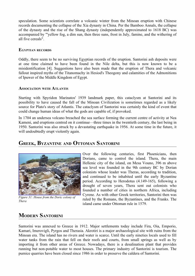
speculation. Some scientists correlate a volcanic winter from the Minoan eruption with Chinese records documenting the collapse of the Xia dynasty in China. Per the Bamboo Annals, the collapse of the dynasty and the rise of the Shang dynasty (independently approximated to 1618 BC) was accompanied by "'yellow fog, a dim sun, then three suns, frost in July, famine, and the withering of all five cereals".
EGYPTIAN RECORDS
Oddly, there seem to be no surviving Egyptian records of the eruption. Santorini ash deposits were at one time claimed to have been found in the Nile delta, but this is now known to be a misidentification [4]. Suggestions have also been made that the eruption of Thera and volcanic fallout inspired myths of the Titanomachy in Hesiod's Theogony and calamities of the Admonitions of Ipuwer of the Middle Kingdom of Egypt.
ASSOCIATION WITH ATLANTIS
Starting with Spyridon Marinatos' 1939 landmark paper, this cataclysm at Santorini and its possibility to have caused the fall of the Minoan Civilization is sometimes regarded as a likely source for Plato's story of Atlantis. The cataclysm of Santorini was certainly the kind of event that could change human ideas of what the gods are capable of, if provoked.
In 1704 an undersea volcano breached the sea surface forming the current centre of activity at Nea Kameni, and eruptions centred on it continue—three times in the twentieth century, the last being in 1950. Santorini was also struck by a devastating earthquake in 1956. At some time in the future, it will undoubtedly erupt violently again.
GREEK, BYZANTINE AND OTTOMAN SANTORINI
Over the following centuries, first Phoenicians, then Dorians, came to control the island. Thera, the main Hellenic city of the island, on Mesa Vouno, 396 m above sea level was founded in the 9th century BC by Dorian colonists whose leader was Theras, according to tradition, and continued to be inhabited until the early Byzantine period. According to Herodotus (4.149-165), following a drought of seven years, Thera sent out colonists who founded a number of cities in northern Africa, including Cyrene. As with other Greek territories, Santorini then was ruled by the Romans, the Byzantines, and the Franks. The island came under Ottoman rule in 1579.
MODERN SANTORINI
Santorini was annexed to Greece in 1912. Major settlements today include Fira, Oia, Emporio, Kamari, Imerovigli, Pyrgos and Therasia. Akrotiri is a major archaeological site with ruins from the Minoan era. The island has no rivers and water is scarce. Until the early nineties locals used to fill water tanks from the rain that fell on their roofs and courts, from small springs as well as by importing it from other areas of Greece. Nowadays, there is a desalination plant that provides running but non-potable water to most houses. The primary industry of Santorini is tourism. The pumice quarries have been closed since 1986 in order to preserve the caldera of Santorini.
Figure 31: House from the Doric colony of Thera
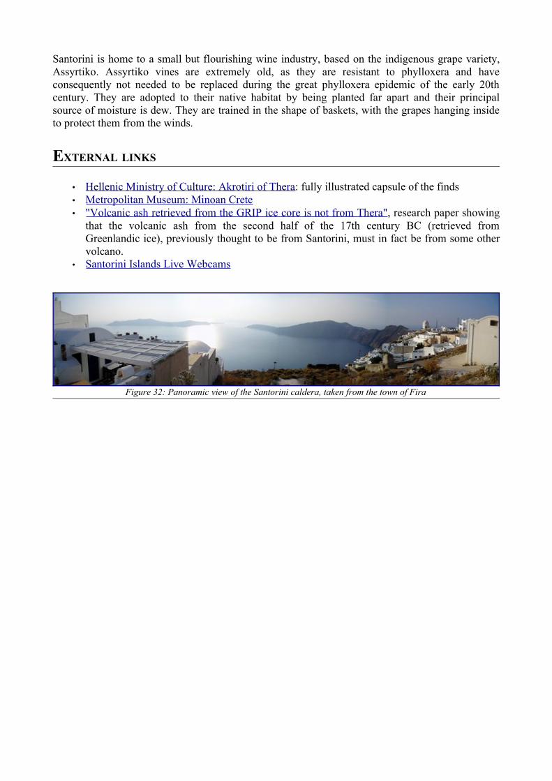
Santorini is home to a small but flourishing wine industry, based on the indigenous grape variety, Assyrtiko. Assyrtiko vines are extremely old, as they are resistant to phylloxera and have consequently not needed to be replaced during the great phylloxera epidemic of the early 20th century. They are adopted to their native habitat by being planted far apart and their principal source of moisture is dew. They are trained in the shape of baskets, with the grapes hanging inside to protect them from the winds.
EXTERNAL LINKS
• Hellenic Ministry of Culture: Akrotiri of Thera : fully illustrated capsule of the finds • Metropolitan Museum: Minoan Crete • "Volcanic ash retrieved from the GRIP ice core is not from Thera" , research paper showing
that the volcanic ash from the second half of the 17th century BC (retrieved from Greenlandic ice), previously thought to be from Santorini, must in fact be from some other volcano.
• Santorini Islands Live Webcams
Figure 32: Panoramic view of the Santorini caldera, taken from the town of Fira
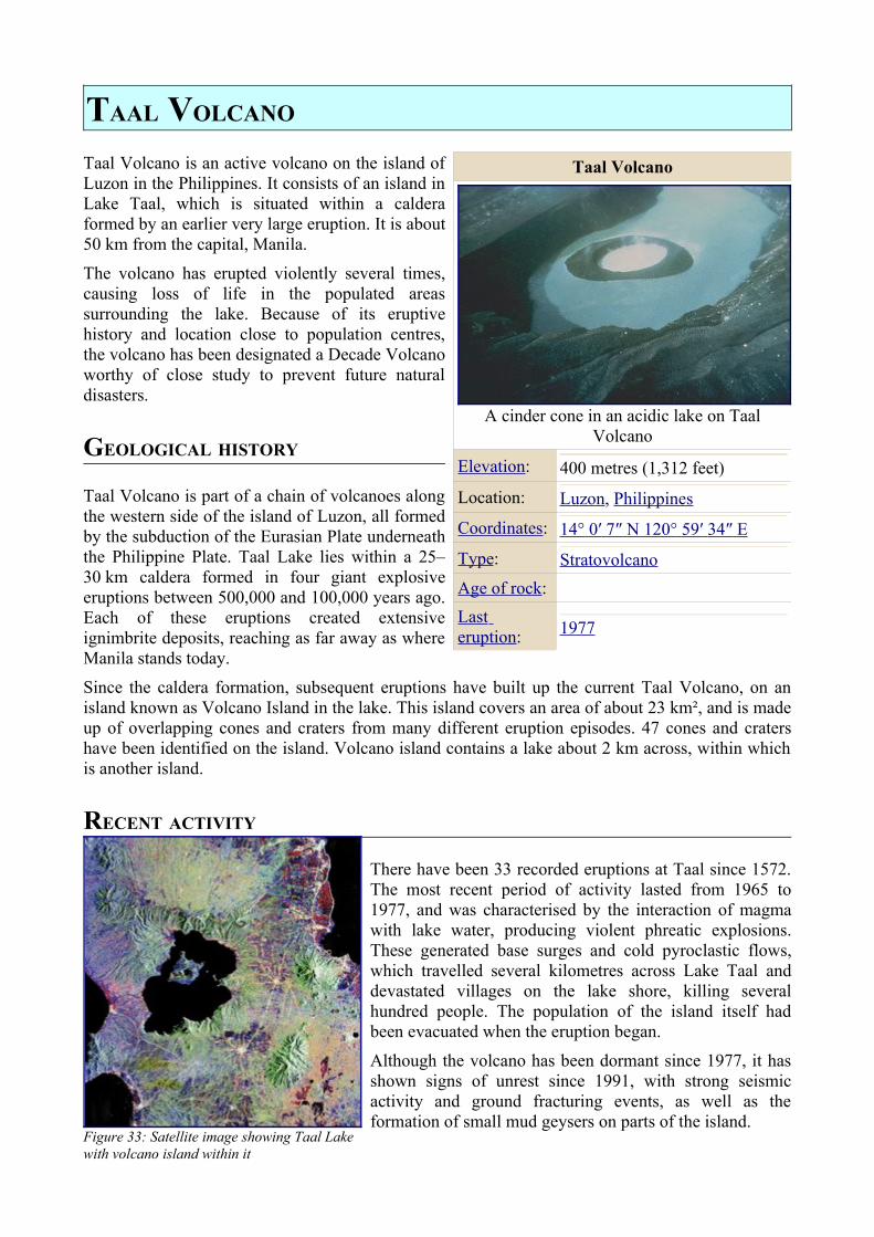
TAAL VOLCANO
Taal Volcano is an active volcano on the island of Luzon in the Philippines. It consists of an island in Lake Taal, which is situated within a caldera formed by an earlier very large eruption. It is about 50 km from the capital, Manila.
The volcano has erupted violently several times, causing loss of life in the populated areas surrounding the lake. Because of its eruptive history and location close to population centres, the volcano has been designated a Decade Volcano worthy of close study to prevent future natural disasters.
GEOLOGICAL HISTORY
Taal Volcano is part of a chain of volcanoes along the western side of the island of Luzon, all formed by the subduction of the Eurasian Plate underneath the Philippine Plate. Taal Lake lies within a 25–30 km caldera formed in four giant explosive eruptions between 500,000 and 100,000 years ago. Each of these eruptions created extensive ignimbrite deposits, reaching as far away as where Manila stands today.
Since the caldera formation, subsequent eruptions have built up the current Taal Volcano, on an island known as Volcano Island in the lake. This island covers an area of about 23 km², and is made up of overlapping cones and craters from many different eruption episodes. 47 cones and craters have been identified on the island. Volcano island contains a lake about 2 km across, within which is another island.
RECENT ACTIVITY
There have been 33 recorded eruptions at Taal since 1572. The most recent period of activity lasted from 1965 to 1977, and was characterised by the interaction of magma with lake water, producing violent phreatic explosions. These generated base surges and cold pyroclastic flows, which travelled several kilometres across Lake Taal and devastated villages on the lake shore, killing several hundred people. The population of the island itself had been evacuated when the eruption began.
Although the volcano has been dormant since 1977, it has shown signs of unrest since 1991, with strong seismic activity and ground fracturing events, as well as the formation of small mud geysers on parts of the island.
Taal Volcano
A cinder cone in an acidic lake on Taal Volcano
Elevation: 400 metres (1,312 feet)
Location: Luzon, Philippines
Coordinates: 14° 0′ 7″ N 120° 59′ 34″ E
Type: StratovolcanoAge of rock:Last eruption: 1977
Figure 33: Satellite image showing Taal Lake with volcano island within it
ERUPTION PRECURSORS AT TAAL
In light of its proximity to populated areas and violent eruptive history, Taal has been designated one of fifteen Decade Volcanoes, making at a focus for research efforts and disaster mitigation plans. While seismic activity is a common precursor to eruptive activity, another useful indicator at Taal is the temperature of Lake Taal. Before the 1965 eruption began, the lake's temperature rose to several degrees above normal. However, the lake's temperature does not always rise before an eruption. Before some eruptions, the dissolution of acidic volcanic gases into the lake has resulted in the death of large numbers of fish.
EARTHQUAKE PRECURSORS IN THE TAAL REGION
An interesting observation on Volcano Island was made in 1994. Volcanologists measuring the concentration of radon gas in the soil on the island measured an anomalous increase of the radon concentration by a factor of six in October 1994. This increase was followed 22 days later by a magnitude 7.1 earthquake on 15 November, centred about 50 km south of Taal, off the coast of Luzon.
A typhoon had passed through the area a few days before the radon spike was measured, but when Typhoon Angela, the most powerful to strike the area in ten years, crossed Luzon on almost the same track a year later, no radon spike was measured. Therefore, typhoons were ruled out as the cause, and there is strong evidence that the radon originated in the stress accumulation preceding the earthquake.
EXTERNAL LINKS
• Information from PHIVOLCS • VolcanoWorld page about Taal • Global Volcanism Program information
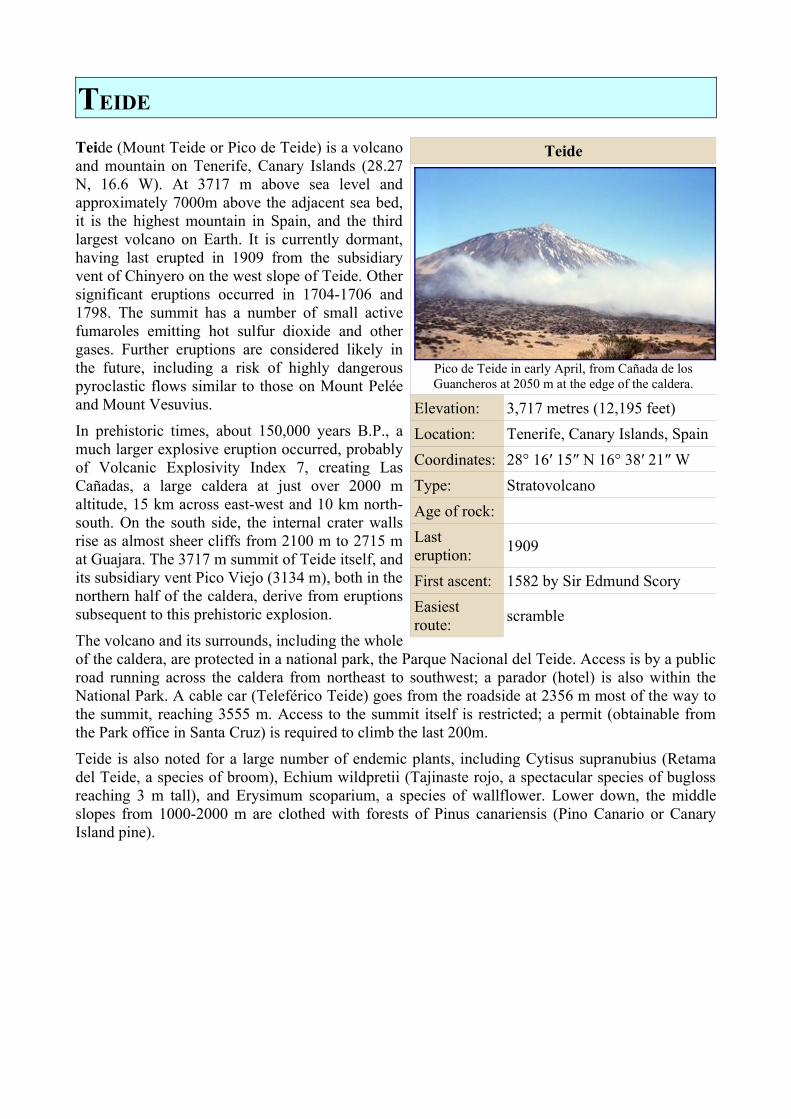
TEIDE
Teide (Mount Teide or Pico de Teide) is a volcano and mountain on Tenerife, Canary Islands (28.27 N, 16.6 W). At 3717 m above sea level and approximately 7000m above the adjacent sea bed, it is the highest mountain in Spain, and the third largest volcano on Earth. It is currently dormant, having last erupted in 1909 from the subsidiary vent of Chinyero on the west slope of Teide. Other significant eruptions occurred in 1704-1706 and 1798. The summit has a number of small active fumaroles emitting hot sulfur dioxide and other gases. Further eruptions are considered likely in the future, including a risk of highly dangerous pyroclastic flows similar to those on Mount Pelée and Mount Vesuvius.
In prehistoric times, about 150,000 years B.P., a much larger explosive eruption occurred, probably of Volcanic Explosivity Index 7, creating Las Cañadas, a large caldera at just over 2000 m altitude, 15 km across east-west and 10 km north-south. On the south side, the internal crater walls rise as almost sheer cliffs from 2100 m to 2715 m at Guajara. The 3717 m summit of Teide itself, and its subsidiary vent Pico Viejo (3134 m), both in the northern half of the caldera, derive from eruptions subsequent to this prehistoric explosion.
The volcano and its surrounds, including the whole of the caldera, are protected in a national park, the Parque Nacional del Teide. Access is by a public road running across the caldera from northeast to southwest; a parador (hotel) is also within the National Park. A cable car (Teleférico Teide) goes from the roadside at 2356 m most of the way to the summit, reaching 3555 m. Access to the summit itself is restricted; a permit (obtainable from the Park office in Santa Cruz) is required to climb the last 200m.
Teide is also noted for a large number of endemic plants, including Cytisus supranubius (Retama del Teide, a species of broom), Echium wildpretii (Tajinaste rojo, a spectacular species of bugloss reaching 3 m tall), and Erysimum scoparium, a species of wallflower. Lower down, the middle slopes from 1000-2000 m are clothed with forests of Pinus canariensis (Pino Canario or Canary Island pine).
Teide
Pico de Teide in early April, from Cañada de los Guancheros at 2050 m at the edge of the caldera.
Elevation: 3,717 metres (12,195 feet)Location: Tenerife, Canary Islands, SpainCoordinates: 28° 16′ 15″ N 16° 38′ 21″ WType: StratovolcanoAge of rock:Last eruption: 1909
First ascent: 1582 by Sir Edmund ScoryEasiest route: scramble
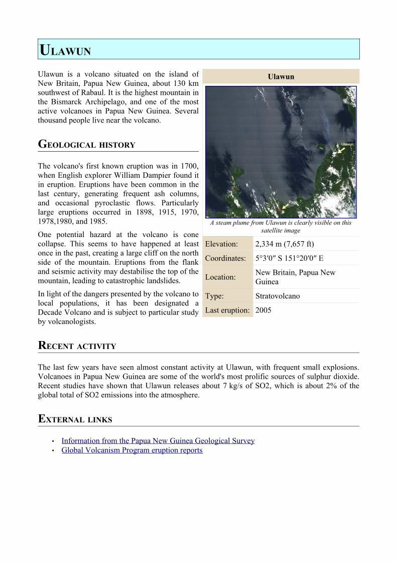
ULAWUN
Ulawun is a volcano situated on the island of New Britain, Papua New Guinea, about 130 km southwest of Rabaul. It is the highest mountain in the Bismarck Archipelago, and one of the most active volcanoes in Papua New Guinea. Several thousand people live near the volcano.
GEOLOGICAL HISTORY
The volcano's first known eruption was in 1700, when English explorer William Dampier found it in eruption. Eruptions have been common in the last century, generating frequent ash columns, and occasional pyroclastic flows. Particularly large eruptions occurred in 1898, 1915, 1970, 1978,1980, and 1985.
One potential hazard at the volcano is cone collapse. This seems to have happened at least once in the past, creating a large cliff on the north side of the mountain. Eruptions from the flank and seismic activity may destabilise the top of the mountain, leading to catastrophic landslides.
In light of the dangers presented by the volcano to local populations, it has been designated a Decade Volcano and is subject to particular study by volcanologists.
RECENT ACTIVITY
The last few years have seen almost constant activity at Ulawun, with frequent small explosions. Volcanoes in Papua New Guinea are some of the world's most prolific sources of sulphur dioxide. Recent studies have shown that Ulawun releases about 7 kg/s of SO2, which is about 2% of the global total of SO2 emissions into the atmosphere.
EXTERNAL LINKS
• Information from the Papua New Guinea Geological Survey • Global Volcanism Program eruption reports
Ulawun
A steam plume from Ulawun is clearly visible on this satellite image
Elevation: 2,334 m (7,657 ft)
Coordinates: 5°3′0″ S 151°20′0″ E
Location: New Britain, Papua New Guinea
Type: Stratovolcano
Last eruption: 2005
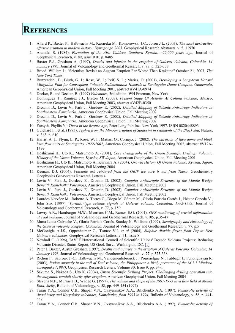
REFERENCES
1. Allard P., Baxter P., Halbwachs M., Kasareka M., Komorowski J.C., Joron J.L. (2003), The most destructive effusive eruption in modern history: Nyiragongo 2003, Geophysical Research Abstracts, v. 5, 11970
2. Aramaki S. (1984), Formation of the Aira Caldera, Southern Kyushu, ~22,000 years ago, Journal of Geophysical Research, v. 89, issue B10, p. 8485
3. Baxter P.J., Gresham A. (1997), Deaths and injuries in the eruption of Galeras Volcano, Colombia, 14 January 1993, Journal of Volcanology and Geothermal Research, v. 77, p. 325-338
4. Broad, William J.: "Scientists Revisit an Aegean Eruption Far Worse Than Krakatoa" October 21, 2003, The New York Times.
5. Bunzendahl, E.; Bluth, G. J.; Rose, W. I.; Reif, S. L.; Matias, O. (2001), Developing a Long-term Hazard Mitigation Plan for Consequent Volcanic Sedimentation Hazards at Santiaguito Dome Complex, Guatemala, American Geophysical Union, Fall Meeting 2001, abstract #V41A-0974
6. Decker, R. and Decker, B. (1997) Volcanoes, 3rd edition, WH Freeman, New York. 7. Domínguez T., Ramírez J.J., Breton M. (2003), Present Stage Of Activity At Colima Volcano, Mexico,
American Geophysical Union, Fall Meeting 2003, abstract #V42B-0350 8. Droznin D., Levin V., Park J., Gordeev E. (2002), Detailed Mapping of Seismic Anisotropy Indicators in
Southeastern Kamchatka, American Geophysical Union, Fall Meeting 2002 9. Droznin D., Levin V., Park J., Gordeev E. (2002), Detailed Mapping of Seismic Anisotropy Indicators in
Southeastern Kamchatka, American Geophysical Union, Fall Meeting 2002 10. Forsyth, Phyllis Y.: Thera in the Bronze Age, Peter Lang Pub Inc, New York 1997. ISBN 0820448893 11. Guichard F., et al. (1993), Tephra from the Minoan eruption of Santorini in sediments of the Black Sea, Nature,
v. 363, p. 610 12. Harris, A. J.; Flynn, L. P.; Rose, W. I.; Matias, O.; Cornejo, J. (2002), The extrusion of lava dome and block
lava flow units at Santiaguito, 1922-2002, American Geophysical Union, Fall Meeting 2002, abstract #V12A-1399
13. Hoshizumi H., Uto K., Matsumoto A. (2001), Core stratigraphy of the Unzen Scientific Drilling: Volcanic History of the Unzen Volcano, Kyushu, SW Japan, American Geophysical Union, Fall Meeting 2001
14. Hoshizumi H., Uto K., Matsumoto A., Kurihara A. (2004), Growth History Of Unzen Volcano, Kyushu, Japan, American Geophysical Union, Fall Meeting 2004
15. Keenan, D.J. (2004), Volcanic ash retrieved from the GRIP ice core is not from Thera, Geochemistry Geophysics Geosystems Research Letters 4
16. Levin V., Park J., Gordeev E., Droznin D. (2002), Complex Anisotropic Structure of the Mantle Wedge Beneath Kamchatka Volcanoes, American Geophysical Union, Fall Meeting 2002
17. Levin V., Park J., Gordeev E., Droznin D. (2002), Complex Anisotropic Structure of the Mantle Wedge Beneath Kamchatka Volcanoes, American Geophysical Union, Fall Meeting 2002
18. Lourdes Narváez M., Roberto A. Torres C., Diego M. Gómez M., Gloria Patricia Cortés J., Héctor Cepeda V., John Stix (1997), 'Tornillo'-type seismic signals at Galeras volcano, Colombia, 1992-1993, Journal of Volcanology and Geothermal Research, v. 77, p. 159
19. Lowry A.R., Hamburger M.W., Meertens C.M., Ramos E.G. (2001), GPS monitoring of crustal deformation at Taal Volcano, Journal of Volcanology and Geothermal Research, v.105, p.35-47
20. Marta Lucia Calvache V., Gloria Patricia Cortés, Stanley N. Williams (1997), Stratigraphy and chronology of the Galeras volcanic complex, Colombia, Journal of Volcanology and Geothermal Research, v. 77, p.5
21. McGonigle A.J.S., Oppenheimer C., Tsanev V.I. et al (2004), Sulphur dioxide fluxes from Papua New Guinea's volcanoes, Geophysical Research Letters, v. 31, issue 8
22. Newhall C. (1996), IAVCEI/International Council of Scientific Unions' Decade Volcano Projects: Reducing Volcanic Disaster. Status Report, US Geol. Surv., Washington, DC. [1]
23. Peter J. Baxter, Austin Gresham (1997), Deaths and injuries in the eruption of Galeras Volcano, Colombia, 14 January 1993, Journal of Volcanology and Geothermal Research, v. 77, p.325-338
24. Richon P., Sabroux J.-C., Halbwachs M., Vandemeulebrouck J., Poussielgue N., Tabbagh J., Punongbayan R. (2003), Radon anomaly in the soil of Taal volcano, the Philippines: A likely precursor of the M 7.1 Mindoro earthquake (1994), Geophysical Research Letters, Volume 30, Issue 9, pp. 34-1
25. Sakuma S., Nakada S., Uto K. (2004), Unzen Scientific Drilling Project: Challenging drilling operation into the magmatic conduit shortly after eruption, American Geophysical Union, Fall Meeting 2004
26. Stevens N.F., Murray J.B., Wadge G. (1997), The volume and shape of the 1991-1993 lava flow field at Mount Etna, Sicily, Bulletin of Volcanology, v. 58, pp. 449-454 (1997)
27. Taran Y.A., Connor C.B., Shapar V.N., Ovsyannikov A.A., Bilichenko A.A. (1997), Fumarolic activity of Avachinsky and Koryaksky volcanoes, Kamchatka, from 1993 to 1994, Bulletin of Volcanology, v. 58, p. 441-448
28. Taran Y.A., Connor C.B., Shapar V.N., Ovsyannikov A.A., Bilichenko A.A. (1997), Fumarolic activity of

Avachinsky and Koryaksky volcanoes, Kamchatka, from 1993 to 1994, Bulletin of Volcanology, v. 58, p. 441-448
29. Uto K., Hoshizumi H., Matsumoto A., Oguri K., Nguyen H. (2001), Volcanotectonic history of Shimabara Peninsula and the evolution of Unzen volcano in Southwest Japan, American Geophysical Union, Fall Meeting 2001
30. Uto K., Nakada S., Shimizu H., Sakuma S., Hoshizumi H. (2004), Overview and the achievement of the Unzen Scientific Drilling Project, American Geophysical Union, Fall Meeting 2004
31. Walter L. Friedrich, Alexander R. McBirney (Translator): Fire in the Sea: Natural History and the Legend of Atlantis, Cambridge University Press, United Kingdom 1999. A historical account of the eruption and its effects from a geological point of view with many drawings, figures and pictures.
32. Yamamoto T., Takarada S., Suto S. (1993), Pyroclastic flows from the 1991 eruption of Unzen volcano, Japanese Bulletin of Volcanology, v. 55, p. 166-175
APPENDICES
ORIGINAL AUTHORS
The following authors have contributed to the online articles from which this WikiReader has been produced. They are listed in order of the number of edits made. Anonymous editors are not listed.
Worldtraveller, Hike395, Gilgamesh, ChrisO, Darwinek, MPF, SEWilco, D6, Wetman, RedWolf, David newton, Andruzzo, Hadal, Marshman, Lukobe, Quadell, El C, Jll, Ahoerstemeier, CanisRufus, GarciaB, Joshbrez, Olekils, Bryan Derksen, Schutz, Balcer, ChristopherWillis, Fg2, Jongarrettuk, Megan1967, Olivier, ShadowDragon, Adam Bishop, Antandrus, Carnildo, David Thrale, Docu, Ellywa, FlaBot, Grutness, Hajor, Maveric149, niteowlneils, RobotE, Sam Hocevar, Solitude, Swimmer618, Thamis, AlexPlank, Andre Engels, Anthony DiPierro, Beginning, Bobo192, Cdc, Chmouel, Chobot, Clarahamster, Dimitrir, Dryazan, Dysprosia, Everyking, Fenners, Flyingbird, Fnielsen, Gianfranco, Hayabusa future, Ixfd64, JeLuF, Jpbrenna, Kaare, Ktsquare, LoopZilla, Modeha, ngb, Portum, Rdsmith4, RickK, Rmhermen, Robbot, RussBot, Sam12, ScottDavis, Sjv27, Sleep pilot, Stan Shebs, Sverdrup, Template namespace initialisation script, Voyevoda, Wikibot, Wwoods, Yalbik, ²¹², A2Kafir, AdSR, Alai, Alfio, Andycjp, Anthony Appleyard, Aphaia, BanyanTree, Bevo, Bobblewik, Bogdangiusca, Bota47, Brian0918, Brion VIBBER, Byrial, Cacafuego95, Charles Matthews, Christopherparham, Clawed, Complex01, ContiE, Conversion script, Crissov, Curps, Dan100, Daniel Quinlan, Danny, Darco, DarkHorizon, Dcoetzee, Dominus, DO'neil, Dori, Ductapedaredevil, Dwmyers, E. abu Filumena, Ebear422, Ed g2s, Edward, Enigmasoldier, Erebus555, Eric Kvaalen, Even, Fabiform, Fennec, Fhimpe, Frecklefoot, Fredrik, Fuelbottle, Gadfium, Gdr, Gene Nygaard, Gerald Farinas, Golbez, Grunt, Heron, Hpc, Inter, J.Voss, Jdforrester, JediMaster16, Jemecki, Joanjoc, JoJan, Jovanvb, Jusjih, Jyril, Katefan0, Kbahey, Kbdank71, Kingturtle, Knucmo2, Knutux, Kosebamse, Kpjas, Llywrch, Magnus Manske, ManningBartlett, Manos, Maximus Rex, Michael Hardy, Mikkalai, Mitsukai, Montrealais, Morn, Mulad, Mwng, NetBot, NevilleDNZ, Newnoise, Nikai, Nilmerg, NSR, Okc, One-dimensional Tangent, Orangemarlin, Orelstrigo, Panairjdde, Pavel Vozenilek, Pearle, Pekinensis, Penmachine, Peregrine981, Peterlin, Petroleum, Phil Boswell, PhilippeD, Profoss, Puckly, Pumpie, Radiojon, RadRafe, Rainer, Ran, Rasmus Faber, Raul654, Rcingham, Reflex, Reaction, Retaggio, RexNL, Ricky81682, RodC, Rogper, RoyV, Rune.welsh, Sabbut, Sandover, Sannse, Scapermoya, ScottyBoy900Q, Secretlondon, Senori, Sietse Snel, Silsor, Slawojarek, Slowking Man, Smallweed, Smoddy, Stephen Gilbert, SWAdair, Tbc2, Terd, The number c, The Singing Badger, TimR, Tony Sidaway, Tranter, Trevor macinnis, TreyHarris, Udzu, Vcxlor, VeryVerily, Vicki Rosenzweig, Wac, Waltpohl, Wclark, Wikibofh, Wikix, Wildnis, WouterBot, Xerxes314, Yann, Yekrats, YurikBot, Zandperl, ZekeMacNeil, Zoicon5, ZwoBot
LAST CHANGES TO SOURCE ARTICLES
Avachinsky 00:38, 29 January 2006Koryaksky 20:37, 09 May 2006Colima 18:12, 27 March 2006Mount_Etna 18:09, 02 June 2006Galeras 20:53, 02 June 2006Mauna_Loa 23:13, 30 May 2006Merapi 11:49, 18 May 2006Nyiragongo 16:54, 09 March 2004Mount_Rainier 17:38, 01 June 2006Sakurajima 17:16, 02 June 2006Santamaría_(volcano) 20:23, 2 June 2006Santorini 00:54, 01 June 2006Taal_Volcano 23:42, 01 May 2006Teide 11:47, 31 May 2006Ulawun 03:15, 20 September 2005Mount_Unzen 02:41, 18 April 2006Unzen 10:30, 11 August 2005
GNU FREE DOCUMENTATION LICENSE
Version 1.2, November 2002
Copyright (C) 2000,2001,2002 Free Software Foundation, Inc.59 Temple Place, Suite 330, Boston, MA 02111-1307 USAEveryone is permitted to copy and distribute verbatim copiesof this license document, but changing it is not allowed.
0. PREAMBLE
The purpose of this License is to make a manual, textbook, or other functional and useful document "free" in the sense of freedom: to assure everyone the effective freedom to copy and redistribute it, with or without modifying it, either commercially or noncommercially. Secondarily, this License preserves for the author and publisher a way to get credit for their work, while not being considered responsible for modifications made by others.
This License is a kind of "copyleft", which means that derivative works of the document must themselves be free in the same sense. It complements the GNU General Public License, which is a copyleft license designed for free software.
We have designed this License in order to use it for manuals for free software, because free software needs free documentation: a free program should come with manuals providing the same freedoms that the software does. But this License is not limited to software manuals; it can be used for any textual work, regardless of subject matter or whether it is published as a printed book. We recommend this License principally for works whose purpose is instruction or reference.
1. APPLICABILITY AND DEFINITIONS
This License applies to any manual or other work, in any medium, that contains a notice placed by the copyright holder saying it can be distributed under the terms of this License. Such a notice grants a world-wide, royalty-free license, unlimited in duration, to use that work under the conditions stated herein. The "Document", below, refers to any such manual or work. Any member of the public is a licensee, and is addressed as "you". You accept the license if you copy, modify or distribute the work in a way requiring permission under copyright law.
A "Modified Version" of the Document means any work containing the Document or a portion of it, either copied verbatim, or with modifications and/or translated into another language.
A "Secondary Section" is a named appendix or a front-matter section of the Document that deals exclusively with the relationship of the publishers or authors of the Document to the Document's overall subject (or to related matters) and contains nothing that could fall directly within that overall subject. (Thus, if the Document is in part a textbook of mathematics, a Secondary Section may not explain any mathematics.) The relationship could be a matter of historical connection with the subject or with related matters, or of legal, commercial, philosophical, ethical or political position regarding them.
The "Invariant Sections" are certain Secondary Sections whose titles are designated, as being those of Invariant Sections, in the notice that says that the Document is released under this License. If a section does not fit the above definition of Secondary then it is not allowed to be designated as Invariant. The Document may contain zero Invariant Sections. If the Document does not identify any Invariant Sections then there are none.
The "Cover Texts" are certain short passages of text that are listed, as Front-Cover Texts or Back-Cover Texts, in the notice that says that the Document is released under this License. A Front-Cover Text may be at most 5 words, and a Back-Cover Text may be at most 25 words.
A "Transparent" copy of the Document means a machine-readable copy, represented in a format whose specification is available to the general public, that is suitable for revising the document straightforwardly with generic text editors or (for images composed of pixels) generic paint programs or (for drawings) some widely available drawing editor, and that is suitable for input to text formatters or for automatic translation to a variety of formats suitable for input to text formatters. A copy made in an otherwise Transparent file format whose markup, or absence of markup, has been arranged to thwart or discourage subsequent modification by readers is not Transparent. An image format is not Transparent if used for any substantial amount of text. A copy that is not "Transparent" is called "Opaque".
Examples of suitable formats for Transparent copies include plain ASCII without markup, Texinfo input format, LaTeX input format, SGML or XML using a publicly available DTD, and standard-conforming simple HTML, PostScript or PDF designed for human modification. Examples of transparent image formats include PNG, XCF and JPG. Opaque formats include proprietary formats that can be read and edited only by proprietary word processors, SGML or XML for which the DTD and/or processing tools are not generally available, and the machine-generated HTML, PostScript or PDF produced by some word processors for output purposes only.
The "Title Page" means, for a printed book, the title page itself, plus such following pages as are needed to hold, legibly, the material this License requires to appear in the title page. For works in formats which do not have any title page as such, "Title Page" means the text near the most prominent appearance of the work's title, preceding the beginning of the body of the text.
A section "Entitled XYZ" means a named subunit of the Document whose title either is precisely XYZ or contains XYZ in parentheses following text that translates XYZ in another language. (Here XYZ stands for a specific section name mentioned below, such as "Acknowledgements", "Dedications", "Endorsements", or "History".) To "Preserve the Title" of such a section when you modify the Document means that it remains a section "Entitled XYZ" according to this definition.
The Document may include Warranty Disclaimers next to the notice which states that this License applies to the Document. These Warranty Disclaimers are considered to be included by reference in this License, but only as regards disclaiming warranties: any other implication that these Warranty Disclaimers may have is void and has no effect on the meaning of this License.
2. VERBATIM COPYING
You may copy and distribute the Document in any medium, either commercially or noncommercially, provided that this License, the copyright notices, and the license notice saying this License applies to the Document are reproduced in all copies, and that you add no other conditions whatsoever to those of this License. You may not use technical measures to obstruct or control the reading or further copying of the copies you make or distribute. However, you may accept compensation in exchange for copies. If you distribute a large enough number of copies you must also follow the conditions in section 3.
You may also lend copies, under the same conditions stated above, and you may publicly display copies.
3. COPYING IN QUANTITY
If you publish printed copies (or copies in media that commonly have printed covers) of the Document, numbering more than 100, and the Document's license notice requires Cover Texts, you must enclose the copies in covers that carry, clearly and legibly, all these Cover Texts: Front-Cover Texts on the front cover, and Back-Cover Texts on the back cover. Both covers must also clearly and legibly identify you as the publisher of these copies. The front cover must present the full title with all words of the title equally prominent and visible. You may add other material on the covers in addition. Copying with changes limited to the covers, as long as they preserve the title of the Document and satisfy these conditions, can be treated as verbatim copying in other respects.
If the required texts for either cover are too voluminous to fit legibly, you should put the first ones listed (as many as fit reasonably) on the actual cover, and continue the rest onto adjacent pages.
If you publish or distribute Opaque copies of the Document numbering more than 100, you must either include a machine-readable Transparent copy along with each Opaque copy, or state in or with each Opaque copy a computer-network location from which the general network-using public has access to download using public-standard network protocols a complete Transparent copy of the Document, free of added material. If you use the latter option, you must take reasonably prudent steps, when you begin distribution of Opaque copies in quantity, to ensure that this Transparent copy will remain thus accessible at the stated location until at least one year after the last time you distribute an Opaque copy (directly or through your agents or retailers) of that edition to the public.
It is requested, but not required, that you contact the authors of the Document well before redistributing any large number of copies, to give them a chance to provide you with an updated version of the Document.
4. MODIFICATIONS
You may copy and distribute a Modified Version of the Document under the conditions of sections 2 and 3 above, provided that you release the Modified Version under precisely this License, with the Modified Version filling the role of the Document, thus licensing distribution and modification of the Modified Version to whoever possesses a copy of it. In addition, you must do these things in the Modified Version:
• A. Use in the Title Page (and on the covers, if any) a title distinct from that of the Document, and from those of previous versions (which should, if there were any, be listed in the History section of the Document). You may use the same title as a previous version if the original publisher of that version gives permission.
• B. List on the Title Page, as authors, one or more persons or entities responsible for authorship of the modifications in the Modified Version, together with at least five of the principal authors of the Document (all of its principal authors, if it has fewer than five), unless they release you from this requirement.
• C. State on the Title page the name of the publisher of the Modified Version, as the publisher. • D. Preserve all the copyright notices of the Document. • E. Add an appropriate copyright notice for your modifications adjacent to the other copyright notices. • F. Include, immediately after the copyright notices, a license notice giving the public permission to use the Modified Version under the
terms of this License, in the form shown in the Addendum below. • G. Preserve in that license notice the full lists of Invariant Sections and required Cover Texts given in the Document's license notice. • H. Include an unaltered copy of this License. • I. Preserve the section Entitled "History", Preserve its Title, and add to it an item stating at least the title, year, new authors, and publisher
of the Modified Version as given on the Title Page. If there is no section Entitled "History" in the Document, create one stating the title, year, authors, and publisher of the Document as given on its Title Page, then add an item describing the Modified Version as stated in the previous sentence.
• J. Preserve the network location, if any, given in the Document for public access to a Transparent copy of the Document, and likewise the network locations given in the Document for previous versions it was based on. These may be placed in the "History" section. You may omit a network location for a work that was published at least four years before the Document itself, or if the original publisher of the version it refers to gives permission.
• K. For any section Entitled "Acknowledgements" or "Dedications", Preserve the Title of the section, and preserve in the section all the substance and tone of each of the contributor acknowledgements and/or dedications given therein.
• L. Preserve all the Invariant Sections of the Document, unaltered in their text and in their titles. Section numbers or the equivalent are not considered part of the section titles.
• M. Delete any section Entitled "Endorsements". Such a section may not be included in the Modified Version. • N. Do not retitle any existing section to be Entitled "Endorsements" or to conflict in title with any Invariant Section. • O. Preserve any Warranty Disclaimers.
If the Modified Version includes new front-matter sections or appendices that qualify as Secondary Sections and contain no material copied from the Document, you may at your option designate some or all of these sections as invariant. To do this, add their titles to the list of Invariant Sections in the Modified Version's license notice. These titles must be distinct from any other section titles.
You may add a section Entitled "Endorsements", provided it contains nothing but endorsements of your Modified Version by various parties--for example, statements of peer review or that the text has been approved by an organization as the authoritative definition of a standard.
You may add a passage of up to five words as a Front-Cover Text, and a passage of up to 25 words as a Back-Cover Text, to the end of the list of Cover Texts in the Modified Version. Only one passage of Front-Cover Text and one of Back-Cover Text may be added by (or through arrangements made by) any one entity. If the Document already includes a cover text for the same cover, previously added by you or by arrangement made by the same entity you are acting on behalf of, you may not add another; but you may replace the old one, on explicit permission from the previous publisher that added the old one.
The author(s) and publisher(s) of the Document do not by this License give permission to use their names for publicity for or to assert or imply endorsement of any Modified Version.
5. COMBINING DOCUMENTS
You may combine the Document with other documents released under this License, under the terms defined in section 4 above for modified versions, provided that you include in the combination all of the Invariant Sections of all of the original documents, unmodified, and list them all as Invariant Sections of your combined work in its license notice, and that you preserve all their Warranty Disclaimers.
The combined work need only contain one copy of this License, and multiple identical Invariant Sections may be replaced with a single copy. If there are multiple Invariant Sections with the same name but different contents, make the title of each such section unique by adding at the end of it, in
parentheses, the name of the original author or publisher of that section if known, or else a unique number. Make the same adjustment to the section titles in the list of Invariant Sections in the license notice of the combined work.
In the combination, you must combine any sections Entitled "History" in the various original documents, forming one section Entitled "History"; likewise combine any sections Entitled "Acknowledgements", and any sections Entitled "Dedications". You must delete all sections Entitled "Endorsements."
6. COLLECTIONS OF DOCUMENTS
You may make a collection consisting of the Document and other documents released under this License, and replace the individual copies of this License in the various documents with a single copy that is included in the collection, provided that you follow the rules of this License for verbatim copying of each of the documents in all other respects.
You may extract a single document from such a collection, and distribute it individually under this License, provided you insert a copy of this License into the extracted document, and follow this License in all other respects regarding verbatim copying of that document.
7. AGGREGATION WITH INDEPENDENT WORKS
A compilation of the Document or its derivatives with other separate and independent documents or works, in or on a volume of a storage or distribution medium, is called an "aggregate" if the copyright resulting from the compilation is not used to limit the legal rights of the compilation's users beyond what the individual works permit. When the Document is included in an aggregate, this License does not apply to the other works in the aggregate which are not themselves derivative works of the Document.
If the Cover Text requirement of section 3 is applicable to these copies of the Document, then if the Document is less than one half of the entire aggregate, the Document's Cover Texts may be placed on covers that bracket the Document within the aggregate, or the electronic equivalent of covers if the Document is in electronic form. Otherwise they must appear on printed covers that bracket the whole aggregate.
8. TRANSLATION
Translation is considered a kind of modification, so you may distribute translations of the Document under the terms of section 4. Replacing Invariant Sections with translations requires special permission from their copyright holders, but you may include translations of some or all Invariant Sections in addition to the original versions of these Invariant Sections. You may include a translation of this License, and all the license notices in the Document, and any Warranty Disclaimers, provided that you also include the original English version of this License and the original versions of those notices and disclaimers. In case of a disagreement between the translation and the original version of this License or a notice or disclaimer, the original version will prevail.
If a section in the Document is Entitled "Acknowledgements", "Dedications", or "History", the requirement (section 4) to Preserve its Title (section 1) will typically require changing the actual title.
9. TERMINATION
You may not copy, modify, sublicense, or distribute the Document except as expressly provided for under this License. Any other attempt to copy, modify, sublicense or distribute the Document is void, and will automatically terminate your rights under this License. However, parties who have received copies, or rights, from you under this License will not have their licenses terminated so long as such parties remain in full compliance.
10. FUTURE REVISIONS OF THIS LICENSE
The Free Software Foundation may publish new, revised versions of the GNU Free Documentation License from time to time. Such new versions will be similar in spirit to the present version, but may differ in detail to address new problems or concerns. See http://www.gnu.org/copyleft/.
Each version of the License is given a distinguishing version number. If the Document specifies that a particular numbered version of this License "or any later version" applies to it, you have the option of following the terms and conditions either of that specified version or of any later version that has been published (not as a draft) by the Free Software Foundation. If the Document does not specify a version number of this License, you may choose any version ever published (not as a draft) by the Free Software Foundation.
HOW TO USE THIS LICENSE FOR YOUR DOCUMENTS
To use this License in a document you have written, include a copy of the License in the document and put the following copyright and license notices just after the title page:
Copyright (c) YEAR YOUR NAME.Permission is granted to copy, distribute and/or modify this documentunder the terms of the GNU Free Documentation License, Version 1.2or any later version published by the Free Software Foundation;with no Invariant Sections, no Front-Cover Texts, and no Back-Cover Texts.A copy of the license is included in the section entitled "GNUFree Documentation License".
If you have Invariant Sections, Front-Cover Texts and Back-Cover Texts, replace the "with...Texts." line with this:
with the Invariant Sections being LIST THEIR TITLES, with the Front-Cover Texts being LIST, and with the Back-Cover Texts being LIST.
If you have Invariant Sections without Cover Texts, or some other combination of the three, merge those two alternatives to suit the situation.
If your document contains nontrivial examples of program code, we recommend releasing these examples in parallel under your choice of free software license, such as the GNU General Public License, to permit their use in free software.
INDEX
African Plate.................................................. 19, 25, 34Aira caldera............................................................... 37Ash.... 10, 13, 18, 19, 21, 27, 30, 34, 35, 36, 37, 38, 39, 40, 42, 43, 44, 45, 46, 50, 51Atlantis...................................................................... 45Benito Mussolini....................................................... 21Bismarck Archipelago............................................... 50Caldera 9, 10, 12, 16, 19, 20, 37, 38, 42, 43, 45, 47, 49, 51Campania................................................................... 35Canary Islands........................................................... 49Caribbean Plate.......................................................... 39Catania....................................................................... 20Cinder cone............................................................... 20Cocos Plate................................................................ 39Crater 10, 12, 17, 19, 25, 26, 28, 30, 34, 35, 36, 39, 40, 41, 47, 49Crete.......................................................................... 43Earthquake 9, 20, 23, 27, 28, 34, 35, 37, 41, 43, 45, 48, 51El Palmar................................................................... 41Empedocles............................................................... 19Etna.......................................................... 18, 19, 20, 21Eurasian Plate...................................... 9, 14, 19, 34, 47Fumarole................................................................ 9, 49Galeras....................................................................... 12George Vancouver..................................................... 31Geyser....................................................................... 47Greenland.................................................................. 44Harry Glicken............................................................ 28Herculaneum......................................33, 34, 35, 36, 43Hesiod....................................................................... 45Hot spot..................................................................... 25Istanbul...................................................................... 34Japan........................................................ 27, 37, 51, 52Kagoshima................................................................. 37Kamchatka Peninsula............................................ 9, 14Katia and Maurice Krafft........................................... 28Koryaksky................................................. 9, 14, 15, 51Krakatau.................................................................... 44La Grande Soufrière.................................................. 39Lahar.................................. 9, 14, 23, 27, 28, 30, 31, 41Lake Kivu.................................................................. 25Lake Nyos................................................................. 26Lake Taal............................................................. 47, 48Landslide....................................... 9, 10, 20, 28, 41, 50Lava dome..................................................... 10, 27, 40Lava flow. 14, 17, 19, 20, 21, 25, 33, 36, 37, 39, 40, 41Lava lake............................................................. 25, 26Libya......................................................................... 21Luzon................................................................... 47, 48Magma chamber...................................... 23, 37, 38, 43Manila....................................................................... 47Mascali...................................................................... 21Mauna Loa................................................................. 16Mediterranean Sea..................................................... 21
Mexico....................................................................... 10Minoan Civilisation................................................... 42Monte Somma........................................................... 33Mount Pinatubo......................................................... 40Mount St. Helens....................................................... 20Mt. Pelée.................................................................... 39Naples........................................................................ 33Nea Kameni............................................................... 43New Britain............................................................... 50Nicolosi..................................................................... 20Nile delta................................................................... 45Nyamuragira.............................................................. 25Pacific Ocean................................................. 10, 39, 41Pacific Plate........................................................... 9, 14Pacific Ring of Fire............................................... 9, 14Papua New Guinea.............................................. 50, 51Pasto.......................................................................... 12Philippine Plate.......................................................... 47Philippines................................................................. 47Phreatic eruption...................................... 14, 28, 43, 47Plato........................................................................... 45Pliny the Elder........................................................... 35Pliny the Younger...................................................... 34Pompeii.......................................................... 33, 34, 35Pyroclastic flow.... 9, 10, 14, 19, 23, 27, 28, 30, 35, 37, 40, 41, 47, 49, 50Quetzaltenango.......................................................... 39Radiocarbon dating.................................................... 44Radon gas.................................................................. 48Russia.................................................................... 9, 14Rwanda...................................................................... 25San Francisco............................................................ 40Santiaguito..................................................... 39, 40, 41Seattle........................................................................ 30Shang dynasty............................................................ 45Shield volcano........................................................... 16Shimabara peninsula.................................................. 27Sicily......................................................................... 18Spyridon Marinatos............................................. 42, 45Stanley Williams....................................................... 12Stratovolcano............................................................. 19Subduction........................................................... 39, 47Sulphur dioxide......................................................... 50Tambora.................................................................... 44Tephra................................................ 10, 35, 37, 43, 51Tornillo...................................................................... 13Tsunami............................................................... 27, 43Typhoon.................................................................... 48Unzen Scientific Drilling Project.............................. 28Valle del Bove........................................................... 19Vesuvius................................ 18, 33, 34, 35, 36, 43, 49Virgil......................................................................... 20Virunga Mountains.................................................... 25Volcano Island........................................................... 47William Dampier....................................................... 50Xia dynasty................................................................ 45

Year Without a Summer............................................ 44 Zafferana................................................................... 21
Related Documents


![Monogenetic Basaltic Volcanoes: Genetic Classification, Growth, … · 6 Updates in Volcanology - New Advances in Understanding Volcanic Systems the crust [42, 109]. Therefore, the](https://static.cupdf.com/doc/110x72/5f03ee017e708231d40b787f/monogenetic-basaltic-volcanoes-genetic-classification-growth-6-updates-in-volcanology.jpg)