Cloiche Wind Farm Chapter 10: Hydrology and Hydrogeology Environmental Impact Assessment Report April 2020 10-i CHAPTER 10: Hydrology and Hydrogeology 10.1 Executive Summary 10-1 10.2 Introduction 10-2 10.3 Scope of Assessment 10-2 10.4 Legislation, Policy and Guidance 10-7 10.5 Methodology 10-9 10.6 Baseline 10-12 10.7 Potential Effects 10-18 10.8 Mitigation 10-21 10.9 Residual Effects 10-24 10.10 Cumulative Effects 10-25 10.11 Conclusion 10-26 10.12 References 10-30 Figures (Volume 3) Figure 10.1 (a,b,c): Surface Water Features Figure 10.2: SEPA Nested Catchments Figure 10.3: Bedrock Formations Figure 10.4: Superficial Deposits Figure 10.5: Private Water Supply Locations Figure 10.6: National Vegetation Classification (NVC) Potential Groundwater Dependent Terrestrial Ecosystems (GWDTE) Areas Figure 10.7: Infrastructure within 50m Surface Water Buffer Technical Appendices (Volume 4) Technical Appendix 10.1: Ground Water Dependent Terrestrial Ecosystems (GWDTE) Assessment Technical Appendix 10.2: Private Water Supplies (PWS) Assessment Technical Appendix 10.3: Watercourse Crossing Assessment

Welcome message from author
This document is posted to help you gain knowledge. Please leave a comment to let me know what you think about it! Share it to your friends and learn new things together.
Transcript
Cloiche Wind Farm Chapter 10: Hydrology and Hydrogeology
Environmental Impact Assessment Report
April 2020 10-i
CHAPTER 10: Hydrology and Hydrogeology
10.1 Executive Summary 10-1 10.2 Introduction 10-2 10.3 Scope of Assessment 10-2 10.4 Legislation, Policy and Guidance 10-7 10.5 Methodology 10-9 10.6 Baseline 10-12 10.7 Potential Effects 10-18 10.8 Mitigation 10-21 10.9 Residual Effects 10-24 10.10 Cumulative Effects 10-25 10.11 Conclusion 10-26 10.12 References 10-30
Figures (Volume 3)
Figure 10.1 (a,b,c): Surface Water Features
Figure 10.2: SEPA Nested Catchments
Figure 10.3: Bedrock Formations
Figure 10.4: Superficial Deposits
Figure 10.5: Private Water Supply Locations
Figure 10.6: National Vegetation Classification (NVC) Potential Groundwater Dependent
Terrestrial Ecosystems (GWDTE) Areas
Figure 10.7: Infrastructure within 50m Surface Water Buffer
Technical Appendices (Volume 4)
Technical Appendix 10.1: Ground Water Dependent Terrestrial Ecosystems (GWDTE) Assessment
Technical Appendix 10.2: Private Water Supplies (PWS) Assessment
Technical Appendix 10.3: Watercourse Crossing Assessment
Cloiche Wind Farm Chapter 10: Hydrology and Hydrogeology
Environmental Impact Assessment Report
April 2020 10-1
10. Hydrology and Hydrogeology
10.1 Executive Summary
10.1.1 This Chapter considers the potential effects on the hydrological and hydrogeological
environment associated with the construction, operation and decommissioning of
Cloiche Wind Farm (the Proposed Development). Such effects could include:
• Potential impacts on water quality (including both surface water and groundwater
bodies) and assessment of risks from chemical pollution or sedimentation;
• Assessment of flood risk and the potential direct and indirect impacts of the
Proposed Development on flood risk at the site and potentially affecting land
downstream;
• Impacts on flow regimes, water quality or the geomorphological characteristics of
watercourses as a result of proposed watercourse crossings;
• The potential for the Proposed Development to impact Groundwater Dependent
Terrestrial Ecosystems; and
• Any alterations to regimes of water supplying Private Water Supplies in the locale
of the Proposed Development or within potential hydrological connection to the
site.
10.1.2 Taking into account measures that shall be detailed in a site Construction Environmental
Management Plan (CEMP) and the implementation of best practice measures as
described in Scottish Environment Protection Agency (SEPA) guidance, this assessment
concludes that there are no predicted significant residual effects on the hydrology and
hydrogeology of the site during the construction phase.
10.1.3 This assessment also concludes that there are no predicted significant effects on the
hydrology or hydrogeology of the site during the operational phase of the development,
due to the proposed installation of appropriate Sustainable Drainage Design (SuDS)
measures. Some direct loss of habitat shall occur (and therefore some localised alteration
in surface drainage).
10.1.4 At the decommissioning stage the implementation of best practice measures shall ensure
that there shall be no significant residual effects on the hydrology and hydrogeology of
the site.
Cloiche Wind Farm Chapter 10: Hydrology and Hydrogeology
Environmental Impact Assessment Report
April 2020 10-2
10.2 Introduction
10.2.1 This Chapter considers the potential significant effects on the hydrological and
hydrogeological environment associated with the construction, operation and
decommissioning of the Proposed Development. The specific objectives of the Chapter
are to:
• describe the hydrological and hydrogeological baseline;
• describe the assessment methodology and significance criteria used in completing
the impact assessment;
• describe the potential effects, including direct, indirect and cumulative effects;
• describe the mitigation measures proposed to address likely effects; and
• assess the residual effects remaining following the implementation of mitigation.
10.2.2 The assessment has been carried out by hydrologists employed by Ramboll UK Limited
(Ramboll). The lead hydrologist has in excess of ten years’ experience of working on EIA
wind farm submissions and is a member of CIWEM. Further team members are IEMA
members and have worked with the lead hydrologist for three years on windfarm EIA
submissions.
10.2.3 Figures and Technical Appendices are referenced in the text where relevant. This Chapter
is supported by the following figures:
• Figure: 10.1 (a-c): Surface Water Features
• Figure 10.2: SEPA Nested Catchments
• Figure 10.3: Bedrock Formations
• Figure 10.4: Superficial Deposits
• Figure 10.5: Private Water Supply Locations
• Figure 10.6: National Vegetation Classification (NVC) Potential Groundwater
Dependent Terrestrial Ecosystems (GWDTE) Areas
• Figure 10.7: Infrastructure within 50m Surface Water Buffer
10.2.4 This Chapter is also supported by the following Technical Appendices:
• Technical Appendix 10.1: Ground Water Dependent Terrestrial Ecosystems
(GWDTE) Assessment;
• Technical Appendix 10.2: Private Water Supplies (PWS) Assessment; and
• Technical Appendix 10.3: Watercourse Crossing Assessment.
10.3 Scope of Assessment
10.3.1 This Chapter considers effects on the hydrological and hydrogeological characteristics of
the site, which could include:
• Potential impacts on water quality (including both surface water and groundwater
bodies) and assessment of risks from chemical pollution or sedimentation;
• Assessment of flood risk, and the potential for direct and indirect impacts of the
Proposed Development on flood risk at the site;
• Impacts on flow regimes, water quality or the geomorphological characteristics of
watercourses as a result of proposed watercourse crossings;
• The potential for the Proposed Development to impact Groundwater Dependent
Terrestrial Ecosystems; and
Cloiche Wind Farm Chapter 10: Hydrology and Hydrogeology
Environmental Impact Assessment Report
April 2020 10-3
• Any alterations to regimes of water suppling Private Water Supplies in the locale of
the Proposed Development or within potential hydrological connection to the site.
10.3.2 The Chapter assesses cumulative effects as arising from the addition of the Proposed
Development to other committed developments and wind farm proposals currently in
the planning process. Operational wind farms (e.g. Stronelairg) are considered to form
part of the baseline conditions for the assessment.
10.3.3 The assessment is based on the Proposed Development as described in Chapter 3:
Description of Development. The assessment also takes in to account the Draft
Construction Environmental Management Plan (CEMP) (Technical Appendix 3.1).
Study Area
10.3.4 The study area, in respect to potential impacts on water resources, includes the Proposed
Development and a surrounding buffer of 250m from the site boundary. Additionally, the
assessment takes into account potential hydrological downstream connectivity to areas
extending beyond this buffer.
Consultation Reponses
10.3.5 Full details on the consultation responses and scoping opinion can be reviewed in Chapter
5: Scoping and Consultation, and associated appendices. Table 10.1 summarises the
scoping and additional consultation responses relevant to hydrology and hydrogeology
and provides information on where and / or how they have been addressed in this
assessment.
Table 10.1: Scoping and Consultation Responses relevant to Hydrology and Hydrogeology
Consultee Issue Raised Response / Action Taken
Scoping Consultation Responses
Scottish Environment Protection Agency (SEPA)
The Developer will investigate the presence of any private water supplies which may be impacted by the development. The EIA Report should include details of any supplies identified by this investigation and if any supplies are identified the Company should provide an assessment of the potential impacts, risks and any mitigation which would be provided.
Details of private water supplies located within a 5km buffer of the study area have been reviewed (Figure 10.5).
An assessment of potential impacts on relevant PWS and other groundwater abstractions are included in this Chapter and within Technical Appendix 10.2, Private Water Supplies.
Map and assessment of all engineering activities in or impacting on the water environment including proposed buffers, details of any flood risk assessment and details of any related Water Controlled Activities (Scotland) Regulations 2011 (as amended) (CAR) applications.
Flood risk is assessed in section 10.7.16 to 10.7.18 of this Chapter.
To be set out in detailed design plans which will be undertaken post determination of the application.
The Proposed Development will require a construction site licence (under CAR regulations) for the management of surface water and groundwater discharge.
Cloiche Wind Farm Chapter 10: Hydrology and Hydrogeology
Environmental Impact Assessment Report
April 2020 10-4
Consultee Issue Raised Response / Action Taken
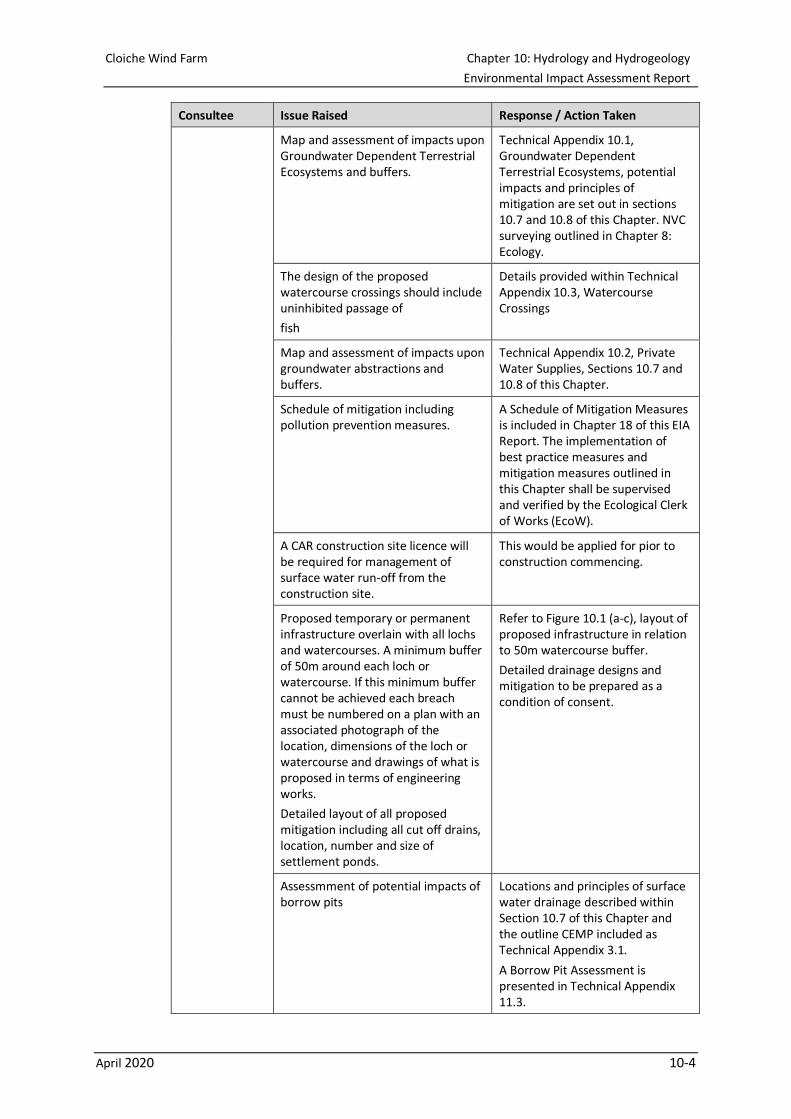
Map and assessment of impacts upon Groundwater Dependent Terrestrial Ecosystems and buffers.
Technical Appendix 10.1, Groundwater Dependent Terrestrial Ecosystems, potential impacts and principles of mitigation are set out in sections 10.7 and 10.8 of this Chapter. NVC surveying outlined in Chapter 8: Ecology.
The design of the proposed watercourse crossings should include uninhibited passage of
fish
Details provided within Technical Appendix 10.3, Watercourse Crossings
Map and assessment of impacts upon groundwater abstractions and buffers.
Technical Appendix 10.2, Private Water Supplies, Sections 10.7 and 10.8 of this Chapter.
Schedule of mitigation including pollution prevention measures.
A Schedule of Mitigation Measures is included in Chapter 18 of this EIA Report. The implementation of best practice measures and mitigation measures outlined in this Chapter shall be supervised and verified by the Ecological Clerk of Works (EcoW).
A CAR construction site licence will be required for management of surface water run-off from the construction site.
This would be applied for pior to construction commencing.
Proposed temporary or permanent infrastructure overlain with all lochs and watercourses. A minimum buffer of 50m around each loch or watercourse. If this minimum buffer cannot be achieved each breach must be numbered on a plan with an associated photograph of the location, dimensions of the loch or watercourse and drawings of what is proposed in terms of engineering works.
Detailed layout of all proposed mitigation including all cut off drains, location, number and size of settlement ponds.
Refer to Figure 10.1 (a-c), layout of proposed infrastructure in relation to 50m watercourse buffer.
Detailed drainage designs and mitigation to be prepared as a condition of consent.
Assessmment of potential impacts of borrow pits
Locations and principles of surface water drainage described within Section 10.7 of this Chapter and the outline CEMP included as Technical Appendix 3.1.
A Borrow Pit Assessment is presented in Technical Appendix 11.3.
Cloiche Wind Farm Chapter 10: Hydrology and Hydrogeology
Environmental Impact Assessment Report
April 2020 10-5
Consultee Issue Raised Response / Action Taken
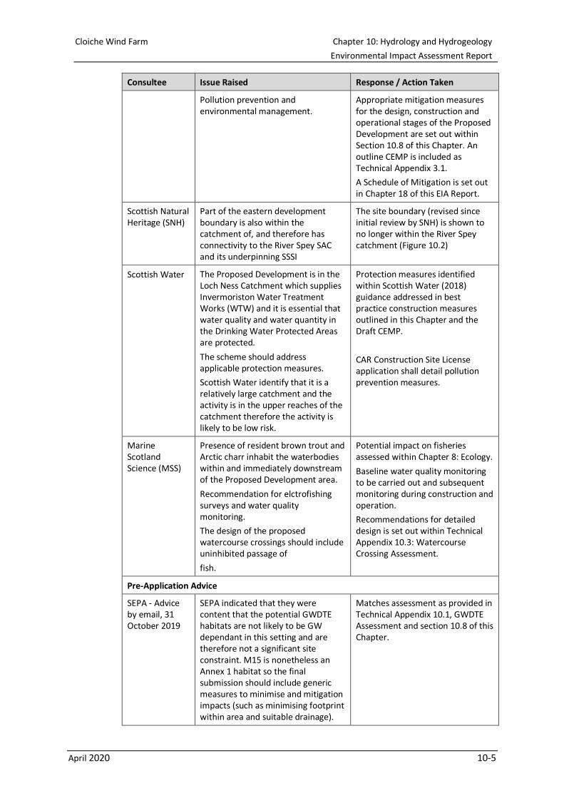
Pollution prevention and environmental management.
Appropriate mitigation measures for the design, construction and operational stages of the Proposed Development are set out within Section 10.8 of this Chapter. An outline CEMP is included as Technical Appendix 3.1.
A Schedule of Mitigation is set out in Chapter 18 of this EIA Report.
Scottish Natural Heritage (SNH)
Part of the eastern development boundary is also within the catchment of, and therefore has connectivity to the River Spey SAC and its underpinning SSSI
The site boundary (revised since initial review by SNH) is shown to no longer within the River Spey catchment (Figure 10.2)
Scottish Water The Proposed Development is in the Loch Ness Catchment which supplies Invermoriston Water Treatment Works (WTW) and it is essential that water quality and water quantity in the Drinking Water Protected Areas are protected.
The scheme should address applicable protection measures.
Scottish Water identify that it is a relatively large catchment and the activity is in the upper reaches of the catchment therefore the activity is likely to be low risk.
Protection measures identified within Scottish Water (2018) guidance addressed in best practice construction measures outlined in this Chapter and the Draft CEMP.
CAR Construction Site License application shall detail pollution prevention measures.
Marine Scotland Science (MSS)
Presence of resident brown trout and Arctic charr inhabit the waterbodies within and immediately downstream of the Proposed Development area.
Recommendation for elctrofishing surveys and water quality monitoring.
The design of the proposed watercourse crossings should include uninhibited passage of
fish.
Potential impact on fisheries assessed within Chapter 8: Ecology.
Baseline water quality monitoring to be carried out and subsequent monitoring during construction and operation.
Recommendations for detailed design is set out within Technical Appendix 10.3: Watercourse Crossing Assessment.
Pre-Application Advice
SEPA - Advice by email, 31 October 2019
SEPA indicated that they were content that the potential GWDTE habitats are not likely to be GW dependant in this setting and are therefore not a significant site constraint. M15 is nonetheless an Annex 1 habitat so the final submission should include generic measures to minimise and mitigation impacts (such as minimising footprint within area and suitable drainage).
Matches assessment as provided in Technical Appendix 10.1, GWDTE Assessment and section 10.8 of this Chapter.
Cloiche Wind Farm Chapter 10: Hydrology and Hydrogeology
Environmental Impact Assessment Report
April 2020 10-6
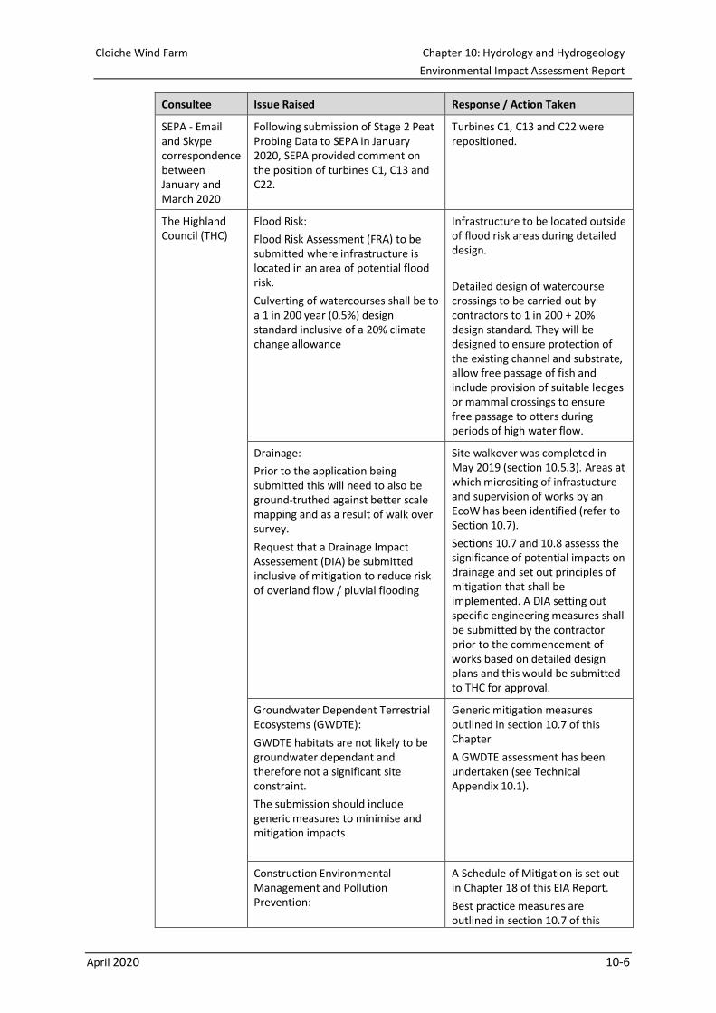
Consultee Issue Raised Response / Action Taken
SEPA - Email and Skype correspondence between January and March 2020
Following submission of Stage 2 Peat Probing Data to SEPA in January 2020, SEPA provided comment on the position of turbines C1, C13 and C22.
Turbines C1, C13 and C22 were repositioned.
The Highland Council (THC)
Flood Risk:
Flood Risk Assessment (FRA) to be submitted where infrastructure is located in an area of potential flood risk.
Culverting of watercourses shall be to a 1 in 200 year (0.5%) design standard inclusive of a 20% climate change allowance
Infrastructure to be located outside of flood risk areas during detailed design.
Detailed design of watercourse crossings to be carried out by contractors to 1 in 200 + 20% design standard. They will be designed to ensure protection of the existing channel and substrate, allow free passage of fish and include provision of suitable ledges or mammal crossings to ensure free passage to otters during periods of high water flow.
Drainage:
Prior to the application being submitted this will need to also be ground-truthed against better scale mapping and as a result of walk over survey.
Request that a Drainage Impact Assessement (DIA) be submitted inclusive of mitigation to reduce risk of overland flow / pluvial flooding
Site walkover was completed in May 2019 (section 10.5.3). Areas at which micrositing of infrastucture and supervision of works by an EcoW has been identified (refer to Section 10.7).
Sections 10.7 and 10.8 assesss the significance of potential impacts on drainage and set out principles of mitigation that shall be implemented. A DIA setting out specific engineering measures shall be submitted by the contractor prior to the commencement of works based on detailed design plans and this would be submitted to THC for approval.
Groundwater Dependent Terrestrial Ecosystems (GWDTE):
GWDTE habitats are not likely to be groundwater dependant and therefore not a significant site constraint.
The submission should include generic measures to minimise and mitigation impacts
Generic mitigation measures outlined in section 10.7 of this Chapter
A GWDTE assessment has been undertaken (see Technical Appendix 10.1).
Construction Environmental Management and Pollution Prevention:
A Schedule of Mitigation is set out in Chapter 18 of this EIA Report.
Best practice measures are outlined in section 10.7 of this
Cloiche Wind Farm Chapter 10: Hydrology and Hydrogeology
Environmental Impact Assessment Report
April 2020 10-7
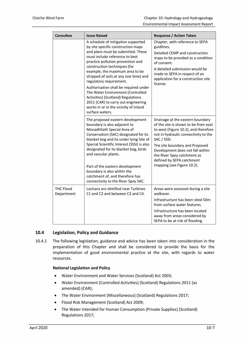
Consultee Issue Raised Response / Action Taken
A schedule of mitigation supported by site specific construction maps and plans must be submitted. These must include reference to best practice pollution prevention and construction techniques (for example, the maximum area to be stripped of soils at any one time) and regulatory requirement.
Authorisation shall be required under The Water Environment (Controlled Activities) (Scotland) Regulations 2011 (CAR) to carry out engineering works in or in the vicinity of inland surface waters.
Chapter, with reference to SEPA guidlines.
Detailed CEMP and construction maps to be provided as a condition of consent.
A detailed submission would be made to SEPA in respect of an application for a construction site license.
The proposed eastern development boundary is also adjacent to Monadhliath Special Area of Conservation (SAC) designated for its blanket bog and its under lying Site of Special Scientific Interest (SSSI) is also designated for its blanket bog, birds and vascular plants.
Part of the eastern development boundary is also within the catchment of, and therefore has connectivity to the River Spey SAC.
Drainage at the eastern boundary of the site is shown to be from east to west (Figure 10.2), and therefore not in hydraulic connectivity to the SAC / SSSI.
The site boundary and Proposed Development does not fall within the River Spey catchment as defined by SEPA catchment mapping (see Figure 10.2).
THC Flood Department
Lochans are idntified near Turbines C1 and C2 and between C3 and C4.
Areas were assessed during a site walkover.
Infrastructure has been sited 50m from surface water features.
Infrastructure has been located away from areas considered by SEPA to be at risk of flooding.
10.4 Legislation, Policy and Guidance
10.4.1 The following legislation, guidance and advice has been taken into consideration in the
preparation of this Chapter and shall be considered to provide the basis for the
implementation of good environmental practice at the site, with regards to water
resources.
National Legislation and Policy
• Water Environment and Water Services (Scotland) Act 2003;
• Water Environment (Controlled Activities) (Scotland) Regulations 2011 (as
amended) (CAR);
• The Water Environment (Miscellaneous) (Scotland) Regulations 2017;
• Flood Risk Management (Scotland) Act 2009;
• The Water Intended for Human Consumption (Private Supplies) (Scotland)
Regulations 2017;

Cloiche Wind Farm Chapter 10: Hydrology and Hydrogeology
Environmental Impact Assessment Report
April 2020 10-8
• The Public and Private Water Supplies (Miscellaneous Amendments) (Scotland)
Regulations 2015;
• The Public Water Supplies (Scotland) Regulations 2014 (as amended 2017); and
• The Water Environment (Drinking Water Protected Areas) (Scotland) Order 2013.
Guidance and Advice
• Pollution Prevention Guidelines (PPG) 1: Understanding your environmental
responsibilities - good environmental practices (July 2013);
• Guidance for Pollution Prevention Guidelines (GPP) 2: Above ground oil storage
tanks (January 2018);
• GPP 4: Treatment and disposal of wastewater where there is no connection to the
public foul sewer (November 2017);
• GPP 5: Works and maintenance in or near water (January 2017);
• PPG 6: Working at construction and demolition sites (2012) 0F
1;
• GPP 13 Vehicle washing and cleaning (April 2017);
• GPP 21: Pollution incident response planning (July 2017);
• PPG 22: Incident response - dealing with spills (October 2018);
• Planning Advice Note (PAN) 79: Water and Drainage (September 2006);
• LUPS-GU4: Planning guidance on on-shore windfarm developments (2017);
• LUPS-DP-GU2a: Development Plan Guidance on Flood Risk (2018);
• LUPS-GU19: Planning advice on wastewater drainage (2011);
• LUPS-GU31: Guidance on Assessing the Impacts of Development Proposals on
Groundwater Abstractions and Groundwater Dependent Terrestrial Ecosystems,
Version 3 (September 2017);
• WAT-SG-25: Good Practice Guide - River Crossings (November 2010) ;
• WAT-SG-26: Good Practice Guide - Sediment Management (September 2010);
• WAT-SG-29: Good Practice Guide - Temporary Construction Methods (March
2009);
• WAT-SG-75: Sector Specific Guidance: Construction Sites;
• WAT-PS-06-02: Culverting of Watercourses (June 2015);
• SEPA (2015), CAR - A Practical Guide, Version 8.4 (October 2019);
• Scottish Renewables, Scottish Natural Heritage (SNH), SEPA, Forestry Commission
Scotland, Historic Environment Scotland, Marine Scotland Science and AEECoW
(2019), Good Practice During Wind Farm Construction (4th Edition); and
• Scottish Government (2012) River Crossings and Migratory Fish.
1 Guidance provided in recent GPPs will be followed and take precedent over information provided in PPG 6, which was withdrawn on 14th
December 2015, where there is overlap in the provision of advice. For example, guidance on the storage of handling of oils/fuels in GPP 2
will take precedent over guidance provided in Section 5 (Oil use, storage and refuelling) of PPG 6.
Cloiche Wind Farm Chapter 10: Hydrology and Hydrogeology
Environmental Impact Assessment Report
April 2020 10-9
10.5 Methodology
Desk-based Assessment
10.5.1 The assessment of potential effects has comprised the following general approach:
• consultation with relevant statutory and non-statutory bodies;
• detailed desk studies and site visits to establish baseline conditions on the site and
in the surrounding area;
• identifying and establishing the sensitivity of water resource receptors on the basis
of their use, proximity to the site, existing quality or resource value and
consideration of potential source-pathway-receptor linkages;
• evaluation of the potential impacts of the Proposed Development and the effect
that these could have on current site conditions;
• evaluating the magnitude of such impacts in terms of change to water resources;
• classifying the significance of likely effects;
• identification of possible measures to avoid and mitigate against any identified
adverse effects resulting from the Proposed Development; and
• the evaluation of the residual significance of these effects following consideration
of mitigation measures.
10.5.2 The following information sources have been used in the assessment to characterise
existing and / or future baseline conditions:
• Ordnance Survey 1:25,000 and 1:50,000 mapping;
• 5m Digital Terrain Model (DTM) data;
• Aerial and LiDAR imagery (ESRI world imagery);
• British Geological Survey (BGS) Geology of Britain Viewer (1:50,000) for superficial
and bedrock;
• BGS Hydrogeological and Groundwater Vulnerability Maps of Scotland (1:625,000);
• Vulnerability of Groundwater in the Uppermost Aquifer, SNIFFER (September
2004);
• National Soils Map for Scotland (National Soils Inventory for Scotland (NSIS1));
• SEPA Flood Risk Management Maps (updated 23 April 2018) web mapping;
• SEPA Water Classification Hub;
• THC Private Water Supply Register (dated 16 October 2019);
• Drinking Water Quality Regulator for Scotland (DWQR) Private Water Supply Map;
• THC Open Data on Private Water Supplies; and
• Drinking Water Protected Areas – Surface, Scottish Government.
10.5.3 A site walkover was conducted by Ramboll on the 14, 15 and 16 May 2019. Conditions on
the date of the survey were warm and dry and the site visit was preceded by a period of
dry weather. The purpose of the site walkover was to (i) assess the general hydrological
condition of the site, (ii) characterise watercourses at the site such that proposed
watercourse crossing points may be assessed and (iii) assess hydrological conditions at
potential GWDTE sites. The survey consisted of visual inspection and geolocated
surveying of watercourses across the site. The site walkover was carried out in
conjunction with ecological NVC surveying.
Cloiche Wind Farm Chapter 10: Hydrology and Hydrogeology
Environmental Impact Assessment Report
April 2020 10-10
Definition of Future Baseline
10.5.4 There is potential for climate change to impact on future baseline conditions. Climate
change studies predict a decrease in summer precipitation and an increase in winter
precipitation alongside slightly higher average temperatures. This suggests that there
may be greater pressures on PWS’s in summer months in the future. However, summer
storms are predicted to be of greater intensity. Therefore, peak fluvial flows associated
with extreme storm events may also increase in volume and velocity. These climate
change factors have been taken into account when considering the potential for likely
significant effects.
Criteria for the Assessment of Effects
Criteria for Defining Sensitivity of Receptor
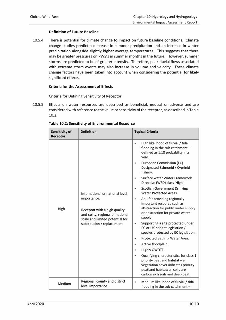
10.5.5 Effects on water resources are described as beneficial, neutral or adverse and are
considered with reference to the value or sensitivity of the receptor, as described in Table
10.2.
Table 10.2: Sensitivity of Environmental Resource
Sensitivity of Receptor
Definition Typical Criteria
High
International or national level importance.
Receptor with a high quality and rarity, regional or national scale and limited potential for substitution / replacement.
▪ High likelihood of fluvial / tidal flooding in the sub catchment – defined as 1:10 probability in a year.
▪ European Commission (EC) Designated Salmonid / Cyprinid fishery.
▪ Surface water Water Framework Directive (WFD) class 'High'.
▪ Scottish Government Drinking Water Protected Areas.
▪ Aquifer providing regionally important resource such as abstraction for public water supply or abstraction for private water supply.
▪ Supporting a site protected under EC or UK habitat legislation / species protected by EC legislation.
▪ Protected Bathing Water Area.
▪ Active floodplain.
▪ Highly GWDTE.
▪ Qualifying characteristics for class 1 priority peatland habitat – all vegetation cover indicates priority peatland habitat; all soils are carbon rich soils and deep peat.
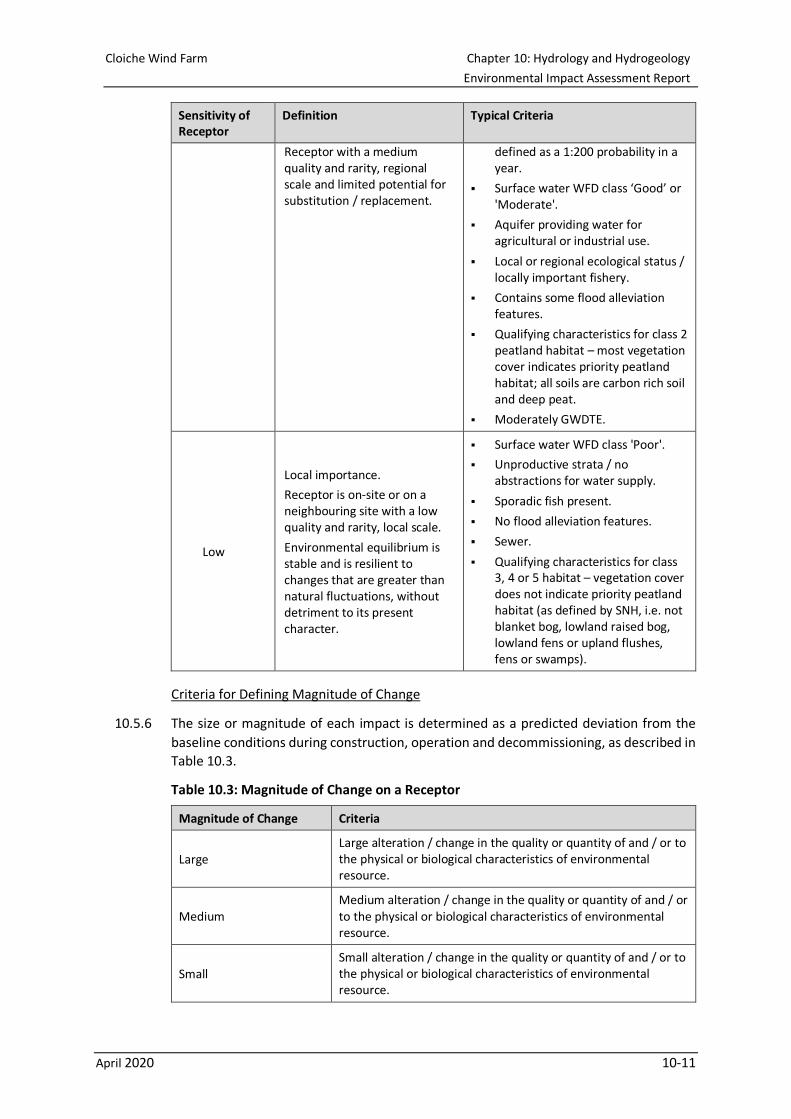
Medium Regional, county and district level importance.
▪ Medium likelihood of fluvial / tidal flooding in the sub catchment –
Cloiche Wind Farm Chapter 10: Hydrology and Hydrogeology
Environmental Impact Assessment Report
April 2020 10-11
Sensitivity of Receptor
Definition Typical Criteria
Receptor with a medium quality and rarity, regional scale and limited potential for substitution / replacement.
defined as a 1:200 probability in a year.
▪ Surface water WFD class ‘Good’ or 'Moderate'.
▪ Aquifer providing water for agricultural or industrial use.
▪ Local or regional ecological status / locally important fishery.
▪ Contains some flood alleviation features.
▪ Qualifying characteristics for class 2 peatland habitat – most vegetation cover indicates priority peatland habitat; all soils are carbon rich soil and deep peat.
▪ Moderately GWDTE.
Low
Local importance.
Receptor is on-site or on a neighbouring site with a low quality and rarity, local scale.
Environmental equilibrium is stable and is resilient to changes that are greater than natural fluctuations, without detriment to its present character.
▪ Surface water WFD class 'Poor'.
▪ Unproductive strata / no abstractions for water supply.
▪ Sporadic fish present.
▪ No flood alleviation features.
▪ Sewer.
▪ Qualifying characteristics for class 3, 4 or 5 habitat – vegetation cover does not indicate priority peatland habitat (as defined by SNH, i.e. not blanket bog, lowland raised bog, lowland fens or upland flushes, fens or swamps).
Criteria for Defining Magnitude of Change
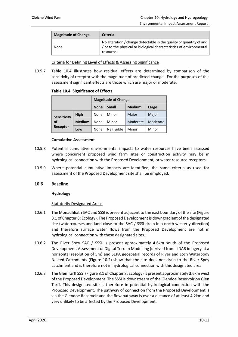
10.5.6 The size or magnitude of each impact is determined as a predicted deviation from the
baseline conditions during construction, operation and decommissioning, as described in
Table 10.3.
Table 10.3: Magnitude of Change on a Receptor
Magnitude of Change Criteria
Large Large alteration / change in the quality or quantity of and / or to the physical or biological characteristics of environmental resource.
Medium Medium alteration / change in the quality or quantity of and / or to the physical or biological characteristics of environmental resource.
Small Small alteration / change in the quality or quantity of and / or to the physical or biological characteristics of environmental resource.
Cloiche Wind Farm Chapter 10: Hydrology and Hydrogeology
Environmental Impact Assessment Report
April 2020 10-12
Magnitude of Change Criteria
None No alteration / change detectable in the quality or quantity of and / or to the physical or biological characteristics of environmental resource.
Criteria for Defining Level of Effects & Assessing Significance
10.5.7 Table 10.4 illustrates how residual effects are determined by comparison of the
sensitivity of receptor with the magnitude of predicted change. For the purposes of this
assessment significant effects are those which are major or moderate.
Table 10.4: Significance of Effects
Magnitude of Change
None Small Medium Large
Sensitivity of Receptor
High None Minor Major Major
Medium None Minor Moderate Moderate
Low None Negligible Minor Minor
Cumulative Assessment
10.5.8 Potential cumulative environmental impacts to water resources have been assessed
where concurrent proposed wind farm sites or construction activity may be in
hydrological connection with the Proposed Development, or water resource receptors.
10.5.9 Where potential cumulative impacts are identified, the same criteria as used for
assessment of the Proposed Development site shall be employed.
10.6 Baseline
Hydrology
Statutorily Designated Areas
10.6.1 The Monadhliath SAC and SSSI is present adjacent to the east boundary of the site (Figure
8.1 of Chapter 8: Ecology). The Proposed Development is downgradient of the designated
site (watercourses and land close to the SAC / SSSI drain in a north westerly direction)
and therefore surface water flows from the Proposed Development are not in
hydrological connection with these designated sites.
10.6.2 The River Spey SAC / SSSI is present approximately 4.6km south of the Proposed
Development. Assessment of Digital Terrain Modelling (derived from LiDAR imagery at a
horizontal resolution of 5m) and SEPA geospatial records of River and Loch Waterbody
Nested Catchments (Figure 10.2) show that the site does not drain to the River Spey
catchment and is therefore not in hydrological connection with this designated area.
10.6.3 The Glen Tarff SSSI (Figure 8.1 of Chapter 8: Ecology) is present approximately 3.6km west
of the Proposed Development. The SSSI is downstream of the Glendoe Reservoir on Glen
Tarff. This designated site is therefore in potential hydrological connection with the
Proposed Development. The pathway of connection from the Proposed Development is
via the Glendoe Reservoir and the flow pathway is over a distance of at least 4.2km and
very unlikely to be affected by the Proposed Development.
Cloiche Wind Farm Chapter 10: Hydrology and Hydrogeology
Environmental Impact Assessment Report
April 2020 10-13
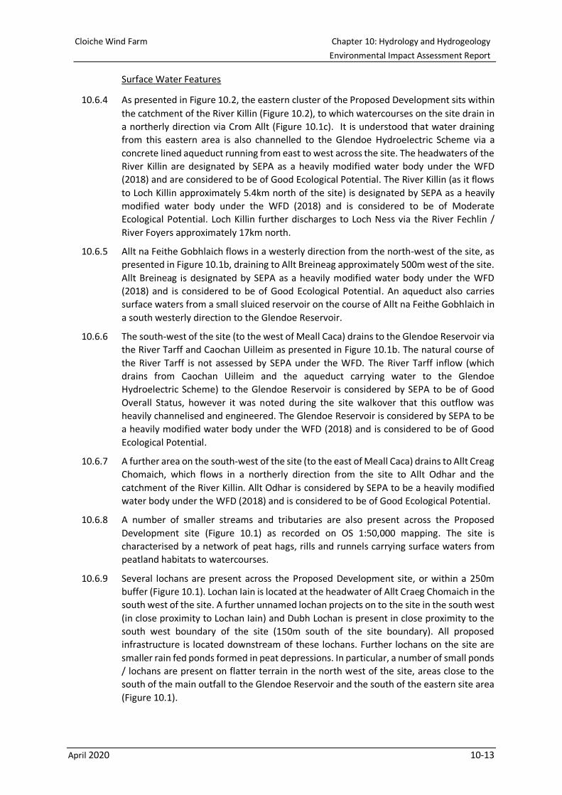
Surface Water Features
10.6.4 As presented in Figure 10.2, the eastern cluster of the Proposed Development sits within
the catchment of the River Killin (Figure 10.2), to which watercourses on the site drain in
a northerly direction via Crom Allt (Figure 10.1c). It is understood that water draining
from this eastern area is also channelled to the Glendoe Hydroelectric Scheme via a
concrete lined aqueduct running from east to west across the site. The headwaters of the
River Killin are designated by SEPA as a heavily modified water body under the WFD
(2018) and are considered to be of Good Ecological Potential. The River Killin (as it flows
to Loch Killin approximately 5.4km north of the site) is designated by SEPA as a heavily
modified water body under the WFD (2018) and is considered to be of Moderate
Ecological Potential. Loch Killin further discharges to Loch Ness via the River Fechlin /
River Foyers approximately 17km north.
10.6.5 Allt na Feithe Gobhlaich flows in a westerly direction from the north-west of the site, as
presented in Figure 10.1b, draining to Allt Breineag approximately 500m west of the site.
Allt Breineag is designated by SEPA as a heavily modified water body under the WFD
(2018) and is considered to be of Good Ecological Potential. An aqueduct also carries
surface waters from a small sluiced reservoir on the course of Allt na Feithe Gobhlaich in
a south westerly direction to the Glendoe Reservoir.
10.6.6 The south-west of the site (to the west of Meall Caca) drains to the Glendoe Reservoir via
the River Tarff and Caochan Uilleim as presented in Figure 10.1b. The natural course of
the River Tarff is not assessed by SEPA under the WFD. The River Tarff inflow (which
drains from Caochan Uilleim and the aqueduct carrying water to the Glendoe
Hydroelectric Scheme) to the Glendoe Reservoir is considered by SEPA to be of Good
Overall Status, however it was noted during the site walkover that this outflow was
heavily channelised and engineered. The Glendoe Reservoir is considered by SEPA to be
a heavily modified water body under the WFD (2018) and is considered to be of Good
Ecological Potential.
10.6.7 A further area on the south-west of the site (to the east of Meall Caca) drains to Allt Creag
Chomaich, which flows in a northerly direction from the site to Allt Odhar and the
catchment of the River Killin. Allt Odhar is considered by SEPA to be a heavily modified
water body under the WFD (2018) and is considered to be of Good Ecological Potential.
10.6.8 A number of smaller streams and tributaries are also present across the Proposed
Development site (Figure 10.1) as recorded on OS 1:50,000 mapping. The site is
characterised by a network of peat hags, rills and runnels carrying surface waters from
peatland habitats to watercourses.
10.6.9 Several lochans are present across the Proposed Development site, or within a 250m
buffer (Figure 10.1). Lochan Iain is located at the headwater of Allt Craeg Chomaich in the
south west of the site. A further unnamed lochan projects on to the site in the south west
(in close proximity to Lochan Iain) and Dubh Lochan is present in close proximity to the
south west boundary of the site (150m south of the site boundary). All proposed
infrastructure is located downstream of these lochans. Further lochans on the site are
smaller rain fed ponds formed in peat depressions. In particular, a number of small ponds
/ lochans are present on flatter terrain in the north west of the site, areas close to the
south of the main outfall to the Glendoe Reservoir and the south of the eastern site area
(Figure 10.1).
Cloiche Wind Farm Chapter 10: Hydrology and Hydrogeology
Environmental Impact Assessment Report
April 2020 10-14
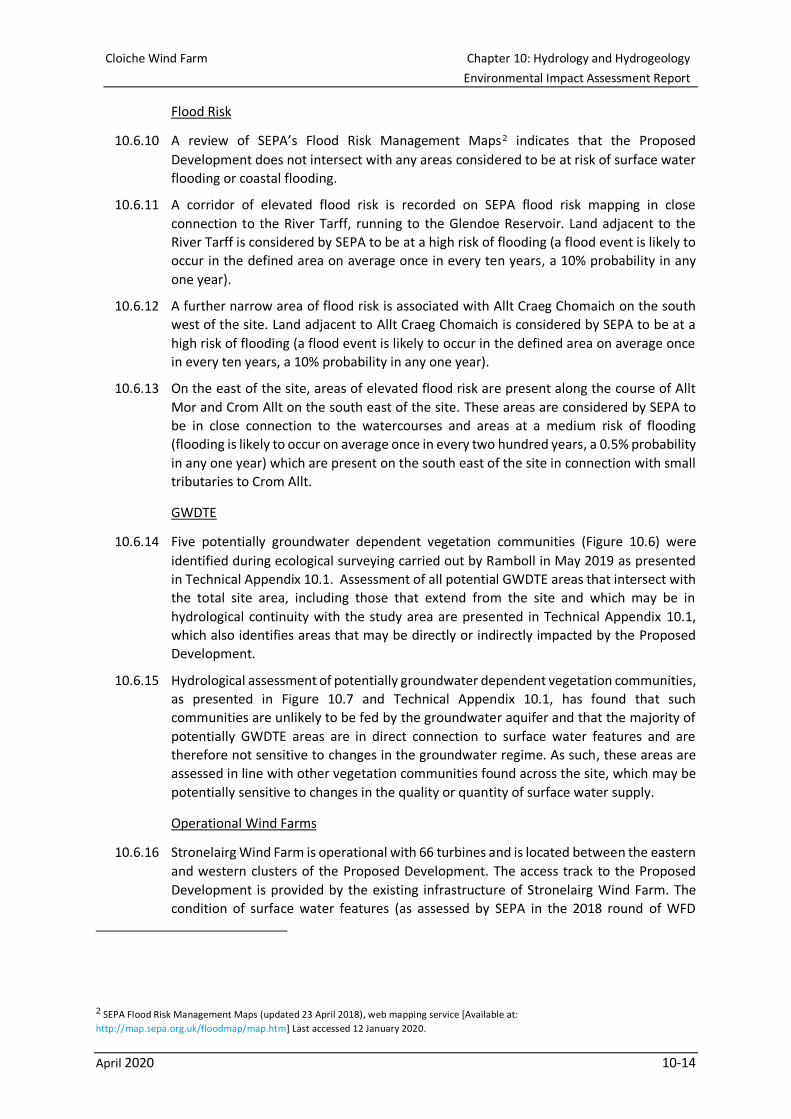
Flood Risk
10.6.10 A review of SEPA’s Flood Risk Management Maps 1F
2 indicates that the Proposed
Development does not intersect with any areas considered to be at risk of surface water
flooding or coastal flooding.
10.6.11 A corridor of elevated flood risk is recorded on SEPA flood risk mapping in close
connection to the River Tarff, running to the Glendoe Reservoir. Land adjacent to the
River Tarff is considered by SEPA to be at a high risk of flooding (a flood event is likely to
occur in the defined area on average once in every ten years, a 10% probability in any
one year).
10.6.12 A further narrow area of flood risk is associated with Allt Craeg Chomaich on the south
west of the site. Land adjacent to Allt Craeg Chomaich is considered by SEPA to be at a
high risk of flooding (a flood event is likely to occur in the defined area on average once
in every ten years, a 10% probability in any one year).
10.6.13 On the east of the site, areas of elevated flood risk are present along the course of Allt
Mor and Crom Allt on the south east of the site. These areas are considered by SEPA to
be in close connection to the watercourses and areas at a medium risk of flooding
(flooding is likely to occur on average once in every two hundred years, a 0.5% probability
in any one year) which are present on the south east of the site in connection with small
tributaries to Crom Allt.
GWDTE
10.6.14 Five potentially groundwater dependent vegetation communities (Figure 10.6) were
identified during ecological surveying carried out by Ramboll in May 2019 as presented
in Technical Appendix 10.1. Assessment of all potential GWDTE areas that intersect with
the total site area, including those that extend from the site and which may be in
hydrological continuity with the study area are presented in Technical Appendix 10.1,
which also identifies areas that may be directly or indirectly impacted by the Proposed
Development.
10.6.15 Hydrological assessment of potentially groundwater dependent vegetation communities,
as presented in Figure 10.7 and Technical Appendix 10.1, has found that such
communities are unlikely to be fed by the groundwater aquifer and that the majority of
potentially GWDTE areas are in direct connection to surface water features and are
therefore not sensitive to changes in the groundwater regime. As such, these areas are
assessed in line with other vegetation communities found across the site, which may be
potentially sensitive to changes in the quality or quantity of surface water supply.
Operational Wind Farms
10.6.16 Stronelairg Wind Farm is operational with 66 turbines and is located between the eastern
and western clusters of the Proposed Development. The access track to the Proposed
Development is provided by the existing infrastructure of Stronelairg Wind Farm. The
condition of surface water features (as assessed by SEPA in the 2018 round of WFD
2 SEPA Flood Risk Management Maps (updated 23 April 2018), web mapping service [Available at:
http://map.sepa.org.uk/floodmap/map.htm] Last accessed 12 January 2020.
Cloiche Wind Farm Chapter 10: Hydrology and Hydrogeology
Environmental Impact Assessment Report
April 2020 10-15
assessment) and baseline assessment described above is considered to take in to account
the presence of the Stronelairg Wind Farm.
10.6.17 Corriegarth Wind Farm is located approximately 8km to the north of the Proposed
Development. The Corriegarth site is present on headwaters that drain to Loch Ness via
the River Foyer to which the River Killin flows from the Proposed Development. Given the
distance of both the Proposed Development and Corriegarth to Loch Ness outside of the
study area of this assessment and it is considered highly unlikely that cumulative effects
would occur.
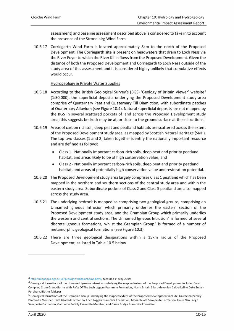
Hydrogeology & Private Water Supplies
10.6.18 According to the British Geological Survey’s (BGS) ‘Geology of Britain Viewer’ website2F
3
(1:50,000), the superficial deposits underlying the Proposed Development study area
comprise of Quaternary Peat and Quaternary Till Diamiction, with subordinate patches
of Quaternary Alluvium (see Figure 10.4). Natural superficial deposits are not mapped by
the BGS in several scattered pockets of land across the Proposed Development study
area; this suggests bedrock may be at, or close to the ground surface at these locations.
10.6.19 Areas of carbon rich soil, deep peat and peatland habitats are scattered across the extent
of the Proposed Development study area, as mapped by Scottish Natural Heritage (SNH).
The top two classes (1 and 2) taken together identify the nationally important resource
and are defined as follows:
• Class 1 - Nationally important carbon-rich soils, deep peat and priority peatland
habitat, and areas likely to be of high conservation value; and
• Class 2 - Nationally important carbon-rich soils, deep peat and priority peatland
habitat, and areas of potentially high conservation value and restoration potential.
10.6.20 The Proposed Development study area largely comprises Class 1 peatland which has been
mapped in the northern and southern sections of the central study area and within the
eastern study area. Subordinate pockets of Class 2 and Class 5 peatland are also mapped
across the study area.
10.6.21 The underlying bedrock is mapped as comprising two geological groups, comprising an
Unnamed Igneous Intrusion which primarily underlies the eastern section of the
Proposed Development study area, and the Grampian Group which primarily underlies
the western and central sections. The Unnamed Igneous Intrusion 3F
4 is formed of several
discrete igneous formations, whilst the Grampian Group 4F
5 is formed of a number of
metamorphic geological formations (see Figure 10.3).
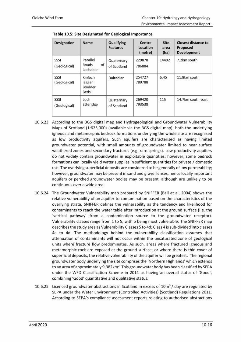
10.6.22 There are three geological designations within a 15km radius of the Proposed
Development, as listed in Table 10.5 below.
3 http://mapapps.bgs.ac.uk/geologyofbritain/home.html, accessed 1s May 2019. 4 Geological formations of the Unnamed Igneous Intrusion underlying the mapped extent of the Proposed Development include: Crom
Complex, Crom Granodiorite With Rafts Of The Loch Laggan Psammite Formation, North Britain Siluro-devonian Calc-alkaline Dyke Suite -
Porphyry, Biotite-feldspar 5 Geological formations of the Grampian Group underlying the mapped extent of the Proposed Development include: Gairbeinn Pebbl y
Psammite Member, Tarff Banded Formation, Loch Laggan Psammite Formation, Monadhliath Semipelite Formation, Coire Nan Laogh
Semipelite Formation, Gairbeinn Pebbly Psammite Member, and Garva Bridge Psammite Formation.
Cloiche Wind Farm Chapter 10: Hydrology and Hydrogeology
Environmental Impact Assessment Report
April 2020 10-16
Table 10.5: Site Designated for Geological Importance
Designation Name Qualifying Features
Centre Location (metre)
Site area (ha)
Closest distance to Proposed Development
SSSI
(Geological)
Parallel Roads of Lochaber
Quaternary
of Scotland
229878
786884
14492 7.2km south
SSSI (Geological)
Kinloch laggan Boulder Beds
Dalradian 254727 789788
6.45 11.8km south
SSSI
(Geological)
Loch Etteridge
Quaternary
of Scotland
269420 793538
115 14.7km south-east
10.6.23 According to the BGS digital map and Hydrogeological and Groundwater Vulnerability
Maps of Scotland (1:625,000) (available via the BGS digital map), both the underlying
igneous and metamorphic bedrock formations underlying the whole site are recognised
as low productivity aquifers. Such aquifers are characterised as having limited
groundwater potential, with small amounts of groundwater limited to near surface
weathered zones and secondary fractures (e.g. rare springs). Low productivity aquifers
do not widely contain groundwater in exploitable quantities; however, some bedrock
formations can locally yield water supplies in sufficient quantities for private / domestic
use. The overlying superficial deposits are considered to be generally of low permeability;
however, groundwater may be present in sand and gravel lenses, hence locally important
aquifers or perched groundwater bodies may be present, although are unlikely to be
continuous over a wide area.
10.6.24 The Groundwater Vulnerability map prepared by SNIFFER (Ball et al, 2004) shows the
relative vulnerability of an aquifer to contamination based on the characteristics of the
overlying strata. SNIFFER defines the vulnerability as the tendency and likelihood for
contaminants to reach the water table after introduction at the ground surface (i.e. the
‘vertical pathway’ from a contamination source to the groundwater receptor).
Vulnerability classes range from 1 to 5, with 5 being most vulnerable. The SNIFFER map
describes the study area as Vulnerability Classes 5 to 4d; Class 4 is sub-divided into classes
4a to 4d. The methodology behind the vulnerability classification assumes that
attenuation of contaminants will not occur within the unsaturated zone of geological
units where fracture flow predominates. As such, areas where fractured igneous and
metamorphic rock are exposed at the ground surface, or where there is thin cover of
superficial deposits, the relative vulnerability of the aquifer will be greatest. The regional
groundwater body underlying the site comprises the ‘Northern Highlands’ which extends
to an area of approximately 9,382km2. This groundwater body has been classified by SEPA
under the WFD Classification Scheme in 2014 as having an overall status of ‘Good’,
combining ‘Good’ quantitative and qualitative status.
10.6.25 Licenced groundwater abstractions in Scotland in excess of 10m3 / day are regulated by
SEPA under the Water Environment (Controlled Activities) (Scotland) Regulations 2011.
According to SEPA’s compliance assessment reports relating to authorised abstractions
Cloiche Wind Farm Chapter 10: Hydrology and Hydrogeology
Environmental Impact Assessment Report
April 2020 10-17
in 20175F
6, there are no groundwater abstractions for public water supply within 2km of
the Proposed Development area. A surface water abstraction licence is reported
approximately 1.01km west which is licenced to Glendoe Hydroelectric Scheme and a
PWS is located 1.8km south west of the site.
10.6.26 Full assessment and location of PWS, and their potential connectivity to the site are
provided in Technical Appendix 10.2.
Summary of Important Hydrological Features
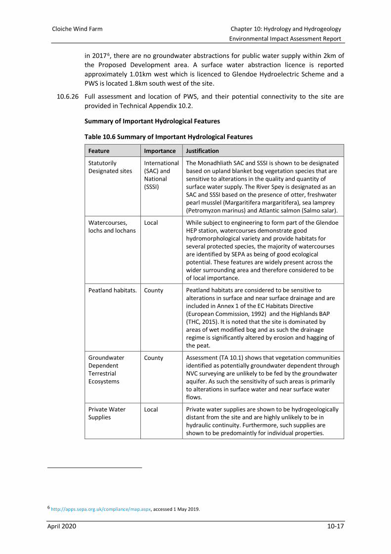
Table 10.6 Summary of Important Hydrological Features
Feature Importance Justification
Statutorily Designated sites
International (SAC) and National (SSSI)
The Monadhliath SAC and SSSI is shown to be designated based on upland blanket bog vegetation species that are sensitive to alterations in the quality and quantity of surface water supply. The River Spey is designated as an SAC and SSSI based on the presence of otter, freshwater pearl musslel (Margaritifera margaritifera), sea lamprey (Petromyzon marinus) and Atlantic salmon (Salmo salar).
Watercourses, lochs and lochans
Local While subject to engineering to form part of the Glendoe HEP station, watercourses demonstrate good hydromorphological variety and provide habitats for several protected species, the majority of watercourses are identified by SEPA as being of good ecological potential. These features are widely present across the wider surrounding area and therefore considered to be of local importance.
Peatland habitats. County Peatland habitats are considered to be sensitive to alterations in surface and near surface drainage and are included in Annex 1 of the EC Habitats Directive (European Commission, 1992) and the Highlands BAP (THC, 2015). It is noted that the site is dominated by areas of wet modified bog and as such the drainage regime is significantly altered by erosion and hagging of the peat.
Groundwater Dependent Terrestrial Ecosystems
County Assessment (TA 10.1) shows that vegetation communities identified as potentially groundwater dependent through NVC surveying are unlikely to be fed by the groundwater aquifer. As such the sensitivity of such areas is primarily to alterations in surface water and near surface water flows.
Private Water Supplies
Local Private water supplies are shown to be hydrogeologically distant from the site and are highly unlikely to be in hydraulic continuity. Furthermore, such supplies are shown to be predomaintly for individual properties.
6 http://apps.sepa.org.uk/compliance/map.aspx, accessed 1 May 2019.
Cloiche Wind Farm Chapter 10: Hydrology and Hydrogeology
Environmental Impact Assessment Report
April 2020 10-18
10.7 Potential Effects
Potential Effects During the Construction Phase
Chemical Pollution
10.7.1 There is the potential for the accidental release of stored fuels, oils and materials (e.g.
cement and grout) used on-site during construction works to negatively impact surface
waters on the site and downstream from the site, and the underlying groundwater.
Potential effects include degradation of water quality and indirect effects on aquatic
habitats and species.
10.7.2 A search area for the siting of a batching plant is proposed to the north of the Glendoe
Reservoir during the construction phase on land previously consented for use as a
construction compound for the Stronelairg Wind Farm, a small proportion of which (<5%
of the total site area) projects to within the 50m buffer of the Glendoe Reservoir and a
tributary of the reservoir. However, there is an existing track which intersects between
the batching plant location and the reservoir from the south which would reduce the
potential for the direct release of concrete / cement materials to the aquatic environment
along with pathway. Although a tributary of the reservoir is located to the east of the
proposed batching plant location, this is a small drain which formerly accepted discharge
from a settling pond area within the construction compound for Stronelairg Wind Farm.
The storage of materials and batching plant shall be located outwith the 50m waterbody
buffer and any surface water discharge would be subject to water quality treatment as
was previously consented for the construction compound for the Stronelairg Wind Farm.
10.7.3 Nine borrow pit locations are also proposed across the study area. Such locations may
represent areas where the unsaturated zone of the bedrock would be exposed and
therefore of a relatively higher vulnerability with regard to groundwater contamination.
While one Borrow Pit (Borrow Pit 9) is within the 50m buffer of a small waterbody
identified on OS mapping, this is the site of a borrow pit used for the construction of
Stronelairg Wind Farm (Stronelairg Borrow Pit 7).
10.7.4 Were such a release to occur, there is the potential for a negative impact to surface water
resources and to shallow groundwater (if present) in near-surface peat and superficial
deposits, with a subsequent impact on biodiversity. Potential effects include degradation
of water quality, direct effects on aquatic ecology and indirect effects on the ecology of
downstream receptors.
Sedimentation and Erosion
10.7.5 There is the potential for the discharge of increased sediment loads due to construction
activity and erosion, to negatively impact on aquatic ecology or fluvial morphology of
receptors downstream from the Proposed Development. There is also potential for
surface water run-off with relatively high sediment loads to be discharged over or into
soil, which may in turn impact on local infiltration capacity. Increased sediment loads may
be the result of excavation and surface disturbance, excavation and dewatering of
foundation excavations or the mobilisation of stockpiled material.
10.7.6 When designing the proposed infrastructure, a 50m buffer has typically been applied
around all watercourses and waterbodies across the site. However, where proposed
access tracks are required to cross a watercourse, there is a requirement for
infrastructure to be included within the 50m buffer, although this is only applicable in a
very limited number of locations. This has been considered within a Watercourse
Cloiche Wind Farm Chapter 10: Hydrology and Hydrogeology
Environmental Impact Assessment Report
April 2020 10-19
Crossing Assessment (Technical Appendix 10.3). In three instances (Figure 10.7) this is in
order to make use of existing infrastructure or previously disturbed land and for turbine
C11, the turbine foundation has been sited outwith the buffer but a portion of the
hardstanding encroaches into the buffer. It may nevertheless be noted that the nearest
watercourse to C11 is a minor watercourse. As such, the site design has sought to reduce
the potential for the release of sediments to water resources and it would be anticipated
that sediment in distributed overland flows would be entrained in areas of vegetation or
smaller surface water channels. However, there remains the potential that sediment
discharged via surface water run-off could impact peat soils and, in particular, the
acrotelm in areas of undisturbed peat bog.
10.7.7 Across the wet modified bog habitat that dominates the site, surface flows are dendritic
and comprise peat hags and ephemeral streams that discharge during periods of rainfall
and saturation of underlying peat soils. At two locations the potential for interaction
between the Proposed Development and complex surface water drainage patterns has
been identified: land on the north west area of the site between proposed turbine
locations turbines C1 and C2 and at the route of the access track between proposed
turbine locations C3 and C4.
10.7.8 The proposed track and turbine location of C1 follows the course of an existing track and
peat gullies are present adjacent to the north and north east. The access track leading to
proposed turbine location C2 is shown to cross an area of eroded peat characterised by
peat hagging and ephemeral channels. The area between the two proposed turbine
locations is characterised by relatively low gradients and the accumulation of water in
rain fed blanket bog. The proposed access track running from the main access route to
C3 is within close proximity (27m east at the nearest point) to a drain not shown on
1:50,000 mapping (as recorded during the site visit and on aerial imagery of the site).
Aerial imagery shows the drain to be engineered (straightened) and the site walkover
recorded the presence of an armoured bed. At such locations there is the potential that
the development of site infrastructure could interrupt established drainage patterns.
10.7.9 There is the potential for hardstanding and compacted surfaces to increase rates of
surface runoff on the area of the Proposed Development and for infrastructure to create
preferential drainage pathways. Increases in surface runoff may in turn lead to higher
risks of erosion and sedimentation and also have the potential to increase flood risk
downstream.
Alteration to Surface Water Flows and Runoff
10.7.10 The construction of access tracks could lead to the restriction of surface water flows and
near-surface flows downslope across the site. This leads to the potential for a reduction
in the water supply to down slope mire habitats and the risk of peat soils becoming dry
or eventually desiccated due to a lowering of the water table and alterations to the
drainage pattern.
Impact on GWDTE
10.7.11 An assessment of potential effects to GWDTE areas is provided in Technical Appendix
10.1. This assessment shows that it is unlikely that such areas are fed by the groundwater
aquifer and that the majority of potentially GWDTE areas are in direct connection to
surface water features and are therefore not sensitive to changes in the groundwater
regime.

Cloiche Wind Farm Chapter 10: Hydrology and Hydrogeology
Environmental Impact Assessment Report
April 2020 10-20
10.7.12 The assessment suggests that the majority of areas identified as potential GWDTE areas
are ombrogenous (rain fed) habitats and, as such, it is considered likely that such habitats
are of limited sensitivity with regards to groundwater resources. However, such
vegetation communities are sensitive to alterations in the quality and quantity of surface
and near-surface water supply. There is therefore the potential for direct loss of peatland
habitat and indirect impacts as a result of chemical or physical alterations to surface
runoff during the construction phase.
Watercourse Crossings
10.7.13 During the construction of watercourse crossings there is potential for activities to
negatively impact both water quality and the natural morphology. SEPA’s good practice
guide (Engineering in the water environment: River crossings (Natural Scotland and SEPA,
2010)) identifies that where proper care is not taken during the construction phase
disturbance of river bed and banks can lead to the direct loss of aquatic flora and fauna,
and the release of fine sediments and other pollutants that may lead to the smothering
of plants and animals or the habitats they depend on.
10.7.14 Crossings (and culverts) will be designed to ensure protection of the existing channel and
substrate, allow free passage of fish and include provision of suitable ledges or mammal
crossings to ensure free passage to otters during periods of high water flow.
10.7.15 An assessment of the proposed locations of watercourse crossings, and the likely
licensing requirements for crossings are set out in Technical Appendix 10.3.
Private Water Supplies
10.7.16 An assessment of PWS is provided in Technical Appendix 10.2. According to the Drinking
Water Quality Regulator for Scotland and THC records obtained by Ramboll, there are 14
registered PWSs within a 5km radius of the Proposed Development; the nearest of which
is 1.8km south west of the site (see Figure 10.5). No evidence of further PWS was
observed during the site visit and the Applicant is not aware of any PWS within close
proximity to the existing Stronelairg Wind Farm site. The assessment concludes that the
identified PWS within the study area are considered to be hydrogeologically distant from
the site and are highly unlikely to be in hydraulic continuity (refer to Table 10.2 of
Technical Appendix 10.2).
Flood Risk
10.7.17 Flood risk across the site has been shown to relate to areas in close connectivity with
surface water features, and infrastructure development is not proposed within areas
considered to be at risk of flooding.
10.7.18 Detailed assessment of flood risk at proposed watercourse crossings shall be carried out
by contractors such that crossings do not represent an impediment to flows during a 1 in
200 (0.5%) annual probability flow event and therefore such that flood risk is not
increased upstream during such an event.
10.7.19 An increase in the area of impermeable surface area during construction could lead to
higher runoff rates and therefore higher risk of peak flows downslope from the Proposed
Development. However, as the development is not considered to have a significant
potential to increase flood risk to downstream receptors due to the low percentage
change of hardstanding surface relative to the site area, the potential for an increase in
flood risk due to the Proposed Development is considered to be negligible.
Cloiche Wind Farm Chapter 10: Hydrology and Hydrogeology
Environmental Impact Assessment Report
April 2020 10-21
Potential Effects During the Operational Phase
10.7.20 The potential risk of the release of pollutants or sediment from the activities relating to
the operational phase of the Proposed Development is substantially lower than during
construction because of the decreased levels of ground disturbance. Additionally, the
operation or refuelling of plant machinery shall not take place on the Proposed
Development area during the operational phase.
10.7.21 There is the potential for hardstanding surfaces and compacted tracks and infrastructure
to lead to increased rates of surface runoff, in turn leading to the potential for increased
risk of surface erosion and downstream flood risk. There is also the potential for tracks
and associated drainage infrastructure to lead to preferential drainage pathways and lead
to the alteration of drainage patterns potentially leading to a loss in quality of peat
habitats.
10.7.22 There is the potential for infrastructure installed at the site to present a barrier to near
surface flows across the site during the operational phase. Were cross drainage measures
not appropriately installed, there is the potential for tracks to impede the movement of
surface waters across blanket bog leading to the drying out or desiccation of areas
dependent on water supply or retention.
Potential Effects During the Decommissioning Phase
10.7.23 While the risks to water resources are similar to those identified during the construction
phase, decommissioning shall additionally require the breaking up and removal of
concrete structures and reinforcement (e.g. turbine bases, transformers substations or
buildings); the excavation and removal of crushed rock, geotextile or geogrid
reinforcement materials; lifting and removal of cables and the dismantling and laying
down of turbine components prior to removal from the site.
10.7.24 During the decommissioning phase there is the potential for construction activity to
impair the condition of hydrological and hydrogeological resources on and downstream
of the site. SNH commissioned report (Welstead et al, 2013) identifies that potential risks
to ground and surface water environment may include the potential for:
• Bank instability and increased erosion leading to effects on the quality of aquatic
habitats and ecology;
• Establishing rapid drainage paths leading to the potential for increased pollution
extent;
• The drainage of water dependent habitats;
• Sedimentation and pollution from suspended materials leading to effects on
fisheries and protected habitats / species;
• Spills of fuels and oils from vehicles, turbine gearboxes and transformers leading to
effects on fisheries and protected habitats / species; and
• Soil compaction leading to increased runoff and erosion potential leading to effects
on fisheries and protected habitats / species.
10.8 Mitigation
Mitigation During Construction Phase
10.8.1 Mitigation and principles of construction best practice in respect to potential impacts to
potentially GWDTE areas, watercourse crossings and PWS are set out in Technical
Cloiche Wind Farm Chapter 10: Hydrology and Hydrogeology
Environmental Impact Assessment Report
April 2020 10-22
Appendices 10.1, 10.2 and 10.3 respectively. Construction site plans and a detailed
drainage layout plan (demonstrating proposed Sustainable Drainge Systems (SuDS) and
other drainage mitigation measures) shall be prepared by the contractor and would input
to a Drainage Impact Assessment (DIA) that would be agreed with SEPA and THC prior to
construction.
Chemical Pollution
10.8.2 The potential for impacts on the water environment through the release of pollutants or
sediments during the construction phase shall be managed through the implementation
of a CEMP (as detailed in Technical Appendix 3.1 Draft Construction Environmental
Management Plan). The CEMP shall incorporate measures to ensure that the release of
sediments or pollutants to the surrounding environment is avoided.
10.8.3 Unless otherwise agreed by the ECoW the storage of potentially contaminative materials
(oils, cements / grouts) shall be carried out at least 50m from watercourses and drainage
paths. Fuels, oils or chemicals stored onsite shall be sited over an impervious base and
according with the Water Environment (Controlled Activities) (Scotland) Regulations
2011 (as amended).
Sedimentation and Erosion
10.8.4 The CEMP would include measures to minimise potential adverse effects related to
surface water and groundwater discharge, including impacts associated with dewatering
which may arise from the excavation of borrow pits and turbine foundations. Therefore,
the contractor shall be required to meet regulatory requirements and implement best
practice measures as set out in SEPA planning guidance.
10.8.5 It is anticipated that the Proposed Development would be subject to a construction site
licence (under the CAR regulations).
10.8.6 Where required, interceptor ditches shall divert waters to locations downstream of
proposed excavation or soil disturbance works associated with the installation of turbine
foundations, the development of construction compounds and batching plants,
groundworks during the installation of the substation and the excavation of borrow pits.
These would be specified in the DIA.
10.8.7 Sediment capture methods to be implemented at the site would be detailed in the DIA
and the CEMP. Such measures shall ensure that sediment laden runoff shall be directed
to settlement ponds suitable for the containment of volumes of water and sediment as
appropriate to the area of disturbed or excavated ground (taking in to account the
potential for rainfall events). Water discharged from settlement ponds shall be directed
to vegetated areas and measures such as silt fences shall ensure sediment loads are fully
entrained.
10.8.8 A detailed Borrow Pit Assessment would be prepared including details of the proposed
drainage layout at each location and details of methods by which stockpiled materials
would be separated from surface runoff as far as practicably possible.
10.8.9 Where drains are installed, either temporarily during the construction phase or in
association with the installation of site infrastructure, check dams would be installed at
suitable intervals (as defined by the gradient of the drain) to reduce flow velocity and
allow the settlement of sediment loads prior to discharge to watercourses. These would
be detailed in the DIA.
Cloiche Wind Farm Chapter 10: Hydrology and Hydrogeology
Environmental Impact Assessment Report
April 2020 10-23
Alteration to Surface Water Flows and Runoff
10.8.10 Details of SuDS would be included in the DIA and the final CEMP, as required, to provide
a surface water management and treatment train that would mitigate potential adverse
impacts on the hydrology of the site and surrounding areas during the construction phase
of the Proposed Development. Measures would ensure that pre-development runoff
rates are maintained and that rates of runoff to watercourses are not increased. A full
SuDS solution would be developed prior to construction. Construction site plans and
proposed drainage measures shall form a DIA that would be compiled by the contractor.
10.8.11 At the limited number of locations where a track is required to cross a watercourse, or
where other infrastructure is necessary within 50m of a surface watercourse, either as
described in this Chapter or as identified by the ECoW, the installation of SuDS measures
shall be supervised by the ECoW during the construction phase of works. The
requirement for monitoring of water quality within watercourses downstream of the
Proposed Development would be agreed with SEPA and Marine Scotland. Procedures for
this would be detailed in the CEMP. Prior to works, baseline water quality monitoring
shall be carried out (both upstream and downstream) and repeated during the
construction works at agreed intervals.
Mitigation During Operational Phase
10.8.12 A site maintenance programme with regard to site plant and infrastructure would be
implemented by the successful contractor.
10.8.13 A maintenance schedule would be developed for all SuDS and drainage assets installed
at construction stage to ensure that the function and benefit provided by the asset
remains for the lifetime of the Proposed Development. This would be set out in the DIA.
Mitigation During Decommissioning Phase
10.8.14 With regards to the control of sediments and potential pollutants, the mitigation
employed during the decommissioning phase would be expected to be similar to that
used during the construction phase.
10.8.15 At the point of full or partial decommissioning of the Proposed Development, the CEMP
developed during the construction phase shall provide guidance for the management of
risk to the water environment. The CEMP would be reviewed (along with any changes in
legislation, climate, designations, habitats or water use) and used to plan
decommissioning activity.
10.8.16 The potential for some infrastructure to remain in-situ should be assessed, taking in to
account the potential disturbance to the surrounding area and the potential impacts
were the backfill of excavations required (e.g. chemical effects of off-site material or the
reconfiguration of established drainage pathways). Where infrastructure is retained it
would be shown that to do so represents the best practicable environmental option.
10.8.17 Decommissioning shall be planned such that:
• Disturbance to undeveloped areas is minimised;
• Works are carried out from existing infrastructure and developed areas (e.g.
working on existing pads, working back to access point);
• Where material is excavated it should be used as backfill where appropriate or
removed from site for re-use or recycling. Where areas are backfilled the creation
Cloiche Wind Farm Chapter 10: Hydrology and Hydrogeology
Environmental Impact Assessment Report
April 2020 10-24
of preferential drainage pathways should be avoided (e.g. through the use of clay
bunds);
• The CEMP shall provide guidance with regards to the potential mobilisation of
sediments and the attenuation of sediment rich waters;
• The CEMP shall provide guidance for the handling of potentially contaminative
materials such as fuels and oils;
• In-situ soils should be retained; and
• If a site is being repowered materials should be retained and re-used on site.
10.9 Residual Effects
Residual Construction Effects
Chemical Pollution
10.9.1 Pollution prevention measures specified within the Draft CEMP (Technical Appendix 3.1)
would ensure compliance with SEPA’s GPPs and PPGs. Measures such as the use of spill
kits, placement of impermeable geotextile membranes and the suitable storage,
maintenance and handling of equipment and materials would effectively limit the release
of contaminants to the environment and the associated potential significant effects.
Through the implementation of mitigation, the effects on surface waters or groundwater
have the potential to be of a small / none magnitude on receptors of high sensitivity, and
are therefore of a negligible significance and not significant.
Sedimentation and Erosion
10.9.2 Provided mitigation measures and best practice methods are adhered to during the
construction phase (as described in Technical Appendix 3.1: Draft CEMP), and specific
guidance related to watercourse crossings referenced in Technical Appendices 10.3 are
adhered to, residual adverse effects on controlled waters would be not significant.
Alteration to Surface Water Flows and Runoff
10.9.3 During the construction phase there shall be direct loss of some peat habitat and
therefore alteration to surface water flows and near surface water storage. There is also
the potential that drainage characteristics of worked ground shall be temporarily altered
during and for a period of time after reinstatement. The scale of direct habitat
modification shall be small in the context of the wider site and surrounding area and
habitat improvement proposed for the site (Technical Appendix 8.6) shall seek to restore
wet modified bog such that any loss or alteration to drainage characteristics is suitably
compensated. As such loss and direct modification impacts to water resources are
considered to be small and temporary and therefore not significant in EIA terms.
10.9.4 Such measures are considered to provide suitable mitigation such that the potential
impacts of chemical pollution, sedimentation and surface runoff and alterations to
surface water features shall be not significant.
Residual Operational Effects
10.9.5 Following appropriate design and construction and provided suitable maintenance
schedules are developed and are adhered to, residual adverse effects on surface waters
or groundwater receptors, and on water resources during the operational phase would
be not significant.
Cloiche Wind Farm Chapter 10: Hydrology and Hydrogeology
Environmental Impact Assessment Report
April 2020 10-25
Residual Decommissioning Effects
10.9.6 Provided that the CEMP is reviewed (along with any changes in legislation, climate,
designations, habitats or water use) and used to plan decommissioning activity, and that
the mitigation measures and best practice methods are adhered to during the
decommissioning phase, residual adverse effects on surface waters or groundwater
receptors, and on water resources would be not significant.
10.10 Cumulative Effects
10.10.1 This section considers the potential for cumulative effects on hydrological and
hydrogeological features from those proposed, and consented schemes closest to the
study area by first describing the known conditions on each of those sites and then
summarising the cumulative effect with the Proposed Development. Table 10.7 shows
the developments that could result in cumulative effects on surface water and
groundwater in combination with the Proposed Development. These cumulative
developments occur within 10km and are in the same zone of influence as the Proposed
Development.
Table 10.7: Developments Considered in Cumulative Assessment
Consented Application / Appeal
Dell Wind Farm Glenshero Wind Farm
Glenshero
10.10.2 The proposed Glenshero Wind Farm (application submitted) would form two areas of
turbines, totalling 39 turbines, in close proximity to the south of the Proposed
Development. Submitted plans show that the Glenshero Wind Farm would drain
southwards, forming part of the River Spey catchment. In contrast, Figure 10.2 shows
that the Proposed Development does not drain to the south and therefore does not
interact with controlled waters within the catchment of the River Spey. It is noted that
proposals for the Glenshero Wind Farm include the use of access tracks already
developed for the Stronelairg Wind Farm, however hydrological assessment for the
Glenshero development states that there would be no new infrastructure within the Loch
Ness Catchment (MacArthur Green, 2018). As there is not considered to be hydrological
connectivity between the proposed area of turbine development on the Glenshero site
and the Proposed Development, no significant cumulative effects are assessed to occur.
Dell
10.10.3 The consented Dell Wind Farm consists of 14 turbines and is to be located adjacent to the
north of the Proposed Development. Dell Wind Farm is located largely within the
headwaters of the River Killin and a small area of the Dell Wind Farm drains to the Allt
Breineag catchment and there is therefore potential for cumulative downstream impacts,
such as reduction in water quality or increase in downstream sediment loads. The
Environmental Statement submitted with respect to the development of the Dell Wind
Farm considered the potential impacts on hydrology to be not significant therefore no
significant cumulative effects on controlled waters are assessed to occur.
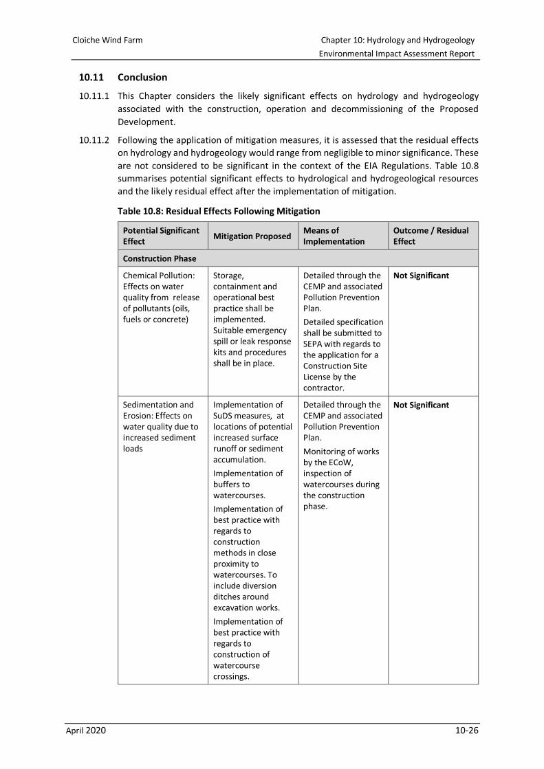
Cloiche Wind Farm Chapter 10: Hydrology and Hydrogeology
Environmental Impact Assessment Report
April 2020 10-26
10.11 Conclusion
10.11.1 This Chapter considers the likely significant effects on hydrology and hydrogeology
associated with the construction, operation and decommissioning of the Proposed
Development.
10.11.2 Following the application of mitigation measures, it is assessed that the residual effects
on hydrology and hydrogeology would range from negligible to minor significance. These
are not considered to be significant in the context of the EIA Regulations. Table 10.8
summarises potential significant effects to hydrological and hydrogeological resources
and the likely residual effect after the implementation of mitigation.
Table 10.8: Residual Effects Following Mitigation
Potential Significant Effect
Mitigation Proposed Means of Implementation
Outcome / Residual Effect
Construction Phase
Chemical Pollution: Effects on water quality from release of pollutants (oils, fuels or concrete)
Storage, containment and operational best practice shall be implemented. Suitable emergency spill or leak response kits and procedures shall be in place.
Detailed through the CEMP and associated Pollution Prevention Plan.
Detailed specification shall be submitted to SEPA with regards to the application for a Construction Site License by the contractor.
Not Significant
Sedimentation and Erosion: Effects on water quality due to increased sediment loads
Implementation of SuDS measures, at locations of potential increased surface runoff or sediment accumulation.
Implementation of buffers to watercourses.
Implementation of best practice with regards to construction methods in close proximity to watercourses. To include diversion ditches around excavation works.
Implementation of best practice with regards to construction of watercourse crossings.
Detailed through the CEMP and associated Pollution Prevention Plan.
Monitoring of works by the ECoW, inspection of watercourses during the construction phase.
Not Significant
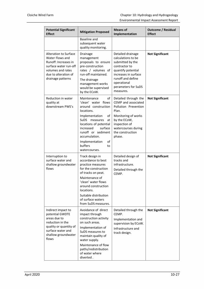
Cloiche Wind Farm Chapter 10: Hydrology and Hydrogeology
Environmental Impact Assessment Report
April 2020 10-27
Potential Significant Effect
Mitigation Proposed Means of Implementation
Outcome / Residual Effect
Baseline and subsequent water quality monitoring.
Alteration to Surface Water Flows and Runoff: Increases in surface water run-off volumes and rates due to alteration of drainage patterns
Drainage management proposals to ensure pre-construction rates / volumes of run-off maintained.
The drainage management works would be supervised by the ECoW.
Detailed drainage calculations to be submitted by the contractor to quantify potential increases in surface runoff and define operational perameters for SuDS measures.
Not Significant
Reduction in water quality at downstream PWS’s
Maintenance of ‘clean’ water flows around construction locations.
Implementation of SuDS measures at locations of potential increased surface runoff or sediment accumulation.
Implementation of buffers to watercourses.
Detailed through the CEMP and associated Pollution Prevention Plan.
Monitoring of works by the ECoW, inspection of watercourses during the construction phase.
Not Significant
Interruption to surface water and shallow groundwater flows
Track design in accordance to best practice measures for the construction of tracks on peat.
Maintenance of ‘clean’ water flows around construction locations.
Suitable distribution of surface waters from SuDS measures.
Detailed design of tracks and infrastructure.
Detailed through the CEMP.
Not Significant
Indirect impact to potential GWDTE areas due to reduction in the quality or quantity of surface water and shallow groundwater flows
Avoidance of direct impact through construction activity on such areas.
Implementation of SuDS measures to maintain quality of water supply.
Maintenance of flow paths/redistribution of water where diverted .
Detailed through the CEMP.
Implementation and supervision by ECoW.
Infrastructure and track design.
Not Significant
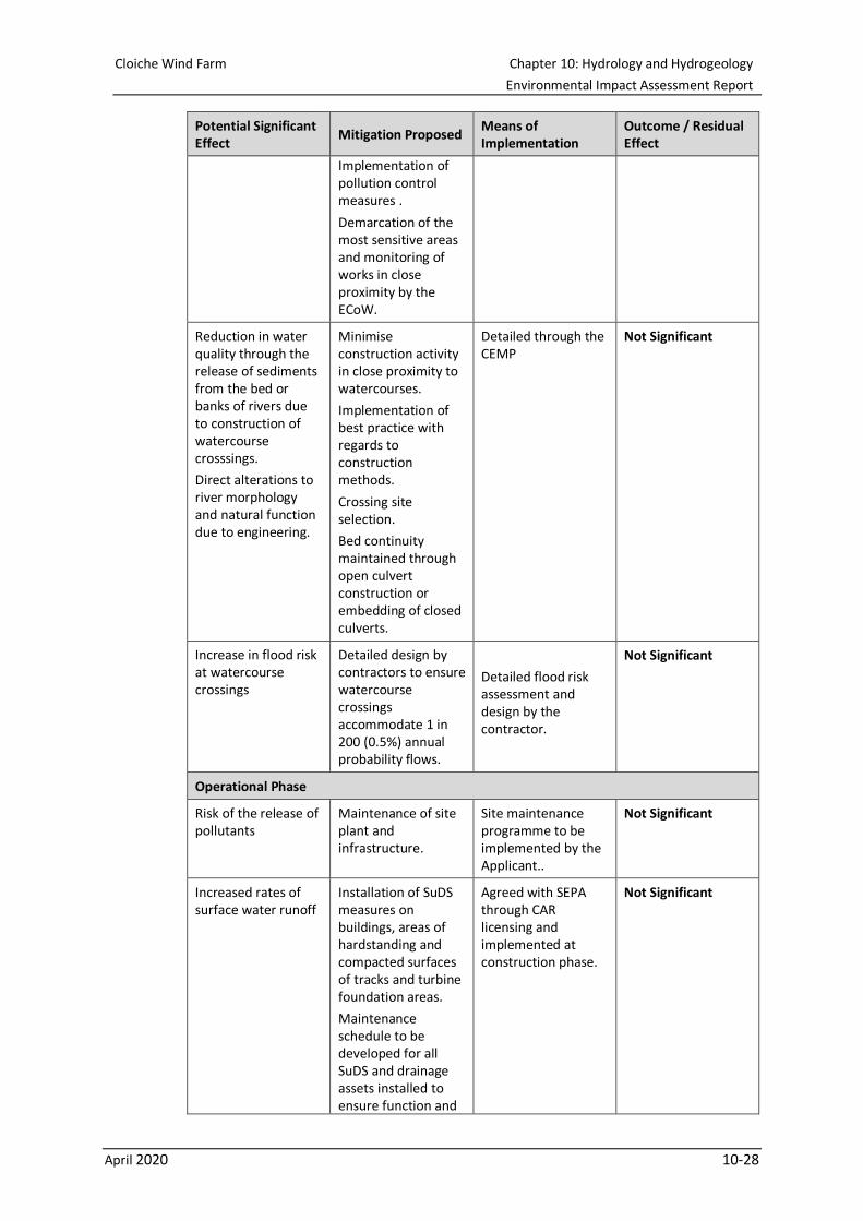
Cloiche Wind Farm Chapter 10: Hydrology and Hydrogeology
Environmental Impact Assessment Report
April 2020 10-28
Potential Significant Effect
Mitigation Proposed Means of Implementation
Outcome / Residual Effect
Implementation of pollution control measures .
Demarcation of the most sensitive areas and monitoring of works in close proximity by the ECoW.
Reduction in water quality through the release of sediments from the bed or banks of rivers due to construction of watercourse crosssings.
Direct alterations to river morphology and natural function due to engineering.
Minimise construction activity in close proximity to watercourses.
Implementation of best practice with regards to construction methods.
Crossing site selection.
Bed continuity maintained through open culvert construction or embedding of closed culverts.
Detailed through the CEMP
Not Significant
Increase in flood risk at watercourse crossings
Detailed design by contractors to ensure watercourse crossings accommodate 1 in 200 (0.5%) annual probability flows.
Detailed flood risk assessment and design by the contractor.
Not Significant
Operational Phase
Risk of the release of pollutants
Maintenance of site plant and infrastructure.
Site maintenance programme to be implemented by the Applicant..
Not Significant
Increased rates of surface water runoff
Installation of SuDS measures on buildings, areas of hardstanding and compacted surfaces of tracks and turbine foundation areas.
Maintenance schedule to be developed for all SuDS and drainage assets installed to ensure function and
Agreed with SEPA through CAR licensing and implemented at construction phase.
Not Significant
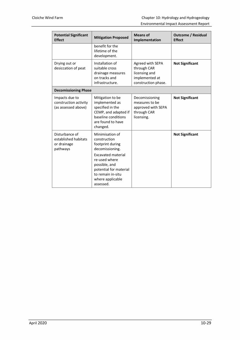
Cloiche Wind Farm Chapter 10: Hydrology and Hydrogeology
Environmental Impact Assessment Report
April 2020 10-29
Potential Significant Effect
Mitigation Proposed Means of Implementation
Outcome / Residual Effect
benefit for the lifetime of the development.
Drying out or desiccation of peat
Installation of suitable cross drainage measures on tracks and infrastructure.
Agreed with SEPA through CAR licensing and implemented at construction phase.
Not Significant
Decomissioning Phase
Impacts due to construction activity (as assessed above)
Mitigation to be implemented as specified in the CEMP, and adapted if baseline conditions are found to have changed.
Decomissioning measures to be approved with SEPA through CAR licensing.
Not Significant
Disturbance of established habitats or drainage pathways
Minimisation of construction footprint during decomissioning.
Excavated material re-used where possible, and potential for material to remain in-situ where applicable assessed.
Not Significant
Cloiche Wind Farm Chapter 10: Hydrology and Hydrogeology
Environmental Impact Assessment Report
April 2020 10-30
10.12 References
British Geological Survey (BGS) (2020). Available online:
http://mapapps.bgs.ac.uk/geologyofbritain/home.html, accessed 16th January 2020
Drinking Water Quality Regulator for Scotland (DWQR) Private Water Supply Map.
Available online: https://dwqr.scot/private-supply/pws-location-map/, accessed 16th
January 2020
MacArthur Green, 2018. Hydrological Assessment to Inform River Spey SAC Habitats
Regulations Appraisal. Available online: http://www.glenshero-
windfarm.co.uk/media/2636792/eiar_volume4_technicalappendix68.pdf. Last
accessed 21/01/2020
National Soils Map for Scotland (National Soils Inventory for Scotland (NSIS1)).
Available online: https://soils.environment.gov.scot/maps/soil-maps/national-soil-
map-of-scotland/
Natural Scotland and SEPA, 2010. Engineering in the Water Environment: Good
Practice Guide. River Crossings (WAT-SG-25). Available online:
https://www.sepa.org.uk/media/151036/wat-sg-25.pdf
Scottish Government (2003). Water Environment and Water Services (Scotland) Act
2003. Available at: http://www.legislation.gov.uk/asp/2003/3/contents
Scottish Government (2011, 2013, 2017) Water Environment (Controlled Activities)
(Regulations) Scotland 2011 (CAR) and their further amendments of 2013 and 2017
Available at: https://www.sepa.org.uk/regulations/water/
Scottish Government (2017) The Water Environment (Miscellaneous) (Scotland)
Regulations 2017. Available at:
http://www.legislation.gov.uk/ssi/2017/389/contents/made
Scottish Government (2009) Flood Risk Management (Scotland) Act 2009. Available
at: http://www.legislation.gov.uk/asp/2009/6/contents
Scottish Government (2017) the Water Intended for Human Consumption (Private
Supplies) (Scotland) Regulations 2017 Available at:
https://www.legislation.gov.uk/ssi/2017/282/note/made
Scottish Government (2015) the Private and Public Water Supplies (Miscellaneous
Amendments) (Scotland) Regulations 2015. Available at:
https://www.legislation.gov.uk/ssi/2015/346/contents
Scottish Government (2017) The Public Water Supplies (Scotland) Regulations 2014
(as amended). Available at:
https://www.legislation.gov.uk/sdsi/2014/9780111024782/contents
Scottish Government (2013) The Water Environment (Drinking Water Protected Areas)
(Scotland) Order 2013
Scottish Government (2012) River Crossings and Migratory Fish. Available online:
http://www.scotland.gov.uk/Topics/marine/science/Publications/publicationslatest/rive
rcrossings
Scottish Renewables, Scottish Natural Heritage (SNH), SEPA, Forestry Commission
Scotland, Historic Environment Scotland, Marine Scotland Science and AEECoW
(2019), Good Practice During Wind Farm Construction (4th Edition)
Cloiche Wind Farm Chapter 10: Hydrology and Hydrogeology
Environmental Impact Assessment Report
April 2020 10-31
Scottish Water (2018) Precautions to protect drinking water and Scottish Water assets
during windfarm construction and operational activities. Available online:
https://www.scottishwater.co.uk/en/Help-and-Resources/Document-Hub/Key-
Publications/Sustainable-Land-Management
SEPA: Guidance and Advice Notes, as dated. Available at:
https://www.sepa.org.uk/environment/land/planning/guidance-and-advice-notes/
• Pollution Prevention Guidelines (PPG) 1 : Understanding your environmental
responsibilities - good environmental practices (July 2013);
• Guidance for Pollution Prevention Guidelines (GPP) 2: Above ground oil storage
tanks (January 2018);
• GPP 4: Treatment and disposal of wastewater where there is no connection to the
public foul sewer (November 2017);
• GPP 5: Works and maintenance in or near water (January 2017);
• PPG 6: Working at construction and demolition sites (2012) ;
• GPP 13 Vehicle washing and cleaning (April 2017);
• GPP 21: Pollution incident response planning (July 2017);
• PPG 22: Incident response - dealing with spills (October 2018);
• Planning Advice Note (PAN) 79: Water and Drainage (September 2006);
• LUPS-GU4 : Planning guidance on on-shore windfarm developments (2017);
• LUPS-DP-GU2a: Development Plan Guidance on Flood Risk (2018);
• LUPS-GU19: Planning advice on wastewater drainage (2011);
• LUPS-GU31: Guidance on Assessing the Impacts of Development Proposals on
Groundwater Abstractions and Groundwater Dependent Terrestrial Ecosystems,
Version 3 (September 2017);
• WAT-SG-26: Good Practice Guide - Sediment Management (September 2010);
• WAT-SG-29: Good Practice Guide - Temporary Construction Methods (March
2009);
• WAT-SG-75: Sector Specific Guidance: Construction Sites;
• WAT-PS-06-02: Culverting of Watercourses (June 2015); and
• SEPA (2015), CAR - A Practical Guide, Version 8.4 (October 2019);
SEPA Flood Risk Management Maps (2018) web mapping. Available online:
http://map.sepa.org.uk/floodmap/map.htm
SEPA Water Classification Hub. Available online: https://www.sepa.org.uk/data-
visualisation/water-classification-hub/, accessed 16th January 2020
SEPA (2020). Drinking Water Protected Areas – Surface, Scottish Government.
Available at: https://map.environment.gov.scot/sewebmap/, accessed January 2020
THC Open Data on Private Water Supplies. Available online: https://map-
highland.opendata.arcgis.com/datasets/ded172bbade24650bb2c1baec5e0d318_0?geo
metry=-4.997%2C57.092%2C-4.182%2C57.222, accessed 16th January 2020

Cloiche Wind Farm Chapter 10: Hydrology and Hydrogeology
Environmental Impact Assessment Report
April 2020 10-32
Welstead, J., Hirst, R., Keogh, D., Robb G. and Bainsfair, R. 2013. Research and
guidance on restoration and decommissioning of onshore wind farms. Scottish Natural
Heritage Commissioned Report No. 591
Related Documents