Central Vermont Back Road BIKE TOURS Presented by in conjuction with Central Vermont Regional Planning Commission Central Vermont Chamber of Commerce Biking in Central Vermont The quiet villages, rolling hills, and breathtaking scenery of Central Vermont could not have been better designed for the biking enthusiast. The combination of paved and unpaved roads winding by historic communities and picturesque countryside provides the perfect setting for day-long exploration. The tours of Central Vermont are designed for the enjoyment of the recreational cyclist. However, Central Vermont is hilly, so a reasonable level of fitness is required. Each tour is laid out to return the rider to his or her starting point. Tours range from 5 to 25.7 miles. Some have optional extensions, and creative minds can combine routes or design their own from the maps provided. From Montpelier's historic downtown and capitol district to the secluded meadows of the Mad River Valley, these tours provide an ever changing backdrop for your travels. Along the way, you will encounter steepled churches, country stores, and dairy farms. You'll pass forests, streams, and quiet ponds. You'll be able to stop and enjoy apple cider, maple candies, Vermont cheddar, or hand-dipped chocolates. Use this guide for a one-day adventure, or plan a week and investigate every route. Your home base can be a deluxe motel or a country bed and breakfast. Pack sandwiches to go, or enjoy nearby restaurants of every variety. The tours in this guide are unique. You will find them nowhere else. They were discovered and mapped by local residents who share your passion for wide tires and open spaces. The residents of Central Vermont have a love of the land and natural environment that is unsurpassed. They revel in the splendor of the mountains, the rush of streams and the solitude of the fields. They are committed to preserving their heritage, and they invite you to share the wonder of the Vermont experience. For more information: Send Email to request a printed copy [email protected] © Copyright Central Vermont Chamber of Commerce © 2004, All rights reserved. CV Chamber / P.O. Box 336 / Barre, Vermont 05641 1-877-887-3678 or CVermont1 @ AOL.com

Welcome message from author
This document is posted to help you gain knowledge. Please leave a comment to let me know what you think about it! Share it to your friends and learn new things together.
Transcript

Central Vermont
Back Road BIKE TOURS
PPPPrrrreeeesssseeeennnntttteeeedddd bbbbyyyy
in conjuction withCentral Vermont Regional Planning
CommissionCentral Vermont Chamber of Commerce
Biking in Central VermontThe quiet villages, rolling hills, and breathtaking scenery of Central Vermont could not have been betterdesigned for the biking enthusiast.
The combination of paved and unpaved roads winding by historiccommunities and picturesque countryside provides the perfect setting forday-long exploration.
The tours of Central Vermont are designed for the enjoyment of therecreational cyclist. However, Central Vermont is hilly, so a reasonable levelof fitness is required.
Each tour is laid out to return the rider to his or her starting point. Toursrange from 5 to 25.7 miles. Some have optional extensions, and creative minds can combine routes or designtheir own from the maps provided.
From Montpelier's historic downtown and capitol district to the secluded meadows of the Mad River Valley,these tours provide an ever changing backdrop for your travels.
Along the way, you will encounter steepled churches, country stores, and dairy farms. You'll pass forests,streams, and quiet ponds.
You'll be able to stop and enjoy apple cider, maple candies, Vermont cheddar, or hand-dipped chocolates.
Use this guide for a one-day adventure, or plan a week and investigate every route.
Your home base can be a deluxe motel or a country bed and breakfast. Pack sandwiches to go, or enjoy nearbyrestaurants of every variety.
The tours in this guide are unique. You will find them nowhere else. They were discovered and mapped bylocal residents who share your passion for wide tires and open spaces.
The residents of Central Vermont have a love of the land and natural environment that is unsurpassed. Theyrevel in the splendor of the mountains, the rush of streams and the solitude of the fields. They are committed topreserving their heritage, and they invite you to share the wonder of the Vermont experience.
For more information:
Send Email to request a printed copy [email protected]
© Copyright Central Vermont Chamber of Commerce © 2004, All rights reserved.CV Chamber / P.O. Box 336 / Barre, Vermont 05641
1-877-887-3678 or CVermont1 @ AOL.com
CCCCeeeennnnttttrrrraaaallll VVVVeeeerrrrmmmmoooonnnntttt
Berlin Pond Loop (new) 5 milesTerrain and Road Conditions:This loop is shorter and not as hilly as most of the other rides. It is suitable for casualcyclists and even families, if the children are fairly strong peddlers. The entire route ison dirt roads.
Tour Highlights: This tour will take you around the perimeter of Berlin Pond. Nestled at the foot of theIrish Hills, Berlin Pond supplies the drinking water for Vermont's capital city,Montpelier. The pond is a popular spot for bird watchers, joggers and bicyclists.Automobiles also share these roads, so remember to ride single file.
Calais Historic Hamlets (new) about 20 milesTerrain and Road Conditions:This route covers some hilly terrain and requires a reasonable degree of fitness on thepart of the cyclist. Most roads are marked. With the exception of a short stretch onCounty Road, this entire route is unpaved.
Tour Highlights:The Hamlet Tour offers an exciting visit through Central Vermont's countryside. Alongthis route you will encounter four compact settlements, each unique, but each reflectiveof Vermont's past. You will also traverse landscapes of pastoral beauty and wind pastseveral lakes and ponds. There is a tremendous reservoir of history along this ride, sopedal forward and allow your mind and senses to wander back.
Mad River Valley Recreation Path (new) 4.5 milesTerrain and Road Conditions:This route is quite short. It is flat on the recreation path, and flat to gently rolling on theroad portion. The recreation path is mostly a dirt track, but may be sandy, grassy orgravely in places and is not suitable for "skinny tires." Access to the recreation path isprovided by an easement granted through the generosity of the landowner and the pathis maintained by a network of local volunteers (The Mad River Path Association).Please respect all posted rules and STAY ON THE PATH. Also ride with caution andat prudent speed as the path receives considerable pedestrian use by dog walkers,families with small children and others.The road sections of this loop are dirt, with the exception of a very short section ofTremblay Road which is paved.
Tour Highlights:This loop will take you along the banks of the beautiful Mad River, past farm fields,swimming holes, wetlands, under a covered bridge. and through flood plain forests,offering views of the surrounding mountainsall along the way.
Mad River Tour Overview 16.3 (Optional loop 8.7 miles)Terrain and Road Conditions:
Back Road BIKE TOURS

The degree of difficulty you encounter will depend on whether or not you choose toinclude the optional section north and east of routes 17 and 100, as this contains thetrip's most rugged terrain and consists entirely of unpaved surfaces.The main route is more gentle and incorporates some paved surfaces. It begins with agood climb, however, and has one prolonged descent, so a degree of fitness is required. Tour Highlights:The landscape you will traverse on this tour is memorable and inspiring. Its focal pointis the Mad River, which carves a course through a narrow valley between the Northfieldand Green Mountain ranges in a series of inviting pools, riffles and gorges. Along theway it passes classic New England villages, pastoral farmlands, covered bridges, andsome of Vermont's highest peaks. The river's milling power and fertile floodplain were magnets for 18th and 19th centurysettlers. Reminders of those bygone times abound in the architecture and landscapefeatures of the valley. The latter half of the 20th century has witnessed the valley'srenaissance as a recreation and resort center, hosting several downhill and Nordic skiareas, a particularly scenic segment of the Long Trail, year round events and festivals,and a full complement of services, goods and accommodations.The tour is designed to introduce the cyclist to the Mad River Valley in all of its dramaand diversity. It will take you into historic Waitsfield and Warren villages; past artgalleries and antique shops; up the valley walls past hillside farms, stone walls andpanoramic overlooks; over dirt roads lined with stately sugar maples; and along theclear flowing waters of the Mad River.
Montpelier - East Montpelier 16.5 (9.2 miles option)Terrain and Road Conditions:These loops are not terribly long, but it's quite hilly - particularly on the way out of andinto Montpelier. With the exception of one short segment over very rough surfaces, theroads upon which you will ride are well maintained and fairly wide dirt or asphaltsurface. Most road names are posted.
Tour Highlights:Atop the golden dome of the Statehouse in the City of Montpelier stands a statue of Ceres, the Romangoddess of agriculture. This tour takes you fromher home in Vermont's charming capital city out tothe beautiful and productive farmlands she symbolizes - and back again. Montpelier is the smallest state capital in the U.S. ata population of 8,000. It's thriving downtown hostsseveral impressive government buildings and an
array of historically and architecturally significant commercial buildings. The latter hosta variety of unique businesses and restaurants. Montpelier is a compact city. Only minutes out of town, on the back roads of EastMontpelier, stone walls, majestic sugar maples, historic barns, churches and farmsteads,and mountain views across verdant pastures grace the landscape.Note: For those wishing to both shorten the ride and avoid the climb out of Montpelier,park at the Old Meeting House (see below) and begin your ride there.
Note: For those wishing to both shorten the ride and avoid the climb out ofMontpelier, park at the Old Meeting House and begin your ride there.
Northfield Tour 12.3 milesTerrain and Road Conditions:This route is not long, but contains two very steep climbs. The "upside" of this is thatin 12 miles of cycling, there is only about a mile and a half of serious "gear crunching"the rest is flat, downhill or gently rolling. Road surfaces vary from paved State highwayto narrow, winding dirt roads. Most of the route is unpaved.
Tour Highlights:This tour takes you through a variety of landscapes in a

relatively short distance. Along its course you will encounter cool forests, panoramicmountain views, hillside farms, and a small urban center steeped in history. The tourbegins and ends in Northfield Village that has a population of 2,000.Chartered in 1781, Northfield has had its share of ups and downs. Its first period ofrapid growth began in 1848 when it was established as the headquarters of the CentralVermont Railway. Just five years later, in an apparent vendetta against the town,Vermont's governor, vowing to "make grass grow in the streets of Northfield," movedthe railroad headquarters to St. Albans. However, Northfield was not about to roll over.In 1866, Norwich University, a private military academy, moved to Northfield givingthe town a much needed infusion of life. The university is still going strong, as you willsee. In the 1890's the granite industry became established in Northfield bringing with itmany Spanish and Italian stone workers. During the Great Depression of the 1930's,the industry was forced to consolidate its resources into nearby Barre, plungingNorthfield into yet another period of decline. The town bounced back once againbehind the establishment of a knitting and woolen industry and the expansion of theuniversity. Today, Northfield is a proud and thriving small town.
The Lakes Tour (new) 7 milesTerrain and Road Conditions:While this is a short loop, it traverses some hilly terrain. Nearly all of this route is onwell-maintained dirt roads.
General Description:This short loop takes you through the wettest towns in Vermont (Woodbury has 25lakes and ponds: Calais, 14). So, bring your swimsuit and fishing pole. Water,however, is not this route's only attraction. You will also pass through pastoralcountryside and two compact, charismatic villages.
Waterbury-Stowe 22 miles
Terrain and Road Conditions:Although this loop has a few fairly rugged climbs, they are brokenup by stretches of easy, level pedaling - particularly on the StoweRecreation Path - and exhilarating descents. Almost half of your tripwill be covered on paved surfaces (including two and a half miles onthe Stowe Bike Path) with the remainder being on fairly wide, wellmaintained dirt roads.
Waterbury-Stowe Tour Highlights:Variety is the hallmark of this loop. It will take the cyclist past panoramic mountainviews, under "haunted" covered bridges, through woods and pastures, along and oversmall rivers, into one of Vermont's best known villages, and past several shops andtourist attractions. Just about everyone will find the type of cycling experience theyseek at some point on this ride.
Websterville Loop 13.7 MilesTerrain and Road Conditions:Although this route is fairly short, there are a few good climbs, especially after reachingWashington Village. Roads are paved near the settled areas, but most of this tour is onunpaved, gravel roads.
Waterbury-Stowe Tour Highlights:Granite is the backbone of Vermont. Nowhere is this more evident than in the vicinityof Barre, where the landscape, economy, and culture have been defined by this rock for200 years. This route will take you past historic and active quarries (including theworld's largest!). But granite isn't the only attraction - there are Indian trails, historichomes, three villages - and of course, the classic Vermont countryside. Although theroute is fairly short, there are a few long climbs.

Berlin Pond Loop5 Miles
Terrain and Road Conditions:
This loop is shorter and not as hilly as most of the other rides. It is suitable for casual cyclists andeven families, if the children are fairly strongpeddlers. The entire route is on dirt roads.
Tour Highlights:
This tour will take you around the perimeter of Berlin Pond. Nestled at the foot of the Irish Hills,Berlin Pond supplies the drinking water forVermont's capital city, Montpelier. The pond is apopular spot for bird watchers, joggers and bicyclists. Automobiles also share these roads, soremember to ride single file.
Route Description:
Park at the designated parking area onBrookfield Road near the intersection of Paine Turnpike. Turn left out of the lot and ride alongthe east side of the pond.
At about .4 mile, after crossing a wetland area,the road will climb into a wooded area. Bear left tocontinue on Brookfield Road.
Proceed south along Brookfield Road. Theterrain is rolling, passing a few residences, farmsteads and glances of the pond to the west.
At about 2.2 miles the road reaches a remoteintersection. Take a sharp left onto Mirror Lake Road.
At the 2.7-mile mark, after crossing a wetland,the road intersects with Paine Turnpike South. Turn left (north) and proceed along the westernshore of the pond.
At about 4.5 miles, you will begin to parallelI-89. Not long after that, Brookfield Road will appear on your left. Take the left turn back to theparking area.
Calais Historic Hamletsabout 20 Miles
Terrain and Road Conditions:
This route covers some hilly terrain and requires a reasonable degree of fitness on the part of thecyclist. Most roads are marked. With the exceptionof a short stretch on County Road, this entire routeis unpaved.
Tour Highlights:
The Hamlet Tour offers an exciting visit through Central Vermont's countryside. Along this route youwill encounter four compact settlements, eachunique, but each reflective of Vermont's past. Youwill also traverse landscapes of pastoral beauty andwind past several lakes and ponds. There is a tremendous reservoir of history along this ride, sopedal forward and allow your mind and senses towander back.
Route Description:
The most appropriate starting point along thistour is the tiny village of Maple Corner. Here, thereexists a post office and general store which can provide both parking and provisions.Located at the southeast corner of Curtis Pond,Maple Corner owes its existence to this body ofwater and the mill industries it helped power. In theearly 19th century, the village hosted saw and gristmills. Later, in the 1870's, a woolen mill and machineshop which produced horse rakes, appeared. Around 1910, a carriage factory here was converted to acreamery which served nearby farms.
From Maple Corner, pedal east out of town alongKent Hill Road. Shortly (0.7 mile) you will arrive atKent's Corner. This small hamlet has changed very little over the past 150 years or so and is listed onthe National Register of Historic Places. The KentTavern is owned by the Vermont Historical Societyand is occasionally opened to the public.
Turn left onto Robinson Cemetery Road at thefour corners intersection. Just a short distance up theroad you will notice a historic post and beam, hydro-powered sawmill to your left. A bit further upthe hill you will pass the cemetery and views ofGroton State Forest to the east.
At 1.88 miles you will arrive at a grassy triangle.Stay to the right and continue along West CountyRoad for about 1.5 miles at which point you will turn right onto Bayne Comolli Road.
Remain on this road for 2.5 hilly miles beforearriving at a T intersection with another grassytriangle. Turn right here onto No. 10 Pond Road. Continue on, passing the pond on your left.
At the next intersection, a right hand turn ontoNorth Calais Road will enable you to continue theloop. However, a very short side trip into the hamlet of North Calais is recommended. A left hand turnwill bring you there. As you poke around the villageyou will notice a number of decrepit dam walls andstone foundations amid the historic residences.These lay as a record of North Calais's days of sawand grist milling (as early as 1800), and as a
The Lakes Tour7 Miles
Terrain and Road Conditions:
While this is a short loop, it traverses some hilly terrain. Nearly all of this route is on well-maintaineddirt roads.
General Description:
This short loop takes you through the wettest towns in Vermont (Woodbury has 25 lakes and ponds:Calais, 14). So, bring your swimsuit and fishing pole.Water, however, is not this route's only attraction.You will also pass through pastoral countryside andtwo compact, charismatic villages.
Route Description:
Park at the Woodbury Town Clerk's Officelocated on the east side of Route 14 in South Woodbury. This cluster of Greek Revival structureslooks much as it did during its heyday as a millingcenter in the mid-19th Century.
Head straight across Rte 14 and climb Foster HillRoad through the Village of South Woodbury on apaved surface. Above the village, the road veers to theleft, pavement ends, and the climb continues as you head south toward Calais.
At about 2 miles, you will descend into the tinyVillage of North Calais. As you poke around thissettlement, notice a number of decrepit dam walls and stone foundations amid the historic residences. Theselay as a record of North Calais's days of saw andgrist milling (as early as 1800), and as amanufacturing center (later 19th century). Water flowing from Mirror Lake powered the production ofwooden clocks, cast bells, carriages, coffins, woolengoods and even wooden fifes.
Stay to the right at the Y (Calais Road) in thevillage then make a sharp right onto No. 10 PondRoad (2.4 miles) at the triangle just beyond.
Proceed along the shores of No.10 Pond and thenNelson Pond (where the road becomes Nelson PondRoad) . These are beautiful clear, cold water bodies. Both have public access areas.
Turn right at the four corners intersection beyondNelson Pond onto Chartier Hill Road and climbsteeply into open pasture land affording views back to the lakes and the hills and forests beyond.
Take your first available left onto Tebbets at agrassy triangle (4.7 miles) and continue to climb. Atthe crest of the hill, you will be rewarded with someexcellent views of the countryside and encounter an unusual cultural landscape feature; a large barn withan enclosed ramp which bridges the road.
After crossing under the barn you will descendsharply at first, and then more gradually back to theVillage of South Woodbury.
Turn left onto Foster Hill Road and continue backto Route 14 and the Town Clerk's Office.

manufacturing center (later 19th century). Waterflowing from No. 10 Pond powered the productionof wooden clocks, cast bells, carriages, coffins,woolen goods and even wooden fifes.
Exit North Calais the same way you entered andcontinue on North Calais Road (which becomesPekin Brook Road) for about 4 miles of mostly downhill pedaling. You will pass the Calais TownHall, which dates from the mid 19th century, alongthe way.
At a four corners intersection (10.25 miles), turnright onto George Road passing a farmstead on theright. The road will begin to climb steeply and turn more primitive. The road will turn sharply to the leftnear the top of the climb, straighten out and reach aT intersection at 11.7 miles.
Turn right at the T onto Lightening Ridge Road.(This road earned its name because the wagons thatonce used it were often forced to lighten their loads in order to make the climb. But don't worry;although you will be climbing again, the steepest partis behind you.)
Proceed on Lightening Ridge Road. Bearing left,it becomes Adamant Road and descends into the village of Adamant at about the 13.5-mile mark. Thislittle hamlet, located on the shore of Sodom Pondwas settled in the 1880's when granite was quarriedin this locale. It is the site of the first State CharteredCredit Union in Vermont, a cooperative store, a renowned music school (offering summer concerts),and an annual strawberry festival.
Proceeding through the village you will pass theAdamant Methodist Church on your left. Bear to theright at the intersection just beyond this point ontoMartin Road.
In 1.13 miles you will reach another Tintersection. Turn right onto County Road and travel for about one half mile on a paved stretch beforeturning right again onto Bliss Pond Road.
Shortly after passing Bliss Pond, bear left at agrassy triangle onto Old West Church Road andcontinue about 1.5 miles back to Kent's Corner. Along the way you will pass the Old West Church(c.1823), a meeting house which is heated by woodstoves and retains its original pews. In letters abovethe pulpit, a message written in dried hemlock boughs commands: "Removeth not the ancientlandmark which thy fathers have set."
At Kent's Corners turn left onto Kent Hill Roadand proceed to Maple Corner, concluding your trip.

Mad River Valley Tour16.3 miles
(5.7 mile optional extension)
Terrain and Road Conditions:
The degree of difficulty you encounter will depend onwhether or not you choose to include the optionalsection north and east of routes 17 and 100, as thiscontains the trip's most rugged terrain and consistsentirely of unpaved surfaces.The main route is more gentle and incorporates somepaved surfaces. It begins with a good climb, however,and has one prolonged descent, so a degree of fitnessis required.
Tour Highlights:
The landscape you will traverse on this tour is memorable and inspiring. Its focal point is the MadRiver, which carves a course through a narrowvalley between the Northfield and Green Mountainranges in a series of inviting pools, riffles and gorges. Along the way it passes classic NewEngland villages, pastoral farmlands, coveredbridges, and some of Vermont's highest peaks. The river's milling power and fertile floodplain weremagnets for 18th and 19th century settlers.Reminders of those bygone times abound in thearchitecture and landscape features of the valley.The latter half of the 20th century has witnessed thevalley's renaissance as a recreation and resort center, hosting several downhill and Nordic ski areas, aparticularly scenic segment of the Long Trail, yearround events and festivals, and a full complement ofservices, goods and accommodations.The tour is designed to introduce the cyclist to theMad River Valley in all of its drama and diversity. Itwill take you into historic Waitsfield and Warrenvillages; past art galleries and antique shops; up thevalley walls past hillside farms, stone walls andpanoramic overlooks; over dirt roads lined with stately sugar maples; and along the clear flowingwaters of the Mad River.
Route Description:
Park in the Village of Waitsfield where public parking can be found across from the library on Route 100.This scenic hamlet is listed on the national Register of Historic Places and boasts many fine, well-maintained18th- and 19th-century structures. Greek Revival is the prominent architectural style. Waitsfield had itsorigins as a milling settlement, but quickly evolved into the main commercial center of the Mad River Valley.
Turn east at the village's main intersection and proceed through The Great Eddy Covered Bridge over theMad River. Also on the national Register, this span is the second oldest covered bridge in Vermont and theoldest in continuous operation. Built in 1833, its braces were actually hewn from tree crotches. Just below thebridge is a popular swimming hole.
Climb out of the village and take your first left onto Common Road (0.4 mile).Climb rather steeply for another 1.2 miles on paved surfaces before reaching Waitsfield Common. If you
don't choose to ride the Fayston option, you have just completed what is far and away the most difficult partof this loop. Here you will bear right onto Common Road and cruise along a high plateau for about 3 mileson a dirt surface, passing occasional farmsteads and panoramic vistas.
At 4.4 miles bear left onto the paved surface of East Warren Road to continue the loop. You will soonencounter a roller coaster dip and rise and then continue on a plateau into the town of Warren.
At 8.4 miles, just after you pass Airport Road, thepavement will bend sharply to the right and begin anexciting 2-mile descent along Freeman Brook into thevillage of Warren.
When you reach the "T" intersection in the village,you will need to turn right to continue the loop, but first,make a left and see the rest of this picturesque hamlet.Warren Village is another national register site. Although it had its beginnings as a mill village, all of itsearly mill and dam sites have been lost to floods andfires. However, over 70 historic structures remain in thistight cluster of residences, commercial buildings andchurches. The covered bridge at the far end of the villagedates to 1879 and was built by one man.
Backtrack cross the Mad River and turn right onto Route 100 North.

Continue north, paralleling the river until you reach the intersection of Routes 100 and 17. If you are tiringat this point, you may continue north on Route 100, through the settlement of Irasville. You will find a varietyof shops and stores, and back to the village of Waitsfield (16.3 miles). If you're still pretty fresh and in themood for some hills and incredible scenery, turn left onto Route 17.
1.02 miles from the intersection, take your first right onto Number Nine Road. Climb steeply, bearing rightat an island of mailboxes. Soon you will reach the Bragg Hill Farm, c. 1843, providing spectacular views tothe south and east.
Bear right at the intersection of Stagecoach Road and Bragg Hill, then left onto Kew-Vasseur Road (3.0miles).
Here you will climb once again to another marvelous vantage point, descend into a small basin, climb againand descend to a "T" intersection (4.5 miles).
Turn right here onto Center Fayston Road and descend swiftly for 2.6 miles to Route 100, taking time toadmire the scenery. The last part of this descent is very steep so check your brakes at the top.
Turn right onto Route 100 South and pedal 1.6 miles back to the Village of Waitsfield (loop total is 8.7miles).

Mad River Valley Recreation Path4.5 miles
Terrain and Road Conditions:
This route is quite short. It is flat on the recreationpath, and flat to gently rolling on the road portion.The recreation path is mostly a dirt track, but may besandy, grassy or gravely in places and is not suitablefor "skinny tires." Access to the recreation path isprovided by an easement granted through thegenerosity of the landowner and the path is maintained by a network of local volunteers (TheMad River Path Association). Please respect allposted rules and STAY ON THE PATH. Also ridewith caution and at prudent speed as the path receives considerable pedestrian use by dog walkers,families with small children and others.The road sections of this loop are dirt, with theexception of a very short section of Tremblay Roadwhich is paved.
Tour Highlights:
This loop will take you along the banks of the beautiful Mad River, past farm fields, swimmingholes, wetlands, under a covered bridge. and throughflood plain forests, offering views of the surrounding mountainsall along the way.
Route Description:
Park at the Recreation Path parking lot on the west side of theMeadow Road Bridge.
Turn right out of the lot back onto Meadow Road, cross thebridge and then take an immediate, hard right just after the bridge,onto the path.
The path more or less follows the course of the river for about 1.5miles before branching off to the east. It is well marked the entireway. At about the 2-mile mark, the path will deposit you ontoTremblay Road.
Turn left onto Tremblay Road. A short climb will bring you to theintersection of North Road where you will turn left again.
Stay on North Road for about 2 rolling miles before reaching theintersection of Meadow Road at the bottom of a hill, shortly afterpassing a dairy farm.
Turn left onto Meadow Road and ride back to the parking lot. Note: If you would like to avoid automobile traffic altogether, simply turn around and retrace your steps onthe recreation path after reaching Tremblay Road.

Montpelier East Montpelier16.5 (9.2 mile option)
Terrain and Road Conditions:These loops are not terribly long, but it's quite hilly -particularly on the way out of and into Montpelier.With the exception of one short segment over veryrough surfaces, the roads upon which you will rideare well maintained and fairly wide dirt or asphaltsurface. Most road names are posted. Tour Highlights:Atop the golden dome of the Statehouse in the Cityof Montpelier stands a statue of Ceres, the Romangoddess of agriculture. This tour takes you from herhome in Vermont's charming capital city out to thebeautiful and productive farmlands she symbolizes -and back again. Montpelier is the smallest state capital in the U.S. ata population of 8,000. It's thriving downtown hostsseveral impressive government buildings and anarray of historically and architecturally significantcommercial buildings. The latter host a variety of unique businesses and restaurants. Montpelier is a compact city. Only minutes out oftown, on the back roads of East Montpelier, stonewalls, majestic sugar maples, historic barns, churchesand farmsteads, and mountain views across verdantpastures grace the landscape.Note: For those wishing to both shorten the ride andavoid the climb out of Montpelier, park at the OldMeeting House (see below) and begin your ridethere.
Route Description:
Park in the City of Montpelier (public parking canbe found in several lots and on the street, but it's notalways easy, especially when the legislature is insession). After seeing the various points of interest downtown, proceed north on Main Street bearingright at the roundabout across from the formerMasonic Temple which now houses a medical clinic.
Climb steadily out of town on Upper Main Street(on the way you will pass the New England CulinaryInstitute on the left - the school operates several fine restaurants in the city which are well worth visiting!).After a sharp left hand turn, Main Street becomesCounty Road, flattens out a bit and becomes a bitmore rural in character. About a mile and a half outof town you will pass the Morse Farm stand on theright where a variety of local agricultural products,crafts and gifts may be purchased.
Continue on the County Road until its intersectionwith Barnes Road on the right (3.2 miles). BarnesRoad (unpaved) will lead you through a residential area to the historic settlement of East MontpelierCenter.
Turn left onto Center Road (4 miles). Shortly youwill pass the Old Meeting House (c. 1823), aNational Register Historic Site and community landmark, on the right. Take a moment to admire thisfine example of "Federal Vermont" architecture.
Continue up scenic and historic Center Roadpedaling on dirt surfaces past tidy farmsteads andbeneath the canopy of majestic roadside sugar maples. Center Road appears in State records as
At about 6.6 miles, turn right onto Sibley Road.Notice the old farmhouse which soon appears onyour left - it was built in 1795 and is reputed to have been involved in the embargo of the War of 1812and the Underground Railroad. Further down theroad on your left, you will pass an impressivecomplex of agricultural buildings known as the Sibley Farm. The Groton Mountains to the eastprovide a splendid backdrop for this arresting scene.
Shortly after the Sibley Farm, the road branchesin a "Y" at a grassy triangle. Take the left fork andcontinue for one-half mile before turning left onto arugged jeep trail which runs uphill through a pasturewithin sight of the farmhouse at the end of Foster Road. Stay on this trail as it winds through thewoods for about .6 mile. Turn right onto ChickeringRoad at the end of the trail.
In just over one-half mile you will come to a "T"intersection. Turn right onto Guyette Road. One milelater turn right at another "T" onto Snow Hill Road.The views from the height of land on this road areinspiring. Farms, fields, woods and mountains form a patchwork landscape.
Continue straight over pleasant, rolling terrain foralmost three miles. (Snow Hill Road will change toDodge Road at a four-way intersection.)
At the end of Dodge Road (12.8 miles) turn leftback onto Center Road, through the hamlet of EastMontpelier Center, past the Old Meeting House and back onto pavement. Continue on Center Road forabout a mile and a half to its intersection with theCounty Road. As you approach this junction, greatlong-range views open up to the south and west overthe City of Montpelier.
Turn left onto the County Road and retrace yoursteps back down Main Street to downtown Montpelier. Use caution on this steep descent.
Continue on the County Road until its intersectionwith Barnes Road on the right (3.2 miles). BarnesRoad (unpaved) will lead you through a residential area to the historic settlement of East MontpelierCenter.
Turn left onto Center Road (4 miles). Shortly youwill pass the Old Meeting House (c. 1823), aNational Register Historic Site and community landmark, on the right. Take a moment to admire thisfine example of "Federal Vermont" architecture.
Continue up scenic and historic Center Roadpedaling on dirt surfaces past tidy farmsteads andbeneath the canopy of majestic roadside sugar maples. Center Road appears in State records asearly as 1793 as "the road from East Montpelier toMemphremagog" and as you travel upon it, you maybelieve that time is standing still.
At about 6.6 miles, turn right onto Sibley Road.Notice the old farmhouse which soon appears onyour left - it was built in 1795 and is reputed to have been involved in the embargo of the War of 1812and the Underground Railroad. Further down theroad on your left, you will pass an impressivecomplex of agricultural buildings known as the Sibley Farm. The Groton Mountains to the eastprovide a splendid backdrop for this arresting scene.
Shortly after the Sibley Farm, the road branches ina "Y" at a grassy triangle. Take the left fork andcontinue for one-half mile before turning left onto arugged jeep trail which runs uphill through a pasturewithin sight of the farmhouse at the end of Foster Road. Stay on this trail as it winds through thewoods for about .6 mile. Turn right onto ChickeringRoad at the end of the trail.

early as 1793 as "the road from East Montpelier toMemphremagog" and as you travel upon it, you maybelieve that time is standing still.
In just over one-half mile you will come to a "T"intersection. Turn right onto Guyette Road. One milelater turn right at another "T" onto Snow Hill Road.The views from the height of land on this road areinspiring. Farms, fields, woods and mountains form a patchwork landscape.
Continue straight over pleasant, rolling terrain foralmost three miles. (Snow Hill Road will change toDodge Road at a four-way intersection.)
At the end of Dodge Road (12.8 miles) turn leftback onto Center Road, through the hamlet of EastMontpelier Center, past the Old Meeting House and back onto pavement. Continue on Center Road forabout a mile and a half to its intersection with theCounty Road. As you approach this junction, greatlong-range views open up to the south and west overthe City of Montpelier.
Turn left onto the County Road and retrace yoursteps back down Main Street to downtown Montpelier. Use caution on this steep descent.
Northfield Tour12.3 Miles
Terrain and Road Conditions:
This route is not long, but contains two very steepclimbs. The "upside" of this is that in 12 miles ofcycling, there is only about a mile and a half ofserious "gear crunching" the rest is flat, downhillor gently rolling. Road surfaces vary from pavedState highway to narrow, winding dirt roads. Mostof the route is unpaved.
Tour Highlights:
This tour takes you through a variety oflandscapes in a relatively short distance. Along itscourse you will encounter cool forests, panoramicmountain views, hillside farms, and a small urban center steeped in history. The tour begins andends in Northfield Village that has a population of2,000.Chartered in 1781, Northfield has had its share ofups and downs. Its first period of rapid growthbegan in 1848 when it was established as theheadquarters of the Central Vermont Railway. Just five years later, in an apparent vendetta against thetown, Vermont's governor, vowing to "make grassgrow in the streets of Northfield," moved therailroad headquarters to St. Albans. However, Northfield was not about to roll over. In 1866,Norwich University, a private military academy,moved to Northfield giving the town a muchneeded infusion of life. The university is still going strong, as you will see. In the 1890's thegranite industry became established in Northfieldbringing with it many Spanish and Italian stoneworkers. During the Great Depression of the 1930's, the industry was forced to consolidate itsresources into nearby Barre, plunging Northfieldinto yet another period of decline. The town bounced back once again behind the establishmentof a knitting and woolen industry and theexpansion of the university. Today, Northfield is aproud and thriving small town.
Route Description:
Park at Depot Square in the heart of the Villageof Northfield and proceed east on Wall Street,across the railroad tracks and the Dog River.
Turn left onto Water Street at your firstintersection and follow along the flood plain of theriver . The Dog river is known as one ofVermont's better trout streams.
At about 1.2 miles, after passing Terry HillRoad, the road bends sharply to the right and upDole Hill Road. This road climbs steeply foralmost a mile, past Norwich University Cemetery,to an open hilltop with nice views of the Dog River valley and the hills beyond. After cresting the hill,you will descend, bearing left at a grassy triangle,and left again at a stop sign (2.8 miles) onto SmithHill Road.
Continue your descent on Smith Hill Road tothe intersection of Rte. 12A (4.1 miles).
Bear left at the top of the hill. In about a mile,panoramic views to the west begin to unfold, each moremagnificent than the previous. On a clear day,Vermont's highest peak, Mount Mansfield, is prominent on the northwest horizon .
After 3 miles, Winch Hill Road drops sharply backto the valley intersecting Route12A again at 10.3 miles.
Turn right onto Rte. 12A, then left at its intersectionwith Rte. 12 (11.2 miles). Proceed past NorwichUniversity, or take time to explore its beautiful campusand military museum. Continue down Main Street withits many well kept, historic homes, returning to DepotSquare (12.3miles).
Continue your descent on Smith Hill Road to theintersection of Rte. 12A (4.1 miles).
Turn left onto 12A and proceed under a trestlebridge. Take the first right onto Bull Run Rd (4.4Miles).
You will ride through a cool streamside forest for 2.2miles on gently rolling terrain before turning left ontoWinch Hill Road. This turn comes shortly after youcross the fourth bridge over Bull Run. The ascent upWinch Hill is extremely steep and it may be necessaryto dismount and walk in places. However, it only lastsabout a half mile and you will be well rewarded for your efforts.
Bear left at the top of the hill. In about a mile,panoramic views to the west begin to unfold, each moremagnificent than the previous. On a clear day,Vermont's highest peak, Mount Mansfield, is prominent on the northwest horizon .
After 3 miles, Winch Hill Road drops sharply backto the valley intersecting Route12A again at 10.3 miles.
Turn right onto Rte. 12A, then left at its intersectionwith Rte. 12 (11.2 miles). Proceed past NorwichUniversity, or take time to explore its beautiful campusand military museum. Continue down Main Street withits many well kept, historic homes, returning to DepotSquare (12.3miles).

Turn left onto 12A and proceed under a trestlebridge. Take the first right onto Bull Run Rd (4.4Miles).
You will ride through a cool streamside forestfor 2.2 miles on gently rolling terrain beforeturning left onto Winch Hill Road. This turncomes shortly after you cross the fourth bridge over Bull Run. The ascent up Winch Hill isextremely steep and it may be necessary todismount and walk in places. However, it only lasts about a half mile and you will be wellrewarded for your efforts.

Waterbury - Stowe22.2 Miles
Terrain and Road Conditions:
Although this loop has a few fairly rugged climbs,they are broken up by stretches of easy, levelpedaling - particularly on the Stowe Recreation Path- and exhilarating descents. Almost half of your tripwill be covered on paved surfaces (including two anda half miles on the Stowe Bike Path) with the remainder being on fairly wide, well maintained dirtroads.
Tour Highlights:
Variety is the hallmark of this loop. It will take the cyclist past panoramic mountain views, under"haunted" covered bridges, through woods andpastures, along and over small rivers, into one ofVermont's best known villages, and past several shops and tourist attractions. Just about everyonewill find the type of cycling experience they seek atsome point on this ride.
Route Description:
Park along the road at the Waterbury Center village green, reached by turning east off Route 100. Thevillage green was the southern terminus of Vermont's last trolley line. The Mt. Mansfield Electric Trolley Co.ran from Waterbury Center to Stowe from 1897 to 1932. Provisions are available at the general store west ofthe green, as they have been since the mid 1800's.
Take 1 quick left at the green to reachMaple Street. For a mile or so you will rideon paved level ground through a residentialneighborhood before beginning your ascent of Barnes Hill. Here the pavement will giveway to dirt and the gentle terrain andsuburban feel will end. As you climb and crest Barnes Hill, excellent views of MountMansfield (Vermont's highest peak) and the Green Mountains will open up on your left.On the right, you will pass two scenic farmsnestled at the base of the Worcester Range.
At about 3.7 miles, you will bear to the leftat a 3-way intersection. Here, Barnes Hill Road becomes known as Stowe Hollow
Road. After a short ascent to the height of land between Waterbury Center and Stowe Village, the route dropssharply for a long, swift and very scenic 2-mile descent.
At 5.6 miles you will arrive at a 4-way intersection with a STOP sign. Proceed across the intersection andunder a covered bridge, onto Covered Bridge Road. According to local legend, this bridge has been hauntedfor 150 years by the ghost of a young woman named Emily who hung herself from the rafters after beingspurned by her lover.
Bear left back onto Stowe Hollow Road (paved) and descend quickly into the Village of Stowe (7.6 miles).This route will deposit you on Main Street (Rte. 100), opposite Community Church, Stowe's most famouslandmark.
Cross Main Street into the church driveway and go behind the building where you will find the StoweRecreation Path. First, take a little time to explore Stowe Village. All varieties of food, accommodations andshopping are available in Stowe; both in the village and on the Mountain Road (Rte. 108). Car shows, horseshows, concerts, festivals, and other events are frequent throughout the year.
The recreation path is a popular spot and for good reason. It is flat,scenic, paved and free of motorized vehicles. On weekends and holidays itcan attract hordes of walkers, bikes, and roller bladers, so exercise caution.Keep your speed down and your eyes up. The path meanders back andforth along and over the West Branch of the Little River for about 5.5 miles.This tour, however, employs only a 2.7 mile section. Shortly after the 2.5mile point which is marked on the pavement, the path crosses under abridge. Immediately after the bridge, a parking area/access point will appearto the left. Get off the path here and turn right out of the parking lot ontoLuce Hill Road (paved; 10.3 miles)
After a short flat, you will begin a fairly long, rather steep ascent. Proceedstraight, passing Barrows Road on the left. Near what seems to be the top ofthe hill, the road turns sharply to the left and climbs more gradually foranother 1/2 mile to the Trapp Family Lodge. The Trapps, of the Sound ofMusic fame, settled here and built this establishment after fleeing the Nazi's in the late 1930's. This hilltoplocation reminded them of their native Austria. The views to the left of the Worcester Range, and further upthe road to the right of Nebraska Notch, are unparalleled.
After passing the Lodge complex, the road turns to dirt and begins a very beautiful, but very steep descentinto the Village of the Little River. Be sure your brakes are in good working order!

At 14.2 miles at the bottom of the hill, take a left onto Moscow Road (paved). Proceed along the river andthrough the little Village of Moscow to the road's intersection with Rte 100 (16.4 miles).
Turn right onto Rte. 100 South. Although this is a heavily traveled route, it has wide shoulders and you willonly be on it for a short distance (less than a mile).
Route 100 will make a gradual climb up Shutesville Hill. Near the top, across from a display of chainsawcarvings, turn right onto Gregg Hill Road (17.4 miles).
Gregg Hill Road (dirt) will loop back to Rte. 100 after 3.9 very pleasant miles of cruising (21.3 miles).Turn right (south) onto Rte. 100. Turn left onto Hollow Road just after passing the Cold Hollow Cider
Mill, one of Vermont's most popular tourist attractions. Continue back to the Village Green.

Websterville Loop13.7 Miles
Terrain and Road Conditions:
Although this route is fairly short, there are a fewgood climbs, especially after reaching Washington Village. Roads are paved near the settled areas, butmost of this tour is on unpaved, gravel roads.
Tour Highlights: Granite is the backbone of Vermont. Nowhere is this more evident than in the vicinity of Barre,where the landscape, economy, and culture havebeen defined by this rock for 200 years. Thisroute will take you past historic and active quarries (including the world's largest!). But granite isn'tthe only attraction - there are Indian trails, historichomes, three villages - and of course, the classicVermont countryside. Although the route is fairlyshort, there are a few long climbs.
Route Description:Park at the Barre Town Elementary School on
Websterville Rd., Lower Websterville. From Barre Town Parking area turn right onto
Websterville Road. From this point until youreach Washington Village you will be followingthe Historic Coos Indian Trail, one of only two East/West prehistoric Indian trails known to haveexisted in Vermont.
Continue on Websterville Road for about a mileuntil you reach the Wells Lawson Quarry on theright. This is the oldest quarry on Millstone Hilland was opened sometime around 1800 by Abijah Abbot who is said to have provided millstones tomany of the early gristmills in New England. Thiswas the deepest quarry in the world having a depthof over 400 ft.
At the quarry, Websterville Road bears left.Continue straight for a few hundred feet to thenext intersection then turn left onto Little JohnRoad, getting off the main road (Church Hill Road), which continues up hill. Little John Roadwill be paved for .2 miles then will continue as agravel road for about another mile. Historicallythis is the most interesting part of the old CoosIndian Trail. It is part of the very first road opened throughout the town of Barre and was home tomany of the town's first settlers.
Shortly after pavement ends on the left is the"Lodge at Millstone Hill," a converted barn that'snow a new bed and breakfast whose propertycontains many old quarries and private trails.Farther down the road on the right you will come to 2 abandoned quarries with historic markers.These are typical of the 50 or more abandonedquarries located within a one mile radius of thisroad. What was once an industrial wasteland some 100 years ago has now been reclaimed by natureto become one of Millstone Hill's unique manmade natural wonders. These quarries range in depth from 25-50 feet. The water is spring fed andcontains several varieties of fish.Beyond the quarries at the intersection is the historic Nichols House. It was built around 1800and is believed to be the oldest home in BarreTown. It still contains several original fireplaces
The road will continue through open farmland forabout 1.9 miles until you reach the intersection withLambert Road. Turn Left onto Lambert Road,descending .7 mile to the intersection with Route 110.Turn Right onto Route 110, and follow for .7 milegoing into Washington Village.
At the library in the village turn right onto FirehouseRoad. Go up the hill for .4 mile turning left ontoMcDonald Road at the cemetery. (McDonald Road willturn into Washington Road, and eventually it willbecome Tower Road, and then Graniteville Road).
After 1.5 miles, you will start to climb a steep hill.(Climb will start at Poor Farm Road and will continuefor .5 mile) The road will narrow and eventually mergewith an unnamed road (when you see a Chalet typehome); continue straight on road. After about anothermile, you will pass Sugarhouse Road. Shortly after youwill pass through a pine tree plantation. About .5 mile beyond, you will see the large communication tower onthe right. This is the highest point of the trip.
Continue on road, notice view of active quarries afterabout .5 mile. Continue for about 1 mile, you will thenbe descending into Upper Graniteville and will then seethe large Rock of Ages quarry on your left. This is thelargest granite quarry in the world. Several hundred feetdeep and almost 100 acres in size, it is now filled withwater and is no longer active. You can turn left at theold tourist center and get to the edge of the quarry toget a better look at its size.
Then continue down the hill for about 1 mile. Youwill pass through Lower Graniteville and will reach thenew Rock of Ages Tourist Center. This new state of theart tourist center will open in the spring of 2004. Thereyou can get a comprehensive overview of the BarreGranite story, or visit the manufacturing plant and touran active quarry. _ When done with your tour, turn right back onto Graniteville Road. Follow for about 1mile then turn right onto Websterville Road. Follow .2miles back to Barre Town Elementary School parkinglot.

and a beehive oven. Continue straight through the intersection onto
Lowery Road. Just beyond the intersection .3miles on the left you will come to the historicSherman Farm. This was the home of Jonathan Sherman, the winner of the Famous Fist Fightheld in the 1790's when Barre was renamed fromWildersburg to Barre (after Barre, Massachusetts), the home town of Mr. Sherman and many ofBarre's early settlers.

OOOOtttthhhheeeerrrr AAAAccccttttiiiivvvviiiittttiiiieeeessss
There is much more to Central Vermont than biking through scenicvistas. The beauty of the Green Mountains sometimes overshadows theactivity that takes place in the region.
There is a thriving arts community with galleries, performances and festivals.There are historic sites and buildings - buildings that are in daily use, but open tovisitors.There are walking tours of historic districts.There are antique and craft shops, and boutiques of all kinds.There are makers of Vermont products who invite you to tour their facilities.There are parks, pools and playgrounds.There is natural beauty that can be explored by car, canoe or boat as well as bybicycle.There are swimming holes and beaches, boating, fishing and camping.There are hayrides and horseback riding.And there is plenty of golf.There is skiing cross country and downhill and snowmobiling.There are numerous granite monuments in Barre and elsewhere that reflect andpreserve the region's heritage and ethnic diversity. And much more...
Visitors can arrive by automobile, by plane, by bus or by Amtrak'sVermonter.
There is also plenty of help finding the information you need to make themost of your visit.
The Central Vermont chamber of Commerce publishes the followingvisitor materials:
· Central Vermont Travel Magazine,· Central Vermont Back Road Tours (automobile orientation),· Central Vermont Recreation and Road Map,· Central Vermont restaurant & lodging quick listings guide, and. Central Vermont points of interest.
The chamber can also respond to special inquiries on a variety of topics.
Don't hesitate to write or call.
© Copyright Central Vermont Chamber of Commerce © 2004, All rights reserved.CV Chamber / P.O. Box 336 / Barre, Vermont 05641
1-877-887-3678 or CVermont1 @ AOL.com
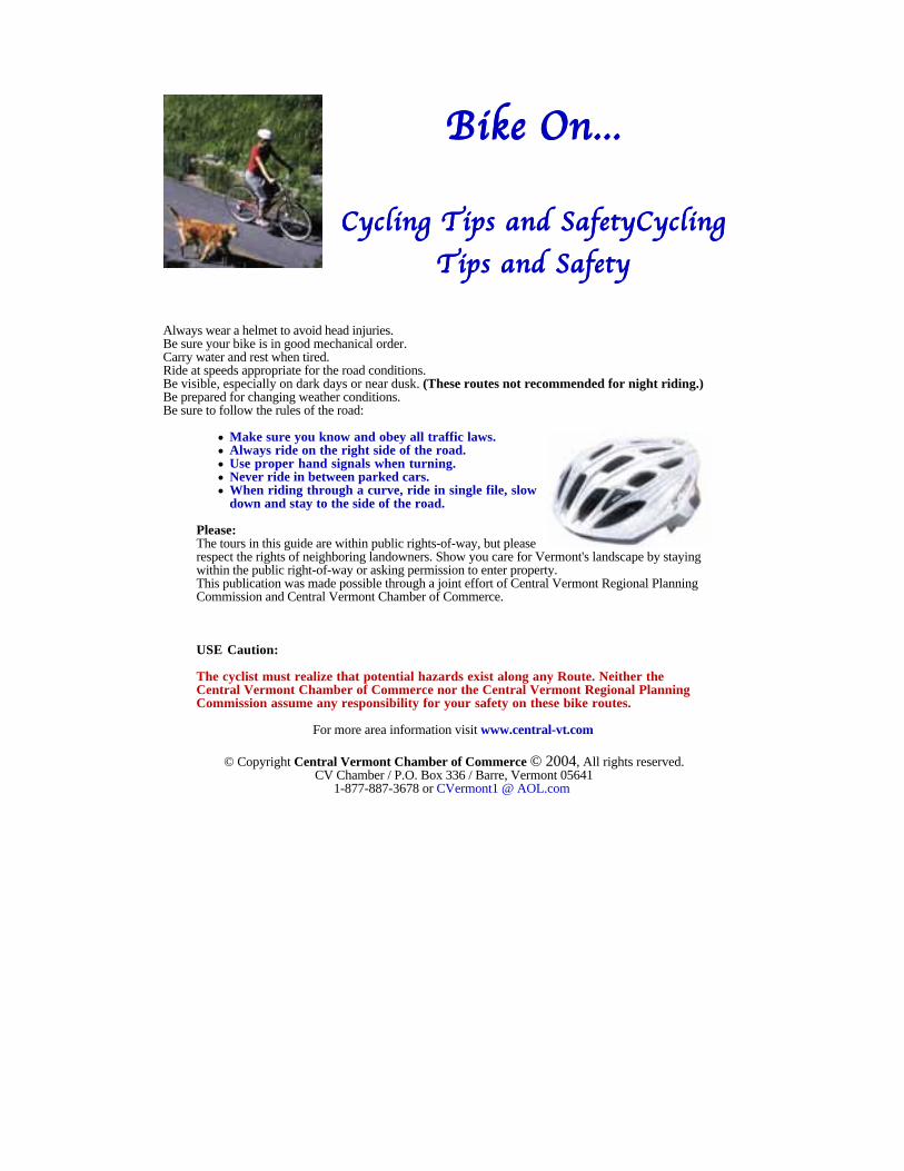
BBBBiiiikkkkeeee OOOOnnnn............
CCCCyyyycccclllliiiinnnngggg TTTTiiiippppssss aaaannnndddd SSSSaaaaffffeeeettttyyyyCCCCyyyycccclllliiiinnnnggggTTTTiiiippppssss aaaannnndddd SSSSaaaaffffeeeettttyyyy
Always wear a helmet to avoid head injuries.Be sure your bike is in good mechanical order.Carry water and rest when tired.Ride at speeds appropriate for the road conditions.Be visible, especially on dark days or near dusk. (These routes not recommended for night riding.) Be prepared for changing weather conditions.Be sure to follow the rules of the road:
Make sure you know and obey all traffic laws.Always ride on the right side of the road.Use proper hand signals when turning.Never ride in between parked cars.When riding through a curve, ride in single file, slowdown and stay to the side of the road.
Please:The tours in this guide are within public rights-of-way, but pleaserespect the rights of neighboring landowners. Show you care for Vermont's landscape by stayingwithin the public right-of-way or asking permission to enter property.This publication was made possible through a joint effort of Central Vermont Regional PlanningCommission and Central Vermont Chamber of Commerce.
USE Caution:
The cyclist must realize that potential hazards exist along any Route. Neither theCentral Vermont Chamber of Commerce nor the Central Vermont Regional PlanningCommission assume any responsibility for your safety on these bike routes.
For more area information visit www.central-vt.com
© Copyright Central Vermont Chamber of Commerce © 2004, All rights reserved.CV Chamber / P.O. Box 336 / Barre, Vermont 05641
1-877-887-3678 or CVermont1 @ AOL.com
Related Documents