August 6, 2010 www.CapeWind.org 1 www.CapeWind.org

Welcome message from author
This document is posted to help you gain knowledge. Please leave a comment to let me know what you think about it! Share it to your friends and learn new things together.
Transcript
August 6, 2010 www.CapeWind.org 1
www.CapeWind.org
August 6, 2010 www.CapeWind.org 2
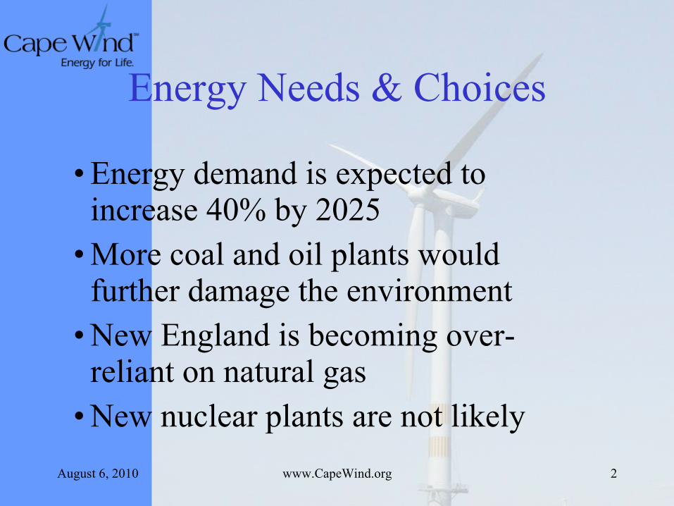
Energy Needs & Choices
• Energy demand is expected to increase 40% by 2025
• More coal and oil plants would further damage the environment
• New England is becoming over-reliant on natural gas
• New nuclear plants are not likely
August 6, 2010 www.CapeWind.org 3
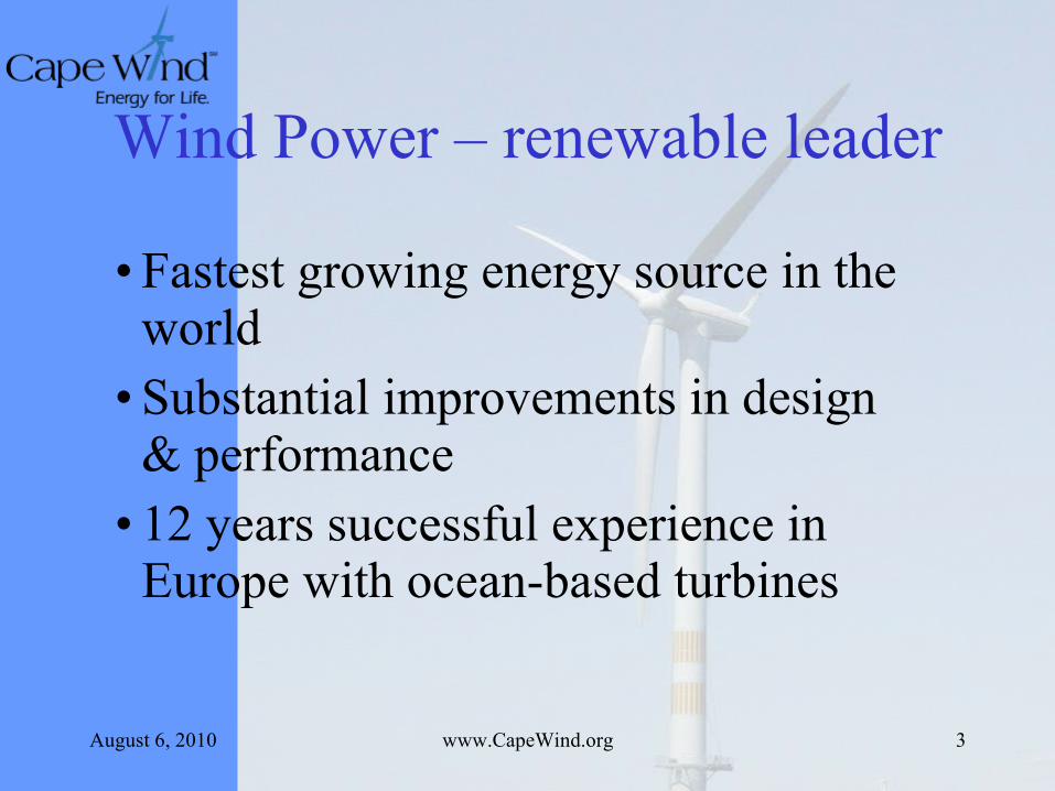
Wind Power – renewable leader
• Fastest growing energy source in the world
• Substantial improvements in design & performance
• 12 years successful experience in Europe with ocean-based turbines
August 6, 2010 www.CapeWind.org 4
August 6, 2010 www.CapeWind.org 5
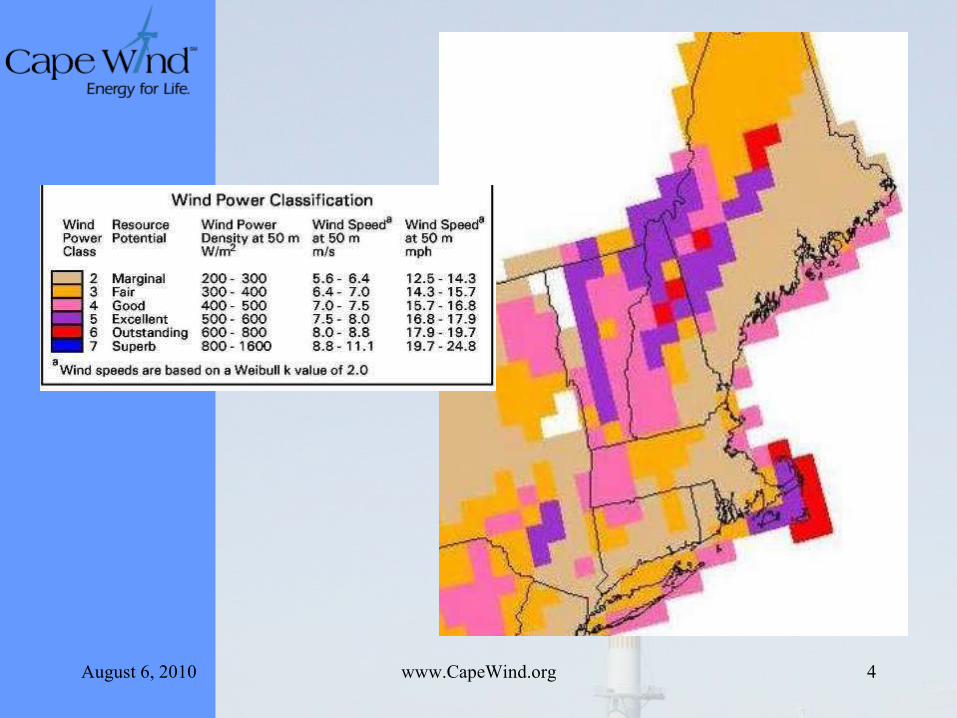
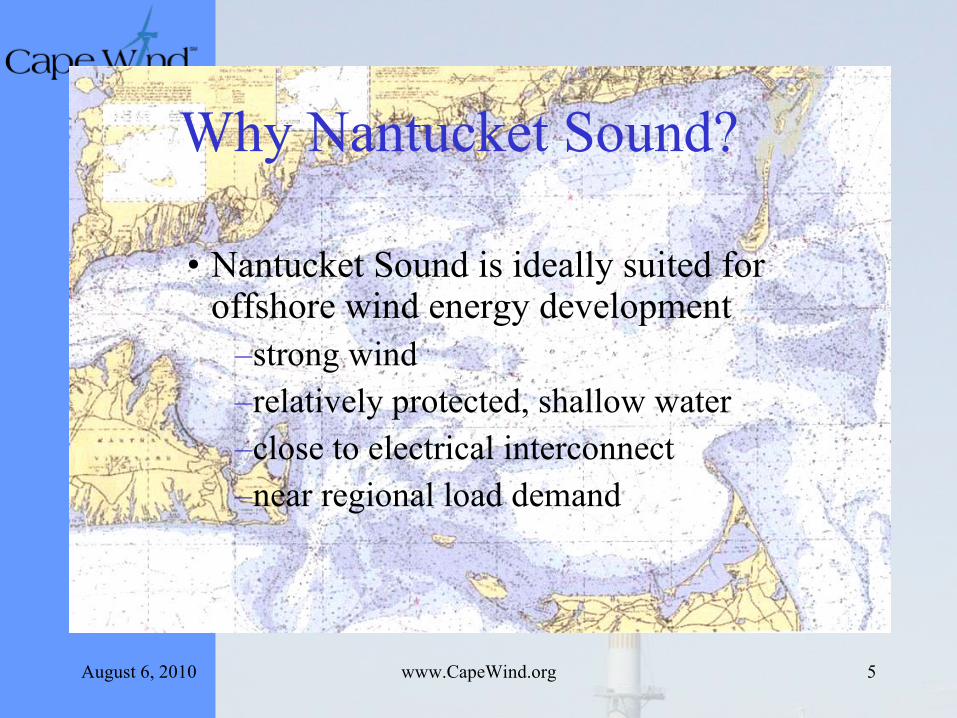
Why Nantucket Sound?
• Nantucket Sound is ideally suited for offshore wind energy development
–strong wind –relatively protected, shallow water –close to electrical interconnect–near regional load demand
August 6, 2010 www.CapeWind.org 6
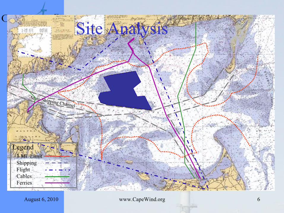
Main Shipping Channel
Legend3 Mi. LimitShippingFlightCablesFerries
Site Analysis
August 6, 2010 www.CapeWind.org 7
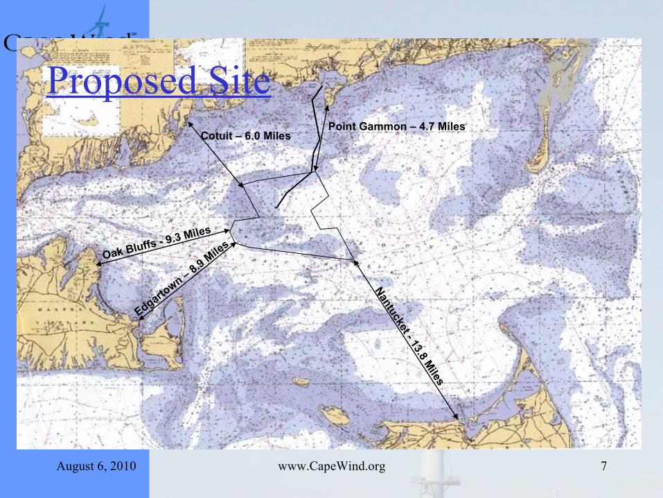
Nantucket - 13.8 M
iles
Cotuit – 6.0 MilesPoint Gammon – 4.7 Miles
Oak Bluffs - 9.3 Miles
Edgartown – 8.9 M
iles
Proposed Site
August 6, 2010 www.CapeWind.org 8
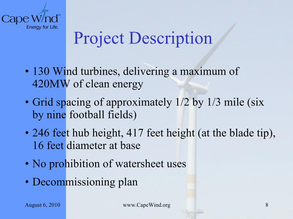
Project Description
• 130 Wind turbines, delivering a maximum of 420MW of clean energy
• Grid spacing of approximately 1/2 by 1/3 mile (six by nine football fields)
• 246 feet hub height, 417 feet height (at the blade tip), 16 feet diameter at base
• No prohibition of watersheet uses
• Decommissioning plan
August 6, 2010 www.CapeWind.org 9
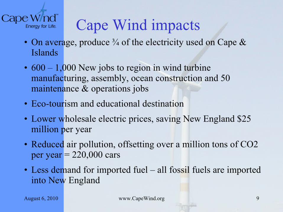
Cape Wind impacts• On average, produce ¾ of the electricity used on Cape &
Islands
• 600 – 1,000 New jobs to region in wind turbine manufacturing, assembly, ocean construction and 50 maintenance & operations jobs
• Eco-tourism and educational destination
• Lower wholesale electric prices, saving New England $25 million per year
• Reduced air pollution, offsetting over a million tons of CO2 per year = 220,000 cars
• Less demand for imported fuel – all fossil fuels are imported into New England
August 6, 2010 www.CapeWind.org 10
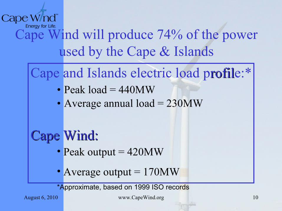
Cape and Islands electric load profilrofile:*• Peak load = 440MW• Average annual load = 230MW
*Approximate, based on 1999 ISO records
Cape Wind will produce 74% of the power used by the Cape & Islands
Cape Wind:Cape Wind:• Peak output = 420MW
• Average output = 170MW
August 6, 2010 www.CapeWind.org 11
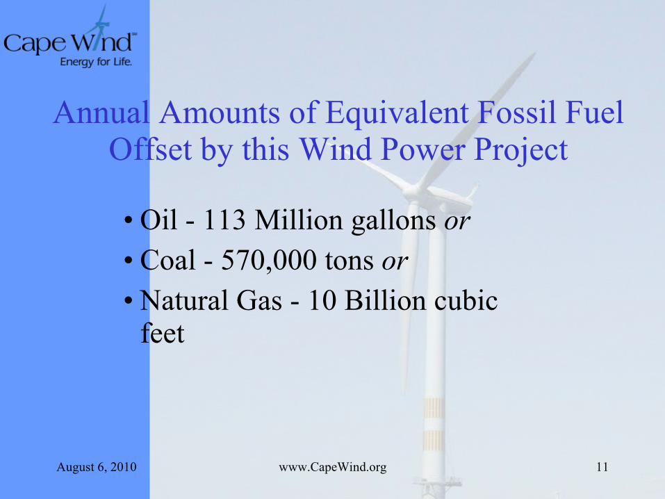
Annual Amounts of Equivalent Fossil Fuel Offset by this Wind Power Project
• Oil - 113 Million gallons or• Coal - 570,000 tons or• Natural Gas - 10 Billion cubic
feet
August 6, 2010 www.CapeWind.org 12
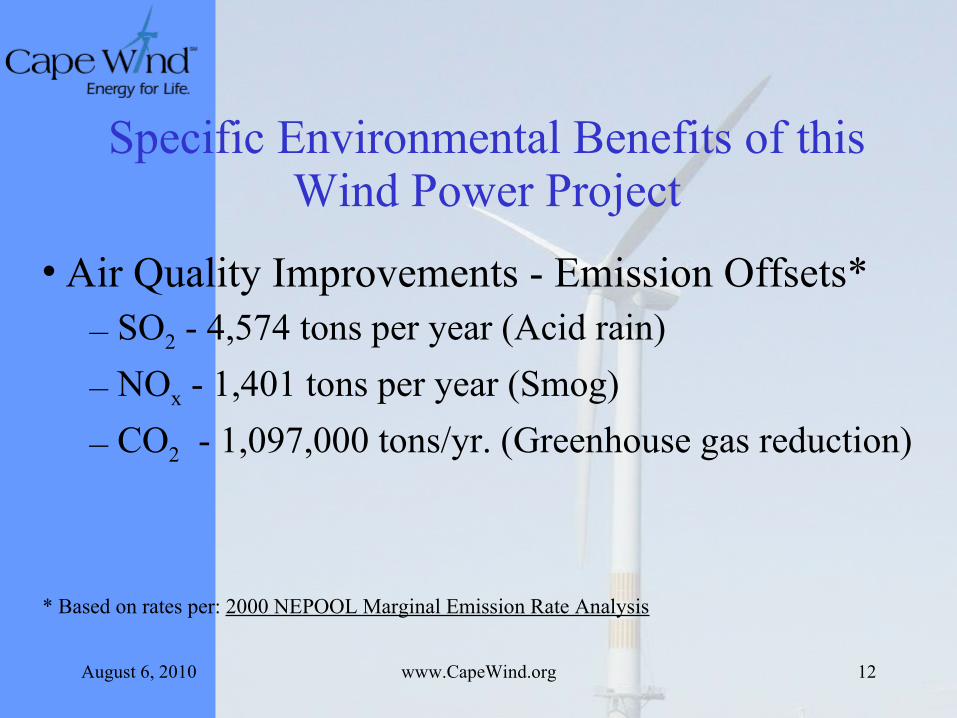
Specific Environmental Benefits of this Wind Power Project
• Air Quality Improvements - Emission Offsets* – SO2 - 4,574 tons per year (Acid rain)
– NOx - 1,401 tons per year (Smog)
– CO2 - 1,097,000 tons/yr. (Greenhouse gas reduction)
* Based on rates per: 2000 NEPOOL Marginal Emission Rate Analysis
August 6, 2010 www.CapeWind.org 13
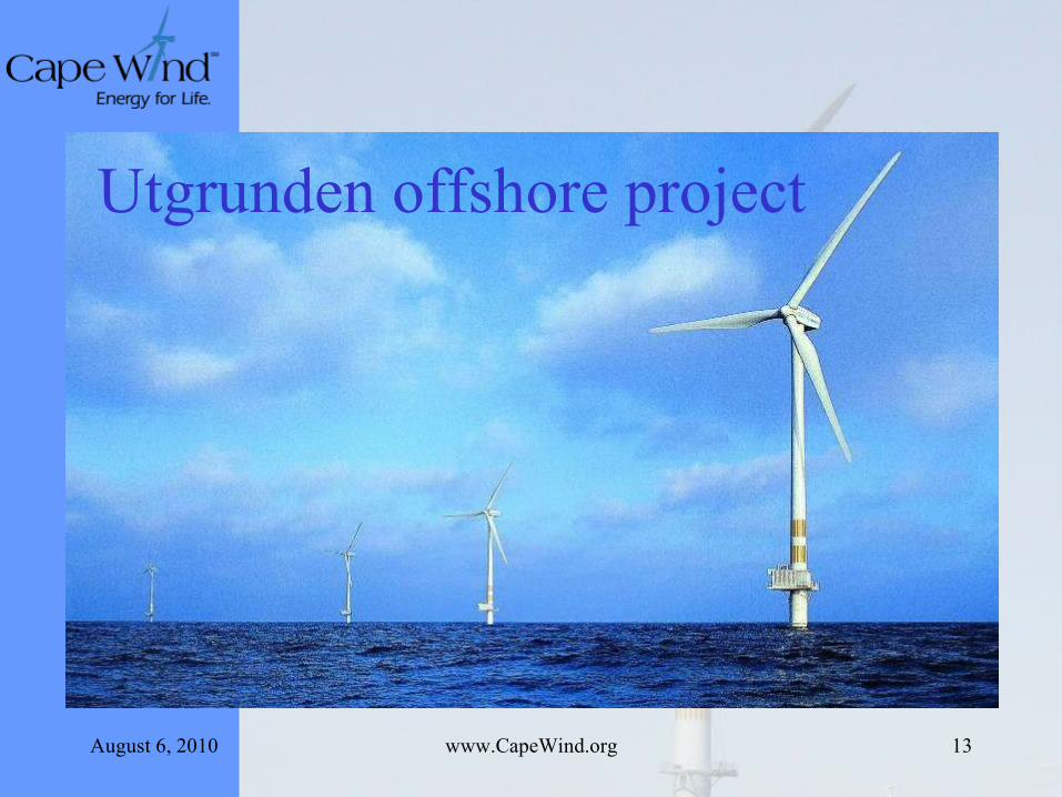
Utgrunden offshore project
August 6, 2010 www.CapeWind.org 14
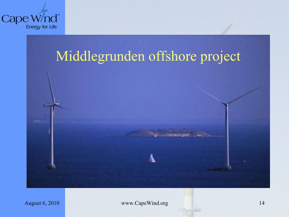
Middlegrunden offshore project
August 6, 2010 www.CapeWind.org 15
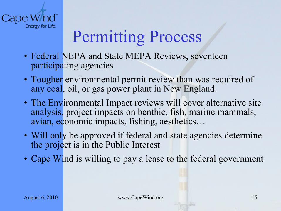
Permitting Process• Federal NEPA and State MEPA Reviews, seventeen
participating agencies
• Tougher environmental permit review than was required of any coal, oil, or gas power plant in New England.
• The Environmental Impact reviews will cover alternative site analysis, project impacts on benthic, fish, marine mammals, avian, economic impacts, fishing, aesthetics…
• Will only be approved if federal and state agencies determine the project is in the Public Interest
• Cape Wind is willing to pay a lease to the federal government
August 6, 2010 www.CapeWind.org 16
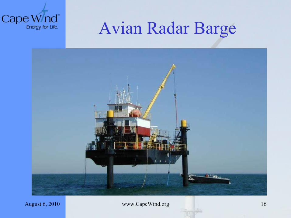
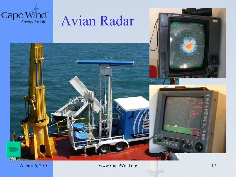
Avian Radar Barge
August 6, 2010 www.CapeWind.org 17
Avian Radar

August 6, 2010 www.CapeWind.org 18
Geological ResearchGeological Research
August 6, 2010 www.CapeWind.org 19
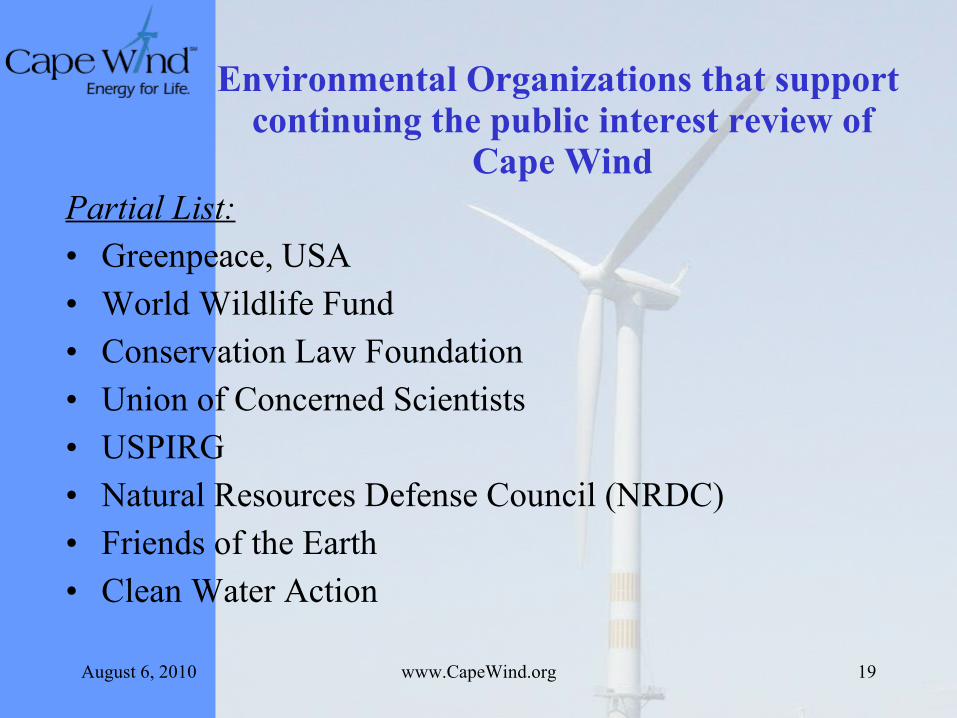
Environmental Organizations that support continuing the public interest review of
Cape WindPartial List:
• Greenpeace, USA
• World Wildlife Fund
• Conservation Law Foundation
• Union of Concerned Scientists
• USPIRG
• Natural Resources Defense Council (NRDC)
• Friends of the Earth
• Clean Water Action
August 6, 2010 www.CapeWind.org 20
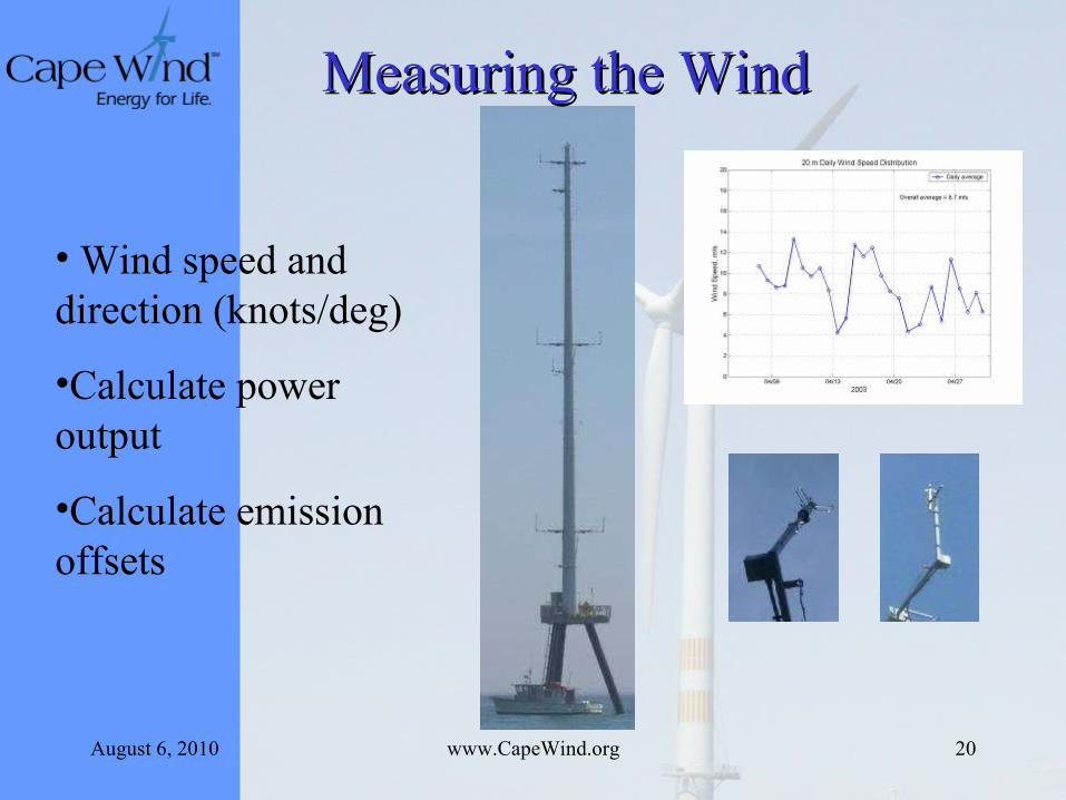
• Wind speed and direction (knots/deg)
•Calculate power output
•Calculate emission offsets
Measuring the WindMeasuring the Wind
August 6, 2010 www.CapeWind.org 21
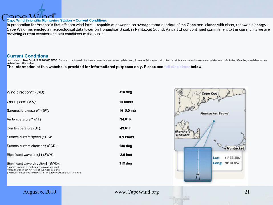
Cape Wind Scientific Monitoring Station ~ Current Conditions In preparation for America’s first offshore wind farm, - capable of powering on average three-quarters of the Cape and Islands with clean, renewable energy - Cape Wind has erected a meteorological data tower on Horseshoe Shoal, in Nantucket Sound. As part of our continued commitment to the community we are providing current weather and sea conditions to the public.
Current ConditionsLast updated: Mon Dec 8 13:00:06 2003 EDST • Surface current speed, direction and water temperature are updated every 6 minutes. Wind speed, wind direction, air temperature and pressure are updated every 10 minutes. Wave height and direction are updated every 30 minutes.
The information at this website is provided for informational purposes only. Please see full disclaimer below.
Wind direction*† (WD): 318 deg
Wind speed* (WS): 15 knots
Barometric pressure** (BP): 1015.0 mb
Air temperature** (AT): 34.6° F
Sea temperature (ST): 43.0° F
Surface current speed (SCS): 0.9 knots
Surface current direction† (SCD): 188 deg
Significant wave height (SWH): 2.5 feet
Significant wave direction† (SWD): 318 deg *Reading taken at 20 meters above mean sea level** Reading taken at 10 meters above mean sea level† Wind, current and wave direction is in degrees clockwise from true North

August 6, 2010 www.CapeWind.org 22
What’s Happening?
• Tentative approval for the electric cable from the Massachusetts Energy Facility Siting Board
• Draft Environmental Impact Statement due out in August followed by several months of public comment period
Related Documents