NAS: Nearest H/W Interchange: Nearest Bus Stop: Nearest Fire Station: Full Report & KML Mapping: Contact the Economic Development Office: Location: Zoning: 6/26/15 Aerial Photography Spring 2014, click on PDF layers to control the view of Layers. Produced by T&W, GEOMATICS, created Official Plan Land Use Designation: mississauga.ca/data mississauga.ca/business 116 99907072 06751000 99927603 E R I N M I LL S P KY E R I N C E N T R E B L VD UNNA M E D UNNA M E D UNNA M E D 1.31 ha (3.23 acres) Central Erin Mills MN / Ward 9 C3 MU 0 ha (0 acres) Hwy 403/Erin Mills Parkway, 1338m away ERIN MILLS TOWN CENTRE BUS TERMINAL PLATFORM B, 39m away FIRE STATION 115, 806m away 32.6 m 0 SITE Site Area:

Welcome message from author
This document is posted to help you gain knowledge. Please leave a comment to let me know what you think about it! Share it to your friends and learn new things together.
Transcript
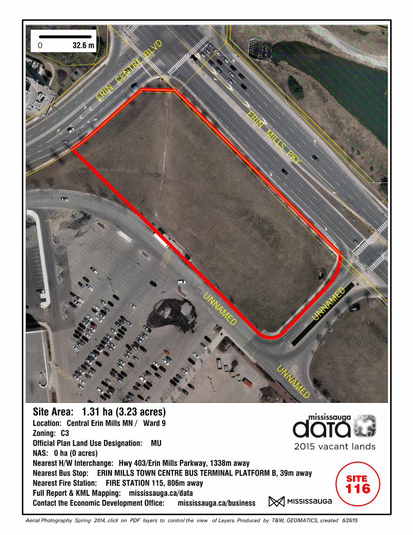
NAS:
Nearest H/W Interchange:
Nearest Bus Stop:
Nearest Fire Station:
Full Report & KML Mapping:
Contact the Economic Development Office:
Location:
Zoning:
6/26/15Aerial Photography Spring 2014, click on PDF layers to control the view of Layers. Produced by T&W, GEOMATICS, created
Official Plan Land Use Designation:
mississauga.ca/data
mississauga.ca/business
116
99907071
99907072
99907073
067510
00
99927603
99907211
ERIN
MILLS PK
Y
ERIN CE
NTR
E BLV
D
UNNAMED
UNNAM
ED UNNAMED
1.31 ha (3.23 acres)Central Erin Mills MN / Ward 9
C3
MU
0 ha (0 acres)
Hwy 403/Erin Mills Parkway, 1338m away
ERIN MILLS TOWN CENTRE BUS TERMINAL PLATFORM B, 39m away
FIRE STATION 115, 806m away
32.6 m0
SITE
Site Area:
Related Documents